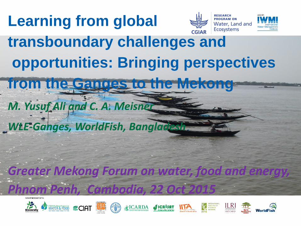
Subtitle Learning from global transboundary challenges and opportunities: Bringing perspectives from the Ganges to the Mekong M. Yusuf Ali and C. A. Meisner WLE-Ganges, WorldFish, Bangladesh Greater Mekong Forum on water, food and energy, Phnom Penh, Cambodia, 22 Oct 2015

Welcome message from author
This document is posted to help you gain knowledge. Please leave a comment to let me know what you think about it! Share it to your friends and learn new things together.
Transcript
Subtitle
Learning from global
transboundary challenges and
opportunities: Bringing perspectives
from the Ganges to the Mekong
M. Yusuf Ali and C. A. Meisner
WLE-Ganges, WorldFish, Bangladesh
Greater Mekong Forum on water, food and energy,
Phnom Penh, Cambodia, 22 Oct 2015

Basic Fact of Ganges river basin
River length: 2,525 Km
Starting point: Gangotri glacier at Uttrakhand, India
End point (mouth): Bay of Bengal, Bangladesh
with other rivers
How many countries traverse: Bangladesh, India,
Nepal
Elevation: Starting point(3,892 m), end point (0 m)
Water source: 91 % from rainfall, 09 % from
glaciers/snow melt
Basin area -1.1million km2

Ganges origin, end point and whole basin area

Ganges at Headwater and Lower basin

Comparison between Ganges and Mekong for some facts
Stat. Ganges Mekong
Basin Population(Million) 655 60
Water resource /year (Billion
M3)
525 457 km3
Water withdrawal(Billion M3) 266.8 -
Cropped area(Million ha) 44.99 10
Irrigated area(million ha) 22.41 04
Population below Poverty
level (%)
30 20

Ecosystem services(ESS): Fishing

ESS: Irrigation-Dam-Barrage-Canal

ESS: Irrigated crops

ESS: (tourism and culture)

ESS: (Navigation, timber and others)

ESS: Biodiversity

ESS: Hydropower

Problems: low dry season flow, siltation, erosion and flood
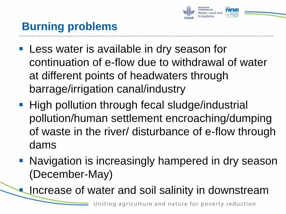
Burning problems
Less water is available in dry season for
continuation of e-flow due to withdrawal of water
at different points of headwaters through
barrage/irrigation canal/industry
High pollution through fecal sludge/industrial
pollution/human settlement encroaching/dumping
of waste in the river/ disturbance of e-flow through
dams
Navigation is increasingly hampered in dry season
(December-May)
Increase of water and soil salinity in downstream

Lack of common Basin development program
No transboundary agreement/joint river
commission between co-basin countries
Only short term bilateral treaties (such as India-
Bangladesh; India-Nepal)
Dearth of High level political intervention for
developing a science based total basin
approach comprising Bangladesh, India, Nepal,
China and Bhutan like Mekong/Rhine

Future Opportunities
Water could be an entry point for addressing
challenges common to region through a Ganges
River Commission (GRC):
Increased data sharing, joint monitoring and capacity
development
Joint investment, Joint operation and management
Store monsoon water (80 % rainfall in four months which is
420 billion m3 streamflow) for ensuring dry season flow
Expand irrigation and navigation facilities including river link
for Nepal (as land locked)
Mitigate the effect of floods and erosion
Manage droughts and salinity with the changing climate

Contd. Future Opportunities
Augment dry season river flows
Generate environmentally safe hydropower for
own use and market to other co-basin country
Ensure ecosystem services through ensuring e-
flow
Cooperation in smart conservation agriculture
to optimize water use for dry season crops
Collaboration in climate change adaptation and
mitigation
Related Documents


