George Petrie’s “Topographical Department” 1835 - 1842 Paul Walsh

Paul Walsh, 'George Petrie's "Topographical Department" 1835-42'. 15-10-2014
Jul 29, 2015
Welcome message from author
This document is posted to help you gain knowledge. Please leave a comment to let me know what you think about it! Share it to your friends and learn new things together.
Transcript

George Petrie’s
“Topographical Department”
1835 - 1842
Paul Walsh
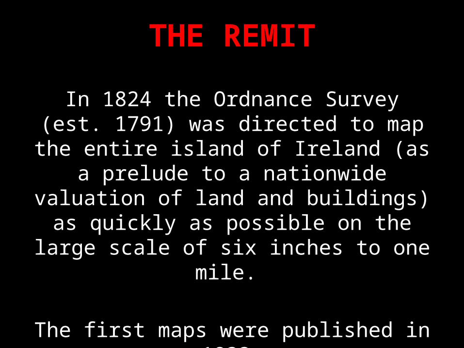
THE REMIT
In 1824 the Ordnance Survey (est. 1791) was directed to map the entire island of Ireland (as a
prelude to a nationwide valuation of land and buildings) as quickly as possible on the large
scale of six inches to one mile.
The first maps were published in 1833.The project was completed in 1846.

Mountjoy HouseHeadquarters of the Ordnance Survey

The success of the Survey was effected ‘through the instrumentality of that superior mind and
powerful will, which presided over and controlled the whole work.’
J.E. Portlock, Memoir of the life of Major-General Colby (1869).
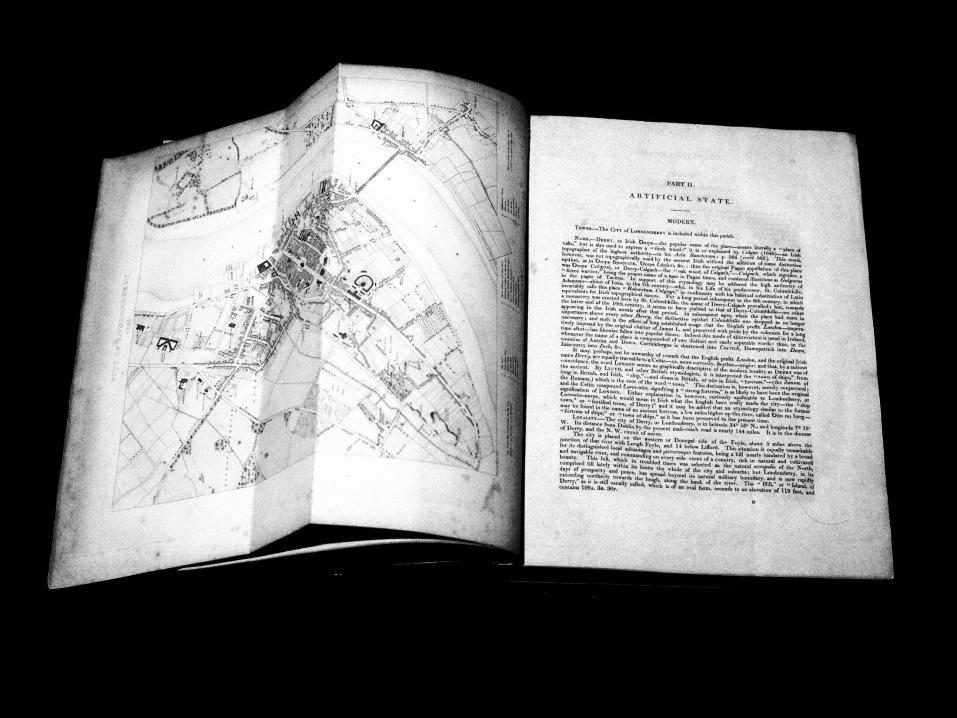
‘A map is in its nature but a part of a Survey, and that much of the information connected with it,
can only be advantageously embodied in a memoir, to which the map then serves us a
graphical index.’ Thomas A. Larcom

Colonel Thomas Colby
Preface to the memoir of Templemore Parish, Co. Derry (published 1837)
‘Lieutenant Larcom conceived the idea, that with such opportunities, a small additional cost would enable him, without retarding the execution of the maps, to draw together a work embracing every species of local information relating to Ireland.
He submitted this idea to me, and I obtained the sanction of the Irish Government for carrying it into effect. To him I entrusted the execution . . . .’
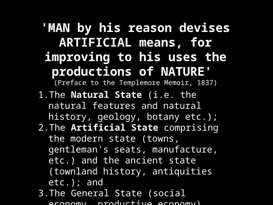
'MAN by his reason devises ARTIFICIAL means, for improving to
his uses the productions of NATURE' (Preface to the Templemore Memoir, 1837)
1. The Natural State (i.e. the natural features and natural history, geology, botany etc.);
2. The Artificial State comprising the modern state (towns, gentleman's seats, manufacture, etc.) and the ancient state (townland history, antiquities etc.); and
3. The General State (social economy, productive economy).

‘MEMOIR’
Natural StateGeology and Botany
Artificial StateModern and Ancient
General StateSocial and Productive
economies
GeologyCapt. J.E. Portlock
BotanyDavid Moore
ModernGeorge Downes
AncientGeorge Petrie
Social EconomyGeorge Downes
Productive EconomyCapt. J.E. Portlock
‘Field officers’
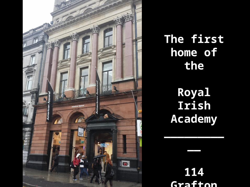
The first home of the
Royal Irish Academy
___________
114 Grafton Street

‘Orthography being the part which we are alone authorised in strictness to do & being authorised we are bound to do it come what
may of all else. First then in order of necessity is orthography because it is ordered,
antiquities because they exist upon the ground, therefore are topography, history etc.
as much as possible . . .’(Larcom to Petrie – 6th March 1838)

Year1829183018311832183318341835183618371838183918401841
County survey initiatedAntrimDerry TyroneDownDonegal, Fermanagh, Armagh, MonaghanLeitrim, Louth, CavanLongford, MeathDublin, Roscommon North, Mayo, Kildare, Sligo, WestmeathGalway, Laois, Wicklow, OffalyKilkenny, Wexford, CarlowClare, Limerick, Tipperary, WaterfordKerry, Cork
‘Orthography’111459
1113141416114

Grade Name Day rate (shillings/pence)
‘Department Head’
George Petrie
George Downes
10/- (1835-42)
10/- (1835-41)
Orthographer I J. O’Donovan
E. Curry
T. O’Conor
P. O’Keeffe
9/6 (1839-42)
7/- (1839-42)
7/- (1839-42)
6/6 (1838-41)
Orthographer II J. Mangan
P. Kenny
A. Curry
5/- (1838-41)
5/- (1839-40)
4/6 (1840-41)
Senior Clerk G. O’Lawlor 5/- (1839-41)
Inferior assistants W. Hayes, A. Henry,
J. Cunningham,
W. Wotton, W. Parker,
A. Russell, J. O'Sullivan,
H. Petty, J. Duffy
1/6 – 3/6 (1833-42)
Artist G. du Noyer
W. Wakeman
1/6 – 3/6 (1833-42)
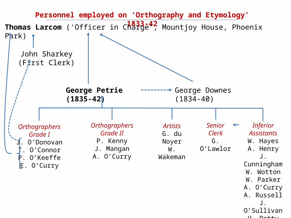
Personnel employed on ‘Orthography and Etymology’ 1833-42
Thomas Larcom (‘Officer in Charge’, Mountjoy House, Phoenix Park)
John Sharkey (First Clerk)
George Petrie (1835-42)
OrthographersGrade I
J. O’DonovanT. O’ConnorP. O’KeeffeE. O’Curry
George Downes (1834-40)
OrthographersGrade IIP. Kenny
J. ManganA. O’Curry
Senior ClerkG. O’Lawlor
Inferior AssistantsW. HayesA. Henry
J. CunninghamW. WottonW. ParkerA. O’CurryA. Russell
J. O’SullivanH. PettyJ. Duffy
ArtistsG. du Noyer
W. Wakeman

21 Great Charles Street
The home of George Petrie
Headquarters of the so-called
‘Topographical Department’‘The Topographical Department.’
‘Tee Petrie’

Year County J. O’Donovan T. O’Conor P. O’Keeffe E. O’Curry A. O’Curry1829-33 Antrim1832-4 Tyrone1834 Down
Derry
Fermanagh
Armagh
Monaghan
1835 Donegal
Louth
1836 Cavan
Leitrim
Meath
Sligo
1837 Dublin
Longford
Roscommon
Westmeath
Kildare
Offaly
1838 Mayo
Galway
Laois
Wicklow
1839 Carlow
Kilkenny
Clare
1840 Wexford
Limerick
Tipperary
1841 Waterford
Kerry
Cork

GEORGE PETRIE(1790 – 1866)
– Artist –
– Antiquarian –
– Musician –
– Numismatist –Portrait from the
Dublin University Magazine (1839)


Thomas Spring Rice, Chancellor of the Exchequer.(April 1838)
‘That the ordnance officers should collect and be encouraged to collect much valuable information which cannot be given to the world in the shape of a map is quite true. That this should be published in the shape of a memoir or of pièces justificatives I admit. That we should pay for this I agree. But that we should undertake to compile regular county and city histories of all Ireland I cannot assent to.’

Letter to Sir Henry Goulburn(May 1842)
‘Of all the abuses and misapplications of the public funds which have taken place
for a considerable time past, I know not a more palpable instance than in the Topographical Department of the
Ordnance Survey of Ireland.’
(Signed: A Protestant Conservative)
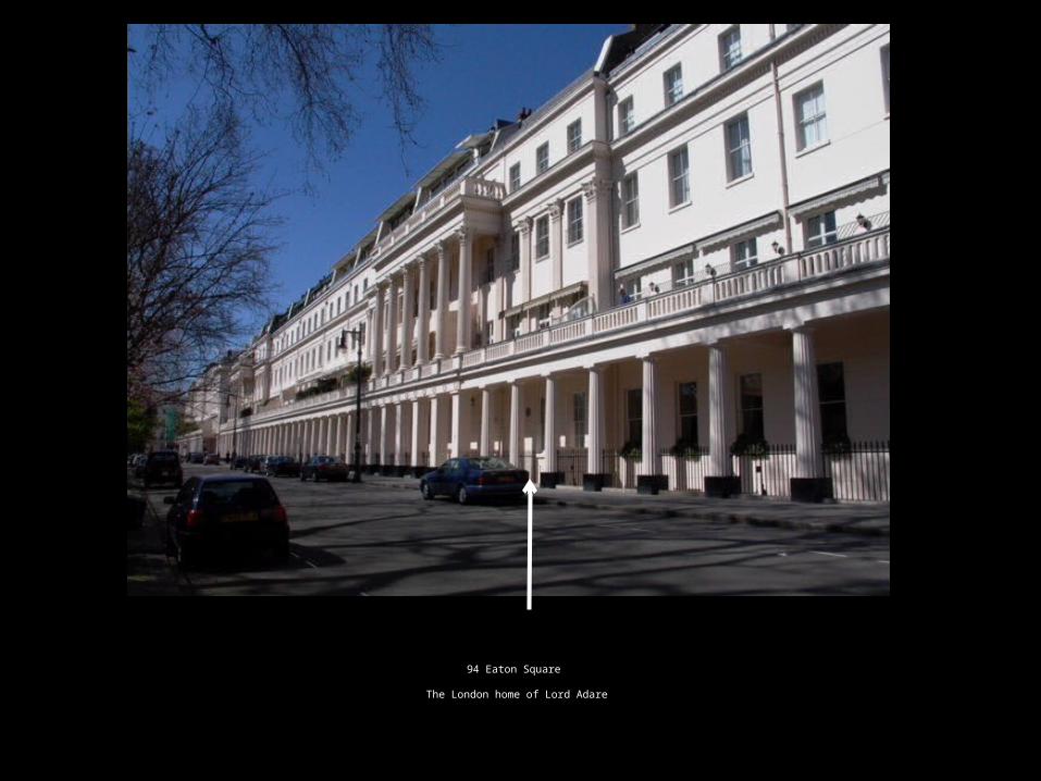
94 Eaton Square
The London home of Lord Adare

‘Orthography Output’
c. 144,000 names on the mapsincluding
• 316 Barony names• 2,422 Civil Parish names• Over 60,000 Townland names
All contained with 3,289 name books.

‘A map is in its nature but a part of a Survey, and that much of the information
connected with it, can only be advantageously embodied in a memoir, to which the map then serves us a graphical
index.’
MAP + Memoir = GIS
Related Documents