National Park Service Cultural Landscapes Inventory Fort Stanwix Fort Stanwix National Monument 1999 Revised 1999

Welcome message from author
This document is posted to help you gain knowledge. Please leave a comment to let me know what you think about it! Share it to your friends and learn new things together.
Transcript

National Park ServiceCultural Landscapes Inventory
Fort StanwixFort Stanwix National Monument
1999Revised 1999

Fort StanwixFort Stanwix National Monument
Contents
Part 1Executive Summary ................................................................................................................. Part 1, page 1
Park Information, Property Level and Inventory Summary...................................................... Part 1, page 3
Landscape Description............................................................................................................. Part 1, page 5
Cultural Landscapes Inventory Hierarchy Description............................................................. Part 1, page 7
Location Map............................................................................................................................ Part 1, page 8
Boundary Description, Regional Context ................................................................................. Part 1, page 9
Site Plan ................................................................................................................................. Part 1, page 12
Chronology............................................................................................................................. Part 1, page 13
Statement of Significance ...................................................................................................... Part 1, page 17
Part 2Physical History
Fort Stanwix (1758 -1790)...................................................................................................... Part 2a, page 1
Fort Stanwix and the City of Rome (1786 -1960)................................................................... Part 2a, page 3
The Reconstruction of Fort Stanwix (1960 -Present)............................................................. Part 2b, page 1
Part 3Analysis and Evaluation
Summary................................................................................................................................ Part 3a, page 1
Landscape Characteristics and Features
Archeological Sites................................................................................................................. Part 3a, page 1
Buildings and Structures ........................................................................................................ Part 3a, page 3
Circulation .............................................................................................................................. Part 3a, page 6
Constructed Water Features .................................................................................................. Part 3a, page 6
Land Use ............................................................................................................................... Part 3a, page 7
Natural Systems and Features............................................................................................... Part 3b, page 1
Small Scale Features ……………………………………………………………………………….Part 3b, page 1
Spatial Organization …………………………………………………………………………...…...Part 3b, page 2
Topography ………………………………………………………………………………………….Part 3b, page 4
Vegetation ……………………………………………………………………………………………Part 3b, page 5
Views and Vistas …………………………………………………………………………………….Part 3b, page 7

Fort StanwixFort Stanwix National Monument
Part 4Management Information
Descriptive And Geographic Information ................................................................................. Part 4, page 1
National Register Information................................................................................................... Part 4, page 1
National Historic Landmark Information, World Heritage Information...................................... Part 4, page 3
Cultural Landscape Type and Use........................................................................................... Part 4, page 3
Ethnographic Information ......................................................................................................... Part 4, page 3
Adjacent Lands Information ..................................................................................................... Part 4, page 6
General Management Information, Condition Assessment and Impacts ................................ Part 4, page 7
Agreements, Legal Interest, and Access ................................................................................. Part 4, page 9
Treatment, Approved Treatment Cost, Stabilization Costs.................................................... Part 4, page 10
Documentation Assessment and Checklist............................................................................ Part 4, page 12
Appendix
Bibliography............................................................................................................................ Part 4, page 14
Supplemental Information…………………………………………………………………………..Part 4, page 20

Fort StanwixFort Stanwix National Monument
Executive Summary
General Introduction to the CLI
The Cultural Landscapes Inventory (CLI) is a comprehensive inventory of all historically significant landscapes within the National Park System. This evaluated inventory identifies and documents each landscape’s location, physical development, significance, National Register of Historic Places eligibility, condition, as well as other valuable information for park management. Inventoried landscapes are listed on, or eligible for, the National Register of Historic Places, or otherwise treated as cultural resources. To automate the inventory, the Cultural Landscapes Automated Inventory Management System (CLAIMS) database was created in 1996. CLAIMS provides an analytical tool for querying information associated with the CLI.
The CLI, like the List of Classified Structures (LCS), assists the National Park Service (NPS) in its efforts to fulfill the identification and management requirements associated with Section 110(a) of the National Historic Preservation Act, NPS Management Policies (2001), and Director’s Order #28: Cultural Resource Management (1998). Since launching the CLI nationwide, the NPS, in response to the Government Performance and Results Act (GPRA), is required to report on an annual performance plan that is tied to 6-year strategic plan. The NPS strategic plan has two goals related to cultural landscapes: condition (1a7) and progress on the CLI (1b2b). Because the CLI is the baseline of cultural landscapes in the National Park System, it serves as the vehicle for tracking these goals.
For these reasons, the Park Cultural Landscapes Program considers the completion of the CLI to be a servicewide priority. The information in the CLI is useful at all levels of the park service. At the national and regional levels it is used to inform planning efforts and budget decisions. At the park level, the CLI assists managers to plan, program, and prioritize funds. It is a record of cultural landscape treatment and management decisions and the physical narrative may be used to enhance interpretation programs.
Implementation of the CLI is coordinated on the Region/Support Office level. Each Region/Support Office creates a priority list for CLI work based on park planning needs, proposed development projects, lack of landscape documentation (which adversely affects the preservation or management of the resource), baseline information needs and Region/Support office priorities. This list is updated annually to respond to changing needs and priorities. Completed CLI records are uploaded at the end of the fiscal year to the National Center for Cultural Resources, Park Cultural Landscapes Program in Washington, DC. Only data officially entered into the National Center’s CLI database is considered “certified data” for GPRA reporting.
The CLI is completed in a multi-level process with each level corresponding to a specific degree of effort and detail. From Level 0: Park Reconnaissance Survey through Level II: Landscape Analysis and Evaluation, additional information is collected, prior information is refined, and decisions are made regarding if and how to proceed. The relationship between Level 0, I, and II is direct and the CLI for a landscape or component landscape inventory unit is not considered finished until Level II is complete.
A number of steps are involved in completing a Level II inventory record. The process begins when the CLI team meets with park management and staff to clarify the purpose of the CLI and is followed by historical research, documentation, and fieldwork. Information is derived from two efforts: secondary sources that are usually available in the park’s or regions’ files, libraries, and archives and on-site landscape investigation(s). This information is entered into CLI database as text or graphics. A park
Page 1 of 18Cultural Landscapes Inventory (Part 1)

Fort StanwixFort Stanwix National Monument
report is generated from the database and becomes the vehicle for consultation with the park and the SHPO/TPO.
Level III: Feature Inventory and Assessment is a distinct inventory level in the CLI and is optional. This level provides an opportunity to inventory and evaluate important landscape features identified at Level II as contributing to the significance of a landscape or component landscape, not listed on the LCS. This level allows for an individual landscape feature to be assessed and the costs associated with treatment recorded.
The ultimate goal of the Park Cultural Landscapes Program is a complete inventory of landscapes, component landscapes, and where appropriate, associated landscape features in the National Park System. The end result, when combined with the LCS, will be an inventory of all physical aspects of any given property.
Relationship between the CLI and a CLR
While there are some similarities, the CLI Level II is not the same as a Cultural Landscape Report (CLR). Using secondary sources, the CLI Level II provides information to establish historic significance by determining whether there are sufficient extant features to convey the property’s historic appearance and function. The CLI includes the preliminary identification and analysis to define contributing features, but does not provide the more definitive detail contained within a CLR, which involves more in-depth research, using primary rather than secondary source material.
The CLR is a treatment document and presents recommendations on how to preserve, restore, or rehabilitate the significant landscape and its contributing features based on historical documentation, analysis of existing conditions, and the Secretary of the Interior’s standards and guidelines as they apply to the treatment of historic landscapes. The CLI, on the other hand, records impacts to the landscape and condition (good, fair, poor) in consultation with park management. Stabilization costs associated with mitigating impacts may be recorded in the CLI and therefore the CLI may advise on simple and appropriate stabilization measures associated with these costs if that information is not provided elsewhere.
When the park decides to manage and treat an identified cultural landscape, a CLR may be necessary to work through the treatment options and set priorities. A historical landscape architect can assist the park in deciding the appropriate scope of work and an approach for accomplishing the CLR. When minor actions are necessary, a CLI Level II park report may provide sufficient documentation to support the Section 106 compliance process.
Page 2 of 18Cultural Landscapes Inventory (Part 1)

Fort StanwixFort Stanwix National Monument
Property Level And CLI Number
Property Level: Landscape
CLI Identification Number: 650027
Parent Landscape CLI ID Number: 650027
Inventory Level: Level II
12/21/1999Date Level II Entered:
8/15/1998Date Level I Entered:
4/10/1998Date Level 0 Entered:
John Auwaerter and David UscholdLevel II Data Entry Recorder:
John AuwaerterLevel I Data Entry Recorder:
David UscholdLevel 0 Data Entry Recorder:
Level II Site Visit:
Level I Site Visit:
Level 0 Site Visit:
Yes
Yes
No
Name: Fort Stanwix
Inventory Summary
Completion Status:Level 0
Level I
Level II12/21/1999Date Level II Data Collected:John Auwaerter and David UscholdLevel II Data Collection
4/10/1998Date Data Collected - Level 0:David UscholdLevel 0 Recorder:
8/15/1998Date Level I Data Collected:John AuwaerterLevel I Data Collection
Date of Concurrence 12/12/2000
Park Information
Park Name: Fort Stanwix National Monument
Park Organization Code: 1760
Park Alpha Code: FOST
Administrative Unit: Fort Stanwix National Monument
Page 3 of 18Cultural Landscapes Inventory (Part 1)
Fort StanwixFort Stanwix National Monument
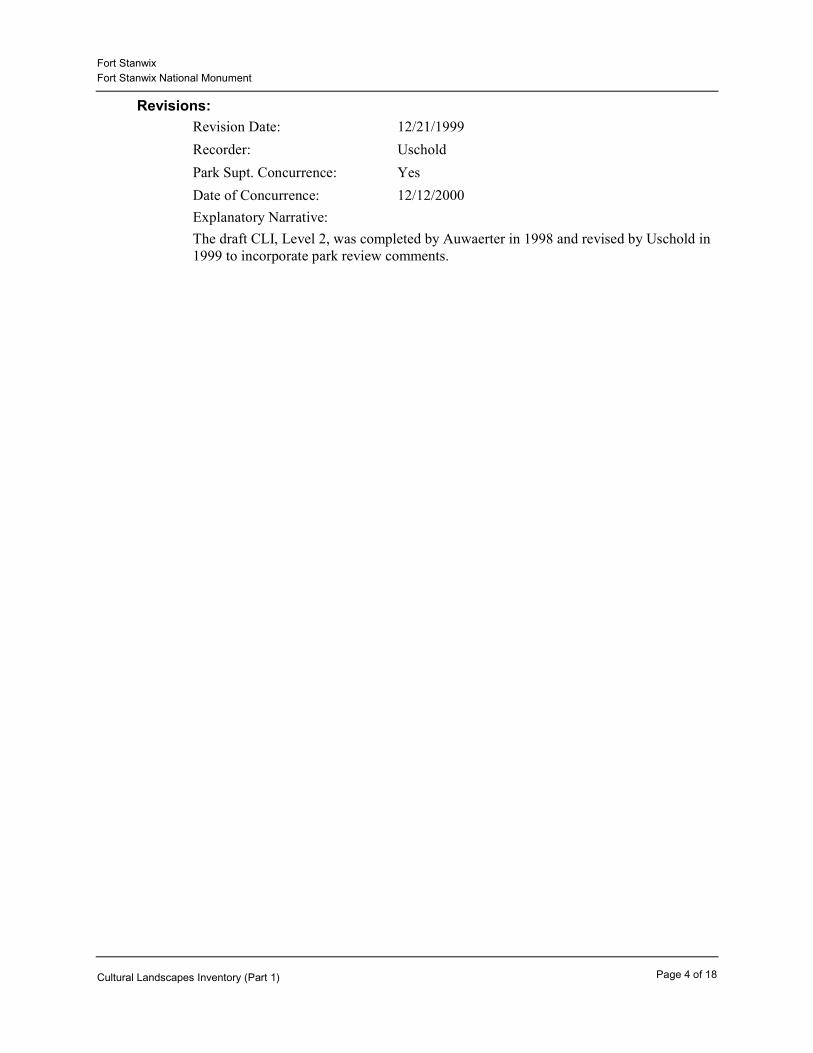
Revisions:Revision Date: 12/21/1999Recorder: Uschold
Explanatory Narrative:The draft CLI, Level 2, was completed by Auwaerter in 1998 and revised by Uschold in 1999 to incorporate park review comments.
Park Supt. Concurrence: Yes12/12/2000Date of Concurrence:
Page 4 of 18Cultural Landscapes Inventory (Part 1)

Fort StanwixFort Stanwix National Monument
Landscape Description
Fort Stanwix National Monument is a partial reconstruction of the 18th-century earth and timber fort previously located on the site. Construction of the recreated fort began in 1974 and was complete enough in 1976 for the fort to open to the public. For the most part, construction was completed in 1978, but some work remains to be done. Fort Stanwix National Monument occupies a 15.5-acre site in downtown Rome, New York that was cleared through the city’s Urban Renewal Agency in the early 1970s. The site is bordered to the west by North James Street, one of the main streets of the central business district, and to the south and east by multi-lane Erie Boulevard and Black River Boulevard, built over former canals of the same names. Across from the site, North James Street is lined by modern parking and commercial buildings and parking lots constructed as part of the city’s urban renewal plan. Erie and Black River Boulevards along the site are lined by a mixture of commercial and residential buildings. Immediately to the north of the Fort is the National Register-listed Gansevoort-Bellamy Historic District, which encompasses Rome’s civic square and includes the Rome Historical Society housed in the former Post Office, Old City Hall, the Oneida County Courthouse, and St. Peter’s Church, among other properties.
The existing Fort Stanwix is an earth and timber-clad reinforced concrete structure that replicates the historic fort as it may have appeared in 1777. Located on the site of the historic fort, the reconstruction contains one original feature, a brick hearth. The central part of the fort is a square with a side length of 200 feet. Off of each corner are timber and earth pentagonal bastions with flanks of 36 feet and faces of 90 feet. With these elements, the overall dimensions of the fort from bastion tip to bastion tip is 330 feet. Outside of this structure, the fort is covered in turf, as is the surrounding property. The outer edges of the fort on the north, south, and west sides are composed of a berm followed by a ditch, a parapet, a low palisade fence, and a glacis. The glacis is the low, gently-sloping outermost earthwork, the outer edges of which are almost imperceptible. The interior of the fort has three freestanding log buildings surrounding the parade grounds, along with frame casemates that are built into the four outer earthen walls.
The site outside of the glacis is primarily lawn, with deciduous trees lining North James Street and a mixture of evergreen and deciduous trees and shrubs north of the fort to screen the maintenance garage and other buildings north of the site. A footpath loops around the site, and signs mark the entrances on the south and east sides. A reconstructed water feature, the Branch of Technohat Creek, runs to the east and south of the fort. The topography outside of the fort complex, which was graded after demolition of the buildings on the site, is fairly level with a gentle down-grade toward the south.
In the National Register of Historic Places, the recorded period of significance for Fort Stanwix National Monument is 1758 to 1781. It was in 1758 that the British built the fort and in 1781 that the Americans withdrew permanent garrison. The property is listed as being historically significant under National Register Criterion A (association with an important event), primarily for its association with the American Revolution as the site of Fort Stanwix.
However, two issues related to this documented historical significance should be considered further. First, the period of significance should potentially be extended to 1790 so that it would include important treaty negotiations and other events that took place. Second, it is clearly stated in the existing National Register documentation that it is only the site that is eligible for the National Register and not any of the features on it, including the fort (NR 12/28/81). It may be more appropriate to list the site as being significant under Criterion D for the site's information potential. Criterion A is limited to those sites or resources which retain historic integrity (according to National Register guidelines). The existing
Page 5 of 18Cultural Landscapes Inventory (Part 1)

Fort StanwixFort Stanwix National Monument
National Register listing clearly recognizes that neither the landscape or the structure of this property have integrity and they should not be considered historic resources.
The fort structure, at just over twenty years old, is in overall sound condition, although timber facing must be routinely replaced. The landscape, consisting primarily of lawn and footpaths with trees along the west and north borders, is also in good condition.
The landscape of Fort Stanwix National Monument, defined for the CLI as that area outside of the glacis, is a reconstruction that suggests the open space thought to be present during the recorded period of significance, 1758-1781. At that time, the fort was sited on top of an embankment that dropped approximately 19 feet down to the Mohawk River in a frontier region composed of meadow and old-growth forest. As the fort deteriorated and finally disappeared during the early 19th century, its site became the center of the city of Rome, with the junction of the Erie and Black River Canals at the south-east corner of the present site. A dense concentration of brick and frame industrial, commercial, and residential buildings were constructed there during the 19th century. The corner of Dominick and James Streets, now an empty space, was the commercial heart of the city. Several high-style Greek Revival, Italianate, and Second Empire-style houses of the city’s prominent residents were located east and north of this corner. The 7-block, 15.5-acre site was cleared in the early 1970s of all buildings, structures, and landscape features as part of the Rome Urban Renewal Master Plan, through which the present day Fort Stanwix was reconstructed. The remainder of downtown Rome along North Dominick Street, extending west from the monument, was also in large part demolished during this time. Although the fort was reconstructed to approximate its appearance in 1777, the landscape was left as mown lawn, except for plantings used to screen buildings on the west and north sides. One historic feature was reconstructed, the Branch of Technohat Creek. The boundaries of this landscape were determined by roads developed after the period of significance and by the Rome Urban Renewal Master Plan adopted in 1967.
Fort Stanwix National Monument contains no physical landscape features that contribute to the historic significance of the site, although future investigation may uncover archeological remains in the untested area outside of the fort footprint. In this area, there is the potential to find archeological material tied to the history of the fort, and more likely, to the 19th-century history of Rome. The surrounding modern roads, the Urban Renewal-era development to the west, and the 19th- and early 20th-century development to the north, east, and south do not contribute to the historic setting of Fort Stanwix National Monument as defined during the period of significance.
Page 6 of 18Cultural Landscapes Inventory (Part 1)

Fort StanwixFort Stanwix National Monument
Cultural Landscapes Inventory Hierarchy DescriptionThe Cultural Landscapes Inventory (CLI) records baseline information on all landscapes located within National Parks potentially eligible for the National Register of Historic Places (as per Section 110(a)(1) of the National Historic Preservation Act). Through a review of secondary sources and an examination of the existing landscape, this CLI documents and evaluates the historical development and existing conditions of Fort Stanwix's cultural landscape. It also evaluates the site's recorded historical significance and documents how the landscape contributes to that significance. In addition to the recorded significance, the CLI also evaluates potential additional areas of historical significance for which the landscape may contribute.
Fort Stanwix National Monument is an individual site managed by the National Park Service. Located at 112 East Park Street, Rome, New York, the Monument has an area of 15.5 acres surrounding the fort complex. The fort, a partial reconstruction of the historic fort, consists of an earth and timber-clad, reinforced concrete structure that surrounds three free-standing buildings. For purposes of this CLI, the cultural landscape of Fort Stanwix consists of the open area surrounding the fort complex, specifically that area beyond the glacis or outermost earthwork.
At present, discussions are underway to consider strengthening interpretive ties with Oriskany Battlefield State Historic Site, owned and managed by the New York State Office of Parks, Recreation and Historic Preservation. Located approximately 6 miles east of Fort Stanwix on NY Route 69 at the border of the City of Rome and the Town of Whitestown, Oriskany Battlefield has a history that is intimately linked with that of Fort Stanwix. At this time, however, the CLI for Fort Stanwix is not covering Oriskany Battlefield because the official relationship between these two sites is still under discussion.
Fort Stanwix NM within Rome, NY (FOST Park Brochure).
Page 7 of 18Cultural Landscapes Inventory (Part 1)
Fort StanwixFort Stanwix National Monument
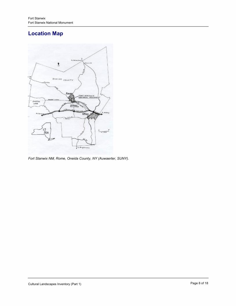
Location Map
Fort Stanwix NM, Rome, Oneida County, NY (Auwaerter, SUNY).
Page 8 of 18Cultural Landscapes Inventory (Part 1)

Fort StanwixFort Stanwix National Monument
Boundary Description
Fort Stanwix National Monument has no legally mandated boundaries at this time. The property currently owned by the United States National Park Service encompasses 15.52 acres and is bounded on the west by North James Street; on the north by Park Street and St. Peter’s Church; on the east/south by Black River Boulevard; and on the south by Erie Boulevard/East Whitesboro Street.
Regional Context
Cultural Context
Fort Stanwix National Monument is in downtown Rome, New York, a small city of approximately 44,000 located along the main east-west corridor of upstate New York approximately 100 miles west of Albany. This east-west corridor initially developed along natural riverine and geologic systems, the importance of which were then reinforced through construction of the Erie Canal, and later, railroads and the New York State Thruway. Ten miles to the south-east is Utica, Rome’s larger sister-city. Syracuse is approximately 40 miles west. Rome’s primary modern industries have been copper and brass (Revere) and defense (Griffiss Air Force Base).
The development of Rome was historically centered near the intersection of the Erie and Black River Canals, around the present site of Fort Stanwix. However, through massive Urban Renewal projects begun in the 1960s, including the reconstruction of Fort Stanwix, the historic downtown was in large part replaced by new larger urban blocks, a pedestrian mall on Dominick Street, and less dense development. Planning is underway to reinvigorate the downtown core, the first phase of which--the reopening of Dominick Street--was recently completed.
The lands directly adjacent to Fort Stanwix National Monument do not contribute to the historic setting of the site because they all post-date the documented period of significance, 1758-1781. All adjacent buildings are separated by public streets, except for St. Peter’s Church and rectory, which are contiguous with the site at the north-west corner. Several reports, including the 1973 Comprehensive Design Report, have stated that the adjacent lands are useful in interpreting the history of Fort Stanwix through the contrast between the timber fort and its open site and the urban buildings of the surrounding city.
To the north, Fort Stanwix National Monument abuts the Gansevoort-Bellamy Historic District, which was listed in the National Register of Historic Places in 1975. This historic district includes portions of North James, Court, and Park Streets (encompassing St. Peter’s Church and rectory, Old City Hall, the Old Post Office, and the Oneida County Courthouse). St. Peter’s Church and the Old City Hall are both highly visible from most parts of Fort Stanwix.
Page 9 of 18Cultural Landscapes Inventory (Part 1)

Fort StanwixFort Stanwix National Monument
Urban Renewal District and Fort Stanwix overlay on Rome, NY (Fort Stanwix Master Plan).
Political Context
Fort Stanwix National Monument is located in the City of Rome, Oneida County, NY, within the Utica-Rome metropolitan statistical area. The city is located in the 23rd Congressional District.
Physiographic Context
Fort Stanwix National Monument is located at the boundary of two major physiographic regions, the Glaciated Allegheny Plateau, extending south and east of Rome; and the Great Lakes region, extending west and north. These two regions define a major watershed divide: the Mohawk River, located about 1,000 feet to the east of the site, drains into the Atlantic through the Hudson River; Wood Creek, located about one mile west, drains into the Great Lakes. While Fort Stanwix remains on high ground above the Mohawk River, this embankment has become less prominent with the urban development of Rome.
Page 10 of 18Cultural Landscapes Inventory (Part 1)

Fort StanwixFort Stanwix National Monument
Fort Stanwix, located along Oneida Carry (FOST Park Brochure).
Page 11 of 18Cultural Landscapes Inventory (Part 1)

Fort StanwixFort Stanwix National Monument
Site PlanSite Plan, Fort Stanwix NM, Rome, NY, 1998 (Auwaerter, SUNY). See Appendices for larger-scale fold-out site plan.
Page 12 of 18Cultural Landscapes Inventory (Part 1)

Fort StanwixFort Stanwix National Monument
Chronology
Year Event Description
Settled Since earliest times, area around future Fort Stanwix used by the Iroquois as a portage route between the Mohawk River and Wood Creek, known as the "De-O-Wain-Sta" or Oneida Carrying Place.
1500 AD
Established Oriskany Patent established, but not yet subdivided.
1705 AD
Built Fort Stanwix constructed by the British replacing five smaller forts that protected the Oneida Carry during the French and Indian War.
1758 - 1761 AD
Altered British end garrison at Fort Stanwix after conquest of Canada; fort continues to serve as center for Indian affairs.
1763 AD
Established Boundary Line Treaty is signed at Fort Stanwix.1768 AD
Abandoned The barracks are destroyed by fire, and the British abandon the fort entirely.
1774 AD
Altered The Continental Army begin to rebuild and regarrison Fort Stanwix, renaming it Fort Schuyler.
1776 AD
Maintained Continental Army repulsed the British in the Siege of Fort Stanwix.
1777 AD
Destroyed Fire destroys barracks buildings; flood damages earthworks. Permanent garrison at Fort Stanwix is withdrawn.
1781 AD
Established Treaty of Fort Stanwix takes place at fort.1784 AD
Land Transfer A portion of the Oriskany Patent that included Fort Stanwix and the Oneida Carry is auctioned as an "Expense Lot" and aqcuired by Dominick Lynch.
1786 AD
Page 13 of 18Cultural Landscapes Inventory (Part 1)

Fort StanwixFort Stanwix National Monument
Established Oneida and Onondaga Indian Nations sign treaties with the State of New York at fort.
1788 AD
Established Onondaga and Cayuga Indian Nations sign treaties with State of New York.
1790 AD
Built State of New York constructs a blockhouse in the center of the fort site.
1794 AD
Platted William Weston draws a map for Lynch establishing the village.
1796 AD
Built Western Inland Lock Navigation Company builds a canal across the Oneida Carry adjacent to site of Fort Stanwix (present Erie Boulevard).
1797 AD
Built Construction on the Erie Canal begins in Rome, south of Fort Stanwix, completed in 1825.
1817 AD
Established Rome incorporated as a village. Citizens reject name of Lynchville.
1819 AD
Purchased/Sold Last parcels of land on site of fort are sold.1828 AD
Built Construction begins on the Black River Canal, located along east border of present Fort Stanwix; completed by 1851.
1839 AD
Urbanized By this date, last remnants of the fort’s earthworks had been removed and replaced by residential and commercial development.
1840 AD
Altered Erie Canal is enlarged and relocated to south border of present Fort Stanwix on old Inland Canal alignment (Erie Boulevard).
1844 AD
Established Rome is incorporated as a city.1870 AD
Abandoned Erie and Black River Canals abandoned by 1918, with the Barge Canal replacing the Erie.
1918 AD
Purchased/Sold The State of New York purchases a small plot at the site to commemorate Fort Stanwix.
1927 AD
Page 14 of 18Cultural Landscapes Inventory (Part 1)
Fort StanwixFort Stanwix National Monument
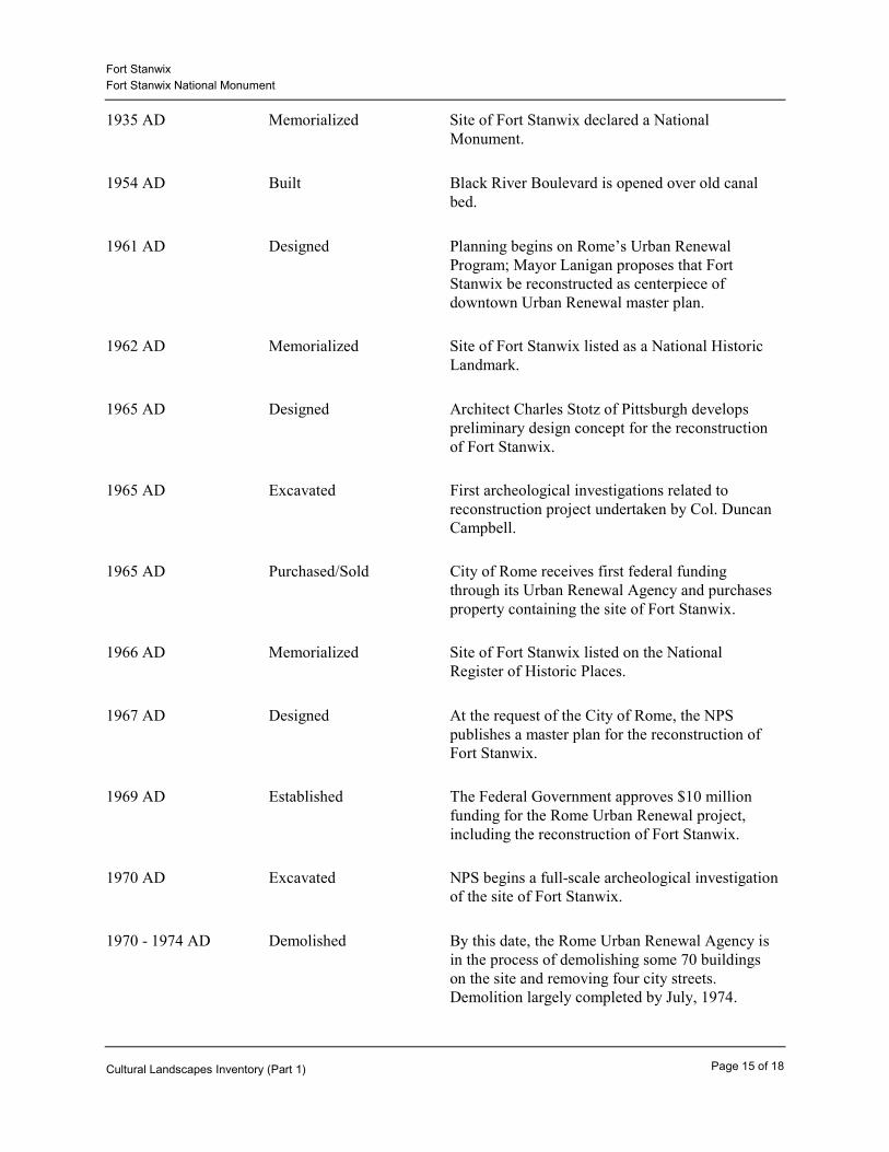
Memorialized Site of Fort Stanwix declared a National Monument.
1935 AD
Built Black River Boulevard is opened over old canal bed.
1954 AD
Designed Planning begins on Rome’s Urban Renewal Program; Mayor Lanigan proposes that Fort Stanwix be reconstructed as centerpiece of downtown Urban Renewal master plan.
1961 AD
Memorialized Site of Fort Stanwix listed as a National Historic Landmark.
1962 AD
Designed Architect Charles Stotz of Pittsburgh develops preliminary design concept for the reconstruction of Fort Stanwix.
1965 AD
Excavated First archeological investigations related to reconstruction project undertaken by Col. Duncan Campbell.
1965 AD
Purchased/Sold City of Rome receives first federal funding through its Urban Renewal Agency and purchases property containing the site of Fort Stanwix.
1965 AD
Memorialized Site of Fort Stanwix listed on the National Register of Historic Places.
1966 AD
Designed At the request of the City of Rome, the NPS publishes a master plan for the reconstruction of Fort Stanwix.
1967 AD
Established The Federal Government approves $10 million funding for the Rome Urban Renewal project, including the reconstruction of Fort Stanwix.
1969 AD
Excavated NPS begins a full-scale archeological investigation of the site of Fort Stanwix.
1970 AD
Demolished By this date, the Rome Urban Renewal Agency is in the process of demolishing some 70 buildings on the site and removing four city streets. Demolition largely completed by July, 1974.
1970 - 1974 AD
Page 15 of 18Cultural Landscapes Inventory (Part 1)
Fort StanwixFort Stanwix National Monument
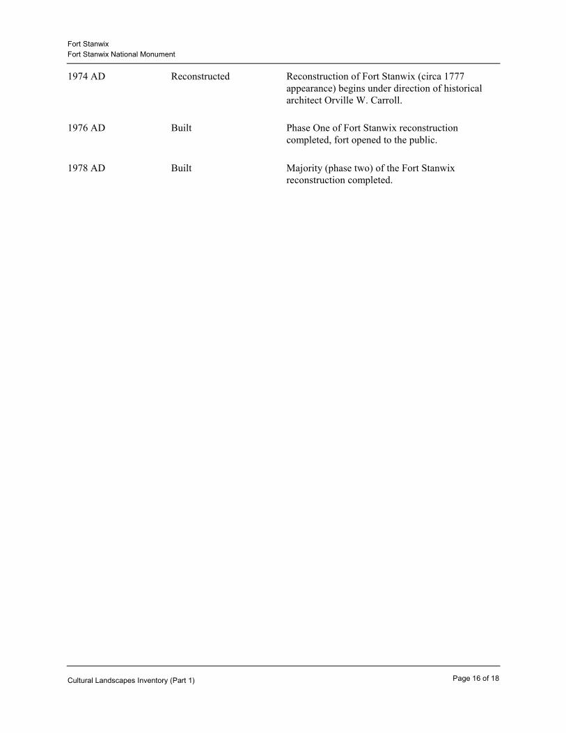
Reconstructed Reconstruction of Fort Stanwix (circa 1777 appearance) begins under direction of historical architect Orville W. Carroll.
1974 AD
Built Phase One of Fort Stanwix reconstruction completed, fort opened to the public.
1976 AD
Built Majority (phase two) of the Fort Stanwix reconstruction completed.
1978 AD
Page 16 of 18Cultural Landscapes Inventory (Part 1)
Fort StanwixFort Stanwix National Monument
Statement Of Significance
Fort Stanwix National Monument is listed on the National Register of Historic Places as being historically significant under National Register Criterion A as the site of Fort Stanwix. Built in 1758 by the British, taken over and rebuilt by the Americans in 1776, and garrisoned until 1781, Fort Stanwix played a significant role in American history during this period. By 1840, the last remnants of the earth and timber Fort Stanwix had disappeared beneath the burgeoning village of Rome.
The documented period of significance for the site is 1758 to 1781, encompassing the construction of the fort and extending until the last permanent American garrison in 1781. However, this should be explored further and possibly extended to 1790, to include all of the important treaty activities that took place at the fort.
According to National Register guidelines and a determination by the NY SHPO, the present Fort Stanwix, a reconstruction built between 1974 and 1978, has no historic significance and is not a contributing resource of the property listed in the National Register of Historic Places. The site of the original fort was declared a National Historic Landmark in 1962 and listed in the National Register of Historic Places in 1966 before the present Fort Stanwix was reconstructed. Although most of the archeological evidence of historic Fort Stanwix was removed prior to the reconstruction. The "site" does retain integrity as reflected in the 1981 National Register nomination form prepared by the National Park Service.
The nearby Oriskany Battlefield is separately listed as a National Historic Landmark for its role in the American Revolution. The battle at Oriskany on August 6, 1777 was fought in an attempt to relieve the siege of Fort Stanwix.
The historic Fort Stanwix was sited at the Oneida Carry, known by the Oneida as ”De-O-Wain-Sta,” a strategic one-mile or longer portage, depending on water levels, that connected the Great Lakes and Atlantic watersheds via Wood Creek and the Mohawk River. Fort Stanwix was constructed by the British in 1758 to replace five smaller forts built in the area during the French and Indian War. Fort Stanwix replaced Fort Williams (replaced by New or Pentagon Fort), Bull, Newport, Craven, and Wood Creek. With the conquest of Canada in 1763, the British withdrew from Fort Stanwix. It continued to serve, however, as an important center for Indian affairs, and it was here in 1768 that the Iroquois signed the Boundary Line Treaty that made possible a significant surge of westward settlement. Due to its temporary method of construction, the fort deteriorated and was finally abandoned by the British in 1774.
The role of Fort Stanwix in the Revolution is the basis for the national significance of this site. In 1776, the Americans repaired and regarrisoned the deteriorated British fort. As part of their effort to divide the colonies, a British coalition force began the Siege of Fort Stanwix on August 3, 1777. Although the Americans suffered heavy losses at the nearby Battle of Oriskany on August 6, the efforts at Fort Stanwix repelled the combatant force attack on the fort by August 23, 1777, resulting in the retreat of the British force to Canada. The failure of the British to take Fort Stanwix was a significant factor leading to the surrender of the main force under Burgoyne at Saratoga on October 17, 1777. Permanent garrison was ended at Fort Stanwix in 1781.
After 1781, the fort was again the scene of important Indian affairs, notably the Treaty of Fort Stanwix in October, 1784, which set terms for a separate peace with the Iroquois Confederacy. This treaty ceded
Page 17 of 18Cultural Landscapes Inventory (Part 1)

Fort StanwixFort Stanwix National Monument
large parts of their lands to the United States. Four additional treaties took place at the fort. In 1788 the Oneida Indian Nation and the State of New York Land Treaty took place at Fort Stanwix. Also in 1788 and again in 1790, the Onondaga Indian Nation signed treaties with the State and also in 1790 the Cayuga Indian Nation signed a treaty with the State. After 1790, the State maintained a blockhouse for supply storage within the fort military until around 1815, but the last remnants of the fort complex were replaced by urban development by 1840.
The present Fort Stanwix is a partial reconstruction built between 1974 and 1978 and, according to the National Register, it is only the site that is considered a significant historic resource. As a reconstruction, the fort itself is ineligible for the National Register due to its current design being somewhat conjectural and due to its modern construction materials and methods (NRHP, 1981 and NYSHPO/NPS LCS, 1996). The Fort Stanwix National Monument occupies a 15.5-acre parcel that was cleared through Rome’s Urban Renewal Master Plan, and its boundaries are defined by urban development that occurred after the documented period of significance (1758-1781). In 1996 the State Historic Preservation Officer confirmed the earlier assessment that none of the buildings or structures presently on the site contribute to the historic significance of the property.
Page 18 of 18Cultural Landscapes Inventory (Part 1)
Fort StanwixFort Stanwix National Monument
Physical History
1758-1790, Fort Stanwix
The site of Fort Stanwix has long been a funnel for commerce, settlement, and military activity. Located along the “De-O-Wain-Sta” or Oneida Carrying Place, the area was used since earliest times as a portage between two great watersheds: the Great Lakes and the Atlantic Ocean via Wood Creek and the Mohawk River, located only one to six miles apart at this point (depending on water level). Because it was one of two water routes between New York and Canada, the Oneida Carry took on great strategic significance. With permission from the Iroquois, during the French and Indian War on top of high ground above the Mohawk River, the British built Fort Stanwix in 1758 (replacing five smaller nearby forts). The fort was named Fort Stanwix, after Brigadier General John Stanwix. Although the site of Fort Stanwix was within the Oriskany Patent, this patent had not yet been divided.
With the British conquest of Canada, Fort Stanwix temporarily lost its strategic importance, and the British withdrew in 1763. The British continued to use the fort, however, as a center for Indian affairs, and it was there in 1768 that the Boundary Line Treaty was signed with the Iroquois that allowed European settlement east of a line stretching from west of Fort Stanwix south and west to the Ohio and Tennessee Rivers. In 1774, the barracks were destroyed by fire and the British abandoned the deteriorated fort completely.
In 1776, Fort Stanwix took on renewed strategic importance as the Oneida Carry once again became a contested area between two warring countries, the United States and the British in Canada. In this same year, the Americans began to rebuild Fort Stanwix along the lines of the old structure, with cedar logs harvested from the surrounding swamplands for the structure and sod to cover the earthworks. The Americans renamed it Fort Schuyler, although the old name continued to be used.
In 1777, the British began their three-pronged offensive to split the colonies by gaining control of New York State. One force under the direction of General Barry St. Leger was to head down the St. Lawrence, cross Lake Ontario to Oswego, then capture Fort Stanwix and proceed down the Mohawk Valley to meet the other two forces at Albany. Leger’s forces, however, met unexpected resistance when they began their siege on Fort Stanwix on August 3rd. In aid of Fort Stanwix, General Nicholas Herkimer assembled the Tryon County Militia and approached from the east along the Mohawk Valley. On August 6, 1777, Herkimer met American Loyalists and Indian troops at Oriskany, a few miles east of Fort Stanwix, and engaged in one of the Revolution's bloodiest battles, known today as the Battle of Oriskany. Iroquois had been recruited to serve on both sides, and this battle broke the Confederacy’s Great Peace that had been in place for generations.
With the Oriskany battle ending in somewhat of a stalemate, most of the British and the Indian force involved in the battle retreated to join the siege of Fort Stanwix. St. Leger finally withdrew from Fort Stanwix on August 23rd, abandoned the siege, and returned to Canada. St. Leger intended to join Burgoyne but arrived too late. The defeat of the British attack on Fort Stanwix was a significant factor leading to the surrender of Burgoyne and his forces at Saratoga on October 17, 1777.
Fort Stanwix itself saw no further battle in the war, but the Americans kept permanent garrison there until 1781 when a fire again destroyed the barracks and flooding eroded the earthworks. After this time, the fort was the scene of many important Indian affairs, notably the Treaty of Fort Stanwix in October, 1784, which set terms for a separate peace with the Iroquois Confederacy to cede large parts of their
Page 1 of 6Cultural Landscapes Inventory (Part 2a)

Fort StanwixFort Stanwix National Monument
lands to the United States. In 1788 two treaties were negotiated at Fort Stanwix between the Onondaga and Oneida Nations and the State of New York. Two additional treaties were signed in 1790 between the Onondaga and Cayuga Indian Nations and the State.
The damage that occurred in 1781 was never repaired, and the fort continued to deteriorate, as the timber rotted and the earthworks eroded. The only improvement made during the late 18th century was the construction of a blockhouse on the former parade grounds by the State of New York. The blockhouse was used for housing military supplies and remained until about 1815.
Oneida Carrying Place and pre-1758 forts (Casemates and Cannonballs).
Page 2 of 6Cultural Landscapes Inventory (Part 2a)

Fort StanwixFort Stanwix National Monument
Plan of Fort Stanwix, c1759 (FOST Park Library).
Sketch of Fort Stanwix as it appeared 1777, by Peter Hugunine in 1897 (Rome Historical Society).
1786-1960, Fort Stanwix and the City of Rome
Page 3 of 6Cultural Landscapes Inventory (Part 2a)

Fort StanwixFort Stanwix National Monument
In 1786, only five years after permanent garrison was ended at Fort Stanwix, the American government moved to apportion the Oriskany Patent to confiscate lands of those who sided with the British. This process was accomplished through an Act of Attainer. A portion of the confiscated land, referred to as the "expense lot," was sold at auction to pay for the survey. This land included the Oneida Carry and the site of Fort Stanwix and was acquired by Dominick Lynch, a New York City merchant. Lynch, who purchased much of the land that would comprise the city of Rome, hired William Weston in 1796 to lay out a village plan. Lynch named the future city Lynchville; one of the main streets he named “Dominick” after himself, and the other, “James” after his son. The ruins of Fort Stanwix occupied the eastern part of block twelve in the village plan.
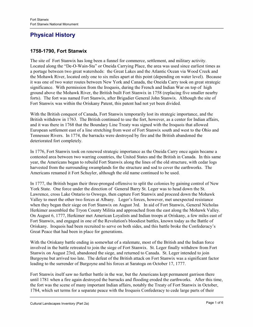
In the same year that Lynchville was mapped, the Western Inland Lock Navigation Canal was completed there across the Oneida Carry. Because of low water levels, the canal was not a tremendous success and the village through which it ran grew relatively slowly. In 1800, Lynchville had a population of 1, 497. By 1810, it had grown to 2,003. In 1817, work began on the Erie Canal south of Lynchville, signaling a period of increased growth. In 1819, the village was incorporated under the name Rome (local citizens objected to the name Lynchville). By 1840, all of the land on the site of Fort Stanwix had been sold and developed with residential and commercial buildings. Just prior to this time, however, remains of the fort were still evident. For example, when the Stryker House was being built at the northeast corner of Spring and Liberty Streets in 1838, it was noted that “...part of the old fort was a distressed looking place. There was a mound and there were ditches and trenches, and the grounds were used to deposit dead dogs, hogs, cats, horses and all the rubbish of the town” (Waite). By 1840, all traces of the old earthworks were gone. The site had become the center of Rome, with the dense commercial heart just southwest of the fort site at the corner of James and Dominick Streets.
In 1844, the Erie Canal was enlarged and relocated to the alignment of the old Western Inland Lock Navigation Canal along the present alignment of Erie Boulevard. Work was also underway on the Black River Canal, which provided access to the timber and mineral reserves to the north and joined the Erie just southeast of the fort site. By 1850, Rome had a population of 7,920.
By the late 19th and early 20th centuries, Rome was prospering due to its ready access to transportation, water power, raw materials for industry, and agriculture. In 1870, Rome had a population of 11,000 and was incorporated as a city. The town's most famous products were from the cheese, iron, copper, and brass industries, with Revere Copper and Brass Corporation probably the most well known. During the mid-20th century, the development of Griffiss Air Force Base, established in 1941, provided a great boost to Rome and the base became Central New York’s largest single employer with a work force of between 13,000 and 15,000. By 1960, Rome had a population of 51,646.
During this period, there had already been several attempts to memorialize or rebuild the fort. In 1923, the first organized efforts were taken to memorialize Fort Stanwix by the Rome Kiwanis Club as part of a ten-year plan to mark significant historic sites in the Mohawk Valley. Although Rome celebrated the sesquicentennial of Fort Stanwix in 1927, little action was taken on this plan. The State of New York, however, did purchase a small plot at the site in commemoration of Fort Stanwix. In 1929, the City of Rome proposed a committee to investigate and report to the State Legislature on the possibility of establishing a state museum at Rome to commemorate the Siege of Fort Stanwix in 1777, but no action by the State was taken on this proposal.
In the 1930s, Rome turned to the federal government for assistance. In 1933, the Rome Chamber of Commerce petitioned the Secretary of the Interior through Congressman Fred Sisson to consider the establishment of a federal park and memorial on the site of Fort Stanwix. His efforts resulted in the
Page 4 of 6Cultural Landscapes Inventory (Part 2a)

Fort StanwixFort Stanwix National Monument
passage of legislation, signed in August, 1935, establishing the site of Fort Stanwix as a National Monument. The fort's original British name of Fort Stanwix was used as opposed to the later American name of Fort Schuyler. No boundaries were set for the monument at the time. Because no funding was attached to the legislation and no land was acquired for it by the National Park Service, the monument was not developed and downtown Rome remained largely unaffected.
View south, east side of James Street, c1930 (FOST Park Library).
Page 5 of 6Cultural Landscapes Inventory (Part 2a)
Fort StanwixFort Stanwix National Monument
Stryker House on site of Fort Stanwix, 1970 (Casemates and Cannonballs).
Page 6 of 6Cultural Landscapes Inventory (Part 2a)

Fort StanwixFort Stanwix National Monument
1960-present, The Reconstruction of Fort Stanwix
The 1960s began a turbulent time in Rome. With the construction of arterial roads along the old canal beds, the opening of freeways, and the growth of Griffiss Air Force Base, development began to spread outward and away from the city. There was fear that the city’s main employers could downsize, leaving the city in economic hardship. To attract people back to the city and to diversify its economy, the leaders of Rome embraced the federal Urban Renewal Program. The project developed for downtown was called the Fort Stanwix Central Business District Urban Renewal Project and would include nearly complete rebuilding of the downtown and creation of a tourist economy centered on a reconstructed Fort Stanwix and other historic sites in the city. Rome had utilized urban renewal during the 1950s with the creation of Midtown Plaza, a large shopping center along the south side of Erie Boulevard adjacent to downtown.
It was in July, 1961 that Mayor Lanigan officially proposed the reconstruction of Fort Stanwix as part of Rome’s Urban Renewal program. With ample Federal funds and powers of condemnation, the Rome Urban Renewal Agency (RURA) began to plan for rebuilding Fort Stanwix as the focal point of the downtown redevelopment. Planning for the project soon gained momentum. In 1962, the site of Fort Stanwix was designated a National Historic Landmark under the jurisdiction of the Historic Sites Act of 1935. In the same year, Gilbert Hagerty of the Fort Stanwix Museum worked with architect Charles M. Stotz of Pittsburgh in developing the first preliminary design for the reconstruction of Fort Stanwix. In 1964, RURA requested the assistance of the National Park Service (NPS) in developing reconstruction plans for the Fort site within their Urban Renewal Master Plan. The next year, the first archeological investigations related to reconstruction were undertaken by Col. Duncan Campbell. By 1967, the NPS completed a master plan which detailed reconstruction of the fort on the historic site.
The site for Fort Stanwix National Monument was purchased through RURA and donated to the federal government. Clearing of the 15.5-acre parcel was underway by 1970 and targeted for completion by July, 1974. The reconstruction project removed all buildings, structures, and landscape features from within the 7-block area bounded by James Street, Dominick Street, Park Street, Black River Boulevard, and Erie Boulevard/Whitesboro Street. The corner of James and Dominick Streets was historically the heart of downtown Rome. Removed from this area were over 70 buildings, including 19th and early 20th century commercial buildings lining James Street and portions of Dominick Street; high-style Greek Revival, Italianate, and Second Empire-style houses; and West Liberty, West Dominick, Spring, and East Willet Streets. This area comprised one of the oldest sections of the city.
The design of the new fort was based on evidence found in historic maps, drawings, and in-depth archeological investigations undertaken at the site by the NPS between 1970 and 1972. The fort was to be recreated to its appearance during the Siege of Fort Stanwix in 1777. While the appearance of the new fort was as historically accurate as the documentation permitted, its construction was a mix of old and new. Much of the structure was built of reinforced concrete and steel, then covered in wood and sod. The new Fort Stanwix opened in time for the Bicentennial in 1976 at a final cost of $4.2 million.
The landscape around the new Fort Stanwix was kept intentionally simple, because planners acknowledged it would be difficult to reconstruct the historic wilderness setting. As noted in the “Comprehensive Design Report” prepared for the NPS in 1973, “The resurrection of Fort Stanwix... an early military outpost once dominating a wilderness scene... will parallel the reconstruction of downtown Rome, but the Fort will now face a distinctly different setting inherent in the surrounding urban condition.... The recreated historic scene should be as authentic as possible to the very limits of the lands comprising Fort Stanwix, where the abruptness of change will only reinforce its interpretive
Page 1 of 3Cultural Landscapes Inventory (Part 2b)
Fort StanwixFort Stanwix National Monument
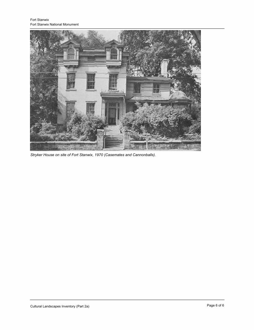
impact.” While it is likely the landscape surrounding the fort was composed of open fields containing the stumps of the cut trees, to recreate that scene would be conjectural. At first the area surrounding the reconstructed fort was kept as an open meadow. Today it is maintained as a grass lawn with gravel paths, stacked wood-rail fences, and plantings along the west and north perimeters.
In addition to the fort, the NPS constructed a maintenance building on the northeast side of the site in 1975. A garage wing was added to this building in 1987. The building continues to serve as the parks maintenance offices and garage. The existing fort complex is the result of the completion of the first two phases of a multi-phased development plan. A third phase to construct a visitor center on the site, has been partially funded. It has not yet been determined whether the new visitor center will be located on or off-site. Later phases will reconstruct the remaining elements of the fort including the necessary, ravelin and sally port as funding allows.
Sketch of reconstructed Fort Stanwix (FOST Park Brochure).
Page 2 of 3Cultural Landscapes Inventory (Part 2b)

Fort StanwixFort Stanwix National Monument
Aerial view of Rome, NY prior to reconstruction of Fort Stanwix, 1969 (FOST Park Archives).
Aerial view of Rome, NY after reconstruction of Fort Stanwix, 1976 (FOST Park Archives).
Page 3 of 3Cultural Landscapes Inventory (Part 2b)

Fort StanwixFort Stanwix National Monument
Summary
Analysis And Evaluation
The landscape surrounding Fort Stanwix is a reconstruction suggesting the open space present during the documented period of significance, 1758-1781. Other than the open character, it bears no resemblance to what the historic landscape would have looked like. Historically, the fort was sited on top of an embankment that dropped approximately 19 feet down to the Mohawk River in a frontier region composed of meadow and old-growth forest. While the landscape surrounding the fort was certainly open in character, it was presumably unkempt meadow scattered with stumps from the cut trees used to build the fort. The trees also would have been cleared to keep the area open for strategic purposes in defending the fort. While the area surrounding the reconstructed fort was not intended to replicate the historic landscape, the topography at the base of the fort and including the glacis is believed to be historically accurate.
As the fort deteriorated and finally disappeared during the early 19th century, its site became the center of the village of Rome, with the junction of the Erie and Black River Canals at the southeast corner of the present fort site. A dense concentration of brick and frame industrial, commercial, and residential buildings were constructed there during the 19th century. The corner of Dominick and James Streets was the commercial heart of the city, and several high-style Greek Revival, Italianate, and Second Empire-style houses of the city’s prominent residents were located east and north of this corner.
In the early 1970s, the 7-block, 15.5-acre site was cleared of all buildings, structures, and landscape features as part of the Rome Urban Renewal Master Plan, through which the present Fort Stanwix was reconstructed. The remainder of downtown Rome along North Dominick Street was also in large part cleared during this time. Although the fort was reconstructed to approximate its appearance in 1777, and the landscape was initially open meadow, today it is maintained as mown lawn, except for plantings used to screen buildings on the west and north sides. One historic feature was reconstructed, the Branch of Technohat Creek. The boundaries of this landscape were determined by roads developed after the period of significance and by the Rome Urban Renewal Master Plan adopted in 1967.
Fort Stanwix National Monument contains no landscape features that contribute to the historic significance of the site. All of the landscape features are either modern (circulation, buildings, vegetation), non-historic reconstruction (Branch of Technohat Creek), outside the period of significance (setting), or so altered that they no longer convey conditions during the period of significance (topography: embankment above Mohawk River). There remains some potential for significant archeological resources on the site. According to the 1998 “Archeological Overview and Assessment” (Johnson and Donta), in the area outside of the fort footprint there is the potential to find remains tied to the history of the fort, but more likely, to the 19th-century history of Rome.
Landscape Characteristics And Features
Archeological Sites
The most recent archeological work done at Fort Stanwix is the June, 1999 “Archeological Overview and Assessment of the Fort Stanwix National Monument/Rome, New York.” According to the abstract of this report, the archeological research at the site, focused on the fort, began in 1965 with the work of J. Duncan Campbell. His preliminary findings suggested there were remains from the fort that could be useful in the planned reconstruction project. In 1970, the National Park Service began extensive
Page 1 of 7Cultural Landscapes Inventory (Part 3a)
Fort StanwixFort Stanwix National Monument
archeological work under the direction of Hanson and Hsu, and completed this work by 1975. The site presently curates approximately 405,000 archeological objects; about 45,000 of these are associated with Fort Stanwix. Because of the amount of excavation and extensive disturbance from the reconstruction and previous urban development, there is low potential for any further remains related to the fort in this area. However, in the area of the site outside of the fort footprint there remains a potential for further Fort Stanwix-related archeological resources given that such resources were found preserved below the site of the fort proper. The areas beyond the sally port on the east side and the area to the west (beneath James Street) have been identified as having high potential. The highest potential, however, is for resources related to the 19th-century history of Rome, given that during clearing of the site, foundations were left intact and filled with demolition material.
The potential for any further fort-related significant archeological resources remaining in situ is low beneath the fort footprint, but somewhat higher outside the fort. Based on prior investigations, the footprint of the fort does not possess any significance under National Register Criterion D because the significant archeological resources related to the fort were recovered and removed prior to reconstruction. The potential does remain, however, for future finds in the area outside of the fort footprint, in the mowed lawn areas of the site.
Page 2 of 7Cultural Landscapes Inventory (Part 3a)
Fort StanwixFort Stanwix National Monument
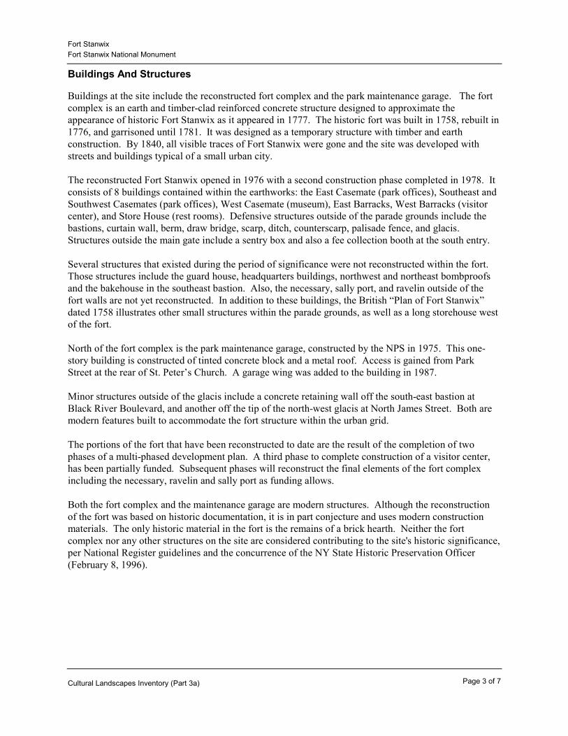
Buildings And Structures
Buildings at the site include the reconstructed fort complex and the park maintenance garage. The fort complex is an earth and timber-clad reinforced concrete structure designed to approximate the appearance of historic Fort Stanwix as it appeared in 1777. The historic fort was built in 1758, rebuilt in 1776, and garrisoned until 1781. It was designed as a temporary structure with timber and earth construction. By 1840, all visible traces of Fort Stanwix were gone and the site was developed with streets and buildings typical of a small urban city.
The reconstructed Fort Stanwix opened in 1976 with a second construction phase completed in 1978. It consists of 8 buildings contained within the earthworks: the East Casemate (park offices), Southeast and Southwest Casemates (park offices), West Casemate (museum), East Barracks, West Barracks (visitor center), and Store House (rest rooms). Defensive structures outside of the parade grounds include the bastions, curtain wall, berm, draw bridge, scarp, ditch, counterscarp, palisade fence, and glacis. Structures outside the main gate include a sentry box and also a fee collection booth at the south entry.
Several structures that existed during the period of significance were not reconstructed within the fort. Those structures include the guard house, headquarters buildings, northwest and northeast bombproofs and the bakehouse in the southeast bastion. Also, the necessary, sally port, and ravelin outside of the fort walls are not yet reconstructed. In addition to these buildings, the British “Plan of Fort Stanwix” dated 1758 illustrates other small structures within the parade grounds, as well as a long storehouse west of the fort.
North of the fort complex is the park maintenance garage, constructed by the NPS in 1975. This one-story building is constructed of tinted concrete block and a metal roof. Access is gained from Park Street at the rear of St. Peter’s Church. A garage wing was added to the building in 1987.
Minor structures outside of the glacis include a concrete retaining wall off the south-east bastion at Black River Boulevard, and another off the tip of the north-west glacis at North James Street. Both are modern features built to accommodate the fort structure within the urban grid.
The portions of the fort that have been reconstructed to date are the result of the completion of two phases of a multi-phased development plan. A third phase to complete construction of a visitor center, has been partially funded. Subsequent phases will reconstruct the final elements of the fort complex including the necessary, ravelin and sally port as funding allows.
Both the fort complex and the maintenance garage are modern structures. Although the reconstruction of the fort was based on historic documentation, it is in part conjecture and uses modern construction materials. The only historic material in the fort is the remains of a brick hearth. Neither the fort complex nor any other structures on the site are considered contributing to the site's historic significance, per National Register guidelines and the concurrence of the NY State Historic Preservation Officer (February 8, 1996).
Page 3 of 7Cultural Landscapes Inventory (Part 3a)

Fort StanwixFort Stanwix National Monument
Historic appearance of fort, c1777 (FOST Park Brochure).
Exterior of fort, 1998 (OCLP FOST CLI Files).
Page 4 of 7Cultural Landscapes Inventory (Part 3a)

Fort StanwixFort Stanwix National Monument
Interior of fort, 1998 (OCLP, FOST CLI File).
Park maintenance facility, 1998 (OCLP, FOST CLI File).
Page 5 of 7Cultural Landscapes Inventory (Part 3a)

Fort StanwixFort Stanwix National Monument
Circulation
Circulation outside of the glacis consists of paths that loop around the site from the maintenance garage south to Black River Boulevard, then west to James Street. These paths, which are also used by maintenance vehicles, are built of asphalt covered with a reddish-gray gravel. The paths lead to the sally port (now used as a service entry) on the east side, and to the main entrance on the south side. While these paths are contemporary, they do lead to the fort's historic entrances. In addition, the front (south) entrance to the fort is believed to be the route of the original Oneida Carry.
In addition to the gravel paths, the site is bordered by concrete sidewalks within the public right-of-way. At the West Dominick Street entrance, the sidewalk is paved in brick.
Public streets border the site, except at the north-west corner at St. Peter’s Church. These streets include Park Street, a narrow city street; James Street, four-lanes and partially-divided; Black River Boulevard (NY 26), a four-lane arterial state highway; and Erie Boulevard (NY 46/49/69), the major arterial state highway through the downtown area.
Circulation consists of asphalt-paved paths and perimeter concrete sidewalks that are modern in material and design. While these elements detract from the historic character of the site, they are necessary features to provide visitor and staff access.
Constructed Water Features
The single constructed water feature at Fort Stanwix is the Branch of Technohat Creek (LCS Number 0017-TC). This water feature, built between 1974 and 1976, is located east of the fort complex. A reconstruction of the natural stream that existed during the period of significance, this water feature has a 3 - 5’ channel with metal grate drain covers spaced along its length; it only carries water during runoff and snow melt. The banks and bed are covered with sod, and two minor plank bridges are located at path crossings. A second channel for waste at the site of a historic privy was also built.
While the reconstructed Branch of Technohat Creek does assist to replicate the historic scene, it is not considered a contributing feature of the site's historic significance (per concurrence with the NY State Historic Preservation Office, February 8, 1996).
Page 6 of 7Cultural Landscapes Inventory (Part 3a)

Fort StanwixFort Stanwix National Monument
Reconstructed Branch of Technohat Creek, 1998 (OCLP, FOST CLI File).
Land Use
During the period of significance, 1758-1781, land use surrounding Fort Stanwix consisted primarily of transportation (the Oneida Carry, Mohawk River and Wood Creek), open space for defensive purposes, and forest. Just prior to the Revolution, five European families lived near Fort Stanwix, and it is likely they had cleared some land for agriculture. The original route of the Oneida Carry is believed to have passed through what is now the south entry to the fort. A military road extended from the fort to the carry and continued down the valley to the east.
Today, land use surrounding Fort Stanwix National Monument is a mixture of commercial, residential, light industrial, and institutional urban uses that were not present during the historic period. The reconstructed fort is used for educational and commemorative purposes, rather than military. The open lawn area is a public open space with pedestrian paths. The NPS maintenance building is located along the north edge of the site on Park Street.
Present land uses on and surrounding Fort Stanwix National Monument differ markedly from the largely-frontier landscape and military uses present during the period of significance. Therefore, existing land uses do not contribute to the historic significance of the site.
Page 7 of 7Cultural Landscapes Inventory (Part 3a)

Fort StanwixFort Stanwix National Monument
Natural Systems And Features
Fort Stanwix was sited on the portage trail known as the Oneida Carry between the Mohawk River and Wood Creek, a narrow divide between the Atlantic and Great Lakes watersheds. While this natural watershed system is still in place on a regional scale, the urban development of Rome has substantially altered site-specific drainage characteristics.
The natural watershed system remains an important element in the history of Fort Stanwix and does exist on a regional scale, but there are no longer any landscape features remaining on the site that convey this natural drainage system.
Site of Fort Stanwix along Oneida Carry and at convex of Wood Creek and Mohawk River watersheds (FOST Park Brochure).
Small Scale Features
Small-scale features outside the outer edge of the glacis include two minor plank bridges across the Branch of Technohat Creek; stacked split-rail fences at the main entrance, the two James Street entrances, and near the maintenance garage; park signs; and interpretive signs along the paths. Aluminum goose-neck light standards ring the site along the public streets. All of these features are modern in materials and design and none contribute to the historic significance of the site.
Page 1 of 8Cultural Landscapes Inventory (Part 3b)

Fort StanwixFort Stanwix National Monument
Post and rail fences and typical park signage, 1998 (OCLP, FOST CLI File).
Spatial Organization
During the period of significance between 1758 and 1781, Fort Stanwix was the only major structure in the vicinity. It stood on top of high ground overlooking the Mohawk River to the south-east. It has been conjectured that the fort was in a clearing amid a region composed of meadow and old-growth forest.
The historic spatial organization of a single, large structure set in an opening in the woods has been suggested by the open lawn area that surrounds the reconstructed fort. However, instead of woods the new fort is surrounded by urban development. Buildings in the Gansevoort-Belamy Historic District, notably City Hall and St. Peter’s Church, are conspicuous and provide a sense of urban enclosure on the north-west side of the fort. Enclosure is not well defined on the west, south, and east sides due to the wide roads and large spaces between buildings.
Although the historic open space is suggested through the reconstruction by the open lawn area surrounding the new fort, the spatial organization present during the period of significance, like all of the landscape features, has been lost. The present recreated spatial organization does not contribute to the historic significance of the site. A suggested forest and meadow surrounding could be recaptured by replanting limited forest-like tree stands along the site's perimeter and by establishing a meadow within the lawn areas surrounding the fort.
Page 2 of 8Cultural Landscapes Inventory (Part 3b)

Fort StanwixFort Stanwix National Monument
Historic organization of area surrounding fort: combination of woodlands, open fields and swamp (FOST, HSR).
Aerial view of park, showing organization of area surrounding Fort Stanwix, 1976 (Fost Park Library).
Page 3 of 8Cultural Landscapes Inventory (Part 3b)
Fort StanwixFort Stanwix National Monument
Topography
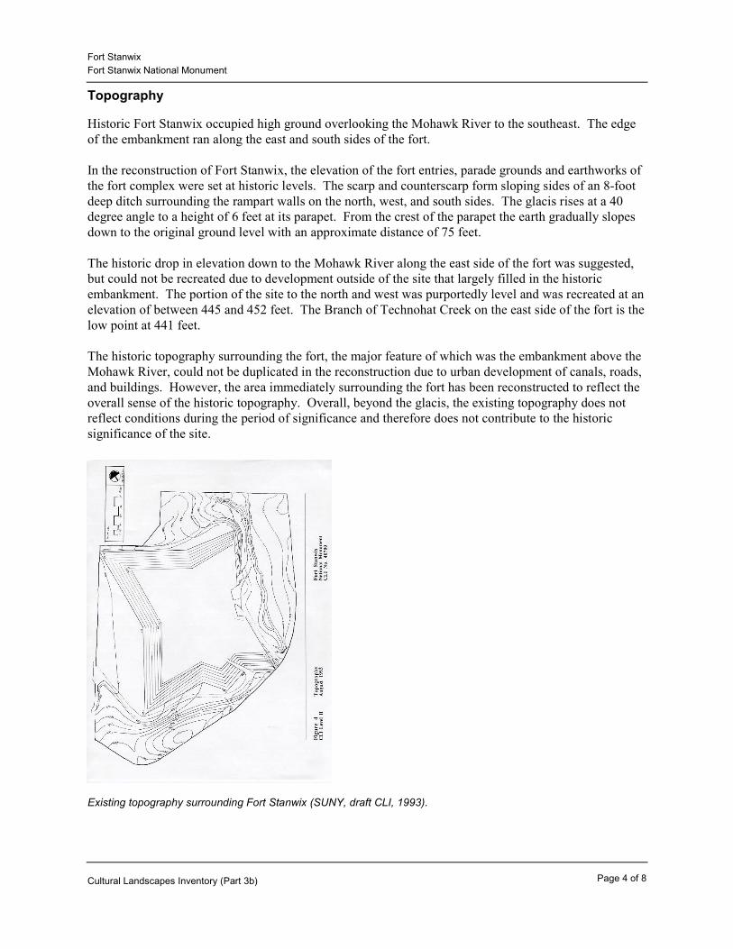
Historic Fort Stanwix occupied high ground overlooking the Mohawk River to the southeast. The edge of the embankment ran along the east and south sides of the fort.
In the reconstruction of Fort Stanwix, the elevation of the fort entries, parade grounds and earthworks of the fort complex were set at historic levels. The scarp and counterscarp form sloping sides of an 8-foot deep ditch surrounding the rampart walls on the north, west, and south sides. The glacis rises at a 40 degree angle to a height of 6 feet at its parapet. From the crest of the parapet the earth gradually slopes down to the original ground level with an approximate distance of 75 feet.
The historic drop in elevation down to the Mohawk River along the east side of the fort was suggested, but could not be recreated due to development outside of the site that largely filled in the historic embankment. The portion of the site to the north and west was purportedly level and was recreated at an elevation of between 445 and 452 feet. The Branch of Technohat Creek on the east side of the fort is the low point at 441 feet.
The historic topography surrounding the fort, the major feature of which was the embankment above the Mohawk River, could not be duplicated in the reconstruction due to urban development of canals, roads, and buildings. However, the area immediately surrounding the fort has been reconstructed to reflect the overall sense of the historic topography. Overall, beyond the glacis, the existing topography does not reflect conditions during the period of significance and therefore does not contribute to the historic significance of the site.
Existing topography surrounding Fort Stanwix (SUNY, draft CLI, 1993).
Page 4 of 8Cultural Landscapes Inventory (Part 3b)

Fort StanwixFort Stanwix National Monument
Vegetation
During the period of significance, 1758-1781, Fort Stanwix was sited in a clearing within a climax northern hardwood forest. Swamplands were likely to the east along the Mohawk River. There is no documentation of specific plant materials present during the period of significance and within the modern boundaries of the site.
Existing vegetation consists of screen plantings and mown lawn. Screening is limited to the west and north sides. Along North James Street, there are Red Maples (Acer rubrum) along the inside edge of the sidewalk. Around the maintenance garage are Amur Maple (Acer grinnala), White Pine (Pinus strobus), Arborvitae (Thuja occidentalis), and Rock Elm (Ulmus thomasii). East of the maintenance garage along Park Street is a screen of White Pine. The open area is mown lawn, except along the Branch of Technohat Creek where the grasses are left longer and include cattails.
All of the vegetation is modern in material and design. What vegetation does exist is formal in its layout and does not represent the historic appearance of the site. The existing vegetation does not contributes to the historic significance of the site.
Mown lawn areas at base of fort, 1998 (OCLP, FOST CLI File).
Page 5 of 8Cultural Landscapes Inventory (Part 3b)
Fort StanwixFort Stanwix National Monument
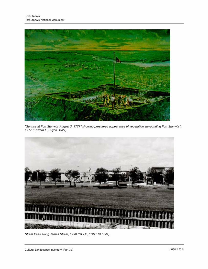
"Sunrise at Fort Stanwix, August 3, 1777" showing presumed appearance of vegetation surrounding Fort Stanwix in 1777 (Edward F. Buyck, 1927).
Street trees along James Street, 1998 (OCLP, FOST CLI File).
Page 6 of 8Cultural Landscapes Inventory (Part 3b)
Fort StanwixFort Stanwix National Monument
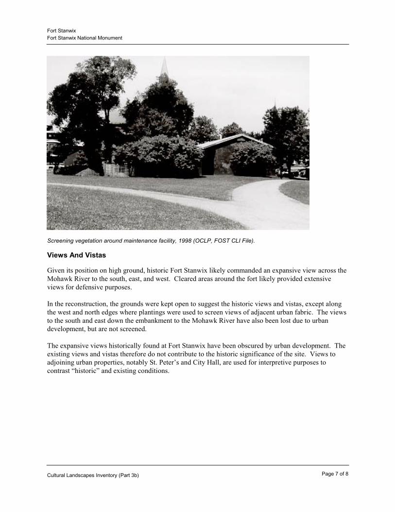
Screening vegetation around maintenance facility, 1998 (OCLP, FOST CLI File).
Views And Vistas
Given its position on high ground, historic Fort Stanwix likely commanded an expansive view across the Mohawk River to the south, east, and west. Cleared areas around the fort likely provided extensive views for defensive purposes.
In the reconstruction, the grounds were kept open to suggest the historic views and vistas, except along the west and north edges where plantings were used to screen views of adjacent urban fabric. The views to the south and east down the embankment to the Mohawk River have also been lost due to urban development, but are not screened.
The expansive views historically found at Fort Stanwix have been obscured by urban development. The existing views and vistas therefore do not contribute to the historic significance of the site. Views to adjoining urban properties, notably St. Peter’s and City Hall, are used for interpretive purposes to contrast “historic” and existing conditions.
Page 7 of 8Cultural Landscapes Inventory (Part 3b)

Fort StanwixFort Stanwix National Monument
View from fort to City Hall and St. Peter's Cathedral, 1998 (OCLP, FOST CLI File).
Page 8 of 8Cultural Landscapes Inventory (Part 3b)
Fort StanwixFort Stanwix National Monument
Management Unit:
Tract Numbers: 01-101
Size (acres): 15.52
Management Information
Descriptive And Geographic Information
Fort SchuylerHistoric Name(s):Fort Stanwix
Fort Stanwix National MonumentCurrent Name(s):
Oneida County, NYState and County:
Boundary UTMSource Zone NorthingEastingBoundary UTM(s): Type DatumUSGS Map 1:24,000
18 4784219462881Point NAD 83
National Register Information
Entered -- Inadequately Documented
The site of Fort Stanwix was declared a National Monument through an act of Congress in 1935 (49 Stat. 665), although no property was acquired at the time by the federal government. In 1962, the site of Fort Stanwix became a National Historic Landmark under the jurisdiction of the Historic Sites Act of 1935. In 1966, with the establishment of the National Historic Preservation Act, the site was listed on the newly-established National Register of Historic Places. The site was documented for the National Register in August, 1981 after the site had been cleared (early 1970s) and a partially reconstructed fort built (1976-78).
The existing National Register of Historic Places nomination form (NRHP, 12/28/1981) lists the resource as a "building" and the NRIS database notes contributing buildings as "1" (the reconstructed fort). However, the existing National Register nomination form clearly states that the reconstructed fort is not eligible. In addition, the existing form does not adequately address the existing landscape.
We recommend the existing nomination should be amended to address inconsistencies and consider the following issues: 1.) the resource should be listed as a "site" and not a building; 2.) the site should possibly be listed as significant under Criterion D (as an archeological site) rather than Criterion A; 3.) Criterion Consideration E should be removed from the listing. The reconstructed fort was determined ineligible by the New York SHPO (2/8/1996); 4.) the landscape surrounding the fort should be described in more detail and noted as being non-
National Register Documentation:
Explanatory Narrative:
GIS File Name:
GIS File Description:
Page 1 of 20Cultural Landscapes Inventory (Part 4)

Fort StanwixFort Stanwix National Monument
contributing to the historic significance of the site; and 5.) the period of significance should be explored further to potentially extend to 1790. The stated period of significance in the existing nomination is 1758-1781 and does not include the final treaties that took place there in 1784, 1788and 1790.
These changes to the National Register documentation will clarify what the contributing resourcesof this site are. However, these revisions are not meant to lessen the importance of Fort Stanwix (the reconstructed fort and its surrounding landscape) as an important cultural and ethnographic resource.
The data contained within this National Register Information section of this CLI is recommended as a means to include landscape information within the existing National Register listing. The particular information listed below is a response inclusive of the existing National Register nomination and what should be responses to include both the structures and the landscape.
Ineligible -- Managed As Cultural Resource
A letter addressing the issues mentioned above (National Register Documentation: Explanatory Narrative), was sent to the NY SHPO on December 18, 2000 by Gary Warshefski, Superintendent of Fort Stanwix National Monument, asking for concurrence on the findings of the CLI. In particular, our findings that the landscape resources of Fort Stanwix do not contribute to the site's historical significance (as already documented in the existing National Register form, 12/28/81). The exterior of appearance of the fort is based on historic documentation and uses a minimal degree of conjecture. No attempt was made to recreate the historic landscape. Although the landscape does not contribute to the National Register eligibility of the site, this does not lessen the value of the site as an important cultural resource.
A response was received from the NY SHPO dated January 24, 2001 signed by Christine Capella Peters, saying that based on their review the NY SHPO "concurs with the general CLI findings that extant landscape features do not contribute to the property's signficance due to age or high degree of alteration. We do note, however, that while the landscape's views and vistas have been altered and/or lost, th general open nature of the grounds is instrumental in conveying the significance of the site. We also concur with the CLI findings that areas outside the fort footprint may be archeologically sensitive."
1/24/2001
District
National Register Eligibility:
Explanatory Narrative:
Date of Eligibility Determination:
National Register Classification:
NRIS Information:NRIS Number: 66000057Primary Certification: Listed In The National RegisterPrimary Certification Date: 10/15/1966
Name In National Register: Fort Stanwix National Monument
Designated National Landmark11/23/1962
Other Certifications:Other Certification Date:
Page 2 of 20Cultural Landscapes Inventory (Part 4)

Fort StanwixFort Stanwix National Monument
Significance Level:
Contributing/Individual:
National
Individual
A -- Inventory Unit is associated with events that have made a significant contribution to the broad patterns of our history
Significance Criteria:
E -- A reconstructed building when accurately executed in a suitable environment and presented in a dignified manner as part of a restoration master plan, and when no other building or structure with the same association has survived
Criteria Considerations:
Period Of SignificanceTime Period: 1758 - 1781 AD
War in the North
Historic Context Theme: Shaping the Political LandscapeHistoric Context Subtheme: The American RevolutionHistoric Context Facet:
Time Period: 1768 AD
Early Military Landscapes (pre-1776)
Historic Context Theme: Shaping the Political LandscapeHistoric Context Subtheme: Early Military Landscapes (pre-1776)Historic Context Facet:
Area Of Significance:
Priority: 1MilitaryCategory:
Cultural Landscape Type and Use
Historic SiteCultural Landscape Type:
National Historic Landmark Information
Yes
11/23/1962
none
National Historic
Date Determined Landmark:
Landmark Theme:
Landmark Status:
World Heritage Site Information
NoWorld Heritage Site Status:
Page 3 of 20Cultural Landscapes Inventory (Part 4)
Fort StanwixFort Stanwix National Monument
Current and Historic Use/Function:Use/Function Category: DefenseUse/Function: FortificationDetailed Use/Function: Battery (Defense)Type Of Use/Function: Historic
Use/Function Category: EducationUse/Function: Interpretive LandscapeDetailed Use/Function: Interpretive LandscapeType Of Use/Function: Current
Use/Function Category: Recreation/CultureUse/Function: Monument (Marker, Plaque)Detailed Use/Function: Monument (Marker, Plaque)Type Of Use/Function: Current
Associated GroupsCayuga Nation of IndiansBoth Current And Historic
Name of Peoples:Type of Association:
Military ReenactorsCurrent
Name of Peoples:Type of Association:
Mohawk Council of AkwesasneBoth Current And Historic
Name of Peoples:Type of Association:
Mohawks of the Bay of QuinteBoth Current And Historic
Name of Peoples:Type of Association:
Oneida Indian nationBoth Current And Historic
Name of Peoples:Type of Association:
Oneida Nation of the ThamesBoth Current And Historic
Name of Peoples:Type of Association:
Oneida Tribe of Indians of WisconsinBoth Current And Historic
Name of Peoples:Type of Association:
Onondaga Indian NationBoth Current And Historic
Name of Peoples:Type of Association:
Ethnographic Information
No Survey ConductedEthnographic Survey Conducted:
Page 4 of 20Cultural Landscapes Inventory (Part 4)
Fort StanwixFort Stanwix National Monument
Fort Stanwix has extensive ethnographic significance. Some of the ethnographic connections havebeen explored while others require more research. The groups associated with this significance range from Native Americans to European settlers to military reenactors. Some of these groups are identified in the above list.
A draft narrative, "Ethnographic Resources at Fort Stanwix: Existing Conditions," was recently prepared by Rebecca Joseph, Northeast Regional Anthropologist. The narrative was drafted in 1999 and is not yet finalized. Its purpose is to inform the General Management Plan currently underway. It identifies several ethnographic associations between various peoples and the park and summarizes some of the current ethnographic issues at the park.
In addition, a 1998 report entitled: "A Place of Great Sadness: Mohawk Valley Battlefield Ethnography" was prepared for the NPS by SJS Archaeological Services, Inc. This report was designed to provide the NPS with information documenting the relationship between contemporary Iroquois groups and historic sites within the Mohawk Valley, including Fort Stanwix. The report summarizes the interests and concerns of contemporary Iroquois peoples and makes recommendations on management and planning issues, which incorporate their concerns. The report does not investigate non-Iroquois ethnography, but does discuss the need for additional studies.
The primary ethnographic issue identified in the 1998 report concerns the violation of the Great Law that occurred during the Siege of Fort Stanwix and the related Battle of Oriskany in 1777. In this battle, the Iroquois took up arms against one another, in violation of the Great Law, being persuaded to fight on both the British and American sides. While non-Indian historians have emphasized the importance of the Battle of Oriskany and the Siege of Fort Stanwix as a turning point in the Revolution, for Iroquois peoples its significance lies in the horror of civil war and the violation of religious principles. The Iroquois diaspora is also linked to Fort Stanwix through the 1784 Treaty of Fort Stanwix, by which the Iroquois who sided with the British surrendered claims
Significance Description:
Seneca Nation of IndiansBoth Current And Historic
Name of Peoples:Type of Association:
Seneca-Cayuga Tribe of OklahomaBoth Current And Historic
Name of Peoples:Type of Association:
Six Nations CouncilBoth Current And Historic
Name of Peoples:Type of Association:
St. Regis Mohawk TribeBoth Current And Historic
Name of Peoples:Type of Association:
Tonawanda Band of SenecaBoth Current And Historic
Name of Peoples:Type of Association:
Tuscarora NationBoth Current And Historic
Name of Peoples:Type of Association:
Wahta MohawksBoth Current And Historic
Name of Peoples:Type of Association:
Page 5 of 20Cultural Landscapes Inventory (Part 4)

Fort StanwixFort Stanwix National Monument
to their old lands in return for insignificant presents. Phase two of this study is currently underway and will concentrate on non-Iroquois tribes.
In addition, the NPS has completed two studies regarding military reenactors, for which Fort Stanwix provides an appropriate setting for the reenactor performances. While the studies do not concentrate on Fort Stanwix, the fort is a relevant site for both studies. They include "Revolutionary War Reenactor Activities at National Parks" (Stanton, Cathy; Boston 1998) and Reenactors in the Parks: A Study of External Revolutionary War Reenactment Activity at NationalParks (Stanton, Cathy; Boston 1999). Both studies are unpublished reports to the 225th Anniversary of the American Revolution Planning Committee.
Adjacent Lands Information
YesDo Adjacent Lands Contribute?
The lands directly adjacent to the park cannot be considered as contributing to the site's historical significance. All of the immediately surrounding land has experienced urban development and possesses a very different character than it did during the fort's existence. However, several areas in close proximity to the park should be considered as related areas that add to the interpretive story of Fort Stanwix. These areas include the Lower Landing site, Muck Road Swamp, Wood Creek, the Tomb of the Unknown Revolutionary War Soldier, and the several features or sites within the Gansevoort Historic District. In addition, the Oriskany Battlefield, six miles southeast, is closely tied to the history of Fort Stanwix.
Adjacent Lands Description:
Fort Stanwix within Rome, NY (FOST Park Brochure).
Page 6 of 20Cultural Landscapes Inventory (Part 4)

Fort StanwixFort Stanwix National Monument
General Management Information
Management Category: Should Be Preserved And Maintained
Management Category Date: 2/24/1995
The "Management Category" for Fort Stanwix, that it "should be preserved and maintained" refersto the parks as a whole, both the reconstructed fort and the surrounding landscape. This determination is based on the park's mission to manage the entire site as a cultural resource, interpreting the role of Fort Stanwix in the American Revolution. The reconstructed fort, and the open character of the surrounding landscape, should be preserved and maintained as valuable resources.
This management category concentrates on the landscape and includes the fort structure. This determination is consistent with the individual management category assigned to the fort structure itself within the NPS List of Classified Structures (LCS 5/21/92).
Explanatory Narrative:
Condition Assessment And ImpactsThe criteria for determining the condition of landscapes is consistent with the ResourceManagement Plan Guideline definitions (1994) and is decided with the concurrence of parkmanagement. Cultural landscape conditions are defined as follows:
Good: indicates the landscape shows no clear evidence of major negative disturbance anddeterioration by natural and/or human forces. The landscape's cultural and natural values are aswell preserved as can be expected under the given environmental conditions. No immediatecorrective action is required to maintain its current condition.
Fair: indicates the landscape shows clear evidence of minor disturbances and deterioration bynatural and/or human forces, and some degree of corrective action is needed within 3-5 yearsto prevent further harm to its cultural and/or natural values. If left to continue without theappropriate corrective action, the cumulative effect of the deterioration of many of thecharacter-defining elements will cause the landscape to degrade to a poor condition.
Poor: indicates the landscape shows clear evidence of major disturbance and rapiddeterioration by natural and/or human forces. Immediate corrective action is required to protectand preserve the remaining historical and natural values.
Undetermined: Not enough information available to make an evaluation.
Condition Assessment: Good
Date Recorded: 09/30/1998
Park Management Concurrence: Yes
Assessment Date: 09/30/1998
Concurrence Date: 12/12/2000
Page 7 of 20Cultural Landscapes Inventory (Part 4)
Fort StanwixFort Stanwix National Monument
Impact:
Internal/External: ExternalDescription:The landscape integrity of the larger site has been lost due to urban development.
Type of Impact: Impending Development
Level Of Impact Severity:
Stabilization Measures:
Page 8 of 20Cultural Landscapes Inventory (Part 4)

Fort StanwixFort Stanwix National Monument
Agreements, Legal Interest, and AccessNPS Legal Interest: Fee Simple
Explanatory Narrative:
Other RestrictionsPublic Access:
Unrestricted
Page 9 of 20Cultural Landscapes Inventory (Part 4)

Fort StanwixFort Stanwix National Monument
Treatment
Approved Treatment: Undetermined
Approved Treatment Document:
Document Date:
Explanatory Narrative:Completion of a General Management Plan is currently underway for Fort Stanwix National Monument (planned completion in 1999). Treatment cannot be determined before the GMP is complete.
Approved Treatment Completed:
Approved Treatment Cost
Landscape Approved Treatment Cost:
$0
Cost Date:
Level of Estimate:
Cost Estimator:
LCS Structure Approved$0
Explanatory Description:
Treatment Cost:
Stabilization Costs
Landscape Stabilization Costs: $458,035
Cost Date: May 14, 2004
Level Of Estimate: B - Preliminary Plans/HSR-CLR
Cost Estimator: Park
LCS Structure Stabilization Cost: $0
Explanatory Description: The total unfunded projects for PMIS is $458,035. Thefollowing PMIS projects apply:
PMIS # 17151 Plant trees along park boundary and mitigate hazards
PMIS # 109027 Resurface parade ground
Page 10 of 20Cultural Landscapes Inventory (Part 4)

Fort StanwixFort Stanwix National Monument
PMIS # 11299 Resurface main trails
PMIS # 109024 Rehabilitate/ replace existing sidewalks
PMIS # 98864 Improve visitor signage
Page 11 of 20Cultural Landscapes Inventory (Part 4)
Fort StanwixFort Stanwix National Monument
Documentation:Administrative History
Year Of Document: 1985
Adequate Documentation: No
The report is an informal narrative written by previous superintendent William Jackson covering 1923 to 1976. The report is not comprehensive and the park is currently pursuing the initiation of a formal Administrative History.
"Administrative History Report"Amplifying Details:
Explanatory Narrative:
Document:
OtherYear Of Document: 1967
Adequate Documentation: No
The Master Plan was completed prior to fort reconstruction and was an adequate park master plan at the time. However, it is now outdated and will be replaced by a new General Management Plan slated for completion in 1999.
Fort Stanwix NM Master PlanAmplifying Details:
Explanatory Narrative:
Document:
OtherYear Of Document: 1973
Adequate Documentation: Yes
Written by Orville W. Carroll, the report was completed in preparation for the fort reconstruction, compiling available information necessary to reconstruct the fort with the most accuracy, admitting that some conjecture was present.
Historic Structure Report: Architectural Data SectionAmplifying Details:
Explanatory Narrative:
Document:
OtherYear Of Document: 1976
Adequate Documentation: Yes
Combines the information within the Historic Structures Report, the archeology overview ("Casements and Cannonballs") and provides administrative data used for the reconstruction of the fort.
History, Historic Furnishing, and Historic Structure Report
Amplifying Details:
Explanatory Narrative:
Document:
GoodDocumentation Assessment:
Documentation Assessment and Checklist
Page 12 of 20Cultural Landscapes Inventory (Part 4)

Fort StanwixFort Stanwix National Monument
OtherYear Of Document: 1999
Adequate Documentation: YesArcheological Overview and AssessmentAmplifying Details:
Document:
Page 13 of 20Cultural Landscapes Inventory (Part 4)

Fort StanwixFort Stanwix National Monument
Bibliography
Appendix
Citations:
"Casemates and Cannonballs" Archeological Investigations at Fort Stanwix NM
000438Both Graphic And NarrativeCultural Resources Management Studies Collection, Charlestown Navy Yard, Charlestown, MA
CRBIB
1975
Hanson, Lee; Hsu, Dick PingCitation Author:Citation Title:
Year of Publication:
Source Name:Citation Number:Citation Type:Citation Location:
Fort Stanwix: History, Historic Furnishing, and Historic Structure Reports
010354Both Graphic And NarrativeCultural Resources Management Studies Collection, Charlestown Navy Yard, Charlestown, MA
CRBIB
1976
Luzader, John F; Torres, Louis; Carroll, Orville WCitation Author:Citation Title:
Year of Publication:
Source Name:Citation Number:Citation Type:Citation Location:
Historic Structure Report, Architectural Data Section, Fort Stanwix National Monument
000443Both Graphic And NarrativeCultural Resources Management Studies Collection, Charlestown Navy Yard, Charlestown, MA
CRBIB
1973
Carroll, Orville WCitation Author:Citation Title:
Year of Publication:
Source Name:Citation Number:Citation Type:Citation Location:
Page 14 of 20Cultural Landscapes Inventory (Part 4)

Fort StanwixFort Stanwix National Monument
History of a 19th Century Urban Complex on the Site of Fort Stanwix
000436Both Graphic And NarrativeCultural Resources Management Studies Collection, Charlestown Navy Yard, Charlestown, MA
CRBIB
1972
Waite, Diana SteckCitation Author:Citation Title:
Year of Publication:
Source Name:Citation Number:Citation Type:Citation Location:
Master Plan, Fort Stanwix National Monument
010353Both Graphic And NarrativeCultural Resources Management Studies Collection, Charlestown Navy Yard, Charlestown, MA
CRBIB
1967
StaffCitation Author:Citation Title:Year of Publication:
Source Name:Citation Number:Citation Type:Citation Location:
Fort Stanwix National Monument Administrative History Report 1923-1976.
NarrativeFOST Park Library
Administrative History Report
1985
Jackson, William N.Citation Author:Citation Title:
Year of Publication:
Source Name:
Citation Type:Citation Location:
Brochure, North Country National Scenic Trail
Both Graphic And NarrativeFOST Park Library
Brochure
NPSCitation Author:Citation Title:
Source Name:
Citation Type:Citation Location:
Page 15 of 20Cultural Landscapes Inventory (Part 4)

Fort StanwixFort Stanwix National Monument
Cultural Landscape Inventory, Fort Stanwix National Monument, Level 1 (draft)
Both Graphic And NarrativeOCLP CLI Library
Cultural Landscapes Inventory
1993
Curry, George W., Project Director.Citation Author:Citation Title:
Year of Publication:
Source Name:
Citation Type:Citation Location:
Comprehensive Design Report, Fort Stanwix National Monument
NarrativeFOST Park Library
Design Report
1973
Duryea and Wilhelmi et al.Citation Author:Citation Title:
Year of Publication:
Source Name:
Citation Type:Citation Location:
A Place of Great Sadness/Mohawk Valley Battlefield Ethnography
NarrativeUnpublished paper prepared for NPS, FOST Park Library
Ethnography Study
1998
SJS Archaeological Services, Inc.Citation Author:Citation Title:
Year of Publication:
Source Name:
Citation Type:Citation Location:
Rome, New York: A Short History
Rome Historical Society, Rome NY
History
1983
Scott, John Albert.Citation Author:Citation Title:Year of Publication:
Source Name:
Citation Location:
Page 16 of 20Cultural Landscapes Inventory (Part 4)

Fort StanwixFort Stanwix National Monument
The History of Oneida County
FOST Park Library
History Report
1977
Jackson, Harry et al.Citation Author:Citation Title:Year of Publication:
Source Name:
Citation Location:
Land Use History For the Oriskany Battlefield
Prepared for the NPS, FOST Park Library
Land Use History
1998
ICON Architecture and Saratoga AssociatesCitation Author:Citation Title:Year of Publication:
Source Name:
Citation Location:
Landmarks of Liberty/Rome, New York
FOST Park Library
Landmarks of Liberty
1976
James, Ruby G., AdvisorCitation Author:Citation Title:Year of Publication:
Source Name:
Citation Location:
Master Plan, Rome Central Business District
FOST Park Library
Master Plan
1995
EDAW, Inc.Citation Author:Citation Title:Year of Publication:
Source Name:
Citation Location:
National Register of Historic Places Inventory, Nomination Form: Fort Stanwix NM
Both Graphic And NarrativeFOST Park Library
National Register of Historic Places
1981
Pitcaithley, DwightCitation Author:Citation Title:
Year of Publication:
Source Name:
Citation Type:Citation Location:
Page 17 of 20Cultural Landscapes Inventory (Part 4)
Fort StanwixFort Stanwix National Monument
List of Classified Structures, Fort Stanwix NM
Both Graphic And NarrativeLCS Library, Northeast Cultural Resources Center, Lowell, MA
NPS List of Classified Structures
1995Citation Title:Year of Publication:
Source Name:
Citation Type:Citation Location:
Park Brochure, Fort Stanwix National Monument
Both Graphic And NarrativeFOST Park Library
Park Brochure
1998
NPSCitation Author:Citation Title:Year of Publication:
Source Name:
Citation Type:Citation Location:
Park Brochure, Fort Stanwix NM, Walking Tour
Both Graphic And NarrativeFOST Park Library
Park Brochure
Citation Title:
Source Name:
Citation Type:Citation Location:
Park Brochure, Oriskany Battlefield State Historic Site.
Both Graphic And NarrativeFOST Park Library
Park Brochure
1998
New York State Office of Parks, Recreation and Historic Preservation
Citation Author:
Citation Title:Year of Publication:
Source Name:
Citation Type:Citation Location:
Page 18 of 20Cultural Landscapes Inventory (Part 4)
Fort StanwixFort Stanwix National Monument
Fort Stanwix National Monument Statement for Management
FOST Park Library
Statement for Management
1992
NPSCitation Author:Citation Title:
Year of Publication:
Source Name:
Citation Location:
Fort Stanwix NM Enabling Legislation
No. 291, 74th CongressNarrativeFOST Park Library
United States Congress
1935Citation Title:Year of Publication:
Source Name:Citation Number:Citation Type:Citation Location:
Archeological Overview and Assessment of the Fort Stanwix National Monument, Rome, NY
FOST Park Library
University of Massachusetts Archaeological Services
1999
Johnson, Eric and Christopher DontaCitation Author:Citation Title:
Year of Publication:
Source Name:
Citation Location:
Page 19 of 20Cultural Landscapes Inventory (Part 4)

Fort StanwixFort Stanwix National Monument
Supplemental Information
Page 20 of 20Cultural Landscapes Inventory (Part 4)
Related Documents