RECONNAISSANCE SURVEY AND CONTEXT STATEMENT FOR A PORTION OF THE NORTHSIDE Prepared For: City of Riverside Planning Department Riverside County, California Prepared By: Jennifer Mermilliod, M.A., Principal JM Research and Consulting 5110 Magnolia Avenue Riverside, CA 92506 September 2005

Welcome message from author
This document is posted to help you gain knowledge. Please leave a comment to let me know what you think about it! Share it to your friends and learn new things together.
Transcript
RECONNAISSANCE SURVEYAND CONTEXT STATEMENT FOR A PORTION OF THE
NORTHSIDE
Prepared For:
City of Riverside Planning Department Riverside County, California
Prepared By:
Jennifer Mermilliod, M.A., Principal JM Research and Consulting
5110 Magnolia Avenue Riverside, CA 92506
September 2005
The activity which is the subject of this report has been financed in part with Federal funds from the National Park Service, Department of the Interior, through the California Office of Historic Preservation. However, the contents and opinions do not necessarily reflect the views or policies of the Department of the Interior or the California Office of Historic Preservation, nor does mention of trade names or commercial products constitute endorsement or recommendation by the Department of the Interior or the California Office of Historic Preservation.
Regulations of the U.S. Department of the Interior strictly prohibit unlawful discrimination in departmental Federally assisted programs on the basis of race, color, sex, age, disability, or national origin. Any person who believes he or she has been discriminated against in any program, activity, or facility operated by a recipient of Federal assistance should write to:
Director, Equal Opportunity Program U.S. Department of the Interior National Park Service P.O. Box 37127 Washington, D.C. 20013-7127
EXECUTIVE SUMMARY
From October 2004 to September 2005, JM Research and Consulting (JMRC) performed areconnaissance-level survey of a portion of the Northside in the City of Riverside, Riverside County, California, and developed a historic context statement, which constituted Phase I ofa larger project to intensively survey the area. The survey area is partially located within the Downtown Redevelopment Project Area and is bounded by the south side of Strong Street to the north, the north side of First Street to the south, the east side of Randall Drive/Fairmount Boulevard to the west, and SR-91/I-215 to the east, encompassing approximately 425 acres of mixed use land. The survey area is located within Sections 13, 14, 23, and 24, T2S, R5W, S.B.B.M.
The survey was initiated by, and completed in cooperation with, the City of Riverside under a Certified Local Government grant administered by the State Office of Historic Preservation. The purpose of the project was to identify, document, and evaluate, at the reconnaissance level, potential historic districts and individually significant properties foreligibility for listing in the National Register of Historic Places (NRHP or NR), the CaliforniaRegister of Historical Resources (CRHR or CR), and under the City of Riverside’s Cultural Resources Ordinance, Title 20 of the Riverside Municipal Code (Ord. 6263 (1996), as amended). Some individual properties or groups of properties within the survey area have been previously surveyed. The City of Riverside’s first comprehensive survey was completed from 1977 to 1979. This reconnaissance-level survey included minimal recordation of properties, including architectural style, estimated or factual date of construction, and related features. Two freeway improvement projects have recently prompted intensive-level Section 106 surveys within portions of the study area. A reportentitled “Historic Architectural Survey Report (HASR) for the Widening of State Route 60 (SR-60) and Interstate Route 215 (I-215) between Valley Way and University Avenue” by David Bricker was included within the project’s corresponding Historic Property Survey Report (HPSR) dated February 1995 by Stephen Hammond, and a series of revised and supplemental HPSR-HASR documents were prepared from 1993 to 2000 for a separate project to improve I-215/SR-91/SR-60. The preparation of these documents involved a number of consultants, including Myra L. Frank & Associates, Inc.; Historical, Environmental, Archaeological, Research, Team (HEART); Parsons, Brinckerhoff, Quade, & Douglas, Inc.; and David Bricker and Christie Hammond, then Architectural Historians for California Department of Transportation (Caltrans), District 8. The surveyed properties included within these previous Section 106 studies represent about 11% of the properties within the survey area.
The surveyed portion of the Northside represents several types of property use and avariety of periods of development from the late 19th century to the modern period. City staff estimated that of the approximately 800 properties within the project area, some would be individually significant, while many would be significant within the context of historic districts. In order to accomplish the goals and objectives of the project, and in accordance with the Scope of Work provided by the City of Riverside, JMRC conducted a systematic field survey of the project area to identify the boundaries of potential historic districts and individual historic resources. Site-specific research, including building permits and
i
Assessor’s records; research on the history and development of the Northside; and theconduction of three formal oral history interviews with long-time Northside residents assisted in the identification of significant properties and areas within the survey boundaries and aided the development of the historic context statement, which provided a framework within which to identify potentially eligible districts and properties and to apply the criteria for evaluation.
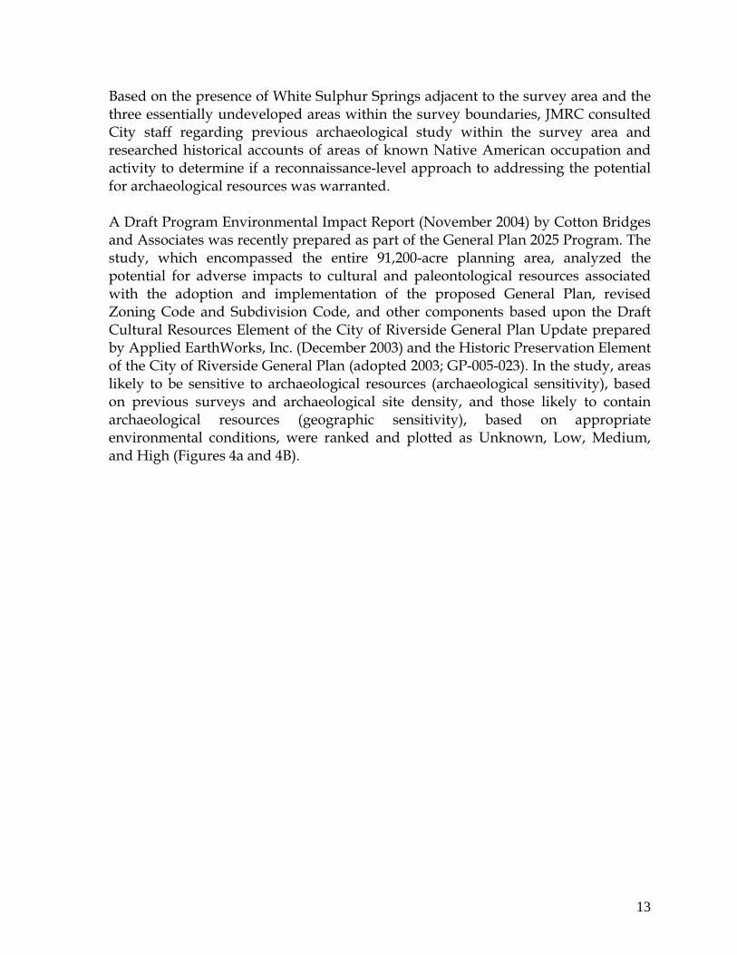
Though the proposed Scope of Work did not call for an archaeological component, consideration of potential archaeological resources was addressed early in the survey process due to the proximity of White Sulphur Springs, a natural hot springs known for its early Native American occupation, to the survey area. In addition, North Hill (or Fairmount Hill), the area northwest of the SR-60/I-215 Interchange, and the former Southern Pacific Company railroad right-of-way land was identified as areas of potential archaeological sensitivity within the survey area. A Draft Program Environmental Impact Report(November 2004) by Cotton Bridges and Associates, which constitutes a reconnaissance-level examination of the survey area, was recently prepared as part of the General Plan 2025 Program. The study, which encompassed the entire 91,200-acre planning area, analyzed the potential for adverse impacts to cultural and paleontological resources associated with the adoption and implementation of the proposed General Plan, revised Zoning Code andSubdivision Code, and other components based upon the Draft Cultural Resources Element of the City of Riverside General Plan Update prepared by Applied EarthWorks, Inc. (December 2003) and the Historic Preservation Element of the City of Riverside General Plan (adopted 2003; GP-005-023). The study ranked archaeological and geographical sensitivity of the area within the Northside survey boundaries as “Unknown.” Recommendations for future archaeological study within the survey area should follow those prescribed by the Draft Program Environmental Impact Report, which calls for a comprehensive archaeological survey program and the project-specific survey of areas slated for development or other ground disturbing activities.
In completing the reconnaissance survey, JMRC found that 952 properties were included within the survey boundary, of which, approximately 11% had been previously intensively surveyed and 63 had been previously designated. Of the 952 properties, 128 were constructed, or appeared to be constructed, after 1959 and 143 appear too altered. 156 properties appear eligible for inclusion as contributors within three (3) potential districts. In addition to the three historic districts, 11 properties appear individually eligible for designation, and 16 properties are recommended for further study. In addition, the theme of Immigration and Ethnic Diversity is recommended for further study as association withethnic groups, particularly Northsiders of Hispanic descent, could not be fully developed (Appendices IV through IX).
A portion of the locally designated and NR-eligible Heritage Square Historic District exists within the southeast boundary of the survey area and represents a large variety of residential architectural styles popular in southern California from the 1880s to the 1920s, including excellent examples of the Victorian, Revival, and Arts and Crafts periods. Debate over the boundaries of this district has ensued within the process of previous surveys byAegis in 1992, during the Section 106 survey process for the Caltrans freeway improvement projects begun in the 1990s, and by Myra L. Frank & Associates, Inc. in 2003. The district is
ii
currently bounded by SR-91 to the east, the north side of Fifth Street to the south, the eastside of Orange Street from Fifth to Third Streets and the west side of Orange Street fromThird to First Streets to the west, and the north side of First Street to the north, where the district overlaps slightly with the current survey boundaries.
A cohesive group of early 20th century single-family residences was identified as an extension of, and for inclusion in, the Mile Square Northwest, a previously determined CRHR eligible historic district adjacent to the southern survey boundary. This area of Riverside was partially surveyed during the first 1977-79 City survey, by Aegis in 1992, andby Myra L. Frank & Associates, Inc. in 2003. The Mile Square Northwest Historic District is located in the northwest quadrant of Riverside’s original Mile Square (1870). The district iscurrently bounded roughly by the south side of First Street to the north, the south side ofSixth Street to the south, the west side of Market Street to the east, and Redwood Drive to the west. During Riverside’s earliest period of settlement, much of the Mile Square was developed as agricultural property, and citrus groves blanketed much of the landscape. Large, predominately two-story grove residences first dotted the Mile Square but soon gave way to smaller cottages when speculators re-subdivided the land during and immediatelyafter the 1880s land boom. Another, population-driven boom just after the turn of thecentury increased the need for housing in proximity to the downtown core that was growing in size and concentration, and the large agricultural properties were subdivided to accommodate smaller single-family residences and multi-family construction. While later phases of construction filled the vacant lots of the Northwest quarter of the Mile Square, the majority of residences were built during the early twentieth century and were Craftsman Bungalow in style with later, period revival styles mixed in sparingly. The streetscape tookon its current appearance at this time when character-defining features such as street trees, streetlights, sidewalks and common setbacks were developed, which contribute to the district. Properties that appear eligible as additional Contributors to the eligible Mile SquareNorthwest Historic District were assigned a CHR Status Code of 3CD - appears eligible for CRas a contributor to a CR eligible district through a survey evaluation. Properties determined to be additional Non-Contributors to the previously determined eligible historic district were assigned a CHR Status Code of 6L – determined ineligible for local listing or designation through local government review process; may warrant special consideration in local planning.
One previously designated local neighborhood conservation area (NCA) within the survey boundaries, St. Andrews Terraces NCA, was identified for expansion and elevation to historic district status. The expanded, eligible district represents the southern half of the St.Andrews Terraces tract (1910) and adjacent subdivisions north of First Street, in the southeast quadrant of the survey area. The eligible district now includes 50 properties (38 contributors and 12 non-contributors) on Hewitt, Lemon, Lime, and Mulberry Streets and is bounded generally by the limits of the Heritage Square Historic District to the south, the former Southern Pacific Company railroad right-of-way to the north, Mulberry Street to the east, and the west side of Lemon Street to the west. In general, the expanded district possesses a lower collective degree of architectural distinction than the original conservationarea but, overall, is distinguished as a geographically cohesive group of residences that highlight the form, detail and materials of the Arts and Crafts Movement, during which the properties were constructed. Accordingly, St. Andrews Terraces Craftsman District appears eligible for local designation under Title 20 of the City of Riverside Municipal Code (Ord.
iii
6263 (1996), as amended) as it embodies distinctive characteristics of a style or period (Criterion C) and conveys a sense of historic and architectural cohesiveness through its design and setting (Criterion H). The potential St. Andrews Terraces Craftsman District was assigned a CHR Status Code of 5S2 - individual property that is eligible for local listing ordesignation. Properties determined to be potential Contributors to the St. Andrews TerracesCraftsman District were assigned a CHR Status Code of 5D2 – contributor to a district that is eligible for local listing or designation. Properties determined to be Non-Contributors to the potential historic district were assigned a CHR Status Code of 6L – determined ineligible for local listing or designation through local government review process; may warrant special consideration in local planning.
One potential historic district, the North Hill Historic District, was identified during thesurvey process and represents the cohesive development of a small, exclusive area overlooking Fairmount Park with a concentration of large-scale, high style single-family residences in a mix of period revival style architecture of the eclectic 1920s and 1930s: TudorRevival, Spanish Colonial Revival, Monterey Revival, French Eclectic, Pueblo Revival, and Minimal Traditional styles. Most residences are architect-designed, and unique, contributing light standards extant on Randall Street, the west end of Houghton Avenue, and Pine Street, were likely specifically selected for this development as they appear no where else in the survey area or in the City. Accordingly, the district appears eligible for listing in the NRHP and CRHR as it embodies the distinctive characteristics of a period and represents the works of several master architects (Criteria C and 3, respectively). The NorthHill Historic District also appears eligible for local designation under Title 20 of the City of Riverside Municipal Code (Ord. 6263 (1996), as amended) as it embodies distinctive characteristics of a style or period (Criterion C), represents the work of notable architects(Criterion D), and conveys a sense of historic and architectural cohesiveness through itsdesign and setting (Criterion H). The potential North Hill Historic District was assigned a CHR Status Code of 3S – appears eligible for NR as an individual property through survey evaluation. Properties determined to be Contributors to the potential North Hill Historic District were assigned a California Historical Resources (CHR) Status Code of 3D – appearseligible for NR as a contributor to a NR eligible district through survey evaluation. Properties determined to be Non-Contributors to the potential historic district were assigned a CHR Status Code of 6L – determined ineligible for local listing or designation through local government review process; may warrant special consideration in local planning.
Under the Scope of Work, up to 100 properties within the project area that may be individually significant were to be identified and documented by JMRC on State ofCalifornia Historic Resources Inventory DPR 523A forms (Primary Record; Appendix VI). During the early phases of the project, JMRC identified 34 properties that appeared to merit formal evaluation. Individual and historic research conducted throughout the survey helped guide the evaluation of these properties according to local, state, and national designation criteria. Of these 34 properties, eleven (11) were recommended for further research during Phase II, 12 were determined ineligible for designation due to alterations orordinary design, and 11 were determined individually significant and eligible for designation. Of the 11 properties that were determined eligible for individual designation, one (1) property (3837 Ridge Road) was determined eligible for listing in the NRHP and the CRHR and for local designation as a City Landmark, one (1) property was determined
iv
eligible for local designation as a City Landmark (3720 Stoddard Avenue), and nine (9)properties were determined eligible for local designation as City Structures of Merit (3668 Poplar Street, 3820 Ridge Road, 3864 Ridge Road, 3380 Russell Street, 3787 Shamrock Avenue, 3307 Spruce Street, 3320 Spruce Street, 3676 Strong Street, and 2357 Wilshire Street). NRHP/CRHR-eligible 3837 Ridge Road was assigned a CHR Status Code of 3S –appears eligible for NR as an individual property through survey evaluation, and all other individually eligible properties were assigned a status code of 5S2 – individual property that is eligible for local listing or designation. Individual properties that were neither identified for potential individual significance nor determined to be too altered were assigned a CHRStatus Code of 6L – determined ineligible for local listing or designation through local government review process; may warrant special consideration in local planning. Individual properties that were identified as potentially individually significant but formally determined ineligible for individual designation, properties that were considered ordinary examples compared to better examples within the survey area, and properties that were identified as too altered, were assigned a CHR Status Code of 6Z – found ineligible for NR, CR or Local designationthrough survey evaluation. Individual properties that were recommended for further research in Phase II and properties constructed after 1959 were assigned a CHR Status Code of 7R –identified in Reconnaissance Level Survey: not evaluated. Properties that were constructed after1959 or were too altered but were non-contributors to proposed districts were assigned a CHR Status Code of 6L – determined ineligible for local listing or designation through localgovernment review process; may warrant special consideration in local planning.
In accordance with local and state historic preservation guidelines, a lesser threshold for integrity of design was applied in determining eligibility at the local and state level. In general, contributors to the Mile Square Northwest and St. Andrews Terraces Craftsman Historic Districts and properties determined individually significant at the local or state level possess a lower collective degree of architectural distinction than merits listing in theNRHP and/or are found in comparable quantity and quality within contemporaneoushistoric neighborhoods or areas of the City of Riverside. Alterations to contributors of the Mile Square Northwest and St. Andrews Terraces Craftsman Historic Districts that were reversible were deemed acceptable.
All properties previously assigned a CHR Status Code of 5 or higher or assigned a CHR Status Code of 3S, 3D, 3CD, 5S2, and 5D2 as part of this survey are considered to be historical resources under the current provisions of the California Environmental Quality Act (CEQA) and Title 20 of the City of Riverside Municipal Code (Ord. 6263 (1996), asamended). Those properties assigned a CHR Status Code of 6L, 6Z, or 7R are not historicresources under CEQA but may require individual cultural resources consideration in future planning or collective consideration, in the case of potential district non-contributors, where impacts to overall integrity and cumulative effects are evaluated.
v
TABLE OF CONTENTS
EXECUTIVE SUMMARY i
I. INTRODUCTION 1II. PROFESSIONAL QUALIFICATIONS 2 III. OBJECTIVES 2 IV. AREA SURVEYED 3 V. METHODOLOGY 6 VI. RESEARCH DESIGN 6
SITE SPECIFIC RESEARCH ORAL HISTORIESCOMMUNITY PARTICIPATIONARCHAEOLOGICAL RESEARCHHISTORICAL RESEARCHFIELD SURVEY
VII. HISTORIC CONTEXT STATEMENT 19 INTRODUCTION AND HISTORICAL OVERVIEW EARLY SETTLEMENT ON THE NORTHSIDE, 1870-1900 EARLY DEVELOPMENT, 1901-1918 SUBURBAN DEVELOPMENT, 1919-1941 POST-WWII DEVELOPMENT, 1946-late 1950s
VIII. SUMMARY OF SURVEY RESULTS 127 PREVIOUSLY IDENTIFIED HISTORIC RESOURCES
SURVEY FINDINGS RESOURCE EVALUATION
CRITERIA FOR SIGNIFICANCE ASSIGNMENT OF STATUS CODES
INCORPORATION OF FINDINGS INTO THE PLANNING PROCESSIX. REFERENCES 154
APPENDICESAppendix I Title 20 of the Riverside Municipal Code (Ord. 6263 (1996), as amended) Appendix II Northside Survey Oral Histories - Questions and Sessions Appendix III Northside Survey Area Tracts Appendix IV Properties within the Northside Survey Area (Table & Photos) Appendix V Potential Historic Districts within the Northside Survey Area (Table) Appendix VI Individually Significant Properties within the Northside Survey Area
(Table & DPR forms (523A Primary Record) Appendix VII Properties within the Northside Survey Area that are Recommended for
Further Study (Table) Appendix VIII Too Altered or ordinary, ineligible properties within the Northside
Survey Area assigned a CHR Status Code of 6Z (Table) Appendix IX Properties Constructed after 1959 within the Northside Survey Area
(Table)Appendix X List of Street Trees in the Northside Survey Area
FIGURESFigure 1. Location Map Figure 2. Areas of Development within the Northside Figure 3a Area of Potential Archaeological Sensitivity –
Aerial View of Athletic Park Figure 3b Area of Potential Archaeological Sensitivity –
Aerial View of area northwest of SR-60/I-215 Interchange Figure 3c Area of Potential Archaeological Sensitivity –
Aerial View of former Southern Pacific Company Railroad ROW Figure 4a Archaeological Sensitivity Map Figure 4b Geographic Site Sensitivity Map Figure 5. Table of Streets Surveyed Figure 6. Riverside Neighborhoods Map Figure 7. Fairmount Heights Figure 8. File’s Island Figure 9. Southeast Quadrant Figure 10. St. Andrews Terraces NCA Figure 11. Main Street Industrial Corridor Figure 12. Freeway Industrial Interchange Figure 13. North of State Route 60 Figure 14. Tract Development 1870-1900 (Table) Figure 15. Tract Development 1901-1918 (Table) Figure 16. Tract Development 1919-1941 (Table) Figure 17. Highway Maps 1958 and 1963 Figure 18. Riverside Fire Station Locations Figure 19. Tract Development 1946-late 1950s (Table) Figure 20. Mile Square Northwest Historic District Addition Figure 21. St. Andrews Terraces Craftsman District Figure 22. North Hill Historic District

I. INTRODUCTION
From October 2004 to September 2005, JM Research and Consulting (JMRC) performed a reconnaissance-level survey of a portion of the Northside in the City of Riverside, Riverside County, California, and developed a historic context statement, which constituted Phase I of a larger project to intensively survey the area. The survey area is partially located within the Downtown Redevelopment Project Area and is bounded by the south side of Strong Street to the north, the north side of First Street to the south, the east side of Randall Drive/Fairmount Boulevard to the west, and SR-91/I-215 to the east, encompassing approximately 425 acres of mixed use land. The survey area is located within Sections 13, 14, 23, and 24, T2S, R5W, S.B.B.M.
The survey was initiated by, and completed in cooperation with, the City of Riverside under a Certified Local Government grant administered by the State Office of Historic Preservation. The purpose of the project was to identify, document, and evaluate, at the reconnaissance level, potential historic districts and individually significant properties for eligibility for listing in the National Register of Historic Places (NRHP or NR), the California Register of Historical Resources (CRHR or CR), and under the City of Riverside’s Cultural Resources Ordinance, Title 20 of the Riverside Municipal Code (Ord. 6263 (1996), as amended). Some individual properties or groups of properties within the survey area have been previously surveyed. The City of Riverside’s first comprehensive survey was completed from 1977 to 1979. This reconnaissance-level survey included minimal recordation of properties, including architectural style, estimated or factual date of construction, and related features. Two freeway improvement projects have recently prompted intensive-level Section 106 surveys within portions of the study area. A report entitled “Historic Architectural Survey Report (HASR) for the Widening of State Route 60 (SR-60) and Interstate Route 215 (I-215) between Valley Way and University Avenue” by David Bricker was included within the project’s corresponding Historic Property Survey Report (HPSR) dated February 1995 by Stephen Hammond, and a series of revised and supplemental HPRS-HASR documents were prepared from 1993 to 2000 for a separate project to improve I-215/SR-91/SR-60. The preparation of these documents involved a number of consultants, including Myra L. Frank & Associates, Inc.; Historical, Environmental, Archaeological, Research, Team (HEART); Parsons, Brinckerhoff, Quade, & Douglas, Inc.; and David Bricker and Christie Hammond, then Architectural Historians for California Department of Transportation (Caltrans), District 8. The surveyed properties included within these previous Section 106 studies represent about 11% of the properties within the survey area.
The surveyed portion of the Northside represents several types of property use and a variety of periods of development from the late 19th century to the modern period.
1

City staff estimated that of the approximately 800 properties within the project area, some would be individually significant, while many would be significant within the context of historic districts. In order to accomplish the goals and objectives of the project, and in accordance with the Scope of Work provided by the City of Riverside, JMRC conducted a systematic field survey of the project area to identify the boundaries of potential historic districts and individual historic resources. Site-specific research, including building permits and Assessor’s records; research on the history and development of the Northside; and the conduction of three formal oral history interviews with long-time Northside residents assisted in the identification of significant properties and areas within the survey boundaries and aided the development of the historic context statement, which provided a framework within which to identify potentially eligible districts and properties and to apply the criteria for evaluation.
II. PROFESSIONAL QUALIFICATIONS
Jennifer Mermilliod, Principal, who meets the Secretary of the Interior’s Standards for Professional Qualifications, was responsible for completing every component of the survey project and producing project deliverables. Ms. Mermilliod has her Bachelor’s Degree in History and her Master’s Degree in Historic Preservation from the University of California, Riverside, and has four years experience in the field. In addition, she completed an internship at the City of Riverside, where she remained employed for two years before organizing her own consulting business. Projects completed while with the City of Riverside and under JMRC have provided experience in the production and management of large-scale survey projects such as the 2003-04 CLG grant-funded project – the Palm Heights Historic District Intensive Survey and Context Statement.
III. OBJECTIVES
The primary objective was to complete Phase I of a larger intensive-level study of the survey area and included identifying potential historic districts, identifying and documenting up to 100 individually significant properties that appear eligible for individual designation, and developing a historic context statement with which to identify associated property types and characteristics and to base the future evaluation of individual resources and potential districts. Potential districts and individually significant properties were to be evaluated according to established national, state, and local designation criteria. The established 50-year threshold for significance was only a guiding measure for evaluation; the parameters of development and character of architectural design, as developed in the historic context statement, defined the period of significance of potential districts and
2
categorized individual properties as contributors, non-contributors, or significant outside of the boundaries of potential, eligible, or designated districts. Maps and tables were to be completed for identified potential districts, and properties that have been severely altered and those that require additional research were to be separately listed in tables to assist in the next phase of the project. All individually significant properties were to be documented on State of California Historic Resources Inventory DPR form 523A (Primary Record and added to the City of Riverside’s Historic Resources Inventory Database so that survey results could be utilized in the planning process.
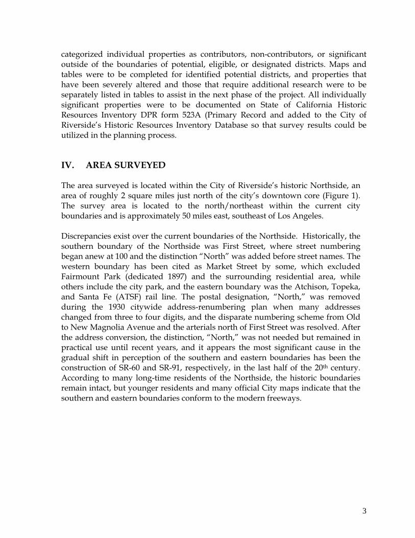
IV. AREA SURVEYED
The area surveyed is located within the City of Riverside’s historic Northside, an area of roughly 2 square miles just north of the city’s downtown core (Figure 1). The survey area is located to the north/northeast within the current city boundaries and is approximately 50 miles east, southeast of Los Angeles.
Discrepancies exist over the current boundaries of the Northside. Historically, the southern boundary of the Northside was First Street, where street numbering began anew at 100 and the distinction “North” was added before street names. The western boundary has been cited as Market Street by some, which excluded Fairmount Park (dedicated 1897) and the surrounding residential area, while others include the city park, and the eastern boundary was the Atchison, Topeka, and Santa Fe (ATSF) rail line. The postal designation, “North,” was removed during the 1930 citywide address-renumbering plan when many addresses changed from three to four digits, and the disparate numbering scheme from Old to New Magnolia Avenue and the arterials north of First Street was resolved. After the address conversion, the distinction, “North,” was not needed but remained in practical use until recent years, and it appears the most significant cause in the gradual shift in perception of the southern and eastern boundaries has been the construction of SR-60 and SR-91, respectively, in the last half of the 20th century. According to many long-time residents of the Northside, the historic boundaries remain intact, but younger residents and many official City maps indicate that the southern and eastern boundaries conform to the modern freeways.
3
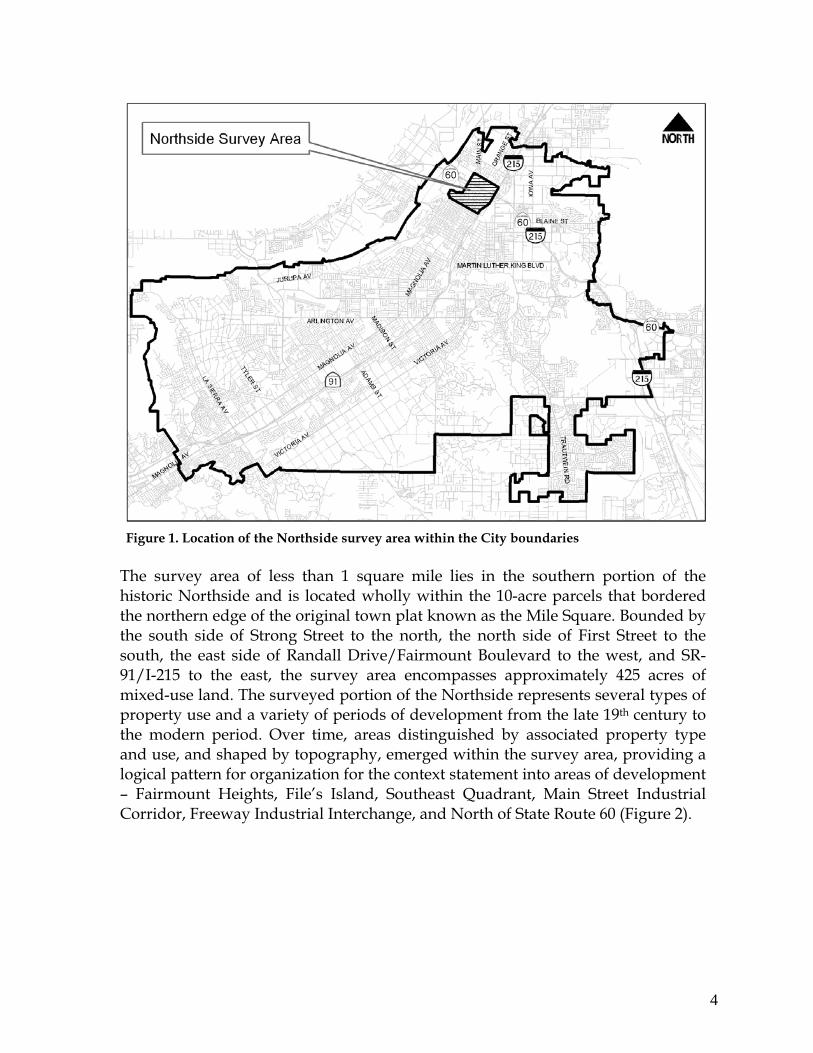
Figure 1. Location of the Northside survey area within the City boundaries
The survey area of less than 1 square mile lies in the southern portion of the historic Northside and is located wholly within the 10-acre parcels that bordered the northern edge of the original town plat known as the Mile Square. Bounded by the south side of Strong Street to the north, the north side of First Street to the south, the east side of Randall Drive/Fairmount Boulevard to the west, and SR-91/I-215 to the east, the survey area en
ixedcompasses approximately 425 acres of
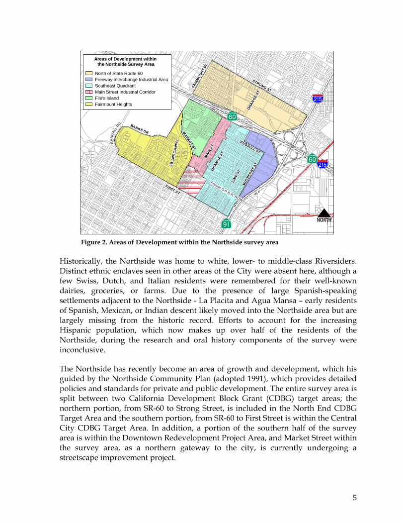
-use land. The surveyed portion of the Northside represents several types of mproperty use and a variety of periods of development from the late 19th century to the modern period. Over time, areas distinguished by associated property type and use, and shaped by topography, emerged within the survey area, providing a logical pattern for organization for the context statement into areas of development – Fairmount Heights, File’s Island, Southeast Quadrant, Main Street Industrial Corridor, Freeway Industrial Interchange, and North of State Route 60 (Figure 2).
4
?z
%&h(
?Æ
?z%&h(
OR
AN
GE
ST
RA
ND
ALL
RD
Former S.P.R.R. ROW
MA
INS
T
OR
AN
GE
ST
FIRST ST
STRONG ST
MA
RK
ET
ST
RUSSELL ST
BANKS DR
FAIR
MO
UN
TB
L
MU
LBE
RR
YS
T
LIM
ES
T
FAIR
MO
UN
TB
L
Areas of Development withinthe Northside Survey Area
North of State Route 60Freeway Interchange Industrial AreaSoutheast QuadrantMain Street Industrial CorridorFile's IslandFairmount Heights
N
Figure 2. Areas of Development within the Northside survey area
Historically, the Northside was home to white, lower- to middle-class Riversiders.
arch and oral history components of the survey wereconclusive.
rn portion, from SR-60 to First Street is within the Central ity CDBG Target Area. In addition, a portion of the southern half of the survey rea is within the Downtown Redevelopment Project Area, and Market Street within
ateway to the city, is currently undergoing a streetscape improvement project.
Distinct ethnic enclaves seen in other areas of the City were absent here, although a few Swiss, Dutch, and Italian residents were remembered for their well-known dairies, groceries, or farms. Due to the presence of large Spanish-speakingsettlements adjacent to the Northside - La Placita and Agua Mansa – early residents of Spanish, Mexican, or Indian descent likely moved into the Northside area but are largely missing from the historic record. Efforts to account for the increasingHispanic population, which now makes up over half of the residents of theNorthside, during the resein
The Northside has recently become an area of growth and development, which his guided by the Northside Community Plan (adopted 1991), which provides detailed policies and standards for private and public development. The entire survey area is split between two California Development Block Grant (CDBG) target areas; the northern portion, from SR-60 to Strong Street, is included in the North End CDBG Target Area and the southeCathe survey area, as a northern g
5
V. METHODOLOGY
Methodology for planning and conducting the Reconnaissance Survey and Context Statement for a Portion of the Northside project, which included an oral history component, was guided by National Register Bulletin 24: Guidelines for Local Surveys: A Basis for Preservation Planning and Instructions for Recording Historical Resources(March 1995), and project deliverables were prepared in accordance with the
ecretary of the Interior’s Standards for Preservation Planning, Identification, Evaluation,
while facilitatinge effective use of resources that are determined not significant under federal, state,
pecific techniques outlined in National Register Bulletin 24: Guidelines for Local Preservation Planning and Instructions for Recording Historical
esources (March 1995) helped guide the practical conduction of fieldwork, the
was anticipated prior to commencement of the survey that potentially significant istrict resources would be evaluated at all levels - National, State,
nd local - using the criteria established for inclusion in the National Register of
Sand Registration, as applicable.
As the survey results and the identification of potentially significant individual and district resources were primarily for use in local preservation and planning, JRMC balanced historic preservation tenets with the purposes expressed in the City of Riverside’s Cultural Resources Ordinance (Title 20, Ord. 6263 (1996), as amended). This merge of historic preservation with community development planningprovides the basis for the protection of the City’s historic resources,thand local preservation law.
In May 2005, a comprehensive revision to Title 20 was initiated by the Riverside City Council, and a committee was formed to evaluate the current ordinance andrecommend improvements. Because changes to the cultural resources ordinancewere not finalized prior to the completion of this survey, JMRC used the adopted ordinance (Ord. 6263 (1996), as amended) for guidance in determining localpreservation goals and objectives and for evaluating extant resources within the survey area (Appendix I).
VI. RESEARCH DESIGN
SSurveys: A Basis forRorganization of archival research, the completion of oral history sessions, the development of the historic context statement, the incorporation of existing data, the recordation of survey data, and the evaluation of historic resources. In addition, JMRC applied techniques that have proven successful in past survey efforts tocomplete the reconnaissance survey of a portion of the Northside.
Itindividual and da
6
Historic Places and the California Register of Historical Resources, and the criteria set forth under Title 20 of the City of Riverside Municipal Code (Ord. 6263 (1996), as amended). Upon completion of all research and survey work, the results wererecorded using the City of Riverside’s Historic Resources Inventory Database, and state-approved DPR forms were generated from database records.
SITE SPECIFIC RESEARCH
Selective site-specific research was conducted as needed by JMRC and facilitated by City staff to assist in the establishment of dates of construction, alteration history,
nd historical association. The results of building permit research were recorded by and Assessor’s parcel number, street address, building
otprints, and aerial photos were provided in map form by City staff. A table was
ivedssessor’s records on microfiche at the County of Riverside.
ntributed to andere guided by the oral history sessions.
astreet on JMRC forms,foalso provided to JMRC that included the estimated date of construction for each property in the survey area according to Assessor’s records. For some properties where no original building permit existed, where Assessor’s records were missing or regarded as inaccurate, or where additional historical information was needed to make determinations of significance or non-significance, JMRC reviewed archA
ORAL HISTORIES
As personal and community histories passed down through spoken recollections and the telling of stories has become increasingly valued and respected, oral history as component of the historic resources survey has become more prevalent. As called for in the Scope of Work, three formal oral history sessions were planned to assist in the identification and evaluation of historic resources as much of the Northside’shistory has not been studied or recorded
METHODOLOGY
As described in National Register Bulletin No. 24, the history of a neighborhood or the significance of buildings, areas, or landscapes may be “richly represented in the memories of its people, and its cultural and aesthetic values may be best represented in their thoughts, expressions, and ways of life.” Three formal oral history sessions were included in the proposed Scope of Work in order to record the recollections and perceptions of long-time Northside residents, assist in the development of the historic context statement, and help identify and evaluate important buildings and places in the community. A multi-phased approach to the oral history component of the survey ensured that site-specific and general research both cow
7
BACKGROUND RESEARCH
o prepare for the oral history sessions, JMRC compiled and studied existing
uring a preliminary windshield survey of the project and surrounding areas in de note of potential historic themes and observed extant
roperty types and resources within and near the survey boundaries for later
RC contacted eachdividual by telephone to explain the purpose of the survey project and the oral
istory planning meeting and was based on eir knowledge of the Northside and the background research and field
Tprimary and secondary source material on the Northside, including buildingpermits, Assessor’s records, previous surveys, written histories, historic maps and photographs, and newspaper articles. Areas where information was lacking or would benefit from clarification were noted to discuss during the oral histories.
FIELD RECONNAISSANCE
DOctober 2004, JMRC mapinvestigation during the oral history sessions. At that time, JMRC noted similarities and differences within the survey area, which appeared to be shaped bytopography, land use, and period of development, for further discussion with long-time residents during the oral histories.
SELECTION OF INTERVIEW PARTICIPANTS
In an early February meeting of JMRC, City staff, representatives of the City’sCultural Heritage Board, and professional and student volunteers, a list of known long-time residents of the Northside community was made from which to select a group, or groups, of willing oral history interviewees. JMinhistory component and to request their participation. Follow-up letters, along with a list of interview questions, were sent by JMRC to interested individuals inviting them to participate at one of two scheduled oral history sessions, and telephone confirmation with each participant was made before each session.
The third session was organized by university of California, Riverside student volunteer Michelle Rypinski and consisted mostly of members of her immediate and extended family.
PREPARATION OF INTERVIEW QUESTIONS
list of questions to pose to oral history interviewees was collectively prepared by Athe participants of the February oral hthreconnaissance completed by JMRC. The scheduled oral history sessions wereguided by the prepared questions, which were given to participants prior to the meeting and were also intended to prompt thought and recollection into areas not specifically introduced (Appendix II).
8
ORAL HISTORY SESSIONS
The oral histories required by the Scope of Work were conducted on three occasions with different groups of participants. The first two were held in the large conference oom on the third floor or f the Riverside City Hall, downtown, and the third was
ome within the survey boundaries. Each session egan with an introduction to the scope and purpose of the interview and survey
o brought along historic materials to share. The first two interviews ere videotaped, and the third was audio taped (Appendix II).
ide.
held at the Grace Linrud family hband the federal funds that made the survey possible were acknowledged. Most members of the initial planning meeting were involved in the oral histories and either facilitated, assisted, recorded, or observed the sessions. Each interview, which included from 1 to 5 interviewees, lasted approximately two hours, and someinterviewees alsw
In addition to the three formal sessions required by the proposed Scope of Work, JMRC and Laura Klure conducted or participated in two additional, informal sessions with current or former Northside residents; these interviews were not video or audio taped. On April 26, 2005, Laura Klure interviewed Raymond and Tony Solorio, long-time residents of the Northside associated with the Northside’s once small Hispanic community as well as the North Main/Northside businesscommunity. On June 10, 2005, Jennifer Mermilliod participated in a reunion of some members of the Paxton family at their family home within the survey area at 2450 Orange Street. Facilitated by the current owners, Scott and Joanne Simpson, the Paxtons offered site-specific and general information about the residence and the
gricultural/citrus and dairy history of the Northsa
POST-INTERVIEW REVIEW AND ANALYSIS
Some of the detailed notes taken during the three required oral history sessions and the two informal ones were typed up for easier use as the survey project budged prohibited the transcription of video or audio tapes. JMRC used the taped interviews and written notes to assist in the preparation of the historic context statement and to help identify and evaluate the significance of individual properties and places on the Northside. City staff anticipates that copies of the video, audio, and written accounts of the oral history sessions will be maintained at the City of Riverside Planning Department and placed in the downtown branch of the Riverside Public Library.
COMMUNITY PARTICIPATION
In addition to the required and supplementary oral history sessions, JMRC also engaged the citizens of the Northside during the latter half of the survey process to inform them of the project and progress to date, take note of community concerns or
9
suggestions, and pose specific questions regarding absences or inconsistencies in the historic record.
On May 25, 2005, JMRC attended Mayor’s Night Out, a monthly event held in
earn about current projects and concerns in theorthside community. In addition, JMRC gave a brief presentation to the attending
em of the survey, including funding source, oundaries, scope, purpose, and progress to date.
d answer session in which community members raised concerns about nd offered recollections about Fairmount Park and golf course and the White
as the Will Rogers Museum where some formation relating to the Riverside Fairgrounds is housed. Though just outside the
survey boundaries, which is only a porFairm c
onte location and their importance to and association with addition, attendants of the Northside
Improvement Association answered specific questions regarding their perspective of the historic and current boundaries of the Northside and their relationship to the downtown area.
During both events, JMRC took note of community projects, concerns, and suggestions offered regarding specific properties, places, or areas of research. At each event invited attendants were invited to contact JMRC with additional information, concerns, or suggestions, or to share historic materials for photocopying and possible inclusion in the survey report. Aside from discussion
different areas of the city during which community members can meet City leaders, staff, and fellow neighbors; collect material regarding city services andneighborhood accomplishments, and learn about current or upcoming projects and programs in their neighborhood. The events are special opportunities to voice concerns in a question and answer format between residents and City Hall. The May 2005 Mayor’s Night Out was held at Fremont School in the Northside and provided an opportunity for JMRC to lNcommunity members to advise thb
On August 8, 2005, JMRC and City Historic Preservation Officer, Janet Hansen, attended a meeting of the Northside Improvement Association, the oldest, still functioning community organization in Riverside. JMRC offered an informalpresentation, which included information on the survey such as funding source,boundaries, scope, purpose, and preliminary findings. JMRC requested that residents bring forth concerns, comments, and suggestion, and identify areas or buildings they wanted to be sure were not overlooked. This was followed by a question anaSulphur Springs area, both just outside the survey boundaries. Residents also commented on the rural nature of the early community, naming some specific places and community members. Attendants also offered helpful information regarding sources for additional research suchin
tion of the Northside, the fairgrounds, ount Park, and White Sulphur Springs are included within the Historixt Statement due to theirC
the Northside community (see Section VII). In
10
during each event, to date, attending community members have not contacted JMRC to offer additional information.
ARCHAEOLOGICAL RESEARCH
Though the proposed Scope of Work did not call for an archaeological component, consideration of potential archaeological resources was addressed early in the survey process due to the proximity of White Sulphur Springs to the survey area. The natural hot springs and adjacent tulle bog are located adjacent to the northern limits of the survey boundaries and were first used by local Native Americans, likely Cahuillas and Gabrieliños, for their alleged medicinal and curative properties. Beginning in 1876, the sulphur springs were commercially developed by a succession of Riversiders beginning with James P. Greaves, a founding father of Riverside.
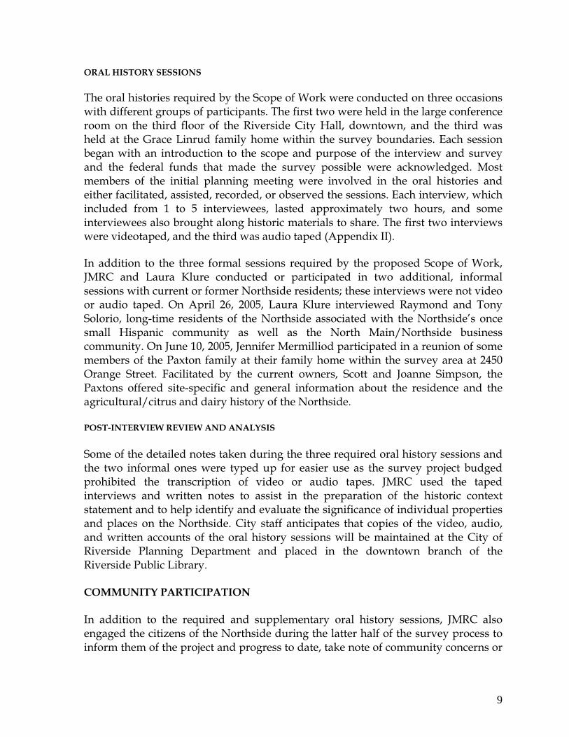
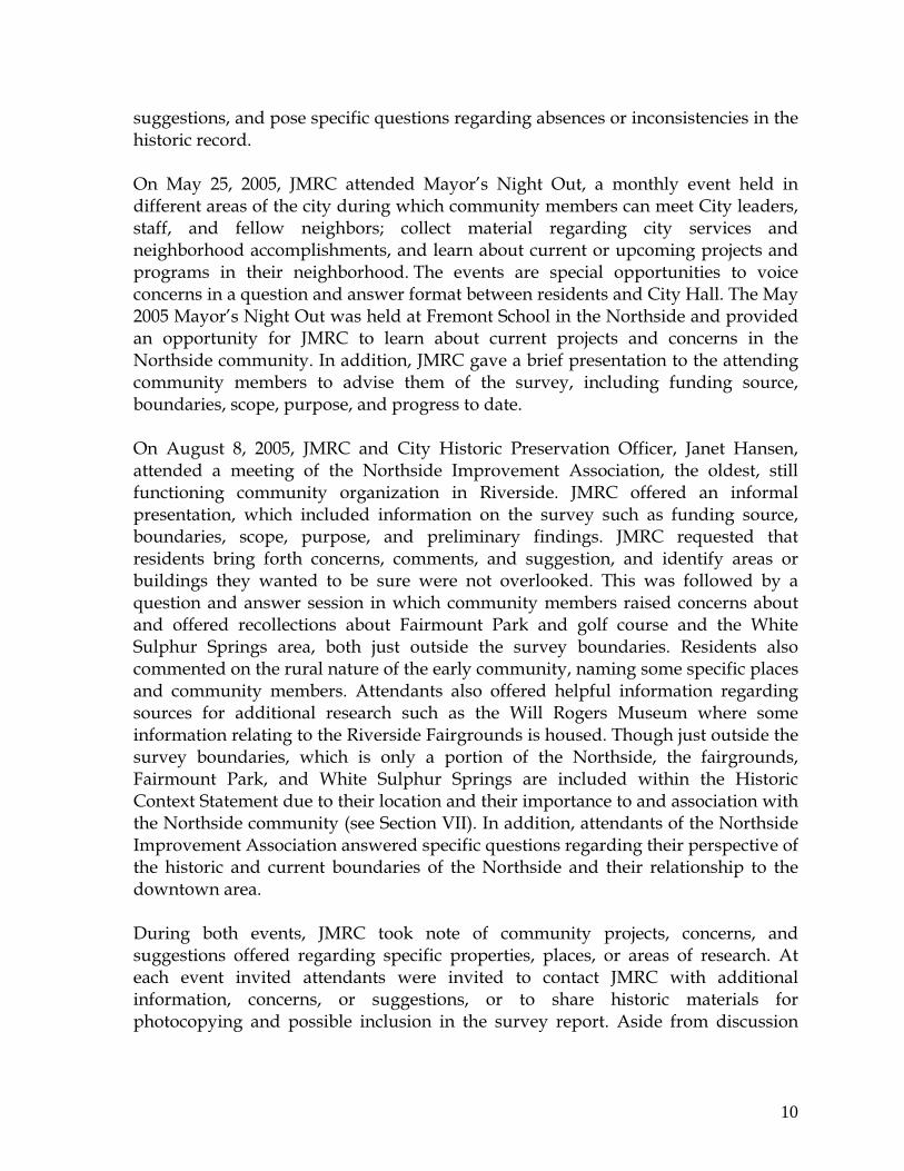
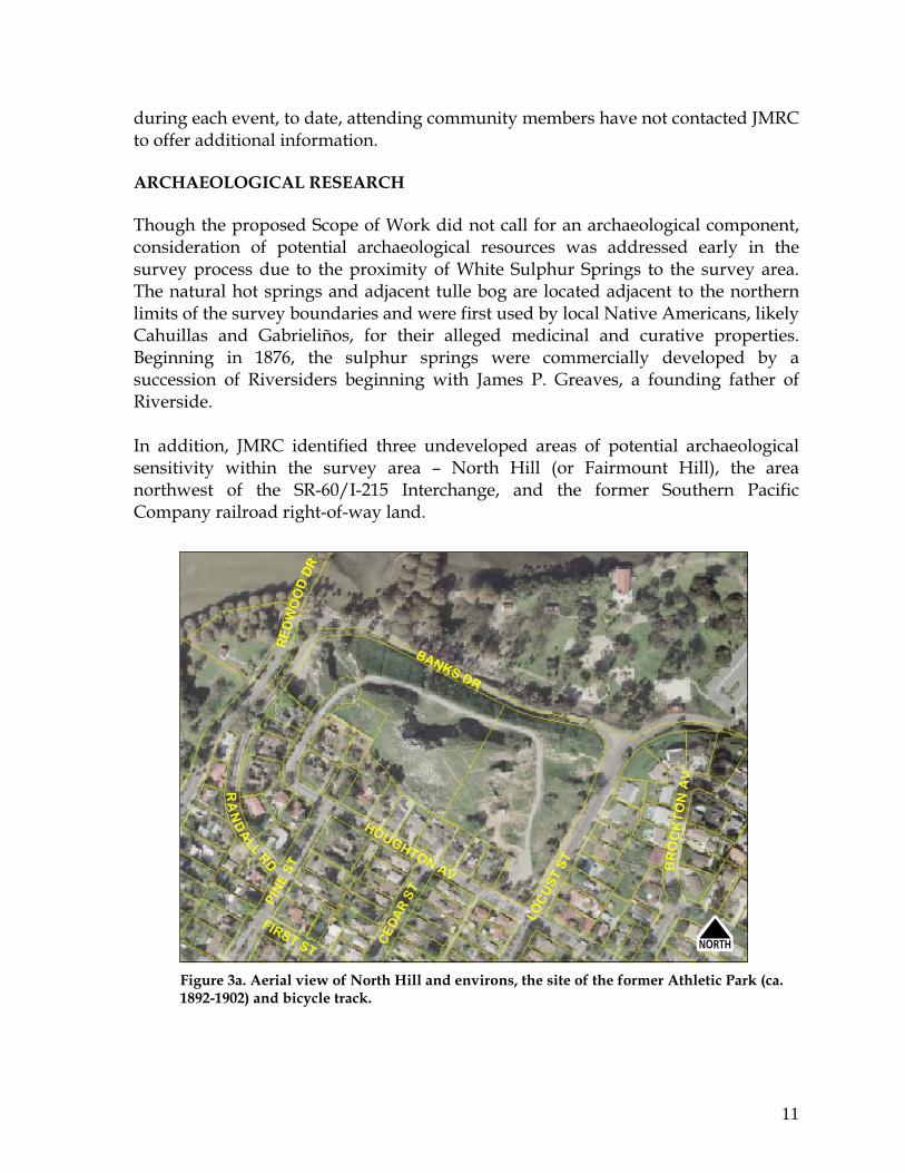
In addition, JMRC identified three undeveloped areas of potential archaeological sensitivity within the survey area – North Hill (or Fairmount Hill), the area northwest of the SR-60/I-215 Interchange, and the former Southern Pacific Company railroad right-of-way land.
RE
BANKS DR
DD
DR
V
WO
O
PIN
ES
T
LOC
US
TS
T
HOUGHTON AV
RA
ND
ALL
RD
CE
DA
RS
T
FIRST ST
BR
OC
KT
ON
A
NFigure 3a. Aerial view of North Hill and environs, the site of the former Athletic Park (ca. 1892-1902) and bicycle track.
11
%&h(?z
STRONG STO
RA
NG
ES
T
LAC
AD
EN
AD
R
KNOLL WYHIL
LCR
ES
TA
V
NFigure 3b. Aerial view of the area northwest of the SR-60/I-215 Interchange
?Æ
LEM
ON
ST
LIM
ES
T
POPLAR STM
ULB
ER
RY
ST
OR
AN
GE
ST
HEWITT ST
HIAWATHA PL
Y ST
LIM
ES
T
FIRST ST MU
LBE
RR
NFigure 3c. Aerial view of the former Southern Pacific Company railroad right-of-way
12
Base the survey boundaries, JMRC consulted
d on the presence of White Sulphur Springs adjacent to the survey area and the three essentially undeveloped areas withinCity staff regarding previous archaeological study within the survey area and researched historical accounts of areas of known Native American occupation and activity to determine if a reconnaissance-level approach to addressing the potential for archaeological resources was warranted.
A Draft Program Environmental Impact Report (November 2004) by Cotton Bridges and Associates was recently prepared as part of the General Plan 2025 Program. The study, which encompassed the entire 91,200-acre planning area, analyzed thepotential for adverse impacts to cultural and paleontological resources associated with the adoption and implementation of the proposed General Plan, revised Zoning Code and Subdivision Code, and other components based upon the Draft Cultural Resources Element of the City of Riverside General Plan Update preparedby Applied EarthWorks, Inc. (December 2003) and the Historic Preservation Element of the City of Riverside General Plan (adopted 2003; GP-005-023). In the study, areas likely to be sensitive to archaeological resources (archaeological sensitivity), based on previous surveys and archaeological site density, and those likely to contain archaeological resources (geographic sensitivity), based on appropriateenvironmental conditions, were ranked and plotted as Unknown, Low, Medium, and High (Figures 4a and 4B).
13
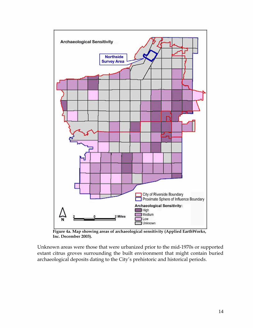
Figure 4a. Map showing areas of archaeological sensitivity (Applied EarthWorks,Inc. Decemb
Unknown areas w were urban the mid-1970s or supportedextant citrus groves surrounding the built environment that might contain buried archaeological deposits dating to the City’s prehistoric and historical periods.
er 2003).
ere those that ized prior to
14
Figure 4b. Map showing areas of geographic site sensitivity (Applied EarthWorks, Inc. December 2003).
s this most recenA t archaeological study constitutes a reconnaissance-level
prehistoric and historical archaeological sites and sites containing Native American
examination of the survey area, it was determined by JMRC and the City Historic Preservation Officer that the Scope of Work should not be revised to include an archaeological component and that recommendations for future archaeological study within the survey area should follow those prescribed by the Draft Program Environmental Impact Report, as amended. The study concludes that the City should “actively pursue a comprehensive survey program to identify and document
15
human remains.” As archaeological sensitivity of the area within the Northside survey boundaries is identified as “Unknown,” without a comprehensive survey
rogram in place, “…areas slated for development or other ground disturbing
y, further mitigationeasures described in Sections 6.3.1 through 6.3.4 of the Draft Cultural Resources
lement of the City of Riverside General Plan Update (Appendix D to the Draft a mplemented.
ISTORICAL RESEARCH
The history and development of the Northside was researched in order to gather a
pactivities [should] be surveyed for archaeological resources by qualified individuals who meet the Secretary of the Interior’s Standards and Guidelines regardingarchaeological activities and methods prior to the City’s approval of project plans.” Should archaeological resources be identified in the Northside survey area through future comprehensive or project-specific archaeological survemEProgr m Environmental Impact Report) should be i
H
general history of the survey area and compose a historic context statement, which formed the basis for the evaluation of potentially significant individual properties and potential districts and assisted in identifying associated property types and characteristics. In the absence of extensive materials on the history of the area, JMRC relied mainly upon historic maps, previous surveys of included or adjacentproperties, oral histories, and published local and regional historical accounts. Exhaustive, property-by-property research to establish construction and ownership history was not completed; rather selected building permit and Assessor’s records research was completed and a sampling of city directories was conducted to establish development patterns and the general composition of the early occupants of the Northside.
FIELD SURVEY
In order to fulfill the objectives of the Northside survey, JMRC conducted areconnaissance-level field survey of the project area, which was organized in parts and restructured slightly based on field survey results.
In October 2004, JMRC conducted a preliminary windshield survey of the project and surrounding areas in order to gain a general understanding of the extant property types and resources within and near the survey boundaries and to note likely areas of discussion during the oral history sessions. At that time, JMRC made note of the extent of modern buildings and infill construction and buildings whose integrity of design appeared to have been compromised by alterations like the replacement of windows or alteration of window openings, the application ofinappropriate wall cladding, the enclosure or alteration of porches or entries, large-scale or highly visible additions, and the alteration or removal of important architectural details. JMRC observed the similarities and differences within the
16
survey area, which appeared to be shaped by topography, land use, and period of development. Also noted were the layout of streets and lots within the survey areand the continuity, or discontinuity, both among adjacent blocks and between other a
areas within the survey boundaries in terms of common lot sizes, setbacks,landscaped parkways, streetlights and trees, and public spaces such as streets, curbs, driveway approaches, and sidewalks.
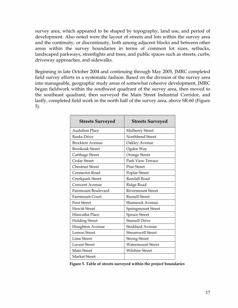
Beginning in late October 2004 and continuing through May 2005, JMRC completed field survey efforts in a systematic fashion. Based on the division of the survey area into manageable, geographic study areas of somewhat cohesive development, JMRC began fieldwork within the southwest quadrant of the survey area, then moved to the southeast quadrant, then surveyed the Main Street Industrial Corridor, and lastly, completed field work in the north half of the survey area, above SR-60 (Figure 5).
Streets Surveyed Streets Surveyed
Audubon Place Mulberry Street Banks Drive Northbend Street Brockton Avenue Oakley Avenue Brookoak Street Ogden Way Carthage Street Orange Street Cedar Street Park View Terrace Chestnut Street Pine Street Connector Road Poplar StreetCreekpark Street Randall Road Crescent Avenue Ridge Road Fairmount Boulevard Rivermount Street Fairmount Court Russell StreetFirst Street Shamrock AvenueHewitt Street Springmount Street Hiawatha Place Spruce StreetHolding Street Stansell Drive Houghton Avenue Stoddard Avenue Lemon Street Streamwell Street Lime Street Strong Street Locust Street Watermount Street Main Street Wilshire Street Market Street
Figure 5. Table of streets surveyed within the project boundaries
17
The survey area is within one of the oldest areas of the city and was oriented on an orthogonal plan, which follows a northeast/southwest axis, rather than strictly following the cardinal points and corresponds with the boundary lines of the Spanish rancherías that once defined land ownership in the region and continues to the Riverside-San Bernardino County boundary. Given the orthogonal plan and the sloping topography of some areas, JMRC typically photographed one side of each street in the morning and the other side in the afternoon to take advantage of natural light. JMRC took professional quality digital photographs in the field and noted potentially significant individual properties, potential district boundaries, properties that had been significantly altered, and those which appeared to post-date 1959, the threshold for photographic documentation as assigned by the Scope of Work.Through the review of field notes and photographs, JMRC returned to significant properties or areas with pre-printed field survey forms to record important architectural features, details, and alterations, as well as delineate potential district boundaries in the field.
JMRC met with City Historic Preservation Officer Janet Hansen in April and May 2005 to drive through the survey area and/or discuss extant resources, overall development patterns, potential district contributors and boundaries, and potential individually significant properties. A final in-the-field meeting with Ms. Hansen was completed in late August 2005 to finalize district boundaries, confirm identified individual resources, and discuss the survey’s planning objectives in light ofpending revisions to the City’s Cultural Resources Ordinance (Title 20, Ord. 6263 (1996), as amended).
JMRC completed the field survey in August 2005 by revisiting the few individual
e entered into the database late in August 2005.
properties for which important data was not completed during initial fieldrecordation. Properties whose nature of alterations made them potential non-contributors to identified districts were also revisited to assist in evaluation. At this time, additional context views were photographed, and an effort was made torephotograph properties that had been obstructed by residents or vehicles or were otherwise of poor quality.
Architectural descriptions were prepared throughout the field survey phase of research and revised according to site-specific research and repeated field survey, and properties were entered into the City of Riverside’s Historic ResourcesInventory Database in order to meet periodic project deliverables. The remaining properties wer
18
VII. HISTORIC CONTEXT STATEMENT
INTRODUCTION AND HISTORICAL OVERVIEW
The historic context is a valuable component of the survey process, as it contributes to an understanding of the history and patterns of development of a site,community, area, or region as reflected in the built environment. Shaped by place
nd time, the historic context organizes the narration of the historic development of
order to structure the Northside reconnaissance survey process, guide fieldwork,
ut the significance of, and the potential impact of ffects to, extant historic resources. Some historic themes that have been previously
aan area into cohesive historic periods, or themes, such as times of residential or commercial development, cultural and social change, industrial, agricultural, or engineering achievement, or physical growth, including the appearance ofarchitectural styles and building forms. The evolution and impact of themes are supported by historical research and illustrated by the presence of physicalresources that are categorized by property type, a grouping of individual properties that share physical or associative attributes. In this way, the survey, and the historic context itself, becomes a powerful tool in preservation planning (NPS 1985:14-15; NPS 1986:6-9).
Inand establish a framework for evaluating the potential significance of historic properties and districts, research on the history of the area was collected and reviewed early in the survey process. This area of Riverside has never beenextensively researched, and discussion of the area in secondary resources was scant. In addition, primary sources such as newspaper articles and available historic photographs were limited. As a result, the research phase of the survey continued longer than anticipated while historic maps, previous surveys of individual properties, published local and regional historical accounts, and various historic documentation in private collections were gathered. Oral histories conducted in February 2005 by long-time residents or business owners of the Northside provided primary historic material and assisted in directing research efforts. Intensive property ownership history was not conducted in favor of a sampling of citydirectories to establish the general composition of the early occupants of theNorthside. Based on these efforts, a focused historic context was developed that centered on the defining elements of theme, place, and time.
The extant resources, organized by property type, within the Northside help clarify the significance and impact of the themes. In this way, the context becomes more than a historical narrative; it is a guide with which to examine the relative integrity and import of the potential individual and district resources within theneighborhood, giving those involved in preservation planning a tool with which to make important decisions aboe
19
developed for the city of Riverside and figure prominently in the development of many areas not explored in depth here, as they do not relate to the history of development, the nature of the extant historic resources, or the historic inhabitants of the survey area. The theme of Immigration and Ethnic Diversity has beenrecommended for further study as association with ethnic groups, particularly Northsiders of Hispanic descent, could not be fully developed.
Themes that have been developed in this historic context are organized according to major periods of settlement and growth and include Early Settlement on theNorthside 1870-1900, Early Development 1901-1918, Suburban Development 1919-1941, and Post-WWII Development 1946-1959. History and development, which includes a discussion of related property types and architectural styles, are explored within each period and presented chronologically. The Northside is a very large area, encompassing roughly 2 square miles that was developed over a period of decades. Over time, areas distinguished by associated property type and usemerged within the reduced survey area of less than 1 square mile, providing a
pproximately 50 miles east, southeast of Los Angeles, the city of Riverside lies on a
ecifically within the traditional cultural territory of e Cahuillas and Gabrieliños (LSA 2005:5). The present-day Riverside area received
elogical pattern for organization for the context statement. Thus, each main area of development – Fairmount Heights, File’s Island, Southeast Quadrant, Main Street Industrial Corridor, Freeway Industrial Interchange, and North of State Route 60 (SR-60) – are summarized, after a brief historical overview, and are explored within the applicable themes introduced above (Figure 2).
HISTORICAL OVERVIEW
Aplain that is interrupted by the Santa Ana River to the west and a series of foothills that are known as Rubidoux Mountain, Box Springs Mountain, Jurupa Mountains, Pedley Hills, Pachappa Hill, and Victoria Hill, all of which partially define the City’s boundaries. A series of arroyos from the eastern hills to the Santa Ana River crosses the Riverside plain. The Tequesquite Arroyo, the largest of the arroyo system,largely confined development to the original townsite, now Riverside’s downtown core, for over four decades.
The greater Riverside area was originally inhabited by several Native American groups, including the Cahuilla, Serrano, Luiseno, and Gabrieliño Indians, with the Northside area of Riverside spthits first European visitors in 1774-1776, shortly after the beginning of Spanish colonization of Alta California in 1769. At that time, Juan Bautista de Anza, the famed Spanish explorer, reported that several Gabrieliño villages were found near the Anza Narrows on the Santa Ana River, approximately three miles southwest of the survey area (Patterson 1996:120; Gunther 1984:25-26). After the establishment of Mission San Gabriel in 1771, the Riverside area became one of the mission's principal
20
rancherías, known as Jurupa. Despite these early contacts, no Europeans are known to have settled in the area until after the creation of the Rancho Jurupa land grant in 1838, during the secularization of the mission system when Spanish-speaking rancheros and large land grant holders, including Juan Bandini, Louis Rubidoux, Cornelius Jenson, Benjamin Ables, Arthur Parks, and J.L. Stewart arrived in the area.
Awarded to Juan Bandini, the first non-Indian known to have settled in the region (Patterson 1996:121), Rancho Jurupa encompassed what are now the northern portion of the city of Riverside and the unincorporated area of Jurupa. In the 1840s,
number of other land grants were created in the vicinity. Two of these also encompassed portions of present-day Riverside, namely La Sierra (Sepulveda) and El Sobrante de San Jacinto, both of which lie several miles southwest of the current project boundary. Also in the 1840s, settlers from New Mexico established two farming communities on the Jurupa Rancho - La Placita and Agua Mansa - approximately two miles north of the survey area.
Established in 1844-5, La Placita (also known as Spanishtown) and Agua Mansa were two villages within one Spanish-speaking community located on either side of the Santa Ana River. The community was founded on the Bandini Donation, a piece of land given by Juan Bandini to Spanish-speaking settlers of Spanish, Mexican, and Indian descent from New Mexico in return for their services as a buffer and defense against Indian raiders. Sited on rich river-bottom farmland, La Placita was founded first by 20 families led by Lorenzo Trujillo and Jose Martinez on the east side of the river up to the western base of the La Loma Hills, west of present-day Highgrove. The better-known Agua Mansa was situated the following year on the west side of the river on a part of the Bandini Donation that stretched from near the present-day Riverside/San Bernardino County line to Slover Mountain in Colton (Patterson 1996:1
d to the county seat in San Bernardino went through a Placita, across the river to Agua Mansa and through Colton. For a short time, La
a
22-31).
Though organized by a town hall meeting style of government, the community was heavily influenced by the Catholic tradition and resident priest and was subject to the judicial jurisdiction of San Bernardino County. The people of Agua Mansa and La Placita were united in a church parish called San Salvador, which later also became the name of the county township (1851) and the school district (1863). In the 1850s, the Church of San Salvador and cemetery were constructed on the highground of Agua Mansa, and the parish school (1844) was relocated there. Later, the Riverside School District (1871) was carved from a branch of this original district. The more traveled and safer roaLPlacita, Agua Mansa and Riverside were combined in the San Salvador County Township (Patterson 1996:109-127).
21
The Spanish-speaking community was unique in the Rancho period, which was characterized by livestock ranching rather than farming and did not promote individual land and home ownership. The independent landholders of La Placita and Agua Mansa owned their own adobe homes and farms, which were irrigated by ditches dug from the Santa Ana River. They grew both gain and garden produce such as grapes and raised animals for meat, milk, and labor. By 1855, the community
oasted about 200 members and eventually had more than 100 little farming fields
death in early 1870 caused thebandonment of the project by co-investors just before the state of California
een offering for the planting ofulberry trees and silkworm cocoons (Patterson 1996:35). Almost immediately after
Mile Squarees to the northeast within the current city boundaries, and the survey area is
in the 10-acre parcels to the north. The orthogonal street plan, hich is oriented on a northeast/southwest axis, rather than strictly following the
known as the Government Tract,here streets were laid out on a strict north-south grid and intersect at odd angels
b(Patterson 1996:127-8), and their horses, sheep, and cattle freely grazed ongovernment land and what would become Riverside, causing quick and lasting conflict with Riversiders until the early 20th century.
The lands within the survey area were also part of Bandini’s Rancho Jurupa and were purchased by the California Silk Center Association in 1868. In September 1870, the Southern California Colony Association, led by John W. North, purchased the holdings of the California Silk Center Association, which consisted ofapproximately 8,600 acres of the eastern portion of the Rancho, and founded the colony of Riverside. The short-lived silkworm colony had been founded in 1868 by Louis Prevost, a native of France, and hisawithdrew the high, promotional bounties it had bmpurchasing the silk colony lands, work on an irrigation canal began under thedirection of a former silk colony director, Thomas Cover, who was one of four men to join the new colony. By the end of the same year, the holdings of the Southern California Colony Association were surveyed and platted by Goldsworthy and Higbie as an orthogonal plan with 10-acre parcels to the north and south of a one-mile square townsite known as the Mile Square (plat map 1870). Thelilocated wholly withwcardinal points, corresponded with the boundary lines of the Spanish rancherías that once defined land ownership in the region and continues to the Riverside-SanBernardino County boundary.
Also in 1870, a nearly 13-square-mile area to the southwest, which included much of the government land, was purchased by Benjamin Hartshorn. Part of the Hartshorn Tract, which was also laid out in the orthogonal pattern, was sold in 1874 to investor William T. Sayward and Indiana banker Samuel C. Evans who soon established the Riverside Land and Irrigating Company. The area became known as Arlington, a distinct community (Bynon 1893-4:21). Between the lands owned by the Southern California Colony Association and the Riverside Land and Irrigating Company remained a much-reduced, mile-wide strip of landw
22
with Magnolia Avenue, the main arteri l that strings the three developments t (Figure 1). In downtStreet, which continueStreet serves as a northStreet within the survwith bordering neighb
During the 1870s andCalifornia, the buddinresidents by 1890 (Ceagricultural productiocame with successful,orange in the mid-1870 the spread ofcitrus cultivation thro erside to theforefront of the citrus i
The City of Riverside w by the citizensof Riverside (Phillips 1 tely 56 squaremiles. The incorporat the SouthernCalifornia Colony Ass e lands in theGovernment Tract (Pat d in the heartof the original Mile Sq e divided intosmall farm lots of 5, 10 to hay raisingand grazing (Bynon ounty seat ofRiverside County, whi ernardino andSan Diego Counties, a d cooperative
th and east oftheast) of thedevelopment
the southwestesquite Arroyo, arowing Riversidesite, including the
es and, to a lesserommunities were
more than half of theNorthside’s approximately 6,200 residents are Hispanic (Census Bureau, Census 2000 – City of Riverside Northside Neighborhood Demographic Profile).
aogether own Riverside, Magnolia Avenue becomes Market
s to bisect the southern portion of the survey area. Market ern gateway to the City; however, development along Marketey area is oriented away from the arterial and is associated orhoods rather than the streetscape.
1880s, amid a land boom that swept through southerng town of Riverside grew rapidly with approximately 4,600 nsus Bureau, Census 1890). As land values were tied to
n, the most important boost to Riverside's early prosperity canal system irrigation and the introduction of the naval s. Its nearly instant success in Riverside led to
ughout southern California, and propelled Rivndustry.
as incorporated in 1883 by a vote of 228 to 147995:3) and at that time encompassed approximaed area included the original purchase byociation as well as the Arlington area and thterson 1996:17). The business district was locateuare townsite, while about 33 square miles wer, 20, and 40 acres and the remainder dedicated1893-4:23). In 1893, Riverside became the cch formed in that year from portions of San Bnd by 1895, Riverside was a thriving, irrigate
that specialized in citriculture.
Riverside grew rapidly and early, and development soon spread northe original townsite. The Northside area, which lies adjacent (norCity’s downtown core (Figure 6), experienced areas of concentratedprimarily throughout the first half of the 20th century. Development towas not substantial until the early 20th century, after the Tequnatural land barrier, was filled in 1913. The fill allowed the gpopulation to spill into the areas southwest of the original townformer Government Tract, which were covered by citrus grovdegree, vineyards and walnut orchards. Historically, ethnic cconcentrated on Riverside’s Eastside, “Chinatown,” and scattered throughout the Arlington area, while the homes and businesses of the Northside were occupied with predominantly white, working- and middle-class citizens until the latter 20th
century (Mermilliod & Klure 2005a & 2005b). Today,
23
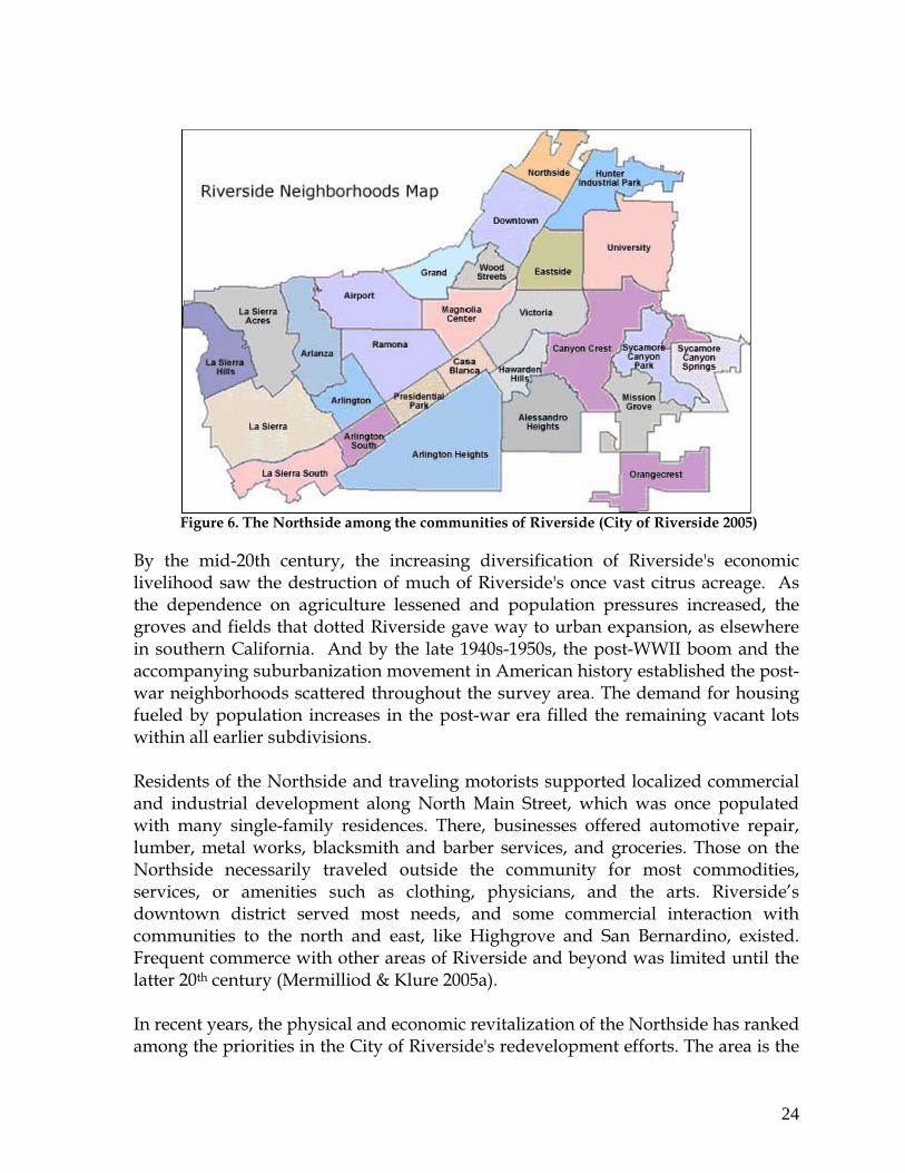
Figure 6. The Northside among the communities of Riverside (City of Riverside 2005)
By the mid-20th cen of Riverside's economicvelihood saw the destruction of much of Riverside's once vast citrus acreage. As
he Northside has rankedmong the priorities in the City of Riverside's redevelopment efforts. The area is the
tury, the increasing diversificationlithe dependence on agriculture lessened and population pressures increased, the groves and fields that dotted Riverside gave way to urban expansion, as elsewhere in southern California. And by the late 1940s-1950s, the post-WWII boom and the accompanying suburbanization movement in American history established the post-war neighborhoods scattered throughout the survey area. The demand for housing fueled by population increases in the post-war era filled the remaining vacant lots within all earlier subdivisions.
Residents of the Northside and traveling motorists supported localized commercial and industrial development along North Main Street, which was once populated with many single-family residences. There, businesses offered automotive repair, lumber, metal works, blacksmith and barber services, and groceries. Those on the Northside necessarily traveled outside the community for most commodities, services, or amenities such as clothing, physicians, and the arts. Riverside’sdowntown district served most needs, and some commercial interaction withcommunities to the north and east, like Highgrove and San Bernardino, existed. Frequent commerce with other areas of Riverside and beyond was limited until the latter 20th century (Mermilliod & Klure 2005a).
In recent years, the physical and economic revitalization of ta
24

topic of the Northside Community Plan (adopted 1991), which provides moredetailed policies and standards for private and public development. The entiresurvey area is split between two California Development Block Grant (CDBG) target areas; the northern portion, from SR-60 to Strong Street, is included in the North End CDBG Target Area and the southern portion, from SR-60 to First Street is within the Central City CDBG Target Area. In addition, a portion of the southern half of the survey area is within the Downtown Redevelopment Project Area, and Market Street within the survey area, as a northern gateway to the city, is currently undergoing a streetscape improvement project.
AREAS OF DEVELOPMENT WITHIN THE NORTHSIDE
Development within the survey area appears to have been concentrated rather than scattered throughout this large geographic area, lending today’s landscape aollection of areas defined not only by use, but also by period of development
table listing subdivisions for each Area of Development is found inppendix III, and Appendix X lists street trees by street name throughout the
and isounded by First Street to the south, Randall Road to the west, and Market Street to
the east. The northern limits of this area are defined partially by Market Street and by Ba cluded within the Fairmount
eights area are Banks Drive, Brockton Avenue, Cedar Street, Chestnut Street,
c(Figure 2). AAsurvey area, provided by Ron Smith, City of Riverside Urban Forester.
Fairmount Heights
The Fairmount Heights area is in the southwest quadrant of the survey areab
nks Drive, which skirts Fairmount Park. Streets inHCrescent Avenue, Fairmount Boulevard, Fairmount Court, First Street, Houghton Avenue, Locust Street, Market Street, Park View Terrace, Pine Street, Randall Road, and Ridge Road (Figure 7). Market Street near Fairmount Park, which was once part of the old roadway alignment of the Crestmore/Riverside-Rialto Line of the Pacific Electric Railway Company (PE), which became known as the Crescent City Railway has been altered extensively in since the decade following WWII and is currently included in a Market Street improvement project.
25
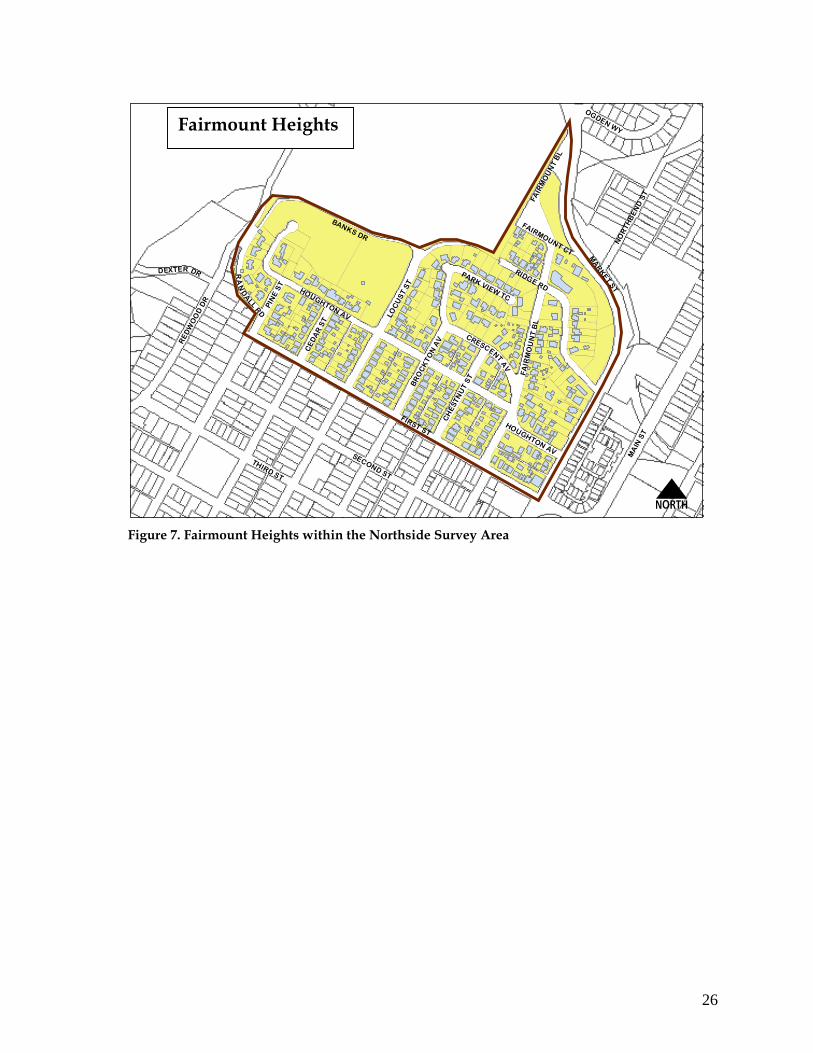
26
RE
D
CE
DA
R
BR
OC
KTO
NA
V
FA
IRM
OU
NTCRESCENT
AV
HE
STN
UT
ST
WO
FIRST ST
LOC
U
TH
ST
SECO
MA
INS
T
BL
C
HOUGHTON AVC
OD
DR
OGDEN WY
PIN
ES
T
MA
RK
ETST
ST
ST
RIDGE RD
BANKS DR
NO
RTH
BE
ND
ST
RA
ND
ALL
RD
PARK VIEW T
FAIRMOUNT CT
DEXTER DR
FAIR
MO
UN
TB
L
HOUGHTON AV
IRD ST
ND ST
NFigure 7. Fairmount Heights within the Northside Survey Area
Fairmount Heights
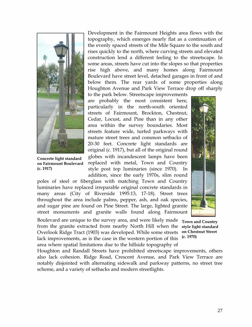
27
Development in the Fairmount Heights area flows with the topography, which emerges nearly flat as a continuation of the evenly spaced streets of the Mile Square to the south and rises quickly to the north, where curving streets and elevated construction lend a different feeling to the streetscape. In some areas, streets have cut into the slopes so that properties rise high above, and many homes along Fairmount Boulevard have street level, detached garages in front of and below them. The rear yards of some properties along Houghton Avenue and Park View Terrace drop off sharply to the park below. Streetscape improvements are probably the most consistent here, particularly in the north-south oriented streets of Fairmount, Brockton, Chestnut, Cedar, Locust, and Pine than in any other area within the survey boundaries. Most streets feature wide, turfed parkways with mature street trees and common setbacks of 20-30 feet. Concrete light standards are
roundglobes with incandescent lamps have been
ck improvements, as is the case in the w stern portion of thisarea where spatial limitations due Houghton and Randall Streets have prohibited streetscape improvements, others
lso lack cohesion. Ridge Road, Crescent Avenue, and Park View Terrace are
original (c. 1917), but all of the original
replaced with metal, Town and Country style post top luminaries (since 1970). In addition, since the early 1970s, slim round
poles of steel or fiberglass with matching Town and Country luminaries have replaced irreparable original concrete standards in many areas (City of Riverside 1995:13, 17-18). Street trees throughout the area include palms, pepper, ash, and oak species, and sugar pine are found on Pine Street. The large, lighted granite street monuments and granite walls found along Fairmount Boulevard are unique to the survey area, and were likely made from the granite extracted from nearby North Hill when the Overlook Ridge Tract (1903) was developed. While some streets
Concrete light standardon Fairmount Boulevard (c. 1917)
Town and Country style light standardon Chestnut Street (c. 1970) la e
to the hillside topography of
anotably disjointed with alternating sidewalk and parkway patterns, no street tree scheme, and a variety of setbacks and modern streetlights.
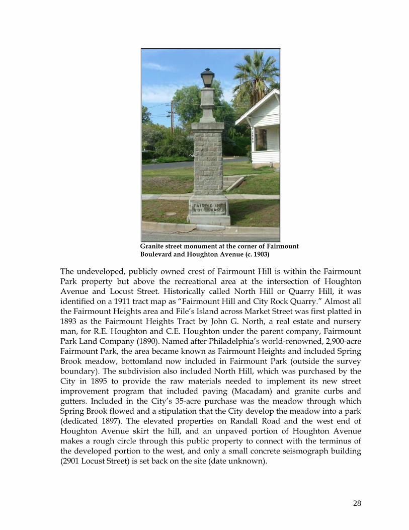
Granite street monument at the corner of FairmountBoulevard and Houghton Avenue (c. 1903)
The undeveloped, publicly owned crest of Fairmount Hill is within the Fairmount Park property but above the recreational area at the intersection of Houghton Avenue and Locust Street. Historically called North Hill or Quarry Hill, it was identified on a 1911 tract map as “Fairmount Hill and City Rock Quarry.” Almost all the Fairmount Heights area and File’s Island across Market Street was first platted in 1893 as the Fairmount Heights Tract by John G. North, a real estate and nursery man, for R.E. Houghton and C.E. Houghton under the parent company, Fairmount Park Land Company (1890). Named after Philadelphia’s world-renowned, 2,900-acre Fairmount Park, the area became known as Fairmount Heights and included Spring Brook meadow, bottomland now included in Fairmount Park (outside the survey boundary). The subdivision also included North Hill, which was purchased by the City in 1895 to provide the raw materials
prneeded to implement its new street
ovement program that included paving (Macadam) and granite curbs and imgutters. Included in the City’s 35-acre purchase was the meadow through which Spring Brook flowed and a stipulation that the City develop the meadow into a park (dedicated 1897). The elevated properties on Randall Road and the west end of Houghton Avenue skirt the hill, and an unpaved portion of Houghton Avenue makes a rough circle through this public property to connect with the terminus of the developed portion to the west, and only a small concrete seismograph building (2901 Locust Street) is set back on the site (date unknown).
28
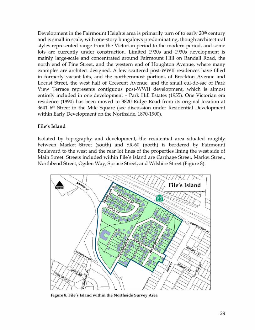
Development in the Fairmount Heights area is primarily turn of to early 20th century and is small in scale, with one-story bungalows predominating, though architectural tyles represented range from the Victorian period to the modern period, and some
lots are currently under construction. Limited 1920s and 1930s development is mainly la ount Hill on Randall Road, the
orth end of Pine Street, and the western end of Houghton Avenue, where many xamples are architect designed. A few scattered post-WWII residences have filled
in formerly vacant lots, and the northernmost portions of Brockton Avenue and Locust Street, the west half of Crescent Avenue, and the small cul-de-sac of Park View Terrace represents contiguous post-WWII development, which is almost entirely included in one development – Park Hill Estates (1955). One Victorian era residence (1890) has been moved to 3820 Ridge Road from its original location at 3641 6th Street in the Mile Square (see discussion under Residential Development within Early Development on the Northside, 1870-1900).
File’s Island
Isolated by topography and development, the residential area situated roughly between Market Street (south) and SR-60 (north) is bordered by Fairmount Boulevard to the west and the rear lot lines of the properties lining the west side of Main Street. Streets included within File’s Island are Carthage Street, Market Street, Northbend Street, Ogden Way, Spruce Street, and Wilshire Street (Figure 8).
s
rge-scale and concentrated around Fairmne
?zM
AIN
ST
SPRUCE ST
MA
INS
T
GE
ST
OR
AN
M
FAIR
MO
UN
DGE RD
S
RD AV
T
CARTHAGE ST
PARK VIEWTC
FA
IRM
OU
NT
B
TB
L
TODDAMARKET ST
RI
NO
RTH
BE
ND
ST
RUSSELL ST
WIL
SH
IRE
ST
OGDEN WY
SPRUCE S
CONNECTOR ST
FAIRMOUNT CT
L
N
Figure 8. File’s Island within the Northside Survey Area
File’s Island
29
Most of the area is situated on the nearly flat ground of a high plateau that steeply rades to a small post-WWII neighborhood just below. The late 1950s neighborhood made up of two streets that form a horseshoe – Carthage Street and Ogden Way,
ccessing 33 homes with common setbacks of approximately 20-25 feet. Streetscape provements here include sidewalks and wide parkways with streetlights
onsisting of slim round steel poles with Town and Country style post top minaries, which were installed in the early 1970s during a City streetlight provement project (City of Riverside 1995:18). Obsolete mercury vapor lamps
ere some of the last in the city to be converted (2000) to efficient, high pressure odium. It appears that a street tree scheme was included in the original evelopment as several mature oak trees are extant in the parkway, particularly on gden Way.
he neighborhood on higher ground is about twice as large. It was first developed y George D. Carleton, “Riverside’s raisin man,” with a Gothic Revival style home mid a 20-acre Semi-Tropic Nursery (1870s) of 25,000 small orange and lemon trees
of many varieties ly (1882-1911), for whompruce Street w eriod of development is omparable with the Fairmount Heights ar a across Market Street with which it was
subdivide residences here wereonstructe
west side of
gisaimcluimwsdO
Tba
and later associated with the Hendry famiSc
as originally named. While its range of pe
d as the Overlook Ridge Tract in 1903, mostd between 1911 and 1959. The overall streetscape in this neighborhood is c
disjointed with absent or varied amenities. Lighting consists of few mast armstreetlights mounted on utility poles, and setbacks are fairly consistent at 20-30 feet, but there are a number of exceptions, particularly around the curve of Northbend Street, where limited space due to topographical constraints has shortened setbacks considerably. Wilshire Street is lined with mature palm trees, and sidewalks and a narrow parkway are extant on a portion of Spruce Street; the west end of Spruce Street lacks even curbs and gutters.
These two neighborhoods are separated by topography and period of development, but the whole seems cut-off from other residential development by land use as it is bordered by main arterials; commercial, industrial, and manufacturing property; parkland; and vacant land that is being developed for professional office use.
Southeast Quadrant
he Southeast Quadrant is bounded by First Street to the south, theTOrange Street to the west, Mulberry Street/State Route 91 (SR-91) to the east, and SR-60 to the north. This area represents the largest geographic area within thesurvey area and includes Audubon Place, First Street, Hiawatha Place, Hewitt Street, Holding Street, Lemon Street, Lime Street, Mulberry Street, Orange Street, Poplar Street, Russell Street and Spruce Street (Figure 9).
30
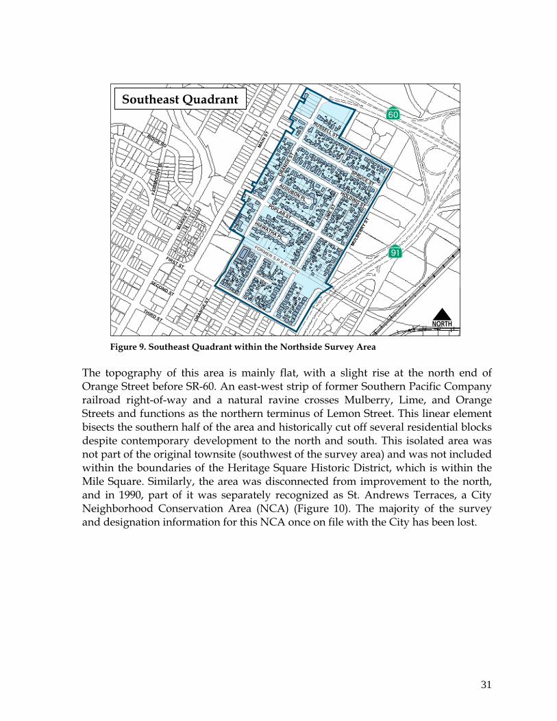
31
?z
?ÆFORMER S.P.R.R. ROW
MA
INS
T
FIRST ST
OR
AN
GE
ST
MA
RK
ET
ST
SPRUCE ST
SECOND ST
THIRD ST
LL ST
POPLAR ST
HOLDING ST
RIDGE RD
FA
IRM
OU
NT
BL
AUDUBON PL
HIAWATHA PL
MU
LBE
RR
YS
T
OR
AN
GE
ST
LIM
ES
T
RUSSE
NFigure 9. Southeast Quadrant within the Northside Survey Area
The topography of this area is mainly flat, with a slight rise at the north end of Orange Street before SR-60. An east-west strip of former Southern Pacific Company railroad right-of-way and a natural ravine crosses Mulberry, Lime, and Orange Streets and functions as the northern terminus of Lemon Street. This linear element bisects the southern half of the area and historically cut off several residential blocks despite contemporary development to the north and south. This isolated area was not part of the original townsite (southwest of the survey area) and was not included within the boundaries of the Heritage Square Historic District, which is within the Mile Square. Similarly, the area was disconnected from improvement to the north, and in 1990, part of it was separately recognized as St. Andrews Terraces, a City Neighborhood Conservation Area (NCA) (Figure 10). The majority of the survey and designation information for this NCA once on file with the City has been lost.
Southeast Quadrant
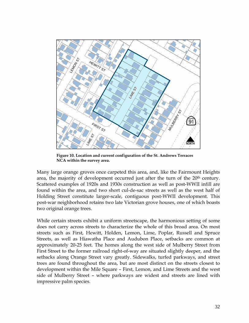
?ÆLI
ME
ST
FIRST ST
LEM
ON
ST
MUL
BERR
YST
HEWITT ST
LIM
EST
NFigure 10. Location and current configuration of the St. Andrews TerracesNCA within the survey area.
Many large orange groves once carpeted this area, and, like the Fairmount Heights rea, the majority of development occurred just after the turn of the 20th century.
Scattered examples of 1920s and 1930s construction as well as post-WWII infill are fo of
olding Street constitute larger-scale, contiguous post-WWII development. This
Place, setbacks are common atpproximately 20-25 feet. The homes along the west side of Mulberry Street from
right-of-way are situated slightly deeper, and the
a
und within the area, and two short cul-de-sac streets as well as the west halfHpost-war neighborhood retains two late Victorian grove houses, one of which boasts two original orange trees.
While certain streets exhibit a uniform streetscape, the harmonious setting of some does not carry across streets to characterize the whole of this broad area. On most streets such as First, Hewitt, Holden, Lemon, Lime, Poplar, Russell and Spruce Streets, as well as Hiawatha Place and AudubonaFirst Street to the former railroadsetbacks along Orange Street vary greatly. Sidewalks, turfed parkways, and street trees are found throughout the area, but are most distinct on the streets closest to development within the Mile Square – First, Lemon, and Lime Streets and the west side of Mulberry Street – where parkways are widest and streets are lined with impressive palm species.
32
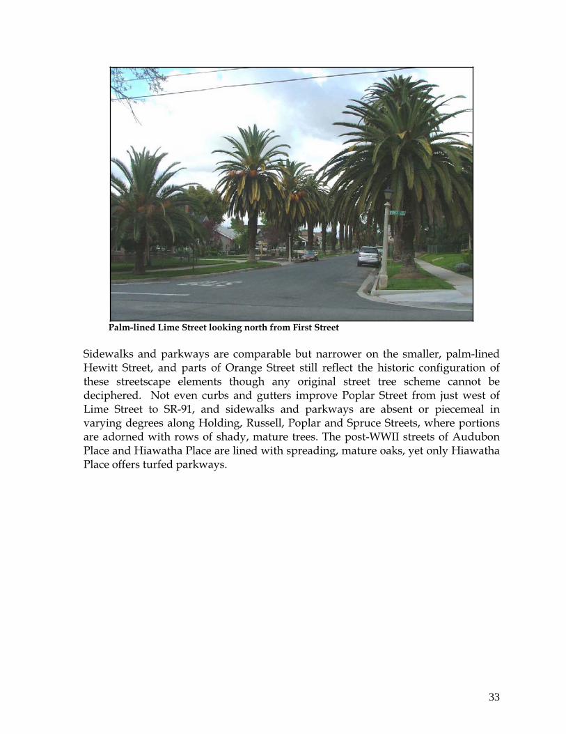
Palm-lined Lime Street looking north from First Street
Sidewalks and parkways are comparable but narrower on the smaller, palm-lined Hewitt Street, and parts of Orange Street still reflect the historic configuration of these streetscape elements though any original street tree scheme cannot be deciphered. Not even curbs and gutters improve Poplar Street from just west of Lime Street to SR-91, and sidewalks and parkways are absent or piecemeal in varying degrees along Holding, Russell, Poplar and Spruce Streets, where portions are adorned with rows of shady, mature trees. The post-WWII streets of Audubon Place and Hiawatha Place are lined with spreading, mature oaks, yet only Hiawatha Place offers turfed parkways.
33
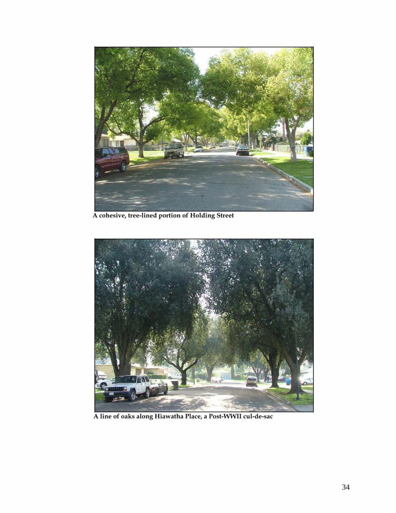
A cohesive, tree-lined portion of Holding Street
A line of oaks along Hiawatha Place, a Post-WWII cul-de-sac
34
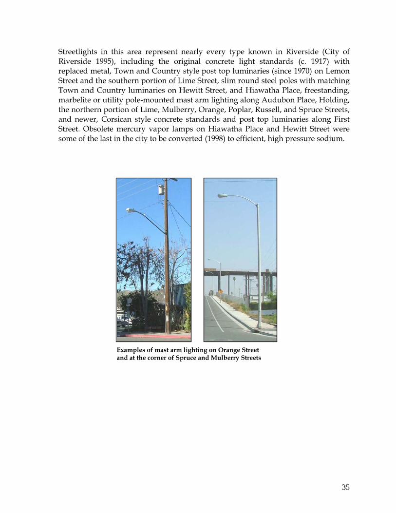
Streetlights in this area represent nearly every type known in Riverside (City of Riverside 1995), including the original concrete light standards (c. 1917) withreplaced metal, Town and Country style post top luminaries (since 1970) on Lemon Street and the southern portion of Lime Street, slim round steel poles with matching Town and Country luminaries on Hewitt Street, and Hiawatha Place, freestanding, marbelite or utility pole-mounted mast arm lighting along Audubon Place, Holding,
e northern portion of Lime, Mulberry, Orange, Poplar, Russell, and Spruce Streets,
Examples of mast arm lighting on Orange Streetand at the corner of Spruce and Mulberry Streets
thand newer, Corsican style concrete standards and post top luminaries along First Street. Obsolete mercury vapor lamps on Hiawatha Place and Hewitt Street were some of the last in the city to be converted (1998) to efficient, high pressure sodium.
35
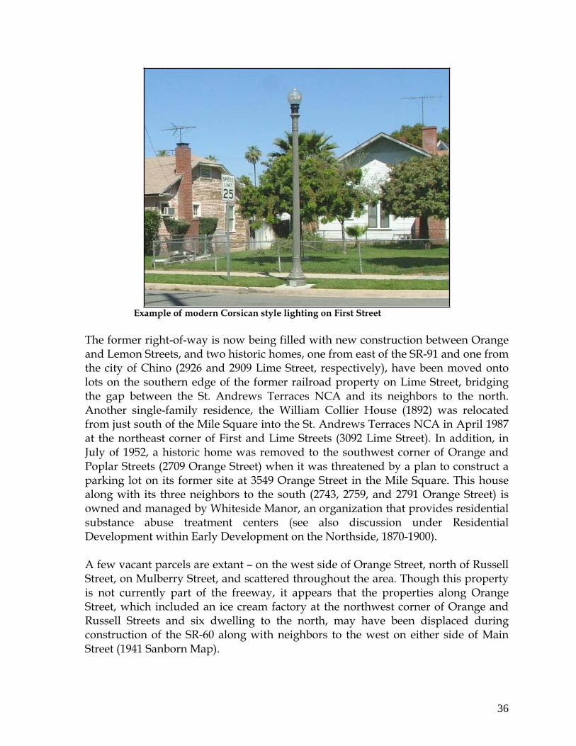
Example of modern Corsican style lighting on First Street
The former right-of-way is now being filled with new construction between Orange nd Lemon Streets, and two historic homes, one from east of the SR-91 and one from
f Chino (2926 and 2909 Lime Street, respectively), have been moved onto ts on the southern edge of the former railroad property on Lime Street, bridging
se treatment centers (see also discussion under Residentialevelopment within Early Development on the Northside, 1870-1900).
athe city olothe gap between the St. Andrews Terraces NCA and its neighbors to the north. Another single-family residence, the William Collier House (1892) was relocated from just south of the Mile Square into the St. Andrews Terraces NCA in April 1987 at the northeast corner of First and Lime Streets (3092 Lime Street). In addition, in July of 1952, a historic home was removed to the southwest corner of Orange and Poplar Streets (2709 Orange Street) when it was threatened by a plan to construct a parking lot on its former site at 3549 Orange Street in the Mile Square. This house along with its three neighbors to the south (2743, 2759, and 2791 Orange Street) is owned and managed by Whiteside Manor, an organization that provides residential substance abuD
A few vacant parcels are extant – on the west side of Orange Street, north of Russell Street, on Mulberry Street, and scattered throughout the area. Though this property is not currently part of the freeway, it appears that the properties along Orange Street, which included an ice cream factory at the northwest corner of Orange and Russell Streets and six dwelling to the north, may have been displaced during construction of the SR-60 along with neighbors to the west on either side of Main Street (1941 Sanborn Map).
36
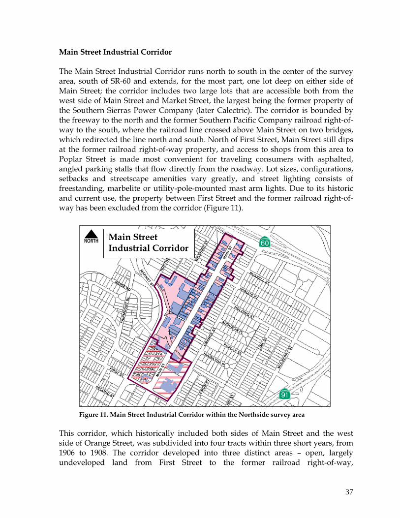
Main Street Industrial Corridor
The Main Street Industrial Corridor runs north to south in the center of the survey area, south of SR-60 and extends, for the most part, one lot deep on either side of Main Street; the corridor includes two large lots that are accessible both from the west side of Main Street and Market Street, the largest being the former property of the Southern Sierras Power Company (later Calectric). The corridor is bounded by the freeway to the north and the former Southern Pacific Company railroad right-of-
ay to the south, where the railroad line crossed above Main Street on two bridges, irected the line north and south. North of First Street, Main Street still dips
t the former railroad right-of-way property, and access to shops from this area to ,,
wwhich redaPoplar Street is made most convenient for traveling consumers with asphaltedangled parking stalls that flow directly from the roadway. Lot sizes, configurationssetbacks and streetscape amenities vary greatly, and street lighting consists offreestanding, marbelite or utility-pole-mounted mast arm lights. Due to its historicand current use, the property between First Street and the former railroad right-of-way has been excluded from the corridor (Figure 11).
?z
DS
T
NS
T
?Æ
MA
INS
T
FIRST ST
SECOND ST LEM
ON
ST
NO
RTH
OR
AN
GE
ST
MA
RK
ETST
SPRUCE ST
RUSSELL ST
HOLDING ST
RIDGE RD
BE
N
MA
I
POPLAR ST
LIM
ES
T
WATHA PL
MU
LBE
FAIR
MO
UN
TB
L
W
AUDUBON PL
ST
ILS
HIA RR
YS
TLIM
E
HIR
ES
TN
Figure 11. Main Street Industrial Corridor within the Northside survey area
This corridor, which historically included both sides of Main Street and the westside of Orange Street, was subdivided into four tracts within three short years, from1906 to 1908. The corridor developed into three distinct areas – open, largelyundeveloped land from First Street to the former railroad right-of-way,
Main Street Industrial Corridor
37
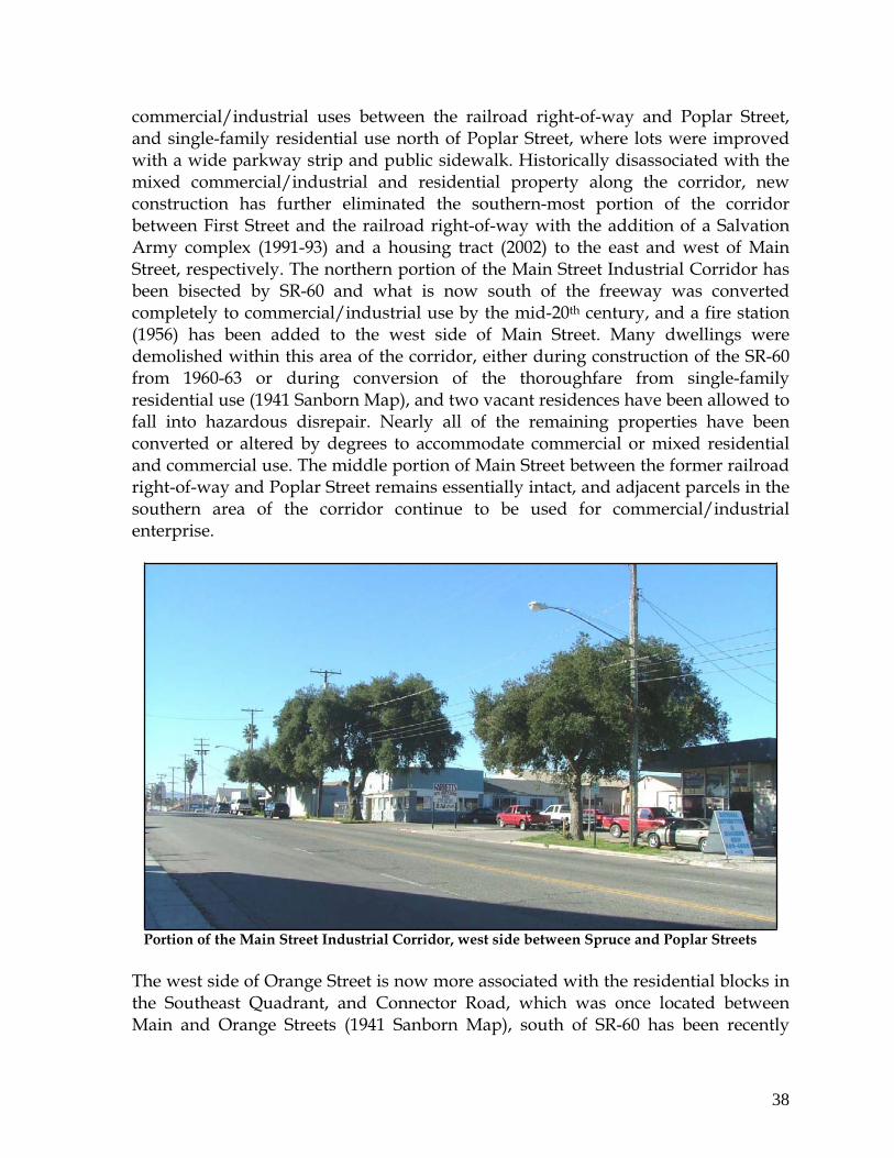
commercial/industrial uses between the railroad right-of-way and Poplar Streetand single-family residential use north of Poplar Street, where lots were improvedwith a wide parkway strip and public sidewalk. Historically disassociated with themixed commercial/industrial and residential property along the corridor, newconstruction has further eliminated the southern-most portion of
,
the corridoretween First Street and the railroad right-of-way with the addition of a Salvation
es have beenonverted or altered by degrees to accommodate commercial or mixed residential
bArmy complex (1991-93) and a housing tract (2002) to the east and west of MainStreet, respectively. The northern portion of the Main Street Industrial Corridor hasbeen bisected by SR-60 and what is now south of the freeway was convertedcompletely to commercial/industrial use by the mid-20th century, and a fire station(1956) has been added to the west side of Main Street. Many dwellings weredemolished within this area of the corridor, either during construction of the SR-60from 1960-63 or during conversion of the thoroughfare from single-familyresidential use (1941 Sanborn Map), and two vacant residences have been allowed tofall into hazardous disrepair. Nearly all of the remaining properticand commercial use. The middle portion of Main Street between the former railroadright-of-way and Poplar Street remains essentially intact, and adjacent parcels in thesouthern area of the corridor continue to be used for commercial/industrialenterprise.
he Main Street Industrial Corridor, west side between Spruce and Poplar Streets Portion of t
The west side of Orange Street is now more associated with the residential blocks in the Southeast Quadrant, and Connector Road, which was once located betweenMain and Orange Streets (1941 Sanborn Map), south of SR-60 has been recently
38
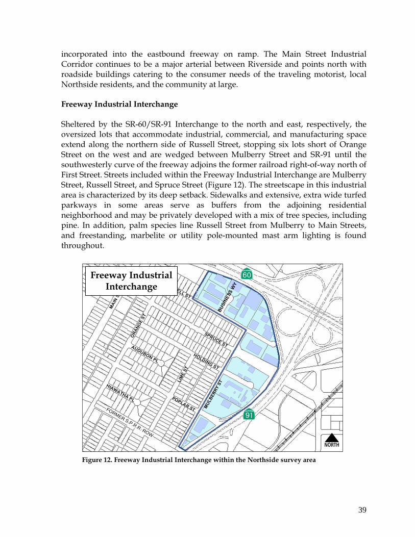
incorporated into the eastbound freeway on ramp. The Main Street Industrial Corridor continues to be a major arterial between Riverside and points north with roadside buildings catering to the consumer needs of the traveling motorist, local Northside residents, and the community at large.
Freeway Industrial Interchange
R-91 Interchange to the north and east, respectively, the versized lots that accommodate industrial, commercial, and manufacturing space
Sheltered by the SR-60/Soextend along the northern side of Russell Street, stopping six lots short of Orange Street on the west and are wedged between Mulberry Street and SR-91 until the southwesterly curve of the freeway adjoins the former railroad right-of-way north of First Street. Streets included within the Freeway Industrial Interchange are Mulberry Street, Russell Street, and Spruce Street (Figure 12). The streetscape in this industrial area is characterized by its deep setback. Sidewalks and extensive, extra wide turfed parkways in some areas serve as buffers from the adjoining residentialneighborhood and may be privately developed with a mix of tree species, including pine. In addition, palm species line Russell Street from Mulberry to Main Streets, and freestanding, marbelite or utility pole-mounted mast arm lighting is foundthroughout.
?z
INE
SSW
Y
?Æ
BU
S
FORMER S.P.
OR
A SPRUCE ST
POPLAR ST
HOLDING ST
AUDUBON PL
HIAWATHA PL
MU
LBER
RY
STLI
ME
ST
R.R. ROW
MA
NG
ES
T
INS
T
RUSSELL ST
N
Freeway IndustrialInterchange
Figure 12. Freeway Industrial Interchange within the Northside survey area
39

The topography of this non-residential area is flat, rising slightly at SR-60, and dropping sharply to at its eastern boundary to SR-91, below. The noise of the freeway traffic and the current Federal Highway Administration (FHWA) andCalifornia Department of Transportation (Caltrans) Interstate Route 215 (I-215)/SR-91/SR-60 Improvement Project drowns out the sounds from businesses such asBurgess Moving and Storage, Genesis Boats, and Arpin Logistics that occupy the buildings and large yards within the area. This area was developed in the late 20th
century and features vernacular buildings associated with various industrial,commercial, and manufacturing ventures. One public building, the CaliforniaDepartment of Forestry Southern California Headquarters and Operation Center(1954; 2524 Mulberry Street), is found within the boundaries.
North of State Route 60
The area of the survey area that is situated north of the SR-60 is bounded by the freeway to the south, Strong Street to the north, Fairmount Boulevard to the west and the SR-91 to the east. Streets included within the North of State Route 60 Area are Fairmount Boulevard, Main Street, Orange Street, Oakley Avenue, Stoddard Avenue, Shamrock Avenue, and Stansell Drive. The short Arroyo Vista Avenue, located northeast of the intersection of Orange Street and SR-60, now serves as a restricted access road and any properties associated with this avenue are no longer extant. West La Cadena Drive south of Strong Street (also identified as Charles Street) and associated commercial properties (1707 and 1769 W. La Cadena) are no longer extant due to current construction for the I-215/SR-91/SR-60 Improvement Project (Figure 13).
40

41
?z
%&h(
MA
INS
T
MA
INS
OR
AN
GE
ST
RONG ST
RUSSELL ST
STODDARD AV
MROCK AV
HIL
LCR
ES
T
KNO LL WY
DA
VI
LAC
AD
EN
AD
R
SPRUCE ST
OAKLEY AV
CARTHAGE ST
CONNECTOR ST
T STFAIR SHA A
VES
D
MO
UN
TB
L
STANSELL DR
LOFTON PL
POST ST
R
CASTAIC STELLIOTTA DR
STRONG STNorth of State Route 60
NFigure 13. North of State Route 60 within the Northside survey area
Topography of the area is mostly low and flat, as the area is an extension of the eastern flood plains of the Santa Ana River. Flood control channels that flow both above and below ground bisect the area on an east-west axis and a natural hot spring, known most commonly as Elliotta Springs, is located just north of the survey boundaries at Strong and Orange Streets.
Once contiguous with the residential property to the south, this portion of the a has been severed by the construction of the SR-60 (1960-63). North of the
ed,
survey areSR-60, Main Street angles to the north/northwest and continues as a main thoroughfare to outlying areas of the Northside and farther communities such as Colton. Here, Main Street is mixed in its use and exhibits single-family residences, commercial and service establishments, one vacant property, and the rear property of a public school – Fremont Elementary. Setbacks and lot sizes vary widely, and this portion of Main Street is improved with sidewalks. Orange Street, the other arterial to continue north from downtown into the Northside is similarly variwith the main entrance to Fremont Elementary fronting the street alongside residential property of mixed density and across from Riverside County Flood Control and Water Conservation District property, vacant land, and Calvary Baptist Church. While sidewalks, curbs and gutters enhance the east side of Orange Street, the west side of the street exhibits a portion of rolled asphalt curbing and an area that lacks all amenities. Two properties, a tire and wheel shop (3615 Oakley Avenue) and a single-family residence 1953; 3651 Oakley Avenue), are isolated on the short
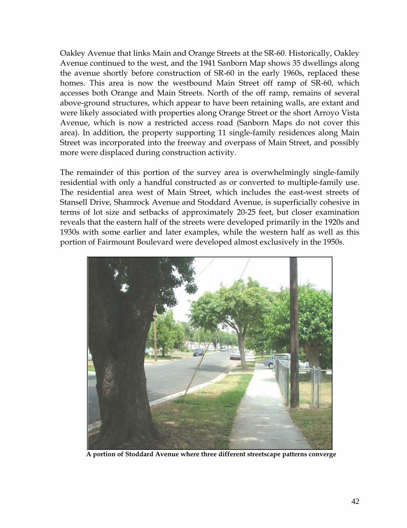
Oakley Avenue that links Main and Orange Streets at the SR-60. Historically, OakleyAvenue continued to the west, and the 1941 Sanborn Map shows 35 dwellings along the avenue shortly before construction of SR-60 in the early 1960s, replaced these homes. This area is now the westbound Main Street off ramp of SR-60, which accesses both Orange and Main Streets. North of the off ramp, remains of several above-ground structures, which appear to have been retaining walls, are extant and were likely associated with properties along Orange Street or the short Arroyo Vista Avenue, which is now a restricted access road (Sanborn Maps do not cover this area). In addition, the property supporting 11 single-family residences along Main Street was incorporated into the freeway and overpass of Main Street, and possibly more were displaced during construction activity.
The remainder of this portion of the survey area is overwhelmingly single-familyesidential with only a handful constructed as or converted to multiple-family use. r
The residential area west of Main Street, which includes the east-west streets of Stansell Drive, Shamrock Avenue and Stoddard Avenue, is superficially cohesive in terms of lot size and setbacks of approximately 20-25 feet, but closer examination reveals that the eastern half of the streets were developed primarily in the 1920s and 1930s with some earlier and later examples, while the western half as well as this portion of Fairmount Boulevard were developed almost exclusively in the 1950s.
A portion of Stoddard Avenue where three different streetscape patterns converge
42
This is not only evident in the architectural styles represented, but the streetscape also reveals the area’s rural past and shifts in, or a piecemeal approach to, municipal residential planning efforts as sidewalks, landscaped parkways, and street trees are shifted or absent along different areas of the same streets. Street lighting is sparse and consists of a mix of freestanding, marbelite and utility-pole-mounted mast arm lighting throughout the area. Similarly, the absence of streetscape improvements, even curbs and gutters in some areas, along Strong Street give it a pastoral feel, one that is enhanced to the east as lot sizes grow larger and use more rural past Main Street and even more so beyond Orange Street.
EARLY SETTLEMENT ON THE NORTHSIDE, 1870-1900
Beginning in 1870, two settlements emerged in a portion of the San Bernardino Valley - the Southern California Colony on the former Jurupa Rancho land, which would soon be called “Riverside,” and the New England Colony (named in 1874) in the former Hartshorn Tract, which would be dubbed the “Village of Arlington.” North of the Southern California Colony were the established farming villages of La Placita and Agua Mansa and between the colonies lay the mile-wide strip of land owned by the federal government – the Government Tract. Although the two colonies and the Government Tract were initially independently owned, they were soon linked in their dependence on canal irrigation and rail transportation to
onsolidated under one municipality. Those who settled on the orthside within the former Jurupa Rancho lands favored dairy and general
ompanycilitated unprecedented migration and settlement into the region from the East
support the driving economy of the times – agriculture, specifically, the growth of citrus – and cNagricultural production.
HISTORY
With the completion of the transcontinental railroad to San Francisco in 1869, tourists, boomers and boosters flowed into California at an estimated rate of 70,000 per year, a stream that was soon diffused into the southern region of the state. After an initial boom that soon waned, the region experienced a period of quiet but substantial growth, with improvements in water supply and agriculturalproduction. The arrival of the Atchison, Topeka, and Santa Fe (ATSF) line into California in 1886 rejuvenated earlier expectations and marked the beginning of a real estate explosion. Competition between ATSF and the Southern Pacific Cfaand Midwest.
The legendary boom of the eighties was more subdued in Riverside, differing in timing, extent, and impact. The northern connection of the transcontinental rail line to Riverside in 1876 and its connection to the east in 1883 contributed to an earlier,
43
local boom, which was less explosive than in other parts of the region. Locally, the land and building boom was tied to the production, sale, and shipment ofagricultural products, namely citrus (Patterson 1996:155-156). The most important boost to Riverside's early prosperity came with successful, canal system irrigation and the introduction of the naval orange in the mid-1870s and was sustained by advancements in citrus processing in the 1880s. The nearly instant success of the navel orange in Riverside led to the spread of citrus cultivation throughout southern California, and propelled Riverside to the forefront of the citrus industry. The budding town of Riverside grew rapidly from its birth in 1870, with approximately 4,600 residents by 1890 (Census Bureau, Census 1890), and, while other parts of the region suffered after 1887, steady growth continued in the newly electrified town of Riverside largely until the national financial crisis of 1893 when residential and commercial construction stalled yet citrus acreage increased, and Riverside County was born.
Irrigation
Before 1870, to gain water for irrigation, people of the ranchos and the residents of La Placita and Agua Mansa dug simple ditches to divert water from the Santa Ana River, but the rapidly growing citrus industry needed a dependable andontinuous supply of water. Using techniques borrowed from hydraulic mining,
eriginal system (Patterson 1996:43-44). Ownership of the canal was divided among
ccivil engineers Goldsworthy and Higbie were contracted in 1870 by the Southern California Colony Association to construct an irrigation system, soon known as the Upper Canal, using the Santa Ana River as the water source. Chinese laborers who were familiar with mining techniques and possibly Cahuilla Indians (Lawton 1989:10) constructed much of the canal, which “marked the beginning of modern water distribution techniques in the region” (Phillips 1995:3).
The approximately 19-mile canal is comprised of the Upper Canal (1870), the Lower Canal (1875), and the Warm Creek Canal (1886) and runs from the secondary headworks, created in 1886 on the south side of the Santa Ana River in San Bernardino County to Home Gardens in the Temescal Wash in Riverside County. The 7 ¼-mile portion of the Upper Canal (completed to the Mile Square by 1871) was carved through the La Loma Hills above La Placita, and the Spanishtown Flume that spanned the Highgrove Arroyo was the longest of thoresident shareholders who received irrigation.
By 1875, the tax on the river supply was becoming insufficient for the growing community. In that year, Evans and Sayward began construction of another canal, known as the Lower Canal, which began diversion downriver from and ran parallel to the Upper Canal, in order to irrigate their newly purchased holdings in Arlington. La Placita donated right-of-way land for the construction of the second
44
canal, which utilized the settlement’s original intake site and upgraded the La Placita Ditch into a lateral canal (Patterson 1996:68). The two colonies, the Southern California Colony Association and the New England Colony, soon merged and both canals became controlled by Evans and Sayward under the Riverside Land
nd Irrigation Company. By 1885, the Upper and Lower Canals were owned and
p is tied toe privately owned parcels on which its segments are situated (RCPD May 2003).
ionistrict (RCFCWCD) flows both above and below ground on an east-west axis
north of the SR-60. The flood channel runs aboveground to the west from the SR-60/SR-91 interchange to the east side of Orange Street (constructed in 1980), where it drops below ground level across Orange Street, beneath Fremont Elementary School, across Main Street, and below the residential neighborhood to the west (constructed in 1977; Mermilliod 2005b).
acontrolled by the Citizen’s Water Company, which represented most of the area’s water users and became the City’s main water supplier (Phillips 1995:6). The upper end of the canal system was reconstructed in 1886, which added the Warm Creek Canal to the head of the Upper Canal at a higher intake and necessitated the construction of the Highgrove Drop, now a City Landmark, which redirected water flow and supplied hydroelectric power to Colton and Riverside.
Constant increase in demand for water prompted the lining of the dirt ditch in concrete to avoid the loss of water through seepage, but by 1902, the water level of the Santa Ana River had diminished to the point that the canal was nearly unusable. In 1914, the original canal headgates were abandoned due to maintenance costs, and in 1938, the City of Riverside rebuilt much of the Upper Canal. Decrease in the dependency on citrus as the supporting economy finally curtailed the need for water supplied from the canal, which ceased altogether in 1959. The canal system was condemned in 1961, but today the Upper Canal is still operational and used partially for irrigation and storm water run-off.
The Upper Canal runs north along the east side of SR-91 adjacent to the survey area, and a portion of it (outside the survey area) has been designated as a City Landmark (2003). The abandoned lower canal enters the survey area from the north at Strong and Orange Street, then runs south on the east side of Orange Street; it later crosses west across the survey area to Market Street. The Lower Canal has not been in use since 1961 and has deteriorated; its ownershith
No aboveground elements of the Upper and Lower Canals have been noted within the survey area, however, the University Wash Flood Control Channel operated and maintained by the Riverside County Flood Control and Water ConservatD
45

46
The RCFCWCD flood control channel as it emergesfrom belowground on the west side of Fairmount Street, north of SR-60, outside the survey area.
The RCFCWCD flood control channel as it emerges from belowground on the east side of Orange Street, north of SR-60 within the survey area.
s of irrigation/agricultural history to the orthside and to Riverside.
Alamo
The flood channel emerges aboveground on the west side of Fairmount Boulevard where it intersects with the Spring Brook Lateral Channel running roughly north-south, which can be seen aboveground on the north side of Strong Street, just west of Fairmount Boulevard and outside the survey boundaries. As one, this channel runs south, under SR-60 and empties into Lake Evans in Fairmount Park(Mermilliod 2005b). Intensive-level study of the flood control channel is outside of the period of construction and survey limits of this reconnaissance-level survey and was not investigated for significance; further study is recommended to determine the channel’s historic importance in termN
Water Company
d north of the Riverside Fairgrounds, outside of the survey area, the A1912) was carved from portions of the Riverside Land and Water Com
Locate lamoTract ( pany
fter the construction of the Crestmore/Riverside-Rialto Line (1907) of the Crescent
older was alsoroportionate shareholder in the Alamo Water Company. The current president of
aCity Railway Company along the southern boundary of the tract (LSA 2005:10). The tract straddled the Santa Ana River, which provided irrigation and drinking water to each of the large, deep lots designed to support family farms. Parcel owners not only owned the land, but the water, too, as each property hp
the water company is Northsider Sam GAlamo Tract lands have changed hands and
een reduced to smaller lot sizes throughout the 20th century, shareholders have
ailroad
ated right-of-way land, this line was expanded to e west with a branch line through Riverside and a station constructed on the
eastern int ofRocks, ntain(Patter firstdirect SantaAna, a TSF that consolidated
ith others in 1887 as the California Central Railway Company. Soon, stations began
regory, who still farms and irrigates his rural parcel west of the survey area. As bdwindled, but the company remains the only privately-owned water company inthe City. Several original above- and below-ground structures of the well-and-canal irrigation system are still extant outside the survey area, and the Alamo Water Company lands and any associated buildings, structures, or objects arerecommended for further study in Phase II (Mermilliod & Klure 2005a).
R
Though often overshadowed by the pivotal role that canal irrigation played in the early prosperity and enduring stability of Riverside, the success of citriculture, local tourism, and settlement through the introduction of rail transportation into the region and the City cannot be understated. The railroad more than threaded the two original colony settlements and the Government Tract together; it offered aconnection to the southern California region and far beyond. The arrival of the railroad at this time, and particularly the competition between rail companies, was critical, allowing Riverside to quickly lead the nation’s citrus industry andparticipate in the real estate boom of the late 1880s that was felt throughout southern California.
Travelers, boomers and boosters began to flood California and the southernCalifornia region with the completion of the transcontinental railroad to San Francisco in 1869, and by the time Riverside incorporated as a city, the first rail line had just arrived in Riverside. In 1882-3, the California Southern (part of the ATSF system after 1884) completed its route through Box Springs, EastRiverside/Highgrove, and points north. In 1885-86, with the assistance of local communities and citizens who donth
edge of the Mile Square, which replaced the original ATSF station at Poapproximately 3 miles to the north at the foot of Sugarloaf Mou
son 1996:161). This new ATSF line through downtown was Riverside’srail link to Los Angeles (via Corona) and was used by the Riverside,nd Los Angeles Railway Company, a subsidiary of A
wto pop up all over Riverside – Pachappa Station at Arlington Avenue, Casa Blanca Station at Madison Street, Arlington Station at Van Buren Boulevard, and Alvord Station at the crossing of Magnolia Avenue (no longer extant; Hammond 1995:5 and Patterson 1996:161, 184).
In 1892, the competitive Southern Pacific Company extended a Colton branch line into Riverside, which came in from the northeast and branched in two different
47
directions – south to run parallel with the ATSF line along the citrus packinghouses on Pachappa Avenue, and west, along the railroad right-of-way in the Southeast Quadrant and across Main Street. Over Main Street, the line split again, with two
ridges, heading north and south. According to the 1931 Sanborn Map, a concrete
hose involved initriculture improved upon the rail service with the invention of the ventilated car
rists-turned-residentsthe region (McWilliams 1973: 113-122). By 1890, the 20-year-old town of Riverside
o-owned by Union Pacific after 1921), became the third majorailroad line when Riverside joined the line’s service from the coast to points east in
1904 (Klotz 1972:85-86). Within a decade, spurs were built off of the line near the
btrestle over Main Street turned north as the Riverside, Rialto, and Pacific Railway and the wooden trestle over the same area of Main Street turned south, curving onto Market Street and was used by PE (1899; 1915), which traveled south of downtown along the prominent Magnolia Avenue, through the Government Tract, toArlington, providing access and facilitating development and connectivity.
The development of transcontinental and local rail systems served to advance Riverside’s agro-economy, particularly citrus production. Not only did the railway connection to the East improve shipping time and costs, it also improved the quality of the produce that arrived in the East. Almost immediately, tc(1887) and refrigerated car (1889), while others made advancements in cultivation, pruning, irrigation, fertilization, harvesting, packing, and marketing. The ATSF Downtown and Arlington Stations served the packinghouses that congregated near them and the vast citrus acreage of the Mile Square and Arlington Heights. By 1892,Arlington oranges were sent by rail to the east and even further, by ship to Londonand Liverpool (Lawton 1989:11).
It was not simply the availability of rail transportation, but the competition between the two transcontinental giants - ATSF and Southern Pacific – that facilitatedunprecedented migration from the East and Midwest. Both rail companies cutpassenger rates sharply and repeatedly to win passengers, and the ticket price from Missouri Valley to southern California was soon reduced to $1. More than 60 new towns were laid out in southern California between 1887 and 1889. Most of these towns were more populated by empty subdivided lots than by residents andvanished when the boom collapsed by 1889, but in general, the 1880s contributed a considerable increase in wealth and approximately 137,000 toutohad gained over 4,000 residents (Census Bureau, Census 1890).
Long-distance, interurban, and local rail-related transportation continued to develop into the early part of the 20th century. By 1900, the PE had reached North Hill (purchased by the City in 1895) at Locust and Houghton Streets, and likelyfacilitated the removal of granite from the North Hill Quarry the source of the granite curbs and gutters still extant downtown (Patterson 1996:192, 229). Enticed by a guarantee of property and rights-of-way, the San Pedro, Los Angeles, and Salt Lake Railroad (cr
48
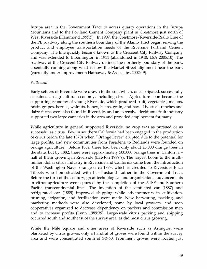
Jurupa area in the Government Tract to access quarry operations in the Jurupa Mountains and to the Portland Cement Company plant in Crestmore just north of West Riverside (Hammond 1995:5). In 1907, the Crestmore/Riverside-Rialto Line of the PE roadway along the southern boundary of the Alamo Tract began serving the
roduct and employee transportation needs of the Riverside Portland Cement e line quickly became known as the Crescent City Railway Company
nd was extended to Bloomington in 1911 (abandoned in 1940; LSA 2005:10). The
xtensive deciduous fruit industryupported two large canneries in the area and provided employment for many.
hile the Mile Square and other areas of Riverside such as Arlington were
pCompany. Tharoadway of the Crescent City Railway defined the northerly boundary of the park, essentially running along what is now the Market Street alignment near the park (currently under improvement; Hathaway & Associates 2002:49).
Settlement
Early settlers of Riverside were drawn to the soil, which, once irrigated, successfully sustained an agricultural economy, including citrus. Agriculture soon became the supporting economy of young Riverside, which produced fruit, vegetables, melons, raisin grapes, berries, walnuts, honey, beans, grain, and hay. Livestock ranches and dairy farms were also found in Riverside, and an es
While agriculture in general supported Riverside, no crop was as pursued or as successful as citrus. Few in southern California had been engaged in the production of citrus before the late 1870s when “Orange Fever” erupted due to the potential for large profits, and new communities from Pasadena to Redlands were founded on orange agriculture. Before 1862, there had been only about 25,000 orange trees in the state, but by 1882, there were approximately 500,000 orange trees in California –half of them growing in Riverside (Lawton 1989:9). The largest boom to the multi-million dollar citrus industry in Riverside and California came from the introduction of the Washington Navel orange circa 1873, which is credited to Riversider Eliza Tibbets who homesteaded with her husband Luther in the Government Tract. Before the turn of the century, great technological and organizational advancements in citrus agriculture were spurred by the completion of the ATSF and Southern Pacific transcontinental lines. The invention of the ventilated car (1887) andrefrigerated car (1889) improved shipping while advancements in cultivation,pruning, irrigation, and fertilization were made. New harvesting, packing, and marketing methods were also developed, some by local growers, and sooncooperatives organized to decrease dependency on packers and commission men and to increase profits (Lynn 1989:39). Large-scale citrus packing and shippingoccurred south and southeast of the survey area, as did most citrus growing.
Wblanketed by citrus groves, only a handful of groves were found within the survey area and were concentrated south of SR-60. Prominent groves were located just
49
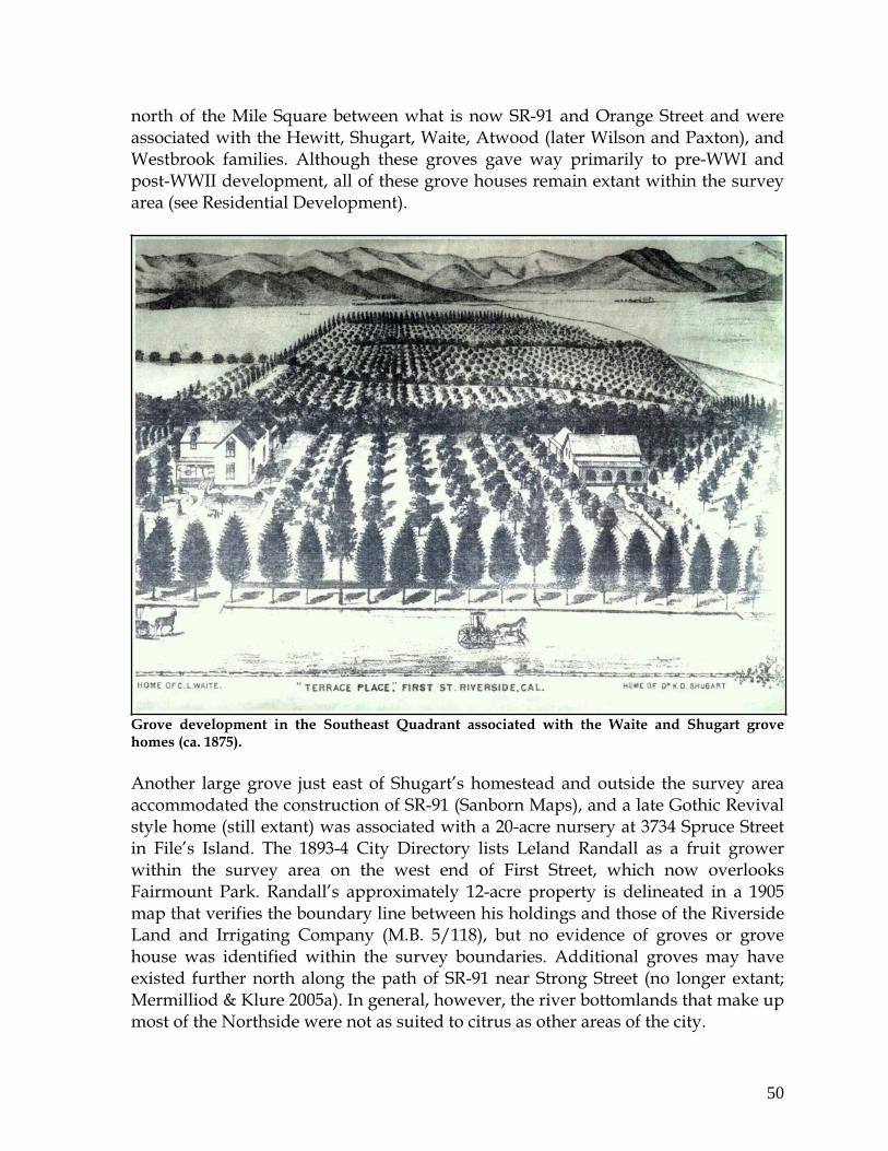
north of the Mile Square between what is now SR-91 and Orange Street and weressociated with the Hewitt, Shugart, Waite, Atwood (later Wilson and Paxton), and
Westbrook families. Although these groves gave way primarily to pre-WWI and post-WWII development, all of these grove houses remain extant within the survey area (see Residential Development).
a
Grove development in the Southeast Quadrant associated with the Waite and Shugart grove homes (ca. 1875).
Another large grove just east of Shugart’s homestead and outside the survey area accommodated the construction of SR-91 (Sanborn Maps), and a late Gothic Revival style home (still extant) was associated with a 20-acre nursery at 3734 Spruce Street in File’s Island. The 1893-4 City Directory lists Leland Randall as a fruit grower within the survey area on the west end of First Street, which now overlooks Fairmount Park. Randall’s approximately 12-acre property is delineated in a 1905 map that verifies the boundary line between his holdings and those of the Riverside Land and Irrigating Company (M.B. 5/118), but no evidence of groves or grove house was identified within the survey boundaries. Additional groves may have existed further north along the path of SR-91 near Strong Street (no longer extant; Mermilliod & Klure 2005a). In general, however, the river bottomlands that make up
ost of the Nm orthside were not as suited to citrus as other areas of the city.
50
Residents on the Northside operated successful farms, dairies, and ranches at various scales. Farmers on the Northside raised a variety of crops, including tomatoes, corn, peaches, walnuts, and berries. The 1893-4 City Directoryacknowledges two farmers outside the survey area - Elio Rena, who was known for his “thrifty” farm of alfalfa and grapes, which was just inside the city limits on North Orange Street, and M.A. Teal, who was listed as a miner and prospector as well as a farmer and horticulturist on North First and Orange Streets. Also beyond the survey boundaries on Clark Street was a large, Asian-owned persimmon farm and the well-known Pellisser Dairy, far north of the survey area, near Center Street. A cornfield and farm that was once within the survey area was displaced by SR-60. The farm was owned by Mrs. Defoni, though the spelling of this Italian surname is
ncertain and may be ‘Difani,’ of, or descendant of, Mills & Difani, which the 1892 ists as a blacksmith and carriage shop at Eighth and Orange Streets.
one of the three dairies listed in the 1893-4 directory were located on the
re recalled by some Northsiders to have been owned by Asian residents. On a
ners.he law served to heighten the already strained interaction between the new Anglo
settlers of Riverside and their Spanish-speaking neighbors (Patterson 1996:60-61).
uCity Directory lNNorthside, but many family dairies were known to exist on North Orange and North Main Streets, and the Arris Dairy, the last to succumb to post-WWII development, was located on Columbia Avenue, just north of the surveyboundaries. Three large egg ranches were found on the Northside – Hardman’s on Columbia Avenue and two others on Chase Street and on North Main Street, which asmaller scale, many residents throughout the Northside existed or supplemented their income through small “truck farms” - patches of land where people lived and farmed small crops that could be loaded onto trucks and sold throughout thecommunity. In addition, many engaged in small-scale ranching by keeping small hen houses and chicken coops (Mermilliod & Klure 2005a).
Proximity and a common agricultural economy necessitated limited interaction between early Riversiders and the residents of La Placita and Agua Mansa. Riversiders hired members of the Spanish-speaking community for various jobs, some Anglos visited the area for Spanish holidays, and at least one Northsider is buried at the San Salvador Cemetery in Agua Mansa, the father of oral history participant Frances McArthur-Wright, but the extent and the reason for its use, whether cultural, religious, or practical, is unclear. For the most part, however, the relationship between the two communities was characterized by “cultural and economic conflict and no noticeable absorption” (Patterson 1996:118). In addition, old laws that served a grazing economy required a landowner to protect their fields with guarded fences, but in 1872, the state legislature passed a No-Fence Act, transferring the responsibility of controlling grazing limits to the animal owT
51
Although nearly destroyed in 1862 by a devastating nighttime flood, it was not until
unded or from when La Placita and Agua ansa began to decline around the turn of the 20th century, has not been
Riverside County was formed from San Bernardino County in 1893 that AguaMansa and the majority of the La Placita settlement were separated from Riverside, and by the early 20th century, La Placita had lost much of its farmland and distinct community character. Many residents or their descendants are reported to have moved to North Orange Street and other parts of Riverside, to Colton, or beyond (Patterson 1996:210, 357). The last remnant of the earliest community in whatbecame Riverside County is the old Trujillo adobe home, which is maintained by Riverside County as a California Point of Historical Interest and County Landmark north of the survey area near the intersection of North Orange and Center Streets (Jennings et. al. 1993:9).
The presence of persons of Spanish, Mexican, or Indian descent in the Northside area, either from the time Riverside was foMacknowledged in the limited historic accounts of the area’s history. But proximity to these villages makes it likely that some Spanish-speakers from this community would have settled in the Northside, and several Spanish names are listed in the 1893-4 City Directory, showing that, whether originating from La Placita, Agua Mansa, or elsewhere, Spanish-speakers were living and working on the Northside early in Riverside’s history. The directory includes many laborers on North Orange Street like L. Garcia, Antonio Martine, Fred Montijo, Alonzo Pennoceio, Rafael Romo, Jose Ronjeld, and Pas Vaca as well as D.C. Valdez, for whom no occupation is listed. In addition, Miguel Estudillo, Deputy County Clerk and Clerk of County Board of Supervisors, and Elio Pena, a well-known and prosperous farmer, lived and worked on North Orange Street. These residents lived and worked in theNorthside along with C.G. Atwood, A.L. Bartlett (attorney and notary at 159 N. Main St). J.E. Bates (laborer), R.H. and Julia A. Benson (viticulturists), J. H. Fountain (J.H. Fountain & Co., real estate, and Deputy Assessor, Eaton Caldwell (nooccupation listed), C.W. Castleman (mason), Cedro De Carlo (horticulturist), James Carlyle (nurseryman), Charles and William Elliot (horticulturists), L.B. Goodrich (farmer), Charles R. Gray (attorney), E.C. Love (note teller at Riverside Banking Company), M.L. Martin (farmer), John McLaren (Under Sheriff), C.A. Newcomb, Edmund B. Richardson (retired), S.L. Spencer (laborer), J.C. Stebbins (Glenwood Tailors, res. North Market), Fred W. Swope (Riverside County Sheriff).
As the historic record for the Northside is sparse, and evidence of historic populations of members of the Spanish, Mexican, Indian or other descent on the Northside is even more obscure, further research must be completed to fully develop an immigration and ethnic diversity theme within the historic context.
52
COMMUNITY DEVELOPMENT
Early residents of the Northside enjoyed many neighborhood places and spaces of informal recreation, but three areas of organized recreation within the historic boundaries of the Northside offered facilities and attractions that also drew participants from downtown and, sometimes, beyond. Athletic Park was located within the survey boundaries while White Sulphur Springs and Fairmount Park border the survey area, but their significance to residents within the Northside warrants inclusion here. Only Fairmount Park is still in use as a public park, but is now drawn outside the City’s newly perceived boundaries of the Northside, whose southern boundary is increasingly recognized as SR-60.
White Sulphur Springs
Since 1876, thousands of Riversiders as well as local and eastern visitors have enjoyed the waters of a natural hot spring captured for use as a bathing and swimming plunge. White Sulphur Springs, a name that has changed many times, is located at 3723-25 Strong Street, near Main Street, just north of the survey area. Historic accounts indicate that the property was either more extensive or was considered to be located on North Orange Street.
ral, a
RP&H 1897:n.p.).
ashousing 60 dressing
oms, galleries, offices, and more was planned and funded by the sale of advanced
First used by local Native Americans, likely Cahuillas and Gabrieliños, the natuhot springs and adjacent tulle bog were purchased by Dr. James P. Greves
ounding Father and Riverside’s first postmaster, in 1876 for their alleged medicinal Fand curative properties. It was in 1886 that William Elliott, a newcomer from Illinois, acquired the springs and capitalized on its healthful and recreational potential. By 1896, Elliott sank the first well on the property and began construction on a plunge to capture the natural mineral waters. The Riverside Press and Horticulturist (RP&H)reports that by September 1897, Elliott was still in the process of improving the property and indicates that the undertaking may have been in response to a public clamoring for specific recreation facilities:
Some months ago we alluded to the question of a public bath and picnic grounds, and the matter has been agitated considerably on the streets. And we believe we voice the sentiments of every man, woman, and child in Riverside when we say that the necessity of a good system of plunge and swimming baths is almost imperative (
By May 1898, RP&H reports that the 40x60-foot natatorium, or swimming pool, wcomplete and that the construction of a glass-roofed buildingrotickets, indicating the popularity of and demand for such a facility.
53
Elliotta Plunge (c. 1900) at N. Orange Street
With the original purchase, Elliott had taken over and maintained Dr. Greeves’ 25-acre vineyard, which contributed to Riverside’s early raisin grape industry, but by 1894, had eliminated it in favor of orange agriculture. Elliott had also opened an area of his ranch that was shaded with pepper, cypress, cottonwood, and willow
her 1984:177) and the whole became a popular social trees for a picnic area (Guntesort.r
Early community demand for and support of the plunge may also have been due to limited domestic bathing. The construction of private bathrooms that featured a shower or bathtub was virtually unknown before the late 19th century and evolved from approximately 1880 to 1900. From foot-powered, hand-held shower nozzles, full immersion tubs with running water via a public water supply source emerged around 1885 and by the turn of the century, a number of models were offered by mail-order catalogue (Lienhard 1998:n.p.). The 1902 Edition of the Sears, Roebuck, and Co. Catalogue offered several hipbaths, an infant bathtub, an oval foot tub, and six full-sized bathtubs, which ranged from 4½ to 6 feet in length, cost from $5.00 (unplumbed) to $28.00, and are generally touted as “perfect in every respect.” The Acme Folding Bath Tub with Instantaneous Heater Combined was marketed to all classes in the same sentence as “Just the thing for your summer home or where you have only a limited amount of space,” and the description for the Stationary Bath Tub indicates that bathtubs were added to the homes of people of “moderate” means while also describing a private bathtub as a luxury. Undoubtedly, private tubs existed in the bathrooms of Riverside’s late Victorian homes, but their
54
prevalence is unknown. Another description from the 1902 Sears Catalogue helps illuminate both the uncommonness of domestic bathtubs and the health-related
esire for full immersion bathing:
ssity is to be in Cline’s Port hoomp ny home ot pr
with a tub, this l d t he longwant, for a small full, invigo , life gibath, such as your ady
Riverside, the plunge was suchdraw for local residents that a second well was dug to 370 feet in 1900, which
he production of Dr.eron’s specialty, medicinal eucalyptus oil. The plunge closed in the summer of
lungeas the site for the Calectric Women’s Picnic and Swimming Party, and Northsiders member it well as a place to go for special times like birthday celebrations
(Mermilliod & Klure 2005b). In the late 1940s, the pool and buildings were entirely rebuilt by Frank Heron, son to Dr. Heron (WSSP c. 1960s).
In 1958, Ray and Virginia Morissette purchased “Heron’s Plunge” and the associated buildings. As part of the improvements the Morissettes made, the mineral baths were separated from the main pool, and badminton and volleyball courts were added as well as a shuffleboard deck and water slide (Daily Press 1959:B-10). By
d
A desirable nece found able S wer Bath.No home is c lete without a bath. As ma s are n ovided
ittle portable bath is constructe o fill t feltcost and no trouble. A rating vingphysician prescribes; always re .
Whatever the private bathing amenities of Victorianasecured a continuous flow of 50,000 gallons per day. A small motor later increased the flow to 200,000 gallons per day, which were emptied from the pool each night and flowed down Strong Street. By the early 1900s, the ultra-pure water of the mineral spring was being bottled onsite and sold for table water in great quantities as far as Los Angeles, and the clear waters were a draw for Hollywood film stars and makers alike such as Buster Keaton, Annette Kellerman, and The GreatHoudini, who in 1919 dived to the bottom of the Elliotta Plunge to release a woman from a safe (Patterson 1964:82; Hall 1996:121-24).
Throughout the early 20th century, local Northsiders frequented the plunge, and visitors and downtown residents were bussed in from the Mission Inn for a dime (WSSP c. 1960s), but the depressed 1930s led to decreased activity at the resort. In 1937, Dr. N.C. Heron of Los Angeles purchased “Elliotta Plunge,” which was as often called Elliotta Springs, and demolished it for the construction of a then-modern sanitarium and health resort, which centered on tH1937 for the planting of a Eucalyptus grove and the construction of the new facilities, which were completed in 1939 (Riverside Press c. 1937:n.p.). It appears thatremnants of this Eucalyptus grove are still extant on the property.
Throughout the 1940s, Heron’s Plunge continued to serve local residents as a spot of informal recreation and also as one for large parties and events. In 1946, the pwre
55
1959, the plunge was reopened as White Sulphur Springs. A 1960s brochure still touted the medicinal properties of the 78-100° hot spring as “unexcelled for relief of arthritis, rheumatism, etc., or just plain sore muscles,” and also listed the amenities of the facility, which, in addition to swimming and recreation, offered swimming lessons, concessions, towels, and suit rentals (WSSP c. 1960s).
The facility continued to operate as a pay-for-use public pool under the Morissette’s ownership and occupation until the late 1960s (Hanks 2005). Recreational facilities and several associated buildings are still extant today, but are no longer in operation, and the property has been severely neglected for some time. Among other public baths and plunges within the city, some believe that the plunge catered to a white middle- and upper-class clientele, and oral histories suggest that pressures to racially integrate the plunge led to its closure, which was no doubt as impacted by the rise in construction of private swimming pools in the later half of the 20th century.
The property was surveyed in 1979 and designated a City Structure of Merit in 1989. The site is currently being considered for a residential housing development. As the property is outside the survey boundaries, site-specific study and evaluation is recommen
the Southern California region, and part of the ourse for the annual meets was located at Athletic Park. The Riverside Wheelman’s lub was organized in 1891 under the leadership of Harry W. Hawes of N.S. Hawes
and Son, a music and art store located at 12 Main Street, which also sold sewingmachin in 1893-4. N.S. Hawes and Son
as touted as being the “exclusive agents for the Columbia bicycles for this section” (Bynon & Son 1893-4:[63]). Many different models of the Columbia bicycle produced
ded during Phase II.
Athletic Park
Athletic Park (c. 1892 to 1902) is located at the base of North Hill, above Fairmount Park and northwest of the intersection of Houghton Avenue and Locust Street in the Fairmount Heights area. Historically called North Hill or Quarry Hill, it wasidentified on a 1911 tract map as “Fairmount Hill and City Rock Quarry” and was included in the Fairmount Heights Tract (1893), a subdivision by John G. North, a real estate and nursery man, for R.E. Houghton and C.E. Houghton under the parent company, Fairmount Park Land Company (1890). In 1895, the City purchased 35 acres of the tract, including the Spring Brook meadow, which became Fairmount Park (dedicated 1897), and North Hill, which was quarried to provide the rawmaterials needed to implement the City’s new street improvement vision of pavedstreets (Macadam) and granite curbs and gutters.
From 1892-1900, the Riverside Wheelmen’s Club held an annual event for clubmembers and other enthusiasts fromcC
7es and was advertised as a “bicycle agency”
w
56
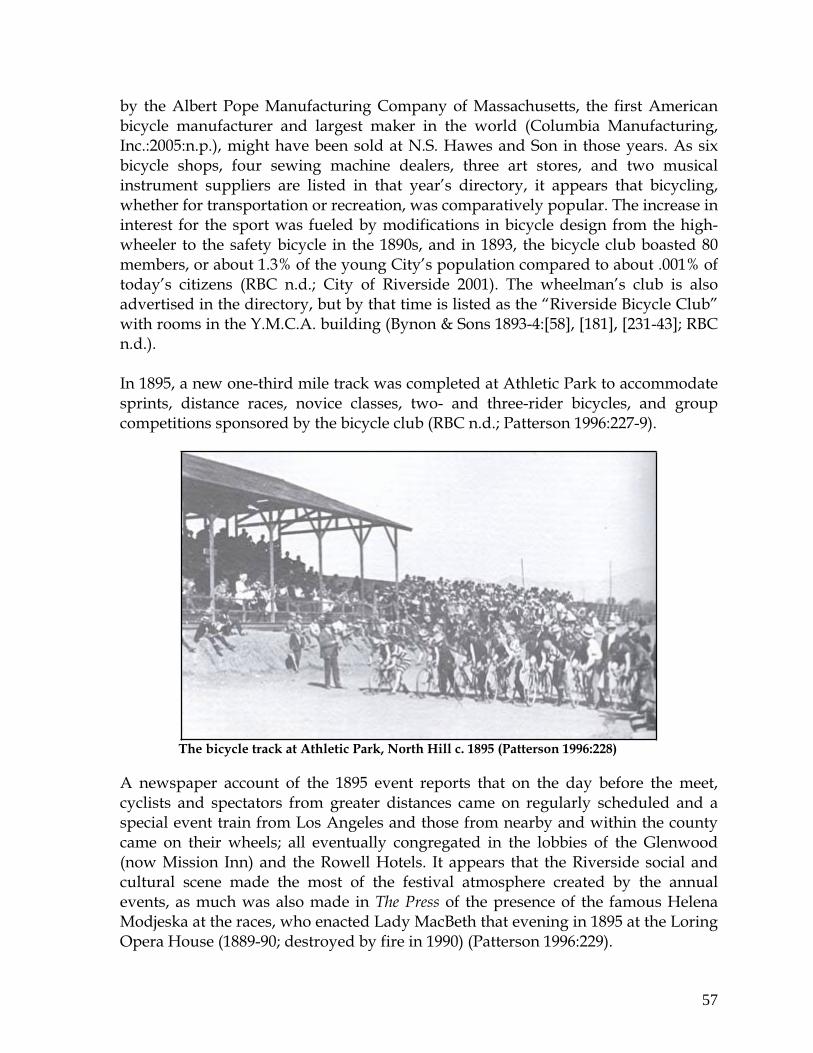
by the Albert Pope Manufacturing Company of Massachusetts, the first American bicycle manufacturer and largest maker in the world (Columbia Manufacturing, Inc.:2005:n.p.), might have been sold at N.S. Hawes and Son in those years. As six bicycle shops, four sewing machine dealers, three art stores, and two musical instrument suppliers are listed in that year’s directory, it appears that bicycling, whether for transportation or recreation, was comparatively popular. The increase in interest for the sport was fueled by modifications in bicycle design from the high-wheeler to the safety bicycle in the 1890s, and in 1893, the bicycle club boasted 80 members, or about 1.3% of the young City’s population compared to about .001% of today’s citizens (RBC n.d.; City of Riverside 2001). The wheelman’s club is also advertised in the directory, but by that time is listed as the “Riverside Bicycle Club” with rooms in the Y.M.C.A. building (Bynon & Sons 1893-4:[58], [181], [231-43]; RBC
.d.).n
In 1895, a new one-third mile track was completed at Athletic Park to accommodate sprints, distance races, novice classes, two- and three-rider bicycles, and groupcompetitions sponsored by the bicycle club (RBC n.d.; Patterson 1996:227-9).
The bicycle track at Athletic Park, North Hill c. 1895 (Patterson 1996:228)
A newspaper account of the 1895 event reports that on the day before the meet, cyclists and spectators from greater distances came on regularly scheduled and a special event train from Los Angeles and those from nearby and within the county came on their wheels; all eventually congregated in the lobbies of the Glenwood (now Mission Inn) and the Rowell Hotels. It appears that the Riverside social and cultural scene made the most of the festival atmosphere created by the annual events, as much was also made in The Press of the presence of the famous Helena Modjeska at the races, who enacted Lady MacBeth that evening in 1895 at the Loring Opera House (1889-90; destroyed by fire in 1990) (Patterson 1996:229).
57
Well known Riversider cyclist Carson Shoemaker, who was also celebrated in the east, as well as internationally known track and field coach Dean Cromwell were regular competitors. By 1900, the electric streetcar had been completed to Locust and Houghton Streets at the edge of Athletic Park, and the largest and last meet took place in that year. The decision to cancel the meets may have been influenced by the
roximity of the track to North Hill, a very active quarry in the last years of the 19th
ources differ on the continuity of the Riverside Wheelman’s Club to the present club, the Riverside Bicycle Club. A 2001 Riverside Proclamation suggests that a bicycle club was operational from 1891 to today with the name changed from Riverside Wheelman’s Club to the Riverside Bicycle Club in 1960. Information on file in the current club’s library indicates that from 1936-WWII, another bicycle club that emphasized road races and recreational riding was formed and the current club was organized in the early 1960s. Interestingly, the club is listed as the “Riverside Bicycle Club” in the 1893-4 City Directory. The precise history of the club has not been fully developed, but it is clear that the Riverside Wheelmen’s Club is at least an ancestor to today’s Riverside Bicycle Club, which is a thriving organization formally recognized and applauded by the City for its commitment to fitness, safety, and charity.
Fairmount Park
Sprawled between the former Crescent City Railway roadway (now the current alignment of Market Street) to the north, the Santa Ana River to the west, Little Mount Rubidoux to the south, and the Fairmount Heights residential development to the east, the approximately 200-acre Fairmount Park is a historically, aesthetically, and cult rthside survey boundaries.
pcentury, but by then, enthusiasm for bicycling around the region had waned. Tracks also closed in Ontario, Pasadena, Los Angeles, and other cities, and by early 1902, the bicycle club gave up their lease on the land and sold the grandstand and fence, which were moved to Chemawa Park (Patterson 1996:229), a 23-acre community park in the Arlington area (8830 Magnolia Avenue) that had opened in the late 1890s and offered a zoo, aviary, and roller skating rink, and provided traditional open space for leisurely pastimes, such as picnicking, fairs and athletic recreation (Tang et al. 2003:28).
S
urally significant area located just outside the No
As the largest park in Riverside, Fairmount Park boasts three separate lakes –Fairmount Lake (formerly Dexter Lake, circa 1904), Lake Evans (circa 1924), andBrown Lake (circa 1924) – and various other amenities among an open space settingof turf, shrubs, curvilinear roadways, and a huge variety of mature trees, many ofwhich were gifted and planted before 1922 by Riversiders on a designated arbor day(Brown & Boyd 1922). In addition to boating and fishing on the lake, the park offers
58
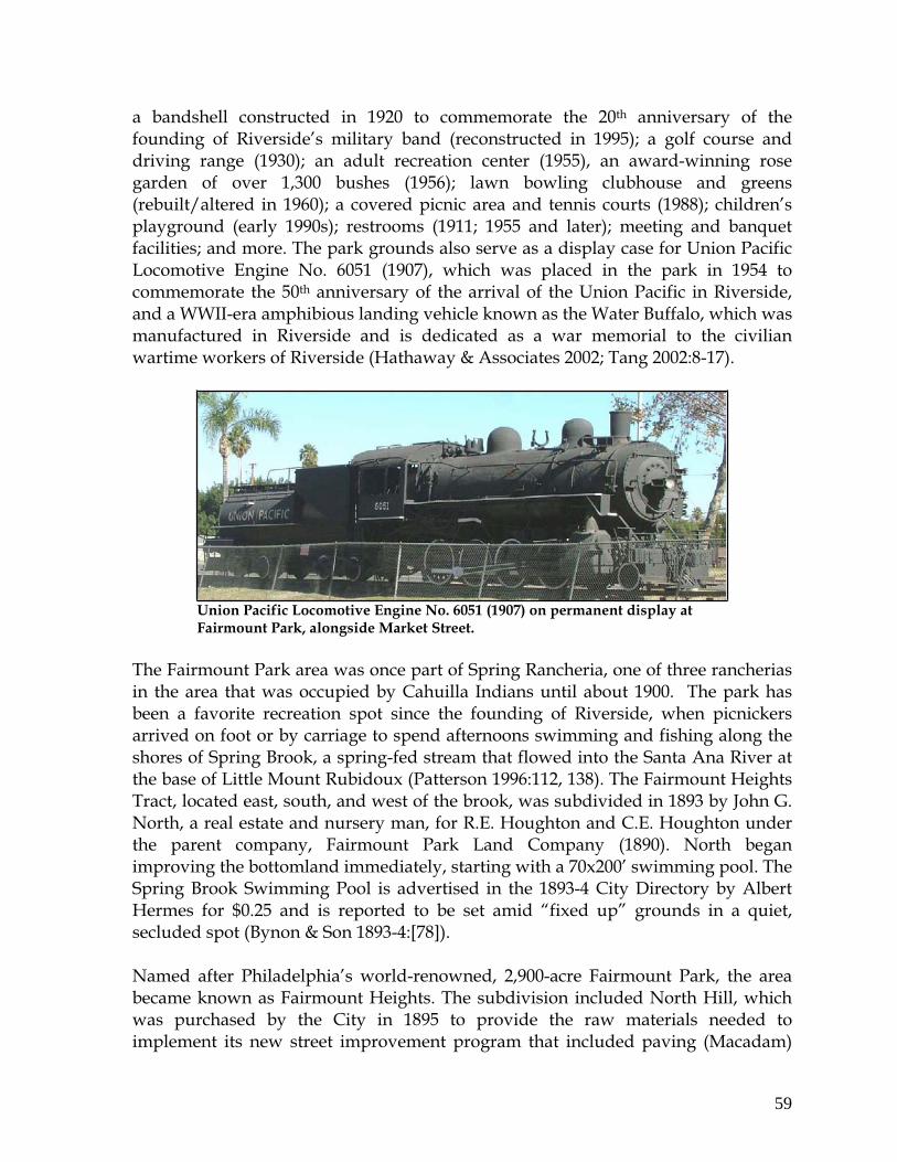
a bandshell constructed in 1920 to commemorate the 20th anniversary of thefounding of Riverside’s military band (reconstructed in 1995); a golf course anddriving range (1930); an adult recreation center (1955), an award-winning rosegarden of over 1,300 bushes (1956); lawn bowling clubhouse and greens(rebuilt/altered in 1960); a covered picnic area and tennis courts (1988); children’splayground (early 1990s); restrooms (1911; 1955 and later); meeting and banquetfacilities; and more. The park grounds also serve as a display case for Union PacificLocomotive Engine No. 6051 (1907), which was placed in the park in 1954 tocommemorate the 50th anniversary of the arrival of the Union Pacific in Riversideand a WWII-era am
,phibious landing vehicle known as the Water Buffalo, which was
anufactured in Riverside and is dedicated as a war memorial to the civilian mwartime workers of Riverside (Hathaway & Associates 2002; Tang 2002:8-17).
Union Pacific Locomotive Engine No. 6051 (1907) on permanent display atFairmount Park, alongside Market Street.
The Fairmount Park area was once part of Spring Rancheria, one of three rancheriasin the area that was occupied by Cahuilla Indians until about 1900. The park hasbeen a favorite recreation spot since the founding of Riverside, when picnickersarrived on foot or by carriage to spend afternoons swimming and fishing along theshores of Spring Brook, a spring-fed stream that flowed into the Santa Ana River atthe base of Little Mount Rubidoux (Patterson 1996:112, 138). The Fairmount HeightsTract, located east, south, and west of the brook, was subdivided in 1893 by John GNorth, a real estate and nursery man, for R.E. Houghton and C.E. Houghton underthe parent company, Fairmount Park Land Company (1890). North beganimproving the bottomland immediately, starting with a 70x200’ swimming pool. TheSpring Brook Swimming Pool is advertised in the 1893-4 City Directory by AlbertHermes for $0.25 and is reported to be set amid “fixed up” grounds in a quiet,secluded spot (Bynon & Son 1893-4:[78]).
.
amed after Philadelphia’s world-renowned, 2,900-acre Fairmount Park, the area
)
Nbecame known as Fairmount Heights. The subdivision included North Hill, whichwas purchased by the City in 1895 to provide the raw materials needed toimplement its new street improvement program that included paving (Macadam
59
and granite curbs and gutters. Included in the 35-acre purchase was the meadowthrough which Spring Brook flowed and a stipulation that the City develop themeadow into a park. The original 35-acre Fairmount Park was officially dedicatedby City Ordinance #241 in October 1897 and opened on Arbor Day in April 1898.Between the purchase agreement and the official dedication, the City allowedCaptain Charles M. Dexter, a Union Veteran of the Civil War, and a committee of thGrand Army of the Republic to improve the unofficial public playground and picnicspot and to plant Mexico-native Montezuma Bald Cypress trees (Taxodiummucronatum). Captain Dexter, who arrived in Riverside in 1890 and died in 1918became superintendent of the park and is considered the “father” of Fairmount Park(Brown & Boyd:1922). In 1903, Samuel Cary Evans, Sr. donated 70 acres to the park,and Fairmount Lake (first Dexter Lake) was created by damming the waters ofSpring Brook. In 1910, private donations by Mayor Samuel C. Evans, Jr. and hisbrother Pliny Evans added to the park, and a trip to Asia influenced RiversiderGeorge N. Reynolds to donate additional land and encourage Japanese-inspiredalterations to the lake (Black 1995). That same year, a $30,000 bond issue wasapproved to improve the park by adding a plunge and a wading pool (RCPD 1985).The plunge was opened in 1912, and in 1920, unofficial racial restrictions thatallowed African American citizens to use the plunge only on Thursdays promptedlitigation against the City. Though the incident was settled out of court in 1922opening the plunge to all, by 1925, the completion
e
,
of the plunge at Lincoln School on e Eastside essentially reestablished segregation when most African Americans
chose to use the new plunge nearest t eir own neighborhoods and visited the Fairmo Patterson 299-301).
thh
unt Park plunge only for an annual church picnic (
60
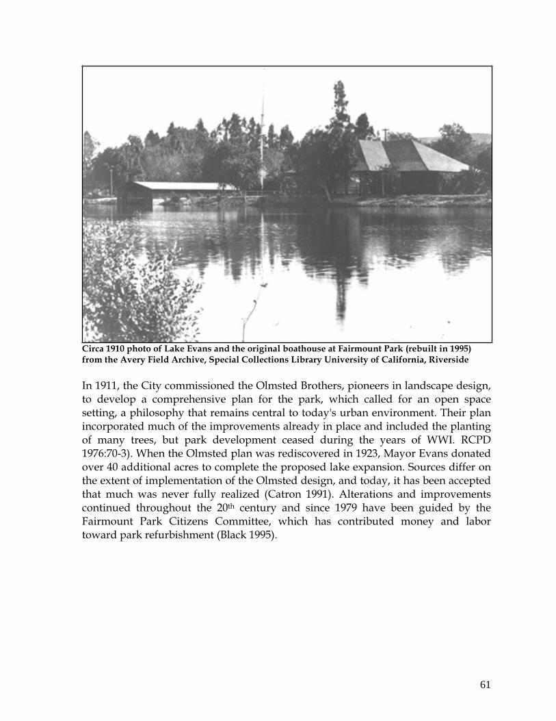
Circa 1910 photo of Lake Evans and the original boathouse at Fairmount Park (rebuilt in 1995) from the Avery Field Archive, Special Collections Library University of California, Riverside
In 1911, the City commissioned the Olmsted Brothers, pioneers in landscape design, to develop a comprehensive plan for the park, which called for an open space setting, a philosophy that remains central to today's urban environment. Their plan incorporated much of the improvements already in place and included the planting
f many trees, but park development ceased during the years of WWI. RCPD o1976:70-3). When the Olmsted plan was rediscovered in 1923, Mayor Evans donated over 40 additional acres to complete the proposed lake expansion. Sources differ on the extent of implementation of the Olmsted design, and today, it has been accepted that much was never fully realized (Catron 1991). Alterations and improvements continued throughout the 20th century and since 1979 have been guided by the Fairmount Park Citizens Committee, which has contributed money and labor toward park refurbishment (Black 1995).
61
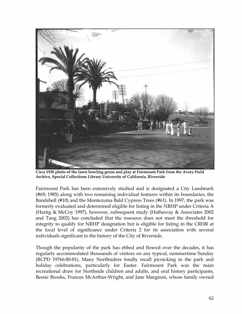
the lawn bowling green and play at Fairmount Park from the Avery Field Circa 1930 photo ofArchive, Special Collections Library University of California, Riverside
Fairmount Park has been extensively studied and is designated a City Landmark (#69; 1985) along with two remaining individual features within its boundaries, the Bandshell (#10) and the Montezuma Bald Cypress Trees (#61). In 1997, the park was formerly evaluated and determined eligible for listing in the NRHP under Criteria A (Hartig & McCoy 1997), however, subsequent study (Hathaway & Associates 2002 and Tang 2002) has concluded that the resource does not meet the threshold for integrity to qualify for NRHP designation but is eligible for listing in the CRHR at the local level of significance under Criteria 2 for its association with severalindividuals significant to the history of the City of Riverside.
Though the popularity of the park has ebbed and flowed over the decades, it has regularly accommodated thousands of visitors on any typical, summertime Sunday (RCPD 19766:80-81). Many Northsiders fondly recall picnicking in the park and holiday celebrations, particularly for Easter. Fairmount Park was the mainrecreational draw for Northside children and adults, and oral history participants, Bessie Brooks, Frances McArthur-Wright, and Jane Margison, whose family owned
62
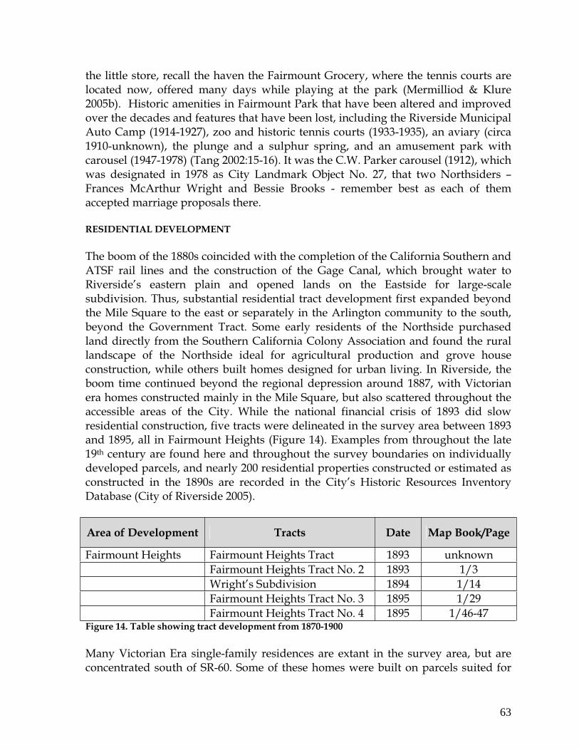
the little store, recall the haven the Fairmount Grocery, where the tennis courts are located now, offered many days while playing at the park (Mermilliod & Klure 2005b). Historic amenities in Fairmount Park that have been altered and improved over the decades and features that have been lost, including the Riverside Municipal Auto Camp (1914-1927), zoo and historic tennis courts (1933-1935), an aviary (circa 1910-unknown), the plunge and a sulphur spring, and ancarousel (1947-1978) (Tang 2002:15-16). It was the C.W. Parkewas designated in 1978 as City Landmark Object No. 27,Frances McArthur Wright and Bessie Brooks - rememberaccepted marriage proposals there.
RESIDENTIAL DEVELOPMENT
The boom of the 1880s coincided with the completion of the CATSF rail lines and the construction of the Gage Canal, wRiverside’s eastern plain and opened lands on the Esubdivision. Thus, substantial residential tract developmenthe Mile Square to the east or separately in the Arlington cobeyond the Government Tract. Some early residents of thland directly from the Southern California Colony Associatlandscape of the Northside ideal for agricultural producconstruction, while oth
amusement park withr carousel (1912), whichthat two Northsiders –
best as each of them
alifornia Southern andhich brought water to
astside for large-scalet first expanded beyond
mmunity to the south,e Northside purchasedion and found the ruraltion and grove house
ers built homes designed for urban living. In Riverside, the oom time continued beyond the regional depression around 1887, with Victorianra homes constructed mainly in the Mile Square, but also scattered throughout the ccessible areas of the City. While the national financial crisis of 1893 did slow sidential construction, five tracts were delineated in the survey area between 1893
nd 1895, all in Fairmount Heights (Figure 14). Examples from throughout the late9th century are found here and throughout the survey boundaries on individually eveloped parcels, and nearly 200 residential properties constructed or estimated asonstructed in the 1890s are recorded in the City’s Historic Resources Inventory atabase (City of Riverside 2005).
bearea1dcD
Area of Development Tracts Date Map Book/Page
Fairmount Heights Fairmount Heights Tract 1893 unknownFairmount Heights Tract No. 2 1893 1/3
Wright’s Subdivision 1894 1/14Fairmount Heights Tract No. 3 1895 1/29Fairmount Heights Tract No. 4 1895 1/46-47
Figure 14. Table showing tract development from 1870-1900
Many Victorian Era single-family residences are extant in tconcentrated south of SR-60. Some of these homes were bu
he survey area, but areilt on parcels suited for
63
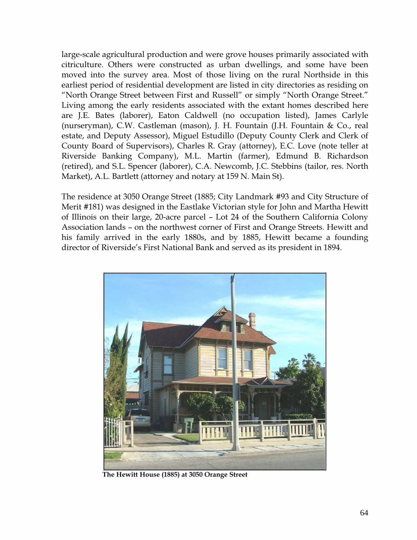
large-scale agricultural production and were grove houses primarily associated with citriculture. Others were constructed as urban dwellings, and some have been moved into the survey area. Most of those living on the rural Northside in this earliest period of residential development are listed in city directories as residing on “North Orange Street between First and Russell” or simply “North Orange Street.” Living among the early residents associated with the extant homes described here are J.E. Bates (laborer), Eaton Caldwell (no occupation listed), James Carlyle(nurseryman), C.W. Castleman (mason), J. H. Fountain (J.H. Fountain & Co., real estate, and Deputy Assessor), Miguel Estudillo (Deputy County Clerk and Clerk of County Board of Supervisors), Charles R. Gray (attorney), E.C. Love (note teller at Riverside Banking Company), M.L. Martin (farmer), Edmund B. Richardson (retired), and S.L. Spencer (laborer), C.A. Newcomb, J.C. Stebbins (tailor, res. North Market), A.L. Bartlett (attorney and notary at 159 N. Main St).
The residence at 3050 Orange Street (1885; City Landmark #93 and City Structure of Merit #181) was designed in the Eastlake Victorian style for John and Martha Hewitt of Illinois on their large, 20-acre parcel – Lot 24 of the Southern California Colony Association lands – on the northwest corner of First and Orange Streets. Hewitt and his family arrived in the early 1880s, and by 1885, Hewitt became a foundingdirector of Riverside’s First National Bank and served as its president in 1894.
The Hewitt House (1885) at 3050 Orange Street
64
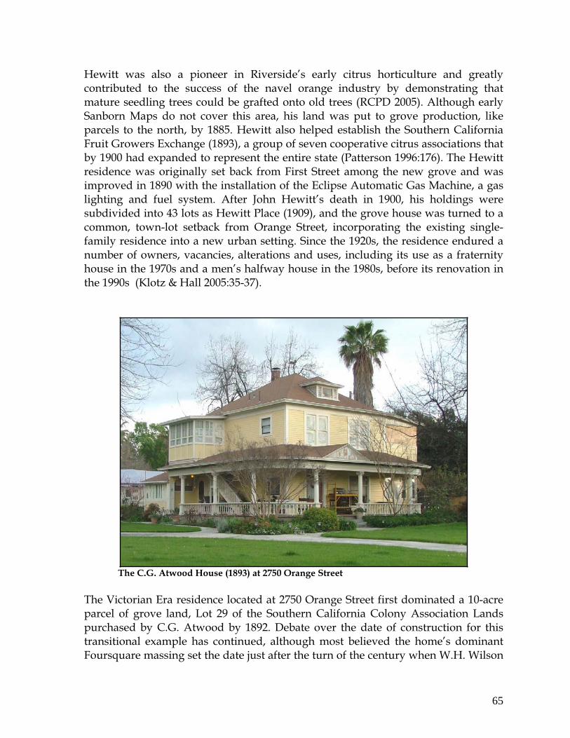
Hewitt was also a pioneer in Riverside’s early citrus horticulture and greatly ontributed to the success of the navel orange industry by demonstrating that ature seedling trees could be grafted onto old trees (RCPD 2005). Although early
anborn Maps do not cover this area, his land was put to grove production, like arcels to the north, by 1885. Hewitt also helped establish the Southern California ruit Growers Exchange (1893), a group of seven cooperative citrus associations that
cmSpFby 1900 had expanded to represent the entire state (Patterson 1996:176). The Hewitt residence was originally set back from First Street among the new grove and was improved in 1890 with the installation of the Eclipse Automatic Gas Machine, a gas lighting and fuel system. After John Hewitt’s death in 1900, his holdings weresubdivided into 43 lots as Hewitt Place (1909), and the grove house was turned to a common, town-lot setback from Orange Street, incorporating the existing single-family residence into a new urban setting. Since the 1920s, the residence endured a number of owners, vacancies, alterations and uses, including its use as a fraternity house in the 1970s and a men’s halfway house in the 1980s, before its renovation in the 1990s (Klotz & Hall 2005:35-37).
The C.G. Atwood House (1893) at 2750 Orange Street
The Victorian Era residence located at 2750 Orange Street first dominated a 10-acre parcel of grove land, Lot 29 of the Southern California Colony Association Lands purchased by C.G. Atwood by 1892. Debate over the date of construction for this transitional example has continued, although most believed the home’s dominant Foursquare massing set the date just after the turn of the century when W.H. Wilson
65
was believed to have constructed the residence after his arrival in Riverside in 1902. Although the Colonial Revival style, of which the Classic Box, or Foursquare, is a subtype, is commonly seen in Riverside in the first years of the 20th century, McAlester sets the period for the style from 1880-1955 (McAlester 2000:321). Though rare in Riverside, the earliest examples would have undoubtedly been influenced by neighboring Victorian Era predecessors as the form of late examples throughout the City are shaped by the sprawling, post-WWII Ranch style.
Assessor’s Records support this evaluation of the blend of architectural styles found in this early Foursquare as well as the current owners’ (Scott and Joanne Simpson) discovery of 1893 newspaper shreds found in the attic as insulation. C.G. Atwood is listed as the owner of the property in 1892, and no figures are listed for building improvements or trees. The following year, an improvement is assessed at $1200 with the notation, “House + S,” and $1,180 is listed for trees, which are noted to be a mixture of buds and seeds (Assessor’s Records 1892-1895:Bk. 2, Pg. 3). Clearly, the home and grove were established by 1893, and the residence is an example of an early Classic Box, or Foursquare, one of the nine principal subtypes of the Colonial Revival style built during Riverside’s grove-inspired Victorian Era as it moved into the Eclectic P
residence until they sold the property in 1956 to the Bumsteads ermilliod 2005a). By this time, the area around it had been subdivided as part of
No. 3 Tract (1954), one of three subdivisions in the early 1950s that dded the Audubon Place and Hiawatha Place cul-de-sacs to the Southeast
eriod.
The C.G. Atwood House has been associated with several families of long-term occupancy. Historical accounts suggest that William H. and Mary Wilson, long-believed to be the home’s first owners and occupants, had arrived in Riverside in 1902, and Assessor’s records indicate that he either acquired the reduced property of 4.5 acres by 1905 (Assessor’s Records 1899-1907:Bk. 2, Pg. 3; Hall 2003:41). The Wilsons established a small dairy on the property, maintained a citrus grove, and raised livestock. Arthur D. Paxton, employed with the Southern California Gas Company, purchased the home in 1920, and the property’s use shifted more toward dairy production than citrus. Though the exterior staircase on the veranda was extant and rooms in the home were already being rented out when the Paxtons moved in, according to the Paxton daughters, Harriet and Mary Helen, manyalterations and additions were made to the home during the Paxton period such as the addition of the kitchen and enclosed sleeping porches and alterations andadditions to the rear of the home. The Paxtons continued to rent out the entire second floor of the(Mthe Oak ManoraQuadrant and the original parcel had been reduced to .84 acres (M.B. 27/33). The Bumsteads (1956-1978) and later the Osborns (1978-1997) are credited withpreserving and restoring much of the old house and converting the interior of the home back into a single-family residence (Hall 2003:43). The Simpsons are
66
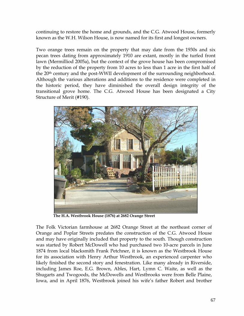
continuing to restore the home and grounds, and the C.G. Atwood House, formerly known as the W.H. Wilson House, is now named for its first and longest owners.
Two orange trees remain on the property that may date from the 1930s and six pecan trees dating from approximately 1910 are extant, mostly in the turfed front lawn (Mermilliod 2005a), but the context of the grove house has been compromised by the reduction of the property from 10 acres to less than 1 acre in the first half of
e 20th century and the post-WWII development of the surrounding neighborhood. thAlthough the various alterations and additions to the residence were completed in the historic period, they have diminished the overall design integrity of thetransitional grove home. The C.G. Atwood House has been designated a CityStructure of Merit (#190).
stbrook House (1876) at 2682 Orange StreetThe H.A. We
The Folk Victorian farmhouse at 2682 Orange Street at the northeast corner of Orange and Poplar Streets predates the construction of the C.G. Atwood House and may have originally included that property to the south. Though construction was started by Robert McDowell who had purchased two 10-acre parcels in June 1874 from local blacksmith Frank Petchner, it is known as the Westbrook House for its association with Henry Arthur Westbrook, an experienced carpenter who likely finished the second story and fenestration. Like many already in Riverside, including James Roe, E.G. Brown, Ables, Hart, Lymn C. Waite, as well as the Shugarts and Twogoods, the McDowells and Westbrooks were from Belle Plaine, Iowa, and in April 1876, Westbrook joined his wife’s father Robert and brother
67
William in Riverside to find relief and a cure for his tuberculosis. At that time, the house was not quite finished, and Robert and William McDowell died in 1877,oon after Westbrook arrived, leaving the property to Westbrook and his wife Jane
Riverside with their daughter Ada later that year. McDowell maylso have deeded additional acreage to the north to P.S. Russell (McDowell-
wnstairs bathroom boasted a sink and a athtub (likely not original as private, full immersion bathing began to evolve
tral Avenue, a three-story home for S.C. vans on Magnolia Avenue (1890), the Frank B. Devine house (1888) at 4475 12th
M.C.A. Building (1888-9) on Main Street, the William S. Sweatt House 891) at 4587 Mulberry Street, and the downtown Evans Building (1892).
itrus grower, and his two daughters, Ada and Lova, inherited the ouse (Patterson 1980:n.p.). In 1933, Ada traded the Westbrook House for grower,
swho came toaWestbrook 1877).
Westbrook inherited a cow, over 100 chickens, and 20 acres planted mostly in young orange trees (Seedlings, St. Michaels, Blood and Valencia oranges), alfalfa, peaches, apricots, almonds, figs, prunes, strawberries, and raisin grapes. A domestic water cistern on the property was supplied with canal water (Patterson 1980:n.p.). Eventually, a two-story tank house and well were added behind a later adobe building (1882) constructed for cool storage, and a separate servants’ quarter for laborers was located to the north (Patterson 1980:n.p.). Originally, only one bedroom filled the second floor, but Westbrook added two bedrooms and made the original bedroom into a bathroom in 1882 and added two more bedrooms in 1920. Reportedly, a dobaround 1885), but the toilet was on the back porch (McDowell-Westbrook n.d.).
Though a skilled carpenter by trade, and fast becoming a leading horticulturist via inheritance, Westbrook kept his own house modest while crafting beautiful homes, shops, and office buildings for friends and neighbors. After his initial convalescence, Westbrook built a drug store for James Roe, the Lyman C. Waite Residence (1884/1890) at 3121 Mulberry Street, the Daniels House (1891) at 5809 Brockton Avenue, the Ames-Westbrook House (1888) at 4811 Brockton Avenue, the Streeter House (1888) at 5211 CenEStreet, the Y.(1Westbrook also was a member grower and served on the Board of the Riverside Exchange of the California Fruit Growers Exchange, now Sunkist Growers, Inc., and he was recognized as a true horticulturist. Westbrook also helped start the National Bank of Riverside in 1906 and served on its board and as Vice President (Hall 2005:3; City of Riverside 2005).
Westbrook died in January 1922 after he had become a prominent local building contractor and chJohn S. Gage’s home on Magnolia Avenue. In late 1940s, the property was reduced to 10 acres and sold to Jack and Laura Parks and it later became rental property for a time. It was in severe disrepair by 1997, when Mark and Lucille Chacon purchased the property and began ongoing restoration work. Several additional
68
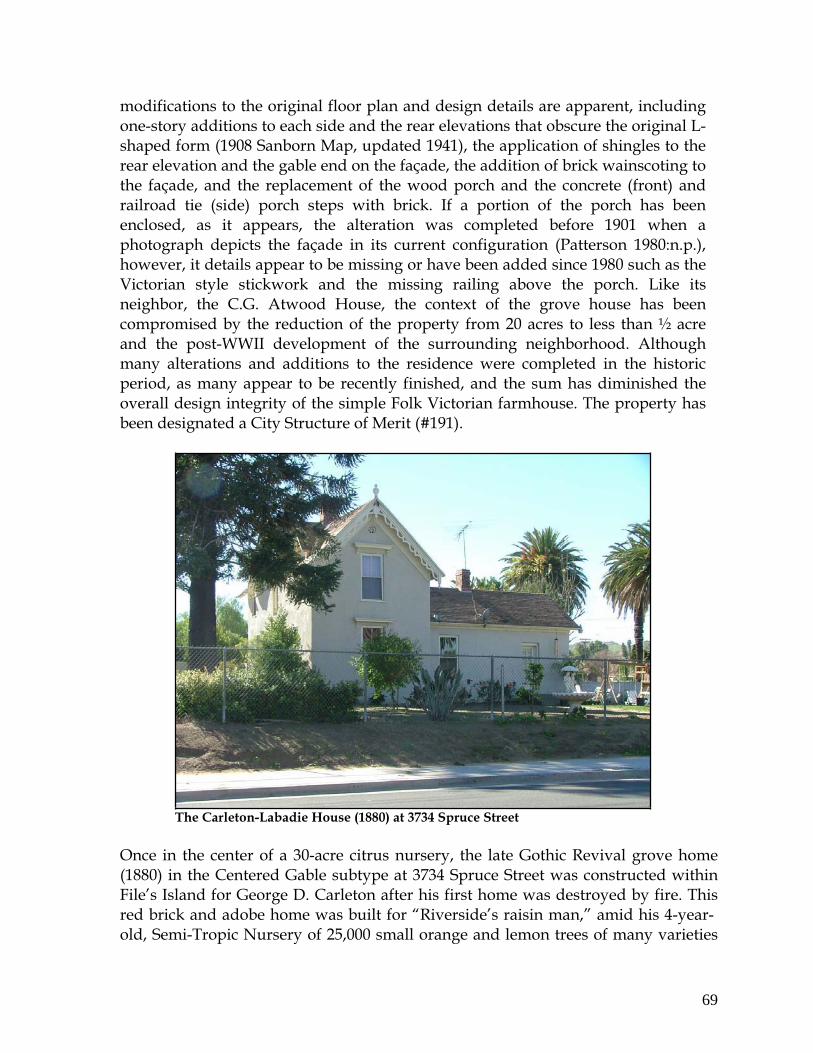
modifications to the original floor plan and design details are apparent, including one-story additions to each side and the rear elevations that obscure the original L-shaped form (1908 Sanborn Map, updated 1941), the application of shingles to the rear elevation and the gable end on the façade, the addition of brick wainscoting to the façade, and the replacement of the wood porch and the concrete (front) and railroad tie (side) porch steps with brick. If a portion of the porch has been enclosed, as it appears, the alteration was completed before 1901 when a photograph depicts the façade in its current configuration (Patterson 1980:n.p.), however, it details appear to be missing or have been added since 1980 such as the
ictorian style stickwork and the missing railing above the porch. Like its r, the C.G. Atwood House, the context of the grove house has been
ompromised by the reduction of the property from 20 acres to less than ½ acre
Vneighbocand the post-WWII development of the surrounding neighborhood. Although many alterations and additions to the residence were completed in the historic period, as many appear to be recently finished, and the sum has diminished the overall design integrity of the simple Folk Victorian farmhouse. The property has been designated a City Structure of Merit (#191).
The Carleton-Labadie House (1880) at 3734 Spruce Street
Once in the center of a 30-acre citrus nursery, the late Gothic Revival grove home (1880) in the Centered Gable subtype at 3734 Spruce Street was constructed within File’s Island for George D. Carleton after his first home was destroyed by fire. This red brick and adobe home was built for “Riverside’s raisin man,” amid his 4-year-old, Semi-Tropic Nursery of 25,000 small orange and lemon trees of many varieties
69
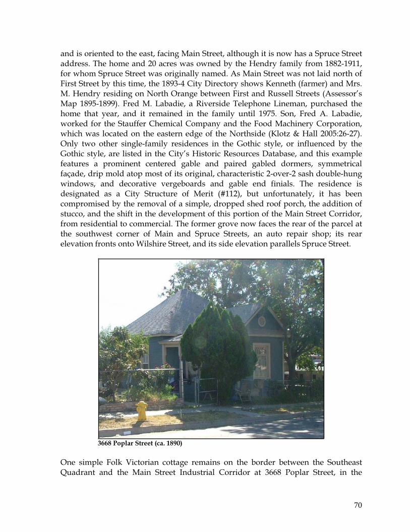
and is oriented to the east, facing Main Street, although it is now has a Spruce Streetddress. The home and 20 acres was owned by the Hendry family from 1882-1911,
ld atop most of its original, characteristic 2-over-2 sash double-hung indows, and decorative vergeboards and gable end finials. The residence is
City Structure of Merit (#112), but unfortunately, it has been ompromised by the removal of a simple, dropped shed roof porch, the addition of
afor whom Spruce Street was originally named. As Main Street was not laid north of First Street by this time, the 1893-4 City Directory shows Kenneth (farmer) and Mrs. M. Hendry residing on North Orange between First and Russell Streets (Assessor’s Map 1895-1899). Fred M. Labadie, a Riverside Telephone Lineman, purchased the home that year, and it remained in the family until 1975. Son, Fred A. Labadie, worked for the Stauffer Chemical Company and the Food Machinery Corporation, which was located on the eastern edge of the Northside (Klotz & Hall 2005:26-27). Only two other single-family residences in the Gothic style, or influenced by the Gothic style, are listed in the City’s Historic Resources Database, and this example features a prominent centered gable and paired gabled dormers, symmetricalfaçade, drip mowdesignated as acstucco, and the shift in the development of this portion of the Main Street Corridor, from residential to commercial. The former grove now faces the rear of the parcel at the southwest corner of Main and Spruce Streets, an auto repair shop; its rear elevation fronts onto Wilshire Street, and its side elevation parallels Spruce Street.
3668 Poplar Street (ca. 1890)
One simple Folk Victorian cottage remains on the border between the Southeastuadrant and the Main Street Industrial Corridor at 3668 Poplar Street, in the Q
70
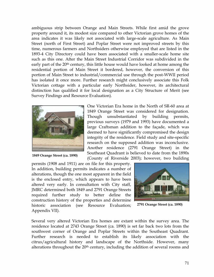
ambiguous strip between Orange and Main Streets. While first amid the grove property around it, its modest size compared to other Victorian grove homes of the area indicates it was likely not associated with large-scale agriculture. As Main Street (north of First Street) and Poplar Street were not improved streets by this time, numerous farmers and Northsiders otherwise employed that are listed in the 1893-4 City Directory could have been associated with a smaller-scale home site such as this one. After the Main Street Industrial Corridor was subdivided in the early part of the 20th century, this little house would have looked at home among the residential portion of Main Street it bordered, however, the conversion of this portion of Main Street to industrial/commercial use through the post-WWII period has isolated it once more. Further research might conclusively associate this Folk Victorian cottage with a particular early Northsider, however, its architecturaldistinction has qualified it for local designation as a City Structure of Merit (see Survey Findings and Resource Evaluation).
One Victorian Era home in the North of SR-60 area at 1849 Orange Street was considered for designation. Though unsubstantiated by building permits,previous surveys (1979 and 1993) have documented a large Craftsman addition to the façade, which wasdeemed to have significantly compromised the design integrity of the residence. Field study and site-specific research on the supposed addition was inconclusive. Another residence (2791 Orange Street) in theSoutheast Quadrant is believed to date from the 1890s
source Evaluatioppendix VII).
everal very altered Victorian Era homes are extant within the survey area. The
(County of Riverside 2003); however, two building permits (1908 and 1911) are on file for this property. In addition, building permits indicates a number of alterations, though the one most apparent in the field is the enclosed entry, which appears to have been altered very early. In consultation with City staff, JMRC determined both 1849 and 2791 Orange Streets required further study to better define the construction history of the properties and determine historic association (see Re
1849 Orange Street (ca. 1890)
n; 2791 Orange Street (ca. 1890)
A
Sresidence located at 2743 Orange Street (ca. 1890) is set far back two lots from the southwest corner of Orange and Poplar Streets within the Southeast Quadrant. Further research is needed to establish its likely association with thecitrus/agricultural history and landscape of the Northside. However, many alterations throughout the 20th century, including the addition of several rooms and
71
an exterior staircase on the facade, the conversion of the residence to multi-family use, the replacement of original windows, and the addition of rooms to the garage for living space, preclude a higher distinction than its current designation as a City Structure of Merit (#191). Also in the Southeast Quadrant, the Victorian grove home
t 3063-65 Lime Street was once the home of L.C Waite and, along with the st) of Dr. K.D. Shugart (moved to 2973 Mulberry Street), was
entified as part of “Terrace Place” before the later subdivision of the area as St.
ange Street (ca. 1890), which wasetermined eligible for listing in the NR as an excellent example of a Victorian
aneighboring home (eaidAndrews Terraces (1910), with which it was included (see Residential Development 1901-1919). The residence has been severely altered with both Craftsman and Tudor Revival inspired alterations, and a new main entry was created to face its new orientation onto St. Andrews Boulevard (now Lime Street) as the original entrance faced First Street. The residence is a contributor to the St. Andrews Terraces NCA; its alteration and the elimination of its original context precludes it from further distinction. A small Victorian cottage is located on a town lot at 3735 Spruce Street (ca. 1890) whose era of construction is nearly indistinguishable due to manyalterations, and a once grand home at 1791 OrdCenter Gable Cottage, has been severely altered by the alteration of roof form, eaves, siding, and windows. This residence was designated prior to its alteration as a City Structure of Merit (#194). Another Gothic Revival residence in the Centered Gable subtype is found on the east side of Main Street north of Poplar Street, predating the corridor’s subdivision (1907-1909). This formerly grand residence (2574 Main Street) is all but eclipsed behind a commercial lobby addition and two other commercial buildings constructed on the lot to front Main Street. Lastly, a Late Victorian Cottage located at 2909 Market Street has been compromised by the addition of stucco, the replacement of windows and alteration of window openings, the conversion to multiple family use, and the recent lot reduction, resulting in a much shallower setback on Market Street, during the in-progress Market Street improvement project.
72
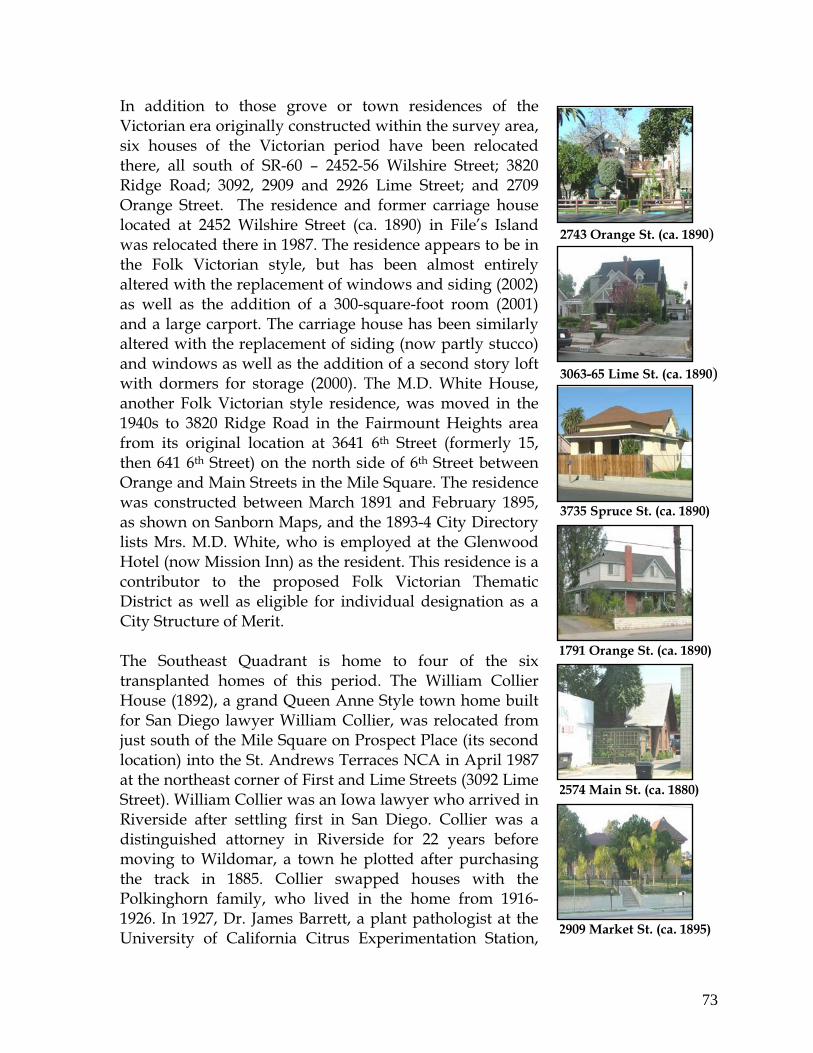
73
In addition to those grove or town residences of the Victorian era originally constructed within the survey area, six houses of the Victorian period have been relocated there, all south of SR-60 – 2452-56 Wilshire Street; 3820 Ridge Road; 3092, 2909 and 2926 Lime Street; and 2709 Orange Street. The residence and former carriage house located at 2452 Wilshire Street (ca. 1890) in File’s Island was relocated there in 1987. The residence appears to be in the Folk Victorian style, but has been almost entirely altered with the replacement of windows and siding (2002) as well as the addition of a 300-square-foot room (2001)
3735 Spruce St. (ca. 1890)
2743 Orange St. (ca. 1890)
and a large carport. The carriage house has been similarly
as constructed between March 1891 and February 1895,as shown on Sanborn Maps, and the 1893-4 City Directory lists Mrs. M.D. WhitHotel (now Mission Iontributor to the rian Thematic
at the northeast corner of First and Lime Streets (3092 Lime Street). William Collier was an Iowa lawyer who arrived in Riverside after settling first in San Diego. Collier was a distinguished attorney in Riverside for 22 years before moving to Wildomar, a town he plotted after purchasing the track in 1885. Collier swapped houses with the Polkinghorn family, who lived in the home from 1916-1926. In 1927, Dr. James Barrett, a plant pathologist at the University of California Citrus Experimentation Station,
altered with the replacement of siding (now partly stucco) and windows as well as the addition of a second story loft with dormers for storage (2000). The M.D. White House, another Folk Victorian style residence, was moved in the 1940s to 3820 Ridge Road in the Fairmount Heights area from its original location at 3641 6th Street (formerly 15, then 641 6th Street) on the north side of 6th Street between Orange and Main Streets in the Mile Square. The residence
3063-65 Lime St. (ca. 1890)
w
e, who is employed at the Glenwood nn) as the resident. Thproposed Folk Victo
is residence is acDistrict as well as eligible for individual designation as a City Structure of Merit.
The Southeast Quadrant is home to four of the six transplanted homes of this period. The William Collier House (1892), a grand Queen Anne Style town home built for San Diego lawyer William Collier, was relocated from
st south of the Mile Square on Prospect Place (its second
1791 Orange St. (ca. 1890)
2574 Main St. (ca. 1880)
2909 Market St. (ca. 1895)
julocation) into the St. Andrews Terraces NCA in April 1987
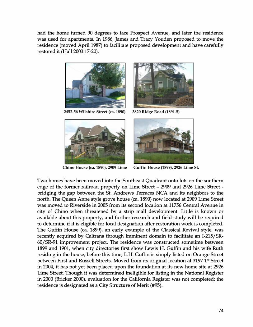
had the home turned 90 degrees to face Prospect Avenue, and later the residence was used for apartments. In 1986, James and Tracy Youden proposed to move the residence (moved April 1987) to facilitate proposed development and have carefully restored it (Hall 2003:17-20).
en the St. Andrews Terraces NCA and its neighbors to the orth. The Queen Anne style grove house (ca. 1890) now located at 2909 Lime Street
was moved to Riverside in 2005 from its se ond location at 11756 Central Avenue incity of known or
vailabl ty, and further research and field study will be required
; before this time, L.H. Guffin is simply listed on Orange Street Streets. Moved from its original location at 3197 1st Street placed upon the foundation at its new home site at 2926
74
had the home turned 90 degrees to face Prospect Avenue, and later the residence was used for apartments. In 1986, James and Tracy Youden proposed to move the residence (moved April 1987) to facilitate proposed development and have carefully restored it (Hall 2003:17-20).
en the St. Andrews Terraces NCA and its neighbors to the orth. The Queen Anne style grove house (ca. 1890) now located at 2909 Lime Street
was moved to Riverside in 2005 from its se ond location at 11756 Central Avenue incity of known or
vailabl ty, and further research and field study will be required
; before this time, L.H. Guffin is simply listed on Orange Street Streets. Moved from its original location at 3197 1st Street placed upon the foundation at its new home site at 2926
Two homes have been moved into the Southeast Quadrant onto lots on the southern edge of the former railroad property on Lime Street – 2909 and 2926 Lime Street - bridging the gap betwe
Two homes have been moved into the Southeast Quadrant onto lots on the southern edge of the former railroad property on Lime Street – 2909 and 2926 Lime Street - bridging the gap betwe
2452-56 Wilshire Street (ca. 1890) 3820 Ridge Road (1891-5)
Guffin House (1899), 2926 Lime St. Chino House (ca. 1890), 2909 Lime
nncc
Chino when threae about this properChino when threae about this proper
tened by a strip mall development. Little istened by a strip mall development. Little isaato determine if it is eligible for local designation after restoration work is completed. The Guffin House (ca. 1899), an early example of the Classical Revival style, was recently acquired by Caltrans through imminent domain to facilitate an I-215/SR-60/SR-91 improvement project. The residence was constructed sometime between 1899 and 1901, when city directories first show Lewis H. Guffin and his wife Ruth
siding in the house
to determine if it is eligible for local designation after restoration work is completed. The Guffin House (ca. 1899), an early example of the Classical Revival style, was recently acquired by Caltrans through imminent domain to facilitate an I-215/SR-60/SR-91 improvement project. The residence was constructed sometime between 1899 and 1901, when city directories first show Lewis H. Guffin and his wife Ruth
siding in the housererebetween First and Russell
2004, it has not yet beenbetween First and Russell
2004, it has not yet beenininLime Street. Though it was determined ineligible for listing in the National Register in 2000 (Bricker 2000), evaluation for the California Register was not completed; the residence is designated as a City Structure of Merit (#95).
Lime Street. Though it was determined ineligible for listing in the National Register in 2000 (Bricker 2000), evaluation for the California Register was not completed; the residence is designated as a City Structure of Merit (#95).
74
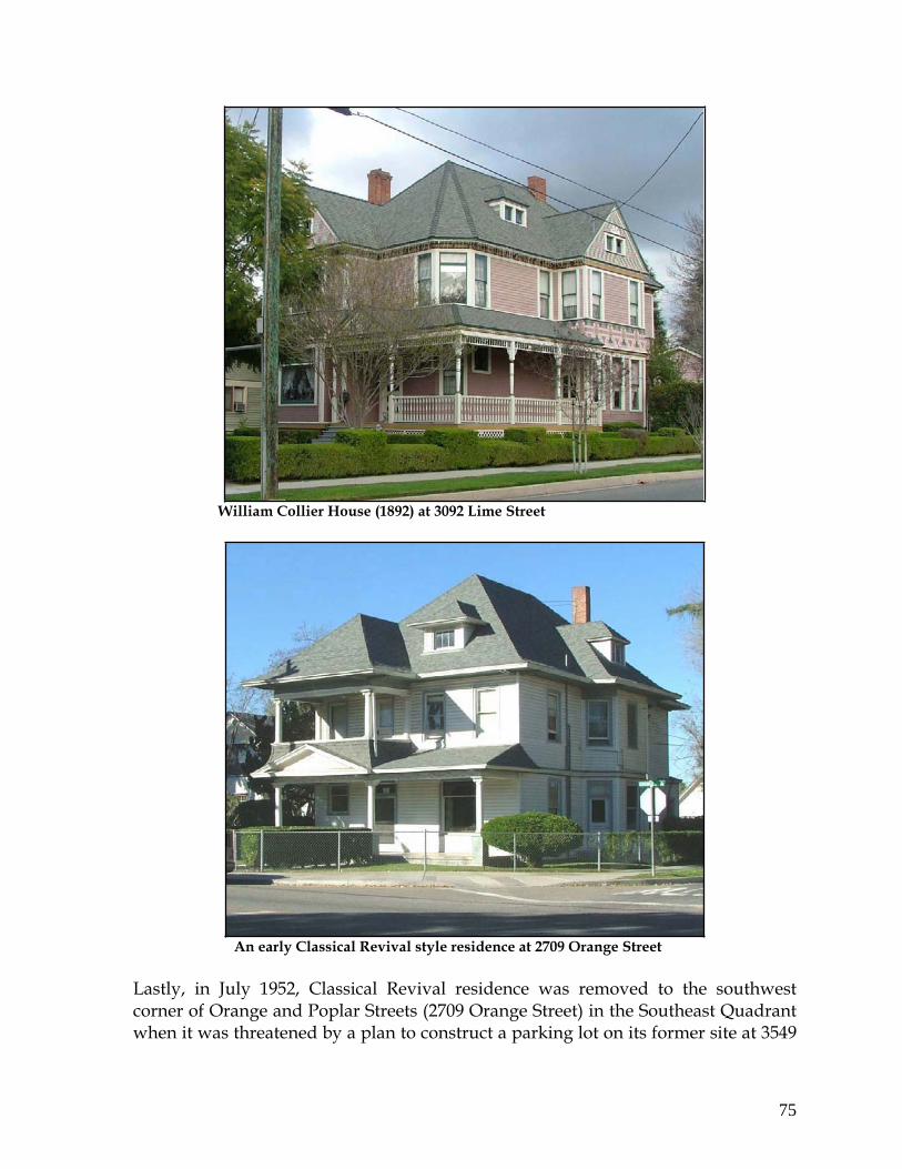
William Collier House (1892) at 3092 Lime Street
An early Classical Revival style residence at 2709 Orange Street
Lastly, in July 1952, Classical Revival residence was removed to the southwest corner of Orange and Poplar Streets (2709 Orange Street) in the Southeast Quadrant when it was threatened by a plan to construct a parking lot on its former site at 3549
75
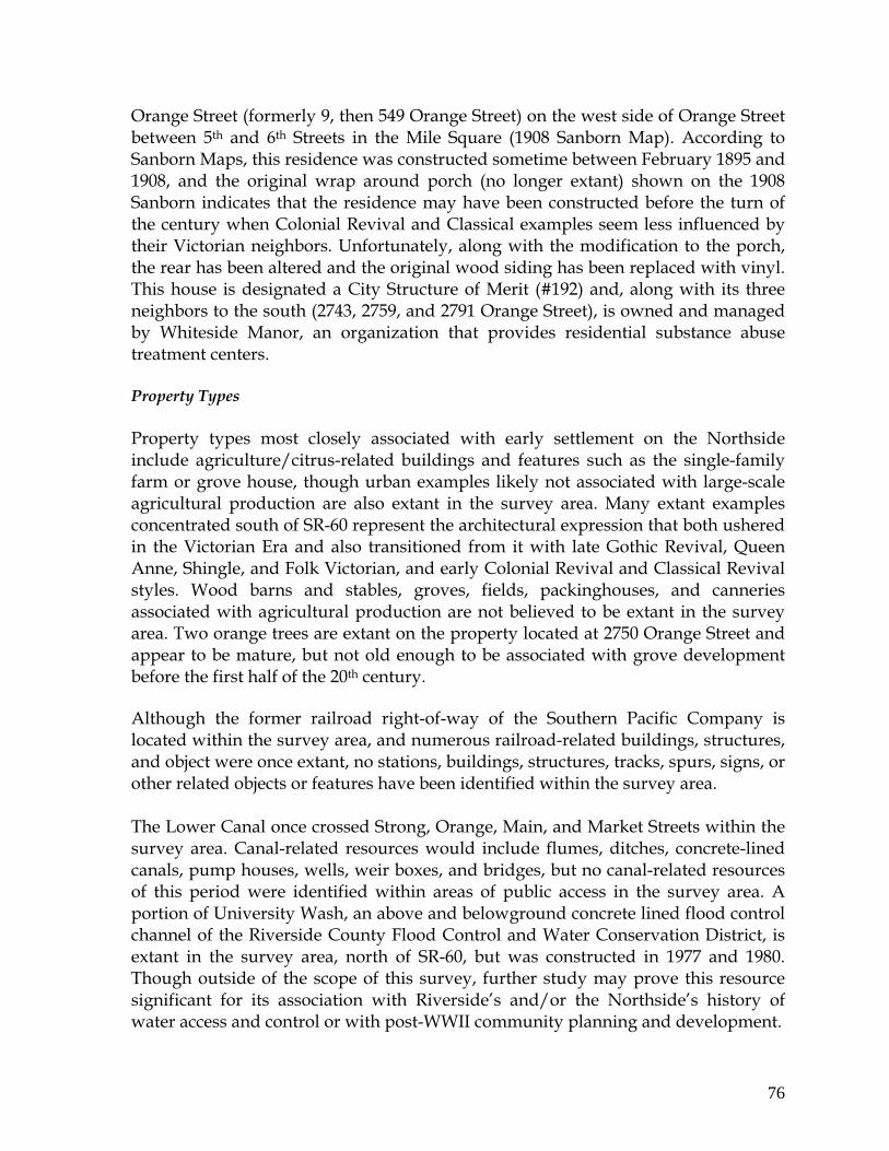
Orange Street (formerly 9, then 549 Orange Street) on the west side of Orange Street between 5th and 6th Streets in the Mile Square (1908 Sanborn Map). According to
anborn Maps, this residence was constructed sometime between February 1895 and 1908, and the original wrap around porch (no longer extant) shown on the 1908
re the turn ofe century when Colonial Revival and Classical examples seem less influenced by
uction are not believed to be extant in the survey rea. Two orange trees are extant on the property located at 2750 Orange Street and
elated resources would include flumes, ditches, concrete-lined anals, pump houses, wells, weir boxes, and bridges, but no canal-related resources
S
Sanborn indicates that the residence may have been constructed befoththeir Victorian neighbors. Unfortunately, along with the modification to the porch, the rear has been altered and the original wood siding has been replaced with vinyl. This house is designated a City Structure of Merit (#192) and, along with its three neighbors to the south (2743, 2759, and 2791 Orange Street), is owned and managed by Whiteside Manor, an organization that provides residential substance abusetreatment centers.
Property Types
Property types most closely associated with early settlement on the Northsideinclude agriculture/citrus-related buildings and features such as the single-family farm or grove house, though urban examples likely not associated with large-scale agricultural production are also extant in the survey area. Many extant examples concentrated south of SR-60 represent the architectural expression that both ushered in the Victorian Era and also transitioned from it with late Gothic Revival, Queen Anne, Shingle, and Folk Victorian, and early Colonial Revival and Classical Revival styles. Wood barns and stables, groves, fields, packinghouses, and canneries associated with agricultural prodaappear to be mature, but not old enough to be associated with grove development before the first half of the 20th century.
Although the former railroad right-of-way of the Southern Pacific Company is located within the survey area, and numerous railroad-related buildings, structures, and object were once extant, no stations, buildings, structures, tracks, spurs, signs, or other related objects or features have been identified within the survey area.
The Lower Canal once crossed Strong, Orange, Main, and Market Streets within the survey area. Canal-rcof this period were identified within areas of public access in the survey area. A portion of University Wash, an above and belowground concrete lined flood control channel of the Riverside County Flood Control and Water Conservation District, is extant in the survey area, north of SR-60, but was constructed in 1977 and 1980.Though outside of the scope of this survey, further study may prove this resource significant for its association with Riverside’s and/or the Northside’s history of water access and control or with post-WWII community planning and development.
76
Numerous property types might be related community development within this period, but would be concentrated outside the survey area. Only the remains of Athletic Park (ca. 1892-1902) are extant within the survey boundaries and the area around North Hill has been developed since the 1920s. Field inspection did not reveal the presence of historic buildings, structures, features or objects related toommunity development here or anywhere within the survey boundaries.
d ofevelopment represent approximately 2% of the survey area.
full height and grandesign but also because Riverside was founded by north- and mid-easterners who
molding around windows and door, characteristic 2-over-2 sash double-hung
c
Architectural Styles
During the earliest period of development, Riverside’s Victorian Era examples are seen within two contexts – conforming to the constraints of small urban lots and commanding the large acreage of agricultural fields and groves. Most of the rural Northside was beyond the influence of the growing urban center that was the heart of the Mile Square, and the manifestation of architectural trends within the survey area responded to the landscape, which was mostly dedicated to agricultural crops such as alfalfa, citrus, grapes, and orchard fruits or given to dairy and ranchproduction. Though concentrated south of SR-60, examples exist throughout the Northside survey area from this earliest period of residential development inRiverside in the late Gothic Revival, Queen Anne, Shingle, and Folk Victorian, and early Colonial Revival and Classical Revival styles. Examples from this period
Gothic Revival
From the Romantic Period in England, the Gothic style arrived in America in the late 18th century and features romantic and picturesque pointed towers, archways, and finials. The Gothic Revival style comes at the end of the Romantic Period, when interest in the Gothic style is “revived” in the post-Civil War era and influenced by the Victorian period. In Riverside it is a firm foundation for the Victorian styles that quickly take over the urban and rural residential form. Several examples of the Gothic Revival style are found in the Northside. In fact, it seems the Gothic design is concentrated there, south of the SR-60 perhaps because itsdlikely constructed their grove homes in the styles to which they had viewed at home, though the Gothic Revival style was more adapted to public architecture than private (Poppeliers et al. 1983:40-41).
The style features several subtypes, of which the Centered Gable is extant in the Northside survey area with the Carleton-Labadie House, and the Waite House (now altered) on Lime Street is done in the Paired Gable subtype. The Gothic style is known for steeply-pitched roofs, paired gabled dormers, symmetrical façade, drip
77
windows, decorative vergeboards, and gable end finials, all of which are found in the Carleton-Labadie House (McAlester 2000:196-8). In addition, a very altered esidence on Main Street in the Gothic style is constructed of brick and polychromed
about the tall, double-hung windows.
he Victorian Era, roughly fr was witness to changffected residential design hnique. In Am thedustrialization and the spre ilitated the of iroor plans and the availability estration an iling. Nnd popularized by late-19th century British architects, the Queen Anne (circa 1880-910) style borrowed heavily Jacobean era spindlnd free classic subtypes of rican interp n (McA000:239, 268).
identified in the Anne st ely bee most from a mature, ind ail. cter-d
a wit eeplyls shingle windo
ouble-hung and can be pres pplied in rns, cuays, and overhanging eaves vices used t id a flaurface. Partial, full, or wrap can be present in binatio
ils may includ d balustrade orneretailing. The William Collier ple of the n Ann
the survey area and boa terials and ela detail tharacterize the style like ban wall shingles and board ,loping roof pitch, and slim dles porch suppo d balu e
hingle
n American style, the Victor e is appropriately r nted he rise of the Arts and Crafts takeover of t aftsman
e illustrates the perfect blend ofhingle and Craftsman philosophies in its blend of concrete, wood, and striking
r
Queen Anne
T om 1860 to 1900, many es thata and building tec erica, rise ofin ad of the railroad fac design regularfl of mass-produced fen d deta ameda1 from Elizabethan and
mes, but ework
a the style are an A retatio lester2
f the stylesO Victorian Era, the Queen yle lik nefitedthfe
ustrialized nation united by rn overall vertical orientation
Charah a st
efiningpitchedatures of the style include
roof of complex form. Wal are clad in clapboard or , and ws ared ented in bays; shingles a patte tawayb or walls are some de o avo t walls -around porches com n, anddecorative deta e turned spindles an or c bracketd House is the finest exam Quee e stylein sts the mixed ma borate s thac ded, patterned clap sidings , turned spin rts an stradmembers,
S
A ian Shingle styl eprese ere onth Movement before the he Cr style,which dominates the survey area. The Petro HousSclinker brink with an overall horizontal massing during a time of architectural transition. The Shingle style hails from New England, but is popularized in the west by architect Willis Polk. As the style evolves from the Queen Anne, many examples typically show Queen Anne elements, but these are absent on the Petro House, where the use of natural materials, dominating, overhanging shingled front gable and flaring eaves, a preview of Asian-influenced Craftsman elements to come (Poppeliers et al. 1983:60).
78
Folk Victorian
The Folk Victorian is considered as the presence of Victorian decorative detailing on simple folk forms (McAlester 2000:309). Several examples exist within the survey area and display the simple porches with turned spindles, vergeboards, anddecorative vents. The M.D. White House boasts the common, dual-axis, paired gable ends most noted with the style
Colonial Revival
The Colonial Revival style was dominant across the country during the early 20th
century and represents a renewal of interest in early English and Dutch styles of the Atlantic seaboard and typically combines details from the Georgian and Adam styles or Postmedieval English and Dutch examples (McAlester 2000:324). Architect interpretations of European designs, namely the Adam and Georgian styles as well as the English and Dutch Colonial styles, were generally pure, yet the movement toward European period styles was eclectic by nature. The early reign of the Eclectic Movement was curtailed by the rise of the Prairie and Craftsman styles, but World War I renewed interest in period revival architecture, and vernacular examples are most prevalent during the 1920s and 1930s.
The Colonial Revival style manifests itself in single- or two-story examples with symmetrical facades and hipped or gabled roofs. Dormers are common to this style as are accentuated entries, bell-cast eaves, and the use of classical columns. Fenestration contributes to façade symmetry and is found in double-hung sash with a range of pane configurations. In Riverside, the style gained popularity after the turn of the century. Local, vernacular examples were influenced by Queen Anne, Turn of the Century and American Foursquare elements as is seen in the transitional Colonial R ith its wrap around porch and
ther Victorian elements. Various subtypes of the Colonial Revival style dominated evival style house at 2750 Orange Street w
oAmerican architecture during the first half of the 20th century and are represented on the Northside.
Classical Revival
Interest in classical designs was prompted by the 1893 World’s ColumbianExposition, which was held in Chicago and featured a classical theme fashioned by well-known architects. Popularized by exposition reports and photographs, the Neoclassical style, like the closely related Colonial Revival style, was fashionable in the first half of the 20th century, but was suppressed by other Eclectic styles. Character-defining features of the style include a full height porch roof supported by classical columns, which can be square in later examples, double-hung sashes of six
79
or nine panes, and decorative entry door surrounds (McAlester 2000:343-46).
A well-done two-story example among many one-story Classical cottages exists ithin the survey area at 2709 Orange Street. With Classical porch support columns,
and matching second-floor balcony posts pyramidal hip roof and dormers, and an overall vertical massing, this residits original location at 3549 Oranwrapped around the north elevatiStreet, the influence of Victorian Er
EARLY DEVELOPMENT, 1901-19
HISTORY
Out of the boom of the 1880s, soquiet growth that lasted throughelectrical power, interurban tr
cWilliams 1973:128-134).
. Among general agriculturalte the Riverside landscape and
ized equipment by Riversidele Paxton. At the same time, a
ssociations were being forgedPresidents Theodore Roosevelt9, respectively, and a new city
y of public utilities were restructured, and civic buildings such as Carnegie
ler, was incorporated into the citytreetscape. Two major institutions were also established in Riverside during this eriod – the University of California Citrus Experimentation Center (1906) and the rmy’s Alessandro Flying Field (1918; eventually March Air Force Base). By 1918, e powerful Southern Sierras Power Company (later Calectric) had adoptediverside as its corporate headquarters, facilitating local hydroelectrical service to outhern California’s Inland Counties, a key factor to development of the area
lure 2005b:31), and in 1916, the city became one of three in the state to establish a lanning commission (Patterson 1996:242-93; 351). All the while, Riverside’ sopulation was steadily increasing, and by the end of WWI, it had more than
w,
ence appears to epitomize the style. Moved from ge Street in the Mile Square, the porch onceon indicating, like it’s neighbor at 2750 Orange a designs at the turn of the century.
18
uthern California moved into another period of the first decades of the 20th century. Water,
ansportation, and urban infrastructure andsubdivision were developed or enhanced in Riverside as and in many areas inanticipation of the next period of booming growth (M
Locally, this era was witness to many changesproduction, the citrus industry continued to dominathe economy with the development of mechaninventors like Fred Stebler, George Parker, and Hamunicipal identity was being created and political alargely through the efforts of booster Frank Miller.and William Taft visited Riverside in 1903 and 190charter was adopted in 1907. The city limits were reduced, municipal ownership and
eliverdlibraries in the Mile Square (1902; no longer extant) and in the Arlington area (1909) and a post office (1911) were constructed. The City officially took over the previously private tradition of street tree planting and care in 1906, and by 1910, the ndian raincross, introduced to Riverside by MilI
spAthRS(Kpp
80
doubled, with th 1910 when the numberf residents soared from 7,973 to 15,212 (Census Bureau, Census 1900-1920).
aled streets.
COMMUNITY DEVELOPMENT
Residents of the Northside continued to enjoy the neighborhood places and spaces of informal recreation established in the earliest period of development like Fairmount Park and White Sulphur Springs, and during this period, an established Riverside attraction was relocated to the Northside – the Riverside County/ Southern California Fair - and became associated with Fairmount Park. The historic Riverside Fairgrounds border the survey area, but as with other early areas of recreation, their significance to residents within the Northside warrants inclusion here. In addition, the Northside gained an elementary school during this period –Fremont Elementary – that is located just north of SR-60.
Riverside Fairgrounds
The former Riverside Fairgrounds is located within the Northside, just northwest of the survey boundaries. The fairgrounds located in the area roughly bounded by Strong Street to the north, Fairmount Boulevard to the east, the Crestmore/Riverside-Rialto Line of the PE (later Crescent City Railway) roadway (now the Market Street alignment) to the south and the Santa Ana River to the west, near the northern edge of Fairmount Park. While in operation, the fairgrounds were commonly associated with the parkland by area residents but the connection was severed by the construction of SR-60 through the area in 1960-63. Fairgrounds Street is still extant alongside the freeway to the north.
Before the area was developed for use as a fairground, a county fair was held for a number of years at Chemawa Park (8830 Magnolia Avenue), a 23-acre community
intained by the Pacific Electric Railway. Chemawa Park opened the late 1890s and provided open space for leisurely pastimes, such as picnicking,
fairs and athletic recreation. According to long-time resident Theresa Gordon, the
e largest jump occurring between 1900 ando
Perhaps more than the simple addition of Riverside natives over these years, this local population growth may be fueled by an influx of people from regional or national locales who sought to reverse their finances in a town, which by now must have a established an even-keeled reputation for riding out both the boom times and the down times as experienced in the last decades of the 19th century, perhaps to try their hand at citriculture. While the Cityscape grew increasingly larger through the efforts of Miller and other boosters and the addition of fine public, civic, and research facilities on a grand scale, the sheer numbers of people looking to settle made the face of Riverside’s neighborhoods like those of the Northside largely into compact, modest-sc
space owned and main
81
park also offered a roller skating rink (Gordon 1994:6). The Riverside Polo Club (circa 1890) drew a wealthy membership and played on the well-known polo field at Chemawa Park, which was considered the meeting place of the “elite among British leaders of Arlington and Riverside society (Patterson 1964:103). The Riverside Driving Association (1890s) also used the track at Chemawa Park for harness racing from about 1913-1915 (Patterson 1996:227). Although such parks were considered a “standard device of street railways at the time, to build business,” (Patterson 1964:103), the Pacific Electric also offered a unique entertainment to its passengers, an amusement par s, monkeys, an aviary,
nd more.
Riverside County Fair Board, anDirectors. The 1926 Southern Caliof the county as shortly afterwaCalifornia to take over the governyear, the state created the 46th Di ency, tomanage the fair. The last Southern California Fair was held at the fairgrounds site north of Fairmount Park in 1930 after which the directors of the Southern California Fair and the Los Angeles County Fair signed an agreement to combine the two fairs. With the newly opened and more centrally located Pomona Fairgrounds (1922), the state forwarded the funding intended for the 46th District Agricultural Association to the 9th District Agricultural Association, which administered the LA County Fair. The Riverside Fairgrounds acreage was given to the City of Riverside by Quitclaim Deed, and, though in 1931 and 1932 the LA County Fair was held jointly with the Southern California Fair in Pomona (Fairplex 2005:n.p.), the 46th District Agricultural Association lay dormant for a few years before opening the Hemet Turkey and Utility Show in Hemet and later moved to Perris (Diederich 2005).
While at Riverside, the Southern California Fair offered many traditional attractions such as livestock exhibits, a jumping frog contest, art shows and a junior fair along with some unexpected activities. A grandstand and racetrack facilitated horse racing by the Riverside Driving Association, and later automobile and motorcycle races. Races, and aeronautical exhibits and flyovers are remembered by many Northside residents (LSA 2005:10). The fairgrounds also featured aeronautical exhibits and flyovers, and hosted well-known such as Roman Warren, wboyAviator who staged horse stunts a
k and small zoo, which housed brown beara
By 1913, the Riverside County Fair had become a formally sponsored event and, though already hosted for several years at Chemawa, the “First Fair of Riverside County” was officially held that year in the park. In 1915 the annual event was moved to the former Riverside Fairgrounds site north of Fairmount Park. The annual fair became the Southern California Fair in 1918 after the abolishment of the
d became governed by a countywide Board of fornia Fair was the last under the local regulation rd, heavy financial burden caused the State of ing and funding of the annual fair. The following trict Agricultural Association, a state ags
performers the Cond a daring flyunder the bridge.
82
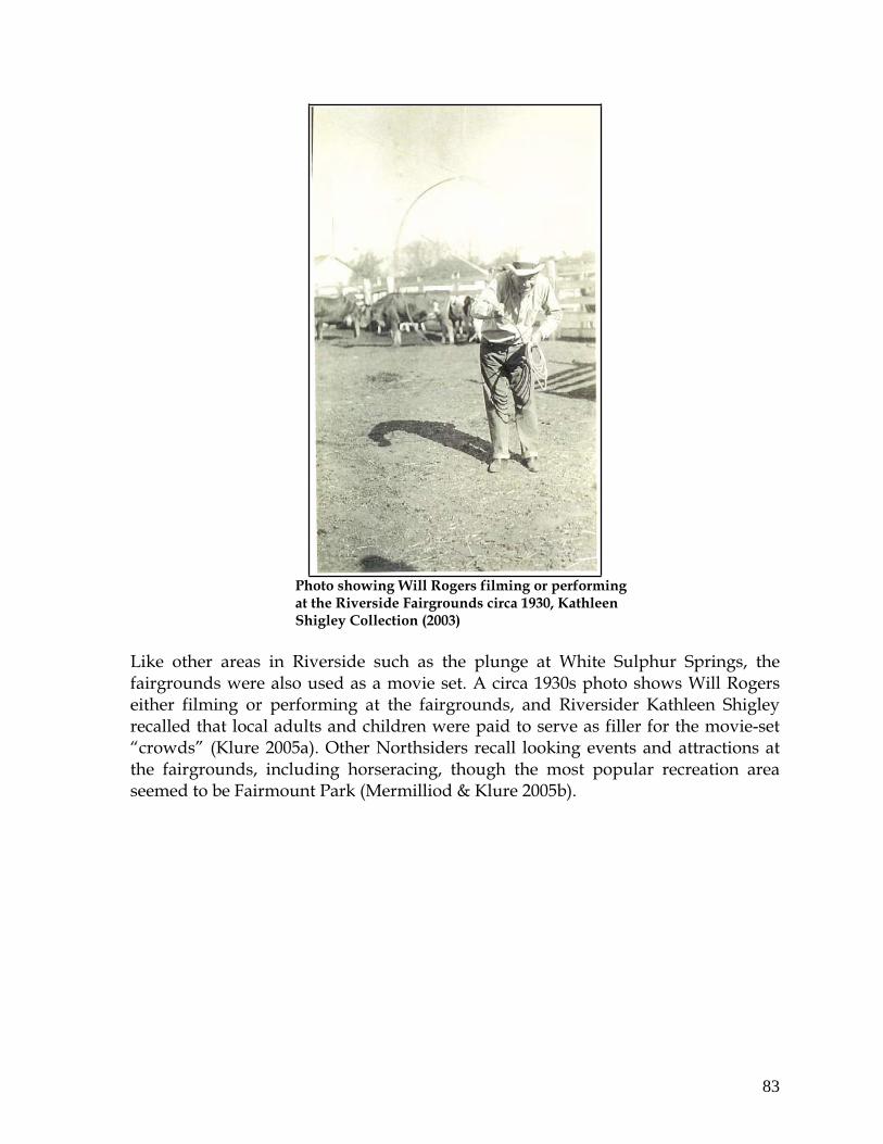
Photo showing Will Rogers filming or performingat the Riverside Fairgrounds circa 1930, KathleenShigley Collection (2003)
Like other areas in Riverside such as the plunge at White Sulphur Springs, the fairgrounds were also used as a movie set. A circa 1930s photo shows Will Rogersither filming or performing at the fairgrounds, and Riversider Kathleen Shigley ecalled that local adults and children were paid to serve as filler for the movie-set
“crowds” (Klure 2005a). Other Northsiders recall looking events and attractions at the fairgrounds, including horseracing, though the most popular recreation area seemed to be Fairmount Park (Mermilliod & Klure 2005b).
er
83
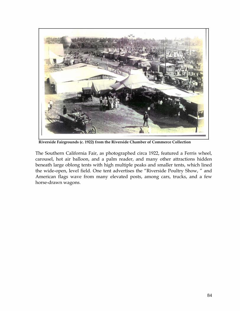
Riverside Fairgrounds (c. 1922) from the Riverside Chamber of Commerce Collection
The Southern California Fair, as photographed circa 1922, featured a Ferris wheel, carousel, hot air balloon, and a palm reader, and many other attractions hidden beneath large oblong tents with high multiple peaks and smaller tents, which lined the wide-open, level field. One tent advertises the “Riverside Poultry Show, ” and American flags wave from many elevated posts, among cars, trucks, and a few horse-drawn wagons.
84

Riverside Fairgrounds Race Track (c. 1922) from the Riverside Chamber ofCommerce Collection
The grounds are dotted with many utility poles, and the track is lined with mast arms and glass globe lights, indicating that racing may have gone into the evening hours. A car race was held that year, and the track, which appears to have been bordered by a low, stone wall with piers, was also used for a parade that drew deep ows of spectators.
ms and temporarily relocated students to earby Calvary Temple Church on the southeast corner of Strong and Orange
r
Fremont Elementary School
In 1917, Fremont Elementary School (1925 Orange Street) was established for the children of the Northside, set back far on a large lot between Orange and Main Streets, just north of Oakley Avenue, or now, SR-60. One of the original buildings, a two-wing classroom and auditorium, is reported to the only survivor of a 1949 fire but was demolished in December 1967. Another building was added to the school complex in 1936. Designed by architect G. Stanley Wilson in fireproof, reinforced concrete construction, the four-classroom building is extant along Main Street, and in 1969, the east and west concrete walls were opened, the wood floors werereplaced with concrete, and a masonry wall was added for its conversion into a storm drain spillway to redirect floodwater from a devastating flood in the winter of 1968, which damaged several classroon
85
Streets (outside the survey boundaries; Department of Schoolhouse Planning1978:n.p).
Fremont Elementary School (constructed from 1917-1970), Main Street frontage
classroomuildings were completed by contractor M. Wilkerson in December 1955, and in July
From the late 1940s to the early 1970s, several additions and alterations were madeto the elementary school campus. In 1949, architect E. Heitschmidt designed an administration building and six classrooms, which were completed by contractors Hill and Hunt in August 1950. Part of the project included upgrades to an existing concrete pipe storm drain beneath the new classrooms. The architectural firmRuhnau, Evans, and Brown (later Ruhnau, Evans, and Steinmann) designed three additions to the growing school complex in the 1950s and 1960s. Twob1966, the Hoefer Construction Company added a three-classroom wing, a kitchen, and lunch shelter, and enlarged the parking lot on Main Street. This addition accommodated displaced schoolchildren from the abandoned Lincoln Elementary School (formerly Sixth Street School) and allowed hot lunches to begin being served on campus. In March 1969, the architectural team designed an air-conditioned administration, IMC, and three-classroom complex and also created plans to convert the 1950 administration building into a special education classroom, which was completed by contractor Lloyd Lambeth in July 1970 (Department of Schoolhouse Planning 1978:n.p).
86
Fremont Elementary School (constructed from 1917-1970), Orange Street frontage
The 1960s altered school campuses throughout the City as many historic school buildings were investigated for structural soundness in compliance with the 1933 Field Act (updated), which, on the heels of a series of devastating earthquakes,
andated school building cm onstruction, remodeling, and relocation for earthquake local effort preempted a more widespread move in 1976 to phase out or
e-Field Act buildings and ushered in the portable classroom era in safety. Thisetrofit prr
Riverside. Many historic school buildings were demolished during this time orshortly after. For each wave of portable classroom construction and distribution to district schools, Fremont Elementary School received a couple beginning in 1966 when contractor B.M. Wilkerson constructed 27 portable classrooms throughout the district. In 1968, the district gained 33 additional portables constructed by contractor Foresberg & Gregory, and in 1969, 19 portable classrooms added to the district by Avalon Construction Company. In August 1970, the district purchased five larger, air-conditioned units. As is indicated in the name, portable classroom facilitated campus growth and alteration by their transferable nature, and, beginning in 1970, the newly acquired portable classrooms were moved, relocated, demolished, or upgraded to suit the growing needs of Fremont Elementary (Department of Schoolhouse Planning 1978:n.p).
The parcel configuration of the school campus has expanded to the north over time from a basically rectangular lot to an odd-shaped parcel that runs behind the rear lots of residential development to the north along Orange, Main and Strong Streets (1908 Sanborn Map, updated 1941). The addition of the northwest corner of the campus was acquired in 1969, and an approximately 50x 150’ strip off Orange Street was deeded to the district by Riverside County Flood Control after completion of a
87
1977 project, which installed an 8x8’ underground storm channel through the school property (Mermilliod 2005b). This project also allowed for the improvement and
idening of Orange Street and the school parking lot (Department of Schoolhouse
as common in Riverside,remont’s earliest school principals were women and included: Clara Payette (1917-
cArthur Wright, Jane Margison, Bessie Brooks, and Stacey Malaney, who have in many aspects of the development of the Northside including the
evelopment of Reid Park and the perpetuation of the Northside Improvement
ESIDENTIAL DEVELOPMENT
8. In addition, some residences wereonverted to accommodate multiple-family living and city lots were subdivided for
ccupation, both residential and commercial. From 1895 to 1908, theumber of multi-family residences grew approximately 67% and had spread from
ent Tract included the Tibbets’ Tract (1903), e Salt Lake Depot Tract (1908) and Jurupa Addition Tract No. 1 (1908) (plat maps
wPlanning 1978:n.p).
Most Northsiders have fond memories of their own school days or of sending their own children to Fremont Elementary School, which appears to have been astabilizing force in the Northside community. As wF1918), Bertha Parker (1918-1923), Amy C. Stevenson (1923-1925), and MattieSingletary (1925-1950). However, exclusive female, scholarly leadership in the first half of the century is extraordinary and may be characteristic of the propensity by Northside women to take the lead in the community, like Ruth Lewis, FrancesMbeen influentialdAssociation, the longest-run community organization of its kind in the City, and some of whom have served on City Boards and Commissions.
R
Aside from developments on the Eastside in the late 1880s, most early residential development in Riverside necessarily surrounded the commercial core within the Mile Square. Prompted by the sharp rise in population in the early 20th century, both the commercial district and the surrounding residential neighborhoods grew in density, triggering the construction of many single-family residences, and some multi-family residences represented as duplexes, flats accommodating three families or more, and apartments between 1895 and 190chigher density onthe central arterials to the edges of the Mile Square (Sanborn Maps 1895. 1908).
Population increases and the need for housing in proximity to the center of the city continued into the 20th century. While many early land speculators in Riverside had failed to realize the sizeable profits from the quick turnover of subdivided lots achieved elsewhere in the region, the need for residential development soon became acute. The Tequesquite Arroyo, the largest of the arroyo system to cross theRiverside plain, hampered residential expansion southwest of the original townsite, although some tracts were developed further south in the Government Tract. Scattered subdivisions in the Governmth
88

1903-1915), though most of the lands in the Government Tract were not improved uring this period, and the area retained its rural landscape.
their rural, open appeal (Figure 15). The reparation of this former grove land to residential occupancy occurred largely
e 28 tracts divided after that – Virginia ract (north of SR-60), and an amended 1911 subdivision of Indian Hill Tract
d
With the irrigated land to the east already carved up and the groves and fields to the south severed from the Mile Square by the Tequesquite Arroyo, speculationnaturally turned north to the bottomlands already within the City boundaries.During this early period of settlement, the Northside’s landscape at least within the survey area was severely altered with the addition or resubdivision of 28 tracts,while lands to the north retainedpbetween 1903 and 1911, with only two of thT(Fairmount Heights).
Area of Development Tracts Date Map Book/Page
Fairmount Heights Overlook Ridge Tract 1903 4/94Crescent Avenue Subdivision 1903 4/99Lewis Villa Tract 1905 5/122Montecito Tract 1906 5/159Merryfield Addition 1906 5/165
Moore’s Subdivision 1908 6/68 Elliot Subdivision 1909 6/82 Lett’s Resubdivision 1910 7/13
Indian Hill Tract 1911 8/11Indian Hill Tract (amended) 1916 10/13
File’s Island File’s Subdivision 1905 5/129File’s Subdivision No. 2 1905 5/137Fairmnt Hts. Tr. No. 3 (resub) 1906 5/177
Main St. Industrial Corridor E.N. Smith’s Subdivision 1907 5/179File’s Subdivision No. 3 1907 6/3North Main St. Tract 1907 6/30
Wauregan Tract 1908 6/52North of SR-60 Oakley’s Subdivision 1906 5/160
File’s Subdivision No. 4 1909 6/50Valley View Tract 1911 8/8
Glendora Tract 1911 8/25 Virginia Tract 1913 9/6Southeast Quadrant Hewitt Place 1909 7/3
McMullen Subdivision 1910 7/11 Shugart Homestead 1910 7/40
St. Andrews Terraces 1910 7/49
89
Area of Development Tracts Date Map Book/Page
Noland Place 1911 8/54 Elliot’s Subdivision 1912 8/66Figure 15. Table showing tract development from 1901-1918
Many examples throughout the survey area exist from this period of development, which encompasses the turn of the century through the end of WWI, and a number of architectural styles are represent. Though more impressive examples in one to two-stories do exist, most are simple dwellings in overwhelmingly modest-scale neighborhoods of one- or one-and-a-half story, single-family residences. As themajority of lots were developed soon after subdivision and sale to individual buyers, it is clear that residential development in this period was characterized by
mediate population pressure for additional housing stock rather than future imgrowth speculation.
One of the earliest homes constructed during this period highlights the influence of the Arts and Crafts Movement on the Victorian Era before the takeover of the Craftsman style, which dominates the survey area. This Shingle style home (3837 Ridge Road) in Fairmount Heights was never associated with agriculturalproduction. This residence shows evident of the Arts and Crafts Movement and was constructed of concrete, wood, and striking clinker brink during a time ofarchitectural transition.
The Petro House (c. 1902-04) at 3837 Ridge Road
90
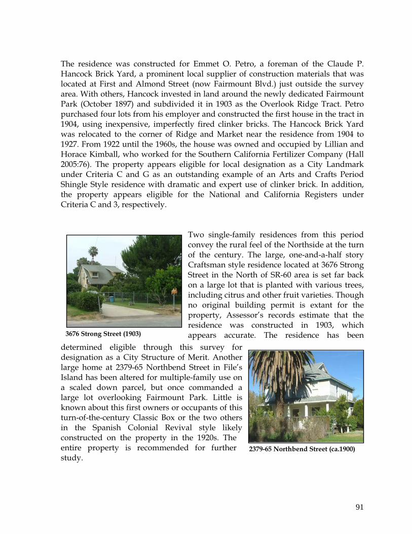
The residence was constructed for Emmet O. Petro, a foreman of the Claude P. Hancock Brick Yard, a prominent local supplier of construction materials that was located at First and Almond Street (now Fairmount Blvd.) just outside the survey area. With others, Hancock invested in land around the newly dedicated Fairmount Park (October 1897) and subdivided it in 1903 as the Overlook Ridge Tract. Petro purchased four lots from his employer and constructed the first house in the tract in 1904, using inexpensive, imperfectly fired clinker bricks. The Hancock Brick Yard was relocated to the corner of Ridge and Market near the residence from 1904 to 1927. From 1922 until the 1960s, the house was owned and occupied by Lillian and Horace Kimball, who worked for the Southern California Fertilizer Company (Hall
005:76). The property appears eligible for local designation as a City Landmark nder Criteria C and G as an outstanding example of an Arts and Crafts Period
Sh ith dramatic ert use of c bthe gible for the al and Ca a
pectively
Two single-family residences from this period the rural feel of orthsid turn
. The lar ne-and- storyan style residen ated at rong
rth of Son a large lot that is planted with various trees, including citrus and other fruit varieties. Though
at the
en
constructed on the property in the 1920s. The entire property is recommended for further study.
2u
ingle Style residence wproperty appears eli
and expNation
linkerliforni
rick. In addition,Registers under
Criteria C and 3, res .
convey the N e at theof the century ge, o a-halfCraftsm ce loc
R-60 area is set far back 3676 St
Street in the No
no original building permit is extant for theproperty, Assessor’s records estimate thresidence was constructed in 1903, whichappears accurate. The residence has be
determined eligible through this survey for designation as a City Structure of Merit. Another large home at 2379-65 Northbend Street in File’s Island has been altered for multiple-family use on a scaled down parcel, but once commanded a large lot overlooking Fairmount Park. Little is known about this first owners or occupants of this turn-of-the-century Classic Box or the two others in the Spanish Colonial Revival style likely
3676 Strong Street (1903)
2379-65 Northbend Street (ca.1900)
91
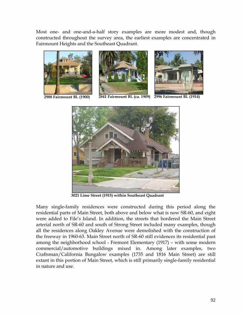
Most one- and one-and-a-half story examples are more modest and, though constructed throughout the survey area, the earliest examples are concentrated in Fairmount Heights and the Southeast Quadrant.
2988 Fairmount Bl. (1900) 2841 Fairmount Bl. (ca. 1909) 2996 Fairmount Bl. (1914)
3021 Lime Street (1915) within Southeast Quadrant
any single-family residences were constructed during this period along the sidential parts of Main Street, both above and below what is now SR-60, and eight ere added to File’s Island. In addition, the streets that bordered the Main Street
rterial north of SR-60 and south of Strong Street included many examples, though ll the residences along Oakley Avenue were demolished with the construction of e freeway in 1960-63. Main Street north of SR-60 still evidences its residential past
mong the neighborhood school - Fremont Elementary (1917) – with some modern ommercial/automotive buildings mixed in. Among later examples, tworaftsman/California Bungalow examples (1735 and 1816 Main Street) are still xtant in this portion of Main Street, which is still primarily single-family residential
nature and use.
MrewaathacCein
92

93
3787 Shamrock Avenue (ca. 1915) North of SR-60
tomotive (2360 Main Street),hich was originally a 1909 home for the Solorio family, a Hispanic family with
e earlier La Placita and Agua Mansa
1735 Main Street (1916) 1816 Main Street (1912)
Similarly, early examples in the Main Street Industrial Corridor were demolished or altered during the area’s complete conversion to commercial industrial use or during the construction of SR-60 such as Solorio Auwroots from Mexico and social ties to thcommunities. The Freeway Industrial Interchange was not developed in this period.
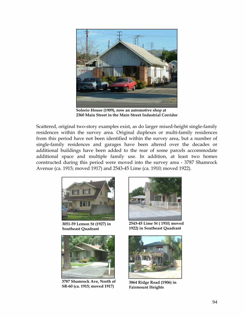
94
Solorio House (1909), now an automotive shop at2360 Main Street in the Main Street Industrial Corridor
Scattered, original two-story examples exist, as do larger mixed-height single-family residences within the survey area. Original duplexes or multi-family residencesfrom this period have not been identified within the survey area, but a number of single-family residences and garages have been altered over the decades or additional buildings have been added to the rear of some parcels accommodate additional space and multiple family use. In addition, at least two homes constructed during this period were moved into the survey area - 3787 Shamrock Avenue (ca. 1915; moved 1917) and 2543-45 Lime (ca. 1910; moved 1922).
2543-45 Lime St ( 1910; moved1922) in Southeast Quadrant
3051-59 Lemon St (1927) in Southeast Quadrant
3864 Ridge Road (1906) in Fairmount Heights
3787 Shamrock Ave, North ofSR-60 (ca. 1915; moved 1917)
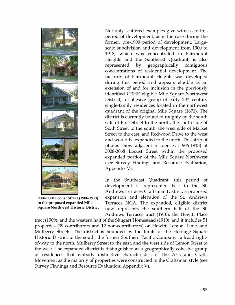
Not only scattered examples give witness to this period of development, as is the case during the former, pre-1900 period of development. Large-scale subdivision and development from 1900 to1918, which was concentrated in Fairmount Heights and the Southeast Quadrant, is also represented by geographically contiguous
airmount Heights was developed
currently bounded roughly by the south side of First Street to the north, the south side of Sixth Street to the south, the west side of Market Street to the east, and Redwood Drive to the west and would be expanded to the north. This strip of photos show adjacent residences (1906-1913) at 3008-3068 Locust Street within the proposed expanded portion of the Mile Square Northwest (see Survey Findings and Resource Evaluation; Appendix V).
In the Southeast Quadrant, this period of development is represented best in the St. Andrews Terraces Craftsman District, a proposed expansion and elevation of the St. Andrews Terraces NCA. The expanded, eligible district now represents the southern half of the St. Andrews Terraces tract (1910), the Hewitt Place
tract (1909), and the western half of the Shugart Homestead (1910), and it includes 51 properties (39 contributors and 12 non-contributors) on Hewitt, Lemon, Lime, and Mulbe areHistor ht-
f-way to the north, Mulberry Street to the east, and the west side of Lemon Street to
3008-3068 Locust Street (1906-1913)
concentrations of residential development. Themajority of Fduring this period and appears eligible as anextension of and for inclusion in the previously identified CRHR eligible Mile Square Northwest District, a cohesive group of early 20th century single-family residences located in the northwest quadrant of the original Mile Square (1871). The district is
in the proposed expanded Mile Square Northwest Historic District
rry Streets. The district is bounded by the limits of the Heritage Squouthern Pacific Company railroad rigic District to the south, the former S
othe west. The expanded district is distinguished as a geographically cohesive group of residences that embody distinctive characteristics of the Arts and CraftsMovement as the majority of properties were constructed in the Craftsman style (see Survey Findings and Resource Evaluation; Appendix V).
95
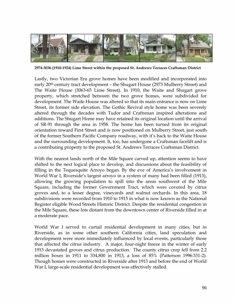
96
2974-3036 (1910-1924) Lime Street within the proposed St. Andrews Terraces Craftsman District
Lastly, two Victorian Era grove homes have been modified and incorporated into early 20th century tract development – the Shugart House (2973 Mulberry Street) and The Waite House (3063-65 Lime Street). In 1910, the Waite and Shugart groveproperty, which stretched between the two grove homes, were subdivided for development. The Waite House was altered so that its main entrance is now on Lime Street, its former side elevation. The Gothic Revival style home was been severely altered through the decades with Tudor and Craftsman inspired alterations and additions. The Shugart Home may have retained its original location until the arrival of SR-91 through the area in 1958. The home has been turned from its original orientation toward First Street and is now positioned on Mulberry Street, just south of the former Southern Pacific Company roadway, with it’s back to the Waite House and the surrounding development. It, too, has undergone a Craftsman facelift and is
contributing property to the proposed St. Andra ews Terraces Craftsman District.
With the nearest lands north of the Mile Square carved up, attention seems to have shifted to the next logical place to develop, and discussions about the feasibility of filling in the Tequesquite Arroyo began. By the eve of America’s involvement in World War I, Riverside’s largest arroyo in a system of many had been filled (1913), allowing the growing population to spill into the areas southwest of the Mile Square, including the former Government Tract, which were covered by citrus groves and, to a lesser degree, vineyards and walnut orchards. In this area, 18 subdivisions were recorded from 1910 to 1915 in what is now known as the National Register eligible Wood Streets Historic District. Despite the residential congestion in the Mile Square, these lots distant from the downtown center of Riverside filled in at a moderate pace.
World War I served to curtail residential development in many cities, but in Riverside, as in some other southern California cities, land speculation anddevelopment were more immediately influenced by local events, particularly those that affected the citrus industry. A major, four-night freeze in the winter of early 1913 devastated groves and citrus production. The county citrus crop fell from 2.2 million boxes in 1911 to 334,800 in 1913, a loss of 85% (Patterson 1996:331-2). Though homes were constructed in Riverside after 1913 and before the end of World War I, large-scale residential development was effectively stalled.
COMMERCIAL/INDUSTRIAL DEVELOPMENT
Though citru omy until about 1930, the 1913eeze and the effects of World War I caused Riversiders to reevaluate and diversify
Street Tract (1907), File’s Subdivision No. 3 907), and Wauregan’s Tract (1908) – the corridor quickly developed into three
nd became connected to First Street with the extension of Main Street
cording
of the Suverkrup lumberyard between Main and Orange 2, a low-income housing tract replaced the Boyd & Lovesee ree historic single-family residences between Main and Market
s continued to dominate the local econfrtheir commercial interests. Residential development occurred in a portion of the Main Street Industrial Corridor, but its conversion throughout the 20th century to nearly exclusively commercial/industrial use was a sign of the decreased dependence on citrus and other agriculture and has prompted its identification as an industrial corridor unique from other areas of Riverside.
Subdivided between 1906 and 1908 into four tracts south of the present SR-60 – E.N. Smith Subdivision (1906), North Main(1distinct areas asouth. At one time, the Southern Pacific Company railroad line (1892) crossed over Main Street between First and Poplar Streets from the east/northeast where itentered the city along Massachusetts Avenue. At that point, it branched into two different directions – south to run parallel with the ATSF railroad along the citrus packinghouses on Pachappa Avenue, and west, along the railroad right-of-way in the Southeast Quadrant and across Main Street. At Main Street, the line split again,
ith two bridges over one area of Main Street, heading north and south. Acwto Sanborn Maps (1931), the concrete trestle over Main Street turned north as the Riverside, Rialto, and Pacific Railway, and the wooden trestle over Main Street turned south, curving onto Market Street, to be used by PE for the local electric streetcar line. North of First Street, Main Street still dips steeply at the former railroad right-of-way property, and access to shops from this area to Poplar Street is made most convenient for traveling consumers with asphalted, angled parking stalls that flow directly from the roadway. A WPA project in 1940 added concrete stops to this portion of Main Street.
From the former Southern Pacific Company railroad right-of-way south to First Street, the land remained largely open. On the west side of Main Street, the PE housed a substation, and, later, Boyd & Lovesee Lumber Company occupied the area. A railroad freight house, bunkhouses, and the John Suverkrup LumberCompany were located on the east. New construction has eliminated this portion of the corridor; in 1991-93, three buildings associated with the Salvation Army were onstructed on the sitec
Streets and in 200umberyard and thl
Streets.
97
Between the former railroad right-of-way and Poplar Street, the corridor was developed with light industrial, commercial, and storage buildings. Some of the extant buildings, or portions of buildings, appear to closely resemble otherindustrial/commercial buildings extant in the Mile Square and on the Eastside
efore or around the turn of the century, and the Main Street Industrial Corridor
arlier Sanborn Maps are not available, but the 1931 ap shows only two businesses, a storage building, and a vacant warehouse on the
s the geographic extent of historic maps and other materials are limited, only two
es. Most residential examples are one or half stories in height, though several two-story examples are also extant, re accompanied by one- or two-car, detached garages. It was during this
and developed and single-e nearly every street, but are
airmount Heights and the Southeast Quadrant.
bwas formally subdivided by 1907. However, no evidence has been found in the historic record for improvement of the large lots before 1923. The 1908 Sanborn Map does not include this area, and the updated 1931 Sanborn Map shows 19commercial/industrial buildings, many of them vacant, already in place. Building permit records, which are sparse, place the earliest date of construction between 2700 and 2900 Main Street at 1923 (see Suburban Development 1919-1941). More in depth site-specific research that is beyond the scope and funding of the current study must be completed to gain a comprehensive understanding of theconstruction history along the corridor.
To the north from Poplar to Spruce Streets (then Hendry Street), homes filled the lots, which were improved with a wide parkway strip and sidewalk; some parkways have been filled in with asphalt. Emwest side of Main Street between Poplar and Spruce Streets among 21 single-family residences; only a handful of residence remain today along this portion of Main Street, many of which have been severely altered, and all but one have been converted to commercial use. The area farther north along Main Street between Spruce and SR-60 is also not represented by Sanborn Maps until 1952. This map and oral accounts indicate that single-family residences populated these lots as well. Conversely, Main Street north of SR-60 still evidences its residential past among the neighborhood school (see above).
Acommercial enterprises outside of this core commercial/industrial area wasidentified from this period within the survey boundaries – 3339 and 4014 First Street.
Property Types
The residential property types related to this period of development are single-amily and converted, multi-family residencf
one-and-a-nd most aa
period that most of the survey area was subdividedamily examples constructed from 1903-1918 dominatf
highly concentrated in F
98
Subdivided from 1907 through 1909, no historic commercial/industrial examples, or remaining portions or elements, could be identified within the corridor, but could not be absolutely identified prior to 1923. Should further study during Phase II of the Northside Survey include the Main Street Industrial Corridor, it is possible that vernacular, single-story, commercial, industrial, or manufacturing buildings, orportions of extant buildings and related features and objects such as signs andancillary structures, might date from this period. Other associated property types include railroad-related elements that facilitated commercial/industrial productionand distribution in this corridor and may include extant tracks, spurs, bridges, and signs along the historic route of the Southern Pacific Company, although no such railroad-related resources have been noted within the Southeast Quadrant or Main Street Industrial Corridor from the public right-of-way.
Property types related to community development within this period and associated ith the historic Riverside fairgrounds, if extant, are located outside the survey area.
rchitectural Styles
uring this period of development, turn of- and early-20th century residential
d a concentrated, homogenousharacter rather than the open and distinct feel of the rural spaces of the earlier era.
xist throughout the Northside survey area from this earliest period f residential development in Riverside in the Craftsman, Colonial Revival, Classical
wProperty types associated with Fremont Elementary School include classroom and administrative buildings, as well as any extant campus features such as flagpoles, signs, or permanent recreational equipment or landscapes. Further research isneeded to determine the existence and integrity of remaining buildings and features of the elementary school campus, and as the campus was developed and improved throughout the 20th century, it is recommended that the campus be evaluated as a potential district during Phase II of the Northside Survey.
A
Dexamples exist within the survey area in mostly modest size and form and particularly concentrated in Fairmount Heights and the Southeast Quadrant. In this period, residential representations of the period reflect a growing population and need for more housing stock in limited spaces. In addition, dependency on citrus and agriculture is less of an influence on residential lot size and design, lending Riverside’s residential landscapes during this periocMany examples eoRevival, and Prairie styles.
Craftsman
Influenced by the English Arts and Crafts movement, simplicity of design and use of natural materials distinguished the Craftsman style from residences of the Victorian era. Primarily the creation of two California brothers, Charles Sumner Greene and
99
Henry Mather Greene, the style emerged around 1903 and quickly spread throughout the nation via popular magazines and pattern books, which offered stock plans for one- or one-and-a-half story Craftsman Bungalows. Some pattern books offered special plans, materials lists, and even pre-cut lumber and guidelines. Inherent in the style is a horizontal orientation, which is achieved in part through
e use of a low-pitched roof with overhanging eaves and exposed roof rafter tails. den beams are often added in mock support of wide, overhanging
able ends, and wall cladding is typically wood clapboard or shingle, although es. Casement or double-hung
indows often boast decorative, multiple top panes or sash and are found in pairs nds of three or more that are trimmed with continuous, wide flat
oards. Wide, full or partial façade porches with distinctive and varied roof e, tapered columns rise from
round to roof or rest on massive piers or a solid porch balustrade that extends or. Columns can be paired, and various cladding materials are
often combined and include stone, brick, stucco, clapboard, shingle, or concrete
popular Period Revival styles in this area. Most are constructed as bungalows in modest, one- to one-and-a-half story urban dwellings.
olonial Revival
mmetry and is found in double-hung sash with range of pane configurations. Various subtypes of the Colonial Revival style
dominated American architecture during the first half of the 20th century and are represented on the Northside, during this period, mainly in Classical cottage form
thDecorative woogstone, brick, and stucco are also seen on some examplwor grouped in babsupports are a hallmark of the style. Generally squargabove the porch flo
block (McAlester 2000; 452-463).
Soon after the introduction of the style, the term “California Bungalow” waspopularized. Originally, the term may have been a regional interpretation or one applied interchangeably in reference to the origin of the style, but has come to distinguish those examples that are less stylistically defined and offer a more modest interpretation of the style’s character-defining features.
As the heyday of the Craftsman style in Riverside, which is generally 1910 to 1920, is expanded on the Northside with several examples predating 1910 and stretching farinto the 1920s, supplanting the
C
The Colonial Revival style represents a renewal of interest in early English and Dutch styles of the Atlantic seaboard and typically combines details from theGeorgian and Adam styles or Postmedieval English and Dutch examples (McAlester 2000:324).
The Colonial Revival style manifests itself in single- or two-story examples with symmetrical facades and hipped or gabled roofs. Dormers are common to this style as are accentuated entries, bell-cast eaves, and the use of classical columns. Fenestration contributes to façade sya
100
(see also Residential Development 1870-1900).
ent 1870-1900). Most examples in the survey area for this eriod are one-story Classical cottages.
nity facilities andnt Park and Fremont Elementary School already he Northside between world wars focused on filling in
Classical Revival
Interest in classical designs was prompted by the 1893 World’s ColumbianExposition, which was held in Chicago and featured a classical theme fashioned by well-known architects. Popularized by exposition reports and photographs, theNeoclassical style, like the closely related Colonial Revival style, was fashionable in the first half of the 20th century, but was suppressed by other Eclectic styles. Character-defining features of the style include a full height porch roof supported by classical columns, which can be square in later examples, double-hung sashes of six or nine panes, and decorative entry door surrounds (McAlester 2000:343-46; see also Residential Developmp
Prairie
A distinctly American style, like the Craftsman, the Prairie style emerges from Chicago and is popularized by Frank Lloyd Wright. A rejection of period styles, the Prairie style was plain in detail, massive and horizontal in scope, with the interior plans influenced by Victorian models and exterior details Asian-inspired (Poppeliers (1983:80). A few Prairie styles are extant in the survey area, which is dominated by the closely related Craftsman style, the best designed by well-known architect Albert Shliem at 2996 Fairmount Boulevard.
SUBURBAN DEVELOPMENT, 1919-1941
ostly subdivided in the previous period, and with commuMamenities such as Fairmoustablished, development in te
vacant residential and commercial properties and adapting others to changing needs. Having laid the groundwork in the last decades, newly delineated urban lots in the Northside were ready for the coming population explosion.
101
HISTORY
As WWI came to a close, America’s collective focus narrowed once more, and the quiet growth during the first decades of the 20th century was called upon to support an unprecedented boost in regional population. The effects of the increase in oil production during and after WWI, the rising popularity of motion pictures, and the booming tourist trade all served to bring settlers and dollars into southern California and prompted the real estate boom of the 1920s and the development of southern California’s first suburbs. Approximately 1,440,000 new residents settled in southern California during the 1920s, an impact that was felt locally (McWilliams 1976:135-
37).
WI and the effects of the end of the Mexican evolution, which prompted large-scale immigration from the south.
junior high schools in the 1920s and the Municipal uditorium (1928-29). Chain stores like JC Penney and Sears Roebuck & Company
1
Though Riverside’s agricultural landscape slowly began to transform and shift interest to other agricultural products and industries, citrus remained the economic and cultural identity of the city. A shift, though, in the City’s dependence onagriculture and citrus can be seen in both residential and commercial/industrial development with the establishment of small- to large-scale family farms, mainly in portions of the Northside and in the Arlington area, and commercial/industrial interests are both diversified in terms of products and services and consolidated geographically. During this period, countywide citrus production and acreage was maintained or increased with the inclusion of new citrus production in Corona, Hemet-San Jacinto and Elsinore areas, even though local acreage was decreased in favor of other crops or urbanization (Patterson 1996:380-81). In addition, a shift in local labor groups from Japanese to Mexican workers reflected both America’s alliance with Japan during WR
Though many Mexican immigrants must surely have settled in areas whereresidents of Mexican-American heritage were already established such as CasaBlanca and Arlington, some undoubtedly settled on the Northside as today, over half of Northside residents are Hispanic. Some residents and descendents of La Placita and Agua Mansa are believed to have settled in the Northside after the Spanish settlement declined. Despite the lack of evidence of Northside Hispanics in the historic record, other Spanish-speakers working as laborers and professionals are listed in early city directories whose names match those known to be associated with the Spanish settlement like Garcia, Romo, and Pena (Bynon 1893-4:n.p.; Patterson 1996:132).
Though not on the Northside, public building continued elsewhere in the City with the construction of threeAarrived in Riverside, and a motion picture studio was constructed about 1920. The 1920s and 1930s saw the development of the fine arts in Riverside with the
102
formation of the Riverside Community Players (1925), the Riverside Art Association (1931), and the Riverside Opera Association (1932) (Patterson 1996:383,402). In the depressed 1930s, local public projects benefited from national relief programs like the Works Progress Administration (WPA), which assisted in the construction of public improvements, such as the concrete parking stops installed along North Main Street shops, and also contributed to arts and education projects like theconstruction of a new building for the Chemawa Junior High School (1928) in 1939-40 (demolished 1973).
According to Riverside census records, from 1910 to 1940 the City’s population more than doubled from 15,212 to 34,696, with the largest increase of 10,355 new residents between 1920 and 1930. It is unclear how these figures represent the population
ithin the survey area had already beeneadied for development, and within this period, only two tracts were developed in
the Fairmount Heights area of the Northside – the Redwood Tract (1924), which resubdivided the 1916 Amended Indian Hill Tract, and City Park Tract (1926). In the Southeast Quadrant, Russell Tract Nos. 1 & 2 (1936, 1937) and the Rusora Tract (1937) were developed, and developers began to consider the area in the northeast area of the Southeast Quadrant, now the Freeway Industrial Interchange, and the C.C. Pond Subdivision (1941) was laid out there (Figure 16). Speculation in this area may have waited too long. WWII slowed development, and by the time the war came to a close, the area appeared suitable for large-scale industrial and manufacturing.
growth within the Northside, specifically, but the onset of large-scale residential development there during this period evidences the relative increase to the boost in the larger Riverside population.
RESIDENTIAL DEVELOPMENT
In response to dramatic increases in population, residential development in Riverside increased again in the peacetime climate between WWI and WWII, which was typical throughout southern California. In Riverside, previously undeveloped land was subdivided as new residential tracts were developed. Extensive grove and agricultural properties were carved up, and new, smaller homes were built near large grove houses or filled in vacant residential lots (RCPD February 2003:16). On the Northside, however, much of the land wr
Area of Development Tracts Date Map Book/Page
Fairmount Heights Redwood Tract 1924 11/77City Park Tract 1926 13/82
Freeway Industrial Interchange
C.C. Pond Subdivision 1941 20/7
103
Area of Development Tracts Date Map Book/Page
Southeast Quadrant Russell Tract 1936 18/94Russell Tract No. 2 1937 19/26
Rusora Tract 1937 19/27Figure 16. Table showing tract development from 1919-1941
Like the previous period, residential development in this era was generally modest in scale with one- and one-and-a-half story examples filling vacant parcels in previously and newly subdivided tracts throughout the survey area. Residences are mainly Craftsman Bungalow, or California Bungalow with very few period styles among them (see Architectural Styles, below). One exemplary, modest dwelling of exposed clinker brick construction is located at 3720 Stoddard. The residence is currently designated a City Structure of Merit (189) and has previously been determined eligible for listing in the NR (Hammond 1995). However, eligibility for listing in the NR could not be confirmed as the limited comparative study of hollow tile construction employed for the 1995 survey should be broadened to a citywide context rather than the geographic extent of historic Sanborn Maps. However, due to its unique, and now rare, exposed hollow tile construction, the residence has been determined eligible for distinction as a City Landmark under this survey.
104
105
Clinker Brick House at 3720 Stoddard Avenue (1923)
Population increases, however, allowed for the spread of multiple-family housing beyond the Mile Square and into the Northside neighborhoods during this time.
everal examples of original multiple-family housing exist within the survey in duplex or multiple unit forms, including 2809-21 Fairmount Boulevard (1920s), 3028 Fairmount Blvd, 3503-17 First Street, 2650-54, Lime Street (1925), and 2869 Market Street (1923).
S
Randall Road toward Fairmount Park and streetlights
One potential historic district, the North Hill Historic District, was identified during the survey process and represents the cohesive development of a small, exclusive area overlooking Fairmount Park with a concentration of large-scale, high stylesingle-family residences in a mix of period revival style architecture of the eclectic
920s and 1930s: Tudor Revival, Spanish Colonial Revival, Monterey Revival, French Eclectic, Pueblo Revival, and Minimal Traditional styles. Most residences are a rds extant on Randall
treet, the west end of Houghton Avenue, and Pine Street, were likely specifically
Mile Square. Althoughughly doubled, construction within the survey area during pled with over 330 new homes constructed (County of
ment, about 75% of
ontributed to and was influenced by the diversification of commercial/industrial opulation increases, particularly in the 1920s, necessitated diversification
s much as the depression and devastating nighttime freeze that followed did in the
1
rchitect-designed, and unique, contributing light standaSselected for this development as they appear no where else in the survey area or in the City. As mostly small-scaled, turn-of and early-century residences boast style popular before period revival styles took over the face of 1920s and 1930ssubdivisions in Riverside, the presence of large, high-style examples is made more striking (see Survey Findings).
Residents who settled on the Northside during this time may have been new arrivals or may have sought relief from population pressures in thethe City’s population rothis time more than triRiverside 2003), indicating that many chose to settle on the Northside According to city directories, Northside residents in the 1920s and 1930s were a mix of blue- and white-collar workers, including laborers, painters, teachers, clerks, carpenters,engineers, electricians, contractors, farmers, mechanics, and janitors.
As elsewhere, residential development stalled during the depressed early 1930s, and, though building picked up in the survey area in 1936, a paralyzing freeze in 1937, which decreased citrus production 37% (Patterson 1996:379-80), keptconstruction in a general slump. Though three tracts are divided in the 1930s (see table below), of the 21 years within this period of developconstruction was completed by 1930. With the onset of another world war, strong residential development would take years to rebound.
COMMERCIAL/INDUSTRIAL DEVELOPMENT
During this period, decreased dependence on agriculture and citrus bothcinterests. Pa1930s. While economic interests became broader, geographically, commercial and industrial enterprise seemed to consolidate as some areas became increasingly associated with these uses. Neighborhood stores and shops like Dodge’s Grocery (1923 to ca. mid-1960s), a City Structure of Merit (#541) and contributor to the Heritage Square Historic District at 3339 First Street and another at 4041 First Street
106
(later converted to a single-family residence) coexisted with these emerging strips of concentrated commercial zones, such as Magnolia Center to the south, University Avenue on the Eastside, the Magnolia Avenue/Van Buren Business District, and the expanding Main Street Industrial Corridor, and were eventually overshadowed by
em. This geographic concentration of commercial enterprise in Riverside was
as a transportationorridor for Riverside and beyond. Locally, Eighth Street connected the Eastside
intersection.
These commercial zones share commonalities yet are each distinct. As with these other emerging commercial zones, the Main Street Industrial Corridor was supported not only by the traveling motorist upon which it focused, but also by the residents of the surrounding neighborhood, and Northsiders who were physically distant from other public and commercial services of the City may have been even more dependent on this neighborhood center. In addition, industrial enterprise commingled with strictly commercial uses, making this corridor unique then and now.
Though subdivided by 1907, evidence, or lack of evidence, in the historic record indicates that the improvement of the large lots before 1923 between the former
thlinear as it was associated with major arterials or highways and generally focused on the automobile and the needs of the passing motorist with auto courts, motels, service stations, and roadside eateries.
Commercial development in Magnolia Center along the three intersecting arterials of Magnolia, Central, and Brockton Avenues increased after 1924 when the avenue was paved and designated a state highway, connecting US Highways 60 and 66. In that year, the first motel in the city was built at the Brockton-Central-Magnolia Avenue intersection - Stewart’s Auto Court (1924-1971). By 1941, scatteredbusinesses along the avenue from Jurupa Avenue to Palm School and on theimmediate arterials included numerous gas stations, a creamery and milk deliverycenter, and a Safeway grocery store (Mermilliod 2004:41). The Eastside’s main arterial, University Avenue (formerly Eighth Street), also servedcwith the downtown Mile Square core and served as the access route to theUniversity of California’s Citrus Experiment Station. But by 1933, the thoroughfare was also identified as a segment of State Route 60, and by the early 1950s, it functioned as a major arterial for regional traffic. By that time, commercial buildings, particularly motels, which catered to the needs of travelers, had begun to line the roadsides along Eighth Street, and a few are still extant (Mermilliod 2003:19-20). The Magnolia Avenue/Van Buren Business District, which was established very early, was first associated with another type of traveling consumer – those passing by carriage or streetcar. With this early development, a pattern of commercialconstruction began to emerge, and soon, businesses mostly contained withincommon-walled buildings with continuous storefronts extended east and west along Magnolia Avenue from that
107
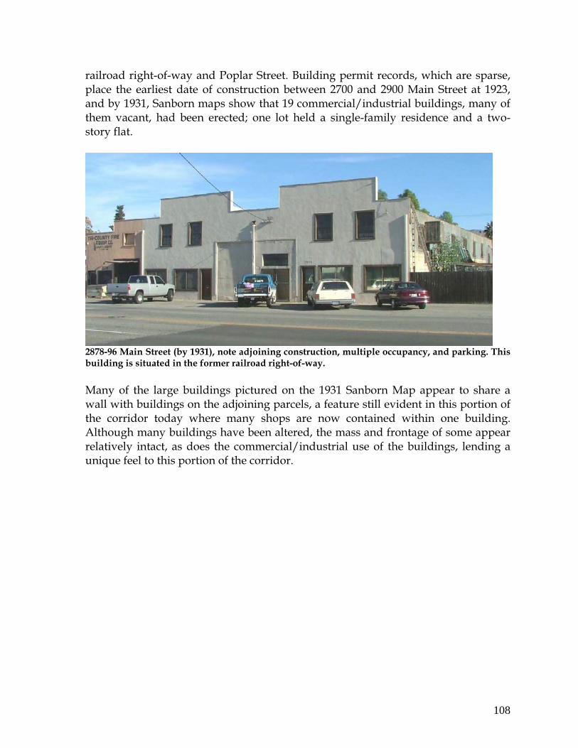
railroad right-of-way and Poplar Street. Building permit records, which are sparse, lace the earliest date of construction between 2700 and 2900 Main Street at 1923, p
and by 1931, Sanborn maps show that 19 commercial/industrial buildings, many of them vacant, had been erected; one lot held a single-family residence and a two-story flat.
2878-96 Main Street (by 1931), note adjoining construction, multiple occupancy, and parking. This building is situated in the former railroad right-of-way.
Many of the large buildings pictured on the 1931 Sanborn Map appear to share a wall with buildings on the adjoining parcels, a feature still evident in this portion of the corridor today where many shops are now contained within one building. Although many buildings have been altered, the mass and frontage of some appear relatively intact, as does the commercial/industrial use of the buildings, lending a unique feel to this portion of the corridor.
108
pany (later Calectric) in the Maindor (Klure 2005
giant th on the corrido ing th ass Powert, with ison, p ed the y of
e to SoutheEighth and c ny co an
29) on ver e parcel accessible f Main curve n of M reet.
his industrial headquarter room veral d ents,cluding the Transportati mer, C uction, eter
report stated that it owned
ctric fostered a now-rare corporate culture that Riverside employees (including many
1958 after losing and embittered bid to buy the City of
Aerial view (to east) of Southern Sierras PoStreet Industrial Corri
wer Com:35)
One new industrial at clearly arrived r dur is period wthe Southern Sierrabased company thaelectrical ser
Company (later Calectric), which was an engineering-Southern California Ed
rn Californirovid majorit
vicestablished at
a. With its corporate headquarters already Market Streets (1918), the ompa nstructed
Industrial Center (19from the west side o
North Main Street on the y largStreet and from the S- portio arket St
T s housed a general store and se epartmin on, Assembly, Transfor onstr and MDepartments. In that same year, the company’s annualapproximately 2,000 high-voltage transmission line miles and about the same number of miles of distribution lines and served a variety of industries in 33 cities and towns, including Riverside (Klure 2005b:35-36). The 1931 (updated) Sanborn Map indicates that the extensive complex space was split roughly equally between the large reinforced concrete buildings and an area of exposed pole storage and the whole traversed by a spur track of the Riverside-Rialto & Pacific Railroad Main Line after it crossed over Main Street. Calefocused on employees as family. Skilled
orthsiders) enjoyed advanced training programs, a stock purchase plan, life Ninsurance, credit union, and a pension plan along with employee suggestion awards, company vacation cabin use, Christmas parties, annual picnics often at Fairmount Park, and many other events held around the City (Klure 2005b:131-167). Calectric relocated to Rialto in
109
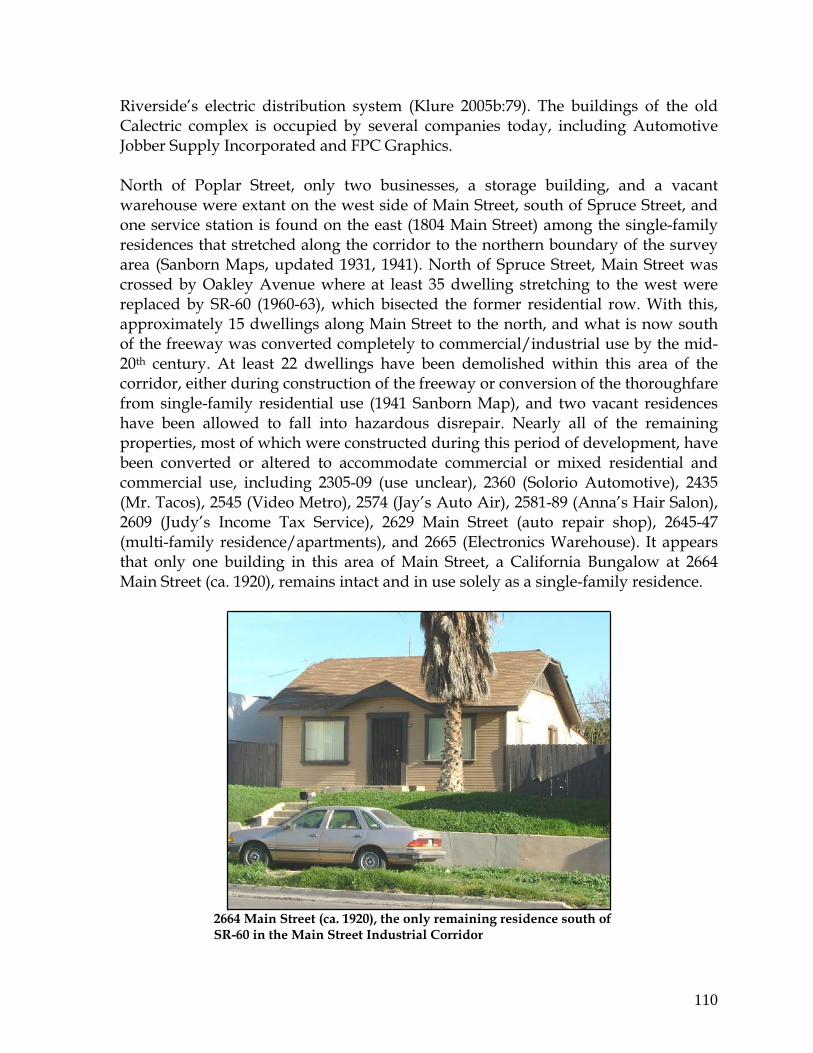
Riverside’s electric distribution system (Klure 2005b:79). The buildings of the old
disrepair. Nearly all of the remainingroperties, most of which were constructed during this period of development, have
Calectric complex is occupied by several companies today, including Automotive Jobber Supply Incorporated and FPC Graphics.
North of Poplar Street, only two businesses, a storage building, and a vacant warehouse were extant on the west side of Main Street, south of Spruce Street, and one service station is found on the east (1804 Main Street) among the single-family residences that stretched along the corridor to the northern boundary of the survey area (Sanborn Maps, updated 1931, 1941). North of Spruce Street, Main Street was crossed by Oakley Avenue where at least 35 dwelling stretching to the west were replaced by SR-60 (1960-63), which bisected the former residential row. With this, approximately 15 dwellings along Main Street to the north, and what is now south of the freeway was converted completely to commercial/industrial use by the mid-20th century. At least 22 dwellings have been demolished within this area of the corridor, either during construction of the freeway or conversion of the thoroughfare from single-family residential use (1941 Sanborn Map), and two vacant residences have been allowed to fall into hazardouspbeen converted or altered to accommodate commercial or mixed residential and commercial use, including 2305-09 (use unclear), 2360 (Solorio Automotive), 2435 (Mr. Tacos), 2545 (Video Metro), 2574 (Jay’s Auto Air), 2581-89 (Anna’s Hair Salon), 2609 (Judy’s Income Tax Service), 2629 Main Street (auto repair shop), 2645-47 (multi-family residence/apartments), and 2665 (Electronics Warehouse). It appears that only one building in this area of Main Street, a California Bungalow at 2664 Main Street (ca. 1920), remains intact and in use solely as a single-family residence.
2664 Main Street (ca. 1920), the only remaining residence south ofSR-60 in the Main Street Industrial Corridor
110
Northsiders as well as Riversiders in general patronize many of the shops on Main Street, which before the arrival of the SR-91, acted as a highway of sorts to local Riversiders and travelers. Most well remembered stores include Vic’s Grocerybetween Poplar and Spruce Street, Save-a-Minute and the Fish Market on the east side of Main Street, and Bader Motors. The Main Street Industrial Corridorcontinues to be a major arterial between Riverside and points north with roadside buildings catering to the consumer needs of the traveling motorist, local Northsideesidents, and the community at large.
ypes must be associated with the development of the Main treet Industrial Corridor and include both vernacular and stylized single-story,
rial, or manufacturing buildings, or portions of extant buildings. elated features and objects such as historic commercial signs, street architecture,
rchitectural Styles
he extant dwellings of this period rather than those constructed for trends that shaped their
esign, though some stylistic commercial/industrial examples mimicked some of of the period such as Spanish Colonial Revival as well as
ontemporary Folk, Western False Front, and Saw tooth Commercial examples are
r
Property Types
The property types related to this period of residential development are single- and multi-family residences that, while less associated to agriculture than in the previous period, may be associated with smaller rural lots, particularly to north of SR-60. Some two-story examples are extant, and many more duplexes were constructedduring this period, but both are far outnumbered by the more common, one- and one-and-a-half-story single-family dwellings on scaled down urban parcels.
Though scattered commercial enterprise existed within a residential context,commercial property tScommercial, industRand ancillary structures may be extant from this period, but could not be identified in the field or through the limited historic maps and other materials currentlyavailable. Other associated property types include railroad-related elements that facilitated commercial/industrial production and distribution in this corridor and may include extant tracks, spurs, bridges, and signs along the historic route of the Southern Pacific Company, although no such railroad-related resources have been noted within the Southeast Quadrant or Main Street Industrial Corridor from the public right-of-way. Further research is recommended to decipher the construction and alteration history along the Corridor as historic materials are inconclusive (see Resources Evaluation).
A
Tcommercial/industrial use elucidate the architecturaldthe residential designsCextant. Exploration of these styles used on commercial construction will be explored
111
during Phase II.
This era is part of the Eclectic Period (circa 1880-1940) during which American architects drew on the broad collection of architectural tradition for stylistic inspiration, producing revivals of American, English, French, and Mediterraneanperiod homes. Architectural interpretations of European designs were generally pure, yet the movement toward European period styles was diverse by nature.
enerally, the early reign of the Eclectic Movement was curtailed by the rise of the tsman styles yet revived by World War I, causing period revival
rchitecture to be most prevalent in the 1920s and 1930s (McAlester 2000:319).
aking up for the deficit in period revival styles in the survey area, however, are e North Hill Historic District in
Fairmount Heights. Here the Northside boasts 12 grand, mostly architect-designed
GPrairie and CrafaSimilarly, previous study in Riverside has characterized this period of development as a time when interest in diversification in response to the catastrophic 1913 freezeand the effects of World War I prompted Riverside’s residential, civic, and commercial architecture to become less locally distinct and more closely mirror the styles found across the country.
Residential design within the Northside, however, did not seem to conform to this accepted view of architectural design trends in the 1920s and 1930s. Though strongly represented in the previous period, Craftsman examples persist into the 1920s,dominating the residential landscape of the survey area despite the popularity of period revival designs seen one after another in other Riverside neighborhoods like Palm Heights to the south. Spanish Colonial Revival, Tudor Revival, Pueblo Revival, Colonial Revival, and Classical Revival designs are represented here, though in surprisingly small numbers perhaps revealing the influence of preceding,neighboring designs on new construction.
Mthe high-styled, large homes that make up th
homes in the Spanish Colonial Revival, Tudor Revival, Monterey Revival, Pueblo Revival, and French Eclectic styles, and one in the Minimal Traditional style, the earliest modern style to emerge from the Eclectic Period. Also, pre-WWII vernacular examples exist throughout the survey area.
Craftsman
See Residential Architecture 1870-1900 and 1901-1918.
Spanish Colonial Revival
Initially spawned by the popularity of the Mission style, following the 1915 Panama-California Exposition, held in San Diego, California, the Spanish Colonial Revival style was redefined by the entire history of Spanish architecture. Buildings in the
112
style were constructed from 1915 to 1940, but in Riverside, most examples are typically from the 1920s and 1930s, a time when period revival architecturedominated construction styles. The Spanish Colonial Revival style was mastered by such well-known local architects as Robert H. Spurgeon, Jr., Henry L.A. Jekel, and G.
tanley Wilson, although most examples were constructed by local builders. or rectangular plans, a low-
itched roof topped with red tiles, and close eaves. Arches are common above doors
oosely based on late medieval examples, the Tudor Revival style rose in popularity
beams, characterize the style.
onterey Revival
nique to the survey area and rare to Riverside, one example (4428 Houghton
SCharacter-defining features of the style include squarepand prominent windows, and walls are sheathed in smooth stucco. Round or square towers are sometimes present, and decorative details include patterned tiles, scalloped parapets, and the use of wrought iron grille work (McAlester 2000:417-18).
Tudor Revival
Lafter World War I and dominated early 20th century suburban landscapes. Most popular in the 1920s and early 1930s, this style features steeply pitched, typically cross-gabled roofs and groups of tall, narrow windows. Decorative elements often include half-timbering, arches, massive chimneys, and sometimes quoins. Walls can be clad in a variety of materials, including brick, wood, stucco, or stone. Popularity of the style faded in the late 1930s with the rise of the modern period (McAlester 2000: 355-56).
Pueblo Revival
A blend of Native American designs and the Spanish Colonial Revival style, the Pueblo Revival is most common in the southwest region of the United States. Although most popular in the 1920s and 1930s, the Pueblo Revival style is not a common one of the Eclectic period, and surviving examples remain scattered. A flat roof with stepped or rounded parapet walls, the use of stucco, and the presence of vigas, or wooden roof
M
UAvenue) designed by Henry L.A. Jekel in the Monterey Revival style is found in the proposed North Hill Historic District. Given the style’s free interpretation of the Spanish Colonial Revival style and the architect’s bias for the Spanish style, it is not surprising to see many Spanish details on this residence. Character-defining features of the Monterey are hard to classify, but one clear feature is the second-floor balcony covered by the main roof form, which is present in this example. Other features include paired windows and the use of faux shutters, and while the residence displays paired fenestration, the arched, tripartite window assemblage on the right façade mimics the image of a large window flanked with shutters. Unlike the
113
common wrought iron used in Spanish Revival examples, the balcony posts and balustrade are crafted in heavy wood.
ee Residential Architecture 1870-1900 and 1901-1918.
II,fill
pplans, close eaves, large chimneys, and
arious wall-claddings, including wood, brick, stucco, or stone (McAlester 2000:477). 30s is apparent in the style, of which
xamples are scattered throughout the Northside, but one fine example designed by
is single-tory home resist classification into established architectural styles, but are typically
square or rectangular in form with a hipped roof, stuccoed walls, close eaves and minimal detailing. Pre-WWII Vernacular examples differ little from wartime and post-war vernacular trends, but are distinct in their dates of construction. As America entered the war in December 1941, vernacular dwellings constructed in the latter years of the 1930s through 1941 are acknowledged as pre-WWII examples, which are found in the survey area.
Colonial Revival
S
Classical Revival
See Residential Architecture 1870-1900 and 1901-1918.
Minimal Traditional
The Minimal Traditional style rose in popularity in the years before WWdominating large tract-housing development and appearing in significant innumbers in established tracts immediately pre- and post-war. The style is looselyborrowed from the front-gabled, Tudor style sans elaborate detailing and steepitch. Features generally include single storyvThe trend toward simplicity in the depressed 19earchitect Herman O. Ruhnau is extant in the proposed North Hill Historic District at 4465 Randall Road. These simple, unembellished dwellings returned to rival post-WWII vernacular architecture.
Pre-WWII Vernacular
Emerging from the popular Minimal Traditional style, which loosely borrowed its design from the Tudor style, vernacular designs were a rather sharp departure from the traditional form of the Eclectic period. The features and details of ths
114
POST-WWII DEVELOPMENT, 1946-late 1950s
HISTORY
The close of WWII marked the beginning of lasting change on many levels. Wartime increases in manufacturing industries prompted a complete shift in California’s economy, from agricultural to industrial, with southern California leading the state’s production. In 1946, California contributed over 13% of the national value of manufactured goods, a trend that increased in the post-war decades. In addition, another wave of migration headed west in the post-war era with the most gains recorded in southern California (McWilliams 1973:371-2). And changes in land use and planning coupled with the rising importance of the automobile forever altered the urban landscape.
In Riverside, the economic shift and population growth reflected regional trends. The City’s agricultural economy slowly gave way to the rising force of industry as well-known industrial giants, such as Rohr Corporation, Bourns Incorporated, and the Lily-Tulip Cup Corporation arrived in Riverside, and the increasing diversification of Riverside's economic livelihood saw the destruction of much of Riverside's once vast citrus and agricultural acreage. Riverside’s population gained steadily during the 1940s with the addition of approximately 12,000 residents but skyrocketed in the 1950s and 60s. Riverside’s 1950 population of 46, 764 residents ju 70 (Census Bureau
emped to approximately 84,000 in 1960 and over 140,000 in 19nsus 1940-1970). In response to population-driven demands for housing,
,Csubdivision reached record heights as did traffic congestion, prompting the building of the Riverside Freeway (1958), the Pomona Freeway (1960s), and theprofessionalization of city planning (Patterson 1996:430-35; 454).
COMMUNITY DEVELOPMENT
Community development came alive again after WWII when, led by the nation, Americans turned their energies inward once more. The wide, undeveloped areas of the Northside not only drew the attention of large industrial giants, but also provided the space needed for the large-scale infrastructure projects sweeping the nation and the City.
115
Highways
rvey area are part of both the national
ralovernment promised to fund 90% of the
of the 41,000-mile interstate system, whpopulations over 50,000. It was the later
nded rside’s I-15 in the southern portion of Riverside.
e, Riversider J.L. Maude, a civilngineer of San Bernardino and early resident of the Eastside, was appointed one of
three officials to conduct the first comprehensive state roads survey and recommended to the Governor a system of state highways. Maude’s recommendation was a system that consisted of 28 routes, which connected all county seats (Bynon 1893-4:194). The California highway system was formally organized in 1902 when the state constitution was amended to give the Legislature the authorization to institute a statewide highway system. The first Bond Act in 1909 established the system and authorized the construction of over 3,000 miles of highways. Legislative Route Number (LRN) 19, also known as SR-60, was defined largely under the 1931 Bond Act (State of California 2005). According to a 1933 map, the route was already passing along Eighth Street (now University Avenue) by that time (Mermilliod 2003:8).
At that time, SR-60 ran from Los Angeles to Beaumont as SR-60/70/99. An important highway, U.S. 70 was considered “the principal southeastern gateway to
The highways that border and intersect the suand state highway systems. The Riverside Freeway (State Route (SR)-91) crosses the City on a northeast-southeast axis and forms the eastern boundary of the survey area and continued north as Interstate Route 215 (I-215), while the Pomona Freeway (State Route (SR)-60) enters Riverside from the northwest and bisects the survey area. While facilitating the national highway network and local transportation among a growing population, these freeways also served to bisect the Northside and redefine its boundaries.
The concept of a national interstate highway system was conceived in 1923, first mandated by the Federal-Aid Highway Act of 1944, and completed in the 1970s. After WWII, which had delayed the project and diverted federal tax money, interest in the development of an express, interstate highway system to cross each state and facilitate cross-country traffic on north-south and east-west axes was renewed. In 1956, and largely under the influence of President Eisenhower, the fedeg construction, right-of-way, and planning
ich would serve 90% of cities with 1968 Federal Highway Act that in part
fu the construction of RiveAlthough named as an interstate, the I-215, which partially bounds the survey area at the SR-91/I-215/SR-60 Interchange, this highway is not part of the federallyfunded national system but a State highway signed as such to provide continuity and connectivity for motorists.
The State highway system was born in 1895 when the State Legislature authorized the formation of the Bureau of Highways. At that time
116
California from Arizona” and U.S. 99 served as the “central artery of the California State Highway system” as it threaded its way through the interior of the state from the Oregon and Mexico borders (Wilbur, Smith, and Associates 1959b:9; California Highways and Public Works 1950:103, respectively). In Pomona, State Route 60 split from the main route and continued past Ontario and over Riverside streets. The path along the city streets ran from Mission Boulevard, east over the Santa Ana River, around Mount Rubidoux, and through downtown and the Eastside along Eighth Street. Beyond the Eastside community, it joined the southbound Escondido Freeway (U.S. 395), and a branch continued as SR-60 to Beaumont, where it rejoined with SR-60/70, which had passed through Ontario, Bloomington, Colton, Redlands, and west of Yucaipa (Wilbur, Smith, and Associates 1959a:13-18; Mermilliod 2003:8).
The current SR-91, which includes historic West La Cadena Drive and the former PE right-of-way was designated a portion of LRN 43 (defined in 1917), known as SR-18 (defined in 1931), and became a U.S. Highway (US 91) in 1933. It once ran from Long Beach to nearly Barstow, and by the late 1940s, the west side of historic La Cadena Drive between Strong and Chase Road, just north of the survey area, was a primary arterial street lined with residences and roadside commercial architecture. In June 1950, the State of California, Division of Highways constructed a 2.6-mile improvement to the route, adding a 4-lane divided highway from Russell Street to just north of the county line and initiating an effort to bypass Riverside’s surface streets with a modern freeway system. By the early 1950s, it was also signed as US 91 and US 395. The remainder of SR-91 south of Russell through Riverside was o on of the shared SR-60/I-215 inc
thmpleted in the late 1950s, followed by the completie early 1960s (Bricker 1998:7-9; Figure 17).
117
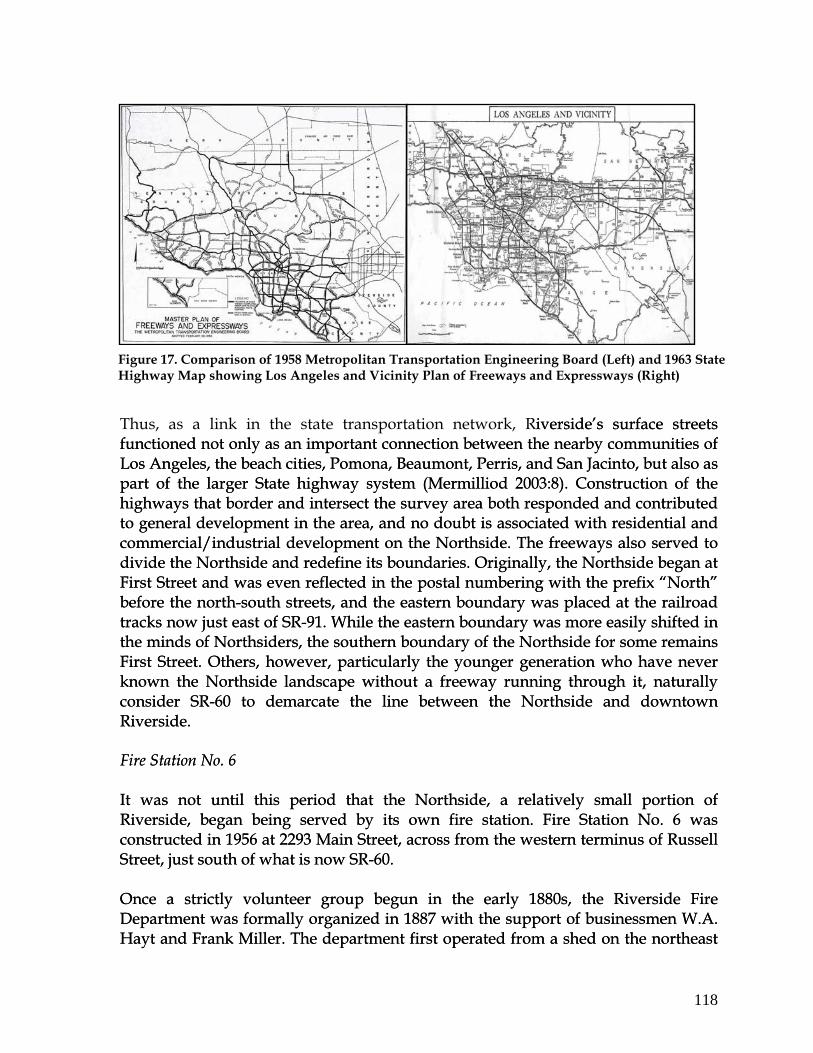
Thus, as a link in the state transportation network, Riverside’s surface streetsfunctioned not only as an important connection between the nearby communities of Los Angeles, the beach cities, Pomona, Beaumont, Perris, and San Jacinto, but also as part of the larger State highway system (Mermilliod 2003:8). Construction of the highways that border and intersect the survey area both responded and contributed to general development in the area, and no doubt is associated with residential and commercial/industrial development on the Northside. The freeways also served to divide the Northside and redefine its boundaries. Originally, the Northside began at First Street and was even reflected in
iverside’s surface streetsfunctioned not only as an important connection between the nearby communities of Los Angeles, the beach cities, Pomona, Beaumont, Perris, and San Jacinto, but also as part of the larger State highway system (Mermilliod 2003:8). Construction of the highways that border and intersect the survey area both responded and contributed to general development in the area, and no doubt is associated with residential and commercial/industrial development on the Northside. The freeways also served to divide the Northside and redefine its boundaries. Originally, the Northside began at First Street and was even reflected in
Figure 17. Comparison of 1958 Metropolitan Transportation Engineering Board (Left) and 1963 StateHighway Map showing Los Angeles and Vicinity Plan of Freeways and Expressways (Right)
the postal numbering with the prefix “North” efore the north-south streets, and the eastern boundary was placed at the railroad
ile the eastern boundary was more easily shifted in thern boundary of the Northside for some remains
It was not until this period that the Northside, a relatively small portion of Riverside, began being served by its own fire station. Fire Station No. 6 was constructed in 1956 at 2293 Main Street, across from the western terminus of Russell Street, just south of what is now SR-60.
Once a strictly volunteer group begun in the early 1880s, the Riverside Fire Department was formally organized in 1887 with the support of businessmen W.A. Hayt and Frank Miller. The department first operated from a shed on the northeast
bbtracks now just east of SR-91. Wh
e minds of Northsiders, the soutracks now just east of SR-91. Wh
e minds of Northsiders, the souththFirst Street. Others, however, particularly the younger generation who have never known the Northside landscape without a freeway running through it, naturally consider SR-60 to demarcate the line between the Northside and downtown Riverside.
ire Station No. 6
First Street. Others, however, particularly the younger generation who have never known the Northside landscape without a freeway running through it, naturally consider SR-60 to demarcate the line between the Northside and downtown Riverside.
ire Station No. 6FF
118
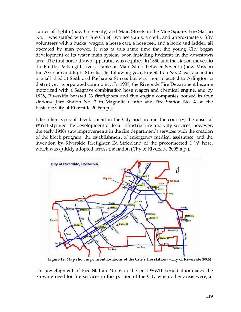
corner of Eighth (now University) and Main Streets in the Mile Square. Fire Station No. 1 was staffed with a Fire Chief, two assistants, a clerk, and approximately fifty volunteers with a bucket wagon, a horse cart, a hose reel, and a hook and ladder, all
perated by man power. It was at this same time that the young City began
ave combination hose wagon and chemical engine, and by 938, Riverside boasted 33 firefighters and five engine companies housed in four
stations (Fire Station No. 3 in Magnolia Center and Fire Station No. 4 on the Eastside; City of Riverside 2005:n.p.).
Like other types of development in the City and around the country, the onset of WWII stymied the development of local infrastructure and City services, however, the early 1940s saw improvements in the fire department’s services with the creation of the block program, the establishment of emergency medical assistance, and the invention by Riverside Firefighter Ed Strickland of the preconnected 1 ½" hose, which was quickly adopted across the nation (City of Riverside 2005:n.p.).
odevelopment of its water main system, soon installing hydrants in the downtown area. The first horse-drawn apparatus was acquired in 1890 and the station moved to the Findley & Knight Livery stable on Main Street between Seventh (now Mission Inn Avenue) and Eight Streets. The following year, Fire Station No. 2 was opened in a small shed at Sixth and Pachappa Streets but was soon relocated to Arlington, a distant yet incorporated community. In 1909, the Riverside Fire Department became motorized with a Seagr1
Figure 18. Map showing current locations of the City’s fire stations (City of Riverside 2005)
The development of Fire Station No. 6 in the post-WWII period illuminates the growing need for fire services in this portion of the City when other areas were, at
119
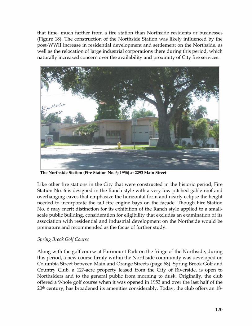
that time, much farther from a fire station than Northside residents or businesses (Figure 18). The construction of the Northside Station was likely influenced by the post-WWII increase in residential development and settlement on the Northside, as well as the relocation of large industrial corporations there during this period, which naturally increased concern over the availability and proximity of City fire services.
The Northside Station (Fire Station No. 6; 1956) at 2293 Main Street
Like other fire stations in the City that were constructed in the historic period, Fire Station No. 6 is designed in the Ranch style with a very low-pitched gable roof and overhanging eaves that emphasize the horizontal form and nearly eclipse the height needed to incorporate the tall fire engine bays on the façade. Though Fire Station No. 6 may merit distinction for its exhibition of the Ranch style applied to a small-scale public building, consideration for eligibility that excludes an examination of its association with residential and industrial development on the Northside would be premature and recommended as the focus of further study.
Spring Brook Golf Course
Along with the golf course at Fairmount Park on the fringe of the Northside, during this period, a veloped on
olumbia Street between Main and Orange Streets (page 68). Spring Brook Golf and new course firmly within the Northside community was de
CCountry Club, a 127-acre property leased from the City of Riverside, is open to Northsiders and to the general public from morning to dusk. Originally, the club offered a 9-hole golf course when it was opened in 1953 and over the last half of the 20th century, has broadened its amenities considerably. Today, the club offers an 18-
120

hole course and driving range, golf carts and lessons, a clubhouse and Pro-shop, a coffee shop, and a banquet room for approximately 65 people.
Though organized late in the period of this study for the Northside Survey, the development of the Spring Brook Golf Course was likely influenced by the increase in residential development and settlement on the Northside, and future study hould include an examination of its association with residential and industrial
development and its significance as a recre
eid Park
g allowed. Reid Park has beenproved by transplanted field lighting from the Fremont Elementary School
playground (late 1960s); the development of two additional fields (date unknown); the addition of picnic tables, turf, playground equipment, and asphalted parking (1969-70); permanent restroom facilities (1971); the grading and extension of parking and the addition of foot paths, trees, and playground equipment (1975); and a HUD-funded Community Center with a kitchen, patio, meeting and classrooms, basketball court, and swimming pool (1980s; RCPD 1976:83-85).
Though organized outside the period of this study for the Northside Survey, oral histories has identified the development of Reid Park as a significant event in Northside history and an important community place for Northside youth and adults alike. The Community Center is still home to the Northside Improvement Association, the oldest, still functioning community organization in Riverside. As with the Spring Brook Golf Course, the development of Reid Park was influenced by the increase in residential development and settlement on the Northside, but was also influenced by changes to Fairmount Park and the slowly shifting perceptions of
sational and event locale for Northsiders.
R
Unlike Fairmount Park, a citywide park, Reid Park is listed as a community park on the City’s General Plan but administered by the Department of Parks andRecreation. Reid Park is situated on approximately 16 acres at Orange Street and Chase Road and was organized in 1964 by a group of Northside residents led by Ruth Lewis, who was instrumental in gaining the City grant of parkland and for the addition of a swimming pool after the plunge at Fairmount Park was removed. The local Little League team may have been a catalyst to the development of the community park as a ball field was the first component constructed to serve the Northside and Highgrove youth.
In 1964, the City granted the use of the land but no assistance in developing it. It was local Northsiders who raised money for equipment and supplies through bake sales, rummage sales, and other fundraisers, and the Lions Club, along with various contractors and businessmen, helped to construct the ball field, bleachers, and a concession stand. Through the decades, however, the City did contribute toimprovements in a piecemeal fashion as fundinim
121

the boundaries of the Northside after the construction of SR-60 (1960-63). Future study should include an examination of its association with residential, industrial, and community development and its significance as a recreational and event locale for Northsiders of all ages.
RESIDENTIAL DEVELOPMENT
The last and final period of development to shape the urban landscape of Riverside occurred during the suburbanization movement of the post-WWII era, which was seen across the nation. As the dependence on agriculture lessened and population pressures increased, the groves and fields that dotted Riverside gave way to urban expansion, as elsewhere in southern California. By the late 1950s, the post-WWII boom and the accompanying suburbanization movement in American history had redefined the residential landscape throughout Riverside. Most of the remaining vacant lots throughout the survey area, many of which were concentrated on Holding and Spruce Streets and on Main Street above SR-60, were filled and several new tracts were developed on much of the remaining vacant residential (Figure 19); some individual parcels were developed independently.
3498 Holding Street (1951) - post-WWII infill construction in the Southeast Quadrant
The suburb of the post-WWII era has recently been a topic of increased study as these neighborhoods are coming into historic maturity. Unlike the piecemeal sale of vacant lots seen in earlier decades, post-WWII development was characterized by the appearance of uniformly constructed tract homes along curving streets and cul-de-sacs and was supported by unprecedented population growth. According to the
122
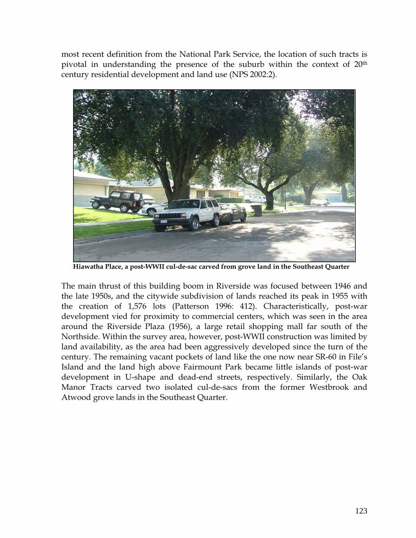
most recent definition from the National Park Service, the location of such tracts is pivotal in understanding the presence of the suburb within the context of 20th
century residential development and land use (NPS 2002:2).
Hiawatha Place, a post-WWII cul-de-sac carved from grove land in the Southeast Quarter
The main thrust of this building boom in Riverside was focused between 1946 and the late 1950s, and the citywide subdivision of lands reached its peak in 1955 with the creation of 1,576 lots (Patterson 1996: 412). Characteristically, post-war development vied for proximity to commercial centers, which was seen in the area around the Riverside Plaza (1956), a large retail shopping mall far south of the Northside. Within the survey area, however, post-WWII construction was limited by land availability, as the area had been aggressively developed since the turn of the century. The remaining vacant pockets of land like the one now near SR-60 in File’s Island and the land high above Fairmount Park became little islands of post-war development in U-shape and dead-end streets, respectively. Similarly, the Oak Manor Tracts carved two isolated cul-de-sacs from the former Westbrook and Atwood grove lands in the Southeast Quarter.
123
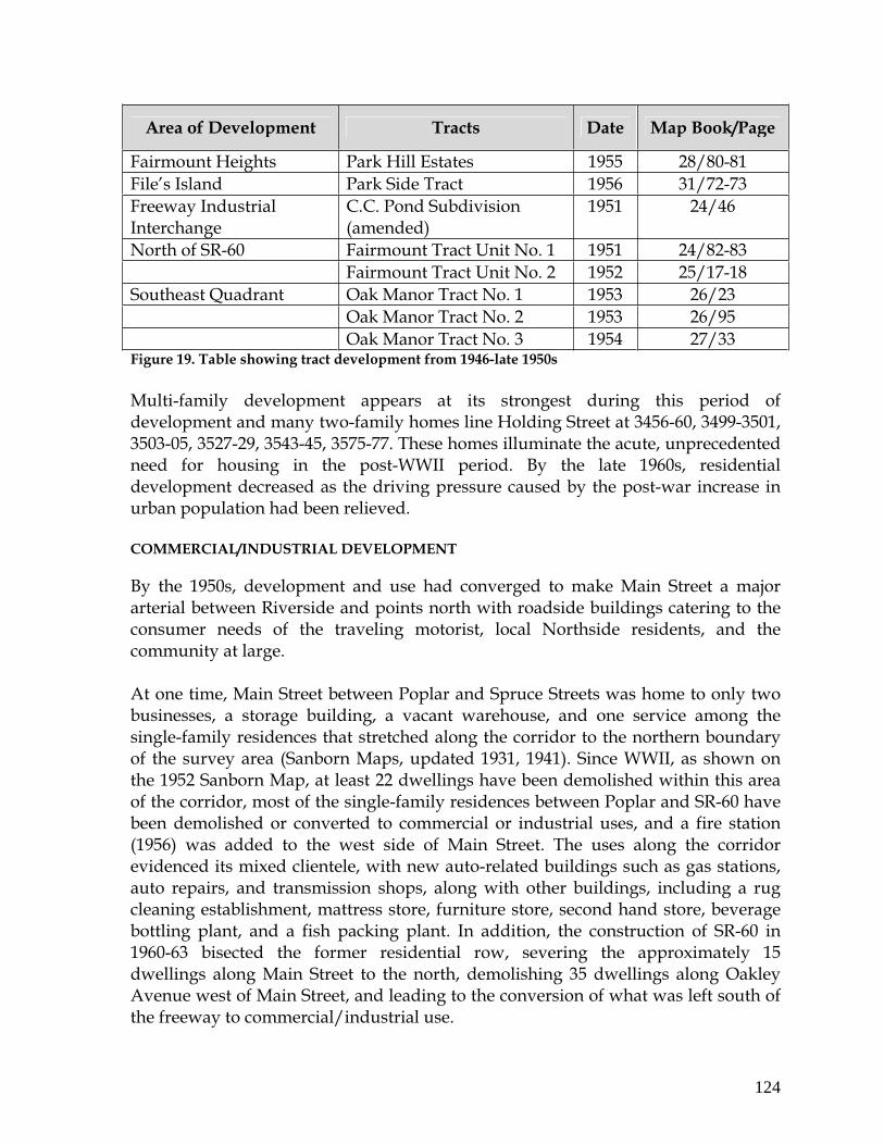
Area of Development Tracts Date Map Book/Page
Fairmount Heights Park Hill Estates 1955 28/80-81File’s Island Park Side Tract 1956 31/72-73Freeway Industrial Interchange
C.C. Pond Subdivision (amended)
1951 24/46
North of SR-60 Fairmount Tract Unit No. 1 1951 24/82-83Fairmount Tract Unit No. 2 1952 25/17-18
Southeast Quadrant Oak Manor Tract No. 1 1953 26/23Oak Manor Tract No. 2 1953 26/95Oak Manor Tract No. 3 1954 27/33
Figure 19. Table showing tract development from 1946-late 1950s
Multi-family developmentevelopment and many two
appears at its strongest during this period of -family homes line Holding Street at 3456-60, 3499-3501,
en relieved.
points north with roadside buildings catering to the onsumer needs of the traveling motorist, local Northside residents, and the
comm
At one y twobusinesingle-famof the surthe 195of the
or industrial uses, and a fire station
airs, and transmission shops, along with other buildings, including a rug leaning establishment, mattress store, furniture store, second hand store, beverage
bottlin1960-63 b oximately 15dwelli leyAvenue west of Main Street, and leading to the conversion of what was left south of the freeway to commercial/industrial use.
d3503-05, 3527-29, 3543-45, 3575-77. These homes illuminate the acute, unprecedented need for housing in the post-WWII period. By the late 1960s, residentialdevelopment decreased as the driving pressure caused by the post-war increase in
rban population had beu
COMMERCIAL/INDUSTRIAL DEVELOPMENT
By the 1950s, development and use had converged to make Main Street a major arterial between Riverside andc
unity at large.
time, Main Street between Poplar and Spruce Streets was home to onlsses, a storage building, a vacant warehouse, and one service among the
ily residences that stretched along the corridor to the northern boundary vey area (Sanborn Maps, updated 1931, 1941). Since WWII, as shown on anborn Map, at least 22 dwellings have been demolish2 S ed within this area
corridor, most of the single-family residences between Poplar and SR-60 have been demolished or converted to commercial (1956) was added to the west side of Main Street. The uses along the corridor evidenced its mixed clientele, with new auto-related buildings such as gas stations, auto repc
g plant, and a fish packing plant. In addition, the construction of SR-60 in isected the former residential row, severing the appr
ngs along Main Street to the north, demolishing 35 dwellings along Oak
124

Former dunclear), 2545 (Video Metro), 2574(Jay’sMain Stre2665 (ElecStreet, a Ca single-family residence. The middle portion of Main Street between the former railroad right-of-way and Poplar Street remains essentially intact, and adjacent
nd an auto parts and machine shop at 1710 Main Street.
-91 from Russell Street to the north (19xx) and later to the outh (19xx) served to divert traffic from Riverside’s surface streets. Despite the
decrearow, theRiverside and points north with roadside buildings frequented by locals and other Rivers
It wasdevelopedother industries with the Southern California region as well as educational and lifesty tion TheNorth1956 withHerman Owarehous ndin 1972626 Mulcorner of Russell Street, where a large business park has been added.
Property Ty
The pfamily re scale commercial vernacularconstrInterchconsistentWWII suburban residential development.
wellings that have been converted to other uses include 2305-09 (use 2360 (Solorio Automotive), 2435 (Mr. Tacos),
Auto Air), 2581-89 (Anna’s Hair Salon), 2609 (Judy’s Income Tax Service), 2629 et (auto repair shop), 2645-47 (multi-family residence - apartments), and tronics Warehouse). It appears that only one building in this area of Main alifornia Bungalow at 2664 Main Street, remains intact and in use solely as
parcels in the southern area of the corridor continue to be used forcommercial/industrial enterprise. Conversely, Main Street north of SR-60 still evidences its residential past among the neighborhood school - Fremont Elementary (1917) – with some modern commercial/automotive buildings mixed in – California Radiator at 2018 Main Street, Allsups Market and a Laundromat at 1703 Main Street, a
The construction of SRs
se in local and regional traffic funneled through this commercial/industrialMain Street Industrial Corridor continues to be a major arterial between
iders.
during this period and after that the Freeway Industrial Interchange was with large-scale industrial and manufacturing buildings. Proximity to
le opportunities made Riverside a desirable locale for Riverside’s locaside, especially, mirrored the changing times. Here, Soden Electric settled in
the large commercial building at 2350 Mulberry Street designed by. Ruhnau a well-known Riverside architect in this era. Later came another
e in 1963 and the Los Angeles MTA building (now other use) in 1964. A4, Russell Walling constructed the buildings that now hold Arpin Logistics at
berry Street. In recent years, the industrial area has grown around the
pes
roperty types related to this period of development are single- and multi-sidences as well as small- and large-
uction along the Main Street Corridor and in the Freeway Industrialange. In some areas, post-WWII construction within the survey area is
or associated with the trends in tract development that characterize post- Cul-de-sacs like Audubon Place and
125
Hiawatypical poof long-d ding Street, Spruce Street, and Main
treet north of SR-60.
s was typical in the post-WWII era, construction boomed after World War II. On moof the erely filled the gaps and fringes of a cohbulk of post-war residential development are found in the Southeast Quadrant and onEstates). Extant examples within the survey area during this period of residential arcthe California Ranch style, and Contemporary Folk. The Contemporary Folk style wilMain Street Industrial Corridor, which has been referred for further study.
ee discussion under Suburban Development, 1919-1941.
Post-W
Post-Wimmediately preceding the war. VernaculMinimEclectic PVernacular designs departed sharply from the traditional form of the Eclectic period and re m andmass otypically oseeaves
California
The CaWWII and1940s.architects
om a vare-story, sprawling shapes have low-
tha Place as well as Carthage Street-Ogden Way, a U-shaped street, form st-war neighborhoods. Post-WWII construction also fills in the vacant lots
eveloped tracts like those along HolS
Architectural Styles
Ast of the streets within the survey area that had been laid out in the first quarter
20th century, post-war construction merent residential landscape. The post-war suburban tracts that characterize the
File’s Island, with one additional development in Fairmount Heights (Park Hill
hitecture represent Post-WWII Vernacular designs, the Minimal Traditional style,
l be explored during Phase II of the survey project, as it is associated with the
Minimal Traditional
S
WII Vernacular
WII designs continued the earlier vernacular models born in the yearsar designs emerged from the popular
al Traditional style, which served to ease the architectural transition from the eriod to the modern era. Like their pre-WWII predecessors, Post-WWII
sist classification into established architectural styles. The basic forf unembellished vernacular designs can be generalized as one-story dwellings
square or rectangular in form with a hipped roof, stuccoed walls, cland minimal detailing.
Ranch
lifornia Ranch style of residential architecture also gained popularity after has continued to influence American domestic architecture since the mid-
This rambling style, which originated from several creative Californiain the 1930s, quickly spread throughout the country, borrowing looselyiety of earlier precedents, including, Prairie, Craftsman, Spanish Colonial, fr
and Post-WWII Vernacular influences. On
126
pitched, hipped or gabled roofs, wide eaves, wooden, brick, or stucco wall-cladding, rear porches, and often, attached garages (McAlester 2000:477-9). The rise of the California Ranch style corresponds with the increased use of automobiles and post-
WII suburbanization, and typical examples are generally found on large suburban lots thhowever,development, and post-WWII infill construction is scaled to fit the smaller lots delineexamples do exists within the survey area.
VIII.
ity staff estimated that of the approximately 800 properties within the project area, ithin the
, and 16 properties are recommended for further study. In addition, the is recommended for further study as
Northsiders of Hispanic descent, could
REVIOUSLY IDENTIFIED HISTORIC RESOURCES
ccording to the California Historical Resources Information System, records
Wat can more easily accommodate their expansive shapes. On the Northside,
most lots of new post-war subdivisions mimic the scale of earlier
ated in the first part of the century, though some larger, more sprawling
SUMMARY OF SURVEY RESULTS
Csome would be individually significant, while many would be significant wcontext of historic districts. While some properties had been included in areconnaissance-level survey, only about 11% of the 952 properties had previously been intensively surveyed. In completing the reconnaissance survey, JMRC found that of the 952 properties, 63 had been previously designated. 128 were constructed, or appeared to be constructed, after 1959 and 143 appear too altered. 156 properties appear eligible for inclusion as contributors within three (3) potential districts. In addition to the three historic districts, 11 properties appear individually eligible for
esignationdtheme of Immigration and Ethnic Diversity
ssociation with ethnic groups, particularlyanot be fully developed (Appendices IV through IX). According to the Scope of Work, potential historic districts were identified and all individually significant properties within the project area were identified and documented by JMRC on State of California Historic Resources Inventory DPR form 523A (Primary Record; Appendix VI). All properties determined eligible for designation at the local, state, or national level were assigned California Historical Resources (CHR) Status Codes.
P
Aentered into the City of Riverside Historic Resources Inventory Database, and previous survey reports on file with the City of Riverside Planning Department, some properties within the survey boundaries had been included in areconnaissance-level survey and only about 11% of the 952 properties hadpreviously been intensively surveyed.
The City of Riverside’s first comprehensive survey was completed from 1977 to 1979. This reconnaissance-level survey included minimal recordation of properties,
127

including architectural style, estimated or factual date of construction, and related features. Two freeway improvement projects have recently prompted intensive-level
ection 106 surveys within portions of the study area. A report entitled “Historic ASR) for the Widening of State Route 60 (SR-60) and
ucted, after 1959 and 143ppear too altered. 156 properties appear eligible for inclusion as contributors within
to the three historic districts, 11 propertiesppear individually eligible for designation, and 16 properties are recommended for
orian, Revival, and Artsnd Crafts periods. Debate over the boundaries of this district has ensued within the
SArchitectural Survey Report (HInterstate Route 215 (I-215) between Valley Way and University Avenue” by David Bricker was included within the project’s corresponding Historic Property Survey Report (HPSR) dated February 1995 by Stephen Hammond, and a series of revised and supplemental HPSR-HASR documents were prepared from 1993 to 2000 for a separate project to improve I-215/SR-91/SR-60. The preparation of these documents involved a number of consultants, including Myra L. Frank & Associates, Inc.; Historical, Environmental, Archaeological, Research, Team (HEART); Parsons,Brinckerhoff, Quade, & Douglas, Inc.; and David Bricker and Christie Hammond, then Architectural Historians for California Department of Transportation(Caltrans), District 8.
SURVEY FINDINGS
In completing the reconnaissance survey, JMRC found that 952 properties wereincluded within the survey boundary, of which, approximately 11% had beenpreviously intensively surveyed and 63 had been previously designated. Of the 952 properties, 128 were constructed, or appeared to be constrathree (3) potential districts. In additionafurther study. In addition, the theme of Immigration and Ethnic Diversity isrecommended for further study as association with ethnic groups, particularlyNorthsiders of Hispanic descent, could not be fully developed (Appendices IV through IX).
The surveyed portion of the Northside represents several types of property use and a variety of periods of development from the late 19th century to the modern period.
A portion of the locally designated and NR-eligible Heritage Square Historic District exists within the southeast boundary of the survey area and represents a large variety of residential architectural styles popular in southern California from the 1880s to the 1920s, including excellent examples of the Victaprocess of previous surveys by Aegis in 1992, during the Section 106 survey process for the Caltrans freeway improvement projects begun in the 1990s, and by Myra L. Frank & Associates, Inc. in 2003. The district is currently bounded by SR-91 to the east, the north side of Fifth Street to the south, the east side of Orange Street from Fifth to Third Streets and the west side of Orange Street from Third to First Streets to
128
the west, and the north side of First Street to the north, where the district overlaps slightly with the current survey boundaries.
MILE SQUARE NORTHWEST HISTORIC DISTRICT
A cohesive group of early 20th century single-family residences was identified as an extension of, and for inclusion in, the Mile Square Northwest, a previously determined CRHR-eligible historic district adjacent to the southern surveyboundary. This area of Riverside was partially surveyed during the first 1977-79 City survey, by Aegis in 1992, and by Myra L. Frank & Associates, Inc. in 2003. The Mile Square Northwest Historic District is located in the northwest quadrant of Riverside’s original Mile Square (1870). The district is currently bounded roughly by the south side of First Street to the north, the south side of Sixth Street to the south, the west side of Market Street to the east, and Redwood Drive to the west.
RIDGE RPARK VIEW T
CRESCENT AV
PINE
ST
TSTCE
DAR
ST HOUGHTON AV
D
LOCU
S
NAV
TBL
C
FIRST ST
THIRD ST MAR
KET
ST
SECOND ST
BRO
CKTO
FAIR
MO
UN
CHES
TNUT
ST
37293739
3738374830333015
30012989
2977
29412925
3341 39353295 37503221 314432703376 39513306 3762315939633325 3275 320732544145 31303364 3977 38524159 4042 39993238 38803259 3145 30753309 38033350 40604236 3825 306138943294 322242443336 3243 383331443199 38433214 3142 3908317542743322 385532253293 392231734035 3861 304338753308 39364061 3879315932093275 3950 30274239
389339644130 314131984255 39743230 41443263 30113980 3042313541603290 3176 3992 30383222 3925 3046 383431973241 3125 304031954111 3943 38403284 305031603208 4141 3957 3844310732254309 31913264 30674323 3138 303430654155 40403209 3161 29753250 383330924042 30553122 30303198 2957384332363265
38553080 30433112 38673174 309132223241 3115 30313187 38793068404131603208 30793225 30192909
28912869
38083812
305231154237 3173 3146 3067309231403207 3042 30073159 300030553124 3080 299630323192 3128 39424342 30433141 3091298839483122 3068 30414362 30203176 30793125 31203191 29623123 29893056 30083158 30673107 30193169 29503044 29614347 3142 305530924252 2938300731594363 3032
38203824
3887
4262 298830433118 3080 29373147 4276 291230203192 3093 3068 3031 2962310633 28903008 298930813117 30193056 2938 38282889 28683069 296131093825
3837384338473853
3859386538693875
3881
313150
3044 3007 2912 38323092 3057 28583136 29883032 28654350 30804364 3045 38363072 3068 2962 28423020 39613093 28413108 411130333070 38423127 4392 29383008 41273081 28264341 3056 3021 4145 28214363 2912 28103105 3069 3848280930093044 29113088 38523057 2790298042403032 278931013045 27743997 385830203091 2960 277342013074 3033 29033008 38643089 2940 28263021 4251 39184265 39363009 2906
2825 27904428 4279 38922901 391739582868429343503024 4307 39782785 27702832 39374323 39983014 395743373891
38972765 40264427 27864351 397740564410 4385 4086 399727452766 40254428 26754393 40554409 266127353014 4443 4085
41212715 3975 26593991 265744652974262426274483 4475
2585257544854495
25672705 25574499
N
Mile Square NorthwestHistoric District Addition
ContributorNon-contributor
Figure 20. Map of the Mile Square Northwest Historic District Addition
y to smaller cottages when speculators re-subdivided the
During Riverside’s earliest period of settlement, much of the Mile Square was developed as agricultural property, and citrus groves blanketed much of the landscape. Large, predominately two-story grove residences first dotted the Mile Square but soon gave wa
129
land during and immediately after the 1880s land boom. Another, population-driven eed for housing in proximity
the downtown core that was growing in size and concentration, and the large
of the Northwest quarter of the Mile Square, the majority of sidences were built during the early twentieth century and were Craftsman
Bungalow in style with later, period revival styles mixed in sparingly. The streetscape took on its current appearance at this time when character-defining featur h a s, streetl d common setbacks weredeveloped.
ST. AN S TE MAN D
The type and extent of survey work that leonservation area is unclear as the majority of the survey and designation
ith the City has been lost; however, the area as documented during the Section 106 survey process for the Caltrans freeway
xisting documentation housed in the City of iverside Planning Department vertical files or Cultural Heritage Board records.
boom just after the turn of the century increased the ntoagricultural properties were subdivided to accommodate smaller single-family residences and multi-family construction. While later phases of construction filled the vacant lotsre
es suc s street tree ights, sidewalks an
DREW RRACES CRAFTS ISTRICT
3020-3068 Locust Street (1906-1913) in the proposed expanded Mile Square Northwest Historic District
d to the designation of this neighborhood cinformation for this NCA once on file wwimprovement projects begun in the 1990s. Discrepancies exist between information presented in the Section 106 documentation and the City’s information on the configuration of the district as well as district contributors and non-contributors such as the ambiguous status of 2973, 3021, 3035, 3049, and 3063 Mulberry Street, which are included within the NCA in the Section 106 study and included in the City’s Historic Resources Inventory Database as Structures of Merit and contributors to the NCA; however, these Mulberry Street properties are not included in the City’s map of the NCA (Figure 10) or on any eR
130
LEM
ON
ST HEWITT ST
?ÆLI
M
FIRST ST MUL
BERR
YST
IME
ST
EST
L NFigure 10. Location and current configuration of the St. Andrews TerracesNCA within the survey area.
According to the NC map, the designated conservation area represents the southern half of the St. Andrews Terraces tract (recorded in 1910) and consists of a group of 21 single-family residences of one- to one-and-a-half stories along Lime Street (St. Andrews Boulevard before 1932), north of First Street, in the Southeast Quadrant of the survey area (Figure 10). The properties of the NCA highlight the form, detail and materials of the Arts and Crafts Movement as the majority of properties wereconstructed in the Craftsman style in 1911 and 1912.
131
?Æ
FORMER RAILROAD R.O.W.
3127304931543177 3109 30223175 30353142
349530803165 3140 3008 29573163 3078 3021 2941 315831243139 30743503 2990 31743507 3007 31903064 292535093112 3077 297435173121 3075 31513058 2989 2909 31973606 3442 29583557 3063 30363614 3575 2973345830593626 30343630 29403591 3053 34743634 3026 295730223654 30353078 3443 28832926 28562941344730083064 3459 287330213625 291029253050 285434753009 2857
3007 29743036 2909 28432989 28413695
3049 2958 282728553022 28902973 27922942 28333008 2770280928742957 2930 2889 28312990 2926 278928582941 2815 27502976 28732910 2842 27692972 2840 27792925 28573030 2956 2826 27492909 2841 27022940 2810 2777 27292825 279229242790 270928093003 27722908
3336 269627893468 33503450 27502769 269133603484 2767 2730275134493502 2675
2710 33373518 26592894 27292892 3467 262633613536 3483 27092953 2643
3554 26923501 26252941 3572 3517 26762889 3456 2611265428692896 3535 2609269135903716 2878 265234663726 3553 259126753476 2646
LEM
ON
ST
ORA
NGE
ST
POPLAR ST
MAI
NST
LIM
EST
HIAWATHA PL
HEWITT ST
NGE
ST
MUL
BERR
YST
LIM
EST
3108 3052346832243235 3470 30323104316031953488 29933229 3150 31213181
3041 29773173 29363016336031403254 3215 3010 296330913157 3354 300930173358 29533124 307731903546 33393141 2945307533703234 311031783570 3515 3174 3063 300531913210 3408 30923158 3049
3535 3169 291534323545 3442 3035307831423159 3450 30913155 30213124 306434703188 3122 30773145 30093423 3050
FIRST STSECOND ST
MUL
BERR
Y
LACA
DENA
DR
OR
LIM
EST
30753108 300730483443 30653129 31063170 298934493191 3036 29872973
31263142
2829 35712891 2642 25753486 265935892809 3455 26263502 255926433465 259026100 3475 254526083485 25432625
STA28482881
2879 2836 27912871 352
2822 2775252525922750 2609 2523350127592804 2576
25092821 35192798 25912819 2743 25603537 3454
St. Andrews Terraces Craftsman District
Within Boundaries of Current St. Andrews Terraces NCA
Within Boundaries of Heritage Square HD to the South
Non-contributors to St. Andrews Terraces Craftsman District
Contributors to St. Andrews Terraces Craftsman District
NFigure 21. Map of St. Andrews Terraces Craftsman District
This previously designated local NCA was identified for expansion and elevation to historic district status. The expanded, eligible district represents the southern half of the St. Andrews Terraces tract (1910) and adjacent subdivisions north of First Street, in the southeast quadrant of the survey area. The district includes properties on Hewitt, Lemon, Lime, and Mulberry Streets and is bounded by the limits of the Heritage Square Historic District to the south, the former Southern Pacific Company railroad right-of-way to the north, Mulberry Street to the east, and the west side of Lemon Street to the west (Figure 21). In general, the expanded district possesses a lower collective degree of architectural distinction than the original conservation area but, overall, is distinguished as a geographically cohesive group of residences that highlight the form, detail and materials of the Arts and Crafts Movement, during which the properties were constructed.
132

2974-3036 (1910-1924) Lime Street within the proposed St. Andrews Terraces Craftsman District
NORTH HILL HISTORIC DISTRICT
One potential historic district, the North Hill Historic District, was identified during the survey process and represents the cohesive development of a small, exclusive area set on the slopes of North Hill overlooking Fairmount Park (Figure 22). The district represents a concentration of large-scale, high style single-family residences in a mix of period revival style architecture of the eclectic 1920s and 1930s: Tudor Revival, Spanish Colonial Revival, Monterey Revival, French Eclectic, PuebloRevival, and Minimal Traditional styles. Most residences are architect-designed, and
nique, contributing light standards extant on Randall Streetu , the west end ofStreet, were likely specifically selected for this
evelopment as they appear no where else in the survey area or in the City. In Houghton Avenue, and Pinedaddition, unique light standards extant on Randall Street, the west end of Houghton Avenue, and Pine Street, were likely specifically selected for this development and appear no where else in the survey area. These standards have not been identified in other areas of the City and should be considered contributors to the district (see Residential Development 1919-1941).
133
PINE
ST
NNZ44652974
4483 4475
44854495
4499
o r t h H i l lo r t h H i l l4443
REDW
OO
DDR
RANDALL RD
FIRST ST
Z3043
LOCU
STST
CEDA
RST
HOUGHTON AV
3151 3092 30573136 303243503198 30803143 30453068 302030933108 41113190 30333127 4392 3008 412730814341 3056 30213182 41453105 3069 300930443174
30883150 29804240303231013136 3045 30203091 296042013074 303330893058 4251
42653044 29062901
286843503078
4307 283243233054 30144337
4427 27863050 435130654410 4385
27663036 44284409
3014
BANKS DR
North HillHistoric District
ContributorNon-contributor
N
Figure 22. North Hill Historic District
During the early phases of the project, JMRC identified 34 properties that appearedmerit formal evaluation. Of these 34 properties, twelve (12) were determined
3380 Russell Street 3787 Shamrock Avenue
toineligible for designation, eleven (11) were recommended for further researchduring Phase II, and eleven (11) were determined individually significant andeligible for designation:
3837 Ridge Road 3720 Stoddard Avenue 3668 Poplar Street 3820 Ridge Road 3864 Ridge Road
3307 Spruce Street 3320 Spruce Street 3676 Strong Street 2357 Wilshire Street
134
The Petro House located at (3837 Ridge Road) in Fairmount Heights highlights the influence of the Arts and Crafts Movement on the Victorian Era before the takeover
f the Craftsman style, which dominates the survey area. This Shingle style home o(3837 Ridge Road) in Fairmount Heights was never associated with agricultural production. This residence shows evident of the Arts and Crafts Movement and was constructed of concrete, wood, and striking clinker brink during a time ofarchitectural transition.
The Petro House (c. 1902-04) at 3837 Ridge Road
The residence was constructed for Emmet O. Petro, a foreman of the Claude P. Hancock Brick Yard, a prominent local supplier of construction materials that was
cated at First and Almond Street (now Fairmount Blvd.) just outside the survey area. WPark (Octpurchased four lots from his employer and constructed the first house in the tract in 1904, uwas reloc1927. FromHorace K ornia Fertilizer Company (Hall2005:7and Craftthe Victooverhang
loith others, Hancock invested in land around the newly dedicated Fairmount
ober 1897) and subdivided it in 1903 as the Overlook Ridge Tract. Petro
sing inexpensive, imperfectly fired clinker bricks. The Hancock Brick Yard ated to the corner of Ridge and Market near the residence from 1904 to
1922 until the 1960s, the house was owned and occupied by Lillian and imball, who worked for the Southern Calif
6). A true Shingle style influenced by the emerging philosophies of the Arts s Movement, the design of the Petro House incorporates many elements of rian Era Shingle style in its steeply pitched, complex roof form,
ing gable end, and signature shingle cladding while asserting the overall
135
horizontacelebrated by the Arts and Crafts Movement.
l orientation, wide overhanging eaves, and natural, native materials
Clinker Brick House at 3720 Stoddard Avenue (1923)
The Clinker Brick House located at 3720 Stoddard Avenue in the North of SR-60 area is an outstanding example of the philosophy inherent in the Arts and Crafts Movement applied to a modest dwelling as exemplified by its use of exposed hollow tile construction and detailing such as is seem in the porch and piers. The residence was constructed in 1923 by builder Karl Martin of Karl Martin & Company, a brick supplier, for owners A.L. and Amy C. Stevenson in the Valley View Tract (1911). Mrs. Stephenson was employed as a teacher at the nearby Fremont Elementary School (1917) across Main Street. In 1960-63, the state acquired the rear one-third of the original parcel for the construction of State Route 60, which prompted the removal of the original garage.
136
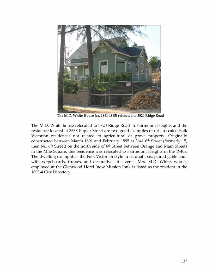
TheresVictorian residences not related to agricultural or grove property. Originally onstructed between March 1891 and February 1895 at 3641 6th Street (formerly 15,
in t he 1940s.he dwelling exemplifies the Folk Victorian style in its dual-axis, paired gable ends
em esident in the893-4 City Directory.
The M.D. White House (ca. 1891-1895) relocated to 3820 Ridge Road
M.D. White house relocated to 3820 Ridge Road in Fairmount Heights and the idence located at 3668 Poplar Street are two good examples of urban-scaled Folk
cthen 641 6th Street) on the north side of 6th Street between Orange and Main Streets
he Mile Square, this residence was relocated to Fairmount Heights in tTwith vergeboards, trusses, and decorative attic vents. Mrs. M.D. White, who is
ployed at the Glenwood Hotel (now Mission Inn), is listed as the r1
137
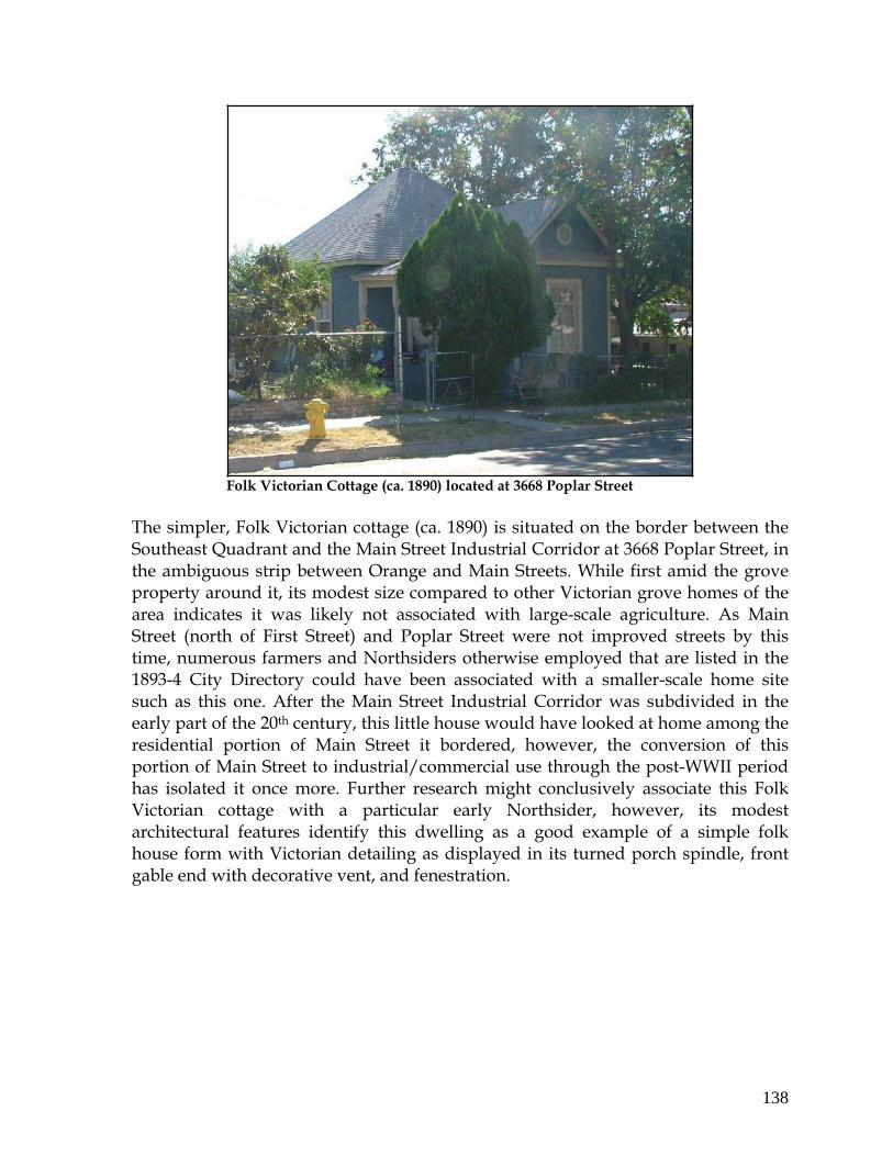
Folk Victorian Cottage (ca. 1890) located at 3668 Poplar Street
simpler, Folk Victorian cottage (ca. 1890) isThe situated on the border between theoutheast Quadrant and the Main Street Industrial Corridor at 3668 Poplar Street, in
property around it, its modest size compared to other Victorian grove homes of the rea indicates it was likely not associated with large-scale agriculture. As Main
tim listed in the893-4 City Directory could have been associated with a smaller-scale home site
early part of the 20th century, this little house would have looked at home among the esidential portion of Main Street it bordered, however, the conversion of this
hasVicarc s a good example of a simple folk
ouse form with Victorian detailing as displayed in its turned porch spindle, front
Sthe ambiguous strip between Orange and Main Streets. While first amid the grove
aStreet (north of First Street) and Poplar Street were not improved streets by this
e, numerous farmers and Northsiders otherwise employed that are1such as this one. After the Main Street Industrial Corridor was subdivided in the
rportion of Main Street to industrial/commercial use through the post-WWII period
isolated it once more. Further research might conclusively associate this Folk torian cottage with a particular early Northsider, however, its modesthitectural features identify this dwelling a
hgable end with decorative vent, and fenestration.
138
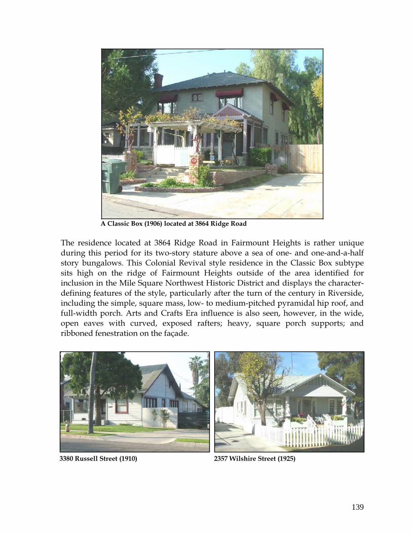
139
The residence located at 3864 Ridge Road in Fairmount Heights is rather unique uring this period for its two-story stature above a sea of one- and one-and-a-half
sits outside of the area identified forclusion in the Mile Square Northwest Historic District and displays the character-
incfulope porch supports; andibboned fenestration on the façade.
A Classic Box (1906) located at 3864 Ridge Road
dstory bungalows. This Colonial Revival style residence in the Classic Box subtype
high on the ridge of Fairmount Heightsindefining features of the style, particularly after the turn of the century in Riverside,
luding the simple, square mass, low- to medium-pitched pyramidal hip roof, and l-width porch. Arts and Crafts Era influence is also seen, however, in the wide, n eaves with curved, exposed rafters; heavy, square
r
3380 Russell Street (1910) 2357 Wilshire Street (1925)
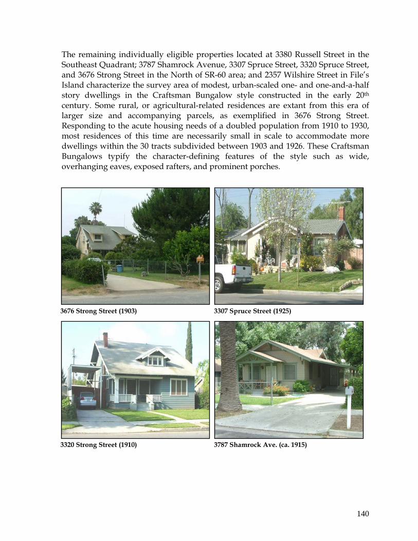
The remaining individually eligible properties located at 3380 Russell Street in the
and 3676 Strong Street in the North of SR-60 area; and 2357 Wilshire Street in File’s sland characterize the survey area of modest, urban-scaled one- and one-and-a-half
cenlarResponding to the acute housing needs of a doubled population from 1910 to 1930,
ost residences of this time are necessarily small in scale to accommodate more
Buove
Southeast Quadrant; 3787 Shamrock Avenue, 3307 Spruce Street, 3320 Spruce Street,
Istory dwellings in the Craftsman Bungalow style constructed in the early 20th
tury. Some rural, or agricultural-related residences are extant from this era of ger size and accompanying parcels, as exemplified in 3676 Strong Street.
mdwellings within the 30 tracts subdivided between 1903 and 1926. These Craftsman
ngalows typify the character-defining features of the style such as wide, rhanging eaves, exposed rafters, and prominent porches.
3676 Strong Street (1903) 3307 Spruce Street (1925)
3787 Shamrock Ave. (ca. 1915) 3320 Strong Street (1910)
140
RESOURCE EVALUATION
accordance with the Scope of Work, potentially significant individual and district
theof the Riverside Municipal Code. In May 2005, a comprehensive revision to Title 20
as initiated by the Riverside City Council, and a committee was formed to evaluate
cultural resources ordinance were not finalized prior to the completion of this urvey, JMRC used the adopted ordinance (Ord. 6263 (1996), as amended) for
he following criteria were used to determine eligibility at each level.
CRI
ct
engbj hip,
of our history; or
story (36 CFR 60.4).
rit
Inresources within the survey boundaries were evaluated for eligibility for listing in
NRHP, the CRHR, and under Riverside’s Cultural Resources Ordinance, Title 20
wthe current ordinance and recommend improvements. Because changes to the
sevaluating extant resources within the survey area (Appendix I).
T
TERIA FOR SIGNIFICANCE
Eligibility for inclusion in the NRHP is determined by applying the criteria established by the National Park Service under the National Historic Preservation
(NHPA), as follows:A
The quality of significance in American history, architecture, archeology, ineering, and culture is present in districts, sites, buildings, structures, and
ects that possess integrity of location, design, setting, materials, workmansofeeling, and association, and:
(a) that are associated with events that have made a significant contribution to the broad patterns
(b) that are associated with the lives of significant persons in or past; or (c) that embody the distinctive characteristics of a type, period, or method of
construction, or that represent the work of a master, or that possess high artistic values, or that represent a significant and distinguishable entity whose components may lack individual distinction; or
(d) that have yielded or may be likely to yield, information important in history or prehi
Eligibility for inclusion in the CRHR is determined by applying the followingeria:c
(1) it is associated with events that have made a significant contribution to the broad patterns of California's history and cultural heritage;
(2) it is associated with the lives of persons important in California's past;
141

(3) it embodies the distinctive characteristics of a type, period, region, or method of construction, or represents the work of an important creative individual, or possesses high artistic value; or
igible Points of Historical Interest (PRC§5024.1(c)).
Thamindividual resources (Landmark or Structure of Merit) and two categories of des dings, or any other geographically
efined area with multiple resources (District or Neighborhood Conservation Area.)
An one ofe following criteria:
emplifies or reflects special elements of the City’s cultural, social, economic, political, aesthetic, engineering, architectural, or natural
d with persons or events significant in local, state, or national history; or
craftsmanship; or(d) represents the work of a notable builder, designer, or architect; or
hetically by plan or physical development; or(f) has a unique location or singular physical characteristics or is a view or
(g) embodies a collection of elements of architectural design, detail, materials
(h) is similar to other distinctive properties, sites, areas, or objects based on a
nt and growth, particular transportation modes, or distinctive examples of park or community planning; or
(4) it has yielded or is likely to yield information important in prehistory or history. The Register includes properties which are listed or have been formally determined to be eligible for listing in the National Register, State Historical Landmarks, and el
e City of Riverside’s Cultural Resources Ordinance (Title 20; Ord. 6263 (1996), as ended) provides two categories of designation criteria for the evaluation of
ignation for a neighborhood, a group of build
individual resource may be locally designated as a Landmark if it meetsth
(a) ex
history; or (b) is identifie
(c) embodies distinctive characteristics of a style, type, period, or method of construction, or is a valuable example of the use of indigenous materials or
(e) contributes to the significance of an historic area, being a geographically definable area possessing a concentration of historic or scenic properties or thematically related groupings of properties which contribute to each other and are unified aest
vista representing an established and familiar visual feature of aneighborhood community or of the City; or
or craftsmanship that represent a significant structural or architectural achievement or innovation; or
historic, cultural, or architectural motif; or(i) reflects significant geographical patterns, including those associated with
different eras of settleme
142
(j) is one of the few remaining examples in the City, region, state, or nation possessing distinguishing characteristics of an architectural or historical type or specimen (RMC §20.20.010).
An ted as a Structure of Merit, aesignation of lesser significance than a Landmark, if it meets one of the following
(a) represents in its location an established and familiar visual feature of the
storic, architectural, or aesthetic character of the d, or
(c) is an example of a type of building which was once common but is now rare
(e) contributes to an understanding of contextual significance of a neighborhood,
A gthe
tified with persons or events significant in local, state, or national history; or
method of
craftsmanship; or(d) represents the work of notable builders, designers, or architects; or
chitectural design, detail, materialsor craftsmanship that represent a significant structural or architectural
luding those associated with
n, setting, materials, workmanship or association (RMC §20.25.010).
individual resource may be locally designadcriteria:
neighborhood, community, or City; or (b) materially benefits the hi
neighborhoo
in its neighborhood; or (d) is connected with a business or use which was once common but is now rare;
or
community, or area (RMC §20.21.010).
eographic area may be locally designated as a Historic District if it meets one of following criteria:
(a) exemplifies or reflects special elements of the City’s cultural, social,economic, political, aesthetic, engineering, architectural, or naturalhistory; or
(b) is iden
(c) embodies distinctive characteristics of a style, type, period, orconstruction, or is a valuable example of the use of indigenous materials or
(e) has a unique location or a view or vista representing an established and familiar visual feature of a neighborhood community or of the City; or
(f) embodies a collection of elements of ar
achievement or innovation; or (g) reflects significant geographical patterns, inc
different eras of settlement and growth, particular transportation modes, or distinctive examples of park or community planning; or
(h) conveys a sense of historic and architectural cohesiveness through its desig
143
A geographic area may be locally designated as a Neighborhood Conservation Area, esignation of lesser significance than a Historic District, if it meets one of the
lowing criteria:a dfol
(a) provides a contextual understanding of broader patterns of Riverside’s cultural, social, economic, political, aesthetic, engineering, architectural, or natural history; or
(b) represents established and familiar visual features of a neighborhood, community, or of the City; or
(c) reflects significant development or geographical patterns, including those associated with different eras of settlement and growth; or
(d) conveys a sense of historic or architectural cohesiveness through its design, setting, materials, workmanship, or association (RMC §20.26.010).
POTENTIAL HISTORIC DISTRICTS AND INDIVIDUALLY SIGNIFICANT PROPERTIES
In accordance with local and state historic preservation guidelines, a lesser threshold for integrity of design was applied in determining eligibility at the local and state level. In general, contributors to the CRHR- and locally-eligible district and individual resources possess a lower collective degree of architectural distinction than merits listing in the NRHP and/or are found in comparable quantity and quality within contemporaneous historic neighborhoods or areas of the City of Riverside.
MILE SQUARE NORTHWEST HISTORIC DISTRICT
A cohesive group of late-19th to early-20th century single-family residences currently bounded by the south side of First Street to the north, the south side of Sixth Street to the south, the west side of Market Street to the east, and Redwood Drive to the west, the Mile Square Northwest Historic District represents Riverside’s earliest periods of residential development. Associated and contemporary contributors and non-contributors in the adjacent Fairmount Heights to the north are eligible for inclusion in the district, revising the northernmost boundary to Crescent Avenue.
ST. ANDREWS TERRACES CRAFTSMAN DISTRICT
St. Andrews Terraces Craftsman District, bounded generally by the limits of the Heritage Square Historic District to the south, the former Southern Pacific Company railroad right-of-way to the north, Mulberry Street to the east, and the west side of Lemon Street to the west in the Southeast Quadrant, represents early 20th century residential development in the Northside and the distinctive form, detail and materials of the Arts and Crafts Movement. Accordingly, St. Andrews Terraces Craftsman District appears eligible for local designation under Title 20 of the City of Riverside Municipal Code (Ord. 6263 (1996), as amended) as it embodies distinctive
144
characteristics of a style or period (Criteri n C) and conveys a sense of historic andarchitectural cohesiveness through its design and setting (Criterion H).
NORTH HILL HISTORIC DISTRICT
The North Hill Historic District on the western slopes of North Hill in Fairmount Heights represents the cohesive development of a small, exclusive area overlooking Fairmount Park with a concentration of large-scale, high style single-family residences in a mix of period revival style architecture of the eclectic 1920s and 1930s: Tudor Revival, Spanish Colonial Revival, Monterey Revival, French Eclectic, Pueblo Revival, and Minimal Traditional styles. Most residences are architect-designed, and unique, contributing light standards extant on Randall Street, the west end of Houghton Avenue, and Pine Street, were likely specifically selected for this development as they appea the survey area or in the City.Accordingly, the district appears eligibleembodies the distinctive cha d represents the works ofseveral master arch orth Hill HistoricDistrict also appea 20 of the City ofRiverside Municip bodies distinctivecharacteristics of a style or period (Critarchitects (Criterion D), and conveys a sense of historic and architectural cohesiveness through its design and setting (Criterion H).
INDIVIDUALLY SIGNIFICANT PROPERTIES
The Petro House (ca. 1902-1904) located at 3837 Ridge Road in Fairmount Heights highlights the influence of the Arts and Crafts Movement on the Victorian Era before the takeover of the Craftsman style, which dominates the survey area. This outstanding example of an Arts and Crafts Period Shingle Style residence is eligible for local designation as a City Landmark under Title 20 of the City of Riverside Municipal Code (Ord. 6263 (1996), as through its dramatic and expert use of clinker brick it embodies distinctive characteristics of a style, period, and method of construction, is a valuable example of the use of indigenous materials and craftsmanship, and embodies a collection of elements of architectural design, detail, materials and craftsmanship that represent a significant architectural innovation (Criteria C and G). Likewise, the property appears eligible for the National and California Registers under Criteria C and 3, respectively.
The Clinker Brick House (1923) located at 3720 Stoddard Avenue in the North of SR-60 area exemplifies the philosophy of the Arts and Crafts Movement through its use of exposed hollow tile construction in form and detail. The residence is designated a City Structure of Merit (#189) and has been previously determined eligible for listing in the NR under Criterion C at the local level of significance (Hammond 1995). Eligibility for listing in the NR could not be confirmed through this survey, as
o
r no where else infor listing in the NRHP and CRHR as it
racteristics of a period anteria C and 3, respectivelitects (Cri y). The N
rs eligible for local designation under Titleal Code (Ord. 6263 (1996), as amended) as it em
erion C), represents the work of notable
145
the limited comparative study of hollow tile construction employed for the 1995 survey should be broadened to a citywideof historic Sanborn Maps. However, due to its unique, and now rare, exposed hollow tile construction, the residence is eligible for local designation as a City Landmark under Title 20 of the City of Riverside Municipal Code (Ord. 6263 (1996), as it embodies distinctive characteristi of a style, period, and method ofconstruction, is a valuable example of the use of indigenous materials andcraftsmanship, and embodies a collection of elements of architectural design, detail, materials and craftsmanship that represent a significant architectural innovation (Criteria C and G).
The M.D. White House (ca. 1891-95) relocated in the 1940s to 3820 Ridge Road in Fairmount Heights and the resid 8 Poplar Street at the border ofthe Southeast Quadrant and the ial Corridor are good examplesof urban-scaled Folk Victorian residences not related to agricultural or grove property. Th lk VictorianThematic DiStructures of Merit under e Municipal Code (Ord.6263 (1996), as they contrib xtual significance of theirrespectiv
The property located at 3864 Ridge Road is a good example of a two-story Colonial Revival style residence in the Classic Box subtype in Fairmount Heights. The property is eligible for individual designation as a City Structure of Merit under Title 20 of the City of Riverside Municipal Code (Ord. 6263 (1996) as it contributes to an understanding of contextual significance of Fairmount Heights and the Northside community.
The remaining individually eligible properties located at 3380 Russell Street in the Southeast Quadrant; 3787 Shamrock Avenue, 3307 Spruce Street, 3320 Spruce Street, and 3676 Strong Street in the North of SR-60 area; and 2357 Wilshire Street in File’s Island represent modest, one- and one-and-a half story Craftsman Bungalows, the type and style of residential dwelling found in the greatest numbers throughout the survey area. Accordingly, these properties were determined eligible for local designation as City Structures of Merit under Title 20 of the City of Riverside Municipal Code (Ord. 6263 (1996), as they contribute to an understanding of contextual significance of their respective areas of development and in the Northside community.
Under the Scope of Work, tables of district contributors and non-contributors were developed and individually significant properties were documented by JMRC on State of California Historic Resources Inventory DPR 523A forms (Primary Record; see Appendix V and VI).
context rather than the geographic extent
cs
ence located at 366Main Street Industr
e M.D. White House is a contributor to the proposed Fostrict, and both are eligibl for individual designation as a City e
Title 20 of the City of Riversidute to an understanding of conte
e areas of development and in the Northside community.
146

PROPERTIES DETERMINED INELIGIBLE FOR DESIGNATION
Of the 34 properties that JMRC identified for formal evaluation for individual significance, twelve (12) properties were determined ineligible for designation(Figure 23).
Address Street Evaluation
2709 Lime Street Ordinary example 2729 Lime Street Compromised by alterations 2857 Lime Street Compromised by alterations 1735 Main Street Compromised by alterations 3659 Mulberry Street Does not meet designation criteria 2240 Northbend Street Ordinary example2709 Orange Street Alterations preclude upgrade to Landmark 3761 Shamrock Avenue Compromised by alterations 3769 Shamrock Avenue Compromised by alterations3356 Spruce Street Compromised by alterations 3294 Strong Street Constructed piecemeal from 1947-1978 3448 Strong Street Ordinary example
Figur aldesig
PRO
Under the Scope of Work, properties assessed as “too altered” to merit individual or collect e photographedand Staff todet esurvey area. Generally, properties that suffered a significant alteration, such as the alte esignificant alterations, such as the application of stucco and a porch enclosure, these pro
PRO
Under dor formally evaluated but listed on a table (Appendix IX).
PROPER ENDED FOR FURTHER STUDY
JMR rfurther study during Phase II (See Append
e 23. Table showing properties formally evaluated but found ineligible for individunation.
PERTIES DETERMINED TOO ALTERED
ive designation or consideration in the planning process werlisted on a table (Appendix VIII). JMRC collaborated with City
ermine criteria to establish a general threshold that could be used throughout th
ration of window openings, or more than one alteration causing a cumulativ
perties were deemed “too altered.”
PERTIES CONSTRUCTED AFTER 1959
the Scope of Work, properties constructed after 1959 were not photographe
TIES RECOMM
C identified and has recommended 16 properties and one (1) historic theme foix VII). Of these 16 properties, 11 are
147
ind ryand/or historic associations could not be fully developed. One of these 11 properties is F inthe Ma the collective properties recommendedfor toPhase II of the project are the University Wash Flood Control Channel (both inside and e survey area White Sulphur Springs, the Spring Brook Golf Course, and the Alamo Water
Company lands.
Individual properties requiring further study are ones where construction and alteration history were ambiguous, or additional research outside the scope and funding of this survey was required. These properties are: 2909 Lime Street (moved in, under restoration), 2926 Lime Street (moved in, under restoration), 2293 Main Street (Fire Station #6), 2524 Mulberry Street (California Department of Forestry Southern California Headquarters), 2379-65 Northbend Street, 1718 Orange Street (Calvary Baptist Church), 1849 Orange, 1925 Orange Street (Fremont Elementary School), 3891 Ridge Road (Church of Religious Scientology), and 3585 Russell Street.
Between the former railroad right-of-way and Poplar Street and two large properties that spread to Market Street, the Main Street Industrial Corridor was developed with light industrial, commercial, and storage buildings. Some of the extant buildings, or portions of buildings, appear to closely resemble other industrial/commercial buildings extant in the Mile Square before or around the turn of the century, and the Main Street Industrial Corridor was formally subdivided by 1907. However, no evidence has been found in the historic record for improvement of the large lots before 1923. The 1908 Sanborn Map does not include this area, and the updated 1931 Sanborn Map shows 19 commercial/industrial buildings, many of them vacant, already in place. Building permit records, which are sparse, place the earliest date of construction between 2700 and 2900 Main Street at 1923 (see Suburban Development 1919-1941). More in depth site-specific research that is beyond the scope and funding of the current study must be completed to gain a comprehensive understanding of the construction history along the corridor.
The University Wash Flood Control Channel was constructed after 1950, the construction year limit of this survey, and is located both inside and outside of the survey area. The flood channel emerges aboveground on the west side of Fairmount Boulevard where it intersects with the Spring Brook Lateral Channel running roughly north-south, which can be seen aboveground on the north side of Strong Street, just west of Fairmount Boulevard and outside the survey boundaries. As one, this channel runs south, under SR-60 and empties into Lake Evans in Fairmount Park (Mermilliod 2005b). Intensive-level study of the flood control channel is outside of the period of construction and survey limits of this reconnaissance-level survey
ividual properties recommended for further study because construction histo
ire Station No. 6 located at 2293 Main Street. Fire Station No. 6 is also includedin Street Industrial Corridor, one of
further study that consists of 53 properties. Other larger properties referred
outside of the survey area), and three properties located outside th–
148
and was ded todetermine the channel’s hi s of irrigation/agricultural
istory to the Northside and t
well as local and eastern visitors have ring captured for use as a bathing and
me that has changed many times, is23-25 t urvey area. First
ral hotas the
f priv was also ars. The facility960s, and the
aciliti st for this survey is complete for the hot rvey boundaries, site-specific study and
this study for theuencede, and
ential andvent locale for
of the survey area, the Alamoovided irrigation and drinking
nersalso
e share t president ofirrigates his
est of ed hands and
ly privately-owned water company in istory se, and association with Northsiders can be the e
Several original abo ructures of the well-and-canal irrigation system are still extant outside the survey area, and the Alamo Water Company lands and any associated objects are recommended for furtherstudy in Phase II.
In addition to these properties, an Immigration and Ethnic Diversity theme could not be developed within the scope of this phase of the survey project as the historic
not investigated for significance; further study is recommenstoric importance in termo Riverside.h
Since 1876, thousands of Riversiders asnjoyed the waters of a natural hot spe
swimming plunge. White Sulphur Springs, a nalocated at 37 S rong Street, near Main Street, just north of the sused by local Native Americans, likely Cahuillas and Gabrieliños, the natu
idesprings may have also served the bathing needs of Victorian Riversvailability o t mon anda a e, full-immersion bathing was not yet com
source of bottled drinking water and a draw for Hollywood filmmakecontinued to operate as a pay-for-use public pool until the late 1
creational f e and several associated buildings have been severely neglected refor some time. Though the historic contexprings, as the property is outside the sus
evaluation is recommended during Phase II.
ofThe Spring Brook Golf Course was developed late in the periodNorthside Survey, but the recreational facility likely influenced and was infl
hsidby the increase in residential development and settlement on the Nortwith residfuture study should include an examination of its association
industrial development and its significance as a recreational and eNorthsiders.
Located north of the Riverside Fairgrounds, outsideanta Ana River, which prTract (1912) straddled the S
water to each of the large, deep lots designed to support family farms. Parcel owder wasnot only owned the land, but the water, too, as each property hol
proportionat renholder in the Alamo Water Company. The curthe water company is Northsider Sam Gregory, who still farms andrural parcel w ngthe survey area. As Alamo Tract lands have cha
roughout the 20th century, shareholders have been reduced to smaller lot sizes thdwindled, but the company remains the onthe City. The h of the tract, wasupported by
ter uarly settlement theme and irrigation history developed here.
ground stve- and below-
buildings, structures, or
149
record for the Northside is sparse, and evidence of historic populations of members of the Spanish, Mexican, Indian or other descent on the Northside is even more obscure. Though historic association bagricultural communities of La Placita and Agua Mansa and the Northside is believed to have existed and is likely evidenced in the growing population of Hispanic Northsiders throughout the 20th
presence of persons of Spanish, Mexican, r Indian descent in the Northside area,either from the time Riverside was foun ed or from when La Placita and AguaMansa began to decline around the turn of the 20th century, has not been acknowledged in the limited historic accounts of the area’s history or during the oral history sessions included in this survey. that some Spanish-speakers from this community would have settled in the Northside, and several Spanis in the 1893-4 City Directory,showing that, whether origina , Agua Mansa, or elsewhere,Spanish-speakers were living and working on the Northside early in Riverside’s history. Furthe migration andethnic diversity theme within the historic context presented here.
ASSIGNMENT OF STATUS CODES
The addition to the previously determined CRHR-eligible Mile Square Northwest Historic District (2003) consists of 127 properties, of which 106 are Contributors and 21 are Non-contributors. Properties that appear eligible as additional Contributors to the historic district were assigned a CHR Status Code of 3CD - appears eligible for CR as a contributor to a CR eligible district through a survey evaluation. Properties determined to be additional Non-Contributors to the historic district were assigned a CHR Status Code of 6L – determined ineligible for local listing or designation through local government review process; may warrant special consideration in local planning.
The potential St. Andrews Terraces Craftsman District was assigned a CHR Status Code of 5S2 - individual property that is eligible for local listing or designation. The proposed district consists of 50 properties, of which 38 are Contributors and 12 are Non-contributors. Properties determined to be potential Contributors to the district were assigned a CHR Status Code of 5D2 – contributor to a district that is eligible for local listing or designation. Properties determined to be Non-Contributors to the district were assigned a CHR Status Code of 6L – determined ineligible for local listing or designation through local government review process; may warrant special consideration in local planning.
The potential North Hill Historic District was assigned a CHR Status Code of 3S –appears eligible for NR as an individual property through survey evaluation. The proposed district consists of 15 properties, of which 12 are Contributors and 3 are Non-contributors. Properties determined to be Contributors to the district were assigned
etween the long ago Spanish-speaking,
century and in the built environment, the o
d
Proximity to these villages makes it likely
h names are listedting from La Placita
r research must be completed to fully develop an im
150

151
a California Historical Resources (CHR) Status Code of 3D – appears eligible for NR as a contrib to a NR eligible district through survey evaluation. Properties determined to be Non utors the were ass s of 6L – determined ineligible for local listing or designation through local government review process; m w ant spe con in local p
NRHP/CRHR-eligible 3837 Ridge Road was assigned a CHR Status Code of 3S – appears eligible for NR as an individual property through survey evaluation. All other individu individualproperty that is eligible for local listing or designation
Individual properties that were neither identified for potential individual significance nor determined to be too altered were assigned a CHR Status Code of 6L – determined ineligible for local listing or designation through local government review process; may warrant special consideration in local planning. Individual properties that were identified as potentially individually significant but mally determined ineligible for individual designation, properties that were considered ordinary examples compared to better examples within the survey area, and properties that were identified as too altered, were assigned a CHR Status Code of 6Z – foundineligible for NR, CR or Local designation through survey evaluationproperties that were recommended for further research in Phase II and properties construc 1 e assigned a CHR Status Code of 7R –Reconnaissance Level Survey: not evaluatedor were too altered but were non-contributors rop t ed a CHR Status Code of 6L –local government review process; may warrant special consideration in local planning
All properties previously assigned a CHR StCHR Status dto be historical resources under the current provisions of the California Environmental Quality Act (CEQA) and Title 20 of the City of Riverside Municipal Code (Ord. 6263 (1996), as amended). Those properties assigned a CHR Status Code of 6L, 6Z, or 7R are not historic resources under CEQA but may require individual cultural resources consideration in future planning or collective consideration, in the case of potential district non-contributors, where impacts to overall integrity and cumulative effects are evaluated.
INCORPORATION OF FINDINGS INTO THE PLANNING PROCESS
Throughout the survey process, meetings with City staff were held to discuss district boundaries, assess contributors and non-contributors, and review findings, and final project deliverables were provided to the City of Riverside Planning
utor-Con
ay
trib
arr
to
cial
dis
sid
tr
era
ict
tion
ign
lan
ed
ning
a C
.
HR Statu Code
ally eligible properties were assigned.a status code of 5S2 –
for
tric
su
. Individual
er
are
ted aft
Co
er
de
959
3S
w
, 3
re
3C
identified in
e a
c
. Properties that were constructed after 1959
, a
t
atus Code of 5 or higher or assigned a 2
o p
as
ose
of
d
th
dis
is
s w
y
ss
on
ign
.
sid
determined ineligible for local listing or designation through
D, of D, 5S2 nd 5D part rve ere
152
Department. Final project findings shall be presented to the City of Riverside’s Cultural Heritage Board, as agendized by the City of Riverside (November 2005).
Riverside has long been a leader in prothistoric pres ation at t al level to maintain character and identity. Historic preservation is addressed in both the City’s Cultural Resources Ordinance, Title 20 of the City of Riverside Municipal Code, and in the City’s newly adopted Historic Preservation Element of the General Plan (February 2003), a future-oriented document thto balances historic preservation principrocess. A City of Riverside General Plan Update is currently being prepared by Applied EarthWorks, Inc. for the General Plan 2025 Program and a Draft Program Environmental Impact Report (November 2004) by Cotton Bridges and Associates was prepared that included the recommendations of a the Cultural Resources Element of the Historic Preservation Element of the City of Riverside General Plan (GP-005-023). Specific findings and recommendations presented in this survey report should be incorporated in the future Final Draft Program Environmental Impact Report for inclusion in the updated General Plan.
Goals 2 and 4 of the Historic Preservation Element of the current General Plan specifically seek to “continue an active program to identify, interpret and designate the City’s cultural resources,” and to “fully integrate the consideration of cultural resources as a major aspect of the City’s planning, permitting, and development activities.” T end edocumentatiprimary resource for information leading toorder to incorporate the findings of the Reconnaissance Survey and Context Statement for a Portion of the Northside projand policiesdeveloped:
a. Make all survey information available to City staff and the public via the Historic Resources Inventory Database, which is available within City Hall and on the City’s web site.
b. Require Planning Department review of all proposed projects that may affect individually eligible properties and properties within proposed historic districts on the Northside in accordance with NEPA, CEQA, and Title 20 of the Riverside Municipal Code.
c. Complete a mail out to owners of individually eligible properties or contributing properties within potential historic districts on the Northside and facilitate neighborhood meetings order to encourage designation and promote an understanding of the
ecting historical resources and promoting erv he loc
at facilitates a comprehensivepals with the planning and development
approach to land use planning and seeks
oon
of
th pr
th
isog
e
, ras
p
elatwe
lan
das
ing
po an
p
licies call for a comprehensive survey and u
ro
ra
Cit
m
y’s
ll
n
p-
ces
to-
s, the following specific tasks have been
da the protection of those resources. In
ect into the historic preservation goals
te database of cultural resources as a
with appropriate City agencies in
significance of the City’s cultural resources and design review requirements.
d. Coordinate with appropriate City agencies and departments, including the City’s Redevelopment Agency and the Public Works, Public Utilities, and Parks and Recreation Departments on any proposed projects on individually eligible properties and properties within potential historic districts on the Northside to ensure protection of identified cultural resources.
e. Initiate Phase II of the Northside survey to include intensive-level research on identified individually eligible properties, additional research on identified properties requiring further study, and reconnaissance-level fieldwork in remaining areas of the Northside.
f. Upon the completion of pending revisions to Title 20 of the Riverside Municipal Code, reevaluate for significance any identified individually eligible property or district that falls outside the scope of the revised ordinance.
153
154
IX. REFERENCES
Applied orks, Inc. ember 2003City of Riverside General Plan Update in: Cotton Bridges and Associates. November 2004. Draft Program Environmental Impact Report (November 2004) prepa r and ile th the City o verside Planning Department.
Black, P 95. “Histo l PreservatioPolytechnic University, Pomona. College of Landscape Architecture.
Bricker lHistoric Property Survey Report for the Improvement of Interstate Route 215/State Route 91/State Route 60 Riverside County, California. Part of a Section 106 review of a current FHWA/Caltrans project on file with the City of Rivers la
Bricker, David, Architectural Historian, Caltrans District 8. 2000. Second Supplemental Historic Property Survey Report for the Improvement of Interstate Route 215/State Route 91/State Route 60 Riverside County, California. Part of a Section r fRiverside Planning Department.
Brown, J.B. and J. Boyd. 1922. .Western Historical Association, Lewis Publishing Co., Chicago, Illinois.
Bynon, A.A. & Son. 1893-4 (reprinted 1992). History and Directory of Riverside Count 93
California hways and Public Works. September 9, 1950 ntitle. California Department of Transportation, Sacramento.
CaliforniaDistrict
California te of. 2005. State of California Website offering a comprehensive overvi f the state highway system and deta n 91 (LRN 18) and SR-60 (LRN 1 ww
Campbell, A.P., City Engineer. 1926. “Map of Proposed Improvements on Beatty Drive.” On file (microfiche), City of Riverside Public Works Department, 879.
Ea
red
ear
rthW
fo
l. 19
Dec
wi
rica
. Draft Cultural Resources Element of the
f Ri
n and Fairmount Park.” California State of Environmental Design, Department
on f
, David, Architectural Historian, Caltrans District 8. 1998. First Supplementa
ide P nning Department.
106 eview of a current
History of San Bernardino and Riverside Counties
FHWA/Caltrans project on file with the City o
y 18
Hig
-4. Historical Commission Press, Riverside Ca
- C
lifo
en
rn
ten
ia.
ial Edition. No
HighwaysVIII.”
and Public Works. Novemberof
December 1958. “Report fromCalifornia Department Transportation, Sacramento.
, Staew o9).
ils o SR-w.cahighways.org.
155
Catron, Richard L. 1991. “The Historic Preservation of Riverside’s Fairmount Park.” A paper presented for the course of History 260 at the University of California, Riverside. On file with the City of Riverside Planning Department.
Census records 1890-2001. Census records for the City of Riverside. On file, Development Dep ent, City of Riverside.
Columbia Manufactu , Inc. 2005. History of Columbia bicycles available online at www.columbiabikes.com.
Cotton Bridges and A En al Impact Repo fRiverside Planning Department.
Department of Schoolhouse Planning. 1978. “Riverside Unified School District History and Plot Plans.” Unpublished compilation.
Diederich, Kathleen, 46correspondence d tor Southern California Fair and associated fairgrounds.
Fairplex. 2005. History of the L.A. County the L.A. County Fair online at www.fairplex.com.
Gunther, Jane Davies. 1984. and their Stories ifo
Hall, Joan H. 1996. e,California.
Hammond, Stephen. 1995. Historical Property Survey Report for the Widening of Interstate St dUniversity Avenue Riverside County, California. Section 106 review on file with the City of Riverside Planning Department.
Hammond, Stephen. 2001. Historical Resources Compliance Report for the Improvement of Interstate Route 215/State Route 91/State ute 60 Riverside County, Cal sproject on fil
Hanks, Richard s(sic.).” History 260, Historic PreservatiRiverside. Housed at the City of Riverside Planning Department vertical files.
artm
ring
ssoem
ciab
teser
.20
No04)
ve p
mbrep
erar
2ed
004fo
.r
Dran
aftd
Pon
rog fi
rale
mwi
virth
one
mCit
enty ort (Nov th
th District Agricultural Association. 2005. Email ulyated J 18 and 19, 2005 regarding the his y of the
Fair, Hotel and Exposition Complex and
paRiverside County, California, Place Names – Their Origins
ux. Rubido Printing Com ny, Riverside, Cal rnia.
Through the Doors of the Mission Inn. Highgrove Press, Riversid
ate Route 60 and Interstate Route 215 between Valley Way an
Rontt.
ifore w
niaith
. th
Pae C
rtit
ofy o
a Sf R
ecive
tiors
nide
106 P
rlan
evinin
ewg
oDe
f apa
curtm
rreen
FHWA/Caltran
. March 14, 2005. “Group Pon Seminar, University of California,
resentation – White Sulpher Spring
156
Hartig, Anthea and Robert McCoy. 1997. Primary Record (523A) and Building Structure and Object Record (523B) for Fairmount Park. On file with the City of Riverside Planning Department.
Hathaway & Associates. 2002. Draft Cultu Resource M gement (C port for Fairmount Park and the XXX (Market Street Infrastructure Improvements/Landmark Office Park Project) Project Riverside, California. Prepared for the City of Riverside Development Department.
Jennings, Bill, R Patterson, and Diana Seider (ed.). 1993. Guide e Historic Land lCommission Press, Riverside, California.
Klotz, Ester and Joan Hall. 2005. Adobes, Bungalows, and Mansions of Riverside, California, Revisited.
Klure, Laura. 2005a. Collection of Kathleen V. Shigley (Decembe daccompanying Shigley correspondence (April 1999). Housed in the personal archives of Laura Klure.
Klure, Laura. 2005b. California E teFamily. Laur
Lawton, Harry W. 1989. “A Brief History of -13 in: Klotz, Esther, Harry W. Lawton, and Joan H. Hall (eds.). 1989 ofCitrus in the Riverside Area. Revised edition funded by the Riverside Municipal Museum. Riv
Lienhard, John H. 1998. Engines of Our Ingenuity No. 1360: Cleaning Ourselves. Available online at www.uh.edu/engines/epi1360.htm.
LSA Associates, Inc. 2005. “Cultural ResourceProject, City of Riverside, Riverside Homes, Inc., February 18, 2005, LSA Project File No. FID433.
McDowell-Westbrook. n.d. Notes from Lisa, Great Great granddaughter to Jane Westbrook. H e(2682 Orange Street).
McDowell-West k‘S,’ Page 148-9. Housed with Chacon coHouse (2682 Orange Street).
Department of Parks and Recreation
ral ana RM) Re
onma
Bark
kes o
r,f R
Toiv
mers
to thricaide County, California. Riverside County Histo
Riverside Museum Press, Riverside, California.
r 2003) an
lectsid
rice,
PoCa
welifo
r Crn
C
omia.
itr
pa
us
ny
in
19
So
04-
ut
19
her
64:
n
A
Ca
Po
lifo
wer
rn
fu
ia.. A
l C
” P H
orp
agisto
ora
es 6ry
a L. Klure, River
erside Museum Press, Riverside, California.
Assessment: The Strong Street Homes County, California.” Prepared for Fidelity
oused with Chacon collection, current owners of Westbrook Hous
brook. 1877. Deed dated May 5,llection, current owners of Westbrook
1877. San Bernardino County, Boo
157
McWilliams, Carey. 1973. Southern California: An Island on the Land. Gibbs Smith Publisher, Salt Lake City, Utah.
Mermilliod, Jennifer. 2003. Historic ProperAvenue Stre ca Project, City of er e, Riverside County, California. Section 106 Review prepared for and housed at the City of Riverside Planning Department.
Mermilliod, Jennifer. 2004. Palm Heights Historic District Intensive Survey and Context Statem t. ie tprepared for
Mermilliod, Jen oformer home at 2750 Orange Street on June 10, 2005.
Mermilliod, Jennifer. 2005b. Telephone discuBrowner of the Riverside County Flood Coof the Unive
Mermilliod, Jen ,President of the Alamo Water Company and long-time resident of the Northside, Riverside City Hall, February 24, 2005.
Mermilliod, Jennifer and Laura Klure. 2005bJane Margis eNorthside, Riverside City Hall, February 25, 2005.
“Move to Provide Public Baths anRiverside Press and Horticult t (RPH). C g stored in City of Riverside Planning Department’s vertical files.
National Park Sfor Preservation Planning.” National Register Bulletin No. 24.
National Park Service (NPS). 1986. “Guidelines for Completing National Register of Historic Places Forms.” Nati l R ster Bulletin No. 16.
National Park S ial rEvaluation and Documentat for the National Register of Historic Places.” No bulletin num
ty Survey Report for the University Rivets pe sid
end h
2se
003d a
-2t t
00he
4Cit
Cey o
rtiff R
d Lers
oid
cae P
llan
Goni
veng
rnm De
enpa
trtm
Gerannt.
t Projecan ou iv
nif
rsit
er.
y W
20
a
05
sh
a.
Flo
Inf
od
orm
C
a
on
l o
tro
ral
l C
in
ha
ter
ssion on September 2, 2005 with Peggy ntrol District regarding construction
nn
vie
el.
w during Paxton Family visit t
nif
on
er
, a
an
nd
d La
Fra
ura
nc
K
es
lu
M
re.
cA
20
rth
05
ur
a.
. Oral interview with Bessie Brooks, -W
Or
ri
al
ght
in
,
ter
lon
vie
g-t
w
im
w
e
ith
re
Sa
sid
m
en
G
ts
reg
of
ory
th
d Picnic Grounds.” September 4, 1897. Theuris lippin
ervice (NPS). Revised 1985. “Guidelines for Local Surveys: A Basis
ona
00
egi
“Hervice (NPS). 2 2. istoric Resident Suburbs: Guidelines foion
ber assigned.
158
“Old Elliotta Springs Will Be Replaced by Sanitarium.” 1937 (undated). RiversidePress. Clipping stored in City of Riverside Planning Department’s vertical files.
Patterson, Tom. 1980. “Letters chronicle origin of 105-year-old home” from the series Out of the County’s Past. The Press Enterprise. Clipping kept by the Chacons, current owners of the Westbrook House at 2682 Orange Street.
Patterson, Tom. 1964. Landmarks of Riverside and the Stories Behind Them.Enterprise Co., Riverside, California.
Patterson, Tom. First Years. Second edition. The M Riv
Phillips, FrancinAn annual report produced by the Riverside Public Utilities Department.
Plat maps 1870-1954. Plat maps of various . sDepartment, City of Riverside.
Poppeliers, Allen et. al. 1983. What Style Is It? A Guide to American Architecture.Building Wa ican Build gs kService, U.S. Department of the Interior. John Wiley & Sons, Inc., New York.
“Pool That Once Was Favorite Spa Of 1959. Daily PressDepartment’
RBC (Riverside Bfile with the Riverside Bicycle Club,
RCFD (City of Riverside Fire Department). 1906. Souvenir of the City of Riverside.” J.H. Tigner, Los Angeles, California. R s,Riverside, California.
RCPD (Riverside City Planning Department). 1976. Draft Northside 701 Community Plan. On file, Planning Department, City of Riverside.
RCPD (Riversi ddesignation e,Planning Department, City of Riverside.
RCPD (Riverside City Planning DepartmentElement of the City of Riverside Ge
The Press
19u96se
. Aum
C P
olores
nys o
forf t
Cahe
lifMu
ornise
a:um
Ri A
verss
sidoci
e’sate
Huer
ndsid
rede,s, California.
e. 1995. “Riverside Public Utilities 1895-1995: 100 Years of Service.”
subdivisions On file, Public Work
tch
s v
er
ert
s S
, B-10. Clipping stored in City of Riverside Planning ica
er
l fi
ies
les
, H
.
istoric Am
Society Opens Here Tomorrow.” March 20,
er in Survey, National Par
icycle Club). n.d. “Scatprovided by Vicki Yearian, Librarian. tered History of Riverside Bicycle Club.” On
eprinted (1987), Riverside Museum Pres
decas
Ce
ityto
Pde
lansig
nina
ngte
DFa
epirm
arotmun
entt P
).ar
19k
85as
. Ca
uCi
ltuty
ralLa
Hnd
erma
itark
ge. O
Bn
oar fil
). February 2003. Historic Preservation neral Plan. Adopted February 18, 2003.
159
Prepared by Architectural Preservatio anning Servi . On le, Planning Department, City of Riverside.
RCPD (Riverside City Planning Departmehistoric designation case to designate thof the Riverside Upper Canal as a LaPlanning Department, City of Riverside.
RCPD (Riverside City Planning DepartmeBoard historic Certificate of Appropriateness case for 3720 Ridge Road, a contributor to the proposed Folk Victorian Thematic Distric d bl r individual d 30 n file, Planning Department, City of Riverside.
RCPD (Riverside City Planning Department). 2005. Historic Resources Inventory Database, wi
Riverside, City of. n.d. City Directories. Various years housed at th ivers P ic Library.
Riverside, City ve e Municipal Code.
Riverside, City of. 1995. Street LightingEngineering Division July 1995, Final Vers9, 1996.
Riverside, City 1commending the members of the Riverside Bi110th Anniversary. On file with the Riverside Bi C se also www.riversidebicycleclub.org.
Riverside, City of. 2005. Various pages of from the City’s homepage: www.riversideca.gov.
Riverside, County of. 1892-1959. Historic Assessor’s Records on microfiche. Housed at the Assessor’s Office at the Gateway Drive location.
Riverside, Cou e,Department of Development. Housed in City of Riv ide Planning Department’
n
nt). May 2003. Cultural Heritage Board e Highgrove Drop and associated portion
ndmark. Case Number P03-0361. On file,
nt). November 2004. Cultural Heritage
Pl ces fi
t anbe
e04
ligi-11
e fo. Oesignation as a City Structure of Merit. Case Num r P
th current updates. Internet address: www.ci.riversid
e R
e.ca.us.
ide ubl
of. n.d. Cultural Resources O
Study. Prepared by the Electrical ion approved by City Council January
rdinance. Title 20 of the Ri rsid
of. 2001. City of Riverside Procycle Club on the occasion of their
clamation d
cyc
ate
le
d Ju
lub
ne
,
12, 2
e
00
the City of Riverside website navigable
nty of. 1968. Directory of Manufacturers, County of Riversiders
s planning library.
160
Riverside, County of. 2003. Metroscan accounts of Assessor’s records to establish dates of construction from 1901.
“Riverside Had Indian Village in Early Days.” n.d. Clipping stored in City of Riverside Planning Department’s vertical files.
“Riverside’s History Traced Back to 1870.” May 12, 1941. Riverside Press, n.p. Clipping stored in City of Riverside Planning Department’s vertical files.
Sanborn Fire Insurance Company (Sanborn Map).1908, update 0s1908, rev. 1952.
Sears, Roebuck, 11. R r Greenland Studios in 1969. Bounty Books, a New York, New York.
Tang, Bai “Tom.” 2002. Cultural Resources Riverside. P de D t Department for the Market Street Infrastructure Improvements/Landmark Office Park P
Tang, Bai “Tom”, Jennifer A. Mermilliod, anSurvey of the Arlington Neighborhood, CiCalifornia. Prepared by CRM Tech foDepartment.
USGS (United States Geological Survey, U.S. Departm of the Int1967 Map: Riverside West, Calif. (7.5', in 1967.
“White Sulphur e history of the springs and promoting the recreationRiverside Planning Department vertical files.
Wilbur, Smith, & y.Volume II. Wilbur, Smith & Associates, San Francisco.
Wilbur, Smith, & Associates. 1959b. County of R nFrancisco.
d through 194
an
rep
d C
ar
o.
ed
19
b
02
y
. T
CR
he
M
Se
T
ars
ech
, R
f
oe
or
bu
Compliance Report - Fairmount Park, th
ckdivision of Crown Publishers, Inc.,
e
Ca
Ci
ta
ty
log
of
ue
R
N
ive
o. 1
rsi
ep
ev
rin
el
te
opm
d fo
en
roject.
d Casey Tibbet, 2003. Historic Resources ty of Riverside, County of Riverside, r the City of Riverside Planning
ent erior)1:24,000); photorevised 1966, field checked
Sp
A
rin
sso
gs
cia
Po
tes
ol
. 1
” (W
95
S
9a.
SP
Fu
). c
nc
. 1
tio
960
nal
s.
P
Aal facility. Housed in the City of
lan
bro
s:
ch
Pro
ur
po
e d
sed
esc
F
rib
ree
in
wa
g th
y - Expresswa
Major Street and Highway Plans Prepared for the oliverside, California. V ume I. Wilbur, Smith & Associates, Sa
161
“Wm. Elliott’s New Resort on North Orange Street.” May 28, 1898. The Riverside Press and Horticulturist (RPH). Clipping stored in City of Riverside Planning Department’s vertical files.
APPENDIX I
R(ORD. 6263 (1996), AS AMENDED)
TSI
ITD
LEE
2M
0UN
OIFC
THIP
EALRIVE CODE
APPENDIX II
N
LIST OF QUESTIONSORAL HISTORY SESSIONS & INTERVIEWEES
ORTHSIDE SURVEY ORAL HISTORIES
Northside Historic Context and Reconnaissance Survey Oral History Questions
This oral history session is being completed as part of the Historic Resources Survey of a Portion of the Northside, which is a project supported by Federal grant funds under the National Historic Preservation Act of 1966 and administered by the California Office of Historic Preservation.
We would like to talk about your memories and experiences as part of the Northside community. Here are some of the questions we would like to ad
1. Did the name “Nort v nt meaning o the past or does it now?
2. What do you consider to be the phys e Northside and how have the boundaries changed over time?
3. Where did (does) your family live? Were homes in the Northside neighborhood generally owned or rented? Has your house been passed down from family member to family member?
4. What were the gathering places for your family and for community activities?
5. What did people do for fun/recreatiowith these activities (e.g., County Sulfur Springs)?
6. Where did people attend church? 7. Where did children attend school? 8. How did not
own or work at Northside businesses, where did they work? 9. What do 10. Was agri
farms located? 11. Did folks hen
houses or chicken coops? 12. How prominent was citrus producti
other areas of the city? 13. Were the
Northside? Hispanics now account for over half of the Northside resid s - has there alway en a large number of Hispanics in the area and i , did they live in any particular area?
14. Were thespecialtie
15. Who were the people that you recommunity when you were growing up and the N
dress:
hside” ha e any significa to y u in
ical boundaries of th
n? What are the places associated
ths
Fairgrounds, Fairmount Park, White
orpeople who lived in the N ide make money? If they did
youcul
retur
me t
emhe
be pr
r aed
boom
utin
thean
but la
sind
nes u
sese?
s o If
n N so
o, w
rthhe
Mre
ain w
Stere
re p
et?rominent
ke
re
ep
an
s
y e
ma
th
ll-s
nic
ca
/m
le
in
ag
or
ricu
ity
lt
gr
ura
ou
l a
on on the Northside compared to
ps
re
h
as
isto
on
ric
u
al
rba
ly
n
ass
lot
oc
s, s
iat
uc
ed
h
w
as
ith theentf so
th
s be
thnre any e ic businesses? Where were/are they? What were es?
or
member were the leaders of the and how did they influence you
thside?
16. What impact have th 0 and 91 Freeways had on your neighborhood and gathering places?
17. What association did you have with Colton, Rialto, and San Bernardino?
18. What are the places you remember in the Northside area that are now gone or g tly ch ?
19. What do you think has changed the most about the Northside?
e 6
ged
communities to the north, such as
rea an
Northside Historic Context and Reconnaissance Survey Oral History Sessions
Session I: February 24, 2005 at City Hall
Facilitators: Jennifer Mermilliod, JMRC Laura Klure, Cultural Heritage Board member
Videographer: Bill Wilkman, Wilkman Preser ion ServicesNote takers: Anne Longenbach, City Historic Preservation Intern
Observers: Janet Hansen, City Historic Preservation Officer Interviewee: Sam Gregory, President, Alamo Water Company
Session II: February 25, 2005 at City Hall
Facilitators: Laura Klure, Cultural Heritage Board member Michelle Sifuentes, UCR student volunteer Videographer: Bill Wilkman, volunteer, Wilkman Preservation ServicesNote takers: Observer: Interviewees:
Frances McArthur-Wright
Session III: Feb HoFacilitators:
Laura Kl Cultural Heritage Board member Note takers: Michelle Linrud Rypinski, UCR student volunteer
Laura Klure, Cultural Heritage Board member Observers:
Interviewees:Barbara Linrud Bjaanes G
volunteer, vat
Michelle Rypinski, UCR student volunteer
Jennifer Mermilliod, JMRC
AMichelle Rypinski, UCR student volunteer Janet Hansen, City Historic Preservation Officer BessieJa
nn
ne
e L
M
on
Brooksar
ge
gis
nb
on
ach, City Historic Preservation Intern
ruaryM
27ic
, 2hel
005le
atLinure,
37ru
55d R
Styp
odin
dask
rdi, U
AvC
enR s
uetud
(Gen
rat v
ceol
Linun
rutee
dr
me)
DDave Scharffenberg E
on
dm
R
un
yp
d
ins
Ac
ki
rey
ra
ev
ce
erl
Lin
y L
rud
inMark Linrud B rud Rypinski

APPENDIX III
NORTHSIDE SURVEY AREA TRACTS
Nor
thsi
de S
urve
y A
rea
Tra
cts
Are
a of
Dev
elop
men
t T
ract
sD
ate
Map
Boo
k/Pa
ge
Fairm
ount
Hei
ghts
Fa
irmou
nt H
eigh
ts T
ract
18
93
unkn
own
Fairm
ount
Hei
ghts
Tra
ct N
o. 2
18
931/
3W
right
’sS
894
1/14
ubdi
visi
on1
Fairm
ount
. 389
51/
29 H
eigh
ts T
ract
No
1Fa
irmou
nt. 4
895
1/46
-47
Hei
ghts
Tra
ct N
o1
Ove
rlook
903
Rid
ge T
ract
1
4/94
Cre
scen
t Aon
903
4/99
venu
e Su
bdiv
isi
1Le
wis
Vill
905
5/12
2a
Trac
t 1
Mon
teci
to90
65/
159
Tra
ct1
Mer
ryfie
ld90
65/
165
Add
ition
1M
oore
’sSu
bdiv
isio
n19
086/
68El
liotS
ubdi
visi
on19
096/
82Le
tt’sR
es91
7/13
ubdi
visi
on1
0In
dian
Hil
911
8/11
l Tra
ct
1In
dian
Hil
916
10/1
3l T
ract
(am
ende
d)1
Red
woo
d 19
24
11/7
7Tr
act
City
Par
k 19
26Tr
act
13/8
2Pa
rk H
ill19
558/
80-8
1 E
stat
es
2Fi
le’
d ’s
Su
1905
5/12
9s I
slan
File
bdiv
isio
nFi
le’s
Su
1905
5/13
7bd
ivis
ion
No.
2
Fairm
1906
5/17
7ou
nt H
eigh
ts T
ract
No.
3 (r
esub
divi
ded)
id
19Pa
rk S
e Tr
act
56
31/7
2-73
Fr
eedu
stria
ge. P
on19
4120
/7w
ay In
l Int
erch
anC
.Cd
Subd
ivis
ion
C.C
. Pon
ded
1951
24/4
6d
Subd
ivis
ion
(am
en)
Mai
ndu
stria
. Sm
i19
075/
179
St.
Inl C
orrid
or
E.N
th’s
Sub
divi
sion
File
’s S
u19
076/
3bd
ivis
ion
No.
3
Nor
th M
1907
6/30
ain
St. T
ract
W
aure
ga
1908
6/
52n
Trac
t
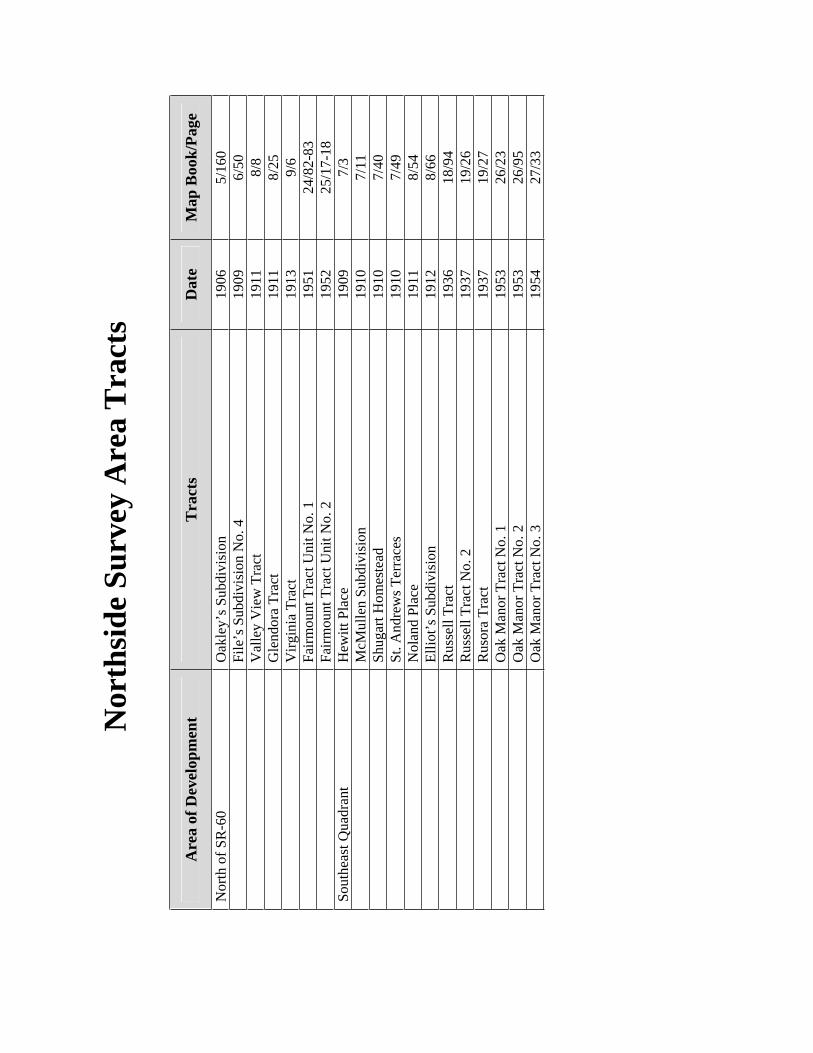
Nor
thsi
de S
urve
y A
rea
Tra
cts
Are
a of
Dev
elop
men
t T
ract
sD
ate
Map
Boo
k/Pa
ge
Nor
th o
f SR
-60
Oak
ley’
s Sub
divi
sion
19
065/
160
File
’s S
ubdi
visi
on N
o. 4
19
096/
50V
alle
y V
1911
8/8
iew
Tra
ct
Gle
ndor
a
1911
8/
25Tr
act
Virg
inia
Trac
t 19
13
9/6
Fairm
ou19
514/
82-8
3nt
Tra
ct U
nit N
o. 1
2
Fairm
ou19
525/
17-1
8nt
Tra
ct U
nit N
o. 2
2
Sout
uadr
aitt
P19
097/
3he
ast Q
ntH
ewla
ceM
cMul
le19
107/
11n
Subd
ivis
ion
Shug
art
19
10
7/40
Hom
este
adSt
.And
r19
107/
49ew
s Ter
race
s N
olan
d P
1911
lace
8/54
Ellio
t’sSu
bdiv
isio
n19
128/
66R
usse
llTr
act
18/9
419
36R
usse
ll T
193
ract
No.
2
719
/26
Rus
ora
Trac
t 19
/27
1937
Oak
Man
1953
26/2
3or
Tra
ct N
o. 1
O
ak M
ano
1953
26/9
5r T
ract
No.
2
Oak
Man
o19
5427
/33
r Tra
ct N
o. 3
APP DIX IV
PROPERTIES WITHIN
NE
THE NO
TABLE & PHOTOS
RTHSIDE SURVEY AREA
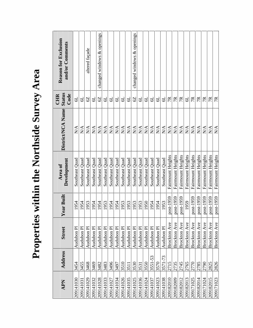
Prop
ertie
s with
in th
e N
orth
side
Sur
vey
Are
a
APN
Add
ress
Stre
etY
ear
Bui
ltA
rea
of
Dev
elop
men
tD
istr
ict/N
CA
Nam
eC
HR
Stat
usC
ode
Rea
son
for
Exc
lusi
onan
d/or
Com
men
ts
2091
4103
034
54A
udub
on P
l N
/A19
54So
uthe
ast Q
uad
6L20
9141
031
3455
Aud
ubon
Pl
1954
Sout
heas
t Qua
d N
/A6L
2091
4102
934
68A
udub
on P
l 19
53So
uthe
ast Q
uad
N/A
6Zal
tere
d fa
çade
20
9141
032
3469
Aud
ubon
Pl
1954
Sout
heas
t Qua
d N
/A6L
2091
4102
834
82A
udub
on P
l 19
54So
uthe
ast Q
uad
N/A
6Zch
ange
d w
indo
ws &
ope
ning
s20
9141
033
3483
Aud
ubon
Pl
N/A
1953
Sout
heas
t Qua
d 6L
2091
4102
734
96A
udub
on P
l N
/A19
54So
uthe
ast Q
uad
6L20
9141
034
3497
Aud
ubon
Pl
N/A
6L
19
54So
uthe
ast Q
uad
2091
4102
635
10A
udub
on P
l 6L
1953
Sout
heas
t Qua
d N
/A20
9141
035
3511
Aud
ubon
Pl
1953
Sout
heas
t Qua
d N
/A6L
2091
4102
535
30A
udub
on P
l 19
53So
uthe
ast Q
uad
N/A
6Zch
ange
d w
indo
ws &
ope
ning
s20
9141
036
3531
Aud
ubon
Pl
N/A
1953
Sout
heas
t Qua
d 6L
2091
4102
435
50A
udub
on P
l N
/A19
50So
uthe
ast Q
uad
6L20
9141
037
3551
-53
Aud
ubon
Pl
1954
Sout
heas
t Qua
d N
/A6L
2091
4102
335
70A
udub
on P
l 19
54So
uthe
ast Q
uad
N/A
6L20
9141
038
3571
-73
Aud
ubon
Pl
N/A
1953
Sout
heas
t Qua
d 6L
2091
8201
027
15B
rock
ton
Ave
N
/Apo
st-1
959
Fairm
ount
Hei
ghts
7R
2091
8200
927
35B
rock
ton
Ave
po
st-1
959
Fairm
ount
Hei
ghts
N
/A7R
2091
8201
227
45B
rock
ton
Ave
7R
post
-195
9Fa
irmou
nt H
eigh
ts
N/A
2091
8201
327
65B
rock
ton
Ave
N
/A19
59Fa
irmou
nt H
eigh
ts
6L20
9171
025
2770
Bro
ckto
n A
ve
post
-195
9Fa
irmou
nt H
eigh
ts
N/A
7R20
9182
014
2785
Bro
ckto
n A
ve
post
-195
9Fa
irmou
nt H
eigh
ts
N/A
7R20
9171
024
2790
Bro
ckto
n A
ve
post
-195
9Fa
irmou
nt H
eigh
ts
N/A
7R20
9182
015
2825
Bro
ckto
n A
ve
post
-195
9Fa
irmou
nt H
eigh
ts
N/A
7R20
9171
023
2826
Bro
ckto
n A
ve
post
-195
9Fa
irmou
nt H
eigh
ts
N/A
7R
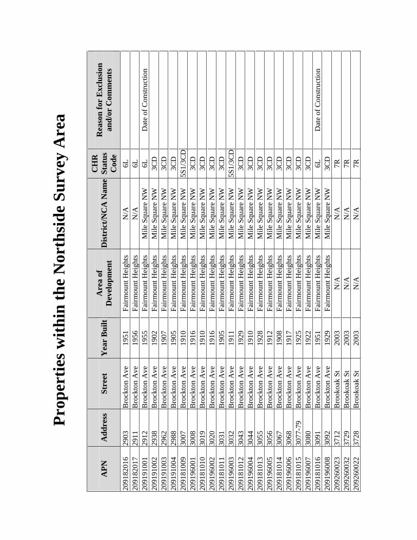
Prop
ertie
s with
in th
e N
orth
side
Sur
vey
Are
a
APN
Add
ress
Stre
etY
ear
Bui
ltA
rea
of
Dev
elop
men
tD
istr
ict/N
CA
Nam
eC
HR
Stat
usC
ode
Rea
son
for
Exc
lusi
onan
d/or
Com
men
ts
2091
8201
629
03B
rock
ton
Ave
N
/A19
51Fa
irmou
nt H
eigh
ts
6L20
9182
017
2911
Bro
ckto
n A
ve
N/A
1956
Fairm
ount
Hei
ghts
6L
2091
9100
129
12B
rock
ton
Ave
6L
1955
Fairm
ount
Hei
ghts
Mile
Squ
are
NW
D
ate
of C
onst
ruct
ion
2091
9100
229
38B
rock
ton
Ave
19
02Fa
irmou
nt H
eigh
tsM
ile S
quar
e N
W
3CD
2091
9100
329
62B
rock
ton
Ave
19
07Fa
irmou
nt H
eigh
ts
Mile
Squ
are
NW
3C
D20
9191
004
2988
Bro
ckto
n A
ve
1905
Fairm
ount
Hei
ghts
M
ile S
quar
e N
W
3CD
2091
8100
930
07B
rock
ton
Ave
19
10Fa
irmou
nt H
eigh
tsM
ile S
quar
e N
W
5S1/
3CD
2091
9600
130
08B
rock
ton
Ave
19
16Fa
irmou
nt H
eigh
ts
Mile
Squ
are
NW
3C
D20
9181
010
3019
Bro
ckto
n A
ve
1910
Fairm
ount
Hei
ghts
M
ile S
quar
e N
W
3CD
2091
9600
230
20B
rock
ton
Ave
19
16Fa
irmou
nt H
eigh
ts
Mile
Squ
are
NW
3C
D20
9181
011
3031
Bro
ckto
n A
ve
3CD
1905
Fairm
ount
Hei
ghts
M
ile S
quar
e N
W
2091
9600
330
32B
rock
ton
Ave
5S
1/3C
D19
11Fa
irmou
nt H
eigh
tsM
ile S
quar
e N
W
2091
8101
230
43B
rock
ton
Ave
M
ile S
quar
e N
W
1929
Fairm
ount
Hei
ghts
3C
D20
9196
004
3044
Bro
ckto
n A
ve
1910
Fairm
ount
Hei
ghts
M
ile S
quar
e N
W
3CD
2091
8101
330
55B
rock
ton
Ave
3C
D19
28Fa
irmou
nt H
eigh
ts
Mile
Squ
are
NW
20
9196
005
3056
Bro
ckto
n A
ve
1912
Fairm
ount
Hei
ghts
M
ile S
quar
e N
W
3CD
2091
8101
430
67B
rock
ton
Ave
M
ile S
quar
e N
W
1908
Fairm
ount
Hei
ghts
3C
D20
9196
006
3068
Bro
ckto
n A
ve
1917
Fairm
ount
Hei
ghts
M
ile S
quar
e N
W
3CD
2091
8101
5
Ave
30
77-7
9B
rock
ton
1925
Fairm
ount
Hei
ghts
M
ile S
quar
e N
W
3CD
2091
9600
730
80B
rock
ton
Ave
1922
Fai
hts
rmou
nt H
eig
Mile
Squ
are
NW
3C
D20
9181
016
3091
Bro
ckto
n A
ve19
51Fa
irmou
nt H
eigh
tsM
ile S
quar
e N
W
6LD
ate
of C
onst
ruct
ion
2091
9600
830
92B
rock
ton
Ave
3CD
1929
Fairm
ount
Hei
ghts
Mile
Squ
are
NW
20
9260
023
S
t
3712
Bro
okoa
k20
03N
/AN
/A7R
2092
6003
2
St
3729
Bro
okoa
k20
03N
/AN
/A7R
2092
6002
2
St
3728
Bro
okoa
k20
03N
/AN
/A7R
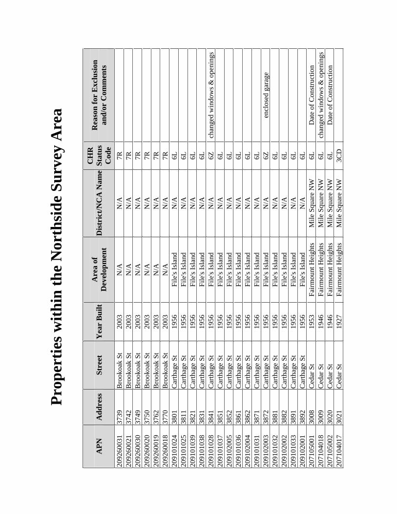
Prop
ertie
s with
in th
e N
orth
side
Sur
vey
Are
a
APN
Add
ress
Stre
etY
ear
Bui
ltA
rea
of
Dev
elop
men
tD
istr
ict/N
CA
Nam
eC
HR
Stat
usC
ode
Rea
son
for
Exc
lusi
onan
d/or
Com
men
ts
2092
6003
1
St
N
/A
37
39B
rook
oak
2003
N/A
7R20
9260
021
S
t
3742
Bro
okoa
k20
03N
/AN
/A7R
2092
6003
0
St
7R
37
49B
rook
oak
2003
N/A
N/A
2092
6002
0
St
7R
37
50B
rook
oak
2003
N/A
N/A
2092
6001
9
3762
Bro
okoa
k St
2003
N/A
N/A
7R20
9260
018
37
70B
rook
oak
St20
03N
/AN
/A7R
2091
0102
438
01C
arth
age
St
1956
File
's Is
land
N
/A6L
2091
0102
538
11C
arth
age
St
1956
File
's Is
land
N
/A6L
2091
0103
938
21C
arth
age
St
1956
File
's Is
land
N
/A6L
2091
0103
838
31C
arth
age
St
1956
File
's Is
land
N
/A6L
2091
0102
838
41C
arth
age
St
1956
File
's Is
land
N
/A6Z
chan
ged
win
dow
s & o
peni
ngs
2091
0103
738
51C
arth
age
St
1956
File
's Is
land
N
/A6L
2091
0200
538
52C
arth
age
St
1956
File
's Is
land
N
/A6L
2091
0103
638
61C
arth
age
St
1956
File
's Is
land
N
/A6L
2091
0200
438
62C
arth
age
St
1956
File
's Is
land
N
/A6L
2091
0103
138
71C
arth
age
St
1956
File
's Is
land
N
/A6L
2091
0200
338
72C
arth
age
St
1956
File
's Is
land
N
/A6Z
encl
osed
gar
age
2091
0103
238
81C
arth
age
St
1956
File
's Is
land
N
/A6L
2091
0200
238
82C
arth
age
St
1956
File
's Is
land
N
/A6L
2091
0103
338
91C
arth
age
St
1956
File
's Is
land
N
/A6L
2091
0200
138
92C
arth
age
St
1956
File
's Is
land
N
/A6L
2071
0500
130
08C
edar
St
1953
Fairm
ount
Hei
ghts
Mile
Squ
are
NW
6L
Dat
e of
Con
stru
ctio
n 20
7104
018
3009
Ced
ar S
t 19
46Fa
irmou
nt H
eigh
tsM
ile S
quar
e N
W
6Lch
ange
d w
indo
ws &
ope
ning
s20
7105
002
3020
Ced
ar S
t 19
46Fa
irmou
nt H
eigh
tsM
ile S
quar
e N
W
6LD
ate
of C
onst
ruct
ion
2071
0401
730
21C
edar
St
1927
Fairm
ount
Hei
ghts
Mile
Squ
are
NW
3C
D
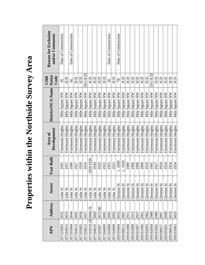
Prop
ertie
s with
in th
e N
orth
side
Sur
vey
Are
a
APN
Add
ress
Stre
etY
ear
Bui
ltA
rea
of
Dev
elop
men
tD
istr
ict/N
CA
Nam
eC
HR
Stat
usC
ode
Rea
son
for
Exc
lusi
onan
d/or
Com
men
ts
2071
0500
330
32C
edar
St
1941
F6L
airm
ount
Hei
ghts
Mile
Squ
are
NW
D
ate
of C
onst
ruct
ion
2071
0401
530
33C
edar
St
1927
Fairm
ount
Hei
ghts
Mile
Squ
are
NW
3C
D20
7105
004
3044
Ced
ar S
t 19
40Fa
irmou
nt H
eigh
tsM
ile S
quar
e N
W
6LD
ate
of C
onst
ruct
ion
2071
0401
3F
3045
Ced
ar S
t 19
27ai
rmou
nt H
eigh
tsM
ile S
quar
e N
W
3CD
2071
0500
5F
3056
Ced
ar S
t 19
29ai
rmou
nt H
eigh
tsM
ile S
quar
e N
W
3CD
2071
0401
230
57C
edar
St
1910
Fairm
ount
Hei
ghts
Mile
Squ
are
NW
5S
1/3C
D20
7105
019-
18F
3068
-70
Ced
ar S
t 19
29/1
926
airm
ount
Hei
ghts
Mile
Squ
are
NW
3C
D20
7104
010
3069
Ced
ar S
t 19
39Fa
irmou
nt H
eigh
tsM
ile S
quar
e N
W
3CD
2071
0500
730
72-8
0F
Ced
ar S
t 19
25ai
rmou
nt H
eigh
tsM
ile S
quar
e N
W
3CD
2071
0400
930
81C
edar
St
1922
Fairm
ount
Hei
ghts
Mile
Squ
are
NW
3C
D20
7105
008
3092
Ced
ar S
t 19
55Fa
irmou
nt H
eigh
tsM
ile S
quar
e N
W
6LD
ate
of C
onst
ruct
ion
2071
0400
830
93C
edar
St
1922
F3C
Dai
rmou
nt H
eigh
tsM
ile S
quar
e N
W
2091
9500
430
32C
hest
nut S
t c.
200
0 F
7Rai
rmou
nt H
eigh
tsM
ile S
quar
e N
W
Dat
e of
Con
stru
ctio
n 20
9196
012
3067
Che
stnu
t St
c. 1
920
F
Mile
Squ
are
NW
3C
Dai
rmou
nt H
eigh
ts20
9191
008
2911
Che
stnu
t St
1909
F
Mile
Squ
are
NW
3C
Dai
rmou
nt H
eigh
ts20
9192
008
2912
Che
stnu
t St
1906
F
Mile
Squ
are
NW
3C
Dai
rmou
nt H
eigh
ts20
9191
007
2937
Che
stnu
t St
1906
F
Mile
Squ
are
NW
3C
Dai
rmou
nt H
eigh
ts20
9191
006
2961
Che
stnu
t St
1909
Fs
aiht
rmou
nt H
eig
Mile
Squ
are
NW
3C
D20
9192
003
2962
Che
stnu
t St
1929
Fats
irmou
nt H
eigh
Mile
Squ
are
NW
3C
D20
9192
004
2988
Che
stnu
t St
1905
Fats
irmou
nt H
eigh
Mile
Squ
are
NW
5S
1/3C
D20
9191
005
2989
Che
stnu
t St
1927
Fats
irmou
nt H
eigh
Mile
Squ
are
NW
3C
D20
9196
017
3007
Che
stnu
t St
1924
Fats
irmou
nt H
eigh
Mile
Squ
are
NW
3C
D20
9195
001
3008
Che
stnu
t St
1924
Fats
irmou
nt H
eigh
Mile
Squ
are
NW
3C
D20
9196
016
3019
Che
stnu
t St
1924
Fats
irmou
nt H
eigh
Mile
Squ
are
NW
3C
D20
9195
003
3020
Che
stnu
t St
1924
Fats
irmou
nt H
eigh
Mile
Squ
are
NW
3C
D
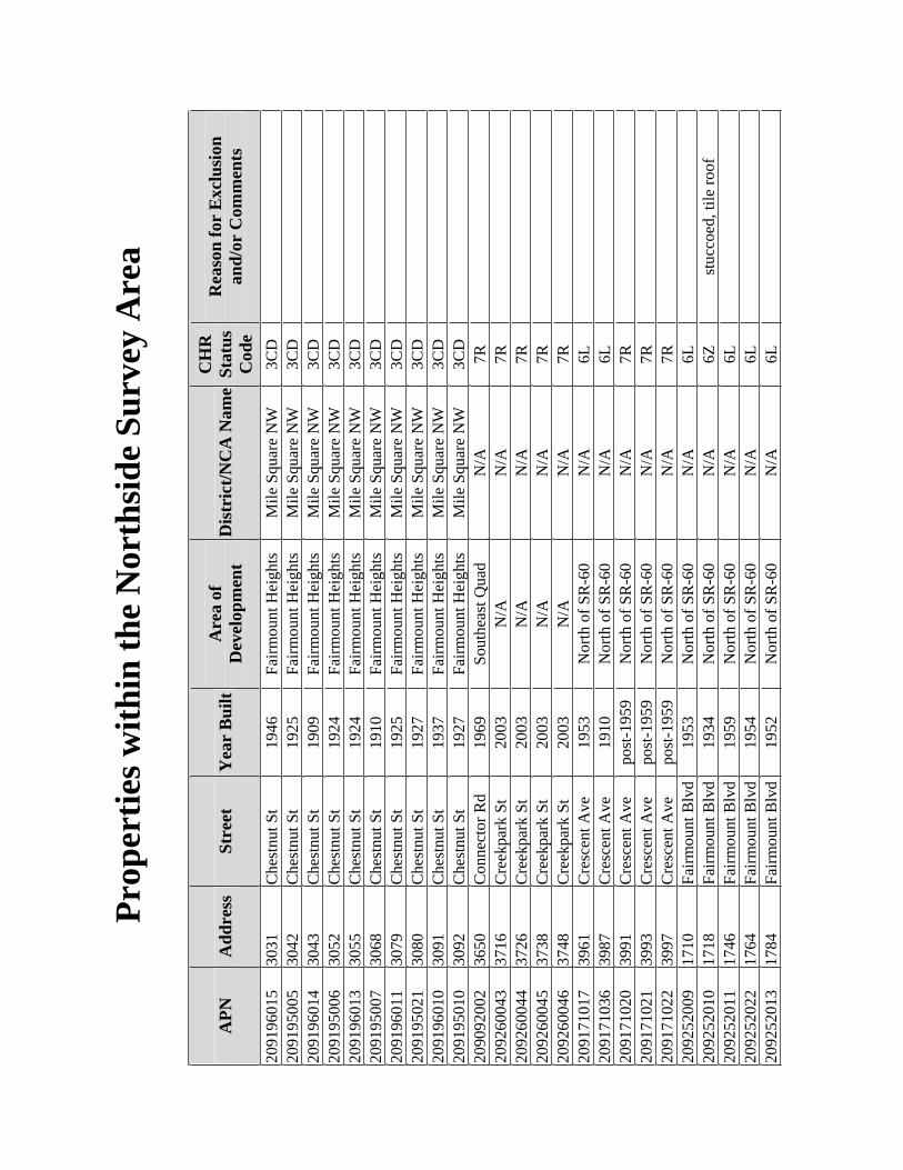
Prop
ertie
s with
in th
e N
orth
side
Sur
vey
Are
a
APN
Add
ress
Stre
etY
ear
Bui
ltA
rea
of
Dev
elop
men
tD
istr
ict/N
CA
Nam
eC
HR
Stat
usC
ode
Rea
son
for
Exc
lusi
onan
d/or
Com
men
ts
2091
9601
530
31C
hest
nut S
t 19
46Fa
ts
Mile
Squ
are
NW
irm
ount
Hei
gh3C
D20
9195
005
3042
Che
stnu
t St
1925
Fats
irmou
nt H
eigh
Mile
Squ
are
NW
3C
D20
9196
014
3043
Che
stnu
t St
1909
Fats
irmou
nt H
eigh
Mile
Squ
are
NW
3C
D20
9195
006
3052
Che
stnu
t St
1924
Fats
irmou
nt H
eigh
Mile
Squ
are
NW
3C
D20
9196
013
3055
Che
stnu
t St
1924
Fats
irmou
nt H
eigh
Mile
Squ
are
NW
3C
D20
9195
007
3068
Che
stnu
t St
1910
Fats
3CD
irmou
nt H
eigh
Mile
Squ
are
NW
20
9196
011
3079
Che
stnu
t St
1925
Fats
irmou
nt H
eigh
Mile
Squ
are
NW
3C
D20
9195
021
3080
Che
stnu
t St
1927
Fats
irmou
nt H
eigh
Mile
Squ
are
NW
3C
D20
9196
010
3091
Che
stnu
t St
1937
Fats
irmou
nt H
eigh
Mile
Squ
are
NW
3C
D20
9195
010
3092
Che
stnu
t St
1927
Fats
M
ile S
quar
e N
W
irmou
nt H
eigh
3CD
2090
9200
236
50C
onne
ctor
Rd
1969
Sout
heas
t Qua
d N
/A7R
2092
6004
3
3716
Cre
ekpa
rk S
t20
03N
/AN
/A7R
2092
6004
4
3726
Cre
ekpa
rk S
t20
03N
/AN
/A7R
2092
6004
5
3738
Cre
ekpa
rk S
t20
03N
/AN
/A7R
2092
6004
6
3748
Cre
ekpa
rk S
t20
03N
/AN
/A7R
2091
7101
739
61C
resc
ent A
ve
1953
Nor
th o
f SR
-60
N/A
6L20
9171
036
3987
Cre
scen
t Ave
19
10N
orth
of S
R-6
0 N
/A6L
2091
7102
039
91C
resc
ent A
ve
post
-195
9N
orth
of S
R-6
0 N
/A7R
2091
7102
139
93C
resc
ent A
ve
post
-195
9N
orth
of S
R-6
0 N
/A7R
2091
7102
239
97C
resc
ent A
ve
post
-195
9N
orth
of S
R-6
0 N
/A7R
2092
5200
917
10Fa
irmou
nt B
lvd
6L19
53N
orth
of S
R-6
0 N
/A20
9252
010
1718
Fairm
ount
Blv
d19
34N
orth
of S
R-6
0 N
/A6Z
stuc
coed
, tile
roof
20
9252
011
1746
Fairm
ount
Blv
d19
59N
orth
of S
R-6
0 N
/A6L
2092
5202
217
64Fa
irmou
nt B
lvd
1954
Nor
th o
f SR
-60
N/A
6L20
9252
013
1784
Fairm
ount
Blv
dN
/A19
52N
orth
of S
R-6
0 6L
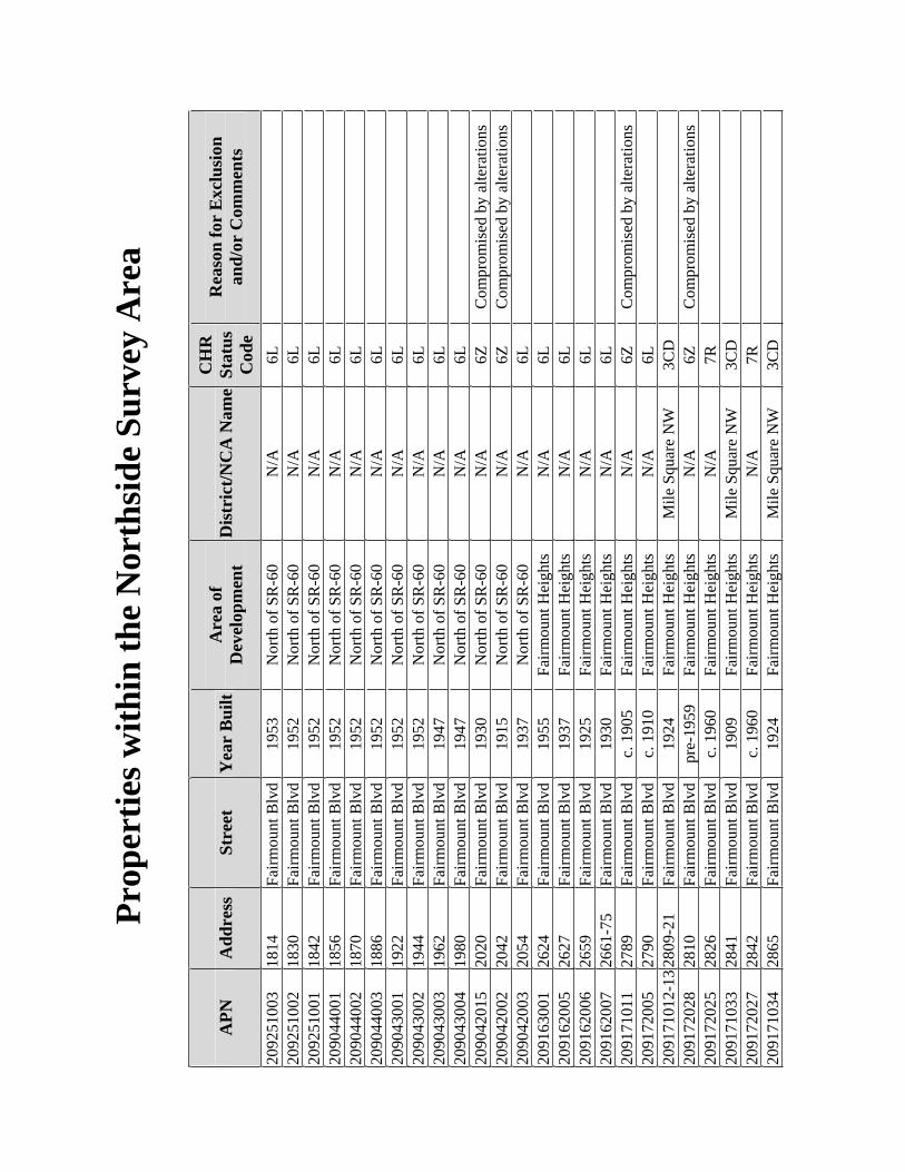
Prop
ertie
s with
in th
e N
orth
side
Sur
vey
Are
a
APN
Add
ress
Stre
etY
ear
Bui
ltA
rea
of
Dev
elop
men
tD
istr
ict/N
CA
Nam
eC
HR
Stat
usC
ode
Rea
son
for
Exc
lusi
onan
d/or
Com
men
ts
2092
5100
318
14Fa
irmou
nt B
lvd
6L19
53N
orth
of S
R-6
0 N
/A20
9251
002
1830
Fairm
ount
Blv
d19
52N
orth
of S
R-6
0 N
/A6L
2092
5100
118
42Fa
irmou
nt B
lvd
1952
Nor
th o
f SR
-60
N/A
6L20
9044
001
1856
Fairm
ount
Blv
d19
52N
orth
of S
R-6
0 N
/A6L
2090
4400
218
70Fa
irmou
nt B
lvd
1952
Nor
th o
f SR
-60
N/A
6L20
9044
003
1886
Fairm
ount
Blv
d19
52N
orth
of S
R-6
0 N
/A6L
2090
4300
119
22Fa
irmou
nt B
lvd
1952
Nor
th o
f SR
-60
N/A
6L20
9043
002
1944
Fairm
ount
Blv
d19
52N
orth
of S
R-6
0 N
/A6L
2090
4300
319
62Fa
irmou
nt B
lvd
1947
Nor
th o
f SR
-60
N/A
6L20
9043
004
1980
Fairm
ount
Blv
d19
47N
orth
of S
R-6
0 N
/A6L
2090
4201
520
20Fa
irmou
nt B
lvd
Com
prom
i a
ltera
tions
19
30N
orth
of S
R-6
0 N
/A6Z
sed
by20
9042
002
2042
Fairm
ount
Blv
d19
15N
orth
of S
R-6
0 N
/A6Z
Com
prom
ised
by
alte
ratio
ns
2090
4200
320
54Fa
irmou
nt B
lvd
1937
Nor
th o
f SR
-60
N/A
6L20
9163
001
2624
Fairm
ount
Blv
dFa
ts19
55irm
ount
Hei
ghN
/A6L
2091
6200
526
27Fa
irmou
nt B
lvd
Fats
1937
irmou
nt H
eigh
N/A
6L20
9162
006
2659
Fairm
ount
Blv
dFa
ts19
25irm
ount
Hei
ghN
/A6L
2091
6200
726
61-7
5vd
Fats
Fairm
ount
Bl
1930
irmou
nt H
eigh
N/A
6L20
9171
011
2789
Fairm
ount
Blv
dF
Cs
c. 1
905
airm
ount
Hei
ghts
N/A
6Zom
prom
ised
by
alte
ratio
n20
9172
005
2790
Fairm
ount
Blv
dF
c. 1
910
airm
ount
Hei
ghts
N/A
6L20
9171
012-
1321
B
lvd
F 28
09-
Fairm
ount
19
24ai
rmou
nt H
eigh
tsM
ile S
quar
e N
W
3CD
2091
7202
828
10Fa
irmou
nt B
lvd
FC
ompr
omi
alte
ratio
ns
pre-
1959
airm
ount
Hei
ghts
N/A
6Zse
d by
2091
7202
528
26Fa
irmou
nt B
lvd
Fc.
196
0 ai
rmou
nt H
eigh
tsN
/A7R
2091
7103
328
41Fa
irmou
nt B
lvd
F19
09ai
rmou
nt H
eigh
tsM
ile S
quar
e N
W
3CD
2091
7202
728
42Fa
irmou
nt B
lvd
Fc.
196
0 ai
rmou
nt H
eigh
tsN
/A7R
2091
7103
4
Blv
d
F28
65Fa
irmou
nt19
24ai
rmou
nt H
eigh
tsM
ile S
quar
e N
W
3CD
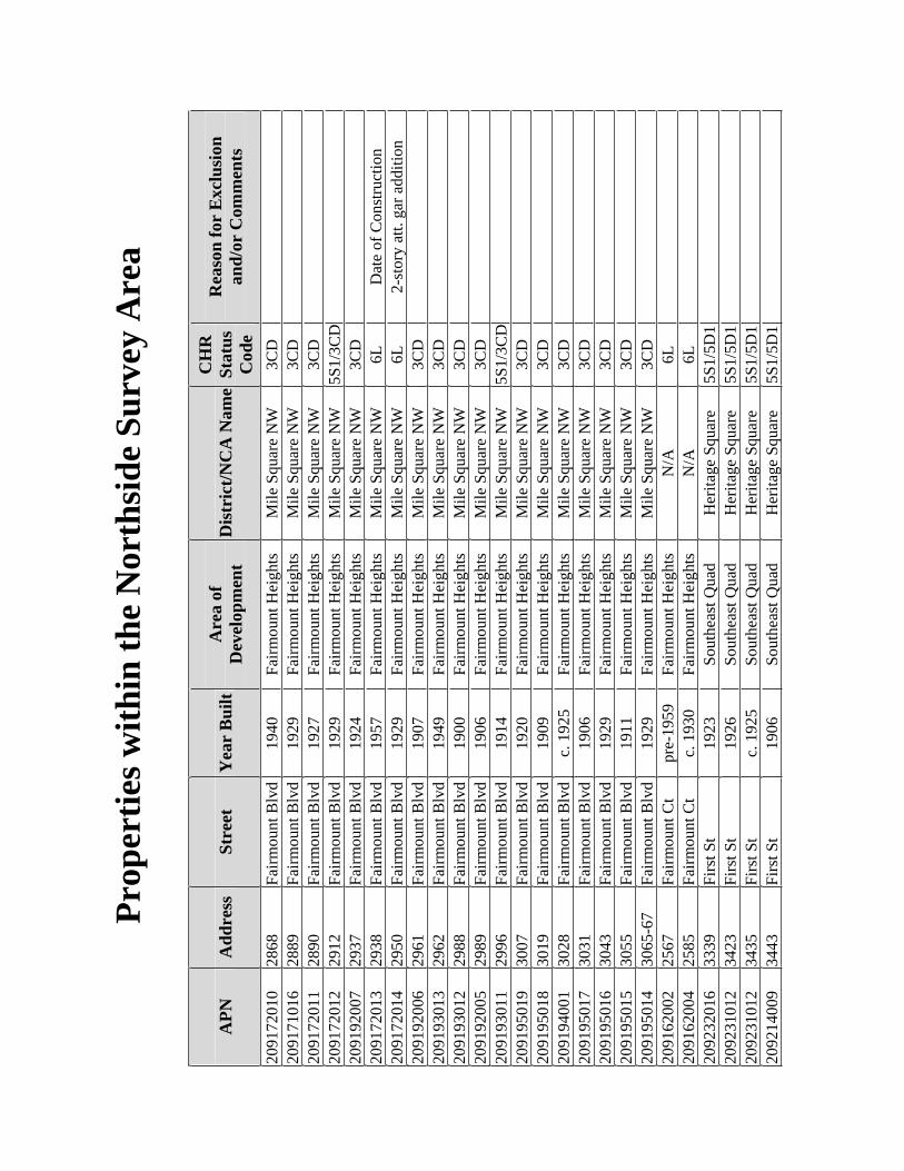
Prop
ertie
s with
in th
e N
orth
side
Sur
vey
Are
a
APN
Add
ress
Stre
etY
ear
Bui
ltA
rea
of
Dev
elop
men
tD
istr
ict/N
CA
Nam
eC
HR
Stat
usC
ode
Rea
son
for
Exc
lusi
onan
d/or
Com
men
ts
2091
7201
0
Blv
d
F28
68Fa
irmou
nt19
40ai
rmou
nt H
eigh
tsM
ile S
quar
e N
W
3CD
2091
7101
6
Blv
d
F28
89Fa
irmou
nt19
29ai
rmou
nt H
eigh
tsM
ile S
quar
e N
W
3CD
2091
7201
1
Blv
d
F28
90Fa
irmou
nt19
27ai
rmou
nt H
eigh
tsM
ile S
quar
e N
W
3CD
2091
7201
229
12Fa
irmou
nt B
lvd
F19
29ai
rmou
nt H
eigh
tsM
ile S
quar
e N
W
5S1/
3CD
2091
9200
7
Blv
d
F29
37Fa
irmou
nt19
24ai
rmou
nt H
eigh
tsM
ile S
quar
e N
W
3CD
2091
7201
3
Blv
dF
2938
Fairm
ount
1957
airm
ount
Hei
ghts
Mile
Squ
are
NW
6L
Dat
e of
Con
stru
ctio
n 20
9172
014
B
lvd
F2-
stor
y at
t. ga
r add
ition
29
50Fa
irmou
nt19
29ai
rmou
nt H
eigh
tsM
ile S
quar
e N
W
6L20
9192
006
B
lvd
F
2961
Fairm
ount
1907
airm
ount
Hei
ghts
Mile
Squ
are
NW
3C
D20
9193
013
Blv
d
F29
62Fa
irmou
nt19
49ai
rmou
nt H
eigh
tsM
ile S
quar
e N
W
3CD
2091
9301
2 B
lvd
F
2988
Fairm
ount
1900
airm
ount
Hei
ghts
Mile
Squ
are
NW
3C
D20
9192
005
B
lvd
F29
89Fa
irmou
nt19
06ai
rmou
nt H
eigh
tsM
ile S
quar
e N
W
3CD
2091
9301
129
96Fa
irmou
nt B
lvd
F19
14ai
rmou
nt H
eigh
tsM
ile S
quar
e N
W
5S1/
3CD
2091
9501
9
Blv
d
F30
07Fa
irmou
nt19
20ai
rmou
nt H
eigh
tsM
ile S
quar
e N
W
3CD
2091
9501
8
Blv
d
F30
19Fa
irmou
nt19
09ai
rmou
nt H
eigh
tsM
ile S
quar
e N
W
3CD
2091
9400
130
28Fa
irmou
nt B
lvd
Fc.
192
5 ai
rmou
nt H
eigh
tsM
ile S
quar
e N
W
3CD
2091
9501
7 B
lvd
F30
31Fa
irmou
nt19
06ai
rmou
nt H
eigh
tsM
ile S
quar
e N
W
3CD
2091
9501
6 B
lvd
F30
43Fa
irmou
nt19
29ai
rmou
nt H
eigh
tsM
ile S
quar
e N
W
3CD
2091
9501
5
Blv
dF
3055
Fairm
ount
1911
airm
ount
Hei
ghts
Mile
Squ
are
NW
3C
D20
9195
014
67
Blv
d
F30
65-
Fairm
ount
1929
airm
ount
Hei
ghts
Mile
Squ
are
NW
3C
D20
9162
002
2567
Fairm
ount
Ct
Fpr
e-19
59ai
rmou
nt H
eigh
tsN
/A6L
2091
6200
425
85Fa
irmou
nt C
tF
c. 1
930
airm
ount
Hei
ghts
N/A
6L20
9232
016
3339
Firs
t St
1923
Sout
heas
t Qua
d H
erit
ua
re
age
Sq5S
1/5D
120
9231
012
3423
Firs
t St
1926
Sout
heas
t Qua
d H
erit
ua
re
age
Sq5S
1/5D
120
9231
012
3435
Firs
t St
c. 1
925
Sout
heas
t Qua
d H
erit
ua
re
age
Sq5S
1/5D
120
9214
009
3443
Firs
t St
1906
Sout
heas
t Qua
d H
erit
ua
re
age
Sq5S
1/5D
1
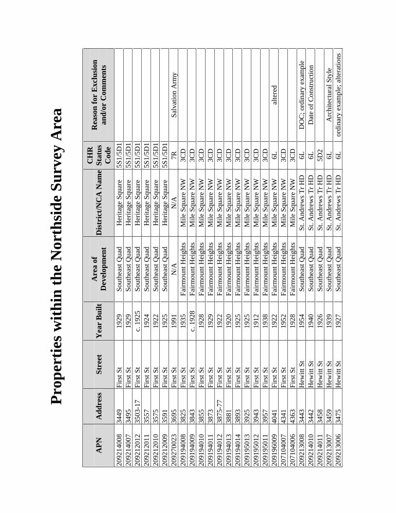
Prop
ertie
s with
in th
e N
orth
side
Sur
vey
Are
a
APN
Add
ress
Stre
etY
ear
Bui
ltA
rea
of
Dev
elop
men
tD
istr
ict/N
CA
Nam
eC
HR
Stat
usC
ode
Rea
son
for
Exc
lusi
onan
d/or
Com
men
ts
2092
1400
834
49Fi
rst S
t 19
29So
uthe
ast Q
uad
Her
it
uare
ag
eSq
5S1/
5D1
2092
1400
734
95Fi
rst S
t 19
29So
uthe
ast Q
uad
Her
it
uare
ag
eSq
5S1/
5D1
2092
1201
235
03-1
7
Her
it
uare
Fi
rst S
t c.
192
5 So
uthe
astQ
uad
age
Sq5S
1/5D
120
9212
011
3557
Firs
t St
1924
Sout
heas
t Qua
d H
erit
ua
re
age
Sq5S
1/5D
120
9212
010
3575
Firs
t St
1922
Sout
heas
t Qua
d H
erit
ua
re
age
Sq5S
1/5D
120
9212
009
3591
Firs
t St
1925
Sout
heas
t Qua
d H
erit
ua
re
age
Sq5S
1/5D
120
9270
023
3695
Firs
tSt
1991
N/A
N/A
7RSa
lvat
ion
Arm
y 20
9194
008
3825
Firs
t St
1935
Fairm
ount
Hei
ghts
Mile
Squ
are
NW
3C
D20
9194
009
3843
Firs
t St
c. 1
928
Fairm
ount
Hei
ghts
Mile
Squ
are
NW
3C
D20
9194
010
3855
Firs
t St
1928
Fairm
ount
Hei
ghts
Mile
Squ
are
NW
3C
D20
9194
011
3873
Firs
t St
1929
Fairm
ount
Hei
ghts
Mile
Squ
are
NW
3C
D20
9194
012
77
F
3875
-Fi
rst S
t 19
22ai
rmou
nt H
eigh
tsM
ile S
quar
e N
W
3CD
2091
9401
338
81Fi
rst S
t 19
20Fa
irmou
nt H
eigh
tsM
ile S
quar
e N
W
3CD
2091
9401
438
93Fi
rst S
t 19
25Fa
irmou
nt H
eigh
tsM
ile S
quar
e N
W
3CD
2091
9501
339
25Fi
rst S
t 19
25Fa
irmou
nt H
eigh
tsM
ile S
quar
e N
W
3CD
2091
9501
239
43Fi
rst S
t 19
12Fa
irmou
nt H
eigh
tsM
ile S
quar
e N
W
3CD
2091
9501
139
57Fi
rst S
t 19
38Fa
irmou
nt H
eigh
ts
Mile
Squ
are
NW
3C
D20
9196
009
4041
Firs
t St
1922
Fairm
ount
Hei
ghts
M
ile S
quar
e N
W
6Lal
tere
d20
7104
007
4341
Firs
t St
1952
Fairm
ount
Hei
ghts
M
ile S
quar
e N
W
3CD
2071
0400
643
63Fi
rst S
t 19
28Fa
irmou
nt H
eigh
ts
Mile
Squ
are
NW
3C
D20
9213
008
3443
Hew
itt S
t 19
54So
uthe
ast Q
uad
St. A
ndre
ws T
r HD
6L
DO
C; o
rdin
ary
exam
ple
2092
1401
034
42H
ewitt
St
1940
Sout
heas
t Qua
d St
. And
rew
s Tr H
D
6LD
ate
of C
onst
ruct
ion
2092
1401
134
58H
ewitt
St
1926
Sout
heas
t Qua
d St
. And
rew
s Tr H
D
5D2
2092
1300
734
59H
ewitt
St
1939
Sout
heas
t Qua
d St
. And
rew
s Tr H
D
6LA
rchi
tect
ural
Sty
le
2092
1300
634
75H
ewitt
St
1927
Sout
heas
t Qua
d St
. And
rew
s Tr H
D
6Lor
dina
ry e
xam
le; a
ltera
tions
p
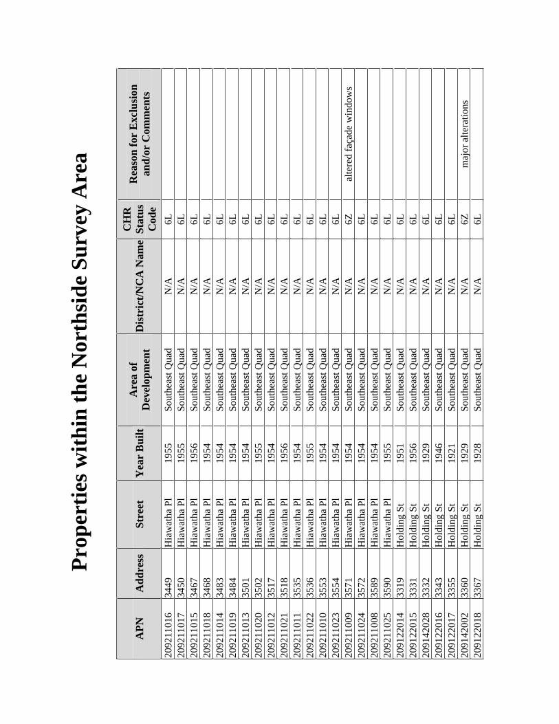
Prop
ertie
s with
in th
e N
orth
side
Sur
vey
Are
a
APN
Add
ress
Stre
etY
ear
Bui
ltA
rea
of
Dev
elop
men
tD
istr
ict/N
CA
Nam
eC
HR
Stat
usC
ode
Rea
son
for
Exc
lusi
onan
d/or
Com
men
ts
2092
1101
634
49H
iaw
atha
Pl
1955
Sout
heas
t Qua
d N
/A6L
2092
1101
734
50H
iaw
atha
Pl
1955
Sout
heas
t Qua
d N
/A6L
2092
1101
534
67H
iaw
atha
Pl
1956
Sout
heas
t Qua
d N
/A6L
2092
1101
834
68H
iaw
atha
Pl
1954
Sout
heas
t Qua
d N
/A6L
2092
1101
434
83H
iaw
atha
Pl
1954
Sout
heas
t Qua
d N
/A6L
2092
1101
934
84H
iaw
atha
Pl
1954
Sout
heas
t Qua
d N
/A6L
2092
1101
335
01H
iaw
atha
Pl
1954
Sout
heas
t Qua
d N
/A6L
2092
1102
035
02H
iaw
atha
Pl
1955
Sout
heas
t Qua
d N
/A6L
2092
1101
235
17H
iaw
atha
Pl
1954
Sout
heas
t Qua
d N
/A6L
2092
1102
135
18H
iaw
atha
Pl
1956
Sout
heas
t Qua
d N
/A6L
2092
1101
135
35H
iaw
atha
Pl
1954
Sout
heas
t Qua
d N
/A6L
2092
1102
235
36H
iaw
atha
Pl
1955
Sout
heas
t Qua
d N
/A6L
2092
1101
035
53H
iaw
atha
Pl
1954
Sout
heas
t Qua
d N
/A6L
2092
1102
335
54H
iaw
atha
Pl19
54So
uthe
ast Q
uad
N/A
6L20
9211
009
3571
Hia
wat
haPl
1954
Sout
heas
t Qua
d N
/A6Z
alte
red
faça
de w
indo
ws
2092
1102
435
72H
iaw
atha
Pl19
54So
uthe
ast Q
uad
N/A
6L20
9211
008
3589
Hia
wat
haPl
1954
Sout
heas
t Qua
d N
/A6L
2092
1102
535
90H
iaw
atha
Pl19
55So
uthe
ast Q
uad
N/A
6L20
9122
014
3319
Hol
ding
St
1951
Sout
heas
t Qua
d N
/A6L
2091
2201
533
31H
oldi
ng S
t19
56So
uthe
ast Q
uad
N/A
6L20
9142
028
3332
Hol
ding
St
1929
Sout
heas
t Qua
d N
/A6L
2091
2201
633
43H
oldi
ng S
t19
46So
uthe
ast Q
uad
N/A
6L20
9122
017
3355
Hol
ding
St
1921
Sout
heas
t Qua
d N
/A6L
2091
4200
233
60H
oldi
ng S
t19
29So
uthe
ast Q
uad
N/A
6Zm
ajor
alte
ratio
ns
2091
2201
833
67H
oldi
ng S
t19
28So
uthe
ast Q
uad
N/A
6L

Prop
ertie
s with
in th
e N
orth
side
Sur
vey
Are
a
APN
Add
ress
Stre
etY
ear
Bui
ltA
rea
of
Dev
elop
men
tD
istr
ict/N
CA
Nam
eC
HR
Stat
usC
ode
Rea
son
for
Exc
lusi
onan
d/or
Com
men
ts
2091
2201
933
79H
oldi
ng S
tC
omio
ns19
13So
uthe
ast Q
uad
N/A
5S1/
6Zpr
omis
ed b
y al
tera
t20
9122
020
3391
Hol
ding
St
1921
Sout
heas
t Qua
d N
/A6Z
asbe
stos
sidi
ng; e
ncl.
Porc
h 20
9122
021
3407
Hol
ding
St
1954
Sout
heas
t Qua
d N
/A6L
2091
2202
234
19H
oldi
ng S
t19
18So
uthe
ast Q
uad
N/A
6L20
9122
023
3431
Hol
ding
St
Sout
heas
t Qua
d 19
24N
/A6L
2091
2202
434
43H
oldi
ng S
t 19
25
Sout
heas
t Qua
d N
/A6L
2091
2204
834
55H
oldi
ng S
t 19
51
Sout
heas
t Qua
d N
/A6L
2091
4104
834
56-6
0t
1953
So
uthe
ast Q
uad
Hol
ding
SN
/A6L
2091
2202
734
67H
oldi
ng S
t 19
51
Sout
heas
t Qua
d N
/A6L
2091
4104
734
74H
oldi
ng S
t 19
56So
uthe
ast Q
uad
N/A
6L20
9122
028
3485
Hol
ding
St
1952
Sout
heas
t Qua
d N
/A6L
2091
4104
634
86H
oldi
ng S
t 19
52So
uthe
ast Q
uad
N/A
6L20
9141
045
3498
Hol
ding
St
1951
Sout
heas
t Qua
d N
/A6L
2091
2202
934
99-3
501
H
oldi
ng S
t19
55So
uthe
ast Q
uad
N/A
6L20
9122
030
3503
-05
Hol
ding
St
1952
Sout
heas
t Qua
d N
/A6L
2091
4104
435
06H
oldi
ng S
t19
51So
uthe
ast Q
uad
N/A
6L20
9122
031
3527
-29
Hol
ding
St
1951
Sout
heas
t Qua
d N
/A6L
2091
4104
335
30H
oldi
ng S
t19
51So
uthe
ast Q
uad
N/A
6L20
9122
032
3543
-45
Hol
ding
St
1955
Sout
heas
t Qua
d N
/A6L
2091
4104
235
60H
oldi
ng S
tSo
uthe
ast Q
uad
1952
N/A
6L20
9122
033
3561
Hol
ding
St
Sout
heas
t Qua
d 19
50N
/A6L
2091
2203
435
75-7
7So
uthe
ast Q
uad
Hol
ding
St
1952
N/A
6L20
9141
041
3576
Hol
ding
St
1952
Sout
heas
t Qua
d N
/A6L
2091
9300
638
33H
ough
ton
Ave
1941
Fairm
ount
Hei
ghts
N
/A6L
2091
9400
338
34H
ough
ton
Ave
c. 1
910
Fairm
ount
Hei
ghts
N
/A6L
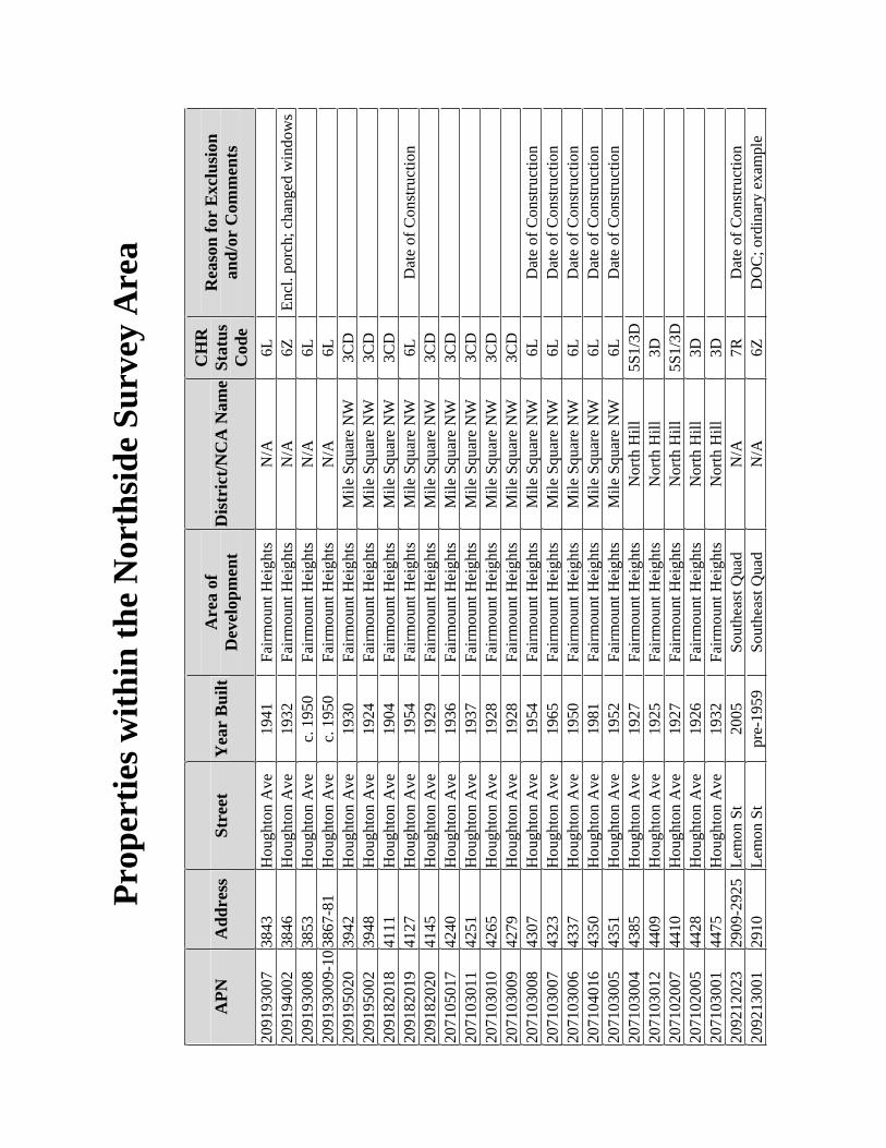
Prop
ertie
s with
in th
e N
orth
side
Sur
vey
Are
a
APN
Add
ress
Stre
etY
ear
Bui
ltA
rea
of
Dev
elop
men
tD
istr
ict/N
CA
Nam
eC
HR
Stat
usC
ode
Rea
son
for
Exc
lusi
onan
d/or
Com
men
ts
2091
9300
738
43H
ough
ton
Ave
19
41
Fairm
ount
Hei
ghts
N
/A6L
2091
9400
238
46H
ough
ton
Ave
Fairm
ount
Hei
ghts
19
32N
/A6Z
Encl
. por
ch; c
hang
ed w
indo
ws
2091
9300
838
53H
ough
ton
Ave
c. 1
950
Fairm
ount
Hei
ghts
N
/A6L
2091
9300
9-10
81
Ave
3867
-H
ough
ton
c. 1
950
Fairm
ount
Hei
ghts
N
/A6L
2091
9502
039
42H
ough
ton
Ave
1930
Fairm
ount
Hei
ghts
M
ile S
quar
e N
W
3CD
2091
9500
239
48H
ough
ton
Ave
19
24
Fairm
ount
Hei
ghts
M
ile S
quar
e N
W
3CD
2091
8201
841
11H
ough
ton
Ave
19
04Fa
irmou
nt H
eigh
ts
Mile
Squ
are
NW
3C
D20
9182
019
4127
Hou
ghto
n A
ve
1954
Fairm
ight
sou
nt H
eM
ile S
quar
e N
W
6LD
ate
of C
onst
ruct
ion
2091
8202
041
45H
ough
ton
Ave
19
29Fa
irmou
nt H
eigh
ts
Mile
Squ
are
NW
3C
D20
7105
017
4240
Hou
ghto
nA
ve19
36Fa
irmou
nt H
eigh
tsM
ile S
quar
e N
W
3CD
2071
0301
142
51H
ough
ton
Ave
19
37
Fairm
ount
Hei
ghts
M
ile S
quar
e N
W
3CD
2071
0301
042
65H
ough
ton
Ave
Fairm
ount
Hei
ghts
19
28M
ile S
quar
e N
W
3CD
2071
0300
942
79H
ough
ton
Ave
F19
28ai
rmou
nt H
eigh
tsM
ile S
quar
e N
W
3CD
2071
0300
843
07H
ough
ton
Ave
F19
54ai
rmou
nt H
eigh
tsM
ile S
quar
e N
W
6LD
ate
of C
onst
ruct
ion
2071
0300
743
23H
ough
ton
Ave
19
65
Fairm
ount
Hei
ghts
Mile
Squ
are
NW
6L
Dat
e of
Con
stru
ctio
n 20
7103
006
4337
Hou
ghto
nA
ve
1950
Fa
irmou
nt H
eigh
tsM
ile S
quar
e N
W
6LD
ate
of C
onst
ruct
ion
2071
0401
643
50H
ough
ton
Ave
Fairm
ount
Hei
ghts
1981
Mile
Squ
are
NW
6L
Dat
e of
Con
stru
ctio
n 20
7103
005
4351
Hou
ghto
nA
veF
1952
airm
ount
Hei
ghts
Mile
Squ
are
NW
6L
Dat
e of
Con
stru
ctio
n 20
7103
004
4385
Hou
ghto
nA
ve19
27Fa
irmou
nt H
eigh
ts
Nor
th H
ill
5S1/
3D20
7103
012
4409
Hou
ghto
nA
ve
1925
Fa
irmou
nt H
eigh
ts
Nor
th H
ill
3D20
7102
007
4410
Hou
ghto
nA
ve
1927
Fa
irmou
nt H
eigh
tsN
orth
Hill
5S
1/3D
2071
0200
544
28H
ough
ton
Ave
1926
Fairm
ount
Hei
ghts
N
orth
Hill
3D
2071
0300
144
75H
ough
ton
Ave
F19
32ai
rmou
nt H
eigh
tsN
orth
Hill
3D
2092
1202
329
09-2
925
Lem
on S
t 20
05So
uthe
ast Q
uad
N/A
7RD
ate
of C
onst
ruct
ion
2092
1300
129
10Le
mon
St
pre-
1959
Sout
heas
t Qua
d N
/A6Z
DO
C; o
rdin
ary
exam
ple
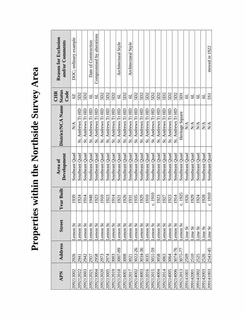
Prop
ertie
s with
in th
e N
orth
side
Sur
vey
Are
a
APN
Add
ress
Stre
etY
ear
Bui
ltA
rea
of
Dev
elop
men
tD
istr
ict/N
CA
Nam
eC
HR
Stat
usC
ode
Rea
son
for
Exc
lusi
onan
d/or
Com
men
ts
2092
1300
229
26Le
mon
St
1939
Sout
heas
t Qua
d N
/A6Z
DO
C; o
rdin
ary
exam
ple
2092
1202
229
41Le
mon
St
1924
Sout
heas
t Qua
d St
. And
rew
s Tr H
D
5D2
2092
1300
329
42Le
mon
St
1914
Sout
heas
t Qua
d St
. And
rew
s Tr H
D
5D2
2092
1202
129
57Le
mon
St
1948
Sout
heas
t Qua
d St
. And
rew
s Tr H
D
6LD
ate
of C
onst
ruct
ion
2092
1300
429
58Le
mon
St
1923
Sout
heas
t Qua
d St
. And
rew
s Tr H
D
6LC
ompr
omi
alte
ratio
ns
sed
by20
9212
020
2973
Lem
on S
t 19
10So
uthe
ast Q
uad
St. A
ndre
ws T
r HD
5D
220
9213
005
2974
Lem
on S
t 19
23So
uthe
ast Q
uad
St. A
ndre
ws T
r HD
5D
220
9212
019
3003
Lem
on S
t 19
14So
uthe
ast Q
uad
St. A
ndre
ws T
r HD
5D
220
9212
018
3007
-09
1921
Arc
hite
ctur
al S
tyle
Le
mon
St
Sout
heas
t Qua
d St
. And
rew
s Tr H
D
6L20
9214
001
3008
Lem
on S
t 19
26So
uthe
ast Q
uad
St. A
ndre
ws T
r HD
5D
220
9212
017
3021
Lem
on S
t 19
31
Sout
heas
t Qua
d A
rchi
tect
ural
Sty
le
St. A
ndre
ws T
r HD
6L
2092
1400
230
22-2
6So
uthe
ast Q
uad
Lem
on S
t 19
35St
. And
rew
s Tr H
D
5D2
2092
1400
330
34-3
6Le
mon
St
1929
Sout
heas
t Qua
d St
. And
rew
s Tr H
D
5D2
2092
1201
630
35Le
mon
St
1910
Sout
heas
t Qua
d St
. And
rew
s Tr H
D
5D2
2092
1201
530
51-5
9c.
191
0 Le
mon
St
Sout
heas
t Qua
d St
. And
rew
s Tr H
D
5D2
2092
1400
430
58Le
mon
St
1923
Sout
heas
t Qua
d St
. And
rew
s Tr H
D
5D2
2092
1201
430
63Le
mon
St
1927
Sout
heas
t Qua
d St
. And
rew
s Tr H
D
5D2
2092
1400
530
64Le
mon
St
1923
Sout
heas
t Qua
d St
. And
rew
s Tr H
D
5D2
2092
1400
630
74-7
619
14Le
mon
St
Sout
heas
t Qua
d St
. And
rew
s Tr H
D
5D2
2092
1201
330
75-7
7c.
192
5 Le
mon
St
Sout
heas
t Qua
d H
erita
ge S
quar
e 5D
120
9141
001
2509
Lim
e St
19
26So
uthe
ast Q
uad
N/A
6L20
9142
001
2510
Lim
e St
19
29So
uthe
ast Q
uad
N/A
6L20
9141
002
2525
Lim
e St
19
24So
uthe
ast Q
uad
N/A
6L20
9142
003
2526
Lim
e St
19
28So
uthe
ast Q
uad
N/A
6L20
9141
003
2543
-45
mLi
me
St
c. 1
910
Sout
heas
t Qua
d N
/A5S
1ov
ed in
192
2
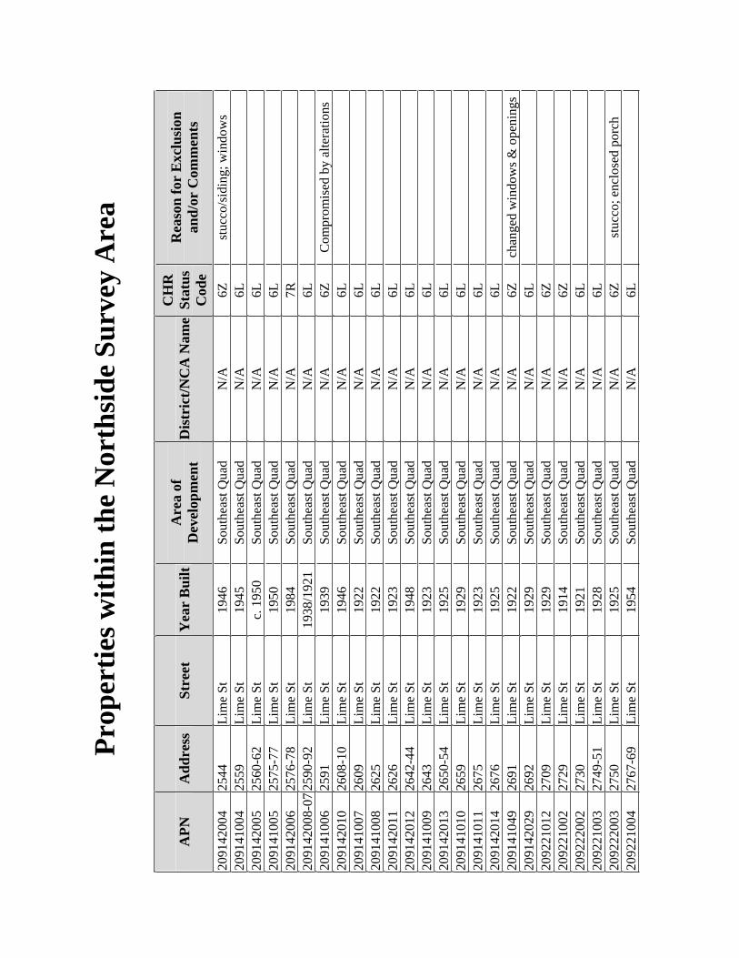
Prop
ertie
s with
in th
e N
orth
side
Sur
vey
Are
a
APN
Add
ress
Stre
etY
ear
Bui
ltA
rea
of
Dev
elop
men
tD
istr
ict/N
CA
Nam
eC
HR
Stat
usC
ode
Rea
son
for
Exc
lusi
onan
d/or
Com
men
ts
2091
4200
425
44Li
me
St
1946
Sout
heas
t Qua
d N
/A6Z
stuc
co/s
idin
g; w
indo
ws
2091
4100
425
59Li
me
St
1945
Sout
heas
t Qua
d N
/A6L
2091
4200
525
60-6
2Li
me
St
c. 1
950
Sout
heas
t Qua
d N
/A6L
2091
4100
525
75-7
7Li
me
St
1950
Sout
heas
t Qua
d N
/A6L
2091
4200
625
76-7
819
84Li
me
St
Sout
heas
t Qua
d N
/A7R
2091
4200
8-07
92
Sout
heas
t Qua
d 25
90-
Lim
e St
19
38/1
921
N/A
6L20
9141
006
2591
Lim
e St
19
39So
uthe
ast Q
uad
N/A
6ZC
ompr
omis
ed b
y al
tera
tions
20
9142
010
2608
-10
Lim
e St
19
46So
uthe
ast Q
uad
N/A
6L20
9141
007
2609
Lim
e St
19
22So
uthe
ast Q
uad
N/A
6L20
9141
008
2625
Lim
e St
19
22So
uthe
ast Q
uad
N/A
6L20
9142
011
2626
Lim
e St
19
23So
uthe
ast Q
uad
N/A
6L20
9142
012
2642
-44
Lim
e St
19
48So
uthe
ast Q
uad
N/A
6L20
9141
009
2643
Lim
e St
19
23So
uthe
ast Q
uad
N/A
6L20
9142
013
2650
-54
Sout
heas
t Qua
d Li
me
St
1925
N/A
6L20
9141
010
2659
Lim
e St
19
29So
uthe
ast Q
uad
N/A
6L20
9141
011
2675
Lim
e St
19
23So
uthe
ast Q
uad
N/A
6L20
9142
014
2676
Lim
e St
19
25So
uthe
ast Q
uad
N/A
6L20
9141
049
2691
Lim
e St
19
22So
uthe
ast Q
uad
N/A
6Zch
ange
d w
indo
ws &
ope
ning
s20
9142
029
2692
Lim
e St
19
29So
uthe
ast Q
uad
N/A
6L20
9221
012
2709
Lim
e St
19
29So
uthe
ast Q
uad
N/A
6Z20
9221
002
2729
Lim
e St
19
14So
uthe
ast Q
uad
N/A
6Z20
9222
002
2730
Lim
e St
19
21So
uthe
ast Q
uad
N/A
6L20
9221
003
2749
-51
Lim
e St
19
28So
uthe
ast Q
uad
N/A
6L20
9222
003
2750
Lim
e St
19
25So
uthe
ast Q
uad
N/A
6Zst
ucco
; enc
lose
d po
rch
2092
2100
427
67-6
9So
uthe
ast Q
uad
Lim
e St
19
54N
/A6L
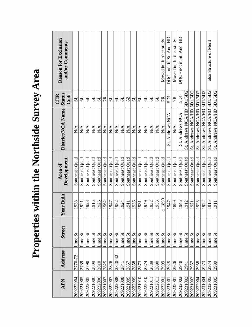
Prop
ertie
s with
in th
e N
orth
side
Sur
vey
Are
a
APN
Add
ress
Stre
etY
ear
Bui
ltA
rea
of
Dev
elop
men
tD
istr
ict/N
CA
Nam
eC
HR
Stat
usC
ode
Rea
son
for
Exc
lusi
onan
d/or
Com
men
ts
2092
2200
427
70-7
219
38Li
me
St
Sout
heas
t Qua
d N
/A6L
2092
2100
527
89Li
me
St
1921
Sout
heas
t Qua
d N
/A6L
2092
2200
527
90Li
me
St
1923
Sout
heas
t Qua
d N
/A6L
2092
2100
628
09Li
me
St
1915
Sout
heas
t Qua
d N
/A6L
2092
2200
628
10Li
me
St
1926
Sout
heas
t Qua
d N
/A6L
2092
2100
728
25Li
me
St
1962
Sout
heas
t Qua
d N
/A7R
2092
2200
728
26Li
me
St
1947
Sout
heas
t Qua
d N
/A6L
2092
2200
828
40-4
2Li
me
St
1952
Sout
heas
t Qua
d N
/A6L
2092
2100
828
41Li
me
St
1924
Sout
heas
t Qua
d N
/A6L
2092
2100
928
57Li
me
St
1911
Sout
heas
t Qua
d N
/A6Z
2092
2200
928
58Li
me
St
1936
Sout
heas
t Qua
d N
/A6L
2092
2101
028
73Li
me
St
1931
Sout
heas
t Qua
d N
/A6L
2092
2201
028
74Li
me
St
1949
Sout
heas
t Qua
d N
/A6L
2092
2101
128
89Li
me
St
1932
Sout
heas
t Qua
d N
/A6L
2092
2201
128
90Li
me
St
1953
Sout
heas
t Qua
d N
/A6L
2092
3200
129
09Li
me
St
c. 1
890
Sout
heas
t Qua
d N
/A7R
Mov
ed in
; fur
ther
stud
y20
9231
001
2925
Lim
e St
19
47So
uthe
ast Q
uad
St. A
ndre
ws N
CA
5D
1D
OC
- no
t in
St. A
nd. H
D
2092
3200
129
26Li
me
St
1899
Sout
heas
t Qua
d N
/A7R
Mov
ed in
; fur
ther
stud
y 20
9232
002
2940
Lim
e St
19
46So
uthe
ast Q
uad
St. A
ndre
ws N
CA
5D
1D
OC
- no
t in
St. A
nd. H
D
2092
3100
229
41Li
me
St
1912
Sout
heas
t Qua
d St
. And
rew
s NC
A/H
D5D
1/5D
220
9231
003
2957
Lim
e St
19
21So
uthe
ast Q
uad
St. A
ndre
ws N
CA
/HD
5D1/
5D2
2092
3200
429
58Li
me
St
1923
Sout
heas
t Qua
d St
. And
rew
s NC
A/H
D5D
1/5D
220
9231
004
2973
Lim
e St
19
22So
uthe
ast Q
uad
St. A
ndre
ws N
CA
/HD
5D1/
5D2
2092
3200
529
74Li
me
St
1915
Sout
heas
t Qua
d St
. And
rew
s NC
A/H
D5D
1/5D
2al
so S
truct
ure
of M
erit
2092
3100
529
89Li
me
St
1911
Sout
heas
t Qua
d St
. And
rew
s NC
A/H
D5D
1/5D
2
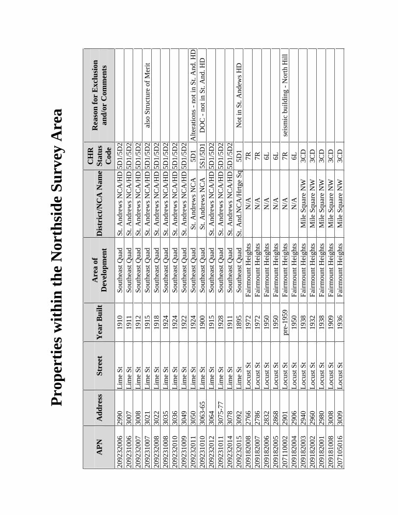
Prop
ertie
s with
in th
e N
orth
side
Sur
vey
Are
a
APN
Add
ress
Stre
etY
ear
Bui
ltA
rea
of
Dev
elop
men
tD
istr
ict/N
CA
Nam
eC
HR
Stat
usC
ode
Rea
son
for
Exc
lusi
onan
d/or
Com
men
ts
2092
3200
629
90Li
me
St
1910
Sout
heas
t Qua
d St
. And
rew
s NC
A/H
D5D
1/5D
220
9231
006
3007
Lim
e St
19
11So
uthe
ast Q
uad
St. A
ndre
ws N
CA
/HD
5D1/
5D2
2092
3200
730
08Li
me
St
1912
Sout
heas
t Qua
d St
. And
rew
s NC
A/H
D5D
1/5D
220
9231
007
3021
Lim
e St
19
15So
uthe
ast Q
uad
St. A
ndre
ws N
CA
/HD
5D1/
5D2
also
Stru
ctur
e of
Mer
it 20
9232
008
3022
Lim
e St
19
18So
uthe
ast Q
uad
St. A
ndre
ws N
CA
/HD
5D1/
5D2
2092
3100
830
35Li
me
St
1924
Sout
heas
t Qua
d St
. And
rew
s NC
A/H
D5D
1/5D
220
9232
010
3036
Lim
e St
19
24So
uthe
ast Q
uad
St. A
ndre
ws N
CA
/HD
5D1/
5D2
2092
3100
930
49Li
me
St
1922
Sout
heas
t Qua
d St
. And
rew
s NC
A/H
D5D
1/5D
220
9232
011
3050
Lim
e St
19
24So
uthe
ast Q
uad
St. A
ndre
ws N
CA
5D
1A
ltera
tions
- no
t in
St. A
nd. H
D20
9231
010
3063
-65
Lim
e St
19
00So
uthe
ast Q
uad
St. A
ndre
ws N
CA
5S
1/5D
1D
OC
- no
t in
St. A
nd. H
D
2092
3201
230
64Li
me
St
1915
Sout
heas
t Qua
d St
. And
rew
s NC
A/H
D5D
1/5D
220
9231
011
3075
-77
Lim
e St
19
28So
uthe
ast Q
uad
St. A
ndre
ws N
CA
/HD
5D1/
5D2
2092
3201
430
78Li
me
St
1911
Sout
heas
t Qua
d St
. And
rew
s NC
A/H
D5D
1/5D
220
9232
015
3092
Lim
e St
18
95So
uthe
ast Q
uad
St. A
nd.N
CA
/Hrtg
e Sq
5D1
Not
in S
t. A
ndew
s HD
20
9182
008
2766
Locu
st S
t 19
72Fa
irmou
nt H
eigh
ts
N/A
7R20
9182
007
2786
Locu
st S
t 19
72Fa
irmou
nt H
eigh
ts
N/A
7R20
9182
006
2832
Locu
st S
t 19
50
Fairm
ount
Hei
ghts
N
/A6L
2091
8200
528
68Lo
cust
St
1950
Fa
irmou
nt H
eigh
ts
N/A
6L20
7110
002
2901
Locu
st S
t pr
e-19
59
Fairm
ount
Hei
ghts
se
ism
ic b
uild
ing
- Nor
th H
ill
N/A
7R20
9182
004
2906
Locu
st S
t 19
50
Fairm
ount
Hei
ghts
N
/A6L
2091
8200
329
40Lo
cust
St
1938
Fairm
ount
Hei
ghts
Mile
Squ
are
NW
3C
D20
9182
002
2960
Locu
st S
t 19
32Fa
irmou
nt H
eigh
tsM
ile S
quar
e N
W
3CD
2091
8200
129
80Lo
cust
St
1938
Fairm
ount
Hei
ghts
M
ile S
quar
e N
W
3CD
2091
8100
830
08Lo
cust
St
1909
Fairm
ount
Hei
ghts
Mile
Squ
are
NW
3C
D20
7105
016
3009
Locu
st S
t 19
36Fa
irmou
nt H
eigh
tsM
ile S
quar
e N
W
3CD
Prop
ertie
s with
in th
e N
orth
side
Sur
vey
Are
a
APN
Add
ress
Stre
etY
ear
Bui
ltA
rea
of
Dev
elop
men
tD
istr
ict/N
CA
Nam
eC
HR
Stat
usC
ode
Rea
son
for
Exc
lusi
onan
d/or
Com
men
ts
2091
8100
730
20Lo
cust
St
1913
Fairm
ount
Hei
ghts
Mile
Squ
are
NW
3C
D20
7105
015
3021
Locu
st S
t 19
36Fa
irmou
nt H
eigh
tsM
ile S
quar
e N
W
3CD
2091
8100
630
32Lo
cust
St
1913
Fairm
ount
Hei
ghts
M
ile S
quar
e N
W
3CD
2071
0501
430
33Lo
cust
St
1924
Fa
tsirm
ount
Hei
ghM
ile S
quar
e N
W
3CD
2091
8100
530
44Lo
cust
St
1912
Fats
irmou
nt H
eigh
Mile
Squ
are
NW
3C
D20
7105
013
3045
Locu
st S
t 19
10Fa
tsirm
ount
Hei
ghM
ile S
quar
e N
W
3CD
2091
8100
430
56Lo
cust
St
1906
Fats
irmou
nt H
eigh
Mile
Squ
are
NW
3C
D20
7105
012
3057
Locu
st S
t 19
13Fa
irmou
nt H
eigh
ts
Mile
Squ
are
NW
3C
D20
9181
003
3068
Locu
st S
t 19
10Fa
irmou
nt H
eigh
ts
Mile
Squ
are
NW
3C
D20
7105
011
3069
Locu
st S
t 19
48Fa
tsirm
ount
Hei
ghM
ile S
quar
e N
W
6LD
ate
of C
onst
ruct
ion
2091
8100
230
80Lo
cust
St
1946
Fats
irmou
nt H
eigh
Mile
Squ
are
NW
6Z
DO
C; e
nclo
sed
porc
h, st
ucco
20
7105
010
3081
Locu
st S
t 19
24Fa
irmou
nt H
eigh
tsM
ile S
quar
e N
W
3CD
2091
8100
130
92Lo
cust
St
1910
Com
prom
i a
ltera
tions
Fa
irmou
nt H
eigh
ts
Mile
Squ
are
NW
6L
sed
by20
7105
009
3093
Locu
st S
t 19
15Fa
irmou
nt H
eigh
ts
Mile
Squ
are
NW
3C
D20
9031
003
1703
Mai
n St
po
st-1
959
Nor
th o
f SR
-60
N/A
6L20
9033
048
1710
Mai
n St
pr
e-19
59N
orth
of S
R-6
0 N
/A6L
2090
3100
417
35M
ain
St
1916
Nor
th o
f SR
-60
N/A
6Z20
9031
013
1749
Mai
n St
po
st-1
959
Nor
th o
f SR
-60
N/A
7Rfa
çade
, win
dow
s, ba
lcon
y20
9033
008
1758
Mai
n St
19
26N
orth
of S
R-6
0 N
/A6Z
ordi
nary
xam
ple
e20
9031
006
1763
Mai
n St
19
45N
orth
of S
R-6
0 N
/A6Z
ordi
nary
xam
ple
e20
9033
007
1768
Mai
n St
19
46N
orth
of S
R-6
0 N
/A6L
2090
3100
717
77M
ain
St
1941
Nor
th o
f SR
-60
N/A
6Zor
dina
ryxa
mpl
e e
2090
3100
817
91M
ain
St
c. 1
935
Nor
th o
f SR
-60
N/A
6Lpr
imar
y re
side
nce
2090
3100
817
91M
ain
St
1947
Nor
th o
f SR
-60
N/A
6Lse
cond
ary
resi
denc
e 20
9033
005
1798
Mai
n St
19
29N
orth
of S
R-6
0 N
/A6Z
porc
h/fa
çade
alte
ratio
ns
Prop
ertie
s with
in th
e N
orth
side
Sur
vey
Are
a
APN
Add
ress
Stre
etY
ear
Bui
ltA
rea
of
Dev
elop
men
tD
istr
ict/N
CA
Nam
eC
HR
Stat
usC
ode
Rea
son
for
Exc
lusi
onan
d/or
Com
men
ts
2090
3300
418
04M
ain
St
1943
Nor
th o
f SR
-60
N/A
6ZEn
cl. p
orch
, stu
cco
2090
3201
118
07M
ain
St
1925
Nor
th o
f SR
-60
N/A
6L20
9033
003
1816
Mai
n St
19
12N
orth
of S
R-6
0 N
/A6L
2090
3201
018
21M
ain
St
1921
Nor
th o
f SR
-60
N/A
6L20
9033
002
1826
Mai
n St
c.
1910
Nor
th o
f SR
-60
N/A
6Zm
oved
in (3
880
1st S
t); a
ltere
d20
9032
009
1833
Mai
n St
19
24N
orth
of S
R-6
0 N
/A6L
2090
3300
118
38M
ain
St
1925
Nor
th o
f SR
-60
N/A
6Zst
ucco
; win
dow
s 20
9032
008
1845
Mai
n St
19
47N
orth
of S
R-6
0 N
/A6L
2090
3201
218
57M
ain
St
1923
Nor
th o
f SR
-60
N/A
6L20
9051
001
1871
Mai
n St
19
40N
orth
of S
R-6
0 N
/A6L
2090
5100
218
83M
ain
St
1951
Nor
th o
f SR
-60
N/A
6L20
9051
003
1895
Mai
n St
19
49N
orth
of S
R-6
0 N
/A6L
2090
5201
019
09M
ain
St
1920
Nor
th o
f SR
-60
N/A
6L20
9052
011
1925
Mai
n St
19
57N
orth
of S
R-6
0 N
/A6L
2090
5201
219
43M
ain
St
1922
Nor
th o
f SR
-60
N/A
6L20
9052
013
1959
Mai
n St
19
25N
orth
of S
R-6
0 N
/A6L
2090
5400
219
90M
ain
St
c. 1
925
Nor
th o
f SR
-60
N/A
6L20
9052
015
1991
Mai
n St
19
22N
orth
of S
R-6
0 N
/A6L
2090
5301
420
17M
ain
St
1922
Nor
th o
f SR
-60
N/A
6L20
9054
003
2018
Mai
n St
19
63N
orth
of S
R-6
0 N
/A7R
2090
9200
1 22
22M
aor
2190
- M
ain
St
pre-
1959
inSt
Indu
stria
l CN
/A
7R20
9091
029
2221
Mai
n St
c.
200
0 M
ain
St In
dust
rial C
orN
/A
7R20
9092
013
78
Ma
or22
50-
Mai
n St
pr
e-19
59in
St In
dust
rial C
N/A
7R
2090
9101
222
93M
ain
St
1956
Mai
n St
Indu
stria
l Cor
N/A
7R
Fire
Sta
tion
No.
6
2091
1401
223
05-0
9M
aor
Mai
n St
c.
192
5 in
St In
dust
rial C
N/A
7R

Prop
ertie
s with
in th
e N
orth
side
Sur
vey
Are
a
APN
Add
ress
Stre
etY
ear
Bui
ltA
rea
of
Dev
elop
men
tD
istr
ict/N
CA
Nam
eC
HR
Stat
usC
ode
Rea
son
for
Exc
lusi
onan
d/or
Com
men
ts
2091
1500
3
Ma
or23
50M
ain
St
pre-
1950
inSt
Indu
stria
l CN
/A
7R20
9114
009-
11M
aor
2359
M
ain
St
pre-
1950
in S
t Ind
ustri
al C
N/A
7R
2091
1500
423
60M
ain
St
1909
Mai
n St
Indu
stria
l Cor
N/A
7R
2091
1501
3
Ma
or23
76M
ain
St
post
-195
9in
St In
dust
rial C
N/A
7R
2091
1400
823
91M
ain
St
c. 1
925
Mai
n St
Indu
stria
l Cor
N/A
7R
2091
1301
0
Ma
or24
09M
ain
St
pre-
1959
inSt
Indu
stria
l CN
/A
7R20
9113
010
2435
Mai
n St
19
47-1
954
Ma
orin
St I
ndus
trial
CN
/A
7R20
9116
004
68
Ma
or24
66-
Mai
n St
pr
e-19
59in
St In
dust
rial C
N/A
7R
2091
1301
1
Ma
or24
75M
ain
St
post
-195
9in
St In
dust
rial C
N/A
7R
2091
1300
5
Ma
or24
91M
ain
St
pre-
1959
inSt
Indu
stria
l CN
/A
7R20
9151
006
M
aor
2509
Mai
n St
pr
e-19
59in
St In
dust
rial C
N/A
7R
2091
5200
1 42
c.
Ma
or25
10-
Mai
n St
1
952-
1959
in S
t Ind
ustri
al C
N/A
7R
2091
5100
425
23-2
5M
aor
Mai
n St
19
29in
St I
ndus
trial
CN
/A
7R20
9151
007
M
aor
2545
Mai
n St
pr
e-19
59in
St In
dust
rial C
N/A
7R
2091
5200
3
Ma
or25
54M
ain
St
pre-
1959
inSt
Indu
stria
l CN
/A
7R20
9151
008-
9 75
M
aor
2559
-M
ain
St
1977
inSt
Indu
stria
l CN
/A
7R20
9152
004
74
Ma
or25
70-
Mai
n St
c.
1952
inSt
Indu
stria
l CN
/A
7R20
9152
004
2574
Mai
n St
c.
188
0 M
ain
St In
dust
rial C
orN
/A
7Rse
para
te re
side
nce
2091
5101
0 89
M
aor
2581
-M
ain
St
1900
/195
2in
St In
dust
rial C
N/A
7R
2091
5200
5
Ma
or25
86M
ain
St
post
-195
9in
St In
dust
rial C
N/A
7R
2091
5101
126
09M
ain
St
c. 1
930
Mai
n St
Indu
stria
l Cor
N/A
7R
2091
5200
726
22M
ain
St
c. 1
920
Mai
n St
Indu
stria
l Cor
N/A
7R
2091
5101
2 33
M
aor
2629
-M
ain
St
pre-
1959
inSt
Indu
stria
l CN
/A
7R20
9151
013
2645
Mai
n St
19
23M
ain
St In
dust
rial C
orN
/A
7R20
9152
008
2650
Mai
n St
b.
195
2 M
ain
St In
dust
rial C
orN
/A
7R
Prop
ertie
s with
in th
e N
orth
side
Sur
vey
Are
a
APN
Add
ress
Stre
etY
ear
Bui
ltA
rea
of
Dev
elop
men
tD
istr
ict/N
CA
Nam
eC
HR
Stat
usC
ode
Rea
son
for
Exc
lusi
onan
d/or
Com
men
ts
2091
5101
426
55-6
5M
ain
St In
dust
rial C
orM
ain
St
1928
N/A
7R
2091
5101
4/16
94
Mai
n 2
655-
Mai
n St
b.
195
2 S
t Ind
ustri
al C
orN
/A
7R20
9152
009
2664
Mai
n St
19
24M
ain
St In
dust
rial C
orN
/A
7R20
9151
015
2677
Mai
n St
b.
195
2 M
ain
St In
dust
rial C
orN
/A
7R20
9152
011
M
ain
2678
Mai
n St
pr
e-19
59St
Indu
stria
l Cor
N/A
7R
2901
5101
626
91M
ain
St
b. 1
952
Mai
n St
Indu
stria
l Cor
N/A
7R
2091
5201
226
92M
ain
St
b. 1
952
Mai
n St
Indu
stria
l Cor
N/A
7R
2092
7000
927
06M
ain
St
1954
Mai
n St
Indu
stria
l Cor
N/A
7R
2092
7000
127
27M
ain
St
c. 1
950s
M
aor
inSt
Indu
stria
l CN
/A
7R20
9270
012
M
aor
2742
Mai
n St
pr
e-19
59in
St In
dust
rial C
N/A
7R
2092
7001
327
58M
ain
St
1923
Mai
n St
Indu
stria
l Cor
N/A
7R
2092
7001
427
74M
ain
St
1923
Mai
n St
Indu
stria
l Cor
N/A
7R
2092
7000
227
75-7
7M
aor
Mai
n St
19
47in
St I
ndus
trial
CN
/A
7R20
9270
015
2804
Mai
n St
19
2M
ain
St In
dust
rial C
orN
/A
7R20
9270
004-
5M
aor
2805
Mai
n St
19
27in
St I
ndus
trial
CN
/A
7R20
9270
017
2822
Mai
n St
19
26M
ain
St In
dust
rial C
orN
/A
7R20
9270
006
2867
Mai
n St
19
46M
ain
St In
dust
rial C
orN
/A
7Rak
a 28
10 M
arke
t Stre
et
2092
7002
028
78-9
6M
aor
Mai
n St
c.
194
0s
in S
t Ind
ustri
al C
N/A
7R
2092
7000
728
79M
ain
St
1923
Mai
n St
Indu
stria
l Cor
N/A
5S
1/7R
Tron
cin
Doo
r and
Win
dow
20
9101
001
2450
Mar
ket S
t 19
67Fi
le's
Isla
nd
N/A
7R20
9151
004
2656
Mar
ket S
t 19
29M
aor
One
lot;
frm
ly 2
525
Mai
n St
reet
in S
t Ind
ustri
al C
N/A
7R
2091
5100
426
76M
arke
t St
1929
Ma
ort
in S
t Ind
ustri
al C
N/A
7R
One
lot;
frm
ly 2
525
Mai
n St
ree
2091
5100
426
82M
arke
t St
1929
Ma
orin
St I
ndus
trial
CN
/A
7RO
ne lo
t; fr
mly
252
5 M
ain
Stre
et20
9270
006
2810
Mar
ket S
t b.
195
2 M
aor
inSt
Indu
stria
l CN
/A
7R20
9172
016
2869
Mar
ket S
t 19
23Fa
irmou
nt H
eigh
tsN
/A6L
Prop
ertie
s with
in th
e N
orth
side
Sur
vey
Are
a
APN
Add
ress
Stre
etY
ear
Bui
ltA
rea
of
Dev
elop
men
tD
istr
ict/N
CA
Nam
eC
HR
Stat
usC
ode
Rea
son
for
Exc
lusi
onan
d/or
Com
men
ts
2091
9300
129
09M
arke
t St
1900
FC
ompr
omi
alte
ratio
ns
airm
ount
Hei
ghts
N/A
6Zse
d by
2091
9301
429
57M
arke
t St
1951
Fairm
ount
Hei
ghts
N/A
6L20
9193
005
2975
Mar
ket S
t c.
195
0s
Fairm
ount
Hei
ghts
N/A
6L20
9194
007
3071
Mar
ket S
t N
/AF
dem
olis
hed
durin
g su
rvey
ai
rmou
nt H
eigh
tsN
/A7R
2091
3000
623
50M
ulbe
rry
St19
56So
uthe
ast Q
uad
N/A
6L20
9122
012
2415
Mul
berr
y St
1929
Sout
heas
t Qua
d N
/A6L
2091
3000
224
50M
ulbe
rry
St19
64So
uthe
ast Q
uad
N/A
7R20
9122
013
2465
Mul
berr
y St
1938
Sout
heas
t Qua
d N
/A6Z
chan
ged
win
dow
s & o
peni
ngs
2091
2204
624
75M
ulbe
rry
St19
39So
uthe
ast Q
uad
N/A
6Zch
ange
d w
indo
ws &
ope
ning
s20
9142
009
2509
Mul
berr
y St
1937
Sout
heas
t Qua
d N
/A6L
2091
3000
325
24M
ulbe
rry
St19
55So
uthe
ast Q
uad
N/A
7RC
A D
ept.
of F
ores
try20
9142
027
2525
Mul
berr
y St
1955
Sout
heas
t Qua
d N
/A6L
2091
4202
625
43M
ulbe
rry
St
1929
Sout
heas
t Qua
d N
/A6L
2091
4202
525
59M
ulbe
rry
St
1937
Sout
heas
t Qua
d N
/A6L
2091
4202
425
75M
ulbe
rry
St
1938
Sout
heas
t Qua
d N
/A6L
2091
4202
325
91M
ulbe
rry
St
1949
Sout
heas
t Qua
d N
/A6L
2091
4202
226
09M
ulbe
rry
St
1949
Sout
heas
t Qua
d N
/A6L
2091
4202
126
25M
ulbe
rry
St
1936
Sout
heas
t Qua
d N
/A6L
2091
3000
426
26M
ulbe
rry
St
1974
Sout
heas
t Qua
d N
/A7R
2091
4202
026
43M
ulbe
rry
St
1948
Sout
heas
t Qua
d N
/A6L
2091
4201
926
59M
ulbe
rry
St
1924
Sout
heas
t Qua
d N
/A6Z
faça
de a
ltera
tion
2091
4201
826
75M
ulbe
rry
St
1924
Sout
heas
t Qua
d N
/A6Z
stuc
co; c
hang
ed w
indo
ws
2091
4203
026
91M
ulbe
rry
St
1927
Sout
heas
t Qua
d N
/A6Z
ordi
nary
xam
ple
e20
9142
030
2691
Mul
berr
y St
c.
192
0 So
uthe
ast Q
uad
N/A
6Lin
rear
; aka
333
7 Po
plar
St.
2092
2202
127
09M
ulbe
rry
St
1925
Sout
heas
t Qua
d N
/A6L
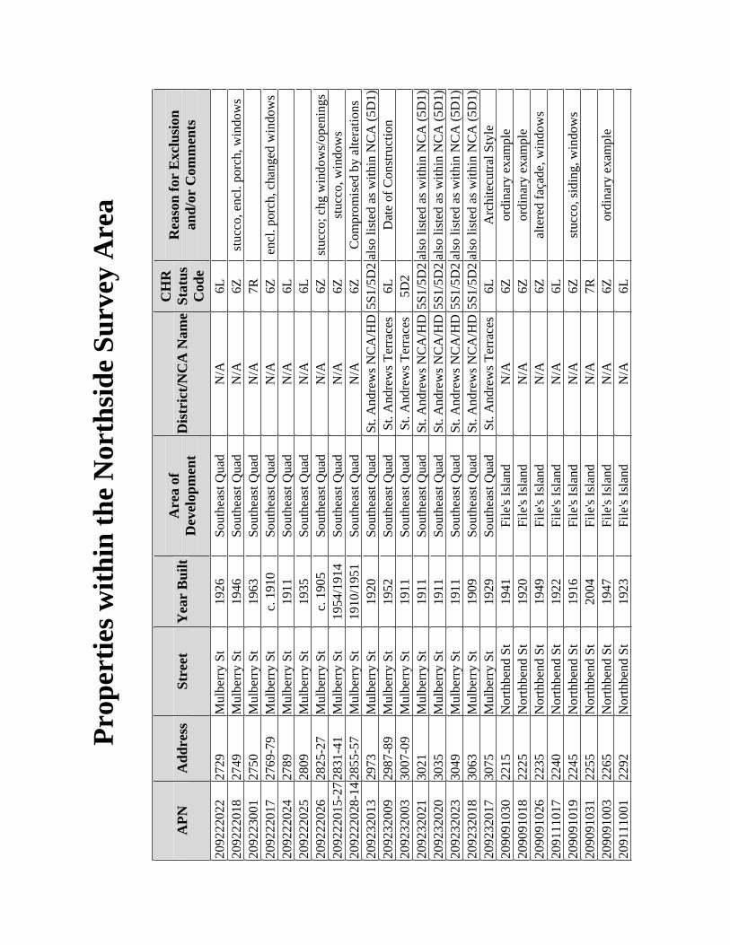
Prop
ertie
s with
in th
e N
orth
side
Sur
vey
Are
a
APN
Add
ress
Stre
etY
ear
Bui
ltA
rea
of
Dev
elop
men
tD
istr
ict/N
CA
Nam
eC
HR
Stat
usC
ode
Rea
son
for
Exc
lusi
onan
d/or
Com
men
ts
2092
2202
227
29M
ulbe
rry
St
1926
Sout
heas
t Qua
d N
/A6L
2092
2201
827
49M
ulbe
rry
St
1946
Sout
heas
t Qua
d N
/A6Z
stuc
co, e
ncl.
porc
h, w
indo
ws
2092
2300
127
50M
ulbe
rry
St
1963
Sout
heas
t Qua
d N
/A7R
2092
2201
727
69-7
9M
ulbe
rry
St
c. 1
910
Sout
heas
t Qua
d N
/A6Z
encl
. por
ch, c
hang
ed w
indo
ws
2092
2202
427
89M
ulbe
rry
St19
11So
uthe
ast Q
uad
N/A
6L20
9222
025
2809
Mul
berr
y St
19
35So
uthe
ast Q
uad
N/A
6L20
9222
026
2825
-27
Mul
berr
y St
c.
190
5 So
uthe
ast Q
uad
N/A
6Zst
ucco
; chg
win
dow
s/op
enin
gs20
9222
015-
27M
ulbe
rry
St
2831
-41
1954
/191
4So
uthe
ast Q
uad
N/A
6Zst
ucco
, win
dow
s 20
9222
028-
14 28
55-5
7 M
ulbe
rry
St
Com
prom
i a
ltera
tions
19
10/1
951
Sout
heas
t Qua
d N
/A6Z
sed
by20
9232
013
2973
M
ulbe
rry
St
1920
Sout
heas
t Qua
d St
. And
rew
s NC
A/H
D5S
1/5D
2al
so li
sted
as w
ithin
NC
A (5
D1)
2092
3200
929
87-8
9 M
ulbe
rry
St
1952
Sout
heas
t Qua
d St
. And
rew
s Ter
race
s6L
Dat
e of
Con
stru
ctio
n 20
9232
003
3007
-09
Mul
berr
y St
19
11So
uthe
ast Q
uad
St. A
ndre
ws T
erra
ces
5D2
2092
3202
130
21M
ulbe
rry
St
lso
liste
d as
wih
in N
CA
(5D
1)19
11So
uthe
ast Q
uad
St. A
ndre
ws N
CA
/HD
5S1/
5D2
at
2092
3202
030
35M
ulbe
rry
St
1911
Sout
heas
t Qua
d St
. And
rew
s NC
A/H
D5S
1/5D
2al
so li
sted
as w
ithin
NC
A (5
D1)
2092
3202
330
49M
ulbe
rry
St
1911
Sout
heas
t Qua
d St
. And
rew
s NC
A/H
D5S
1/5D
2al
so li
sted
as w
ihin
NC
A (5
D1)
t20
9232
018
3063
Mul
berr
y St
19
09So
uthe
ast Q
uad
St. A
ndre
ws N
CA
/HD
5S1/
5D2
also
list
ed a
s with
in N
CA
(5D
1)20
9232
017
3075
Mul
berr
y St
19
29So
uthe
ast Q
uad
St. A
ndre
ws T
erra
ces
6LA
rchi
tecu
tral S
tyle
20
9091
030
2215
N
orth
bend
St
19
41Fi
le's
Isla
ndN
/A6Z
ordi
nary
exa
mpl
e 20
9091
018
2225
Nor
thbe
ndSt
19
20
File
's Is
land
N/A
6Zor
dina
ry e
xam
ple
2090
9102
622
35
Nor
thbe
nd S
t
1949
File
's Is
land
N/A
6Zal
tere
d fa
çade
, win
dow
s 20
9111
017
2240
t
Nor
thbe
ndS
1922
File
's Is
land
N/A
6L20
9091
019
2245
N
orth
bend
St
1916
Fi
le's
Isla
nd
st
ucco
, sid
ing,
win
dow
s N
/A6Z
2090
9103
1 22
55
Nor
thbe
nd
St
20
04
File
's Is
land
N/A
7R20
9091
003
2265
Nor
thbe
nd
or
dina
ry e
xam
ple
St
1947
Fi
le's
Isla
ndN
/A6Z
2091
1100
1 22
92
Nor
thbe
nd
St
1923
Fi
le's
Isla
ndN
/A6L
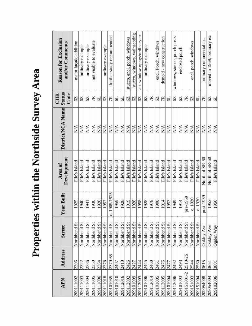
Prop
ertie
s with
in th
e N
orth
side
Sur
vey
Are
a
APN
Add
ress
Stre
etY
ear
Bui
ltA
rea
of
Dev
elop
men
tD
istr
ict/N
CA
Nam
eC
HR
Stat
usC
ode
Rea
son
for
Exc
lusi
onan
d/or
Com
men
ts
2091
1100
2 23
06
t
m
ajor
faça
de a
dditi
on
Nor
thbe
ndS
1925
File
's Is
land
N/A
6Z20
9111
003
2322
t
ordi
nary
xam
ple
Nor
thbe
ndS
1940
File
's Is
land
N/A
6Z e
2091
1100
423
36
Nor
thbe
nd S
t 19
41
File
's Is
land
N
/A
6Z
ordi
nary
exa
mpl
e 20
9111
005
2350
N
orth
bend
St
1930
Fi
le's
Isla
nd
N/A
7R
no
t vis
ible
to e
valu
ate
2091
1100
6 23
64
Nor
thbe
nd S
t 19
26
File
's Is
land
N
/A
6L
2091
1101
8 23
78
Nor
thbe
nd S
t 19
57
File
's Is
land
N
/A
6Z
ordi
nary
exa
mpl
e 20
9101
035
2379
-65
Nor
thbe
nd S
t c.
190
5/19
25Fi
le's
Isla
nd
N/A
7R
fu
rther
stud
y re
com
men
ded
2091
0101
0 24
07
Nor
thbe
nd S
t 19
59
File
's Is
land
N
/A
6L
2091
1201
6 24
10
Nor
thbe
nd S
t 19
28
File
's Is
land
N
/A
6L
2091
1200
2 24
26
Nor
thbe
nd S
t 19
19
File
's Is
land
N
/A
6Z
stuc
co, e
ncl.
porc
h, w
indo
ws
2091
0100
9 24
27
Nor
thbe
nd S
t 19
28
File
's Is
land
N
/A
6Z
stuc
co, w
indo
ws,
wai
nsco
ting
2091
1200
3 24
44
Nor
thbe
nd S
t 19
58
File
's Is
land
N
/A
6Z
alt.
win
dow
opn
gs/o
rdin
ary
ex
2091
0100
6 24
45
Nor
thbe
nd S
t 19
28
File
's Is
land
N
/A
6Z
ordi
nary
exa
mpl
e 20
9112
014
2460
N
orth
bend
St
1978
Fi
le's
Isla
nd
N/A
7R
20
9101
005
2461
N
orth
bend
St
1908
Fi
le's
Isla
nd
N/A
6Z
en
cl. P
orch
, win
dow
s 20
9112
005
2476
N
orth
bend
St
1914
Fi
le's
Isla
nd
N/A
7R
de
mo'
d - n
ew c
onst
ruct
ion
2091
0100
4 24
77
Nor
thbe
nd S
t 19
53
File
's Is
land
N
/A
6L
2091
1200
6 24
92
Nor
thbe
nd S
t 19
49
File
's Is
land
N
/A
6Z
win
dow
s, st
ucco
, por
ch p
osts
20
9101
003
2493
N
orth
bend
St
1914
Fi
le's
Isla
nd
N/A
6Z
en
clos
ed p
orch
20
9151
001-
2 25
10-2
6 N
orth
bend
St
pre-
1959
Fi
le's
Isla
nd
N/A
7R
20
9151
003
2544
N
orth
bend
St
c. 1
920
File
's Is
land
N
/A
6Z
encl
. por
ch, w
indo
ws
2091
5100
4 25
60
Nor
thbe
nd S
t c.
193
0 Fi
le's
Isla
nd
N/A
6L
20
9054
008
3615
O
akle
y A
ve
post
-195
9 N
orth
of S
R-6
0 N
/A
7R
ordi
nary
com
mer
cial
ex.
20
9054
004
3651
O
akle
y A
ve
1953
N
orth
of S
R-6
0 N
/A
6Z
mov
ed in
195
9; o
rdin
ary
ex.
2091
0200
6 38
01
Ogd
en W
ay
1956
Fi
le's
Isla
nd
N/A
6L
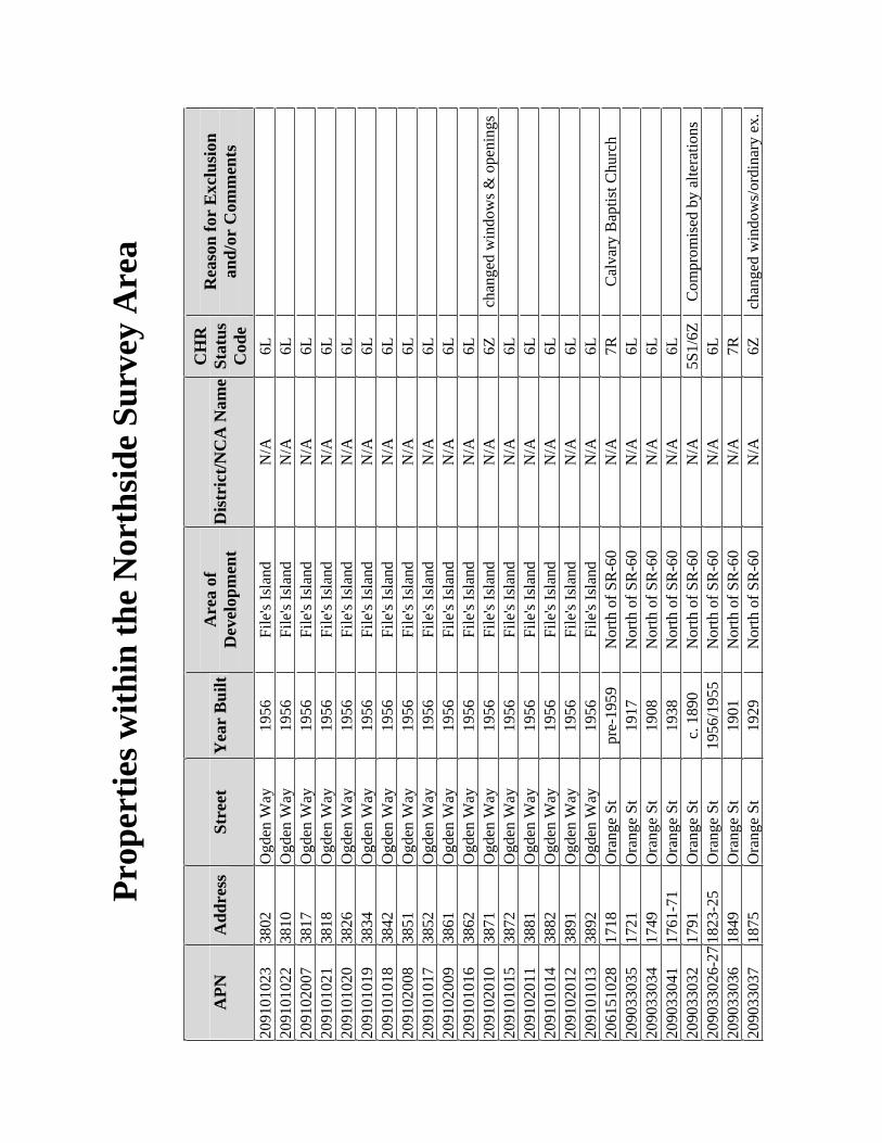
Prop
ertie
s with
in th
e N
orth
side
Sur
vey
Are
a
APN
Add
ress
Stre
etY
ear
Bui
ltA
rea
of
Dev
elop
men
tD
istr
ict/N
CA
Nam
eC
HR
Stat
usC
ode
Rea
son
for
Exc
lusi
onan
d/or
Com
men
ts
3802
Ogd
en W
ay19
56Fi
le's
Isla
nd
6LN
/A20
9101
022
3810
Ogd
en W
ay19
56Fi
le's
Isla
nd
6LN
/A20
9102
007
3817
Ogd
en W
ay19
56Fi
le's
Isla
nd
6LN
/A20
9101
021
3818
Ogd
en W
ay19
56Fi
le's
Isla
nd
6LN
/A20
9101
020
3826
Ogd
en W
ay19
56Fi
le's
Isla
nd
6LN
/A20
9101
019
3834
Ogd
en W
ay19
56Fi
le's
Isla
nd
6LN
/A20
9101
018
3842
Ogd
en W
ay19
56Fi
le's
Isla
nd
6LN
/A20
9102
008
3851
Ogd
en W
ay19
56Fi
le's
Isla
nd
6LN
/A20
9101
017
3852
Ogd
en W
ay19
56Fi
le's
Isla
nd
6LN
/A20
9102
009
3861
Ogd
en W
ay19
56Fi
le's
Isla
nd
6LN
/A20
9101
016
3862
Ogd
en W
ay19
56Fi
le's
Isla
nd
6LN
/A20
9102
010
3871
Ogd
en W
ay19
56Fi
le's
Isla
nd
6Zch
ange
d w
indo
ws &
ope
ning
sN
/A20
9101
015
3872
Ogd
en W
ay19
56Fi
le's
Isla
nd
6LN
/A20
9102
011
3881
Ogd
en W
ay19
56Fi
le's
Isla
nd
6LN
/A20
9101
014
3882
Ogd
en W
ay19
56Fi
le's
Isla
nd
6LN
/A20
9102
012
3891
Ogd
en W
ay19
56Fi
le's
Isla
nd
6LN
/A20
9101
013
3892
Ogd
en W
ay19
56Fi
le's
Isla
nd
6LN
/A20
6151
028
1718
Ora
nge
St
pre-
1959
Nor
th o
f SR
-60
7RC
alva
ry B
aptis
t Chu
rch
N/A
2090
3303
517
21O
rang
e St
19
17N
orth
of S
R-6
0 6L
N/A
2090
3303
417
49O
rang
e St
19
08N
orth
of S
R-6
0 6L
N/A
2090
3304
117
61-7
1O
rang
e St
19
38N
orth
of S
R-6
0 6L
N/A
2090
3303
217
91O
rang
e St
c.
189
0 N
orth
of S
R-6
0 5S
1/6Z
Com
prom
ised
by
alte
ratio
ns
N/A
2090
3302
6-27
1823
-25
Ora
nge
St
1956
/195
5N
orth
of S
R-6
0 N
/A6L
2090
3303
618
49O
rang
e St
19
01N
orth
of S
R-6
0 N
/A7R
2090
3303
718
75O
rang
e St
19
29N
orth
of S
R-6
0 N
/A6Z
chan
ged
win
dow
s/or
dina
ry e
x.
2091
0102
3
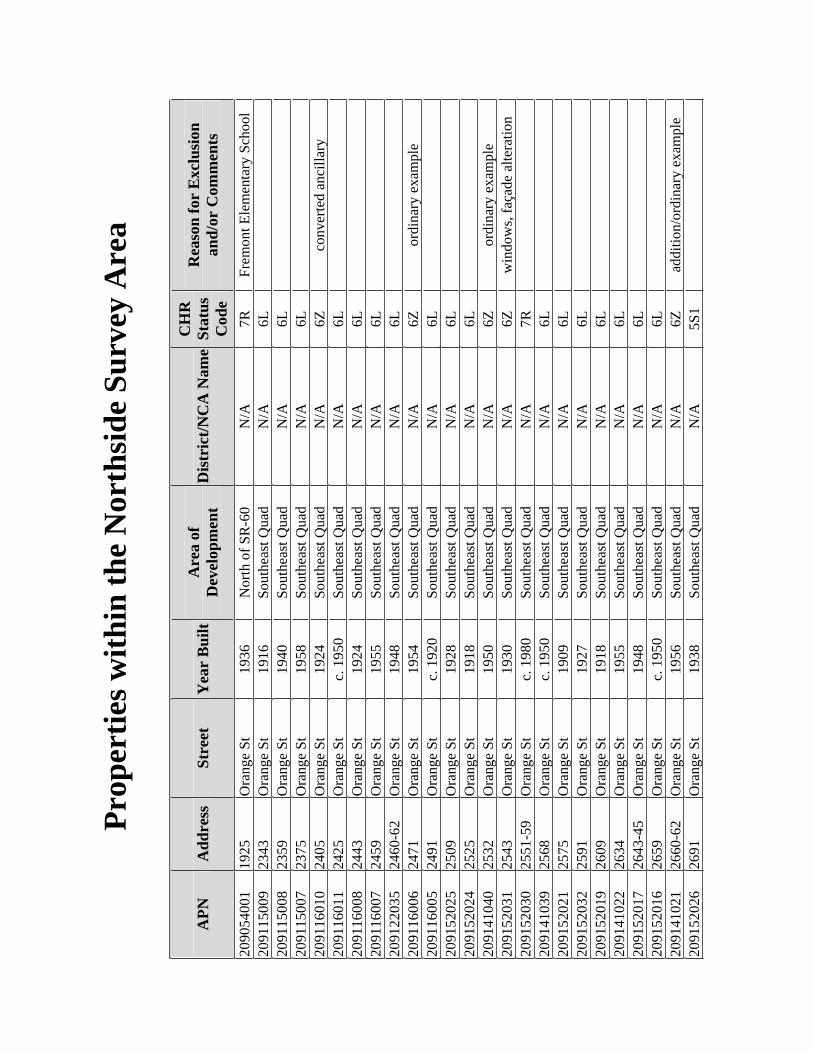
Prop
ertie
s with
in th
e N
orth
side
Sur
vey
Are
a
APN
Add
ress
Stre
etY
ear
Bui
ltA
rea
of
Dev
elop
men
tD
istr
ict/N
CA
Nam
eC
HR
Stat
usC
ode
Rea
son
for
Exc
lusi
onan
d/or
Com
men
ts
2090
5400
119
25O
rang
e St
19
36N
orth
of S
R-6
0 N
/A7R
Froo
lem
ont E
lem
enta
ry S
ch20
9115
009
2343
Ora
nge
St
1916
Sout
heas
t Qua
d N
/A6L
2091
1500
823
59O
rang
e St
19
40So
uthe
ast Q
uad
N/A
6L20
9115
007
2375
Ora
nge
St
1958
Sout
heas
t Qua
d N
/A6L
2091
1601
024
05O
rang
e St
19
24So
uthe
ast Q
uad
N/A
6Zco
nver
ted
anci
llary
2091
1601
124
25O
rang
e St
c.
195
0 So
uthe
ast Q
uad
N/A
6L20
9116
008
2443
Ora
nge
St
1924
Sout
heas
t Qua
d N
/A6L
2091
1600
724
59O
rang
e St
19
55So
uthe
ast Q
uad
N/A
6L20
9122
035
2460
-62
Ora
nge
St
1948
Sout
heas
t Qua
d N
/A6L
2091
1600
624
71O
rang
e St
or
dpl
e 19
54So
uthe
ast Q
uad
N/A
6Zin
ary
exam
2091
1600
524
91O
rang
e St
c.
192
0 So
uthe
ast Q
uad
N/A
6L20
9152
025
2509
Ora
nge
St
1928
Sout
heas
t Qua
d N
/A6L
2091
5202
425
25O
rang
e St
19
18So
uthe
ast Q
uad
N/A
6L20
9141
040
2532
O
rang
e St
or
dina
ry e
xam
ple
1950
Sout
heas
t Qua
d N
/A6Z
2091
5203
125
43O
rang
e St
19
30So
uthe
ast Q
uad
N/A
6Zw
indo
ws,
faça
de a
ltera
tion
2091
5203
025
51-5
9O
rang
e St
c.
198
0 So
uthe
ast Q
uad
N/A
7R20
9141
039
2568
Ora
nge
St
c. 1
950
Sout
heas
t Qua
d N
/A6L
2091
5202
125
75
Ora
nge
St
1909
Sout
heas
t Qua
d N
/A6L
2091
5203
225
91O
rang
e St
19
27So
uthe
ast Q
uad
N/A
6L20
9152
019
2609
Ora
nge
St
1918
Sout
heas
t Qua
d N
/A6L
2091
4102
226
34O
rang
e St
1955
Sout
heas
t Qua
d N
/A6L
2091
5201
726
43-4
5O
rang
e St
19
48So
uthe
ast Q
uad
N/A
6L20
9152
016
2659
Ora
nge
Stc.
195
0 So
uthe
ast Q
uad
N/A
6L20
9141
021
2660
-62
ple
Ora
nge
St
1956
Sout
heas
t Qua
d N
/A6Z
addi
tion/
ordi
nary
exa
m20
9152
026
2691
Ora
nge
St19
38So
uthe
ast Q
uad
N/A
5S1
Prop
ertie
s with
in th
e N
orth
side
Sur
vey
Are
a
APN
Add
ress
Stre
etY
ear
Bui
ltA
rea
of
Dev
elop
men
tD
istr
ict/N
CA
Nam
eC
HR
Stat
usC
ode
Rea
son
for
Exc
lusi
onan
d/or
Com
men
ts
2091
5203
326
75O
rang
e St
or
dina
ry e
xam
ple
c. 1
950
Sout
heas
t Qua
d N
/A6Z
2091
4102
026
82O
rang
e St
1876
Sout
heas
t Qua
d N
/A5S
120
9270
024
2709
Ora
nge
St
1899
Sout
heas
t Qua
d N
/A5S
120
9270
025
2743
Ora
nge
Stc.
189
0 So
uthe
ast Q
uad
N/A
5S1
2092
1100
727
50O
rang
e St
1893
Sout
heas
t Qua
d N
/A5S
120
9270
026
2759
Ora
nge
St19
12So
uthe
ast Q
uad
N/A
6L20
9270
027
2791
furth
er st
udy
ecom
men
ded
Ora
nge
St18
90So
uthe
ast Q
uad
N/A
7R r
2092
7003
028
49O
rang
e St
po
st-1
959
Sout
heas
t Qua
d N
/A7R
2092
1102
728
92-9
4 O
rang
e St
or
dina
ry e
xam
ple
1955
Sout
heas
t Qua
d N
/A6Z
2092
1200
229
72-7
6 O
rang
e St
c.
196
0 So
uthe
ast Q
uad
N/A
7R20
9212
003
2990
Ora
nge
St19
34So
uthe
ast Q
uad
N/A
6L20
9212
004
3008
Ora
nge
St
1929
Sout
heas
t Qua
d N
/A6Z
encl
osed
por
ch, a
ltere
d fa
çade
2092
1200
530
22O
rang
e St
19
21So
uthe
ast Q
uad
N/A
6L20
9212
006
3036
-40
Ora
nge
St
1946
Sout
heas
t Qua
d N
/A6L
2092
1200
730
50O
rang
e St
18
85So
uthe
ast Q
uad
N/A
5S1
2092
1200
830
64O
rang
e St
19
20So
uthe
ast Q
uad
N/A
6L20
9171
008
3917
Park
Vie
w T
c.
post
-195
9Fa
irmou
nt H
eigh
ts
N/A
7R20
9171
009
3918
c.Pa
rk V
iew
Tpo
st-1
959
Fairm
ount
Hei
ghts
N
/A7R
2091
7103
239
36Pa
rk V
iew
Tc.
po
st-1
959
Fairm
ount
Hei
ghts
N
/A7R
2091
7100
739
37Pa
rk V
iew
Tc.
po
st-1
959
Fairm
ount
Hei
ghts
N
/A7R
2091
7100
639
57c.
Park
Vie
w T
post
-195
9Fa
irmou
nt H
eigh
ts
N/A
7R20
9171
031
3958
Park
Vie
w T
c.
post
-195
9Fa
irmou
nt H
eigh
ts
N/A
7R20
9171
005
3977
Park
Vie
w T
c.po
st-1
959
Fairm
ount
Hei
ghts
N
/A7R
2091
7103
039
78Pa
rk V
iew
Tc.
po
st-1
959
Fairm
ount
Hei
ghts
N
/A7R
2091
7100
439
97Pa
rk V
iew
Tc.
post
-195
9Fa
irmou
nt H
eigh
ts
N/A
7R
Prop
ertie
s with
in th
e N
orth
side
Sur
vey
Are
a
APN
Add
ress
Stre
etY
ear
Bui
ltA
rea
of
Dev
elop
men
tD
istr
ict/N
CA
Nam
eC
HR
Stat
usC
ode
Rea
son
for
Exc
lusi
onan
d/or
Com
men
ts
2091
7102
939
98Pa
rk V
iew
Tc.
po
st-1
959
Fairm
ount
Hei
ghts
N
/A7R
2091
7100
340
25Pa
rk V
iew
Tc.
post
-195
9Fa
irmou
nt H
eigh
ts
N/A
7R20
9171
028
4026
Park
Vie
w T
c.
post
-195
9Fa
irmou
nt H
eigh
ts
N/A
7R20
9171
002
4055
Park
Vie
w T
c.
post
-195
9Fa
irmou
nt H
eigh
ts
N/A
7R20
9171
035
4056
Park
Vie
w T
c.po
st-1
959
Fairm
ount
Hei
ghts
N
/A7R
2091
7100
140
85Pa
rk V
iew
Tc.
po
st-1
959
Fairm
ount
Hei
ghts
N
/A7R
2091
8201
141
21Pa
rk V
iew
Tc.
post
-195
9Fa
irmou
nt H
eigh
ts
N/A
7R20
7104
001
3014
Pine
St
1931
Fairm
ount
Hei
ghts
N
orth
Hill
5S
1/3D
2071
0400
230
24Pi
ne S
t 19
50Fa
irmou
nt H
eigh
ts
Nor
th H
ill
6LD
ate
of C
onst
ruct
ion
2071
0200
830
43Pi
ne S
t 19
26Fa
irmou
nt H
eigh
ts
Nor
th H
ill
5S1/
3D20
7104
003
3058
Pine
St
1926
Fairm
ount
Hei
ghts
N
orth
Hill
6L
Arc
hite
ctur
al S
tyle
/Sca
le
2071
0400
430
74Pi
ne S
t 19
28Fa
irmou
nt H
eigh
ts
Nor
th H
ill
3Dno
des
igna
tion
in d
atab
ase
2071
0400
530
88Pi
ne S
t 19
26Fa
irmou
nt H
eigh
ts
Nor
th H
ill
5S1/
3D20
9222
020
3336
Popl
ar S
t 19
37So
uthe
ast Q
uad
N/A
6L20
9222
019
3350
Popl
ar S
t 19
37So
uthe
ast Q
uad
N/A
6Zw
indo
ws,
stuc
co, a
dd c
him
ney
2092
2203
233
60Po
plar
St
prim
ary
exa
mpl
e19
32So
uthe
ast Q
uad
N/A
6Z re
s./or
dina
ry20
9222
032
3360
Popl
ar S
t 19
50So
uthe
ast Q
uad
N/A
6Lse
coen
ce
ndar
y re
sid
2091
4201
633
61pl
ePo
plar
St
1941
Sout
heas
t Qua
d N
/A6Z
ordi
nary
exa
m20
9141
013
3455
Popl
ar S
t 19
54So
uthe
ast Q
uad
N/A
6L20
9211
001
3456
Popl
ar S
t 19
54So
uthe
ast Q
uad
N/A
6L20
9141
014
3465
Popl
ar S
t 19
54So
uthe
ast Q
uad
N/A
6L20
9211
002
3466
Popl
ar S
t 19
54So
uthe
ast Q
uad
N/A
6L20
9141
015
3475
Popl
ar S
t or
dina
ry e
xam
ple
1954
Sout
heas
t Qua
d N
/A6Z
2092
1100
334
76Po
plar
St
1954
Sout
heas
t Qua
d N
/A6L
2091
4101
634
85Po
plar
St
1954
Sout
heas
t Qua
d N
/A6Z
ordi
mpl
e na
ry e
xa

Prop
ertie
s with
in th
e N
orth
side
Sur
vey
Are
a
APN
Add
ress
Stre
etY
ear
Bui
ltA
rea
of
Dev
elop
men
tD
istr
ict/N
CA
Nam
eC
HR
Stat
usC
ode
Rea
son
for
Exc
lusi
onan
d/or
Com
men
ts
2092
1100
434
86Po
plar
St
1954
Sout
heas
t Qua
d N
/A6Z
ordi
nary
exa
mpl
e 20
9141
017
3501
Popl
ar S
t 19
54So
uthe
ast Q
uad
N/A
6Zor
dina
ry e
xam
ple
2092
1100
535
02Po
plar
St
1955
Sout
heas
t Qua
d N
/A6L
2091
4101
835
19Po
plar
St
ordi
nary
exa
mpl
e 19
54So
uthe
ast Q
uad
N/A
6Z20
9211
006
3520
Popl
ar S
t 19
55So
uthe
ast Q
uad
N/A
6L20
9141
019
3537
Popl
ar S
t 19
54So
uthe
ast Q
uad
N/A
6L20
9152
013
3643
Popl
ar S
t 19
11So
uthe
ast Q
uad
N/A
6Zne
ar c
olla
pse;
haz
ardo
us
2092
7001
036
68Po
plar
St
1890
Sout
heas
t Qua
d N
/A5S
220
7102
006
4427
Ran
dall
Rd
1948
Fairm
ount
Hei
ghts
N
orth
Hill
6L
Dat
e of
Con
stru
ctio
n 20
7102
004
4443
Ran
dall
Rd
1925
Fairm
ount
Hei
ghts
N
orth
Hill
3D
2071
0200
344
65R
anda
llR
d19
36Fa
irmou
nt H
eigh
ts
Nor
th H
ill
3D20
7102
002
4483
Ran
dall
Rd
1927
Fairm
ount
Hei
ghts
N
orth
Hill
3D
2091
7201
738
04-1
2R
idge
Rd
1948
Fairm
ount
Hei
ghts
N
/A6L
2091
7201
838
20R
idge
Rd
c. 1
890
Fairm
ount
Hei
ghts
N
/A5S
220
9172
020
3828
Rid
ge R
d 19
40Fa
irmou
nt H
eigh
ts
N/A
6L20
9172
022
3832
Rid
ge R
d19
51Fa
irmou
nt H
eigh
ts
N/A
6L20
9173
003
3837
Rid
ge R
d c.
190
4 Fa
irmou
nt H
eigh
ts
N/A
3S20
9172
024
3842
Rid
ge R
dpo
st-1
959
Fairm
ount
Hei
ghts
N
/A7R
2091
7300
538
47R
idge
Rd
1973
Fairm
ount
Hei
ghts
N
/A7R
2091
7200
538
52R
idge
Rd
1927
Fairm
ount
Hei
ghts
N
/A6L
2091
7300
638
53R
idge
Rd
post
-195
9Fa
irmou
nt H
eigh
ts
N/A
7R20
9172
004
3858
Rid
ge R
d po
st-1
959
Fairm
ount
Hei
ghts
N
/A7R
2091
7300
738
59R
idge
Rd
1938
Fairm
ount
Hei
ghts
N
/A6L
2091
7203
238
64R
idge
Rd
1906
Fairm
ount
Hei
ghts
N
/A5S
220
9173
008
3865
Rid
ge R
d 19
38Fa
irmou
nt H
eigh
ts
N/A
6L
Prop
ertie
s with
in th
e N
orth
side
Sur
vey
Are
a
APN
Add
ress
Stre
etY
ear
Bui
ltA
rea
of
Dev
elop
men
tD
istr
ict/N
CA
Nam
eC
HR
Stat
usC
ode
Rea
son
for
Exc
lusi
onan
d/or
Com
men
ts
2091
7300
938
69R
idge
Rd
1939
Fairm
ount
Hei
ghts
N
/A6L
2091
6300
238
91R
idge
Rd
1952
Fairm
ount
Hei
ghts
N
/A7R
Chu
rch
of R
elig
ious
Sci
ence
20
9172
026
3892
Rid
ge R
d 19
81Fa
irmou
nt H
eigh
ts
N/A
7R20
9162
008
3927
Rid
ge R
d 19
05Fa
irmou
nt H
eigh
ts
N/A
6L20
9162
009
3943
Rid
ge R
d 19
24Fa
irmou
nt H
eigh
ts
N/A
6Zfa
çade
alt.
/att.
gar
age
addi
tion
2091
6201
039
59R
idge
Rd
1946
Fairm
ount
Hei
ghts
N
/A6Z
stuc
co, a
tt. g
arag
e ad
ditio
n 20
9260
042
29
41R
iver
mou
nt S
t20
03N
/AN
/A7R
2092
6004
1
2953
Riv
erm
ount
St
2003
N/A
N/A
7R20
9260
040
t S
t
2965
Riv
erm
oun
2003
N/A
N/A
7R20
9080
019
2200
Rus
sell
St
post
-195
9So
uthe
ast Q
uad
N/A
7R20
9080
024
2205
Rus
sell
St
post
-195
9So
uthe
ast Q
uad
N/A
7R20
9080
023
2239
Rus
sell
St
post
-195
9So
uthe
ast Q
uad
N/A
7R20
9080
020
2240
Rus
sell
St
post
-195
9So
uthe
ast Q
uad
N/A
7R20
9080
021
2280
Rus
sell
St
post
-195
9So
uthe
ast Q
uad
N/A
7R20
9080
022
2285
R
usse
ll St
po
st-1
959
Sout
heas
t Qua
d N
/A7R
2091
2302
433
08
Rus
sell
St
c. 1
990
Sout
heas
t Qua
d N
/A7R
2091
2302
333
20
Rus
sell
St
c. 1
990
Sout
heas
t Qua
d N
/A7R
2090
7001
332
21
Rus
sell
St
1964
Sout
heas
t Qua
d N
/A7R
2090
8001
233
23-2
5R
usse
ll St
19
60So
uthe
ast Q
uad
N/A
7R20
9123
009
3332
Rus
sell
St
1926
Sout
heas
t Qua
d N
/A6L
2091
2300
833
44R
usse
ll St
19
48So
uthe
ast Q
uad
N/A
6Zch
ange
d w
indo
ws/
open
ings
20
9123
007
3356
Rus
sell
St
1945
Sout
heas
t Qua
d N
/A6L
2091
2300
633
68R
usse
ll St
19
12So
uthe
ast Q
uad
N/A
6L20
9123
005
3380
Rus
sell
St
1910
Sout
heas
t Qua
d N
/A5S
220
9123
004
3408
Rus
sell
St
1946
Sout
heas
t Qua
d N
/A6Z
stuc
co, e
nclo
sed
porc
h
Prop
ertie
s with
in th
e N
orth
side
Sur
vey
Are
a
APN
Add
ress
Stre
etY
ear
Bui
ltA
rea
of
Dev
elop
men
tD
istr
ict/N
CA
Nam
eC
HR
Stat
usC
ode
Rea
son
for
Exc
lusi
onan
d/or
Com
men
ts
2091
2300
334
20
Rus
sell
St
1947
Sout
heas
t Qua
d N
/A6Z
faça
de a
lt./o
rdin
ary
exam
ple
2091
2300
234
32R
usse
ll St
19
46So
uthe
ast Q
uad
N/A
6Zst
ucco
, win
dow
s 20
9123
001
3444
-46
Rus
sell
St
pre-
1959
Sout
heas
t Qua
d N
/A6L
2091
2101
1 34
50
Rus
sell
St
1936
So
uthe
ast Q
uad
N/A
6L
20
9080
009
3451
R
usse
ll St
19
33
Sout
heas
t Qua
d N
/A
6L
2091
2101
0 34
60
Rus
sell
St
1936
So
uthe
ast Q
uad
N/A
6Z
or
dina
ry e
xam
ple
2091
2100
9 34
70
Rus
sell
St
1937
So
uthe
ast Q
uad
N/A
6Z
or
dina
ry e
xam
ple
2091
2100
8 34
80
Rus
sell
St
1937
So
uthe
ast Q
uad
N/A
6L
20
9080
007
3505
R
usse
ll St
c.
199
0 So
uthe
ast Q
uad
N/A
7R
20
9121
007
3514
R
usse
ll St
19
37
Sout
heas
t Qua
d N
/A
6L
2090
8000
6 35
15
Rus
sell
St
1937
So
uthe
ast Q
uad
N/A
6L
20
9121
006
3528
R
usse
ll St
19
39
Sout
heas
t Qua
d N
/A
6L
2090
8000
5 35
35
Rus
sell
St
1952
So
uthe
ast Q
uad
N/A
6Z
or
dina
ry e
xam
ple
2091
2100
5 35
42
Rus
sell
St
1936
So
uthe
ast Q
uad
N/A
6Z
or
dina
ry e
xam
ple
2090
8000
4 35
49
Rus
sell
St
1938
So
uthe
ast Q
uad
N/A
6L
20
9121
004
3556
R
usse
ll St
19
39
Sout
heas
t Qua
d N
/A
6L
2090
8000
3 35
61
Rus
sell
St
1949
So
uthe
ast Q
uad
N/A
6Z
or
dina
ry e
xam
ple
2091
2100
3 35
70
Rus
sell
St
1936
So
uthe
ast Q
uad
N/A
6L
20
9080
002
3585
R
usse
ll St
19
49
Sout
heas
t Qua
d N
/A
7R
2091
2100
1 35
96
Rus
sell
St
1937
So
uthe
ast Q
uad
N/A
6Z
ch
ange
d w
indo
ws/
open
ings
20
9115
010
3614
-56
Rus
sell
St
pre-
1959
So
uthe
ast Q
uad
N/A
6Z
or
dina
ry e
xam
ple
2090
5200
9 37
20
Sham
rock
Ave
19
53
Nor
th o
f SR
-60
N/A
6L
20
9052
008
3730
Sh
amro
ck A
ve
1915
N
orth
of S
R-6
0 N
/A
6L
2090
5100
4 37
35
Sham
rock
Ave
19
21
Nor
th o
f SR
-60
N/A
6L
20
9052
007
3742
Sh
amro
ck A
ve
1954
N
orth
of S
R-6
0 N
/A
6L
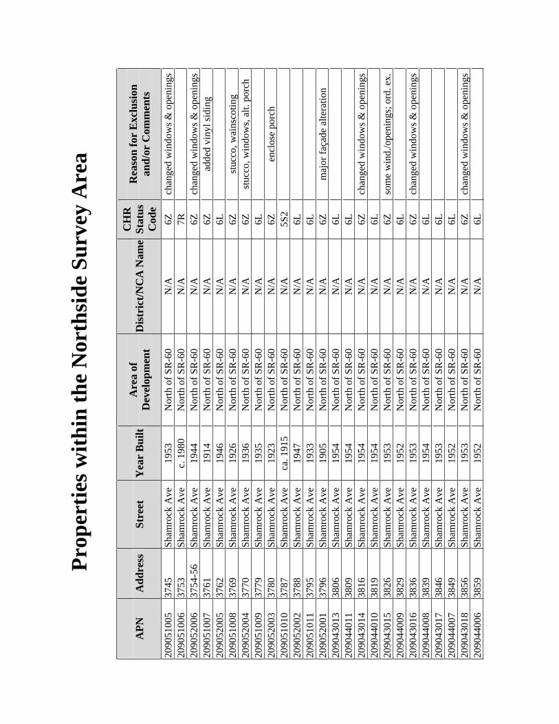
Prop
ertie
s with
in th
e N
orth
side
Sur
vey
Are
a
APN
Add
ress
Stre
etY
ear
Bui
ltA
rea
of
Dev
elop
men
tD
istr
ict/N
CA
Nam
eC
HR
Stat
usC
ode
Rea
son
for
Exc
lusi
onan
d/or
Com
men
ts
2090
5100
537
45Sh
amro
ck A
ve
1953
Nor
th o
f SR
-60
N/A
6Zch
ange
d w
indo
ws &
ope
ning
s20
9051
006
3753
Sham
rock
Ave
c.
198
0 N
orth
of S
R-6
0 N
/A7R
2090
5200
637
54-5
6Sh
amro
ck A
ve
1944
Nor
th o
f SR
-60
N/A
6Zch
ange
d w
indo
ws &
ope
ning
s20
9051
007
3761
l sid
ing
Sham
rock
Ave
19
14N
orth
of S
R-6
0 N
/A6Z
adde
d vi
ny20
9052
005
3762
Sham
rock
Ave
19
46N
orth
of S
R-6
0 N
/A6L
2090
5100
837
69Sh
amro
ck A
ve
1926
Nor
th o
f SR
-60
N/A
6Zst
ucco
, wai
nsco
ting
2090
5200
437
70Sh
amro
ck A
ve
1936
Nor
th o
f SR
-60
N/A
6Zst
ucco
, win
dow
s, al
t. po
rch
2090
5100
9k
Ave
37
79Sh
amro
c19
35N
orth
of S
R-6
0 N
/A6L
2090
5200
337
80k
Ave
Sh
amro
c19
23N
orth
of S
R-6
0 N
/A6Z
encl
ose
porc
h 20
9051
010
3787
Sham
rock
Ave
ca
. 191
5 N
orth
of S
R-6
0 N
/A5S
220
9052
002
3788
Sham
rock
Ave
19
47N
orth
of S
R-6
0 N
/A6L
2090
5101
137
95Sh
amro
ck A
ve19
33N
orth
of S
R-6
0 N
/A6L
2090
5200
137
96Sh
amro
ck A
ve19
05N
orth
of S
R-6
0 N
/A6Z
maj
or fa
çade
alte
ratio
n 20
9043
013
3806
Sham
rock
Ave
1954
Nor
th o
f SR
-60
N/A
6L20
9044
011
3809
Sham
rock
Ave
1954
Nor
th o
f SR
-60
N/A
6L20
9043
014
3816
Sham
rock
Ave
19
54N
orth
of S
R-6
0 N
/A6Z
chan
ged
win
dow
s & o
peni
ngs
2090
4401
0 38
19
Sham
rock
Ave
19
54
Nor
th o
f SR
-60
N/A
6L
20
9043
015
3826
Sh
amro
ck A
ve
1953
N
orth
of S
R-6
0 N
/A
6Z
som
e w
ind.
/ope
ning
s; o
rd. e
x.20
9044
009
3829
Sh
amro
ck A
ve
1952
N
orth
of S
R-6
0 N
/A
6L
2090
4301
6 38
36
Sham
rock
Ave
19
53
Nor
th o
f SR
-60
N/A
6Z
ch
ange
d w
indo
ws &
ope
ning
s20
9044
008
3839
Sh
amro
ck A
ve
1954
N
orth
of S
R-6
0 N
/A
6L
2090
4301
7 38
46
Sham
rock
Ave
19
53
Nor
th o
f SR
-60
N/A
6L
20
9044
007
3849
Sh
amro
ck A
ve
1952
N
orth
of S
R-6
0 N
/A
6L
2090
4301
8 38
56
Sham
rock
Ave
19
53
Nor
th o
f SR
-60
N/A
6Z
ch
ange
d w
indo
ws &
ope
ning
s20
9044
006
3859
Sh
amro
ck A
ve
1952
N
orth
of S
R-6
0 N
/A
6L
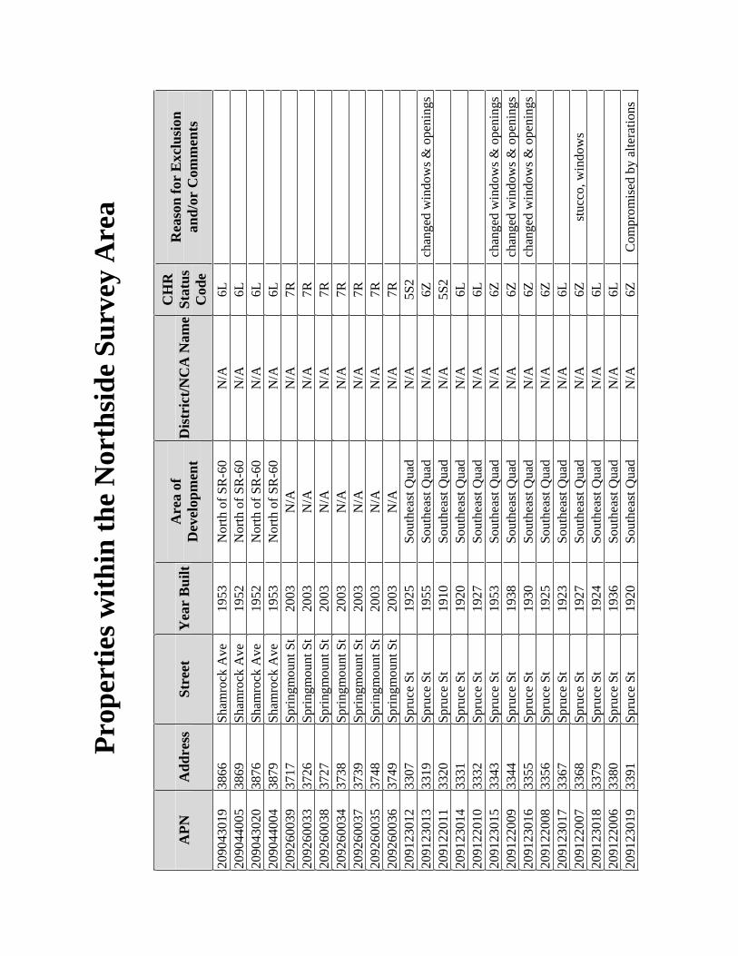
Prop
ertie
s with
in th
e N
orth
side
Sur
vey
Are
a
APN
Add
ress
Stre
etY
ear
Bui
ltA
rea
of
Dev
elop
men
tD
istr
ict/N
CA
Nam
eC
HR
Stat
usC
ode
Rea
son
for
Exc
lusi
onan
d/or
Com
men
ts
2090
4301
938
66ro
ckN
oSh
am A
ve
1953
rth o
f SR
-60
N/A
6L20
9044
005
3869
rock
No
Sham
Ave
19
52rth
of S
R-6
0 N
/A6L
2090
4302
0 6
rock
No
387
Sham
Ave
19
52rth
of S
R-6
0 N
/A6L
2090
4400
438
79ro
ckN
oSh
am A
ve
1953
rth o
f SR
-60
N/A
6L20
9260
039
3717
gm
oSp
rinun
t St
2003
N/A
N/A
7R20
9260
033
3726
gm
oSp
rinun
t St
2003
N/A
N/A
7R20
9260
038
3727
Sp
ringm
ount
St
2003
N/A
N/A
7R20
9260
034
3738
gm
oSp
rinun
t St
2003
N/A
N/A
7R20
9260
037
3739
gm
oSp
rinun
t St
2003
N/A
N/A
7R20
9260
035
3748
Sp
ringm
ount
St
2003
N/A
N/A
7R20
9260
036
3749
gm
oSp
rinun
t St
2003
N/A
N/A
7R20
9123
012
3307
ce
St
SoSp
ru19
25ut
heas
t Qua
d N
/A5S
220
9123
013
3319
ce
St
Sou
hang
ed w
ings
Spru
1955
thea
st Q
uad
N/A
6Zc
indo
ws &
ope
n20
9122
011
3320
ce
St
SoSp
ru19
10ut
heas
t Qua
d N
/A5S
220
9123
014
3331
ce
St
Sou
Spru
1920
thea
st Q
uad
N/A
6L20
9122
010
3332
Spru
ce S
t So
u19
27th
east
Qua
d N
/A6L
2091
2301
533
43Sp
ruce
St
Sou
1953
thea
st Q
uad
N/A
6Zch
ange
d w
ning
sin
dow
s & o
pe20
9122
009
3344
Spru
ce S
t So
uha
nged
win
gs19
38th
east
Qua
d N
/A6Z
cin
dow
s & o
pen
2091
2301
633
55Sp
ruce
St
Sou
hang
ed w
ings
1930
thea
st Q
uad
N/A
6Zc
indo
ws &
ope
n20
9122
008
3356
Sou
Spru
ce S
t19
25th
east
Qua
d N
/A6Z
2091
2301
733
67So
uSp
ruce
St
1923
thea
st Q
uad
N/A
6L20
9122
007
3368
Sou
Spru
ce S
t19
27th
east
Qua
d N
/A6Z
stuc
co, w
indo
ws
2091
2301
833
79So
uSp
ruce
St
1924
thea
st Q
uad
N/A
6L20
9122
006
3380
Sou
Spru
ce S
t19
36th
east
Qua
d N
/A6L
2091
2301
933
91Sp
ruce
St
Sou
Com
1920
thea
st Q
uad
N/A
6Zpr
omis
ed b
y al
tera
tions
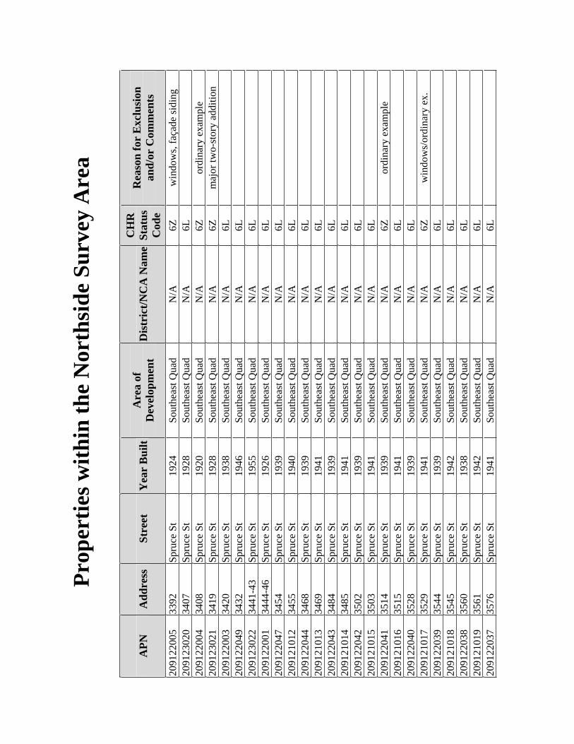
Prop
ertie
s with
in th
e N
orth
side
Sur
vey
Are
a
APN
Add
ress
Stre
etY
ear
Bui
ltA
rea
of
Dev
elop
men
tD
istr
ict/N
CA
Nam
eC
HR
Stat
usC
ode
Rea
son
for
Exc
lusi
onan
d/or
Com
men
ts
2091
2200
533
92Sp
ruce
St
Sou
win
dow
s, fa
çade
sidi
ng
1924
thea
st Q
uad
N/A
6Z20
9123
020
3407
Spru
ce S
tSo
u6
1928
thea
st Q
uad
N/A
L20
9122
004
3408
tSo
u6
Spru
ce S
1920
thea
st Q
uad
N/A
Zor
dina
ry e
xam
ple
2091
2302
134
19 S
t So
u6
maj
Spru
ce19
28th
east
Qua
d N
/AZ
or tw
o-st
ory
addi
tion
2091
2200
334
20 S
t So
uSp
ruce
1938
thea
st Q
uad
N/A
6L20
9122
049
3432
St
Sou
Spru
ce19
46th
east
Qua
d N
/A6L
2091
2302
234
41-4
3 S
t So
u6
Sp
ruce
1955
thea
st Q
uad
N/A
L20
9122
001
3444
-46
St
Sou
Sp
ruce
1926
thea
st Q
uad
N/A
6L20
9122
047
3454
St
Sou
Spru
ce19
39th
east
Qua
d N
/A6L
2091
2101
234
55 S
t So
uSp
ruce
1940
thea
st Q
uad
N/A
6L20
9122
044
3468
St
Sou
6Sp
ruce
1939
thea
st Q
uad
N/A
L20
9121
013
3469
St
Sou
6Sp
ruce
1941
thea
st Q
uad
N/A
L20
9122
043
3484
St
Sou
Spru
ce19
39th
east
Qua
d N
/A6L
2091
2101
434
85 S
t So
uSp
ruce
1941
thea
st Q
uad
N/A
6L20
9122
042
3502
Spru
ce S
t So
u19
39th
east
Qua
d N
/A6L
2091
2101
535
03Sp
ruce
St
Sou
1941
thea
st Q
uad
N/A
6L20
9122
041
3514
St
Sou
oSp
ruce
1939
thea
st Q
uad
N/A
6Zrd
inar
y ex
ampl
e 20
9121
016
3515
Spru
ce S
t So
u19
41th
east
Qua
d N
/A6L
2091
2204
035
28Sp
ruce
St
Sou
1939
thea
st Q
uad
N/A
6L20
9121
017
3529
Spru
ce S
t So
uw
indo
ws/
ordi
nary
ex.
19
41th
east
Qua
d N
/A6Z
2091
2203
935
44Sp
ruce
SSo
ut
1939
thea
st Q
uad
N/A
6L20
9121
018
3545
Spru
ce S
tSo
u19
42th
east
Qua
d N
/A6L
2091
2203
835
60 S
t So
uSp
ruce
1938
thea
st Q
uad
N/A
6L20
9121
019
3561
St
Sou
Spru
ce19
42th
east
Qua
d N
/A6L
2091
2203
735
76Sp
ruce
St
Sou
1941
thea
st Q
uad
N/A
6L
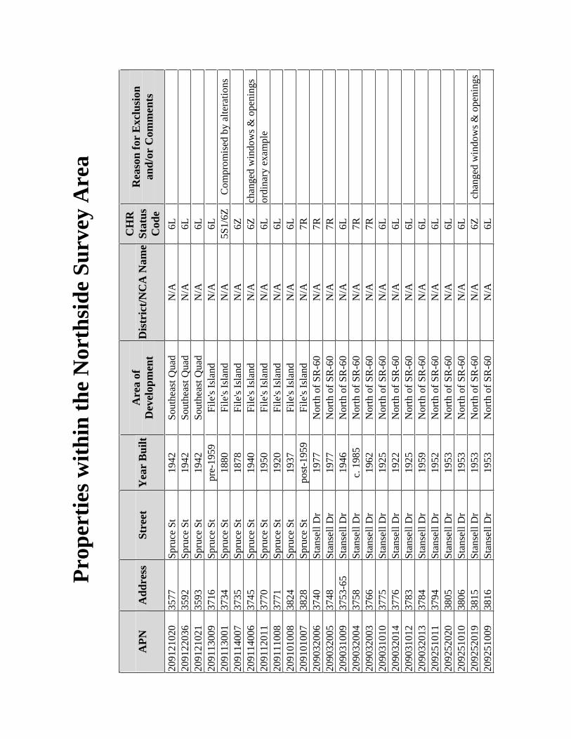
Prop
ertie
s with
in th
e N
orth
side
Sur
vey
Are
a
APN
Add
ress
Stre
etY
ear
Bui
ltA
rea
of
Dev
elop
men
tD
istr
ict/N
CA
Nam
eC
HR
Stat
usC
ode
Rea
son
for
Exc
lusi
onan
d/or
Com
men
ts
3577
Spru
ce S
t 19
42So
uthe
ast Q
uad
6LN
/A20
9122
036
3592
Spru
ce S
t 19
42So
uthe
ast Q
uad
6LN
/A20
9121
021
3593
Spru
ce S
t 19
42So
uthe
ast Q
uad
6LN
/A20
9113
009
3716
Spru
ce S
t pr
e-19
59Fi
le's
Isla
nd
6LN
/A20
9113
001
3734
Spru
ce S
t 18
80Fi
le's
Isla
nd
5S1/
6ZC
ompr
omis
ed b
y al
tera
tions
N
/A20
9114
007
3735
Spru
ce S
t 18
78Fi
le's
Isla
nd
6ZN
/A20
9114
006
3745
Spru
ce S
t 19
40Fi
le's
Isla
nd
6Zch
ange
d w
indo
ws &
ope
ning
s N
/A20
9112
011
3770
Spru
ce S
t 19
50Fi
le's
Isla
nd
6Lor
dina
ry e
xam
ple
N/A
2091
1100
837
71Sp
ruce
St
1920
File
's Is
land
6L
N/A
2091
0100
838
24Sp
ruce
St
1937
File
's Is
land
6L
N/A
2091
0100
738
28Sp
ruce
St
post
-195
9Fi
le's
Isla
nd
N/A
7R20
9032
006
3740
Stan
sell
Dr
1977
Nor
thof
SR-6
7R0
N/A
2090
3200
537
48St
anse
ll D
r 19
77N
orth
ofSR
-67R
0N
/A20
9031
009
3753
-65
Stan
sell
Dr
1946
Nor
thof
SR-6
6L0
N/A
2090
3200
437
58St
anse
ll D
r c.
198
5 N
orth
ofSR
-67R
0N
/A20
9032
003
3766
Stan
sell
Dr
1962
Nor
th o
f SR
-60
7RN
/A20
9031
010
3775
Stan
sell
Dr
1925
Nor
th o
f SR
-60
6LN
/A20
9032
014
3776
Stan
sell
Dr
1922
Nor
th o
f SR
-60
6LN
/A20
9031
012
3783
Stan
sell
Dr
1925
Nor
th o
f SR
-60
6LN
/A20
9032
013
3784
Stan
sell
Dr
1959
Nor
th o
f SR
-60
6LN
/A20
9251
011
3794
Stan
sell
Dr
1952
Nor
th o
f SR
-60
6LN
/A20
9252
020
3805
Stan
sell
Dr
1953
Nor
th o
f SR
-60
6LN
/A20
9251
010
3806
Stan
sell
Dr
1953
Nor
th o
f SR
-60
6LN
/A20
9252
019
3815
Stan
sell
Dr
1953
Nor
th o
f SR
-60
N/A
6Zch
ange
d w
indo
ws &
ope
ning
s20
9251
009
3816
Stan
sell
Dr
1953
Nor
th o
f SR
-60
N/A
6L
2091
2102
0
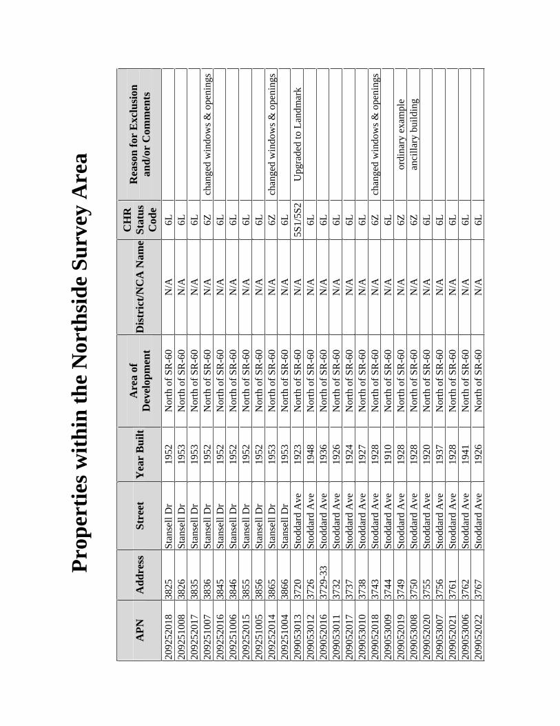
Prop
ertie
s with
in th
e N
orth
side
Sur
vey
Are
a
APN
Add
ress
Stre
etY
ear
Bui
ltA
rea
of
Dev
elop
men
tD
istr
ict/N
CA
Nam
eC
HR
Stat
usC
ode
Rea
son
for
Exc
lusi
onan
d/or
Com
men
ts
2092
38ta
nse
N52
018
25
Sll
Dr
1952
orth
of S
R-6
0 N
/A6L
2092
5100
8 38
26
Stan
sell
Dr
1953
N
orth
of S
R-6
0 N
/A6L
2092
5201
7 38
35
Stan
sell
Dr
1953
Nor
th o
f SR
-60
N/A
6L
2092
5100
7 38
36
Stan
sell
Dr
195
Nor
th o
f SR
-60
N/A
26Z
chan
ged
win
dow
s & o
peni
ngs
2092
5201
6 38
45
Stan
sell
Dr
1952
N
orth
of S
R-6
0 N
/A6L
2092
5100
6 38
46
Stan
sell
Dr
195
Nor
th o
f SR
-60
N/A
26L
2092
5201
53
St1
855
anse
ll D
r 95
2N
orth
of S
R-6
0 N
/A6L
2092
5100
53
St1
N85
6an
sell
Dr
952
orth
of S
R-6
0 N
/A6L
2092
5201
43
St19
NN
865
anse
ll D
r 53
orth
of S
R-6
0 /A
6Zch
ange
d w
indo
ws &
ope
ning
s20
9251
004
3St
186
6an
sell
Dr
953
Nor
th o
f SR
-60
N/A
6L20
9053
013
3720
Stod
dard
Ave
19
23N
orth
of S
R-6
0 N
/A5S
1/5S
2U
pgra
ded
to L
andm
ark
2090
5301
23
172
6St
odda
rd A
ve
948
Nor
th o
f SR
-60
N/A
6L20
9052
016
3729
-33
Stod
dard
Ave
1
N93
6or
th o
f SR
-60
N/A
6L20
9053
011
3St
N73
2od
dard
Ave
19
26or
th o
f SR
-60
N/A
6L20
9052
017
3N
737
Stod
dard
Ave
19
24or
th o
f SR
-60
N/A
6L20
9053
010
31
N73
8St
odda
rd A
ve
927
orth
of S
R-6
0 N
/A6L
2090
5201
83
1N
743
Stod
dard
Ave
92
8or
th o
f SR
-60
N/A
6Zch
ange
d w
indo
ws &
ope
ning
s20
9053
009
31
N74
4St
odda
rd A
ve
910
orth
of S
R-6
0 N
/A6L
2090
5201
93
St1
No
ordi
nary
exam
ple
749
odda
rd A
ve
928
rth o
f SR
-60
N/A
6Z20
9053
008
3750
Stod
dard
Ave
19
28N
orth
of S
R-6
0 N
/A6Z
anci
llary
bui
ldin
g 20
9052
020
3755
St
odda
rd A
ve
1920
N
orth
of S
R-6
0 N
/A
6L
2090
5300
7 37
56
Stod
dard
Ave
19
37
Nor
th o
f SR
-60
N/A
6L
20
9052
021
3761
St
odda
rd A
ve
1928
N
orth
of S
R-6
0 N
/A
6L
2090
5300
6 37
62
Stod
dard
Ave
19
41
Nor
th o
f SR
-60
N/A
6L
20
9052
022
3767
St
odda
rd A
ve
1926
N
orth
of S
R-6
0 N
/A
6L

Prop
ertie
s with
in th
e N
orth
side
Sur
vey
Are
a
APN
Add
ress
Stre
etY
ear
Bui
ltA
rea
of
Dev
elop
men
tD
istr
ict/N
CA
Nam
eC
HR
Stat
usC
ode
Rea
son
for
Exc
lusi
onan
d/or
Com
men
ts
2090
5301
8 37
68
Stod
dard
Ave
19
38
Nor
th o
f SR
-60
N/A
6L
20
9052
023
3773
St
odda
rd A
ve
1949
N
orth
of S
R-6
0 N
/A
6L
2090
5300
4 37
74
Stod
dard
Ave
19
13
Nor
th o
f SR
-60
N/A
6Z
fa
çade
alte
ratio
ns
2090
5202
4 37
79
Stod
dard
Ave
19
28
Nor
th o
f SR
-60
N/A
6L
20
9053
019
3780
St
odda
rd A
ve
1954
N
orth
of S
R-6
0 N
/A
6L
2090
5202
5 37
85
Stod
dard
Ave
19
21
Nor
th o
f SR
-60
N/A
6L
20
9053
002
3786
St
odda
rd A
ve
1950
N
orth
of S
R-6
0 N
/A
6L20
9052
026
3791
St
odda
rd A
ve
1955
N
orth
of S
R-6
0 N
/A
6L20
9053
001
3792
St
odda
rd A
ve
1922
N
orth
of S
R-6
0
6LN
/A20
9043
012
3805
St
odda
rd A
ve
1954
N
orth
of S
R-6
0
6LN
/A20
9042
014
3808
St
odda
rd A
ve
1949
N
orth
of S
R-6
0 N
/A6L
2090
4301
1 38
15
Stod
dard
Ave
19
53
Nor
th o
f SR
-60
6L
N/A
2090
4201
3 38
16
Stod
dard
Ave
19
52
Nor
th o
f SR
-60
6LN
/A20
9042
011
3824
St
odda
rd A
ve
1954
N
orth
of S
R-6
0 N
/A
6L20
9043
010
3825
St
odda
rd A
ve
1953
N
orth
of S
R-6
0 N
/A
6L
2090
4201
0 38
34
Stod
dard
Ave
19
65
Nor
th o
f SR
-60
N/A
7R
20
9043
009
3835
St
odda
rd A
ve
1953
N
orth
of S
R-6
0 N
/A
6Z
chan
ged
win
dow
s & o
peni
ngs
2090
4200
9 38
44
Stod
dard
Ave
19
54
Nor
th o
f SR
-60
N/A
6Z
ch
ange
d w
indo
ws &
ope
ning
s20
9043
008
3845
St
odda
rd A
ve
1953
N
orth
of S
R-6
0 N
/A
6L
2090
4200
8 38
52
Stod
dard
Ave
19
54
Nor
th o
f SR
-60
N/A
6L
20
9043
007
3855
St
odda
rd A
ve
1953
N
orth
of S
R-6
0 N
/A
6L
2090
4200
6 38
62
Stod
dard
Ave
19
54
Nor
th o
f SR
-60
N/A
6L
20
9043
006
3867
St
odda
rd A
ve
1953
N
orth
of S
R-6
0 N
/A
6L
2090
4200
5 38
70
Stod
dard
Ave
19
48
Nor
th o
f SR
-60
N/A
6L
20
9043
005
3873
St
odda
rd A
ve
1948
N
orth
of S
R-6
0 N
/A
6L
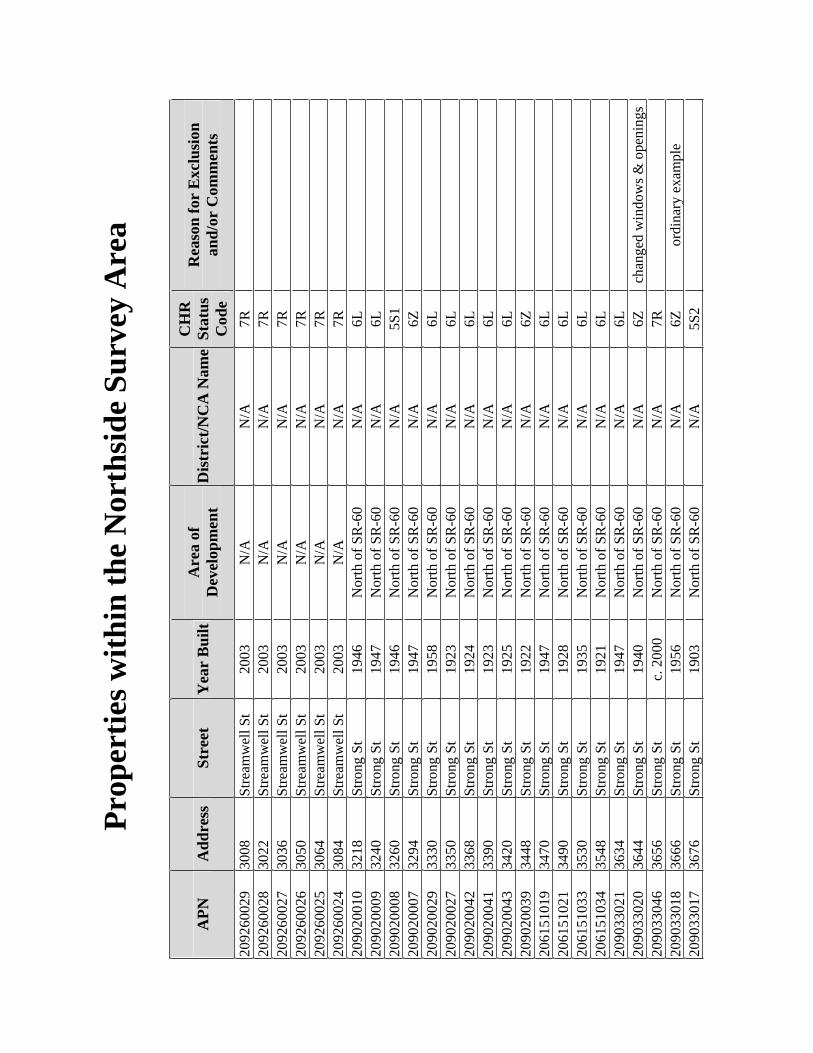
Prop
ertie
s with
in th
e N
orth
side
Sur
vey
Are
a
APN
Add
ress
Stre
etY
ear
Bui
ltA
rea
of
Dev
elop
men
tD
istr
ict/N
CA
Nam
eC
HR
Stat
usC
ode
Rea
son
for
Exc
lusi
onan
d/or
Com
men
ts
2092
6002
9 30
08
Stre
amw
ell S
t 20
03
7RN
/AN
/A20
9260
028
3022
St
ream
wel
l St
2003
N
/A
N/A
7R
20
9260
027
3036
St
ream
wel
l St
2003
N
/AN
/A
7R
2092
6002
6 30
50
Stre
amw
ell S
t 20
03
N/A
N/A
7R
20
9260
025
3064
St
ream
wel
l St
2003
N/A
N/A
7R
20
9260
024
el
l St
3084
Stre
amw
2003
A
7RN
/AN
/20
9020
010
3218
Stro
ng S
tA
6L
19
46N
orth
of S
R-6
0 N
/20
9020
009
3240
Stro
ng S
tA
6L
19
47N
orth
of S
R-6
0 N
/20
9020
008
3260
Stro
ng S
tA
5S
1 19
46N
orth
of S
R-6
0 N
/20
9020
007
3294
Stro
ng S
tA
6Z
19
47N
orth
of S
R-6
0 N
/20
9020
029
3330
Stro
ng S
tA
6L
19
58N
orth
of S
R-6
0 N
/20
9020
027
3350
Stro
ng S
tA
6L
19
23N
orth
of S
R-6
0 N
/20
9020
042
3368
Stro
ng S
tA
6L
19
24N
orth
of S
R-6
0 N
/20
9020
041
3390
Stro
ng S
tA
6L
19
23N
orth
of S
R-6
0 N
/20
9020
043
3420
Stro
ng S
tA
6L
19
25N
orth
of S
R-6
0 N
/20
9020
039
3448
Stro
ng S
tA
6Z
19
22N
orth
of S
R-6
0 N
/20
6151
019
3470
Stro
ng S
tA
6L
19
47N
orth
of S
R-6
0 N
/20
6151
021
3490
Stro
ng S
tA
6L
19
28N
orth
of S
R-6
0 N
/20
6151
033
3530
Stro
ng S
tA
6L
19
35N
orth
of S
R-6
0 N
/20
6151
034
3548
Stro
ng S
tA
6L
19
21N
orth
of S
R-6
0 N
/20
9033
021
3634
Stro
ng S
tA
6L
19
47N
orth
of S
R-6
0 N
/20
9033
020
3644
Stro
ng S
tA
6Z
o
peni
ngs
1940
Nor
th o
f SR
-60
N/
chan
ged
win
dow
s &20
9033
046
3656
Stro
ng S
tA
7R
c.
200
0 N
orth
of S
R-6
0 N
/20
9033
018
3666
Stro
ng S
tA
6Z
e
xam
ple
1956
Nor
th o
f SR
-60
N/
ordi
nary
2090
3301
736
76St
rong
St
A
5S2
1903
Nor
th o
f SR
-60
N/
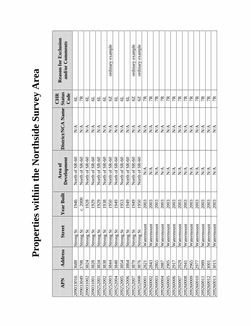
Prop
ertie
s with
in th
e N
orth
side
Sur
vey
Are
a
APN
Add
ress
Stre
etY
ear
Bui
ltA
rea
of
Dev
elop
men
tD
istr
ict/N
CA
Nam
eC
HR
Stat
usC
ode
Rea
son
for
Exc
lusi
onan
d/or
Com
men
ts
2090
3301
6 36
88
Stro
ng S
t 19
46
6LN
orth
of S
R-6
0 N
/A20
9033
049
3708
Stro
ng S
tA
7R
c.
200
0 N
orth
of S
R-6
0 N
/20
9031
002
3824
Stro
ng S
tA
6L
19
28N
orth
of S
R-6
0 N
/20
9031
001
3828
Stro
ng S
tA
6L
19
29N
orth
of S
R-6
0 N
/20
9252
001
3834
Stro
ng S
tA
6L
19
29N
orth
of S
R-6
0 N
/20
9252
002
3838
Stro
ng S
tA
6L
19
38N
orth
of S
R-6
0 N
/20
9252
003
3844
Stro
ng S
tA
6Z
e
xam
ple
1950
Nor
th o
f SR
-60
N/
ordi
nary
2092
5200
438
48St
rong
St
A
6L
1949
Nor
th o
f SR
-60
N/
2092
5200
538
54St
rong
St
A
6L
1953
Nor
th o
f SR
-60
N/
2092
5200
638
64St
rong
St
A
6L
1949
Nor
th o
f SR
-60
N/
2092
5200
738
70St
rong
St
A
6Z
exa
mpl
e 19
49N
orth
of S
R-6
0 N
/or
dina
ry20
9252
008
3876
Stro
ng S
tA
6Z
e
xam
ple
1950
Nor
th o
f SR
-60
N/
ordi
nary
2092
6000
1
unt
A
7R
28
21W
ater
mo
2003
N/A
N/
2092
6000
2
unt
A
7R
28
43W
ater
mo
2003
N/A
N/
2092
6000
328
65un
t
A
7R
Wat
erm
o20
03N
/AN
/20
9260
004
2887
unt
A
7R
W
ater
mo
2003
N/A
N/
2092
6000
5
unt
A
7R
29
05W
ater
mo
2003
N/A
N/
2092
6000
6
unt
A
7R
2917
Wat
erm
o20
03N
/AN
/20
9260
007
unt
N/A
A
7R
2929
Wat
erm
o20
03N
/20
9260
008
unt
N/A
7R
29
41W
ater
mo
2003
N/A
2092
6000
9un
tN
/A
7R
2965
Wat
erm
o20
03N
/A20
9260
010
unt
N/A
N/A
7R
29
77W
ater
mo
2003
2092
6001
1un
tN
/AN
/A
7R
2989
Wat
erm
o20
0320
9260
012
unt
N/A
N/A
7R
30
01W
ater
mo
2003
2092
6001
330
15W
ater
mou
nt
N
/A
N/A
7R
20
03
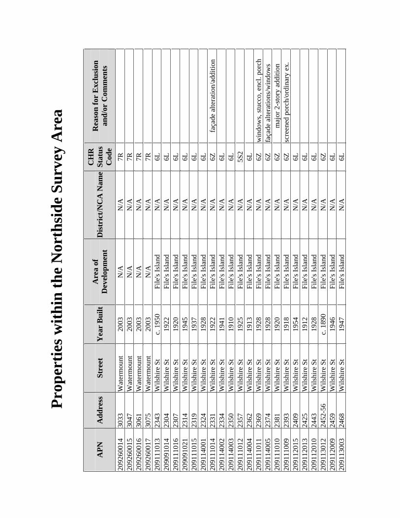
Prop
ertie
s with
in th
e N
orth
side
Sur
vey
Are
a
APN
Add
ress
Stre
etY
ear
Bui
ltA
rea
of
Dev
elop
men
tD
istr
ict/N
CA
Nam
eC
HR
Stat
usC
ode
Rea
son
for
Exc
lusi
onan
d/or
Com
men
ts
2092
6001
4 30
33
Wat
erm
ount
20
03
7RN
/AN
/A20
9260
015
unt
N
/A
7R
3047
Wat
erm
o20
03N
/A20
9260
016
unt
A
7R
3061
Wat
erm
o20
03N
/AN
/20
9260
017
unt
N/A
7R
30
75W
ater
mo
2003
N/A
2091
1101
323
43W
ilshi
reSt
A
6L
c. 1
950
File
's Is
land
N
/20
9091
014
2304
Wils
hire
St6L
1922
File
's Is
land
N
/A20
9111
016
2307
Wils
hire
StA
6L
19
20Fi
le's
Isla
nd
N/
2090
9102
123
14W
ilshi
reSt
N/A
6L
19
45Fi
le's
Isla
nd
2091
1101
523
19W
ilshi
re S
tFi
le's
Isla
nd
A19
37N
/6L
2091
1400
123
24W
ilshi
re S
tA
1928
File
's Is
land
N
/6L
2091
1101
423
31W
ilshi
re S
tn
1922
File
's Is
land
N
/A6Z
faça
de a
ltera
tion/
addi
tio20
9114
002
2334
Wils
hire
St
N/A
1941
File
's Is
land
6L
2091
1400
323
50W
ilshi
re S
t 19
10Fi
le's
Isla
nd
N/A
6L
20
9111
012
2357
Wils
hire
St
1925
File
's Is
land
N
/A
5S2
2091
1400
423
62W
ilshi
re S
t19
13Fi
le's
Isla
nd
N/A
6L
20
9111
011
2369
Wils
hire
St
A
6Z
rch
1928
File
's Is
land
N
/w
indo
ws,
stuc
co, e
ncl.
po20
9114
005
2374
Wils
hire
St
A
6Z
1928
File
's Is
land
N
/fa
çade
alte
ratio
ns/w
indo
ws
2091
1101
023
81W
ilshi
re S
tFi
le's
Isla
nd
N/A
6Z
m
ajor
2-s
tory
add
ition
19
2020
9111
009
2393
Wils
hire
St
N/A
6Z
x.19
18Fi
le's
Isla
nd
scre
ened
por
ch/o
rdin
ary
e20
9112
015
2409
Wils
hire
St
A
6L
1954
File
's Is
land
N
/20
9112
013
2425
Wils
hire
St
1912
File
's Is
land
N
/A6L
2091
1201
0 24
43
Wils
hire
St
1928
Fi
le's
Isla
nd
N/A
6L
20
9113
012
2452
-56
Wils
hire
St
c. 1
890
File
's Is
land
N
/A
6Z
2091
1200
9 24
59
Wils
hire
St
1946
Fi
le's
Isla
nd
N/A
6L
20
9113
003
2468
W
ilshi
re S
t 19
47
File
's Is
land
N
/A
6L
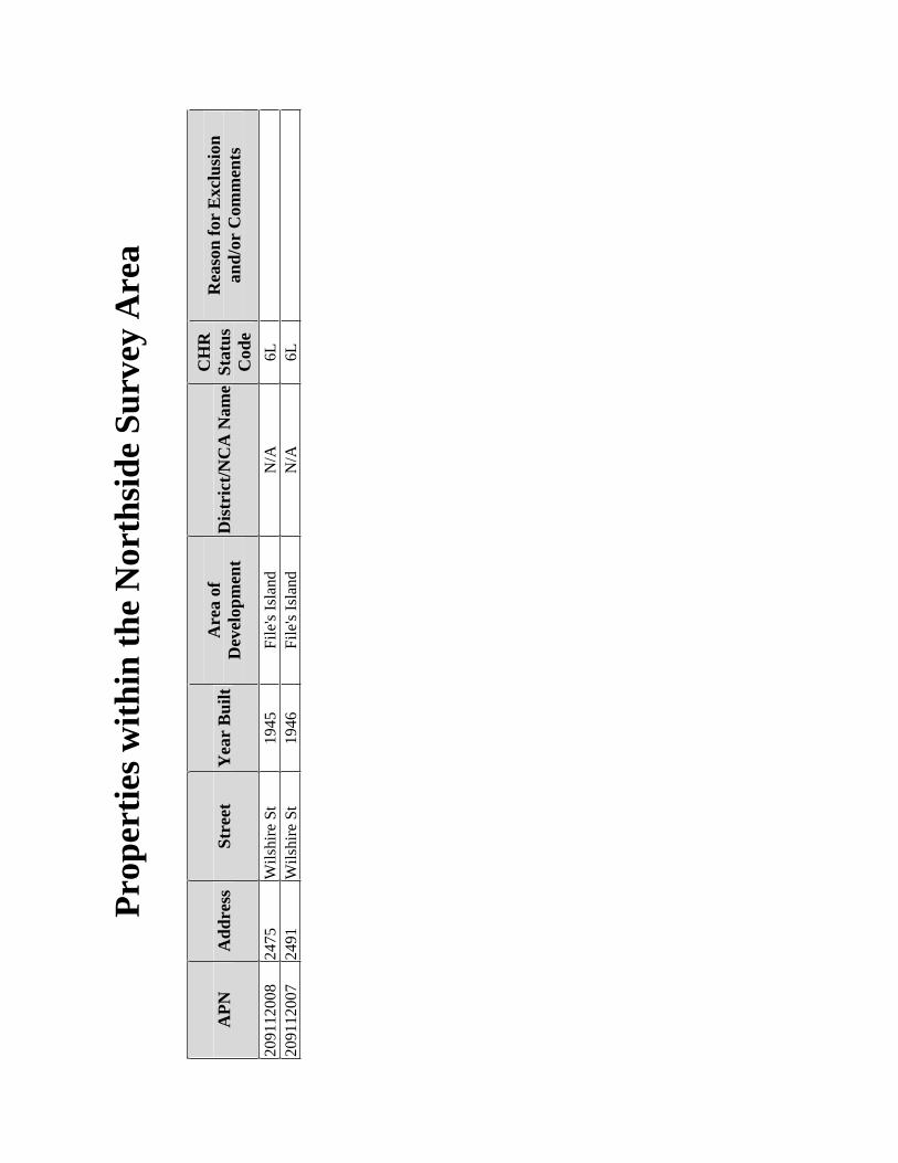
Prop
ertie
s with
in th
e N
orth
side
Sur
vey
Are
a
APN
Add
ress
Stre
etY
ear
Bui
ltA
rea
of
Dev
elop
men
tD
istr
ict/N
CA
Nam
eC
HR
Stat
usC
ode
Rea
son
for
Exc
lusi
onan
d/or
Com
men
ts
2091
1200
8 24
75
Wils
hire
St
1945
Fi
le's
Isla
nd
A
6L
N/
2091
1200
7 24
91
Wils
hire
St
1946
Fi
le's
Isla
nd
A
6L
N/

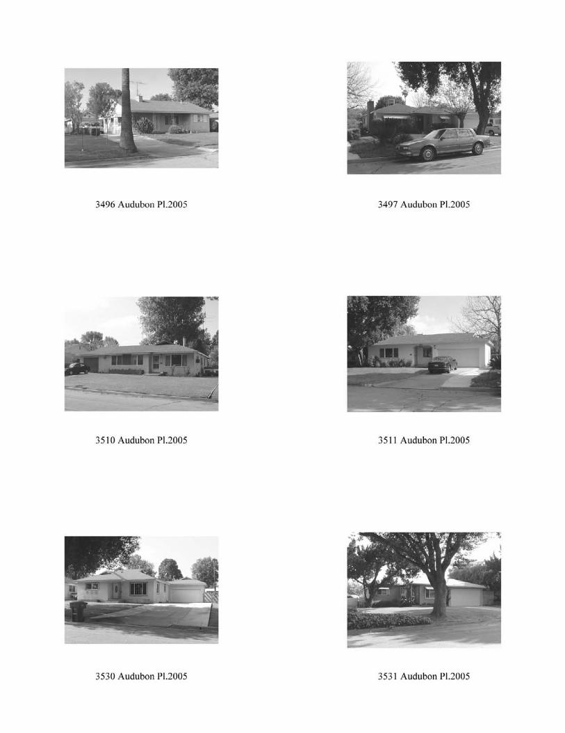
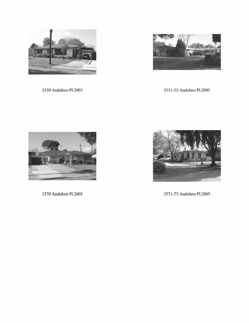
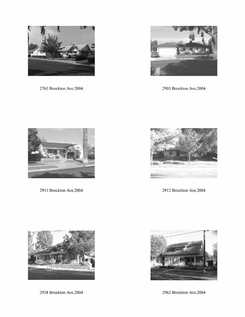
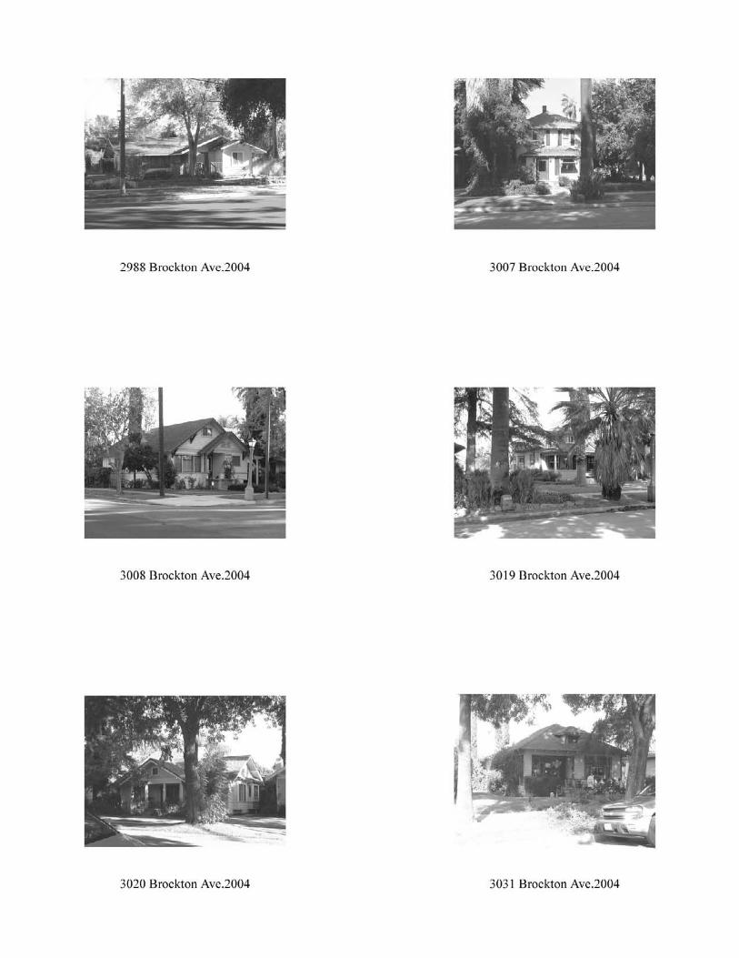

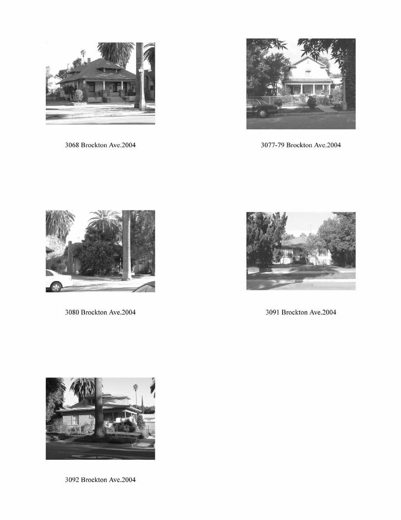
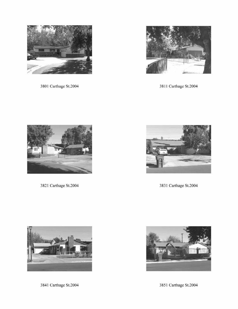
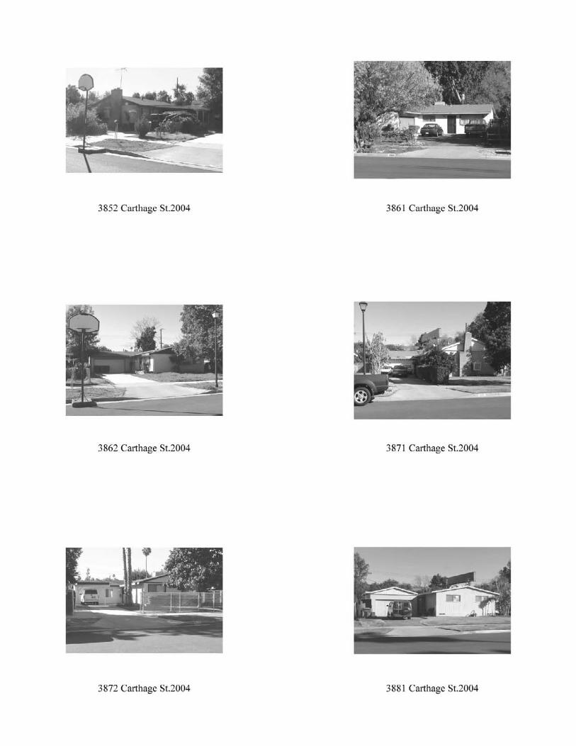
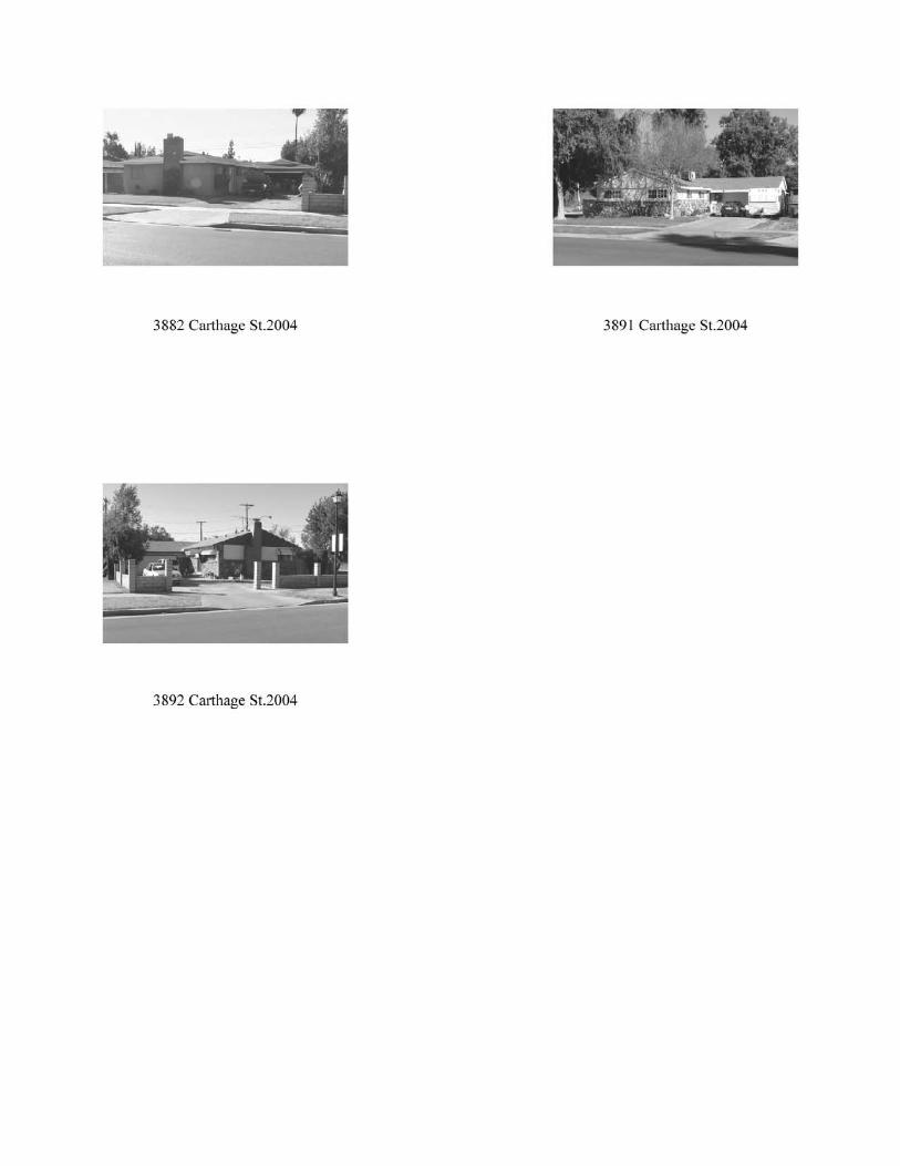
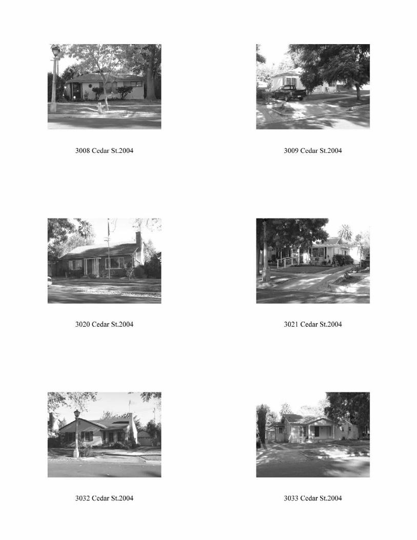
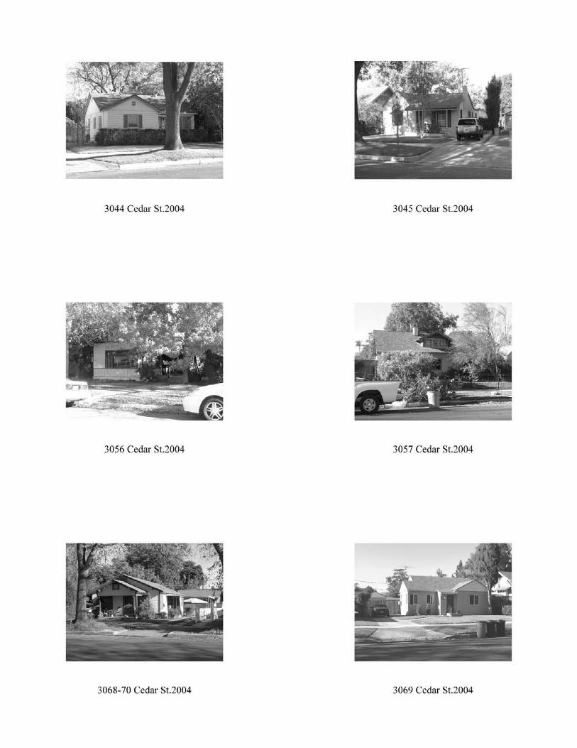
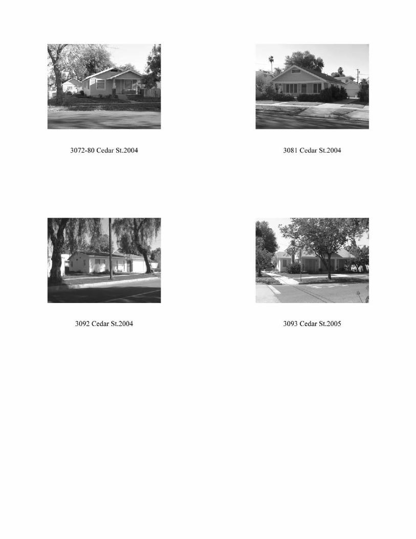
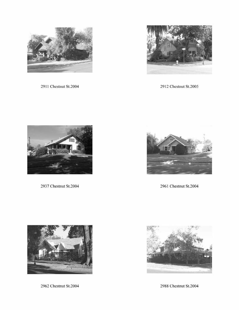
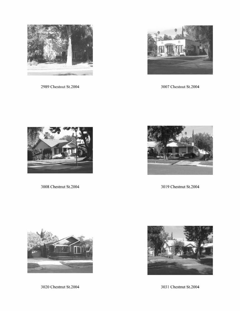
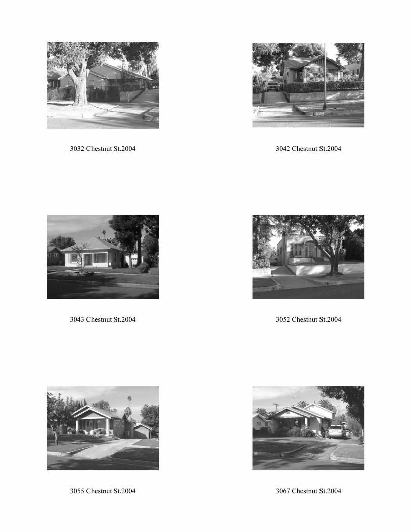
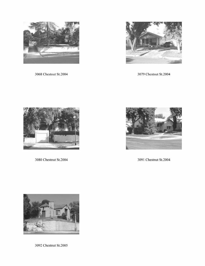
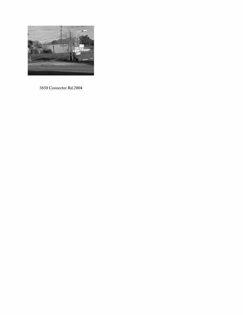

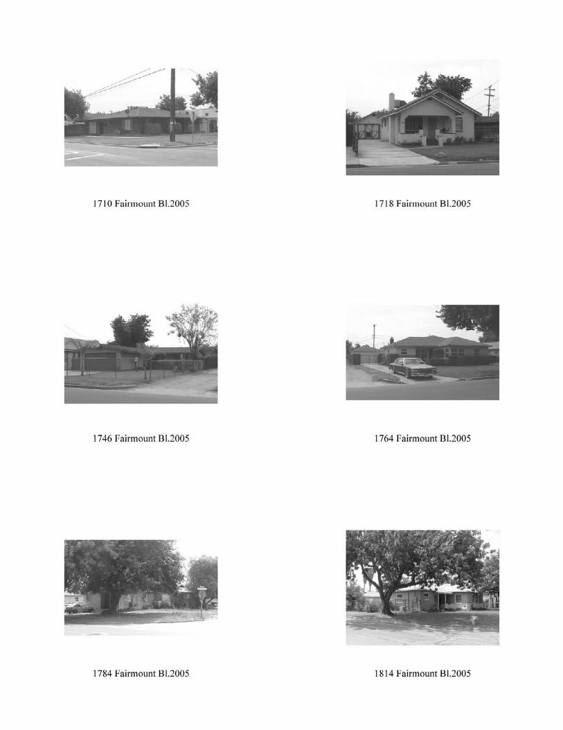
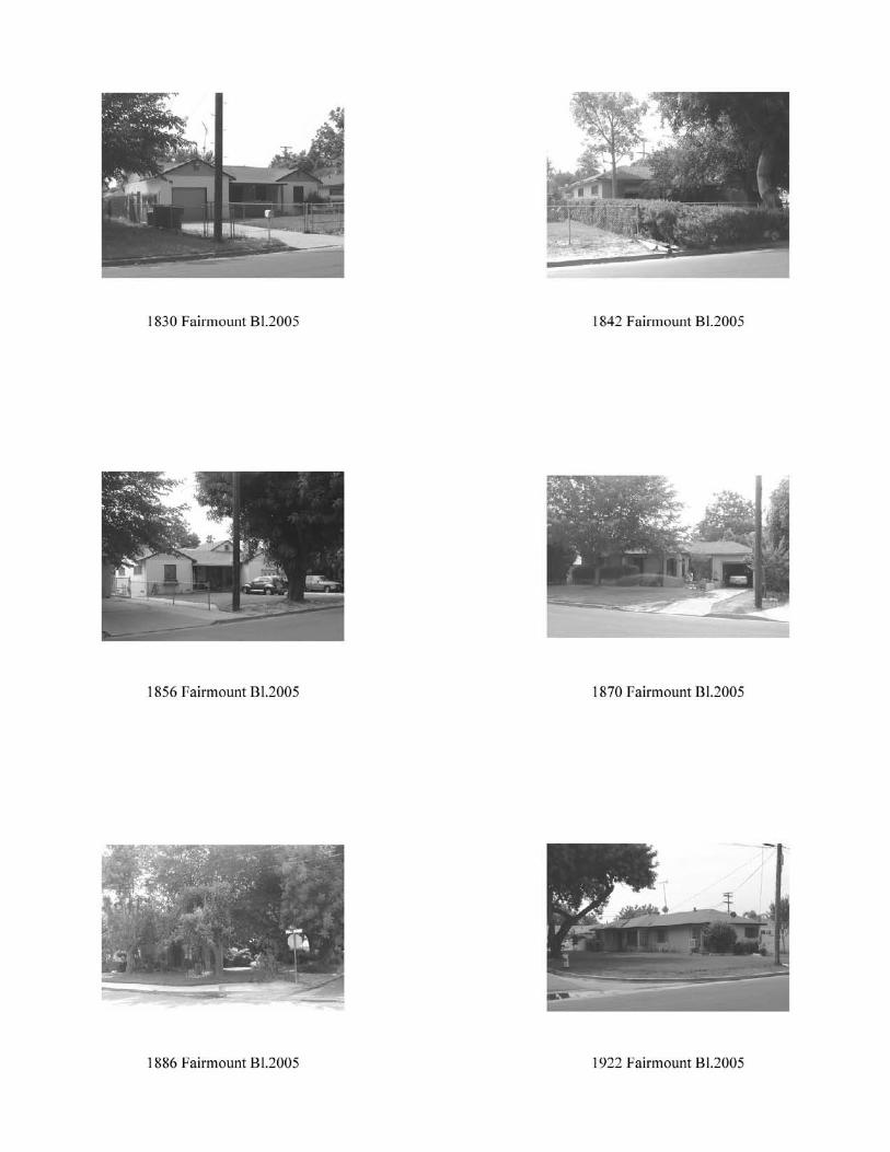
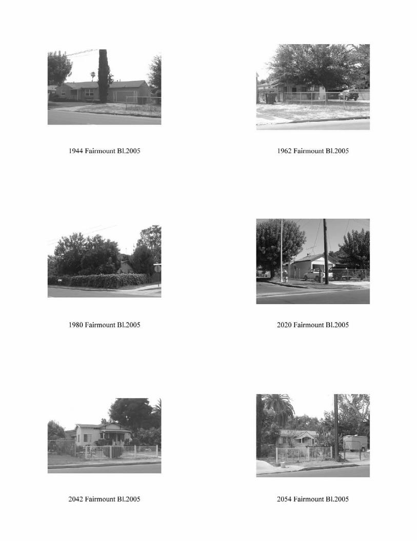
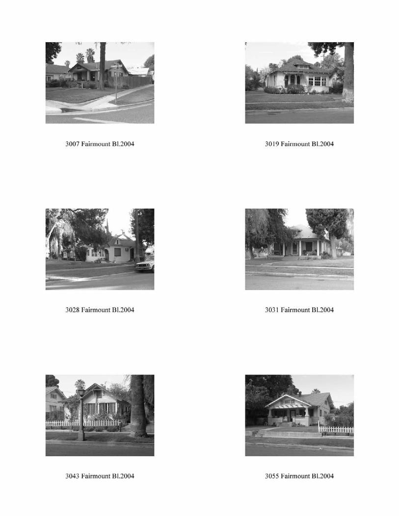
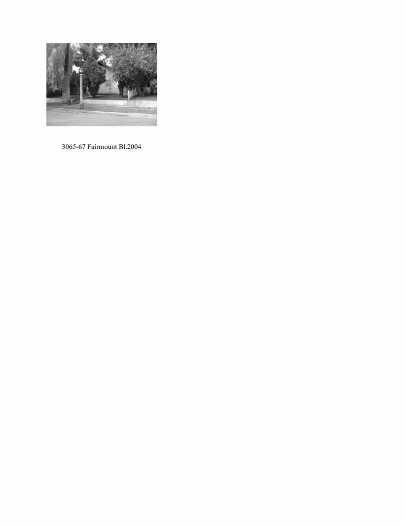
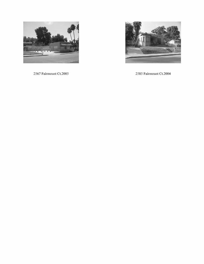
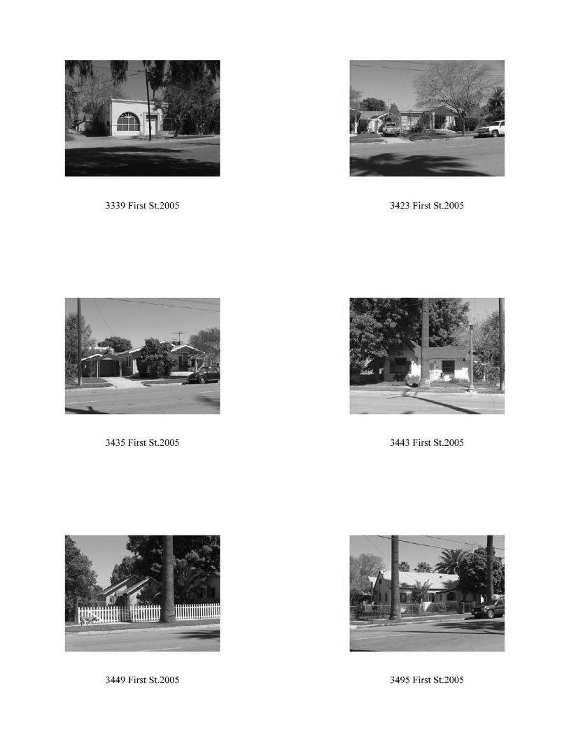
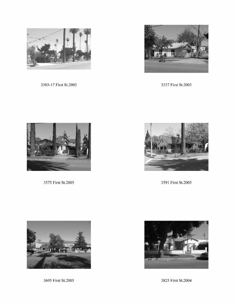
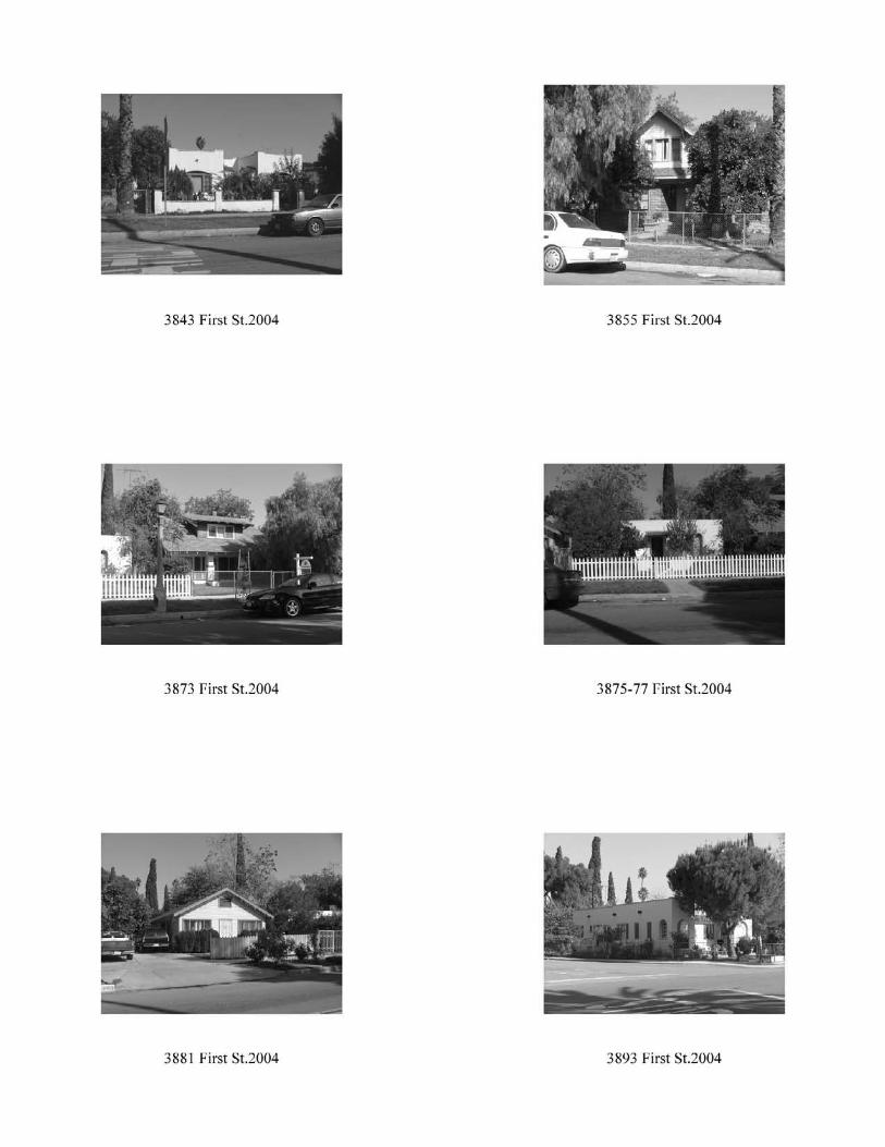
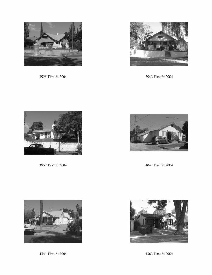
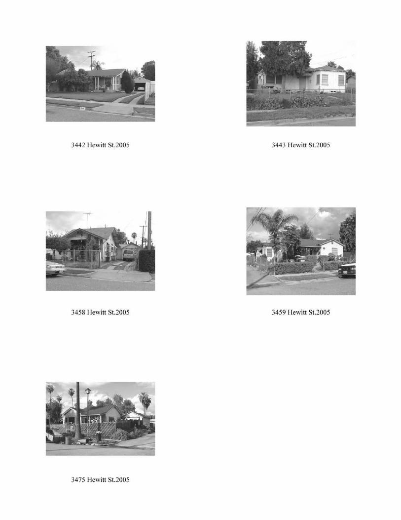
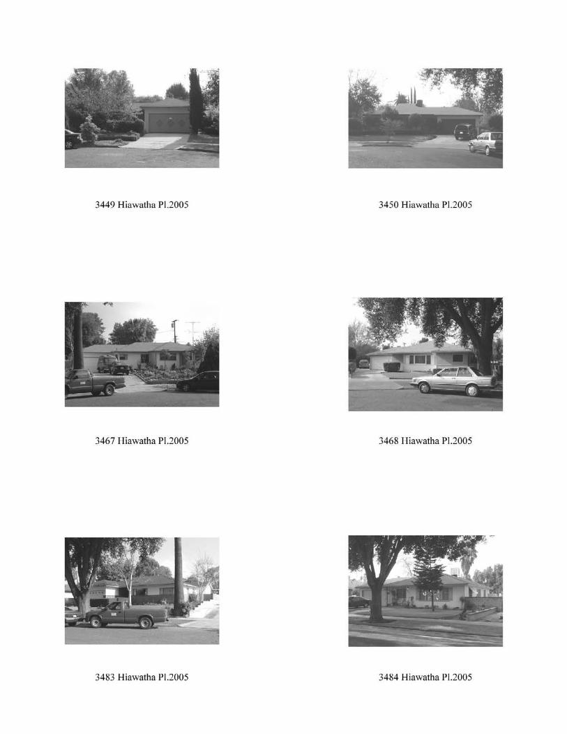
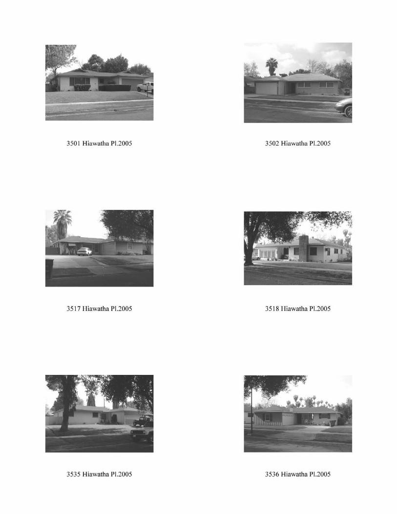
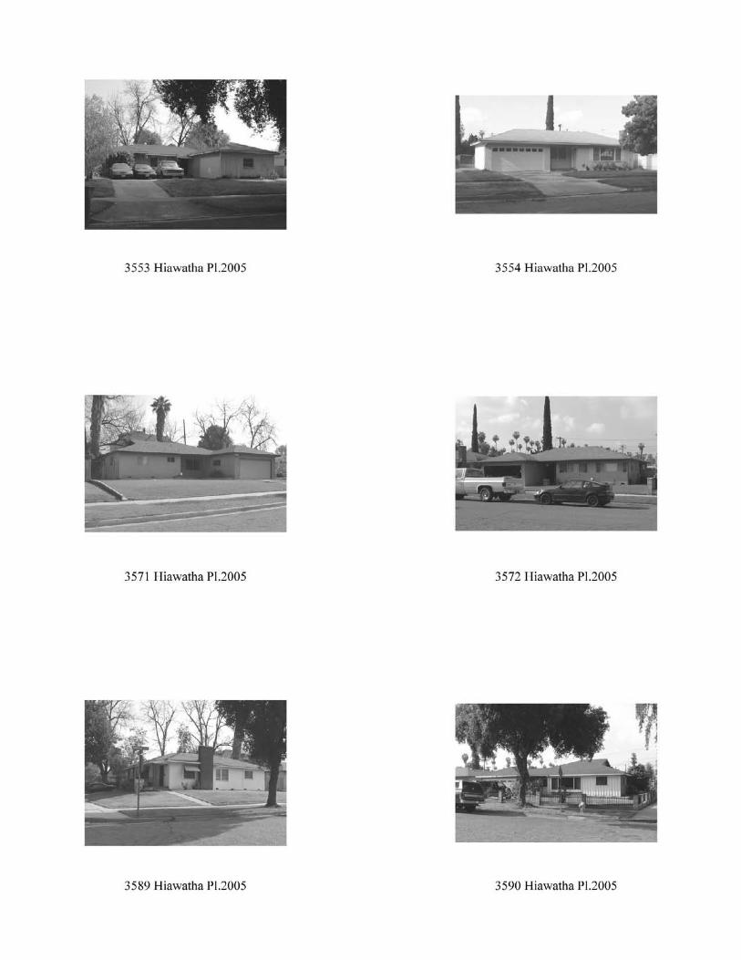
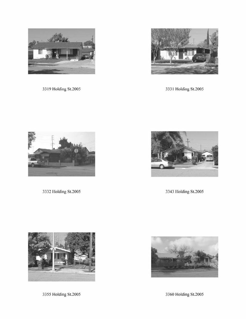
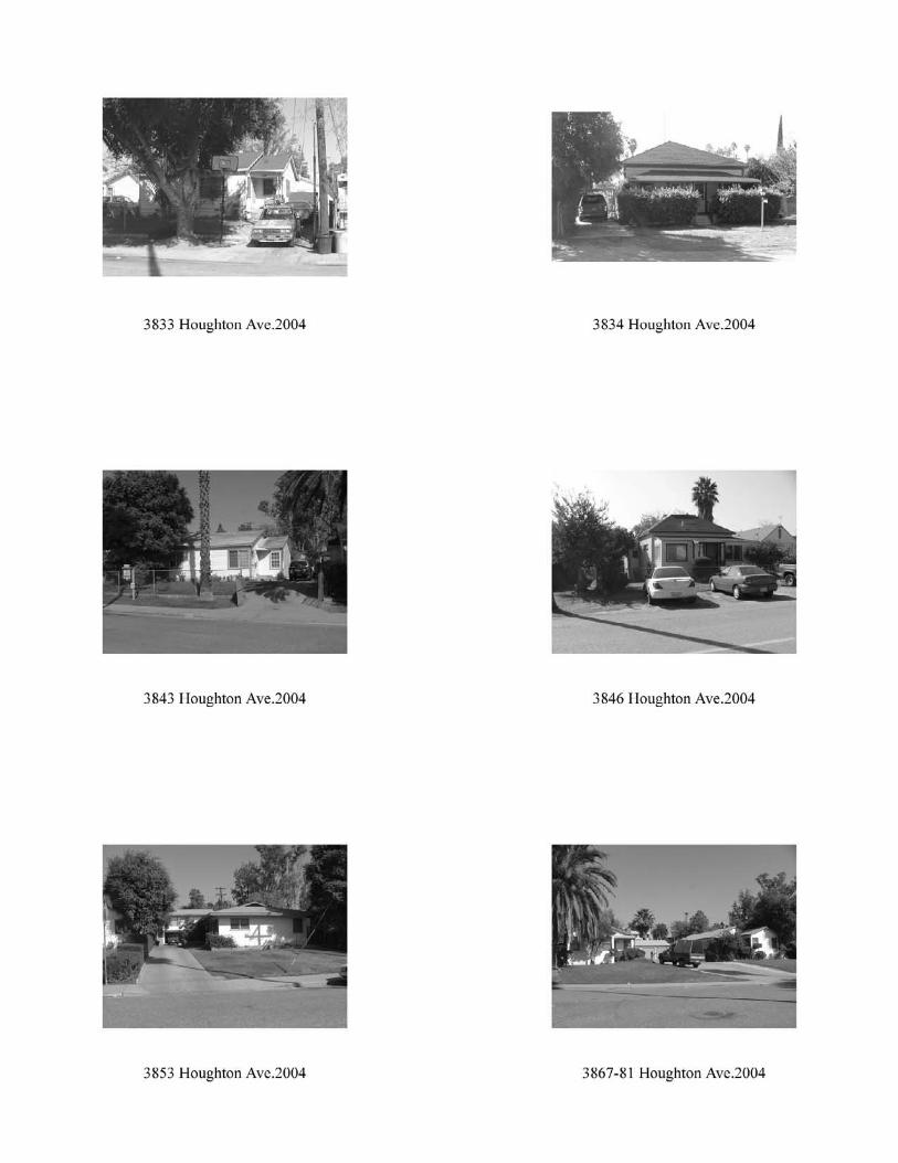
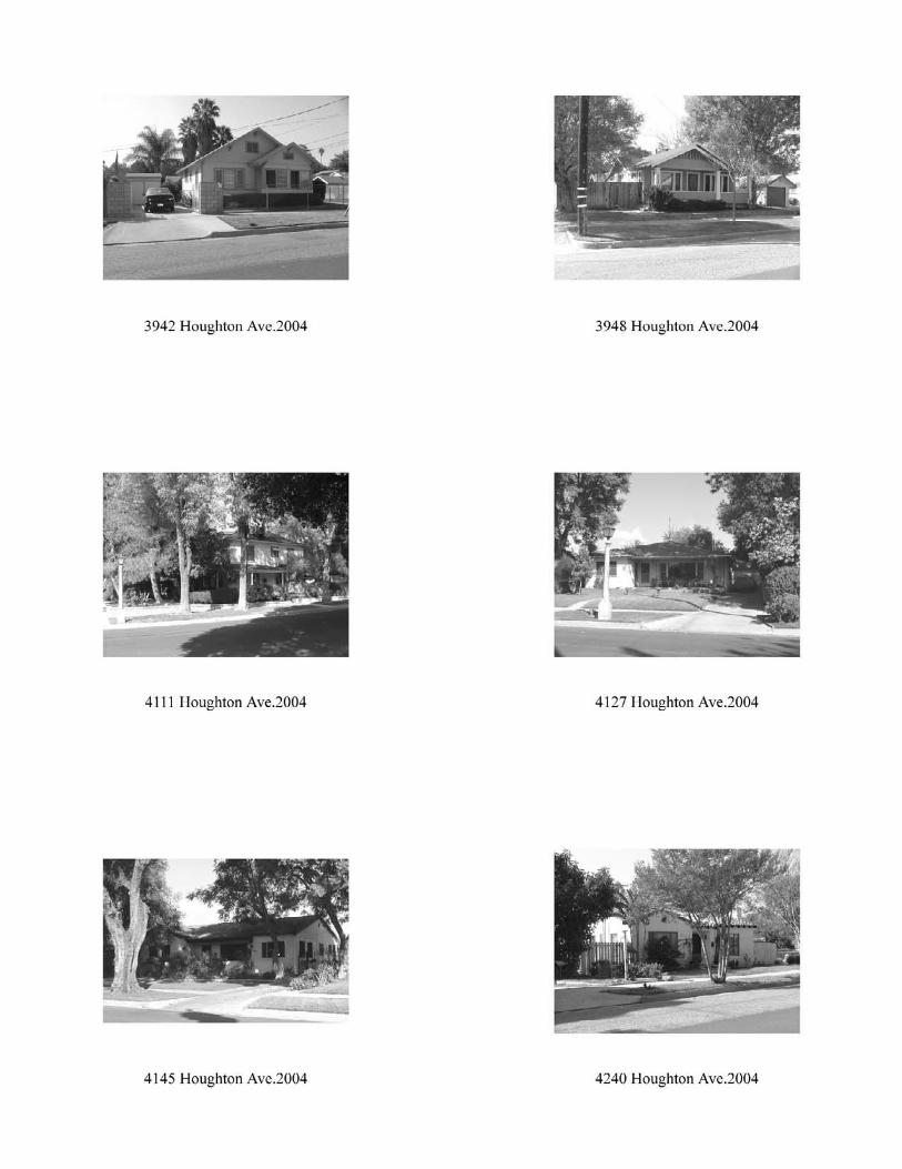
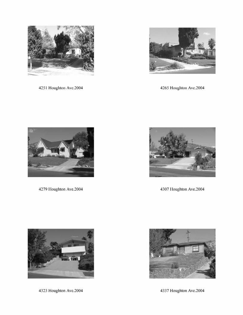
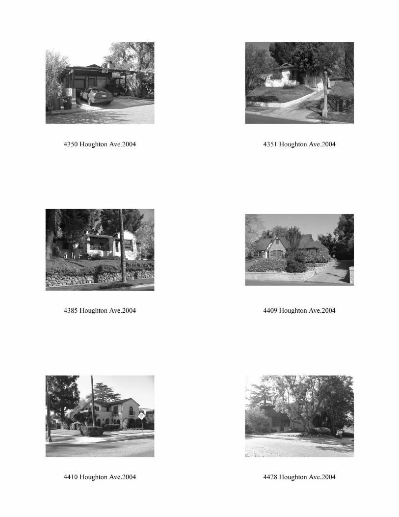
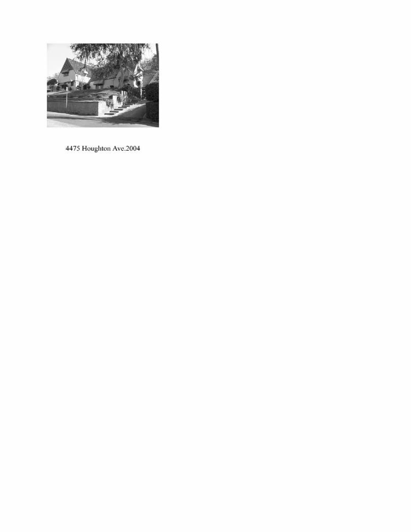
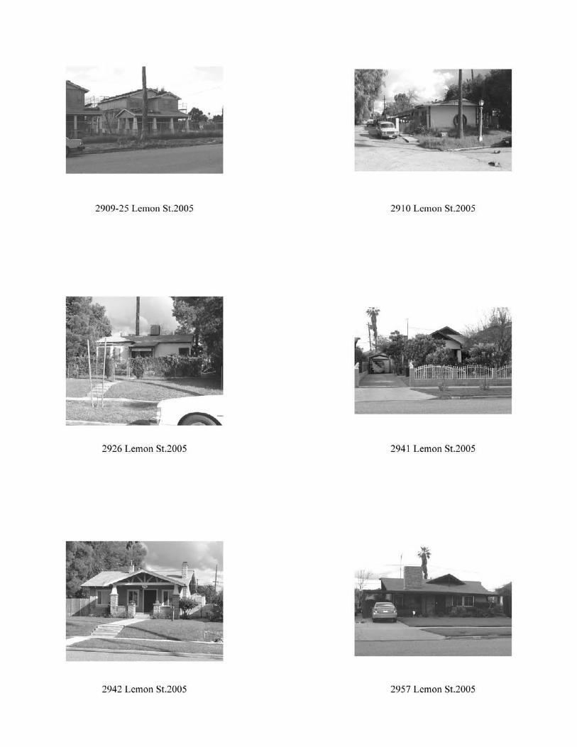
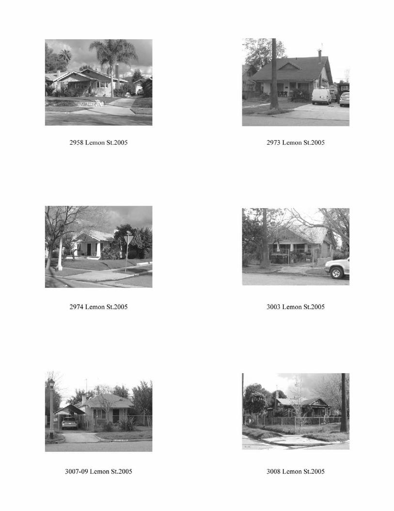
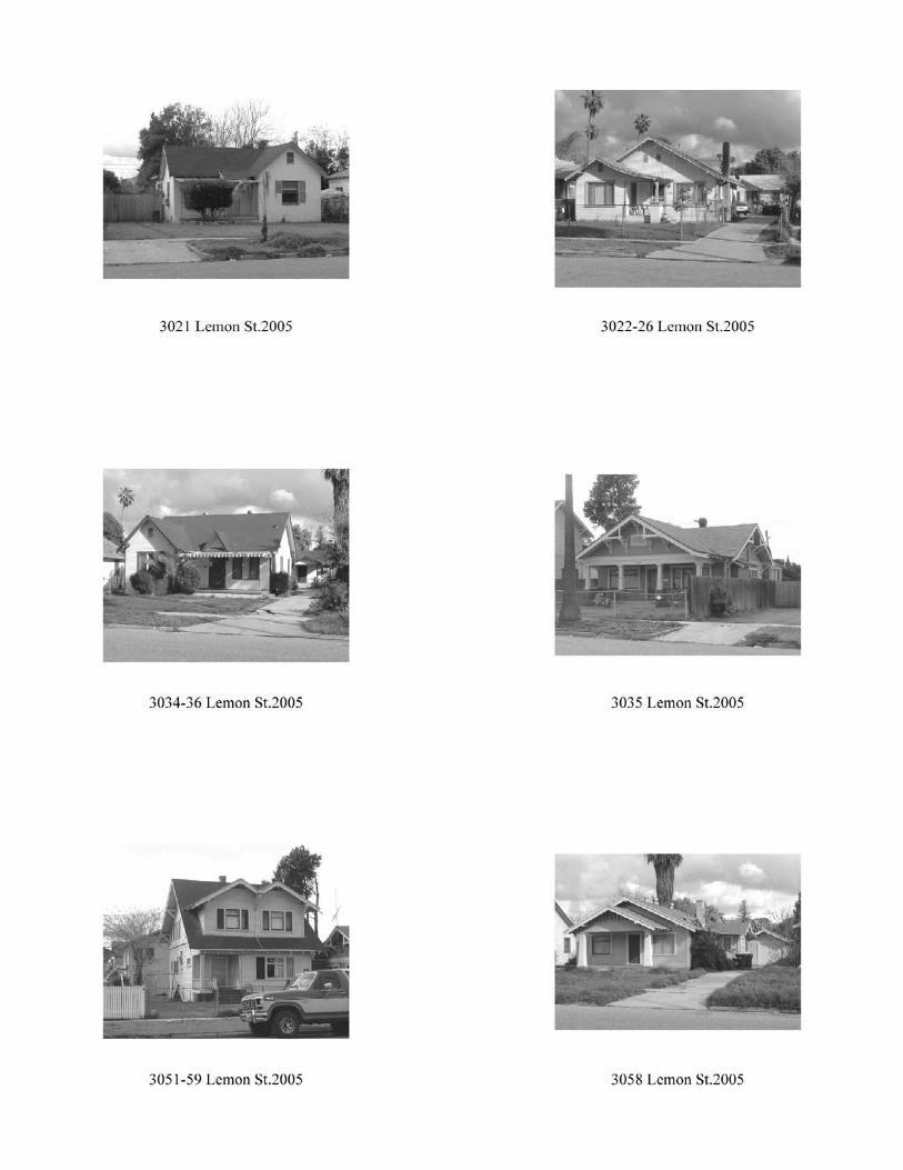
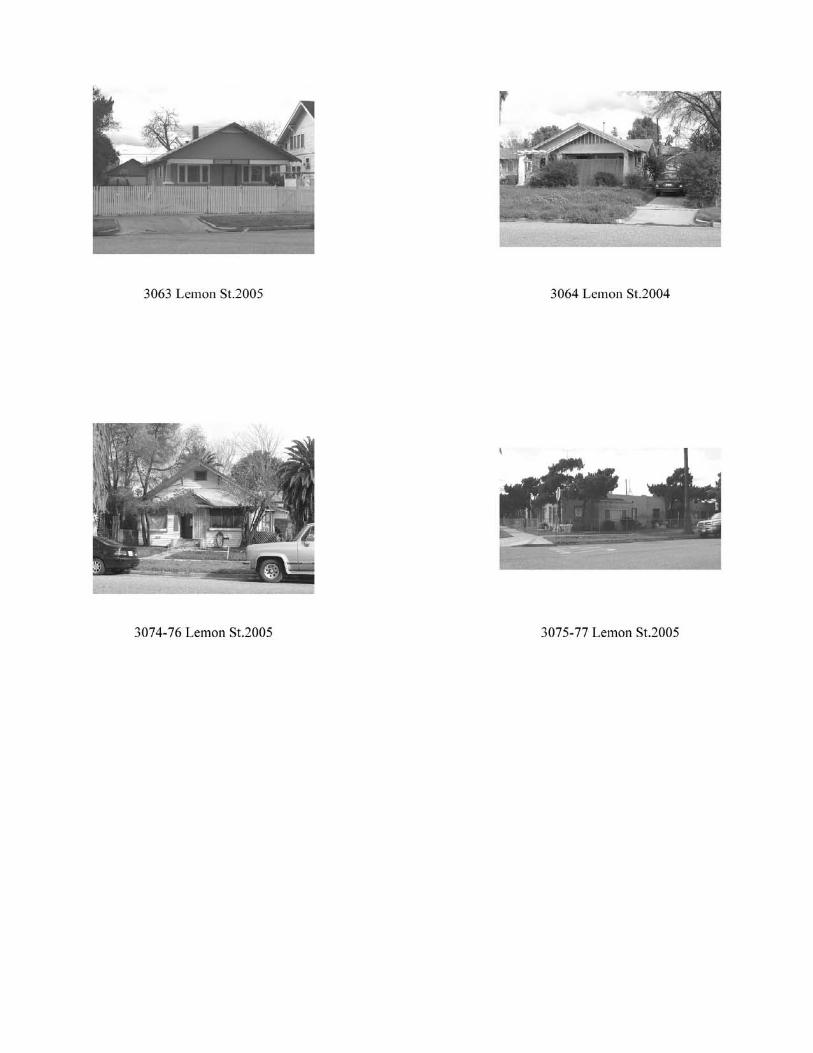
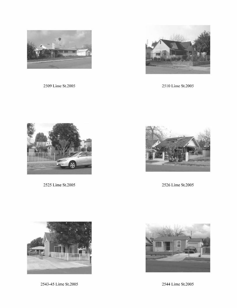
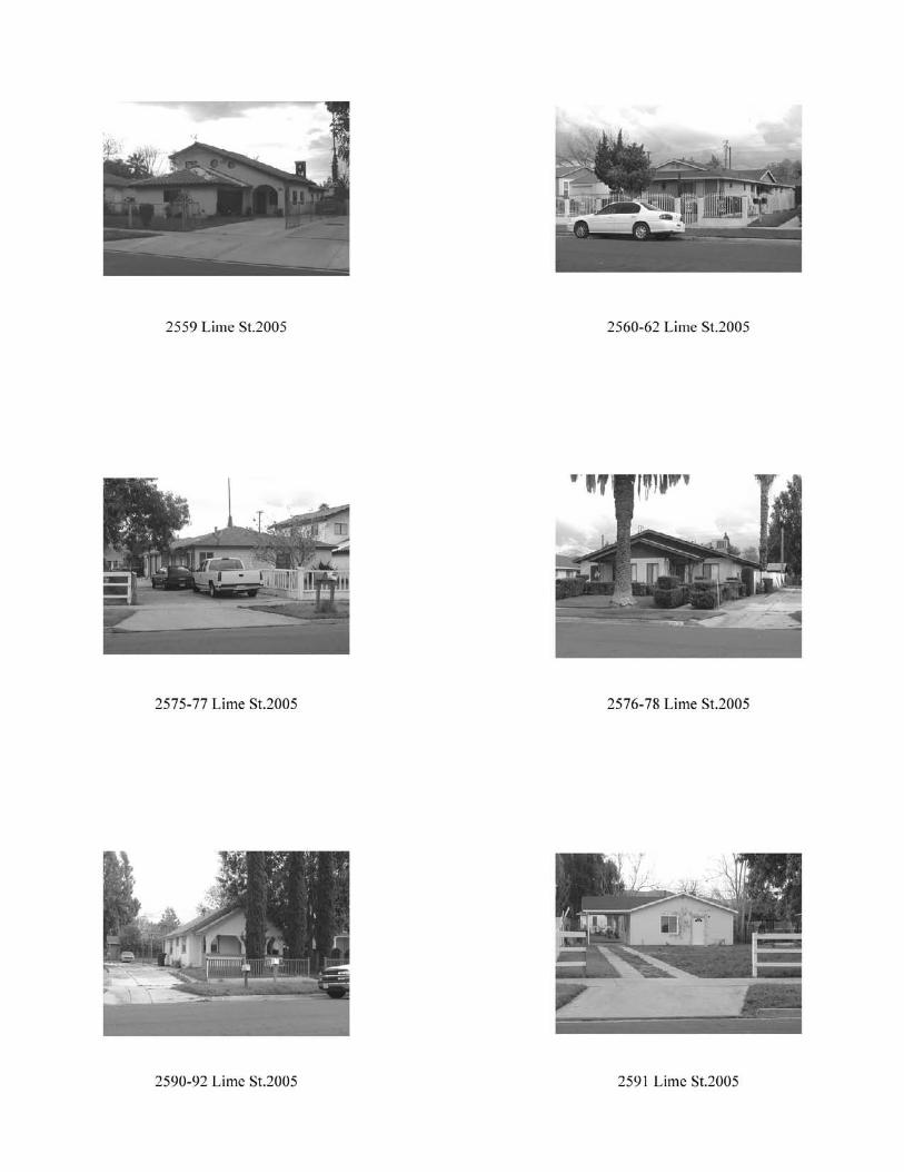
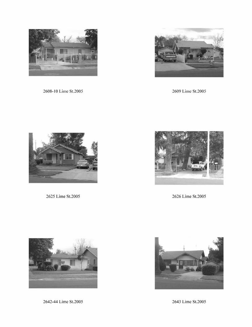


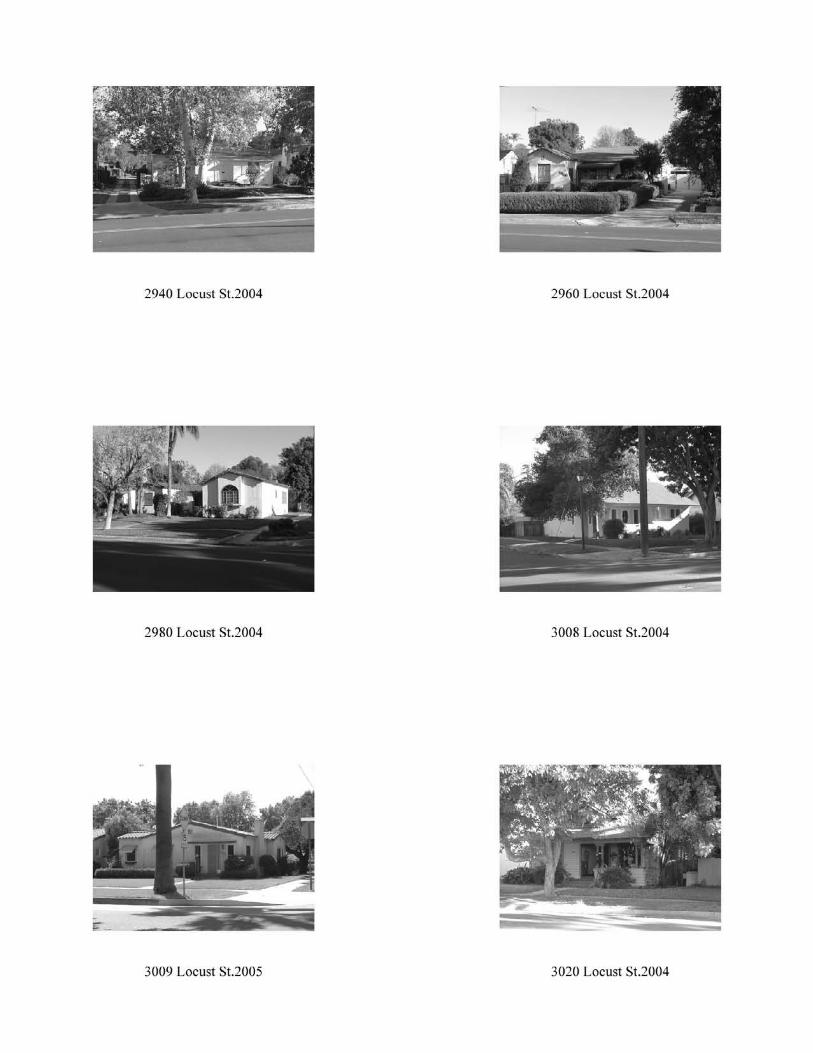
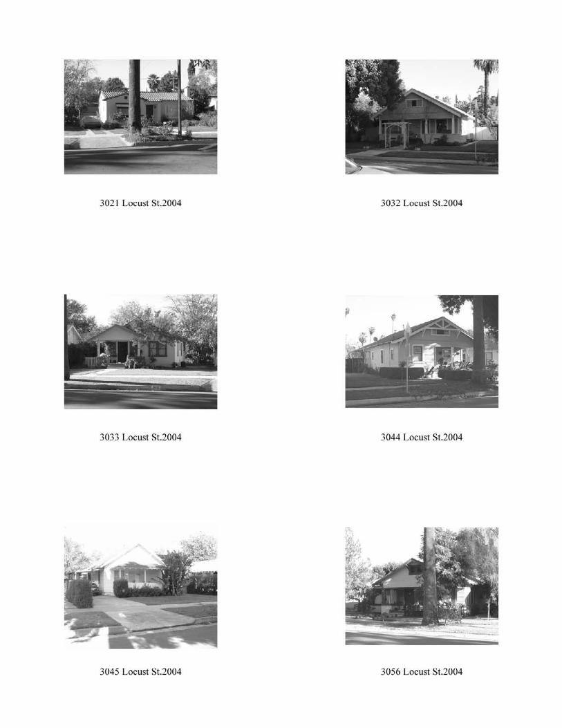
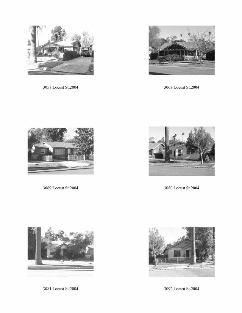
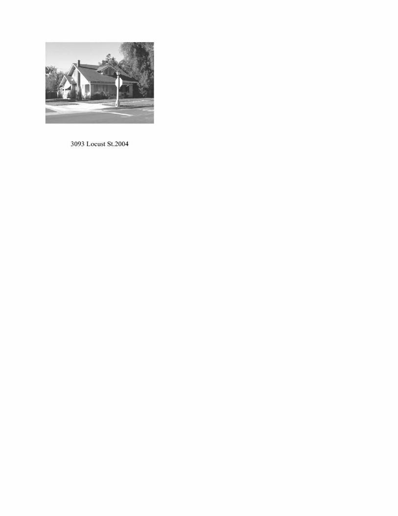
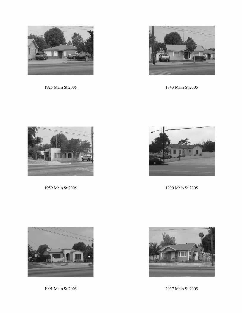
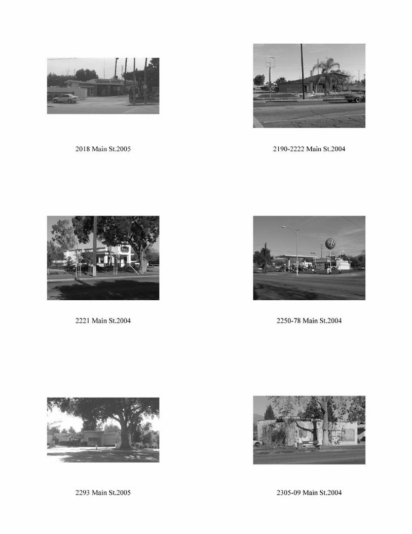
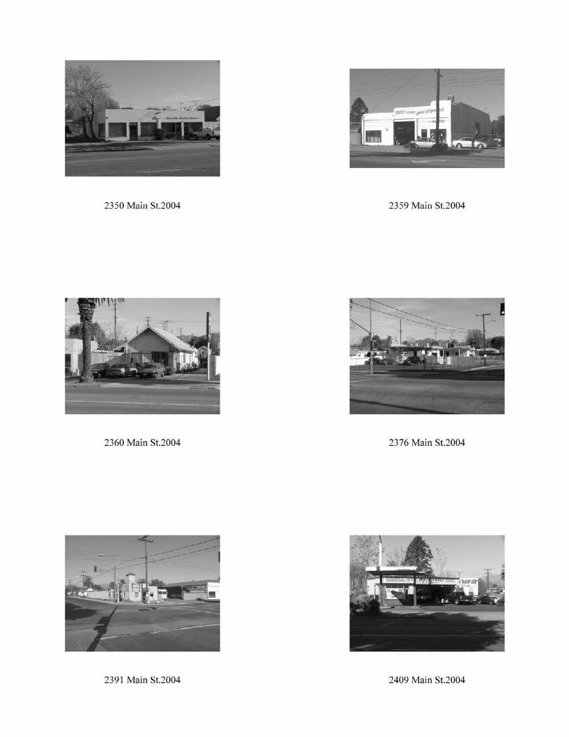
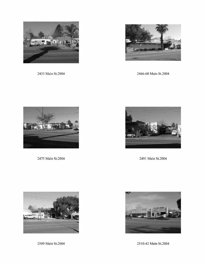


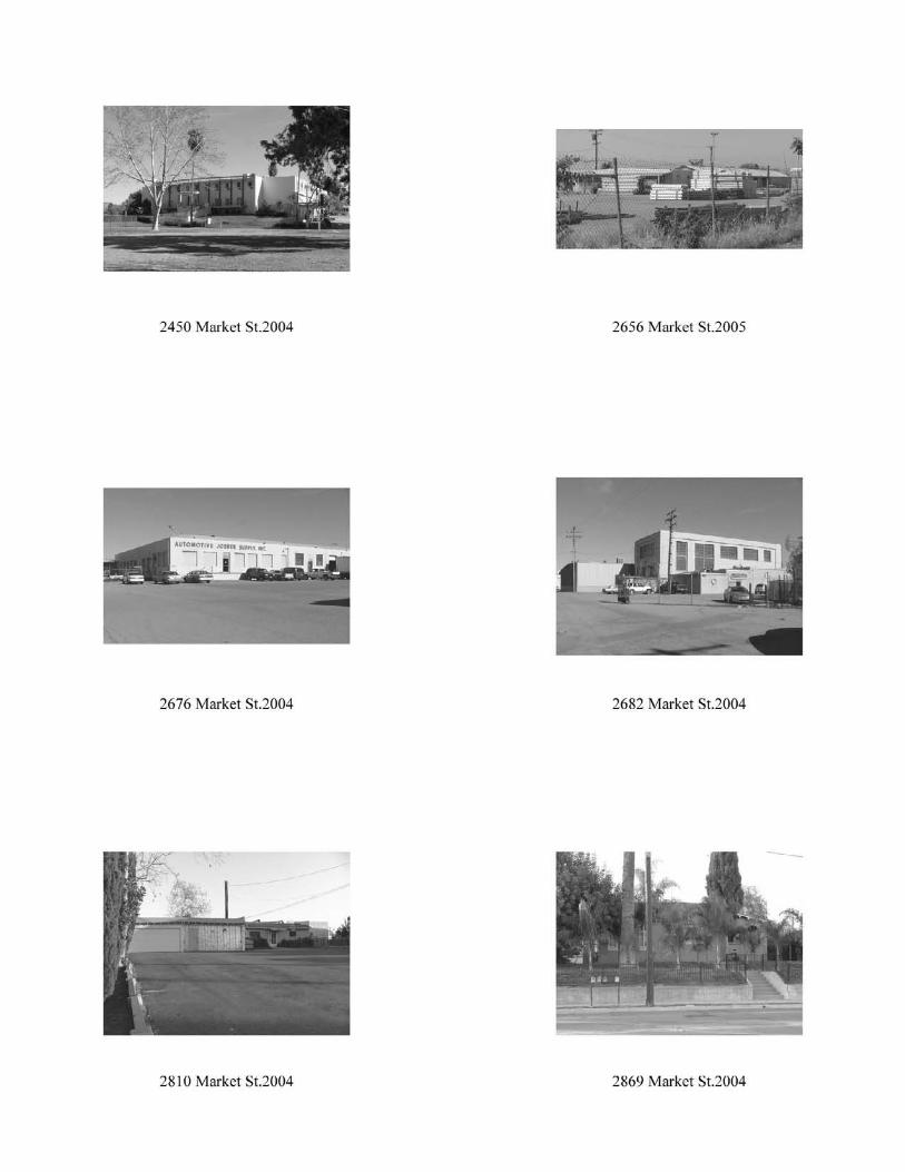
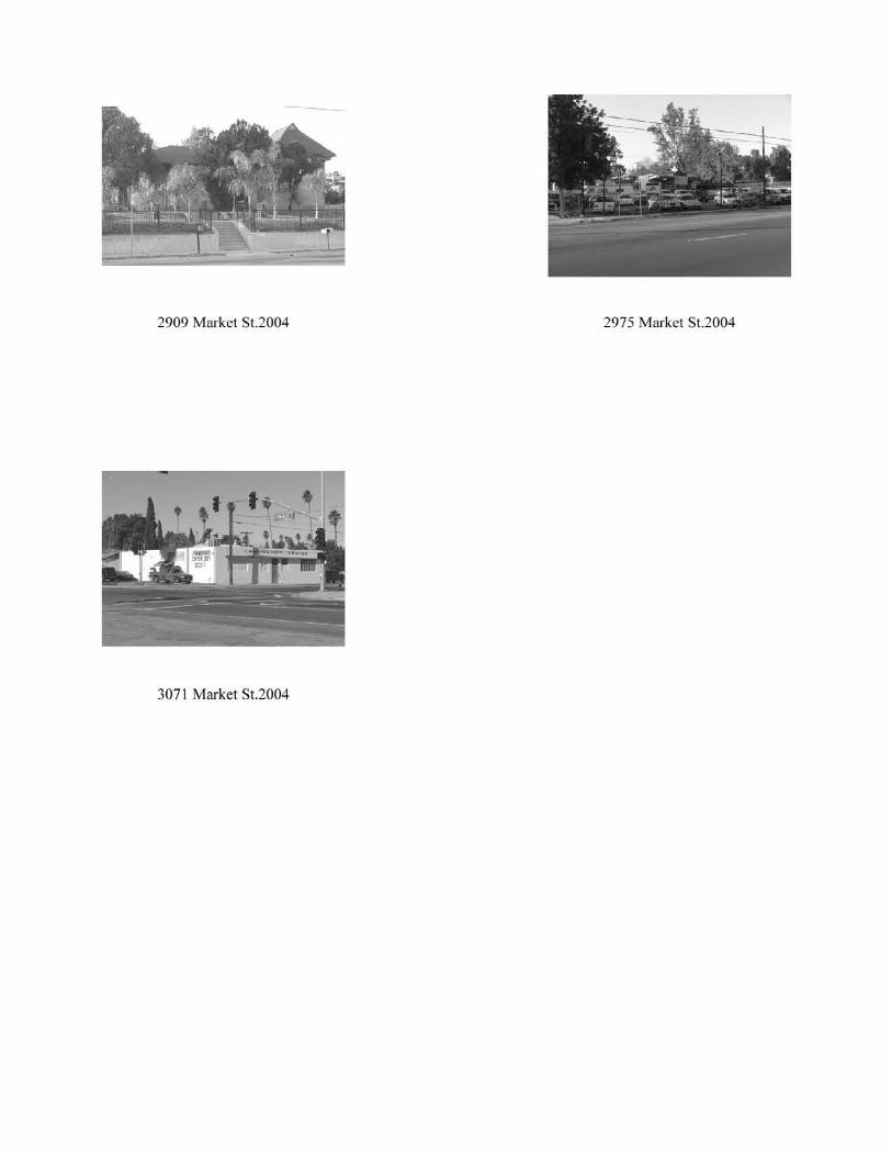
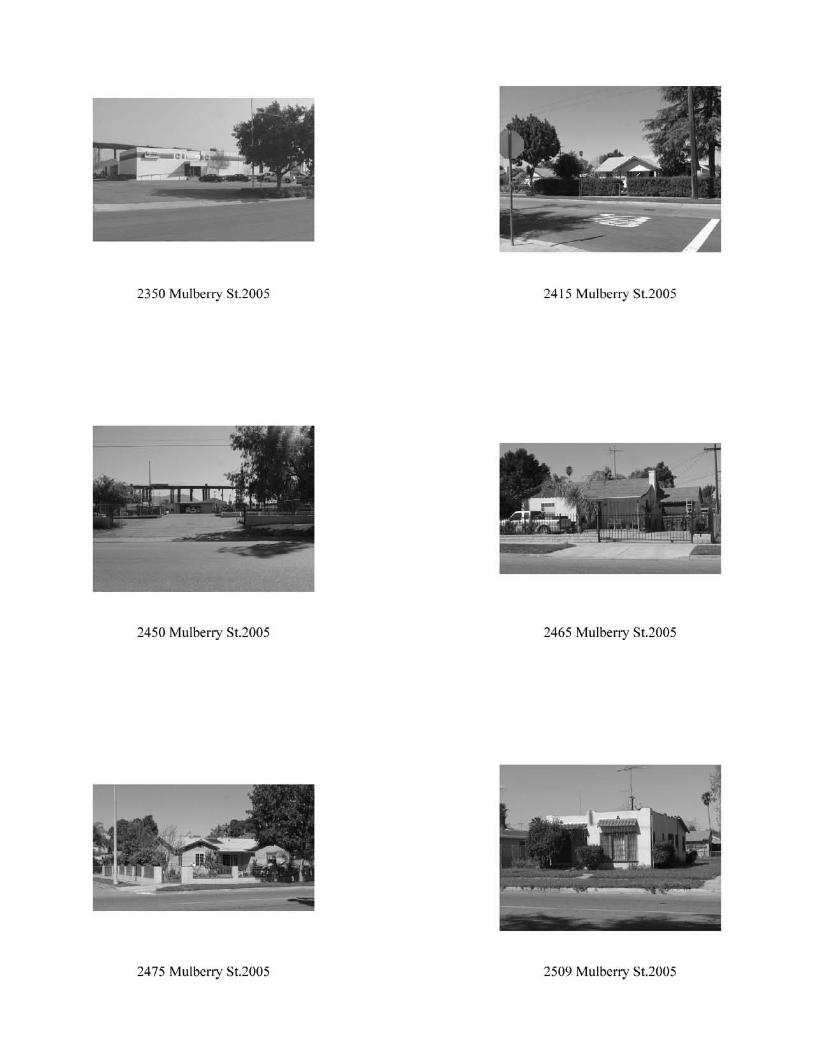

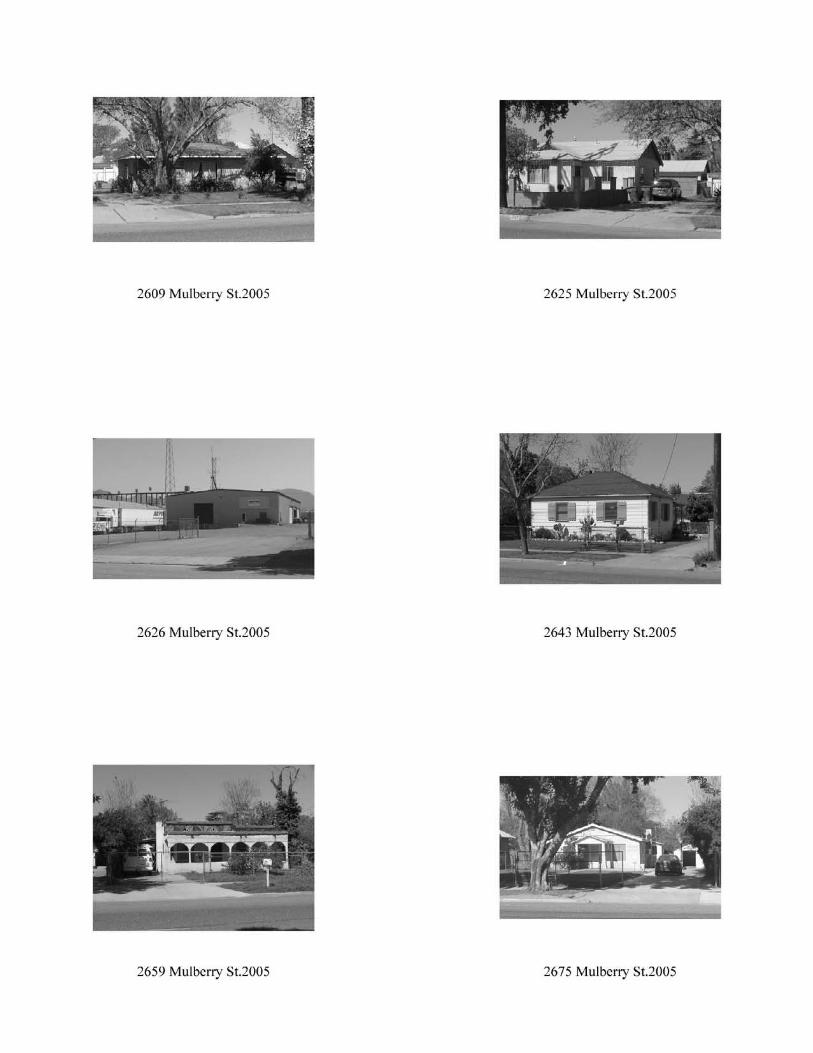
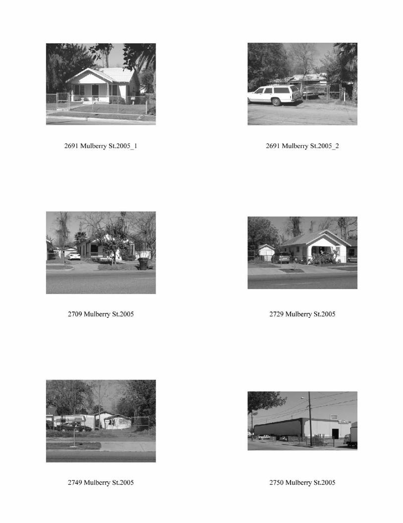
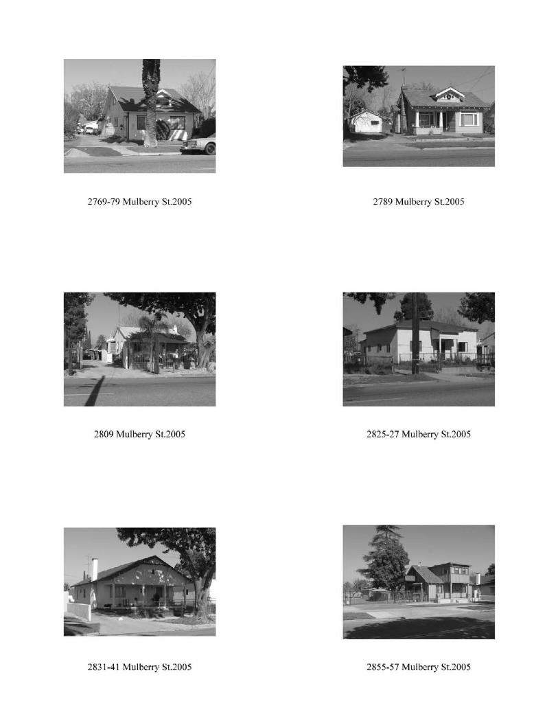
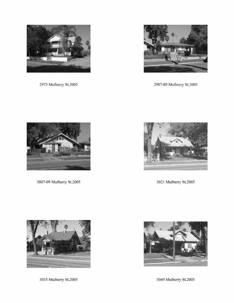
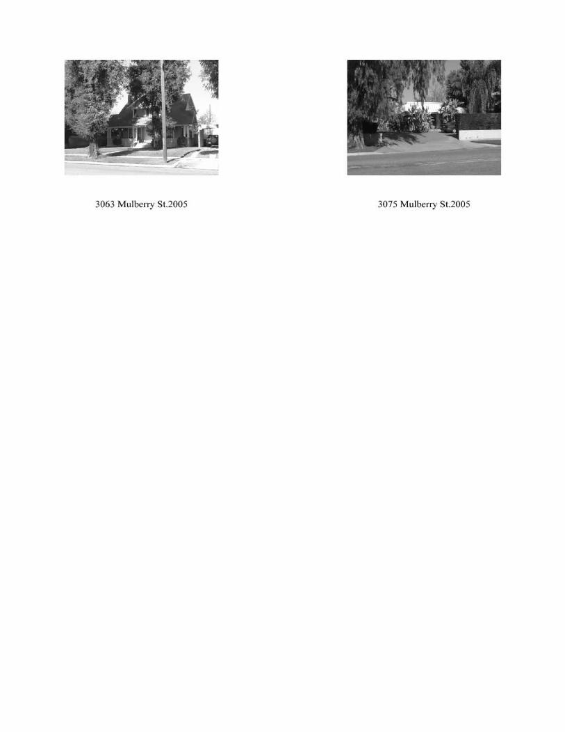


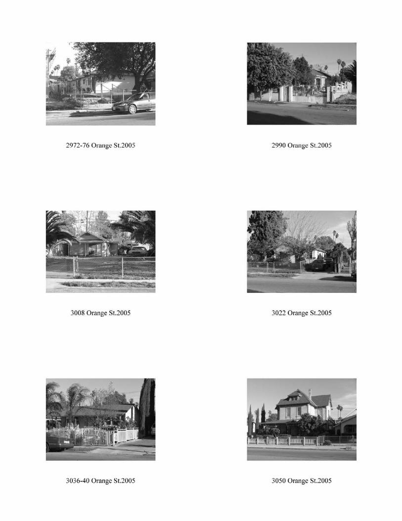
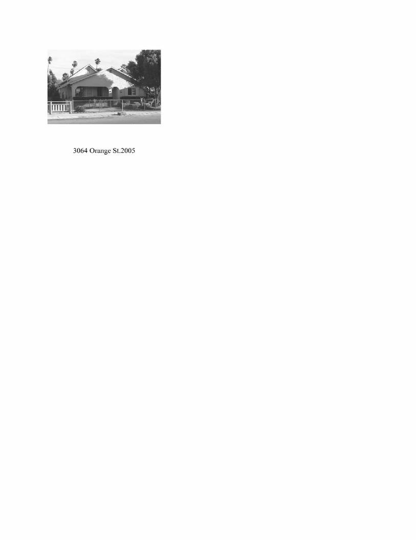
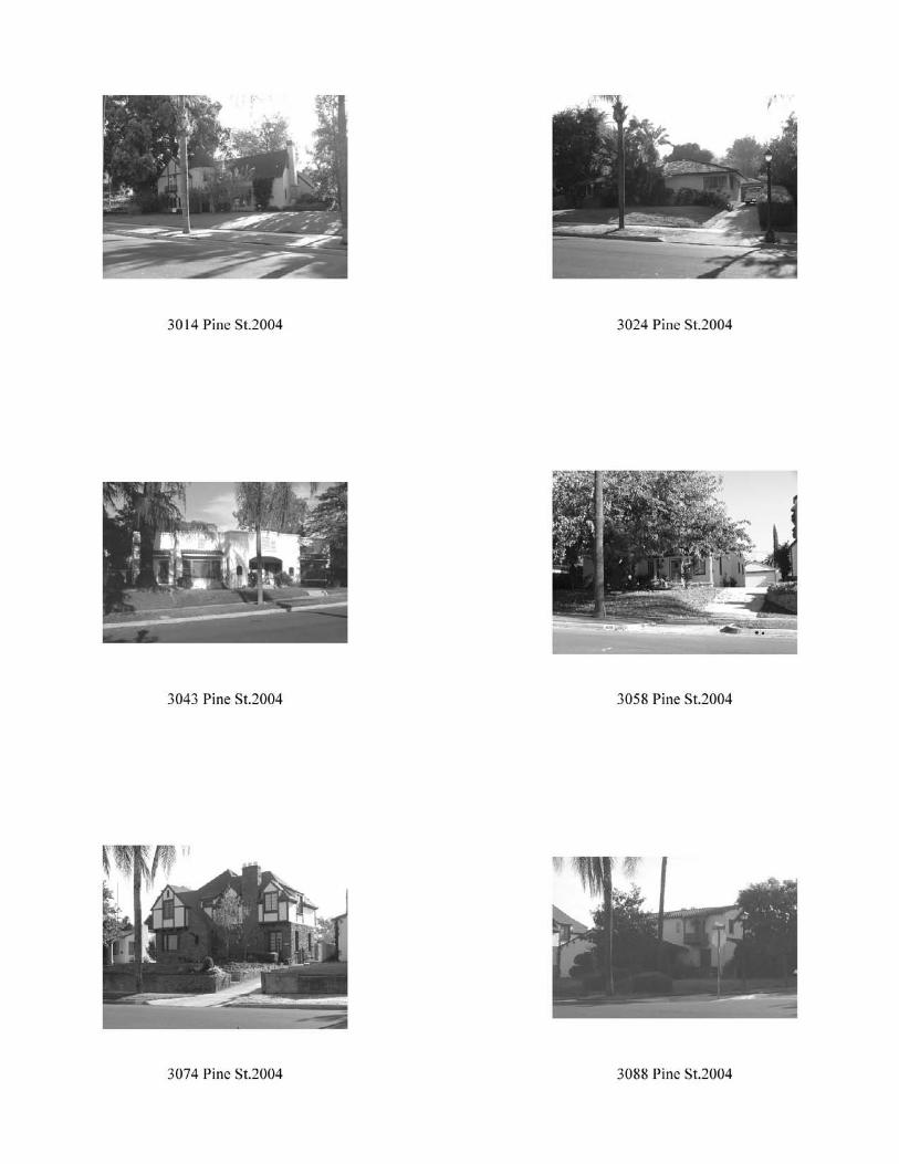
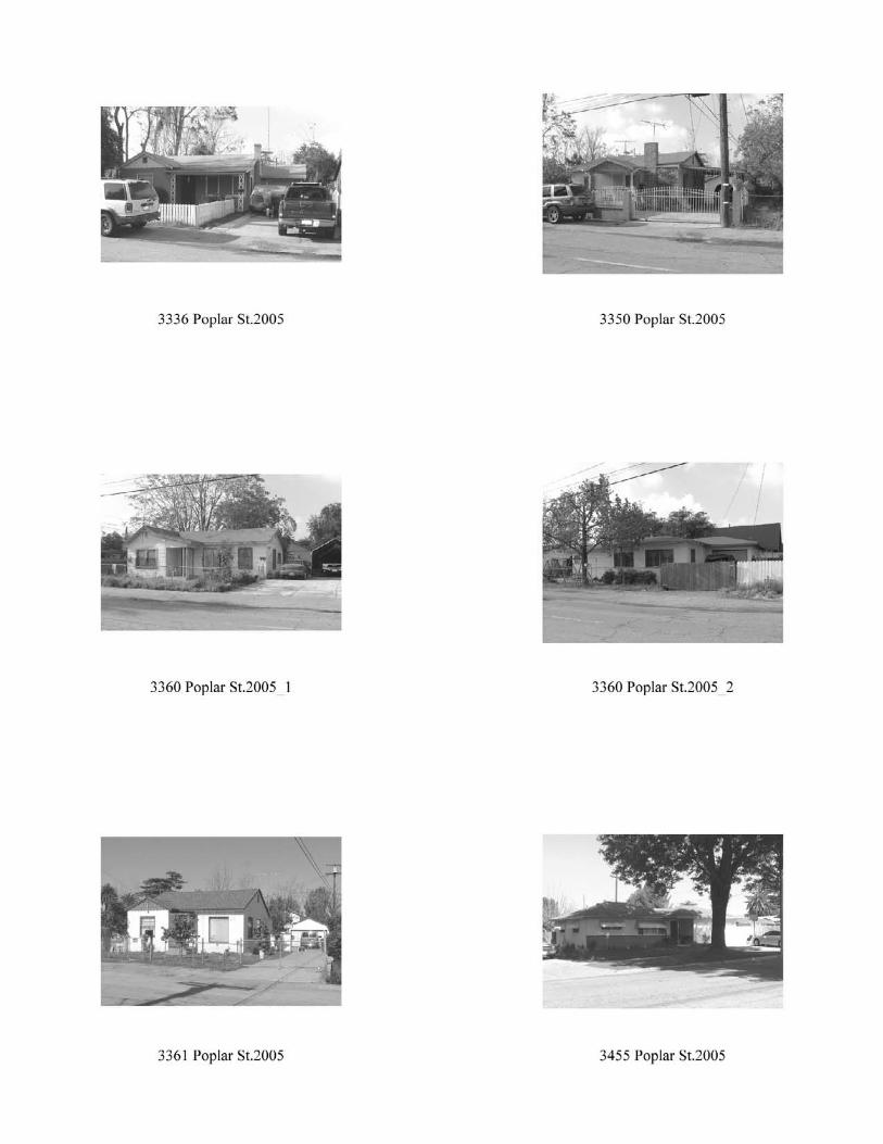
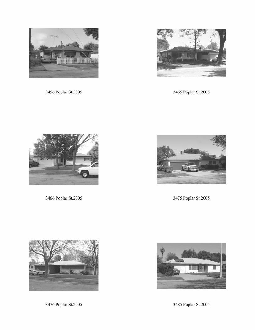
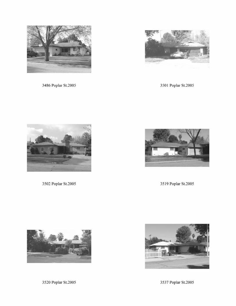
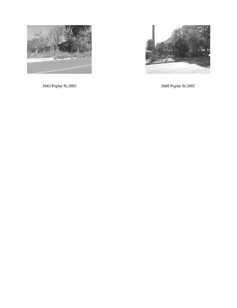
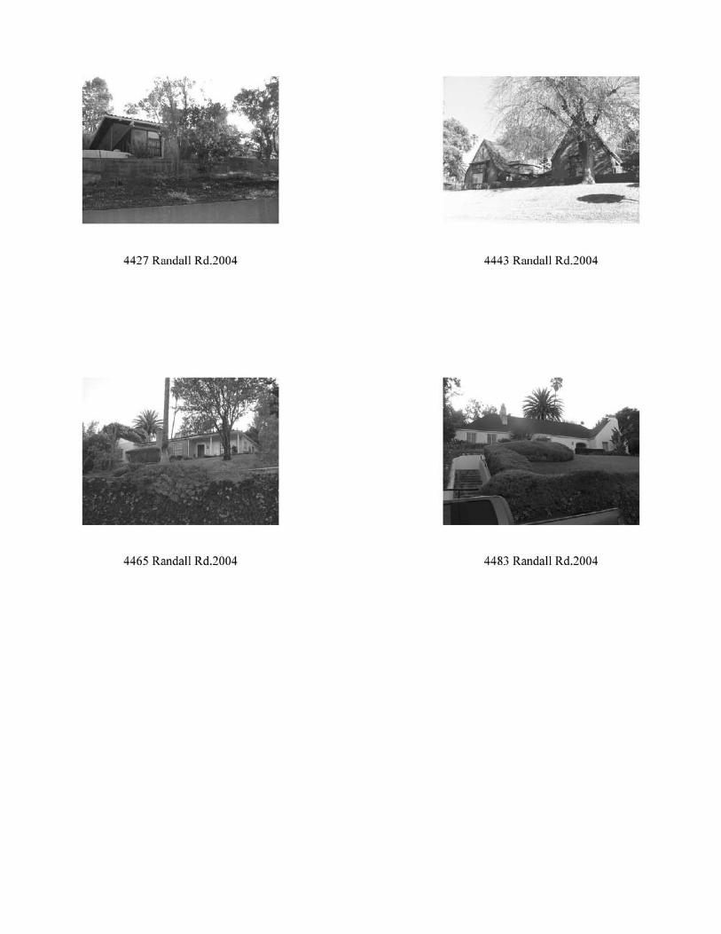
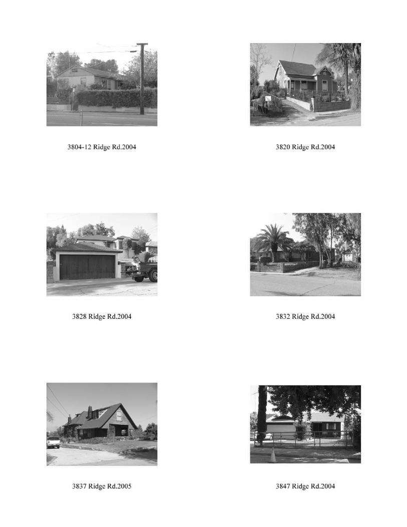
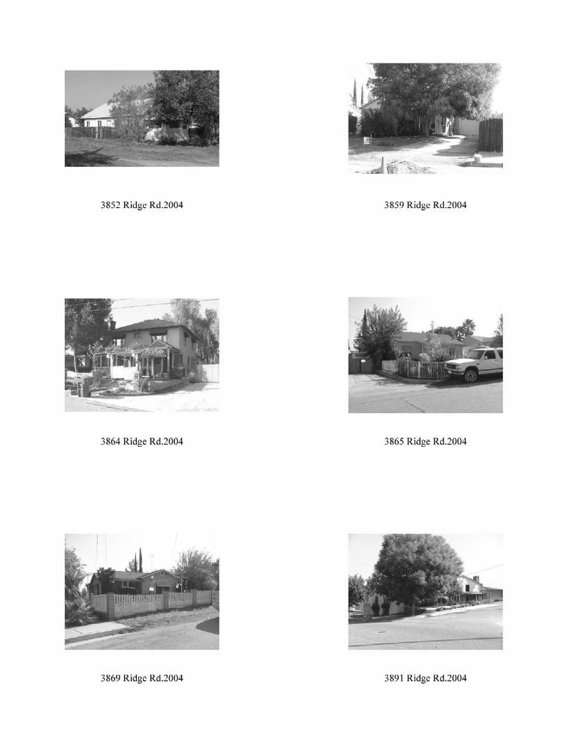
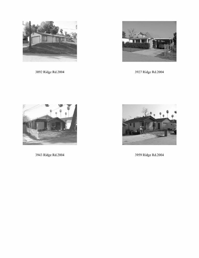
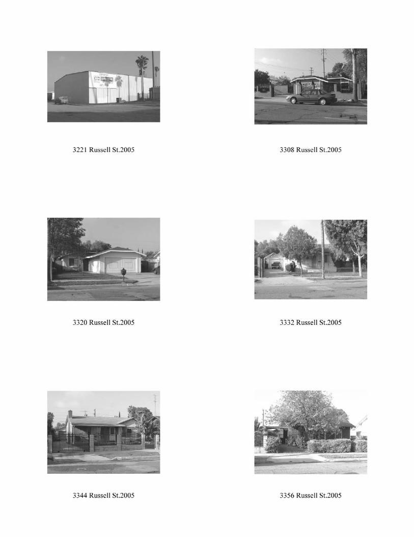


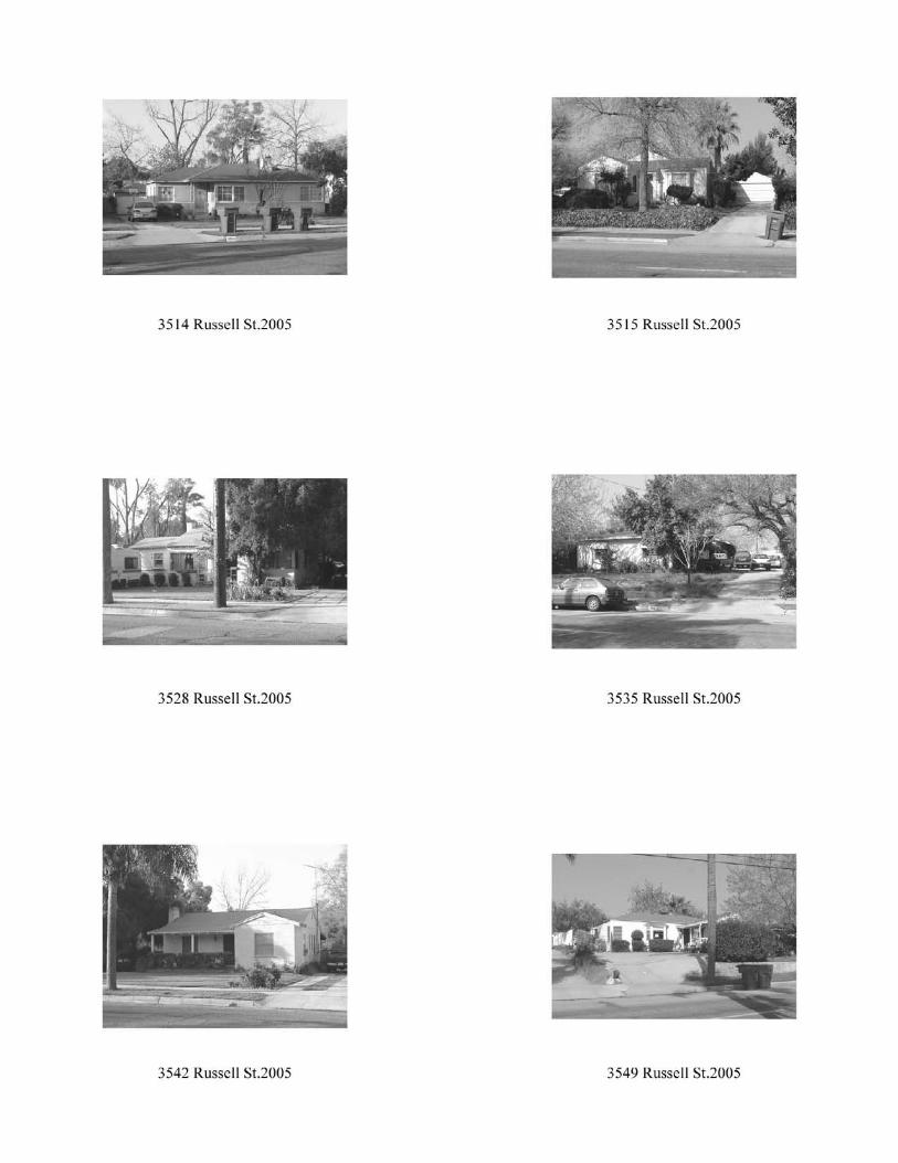
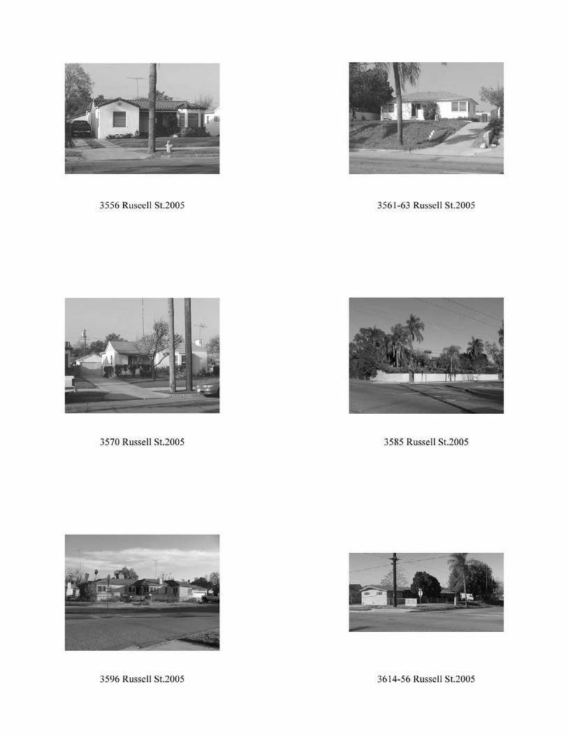
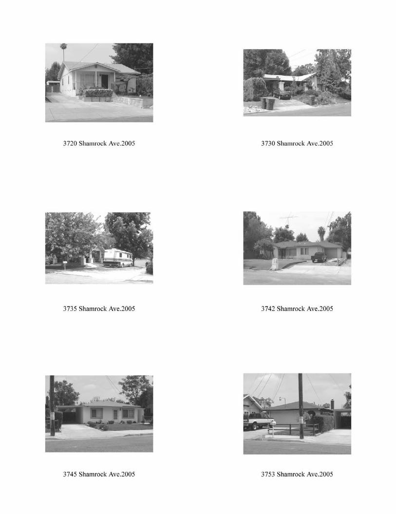
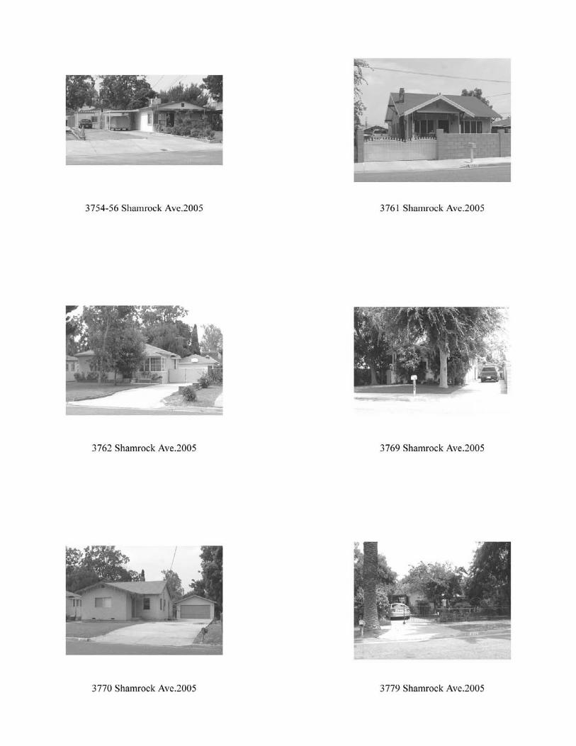


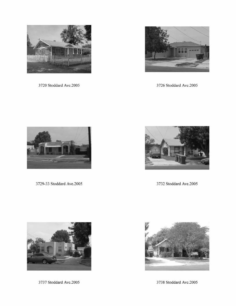
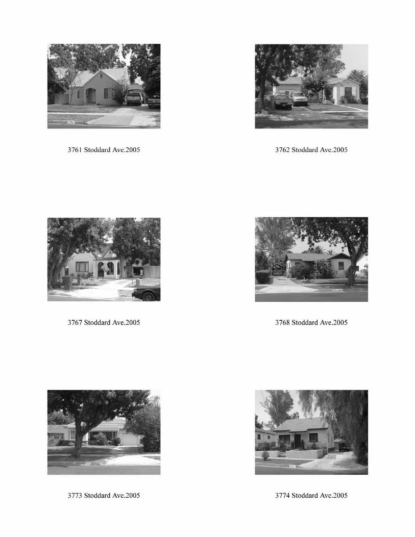

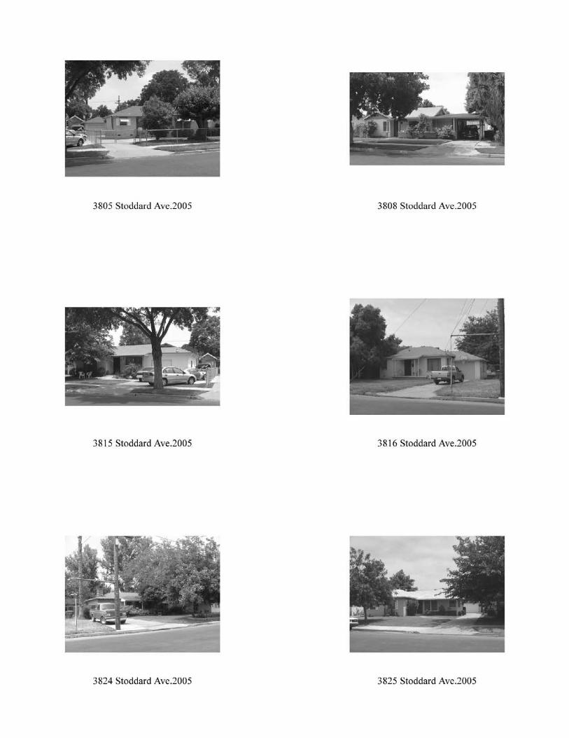
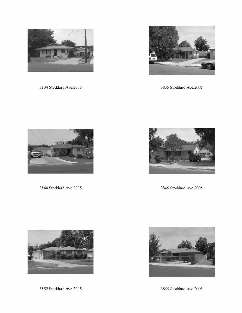
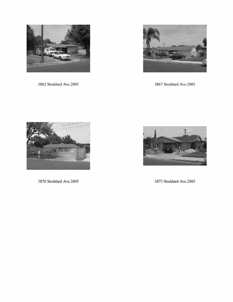
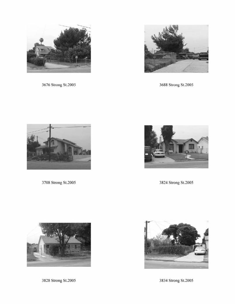
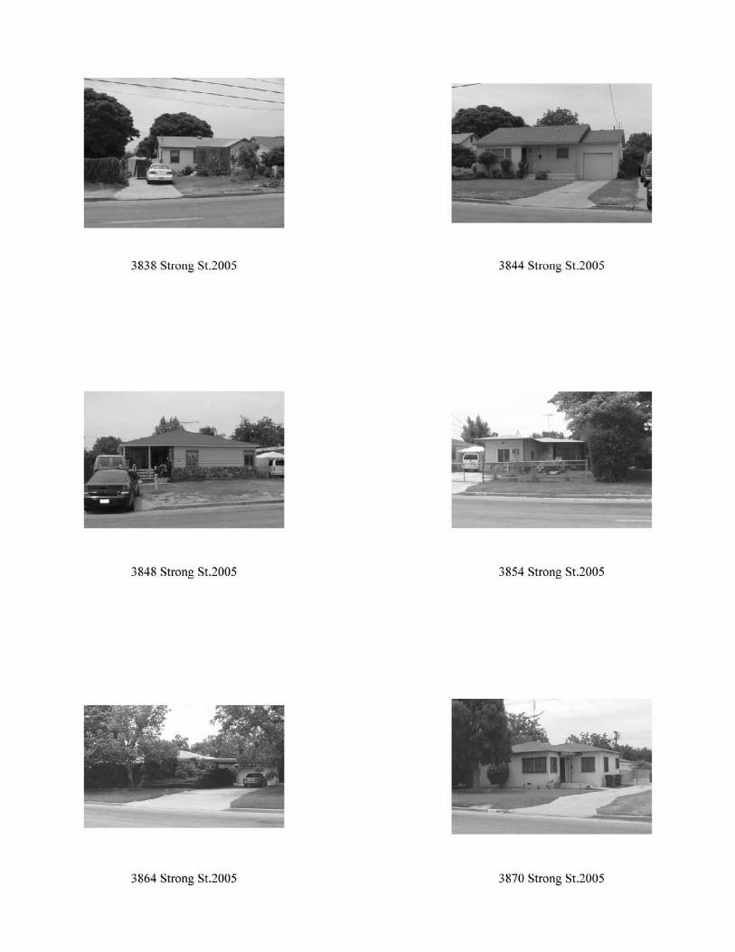
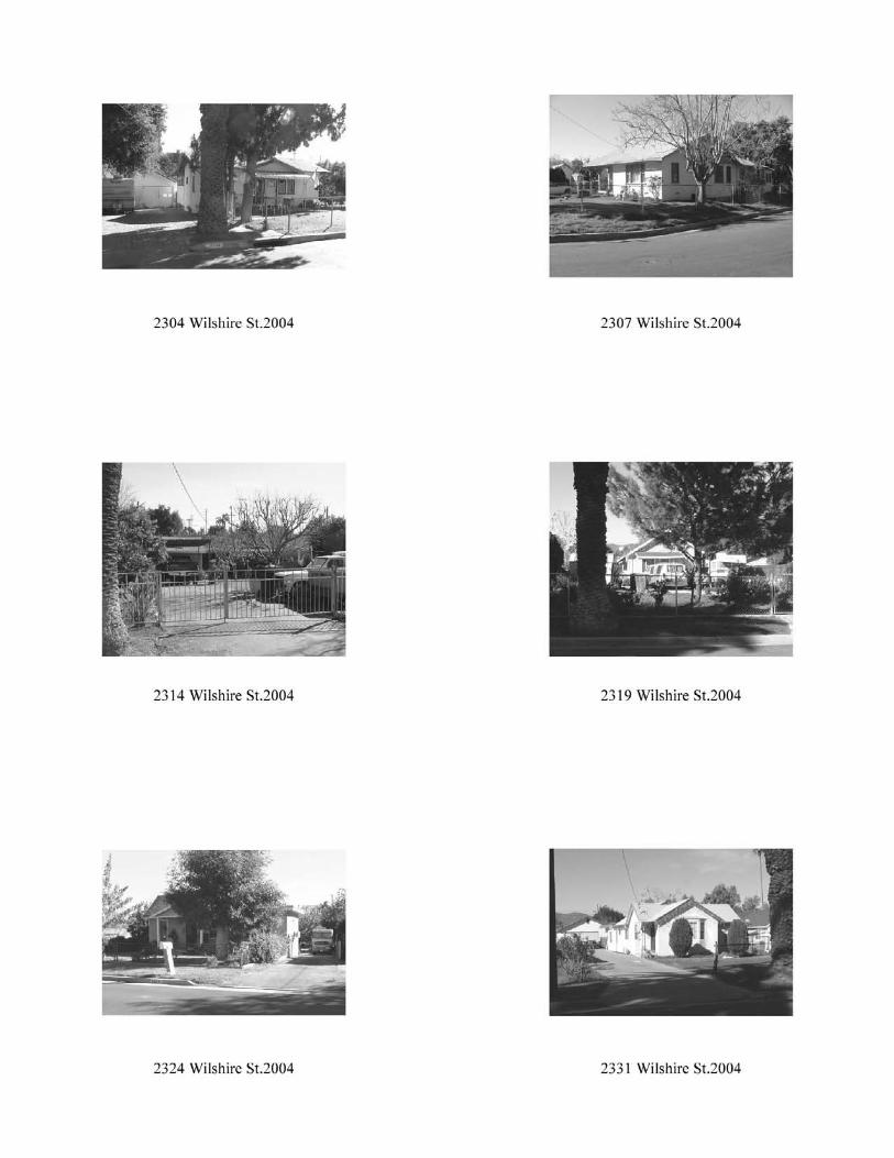
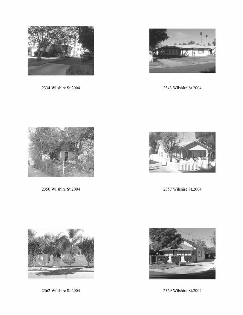
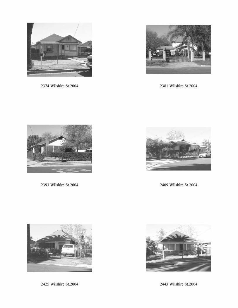
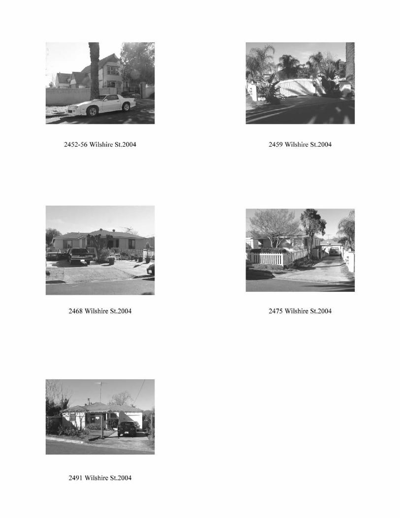
APPENDIX V
OW
TABLE
PITH
TEIN
N T
TH
IAE
LNO
HRIST
TH
ORSI
ID
CE
DSU
ISRTVRIE
CY
TSAREA

Mile
Squ
are
Nor
thw
est H
isto
ric
Dis
tric
t Add
ition
APN
Add
ress
Stre
etY
ear
Bui
ltA
rea
of
Dev
elop
men
tD
istr
ict/N
CA
Nam
eC
HR
Stat
usC
ode
Rea
son
for
Exc
lusi
onan
d/or
Com
men
ts
2091
9100
129
12
Bro
ckto
n A
ve
Fs
1955
airm
ount
Hei
ght
Mile
Squ
are
NW
6L
Dat
e of
Con
stru
ctio
n 20
9191
002
2938
B
rock
ton
Ave
19
02
Mile
Squ
are
NW
Fa
irmou
nt H
eigh
ts3C
D20
9191
003
2962
Bro
ckto
n A
ve
F19
07ai
rmou
nt H
eigh
tsM
ile S
quar
e N
W
3CD
2091
9100
429
88B
rock
ton
Ave
F
1905
airm
ount
Hei
ghts
Mile
Squ
are
NW
3C
D20
9181
009
3007
Bro
ckto
n A
ve
F19
10ai
rmou
nt H
eigh
tsM
ile S
quar
e N
W
5S1/
3CD
SM#
209
2091
9600
130
08B
rock
ton
Ave
1916
Fairm
ount
Hei
ghts
M
ile S
quar
e N
W
3CD
2091
8101
030
19A
veB
rock
ton
1910
Fs
airm
ount
Hei
ght
Mile
Squ
are
NW
3C
D20
9196
002
3020
B
rock
ton
Ave
F
s19
16ai
rmou
nt H
eigh
tM
ile S
quar
e N
W
3CD
2091
8101
130
31
Bro
ckto
n A
ve
Fs
1905
airm
ount
Hei
ght
Mile
Squ
are
NW
3C
D20
9196
003
3032
Bro
ckto
n A
ve
Fs
1911
airm
ount
Hei
ght
Mile
Squ
are
NW
5S
1/3C
DSM
# 24
1 20
9181
012
3043
Bro
ckto
n A
ve
Fs
1929
airm
ount
Hei
ght
Mile
Squ
are
NW
3C
D20
9196
004
3044
B
rock
ton
Ave
F
s19
10ai
rmou
nt H
eigh
tM
ile S
quar
e N
W
3CD
2091
8101
330
55 A
ve
Fs
Bro
ckto
n19
28ai
rmou
nt H
eigh
tM
ile S
quar
e N
W
3CD
2091
9600
530
56 A
ve
Fs
Bro
ckto
n19
12ai
rmou
nt H
eigh
tM
ile S
quar
e N
W
3CD
2091
8101
430
67B
rock
ton
Ave
19
08Fa
irmou
nt H
eigh
ts
Mile
Squ
are
NW
3C
D20
9196
006
3068
Bro
ckto
n A
ve19
17F
sai
rmou
nt H
eigh
tM
ile S
quar
e N
W
3CD
2091
8101
5 30
77-7
9 A
ve
F
Bro
ckto
n19
25ai
rmou
nt H
eigh
tsM
ile S
quar
e N
W
3CD
2091
9600
730
80e
FB
rock
ton
Av
1922
airm
ount
Hei
ghts
Mile
Squ
are
NW
3C
D20
9181
016
3091
Bro
ckto
n A
ve
F19
51ai
rmou
nt H
eigh
tsM
ile S
quar
e N
W
6LD
ate
of C
onst
ruct
ion
2091
9600
830
92
Bro
ckto
n A
ve
F19
29ai
rmou
nt H
eigh
tsM
ile S
quar
e N
W
3CD
2071
0500
130
08F
Ced
ar S
t 19
53ai
rmou
nt H
eigh
tsM
ile S
quar
e N
W
6LD
ate
of C
onst
ruct
ion
2071
0401
830
09C
edar
St
F19
46ai
rmou
nt H
eigh
tsM
ile S
quar
e N
W
6Lch
ange
d w
indo
ws &
ope
ning
s20
7105
002
3020
FC
edar
St
1946
airm
ount
Hei
ghts
Mile
Squ
are
NW
6L
Dat
e of
Con
stru
ctio
n 20
7104
017
3021
Ced
ar S
t 19
27Fa
irmou
nt H
eigh
tsM
ile S
quar
e N
W
3CD
2071
0500
330
32C
edar
St
1941
Fairm
ount
Hei
ghts
Mile
Squ
are
NW
6L
Dat
e of
Con
stru
ctio
n
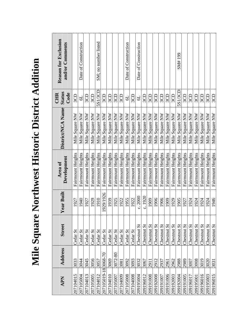
Mile
Squ
are
Nor
thw
est H
isto
ric
Dis
tric
t Add
ition
APN
Add
ress
Stre
etY
ear
Bui
ltA
rea
of
Dev
elop
men
tD
istr
ict/N
CA
Nam
eC
HR
Stat
usC
ode
Rea
son
for
Exc
lusi
onan
d/or
Com
men
ts
2071
0401
530
33
Ced
ar S
t F
s19
27ai
rmou
nt H
eigh
tM
ile S
quar
e N
W
3CD
2071
0500
4 30
44
Ced
ar S
t 19
40
Mile
Squ
are
NW
D
ate
of C
onst
ruct
ion
Fairm
ount
Hei
ghts
6L20
7104
013
C
edar
St
Faht
s30
4519
27irm
ount
Hei
gM
ile S
quar
e N
W
3CD
2071
0500
5
Fa
hts
3056
Ced
ar S
t 19
29irm
ount
Hei
gM
ile S
quar
e N
W
3CD
2071
0401
230
57Fa
hts
Sd
Ced
ar S
t 19
10irm
ount
Hei
gM
ile S
quar
e N
W
5S1/
3CD
M; n
o nu
mbe
r lis
te20
7105
019-
1870
C
edar
St
Faht
s 30
68-
1929
/192
6irm
ount
Hei
gM
ile S
quar
e N
W
3CD
2071
0401
0
Fa
hts
3069
Ced
ar S
t 19
39irm
ount
Hei
gM
ile S
quar
e N
W
3CD
2071
0500
7 80
C
edar
St
Fa
hts
3072
-19
25irm
ount
Hei
gM
ile S
quar
e N
W
3CD
2071
0400
9
Fa
hts
3081
Ced
ar S
t 19
22irm
ount
Hei
gM
ile S
quar
e N
W
3CD
2071
0500
830
92Fa
hts
Ced
ar S
t 19
55irm
ount
Hei
gM
ile S
quar
e N
W
6LD
ate
of C
onst
ruct
ion
2071
0400
830
93C
edar
St
Faht
s19
22irm
ount
Hei
gM
ile S
quar
e N
W
3CD
2091
9500
430
32Fa
hts
Che
stnu
t St
c. 2
000
irmou
nt H
eig
Mile
Squ
are
NW
6L
Dat
e of
Con
stru
ctio
n 20
9196
012
3067
Che
stnu
t St
Faht
sc.
192
0 irm
ount
Hei
gM
ile S
quar
e N
W
3CD
2091
9100
829
11C
hest
nut S
t Fa
hts
1909
irmou
nt H
eig
Mile
Squ
are
NW
3C
D20
9192
008
2912
Che
stnu
t St
Faht
s19
06irm
ount
Hei
gM
ile S
quar
e N
W
3CD
2091
9100
729
37Fa
hts
Che
stnu
t St
1906
irmou
nt H
eig
Mile
Squ
are
NW
3C
D20
9191
006
2961
Che
stnu
t St
1909
Faht
sirm
ount
Hei
gM
ile S
quar
e N
W
3CD
2091
9200
329
62C
hest
nut S
t Fa
hts
1929
irmou
nt H
eig
Mile
Squ
are
NW
3C
D20
9192
004
2988
Faht
sC
hest
nut S
t 19
05irm
ount
Hei
gM
ile S
quar
e N
W
5S1/
3CD
SM#
199
2091
9100
529
89F
sC
hest
nut S
t 19
27ai
rmou
nt H
eigh
tM
ile S
quar
e N
W
3CD
2091
9601
730
07C
hest
nut S
t 19
24F
sai
htrm
ount
Hei
gM
ile S
quar
e N
W
3CD
2091
9500
130
08C
hest
nut S
t F
1924
airm
ount
Hei
ghts
Mile
Squ
are
NW
3C
D20
9196
016
3019
Fs
Che
stnu
t St
1924
airm
ount
Hei
ght
Mile
Squ
are
NW
3C
D20
9195
003
3020
Che
stnu
t St
1924
Fairm
ount
Hei
ghts
Mile
Squ
are
NW
3C
D20
9196
015
3031
Che
stnu
t St
F19
46ai
rmou
nt H
eigh
tsM
ile S
quar
e N
W
3CD
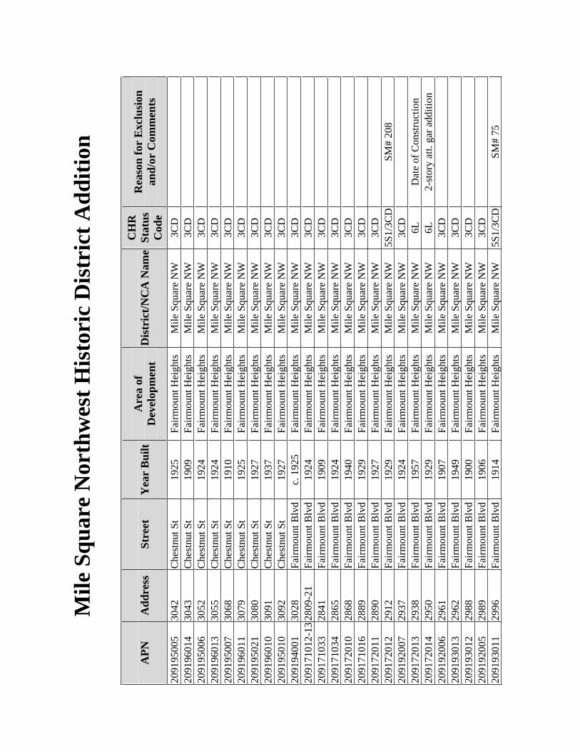
Mile
Squ
are
Nor
thw
est H
isto
ric
Dis
tric
t Add
ition
APN
Add
ress
Stre
etY
ear
Bui
ltA
rea
of
Dev
elop
men
tD
istr
ict/N
CA
Nam
eC
HR
Stat
usC
ode
Rea
son
for
Exc
lusi
onan
d/or
Com
men
ts
2091
9500
530
42
Che
stnu
t St
Fs
1925
airm
ount
Hei
ght
Mile
Squ
are
NW
3C
D20
9196
014
3043
C
hest
nut S
t 19
09
Mile
Squ
are
NW
Fa
irmou
nt H
eigh
ts
3CD
2091
9500
630
52F
Che
stnu
t St
1924
airm
ount
Hei
ghts
Mile
Squ
are
NW
3C
D20
9196
013
3055
Che
stnu
t St
F19
24ai
rmou
nt H
eigh
tsM
ile S
quar
e N
W
3CD
2091
9500
730
68C
hest
nut S
tF
1910
airm
ount
Hei
ghts
Mile
Squ
are
NW
3C
D20
9196
011
3079
Che
stnu
t St
F19
25ai
rmou
nt H
eigh
tsM
ile S
quar
e N
W
3CD
2091
9502
130
80C
hest
nut S
t 19
27Fa
irmou
nt H
eigh
tsM
ile S
quar
e N
W
3CD
2091
9601
030
91C
hest
nut S
t F
1937
airm
ount
Hei
ghts
Mile
Squ
are
NW
3C
D20
9195
010
3092
Che
stnu
t St
F19
27ai
rmou
nt H
eigh
tsM
ile S
quar
e N
W
3CD
2091
9400
130
28 B
lvd
FFa
irmou
ntc.
192
5 ai
rmou
nt H
eigh
tsM
ile S
quar
e N
W
3CD
2091
7101
2-13
21
Fairm
ount
Blv
dF
2809
-19
24ai
rmou
nt H
eigh
tsM
ile S
quar
e N
W
3CD
2091
7103
3 28
41
Blv
d
FFa
irmou
nt19
09ai
rmou
nt H
eigh
tsM
ile S
quar
e N
W
3CD
2091
7103
4
Fairm
ount
Blv
d
F28
6519
24ai
rmou
nt H
eigh
tsM
ile S
quar
e N
W
3CD
2091
7201
0
Blv
d
F28
68Fa
irmou
nt19
40ai
rmou
nt H
eigh
tsM
ile S
quar
e N
W
3CD
2091
7101
6
Blv
d
F28
89Fa
irmou
nt19
29ai
rmou
nt H
eigh
tsM
ile S
quar
e N
W
3CD
2091
7201
1
Blv
d
F28
90Fa
irmou
nt19
27ai
rmou
nt H
eigh
tsM
ile S
quar
e N
W
3CD
2091
7201
229
12Fa
irmou
nt B
lvd
1929
Fairm
ount
Hei
ghts
Mile
Squ
are
NW
5S
1/3C
DSM
# 20
8 20
9192
007
2937
B
lvd
Fa
irmou
nt19
24Fa
irmou
nt H
eigh
tsM
ile S
quar
e N
W
3CD
2091
7201
3
Fairm
ount
Blv
d
2938
1957
Fs
airm
ount
Hei
ght
Mile
Squ
are
NW
6L
Dat
e of
Con
stru
ctio
n 20
9172
014
2950
B
lvd
F
Fairm
ount
1929
airm
ount
Hei
ghts
Mile
Squ
are
NW
6L
2-st
ory
att.
gar a
dditi
on20
9192
006
Fa
irmou
nt B
lvd
F
2961
1907
airm
ount
Hei
ghts
Mile
Squ
are
NW
3C
D20
9193
013
2962
B
lvd
F
Fairm
ount
1949
airm
ount
Hei
ghts
Mile
Squ
are
NW
3C
D20
9193
012
Fa
irmou
nt B
lvd
F
2988
1900
airm
ount
Hei
ghts
Mile
Squ
are
NW
3C
D20
9192
005
Fa
irmou
nt B
lvd
F
2989
1906
airm
ount
Hei
ghts
Mile
Squ
are
NW
3C
D20
9193
011
2996
Fairm
ount
Blv
dF
1914
airm
ount
Hei
ghts
Mile
Squ
are
NW
5S
1/3C
DSM
# 75
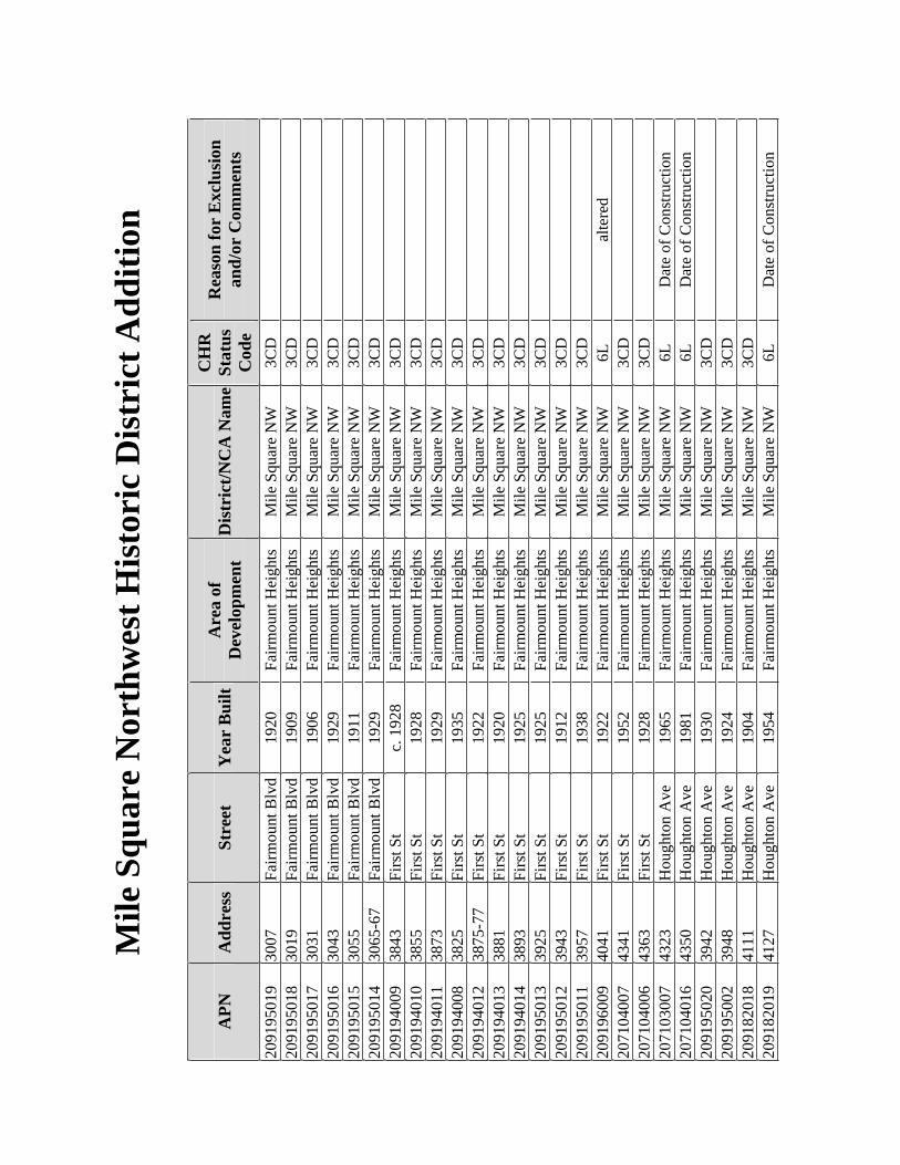
Mile
Squ
are
Nor
thw
est H
isto
ric
Dis
tric
t Add
ition
APN
Add
ress
Stre
etY
ear
Bui
ltA
rea
of
Dev
elop
men
tD
istr
ict/N
CA
Nam
eC
HR
Stat
usC
ode
Rea
son
for
Exc
lusi
onan
d/or
Com
men
ts
2091
9501
9 30
07
Fairm
ount
Blv
dF
s19
20ai
rmou
nt H
eigh
tM
ile S
quar
e N
W
3CD
2091
9501
8 30
19
Fairm
ount
Blv
d19
09
Mile
Squ
are
NW
Fa
irmou
nt H
eigh
ts
3CD
2091
9501
7 30
31
Blv
d
FFa
irmou
nt19
06ai
rmou
nt H
eigh
tsM
ile S
quar
e N
W
3CD
2091
9501
6
Blv
d
F30
43Fa
irmou
nt
1929
airm
ount
Hei
ghts
Mile
Squ
are
NW
3C
D20
9195
015
B
lvd
F
3055
Fairm
ount
1911
airm
ount
Hei
ghts
Mile
Squ
are
NW
3C
D20
9195
014
B
lvd
F30
65-6
7Fa
irmou
nt
1929
airm
ount
Hei
ghts
Mile
Squ
are
NW
3C
D20
9194
009
3843
Firs
t St
c. 1
928
Fs
airm
ount
Hei
ght
Mile
Squ
are
NW
3C
D20
9194
010
3855
Firs
t St
Fs
1928
airm
ount
Hei
ght
Mile
Squ
are
NW
3C
D20
9194
011
3873
Firs
t St
1929
Fs
airm
ount
Hei
ght
Mile
Squ
are
NW
3C
D20
9194
008
3825
Firs
t St
Fs
1935
airm
ount
Hei
ght
Mile
Squ
are
NW
3C
D20
9194
012
77
F
s38
75-
Firs
t St
1922
airm
ount
Hei
ght
Mile
Squ
are
NW
3C
D20
9194
013
3881
Firs
t St
Fs
1920
airm
ount
Hei
ght
Mile
Squ
are
NW
3C
D20
9194
014
3893
Fs
Firs
t St
1925
airm
ount
Hei
ght
Mile
Squ
are
NW
3C
D20
9195
013
3925
Firs
t St
1925
Fs
airm
ount
Hei
ght
Mile
Squ
are
NW
3C
D20
9195
012
3943
Firs
t St
1912
Fs
airm
ount
Hei
ght
Mile
Squ
are
NW
3C
D20
9195
011
3957
Firs
t St
1938
Fs
airm
ount
Hei
ght
Mile
Squ
are
NW
3C
D20
9196
009
4041
Firs
t St
1922
Fs
airm
ount
Hei
ght
Mile
Squ
are
NW
6L
alte
red
2071
0400
743
41Fi
rst S
t F
1952
airm
ount
Hei
ghts
Mile
Squ
are
NW
3C
D20
7104
006
4363
Firs
t St
F19
28ai
rmou
nt H
eigh
tsM
ile S
quar
e N
W
3CD
2071
0300
743
23
Hou
ghto
n A
ve
F19
65ai
rmou
nt H
eigh
tsM
ile S
quar
e N
W
6LD
ate
of C
onst
ruct
ion
2071
0401
643
50
Hou
ghto
n A
ve
F19
81ai
rmou
nt H
eigh
tsM
ile S
quar
e N
W
6LD
ate
of C
onst
ruct
ion
2091
9502
039
42
Hou
ghto
n A
ve
F19
30ai
rmou
nt H
eigh
tsM
ile S
quar
e N
W
3CD
2091
9500
239
48
Hou
ghto
n A
ve
F19
24ai
rmou
nt H
eigh
tsM
ile S
quar
e N
W
3CD
2091
8201
841
11
Hou
ghto
n A
ve
F19
04ai
rmou
nt H
eigh
tsM
ile S
quar
e N
W
3CD
2091
8201
941
27H
ough
ton
Ave
F19
54ai
rmou
nt H
eigh
tsM
ile S
quar
e N
W
6LD
ate
of C
onst
ruct
ion
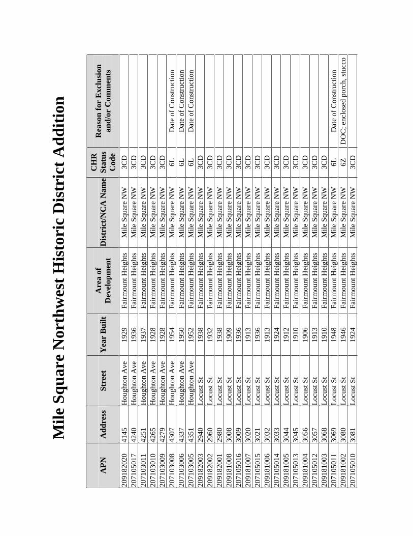
Mile
Squ
are
Nor
thw
est H
isto
ric
Dis
tric
t Add
ition
APN
Add
ress
Stre
etY
ear
Bui
ltA
rea
of
Dev
elop
men
tD
istr
ict/N
CA
Nam
eC
HR
Stat
usC
ode
Rea
son
for
Exc
lusi
onan
d/or
Com
men
ts
2091
8202
041
45
Hou
ghto
n A
ve
Fs
1929
airm
ount
Hei
ght
Mile
Squ
are
NW
3C
D20
7105
017
4240
H
ough
ton
Ave
19
36
Mile
Squ
are
NW
Fa
irmou
nt H
eigh
ts
3CD
2071
0301
142
51H
ough
ton
Ave
F19
37ai
rmou
nt H
eigh
tsM
ile S
quar
e N
W
3CD
2071
0301
042
65H
ough
ton
Ave
19
28Fa
irmou
nt H
eigh
tsM
ile S
quar
e N
W
3CD
2071
0300
942
79H
ough
ton
Ave
F19
28ai
rmou
nt H
eigh
tsM
ile S
quar
e N
W
3CD
2071
0300
843
07H
ough
ton
Ave
F19
54ai
rmou
nt H
eigh
tsM
ile S
quar
e N
W
6LD
ate
of C
onst
ruct
ion
2071
0300
643
37H
ough
ton
Ave
Fs
1950
aiht
rmou
nt H
eig
Mile
Squ
are
NW
6L
Dat
e of
Con
stru
ctio
n 20
7103
005
4351
Hou
ghto
nA
veFa
hts
1952
irmou
nt H
eig
Mile
Squ
are
NW
6L
Dat
e of
Con
stru
ctio
n 20
9182
003
2940
Lo
cust
St
Fs
1938
airm
ount
Hei
ght
Mile
Squ
are
NW
3C
D20
9182
002
2960
Fs
Locu
st S
t 19
32ai
rmou
nt H
eigh
tM
ile S
quar
e N
W
3CD
2091
8200
129
80Lo
cust
St
1938
Fs
airm
ount
Hei
ght
Mile
Squ
are
NW
3C
D20
9181
008
3008
Locu
st S
t 19
09F
sai
rmou
nt H
eigh
tM
ile S
quar
e N
W
3CD
2071
0501
630
09F
sLo
cust
St
1936
airm
ount
Hei
ght
Mile
Squ
are
NW
3C
D20
9181
007
3020
Locu
st S
t 19
13F
sai
rmou
nt H
eigh
tM
ile S
quar
e N
W
3CD
2071
0501
530
21Lo
cust
St
Fs
1936
airm
ount
Hei
ght
Mile
Squ
are
NW
3C
D20
9181
006
3032
Locu
st S
t 19
13F
sai
rmou
nt H
eigh
tM
ile S
quar
e N
W
3CD
2071
0501
430
33Lo
cust
St
1924
Fs
airm
ount
Hei
ght
Mile
Squ
are
NW
3C
D20
9181
005
3044
Fs
Locu
st S
t 19
12ai
rmou
nt H
eigh
tM
ile S
quar
e N
W
3CD
2071
0501
330
45
Locu
st S
t F
s19
10ai
rmou
nt H
eigh
tM
ile S
quar
e N
W
3CD
2091
8100
430
56Lo
cust
St
Fs
1906
airm
ount
Hei
ght
Mile
Squ
are
NW
3C
D20
7105
012
3057
Locu
st S
t 19
13F
sai
rmou
nt H
eigh
tM
ile S
quar
e N
W
3CD
2091
8100
330
68Lo
cust
St
1910
Fs
airm
ount
Hei
ght
Mile
Squ
are
NW
3C
D20
7105
011
3069
Locu
st S
t 19
48F
sai
rmou
nt H
eigh
tM
ile S
quar
e N
W
6LD
ate
of C
onst
ruct
ion
2091
8100
230
80Lo
cust
St
1946
Fs
airm
ount
Hei
ght
Mile
Squ
are
NW
6Z
DO
C; e
nclo
sed
porc
h, st
ucco
2071
0501
030
81Lo
cust
St
1924
Fs
aiht
rmou
nt H
eig
Mile
Squ
are
NW
3C
D
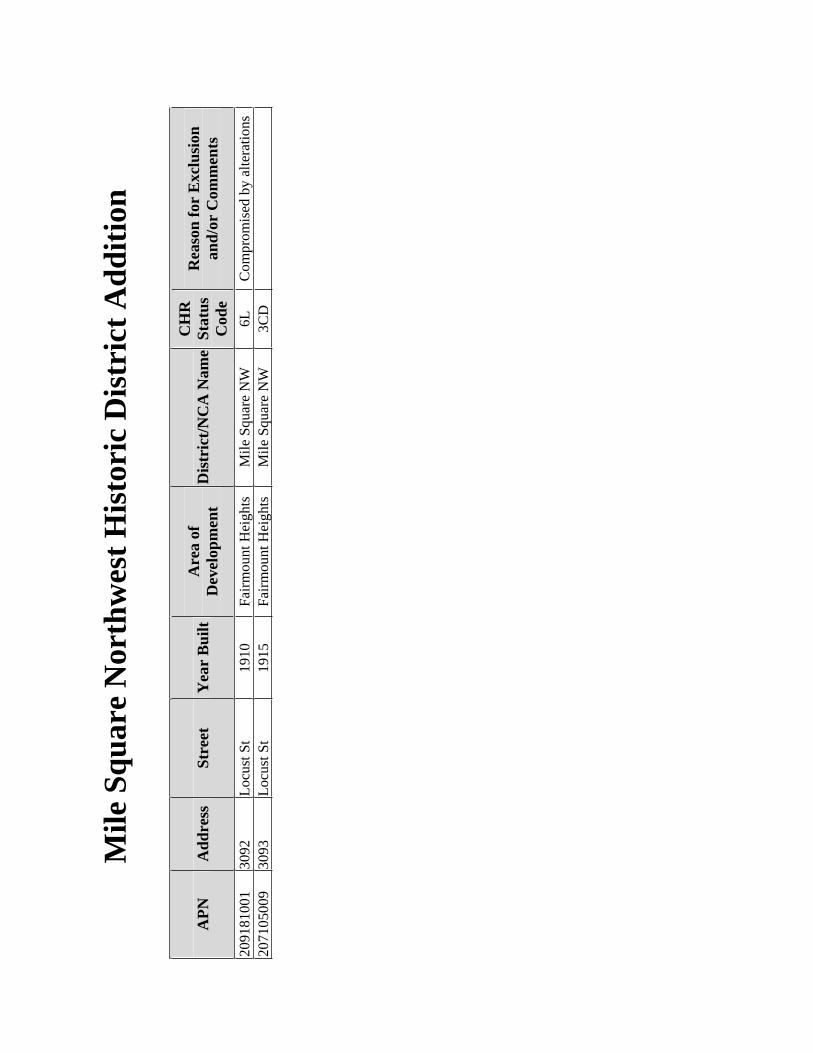
Mile
Squ
are
Nor
thw
est H
isto
ric
Dis
tric
t Add
ition
APN
Add
ress
Stre
etY
ear
Bui
ltA
rea
of
Dev
elop
men
tD
istr
ict/N
CA
Nam
eC
HR
Stat
usC
ode
Rea
son
for
Exc
lusi
onan
d/or
Com
men
ts
2091
8100
130
92
Locu
st S
t F
sC
ompr
ratio
ns19
10ai
rmou
nt H
eigh
tM
ile S
quar
e N
W
6Lom
ised
by
alte
2071
0500
9 30
93
Locu
st S
t 19
15
Mile
Squ
are
NW
Fa
irmou
nt H
eigh
ts
3CD
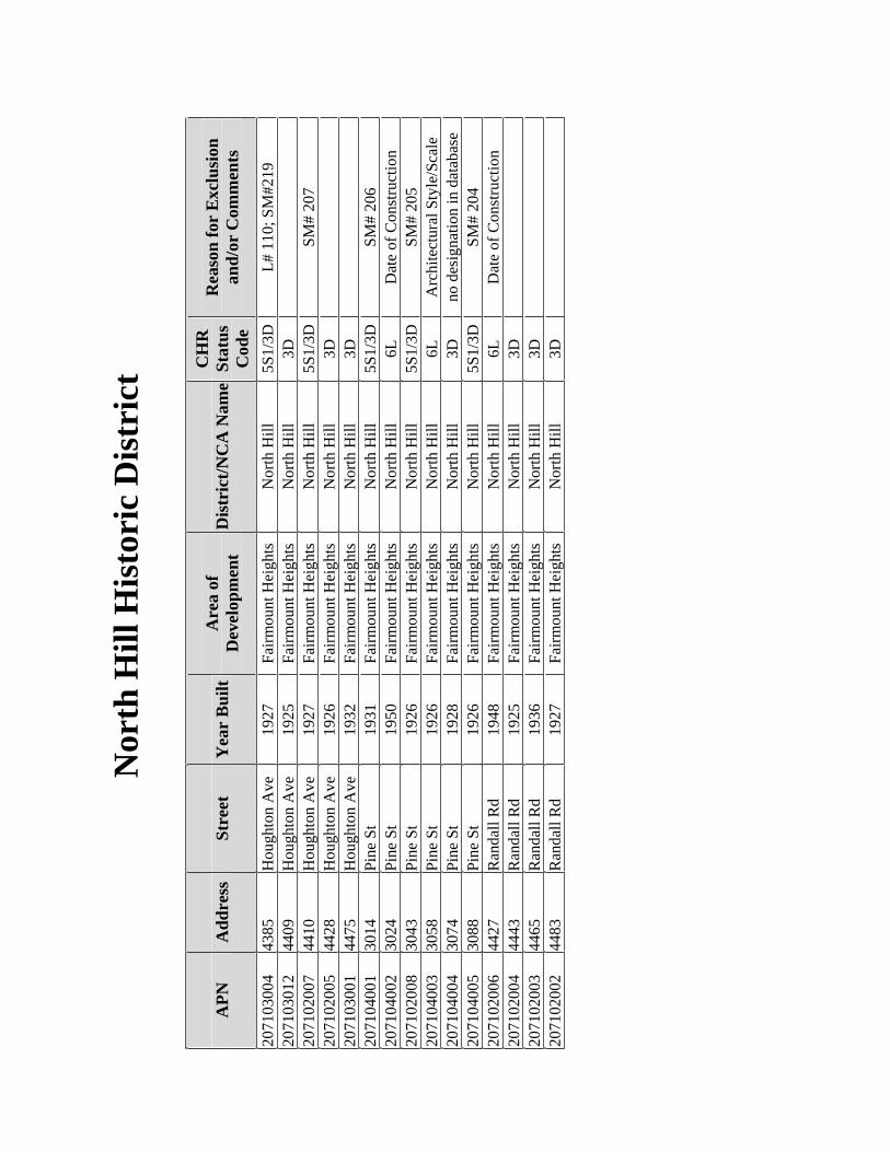
Nor
th H
ill H
isto
ric
Dis
tric
t
APN
Add
ress
Stre
etY
ear
Bui
ltA
rea
of
Dev
elop
men
tD
istr
ict/N
CA
Nam
eC
HR
Stat
usC
ode
Rea
son
for
Exc
lusi
onan
d/or
Com
men
ts
4385
Hou
ghto
n A
ve
1927
Fairm
ount
Hei
ghts
5S
1/3D
L# 1
10; S
M#2
19
Nor
thH
ill20
7103
012
4409
Hou
ghto
n A
ve
1925
Fairm
ount
Hei
ghts
3D
Nor
thH
ill20
7102
007
4410
Hou
ghto
n A
ve
1927
Fairm
ount
Hei
ghts
5S
1/3D
SM#
207
Nor
thH
ill20
7102
005
4428
Hou
ghto
n A
ve
1926
Fairm
ount
Hei
ghts
3D
Nor
thH
ill20
7103
001
4475
Hou
ghto
n A
ve
1932
Fairm
ount
Hei
ghts
3D
Nor
thH
ill20
7104
001
3014
Pine
St
1931
Fairm
ount
Hei
ghts
5S
1/3D
SM#
206
Nor
thH
ill20
7104
002
3024
Pine
St
1950
Fairm
ount
Hei
ghts
6L
Dat
e of
Con
stru
ctio
n N
orth
Hill
2071
0200
830
43Pi
ne S
t 19
26Fa
irmou
nt H
eigh
ts
5S1/
3DSM
# 20
5 N
orth
Hill
2071
0400
330
58Pi
ne S
t 19
26Fa
irmou
ntH
eigh
ts6L
Arc
hite
ctur
al S
tyle
/Sca
leN
orth
Hill
2071
0400
430
74Pi
ne S
t 19
28Fa
irmou
ntH
eigh
ts3D
no d
esig
natio
n in
dat
abas
e N
orth
Hill
2071
0400
530
88Pi
ne S
t 19
26Fa
irmou
ntH
eigh
tsN
orth
Hill
5S1/
3DSM
# 20
4 20
7102
006
4427
Ran
dall
Rd
1948
Fairm
ount
Hei
ghts
6LD
ate
of C
onst
ruct
ion
Nor
thH
ill20
7102
004
4443
Ran
dall
Rd
1925
Fairm
ount
Hei
ghts
3D
Nor
thH
ill20
7102
003
4465
Ran
dall
Rd
1936
Fairm
ount
Hei
ghts
3D
Nor
thH
ill20
7102
002
4483
Ran
dall
Rd
1927
Fairm
ount
Hei
ghts
3D
Nor
thH
ill
2071
0300
4
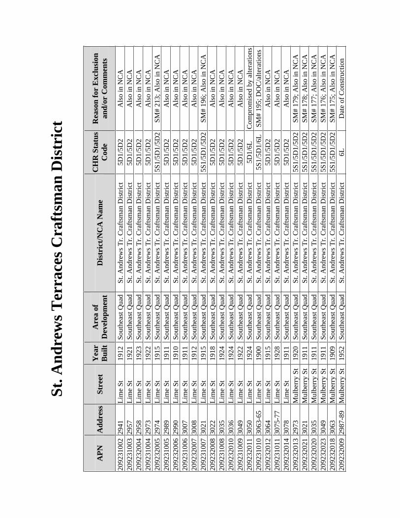
St. A
ndre
ws T
erra
ces C
raft
sman
Dis
tric
t
APN
Add
ress
Stre
etY
ear
Bui
ltA
rea
of
Dev
elop
men
tD
istr
ict/N
CA
Nam
e C
HR
Sta
tus
Cod
eR
easo
n fo
r E
xclu
sion
and/
or C
omm
ents
2092
3100
229
41
Lim
e St
12
ua
dTr
2A
19So
uthe
ast Q
St. A
ndre
ws
. Cra
ftsm
an D
istri
ct
5D1/
5DA
lso
in N
C20
9231
003
2957
Li
me
St
1921
So
uthe
ast Q
uad
an D
istri
ct
2A
lso
in N
CA
St
. And
rew
s Tr.
Cra
ftsm
5D1/
5D20
9232
004
2958
Li
me
St
1923
ua
. Cra
ftsm
trict
A
lso
in N
CA
So
uthe
ast Q
dSt
. And
rew
s Tr
an D
is5D
1/5D
220
9231
004
2Li
me
St
1922
ua
. Cra
ftsm
trict
A
lso
in N
CA
97
3So
uthe
ast Q
dSt
. And
rew
s Tr
an D
is5D
1/5D
220
9232
005
2Li
mua
. Cra
ftsm
trict
SM
# 21
3; A
lso
in N
CA
97
4e
St
1915
Sout
heas
t Qd
St. A
ndre
ws T
ran
Dis
5S1/
5D1/
5D2
2092
3100
52
Lim
ua. C
rafts
mtri
ct
Als
o in
NC
A
989
e St
19
11
Sout
heas
t Qd
St. A
ndre
ws T
ran
Dis
5D1/
5D2
2092
3200
62
Lim
ua. C
rafts
mtri
ct
Als
o in
NC
A
990
e St
19
10So
uthe
ast Q
dSt
. And
rew
s Tr
an D
is5D
1/5D
220
9231
006
3Li
mua
. Cra
ftsm
trict
A
lso
in N
CA
00
7e
St
1911
Sout
heas
t Qd
St. A
ndre
ws T
ran
Dis
5D1/
5D2
2092
3200
73
Lim
ua. C
rafts
mtri
ct
Als
o in
NC
A
008
e St
19
12So
uthe
ast Q
dSt
. And
rew
s Tr
an D
is5D
1/5D
220
9231
007
3Li
mua
. Cra
ftsm
trict
SM
# 19
6; A
lso
in N
CA
02
1e
St
1915
Sout
heas
t Qd
St. A
ndre
ws T
ran
Dis
5S1/
5D1/
5D2
2092
3200
83
Lim
8tri
ctA
lso
in N
CA
02
2e
St
191
Sout
heas
t Qua
dSt
. And
rew
s Tr.
Cra
ftsm
an D
is5D
1/5D
220
9231
008
3Li
m24
St. A
ndre
ws T
r. C
rafts
mtri
ct
Als
o in
NC
A
035
e St
19
Sout
heas
t Qua
dan
Dis
5D1/
5D2
2092
3201
03
Lim
24St
. And
rew
s Tr.
Cra
ftsm
trict
A
lso
in N
CA
03
6e
St
19So
uthe
ast Q
uad
an D
is5D
1/5D
220
9231
009
3Li
m22
St. A
ndre
ws T
r. C
rafts
mtri
ct
Als
o in
NC
A
049
e St
19
Sout
heas
t Qua
dan
Dis
5D1/
5D2
2092
3201
13
Lim
24St
. And
rew
s Tr.
Cra
ftsm
trict
Com
prom
id
by a
ltera
tions
050
e St
19
Sout
heas
t Qua
dan
Dis
5D1/
6Lse
2092
3101
030
63-6
5Li
m00
St. A
ndre
ws T
r. C
rafts
mtri
ctSM
# 19
5; D
OC
/alte
ratio
nse
St
19So
uthe
ast Q
uad
an D
is5S
1/5D
1/6L
2092
3201
23
Lim
15St
. And
rew
s Tr.
Cra
ftsm
trict
A
lso
in N
CA
06
4e
St
19So
uthe
ast Q
uad
an D
is5D
1/5D
220
9231
011
3075
-77
Lim
28St
. And
rew
s Tr.
Cra
ftsm
trict
A
lso
in N
CA
e
St
19So
uthe
ast Q
uad
an D
is5D
1/5D
220
9232
014
3Li
m11
St. A
ndre
ws T
r. C
rafts
mtri
ct
Als
o in
NC
A
078
e St
19
Sout
heas
t Qua
dan
Dis
5D1/
5D2
2092
3201
32
Mu
20
SQ
ua. C
CA
973
lber
ry S
t 19
outh
east
dSt
. And
rew
s Tr
rafts
man
Dis
trict
5S
1/5D
1/5D
2SM
# 17
9; A
lso
in N
2092
3202
13
Mu
r. C
r02
1lb
erry
St
1911
Sout
heas
t Qua
dSt
. And
rew
s Taf
tsm
ast
rict
n D
i5S
1/5D
1/5D
2SM
# 17
8; A
lso
in N
CA
20
9232
020
3M
u1
trict
SM#
177;
Als
o in
NC
A
035
lber
ry S
t 19
1So
uthe
ast Q
uad
St. A
ndre
ws T
r. C
rafts
man
Dis
5S1/
5D1/
5D2
2092
3202
33
Mu
1St
. And
rew
s Tr.
Cra
ftsm
trict
SM
# 17
6; A
lso
in N
CA
04
9lb
erry
St
191
Sout
heas
t Qua
dan
Dis
5S1/
5D1/
5D2
2092
3201
83
Mu
9St
. And
rew
s Tr.
Cra
ftsm
trict
SM
# 17
5; A
lso
in N
CA
06
3lb
erry
St
190
Sout
heas
t Qua
dan
Dis
5S1/
5D1/
5D2
2092
3200
929
87-8
9M
u2
St. A
ndre
ws T
r. C
rafts
mtri
ct
Dat
e of
Con
stru
ctio
n lb
erry
St
195
Sout
heas
t Qua
dan
Dis
6L
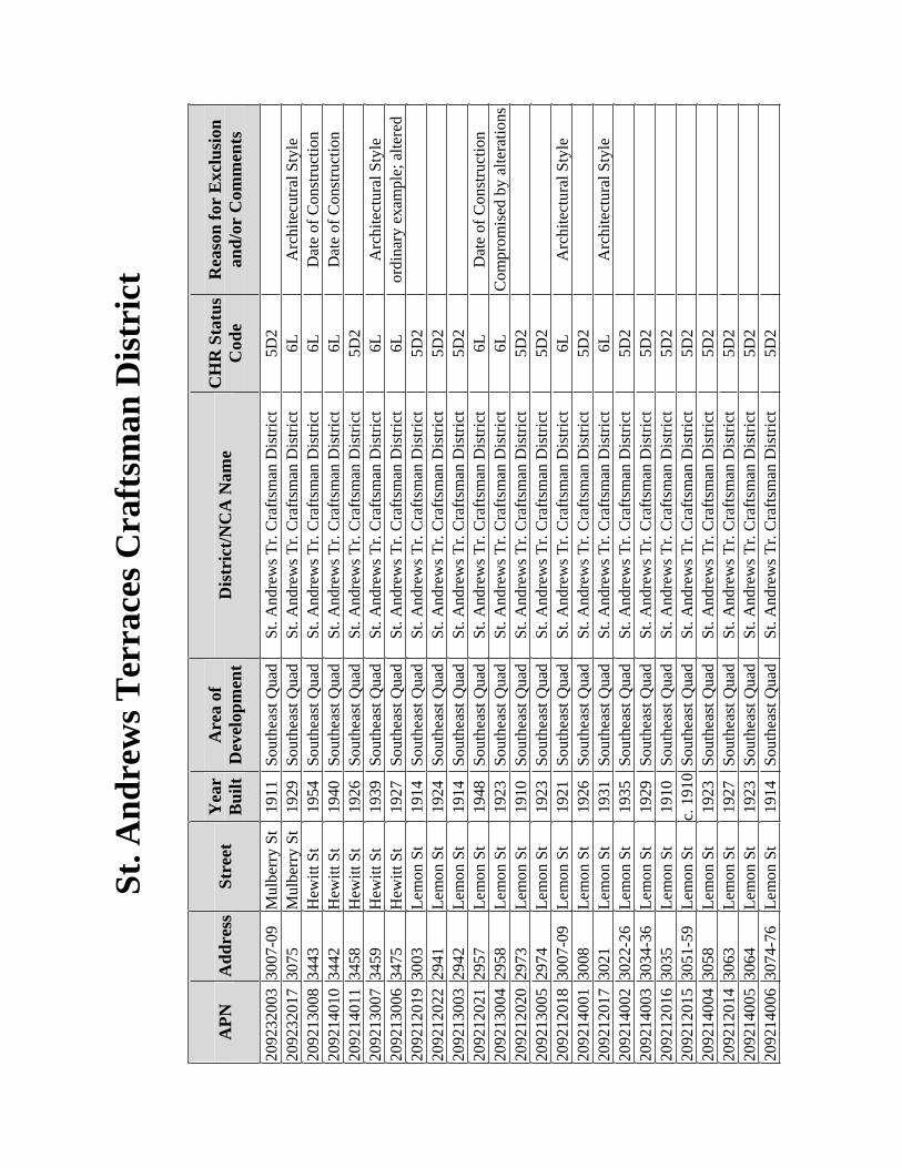
St. A
ndre
ws T
erra
ces C
raft
sman
Dis
tric
t
APN
Add
ress
Stre
etY
ear
Bui
ltA
rea
of
Dev
elop
men
tD
istr
ict/N
CA
Nam
e C
HR
Sta
tus
Cod
eR
easo
n fo
r E
xclu
sion
and/
or C
omm
ents
2092
3200
330
07-0
9 M
ulbe
rr11
ua
dTr
y St
19
Sout
heas
t QSt
. And
rew
s . C
rafts
man
Dis
trict
5D
220
9232
017
3075
M
ulbe
rry
St
1929
So
uthe
ast Q
uad
an D
istri
ct
Arc
hite
cutra
l Sty
le
St. A
ndre
ws T
r. C
rafts
m6L
2092
1300
83
He
4ua
dTr
. Cra
ftsm
trict
D
ate
of C
onst
ruct
ion
443
witt
St
195
Sout
heas
t QSt
. And
rew
s an
Dis
6L20
9214
010
3H
e0
uad
Tr. C
rafts
mtri
ct
Dat
e of
Con
stru
ctio
n 44
2w
itt S
t 19
4So
uthe
ast Q
St. A
ndre
ws
an D
is6L
2092
1401
13
He
6ua
dTr
. Cra
ftsm
trict
2
458
witt
St
192
Sout
heas
t QSt
. And
rew
s an
Dis
5D20
9213
007
3H
eua
. Cra
ftsm
trict
A
rchi
tect
ural
Sty
le
459
witt
St
1939
S
Qou
thea
std
St. A
ndre
ws T
ran
Dis
6L20
9213
006
3H
eS
Qua
. Cra
ftsm
trict
or
dina
ry e
xam
ple;
alte
red
475
witt
St
1927
ou
thea
std
St. A
ndre
ws T
ran
Dis
6L20
9212
019
3Le
mtri
ct2
003
on S
t 19
14So
uthe
ast Q
uad
St. A
ndre
ws T
r. C
rafts
man
Dis
5D20
9212
022
2Le
m
Sot Q
ua. C
294
1on
St
1924
uthe
asd
St. A
ndre
ws T
rra
ftsm
an D
istri
ct
5D20
9213
003
2Le
m
Sot Q
ua. C
294
2on
St
1914
uthe
asd
St. A
ndre
ws T
rra
ftsm
an D
istri
ct
5D20
9212
021
2r.
Cr
n95
7 Le
mon
St
1948
Sout
heas
t Qua
dSt
. And
rew
s Taf
tsm
ast
rict
n D
i6L
Dat
e of
Con
stru
ctio
2092
1300
42
m19
23
Tr. C
rafts
mtri
ct
alte
ratio
ns95
8Le
on S
t So
uthe
ast Q
uad
St. A
ndre
ws
an D
is6L
Com
prom
ied
by
s20
9212
020
2em
1910
Tr
. Cra
ftsm
trict
2
973
Lon
St
Sout
heas
t Qua
dSt
. And
rew
s an
Dis
5D20
9213
005
2Le
m19
23
Sot Q
ua. C
rafts
mtri
ct
297
4on
St
uthe
asd
St. A
ndre
ws T
ran
Dis
5D20
9212
018
3007
-09
Lem
1921
So
t Qua
. Cra
ftsm
trict
A
rchi
tect
ural
Sty
le
on S
t ut
heas
dSt
. And
rew
s Tr
an D
is6L
2092
1400
13
Lem
1926
ua
r. C
rafts
mtri
ct
200
8on
St
Sout
heas
t Qd
TSt
. And
rew
s an
Dis
5D20
9212
017
3Le
m19
31
uad
Tr. C
rafts
mtri
ct
le
021
on S
t So
uthe
ast Q
St. A
ndre
ws
an D
is6L
Arc
hite
ctur
al S
ty20
9214
002
3022
-26
Lem
1935
Tr
. Cra
ftsm
trict
2
on S
t So
uthe
ast Q
uad
St. A
ndre
ws
an D
is5D
2092
1400
330
34-3
6Le
m19
29
SQ
Cra
ftsm
trict
2
on S
t ou
thea
stua
dSt
. And
rew
s Tr.
an D
is5D
2092
1201
63
Lem
1910
C
rafts
mtri
ct
203
5on
St
Sout
heas
t Qua
dSt
. And
rew
s Tr.
an D
is5D
2092
1201
530
51-5
9Le
mc.
191
0 C
rafts
mtri
ct
2on
St
Sout
heas
t Qua
dSt
. And
rew
s Tr.
an D
is5D
2092
1400
43
Lem
1923
C
rafts
mtri
ct
205
8on
St
Sout
heas
t Qua
dSt
. And
rew
s Tr.
an D
is5D
2092
1201
4 30
63
Lem
1927
C
rafts
mtri
ct
2on
St
Sot Q
uthe
asua
dSt
. And
rew
s Tr.
an D
is5D
2092
1400
530
64Le
m19
23
Cra
ftsm
trict
2
on S
t So
uthe
ast Q
uad
St. A
ndre
ws T
r.an
Dis
5D20
9214
006
3074
-76
Lem
14Tr
. Cra
ftsm
trict
2
on S
t 19
Sout
heas
t Qua
dSt
. And
rew
s an
Dis
5D
APPENDIX VI
IND IW
TABLED
IVITH
DUIN
A T
LH
LYE
SNO
IRGN
TI
HFIS
CID
ANE
TSU
PR
RV
OE
PEY
RAR
TEIEA
S
PR 523A FORMS
Indi
vidu
ally
Sig
nific
ant P
rope
rtie
s with
in th
eN
orth
side
Sur
vey
Are
a
APN
Add
ress
Stre
etY
ear
Bui
ltA
rea
ofD
evel
opm
ent
Dis
tric
t/NC
AN
ame
CH
RSt
atus
Cod
eC
omm
ents
Nor
th H
ill H
isis
trict
toric
D3S
St. A
ndre
ws T
Cra
ftic
t er
race
ssm
an D
istr
5S2
Mile
Squ
are
Nst
His
ct
Det
erm
ined
elig
ible
in 2
003
orth
we
toric
Dis
tri3C
S20
9173
003
3837
dR
idge
Rc.
190
4Fa
irmou
nt H
eigh
tsN
/A3S
2090
5301
337
20d
Ave
U
pgra
ded
to L
andm
ark
Stod
dar
1923
Nor
th o
f SR
-60
N/A
5S1/
5S2
2092
7001
036
680
Popl
ar S
t 18
9So
uthe
ast Q
uad
N/A
5S2
2091
7201
838
2090
Fa
irmH
eigh
ts
Rid
ge R
d c.
18
ount
N/A
5S2
2091
7203
238
64Fa
irmH
eigh
ts
Rid
ge R
d 19
06ou
ntN
/A5S
220
9123
005
3380
tR
usse
ll S
1910
Sout
heas
t Qua
dN
/A5S
220
9051
010
3787
k A
ve
Sh
amro
cca
. 191
5N
orth
of S
R-6
0N
/A5S
220
9123
012
3307
tSp
ruce
S19
25So
uthe
ast Q
uad
N/A
5S2
2091
2201
133
20t
Spru
ce S
1910
Sout
heas
t Qua
dN
/A5S
220
9033
017
3676
tSt
rong
S19
03N
orth
of S
R-6
0N
/A5S
220
9111
012
2357
St
Wils
hire
1925
File
's Is
land
N
/A5S
2
APPENDIX VII
PROPERTIES WITHIN THE NORTHSIDE SURVEY AREA THAT REQUIRE ADDITIONAL RESEARCH
BTA LE
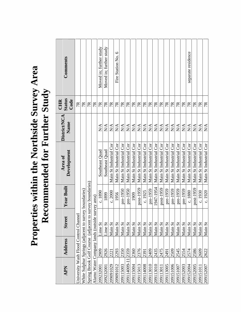
Prop
ertie
s with
in th
e N
orth
side
Sur
vey
Are
a R
ecom
men
ded
for
Furt
her
Stud
y
APN
Add
ress
Stre
etY
ear
Bui
ltA
rea
of
Dev
elop
men
tD
istr
ict/N
CA
Nam
e
CH
RSt
atus
Cod
eC
omm
ents
Uni
vers
ity W
ash
Floo
d C
ontro
l Cha
nnel
7R
Whi
te S
ulph
urgs
(ad
y7R
Spr
inja
cent
to su
rve
bou
ndar
ies)
Sp
ring
Bro
ok G
olf C
ours
e (a
djac
ent t
o su
rvey
7R b
ound
arie
s)
Ala
mo
Wat
er
any
ar
7RC
omp
land
s (ou
tsid
e su
rvey
ea)
2092
3200
129
09Li
me
St
cN
/7R
M
oved
in; f
urth
er st
udy
. 189
0 So
uthe
ast Q
uad
A20
9232
001
2926
Lim
e St
18
99So
uthe
ast Q
uad
N/
7R
Mov
ed in
; fur
ther
stud
y A
2090
9102
9c
N/
7R
2221
Mai
n St
. 2
000
Mai
n St
Indu
stria
l Cor
A20
9091
012
N/
7R
Fire
Sta
tion
No.
6
2293
Mai
n St
19
56M
ain
St In
dust
rial C
orA
2091
1500
3 23
50
Mai
nN
/7R
M
ain
St
pre-
1950
St In
dust
rial C
orA
2091
1400
9-11
Mai
nN
/7R
2
359
Mai
n St
pr
e-19
50St
Indu
stria
l Cor
A20
9115
004
2360
Mai
n St
19
09M
ain
St In
dust
rial C
orN
/7R
A
2091
1501
3
Mai
nN
/7R
23
76M
ain
St
post
-195
9St
Indu
stria
l Cor
A20
9114
008
2391
Mai
n St
c
N/
7R
. 192
5 M
ain
St In
dust
rial C
orA
2091
1301
0 24
09
Mai
nN
/7R
M
ain
St
pre-
1959
St In
dust
rial C
orA
2091
1301
0M
ain
StN
7R
2435
Mai
n St
19
47-1
954
Indu
stria
l Cor
/A20
9113
011
2475
M
ain
St
post
-195
9 M
ain
St In
dust
rial C
orN
/A
7R
2091
1300
5 24
91
Mai
n St
pr
e-19
59
Mai
n St
Indu
stria
l Cor
N/A
7R
20
9151
006
2509
M
ain
St
pre-
1959
M
ain
St In
dust
rial C
orN
/A
7R
2091
5100
7 25
45
Mai
n St
pr
e-19
59
Mai
n St
Indu
stria
l Cor
N/A
7R
20
9152
003
2554
M
ain
St
pre-
1959
M
ain
St In
dust
rial C
orN
/A
7R
2091
5200
4 25
74
Mai
n St
c.
188
0 M
ain
St In
dust
rial C
orN
/A
7R
sepa
rate
resi
denc
e 20
9152
005
2586
M
ain
St
post
-195
9 M
ain
St In
dust
rial C
orN
/A
7R
2091
5101
1 26
09
Mai
n St
c.
193
0 M
ain
St In
dust
rial C
orN
/A
7R
2091
5200
7 26
22
Mai
n St
c.
192
0 M
ain
St In
dust
rial C
orN
/A
7R
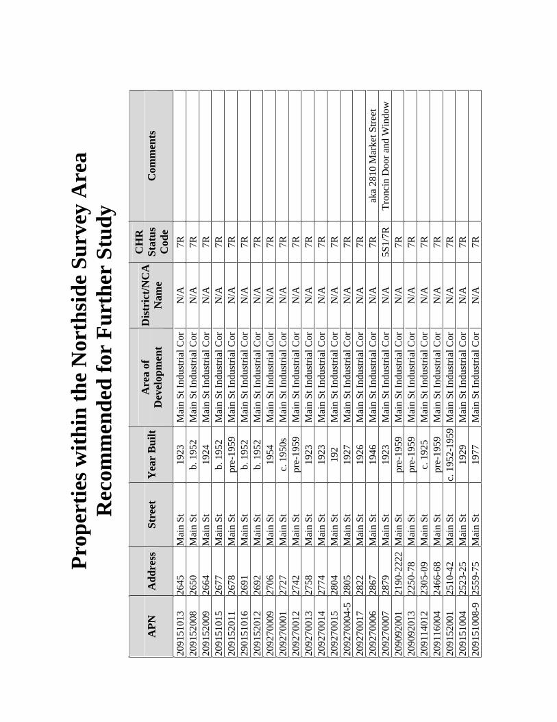
Prop
ertie
s with
in th
e N
orth
side
Sur
vey
Are
a R
ecom
men
ded
for
Furt
her
Stud
y
APN
Add
ress
Stre
etY
ear
Bui
ltA
rea
of
Dev
elop
men
tD
istr
ict/N
CA
Nam
e
CH
RSt
atus
Cod
eC
omm
ents
2091
5101
3 26
45
Mai
n St
19
23
Mai
n St
Indu
stria
l Cor
A
N/
7R20
9152
008
2650
M
ain
St
b. 1
952
Mai
n St
Indu
stria
l Cor
N/A
7R20
9152
009
2664
M
ain
St
1924
M
ain
St In
dust
rial C
orN
/A7R
2091
5101
5 26
77
Mai
n St
b.
195
2 M
ain
St In
dust
rial C
orN
/A7R
2091
5201
1 26
78
Mai
n St
pr
e-19
59
Mai
n St
Indu
stria
l Cor
N/A
7R29
0151
016
2691
M
ain
St
b. 1
952
Mai
n St
Indu
stria
l Cor
N/A
7R20
9152
012
2692
M
ain
St
b. 1
952
Mai
n St
Indu
stria
l Cor
N/A
7R20
9270
009
2706
M
ain
St
1954
M
ain
St In
dust
rial C
orN
/A7R
2092
7000
1 27
27
Mai
n St
c.
195
0s
Mai
n St
Indu
stria
l Cor
N/A
7R20
9270
012
2742
M
ain
St
pre-
1959
M
ain
St In
dust
rial C
orN
/A7R
2092
7001
3 27
58
Mai
n St
19
23
Mai
n St
Indu
stria
l Cor
N/A
7R20
9270
014
2774
M
ain
St
1923
M
ain
St In
dust
rial C
orN
/A7R
2092
7001
5 28
04
Mai
n St
19
2 M
ain
St In
dust
rial C
orN
/A7R
2092
7000
4-5
2805
M
ain
St
1927
M
ain
St In
dust
rial C
orN
/A7R
2092
7001
7 28
22
Mai
n St
19
26
Mai
n St
Indu
stria
l Cor
N/A
7R20
9270
006
2867
M
ain
St
1946
M
ain
St In
dust
rial C
orak
a 28
10 M
arke
t Stre
et
N/A
7R20
9270
007
2879
M
ain
St
1923
M
ain
St In
dust
rial C
orTr
onci
n D
oor a
nd W
indo
w
N/A
5S1/
7R20
9092
001
2190
-222
2 M
ain
St
pre-
1959
M
ain
St In
dust
rial C
orN
/A7R
2090
9201
3 22
50-7
8 M
ain
St
pre-
1959
M
ain
St In
dust
rial C
orA
N
/7R
2091
1401
2 23
05-0
9 M
ain
St
c. 1
925
Mai
n St
Indu
stria
l Cor
A
N/
7R20
9116
004
2466
-68
Mai
n St
pr
e-19
59
Mai
n St
Indu
stria
l Cor
N/A
7R
2091
5200
1 25
10-4
2 M
ain
St
c. 1
952-
1959
Mai
n St
Indu
stria
l Cor
N/A
7R
2091
5100
4 25
23-2
5 M
ain
St
1929
M
ain
St In
dust
rial C
orN
/A
7R20
9151
008-
9 25
59-7
5 M
ain
St
1977
M
ain
St In
dust
rial C
orN
/A
7R
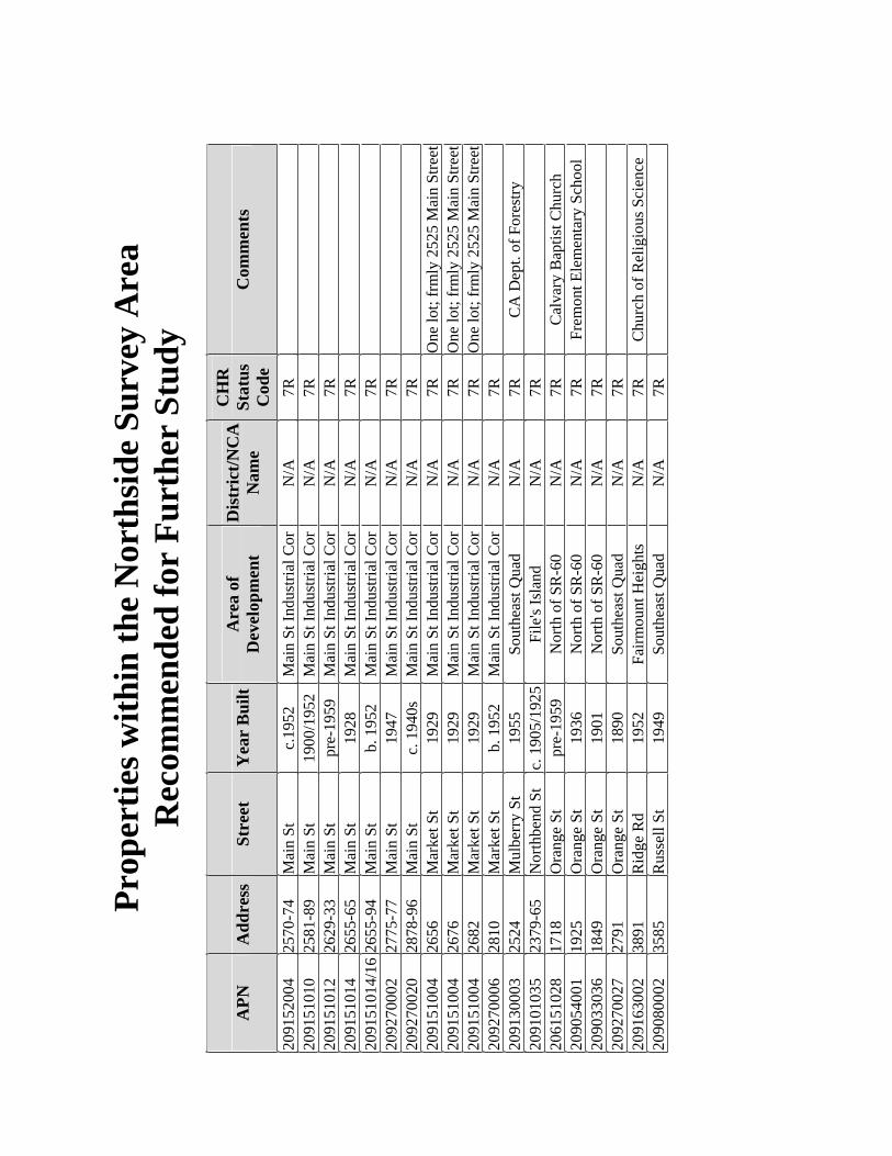
Prop
ertie
s with
in th
e N
orth
side
Sur
vey
Are
a R
ecom
men
ded
for
Furt
her
Stud
y
APN
Add
ress
Stre
etY
ear
Bui
ltA
rea
of
Dev
elop
men
tD
istr
ict/N
CA
Nam
e
CH
RSt
atus
Cod
eC
omm
ents
2091
5200
4 25
70-7
4 M
ain
St
c.19
52
Mai
n St
Indu
stria
l Cor
N/A
7R
20
9151
010
2581
-89
Mai
n St
19
00/1
952
Mai
n St
Indu
stria
l Cor
N/A
7R
20
9151
012
2629
-33
Mai
n St
pr
e-19
59
Mai
n St
Indu
stria
l Cor
N/A
7R
20
9151
014
2655
-65
Mai
n St
19
28
Mai
n St
Indu
stria
l Cor
N/A
7R
20
9151
014/
16 2
655-
94
Mai
n St
b.
195
2 M
ain
St In
dust
rial C
orN
/A
7R
2092
7000
2 27
75-7
7 M
ain
St
1947
M
ain
St In
dust
rial C
orN
/A
7R
2092
7002
0 28
78-9
6 M
ain
St
c. 1
940s
M
ain
St In
dust
rial C
orN
/A
7R
2091
5100
4 26
56
Mar
ket S
t 19
29
Mai
n St
Indu
stria
l Cor
N/A
7R
O
ne lo
t; fr
mly
252
5 M
ain
Stre
et20
9151
004
2676
M
arke
t St
1929
M
ain
St In
dust
rial C
orN
/A
7R
One
lot;
frm
ly 2
525
Mai
n St
reet
2091
5100
4 26
82
Mar
ket S
t 19
29
Mai
n St
Indu
stria
l Cor
N/A
7R
O
ne lo
t; fr
mly
252
5 M
ain
Stre
et20
9270
006
2810
M
arke
t St
b. 1
952
Mai
n St
Indu
stria
l Cor
N/A
7R
20
9130
003
2524
M
ulbe
rry
St
1955
So
uthe
ast Q
uad
N/A
7R
C
A D
ept.
of F
ores
try
2091
0103
5 23
79-6
5 N
orth
bend
St
c. 1
905/
1925
File
's Is
land
N
/A
7R
2061
5102
8 17
18
Ora
nge
St
pre-
1959
N
orth
of S
R-6
0 N
/A
7R
Cal
vary
Bap
tist C
hurc
h 20
9054
001
1925
O
rang
e St
19
36
Nor
th o
f SR
-60
N/A
7R
Fr
emon
t Ele
men
tary
Sch
ool
2090
3303
6 18
49
Ora
nge
St
1901
N
orth
of S
R-6
0 N
/A
7R
2092
7002
7 27
91
Ora
nge
St
1890
So
uthe
ast Q
uad
N/A
7R
20
9163
002
3891
R
idge
Rd
1952
Fa
irmou
nt H
eigh
ts
N/A
7R
C
hurc
h of
Rel
igio
us S
cien
ce
2090
8000
2 35
85
Rus
sell
St
1949
So
uthe
ast Q
uad
N/A
7R
APPENDIX VIII
PROPERTIES ASSIGNED A CHR STATUS CODE OF 6Z WITHIN THE NORTHSIDE SURVEY AREA THAT ARE:
SEVERELY ALTEREDORDINARY AND INELIGIBLE
TABLE
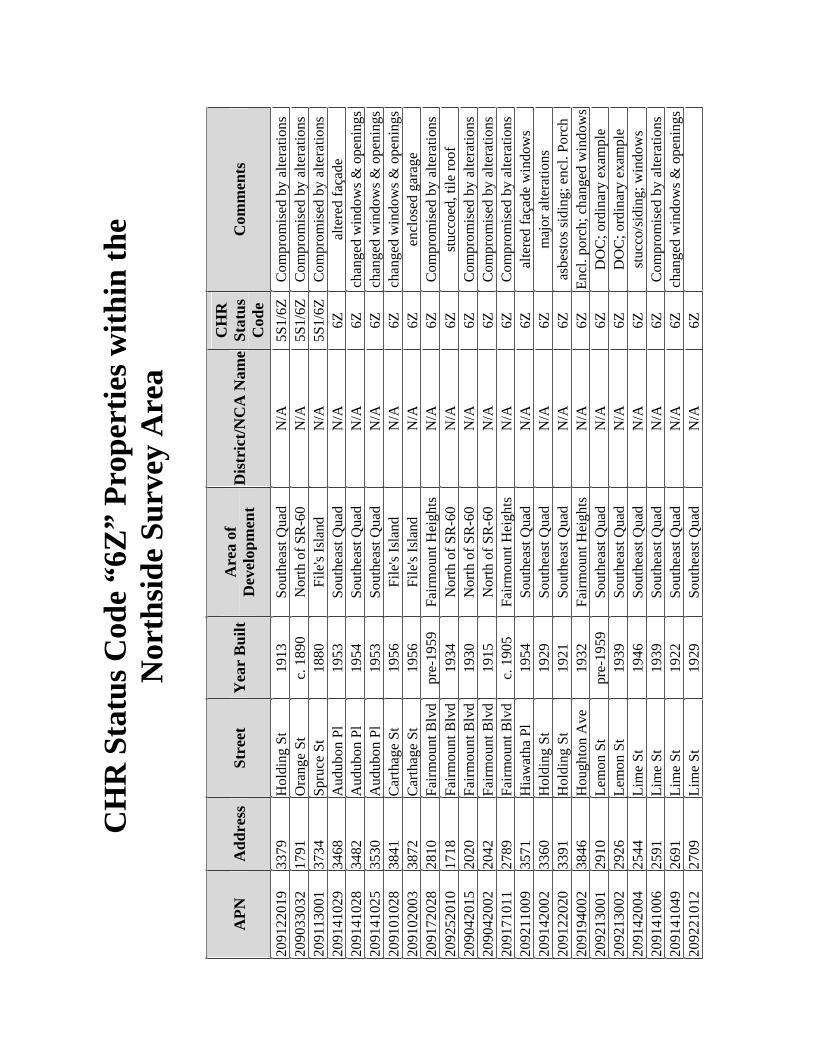
CH
R S
tatu
s Cod
e “6
Z”
Prop
ertie
s with
in th
eN
orth
side
Sur
vey
Are
a
APN
Add
ress
Stre
etY
ear
Bui
ltA
rea
of
Dev
elop
men
tD
istr
ict/N
CA
Nam
eC
HR
Stat
usC
ode
Com
men
ts
2091
2201
9 33
79
Hol
ding
St
1913
So
uthe
ast Q
uad
N/A
5S
1/6Z
Com
prom
ised
by
alte
ratio
ns
2090
3303
2 17
91
Ora
nge
St
c. 1
890
Nor
th o
f SR
-60
N/A
5S
1/6Z
Com
prom
ised
by
alte
ratio
ns
2091
1300
1 37
34
Spru
ce S
t 18
80
File
's Is
land
N
/A
5S1/
6ZC
ompr
omis
ed b
y al
tera
tions
20
9141
029
3468
A
udub
on P
l 19
53
Sout
heas
t Qua
d N
/A
6Z
alte
red
faça
de
2091
4102
8 34
82
Aud
ubon
Pl
1954
So
uthe
ast Q
uad
N/A
6Z
ch
ange
d w
indo
ws &
ope
ning
s20
9141
025
3530
A
udub
on P
l 19
53
Sout
heas
t Qua
d N
/A
6Z
chan
ged
win
dow
s & o
peni
ngs
2091
0102
8 38
41
Car
thag
e St
19
56
File
's Is
land
N
/A
6Z
chan
ged
win
dow
s & o
peni
ngs
2091
0200
3 38
72
Car
thag
e St
19
56
File
's Is
land
N
/A
6Z
encl
osed
gar
age
2091
7202
8 28
10
Fairm
ount
Blv
dpr
e-19
59
Fairm
ount
Hei
ghts
N
/A
6Z
Com
prom
ised
by
alte
ratio
ns
2092
5201
0 17
18
Fairm
ount
Blv
d19
34
Nor
th o
f SR
-60
N/A
6Z
st
ucco
ed, t
ile ro
of
2090
4201
5 20
20
Fairm
ount
Blv
d19
30
Nor
th o
f SR
-60
N/A
6Z
C
ompr
omis
ed b
y al
tera
tions
20
9042
002
2042
Fa
irmou
nt B
lvd
1915
N
orth
of S
R-6
0 N
/A
6Z
Com
prom
ised
by
alte
ratio
ns
2091
7101
1 27
89
Fairm
ount
Blv
dc.
190
5 Fa
irmou
nt H
eigh
ts
N/A
6Z
C
ompr
omis
ed b
y al
tera
tions
20
9211
009
3571
H
iaw
atha
Pl
1954
So
uthe
ast Q
uad
N/A
6Z
al
tere
d fa
çade
win
dow
s 20
9142
002
3360
H
oldi
ng S
t 19
29
Sout
heas
t Qua
d N
/A
6Z
maj
or a
ltera
tions
20
9122
020
3391
H
oldi
ng S
t 19
21
Sout
heas
t Qua
d N
/A
6Z
asbe
stos
sidi
ng; e
ncl.
Porc
h 20
9194
002
3846
H
ough
ton
Ave
19
32
Fairm
ount
Hei
ghts
N
/A
6Z
Encl
. por
ch; c
hang
ed w
indo
ws
2092
1300
1 29
10
Lem
on S
t pr
e-19
59
Sout
heas
t Qua
d N
/A
6Z
DO
C; o
rdin
ary
exam
ple
2092
1300
2 29
26
Lem
on S
t 19
39
Sout
heas
t Qua
d N
/A
6Z
DO
C; o
rdin
ary
exam
ple
2091
4200
4 25
44
Lim
e St
19
46
Sout
heas
t Qua
d N
/A
6Z
stuc
co/s
idin
g; w
indo
ws
2091
4100
6 25
91
Lim
e St
19
39
Sout
heas
t Qua
d N
/A
6Z
Com
prom
ised
by
alte
ratio
ns
2091
4104
9 26
91
Lim
e St
19
22
Sout
heas
t Qua
d N
/A
6Z
chan
ged
win
dow
s & o
peni
ngs
2092
2101
2 27
09
Lim
e St
19
29
Sout
heas
t Qua
d N
/A
6Z
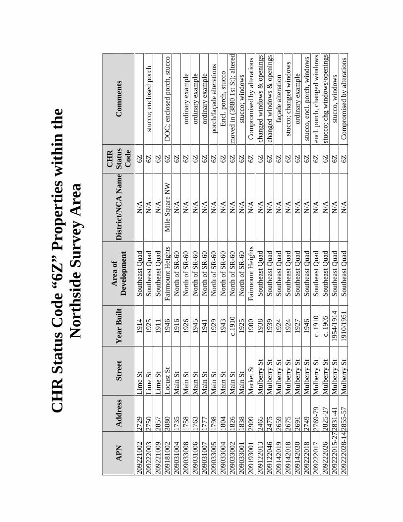
CH
R S
tatu
s Cod
e “6
Z”
Prop
ertie
s with
in th
eN
orth
side
Sur
vey
Are
a
APN
Add
ress
Stre
etY
ear
Bui
ltA
rea
of
Dev
elop
men
tD
istr
ict/N
CA
Nam
eC
HR
Stat
usC
ode
Com
men
ts
2092
2100
2 27
29
Lim
e St
19
14
Sout
heas
t Qua
d N
/A
6Z
2092
2200
3 27
50
Lim
e St
19
25
Sout
heas
t Qua
d N
/A
6Z
stuc
co; e
nclo
sed
porc
h 20
9221
009
2857
Li
me
St
1911
So
uthe
ast Q
uad
N/A
6Z
20
9181
002
3080
Lo
cust
St
1946
Fa
irmou
nt H
eigh
ts
Mile
Squ
are
NW
6Z
D
OC
; enc
lose
d po
rch,
stuc
co20
9031
004
1735
M
ain
St
1916
N
orth
of S
R-6
0 N
/A
6Z
2090
3300
8 17
58
Mai
n St
19
26
Nor
th o
f SR
-60
N/A
6Z
or
dina
ry e
xam
ple
2090
3100
6 17
63
Mai
n St
19
45
Nor
th o
f SR
-60
N/A
6Z
or
dina
ry e
xam
ple
2090
3100
7 17
77
Mai
n St
19
41
Nor
th o
f SR
-60
N/A
6Z
or
dina
ry e
xam
ple
2090
3300
5 17
98
Mai
n St
19
29
Nor
th o
f SR
-60
N/A
6Z
po
rch/
faça
de a
ltera
tions
20
9033
004
1804
M
ain
St
1943
N
orth
of S
R-6
0 N
/A
6Z
Encl
. por
ch, s
tucc
o 20
9033
002
1826
M
ain
St
c.19
10
Nor
th o
f SR
-60
N/A
6Z
m
oved
in (3
880
1st S
t); a
ltere
d20
9033
001
1838
M
ain
St
1925
N
orth
of S
R-6
0 N
/A
6Z
stuc
co; w
indo
ws
2091
9300
1 29
09
Mar
ket S
t 19
00
Fairm
ount
Hei
ghts
N
/A
6Z
Com
prom
ised
by
alte
ratio
ns
2091
2201
3 24
65
Mul
berr
y St
19
38
Sout
heas
t Qua
d N
/A
6Z
chan
ged
win
dow
s & o
peni
ngs
2091
2204
6 24
75
Mul
berr
y St
19
39
Sout
heas
t Qua
d N
/A
6Z
chan
ged
win
dow
s & o
peni
ngs
2091
4201
9 26
59
Mul
berr
y St
19
24
Sout
heas
t Qua
d N
/A
6Z
faça
de a
ltera
tion
2091
4201
8 26
75
Mul
berr
y St
19
24
Sout
heas
t Qua
d N
/A
6Z
stuc
co; c
hang
ed w
indo
ws
2091
4203
0 26
91
Mul
berr
y St
19
27
Sout
heas
t Qua
d N
/A
6Z
ordi
nary
exa
mpl
e 20
9222
018
2749
M
ulbe
rry
St
1946
So
uthe
ast Q
uad
N/A
6Z
st
ucco
, enc
l. po
rch,
win
dow
s20
9222
017
2769
-79
Mul
berr
y St
c.
191
0 So
uthe
ast Q
uad
N/A
6Z
en
cl. p
orch
, cha
nged
win
dow
s20
9222
026
2825
-27
Mul
berr
y St
c.
190
5 So
uthe
ast Q
uad
N/A
6Z
st
ucco
; chg
win
dow
s/op
enin
gs20
9222
015-
27 28
31-4
1 M
ulbe
rry
St
1954
/191
4 So
uthe
ast Q
uad
N/A
6Z
st
ucco
, win
dow
s 20
9222
028-
14 28
55-5
7 M
ulbe
rry
St
1910
/195
1 So
uthe
ast Q
uad
N/A
6Z
C
ompr
omis
ed b
y al
tera
tions
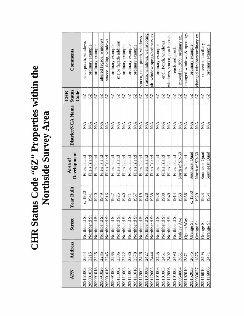
CH
R S
tatu
s Cod
e “6
Z”
Prop
ertie
s with
in th
eN
orth
side
Sur
vey
Are
a
APN
Add
ress
Stre
etY
ear
Bui
ltA
rea
of
Dev
elop
men
tD
istr
ict/N
CA
Nam
eC
HR
Stat
usC
ode
Com
men
ts
2091
5100
3 25
44
Nor
thbe
nd S
t c.
192
0 Fi
le's
Isla
nd
N/A
6Z
en
cl. p
orch
, win
dow
s 20
9091
030
2215
N
orth
bend
St
1941
Fi
le's
Isla
nd
N/A
6Z
or
dina
ry e
xam
ple
2090
9101
8 22
25
Nor
thbe
nd S
t 19
20
File
's Is
land
N
/A
6Z
ordi
nary
exa
mpl
e 20
9091
026
2235
N
orth
bend
St
1949
Fi
le's
Isla
nd
N/A
6Z
al
tere
d fa
çade
, win
dow
s 20
9091
019
2245
N
orth
bend
St
1916
Fi
le's
Isla
nd
N/A
6Z
st
ucco
, sid
ing,
win
dow
s 20
9091
003
2265
N
orth
bend
St
1947
Fi
le's
Isla
nd
N/A
6Z
or
dina
ry e
xam
ple
2091
1100
2 23
06
Nor
thbe
nd S
t 19
25
File
's Is
land
N
/A
6Z
maj
or fa
çade
add
ition
20
9111
003
2322
N
orth
bend
St
1940
Fi
le's
Isla
nd
N/A
6Z
or
dina
ry e
xam
ple
2091
1100
4 23
36
Nor
thbe
nd S
t 19
41
File
's Is
land
N
/A
6Z
ordi
nary
exa
mpl
e 20
9111
018
2378
N
orth
bend
St
1957
Fi
le's
Isla
nd
N/A
6Z
or
dina
ry e
xam
ple
2091
1200
2 24
26
Nor
thbe
nd S
t 19
19
File
's Is
land
N
/A
6Z
stuc
co, e
ncl.
porc
h, w
indo
ws
2091
0100
9 24
27
Nor
thbe
nd S
t 19
28
File
's Is
land
N
/A
6Z
stuc
co, w
indo
ws,
wai
nsco
ting
2091
1200
3 24
44
Nor
thbe
nd S
t 19
58
File
's Is
land
N
/A
6Z
alt.
win
dow
opn
gs/o
rdin
ary
ex20
9101
006
2445
N
orth
bend
St
1928
Fi
le's
Isla
nd
N/A
6Z
or
dina
ry e
xam
ple
2091
0100
5 24
61
Nor
thbe
nd S
t 19
08
File
's Is
land
N
/A
6Z
encl
. Por
ch, w
indo
ws
2091
1200
6 24
92
Nor
thbe
nd S
t 19
49
File
's Is
land
N
/A
6Z
win
dow
s, st
ucco
, por
ch p
osts
20
9101
003
2493
N
orth
bend
St
1914
Fi
le's
Isla
nd
N/A
6Z
en
clos
ed p
orch
20
9054
004
3651
O
akle
y A
ve
1953
N
orth
of S
R-6
0 N
/A
6Z
mov
ed in
195
9; o
rdin
ary
ex.
2091
0201
0 38
71
Ogd
en W
ay
1956
Fi
le's
Isla
nd
N/A
6Z
ch
ange
d w
indo
ws &
ope
ning
s20
9152
033
2675
O
rang
e St
c.
195
0 So
uthe
ast Q
uad
N/A
6Z
or
dina
ry e
xam
ple
2090
3303
7 18
75
Ora
nge
St
1929
N
orth
of S
R-6
0 N
/A
6Z
chan
ged
win
dow
s/or
dina
ry e
x.20
9116
010
2405
O
rang
e St
19
24
Sout
heas
t Qua
d N
/A
6Z
conv
erte
d an
cilla
ry
2091
1600
6 24
71
Ora
nge
St
1954
So
uthe
ast Q
uad
N/A
6Z
or
dina
ry e
xam
ple
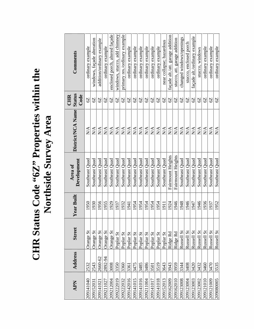
CH
R S
tatu
s Cod
e “6
Z”
Prop
ertie
s with
in th
eN
orth
side
Sur
vey
Are
a
APN
Add
ress
Stre
etY
ear
Bui
ltA
rea
of
Dev
elop
men
tD
istr
ict/N
CA
Nam
eC
HR
Stat
usC
ode
Com
men
ts
2091
4104
0 25
32
Ora
nge
St
1950
So
uthe
ast Q
uad
N/A
6Z
or
dina
ry e
xam
ple
2091
5203
1 25
43
Ora
nge
St
1930
So
uthe
ast Q
uad
N/A
6Z
w
indo
ws,
faça
de a
ltera
tion
2091
4102
1 26
60-6
2 O
rang
e St
19
56
Sout
heas
t Qua
d N
/A
6Z
addi
tion/
ordi
nary
exa
mpl
e 20
9211
027
2892
-94
Ora
nge
St
1955
So
uthe
ast Q
uad
N/A
6Z
or
dina
ry e
xam
ple
2092
1200
4 30
08
Ora
nge
St
1929
So
uthe
ast Q
uad
N/A
6Z
en
clos
ed p
orch
, alte
red
faça
de20
9222
019
3350
Po
plar
St
1937
So
uthe
ast Q
uad
N/A
6Z
w
indo
ws,
stuc
co, a
dd c
him
ney
2092
2203
2 33
60
Popl
ar S
t 19
32
Sout
heas
t Qua
d N
/A
6Z
prim
ary
res./
ordi
nary
exa
mpl
e20
9142
016
3361
Po
plar
St
1941
So
uthe
ast Q
uad
N/A
6Z
or
dina
ry e
xam
ple
2091
4101
5 34
75
Popl
ar S
t 19
54
Sout
heas
t Qua
d N
/A
6Z
ordi
nary
exa
mpl
e 20
9141
016
3485
Po
plar
St
1954
So
uthe
ast Q
uad
N/A
6Z
or
dina
ry e
xam
ple
2092
1100
4 34
86
Popl
ar S
t 19
54
Sout
heas
t Qua
d N
/A
6Z
ordi
nary
exa
mpl
e 20
9141
017
3501
Po
plar
St
1954
So
uthe
ast Q
uad
N/A
6Z
or
dina
ry e
xam
ple
2091
4101
8 35
19
Popl
ar S
t 19
54
Sout
heas
t Qua
d N
/A
6Z
ordi
nary
exa
mpl
e 20
9152
013
3643
Po
plar
St
1911
So
uthe
ast Q
uad
N/A
6Z
ne
ar c
olla
pse;
haz
ardo
us
2091
6200
9 39
43
Rid
ge R
d 19
24
Fairm
ount
Hei
ghts
N
/A
6Z
faça
de a
lt./a
tt. g
arag
e ad
ditio
n20
9162
010
3959
R
idge
Rd
1946
Fa
irmou
nt H
eigh
ts
N/A
6Z
st
ucco
, att.
gar
age
addi
tion
2091
2300
8 33
44
Rus
sell
St
1948
So
uthe
ast Q
uad
N/A
6Z
ch
ange
d w
indo
ws/
open
ings
20
9123
004
3408
R
usse
ll St
19
46
Sout
heas
t Qua
d N
/A
6Z
stuc
co, e
nclo
sed
porc
h 20
9123
003
3420
R
usse
ll St
19
47
Sout
heas
t Qua
d N
/A
6Z
faça
de a
lt./o
rdin
ary
exam
ple
2091
2300
2 34
32
Rus
sell
St
1946
So
uthe
ast Q
uad
N/A
6Z
st
ucco
, win
dow
s 20
9121
010
3460
R
usse
ll St
19
36
Sout
heas
t Qua
d N
/A
6Z
ordi
nary
exa
mpl
e 20
9121
009
3470
R
usse
ll St
19
37
Sout
heas
t Qua
d N
/A
6Z
ordi
nary
exa
mpl
e 20
9080
005
3535
R
usse
ll St
19
52
Sout
heas
t Qua
d N
/A
6Z
ordi
nary
exa
mpl
e
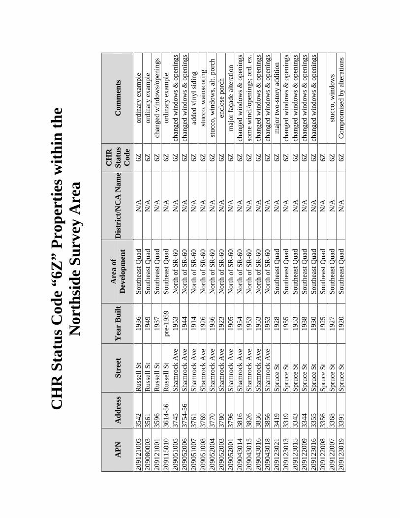
CH
R S
tatu
s Cod
e “6
Z”
Prop
ertie
s with
in th
eN
orth
side
Sur
vey
Are
a
APN
Add
ress
Stre
etY
ear
Bui
ltA
rea
of
Dev
elop
men
tD
istr
ict/N
CA
Nam
eC
HR
Stat
usC
ode
Com
men
ts
2091
2100
5 35
42
Rus
sell
St
1936
So
uthe
ast Q
uad
N/A
6Z
or
dina
ry e
xam
ple
2090
8000
3 35
61
Rus
sell
St
1949
So
uthe
ast Q
uad
N/A
6Z
or
dina
ry e
xam
ple
2091
2100
1 35
96
Rus
sell
St
1937
So
uthe
ast Q
uad
N/A
6Z
ch
ange
d w
indo
ws/
open
ings
20
9115
010
3614
-56
Rus
sell
St
pre-
1959
So
uthe
ast Q
uad
N/A
6Z
or
dina
ry e
xam
ple
2090
5100
5 37
45
Sham
rock
Ave
19
53
Nor
th o
f SR
-60
N/A
6Z
ch
ange
d w
indo
ws &
ope
ning
s20
9052
006
3754
-56
Sham
rock
Ave
19
44
Nor
th o
f SR
-60
N/A
6Z
ch
ange
d w
indo
ws &
ope
ning
s20
9051
007
3761
Sh
amro
ck A
ve
1914
N
orth
of S
R-6
0 N
/A
6Z
adde
d vi
nyl s
idin
g 20
9051
008
3769
Sh
amro
ck A
ve
1926
N
orth
of S
R-6
0 N
/A
6Z
stuc
co, w
ains
cotin
g 20
9052
004
3770
Sh
amro
ck A
ve
1936
N
orth
of S
R-6
0 N
/A
6Z
stuc
co, w
indo
ws,
alt.
porc
h 20
9052
003
3780
Sh
amro
ck A
ve
1923
N
orth
of S
R-6
0 N
/A
6Z
encl
ose
porc
h 20
9052
001
3796
Sh
amro
ck A
ve
1905
N
orth
of S
R-6
0 N
/A
6Z
maj
or fa
çade
alte
ratio
n 20
9043
014
3816
Sh
amro
ck A
ve
1954
N
orth
of S
R-6
0 N
/A
6Z
chan
ged
win
dow
s & o
peni
ngs
2090
4301
5 38
26
Sham
rock
Ave
19
53
Nor
th o
f SR
-60
N/A
6Z
so
me
win
d./o
peni
ngs;
ord
. ex.
2090
4301
6 38
36
Sham
rock
Ave
19
53
Nor
th o
f SR
-60
N/A
6Z
ch
ange
d w
indo
ws &
ope
ning
s20
9043
018
3856
Sh
amro
ck A
ve
1953
N
orth
of S
R-6
0 N
/A
6Z
chan
ged
win
dow
s & o
peni
ngs
2091
2302
1 34
19
Spru
ce S
t 19
28
Sout
heas
t Qua
d N
/A
6Z
maj
or tw
o-st
ory
addi
tion
2091
2301
3 33
19
Spru
ce S
t 19
55
Sout
heas
t Qua
d N
/A
6Z
chan
ged
win
dow
s & o
peni
ngs
2091
2301
5 33
43
Spru
ce S
t 19
53
Sout
heas
t Qua
d N
/A
6Z
chan
ged
win
dow
s & o
peni
ngs
2091
2200
9 33
44
Spru
ce S
t 19
38
Sout
heas
t Qua
d N
/A
6Z
chan
ged
win
dow
s & o
peni
ngs
2091
2301
6 33
55
Spru
ce S
t 19
30
Sout
heas
t Qua
d N
/A
6Z
chan
ged
win
dow
s & o
peni
ngs
2091
2200
8 33
56
Spru
ce S
t 19
25
Sout
heas
t Qua
d N
/A
6Z
2091
2200
7 33
68
Spru
ce S
t 19
27
Sout
heas
t Qua
d N
/A
6Z
stuc
co, w
indo
ws
2091
2301
9 33
91
Spru
ce S
t 19
20
Sout
heas
t Qua
d N
/A
6Z
Com
prom
ised
by
alte
ratio
ns
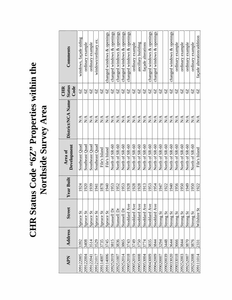
CH
R S
tatu
s Cod
e “6
Z”
Prop
ertie
s with
in th
eN
orth
side
Sur
vey
Are
a
APN
Add
ress
Stre
etY
ear
Bui
ltA
rea
of
Dev
elop
men
tD
istr
ict/N
CA
Nam
eC
HR
Stat
usC
ode
Com
men
ts
2091
2200
5 33
92
Spru
ce S
t 19
24
Sout
heas
t Qua
d N
/A
6Z
win
dow
s, fa
çade
sidi
ng
2091
2200
4 34
08
Spru
ce S
t 19
20
Sout
heas
t Qua
d N
/A
6Z
ordi
nary
exa
mpl
e 20
9122
041
3514
Sp
ruce
St
1939
So
uthe
ast Q
uad
N/A
6Z
or
dina
ry e
xam
ple
2091
2101
7 35
29
Spru
ce S
t 19
41
Sout
heas
t Qua
d N
/A
6Z
win
dow
s/or
dina
ry e
x.
2091
1400
7 37
35
Spru
ce S
t 18
78
File
's Is
land
N
/A
6Z
2091
1400
6 37
45
Spru
ce S
t 19
40
File
's Is
land
N
/A
6Z
chan
ged
win
dow
s & o
peni
ngs
2092
5201
9 38
15
Stan
sell
Dr
1953
N
orth
of S
R-6
0 N
/A
6Z
chan
ged
win
dow
s & o
peni
ngs
2092
5100
7 38
36
Stan
sell
Dr
1952
N
orth
of S
R-6
0 N
/A
6Z
chan
ged
win
dow
s & o
peni
ngs
2092
5201
4 38
65
Stan
sell
Dr
1953
N
orth
of S
R-6
0 N
/A
6Z
chan
ged
win
dow
s & o
peni
ngs
2090
5201
8 37
43
Stod
dard
Ave
19
28
Nor
th o
f SR
-60
N/A
6Z
ch
ange
d w
indo
ws &
ope
ning
s20
9052
019
3749
St
odda
rd A
ve
1928
N
orth
of S
R-6
0 N
/A
6Z
ordi
nary
exa
mpl
e 20
9053
008
3750
St
odda
rd A
ve
1928
N
orth
of S
R-6
0 N
/A
6Z
anci
llary
bui
ldin
g 20
9053
004
3774
St
odda
rd A
ve
1913
N
orth
of S
R-6
0 N
/A
6Z
faça
de a
ltera
tions
20
9043
009
3835
St
odda
rd A
ve
1953
N
orth
of S
R-6
0 N
/A
6Z
chan
ged
win
dow
s & o
peni
ngs
2090
4200
9 38
44
Stod
dard
Ave
19
54
Nor
th o
f SR
-60
N/A
6Z
ch
ange
d w
indo
ws &
ope
ning
s20
9020
007
3294
St
rong
St
1947
N
orth
of S
R-6
0 N
/A
6Z
2090
2003
9 34
48
Stro
ng S
t 19
22
Nor
th o
f SR
-60
N/A
6Z
20
9033
020
3644
St
rong
St
1940
N
orth
of S
R-6
0 N
/A
6Z
chan
ged
win
dow
s & o
peni
ngs
2090
3301
8 36
66
Stro
ng S
t 19
56
Nor
th o
f SR
-60
N/A
6Z
or
dina
ry e
xam
ple
2092
5200
3 38
44
Stro
ng S
t 19
50
Nor
th o
f SR
-60
N/A
6Z
or
dina
ry e
xam
ple
2092
5200
7 38
70
Stro
ng S
t 19
49
Nor
th o
f SR
-60
N/A
6Z
or
dina
ry e
xam
ple
2092
5200
8 38
76
Stro
ng S
t 19
50
Nor
th o
f SR
-60
N/A
6Z
or
dina
ry e
xam
ple
2091
1101
4 23
31
Wils
hire
St
1922
Fi
le's
Isla
nd
N/A
6Z
fa
çade
alte
ratio
n/ad
ditio
n
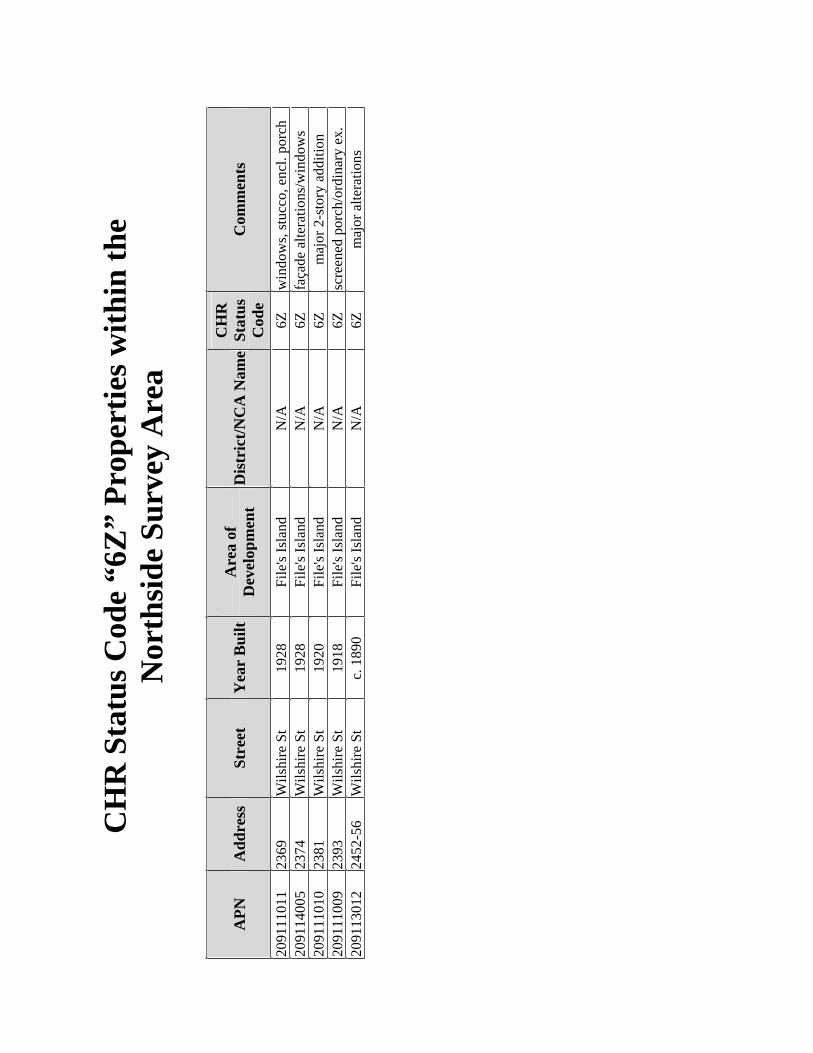
CH
R S
tatu
s Cod
e “6
Z”
Prop
ertie
s with
in th
eN
orth
side
Sur
vey
Are
a
APN
Add
ress
Stre
etY
ear
Bui
ltA
rea
of
Dev
elop
men
tD
istr
ict/N
CA
Nam
eC
HR
Stat
usC
ode
Com
men
ts
2091
1101
1 23
69
Wils
hire
St
1928
Fi
le's
Isla
nd
N/A
6Z
w
indo
ws,
stuc
co, e
ncl.
porc
h 20
9114
005
2374
W
ilshi
re S
t 19
28
File
's Is
land
N
/A
6Z
faça
de a
ltera
tions
/win
dow
s 20
9111
010
2381
W
ilshi
re S
t 19
20
File
's Is
land
N
/A
6Z
maj
or 2
-sto
ry a
dditi
on
2091
1100
9 23
93
Wils
hire
St
1918
Fi
le's
Isla
nd
N/A
6Z
sc
reen
ed p
orch
/ord
inar
y ex
. 20
9113
012
2452
-56
Wils
hire
St
c. 1
890
File
's Is
land
N
/A
6Z
maj
or a
ltera
tions
APPENDIX IX
PROPERTIES CONSTRUCTED AFTER 1959WITHIN THE NORTHSIDE SURVEY AREA
TABLE
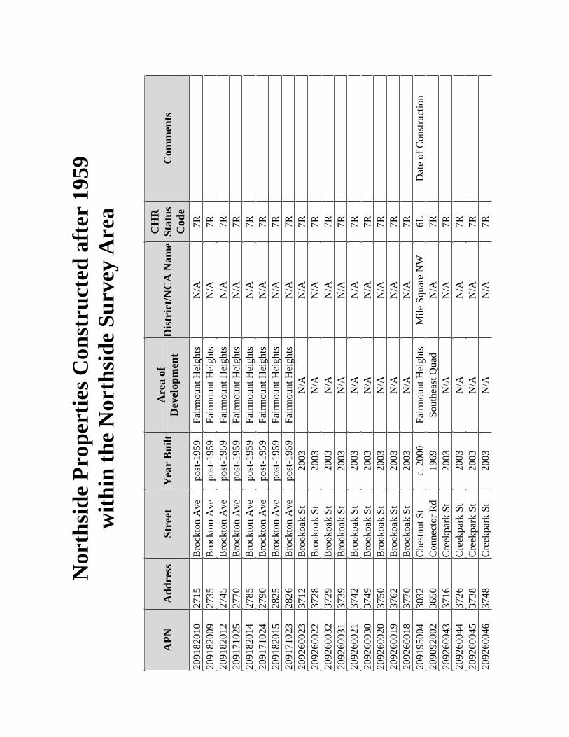
Nor
thsi
de P
rope
rtie
s Con
stru
cted
aft
er 1
959
with
in th
e N
orth
side
Sur
vey
Are
a
APN
Add
ress
Stre
etY
ear
Bui
ltA
rea
of
Dev
elop
men
tD
istr
ict/N
CA
Nam
eC
HR
Stat
usC
ode
Com
men
ts
2091
8201
0 27
15
Bro
ckto
n A
ve
post
-195
9 Fa
irmou
nt H
eigh
ts
N/A
7R
20
9182
009
2735
B
rock
ton
Ave
po
st-1
959
Fairm
ount
Hei
ghts
N
/A
7R
2091
8201
2 27
45
Bro
ckto
n A
ve
post
-195
9 Fa
irmou
nt H
eigh
ts
N/A
7R
20
9171
025
2770
B
rock
ton
Ave
po
st-1
959
Fairm
ount
Hei
ghts
N
/A
7R
2091
8201
4 27
85
Bro
ckto
n A
ve
post
-195
9 Fa
irmou
nt H
eigh
ts
N/A
7R
20
9171
024
2790
B
rock
ton
Ave
po
st-1
959
Fairm
ount
Hei
ghts
N
/A
7R
2091
8201
5 28
25
Bro
ckto
n A
ve
post
-195
9 Fa
irmou
nt H
eigh
ts
N/A
7R
20
9171
023
2826
B
rock
ton
Ave
po
st-1
959
Fairm
ount
Hei
ghts
N
/A
7R
2092
6002
3 37
12
Bro
okoa
k St
20
03
N/A
N
/A
7R
2092
6002
2 37
28
Bro
okoa
k St
20
03
N/A
N
/A
7R
2092
6003
2 37
29
Bro
okoa
k St
20
03
N/A
N
/A
7R
2092
6003
1 37
39
Bro
okoa
k St
20
03
N/A
N
/A
7R
2092
6002
1 37
42
Bro
okoa
k St
20
03
N/A
N
/A
7R
2092
6003
0 37
49
Bro
okoa
k St
20
03
N/A
N
/A
7R
2092
6002
0 37
50
Bro
okoa
k St
20
03
N/A
N
/A
7R
2092
6001
9 37
62
Bro
okoa
k St
20
03
N/A
N
/A
7R
2092
6001
8 37
70
Bro
okoa
k St
20
03
N/A
N
/A
7R
2091
9500
4 30
32
Che
stnu
t St
c. 2
000
Fairm
ount
Hei
ghts
M
ile S
quar
e N
W
6L
Dat
e of
Con
stru
ctio
n 20
9092
002
3650
C
onne
ctor
Rd
1969
So
uthe
ast Q
uad
N/A
7R
20
9260
043
3716
C
reek
park
St
2003
N
/A
N/A
7R
20
9260
044
3726
C
reek
park
St
2003
N
/A
N/A
7R
20
9260
045
3738
C
reek
park
St
2003
N
/A
N/A
7R
20
9260
046
3748
C
reek
park
St
2003
N
/A
N/A
7R
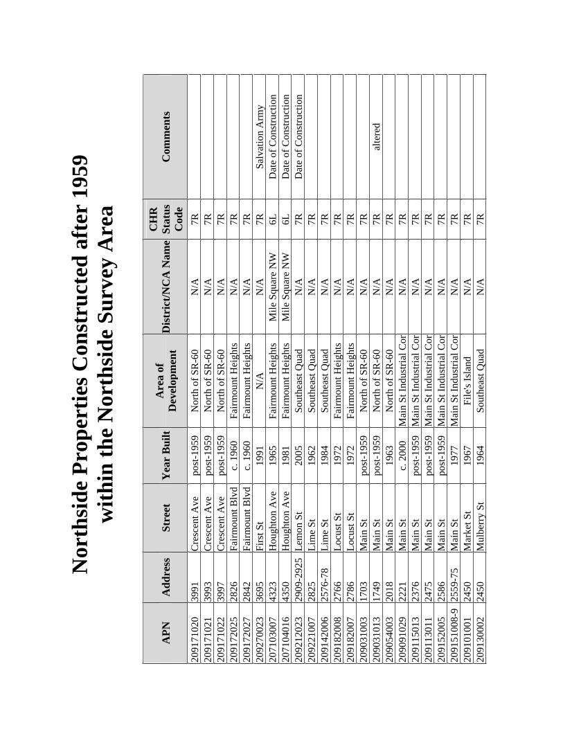
Nor
thsi
de P
rope
rtie
s Con
stru
cted
aft
er 1
959
with
in th
e N
orth
side
Sur
vey
Are
a
APN
Add
ress
Stre
etY
ear
Bui
ltA
rea
of
Dev
elop
men
tD
istr
ict/N
CA
Nam
eC
HR
Stat
usC
ode
Com
men
ts
2091
7102
0 39
91
Cre
scen
t Ave
po
st-1
959
Nor
th o
f SR
-60
N/A
7R
20
9171
021
3993
C
resc
ent A
ve
post
-195
9 N
orth
of S
R-6
0 N
/A
7R
2091
7102
2 39
97
Cre
scen
t Ave
po
st-1
959
Nor
th o
f SR
-60
N/A
7R
20
9172
025
2826
Fa
irmou
nt B
lvd
c. 1
960
Fairm
ount
Hei
ghts
N
/A
7R
2091
7202
7 28
42
Fairm
ount
Blv
dc.
196
0 Fa
irmou
nt H
eigh
ts
N/A
7R
20
9270
023
3695
Fi
rst S
t 19
91
N/A
N
/A
7R
Salv
atio
n A
rmy
2071
0300
7 43
23
Hou
ghto
n A
ve
1965
Fa
irmou
nt H
eigh
ts
Mile
Squ
are
NW
6L
D
ate
of C
onst
ruct
ion
2071
0401
6 43
50
Hou
ghto
n A
ve
1981
Fa
irmou
nt H
eigh
ts
Mile
Squ
are
NW
6L
D
ate
of C
onst
ruct
ion
2092
1202
3 29
09-2
925
Lem
on S
t 20
05
Sout
heas
t Qua
d N
/A
7R
Dat
e of
Con
stru
ctio
n 20
9221
007
2825
Li
me
St
1962
So
uthe
ast Q
uad
N/A
7R
20
9142
006
2576
-78
Lim
e St
19
84
Sout
heas
t Qua
d N
/A
7R
2091
8200
8 27
66
Locu
st S
t 19
72
Fairm
ount
Hei
ghts
N
/A
7R
2091
8200
7 27
86
Locu
st S
t 19
72
Fairm
ount
Hei
ghts
N
/A
7R
2090
3100
3 17
03
Mai
n St
po
st-1
959
Nor
th o
f SR
-60
N/A
7R
20
9031
013
1749
M
ain
St
post
-195
9 N
orth
of S
R-6
0 N
/A
7R
alte
red
2090
5400
3 20
18
Mai
n St
19
63
Nor
th o
f SR
-60
N/A
7R
20
9091
029
2221
M
ain
St
c. 2
000
Mai
n St
Indu
stria
l Cor
N/A
7R
20
9115
013
2376
M
ain
St
post
-195
9 M
ain
St In
dust
rial C
orN
/A
7R
2091
1301
1 24
75
Mai
n St
po
st-1
959
Mai
n St
Indu
stria
l Cor
N/A
7R
20
9152
005
2586
M
ain
St
post
-195
9 M
ain
St In
dust
rial C
orN
/A
7R
2091
5100
8-9
2559
-75
Mai
n St
19
77
Mai
n St
Indu
stria
l Cor
N/A
7R
20
9101
001
2450
M
arke
t St
1967
Fi
le's
Isla
nd
N/A
7R
20
9130
002
2450
M
ulbe
rry
St
1964
So
uthe
ast Q
uad
N/A
7R

Nor
thsi
de P
rope
rtie
s Con
stru
cted
aft
er 1
959
with
in th
e N
orth
side
Sur
vey
Are
a
APN
Add
ress
Stre
etY
ear
Bui
ltA
rea
of
Dev
elop
men
tD
istr
ict/N
CA
Nam
eC
HR
Stat
usC
ode
Com
men
ts
2091
3000
4 26
26
Mul
berr
y St
19
74
Sout
heas
t Qua
d N
/A
7R
2092
2300
1 27
50
Mul
berr
y St
19
63
Sout
heas
t Qua
d N
/A
7R
2090
9103
1 22
55
Nor
thbe
nd S
t 20
04
File
's Is
land
N
/A
7R
2091
1201
4 24
60
Nor
thbe
nd S
t 19
78
File
's Is
land
N
/A
7R
2090
5400
8 36
15
Oak
ley
Ave
po
st-1
959
Nor
th o
f SR
-60
N/A
7R
20
9270
030
2849
O
rang
e St
po
st-1
959
Sout
heas
t Qua
d N
/A
7R
2091
5203
0 25
51-5
9 O
rang
e St
c.
198
0 So
uthe
ast Q
uad
N/A
7R
20
9212
002
2972
-76
Ora
nge
St
c. 1
960
Sout
heas
t Qua
d N
/A
7R
2091
7100
8 39
17
Park
Vie
w T
c.
post
-195
9 Fa
irmou
nt H
eigh
ts
N/A
7R
20
9171
009
3918
Pa
rk V
iew
Tc.
po
st-1
959
Fairm
ount
Hei
ghts
N
/A
7R
2091
7103
2 39
36
Park
Vie
w T
c.
post
-195
9 Fa
irmou
nt H
eigh
ts
N/A
7R
20
9171
007
3937
Pa
rk V
iew
Tc.
po
st-1
959
Fairm
ount
Hei
ghts
N
/A
7R
2091
7100
6 39
57
Park
Vie
w T
c.
post
-195
9 Fa
irmou
nt H
eigh
ts
N/A
7R
20
9171
031
3958
Pa
rk V
iew
Tc.
po
st-1
959
Fairm
ount
Hei
ghts
N
/A
7R
2091
7100
5 39
77
Park
Vie
w T
c.
post
-195
9 Fa
irmou
nt H
eigh
ts
N/A
7R
20
9171
030
3978
Pa
rk V
iew
Tc.
po
st-1
959
Fairm
ount
Hei
ghts
N
/A
7R
2091
7100
4 39
97
Park
Vie
w T
c.
post
-195
9 Fa
irmou
nt H
eigh
ts
N/A
7R
20
9171
029
3998
Pa
rk V
iew
Tc.
po
st-1
959
Fairm
ount
Hei
ghts
N
/A
7R
2091
7100
3 40
25
Park
Vie
w T
c.
post
-195
9 Fa
irmou
nt H
eigh
ts
N/A
7R
20
9171
028
4026
Pa
rk V
iew
Tc.
po
st-1
959
Fairm
ount
Hei
ghts
N
/A
7R
2091
7100
2 40
55
Park
Vie
w T
c.
post
-195
9 Fa
irmou
nt H
eigh
ts
N/A
7R
20
9171
035
4056
Pa
rk V
iew
Tc.
po
st-1
959
Fairm
ount
Hei
ghts
N
/A
7R
2091
7100
1 40
85
Park
Vie
w T
c.
post
-195
9 Fa
irmou
nt H
eigh
ts
N/A
7R
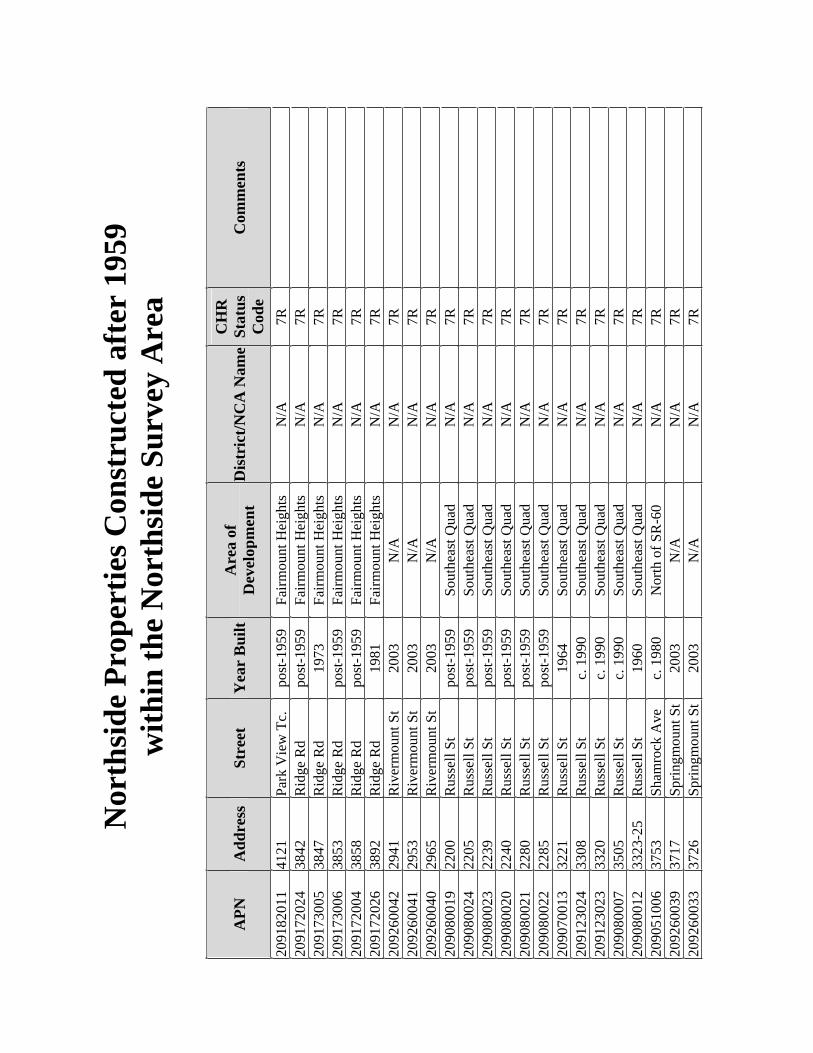
Nor
thsi
de P
rope
rtie
s Con
stru
cted
aft
er 1
959
with
in th
e N
orth
side
Sur
vey
Are
a
APN
Add
ress
Stre
etY
ear
Bui
ltA
rea
of
Dev
elop
men
tD
istr
ict/N
CA
Nam
eC
HR
Stat
usC
ode
Com
men
ts
2091
8201
1 41
21
Park
Vie
w T
c.
post
-195
9 Fa
irmou
nt H
eigh
ts
N/A
7R
20
9172
024
3842
R
idge
Rd
post
-195
9 Fa
irmou
nt H
eigh
ts
N/A
7R
20
9173
005
3847
R
idge
Rd
1973
Fa
irmou
nt H
eigh
ts
N/A
7R
20
9173
006
3853
R
idge
Rd
post
-195
9 Fa
irmou
nt H
eigh
ts
N/A
7R
20
9172
004
3858
R
idge
Rd
post
-195
9 Fa
irmou
nt H
eigh
ts
N/A
7R
20
9172
026
3892
R
idge
Rd
1981
Fa
irmou
nt H
eigh
ts
N/A
7R
20
9260
042
2941
R
iver
mou
nt S
t 20
03
N/A
N
/A
7R
2092
6004
1 29
53
Riv
erm
ount
St
2003
N
/A
N/A
7R
20
9260
040
2965
R
iver
mou
nt S
t 20
03
N/A
N
/A
7R
2090
8001
9 22
00
Rus
sell
St
post
-195
9 So
uthe
ast Q
uad
N/A
7R
20
9080
024
2205
R
usse
ll St
po
st-1
959
Sout
heas
t Qua
d N
/A
7R
2090
8002
3 22
39
Rus
sell
St
post
-195
9 So
uthe
ast Q
uad
N/A
7R
20
9080
020
2240
R
usse
ll St
po
st-1
959
Sout
heas
t Qua
d N
/A
7R
2090
8002
1 22
80
Rus
sell
St
post
-195
9 So
uthe
ast Q
uad
N/A
7R
20
9080
022
2285
R
usse
ll St
po
st-1
959
Sout
heas
t Qua
d N
/A
7R
2090
7001
3 32
21
Rus
sell
St
1964
So
uthe
ast Q
uad
N/A
7R
20
9123
024
3308
R
usse
ll St
c.
199
0 So
uthe
ast Q
uad
N/A
7R
20
9123
023
3320
R
usse
ll St
c.
199
0 So
uthe
ast Q
uad
N/A
7R
20
9080
007
3505
R
usse
ll St
c.
199
0 So
uthe
ast Q
uad
N/A
7R
20
9080
012
3323
-25
Rus
sell
St
1960
So
uthe
ast Q
uad
N/A
7R
20
9051
006
3753
Sh
amro
ck A
ve
c. 1
980
Nor
th o
f SR
-60
N/A
7R
20
9260
039
3717
Sp
ringm
ount
St
2003
N
/A
N/A
7R
20
9260
033
3726
Sp
ringm
ount
St
2003
N
/A
N/A
7R
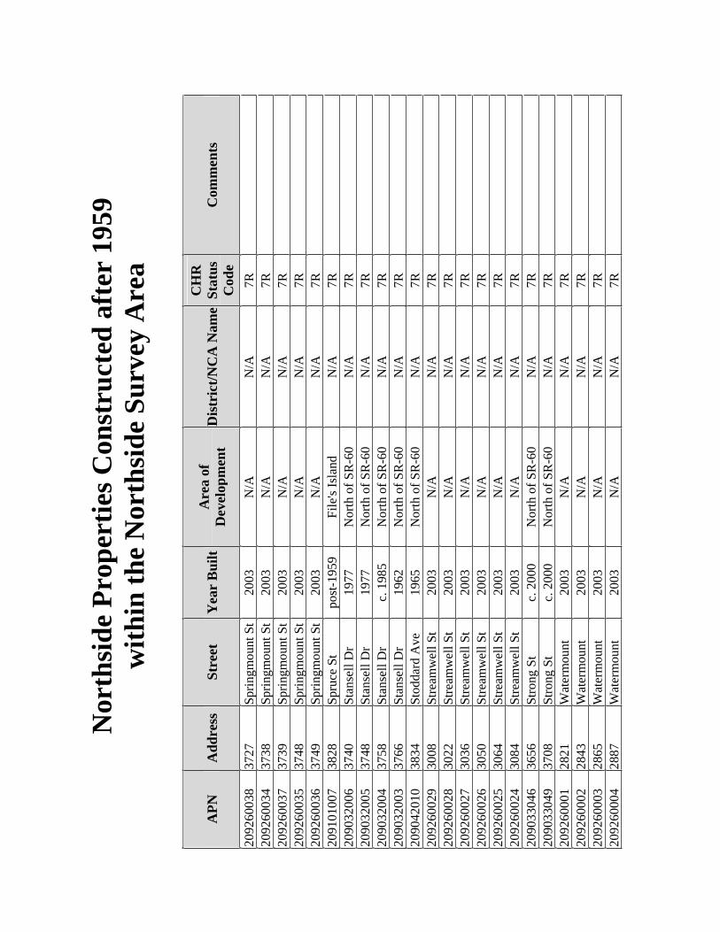
Nor
thsi
de P
rope
rtie
s Con
stru
cted
aft
er 1
959
with
in th
e N
orth
side
Sur
vey
Are
a
APN
Add
ress
Stre
etY
ear
Bui
ltA
rea
of
Dev
elop
men
tD
istr
ict/N
CA
Nam
eC
HR
Stat
usC
ode
Com
men
ts
2092
6003
8 37
27
Sprin
gmou
nt S
t20
03
N/A
N
/A
7R
2092
6003
4 37
38
Sprin
gmou
nt S
t20
03
N/A
N
/A
7R
2092
6003
7 37
39
Sprin
gmou
nt S
t20
03
N/A
N
/A
7R
2092
6003
5 37
48
Sprin
gmou
nt S
t20
03
N/A
N
/A
7R
2092
6003
6 37
49
Sprin
gmou
nt S
t20
03
N/A
N
/A
7R
2091
0100
7 38
28
Spru
ce S
t po
st-1
959
File
's Is
land
N
/A
7R
2090
3200
6 37
40
Stan
sell
Dr
1977
N
orth
of S
R-6
0 N
/A
7R
2090
3200
5 37
48
Stan
sell
Dr
1977
N
orth
of S
R-6
0 N
/A
7R
2090
3200
4 37
58
Stan
sell
Dr
c. 1
985
Nor
th o
f SR
-60
N/A
7R
20
9032
003
3766
St
anse
ll D
r 19
62
Nor
th o
f SR
-60
N/A
7R
20
9042
010
3834
St
odda
rd A
ve
1965
N
orth
of S
R-6
0 N
/A
7R
2092
6002
9 30
08
Stre
amw
ell S
t 20
03
N/A
N
/A
7R
2092
6002
8 30
22
Stre
amw
ell S
t 20
03
N/A
N
/A
7R
2092
6002
7 30
36
Stre
amw
ell S
t 20
03
N/A
N
/A
7R
2092
6002
6 30
50
Stre
amw
ell S
t 20
03
N/A
N
/A
7R
2092
6002
5 30
64
Stre
amw
ell S
t 20
03
N/A
N
/A
7R
2092
6002
4 30
84
Stre
amw
ell S
t 20
03
N/A
N
/A
7R
2090
3304
6 36
56
Stro
ng S
t c.
200
0 N
orth
of S
R-6
0 N
/A
7R
2090
3304
9 37
08
Stro
ng S
t c.
200
0 N
orth
of S
R-6
0 N
/A
7R
2092
6000
1 28
21
Wat
erm
ount
20
03
N/A
N
/A
7R
2092
6000
2 28
43
Wat
erm
ount
20
03
N/A
N
/A
7R
2092
6000
3 28
65
Wat
erm
ount
20
03
N/A
N
/A
7R
2092
6000
4 28
87
Wat
erm
ount
20
03
N/A
N
/A
7R
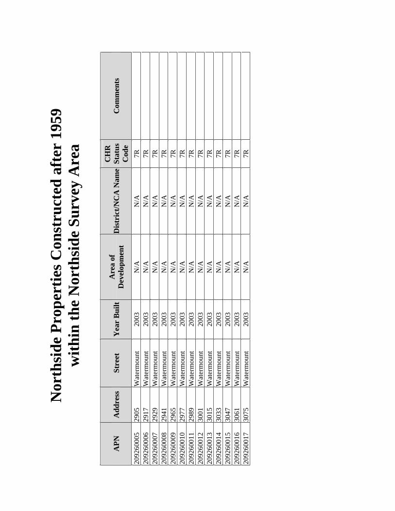
Nor
thsi
de P
rope
rtie
s Con
stru
cted
aft
er 1
959
with
in th
e N
orth
side
Sur
vey
Are
a
APN
Add
ress
Stre
etY
ear
Bui
ltA
rea
of
Dev
elop
men
tD
istr
ict/N
CA
Nam
eC
HR
Stat
usC
ode
Com
men
ts
2092
6000
5 29
05
Wat
erm
ount
20
03
N/A
N
/A
7R
2092
6000
6 29
17
Wat
erm
ount
20
03
N/A
N
/A
7R
2092
6000
7 29
29
Wat
erm
ount
20
03
N/A
N
/A
7R
2092
6000
8 29
41
Wat
erm
ount
20
03
N/A
N
/A
7R
2092
6000
9 29
65
Wat
erm
ount
20
03
N/A
N
/A
7R
2092
6001
0 29
77
Wat
erm
ount
20
03
N/A
N
/A
7R
2092
6001
1 29
89
Wat
erm
ount
20
03
N/A
N
/A
7R
2092
6001
2 30
01
Wat
erm
ount
20
03
N/A
N
/A
7R
2092
6001
3 30
15
Wat
erm
ount
20
03
N/A
N
/A
7R
2092
6001
4 30
33
Wat
erm
ount
20
03
N/A
N
/A
7R
2092
6001
5 30
47
Wat
erm
ount
20
03
N/A
N
/A
7R
2092
6001
6 30
61
Wat
erm
ount
20
03
N/A
N
/A
7R
2092
6001
7 30
75
Wat
erm
ount
20
03
N/A
N
/A
7R
APPENDIX X
STREET TREES LIST BY STREET NAME FOR THE NORTHSIDE SURVEY AREA
PROVIDED BY RON SMITH,CITY OF RIVERSIDE URBAN FORESTER
Related Documents