1 PADAWAN BAU SERIAN LUNDU

Welcome message from author
This document is posted to help you gain knowledge. Please leave a comment to let me know what you think about it! Share it to your friends and learn new things together.
Transcript
1 PADAWAN BAU SERIAN LUNDU
Journey to
. eBook Guide .
FascinatingSouthern
Sarawak
2 PADAWAN BAU SERIAN LUNDU
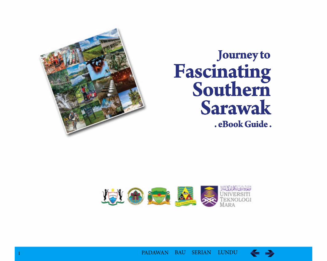
Intricate woven work from ladies of Bidayuh Selako, Lundu
Welcome
The objective of the PBSL Inventory of tourism product was to identify several areas focusing on high-value niche seg-ments to either enhance or proposed for development into tourism products. The sub-objectives are to identify:i. natural or man-make geographical landmarks; ii. historical and landmark buildings;iii. historical sites like old trails or ceremonies;iv. local traditions that include festivals; v. public parks, playground and recreation areas;vi. flagship projects for each of the four councils.
3 PADAWAN BAU SERIAN LUNDU
FascinatingPadawan
Experience the Splendour of the Rich Heritage of Culture, Nature and Landscape
PADAWAN - Index Listing
Introduction 4Recreation and Nature Parks 4 National Parks 5 Kubah National Park 6 Kuching Wetland National Park 7 Talang Satang National Park 9 Semengoh Wildlife Rehabitation Centre 12 Matang Wildlife Centre 15Kampung Telaga Air 16Kampung Danu 18 Kampung Temurang 21 Kampung Annah Rais 23 Kampung Benuk 28Kampung Belimbing Darul Islam 34Pelaman Dunuk 37 Kampung Bengoh 38
PADAWAN - Index Listing
Kampung Giam 41 Kampung Git 43Kampung Semadang 45 Kampung Sentah Siburan 47 Kampung Sikog 49 Kampung Simpok 51Kampung Mundai 54 Kampung Sarig 55 Kampung Senah Rayang 56 Kampung Simuti 57 Kampung Sibakar 58Kampung Sadir 59 Kampung Begu 60Borneo Highland Resort 61Padawan 4x4 Challange 62
4 PADAWAN BAU SERIAN LUNDU
PADAWAN
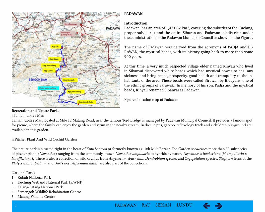
IntroductionPadawan has an area of 1,431.82 km2, covering the suburbs of the Kuching, proper subdistrict and the entire Siburan and Padawan subdistricts under the administration of the Padawan Municipal Council as shown in the Figure .
The name of Padawan was derived from the acronyms of PADJA and BI-RAWAN, the mystical beads, with its history going back to more than some 900 years.
At this time, a very much respected village elder named Kinyau who lived in Sibanyai discovered white beads which had mystical power to heal any sickness and bring peace, prosperity, good health and tranquility to the in-habitants of the area. These beads were called Birawan by Bidayuhs, one of the ethnic groups of Sarawak. In memory of his son, Padja and the mystical beads, Kinyau renamed Sibanyai as Padawan.
Figure : Location map of Padawan
Recreation and Nature Parksi.Taman Jubilee MasTaman Jubilee Mas, located at Mile 12 Matang Road, near the famous ‘Red Bridge’ is managed by Padawan Municipal Council. It provides a famous spot for picnic, where the family can enjoy the garden and swim in the nearby stream. Barbecue pits, gazebo, reflexology track and a children playground are available in this garden.
ii.Pitcher Plant And Wild Orchid Garden
The nature park is situated right in the heart of Kota Sentosa or formerly known as 10th Mile Bazaar. The Garden showcases more than 30 subspecies of pitcher plants (Nepenthes) ranging from the commonly known Nepenthes ampullaria to hybrids by nature Nepenthes x hookeriana (N.ampullaria x N.rafflesiana). There is also a collection of wild orchids from Angraecum eburneum, Dendrobium species, and Zygopetalum species. Staghorn ferns of the Platycerium superbum and Bird’s nest Asplenium nidus are also part of the collections.
National Parks 1. Kubah National Park 2. Kuching Wetland National Park (KWNP) 3. Talang-Satang National Park 4. Semengoh Wildlife Rehabitation Centre5. Matang Wildlife Centre
5 PADAWAN BAU SERIAN LUNDU
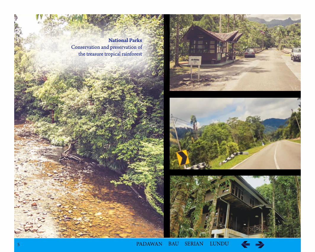
National ParksConservation and preservation of
the treasure tropical rainforest
6 PADAWAN BAU SERIAN LUNDU
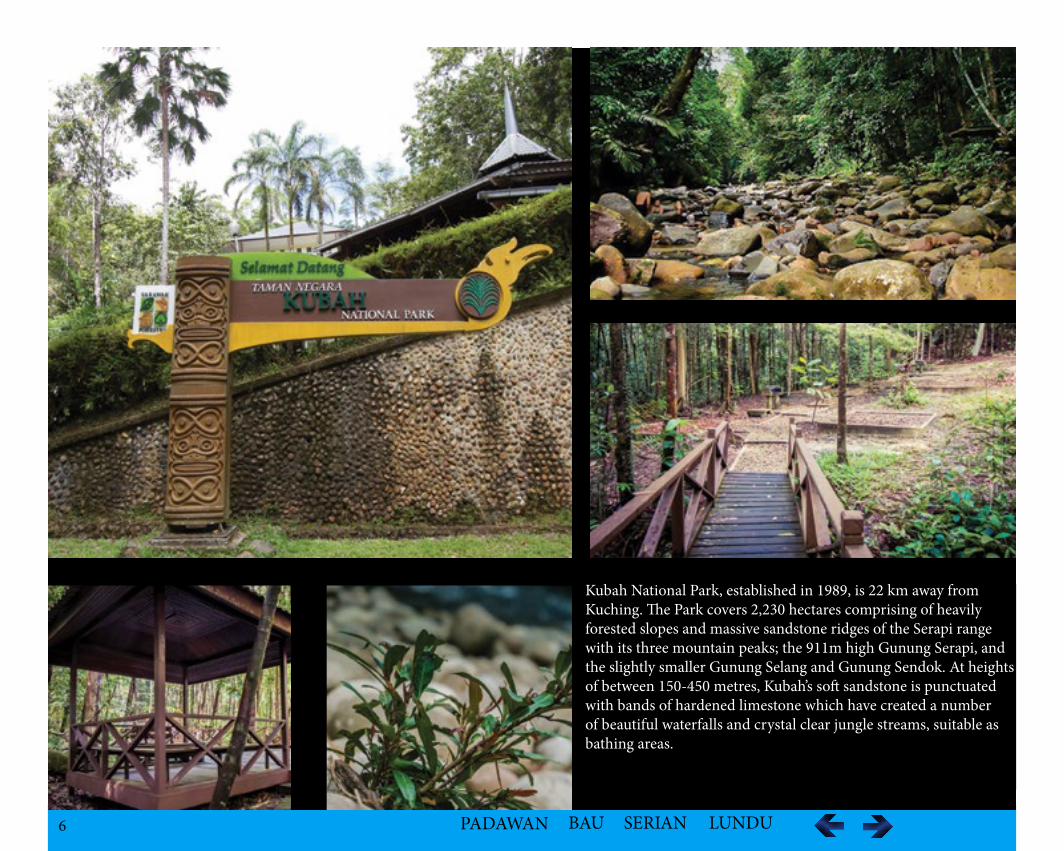
Kubah National ParkRich in palms and orchids
(C) 2014, Robert John Jingut
Kubah National Park, established in 1989, is 22 km away from Kuching. The Park covers 2,230 hectares comprising of heavily forested slopes and massive sandstone ridges of the Serapi range with its three mountain peaks; the 911m high Gunung Serapi, and the slightly smaller Gunung Selang and Gunung Sendok. At heights of between 150-450 metres, Kubah’s soft sandstone is punctuated with bands of hardened limestone which have created a number of beautiful waterfalls and crystal clear jungle streams, suitable as bathing areas.
7 PADAWAN BAU SERIAN LUNDU
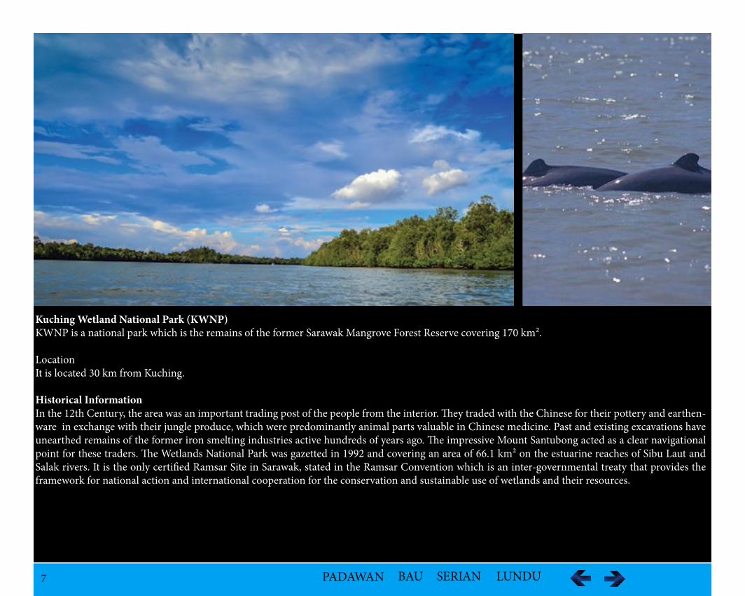
Kuching Wetland National Park (KWNP) KWNP is a national park which is the remains of the former Sarawak Mangrove Forest Reserve covering 170 km².
LocationIt is located 30 km from Kuching.
Historical InformationIn the 12th Century, the area was an important trading post of the people from the interior. They traded with the Chinese for their pottery and earthen-ware in exchange with their jungle produce, which were predominantly animal parts valuable in Chinese medicine. Past and existing excavations have unearthed remains of the former iron smelting industries active hundreds of years ago. The impressive Mount Santubong acted as a clear navigational point for these traders. The Wetlands National Park was gazetted in 1992 and covering an area of 66.1 km² on the estuarine reaches of Sibu Laut and Salak rivers. It is the only certified Ramsar Site in Sarawak, stated in the Ramsar Convention which is an inter-governmental treaty that provides the framework for national action and international cooperation for the conservation and sustainable use of wetlands and their resources.
8 PADAWAN BAU SERIAN LUNDU
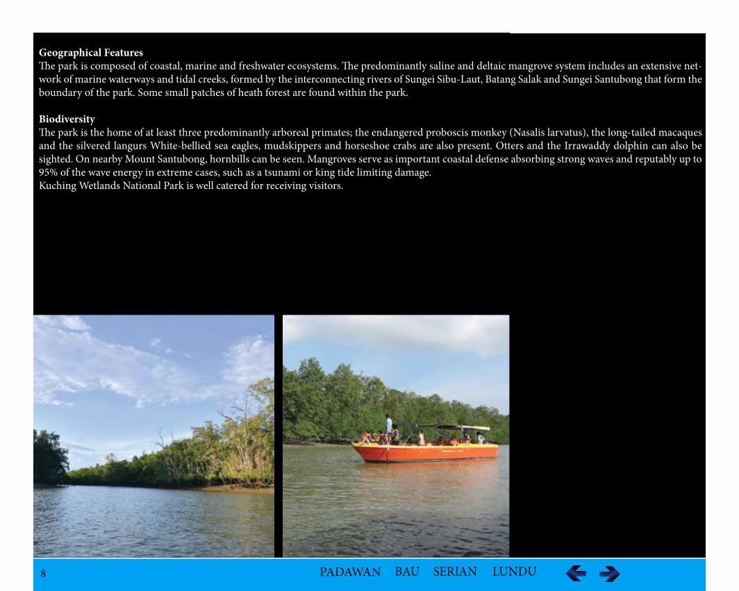
Geographical FeaturesThe park is composed of coastal, marine and freshwater ecosystems. The predominantly saline and deltaic mangrove system includes an extensive net-work of marine waterways and tidal creeks, formed by the interconnecting rivers of Sungei Sibu-Laut, Batang Salak and Sungei Santubong that form the boundary of the park. Some small patches of heath forest are found within the park.
BiodiversityThe park is the home of at least three predominantly arboreal primates; the endangered proboscis monkey (Nasalis larvatus), the long-tailed macaques and the silvered langurs White-bellied sea eagles, mudskippers and horseshoe crabs are also present. Otters and the Irrawaddy dolphin can also be sighted. On nearby Mount Santubong, hornbills can be seen. Mangroves serve as important coastal defense absorbing strong waves and reputably up to 95% of the wave energy in extreme cases, such as a tsunami or king tide limiting damage. Kuching Wetlands National Park is well catered for receiving visitors.
9 PADAWAN BAU SERIAN LUNDU
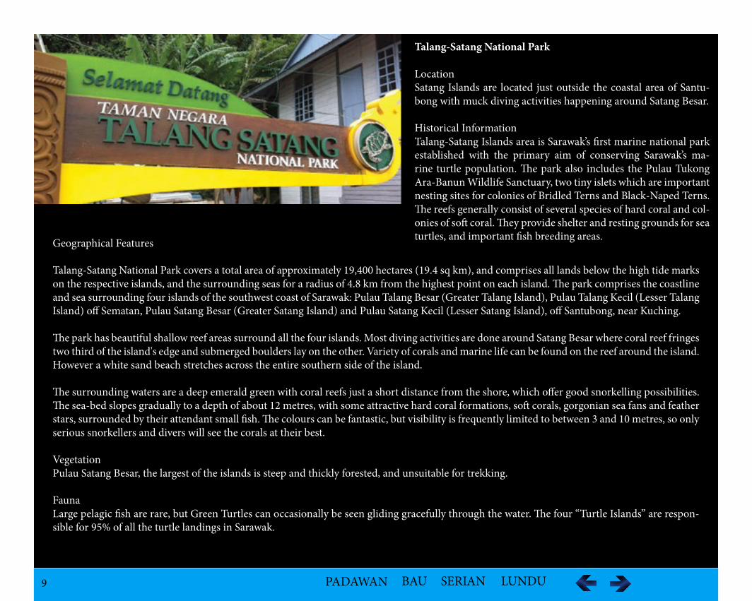
Talang-Satang National Park
LocationSatang Islands are located just outside the coastal area of Santu-bong with muck diving activities happening around Satang Besar.
Historical InformationTalang-Satang Islands area is Sarawak’s first marine national park established with the primary aim of conserving Sarawak’s ma-rine turtle population. The park also includes the Pulau Tukong Ara-Banun Wildlife Sanctuary, two tiny islets which are important nesting sites for colonies of Bridled Terns and Black-Naped Terns. The reefs generally consist of several species of hard coral and col-onies of soft coral. They provide shelter and resting grounds for sea turtles, and important fish breeding areas.Geographical Features
Talang-Satang National Park covers a total area of approximately 19,400 hectares (19.4 sq km), and comprises all lands below the high tide marks on the respective islands, and the surrounding seas for a radius of 4.8 km from the highest point on each island. The park comprises the coastline and sea surrounding four islands of the southwest coast of Sarawak: Pulau Talang Besar (Greater Talang Island), Pulau Talang Kecil (Lesser Talang Island) off Sematan, Pulau Satang Besar (Greater Satang Island) and Pulau Satang Kecil (Lesser Satang Island), off Santubong, near Kuching.
The park has beautiful shallow reef areas surround all the four islands. Most diving activities are done around Satang Besar where coral reef fringes two third of the island's edge and submerged boulders lay on the other. Variety of corals and marine life can be found on the reef around the island. However a white sand beach stretches across the entire southern side of the island.
The surrounding waters are a deep emerald green with coral reefs just a short distance from the shore, which offer good snorkelling possibilities. The sea-bed slopes gradually to a depth of about 12 metres, with some attractive hard coral formations, soft corals, gorgonian sea fans and feather stars, surrounded by their attendant small fish. The colours can be fantastic, but visibility is frequently limited to between 3 and 10 metres, so only serious snorkellers and divers will see the corals at their best.
VegetationPulau Satang Besar, the largest of the islands is steep and thickly forested, and unsuitable for trekking.
FaunaLarge pelagic fish are rare, but Green Turtles can occasionally be seen gliding gracefully through the water. The four “Turtle Islands” are respon-sible for 95% of all the turtle landings in Sarawak.
10 PADAWAN BAU SERIAN LUNDU
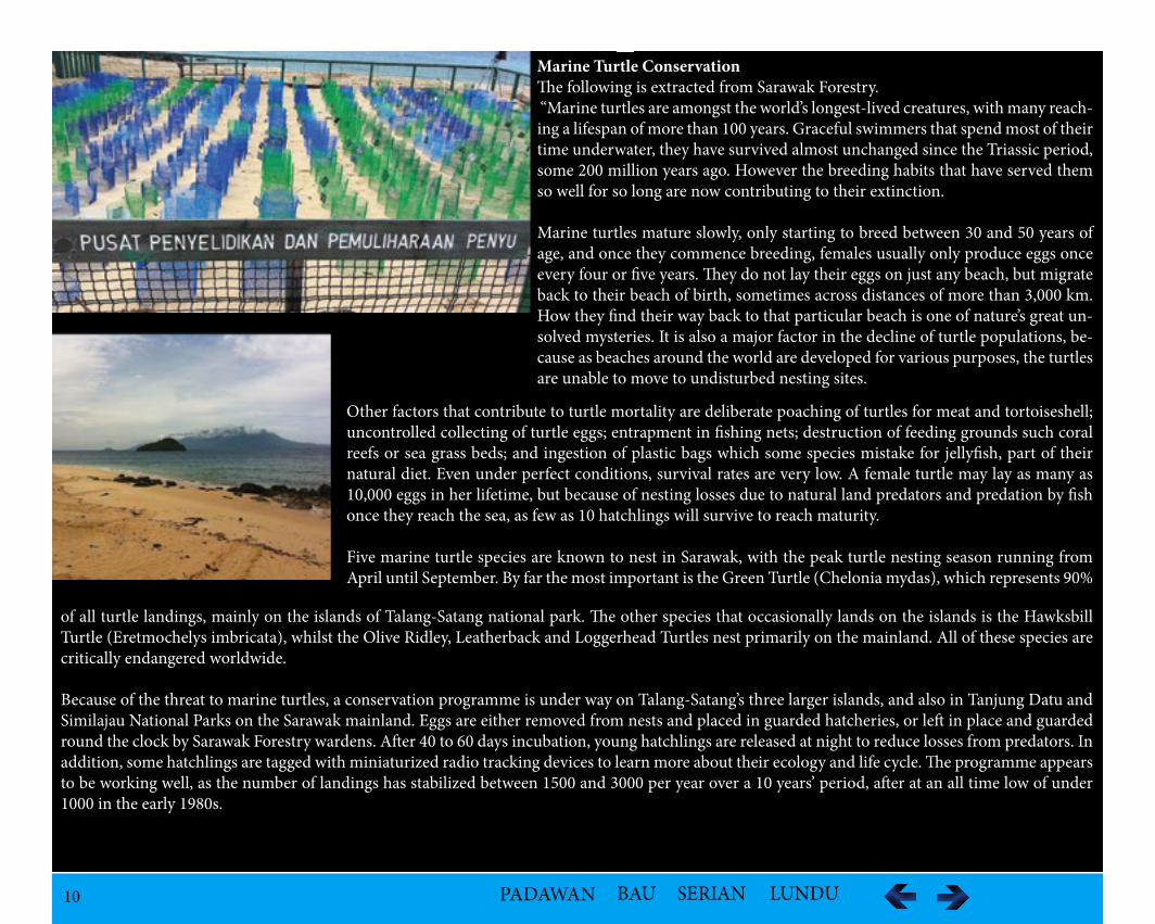
Marine Turtle ConservationThe following is extracted from Sarawak Forestry. “Marine turtles are amongst the world’s longest-lived creatures, with many reach-ing a lifespan of more than 100 years. Graceful swimmers that spend most of their time underwater, they have survived almost unchanged since the Triassic period, some 200 million years ago. However the breeding habits that have served them so well for so long are now contributing to their extinction.
Marine turtles mature slowly, only starting to breed between 30 and 50 years of age, and once they commence breeding, females usually only produce eggs once every four or five years. They do not lay their eggs on just any beach, but migrate back to their beach of birth, sometimes across distances of more than 3,000 km. How they find their way back to that particular beach is one of nature’s great un-solved mysteries. It is also a major factor in the decline of turtle populations, be-cause as beaches around the world are developed for various purposes, the turtles are unable to move to undisturbed nesting sites.
Other factors that contribute to turtle mortality are deliberate poaching of turtles for meat and tortoiseshell; uncontrolled collecting of turtle eggs; entrapment in fishing nets; destruction of feeding grounds such coral reefs or sea grass beds; and ingestion of plastic bags which some species mistake for jellyfish, part of their natural diet. Even under perfect conditions, survival rates are very low. A female turtle may lay as many as 10,000 eggs in her lifetime, but because of nesting losses due to natural land predators and predation by fish once they reach the sea, as few as 10 hatchlings will survive to reach maturity.
Five marine turtle species are known to nest in Sarawak, with the peak turtle nesting season running from April until September. By far the most important is the Green Turtle (Chelonia mydas), which represents 90%
of all turtle landings, mainly on the islands of Talang-Satang national park. The other species that occasionally lands on the islands is the Hawksbill Turtle (Eretmochelys imbricata), whilst the Olive Ridley, Leatherback and Loggerhead Turtles nest primarily on the mainland. All of these species are critically endangered worldwide.
Because of the threat to marine turtles, a conservation programme is under way on Talang-Satang’s three larger islands, and also in Tanjung Datu and Similajau National Parks on the Sarawak mainland. Eggs are either removed from nests and placed in guarded hatcheries, or left in place and guarded round the clock by Sarawak Forestry wardens. After 40 to 60 days incubation, young hatchlings are released at night to reduce losses from predators. In addition, some hatchlings are tagged with miniaturized radio tracking devices to learn more about their ecology and life cycle. The programme appears to be working well, as the number of landings has stabilized between 1500 and 3000 per year over a 10 years’ period, after at an all time low of under 1000 in the early 1980s.
11 PADAWAN BAU SERIAN LUNDU
Tourist Activities
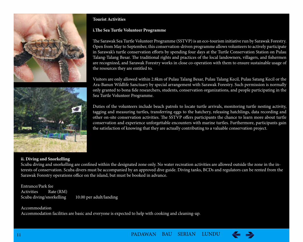
i.The Sea Turtle Volunteer Programme
The Sarawak Sea Turtle Volunteer Programme (SSTVP) is an eco-tourism initiative run by Sarawak Forestry. Open from May to September, this conservation-driven programme allows volunteers to actively participate in Sarawak’s turtle conservation efforts by spending four days at the Turtle Conservation Station on Pulau Talang-Talang Besar. The traditional rights and practices of the local landowners, villagers, and fishermen are recognized, and Sarawak Forestry works in close co-operation with them to ensure sustainable usage of the resources they are entitled to.
Visitors are only allowed within 2.8km of Pulau Talang Besar, Pulau Talang Kecil, Pulau Satang Kecil or the Ara-Banun Wildlife Sanctuary by special arrangement with Sarawak Forestry. Such permission is normally only granted to bona fide researchers, students, conservation organizations, and people participating in the Sea Turtle Volunteer Programme.
Duties of the volunteers include beach patrols to locate turtle arrivals, monitoring turtle nesting activity, tagging and measuring turtles, transferring eggs to the hatchery, releasing hatchlings, data recording and other on-site conservation activities. The SSTVP offers participants the chance to learn more about turtle conservation and experience unforgettable encounters with marine turtles. Furthermore, participants gain the satisfaction of knowing that they are actually contributing to a valuable conservation project.
ii. Diving and SnorkellingScuba diving and snorkelling are confined within the designated zone only. No water recreation activities are allowed outside the zone in the in-terests of conservation. Scuba divers must be accompanied by an approved dive guide. Diving tanks, BCDs and regulators can be rented from the Sarawak Forestry operations office on the island, but must be booked in advance.
Entrance/Park fee Activities Rate (RM)Scuba diving/snorkelling 10.00 per adult/landing
AccommodationAccommodation facilities are basic and everyone is expected to help with cooking and cleaning-up.
12 PADAWAN BAU SERIAN LUNDU
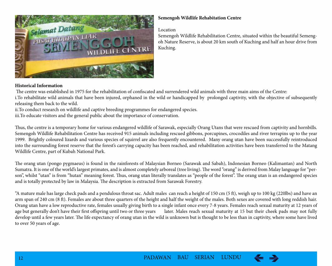
Semengoh Wildlife Rehabitation Centre
LocationSemengoh Wildlife Rehabilitation Centre, situated within the beautiful Semeng-oh Nature Reserve, is about 20 km south of Kuching and half an hour drive from Kuching.
Historical Information The centre was established in 1975 for the rehabilitation of confiscated and surrendered wild animals with three main aims of the Centre:i.To rehabilitate wild animals that have been injured, orphaned in the wild or handicapped by prolonged captivity, with the objective of subsequently releasing them back to the wild.ii.To conduct research on wildlife and captive breeding programmes for endangered species.iii.To educate visitors and the general public about the importance of conservation.
Thus, the centre is a temporary home for various endangered wildlife of Sarawak, especially Orang Utans that were rescued from captivity and hornbills. Semengoh Wildlife Rehabilitation Centre has received 915 animals including rescued gibbons, porcupines, crocodiles and river terrapins up to the year 1999. Brightly coloured lizards and various species of squirrel are also frequently encountered. Many orang utan have been successfully reintroduced into the surrounding forest reserve that the forest’s carrying capacity has been reached, and rehabilitation activities have been transferred to the Matang Wildlife Centre, part of Kubah National Park.
The orang utan (pongo pygmaeus) is found in the rainforests of Malaysian Borneo (Sarawak and Sabah), Indonesian Borneo (Kalimantan) and North Sumatra. It is one of the world’s largest primates, and is almost completely arboreal (tree living). The word “orang” is derived from Malay language for “per-son”, whilst “utan” is from “hutan” meaning forest. Thus, orang utan literally translates as “people of the forest”. The orang utan is an endangered species and is totally protected by law in Malaysia. The description is extracted from Sarawak Forestry.
“A mature male has large check pads and a pendulous throat sac. Adult males can reach a height of 150 cm (5 ft), weigh up to 100 kg (220lbs) and have an arm span of 240 cm (8 ft). Females are about three quarters of the height and half the weight of the males. Both sexes are covered with long reddish hair. Orang utan have a low reproductive rate, females usually giving birth to a single infant once every 7-8 years. Females reach sexual maturity at 12 years of age but generally don’t have their first offspring until two or three years later. Males reach sexual maturity at 15 but their cheek pads may not fully develop until a few years later. The life expectancy of orang utan in the wild is unknown but is thought to be less than in captivity, where some have lived to over 50 years of age.
13 PADAWAN BAU SERIAN LUNDU
Orang utan are primarily fruit eaters and spend most of the day roaming the forest for-aging for food. They are particularly fond of wild figs and the pungent smelling durian. Although fruit is their most important source of food, they also feed on young leaves, insects, bark, flowers, eggs and small lizards. Each individual builds a new nest each night, a safe resting place 12-18 metres (40-60 ft) up in the roof of the forest. Wild orang utan are gen-erally solitary. However, adolescents often gather in pairs and females occasionally form tem-porary groups of four or five. This rather lonely existence stems both from the relative scarci-ty of food in the rainforest and from a lack of predators. A mature adult roams a vast area of forest every day in order to find enough food to satisfy its healthy appetite. Its huge size also eliminates the need for group defence”.
VegetationThe Botanical Research Centre (BRC) is the other major component of the Semenggoh Nature Reserve that includes ethnobotanical gardens, wild fruit orchards, a “Fernarium” and a Rhe-ophyte garden.
Tourist Activities
i.Nature TrailsFive nature trails and a plankwalk have been laid out to allow visitors the opportunity of see-ing the various gardens in BRC. The trails are all relatively short with trekking times ranging from 5-30 minutes, whilst the time required for the plankwalk is approximately 30 minutes. A plant identification system has been created alongside the plankwalk so that visitors are able to familiarise themselves with some of the better known trees and plants especially highlighting Dipterocarps such as Meranti and Engkabang as are wild fruit trees such as jackfruit (cempe-dak) and the infamous Durian.
14 PADAWAN BAU SERIAN LUNDU
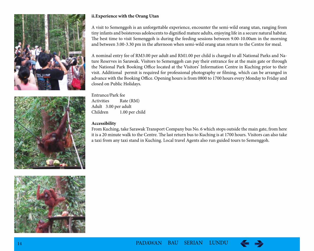
ii.Experience with the Orang Utan
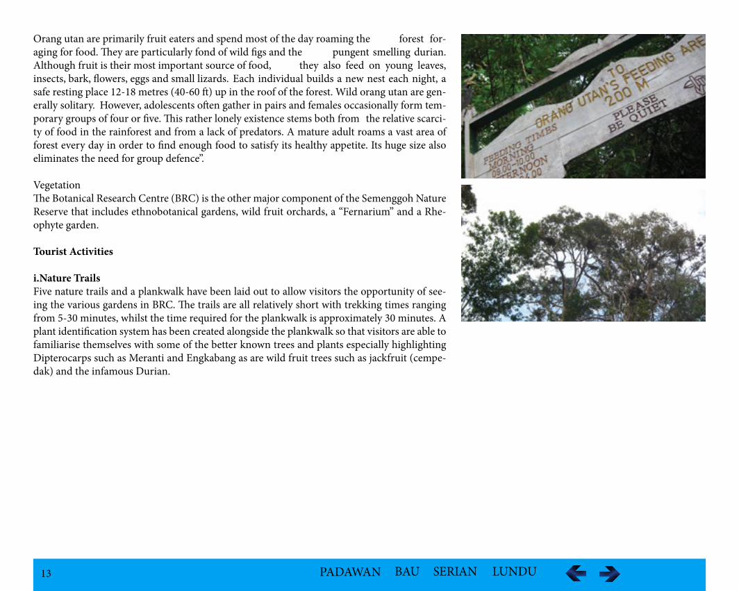
A visit to Semenggoh is an unforgettable experience, encounter the semi-wild orang utan, ranging from tiny infants and boisterous adolescents to dignified mature adults, enjoying life in a secure natural habitat. The best time to visit Semenggoh is during the feeding sessions between 9.00-10.00am in the morning and between 3.00-3.30 pm in the afternoon when semi-wild orang utan return to the Centre for meal.
A nominal entry fee of RM3.00 per adult and RM1.00 per child is charged to all National Parks and Na-ture Reserves in Sarawak. Visitors to Semenggoh can pay their entrance fee at the main gate or through the National Park Booking Office located at the Visitors’ Information Centre in Kuching prior to their visit. Additional permit is required for professional photography or filming, which can be arranged in advance with the Booking Office. Opening hours is from 0800 to 1700 hours every Monday to Friday and closed on Public Holidays.
Entrance/Park fee Activities Rate (RM)Adult 3.00 per adultChildren 1.00 per child
AccessibilityFrom Kuching, take Sarawak Transport Company bus No. 6 which stops outside the main gate, from here it is a 20 minute walk to the Centre. The last return bus to Kuching is at 1700 hours. Visitors can also take a taxi from any taxi stand in Kuching. Local travel Agents also run guided tours to Semenggoh.
15 PADAWAN BAU SERIAN LUNDU
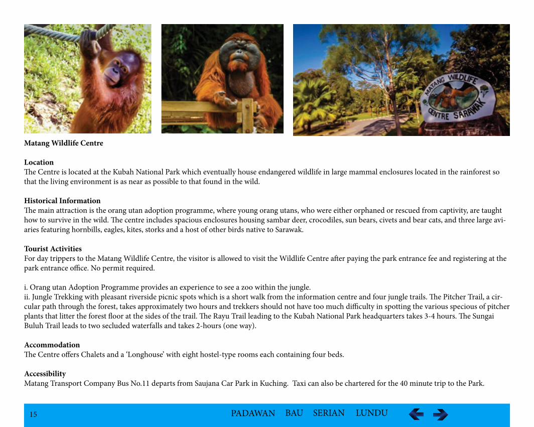
Matang Wildlife Centre LocationThe Centre is located at the Kubah National Park which eventually house endangered wildlife in large mammal enclosures located in the rainforest so that the living environment is as near as possible to that found in the wild.
Historical InformationThe main attraction is the orang utan adoption programme, where young orang utans, who were either orphaned or rescued from captivity, are taught how to survive in the wild. The centre includes spacious enclosures housing sambar deer, crocodiles, sun bears, civets and bear cats, and three large avi-aries featuring hornbills, eagles, kites, storks and a host of other birds native to Sarawak.
Tourist ActivitiesFor day trippers to the Matang Wildlife Centre, the visitor is allowed to visit the Wildlife Centre after paying the park entrance fee and registering at the park entrance office. No permit required.
i. Orang utan Adoption Programme provides an experience to see a zoo within the jungle.ii. Jungle Trekking with pleasant riverside picnic spots which is a short walk from the information centre and four jungle trails. The Pitcher Trail, a cir-cular path through the forest, takes approximately two hours and trekkers should not have too much difficulty in spotting the various specious of pitcher plants that litter the forest floor at the sides of the trail. The Rayu Trail leading to the Kubah National Park headquarters takes 3-4 hours. The Sungai Buluh Trail leads to two secluded waterfalls and takes 2-hours (one way). AccommodationThe Centre offers Chalets and a ‘Longhouse’ with eight hostel-type rooms each containing four beds.
AccessibilityMatang Transport Company Bus No.11 departs from Saujana Car Park in Kuching. Taxi can also be chartered for the 40 minute trip to the Park.
16 PADAWAN BAU SERIAN LUNDU
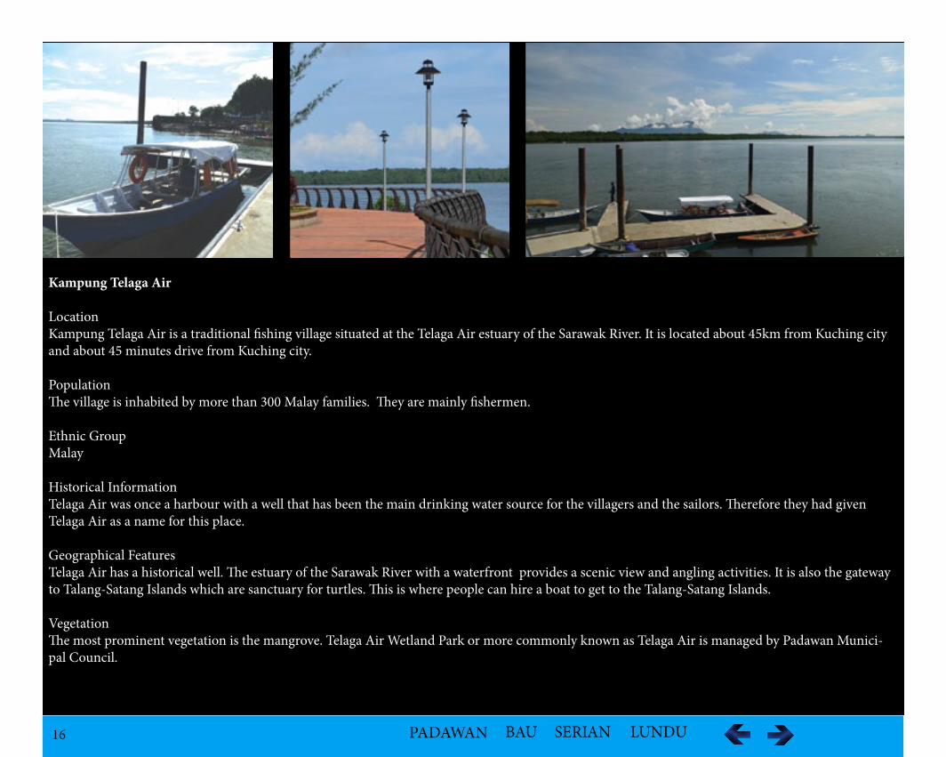
Kampung Telaga Air
LocationKampung Telaga Air is a traditional fishing village situated at the Telaga Air estuary of the Sarawak River. It is located about 45km from Kuching city and about 45 minutes drive from Kuching city.
PopulationThe village is inhabited by more than 300 Malay families. They are mainly fishermen.
Ethnic GroupMalay
Historical InformationTelaga Air was once a harbour with a well that has been the main drinking water source for the villagers and the sailors. Therefore they had given Telaga Air as a name for this place.
Geographical FeaturesTelaga Air has a historical well. The estuary of the Sarawak River with a waterfront provides a scenic view and angling activities. It is also the gateway to Talang-Satang Islands which are sanctuary for turtles. This is where people can hire a boat to get to the Talang-Satang Islands.
VegetationThe most prominent vegetation is the mangrove. Telaga Air Wetland Park or more commonly known as Telaga Air is managed by Padawan Munici-pal Council.
17 PADAWAN BAU SERIAN LUNDU
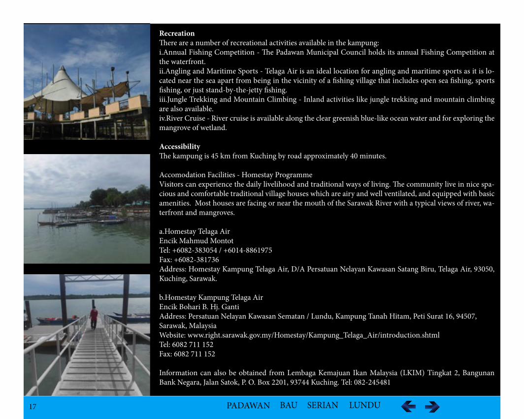
RecreationThere are a number of recreational activities available in the kampung:i.Annual Fishing Competition - The Padawan Municipal Council holds its annual Fishing Competition at the waterfront. ii.Angling and Maritime Sports - Telaga Air is an ideal location for angling and maritime sports as it is lo-cated near the sea apart from being in the vicinity of a fishing village that includes open sea fishing, sports fishing, or just stand-by-the-jetty fishing.iii.Jungle Trekking and Mountain Climbing - Inland activities like jungle trekking and mountain climbing are also available.iv.River Cruise - River cruise is available along the clear greenish blue-like ocean water and for exploring the mangrove of wetland.
AccessibilityThe kampung is 45 km from Kuching by road approximately 40 minutes.
Accomodation Facilities - Homestay ProgrammeVisitors can experience the daily livelihood and traditional ways of living. The community live in nice spa-cious and comfortable traditional village houses which are airy and well ventilated, and equipped with basic amenities. Most houses are facing or near the mouth of the Sarawak River with a typical views of river, wa-terfront and mangroves.
a.Homestay Telaga AirEncik Mahmud MontotTel: +6082-383054 / +6014-8861975Fax: +6082-381736Address: Homestay Kampung Telaga Air, D/A Persatuan Nelayan Kawasan Satang Biru, Telaga Air, 93050, Kuching, Sarawak.
b.Homestay Kampung Telaga AirEncik Bohari B. Hj. GantiAddress: Persatuan Nelayan Kawasan Sematan / Lundu, Kampung Tanah Hitam, Peti Surat 16, 94507, Sarawak, MalaysiaWebsite: www.right.sarawak.gov.my/Homestay/Kampung_Telaga_Air/introduction.shtmlTel: 6082 711 152Fax: 6082 711 152
Information can also be obtained from Lembaga Kemajuan Ikan Malaysia (LKIM) Tingkat 2, Bangunan Bank Negara, Jalan Satok, P. O. Box 2201, 93744 Kuching. Tel: 082-245481
18 PADAWAN BAU SERIAN LUNDU
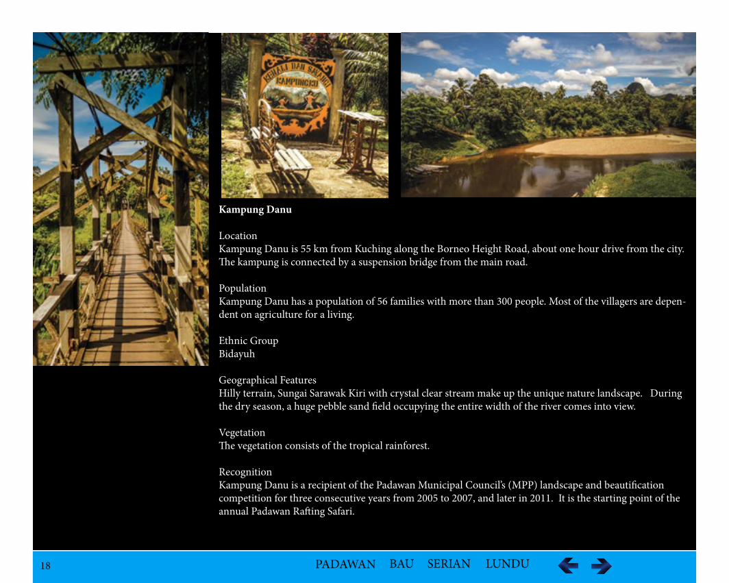
Kampung Danu
LocationKampung Danu is 55 km from Kuching along the Borneo Height Road, about one hour drive from the city. The kampung is connected by a suspension bridge from the main road.
PopulationKampung Danu has a population of 56 families with more than 300 people. Most of the villagers are depen-dent on agriculture for a living.
Ethnic GroupBidayuh
Geographical FeaturesHilly terrain, Sungai Sarawak Kiri with crystal clear stream make up the unique nature landscape. During the dry season, a huge pebble sand field occupying the entire width of the river comes into view.
VegetationThe vegetation consists of the tropical rainforest.
RecognitionKampung Danu is a recipient of the Padawan Municipal Council’s (MPP) landscape and beautification competition for three consecutive years from 2005 to 2007, and later in 2011. It is the starting point of the annual Padawan Rafting Safari.
19 PADAWAN BAU SERIAN LUNDU
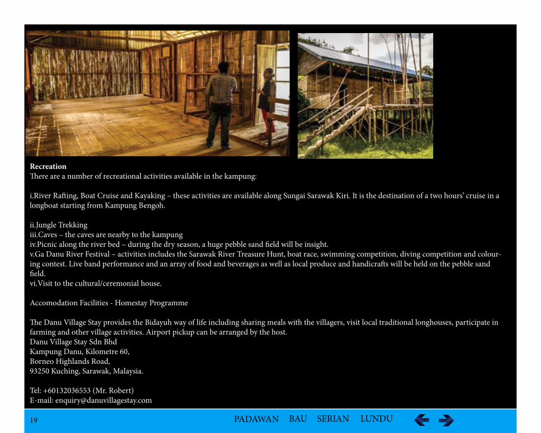
RecreationThere are a number of recreational activities available in the kampung:
i.River Rafting, Boat Cruise and Kayaking – these activities are available along Sungai Sarawak Kiri. It is the destination of a two hours’ cruise in a longboat starting from Kampung Bengoh.
ii.Jungle Trekking iii.Caves – the caves are nearby to the kampungiv.Picnic along the river bed – during the dry season, a huge pebble sand field will be insight.v.Ga Danu River Festival – activities includes the Sarawak River Treasure Hunt, boat race, swimming competition, diving competition and colour-ing contest. Live band performance and an array of food and beverages as well as local produce and handicrafts will be held on the pebble sand field. vi.Visit to the cultural/ceremonial house.
Accomodation Facilities - Homestay Programme
The Danu Village Stay provides the Bidayuh way of life including sharing meals with the villagers, visit local traditional longhouses, participate in farming and other village activities. Airport pickup can be arranged by the host.Danu Village Stay Sdn BhdKampung Danu, Kilometre 60,Borneo Highlands Road,93250 Kuching, Sarawak, Malaysia.
Tel: +60132036553 (Mr. Robert)E-mail: [email protected]
20 PADAWAN BAU SERIAN LUNDU
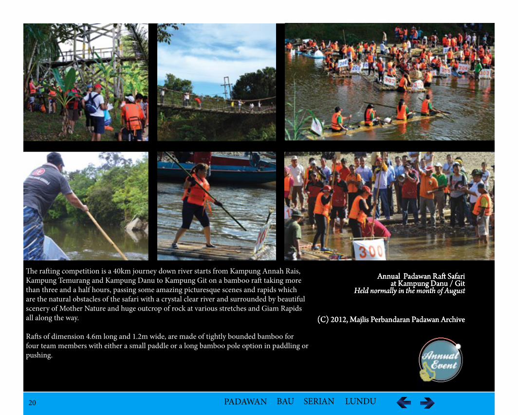
Annual Padawan Raa Safari at Kampung Danu / Git
Held normally in the month of August
(C) 2012, Majlis Perbandaran Padawan Archive
The rafting competition is a 40km journey down river starts from Kampung Annah Rais, Kampung Temurang and Kampung Danu to Kampung Git on a bamboo raft taking more than three and a half hours, passing some amazing picturesque scenes and rapids which are the natural obstacles of the safari with a crystal clear river and surrounded by beautiful scenery of Mother Nature and huge outcrop of rock at various stretches and Giam Rapids all along the way.
Rafts of dimension 4.6m long and 1.2m wide, are made of tightly bounded bamboo for four team members with either a small paddle or a long bamboo pole option in paddling or pushing.
21 PADAWAN BAU SERIAN LUNDU
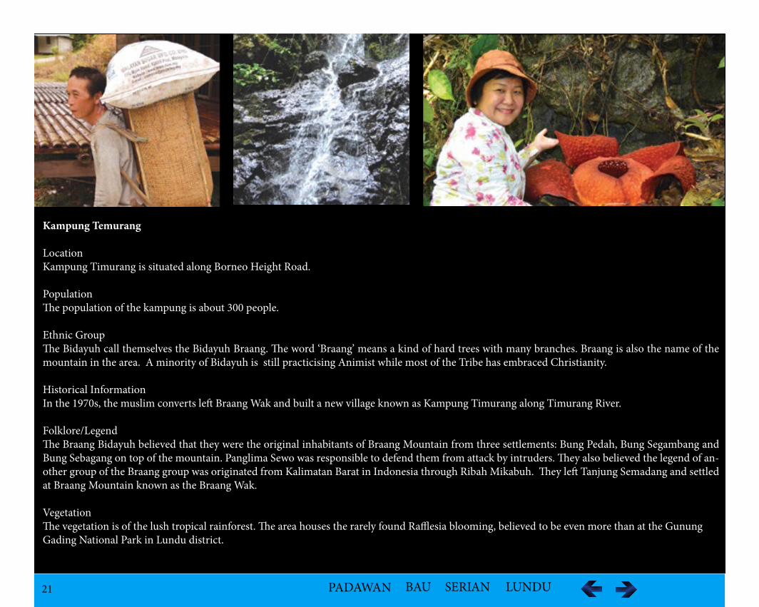
Kampung Temurang
LocationKampung Timurang is situated along Borneo Height Road.
Population The population of the kampung is about 300 people.
Ethnic GroupThe Bidayuh call themselves the Bidayuh Braang. The word ‘Braang’ means a kind of hard trees with many branches. Braang is also the name of the mountain in the area. A minority of Bidayuh is still practicising Animist while most of the Tribe has embraced Christianity.
Historical InformationIn the 1970s, the muslim converts left Braang Wak and built a new village known as Kampung Timurang along Timurang River.
Folklore/LegendThe Braang Bidayuh believed that they were the original inhabitants of Braang Mountain from three settlements: Bung Pedah, Bung Segambang and Bung Sebagang on top of the mountain. Panglima Sewo was responsible to defend them from attack by intruders. They also believed the legend of an-other group of the Braang group was originated from Kalimatan Barat in Indonesia through Ribah Mikabuh. They left Tanjung Semadang and settled at Braang Mountain known as the Braang Wak.
VegetationThe vegetation is of the lush tropical rainforest. The area houses the rarely found Rafflesia blooming, believed to be even more than at the Gunung Gading National Park in Lundu district.
22 PADAWAN BAU SERIAN LUNDU
Geographical Features
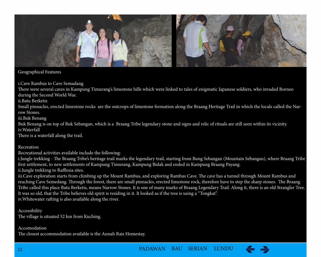
i.Cave Rambus to Cave SemadangThere were several caves in Kampung Timurang’s limestone hills which were linked to tales of enigmatic Japanese soldiers, who invaded Borneo during the Second World War.ii.Batu BerketisSmall pinnacles, erected limestone rocks are the outcrops of limestone formation along the Braang Heritage Trail in which the locals called the Nar-row Stones.iii.Buk BenangBuk Benang is on top of Buk Sebangan, which is a Braang Tribe legendary stone and signs and relic of rituals are still seen within its vicinity.iv.WaterfallThere is a waterfall along the trail.
RecreationRecreational activities available include the following:i.Jungle trekking - The Braang Tribe’s heritage trail marks the legendary trail, starting from Bung Sebangan (Mountain Sebangan), where Braang Tribe first settlement, to new settlements of Kampung Timurang, Kampung Bidak and ended in Kampung Braang Payang.ii.Jungle trekking to Rafflesia sites.iii.Cave exploration starts from climbing up the Mount Rambus, and exploring Rambus Cave. The cave has a tunnel through Mount Rambus and reaching Cave Semedang. Through the forest, there are small pinnacles, erected limestone rock, therefore have to step the sharp stones. The Braang Tribe called this place Batu Berketis, means Narrow Stones. It is one of many marks of Braang Legendary Trail. Along it, there is an old Strangler Tree. It was so old, that the Tribe believes old spirit is residing in it. It looked as if the tree is using a “Tongkat”. iv.Whitewater rafting is also available along the river.
AccessibilityThe village is situated 52 km from Kuching.
Accomodation The closest accommodation available is the Annah Rais Homestay.
23 PADAWAN BAU SERIAN LUNDU
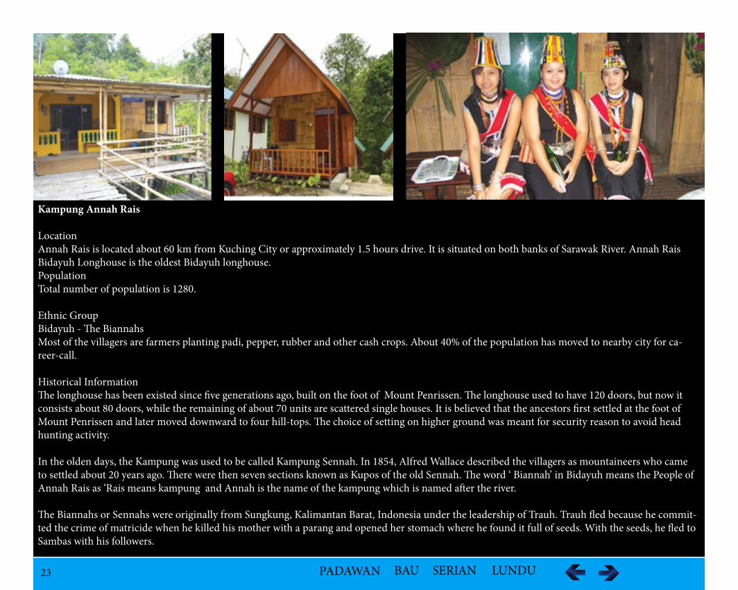
Kampung Annah Rais
LocationAnnah Rais is located about 60 km from Kuching City or approximately 1.5 hours drive. It is situated on both banks of Sarawak River. Annah Rais Bidayuh Longhouse is the oldest Bidayuh longhouse. PopulationTotal number of population is 1280.
Ethnic GroupBidayuh - The Biannahs Most of the villagers are farmers planting padi, pepper, rubber and other cash crops. About 40% of the population has moved to nearby city for ca-reer-call.
Historical InformationThe longhouse has been existed since five generations ago, built on the foot of Mount Penrissen. The longhouse used to have 120 doors, but now it consists about 80 doors, while the remaining of about 70 units are scattered single houses. It is believed that the ancestors first settled at the foot of Mount Penrissen and later moved downward to four hill-tops. The choice of setting on higher ground was meant for security reason to avoid head hunting activity.
In the olden days, the Kampung was used to be called Kampung Sennah. In 1854, Alfred Wallace described the villagers as mountaineers who came to settled about 20 years ago. There were then seven sections known as Kupos of the old Sennah. The word ‘ Biannah’ in Bidayuh means the People of Annah Rais as ‘Rais means kampung and Annah is the name of the kampung which is named after the river.
The Biannahs or Sennahs were originally from Sungkung, Kalimantan Barat, Indonesia under the leadership of Trauh. Trauh fled because he commit-ted the crime of matricide when he killed his mother with a parang and opened her stomach where he found it full of seeds. With the seeds, he fled to Sambas with his followers.
24 PADAWAN BAU SERIAN LUNDU
With the seeds, he fled to Sambas with his followers. From Sambas, they arrived at the mouth of the Sarawak River by a longboat or perahu, went upriver and settled at Batu Kara, near Minggus Angus at around River Soil, He planted the seeds and apparently the trees are still in existence. From there, they moved to Batu Kawa near Gobang River.
Then they moved again towards the south branch of Sarawak River and settled at Lubak Tinuwan on the left bank of Sempro. They did not stay for long as they moved upstream until the river was too shallow for the boat at Batu Jung, they abandoned them and settled two reaches at Braang where Batu Kamudi was. The Sennahs claimed that the names of these two places were given by Trauh. Batu Jung referred to as the place where the longboat were rendered ‘useless’ and the Batu Kamudi the rudder of the longboat which eventually turned into stones. They walked overland to Muara Kundung aling a small stream between Muara Sennah and Kampung Sennah before finally settling at Kampung Annis Rais.
Another version related that when the ancestors of the Sennahs left Sungkung to Rabak Mikabuh, they were led by Riput to Bung Minagis. From there, Bai Barat Ma jemu led them to Ulu Semeru and at a later stage moved the settlement to a small hill known as Gu Sikejang. They moved on after a few years to Sikukuot and continued their migration to Bung Samu. After leaving Bung Samu, they settled at Muara Sennah where there was another group already settled at the place.
Folklore/LegendThe legend described of a man Simusa, during their stay at Bung Minangis at Siburan area, married a girl who was a fairy. They had a daughter called Sikaduk and a son Pungut. The mother passed away as the children were growing up. There was a big tall tree known as Pokok Madang which was cut down by the people. The fallen tree had branches reaching Sungkung. Sikaduk followed the fallen tree until she reached Sungkung where she married Nyaie. At Sungkung, a giant Gite tree was believed to have grown from the fallen from Bung Minangis. The marriage brought forth four sons and four daughters and spread out. The third daughter by the name Muk Rubuh (Sibata) married Barun and moved over to Rabak Mikabuh.
Heritage And Cultural Asset
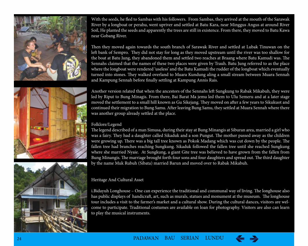
i.Bidayuh Longhouse – One can experience the traditional and communal way of living. The longhouse also has public displays of handicraft, art, such as murals, statues and monument at the museum. The longhouse tour includes a visit to the farmer’s market and a cultural show. During the cultural dances, visitors are wel-come to participate. Traditional costumes are available on loan for photography. Visitors are also can learn to play the musical instruments.
25 PADAWAN BAU SERIAN LUNDU
ii.Traditional food
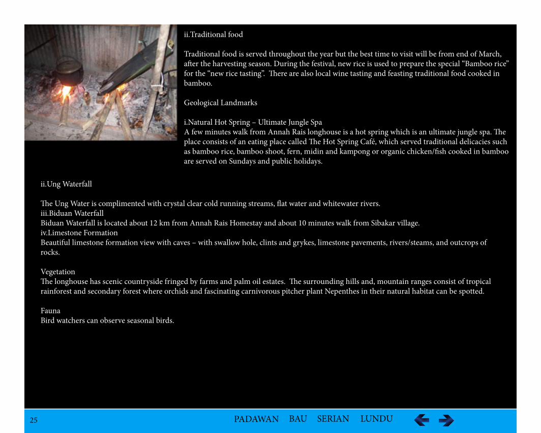
Traditional food is served throughout the year but the best time to visit will be from end of March, after the harvesting season. During the festival, new rice is used to prepare the special “Bamboo rice” for the “new rice tasting”. There are also local wine tasting and feasting traditional food cooked in bamboo.
Geological Landmarks
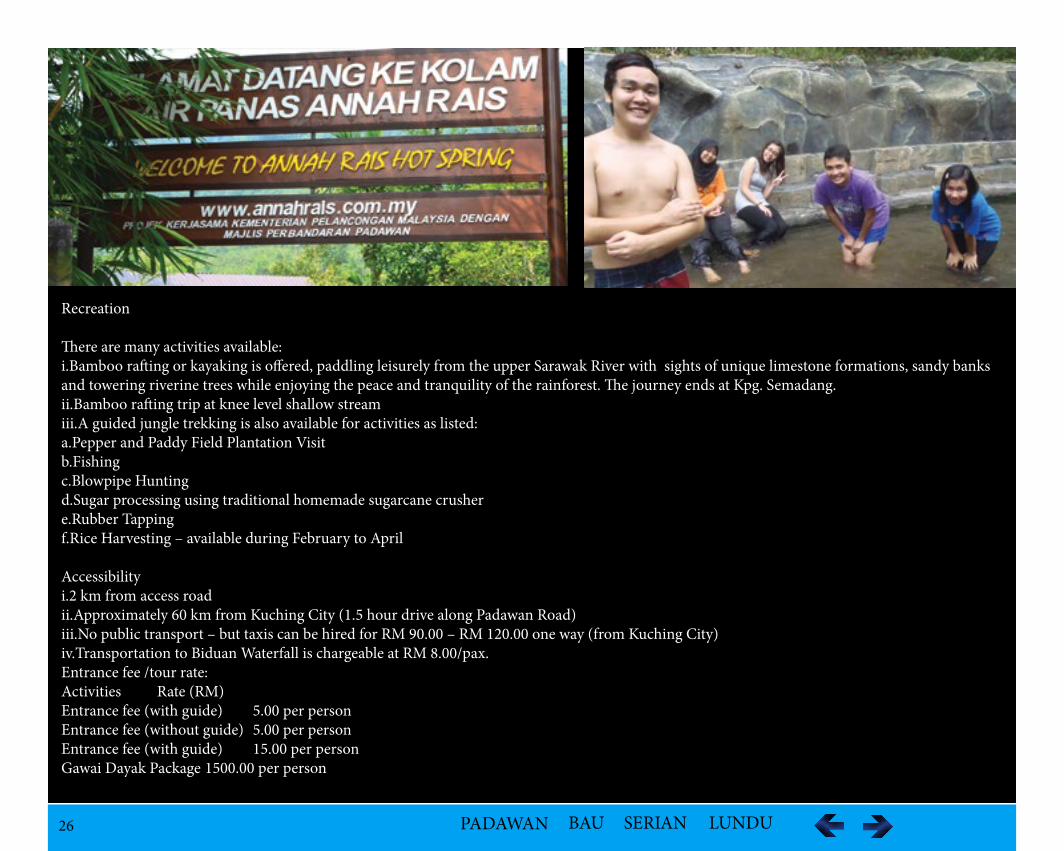
i.Natural Hot Spring – Ultimate Jungle SpaA few minutes walk from Annah Rais longhouse is a hot spring which is an ultimate jungle spa. The place consists of an eating place called The Hot Spring Café, which served traditional delicacies such as bamboo rice, bamboo shoot, fern, midin and kampong or organic chicken/fish cooked in bamboo are served on Sundays and public holidays.
ii.Ung Waterfall
The Ung Water is complimented with crystal clear cold running streams, flat water and whitewater rivers. iii.Biduan WaterfallBiduan Waterfall is located about 12 km from Annah Rais Homestay and about 10 minutes walk from Sibakar village. iv.Limestone FormationBeautiful limestone formation view with caves – with swallow hole, clints and grykes, limestone pavements, rivers/steams, and outcrops of rocks.
VegetationThe longhouse has scenic countryside fringed by farms and palm oil estates. The surrounding hills and, mountain ranges consist of tropical rainforest and secondary forest where orchids and fascinating carnivorous pitcher plant Nepenthes in their natural habitat can be spotted.
FaunaBird watchers can observe seasonal birds.
26 PADAWAN BAU SERIAN LUNDU
Recreation
There are many activities available: i.Bamboo rafting or kayaking is offered, paddling leisurely from the upper Sarawak River with sights of unique limestone formations, sandy banks and towering riverine trees while enjoying the peace and tranquility of the rainforest. The journey ends at Kpg. Semadang.ii.Bamboo rafting trip at knee level shallow streamiii.A guided jungle trekking is also available for activities as listed: a.Pepper and Paddy Field Plantation Visitb.Fishingc.Blowpipe Huntingd.Sugar processing using traditional homemade sugarcane crushere.Rubber Tappingf.Rice Harvesting – available during February to April
Accessibilityi.2 km from access roadii.Approximately 60 km from Kuching City (1.5 hour drive along Padawan Road)iii.No public transport – but taxis can be hired for RM 90.00 – RM 120.00 one way (from Kuching City)iv.Transportation to Biduan Waterfall is chargeable at RM 8.00/pax.Entrance fee /tour rate: Activities Rate (RM)Entrance fee (with guide) 5.00 per person Entrance fee (without guide) 5.00 per personEntrance fee (with guide) 15.00 per personGawai Dayak Package 1500.00 per person
27 PADAWAN BAU SERIAN LUNDU
Contacts Number:- Mr.Edward Kurik : +6016 8674175- Mr.Ringin : +6019 8175229- Mrs.Anna Bong (Serimu Homestay):+6012 8878188
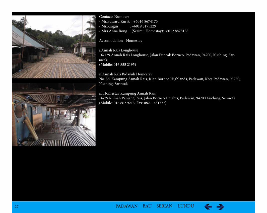
Accomodation - Homestay
i.Annah Rais Longhouse16/129 Annah Rais Longhouse, Jalan Puncak Borneo, Padawan, 94200, Kuching, Sar-awak(Mobile: 016 855 2195)
ii.Annah Rais Bidayuh HomestayNo. 58, Kampung Annah Rais, Jalan Borneo Highlands, Padawan, Kota Padawan, 93250, Kuching, Sarawak
iii.Homestay Kampung Annah Rais16/29 Rumah Panjang Rais, Jalan Borneo Heights, Padawan, 94200 Kuching, Sarawak(Mobile: 016 862 9215; Fax: 082 – 481332)
28 PADAWAN BAU SERIAN LUNDU
Kampung Benuk Longhouseee rich cultural heritage of the Bidayuh
(C) Fitzpatrick Ricky Guing(C) Majlis Perbandaran Padawan Archive
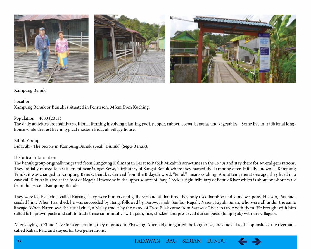
Kampung Benuk
LocationKampung Benuk or Bunuk is situated in Penrissen, 34 km from Kuching.
Population – 4000 (2013)The daily activities are mainly traditional farming involving planting padi, pepper, rubber, cocoa, bananas and vegetables. Some live in traditional long-house while the rest live in typical modern Bidayuh village house.
Ethnic Group Bidayuh - The people in Kampung Bunuk speak “Bunuk” (Segu-Benuk).
Historical InformationThe benuk group originally migrated from Sungkung Kalimantan Barat to Rabak Mikabuh sometimes in the 1930s and stay there for several generations. They initially moved to a settlement near Sungai Sewa, a tributary of Sungai Benuk where they named the kampong after. Initially known as Kampung Tenuk, it was changed to Kampung Benuk. Benuk is derived from the Bidayuh word, “tenuk” means cooking. About ten generations ago, they lived in a cave call Kibuo situated at the foot of Negeja Limestone in the upper source of Pang Creek, a right tributary of Benuk River which is about one-hour walk from the present Kampung Benuk.
They were led by a chief called Karang. They were hunters and gatherers and at that time they only used bamboo and stone weapons. His son, Pasi suc-ceeded him. When Pasi died, he was succeeded by Iteng, followed by Barow, Nijah, Sambu, Rugah, Naren, Riguh, Sujan, who were all under the same lineage. When Naren was the ritual chief, a Malay trader by the name of Dato Puak came from Sarawak River to trade with them. He brought with him salted fish, prawn paste and salt to trade these commodities with padi, rice, chicken and preserved durian paste (tempoyak) with the villagers.
After staying at Kibuo Cave for a generation, they migrated to Ebawang. After a big fire gutted the longhouse, they moved to the opposite of the riverbank called Rabak Pata and stayed for two generations.
29 PADAWAN BAU SERIAN LUNDU
Kampung Benuk Longhouseee rich cultural heritage of the Bidayuh
(C) Fitzpatrick Ricky Guing(C) Majlis Perbandaran Padawan Archive
Due to constant flooding, they divided into two groups and settled at Requak River and Parung Kedong. One faced flooding and the other faced water short-age. Thus, both groups abandoned the two settlements and moved to Sawa River which is a tributary of Benuk River and reestablished Kampung Benuk.
Sir Hugh Low was the first Englishman to visit Kampung Benuk in 1845. Later, when Sunjan was their ritual chief, the Second Rajah, Charles Brooke persuaded him and the people to settle down and instructed them to build a more perma-nent longhouse instead of temporary shelters. The Resident of the Sarawak, Mr. Cunninghame was sent to appoint the headman or tua kampong or orang kaya in the person of Bai Lambo in 1850s.
His duty was to look after the welfare of the villagers while the ritual chief (Tua Gawai) was responsible for Gawai Ceremony and Adat Lama. In 1974, Otor became ritual chief and starting his mini-museum with his private collection. After his death in 1978 at the age of 74, he was succeeded by his son, Paka who passed away on 2 October 2004.
Folklore/Tales/LegendsThe Biperoh and Benuk/Segu groups came from Muk Rubuh or Sibata and Barun of Rabak Mikabuh. Muk Rubuh had six sons of who the third son, Sabu Pagunjaa cleared the land at Rabak Pata where he established the Benuk group.
The community was led by Bai Karang and often attacked by the Skrang Dayaks and other pirates in the olden days. According to the Bebenuk legend, Mangbarik, the famous warrior of Benuk fought very bravely pro-tecting the villagers and killed many enemies of whom the skulls are kept in the Panggah. The enemies were cursed and turned into stones known as the Batu Jung or the junk stone which is half submerged in the river nearby the village.
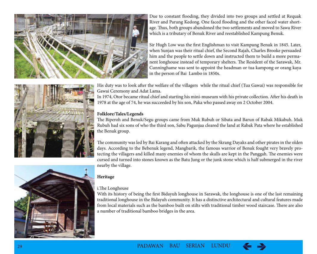
Heritage
i.The LonghouseWith its history of being the first Bidayuh longhouse in Sarawak, the longhouse is one of the last remaining traditional longhouse in the Bidayuh community. It has a distinctive architectural and cultural features made from local materials such as the bamboo built on stilts with traditional timber wood staircase. There are also a number of traditional bamboo bridges in the area.
30 PADAWAN BAU SERIAN LUNDU
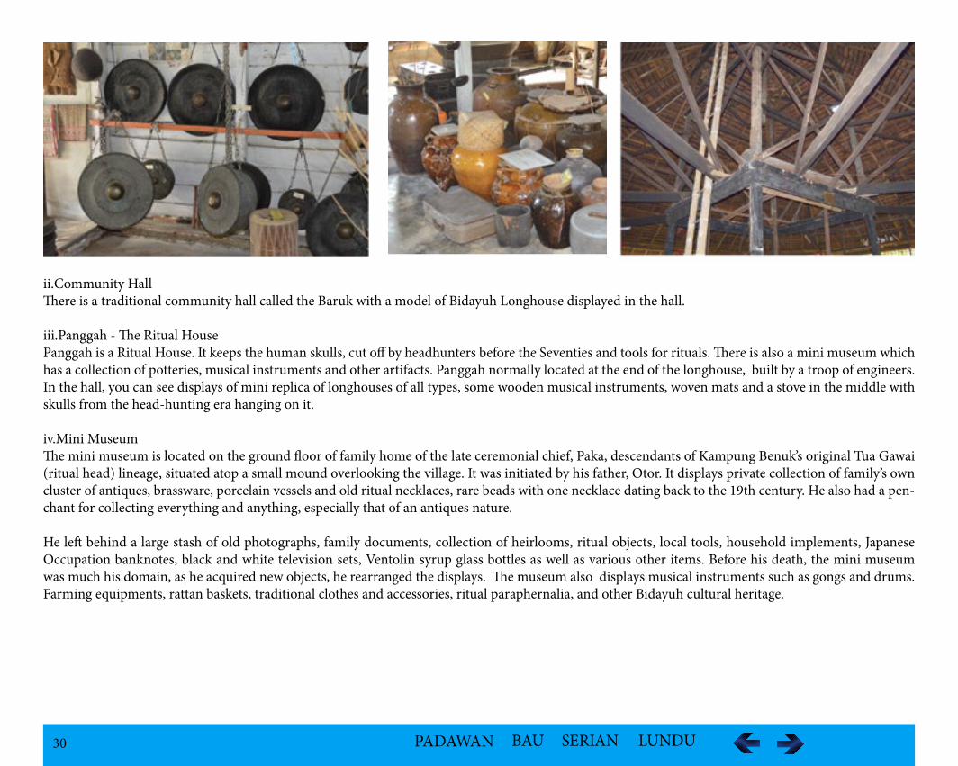
ii.Community HallThere is a traditional community hall called the Baruk with a model of Bidayuh Longhouse displayed in the hall.
iii.Panggah - The Ritual HousePanggah is a Ritual House. It keeps the human skulls, cut off by headhunters before the Seventies and tools for rituals. There is also a mini museum which has a collection of potteries, musical instruments and other artifacts. Panggah normally located at the end of the longhouse, built by a troop of engineers. In the hall, you can see displays of mini replica of longhouses of all types, some wooden musical instruments, woven mats and a stove in the middle with skulls from the head-hunting era hanging on it.
iv.Mini MuseumThe mini museum is located on the ground floor of family home of the late ceremonial chief, Paka, descendants of Kampung Benuk’s original Tua Gawai (ritual head) lineage, situated atop a small mound overlooking the village. It was initiated by his father, Otor. It displays private collection of family’s own cluster of antiques, brassware, porcelain vessels and old ritual necklaces, rare beads with one necklace dating back to the 19th century. He also had a pen-chant for collecting everything and anything, especially that of an antiques nature.
He left behind a large stash of old photographs, family documents, collection of heirlooms, ritual objects, local tools, household implements, Japanese Occupation banknotes, black and white television sets, Ventolin syrup glass bottles as well as various other items. Before his death, the mini museum was much his domain, as he acquired new objects, he rearranged the displays. The museum also displays musical instruments such as gongs and drums. Farming equipments, rattan baskets, traditional clothes and accessories, ritual paraphernalia, and other Bidayuh cultural heritage.
31 PADAWAN BAU SERIAN LUNDU
Geographical Features
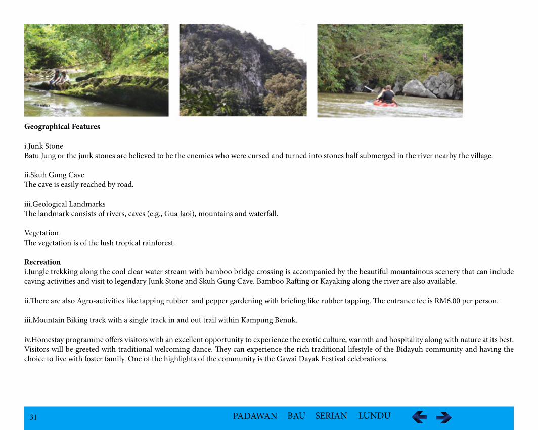
i.Junk StoneBatu Jung or the junk stones are believed to be the enemies who were cursed and turned into stones half submerged in the river nearby the village.
ii.Skuh Gung Cave The cave is easily reached by road.
iii.Geological LandmarksThe landmark consists of rivers, caves (e.g., Gua Jaoi), mountains and waterfall.
VegetationThe vegetation is of the lush tropical rainforest.
Recreationi.Jungle trekking along the cool clear water stream with bamboo bridge crossing is accompanied by the beautiful mountainous scenery that can include caving activities and visit to legendary Junk Stone and Skuh Gung Cave. Bamboo Rafting or Kayaking along the river are also available.
ii.There are also Agro-activities like tapping rubber and pepper gardening with briefing like rubber tapping. The entrance fee is RM6.00 per person.
iii.Mountain Biking track with a single track in and out trail within Kampung Benuk.
iv.Homestay programme offers visitors with an excellent opportunity to experience the exotic culture, warmth and hospitality along with nature at its best. Visitors will be greeted with traditional welcoming dance. They can experience the rich traditional lifestyle of the Bidayuh community and having the choice to live with foster family. One of the highlights of the community is the Gawai Dayak Festival celebrations.

32 PADAWAN BAU SERIAN LUNDU
Kampung Benuk HomestayExperience of the Bidayuh cultural heritage
(C) Fitzpatrick Ricky Guing(C) Majlis Perbandaran Padawan Archive
iv.Homestay programme offers visitors with an excellent opportunity to experience the exotic culture, warmth and hospitality along with nature at its best. Visitors will be greeted with traditional welcoming dance. They can experience the rich traditional lifestyle of the Bidayuh community and having the choice to live with foster family. One of the highlights of the community is the Gawai Dayak Festival celebrations.
v.A visit to a Bidayuh traditional longhouse, Panggah, a mini museum, a river crossing on a bamboo bridge, a trip to the padi farm, rubber plantation as well as pepper garden.
vi.A small shop at the entrance of the kampung has bottled drinks and local produce such as peppers, etc, offered for sale. Some antiques are sold for a very reasonable price.
vii.The Benuk Longhouse is open to the public for visitation. The entrance fees are as stated:
Entrance fee /tour rate: Activities Rate (RM)Entrance fee (with guide) RM 5.00 per person Entrance fee (without guide) RM 5.00 per personEntrance fee (with guide) RM 15.00 per personGawai Dayak Package RM 1500.00 per person
33 PADAWAN BAU SERIAN LUNDU
Kampung Benuk HomestayExperience of the Bidayuh cultural heritage
(C) Fitzpatrick Ricky Guing(C) Majlis Perbandaran Padawan Archive
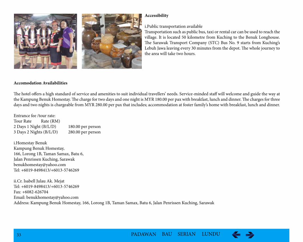
Accessibility
i.Public transportation availableTransportation such as public bus, taxi or rental car can be used to reach the village. It is located 50 kilometre from Kuching to the Benuk Longhouse. The Sarawak Transport Company (STC) Bus No. 9 starts from Kuching’s Lebuh Jawa leaving every 30 minutes from the depot. The whole journey to the area will take two hours.
Accomodation Availabilities
The hotel offers a high standard of service and amenities to suit individual travellers’ needs. Service-minded staff will welcome and guide the way at the Kampung Benuk Homestay. The charge for two days and one night is MYR 180.00 per pax with breakfast, lunch and dinner. The charges for three days and two nights is chargeable from MYR 280.00 per pax that includes; accommodation at foster family’s home with breakfast, lunch and dinner.
Entrance fee /tour rate: Tour Rate Rate (RM)2 Days 1 Night (B/L/D) 180.00 per person 3 Days 2 Nights (B/L/D) 280.00 per person
i.Homestay BenukKampung Benuk Homestay, 166, Lorong 1B, Taman Samax, Batu 6, Jalan Penrissen Kuching, [email protected]: +6019-8498413/+6013-5746269
ii.Cr. Isabell Julau Ak. MejatTel: +6019-8498413/+6013-5746269Fax: +6082-626704Email: [email protected]: Kampung Benuk Homestay, 166, Lorong 1B, Taman Samax, Batu 6, Jalan Penrissen Kuching, Sarawak
34 PADAWAN BAU SERIAN LUNDU
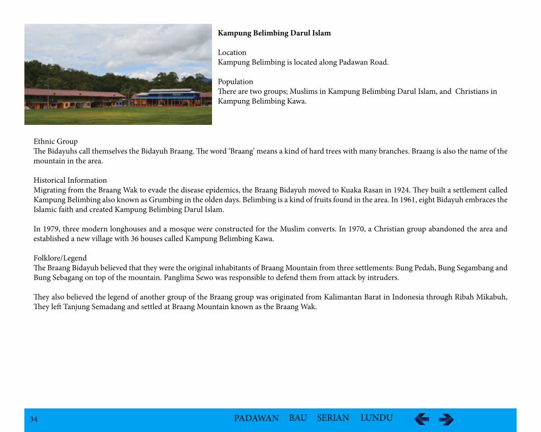
Kampung Belimbing Darul Islam
LocationKampung Belimbing is located along Padawan Road.
PopulationThere are two groups; Muslims in Kampung Belimbing Darul Islam, and Christians in Kampung Belimbing Kawa.
Ethnic GroupThe Bidayuhs call themselves the Bidayuh Braang. The word ‘Braang’ means a kind of hard trees with many branches. Braang is also the name of the mountain in the area.
Historical InformationMigrating from the Braang Wak to evade the disease epidemics, the Braang Bidayuh moved to Kuaka Rasan in 1924. They built a settlement called Kampung Belimbing also known as Grumbing in the olden days. Belimbing is a kind of fruits found in the area. In 1961, eight Bidayuh embraces the Islamic faith and created Kampung Belimbing Darul Islam.
In 1979, three modern longhouses and a mosque were constructed for the Muslim converts. In 1970, a Christian group abandoned the area and established a new village with 36 houses called Kampung Belimbing Kawa.
Folklore/LegendThe Braang Bidayuh believed that they were the original inhabitants of Braang Mountain from three settlements: Bung Pedah, Bung Segambang and Bung Sebagang on top of the mountain. Panglima Sewo was responsible to defend them from attack by intruders.
They also believed the legend of another group of the Braang group was originated from Kalimantan Barat in Indonesia through Ribah Mikabuh, They left Tanjung Semadang and settled at Braang Mountain known as the Braang Wak.
35 PADAWAN BAU SERIAN LUNDU
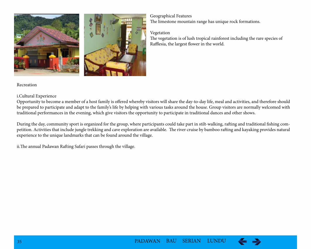
Geographical FeaturesThe limestone mountain range has unique rock formations. VegetationThe vegetation is of lush tropical rainforest including the rare species of Rafflesia, the largest flower in the world.
Recreation
i.Cultural ExperienceOpportunity to become a member of a host family is offered whereby visitors will share the day-to-day life, meal and activities, and therefore should be prepared to participate and adapt to the family’s life by helping with various tasks around the house. Group visitors are normally welcomed with traditional performances in the evening, which give visitors the opportunity to participate in traditional dances and other shows.
During the day, community sport is organized for the group, where participants could take part in stilt-walking, rafting and traditional fishing com-petition. Activities that include jungle trekking and cave exploration are available. The river cruise by bamboo rafting and kayaking provides natural experience to the unique landmarks that can be found around the village.
ii.The annual Padawan Rafting Safari passes through the village.
36 PADAWAN BAU SERIAN LUNDU
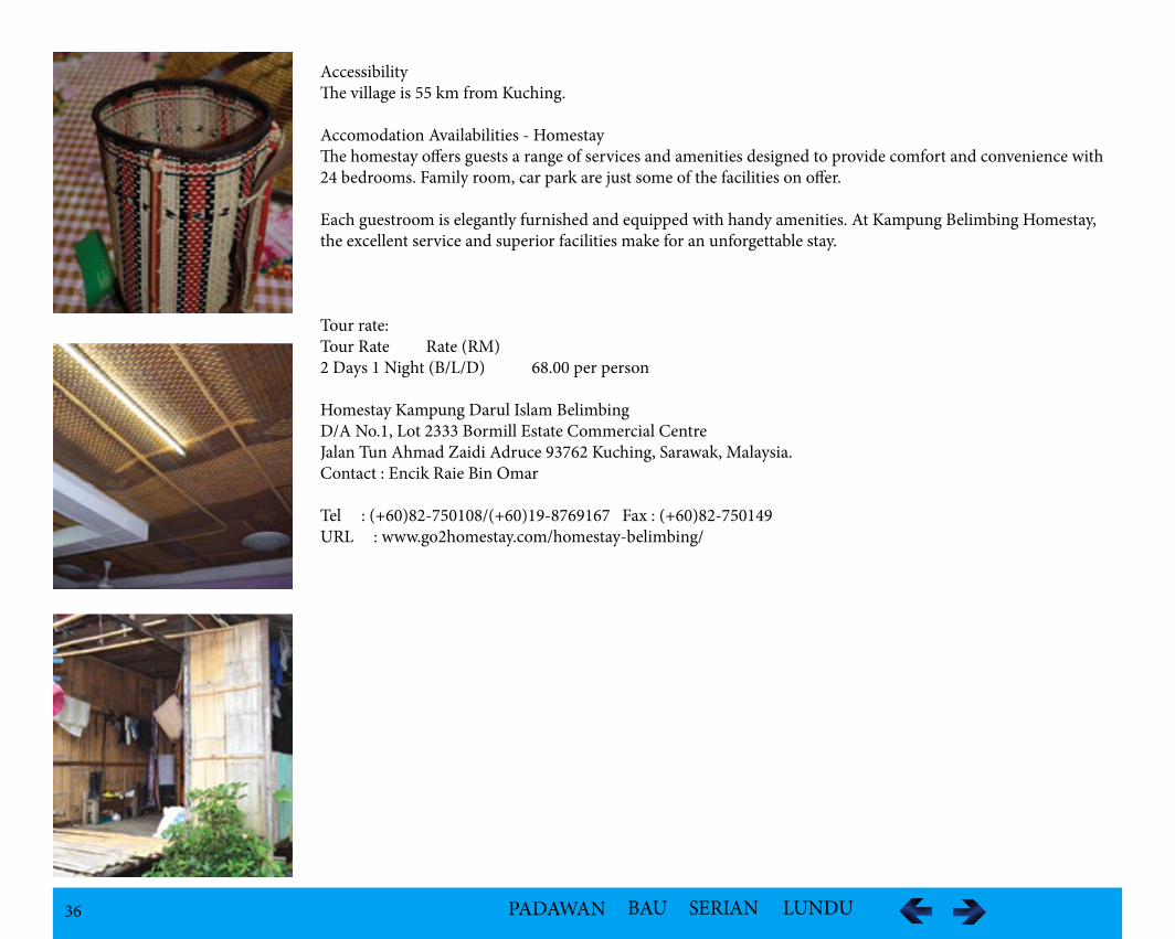
AccessibilityThe village is 55 km from Kuching.
Accomodation Availabilities - HomestayThe homestay offers guests a range of services and amenities designed to provide comfort and convenience with 24 bedrooms. Family room, car park are just some of the facilities on offer.
Each guestroom is elegantly furnished and equipped with handy amenities. At Kampung Belimbing Homestay, the excellent service and superior facilities make for an unforgettable stay.
Tour rate:Tour Rate Rate (RM)2 Days 1 Night (B/L/D) 68.00 per person Homestay Kampung Darul Islam BelimbingD/A No.1, Lot 2333 Bormill Estate Commercial CentreJalan Tun Ahmad Zaidi Adruce 93762 Kuching, Sarawak, Malaysia.Contact : Encik Raie Bin Omar
Tel : (+60)82-750108/(+60)19-8769167 Fax : (+60)82-750149URL : www.go2homestay.com/homestay-belimbing/
37 PADAWAN BAU SERIAN LUNDU
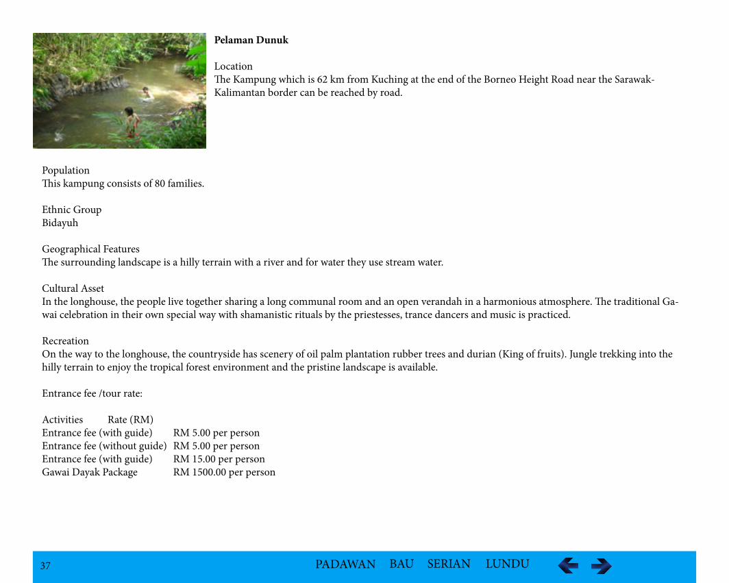
Pelaman Dunuk
LocationThe Kampung which is 62 km from Kuching at the end of the Borneo Height Road near the Sarawak-Kalimantan border can be reached by road.
Population This kampung consists of 80 families.
Ethnic Group Bidayuh
Geographical FeaturesThe surrounding landscape is a hilly terrain with a river and for water they use stream water.
Cultural AssetIn the longhouse, the people live together sharing a long communal room and an open verandah in a harmonious atmosphere. The traditional Ga-wai celebration in their own special way with shamanistic rituals by the priestesses, trance dancers and music is practiced.
RecreationOn the way to the longhouse, the countryside has scenery of oil palm plantation rubber trees and durian (King of fruits). Jungle trekking into the hilly terrain to enjoy the tropical forest environment and the pristine landscape is available.
Entrance fee /tour rate:
Activities Rate (RM)Entrance fee (with guide) RM 5.00 per person Entrance fee (without guide) RM 5.00 per personEntrance fee (with guide) RM 15.00 per personGawai Dayak Package RM 1500.00 per person
38 PADAWAN BAU SERIAN LUNDU
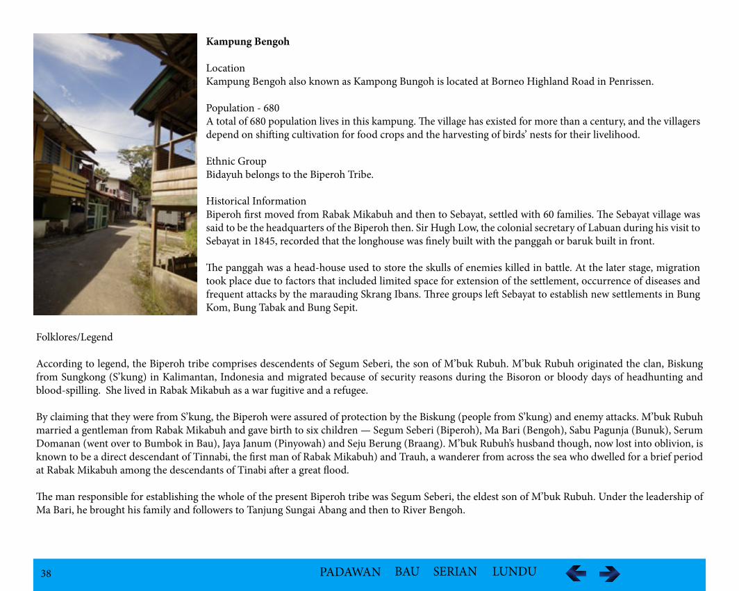
Kampung Bengoh
LocationKampung Bengoh also known as Kampong Bungoh is located at Borneo Highland Road in Penrissen.
Population - 680A total of 680 population lives in this kampung. The village has existed for more than a century, and the villagers depend on shifting cultivation for food crops and the harvesting of birds’ nests for their livelihood.
Ethnic GroupBidayuh belongs to the Biperoh Tribe.
Historical InformationBiperoh first moved from Rabak Mikabuh and then to Sebayat, settled with 60 families. The Sebayat village was said to be the headquarters of the Biperoh then. Sir Hugh Low, the colonial secretary of Labuan during his visit to Sebayat in 1845, recorded that the longhouse was finely built with the panggah or baruk built in front.
The panggah was a head-house used to store the skulls of enemies killed in battle. At the later stage, migration took place due to factors that included limited space for extension of the settlement, occurrence of diseases and frequent attacks by the marauding Skrang Ibans. Three groups left Sebayat to establish new settlements in Bung Kom, Bung Tabak and Bung Sepit.
Folklores/Legend
According to legend, the Biperoh tribe comprises descendents of Segum Seberi, the son of M’buk Rubuh. M’buk Rubuh originated the clan, Biskung from Sungkong (S’kung) in Kalimantan, Indonesia and migrated because of security reasons during the Bisoron or bloody days of headhunting and blood-spilling. She lived in Rabak Mikabuh as a war fugitive and a refugee.
By claiming that they were from S’kung, the Biperoh were assured of protection by the Biskung (people from S’kung) and enemy attacks. M’buk Rubuh married a gentleman from Rabak Mikabuh and gave birth to six children — Segum Seberi (Biperoh), Ma Bari (Bengoh), Sabu Pagunja (Bunuk), Serum Domanan (went over to Bumbok in Bau), Jaya Janum (Pinyowah) and Seju Berung (Braang). M’buk Rubuh’s husband though, now lost into oblivion, is known to be a direct descendant of Tinnabi, the first man of Rabak Mikabuh) and Trauh, a wanderer from across the sea who dwelled for a brief period at Rabak Mikabuh among the descendants of Tinabi after a great flood.
The man responsible for establishing the whole of the present Biperoh tribe was Segum Seberi, the eldest son of M’buk Rubuh. Under the leadership of Ma Bari, he brought his family and followers to Tanjung Sungai Abang and then to River Bengoh.
39 PADAWAN BAU SERIAN LUNDU
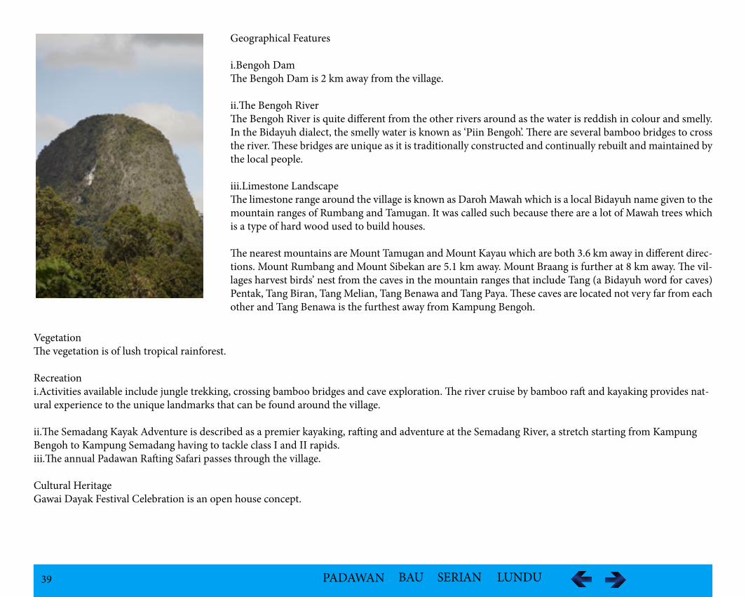
Geographical Features
i.Bengoh DamThe Bengoh Dam is 2 km away from the village.
ii.The Bengoh RiverThe Bengoh River is quite different from the other rivers around as the water is reddish in colour and smelly. In the Bidayuh dialect, the smelly water is known as ‘Piin Bengoh’. There are several bamboo bridges to cross the river. These bridges are unique as it is traditionally constructed and continually rebuilt and maintained by the local people.
iii.Limestone LandscapeThe limestone range around the village is known as Daroh Mawah which is a local Bidayuh name given to the mountain ranges of Rumbang and Tamugan. It was called such because there are a lot of Mawah trees which is a type of hard wood used to build houses.
The nearest mountains are Mount Tamugan and Mount Kayau which are both 3.6 km away in different direc-tions. Mount Rumbang and Mount Sibekan are 5.1 km away. Mount Braang is further at 8 km away. The vil-lages harvest birds’ nest from the caves in the mountain ranges that include Tang (a Bidayuh word for caves) Pentak, Tang Biran, Tang Melian, Tang Benawa and Tang Paya. These caves are located not very far from each other and Tang Benawa is the furthest away from Kampung Bengoh.
VegetationThe vegetation is of lush tropical rainforest.
Recreationi.Activities available include jungle trekking, crossing bamboo bridges and cave exploration. The river cruise by bamboo raft and kayaking provides nat-ural experience to the unique landmarks that can be found around the village.
ii.The Semadang Kayak Adventure is described as a premier kayaking, rafting and adventure at the Semadang River, a stretch starting from Kampung Bengoh to Kampung Semadang having to tackle class I and II rapids. iii.The annual Padawan Rafting Safari passes through the village.
Cultural HeritageGawai Dayak Festival Celebration is an open house concept.
40 PADAWAN BAU SERIAN LUNDU
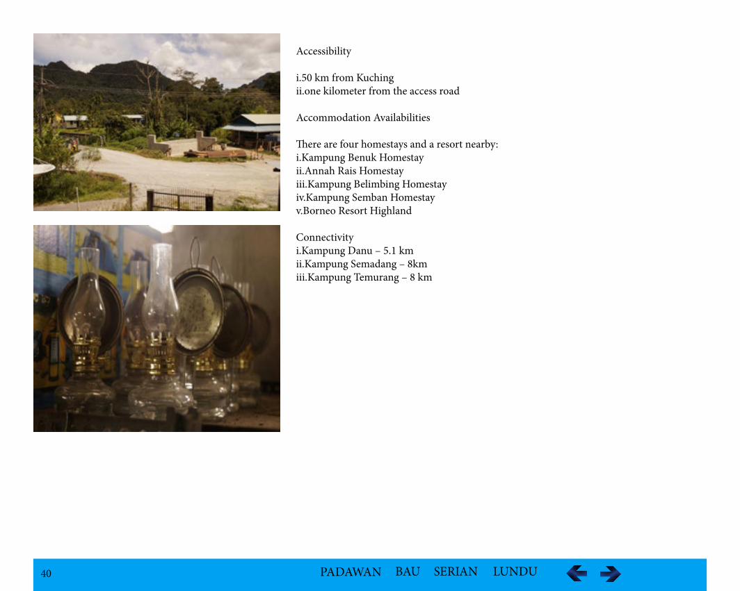
Accessibility
i.50 km from Kuchingii.one kilometer from the access road
Accommodation Availabilities
There are four homestays and a resort nearby:i.Kampung Benuk Homestayii.Annah Rais Homestayiii.Kampung Belimbing Homestayiv.Kampung Semban Homestayv.Borneo Resort Highland
Connectivityi.Kampung Danu – 5.1 kmii.Kampung Semadang – 8kmiii.Kampung Temurang – 8 km
41 PADAWAN BAU SERIAN LUNDU
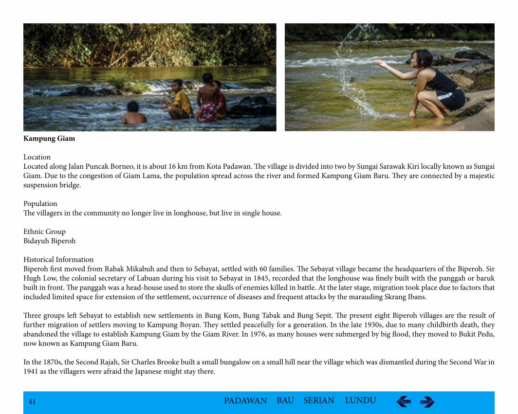
Kampung Giam
LocationLocated along Jalan Puncak Borneo, it is about 16 km from Kota Padawan. The village is divided into two by Sungai Sarawak Kiri locally known as Sungai Giam. Due to the congestion of Giam Lama, the population spread across the river and formed Kampung Giam Baru. They are connected by a majestic suspension bridge.
PopulationThe villagers in the community no longer live in longhouse, but live in single house.
Ethnic GroupBidayuh Biperoh
Historical InformationBiperoh first moved from Rabak Mikabuh and then to Sebayat, settled with 60 families. The Sebayat village became the headquarters of the Biperoh. Sir Hugh Low, the colonial secretary of Labuan during his visit to Sebayat in 1845, recorded that the longhouse was finely built with the panggah or baruk built in front. The panggah was a head-house used to store the skulls of enemies killed in battle. At the later stage, migration took place due to factors that included limited space for extension of the settlement, occurrence of diseases and frequent attacks by the marauding Skrang Ibans.
Three groups left Sebayat to establish new settlements in Bung Kom, Bung Tabak and Bung Sepit. The present eight Biperoh villages are the result of further migration of settlers moving to Kampung Boyan. They settled peacefully for a generation. In the late 1930s, due to many childbirth death, they abandoned the village to establish Kampung Giam by the Giam River. In 1976, as many houses were submerged by big flood, they moved to Bukit Pedu, now known as Kampung Giam Baru.
In the 1870s, the Second Rajah, Sir Charles Brooke built a small bungalow on a small hill near the village which was dismantled during the Second War in 1941 as the villagers were afraid the Japanese might stay there.
42 PADAWAN BAU SERIAN LUNDU
Geographical Features
i.Gunung Bernas or Mount BernasGunung Bernas or Mount Bernas is one of the prominent feature among the many limestone mountains surrounding this beautiful village.ii.Penot Underwater CaveRock formation, stalactites and stalagmites are evidences of its existence over hun-dreds of years.iii. Giam WaterfallGiam waterfall has mountain crystal clear stream water running through it. It is known as Petu Waterfall pool.
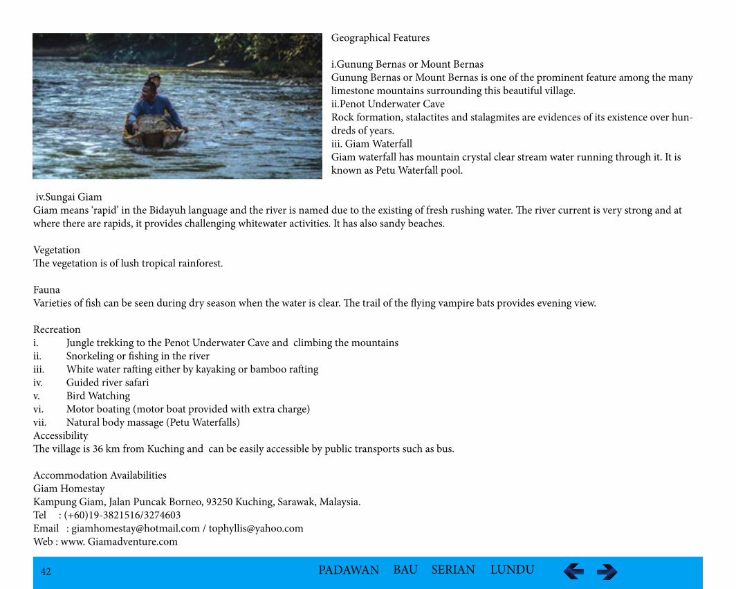
iv.Sungai GiamGiam means ‘rapid’ in the Bidayuh language and the river is named due to the existing of fresh rushing water. The river current is very strong and at where there are rapids, it provides challenging whitewater activities. It has also sandy beaches.
VegetationThe vegetation is of lush tropical rainforest.
FaunaVarieties of fish can be seen during dry season when the water is clear. The trail of the flying vampire bats provides evening view.
Recreationi. Jungle trekking to the Penot Underwater Cave and climbing the mountains ii. Snorkeling or fishing in the riveriii. White water rafting either by kayaking or bamboo rafting iv. Guided river safari v. Bird Watchingvi. Motor boating (motor boat provided with extra charge)vii. Natural body massage (Petu Waterfalls)AccessibilityThe village is 36 km from Kuching and can be easily accessible by public transports such as bus.
Accommodation AvailabilitiesGiam HomestayKampung Giam, Jalan Puncak Borneo, 93250 Kuching, Sarawak, Malaysia.Tel : (+60)19-3821516/3274603Email : [email protected] / [email protected] : www. Giamadventure.com
43 PADAWAN BAU SERIAN LUNDU
Kampung Git
Location Kampung Git is located in Penrissen area along Kampung Giam Road not far frm the Borneo Height at the end of the Borneo Highlands Road by passing eight villages.
Population - 524
Ethnic GroupBidayuh – The community belongs to the Biperoh Clan which is one of the 20 clans of the Bidayuh com-munity.
Historical InformationKampung Git was the result of resettlement from Tembawang Git, which was an offshoot of the Bung Kom, one of the three groups to leave Sebayat from diseased and frequent attacks by the marauding Skrang Ibans to establish new settlements. They moved to Sungai Git and formed Kampung Tembawang Git. They built a 20-door longhouse and a Panggah to continue their tradition. In the early 40s, due to an epidemic of disease, the whole village was abandoned and the villages had to move across Sarawak Kiri River where they built the present longhouse but kept the name of Kampung Git. In 1960s, the longhouse was dismantled to make way for individual houses. For two generations, the villagers lived as pagans until 1969, they were converted to Anglican Christians.
Folktales/LegendAccording to the legend, the Biperoh tribe comprised of descendents of Segum Seberi, the son of M’buk Rubuh. M’buk Rubuh originated the clan, Bi-skung from Sungkong (S’kung) in Kalimantan, Indonesia and migrated because of security reasons during the Bisoron or bloody days of headhunting and blood-spilling. She lived in Rabak Mikabuh as a war fugitive and a refugee. She later married a gentleman from Rabak Mikabuh and gave birth to six chil-dren — Segum Seberi (Biperoh), Ma Bari (Bengoh), Sabu Pagunja (Bunuk), Serum Domanan (went over to Bumbok in Bau), Jaya Janum (Pinyowah) and Seju Berung (Braang). M’buk Rubuh’s husband though, now lost into oblivion, is known to be a direct descendant of Tinnabi, the first man of Rabak Mi-kabuh) and Trauh, a wanderer from across the sea who dwelled for a brief period at Rabak Mikabuh among the descendants of Tinabi after a great flood.
The man responsible for establishing the whole of the present Biperoh tribe was Segum Seberi, the eldest son of M’buk Rubuh.The Biperoh had a common Batu Guna — a mystical stone named Siraguon where a celebration called Namui was held to appease the spirits every seven years involving all the Bidayuh Biperoh villages.
44 PADAWAN BAU SERIAN LUNDU
Geological Landmarks
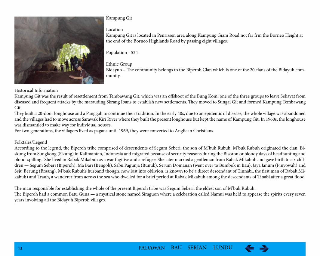
i.Gua PenomGua Penom is a limestone cave near the vicinity of the village. The limestone hills have unique rock formations.
ii.White Water RapidsThe river that flows pass the village has curved river banks with pebbled beach-feature. The large river boulders provide the white water rapids.
VegetationThe vegetation has thick canopy of tropical rainforest. The unique largest flower in the world, the Rafflesia can be found nearby the village.
FaunaSome of the wild animals that can be found are the common barking deers or kijang and the wild boar. Semak is a common fish.
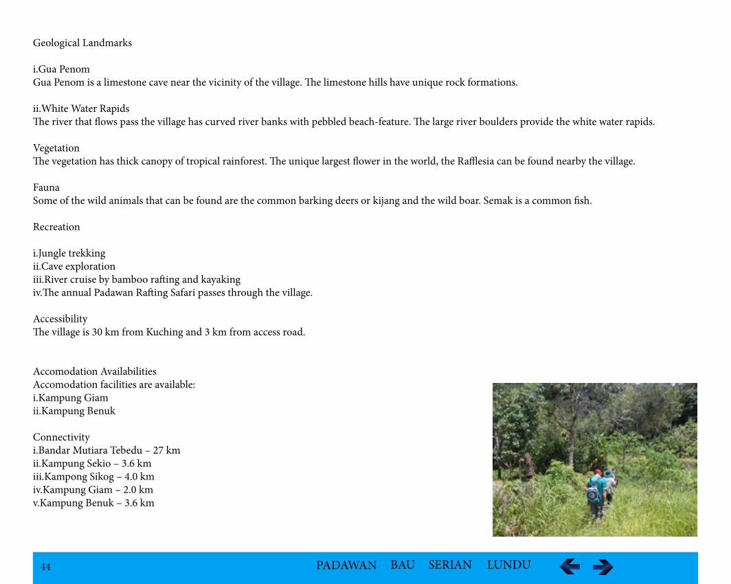
Recreation
i.Jungle trekkingii.Cave exploration iii.River cruise by bamboo rafting and kayaking iv.The annual Padawan Rafting Safari passes through the village.
AccessibilityThe village is 30 km from Kuching and 3 km from access road.
Accomodation AvailabilitiesAccomodation facilities are available: i.Kampung Giamii.Kampung Benuk
Connectivityi.Bandar Mutiara Tebedu – 27 kmii.Kampung Sekio – 3.6 kmiii.Kampong Sikog – 4.0 kmiv.Kampung Giam – 2.0 kmv.Kampung Benuk – 3.6 km
45 PADAWAN BAU SERIAN LUNDU
Kampung Semadang
Location Kampung Semadang is located at Mile 38, Penrissen Road, Kuching
PopulationA modern Bidayuh village with about 200 villagers. During daytime most people are either working in town or at their farms somewhere around the village.
Ethnic GroupBidayuh belonging to the Biperoh Tribe.
Historical InformationBiperoh first moved from Rabak Mikabuh to Sebayat, settled with 60 families. The Sebayat village was said to be the headquarters of the Biperoh. Sir Hugh Low, the colonial secretary of Labuan who visited Sebayat in 1845, recorded the longhouse was finely built with the panggah or baruk built in front is the head house used to store the skulls of enemies killed in battle. At the later stage, migration started due to factors that included limited space for extension of the settlement, occurrence of diseases and frequent attacks by the marauding Skrang Ibans. Three groups left Sebayat to establish new settlements in Bung Kom, Bung Tabak and Bung Sepit.
The settlers from Bung Tabak moved to Tanjung Garung and Tanjung Semadang. Those who moved to Tanjung Semadang built a new village called Kam-pung Semadang.The original longhouse was dismantled to make way for individual houses.
Folklores/LegendAccording to legend, the Biperoh tribe comprised of descendents of Segum Seberi, the son of M’buk Rubuh. M’buk Rubuh originated from the clan, Bi-skung from Sungkong (S’kung) in Kalimantan, Indonesia and migrated because of security reasons during the Bisoron or bloody days of headhunting and blood-spilling. She lived in Rabak Mikabuh as a war fugitive and a refugee. By claiming that they were from S’kung, the Biperoh were assured of protection by the Biskung (people from S’kung) and enemy attacks. M’buk Rubuh married a gentleman from Rabak Mikabuh and gave birth to six children — Segum Seberi (Biperoh), Ma Bari (Bengoh), Sabu Pagunja (Bunuk), Serum Domanan (went over to Bumbok in Bau), Jaya Janum (Pinyowah) and Seju Berung (Braang). M’buk Rubuh’s husband though, now lost into oblivion, is known to be a direct descendant of Tinnabi, the first man of Rabak Mikabuh) and Trauh, a wanderer from across the sea who dwelled for a brief period at Rabak Mikabuh among the descendants of Tinabi after a great flood. The man responsible for establishing the whole of the present Biperoh tribe was Segum Seberi, the eldest son of M’buk Rubuh.
In the olden days, the Biperoh venerated Gunung Baru/Triu in Kampung Semadang as a holy place after Gunung Penrissen where they believed the spirit resided. The Biperoh has a common Batu Guna — a mystical stone named Siraguon where a celebration called Namui was held to appease the spirits every seven years involving all the Bidayuh Biperoh villages. The Batu Guna is now kept at Kampung Semadang for the new generations to see.
46 PADAWAN BAU SERIAN LUNDU
Geographical Features
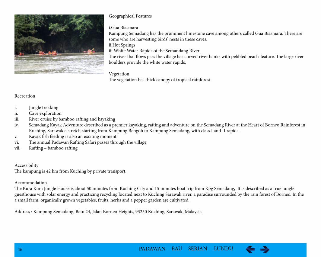
i.Gua BiasmaraKampung Semadang has the prominent limestone cave among others called Gua Biasmara. There are some who are harvesting birds’ nests in these caves.ii.Hot Springsiii.White Water Rapids of the Semandang RiverThe river that flows pass the village has curved river banks with pebbled beach-feature. The large river boulders provide the white water rapids.
VegetationThe vegetation has thick canopy of tropical rainforest.
Recreation
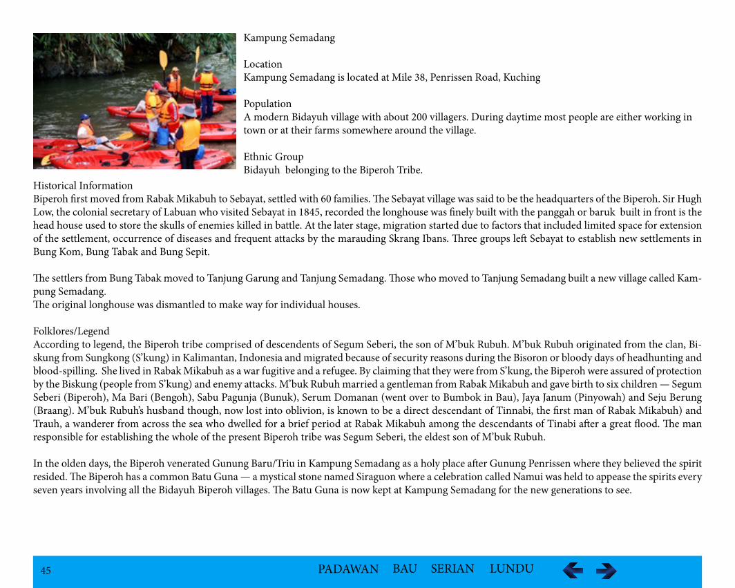
i. Jungle trekkingii. Cave exploration iii. River cruise by bamboo rafting and kayakingiv. Semadang Kayak Adventure described as a premier kayaking, rafting and adventure on the Semadang River at the Heart of Borneo Rainforest in Kuching, Sarawak a stretch starting from Kampung Bengoh to Kampung Semadang, with class I and II rapids. v. Kayak fish feeding is also an exciting moment.vi. The annual Padawan Rafting Safari passes through the village.vii. Rafting – bamboo rafting
AccessibilityThe kampung is 42 km from Kuching by private transport.
AccommodationThe Kura Kura Jungle House is about 50 minutes from Kuching City and 15 minutes boat trip from Kpg Semadang, It is described as a true jungle guesthouse with solar energy and practicing recycling located next to Kuching Sarawak river, a paradise surrounded by the rain forest of Borneo. In the a small farm, organically grown vegetables, fruits, herbs and a pepper garden are cultivated.
Address : Kampung Semadang, Batu 24, Jalan Borneo Heights, 93250 Kuching, Sarawak, Malaysia
47 PADAWAN BAU SERIAN LUNDU
Kampung Sentah Siburan
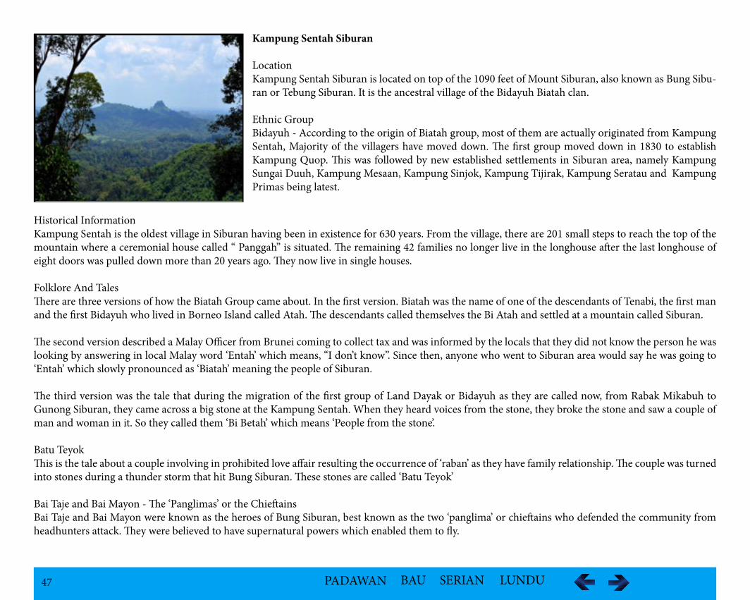
LocationKampung Sentah Siburan is located on top of the 1090 feet of Mount Siburan, also known as Bung Sibu-ran or Tebung Siburan. It is the ancestral village of the Bidayuh Biatah clan.
Ethnic GroupBidayuh - According to the origin of Biatah group, most of them are actually originated from Kampung Sentah, Majority of the villagers have moved down. The first group moved down in 1830 to establish Kampung Quop. This was followed by new established settlements in Siburan area, namely Kampung Sungai Duuh, Kampung Mesaan, Kampung Sinjok, Kampung Tijirak, Kampung Seratau and Kampung Primas being latest.
Historical InformationKampung Sentah is the oldest village in Siburan having been in existence for 630 years. From the village, there are 201 small steps to reach the top of the mountain where a ceremonial house called “ Panggah” is situated. The remaining 42 families no longer live in the longhouse after the last longhouse of eight doors was pulled down more than 20 years ago. They now live in single houses.
Folklore And TalesThere are three versions of how the Biatah Group came about. In the first version. Biatah was the name of one of the descendants of Tenabi, the first man and the first Bidayuh who lived in Borneo Island called Atah. The descendants called themselves the Bi Atah and settled at a mountain called Siburan.
The second version described a Malay Officer from Brunei coming to collect tax and was informed by the locals that they did not know the person he was looking by answering in local Malay word ‘Entah’ which means, “I don’t know”. Since then, anyone who went to Siburan area would say he was going to ‘Entah’ which slowly pronounced as ‘Biatah’ meaning the people of Siburan.
The third version was the tale that during the migration of the first group of Land Dayak or Bidayuh as they are called now, from Rabak Mikabuh to Gunong Siburan, they came across a big stone at the Kampung Sentah. When they heard voices from the stone, they broke the stone and saw a couple of man and woman in it. So they called them ‘Bi Betah’ which means ‘People from the stone’.
Batu TeyokThis is the tale about a couple involving in prohibited love affair resulting the occurrence of ‘raban’ as they have family relationship. The couple was turned into stones during a thunder storm that hit Bung Siburan. These stones are called ‘Batu Teyok’
Bai Taje and Bai Mayon - The ‘Panglimas’ or the ChieftainsBai Taje and Bai Mayon were known as the heroes of Bung Siburan, best known as the two ‘panglima’ or chieftains who defended the community from headhunters attack. They were believed to have supernatural powers which enabled them to fly.
48 PADAWAN BAU SERIAN LUNDU
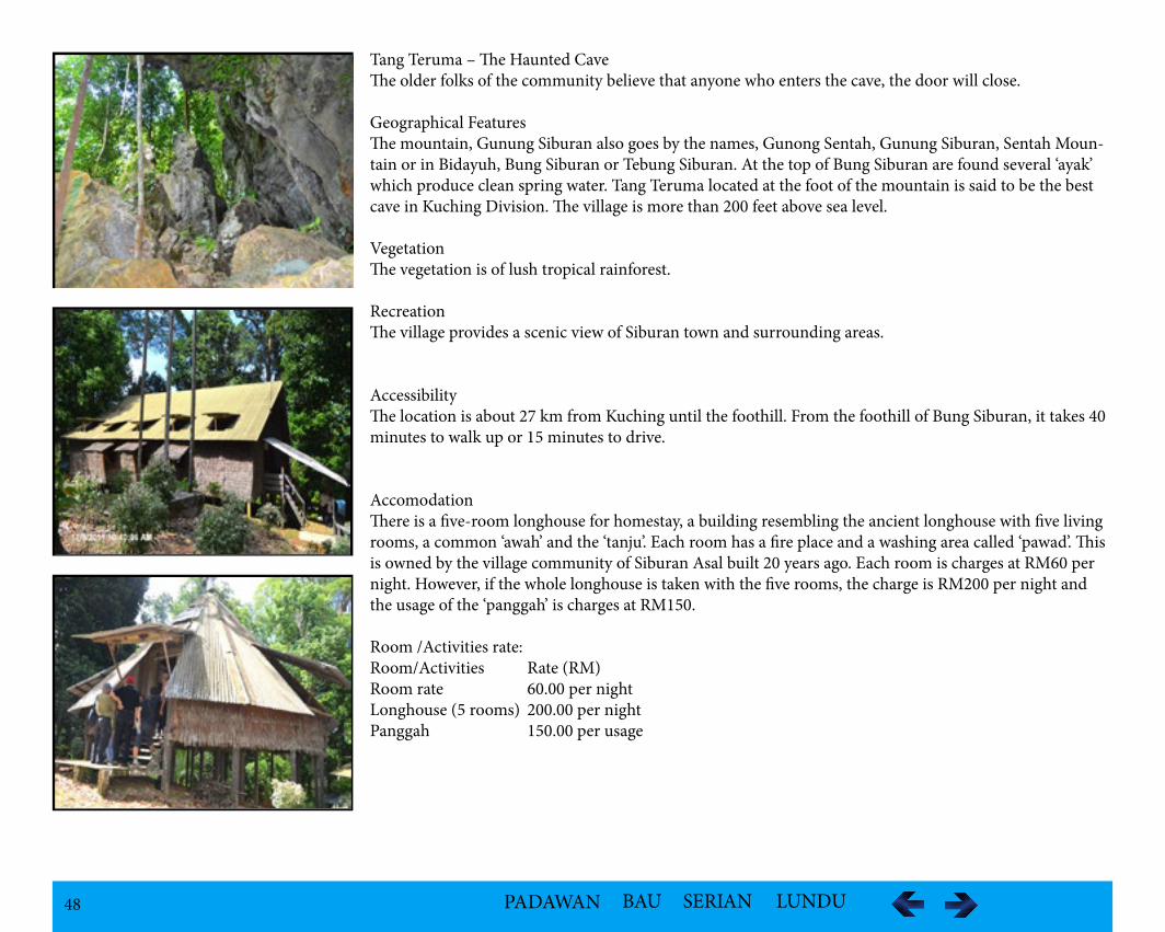
Tang Teruma – The Haunted CaveThe older folks of the community believe that anyone who enters the cave, the door will close.
Geographical FeaturesThe mountain, Gunung Siburan also goes by the names, Gunong Sentah, Gunung Siburan, Sentah Moun-tain or in Bidayuh, Bung Siburan or Tebung Siburan. At the top of Bung Siburan are found several ‘ayak’ which produce clean spring water. Tang Teruma located at the foot of the mountain is said to be the best cave in Kuching Division. The village is more than 200 feet above sea level.
VegetationThe vegetation is of lush tropical rainforest.
RecreationThe village provides a scenic view of Siburan town and surrounding areas.
AccessibilityThe location is about 27 km from Kuching until the foothill. From the foothill of Bung Siburan, it takes 40 minutes to walk up or 15 minutes to drive.
AccomodationThere is a five-room longhouse for homestay, a building resembling the ancient longhouse with five living rooms, a common ‘awah’ and the ‘tanju’. Each room has a fire place and a washing area called ‘pawad’. This is owned by the village community of Siburan Asal built 20 years ago. Each room is charges at RM60 per night. However, if the whole longhouse is taken with the five rooms, the charge is RM200 per night and the usage of the ‘panggah’ is charges at RM150.
Room /Activities rate: Room/Activities Rate (RM)Room rate 60.00 per nightLonghouse (5 rooms) 200.00 per nightPanggah 150.00 per usage
49 PADAWAN BAU SERIAN LUNDU
Kampung Sikog
LocationKampung Sikog is located at Mambong, Padawan .
Population – 963 There are about 198 houses.
Ethnic Group – Bidayuh Bidayuh Bistaang
Historical InformationThe village also known as Kampung Sekuang, was established in 1898. The villagers were originated from Kampung Sitang. The villagers led by Bai Gaa, migrated during disease epidemics and settled at Bung Kedongot. In 1900, Bung Kedongot was officially recognized as Kampung Sikog named after the mangosteen, a sweet juicy fruit with thick purplish rind known as the Queen of the Tropical fruit. The Malay word is “Buah Manggis” and in the dialect of Bidayuh Biatah is “ Buwak Sikok.
Geological Landmarks
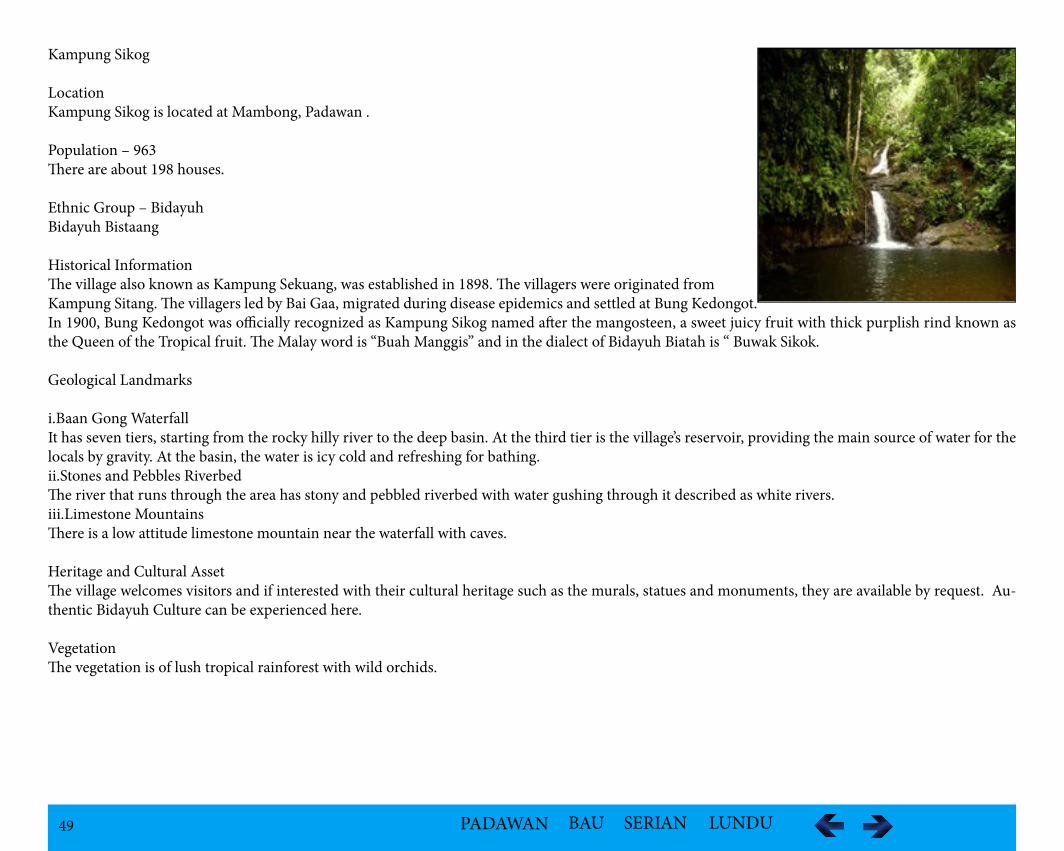
i.Baan Gong WaterfallIt has seven tiers, starting from the rocky hilly river to the deep basin. At the third tier is the village’s reservoir, providing the main source of water for the locals by gravity. At the basin, the water is icy cold and refreshing for bathing. ii.Stones and Pebbles RiverbedThe river that runs through the area has stony and pebbled riverbed with water gushing through it described as white rivers.iii.Limestone MountainsThere is a low attitude limestone mountain near the waterfall with caves.
Heritage and Cultural AssetThe village welcomes visitors and if interested with their cultural heritage such as the murals, statues and monuments, they are available by request. Au-thentic Bidayuh Culture can be experienced here.
VegetationThe vegetation is of lush tropical rainforest with wild orchids.
50 PADAWAN BAU SERIAN LUNDU
FaunaThere are occasional reports of crocodiles lurking in the river. The migratory birds sometimes pass by. The tropical fauna species are common.
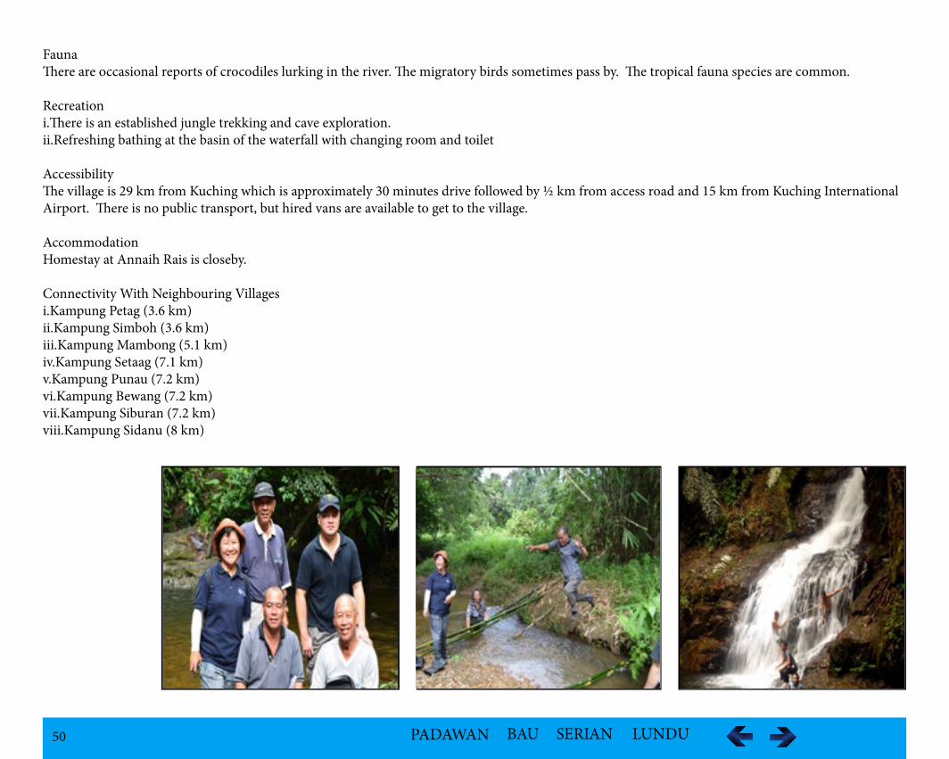
Recreationi.There is an established jungle trekking and cave exploration.ii.Refreshing bathing at the basin of the waterfall with changing room and toilet
AccessibilityThe village is 29 km from Kuching which is approximately 30 minutes drive followed by ½ km from access road and 15 km from Kuching International Airport. There is no public transport, but hired vans are available to get to the village.
AccommodationHomestay at Annaih Rais is closeby.
Connectivity With Neighbouring Villagesi.Kampung Petag (3.6 km)ii.Kampung Simboh (3.6 km)iii.Kampung Mambong (5.1 km)iv.Kampung Setaag (7.1 km)v.Kampung Punau (7.2 km)vi.Kampung Bewang (7.2 km)vii.Kampung Siburan (7.2 km)viii.Kampung Sidanu (8 km)
51 PADAWAN BAU SERIAN LUNDU
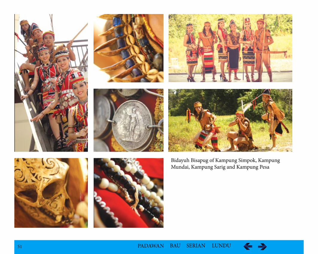
Bidayuh Bisapug of Kampung Simpok, Kampung Mundai, Kampung Sarig and Kampung Pesa
52 PADAWAN BAU SERIAN LUNDU
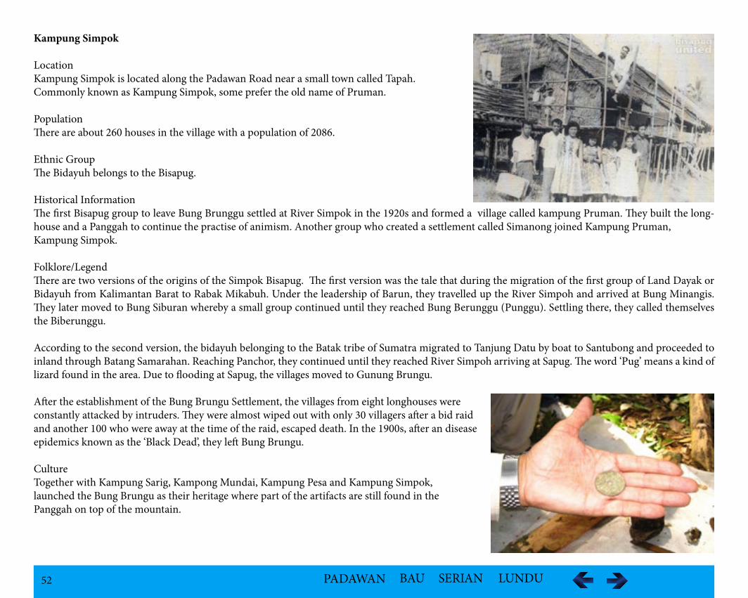
Kampung Simpok
LocationKampung Simpok is located along the Padawan Road near a small town called Tapah. Commonly known as Kampung Simpok, some prefer the old name of Pruman.
Population There are about 260 houses in the village with a population of 2086.
Ethnic GroupThe Bidayuh belongs to the Bisapug.
Historical InformationThe first Bisapug group to leave Bung Brunggu settled at River Simpok in the 1920s and formed a village called kampung Pruman. They built the long-house and a Panggah to continue the practise of animism. Another group who created a settlement called Simanong joined Kampung Pruman, Kampung Simpok.
Folklore/LegendThere are two versions of the origins of the Simpok Bisapug. The first version was the tale that during the migration of the first group of Land Dayak or Bidayuh from Kalimantan Barat to Rabak Mikabuh. Under the leadership of Barun, they travelled up the River Simpoh and arrived at Bung Minangis. They later moved to Bung Siburan whereby a small group continued until they reached Bung Berunggu (Punggu). Settling there, they called themselves the Biberunggu.
According to the second version, the bidayuh belonging to the Batak tribe of Sumatra migrated to Tanjung Datu by boat to Santubong and proceeded to inland through Batang Samarahan. Reaching Panchor, they continued until they reached River Simpoh arriving at Sapug. The word ‘Pug’ means a kind of lizard found in the area. Due to flooding at Sapug, the villages moved to Gunung Brungu.
After the establishment of the Bung Brungu Settlement, the villages from eight longhouses were constantly attacked by intruders. They were almost wiped out with only 30 villagers after a bid raid and another 100 who were away at the time of the raid, escaped death. In the 1900s, after an disease epidemics known as the ‘Black Dead’, they left Bung Brungu.
CultureTogether with Kampung Sarig, Kampong Mundai, Kampung Pesa and Kampung Simpok, launched the Bung Brungu as their heritage where part of the artifacts are still found in the Panggah on top of the mountain.
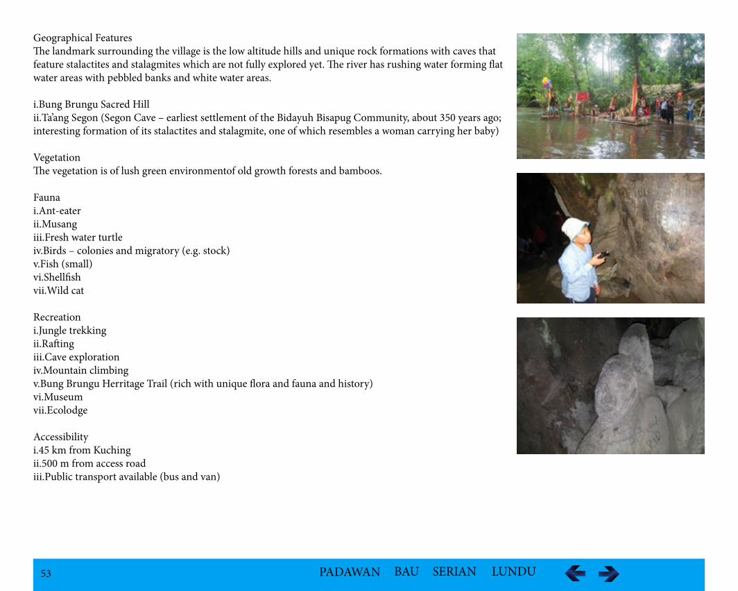
53 PADAWAN BAU SERIAN LUNDU
Geographical FeaturesThe landmark surrounding the village is the low altitude hills and unique rock formations with caves that feature stalactites and stalagmites which are not fully explored yet. The river has rushing water forming flat water areas with pebbled banks and white water areas.
i.Bung Brungu Sacred Hillii.Ta’ang Segon (Segon Cave – earliest settlement of the Bidayuh Bisapug Community, about 350 years ago; interesting formation of its stalactites and stalagmite, one of which resembles a woman carrying her baby)
VegetationThe vegetation is of lush green environmentof old growth forests and bamboos.
Faunai.Ant-eaterii.Musangiii.Fresh water turtleiv.Birds – colonies and migratory (e.g. stock)v.Fish (small)vi.Shellfishvii.Wild cat
Recreationi.Jungle trekkingii.Raftingiii.Cave explorationiv.Mountain climbingv.Bung Brungu Herritage Trail (rich with unique flora and fauna and history)vi.Museum vii.Ecolodge
Accessibilityi.45 km from Kuchingii.500 m from access roadiii.Public transport available (bus and van)
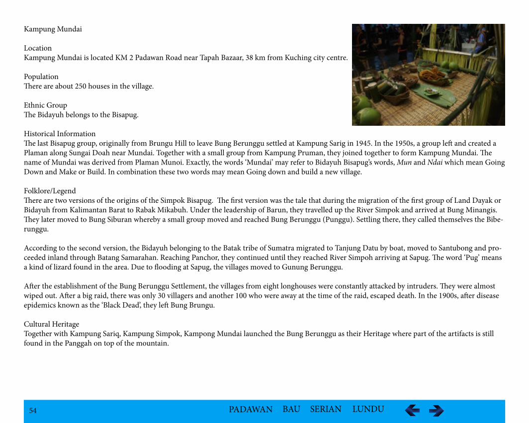
54 PADAWAN BAU SERIAN LUNDU
Kampung Mundai
LocationKampung Mundai is located KM 2 Padawan Road near Tapah Bazaar, 38 km from Kuching city centre.
PopulationThere are about 250 houses in the village.
Ethnic GroupThe Bidayuh belongs to the Bisapug.
Historical InformationThe last Bisapug group, originally from Brungu Hill to leave Bung Berunggu settled at Kampung Sarig in 1945. In the 1950s, a group left and created a Plaman along Sungai Doah near Mundai. Together with a small group from Kampung Pruman, they joined together to form Kampung Mundai. The name of Mundai was derived from Plaman Munoi. Exactly, the words ‘Mundai’ may refer to Bidayuh Bisapug’s words, Mun and Ndai which mean Going Down and Make or Build. In combination these two words may mean Going down and build a new village.
Folklore/LegendThere are two versions of the origins of the Simpok Bisapug. The first version was the tale that during the migration of the first group of Land Dayak or Bidayuh from Kalimantan Barat to Rabak Mikabuh. Under the leadership of Barun, they travelled up the River Simpok and arrived at Bung Minangis. They later moved to Bung Siburan whereby a small group moved and reached Bung Berunggu (Punggu). Settling there, they called themselves the Bibe-runggu.
According to the second version, the Bidayuh belonging to the Batak tribe of Sumatra migrated to Tanjung Datu by boat, moved to Santubong and pro-ceeded inland through Batang Samarahan. Reaching Panchor, they continued until they reached River Simpoh arriving at Sapug. The word ‘Pug’ means a kind of lizard found in the area. Due to flooding at Sapug, the villages moved to Gunung Berunggu.
After the establishment of the Bung Berunggu Settlement, the villages from eight longhouses were constantly attacked by intruders. They were almost wiped out. After a big raid, there was only 30 villagers and another 100 who were away at the time of the raid, escaped death. In the 1900s, after disease epidemics known as the ‘Black Dead’, they left Bung Brungu.
Cultural HeritageTogether with Kampung Sariq, Kampung Simpok, Kampong Mundai launched the Bung Berunggu as their Heritage where part of the artifacts is still found in the Panggah on top of the mountain.
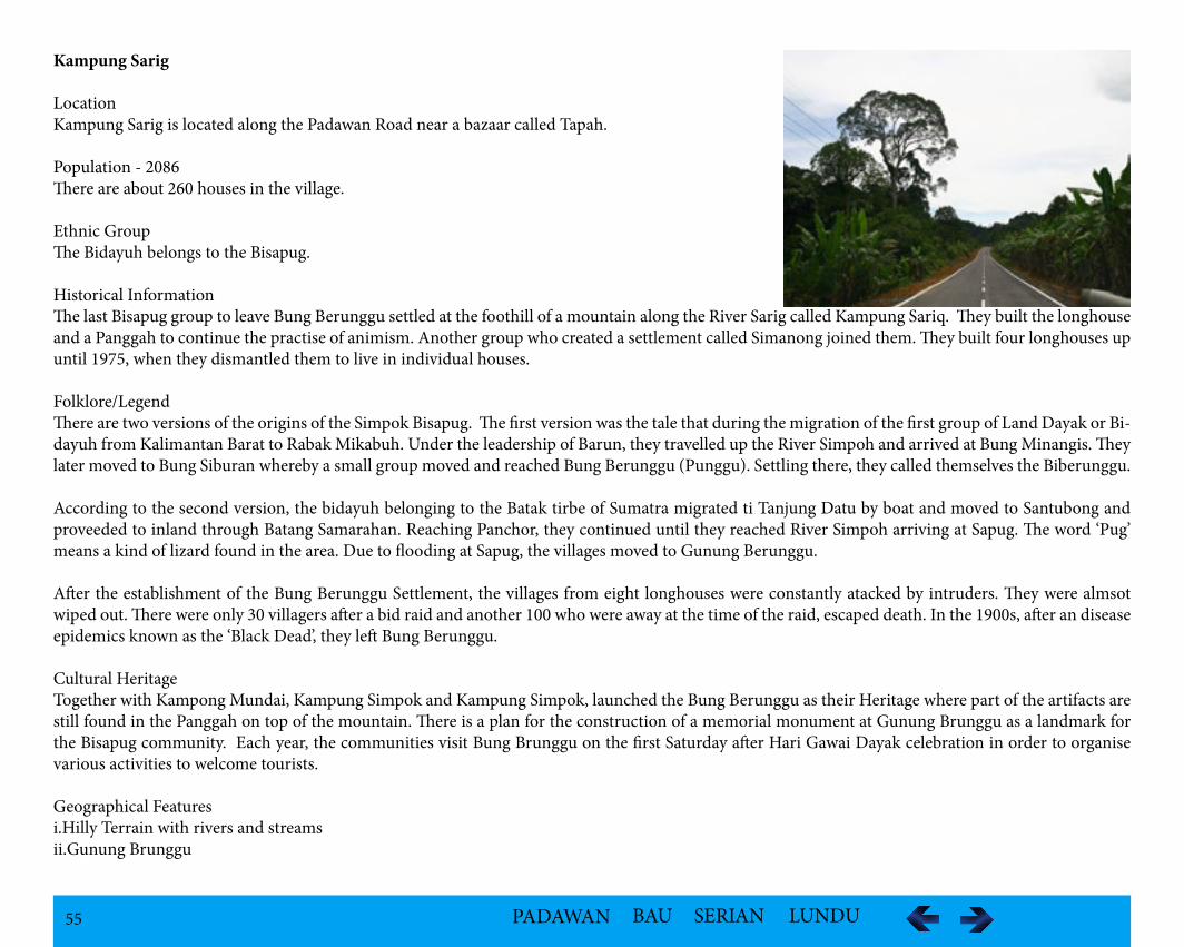
55 PADAWAN BAU SERIAN LUNDU
Kampung Sarig
LocationKampung Sarig is located along the Padawan Road near a bazaar called Tapah.
Population - 2086There are about 260 houses in the village.
Ethnic GroupThe Bidayuh belongs to the Bisapug.
Historical InformationThe last Bisapug group to leave Bung Berunggu settled at the foothill of a mountain along the River Sarig called Kampung Sariq. They built the longhouse and a Panggah to continue the practise of animism. Another group who created a settlement called Simanong joined them. They built four longhouses up until 1975, when they dismantled them to live in individual houses.
Folklore/LegendThere are two versions of the origins of the Simpok Bisapug. The first version was the tale that during the migration of the first group of Land Dayak or Bi-dayuh from Kalimantan Barat to Rabak Mikabuh. Under the leadership of Barun, they travelled up the River Simpoh and arrived at Bung Minangis. They later moved to Bung Siburan whereby a small group moved and reached Bung Berunggu (Punggu). Settling there, they called themselves the Biberunggu.
According to the second version, the bidayuh belonging to the Batak tirbe of Sumatra migrated ti Tanjung Datu by boat and moved to Santubong and proveeded to inland through Batang Samarahan. Reaching Panchor, they continued until they reached River Simpoh arriving at Sapug. The word ‘Pug’ means a kind of lizard found in the area. Due to flooding at Sapug, the villages moved to Gunung Berunggu.
After the establishment of the Bung Berunggu Settlement, the villages from eight longhouses were constantly atacked by intruders. They were almsot wiped out. There were only 30 villagers after a bid raid and another 100 who were away at the time of the raid, escaped death. In the 1900s, after an disease epidemics known as the ‘Black Dead’, they left Bung Berunggu.
Cultural HeritageTogether with Kampong Mundai, Kampung Simpok and Kampung Simpok, launched the Bung Berunggu as their Heritage where part of the artifacts are still found in the Panggah on top of the mountain. There is a plan for the construction of a memorial monument at Gunung Brunggu as a landmark for the Bisapug community. Each year, the communities visit Bung Brunggu on the first Saturday after Hari Gawai Dayak celebration in order to organise various activities to welcome tourists.
Geographical Featuresi.Hilly Terrain with rivers and streams ii.Gunung Brunggu
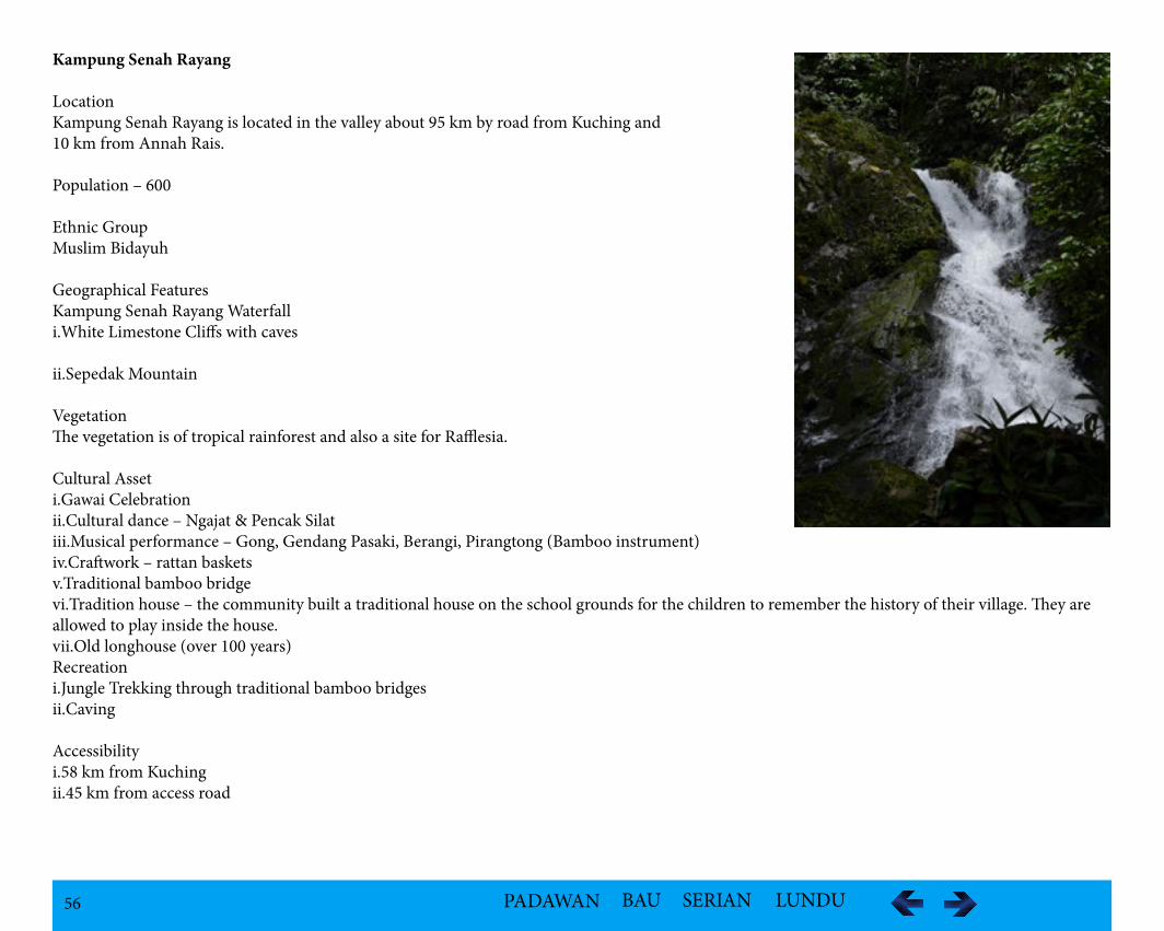
56 PADAWAN BAU SERIAN LUNDU
Kampung Senah Rayang
LocationKampung Senah Rayang is located in the valley about 95 km by road from Kuching and 10 km from Annah Rais.
Population – 600
Ethnic GroupMuslim Bidayuh
Geographical FeaturesKampung Senah Rayang Waterfalli.White Limestone Cliffs with caves
ii.Sepedak Mountain
VegetationThe vegetation is of tropical rainforest and also a site for Rafflesia.
Cultural Asseti.Gawai Celebrationii.Cultural dance – Ngajat & Pencak Silat iii.Musical performance – Gong, Gendang Pasaki, Berangi, Pirangtong (Bamboo instrument)iv.Craftwork – rattan baskets v.Traditional bamboo bridgevi.Tradition house – the community built a traditional house on the school grounds for the children to remember the history of their village. They are allowed to play inside the house.vii.Old longhouse (over 100 years)Recreationi.Jungle Trekking through traditional bamboo bridgesii.Caving
Accessibilityi.58 km from Kuchingii.45 km from access road
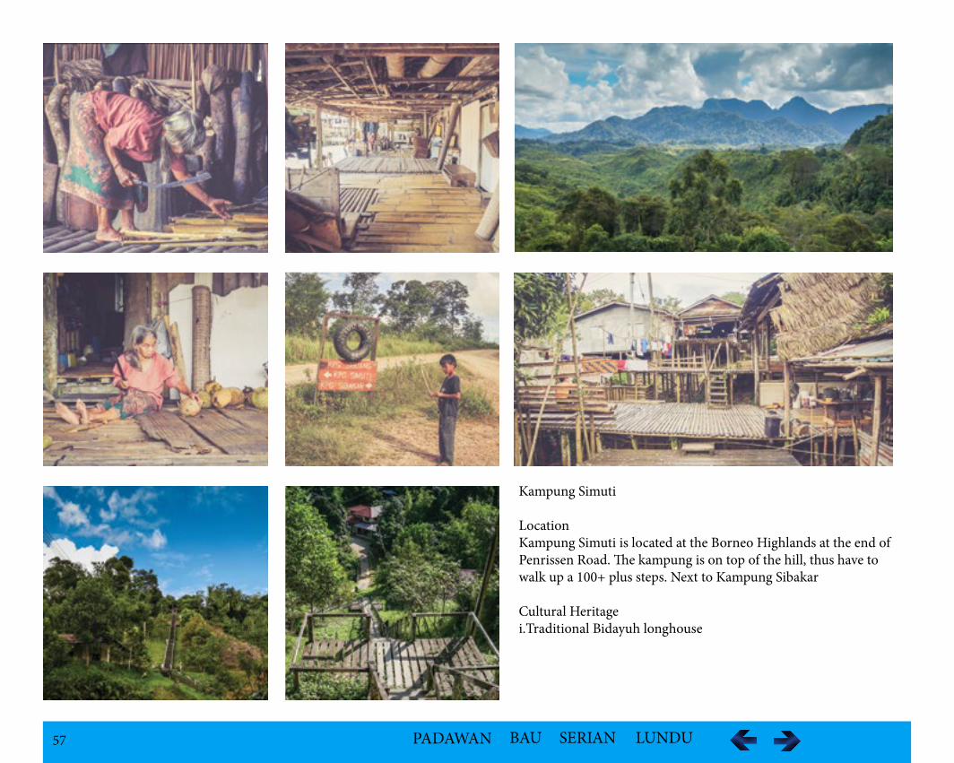
57 PADAWAN BAU SERIAN LUNDU
Kampung Simuti
LocationKampung Simuti is located at the Borneo Highlands at the end of Penrissen Road. The kampung is on top of the hill, thus have to walk up a 100+ plus steps. Next to Kampung Sibakar
Cultural Heritagei.Traditional Bidayuh longhouse
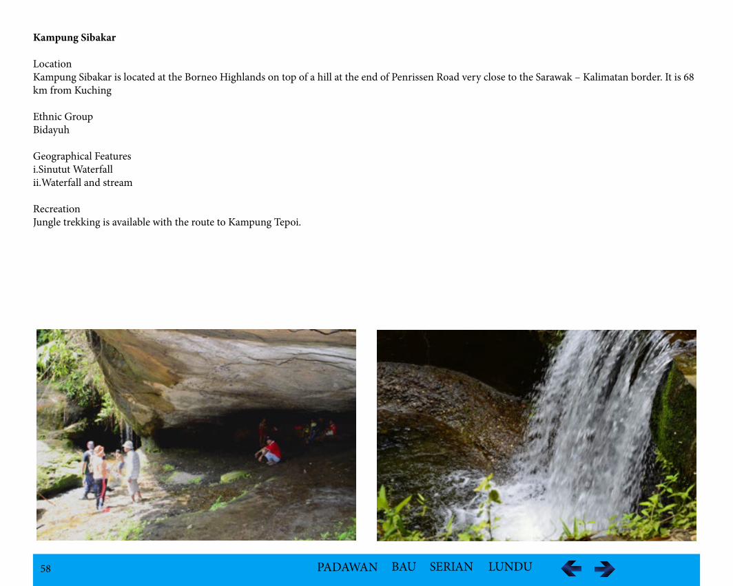
58 PADAWAN BAU SERIAN LUNDU
Kampung Sibakar
LocationKampung Sibakar is located at the Borneo Highlands on top of a hill at the end of Penrissen Road very close to the Sarawak – Kalimatan border. It is 68 km from Kuching
Ethnic GroupBidayuh
Geographical Featuresi.Sinutut Waterfallii.Waterfall and stream
RecreationJungle trekking is available with the route to Kampung Tepoi.
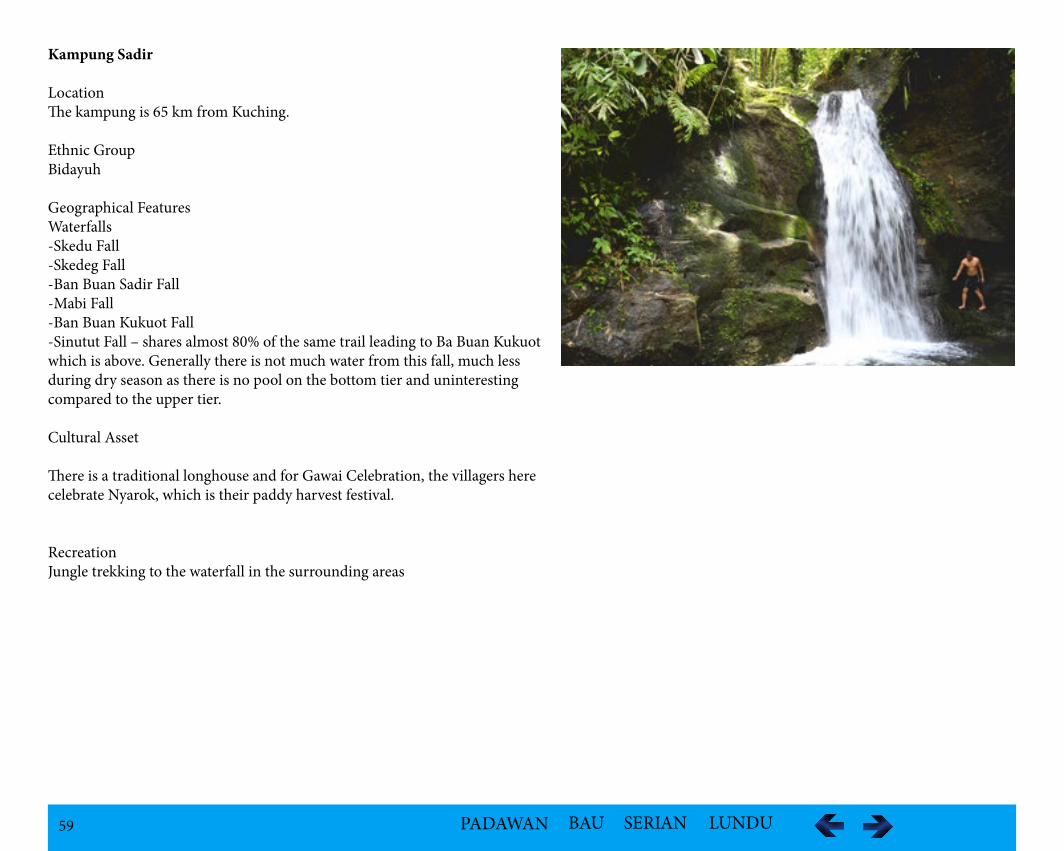
59 PADAWAN BAU SERIAN LUNDU
Kampung Sadir
LocationThe kampung is 65 km from Kuching.
Ethnic GroupBidayuh
Geographical FeaturesWaterfalls -Skedu Fall-Skedeg Fall-Ban Buan Sadir Fall-Mabi Fall-Ban Buan Kukuot Fall-Sinutut Fall – shares almost 80% of the same trail leading to Ba Buan Kukuot which is above. Generally there is not much water from this fall, much less during dry season as there is no pool on the bottom tier and uninteresting compared to the upper tier.
Cultural Asset
There is a traditional longhouse and for Gawai Celebration, the villagers here celebrate Nyarok, which is their paddy harvest festival.
RecreationJungle trekking to the waterfall in the surrounding areas
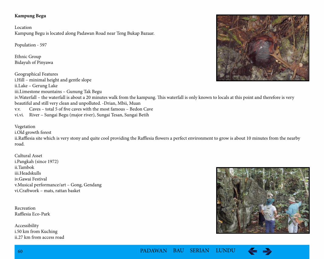
60 PADAWAN BAU SERIAN LUNDU
Kampung Begu
LocationKampung Begu is located along Padawan Road near Teng Bukap Bazaar.
Population - 597
Ethnic GroupBidayuh of Pinyawa
Geographical Featuresi.Hill – minimal height and gentle slopeii.Lake – Gerung Lakeiii.Limestone mountains – Gunung Tak Beguiv.Waterfall – the waterfall is about a 20 minutes walk from the kampung. This waterfall is only known to locals at this point and therefore is very beautiful and still very clean and unpolluted. -Drian, Mbii, Muanv.v. Caves – total 5 of five caves with the most famous – Bedon Cavevi.vi. River – Sungai Begu (major river), Sungai Tesan, Sungai Betih
Vegetationi.Old growth forestii.Rafflesia site which is very stony and quite cool providing the Rafflesia flowers a perfect environment to grow is about 10 minutes from the nearby road.
Cultural Asseti.Pangkah (since 1972)ii.Tambokiii.Headskullsiv.Gawai Festivalv.Musical performance/art – Gong, Gendang vi.Craftwork – mats, rattan basket
RecreationRafflesia Eco-Park
Accessibilityi.50 km from Kuchingii.27 km from access road
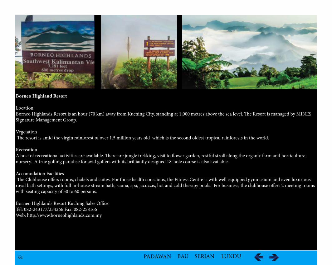
61 PADAWAN BAU SERIAN LUNDU
Borneo Highland Resort
LocationBorneo Highlands Resort is an hour (70 km) away from Kuching City, standing at 1,000 metres above the sea level. The Resort is managed by MINES Signature Management Group.
Vegetation The resort is amid the virgin rainforest of over 1.5 million years old which is the second oldest tropical rainforests in the world.
Recreation A host of recreational activities are available. There are jungle trekking, visit to flower garden, restful stroll along the organic farm and horticulture nursery. A true golfing paradise for avid golfers with its brilliantly designed 18-hole course is also available.
Accomodation Facilities The Clubhouse offers rooms, chalets and suites. For those health conscious, the Fitness Centre is with well-equipped gymnasium and even luxurious royal bath settings, with full in-house stream bath, sauna, spa, jacuzzis, hot and cold therapy pools. For business, the clubhouse offers 2 meeting rooms with seating capacity of 50 to 60 persons.
Borneo Highlands Resort Kuching Sales Office Tel: 082-243177/234266 Fax: 082-258166 Web: http://www.borneohighlands.com.my
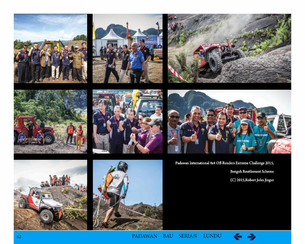
62 PADAWAN BAU SERIAN LUNDU
Padawan International 4x4 Off-Roaders Extreme Challenge 2015,
Bengoh Resslement Scheme
(C) 2015,Robert John Jingut
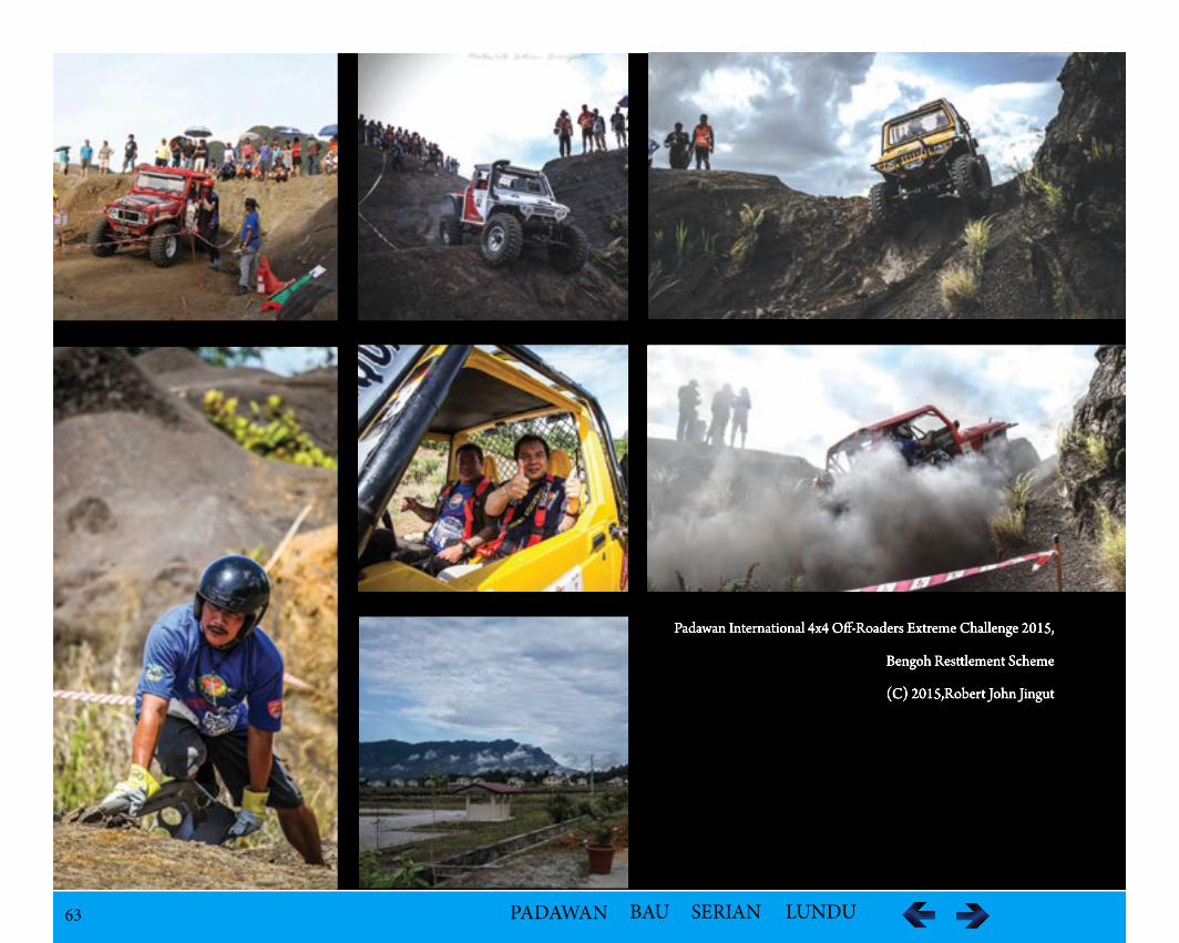
63 PADAWAN BAU SERIAN LUNDU
Padawan International 4x4 Off-Roaders Extreme Challenge 2015,
Bengoh Resslement Scheme
(C) 2015,Robert John Jingut
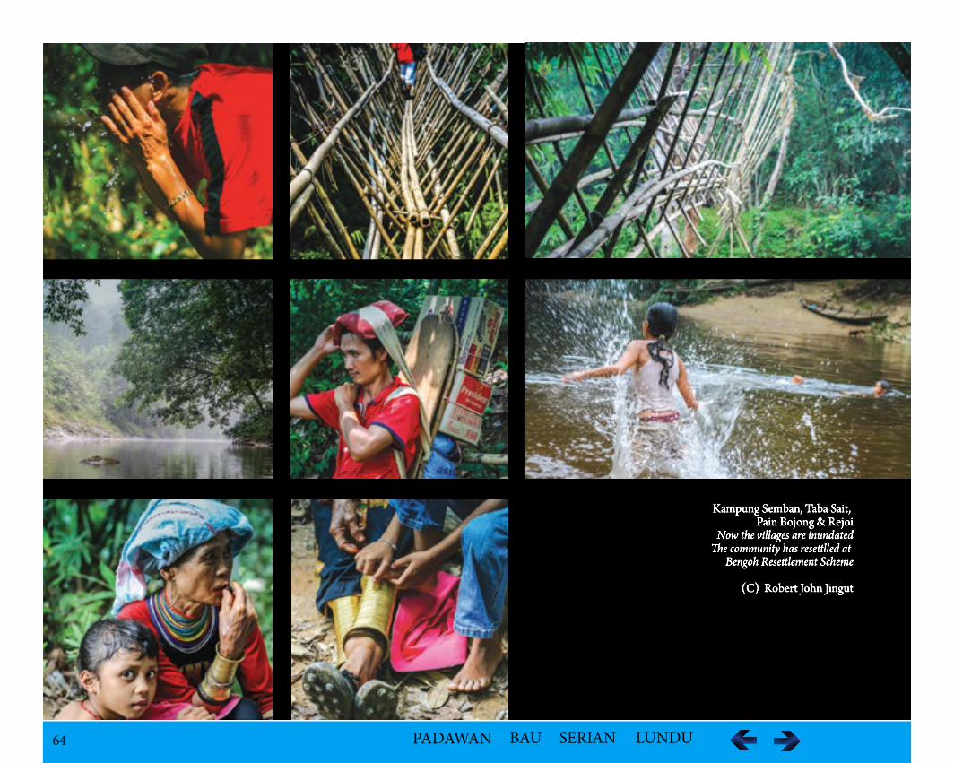
64 PADAWAN BAU SERIAN LUNDU
Kampung Semban, Taba Sait, Pain Bojong & Rejoi
Now the villages are inundatedde community has reseelled at
Bengoh Reseelement Scheme
(C) Robert John Jingut
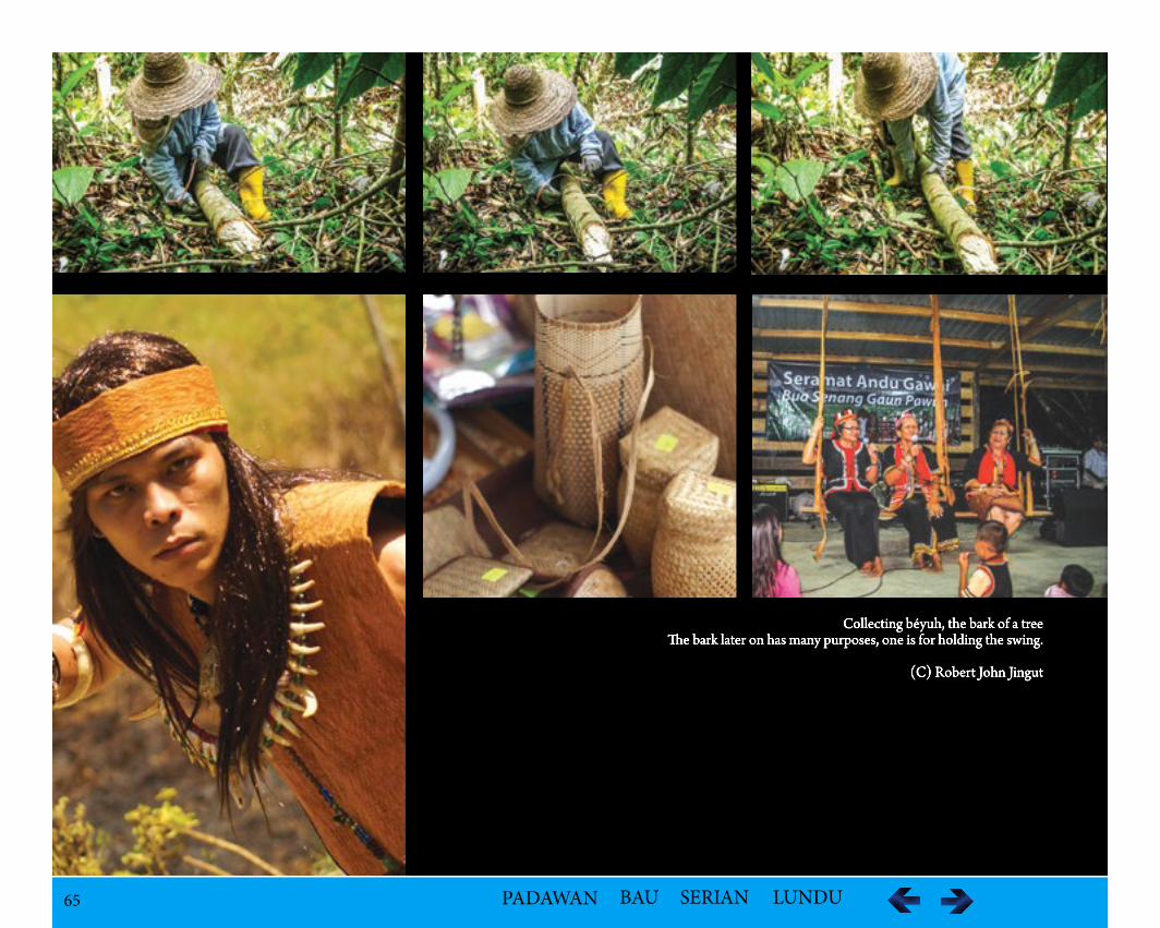
65 PADAWAN BAU SERIAN LUNDU
Collecting béyuh, the bark of a treeee bark later on has many purposes, one is for holding the swing.
(C) Robert John Jingut
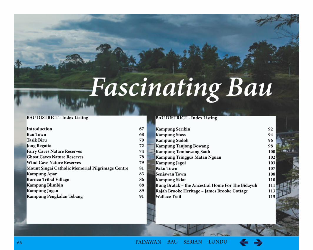
66 PADAWAN BAU SERIAN LUNDU
Fascinating BauBAU DISTRICT - Index Listing Introduction 67Bau Town 68Tasik Biru 70Jong Regatta 72Fairy Caves Nature Reserves 74Ghost Caves Nature Reserves 78Wind Cave Nature Reserves 79Mount Singai Catholic Memorial Pilgrimage Centre 81Kampung Apar 83Borneo Tribal Village 86Kampung Blimbin 88Kampung Jugan 89Kampung Pengkalan Tebang 91
BAU DISTRICT - Index Listing Kampung Serikin 92Kampung Stass 94Kampung Sudoh 96Kampung Tanjong Bowang 98Kampung Tembawang Sauh 100Kampung Tringgus Matan Nguan 102Kampung Jagoi 103Paku Town 107Seniawan Town 108Kampung Skiat 110Bung Bratak – the Ancestral Home For The Bidayuh 111Rajah Brooke Heritage – James Brooke Cottage 113Wallace Trail 115
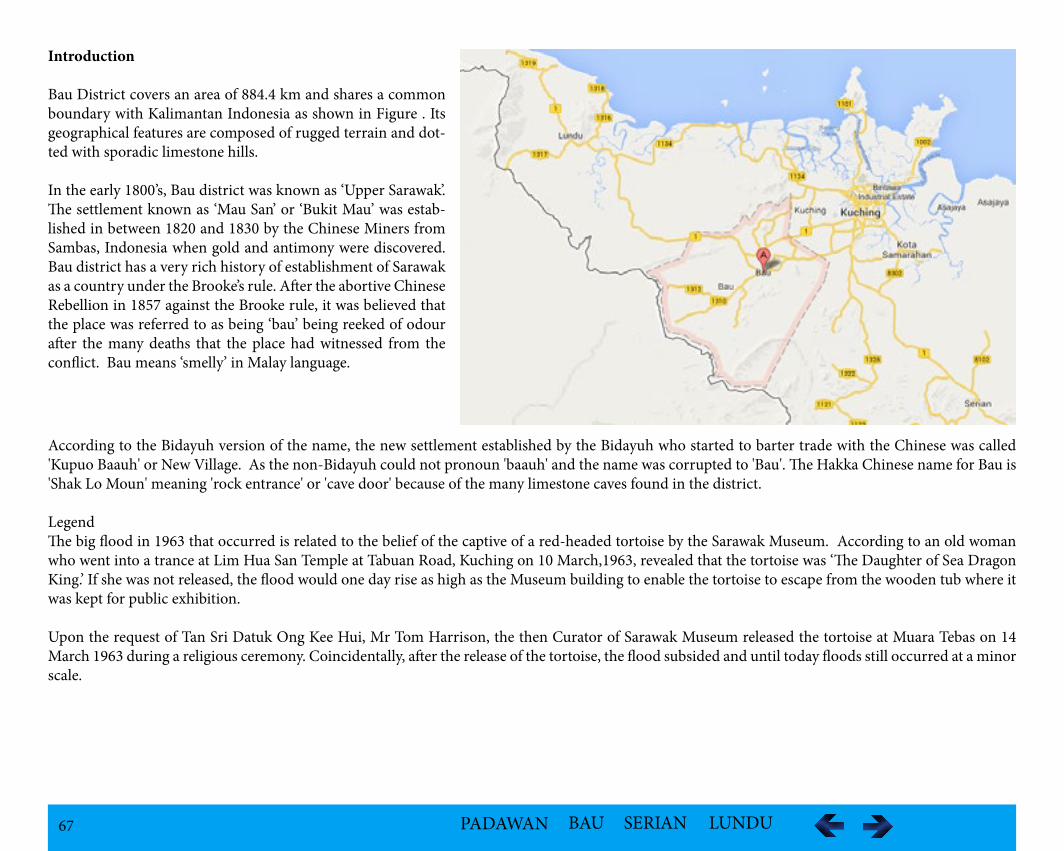
67 PADAWAN BAU SERIAN LUNDU
Introduction
Bau District covers an area of 884.4 km and shares a common boundary with Kalimantan Indonesia as shown in Figure . Its geographical features are composed of rugged terrain and dot-ted with sporadic limestone hills.
In the early 1800’s, Bau district was known as ‘Upper Sarawak’. The settlement known as ‘Mau San’ or ‘Bukit Mau’ was estab-lished in between 1820 and 1830 by the Chinese Miners from Sambas, Indonesia when gold and antimony were discovered. Bau district has a very rich history of establishment of Sarawak as a country under the Brooke’s rule. After the abortive Chinese Rebellion in 1857 against the Brooke rule, it was believed that the place was referred to as being ‘bau’ being reeked of odour after the many deaths that the place had witnessed from the conflict. Bau means ‘smelly’ in Malay language.
According to the Bidayuh version of the name, the new settlement established by the Bidayuh who started to barter trade with the Chinese was called 'Kupuo Baauh' or New Village. As the non-Bidayuh could not pronoun 'baauh' and the name was corrupted to 'Bau'. The Hakka Chinese name for Bau is 'Shak Lo Moun' meaning 'rock entrance' or 'cave door' because of the many limestone caves found in the district.
LegendThe big flood in 1963 that occurred is related to the belief of the captive of a red-headed tortoise by the Sarawak Museum. According to an old woman who went into a trance at Lim Hua San Temple at Tabuan Road, Kuching on 10 March,1963, revealed that the tortoise was ‘The Daughter of Sea Dragon King.’ If she was not released, the flood would one day rise as high as the Museum building to enable the tortoise to escape from the wooden tub where it was kept for public exhibition.
Upon the request of Tan Sri Datuk Ong Kee Hui, Mr Tom Harrison, the then Curator of Sarawak Museum released the tortoise at Muara Tebas on 14 March 1963 during a religious ceremony. Coincidentally, after the release of the tortoise, the flood subsided and until today floods still occurred at a minor scale.
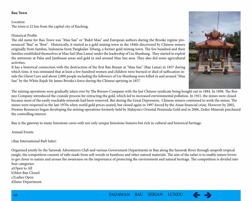
68 PADAWAN BAU SERIAN LUNDU
Bau Town
LocationThe town is 22 km from the capital city of Kuching.
Historical Profile The old name for Bau Town was "Mau San" or "Bukit Mau" and European authors during the Brooke regime pro-nounced "Bau" as "Bow". Historically, it started as a gold mining town in the 1840s discovered by Chinese miners originally from Sambas, Indonesia from Pangkalan Tebang, a former gold mining town. The few hundred and their families established themselves at Mau Sail (Bau Lama) under the leadership of Liu Shanbang. They started to exploit the antimony at Paku and Jambusan areas and gold in and around Mau San area. They also did some agricultural activities. It has a historical connection with the destruction of the first Bau Bazaar at "Mau San" (Bau Lama) in 1857 during which time, it was estimated that at least a few hundred women and children were burned or died of suffocation in-side the Ghost Cave and about 2,000 people including the followers of Liu Shanbang were killed in and around "Mau San" by the White Rajah Sir James Brooke's force during the Chinese uprising in 1857.
The mining operations were gradually taken over by The Borneo Company with the last Chinese syndicate being bought out in 1884. In 1898, The Bor-neo Company introduced the cyanide process for extracting the gold, which led to increased environmental pollution. In 1921, the mines were closed because most of the easily reachable minerals had been removed. But during the Great Depression, Chinese miners continued to work the mines. The mines were reopened in the late 1970s when world gold prices soared, but closed again in 1997 forced by the Asian financial crisis. However by 2002, Preston Resources began developing the mining operations formerly held by Malaysia's Oriental Peninsula Gold and in 2006, Zedex Minerals purchased the controlling interest.
Bau is the gateway to many limestone caves with not only unique limestone features but rich in cultural and historical heritage.
Annual Events
i.Bau International Raft Safari
Organised jointly by the Sarawak Adventurers Club and various Government Departments in Bau along the Sarawak River through unspoilt tropical jungle, the competition consists of rafts made from soft woods or bamboos and other natural materials. The aim of the safari is to enable nature lovers to get closer to nature and arouse the awareness on the importance of protecting the environment and natural heritage. The competition is divided into four categories:a)Open to All b)Men Bau Closedc)Ladies Opend)Inter Department.
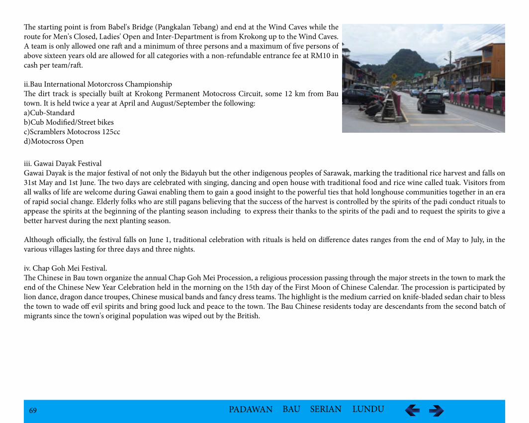
69 PADAWAN BAU SERIAN LUNDU
The starting point is from Babel's Bridge (Pangkalan Tebang) and end at the Wind Caves while the route for Men's Closed, Ladies' Open and Inter-Department is from Krokong up to the Wind Caves. A team is only allowed one raft and a minimum of three persons and a maximum of five persons of above sixteen years old are allowed for all categories with a non-refundable entrance fee at RM10 in cash per team/raft.
ii.Bau International Motorcross ChampionshipThe dirt track is specially built at Krokong Permanent Motocross Circuit, some 12 km from Bau town. It is held twice a year at April and August/September the following:a)Cub-Standard b)Cub Modified/Street bikesc)Scramblers Motocross 125ccd)Motocross Open
iii. Gawai Dayak FestivalGawai Dayak is the major festival of not only the Bidayuh but the other indigenous peoples of Sarawak, marking the traditional rice harvest and falls on 31st May and 1st June. The two days are celebrated with singing, dancing and open house with traditional food and rice wine called tuak. Visitors from all walks of life are welcome during Gawai enabling them to gain a good insight to the powerful ties that hold longhouse communities together in an era of rapid social change. Elderly folks who are still pagans believing that the success of the harvest is controlled by the spirits of the padi conduct rituals to appease the spirits at the beginning of the planting season including to express their thanks to the spirits of the padi and to request the spirits to give a better harvest during the next planting season.
Although officially, the festival falls on June 1, traditional celebration with rituals is held on difference dates ranges from the end of May to July, in the various villages lasting for three days and three nights.
iv. Chap Goh Mei Festival. The Chinese in Bau town organize the annual Chap Goh Mei Procession, a religious procession passing through the major streets in the town to mark the end of the Chinese New Year Celebration held in the morning on the 15th day of the First Moon of Chinese Calendar. The procession is participated by lion dance, dragon dance troupes, Chinese musical bands and fancy dress teams. The highlight is the medium carried on knife-bladed sedan chair to bless the town to wade off evil spirits and bring good luck and peace to the town. The Bau Chinese residents today are descendants from the second batch of migrants since the town's original population was wiped out by the British.
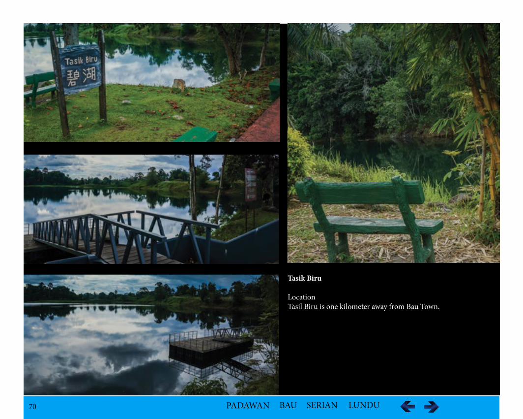
70 PADAWAN BAU SERIAN LUNDU
Tasik Biru
LocationTasil Biru is one kilometer away from Bau Town.
71 PADAWAN BAU SERIAN LUNDU
Historical InformationTasik Biru which was formed from a open cast gold mining pit known as Tai Parit mine, operated by the Borneo Company from 1898. When the min-ing stopped in 1921, it was flooded. It was renamed Tasik Biru or Blue Lake, as the water in the lake appeared greenish bluish due to reflection from the green plants around and the blue sky in 1970s.
In 1977 there was a rent-a-boat system operating for those who like to paddle in the lake, but stopped after the bus tragedy in 1979. A bus carrying students and trainee teachers plunged into the lake in June killing 28 students and a trainee teacher. In 1990, the lake was once again dewatered by a mining company to enable the gold ore to be extracted from the side and bottom of the former gold mine lake in 1990. As sinkholes began to appear around Bau Town so the mining was stopped once again in 2001, however, the lake lost its blue feature.
LegendIt was said that the lake claimed one life in an average of every three years. It has a story related to the flooding of the lake in 1921. A group of miners stumbled upon a golden tortoise at the bottom of the lake. When they tried to catch the tortoise, the tortoise bored into the earth until the subterranean strata. Suddenly, a jet of water appeared and the mine started to flood. It was believed it was a vengeance as the rising water wiped out the the mining settlement. Then an old man, said to be a bomoh, appeared on the scene and pushed a white man into the rising water. Strangely, the water stopped rising.
In 1988, three "monsters" appeared in Tasik Biru rousing not only among the Bau people, but also from elsewhere, as crowds swarmed to the mining town to witness the three strange huge figures in dark shade of about three meter long, swam below the water surface. The medium, from the nearby Bong Low Sian Tze temple was consulted and refered them as evil beings. Some talismans were burned around the four corners of the lake which caused the disappearance of the figures a day later.
Geographical FeaturesTasik Biru is a man made lake with the deepest point about 300 feet deep as a result of open cast mining during the gold mining days. The water has very high content of arsenic.
FacilitiesThe bridge built to span across a narrow part of the lake is to enable visitors to access to the other side of the lake. There is a six-stall canteen, toilets, pontoon gangway, viewing platform, footpaths, railing by the lakeside and a car park.
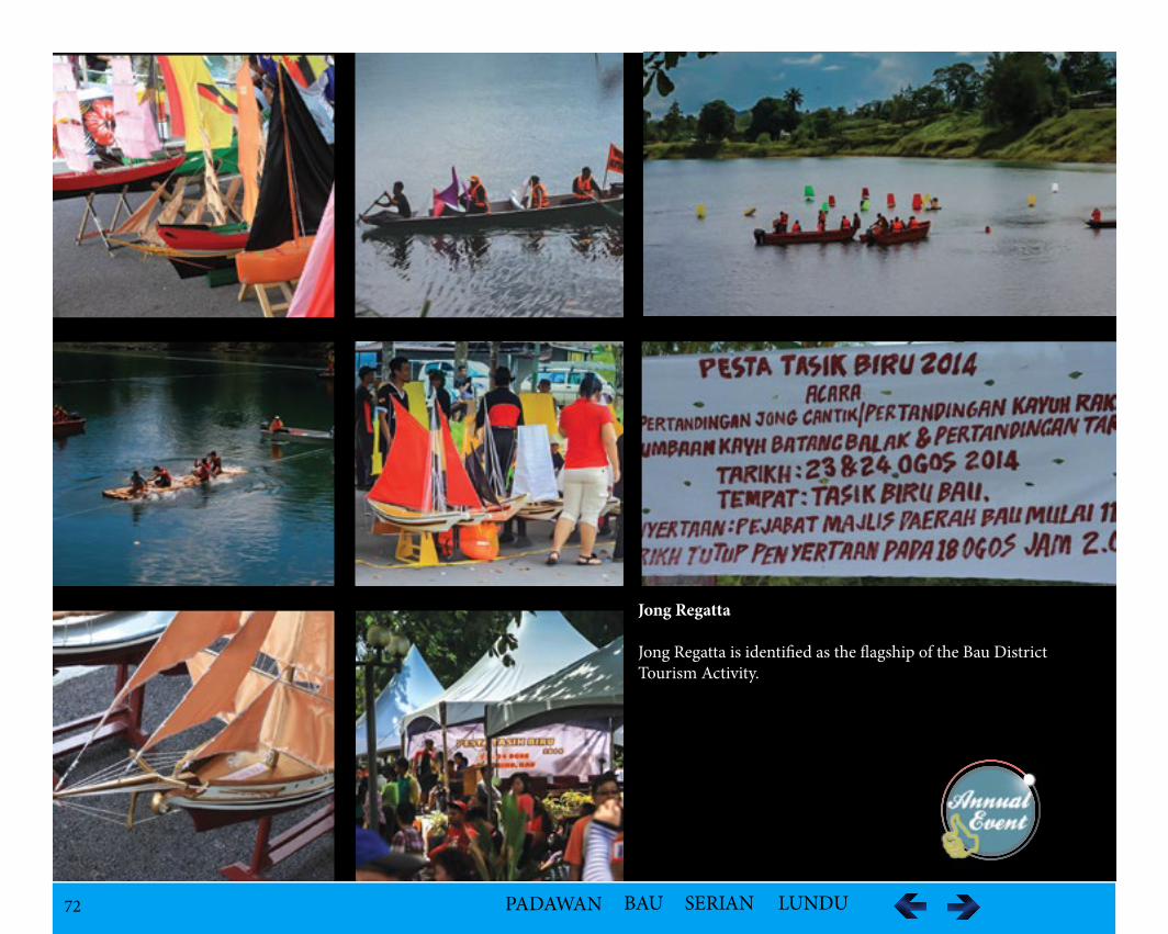
72 PADAWAN BAU SERIAN LUNDU
Jong Regatta
Jong Regatta is identified as the flagship of the Bau District Tourism Activity.
73 PADAWAN BAU SERIAN LUNDU
IntroductionJong Regatta is a cultural boat racing at Tasik Biru in Bau, a unique sport only in Bau District rebranded as 'Pesta Regatta Bau' to lure more foreign tour-ists. Jong is a miniature sailing boats. It is a Malay culture which was used to make offerings to the evil spirit in the past. The offering consists of bananas or Pisang Emas, yellow rice (Nasi Kuning), Reteh and eggs placed in the Jong and released in the river after praying. It is believed that the Jong will drive away sickness of a person to the sea, thus be cured.
HistoryThe Regatta Jong Bau mini-sailboat race is a traditional water sport started way back in 1954 during the time of British rule, however, was disrupted many times for various reasons including the confrontation, communist insurgency and lack of funds, and was once totally forgotten. It was thought that the Malays around Kuching and along the Sarawak River had always admired the Royalist, a large sailing boat of the First Rajah Brooke and the other British Navy sailing boats anchored in the river in the 19th Century.
So they made the model boats out of soft wood, copying the actual design and shape of the sailings boats for decorations and sometimes sailed the Jongs in the lake as past times.The idea of holding a Jong regatta first started in 1949 by the Colonial District Officer, Mr. A.J.N. Richards. Being an enthusiast of Jongs, he organized the regatta in Tasik Biru.
This was due to several reasons:i.Bau being an interior district where there is no big and deep river for regatta;ii.The regatta would be able to generate and promote goodwill and harmony among the multi-racial communities;iii.The revival of old culture;iv.The exchange of ideas and concede to the final points of other jongs.There are five categories of Jongs: Schooner, Bandong, Kotak, Skuchi and Barong. The minature sailing boats were released at one end of the lake and letting the wind to blow them across to the other end of the lake to decide the winners.
LocationThe lake is an ideal place because it is big enough with shady trees providing the shade under the hot tropical sun. The water is clean and no rock around the lake to hinder the race. There is always a constant breeze from the same one direction.
The Art of Making JongsA model boat is a sailable Jong demanding not only a good imaginable model but also a measurable skill to keep the model boat upright in the water. The type of woods used are either from Jelutong, Engkabang or Plaie which is dried for a week or two. The model is made in one piece with a draught as shallow as possible to give speed and stability with the wood carved to an average thickness of about ½ inch. Lead is used as ballast to keep balance when the Jong is in water. When the hull is completed, a water tight deck is fixed onto the hull and is painted with kruin to fill up the joint in between the deck and the hull. The hull then is enamelled to get the smoothness and also to preserve the wood. Masts and spars are made from bamboo as it is straight and light. The length can be from two to six feet.
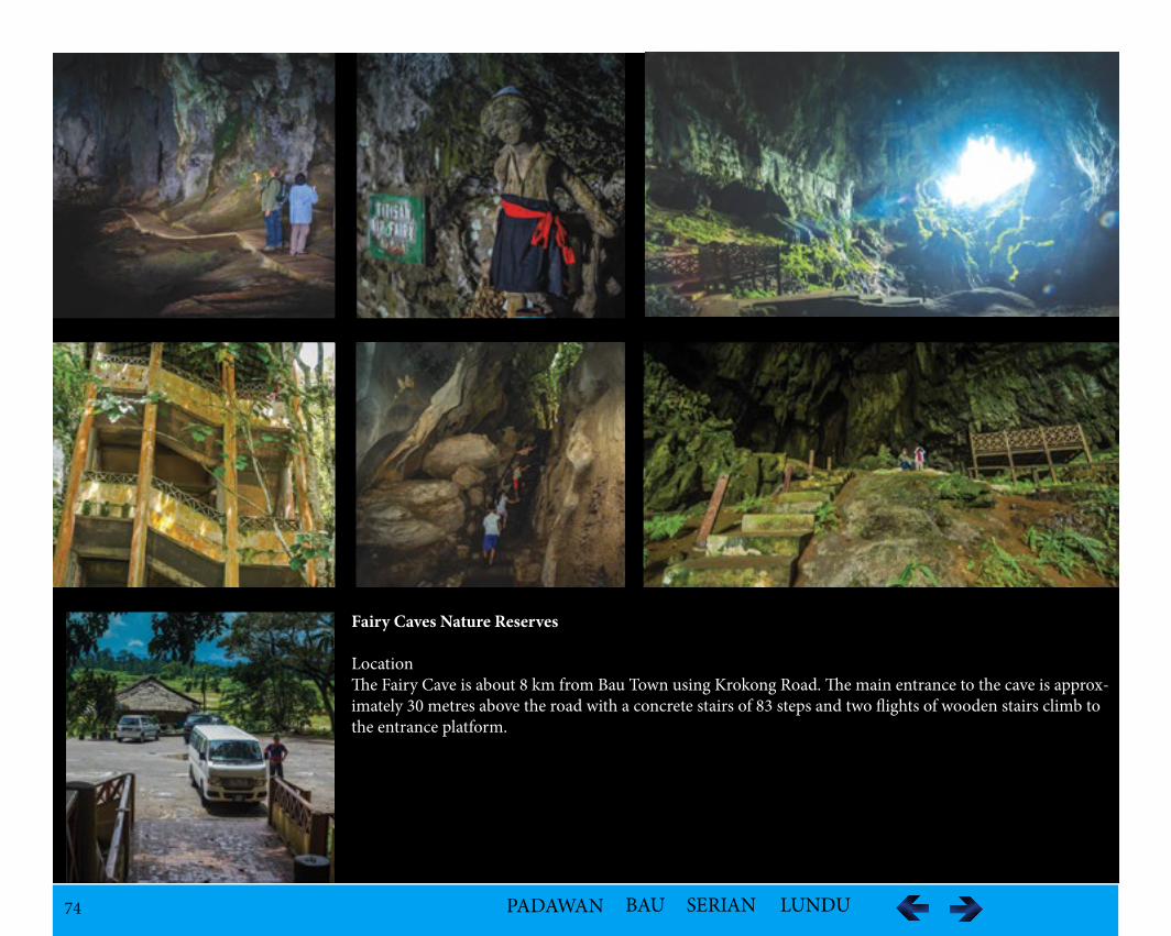
74 PADAWAN BAU SERIAN LUNDU
Fairy Caves Nature Reserves
LocationThe Fairy Cave is about 8 km from Bau Town using Krokong Road. The main entrance to the cave is approx-imately 30 metres above the road with a concrete stairs of 83 steps and two flights of wooden stairs climb to the entrance platform.
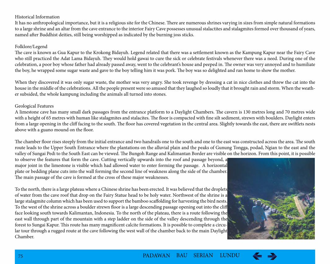
75 PADAWAN BAU SERIAN LUNDU
Historical InformationIt has no anthropological importance, but it is a religious site for the Chinese. There are numerous shrines varying in sizes from simple natural formations to a large shrine and an altar from the cave entrance to the interior Fairy Cave possesses unusual stalactites and stalagmites formed over thousand of years, named after Buddhist deities, still being worshipped as indicated by the burning joss sticks.
Folklore/LegendThe cave is known as Gua Kapur to the Krokong Bidayuh. Legend related that there was a settlement known as the Kampung Kapur near the Fairy Cave who still practiced the Adat Lama Bidayuh. They would hold gawai to cure the sick or celebrate festivals whenever there was a need. During one of the celebration, a poor boy whose father had already passed away, went to the celebrant’s house and peeped in. The owner was very annoyed and to humiliate the boy, he wrapped some sugar waste and gave to the boy telling him it was pork. The boy was so delighted and ran home to show the mother.
When they discovered it was only sugar waste, the mother was very angry. She took revenge by dressing a cat in nice clothes and threw the cat into the house in the middle of the celebrations. All the people present were so amused that they laughed so loudly that it brought rain and storm. When the weath-er subsided, the whole kampung including the animals all turned into stones.
Geological FeaturesA limestone cave has many small dark passages from the entrance platform to a Daylight Chambers. The cavern is 130 metres long and 70 metres wide with a height of 65 metres with human like stalagmites and stalacites. The floor is compacted with fine silt sediment, strewn with boulders. Daylight enters from a large opening in the cliff facing to the south. The floor has covered vegetation in the central area. Slightly towards the east, there are swiftlets nests above with a guano mound on the floor.
The chamber floor rises steeply from the initial entrance and two handrails one to the south and one to the east was constructed across the area. The south route leads to the Upper South Entrance where the plantations on the alluvial plain and the peaks of Gunung Tongga, podad, Ngian to the east and the valley of Sungai Pedi to the South East can be viewed. The Bungoh Range and Kalimantan Border are visible on the horizon. From this point, it is possible to observe the features that form the cave. Cutting vertically upwards into the roof and passage beyond, a major joint in the limestone is visible which had allowed water to enter forming the passage. A horizontal plate or bedding plane cuts into the wall forming the second line of weakness along the side of the chamber. The main passage of the cave is formed at the cross of these major weaknesses.
To the north, there is a large plateau where a Chinese shrine has been erected. It was believed that the droplets of water from the cave roof that drop on the Fairy Statue head to be holy water. Northwest of the shrine is a large stalagmite column which has been used to support the bamboo scaffolding for harvesting the bird nests. To the west of the shrine across a boulder strewn floor is a large descending passage opening out into the cliff face looking south towards Kalimantan, Indonesia. To the north of the plateau, there is a route following the east wall through part of the mountain with a step ladder on the side of the valley descending through the forest to Sungai Kapur. This route has many magnificent calcite formations. It is possible to complete a circu-lar tour through a rugged route at the cave following the west wall of the chamber back to the main Daylight Chamber.
76 PADAWAN BAU SERIAN LUNDU
Vegetationi.Pitcher plants-Nepenthes northiana, could be seen growing in heavy clusters on the steep sides of the limestone cliffs. -The limestone hills in Bau and Padawan are the only known localities in the world for this carnivorous plant, making it endemic to Sarawak.-The discovery of the species in the late 1800s, during the reign of the White Rajahs, further boosted the exotic reputation of Sarawak.ii.There are rich moss inside the chamber of the cave.
Faunai.Batsii.Birds:-Bornean Whistling Thrush- Munias-Cuckoo-Sunbird-Bulbul-Coucals-Flowerpecker-Tailorbird -Swiftlets -Hawk eagle
iii.Snakes (Green Cave Raver – harmless, often leave their moulted skins in the cliff crevices when they climb the limestone walls to hunt bats and swift-lets iv.Portia jumping spider – the most intelligent spider in the world, thought to be capable of learning and problem solving. v.Cave crab
Cultural and Historical Heritagei.The cave is a place of worship and prayers. The Fairy Cave takes its name from a stalagmite structure at the entrance that is said to resemble a Chinese deity.ii.Remnants of Japanese fortresses built by the Japanese army during its occupation of the state in 1941 (four concrete structures at one of its entry points – look like they have been constructed to store water)
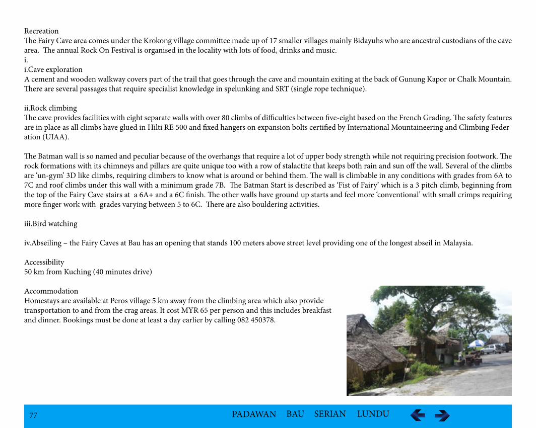
77 PADAWAN BAU SERIAN LUNDU
RecreationThe Fairy Cave area comes under the Krokong village committee made up of 17 smaller villages mainly Bidayuhs who are ancestral custodians of the cave area. The annual Rock On Festival is organised in the locality with lots of food, drinks and music.i.i.Cave explorationA cement and wooden walkway covers part of the trail that goes through the cave and mountain exiting at the back of Gunung Kapor or Chalk Mountain. There are several passages that require specialist knowledge in spelunking and SRT (single rope technique).
ii.Rock climbingThe cave provides facilities with eight separate walls with over 80 climbs of difficulties between five-eight based on the French Grading. The safety features are in place as all climbs have glued in Hilti RE 500 and fixed hangers on expansion bolts certified by International Mountaineering and Climbing Feder-ation (UIAA).
The Batman wall is so named and peculiar because of the overhangs that require a lot of upper body strength while not requiring precision footwork. The rock formations with its chimneys and pillars are quite unique too with a row of stalactite that keeps both rain and sun off the wall. Several of the climbs are ‘un-gym’ 3D like climbs, requiring climbers to know what is around or behind them. The wall is climbable in any conditions with grades from 6A to 7C and roof climbs under this wall with a minimum grade 7B. The Batman Start is described as ‘Fist of Fairy’ which is a 3 pitch climb, beginning from the top of the Fairy Cave stairs at a 6A+ and a 6C finish. The other walls have ground up starts and feel more ‘conventional’ with small crimps requiring more finger work with grades varying between 5 to 6C. There are also bouldering activities.
iii.Bird watching
iv.Abseiling – the Fairy Caves at Bau has an opening that stands 100 meters above street level providing one of the longest abseil in Malaysia.
Accessibility50 km from Kuching (40 minutes drive)
AccommodationHomestays are available at Peros village 5 km away from the climbing area which also provide transportation to and from the crag areas. It cost MYR 65 per person and this includes breakfast and dinner. Bookings must be done at least a day earlier by calling 082 450378.
78 PADAWAN BAU SERIAN LUNDU
Ghost Caves Nature Reserves
LocationThe Ghost Cave is about 550 metres from Bau Town and 45 metres from Jambusan Road.
Historical InformationLong before the village was established, Jugan was related to the 1857 Bau Massacre where between 400 to 500 Chinese men, women and children were massacred in the revered dark cavern of Ghost Cave of the James Brooke era during the Chinese insurrection in February 25, 1857. It was not until the 1930s that the Chinese Kapitan Liew Nyan Foo organised his people to carry out investigations into the cave system and found the bones of hundreds of people. Their bones were later removed and buried at the Bau Chinese cemetery, not far from the site of the massacre.
In the mid 1980s, the cave premises were restored with a brick wall was built inside about 200 feet away from the entrance to prevent people from entering the cave as some people believe that the cave hold artifacts and even valuables as well as gold deposits. A temple called Shak Bong Jar (God of the Rock) was restored to appease the spirits and ensure that the spirits of the victims would remain entombed in the cave and not let loose. A large section is now devoted to the Chinese insurrection and its leader Liu Shanbang.
According to the story, Liu had led the Chinese rebellion against James Brooke, the first white Rajah of Sarawak on February 18 because he disliked the interference of the colonials in Sarawak's affairs. History books link the rebellion to the refusal of the gold miners to pay exorbitant taxes. lt went well until the Malays and natives were persuaded to team up with the Rajah's several hundred-strong Iban forces led by Charles Brooke, the nephew of James, to bring down the Chinese rebellion.
Thereafter, Liu, a six-footer with a long pigtail he was fond of curling around his neck and armed with a sword and pistol, and his forces retreated upriver and back to Bau; they were ambushed along the river, chased when they landed and escaped on foot and finally cornered at a spot called Jugan near the village of Siniawan (on the way from Kuching to Bau). In his last stand at Jugan on February 24, China-born Liu fought bravely despite being outnumbered and "died on his feet". When the Rajah's soldiers left, those who managed to escape found Liu's dead body leaning on his sword. It is said that they buried Liu on the same spot where he was killed together with a large amount of gold which belonged to him.
After the killing of Liu the Rajah's forces arrived at Bau and trapped the Chinese families who had fled into the "ghost cave" a complex which is said to be at least one mile long. They lit a huge bonfire at the entrance, and all either suffocated to death or were killed as they tried to escape. But the Ghost Cave may still be a resting place for the forgotten ones. Even today it is common practice for the Chinese seeking good fortune to visit the temple (named after Liu Shanbang at Jugan) to commemorate the death of this Chinese hero. In fact, the locals have uplifted his status to a "deity" as it is believed that some who prayed to his spirit have received good fortune. The nameless hundreds who perished in the cave, on the other hand, remain largely forgotten.
Geological FeaturesA Limestone cave has a small passage blocked by rock fall from the roof. Daylight can be seen in several places. The entrance is widest near the roof and beneath the lip of the wide part are rows of pendants projections of limestone.
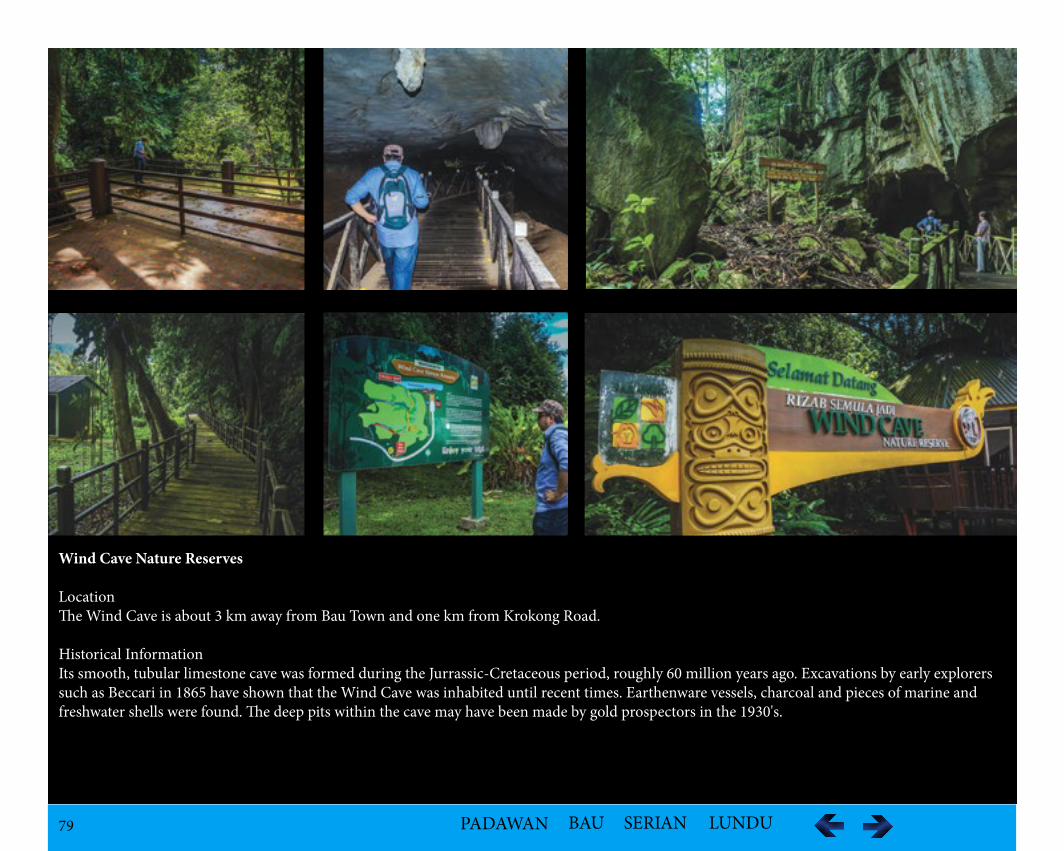
79 PADAWAN BAU SERIAN LUNDU
Wind Cave Nature Reserves
LocationThe Wind Cave is about 3 km away from Bau Town and one km from Krokong Road.
Historical InformationIts smooth, tubular limestone cave was formed during the Jurrassic-Cretaceous period, roughly 60 million years ago. Excavations by early explorers such as Beccari in 1865 have shown that the Wind Cave was inhabited until recent times. Earthenware vessels, charcoal and pieces of marine and freshwater shells were found. The deep pits within the cave may have been made by gold prospectors in the 1930's.
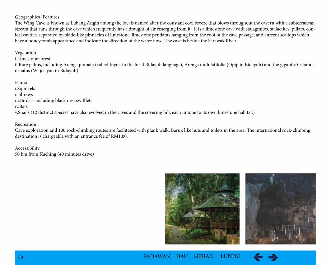
80 PADAWAN BAU SERIAN LUNDU
Geographical FeaturesThe Wing Cave is known as Lubang Angin among the locals named after the constant cool breeze that blows throughout the cavern with a subterranean stream that runs through the cave which frequently has a draught of air emerging from it. It is a limestone cave with stalagmites, stalactites, pillars, con-ical cavities separated by blade-like pinnacles of limestone, limestone pendants hanging from the roof of the cave passage, and current scallops which have a honeycomb appearance and indicate the direction of the water flow. The cave is beside the Sarawak River.
Vegetationi.Limestone forestii.Rare palms, including Arenga pinnata (called Inyok in the local Bidayuh language), Arenga undulatifolia (Opip in Bidayuh) and the gigantic Calamus ornatus (Wi jelayan in Bidayuh)
Faunai.Squirrelsii.Shrewsiii.Birds – including black nest swiftletsiv.Bats v.Snails (12 distinct species have also evolved in the caves and the covering hill, each unique to its own limestone habitat.)
RecreationCave exploration and 100 rock-climbing routes are facilitated with plank walk, Baruk like huts and toilets in the area. The international rock-climbing destination is chargeable with an entrance fee of RM1.00.
Accessibility50 km from Kuching (40 minutes drive)
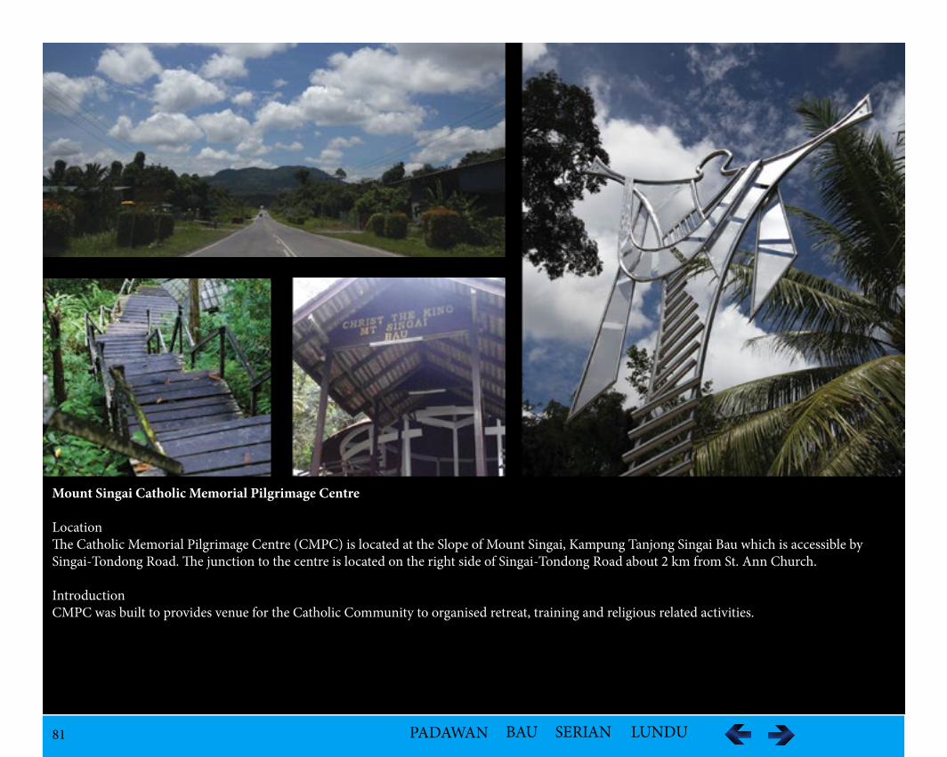
81 PADAWAN BAU SERIAN LUNDU
Mount Singai Catholic Memorial Pilgrimage Centre
LocationThe Catholic Memorial Pilgrimage Centre (CMPC) is located at the Slope of Mount Singai, Kampung Tanjong Singai Bau which is accessible by Singai-Tondong Road. The junction to the centre is located on the right side of Singai-Tondong Road about 2 km from St. Ann Church.
IntroductionCMPC was built to provides venue for the Catholic Community to organised retreat, training and religious related activities.
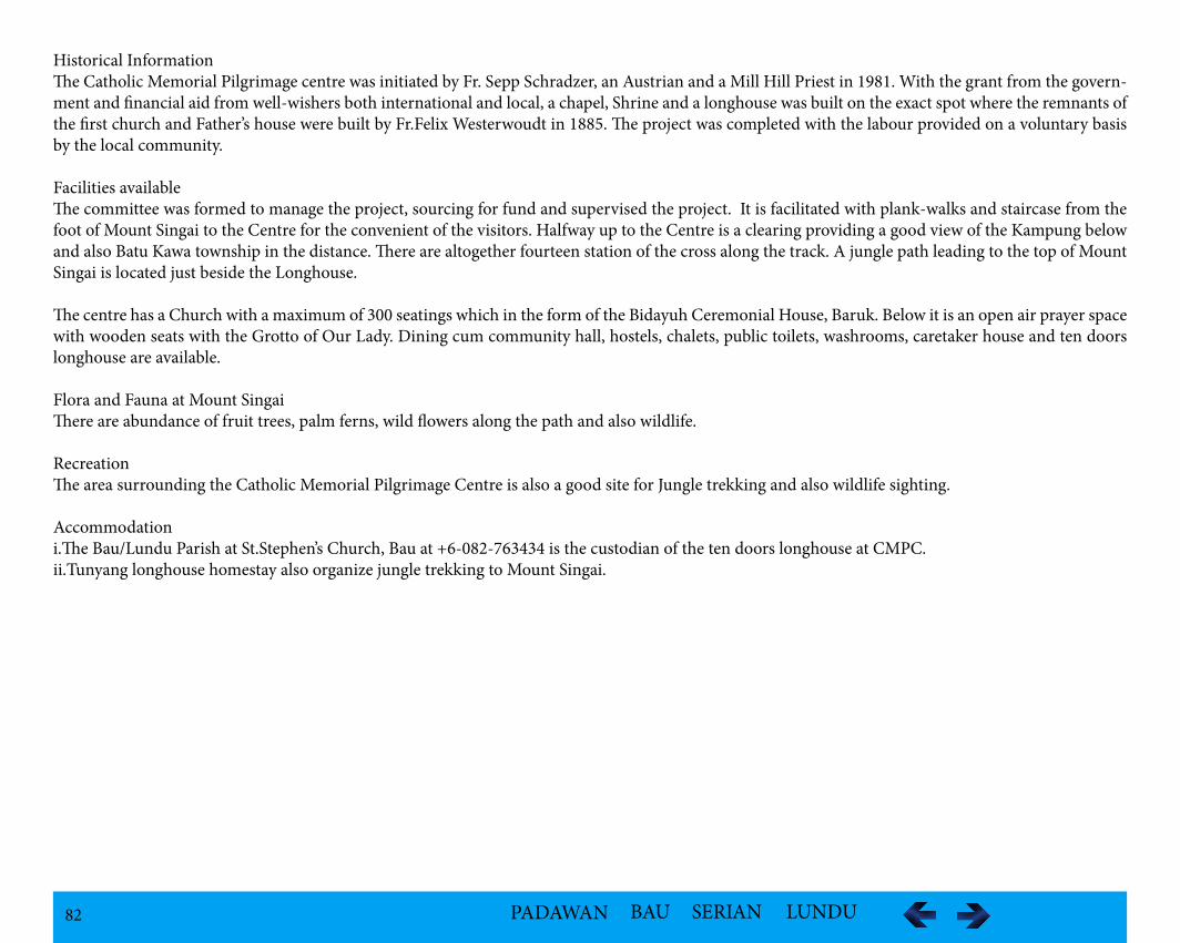
82 PADAWAN BAU SERIAN LUNDU
Historical InformationThe Catholic Memorial Pilgrimage centre was initiated by Fr. Sepp Schradzer, an Austrian and a Mill Hill Priest in 1981. With the grant from the govern-ment and financial aid from well-wishers both international and local, a chapel, Shrine and a longhouse was built on the exact spot where the remnants of the first church and Father’s house were built by Fr.Felix Westerwoudt in 1885. The project was completed with the labour provided on a voluntary basis by the local community.
Facilities available The committee was formed to manage the project, sourcing for fund and supervised the project. It is facilitated with plank-walks and staircase from the foot of Mount Singai to the Centre for the convenient of the visitors. Halfway up to the Centre is a clearing providing a good view of the Kampung below and also Batu Kawa township in the distance. There are altogether fourteen station of the cross along the track. A jungle path leading to the top of Mount Singai is located just beside the Longhouse.
The centre has a Church with a maximum of 300 seatings which in the form of the Bidayuh Ceremonial House, Baruk. Below it is an open air prayer space with wooden seats with the Grotto of Our Lady. Dining cum community hall, hostels, chalets, public toilets, washrooms, caretaker house and ten doors longhouse are available.
Flora and Fauna at Mount SingaiThere are abundance of fruit trees, palm ferns, wild flowers along the path and also wildlife.
RecreationThe area surrounding the Catholic Memorial Pilgrimage Centre is also a good site for Jungle trekking and also wildlife sighting.
Accommodationi.The Bau/Lundu Parish at St.Stephen’s Church, Bau at +6-082-763434 is the custodian of the ten doors longhouse at CMPC.ii.Tunyang longhouse homestay also organize jungle trekking to Mount Singai.
83 PADAWAN BAU SERIAN LUNDU
Kampung Apar
Location: The Kampung is situated at Jalan Apar-Segong about 30 km from Kuching.
PopulationOver 500 (2013)
Ethnic GroupBidayuh - Bisingai
Historical InformationWhen Bidayuh first came to Sarawak from Sungkung, Kalimatan Barat, Indonesia, they built settlements at high ground at Mount Serembu, Mount Sin-gai, Mount Landar and, Mount Jagoi to evade intruders. Jagoi originated from Bung Bratak which was established on Mount Landar. The Bidayuh who stayed at Mount Singai or Dorod Singai, known as Dorod Tongah in the olden days called themselves Bidayuh Singai or Bisingai. The Singai community has never been attacked because of the natural defense system. The community remained on the mountain top until Christianity came and settlements were eatablished at the foothills.
During the early days of the White Rajahs, the Singai community defied the law and order of enforcements and attacked neighbouring villages. It was only after the execution of the Chief Pa Rimbun and the warrior or Panglima Pa Yumo that the Singai Bidayuh became a peaceful and contented community. The breakup of the Bidayuh community at Dorod Singai was due to the conversion to Chirstianity. A group left and settled at River Sudoh and called the settlement Kampung Sudoh. A group from Kampung Tabong moved due to land shortages and together with the group from Kampung Sudoh established Kampung Apar.
Folklore/LegendThe Bidayuh Bijagoi claimed that their ancestry was from Sungkung in Kalimatan Barat, Indonesia. They migrated from Rabak Mikabuh at Penrissen to River Butan and finally settled at Bung Bratak. Bung is translated as settlement. Bratak was the name of a long bean in the area they settled, was a Malay word described as a reference to seeing a group of Malays plucking the bean by the first settlers.
However, it was believed that Bratak meant collision because the village was located at a place between Dordan Hill and Sikoris Hill collide each other. Legend has it that the flowing spring at Bung Bratak which had provided the only source of water has healing powers for minor sickness until today.
According to a legend, three Panglimas or Togund namely Kopiel, Ma Ganai @ Rangai and Ma Giang were the first to set foot on the mountain and found the site suitable for human settlement calling it as Kupuo Singai. It was believed that both Ma Ganai @ Rangai and Ma Giang were among the Bidayuh who came with the Sungkung group. Ma Ganai @ Rangai settled at Kayan River at the Lundu Distriict while Ma Giang went to the upper reaches of the Sarawak Kanan River. Coming from different areas, they could not settle the ownership so they fought it out. Both had supernatural powers. Apparently Ma Giang, being wiser used the rottan thorns to overpower his opponents. Thus the mountain was named after Ma Ganai but later changed to Dorod Singai. Although Ma Giang lost, a village was named after him as Kupuo Giang, later changed to Kampung Tanjung. One group from the Lundu District later joined the village.
84 PADAWAN BAU SERIAN LUNDU
There is another version of the legend that the Bisingai originated from Tanjung Biraban around Santubong area who moved over to Pulau Sigoyang where the present Astana Site is, Suang Nowang now known as Bukit Mata in Kuching and Pasir Paruh near Batu Kawa before crossing to Kalimatan Barat ar-riving at Sungkung. After a few generations, due to population pressure, they migrated to Sarawak via River Bokah, Bung Gading and Bung Rasot (Daun) before finally settling at Bung Singai.
There is also a legend of Princess Mikawel which is related to the history of Bung Mikawel. Princess Mikawel was the daughter of Raja Kidau or Togung Kidau, the legendary Bisingai warrior King who ruled Singai in the early 18th Century. Legend has it that Togung Kidau has mystical powers and could fly like a bird and throw objects for miles.
The King was both feared and respected by his enemies, but worshipped and loved by his people. Togung Kidau had two daughters, Princess Mikawel, the eldest and Princess Sibayak. One night, Togung Kidau summoned his daughters. He told them to move out of Mount Singai and establish new settlements at the foot of the mountain where land was plenty and fertile. Princess Sibayak, left first with her warriors and followers and settled at a fertile valley. There Princess Sibayak established her settlement where they prospered and multiplied. Her followers named the place Sibayak, after their Princess. Sibayak flourished and grew into what is known today as Kampong Tanjong Bowang.
After many moons passed, Princess Mikawel left Mount Singai and journeyed with her warriors and followers through deep jungles, valleys and rivers. They finally settled at “Paya Munyuong” or Munyuong Wetlands, where they cultivated wet padi fields. The first harvest brought bountiful padi and Prin-cess Mikawel was overjoyed that her people have plentiful to eat. However, Princess Mikawel was in for a dangerous surprise. About a cock’s crow away (3 km in today’s measurement) off Paya Munyuong reigned another Princess called Nokea, the daughter of the feared headhunter King of Siluas in what is known today as Sambas in West Kalimantan.
Her territory covered Paya Munyuong stretching far and wide for as long as the human eye could see. Seeing her territory encroached, Princess Nokea summoned her father. Enraged, her father dispatched his warriors to attack Princess Mikawel. Princess Mikawel lost the battle and retreated to a hill over-looking Nokea’s settlement. Nokea was not satisfied. She wanted that hill. She launched another attack. After a gruelsome and inconclusive battle, Prin-cess Mikawel dispatched her messenger to Nokea offering a truce – No more wars, live peacefully side by side. But Nokea was in no mood for peace. She murdered the messenger and sent his head back to Mikawel. The messenger was Mikawel’s husband. Grieving, Mikawel gathered her warriors to plan for an all out assault on Nokea. One moonlit night when Nokea and her people were celebrating the end of a harvest, Princess Mikawel launched her attack.
Taken by surprise, Nokea’s warriors who were highly intoxicated on “tuak” or rice wine made from the recently harvested rice, deserted Nokea leaving her at the mercy of Mikawel’s warriors. Nokea was finally caught and beheaded. The war was over. Princess Mikawel returned to her fort and decreed that that Nokea’s followers would be free to settle at what is now known as Tabong, living alongside her people in peace and harmony. To remind them of the wickedness of war, she named the valley where the final battle was fought “Barouh Nokea” or Nokea’s valley. Legend, again, has it that Princess Mikawel reigned over Tabong for almost 100 years.
Today, the hill is called “Bung Mikawel”, named after the Princess. Evidence of the settlement can be seen to this day – a giant jack-fruit tree behind the longhouse – planted by Princess Mikawel nearly 100 years ago.
85 PADAWAN BAU SERIAN LUNDU
Geographical FeaturesDorod Singai is a plateau-like mountain rises to a height of 1843 ft with steep rocky slope. The river is described with pebbled beaches and flatwater, white-water and unrunnable. The surrounding area has high altitude mountains and medium hills with gentle slope.
Vegetation The vegetation is of old growth lush tropical forest with peat swamp.
FaunaThere is rich biodiversity of birds, animals and fish. The tagang system is being implemented here which is meant for the conservation of the natural en-vironment.
Recreation
i.Bidayuh Tribal Village
A virgin reserve land, which lies near the Association of Research and Development Movement of Singai Sarawak (Redeems) Centre in Apar is set to become a must-visit ecotourism park with the construction of a Bidayuh Tribal Village which will display craftwork, music and performance art for local artists and art galleries.
ii. Boripongow CaféA traditional cafe located in front of Apar Rural Library, the cafe promises a difference unlike any other. Based on the concept of a traditional Bidayuh longhouse or boripongow, it offers authentic pansuh dish which is synonymous to the natives of Sarawak besides the regular menus such as fried noodles and fried rice. Interestingly, most of the foods are cooked using firewood. Nevertheless, customers could still request for foods to be cooked using modern stoves. Depending on the menu, a plate of food would costs RM4.50. It operates from 9.00am to midnight.
Aside from the food, customers to boripongow will be captivated by the cafe’s building structure which is based on natural vegetation. Nipah leaves are used as roofing materials, bamboos as walls while the stairs is made from Berlian wood. The latter can withstand the scorching heat and rain for centuries. There is ample parking space for diners as well as toilet facilities. Diners will be served by experienced waiters and waitresses. Besides walking in, custom-ers can also make advance bookings for lunch or dinner especially during weekends since the cafe is often packed with customers.
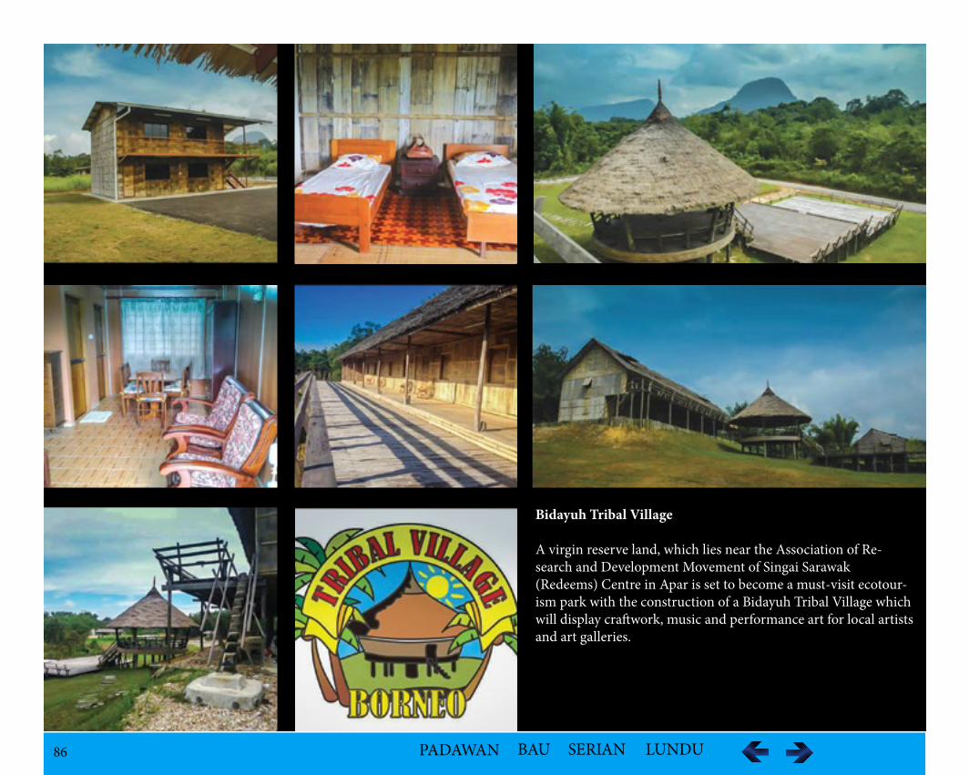
86 PADAWAN BAU SERIAN LUNDU
Bidayuh Tribal Village
A virgin reserve land, which lies near the Association of Re-search and Development Movement of Singai Sarawak (Redeems) Centre in Apar is set to become a must-visit ecotour-ism park with the construction of a Bidayuh Tribal Village which will display craftwork, music and performance art for local artists and art galleries.
87 PADAWAN BAU SERIAN LUNDU
iii.Rayan Deer Farm-stayRayan Deer Farm-stay is the site of traces of Bung Mikawel according to the legend of Princess Mikawel leaving the evidence of the settlement that can be seen to this day with the existence of a giant jack-fruit tree.Activities are offered :-Deer feeding -Cycling-Jogging -Fishing-Mini golf -Jungle trekking on Gunung Singai-Cultural Presentation (during Gawai)
iv.Bamboo Botanical Garden/Park Bau Ethnobotany Park is an establishment of the park will help in the conservation of plants, herbs, wild orchids and pitcher plants and prevent their ex-tinction especially focused on Bamboo species.
Accessibility30 km from Kuching
Accomodation Availabilitiesi.Rayan Deer Farm Stay Resort accommodating 30 deers on a eight hectare land complete with accommodation facilities costing between RM70 to RM80 per night stay, the deer farm can accommodate about 50 visitors at any one time. Besides the deer farm, the resort has two fish ponds and the resort is only one of the attractions found in the village
ii.Borneo Tribal Village Borneo Tribal Village (BTV) kampung stay is a recreation of the ancient tribal Borneo village featuring a typical village of the Bidayuh built according to traditional designs with an environmentally-friendly ambiance, and depicts a simple life in a natural rural setting. It is planned to give visitors a sample of the Bidayuh architecture, fruit trees, herbs and shrubs, handicraft, wild orchids and pitcher plants and sample of local and foreign bamboo species, all of which have significant roles to play in the Bidayuh culture, tradition, way of life and beliefs.
Among the facilities available are a block of 2½-storey longhouse with seven standard rooms and seven deluxe rooms, with separate toilets and bathrooms, a unit of Tribal House with separate bathrooms and toilets and a fire place, a block of motel with four rooms, air conditioned and with separate bathrooms and toilets. There are also ample space for camping and an open ground for open air activities, a tribal farm hut, tribal hunting hut, tribal resting shed and traditional bamboo pipes bathing place.
88 PADAWAN BAU SERIAN LUNDU
Kampung Blimbin
LocationKampung Blimbin is located at Jalan Bau-Serikin Road at Krokong, Bau.
PopulationThe Bidayuh community has a Chinese mixed part of the population as intermarriage between them and the Chinese was not uncommon during the mining days.
Ethnic Group - Bidayuh Bijagoi
Historical InformationThe origin of the Bidayuh community was from Mount Orat. They migrated from there to Mount Traan in 1840. They moved to Piled for short while be-fore they moved to Perason. In 1880, a group left and settled down the river along Pedeh River near a pool. The village was named after the fruit blimbin that was so plentiful in the area.
Geological FeaturesSurrounding the kampung is a hill which is a rounded elevation of limited extent rising above the surrounding land with local relief of less than 300m. The river is a small and comparatively still, deep part of a larger body of water such as a stream or harbor; or a small body of standing water. The Wind Cave is located near the kampung.
89 PADAWAN BAU SERIAN LUNDU
Kampung Jugan
Location Kampung Jugan is located off Bau-Lundu Road.
Population821(2012), This is also the home of Pandelela Rinong, Malaysia’s first female athlete to win an Olympic medal from diving.
Ethnic GroupBidayuh - Bijagoi
Historical BackgroundWhen Bidayuh first came to Sarawak from Sungkung, Kalimatan Barat, Indonesia, they built settlements at high ground at Mount Serembu, Mount Singai, Mount Landar and, Mount Jagoi to evade intruders. Jagoi originated from Bung Bratak which was established on Mount Landar. The community built a number of Baruks and a fence round the village, known as Kampung Bratak to defend themselves. After the raze from an attack, the Bidayuh declined help from the Dutch from Kalimatan for fear of being accused by Brunei for interference. Not until, James Brooke, the first White Rajah came with his help, the village was rebuilt at Mount Rat (Orat).
The kampong was renamed as Tembawang Sauh translated Burned Tembawang. Kampung Jugan was originated from Bung Bratak and has a history of over 50 years old when a group converted to Christians moved away from Kampung Tembawang Sauh still a pagan settlement then.
Long before the village was established, Jugan was related to the 1857 Bau Massacre where between 400 to 500 Chinese men, women and children were massacred in the revered dark cavern of Ghost Cave of the James Brooke era during the Chinese insurrection in February 25, 1857. It was not until the 1930s that the Chinese Kapitan Liew Nyan Foo organised his people to carry out investigations into the cave system and found the bones of hundreds of people. Their bones were later removed and buried at the Bau Chinese cemetery, not far from the site of the massacre. In the mid 1980s, the cave premises were restored with a brick wall was built inside about 200 feet away from the entrance to prevent people from entering the cave as some people believe that the cave hold artifacts and even valuables as well as gold deposits. A temple called Shak Bong Jar (God of the Rock) was restored to appease the spirits and ensure that the spirits of the victims would remain entombed in the cave and not let loose. A large section is now devoted to the Chinese insurrection and its leader Liu Shanbang.
According to the story, Liu had led the Chinese rebellion against James Brooke, the first white Rajah of Sarawak on February 18 because he disliked the interference of the colonials in Sarawak’s affairs. History books link the rebellion to the refusal of the gold miners to pay exorbitant taxes. lt went well until the Malays and natives were persuaded to team up with the Rajah’s several hundred-strong Iban forces led by Charles Brooke, the nephew of James, to bring down the Chinese rebellion.
Thereafter, Liu, a six-footer with a long pigtail he was fond of curling around his neck and armed with a sword and pistol, and his forces retreated upriver and back to Bau; they were ambushed along the river, chased when they landed and escaped on foot and finally cornered at a spot called Jugan near the village of Siniawan (on the way from Kuching to Bau.In his last stand at Jugan on February 24, China-born Liu fought bravely despite being outnumbered and “died on his feet”.
90 PADAWAN BAU SERIAN LUNDU
When the Rajah's soldiers left, those who managed to escape found Liu's dead body leaning on his sword. It is said that they buried Liu on the same spot where he was killed together with a large amount of gold which belonged to him. After the killing of Liu the Rajah's forces arrived at Bau and trapped the Chinese families who had fled into the "ghost cave" a complex which is said to be at least one mile long. They lit a huge bonfire at the entrance, and all either suffocated to death or were killed as they tried to escape.
But the Ghost Cave may still be a resting place for the forgotten ones. Even today it is common practice for the Chinese seeking good fortune to visit the temple (named after Liu Shanbang at Jugan) to commemorate the death of this Chinese hero. In fact, the locals have uplifted his status to a "deity" as it is believed that some who prayed to his spirit have received good fortune. The nameless hundreds who perished in the cave, on the other hand, remain largely forgotten.
Folklore/LegendThe Bidayuh Bijagoi claimed that their ancestry was from Sungkung in Kalimatan Barat, Indonesia. They migrated from Rabak Mikabuh at Penrissen to River Butan and finally settled at Bung Bratak. Bung is translated as settlement. Bratak was the name of a long bean in the area they settled, was a Malay word described as a reference to seeing a group of Malays plucking the bean by the first settlers. However, it was believed that Bratak meant collision be-cause the village was located at a place between Dordan Hill and Sikoris Hill collide each other. Legend has it that the flowing spring at Bung Bratak which had provided the only source of water has healing powers for minor sickness until today.
Geographical Features
The Kampung is situated along River Ular with a turbulent section of a stream associated with a steep, irregular stream bed. Not far are famous rapids of Riam Gari Kechil (10.7 km) and Riam Gari (10.7 km). Accessibility, Kampung Jugan is 56 km from Kuching and 20 km from access road.
It is also in the vicinity of medium altitude mountains.• Gunong Landar (3.6 km) • Gunong Sauh (7.2 km) • Gunong Orat (8 km)
The higher relief of 300 m or more are• Gunong Serapi (3.6 km) • Gunong Sekoris (8 km)
It has the unique limestone rock outcrop and access to the Bau Fairy Caves.
VegetationThe vegetation is of old growth lush tropical rainforest with peat swamp.
RecreationThere is a small market.
91 PADAWAN BAU SERIAN LUNDU
Kampung Pengkalan Tebang
Location Kampung Pengkalan Tebang is a settlement 21 kilometres by road from Bau town. There is a small bazaar known as Pengkalan Tebang Bazaar at the side of the village.
PopulationThe population is a mixed group originally from Gumbang and Tringgus.
Ethnic GroupBidayuh
Historical InformationThe Bidayuh belongs to a small group of its own settled in Gumbang, original inhabitants staying at Rabak Jenus near Pangkalan Tebang. The increase of population and the shortage of farming land around the foot of Mount Api saw the migration from Kampung Gumbang to Pangkalan Tebang. During the Second World from 1941 to 1945, the Japanese army was stationed in the area to mine mercury at Mount Tading. One of the villagers was asked to clear the land for landing, thus Pangkalan Tebang’ which means cleared landing place in Bidayuh dialect. Pangkalan Tebang is a former gold mining town since the early 19th century by Chinese miners.
Geological LandmarksThe Sarawak River passing by the village generally is very shallow there with huge stones on the river bed.
VegetationThe vegetation is of lush tropical rainforest.
RecreationFrom Pangkalan Tebang, the clear river passes through Babel Bridge, a popular spot because it is the starting point of the Open Category of the yearly Raft Safari. During the dry season, the river under the bridge is ankle to knee-high but usually after following a downpour upriver, it is a metre deep.
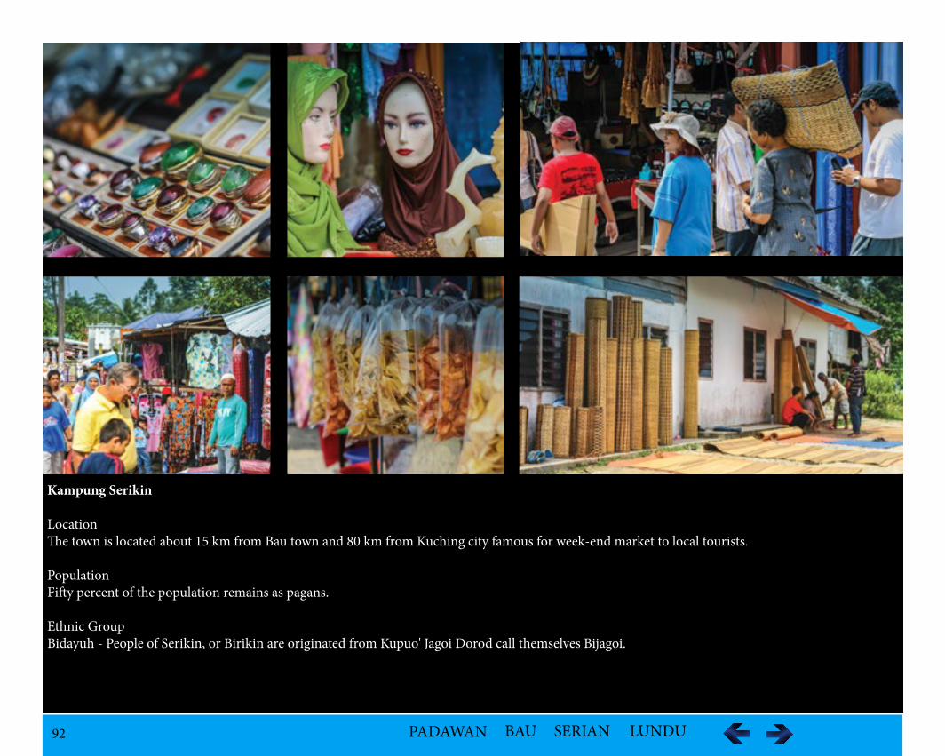
92 PADAWAN BAU SERIAN LUNDU
Kampung Serikin
LocationThe town is located about 15 km from Bau town and 80 km from Kuching city famous for week-end market to local tourists.
PopulationFifty percent of the population remains as pagans.
Ethnic GroupBidayuh - People of Serikin, or Birikin are originated from Kupuo' Jagoi Dorod call themselves Bijagoi.
93 PADAWAN BAU SERIAN LUNDU
Historical InformationBidayuh Jagoi originated from Bung Bratak. They moved to Mount Jagoi due to bad omen according the legend. After that a group migrated down the foot of mountain and established a new settlement called Kampung Serabak at the side of the Sirikin River. A longhouse was built before the Second World War and dismantled after the war. A group left and moved to the River Sirikin and formed a new village called Kampung Sirikin. Sirikin in Bidayuh Jagoi means station as the village is situated between Sarawak and Kalimantan Barat, Indonesia. Any passerby from both countries has to station in the village.
Folklore/LegendThere are two versions of the origins of the Bidayuh Bijagoi. One version related them to the migration from Rabak Mikabuh at Penrissen to Paya Rais and later moved to Mount Jagoi.
The second version related to a dream of a Bidayuh warrior in Bung Bratak. In his dream he saw one wild boar among the domestic pigs. He also saw a sea turtle swimming at the Pangkalan Bratak. Interpretated as an ominous sign that they would be attacked by two groups of enemies, he moved his families to safety at Mount Jagoi. His dream came true as Bung Bratak was attacked and burnt down.
Geological FeaturesThere are two waterfalls near the vicinity: Ribuan Kangang (Kangang Waterfall), Ribuan Tuboh (Tuboh Waterfall)
VegetationThe vegetation is of the lush tropical rainforest.
Recreationi.Jungle trekking to the two waterfalls: Kangang Waterfall and Tuboh Waterfall.ii.Serikin Weekend Market – synonymous for its cheap handicrafts and also colourful fabric. It is increasingly popular with both local and tourist alike. The stalls at the market are mostly operated by Indonesian traders who come every Friday evening to set up their stall for the following day. These stalls of makeshift structure offered variety of colourful fabric ornamental wood carving rattan handicrafts and many more.iii.Services such as reflexology and traditional massage are also available.iv.The border to Indonesia can be reached by a bike-ride (called ojek) of 15 minutes via Jalan Gajah from Serikin.
AccessibilityThe kampung is 80 km from Kuching but there is no public transport.
AccommodationJagoi Serikin Homestay
94 PADAWAN BAU SERIAN LUNDU
Kampung Stass
LocationKampung Stass is situated 24 km from Bau Town.
Ethnic GroupBidayuh -Bijagoi
Historical InformationThe Stass village consists of people who originated from Mount Jagoi Bratak who moved to Tembawang Omba. In 1899, they migrated to Tembawang Baru. In 1925, due to population pressure, the village was split into two groups. One group went to settled in a place where there were many mousedeers locally known as Pelandok. They called the village Kampung Pelandok and built their longhouse. They later changed the name to Kampung Stass. The name of the Kampung Stass was derived from the purchase of trees (Eusideroxylon zwageri) or Bidayuh Jagoi pronounciation, 'Tass'. This is because at the time, many found the purchase of trees in the village. In 1948, the longhouse was dismantled to be replaced by individual house.In the days of the Japanese occupation of Sarawak, there were Chinese people from Bau fleeing the village in order to save themselves from the Japanese. After the war, there were a few remained, lived in the village and marrying locals. During the Indonesia-Malaysia Confrontation in 1963 to 1964, because of the position of Kampung Stass near the Indonesian border, a forward headquar-ters of the Commonwealth Army was built to protect and safeguard the security of the residents. All residents of the nearby areas of the Village Ngironas, Plaman Blubai Upper, Lower and Plaman Blubai Plaman Kaik moved to Kampung Stass. With this military camp in the location, a network of roads was constructed connecting surrounding places to Kampung Stass.
Folklore/LegendThere are two versions of the origins of the Bidayuh Bijagoi. One version related them to the migration from Rabak Mikabuh at Penrissen to Paya Rais and later moved to Mount Jagoi. The second version related to a dream of a Bidayuh warrior in Bung Bratak. In his dream he saw one wild boar among the domestic pigs. He also saw a sea turtle swimming at the Pangkalan Bratak.Interpretated as an ominous sign that they would be attacked by two groups of enemies, he moved his families to safety at Mount Jagoi. His dream came true as Bung Bratak was attacked and burnt down.
Geological FeaturesThere is a popular hill called the Teramuo Hill which is approximately about 5 km from Kampung Stass.

95 PADAWAN BAU SERIAN LUNDU
VegetationThe vegetation is a lush tropical rainforest.
Recreationi.There is a mini museum where antiques are on display.ii.Rotan and Bamboo Handicrafts can also be available.iii.The historical assets provides attraction:-Manual rubber press machine still being usediv.Fort, with interconnecting trenches and some above ground buildings that were completely surrounded by barbed wire and ordinance (Australian Army’s base during the Indonesian confrontation) – but not sure if still therev.BMX dirt biking track
Accessibility1 hour 30 minutes drive from Kuching
96 PADAWAN BAU SERIAN LUNDU
Kampung Sudoh
LocationKampung Sudoh is one of the twelve villages under the Association of Research and Development Movement of Singai Sarawak (REDEEMS) is a commu-nity based organization (CBO).
Population1145 (2013)
Ethnic GroupBidayuh – Bisingai
Historical InformationWhen Bidayuh first came to Sarawak from Sungkung, Kalimatan Barat, Indonesia, they built settlements at high ground at Mount Serembu, Mount Sin-gai, Mount Landar and, Mount Jagoi to evade intruders. Jagoi originated from Bung Bratak which was established on Mount Landar. The Bidayuh who stayed at Mount Singai or Dorod Singai, known as Dorod Tongah in the olden days called themselves Bidayuh Singai or Bisingai. The Singai community has never been attacked because of the natural defense system. The community remained on the mountain top until Christianity came and settlements were eatablished at the foothills.
During the early days of the White Rajahs, the Singai community defied the law and order of enforcements and attacked neighbouring villages. It was only after the execution of the Chief Pa Rimbun and the warrior or Panglima Pa Yumo that the Singai Bidayuh became a peaceful and contented community. The breakup of the Bidayuh community at Dorod Singai was due to the conversion to Chirstianity. A group left and settled at River Sudoh and called the settlement Kampung Sudoh.
Folklore/LegendThe Bidayuh Bijagoi claimed that their ancestry was from Sungkung in Kalimatan Barat, Indonesia. They migrated from Rabak Mikabuh at Penrissen to River Butan and finally settled at Bung Bratak. Bung is translated as settlement. Bratak was the name of a long bean in the area they settled, was a Malay word described as a reference to seeing a group of Malays plucking the bean by the first settlers. However, it was believed that Bratak meant collision be-cause the village was located at a place between Dordan Hill and Sikoris Hill collide each other. Legend has it that the flowing spring at Bung Bratak which had provided the only source of water hasd healing powers for minor sickness until today.
According to a legend, three Panglimas or Togund, namely Kopiel, Ma Ganai @ Rangai and Ma Giang were the first to set foot on the mountain and found the site suitable for human settlement calling it as Kupuo Singai. It was believed that both Ma Ganai @ Rangai and Ma Giang were among the Bidayuh who came with the Sungkung group. Ma Ganai @ Rangai settled at River Kayan at the Lundu Distriict while Ma Giang went to the upper reaches of the River Sarawak Kanan. Coming from different areas, they could not settle the ownership so they fought it out. Both had supernatural powers. Apparently Ma Giang, being wiser used the rottan thorns to overpower his opponents. Thus the mountain was named after Ma Ganai but later changed to Dorod Singai. Although Ma Giang lost, a village was named after him as Kupuo Giang, later changed to Kampung Tanjung. One group from the Lundu District later joined the village.
97 PADAWAN BAU SERIAN LUNDU
There is another version of the legend that the Bisingai originated from Tanjung Biraban around Santubong area who moved over to Pulau Sigoyang where the present Astana Site is, Suang Nowang now known as Bukit Mata in Kuching and Pasir Paruh near Batu Kawa before crossing to Kalimatan Barat arriving at Sungkung. After a few generations, due to population pressure, they migrated to Sarawak via River Bokah, Bung Gading and Bung Rasot (Daun) before finally settling at Bung Singai.
Geological FeaturesThe village is in the vicinity of medium altitude mountains.
VegetationThe vegetation is of old growth of lush tropical rainforest mainly with Dipterophora type.
FaunaThere is a diversity of birds and fish.Recreationi.Cultural – the old tradition and culture experience
A modern Baruk was constructed with traditional architecture in 1984 with four belians posts taken from Kampung Saga on top of Mount Singai. To-day the Baruk is used as the village library.ii.Hikingiii.Mountain climbingiv.Nature studyv.Trail bike ridingvi.Wildlife sighting
Accessibility40 minutes drive from Kuching
98 PADAWAN BAU SERIAN LUNDU
Kampung Tanjong Bowang
LocationKampung Tanjong Bowang is located along Batu Kawa-Singai Bau Road.
Ethnic GroupBidayuh - Bisingai
Historical InformationWhen Bidayuh first came to Sarawak from Sungkung, Kalimatan Barat, Indonesia, they built settlements at high ground at Mount Serembu, Mount Sin-gai, Mount Landar and, Mount Jagoi to evade intruders. Jagoi originated from Bung Bratak which was established on Mount Landar. The Bidayuh who stayed at Mount Singai or Dorod Singai, known as Dorod Tongah in the olden days called themselves Bidayuh Singai or Bisingai. The Singai community has never been attacked because of the natural defense system. The community remained on the mountain top until Christianity came and settlements were eatablished at the foothills.
During the early days of the White Rajahs, the Singai community defied the law and order of enforcements and attacked neighbouring villages. It was only after the execution of the Chief Pa Rimbun and the warrior or Panglima Pa Yumo that the Singai Bidayuh became a peaceful and contented community. Kampung Tanjung Bowang was a Christian establishment that moved from the pagan Kampung Tanjung originally known as Kupuo Giang.
Folklore/LegendThe Bidayuh Bijagoi claimed that their ancestry was from Sungkung in Kalimatan Barat, Indonesia. They migrated from Rabak Mikabuh at Penrissen to River Butan and finally settled at Bung Bratak. Bung is translated as settlement. Bratak was the name of a long bean in the area they settled, was a Malay word described as a reference to seeing a group of Malays plucking the bean by the first settlers. However, it was believed that Bratak meant collision be-cause the village was located at a place between Dordan Hill and Sikoris Hill collide each other. Legend has it that the flowing spring at Bung Bratak which had provided the only source of water hasd healing powers for minor sickness until today.
According to a legend, three Panglimas or Togund, Kopiel, Ma Ganai @ Rangai and Ma Giang were the first to set foot on the mountain and found the site suitable for human settlement calling it as Kupuo Singai. It was believed that both Ma Ganai @ Rangai and Ma Giang were among the Bidayuh who came with the Sungkung group. Ma Ganai @ Rangai settled at River Kayan at the Lundu Distriict while Ma Giang went to the upper reaches of the River Sarawak Kanan. Coming from different areas, they could not settle the ownership so they fought it out. Both had supernatural powers. Apparently Ma Giang, being wiser used the rottan thorns to overpower his opponents.
Thus the mountain was named after Ma Ganai but later changed to Dorod Singai. Although Ma Giang lost, a village was named after him as Kupuo Giang, later changed to Kampung Tanjung. One group from the Lundu District later joined the village.
99 PADAWAN BAU SERIAN LUNDU
There is another version of the legend that the Bisingai originated from Tanjung Biraban around Santubong area who moved over to Pulau Sigoyang where the present Astana Site is, Suang Nowang now known as Bukit Mata in Kuching and Pasir Paruh near Batu Kawa before crossing to Kalimatan Barat ar-riving at Sungkung.
After a few generations, due to population pressure, they migrated to Sarawak via River Bokah, Bung Gading and Bung Rasot (Daun) before finally settling at Bung Singai.
There is also a legend of Princess Mikawel which is related to the history of Bung Mikawel. Princess Mikawel was the daughter of Raja Kidau or Togung Kidau, the legendary Bisingai warrior King who ruled Singai in the early 18th Century. Legend has it that Togung Kidau has mystical powers and could fly like a bird and throw objects for miles.
The King was both feared and respected by his enemies, but worshipped and loved by his people. Togung Kidau had two daughters, Princess Mikawel, the eldest and Princess Sibayak. One night, Togung Kidau summoned his daughters. He told them to move out of Mount Singai and establish new settlements at the foot of the mountain where land was plenty and fertile.
The youngest Princess Sibayak left first with her warriors and followers, and settled at a fertile valley. There Princess Sibayak established her settlement where they prospered and multiplied. Her followers named the place Sibayak, after their Princess. Sibayak flourished and grew into what is known today as Kampong Tanjong Bowang.
Geographical FeaturesDorod Singai is a plateau-like mountain rises to a height of 1843 ft with steep rocky slope.
RecreationThere is a Headhouse or Panggah at the side of the Headman’s house which is a showpiece of the historical past with five skulls being kept.
100 PADAWAN BAU SERIAN LUNDU
Kampung Tembawang Sauh
LocationKampung Tembawang Sauh is 52 km from Kuching along Jalan Bau Lundu.
Ethnic GroupBidayuh - Bijagoi
Historical InformationWhen Bidayuh first came to Sarawak from Sungkung, Kalimatan Barat, Indonesia, they built settlements at high ground at Mount Serembu, Mount Sin-gai, Mount Landar and, Mount Jagoi to evade intruders. Jagoi originated from Bung Bratak which was established on Mount Landar. The community built a number of Baruks and a fence round the village, known as Kampung Bratak to defend themselves. After the raze from an attack, the Bidayuh was refused help from the Dutch from Kalimatan for fear of being accused by Brunei for interference. Not until, James Brooke, the first White Rajah came with his help, the village was rebuilt at Mount Rat (Orat). The kampong was renamed as Tembawang Sauh translated Burned Tembawang. The last group to move from Mount Tembawang Sauh was at 1970 to settle at the foothill. The name of the kampung was retained.
Folklore/LegendThe Bidayuh Bijagoi claimed that their ancestry was from Sungkung in Kalimatan Barat, Indonesia. They migrated from Rabak Mikabuh at Penrissen to River Butan and finally settled at Bung Bratak. Bung is translated as settlement, while Bratak was name of a long bean in the area they settled. However, it was believed that Bratak meant collision because the village was located at a place between Dordan Hill and Sikoris Hill collide each other. Legend has it that the flowing spring at Bung Bratak which had provided the only source of water hasd healing powers for minor sickness until today.
Geological Featuresi.Hill (Bung Bratak) is near the vicinity which was once a large Bidayuh hill settlement of seven longhouses. ii.There are two natural waterfalls on Bung Bratak.iii.Natural spring water pool (on Bung Bratak) is believed to be capable of curing all sorts of illnesses
VegetationThe vegetation is of the lush tropical rainforest.
Cultural AssetThe Baruk was built in 1952. Bung Bratak is celebrated on the 1 May annually.
Recreationi.Jungle trekking through the mountains
Accessibility52 km from Kuching

101 PADAWAN BAU SERIAN LUNDU
Accomodation Availabilities
Longhouse on Bung BratakTwo longhouses to be built: one to serve as accommodation for tourists and the other to house a canteen, museum, office and conference room. The accommodation will be at minimal charge of RM20 per adult and RM10 per child per night, and operates 24 hours a day.

102 PADAWAN BAU SERIAN LUNDU
Kampung Tringgus Matan Nguan
LocationThe kampung is located on the Sarawak Kanan River in the South Western part of Sarawak about 10 km from the Malaysian-Indonesian border.
Population - 213
Ethnic Group Bidayuh - JagoiMixed group of from the local and the Bidayuh from Gahung of Kalimantan Barat, Indonesia due to intermarriage.
Historical InformationThe Bidayuh of the Tringgus is among the smallest group in Bau district. They were the original inhabitants of Kampong Tringgus Raya which was estab-lished at the foot of Mount Sibelih along the border line between Sarawak and Kalimantan Barat, Indonesia. A longhouse and a baruk were built. In 1847, after the visit of Noel Dension, the Assistant Resident of Upper Sarawak commented that the baruk was small and dirty. In 1946, due to population growth and shortage of land, the whole population migrated and established four settlements, one of which is Kampung Tring-gus Matan Nguan. In the 1963 during the Malaysia/Indonesia Confrontation, the four settlements joined together and moved to Sedoh for security. After the confrontation was over and when the peace was restored, they split and moved to establish other settlements.
Geographical FeaturesThe area is surrounded by low attitude mountains with extreme contour and flat water rivers and a lake. The waterfall is about four hours walk.
VegetationThe vegetation is the lush tropical forests.
FaunaThere are biodiversity likei.Turtles ii.Birdsiii.Wild boar (hard to see)iv.Deer (hard to see)v.Birds – colonies and migratoryvi.Fish – Tilapia, Seruah
Recreationi.Bamboo rafting Competition
Accessibility23 km tar-sealed Road from Bau
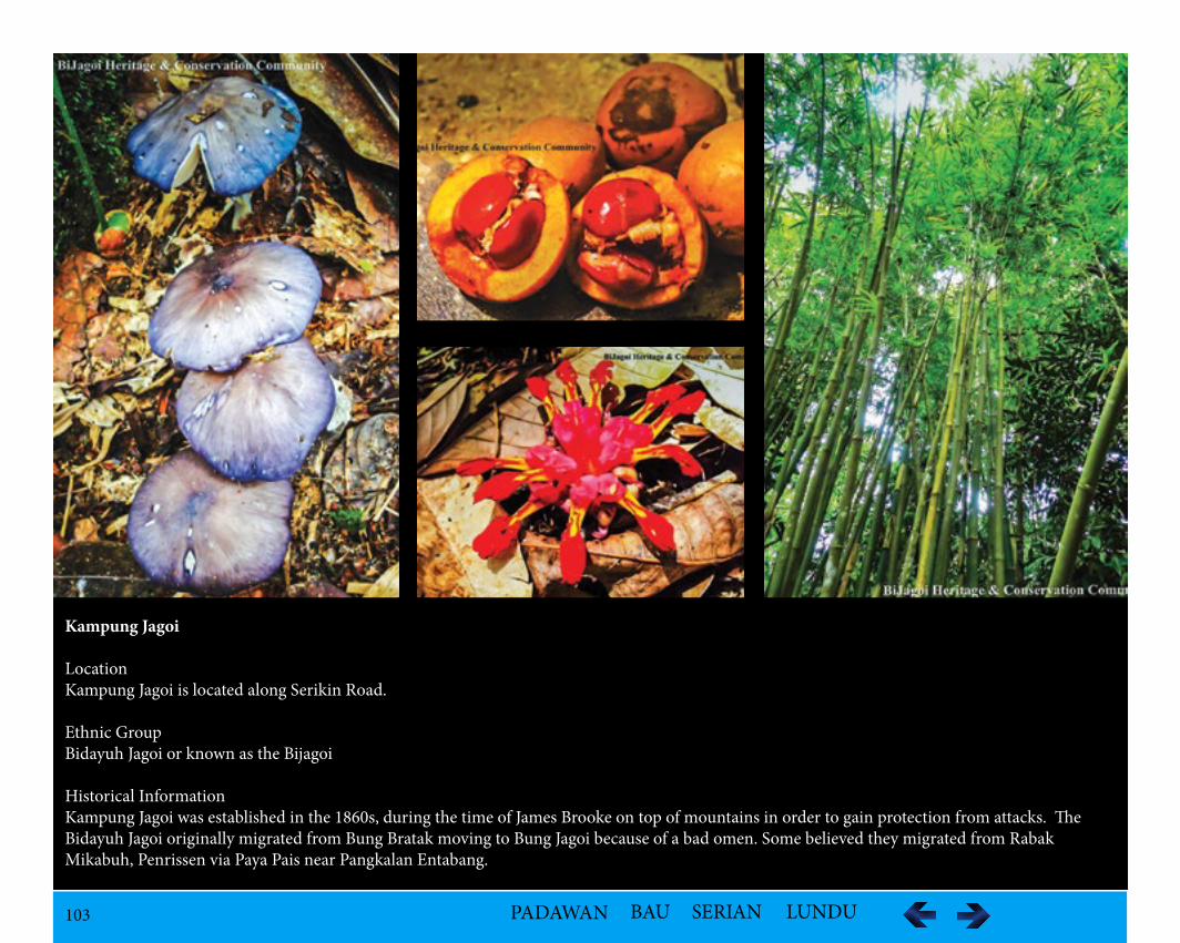
103 PADAWAN BAU SERIAN LUNDU
Kampung Jagoi
LocationKampung Jagoi is located along Serikin Road.
Ethnic GroupBidayuh Jagoi or known as the Bijagoi
Historical InformationKampung Jagoi was established in the 1860s, during the time of James Brooke on top of mountains in order to gain protection from attacks. The Bidayuh Jagoi originally migrated from Bung Bratak moving to Bung Jagoi because of a bad omen. Some believed they migrated from Rabak Mikabuh, Penrissen via Paya Pais near Pangkalan Entabang.
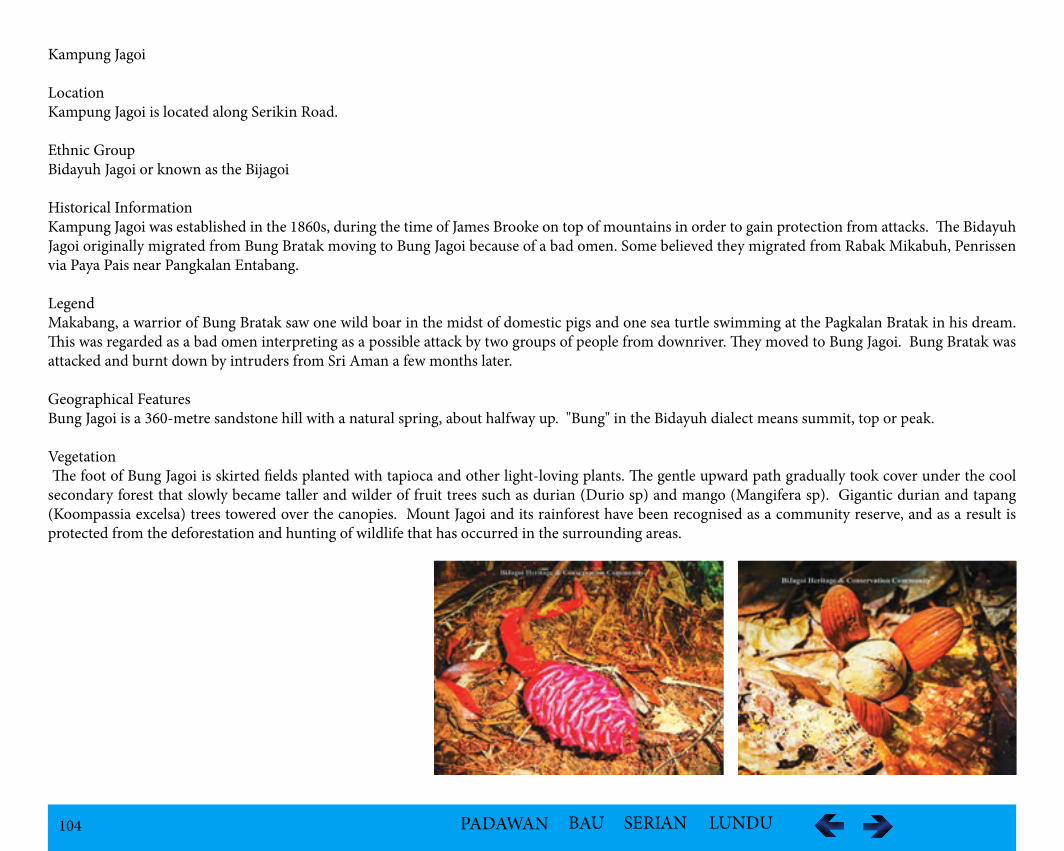
104 PADAWAN BAU SERIAN LUNDU
Kampung Jagoi
LocationKampung Jagoi is located along Serikin Road.
Ethnic GroupBidayuh Jagoi or known as the Bijagoi
Historical InformationKampung Jagoi was established in the 1860s, during the time of James Brooke on top of mountains in order to gain protection from attacks. The Bidayuh Jagoi originally migrated from Bung Bratak moving to Bung Jagoi because of a bad omen. Some believed they migrated from Rabak Mikabuh, Penrissen via Paya Pais near Pangkalan Entabang.
LegendMakabang, a warrior of Bung Bratak saw one wild boar in the midst of domestic pigs and one sea turtle swimming at the Pagkalan Bratak in his dream. This was regarded as a bad omen interpreting as a possible attack by two groups of people from downriver. They moved to Bung Jagoi. Bung Bratak was attacked and burnt down by intruders from Sri Aman a few months later.
Geographical FeaturesBung Jagoi is a 360-metre sandstone hill with a natural spring, about halfway up. "Bung" in the Bidayuh dialect means summit, top or peak.
Vegetation The foot of Bung Jagoi is skirted fields planted with tapioca and other light-loving plants. The gentle upward path gradually took cover under the cool secondary forest that slowly became taller and wilder of fruit trees such as durian (Durio sp) and mango (Mangifera sp). Gigantic durian and tapang (Koompassia excelsa) trees towered over the canopies. Mount Jagoi and its rainforest have been recognised as a community reserve, and as a result is protected from the deforestation and hunting of wildlife that has occurred in the surrounding areas.
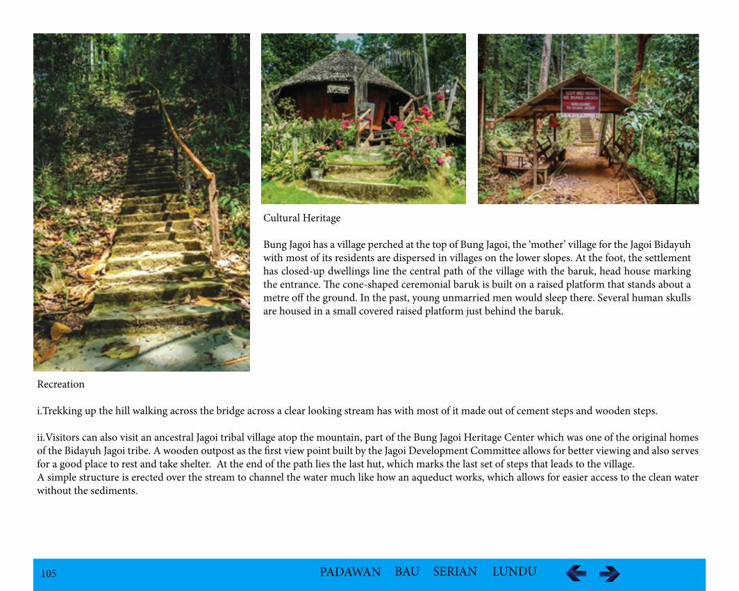
105 PADAWAN BAU SERIAN LUNDU
Cultural Heritage
Bung Jagoi has a village perched at the top of Bung Jagoi, the ‘mother’ village for the Jagoi Bidayuh with most of its residents are dispersed in villages on the lower slopes. At the foot, the settlement has closed-up dwellings line the central path of the village with the baruk, head house marking the entrance. The cone-shaped ceremonial baruk is built on a raised platform that stands about a metre off the ground. In the past, young unmarried men would sleep there. Several human skulls are housed in a small covered raised platform just behind the baruk.
Recreation
i.Trekking up the hill walking across the bridge across a clear looking stream has with most of it made out of cement steps and wooden steps.
ii.Visitors can also visit an ancestral Jagoi tribal village atop the mountain, part of the Bung Jagoi Heritage Center which was one of the original homes of the Bidayuh Jagoi tribe. A wooden outpost as the first view point built by the Jagoi Development Committee allows for better viewing and also serves for a good place to rest and take shelter. At the end of the path lies the last hut, which marks the last set of steps that leads to the village. A simple structure is erected over the stream to channel the water much like how an aqueduct works, which allows for easier access to the clean water without the sediments.
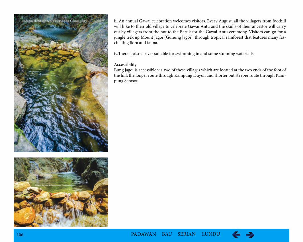
106 PADAWAN BAU SERIAN LUNDU
iii.An annual Gawai celebration welcomes visitors. Every August, all the villagers from foothill will hike to their old village to celebrate Gawai Antu and the skulls of their ancestor will carry out by villagers from the hut to the Baruk for the Gawai Antu ceremony. Visitors can go for a jungle trek up Mount Jagoi (Gunung Jagoi), through tropical rainforest that features many fas-cinating flora and fauna.
iv.There is also a river suitable for swimming in and some stunning waterfalls.
Accessibility Bung Jagoi is accessible via two of these villages which are located at the two ends of the foot of the hill; the longer route through Kampung Duyoh and shorter but steeper route through Kam-pung Serasot.
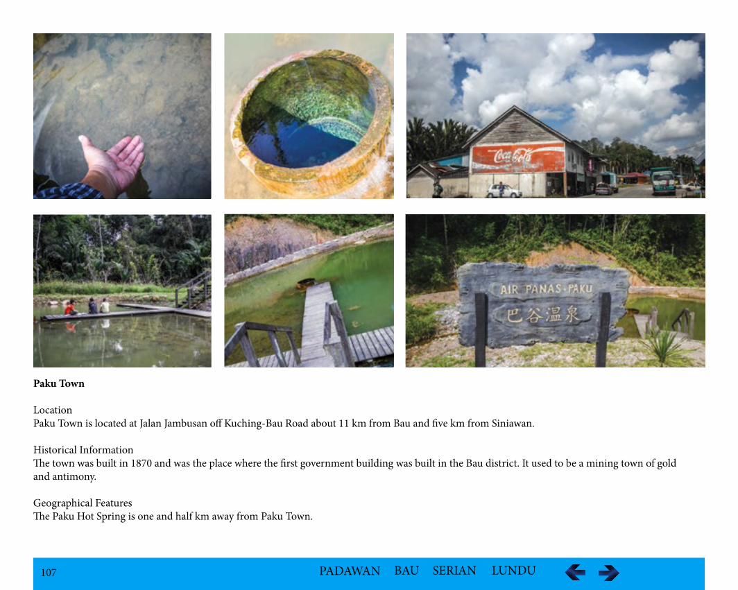
107 PADAWAN BAU SERIAN LUNDU
Paku Town
LocationPaku Town is located at Jalan Jambusan off Kuching-Bau Road about 11 km from Bau and five km from Siniawan.
Historical InformationThe town was built in 1870 and was the place where the first government building was built in the Bau district. It used to be a mining town of gold and antimony.
Geographical FeaturesThe Paku Hot Spring is one and half km away from Paku Town.
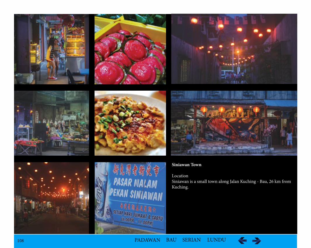
108 PADAWAN BAU SERIAN LUNDU
Siniawan Town
LocationSiniawan is a small town along Jalan Kuching - Bau, 26 km from Kuching.
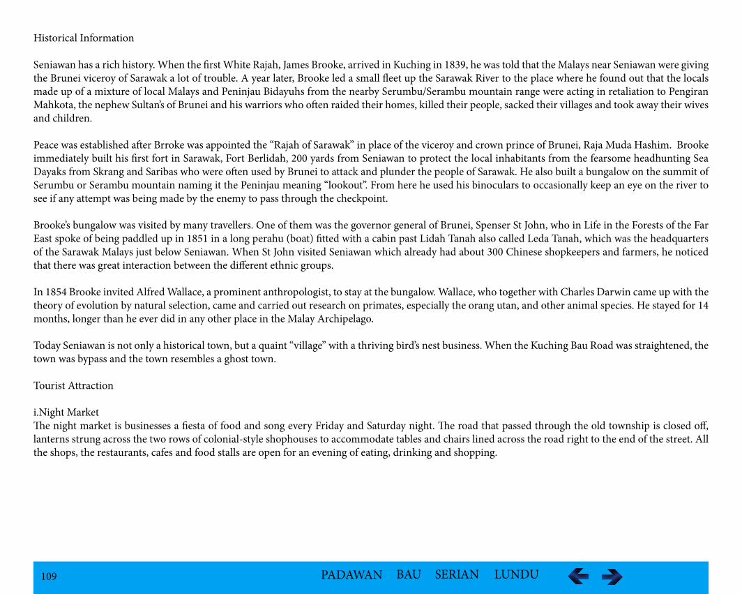
109 PADAWAN BAU SERIAN LUNDU
Historical Information
Seniawan has a rich history. When the first White Rajah, James Brooke, arrived in Kuching in 1839, he was told that the Malays near Seniawan were giving the Brunei viceroy of Sarawak a lot of trouble. A year later, Brooke led a small fleet up the Sarawak River to the place where he found out that the locals made up of a mixture of local Malays and Peninjau Bidayuhs from the nearby Serumbu/Serambu mountain range were acting in retaliation to Pengiran Mahkota, the nephew Sultan’s of Brunei and his warriors who often raided their homes, killed their people, sacked their villages and took away their wives and children.
Peace was established after Brroke was appointed the “Rajah of Sarawak” in place of the viceroy and crown prince of Brunei, Raja Muda Hashim. Brooke immediately built his first fort in Sarawak, Fort Berlidah, 200 yards from Seniawan to protect the local inhabitants from the fearsome headhunting Sea Dayaks from Skrang and Saribas who were often used by Brunei to attack and plunder the people of Sarawak. He also built a bungalow on the summit of Serumbu or Serambu mountain naming it the Peninjau meaning “lookout”. From here he used his binoculars to occasionally keep an eye on the river to see if any attempt was being made by the enemy to pass through the checkpoint.
Brooke’s bungalow was visited by many travellers. One of them was the governor general of Brunei, Spenser St John, who in Life in the Forests of the Far East spoke of being paddled up in 1851 in a long perahu (boat) fitted with a cabin past Lidah Tanah also called Leda Tanah, which was the headquarters of the Sarawak Malays just below Seniawan. When St John visited Seniawan which already had about 300 Chinese shopkeepers and farmers, he noticed that there was great interaction between the different ethnic groups.
In 1854 Brooke invited Alfred Wallace, a prominent anthropologist, to stay at the bungalow. Wallace, who together with Charles Darwin came up with the theory of evolution by natural selection, came and carried out research on primates, especially the orang utan, and other animal species. He stayed for 14 months, longer than he ever did in any other place in the Malay Archipelago.
Today Seniawan is not only a historical town, but a quaint “village” with a thriving bird’s nest business. When the Kuching Bau Road was straightened, the town was bypass and the town resembles a ghost town.
Tourist Attraction
i.Night MarketThe night market is businesses a fiesta of food and song every Friday and Saturday night. The road that passed through the old township is closed off, lanterns strung across the two rows of colonial-style shophouses to accommodate tables and chairs lined across the road right to the end of the street. All the shops, the restaurants, cafes and food stalls are open for an evening of eating, drinking and shopping.

110 PADAWAN BAU SERIAN LUNDU
Kampung Skiat
LocationKampung Skiat is also known as Kampung Sekiat, is located along Jalan Kuching-Bau.
Geographical FeaturesThe kampung landscape is of mountainous terrain with Gunung Jambusan closeby. Tupak Cave is accessible through Jalan Merembeh, off Jalan Jambusan and 100 metre east of Kampung Skiat. The Limestone hill of Gunung Jambusan is part of a thick source of massive pale grey, poorly to moderately fossil-iferous pure limestone, with a little dark-grey argillaceous limestone. There are a number of limestone pinnacles.
FaunaThe cave is protected because of the valuable birds’ nests.
Recreationi.Geo-garden of pinnaclesii.Cave Explorationiii.Limestone Cliffs and Outcrops
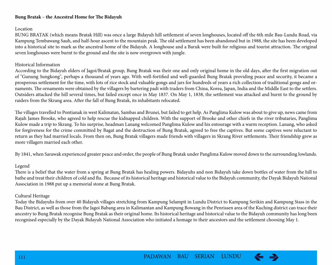
111 PADAWAN BAU SERIAN LUNDU
Bung Bratak – the Ancestral Home for The Bidayuh
LocationBUNG BRATAK (which means Bratak Hill) was once a large Bidayuh hill settlement of seven longhouses, located off the 6th mile Bau-Lundu Road, via Kampung Tembawang Sauh, and half-hour ascent to the mountain peak. The old settlement has been abandoned but in 1988, the site has been developed into a historical site to mark as the ancestral home of the Bidayuh. A longhouse and a Baruk were built for religious and tourist attraction. The original seven longhouses were burnt to the ground and the site is now overgrown with jungle. Historical InformationAccording to the Bidayuh elders of Jagoi/Bratak group, Bung Bratak was their one and only original home in the old days, after the first migration out of "Gunung Sungkong", perhaps a thousand of years ago. With well-fortified and well-guarded Bung Bratak providing peace and security, it became a prosperous settlement for the time, with lots of rice stock and valuable gongs and jars for hundreds of years a rich collection of traditional gongs and or-naments. The ornaments were obtained by the villagers by bartering padi with traders from China, Korea, Japan, India and the Middle East to the settlers. Outsiders attacked the hill several times, but failed except once in May 1837. On May 1, 1838, the settlement was attacked and burnt to the ground by raiders from the Skrang area. After the fall of Bung Bratak, its inhabitants relocated.
The villages travelled to Pontianak in west Kalimatan, Sambas and Brunei, but failed to get help. As Panglima Kulow was about to give up, news came from Rajah James Brooke, who agreed to help rescue the kidnapped children. With the support of Brooke and other chiefs in the river tributaries, Panglima Kulow made a trip to Skrang. To his surprise, headman Lanang welcomed Panglima Kulow and his entourage with a warm reception. Lanang, who asked for forgiveness for the crime committed by Bagat and the destruction of Bung Bratak, agreed to free the captives. But some captives were reluctant to return as they had married locals. From then on, Bung Bratak villagers made friends with villagers in Skrang River settlements. Their friendship grew as more villagers married each other.
By 1841, when Sarawak experienced greater peace and order, the people of Bung Bratak under Panglima Kulow moved down to the surrounding lowlands.
LegendThere is a belief that the water from a spring at Bung Bratak has healing powers. Bidayuhs and non Bidayuh take down bottles of water from the hill to bathe and treat their children of cold and flu. Because of its historical heritage and historical value to the Bidayuh community, the Dayak Bidayuh National Association in 1988 put up a memorial stone at Bung Bratak.
Cultural HeritageToday the Bidayuhs from over 40 Bidayuh villages stretching from Kampung Selampit in Lundu District to Kampung Serikin and Kampung Stass in the Bau District, as well as those from the Jagoi Babang area in Kalimantan and Kampung Bowang in the Penrissen area of the Kuching district can trace their ancestry to Bung Bratak recognise Bung Bratak as their original home. Its historical heritage and historical value to the Bidayuh community has long been recognised especially by the Dayak Bidayuh National Association who initiated a homage to their ancestors and the settlement choosing May 1.
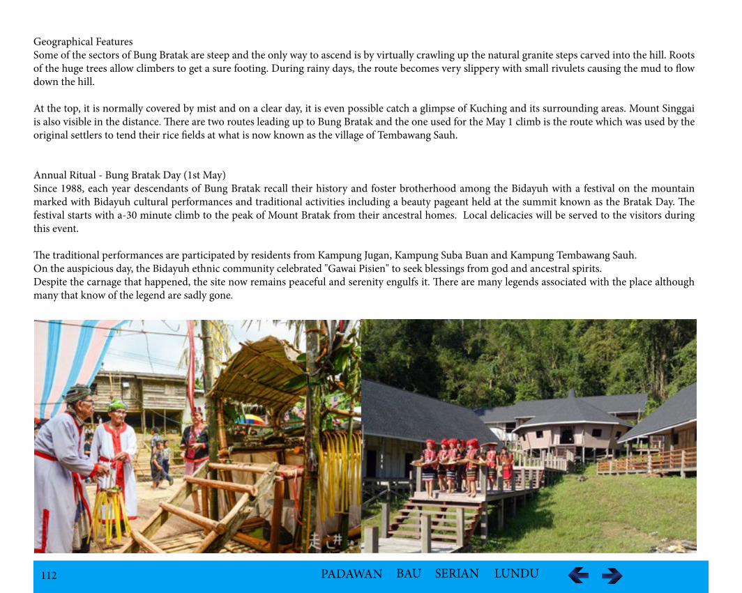
112 PADAWAN BAU SERIAN LUNDU
Geographical FeaturesSome of the sectors of Bung Bratak are steep and the only way to ascend is by virtually crawling up the natural granite steps carved into the hill. Roots of the huge trees allow climbers to get a sure footing. During rainy days, the route becomes very slippery with small rivulets causing the mud to flow down the hill.
At the top, it is normally covered by mist and on a clear day, it is even possible catch a glimpse of Kuching and its surrounding areas. Mount Singgai is also visible in the distance. There are two routes leading up to Bung Bratak and the one used for the May 1 climb is the route which was used by the original settlers to tend their rice fields at what is now known as the village of Tembawang Sauh.
Annual Ritual - Bung Bratak Day (1st May)Since 1988, each year descendants of Bung Bratak recall their history and foster brotherhood among the Bidayuh with a festival on the mountain marked with Bidayuh cultural performances and traditional activities including a beauty pageant held at the summit known as the Bratak Day. The festival starts with a-30 minute climb to the peak of Mount Bratak from their ancestral homes. Local delicacies will be served to the visitors during this event.
The traditional performances are participated by residents from Kampung Jugan, Kampung Suba Buan and Kampung Tembawang Sauh. On the auspicious day, the Bidayuh ethnic community celebrated "Gawai Pisien" to seek blessings from god and ancestral spirits. Despite the carnage that happened, the site now remains peaceful and serenity engulfs it. There are many legends associated with the place although many that know of the legend are sadly gone.
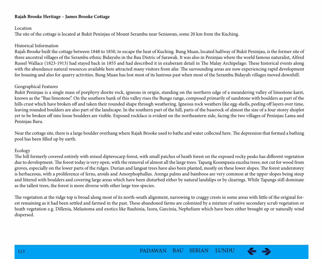
113 PADAWAN BAU SERIAN LUNDU
Rajah Brooke Heritage – James Brooke Cottage
LocationThe site of the cottage is located at Bukit Peninjau of Mount Serambu near Seniawan, some 20 km from the Kuching.
Historical InformationRajah Brooke built the cottage between 1848 to 1850, to escape the heat of Kuching. Bung Muan, located halfway of Bukit Peninjau, is the former site of three ancestral villages of the Serambu ethnic Bidayuhs in the Bau Distric of Sarawak. It was also in Peninjau where the world famous naturalist, Alfred Russel Wallace (1823-1913) had stayed back in 1855 and had described it in exuberant detail in The Malay Archipelago. These historical events along with the abundance natural resources available here attracted many visitors from afar. The surrounding areas are now experiencing rapid development for housing and also for quarry activities. Bung Muan has lost most of its lustrous past when most of the Serambu Bidayuh villages moved downhill.
Geographical FeaturesBukit Peninjau is a single mass of porphyry diorite rock, igneous in origin, standing on the northern edge of a meandering valley of limestone karst, known as the “Bau limestone”. On the southern bank of this valley rises the Bungo range, composed primarily of sandstone with boulders as part of the hills crust which have broken off and taken their rounded shape through weathering. Igneous rock weathers like egg-shells, peeling off layers over time, leaving rounded boulders are also part of the landscape. In the southern part of the hill, parts of the baserock of almost the size of a four storey shoplot yet to be broken off into loose boulders are visible. Exposed rockface is evident on the northeastern side, facing the two villages of Peninjau Lama and Peninjau Baru.
Near the cottage site, there is a large boulder overhang where Rajah Brooke used to bathe and water collected here. The depression that formed a bathing pool has been filled up by earth.
EcologyThe hill formerly covered entirely with mixed dipterocarp forest, with small patches of heath forest on the exposed rocky peaks has different vegetation due to development. The forest today is very open, with the removal of almost all the large trees. Tapang Koompasia excelsa trees; not cut for wood from groves, especially on the lower parts of the ridges. Durian and langsat trees have also been planted, mostly on these lower slopes. The forest understorey is herbaceous, with a proliference of ferns, aroids and Amorphophallus. Arenga palms and bamboos are very common at the upper slopes being steep and littered with boulders and covering large areas which have been disturbed either by natural landslips or by clearings. While Tapangs still dominate as the tallest trees, the forest is more diverse with other large tree species.
The vegetation at the ridge top is broad along most of its north-south alignment, narrowing to craggy crests in some areas with little of the original for-est remaining as it had been settled and farmed in the past. These abandoned farms are colonized by a mixture of native secondary scrub vegetation or heath vegetation e.g. Dillenia, Melastoma and exotics like Bauhinia, Ixora, Garcinia, Nephelium which have been either brought up or naturally wind dispersed.
114 PADAWAN BAU SERIAN LUNDU
The CottageThe cottage is at 424m above sea level, built on a rectangular raised platform 16m by 8m. Four belian posts of dimension : 4” X 4”, possibly 5” X 5” orig-inally, extensively weathered and burnt accidentally, remain forming a rectangle measuring 4 m X 3 m thus indicating the cottage was obviously larger than this, as these poles are likely to be either foundation pillars for the cottage or corner posts for a veranda. They stand about 1.5 m, and have a rounded holder cut into the top indicating that a round railing was supported by these posts. It is unlikely that the floor of a cottage would consist of a round beam, so the likelihood that this was a railing is increased.
The Cottage SiteThe remains of a path extending from the cottage northwards along the ridge are clear, with raised bunds on either side. The path is about 3 m wide, and overgrown. The side bunds rise about 1-2 m on either side. Close to the beginning of this path at the cottage, a small stake (2” X 2”) was found in the ground, emerging about 30 cm and also weathered. This appears to be some form of supporting peg for steps. The path extends for about 50-70 m, to where the level part of the ridge drops. It is possible that this raised bund-like structure may have been some form of defensive battlements in the past, thought to be a fort.
115 PADAWAN BAU SERIAN LUNDU
Wallace Trail
Historical InformationAlfred Russel Wallace (1823 - 1913) was a contemporary and correspondent of Charles Darwin, who traveled widely across the Malay Archipelago be-tween 1854 and 1862, collecting specimens and describing the natural world, has a unique association with Sarawak. The Rajah of Sarawak, Sir James Brooke, supported Wallace's visit to Kuching and the surrounding areas from 1 November 1854 to 23 January 1856. Wallace spent much of his remaining time in Sarawak at Sir James Brooke's bungalow near the summit of Bukit Serambu, Seniawan.
In his book “The Malay Archipelago” he writes, “I have been staying some time at a cottage of Sir James Brooke's, about twenty miles inland, on the ridge of a mountain, at an elevation of about one thousand feet. The path up is peculiar, half is over broken rocks, the other half up ladders.” And further on, he notes, “Huge boulders, as big as the houses themselves, rise among them, and hang over them in the most extraordinary manner. Every one is a picturesque object stained with lichens, and on the shady side covered with mosses, while the tops are generally more are less clothed with curious ferns and orchids.”
Wallace's legacy is not only the journeys, but the theories he developed from his observations which introduced Sarawak to the world from the the paper he wrote while in Sarawak titled “On the Law Which Has Regulated the Introduction of New Species” published in September 1855 (commonly known as “Sarawak Law 1855”). It was this essay that spurred Darwin to write “Origin of Species”.
Wallace and Darwin are recognized today as co-developers of the theory of natural selection. As a renowned naturalist, he made many important findings related to the forest in Bukit Peninjau.
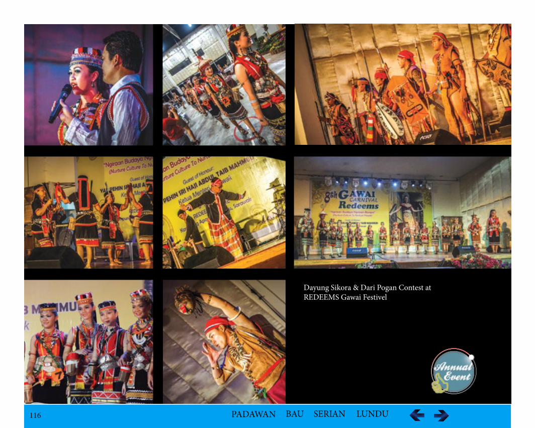
116 PADAWAN BAU SERIAN LUNDU
Dayung Sikora & Dari Pogan Contest atREDEEMS Gawai Festivel
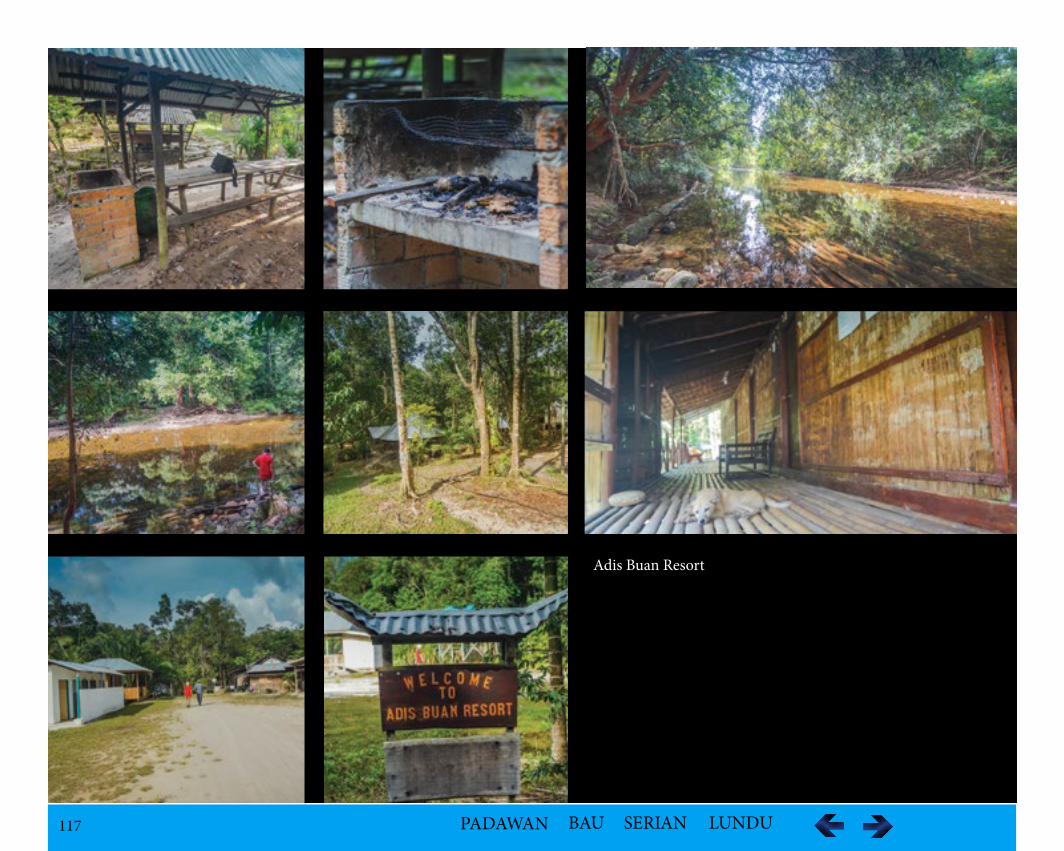
117 PADAWAN BAU SERIAN LUNDU
Adis Buan Resort
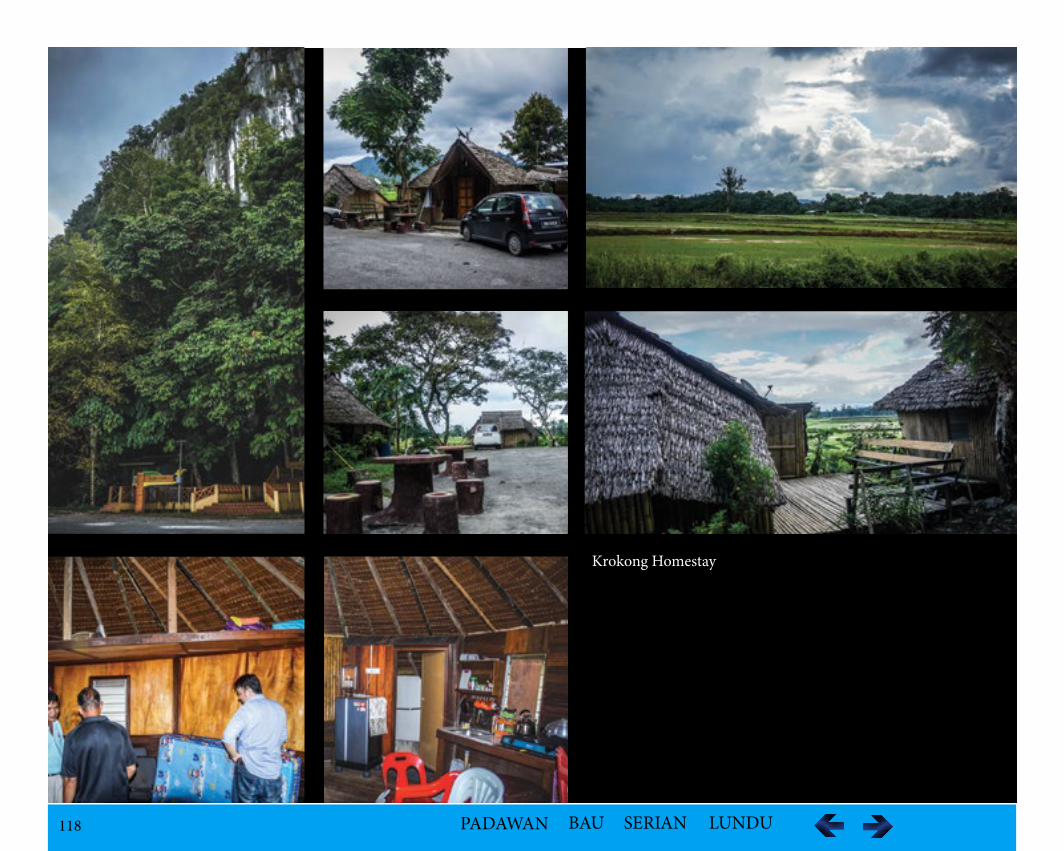
118 PADAWAN BAU SERIAN LUNDU
Krokong Homestay
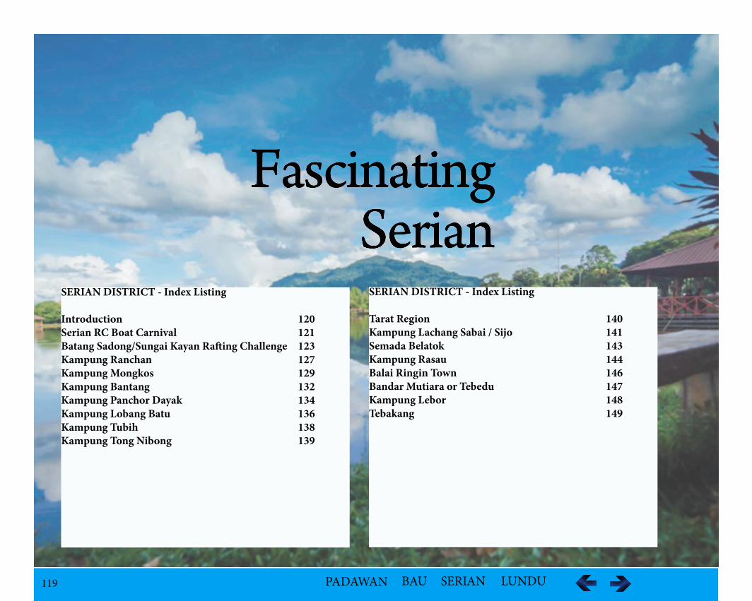
119 PADAWAN BAU SERIAN LUNDU
FascinatingSerian
SERIAN DISTRICT - Index Listing
Introduction 120Serian RC Boat Carnival 121 Batang Sadong/Sungai Kayan Rafting Challenge 123Kampung Ranchan 127Kampung Mongkos 129Kampung Bantang 132Kampung Panchor Dayak 134Kampung Lobang Batu 136Kampung Tubih 138Kampung Tong Nibong 139
SERIAN DISTRICT - Index Listing
Tarat Region 140Kampung Lachang Sabai / Sijo 141Semada Belatok 143Kampung Rasau 144Balai Ringin Town 146Bandar Mutiara or Tebedu 147Kampung Lebor 148Tebakang 149
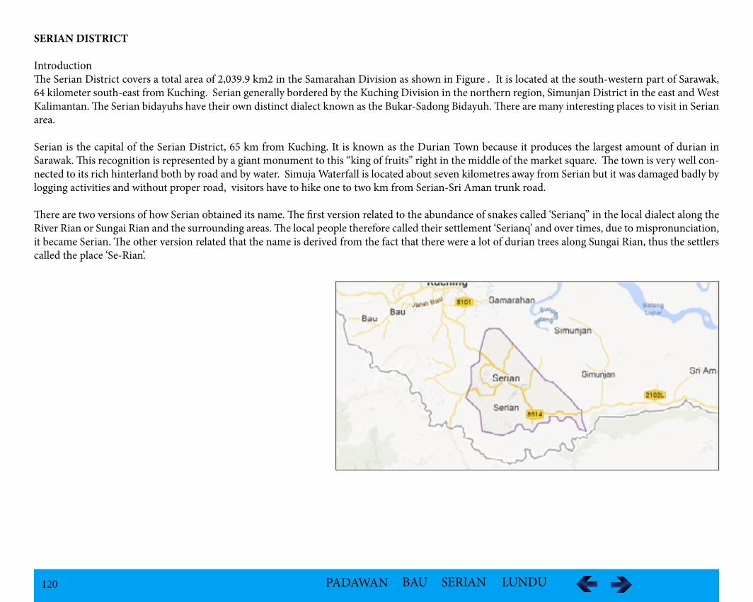
120 PADAWAN BAU SERIAN LUNDU
SERIAN DISTRICT
IntroductionThe Serian District covers a total area of 2,039.9 km2 in the Samarahan Division as shown in Figure . It is located at the south-western part of Sarawak, 64 kilometer south-east from Kuching. Serian generally bordered by the Kuching Division in the northern region, Simunjan District in the east and West Kalimantan. The Serian bidayuhs have their own distinct dialect known as the Bukar-Sadong Bidayuh. There are many interesting places to visit in Serian area.
Serian is the capital of the Serian District, 65 km from Kuching. It is known as the Durian Town because it produces the largest amount of durian in Sarawak. This recognition is represented by a giant monument to this “king of fruits” right in the middle of the market square. The town is very well con-nected to its rich hinterland both by road and by water. Simuja Waterfall is located about seven kilometres away from Serian but it was damaged badly by logging activities and without proper road, visitors have to hike one to two km from Serian-Sri Aman trunk road.
There are two versions of how Serian obtained its name. The first version related to the abundance of snakes called ‘Serianq” in the local dialect along the River Rian or Sungai Rian and the surrounding areas. The local people therefore called their settlement ‘Serianq’ and over times, due to mispronunciation, it became Serian. The other version related that the name is derived from the fact that there were a lot of durian trees along Sungai Rian, thus the settlers called the place ‘Se-Rian’.
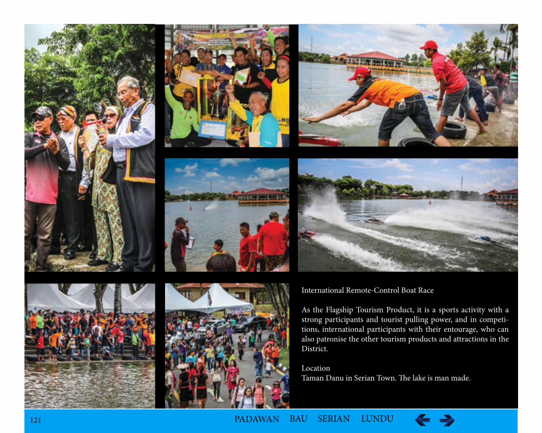
121 PADAWAN BAU SERIAN LUNDU
International Remote-Control Boat Race
As the Flagship Tourism Product, it is a sports activity with a strong participants and tourist pulling power, and in competi-tions, international participants with their entourage, who can also patronise the other tourism products and attractions in the District.
LocationTaman Danu in Serian Town. The lake is man made.
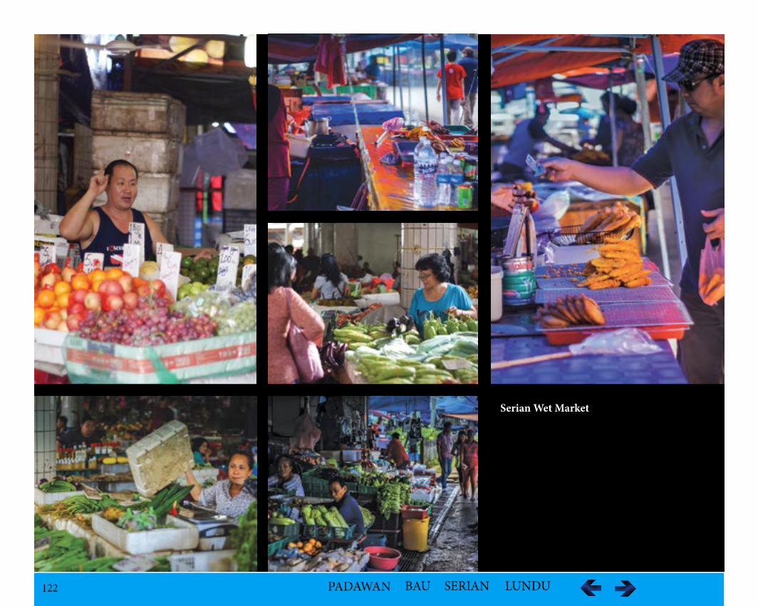
122 PADAWAN BAU SERIAN LUNDU
Serian Wet Market
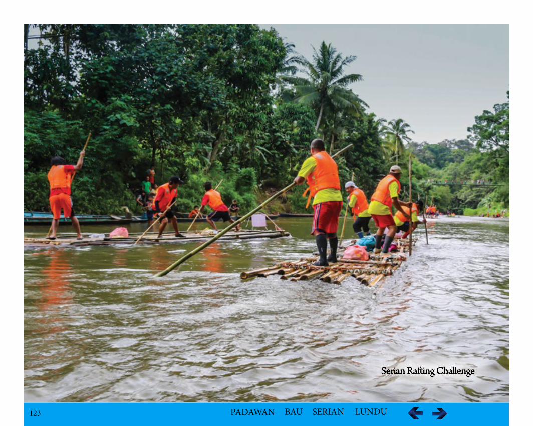
123 PADAWAN BAU SERIAN LUNDU
Serian Rafting Challenge
124 PADAWAN BAU SERIAN LUNDU
Cable Water Ski at Taman Danu - Tourism Flagship of SerianAs the Flagship Tourism Product, it is a sports activity with a strong participants and tourist pulling power, and in competitions, international partici-pants with their entourage, who can also patronise the other tourism products and attractions in the District.
LocationThe activity is proposed to be held in Serian Lake Garden or Taman Danu in Serian Town.
Geological FeaturesThe lake is man made.
FacilitiesThere are resting structure built above the water, jogging track and a children playground.
Batang Sadong/Sungai Kayan Rafting Challenge
IntroductionRafting in Bidayuh means ‘Bilanting’ which is a very popular challenging and leisure activity amongst the locals. The event organized in collaboration with the Divisional Tourism Task Group and the Serian District Council for the first time in 2001, is aimed at attracting domestic and foreign tourists and to promote Serian District as tourist destination. In the competition 3 to 5 members in a group of participants will get the chance to maneuver their raft through Kayan/Batang Sadong River once used by riverine communities.
LocationThe starting point for the race is Kampung Tema Mawang in Tebedu and the finishing point is at Tebakang Bazaar covering a distance of 25 km.
ActivitiesThere are four categories: Men Open, Ladies Open, Government Departments and Hotel and Tour Agencies. The most attractive raft will also receive a cash prize. There is participation fee incurred per team and is opened only to participants aged 18 years and above. Each team can only have four mem-bers.
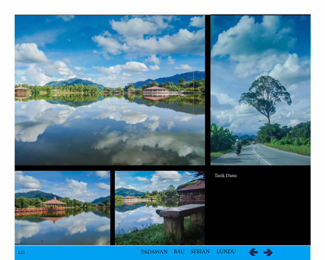
125 PADAWAN BAU SERIAN LUNDU
Tasik Danu
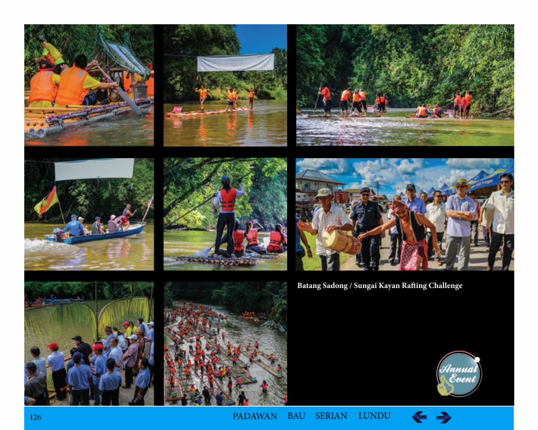
126 PADAWAN BAU SERIAN LUNDU
Batang Sadong / Sungai Kayan Rafting Challenge
127 PADAWAN BAU SERIAN LUNDU
Kampung Ranchan
LocationIt is about 5 km away from Serian Town and 60 km from Kuching.
Population – 278
Ethnic GroupBidayuh – Bighat of the Bukar-Sadong Bidayuh of Serian
Historical InformationThe early Bidayuh migrated from Tembawang Tampun and moved to Semabang at Ulu Sungai Robin, Ulu Sadong in the 1500s. Before Sanggau pirates came and attacked the village in the 1870s, the Bigahat escaped to Bung Nyarau, then Red Tak Sebintin, then to Kuala Gahat and finally at Gahat Sem-abang where they finally settled down. A group eventually moved away to Seroban and finally settled in Rachan.
Geological Featuresi.Waterfall (Ranchan Falls) in Ranchan Recreational Park
ii.Sungai Rachan
Facilities
The Serian District Council (SDC) has a number of chalets at Ranchan Pool and a Tourism Activities Park which has the followings:i.Gazebosii.Jogging Trackiii.BBQ Placesiv.Public Toilets, Shower Rooms and Changing Roomsv.Seafood Restaurantvi.Benchesvii.Suspension bridge across the stream, falls and cascadesviii.Trails for sight-seeing ix.Camp Sitex.Free Parking Lot
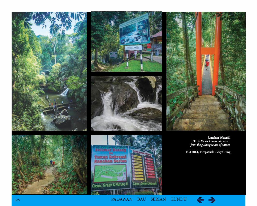
128 PADAWAN BAU SERIAN LUNDU
Ranchan WaterfalDip in the cool mountain water om the gushing sound of nature
(C) 2014, Fitzpatrick Ricky Guing
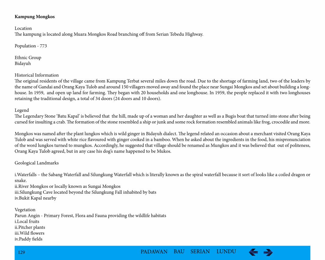
129 PADAWAN BAU SERIAN LUNDU
Kampung Mongkos
LocationThe kampung is located along Muara Mongkos Road branching off from Serian Tebedu Highway.
Population - 773
Ethnic GroupBidayuh
Historical InformationThe original residents of the village came from Kampung Terbat several miles down the road. Due to the shortage of farming land, two of the leaders by the name of Gandai and Orang Kaya Tulob and around 150 villagers moved away and found the place near Sungai Mongkos and set about building a long-house. In 1959, and open up land for farming. They began with 20 households and one longhouse. In 1959, the people replaced it with two longhouses retaining the traditional design, a total of 34 doors (24 doors and 10 doors).
LegendThe Legendary Stone ‘Batu Kapal’ is believed that the hill, made up of a woman and her daughter as well as a Bugis boat that turned into stone after being cursed for insulting a crab. The formation of the stone resembled a ship or junk and some rock formation resembled animals like frog, crocodile and more.
Mongkos was named after the plant lungkos which is wild ginger in Bidayuh dialect. The legend related an occasion about a merchant visited Orang Kaya Tulob and was served with white rice flavoured with ginger cooked in a bamboo. When he asked about the ingredients in the food, his mispronunciation of the word lungkos turned to mungkos. Accordingly, he suggested that village should be renamed as Mungkos and it was believed that out of politeness, Orang Kaya Tulob agreed, but in any case his dog’s name happened to be Mukos.
Geological Landmarks
i.Waterfalls – the Sabang Waterfall and Silungkung Waterfall which is literally known as the spiral waterfall because it sort of looks like a coiled dragon or snake.ii.River Mongkos or locally known as Sungai Mongkosiii.Silungkung Cave located beyond the Silungkung Fall inhabited by batsiv.Bukit Kapal nearby
VegetationParun Angin - Primary Forest, Flora and Fauna providing the wildlife habitatsi.Local fruitsii.Pitcher plantsiii.Wild flowersiv.Paddy fields
130 PADAWAN BAU SERIAN LUNDU
Faunai.Batsii.Various other small mammals
Cultural Asseti.24 doors Bidayuh Traditional longhouseOne of the remaining Bidayuh longhouses that still exist.ii.As part of the Homestay Programme, a welcome ceremony is practiced which has the visitors greeted with drum music called “bidumbak”. A white hen’s egg is used to chase away evil spirits and visitors are then entertained with a traditional welcoming dance known as ‘langi pingadap’. Another dance called “Pak Dino and Dayang Diki” may also be presented with dance dolls to tell a story about a married couple who were siblings, a taboo reunion thus the couple was cursed and they turned into monkeys. To end the ceremony, a lighter and more festive note than the welcoming ceremony, a “belangi” dance in which the visitors are encouraged to take part is performed. Before this dance begins, male visitors are given ‘sabok’ (men’s sarong)iii.Experience Bidayuh culture and kampong lifestyleiv.Bidayuh Gawai celebration which is a harvest festival celebrated to give thanks to their ancestors for the bountiful harvest of the year and seek blessing for a good healthy and good harvest for the coming year. Homestay at Kampung Mongkos
v.Longhouse tourvi.Bidayuh local food preparation
Tourism Activitiesi.Pepper garden and tropical fruits during fruit seasonii.Watch or join the women making baskets, bead items, woodcarving and many other types of handicraftsiii.Learn the traditional method of processing padiiv.Participate in the pangram or top spinning contests, a traditional game usually played after the harvesting season.v.Jungle trekking - A 2.5 km jungle trekking from the Kampung to Post Segomon of Indonesia border. vi.Fishing
Accessibility103 km from Kuching (approx. 2 hours drive)
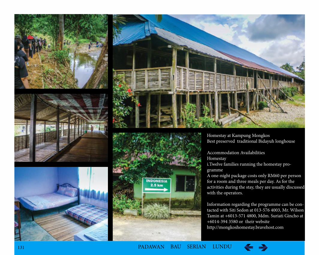
131 PADAWAN BAU SERIAN LUNDU
Homestay at Kampung MongkosBest preserved traditional Bidayuh longhouse
Accommodation AvailabilitiesHomestayi.Twelve families running the homestay pro-grammeA one-night package costs only RM60 per person for a room and three meals per day. As for the activities during the stay, they are usually discussed with the operators.
Information regarding the programme can be con-tacted with Siti Sedon at 013-576 4003, Mr. Wilson Tamin at +6013-571 4800, Mdm. Suriati Gincho at +6014-394 3580 or their website http://mongkoshomestay.bravehost.com
132 PADAWAN BAU SERIAN LUNDU
Kampung Bantang
LocationThe village is located along the Baki-Riih Road off Jalan Serian-Tebedu.
Ethnic GroupBidayuh
Historical InformationSireh Cave or Gua Sireh , near the Kampung Bantang, Sarawak has evidence of human settlement during the Stone Age, New Stone Age and the Iron Age about 21,000 years ago. Pottery, shells, beads, burials and rock paintings left by ancient inhabitants were discovered. Evidence of rice husks on pottery indicated that planting rice as food occurred in prehistoric times.
Geological FeaturesThere are two obvious rock faces visible from the road. Buros is the smaller mountain but steep limestone mountain with different shaped white rocks around. A stream runs on a bed of igneous rock. Gunung Nambi at Kampong Bantang has 15 cave entrances with about 3 km of known passages. There are a few caves namely, Gua Sireh and Gua Baid.
FaunaSwiftlets
Tourism Activitiesi.Jungle trekking through the trail between kampung houses through the small bamboo bridges, pepper gardens to the mountain ii.Visit to the archaeology site in Gua Sireh iii.White Magic wall at the right of the entrance of the caveiv.Remnants of birdnest harvesting activities
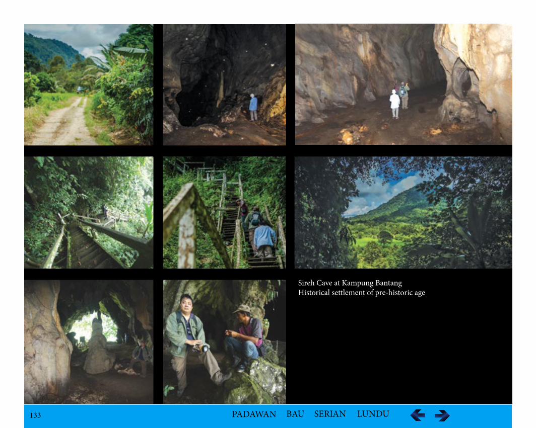
133 PADAWAN BAU SERIAN LUNDU
Sireh Cave at Kampung BantangHistorical settlement of pre-historic age
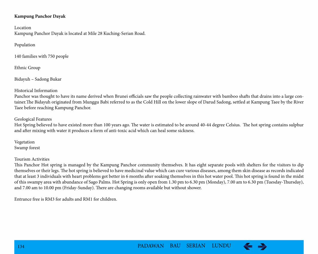
134 PADAWAN BAU SERIAN LUNDU
Kampung Panchor Dayak
LocationKampung Panchor Dayak is located at Mile 28 Kuching-Serian Road.
Population
140 families with 750 people
Ethnic Group
Bidayuh – Sadong Bukar
Historical InformationPanchor was thought to have its name derived when Brunei officials saw the people collecting rainwater with bamboo shafts that drains into a large con-tainer.The Bidayuh originated from Munggu Babi referred to as the Cold Hill on the lower slope of Darud Sadong, settled at Kampung Taee by the River Taee before reaching Kampung Panchor.
Geological FeaturesHot Spring believed to have existed more than 100 years ago. The water is estimated to be around 40-44 degree Celsius. The hot spring contains sulphur and after mixing with water it produces a form of anti-toxic acid which can heal some sickness.
VegetationSwamp forest
Tourism ActivitiesThis Panchor Hot spring is managed by the Kampung Panchor community themselves. It has eight separate pools with shelters for the visitors to dip themselves or their legs. The hot spring is believed to have medicinal value which can cure various diseases, among them skin disease as records indicated that at least 3 individuals with heart problems got better in 6 months after soaking themselves in this hot water pool. This hot spring is found in the midst of this swampy area with abundance of Sago Palms. Hot Spring is only open from 1.30 pm to 6.30 pm (Monday), 7.00 am to 6.30 pm (Tuesday-Thursday), and 7.00 am to 10.00 pm (Friday-Sunday). There are changing rooms available but without shower.
Entrance free is RM3 for adults and RM1 for children.
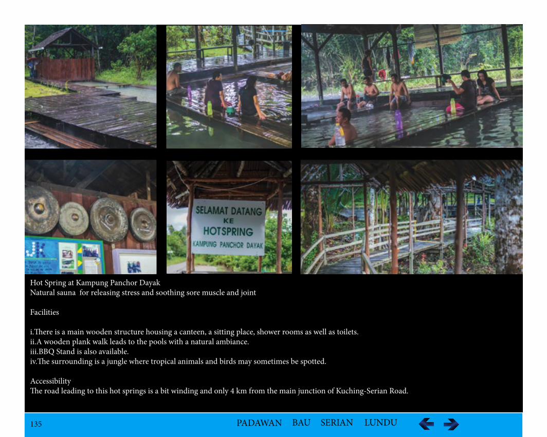
135 PADAWAN BAU SERIAN LUNDU
Hot Spring at Kampung Panchor DayakNatural sauna for releasing stress and soothing sore muscle and joint
Facilities
i.There is a main wooden structure housing a canteen, a sitting place, shower rooms as well as toilets.ii.A wooden plank walk leads to the pools with a natural ambiance.iii.BBQ Stand is also available.iv.The surrounding is a jungle where tropical animals and birds may sometimes be spotted.
AccessibilityThe road leading to this hot springs is a bit winding and only 4 km from the main junction of Kuching-Serian Road.
136 PADAWAN BAU SERIAN LUNDU
Kampung Lobang Batu
Ethnic Group
Bidayuh – The Gahat/Semabang group is one of the 15 subgroups under the Bukar-Sadong Bidayuh of Serian.
Population24 families – 127 people
Historical InformationThe early Bidayuh migrated from Tembawang Tampun and moved to Semabang at Ulu Sungai Robin, Ulu Sadong in the 1500s. Before the 1790s attack by the Sanggau pirates, the Bigahat escaped to Bung Nyarau, then to Red Tak Sebintin, and to Kuala Gahat before finally settled at Gahat Semabang in the 1810s. From Kampung Gahat Semabang, currently known as Kampung Gahat Mawang, some moved to settled at Lobang Batu Mawang in the 1976 and subsequently branched into other kampungs in which Kampung Lobang Batu Lin is one of them.
Geological FeaturesSilabur Cave is a limestone cave which is situated at the middle of the Mount Silabur.
VegetationThe vegetation is the limestone forest.
FaunaThe cave is a nesting place for thousands of swiftlet (Aerodramus maximus) building nest using their saliva attaching it high up on the cave ceiling and bats.
Tourism Activitiesi.Jungle trekking take about one hour to the foothill of Mount Silabur and another one hour of climbing to the entrance of Silabur Cave. ii.Sightseeing of thousand of swiftlets blackening the sky as they enter Silabur Cave through multiple small entrances at the top, side and middle of Mount Silabur at around 6.00 to 7.30 am and 5.00 to 6.30 pm each day.The Silabur Cave is managed by the Silabur Birdnest Operator Association which charge an entrance fee of RM10 per person at the Coop Tukar shop. The tour includesprivate guide at RM50 per person.
AccessibilityFrom Serian roundabout, at KM 12 junction of Jalan Serian/Tebedu at KM12 to Tebakang/Mongkos Road and upon reaching the junction just after Te-bekang bazaar, passing by SMK Tebakang turn left and after KM 16 km, passing by SK Lobang Batu entering small kampung road leading to Kampung Batu Lin/Batu Mawang about 1.5 km inside.
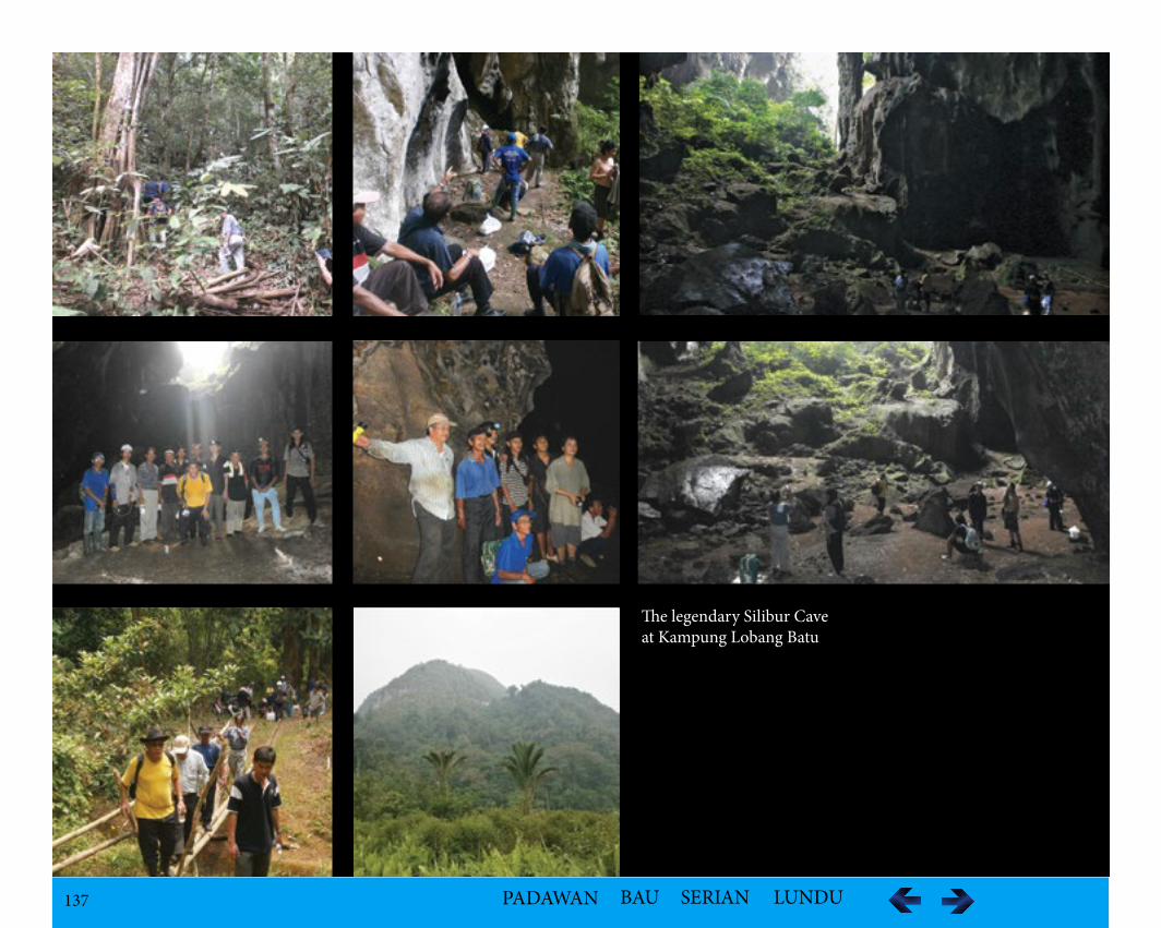
137 PADAWAN BAU SERIAN LUNDU
The legendary Silibur Caveat Kampung Lobang Batu
138 PADAWAN BAU SERIAN LUNDU
Kampung Tubih
LocationKampung Tubih, Batuh Ra-ung is along the Baki-Riih branching from the Serian-Tebedu Highway at Tebedu.
Population36 families – 238 people
Ethnic GroupBidayuh
Historical InformationThere are three branches of Kampung Tubih. In 1938, nine families from Kampung Mawang migrated to the new settlement along the Tubih River, called Kampong Tubih Mawang and embraced the Catholic Faith. They explored the land area to grow upland rice and rubber planting and garden pepper. Behem Tubih village was opened in 1970 when six families moved to the new settlement at Behem River. and embraced the Christian faith Seven Day Adventist (SDA) and opened a new church in 1976. Tubih Kampung Sungai Ujan was opened in 1970, when the families from Kampung Tubih Mawang exited after professing Christianity Anglican because at that time most of the residents in Kampung Mawang Tubih did not accept the Christian religion.
Geological FeaturesLimestone rocks formation with one of the rocks mountain having a cave near the top of the summit.
VegetationLimestone forest especially Nepenthes sp.
FaunaSwiftlets
Tourism Activitiesi.Jungle Trekkingii.Caving iii.Rock Climbing and Abseiling at limestone hills cliffs
AccessibilityThere is no public transport but only private transport.
139 PADAWAN BAU SERIAN LUNDU
Kampung Tong Nibong
LocationThe kampung is along the Jalan Mentung Merau-Sangai and located at the periphery and northwest of the Gunung Apeng Forest Reserve.
Population72 families with 312 people
Ethnic groupBidayuh
Historical InformationOne of the smaller of the 15 subgroups under the Bukar-Sadong Bidayuh of Serian is the Sambat group. They came from Tembawang Tampun, and passed through Tembawang Rutoi which is the main original Bidayuh settlement for all Bidayuh Bukar-Sadong between the border of Sarawak-Kalimantan. They settled at Rawan Mountain but later, they moved to Tembawang Sambat, between Bukit Bukeng and Mapu Kejabu in the 1600s, calling themselves the Sambat Bidayuh. In 1820s, they abandoned the settlement and began migrating to Bunan Mawang. Some later moved on in 1942 to Tong Nibong named after Lubok Nibong which is recognized as the earliest known settlement.
Geological FeaturesGunung Apeng is a mountain in the region of Sarawak, the country of Malaysia with an average elevation of 201 meter above sea level. The soil in the area is high in histosols, gleysols (hs), a soil with more than a defined amount of organic matter; an organic soil. There is a steep and heavily dissected terrain of higher elevation towards the ridge top that links Gunung Apeng, Gung Layat and Gunun Penandok.
VegetationThe original vegetation is closed to open broadleaved evergreen or semi-deciduous forest on the ridge top remains undisturbed due to extremely steep terrain and inaccessibility. Below the area, the land has been cleared for shifting cultivation. Japanese Forest Conservation Area at the Gunung Apeng Forest Reserve is supported by Mitsubishi Corporation. By 2012, a total of 124,000 seedlings of indigenous species of Engkabang Jantong, Kapur bukit and fruit trees to rehabilitate the area.
Tourism Activitiesi.Trekking across Suspension Bridge across the bridge 4 km away from the kampung.ii.Two levels of waterfall at the Japanese Conservation area
AccessibilityThe area is accessible by a good network and two hour drive from Kuching.
140 PADAWAN BAU SERIAN LUNDU
Tarat Region
LocationTarat is along the Kuching-Serian Highway and situated at the 33rd to 34th mile along the highway.
Population - 1,198
Ethnic Group
Majority:
i.Chinese in the main town area
ii.Bidayuh in rural and suburban Tarat
Historical InformationThe Bidayuh in this area was originally from Bugau, Kalimantan who moved to Tembawang Tampun to expand and search for bigger farming land in the 1500s. After a century in the 1600s they moved on to Tembawang Rutoi. According to oral tradition, farming could only be done by permission of the priest, known as the Tua Gawai in an elaborate ceremony to get the best possible conditions influenced by the gods and spirits.
In one occasion, Tua Gawai Beh Tiih and Beh Ringah found out that the people had begun burning the fields without their permission. Angered by this sit-uation, they moved away and eventually settled at Sungai Kuhas in the 1650s. In the 1700s, they moved on to Gunung Sadong and built a settlement called Bukar Mawang Sambu two–third up the slope. Sambu meant ‘up’ and Bukar evolved from ‘Kakar’ which meant the muddy condition of river during flood.
Another oral tradition by the elders suggested that the ancestors of Bukar Mawang Sambu came from Sungkung, Kalimantan Barat via Tanjung Datu and settled for awhile in Santubong before moving along the Batang Samarahan until Pangkalan Gantang settling at Gunung Sadong. In the 1780s, a group broke away and created a settlement in Bukar Ta’ee at Munggu Babi. In the 1790s, another group broke away and settled at Sungai Kakeng at Kampung Ka-keng. In the 1800s, the villagers abandoned Bukar Mawang Sambu and moved to Kampung Lanchang Mawang at the foot of Gunong Sadong. Lanchang meant swift running water.
In the 1900s, a group broke away to form Tarat Region. Tarat comprises of three kampongs namely; Tarat Mawang, Tarat Melawi and Tarat Sebala. Tarat Mawang was named after the Minarad Snake, while those who did not want to accept Christianity and wanted to continue practicing paganism moved and established Tarat Melawi. Tarat Sebala which means staying together did not want to join Anglicanism.
Tourism Activitiesi.Jungle trekking to Waterfallii.Trailing and Jungle Trekking – Tarat / Darud Sadung / Lanchang Trail
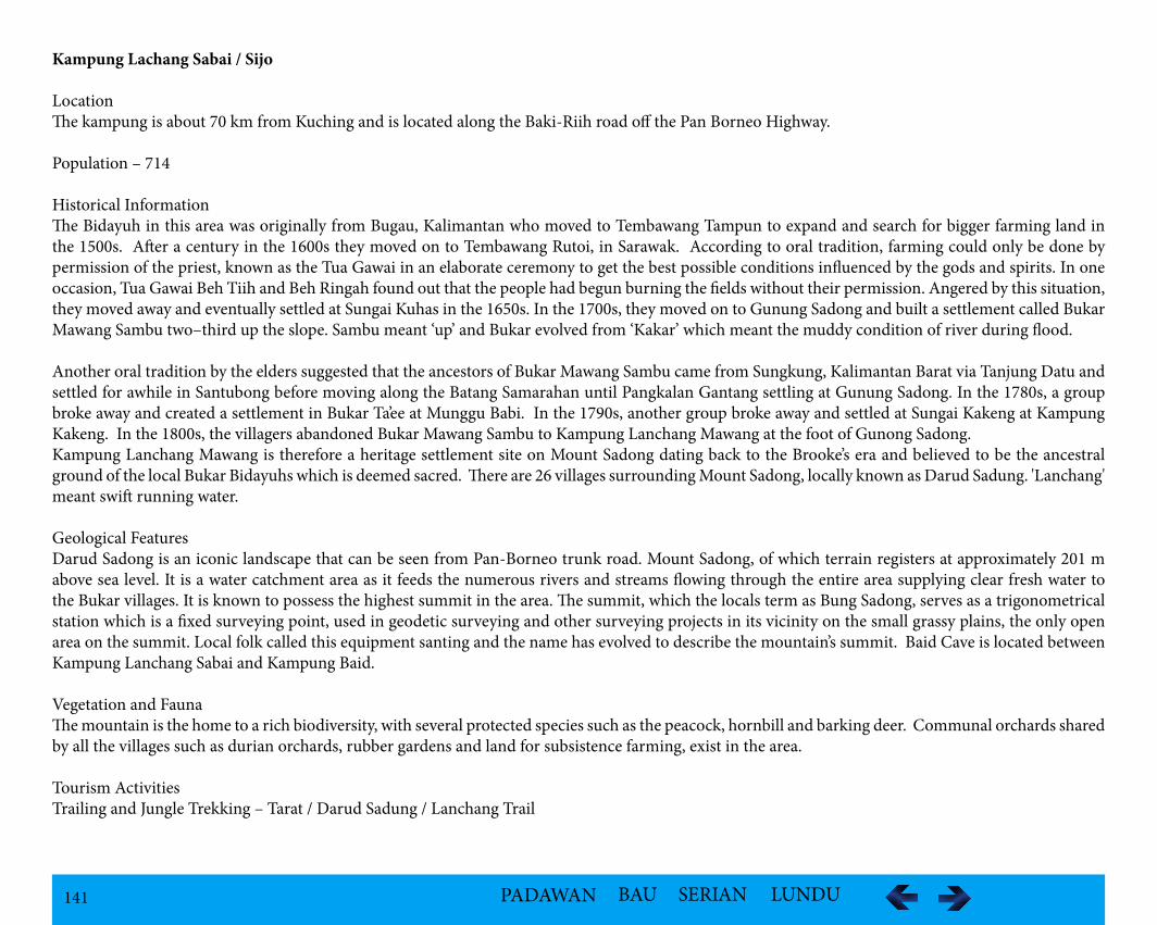
141 PADAWAN BAU SERIAN LUNDU
Kampung Lachang Sabai / Sijo
LocationThe kampung is about 70 km from Kuching and is located along the Baki-Riih road off the Pan Borneo Highway.
Population – 714
Historical InformationThe Bidayuh in this area was originally from Bugau, Kalimantan who moved to Tembawang Tampun to expand and search for bigger farming land in the 1500s. After a century in the 1600s they moved on to Tembawang Rutoi, in Sarawak. According to oral tradition, farming could only be done by permission of the priest, known as the Tua Gawai in an elaborate ceremony to get the best possible conditions influenced by the gods and spirits. In one occasion, Tua Gawai Beh Tiih and Beh Ringah found out that the people had begun burning the fields without their permission. Angered by this situation, they moved away and eventually settled at Sungai Kuhas in the 1650s. In the 1700s, they moved on to Gunung Sadong and built a settlement called Bukar Mawang Sambu two–third up the slope. Sambu meant ‘up’ and Bukar evolved from ‘Kakar’ which meant the muddy condition of river during flood.
Another oral tradition by the elders suggested that the ancestors of Bukar Mawang Sambu came from Sungkung, Kalimantan Barat via Tanjung Datu and settled for awhile in Santubong before moving along the Batang Samarahan until Pangkalan Gantang settling at Gunung Sadong. In the 1780s, a group broke away and created a settlement in Bukar Ta’ee at Munggu Babi. In the 1790s, another group broke away and settled at Sungai Kakeng at Kampung Kakeng. In the 1800s, the villagers abandoned Bukar Mawang Sambu to Kampung Lanchang Mawang at the foot of Gunong Sadong. Kampung Lanchang Mawang is therefore a heritage settlement site on Mount Sadong dating back to the Brooke’s era and believed to be the ancestral ground of the local Bukar Bidayuhs which is deemed sacred. There are 26 villages surrounding Mount Sadong, locally known as Darud Sadung. 'Lanchang' meant swift running water.
Geological FeaturesDarud Sadong is an iconic landscape that can be seen from Pan-Borneo trunk road. Mount Sadong, of which terrain registers at approximately 201 m above sea level. It is a water catchment area as it feeds the numerous rivers and streams flowing through the entire area supplying clear fresh water to the Bukar villages. It is known to possess the highest summit in the area. The summit, which the locals term as Bung Sadong, serves as a trigonometrical station which is a fixed surveying point, used in geodetic surveying and other surveying projects in its vicinity on the small grassy plains, the only open area on the summit. Local folk called this equipment santing and the name has evolved to describe the mountain’s summit. Baid Cave is located between Kampung Lanchang Sabai and Kampung Baid.
Vegetation and FaunaThe mountain is the home to a rich biodiversity, with several protected species such as the peacock, hornbill and barking deer. Communal orchards shared by all the villages such as durian orchards, rubber gardens and land for subsistence farming, exist in the area.
Tourism ActivitiesTrailing and Jungle Trekking – Tarat / Darud Sadung / Lanchang Trail
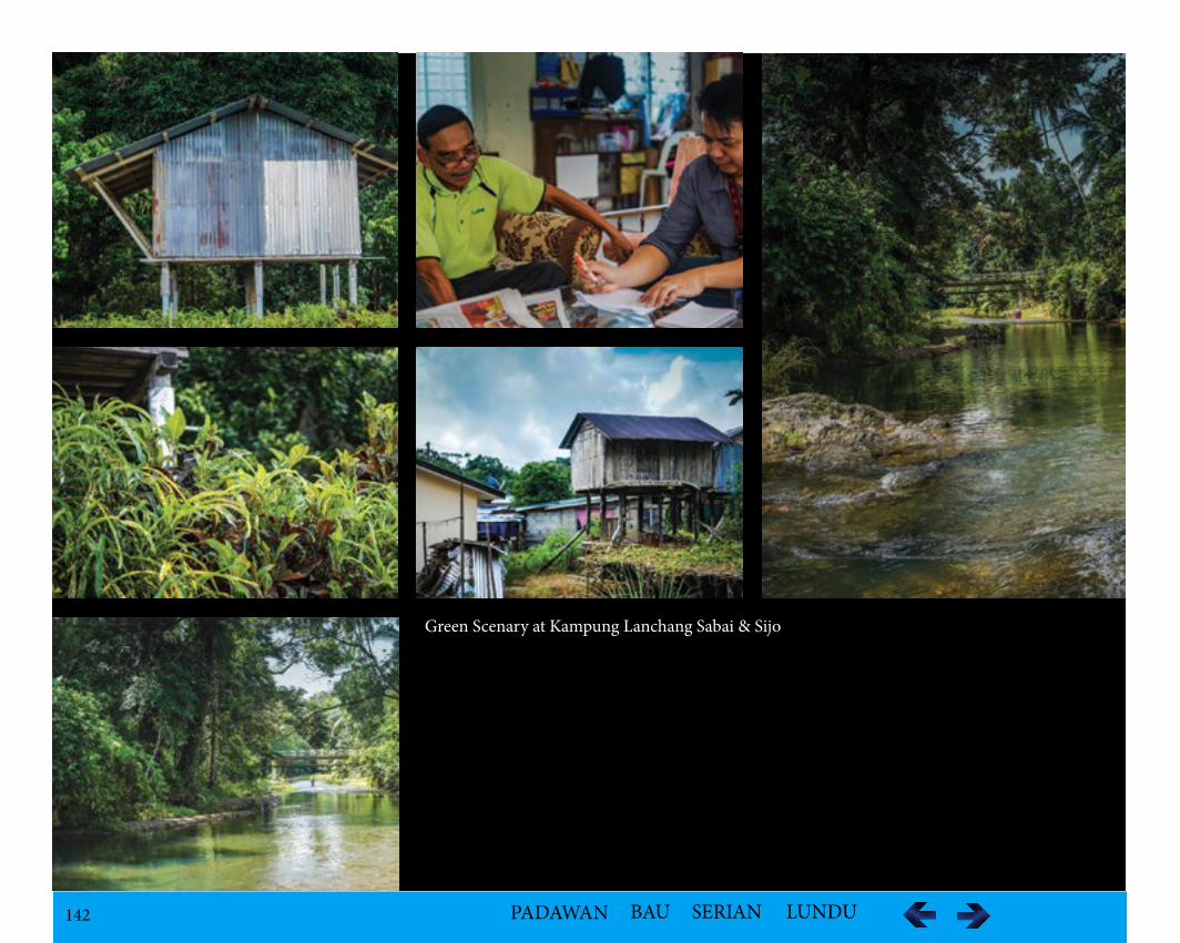
142 PADAWAN BAU SERIAN LUNDU
Green Scenary at Kampung Lanchang Sabai & Sijo
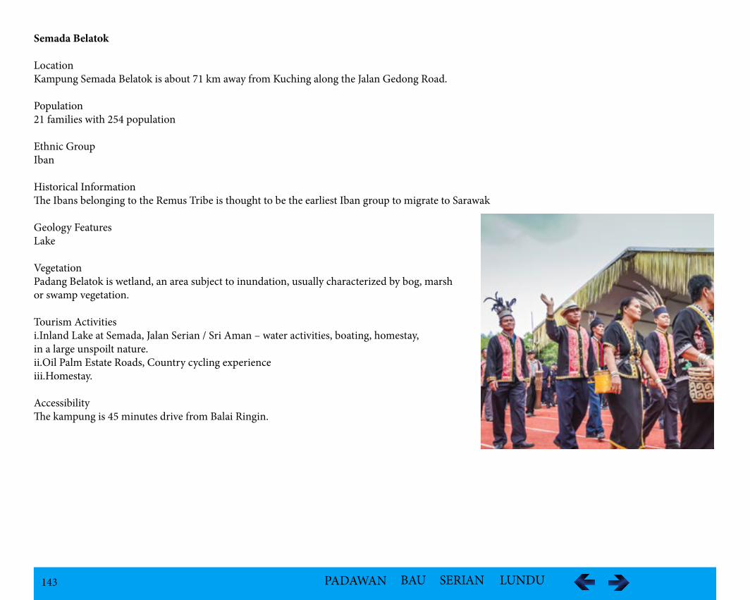
143 PADAWAN BAU SERIAN LUNDU
Semada Belatok
LocationKampung Semada Belatok is about 71 km away from Kuching along the Jalan Gedong Road.
Population 21 families with 254 population
Ethnic GroupIban
Historical InformationThe Ibans belonging to the Remus Tribe is thought to be the earliest Iban group to migrate to Sarawak
Geology FeaturesLake
VegetationPadang Belatok is wetland, an area subject to inundation, usually characterized by bog, marsh or swamp vegetation.
Tourism Activitiesi.Inland Lake at Semada, Jalan Serian / Sri Aman – water activities, boating, homestay, in a large unspoilt nature.ii.Oil Palm Estate Roads, Country cycling experienceiii.Homestay.
AccessibilityThe kampung is 45 minutes drive from Balai Ringin.
Pesta Birumuh 2015Richness of multi culture of Serian
(C) 2015, Robert John Jingut
144 PADAWAN BAU SERIAN LUNDU
Kampung Rasau
LocationThe kampung is located along the Baki-Riih road off the Pan Borneo Highway.
Population 74 families and 548 populations
Geology FeaturesThe surrounding consists of a freshwater river with underdeveloped waterfall at the Fairy Princess Mountain.
VegetationThe vegetation is unique due to the presence of rafflesia.
Tourism Activities
i.Gunung Simuja / RasauTrails to Fairy Princess mountain top Beauty Bath site.ii.Juggle Trekking to Rafflesia siteiii.Visit to the remain of a longhouse.
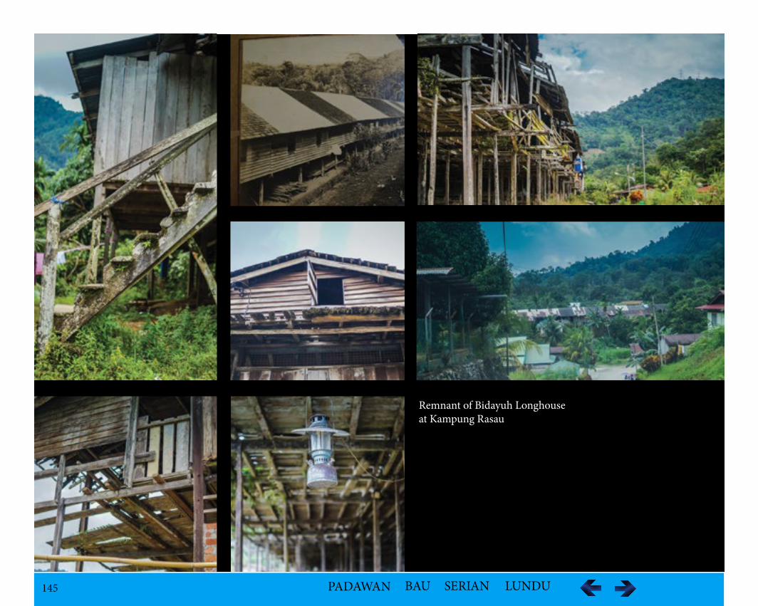
145 PADAWAN BAU SERIAN LUNDU
Remnant of Bidayuh Longhouseat Kampung Rasau
146 PADAWAN BAU SERIAN LUNDU
Balai Ringin Town
LocationBalai Ringin is a town along the Pan Borneo Highway. The area is predominantly inhabited by Iban though there are a few Malay villages.
Population – 682
Ethnic GroupThe area is predominantly inhabited by Iban though there are a few Malay villages.
Geology FeaturesSungai Baruk with Lubok BuaiBatang Kerang Floodplain with black water habitatWaterfallsRivers
VegetationPadang Bakong Wetland, 8 km away an area subject to inundation, usually characterized by bog, marsh or swamp vegetation.
Tourism Activitiesi.Wet Land at Balai Ringin - Walk ways over a large area of wetland, a great ecotourism experience. Proposed to have river safaris, fishing and other water sports. ii.Bird and crocodile watching - Tourists will definitely find the safari an adventure as they get to have closer view of crocodiles basking under sun, un-perturbed in their natural environment.
AssessibilityThe town is about one hour's drive from the town of Serian and approximately 75.3 km southeast of Kuching.
147 PADAWAN BAU SERIAN LUNDU
Bandar Mutiara or Tebedu
LocationTebedu renamed Bandar Mutiara is the border town between Sarawak and Kalimantan located about 50 km away from Serian town.
Ethnic GroupBidayuh
Geological FeaturesThe landscape is made up of limestone formations. i.Mountain (Mount Rawan – the mountain range that separates Sarawak and West Kalimantan) ii.River (Suhu River)
VegetationPaddy fields can be seen along the way to Tebedu.
148 PADAWAN BAU SERIAN LUNDU
Kampung Lebor
LocationKampung Lebor is located at Gedong Road.
Population123 families and 805 people
Ethnic GroupIban
Geological FeaturesBukit Tasau
Historical InformationThe Ibans belonging to the Remus Tribe is thought to be the earliest Iban group to migrate to Sarawak.
VegetationRafflesia the biggest carnivorous flower in the world
Tourism ActivitiesHill and trekking to the rafflesia area takes about 25 minutes.
AccessibilityThe journey to Bukit Tasau takes about 45 minutes drive from Kuching city to Serian town and another 30 minutes from Serian town to the junction of Bukit Tasau foothill.Public transportation to Serian Town from Kuching City: Bus No.3A (Sarawak Transport Co. Contact No.082 233576) or Bus No.K3 (City Public Link - Contact No.082 428278/239178). This takes about one hour bus ride.Transportation from Kuching City or pick up from Serian Town can be arranged with the representative from the village.
For further information on entrance fee, guide fee and possibility of Rafflesia blooming; please contact the representative of the village as mentioned below.
MR.LANGKASTY NARANGContact No: 013 836 1488 or 010 797 1488
149 PADAWAN BAU SERIAN LUNDU
Tebakang
Location
Tebakang (also known as Tebekang or Tabekang) is located along Gedong Road.
Population
194 families and 1132 people
Ethnic Group
The population of Tebakang is predominantly Bidayuh and Malays. The kampung is divided into two kampongs by the Sadong River or Sungai Sadong in which the settlement on the main road side is named Kampung Bidayuh Tebakang and on the other side of the Sadong River is Kampung Melayu Te-bakang.
Historical Information
The name ‘Tebakang’ is derived from an inland fish of scientific name: Helostomatemmincki which is common in the area. The name Tebakang is from Sungai Tebakang which flows by the village. During a war between the Netherlands and Indonesia, a small group of Melayu Sambas migrated to the vil-lage and helped its population to increase. In the 1920s, when Sarawak was under Rajah Brooke’s rule, a representative from Kampung Melayu Tebakang known as a native officer was appointed to manage the Ulu Sadong area.
During Charles Vyner Brooke’s era, Fort Tebakang was built on the top of a small hill near Saong River behind Pangkalan Enbong as an administrative centre in 1929. The structure of the fort was built of belian in Malay style. Kampung Melayu Tebakang has existed since the beginning of the 18th century after its initiation by a merchant and scholar named Haji Laer, who came from Kampung Bintangor in Sarawak.
Geological FeaturesThe Tebakang area has some striking limestone hills with vertical cliffs. River Kayan or Sungai Kayan passes through the area with Gunung Ritoh and the Batu Karangan in the vicinity.
150 PADAWAN BAU SERIAN LUNDU
Tourism Activitiesi.The suspension bridge in the kampung across the Batang Kayanii.Farming related activities for the visitors – harvest padi or fruits such as plucking coconuts out of palm trees 30-40 ftiii. Batang Kayan river crusing, long boat river safari, fishing, white water rafting, wet abseiling and picnic iv.Village tour, trekking and caving v.Cultural activities – traditional games such as kite flying, top-spinning, congkak, cultural dances, musical performances and a mock-wedding
AccommodationHomestay Kampung Melayu Tebakang is about 80 km from Kuching and 8km from Serian Town. The homestay with traditional Malay culture which is being managed and operated by the village co-operative have nineteen participating houses with a combined number of 22 clean rooms.
Ms. Pauziah Bt. Mohd YussupTel: +6082-874263 / +6019-8582078Fax: +6082-875780Email: [email protected]
Address: Homestay Kampung Melayu Tebakang, Suruhanjaya Koperasi Malaysia Negeri Sarawak Daerah Serian Lot 938, Serian Town Land District 94700 Serian, Sarawak
Accessibility The kampung is approximately half an hour journey from Serian Town using Serian/Gedong Road at the junction of Gedong Road is not far from Simu-ja Camp or Kampung Rasau. The journey by via Kuching-Serian Road took about two hours by bus.
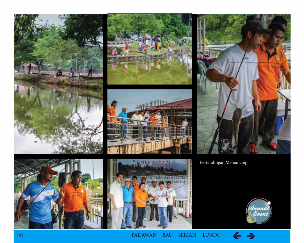
151 PADAWAN BAU SERIAN LUNDU
Pertandingan Memancing
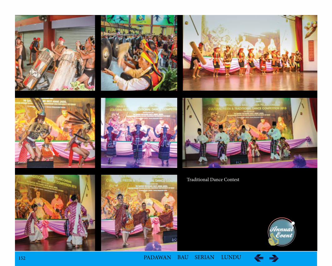
152 PADAWAN BAU SERIAN LUNDU
Traditional Dance Contest
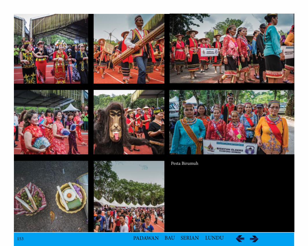
153 PADAWAN BAU SERIAN LUNDU
Pesta Birumuh
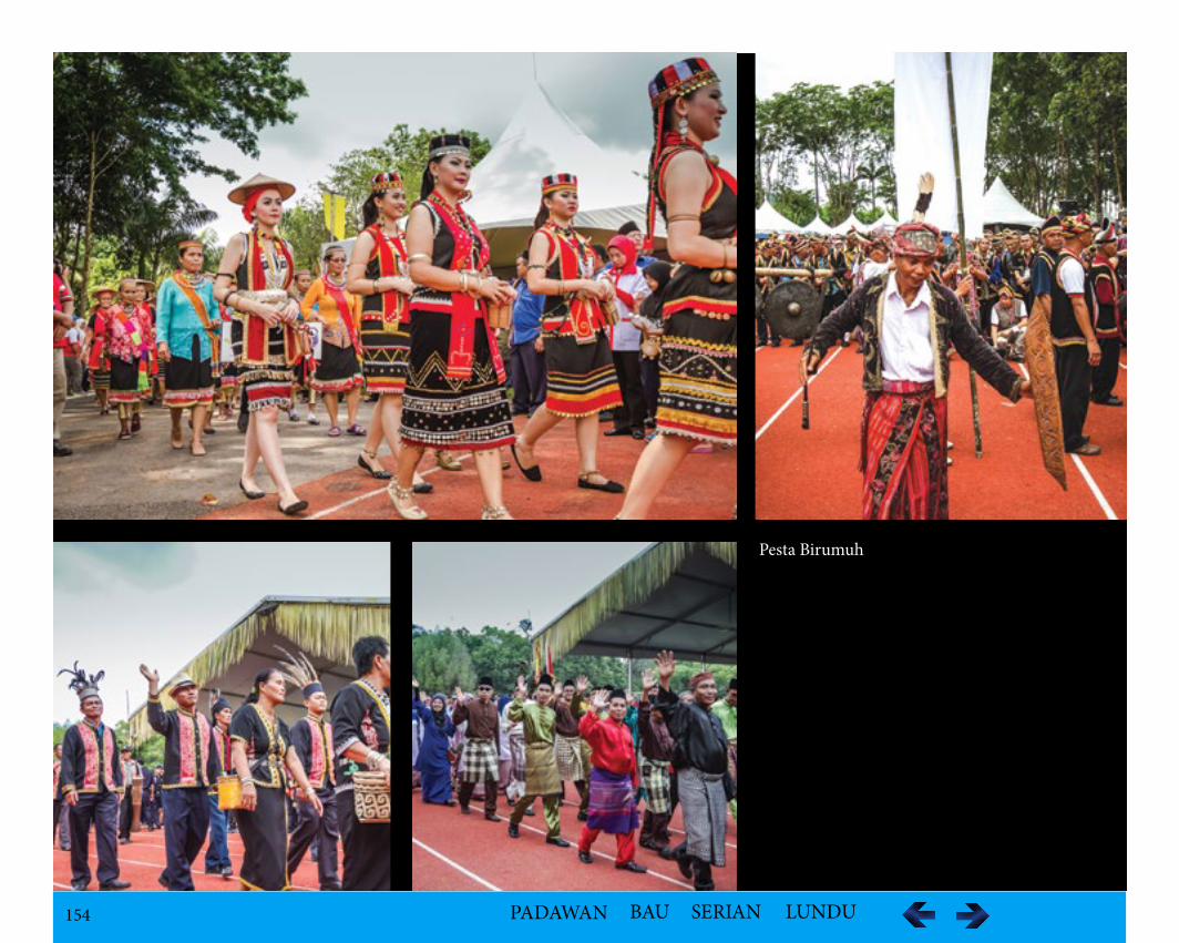
154 PADAWAN BAU SERIAN LUNDU
Pesta Birumuh
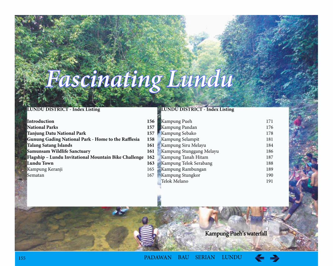
155 PADAWAN BAU SERIAN LUNDU
Kampung Pueh’s waterfall
Fascinating LunduLUNDU DISTRICT - Index Listing
Introduction 156National Parks 157Tanjung Datu National Park 157Gunung Gading National Park - Home to the Rafflesia 158Talang Satang Islands 161Samunsam Wildlife Sanctuary 161Flagship – Lundu Invitational Mountain Bike Challenge 162Lundu Town 163Kampung Keranji 165Sematan 167
LUNDU DISTRICT - Index Listing
Kampung Pueh 171Kampung Pandan 176Kampung Sebako 178Kampung Selampit 181Kampung Siru Melayu 184Kampung Stunggang Melayu 186Kampung Tanah Hitam 187Kampung Telok Serabang 188Kampung Rambungan 189Kampung Stungkor 190Telok Melano 191

156 PADAWAN BAU SERIAN LUNDU
LUNDU DISTRICT
IntroductionLundu District is located at the western region of Sarawak as shown in Figure . Initially established as Lundu District Authority, it was restructured as Lundu District Council in 1953. The Lundu District has been around for decades, since the era of the Brooke family rule. Mr. Henry Fitzgibbon was the first Lundu District Officer at Brooke era, administering the Lundu District in 1877.
Based on the narrative of the elderly, Lundu gets its name from a species of local a small catfish fish called Lundu fish or Guilo macrones found abounds in the Sungai Lundu which flows down from Gunung Gading and along the Batang Kayan.
Lundu is known for the National Parks, wildlife sanctuaries, scenic beaches and mountainous landscape with unique geological features.
157 PADAWAN BAU SERIAN LUNDU
National Parks
Tanjung Datu National Park
Sarawak’s smallest park at 13 km2 is located at the westernmost tip of Sarawak bordering Kalimantan, Indonesia. Tanjung Datu National Park is located in Lundu District of Kuching Division. It is about 90 km from Lundu town and 150 km from Kuching City. The park offers primary rainforest, clean rivers and beaches and coral reefs within 100m of each other. Its clear water is ideal for snorkeling, scuba diving and dolphin spotting.
The forest is rich in wildlife such as Bornean gibbons, pigtailed and long tail macaques, bear cats, civets, numerous species of birds including Hornbills and Peacocks Pheasants. Along the beach, is the nesting ground for green turtles and Olive Ridley turtles.There are no accommodation facilities for visitors.
AccessibilityIt takes approximately 2 hour drive from Kuching City by roads and another 45 minutes boat ride from Sematan which depends on the speed of the boat and weather condition.
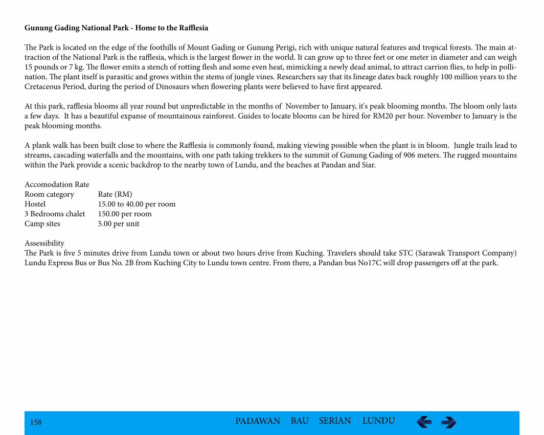
158 PADAWAN BAU SERIAN LUNDU
Gunung Gading National Park - Home to the Rafflesia
The Park is located on the edge of the foothills of Mount Gading or Gunung Perigi, rich with unique natural features and tropical forests. The main at-traction of the National Park is the rafflesia, which is the largest flower in the world. It can grow up to three feet or one meter in diameter and can weigh 15 pounds or 7 kg. The flower emits a stench of rotting flesh and some even heat, mimicking a newly dead animal, to attract carrion flies, to help in polli-nation. The plant itself is parasitic and grows within the stems of jungle vines. Researchers say that its lineage dates back roughly 100 million years to the Cretaceous Period, during the period of Dinosaurs when flowering plants were believed to have first appeared.
At this park, rafflesia blooms all year round but unpredictable in the months of November to January, it's peak blooming months. The bloom only lasts a few days. It has a beautiful expanse of mountainous rainforest. Guides to locate blooms can be hired for RM20 per hour. November to January is the peak blooming months.
A plank walk has been built close to where the Rafflesia is commonly found, making viewing possible when the plant is in bloom. Jungle trails lead to streams, cascading waterfalls and the mountains, with one path taking trekkers to the summit of Gunung Gading of 906 meters. The rugged mountains within the Park provide a scenic backdrop to the nearby town of Lundu, and the beaches at Pandan and Siar.
Accomodation RateRoom category Rate (RM)Hostel 15.00 to 40.00 per room3 Bedrooms chalet 150.00 per roomCamp sites 5.00 per unit
AssessibilityThe Park is five 5 minutes drive from Lundu town or about two hours drive from Kuching. Travelers should take STC (Sarawak Transport Company) Lundu Express Bus or Bus No. 2B from Kuching City to Lundu town centre. From there, a Pandan bus No17C will drop passengers off at the park.
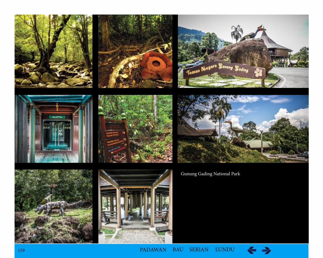
159 PADAWAN BAU SERIAN LUNDU
Gunung Gading National Park
160 PADAWAN BAU SERIAN LUNDU
Gunung Gading National Park
161 PADAWAN BAU SERIAN LUNDU
Talang Satang Islands
This marine park, consisting of four islands, Pulau Satang Besar, Pulau Satang Kecil, Talang-Talang Besar and Talang Talang Kecil was established as a turtle sanctuary to conserve the marine turtle. Only the Satang Islands are open to visitors, The Sematan Hotel at the small coastal village of Sematan can arrange trips to the Satang Islands.
A tour operator, Borneo Inbound Tours & Travel also has trips to the islands.
Samunsam Wildlife Sanctuary
Samunsam Wildlife Sanctuary became the first wildlife sanctuary, located in the Kuching Division covering an area of about 69 km2 within the Gunung Pueh Forest Reserve. The wildlife sanctuary stretches from the border with Indonesia to within two km of the coast on a flat, undulating terrain no more than 25 meters above sea level, with the Samunsam River flowing through it. It was made a wildlife sanctuary to protect the habitat of proboscis monkeys that live there.
The result is that other wildlife species like the Langur, Melalopho, Bornean Gibbon, Black Hornbill, Wrinkled Hornbill, Blue-eared Kingfisher, Ruddy Kingfisher, Jambu Fruit-Dove, Green Imperial-Pigeon, Great Frigatebird, Golden-bellied Gerygone, Bornean Bristlehead, Black-and-white Bulbul, Yel-low-bellied Bulbul, Striped Wren-Babbler, Crimson-breasted Flowerpecker and Purple-throated Sunbird have also been found in the sanctuary where they can thrive with limited human contact.
There are limited accommodations with only one.
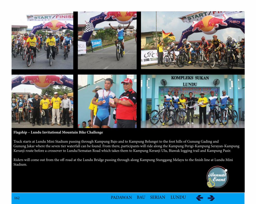
162 PADAWAN BAU SERIAN LUNDU
Flagship – Lundu Invitational Mountain Bike Challenge
Track starts at Lundu Mini Stadium passing through Kampung Bajo and to Kampung Belungei to the foot hills of Gunung Gading and Gunung Jakar where the seven tier waterfall can be found. From there, participants will ride along the Kampung Perigi-Kampung Serayan-Kampung Keranji route before a crossover to Lundu/Sematan Road which takes them to Kampung Keranji Ulu, Biawak logging trail and Kampung Pasir.
Riders will come out from the off-road at the Lundu Bridge passing through along Kampung Stunggang Melayu to the finish line at Lundu Mini Stadium.
163 PADAWAN BAU SERIAN LUNDU
Lundu Town
LocationLundu town is located in the Northwest of Kuching Division bordering with West Kalimantan, 100 km from Kuching City and 70 km from Bau Town. Lundu was also previously connected by air, as there were remains of the former airstrip in Lundu and part of the runway of the old airstrip is now used as road.
PopulationAbout 5,000 people live in or close to Lundu town
Historical InformationPreviously, Lundu was only reachable by ferry services across the Batang Kayan until Batang Kayan Bridge was officially opened to traffic in mid to late 2000s.
Towards the close of the eighteenth century the three main ethnic groups; the Iban, Chinese and Bidayuh came separately to make their homes in Lundu at the same time. From the east came the Ibans who originated from Balau on the west bank of the Batang Lupar. They spoke, and still speak their own dialect of Iban and traditionally had been enemies with the Ibans of the Saribas and Paku areas. A group of Balau people decided to mindah, migrate. They stopped first at Sebuyau, and from there travelled west. From their stay at Sebuyau they have kept the name Iban Sebuyau.
A separate group led by their chief, Nyambong, went by sea and first established themselves near the sea at the mouth of the Batang Kayan. Later the Se-buyau group moved upriver and built a longhouse on the east bank of the Batang Kayan to the ulu of the small Sungai Stunggang. The present Kampong Stunggang Dayak occupies the site of the old longhouse. On his first visit to Kuching in 1839, James Brooke, later to become the first Rajah of Sarawak, met the headman of the longhouse, Jugah.
According to custom, the longhouse was called Rumah Jugah or "Jugah's Longhouse." Jugah invited Brooke to visit Lundu, thus spent his first time among Dayaks. The Sebuyau remained Brooke's favorite tribe, and they performed heroic service in the Rajah's campaigns against the pirates. The Lundu chiefs bore the title of Orang Kaya Pemancha, literally translated as "Rich-Man, Commander," after Jugah had been ennobled by the Sultan of Brunei in the early nineteenth century. This historic line came to an end in 2003 with the death of O.K.P. Kalong, a direct descendent of Nyambong and Jugah, at the age of 93.
The Chinese arrived from the west, over the hills that separate Sarawak from Kalimantan, Indonesian. The Chinese had been living in Pontianak and Sam-bas for a hundred years or more. When gold was discovered in Bau, the Chinese migrated there and established their kongsi, or "commercial republic." Along the way a number of mainly Hakka Chinese, settled in the Lundu area, at a spot about a mile to the ulu of Rumah Stunggang, where they began to grow vegetables to sell to the Sebuyau Ibans. Many Chinese people in the Lundu district make their living by planting pepper.
Before the Brooke era, and well into it, life at Lundu was centered on Rumah Stunggang and the nearby area where Brooke established a fort and offices. The present Christ Church, which replaces the first Christ Church built in 1863, overlooks the site of the old fort and its landing. It is unclear when Lundu town began to assemble itself at the present location about a mile to the ili’ of the river.
164 PADAWAN BAU SERIAN LUNDU
Some sort of pasar must have existed in the second half of the 19th century, for the Lundu District Officer wrote in the 1870s to report on Chinese secret societies. The smaller Chinese temple across the road from the bigger temple by the bus station was built in 1893.
The Bidayuh Selako or Selakau tribe also came from the West. The Selako claimed the land from west of the Batang Kayan to Sematan. As Lundu became a regional center, Malays also came to settle from the Natuna Islands.
The Sebuyau were interested in developing low-land rice, and they traded their surplus to the Malays of the Natuna Islands for salted fish, sugar, and other goods. The Chinese came to trade and to farm, and the Selako also appreciated security and prosperity. The Selako now supply Lundu with vegetables and fruits from their farms. The Malays fished on the sea.
The Saribas Ibans made one attempt to wage war on the Lundu Sebuyau in the early 1800s. The Sebuyau had cannon, and the Saribas were defeated and forced to retreat as their war-boats were blocked by an emormous boom laid across the river. Since then Lundu has been at peace, with the exception of two periods: the Japanese occupation and Konfrontasi, the guerilla war waged on Sarawak, by Sukarno's Indonesia. The Japanese occupation was a time of hardship and anxiety for Lundu people, but they suffered nothing more painful than shortages of food and goods. Konfrontasi was a small war, but brought tragedy. Local people were killed by Indonesian guerillas, and some younger people of Lundu lost their lives after having joined the communist insurrection supported by Indonesia.
Lundu had electricity and piped water from Gunung Gading by the early 60s. Piped water came to Kpg. Stunggang Dayak in 1987, and electricity was extended in 1988. The Lundu hospital was built in 1965, and now offers treatment for all except the most serious problems including a dental clinic and ultrasound screening for mothers-to-be.
Cultural HeritagePeople in Lundu make their living in traditional ways, by farming, fishing, planting cocoa, pepper, and rubber, although rubber is less important than it was. There is a smidgen of light industry, and the palm-oil plantations that line the Bau-Lundu road and across the river towards Sematan, together with the factories for the extraction of the oil. Trade to supply the needs of primary economic contributors is vigorous.
Geological Features
The main river is the Kayan River or Batang Kayan.• Siar Beach• Pandan Beach• Jangkar Waterfall near Lundu
AccessibilityLundu could be reached from Kuching only by boat until 1968. In that year the road from Bau to Lundu was completed and regular bus service began. This road remained a gravel-surfaced road until 1995, when the whole stretch was improved and asphalted. Nowadays, it is accessible by road. Regular public buses ply the Kuching-Lundu route.
165 PADAWAN BAU SERIAN LUNDU
Kampung Keranji
LocationKampung Keranji is located 93 km from Kuching along Lundu-Sematan Road.
Population – 324
Ethnic GroupBidayuh – Selako
Historical Information
In the past Selako/Selakau/Rara (Lara) did not belong to the Bidayuh Community in view of the difference in dialect, culture and customs until 1970s. Undu Bidayuh first migrated from Sungkung, Kalimantan to Rabak Mikabuh, Penrissen. After that a group led by Undu left for Landeh settling for a few years. They moved to Landan at Mount Gading, finally settling down at the river mouth of Lundu River and its surrounding areas.
The Bidayuh Selakau originally came from Mount Gading situated at the source of River Selakau near Sengkawang, Kalimatan Barat. When a group of the community no longer wanted to be in the headhunting life style as they did not want to make enemies, they left for Tembang Bechengal and settled at Lao also situated at Sengkawang. From Lao, they moved to Arok and went over to Sarawak where they settled at Pasir River before moving down the River Kayan settling at Tembang Nyambar. Later, a group from those settlers moved to the foot of Mount Gading at Dango Batu Dayuh and called the place Bantang which means in their dialect ‘Longhouse’. When Christianity spread to the area during 1863 – 1868, they called Bantang St. Mark which was eventually pronounced as Sedamak.
The longhouse was broken out as the families preferred to live in individual houses. Due to an outbreak of cholera, the settlers moved out from the parent kampung to new land along the River Siberis named after the Siberis trees, which were commonly found along the river and formed the Seberis Settle-ment. In 1880s, a splinter group moved away and settled at River Seragan and established Kampung Serayan building a longhouse and a Rumah Gawai to practice the old pagan Adats. Due to land and religious issues, some moved to Keranji River and formed Kampung Keranji which is the name of a local fruit.
166 PADAWAN BAU SERIAN LUNDU
Folklore/LegendThe legend described a warrior, Panglima Neggis who brought the villagers died after killing a ghost in form of a tiger. His descendants, Raja Api and Damong later killed Malay known as Tuan Said from Tanjong Datu who claimed to be able to cure sickness but found to be cheating the community. He put a curse on the community that they would be wiped out. Later, they were indeed attacked by the Ibans.
The survival fled to Siberis where the Lara Dayaks waged a war against them. Those survived were forced to surrender their jars and later intermarried leading to the extinction of the Undu Bidayuh.
Geological Featuresi.A coastline covered by small bays, coves and beachesii.Rugged mountain peaks which provide a scenic backdrop iii.Waterfall at Sungai Lundu
FloraThe vegetation is described as coastal vegetation forest.
Tourism Activitiesi.Mountain bikingii.Part of the route of the Lundu Mountain Bike Challenge
167 PADAWAN BAU SERIAN LUNDU
Sematan
LocationSematan is 120 km away from Kuching, Situated on the western tip of Sarawak overlooking the South China Sea and 30 km from Lundu Town.
PopulationThe Chinese Community of 100 is in the town area while the Malay community is made up of mainly fishermen in the coastal area.
Historical InformationA fishing village, Sematan started as a Chinese trading outpost of four families near the Cape of Tanjung Dato adjacent to the West Kalimantan coastal town of Paloh. The town was prosperous during the 1950s when the British colonial government set up a bauxite mine in 1958. During the Confrontation period, Sematan became an outpost of British Gurkha soldiers looking for Indonesian invaders from across the border. The wooden bazaar still remains.
LegendOne Malay legend was about a grand-lady of Telok Serabang called 'Nakhoda (admiral) Itam' or 'Jeragan Sitam'. She was a great warrior who dressed like a man and came from the Natuna island Ranai, in a sailing boat with coconuts, which she planted at Labuan Gadong in the Tanjong Dato National park.
Geological FeaturesThe Sematan town is flanked by white sandy beaches called Abang Amin Beach, Sungai Kilong Beach and Pueh Beach which are collectively known as Sematan Beach. There is also the Sebat Waterfall towards the inland and Mount Pueh or Gunung Pueh. Off the coast are islands commonly known as the Talang-Talang turtle island.
Tourism Activities
i.Walk along the Sematan Jettyii.Kayaking paddling on the waves of the South China Seaiii.Snorkeling at the Talang-Talang Islandiv.Visit to the Selakau Longhousev.Base for anglers to go sea fishingvi.Gateway to Tanjong Dato National Park, the Samunsam Wildlife Sanctuary and Telok Melano by boatvii.Mountain bikingviii.Boat rides to experience island and coastal sight such as Telok Melano and Tanjung Datu’ National Park. ix.Visit to the Jelly-fish factory during the jellyfish season in the months of April and May
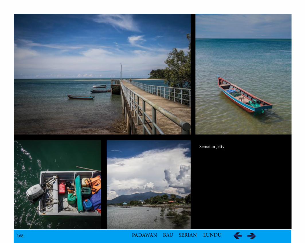
168 PADAWAN BAU SERIAN LUNDU
Sematan Jetty
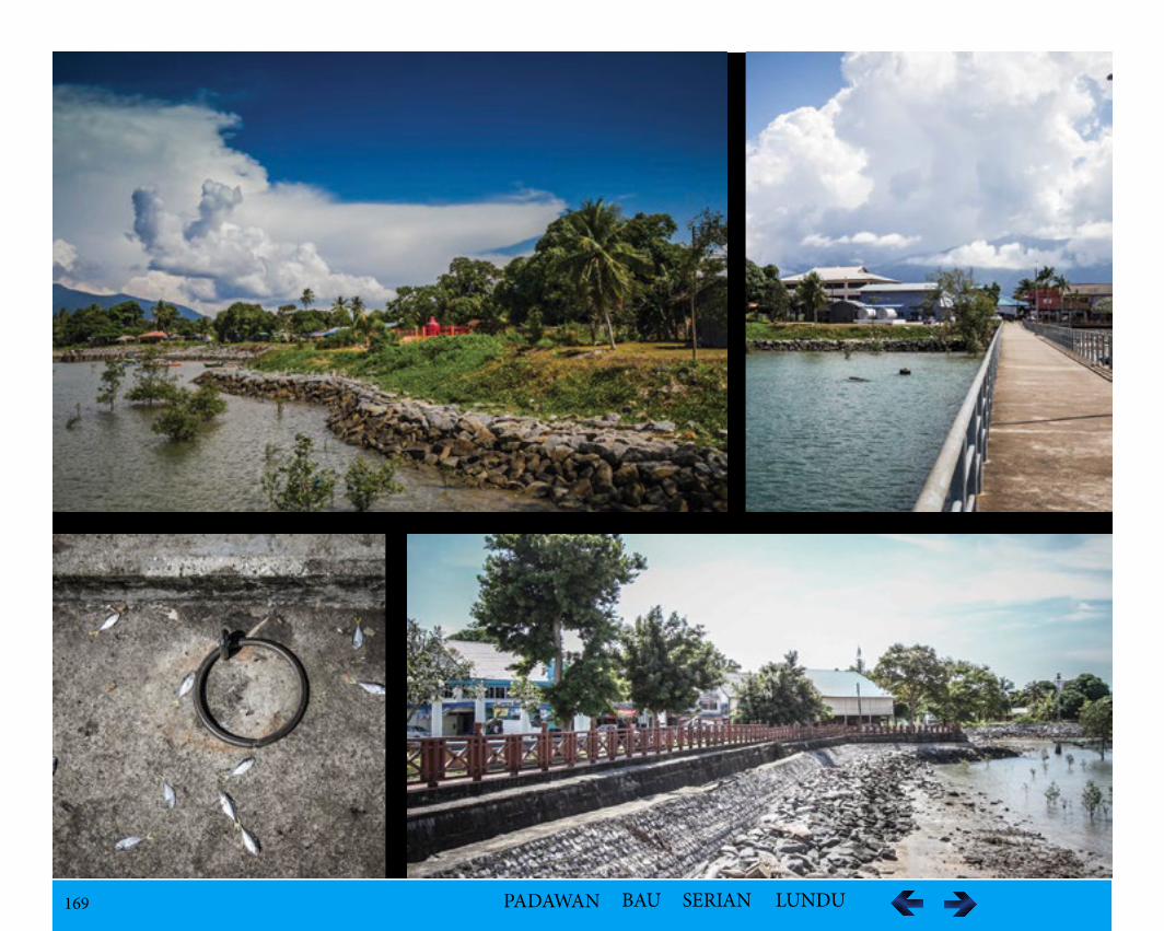
169 PADAWAN BAU SERIAN LUNDU
170 PADAWAN BAU SERIAN LUNDU
Accommodation Facilities
i.Sematan Palm Beach ResortThe main attraction in Palm Beach Resort is the sea and the landscape providing facilities for scuba divers with trips arranged beforehand. Kayaks and mountain bikes rental are also available. The resort also caters for meetings and social functions. It can accommodate up to 120 persons.
Rooms available are:Room type Rate (RM)A-frame Chalet (4 beds) RM330 (weekends) RM280 (weekdays) Quadruple (2 beds) RM 180 (weekends) RM153 (weekdays) Terrace Twin (2 beds) RM180 (weekends) RM153 (weekdays)Family Rooms (6 beds) RM390 (weekends) RM331 (weekdays)*All rates (including dinner and breakfast)
The resort also offers diving lessons from their PADI- certified dive instructors. Sebat Waterfall is just a half-hour bicycle ride from the resort.
ii.Home stay Tanah Hitam, 94100 Sematan, Lundu, Sarawak
AccessibilityThe town is about one-and-a-half hours’ drive from Kuching by road.
171 PADAWAN BAU SERIAN LUNDU
Kampung Pueh
LocationKampung Pueh is situated by the South China Sea at the foot of Mount Pueh.
Population 864 inhabitants in total – 828 of these are Bidayuh Selako
Ethnic GroupBidayuh Selako
Historical InformationThe Bidayuh from Kampung Pueh migrated directly from Sengkuku Anjongan Mantero near Sengkawang, Kalimatan Barat, Indonesia to Pueh, Lundu which was then under Sultan of Sambas. In a war between the Princess of Sambas and Mampawa in 1772, a Chinese settlement along the River Selakau was completely wiped out. The migration of the Bidayuh from Kampung Pueh from their parent kampung was due to a conflict of gold mine between them and the Chinese miners who arrived in large numbers in the mid 18th century. After the battle, the Bidayuh for fear of the reprisals of the Chinese moved to River Bantanan towards Mount Pueh. They first settled at Kota Lama near River Guntung and then moved to upriver to Sawah at Kalimantan Barat.
Due to heavy taxation from the Sultan of Sambas, they moved over to Sarawak. Initially only four families from Tembang Banyor in Ulu Sambas, Kali-mantan Barat, after moving over to Sarawak along River Sungai Angkabang, built temporary huts in 1875. The settlement was named after a type of grass known as Pueh.
During the outbreak of cholera in 1879 with the loss of their inhabitants, they moved to the other side of the river. Then, the villagers split in two groups. Those who stayed by the river with more families joining, built a number of longhouses in the 1900s. The only Bidayuh Selako longhouse remained in Sarawak was built nine km inland in 1930, currently houses 20 families of about 500. Unlike Iban or Bidayuh longhouses which are built on high stilt, the Selako longhouse is relatively low.
A Commemorating Stone was constructed to commemorate the beginning of settlement of Kampung Pueh in 1985.
Geological Features
i.There are mountain ranges and prominently, Mount Pueh or Gunung Pueh in the inland.ii.There are rapids along the river.iii.A waterfall called the Sabbath Waterfall is about 15-20 minutes’ walk.iv.On the sea front is the sandy beaches known as the Pueh Beach.
172 PADAWAN BAU SERIAN LUNDU
VegetationThe vegetation in the vicinity is a mixed of primary and secondary growth of tropical rainforest. The access to the forest area has been restricted with the creation of a forest reserve in 1985. The Oil Palm plantation was established in 2003.
FaunaA number of lowland species may be seen along the pipelines above Sebako mini-hydro. Species recorded include: Chequer-throated Woodpecker, Mountain Barbet, Oriental Cuckoo, Bornean Whistler, White-throated Fantail, Snowy-browed Flycatcher, Hill Blue-Flycatcher, Little Pied Flycatcher, Scaly-breasted, Yellow-bellied, Buff-vented and Streaked Bulbuls, Oriental and Everett’s White-eye, Mountain Blackeye, Mountain Tailorbird, Mountain Leaf-Warbler, Rufous-fronted Babbler and White-browed Shrike-Babbler. There is also a silkworm farm nearby.
Cultural HeritagePesta Narakng is a custom originated in Kalimantan several hundred years ago and was practiced by Selakau ancestors who migrated to Sarawak. The narakng procession is celebrated involving a few villages participated by over a hundred villagers, going on foot to visit one kampung after another. This traditional celebration, normally in the conjunction of Gawai celebration for the blessing of their God calls “Jubata”. Children play ‘chakoro’, a traditional game of spinning betel nuts, during the narakng celebration at Kampung Pueh.
Tourism Activities
i.Activities include a trek up Gunung Gading as well as visits to local industries.ii. The farm silk is still produced using manual techniques but may not always be possible to view silkworms at all times. iii.Visit to the Bidayuh Salako Longhouse can experience the unique lifestyle and culture, even in paddy planting as some of the villagers are still living in the only Selakau longhouse. There are also handicrafts made by the locals. iv.For water activities, there is fishing, a natural fish spa and kayaking.v.Camping involves the concept of recognising self, improving self-confidence, self-seeking values, physical endurance and mental training.
173 PADAWAN BAU SERIAN LUNDU
Accommodation Availabilities
i.Pueh Longhouse Homestay It was established in 2004, endorsed by the Ministry of Urban Development and Tourism under “Homestay Association of Sarawak” involving 14 house-hold. This Bidayuh Salako village about 9km outside of town has a longhouse homestay program.
Kampung Pueh LonghouseMr. Meot ak. NuberTel: +6082-711101 /+6014-8788252Fax: +6082-711986Address: Homestay Kampung Pueh, Jalan Lundu / Sematan, 94100 Sematan
ii.Pueh CampIt is the venue for improving fitness and self-confidence among various public and private organisations regardless of age ever since its inception 20 years ago. The programme conducted at the camp is intended to provide guidance to participants towards achieving a more meaningful quality of life in line with current development besides exposure to critical thinking techniques. The camp has all the required facilities to organise any programme such as resthouse, hostels, surau, lecture halls, dining halls, multipurpose hall and games courts. The latter has long been the choice of many parties to conduct courses or looking for peace of mind. There are several challenges provided, such as jungle trekking, rock climbing and kayaking expedition
Four different types of courses are offered by the camp according to specific time frames that is three days, five days, eight days and 14 days. The participant can choose the desired level and stage by choosing the type of courses.
AccessibilityKampung Pueh is accessible by an 8 km tar-sealed road from Lundu- Sematan Road.
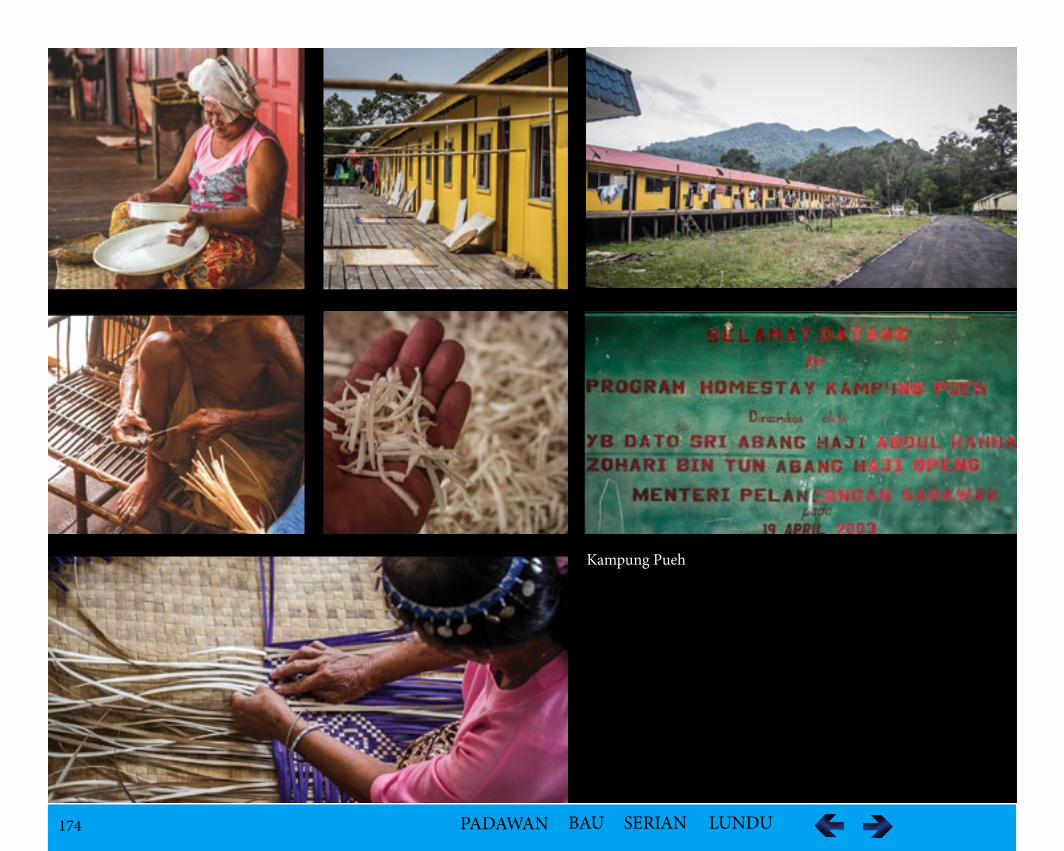
174 PADAWAN BAU SERIAN LUNDU
Kampung Pueh
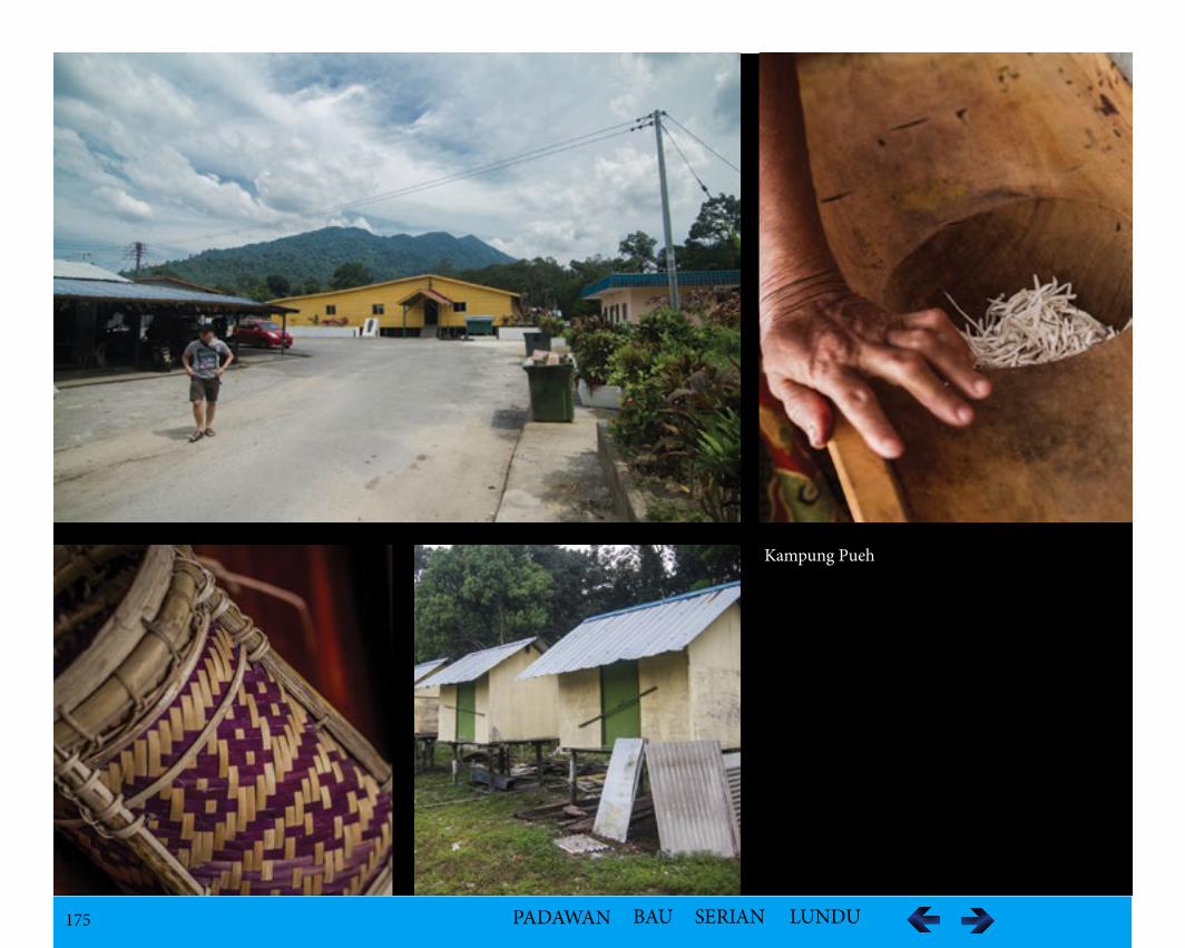
175 PADAWAN BAU SERIAN LUNDU
Kampung Pueh

176 PADAWAN BAU SERIAN LUNDU
Kampung Pandan
Ethnic GroupMalay
Geological Featuresi.The Pandan Beach of white sandy beaches with rock outcrops is located in this Kampung with Siar Beach and Gunung Gading nearby.
FaunaThe turtles nest in the beach.
Tourism Activityi.Camping at Siar Beach Resort ii.Visit Gunung Gading National Park Accommodation There are a number of campsites and homestay.
i.Kem Alapong (Kampung style), SiarTel: 012-894 5584 (Hj.Reduan)
ii.Pandan Beach Camp Ground, LunduTel: 082-735 501, Faks: 082-735 035, (Kr.Chen; 013-820 588)
iii.YES Retreat Union, Siar ResortTel: 082 459 366 / 019 829 3027
iv.Pandan Gold Coast ResidenceEugene Lim +6019-2696983 (Malaysia); Evonne Lim +6590069902 (Singapore)Email: [email protected]
v.Ocean Resort176, Siar Beach Pandan, Jalan Pandan, 94500 LunduTel: 082 452 245 (booking); Tel: 012-882 3222 (Jasmin-Lundu)
vi.Siar Beach ResortJalan Siar / Pandan, Lundu, 94500Tel: 082-412898 / 019-8869478 Fax: 082 – 237186Email: [email protected], [email protected]: www.siarbeachresort.com
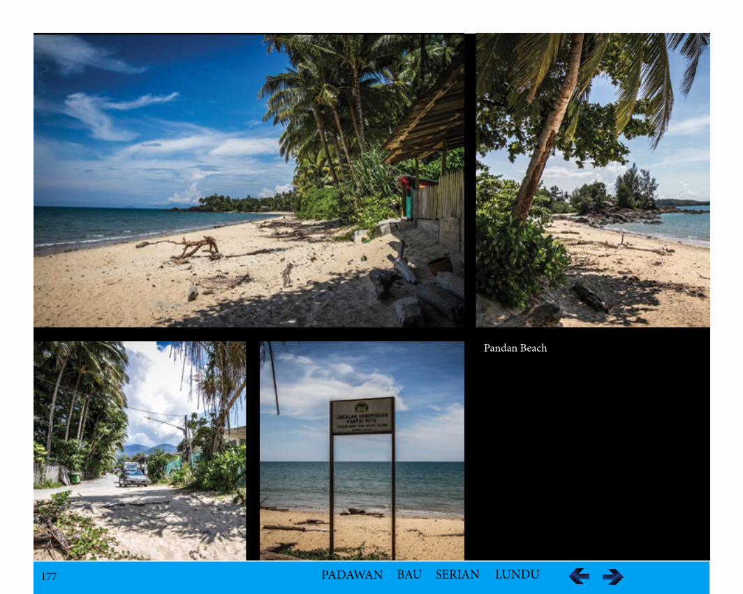
177 PADAWAN BAU SERIAN LUNDU
Pandan Beach
178 PADAWAN BAU SERIAN LUNDU
Kampung Sebako
LocationKampung Sebako is 15km from Sematan Bazaar.
Population - 747
Ethnic GroupBidayuh – SelakauThey remained pagans until 1996 and currently 30% are still pagans.
Historical InformationIn the past Selako/Selakau/Rara (Lara) did not belong to the Community in view of the difference in dialect, culture and customs until 1970s. Undu Bi-dayuh first migrated from Sungkung, Kalimantan to Rabak Mikabuh, Penrissen. After that a group led by Undu left for Landeh settling for a few years. They moved to Landan at Mount Gading, finally settling down at the river mouth of Lundu River and its surrounding areas.
The Bidayuh Selakau originally came from Gajing Mountain situated at the source of River Selakau near Sengkawang, Kalimatan Barat. When a group of the community no longer wanted to be in the headhunting life style as they did not want to make enemies, they left for Tembang Bechengal and settled at Lao also situated at Sengkawang. From Lao, they moved to Arok and went over to Sarawak where they settled at Pasir River before moving down the River Kayan settling at Tembang Nyambar. Later, a group from those settlers moved to the foot of Mount Gading at Dango Batu Dayuh and called the place Bantang which means in their dialect ‘Longhouse’. When Christianity spread to the area during 1863 – 1868, they called Bantang St. Mark which was eventually pronounced as Sedamak. The longhouse was broken out as the families preferred to live in individual houses.
Due to an outbreak of cholera, the settlers moved out from the parent kampong to new land along the River Sebako known as Kampung Sebako Lama in the 1900s. Two longhouses known as Bantang Ngagit and Bantang Tapang as well as a Rumah Adat lama were constructed. The word Bako in Selakau dialect means ‘stagnant water’. Due to constant flooding, they abandoned the site, moved to higher ground and built individual houses.
Folklore/LegendThe legend described a warrior, Panglima Neggis who brought the villagers died after killing a ghost in form of a tiger. His descendants, Raja Api and Damong later killed Malay known as Tuan Said from Tanjong Datu who claimed to be able to cure sickness but found to be cheating the community. He put a curse on the community that they would be wiped out. Later, they were indeed attacked by the Ibans. The survival fled to Seberis where the Lara Dayaks waged a war against them. Those survived were forced to surrender their jars and later intermarried leading to the extinction of the Undu Bidayuh.
Geographical Featuresi.The Kampung Sebako Waterfall is very unique with seven levels while the Upper Sebako Waterfalls has 12 tiers. ii.The mountain range known as the Berumput Range is in the vicinity.iii.The Sebako Hotspring has existed even before the village was opened, situated in a flat land not far from the village.
179 PADAWAN BAU SERIAN LUNDU
VegetationThe famous Rafflesia can be found here and there is an abundance of Bamboo locally known as the “Perindu”.
Tourism ActivitiesJungle Trekking to the waterfalls, mountain range and rafflesia site when in bloom..
Accommodation Availabilities
Sebako Homestay All guests are served with village-style cuisines that are cooked by members of the village Women Movement. Exotic menus like grilled fish and carp, yam and boiled tapioca are the favourite choices.
Manager of Sebako Homestay, Salbiah Haji Dahari or Ahmad at 013-847 3008 and 019-827 8005/019-467 1063
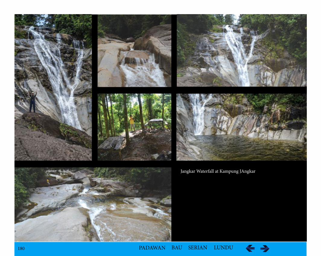
180 PADAWAN BAU SERIAN LUNDU
Jangkar Waterfall at Kampung JAngkar
181 PADAWAN BAU SERIAN LUNDU
Kampung Selampit
LocationKampung Selampit is situated along the Lundu-Sematan Road.
Population – 178
Ethnic GroupBidayuh - Jagoi
Historical InformationBidayuh Jagoi originated from Bung Bratak. They moved to Mount Jagoi due to bad omen according the legend. Facing limited expansion, they moved to Kalimantan Barat where they settled at Jagoi Babang. A year later, a splinter group moved to Stass and from Kampung Stass, they went to Belubai in Kalimantan Barat. Living there for a few years, after being hit by cholera, some left to Sungai Raso in Lundu in 1905. They settled at Kampong Stungkor and lived for four generations, before land and religious pressure forced a group to move to build a new settlement called Kampung Selampit along River Jaong. They were joined later by a second group from Kampung Raso.
Folklore/LegendThere are two versions of the origins of the Bidayuh Bijagoi. One version related them to the migration from Rabak Mikabuh at Penrissen to Paya Rais and later moved to Mount Jagoi. The second version related to a dream of a Bidayuh warrior in Bung Bratak. In his dream he saw one wild boar among the domestic pigs. He also saw a sea turtle swimming at the Pangkalan Bratak. Interpretive as an ominous sign that they would be attacked by two groups of enemies, he moved his families to safety at Mount Jagoi. His dream came true as Bung Bratak was attacked and burnt down.
One later legend relating to the origin of the name of Selampit described a couple during the headhunting days in the early 19th Century, wanted to escape from a headhunting expedition, left Kapung Raso using a longboat down the Batang Kayan River. Upon arriving at Batu Siib near the present Kampung Selampit, they were cornered by the enemies and both husband wife and longboat were pressed into two pieces of stone. Since the word ‘lampit’ means pressed, it was believed this legend gave the name of the settlement. However, geological reasoning was that since the settlement is situated between Batang Kayan River and River Jaong, the village is pressed by these two rivers.
182 PADAWAN BAU SERIAN LUNDU
Cultural Heritage – Gawea SowaGawea Sowa is held to thank the spirits of the land, the sea, the wind, their ancestors and most importantly - the spirit of padi or e'eng podi. This is celebrat-ed 18 anytime from the 1st to 31st of June. It is a three days celebration. On the first day that the bawal is erected on the tonju of the Ketua Gawai's house, who is chosen from one of the celebrant families, each of whom contributes a certain amount towards the costs. After building the bawal, they decorate the area with plants which have significance to the padi spirit and make various other offerings. In the evening, the dayung borih (female shamans) and piny-igar (priests) along with their assistants chant to call the spirits, the ancestors and the gods of wind, land and sea to come and feed on offerings in the hut.
On the second day, they make yet other offerings, and there is dancing with continuous drum beating. Every dance is symbolic with one for clearing of the land, another for the preparation of seedlings and of course another for a good harvest. The climax of Gawea Sowa is on the third day, when all the spirits come together.
That afternoon, they are fed after having been called down in the 'ngayun' ceremony - during which the dayung borih swing on indoor contraptions. In-viting music is played on gongs, and the spirits are welcomed. The ones that arrive are the spiritual spouses of the shamans, and they eat with their earthly husbands and wives in front of the bawal. Later that evening, the shamans again have to chant melodies to invite the spirit of padi or e'eng podi- to come closer for a good harvest. The shamans go into trance for this, leaving for the next world to meet their spiritual spouses. Usually the priests and priestess are rewarded with the magical appearance in the rice packets of the offerings with new rice seeds for the next planting and little pebbles to signify cool, and therefore good, planting.
The Gawai house is the scene of Selampit's own particular way of celebrating Gawea Sowa. The tonju - the open-air bamboo drying area in front of the house - is covered with mats and the gong beaters are visible under the thatched leaves. An altar called a bawal has been built and decorated with bamboo poles with red and white pennants.
Geographical FeaturesSungai Batang Kayan and River Jaong runs through the villages with pebbled river banks. The legendary rock in the jungle called the 'Batu Si'ib' is the site for the celebration of the Gawai.
VegetationThe vegetation is of lush tropical rainforest.
Tourism Activitiesi.Experience the local cultureii.Fishing
Accommodation Availabilitiesi.Siar Beachii.Tanjung Datu National Park
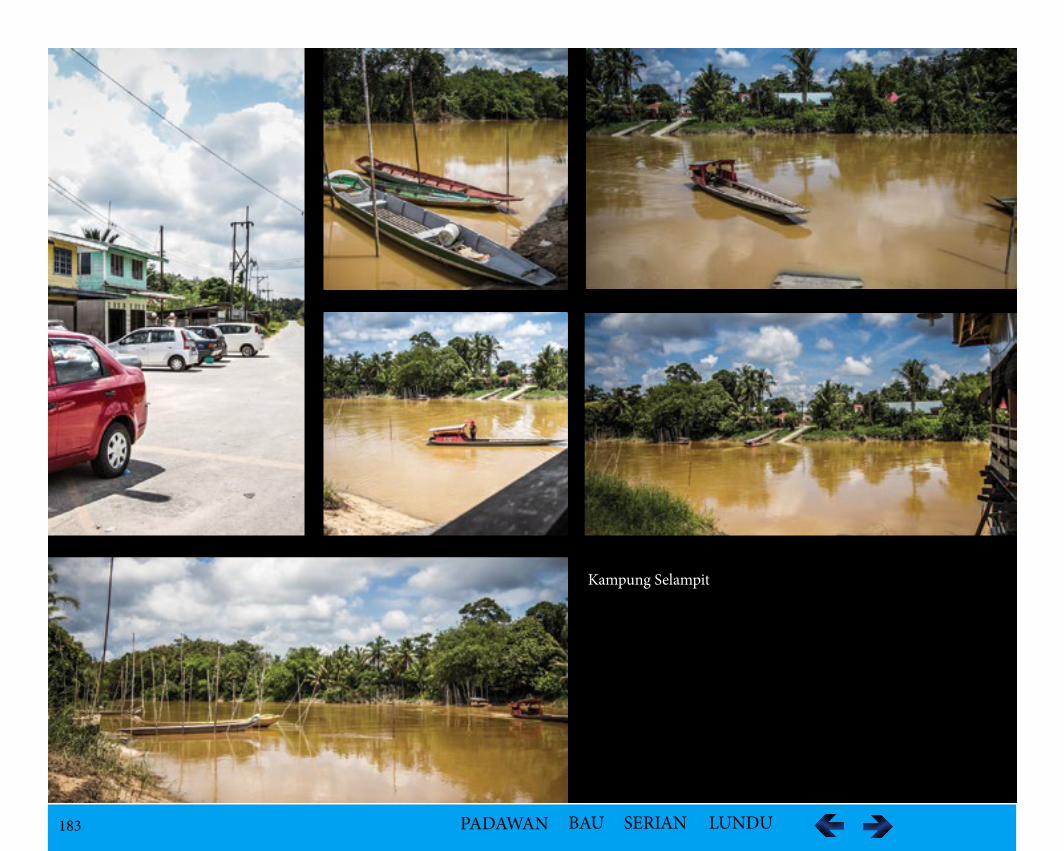
183 PADAWAN BAU SERIAN LUNDU
Kampung Selampit
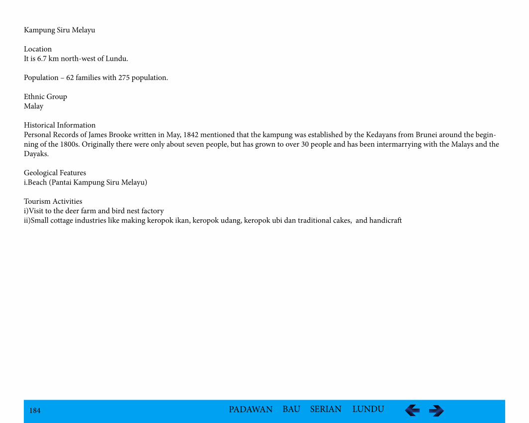
184 PADAWAN BAU SERIAN LUNDU
Kampung Siru Melayu
LocationIt is 6.7 km north-west of Lundu.
Population – 62 families with 275 population.
Ethnic GroupMalay
Historical InformationPersonal Records of James Brooke written in May, 1842 mentioned that the kampung was established by the Kedayans from Brunei around the begin-ning of the 1800s. Originally there were only about seven people, but has grown to over 30 people and has been intermarrying with the Malays and the Dayaks.
Geological Featuresi.Beach (Pantai Kampung Siru Melayu)
Tourism Activitiesi)Visit to the deer farm and bird nest factoryii)Small cottage industries like making keropok ikan, keropok udang, keropok ubi dan traditional cakes, and handicraft
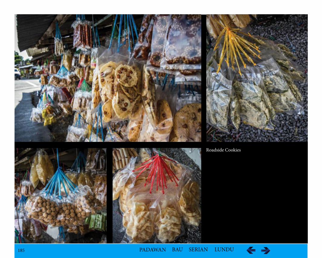
185 PADAWAN BAU SERIAN LUNDU
Roadside Cookies
186 PADAWAN BAU SERIAN LUNDU
Kampung Stunggang Melayu
Population – 1196
Ethnic GroupMalay
Historical InformationAs far as anyone knows, the lands around Lundu were empty of people until relatively recently. Although the main river is called Batang Kayan, "the Kayan river," there is no evidence at all that any Kayan people ever lived there. In the middle of the eighteenth century a group of Bidayuh people from near Bau migrated and settled on the west bank of the Batang Kayan, where Kampong Stunggang Melayu now stands. They came to be called the Dayak Lundu, and though the last member of the tribe died in the 1960s, the grove of durian trees they planted is still around.
Tourism Activitiesi.Visit to the small Keropok industries
187 PADAWAN BAU SERIAN LUNDU
Kampung Tanah Hitam
Locationclose proximity to Lundu town
Population1043
Ethnic GroupMalay
Geological FeaturesSandy Beaches
Tourism Activitiesi.Crab farm (well-known for its crab farms)ii.Fishingiii.Trekkingiv.white water rafting,
Accommodation Availabilities
Homestayi.Kampung Tanah Hitam Homestay94100 Sematan, Lundu, SarawakContact person: Mr MunirTel: 016 855 1793 / 010 507 0456Fax: 082 711 152
-Activities offered: Pueh Mountain range, Gunung Gading, Rafflesia, Pitcher Plants and Sematan Beach.
188 PADAWAN BAU SERIAN LUNDU
Kampung Telok Serabang
LocationKampung Telok Serabang is located at Jalan Lundu/Sematan at Sematan.
Population – 15 families and 60 population
Ethnic GroupMalay
Historical InformationMount Pueh or Gunung Pueh, also known as Mount Pueh-Berumput, Mount Poi and Mount Poe, is a mountain located near Lundu on the Malaysia-In-donesia border. It was made well-known by Eric Mjöberg (1882–1938), a Swedish naturalist and biologist who was then the Curator of the Sarawak Muse-um (1922–1924), for the collections made there. Mjöberg’s herpetological collections from Gunung Pueh between October to December 1923, and other localities in Borneo, were reported by Smith (1925). Mjöberg, unfortunately, left little by way of written records, of his ascent of Pueh and the collections he made.
Geological Featuresi.Coastal sandy beaches fronting the South China Seaii.Gunung Puehiii.River Tembaga iv.Pulau Gado, a tiny island surrounded by corals and beautiful stony shores known as Batu Mandi and Batu Dinding
VegetationMangrove Forest and a coconut plantation was established by the Malays immigrants from Sambas Area in Kalimantan during the Brooke’s rule.
FaunaAn abundance of biodiversity that includes 26 species of birds, four species of bats and one species of rat were observed. The only montane endemic re-corded is the Grey Fruit bat, Aethalpos alecto. Based on their tracks and other signs, wild pigs (Sus barbatus) were common near the summit. Three Ar-cuate Horseshoe bats (Rhinolopus arcuatus), previously recorded only from Bungoh cave near Bau in Sarawak are also found. From the sea are the turtles.
Tourism Activitiesi.Sport fishing trip and snorkeling for marine-tourism industry
Accommodation i.Homestay Kampung Telok Melano / Telok Serabangii.Persatuan Nelayan Kawasan Sematan/Lunduiii.Kampung Tanah Hitam
189 PADAWAN BAU SERIAN LUNDU
Kampung Rambungan
LocationKampung Rambungan is located along in Lundu-Sempadi Road.
Population – 35 families and 237 population
Ethnic GroupMalay
Historical InformationRambungan was established by two brothers from Bukit Sari of Samah and Radat around 1900. Sampadi Kampung Lundu was established by Haji Gherib and his followers who were migrants from Brunei at the beginning of 1902. The true history of this village was about a well known event of a court case and a suit by the villagers.
Geological FeaturesRambungan Beach is in the vicinity and at the Sempadi Island is a boat ride away. The Rambungan River or Batang Rambungan passes the kampung.
Vegetation i.Mangrove Forest
FaunaThe unique fish, Betta ibanorum get trapped in small pools of water during dry weather.
Tourism Activities
i.View of the sea from the Rambungan Jetty and enjoy fishingii.Swimming at the seaside iii.One hour kayaking to Sempadi Island iv.Gateway to Satang Island and Talang-Talang Island nearbyv.Boat ride to Sempandi Island
190 PADAWAN BAU SERIAN LUNDU
Kampung Stungkor
LocationKampung Stungkor Baru is at 52 km along the Kuching/Lundu Road.
Population513
Ethnic GroupBidayuh - Jagoi.
Historical InformationBidayuh Jagoi originated from Bung Bratak. They moved to Mount Jagoi due to bad omen according the legend. Due to limited expansion, they moved to Kalimantan Barat where they settled at Jagoi Babang. A year later, splinter group moved to Stass and the Kampung Stass, they went to Belubai in Kali-mantan Barat. Living there for a few years, after hit by cholera, some left to Sungai Raso in Lundu in 1905. They settled at Kampong Stungkor. Stungkor is a kind of tree that was found aplenty along the River Stungkor. In 1959, a group left and created a new village along Kuching/Lundu Road and named it Kampung Stungkor Baru.
Folklore/LegendThere are two versions of the origins of the Bidayuh Bijagoi. One version related them to the migration from Rabak Mikabuh at Penrissen to Paya Rais and later moved to Mount Jagoi. The second version related to a dream of a Bidayuh warrior in Bung Bratak. In his dream he saw one wild boar among the domestic pigs. He also saw a sea turtle swimming at the Pangkalan Bratak. Interpretated as an ominous sign that they would be attacked by two groups of enemies, he moved his families to safety at Mount Jagoi. His dream came true as Bung Bratak was attacked and burnt down.
Cultural HeritageThe kampung is part of the Gawai Carnival organized by Redeems (Association of Research and Development Movement of Singai Sarawak). 7.3.14Telok Melano
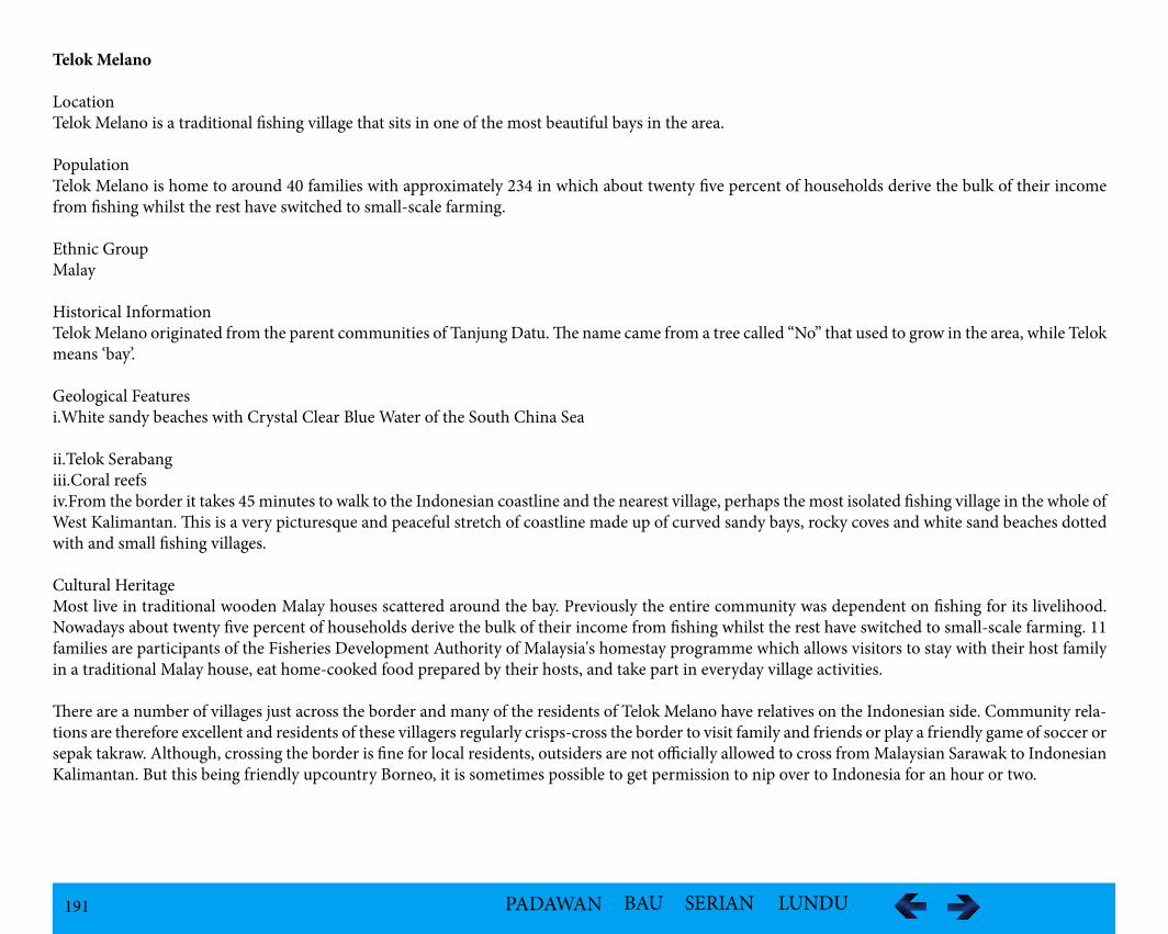
191 PADAWAN BAU SERIAN LUNDU
Telok Melano
LocationTelok Melano is a traditional fishing village that sits in one of the most beautiful bays in the area.
PopulationTelok Melano is home to around 40 families with approximately 234 in which about twenty five percent of households derive the bulk of their income from fishing whilst the rest have switched to small-scale farming.
Ethnic GroupMalay
Historical InformationTelok Melano originated from the parent communities of Tanjung Datu. The name came from a tree called “No” that used to grow in the area, while Telok means ‘bay’.
Geological Featuresi.White sandy beaches with Crystal Clear Blue Water of the South China Sea
ii.Telok Serabangiii.Coral reefsiv.From the border it takes 45 minutes to walk to the Indonesian coastline and the nearest village, perhaps the most isolated fishing village in the whole of West Kalimantan. This is a very picturesque and peaceful stretch of coastline made up of curved sandy bays, rocky coves and white sand beaches dotted with and small fishing villages.
Cultural HeritageMost live in traditional wooden Malay houses scattered around the bay. Previously the entire community was dependent on fishing for its livelihood. Nowadays about twenty five percent of households derive the bulk of their income from fishing whilst the rest have switched to small-scale farming. 11 families are participants of the Fisheries Development Authority of Malaysia's homestay programme which allows visitors to stay with their host family in a traditional Malay house, eat home-cooked food prepared by their hosts, and take part in everyday village activities.
There are a number of villages just across the border and many of the residents of Telok Melano have relatives on the Indonesian side. Community rela-tions are therefore excellent and residents of these villagers regularly crisps-cross the border to visit family and friends or play a friendly game of soccer or sepak takraw. Although, crossing the border is fine for local residents, outsiders are not officially allowed to cross from Malaysian Sarawak to Indonesian Kalimantan. But this being friendly upcountry Borneo, it is sometimes possible to get permission to nip over to Indonesia for an hour or two.
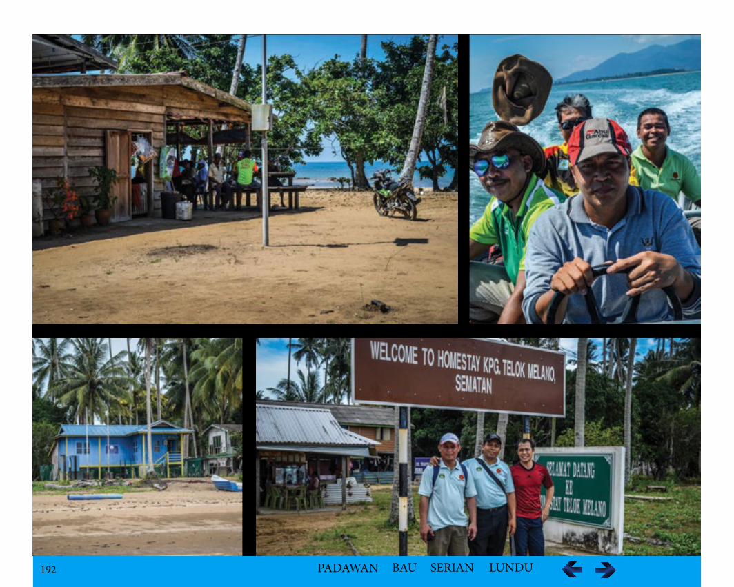
192 PADAWAN BAU SERIAN LUNDU
193 PADAWAN BAU SERIAN LUNDU
Vegetationi.Gateway to Tanjung Datu National Park which comprises a narrow ridge of rugged forest-covered hills fringed by pristine white sand beaches, crystal clear waters and patches of coral reefii.Coconut trees
FaunaVarious wildlifes can be found in Tanjung Datui)Hundreds of bird species with at least three types of Hornbill, as well as peacocks.ii) Primates include Bornean Gibbons, Pig-Tailed Macaques, Long-Tailed (or Crab-Eating) Macaques, and Silvered and Banded Langurs (or Leaf Mon-keys).iii)Bearded Pigs, Sambar Deer, Mouse Deer, Barking Deer, Bearcats, Civet Cats and various species of squirrel are amongst the land mammals that may occasionally be seen here.iv)Reptile species include a variety of ground and tree lizards, as well as Pit Vipers and Tree Snakes, but Tanjung Datu’s greatest contribution to reptile con-servation is its role as a marine turtle nesting site. Highly endangered Green Turtles and Olive Ridley Turtles regularly lay their eggs on the park’s beaches. Therefore a turtle hatchery has been established - a fenced-off area close to the beach which is protected and monitored by park staffv)Tanjung Datu’s coral reefs are home to a number of venomous creatures, including Sea Snakes, Coral Snakes, Stonefish and Cone Shells. Marine Snakes are usually harmless if undisturbed, and if seen should be left well alone. Stonefish may conceal themselves in mud or sand surrounding the coral, espe-cially at low tide. Cone Shells are highly venomous and should not be handled under any circumstances.vi)A short distance offshore from the park there is a small coral reef. Further offshore there are a number of artificial reefs established by the Fisheries Development Authority since 1986. These artificial reefs were added to create an additional fisheries resource for the communities in the area and also to prevent commercial fishing vessels from trawling. Ten years on and the reefs are starting to take shape with both soft and hard corals clinging to the concrete spheres and tubes of the original structure, and various marine life taking sheltering amongst the coral. It is possible to dive in these reefs and the Fisheries Development Authority can help to organise diving trips in this area and on small reefs located to the south of Telok Melano.
Tourism Activitiesi)A trip to Telok Melano is only possible in the dry season as during the monsoon season from October to March there are high seas.ii)A 10 minute boat ride from the village brings to Tanjonng Datu National Park. Although Tanjung Datu is not officially open to the public for overnight stays it is possible to cruise up the coast from Telok Melano and stop off at the park along the way. iii)Tanjung Datu is an important conservation area as it contains one of Sarawak's few turtle beaches. There is a small turtle hatchery at the ranger's post.iv)The Telok Melano area is also good for jungle trekking from the village to Tanjung Datu National Park or even trek all the way back to Sematan, which is day's walk for most people. Another option is to head inland along well-worn walking paths that lead to small farms and vegetable gardens. In addition to subsistence crops, most villagers grow cash crops such as pepper and rubber. Visitors staying at Telok Melano are welcome to try their hand at tapping rubber, harvesting pepper or, if they are up for it, a full day's work in the fields.v)Beyond the farms of Telok Melano lies the Indonesian province of West Kalimantan. From the coast it only takes 25 minutes to walk to the border which is marked by a small wooden Welcome to Indonesia arch.The border here is not an official crossing point so there are no immigration or customs officials. All official matters are dealt with by three policemen on the Indonesian side and one policeman at Telok Melano. A ride back to Telok Melano on the back of motorbike costs RM 5 one way in 15-20 minutes.vi)The homestay programme provides Cultural Show - Gendang Show in traditional Malay Architecture Wooden Houses.
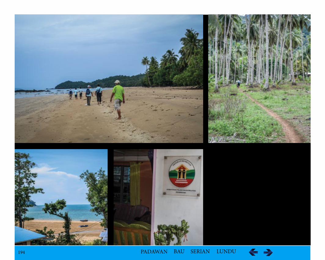
194 PADAWAN BAU SERIAN LUNDU
195 PADAWAN BAU SERIAN LUNDU
Accommodation Homestay - Staying with a family at Telok Melano as part of the Sarawak Fishing Village Homestay Programme, a community based project set up by the Malaysian Fisheries Board and the village's fishing association.i.Telok Melano Homestay
En. Mohd Hj Wek / Pn. AffidahTel: +6082-711152 / +6010-982 1506Fax: +6082-711152Email: [email protected] D/A Persatuan Nelayan Kawasan Sematan/Lundu, Sarawak
ii.Telok Melano Homestay ProgrammeMr Abg. Ahmad Zulkipli B. Abg Mohd NerawiCoordinator "Projek Perintis Homestay."Fisheries Development Authority of Malaysia (LKIM)2nd Floor, Bangunan Bank Negara,Jln Satok, PO Box 2201, 93744 Kuching, Sarawak, Malaysia.Tel: 082-245481Fax: 082-256871
AccessibilityDuring the dry season there are two ways of getting to Telok Melano from Sematan i)Approx. 45 minutes by speedboatSpeed boat from the Fisheries Board can be rented to Telok Melano for a group of 5 or more. The speedboat skims the surface with the two outboards powering along. ii)By traditional fishing boatIf on a budget, or travelling alone or in a small group, the best option is to hitch a ride on a local fishing vessel which takes approximately two hours. Al-most every day during the dry season at least one boat from Telok Melano comes to Sematan, normally arriving around 10 am and leaving at midday or after lunch. There is no fixed schedule.
Boat Fee from Sematan to Teluk Melano:Boat type Rate (RM)Speed boat 250.00 (return trip)Fishing boat 10.00 (local)15.00-20.00 (tourist)
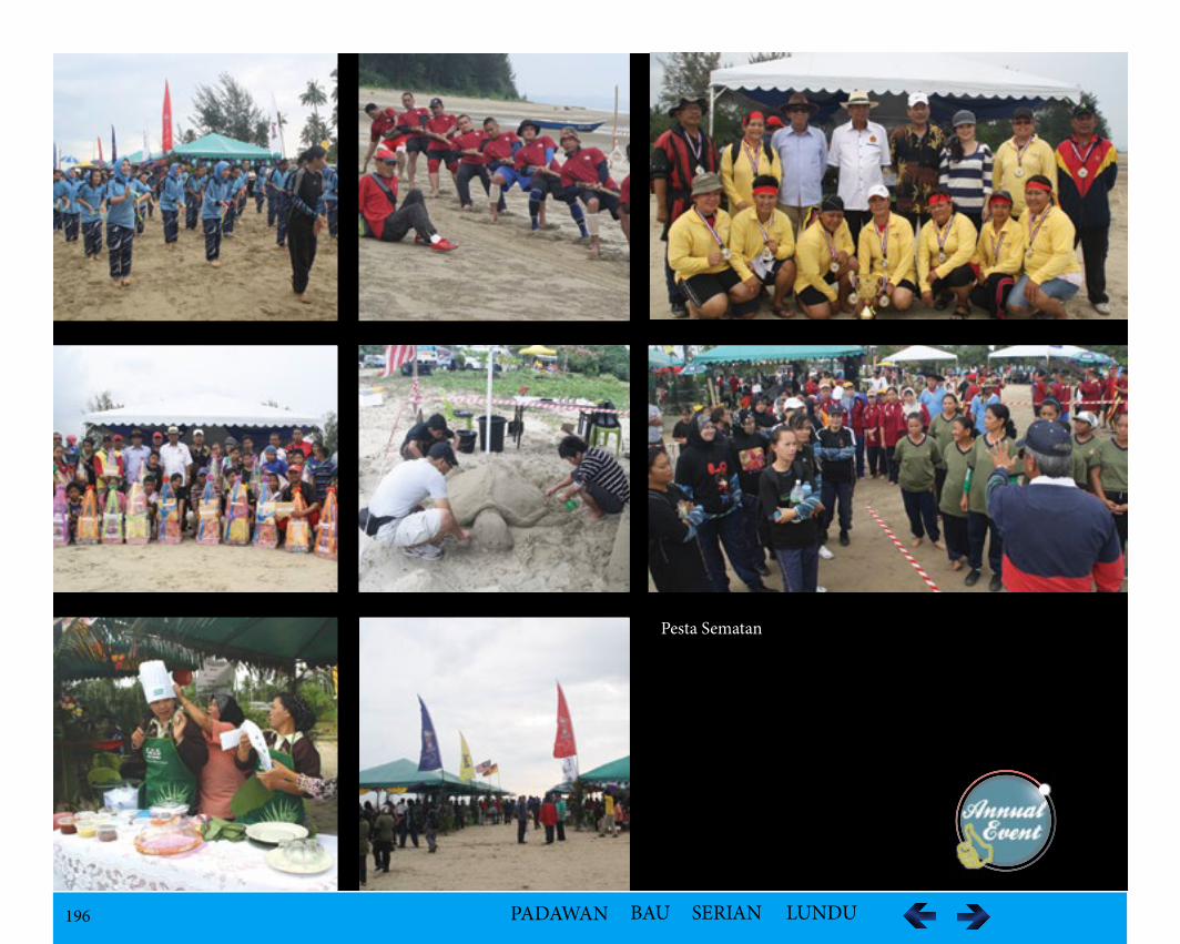
196 PADAWAN BAU SERIAN LUNDU
Pesta Sematan
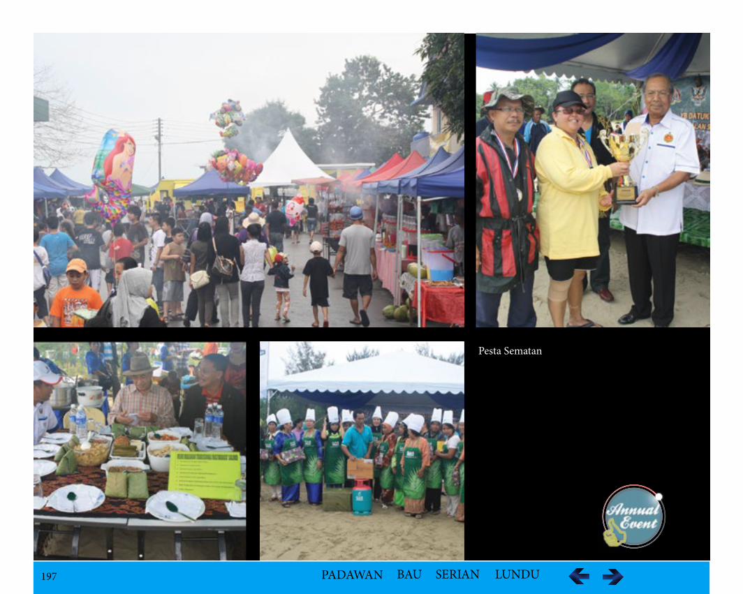
197 PADAWAN BAU SERIAN LUNDU
Pesta Sematan
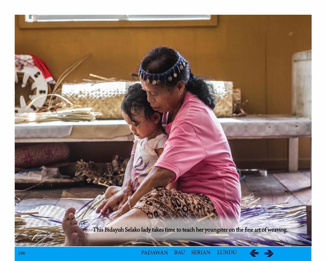
198 PADAWAN BAU SERIAN LUNDU
This Bidayuh Selako lady takes time to teach her youngster on the fine art of weaving.
199 PADAWAN BAU SERIAN LUNDU
Thank You for using the
eBook
Related Documents