PACIFIC MARINE CLIMATE CHANGE REPORT CARD Science Review 2018: pp 159-176 Effects of Climate Change on Settlements and Infrastructure Relevant to the Pacific Islands John Connell, University of Sydney, Australia. Introduction Climate change is of considerable significance in the Pacific region. Though contributing almost nothing (around 0.03%) to greenhouse gas emissions, the Pacific is on the receiving end of their impact. Because of the concentration of atolls in the region, climate change will have a more severe impact than in most parts of the world. What is Already Happening? Three regional climate related changes are simultaneously occurring: (i) a rise in air and sea- surface temperatures (projected to increase by up to 2°C by 2050); (ii) changes in rainfall (with expectations of less frequent but more intense rainfall events, and greater storminess, with potential impacts on flooding); and (iii) higher future sea levels (Lal et al. 2002, Mimura et al. 2007). Each of these varies regionally most notably the El Niño Southern Oscillation (ENSO), a quasi-periodic climatic pattern that occurs across the Pacific roughly every five years, that changes sea- surface temperatures (warming with El Niño and EXECUTIVE SUMMARY From around the time of independence, mostly in the 1970s, the coastal zones of most Pacific states have experienced changes in land use, from being primarily agricultural to becoming increasingly urban and tourism orientated. This ‘coastal squeeze’ has led to a concentration of infrastructure and wealth in low lying coastal areas, prone to multiple natural hazards, the impacts of which are exacerbated by climate change. Climate change projections for the Pacific suggest that sea levels will rise by as much as 1.4 m by the end of the century potentially increasing erosion and coastal flooding brought about by storm surges and cyclones superimposed on rising sea levels. Cyclones are likely to be less frequent but more severe and over an expanded area, evident in the recent impacts of Cyclones Pam and Winston. Changes in temperature and rainfall indicate a general warming and drying trend, variable across the region, with a probable greater incidence of drought in association with El Niño Southern Oscillation (ENSO) events, but also an increased frequency and severity of pluvial flooding. These physical changes are likely to lead to increased threats to coastal population concentrations, especially urban settlements, with accompanying negative impacts on national economies. The impacts are and will be greatest for atolls and atoll states.

Welcome message from author
This document is posted to help you gain knowledge. Please leave a comment to let me know what you think about it! Share it to your friends and learn new things together.
Transcript

PACIFIC MARINE CLIMATE CHANGE REPORT CARD
Science Review 2018: pp 159-176
Effects of Climate Change on Settlements and Infrastructure Relevant to the Pacific Islands
John Connell, University of Sydney, Australia.
Introduction Climate change is of considerable significance in the Pacific region. Though contributing almost nothing (around 0.03%) to greenhouse gas emissions, the Pacific is on the receiving end of their impact. Because of the concentration of atolls in the region, climate change will have a more severe impact than in most parts of the world.
What is Already Happening? Three regional climate related changes are simultaneously occurring: (i) a rise in air and sea-
surface temperatures (projected to increase by up to 2°C by 2050); (ii) changes in rainfall (with expectations of less frequent but more intense rainfall events, and greater storminess, with potential impacts on flooding); and (iii) higher future sea levels (Lal et al. 2002, Mimura et al. 2007). Each of these varies regionally most notably the El Niño Southern Oscillation (ENSO), a quasi-periodic climatic pattern that occurs across the Pacific roughly every five years, that changes sea-surface temperatures (warming with El Niño and
EXECUTIVE SUMMARY
From around the time of independence, mostly in the 1970s, the coastal zones of most Pacific states
have experienced changes in land use, from being primarily agricultural to becoming increasingly urban
and tourism orientated. This ‘coastal squeeze’ has led to a concentration of infrastructure and wealth in
low lying coastal areas, prone to multiple natural hazards, the impacts of which are exacerbated by
climate change. Climate change projections for the Pacific suggest that sea levels will rise by as much
as 1.4 m by the end of the century potentially increasing erosion and coastal flooding brought about by
storm surges and cyclones superimposed on rising sea levels. Cyclones are likely to be less frequent
but more severe and over an expanded area, evident in the recent impacts of Cyclones Pam and
Winston. Changes in temperature and rainfall indicate a general warming and drying trend, variable
across the region, with a probable greater incidence of drought in association with El Niño Southern
Oscillation (ENSO) events, but also an increased frequency and severity of pluvial flooding. These
physical changes are likely to lead to increased threats to coastal population concentrations, especially
urban settlements, with accompanying negative impacts on national economies. The impacts are and
will be greatest for atolls and atoll states.
160
cooling with La Niña) and air-surface pressures. At the peaks of these cycles, more extreme weather occurs. ENSO fluctuations have been the most important influence on climate variability in recent decades. In most of the Pacific, particularly high sea levels have been recorded during La Niña events, for example from July 2006 to June 2008 (Chowdhury et al. 2010). Drought in the Papua New Guinea (PNG) highlands from 2015-16 was also linked to ENSO. Such short-term climatic shifts must be differentiated from long-term changes. Climatic changes, at different scales, are complex, while relatively few records exist in many parts of the Pacific to document the extent and impact of climate change locally, both directly and in their outcome, for such changes as water availability, agricultural production, food security and health. The Pacific region (here the nine independent states of Fiji, Kiribati, Nauru, Papua New Guinea (PNG), Samoa, Solomon Islands, Tonga, Tuvalu and Vanuatu) includes some of the most vulnerable islands and countries in the world, and the islands most at threat to climate change and population displacement are coral atolls. The Pacific islands region is vulnerable to cyclones and droughts (associated with ENSO), and also to non-climate related tectonic activity. Volcanic activity is common in the ‘ring of fire’ that describes an arc more or less through the Melanesian Small Island Developing States (SIDS). PNG and Vanuatu have been, and remain, the site of some particularly violent volcanoes (Nunn 2009). Population shifts have accompanied volcanic activity (and tsunamis) in the past half century; the future of such displaced populations offers precedents for the resettlement of people displaced by the effects of climate change. Sensitivity to environmental influences is compounded by some states being composed of many islands scattered over very large areas. Its socio-economic vulnerability is the outcome of population size and distribution, small open economies, limited human resources, poor and aging infrastructure, distance from markets and few economies of scale. Gradually rising sea levels, and more intense storms and cyclones pose risks to coastal settlements, water resources, plants and human health (Nurse et al 2014). More than 150 populated atolls (usually ring-shaped reefs and chains of islands formed of coral) are in the Pacific. In atolls, all settlements are coastal and only just above sea level, and the atolls have long sinuous coasts and small land areas (Nunn and Kumar 2006). Atoll states are prone to a range of hazards, most of
which exist elsewhere, but islanders are less easily able to mitigate such hazards, or, without high ground, retreat from them (Connell 2013). The two states most at risk are Kiribati and Tuvalu, having weak economies, significant dependence on subsistence fisheries and agriculture, scarce human resources and being exclusively composed of atolls scattered over a vast expanse of ocean. An additional problem is that of water shortages, where ground water lenses are under increased human pressure, especially in urban centres, and rainfall is intermittent. The atoll states are also more isolated than the other states, hence costs are high, and the multiple problems of development are thus multiplied further, and emphasise the recourse to migration. As a result of inherent vulnerabilities, the Pacific island states have faced wide-ranging economic, social, environmental and political challenges that impeded their achievement of the Millennium Development Goals (MDGs). Some were successful in reducing child mortality and in achieving universal primary education, but few made gains in reducing poverty and achieving gender equality. Health and education outcomes are generally poorer in Melanesia (except Fiji) and Micronesia. The Pacific region is currently facing a non-communicable diseases (NCDs) crisis, which is the leading cause of death in all the states except PNG (Commonwealth Secretariat 2017). PNG is the most populous country in the region, estimated at around 8 million people, representing three quarters of the region’s population and 84 per cent of the total land area. By contrast, Tuvalu is the least populous, with a population estimated at less than 10,000 people. Except for Nauru, Kiribati, Tuvalu and Fiji, the majority of inhabitants of the Commonwealth Pacific small states live in rural and outer island areas. The Pacific SIDS span three broad cultural regions: Melanesia (Fiji, PNG, Solomon Islands and Vanuatu), Micronesia (Kiribati, Nauru) and Polynesia (Samoa, Tonga, Tuvalu). Population densities of the Micronesian and Polynesian states are higher than in the more mountainous Melanesian states and islands. In the last half century, there has been both accelerated international migration and rural-urban migration, with declining populations in national peripheries and growing high density urban concentrations, exclusively on coasts (other than in parts of PNG), where relatively flat land is available for agriculture, tourism and urban growth. The ‘coastal squeeze’ has put pressure on water resources and

161
agricultural land, led to the clearance of mangroves, polluted lagoons, reduced the habitat of coastal fisheries, increased the potential for coastal erosion, and resulted in the bulk of populations living on the coast and in urban areas. Almost all the population live on or near the coast, except in PNG, and to a much lesser extent Vanuatu, Tonga and Solomon Islands. Tourism and service infrastructure and manufacturing industries are almost exclusively coastal. Only PNG has significant infrastructure, mines and plantations and population concentrations located away from coasts, and there and elsewhere almost all capital investment and infrastructure is in vulnerable near-shore areas. These trends have accompanied slow economic growth, the inability to create adequate numbers of jobs in the formal sector, steady population growth, greater pressure on a range of resources and rising expectations of what constitute adequate lives and livelihoods. As urban centres have grown, newer migrants and newer housing areas, often informal, have located in marginal sites that are vulnerable to hazard, by either being on steep slopes, in valleys or on the coasts themselves. Informal housing especially does not meet cyclone standards. More affluent urban citizens are able to live at higher altitudes. Towns and cities have grown rapidly since independence, but without effective planning or management (Mecartney and Connell 2017). This has resulted in ‘over-urbanisation’ characterised by high levels of unemployment, formal housing unable to meet the needs of migrants (and others), inadequate urban services, such as water and electricity, informal housing areas, alongside significant and intensified environmental problems, associated with inadequate sewerage, water supply and waste management, and occasional flooding. That has added to serious problems of urban management (Connell 2013). The concentration of populations and economic assets in potentially vulnerable coastal zones is of concern, if unavoidable, in the atoll states. The threats posed to Pacific SIDS are significantly increased because the majority of people and infrastructure are located in low-lying coastal zones with limited on-island relocation opportunities. Climate Related Hazards and Vulnerability Actual measurements of climate change are scarce. Assumptions and projections are derived from regional and global estimates and measures, but since these are often limited in oceanic realms, general circulation models lack local specificity. Specific data are critical
to ensure detailed assessments of vulnerability and risk. In the Pacific there has been a net increase in temperature since around 1800 when the Little Ice Age ended (Nunn 2007). The limited data from the region broadly agree with IPCC data on a global warming of 0.56–0.77ºC between 1901 and 2001. Over the past 50 years in the Pacific warming trends have however varied between 0.08ºC and 0.20ºC per decade (Australian Bureau of Meteorology and CSIRO 2011). Relatively little can be done by small Pacific states alone to mitigate or effectively avert their exposure to hazards associated with climate-related events; their consequences are more within societal control although the options available are limited. In terms of environmental risks, disasters affect Pacific small states disproportionately compared to other small states, in terms of occurrence and probability, as well as damage and losses (Cabezon et al. 2016). The recent devastating and unprecedented impacts of Cyclone Winston in Fiji (2016) and Cyclone Pam in Vanuatu (2015) are acute reminders of how natural disasters can derail the development prospects of SIDS. Climate change poses a particular threat to Pacific SIDS, especially the atoll states of Kiribati and Tuvalu, where nowhere is more than 3 metres above sea level. Climate change also threatens agricultural production and income, particularly in the Melanesian island states, through increased water salinity, marine productivity, and also tourism and health. The level of exposure to climate hazards varies between states based both on geographical factors (such as the propensity to experience cyclones and droughts, island types and topography) and on such factors as population and infrastructure distribution, all of which provide a framework for considering regional vulnerability (Forbes et al. 2013). The atoll states and Vanuatu have proved particularly vulnerable, the former to storm surges, and the latter to cyclones. A range of climate-related hazards have an impact on coastal and marine settlements and infrastructure, compromising their functioning and resulting in loss of life, damage and economic losses. These can be rapid-onset events that take place on a relatively short timescale, such as storm surges, high winds, and abnormal rainfall events, and these can be either individual events or collective events where two or more of the effects occur near simultaneously. On the other hand, there are longer term slow-onset events, which can be difficult to detect and whose impacts are more diffuse and operate through secondary causes, the most significant of which is sea-level rise, because

162
it is both ubiquitous and seemingly inexorable. Heat stress and drought may also be slow-onset events. Heat Stress As urbanisation has increased the heat island effect has increased in parallel, with rising temperatures in the largest urban centres, though limited in the smaller towns of Pacific SIDS. Higher temperatures in urban centres increase stress and morbidity. Urbanization at greater densities, with more fuel and vehicle usage, intensifies the heat island effect and increases air pollution. Diseases such as asthma, presently significant in larger urban areas, may become more prevalent. Hazards also influence health status. During 2002–03 when Vanuatu experienced five cyclones, the incidence of malaria doubled that of the preceding year (Lal et al. 2009). Flooding affects health, with a greater incidence of skin and vector-borne diseases. Loss of access to safe water supplies accentuates the incidence of diarrhoea, where rates are positively correlated with temperature, and negatively with water availability (Connell 2013). Such circumstances are particularly prevalent in the atoll states while El Niño has been linked to outbreaks of malaria, cholera, dengue and other infectious diseases (Singh et al. 2001). Urban household sizes are large which increases the risk of disease transmission. Greater incidence of hazard events, and temperature increases, are likely to worsen health status, and increase the social and economic costs of health care. Climate change potentially harms human health, directly and indirectly. Increased temperatures are associated with drought periods and hence compound other drought-related effects. Heatwaves can cause direct effects such as dehydration, heat exhaustion and heat stroke, and most affect vulnerable sections of the population, such as the elderly, compounded with the reduced availability of local food supplies. The incidence of dengue in the Pacific is correlated with both rising temperatures and ENSO events but the latter may be no more significant in the future (Lal et al. 2002). By the late 2000s dengue had become more widespread and was regarded as having reached ‘epidemic’ proportions in places. The 1998 dengue fever epidemic in Fiji cost $3–6 million (Mimura et al. 2007), and future outbreaks could be more costly. Rising temperatures, longer wet seasons, and increased urbanization have all contributed to the global rise of dengue and other vector-borne diseases.
Droughts Various small islands have only been settled intermittently because of inadequate rainfall, and droughts are recurrent phenomena that are usually associated with El Niño events. Even on islands where rainfall is normally heavy, significant breaks in rainfall are enough to damage food plants. Droughts can affect coastal groundwater aquifers which supply urban areas. In these instances, reduced recharge from rainfall and runoff, coupled with reliance on and continued abstraction from these aquifers in order to meet water demand, has resulted in saline intrusion due to over-pumping. During extended droughts, lenses become more saline or even disappear, as in Kiribati (White et al 1999). The El Niño event of 1997–98 brought droughts to many Pacific states, with consequent reduced agricultural production and food shortages. A similar situation recurred across a belt of the central Pacific in 2011, with Tuvalu significantly affected. Health was affected by people drinking polluted lens water, crops failed, water and desalination plants were shipped in from as far as New Zealand, and water rations imposed in three Pacific SIDS: Kiribati, Tuvalu and Samoa.
Small and remote islands are more at risk of the consequences of drought where alternative water sources are few and relief supplies may be difficult to access. Decreased rainfall both limits water availability and facilitates ocean water intrusion. Alternative water sources, other than rainfall, are invaluable in coping
Box 1. PNG Drought 2015-2016.
The PNG drought of 2015-16 indicates both how droughts can affect every part of Pacific states, and the region as a whole, and how they are recurrent events linked to ENSO cycles. For a year, most of PNG was badly affected by drought and, at high altitudes, this was accompanied by frost. The El Niño drought had a negative impact on water supply and food production, and indirectly on school operations (some of which closed since no water was available), women’s labour (as women had to walk long distances for water), villagers’ health and river transport (with the Fly River not being suitable for shipping for some months). Food was particularly scarce in the highlands above 2000 metres and in some small and remote islands of Milne Bay Province, despite food aid and sweet potato cuttings being delivered by various organisations. Recovery was slow because sweet potato could not be planted until adequate rain was available for it to grow and mature (Bourke et al 2016).

163
with drought. Food security is also threatened by prolonged drought as it was in parts of Tuvalu in 2011. Likewise, in parts of Fiji villagers have had to resort to both purchasing bottled water and rationing fresh water from boreholes to respond to prolonged drought and changes in seasonal rainfall patterns (Pearce et al 2018). Storms and Cyclones Cyclones are frequent in most parts of the Pacific, except in areas which are extremely close to the equator, although cyclonic activity has gradually become more widespread (Rasmussen et al. 2009). Time series data are too limited to give more than indications of the extent of any increased periodicity and severity, while regional variations fluctuate (Mimura et al. 2007). In the Pacific region, no significant trends in either the number of cyclones or their intensity were evident from 1981 to 2007 (Australian Bureau of Meteorology and CSIRO 2011), although there is fragmentary evidence that cyclones may be becoming more intense (Webster et al. 2005, Elsner et al. 2008, Walsh et al. 2012), probably because of the increased frequency of ENSO events. Cyclone intensity is likely to increase in the future, by 2–11 per cent by 2100, but the frequency of cyclones may fall by 6–34 per cent over the same period, resulting in fewer but more damaging cyclones (Knutson et al. 2010). There does seem to have been an increase in cyclone activity in the past decade and higher intensity cyclones, notably Cyclones Pam and Winston, have caused substantially increased damage. High winds are associated with tropical storm and cyclone activity. Typically, the damage caused by winds is to buildings and particularly roofs and overhead utilities. Further destruction is caused by windblown debris including trees and sheet metal. The concentration of buildings and overhead services in built-up areas means that there is a high potential for extensive damage and disruption, especially if damage to power generation and water distribution system occurs.
Although risks and losses differ across islands, factors determining the extent appear to be related to island size and spatial concentrations of economic activity, thus smaller islands and towns where social and economic infrastructure are densely concentrated tend to be more impacted. The greatest problem for small Pacific states is that cyclones may affect the whole country so that there are no safe areas, places where agriculture has survived in order to provide local relief
and some degree of food security, or places to which the population most affected might migrate temporarily.
Flooding Floods often occur in association with cyclones. As cyclones become stronger, and populations are increasingly concentrated in low-lying coastal and riverine areas, their impact is greater. Most floods follow cyclones, but flooding can be exacerbated by coastal water intrusion through storm surges and high tides. As water flows down to the sea, coastal areas are most severely affected. That has been most apparent in Fiji, Solomon Islands and Samoa where intense storms occur, aggravated by steep topography and upstream land clearance, especially for sugar cane in Fiji, alongside the development of housing and infrastructure, all contributing to increased run-off and faster rainfall accumulation. Coastal settlement patterns have restricted natural drainage paths and cannot cope with increased flows within restricted channels. Flood waters therefore follow the path of least resistance, banks are overtopped, roads become drainage paths, while roads, culverts, and bridges have been under-designed to cope with high flows. In addition, solid waste generated in urban areas and debris brought down by flood waters causes blockages
Box 2. Cyclone Pam. The Category Five Cyclone Pam struck Vanuatu in March 2015 and also affected Tuvalu and New Caledonia. It was the second most intense tropical cyclone in the south Pacific in terms of sustained winds. The cyclone followed a north-south path through the country affecting as many as 70% of the population. Eleven people died, half of them in the capital, Port Vila. Ninety percent of structures on the main island of Efate were either damaged or destroyed, both by winds of up to 320 km/hour and by subsequent floods. Storm surges resulted in considerable coastal erosion, telecommunications were cut, and water shortages posed problems. Most smaller islands experienced less drastic immediate effects but had subsequent problems since communications were destroyed and relief supplies could not reach them. Ninety percent of food crops were lost. The overall damage was estimated at $360 million. Low incomes (to purchase food), land shortages, high costs of living, poor housing and limited job opportunities compounded the problems, but social networks and mutual assistance enabled many to get by. Those who were most vulnerable were in rental housing, the elderly, or in female headed households (Rey et al 2017) or in many remote islands that were not easily accessible.

164
within the drainage infrastructure, clogging culverts and adding to flooding. In flash floods after heavy rains in Honiara (Solomon Islands) in 2014, more than 20 people lost their lives, thousands of people were displaced, infrastructure was damaged, and hundreds of homes were damaged or destroyed. The floods left a trail of devastation especially to settlements along the banks of the Mataniko river. The cost of the damage was estimated at US$107 million, and prompted considerations of more effective watershed management, land use planning, culvert clearance, rubbish disposal and building controls. Typically, in such areas as the Rewa delta (Fiji), floods have become more frequent; between 1970 and 1998, 15 tropical cyclones caused floods which intensified in both frequency and magnitude, at the same time as the affected population grew, upper watershed deforestation and monocultural agriculture increased while river sedimentation exacerbated flood problems (Kostaschuk et al. 2001; Lata and Nunn 2012). Rates of sediment deposition in tropical Pacific islands are some of the highest in the world, because of the high frequency of cyclones and associated extreme rainfalls (Terry 2007), contributing to the severe degradation and reduced productivity of coastal lagoon ecosystems. In many parts of Fiji, where most towns are in low-lying areas, and Samoa, where the capital, Apia, is built on the floodplain of four rivers, lack of urban planning has resulted in many businesses and residential properties being located in flood-prone areas, hence vulnerability to flooding is increasing. In 1931 a combination of cyclone and flooding resulted in the death of more than 225 people in Fiji, mainly in recently settled floodplain areas in north-west Viti Levu. One consequence was resettlement away from the floodplain, but growing social and economic pressures subsequently resulted in renewed floodplain settlement, exposing new generations to unfamiliar risks (Yeo and Blong 2010), which duly occurred in 2009 and 2012. In the 2012 floods the worst affected were displaced sugar cane farmers who had moved to the low-lying outskirts of the town of Nadi in search of employment. Here, as elsewhere, the relatively poor were more likely to live in the most flood-prone areas and be unable to afford more flood resistant homes. Where deforestation has occurred, as it often has near coastal and urban areas, flash flooding is more intense and the impacts greater. A 2001 flood event, in itself not unusual, inundated large parts of the Apia urban area, within a ‘negligible time’ from the start of the
intense rainfall, resulting in more than $5 million damage (Penaia et al. 2007). Hard paving results in more rapid runoff and more intense flooding. Fiji is particularly prone to floods, which have accounted for almost a third of disasters since 1970, and has a high-density lowland population. The small town of Navua is flooded about once every 7 years and Nadi, one of the largest towns, and a major transport centre, is also regularly flooded. Damage from 2012 floods in Nadi was estimated at around $40 million – about 1.5 per cent of GDP (Fiji Times, 12 April 2012). The incidence of dengue, leptospirosis and typhoid increased (Nunn 2013). Flooding has social and economic costs which are often prolonged through damage to infrastructure. The 2009 Fijian floods, which followed a series of depressions at a time of high tides, affected over 150,000 people and cost about $13 million to the country’s sugar belt and adjoining urban areas (Holland 2009, Lal et al. 2009). Almost 50 per cent of the flood-affected farm households were expected to subsequently fall below the poverty line. Roads and seawalls were damaged, with the sea claiming parts of previously reclaimed wetland areas, while landslides washed away farmland in hilly areas. Salt inundated farms were not expected to produce crops for at least 2 years (Lal, Rira et al. 2009, Lal 2010). Both the 2009 floods in Fiji and Cyclone Ami in 2003, which badly affected sugar growing areas on Vanua Levu, with the loss of $35 million of sugar (Lal 2003), resulted in some migration into urban areas, especially Suva, since cane growing was no longer productive, government assistance was minimal, sugar cane prices were falling, and long-term land tenure and eviction issues were worsening (Lal 2003, Lal et al. 2009). The most affected were poorer farmers with smaller landholdings and houses on lower ground (Lal et al. 2009). Socio-economic factors thus worsened the impacts of flooding for some population groups, whether relatively remote or poor. Floods typify how the ultimate outcomes of natural disasters are the result of interaction across a complex web of factors: including the timing, duration and intensity of the disaster, and the sensitivity to disaster of affected households, communities, commerce and governments. Natural disasters may become human disasters. Landslides are relatively rare, but can accompany floods and earthquakes. Whilst these are associated with steep slopes and mountainous areas, they have an indirect impact on coastal areas and settlements. They contribute to sediment and debris brought down by swollen rivers, which in turn can magnify the
165
destruction of infrastructure and contribute to flooding, and then cover reefs with sediment. In addition, they disrupt transport links and the provision of water supplies on which coastal urban areas rely. In the highlands province of Hela (PNG) at least 25 people died in 2012 after heavy rain contributed to a landslip some 2 kilometres long and 500 metres wide alongside the Highlands Highway and adjacent to a mining site quarry, prompting concern over the particular causes of the disaster. The severity of coastal flooding depends on various factors, including the geomorphology of the coastal area: what the bathymetry is; how any fringing reefs can dissipate the wave energy; and the topography of the impact area (low-lying and flat, broad or narrow, or how steeply the land rises). The impact is also influenced by the extent to which human activities have altered coastal ecosystems. For example how degraded reef ecosystems are, and if mangroves have been removed and swamp areas been filled in and built over. Coastal Erosion Beaches are the first line of coastal defence and are dynamic in nature. Under normal conditions, beaches are shaped by a myriad of coastal processes such as wind, waves, currents, tides, sediment transport, and high energy events. Increasingly the interactions of coastal processes are being skewed by anthropogenic influences leading to a reduction in beach width. Removal of sand and gravel from lagoons, in Funafuti and Tarawa, has scoured lagoon floors, reduced marine productivity and contributed to coastal erosion (Ambroz 2009a). Many of the region’s coastlines have been affected by deforestation, sea level rise (SLR), tidal and wave action, storms, sand mining and housing, wharf and causeway construction. Construction of seawalls and land reclamation have largely been ineffective in mitigating erosion (ADB 2017). So far human impacts have had a greater influence on localised erosion and coastline changes than more natural processes, hence the impacts of erosion are usually greatest in urbanised areas. Nonetheless on the north coast of New Guinea, on Vanua Levu (Fiji), and on reef islands off the coast of Choiseul (Solomon Islands) shoreline recession and erosion have displaced villages from established sites (Lipset 2011, Albert et al 2016, Charan et al 2017). Sea Level Rise Sea levels have been rising in the Pacific, although this is far from uniform across the region. This has become increasingly evident, with the southwestern Pacific
regarded as one of the global regions most vulnerable to contemporary and future changes (Nicholls and Cazenave 2010; Becker et al 2012; Meyssignac and Cazenave 2012). Estimates of SLR by the Intergovernmental Panel on Climate Change (IPCC) have indicated a global average of 3.1 mm/year between 1993 and 2009, representing an increase from 1.7 mm/year between 1950 and 2009, with the eventual outcome of an SLR of between 0.18 and 0.59 meters by the end of the century. Considerable regional and local variations occur, but relatively few measures (either in time or space) exist for most island regions. Between 1993 and 2009 the rate of SLR was about four times the global average (which was about 3.3 mm per year) (Nurse et al 2014). Contemporary records for the central Pacific suggest that SLR of around the IPCC estimates are still evident, with a rising trend for some Pacific Island states of 3.1 mm/year, with Fiji, Tonga, and Kiribati exhibiting even more rapid rises and thus exceeding earlier IPCC predictions (Becker et al 2012). A further study has pointed to rates as high as 7 mm/year since 1993 for Papua New Guinea and 5 mm/year and 4 mm/year for Tuvalu and Kiribati, respectively (ABM and CSIRO 2011). Trends and estimates have increased over time. SLR is complicated by ENSO events, being affected by large areas of water warming and expanding, or cooling and contracting. Current SLR is in practice a fraction of the sea-level changes that occur as short-term impacts (unusually high tides and storm surges) from ENSO-related fluctuations. ENSO fluctuations have occurred for millennia, with a considerable range of outcomes (McGregor et al 2013). In recent decades, the number and intensity of El Niño warming events has increased and the number of La Niña events decreased - a change which may be attributable to global warming. ENSO fluctuations have been the most important influence on climate variability in recent decades, but short-term climatic shifts must be differentiated from long-term changes. Particularly high sea levels are recorded during La Niña events, for example, from July 2006 to June 2008 in most of the Pacific (Chowdhury, Barnston, et al 2010; Siméoni and Ballu 2012). Various islands, especially atolls, have experienced damage – notably erosion and flooding – caused by both perigean (astronomical) high tides and storm surges associated with particular El Niño conditions. SLR is further complicated and compounded by tectonic shifts. Between 1992 and 2010, SLR around

166
the Torres Islands (Vanuatu) was nearly 8 mm/year, significantly above the global average, but an anomaly that was part of a decade-long and increasing trend in the western Pacific. Thus, while SLR was relatively rapid in the region, the principal causes of flooding were subsidence, related to plate movements, and earthquakes (Ballu et al. 2011, Siméoni and Ballu 2012). Similar explanations account for parallel changes in the Solomon Islands, and the New Guinea islands region. Climatic changes, at different scales, are unusually complex, while relatively few accurate measures exist to document the extent and impact of change, both directly and in the outcome of such changes in terms of water availability. However, ENSO events have contributed to rainfall patterns becoming more unpredictable, with floods and droughts being accompanying outcomes, while future wet and dry extremes, and hence floods and droughts, are expected to be more intense (Power et al 2013). Cyclones have caused far more damage to coastal areas than SLR itself, but continued SLR and more intense cyclones pose a severe threat to the region. Moreover, rising water levels associated with storm activities are decreasing the return periods of extreme events. Storm Surges Storms may create waves that wash over atolls, much as cyclones do, and contaminate freshwater lenses, which are not naturally replenished for up to ten months. A cyclone event in 2003 on the high island of Vanua Levu (Fiji) resulted in three-quarters of the island’s water sources, of various kinds, still being contaminated a month later, because of soil, bacteria and other debris washing into rivers and entering groundwater supplies (Mosley et al. 2004). Greater severity of storms would increase the incidence of such problems. Water resources are extremely vulnerable, especially on atolls where lenses are more likely to be affected by saline intrusion, and will increase vulnerability, especially in urban areas. Reliance on rainfall increases the vulnerability of SIDS to future change in distribution of rainfall. Climate models show that a 10 percent reduction in average rainfall by 2050 is likely to correspond to a 20 percent reduction in the size of freshwater lenses on Tarawa. Erosion of islands, either during powerful storms or following SLR, can lead to a reduction in the size (and water quality) of the freshwater aquifer of the island (Roy and Connell 1991), or its complete disappearance from smaller
islands. Any decline in the size of the islands, resulting from land loss accompanying SLR, may thus render some small islands effectively uninhabitable, despite their physical resilience (Terry and Chui 2012). By 2050, some small Pacific islands may well have disappeared. On balance, Pacific atolls tend to be currently increasing in area, rather than the predicted converse, so that erosion is presently more than balanced by deposition (Webb and Kench 2010, Connell 2015). This offers scope for effective mitigation to be undertaken. However, the degradation of protective reefs and reef bleaching as temperatures increase may limit that time window.
On atolls especially, growing populations and growing demand for new functions (e.g. vehicle washing, washing machines) have resulted in sometimes excessive water use, contributing to compaction of
Box 3. Water Resources in Tarawa.
In Tarawa urban problems have reached crisis proportions – a ‘perfect storm’ of economic problems that have been intensified by environmental changes and extreme pressure on scarce resources such as water. Tarawa primarily relies on access to shallow groundwater from freshwater lenses, with some rainwater tanks and desalination. A range of factors, notably population growth, has led to over-extraction, conflicts, severe pollution of the lenses and endemic waterborne diseases, in association with high incidences of pneumonia and diarrhoea (the leading causes of death amongst children) and high infant mortality rates. The declaration of water reserves on privately owned land has led to conflicts, illegal settlements and vandalism of public assets, while water consumption per capita is increasing towards levels in more developed nations, further threatening sustainability (Moglia et al. 2008). All urban atolls, including Tarawa, with rising populations, scarce rainfall and few economic options, experience severe problems. Economic regimes are rarely in place to encourage effective water conservation. Capacity to pay for access to water and sanitation services is limited, especially in expanding urban settlements, where there has been minimal government investment. Water management is made difficult by fragmentation in the water sector, inadequate water resources legislation, failures of policy and planning (and implementation), insufficient human resources (with technical and management skills), and deficient community education, awareness and participation. Reluctance and inability to pay, challenges to collecting revenue, and land tenure constraints have reduced the success of supply schemes. Dense populations with inadequate access to clean water and sanitation services pose ongoing public health problems. (See Storey and Hunter 2010).
167
lenses (as in Funafuti, Tuvalu) and saltwater intrusion, through the upwelling of salt water. In urban areas like Tarawa (Box 3), that has posed problems for ensuring adequate water supplies. Wind Waves A relatively recent concern, still poorly understood, are distant-source wind waves (not associated with commonly identified sources such as cyclones or perigean tides) which have been an occasional, and increasingly less rare, source of inundation of low-lying areas, as occurred in several Pacific Island states in December 2008 (Aucan, Hoeke, and Merrifield 2012). Swell generated more than four thousand kilometres from the furthest affected island created considerable damage at a time when regional sea level was already elevated, due to both La Niña conditions and SLR (Hoeke et al 2013). Atolls from Midway and Wake in the northern Pacific to the Carteret Islands and Takuu (PNG) were affected. The impact would have been greater had the swells arrived during a peak of spring tides or in stronger La Niña conditions. In 2008, a series of tidal surges (from wind waves) at the end of a La Niña period washed away kitchens, flooded homes, and destroyed churches on Takuu. Provincial shipping was unable to resume for several weeks, as hazards emphasized atoll vulnerability and locational disadvantage.
What Could Happen? Small island states are some of the most vulnerable countries of the world to the adverse impacts of climate change, and the Pacific, and particularly the low-lying coral islands, is a particularly vulnerable region. Climate change already disproportionately affects the Pacific. Most islands are experiencing climate change impacts on communities, infrastructure, water supply, coastal and forest ecosystems, fisheries, agriculture, biodiversity and human health. The consequences of SLR, sea temperature increases, ocean acidification, coral reef bleaching, altered rainfall patterns, and temperature rise will be increasingly felt. Ocean warming, more frequent and more intense tropical cyclones, flash floods and droughts, will have an impact on food production systems, whether terrestrial or marine (Bell et al 2016, Taylor et al 2016). The impact on fisheries may be considerable and fisheries contribute significantly to GDP and subsistence livelihoods in most Pacific SIDS (Bell et al 2011). This change is most likely to occur before significant changes to agriculture because of the mobility of marine species and the fragility of coral ecosystems.
Predictions of future climate change inevitably vary but suggest acceleration in the rate of global warming. Temperature changes in the Pacific will increase by between 0.45ºC and 0.82ºC by the 2020s and by 0.8ºC to 1.79ºC by the 2050s (Barnett 2011, World Bank 2016). The impact of that warming on rainfall patterns is less certain, though rainfall is expected to be both more seasonal and more intense (Australian Bureau of Meteorology and CSIRO 2011, Barnett 2011). ENSO events may also become more frequent and intense, whereas cyclones may be less frequent but more intense, and extend further beyond their usual climatic range. Neither temperature nor rainfall are expected to change substantially in the immediate future, though small and subtle changes may have significant results. SLR is expected to be somewhat higher than the global average, in the range of 0.17m to 0.38m by 2050. Pacific SIDS face an urban future and urban population growth rates exceed national population growth rates. In the atoll states of Kiribati and Tuvalu, urban populations now exceed rural populations. By 2050, it is likely that there will be at least one city of over a million people in the Pacific - Port Moresby – where more than half the population currently live in informal settlements. Urbanisation has rarely been planned with reference to environmental considerations hence towns and cities are vulnerable to hazards. About 85% of the buildings and population in Port Vila (Vanuatu) are exposed to moderate levels of risk from earthquakes and cyclones and 15% are exposed to high levels of risk. Some 6% of buildings and population are currently exposed to high levels of risk (Butcher–Gollach 2018). Informal urbanisation occurs where incomes are low and irregular, public housing policies fail to meet demand for low cost housing, urban planning and management remain weak, formal housing is too scarce (or too expensive) and migrants especially are without employment and adequate incomes. Many urban settlers have few sources of income, no legal residential status and no security of tenure, limited access to services (such as water, electricity and sewerage), and live at high densities, the combination of which poses social and health risks. At least since the 1980s, many recent migrants have settled in marginal, particularly low-lying urban areas that are prone to flooding and disease problems, as in Tarawa and Funafuti. In Tarawa, migrants have settled illegally above key water lenses – so contributing to their pollution. In such marginal areas, occupied by the relatively poor, management is absent, services and water security are scarce and continued unregulated growth worsens such problems. Given the opportunity

168
urban residents are willing to work with government or anyone else to achieve better services, whether physical infrastructure, such as sanitation and electricity supply, or stronger local governance and community projects (Keen et al 2017). Access to such service is most disadvantaged in Melanesian towns and cities (World Bank 2015). Climate change is likely to contribute to accelerated rural-urban migration and greater pressure on coastal urban areas, accentuated where substantial ‘coastal squeeze’ has occurred and marine ecosystems are already degraded, as in low-lying coastal sites with inadequate environmental management, where flood problems are increasing. Low-lying urban areas, such as Funafuti and Tarawa, but also Nadi and Apia, are particularly at risk because of the existence of high-density, relatively poor migrant populations in low-lying, marginal coastal areas. Higher rates of erosion and coastal land loss are expected as a consequence of projected increases in sea level. Once again, stresses will be most acute on coral atolls; a one metre rise in sea–level would make the majority of land in the atoll states vulnerable to flooding, and the atoll states (and all individual atolls) have no land where withdrawal is possible. The socio-economic impacts of poverty and environmental degradation are greatest in urban areas since many low-income residents live in marginal areas and have restricted ability (whether savings, insurance, or social ties) to cope with crises. Indirect costs include households’ reduced ability to pay school fees, resulting in children missing school, additional costs for health care from an increased incidence of water and vector-borne diseases, but reduced ability to purchase food and medicine. As climate change continues on its present trajectory it is likely to make the development and maintenance of sustainable livelihoods more difficult and increase the need and demand for migration and resettlement. Continued rural-urban migration, especially from the outer-islands of Tuvalu and Kiribati to the urban atolls, has increased the vulnerability of these urban islands, as populations settle in marginal areas and physical changes (such as causeway construction and gravel mining) are made to the atolls, further threatening the ‘natural’ environment. Many such marginal areas have only been recently settled. In Kiribati, the combination of a relatively high population growth rate and steady rural-urban migration has substantially increased the extent of risk. However, beyond atoll states, richer people often live at higher altitudes and poorer people
on reclaimed (therefore at risk) land, as in, for example, Port Vila, Apia and Nuku’alofa. The poor are more likely to be at risk, yet are less easily able to cope (including through the possession of skills that might be useful, or possession of land and other resources elsewhere, that may offer alternatives), and they are often ignored in consultation and policy formation. Climate change, coupled with current human pressures and stresses, especially in urban areas, will compromise options for sustainable development. Temperatures Across the Pacific region a significant warming of the daytime surface air temperature will occur along with the night time temperature increasing more than the daytime temperature. The frequency of warm days, warm nights, and extreme high temperatures has increased at the same time as fewer cool days, cool nights, and extreme low temperatures were observed. That will increase the urban heat island effects, increase the likelihood of respiratory diseases and require more effective forms of ventilation. Rainfall The extent to which drought circumstances may recur, and with what intensity, cannot be predicted. Future rainfall patterns are uncertain; variation in the range of projections of future rainfall is large and even the direction of change is not clear (Mimura et al. 2007). However greater variation in rainfall is expected between wet and dry months, with more intense rainfall in the wettest periods (World Bank 2016). Meteorological data for Fiji indicate that there has been a net shift to drier conditions since the 1950s, and that drought periods have become somewhat longer (Deo 2011). Thus, at least for Fiji, climate change or ENSO fluctuations have increased the extent and severity of extreme events, with both droughts and floods becoming more significant. There is otherwise no detectable trend that suggests that the frequency and/or duration of droughts is changing. Storms and Cyclones NOAA general circulation models have projected an increase in the frequency of high intensity category 4 and 5 storms over the next century. These projections are directly related to increased anthropogenic greenhouse emissions into the atmosphere leading to a warming of sea surface temperatures which is the engine that drives and sustains storms and hurricanes. It is highly like that trends will follow those of recent years where less frequent storms will be more intense, damaging and costly (in lives and incomes) and present climate extremes will become more frequent,
169
with implications for flooding and coastal infrastructure, where construction continues to be in the coastal areas. High intensity storms and cyclones have overwhelmed Pacific islands for centuries causing deaths and damage and requiring significant allocation of time, effort and resources to recover from the social, economic, environmental and physical devastation caused. The projected increased frequency of high intensity storms will negatively impact post cyclone recovery efforts by allowing less time for islands to recover before being threatened once again. Recovery efforts will therefore necessitate further additional resources over shorter time periods, which will require greater allocation of funding to plan for and to remedy. Sea Level Rise There is no question that SLR is occurring and appears to be accelerating over time, especially in the south-western Pacific where its impacts are enhanced by El Niño effects (Church and White 2011). Presently, the processes driving coastal flooding are more related to sea surges and pluvial events driven by tropical storms and hurricane activity, superimposed on sea level rises. Possible Future Impacts on Coastal Infrastructure and Settlement Future SLR will intensify the impact of storm erosion and coastal flooding throughout the Pacific SIDS, but especially on the two atoll states. SLR will have an impact on aquifers through saline intrusion, while increased human activity, such as pumping, may worsen this situation. The freshwater-saline water interface will migrate inland, meaning that boreholes which once tapped freshwater may be more likely to tap brackish and saline waters. Less potable water would be available for water supply to consumers, both hastening population concentrations on larger islands while simultaneously increasing pressure on them for particularly scarce water resources. That would be further exacerbated by the reduced level of aquifer recharge consequential on the changes in rainfall patterns; less overall rainfall, but an increase in the number of consecutive rain days, and greater rainfall intensity might lead to greater run-off rather than recharge due to infiltration. Coastal impacts would affect growing urban centres and the location of many economic activities including airports, port facilities, power stations, manufacturing and service industries and tourism facilities. It is likely that SLR will have a negative impact on beaches. If
beaches disappeared, coral reefs were degraded, and temperatures increased, tourists would be less likely to return. Estimates of the coastal population that would be at risk suggest that across the region about 250,000 people already live below 3 metres elevation. These people and their associated properties and livelihoods would be at risk from a combination of SLR, storm surges, and high tides and flooding. Wave heights depend on winds and storms as well as bathymetry, coastal morphology, and the level of protection and energy dissipation provided by coral reefs. Continuing degradation of protective reefs, mangroves, dunes, and beaches will exert a negative feedback on top of the effects of rising sea levels, tides, wind driven waves, and surges. Whether it will be possible to offset these in the long term through either hard engineering or soft interventions is regionally variable. Geo-engineering ‘solutions’ are unlikely to be of more than very local utility to cope with climate change displacement (and the very small-scale reclamations that do exist have often shifted erosion problems elsewhere). Any prospect of significant geo-engineering in atolls is likely to be quickly ruled out because of the high costs on low-lying sinuous atolls, and even some ‘soft’ options, such as mangrove planting and beach nourishment, are less likely to be successful, although they offer environmental benefits. Pluvial Flooding Settlements and infrastructure in coastal areas are at risk of flooding from storm surges and swells, and at risk from flooding events originating inland. The combination of more extreme events and human alterations of the natural environment, whether through settlement or economic activities, such as farming, forest clearing and road building, have together increased the potential magnitude and extent of flooding in coastal areas. Physical developments in coastal areas compromise the ability to absorb and attenuate river flows and surges. Concentration of infrastructure will increase barrier effects leading to increased flood risk, and potentially place properties at risk, which would not be otherwise. Such developments have been ongoing for decades and will be generally hard to reverse. Fewer rain days but increased rainfall intensity have important implications for pluvial flooding. Increased rainfall intensity will lead to greater runoff, with more sediment carrying, and greater, erosive capacity and more water channelled to low-lying coastal areas,
170
increasing the probability of flooding. Some sediment will end up in the marine environment and have an adverse effect on corals and other ecosystems, especially if mangrove areas have been removed or degraded. This suggests that there is a need for a fundamental rethink of the way coastal areas are developed and re-developed in the future if the risks from flooding are to be minimised. That requires growing recognition of the need for improved urban management and planning, and for attention to be given to the potential need for resettlement from particularly threatened atolls. Impacts on Historical and Cultural Infrastructure Several important archaeological sites are located in low-lying coastal areas, and on offshore islands. Their excavation has added to our understanding and appreciation of Pacific history and especially of the Lapita cultural complex and the settlement of Pacific SIDS such as Vanuatu and Fiji. Undoubtedly many more valuable sites exist but are yet to be excavated and analysed. Outside PNG most such sites are in low–lying coastal areas and are now at increasing risk from SLR, storm surges, and accompanying coastal erosion. Contemporary cemeteries are disappearing from some islands. The loss of these sites, including several UNESCO World Heritage Sites, many of which remain to be fully investigated, would be a loss of part of the Region’s heritage. All of these will be at risk, to a greater or lesser extent, from SLR, and from coastal flooding, storm surges, or more intense hurricane activity. Coastal erosion places at risk those cultural sites which are not recognised and afforded some degree of protection. Past and present burial and cultural sites are at increasing risk. They hold significant cultural, emotional, and traditional value to the region, but are threatened by SLR, coastal erosion and flooding.
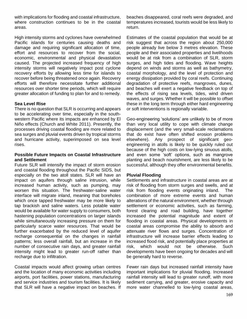
Confidence Assessment What is already happening
H High
M X Medium
L Low
L M H
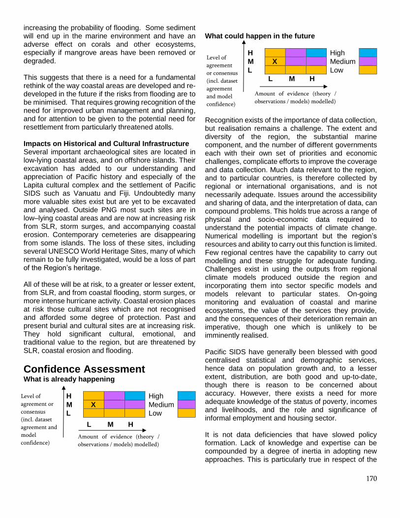
What could happen in the future
H High
M X Medium
L Low
L M H Recognition exists of the importance of data collection, but realisation remains a challenge. The extent and diversity of the region, the substantial marine component, and the number of different governments each with their own set of priorities and economic challenges, complicate efforts to improve the coverage and data collection. Much data relevant to the region, and to particular countries, is therefore collected by regional or international organisations, and is not necessarily adequate. Issues around the accessibility and sharing of data, and the interpretation of data, can compound problems. This holds true across a range of physical and socio-economic data required to understand the potential impacts of climate change. Numerical modelling is important but the region’s resources and ability to carry out this function is limited. Few regional centres have the capability to carry out modelling and these struggle for adequate funding. Challenges exist in using the outputs from regional climate models produced outside the region and incorporating them into sector specific models and models relevant to particular states. On-going monitoring and evaluation of coastal and marine ecosystems, the value of the services they provide, and the consequences of their deterioration remain an imperative, though one which is unlikely to be imminently realised. Pacific SIDS have generally been blessed with good centralised statistical and demographic services, hence data on population growth and, to a lesser extent, distribution, are both good and up-to-date, though there is reason to be concerned about accuracy. However, there exists a need for more adequate knowledge of the status of poverty, incomes and livelihoods, and the role and significance of informal employment and housing sector. It is not data deficiencies that have slowed policy formation. Lack of knowledge and expertise can be compounded by a degree of inertia in adopting new approaches. This is particularly true in respect of the
Amount of evidence (theory /
observations / models) modelled)
Level of
agreement
or consensus
(incl. dataset
agreement
and model
confidence)
Amount of evidence (theory /
observations / models) modelled)
Level of
agreement or
consensus
(incl. dataset
agreement and
model
confidence)

171
provision of infrastructure which tends to be reactive to current situations rather than proactive in meeting future needs, despite the many reports that can follow disaster events. However, the fragile state of many economies means that governments have few opportunities (and limited human and financial resources) to address some of the causes of current and future risks, especially where action is required at various scales. Yet urgency is required as the future of the Pacific is an urban one. Land shortages are the quintessential urban and coastal phenomenon, alongside land tenure disputes and conflicts, resulting in increasing numbers of informal settlements on unsuitable land (to which services cannot easily be extended), illegal dumping and other harmful practices. The number of very poor squatters has increased in urban areas of Suva (Fiji), Honiara (Solomon Islands), Port Vila (Vanuatu) and Port Moresby (PNG) due to a lack of access to affordable land and formal housing. In Betio and Bairiki (Kiribati), there are areas of high-density housing with lack of access to clean water and proper sanitation. Customary land tenure systems in Melanesia, Polynesia and Micronesia present challenges to housing and infrastructure provision, providing a disincentive to invest in land development and urban infrastructure. Yet hazards are catalysts for further migration to urban areas, which ironically intensifies the problems of urban hazards. Indeed, climate change, while stimulating more frequent and more intense cyclones, is likely to be a factor in contributing to ‘slow onset’ migration.
Knowledge Gaps Various gaps in knowledge exist which emphasise the considerable challenges attached to meeting a future of perhaps accelerated climate change. These include:
• Estimates of the value of infrastructure which is vulnerable to climate change, and of the financial costs of climate proofing infrastructure
• Better analysis and consideration of what might be done to mitigate risks, especially related to urban water security
• Gaps in understanding changes in precipitation patterns across the region and the ability to provide credible island scale information; this has implications for the development of design standards for infrastructure particularly for transport networks (e.g. roads, bridges and drainage)
• How climate change might affect ocean currents and storm surges and by extension coastal erosional processes, especially within and between particular atolls
• If coastal ecosystems be restored to the extent that they could provide coastal protection; mangrove restoration offers a limited solution but has rarely been systematically applied in a context where clearance continues and land is not owned by the state
• Understanding how changes in land use, brought about by climate and human changes might impact coastal flooding
• Understanding the risks and impacts of coastal flooding (from storm surges and pluvial flooding)
• Gaps in understanding of the influences of climate oscillations, and especially ENSO, on storm and hurricane activity, droughts and SLR
• Little understanding of the significance of wind waves despite their considerable significance
• Consequent lack of understanding of when different oscillations might be superimposed on each other and the way this would magnify their individual effects and have major implications for coastal settlements in terms, for example, of the potential social and economic disruption, damage, and losses
• Uncertainty and discrepancy between models and model outputs and a lack of understanding of the sources of the differences which cause uncertainty and a reluctance to act on the part of decision-makers who tend to view uncertainty in a negative light; the ‘science-to-policy’ dialogue is important when decisions have to be made regarding the allocation of scarce resources.
• Uncertainty over which areas and policies require priority
The greatest challenges lie in effectively committing to responding to change and developing adequate policies and practices that do so, in the absence of adequate financial and human resources, and in rapidly changing national and regional political and socio-economic contexts. The short-term pursuit of economic advantage, coupled with weak regulatory mechanisms, continues to contribute to the adverse impacts of and on coastal settlements. In almost all instances authorities with responsibility for the management of coastal zones, settlements and infrastructure struggle to meet the challenges due to weak economic circumstances. Data may be thin but
172
is generally adequate for basic policy formation. That is beginning to happen, both at a regional scale (Pacific Community 2017), and at national scale (Government of Papua New Guinea 2010), and in reports produced by outside agencies, for example on flood risk management (World Bank 2017) and coastal protection (ADB 2017), which may or may not have local traction. However, development of appropriate policies and their implementation remains a cultural, political and economic problem.
Socio-economic Impacts Throughout this report socio-economic impacts, actual or potential, have been incorporated into the discussions. These include:
• Adverse impacts on economic activities, such as agriculture and tourism, leading to loss of employment and stranded investments
• Loss of productivity, especially in the marine sector • Increased demand on welfare and health services • Disruption of education • Increases in domestic tension and psychological
conditions • Loss of cultural heritage and personal/family
histories and artefacts • Adverse macro-economic impacts related to
diversion of expenditures to recovery activities such as repair and replacement of infrastructure, services and utilities, rather than more broadly based development
• Internal displacement and relocation of sections of the population and increased outward migration; migration is already putting excessive and adverse pressures on urban areas and this is likely to increase
There can be no doubt that SLR and other climatically driven processes are already exerting a significant impact on coastal settlements and infrastructure. Nonetheless it remains possible even with limited economic resources to provide a decent level of protection with good institutional and management capabilities. Options are available, but they come at a high cost. Coastal protection, through combinations of hard and soft engineering require detailed investigation and proper planning before implementation if it is to be successful. Costs could be of the order of tens of millions of dollars per kilometre of protection provided. The highest adaptation costs for Pacific SIDS by 2040 will be for coastal protection (World Bank 2016). Even
then it cannot provide protection against increasingly extreme events, and countries could not afford this themselves. Atolls are not only particularly difficult to safeguard while atoll states are not easily able to effectively manage funds and projects designed to mitigate climate change (Dean et al 2017). Geo-engineering is only likely to be justified in a few unusual contexts, such as the Green Climate Fund (GCF) approved projects for Tuvalu that will construct sea walls for the populated islands. Pacific SIDS have not been able to mitigate and manage widespread ‘coastal squeeze’ especially as populations increase, because of the desire for access to services and to land suitable for development (whether for agriculture, tourism or the construction of infrastructure). These concentrations have had negative impacts on coastal ecosystems, marine resources and again on food security. As expectations rise population growth is not generally slowing fast enough to reduce or stabilise population pressure on scarce resources. Other than in outer islands, in most parts of the Pacific, people now live at increasingly unsustainable densities unprecedented in past history. It is there that environmental hazards most affect the poor who are least able to cope. Good environmental change adaptation projects focus on such fundamental needs as food and water security, coastal protection and reduction of poverty and inequality, but that requires holistic policy formation. Few small state governments have addressed the needs of the poor, but such people have often moved away from existing impoverished environments and are presently displaced into marginal urban environments. Their needs should be a priority. Minimising the urban ‘coastal squeeze’ is a related priority. Climate change offers no gains to small Pacific island states. Although detailed scientific data are often lacking, all are highly vulnerable to natural disasters, which can badly damage urban and rural housing and infrastructure, as the recent examples of Cyclone Pam in Vanuatu (2015) and Cyclone Winston in Fiji (2016) demonstrated. These vulnerabilities make it difficult for these countries to achieve the MDGS. Most at risk are small and remote islands and atolls, where recovery after disasters is more difficult. With the populations of the Melanesian small states especially, particularly PNG and Solomon Islands, likely to increase rapidly to 2050, rural-urban migration is expected to increase in tandem and place immense pressures on already difficult situations in the urban centres, particularly in

173
regards to access to adequate, safe and affordable housing and basic services. Climate change is expected to increase the frequency and severity of natural disasters, which is a major risk to the sustainability of vulnerable cities and communities. Pacific states have been at the forefront of global climate negotiations and national action. All nine countries have ratified the Paris Agreement, with Fiji the first country in the world to ratify. In addition, the majority of states have identified climate change as one of their key national priorities. Given the integrated nature of climate change and natural disasters, many have also integrated their climate change and natural disaster policies. An integrated approach to address climate change and disaster risk management exists at the regional level through the Framework for Resilient Development in the Pacific (SPC 2017). Yet national governments in the Pacific lack the capacity to respond effectively to major disruptions, since this demands policy solutions and practices that cut across sectors and levels of governance. The Melanesian Pacific island countries especially have been found wanting in recent years and an urgent need exists to prepare evacuation and settlement plans since the response to hazards will be at least initially national, and their absence has hindered the development of new livelihoods for people exposed to sudden hazard events. Good climate change mitigation projects must focus on such fundamental needs as food and water security, coastal protection and reduction of poverty and inequality. Such adaptive strategies would meet local needs, enable retention of culture and reduce the need for unnecessary and problematic migration. More effective urban management and greater resilience to hazards, and especially climate change, would benefit from land use planning, more compact urban forms, implementing and following building codes, upgrading infrastructure, but especially building institutional capacity and effective urban governance and urban authorities, effective data acquisition and monitoring (Mycoo and Donovan 2017). However, that requires comprehensive policy formation, and national governments will need to collaborate with relevant development partners to ensure an integrated policy approach. Without more effective policy formation - and even more important, its practice - poverty, unemployment, inequality, environmental degradation and sustainable livelihoods are all likely to worsen in the decades to come. Present directions suggest greater uneven development, especially in the fast-growing urban centres, provoking the tensions, crime
and violence which are already occurring in some urban centres. Climate change will place particular pressure on agriculture, fisheries and food security, and therefore on two thirds of the region’s population, and exacerbate existing vulnerabilities of small states. Cyclones alone take a considerable human toll, exact substantial economic and social costs, dislocate communities and put a substantial brake on economic development. Such storms are predicted to become even more intense. Nowhere else in the world are small island states facing greater threats and challenges.
Citation
Please cite this document as:
Connell, J. (2018) Impacts of Climate Change on Settlements and Infrastructure Relevant to the Pacific Islands. Pacific Marine Climate Change Report Card: Science Review 2018, pp 159-176.
The views expressed in this review paper do not represent the Commonwealth Marine Economies Programme, individual partner organisations or the Foreign and Commonwealth Office.
References Albert, S, Leon, J, Grinham, A, Church, J,
Gibbes, B and Woodroffe, C (2016) Interactions between sea-level rise and wave exposure on reef island dynamics in the Solomon Islands, Environmental Research Letters, 11, 054011.
Ambroz, A (2009) Tuvalu Technical Report: A Preliminary Economic Analysis of Extracting Aggregate from the Funafuti Lagoon. SOPAC Project Report No. 137. Suva.
Asian Development Bank (2017) Affordable Coastal Protection in the Pacific Islands, ADB, Sydney.
Aucan, J, R Hoeke, and M Merrifield (2012) Wave-Driven Sea Level Anomalies at the Midway Tide Gauge as an Indicator of North Pacific Storminess over the Past 60 Years. Geophysical Research Letters, 39, l17603.
Australian Bureau of Meteorology and CSIRO (2014) Climate Variability, Extremes and Change in the Western Tropical Pacific: New Science and Updated Country Reports, Australian Bureau of Meteorology and CSIRO, Melbourne.
Ballu, V, Bouin, M, Siméoni, P, Crawford,W, Calmant, S, Boré,J-M, Kanas,T and Pelletier, B. (2011) Comparing the Role of Absolute Sea-Level Rise and Vertical Tectonic Motions in Coastal

174
Flooding, Torres Islands (Vanuatu). Proceedings of the National Academy of Sciences 108 (32): 13019-13022.
Barnett, J (2011) Dangerous climate change in the Pacific islands: Food production and food security, Regional Environmental Change, 11, S229-S237.
Becker, M, B Meyssignac, C Letetrel, W Llovel, A Cazenave, and T Delcroix (2012) Sea Level Variations at Tropical Pacific Islands since 1950, Global and Planetary Change, 80-81, 85-98.
Bell, J, Johnson, J and Hobday, A (2011) Vulnerability of tropical Pacific fisheries and aquaculture to climate change, SPC, Noumea.
Bell, J, Taylor, M, Amos, M and Andrew, N (2016) Climate Change and Pacific Island Food Systems, CCAFS and CTA, Copenhagen and Wageningen.
Bourke, R.M, Allen, B and Lowe, M (2016) Estimated impact of drought and frost on food supply in rural PNG in 2015, ANU Development Policy Centre Policy Brief 11, Canberra.
Butcher-Gollach, C (2018) Planning and Urban Informality – Addressing Inclusiveness for Climate Resilience in the Pacific, in W. Filho, ed, Climate Change Impacts and Adaptation Strategies for Coastal Communities, Springer, Cham, pp. 43-68.
Cabezon, E, Hunter, L, Tumbarello, P, Washimi, K and Wu, Y (2016), Strengthening Macro-Fiscal Resilience to Natural Disasters and Climate Change in the Small States of the Pacific, in Roger, P and Tumbarello, P (eds) Resilience and Growth in the Small States of the Pacific, IMF, pp. 71–94.
Charan, D, Kur, M and Singh, P (2017) Customary Land and Climate Change Induces Relocation – A Case Study of Vunidogoloa Village, Vanua Levu, Fiji, in W. Filho, ed, Climate Change Adaptation in Pacific Countries, Springer, Cham, pp. 19-34.
Chowdhury, M, Barnston,A. Guard,C Duncan, S Schroeder,T and Chu, P-S (2010) Sea-Level Variability and Change in the US-Affiliated Pacific Islands: Understanding the High Sea Levels during 2006-2008, Weather, 65(10), 263-268.
Chowdhury, M, Chu, P-S, Zhao, X, Schroeder, T and Marra, J (2010) Sea Level Extremes in the US-Affiliated Pacific Islands-A Coastal Hazard Scenario to Aid in Decision Analyses. Journal of Coastal Conservation, 14, 53-62.
Church, J, and White, N (2011) Sea-Level Rise from the Late 19th to the Early 21st Century, Surveys in Geophysics, 32 (4-5):585-602.
Commonwealth Secretariat (2017) A Sustainable Future for Small States. Pacific 2050, Commonwealth Secretariat, London.
Connell, J (2013) Islands at Risk. Environments, Economies and Contemporary Change, Edward Elgar, Cheltenham.
Connell, J (2015) Vulnerable Islands: Climate Change, Tectonic Change, and Changing Livelihoods in the Western Pacific, The Contemporary Pacific, 27(1), 1-36.
Dean, A, Green, D and Nunn, P (2017) Too much sail for a small craft? Donor requirements, scale and capacity discourses in Kiribati, in E. Stratford, ed. Island Geographies, Abingdon, Routledge.
Elsner, J, Kossin, J and Jagger, T (2008) The Increasing Intensity of the Strongest Tropical Cyclones. Nature, 455, 92-95.
Forbes, D, James, T Sutherland, M and Nichols S (2013) Physical basis of coastal adaptation on tropical small islands’ Sustainability Science, 8 (2013): 327-344.
Government of Papua New Guinea (2010) National Urbanization Policy for Papua New Guinea, 2010-2030, Port Moresby.
Hoeke, R, McInnes, K Kruger,J McNaught, R Hunter, R and Smithers, S (2013) Widespread Inundation of Pacific Islands Triggered by Distant Source Wind-Waves. Global and Planetary Change, 108,128-138.
Holland, P (2009) Nadi Floods. Economic Costs. January 2009, SOPAC Technical Report No. 426, Suva.
Keen, M, Barbara, J, Carpenter, J, Evans, D and Foukona, J (2017) Urban Development in Honiara. Harnessing Opportunities, Embracing Change, ANU, Canberra.
Knutson, T, McBride, J, Chan, J, Emanuel, K et al (2010) Tropical cyclones and climate change, Nature Geoscience, 3, 157-163.
Kostaschuk, R, Terry, J and Raj, R (2011) Tropical cyclones and floods in Fiji, Hydrological Sciences Journal, 46, 453-450.
Lal, P (2003) Cyclone Ami. 13-14 January 2003, Lautoka, Vikas Press.
Lal, P (2010) Vulnerability to natural disasters; An economic analysis of the impact of the 2009 floods on the Fjijan sugar belt, Pacific Economic Bulletin, 25(2), 62-77.
Lal, M, Harasawa, H and Takahashik K (2002) Future Climate Change and Its Impacts over Small Island States. Climate Research, 19, 179-192.
Lal, P, Kinch, J and Wickham, F (2009) Review of Economic and Livelihood Impact Assessments of, and Adaptation to, Climate Change in Melanesia. Apia: SPREP.
Lal, P. Rira, R and Khatri, N (2009) Floods in the Fiji Sugar Belt and Policy Implications, Gland, IUCN.

175
Lata, K and Nunn, P (2012) Misperceptions of Climate-Change Risk as Barriers to Climate-Change Adaptation: A Case Study from the Rewa Delta, Fiji, Climatic Change, 110(1), 169-186.
Lipset, D (2011) The tides: masculinity and the dialogics of climate change in coastal Papua New Guinea, Journal of the Royal Anthropological Institute, 17, 20–43.
McGregor, H V, M J Fischer, M K Gagan, D Fink, S J Phipps, H Wong, and C D Woodroffe (2013 A Weak El Niño/Southern Oscillation with Delayed Seasonal Growth around 4,300 Years Ago. Nature Geoscience, 6(11), 949-953.
Mecartney, S and Connell, J (2017) Urban Melanesia: The Challenges of Managing Land, Modernity and Tradition, in S. McDonnell, M. Allen and C. Filer, eds, Kastom, property and ideology: land transformations in Melanesia, ANU Press, Canberra, 57-84.
Meyssignac, B, and Cazenave, A (2012) Sea Level: A Review of Present-Day and Recent-Past Changes and Variability. Journal of Geodynamics, 58:96-109.
Mimura, N, Nurse, L, McLean, R Agard,A Briguglio,L Lefale,P Payet,R and Sem, G (2007) Small Islands. In Climate Change 2007: Impacts Adaptation and Vulnerability, M. Parry, O. Canziani, J. Palutikof, P. van der Linden, and C. Hanson, eds, Cambridge: Cambridge University Press, 687-716.
Moglia, M, Perez, P and Burn, S (2008) Water troubles in a Pacific atoll town, Water Policy, 10, 613- 637.
Mosley, L, Sharp, D and Singh, S (2004) Effects of a tropical cyclone on the drinking water quality of a remote Pacific island, Disasters, 28, 393-405.
Mycoo, M and Donovan, M (2017) A Blue Urban Agenda: Adapting to Climate Change in the Coastal Cities of Caribbean and Pacific Small Island Developing States, Inter-American Development Bank, Washington.
Nicholls, R and Cazenave, A (2010) Sea-Level Rise and Its Impact on Coastal Zones. Science,328 (5985): 1517-1520.
Nunn, P (2007) Climate, Environment and Society in the Pacific during the Last Millennium, Amsterdam: Elsevier.
Nunn, P (2009) Vanished Islands and Hidden Continents of the Pacific, Honolulu, University of Hawaii Press.
Nunn, P (2013) The End of the Pacific? Effects of sea level rise on Pacific Island livelihoods, Singapore Journal of Tropical Geography, 34(2), 143–171.
Nunn, P and Kumar, R (2006) Coastal Evolution in the Asia-Pacific Region. In N. Harvey, ed, Global Change and Integrated Coastal Management: The Asia-Pacific Region, Berlin: Springer, 93-116.
Nurse, L, McLean, R, Agard, J, Briguglio, L et al (2014) Small Islands, in V. Barros et al eds, Climate Change 2014, Cambridge University Press, Cambridge, 1613-1654.
Pacific Community (2016) Framework for Resilient Development in the Pacifica. An Integrated Approach to Address Climate Change and Disaster Risk Management 2017-2030, Pacific Community, Noumea.
Pearce, T, Currenti, R, Mateiwai, A and Doran , B (2018) Adaptation to climate change and freshwater resources in Vusama village, Viti Levu, Fiji, Regional Environmental Change (in press)
Penaia, A, Titimaea, A, Kohlhase, J, Nelson, F et al (2007) Reducing flood risk. From science to policy: the Samoa Process, SOPAC Miscellaneous Report No. 693, Suva.
Power, S, Delage, F Chung, C, Kociuba, G and Keay, K (2013) Robust twenty-first-century projections of El Niño and related precipitation variability, Nature, 502, 541-545.
Rasmussen, K, May, W, Birk, T, Mataki, M et al (2009) Climate change on three Polynesia outliers in the Solomon Islands: impacts, vulnerability and adaptation, Geografisk Tidsskrift, 109, 1-13.
Rey, T, Le De, L, Leone, F and Gilbert, D (2017) An integrative approach to understand vulnerability and resilience post-disaster. The 2015 cyclone Pam in urban Vanuatu as case study, Disaster Prevention and Management, 26(3), 259-275.
Roy, P and Connell, J (1991) Climatic Change and the Future of Atoll States. Journal of Coastal Research, 7(4), 1057-1075.
Siméoni, P and Ballu, V (2012) Le mythe des premiers réfugiés climatiques: Mouvements de populations et changements environnementaux aux îles Torres (Vanuatu). Annales de Géographie 685, 219-241.
Singh, R, Hales, S, de Wet, N, Raj, R, Hearnden, M and Weinstein, P (2001) The influence of climatic variation and change on diarrheal disease in the Pacific islands, Environmental Health Perspectives, 109, 155-159.
SPC (2017) Framework for Resilient Development in the Pacific, Noumea, SPC.
Storey, D and Hunter, S (2010) Kiribati: an environmental perfect storm, Australian Geographer, 41, 167-181.
Taylor, M, McGregor, A and Dawson, B (2016) Vulnerability of Pacific Island agriculture and forestry

176
to climate change, Pacific Community and Australian Aid, Noumea.
Terry, J (2007) Tropical Cyclones, Climatology and Impacts in the South Pacific, New York, Springer.
Terry, J and Chui, T (2012) Evaluating the Fate of Freshwater Lenses on Atoll Islands after Eustatic Sea-Level Rise and Cyclone-Driven Inundation: A Modelling Approach. Global and Planetary Change, 88-89:76-84.
Walsh, K, McInnes, K and McBride, J (2012) Climate Change Impacts on Tropical Cyclones and Extreme Sea Levels in the South Pacific: A Regional Assessment. Global and Planetary Change, 80:149-164.
Webb, A and Kench, P (2010 The Dynamic Response of Reef Islands to Sea-Level Rise: Evidence from Multi-decadal Analysis of Island Change in the Central Pacific. Global and Planetary Change, 72, 234-246.
Webster, P. Holland, G, Curry, J and Chang, H-R (2005) Changes in Tropical Cyclone Number, Duration, and Intensity in a Warming Environment. Science, 309 (5742), 1844-1846.
White, I, Falkland, T and Scott, D (1999) Droughts in small coral islands: a case study, South Tarawa, Kiribati, UNESCO IHP Technical Documents in Hydrology No. 26, Paris.
World Bank (2015) Unsettled: Water and Sanitation in Urban Settlement Communities of the Pacific, Sydney, World Bank.
World Bank (2016) Climate and Disaster Resilience, Sydney, World Bank.
World Bank (2017) Urban Flood Risk Management in the Pacific: Tracking Progress and Setting Priorities, Sydney, World Bank.
Yeo, S and Blong, R (2010) Fiji’s worst natural disaster: the 1931 hurricane and flood, Disasters, 34, 657-683.
© Crown Copyright (2018)
Related Documents