Jacob Davis, USACE Dam Safety Program Manager Jason Sheeley, MMC MCX Assistant Director Chris Baker, Lead, Public Awareness and Communications Team USACE Dam and Levee Safety Programs 18 August 2020 OVERVIEW OF EC1110-2-6075 INUNDATION MAPS & EMERGENCY ACTION PLANS SILVER JACKETS prepared for “The views, opinions and findings contained in this report are those of the authors(s) and should not be construed as an official Department of the Army position, policy or decision, unless so designated by other official documentation.”

Welcome message from author
This document is posted to help you gain knowledge. Please leave a comment to let me know what you think about it! Share it to your friends and learn new things together.
Transcript

Jacob Davis, USACE Dam Safety Program Manager
Jason Sheeley, MMC MCX Assistant Director
Chris Baker, Lead, Public Awareness and Communications Team USACE Dam and Levee Safety Programs
18 August 2020
OVERVIEW OF EC1110-2-6075 INUNDATION MAPS & EMERGENCY ACTION PLANS
SILVER JACKETSprepared for
“The views, opinions and findings contained in this report are those of the authors(s) and should not be construed as an official Department of the Army position, policy or decision, unless so designated by other official documentation.”
2
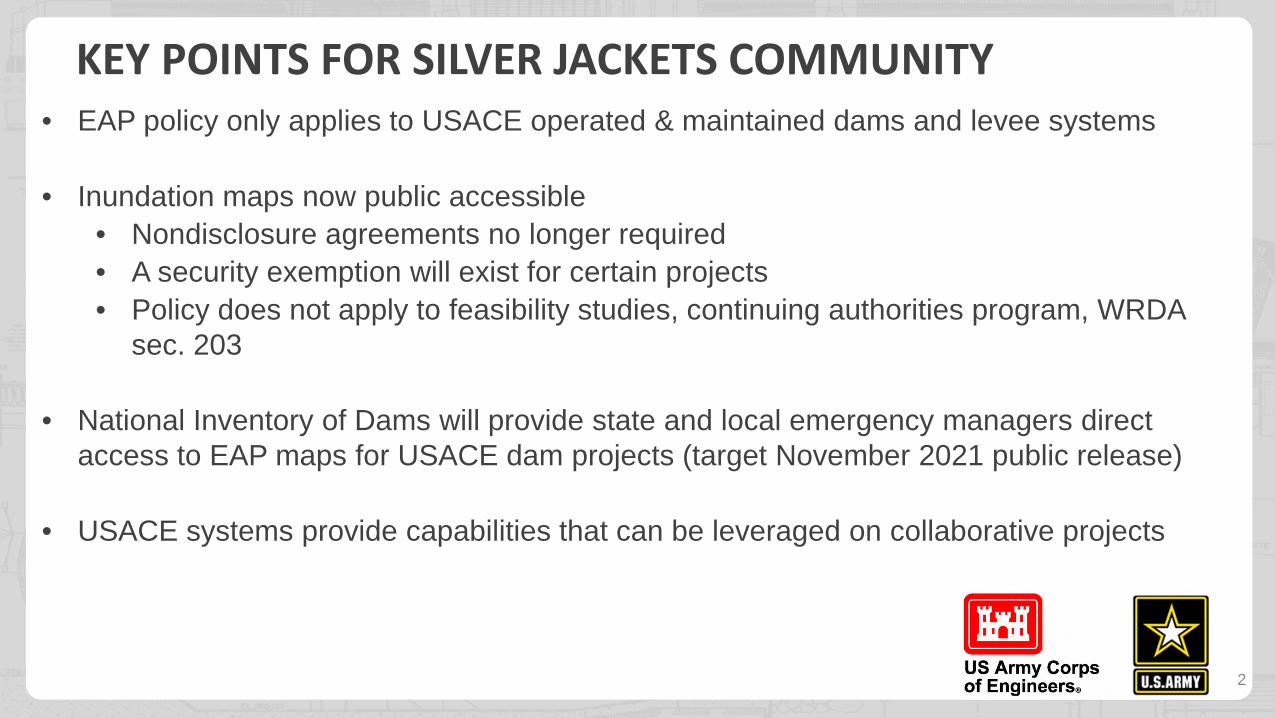
KEY POINTS FOR SILVER JACKETS COMMUNITY • EAP policy only applies to USACE operated & maintained dams and levee systems
• Inundation maps now public accessible
• Nondisclosure agreements no longer required
• A security exemption will exist for certain projects
• Policy does not apply to feasibility studies, continuing authorities program, WRDA sec. 203
• National Inventory of Dams will provide state and local emergency managers direct access to EAP maps for USACE dam projects (target November 2021 public release)
• USACE systems provide capabilities that can be leveraged on collaborative projects

HAVE YOU PARTICIPATED IN A USACE EMERGENCY ACTION PLAN EXERCISE?
YES NO

4
EMERGENCY ACTION PLANS
Including exercises and incident management and reporting
Objective
Timely corrective actions and notifications

5
CONSISTENCY WITH FEDERAL GUIDELINES (FEMA 64*)
Priority to involve emergency managers
Plan organization
Plan name
Evacuation planning responsibility
Project emergency levels
Address area of most immediate impacts
Inundation maps & dissemination
* Also aligned with FEMA 946, DHS-Emergency Preparedness Guidelines for Levees
No Change
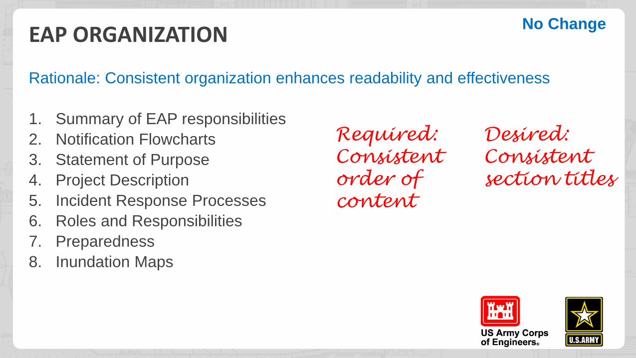
EAP ORGANIZATION
Rationale: Consistent organization enhances readability and effectiveness
1. Summary of EAP responsibilities
2. Notification Flowcharts
3. Statement of Purpose
4. Project Description
5. Incident Response Processes
6. Roles and Responsibilities
7. Preparedness
8. Inundation Maps
Required: Consistent order of content
No Change
Desired: Consistent section titles
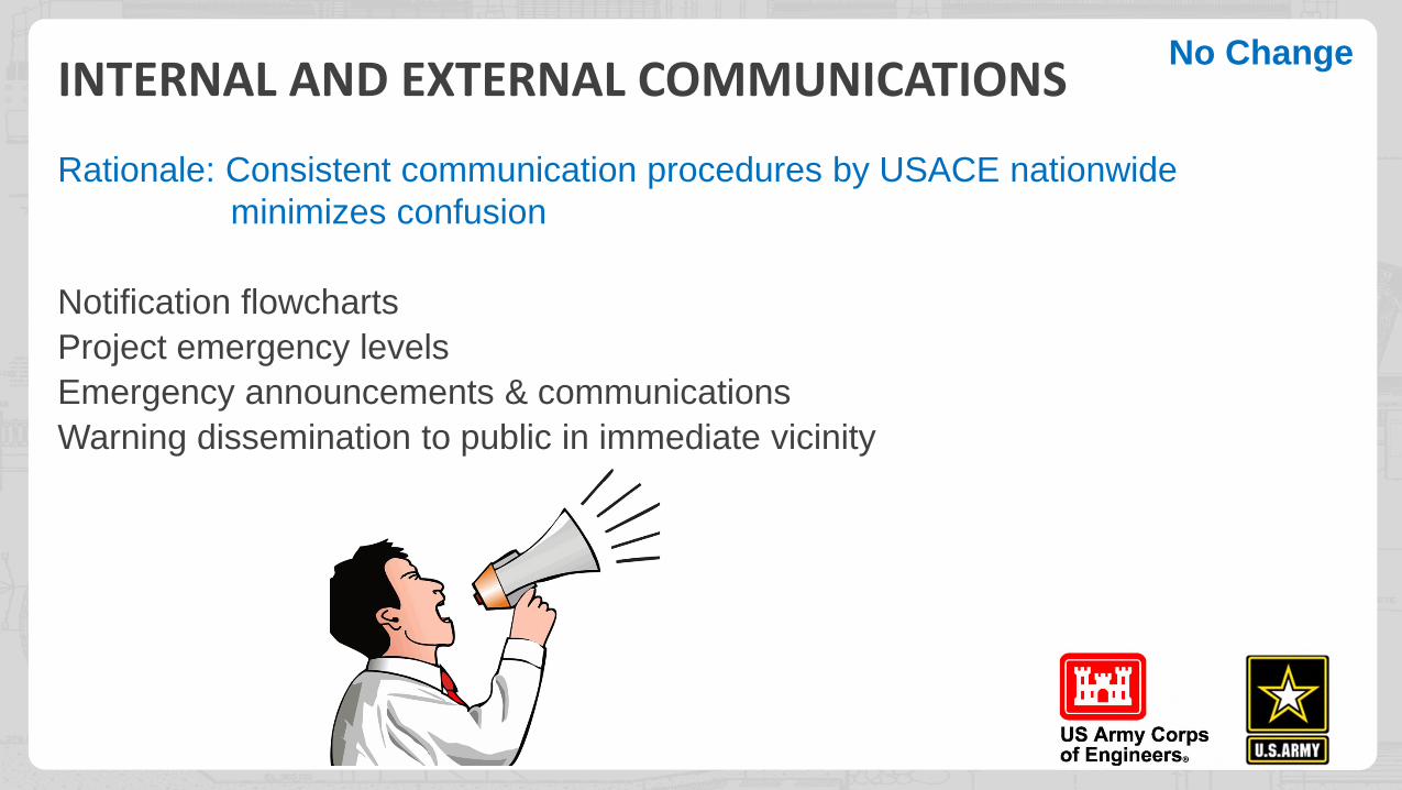
INTERNAL AND EXTERNAL COMMUNICATIONS
Rationale: Consistent communication procedures by USACE nationwide minimizes confusion
Notification flowcharts
Project emergency levels
Emergency announcements & communications
Warning dissemination to public in immediate vicinity
No Change

COMMUNICATIONS - NOTIFICATION FLOWCHARTS Rationale: Prompt notification is crucial during emergencies
Critical EAP content (BLUF)
–Establishes external and
district-internal command
chain upward reporting
procedures
External notifications have priority
No Change

COMMUNICATIONS: PROJECT EMERGENCY LEVELS
Rationale: Alignment with federal guidelines ensures common understanding
Primary purpose is clear external communication of project condition and incident management activities being undertaken by the project owner.
Previous terms: failure imminent or has occurred, failure situation is developing, non-failure emergency condition
No Change

Rationale: Nearby areas must be evacuated quickly
Required: Description of procedure & means for warning dissemination directly to the general public in the immediate vicinity of the project
COMMUNICATIONS: WARNINGS TO PUBLIC IN IMMEDIATE VICINITYNo Change
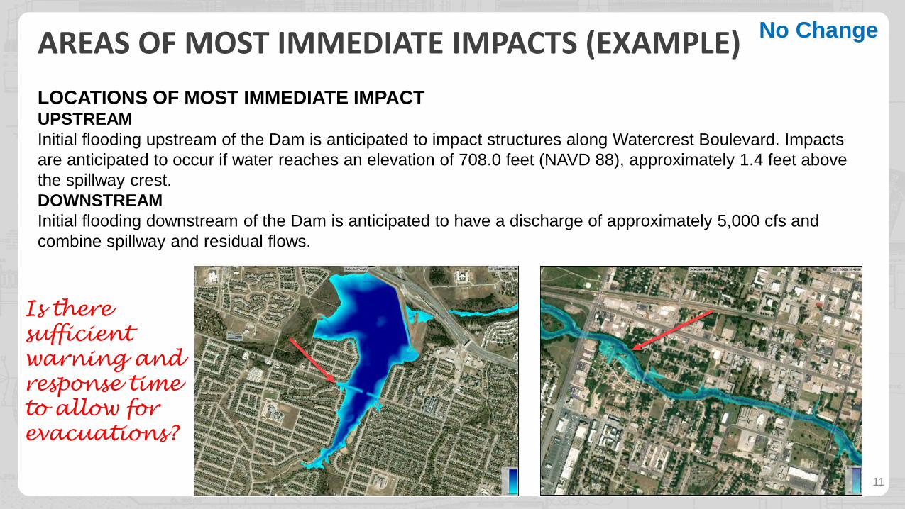
AREAS OF MOST IMMEDIATE IMPACTS (EXAMPLE)
11
Is there sufficient warning and response time to allow for evacuations?
No Change
LOCATIONS OF MOST IMMEDIATE IMPACT UPSTREAM Initial flooding upstream of the Dam is anticipated to impact structures along Watercrest Boulevard. Impacts are anticipated to occur if water reaches an elevation of 708.0 feet (NAVD 88), approximately 1.4 feet above the spillway crest. DOWNSTREAM Initial flooding downstream of the Dam is anticipated to have a discharge of approximately 5,000 cfs and combine spillway and residual flows.

INUNDATION MAPS
Policy Briefing and
Implementation Overview
12
POLICY SUMMARY • USACE produced inundation maps are to be released to the public*
• Public release exemption available for security reasons
• Disseminated via National Inventory of Dams – dam emergency action plan maps
• Disseminated via Access to Water – basin maps & events
• Requirement to publish to USACE flood inundation map database
• Local dissemination encouraged via national sources
* This requirement does not apply to feasibility studies, including those conducted under the Continuing Authorities Program and studies conducted by non-federal interests under Section 203 of the Water Resources Development Act of 1986, as amended.
13
Change

USACE PRODUCED INUNDATION MAPS ARE RELEASED TO THE PUBLIC
14
Change

PUBLIC RELEASE EXEMPTION FOR SECURITY REASONS
Paragraph 7d(1)
• Does not restrict access by other federal/state/local emergency management agencies
• Requires concurrence by USACE Director of Civil Works
• Complete in normal engineering processes like EAP, risk/security assessments, not during emergencies
• Concerns about public reaction during an emergency are not indicative of a credible security threat to a project
• May still be discoverable under FOIA – consult counsel 15
Change
HAVE YOU SEEN A USACE EMERGENCY ACTION PLAN INUNDATION MAP BEFORE?
HAVE YOU SHARED FLOOD MAPS WITH THE PUBLIC BEFORE?
YES
YES NO
NO
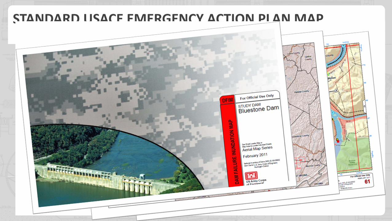
STANDARD USACE EMERGENCY ACTION PLAN MAP

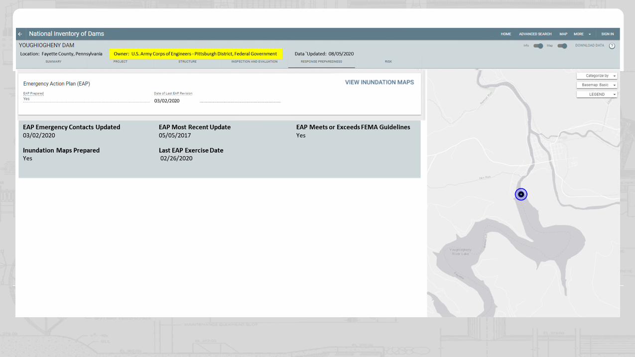
DAM EAP MAPS DISSEMINATED VIA NATIONAL INVENTORY OF DAMS (NID)
18
Basic map view embedded in response preparedness tab
Change
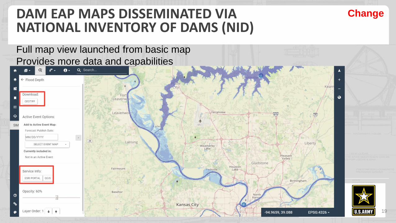
DAM EAP MAPS DISSEMINATED VIA NATIONAL INVENTORY OF DAMS (NID)
19
Full map view launched from basic map Provides more data and capabilities
Change

BASIN (CWMS) AND FLOOD EVENT MAPS DISSEMINATED VIA ACCESS TO WATER RESOURCES
20
Change

USACE INUNDATION MAP DATABASE VIEWER
21
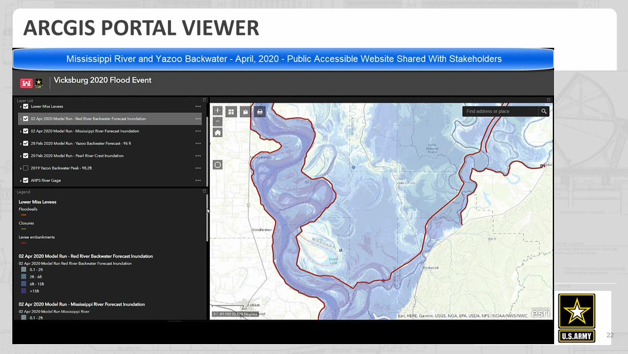
ARCGIS PORTAL VIEWER
22

2020 2021 2022
Inundation map policy published July 2019
Public release of the NID website November 2021
NID Development
11/1/2019 - 10/30/2020
EC Rollout
7/31/2020
NID Internal Review
11/15/2020 – 5/31/2021
NID External Review
6/1/2021-9/30/2021
Access to Water Dev. 3/1/2020 – 11/30/2020
Review Access to Water
Update district-produced EAP scenarios 6/1/2020 – 5/31/2021
Verify RA scenarios
11/15/2020 – 5/31/2021
Verify EAP scenarios loaded
Verify RA scenarios
11/15/2020 – 5/31/2021
Comm. Training Workshops
Training-Populate NID fields Starting 11/15/2020
TIMELINE – KEY DAM SAFETY ACTIVITIES
23

Inundation Maps • Engineer Circular 1110-2-6075 • Communication plan and
resources to support
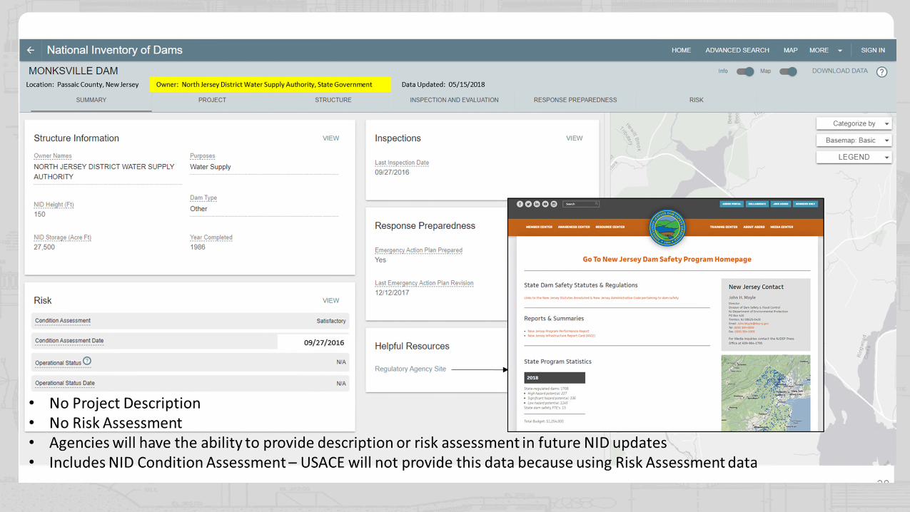
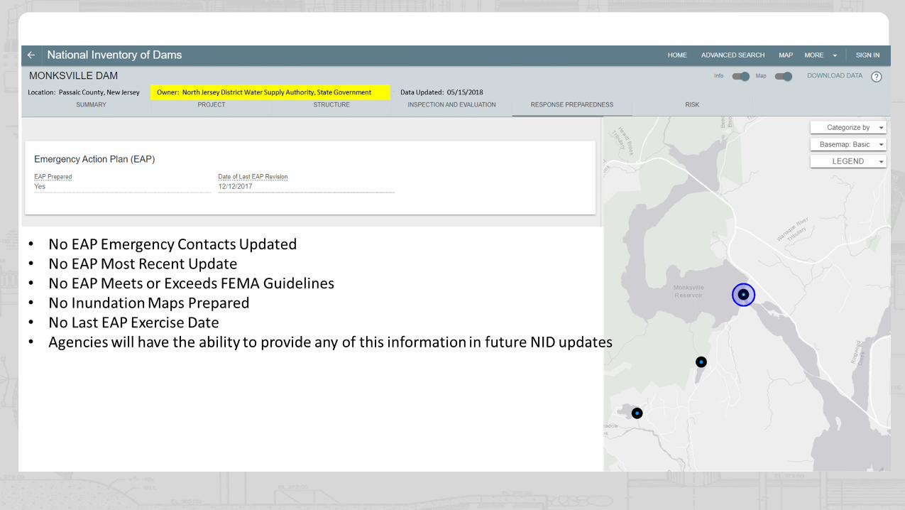
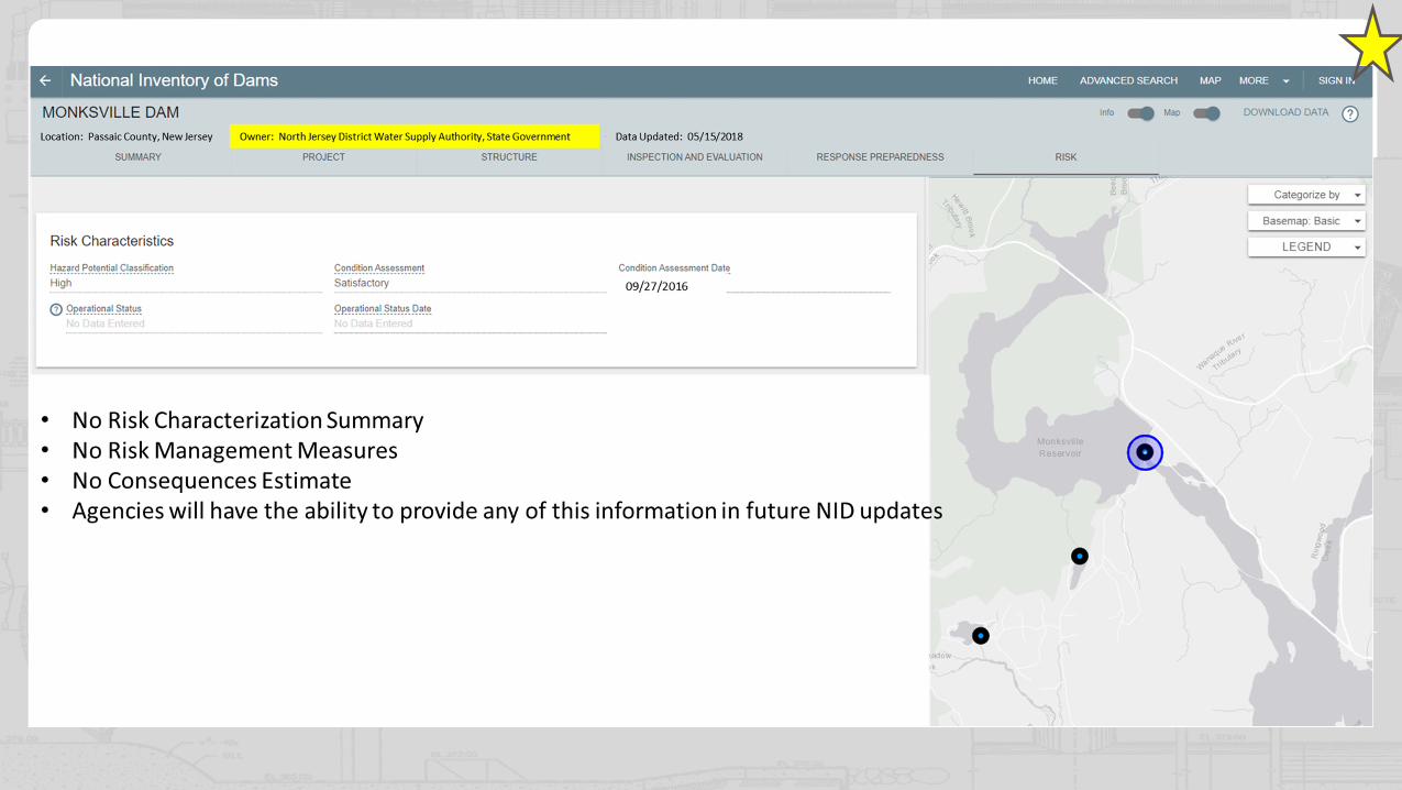
National Inventory of Dams • Updated look and feel • Inundation maps • Public viewer will include
KEY DAM SAFETY ACTIVITIES
project summary fields: project description, risk characterization, and risk management measures fields
Communication • District project comm. plans • Plans to include district
approach to comm. about inundation maps and populating the project summary fields
• Training workshops and additional resources to assist
24
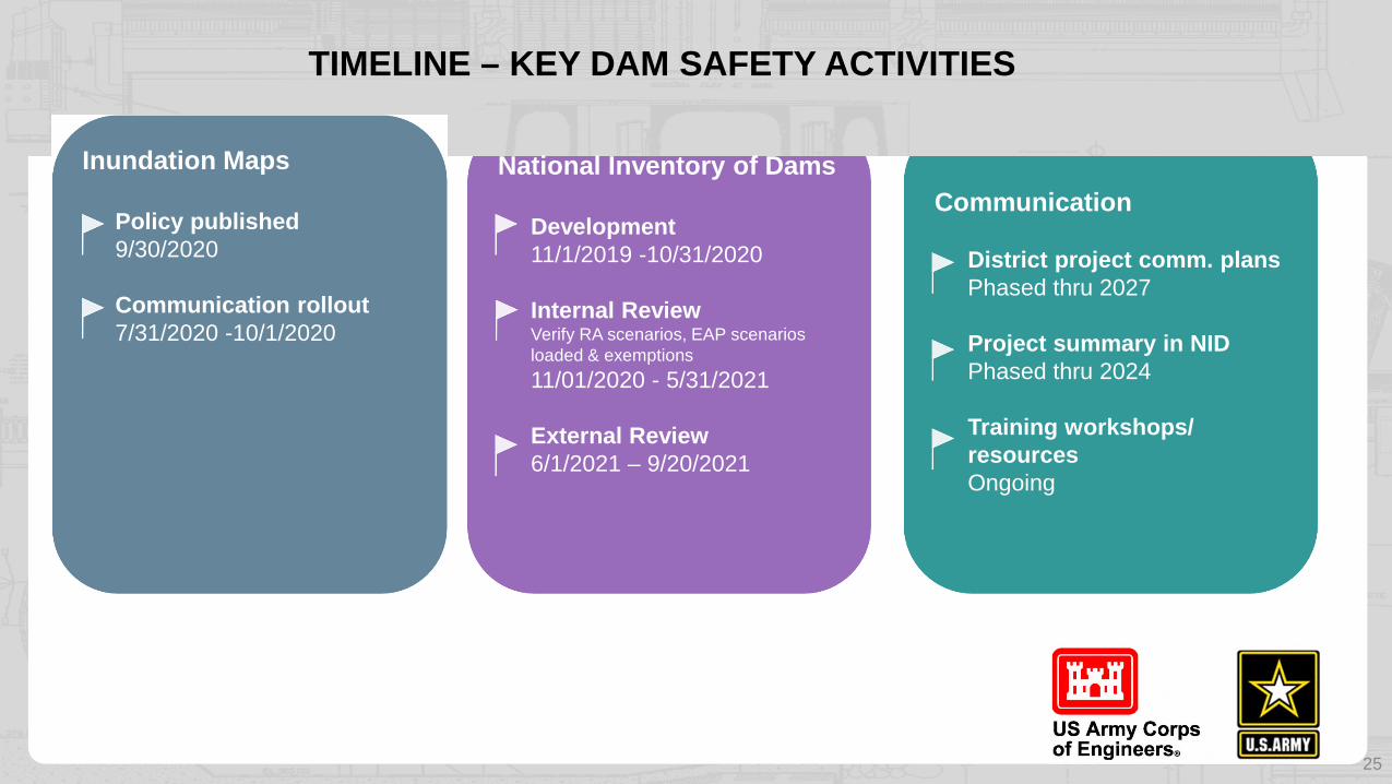
Inundation Maps
Policy published 9/30/2020
Communication rollout 7/31/2020 -10/1/2020
National Inventory of Dams
Development 11/1/2019 -10/31/2020
Internal Review Verify RA scenarios, EAP scenarios loaded & exemptions
11/01/2020 - 5/31/2021
External Review 6/1/2021 – 9/20/2021
TIMELINE – KEY DAM SAFETY ACTIVITIES
Communication
District project comm. plans Phased thru 2027
Project summary in NID Phased thru 2024
Training workshops/ resources Ongoing
25

26

27
28

29
30
31
32

AUTHORITATIVE SOURCES
National Levee Database – leveed areas, levee EAP scenario maps https://levees.sec.usace.army.mil/
National Inventory of Dams – dam EAP scenario maps https://nid.sec.usace.army.mil/
Access to Water – Inundation maps for emergency preparedness, basins, flood events http://water.usace.army.mil/

DISCUSSION
When published EC 1110-2-6075 will be available at https://www.publications.usace.army.mil/USACE-Publications/Engineer-Circulars/
Send comments about EC 1110-2-6075 to
34
Related Documents