Oregon Flood Hazard Data Standard v2.0 Summary of Proposed Amendment Collaborative Effort of: Jed Roberts (DOGAMI), Steve Lucker & Christine Shirley (DLCD) GIS Framework Forum ‘14 November 5, 2014 Photo: Andy Cripe, Corvallis Gazette-Times Willamette Valley Flood 201

Oregon Flood Hazard Data Standard v2.0 Summary of Proposed Amendment Collaborative Effort of: Jed Roberts (DOGAMI), Steve Lucker & Christine Shirley (DLCD)
Dec 21, 2015
Welcome message from author
This document is posted to help you gain knowledge. Please leave a comment to let me know what you think about it! Share it to your friends and learn new things together.
Transcript

Oregon Flood Hazard Data Standard v2.0
Summary of Proposed Amendment
Collaborative Effort of: Jed Roberts (DOGAMI), Steve Lucker & Christine Shirley (DLCD)
GIS Framework Forum ‘14 November 5, 2014
Photo: Andy Cripe, Corvallis Gazette-Times
Willamette Valley Flood 2012

What Are We Amending?
GIS Framework Forum ‘14 November 5, 2014
• Version 1.0• Endorsed in December 2006• Adopted FEMA digital flood
insurance rate map (DFIRM) database as standard
• DLCD named as steward

GIS Framework Forum ‘14 November 5, 2014
• Flood hazard data is more than FEMA flood insurance maps
• Need a standard for other flood mapping, high water marks, and flood warning gages
• Additional stewards of flood hazard data
Why Are We Amending?
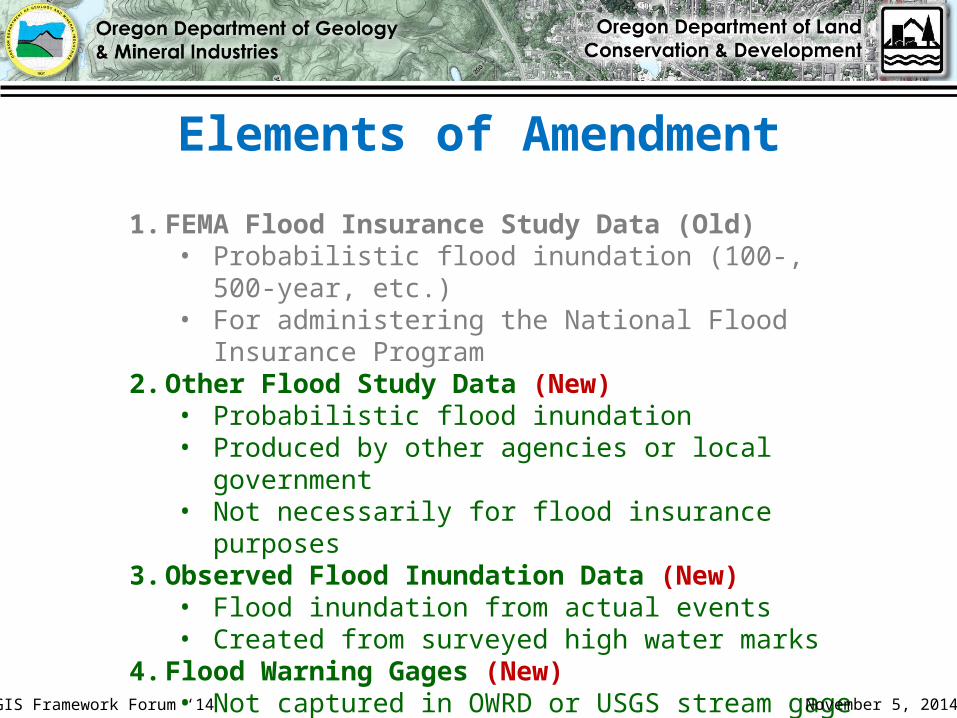
1. FEMA Flood Insurance Study Data (Old)• Probabilistic flood inundation (100-, 500-year, etc.)• For administering the National Flood Insurance Program
2. Other Flood Study Data (New)• Probabilistic flood inundation• Produced by other agencies or local government• Not necessarily for flood insurance purposes
3. Observed Flood Inundation Data (New)• Flood inundation from actual events• Created from surveyed high water marks
4. Flood Warning Gages (New)• Not captured in OWRD or USGS stream gage databases
Elements of Amendment
GIS Framework Forum ‘14 November 5, 2014
FEMA Flood Insurance Study Data
1. Flood Hazard Zones• 100-year zone most common (where flood
insurance is required)• Sometimes 500-year zone is shown
2. Cross-Sections• Locations where flood elevations are calculated• Flood elevations are interpolated between cross-
sections3. Study Reach
• Section of river or stream that was studied
GIS Framework Forum ‘14 November 5, 2014

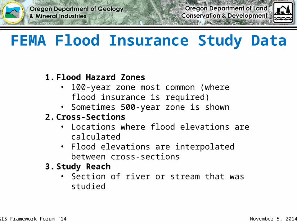
100-Year Flood Hazard Zone
Study Reach
Cross-Section
Elevations
FEMA Flood Insurance Study Data
GIS Framework Forum ‘14 November 5, 2014
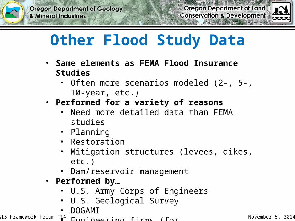
Other Flood Study Data• Same elements as FEMA Flood Insurance Studies
• Often more scenarios modeled (2-, 5-, 10-year, etc.)• Performed for a variety of reasons
• Need more detailed data than FEMA studies• Planning• Restoration• Mitigation structures (levees, dikes, etc.)• Dam/reservoir management
• Performed by…• U.S. Army Corps of Engineers• U.S. Geological Survey• DOGAMI• Engineering firms (for cities/counties)
GIS Framework Forum ‘14 November 5, 2014
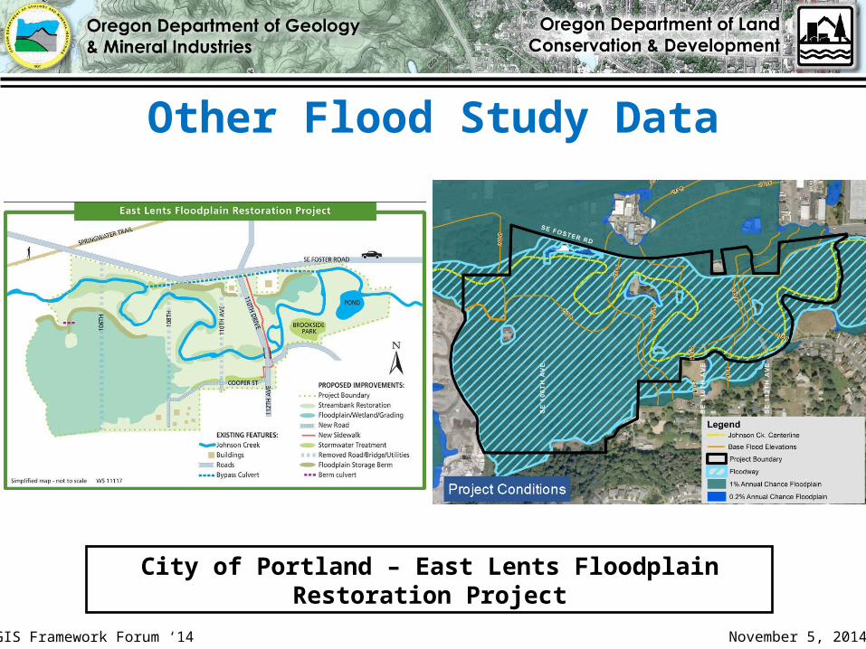
Other Flood Study Data
City of Portland – East Lents Floodplain Restoration Project
GIS Framework Forum ‘14 November 5, 2014

Observed Flood Inundation Data
1. Flood Inundation Zones• Extent of actual flooding from specific events (as
opposed to probabilistic modeling)• Existing data from 1996 Western Oregon floods,
Vernonia (2007), Upper Sandy River (2011), Mid-Willamette Valley (2012)
2. High Water Marks• Points where flood elevations are surveyed• High water marks can be used to re-create flood
inundation zone
GIS Framework Forum ‘14 November 5, 2014
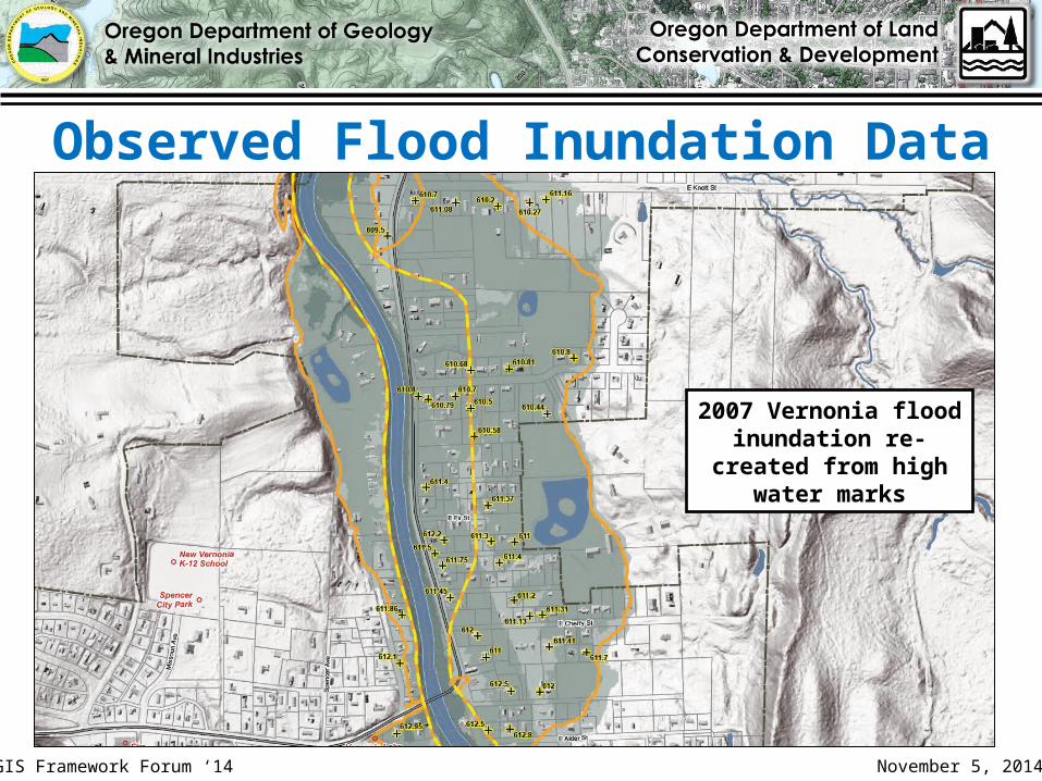
Observed Flood Inundation Data
2007 Vernonia flood inundation re-
created from high water marks
GIS Framework Forum ‘14 November 5, 2014
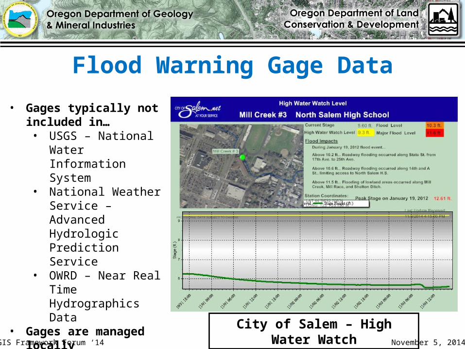
Flood Warning Gage Data
• Gages typically not included in…• USGS – National Water
Information System• National Weather
Service – Advanced Hydrologic Prediction Service
• OWRD – Near Real Time Hydrographics Data
• Gages are managed locally• Temporary gages• Staff gages
City of Salem – High Water WatchGIS Framework Forum ‘14 November 5, 2014
Activity to Date
• May 5, 2014 – Distribution of amended standard to Hazard FIT Team for review
• August 5, 2014 – Distribution of amended standard to larger GIS community (45 day comment period)
• September 19, 2014 – Comment period closed• October 30, 2014 – Addressed minor comments;
re-submitted to Framework Coordinator
GIS Framework Forum ‘14 November 5, 2014
Related Documents