Open Water Data Initiative an Esri perspective Special thanks to Al Rea USGS, and David Maidment University of Texas for reuse of slide content Steve Kopp

Open Water Data Initiative an Esri perspective Special thanks to Al Rea USGS, and David Maidment University of Texas for reuse of slide content Steve Kopp.
Dec 24, 2015
Welcome message from author
This document is posted to help you gain knowledge. Please leave a comment to let me know what you think about it! Share it to your friends and learn new things together.
Transcript
Open Water Data Initiative
an Esri perspective
Special thanks to Al Rea USGS, and David Maidment University of Texas for reuse of slide content
Steve Kopp

Water Data Challenges
• Access to water data is difficult- Inconsistent creation and collection- Collected by hundreds of organizations- No common place to find it
• Understanding connections requires a geospatial framework- Landscape to stream- Stream to stream
• Increasing interest in water data
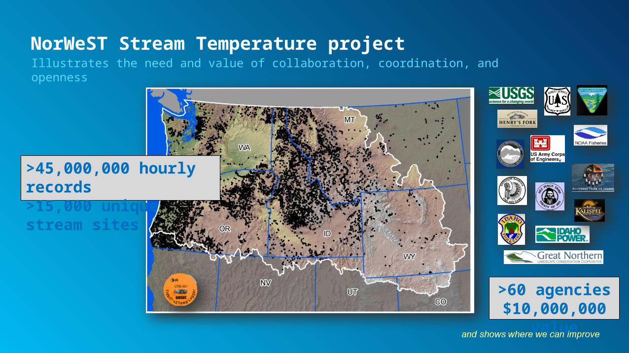
>60 agencies$10,000,000
value
>45,000,000 hourly records>15,000 unique stream sites
NorWeST Stream Temperature projectIllustrates the need and value of collaboration, coordination, and openness

Technology advances are making this easier
• Driven by trends toward openness, ease of use, and emerging standards
• Evolution was paper to digital data files, now data services and information products

Open Water Data Initiative - improves collaboration and use
• Focal point for water data collection and publishing efforts
• Improving communication and coordination between agencies
• Provides a framework and guidance for contributors
• Simplified, centralized access points
Authoritative Information Organized and Accessible for many uses
Federal
State
Local
Open WaterData
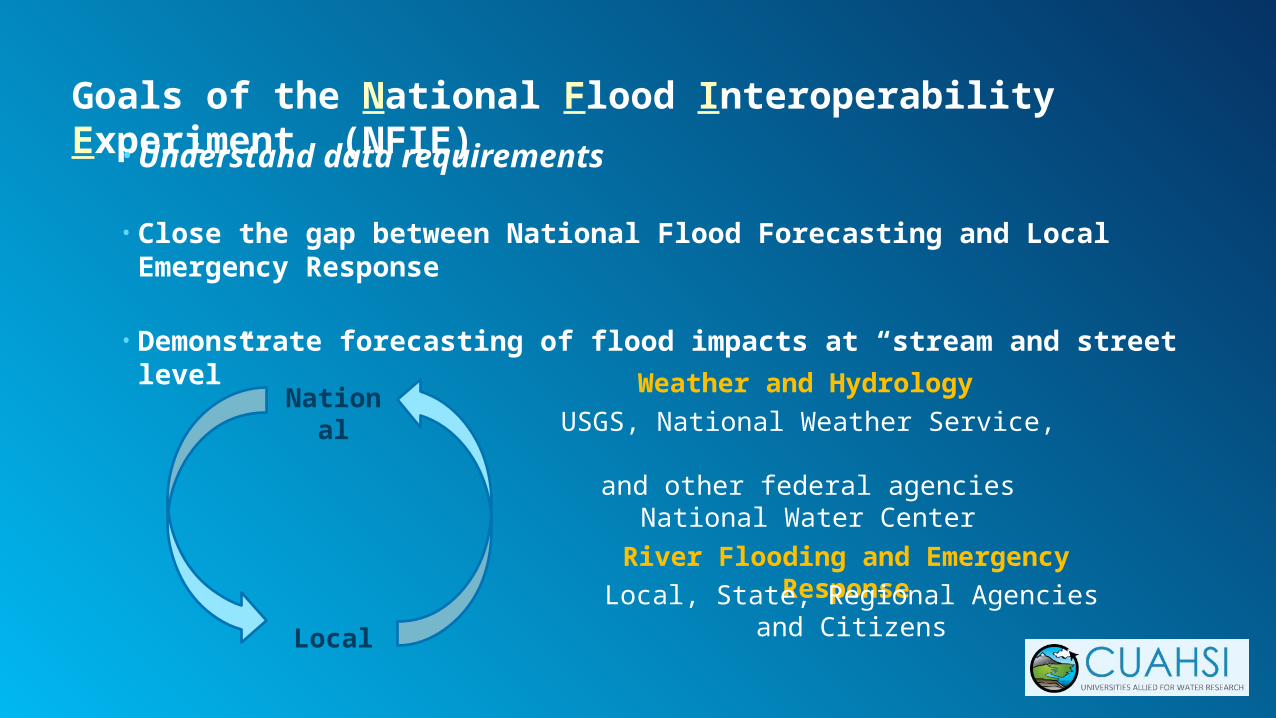
Goals of the National Flood Interoperability Experiment (NFIE)
• Understand data requirements
• Close the gap between National Flood Forecasting and Local Emergency Response
• Demonstrate forecasting of flood impacts at “stream and street level”
National
Local
Weather and Hydrology
USGS, National Weather Service, and other federal agencies
National Water Center
River Flooding and Emergency Response
Local, State, Regional Agencies and Citizens

Why local scale flood forecasting?
Understanding your risk

National Flood Interoperability Experiment
NWS Basins and Forecast Points
USGS Water Watch Points National Flood Hazard Layer
NHDPlus

Results from NFIE for OWDI
1. We now know clearly what data is needed for a national stream flow prediction system
2. We know that it is possible to forecast flow on 2.7 million stream reaches in 10 minutes, and design work is happening to turn this into a calibrated operational system.
Further research and prototyping continues, focused on modeling flood inundation, and sharing of results as targeted information products

Esri interests in the Open Water Data Initiative
• Technology provider / consultant to agencies creating and publishing water data
• Technology provider / consultant to consumers of water data
• Consumer of water data- To construct online maps and analytic services
• Re-publisher of water data- As online maps and services
OpenWaterData
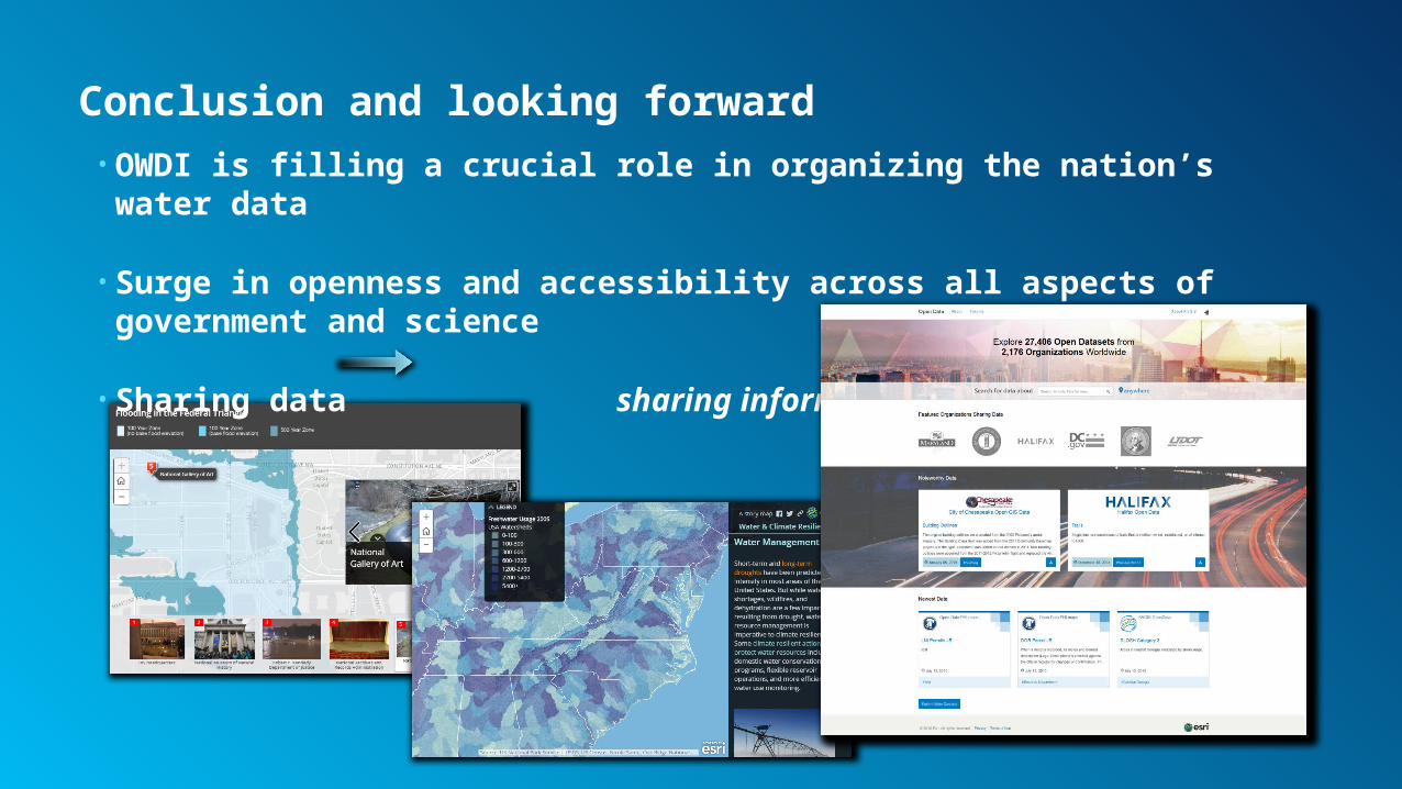
Conclusion and looking forward• OWDI is filling a crucial role in organizing the nation’s water data
• Surge in openness and accessibility across all aspects of government and science
• Sharing data sharing information

Related Documents