PGI05391 Thematic Trail Trigger Mod. 3C-3T-25 ONLINE TUTORING SESSION N. 1 - AGENDA Template rev. 2 24.02.2019 Macro-category “ Trail Management & Governance (TMG)” 2 July 2020 Location: online (Zoom) (link to follow by invitation mail) Language: English 2 July - 10.00 to 12.00 ( Session 1) Hours CONTENT PURPOSE 9.30 –9.50 Internal session between Lead Partner and the three partner transferors Getting ready for the session and discussion 10.00 –10.10 Introduction by Lead Partner (moderator) Organisation of the Tutoring Session Definition and main aspects of Trail Management and Governance 10.10 – 10.20 1. ROMANIA : GP n. 12 - Poarta Carpatilor Presentation by PP7 transferor Outline of the GP Reference to the feedbacks received during the Study Visit n. 5, with special regard to TMG aspects 10.20 – 10.30 2. FINLANDIA: GP 26 - Silence as a Tourist Attraction Presentation by PP3 transferor Outline of the GP Reference to the feedbacks received during the Study Visit n. 3, with special regard to TMG aspects 10.30 – 10.40 3. POLAND : GP n. 42 - TeH2O Presentation by PP5 transferor Outline of the GP Reference to the feedbacks received during the Study Visit n. 4, with special regard to TMG aspects 10.40 -11.10 Q&A as per partners’ requests on Google spreadsheet Each transferor to provide answers to be questions made, if not yet replied 11.10 -11.50 Open session Possibility for all participants to seek more details or counselling for replicating the experiences in their Action Plan 11.50-12.00 Summary of issues raised/answered. Arrangements for any further in-depth review Reporting One2one or other modalities for more in-depth analysis if necessary

Welcome message from author
This document is posted to help you gain knowledge. Please leave a comment to let me know what you think about it! Share it to your friends and learn new things together.
Transcript

PGI05391
Thematic Trail Trigger
Mod. 3C-3T-25 ONLINE TUTORING SESSION N. 1 - AGENDA
Template rev. 2 24.02.2019
Macro-category “ Trail Management & Governance (TMG)”
2 July 2020
Location: online (Zoom)
(link to follow by invitation mail)
Language: English
2 July - 10.00 to 12.00 ( Session 1)
Hours CONTENT PURPOSE
9.30 –9.50 Internal session between
Lead Partner and the three
partner transferors
Getting ready for the session and discussion
10.00 –10.10 Introduction by Lead
Partner (moderator)
Organisation of the Tutoring Session
Definition and main aspects of Trail Management and
Governance
10.10 – 10.20 1. ROMANIA :
GP n. 12 - Poarta
Carpatilor
Presentation by PP7
transferor
Outline of the GP
Reference to the feedbacks received during the Study
Visit n. 5, with special regard to TMG aspects
10.20 – 10.30 2. FINLANDIA:
GP 26 - Silence as a
Tourist Attraction
Presentation by PP3
transferor
Outline of the GP
Reference to the feedbacks received during the Study
Visit n. 3, with special regard to TMG aspects
10.30 – 10.40 3. POLAND :
GP n. 42 - TeH2O
Presentation by PP5
transferor
Outline of the GP
Reference to the feedbacks received during the Study
Visit n. 4, with special regard to TMG aspects
10.40 -11.10 Q&A as per partners’ requests on Google
spreadsheet
Each transferor to provide answers to be questions
made, if not yet replied
11.10 -11.50 Open session Possibility for all participants to seek more details or
counselling for replicating the experiences in their
Action Plan
11.50-12.00 Summary of issues
raised/answered.
Arrangements for any
further in-depth review
Reporting
One2one or other modalities for more in-depth analysis
if necessary
PGI05391
Thematic Trail Trigger
Mod. 3C-3T-25 ONLINE TUTORING SESSION N. 1 - AGENDA
Template rev. 2 24.02.2019
2 July - 13.00 to 15.00 ( Session 2)
Hours CONTENT PURPOSE
12.40 –12.50 Internal session between
Lead Partner and the three
partner transferors
Getting ready for the session and discussion
13.00 –13.10 Introduction by Lead Partner
(moderator)
Organisation of the Tutoring Session
Definition and main aspects of Trail Management
and Governance
13.10 – 13.20 4. MALTA:
GP n. 22 - Dingli Heritage
Trail
| Presentation by PP4
transferor
Outline of the GP
Reference to the feedbacks received during the
Study Visit n. 5, with special regard to TMG aspects
13.20 – 13.30 5 ITALY:
GP n. 37 - Val di Cornia Park
Presentation by PP 2
transferor
Outline of the GP
Reference to the feedbacks received during the
Study Visit n. 3, with special regard to TMG aspects
13.30 – 13.40 6. ITALY :
GP n. 43 SAPE
Presentation by Lead
partner transferor
Outline of the GP
Reference to the feedbacks received during the
Study Visit n. 4, with special regard to TMG aspects
13.40 -14.10 Q&A as per partners’ request on Google spreadsheet
Each transferor to provide answers to be questions
made, if not yet replied
14.10 -14.50 Open session Possibility for all participants to seek more details or
counselling for replicating the experiences in their
Action Plan
14.50-15.00 Summary of issues
raised/answered.
Arrangements for any
further in-depth review
Reporting
One2one or other modalities for more in-depth
analysis if necessary
N.B. The two sessions are planned to be recorded; videos will be made available to partners and their
stakeholders for future consultation. Provisions to secure the participants’ consent will be indicated in the
invitation mail.

Lead Partner
Project Co-ordination Team
ThreeT
Thematic Trail Trigger
ONLINE TUTORING SESSION n. 1
Management & Governance
DOC.4C-3T-99 OTS 1 - 2 July 2020

2
AGENDA sub-session 1
2 July - 10.00 to 12.00 ( Session 1)
Hours CONTENT PURPOSE
9.30 –9.50 Internal session between Lead
Partner and the three partner
transferors
Getting ready for the session and discussion
10.00 –10.10 Introduction by Lead Partner
(moderator)
Organisation of the Tutoring Session
Definition and main aspects of Trail Management and Governance
10.10 – 10.20 1. ROMANIA :
GP n. 12 - Poarta Carpatilor
Presentation by PP7 transferor
Outline of the GP
Reference to the feedbacks received during the Study Visit n. 5,
with special regard to TMG aspects
10.20 – 10.30 2. FINLANDIA:
GP 26 - Silence as a Tourist
Attraction
Presentation by PP3 transferor
Outline of the GP
Reference to the feedbacks received during the Study Visit n. 3,
with special regard to TMG aspects
10.30 – 10.40 3. POLAND :
GP n. 42 - TeH2O
Presentation by PP5 transferor
Outline of the GP
Reference to the feedbacks received during the Study Visit n. 4,
with special regard to TMG aspects
10.40 -11.10 Q&A as per partners’ requests on Google spreadsheet
Each transferor to provide answers to be questions made, if not yet
replied
11.10 -11.50 Open session Possibility for all participants to seek more details or counselling for
replicating the experiences in their Action Plan
11.50-12.00 Summary of issues
raised/answered. Arrangements
for any further in-depth review
Reporting
One2one or other modalities for more in-depth analysis if necessary

3
AGENDA sub-session 2
2 July - 13.00 to 15.00 ( Session 2)
Hours CONTENT PURPOSE
12.40 –12.50 Internal session between Lead Partner
and the three partner transferors
Getting ready for the session and discussion
13.00 –13.10 Introduction by Lead Partner
(moderator)
Organisation of the Tutoring Session
Definition and main aspects of Trail Management and Governance
13.10 – 13.20 4. MALTA:
GP n. 22 - Dingli Heritage Trail
| Presentation by PP4 transferor
Outline of the GP
Reference to the feedbacks received during the Study Visit n. 5, with
special regard to TMG aspects
13.20 – 13.30 5 ITALY:
GP n. 37 - Val di Cornia Park
Presentation by PP 2 transferor
Outline of the GP
Reference to the feedbacks received during the Study Visit n. 3, with
special regard to TMG aspects
13.30 – 13.40 6. ITALY :
GP n. 43 SAPE
Presentation by Lead partner
transferor
Outline of the GP
Reference to the feedbacks received during the Study Visit n. 4, with
special regard to TMG aspects
13.40 -14.10 Q&A as per partners’ request on Google spreadsheet
Each transferor to provide answers to be questions made, if not yet
replied
14.10 -14.50 Open session Possibility for all participants to seek more details or counselling for
replicating the experiences in their Action Plan
14.50-15.00 Summary of issues raised/answered.
Arrangements for any further in-depth
review
Reporting
One2one or other modalities for more in-depth analysis if necessary
4
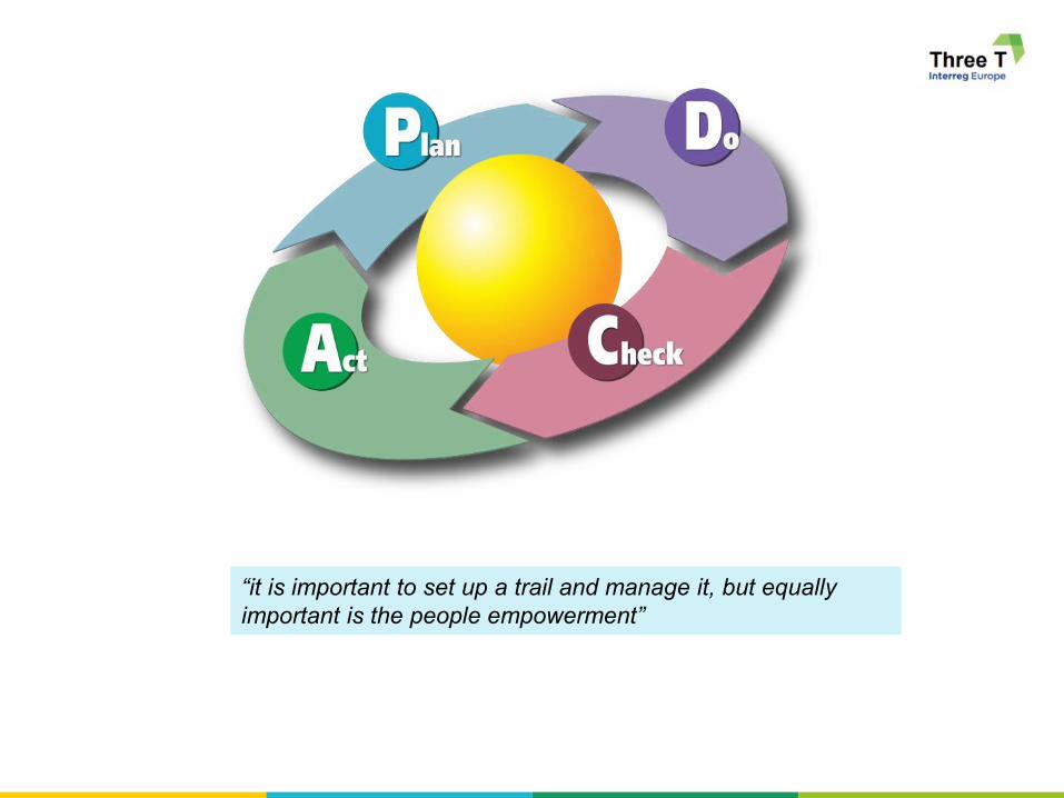
“it is important to set up a trail and manage it, but equally
important is the people empowerment”

5
Management
Management Responsibility . Success requires the participation of all members of the project
team, but remains the responsibility of management to provide the resources needed to
succeed. (PMBOK Guide, 2008)
Source: ThreeT Glossary page 10
With reference to our Thematic Trail, the management becomes relevant in 4 main phases:
I. Trail start-up (Phase A)
II. Trail development (Phase B)
III. Trail action design & planning (Phase C)
IV. Trail implementation, management & promotion (Phase D)
MANAGEMENT
Management is the administration of an organization, whether it is a business, a not-for-
profit organization, or government body. Management includes the activities of setting
the strategy of an organization and coordinating the efforts of its employees (or of
volunteers) to accomplish its objectives through the application of available resources,
such as financial, natural, technological, and human resources.

6
Management
Trail Start-up Trail Development

7
Management
Trail Action Design &
Planning
Trail Implementation, Management &
promotion Design & Planning
8
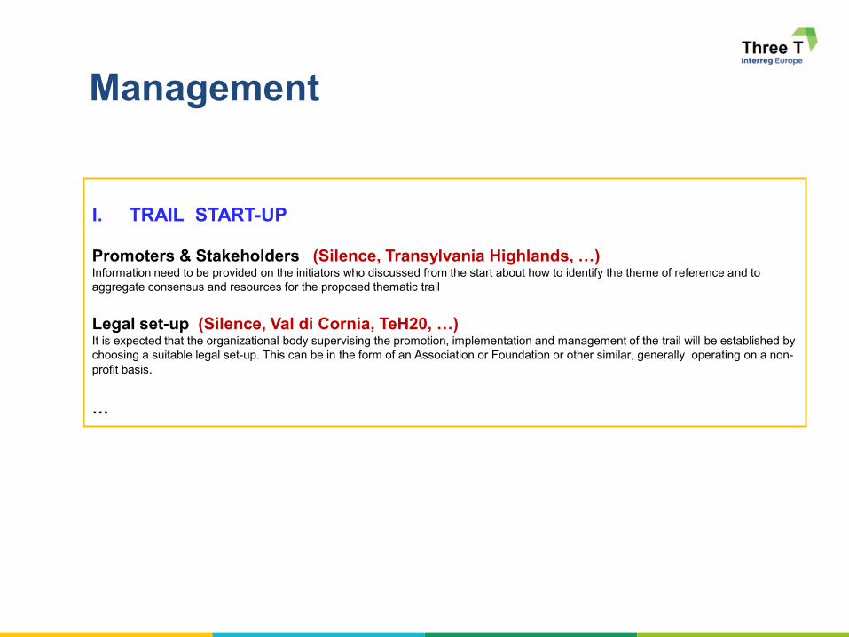
Management
I. TRAIL START-UP
Promoters & Stakeholders (Silence, Transylvania Highlands, …) Information need to be provided on the initiators who discussed from the start about how to identify the theme of reference and to
aggregate consensus and resources for the proposed thematic trail
Legal set-up (Silence, Val di Cornia, TeH20, …) It is expected that the organizational body supervising the promotion, implementation and management of the trail will be established by
choosing a suitable legal set-up. This can be in the form of an Association or Foundation or other similar, generally operating on a non-
profit basis.
…

9
Management
II. TRAIL DEVELOPMENT
Trail Identification Trail identification will start as a preparatory exercise to permit its subsequent identification on the ground; the trail may be represented
by a continuous path that interconnects various points of interest through links (trails, unpaved rural roads, etc.. ) walked or travelled on
by cycling and/or mountain biking, riding etc. In general, a Trail may be conveniently divided into sections or stages.
A Trail may also be an archipelago of points not necessarily connected together.
The whole journey may be documented by GPS tracking thus allowing the publication of information on a web-GIS portal and their
download using portable applications.
Rehabilitation or new works The opening up or the consolidation of a Trail requires the provision or renovation of bridges, walkways and other path
infrastructure, as well as protective measures such as fences, low walls, etc.
Along the Trail small-scale side infrastructure is generally welcomed to allow a travellers' stop-over and, where possible, use of
associated utilities (benches, tables, litter bins, drinkable water fountains, toilets, information boards, sheds or other type of
shelter, unmanned hostels, bicycle racks, vehicle parking bays, etc.).
Particular attention shall be paid to the use of such facilities by disabled or age-impaired persons
Services …
Information and communication …
Points of interest …

10
Management
III. TRAIL ACTION DESIGN & PLANNING
Design > strategy | action design | stakeholder
identification | cost & other resource estimate
Phasing > priority setting | finance | timing
This is the core of ThreeT Action Plan in Phase 1 !
11
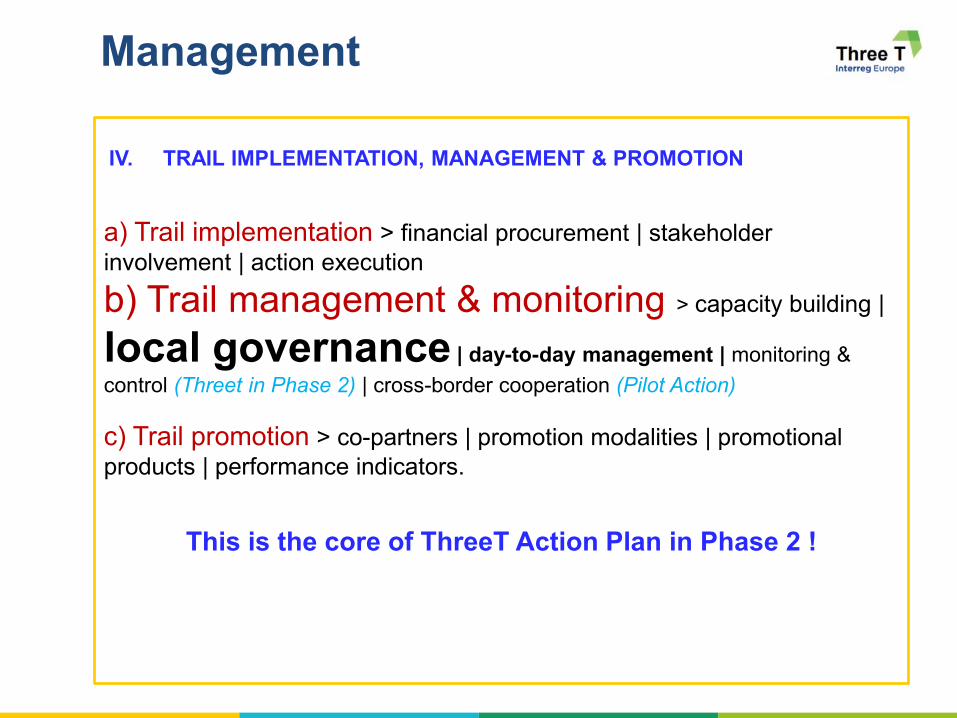
Management
IV. TRAIL IMPLEMENTATION, MANAGEMENT & PROMOTION
a) Trail implementation > financial procurement | stakeholder
involvement | action execution
b) Trail management & monitoring > capacity building |
local governance | day-to-day management | monitoring &
control (Threet in Phase 2) | cross-border cooperation (Pilot Action)
c) Trail promotion > co-partners | promotion modalities | promotional
products | performance indicators.
This is the core of ThreeT Action Plan in Phase 2 !
12
Governance
Refers to the bringing together of various actors to achieve shared purposes and
benefits in certain areas of development. (Picture project).
Modern governance is not based on centralised 'command and control' but is dispersed
across multiple centres of authority (Hooghe and Marks, 2003).
There are many self-organising, inter-organisational networks which complement markets
and government hierarchies as governing structures for allocating resources and exercising
control and coordination (Rhodes, 1996).
Two dimensions of governance exist — vertical and horizontal coordination — which work in
combination. (EEA, Report No 2/2012)
Source: ThreeT Glossary page 7
Multi-Level Governance . The term is understood as non-hierarchical forms of
policymaking, involving public authorities as well as private actors, who operate at different
territorial levels, and who acknowledge their interdependence. (EEA, Report No 2/2012)
Those are the actors of ThreeT Phase 2 !

13
Management & Governance

Let’s start now !

GP Silence as a tourism attraction –Central Finland regional plan
OTS MC TMG 7/1/2020
Liisa Bergius PP3 1
GP Silence as a tourism attraction –Central Finland regional Plan
Tutoring Partner 3
Regional Council of Central Finland
ThreeT
Thematic Trail TriggerOTS1 2nd July 2020
2
Administration perspective:
Regional planning according to Finnish Land use and Building Act
Purpose and tools of regional planning:
1. Regional scheme (Central Finland Strategy 2040),
2. Regional development programme,
3. Regional plan which steers other land use planning.
- Regional scheme indicates the regional development goals.
- Regional plan sets out the principles of land use and community
structure and designates areas as necessary for regional development.
- Areas are designated as reserved only to the extent and accuracy
required by national or regional land use goals or by harmonizing the
use of land in more than one municipality.
- When drawing up a plan, attention must be paid to the economy of land
use and to avoiding unreasonable harm to landowners or other
titleholders.
- When a plan is drawn up, the party responsible for implementing the
plan and the measures it requires must be indicated.
1
2

GP Silence as a tourism attraction –Central Finland regional plan
OTS MC TMG 7/1/2020
Liisa Bergius PP3 2
3
Presentation:
- Map: Scale in Central Finland 1:250 000, areas min
50 ha,
- Plan symbols, key to the symbols and written
regulations
- Written report
Plan symbols:
1. Areas reserved for a certain land use – restrictions
for land use (roads, nature protection,…)2. Symbols showing the development principle of an
area – no strict restrictions, need for harmonizing
more detailed land use (tourism and recreation
attraction areas,…) 3. Symbols showing the special character of an area -
no strict restrictions, need for harmonizing more
detailed land use (wind power, cultural values, …)
Regional Plan of Central Finland
Land use and building act:
Regulations required in planning or developing the area covered by the regional
plan may be given in the plan, taking into account its purpose and the demands
set for its content (regional plan regulations).
When an area requires protection due to its landscape, natural values, built
environment, cultural and historical values or special environmental values, the
necessary regulations for this purpose may be given in the regional plan (protection
regulations).
4
1. Defining main principles:
• No human mad noise over 35dB,
• Solid areas min 50 hectares
• Importance of silence for recreational
use of nature and nature tourism
2. Buffering noise source areas
3. Defining other Criteria (regional plan):
• Low population density, no intensive
agriculture or other land use, no
surpassing flight routes
• Cultural environment values,
recreational use (areas and trails),
nature conservation values (nature
protection areas, Natura 2000 areas,
nature and natural parks and other
specific nature values)
4. Soud landscape defining: Measuring
noise levels inside the potential areas
Designating silent areas- Survey 2013
Picture: Buffering zones: roads
3
4

GP Silence as a tourism attraction –Central Finland regional plan
OTS MC TMG 7/1/2020
Liisa Bergius PP3 3
5
Silence as a tourism attractionSilent areas:
• Noise under 35dB, area over 50 hectares
• 36 pieces, total 157 587 hectares, 8% of the area
• Largest silent area: Lake Päijänne
• Silence is related with all 5 National parks
Silence as a quality in regional plan:
• Notified in Central Finland Regional plan as a
quality and criteria included in planning symbol for
Tourism and recreation attraction areas
➢ Win – win situation: beneficial for landowners and
local inhabitants,
➢ no protection elements included
➢ This concept shows silence (or quietness) as a
succes factor for the region without any official
protection
➢ Could be possible to have a symbol showing the
special character of an area,
➢ No strict restrictions could be set
➢ END (European Noise Directive): Need to
preserve areas of good acoustic environmental
quality (quiet areas): Potential quiet areas in
Europe 25 Feb 2020
6
• Silence is noticed and recognized as a
strategic resource
• Silence could be utilized more effectively
in regional programming and regional
planning
• So far:
• No Official status for silent areas,
• No acces restrictions,
• Accessibility and visiting sites is based on
Everymans Rights,
• No organized accessibility or routes,
• No certified tourism concept,
• No qualification criteria for suppliers.
• Concepts using silence as a tourism
attraction in the region are operating on
voluntary base:
• Nukula Guesthouse (SV3)
• Forest Manor (Bear manor) Lakomäki
• Water and inland trails in natural parks
• Leivonmäki cottages in Leivonmäki
natural park
• ®Meijän polku – Our path (GP)
• ....
Silence as a tourism attraction –Conclusions
https://www.nukula.fi (EN)
https://lakomaki.johku.com/en_US
5
6

GP Silence as a tourism attraction –Central Finland regional plan
OTS MC TMG 7/1/2020
Liisa Bergius PP3 4
7
EEA 25 Feb 2020 Potential
quiet areas in Europe, based
on the QSI and Natura 2000
protected sites
https://www.eea.europa.eu/d
ata-and-
maps/figures/quietness-
suitability-index-qsi-3
Water bodies
Action plan preparation
Elements in Regional structure of wellbeing
Tourism
Diversity of nature
Silent areas
Leisure cottages
Culture
Cultural environments
Landscapes
National parks
Accessibility
Recreation
TrailsVillages and city centres
7
8

GP Silence as a tourism attraction –Central Finland regional plan
OTS MC TMG 7/1/2020
Liisa Bergius PP3 5
Thank you!
9
ThreeT
Thematic Trail Trigger
ONLINE TUTORING SESSION n. 1
Management & Governance
Bydgoszcz, 2nd July 2020
TeH2O – Bydgoszcz Water, Industry and Craft Trail
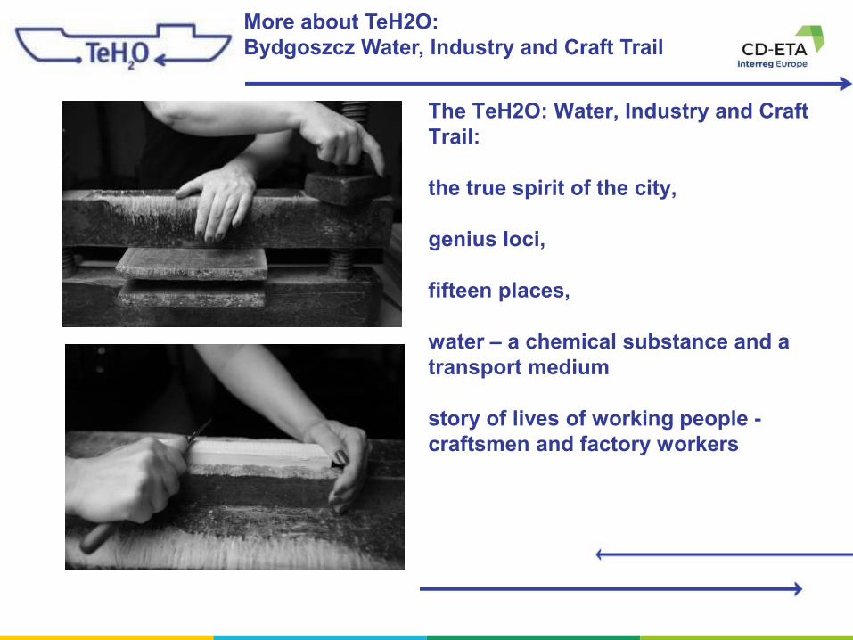
More about TeH2O:
Bydgoszcz Water, Industry and Craft Trail
Fot. T. Markowski
Fot. T. MarkowskiFot. T. Markowski
The TeH2O: Water, Industry and Craft
Trail:
the true spirit of the city,
genius loci,
fifteen places,
water – a chemical substance and a
transport medium
story of lives of working people -
craftsmen and factory workers

More about TeH2O:
Bydgoszcz Water, Industry and Craft Trail
Fot. T. Markowski
Fot. T. MarkowskiFot. T. Markowski
TeH2O: Bydgoszcz Water, Industry and Craft Trail
History of trail in a pill
Most important goal –create a professiona turist
brand
- Start in 2012 – Bydgoszcz join to
the Shift X
- 2015 – inauguration of the trail

Management of TeH2O:
Bydgoszcz Water, Industry and Craft Trail
TeH2O: Bydgoszcz Water, Industry and Craft Trail
Management – start creating
of the project
- the concept – by the city
Council and Integrated
Management Department.
- Inspiration - Silesia, Styria and
Lusatia (for example Silesian
Industrial Monuments Route),
- specialists from the
Jagiellonian University, Silesia
route and the Locativo
company, local researchers of
the city's history
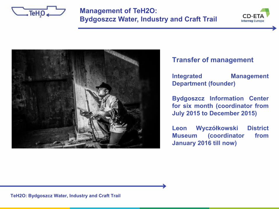
Management of TeH2O:
Bydgoszcz Water, Industry and Craft Trail
TeH2O: Bydgoszcz Water, Industry and Craft Trail
Transfer of management
Integrated Management
Department (founder)
Bydgoszcz Information Center
for six month (coordinator from
July 2015 to December 2015)
Leon Wyczółkowski District
Museum (coordinator from
January 2016 till now)

Financing of TeH2O:
Bydgoszcz Water, Industry and Craft Trail
TeH2O: Bydgoszcz Water, Industry and Craft Trail
Financing
City Council gives budget to Leon
Wyczółkowski District Museum
once in a year
PLN 140,000 (~ 31,000 €) per year

More about TeH2O:
Bydgoszcz Water, Industry and Craft Trail
TeH2O: Bydgoszcz Water, Industry and Craft Trail
Why the museum?
- large municipal unit is able to
operate more efficiently for the
route,
-better technical and
substantive facilities,
- authority in negotiations (for
example with Ministry of
Culture).
- basic funds from city budget,
- transparent.

More about TeH2O:
Bydgoszcz Water, Industry and Craft Trail
TeH2O: Bydgoszcz Water, Industry and Craft Trail
Responsibility
caretakers not owners
Coordinator provide facilties:
- a free promotion
- training for representatives of
the facilities (at least one per year)
- networking and cooperation
through integration - as a result,
everyone likes each other and
cooperates with pleasure
- we ensure consistent and clear
visual identification and
promotional materials (e.g.
leaflets, flags, T-shirts)
- coordinate the most important
event every year, i.e. the Feast of
the Trail (TehoFest) – suport the
activities of the facilities, help
create the program, partially
subsidize the attractions planned
by them
More about TeH2O:
Bydgoszcz Water, Industry and Craft Trail
TeH2O: Bydgoszcz Water, Industry and Craft Trail
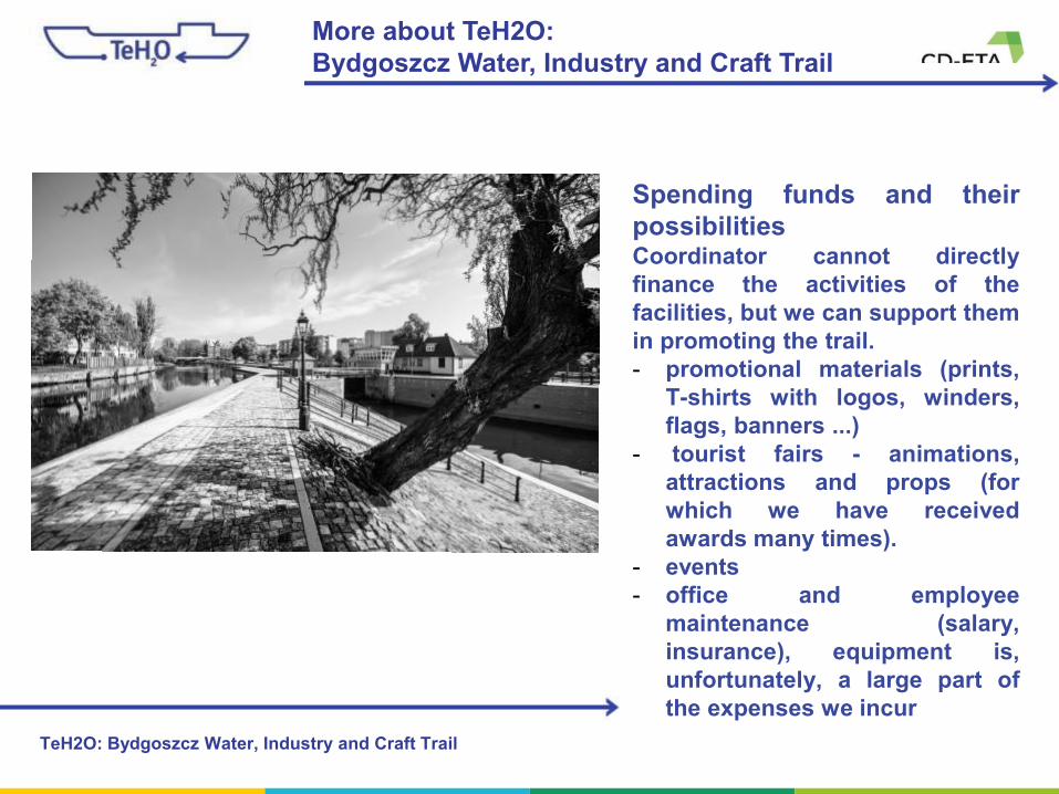
Spending funds and their
possibilitiesCoordinator cannot directly
finance the activities of the
facilities, but we can support them
in promoting the trail.
- promotional materials (prints,
T-shirts with logos, winders,
flags, banners ...)
- tourist fairs - animations,
attractions and props (for
which we have received
awards many times).
- events
- office and employee
maintenance (salary,
insurance), equipment is,
unfortunately, a large part of
the expenses we incur

Bydgoszcz Canal
More about TeH2O: Bydgoszcz Water, Industry and Craft Trail
TeH2O: Bydgoszcz Water, Industry and Craft Trail
The current Bydgoszcz Canal (24.77 km
long and 28-30 m wide) is a part of
Bydgoszcz water hub and E-70
international way – a link between western
and eastern Europe.
More about TeH2O:
Bydgoszcz Water, Industry and Craft Trail
TeH2O: Bydgoszcz Water, Industry and Craft Trail
Management structure- city Council (Integrated Management Department) - creator of the trail
- District Museum – manager (the first manager was Bydgoszcz Information Center)
- coordinator - museum employee, project specialist (who is just talking to you)
- trail facilities (15) with which contracts are signed, and their conditions for
participation in the trail are discussed in the regulations, which is the basic
document of the project
- support - Museum Education and Promotion Department, Bydgoszcz Information
Center, Kuyavian-Pomeranian Tourist Organization, City Promotion Department,
Integrated Management Department (graphic designs, tourist fairs, promotion in
social media)

More about TeH2O: Bydgoszcz Water, Industry and Craft Trail
TeH2O: Bydgoszcz Water, Industry and Craft Trail
Daily work-completing the website and
social media
-contact with the media
(television, radio, local
newspapers)
-administrative work
- being in not only city space
- educational project

More about TeH2O: Bydgoszcz Water, Industry and Craft Trail
TeH2O: Bydgoszcz Water, Industry and Craft Trail
Development strategy- connecting new facilities - the
most important thing is that we
don't invite anyone to the trail
- development of communication
between objects
- marking the road and pedestrian
trail in urban space - there is a
real chance that we will start with
signposts in the city center
- full commercialization of the
offer - including bundling of
services of several facilities at the
same time
- trail monitoring and evaluation -
to measure results

Brasov County Council
Partner 7 - (RO)
ThreeT
Thematic Trail TriggerEco-touristic trail network in
Poarta Carpatilor
02/07/2020

2
3
Eco-touristic trail network in Poarta Carpatilor
Part 1 – GP/Project presentation
Part 2 – Trail Management
Part 3 – Good governance
Part 4 – Q&A

4
Eco-touristic trail network in Poarta Carpatilor
Part 1 – Project
presentation

5
Eco-touristic trail network in Poarta Carpatilor

6
Eco-touristic trail network in Poarta Carpatilor

7
Eco-touristic trail network in Poarta Carpatilor

8
Eco-touristic trail network in Poarta Carpatilor

9
Our partners for the
ecotouristic destination:
• Piatra Craiului National Park
• Bucegi Natural Park
• Local Council Bran
• Local Council Moieciu
• Local Council Fundata
Who is involved ?

10
Good Practice n.1
TITLE Eco-touristic trail network in Poarta Carpatilor
Short
description
The practice aims to create prerequisites for ecotouristic development as an
essential factor in preserving the agro-pastoral landscape and the biodiversity by
implementing a network of ecotrails.
Key words Infrastructure, Information and communication, Trail management and
governance
Location Commune Fundata and Moieciu de Sus village – Brasov County (Ro)
Financial 165.000 Eur
Innovative The main innovation of our project was to set up a online GIS for visitors of the
trails. Through our website and the implemented GIS (and in future a separate
application) visitors have access to detailed maps (topography, geology, history,
botany etc), locations of POIs (geology, habitats, crafts, artists, traditional
architecture etc) and own location for orientation through mobile phones.
Transferability All activities included in our project which generated the ecotrail network in Poarta
Carpatilor destination are applicable to other areas and adjust them to suit local
conditions.
Hyperlink Web // Video Link

11
Further
development of
the practice
Extension of the eco-touristic trail network
Connection with neighbor destinations
Embedding of the destination Poarta Carpatilor in a larger Geopark concept
Change of visitors behavior (“form weekend tourist to several day visitor”)
Change of the urbanistic building plans to include the eco-touristic concept
Conservation of the HNV farmlands and the biodiversity
Develop a local certification for products and services in Poarta Carpatilor
area
Eco-touristic trail network in Poarta Carpatilor

12
Good Practice n.1
Eco-touristic trail network in Poarta Carpatilor

13
Good Practice n.1
Eco-touristic trail network in Poarta Carpatilor
SCIENCE FIRST !!! Ecotouristic information is emerging out of scientific research and data in Poarta Carpatilor

14
Good Practice n.1
Eco-touristic trail network in Poarta Carpatilor
Social, cultural, historical and ethnographic information in Poarta Carpatilor

15
Good Practice n.1
Eco-touristic trail network in Poarta Carpatilor

16
Good Practice n.1
Eco-touristic trail network in Poarta Carpatilor
Outdoor sport events in Poarta Carpatilor – Mountain running, MTB, hiking, etc

17
T8 – ”Pe culmea Bisericutei” – ” On top of the little church”Short
description
The route marked with “Red Little Man” starts from behind the Moieciu de Sus
Cultural Center through a steep climb. You cross separate meadows with fences,
and the view remains focused on the Bucegi Mountains that dominate the
landscape.
Key words Moieciu de Sus, Meadows, Huts, Trails
Location start Moieciu de Sus village – Brasov County (Ro)
Location end Moieciu de Sus village – Brasov County (Ro)
Total lenght 12.5 km
Total elevation 700 m
Link to map All activities included in our project which generated the ecotrail network in Poarta
Carpatilor destination are applicable to other areas and adjust them to suit local
conditions.
Link to GIS https://poartacarpatilor.ro/harta-destinatiei-ecoturistice-poarta-carpatilor/?arcgis-
layers=38
Hyperlink https://poartacarpatilor.ro/traseu/t8/
TAT – T8 Eco-touristic trail network in Poarta Carpatilor

18
TRAIL PLANNING 1 T8 – ”Pe culmea Bisericutei” – ” On
top of the little church”Who is the initiator of the idea for the trail? Centre for Mountain Ecology (CEM)
Is there any historical background of the trail? There is a ethnographic justification for the existence
of the traditional paths
Who started with planning the trail and when? Centre for Mountain Ecology, 2009
Was a formal planning process initiated? No
Was the planning tendered and/or outsourced? No
Who was involved in the planning procedure? CEM, meadows owners, locals
Which institutions/persons were involved in the
planning team?Regional and local NGO’s, Local Council from Moieciu, accommodation owners
Were existing services (e.g. accommodation, food
supplies, etc.) considered and incorporated during trail
planning?
Yes
Was access to the trail start and end points (e.g. via
public transport) considered and incorporated during
trail planning?
Yes
TAT – T8 Eco-touristic trail network in Poarta Carpatilor

19
TRAIL PLANNING 2 T8 – ”Pe culmea Bisericutei” – ” On
top of the little church”Did any challenges occur during the planning phase? YES. Mapping problem appeared, data base problems
and picture database had to be merged.
How were challenges solved? Creating the CEM GIS with all available information.
How long took the planning phase until trail
establishment?3 years
TAT – T8 Eco-touristic trail network in Poarta Carpatilor

20
MAINTENANCE CHAIN T8 – ”Pe culmea Bisericutei” – ” On
top of the little church”Who “owns” the trail? The local community
Is there a specific institution responsible for trail
maintenance?No
Is there a yearly budget allocated for maintenance? No
Who pays for the annual maintenance budget? CEM and the owners
Is voluntary maintenance work and monitoring
calculated and reported?YES
Is there a monitoring system established for checking
the trail?YES – volunteers register in CEM’s GIS
Are there any surveys/ digital data mining about the
trail usage?No. They are planned via IoT
Is there an analog or digital feedback form for trail
users? And who is processing it?No. They are planned via ArcGIS Survey
What are the main challenges in trail maintenance (e.g.
vandalism, natural events)?Costs for replacement
Is there a communication procedure on how to solve
each single problem?No
How are stakeholders involved during maintenance, its
planning and troubleshooting?They are informed by CEM
TAT – T8 Eco-touristic trail network in Poarta Carpatilor

21
Good Practice n.1
Eco-touristic trail network in Poarta Carpatilor
CEM’s planned ecotouristic trails in Poarta Carpatilor for 2020 - 2022
22
Eco-touristic trail network in Poarta Carpatilor
Part 2 – Trail
Management

23
Eco-touristic trail network in Poarta Carpatilor
Part 2 – Trail Management
Aspects:
1. Private ownership of majority of trail sections
2. Creation of two local associations to further develop the trails – one is functioning and
the other is inactive
3. Funding for trail development has no annual budget from local council
4. Local population sustains the trail network
5. CEM is acting as a promoter of the ETTN in Poarta Carpatilor
6. CEMs volunteers inform and monitories the network (send pictures form damaged
infopoints, etc)
7. CEM develops further project ideas towards sustainable tourism implementation in the
Poarta Carpatilor
8. Locals maintain the trails

24
Eco-touristic trail network in Poarta Carpatilor
Part 3 – Good
governance

25
Eco-touristic trail network in Poarta Carpatilor
Part 3 – Good (or bad)
governance
Aspects:
1. Good collaboration with one of the communes from Poarta Carpatilor area
2. Good collaboration with Brasov County administration
3. CEM developed a sustainable tourism strategy for the are, but it is not yet any local
council decision to adopt it
4. CEM developed together with the Architects Assoc. of Romania a building guide for the
are, but it is not yet any local council decision to adopt it
5. CEM involves in the planning of the area by proposing documents, maps and projects for
further sustainable touristic development, but the local administration struggles to
implement waste water system and drinking water system
6. Conflicts between mass tourism services and sustainable tourism services exist and have
to be managed by the implementation of a strategy

26
Eco-touristic trail network in Poarta Carpatilor
Part 4 – Q&A

27
Eco-touristic trail network in Poarta Carpatilor
Q1.1 - LP: Provide more details on how the local
community was involved in the project and could make
profit from the initiative.
Answer: CEM has a decade-long experience in the Poarta Carpatilor area and during several former
projects, starting with 1991, TRUST and RESPECT was build up between us and the local community.
In all our projects we firstly involved local people, local services and local products.
The ETTN was “just” a further CEM-initiative to help the local community to switch more towards
sustainable tourism (discovering through hiking and walking activities) and help them to diversify the
touristic offer in the area. Although most touristic services and products are not sustainable (by COP
Paris 2015-definition) in the area, our ETTN-project involved most locals by getting their (verbal)
approval to pass their meadows and forests (and partially their gardens) and to let us mark the
paths/trails in the village area. This project couldn’t have been possible without their (passive)
implication.
For us, the traditional work done by the local community to maintain the meadows and the huts, to
create the local food products and to maintain the local traditional mountain-agriculture and the
biodiversity, are enough implication to maintain the main purpose of the trail network: the traditional
cultural landscape.
28
Eco-touristic trail network in Poarta Carpatilor
Q1.2 - LP: Also more details are welcomed on how the
trails were designed using the cooperation concept.
Answer: CEM had a very easy job to do to design the trail-network: we had just to pick up the “best”trails already existing and created by locals through their daily work in local mountain agriculture.
The traditional management system they developed, as being the most efficient for their area, is based
on 3 main areas they include in their farming agriculture: the house area and the surrounding
meadows, the meadows for hay-production as winter food they own in the village and the high
mountain pastures for their animals in the summer. Between this 3 areas several walking and working
paths emerged during the centuries. They intersect and cross-connect the farming areas of each
family (owner) and create an unique trail-network in this mountain area.
Picking up the best segments for the ETTN project followed few important criteria:
1. Owner had to agree to include her/his farmland for touristic purpose
2. The trajectory of the trail segment should include some beautiful viewpoints on the surroundings
3. The segment should create a connection between other important Points of Interest (POI)
4. The segments should be used by more locals, not just by one family (with few exceptions)
5. The segments should pass safely public roads
The cooperation concept was based on personal discussions with each family, explaining the
implication of our actions and their benefits for their touristic business. Most families are also owners
of at least one small guesthouse.
29
Eco-touristic trail network in Poarta Carpatilor
Q2 – PP3: The involvement of locals as an ongoing
process - how does it work? Local economic system?
Answer: As we answered already Q1.1, the main involvement of the locals as an ongoing process is to
maintain the mountain agriculture they already apply since hundreds of years in this area. Our main
objective is to motivate them to keep doing this hard, exhausting work day by day.
The main problems in the ETTN-area are the abandonment of the mountain farming, the depopulation,
the disappearance of local food and non-food products and the connected change of the traditional
cultural mountain landscape.
Our approach is to create a deeper understanding in the minds of the locals on the unique landscape
with a higher biodiversity (than the potential natural one in the area) they and their ancestors created
in this area, the importance for whole Europe and to show them how they could use this mindset and
information for developing a sustainable tourism.
Together with other partners we created certification systems (ecotourism) and we plan to extend this
certification concept for food and non-food products produced in the ETTN area.

30
Eco-touristic trail network in Poarta Carpatilor
Q3.1 – PP4: Which are the main issues, relate to natural
heritage protection, taken into consideration when planning
new services / activities?
Answer: As in most other countries of the EU, the concept of natural heritage protection must be
extended on the traditional cultural landscape with high nature value. Mostly meadows harbor a high
biodiversity in ETTN area. From this point of view we started in Poarta Carpatilor to define new areas
which are not integrated yet in regional planning with conservation targets: High Nature Value
farmlands. The general natural heritage protection is related to virgin forests and high alpine areas.
The main issues we considered in our projects are:
To combat alteration of the traditional cultural landscape
To combat degradation of HNV farmlands and landscapes through random building activities
To define new restricted and totally protected areas following the recommendation of the EU, to have
30% protected areas and 10% strictly protected areas

31
Eco-touristic trail network in Poarta Carpatilor
Q3.2 – PP4: Do cost/benefit studies take into
consideration, and assign a monitory value to, the impact
on the natural environment of existing or future projects in
the area?
Answer: The first answer is simply NO. We have not done any studies according cost/benefit
evaluations because we don not have to do large investments, we have to conserve existing and very
valuable parts of potential sustainable touristic development in Poarta Carpatilor and in Brasov
County.
The general aim would be to calculate the preservation of cultural and natural heritage compared to its
distruction.
What we have done and what we do permanently is to show examples of and from other areas in
Europe where locals gave up or brutally changed their way of life focusing on mass and industrial
tourism.
For further projects we proposed to the regional government for evaluation of any project according to
its sustainability the respectation of the 17 SDGs, the 168 targets of the SDG and their 238 indicators.
As an additional tool for evaluating development projects in tourism and building domain we proposed
also the MIPS-concept to be implemented at regional level (Material Intensity per Service Unit).
32
Eco-touristic trail network in Poarta Carpatilor
Q4.1 – PP9: We see the Centre for Mountain Ecology
(CEM) as "anchor point" of the eco-touristic trail network.
1 How did you get other companies and private people for
(eg for sponsoring, events, actions, offers) involved? Answer: In all of our activities, which are not funded through European funding, EEC-countries or
national or regional level programs, we always followed the main principle to ask for funding “action-
related”. For example for a mountain running marathon we organized for 10 years we had sponsors for the
different types of actions we undertook during the event: for timing we asked a timing/watch company
for sponsoring, for equipment a running shoe producer, for aid stations local chees or drinking
producers. Always action-related.
For the ETTN project we had also the Local Council form Fundata as partner with 5% of buget.
Private people are involved through our volunteering program. For one event we have even up to 170
volunteers. For the ETTN project we had in general 20-30 permanent volunteers helping to fulfill all
actions.

33
Eco-touristic trail network in Poarta Carpatilor
Q4.2 – PP9: We see the Centre for Mountain Ecology
(CEM) as "anchor point" of the eco-touristic trail network.
2 And what did you do in the beginning to gather different
people in order to create events and the trails? And how
did you manage to connect them?
Answer: As we said before, we had a very good volunteering program and during the decades of
activity CEM, even if we are just 3 permanent employees, can count on a pool of 100 volunteers.
For them we organize weekends in the mountains, working weekends, meetings or small events. Lot
of them are coming from the urban area of Bucharest, Brasov, Constanta or Galati, but in the mean
time most people in village Moieciu de Sus know them or host them as guests in their guesthouses.
Romania has a well developed NGO network. We help each other for different projects or materials,
information or volunteer work.

34
Eco-touristic trail network in Poarta Carpatilor
Q4.3 – PP9: We see the Centre for Mountain Ecology
(CEM) as "anchor point" of the eco-touristic trail network.
3 What difficulties did you have in organising meetings with
the locals?Answer: To organize meetings with the locals was one of our biggest mistakes in the beginning of our
activity. We imagined gathering them would be more time efficient and easy to manage for project
indicators (participants per meeting). But we realized that not everybody in the village or in the area is
willing to work or volunteer together with his neighbor. A lot of problems appeared during gatherings
because two people could not stand each other and their discussions “destroyed” the whole meeting.
Since years we decided to use another strategy, a more time consuming one for us, but more efficient:
face-to-face meetings.
In this way we use more time, but for us it is very valuable time, because you discuss with each
person (owner of a plot of land you whish to pass with the trails you propose) and the results are
usually positive.
This methodology we will apply in all our projects and we recommend to all of you to apply it too. For
projects it can be a little bit more time consuming and the indicators have to be described more
precise, but the results regarding the acceptance of a project or the envolvment of the locals is better.

Thank you!

ThreeT - Thematic Trail Trigger
ThreeT Tutorial Session No.1
PP4 – Planning Authority, Malta
Dingli Heritage Trail
2
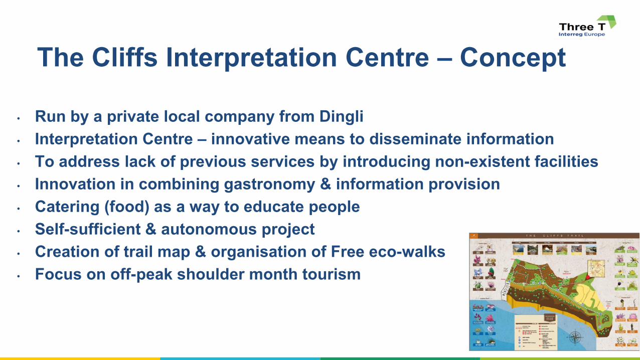
• Run by a private local company from Dingli
• Interpretation Centre – innovative means to disseminate information
• To address lack of previous services by introducing non-existent facilities
• Innovation in combining gastronomy & information provision
• Catering (food) as a way to educate people
• Self-sufficient & autonomous project
• Creation of trail map & organisation of Free eco-walks
• Focus on off-peak shoulder month tourism
The Cliffs Interpretation Centre – Concept

3
• Means of information dissemination:
• Walking trail map, website, leaflets, info. panels
• Free Eco-walks throughout the whole year
• Local food menu with seasonal variations
• Information dissemination to widespread target audience:
• General Public – Over 300 FREE eco-walks for approx. 4000 people
• Students – Over 1700 secondary students in four years
• Stakeholder Meetings – 10 seminars by different associations
• Collaboration with NGOs, Local council, National authorities
Methods & Target Reach

4
• Economic – Self-sufficient & financially viable project without needing external
funds: Revenue from catering allow FREE information provision to visitors;
economic local development
• Environment – Info. Dissemination on Natura 2000 site, promotion of countryside
• Social – Creating jobs for locals, Run by locals (authentic visitor experience),
Stakeholder dialogue, Rejuvenation of past gastronomic practices, wheel-chair
accessible premises
• The Centre achieved recognition in 5 different awards with significance at
International, European and National scales related to sustainable tourism &
environmental best practice
Sustainability Pillars

5
▪ Compilation of study explaining the three pillars of sustainability and
cross‐referenced with related policies;
▪ Securing long‐term financial viability of The Centre’s operations was crucial to the running of The Centre;
▪ Business model based on self‐sufficiency, achieved through linking
gastronomy/catering with direct information dissemination;
▪ Walking trail promoted by The Centre resulted in friction between the
users and an individual within a particular area;
▪ Next challenge is to increase the environmental pillar of sustainability by
investing in additional agricultural land in the area (including the removal
of several invasive alien trees, planting indigenous fruit trees and wild
local trees, and bringing back water in the area through rainwater
harvesting.
Key issues related to TMG identified in the Study Visit

6

7

8
9
(form LP)
▪ Can more details be provided on how the study explaining the three
pillars of sustainability has been compiled and cross-referenced with
related policies? How the idea of "controlled access numbers" is/ or is
going to be introduced and applied?
(form PP8)
▪ Details on the App: design, content, cooperative mechanisms behind.
Experiences of its introduction: added value, lessons learned, etc.?
▪ Methods of interpreting local gastronomic heritage - types of events,
books, menus, joint marketing of local products?
▪ Discussion on our action planned: Ideas and feedbacks on how similar
initiatives could be identified and supported in our region?

10
(form PP8)
▪ Could you explain the framework and funding conditions for
restaurateurs more deeply, if there are any written down?

11
Thank You

Lead Partner
Project Co-ordination Team
ThreeT
Thematic Trail Trigger
ONLINE TUTORING SESSION n. 1
Management & Governance
DOC.4C-3T-99 OTS 1 - 2 July 2020

Alex Bruni & Silvia Guideri
Parchi Val di Cornia SpA
ARCHAEOLOGICAL PARKS:
CONSERVATION, DEVELOPMENT,
MANAGEMENT OF LANDSCAPES AND STORIES
An experience of integrated development of
the archaeological and landscape heritage of
the area: The Val di Cornia Parks Network
System in Tuscany.
BOZZA DI DISCUSSIONE

BOARD OF DIRECTORS
ALESSANDRO BRUNI - President: BTB strategist, Philosopher, Professor in Pisa in BtB
strategy at Engineering faculty
MAURO TOGNOLI - Chief Operating Officer: Entrepreneur from northern Italy; Experience
in public-owned companies
LAURA VANNI - Vice President: Labor & Accounting Consultant
ROBERTO GROSSI – member: expert in cultural institutions development; former City
Culture Councilor in Rome; former President of Teatro Bellini in Catania; Author; expert in
publicly-controlled companies governance
BEATRICE MASAZZA: local entrepreneur in tourism

The Val di Cornia (Cornia Valley) comprises 5 Municipalities (Piombino, Campiglia Marittima, San
Vincenzo, Sassetta, Suvereto), with a population of around 62,000 inhabitants.

COME METTERE A SISTEMA TUTTO QUESTO?
PUBLICS / STAKE HOLDERS VALURE-CREATION PROCESS
INTEREST: the user and
beneficiary of the asset /
product / service
GAIN: economical operator
involved at his satellite
business advantage
IDENTITY: the citizenship
component of the project:
people recognizing it as part of
their heritage and culture
RESEARCH: prerequisite for
the creation of value (eg.
Archeo dig-up)
CONSERVATION: prerequisite
for the conservation (and
augmenting) of asset value
FRUITION: UX, appreciation,
revenue generation,
profitability, …

6
POSITIONING
IDENTITY
GAIN
INTEREST
RESEARCH
CONSERVATIO
N
FRUITION
PU
BL
IC / S
TA
KE
HO
LD
ER
VALUE CREATION
LE CITTA’ D’ARTE

7
IDENTITY
GAIN
INTEREST
RESEACH
CONSERVATI
ON
FRUITION
PU
BL
ICS
/ STA
KE
HO
LD
ER
VALUE CREATION
ART
TERRITORY
POSITIONING

8
PERSONAS NEED/SERVICE DEFINITION
FAMILIES in cerca di un'esperienza calibrata fra la
visita istruttiva, l'intrattenimento, la “gestione della giornata”, la vacanza, le attività ludiche tenendo in considerazione le diverse
esigenze dei vari componenti
• Attività
coinvolgenti/ludiche
• Spazi sicuri dove rilassarsi
• Percorsi non troppo
impegnativi
• Ristorante/Punto ristoro
• Servizi igienici
• Prezzo sostenibile
• Bookshop assortito con
gadget (con anche giochi)
e editoria per bambini
• Visite smart
• Acquisto on-line biglietti
• Parcheggio
• Ristorante/punto ristoro
• Area attrezzata per
picnic
• Servizi igienici
• Area giochi
• Servizio guida
• Attività ludica e
didattica
• Bookshop con sezione
dedicata
• Call center per
informazioni
Parco di Baratti
Parco di S. Silvestro
Museo archeologico
Servizi in linea con le richieste
Necessarie alcune azioni di
miglioramento
Servizi in linea con le richieste
Necessarie alcune azioni di
miglioramento
NEEDS SERVICES
Servizi in linea con le richieste
Necessarie alcune azioni di
miglioramento

9
PERSONAS
NEEDS / SERVICE CREATION
VIAGGIATORE SMART cosmopolita, altospendente, sensibile a
esperienze da raccontare
• Alta qualità dei servizi offerti
• Esperienza coinvolgente
• Luoghi non affollati
• Ristorante/punto ristoro
• Punti panoramici attrezzati per
immergersi nell'esperienza
• Bookshop mirato (in
particolare con editoria di
livello)
• Grande attenzione all'estetica
• Grande attenzione
all'accoglienza
• Parcheggio
• Ristorante/Punto ristoro
• Servizi igienici
• Servizio guida anche
personale (su
prenotazione)
• Punti panoramici
• Bookshop mirato
• Acquisto ticketonline
• Call center info e
prenotazioni
Parco di Baratti
Parco di S. Silvestro
Museo archeologico
Servizi in linea con le richieste
Necessarie alcune azioni di
miglioramento
Servizi in linea con le richieste
Necessarie alcune azioni di
miglioramento
NEEDS SERVICES
Servizi in linea con le richieste
Necessarie alcune azioni di
miglioramento

10
E.G.: ON-GOING INITIATIVES IN PARCO DI BARATTI
TO ALIGN products/services/needs/targets (personas)

11
COMMUNICATION STRATEGY
Web marketing

12
COMMUNICATION STRATEGY
Web marketing

STRATEGY
VERY VERY SIMPLE AND BASIC: 100% DIGITAL MARKETING BUDGET
FBLANDING PAGECALL TO ACTIONTRADITIONAL SITE
FOCUSED
EASY TO EXECUTE
EFFICIENT
EASY TO KPI AND CONTROL
POSITIVELY AFFECTING COMPANY CULTURE

PERSONAS
Definizione dei bisogni e relativi servizi
PERSONAS
Definizione dei bisogni e relativi servizi
logistics

Coordinated urban plans defined the areas to be protected going beyond the legal concepts of cultural and
landscape heritage, overcoming the administrative borders and interpreting the natural and cultural features
of the territory as a unitary common good.
Around 500 hectares of archaeological areas
Around 6,000 hectares of protected natural areas (today Anpil and parks, per Law 394/1991)
6 public parks are planned in this area
Archeological Park of Baratti-Populonia
Archeo-Mining Park of San Silvestro
Sterpaia Coastal Park
Rimigliano Coastal Park
Montioni Woodland Park
Poggio Neri Woodland Park
Archeological Museum of the Territory
San Silvestro Park Museums
Since 2009
Museum of the Castle and City of Piombino
Museums of Campiglia Castle
How the Parks Network System was born
The Parks System today

To achieve this objective, in 1993, the local councils in the Cornia Valley backed the
formation of a special body which they gave the statutory mission to CREATE the parks
envisaged by the planning schemes, and to MANAGE their services and promotional
activities in an integrated form: a company called Parchi Val di Cornia Spa.
The governance of the archaeological
area and museum
MANAGEMENT ENHANCEMENT
Carrying out all necessary
interventions for the
development of the parks
in order to add value to the
cultural and environmental
assets in a positive
economic perspective.
Managing its services either directly or through contractors

Strengths
Implementation of a conservation project for a large area
Integration between cultural assets, environmental assets, and tourism services of the
5 municipalities;
Integration and coordination between the phases of conservation, enhancement and
management of the system
Creation of a business culture in the management of cultural/environmental assets
Economy of scale (the parks and museums network);
More effective promotion, and the creation of integrated packages (culture,
environment, services) promotional and commercial efficiency;
High capacity for self-financing

Servizi tecnici
Divisione Parchi Naturali
Attività Culturali,
Didattiche e Formative
Museo
Archeologico
Comunicazione e marketing
Amministrazione e Segreteria
Gestione Risorse Umane
Parco di Baratti
e Populonia
Parco di
S. Silvestro
Parco di
Montioni
Parco di
Rimigliano
Parco della
Sterpaia
Consiglio di Amministrazione
Amministratore delegato
Divisione Parchi Archeologici e Musei
Ufficio Manutenzione e
salvaguardia del patrimonio
Ufficio Prentazioni
ORGANIZATION CHART TO 2012 sites
development

ORGANIZATION 2012 TO 2020 technical competence

THE NEW CHAT business units
SHAREHOLDERS BOARD
Baratti & Populonia
SITE Museo Archeol. SITE San Silvestro SITE Natural Parks & Seaside
System
Mkting, Comunicazione & PR
Amm. Fin & Contr. & Contratti
Scientific Board,
Partnership, Funding, S.
Guideri
Tech support staff
CHiEF OPERATING OFFICER M.
Tognoli
PRESIDENT
A. Bruni
HR
BOARD Of DIRECTORS
Office Management & IT
MUNICIPALITIES CONFERENCE
Natural Parks and
Seaside System

THE INSTITUTIONAL FRAMEWORK :
Outline Agreement between the municipal councils for the unified implementation of
services of the Val di Cornia Parks System ( 2002)
1993 –Founding of a shared company with public and private capital with the
involvement of the Val di Cornia municipalities and private enterprises.
2002 – Framework agreement between the 5 municipalities for the unified
implementation of services of the Val di Cornia Parks System .
2004 – Shared contract between the municipalities and the Parchi Val di Cornia
society for the services management.

THE INSTITUTIONAL FRAMEWORK
Outline Agreement between the 5 municipal councils for the
unified implementation of services of the Val di Cornia Parks System ( 2002)
Art.2 - The parks as unified territorial system
The natural, historical and archeological resources of the parks, regardless of their geographical
location, represent
a single local heritage asset
in the Val di Cornia, whose cultural and economic development and promotion is best pursued at a
level above that of the individual municipality, by means of coordinated planning schemes, and
organizational forms appropriate to the nature of the services to be provided.
Art. 13 - Criteria for dividing up funds for management of services
The funds, required for the unified management of the cultural and environmental heritage of the parks
system will be shared out between the Municipalities that are providers of the services,
in proportion to the number of local residents.

THE INSTITUTIONAL FRAMEWORK:
Agreement with authorities responsible for heritage protection.
The cultural heritage enhanced with the Parks project (archaeological areas, museums and
monuments, mining sites of historical interest, woods and protected natural areas) are
safeguarded by the national legislation - Codice dei Beni Culturali e del Paesaggio - Decreto
legislativo 22 gennaio 2004, n.42..
Advices and agreements with the state authorities - Ministry of Cultural Heritage - were necessary
for their enhancement .
The agreement for the enhancement of the cultural heritage of the area
of Baratti-Populonia – 5th november 2007
The ministry, in concert with local authorities (Regione Toscana and the municipality of Piombino)
stipulate an agreement to commit to Parchi Val di Cornia the enhancement of the cultural heritage
of the territory for the management of the Archaeological park of Baratti and Populonia.

La composizione societaria a partire da Agosto 2007
• Comune di Piombino (1993)
• Comune di Campiglia Marittima (1993)
• Comune di S. Vincenzo (1993)
• Comune di Suvereto (1993)
• Comune di Sassetta (1993)
• Provincia di Livorno (2005)
• Camera di Commercio di Livorno (2005)
Anno 2007 – capitale € 1.480.444,05
Azionisti pubblici

51%
15%
28%
5% 1%
Patto territoriale
Comunità europea
Fondazione MBCA
Risorse proprie
Financial cover of investments in Parks € 27.240.523,00
From Conservation to Development: Investments (1994-2016):
0
1.000.000
2.000.000
3.000.000
4.000.000
5.000.000
6.000.000
7.000.000
8.000.000
9.000.000
Parco
archeominerario di
San Silvestro
Parco archeologico di
Baratti e Populonia
Museo di Cittadella Parco della Sterpaia Parco di Rimigliano Parco di Montioni
Contributo CEE
Patto Territoriale
Risorse proprie/Comune
Accordo di programma
Fondazione M.P.S.

Food services and reception inside the parks.
Park of San Silvestro
1 Restaurant Santa Barbara
2 Gowett Hostel
Park of Baratti
3 Restaurant San Cerbone
Park of Rimigliano
4 Restaurant Torraccia
5 Podere Tuscania( farm)
Park of Montioni
6 Hostel
Park of Sterpaia
7 Perelli 1
8 Perelli 2
9 Carlappiano
10 Mortelliccio
11 Carbonifera
12 Punto ristoro Sterpaia
13 Punto ristoro al Pino
14 Concessione Carbonifera
15 Concessione Carbonifera
ESTIMATED VALUE well over 3.000.000 euros

San Silvestro Baratti Cittadella Castello Museo della Rocca
TOTALI
1998 24.274 23.641 47.915
1999 24.631 60.281 84.912
2000 26.700 60.941 87.641
2001 24.081 65.446 7.523 97.050
2002 25.071 65.160 7.038 97.269
2003 20.676 54.446 5.574 80.696
2004 20.711 49.609 5.047 75.367
2005 17.287 45.826 5.205 68.318
2006 22.842 45.494 4.398 72.734
2007 26.407 56.985 4.412 87.804
2008 27.354 53.288 4.763 85.405
2009 29.066 49.909 4.492 2.278 1.397 87.142
2010 29.316 49.531 5.971 4.908 1.251 90.977
2011 30.657 47.287 5.397 3.242 2.791 89.374
2012 27.363 43.620 4.858 1.928 1.809 79.578
2013 26.382 44.151 4.366 2.145 1.382 74.426
2014 31.941 47.627 6.058 3.208 1.506 90.340
2015 30.805 44.873 4.586 2.619 2.087 84.970
2016 32.210 43.855 6.358 545 867 83.835
2017 33.568 44.906 6.015 893 0 85.382
2018 31.280 45.707 5.982 1.013 83.982
Visitors to Archeological Parks and Museums

Anni Ricavi Costi Capacità di
autofinanziamento
1998 589.364,32 1.130.523,25 52,13%
1999 937.643,87 1.170.436,41 80,11%
2000 1.007.250,91 1.292.297,29 77,94%
2001 1.101.678,49 1.479.902,70 74,44%
2002 1.285.033,00 1.925.700,00 66,73%
2003 1.617.682,39 2.069.466,70 78,17%
2004 1.478.134,00 1.898.396,00 77,86%
2005 1.689.623,00 2.139.954,00 78,96%
2006 2.230.482,00 2.328.532,00 95,79%
2007 2.463.298,00 2.471.316,45 99,68%
2008 2.476.836,48 2.588.288,54 95,69%
2009 2.569.861,88 2.767.367,69 92,86%
2010 2.599.857,17 2.823.697,60 92,07%
2011 2.578.463,40 2.716.273,03 94,93%
2012 1.339.017,74 2.167.210,84 61,79%
2013 1.329.233,02 2.138.419,69 62,16%
2014 1.473.864,18 2.206.482,33 66,80%
2015 1.468.410,16 2.216.568,02 66,25%
2016 1.461.072,70 2.190.219,47 66,71%
2017 1.522.489,03 2.242.032,15 67,91%
2018 1.565.939,98 2.416.703,21 64,80%
Total operating results- Historical comparison

Revenue split

L’evoluzione delle presenze turistiche nel territorio provinciale (2000-2013)

MOBILITY
31

TRANSPORT
LAYOUT
32

Q&A
FINLANDIA
More detailed description of the co-operation network and roles of each stakeholder involved.
Municipalities for asset management and services
Satelite businesses (eg Parcheo card, co-business, Marketing)
The State for the conservation of cultural assets
MALTA
Are there plans for additional means of transport such as an electric bus linking the various sites, since cycling
might not be such an easy option, particularly in summer?
‘Ridurre la pressione antropica e dei veicoli privati nel parco creando una graduale limitazione della sosta
all'interno del Golfo in particolari periodi dell’anno (con l’esclusione dei residenti, dei commercianti e degli operatori) attraverso il potenziamento del parcheggio scambiatore delle Caldanelle e l'incentivazione dell'uso
di mezzi alternativi (bici, bus navette, etc.) con una contestuale riduzione dei parcheggi all’interno del golfo’. Will be partt of next 3-years plan to be disussed w shareholders. Region and Province involved

Q&A
ROMANIA
1. Is there any standard developed and applied for designing the routes without barriers or is it the individual
aproach of the architect or engineer the basis for the approach ??
Guideri off-hand
2. "The system has developed a project with an innovative governance and has also made the facilities and
routes accessible to people with reduced mobility wherever possible. " What do you mean with Innovative
governance??
3. Could you develop the concept of innovative governance better and more detailed?
Integration between cultural assets, environmental assets, and tourism services of the 5 municipalities;
Integration and coordination between the phases of conservation, enhancement and management of
the system
Creation of a business culture in the management of cultural/environmental assets
Economy of scale (the parks and museums network);
High capacity for self-financing

Q&A
UNGHERIA (queste sono quasi tutte tue/vostre! ;-)
1. Info board design, App, maps were highly valuable showcase examples.
2. Visitor card: ParcheoCard: terms, conditions for involved service providers, discounts offered.
How to reach target groups of the card on both ends: Tourists and service providers?
How the card’s business model is set up?
3. How to reach effectively the wider public audience; what kind of communication / promotion / dissemination methods
are used in general and also focusing on families, children and youngsters?
4. How to make archaeological sites interesting and experiences-oriented? What techniques / methods are used; what kind
of games were invented?
E.g: experimental archaeology laboratories thematically oriented in the different sites, the choice to incentivize and to
coexist archaeological research campaigns with the enjoyment, which enriches the visit and fascinates the public, but also to
some basic design choices such as that of the train to New Year's Eve
5. Discussion on our action planned: Ideas and feedbacks on expected start-up costs of setting up and launching a similar
system among existing archeological sites in our region: scale and types of costs.
Da slide: Coordinated urban plans defined the areas to be protected going beyond the legal concepts of cultural and
landscape heritage, overcoming the administrative borders and interpreting the natural and cultural features of the
territory as a unitary common good.
Q&A
GERMANIA
Use of the different buildings
o How were the anchor points in the parks chosen?
Guideri off-hand
o How was it decided which buildings are suitable for which use (park centers, restaurants, etc.)? Was there an
external expertise (consultant enterprise) involved?
We use designers and specialists from time to time to complement the technical skills present in the company, we
define the addresses and objectives also on the basis of the needs of management in accordance with the mission
assigned by shareholders and the ministry owners of the assets and we are still the ones to coordinate/orientate those
involved in the project including the universities operating in the territory. It is important to emphasize the role of
landscape architects and refer to masterplans.
With regard to the choice of 'containers' we have always preferred to recover philologically existing structures,
obtaining the dual purpose of restoring historic buildings that tell a part of history and turn them into services that also
offer an income through rents (e.g. New Year's Eve)
o How are licenses issued to private users? Do the private actors have to present a concept?
IT’S A PUBLIC ECONOMICAL TENDER REGULATED BY NATIONAL LAWS AND REGULATIONS
What measures are being taken to market the parks?
ESSENTIALLY DIGITAL MARKETING, PRESS-RELEASE, SPECIALIZED PRESS, WORD OF MOUTH

37
The cultural and landscape resources of a local area, namely history and the environment, are
strategic factors of a modern supply of tourism services and facilities, and represent a point of
departure for a new model of sustainable development
However, none of this can happen without:
research and knowledge and conservation/planning of heritage and the landscape
integration between cultural and environmental resources and services (System)
synergy between local authorities and departments in implementing the project (integrated
management)
choosing a streamlined tool for the implementation of the project (efficient management)
strategic coherence in the administration of the territories
PROTECTION ENHANCEMENT AND MANAGEMENT ARE STRICTLY LINKED
Summing up:
Related Documents