Meeting of the Working Group of Asia–Pacific Ministerial Conference On Housing and Human Settlements (APMCHUD) on 'Urban and Rural Planning and Management' th th (16 – 17 August, 2012) Meeting Venue: Gulmohar Hall, India Habitat Centre, Lodhi Road, New Delhi-110003 A Report Ministry of Housing & Urban Poverty Alleviation Government of India hsmi

Welcome message from author
This document is posted to help you gain knowledge. Please leave a comment to let me know what you think about it! Share it to your friends and learn new things together.
Transcript

Meeting of the Working Group of
Asia–Pacific Ministerial Conference OnHousing and Human Settlements (APMCHUD)
on'Urban and Rural Planning and Management'
th th(16 – 17 August, 2012)Meeting Venue: Gulmohar Hall, India Habitat Centre, Lodhi Road, New Delhi-110003
A Report
Ministry of Housing & Urban Poverty AlleviationGovernment of India
hsmi

lwpukdk vf/kdkj
Hkkjr ljdkjvkokl vkSj ’kgjh xjhch
mi’keu ea=kky;]fuekZ.k Hkou] ubZ fnYyh&110108
GOVERNMENT OF INDIAMINISTRY OF HOUSING &
URBAN POVERTY ALLEVIATIONNIRMAN BHAWAN, NEW DELHI-110008
www.mhupa.gov.in
Susheel Kumar, IASJoint Secretary (Housing)Tel.No. : 23061665Fax : 23061497
ForewordCountries of the Asia Pacific region, for the past decade, have been experiencing unprecedented increase in urbanization which has posed complex challenges for city planners and managers. The region though the second least urbanized region in the world, after Africa, is fast catching up with a high urban population average annual growth of 2.0 % per annum (as during 2005 to 2010) and has fastest urbanization in the world next to Africa. According to the UN-ESCAP, in 2010 about 43% of the Asia and Pacifi c population lived in urban areas and the urban proportion of the Asia Pacifi c has risen by 29%, more than any other region. Besides this, it is also the fastest growing economic region in the World and the rapid economic growth of the region is closely linked with urbanisation levels.
Within the Asia Pacifi c region there are, however, wide variations and it is seen that in general countries with the fastest urban population growth rates are the one’s having the lowest levels of urbanisation. The urban population growth is attributed to natural increase in population, rural to urban migration and erstwhile rural areas being classifi ed as urban due to population growth. Urbanisation, population increase, increased consumption and the unsustainable growth challenge the regions sustainable development. To address the situation there is a need for greater responsibility and quick responses to meet the growing requirements. Integrated strategic approach towards regional planning and management with greater sensitivity towards peri-urban areas, regional identity, environmental concerns, energy concerns and response to climate change is the need of the hour.
This report, a compilation of the proceedings of the Working Group and technical papers on the theme “Urban and Regional Planning and Management”, details the recommendations as arrived at by the Working Group’s deliberation. Taking into account the diverse nature of cities, adaptation measures will certainly vary among cities, but I am sure it will be useful in offering great insight on various issues of ‘urban and rural planning and management’ and address the concern accordingly.
Joint Secretary MoHUPA, Govt. of India and Chief Coordinator APMCHUD

PrefaceThe Working Group Meet of the Asia Pacifi c countries on the theme “Urban and Rural Planning and Management” was organised in New Delhi at the India Habitat Centre (IHC), Lodhi Road, on 16th & 17th August, 2012. The Ministry of Housing and Urban Poverty Alleviation (MoHUPA), Government of India, took up of the lead role for coordinating the activities of APMCHUD working group on the theme ‘Urban & Rural Planning and Management’. Human Settlement Management Institute (HSMI), Research and Training Division of Housing and Urban Development Corporation Ltd (HUDCO), has been privileged to coordinate the Working Group on behalf of MoHUPA, Government of India.
Housing & Urban Development Corporation Ltd., a premier techno-fi nancial institution was set up by the Government of India to facilitate housing & infrastructure development in the country with a social motto of serving the ‘unserved’ and thus bridging the ‘housing divide’ in the country. The Corporate Plan of the organisation refl ects its vision for the future growth and business environment, which is interlinked with the developments in the macroeconomic environment of the country as well as the developments in the relevant sector. The assignment fi tted well into the organisation’s Corporate Plan.
The Working Group Meeting aimed at outlining regional actions to promote sustainable urban and rural planning and management in the region, which is urbanising at an unprecedented pace and undergoing vibrant economic transformation. The Expert Group Meeting offered a platform, bringing together various countries of the region, to address the regional challenges, through collaborative efforts and sharing of experiences and best practices. The meeting spread over two days extensively deliberated on fi ve issues concerning urban and rural planning and management namely; Approaches to Urban and Rural Planning and Management in Asia Pacifi c Region, Inclusive Planning and Practices, Urban and Rural Continuum - Imperative of Integrated Planning Development, Land related issues, and Tools, Technologies and Capacity Building for Urban and Rural Planning and Management. The report provides the detailed proceedings of the Working Group’s deliberations and recommendation, and the technical papers etc. on the theme.
We are extremely grateful to the member countries of APMCHUD, the delegates from participating countries, the dignitaries from respective Embassies for their participation in the Expert Group Meeting. We are also thankful to the resource persons for various Technical Sessions, Experts chairing and co-chairing the sessions, representatives of various organisations and academicians related to the sector for their valuable inputs that helped to formulate the recommendations.
Chairman and Managing DirectorHousing and Urban Development Corporation Ltd (HUDCO), New Delhi

C O N T E N T S
Foreword i
Preface iii
Contents v
SECTION I
Working Group-1 Proceedings and Recommendations• Overview 3• Proceedings of the Expert Group Meeting 4• Recommendations of the Working Group Meeting 20
SECTION II
Papers on the theme• Background paper 27• Introduction to the Technical sessions 53• Technical Papers (details overleaf) 57
SECTION III
Annexure I-VI• Programme Schedule 221• Theme Paper by Chairman and Managing Director, HUDCO 225• Statement by Minister of Housing and Urban Poverty Alleviation 231• List of Foreign delegates 235• List of Resource Persons 237• Press Release 239
SECTION IV
Country Paper - Power point Presentations• Republic of Iraq 243• Armenia 245• Thailand 246• Bhutan 256• Sri Lanka 259• Indonesia 265

C O N T E N T S
SECTION II Details of technical papers Page No.
1. Strategic Planning and Housing Sector in Iraq – Country paper from Iraq 57-Ms. Edan Sallomi Alwan Al-Sumaily
2. Regional Self Governance in the Overall Urban and Rural Development–Country 65paper from Armenia-Ms. Sonia Matevosyan
3. Approaches in Urban and Rural Planning in India 69-Ms. Shobha Kumar
4. Urban, non-Urban and Regional Dimension of Urbanization 75-Prof. VK Dhar
5. Planning and Governance of Metropolitan Cities in India 83-Mr. BN Singh
6. Inclusive Planning: A Prerequisite for a Sustainable Growth Strategy 93-Ms. Nila Pandian
7. Culture as the 4th Pillar of Sustainable Development – Creative Cities 105-Mr. RK Safaya
8. Some Thoughts on Inclusive Planning Practices in Delhi 113-Mr. AG Krishna Menon
9. Integrated Planning for Metropolitan and District Regions 119-Dr. KK Pandey
10. Peri-Urban Land Developments in India – Issues and Concerns 131-Dr. PSN Rao
11. Inclusive Approach a Culture of Regional Indigenous Planning – Case 141Example of Jaipur -Dr. Anjali Krishnan Sharma
12. Land a Critical Resource in Urban and Rural Planning and Management 149-Dr. Manika Negi
13. Towards a Hybrid Land Policy for Inclusive Development 161-Mr. AK Jain
14. DDA’s New Initiatives of Participatory Planning for MPD-2021 Review 173-Dr. SP Bansal
15. Planning for a Pilgrim Town – Master Plan for KATRA, (J&K) 179-Prof. Madhu Bharti
16. Inclusion of the Poor in Asian Cities: the Case of Participatory Municipal Planning 180-Ms. Banashree Banerjee
17. Utilisation of Geospatial Technologies in Karnataka under NRDMS Programme – 197An Overview -Mr. H. Hemanth Kumar
18. Potential and Challenges in the Use of SDI in Decentralized Water Resources Planning – 201Case of Rural Almora District, Uttarakhand State, India-Ms. Vani and Rohit Asthana

Report of the Working Group on ‘Urban and Rural Planning and Management’
Working Group Meeting of the Asia Pacifi c Ministerial Conference on Housing and Urban Development (APMCHUD)(16th – 17th August, 2012) New Delhi
3
Working Group-1Proceedings and Recommendations
I. Overview
1. The APMCHUD was established as an inter-governmental mechanism for cooperation and collaboration in the fi eld of housing and urban development among the Asia Pacifi c countries. It is a consultative mechanism with the Technical support from the UN-Habitat. The First APMCHUD conference held in Delhi, India in 2006, focused on the theme ‘A Vision for Sustainable Urbanization in the Asia-Pacifi c by 2020’ and aimed at galvanizing government action and political commitments at the regional level to improve the lives of millions of slum dwellers. The Conference came up with ‘The Delhi Declaration’ and adopted ‘Enhanced Framework of Implementation for Sustainable Urbanisation in Asia Pacifi c’.
2. The Second APMCHUD conference held in Tehran, Islamic Republic of Iran, 2008, on the theme: ‘Sustainable Urban Development; Associating Growth with Equity and Identity’ resulted in Tehran Declaration and Action Plan that contained a commitment to support regional cooperation for sustainable urbanization. It proceeded to undertake an in-depth consideration of each of the key facets of sustainable urbanization and agreed on key messages and actions for each: i) Urban and Rural Planning and Management; ii) Urban Slums Upgrading; iii) Delivery of Millennium Development Goals for Water and Sanitation; iv) Financing Sustainable Housing: Enhancing Affordability and Quality of Low-Income Housing; iv) Development of Sustainable Urbanization with a focus on Natural Disasters. In order to ensure the effective execution of the action plan, the Conference called upon countries of the region to promote and establish technical networks and working groups relating to the different sub-themes.
3. The Third APMCHUD conference held in Solo in Indonesia in 2010 focused on the theme “Empowering Communities for Sustainable Urbanization” and expressed concern about the impacts of the economic crisis and climate change on achieving the Millennium Development Goals (MDGs); recognized the role of local stakeholders, including women and children, in achieving sustainable urbanization and tackling climate change; and agreed on an implementation plan to address the challenges of housing and urbanization. The Solo Declaration agreed on the continuation of the activities of the fi ve working groups. It also announced the creation of a Permanent Secretariat for the APMCHUD in New Delhi, India.— WG1 Urban and Rural Planning and Management— WG2 Urban Slums Upgrading— WG3 Delivery of Millennium Development Goals for Water and Sanitation— WG4 Financing Sustainable Housing: Enhancing Affordability and
Quality of Low-Income Housing — WG5 Development of Sustainable Urbanization with a focus on Natural
Disasters
4. The Fourth Asia-Pacifi c Ministerial Conference on Housing and Urban Development is being held in Amman, Hashemite Kingdom of Jordan from 10-12 December 2012. The overall theme of the Conference this time is “Youth and Information Technology in Sustainable Urban Development”. The fi ve working groups of APMCHUD, as framed in the earlier Conference at Tehran and their continuity reaffi rmed at Solo Conference, were to hold deliberations on the said themes to address the regional challenges. The reports of these working groups outlining regional actions to promote sustainable urbanization

Report of the Working Group on ‘Urban and Rural Planning and Management’
Working Group Meeting of the Asia Pacifi c Ministerial Conference on Housing and Urban Development (APMCHUD)(16th – 17th August, 2012) New Delhi
4
in the region shall be presented at Amman. For India Ministry of Housing and Urban Poverty Alleviation (MoHUPA), Government of India, took up of the leadership role for coordinating the activities of working group WG1 on ‘Urban & Rural Planning and Management’.
5. India represented by Kumari Selja, the Hon’ble Minister for Housing and Urban Poverty Alleviation and Minister of Culture, Government of India, was the fi rst Chair of APMCHUD during 2006-2008, and continues to be a member on the Bureau of APMCHUD since then in the subsequent two terms. The Government of India, Ministry of Housing and Urban Poverty Alleviation (MoHUPA) with the working group coordinated by Human Settlement Management Institute (HSMI), Research and Training Division of Housing and Urban Development Corporation (HUDCO) organized a two-day Expert Group Meeting on 16th and 17th August 2012 at the India Habitat Centre (IHC), Lodhi Road, New Delhi.
6. Effort was made to bring together 68 countries to deliberate on the APMCHUD working group theme. Offi cials of the concerned Ministries of the member countries of the APMCHUD were invited to take part in the deliberations and also make a presentation on the topic. Technical papers were invited focusing on the theme ‘Urban & Rural Planning and Management’, highlighting practical experiences and innovative solutions.
II. Proceedings of the Expert Group Meeting
Minister for Housing and Urban Poverty Alleviation and Minister of Culture Kumari Selja inaugurated a two day expert group meeting of the Asia Pacifi c Ministerial Conference on Housing and Urban Development (APMCHUD) on the 16th of August 2012. The meet focused on the theme of Urban and Rural Planning and Management, and mechanisms for ensuring sustainable urbanisation in the Asia Pacifi c Region.
The Conference was attended by 24 Foreign Delegates from 18 member countries including Iraq, Sri Lanka, Fiji, Indonesia, Armenia, Thailand and Bhutan and other experts from India who deliberated on the dynamics of urban and rural planning and management with focus on issues related to traditional and current planning and management tools, institutional legislative framework, landuse planning, regulaltion and land management strategy, government policies and strategies, future directions and prospects and guiding principles for Asia Pacifi c regions as per the schedule at Annexure-I.
Day 1 - Thursday 16th August 2012
Inaugural Session1. The inaugural session of the Expert Group Meeting started with the lighting of the lamp by the dignitaries
on the dais. This was followed by Shri Susheel Kumar, Chief Coordinator of APMCHUD and Joint Secretary (Housing), MoHUPA opening the meet with a welcome address. Welcoming the delegates, Shri Susheel Kumar, indicated that the recommendations of this working group meeting on ‘Urban And Rural Planning And Management’ would be presented by the Lead Country of the WG-1, India at the

Report of the Working Group on ‘Urban and Rural Planning and Management’
Working Group Meeting of the Asia Pacifi c Ministerial Conference on Housing and Urban Development (APMCHUD)(16th – 17th August, 2012) New Delhi
5
2. Shri VP Baligar, Chairman and Managing Director, HUDCO, introducing the theme of the Asia Pacifi c meet, highlighted that the next two days would extensively deliberate on fi ve issues concerning urban and rural planning and management, which included the various planning approaches for urban and rural areas, inclusive planning requirements, development of urban-rural continuum, land as a critical input for spatial development and various innovative tools and techniques and capacity building requirements for planning.
He further brought out that the Master Plans need to be more fl exible, dynamic and participatory and that planning needs to address not just the formal sector but also the informal sector. The growth of cities have implications for infrastructure and energy sector which need to keep pace with the growing needs especially of the disadvantaged and poorer masses. Unregulated growth within the cities and the fringes needs to be curbed, he emphasised. Finally, he stressed that Provision of Urban Amenities in Rural Area – PURA, a programme of the Ministry of Rural development (MoRD), good transport planning, congestion pricing, regional development and climate sensitive development is the need of the hour. (Annexure-II)
3. Shri A K Misra, Secretary, MoHUPA delivered the special address where he highlighted the issues of rural migration and slums in urban areas. In his address, Shri Misra, identifi ed focus areas on which the city planners can contribute signifi cantly towards ensuring sustainable growth of cities. Appropriate density patterns in cities, orientation of city’s form and structure in terms of developing vertical cities or horizontal cities in the context of urban land being scarce, and a pro-poor building bye-laws can go a long way in this regard, he highlighted.
4. The Hon’ble Minister of HUPA inaugurated the programme followed by the inaugural address (Annexure-III). Inaugurating the Expert Group Meeting, the Minister indicated that the Asia Pacifi c Region is undergoing rapid transition in both economic and urban growth terms. While the economic growth is indeed good for the region, the extraordinary urban growth in the region in resulting in a dichotomy in development. Whereas the in-migrants into the city provide cheap labour sustaining the city’s economic growth, the urban centres are not providing adequately to meet the housing and infrastructure requirements for them. This is resulting in the proliferation of informal settlements and slums in the cities.
Housing and Urban Development Ministerial Conference meeting of the Asia Pacifi c Countries, scheduled for December, 2012 in Jordan.

Report of the Working Group on ‘Urban and Rural Planning and Management’
Working Group Meeting of the Asia Pacifi c Ministerial Conference on Housing and Urban Development (APMCHUD)(16th – 17th August, 2012) New Delhi
6
Highlighting various initiatives of the Government of India such as land reservation for weaker sections in larger layouts, allocation of funds for urban poor by urban local bodies, through the JNNURM and also the Rajiv Awas Yojana for a slum free India, the Minister emphasised the need to focus on inclusive planning, whereby the requirements of all the sections of the society are taken into account, for holistic development of human settlements. She spoke about the role of participatory planning, inclusive development, empowerment of the masses, involvement of the poor and disadvantaged in urban planning. She also stressed the need for comprehensive approach for optimal utilisation of land and use of innovative approaches for land mobilisation.
Further, she said, that the secondary cities and new towns are now to receive attention for socio economic growth and development. The CDP approach as followed under JnNURM shall supplement the master plans for cities. One third of the central funds are targeted for the poor and the municipalities have pro-poor reform agendas. The District level planning in India is still evolving and needs to be strengthened, she remarked. Rural areas also need to get economic advantages which she said shall be addressed through MoRD’s Programme of ‘Provision of Urban Amenities in Rural Area’ (PURA).
The Inaugural Session ended with a Vote of Thanks by Shri A N Krishnamurthy, Executive Director, Training, Human Settelment Management Institute, HUDCO.
Technical Session I:Approaches to Urban and Rural Planning and Management in Asia and Pacifi c Region
1. The Technical Session was chaired by Mr. Istabraq Ibraheem Al-Shouk, Senior Deputy Minister, Ministry of Construction & Housing, Government of Iraq and co-chaired by Mr Ramesh K Safaya, Urban Planning Expert, India.
2. The fi rst presentation made by the delegate from Iraq, covered initiatives of the Government of Iraq in overcoming hurdles to achieve the goal of affordable housing in rural and urban areas. The political conditions in Iraq he said have been such that development in the sector is still in its initial stages. He highlighted the goals being sought for and invited interventions from member countries towards achievement of the target.
3. The second presentation was made by Ms Sonya Matevasyan, delegate from Armenia. The presentation stressed on regional level planning structures and policy initiatives of the Government of Armenia. Armenia is a mountainous country with limited resources and prone to earthquake and landslide hazards. The earlier approach for planning was not suffi cient for addressing the needs of the country, and hence in 2011, it was informed that a Bill on Regional Self Governance was passed which favours a more participatory approach and encourages smoother functioning at various levels of the Government. The latest approach, she said, favours simplifi cation of paperwork, leaner master plans which are to the point and more user friendly.
4. The next presentation on ‘Provision of Urban Amenities in Rural Area’ (PURA) was made by Mr Rajesh Bhushan, Joint Secretary, MoRD, Government of India (GoI). Shri Bhushan covered the background of the inception of the programme which he said was in line with the principles of Mahatma Gandhi and according to the vision of the ex-President of India, Shri APJ Kalam. The programme PURA encourages private sector partnership, strong role of elected local self-government or Panchayats and convergence of various schemes of the GoI. Talking of implementation of the programme he said, private sector shall also earn from the partnership and bring economic sustainability in the process, whereby the GoI shall bring in viability gap funding. Shri Bhushan explained the broad features of the procedural guidelines and institutional setup for undertaking activities under PURA. The PURA is as yet at pilot stage and upscaling of the projects is under way in the Twelfth Plan period, he said.
5. Prof VK Dhar, an Urban Planning Expert, India made a presentation on the topic “Urban, Non-Urban and Regional Dimensions of Urbanisation”. Prof Dhar presented an analysis of the defi nitions adopted for categorising urban and rural areas in various countries. It was brought out that 2/5th of the census towns in

Report of the Working Group on ‘Urban and Rural Planning and Management’
Working Group Meeting of the Asia Pacifi c Ministerial Conference on Housing and Urban Development (APMCHUD)(16th – 17th August, 2012) New Delhi
7
India are not having statutory status. There are large regional variations in terms of level of urbanisation. The present planning approach has poor conceptual framework for establishing spatial linkages. There is a need to include the hinterlands in the planning process. Agro based industries need to be encouraged for economic development of rural areas. Emerging patterns of economic corridors and spatial agglomerations need to be acknowledged in the planning processes. The present gaps in regional level planning need to be addressed at national level, he emphasised.
6. The last presentation under the fi rst set of Technical Session was made by Shri BN Singh, former Director, AMDA, India on the topic “Planning and Governance of Metropolitan Cities in India”. In his presentation Shri Singh brought out that expansion of the urban population is occurring mostly in large cities such as mega and metropolitan cities. The million plus cities, with the exception of 6 cities, have several municipal and non-municipal urban areas and rural panchayats. Large investments in metropolitan areas are undertaken by multiple organisations including central and state government agencies. Rural and urban settlements are the two sides of the same coin of the socio-economic system. Planning for metropolitan regions need to include multi-municipal urban agglomerations with their hinterland. This requires preparing integrated plans for the orderly development of the metropolitan city and its surrounding areas.
7. The Technical Session-I was summarised by the co-chairperson who pointed out that decentralisation, public participation need to be encouraged in the planning process especially as the civil society is getting stronger. Thought also needs to be given to the optimal size of a city from the ecological perspective, he said.
Technical Session II: Inclusive Planning and Practices
1. The Technical Session was chaired by Mr. M.N Buch and co-chaired by Ms. Sukumaporn Jongpukdee, Senior Architect, National Housing Authority, Thailand.
2. Mr. MN Buch, IAS (Retd), in his opening remarks elaborated on what exactly is meant by inclusive planning and talked of the need for the mechanism for genuine public participation in the urban planning process and invited Mr. Susheel Kumar, JS, HUPA to make his presentation.
3. Mr. Susheel Kumar’s presentation focussed on Ministry of Housing and Urban Poverty Alleviation’s work related to Housing and RAY. He highlighted the thrust areas of HUPA, i.e.- Formulation of housing policy and programmes- Slum redevelopment - Implementation of urban poverty alleviation programmes
His presentation elaborated on the fi rst two area of operation in line with the theme of the Working Group. He chronologically traced the evolution of the recent policies and programmes of HUPA starting with launch of JNNURM in 2005, the National Housing and Habitat Policy 2007, the IHSUP 2008, announcement for slum free India and scheme for affordable housing in partnership 2009, and efforts for slum free city planning in 2010, leading to the launch of RAY in 2011. He outlined the salient features of the JNNURM including its components progress in terms of sanctioned projects and amounts sanctioned.
While introducing the recently launched Government of India’s programme of Rajiv Awas Yojana (RAY) Shri Sushil Kumar described the unique features of RAY Programme i.e. the:• Rights based approach, • Slum free city approach,• Pro-active programme approach that includes corrective and preventive steps to prevent formation of
slums, and,• Planning process where the community plays a central role.

Report of the Working Group on ‘Urban and Rural Planning and Management’
Working Group Meeting of the Asia Pacifi c Ministerial Conference on Housing and Urban Development (APMCHUD)(16th – 17th August, 2012) New Delhi
8
The Chairman while appreciating the presentation observed that the National Commission on Urbanisation in its report over two decades ago had recommended that out of the 349 towns investment was being made in only 4 metropolitan cities to generate economic momentum. Remaining settlements were growing fast and it made sense for the Government to invest in the development of these towns. To this end, the JNNURM was the fi rst step in the right direction and a large number of small and medium towns, tier two and tier three cities have seen a new concept of development. He also observed that the Government of India should decide whether it is a facilitator or provider for the provision of slum free cities. In case, the Government wants to be a provider, it should be prepared to actually intervene and provide for the people. He also cautioned that while the concept of PPP is very good, it has to be treated with caution since in many instances it becomes a profi t-profi t-profi t proposition, not a Public Private Partnership. He then invited the next speaker from Thailand to make a presentation and observed that he personally had been very impressed with the interventions for slum redevelopment in the city of Bangkok, the efforts of the Royal Thai Housing Board and the personal intervention of the King of Thailand in the fi eld of education where maximum attention was paid to rural and backward children.
4. Ms. Sukumaporn Jongpukdee from Thailand covered the following issues in her presentation:• Brief description of Thailand• Housing Urban Development in Thailand• New urban land development method (Land readjustment)
After giving a background of the political and demographic profi le of the country, she elaborated on the organisational structure describing the National Housing Authority (NHA) and the National Housing Planning Board, and the efforts of the state and local governments. She mentioned that the NHA was placed with the Ministry of Social Development and Security and the largest proportion of their work was with development of urban poor communities. She described the model of land readjustment followed for several projects which, she said, was on the same pattern as efforts made in Japan. She then elaborated on the land readjustment projects which were used both for the provision of the serviced land and for the implementation of the urban development projects.
5. Dr. Renu Khosla, Director, Centre for Urban and Regional Excellence (CURE) made a presentation titled “Pani Potties Makan and Ajeevika (water…toilets…Houses…and…livelihoods)-Unthinking Inclusive Urban Development. In this presentation she posed key questions as:• Do planners write poor off the urban script?• Can people help to create inclusive city?
She stressed that the cities are about people who are different culturally, economically and socially and all these concerns have to be taken on board in the planning process. She stressed that community participation was not easy, and required suffi cient time because it was a process. She described what was termed as a ladder of community participation, saying that it was not a mere matter of ticking a box and agreeing or approving a planners plan, but a matter of identifying needs and priorities and designing spaces for them to live in. She then presented the case study of Agra, terming it the slum city imprint. She described in

Report of the Working Group on ‘Urban and Rural Planning and Management’
Working Group Meeting of the Asia Pacifi c Ministerial Conference on Housing and Urban Development (APMCHUD)(16th – 17th August, 2012) New Delhi
9
detail the project for the improvement of a 4.2 km. long open drain to the east of Taj Mahal which impacted the lives of 4000 households living in 17 slums along the drain while partnering with the Department of Tourism who wanted to beautify the city for better tourist experience. Elements of sewage control, solid waste management and the construction of new toilets in 4000 houses were brought in. She also touched upon several other aspects of the project including heritage conservation, livelihood development and other social and cultural aspects for improving the quality of life. She concluded by stressing on the concept of moving from foot printing to imprinting where the focus should be on localism, decontrol and capacity building.
Session Chairman Mr. Buch while appreciating the presentation stressed that while urban development is often thought of as infrastructure and land use plans, it should be remembered that people are crucial in the planning process. Chairman then invited Mr. RK Safaya to make his presentation.
6. Mr. R K Safaya, Urban planning Expert, India began with the defi nition of cultural planning describing the common understanding of costs, population, work, energy, happiness, relationship with other species and the future. He described the planners’ triangle, which described the dilemma of the planner who had to balance economic development, social equity and environmental protection. He then described that the most stable form of development would be one that had the fourth dimension of the cultural vitality. He then elaborated on how planners can use cultural planning as a tool to promote the culture of citizenship of cities. He elaborated on the Bhutan model of gross national happiness. In his concluding remarks Chairman appreciated and quoted that in the context of planning the Indian city, culture is that which makes the city from urban to urbane.
Technical Session III: Urban – Rural Continuum – Imperative of Integrated Planned Development
1. The session on Urban Rural Continuum, planned broadly to look into the ‘Imperative of Integrated Planned Development’, was chaired by Prof. Dinesh Mehta, Professor. Emeritus, CEPT, Ahmedabad and co-chaired by Shri MDK Chandrasena, Director, (Planning & Management Information System), Urban Settlement Development Authority, Srilanka.
2. At the outset, the Chairperson brought out that the rural and urban connotations go beyond the space dimension. The contradictions of rural and urban in terms of values refer to traditional values and modern value; and w.r.t. economy it is the rural economy and urban economy and the like and wished to get more from the panellists.
3. The fi rst speaker for the session Mr. Kinzang Norbu, Director, Department of Human Settlement, Bhutan provided an overview of his country and highlighted the Urban and Rural Planning Strategic Framework in his country which focuses on ‘Happiness’ which is the ultimate desire of all human beings. He said in his country, the basic concept of planning and management for any human settlement is human happiness – which is the ultimate for which human settlements are planned and that all that is done is a means of achieving it. Further, he emphasised on the need to respond imaginatively to both push and pull factor considering the challenges of rapid urbanisation and to initiate regional growth that possesses an economic base, has effi cient and effective infrastructure and provides measurable improvement in quality of built environment. He spoke of aiming at development with minimum damage to the environment while also preserving the traditional built form and ensuring equitable access to basic services and meeting the needs of the vulnerable and disadvantaged groups. As regards Governance issues he stressed on the need to adapt to the changing needs while retaining the planning and management philosophy and that of strengthening the management capacities.
Talking of challenges w.r.t. a) Preservation of environmentally sensitive and culturally rich areas, b) Social challenges w.r.t provision of low income housing and social problems as a result of unemployment, c) Lack of legal instruments and weak institutional capacity and increasing expectation of people, and d) Finance in his country he delineated the current initiatives in his country whereby :

Report of the Working Group on ‘Urban and Rural Planning and Management’
Working Group Meeting of the Asia Pacifi c Ministerial Conference on Housing and Urban Development (APMCHUD)(16th – 17th August, 2012) New Delhi
10
• the mission has been to promote development which is consistent with the national development policies for which acts and guidelines have been formulated and considerable progress has been made in terms of equitable access to basic services, housing for poor, basic infrastructure and enhanced environmental conditions.
• potential growth centres have been identifi ed• PPP models and women’s participation has been recognised.
Finally, it was emphasised that it is in the hands of the people how they act and react and garner the bliss. Citing examples, he brought out the philosophy of Bhutan.
4. Prof. Dr. KK Pandey, IIPA, New Delhi spoke on the need for integrated planning for metropolitan and district regions. He said that the Metropolitan Planning Committee (MPC) and District Planning Committee (DPC) concept is there as part of the constitutional provision but what is actually happening is far from satisfactory. Only Kolkata and Mumbai, he said, have the Metropolitan Planning Committee but plans are prepared in subordination to other authorities. The District Planning Committee lack representation of local populace and consequently, urban divide and rural urban divide has remained. He stressed on the need to:• Equip local bodies to prepare development plans (something which has been issued as an advisory by
the government).• Spatial planning to address the regional imbalances• Proactive state actions by way of institutional restructuring and capacity building• Bottom up consolidation of development plan• To consider the mutual rural and urban independence.
5. Prof. Dr. PSN Rao, School of Planning and Architecture, New Delhi India discussed the issues and concerns of peri-urban areas. Starting with fact stating how the metropolitan cities have been on the rise from 35 in 2001 to 53 in 2011, he brought in the issue of their expansion into rural hinterlands in often unplanned manner which is mainly due to the delay in master planning. Various ways in which peri-urban areas have been developed was stated as townships by private developers, government promoted townships, land readjustments, land pooling and also illegal land subdivisions.
He brought out the lacunae in the current land acquisition act and multiplicity of institutions as a reason for the present situation. Frequent regularisation exercises by the Government further encourage illegal subdivision; he said and showed examples of urban sprawl with outskirts of the cities with developments for the rich. He fi nally stressed on the need for a peri-urban policy as opposed to CDP as promoted by JNNURM.
6. The next speaker Ms. Neela Munshi, Urban planner, AUDA, Ahmedabad brought out the urban planning process practised in Gujarat- Town Planning scheme (TPS) and the highlights of the scheme that :• It is a two-tier planning at macro and micro level both with fi rst tier preparation of development plan
followed by the second stage which is the TPS.• The concept has been to appropriate portion of land from original land owners and provide regular
shaped plots with proper access.
All this, she said, is done with people’s participation and has proved to be an effi cient and effective tool to implement the development plan. How land management and provision of infrastructure has been possible through TPS was highlighted. However, certain constraints as regards overlapping of land pertaining laws, inadequate provision of time schedule, technical and administrative set up was brought out but the essential highlight was fi nal development following planning norms.
7. Dr Anjali Krishnan Sharma, Practising Architect citing an example of Indian city Jaipur brought out how inclusive approach has been a culture of regional indigenous planning.
The Technical Session III was summarised by the Chairperson reinforcing the fact that immigration to

Report of the Working Group on ‘Urban and Rural Planning and Management’
Working Group Meeting of the Asia Pacifi c Ministerial Conference on Housing and Urban Development (APMCHUD)(16th – 17th August, 2012) New Delhi
11
cities and expansion of towns and cities is natural and cannot be checked. Need for a regional framework to effectively handle the planning issues and seek development is an imperative. He stressed that the urban rural divide and haphazard development on the hinterlands and piecemeal planning schemes should be done away with. Planning cannot be independent of how the economies and unfolding. There is a need to proactively visualise and identify land/ zones that have the urbanisation potential thereby enabling the authorities to respond in an effective sustainable fashion, he said.
8. This was followed by the Technical Session IV on day 2 of the Expert Group Meeting.
Day 2 - Friday 17th August 2012
Technical Session IV:1. Land-related issues in Urban and Rural Planning and Management
1. The Session was chaired by Dr. Isher Judge Ahluwalia, Chairperson, Indian Council for Research and International Economic Relations (ICRIER), Delhi, India who in her opening remarks expressed her serious concern about the huge urban infrastructure gap in India. She felt that today, one of the main issues hindering the potential growth of the country is lack of adequate infrastructure. The gap is both physical and fi nancial in nature. She pointed out that the main reason for the gap is the very fi rst stage of any development of this kind, that is, the acquisition of land. The process is very cumbersome and stalls or delays many viable projects which leads to cost overruns and an even longer gestation period for such projects.
The co-chair Mrs. Khanitta Kolaka, Deputy Director, Technical Cooperation Division of Department of Housing Development Studies, Thailand represented her country and made it clear that in Thailand availability of land is not at all a problem, but land tenure provision is a big challenge and how to use the land is an issue. This was followed by detailed presentations by the speakers of the session.
2. Sh. M.D.K Chandrasena, Director (Planning & Management Information System), Urban Settlement Development Authority, Srilanka, sketched out the urbanization scenario in Srilanka and the contribution of the urban sector to GDP. Urban population is 15% of total population and is projected to go up to 20% by 2015 and 30% by 2030. He said that the Srilankan economy was shifting from an agrarian society to

Report of the Working Group on ‘Urban and Rural Planning and Management’
Working Group Meeting of the Asia Pacifi c Ministerial Conference on Housing and Urban Development (APMCHUD)(16th – 17th August, 2012) New Delhi
12
manufacturing society. Urbanisation is posing many problems. 50% of Colombo’s population lives in under-served settlements which are not homogenous. The living conditions are quite pathetic in such settlements.
Throwing some light on the housing history of Srilanka, he said that even if there were housing shortages in the country, housing was not offi cially recognized as a major problem till the time Srilanka was badly hit by the Tsunami catastrophe in 2004. This created a new atmosphere to focus the immediate attention on the housing problem of this country. Under this circumstance special attention was focused on housing and it had been estimated that the total shortage of houses in Sri Lanka was 1.2 Million. Under the Tsunami rehabilitation plan, measures had been taken to construct considerable amount of houses with the assistance of local and foreign contributions. After reconstruction of Tsunami devastated houses, it has been estimated that the number of housing requirement in Sri Lanka was about One Million. In order to meet this shortage, the ‘Jana Sevana Housing and Settlement Development Drive for One Million Housing’ had been formulated. This programme is a national drive for the construction of One Million houses within fi ve years from 2011 – 2015, towards building a self reliant nation. The programme is specially designed to ensure the fl ow of benefi ts to all groups in the society. He concluded by saying that a good institutional framework exists in the country wherein the local government system is well established. As far as the slum policy is concerned, in-situ development is the most preferred method, however, if relocation becomes inevitable, then stress is on voluntary relocation and also relocation programmes go beyond conventional state-funded schemes, involving the communities etc.
3. Sh. A.K. Jain - Former Commissioner (Planning), Delhi Development Authority in his presentation delineated the land acquisition process in India. He said traditionally, there has been large scale appropriation of rural lands for urban development like for housing, commercial centres, industries, roads and highways etc. The process has entailed coercive land acquisition under the colonial Land acquisition Act 1894. As far as land in urban areas is concerned, it is owned by either government, private or communal tribes who are interested in hoarding it. This leads to land market distortions in the absence of an effi cient land development and management policy, poor planning, poor land information system, cumbersome and slow land transaction procedures. Distortions lead to speculation and the class that is most affected is the urban poor. The recent agitations and court cases, e.g. at Manesar (Maruti Car Co.), Bhatta Parsaul, Greater NOIDA and Singur SEZ (WB), highlight the widespread discontentment against coercive land acquisition under the colonial Land Acquisition Act.
In India, land is a state subject and various State Governments have adopted their own land policies for urban development. Models in U.P and Haryana lets the private sector acquire land from the landowners and then develop it while the state acts as a facilitator. Another model is land and infrastructure bundling like the F1 racing track developed in Greater Noida. Chennai and Andhra Pradesh follow a guided urban development strategy where land as well as service provision is undertaken by the private sector with a stipulation for EWS and then handed over to the government. However, private sector has its own problems: urban growth and infrastructure do not keep pace, there are inequities in access to land, lack of coordination and planning etc.
He spelt out the land issues in India very clearly, viz; Lack of a clear urban land policy that takes into account activities of all agencies involved in land management; Land administration and urban planning are often over-centralised; Complex land regulations and lengthy procedures; Multiple land tenure systems (legal pluralism) often lead to tenure insecurity and can result in severe land confl icts which is aggravated by the lack of (adequate) land confl ict-resolution procedures; Lack of information about land tenure rules, regulations and practices which limit transparent land market activities as well as a lack of reliable information on land use and ownership because of non-existing or uncoordinated recordkeeping systems and a lack of institutional co-ordination and – as a consequence – a lack of land information systems.
He talked about the initiatives taken by cities in Bangladesh, Philippines and Australia to streamline land transaction procedures and integrate land information management. Such improvements includes cadastral mapping, land registration and titling, institutional streamlining and reduction in number of approvals for real estate projects. Singapore has a comprehensive land information system which meets the needs of

Report of the Working Group on ‘Urban and Rural Planning and Management’
Working Group Meeting of the Asia Pacifi c Ministerial Conference on Housing and Urban Development (APMCHUD)(16th – 17th August, 2012) New Delhi
13
all government departments with particular interests in land as well as providing a ‘one stop shop’ for the public. Malaysia has developed a computer-assisted mapping system, originally intended for managing land registration information, but has now become a multi-purpose GIS.
As far as the issue of improving the urban poor’s access to land is concerned, he suggested a mix of direct subsidies through public housing, sites and services projects, housing credit schemes and slum upgrading programs. He also cited a number of innovative on-site slum rehabilitation policies such as land sharing as practised in Bangkok and its variations in Kuala Lumpur. A good example is Myanmar’s hut-to-apartment scheme, where government sells land to private developers provided that they give a percentage of the houses constructed to its low income households on the site. The Community Mortgage Programs in Bangkok and Manila are also helping the urban poor.
He summarised by emphasising that in order to meet the huge urban targets there is no option, but to optimize and synergize the resources of both public and private sectors. Various models of land assembly and public- private partnerships are being implemented in India and other countries which provide important lessons. These experiences make explicit the need to evolve a plural approach and a hybrid land policy that ensures development of infrastructure and transport networks prior to real estate disposal. This needs a closer spatial, institutional, fi nancial interaction for planned development of physical and social infrastructure, social housing, public greens and transport networks. The tools of Land Pooling and Readjustment, Excess Condemnation, Accommodation Reservation, Transferable Development Rights, etc. can be effectively used for sustainable infrastructure while promoting private sector participation. In order to harness the advantages of both the government and private sectors a gradual transition by a hybrid approach can integrate best of the two worlds. This will help the cities become more competitive, inclusive and integrated, he said.
4. Sh. S.P. Bansal - Engineer-Town Planner, Commissioner (Planning) II, Delhi Development Authority (DDA), Delhi talked about the participatory planning approach that DDA has adopted in its Master Plan for Delhi (MPD) -2021. MPD-2021 envisages the vision of making Delhi a global metropolis and a world-class city and details out the policy guidelines for comprehensive planning of Delhi with a perspective period upto 2021. He said that the participatory planning approach followed in evolving the plan is laudable and a sure way to ensure better implementation. Some of the innovative policies of the plan to push participatory planning & inclusive development in Delhi he said are: A critical reform has been envisaged in the prevailing land policy (Large Scale Land Acquisition, Development and Disposal Policy) to facilitate “public private partnerships”; A focused thrust on “incentivizing recycling of old, dilapidated areas”, for their rejuvenation/redevelopment; A mechanism for re-structuring of the city based on mass transport; Perspective plan of physical infrastructure prepared by the concerned service agencies, to help in better coordination and augmentation of services; Decentralised local area planning by greater participatory planning process, and fi ve yearly review of the plan to keep pace with the fast changing requirements of the society; Emphasis on “inclusive planning” i.e. in-situ slum rehabilitation by using land as a resource & by involvement of private sector; Further to prevent growth of slums, mandatory provision of weaker section housing in all group housing projects to the extent of 15% of permissible FAR; Incorporation of “informal sector in planned development” by earmarking “hawking zones”, sites for “weekly markets”, new areas for informal trade & involvement of NGOs etc.
5. Prof. Madhu Bharti, Faculty of Planning & Public Policy, CEPT University, Ahmedabad presented a paper titled “Planning for a Pilgrim Town: Master Plan for Katra”. In her presentation she detailed out the process and stages in formulation of the Master Plan for Katra, which is a small pilgrim town in the state of Jammu and Kashmir. She highlighted that the current approach to preparation of Master Plan that has been adopted for Master Plan of Katra is not limited to a typical land use plan or allocation of places for built form but incorporated social planning economic planning and public participation in decision making.
The major challenge of Katra town as identifi ed by Prof. Bharti is the specifi c and unique economy of the town which predominantly is dependent on the pilgrims that pass through the town to go to the holy temple of Mata Vaishnu Devi, thus leading to specifi c requirements in the Master Plan. In other words, stressing

Report of the Working Group on ‘Urban and Rural Planning and Management’
Working Group Meeting of the Asia Pacifi c Ministerial Conference on Housing and Urban Development (APMCHUD)(16th – 17th August, 2012) New Delhi
14
that, Master Plan needs to be responsive towards the substantially large fl oating population and not just the local residents.
Starting with a brief introduction of the Katra town, Prof. Bharti detailed out the 5-statge methodology carried out for preparation of the Master Plan as:1. Project initiation2. Preparation of base map3. Complete analysis of the existing data4. Framing vision for the town5. Plan an implementation framework
The analysis part included projection of resident population as well as fl oating population and infrastructure assessment in terms of social, physical as well as transportation infrastructure. The major development issues were identifi ed and based on that a VISION for Katra was formulated which is essentially to develop the town as modern pilgrimage tourism with ecological sustainability being a major planning and design criterion. This was followed by a Concept Plan for sustainable development and planning proposals that incorporated:• Balance between Resource Conservation & development• Mobility, Accessibility and Connectivity• World Class Infrastructure• Pedestrian Friendly Development
6. Banashree Banerjee, Urban Management Consultant and Associate Staff Member, IHS talked on “Inclusion of the poor in Asian cities: the case of participatory municipal planning”. The presentation focused on participatory municipal planning as an instrument of inclusion as part of decentralization practice in Asian cities. The presentation broadly mentioned experiences in Philippines, Indonesia, Thailand and Cambodia. It was observed that participatory planning has led to greater citizen satisfaction with basic services and better coverage of previously excluded groups. It was followed by a detailed presentation of the Municipal Action Plan for Poverty Reduction (MAPP), which was initiated in 2000 across 42 Class I towns of the Indian state of Andhra Pradesh as part of the Andhra Pradesh Urban Services for the Poor (APUSP) program undertaken with support from the Department of International Development (DFID) of the UK government. She mentioned the major components of APUSP as:• Municipal reforms for improved performance• Funding for environmental services for the poor• Civil Society lobbying and participation in poverty reduction
The key features of MAPP as mentioned by Ms. Banerjee were:• Mandatory for municipalities to prepare MAPP to access APUSP funds.• MAPP contains the municipality’s strategy, proposals and implementation plan with measurable
outcomes for reform and poverty reduction.• Prepared with the participation of local stakeholders, including representatives from slums.

Report of the Working Group on ‘Urban and Rural Planning and Management’
Working Group Meeting of the Asia Pacifi c Ministerial Conference on Housing and Urban Development (APMCHUD)(16th – 17th August, 2012) New Delhi
15
• Entry criteria are demonstrated commitment to reform and willingness to work with the poor and other citizens.
This was followed by detailed presentation of the designing and the process as well as stages in implementing MAPP at city level as well as micro planning at slums.
Ms. Banerjee also brought out the challenges and barriers faced in the implementation of the program which included:• Attitudes and practices: old habits die hard • Process capture: Proactive NGO/MLA/councilor/ offi cer • Reforms as barriers to inclusion• Concern over preparatory time• Expectation management• Sustaining enthusiasm• Satisfying the various “publics”• Scale: Managing the process in 42 municipalities
She ended her presentation with the observation that MAPP is an elaborate and time consuming approach to poverty reduction which is not easy and fraught with diffi culties of many types and at several levels but results are worth the effort.
Technical Session V: Tools, Technologies and Capacity Building for Urban and Rural Planning and Management
1. The session was Chaired by Dr. PK Mohanty, Additional Secretary & Mission Director (RAY), Ministry of Housing and Urban Poverty Alleviation and co-chaired by Mr. Kinzang Norbu, Director, Department of Human Settlement, Bhutan. At the outset Dr. PK Mohanty delineated aspects related to specifi c and innovative tools and technologies for effective delivery of services and sustainable urban and rural management. Capacity building of various stakeholders, policy makers and implementation agencies at various institutional levels of urban management is an imperative for effective rural and urban management, he said, and invited the presenters.
2. Regional Advisor UN-HABITAT, Dr. Kulwant Singh spoke on ‘Capacity Building in Urban Planning for City Leaders & Urban Managers-Tools and Techniques for Spatial Planning, Finance & Management’ and at the outset drew attention to the world population growth and urbanization scenario. Nearly two billion new urban residents are expected in the next 20 years, and the urban populations of South Asia and Africa are likely to double. Much of the growth will be in small and medium-sized cities, he said. There are 3 concurrent changes with long term and deep impacts on urbanization which are i) differential Impact of Climate Change, ii) differential Impact of Growing and Ageing iii) differential Impact of urbanization on economies. The burgeoning slums are posing challenges to urbanisation - nearly 1 billion people are living in slums. Considering all these there is a need for a new urban agenda focussing on a) sustainable urban planning & design b) promotion of urban economy c) formulation of national urban policy d) plan for urban enlargements e) capacity building in urban planning for city leaders, policy makers on urban development, urban planning professionals.
Further Dr Singh outlined various components that go into spatial planning and management. Capacity Building in Urban Planning, he said, is needed because: i) Cities need to be prepared to face urban growth ii) Urgent need to embrace new approaches to urban planning iii) To help city leaders to stay ahead of urbanisation challenges & take principles into action. Urban planning is needed because: i) Planning can strengthen the advantages of agglomeration ii) Urban form correlates to a sustainable city iii) Planning can help city leaders implement a vision. In the context of shaping a city he said, following things are important i) a collective vision is a must which is aspirational and implementable ii) Cities must make the most out of their land iii) Urban form makes a difference and can be induced. With regard to density an average density

Report of the Working Group on ‘Urban and Rural Planning and Management’
Working Group Meeting of the Asia Pacifi c Ministerial Conference on Housing and Urban Development (APMCHUD)(16th – 17th August, 2012) New Delhi
16
of 150p/ha would be a good result globally and would mean reversing a sprawl tendency. However he said, densities need to be relevant to each city and cultural context. To improve access and mitigate congestion following are important: i) Travel less - Link land use and transport planning, Compact/mixed use patterns reduce need to travel, Rights-of-way types and streetscapes; Travel better - Expand the number of transportation choices, develop an affordable, cost-effective and effi cient public transport network. Manage traffi c supply and demand. In context of providing key services and infrastructure the following points, he said, are noteworthy: i) Estimate Infrastructure fi nancing gaps at the local level ii) integrated approach to sectors and spatial planning for cost effi ciency iii) Leverage the informal sector in waste collection iv) Focus on Water supply systems and services & Integrate water policies and stakeholders input focusing on outcomes. In the context of ‘providing housing for all’ the following are important: i) Consider Informal settlements are assets rather than liabilities ii) adjust land policy and development regulations iii) use ICT to improve the living conditions of slum dwellers. To build and manage resource base urban development the following were considered important: i) Collecting resources – Transfers, property tax, taxes on economic activities, user charges accessing the market ii) Effi ciency in expenditure iii) Tax increment fi nancing as an option to fi nance front-end costs.
3. Dr. S.P. Sekar, Prof. Department of Planning, Anna University, Chennai made a presentation on “Knowledge Management Tools in Urban Planning”. He defi ned the Knowledge Management (KM) as a tool adopted in business corporate to enable the effi ciency of the Organization. It comprises a range of practices used in an organisation to identify, create, represent, distribute and enable adoption of what it knows, and how it knows it, he said.
Further he elaborated KM as programs typically tied to organisational objectives such as improved performance, competitive advantage, innovation, developmental processes, lessons learnt, transfer and the general development of collaborative practices. In his presentation, Dr. Sekar shared his views with the audience for using this tool for solving the planning problems i.e. how to access the planning problems and how to select and apply tools to solve these problems and subsequently how to review the successes. He further explained the methods for accessing the planning problems and selection of appropriate tools and technique of applying tools. Dr. Sekar further emphasised that the best method of learning is by reviewing. Finally he presented a case study to show how effectively KM application can be used to resolve development issues at planning stage.
4. Shri H. Hemanth Kumar, Fellow, Indian Institute of Science, Bangalore, India made a presentation on ‘Utilisation of Geospatial Technologies In Karnataka under NRDMS program– an overview’. He provided an overview of how the Karnataka State Council for Science & Technology (KSCST) recognizing the need for both spatial and non-spatial data to local level planning across Karnataka established Karnataka Natural Resources Data Management System (NRDMS) program in 1992 to develop a comprehensive spatial data management system for easy access of data and information. NRDMS is a joint project of Natural Resources Data Management System (NRDMS) of Department of Science & Technology, Government of India, and the Government of Karnataka. District NRDMS centers were established in each district, tasked with empowering local communities to make informed decisions in local-level planning initiatives using geospatial technologies. The utilization of geospatial data and services for a wide range of uses has seen steady growth in the requests for both data and services by planners and administrators. The NRDMS program is continuously updating its datasets in diverse fi elds with an increasing set of application requirements. Recognizing the power of providing spatial data services through web, the Council established Karnataka State Spatial Data Infrastructure (KSSDI) and planned KSSDI to be an Internet-based geospatial data directory for the entire state. KSSDI is dedicated to advancing applications of geographic information system technology within Karnataka State for local government applications. The open framework for Web-based delivery of data and services benefi ts clearinghouse users, clients and application developers. Specifi cally, the KSSDI project sought to create a standards-based web-based Geoportal, implementing Open Geospatial Consortium (OGC) and International Organization for Standardization (ISO) standards, and a clearinghouse for spatial data generated by various agencies of the government of Karnataka. The KSSDI project required a solution to catalog vast stores of distributed geospatial data, and make this data

Report of the Working Group on ‘Urban and Rural Planning and Management’
Working Group Meeting of the Asia Pacifi c Ministerial Conference on Housing and Urban Development (APMCHUD)(16th – 17th August, 2012) New Delhi
17
available via OGC compliant web services to other systems whose interfaces and encodings are compliant with the same OGC standards. The portal enables organizations to describe, catalog, search, discover and securely disseminate massive volumes of data. KSSDI implements Standard OGC services including comprehensive Web Mapping Service (WMS), Web Coverage Service (WCS), Catalog Service for the Web (CS-W), Web Feature Service (WFS), Web Map Context (WMC), Web Processing Service (WPS) and ISO 19115/19139 metadata standards. Geo-spatial data sets acquired, maintained, and provided by various concerned state-level Government/ Private/ Academic institutions in Karnataka is proposed to be covered in the Project. The Geo-portal and the Clearinghouse provides access to spatial data/ metadata sets currently held by KSCST at different District Database Centres set up under NRDMS with certain restrictions under provisions of the prevailing rules and regulations of the Government of India. Other organisations/ agencies have been invited to share their data/ metadata sets held or provided by them by publishing their details in the Geo-portal /Clearinghouse. The goal is to implement a centralized hub and single-window access mechanism to assist users discovering geospatial datasets. This ultimately will be immensely useful in local planning initiatives across the state. The modules in the Karnataka GeoPortal are categorized into • Map viewer - Web Map Service (WMS),• Product catalogue/metadata - Catalogue Service on Web (CS-W), • Services specifi c service/ feature data sets - Web Feature Service (WFS), • Simple Applications (Query based decision support)• Coverage services/images - Web Coverage Service (WCS) • Help/support
In Karnataka state some of the line departments through various e-initiatives are providing on-line delivery of citizen services taking the discretion away from civil servants at operating levels. Most of these services do not have the spatial content. With the availability of Karnataka Geoportal, the council developed few Portals at pilot level to monitor and evaluate few state funded program to showcase the power of web GIS. The KSCST realizing the need for Web based GIS services and keeping in view the expertise available and the need to introduce a synergic approach using multidisciplinary knowledge for addressing the present and future issues associated with geospatial technologies is planning to develop web based geospatial applications to provide integrated solutions to user departments.
5. The next presentation was by Ms Vani and Rohit Asthana, Development Centre for Alternative Policies, Delhi on ‘Potential and Challenges in the Use of Spatial Data Infrastructure (SDI) in Decentralized Water Resources Planning – Case of Rural Almora District, Uttarakhand State, India’. At the outset Ms Vani outlined the constituents of SDI which include geographic data, metadata, framework, services, clearinghouse, standards, and partnerships. The goals of all SDI go beyond data access, discovery, and evaluation for use to their application in real problem-solving and decision-making settings, she said. A functional SDI could prove an important asset in societal decision and policy making, effective governance, citizen participation processes, and private sector opportunities, as it enables information transparency and sharing. The challenge in India is to create and apply an SDI that supports planning and implementation for strengthening democracy and achieving environmentally sustainable development. SDI-enabling geospatial technologies such as GIS, Remote Sensing and GPS are already available. GIS and SDI mutually support and enable each other. Offi cial recognition of the importance of spatial data and its varied applications came much later in 2000, when the Government of India constituted a taskforce to suggest ways and means to create an SDI. The taskforce came out with a blueprint for national spatial data infrastructure (NSDI) – ‘NSDI: Strategy and Action Plan’ which defi ned its direction. As on date 17 Nodal Agencies are affi liated to NSDI who are major contributors to NSDI development. India Geo-Portal was launched on 22 December 2008 by Government of India. Several states such as Delhi, Karnataka, Madhya Pradesh, North Eastern States, Kerala and West Bengal have established their geo-portals. The importance of SDI and its applications have however been recognized and noted in many national and sectoral plans and policies. In May 2006, the National e-Governance Plan (NeGP) was approved by Govt of India comprising 27 Mission Mode Projects (MMPs) and 10 components, with the centrality of citizen service

Report of the Working Group on ‘Urban and Rural Planning and Management’
Working Group Meeting of the Asia Pacifi c Ministerial Conference on Housing and Urban Development (APMCHUD)(16th – 17th August, 2012) New Delhi
18
delivery. One of the MMPs pertains to Panchayati Raj Institutions as one of the key projects under the NeGP. An Expert Group constituted by the Ministry of Panchayat Raj submitted an exhaustive report in January 2008 covering almost all aspects of utilisation of ICT in the Panchayati Raj Institutions. The expert group recommended use of NICNET and SWAN for providing connectivity to the PRIs at the village and block level. While the suggestions pertained to a number of IT resources and solutions, the same would enable SDI and GIS as well, whenever the latter are adopted for local planning. The application of SDI for decentralized governance received a fi llip in the wake of the preparation of guidelines for Integrated District Planning by the Planning Commission in 2008, during the 11th FYP. The Eleventh Five Year Plan has stressed that it is absolutely critical for the inclusiveness of our growth process that the large numbers of elected local government representatives are fully involved in planning, implementing and supervising the delivery of essential public services. Guidelines for Integrated District Planning were developed in the context of current highly sectoral, ‘silo’ approaches to planning and implementation by central and state agencies, as well as the relative reluctance of state governments to devolve suffi cient powers on PRIs (panchayeti Raj Institution)as per the letter and spirit of the Constitution. The Guidelines recognize the importance of placing strong emphasis on using ICT tools to anchor and thereby considerably enhance the quality of decentralised planning from the outset. Among the many IT initiatives of the Ministry of Panchayat Raj are:-� National Panchayat Portal developed by NIC� PlanPlus software developed by NIC � PRIASoft - a PRI web and local language enabled accounting package prepared by NIC
Further, she illustrated a case of Uttarakhand NRDMS (The Natural Resources Data Management System) Centre, Almora who have initiated district level spatial data infrastructure by setting up the Almora Geo Portal .The Uttarakhand Council of Science and Technology, Dehra Dun is presently planning to set up Spatial Data Infrastructure at the State level. The objective of the project which commenced in November 2009, is to empower local communities and Panchayat Raj Institutions in Takula Block, Almora District, to prepare local development plans [Annual and Five Year Plans] with the help of latest GIS tools, aimed at integrated natural resource management, with a focus on the conservation, development and management of water resources. Finally she concluded by highlighting that the main outputs of this on-going program would be:� Digitized Cadastral Maps of all villages in the Block� Natural resources data base for the block, covering all villages.� Block level Master Plan� Village Natural Resources Maps, based on the digitized cadastral maps and updated through PRA, for
158 villages.� Five Year Development Plans for each village, which are displayed in digitized Maps. � Skills and awareness among PRIs and village community members of area based participatory
planning.
6. The fi nal presentation for the session was by Mr AGK Krishna Menon, Convener INTACH Delhi Chapter. The presentation was initially scheduled for Session III but, for unavoidable reasons, it was accommodated here. Mr Menon shared his experience of drafting of Local Area Plans with an attempt to introduce inclusive planning practices for the management of the city as mandated in the Master Plan for Delhi. As a critique of planning orthodoxy he mentioned that even six decades after Independence, in the face of considerable social and economic changes in society, the ideology and practices of the planning profession in India continues to cleave closely to colonial imperatives, such as relying on the police powers of the State to manage urban space, while on the other, urban residents, when given a voice, are largely interested in claiming more personal benefi ts at the cost of social good. He highlighted that inclusive planning practices in Delhi will have to balance the populist demands of individuals with the imperatives of dealing with the challenges of contemporary urbanism in India.

Report of the Working Group on ‘Urban and Rural Planning and Management’
Working Group Meeting of the Asia Pacifi c Ministerial Conference on Housing and Urban Development (APMCHUD)(16th – 17th August, 2012) New Delhi
19
Special Session:Discussion and Finalisation of Recommendation
1. The special session was chaired by Prof. A Maitra, Former Director, School of Planning and Architecture, Delhi and Co-chaired by Dr. P. Jaypal, Executive Director, HUDCO.
2. Presentation during the session was also made by Mr. Kolinw Bola, Director of Housing & Squatter, M/o Local Government, Urban Development, Housing & Environment, Republic of Fiji. He gave an overview of the Republic of Fiji and the Government’s Urban and Housing Policy. He presented procedure, implementation, monitoring and funding pattern of city wide informal settlement /upgrading projects.
3. During the Special session, the recommendations for each of the technical session were presented by the respective rapporteurs of the sessions which were further discussed and deliberated before fi nalization.
4. Prof. A Maitra while appreciating the outcome of the Expert Group Meeting thanked the rapporteurs for concluding the discussions of each of the Technical Sessions and provided insight for fi nalisation of the recommendations. Interventions from the fl oor stressed the need for:• sensitisation of planners on gender issues;• use of GIS to build spatial data to track potential urbanisable areas for addressing the needs;• going thoroughly through the best practices available in Asia Pacifi c countries prior to making of the
recommendations;• focus on climatic change and environmental sensitivity; • reaffi rming Government’s role as a facilitator, provider and regulator
Valedictory session
1. During the Valedictory session Shri A Misra, Secretary, MoHUPA, Dr. Mohanty, Additional Secretary MoHUPA, Shri VP Baligar, CMD HUDCO, Dr. P Jaypal, ED HUDCO and Shri AN Krishnamurthy, EDT HUDCO-HSMI, were present on the dais. Dr. P Jaypal delivered welcome address and also gave the details of the two days deliberations. He presented the recommendations of each Technical Session to apprise Secretary HUPA.
2. Shri A Misra, Secretary MoHUPA applauded the efforts put in during the two days deliberations with outcome of the recommendations on each Technical Sessions. He said that due to rapid urbanisation,

Report of the Working Group on ‘Urban and Rural Planning and Management’
Working Group Meeting of the Asia Pacifi c Ministerial Conference on Housing and Urban Development (APMCHUD)(16th – 17th August, 2012) New Delhi
20
3. The WG-1 meet came to successful conclusion with the vote of thanks delivered by Mr. A N Krishnamurthy, Executive Director- Training, HSMI-HUDCO.
III. Recommendations of the Working Group Meeting
The delegates and experts from member countries of the Asia Pacifi c region, the resource persons for the Technical Sessions, academicians and representatives of various organisations related to the sector, deliberated on the sub themes over the two days of the Expert Group Meeting.
The Group formulated the recommendations which were then presented during the Special Session chaired by Prof. AK Maitra. The Working Group after further deliberations incorporated the minor changes and suggestions and fi nalised the recommendations which are as follows:
Technical Session I - Approaches to Urban and Rural Planning and Management in Asia Pacifi c Region
1. The urban centres in the countries of Asia-Pacifi c region are playing the role of generators of economic growth momentum and act as the backbone of the economy of their respective countries. In this context, the planning and management efforts should encourage and strengthen this trend.
2. In the context of the rapid urbanization, Asia Pacifi c Countries need to place human settlements planning appropriately in the realm of development planning.
3. The planning process need to be reoriented towards being ‘bottom’ driven and participatory rather than ‘top’ driven and expert oriented.
Asia Pacifi c Countries need to place human settlements planning appropriately with bottom driven and participatory approach. He further reiterated that the urban centres in the countries of Asia Pacifi c region are playing the role of generators of economic growth momentum, so the planning and management efforts should encourage and strengthen this trend. There is a need for exchange of the technical know-how of tools and technologies in planning and management in the Asia Pacifi c region, he said. He, at the end thanked all the participating countries for sharing their views and valuable experiences and making the meeting a successful event. He also thanked all the institutions/ organisers involved with this Working Group Meeting and announced that the main conference will be organised in December in Jordan.

Report of the Working Group on ‘Urban and Rural Planning and Management’
Working Group Meeting of the Asia Pacifi c Ministerial Conference on Housing and Urban Development (APMCHUD)(16th – 17th August, 2012) New Delhi
21
4. The role of the Governments in most of the countries appears to be changing from actual ‘delivery’ to being ‘facilitators’. While this approach may be appropriate, the Governments will have much increased role in the era of privatization/globalisation by way of regulating and addressing the requirements of the urban poor.
5. There is also a need to enlarge the platform from Public Private Partnership (PPP) to Public Private People Partnership (PPPP). The essential role of the Governments should be to achieve a balance between social costs and private benefi ts, and social benefi ts and private costs.
6. In the emerging context, the Metros and Mega Cities will need to focus on efforts to reduce the consumption of land, water and energy.
7. Metro and Mega Cities shall also be required to reorient or evolve an urban form capable to incorporate renewed planning so as to make way for ever changing technology, transport and business.
8. Integration of land use and public transport should be a focus area and cities need to be restructured in accordance with the same.
9. Most countries currently in the Asia Pacifi c Region are adopting the approach of Master Plan preparation, which in the recent past has not been considered adequate enough to accommodate the emerging challenges. Accordingly, each country would review the effi ciency, applicability of the same especially in view of operationalisation and implementation of the plans, environmental issues, hazard prone areas as well as issues connected with urban poor.
10. Small and Island Nations need to focus their planning efforts inter-alia in relation to the environmental sensitivity issues including impact of climate change and the planning paradigm needs to shift to focus additional and centre-stage such critical issues of long term in nature.
11. Disaster preparedness should be a focus area of human settlement planning. Every planning effort should essentially incorporate, in relation to the anticipated natural calamities, the context based response mechanism and avenues.
Technical Session II- Inclusive Planning and Practices
1. The Human Settlements planning should be `people centric’ rather than ‘project and space centric’.
2. The planning process should be `inclusive’ by adequately recognising the role of `informal sector and settlements’ and should follow a `city-wide approach’.
3. The human settlements planning should be sensitive to the requirements of all the sections of the society and particularly the women, children, differently-abled, and such other socially disadvantaged, and the planning efforts and outputs should be responsive and incorporate provisions that address such special requirements. The human settlements planning process should be `pro-active’ in anticipating the growth dynamics and its expected impact on city structure and form, and accordingly incorporate futuristic provisions for urban poor and vulnerable sections.
4. The Asia Pacifi c countries at large need to evolve a range of options for shelter delivery, in tune with the affordability of the anticipated sections of the society. Feasibility of incorporating provisions such as reservation of land and housing in major development projects for the urban poor need a special focus.
5. Access to basic services to all sections of the city should be the core objective of all planned efforts, with focus on sanitation, health and education services.
6. The planning process must recognise the locational association in terms of work-residence relationship and accordingly accommodate the same while considering any urban renewal effort.

Report of the Working Group on ‘Urban and Rural Planning and Management’
Working Group Meeting of the Asia Pacifi c Ministerial Conference on Housing and Urban Development (APMCHUD)(16th – 17th August, 2012) New Delhi
22
7. The planning process should recognise the contributory role of the urban poor, in the city’s function and economy, and need to incorporate provisions that would facilitate their integration in the urban society.
8. The planning process should be participatory in nature, with active involvement of the civil society including the disadvantaged and slum dwellers. The local culture need to be used as a tool for harnessing support and cooperation of the local community.
9. The planning efforts must ensure the preservation of culturally rich cities and the cultural identity of cities, and focus on preservation and conservation of the cultural heritage of such cities and their value enhancement.
Technical Session III- Urban-Rural Continuum - Imperatives of Integrated Planned Development
1. The planning process must recognize that human settlements are like organisms and they tend to grow within a socio-economic and cultural milieu. Thus, the existing complementary relationship in the resource fl ow and interaction between the urban and the rural hinterland should form the basis for integrated planning.
2. Asia Pacifi c countries need to incorporate a regional settlement development framework in their human settlements planning effort, seeking an order in the settlement size and hierarchy, and towards facilitating strengthening such evolving relationship and promoting balanced regional development.
3. The planning of large cities should essentially be on a larger regional canvas to facilitate development in a regional resource framework.
4. In the context of rapid urbanization, it is imperative that if the planning process is not responsive, the peri-urban areas would face haphazard development. Accordingly, Asia pacifi c countries need to bring in spatial planning regulatory provisions, to ensure orderly development of fringe areas to refl ect a gradual, equitable and mutually complementary development.
5. There is an increasing tendency for large scale space intensive and also polluting activities getting located in the urban fringe areas in most cities of the countries of the Asia Pacifi c Region. The planning process must be sensitive towards this issue to ensure that the fragile fringe areas do not become dumping yards for the large cities.
6. The planning efforts need to ensure strengthening the connectivity of the mother city and its region, towards facilitating spatial disbursal of unmanageable growth from the city, and also facilitating the ‘deprived’ periphery to attract activities.
Technical Session IV- Land-related issues in Urban and Rural Planning and Management
1. A more democratic approach towards land acquisition and development to minimize the need for conversion of agricultural land for urbanization and controlling the urban sprawl by optimum densities, intensive development and decentralization.
2. The Asia-Pacifi c countries need to promote conscious policies such as reservation of land in City Plans to ensure that requirements of urban poor are adequately addressed. Toward the same an inclusive land policy and participatory planning effort, where in-situ rehabilitation can be done by using land as a resource needs to form part of City Planning process.
3. In the context of land becoming a scarce commodity in cities for organised development, innovative land pooling, readjustment and development models, as already being applied in many cities in Asia-Pacifi c region, deserves examination for suitable adoption and adaption.

Report of the Working Group on ‘Urban and Rural Planning and Management’
Working Group Meeting of the Asia Pacifi c Ministerial Conference on Housing and Urban Development (APMCHUD)(16th – 17th August, 2012) New Delhi
23
4. A hybrid Land Policy to suit various types of development may be adopted by synergising the resources of both public and private sectors. Such a land policy may have a combination of modes such as compulsory land acquisition through cash/alternative land allotment, development rights, FAR/FSI and Land Pooling. The infrastructure development can be fi nanced through various monetisation modes such as conversion charges, FAR charges, Betterment Levy, etc.
5. Optimum supply of land should be ensured by smart and compact growth, through various modes such as commercial/mixed land use, Transferable Development Rights, sale of FSI and air rights, Public Private Participation, etc. to augment the affordable supply of land for housing other basic services for the poor.
6. Public Private Partnership in Land development initiatives covering land acquisition, development and disposal, may be encouraged and prerequisites for implementing Public-Private-Participation in Land Policy should be in place before hand. Simplifi cation of all regulations and procedures concerning land management, guaranteeing more transparency and cheaper land administration, better information base, like MIS enabled GIS, computerization of land records and inventory of land need to be done.
7. A strong legal and regulatory framework would be necessary for enhancing the participation of the private sector in development of land. Innovations like land sharing, one-window approval, permitting Transferable Development Rights, fi scal incentives for private sector development, etc. would go a long way in making PPP in land development a success.
8. Incorporation of ‘Informal Sector’ in planned development by earmarking ‘hawking Zones’, sites for ‘weekly markets’, new areas for informal trades and involvement of NGOs, etc. is very relevant for most Asia Pacifi c countries and require attention.
9. In the context of rapid growth of cities, the urban land needs to be appropriately organised and utilised towards adequately meeting the fi nancial requirements for implementation of the city plan.
Technical Session V- Tools. Technologies and Capacity Building for Urban and Rural Planning and Management
1. The human settlement planning process continues to be largely based on conventional methods not utilising the emerging technologies and innovative techniques. By using Spatial Data Infrastructure (SDI) in convergence with Geographic Information System (GIS) techniques accurate information on environment and infrastructure resources could be collected and maintained in data bank at country/ state/ district/ block/ ward/ slum level.
2. The successful use of Spatial Data Infrastructure (SDI) in governance and development will depend upon pervasiveness of the basic Information Communication Technology (ICT) infrastructure. SDI and GIS techniques should be effectively utilised in preparedness of disaster management programme in Asia and Pacifi c region.
3. In the context of rapid urbanisation and growth of cities in the Asia Pacifi c Region, it is necessary to strengthen the planning education structure and network in all the countries, to have adequate and trained personnel in the fi eld of sustainable development of human settlements at large.
4. Planning is a process, and there is a need to ensure a continuing effort for capacity building of the personnel involved in the planning and management of urban and rural settlements. Such continual effort should be addressed the various levels of the personnel involved in such activities.
5. There are a large number of innovative best practices in the urban and rural planning and management emerging in the Asia Pacifi c region. For capacity building of urban managers, Exchange Programmes for city mayors/offi cials of ULBs need to be introduced between countries of Asia-Pacifi c region.

6. Institutions imparting training in innovative planning techniques need to be identifi ed in countries of the Asia- Pacifi c region and networking enabled so that technocrats/planners of the member countries could be imparted training in the identifi ed institutes.
7. For exchange of technical know-how of tools and technologies in planning and management, an Asia Pacifi c Alliance for urban and rural managers could be constituted, wherein best practices in the area of urban and rural management in the countries of Asia-Pacifi c region are documented, shared and made available to other countries. This may also include a technical journal highlighting the best practices in the Asia Pacifi c region in the area of urban and rural planning and management.
8. An award for `the most liveable and inclusive city’ could be introduced/initiated with seed money being provided by member countries.

Report of the Working Group on ‘Urban and Rural Planning and Management’
Working Group Meeting of the Asia Pacifi c Ministerial Conference on Housing and Urban Development (APMCHUD)(16th – 17th August, 2012) New Delhi
27
Background PaperUrban and Rural Planning and Management:
Issues, initiatives and challenges
1. Overview
Asia and the Pacifi c is the fastest growing economic region in the world, yet unsustainable growth, population increase, increased consumption and urbanization challenge the region’s sustainable development. In the year 2010, 43% of the Asia and the Pacifi c population lived in urban areas,, the second lowest urban proportion of a region in the world; however, in the last two decades the Asia-Pacifi c urban proportion has risen by 29 per cent, more than any other region – according to ESCAP fi gures. Robust governance structures enhanced accountability and coordinated sustainability approaches need to be integrated across all policy levels, if the region is to overcome the challenges it faces today. A look at how the human settlements grew, what has been the urbanisation trend and what have been the redressal mechanisms shall help at crystallising the thought process.
2.0 Historical account of Planning of Human Settlements
The planning of human settlements has been taking place since the dawn of civilization. The surpluses generated in the rural areas led to the creation of so called bigger settlements, which became the marketing centres and consequently urban, and were located along the rivers because of the ease of transport both for people as well as goods, which was river based. Human civilization grew around these settlements .We are aware of great civilizations like Egyptians,Roman, Mesopatamians, Greek, Persian,Indus, Maya so on and so forth which had sophisticated system of urban planning. The experts are of the opinion that the fi rst known planned settlements grew around 7000 BC in present day Turkey and were fully developed township by 6000 BC. However, some Archaeologist also believe that the great epic of Mahabarata in India was actually the historical account of the civilization that existed in India around 15000 BC and the large number of townships were developed in the Northern India. However, the urban settlements of Mohenzo-daro and Harappa (Pakistan) and Dholavira (India), represent a very highly developed urban planning concepts, dating 3500 BC. The grid iron street pattern was adopted and houses were planned and located in accordance with the class/status. Rain water harvesting techniques were incorporated at the city level and entire water management was taken care off. The temple cities in India like Varanasi, Ujjain are known as the cities of antiquity and are based on ancient treaties on urban planning. During medieval ages the urban planning concepts were tuned to the changing circumstances and led to the emergence of the classic examples of series of walled cities in India. Similarly, it is believed that very rich civilization in China gave birth to large number of cities which were planned and designed based on cosmic forces. Signifi cant number of cities in the Asia Pacifi c Region had series of historically rich urban planning experiences which enriched the literature on the subject.
3.0 Evolution of modern day planning
The modern urban planning emerged in the later part of 19th Century due to rapidly growing chaotic and polluted cities in western Europe as an outcome of industrialisation. Economic depression (1929-39) further brought together a large number of thinkers,who were categorized as pragmatists or utopians. The pragmatist were architects-Daniel Burnham,Lawyers-Alfred Bettman and Edward Bassett, Engineers-Robert Moses, Social critics-Jane Jacobs and publicists-Walter Moody. Pragmatic ideology involved a perspective of improving city form for better functioning, engage in new construction and adopt policies with greater reliance on control

Report of the Working Group on ‘Urban and Rural Planning and Management’
Working Group Meeting of the Asia Pacifi c Ministerial Conference on Housing and Urban Development (APMCHUD)(16th – 17th August, 2012) New Delhi
28
mechanisms. The fi rst group of idealists were Robert Owen, Ebenezer Howard, and Parick Geddes, who, were so called anti urban,promoted urban design based on blend of country and city, semi rural landscape with green belts and suggested an ideal city size of 30-40,000. people. Patrick Geddes advocated that the physical planning and design is not a engineering solution but involves strong co-relation between folk, place and work. Similarly, Ebenezer Howard advocated garden city concept to recreate English village life. The second group of idealists were LeCorbusier, Lewis Mumford and Frank Lloyd Wright. Le Corbusier promoted a concept of modernist city which is highly ordered and functional; Frank Lloyd Wright promoted idle cities with low density and dispersed urban form. Automobile started shaping the cities in 1920 and the rise of zoning in 1926 and standard city planning enabling act in 1928 in US and subsequently Town and Country planning act 1947 of UK shaped the modern thinking on urban planning.
4.0 Urbanization Trend in Asia –Pacifi c Region
Urban areas house half of the world’s population and in the Asia-Pacifi c region; rapid economic growth is closely linked with urbanization levels. Between 2005 and 2010, the urbanized proportion of the world’s population overtook the rural population (rising from 49% in 2005 to 51% in 2010); and the urban population continues to grow (the average annual growth between 2005 and 2010 was 1.9%). As of 2010, Asia and the Pacifi c is the second least urbanized region of the world, with only 43% of the population living in urban areas; however, it has the second fastest urban population growth rate, at an average of 2.0% per annum (2005-2010). Currently, Africa is the least urbanized region and has the highest urban population growth in the world, at an average annual rate of 3.5% (2005- 2010). Across the Asia-Pacifi c region, the urban proportion and urban population growth rates vary dramatically.
Within Asia and the Pacifi c, the Pacifi c sub region is the most urbanized, with 71% of the population living in cities and towns; however, the urban proportion was already at 71% in 1990. Micronesia (Federated States of), Papua New Guinea, Samoa, Solomon Islands, and Tonga are exceptions, each having less than 25% of their population living in urban areas. In contrast, South and South-West Asia is the least urbanized with only 33% of the population living in urban areas. Exceptions in this sub region are Islamic Republic of Iran and Turkey, where approximately 70% of the population lives in urban areas.
Figure – Index of Urban Proportion, Asia-Pacifi cSubregions, 1990 to 2010
Source : UN ESCAP (2011) Statistical Yearbook forAsia and the Pacifi c
Figure– Urban Population, Asia-Pacifi c Subregions, 1990
and 2010Source : UN ESCAP (2011)
Statistical Yearbook for Asia and the Pacifi c

Report of the Working Group on ‘Urban and Rural Planning and Management’
Working Group Meeting of the Asia Pacifi c Ministerial Conference on Housing and Urban Development (APMCHUD)(16th – 17th August, 2012) New Delhi
29
South and South-West Asia had the fastest urban population growth rate of all the Asian and Pacifi c sub regions at an average of 2.4% per year during 2005-2010. The South-East Asia urban population growth was somewhat slower at 2.2% per year, followed by East and North-East Asia at 2.0% and the Pacifi c at 1.8%. In North and Central Asia the urban population growth rate has hovered close to zero over the last two decades (0.3% for 2005-2010). In general, countries with the fastest urban population growth rates are also those with the lowest levels of urbanization. All ten of the Asia-Pacifi c countries with an average annual urban population growth rate above 3.0% have an urban proportion at or below 40%.
Only one in ten people lived in cities at the beginning of the 20th century and now almost 50% of population of the world lives in cities .Each year 60 million people are added to the global urban population. In next 25 yrs, the world’s urban areas will grow by an estimated one billion people. Almost all this growth will occur in developing countries.21st century has been described as fi rst urban century. In 1950 there were 86 cities in the world with a population of over one million and today there are 400, and by 2015 it will be 550. Richard Stern, university of Toronto says that the new reality and a new challenge in the world is a large urban region, or city region. Show me the large metropolitan area almost anywhere in the world –in both industrialized zone and the developing areas of Africa, Asia, or Latin America –and I can almost guarantee that I can show a governance system that operates both ineffectively and inequitably. If the growth of huge metropolitan areas in the world looks like an immutable force, then the structure of governance we have erected to respond to the problem of these areas looks like Godzilla .We may also add that The urban planner seems to have withdrawn with all his abilities and tools and the city just happens to remain frozen unable to cope with the growing problems. The question remains as to why urban planners have not been able to visualize the situation in which our cities are today? Or is it that solutions do not exist? Have we ignored the rural hinterland which has qualifi ed for urban status too fast? Is the failure of cities attributable to failure of integrated urban –rural development? Is regional planning a tool to balance development and has been much ignored? Is it that all problems in the region cannot be addressed in core cities?
5.0 Rural Urban Linkages
In the Asia-Pacifi c region, rapid economic growth is closely linked with urbanization levels. By and large the more developed countries have relatively high levels of urbanization – for example, Asia-Pacifi c high income countries have an average urbanized proportion of 75%, while the LDC’s of the region have an average of 27%. Rapid economic development has encouraged rural inhabitants to migrate to urban areas to improve their economic opportunities and access to services. Rural-to-urban migration is also caused by such “push” factors as the inability of households to sustain livelihoods in rural areas for economic reasons, confl icts, natural disasters and environmental changes such as desertifi cation and saltwater intrusion. Other factors in urban growth are population growth and reclassifi cation of rural areas as urban. The population growth rate in Asia and the Pacifi c is 1.0%, while urban population growth is 2.0%. Hence, assuming that fertility in urban and rural areas is comparable, roughly half of urban population growth comes from rural-to urban migration and reclassifi cation of rural areas as urban; the rest is due to population growth.
Cecilia Tacole – in her paper on the level between urban and rural development classifi es that there is tremendous variety of the linkages and interaction between rural areas and urban centres. The experience shows importance of tailoring interventions to the specifi c environmental, economic and institutional context of each urban centre and its surrounds. This requires a decentralized approach that is driven by local demand and priorities with the participation of wide range of stakeholders in planning and implementing initiative. Further the author says – put differently, policies that support the positive aspects of rural – urban linkages and interactions and reduce their negative impacts need to be based on strengthening local democracy and civil society, thus making local government accountable and making sure that the needs and priorities of both rural and urban poor groups are taken into consideration. The local government in small and intermediate urban centre are able to compete with larger cities for new investments and help retain added value from local products and hold the best promise for more decentralized urban system and their capacity to do often depends on better transport and communication with the core city - links that need the support of central government.

Report of the Working Group on ‘Urban and Rural Planning and Management’
Working Group Meeting of the Asia Pacifi c Ministerial Conference on Housing and Urban Development (APMCHUD)(16th – 17th August, 2012) New Delhi
30
The population and activities described either as rural or urban are more closely linked both across space and across sectors than is usually thought and that distinctions are often arbitrary. What is defi ned as an “urban centre” may vary from one country to another and households may be “multi spatial” with some members residing in rural areas and others in towns, as well as engaging in agriculture within urban areas and in non-farm activities in the country side. Flows of people, goods and wastes and the related fl ows of information and money act as linkages across space between cities and country side.
For both urban and rural population recent and current changes in the global social economic and political contexts have resulted in deepening social differentiation and increasing poverty. However, they are also characterized by great diversity at the local level which is the consequences of historical, political, socio-cultural and ecological, as well as economic differences. The failure on the part of urban planners is the fact that the rural hinterland which provide the life support system have remained ignored and there is a consensus emerging that now we may not be able to afford to be ignorant.
6.0 Urbanisation Trend in Asia-Pacifi c Countries, Issues, initiatives and redressal mechanisms
Part of the urbanization picture in Asia and the Pacifi c is the growth of mega-cities – cities whose population exceeds 10 million. Of the world’s 21 mega-cities in 2010, 12 are in Asia, including 7 of the largest 10 cities. Although mega-cities are often portrayed as the face of urbanization in Asia and the Pacifi c, the reality is that most of the region’s urban population lives in secondary cities and small towns. Specifi cally, as of 2009, 60% of the urban population in continental Asia lived in cities with a population of less than 1 million, while only 21% lived in cities of from 1 to 5 million.
Largest 30 Urban Agglomerations - Asia and the Pacifi c countries by International Ranking, 2010
World Rank Order Country Urban Agglomeration Population (millions)
1 Japan Tokyo 36.67 2 India Delhi 22.164 India Mumbai (Bombay) 20.047 China Shanghai 16.588 India Kolkata (Calcutta) 15.559 Bangladesh Dhaka 14.6510 Pakistan Karachi 13.1213 China Beijing 12.3915 Philippines Manila 11.6316 Japan Osaka-Kobe 11.3419 Russian Federation Moskva (Moscow) 10.5520 Turkey Istanbul 10.5222 Republic of Korea Seoul 9.7723 China Chongqing 9.4024 Indonesia Jakarta 9.2126 China Shenzhen 9.0128 China Guangzhou, Guangdong 8.88
Source: United Nations Department of Economic and Social Affairs, Population Division (2010). World Urbanization Prospects, the 2009 Revision. ESA/P/WP/215. New York.
Asia-pacifi c region is home to sixty million people. The last 20 years have seen the emergence of several Asia-pacifi c countries as signifi cant economic powers. Notable in the accomplishments of these countries

Report of the Working Group on ‘Urban and Rural Planning and Management’
Working Group Meeting of the Asia Pacifi c Ministerial Conference on Housing and Urban Development (APMCHUD)(16th – 17th August, 2012) New Delhi
31
are consistent and rapid increase in the level of industrialization, particularly in high technology and in the application of high technology to traditional industry. Peter John Marcotullio, University of Tokyo, describes, the functional niche within the regional city system has forced cities to differentiate in terms of their economic activities, which has impacted their urban form. Transfers of technologies and information through trade and investment have benefi ted recipients and have also “compressed” or “telescoped” development, sped-up national urbanization rates and created new types of environmental challenge through overlapping sets of environmental problems. Further, these impacts have been mediated differently by a variety of national and local policies. Together, this bundle of infl uences is creating an assortment of urban forms and environmental conditions within cities in the region. The results cast doubt on whether the physical forms of or environment conditions within cities currently at different development levels are converging.
Current data on the urban slum population are sparse with 2007 data estimates for only 4 Asian countries (none in the Pacifi c). The last reasonably full set of available data (2005) contains estimates for 15 Asian countries (none in the Pacifi c). Based on 2005 data, the Asian and Pacifi c urban slum population exceeded 25% of the total urban population for 14 countries (all countries with available data with the exception of Turkey with 16%). As compared to 1990, 10 of the 15 countries with available data experienced declines in the percentage of the urban population living in slums. The comparison between years should be made with some caution, as cities and towns develop and land prices increase, slum dwellers may be driven out from the inner city, re-emerging in the urban periphery, beyond municipal boundaries. Those beyond municipal boundaries may not appear in offi cial urban statistics.
In 2005, more than 30% of all urban residents in the two most populous Asia-Pacifi c countries, India and China, lived in slums. In China the proportion of the slum-dwelling urban population was 31% while in India that proportion was 32%.
In 2005 the region was home to more than half the world’s total slum population or about 581 million people. Most of slum dwellers in southern Asia, 63% or at least 170 million people reside in India.90% or 195 million people of eastern Asia slum dwellers live in China. Bangladesh was home to 30 million slum dwellers in 2001 and 85% of its urban population lived in poverty that year.74% of Pakistan urban population lived in poverty in 2001,more than 35 million people.
The process of urbanization in China is on increase since economic reforms in 1978. The urbanization rate increased from 17.9% in 1978 to 43.9% in 2006, and by turn of 21st century it is expected to cross 90%.The migration from rural to urban has signifi cantly increased during last 30 years, putting considerable strain on cities and towns.
The dominance of ideology, state control and economic planning on urban planning and development in China is rapidly diminishing after economic reforms in 1978. With the declining role of state enterprises in the economy and investment in cities, the introduction of housing and land reform, and the opening up of Chinese cities to foreign investment, the state and centrally-planned economy have less signifi cant role to play in infl uencing the development of cities. Past urban planning practices, which were legitimized by the socialist ideology of planned growth, are now fundamentally challenged. Economic reforms have triggered reorganization of the
Figure– Urban Slum Population - Countries in Asia and the Pacifi c, 2005
Source : UN ESCAP (2011) Statistical Yearbook for Asia and the

Report of the Working Group on ‘Urban and Rural Planning and Management’
Working Group Meeting of the Asia Pacifi c Ministerial Conference on Housing and Urban Development (APMCHUD)(16th – 17th August, 2012) New Delhi
32
economy and society on which urban planning operates. Decentralization of decision making, market-led urban development initiatives, retreat from socialist ideology, deregulation and increase in the number of actors and confl icts of interests in land development have challenged fundamentally the practice of urban planning. The defi ciency of the conventional urban planning system has been recognized. The enactment of the City Planning Act 1989 is a major milestone that tries to re-establish and formalize the urban planning system in China to meet the challenges. But, there are still many defi ciencies of the urban planning system in dealing with the rapidly changing socio-economic environment. Some of these defi ciencies can be traced to the legacies of past planning practice and some are defi ciencies of the City Planning Act. Experiments are taking place in Chinese cities which aim to provide better guidance to urban planning and development control from a centrally-planned to transitional economy. These include urban district plans, detailed development control plans and zoning. From a broader examination of current global challenges that confront urban planning in various countries, it can be seen that the problems in China stem from the reorganization of state and market in urban planning. The experts feel that Urban planning in China is now at a crossroads.
Rural-urban migration and the growth of existing cities have for many years dominated the process of urbanization in many areas of the developing world. On the one hand, rapid population growth results in signifi cant demographic pressure on arable land and deteriorating employment prospects in the agricultural sector. Rural development is constrained by the lack of investment and infrastructures and offers very few prospects for surplus rural labor. On the other hand, existing cities, especially one or a handful of large existing cities, tend to be economically dominant (United Nations, 1998: 22; Pernia, 1998: 107), causing many rural residents to migrate to these areas. In many cases the predominance of existing cities in the process of urbanization is further exacerbated by the rapid natural population growth of existing cities and the sprawling expansion of their surrounding areas, resulting in an increasing number of mega-cities in developing countries (Rondinelli, 1983: 28-32; Brockerhoff and Brennan, 1998: 77-82; United Nations, 2005). The creation of new urban sites in rural areas has thus become a negligible part of the process of urbanization and has tended to be marginalized in urbanization studies reports, the thought provoking study conducted by Yu ZHU and Xinhua QI, Huaiyou SHAO, Kaijing HE, of centre for population and development research,Fujian Normal University, China and The Australian national university, refl ected in the paper titled ‘The evolution of Chinas in situ urbanization and its planning and environmental implications ---case study of QUANZHOU MUNCIPALITY’, wherein the authors are establishing the existence of in-situ urbanisation in China. China’s experience before the reform era was not fundamentally different from the process described above. Although the government operated a strict control of rural-urban migration via the stringent household registration system, it was the growth of existing large and medium-sized cities that represented the major driving force behind the pattern of urbanization during this period (Ma and Lin, 1993). Rural areas were virtually excluded from the dual process of industrialization and urbanization.
However, the role of rural areas in China’s urbanization process has changed signifi cantly since 1980’s. A new pattern of urbanization has emerged in rural areas of the country (Zhu, 1999). By contrast with the conventional city-based process of urbanization, dominated by rural-urban migration, in situ urbanization implies that rural settlements and their populations become urban or quasi-urban populations without any signifi cant geographical relocation of their residents (Zhu, 2004). This has caused signifi cant structural and physical changes in vast rural areas, and has also resulted in an increasingly blurred distinction between urban and rural settlements. The process is more prominent in densely populated coastal areas, and has contributed signifi cantly to the emergence and development of some 20,000 small towns in China, thus affecting over 100 million employees engaged in non-agricultural rural activities and their family members.
The coastal areas of China hold 76% of the population, having density of 400 persons per sq kms. Quanzhou City region has been divided in to urban core,(density 5000 persons per sq kms), Transitional zone with strong urban characteristics (density 1000 persons per sq kms), Transitional zone with weaker urban characteristics(density 400 persons per sq kms), Remainder still predominantly rural. The city core holds only 10% of the population and two transitional zones hold 65% of the populations and 25% by rest. Conventional urban statistics does not explain the whole story and the transitional urban and quasi-urban play a major role in Quanzhou’s spatial planning.

Report of the Working Group on ‘Urban and Rural Planning and Management’
Working Group Meeting of the Asia Pacifi c Ministerial Conference on Housing and Urban Development (APMCHUD)(16th – 17th August, 2012) New Delhi
33
This pattern of urbanization has important implications for population, development and environment (PDE) dynamics and related policy-making. On the one hand, it offers an alternative to conventional urbanization models dominated by rural-urban migration and the growth of large cities. Economically it has benefi ted a large number of rural populations, which are often neglected in development processes, and diverted many potential rural-urban migrants who would otherwise contribute to the growth of slum areas commonly found in the large cities of developing countries. On the other hand, this pattern of urbanization is often viewed as lacking the benefi ts of the typical agglomeration economy of large cities, and has signifi cant negative effects on the environment. Note however that, in view of the absence of comparative studies, the issue as to whether such negative effects are more serious than those affecting the mega-cities of developing countries remains unclear. The author raises pertinent questions, namely: i) whether this pattern of urbanization is merely a short-lived phenomenon caused by China’s planned economy in the past and its legacy, or is instead a long-lasting and inevitable trend of settlement evolution; and ii) whether it is sustainable both economically and environmentally and whether and how it can be incorporated into urban and rural planning practices if it turns out to be an inevitable feature of China’s urbanization. So far these issues have not been suffi ciently well addressed as a result of the conventional rural-urban dichotomous approaches used in settlement defi nitions and corresponding data collection processes and in conventional urban and planning theories and practices. As noted above, one key issue of ‘in situ urbanization’ is whether it is merely a short-lived phenomenon or is instead a long-lasting trend. Evidence from Quanzhou appears to suggest that the latter is the case, and the evolution of in situ urbanization is an important factor shaping the future process of urbanization in China, at least in coastal areas,
Having examined the state and evolution of in situ urbanization in China’s urbanization process, one issue is to defi ne the exact nature of the mechanism that underlies these profound transformations, which are markedly different from conventional patterns of urbanization and at odds with conventional theories based on the experience of developed countries. In the Chinese context, there is a great temptation to attribute this transformation to various ‘institutional factors’, focusing in particular on the role of the Hukou system in preventing people from entering cities, especially large agglomerations, and policies promoting the development of (Township-Village Enterprise) TVEs (e.g. Zhao, 2002).
The Chinese TVEs, rural collectively-owned entrepreneurial fi rms, had great impacts, during the stage when the private ownership was not recognized, and when it was done by way of reforms, TVE’s had created that skilled manpower leading to the establishment of the private fi rms. The industrial clusters with a concentration of private entrepreneurial fi rms coordinated by local governments have emerged rapidly in vast rural areas in coastal provinces, reports Chenggang Xu, University of Hong kong and Tsinghua University, and Xiaobo Zhang IFPRI, Zhejiang University in a study ‘The evolution of Entrepreneurial Firms –Township-Village Enterprises revisited’. It is this initiative which has triggered the in situ urbanization in the Chinese region under study. The underlying argument is that China’s in situ urbanization could only exist under unique institutional arrangements such as the Hukou system, and as soon as these institutional arrangements are removed, it will no longer persist. In addition to the defi ciency of conventional urban statistics in covering in situ urbanization, this factor is another important reason why in situ urbanization has been neglected in urbanization studies and urban planning, since these institutional arrangements have been increasingly undermined by market-oriented reforms.
It is true that China’s institutional factors, such as the Hukou system and other relevant policies, have contributed signifi cantly to the process of in situ urbanization, which may explain why in situ urbanization is particularly developed in China. However, these factors only provide a partial explanation. Recent studies in some areas where in situ urbanization is well developed, including a study of the Quanzhou city region, indicate that local people have little intention of moving to cities, and that this would still be the case even without the restrictions imposed by the Hukou system (Wang et al., 2002; Zhu, 2002). Although the Hukou system still causes much inconvenience and implies many drawbacks for farmers moving to cities, it has become increasingly less so as China’s reform and opening-up policies have been further implemented. However, the desire of people in the Quanzhou city-region to move to cities does not appear to have increased as a result.
The author has also drawn parallel to situations of other countries. We do understand that most part in the areas surrounding Asia’s mega-cities as ‘rural polises’ and ‘urbanization by implosion’ further enhances the universal

Report of the Working Group on ‘Urban and Rural Planning and Management’
Working Group Meeting of the Asia Pacifi c Ministerial Conference on Housing and Urban Development (APMCHUD)(16th – 17th August, 2012) New Delhi
34
signifi cance of the process of in situ rural-urban transformation. Using evidence drawn primarily from India, Pakistan, and Bangladesh, Qadeer has identifi ed a ‘largely unacknowledged’ form of urbanization in rural parts of vast regions in developing countries. In these areas, the in-place growth of population results in densities that equal or exceed the urban threshold of 400 persons/km2, comparable to the population densities in exurbs of western cities such as Los Angeles, New York or Toronto. Referring to rural regions as ‘ruralopolises’, Qadeer (2000; 2004) observes that they cover most of rural Bangladesh, an area of 311,200 km2 extending from West Bengal to the outskirts of Delhi in India, and the coastlines of Kerala and Orissa provinces with an area of 56,000 km2 The existence and evolution of these settlement patterns further suggest that even in areas that are still predominantly rural in economic, social and institutional terms without the infl uence of large cities, unprecedented high population density alone is “the transforming force that invests rural regions with urban spatial characteristics”, thus causing the emergence and development of “a hybrid settlement system that is spatially urban”(Qadeer, 2004). Qadeer argues that this level of density helps “transforms spatial organization and land market, both for agricultural land residential lands, as well as precipitates thresholds for community infrastructure”, and “recasts settlements patterns, tenure systems and demand for facilities and services in urban models.
China now has a new urban and rural planning act, 2008 which is very recent one under which master plans are prepared, named as tier one intervention and detailed plans as tier two.
The evaluation studies of some earlier exercises of master plans in China which however have been drafted since 1970 one way or the other, have pointed out that though plans have done well in controlling development, have followed the principles of sustainability, embodied the balance of economy, improved the city’s image by strict control of the green space and scenic reserves. However, cities face new challenges under rapid urbanization that comes with the improvement of its market economy system. Experts feel that the involvement of private sector in provision of public facilities may not be without problems but is being explored. Fulong Wu in China’s emerging cities –the making of new urbanism, says that urban planning as modern profession in China today is inextricably linked to the national goal of market –oriented economic development based on western inspired defi nition of ‘modernization’ and decentralized fi scal power. This opinion refl ects the same concern as is enshrined in UNESCO’S universal declaration on cultural diversity followed by convention on the protection and promotion of the diversity of cultural expression,wherein culture has been recognized as a fourth pillar of sustainable development besides economic viability, social equity,and environmentally responsibility. Modernization, the vision scripted in the western technological civilization as if universal and obvious legitimizes western values and delegtimises alternative value system leading to global cultural asymmetry between the west and the rest (Aseniero 1985 and Banuri 1990). China is also deliberating on confl icting situations emerging in peri-urban spaces/ urban fringes. Signifi cance of property rights is important and determines whether the desired urban form will become feasible in complex land ownership/ such situations. Rural collective ownership is vested in agricultural village governments supposedly answerable to all the villagers but often able to act with impunity. Village government of urban fringe may sell land use rights to adjacent urban government in the established development zones on the village land and transfer the rights to developers. Says Fulong wu, China has a mature urban planning regime that emphasizes the systematic redevelopment of run down areas in a way that is consistent with long range plans for land use and transportation. In all cities head of urban planning directly reports to Mayor, says MGI report.
China has demonstrated series of best practices in urban sector which can be replicated. Comprehensive Revitalisation of Urban Settlements, Chengdu –with a metropolitan population of 10 million and located in the poorer western region, was one of the most severely polluted cities in China. Surrounded on four sides by two rivers (Fu and Nan), industrial effl uent, raw sewage and the intensive use of freshwater deteriorated the rivers’ waters and silted the rivers causing annual fl oods during the rainy season and one of the rivers to run dry during the dry season. Slum and squatter settlements proliferated on the banks of both rivers, exacerbating the social, economic and environmental problems of the city. In 1993, further to a petition by school children to the Mayor, Chengdu started the Fu and Nan Rivers comprehensive revitalization plan. Owing to the quantity of capital investment required and the number of people and communities affected, the Municipal Government of Chengdu adopted a strategy of partnership and participation. Over 30,000 households previously inhabiting the slums on both banks of the two rivers have been re-housed since 1995 in new, fully equipped housing estates.

Report of the Working Group on ‘Urban and Rural Planning and Management’
Working Group Meeting of the Asia Pacifi c Ministerial Conference on Housing and Urban Development (APMCHUD)(16th – 17th August, 2012) New Delhi
35
The vacated land has been used to create a continuous green space replete with parks, gardens, recreational and cultural facilities. The two rivers have been de-silted, widened and their ecological fl ow restored, reducing fl ood vulnerability to a 200-year risk. A series of concomitant projects dealt with solid waste, sewage collection and treatment, industrial effl uent, road infrastructure, transport and communications, and parks and gardens. The lessons learned in participatory planning and partnership are being transferred in a unique setup whereby staff involved in the project has been seconded to surrounding towns and district
Australia is the most urbanized society in the world. Continued population growth in cities is putting considerable pressure on public transport and roadways, energy, air,water, systems within the urban environment. Urban planning is undertaken at all levels in government. The urban planning has evolved from British colonial settlements over the time period infl uenced by contemporary planning movements in Britian, US, and Western Europe. Australia’s federal system of government, the six states and two union territories have their own urban planning legislations and procedures resulting in separate systems in planning independent of each other. Metropolitan planning started with Sydney county of Cumberland of 1948,incuding regional plan of 1968.Federal government has released national urban policy in 2011 fi rst time. The projections indicate that by 2050,Australia will have 35 million people and 72% of this growth will occur in cities. Aging is an issue due to increasing life expectancy and low fertility rates. Planners are confronted with the problems of population growth, transport emissions, waste management, rainfall patterns and extreme whether events. Transport emissions have been reported as one of the strongest area of emissions growth in Australia, which is a consequence of distance separating many land uses and of underlying low density form of many metropolitan areas. Private car use has continued to increase .Rates of recycling has increased,but the waste generation is also increased.
Planners are laying emphasis on urban renewal and consolidation, and attempt is being made to contain outward sprawl. The transformation of inner city areas and older employment zones,are no longer now looked as places of social disadvantage. In parallel to renovation of housing stock there has also been a revitalization of disused industrial and commercial spaces in to new residential, commercial and recreational spaces, often at higher density.
Green bans movement in 1970, in Sydney paved the way for development of sense of historic preservation, and heritage and conservation has now become an important component of development plan.States and territories have now implemented heritage acts and have heritage frameworks in place to protect buildings and places of cultural signifi cance. On a national scale in 1999 the environment protection and biodiversity conservation acts was introduced which outlines a national heritage list.
Urban planners now realize the need to integrate active and sustainable public transport with destinations accessible to alternative modes of transport such as cycling and walking to encourage people to reduce the stress of cars on the roads. The urban structure of Australian cities consists of dispersed suburbs and dense central building districts which creates immense planning challenges. The modal split in favour of public transport is only 19% and road transport contributes 88% of all transport emissions. Network of buses and trains are being integrated with effective land uses and thereby cities are to be restructured.
Water sensitive urban design has been evolved to become a framework for integrating the management of urban water within the practice of sustainable urban design. Water sensitive design aims to ensure that the management of urban water occurs with sensitivity towards natural water systems and the broader ecosystems that the water system supports. The key guiding principles of WSUD are reducing demand for portable water, seeking alternative sources of water such as rainwater and waste water reuse, minimizing waste water generation and treatment of waste water to a standard suitable for effl uent reuse opportunities and /or release to receiving waters, treating urban storm water to meet water quality objectives for reuse and /or discharge to surface waters, using storm water as a source for improving visual,recreational and aesthetic aspects A large number of projects have been developed and implemented incorporating recycling on site and reducing the demand for portable water, The integration of urban storm water,in the infrastructure development, through the construction of wet lands and bio- retention systems have demonstrated the effectiveness of water sensitive urban design programme.
The Australian government and planners have began to see community engagement in the decision making process of urban planning of fundamental importance. The urban environment thus being created encourages

Report of the Working Group on ‘Urban and Rural Planning and Management’
Working Group Meeting of the Asia Pacifi c Ministerial Conference on Housing and Urban Development (APMCHUD)(16th – 17th August, 2012) New Delhi
36
positive social behaviour, through building social connectivity and well being. Attempt is being made to involve poor and minorities as well. The new urban policy promises to enhance the liveability of cities by promoting better urban design, planning and affordable access to recreational, cultural and community facilities.
Planners now are occupied to deal with issues of climate change, as highly urbanized populations are prone to extreme weather patterns. Over 80% of population lives in coastal areas and many on the fringe of bush land and rivers making them vulnerable to effects of climate change. These effects include sea level rise, increased storm surges resulting in coastal erosion, strong winds, intense rainfall causing fl ash fl oods and bushfi res due to increased temperatures .Since 2009,the federal government has re-engaged itself in a strategic decision making process to prepare for climate change. Avoidance of future risk is the most cost effective approach to urban planning. The approach to coastal settlements is fi rst ‘retreat’-ie relocating coastal and riverside infrastructure that are high risk of damage and designing infrastructure in new locations, second ‘accommodate’-ie means adapting the existing built environments to effectively cope with the changing conditions island raising through adding sand to beaches and raising infrastructure and buildings near the coast and riverside. Thirdly ‘protect’-ie involves building sea walls and levees to prevent damage from storm surges and sea level rise. The urban planning in Australia is now dominated by the above issues.
David Rita in Continent without Slums writes Australia does not suffer from problems of over populations in any kind of way equivalent to the rest of the world now, but Australia’s ecological footprint was found to be around 7.8 global hectares, roughly 2.8 times the planetary average and well in excess of the 2.1 fi gure which is about what the planet can regenerate on an annual basis. Gains on one front but loses on another front. Urban planners will have to reconcile with this.
This brings us to larger issues of ecological footprint and global poverty. Some of the Asian countries are also crossing the ecological footprint, along with North America and Europe. Global poverty at the same time indicates, 50% of global population earns less than 2.5 dollars a day and 80% earn 10 dollars a day. Cities occupy just 2 % of the earth’s surface, yet the inhabitants already consume 75% of the planets natural resources of goods and services and 50% of global carbon dioxide emissions originate in towns and cities. At the global level the 20% of the world’s populations living in developed countries account for 46.4% of global green house gas emissions, while the 80% of the world populations living in developing countries account for remaining 53.6%. US with less than 5% of global population generates 20% of carbon dioxide emissions.
In 2006, the world’s cities generated an estimated 67% of primary energy demand and 71% of energy-related global greenhouse gas emissions.2 A regional breakdown for Asia and the Pacifi c is unfortunately not available. However, another study estimates that China’s largest 35 cities contributed 40% of its energy-related carbon dioxide emissions.3 Based on a 2007 report, Asia and the Pacifi c untreated solid wastes contribute as much as 75 billion tons of carbon dioxide to the atmosphere every year; another indication of cities’ signifi cant contributions to greenhouse gas emissions. While the per capita carbon footprints in Asian and Pacifi c developing countries remain relatively low compared with those of developed countries, they are growing rapidly. As cities account for most such emissions, within a country the per capita urban carbon footprint is likely to be much higher than the per capita national-level carbon footprints.
Asian cities also tend to be densely populated, with 6,500 people per square kilometre, compared to 4,500 in Latin America and 4,000 in Europe.” Cities with higher concentrations of people are likely to be worst affected by climate change as was evident during the devastating fl oods in Mumbai (2005), Jakarta (2007), Brisbane (2010–11) and Bangkok (2011). Cities are highly vulnerable to climate change as a whole and home to signifi cant numbers of the poor, often located in informal settlements or ‘slums.’ These and other marginal areas in cities are extremely exposed to climate hazards. Urban services such as water and food supplies, sanitation and electricity will come under increasing strain from fl oods, droughts, heat waves and rising sea-levels.
Cities both contribute to climate change and are also directly affected by climate change. An estimated 54% of the Asian and Pacifi c urban population lives in low-lying coastal zones. Cities in coastal deltas such as Dhaka, Bangkok, Ho Chi Minh City, Jakarta, Kolkata, Shanghai and Manila, among others, are highly vulnerable to sea-level rises, storm-water surges and fl ooding. In addition to the direct impacts of climate change, cities are also affected by climate-change-related impacts in rural areas such as fl oods, droughts, desertifi cation and soil

Report of the Working Group on ‘Urban and Rural Planning and Management’
Working Group Meeting of the Asia Pacifi c Ministerial Conference on Housing and Urban Development (APMCHUD)(16th – 17th August, 2012) New Delhi
37
erosion, which increase food insecurity in cities and provide another “push” factor for rural-to-urban migration. Although the poor contribute the least to climate change, they can be expected to suffer the most from the negative impacts, whether they live in urban or rural areas.
Alistair Woodward, Simon Hales, Philip Weinstein university of Otago, New Zealand in their study on Climate Change and Human Health in Asia pacifi c region reports that the potential effects of global climate change have been reviewed by the Inter governmental Panel on Climate Change (Watson et al. 1996) and reported in greater detail in a recent WHO/WMO/UNEP publication (McMichael et al. 1996). There is no reason to believe that the Asia Pacifi c region will be spared; indeed, in many respects the region is particularly susceptible to climate-related injury and illness. Most obviously, Pacifi c island states and the low-lying coastal countries of Asia are more liable than most countries to damage from rising sea levels. Health problems due to heat waves and photochemical air pollution will be most severe in large cities with high traffi c volumes and poor housing. The Asia Pacifi c region already contains 13 of the 25 largest cities of the world. By 2015, nearly 1 billion people in Asia are expected to be living in cities with a population of over 1 million (UNEP 1997). Within urban areas there is potential for some vector-borne infections, such as dengue fever, to spread to large non-immune populations as temperatures rise and rainfall patterns alter (Martens et al. 1997).Both gains and losses in agriculture are expected as a consequence of global warming.
World-wide, the gains and losses may almost cancel out if the most optimistic scenarios are followed (Parry & Rosenzweig 1993). However, the overall picture masks pronounced differences between countries. In general terms, developed countries are expected to do well, while developing countries do poorly In the Asia Pacifi c region, food demand is expected to increase by about 50% by 2015 and about 100% by 2050; yetdensely populated regions are projected to run out of suitable agricultural land by about the year 2000 (UNEP 1997).
During the early 1990s, Indonesia was regarded as one of the new economic powers of Asia its economy grew at an average of 8% per annum, and the counteys’ population continued to increase rapidly also. Since the beginning of the century the number of people in Indonesia has increased 4-fold,, the demographic momentum is so great that the population of the country is likely to increase by a further 50 million people in the next 15 yr, reaching to total of around 240 million by the early 2010.One result of this growth is likely to be a further shift of population to cities like Jakarta, with exacerbation of the poor physical and social conditions for many inhabitants. Effects of climate change such as more frequent days of extreme heat, air pollution and risk of fl ooding and storm damage will be felt most in cities that are already stressed. Jakarta is a one example of a city already under severe stress as a result of economic and population growth that can be sustained.
Sea-level rise is a major threat for many Pacifi c Island states. Yet in some countries there is an expressed sense of powerlessness, and a reluctance to give the issue high priority. One explanation for this may be the lack of information that is generated locally, is controlled locally, and is appropriate to local concerns. The study of 24 small island nations refl ect various susceptibility to sea level rise and has been ranked as extreme, severe, moderate, and modest.
Countries such as New Zealand have traditionally regarded their remoteness as a strength in public health terms. Distance may have been a barrier against disease and disorder in the past, but increased frequency and speed of transport of people and goods around the world now make it very diffi cult for any country to keep pathogens out. The most vulnerable human populations are those that are currently marginal, in terms of location of resources. It is well known that the plant communities most at risk from climate change are those confi ned to ecological margins (such as coasts, mountains, polar regions). The same is true for human communities, which may be considered ‘on the edge’ geographically (for example, the low-lying Pacifi c Island states) or economically (countries like Papua New Guinea). Previous strengths may turn out to be liabilities reports the study.
The climate change agenda is now a necessity and the planners have to respond to the same. Yet despite their vulnerability to the effects of increasing temperatures, some Asia-Pacifi c cities have learned to navigate lower carbon-effi cient pathways and adapt to a warmer world. Select cities highlighted in the report are already taking action: in Hanoi, municipal administrators are strengthening dykes for better fl ood control; a climate-linked insurance scheme in Bangladeshi cities is covering residents living in over 2,000 slums against disasters; Tokyo has Asia-Pacifi c’s fi rst city-level cap-and-trade scheme which aims at lowering the majority of urban emissions;

Report of the Working Group on ‘Urban and Rural Planning and Management’
Working Group Meeting of the Asia Pacifi c Ministerial Conference on Housing and Urban Development (APMCHUD)(16th – 17th August, 2012) New Delhi
38
and New Delhi’s municipal environment department has been engaging urban youth on climate change by establishing educational ‘eco-clubs’.
China with 17% of global population generates 21% and India with 17% of world populations is generating 5% of carbon dioxide emissions. Urban planners have to reduce the ecological footprint by reducing the consumption of land, energy. And water through eco- sensitive approaches. Australia, China and India shall have to demonstrate the effectiveness of implementations of climate change agenda for its cities and take the lead role in Asia –pacifi c region.
Rapid industrialization in Japan has led to urban growth and development of public transportation, electric trains and streetcars, has dominated the urban planning process. Housing shortage was felt and major railway companies were encouraged to contribute towards housing developments. Urban planning has centered around land use zoning, urban building law, public facilities designation, building line system, and land readjustment system (part of private land as public spaces). New industrial cities established around 1995 lead to growing environmental crises. Japanese describe their cities as better than western models, as they are arranged around large plaza, inside city offers employment, and outside cities –residences. Japanese also believe that European cities refl ect contrast with nature, nature and cities are two opposite concepts, but Japanese cities are like villages that have grown naturally from the power of nature – body of organism-no urban structure. They believe that their unique culture believes in oneness of humanity and nature.
Over half of total energy in urban areas is now related in some way to its spatial structure-that is to the relative location of homes, job and shopping sites according to Susan Owens at Cambridge university. Against this hypotheses a study conducted by Dakal while examining energy use, carbon dioxide emissions in four Asian cities that is Beijing, Seoul, Shenghai,and Tokyo has concluded that the Tokyo, wealthiest city has considerably lower emissions than two Chinese cities assessed. Houston has a modal split in favour of public transport+cycling+walking and is contributing 5690 kg carbon dioxide per capita per year against Tokyo which has 68% in favour of public transport+cycling+walking and contributes only 818 kg per capita per year. This also demonstrates that there is not an inevitable relationship between increasing prosperity and increasing emissions. However this is also supported by the study conducted Prof Lehman –University of New Castle. He says Asia has a unique opportunity for total urban design concepts be developed on principle of optimum density and the ideal lighting conditions with the integrations of pubic transport. He further concludes that cities need focus on urban design which should be an outcome of density, public transport, water management, solar orientation, day lighting, and construction systems. A mixed use, compact city model represents the optimum use of space and future land use.
The cities of Japan are facing problems such as existence of multi occupied zone with tall buildings and decrepit wooden houses, while scattering of unused lands in the middle of urban area. There are many sprawling developments in urbanization restricted areas. Marin Tominaga concludes in his study that additional expansion of urban area might cause increase of the unused lands, declination of city centre and disappearance of prime agriculture lands under the situation of anticipated population decrease in japan. The solution lies in the concept of ‘Compact city.
Japanese urban planners could take pride in the urbanscape of Tokyo, but planners also express another opinion that on closer examination of the high density inner areas can hardly be described as sustainable. High population densities do not necessarily mean sustainability. Urban planners will now be required to streamline these arguments on scientifi c basis so as to reshape the “economic cities’ to ‘ecological cities”, in coming years. Japan has also enacted revised city planning act in 1992 which calls for mandatory citizen participation in creating a city master plan.
Japanese planners are also advocating a planning concept which respects the mixture of urban and rural land uses, should be developed and applied to encourage an ordered growth. Farm and wooded landscape provide key ecological functions, generate visual qualities, and cultural services that help justify the continued relationship of rural and urban land use mix. Western urban planning concepts such as zoning and green belt additions have been applied to the cities to encourage controlled urban growth, but have not achieved signifi cant success. Japan is a mountainous country, with over three quarter of land area steeply sloping .The main agriculture and urban areas

Report of the Working Group on ‘Urban and Rural Planning and Management’
Working Group Meeting of the Asia Pacifi c Ministerial Conference on Housing and Urban Development (APMCHUD)(16th – 17th August, 2012) New Delhi
39
crowd together in the river valleys and alluvial plains. Rapid urban growth in the 20th century was almost always in to densely settled agriculture land. As a result preservation of green spaces has long been a concern in Japanese planning. The legal planning system for green space conservation in cities developed gradually since 1910.The objective of laws have been city planning, agriculture, nature conservation, and prevention of disaster. Scenic area zoning, a landmark urban law allowed some housing development as long as green coverage was maintained and regulations followed which were more restrictive than other zones. This was done to avoid compensations for loss of development rights.85000 hectares in 108 cities is designated as scenic areas.
The town planners in Japan are also struggling to recover from the damages from Earthquake and Tsunami of March 2011 and the recovery period is expected to be 10 yrs(2021).Miyagi Prefecture has decided to relocate coastal residential area to more upland and separate from industrial area. The coastal leef and green space will be located in the sea shore. Planners aim not only to restore the devastated area but are also aiming to restructure the entire prefecture and also linking the development plans to population decline, aging population, preservation of the environment, Symbiosis with nature and creation of safe communities
Land acquisition and fi nancing of urban development are the critical issues with which planners have been confronted while trying to implement the grand vision under Master Plans. Projects implemented through acquisition or condemnation often entail relocation of residents, social problems and dispute on compensation. The problems faced by tenants are diffi cult to resolve. Land pooling, or land consolidation or land readjustment have been successfully implemented in Japan since 1919 when it was formally legalized. The land readjustment act 1954 and city planning law 1968 recognizes land readjustment as one of the several methods of urban development. Projects have been implemented both by government as well as private agencies with signifi cant success. A private association must obtain the agreements of two-thirds of the areas land owners and lease holders, who must own more than two-thirds of land. All projects require public notice of the development plan and opportunity for comment before fi nal review by a designated public authority. All projects must conform to the zoning and infrastructure requirements. The redistributed and original parcels must correspond closely in terms of location, environmental conditions, land use, and size. The cost of public facilities is covered by the sale of cost equivalent land plus, in most cases subsidies or low interest loans from the national, prefectural and local governments. Landowners contribute 10% of their land for cost equivalent purposes and 20% for public facilities.
There is also a considerable debate within Japan as to the precise nature and extent of their own urban problems. Some Japanese planners see population issues in the metropolitan areas due to decentralization policies as a good thing, easing urban problems caused by over concentration and opportunities to strengthen the economies of non-metropolitan areas. However, some cities which equate growth with progress view such losses as a disadvantage even if they may help to relieve some of the current pressures on land, transport, and urban facilities. Says Iermy Alden in some strengths and weaknesses in Japanese urban planning.
Japan is a unique example, wherein regional planning is an off shoot of national economic planning as it has refl ected national goals and style of planning at a national level says Norman j Glickman in a study conducted in late seventies, showing regional planning is not new to Japan today. The fi rst regional planning exercise began in period 1945-1950,with the focus on repair from war damage. The second stage was a period 1950-1955, linked to economic reconstruction, with the focus on the development of underdeveloped regions, chosen as special areas. Comprehensive national land development Act of 1950, with the goal as economic development also indicate a ‘Top down approach’ to regional development planning. The planners set up 21 river basin districts as special areas.The period of 1955-1960,was a period of realization that the overcrowding in major metropolitan areas was bad, and there is a need for more effi cient use of land and the economy is required to be spatially decentralized. However, economic growth dominated as compared to equity. The period 1960-1970,saw the concept of ‘growth pole’ and big projects, ports, national transportation networks and the new industrial city construction Act (1962) and promotion of special area for industrial development Act 1964. The ‘balanced growth’ in an interregional sense was the goal. Growth centre concept was mooted,and the country was divided in to zones as ‘excessive concentration’ (The large cities), ‘areas of adjustment’ (outside large cities), and the development areas (depressed regions). 1970’s saw the plan to relocate industries from big cities to areas of low density, new industrial cities, super express train and highway networks. What is interesting to note here is that

Report of the Working Group on ‘Urban and Rural Planning and Management’
Working Group Meeting of the Asia Pacifi c Ministerial Conference on Housing and Urban Development (APMCHUD)(16th – 17th August, 2012) New Delhi
40
the author has offered its conclusions which could be the eye opener for other countries in Asia pacifi c region. The share of populations in new industrial cities increased by only 0.1%, and decentralization did not happen. The big cities in industrial regions accommodated 77% of the population growth. The analysis shows that there was little realization of public goals with regard to regional policy by these programmes. The author advocates that the cities are - too–big argument needs to be reconsidered on the grounds of possible greater effi ciency of large centres with higher incomes and productivity. Planners think that by developing underdeveloped regions, interregional and therefore, interpersonal income differentials would be reduced. In other words planners assume that ‘PLACE’ equity (ie the development of poor regions relative to rich regions) implied ‘PEOPLE’ equity (ie reduction of income differences among individuals). The real question is whether the development of lagging regions will be more effective in helping its residents than encouraging outmigration to richer, more productive regions.
Various studies have indicated that the city planning areas are only 25% of the land area and the remainder constitutes the agriculture, forest, national parks and natural resources, that are controlled by variety of departments and the use is regulated by different laws. Poor cooperation persists. Japan is divided in 47 units called prefectural governments. The national land use planning law is a land use plan and also a regulation that aims to use national territory comprehensively and systemically and establishes national planning, prefectural planning and municipal planning. The Prefectural planning sets out fi ve regions, in each prefecture, a city region which is an area that needs to be developed and maintained as an integrated city, an agricultural region,an forest region, an natural park region, and a nature conservation region.
The amendment to decentralization promotion law in 1999, transferred the role of planning to prefecture and local councils, and in essence, the central-local administration has a three tier vertical system; central, prefecture and local councils. Although, the city planning areas may cross the boundaries of local councils, the prefecture councils execute plans, so that the prefecture councils offi cially retain the role of regional planning. City planning areas are governed by local authorities. The area under CPA is divided in to one urbanization promoting area and two urbanization restricted area. Japan organizes regional planning at two levels,one at central government level through preparation of comprehensive national development plan,which has divided the nation in to 11 blocks and articulates regional strategies but lacks any actual programme says Miki Muraki and Hiroyuki Takano in their study. The city planning law requires the local councils to hold hearings for statuary regional planning procedures; however there has been a notable lack of statury plan making,particularly as regards participation mechanisms. The second type of regional plan is developed through co-operation between local councils and administrative unions and regional associations (RA).The plan areas are based on the boundaries of local councils and therefore do not cross prefecture boundaries. The RA system was introduced in 1995,because of the demand for strong coordinated services from regional governments, from local councils.The RA’s are empowered to draw up regional strategies in cooperation with member local councils and their work will be provided under the RA entity. As nationally authorized organization, they may make direct requests to the central governments for the assignments of certain administrative duties from prefecture councils to RA. An RA can theoretically function as the regional council. Among the options for consolidated planning at at the regional level /local level-the central government has promoted the merger of local councils, with marginal success. However,currently only a limited number of RA;s have regional planning functions,as the core activities are limited to fi re,medical and health.The authors of the study has concluded that if the few issues are addressed the RA’s can emerge as strong institutions for regional planning.
Korea, has undertaken focused reforms of planning controls for an urban-rural continuum. National land planning law 2002, introduced a unitary planning control system for the urban-rural continuum and also coined many concepts related to urban growth management techniques such as adequate public facility requirements, phased development, fi scal impact fee, development permit, and land suitability analysis. In simple terms –no plan no development. This was an out come of realization of devastating effects in rural areas and more so in urban fringes. Rural areas have enjoyed relative freedom and have consequently paid for this freedom in unplanned development comments an Expert. The British experiment of provision of green belts was also provided in cities and since it crossed jurisdiction of many boundaries of local administration, the same became a point of confl ict. Rural land use controls for the protection of agricultural land were established under two categories within national land use and management law: the exclusive agriculture –forest areas and semi agriculture –forest areas

Report of the Working Group on ‘Urban and Rural Planning and Management’
Working Group Meeting of the Asia Pacifi c Ministerial Conference on Housing and Urban Development (APMCHUD)(16th – 17th August, 2012) New Delhi
41
This was equivalent to city planning area controls. These rural land use controls designated area as semi-urban area, semi-agricultural and forest area, exclusive agriculture and forest area,and natural conservation area. The Japanese introduced the land readjustment concept in place of land acquisition or condemnation in south Korea prior to 1945. By 1990, 84% of all cities had used this technique. Seoul has used this to its signifi cant advantage. 30% of the land is used for public improvements and another 10% is sold for fi nancing. This concept was also utilized for provision of low income housing.
Thailand’s policy for decreasing slum growth, had a strong impact when it was implemented before 1990’s.The main reason behind Thailand’s ability to reduce slum growth are strong political commitment by its leadership accompanied by a tradition of strategic planning and monitoring development efforts, which have been an integral part of development tradition for the last 30 years.
Thailand’s unique concept of urban forums have received wide appreciations. Urban Forums in Thailand are loosely organized entities promoting civic engagement,enabling stakeholders involved in urban development - common citizens, civic society actors, the private sector and local government offi cials alike - to discuss urban issues at the sub-local, local, regional and national level, arrive at a common vision for the city through participatory and strategic planning processes and develop action plans to achieve this vision. As such, Urban Forums are instrumental to achieve sustainable and effective socio-economic and environmental development of urban areas. In recent years, ESCAP has assisted several cities and countries in Asia and the Pacifi c in initiating and supporting Urban Forums. In Thailand, some 15 Urban Forums are actively promoting civic engagement in different areas of participatory urban development (amongst others improving the quality of life and awareness raising on environmental and public health issues). The activities of these Forums range from public gatherings, organizing workshops, seminars and conferences to information dissemination, social animation and research.
Bangkok Forum Created in 1992, is one of the most professionally operating Urban Forums in Thailand serving as a catalysator within the Urban Forum Movement. It’s activities are aimed at creating awareness on the necessity of decentralization of political and administrative power as well as of restructuring and reforming Bangkok’s bureaucratic local government system to make Thailand more democratic, promote public participation in public affairs and restore a sense of community among the residents of Bangkok. Besides, Bangkok Forum tries to humanize Bangkok through conserving and restoring neighbourhoods and communities and improving the aesthetics of city life and the management of the urban environment and geography.The other city forums are Songkhla Forum, Nakhon Forum, Prachacom Muang Condee Committee, Korat Forum, Rakpaknampo Forum Campaign Committee for Local Authority Chiang Mai.
The urban planners in Thailand are, however continuously worried about implications of natural disasters, in particular fl oods. The study conducted by the department of urban and regional planning, Chulalongkorn University, Bankok Thailand, says, in the last 2 consecutive years, Thailand had experienced large scale of fl ood disasters. First, in 2010, 3 percents of the agricultural areas and 10 percents of the population were affected, resulting in the loss of at least 20,000 million baht at the beginning of 2011, there were a fl ood disaster and landslides in Southern Thailand. At the end of the same year, the country experienced the unimaginable scale of fl ood disaster from Northern to Central Thailand including Bangkok due to a large amount of water from Nok-Ten Cyclone. The cyclone caused heavy rain in Northern and Northeastern Thailand. Worsening the situation, the level of the seawater was particularly high that year, resulting in the loss of 300,000 million baht and the economic repercussion of the fl ood still continued for a certain period of time. The two fl ood disasters were a direct impact of the global and regional climate changes. The study shows that there have been changes in the use of lands in Thailand in recent years. Unfortunately, these changes are likely to increase green house gases also. According to the Department of National Parks, Wildlife, and Plant Conservation, between 1961–2009, Thailand had lost 72 million rai (1 Rai equals to 1600 sq mtrs) of forestlands or 1.6 million rai per year. In 1961, there were 171 million rai of forestlands or 53.3 percents of the total land area. The number decreased continuously until only 99.15 rai or 30.86 percents of the total land area in 2009 was left. (Anuchit Rattanasuwal, 2011). It was found that the decreasing rate is the highest in the north of Thailand which is the location of the water sources where the water is naturally absorbed and slowed down before reaching Central and Eastern Thailand.In addition, it was found that between 2000 – 2009, lands for agriculture, especially paddy fi elds, which are capable of carrying rainwater, were turned into communities and buildings. (Land Development Department,

Report of the Working Group on ‘Urban and Rural Planning and Management’
Working Group Meeting of the Asia Pacifi c Ministerial Conference on Housing and Urban Development (APMCHUD)(16th – 17th August, 2012) New Delhi
42
2011) Since the fi rst National Economic and Social Development plan (1961-1966), the main objective has been to promote economic growth through the use of natural resources and lands as much as possible. The private sectors have been taking the lead in Thailand’s economic development without an overall organized plan whereas the government has been providing infrastructures to support them. Such economic development is unstable and imbalanced, resulting in a kind of society that is full of opportunists.
The planners have suggested that the master plan imay be sent down to the regional level, which should also be under the National Economic and Development Board, the division for the regional planning and should be based on natural resources and administration principles. A river basin may be used to determine a boundary for each set of natural resources. In this way, one region will have a complete set of interrelated natural resources from the beginning to the end namely forests, water sources, agricultural areas, urban areas and beaches. Through this approach, the regional planning has a chance totake into account all relevant issues and can determine ways to develop each area properly. As for the city planning, each individual city should be viewed as a part of its region. Therefore, the city planning should be in line with the guideline set by the regional planning. Local governments should not form a development plan that goes against the state agencies of upper levels. But there should be a mechanism that will offer reasonable compensations from the regional level to an individual city thoroughly and fairly. In addition, there should be a proper guidelines for the utilization of lands with strict measures that reward law abiding citizens and punish lawbreakers: land expropriation, land readjustment, development incentives and fi nancial incentives to motivate and discourage the use of lands that are not in line with the city plan. or guideline for the utilization of lands, concludes the study.
In Jordan slums have grown at the rate of 3.4% per year; Most Jordanian cites are suffering from rapid urban growth,due to rural urban migration as well as immigration from other countries, as a an outfall of gulf war Bassam Saleh and Samih Al Rawashdeh, in their study of urban expansion of three major cities of Amman, Ma’daba, and Irbid have concluded that the current stages of urban growth in Jordanian cities would fi t better in the ‘suburbanization’ phase. Amman, the capital city has a population of two million, Ma’daba is a small city with substantial cultural heritage and Ibrid is the second city of Jordan, lying in the rich agricultural region. The study further mentions that the fastest growth is happening just outside of the city core. Technological and economic progress creates greater fl uidity in the population with changes in transport and technology allowing the outward dispersal of manufacturing, retail, trade and housing. Moreover, the increase in the standard of living raises the spatial demands of city dwellers. There is a strong and parallel relationship between land development and transportation infrastructure in the three Jordanian cities and transportation services must be available to provide access before land can be developed, but the demand for development also creates a demand for access, which in turn, is usually responsible for the ultimate provision of a transportation infrastructure. Before urbanization, Amman, Madaba and Irbid areas were considered as fertile lands suitable for cereals cultivation with a production enough to subsidize the needs of Jordan. The population of each city was around few thousands inhabitants before 1918 and has increased hundreds of times in less than a century. The huge increase in population created many planning and environmental problems, including reduction in green spaces.
Cambodia has also initiated slum prevention policies recently. While Cambodia is still primarily a rural country, it is changing fast and urbanization is exceptionally rapid over the last years. With an annual growth of urban population by 8.4% according to the ADB the rate is probably among the highest rates in the world. This high rate primarily results from permanent large-scale migration from rural areas into Phnom Penh as well as some secondary towns, since the Paris Peace Agreement of 1991. Since 1970 due to three decades of civil unrest and war individual ownership of land was banned, cities emptied and people were forced to live in communes that engaged massive irrigation projects in rural areas. Nowadays the escalating growth in urban population has led to accelerating defi ciencies in urban infrastructure and effi cient planning for urban services and development concepts. As a historical consequence, today land use planning and urban land management are among the most pressing development issues in Cambodia. Jan-peter MUND, Ralf SYMANN, and Teang Peng SEANG reports, according to the 2004 inter-censual population survey, the urban population in Cambodia is about 1.9 million of which 58% live in the capital, and dominant city, Phnom Penh (NIS 2004). Despite high urbanization rates, the current level of urbanization is still very low. About 17% of Cambodians are living in urban areas and Cambodia’s level of urbanization is expected to increase to 24% of its population in 2015, when the urban population is forecast to total four million people (NIS). About 20 percent of the urban population in Cambodia

Report of the Working Group on ‘Urban and Rural Planning and Management’
Working Group Meeting of the Asia Pacifi c Ministerial Conference on Housing and Urban Development (APMCHUD)(16th – 17th August, 2012) New Delhi
43
is squatters. The lack of basic urban infrastructure and land tenure are the most threatening issues. Squatter settlements have traditionally been considered illegal and families denied tenure and access to most basic services. The fl attening of land records in the past also contributes to poor families being particularly vulnerable.
Urban planning and land management in Cambodia are still confronted with a variety of challenges in urban and rural areas (Symann 2005) i.e.: Uncertain legal framework and responsibilities in spatial planning, urban planning and land management, Indistinct state land and private state land property, Uncontrolled grabbing of land and land confl icts in peri-urban areas, Steadily rising Rural-urban migration Rapid urban population growth in Phnom Penh and in a few provincial cities, Uncontrolled settlement development and construction activities without adequate infrastructure, Large scale development activities along road corridors and national borders which are hardly balanced, Exceeded unsustainable use of natural resources and infrastructure.
To support the decentralized efforts, resource and technique is needed on the local level. The balloon aerial photo technique is an inexpensive example to be used at the local level. Amateur aerial balloon photos from a non calibrated digital camera (Olympus C-60 or C-70) provide a low-cost but quality effi cient alternative for the production of high-resolution aerial colour photos of the planning region). The rectifi ed merged and geo-referenced aerial balloon-photos with pixel accuracy below 1m of resolution proved to be an excellent and low cost option to receive the most recent spatial data for urban areas with rapid land use changes Besides, they are expected to be useful for other “small area” projects like village based land use planning or (eco-) tourism projects at specifi c locations have been confi rmed by the authors. This technology is extremely helpful for other nations,as regular GIS is time consuming and costly.
Slum growth in Turkey declined radically between 1991 to 2001, from 23.3% to 17.9% primarily because of effective policy decentralization which empowered the municipal govts to borrow from international fi nancial institutions to build or upgrade water and sanitation networks. This demonstrates that urban planning and municipal governance are two sides of the same coin The criticism often levied on urban planning refl ects our failure in urban management, which demands an awareness beyond urban planning. Turkey has also been facing earthquakes since 1992 and believes very strongly that land use planning can serve as a useful instrument for mitigating the extent of disaster damage if it is part of appropriate planning system.
There is a growing recognition among Asia-pacifi c countries and international agencies that what they term “slums” are actually centers of economic innovations and dynamism and (more) affordable homes for most of the city’s low income population. Their interest is to improve conditions in them (and working with their inhabitants to do so) rather then seeking to eradicate them. We know that people living in slums are essential and inseparable part of urban society.
Land use pattern in three cities of Jakarta. Bankok and Manila were examined from the point of view of mixed urban and agriculture land use .It showed that the three cities were at different stages of urbanization. Jakarta had entered a sub – urbanization stage, Metro Manila analysis of spatial pattern revealed areas of mixed land use within and around the city. Bankok showed the mixed land use shifting outwards as urbanization proceeds. These fi ndings indicate that planning concepts need to respect the vernacular landscape of each Asian mega cities as well as its stage of urbanization.
Good urban governance is a prerequisite to sustainable development and urban poverty reduction. Today, cities are faced with a continuously growing population and the associated social needs. Resources available to municipalities are however not growing at a similar pace. In this context, effective decentralization, effi cient management of limited resources, popular participation and the development of productive partnerships between the city and the state, civil society, grass roots communities, as well as the private sector, are essential tools in the fi ght that cities wage against urban poverty. The Habitat Agenda commits UNCHS (Habitat) to working towards the establishment of good urban governance in the world’s towns and cities. Most feature a paradigm shift in the provision of services within cities, which are carried out in a decentralized manner, by encouraging the lowest level of authority that can provide the services effi ciently to do so, while increasing the potential for the inclusion of the citizenry in running their cities. This is accompanied by availing the corresponding required resources to achieve effective service delivery. Women and men are equally represented and their needs and priorities equally addressed. Inclusive participation seeks to empower all people especially women and the poor,

Report of the Working Group on ‘Urban and Rural Planning and Management’
Working Group Meeting of the Asia Pacifi c Ministerial Conference on Housing and Urban Development (APMCHUD)(16th – 17th August, 2012) New Delhi
44
to participate in effective decision-making. The aforesaid cities are fi nancially sound and cost-effective in revenue resources management. In this regard, transparency and accountability are essential in allowing stakeholders to understand local government operations and to assess which sectors of society are benefi ting from decisions and actions. Bali, a densely populated island of 3 million inhabitants, was not able to meet the local urban infrastructure needs of its population or with the rapid growth of the tourism sector. Building on the existing partnership between the Government of Indonesia and the World Bank, the provision of local urban infrastructure has been gradually decentralized to local authorities. Greater responsibility has been given to Balinese local governments for medium-term planning, programming, budgeting, and implementation of urban infrastructure. Most recently, the Bali Urban Infrastructure Programme (BUIP) built on continued decentralisation, greater and more focused efforts at private sector participation, increased focus on environmental sustainability, on-going community participation, support for capacity building in urban management and greater fi nancial responsibility at the local government level. The BUIP initiatives have increased the Government of Indonesia’s commitment to decentralisation. Since the 1997/98 budget year, for example, all urban infrastructure grants are channelled directly to local governments. As a result of the Bali initiatives, therefore, the role of central government is being gradually transformed from implementer to provider of overall guidance and technical assistance to the lower level governments.
Naga is a city of 139,000 people in Central Philippines. Over the past 10 years, it has become one of the recognised models in Philippine local governance. Building on the 1991 Local Government Code mandating the need for greater participation in local governance, Naga City passed its “Empowerment Ordinance” in late 1995. The Naga City People’s Council (NCPC) set the stage for what has been a revolutionary experiment in local governance. In effect, what some call a “shadow government” has been formed, a civil society counterpart to the City Council. Civil society has been empowered to work closely with the local government to design, implement and evaluate the City’s development agenda. A June 1996 meeting identifi ed, inter alia, three priority areas for action under the aegis of the Naga City Participatory Planning Initiatives: the clean up of the Naga River, the management of solid waste and the revitalisation of the Naga City Hospital. Reaching down to the village level through civil society-organised task forces and committees, citizen input is contributing enormously to the effectiveness and sustainability of these initiatives. The participatory process skills developed in Naga City have been applied to several new initiatives, including: the creation of the Naga City Investment Board (NCIB), a private sector-led initiative with members from the Naga City People’s Council; the adoption of an Integrated Livelihood Masterplan (ILM) rationalizing existing national and local livelihood programmes; the implementation of capacity-building programmes within the city bureaucracy, particularly the Public Service Excellence Program (PSEP); and the ongoing development of a Citizen’s Guidebook of City Government Services designed to improve service delivery, promote citizen empowerment and accountability among city government service providers.
The island Province of Guimaras, Philippines is located approximately 500 kilometres south of Manila, nestled between the larger islands of Panay and Negros in the Western Visayas. The island has a total area of 60,465 hectares (about the same size as Singapore) and a population of 133,000. Located just 3 kilometres across the straight from the medium-sized city of Iloilo (population 300,000 and capital of Iloilo Province), Guimaras can be considered to be a peri-urban region that is coming increasing under the urban growth shadow. In 1994, the Provincial Government of Guimaras in partnership with the Canadian Urban Institute (CUI) embarked on a community-based and multi-stakeholder development planning process involving all the three levels of local governments (engaging a total of 102 local government units). The program, undertaken with funding support of the Canadian International Development Agency (CIDA), has been focused on developing the capacities of local government units to promote sustainable development practices and community involvement in planning and decision-making. It supports the Philippine Government’s thrust towards decentralisation of power to local authorities and empowerment of local communities, which is required under the country’s Local Government Code - LGC Code (decentralisation legislation) enacted in 1991. This partnership project is a case study in approaches to “operationalising” the LGC. The project has been able to engage more than 5000 stakeholders from national government agencies, local authorities, private sector and civil society in a community-based planning and decision making process. This process resulted in the completion of strategic plans in all three levels of local government: provincial, 5 municipalities and 96 barangays (which are the offi cially recognised village-based

Report of the Working Group on ‘Urban and Rural Planning and Management’
Working Group Meeting of the Asia Pacifi c Ministerial Conference on Housing and Urban Development (APMCHUD)(16th – 17th August, 2012) New Delhi
45
level of government in the Philippines). The strategic plans initiated in 1996 are providing directions for the local governments in mobilising human and fi nancial resources for the various priority economic, environmental and social development thrusts in the island province.
Integral to the strategic planning process has been action learning, or “learning-by-doing.” Based on the priorities determined in the strategic planning process and using a participatory community-based process, the project has been implementing three pilot projects. The purpose of these projects is to have some tangible community focus for realising concrete benefi ts from the project (in addition to the planning and capacity-building elements). As a result of the outcomes and impacts of the Guimaras experience, the CUI and the Province of Guimaras were asked to share their experiences in three different places: Boracay Island, the Province of Aklan, and the Municipality of Malay (Aklan Province).
Ghobeiri Municipality in Lebanon has a population of 200,000 and held its fi rst elections after 35 years in 1998 resulting in the emergence of a crop of qualifi ed municipal council members with strong private sector and voluntary work background. The new council was confronted by uncontrolled urbanisation trends affecting all Lebanese cities; the destructive consequences of the civil war and waves of internal displacement and emigration. Managing the city’s problems and enhancing sustainable development relied on building partnership with all actors, namely, citizen groups, NGOs, the private sector, the central and international agencies. Ghobeiri municipal council co-ordinates directly with 16 social NGOs and CBOs and indirectly with 10. Ghobeiri Municipality receives support from UNDP’s LIFE (Local Initiative Facility for Urban Environment) Programme, UNICEF and is involved actively in UNCHS (Habitat)’s activities. Using a participatory, bottom-up approach in identifying needs and priorities with the involvement of all stakeholders, the Municipality has in two years provided basic infrastructure to lower income groups with connection of 18,000 households to the sewage system, equipping all streets with lights and signs. Green parks and areas through planting over 4000 trees have also been developed. The municipality has been involved in vocational training of over 100 children and offers social assistance to vulnerable groups through NGOs working with over 30,000 orphans, widows and the disabled. Women (over 100) are targeted in a programme aimed to empower them through literacy training, vocational/skills training and economic support.
The women training literacy program has been replicated in two major Lebanese municipalities in Southern Lebanon, mainly: Nabatiyeh and Sarafand. The UNICEF child labour program was also replicated successfully on in four different municipalities: Tripoli, Saida, Tyre, and Bourj Hammoud and has also been adopted by an NGO. The project has demonstrated that approaching development projects from a participatory approach through involving all community groups and other stakeholders and the integration of marginalised groups within the Municipality’s framework are key aspect of the success of initiatives. However, Lebanon has also experienced an increase in slum population.
Dhaka, Bangladesh is one of the fastest growing mega-cities in the world. Slums pose one of the biggest problems of the city. Around 12 per cent of the total population of the Dhaka city live in slum areas, which are very densely populated with a population density of 750 people per hectare. These areas have few or no basic utility services, including portable water, sanitation, drainage, etc. Slum Improvement Project (SIP) under the Local Government Engineering Department (LGED) was established in 1985 in fi ve municipalities to address the social and environmental problems affecting slum dwellers.Through the Slum Improvement Project (SIP) participatory approach, the Local Authority in partnership with urban communities, public and private institutions has made a breakthrough in providing an integrated package of basic physical, social and economic infrastructure services to the urban poor. Of all SIP components, the micro-credit program has been found to be particularly successful and most attractive. Many poor households have increased their income using this facility. The SIP has signifi cantly raised levels of awareness particularly in health and sanitation among slum dwellers, resulting in signifi cant reductions in the incidence of numerous diseases. The SIP has empowered poor women through community involvement, particularly through the savings and credit program, thereby realising the overall status of women in families and communities.
Urban fi nancing within the Colombo Municipal Council, Sri Lanka had collapsed and the central government was unable to assist. Consequently, there was severe problem in the maintenance of infrastructure and services. Rigid, hierarchical and bureaucratic public administration and practice within the council aggravated the

Report of the Working Group on ‘Urban and Rural Planning and Management’
Working Group Meeting of the Asia Pacifi c Ministerial Conference on Housing and Urban Development (APMCHUD)(16th – 17th August, 2012) New Delhi
46
situation. To overcome this problem, the council invited stakeholders to develop a vision and a mission through the elaboration of a Corporate Plan, which was released to the public. The municipal council then sought to establish effective partnerships between the administrators (local and central governments), the residents, private sector, and NGOs. Further external help was sought from International agencies such as UNCHS, the World Bank, GTZ, DFID, and Asian Development Bank as well as from Foreign Central governments of Netherlands, Norway, Great Britain, Australia, and Germany to address the issue of Water and Sanitation and Solid Waste Management. The NGOs and Private sector played leadership role.The council started measuring performance not only in terms of input but also in terms of output. The importance of good leadership and team spirit was recognized within the local authority and during elections, the diverse interests was represented including both professionals and grassroots leaders. To build openness, several innovative measures were initiated including the 100-Day Programme, which aimed at creating an impact in the public service delivery within 100 days, and the City Development Strategy, which addresses the urban economy, environment, poverty and social development in the city. The local authority also set aside a weekly Public-Day when high ranked council offi cials meet with citizens to hear views and grievances.
Singapore has been dealing with the issues of urban transport even before its independence from British in 1965, in a far more serious manner as compared to many other countries in the region. The period of 1960 to 1980 was the era of problem-driven transport planning. However, transport infrastructure received priority, and increased capital expenditure on roads. This resulted in the 1971 Concept Plan, basically a Land Use and Transportation Plan which looked at the land use developments along designated corridors projected to the year 1992 for a population of 3.4 million. Included in the Concept Plan was a comprehensive network of expressways and arterial roads to facilitate transportation between zones of high traffi c generation together with a mass rapid transit system encircling the central portion of the island. Vehicle ownership policies elaborated the rise of import duty, additional registration fee, increasing road tax,and petrol tax all efforts in the direction of reducing the dependency on private vehicles. The public transport was gradually improved on the other hand, Vehicles older than 10 yrs invited surcharge. Traffi c congestion management measures involved staggering working hours and car pools, Area licensing schemes, park and ride in busy districts, and designation of restricted zones. Parking norms and rates were linked to area, peak non peak, and time etc.
The era of 1990 onwads was an era of vision–driven transport planning. Singapore has now a unique strategic transport plan. The concept plan of 2000, proposed land transport authority, expansion of expressway network, maximizing capacities, integration between land use and transport, Managing demand of road usage through ownership and usage measures, Providing quality public transport. The two most important components of the report of the select committee on transport are controlling vehicle population growth and controlling vehicle usage. The, tax charges of purchasing a new vehicle were left to market forces through the use of a quota system. The idea of using a quota system to curb vehicle population growth was discussed even before the implementation of the ALS in 1975. Thomson (1978, p.292) noted that “the novel idea is that the government should decide upon a maximum number of cars to be owned on the island and should issue no more than that number of licenses. Thus the market would see that the right of car ownership went to the highest bidders and the government would be free of any administrative burden other than the normal enforcement of licensing.
This novel method was introduced in May 1990 as the Vehicle Quota System (VQS). The number of quotas is fi xed by the government before hand for each quota year to keep the vehicle population growth rate at 3% in tandem with the growth in road capacity A person wishing to register a vehicle must fi rst obtain a Certifi cate of Entitlement (COE) through a bidding process that is conducted once a month. For the purpose of bidding, vehicles are classifi ed into 7 categories: depending of the engine capacity. When bidding is open, an interested bidder is required to deposit an amount equivalent to half his bid and this can be done electronically through bank automated teller machines. All successful bidders within each category pay the lowest successful bid price of the category. The allotted COEs must be used to register the vehicles of the appropriate categories within 6 months of the bid. COEs are valid for a maximum period of ten years. The COE system has resulted in signifi cantly increasing the cost of owning a car so that the car price per capita GDP rose from 2.7 in 1986 to 3.7 in 1991 and further to 4.7 in 1994 (LTA, 1996). Because of persistent criticism of the high cost of car ownership, the government has on many occasions explained the rationale of the scheme, citing the limitation of land space and the unacceptable condition.

Report of the Working Group on ‘Urban and Rural Planning and Management’
Working Group Meeting of the Asia Pacifi c Ministerial Conference on Housing and Urban Development (APMCHUD)(16th – 17th August, 2012) New Delhi
47
The White Paper indicated that the ownership cost is about 60% to 70% of the total cost of operating a car in Singapore. Having incurred a high upfront cost of acquiring a car, Singaporeans tend to use the cars extensively because of the relatively lower cost of usage. The annual mileage of cars in Singapore in 1991 was 18,600 km. By international standards, this is a very high considering the fact that the size of Singapore is only 640 km2. The rationale for taxing vehicles was also being reviewed. This arises from the basic premise that vehicles should be taxed for their use of the road. Such a usage may be evaluated on the basis of contribution to traffi c congestion or contribution to structural damage to the pavement.
In the latter, the contribution of goods and heavy vehicles will no doubt be many times that of cars or two-wheelers. On the other hand, in assessing the contribution to traffi c congestion, an appropriate measure of the vehicle’s use of road space must be determined. Where the space issued for storage, as in a car park, then taxation can be based on the physical dimension of the vehicles. If the space is based on capacity considerations, the use of passenger car equivalents can be a useful method of normalising the various vehicle types. However, the passenger car equivalents even for the same class of vehicles may vary under different road conditions and vehicle manoeuvres, a simple conversion for the purpose of taxation may not be so straight forward. The government also considered evaluating the possibility of using passenger car equivalents to derive the road tax structure. The charges vary from area to area, timings, weekdays and holidays and zones declared as restricted zones.
Sustainable development means the capacity to meet the needs of the present without compromising the ability of future generations to meet their own needs. In Malaysia, the effort to implement sustainable development was highlighted in the Eight Malaysian Plan in 2001 to 2005. In year 2004, a set of indicators that can measure the sustainability of development which is known as Malaysian Urban Indicators Network (Murni Net) System was formed. It is an attempt for the government to ensure fulfi lling their national aspiration in realizing the concept of sustainable development of urban areas which are administered by Local Authority. Once implemented, it is said to improve the sustainability of many cities based on scores achievement. The study conducted by Marlyana Azyyati Marzukhi, Dasimah Omar, Oliver Ling Hoon Leh, Muhammad Sharil Hamir. Maassoumeh Barghchi worked out a set of indicators to be used by selected local authorities in Malaysia so as to determine the scores achievement by the cities to be declared as sustainable cities in Malaysia. Expert interviews were conducted from the cross section of the society and 7 Local Authorities. Malaysia Urban Indicators Network or also known as Murni Net is developed by the Federal Department of Town and Country Planning Peninsular Malaysia, Ministry of Housing and Local Government Malaysia. The system serves as an approach that is able to measure the sustainability of a city and region through the 11 planning sectors such as demography, Housing, Urban economics, Utilities and infrastructure,Public facilities and recreation, Sociology and social impact, Land use, Heritage and tourism, Transport and accessibility, Management and fi nance. These eleven (11) planning sectors are divided into fi fty fi ve (55) urban indicators. This approach is implemented by all Local Authorities in Malaysia.
In Europe, Modernism has attempted to re emphasize the role of traditional urban spaces in the cities which were meaning full and interactive, but in Iran, unfortunately the modernism has reduced the traditional urban spaces, forms and texture to something which is not required or is meaningless,is the cry of city planners in Iran. Urban space have pro found impact on behavior and quality of life of contemporary society. Iran has a long history and each period has left a distinct mark on urban scene, refl ecting certain ideology, needs and understanding of the social and economic order. The urban heritage of Iran, is the cumulative heritage of mankind, and needs to be protected at all costs, including at the cost of benefi ts arising out of globlisation and urbanization. The historical cities of Isfahan and other cities have a very strong heritage value. Isfahan is well protected, but lesser known cities are losing their cultural resource stock under the so called development. The cities are also losing traditional housing stock, says Mahata Mirmoghtadaee in the study’ ‘process of housing transformations in Iran’. The spatial characteristics of traditional Iranian houses refl ect natural, geographical, and cultural needs. An important aspect of the traditional Iranian house is its adaptation to the harsh climate of the central parts of the country. Notable climatic problems are harsh sunlight and temperature in the summer; diurnal fl uctuations of temperature; low humidity; limited water supplies; and dusty, sandy winds. In areas of Iran with a hot and arid climate, special traditional designs found solutions to these problems. Therefore, the urban design and architectural style show evidence of these solutions (Tavassoli, 2002). The majority of traditional houses are

Report of the Working Group on ‘Urban and Rural Planning and Management’
Working Group Meeting of the Asia Pacifi c Ministerial Conference on Housing and Urban Development (APMCHUD)(16th – 17th August, 2012) New Delhi
48
introverted, or look inwards. All the spaces were arranged around an open, rectangular courtyard that formed the link between different areas of the house. The arrangement follows certain geometrical rules. According to Haji-Qassemi, this geometry not only defi nes the general body of ensemble and gives shape to its every single detail, but also imposes a hierarchy to its different areas, which determine their locations and relationships in accordance with their character and importance. While harmoniously connected to each other in the design, the areas of the house enjoy complete independence and are always separated from the others by intermediary areas (Haji-Qassemi, 2003). The important thing is the less dependency on conventional forms of energy for thermal comfort. The planners are struggling to protect this heritage.
In most developing countries globalization impact vary greatly in extent and intensity over time, spatially, within cities and between cultures. The concept of privatization of, services and infrastructure is a reality. Urban planning will be required to orient itself to this new scenario, and at the same time evolve a mechanism so that the planning process can itself be localized benefi ting the vast majority of populations who have remained marginal and outside its net of benefi ts. Bhutan has adopted a separate route to development, by denying to accept the concept of gross national product as a measure of economic growth and are promoting the concept of gross national happiness. This concept was initiated in 1972, when the word sustainable development was fi rst coined by the world community—Bruntland commission. The corner stone of this policy is simple—sustainable and equitable socio–economic development, conservation of environment, preservation and promotion of culture, and promotion of good governance. A large commercial and industrial ventures are refused, if it requires any compromise with environment and yet signifi cant progress has been made by Bhutan over last 40 yrs. Are culturally determined pathways possible for economic development,in an era of globlisation? If so will the urban and rural planning process and theory have a different fl avour in Bhutan. Yes, it has succeeded in many ways. The traditional buildings, and heritage is so well protected that the same gives a distinct character to the cities of Bhutan. The indicators of happiness are being debated and western world is looking at it with great interest.
By 2008, an estimated 340 million people already lived in urban India, representing nearly 30% of the total population. Further, Mckinsey Global Institute, projects that the population of Indian cities will increase to 590 million—40% of India’s total population, witnessing an urban transformation, the scale and speed of which has not happened in the world except china. Thirty cities will have a population of more than 4 million inhabitants and cities in India will contribute 70% of India’s GDP in 2030. Slums account for around 24% of urban population and essential city infrastructure is under considerable stress. Experts have voiced a concern that inspite of impressive record of economic growth, the incidence of urban poverty has accelerated with GDP growth. In fact urban poverty will become a major challenge for policy makers in India as the urban population in the country is growing, so is urban poverty.
Urban planning in India is greatly inspired initially by Petrik Geddes and subsequently by town and country planning act of UK 1947 and the fi rst Master Plan of Delhi 1961-62, paved the way for other cities to initiate similar exercises, after putting in place state town planning acts. Master plans did make an impact in regulating the growth of cities to some extent. However, hardly around 1200 master plans were completed or are in stages of completion against the requirement of 4000 cities. Regional Planning was limited to metropolitan region as some city grew in to city regions and was also extended to some regions which were identifi ed as resource regions for spreading economic development. However, implementation of the same left much to be desired. India with the vast population spread out in various ecological regions, with unique cultural diversity, with varying stages of economic development requires new and innovative regional planning approaches to sustain the growing urbanization in line with the environmental resource. Mushrooming of squatter settlements and slums in cities have lead to the criticism of master planning for not being pro urban poor.
Urbanization does not take place in vacuum. It is the current status of rural hinterland with its natural and cultural endowments, which can pave way for sustainable cities. There is a consensus emerging on the fact that rural development with the focus on employment generation, watershed management, development and protection of water resources is critical for the subsequent urbanization. Towards this direction district development vision plans for next 30 years are being considered as important tool for guided urban development. In addition to this Govt. of India has also formulated a central sponsored scheme known as “provision of urban amenities in rural areas” (PURA). The scheme envisages Public Private Partnership for the development of growth centres

Report of the Working Group on ‘Urban and Rural Planning and Management’
Working Group Meeting of the Asia Pacifi c Ministerial Conference on Housing and Urban Development (APMCHUD)(16th – 17th August, 2012) New Delhi
49
within rural hinterland which would offer a new direction of growth of the existing settlements and also help in generating employment within the region itself.
Government of India has also formulated “National Mission for Sustainable Habitat” with the focus on energy effi ciency in buildings, management of solid waste and modal shift to public transport. The mission will promote energy effi ciency as an integral component of urban planning and urban renewal. Integration of transport/mobility with land use will remain the most important challenge for urban planners in India. India is also confronted with the waste disposal, as well as water management which is now becoming the limited factor to the development of urban centres. Some Planner believes that cities are promoting water intensive development which needs to be re-examined. Requirement of aquifers for recharging may put severe restrictions on the future expansion of the cities. And at the same time large number of wetlands has been encroached upon. Waste disposal on city peripheries have compelled people living in surrounding rural areas to voice their opinion for not using their lands for dumping of wastes. Integrated rural and urban development is therefore, not a luxury but a dire need to over come all the above problems so that sustainable cities can be promoted.
Government of India has formulated National Urban Housing and Habitat Policy 2007. The policy seeks to use the perspective of regional planning as brought out in the 74th amendment act in terms of preparation of district plans by district planning committee and metropolitan plans by metropolitan planning committees as a vital determinant of systematic urban planning. The policy seeks to promote a symbiotic development of rural and urban areas. In this regard, the policy seeks to ensure refi nement of town and country planning acts and their effective implementation. The core focus of this policy is on Affordable Housing for All with special emphasis on vulnerable sections and urban poor.
Government of India also launched a mission program in 2005 with a focus on improvement of urban infrastructure and provision of housing for urban poor in selected cities known as Jawahar lal Nehru urban renewal mission (JNNURM). This was also supported by urban reform agenda for improving the effectiveness of urban local bodies including their fi nancial health. The function of urban planning has been devolved to urban local bodies by way of 74th constitutional amendment. The mission has helped to focus attention of the decision makers and professionals. The city development plans were prepared for mission cities which were essentially vision documents highlighting the investment requirements for the plan period. The mission has also brought to surface the need for capacity building for plan preparation and implementation.
Government of India has also initiated a centrally sponsored scheme called Rajiv Awas Yozna under which it is propsed to make Indian cities slum free. The progrramme envisages a mixed bag of funding from central govt,and state govt including urban local bodies. Land as a resource is also being tried to generate funds to meet the cost of the project. Involvement of private sector and civil society is being contemplated in a big way. Considerable stress is being laid on using GIS for mapping and data generation Out lay is also ear marked for capacity building for municipal functionaries for project formulation and implementation
India’s rich cultural heritage as seen in its historical cities has remained as the focus area for planners for a long time. There is an emerging view point that this legacy cannot be ignored. Apart from improving the infrastructural status and make them more livable there is also a need to evolve a more social and human approach linking conservation with human welfare so as to achieve sustainable revitalization. The inner cities in India refl ect a mix of traditional architecture and vibrant community open spaces and structures, representing several layers of history. There is a consensus that these areas need a special treatment and must be handled with a sensitive approach. The cities in India refl ect the accumulated cultural heritage through its built form, sreets, spaces, including the treasure of intangible heritage. The cities like Delhi, Jaipur, Agra,Varanasi, Ujjain, Puri, Bhubneshwar, Bodh Gaya, so on and so forth, the list can be long. The issue is that can the same instruments and tools of urban improvements be applied in these cities as are applied in other cities or a special mechanism is required to be evolved which would than be called ‘cultural lead revitalization’ seeking balance between conservation and development.
This brings us to the most important, currently extensively debated in the entire Asis-Pacifi c region,the issue of conservation of urban heritage in the entire region. The Asia pacifi c region is endowed with a vast and ancient cultural heritage that is more than 5000 yrs old. From the Indus valley civilization in south Asia to the Chinese

Report of the Working Group on ‘Urban and Rural Planning and Management’
Working Group Meeting of the Asia Pacifi c Ministerial Conference on Housing and Urban Development (APMCHUD)(16th – 17th August, 2012) New Delhi
50
kingdoms and dynasties of east and and south east Asia, ancient heritage has shaped much of the lives and value systems of the regions people. There is a growing recognition that cultural heritage and its conservation is a shared responsibility of all levels of government, proponents, and members of a community. We are now moving away from simply making an inventory of heritage resources, to an integrated and interlinked approach to heritage management .Heritage is more than a record of the past-it is becoming an integral part of urban identity, now and for the future, says Hari niwas in his study ‘‘Prioritising cultural heritage in the Asia pacifi c region; Role of city governments’.
Conserving this precious cultural heritage has been a challenge to governments, planners and civil society at large. Cities have recognized that many of the old districts, which were nurtured by the community for generations are being destroyed in the name of so called development and modernization. Over the past three decades, countries across Asia have experienced unprecedented economic prosperity brought about by a strategy emphasizing capital investment in infrastructure and labour to promote urban renewal,heavy industry, agro business, and tourism. However,this strategy ever has exacted a heavy toll on the environmental and cultural heritage resources of the countries of the region. While damage to environmental resources has for some time been recognised, more recently it has been recognised that this strategy has also led to an alarming depletion of common stock of ‘cultural capital’ Particularly threatened are the cultural assets which constitute our urban heritage –the cores of historic but still vibrant cities and towns says Richard Engelhardt, Regional advisor of culture in Asia and the Pacifi c, UNESCO Bankok. He further adds, globalisation, and in particular urbanisation have made it obvious that it is necessary to urgently take concerted strategic action on world wide basis to protect of worlds resources in a way which will assure that these basic resources will be sustainable over the longest possible term. This constitutes nothing less than a new conservation paradigm heritage integrating conservation with development.
The documents on UNESCO’s heritage awards in Asia-Pacifi c region says throughout the Asia-Pacifi c region, the role of private individuals and institutions in safeguarding built structures is paramount, as buildings and sites are largely in private or civic ownership. Recognizing this, UNESCO seeks to encourage private sector involvement and public-private collaboration in heritage conservation. The UNESCO Asia-Pacifi c Heritage Awards for Culture Heritage Conservation were established as a strategic way to recognize the achievement of the private sector and public-private initiatives in successfully restoring structures of heritage value in the region. Through the programme, UNESCO encourages policies and practices which result in the preservation of the unique heritage values and historic signifi cance of our communities. UNESCO believes that lauding private efforts will encourage others to undertake conservation projects, using private means or by seeking public-private partnerships. In the ten years since the time the Awards programme was established in 2000, UNESCO has received 392 entries from 23 countries and territories, spanning a wide range of conservation projects from private residences to palace complexes.
A total of 132 winners have been recognized, along with 5 Jury Commendation for Innovation. Many of the projects have set technical and social benchmarks for conservation in the region, while acting as catalysts for local preservation activity. All winning entries demonstrated sound understanding of the issues of conservation in relation to the cultural, social, historical, and architectural signifi cance of the building or complex. In addition, the projects have had an important impact in terms of stimulating further conservation works and making a contribution to cultural continuity in their respective communities.
The Hong Kong declaration on sustainable development for cities (Adopted at the Asia and Pacifi c leadership forum, China, 26th Feb. 2004) on tourism and heritages declares, that – with a rich cultural heritage, the Asia-Pacifi c region is a global tourist destination that is witnessing growing numbers of visitors. Tourism has become an important business sector and revenue source for many cities. We encourage national and local governments to promote sustainable tourism, protect the rich cultural heritage of this region, and enhance mutual understanding and friendship among the communities of nations through awareness-building activities among both local residents and tourists to highlight the historical signifi cance of such heritage. Further, we also urge national and local governments to maintain and conserve the natural,historical, and cultural diversity and heritage of the region, including its intangible heritage. We stress the urgent need of preserving historical urban settlement and landscape forms, through appropriate legal frameworks and fi nancial and technical support aimed at conservation and rehabilitation activities.—and therefore, We call upon national and local governments to integrate heritage

Report of the Working Group on ‘Urban and Rural Planning and Management’
Working Group Meeting of the Asia Pacifi c Ministerial Conference on Housing and Urban Development (APMCHUD)(16th – 17th August, 2012) New Delhi
51
protection, conservation and rehabilitation into current and future urban development, at both the planning and implementation stages. We emphasize that cultural identities of cities are not only a national asset with great cultural and economic signifi cance; they are also an essential element of sustainable development at all levels.
Asia pacifi c region with so much of cultural wealth refl ected in its urban centres, the protection and enhancement of their signifi cance, under the phase of globalization will remain a huge challenge for urban planners.
7.0 Towards Resolution of Issues – Varying Perceptions
Urban Planning is being revisited and the urban governance section in UN-Habitat is deliberating on urban planning and its relevance. What are the new approaches? Do they work? Does master plan still work? What are the advantages of strategic planning? How has urban planning responded to increasing diversity and multiculturism in cities? Does it simply control diversity or accommodate or actually encourage it? Report UN-Habitat, Planning Sustainable Cities : Global report on Human Settlement 2009 highlights that there is now a realization, in many parts of the World, that urban planning systems have changed very little and are often contributors to urban problems rather then functioning as tools for human and environmental improvement, the issues are –
• The environmental challenges of climate change and cities excessive dependence on fossil fuel powered cars
• The demographic challenges of rapid urbanization, rapid growth of small and medium sized towns, and an expanding youth population in developing nations, and in developed nations, the challenge of shrinking cities, ageing and the increasing multicultural composition of cities.
• The economic challenges of uncertain future growth and fundamental doubts about market led approaches that the current global fi nancial crises have engendered as well as increasing informality in urban activities.
• Increasing Socio–spatial challenges, especially social and spatial inequalities, urban sprawl and unplanned peri–urbanization.
• The challenges and opportunities of increasing democratization of decision making as well as increasing awareness of social and economic rights among ordinary people.
The report further elaborates, that some innovative concepts/approaches in urban planning have been adopted such as strategic spatial planning, new land regularization and management approaches, participatory processing and partnerships, planning for new and more sustainable spatial forms such as compact cities and new urbanism. However, in many developing countries older forms of master planning have persisted which has failed in accommodating the poor and through the existence of informal cities, socio spatial marginalization is the outcome.
There are number of key messages emerging from the global report which would help fi nding the new role for urban planning to achieve sustainable urban development. It has been recognized that the global economic crisis have exposed the limit of private sector in terms of its resilience and future growth as well as the ability of the market to solve most urban problems. Governments need to increasingly take as a more central role in cities and towns in order to lead development initiatives and ensure that basic needs are met and urban planning has an immense role to play. Countries therefore, need to develop overall national urban strategies. Urban Planning needs to be institutionally located in a way that allows it to play a role in creating urban investment and livelihood opportunities through responsive and collaborative processes. The urban planning system as is adopted must allow and encourage active participation, and all the participatory processes shall be oriented in a way so as to infl uence plann preparation and decision making. Mechanisms are also required to be evolved for socially marginalized groups to have voice, in both representative politics and participatory planning process. The Global report also identifi es a number of promising trends for bridging the green and brown agendas, which includes, development of sustainable energy, improvement of eco-effi ciencies by way of use of waste product, sustainable transport in order to reduce adverse environmental impacts and development of cities without slums. The report also highlights an important message of improving the quality of planning education with the focus on promotion of social equity as well as sustainability.

Report of the Working Group on ‘Urban and Rural Planning and Management’
Working Group Meeting of the Asia Pacifi c Ministerial Conference on Housing and Urban Development (APMCHUD)(16th – 17th August, 2012) New Delhi
52
Parallel to above efforts, since fi rst social forum in 2001,attempt was being made by non governmental organizations,professional associations,forums,and national and international civil society networks, committed to social struggle for just, democratic, humane,and sustainable cities by way of drafting a world charter for the right to the city. The charter aims to gather the commitments and measures that must be assumed by civil society, local and national governments, members of parliament, and international organizations,so that all people may live with dignity in our cities.,This was then discussed in world urban forum in 2004 and again in world social forum in 2005. Rights to work and Rights to housing may have signifi cant impact on urban planning process which needs to be assessed. Is Asia—Pacifi c region ready for this?
Urban planners spend considerable time and energy over time to seek convergence towards environmental protection, towards economic development and third important goal of planning ie social equity. Instead they get caught up in the tension generated among these three fundamental aims, which collectively I call ‘Planners Triangle’ and through sustained period of confronting planners try to resolve the confl icts. To do so planners have to redefi ne “sustainability”, since its current formulations romanticizes over sustainable part and is too vaguely holistic. Planners would benefi t both from integrating social theory with environmental thinking and from combining their substantive skills with techniques for community confl ict resolution, to confront economic and environmental injustice – says Scot Cambell in Urban Planning and contradiction of sustainable development.
Ronald McGill” in his paper on urban development in developing countries analyzing the contribution on the subject by Stren, 1993, Mattingly, 1994, Werna 19950, mentions that urban management should be driven by the lowest level of Competent Government. Urban management seems to have twin objective fi rst to “Plan” to provide and maintain cities infrastructure and services and second to make sure that the cities government is in a fi t state, organizationally and fi nancially, to ensure the provision and maintenance. There are emerging concepts in favors of land use planning in sustainable rural systems.
“Hubert N Van lier” mentions in his recent paper, rural infrastructure is replaced with “ecological networks:” which can be protected through spatial concepts, with the introduction of new phenomenon in land development policies: that of “rural renewing”. Therefore it is becoming increasingly clear that a holistic view needs to be taken of urban and rural entities wherein the concepts of eco- cities could take shape which would fully harness the benefi ts of ecological system. Urban environment which includes the rural hinterland could be seen as a system wherein the effi ciency of resource fl ows is maintained by way if integrated infrastructure development says the report on Eco—cities by World bank and AusAID
There are immense challenges for the planners in the Asia --Pacifi c Region particularly for the development of inclusive cities with the focus on urban poor, making cities pedestrian and public transport friendly, defi ning a role and relevance of city planning in an areas of increasing privatization, competitiveness,economy driven cities, balancing between private benefi ts vs social costs and social benefi ts vs private cost and evolving a city urban form, capable to incorporate fl exible spatial planning so as to make way for ever changing technologies, transport and business, and reduction of GHG emissions. Can there be one uniform planning process for all the countries or there would be a series of solutions to the planning process and theory, refl ecting the local cultural ethos and experiences. It is with this in mind that the seminar on Urban and Rural Planning and Management, for Asia --Pacifi c Region has been organized. We are sure that the deliberations during two days would lead to recommendations which will pave the way for the development of sustainable cities in the Asia – pacifi c region and else where in the world .
Acknowledgement: The Background Paper has been prepared by Mr Ramesh K Safaya, (Architect, Urban Designer and Town Planner) Former Executive Director, Housing and Urban Development Corporation, Delhi. Statistical details for Asia Pacifi c Region have been sourced from http://www.unescap.org/stat/data/syb2011/I-People/Urbanization.asp UN ESCAP (2011) Statistical Yearbook for Asia and the Pacifi c.

Report of the Working Group on ‘Urban and Rural Planning and Management’
Working Group Meeting of the Asia Pacifi c Ministerial Conference on Housing and Urban Development (APMCHUD)(16th – 17th August, 2012) New Delhi
53
Introduction to Technical Sessions
The Asia-Pacifi c region is undergoing vibrant economic transformations with a number of countries recording remarkable economic and social gains. Home to 60 per cent of humanity, the region has vast human resources promising further potential for growth and development. At the same time, rapid urbanisation in the region is further enhancing the role of cities as engines of economic growth. Bringing together the various countries in the region this meeting of the working group offers a unique platform to address these regional challenges through collaborative efforts and sharing of experiences and best practices.
Technical Session I
Approaches to Urban and Rural Planning and Management in Asia Pacifi c Region
This theme encompasses aspects related to regional level planning for large urban agglomerations; address connectivity and linkage issues between rural and economic activities, transportation networks and connectivity; look into institutional mechanism and legislative framework for urban planning and management; address monitoring and review mechanisms as well as evaluation approaches for policies and projects for urban development.
In India, urban and rural planning, more often referred to as ‘town planning’ is about a 100 years old. Although town planning of some sort was indeed prevalent in ancient times, it was only with the enactment of the Bombay Town Planning Act in the year 1914 that modern town planning came into force in the country, initially in the state of Maharashtra and later, on other states of the country. This legislation heralded a new era in town planning on modern scientifi c lines as is known to us today. The infl uences of the British, the French and the Dutch played a key role in shaping the human settlement structure in the towns and cities. Amongst these western colonists, the British had the major infl uence since they ruled India for over 200 years. Therefore, Town Planning Schemes and Master Plans found their way in the country. Town Planning Departments were set up in various states of India to undertake the tasks related to planning of towns. While approaches to town planning were quite clear, there has been little emphasis on planning in the rural areas and villages in India. While there have been rural housing and rural development programmes, there have not been any rural settlement planning programmes in India.
Initially, the approach to town planning (in urban areas) was by way of undertaking town planning (TP) schemes. That soon led way to the preparation of Master Plans. In addition, ‘new towns’ was another approach that has been adopted in many states. In order to promote industrial development, industrial estates and industrial towns have also been created. Later, public-private partnerships have become quite popular where both the government agencies and the private sector come together to set up projects. The creation of special economic zones (SEZs) is yet another approach where land is assembled on a large scale for the creation of special zones where government concessions are provided to initiate rapid economic development.
Technical Session II
Inclusive Planning and Practices
The theme encompasses traditional and indigenous planning methods, institutional mechanisms to facilitate participatory approaches in planning, look into the tools and methods for participatory planning; inclusive approaches for planning and urban management, inclusion of older city cores in planning and growth of urban areas and urban renewal strategies.
The enactment of town planning laws in India was with the belief was that good town planning would lead to better public health and reduction in widespread diseases. With growing infl ux of low income population into cities and the increase in the number of slum dwellers, housing and civic infrastructure became a casuality. Informal economy began to thrive. In order that cities are properly planned, Master Plans were prescribed and

Report of the Working Group on ‘Urban and Rural Planning and Management’
Working Group Meeting of the Asia Pacifi c Ministerial Conference on Housing and Urban Development (APMCHUD)(16th – 17th August, 2012) New Delhi
54
prepared. These included, amongst other things, land uses for different uses, development controls and subdivision regulations. As part of municipal functions, building byelaws, etc. were framed. To tackle the specifi c problem of slums, various central and state government schemes have been introduced from time to time. These were geared to specifi cally address the requirements of the low income population.
In order to make development more inclusive, participatory approaches have been introduced. In many cases, NGOs and CBOs have also been brought into the scheme of things so that there is more ‘inclusion’. With the introduction of the JNNURM (Jawaharlal Nehru National Urban Renewal Mission) in the year 2005, stakeholder consultations have become centre stage to the whole process of urban development. Whilst JNNURM is limited to 65 cities in the country, the remaining cities are covered under IHSDP (Integrated Housing and Slum Development Programme) for providing basic services and shelter for the urban poor in slum areas.
Housing projects of urban development authorities and housing boards in various states have been hitherto funded by the Housing and Urban Development Corporation (HUDCO) with a focus on at least 50 percent of funding for the low income groups and economically weaker sections of the society. This by far has been one of the major efforts at inclusion in the area of housing and urban development in the country.
Whilst in India we have till date not made specifi c mention of the word ‘inclusive’ in our National Urban Housing and Habitat Policy 2007 or in any of our state housing policies, the concept has been in many ways latent in our policy thinking. As a welfare state, the Government of India as well as the state governments have always taken a sympathetic view towards providing housing to the low income populations. However, due to the rather low level of public / government investments, such housing has been small in quantity and hard to come by.
India has 286 million people living in over 5000 cities and towns with over 40 per cent of them living in 60 metropolitan urban agglomerations. There are 61.7 million urban people living in slums and squatter settlements today. It is projected that urban population of the country will grow to 468 million by 2020. This would have serious impact on housing, civic infrastructure, basic amenities and employment.
Conscious of the issues of slums and poverty, the United Progressive Alliance (UPA) Government in India through the National Common Minimum Programme (NCMP) has committed itself to a comprehensive approach to urban renewal with emphasis on social housing, inclusive city growth and slum upgradation and development. Government of India has launched the Jawaharlal Nehru National Urban Renewal Mission (JNNURM) last year to address the problems of slums and civic amenities to the poor in an integrated manner and has allocated an amount of US $12.5 billion as central grant which would leverage state share, institutional fi nance and benefi ciary contribution. In the Indian context, one can visualize inclusive housing in terms of the following categories viz.
a) Social Inclusion – India is a land of diverse cultures; caste being one of the key components. While there are four major divisions of caste, there are dozens of sub-castes within. Society is highly stratifi ed and segregated. A large number of states and languages further add to the complexity. Many sections of Indian society have been disadvantaged and deprived for centuries and it is the endeavour of the governments both at the national and sub-national level to ‘include’ citizens from all walks of life. The Indira Awas Yojana is one such national housing programme which incorporates social inclusion, although it is only confi ned to the rural areas of the country. However, a large number of social groups perceive that they are not included in the housing programmes / they have little access to housing programmes. Whilst policy does not discriminate any social group from accessing housing, the exclusion is more from the lack of awareness and low incomes of the people than anything else. Further, social exclusion seems to exist in many places, by way of traditional practice, for centuries.
b) Economic Inclusion - Large segments of urban population belong to the low income population. The affordability of such population is very low and therefore, they automatically are excluded from the formal housing market. Further, the nature of formal supply is also such that it caters only to the upper reaches of the income band and the lower reaches of the income band are excluded. Such population have no other choice but to fend for themselves and look for alternatives, not always formal or legal. Consequent physical segregation is the outcome of economic out pricing. As a result, large pockets of low-income population tend to congregate in one or more places, thereby creating islands of exclusion. Similarly, the richer class of people who are able to get themselves included in the formal systems of

Report of the Working Group on ‘Urban and Rural Planning and Management’
Working Group Meeting of the Asia Pacifi c Ministerial Conference on Housing and Urban Development (APMCHUD)(16th – 17th August, 2012) New Delhi
55
housing supply, in the well serviced and ‘posh’ areas, become inhabitants of ‘exclusive’ enclaves of prosperity where people who have ‘arrived’ can only stay.
c) Financial Inclusion – One of the ways in which one can include the categories of people who cannot afford housing is to increase their access by way of greater access to mortgage fi nance. In India today, unfortunately, housing fi nance cannot be accessed by a majority of the houseless population on account of the fact that the conditions are quite stringent. On account of a variety of reasons, banks and fi nancial institutions demand many requirements to be fulfi lled before loans are sanctioned. Therefore, the lower income population get excluded from the housing fi nance market. Although attempts are being made by the National Housing Bank and other organizations to develop micro-fi nance systems which can include the lower incomes in their loan portfolios, a lot of ground still needs to be covered before fi nancial inclusion of the low income population can become a reality.
d) Inclusion of the Aged – With increased medical facilities, advancement in treatment methodologies and general improvement in the quality of life, the population of aged persons or the elderly is on the rise. Often, such population fi nd it diffi cult to access housing. Housing for the elderly, as is popular in some societies, is not very popular in India. Further, there is also a school of thought that by developing exclusive projects for housing the elderly, one is actually secluding them from the social mainstream and mileu and thereby, contributing to exclusion of a different kind. There are no laws in this regard in India and whatever little is being done is by the private sector and the state has done precious little.
e) Inclusion of the Physically Challenged - There are many sub-categories of physically challenged persons in Indian society. Persons with any of these challenges need special provisions in housing units in order to make living adequate and comfortable for them. Full access or barrier free built environments have become very important in order to cater to the needs of an inclusive society. In most cities in India, the local building byelaws do incorporate mandatory provisions for buildings to make these provisions. However, here again, one can cite many examples where these provisions are seldom implemented. In fact, the building byelaws incorporate these provisions for public and semi-public buildings and not for residential buildings. This makes it very diffi cult for physically challenged persons to access housing.
f) Inclusion Under Special Circumstances – There are many groups of people living under special circumstances. Groups engaged in home based economic activities, occupational groups (such as fi shermen), refugees, disaster affected victims, oustees, etc. Again, while the special requirements of each of these groups are very peculiar and different, sometimes, their physical inclusion becomes diffi cult. In most instances, housing projects catering to the requirements of such population do not get developed. Further, other groups of people such as single men, single women, orphans, widows, etc. are also other vulnerable sections of the society who often are not included in the housing supply in the country and thereby suffer from exclusion.
Technical Session III
Urban–Rural Continuum – Imperative of Integrated Planned Development :
This theme deals with aspects related to holistic approach to planning for developing a symbiotic relationship between the rural and the urban. It shall look into integrated planned approaches for integrated and sustainable regional level planning. The discussions shall deal with the multiple issues connected with the disconnect between the urban and the rural.
In many states of the country, regional planning has been emphasised. Large metropolitan regions have been conceived with a view to integrate urban and rural areas, particularly those areas which are in the hinterland of the ‘mother’ city. The National Capital Region is perhaps the largest of such regions. Other large metropolitan cities have also demarcated such regions.
A few decades ago, the National Commission on Urbanisation identifi ed many Spatial Priority Urbanisation Regions (SPURS).

Report of the Working Group on ‘Urban and Rural Planning and Management’
Working Group Meeting of the Asia Pacifi c Ministerial Conference on Housing and Urban Development (APMCHUD)(16th – 17th August, 2012) New Delhi
56
The Delhi – Mumbai Industrial Corridor is a new proposal where integration of the urban and the rural is a part of the overall scheme of things for promoting industrial development.
In many parts of the country, corridor development of human settlements has been happening in a natural manner as a part of peri-urban development along highways. Kerala, a state in south India is known for its urban-rural continuum.
Sometime ago, the Government of India embarked upon a massive programme of constructing national highways in the form of a ‘Golden Quadrilateral’ connecting various parts of the length and breadth of the country. This highway connects many towns and cities across Indian and passes through many villages.
In order to bring the benefi ts of development to the villages, the Government of India, Ministry of Rural Development launched the PURA (Provision of Urban Amenities in Rural Areas) programme in several villages. The idea was to identify a cluster of villages, connect them with roads, provide the basic infrastructure and skill upgradation so that income generating opportunities could be initiated. This has programme has been initiated in several states of the country.
Technical Session IV
Land related issues in Urban and Rural Planning and Management
This theme deals with land as a resource and its sustainable development. The session shall explore the various aspects related with land tenure systems and the role of institutions in providing a regulatory framework which safeguards the needs of the vulnerable groups while, at the same time, provide for the economic growth of the urban and rural populace and their burgeoning needs.
One of the key inputs for human settlement development is land. While in the early days of India’s independence, land was more easily available for urban development purposes, today the situation is quite opposite. Land in the cities has become very expensive while in the rural areas, farmers just are not willing to part with this essential resource. Farmer agitations on land acquisition have become quite common these days.
In addition to the supply of land for urban development, there are many other problems with land record maintenance, ownership title issues, mortgages, land acquisition on a large scale for urban development, land transfers and so on. Land being a state subject in the Indian Constitution, the laws and systems of land administration are different in each state. This makes things extremely complex.
Technical Session V
Tools, Technologies and Capacity Building for Urban and Rural Planning and Management
The theme deals with aspects related to specifi c and innovative tools and technologies for effective delivery of services and sustainable urban and rural management. Capacity building of various stakeholders, policy makers and implementation agencies at various institutional levels of urban management is an imperative for effective rural and urban management. This also deals with identifying the needs and gaps in capacity building in the sector.
Human capacities have been found to be woefully lacking in the urban and municipal sector. While India has experienced a major urbanisation boom in the last decade, the human resource requirements in the government departments have not really kept pace with changing technologies, approaches and methods of working. On the one hand, India has some of the best schools of planning and architecture for human settlement planning and design and there are many private consultancy organisations with a high degree of professional expertise, the urban local bodies and town planning bodies have a lack of adequate manpower. To begin with, there is an urgent need for increasing the number of posts in the government departments and municipal bodies so that they are well equipped to handle the tasks at hand. Adequate and trained manpower, computers and other latest equipments, GIS and other software are some of the requirements that are needed. Further, the manpower also needs constant updating of knowledge and becoming abreast with the latest developments.
Acknowledgement: The article has been prepared by Dr.P.S.N.Rao, Professor of Housing, School of Planning and Architecture, Indraprastha Estate, New Delhi 110002, INDIA. EMAIL : [email protected]

Report of the Working Group on ‘Urban and Rural Planning and Management’
Working Group Meeting of the Asia Pacifi c Ministerial Conference on Housing and Urban Development (APMCHUD)(16th – 17th August, 2012) New Delhi
57
Technical paper - 1Strategic Planning and Housing Sector
Republic of IraqMinistry of Construction and Housing
Iraq-Baghdad
1.0 Introduction
For the last forty years, Iraq has been oriented by the central system, During the period 1980-2003, it witnessed long wars and economic blockade, its development to infl uenced with these conditions because of the economic policies that adapted to support the war effort and the sustainability of the elements to counter the blockade, that limiting the positive effects of development achieved for a period of the seventies and resulted in survival of Iraq going on in a vicious circle from which it could not emerge unless with a shock that re-built it again. This shock came in 2003 with the fall of the regime, and transition was made to adopt the strategic planning which has become a feature of civilized nation. It is based on a realistic approach in the analysis for its path of development in various aspects, including the housing sector.
2.0 Overview of the Country
2.1.1 Geography and Environmental Development The Republic of Iraq is located in the south-west of Asia, surrounded by Iran to the east, Turkey to the north, Syria and Jordan from the West, Kuwait and Saudi Arabia to the south. With an area of 317,438 square kilometers, Iraq is a member of the Arab League, OIC and OPEC.
Iraq has two rivers,Tigris and Euphrates, which run from north to south. Iraq is characterized by a climate consisting of hot, dry summers and cool winters, with the geographic diversity of four natural regions: the desert to the west of the Euphrates, the plateau in the Upper of Tigris and Euphrates, the mountains to the north and the alluvial plains between the Tigris and Euphrates rivers in the central region and extends southward.

Report of the Working Group on ‘Urban and Rural Planning and Management’
Working Group Meeting of the Asia Pacifi c Ministerial Conference on Housing and Urban Development (APMCHUD)(16th – 17th August, 2012) New Delhi
58
Iraq has suffered environmental neglect during the past three decades including where environment has faced many problems and challenges due to many causes including unreasonable decisions or development policies resulting of environmental damage.
After 2003, the view turned into the direction of environmental action with holistic view in terms of a set of procedures and steps such as:
1. Constitutional Articles, for Article 114, paragraph III of the Iraqi Constitution on 2005, “ formulate the environmental policy to ensure the protection of the environment from pollution and maintaining its cleanliness, in cooperation with the regions and governorates not organized in a region.”
2. The establishment the Ministry of Environment, which is a serious step toward changing the traditional view that was based on the separation of the environmental dimension from the economic and social dimensions of development in the developmental interactions.
3. The parliament endorsed the law to protect and improve the environment in 2009, which is one of the more effective laws in the treatment of environmental problems and put strict controls to deal with it. It contains a special paragraph to establish “environmental police” to hold accountable the offenders, and adopted a set of goals, including establishing data base of Iraqi environment including the level of pollutants and the causes of pollution, protection of water, air, biodiversity and the reduction of noise and high levels of environmental control.
2.1.2 Population, Social and Economic Development
The total population of Iraq is about 31 million with a population growth rate up to 2.8%. Some attributes of the development reality of Iraq extending over a period of forty years are as follows:
1. The oil revenues is the only source and the basis for fi nancing the development process in Iraq, thus weakening the role and importance of other sources of funding, especially taxes.
2. Central system in the management of the Iraqi economy, making the public sector leader of the development process, accompanied by the marginalization of the role of the private sector and if at all its role is uninfl uential in the effectiveness of development with a complete absence of the role of civil society organizations.
3. Capital accumulation process in Iraq has been achieved according to the style of the accumulation of oil revenues transfers to the economic sectors without the promotion of capital accumulation through technological progress and improving their rates of productivity growth rates, which emptied the gross domestic product and capital accumulation achieved of its real content.
4. The absence of intellectual and practical base for sustainable human development in the allocation of income between investment and consumption, making the development process in Iraq, far from the standards of sustainable development to improve the quality of life.
5. Schizophrenia and lack of coherence and harmony “Recipes” characterized the branches of economic policy at the application, specifi cally the fi scal and monetary policies, which exacerbated the severity of the crises suffered by the Iraqi economy such as unemployment, infl ation and the prevalence of administrative corruption.
2.1.3 System of Government
The trend towards more decentralization, both in political and administrative aspect after 2003, represents a profound transformation in the way of governmental decision-making, as the decentralization can promote more accountability and greater responsiveness in service delivery. They also enhance the ability of citizens to participate in decision-making and claim their rights. It should be noted in this regard the weakness of institutional structures and human capacity at local level in the planning and operational dimensions, which requires strengthening to achieve the objective of promoting decentralized planning and management. Giving a greater role for local

Report of the Working Group on ‘Urban and Rural Planning and Management’
Working Group Meeting of the Asia Pacifi c Ministerial Conference on Housing and Urban Development (APMCHUD)(16th – 17th August, 2012) New Delhi
59
governments in planning and management does not mean that their thinking is limited at the local level (region or province), but must integrate their plans and strategies with nearby provinces across the country.
3.0 Urban and Rural Planning and Management
3.1 Traditional Planning and Management ToolsThe interest in the spatial dimension of development started in the sixties of the last century through the National Development Plan 1965-1969 because of the impact of the phenomenon of massive migration from the countryside to the cities, hence the gesture in order to spread development outside the major attraction urban centers of Baghdad, Mosul and Basra.
However, the systematic thinking and adoption of spatial development as a way of development planning in Iraq adopted at the beginning of the seventies of the last century and which resulted in the creation of an entity responsible of spatial dimension that was (Regional Planning in 1972) which have undertaken the tasks of planning, spatial development in various aspects. The attention to spatial dimension continued and accomplished many studies and provincial development plans, identifi ed indicators for regional development and to the system for urban hierarchy of cities in Iraq, according to the capabilities and features of spatial development in the provinces.
3.1.1 Achievements and Failure to Translate a Strategy
The lack of continuity of these policies because of the exceptional circumstances of war and economic blockade in that period led to the weakness of its impacts in the nineties and the beginning of this century. There are common features of spatial development in Iraq continue to be characterized and which can be determined as follows:
1. Spatial concentration of economic activity and population: since 1950 until 1995 there was a clear focus in the levels of economic and social development on a limited number of provinces, which caused the movement of massive migration to these centers and have contributed to the creation of spatial variation for all dimensions of development: urban, economical, and social.
2. Losing of hierarchy in the structure of human settlements and the continuation of the dominant city: by continuing control of Baghdad as a dominated city at the level of urban structure of the rest of the cities of Iraq,the proportion of the population of the second city after Baghdad has reached the 1/6 of the total population of the fi rst city rather than the proportion of 1/2 set by the base of Zeph.
3. Spatial development was not better, there is great variation in levels of economic and social development and in services, both among the provinces or at the level of rural and urban areas.
3.2 Current Planning and Management Tools
With the adoption of new methodologies that have evolved over the past few decades, which aim to address the problems faced by traditional planning systems and which consist of common elements, including:
• distinguish with the strategy rather than totalitarian,• distinguish with fl exible rather than specifi c targets,• distinguish with go towards the implementation and application,• directed by stakeholders or the community,• refl ect the urban concerns emerging,• with an integrated role,• is focused on the planning process.

Report of the Working Group on ‘Urban and Rural Planning and Management’
Working Group Meeting of the Asia Pacifi c Ministerial Conference on Housing and Urban Development (APMCHUD)(16th – 17th August, 2012) New Delhi
60
3.2.1 Broad Institutional and Legislative framework
One of the successful experiences in this area is the program to strengthen the housing sector in Iraq, which is a project of the United Nations Human Settlements Programme to support the Iraqi government to face of the country’s housing defi cit, that estimated at two million housing units:
1. The fi rst phase of the project, was an analysis of the housing market in Iraq
2. The second phase was to provide support to the Ministry of Construction and Housing in order to translate the analysis to a National Housing Policy for vulnerable groups and to transfer the government’s role from the role of direct provider of housing to become the enabling to the private sector in housing production.
3. While Phase three of the project is the evaluation of National Housing Policy and strategies for housing in Erbil, Hilla and Najaf in order to address the problems of the housing sector that have been identifi ed in the study of housing market in Iraq, and evaluate the development of National Housing Policy and the three housing strategies, and the formation of a detailed action plan for the implementation of National Housing Policy, evaluation and development of institutional capacities in accordance with a detailed action plan.
The National Housing Policy was formulated in Iraq and approved by the Iraqi Council of Ministers in November 2010 to respond to the many challenges facing the housing sector in Iraq. It has been guided in the formulation of policy by fi ve principles:
• Focus the role of the public sector in the provision of an enabling environment for the production of housing;
• Support the private sector to produce housing with enough pace;
• Development of housing fi nance system;
• Decentralization of land use planning and infrastructure;
• The use of new methods to speed up the production of housing
1. The National Housing Policy with seven areas: land management, development of production of housing, housing fi nance, infrastructure of housing, management of housing and maintenance, building materials and slums, the last section deals with various aspects of the implementation of National Housing Policy, including strategies and institutional reform and the development of regulatory legislation.
2. The institutional framework for the housing sector consists of the National Council for Housing at the top of the pyramid with the chairmanship of His Excellency the Minister of Construction and Housing and the membership of the General Secretary of the Council of Ministers and representatives of the Investment Authority, the Advisers, the Ministry of Construction and Housing, Planning, Municipality and Public Works, Displacement and Migration, The Province of Baghdad, Baghdad Municipality, Real Estate State and the Real Estate Bank.
3. The National Council for Housing follow-up, coordinates and implements activities of the National Housing Policy as well as, drawing up strategies for housing and recommendations on confi rmation of housing projects and to propose and amend legislation that contradict or impede the National Housing Policy.
4. The parties that represented the Council are responsible for land use planning and development, provision of infrastructure and public utilities and community facilities, in addition to the protection of the environment through strategies that are adopted.
5. A prerequisite for the success of National Housing Policy is the strong and effective local governments, backed by the central government. Decentralization and the transfer of powers and functions of land management and development of housing to the local level is an integral part of the success of the

Report of the Working Group on ‘Urban and Rural Planning and Management’
Working Group Meeting of the Asia Pacifi c Ministerial Conference on Housing and Urban Development (APMCHUD)(16th – 17th August, 2012) New Delhi
61
implementation of policies, strategies, coupled with the coordination between different agencies and levels of government, public participation in decision-making, with raising awareness among local communities about the new responsibilities of local authorities and the development of the public consultation to ensure effective participation in local planning and formulation of local housing strategies, as well as production and housing improvement. Effective public participation is vital to the success of decentralization, it is also important to increase the role played by local communities and NGOs in the decision-making.
3.2.2 Land Use Planning, Regulations and Land Management Strategy
Today there are three potential sources of empty land for the development of new housing: empty plots of land within built-up areas, subdivisions and incomplete plots, and agricultural land on the outskirts of urban areas. However, the government has issued a formal decision to develop parcels of land owned by the state to handle, in term of providing complete master plans of the main cities.
The Ministry of Municipalities and Public Works, since 1994, took over the functions of supervision on the activities of local governments, is responsible for urban planning in the municipalities of Iraq with the exception of Baghdad (which holds these tasks in the Municipality of Baghdad). However, the Ministry of Municipalities and Public Works in charge of preparing the urban development plans, while the municipalities generally bear the responsibility for implementation, and this is a huge decision in light of the limited capacity of local governments and non-availability of the necessary powers to collect revenue and the implementation of the required improvements to infrastructure.
The National Housing policy dealt with the land management as follows:
• Policies of Land Management : the rationalization of efforts to develop the land and give priority to urban infi ll and incomplete plots located on urban area, the sale of land in bulk, prepare inventories of serviced spare land and close to services, to cancel the current large support to the allocation of public lands, the establishment and maintenance of electronic program of a national registration property, the decentralization governments put a fair system to determine the property tax, local government support to provide a wide variety of land of varying sizes, the order of procedures for conversion of agricultural land to the urban uses up to the quality, delegate the powers of the preparation and implementation of projects and land management to the appropriate local level.
As for the other six themes, they included the following policies:
• Policies of Housing Production: the public sector facilitates the emergence of medium construction institutions, the rationalization of portfolio of building contractors of the public sector, the use of cooperatives and partnerships between the public and private sectors, the government shall provide the necessary for the development of residential units gradually, the Ministry of Construction and Housing will develop models for the design of alternative housing projects.
• Policies of Housing Finance: Find variety sources of housing fi nance by encouraging commercial banks, consolidation of the Real Estate Bank and the Housing Fund as secondary institutions to fi nance housing, development of new indicators to increase the affordability of housing for families of middle, moderate and low income, directing government funds to low-income families and marginalized groups, expand the use of loans allocated to the expansion of housing and improve their situation, with the development of a comprehensive law for the fi nancing of housing.
• Policies of Infrastructure for Housing: the public sector will improve services related to shelter, basic infrastructure development to accommodate the additional demand, encourage private sector participation in the management and development of infrastructure related to shelter, the use of technology and design that is locally appropriate.
• Policies of Management and Maintenance of Housing: increased governmental inspections to the units intended for rent in the private sector, privatization of maintenance services for all agencies working in

Report of the Working Group on ‘Urban and Rural Planning and Management’
Working Group Meeting of the Asia Pacifi c Ministerial Conference on Housing and Urban Development (APMCHUD)(16th – 17th August, 2012) New Delhi
62
the administration of housing, review the regulatory framework for the management and maintenance of multiple families housing, giving priority to low-income families for free housing units and new projects, and the preservation of historic areas and improving the investment climate and stimulate investment from the public sector.
• Policies of Housing and Building Materials: to facilitate the process of accesses of building materials producers to fi nance, the use of joint ventures to transfer of knowledge and access to capital, standardization of the operating environment, the rationalization of public companies of construction materials, and encourage the production and use of locally produced building materials that friendly to the environment and improve quality control.
• Policies of Slums: slum upgrading or renewal on the basis of each individual case, and fairly resettlement on the basis of comprehensive consultation with the local community and to compensate people fairly and according to law.
3.2.3 Government Policies and Strategies
The National Housing Policy stems from more comprehensive vision, as it was preparing a National Development Plan for the years 2010-2014 which was characterized by a host of issues including:
1. Adopted a participatory approach in the preparation, starting from the general framework of a plan to diagnose reality and the potential to identify problems and limitations, and draw visions and translate them into goals and means to achieve the goals and identify projects for the investment plan and its priorities. The partnership approach taken in the preparation of the plan taking many variations forms to ensure the contribution of all actors in the process of preparing the plan.
2. The plan is not limited in its handling of the matter on the development of government investment only, but the private sector was considered a key partner in the development process and expects to contribute to secure up to 46% of the required investments to achieve the visions and objectives of this plan. Sectors, activities and events that has been diagnosed which the local private sector and foreign investment can invest in them.
3. The plan calls for the strengthening decentralized management of development, and to give more effective role for the provinces in this area according to their potential and their capacity to manage the development process.
4. The plan included axes that has not received attention in previous plans in Iraq, the most prominent example is the subject of the spatial dimension of development and distribution of the fruits of development in a fair and equitable to all of Iraq according to the level of deprivation and need and the sizes of population in the area of public services and the infrastructure, according to the potential and comparative advantage in the productive sectors, the sectors of ports, tourism and archeology, as well as focused on the subject of sustainable development, and emphasized the balance in the resolution of development on the dimensions of the three sustainable development of the economic dimension and the social and environmental dimension, the plan called for the use of technologies that friendly to the environment and address the cumulative environmental impacts of the previous decades, and focused on social and human aspects that were not precedence in previous plans, like fragile categories and poverty and the need to reduce it, and the degree of achievement of the Millennium development Goals, and the issue of institutional reform and good governance, as well as focus on the areas of empowerment in many activities, especially on the subject of the provision of housing.
As for the housing sector, the strategic vision is to secure housing for the largest proportion of individuals, families and increase the Iraqis’ choices for the type of housing and location, the goals are:
1. Provide adequate housing for the largest number of households across the country.2. Reduce the overcrowding and residential occupancy rates to acceptable limits.

Report of the Working Group on ‘Urban and Rural Planning and Management’
Working Group Meeting of the Asia Pacifi c Ministerial Conference on Housing and Urban Development (APMCHUD)(16th – 17th August, 2012) New Delhi
63
3. Reduce the differences in the levels of residential satisfaction among the various provinces, and between urban and rural areas on the other.
4. Raise the effi ciency of housing production and reduce cost.5. Increase the government’s ability to respond to the needs of special groups and segments that cannot get
suitable accommodation.6. Improve the quality of new housing, including energy effi ciency and environmental impacts.7. Improve the ability of homeowners to improve and expand existing homes.
4.0 Future Direction and Prospects
In this context, the Ministry of Construction and Housing announced of the project of Affordable Housing that will house all in need of housing in the urban and rural areas. The project has been employed within its plan for the next four years and the Council of Ministers monitoring of the amount of two billion dollars for this project, the Ministry prepares the required designs through hosting a contest where three offi ces won from 35 Offi ce and company that applied. The Ministry is currently preparing detailed designs and the land in Baghdad and the provinces to direct the project.
In Marshy Area, there is the Housing Project of the Marshes in this part of Iraq with the unique natural characteristics.
In the same context, the Ministry is updating now the Housing Standards in Iraq, which have not been updated since 1983.
5.0 Guiding Principles for the Asia – Pacifi c Region
Needless to say that the conditions experienced by Iraq made its experience in strategic planning, planning and management of urban and rural areas still in its infancy, so, Iraq, is in this context and after this presentation of its experience, welcoming all contributions of all friends in Conference to enrich Iraq with their experiences in all that helps to increase its expertise and development capabilities and improve the effi ciency of investment with the exploitation of its human and physical resources to achieve the sought goal of:
1. Economic policy with a clear vision and goal, concepts in the process of economic construction is through the identifi cation and distribution of roles between the private and public sector and to ensure a gradual transition to a market economy with less costs.
2. Tax policy enhanced the role of investment in economic activity and its role in support of funding and economic stimulus through taxes and prices, and the scope of exemption.
3. Investment policy making the sector of infrastructure and basic services as its priorities in strategic objectives and to support the effectiveness of investment and enhance the access of foreign investment to the economic arena.
4. National employment policy that determines objectives of vision stems from the fact that the private sector is the generator sector of jobs and enhanced for sustainable growth.
5. Supportive fi scal policy with the principle of competition, investment and incubator for social welfare systems.
6. Production policy for the purpose of enhancing diversifi cation of production structure of the investment.
7. Effective credit policy to seek economic expansion in the granting of credit to the private sector with concessional interest rates and promotional support for the goals of productivity.
8. Technological development based on international standards so as to enhance the prestige of investment and support its dynamic dealings in modern style.

Report of the Working Group on ‘Urban and Rural Planning and Management’
Working Group Meeting of the Asia Pacifi c Ministerial Conference on Housing and Urban Development (APMCHUD)(16th – 17th August, 2012) New Delhi
65
Technical paper - 2Regional Self Governance in the Overall Urban
and Rural Development
Sonia MatevosyanMinistry of Urban Development
Republic of Armenia
Excerpts of the presentation translated into English
Regional Development Problems in some way or the other are related to the day to day advancement of Human Civilization-right from its inception to the modern period of scientifi c advancement. Regional Planning is considered to be the pivot of the ideal model of overall regional organization, which is directed not only to the development of the region and society as a whole, but also the development of the individual citizens. The centre of regional and overall development is MAN, i.e. the citizen, the individual and his overall comfort and advancement. The whole objective of regional and social development in fact is to provide every individual with a respectable life that will meet with the basic standards of a good lifestyle and help him in his advancement and development in the given region.
The success and failure of documenting such a regional development is judged by its planning and management, which is infl uenced by and has much to do with the region’s natural resources and also by the amount of external and foreign infl uence it receives. This in itself stands to be an individual discipline of science, which covers a large area of problems and helps in the self governance of the region.
The system and methods of regional self governance that were in practice during the 20th century do not satisfy the modern demands of the regional developments and cannot be implemented in modern regional self governance. There are a number of economic problems that crop up in conditions of market economy. With the advancement of real estate market which includes immovable properties such as land, there has been a need to implement more fl exible methods of regional planning and self governance. The methods currently used by the authorities in the fi eld of regional development and self governance are all related to and depended not only on the investments that occur in the area, but also on the real estate market and business connections. In most cases they do not at all pay heed to or take into consideration the interests of the people living in the given region, which should have otherwise been the most important basis and criteria of effective governance and effective regional development.
The desperate need to save the Landschaft - the fl ora and fauna of the region has brought about the much need to introduce effective laws and implementations, which would guarantee the protection of and prevent the exploitation of the natural resources of the region. The modern laws of regional planning should also take into consideration the different methods undertaken in different countries in making a model plan of social governance. Regional planning should not only include the active participation of the citizens of the region, but also the different regional governmental bodies, as well as at state and central level. In preparing this paper, data has been collected from the Russian Federation, Ukraine, Republic of Belarus, Kirgizstan, Moldova and Tajikistan. I fi nd it however more to the point to directly present to you the points kept in mind during regional planning in the Republic of Armenia. However, before we get to this, allow me to give you some necessary information regarding Armenia.
The Republic of Armenia is a mountainous country in the south Caucasus region of Eurasia. Located on the crossroads of Eastern Europe and Western Asia, it is bordered by Turkey to the west, Georgia in the north, The De Facto Republic of Nagorno- Kharabagh and Azerbaijan to the east, and Iran and the Azerbaijani enclave of

Report of the Working Group on ‘Urban and Rural Planning and Management’
Working Group Meeting of the Asia Pacifi c Ministerial Conference on Housing and Urban Development (APMCHUD)(16th – 17th August, 2012) New Delhi
66
Naxichevan to the south. Armenia lies between latitudes 38o and 42o N, and Meridians 43o and 47o E.
The Armenian government gives special importance to the issue of Regional Planning and Development, and this issue is always under the attention of our Ministry. Regional Planning serves as the basis of all other types of developments in the country, and only right planning will ensure the judicial use of natural and social resources and ensure the safety and comfort of the people living in the region. The infrastructure of the region, the provision of right transport facilities and the safety of monuments of historical importance from natural calamities all depend on wise regional planning.
The problems faced by the Republic of Armenia in the equal development of the Country’s different regions include :-• The limited regional and natural resources. • Armenia is located on a high seismic zone prone to earthquakes and landslides, which pose as a challenge
to regional development.• Unequal development status of the different regions, with some areas being more developed than the other.
This brings about an imbalance. • Constructions and building activities in areas that had been sketched to be left untouched, such as park and
green areas that had to be left green and protected by the government. • Exploitation of cultivable land, with farmlands being used to build commercial centers rather than being
encouraged to be used for cultivation.
Among the problems mentioned above, the problem of unequal development of the different regions of the country proves to be the most alarming. Only after looking at the conditions of the region and noting down the available resources in the area, can we move towards achieving development.
The Republic of Armenia is divided into 10 states or regions, which include 915 communities, out of which 50 are urban. These regions are further divided into self governing bodies at the state, city, village and regional levels. The Constitution of Armenia provides for compulsory steps to be taken at different government levels to attain the goal of regional development.
The plan for regional development is prepared in 3 levels.
National Level Regional and state Level City/ Town and Village Level
Chart/plan prepared for the development of the Republic of Armenia as a whole.
Chart/plan prepared for the development at state and regional level
Chart/plan prepared for the development of the region at community level.
Financing
Financed by the GDP of country. Provided by the centre from the country’s GDP, as the states rely on the centre for fi nancial support.
Financed by the funds generated from the community.
Proposal (Initiative)
Plan proposed and initiated by the Government.
Can be initiated by the central government, the ministry of development or the regional head.
The head of the community initiates the plan and follows it to assure its realization.
Approved By
Central Government of the Republic.
The Central Government –Ministry of Development.
Community Head.

Report of the Working Group on ‘Urban and Rural Planning and Management’
Working Group Meeting of the Asia Pacifi c Ministerial Conference on Housing and Urban Development (APMCHUD)(16th – 17th August, 2012) New Delhi
67
It is worth a mention that almost all permissions regarding building anything in any given region lies with the regional committee. While giving permission for any construction activities in Armenia, the location of the proposed region is fi rst examined and also the communities comfort is taken into account as to how exactly will the people living in the region be benefi ted or affected by it.
This is important in the sense that it helps in the development of strategic programs that are fi t for the region, which ensures the smooth self governance and planning activities of the given geographical area.
Similarly, the plans for regional development written by the heads of the fi nancially less developed regions are generally ignored and not given priority. These types of actions on the sides of the authorities give birth to many problems and hampers the overall development. In 2008, with the aim of improving the regional development plans and making them more effective, the government of the Republic of Armenia passed a law which simplifi ed the process of the paperwork required for development activities, especially in the areas where building plans are mainly for housing purposes. All this was done to simplify the already existing complex laws and to make it easy and affordable. However, there are various demands to be met and laws to be followed in the process of simplifying the already existing complex laws and make them citizen-friendly.
During the recent years of regional development, 3 main tendencies have been noted. :-
• The tendency of relying on the effi cient regional planning for the development of different areas.
• Ensuring the optimal revision and updating of plans and laws regarding development.
• In classifying the permissions required, the documents to be presented and the authorities to be approached based on the type of the construction activity.
In 2010, there were a number of reforms regarding the documentation and the permission given by the related organs for constructional activities. All of these reforms were done to make the whole process easier and friendly. Replacing old laws with new ones helps in making the whole process of obtaining permission for constructional activities a lot more easier, understandable, less time consuming and affordable.
However, the new law provides that the paperwork of the different development activities will be different, based on the area, the size and the objective. However, in all cases the area has to be examined fi rst, and an expert has to assure that the development activities are safe and permissible before any work can commence. One of the reforms undertaken by the government was aimed at simplifying the process of obtaining permission for constructional activities in rural areas.
The responsibility of providing permission and necessary documents for construction activities have been distributed to the different regional government bodies. However, no documents or permission will be provided if the centrally implemented laws and requirements regarding development activities have not been met with, which will be decided by a centrally appointed committee. This committee will have to ensure and be satisfi ed that the area is safe for construction and this development is not harming the fl ora and fauna of the region. Within the next 3-4 years, the entire regions of the country have to take steps in making a master plan of the region under their control. According to the law, after no construction activities will be allowed in areas which do not have a master plan. However, it is promising to note that during the years of 2010-11, the government of Armenia provided 42,492,100 AMD, (approx.$12000) for the preparation of the master plan for the regions near lake Sevan. This was aimed at protecting the natural beauty of the area and preventing the natural resources from being exploited. Because of this step of the government, more than 20 regions started undertaking regional development activities and drawing a Master plan for their regions.
The reforms undertaken by the Ministry of Urban Development during the years 2010-11 include :
• In 2010 the government adopted a new simplifi ed process for drawing the topography of different villages, and checking for the authencity of the different developmental activities being undertaken in the region.

Report of the Working Group on ‘Urban and Rural Planning and Management’
Working Group Meeting of the Asia Pacifi c Ministerial Conference on Housing and Urban Development (APMCHUD)(16th – 17th August, 2012) New Delhi
68
• The classifi cation of the different types of the development activities, based on the project or development proposed.
• In 2011, the parliament of the Republic of Armenia amended the clause concerning regional development. Laws were also passed regarding regional self governance and the self governing status of the national capital Yerevan. The land law was also amended.
• In June 2011, a bill was initiated in the parliament regarding the need to draw a master plan for each region and revise the old ones. This was passed by the parliament and became a law in December the same year.
The reforms done by the Armenian Government are mainly aimed at :
• Simplifi cation and minimization of requirements in drawing the master plan of the region – inclusion of modern technology.
• Limiting the number of sheets used to make the master plan by removing unimportant points or including two or more points under one heading to make it to the point and user friendly.
• Making the process cheaper and less time consuming.
• Helping the different regions in establishing self governance and smooth functioning.
Recent analysis states that during the past few years, the government has helped the regional administrations in their activities and steps towards making a master plan for their region. Active and successful planning and development activities in the republic are all because this issue is of utmost importance to the Government and is always under the continuous attention of the authorities concerned.

Report of the Working Group on ‘Urban and Rural Planning and Management’
Working Group Meeting of the Asia Pacifi c Ministerial Conference on Housing and Urban Development (APMCHUD)(16th – 17th August, 2012) New Delhi
69
Technical paper - 3Approaches in Urban and Rural Planning in India
Shobha KumarFaculty
Human Settlements Management InstituteHUDCO, New Delhi
1.0 Introduction
Today the world is predominantly urban. The percentage of the population living in the urbanized world reached 51 per cent in 2010. The Asia and the Pacifi c is the second least urbanized region in the world, after Africa, with an average 43 per cent population living in urban areas. Although, there are wide variations within the Asia Pacifi c region, on an average the Region is as yet predominantly rural. However, the Region is fast catching up with a high urban population average annual growth of 2.0 per cent per annum between 2005 to 2010 which is fastest urbanization in the world, only after Africa. The Pacifi c sub-region is the most urbanized with 71% of the population living in urban area, South and South East Asia sub region is the least with an average fi gure of 33 per cent. The Statistical Yearbook for Asia and the Pacifi c, 2011 reveals that in general, the fastest urbanization growth rates are happening in the least urbanized countries. The population growth rate in Asia Pacifi c Region is 1 per cent and the urbanization growth rate is 2 per cent. Urban population growth is attributed to natural growth in population, rural to urban migration and erstwhile rural areas being classifi ed as urban due to population growth.
India was having 25.5 per cent of its population living in the urban areas in 1990, which grew to 30 per cent in 2010 with an urban growth rate of 2.4 per cent per annum between 2005 and 2010. As per the 2011 Census, 31.16 per cent of India is living in urban areas which increased from a fi gure of 27.81 per cent in 2001. The urban population in India is slated to be double and to reach almost 40 per cent of the total population in the next two decades. The urbanisation is characterized by growth of metropolitan cities with a population of more than a million and growth of existing metropolises at their peripheries engulfi ng the surrounding villages into the larger metropolitan area.
2.0 Approaches in Urban and Rural Planning in India
Although majority of Indians live in rural areas, planning in India has always been urban centric with a large rural populace living in poverty, with inadequate or no access to basic services, social security, health, education and livelihoods. There is large migration of the rural population to the urban areas in search of livelihoods and other needs. The cities have always been the drivers of the economy and having inherent advantages over rural areas due to economics of scale. The cities also are a cultural and political melting pot where people meet and bigger ideas can take shape. A large percentage of the gross domestic product is attributed to development of cities. Infrastructure development of cities including slum improvement is an important aspect of planning to address the growing needs of urbanisation in the country. However, rural areas are where most of the Indian population is and hence, neglect in integrated rural urban planning is resulting in underdeveloped rural areas, urban chaos and slum growth.
Although in India there have been a number of government programmes targeting livelihoods, housing, rural electrifi cation, roads connectivity, sanitation, health and education, the intrinsic lack of focused planning of rural areas is woefully missing. In terms of spatial infrastructure, roads connectivity is targeted for economic growth of rural areas without any integrated economic strategy resulting in highway strip development so characteristic of India. Economic sustainability of the projects in rural or town level recieves a setback with little or no potential

Report of the Working Group on ‘Urban and Rural Planning and Management’
Working Group Meeting of the Asia Pacifi c Ministerial Conference on Housing and Urban Development (APMCHUD)(16th – 17th August, 2012) New Delhi
70
for private partnership and fi nancial resources due to inadequate immediate fi nancial benefi ts. The rural areas have potential for growth of cottage, agro based and other industries, technical research centres, non-fossil fuels based energy generation centres, educational institutes and ecological, cultural or heritage related tourism. In this age of the internet, even location of certain industrial sectors need not be too urban centric. The ideas contained in PURA ie. Provision of Urban Amenities in Rural Areas need to see fruition in India for the country to develop equitably and in an inclusive and sustainable manner. Equitable growth for all the regions in the country is an imperative for mitigating socio economic confl icts and left wing extremist activities in this ever growing world fast reaching its saturation limits for utilization of each and every resource. An inclusive approach to growth is also related to higher economic growth and overall development. A balance needs to be struck for attaining goals of economic growth and inclusive planning. Hence, although our cities need the world class infrastructure to attract investors and generate economic growth, an inclusive approach calls for distribution of the infrastructural investment through development of various other growth centres targeting rural related development.
In India a large chunk of the Gross Domestic Product is through the agriculture sector. Rural sensitive development and planning shall also better protect our environmental resources including large water shed areas, water bodies, mountainous slopes, forests etc. in an integrated manner, protect the nation’s biodiversity, food security and shall optimize the usage of land especially agriculturally fertile land and pastures. Economic growth of rural areas shall counter distress related rural to urban migration.
A characteristic of the developing countries in the Asia Pacifi c Region including India is rapid economic growth with some level of improvement in human development indices over a period of time, however, the same countries are also experiencing large rich and poor divide. India has managed to bring a large number of people from the lower to the fast growing middle class, however it still has a number of poor people living below the poverty line. In a country like India where large percentage of economy is still related to agriculture and the majority lives in rural areas, the rich poor divide can be reduced through an integrated and equitable planning approach. As per Planning Commission, Government of India, 20.9 percent of the urban population and 33.8 percent of population in rural India was still below poverty line in 2010, by most conservative standards. The experience especially from BRIC countries (Brazil, Russia, India and China) indicates that 1 per cent point growth in agriculture is at least twice or thrice more effective in reducing poverty than the same level of growth coming from a non-agricultural sector thus indicating a case for greater degree of planning for development of rural areas and smaller urban centres.
The various fl agship programmes of the central government in India target the rural populace, however, high impact strategic planning for economic generation of larger regions including the rural potential is missing. The Integrated Rural Development Programme launched in the seventies directed at formulation of the District Development Plan. In 1993, the 73rd Constitutional Amendment gave constitutional status to the Panchayats and Gram Sabhas ie the local bodies in rural areas. The District Planning Committee was proposed for preparing plans for the socio economic development at District level. Now, the reality is far from that envisaged and proposed in terms of planning for the areas concerned. The planning of rural or district level areas cannot be achieved without capacity building at the local level. The district level plans are practically not there for most districts and the local panchayats are according approvals at project level basis, in an ad hoc and piece meal manner without fully understanding the socio economic impact on the area concerned and without in any way having the capacities to link it at the larger district or regional level. This result is nothing less than unsustainable growth with long term negative impacts. The growth is largely market driven, where the potential of the rural area grows due to its sheer physical proximity to an urban centre. This market driven growth is almost never inclusive in nature in the long term as sustainable economic linkages between the urban and rural is not established.
Although, out of the 21 mega cities of the world, 12 are located within the Asia Pacifi c, most of the urban population of the region is located in smaller cities and towns. In 2009, 60 per cent of the urban population in Asia lived in cities with less than 1 million population. Three of the mega cities of Asia are located in India ie Delhi, Mumbai and Kolkata with population of more than 10 million each. As per the latest population census of 2011, towns in India has increased from 5,161 in 2001 to 7,935 in 2011, of which statutory towns have increased from 3,799 to 4,041 and census towns have increased from 1,362 to 3,894. The defi nition of statutory urban unit or town includes all places with a municipality, corporation, cantonment board or notifi ed town area

Report of the Working Group on ‘Urban and Rural Planning and Management’
Working Group Meeting of the Asia Pacifi c Ministerial Conference on Housing and Urban Development (APMCHUD)(16th – 17th August, 2012) New Delhi
71
committee. All other places with a minimum population of 5000, at least 75 per cent of male main workers engaged in non-agricultural pursuits and density of population at least 400 persons per square kilometres are known as census towns which have seen the largest growth in India. However, these smaller towns have little or no basic infrastructure services like proper sewage, sanitation, housing, health or education services and no urban municipality to look after the administrative and planning needs. Development of these smaller towns is required for minimizing migration towards the few mega cities and other major cities through distribution of the migration patterns. Although, there are programmes such are Integrated Development of Small and Medium Towns, the growth rate of urban population and rate of new entry of urban areas from erstwhile rural status is too high for these programmes to catch up with primarily because the economic drivers are mainly concentrated in few select cities and investors are not interested in these smaller cities. Planning for distributed development or balanced regional planning shall ensure that the government has less investment to put in for development with more private facilitators pitching in. It is not feasible or even sustainable for government alone to be instrumental in developing any area. The mega cities may be the modern face of the country not just acting as a show case of development for the nation but also acting as mega generators of economic growth, but equitable and balanced regional growth is important for inclusive development which is far reaching and sustainable.
The planning process in India is through fi ve year plans impacting the various sectors of development at nation-wide level. These plans are supported by fi scal plans deciding the level of central resources for various sectors. The Urban Development Plan Formulation and Implementation (UDPFI) Guidelines, Ministry of Urban Affairs and Employment, Government of India, 2006 lays down guidelines for spatio-economic planning of small, medium and large urban centres. It classifi es the urban areas into small towns, medium towns and cities on basis of population which becomes the major criterion for delineating the various parameters of planning. The 74th Amendment of the Constitution calls for devolution of planning function to local authorities and inclusion of people in planning process. Hence, the UDPFI indicates multi-tier approach to planning in India with 20-25 year long perspective plans which are long term policy plans for socio- economic development of settlement; about 5 year long development plans which are to be conceived within the framework of the approved perspective plan and which look into medium term comprehensive spatio-economic development of the urban centre. The last leg is the Annual Plan which is to be conceived within the framework of the Development Plan containing physical and fi scal details of new and ongoing projects for implementation by local authorities.
The planning approach as per the UDPFI tries to devolve the powers of planning and implementation of key projects to the local bodies and the State level bodies. The local bodies especially the Panchayats are not seen as having the professional or managerial capacities for integrated planning and can only have a piece meal approach to planning at local level. The urban local bodies are also severely lacking in various capacities as well as powers as the devolution of powers as envisaged in the 74th Amendment has not yet been institutionalized in many States of India and is still an ongoing process. Further, although the District level planning is more effectively the key planning process for guiding at local and district level, apart from a few States including Maharastra and Gujarat, District level planning mechanism is non-existent or not effective enough. Planning institutions at State and District level needs to be strengthened to guide planning at District and give strong and comprehensive planning directions for the local level.
The UDPFI also suggests regional level plans incorporating the development policies and programmes that need to be addressed at larger level and which come under the joint responsibility of Centre, State and local authorities. At the Centre level the Planning Commission looks at the planning for larger levels covering many States but until and unless there are strong linkages between the Centre, State, District and local levels, the planning process cannot be integrated and complete. Any weakness in the links that bind the complete planning process shall destroy the development process and cause resources mismanagement. Unfortunately, India has not been able to establish a continuous integrated planning tier mechanism for smooth planning processes to take place. A very strong Centre and weak local bodies are not conducive to the process.
The planning approach in India remains land centric and land use regulation based. As per census 2011, administratively, India is divided into 6.41 lac villages, 7,936 towns, 5,924 sub districts, 640 districts and 35 States/ Union Territories. Administrative boundaries should not limit the impact of the planning process and it is important that integrated and comprehensive planning approach is followed in tune with the realities at ground

Report of the Working Group on ‘Urban and Rural Planning and Management’
Working Group Meeting of the Asia Pacifi c Ministerial Conference on Housing and Urban Development (APMCHUD)(16th – 17th August, 2012) New Delhi
72
level. The urban areas are actually not limited by municipal boundaries are hence planning cannot be limited to these boundaries. The urban rural continuum is the actual ground reality and the cities are part of larger agglomerates and urban corridors. Urban and rural boundaries merge. Peri-urban areas are also important areas of consideration within comprehensive planning process. The administrative boundaries should not hamper the process of planning and it is important that the country be identifi ed into various regional zones or corridors with common concerns including those of the environment for purpose of integrated planning. Various States should come together for the larger purpose. Administrative mechanisms should address this issue through formation and strengthening of regional level planning bodies instead of planning being limited through political boundaries. Perspective level plans should be implemented so that larger strategic purposes are not lost. A planning process where local level and regional level processes are disjointed is not an appropriate approach to planning. Stronger connections, shared information and creation of linkages should be the desired approach. Linkages between the fi ve year plans and other plans, regional concerns can only be addressed though concerted efforts of various States, Centre and local bodies. Piece meal and ad hoc approach is to be avoided and territorial coordination should be encouraged. Larger environmental concerns can only be addressed properly if planning approach is able to bring together concerns beyond the political boundaries.
The urban boundaries eating into the rural villages at the peripheries is a huge cause for concern if market driven approach takes place instead of integrated planning. Proper land acquisition linked with integrated socio economic development is required. The new Land Acquisition, Rehabilitation and Resettlement Bill, 2011 proposes to strongly link land acquisition process with resettlement and rehabilitation which should be a step towards positive and inclusive growth. There is however a need for long term livelihood creation for the displaced people for a sustainable growth devoid of confl icts and sharp class boundaries in the urban fabric. Although it is important that development plans and perspective plans have a level of fl exibility to encompass and include the positive market changes for economic growth, at the same time to lose the vision and goals of the plans and overriding the inclusive growth objectives can only lead to chaos and unsustainability.
The Jawaharlal Nehru National Urban Renewal Mission (JnNURM) involved preparation of City Development Plans for the 65 mission cities in India. The approach followed by the CDP required less of master plan and land use regulation method of planning and a shift of what cannot be done and what is incompatible to what can be done in an strategic manner. The approach is that of an integrated strategic planning with clear cut vision for the city, prioritization of needs and goals and systematic approach to implementation of projects within the larger objectives. The CDP toolkit encourages planning to include city beyond its municipal boundaries and nearby peri-urban areas are also included. This is positive approach to planning and can lead to positive changes for the city areas. However, the short term vision of the plans and sometime hurried manner of the preparation of these CDPs targeted for availing of the fi nancial resources within deadlines results in limitations in the planning intervention. The strategic planning approach also results in tailor made interventions for development as population centric land use method results in a leaning towards generic solutions for cities.
The early city planning approach in India before the British emerged from organic growth patterns and traditional planning principles. The British brought with them the western garden city concepts, and architectural form and colonial vision centred planning. The later land use centric approaches resulted in loss of urban form as the shape of the city lost out to the growing urban complexities and lack of planning bodies to override the market driven forces or to meet the needs of the urban slum populace. The planning of today looks into socio economic and spatial needs but lacks the vision for providing urban design and form to the city resulting in urban blight and ugliness. Determinism of form for the entire city is not possible or desired, however certain key areas of the city crucial in providing identity, vision and orientation to the urban centre need to stress a much desired focus on urban design and form. Talking of identity, regional cultural heritage and its preservation should be the desired approach for planning to eliminate the all pervasive look that most cities in India have as on date.
The eleventh fi ve year plan ending in 2012 targets poverty reduction, education, health, development of women and children, infrastructure development for rural and urban poor, environmental concerns including forests, air quality and energy. The approach paper for the twelfth fi ve year plan envisages faster, sustainable and more inclusive growth. The strategic planned approach should have certain value based priorities especially in context of the developing countries such as India. Issues of social welfare, inclusivity, rehabilitation and improvement

Report of the Working Group on ‘Urban and Rural Planning and Management’
Working Group Meeting of the Asia Pacifi c Ministerial Conference on Housing and Urban Development (APMCHUD)(16th – 17th August, 2012) New Delhi
73
of squatter settlements, mixed zoning, inclusion of informal economic activity within the overall framework, environmental concerns, non-energy intensive solutions, leaning towards public transport need to be the focus parameters. In a country like India where a large population is young, creation of livelihoods and educational needs is another area of focus. Country wide transport networks need to be strengthened and strong public transport solutions need to be implemented and related regulation measures to promote the same needs to be put in place. Compact planning using high fl oor area ratio (FAR) and high density norms needs to be employed to save land which is a limited resource. Further, compact planning also saves on transport and energy needs. It is more sustainable solution for any city. India has very low FAR norms as compared to the rest of the developing or developed Asia Pacifi c Region. Vision building of cities so as to prioritize issues in an increasing complex world with leaning towards the poor and the disadvantaged is required.
Professionalization of the administration, improvement in capacity building in planning as well as project management is required to successfully plan our cities and rural regions. A participatory approach or people centric approach is required to assess local needs, mobilize resources including fi nancial through People-Public-Private-Partnership process, greater level of acceptability of the plans, better monitoring and greater transparency. However, as inherent in democracy, a degree of caution needs to be exercised for protection of larger level regional concerns and minority concerns. Capacity building of stakeholders is required for sensitization of larger level issues.
Climate change has exposed the world to large scale risks due to increase in vulnerability towards natural hazards, increased exposure towards intensity of these natural hazards and unexpected extreme weather conditions. The population of Asia Pacifi c Region especially the low lying coastal zones are exposed to high risks. 54 percent of the total urban population of the Asia Pacifi c Region lives in low lying areas. India is especially vulnerable to the climate change due to the large climate dependency of the agricultural sector and the presence of a large coastal line. The vulnerability of the poor towards the negative effects of climate change in rural and urban areas is of paramount concern. The disasters can cause confl icts over dwindling resources and even large scale migration. Disaster sensitive planning is now an imperative and cannot be a subsidiary parameter for planning especially when dealing with larger mountainous regions, water sheds, water bodies, forests, deserts and other sensitive eco systems. The climate change response requires disaster mitigation strategy planning, disaster response mechanisms and post disaster rehabilitation preparedness at various levels. Sharing of data and resources beyond political boundaries is a must at larger level. At local level, appropriate building design systems, sensitive land use planning, provision of land for housing the urban poor in appropriate locations, development of local schools or sport facilities as shelters in time of disasters should be included in climate responsive planning.
Conclusion
In conclusion, an integrated strategic approach towards planning beyond territorial political or administrative boundaries, targeted towards a vision for the urban or rural regions, with greater sensitivity towards regional identity, environmental concerns, urban form, peri-urban and rural concerns, energy concerns and climate change response is the need of the hour. Impetus to mixed zoning and recognition of informal economy leads to better economic sustainability. While leveraging the economic potential of the major urban centres, it is important to have inclusive planning for the urban slums, rural hinterlands and emerging towns in the country. The fast pace of urbanisation calls for greater responsibility and quick responses to meet the growing needs. Inclusive approach which provides access to housing, basic services, livelihoods, health and education is an imperative which has been recognised by the Five Year Plan approaches and the Central Government fl agship programmes, however lack of adequate, targeted and effective planning has led to the problems of migration, rural and urban poverty and creation of slums to a large extent. An integrated rural and urban planning with institutional and process strengthening at various regional, district and local levels shall go a long way in meeting the development needs of the country. Distribution of economic generators within the country with focus on agro based industries shall help in more inclusive and sustainable future for the country’s large populace in the rural areas and small towns thus resulting in lessening of large urban - rural and rich – poor divides in the nation. The approaches of the fi ve year plans and the various programmes including the JNNURM need to be taken further so that the spirit by which they have been formulated can achieve its full impact in the targeted areas.

Report of the Working Group on ‘Urban and Rural Planning and Management’
Working Group Meeting of the Asia Pacifi c Ministerial Conference on Housing and Urban Development (APMCHUD)(16th – 17th August, 2012) New Delhi
74
References
1. Faster, Sustainable and More inclusive Growth- An Approach to the Twelfth Five Year Plan- Planning Commission, Government of India, October 2011
2. Statistical Yearbook for Asia and Pacifi c 2011- United Nations ESCAP
3. JNNURM –Sub Mission for Urban Infrastructure and Governance, Revised Toolkit for Preparation of City development Plan, Government of India, December 2009
4. The Land Acquisition, Rehabilitation and Resettlement Bill, 2011, Government of India
5. UDPFI Guidelines, Government of India, 2006
6. Integrated Planning of Rural Areas, AK Jain
7. Global Report on Human Settlements 2011, Cities and Climate Change, UNHABITAT
8. Planning Sustainable Cities, UNHABITAT Practices and Perspectives, UNHABITAT, 2010
9. City Wide Strategic Planning – A step by step Guide, UNHABITAT, 2010
10. Report on Indian Urban Infrastructure and Services, March 2011, the High Powered Expert Committee (HPEC) for Estimating the Investment Requirements for Urban Infrastructure Services- Chairperson, Dr. Isher Judge Ahluwalia, Indian Council for Research on International Economic Relations
11. Manual for Integrated District Planning- Planning Commission, Government of India, 2008

Report of the Working Group on ‘Urban and Rural Planning and Management’
Working Group Meeting of the Asia Pacifi c Ministerial Conference on Housing and Urban Development (APMCHUD)(16th – 17th August, 2012) New Delhi
75
Technical paper - 4Urban, Non-Urban and Regional Dimension of
Urbanisation V.K.Dhar
Professor and PEARL Cordinator,National Institute of Urban Affairs, India Habitat Centre, Lodhi Road,
New Delhi–110003
1.0 Introduction
WHAT IS ‘URBAN’ AND WHAT IS ‘RURAL’? Are the two mutually exclusive or are there degrees of urbanity and rusticity that cut across the whole range of human settlements. Whatever may be the qualitative or even socio-economic aspects of rural urban linkages, statistically, census defi nition round the world draw a clear demarcation between rural and urban places. In bygone days, urban settlements stood out distinct and clear often surrounded by walls beyond which it was all country side. But today the criteria used to distinguish the ‘urban’ from the ‘rural’ varies widely from country to country and sometimes within the same country from time to time. The defi nition adopted are indeed diverse based on one or more such factors as administrative status, population size and density, occupational patterns and land use and other characteristics associated with towns and cities.
Various Criteria
Even today some countries defi ne the terms ‘urban’ by reference to specifi c towns and cities. In Egypt, urban areas are defi ned as ‘Governates of Cairo, Alexandria, Port Said, Islamia and Suez”, combined with the administrative criteria of frontier governments and capitals of other governates as well as district capitals”. Municipal local areas alone are deemed to be urban in number of centres such as:-
Algeria - 55 most important communes having local self governments
Morocco - 117 Urban Centres
Tanzania - 16 Gazetted township
Dominican Republic - Administrative centres of municipios & municipal districts
El-Salvador - Administrative centres of municipios
Nicargua - Administrative centres of departments and muninicipios
Brazil - Administrative centre of municipios and districts
Indonesia - Municipalities, regency capitals and other places with urban characteristics
Iraq - Areas within the boundaries of Municipal Council
Sri Lanka - Municipalities, Urban Councils or towns
Thailand - Municipalities

Report of the Working Group on ‘Urban and Rural Planning and Management’
Working Group Meeting of the Asia Pacifi c Ministerial Conference on Housing and Urban Development (APMCHUD)(16th – 17th August, 2012) New Delhi
76
Belgium - Cities, Urban Agglomeration and urban communes
Bulgaria - Towns i.e. localities legally established as urban
Hungary - Budapest and all legally designated towns
Finland - Urban Communes
Norway - Town Municipalities
U.K. - Cities, Municipal boroughs and urban districts
A very common basis is the size of settlements in terms of population as low a limit as 200 in Denmark and Sweden and towns and industrial centres more than 400 in Albania. In South Africa, all areas of 500 or more inhabitants are treated as urban and even lesser places having some urban characteristics and about 100 ‘whites’. Settlement qualify to be ‘urban’ if they have a population of 1000 in Canada, Venezuela, Australia and New Zealand; 1500 in Columbia and Ireland’ 2000 in Kenya, Liberia, Cuba and France; 2500 in Mexico and USA, and 5000 in Ghana, Korea, Austria, Pakistan and Iran where in addition, all Shahrestan are included regardless of size. Some countries including India have multiple criteria combining occupational and other urban characteristics with size of population. In Japan, a city should have a population of atleast 30,000 with 60 percent of houses located in main built up areas and atleast 60 percent of the population in urban type of business. Smaller places can be treated as ‘urban’ if they have urban facilities and conditions as defi ned by a prefecture order. In Israel, population limit of 2000 is subject to the condition that not more than one third of the civilian labour earn their living from agriculture. Yugoslavia has a graduated scale with all places having 15,000 or more being treated as urban and places in the range of 5000 to 14,999 area classifi ed as urban if 30 percent are not engaged in agriculture; 3000 to 4999 if 70 per cent have non-agricultural occupation, and down to 2000 if 80 per cent are non-agricultural. In Netherlands all municipalities with 2000 or more inhabitants are classifi ed as urban and those with less than 2000 as semi-urban provided not more than 20 percent of their economically active male population is engaged in agriculture. Zaire has the limit of 2,000 inhabitants with predominantly non-agricultural type of economic activity.
The term urban characteristics is vaguely used in a number of countries but it is only in Philippines and Czechoslovakia that these are specifi cally set out. In Philippines, Barrios, cities and municipalities having 1000 or more inhabitants are regarded as urban provided they have densities of about 500 to 1000 per square kilometer, which can be disregarded if the central districts have such characteristics as – “network of streets; six or more commercial or recreational establishments and some amenities of a city e.g. town hall, church, public plaza, market place, school, hospital etc.” Czechoslovakia has “large towns” with population of 5000 having a density of 100 persons per hectare of built up area with not more than 10 percent active in agriculture and “small towns” down to about 2500 inhabitants with density 75 per hectare and 15 percent in agriculture. In addition, certain urban characteristics which may be present to a lesser degree in small towns are described as three or more living quarters in atleast 15 percent of houses, piped water supply and sewerage system, atleast 2 to 5 physicians and pharmacy, secondary school, a hotel with twenty beds, trade and distributive services, job opportunities for the surrounding areas, bus terminus etc.
Considering all the above variations, the defi nition adopted in India in the 1961 census and followed in 1971, 1981, 1991 and 2001 is a comprehensive one with multiple criteria. The defi nition that prevailed more or less before 1961 was laid down in 1901 to include:
1 every municipality, cantonment and all civil lines not included in a municipality; and
2 every other continuous collection of houses permanently inhabited by not less than 5000 persons which the Provincial Superintendent of census may decide to treat as a town

Report of the Working Group on ‘Urban and Rural Planning and Management’
Working Group Meeting of the Asia Pacifi c Ministerial Conference on Housing and Urban Development (APMCHUD)(16th – 17th August, 2012) New Delhi
77
2.0 Indian Classifi cation
The defi nition in use in India since 1961 as set out in 2001 census is as follows:
1 All places with a municipality, corporation, cantonment board or notifi ed area committee, etc. so declared by state law;
2 All other places which satisfy the following criteria:
a. a minimum population of 5000;
b. at least 75 percent of male working population engaged in non-agricultural pursuits; and
c. a density of population of at least 400 persons per sq. km.
The above defi nition includes most of the criteria – administrative, population size, density, occupational status etc. The limit of 5000 is by no means rigid and the classifi cation of towns into six size categories includes class VI with population less than 5000. There were 324 such towns in 1981, 287 in 1991 and 227 in 2001. In fact some of these towns had a population of less than 2000 and a number even less than 1000 mostly in hill areas.
On the other hand a very large number of places with a population of 5000 or over and even exceeding 10,000 were classifi ed as villages and they were more than three times the number of all the towns and cities in the country as may be seen from the following Table 1 for 1991.
A interesting aspect of the rigidity of Indian classifi cation can be seen in the fact that 666 places of different sizes, that were classifi ed as urban in 1991, were under the same defi nition declassifi ed and treated as villages in 2001 census and 1138 places that entered the urban category in 2001 census did not do so in the lowest class but in all size laterally.
A large number of places that are statically urban according to census need not the urban administratively. Only less than one third of the census urban places were constituted as full fl edged municipalities or city corporations and another 2091 are Nagar Panchayats, notifi ed areas or town area committees.
The criteria for constituting a municipality differ considerably among the various states. In Tamil Nadu which has the largest number of urban places (832 as many as 724 do not come within the purview of municipal committee because no town in given municipal status unless its population exceeds 20,000 and its annual revenue is substantially in excess of one lakh. The Gujarat Panchayat Act 1961 extended to places upto population of 30,000 and following the passing of this Act, the places with population of 20,000 or less are designated as Nagar Panchayats. In 2001 in Gujarat, about 93 towns had Panchayats and only 85 municipal authorities. On the other hand there are many municipal bodies with population less than 5000 and practically all the census urban places in Haryana, Punjab, J & K, Rajasthan are urban local bodies. Uttar Pradesh has a separate category of Town Areas under a separate Act for its small towns with population around 5000 and Municipal Boards are constituted for places with about 20,000 population. A large majority of such town areas in Uttar Pradesh have however been treated as villages under the census.
Kerala is in a call by itself. There are no nucleated villages. ‘Rural Areas’ are merely linear extension of urban concentrations and the average size of Panchayat exceeds 20,000 and they function more or less in the same style as municipalities. Kerala is indeed a collection of rural towns interspersed with larger administrative and commercial centres.
It will thus be seen that if only the administrative test of notifi ed urban local bodies were applied more than one third of places classifi ed as urban will become rural and if the size test of 5000 population, which is more usually accepted in UN estimates, were applied, the number of urban places will become more than fi ve times and over 110 million will be added which is more than 50 percent of total urban population in 1991. Such is the paradox of urban and non-urban in the Indian context. Nevertheless, it is the total urban population according to the census that is regarded as the statistical index of the level of urbanisation at a given time.
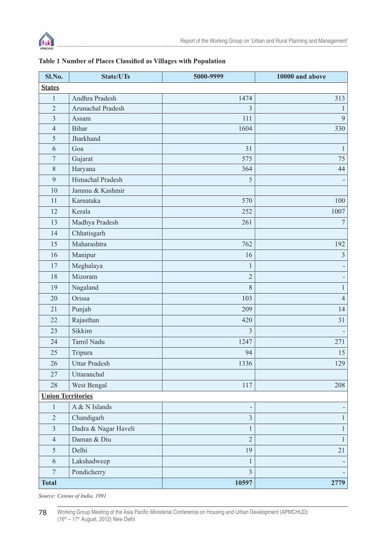
Report of the Working Group on ‘Urban and Rural Planning and Management’
Working Group Meeting of the Asia Pacifi c Ministerial Conference on Housing and Urban Development (APMCHUD)(16th – 17th August, 2012) New Delhi
78
Table 1 Number of Places Classifi ed as Villages with Population
Sl.No. State/UTs 5000-9999 10000 and aboveStates
1 Andhra Pradesh 1474 3132 Arunachal Pradesh 3 13 Assam 111 94 Bihar 1604 3305 Jharkhand6 Goa 31 17 Gujarat 575 758 Haryana 364 449 Himachal Pradesh 5 -10 Jammu & Kashmir11 Karnataka 570 10012 Kerala 252 100713 Madhya Pradesh 261 714 Chhatisgarh15 Maharashtra 762 19216 Manipur 16 317 Meghalaya 1 -18 Mizoram 2 -19 Nagaland 8 120 Orissa 103 421 Punjab 209 1422 Rajasthan 420 3123 Sikkim 3 -24 Tamil Nadu 1247 27125 Tripura 94 1526 Uttar Pradesh 1336 12927 Uttaranchal28 West Bengal 117 208
Union Territories1 A & N Islands - -2 Chandigarh 3 13 Dadra & Nagar Haveli 1 14 Daman & Diu 2 15 Delhi 19 216 Lakshadweep 1 -7 Pondicherry 3 -
Total 10597 2779
Source: Census of India, 1991

Report of the Working Group on ‘Urban and Rural Planning and Management’
Working Group Meeting of the Asia Pacifi c Ministerial Conference on Housing and Urban Development (APMCHUD)(16th – 17th August, 2012) New Delhi
79
Table 2: Local Bodies in Urban India, 2001-2002 (As on September, 2003)
Sl.No.
State/UTs Municipal Corporation
Municipal Council
Nagar Panchayats
Panchayats/Non-Municipal
Total
State1 Andhra Pradesh 7 109 1 93 2102 Arunachal Pradesh 17 173 Assam 1 29 38 57 1254 Bihar 5 32 80 13 1305 Jharkhand 1 17 22 112 1526 Goa 13 31 447 Gujarat 6 85 58 93 2428 Haryana 1 21 46 38 1069 Himachal Pradesh 1 20 31 5 5710 Jammu & Kashmir 7 63 5 7511 Karnataka 6 124 87 53 27012 Kerala 5 53 101 15913 Madhya Pradesh 14 86 234 60 39414 Chhatisgarh 6 20 49 22 9715 Maharashtra 19 224 2 133 37816 Manipur 8 21 4 3317 Meghalaya 6 3 7 1618 Mizoram 1 21 2219 Nagaland 8 1 920 Orissa 2 33 68 35 13821 Punjab 4 97 30 26 15722 Rajasthan 3 11 169 39 22223 Sikkim 8 1 924 Tamil Nadu 6 102 611 113 83225 Tripura 1 12 10 2326 Uttar Pradesh 11 193 417 83 70427 Uttaranchal 1 31 28 26 8628 West Bengal 6 112 4 253 375
Union Territories1 A & N Islands 1 2 32 Chandigarh 1 0 13 Delhi 1 1 60 624 Pondicherry Not Available 2 25 Dadra & Nagar Haveli 2 26 Lakshadweep 3 37 Daman & Diu 2 4 6
Total 107 1438 2091 1525 5161

Report of the Working Group on ‘Urban and Rural Planning and Management’
Working Group Meeting of the Asia Pacifi c Ministerial Conference on Housing and Urban Development (APMCHUD)(16th – 17th August, 2012) New Delhi
80
3.0 The dominant transition process
The numbers of additions to urban family of human settlements lags behind as in the past. The number of urban places increased from 3059 in 1951 to 5161 only in 2001 while the urban population almost increased to fi ve times from 62.4 million to 285.3 millions. Take over a longer period of 100 years the number of urban places increased by 183 per cent and the urban population by 1040 percent between 1901 – 2001.
The alternative process of change over of rural settlements to urban has not received necessary attention. The fact that 13376 so called ‘ villages’ have population exceeding 5000 or even exceeding 10,000 is an evidence of their vitality and growth potential but the absence of any worthwhile infrastructure is a serious handicap to their development as agents of urbanization. Such a large agglomeration of people indicate diversity of activities which can receive a fi llip if necessary facilities and organizational inputs are provided. Urbanisation policies, as any development policies have, to be based on dispersal and two are interlinked.
One of the reasons for failure to ensure against regional imbalances and to provide dispersal of employment opportunities to lesser settlements – small towns or large villages – is the absence of linkages between urban infrastructure and industrial location. Policies of urbanisation and economic planning have to be related to common base of human settlements. Only thus can one expect a comparative release of pressure on major urban centres as well as balanced absorption of the projected labour force.
4.0 Are cities really engines of rural growth?
In India, during the British rule, due to imperial objectives of law and order and revenue collection greater emphasis was laid on establishment of administrative headquarters like tehsil/taluk and thane circles which subsequently grew into kind of central places. It can certainly be hypothesized that considerations of economic development and optimum utilisation of local resources as well as infrastructural built up were considered in a spatial relationship along with people’s choice and convenience, this pattern of support centre would turn out to be different with far greater balance between the different level of human settlements.
The existing settlement pattern thus only tends to increase imbalances with lopsided development. Whatever the size of human settlement – village, town, city or metropolis - there is a symbiotic relationship that should pervade their functional roles and spatial distribution. The various levels of settlements, rural or urban, cannot exist in isolation but are meant to sustain the economy of the other units and are in turn sustained by the lower and higher levels of human habitation.
It is the failure to establish these linkages by a systematic development of human settlements with a network of small and medium towns, that account for extensive areas being declared backward regions. It may be mentioned here that out of about 402 districts in 1981 census, 286 were declared as backward by the Planning Commission.
Urbanisation in the Districts
An analysis of the census data appears to establish direct link between backwardness and level of urbanisation or number of support centres existing in various districts of the country. The distribution of districts by percentage of urban population according to 1991 census are given below.
Percentage of Urban Population No. of districts0-10 11010-15 61150-25 13925-40 8240-60 3360+ 17
Entirely Rural 10Total 452

Report of the Working Group on ‘Urban and Rural Planning and Management’
Working Group Meeting of the Asia Pacifi c Ministerial Conference on Housing and Urban Development (APMCHUD)(16th – 17th August, 2012) New Delhi
81
Almost 70 percent of the districts have less than 25 percent urban population that was nearly equals to all India average (25.7). More than half of these are less than 15 percent urban. There were, however, substantial variation among states. Another index would be the number of towns/support centres existing in differential districts. The following table gives the distribution of districts according to number of towns existing in 1991 census.
No. of Towns No. of districts
1-5 149
6-10 147
11-15 90
16-20 40
4-30 16
Entirely Rural 10
Total 452
As high as, 67 percent of the districts had less than 10 towns and almost 33 percent less than 5 towns. In such circumstances it means that with average size district in India of about 18 lakhs there may be a single town to serve a population of 2 to 5 lakhs. On the other hand, there are 10 districts which are totally rural in character. There are few districts like Muzaffarpur and Katihar in Bihar where the population per town ranges from 13 to 21 lakh. This only means that rest majority of the population is just not served and the benefi ts of development are appropriated by a small percentage of people. The possibility of shortage of urban places being made by a substantially large number of large sized villages as discussed earlier.
5.0 Implications for development planning
The question is whether the programmes and schemes of rural development, particularly for the backward areas can be effectively implemented to achieve their objectives without the inter-linkages of small and medium towns. Can agriculture be commercialised and agriculturist be placed within easy reach of adequate support by way of supplies, credit, marketing and technologies without a viable system of human settlements? Establishing thereby a symbiotic relationship between rural hinterlands and small and medium towns?
Similarly, mere sectoral allocations for economic and social services by the respective departments cannot provide the desired results. They must have locational footholds in the form of an urban/semi-urban hierarchy of settlements for the effective delivery of these services. Poor urban hierarchies or the absence of settlement size not only hinder and downward fl ow of services and development impulses but actually ‘polarizes’ socio-economic development into poles of growth: the large urban centres. This inevitably stultifi es the spread effect, and arrests diffusion to the peripheries and outwards to the lagging areas.
Spatial Perspectives
The location of growth centres, or the selection of existing small and medium towns or a large village for the purpose is generally an ad-hoc decision often infl uenced by administrative and political exigencies. A number of question arise:
- Can growth centre strategies be purposeful and effective in ensuring dispersal without taking into account the spatial and functional interlinkages between town and country?
- Can investment planning and resource allocations be divorced from the planning of physical inter relationships between various levels of human settlements?
- Will the district plans continue to remain sectoral plans superimposed on a rural canvas, ignoring the existence of ‘urban’ places so crucial to effective plan implementation or should they be integrated with a spatial development plan of human settlements?

Report of the Working Group on ‘Urban and Rural Planning and Management’
Working Group Meeting of the Asia Pacifi c Ministerial Conference on Housing and Urban Development (APMCHUD)(16th – 17th August, 2012) New Delhi
82
It is necessary to recognize the horizontal and vertical relationship between the different sizes of human settlements from the village to the district and regional towns or city in terms of space, population to be served, functions to be performed and the level of services to be delivered.
Search of New Horizons
Planning of human settlements requires scanning all along the spectrum. The absence of this, or inadequate attention to it could be major gap in our settlement planning. There is even a gap in our knowledge on the structure and functioning of settlements in the interfaces (urban) threat are emerging in the spectrum. The revolution in transport and technology, the changing mobility and travel preference patterns of producers and consumers consequent upon their changing levels of income, and sectorally and administratively oriented planning interventions are disturbing and often destroying the earlier hierarchic systems. The migration patterns in their turn do change the system, more conspicuously in the areas where large scale development and rehabilitation projects are located. This is to be expected, but the disturbed system has to be taken note of and settlement planning designed accordingly.
It must be mentioned here that disturbances are not taking place at all levels and in all regions; they are minimal in the hill forest regions particularly in the core regions, and in some of the coastal zone environments. In some of the agricultural regions, higher order urban centres (private cities) do not exist. Here, the regional scale and setting are important. The settlement hierarchic system and the regional hierarchic system are interdependent. Though at the higher levels in the hierarchic system, inter-city linkages are more important, but in the lower orders, urban-rural links are more important.
The impact of primacy (dominance and hence the shadow effect) of the metropolis does not percolate at all levels in the hierarchy. Primacy is related to the whole system or sub-system, and can be reduced through regional development policies. These attributes of the settlement system need to be explicitly recognized in allocating investments for development of infrastructure, along with plans to provide an economic base which is necessary to sustain the infrastructure for better living.

Report of the Working Group on ‘Urban and Rural Planning and Management’
Working Group Meeting of the Asia Pacifi c Ministerial Conference on Housing and Urban Development (APMCHUD)(16th – 17th August, 2012) New Delhi
83
Technical paper - 5Planning and Governance of Metropolitan Cities
in India B.N.Singh
Former Director Association of Municipalities & Development Authorities(AMDA),
New Delhi, India
1.0 The contextual background
Metropolitanisation
Large cities growth is a striking feature of India’s current urbanisation landscape. The number of metropolitan cities in India, that stood at one (Kolkata) in 1901, increased to 5 by 1951. By 1981, such cities increased to 12 and the number further swelled to 23 by 1991. The last two decades have continued with this pattern of growth with number of metropolitan cities reaching 35 in 2001, and further increasing to 53 by 2011. The number of Class II to Class VI (medium and small towns) have also increased. Bulk of the urban population is living in metropolitan regions. Among the million plus Urban Agglomeratios (UAs)/Towns, there are three Mega Cities with a population of more than 10 million. These are: Greater Mumbai UA (18.4 million) in the west, Kolkata UA (14.1 million) in the east and Delhi UA (16.3 million) in the north, which held the third rank in Census 2001, has pushed Kolkata from second to third position as per 2011 Census. Metro cities have become engines of growth and their economies are playing an increasingly important economic role with their per capita contribution being higher than other urban centres in the country. The effi cient performance of metropolitan cities is, therefore, crucial for the country’s vibrant economy. The urban population is projected to rise to 600 million by 2030 (Planning Commission 12th Plan Approach). The National Urban Housing and Habitat Policy 2007 states that by 2041, 50% of India’s population will be urban. Such a dramatic growth, while creating dynamic cities with spatial confi gurations, will further witness emergence of many such large urban agglomerations across the country.
Multi-municipal Urban Agglomerations
The million plus cities, with the exception of 6 cities having only a municipal corporation, namely, Ludhiana, Faridabad, Jaipur, Kota, Vasai-Virar and Greater Visakhapatnam, have several municipal and non-municipal urban areas and rural panchayats. Growth has overrun traditional boundaries and is not confi ned to the boundary of a single municipal corporation. For instance, Kolkata UA comprises 3 Municipal Corporations, 38 Municipal Councils, 81 non-statutory constituents and one Cantonment Board. Metropolitan areas are experiencing peripheral spatial expansion in an unplanned and uncontrolled manner with confl icting land uses and varied densities.
In the case of some metropolitan areas, core city growth has declined with growing peripheries. Large investments in metropolitan areas are undertaken by multiple organisations including central and state government agencies. Managing growth in such agglomerations involves several organisations and agencies of central, state and local governments.The multi-municipal situations and overlapping jurisdictions have aggravated the problems relating to implementation of plans and projects in million-plus metropolitan areas, resulting in delays and confl icts. Such metropolitan areas, therefore, need metropolitan wide perspective, planning, and action.

Report of the Working Group on ‘Urban and Rural Planning and Management’
Working Group Meeting of the Asia Pacifi c Ministerial Conference on Housing and Urban Development (APMCHUD)(16th – 17th August, 2012) New Delhi
84
Metropolitan Cities Spatial Expansion
Among the 53 metropolitan urban agglomerations spread over 18 States in the country, 29 metros are multi-municipal agglomerations, 18 metros are UAs with one municipality and non-statutory bodies (census towns/outgrowths), and 6 metros are principally single municipal corporations (Ludhiana, Faridabad, Jaipur, Kota, Vasai-Virar and Greater Visakhapatnam). The metropolitan urban agglomerations have grown beyond the traditional municipal boundaries and are not confi ned to the boundary of a single municipality. Table 1 below indicates the position as per 2011 Census.
Multiple Tasks and Multiple Agencies
The wide range of economic activities, infrastructure and services required to maintain the metropolitan areas involve stakes of several departments and agencies of central and state governments, apart from local governments. They have signifi cant policy and investment roles, with multiple tasks, multiple organizations, and multiple jurisdictions. The provision of infrastructure, services, and their maintenance in metropolitan areas require inter-governmental and inter-agency collaborative framework. Managing growth in the metropolitan agglomerations is not just an inter-municipal issue. In essence, a metropolitan area can rarely be unitary. The metropolitan area is larger than metropolitan urban agglomeration. The metropolitan areas also need a metropolitan wide vision, planning, advocacy and action, as they are major sources of output, productivity, and growth; and contribute greater shares of GDP, than their population would imply.
Table 1: Metropolitan Urban Agglomerations -2011
S.N. UA/City
2011 Popn
in million
UA/M.Co.
rp
Statutory Constituents Non-StatutoryCB TotalM.
CorpM/
MCl NP CT OG
1 Greater Mumbai 18.41 UA 6 2 0 02 Delhi 16.31 UA 1 1 0 107 1 1103 Kolkata 14.11 UA 3 38 0 75 6 1 1234 Chennai 8.70 UA 1 17 20 47 12 1 985 Bangalore 8.50 UA 1 0 0 2 11 0 146 Hyderabad 7.75 UA 1 0 0 23 49 1 747 Ahmedabad*
2INA+1NA6.35 UA 1 4 0 10 49* 1 65
8 Pune 5.05 UA 2 0 0 1 3 69 Surat (*3 INA) 4.59 UA 1 1 0 4 8* 0 1410 Jaipur 3.07 MCorp 1 0 0 0 0 0 111 Kanpur 2.92 UA 1 0 0 3 2 1 712 Lucknow 2.90 UA 1 0 0 2 0 1 413 Nagpur 2.50 UA 1 0 0 2 0 0 314 Ghaziabad 2.36 UA 1 1 0 3 0 0 515 Indore 2.17 UA 1 0 0 10 7 0 1816 Coimbatore 2.15 UA 1 3 32 12 0 0 4817 Kochi 2.12 UA 1 6 0 45 2 0 5418 Patna 2.05 UA 1 0 3 3 1 1 919 Kozhikode 2.03 UA 1 2 0 45 4 0 5220 Bhopal 1.88 UA 1 1 0 0 0 0 2

Report of the Working Group on ‘Urban and Rural Planning and Management’
Working Group Meeting of the Asia Pacifi c Ministerial Conference on Housing and Urban Development (APMCHUD)(16th – 17th August, 2012) New Delhi
85
21 Thrissur 1.85 UA 1 5 0 111 1 0 11822 Vadodara (*3 INA) 1.82 UA 1 0 0 7 18* 0 2623 Agra 1.75 UA 1 0 2 9 1 1324 GVMC 1.73 MCorp 1 0 0 0 0 0 125 Malappuram 1.70 UA 0 4 0 37 1 0 4226 Thiruvananthapuram 1.69 UA 1 3 0 24 2 0 3027 Kannur 1.64 UA 0 6 0 60 0 1 6728 Ludhiana 1.61 MCorp 1 0 0 0 0 129 Nashik 1.56 UA 1 1 0 1 1 430 Vijaywada 1.49 UA 1 2 0 6 14 0 2331 Madurai 1.46 UA 1 3 4 6 1 0 1532 Varanasi 1.43 UA 1 1 0 16 1 1 2033 Meerut 1.42 UA 1 0 0 4 0 1 634 Faridabad 1.40 M. Corp 1 0 0 0 0 0 135 Rajkot 1.39 UA 1 0 0 2 6 0 936 Jamshedpur
(*2 NAC)1.33 UA 0 1 1 8 3* 0 13
37 Srinagar 1.27 UA 1 1 0 1 6 1 1038 Jabalpur 1.26 UA 1 0 0 11 9 1 2239 Asansol 1.24 UA 1 3 0 12 1 0 1740 Vasai Virar City 1.22 MCorp 1 0 0 0 0 0 141 Allahabad 1.21 UA 1 0 0 2 17 1 2142 Dhanbad 1.20 UA 1 0 0 4 0 0 543 Aurangabad 1.19 UA 1 0 0 0 0 1 244 Amritsar 1.18 UA 1 0 0 2 23 0 2645 Jodhpur 1.14 UA 1 0 0 3 2 0 646 Ranchi 1.13 UA 1 0 0 5 0 0 647 Raipur 1.12 UA 1 1 0 0 2 0 448 Kollam 1.11 UA 1 1 0 23 2 0 2749 Gwalior 1.10 UA 1 0 0 0 0 1 250 Durg-Bhilainagar 1.06 UA 2 3 1 0 1 0 751 Chandigarh 1.02 UA 1 0 0 5 2 0 852 Tiruchirappalli 1.02 UA 1 1 3 4 0 0 953 Kota 1.00 MCorp 1 0 0 0 0 0 1Total of 53 cities 160.66 59 112 66 757 263 21 1278
Note : UA : Urban Agglomeration; M.Corp: Municipal Corporation ; M : Municipality ; MCl : Municipal Council ; NP : Nagar Panchayat; CT : Census Town ; OG : Out Growth ; CB : Cantonment Board ; INA: Industrial Notifi ed Area ; NA : Notifi ed Area ; NAC : Notifi ed Area Committee ; Statutory Constituents comprise :Municipal Corporation, Municipality / Municipal Council, Nagar Panchayats ; Non-Statutory Constituents comprise : Census Towns, Out Growths ; Notifi ed Area, Industrial Township, and Industrial Notifi ed Area
Source: Census of India 2011

Report of the Working Group on ‘Urban and Rural Planning and Management’
Working Group Meeting of the Asia Pacifi c Ministerial Conference on Housing and Urban Development (APMCHUD)(16th – 17th August, 2012) New Delhi
86
2.0 Regional Approaches To Settlements Planning
Demographic
In the beginning of the 21st century, India continues to be predominantly rural with over 70 per cent of its total population still living in its villages numbering over 6 lakh. Since the last decade, things have, however, dramatically changed. The total urban population has increased from 286.1 million in 2001 to 377.1 million in 2011.The proportion of urban population has gone up from 27.81 per cent of the total population in 2001 to 31.16 per cent in 2011, or an increase of only 3.35 percentage points over a decade. This rate of urbanisation level of less than one-third of the population is signifi cantly less than the rate in many other developing countries. However, it is signifi cant to note that the decadal increase in the size of urban population by 91 million people over 2001-2011 is greater than that of the decadal increase in rural population of 90.60 million. The implicit assumption for such an increase appears to be that the expansion of the urban population is occurring mostly in large cities such as mega and metropolitan cities.The number of urban settlements has increased from 5,161 in 2001 to 7,935 in 2011, i.e.,an increase of 2774 towns, with 54 per cent growth against 31.8 per cent growth in the urban population. Another signifi cant factor is the increase in the number of Census towns from 1362 in 2001 to 3894 in 2011. The total number of Urban Agglomerations/Towns which constitutes the urban frame is 6166 in the country in 2011.
Cities and Economic Development
About 60 per cent of GDP and 90 per cent of all government revenues come from cities. While agriculture maintains a major share of the work-force, its contribution to GDP is steadily declining from 57 per cent in 1950-51 to 28 per cent in 2000-01. On the other hand, the share of industry from 15 per cent in 1950-51 to 26 per cent in 2000-01, and services sector from 29 per cent in 1950-51 to 46 per cent during the same period is signifi cantly higher and increasing. It may be pertinent to mention that opportunities for regional economic activities can be increased through promotion of rural-urban and inter-regional linkages through improvement of infrastructure networks of transport, power and telecommunication. In order to create non-farm income-earning opportunities and to enhance agriculture production, the creation of rural service-centres at suitable locations may help in achieving the objective.
Inter-linkages and Interactions
Nearly every settlement of any size, whether rural or urban, is integrated into the national economic stream through a multi-modal transport and a rapidly expanding telecommunication system. The interactions between cities and their surrounding rural areas, neighbouring urban centres and interacting ecological relationships, therefore, necessitates regional approaches to settlements planning. People are migrating to towns and cities where they can improve their economic livelihoods. It is now well accepted that improved conditions in rural India can be achieved with better and more liveable cities, as urbanisation process sweeping across the country has the potential to connect all places and people into a productive system through networks of economy, jobs and services in urban regions. Such regional approaches to planning could be at the city-region level, metropolitan region level, or a natural resource or ecological region level. Regional planning should take into consideration the impacts of the inter-linkages and interactions on the socio-economic and environmental resources of the region’s area.
Rural-Urban Continuum
Rural and urban settlements are the two sides of the same coin of the socio-economic system. On one side of this coin, improvement of rural life through effi cient agricultural practices creates both excess labour and increased production. Cities capture the comparative advantage of both – excess labour and increased production. On the other side of the coin, the city has both positive and negative impacts on rural region beyond its administrative

Report of the Working Group on ‘Urban and Rural Planning and Management’
Working Group Meeting of the Asia Pacifi c Ministerial Conference on Housing and Urban Development (APMCHUD)(16th – 17th August, 2012) New Delhi
87
boundary. Neither rural nor urban development can proceed in isolation. Urban growth translates into higher demand for agricultural production. Regional centres and rural towns support agricultural development by providing marketing and transportation facilities including inputs such as fertilisers, seeds, and machinery for farm consumption. Rural development thus promotes urban development. Urban and rural environment have become more closely linked in the urbanising process. In fact, there is a rural-urban continuum.
Rural-Urban Linkages
There are visible and invisible fl ows or linkages between rural and urban areas. Such linkages may be categorised into: (1) Economic, (2)Service, (3) Demographic, (4) Environmental, and (5) Infrastructure, as detailed below:
(1) Economic linkages: provide the exchange of unprocessed and processed products, with both rural and urban areas acting as markets for each other.
(2) Service linkages: provide a central location in urban centres for retail, commercial, administrative and transport services for agricultural products within their rural hinterlands.
(3) Demographic linkages: rural and urban areas are linked by rural-to-urban and urban-to-rural migration.
(4) Environmental linkages: constitute a signifi cant rural-urban linkage for demand of natural resources particularly in terms of land and water, and polluting effects of urban-based production activities, extending well beyond the city limits.
(5) Infrastructure linkages: connect rural and urban areas by infrastructure networks comprised principally of transport, power and telecommunication networks facilitating social, economic and environmental fl ows.
Rural secondary and tertiary sectors have the potential to be developed in tandem with primary sector such as: from agriculture to agro-industries; and from dairy farming to food processing. There are some good examples such as rural Punjab by agro-industries; rural Maharashtra by sugar cooperatives; rural Gujarat by milk cooperatives; and rural Karnataka by cash crop farming.
3.0 Regional Planning For Metropolitan Cities
Regional Level Planning for Large Urban Agglomerations
Metropolitan cities have both positive and negative socio-economic and ecological impacts on rural region far beyond their administrative boundaries. Positive and negative externalities arising from inter-linkages and interactions between metropolitan cities and their surrounding rural areas necessitates regional approach to planning. Metropolitan region plan is a decisive factor for reducing the differences between urban and rural areas. Most of the metropolitan cities are urban agglomerations (UAs). Planning for metropolitan regions need to include multi-municipal urban agglomerations with their hinterland. The metropolitan areas encompass not only the main municipal corporation but also a number of other local bodies, both urban and rural, surrounding the main city corporation. Such metropolitan areas exert infl uence on the economy and functioning of the surrounding hinterland. This requires preparing integrated plans for the orderly development of the metropolitan city and its surrounding areas. Central and state governments and their agencies undertake investments in these cities. There is a need to undertake such investments within the framework of development plans and as per requirements of metropolitan cities. It is in this context, the need for metropolitan wide vision, planning, advocacy and action becomes important. Infrastructure provision for urban transport, water supply and sanitation, waste management, public health, etc., require metropolitan level planning, implementation and coordination. It is essential that there should be an inter-governmental and inter-agency framework to plan and guide metropolitan growth. In response to the above need, Article 243ZE of the 74th Constitution Amendment provides for formation of MPC for a metropolitan area.

Report of the Working Group on ‘Urban and Rural Planning and Management’
Working Group Meeting of the Asia Pacifi c Ministerial Conference on Housing and Urban Development (APMCHUD)(16th – 17th August, 2012) New Delhi
88
Some of the metropolitan regions include: 1)National Capital Region, 2) Mumbai, 3) Kolkata, 4) Hyderabad and 5) Bangalore Metropolitan Region as follows:
(1) National Capital Region is an inter-state region covering an area of 33,578 sq km comprising (a) NCT of Delhi (1483 sq km), (b) Haryana Sub-region (13,413 sq km), (c) Uttar Pradesh Sub-region (10,853 sq km), and (d) Rajasthan Sub-region (7829 sq km).
(2) Greater Mumbai Region of 4355 sq km covers (a) 7 municipal corporations, (b) 13 municipal councils (c) parts of Raigad and Thane districts, and (d) over 995 villages in three other districts.
(3) Kolkata Metropolitan Area covers an area of 1851 sq km and is composed of (a) 3 Municipal Corporations (b) 38 Municipalities (c) 24 Panchayat Samities consisting of 70 non-municipal urban areas and 14 out-growths.
(4) Hyderabad Metropolitan Area is defi ned as the (Hyderabad Urban Agglomeration which comprises Municipal Corporation of Hyderabad, 12 “surrounding municipalities” and “other areas” totalling 778 sqkm) jurisdiction covered under Hyderabad Urban Development Authority and 3 Special Area Development Authorities having an area of 1905 sq km. Hyderbad Metropolitan Development Authority has been constituted in 2008 by expanding the Hyderabad Urban Development Auhtority. The enlarged jurisdiction now covers an area of 7,100 sqkm.
(5) Bangalore Metropolitan Region comprises whole of the Bangalore Urban District, the Bangalore Rural District and Ramanagram District and covers an area of 8022 sq km.
Some Broad Policies of the Regional Plan Supporting the Rural-Urban Linkages
Some broad policies of the Regional Plan supporting the rural-urban linkages are suggested below:
(a) Population Redistribution policies - aimed at reducing the rate of rural to urban migration particularly to large cities.
(b) Growth and Service Centre Policies - aimed at creating more balanced distribution of urban areas.
(c) Decentralisation of Local Governments - encompassing both rural and urban areas to be focused at the district and metropolitan levels through the process of “Integrated Area Development Planning” for achieving effi ciency in the delivery of urban services for economic development, equity among various groups and environmental sustainability.
4.0 Urbanisation Overview
Urbanisation and Demographic TrendsIn 2001, the urban population of India was 286.1 million, that is, 27.85% of the total population of the country. The total urban population has increased from 286.1 million in 2001 to 377.1 million in 2011 constituting 31.16% of the total population and registering a decadal growth rate of 31.8%. The urban population is projected to rise to 600 million by 2030 (Planning Commission 12th Plan Approach). The National Urban Housing and Habitat Policy 2007 states that by 2041, 50% of India’s population will be urban. This growth will be dramatic, creating dynamic cities with spatial confi gurations with emergence of very large urban agglomerations in the country. The total number of towns in the country increased from 5,161 in 2001 to 7,935 in 2011. It may be signifi cant to note that all the increase refl ects the growth of Census Towns (which increased by 2532 rather than statutory towns which increased by only 242). It may be equally interesting to note that the term ‘urban’ covers a wide spectrum of settlements from mega cities to town panchayats. Urban settlements are emerging in all shapes and sizes in the country.
Urban growth in the country has occurred across the board. Over the years, the city-size distribution of urban population has shifted signifi cantly in favour of large cities (100,000 and above population). The number of

Report of the Working Group on ‘Urban and Rural Planning and Management’
Working Group Meeting of the Asia Pacifi c Ministerial Conference on Housing and Urban Development (APMCHUD)(16th – 17th August, 2012) New Delhi
89
Class-I cities was 394 UAs/Towns in 2001 which has marginally increased to 468 UAs/Towns in 2011. The Census 2001 identifi ed 35 metropolitan areas which has increased to 53 in 2011 indicating an addition of 18 cities from 2001. About 42.6 % of country’s total urban population live in these million plus cities (160.73million persons). About 264.8l million persons, constituting 70% of the total urban population live in Class-I UAs /Towns (100,000 and above population). Large cities thus dominate the urban scene.The growth of large cities is a striking feature of India’s urbanization.
5.0 Decentralisation And Structure Of Governance
The 74th Constitution Amendment ActThe 74th Constitution Amendment Act provides a broad structure of Municipalities for organising urban governance by constitutionally recognising them as institutions of self-government. It has sought in principle functional and fi scal devolution to local governments with an accountable, responsive and decentralised system enabling participation of citizens in urban governance. The main objective of the Amendment is to empower the people to take on increasing responsibilities of local self-governance through Municipalities composed of representatives elected by the people. The Amendment provides a legal framework and set necessary conditions for the States to enact legislation governing the composition with necessary functions and powers and role of local bodies with adequate autonomy. The Amendment stipulates the need for decentralised urban governance and the empowerment of cities as the third-tier of governance with prescriptions for representation, functions, fi nance, urban planning, urban poverty alleviation, and protection of environment and promotion of ecological aspects. The success of the new forms of governance, however, depends on the extent to which the processes have been institutionalised with empowerment, citizen participation and improvement in service delivery. A review of the implementation of the 74th Amendment shows that these stipulations are yet to be fully realised though Jawaharlal Nehru National Urban Renewal Mission (JNNURM) has contributed to speedy adoption of decentralisation by incorporating it as one of the mandatory reforms.
Urban Planning Framework for Municipal Areas under the 74th Constitution Amendment ActThe 74th Constitution Amendment Act envisages the following three important provisions for urban planning:
(1) Provisions of Article 243W whereby the legislature of a State may, by law, endow the municipalities with power and responsibilities subject to such conditions as may be specifi ed therein with respect to:
• the preparation of plans for economic development and social justice;
• the performance of functions and the implementation of schemes as may be entrusted to them including those in relation to the matters listed in the Twelfth Schedule.
Several entries in the Twelfth Schedule to the Constitution, further elaborate on the scope of the new urban planning tasks to be performed by the municipalities.
(2) Provisions of Article 243ZD for the constitution of a District Planning Committee at the district level in every State to consolidate the plans prepared by the Panchayats and the Municipalities in the district and to prepare a draft development plan for the district as a whole; and
(3) Provisions of Article 243ZE for the constitution of a Metropolitan Planning Committee in every Metropolitan area, to prepare a draft development plan for the Metropolitan area as a whole.
Need for Plans for Metropolitan AreasThe metropolitan areas encompass not only the main municipal corporation but also a number of other local bodies, both urban and rural, surrounding the main city corporation. Such metropolitan areas exert infl uence on the economy and functioning of the surrounding hinterland. This requires drawing up integrated plans for the orderly development of the metropolitan cities and the surrounding areas. Central and state governments

Report of the Working Group on ‘Urban and Rural Planning and Management’
Working Group Meeting of the Asia Pacifi c Ministerial Conference on Housing and Urban Development (APMCHUD)(16th – 17th August, 2012) New Delhi
90
and their agencies undertake investments in these cities. There is a need to coordinate such investments within the framework of development plans and as per requirements of the metropolitan cities. It is in this context, the need for metropolitan wide vision, planning, advocacy and action becomes important. Infrastructure provision like urban transport, water supply and sanitation, waste management, public health, etc., require metropolitan level planning, implementation and coordination. It is essential that there should be an inter-governmental and inter-agency framework to plan and guide metropolitan growth. In response to the above need, Article 243ZE of the 74th Constitution Amendment provides for formation of Metropolitan Planning Committee. Though there are 18 states, which have metropolitan areas, but so far only 9 states (West Bengal, Maharashtra, Andhra Pradesh, Karnataka, Madhya Pradesh, Uttar Pradesh, Kerala, Punjab, and Rajasthan) have passed enabling laws. MPCs have actually been set up for Kolkata in West Bengal being the fi rst to constitute MPC in 2001, followed by Mumbai.
6.0 Implications Of 74th Constitution Amendment On The Institutional Framework For Metropolitan Planning And Governance
As per 74th Constitution Amendment, it is obligatory for state governments to constitute a Metropolitan Planning Committee (MPC) in every metropolitan area. The metropolitan area is defi ned as an “area having a population of 10 lakhs or more, comprised in one or more districts, and consisting of two or more municipalities or panchayats or other contiguous areas, specifi ed by the Governor by public notifi cation to be a metropolitan area”. The multi-municipal character is, therefore, an essential requirement of a metropolitan area. The main task of the MPC, as per Article 243ZE of the Constitution, provides for preparation of a draft development plan for the metropolitan area. The MPC is required to integrate urban and rural planning, facilitate the development of regional infrastructure and promote environmental conservation. In preparing development plan, the MPC is required to give due regard to:
(a) the plans prepared by the municipalities and the panchayats in the metropolitan area;
(b) matters of common interest between the panchayats and municipalities including spatial planning, share of water and natural resources, integrated development of infrastructure and environmental conservation;
(c) the overall objectives and priorities set by the central and the government of the state; and
(d) the extent and nature of investments likely to be made in the metropolitan area by agencies of the central and state government and other available resources.
As per the Constitution Amendment, Metropolitan Planning Committee brings the whole exercise of metropolitan development planning a constitutional mandate and provides a platform with two-thirds of the members comprising elected representatives of the urban and rural segments of the metropolitan area, and the remaining one-thirds as nominees of the state and central governments. MPC thus provides a platform for bringing together the local, state and central government agencies along with private sector to help formulate a metropolitan strategy. MPC has thus been conceived as an inter-governmental, inter-organisational collaborative and participatory forum for visioning exercise for metropolitan planning. Such planning covers not merely physical planning but also other related and crucial aspects such as formulation of metropolitan perspective, capital investment coordination, and metropolitan level advocacy, etc. The merit of MPC is that it provides (i) a platform for numerous local jurisdictions to come together. It also brings together (ii) the local, state and central government agencies along with (iii) private sector, and (iv) community at large. The preparation of development plan for the metropolitan area as a whole is the task of this Committee.
In this context, the Government of West Bengal was the fi rst to constitute Kolkata Metropolitan Planning Committee (KMPC) in 2001 under the West Bengal Metropolitan Planning Act, 1994. Chief Minister, West Bengal is the chairperson of KMPC and Minister incharge, Municipal Administration and Urban Development is the vice-chairperson. KMPC has 60 members of whom 40 are elected through general election and 20

Report of the Working Group on ‘Urban and Rural Planning and Management’
Working Group Meeting of the Asia Pacifi c Ministerial Conference on Housing and Urban Development (APMCHUD)(16th – 17th August, 2012) New Delhi
91
members including chairperson and vice-chairperson are nominated by the Government of West Bengal. Kolkata Metropolitan Development Authority has been declared as the Secretariat of KMPC and the Secretary of KMDA is the Member Secretary of the KMPC. KMPC has also constituted an executive committee to fi nalise the sectoral plans. For this purpose, fi ve sectoral sub-committee on: (i) Drainage, Sewerage & Sanitation (ii) Traffi c, Transportation, Railways &Waterways (iii) Water Supply (iv) Education, Health, Employment & Bustee (v) Environment, Wetland, Planning and Parks have been constituted. Each of these committees is headed by a member of KMPC and includes technical offi cers from KMDA and concerned state/central government agencies. This unique combination of democratic decentralisation and the technical expertise placed at the command of KMPC is a land mark in the planned development of a metropolitan city.
7.0 Monitoring, Review & Evaluation Mechanisms
As per 74th CAA, legislature of the state, by law, may make provisions regarding functions relating to monitoring, review and evaluation mechanisms. It is suggested that mechanisms for monitoring, review and evaluation be based on Kolkata MPC pattern where KMDA is the secretariat of KMPC and the Secretary, KMDA is the member secretary of the KMPC, assisted by executive committee to fi nalise the sectoral plans of various sectors as mentioned above.This mechanism will help in planning, coordination, monitoring and evaluation for plans and projects of the metropolitan area which may be assigned to MPC.
A comprehensive assessment is necessary to defi ne the role of metropolitan city vis-a-vis the state and institutions playing a dominant role in urban affairs. The state should promote greater autonomy and accountability to local bodies in municipal affairs.
Representation given to the various sections of the people including interest groups in the DPC/MPC will ensure that voices of the different sections are heard at the institutional level.
In evaluating the effectiveness of various institutions, the following criteria may be useful:
(1) Technical competence in the design and execution of investment in infrastructure;
(2) Effi ciency in the use of resources;
(3) Financial viability based on local revenue base and sound fi nancial management;
(4) Responsiveness to the needs arising from urban growth, with the ability to plan the development of the metropolitan city and its services;
(5) Sensitivity to the needs of the urban poor with public interventions to promote their access to shelter, basic services and employment; and
(6) Concern for environmental protection, through public service provision and regulation of the private sector.
References:
1. Census of India 2001 and Provisional Population Totals (Urban) Census 2011.Government of India, Ministry of Urban Development and Poverty Alleviation, 2001 Background Note on Implementation of Part IXA of the Constitution Relating to Municipalities, Government of India, Ministry of Housing & Urban Poverty Alleviation, 2007 National Urban Housing and Habitat Policy
2. Manmohan Singh, Prime Minister of India, Approach to 12th Five Year Plan, Published in Spatio-Economic Development Record, Vol.18 No.4, July-August 2011
3. Planning Commission, 12th Plan Approach to meet the Challenges of Urbanisation,Published in Spatio-Economic Development Record, Vol. 19 . No.1, January-February 2012

Report of the Working Group on ‘Urban and Rural Planning and Management’
Working Group Meeting of the Asia Pacifi c Ministerial Conference on Housing and Urban Development (APMCHUD)(16th – 17th August, 2012) New Delhi
92
4. Pandey K.K, Chaube P.K., Khurana Kusum Lata, Chowdhry Sachin,2011, Planning Development for Metropolitan Region, Indian Institute of Public Administration, New Delhi
5. Rao PSN, 2006, Urban Governance and Management : Indian Initiatives (Edited) Indian Institute of Public Administration, New Delhi
6. Singh B.N.2006, Strengthening Rural-Urban Linkages in Decentralised Structure in National Seminar organised by Association of Municipalities and Development Authorities on 24-25 November, 2006
7. Singh B.N.2006 in Context, Journal of the Development and Research Organisation for Nature Arts and Heritage, Planning and Governance in Metropolitan Cities in the context of JNNURM
8. Sivaramakrishnan K.C. 2006,Growth in Urban India: Issues of Governance, Occasional Paper No.13,Centre for Policy Research, New Delhi
9. Sivaramakrishnan K.C. 1992, Urban Governance in India, Centre for Policy Research, New Delhi

Report of the Working Group on ‘Urban and Rural Planning and Management’
Working Group Meeting of the Asia Pacifi c Ministerial Conference on Housing and Urban Development (APMCHUD)(16th – 17th August, 2012) New Delhi
93
Technical paper - 6Inclusive Planning : A Prerequisite for a
Sustainable Growth Strategy Ms. Nila PandianAssociate Fellow,
Human Settlement Management InstituteLodi Road, New Delhi – 110 003
Overview
In 1995, at the World Summit for Social Development in Copenhagen, the assembled world leaders called for fostering stable, safe and just societies where everyone would have equal rights and can grow with access to services, to contribute to the fullest of their potential.
In the same spirit, the UN Millennium Declaration of September 2000 upheld the right of citizens “to freedom, to live their lives and raise their children in dignity, free from hunger and from the fear of violence, oppression or injustice, and to access opportunities to benefi t from development.” The Declaration recognised that while development and urbanisation offer great opportunities it is also obvious that the benefi ts are very unfairly shared and costs unevenly distributed. The challenge to make economic growth fully inclusive and equitable is also the overarching aim of the MDGs.
We are at the dawn of a new urban era. With just under half of its population living in cities, the world is already urbanized and it is projected that in another generation two thirds of humanity will be living in cities. The Asia- Pacifi c region is witnessing a fundamental transformation in many spheres of development and has 11 of the world’s 20 mega cities with populations of more than 10 million people. This rapid pace of urbanization has resulted in an explosive growth of cities. However along with the growth in urbanization there is also a growing phenomenon of urbanization of poverty; it is estimated that between one-quarter and one-third of all urban households in the world live in absolute poverty. An estimated 1 billion people are living in slums all over the world, and their numbers are growing daily.
The global urban transition witnessed over the past decades has been phenomenal, presenting Governments and local authorities with unprecedented challenges. Change is occurring at such a swift rate that it is almost overwhelming. Generally, urban centres have become vibrant instruments for economic, social and human development. At the same time, cities have also become a locus of increasing poverty and deprivation. While urbanisation is growing rapidly, the accompanying problems are manifested in the form of severe infrastructural defi ciencies. This situation is linked to inadequate and improper land-use planning along with issues of governance.
The situation in India is no different. There has been a massive increase in urban population in the recent decades in India and today India is one of the largest urban systems in the world. In the 2011 census, for the fi rst time since Independence, the absolute increase in population is more in urban areas that in rural areas. The Level of urbanization increased from 27.81% in 2001 Census to 31.16% in 2011 Census. As per estimates of the Pranob Sen Committee, the slum population in the country was expected to touch 93.06 million by 2011.
However, inspite of the surging growth and the unprecedented speed of urbanisation, India is still viewed as a largely agrarian economy with a majority of its population living in its villages. In this context, cities are also often viewed as exploitative and detrimental to the progress of rural areas. However it is important to remember that both the preceding sentences only convey one part of the Indian development story. The Census of 2011 estimates that 833 million people continue to live in rural India and a very large proportion of them are either wholly or signifi cantly dependant for their livelihoods on farm activity – be it crop agriculture, horticulture,

Report of the Working Group on ‘Urban and Rural Planning and Management’
Working Group Meeting of the Asia Pacifi c Ministerial Conference on Housing and Urban Development (APMCHUD)(16th – 17th August, 2012) New Delhi
94
animal husbandry or fi sheries. On the other hand, the census fi gures also indicate that India’s urban population has increased to almost 380 million in 2011 and projections are that by 2030, out of a total population of 1.4 billion, over 600 million people may be living in urban areas. The expansion of urban India is the platform for industrial and modern service sector growth and the creation of greatly improved livelihood opportunities for the youth of this country. To debate whether India’s future lies in its villages or its cities is a false dichotomy because the villages and cities are interdependent and symbiotic.
The process of urbanisation is a natural process associated with growth. It is well known that agglomeration and densifi cation of economic activities (and habitations) in urban conglomerations stimulates economic effi ciencies and provides more opportunities for earning livelihoods. Possibilities for entrepreneurship and employment increase when urban concentration takes place, in contrast to the dispersed and less diverse economic possibilities in rural areas. This enables faster inclusion of more people in the growth process and is therefore more inclusive. There is no doubt that the condition of the poor in rural India must continue to get major attention but the urban sector development should not be viewed as negating such attention or weakening it in any way. On the contrary, we must acknowledge that there is a synergistic relationship between rural prosperity and the continuum of urban development from small towns through larger cities to metros. A holistic approach to spatial development is needed if the country wishes to achieve more sustainable growth.
The central government has already adopted a multi-pronged strategy to reduce the divide between urban and rural India in its various dimensions. For example, the Bharat Nirman programme addresses gaps in rural infrastructure and covers irrigation, road connectivity, housing, water supply, electrifi cation, and telephony; the National Rural Employment Guarantee Act (NREGA) attempts to ensure a social safety net as it provides guaranteed employment in rural areas and at the same time has the capacity to build rural infrastructure especially if resources from other programmes are pooled in; the Sarva Shiksha Abhiyan and National Rural Health Mission are ambitious programmes for providing elementary education and primary health services respectively. All these programmes indicate the priority being given by the Government to rural development and are meant to give a new hope to rural India.
Apart from the rural-urban divide, there is a divide within urban areas which is also widening. While India’s growth has benefi ted its middle class, it has left behind a large majority of Indians. According to a recent survey, one out of every fi ve poor people in the world is an Indian. About 75% of urban citizens live in the bottom income segments. As more Indians will inevitably live within urbanized conglomerations, with densifi cation of villages, sprouting of peri-urban centres around large towns, and also migration of people into towns, the quality of their lives and livelihoods will be affected by the infrastructure of India’s urban conglomerations. The infrastructure of India’s present towns is very poor. Sewage, water, sanitation, roads and housing are woefully inadequate for their inhabitants. The worst affected are the poor in the towns. This skewed economic ratio must be addressed, as any growth that is not inclusive can never sustain itself on a long-term basis. Addressing life in India’s cities is not an elitist endeavour but rather a central pillar of inclusive growth.
What is Inclusive Planning?
Inclusiveness is a key to ensure sustained growth because it promotes growth with equity. It ensures that everyone, regardless of their economic means, gender, race, ethnicity or religion, is enabled and empowered to fully participate in the social, economic and political opportunities presented by development efforts. Participatory planning and decision-making would go a long way in spreading the benefi ts of growth to all members of society and ensuring greater sense of citizenship.
An inclusive city provides the opportunities and support that enables all residents to develop fully and allow them access to decent housing, transport, education, recreation, communication, employment and the judiciary, as well as cultural and religious expression. In an inclusive city, residents take part in decision-making that ranges from the political to issues of daily life. Such participation injects a sense of belonging and identity into residents, and guarantees them a stake in the benefi ts of urban development. Cities wanting to design and implement plans for inclusiveness can only succeed if they fully understand how the social, economic, political and cultural can, together, best be integrated into the daily lives of the public.

Report of the Working Group on ‘Urban and Rural Planning and Management’
Working Group Meeting of the Asia Pacifi c Ministerial Conference on Housing and Urban Development (APMCHUD)(16th – 17th August, 2012) New Delhi
95
The key interventions required to achieve inclusiveness would have to be at three levels:
� Policy and programme interventions
� Good governance
� Planning and design interventions
a) Policy and Programme interventions: To set the stage for formulating projects that embody inclusive design, we need a broad, inclusive policy framework that guides urban area decision-making. Progressive policies require us to go beyond the traditional land use emphasis of city planning, to integrate all the elements of inclusive design.
The time has now come for governments to shift from a needs-based approach to a rights-based approach. This means all citizens should benefi t from what cities have to offer. Recognition of this right in national policies and legislation is critical to bringing about a fundamental change in our approach to sustainable growth.
The National Urban Housing and Habitat Policy 2007 promotes sustainable development of habitat in the country with a view to ensuring equitable supply of land, shelter and services at affordable prices to all sections of society. The Policy, 2007 focuses the spotlight on the role of multiple stake-holders for realizing the goal of Affordable Housing for All.
The Government of India launched the Jawaharlal Nehru National Urban Renewal Mission (JNNURM) in 2005-06. JNNURM focuses on reform driven, fast track planned development of identifi ed cities with focus on effi ciency of urban infrastructure, service delivery mechanisms, community participation and accountability of urban local bodies and parastatals towards citizens. Sub-mission programmes on Urban Infrastructure and Governance (UIG) and Basic Services to Urban Poor (BSUP) cover 63 identifi ed cities. The other cities are eligible for assistance under Urban Infrastructure Development Scheme for small and Medium Towns (UIDSSMT) and Integrated Housing and Slum Development Programme (IHSDP).All these are with particular reference to balanced regional development, poverty alleviation and rapid economic development, which is crucial for developing inclusive cities. Under JNNURM the logic of emphasising bottom-up planning from the community and the municipality has being included in the design, with the requirement of a mandatory reform - a community participation law to be introduced in states’ municipality statutes, and the establishment of Area Sabhas in urban areas, similar to Gram Sabhas in rural areas, and Ward Committees. Area Sabhas will be linked to the Ward Committee through Area Sabha Representatives. There will therefore be a 3-tier structure for decentralised planning in urban areas, composed of the Municipality, the Ward Committee, and the Area Sabha. With this in place, activity mapping can be taken up to defi ne what each of these 3 tiers will do, in a manner similar to rural decentralised planning.
With 3,682 urban local bodies in the country spread across the 593 districts in the country, such linkages could allow urban economic engines – with their access to markets, infrastructure and credit - to become the fl ywheel of rural growth, resulting in a more inclusive form of growth in the country. The creation of such robust planning processes at the local and district/metropolitan level could also result in increased rural-urban linkages.
Rajiv Awas Yojana- Moving Towards More Inclusive CitiesIt is against this background that the the launch of the Rajiv AwasYojana Scheme (RAY) acquires a special signifi cance. RAY can become an important instrument to implement the national strategy for inclusive growth as well as the national urban housing and habitat policy 2007. RAY envisages a ‘Slum-free India’ through encouraging States/Union Territories to tackle the problem of slums in a defi nitive manner. The scheme proposes to create enabling conditions that will encourage states to tackle the problem of slums in a defi nitive way, by bringing existing slums within the formal system and enabling them to avail of the same amenities as the rest of the town; redressing the failures of the formal system that lie behind the creation of slums; and tackling the shortages of urban land and housing that keep shelter and housing out of reach of the poor and force them to resort to extra-legal solutions in a bid to retain their sources of livelihood and employment.
Apart from prescribing the fl oor area under various categories, no type design should be prescribed or imposed for the construction of dwelling units. In fact the dwelling unit should be designed in accordance with the requirement of the benefi ciaries and in accordance with the climatic conditions of the city. While it is possible

Report of the Working Group on ‘Urban and Rural Planning and Management’
Working Group Meeting of the Asia Pacifi c Ministerial Conference on Housing and Urban Development (APMCHUD)(16th – 17th August, 2012) New Delhi
96
to generalize about urban planning ideas and concepts, the way in which these might be used will be dependent on contextual factors.
An important step has been taken by the Government of India through its 11th fi ve year plan document which outlines a vision based on faster, more broad based and inclusive growth. It is designed to reduce poverty and focus on bridging the various divides that continue to fragment our society.
‘Including the Excluded’ is the concurrent theme of all schemes and programmes bridging the gap between the poor and not so poor, gender divide, rural urban divide, regional divide, unbalanced growth within states, Schedule Castes, Schedule Tribes, Minorities and others left behind, vulnerable groups and economically backward general category population, each of which is essential for achieving overall harmony.
b) Good governance: Good governance plays a critical role in urban sustainability and the long-term success of cities. Cities have the greatest impact on the environment where they are poorly managed. The 74th Constitutional Amendment Act was a legislative milestone in governance. The amendment suggested three main urban planning reforms: the full transfer of city planning to local governments, the formation of a metropolitan planning Committee for each of the 20 metropolitan areas to ensure integrated outcomes at the metropolitan level, and the formation of District planning committee for each of India’s 626 districts. The act stipulated that the state should endow municipalities with necessary powers to prepare plans for economic development and social justice; and matters covered by the Twelfth Schedule. It opened up opportunities for the devolution of governance to the lowest political strata of society and these have been successfully and positively used in some cases. More should be done to make devolution effective across a broader spectrum of citizens.
c) Planning and design interventions: As planners, designers, developers and city managers, we are faced with the continual inequalities of urban life, viz. neighborhoods with vastly different qualities of life, fundamentally unequal access to education and jobs etc. As long as these disparities exist, they will restrict and confi ne groups of people, limiting their ability to make choices about how and where they live, perpetuating inequity and cutting the social connections that defi ne vibrant and thriving cities. We need a way of objectifying some criteria of success, some common points of reference so that we can decide what should be the output when we plan and design cities.
There are three criteria that can help us analyze how people are affected by and can shape development projects.
1. Functionality Designs are functionally based, incorporating the physical inclusiveness of universal design, which supports the unique physical needs of all types of people, and makes places and programs accessible to the widest possible audience.
2. Context SensitivityInclusive design translates the vision of an inclusive city into the physical; it enables people across the entire economic and social spectrum to participate in and receive value from the project. The fi rst step is helping the community understand and take an active role in early strategy and project planning. The critical thinking about the real source of a problem and potential solutions is participatory, involving the entire community in hands-on planning and leveraging resources. The projects are always context-driven, emerging from the needs, assets and culture of the communities and the environment in which they exist. With extensive participation, communities then feel strong ownership and commitment to the project.
3. Equitable Impacts Every project has consequences, both intended and unintended. Successful projects mitigate the social and human impacts, especially on the most vulnerable members of society. In planning and designing for truly inclusive and sustainable habitats, we need to ensure that due consideration is given to the following elements:
a. Housing and NeighborhoodsWhile planning for housing in urban areas, safe neighborhoods with a range of housing types and price levels to accommodate diverse socio-economic backgrounds and lifestyle choices must be provided for.Provision

Report of the Working Group on ‘Urban and Rural Planning and Management’
Working Group Meeting of the Asia Pacifi c Ministerial Conference on Housing and Urban Development (APMCHUD)(16th – 17th August, 2012) New Delhi
97
for affordable housing must include the options for ownership as well as rental housing. Shelter at minimum acceptable standards of habitability (in terms of size and building materials), guided by economically realistic building and planning codes (especially for the urban poor) is crucial to affordable housing.
b. InfrastructureCities can offer a range of resources that attract migrants to the city, these include education and health services, job opportunities, houses, and urban services However access to many of these resources is not equitably distributed. The result is both social and spatial marginalization with the urban poor effectively confi ned to areas that are ill- serviced and poorly connected to those opportunities and services. Housing sites built for the poor at the city’s periphery often lack water and sanitation, solid waste collection and disposal and other amenities.
Box No.1: Lessons for Good Urban Planning: Singapore
Singapore’s rise from a congested city to a thriving fi nancial centre has been breath-taking. At the heart of this transformation has been a robust urban planning system, the responsibility for which lies with the Urban Redevelopment Authority (URA). The URA operates under the auspices of the infl uential Ministry of National Development and is responsible for creating and executing Singapore’s land-use plans. Singapore created its forest concept plan in 1971 and has since created two more, in 1991 and 2001. These concept plans have acted as anchors to Singapore’s 40-to 50-year development strategy and have been refreshed every decade using state -of-the-art geographic information system (GIS) mapping. The 2001 concept plan, for example, starts with a target population of 5.5 million and cascades down to employment estimates by sector and high-level land use, including a sequencing of areas for green fi eld development as well as block –by-block redevelopment (e.g. the development of the Tampines, Woodlands, and Jurong East regional centres, and even the development of Marina city on 690 hectares of reclaimed land south of Singapore in the previous concept plan).
This concept plan also provides broad guidelines for a set of key projects and policies essential to serve expected demand for physical and social infrastructure (such as Mass Rapid Transport Systems and affordable housing units as well as urban design and form. This 40-to-50-year concept plan is then cascaded down to 20 years master plans that translate broad land use into actionable parcel-by-parcel planning norms and distinct infrastructure projects. To ensure the development of world-class urban plans, Singapore has invested upfront in capacity and technology and has ensured a participatory process. The URA team consists of more than 300 professionals (including urban planners, economists, architects, designers and sectoral engineers) and spends around $ 160 million per annum. In addition, Singapore displays its draft concept plans to the public using physical models, fl y-through, and animation. Planners then consider the views of the public before moving to fi nalize content. The process of granting exemptions is clearly articulated, and when granted, exemptions are transparent.
c. Access to Economic DevelopmentA well planned city must offer opportunities for everyone to participate fully in the economy of the city, with access to a variety of jobs. Planning cities with mixed land use presents employment opportunities for people with much lesser effort to reach the place of work rather than segregated landuse planning. With increasing urban sprawl the distances increase and with it comes the issue of access to employment opportunities. The role of the informal sector in the economy also has to be recognized and due importance has to be given to planning particularly the circuits and linkages of the informal sector.
d. Access and MobilityIndian cities are characterized by relatively high density and mixed land uses, which are conducive for high public transit use. However, due to inadequacies in planning and land-use management and lopsided industrial location policies, cities are beginning to experience rampant urban sprawl greatly increasing trip lengths for some and in turn forcing excessive reliance on personalized vehicles, mainly cars.With proper planning and design, cities can reintroduce the human scale to create pedestrian-friendly and bike-friendly streets that reactivate the public realm.

Report of the Working Group on ‘Urban and Rural Planning and Management’
Working Group Meeting of the Asia Pacifi c Ministerial Conference on Housing and Urban Development (APMCHUD)(16th – 17th August, 2012) New Delhi
98
e. Community open spaces/ Greens.Every city needs a vision creating a comprehensive network of connected, safe, functional and green connections such as parks, civic spaces, streets, walking trails, and urban forests that will bind neighborhoods to one another, create ecological conduits from the city’s ridgelines to its shorelines, and ensure a wealth of green spaces for all citizens to enjoy and to complement the city’s predicted growth and density. Parks and open space are key tools for improved air and water quality and preserving rivers, wetlands and urban forests
In planning for open spaces for the present and the future, the needs of diverse communities must be taken into consideration in order to create and preserve attractive, usable, functional and ultimately liveable places in which people can feel comfortable, interact safely with others, and become active participants in the shaping of their own neighborhoods.
f. Cultural MeaningSpaces and places to create and display social and cultural rituals and symbols that have meaning for all residents. Some of the urban local bodies permit people to paint walls along pavements or fl yovers, this allows people to display their heritage and culture and feel a sense of participation in beautifying their own city, and generates revenue for the city.
Importance of Landuse Planning
While approaches to town planning have been quite clear, there has been little emphasis on planning in the rural areas and villages in India. Though there have been rural housing and rural development programmes, there have not been any rural settlement planning programmes in India.
India has an ancient history of refi ned urban planning going back to the Indus Valley Civilization, and there is historical evidence of its practice in later times, right to the Moghul era. While modern planning practice in India, which started during British times, can point to good urban planning examples in Lutyen’s Delhi and Le Corbusier’s Chandigarh, overall, the planning process has not delivered in recent years.
It was only with the enactment of the Bombay Town Planning Act in the year 1914 that modern town planning came into force in the country, initially in the state of Maharashtra and later, in other states of the country. This legislation heralded a new era in town planning on modern scientifi c lines as is known to us today. The enactment of town planning laws in India was with the belief was that good town planning would lead to better public health and reduction in widespread diseases. After independence the state town planning acts suggested setting up of town and country planning departments to create master plans for cities. This included, amongst other things, land uses for different uses, development controls and subdivision regulations. As part of municipal functions, building byelaws, etc. were framed.
Urban planning as currently practised in India is essentially concerned with planning the use and development of land in cities. Development is merely seen as physical manifestation in most of the town planning legislations. The content of development (or master) plan has been accordingly defi ned. Statutory planning documents have failed to enforce change beyond the incremental and the reactive variety.
As cities grow, they need to make informed trade-offs about their use of scarce resources such as land and its supporting infrastructure. This is a challenge that India needs to approach in a deliberate manner by putting in place a modern urban planning system that makes vital choices help link land usage with urban fl ow (mobility of people and goods) in such a way as to ensure where people of all income live, work and spend their leisure time. Planning is necessary so that a city’s infrastructure is capable of delivering basic urban services (such as water supply, sewage treatment, waste management, and storm-water drains) – and that a city functions
Box No.2: Vijayawada’s Inclusive Expansion
Vijayawada has shown how “inclusion” can be accomplished within a framework of integrated planning of a city.
As the commercial capital of Andhra Pradesh, Vijayawada has been growing rapidly. It has been attracting a lot of migration of labour from the northern districts in search of employment for over three decades.

Report of the Working Group on ‘Urban and Rural Planning and Management’
Working Group Meeting of the Asia Pacifi c Ministerial Conference on Housing and Urban Development (APMCHUD)(16th – 17th August, 2012) New Delhi
99
As a result, the Vijayawada urban agglomeration has been experiencing population growth at much faster rates than the state. The river Krishna on its southern side, and hills on its northern side, were physically constraining its development.
By 2001, its population had increased to 8.5 lakh, and 25 per cent of the urban population lived in slums. There were 111 slums on encroached land along the banks of the canals, and on open railway tracks. The population has become 11.8 lakh in 2011 and is expected to increase to 16.5 lakh by 2021. There was an urgent need to relocate people living in slums, particularly in hazardous areas.
To address this challenge, the Vijayawada Municipal Corporation (VMC) has taken up an innovative land-sharing model, partnering with the landowners of Jakkampudi and Gollapudi villages in two phases: phase I covers an area of 226 acres, and 787 acres are covered under phase II. The project was taken up under the BSUP (basic services for the urban poor) programme of the JNNURM. The fi rst phase covered only the villages at Jakkampudi, and is completed. Altogether, 9,000 houses have been built in Jakkampudi area under this programme. The second phase, which includes the whole of Gollapudi and parts of Jakkampudi, is about to begin.
Since VMC did not make much headway in the conventional manner of land acquisition, they decided to get into a direct dialogue with the farmers and reached an agreement. Farmers agreed to part with 40 per cent of their land to the VMC for building houses for the economically weaker sections of society. In return, the VMC agreed to develop the 60 per cent that remained with them, for the use of original owners. Of this land, again, 40 per cent was given by the original owners for physical and social infrastructure. Thus, farmers in the end agreed to retain only 36 per cent of their original land — of course benefi ting from the huge appreciation in its value that resulted from the infrastructure development.
The state government spent Rs 25 crore in actually bearing the cost of development charges for this land. The VMC, besides providing the urban infrastructure in the form of roads with open/closed drains, underground drainage system, reservoir for drinking water, and other physical and social infrastructure, also ensured connectivity with the city. This was done by building an inner ring road, a fl yover bridge across the railway line, and improved connectivity to the national highway. This helped achieve integration in Vijayawada’s urban expansion. However, a public transportation system has to be developed to make this connectivity truly effective.
The economic sustainability of this exercise towards inclusion remains to be seen. The challenge in making this work is to ensure that infrastructure commitment by the urban local body and fi nancial commitments by the benefi ciaries of inclusion are kept, and farmers have an effective option to choose between farming and other alternatives.
effectively for all of its citizens. Failure to anticipate the city’s infrastructure requirements will result in deteriorating quality of life, especially for the poorer sections of society. The basic notion of ‘development’ viz. economic development, inclusive growth and environmental sustainability are not explicitly incorporated in the planning of urban development. It would therefore be useful to briefl y trace the evolution and challenges of urban planning in the context of evolving development strategy.
Role of Town Planning in Development Planning in India
The First Five Year Plan did not include urban development as a sector of economic growth. It had a chapter on housing that contained a section on ‘Town and Country Planning’. The Plan further observed, “Most of the towns in India have grown up haphazardly. They have a large proportion of sub-standard houses and slums containing insanitary mud-huts of fl imsy construction poorly ventilated, over-congested and often lacking in essential amenities such as water and light. This is specially so in the large industrial cities. These conditions have developed because of insuffi cient control over building activity by the State or municipal authorities. Local authorities have been generally indifferent to enforcing such bye-laws regarding building and sanitation as have existed. Their own resources have been too meagre to permit any development work worth the name.” It is noteworthy that the problem was seen as a result of poor enforcement of rules and not as that of need to expand

Report of the Working Group on ‘Urban and Rural Planning and Management’
Working Group Meeting of the Asia Pacifi c Ministerial Conference on Housing and Urban Development (APMCHUD)(16th – 17th August, 2012) New Delhi
100
urban land and services. The most notable development in this period was the building of the planned new city of Chandigarh.
In the Second Five Year Plan (1956-61), Town and country planning legislations were enacted in many states and necessary organisations were set up for the preparation of Master Plans for important towns. Once again, these schemes were not quite seen to be in tandem with other vital inputs that create habitats -- good roads, deep connections with rural hinterlands and facilities such as hospitals and education.
In the Third Plan (1961-66) efforts were made to co-ordinate all agencies and help orient the programmes to the needs of the low-income groups. Master Plans for major cities were prepared and the state capitals of Gandhinagar and Bhubaneshwar were developed. The architectural fetish for starting afresh got a fresh lease of life. The dominant idea became to invest in new townships that often had no connections with earlier built forms and traditional urban habitats.
The Fourth Plan (1969-74) stressed the need to prevent the further growth of population in large cities and the need for decongestion or dispersal of population. This was envisaged through the creation of smaller towns. The Housing & Urban Development Corporation (HUDCO) was established to fund housing and urban development programmes. A scheme for environmental improvement was undertaken with a view to providing a minimum level of services, like water supply, sewerage, drainage, street pavements in 11 cities with a population of 800,000 and above.
The Fifth Plan (1974-79) reiterated the policies of the preceding Plans to promote smaller towns in new urban centres, in order to ease the increasing pressure of urbanisation. This was to be supplemented by efforts to augment civic services in urban areas with particular emphasis on a comprehensive and regional approach to problems in metropolitan cities. The Urban Land (Ceiling & Regulation) Act was enacted to prevent concentration of land holdings in urban areas and to make urban land available for construction of houses for the middle- and low-income groups. The fact that historically urban centres sprout organically along trade routes, roadways and food markets was often not grafted on to many of the choices made. The tendency to plan from the top was the standard perspective for many years.
Box No.3: Equitable and Inclusive Town Planning Schemes at Gujarat
Formed under the Bombay Town Planning Act, 1915 TP Schemes in Gujarat facilitate equitable and inclusive development. A portion of land is appropriated for accommodating urban poor.
Plots providing adequate social infrastructure such as schools, hospitals, dispensaries, clinics, open spaces, housing for the poor, etc., are reserved up to 20% of total development.
The Sixth Plan (1980-85) focused on integrated provision of services along with shelter, particularly for the poor. The Integrated Development of Small and Medium Towns (IDSMT) was launched in towns with population below 1 lakh for roads, pavements, minor civic works, bus-stands, markets, shopping complexes etc. Positive inducements were proposed for setting up new industries and commercial and professional establishments in small, medium and intermediate towns. Many of the 4,000-plus townships and urban agglomerations that are part of the 2001 census are a legacy of these moves.
In 1983, the Task Force on Planning of Urban Development appointed by the Planning Commission, for the fi rst time comprehensively examined the urbanisation and urban development. It asserted “It must be understood that urbanisation is a phenomenon which is part and parcel of economic development in general. It is a natural consequence of economic changes that take place as a country develops. Certain activities are better performed in, indeed require, agglomeration of people while others do not. The location of activities has therefore to be seen in the spatial context of activities among others existing in a country and both likely and desirable development of network of markets and production centres of goods services and employment. It would be idle to imagine that rapid rise in rural population through demographic growth can be absorbed in agriculture and still ensure growth of productivity and total production.” The Task Force observed that the general belief that large cities have grown faster than and at the expense of small and medium towns is not true; and the arithmetic of growth

Report of the Working Group on ‘Urban and Rural Planning and Management’
Working Group Meeting of the Asia Pacifi c Ministerial Conference on Housing and Urban Development (APMCHUD)(16th – 17th August, 2012) New Delhi
101
and distribution of settlements is such that higher growth of small and medium towns will have little effect in magnitude of growth of large cities.
The Seventh Plan (1985-90) observed, “Planning of urban development should essentially be supportive of the economic development in the country, state or sub-region, be it in agriculture, extractive industry, manufacturing industry or in the tertiary sector. The provision of urban services such as transport, communication, water, sanitation and shelter alone is usually unlikely to stimulate large-scale urban development. It is important to time investments in urban services and shelter to coincide with investments in agriculture and industry, mining and commerce, which provide sources of permanent employment. Therefore, a proper urban development approach must consist of two constituents. The fi rst is the interaction between physical and investment planning and the second is the preparation of regional and sub-regional urban development plans to make the fi rst possible. Industrial location policy must be made to sub serve regional and urban planning. During the Seventh Plan a concerted effort should be made to channelize private industrial investment in the vicinity of small and medium towns so that migration of population is diverted to these from going to the metropolises. The same principal should be applied to public sector investment.” It could be noted that though urbanisation was seen as part of economic development and agglomeration benefi ts were recognised, migration to large cities was sought to be diverted to small and medium towns. The Plan explicitly recognised the problems of the urban poor and for the fi rst time an urban poverty alleviation scheme known as Urban Basic Services for the Poor (UBSP) was launched.
Prior to 1991 the allocation of land to different uses, intensity of development through density and Floor Area Ratio (FAR) were axiomatically determined and justifi ed on “health and safety” considerations. The impact of such plans and regulations on the land and real estate markets was hardly ever considered.
The Eighth Plan (1992-97) for the fi rst time explicitly recognised the role and importance of the urban sector for the national economy. The Plan identifi ed small and medium towns as the thrust area in these words. “Particular emphasis will be placed on the development of small and medium (S&M) towns which serve as an important link between the village and the large cities. In order to realise the objective of more balanced distribution of urban growth both in terms of its distribution over space and also by size class of urban areas, the small and medium towns have to act as important centres of attraction, in terms of economic opportunities, to the potential migrants not only from villages but also from urban areas to large cities.” The Plan identifi ed the key issues in the emerging urban scenario, viz: the widening gap between demand and supply of infrastructural services, which hits the poor, whose access to the basic services like drinking water, sanitation, education and basic healthcare is shrinking; the unabated growth of the urban population, aggravating the accumulated backlog of housing shortages and resulting in the proliferation of slums and squatter settlements and decay of city environments.
The principal task of the Ninth Plan (1997–2002) was stated to be “to usher in a new era of growth with social justice and participation in which not only the Governments at the Centre and the States, but the people at large, particularly the poor, can become effective instruments of a participatory planning process. In such a process, the participation of public and private sectors and all tiers of government will be vital for ensuring growth with justice and equity.”
The plan recognised that economic growth and employment opportunities in themselves may not be suffi cient to improve the living conditions of the poor and that the problems of rapid urbanisation had become acute. It stated that “There has been a progressive decline in the availability of essential services as well as in the quality of life in urban areas. The urban poor have been the worst affected segment in this process of decline. The health and environmental consequences of increasing population density, lack of safe drinking water and inadequate urban sanitation are likely to become further aggravated unless steps are initiated during the Ninth Plan to improve the situation through a well-considered and articulated urbanisation policy with identifi ed programme components including those for disease surveillance, epidemic control and urban solid and liquid waste management.”
The National Housing and Habitat Policy 1998 set the objective of providing shelter to all, especially to the poor and the deprived. The policy envisaged construction of 2 million additional houses annually, 1.3 million units in rural areas and 0.7 million units in urban areas.

Report of the Working Group on ‘Urban and Rural Planning and Management’
Working Group Meeting of the Asia Pacifi c Ministerial Conference on Housing and Urban Development (APMCHUD)(16th – 17th August, 2012) New Delhi
102
The Tenth Plan (2002–2007) recognised that the time had come to ensure that the goal of shelter for all is achieved by the end of the Eleventh Plan and that issues and problems relating to provision of rural and urban housing are very different and hence require specifi c interventions. The plan recommended that the “Land Acquisition Act, 1894 should be amended for speeding up the process of acquisition, and to delink the process of taking over possession of land from that of determining compensation. The Act might be modifi ed to focus solely on acquisition of land for public goods (e.g. roads, defence) and public utilities (power lines, irrigation dams/canals), and exclude commercial purposes such as housing.”
The plan also suggested that the existing stipulation of 100 acres for FDI in integrated townships might be relaxed to 50 acres or less, as such vast expanse of land may not be available in urban areas.
Embracing Inclusive Planning as the Vision and Strategy of Planning
The title of India’s 11th Five Year Plan (2007-2012) read as “Towards a Faster and Inclusive Growth”. In the approach paper of the plan (Government of India 2006) inclusive growth was restated prominently in the vision for the plan that notes that the Plan “provides an opportunity to restructure policies to achieve a new vision based on faster, broad based and inclusive growth”. By inclusive growth the plan refers to an all-out effort to increase the access of basic social services to the masses (presumably the left outs included) not only as a welfare measure but as a strong justifi cation for robust growth in the long run. The second reference it makes is to ensure weaker and vulnerable sections of the population like the elderly, disabled, adolescent girls and children under three and “primitive tribal groups” and others whose interests are not always strongly lobbied receive adequate attention. These pronouncements in the fi rst chapter of the Five Year Plan set the tone for the planning objectives.
The vision of urban development included in the Eleventh plan was; “Indian cities will be the locus and engine of economic growth over the next two decades, and the realization of an ambitious goal of 9%–10% growth in GDP depend fundamentally on making Indian cities much more livable, inclusive, bankable, and competitive.” The Plan still retained the old preoccupation with concern for state wise variation in urbanisation and increasing share of larger cities in urban population. This was also refl ected in a proposal to develop other settlements located in the vicinity of the mother city as satellite/counter magnets to reduce and redistribute the population and population infl ux. To cope with the above problem, the government proposed a new scheme for development of satellite towns/counter magnet cities thereby helping in the development of metropolitan regions. The mid-term appraisal of the 11th Five Year Plan reaffi rmed faith in small towns in these words, “Healthy growth of smaller towns will ease the pressure on metros which are already bursting at their seams”.
The objective of the Eleventh Plan was faster and inclusive growth and the initiatives taken in the Plan period have resulted in substantial progress towards both objectives. The mid-term appraisal of the 11th Five Year Plan which includes JNNURM has also revealed that BSUP and IHSDP have made positive impact on ground and raised the aspirations of the people, including slum-dwellers. It has also revealed that much of the investment has been directed towards the provision of critical basic services that are essential to inclusiveness.
The approach paper to the Twelfth plan documents clearly states that urban planning is the crucial element in the whole approach to tackle the challenge of urbanization. The paper recommends that the City Master Plan should be a comprehensive plan, containing all details including futuristic development. It recommends that “The Master Plan should form the basis on which further action can be taken by the ULB, if they are to leverage the value of land, in whatever small extent that is feasible. Much more attention should be given to ‘urban forms’. What is the shape and type of city that is desired? The capacity for urban design and planning must be developed to address such systemic issues taking into account all necessary and inter-connected parameters. Urban planning cannot be limited to spatial allocations and engineering solutions: it must encompass and connect various socio-technical considerations too.”
Recognising the importance of the urban sector for inclusive growth, the approach paper urges the central government to intensify its thrust on guiding and improving the quality of urbanization in the country. It also recommends the continuation of the JNNRUM program in some improved form to suit the next stage of India’s urban renewal. In fact it suggests the convergence of JNNRUM and RAY into a coherent program in the Twelfth Plan.

Report of the Working Group on ‘Urban and Rural Planning and Management’
Working Group Meeting of the Asia Pacifi c Ministerial Conference on Housing and Urban Development (APMCHUD)(16th – 17th August, 2012) New Delhi
103
Box No.4: Community Participation in PlanningIn India, cities are divided into wards, which are then governed by their own administrative bodies in an attempt to promote participation and self-government. Although these governing bodies bring in experts and professionals to resolve urban issues, the voices of those present often include and promote only middle class interests, instead of the collective interests of an economically diverse city. The Ministry of Urban Development of the central government in India is drafting several interesting concepts and policy guidelines to steer urbanization in a sustainable manner. These efforts also exist at the local level. In New Delhi, for example, the local urban government is asking architects and universities to help design wards. This is in line with the Master Plan of Delhi 2021 (MPD), which requires local bodies to prepare detailed development plans for community centers, drainage, roads, parking spaces and shopping areas. This is a positive collaborative effort to promote better cities and a chance to incorporate more voices in the planning process, but it’s still important to incorporate the opinions of more marginalized groups.
Based on evaluations of present programs as well as the analyses undertaken to frame RAY, the approach paper suggests that the key principles for designing the new fl agship programme, should include:• “Take a ‘whole city’ approach to planning and improvement (slums cannot be prevented by focussing on
just the slums: the layout and distribution of infrastructure of the whole city must be considered).• A ‘city master plan’ must be much more than a zoning plan and an engineering plan for the ‘hard
infrastructure’. It must address the condition of social services and progressive improvements in the ‘soft infrastructure’.
• Focus on the needs of the poorest inhabitants of the city. The richer inhabitants are able to look after their needs through private arrangements, and thus private enclaves will grow side by side with ghettos of the poor if the needs of poorer citizens are not given primacy
• Better management of land use, and leveraging of land values to fi nance infrastructure• Innovations in assignment of ‘property rights’ to enable poorer sections to participate in the orderly
development of cities by their ability to access fi nance• Strengthen the ability of urban local bodies to fi nance the maintenance and building of infrastructure• Avoid ‘one size fi ts all’ solutions• Decentralise decision making and ensure participation of all stakeholders including the local communities
so that schemes are suitably calibrated to meet local requirements and aspirations”
The Way ForwardMany large cities in other parts of the world had to undergo substantial renewal and became inclusive through a process of participative evolution. The spirit of Indian democracy and desire for further devolution makes it imperative that urban planners of Indian cities should master participative processes of planning that enable citizens to shape the cities they want. From experience across the globe as well as in India it has been observed that planning is best practiced when the decision making power is with local level institutions. In fact this may be the key to an ongoing process of urban renewal and growth in the country.
While landmarks like the 74th Constitutional Amendment Act and JNNURM are helping to shape India’s urban future, unfortunately the devolution of power both administrative and fi nancial has not been adequate, and hence land use, urban and regional planning practice is weak due to limited capacities of local and regional level institutions. The ground reality is that the regional plans created by the metropolitan planning committees are not binding on the city development plans, thereby negating the benefi ts of metropolitan planning. At the local level the planning function has not been fully transferred to municipalities in many states. Even where this has been transferred state government interventions are still strong and often completely bypass the city administration.
Planning needs to be hierarchical and integrated-regional, urban, zonal and local- for effective land use and environmental sustainability. Observing that urban and regional and planning in India has long way to go in generating new spaces and in rejuvenating existing cities in a rapidly globalizing context, the Working Group on Environmental Sustainability of Indian Cities in preparation for the twelfth Five Year Plan, has drawn attention to some key issues in the spatial planning efforts in India.

Report of the Working Group on ‘Urban and Rural Planning and Management’
Working Group Meeting of the Asia Pacifi c Ministerial Conference on Housing and Urban Development (APMCHUD)(16th – 17th August, 2012) New Delhi
104
• Master Plan is a Land Use Plan for urban areas and is legally enforceable. It is long term (10-20 years) and rigid in that changes are diffi cult to accomplish during its legal validity. Though there is provision for periodic review but the same is not complied by most of the cities.
• Currently Master Plans are available for only 1500 towns out of 5161 urban centers, many of which are not reviewed and are outdated.
• Poor implementation of Master Plans has been the key issue which is largely due to lack of political will.
• City Development Plan (CDP) has been key as far as Project and Infrastructure Investment planning for the JNNURM cities is concerned. However there has been little harmonization between Master Plan (Land Use), Regional Plan and CDP.
• Regional Planning in India only advisory except in case of NCR and Goa Regional Plan• No Regional Land Use plan exists for most of the city regions, and therefore developments outside
Master Plan areas are not planned or controlled.• Special Area Planning in India like SIR’s, SEZ’s, and Industrial Townships, has not been able to gain
traction due to poor planning and implementation.• Town Planning Schemes have been successful in cases of planned urban expansion and infrastructure
delivery, but are limited to Gujarat and Maharashtra (Refer to Box No.-3).• Comprehensive Development Plan which is more like a regional planning practice has been initiated
in some states but still not been mainstreamed.• Lack of Regional Planning Practice is resulting in rural-urban divide rather than creating a continuum
of development.• Lack of convergence between different levels/sector Plans has been a signifi cant barrier to successful
implementation of plans/schemes.
For development to be truly inclusive we need to enhance the well-being of all citizens, create desirable conditions, implement and balance environmental sustainability with economic development. The actual measure of achieving sustainable growth lies in how satisfi ed the citizens are. Land use planning and regulations must be made comprehensive to support the goals of sustainable urbanization. Planning is important to allow cities to make informed trade-offs on their use of scare resources such as land. Usually a master plan sets out the overall strategy for the economy, mass transit, and affordable housing which is then applied in detail at the local level. However most of the time, the relation between what the plans prescribe and the decisions that unfold on the ground are very weak, due to exemptions and conversions to the original plan. Also, the situation on the ground changes very fast, making the planning process seem static and meaningless.
Urban and regional planning in India has a long way to go in generating new spaces and in rejuvenating existing cities in a rapidly globalising context. The urban planners, experts, governments at all levels and civil society must work together to overcome the challenges and make our cities, towns and villages vibrant centres with quality life for all citizens. It is now increasingly apparent that the pattern of growth is just as important as the pace of growth—perhaps even more so. Undoubtedly, the sustainability of our growth depends upon how well we are able to plan for the ‘unplanned’.
References:1. http://www.theindiaeconomyreview.org/Article.aspx?aid=72&mid=42. http://www.infochangeindia.org/urban-india/backgrounder/planning-the-past-history-of-indias-urban-
plans.html3. http://www.un.org/esa/socdev/egms/docs/2009/Ghana/inclusive-planning.pdf4. http://mhupa.gov.in/w_new/RAY%20Guidelines-%20English.pdf5. http://thecityfi x.com/blog/inclusive-planning-how-can-indian-cities-lead-the-way/6. Task force on housing and urban development: planning of urban development; planning commission,
Government of India, New Delhi, September 19837. http://planningcommission.nic.in/plans/planrel/fi veyr/10th/volume1/10th_vol1.pdf8. http://planningcommission.nic.in/aboutus/committee/wrkgrp12/hud/wg_environment%20fi nal%20report.pdf9. http://www.mckinsey.com/mgi/reports/freepass_pdfs/india_urbanization/MGI_india_urbanization_
fullreport.pdf

Report of the Working Group on ‘Urban and Rural Planning and Management’
Working Group Meeting of the Asia Pacifi c Ministerial Conference on Housing and Urban Development (APMCHUD)(16th – 17th August, 2012) New Delhi
105
Technical paper - 7Culture as a fourth pillar
of sustainable development-Creative cities Ramesh K Safaya
Architect-Planner, Urban designerPreamble
The culture as a fourth pillar of sustainable development will help reinforcing the cultural action, with economic, social, and environmental frameworks so as to achieve sustainable and healthy society. Culture will emerge as a planner’s tool to harness support of people, and thus the planning process itself will get humanized. Communities will have a choice to tread a path, by redefi ning well being, as per their values and reformed vision, and accordingly place themselves in the globalized world. The art and heritage components of culture could also be the beginning points to work towards restructuring of existing cities and establish new entities which can be termed as ‘creative’ and ‘knowledge’ cities. These cities will refl ect new urban identity, urban culture and urban governance, best suited for sustainable cities.
The urban revolution
Only one in ten people lived in cities at the beginning of the 20th century and now almost 50% population of the world lives in cities. Each year 60 million are added to the global urban population. In the next 25 years, the world’s urban areas will grow by an estimated one billion people. Almost all this growth will occur in developing countries. This trend is increasing at a faster rate, and rightly so the 21st century has been described as the fi rst URBAN CENTURY. In 1950 there were 86 cities in the world with a population of over one million,today these are 400 and by 2015 these will be at least 550 and 16 of the world’s mega cities, population more than 10 million, will be located in Asia. M. Nadarajah and Ann Tomoko Yamamoto in Urban crisis, Culture and sustainability of cities, highlight that besides immense urban growth, and prominence of mega cities, the uneven globalization is an important feature noticeable in Asian cities. Some of the cities will be increasingly integrated into the global economy and become more international in character, whereas some will face greater challenges in terms of poverty and creating opportunities for economic growth.
Globalization
The above study has also concluded that with the growth of urban centers, millions of people have got access to what is called ‘progress’, but at the same time that series of social, demographic, economic, and political problems result when cities become too big to be socially manageable or when such large cities distort the development of surrounding countryside or even the whole society itself by drawing to themselves resources that are needed for more balanced growth nationwide. The study further refers to the analysis conducted by Ernest Callenbach who attributes this to the rules of market driven society; on waste—goods are cheap and disposable; on costs –trust the market, everything has its monetary price ;on population—go forth and multiply; on energy—always do the cheapest thing, no matter what the consequences; on happiness—focus on accumulating material possession ;on relationships with other species—only humans matter; and on the future—let the future worry about the future. Such rules guiding people’s behavior have led to a number of systemic problems.
Ecological footprint
Cities occupy just 2% of the earth’s surface, yet the inhabitants already consume 75% of the planets resources of goods and services and 50% of global carbon dioxide emissions originate in towns and cities. At the global level

Report of the Working Group on ‘Urban and Rural Planning and Management’
Working Group Meeting of the Asia Pacifi c Ministerial Conference on Housing and Urban Development (APMCHUD)(16th – 17th August, 2012) New Delhi
106
the 20% of the world’s population living in developed countries account for 46.4% of global green house gas emissions, while the 80% of the world population living in developed countries account for remaining 53.6%.US with less than 5% of global population generates 20% of carbon dioxide emissions. The human load is not only a function of population but also of per capita consumption. The consumption is increasing more rapidly by way of expanding trade, advancing technology, and rising income. The modern economist attempts to measure the standard of living by the amount of annual consumption, assuming all the time that a man who consumes more is better than those who consume less .The experts have concluded that since most forms of income (resources and service fl ows) are produced by terrestrial eco-system and associated aquatic ones, it should be possible to estimate the area of land and water required to produce sustainably the quantity of any resource or ecological service used by a defi ned population or economy at a given level of technology. The sums of such calculations with all signifi cant categories of consumption would provide a conservative area based estimate, on natural capital requirements for that population or economy (William Rees, university of British Columbia and Mathis Wackernagel, Universidad Anahuae de xclapa) We realize that in 1970, the ecological footprint (global) was equal to the earth’s annual bio-capacity.
Sustainable development
We also understand that the word sustainable development was fi rst hinted at by the club of Rome report in 1970,was discussed in UN Stockholm conference in 1972, and brought out very loudly in our common future report in 1987.Sustainable development was defi ned as ‘Development that meets the needs of the person without compromising the ability of future generations to meeting their own needs” Rio discussed and carried forward the message in 1992, to world summit in Johannesburg in 2002 and guidelines were established through Agenda 21.
However, there was a paradigm shift in 1980’s when the centrality of economic growth –GDP was modifi ed to include human centered indicators such as nutritional levels, literacy levels, educational levels and environmental quality, which led to UNDP’s report on human development index. The writings of Amartya Sen also infl uenced as he characterized development as ‘human capability expansion’, enhancement of capacities of people to lead the sorts of lives they desire, including their access to cultural resources and cultural participation. If we try and relate both ecological footprint and human development index,we fi nd that the level of 0.8 as HDI and 1.8 global hectares per capita is what this earth can sustain and we have North America Europe, some Asian countries almost touching 8 global hectares per capita, demonstrating the life style beyond the capacity of this earth.
Global poverty
On the other side we also realize that 50% of global population earns 2.5 dollars a day and 80% earn 10 dollars a day. In 2005 more than 30% of all urban residents in the two most populous countries in Asia –Pacifi c region, China and India, lived in slums.
Limitations of sustainable development
Over the years the structure of sustainable development as agreed upon indicate a triangle with Economy—focusing on balance between the costs and benefi ts, per capita income and GDP, etc, Environment—carrying capacity of the supporting ecosystem, and Social inclusion including satisfaction of basic needs. The interacting model would emphasize that the economic and social development should be mutually reinforcing, Equity in the distribution of resources, and at the same time re-generative ability of the environment is not compromised. We do realize that it is quite often seen that the economic considerations prevail in taking the decisions, and environmental considerations remain back seated, with social equity is causality. Secondly, the people feel themselves outside the whole planning process, as if they do not matter.
Gottlieb in his assessment says that some of the core problems are; The failure of positivist economists to ensure that the spread of benefi ts reaches those most in need; Its failure to factor ecological costs (e.g. the costs

Report of the Working Group on ‘Urban and Rural Planning and Management’
Working Group Meeting of the Asia Pacifi c Ministerial Conference on Housing and Urban Development (APMCHUD)(16th – 17th August, 2012) New Delhi
107
of depleting stock resources), in to social debts; The view that social welfare embodies product rather than rights, and conventional economics inability to asses endogenous capacity for cultural, institutional, political and ecological recovery. Modernization theories of development which prioritizes an image and vision of development scripted in the tenants of western technological civilization that is often promoted as the ‘universal’ and the ‘obvious’(Aseniero 1985).What it does is to legitimize so called modern western values and to delegitimize alternative value systems thereby constructing a global cultural asymmetry between the ‘West’ and the ‘Rest’.
The current urbanization both trend and outcome, is raising large number of questions. Is it sustainable? Will urbanization provide all opportunities to future populations in meeting their basic needs on a sustainable basis? M. Nadarajah and Ann Tomoko Yamamoto in Urban crisis, Culture and sustainability of cities raises questions like are there limits to urbanization? Will the complexity of urban phenomenon and the ensuing problems outweigh the initial advantages of sheer size? If our future is increasingly and inevitably urban, where do we and future generations live if cities become both physically and psychologically unhealthy places? What does this mean for planning? Further, urbanization has been a major threat to local and distinct cultures. Both material and non material heritage are in danger of oblivion. Globalization and commercialization/commoditization driven by hegemonic pressures of the global market move forward in the absence of community deliberation endogenously agreed upon cultural transformation. A loss of distinct urban culture is a loss of ‘place identity’ and ‘people identity.’ It confi nes culture to passivity and adaptation and puts into jeopardy the heart of culture i.e. creativity and dynamic and active transformation.
Urban planning and sustainable development
The questions which are being raised are – is urban planning dependent upon the countries development direction. Does globalization also affect the process of urban planning? Is globalization fl attening the cities uniformly in the world? Is globalization breaking the age old and traditional relations between the people and those who govern them? When critical decision making processes are globalised, how does one deal with and protect local path(s) of development?
Solutions proposed by urban planners often exacerbate existing problems; almost all Asian cities are testament to this situation. This reality of governance points to a fundamental question in politics and decision making; should planning be expert directed and top down, or decentralized, bottom up, and directed by people in the community? How can urban planning address the problems of sheer size, provision of goods and services, and loss of culture, location, and identity when sustaining urban population growth? We do realize, when trying to fi nd solutions that serious, sustained consideration of culture in sustainability of cities is almost entirely absent. Exploring culture (and its core activity) in the context of urbanization and city formation is a critical step towards creating both sustainable cultural cities and sustainable urban future and at the same time reform planning process as bottom- up participatory activity.
Urban planners spend considerable time and energy in trying to seek convergence towards environmental protection, towards economic development and third important goal of planning; social equity. Instead they get caught up in the tension generated among these three fundamental aims, which collectively I call ‘‘planners triangle” and through sustained period of confronting, they try to resolve the confl icts. To do so planners have to redefi ne ‘sustainability, since its current formulations romanticizes over sustainable part and is too vaguely holistic. Planners would benefi t both from integrating social theory with environmental thinking and from combining their substantive skills with techniques for community confl ict resolution, to confront economic and environmental injustice—says Scott Cambell in urban planning and contradiction of sustainable development. ’
Development in recognition of cultural diversity
David Throsby, professor of economics Macquarie university, Sydney, Australia on culture in sustainable development highlights that the particular role of culture in this evolving scenario was brought into focus by the world commission on culture and diversity whose report ‘Our Creative Diversity’ was published in 1995.The commission pointed out to the essential cultural dimensions of a human centered development paradigm,

Report of the Working Group on ‘Urban and Rural Planning and Management’
Working Group Meeting of the Asia Pacifi c Ministerial Conference on Housing and Urban Development (APMCHUD)(16th – 17th August, 2012) New Delhi
108
and proposed bringing culture in from the periphery of development thinking and placing it in centre stage. UNESCO further consolidated the concepts in two reports of the world culture in 1998/2000. International conference on cultural policies for development held in Stockholm in 1998, wherein 150 countries reaffi rmed that the governments should recognize culture in such a way that cultural policies would become one of the key components of endogenous and sustainable development. Nevertheless, despite all these global intentions the cultural dimension was still not coming in the right place along with economic and environmental components. The linkage between the economic and cultural development within this was being overlooked. The signifi cant step forward came with the UNESCO’s universal declaration on cultural diversity in 2001, wherein it was declared that cultural diversity is as important as bio-diversity for nature. Agenda -21 for culture, a landmark document was approved by the 4th forum of local authorities for social inclusion of Porto Alegre, held in Barcelona in May 2004 and was presented to UN Habitat, and UNESCO; This was followed by convention on the protection and promotion of the diversity of cultural expressions in 2005. Article-2, para-6, mentions that cultural diversity is a rich asset for individuals and society. The protection, promotion, and maintenance of cultural diversity, are an essential requirements for sustainable development for the benefi t of present and future generations. Article-13 says parties shall endeavor to integrate culture in their development policies at all levels for the creations of conditions conducive to sustainable development and within this framework foster aspects relating to the protection and promotion of the diversity of cultural expressions
Rights to the city
Parallel to above developments, since fi rst social forum in 2001, attempt was made by non-governmental organizations, professional associations, forums and national and international civil society networks, committed to social struggle for just, democratic, humane and sustainable cities by way of drafting a world charter for the rights to the city. The charter aims to gather the commitments and measures that must be assumed by civil society, local and national governments, members of parliament, and international organizations, so that all people may live with dignity in our cities. This was then discussed in world urban forum in 2004 and again in world social forum in 2005. Agenda 21 links cultural rights to human rights. No where human rights will become valid as in cities where the future of humanity lies and the local agencies shall have to take note of this. Culture and human rights, and fi nally rights to the city will change the colour of urban governance. Rights to work and rights to housing may have signifi cant impact on urban planning process which needs to be assessed.
Defi nition of Culture
The voluminous work by Jon Hawkes on the subject mentions that society’s values are the basis upon which all else is built. These values and the ways they are expressed are a society’s culture. The way a society governs itself cannot be fully democratic without there being clear avenues for the expression of community values, and unless these expressions directly affect the directions society takes. When culture is understood to denote the social production and transmission of values, meaning and purpose and it is recognized that the expression of social goals and aspirations is at the heart of the public planning process, the connection between culture and planning becomes clear. So also does the potential for the use of culture as a core element in the mechanisms that facilitate effective public planning. The comprehensive defi nition of culture focuses on its use as a concept to describe the community creation of values, meaning and purpose in life. The arts and heritage is only one aspect of culture but it goes much beyond the physical assets. Communities have rights and responsibility and when they engage themselves, it gives rise to values which determines the nature of society. The meaning we make of our lives is something we do together not an activity to be left to others, no matter how skilled or representative they may claim. Sustainable society depends upon the vitality of a sustainable culture. The application of culture examines the ways that culture is both integral to and unacknowledged by the new paradigms of public planning, in particular those that emphasize sustainability and well being as key goals. Jon Hawkes defi nes the culture in the context of sustainable development as---- A developed state of mind—as in a person of culture, a cultured person, the processes of this development—as in cultural interest, cultural activities; the means of these processes-as in culture as ‘the arts’ and ‘humane intellectual work’ and lastly, as ‘ a whole way of life; ‘ a signifying system’ through which a social order is communicated, reproduced, experienced, and explored.

Report of the Working Group on ‘Urban and Rural Planning and Management’
Working Group Meeting of the Asia Pacifi c Ministerial Conference on Housing and Urban Development (APMCHUD)(16th – 17th August, 2012) New Delhi
109
The key point being made here is that sustainable development is intricately linked to the geo-cultural construct of development (Wallerstein 1991). The possibilities for an ecologically sustainable future depend on how ‘production cultures’ and consumption cultures’ are altered adapt to the changing ecological, socio-political and technological context. For example Haque (1999) argues that sustainable development is threatened by the dominant mode of development thinking that emphasizes a growth oriented industrialization and through this there is also a diffusion of consumerist values and life styles.
Culture as a fourth pillar of sustainable development
The new picture which emerges is the fact that culture is not only fully integrated in the system but it takes the central place in the governance and sustainable development is redefi ned by Friberg and Hettne 1985 as Cultural identity (The social unit of development is a culturally defi ned community and development of this community is rooted in specifi c values and institutions of this culture) Self-reliance (Each community relies primarily on its own strength and resources) Social justice (The development effort should give priority to those most in need) Ecological balance (The resources of the biosphere are utilized in full awareness of the potential of local ecosystems as well as global and local limits imposed on present and future generations. The countries of the third world have a real option to choose indigenous rather than western solutions to their problem as they have access to a strong cultural heritage.
Jon Hawkes argues for the development of ‘cultural framework’ to stand alongside similar social, environmental and economic instruments that can be used to evaluate all public policy. He argues that the emerging focus such as sustainability, well-being, community building and civic engagement needs a clear perspective as a basis for successful implementation. He suggests that such a framework would address three basic questions; what has been the quality of community input into the development of the actual and proposed activities under review? To what extent are these activities refl ective of the values and ways of life of the communities upon which they (will) impact? Do these activities improve the capacity of communities to act and interact? The concept of well being must come from the shared sense of meaning and purpose advocated by the community, and the cultural diversity will be vital for the development of diverse perspectives, which will be key to embrace the future.
Bhutan, – Gross National Happiness
Bhutan, a small Himalayan country, afraid of consequences of climate change (melting of Himalayan glaciers), decided not to adopt the universal measure of GDP as indicator of economic health of their country, in 1972 when the word sustainable development was coined 40 years back
Bhutan had subsistence agriculture, small surplus was bartered and money was virtually unknown... Absence of motorable roads, literacy rate was 17% and life expectancy 38 (1961). Education was considered an unnecessary luxury. Now 85% live in rural areas with thriving agriculture, 3000 kms. of roads, 100 suspension bridges, electricity and communication networks, per capita income 510 dollars, life expectancy 66 years, and literacy rate 47%.The corner stone of state’s policy is focused on ‘GROSS NATIONAL HAPPINESS’, which has four sub components—sustainable and equitable socio-economic development, which revolves around options/selection of appropriate mix of economic activities for same level of economic growth, not biased towards consumption and income redistribution. Second is conservation of environment, which means giving up commercial and industrial ventures if it is compromising the environment, which has resulted in 26% of area under wild life sanctuary and 72% under forest cover. Third is Preservation and promotion of culture which focuses on preservation of cultural diversity, free choice is equated with cultural liberty, human rights and human development. Fourth is promotion of good governance which is evident from the statement made by the statement ‘Poverty results from the failure of relationship which can be revived and strengthened by better values and intentions in the heart of institutions’ made by Jigme Y Thinly, Minister of home and cultural affairs, Bhutan in Canada on Rethinking development —local pathways to global well being. Bhutan has redefi ned well being and has created political and economic architecture around gross national happiness and have operationalised the defi nition of welfare in to suitable indicators.

Report of the Working Group on ‘Urban and Rural Planning and Management’
Working Group Meeting of the Asia Pacifi c Ministerial Conference on Housing and Urban Development (APMCHUD)(16th – 17th August, 2012) New Delhi
110
Global movement for alternative paths to development
There is a consensus emerging that GDP is not capturing the welfare and countries may open the dialogue on meaning of progress. France has established a six member committee of noble laureates, and OECD countries are following same, UK is developing ‘happy planet index,’ and Germany as ‘genuine progress index’. Global community seems to be moving towards promoting sustainable society so as to achieve sustainable development, and sustainable cities would then follow.
Cultural planning and creative cities
There are development paths available to countries for seeking economic growth which can be tread upon so as to avoid the negative environmental consequences and at the same time ensure equity and social justice within whatever growth is feasible. Once we recognize culture as part of sustainable development, human rights including rights to city will localize the governance within the global system. This will lead to greater participation and accountability. Diverse viewpoints may emerge, confl icts may become more visible, and delayed decision making may negate the immediate gains but nevertheless the fi nal outcome will be benefi cial to the society and well being, or welfare or happiness may become more realistic and achievable.
Urban planning in this context will be more humanized and human centered planning will bring radically a new approach as bottom- driven and sense of ownership of decisions will remain with the people at large. Urban planners can only contribute when society itself is clear what their aspirations are, what they are looking for, where their welfare lies. In other words what constitutes the well being. The report of the expert committee on changing consumption patterns in human settlements (UNCHS) in 1997 suggested reduction in the consumption of land, energy and water. Urban planners shall have to demonstrate this by using all their skills and technology available to them. There shall not be available in other route to sustainable urbanization. The above discussion tries to make a point that there is a realization at the global level that if the development pathway is biased, focusing on the welfare of few, exploitation of vast majority of poor who will never have any opportunity for better economic conditions then urban planning will refl ect the same through the adopted form and structure of the cities. We are not against the ‘new economy’ and are aware of positive contributions of so called globalization. What is required is to evolve a mechanism by which we can fi lter the advantages of global progress, in accordance with our values which is refl ective of our collective vision. We are here using culture to involve people and community, not only to build a balanced society but also to refi ne the entire planning process so as to move towards sustainable urbanization. We are also aiming at societal welfare and well being, keeping in mind that if 30% of the population in cities lives in sub- human conditions, the welfare or well being does not exist in the city. Can we build a culture of citizenship of the city?
Culture is also a tool to generate cities which are liveable and creative when we look at culture as a package of art, heritage and cultural industries. Truly creative cities will also be just cities. The UN habitat ‘State of the Worlds Cities’ report, 2004 says, the growing trend of refurbishing and rebranding cities as cultural havens—a creative attempt by many local governments to revitalize economies in need of urban renewal mechanisms…..Whether or not a city has a cultural heritage to draw upon, or merely a survivalist need to succeed, banking on the fi nancial draws of culture—be it artistic, historic, athletic or religious—has proved to be a blessing for many urban offi cials and planners. Culture makes economic sense. Culture can also be a vehicle for employment growth. Governments are directing investment towards new cultural industries and districts, including public spaces whose cultural amenities are intended to harmonize different social interests and improve the quality of urban life.
Colin Mercer in his thought provoking paper says ‘this ‘cultural turn’ in the positioning and marketing of towns and cities is, in itself, a response to profound implications for how cities work and survive in the context of two major forces; globalization and the ‘new economy’, in which technology, creativity, human capital, and capacity for innovation are the watchwords. For reasons of both quality of life and access to creative talent pool, the

Report of the Working Group on ‘Urban and Rural Planning and Management’
Working Group Meeting of the Asia Pacifi c Ministerial Conference on Housing and Urban Development (APMCHUD)(16th – 17th August, 2012) New Delhi
111
arts and culture are vital ingredients of the local environment. In the creative industries, and especially with the coming of the ‘knowledge economy’ access to creative resources and skills will give business and industries their advantage. The arts—and broader cultural resources, amenities and facilities—are coming to be seen as strategic urban assets and they have an important and strategic role to play in the new economy.
Whatever has been said above is actually not new. It is in the works of Patrick Geddes, founder of the town and country planning in UK, Lewis Mumford, author of ‘the city in history’, and it is urgently implied in the work of Jane Jacobs, especially in The death and life of great American cities, when she condemns the planning profession for closing down the opportunities, in our cities, for spontaneous self—diversifi cation. Colin Mercer reminds us that Patrick Geddes did mention that planning has become, unfortunately, a largely a physical science concerned with land use, infrastructure and transport systems and the practice and technique of the master plan has assisted this professional specialization in developing a two dimensional relationship to the urban environment without a feel for what is actually going on in those coloured rectangles and between those model buildings. The fundamentals of FOLK-WORK-PLACE are still relevant. So survey before plan and conduct Cultural mapping so as to trace how life is lived. Find memories, vision and values before planning. Our fundamental emphasis in planning should not be on the production and development of goods and commodities but of people, of citizens. Cities Produce Citizens. We need to move away from both ‘‘mentalist’ and ‘aesthetic’ conceptions of culture and that we need to have a much more robust, hands –on relationship to the production rather than simply the consumption of culture.
Cultural planning is the strategic and integral use of cultural resources in urban and community development. It is not simply a question of ownership or of land use planning but it is very diffi cult to persuade traditional planners that the land can be much more than something to be zoned, rezoned, developed, and sold. Master plan can not convey the dense and complex levels of meaning and value which indigenous people attach to the land. Culture is what counts as culture for those who participate in it. Cultural planning must be based upon the principal of fully consultative and rigorous process of community culture assessment. This is also known as cultural mapping. This is both quantative and qualitative. It is the ‘soft’ and ‘creative’ infrastructure which are the special domain of cultural planning and development. Local communities must preserve their identities, and build upon their historical roots, regardless of their economic and functional dependence on the space of fl ows. Symbolic marking of places, the preservation of symbols, the expression of collective memory in actual practice of communication, are fundamental means by which places may continue to exist as such. The lack of connectedness and especially that between ‘culture’ and ‘ planning’ has served us very poorly over last fi fty years and it will be disastrous if it continues in the context of the knowledge economy concludes Colin Mercer.
Therefore, culture has a potential to moderate economic, environmental and social dimensions of sustainable development in accordance with the perceived vision, quality of life, well being of the community and also help in generating creative cities which can inspire the future generations to become proud citizens.
Indian cities
India has a rich cultural legacy and the same is interwoven with its cities throughout length and breadth of the country. It fl ows from the historical sources, epic narratives, its religions, traditional practices, and its musical, folk, and literary treasures, built heritage, and rituals of pilgrimage so on and so forth. Ancient forms of mountains and river valleys are still revered by the people as sacred places. This represents a particular kind of symbiosis between nature and culture arising from the response of human beings to certain notable qualities they perceive in the natural environment. A large majority of people feel that these human landscapes need to be preserved at all costs so that the cultural quantum is passed on to new generations which would give them much needed identity in the globalized world. We also feel that this immense cultural legacy can help urban planners to harness support from the community at large for leveraging the concepts of sustainable development and shall help in softening the affects of globalization by bringing a strong movement of local pathways to development and creative cities.

Report of the Working Group on ‘Urban and Rural Planning and Management’
Working Group Meeting of the Asia Pacifi c Ministerial Conference on Housing and Urban Development (APMCHUD)(16th – 17th August, 2012) New Delhi
112
Action needed
Establish urban identity of the city, by recognizing that the inhabitants of the city are its real foundations of strong heritage and culture and are the assets and resources for seeking development objectives. Identify lifelines as to how city lives with and through cultural practices. Reconcile confl icts while seeking balance between protectionism and modernization using culture as a tool to harness support of people. Develop urban culture by integrating urban development policies with culture through cultural planning/mapping utilizing physical assets and opportunities for engagement. Improve local spaces and environment by provision of appropriate infrastructure. Strengthen the spirit of place to improve community living. Demonstrate and govern by decentralizing power, empowerment of the local authorities and improve their relations with higher levels of governance. Involve local populations, build their capacity at regional level and put culture/heritage at work for the community. The local government is the most appropriate level for action. Evolve new methodologies for participatory planning and cultural action. Stimulate community debate on values and aspirations that should inform our culture. Plan action in direct response to the vision of the community and develop sense of ownership among the community. Use culture for the development of sustainable and creative cities. Promote culture of citizenship of cities.

Report of the Working Group on ‘Urban and Rural Planning and Management’
Working Group Meeting of the Asia Pacifi c Ministerial Conference on Housing and Urban Development (APMCHUD)(16th – 17th August, 2012) New Delhi
113
Technical paper - 8Some thoughts on Inclusive Planning
Practices in DelhiA G Krishna Menon
Convenor, INTACH Delhi Chapter
Abstract
After considerable hesitation, the Municipal Corporation of Delhi has begun to introduce inclusive planning practices for the management of the city. 33 of the 272 Electoral Wards of the city have been selected for a pilot project to draft Local Area Plans as mandated in the Master Plan of Delhi-2021. I have been involved in drafting nine of those Local Area Plans and this paper is based on my experiences. My perspective is that of an outsider to the offi cial planning bureaucracy and my paper is as much a critique of planning orthodoxy as it is about the problems and potentials of inclusive planning practices in Delhi. The lessons to be learnt from this pioneering exercise are mixed. The paper argues that, on the one hand, even six decades after Independence, in the face of considerable social and economic changes in society, the ideology and practices of the profession in India continues to cleave closely to colonial imperatives, such as relying on the police powers of the State to manage urban space, while on the other, urban residents, when given a voice, are largely interested in claiming more personal benefi ts at the cost of social good. It concludes that inclusive planning practices in Delhi will have to balance the populist demands of individuals with the imperatives of dealing with the challenges of contemporary urbanism in India.
This paper is in the nature of refl ections by a practitioner who has been outside the offi cial planning bureaucracy. I have ‘practiced’ the profession from the periphery for four decades. This has perhaps enabled me to gain insights that I may not have otherwise gained had I been part of the government planning machinery. It is with this background that I present this paper to throw light on inclusive planning practices in Delhi.
The concept of Local Area Planning (LAP) was introduced for the fi rst time in the Master Plan of Delhi – 2021 (MPD-2021). It envisaged an integrated four-tier system of spatial plans to manage the development of the city: Master Plan (MPD), Zonal Development (ZDP), Local Area Plan (LAP) and Layout Plans or project plans. The LAP is thus the third tier disaggregation of MPD-2021 and focuses on the needs of legally defi ned electoral Wards of the city. It is to be prepared through a participatory process to provide a mapped framework for the development of each of the 272 wards of the Municipal Corporation of Delhi (MCD). Each ward has an average population of 50,000 and is represented by an elected Councillor. The MCD is among the largest municipal bodies in the world covering area of 1,397 square kilometres, providing civic services to a population of over 14 million. Earlier this year, the MCD was trifurcated for more effective governance. The trifurcation of MCD along with the z`implementation of LAPs are expected to bring civic governance closer to the people, thus making urban planning and management processes more inclusive.
How do these laudable objective translate on the ground? For the last fi fty years the growth of Delhi has been mediated almost exclusively by the MPD, which came into force in 1962. It was drafted by the Delhi Development Authority (DDA) and derives its mandate from the Delhi Development Act of 1957. The MPD is therefore a legal document which defi nes the proposed uses of urban land to manage the growth of the city for a time frame of 20 years; its perspective period has been extended twice and is currently valid up to 2021. The achievements and failures of MPD over the last fi fty years of its existence should give pause to planners and administrators to comprehensively reassess its original objectives and strategies, but this has not happened. Changing the MPD

Report of the Working Group on ‘Urban and Rural Planning and Management’
Working Group Meeting of the Asia Pacifi c Ministerial Conference on Housing and Urban Development (APMCHUD)(16th – 17th August, 2012) New Delhi
114
from its present form is diffi cult because it is a legal document. Its legal status has constrained the hands and imagination of reformers. Nevertheless, there have been several hundred site specifi c modifi cations to the MPD, some of which have been contested by the judiciary on account of their interpretation of the legal provisions of the Delhi Development Act, 1957. In this manner one has witnessed the initiative to address important urban issues being usurped by the judiciary. From this perspective the introduction of inclusive planning practises in the city can be seen as a positive attempt to wrest the initiative to mediate urban matters back by the planning profession.
Hindsight explains why the MPD was bound to fail. Scholars have pointed out that urban development based on physical and economic planning cannot but be lopsided because the social, cultural and political process are inextricably linked with economic and physical variables1. It is unrealistic to expect that an abstract physical plan prescribing land uses for twenty years could succeed under conditions of massive social and economic transformation that the city – and the country – has experienced. Therefore, it is not surprising that much of Delhi has developed outside the framework of the MPD. I draw attention to these developments at the outset because the LAP exercise has had to contend with the problem of the failures of MPD as one of its major concerns. These include for example, dealing with the unauthorized colonies of the poor and the rich, the misuse of residential land by commercial and industrial developments, etc., on the one hand, and on the other, the need for some fi ne-grain adjustments to the grossly defi ned land uses in the MPD and ZDP to improve the quality of life in areas which had developed in accordance to the MPD, such as for example, to address the consequences of the growth in the use of private motor vehicles and the introduction of mass rapid transit corridors through the city.
The city of Delhi as it has emerged after fi fty years of planned development is characterised not only by rampant ‘illegal’ developments, but also by the urgent need to redevelop historic and aging precincts that were built legally. Introducing inclusive planning practices at this stage therefore demands of the citizen an understanding of a complex array of urban issues, many which even the planners have not been able to deal with so far. This timely exercise will have to take into account the ground realities at a disaggregated level in order to formulate blue prints for the future of the city. It will introduce an important corrective mechanism to planning orthodoxy.
Like the MPD and the ZDP, the LAP will also be a legal document. It will be a public statement of planning policies at the Ward level presented in a manner that urban residents of that area can understand. They will now have to take cognizance of planning policies prescribed in the MPD and ZDP before the bulldozers or the police arrive to teach them that lesson. For example, few are aware of the almost draconian provisions of The Ancient Monuments and Archaeological Sites and Remains (Amendment and Validation) Act of 2010 (AMASR Act–2010), which will severely restrict the enjoyment of property rights within the Prohibited and Regulated zones around protected monuments; there are 174 of them in Delhi. When local residents are made aware of these facts, they are naturally aghast. In my view their voices in opposition could provide the ground swell to force law makers to recast the AMASR Act–2010. If this were to happen, it would be in keeping with the true spirit of inclusive planning.
But encouraging this spirit is not always at the core of inclusive practices in Delhi. Ideally the LAP should be prepared in consultation with the local community to set out micro-strategies for the proper planning and sustainable development of the Ward. It should offer a more pragmatic understanding of the city and the needs of its residents. It should also provide fresh ideas on what new developments are needed, how it can be achieved, where public and private resource inputs are required, and some of the rules and regulations that will guide development in the Ward. In reality, however, the practice does not meet the ideal benchmarks. There are several pre-conditions included in the LAP exercise which will leave little scope for meaningful changes to status quo. For example, one of the primary objectives in drafting the LAP is to ensure that the provisions of the MPD and ZDP are adhered to – after all, it is the third level disaggregation of the MPD.
What emerges from this brief overview of the LAP is that the exercise is burdened ab initio by the need to introduce corrective measures, whether in mitigating the variations from the legal land use, or remedying defi ciencies as

Report of the Working Group on ‘Urban and Rural Planning and Management’
Working Group Meeting of the Asia Pacifi c Ministerial Conference on Housing and Urban Development (APMCHUD)(16th – 17th August, 2012) New Delhi
115
prescribed in MPD. While inclusive planning generally implies a bottom-up planning process, in Delhi it is expected to ensure that the products of the top-down prescriptions, the MPD and ZDP, are duly implemented and legitimised, albeit by taking into account – to the extent possible – the local resident’s views.
In this manner, it is expected that the LAP should be compatible with both regional and national guidance documents such as the National Housing policy, Master Plan and the Regional Planning Guidelines, or for that matter, the AMASR Act-2010. However, it must also respond to opportunities and challenges presented by the changing economic climate and promote continued economic and social development. That is a tall order considering the fact that the residents of the city have already, suo moto, responded to the economic and social opportunities during the last fi ve decades. This is borne out by the spate of demolitions and sealings that have taken place in the city during the last decade – at the behest of the judiciary who deemed all developments at variance with the MPD as illegal. From this point of view at least, the practice of inclusive planning offers little solace and comes too late to mitigate the traumas endured by the residents of the city in the name of urban planning.
Nevertheless, I believe that there are opportunities to be seized through the present LAP exercise. Whatever its limitations, the LAP is a qualitative and quantitative tool for assessing public satisfaction and participation in the planning process. For the fi rst time urban residents in the Wards we are working in, are beginning to ‘understand’ the city in which they live. They are fl ooding us with ideas and demands. This meets an important objective of inclusive planning. It is achieved by the kind of information the LAP records, some of which are as follows:
* LAP boundary, which is preferably an election ward boundary, so that there is an elected Councillor – a recognizable ‘face’ – who will be responsible for ensuring the provisions of urban services and amenities in the Ward and for the local resident to address their needs.
* All census data for that Ward. This ensures the adherence to the principles of equity in the development of the Ward.
* The base map of the Ward – latest and authentic Survey of India map of the Ward drafted to a scale where its different constituent elements can be seen. This is a powerful tool in the hands of local residents who can now understand the geography of their neighbourhoods.
* Google maps are also made available to check ground realities.
* LAP is expected to identify and collate the following –
1. All approved layout plans in the Ward.
2. All unauthorized colonies slated for regularization and regularized as per stated government records and policy.
3. The infl uence zone of the Mass Rapid Transit System (MRTS) and other transport corridors with physical boundaries as shown in the ZDP.
4. Low density areas available for re-densifi cation.
5. Redevelopment of developed areas if any.
6. Slums and JJ (jhuggi jhompri) clusters.
7. Villages absorbed within the city.
8. Status of infrastructure – water supply, sewerage, waste collection, electricity, water harvesting drainage.
9. Status of facilities – educational, health, safety, security etc. measured against MPD-2021 norms.
10. Major irritants as felt by local residents and special features of the area which needs to be preserved and enhanced.

Report of the Working Group on ‘Urban and Rural Planning and Management’
Working Group Meeting of the Asia Pacifi c Ministerial Conference on Housing and Urban Development (APMCHUD)(16th – 17th August, 2012) New Delhi
116
11. Heritage – buildings and precincts both listed and unlisted. This has become an important issue in the light of AMASR Act 2010.
12. Urban relief roads and circulation network – city and local level.
13. Open spaces, sports facilities and water bodies.
14. Mixed use streets and commercial streets as notifi ed by MCD.
15. Parking status and identifi cation of, new parking sites.
16. Space for service markets, tehbazari, weekly markets, informal shopping, night shelters etc.
17. Industrial clusters slated for regularization if any.
18. Hoardings, street furniture and signage.
19. Facilities for pedestrians and physically challenged.
20. Gas godowns and petrol pumps.
It would be clear from the above list, that the focus of LAP in Delhi is, on the whole, a corrective approach for restructuring the Ward to conform to the legal provisions of the MPD and ZDP. What is missing in my view is a vision for a better city, such as for example, responding to the challenges of global warming and transforming the city to make it ecologically more sustainable. That would require many changes to the MPD and ZDP, and indeed, the Delhi Development Act itself. This is the difference between the views of a planner working within the system and another working outside it: one is constrained to follow the law and justify past acts of omission and commission, while the other can seek to redefi ne the future on its merits.
But, even if one were to draft LAPs as required by the planning bureaucracy there are impediments and hurdles, which makes one wonder if anyone really intends to get the work done. At the execution level, it was not easy to fulfi l the offi cial expectations of the LAP, so let me describe a few hurdles we encountered in our exercise.
i. LAP boundary: There is often an anomaly between the Ward boundaries in the MCD records (which were provided to us) and the records of the Ward Councillors with whom we discussed the needs of the Ward. This is a minor issue, but it points to an intrinsic problem of maintaining reliable records by civic agencies for urban management.
ii. Census data: The census data are not easy to access. The disaggregated data of Census 2011 at the Ward level were not available and for the purposes of LAP we extrapolated and averaged the fi gures from other sources which were available, such as the number of people on the electoral rolls, ZDP population assumptions and MPD-2021 population projections.
iii. Base map: The Government of Delhi had commissioned the Survey of India to produce a detailed survey of the city. It is the best maps of the city we have got but it is not in the public domain. Even though our project was a government project, there were two diffi culties we encountered trying to obtain the map: one, we encountered huge bureaucratic hurdles because the Survey of India prohibits public access to this patently public resource, and two, we found, when it was made available, it was inaccurate or incomplete in many instances. The fi rst problem was surmounted after much dialogue and waste of time (ours was a time bound exercise) by the MCD taking the responsibility to provide the required maps to the LAP service providers, and the second by laboriously correcting the maps at the fi eld level. As anyone who has dealt with them knows, to obtain any data from the Survey of India is a herculean task making one wonder if the government wants to rectify this antediluvian colonial imperatives to distance the citizen from ‘offi cial’ data. This is the reality of urban planning not only in Delhi, but all over India. Thus one is often satisfi ed while implementing inclusive planning practices when one is able to pry open the bureaucratic veil of secrecy even slightly. When I was studying in the US several decades ago, for example, urban data was

Report of the Working Group on ‘Urban and Rural Planning and Management’
Working Group Meeting of the Asia Pacifi c Ministerial Conference on Housing and Urban Development (APMCHUD)(16th – 17th August, 2012) New Delhi
117
easily accessible to students for their projects and today, it would be available at the click of a mouse. But in India, our antiquated concerns for secrecy still impede the process of urban planning.
iv. Google maps: These were referred to extensively, but it only provided physical images of the area. The underground services, the revenue records to authenticate sites and boundaries were only available in the Survey of India maps and so the Google maps had limited use. However, they were useful for the dialogue with citizens.
v. Approved layout plans in the Ward: While this information was not denied, it was again diffi cult to collect it from the concerned authorities. Far from a click of the mouse, this information had to be collected and collated laboriously, and we succeeded often on account of personal equations between the young professionals working in our team with their colleagues in various government departments.
vi. Unauthorized colonies: Unauthorized colonies are identifi ed often only by their names in departmental records. It was diffi cult to identify their boundaries at any particular point in time because these colonies are in a dynamic state of evolution, so it was diffi cult to defi ne their current status. As per government policy several unauthorized colonies had been regularized over time, and the offi cial guidelines for regularization/relocation were in place, but the information was politically charged so dealing with it was excluded from our task. Dealing with unauthorized colonies remains an unsettled area of urban governance. For example, I was a member of a committee to report on the unauthorized colonies of the affl uent (the K.K. Mathur Committee) and though we submitted our report and recommendations in 2009, there is little evidence that the government wants to resolve the issue. Conditions imposed to regularize unauthorized colonies are also so stringent that few are able to comply, thus keeping them in a perpetual state of legal limbo.
vii. Transport corridors: The MPD-2021 identifi ed the need to increase the density of development 500 meters along both sides of transport corridors. The LAP we produced could not identify these areas because the policy and guidelines to achieve the objectives were not in place.
viii. Low density areas for redensifi cation: Except in the erstwhile green belt identifi ed in MPD-2001 and the government colonies, there are few other areas where such densifi cation can take place. In all planned colonies the development control norms have already been increased to an unsustainable level. And in the urban villages too, the holding capacity has far exceeded safety and welfare norms and now dangerous conditions prevail: these areas are disasters waiting to happen. But in our dialogue with local residents, it was clear that no one wanted to give up an inch of what they had (illegally) constructed, and in fact, demanded further relaxations. These villages were nevertheless identifi ed by us in the LAP as redevelopment areas, but the local residents do not want it! So much for public consultation as a strategy for redevelopment. I still feel, however, that much can still be done to implement some mitigation measures in these disaster prone areas of the city, but to do so would go counter to even the reduced development control norms prescribed by DDA. Such are the dilemmas confronting the implementation of LAPs in Delhi.
ix Redevelopment in other developed areas: Several areas in Delhi need to be redeveloped. Though we did not come across any strong compelling case for the redevelopment of planned areas in the Wards we were dealing with, I am familiar with two schemes which are in the pipeline in other parts of the city, which offer salutary lessons for inclusive planning. One is the East Kidwai Nagar redevelopment scheme and the other the proposals for drafting the guidelines and norms for the Special Area of the Walled City and its extension.
The East Kidwai Nagar scheme is a proposal by the government to replace the old housing stock meant for government employees with higher density housing through public-private partnership. 10% of the built-up area will be set aside for commercial use to fi nance the scheme. The characteristic of such schemes is the ability of the developer to maximise the permissible built-up area; this is often inimical to the objectives of creating better cities. In this project the MPD-2021 permits an FAR of 300, which makes the proposal merely an exercise in arithmetic, not good design. The architect of the scheme, constrained by the need to maximise

Report of the Working Group on ‘Urban and Rural Planning and Management’
Working Group Meeting of the Asia Pacifi c Ministerial Conference on Housing and Urban Development (APMCHUD)(16th – 17th August, 2012) New Delhi
118
the built-up area has merely designed repetitive high rise blocks to achieve the economic objectives of the project. Is that all that we will achieve through redevelopment? I feel that the parameters and guidelines for redevelopment need to focus on creating a better city, particularly when the government is the client: it should set higher standards instead of following market trends. This will require the establishment of sensitive and sensible objectives for redevelopment in LAPs.
In the project for redeveloping the Walled city and its extension, the consultants erred grievously in clubbing the imperatives of the Walled City and those of its extension in accordance to the delineation of the Special Area in MPD-2021: the two are completely different urban precincts which require different approaches to redevelopment – the fi rst is a heritage precinct, which is proposed to be nominated as a component of UNESCO World Heritage City, while the extension is part of the Central Business District of Delhi. Such insensitivities aside, the proposal fell far short of addressing the issue of the urbanscape of the city while proposing its redevelopment, which I identifi ed as the problem in the East Kidwai Nagar scheme.
A recurrent criticism of urban planning in Delhi in the past has been that it is restricted to a two-dimensional land use planning exercise. It fails to address the issue of urban design of the city. Should the LAP exercise not begin to redress this failure at the Ward level?
I have identifi ed some of the major issues confronting LAP/inclusive planning in Delhi. However, I have also identifi ed the major gains from this exercise. For the fi rst time local residents have access to planning data and can understand the issues that affect their neighbourhoods and daily lives. This is no mean feat for a planning system that expects society to submissively accept the dictates of MPD or be labelled as ‘illegal’.
Perhaps, now the real dialogue on inclusive planning can begin.
Notes: 1.Victor S. D’Souza, Foreword, in Urbanization in India, Sociological Contributions, edited by Ravinder Singh Sandhu, Sage Publications, New Delhi, 2003. P.18.

Report of the Working Group on ‘Urban and Rural Planning and Management’
Working Group Meeting of the Asia Pacifi c Ministerial Conference on Housing and Urban Development (APMCHUD)(16th – 17th August, 2012) New Delhi
119
Technical paper - 9Integrated Planning for Metropolitan
and District RegionsDr. KK Pandey
Professor, IIPA, New Delhi
Abstract
This paper presents importance of integrated planning in a metropolitan and district region with a particular reference to Indian initiatives which includes mutual concerns of urban and rural local governments(ULGs).It is noted that 74th Constitution Amendment of 1992 has introduced a systematic process of regional planning through consolidation of urban and rural development plans along with a regional plan for a district and metro region as per article 243 ZD and ZE which stipulate creation of district and Metropolitan Planning Committees.
It is noted that after two decades of the constitutional provision the progress on the follow up for integrated planning is far from satisfactory. The basic reason is reluctance of states to devolve powers and authority for decentralized governance. It is noted that a bottom up comprehensive and multiple perspective plan is not in place for the region as a whole. It is also noted that regional planning is confi ned to a top down project based planning depending upon soft loans and intergovernmental plan funds which have their own constraints in size and volume and are not linked with a gradual and systematic reduction of backlog.
However, it is encouraging to note that India is all set to undergo a rapid pace of urbanisation as per recent trends of Census 2011.Yet,there are regional disparities in the development and associated urbanisation within a district and metro region which call for integrated planning to trigger a balanced growth which is inclusive, sustainable and environment friendly. It is also observed that there is a greater awareness and pressure group of large number of elected representatives to expedite planning for better governance at rural and urban settlements. Recent policies and programmes covering Second Administrative Reforms Commission, National Finance Commission and fl agship programmes of Government of India have emphasized on integrated regional planning taking feedback from the respective local plans.
It is in this context that this paper suggests intergovernmental commitments to implement the constitutional provision of MPC/DPC to carry out regional planning in a bottom up, inclusive, realistic and sustainable manner. It will cover representative nature, due autonomy, exclusive offi ce, staff, fi nancial allocation and a decisive role of planning body at regional level.
Background
73rd and74th Constitution Amendment Acts (CAA) of 1991 and 1992 in India have promoted a process of decentralisation and empowerment of local bodies. It is in line with the global recognition that urbanisation is inevitable and irreversible and has positive relationship with the levels and pace of economic and regional development. Accordingly, as a part of development process, India after a transition from pre-dominantly rural (up to 1981) to a semi-urban society, is also moving towards an urban majority society i. e. a level of 50 per cent of total population. The global population, however, has already achieved 50% mark of urbanisation in the year 2007.
Recent census data indicate that India is all set to have a rapid pace of urbanisation.It is noted that last decade has witnessed reversal of decline in the net percentage increase in the urban population occurring since 1981 and

Report of the Working Group on ‘Urban and Rural Planning and Management’
Working Group Meeting of the Asia Pacifi c Ministerial Conference on Housing and Urban Development (APMCHUD)(16th – 17th August, 2012) New Delhi
120
highest ever number of census towns meaning the change in the economic character of 2800 rural settlements. At the same time data also show a direct relationship between urbanisation and economic development. Accordingly, States with low level of urbanisation have to take steps to trigger urban growth. This requires a balanced regional growth so that economic development is put in place all across the country. This covers a balanced development at district and metropolitan level.
It is also noted that the two regions as a whole should be taken up for integrated planning rather than individual urban and rural local bodies only. Planning in India has been generally attempted without due consideration of the growth in the regional context and implementation through suitable investment plan and institutional framework. Therefore, overall planning and development is not based on inclusive and realistic planning. It is by and large done for project based implementation due to a complex and diversifi ed nature of institutional, legal, fi nancial and administrative system.
Integrated Planning Approach
The rationale behind setting up of MPCs or DPCs is that they would establish the necessary linkages in the integrated planning. This approach intends to meet aspirations and requirements of grass root level planning to form the basis of state level planning and subsequently national level planning. Non-constitution of DPCs and MPCs in most of the states has held back the purpose of bottom-up planning approach. There is a focus on the need for bottom-up planning and necessary constitutional amendment was enacted long back, lack of political will led to neglect of these critical institutions.
Main Features of MPC and DPC
The 74th CAA provided constitution of MPC and DPC to expedite regional planning in the overall context of balanced regional development. The two bodies were expected to give due cognizance to local plans and draw a regional plan to address jurisdictional and distributional issues of mutual concern. The main features of two bodies as envisaged in the Act are given in Table 1.
Table: 1 Comparison of DPCs and MPCs
74th Amendment to the Constitution in Part IX A the Municipalities
243 ZD 243 ZECommittee for District Planning Committee for Metropolitan Planning
(1) These shall be constituted
in every State at the district levela District Planning Committee
in every Metropolitan Areaa Metropolitan Planning Committee
to consolidate the plans prepared by the Panchayats and Municipalities in the district andto prepare a draft development plan for district as a whole
to prepare a draft development plan for the Metropolitan Area as a whole
(2) The Legislature of a State may, by law, make provision with respect to—
(a) composition of the District Planning Committees; (a) the composition of the Metropolitan Planning Committees;
(b) the manner in which the seats in such Committees shall be fi lled:
(b) the manner in which the seats in such Committees shall be fi lled:

Report of the Working Group on ‘Urban and Rural Planning and Management’
Working Group Meeting of the Asia Pacifi c Ministerial Conference on Housing and Urban Development (APMCHUD)(16th – 17th August, 2012) New Delhi
121
Provided that not less than four-fi fths of the total number of members of such Committees shall be elected by, and from amongst, the elected members of the Panchayat at the district level and of the municipalities in the district
Provided that not less than two-thirds of the total number of members of such Committees shall be elected by, and from amongst, the elected members of the Municipalities and Chairpersons of the Panchayats in the Metropolitan area
in the proportion to the ratio between the population of the rural areas and of the urban areas in the district
in the proportion to the ratio between the population of the Municipalities and of the Panchayats in that area
(c) the representation, in such Committees of the Government of India and the Government of the State and of such organizations and institutions as may be deemed necessary for carrying out the functions assigned to such Committees;
(c) the functions relating to district planning which may be assigned to such Committees
(d) the functions relating to planning and coordination for Metropolitan Area which may be assigned to such Committees
(d) the manner in which the Chairpersons of such Committees be chosen.
(e) the manner in which the Chairpersons of such Committees shall be chosen.
(3) Every
District Planning Committee shall, in preparing the draft development plan, --(a) have regard to
Metropolitan Planning Committee shall, in preparing the draft development plan,-- (a) have regard to
(i) the plans prepared by the Municipalities and the Panchayats in the Metropolitan areas
(i) matters of common interest between the Panchayats and the Municipalities, including spatial planning, sharing of water and other physical and natural resources, the integrated development of infrastructure and environmental conservation;
(ii) matters of common interest between the Municipalities and the Panchayats, including coordinated spatial planning of the area, sharing of water and other physical and natural resources, the integrated development of infrastructure and environmental conservation;
(iii) the overall objectives and priorities set by the Government of India and the Government of the state
(ii) the extent and type of available resources whether fi nancial or otherwise;
(iv) the extent and nature of investments likely to be made in the Metropolitan area by agencies of the Government of India and of the Government of the State and other available resources whether fi nancial or otherwise;
(b) consult such institutions and organizations as the Governor may, by order, specify
(b) consult such institutions and organizations as the Governor may, by order, specify
(4) The Chairperson of every
District Planning Committee shall forward the development plan, as recommended by such Committee, to the Government of the State.
Metropolitan Planning Committee shall forward the development plan, as recommended by such Committee, to the Government of the State.
Adapted from KK Pandey at el (2011) Planning from a Metro Region, IIPA

Report of the Working Group on ‘Urban and Rural Planning and Management’
Working Group Meeting of the Asia Pacifi c Ministerial Conference on Housing and Urban Development (APMCHUD)(16th – 17th August, 2012) New Delhi
122
As may be seen from Table 1, the main features of MPC and DPC show a great deal of variation:
1. While the State by legislation has to decide the composition of these bodies and the manner in which seats are to be fi lled in, there are provisions requiring not less than 4/5th of the members in case of DPC and not less than 2/3rds of the members in case of MPC shall be from among the elected representatives. However, only in the case of MPC there is requirement of representation of the Government of India and the Government of the State and of such organizations and institutions as may be deemed necessary for carrying out the functions assigned to such Committees.
2. While both DPC and MPC are supposed to have regard to matters of common interest between the Panchayats and the Municipalities, MPC is supposed to keep in mind the overall objectives and priorities set by the Government of India and the Government of the State.
3. The MPC is advised for coordinated spatial planning of the area, sharing of water and other physical and natural resources, the integrated development of infrastructure and environmental conservation whereas the DPC is advised only for spatial planning, sharing of water and other physical and natural resources, and environmental conservation. It indicates that there would be greater need of the coordination in view of large number of agencies.
Broad Status of MPCs
In contrary to DPCs, it is observed that MPCs have been constituted in a couple of mega and larger metros only such as Kolkata and Mumbai, whereas Hyderabad and Bangalore are at preliminary stages of constitution. On the other hand non-mega city regions are far away from initial steps to set up MPC.
Therefore, basic purpose to initiate integrated planning in a metro region has not been achieved so far and there is a need to expedite the implementation of 243 ZD and ZE of 74th CAA. In this regard, as the local bodies are within the purview of state governments, necessary actions are to be taken at state level. However, centre (national government), as in the past, has to motivate and engage states to follow the suit. At the same time local governments which have a grass root connectivity should also play pro active role, identify their own concerns and requirements in the form of development plan.
Broad Status of DPC
Almost all the states have constituted District Planning Committee as per the 74th CAA. Formation of DPC in several states has become a channel to transfer Central Government funds/grants like Backward Region Grant Fund (BRGF is designed to redress regional imbalances in development of 250 identifi ed districts). According to a study by the IIPA most states have constituted DPC though they are not in letter and spirit of the 74th CAA. The key issues in this regard are as follow:
i. DPC have been constituted more under compulsion rather than convention as constitution of DPC was a pre-condition to avail funds under Backward Regions Grant Fund (BRGF).
ii. DPC is lacking people’s representation as its members are not elected from amongst the elected members of rural and urban local bodies. Instead the elected members are nominated to DPC by District Commissioner.
iii. Members of DPC among many states do not include representatives of parastatals working in the urban & rural areas of the state for example in Haryana, the PHED, Housing Board, etc.
iv. Chairman of the DPC in most of the States is either Minister or District in-charge instead of the elected representative. In some states like Haryana, District Magistrate is heading DPC. This set-up creates hindrances in the planning process which needs to be participative in nature.
v. Some DPCs have Chairman as special invitees.

Report of the Working Group on ‘Urban and Rural Planning and Management’
Working Group Meeting of the Asia Pacifi c Ministerial Conference on Housing and Urban Development (APMCHUD)(16th – 17th August, 2012) New Delhi
123
vi. In most cases of DPCs proportion of urban and rural population is not clear from the manner of composition of DPC.
vii. DPC if functional is neither preparing district plans covering the mandate nor list of functions nor is it consolidating the plans of rural and urban areas. Thus DPC has been unsuccessful in establishing the effective and effi cient rural-urban linkages.
viii. They don’t have assistance of technical agency / staff in discharging their planning functions.
ix. Planning process of various central government schemes are often independent of annual plans of Panchayats and Municipalities.
x. There are no separate offi ce space/cell for functioning of DPC which need to function as a permanent institution.
xi. DPC has become an additional task of the Commissioner & Deputy Commissioner instead of giving full and sole responsibility to someone.
Key Issues
As per a recent study by IIPA, the key issues observed in the implementation of constitutional provision are (i) Appointment of Chairperson (ii) Composition of MPC/DPC (iii) Organizational structure for MPC/ DPC (iv) Overlapping of MPC area with DPC and (v) Inter-institutional Coordination.
Chairperson of MPC should be decided under two different scenarios. Mega cities have a wider interest and intervention by respective states due to their inter country and economic character. The other metropolitan areas have special signifi cance in the state and inter-state context. Accordingly, the systems and procedures, nature and institutional arrangements are fairly complex in a mega city region, the metro region have a relatively lower intensity of issues. Accordingly, Government of India has taken a view that Chief Minister should be the chairperson of MPC in case of mega cities (ATR of Second Administrative Reforms Commission 2011 and the advisory of Ministry of Urban Development as given at Annexure VIII and IX) and Minister In charge for non-mega metro region. Owing to pre occupation of Chief Minister, it is also suggested that Chief Minister may appoint a co-chairperson out of elected members of MPC to assist him on the related matters and ensure meetings of MPC on a regular intervals. Similarly chairperson of DPCs should be the minister in charge along with a co chair person out of elected members so that necessary local and state level stakes are attended in a mutually agreed manner.
Currently the composition of MPC/DPC does not have wider representation of all constituents. Therefore, there is a need to ensure that each municipality gets representation in the MPC/DPC or the unit of representation be such that each municipality is able to have either elected or co-opted representative to the MPC/DPC. Further, the panchayat areas, which are contiguous to a larger municipality should be merged in that and representation of civil society groups should also be considered in the form of special invitees. It is also observed that MPC includes area from a couple of districts. This creates overlapping of jurisdiction. Therefore, duplication/ overlapping of areas in the MPC and DPC need to be removed by merging the concerned DPC area into respective MPC.
Inter institutional coordination is another issue which needs suitable deliberations. There is a range of institutions engaged in the process of regional planning. These need to be made accountable to MPC and DPC for the matters pertaining to regional planning in the respective area. At the same time, they have to be accountable to respective local government with regard to planning within the jurisdiction of LB.
Agenda for Integrated Regional Planning
MPC and DPC should be viewed as a viable tool to promote balanced regional growth in the overall context of economic development and urbanisation. It is observed that these institutions should be given due autonomy so

Report of the Working Group on ‘Urban and Rural Planning and Management’
Working Group Meeting of the Asia Pacifi c Ministerial Conference on Housing and Urban Development (APMCHUD)(16th – 17th August, 2012) New Delhi
124
that they are able to engage urban and rural local governments to prepare a bottom up, realistic, inclusive, and sustainable plan for the region. For an effective regional planning system, there is the need to have a package of inter-related plans at three levels namely long-term Perspective Structure Plan (20-25 years), medium-term Integrated Infrastructure Development Plan (5 year) and short-term Annual Action Plan as part of Infrastructure Development Plan. The Integrated Infrastructure Plan and Annual Plan could be in the form of “rolling” plans to enable the LBs to continuously review and monitor the plan, and to update it every year / fi ve years.
Specifi c initiatives needed to enable MPC/DPC to operate as autonomous and accountable institution to prepare inclusive, environment friendly and sustainable regional plan are identifi ed in the subsequent analyses.
Autonomy and Accountability
It is important to ensure that MPC/DPC operate with reasonable autonomy with adequate powers and functions. In this regard specifi c steps are suggested covering IIPA study (2011) and observations during other discussions are :i. Members may also include co-opted members from civil society groups, organisations such as registered
NGOs/ CBOs, Teachers, Doctors, Engineers/ Architects, Labour Unions, Resident Welfare Association (RWAs) etc.
ii. Chairperson may be under different models namely (a) Chief Minister for mega city regions and (b) Minister Incharge for other metros and DPCs along with a co-chairperson as may be elected out of the elected members.
iii. MPC areas currently falling under DPC also should be detached from respective DPC.iv. Non-elected functionaries covering both professional and administrative staff should be earmarked and
appointed on full-time basis and separate offi ce space should be identifi ed for smooth operation of MPC/DPC.
v. Metropolitan Development Authority /Zila Panchayat should operate as technical arm of MPC/DPC.vi. Backward and forward linkages should be used by MPC/DPC to prepare a realistic plan::
• Institutions under forward linkages include central government, state government, bilateral and multilateral agencies. Forward linkages also cover mutual feedback for State Planning Board, State Finance Commission, Central Finance Commission and Planning Commission of Government of India.
• Backward linkages cover private sector/ civil society organization / service agency/parastatals, local development agency and local body under backward linkages.
vii. Specifi c funds allocated by centre/ state should be channelled through MPC/DPC for onward transfer to ULB/ RLB and service agencies.
Environment Friendly Planning
Specifi c focus is essential for environmental consideration covering Government of India’s emphases on Climate Change and reduction of Green House Gas emissions. Specifi c actions on Environmental Friendly Planning (EFP) should cover:
(i) There is increasing awareness that local governments are expected to play decisive role to promote local solutions on environment. Accordingly, 73rd and 74th Constitution Amendment Acts for the fi rst time recognized urban environment as one of the local function.
(ii) Jawaharlal Nehru National Urban Renewal Mission (JNNURM) has provided massive investments for urban infrastructure and low income housing along with a reform agenda which include several actions pertaining to reduction in emission levels and promotion of absorptions capacity of urban environment. The mission has so far sanctioned projects worth over Rs 1,00,000 crore out of which 90 per cent concentrate on utility infrastructure. This is an opportunity to strengthen these projects from the angle of energy effi ciency.

Report of the Working Group on ‘Urban and Rural Planning and Management’
Working Group Meeting of the Asia Pacifi c Ministerial Conference on Housing and Urban Development (APMCHUD)(16th – 17th August, 2012) New Delhi
125
(iii) India’s fi rst ever National Urban Housing and Habitat Policy 2007 lays specifi c focus on green settlements and development of city housing and habitat plan. This will provide a chance to incorporate green agenda in the settlement planning.
(iv) Prime Minister’s Council on Climate Change has fi nalized National Action Plan on Climate Change (NAPCC) which is based on eight missions which have direct bearing on different functions of local bodies.
(v) Ministry of Urban Development, Government of India, has been assigned the role to design Sustainable Habitat Mission which is a unique occasion to put together convergence from investment potential under NAPCC.
(vi) Energy Conservation Building Code (ECBC) provides a model to gain energy effi ciency for high consumption brackets. This also provides a chance to redesign regulatory frame-work and modify development control rules to have energy effi ciency for medium and low consumption brackets for both residential and commercial uses of energy.
(vii) Metropolitan Development Plan (MDP) should cover environmental concerns on each of the functions and services to be covered under MDP.
(viii) Pioneering Programme on employment creation in rural areas known as MNEREGS(Mahatma Gandhi National Employment Guarantee Scheme) has components for revival of water bodies, construction of tanks, social forestry, and connecting roads with green surroundings. These go a long way to promote safe environment and energy effi ciency.
(ix) These would cover resource conservation recycling and treatment to promote sustainable energy use. (x) This has to particularly include Transport & Traffi c, Roads & related services, Water Supply, Sanitation,
Solid Waste Management, Street Lighting, Public Safety, Shelter as well as spatial organisation of livelihood opportunities.
(xi) While planning for each of the focus area, MPC/DPC have to suitably apply rules, regulations and bye laws taking into account State Municipal Act, Town Planning Act, Environmental Guidelines, Development Control Rules and Energy Conservation Building Code (ECBC) etc. In addition, Environmental Status/ Assessment Report should be prepared by each local body for fi nal feedback to MPC/DPC.
Environment Friendly Metro Plan
(xii) There is increasing awareness on Mass Rapid Transport System (MRTS) as a tool to use low carbon transport and other means of transport and traffi c effi ciency.
(xiii) Suitable instruments for adaptation and sequestration (Carbon Capture) should be adopted to include emission of green house gases. It will also facilitate access to carbon credit.
(xiv) MPC/DPC may guide ULBs/ RLBs and handhold them for designing and pooling the projects as safe environment.

Report of the Working Group on ‘Urban and Rural Planning and Management’
Working Group Meeting of the Asia Pacifi c Ministerial Conference on Housing and Urban Development (APMCHUD)(16th – 17th August, 2012) New Delhi
126
Inclusive Planning
XII Five Year Plan has given put emphasis on ‘More Inclusive Planning’ as a tool to achieve objectives of welfare state. This is equally relevant for MPC/DPC. Regional Plan should be inclusive. This also means that MDP and DPs at local body level should be based on a consultative and bottom-up process. In this regard MPC/DPC should engage ULBs/ RLBs to initiate a bottom-up process from neighbourhood level to have necessary feedback covering:
(i) Local interest groups should be identifi ed and contacted to transform into pressure-groups. Subsequently, these groups should be organised to deliberate on local requirements. It will not only help identify the priorities but also enable these groups to own the plan, have sense of belongingness and better compliance for resource mobilisation, cost recovery and upkeep of assets created under the projects.
(ii) Bottom-up plan thus starting at grass-root level should have specifi c input from NGOs/CBOs to stimulate interest groups to undergo a transition into a formal community structure. This should also include media which needs to be sensitized about importance of urban concerns in a systematic manner.
(iii) In this regard Area Sabha /Gram Sabha should be used to consolidate neighbourhood level proposals for developing a ward level plan for onward consideration of ULB/RLB.
(iv) Simultaneously, specifi c service agencies/ parastatals should also participate right from formal community level up to MPC/DPC level to deliberate feasibility of planning and implementation at (i) neighbourhood (ii) inter-ward (iii) city/village (iv) Inter Local Body and (v) Metro level.
(v) Inclusive planning should include both physical and fi scal/fi nancial plan under alternate scenario that is annual plan as well as mid term and long term plan.
(vi) Chart-2Framework of Inclusive Plan
Therefore, a process of inclusive plan has to include interest groups, pressure groups, community structure at grass-root level, CBOs/ NGOs, parastatals etc. to deliberate and contribute in the planning process on a range of parameters such as spatial, services and infrastructure, livelihood opportunities, climate change and investment.

Report of the Working Group on ‘Urban and Rural Planning and Management’
Working Group Meeting of the Asia Pacifi c Ministerial Conference on Housing and Urban Development (APMCHUD)(16th – 17th August, 2012) New Delhi
127
Sustainable Planning
Planning is a dynamic process and therefore it needs to be appropriately linked with implementation to have a regular feedback. A realistic, inclusive, environment friendly plan as above should also be made sustainable. This will mean linking plan with implementation and post implementation stages of the projects to be developed under the plan. In this regard, MPC/DPC has to maintain a constant touch with each of the stages and has to assume the role of overall coordination with various stakeholders.
i) MPC/DPC has to coordinate with (a) ULB/ RLB (b) Civil Society including private sector and (c) concerned parastatals in the implementation of MDP/DDP.
ii) Overall implementation of plan should be monitored by empowered committee constituted by MPC/DPC.
iii) Individual Development Plan will be the main responsibility of ULB/ RLB.iv) Parastatals and Civil Society should perform their respective role as may be decided by MPC and
ULB/ RLB concerned.Chart-3
Process for a Sustainable Plan
Capacity Building
Capacity building process for planning and implementation of MDP/DP needs to be evolved on following lines:
(i) Awareness workshops/ seminars for senior functionaries from MPC/DPC, ULBs, RLBs, Parastatals, civil society etc.
(ii) Mid career training for functionaries of organization as (i) above. This should include class-room training/ on the job training/ study visits/ handholding.
(iii) Sensitization meeting at ward level and workshop at ULB/RLB level to discuss draft plans.
(iv) Development of material for capacity building
(v) MPC/DPC has to be nodal agency for capacity building in the metropolitan /district area and should carry out training need assessment for a long term training plan and mobilisation of necessary resources.

Report of the Working Group on ‘Urban and Rural Planning and Management’
Working Group Meeting of the Asia Pacifi c Ministerial Conference on Housing and Urban Development (APMCHUD)(16th – 17th August, 2012) New Delhi
128
Annexure I
Frame work for Inter-governmental Actions for Integrated Regional Planning
Action Area Central Government State Government
1. Autonomous and Accountable MPC/DPC
(i) Guidelines/ Advisory for Constitution of MPC/DPC and, Powers and Authority thereon
(i) Modifi cation of respective Acts, Bye Laws, Codes and other Regulations as may be necessary for autonomous and accountable Planning Committee:
2. As Focal Point for Planning Process
(i) Planning frame work as per• 73 and74 CA Acts• Sectoral Programmes
(i) Develop Specifi c Indicators for Planning(ii) Metropolitan Development Authorities /Zila Panchayat should act as technical arm of MPC/DPC to provide technical expertise as may be required by them(iii) Legal Status to Indicators (iv) Link with State Planning Board/ State Finance Commission(v) Guidelines for Parastatals to facilitate MPC/DPC
3. Realistic Planning (i) Promote Global experience sharing on Regional planning and cooperation covering land, shelter services, environment including climate change, livelihood opportunities (ii) facilitate inter state experience sharing and cooperation
(i) Prepare normative Base for Planning standards covering Land, Shelter, Services, infrastructure and livelihood opportunities.(ii) Adapt Modifi ed Rural /urban standards for metropolitan area some what similar to urban setting.
4. Inclusive Planning (i) Share international and inter state experience on inclusive Regional Planning.
(i)Finalise a framework for inclusive planning(ii) Identify institutional structure-beginning from grass-root level up to MPC/DPC
5. Sustainable Planning (i)Inter country experience sharing(ii) Inter state experience sharing(iii) E-governance including Benchmarking
(i)Prepare Administrative Frame-work for systematic implementation(ii) Giving due role to MPC/DPC and LBs for implementation(iii) Create empowered committee to see implementation(iv) Apply Social/ Citizen Audit
7. Capacity Building (i) Facilitate in Inter country experience on planning for city region (ii) fi nancial & functional support to provide material & training/ study visits
(i) Identify training institutions for capacity building(ii) provide fi nancial and technical supports

Report of the Working Group on ‘Urban and Rural Planning and Management’
Working Group Meeting of the Asia Pacifi c Ministerial Conference on Housing and Urban Development (APMCHUD)(16th – 17th August, 2012) New Delhi
129
AbbreviationsBRGF : Backward Region Grant FundCAA : Constitution Amendment ActCBO : Community Building OrganizationDPC : District Planning CommitteeDPP : District Development PlanECBC : Energy Conservation Building CodeEFP : Environment Friendly PlanningJNNURM : Jawahar Lal Nehru National Urban Renewal MissionMDP : Metropolitan Development PlanMPC : Metropolitan Planning CommitteeMRTS : Mass Rapid Transport SystemNAPCC : National Action Plan for Climate ChangeNGO : Non Governmental OrganizationPHEF : Public Health and Engineering DepartmentRWA : Resident Welfare AssociationsULB : Urban Local Bodies
Inter-governmental Follow-up
Although Centre should continue to perform its role to engage, motivate, support, guide and handhold states to take suitable actions (also refer to intergovernmental action agenda at Annexure I), the states have to take a lead in the implementation of constitutional provision.
The points as above need to be taken forward by respective states to realize the vision goals and objectives as emerge from 73rd and 74th CAA, recommendation of Central Finance Commission and Second Administrative Reforms Commission, reform agenda of JNNURM, MNREGS and Advisories issued by Ministry of Urban Development, Government of India.
Finally it appears that integrated planning for urban and rural settlements as envisaged by the constitutional provision under article 243 ZD and ZE needs to be taken up in the letter and spirit of the 74th CAA. It is particularly important to have a balanced regional growth, economic development and associated levels of urbanization. The regional plan for metropolitan and district region should be inclusive, realistic, bottom up, environment friendly and sustainable.
References:1. 73rd Constitution Amendment Act, 1992, Government of India New Delhi
2. 74th Constitution Amendment Act, 1992, Government of India New Delhi
3. Advisory on Creation of MPC, 2010 and 2012, Ministry of Urban Development, GoI
4. Guidelines for JNNURM, Ministry of Urban Development, 2007, Government of India
5. National Urban Housing and Habitat Policy, 2007, Government of India
6. Pandey, KK, et al (ed), Planning for a Metro Region, IIPA, New Delhi
7. Second Administration Reforms Commission, 2009, Government of India
8. XIII National Finance Commission, 2010, Government of India

Report of the Working Group on ‘Urban and Rural Planning and Management’
Working Group Meeting of the Asia Pacifi c Ministerial Conference on Housing and Urban Development (APMCHUD)(16th – 17th August, 2012) New Delhi
131
Technical paper - 10
Peri-Urban Land Development in Metropolitan Cities of India: Issues and Concerns
Prof.Dr.P.S.N.RaoProfessor of Housing, School of Planning and Architecture
New Delhi
While urban population in India as a whole still has a long way to go with just around 30 percent urban, dispersed in around 7000 cities and towns, it has been noticed that the large cities are becoming even more larger, making their management even very diffi cult. As per the Census of India1, a metropolitan city is defi ned as one which has more than a million in terms of population. While in the Census year 2001, there were as many as 35 million plus cities or metropolitan cities, the number rose to as high as 53 by the Census year 2011. One can thus see a rapid increase in the urban population in metropolitan areas. This obviously would increase the demand for land and services in the metropolitan cities and make planning settlements all the more challenging.
The table given at Annexure 1 at the end of this paper gives the picture of increase in Metropolitan population in India.
Land Development Systems
Following the global trends for planning and development of human settlements, India too adapted the Town Planning laws of the UK and in the year 1915, in the aftermath of the outbreak of bubonic plague in the erstwhile state of Bombay, the Bombay Town Planning Act 1915 was enacted, primarily as an outcome of public health issues. The belief was that good town planning would lead to better public health and reduction in widespread diseases. Further, with the growth of other cities in the country, similar laws were enacted in various states of India. The effort was essentially on improving public health.
This led to the setting up of Town Planning Departments and subsequently, Urban Development Authorities. The proliferation of slums2 also led to the setting up of Slum Boards for the purpose of clearance and improvement. Municipal bodies continued to function in urban areas for the performance of civic maintenance functions.
With growing infl ux of low income population into cities and the increase in the number of slum dwellers, housing and civic infrastructure became a casuality. Informal economy began to thrive.
In order that cities are properly planned, Master Plans were prescribed and prepared. These included, amongst other things, land uses for different uses, development controls and subdivision regulations. As part of municipal functions, building byelaws, etc. were framed.
To tackle the specifi c problem of slums, various central and state government schemes have been introduced from time to time. These were geared to specifi cally address the requirements of the low income population. In order to make development more inclusive, participatory approaches have been introduced. In many cases, NGOs and CBOs have also been brought into the scheme of things so that there is more ‘inclusion’. With the introduction of
1 The Census of India is a population count carried out by the Government of India every ten years. The latest is the 2011 Census.2 Slums are derelict unhygienic areas where the urban poor are forced to live in sub-human conditions. The percentage of urban population living in slums varies from city to city, going up to as high as 55 percent in the city of Mumbai, India’s fi nancial capital.

Report of the Working Group on ‘Urban and Rural Planning and Management’
Working Group Meeting of the Asia Pacifi c Ministerial Conference on Housing and Urban Development (APMCHUD)(16th – 17th August, 2012) New Delhi
132
the JNNURM (Jawaharlal Nehru National Urban Renewal Mission)3 in the year 2005, stakeholder consultations have become centre stage to the whole process of urban development. Whilst JNNURM is limited to 65 cities in the country, the remaining cities are covered under IHSDP (Integrated Housing and Slum Development Programme) for providing basic services and shelter for the urban poor in slum areas.
Housing projects of urban development authorities and housing boards in various states have been hitherto funded by the Housing and Urban Development Corporation (HUDCO)4 with a focus on at least 50 percent of funding for the low income groups and economically weaker sections of the society.
In order to accommodate increasing population in cities, Indian cities have various methods of land development as listed below :
a) Large scale land acquisition b) Town planning schemesc) Land Poolingd) Public-private partnerships
Each of these systems is discussed below :
a) Large Scale Land Acquisition : This is a system where the state5 government (provincial / sub-national government) acquires large chunks of land for the purpose of urban development. This is a system where initially, a city level/regional level master plan6 is prepared for the entire urban envelope. Based on the population projection for a given period of time, the land requirements are calculated and based on this, the requisite land is acquired. Then the development is made in a planned manner and smaller parcels are handed over (sold) to individuals. This is a model that has several inherent challenges. The entire process of master plan preparation is quite time consuming. Master plans need to be prepared either by town planning departments, development authorities or urban local bodies7. Often, this is done in a combination of the above. In many instances, there is a shortage of trained technical staff and often, particularly in the recent past, private consultancy fi rms are given the responsibility as an out sourcing work8. While on the one hand the plan preparation is time consuming, its fi nal approval by the government is equally lengthy. On the other hand, population growth being high, the demand keeps accumulating. Further, plan making is only one side of the story. After the plan is approved, the land needs to be acquired for implementing the master plan. This is again a very lengthy process. There are various stages in the process of land acquisition and it is again time consuming. More often than not, the land owners go on a protest since they feel that the compensation paid to them is too meager9. Protests fi nally end up in court litigation which can drag on for several years. Land development agencies invariably follow this method and face many challenges before any development takes place on the ground. As a result of this, the development gets delayed. Consequently, prices rise due to the huge demand – supply gap.
b) Town Planning Schemes : In this system of land assembly, there is no large scale acquisition of land. The lands of the owners are all pooled together and reconstituted to form a layout of a regular shape. Small parcels of land are acquired for the laying out of roads and providing some common facilities. Raw land is taken over from
3 This is a Government of India programme with two major sub-missions viz. a) provision of urban infrastructure and b) basic services for the weaker sections of the society. This is a 7 year mission driven programme which is now complete and the second phase is on the anvil. The views on the success of this programme are divided.4 HUDCO is the apex techno-fi nancial organisation of the Government of India, established way back in the year 1975 and provides major fi nancial assistance to urban local bodies and a host of other para-statal organizations in various parts of the country for social housing and urban development projects.5 The Indian Union is divided into 28 states and 7 union territories. It is a federal constitutional republic governed under a parliamentary system of democracy.6 A Master Plan is a statutory document prepared under a legislation of the state government. These legislation vary from state to state. Town planning and other land related laws are all ‘state subjects’ in India and the state governments have liberty to prepare them as per the requirements of their local situations. In some cities, there are Master Plans while in some, there are Regional Plans. The fi rst Master Plan for any city in India was in the case of Delhi, the national capital, for which the Master Plan was prepared way back in the year 1962. The city of Hyderabad in south India has both a Regional Plan as well as a Master Plan. Same is the case with the city of Bangalore, also in south India.

Report of the Working Group on ‘Urban and Rural Planning and Management’
Working Group Meeting of the Asia Pacifi c Ministerial Conference on Housing and Urban Development (APMCHUD)(16th – 17th August, 2012) New Delhi
133
the land owners and developed land is given back in return. Therefore, a development charge is levied. This is done based on a valuation of the lands. This system is also a time consuming system, often taking decades for the development to take place10. The other issue with town planning schemes is that only the original land owners get back their lands and no new land ownership is created. Therefore, while the owners are happy that their land is not taken away, the lack of creation of new owners of land leads to perpetuation of a skewed distribution of landholdings. In many cities, TP schemes are lying partially implemented for various reasons, particularly since the land owners are not willing to part with their lands even for roads. Further, the issues arising out of valuation of land and properties also leads to court litigation and work gets stalled.
c) Land Pooling : Land pooling also involves procedures just as in the case of town planning schemes. However, the experiment tried out in Visakhapatnam by the Visakhapatnam Urban Development Authority11 is that some portion of developed land is returned, based on the value increase, and a lot of land is released for making out plots and selling to the general public. This is actually a very recent attempt to improve upon the old town planning scheme model so that the general public are also benefi tted. Another variation that is to be found is the land pooling done by some farmers on the outskirts of Pune12. They have voluntarily come together and pooled their lands to develop a township of a large size which has all the modern facilities. This has led to the land owners extracting a substantial amount of benefi t from their lands and also creating property ownership to a large number of people in the city.
d) Public-Private Partnerships : There are several models of public-private-partnership for land development in India. These have been employed in various states and have varying degrees of success. A comparision of the various partnership approaches has been made below :
- Licencing Model- Equity Participation Model- Sale of Assets Model- ULC Route Model- Slum Redevelopment Model
A. Comparison of Various Models of Real Estate Partnership
Licencing Equity Partici-pation
Sale of Assets ULC Route Slum Redevelop-ment
Age of Partnership
This has been go-ing on now for over 15 years in Haryana and a little less in UP.
This is a fairly new concept in-troduced fi rst in W.Bengal and now in Karnataka and Orissa.
This has been in vouge for a very long time in India but practiced in a very limited way.
They are more than 10 years old now.
Although in exis-tence since the last 10 years, became popular only since the last 5 years.
7 In the year 1992, the Constitution of India was amended vide the 74th Amendment by which town planning is to be carried out by urban local bodies (elected municipal bodies). However, for a variety of reasons, this has not really been happening and in many cases, the para-statal agencies have been preparing these plans.8 Recently, the Government of Punjab initiated a consultancy assignment for the preparation of over one hundred master plans for various towns in the state of Punjab. The Master Plan for the city of Bangalore was prepared by a French consultancy fi rm.9 According to SARKAR, Jayanta (2011), “ According to a media report, as many as 40 districts in 17 states in India have now been caught inland acquisition glitches. An estimated area of 3.69 lakh acres is involved”, Business Economics, July 16-31, p.19.10 Town Planning (TP) Schemes are very popular in the state of Gujarat. Many states in India have provisions in their town planning legislation to undertake such schemes. However, it is not fi nding favour on account of the inherent delays in the procedures.11 This project is called as Ozone Valley Project, Visakhapatnam and is currently under development.12 This project is called as Magarpatta City, Pune. A similar project called Nanded City is also being developed.

Report of the Working Group on ‘Urban and Rural Planning and Management’
Working Group Meeting of the Asia Pacifi c Ministerial Conference on Housing and Urban Development (APMCHUD)(16th – 17th August, 2012) New Delhi
134
Licencing Equity Partici-pation
Sale of Assets ULC Route Slum Redevelop-ment
Perfor-mance
Fairly good, with over 6000 acres in Haryana, 1000 acres in Punjab and 3000 acres in Lucknow under development. Oc-cupancy levels have however been low. Nearly 8000 EWS plots have been developed in Gurgaon alone.
While the Orissa model is a good improvement over the Ghaziabad model, the per-formance is yet to be watched. The KHB performance is also yet to be seen. Gujarat ex-perience has been good.
The performance in the few ex-amples so far has been good since this is a simple one time transaction without any risks involved.
While the TN ex-ample did attract a large enterprise, government inade-quacies led to be a non-starter. While the Maharashtra case did produce a good supply, there were government inadequacies.
While the earlier scheme was not very attractive, the latter one did at-tract a large num-ber of developers and more than 60,000 households have been benefi t-ted.
Structuring Partnership agree-ment. In the case of NOIDA and Greater NOIDA, the land is auc-tioned to the de-velopers.
Equity participa-tion
Sale deed/Lease deed
Agreement Agreement
Resource Mobilisation
The land is either mobilised by the developer or alot-ted by the gov-ernment. Finance mobilisation is by the developer. In all the cases so far, this has not been a problem.
In equity partici-pation, the land is usually placed as equity by the government par-ticipator while the private participa-tor invests the fi -nances.
There is no need to do any resource mobilisation to adopt this route.
Here, the land and fi nancial capital are mobilised by the private indi-vidual.
This is a self fi -nancing model where the builder needs to make a small initial capital investment. This system has worked quite well so far.
Accessibil-ity to Low Incomes
Although there has been a provision on this, the acces-sibility in reality has been quite low. In the case of NOI-DA and Greater NOIDA however, there is no provi-sion at all for in-cluding the low in-come population.
Accessibility has been good in the West Bengal ex-ample. The others are yet to come up.
Once the asset is sold, the govern-ment does not have any control on the target groups at a latter date.
Although the ac-cessibility to the low income groups was good, the gov-ernment delays have hampered the scheme.
The low income population get the fl at for free. The accessibility is of course limited to the eligible slum dwellers.
Degree of Compliance
Developers do not fully comply with all the conditions.
Fairly good. Not applicable. Fairly good. Fairly good.
Effi ciency of Delivery
Good. However, there have been project delays on account of the eco-nomic slowdown, infrastructure is-sues, etc.
Good. Not applicable. Good from the developers’ side but poor from the Government.
Fairly good.
Govt.-Developer Relationship
It is a long drawn one.

Report of the Working Group on ‘Urban and Rural Planning and Management’
Working Group Meeting of the Asia Pacifi c Ministerial Conference on Housing and Urban Development (APMCHUD)(16th – 17th August, 2012) New Delhi
135
Licencing Equity Partici-pation
Sale of Assets ULC Route Slum Redevelop-ment
Subsidy No subsidy from government. Cross subsidy from open sale.
No subsidy from government. Cross subsidy from open sale.
Not applicable. Partly subsidised by the govern-ment. Cross subsi-dy from open sale.
No government subsidy. Cross subsidy between slum dwellers and open sale.
Risk Shar-ing
While the risk of collecting charges and monitoring the development rests with the govern-ment, the fi nancial and other risks are completely borne by the developer.
Clear cut risk shar-ing in terms of eq-uity holding.
The risks are trans-ferred with the sale of the asset.
Most of the risks are borne by the developer.
Most of the risks are borne by the developer.
Sustain-ability and Replicabil-ity
This model is sus-tainable and repli-cable.
One has to wait and see the success of this model be-fore commenting.
High, depending on the value of land and the de-mand for real es-tate in the micro market.
This may be low in the current context of repeal of the ULC Act.
Much depends on the value of land and the demand for real estate in the micro market.
Source : P.S.N.Rao (2012)
On the whole, it can be seen that in different contexts, different models are applicable. There is no panacea and each of the models can work in the given situations provided the prerequisites are worked out and structured properly. It is often misunderstood that in private sector involvement, the role of the state is minimised. While this is true to a certain extent, the success of the private sector depends to a great extent on the ability of the government to nurture the relationship all the way through. There is a necessity for the regulating agency to be vigilant and monitor the progress of the partnership closely. A partnership is one where both parties have roles to play. If either one falters, the partnership will not yield the desired results. The above experiences have shown that in most cases, the regulatory role13 of the government needs much improvement if the partnerships are to deliver the objectives. While there is a tremendous opportunity here, the government needs to do proper homework before getting into partnerships with the real estate enterprise. Good structuring, close monitoring, clear role defi nition and risk sharing can reduce possibility of confl icts at a latter date. In so far as inclusivity and provision for the low income populations are concerned, these partnerships have not been very accommodative. In addition to the formal operation of the real estate enterprise, there is also a huge segment of the real estate enterprise which operates in an illegal or quasi-legal manner in promoting land sub-divisions on the fringes of the towns and cities of India.
The Peri-Urban Development Phenomena
It is clear from the above discussion that the existing mechanisms of development mostly operate on the outskirts in the peri-urban areas. With the reduction in the efforts of the governments for preparing planned layouts and townships, there is an ever increasing demand for land and built space which is being catered to by the real estate enterprise, mostly operating in the peri-urban areas. More often than not, the objective is making fast profi ts rather than doing ethical business which can often get logged in a labyrinth of rules and regulations. The reasons and issues emerging out of this are as under :
13 The Government of India has initiated the task of preparing a Real Estate Regulatory Bill as a legislation to streamline the industry. As per the provisions of this Bill (which is yet to be passed as an Act), both the real estate developers as well as the government agencies are to be regulated.

Report of the Working Group on ‘Urban and Rural Planning and Management’
Working Group Meeting of the Asia Pacifi c Ministerial Conference on Housing and Urban Development (APMCHUD)(16th – 17th August, 2012) New Delhi
136
a) Poor Implementation of Spatial Plans – While plans are prepared for cities and towns, they are seldom completed in a time bound manner. Even if they are completed, they do not receive the approval of the competent authorities on time. Further, these plans are stuck since land is not available. This invariably leads to the plans becoming redundant. While this happens, the imminence of the land being acquired by the authorities for planned development drives the land owners to illegally sub-divide the land and colonize, making quick money, rather than getting embroiled in acquisition and compensation issues. In most cases, by the time the landuse plan is approved, the lands are already illegally occupied and built upon14. In many cases, the boundaries need to be enlarged and even here, by the time this is done, the lands are already occupied and built upon. Lackadaisical implementation of plans is a major challenge since while on the one hand, they hamper planned development, they fan illegal developments on the other.
b) Inadequate Land Development Initiatives by the Government – In the early days of India’s independence, many land development schemes have been implemented in various parts of India. However, in the last two decades, the trend for encouraging real estate developers has increased and most state governments now have policies for encouraging private developments. Unfortunately, these are not always planned since the land parcels on which the developers plan their layouts or townships are in all shapes and sizes and at various locations. The benefi ts of planned development are there for all to see in various parts of the country15. These days, these are conspicuous by their absence.
d) Land Acquisition Issues – Often, the reason cited for lack of development of planned layouts and town extensions by development authorities and housing boards is that there is no land available. The stage has gone to an extent where it is almost an unwritten policy not to develop new lands but instead, encourage real estate enterprise, which obviously manages to procure land by direct assembly through negotiated purchase.
e) Multiple Governance Bodies – In Indian cities, the multiplicity of bodies involved in governance and land development, particularly when it comes to the peri-urban areas where even the surrounding ‘village panchayats’16
come into play. Often, the district Collectorate17 also comes into play since land in the rural areas is governed by the district collector. Both the village panchayats and the district collectorate do not have the organisational as well as the human capacities to appreciate the issues related to urban development. As a result, they take a very narrow view of the development and without comprehending the implications, give approvals.
Non Inclusive Policy of Real Estate Development - A large number of private layouts are being sanctioned by the town planning departments in all cities and towns of India today. While these layouts do confi rm to some norms18, they do not provide for many components of social and physical infrastructure. Further, they are sold for their ‘exclusivity’ rather than their ‘inclusivity’. Therefore, while the peri-urban developments do not provide for the low income in a formal manner, they still stay there in a non-formal / unauthorised manner since the central city locations are too expensive for them. Further, the peri-urban locations are also provide attractive options for employment.
Coping Mechanisms – Illegal Land Subdivisions – The resultant option of illegal land sub-divisions which are more affordable invariably emerge in the peri-urban areas. These settlements lack in various basic civic amenities and are often overcrowded and in violation of all building bye laws and other norms of development. Besides lacking in key infrastructure elements, they are also dangerous since building norms are not followed19. Further, since these are at reasonable and affordable prices, there is a great demand for these colonies20.
14 The city of Delhi is a classic example of this where there are over 1,600 illegal land subdivisions which house more than half the residents of the city. In most metropolitan cities of India, illegal land subdivisions provide shelter to at least 30 percent of the city population.15 Navi Mumbai on the outskirts of Mumbai, Yelhanka Sattelite Township on the outskirts of Bangalore, Rohini and Dwaraka sub-cities on the outskirts of Delhi and Salt Lake City and New Town Rajarhat in Kolkata are a few examples of planned development efforts on a large scale. Most cities also have well planned layouts prepared in the 1970s and 1980s. 16 These are the rural local bodies (on the same lines of the urban local bodies or municipal bodies) which also have the power to sanction buildings in their jurisdiction.

Report of the Working Group on ‘Urban and Rural Planning and Management’
Working Group Meeting of the Asia Pacifi c Ministerial Conference on Housing and Urban Development (APMCHUD)(16th – 17th August, 2012) New Delhi
137
17 States in India are further subdivided into smaller units of administration called ‘Districts’ comprising of one or more towns and several villages. Each district is governed by a Collectorate (headed by a Collector) who is an offi cer of the central civil services.18 In most cases, the norms are for the provision of a basic road width and some open space. Loop holes are invariably exploited so that small subdivisions are resorted to so that land need not be left out for schools or hospitals (as needed in larger layouts).19 A recent building collapse in the city of Delhi which resulted in many injuries and deaths once again brought this signifi cant issue into sharp focus, only to be shortlived. Public memory has faded and it is business as usual for the illegal land colonizers and builders.20 A ‘colony’ is the popular word used to denote a neighbourhood.21 Members of Parliament in India are given a certain amount of money to nurture their constituency under the MPLADS (Members of Parliament Local Area Development Scheme). Such money is generally used to provide civic amenities in the illegal colonies.
Harbours of Political Patronage – The peri-urban fringe of cities is the stage for local politics. Illegal land subdivisions are the harbours for local political patronage. Politicians see these developments as potential vote banks and invariably provide protection to them. It has been seen virtually in all states of the country that unauthorized colonies have are seldom demolished, they are always regularized. The city of Delhi has seen the regularization of unauthorized colonies on an unprecedented scale. Currently, the preparations for regularization of these colonies in Delhi are underway and well before the forthcoming general elections scheduled for the year 2014, they are all to be regularized. As a result of this policy, people who do this illegal colonization are encouraged to continue such haphazard development, throwing the law to the winds. In the city of Hyderabad, the government introduced a regularization scheme where people are expected to pay a charge for having their colony regularized. This policy did not work since residents are confi dent that they would not be displaced and the infrastructure would still come in any case, thanks to the MPLADS funds21. In a democracy, as long as political patronage exists, planned development appears to be very challenging, as is evident in India.
Haphazard Spatial Envelope and Sprawl - The end result of all the peri-urban development, be it formally approved real estate development colonies or illegal land subdivisions, they both contribute to a haphazard spatial envelope and sprawl. In both these cases, the land parcels are invariably small and therefore, in patches all over the place. There would be parcels of developments interspersed with parcels of undeveloped or agricultural lands. Drainage, sewerage, roads and other infrastructure lines would become a serious issue since there is no connectivity and as the result, the entire area would face problems when it rains or when the traffi c volume increases. Further, the undeveloped lands would also be deprived of access at a latter date. In many instances, since the infrastructure lines cannot pass from one property through the other, there will be technical issues. Also, when trunk infrastructure is not laid by the government agencies, the well laid out infrastructure inside the real estate developer colonies is of no use. Sporadic developments also do not permit trunk infrastructure, even if it is laid, to function properly. In the absence of trunk infrastructure, alternative systems would normally be put in place. These would later become redundant when the trunk infrastructure comes and thus is a waste of money. Connectivity and public transport is also a problem here. On the whole, the physical envelope of the peri-urban fringes is that of chaos; they are susceptible to natural as well as manmade disasters anytime and getting safety vehicles into these areas would be very diffi cult.
Conclusion
In the ultimate analysis, it can be concluded that peri-urban areas in metropolitan cities present a formidable challenge. Unless and until the governments seriously implement planned development, the problems of large metropolises would not get addressed. The alternative to master planning cities is only doing it better; to make more master plans, and probably make them better in terms of incorporating changing requirements of the day. It is only through master planning and planned projects that infrastructure can be created and managed properly. Unfortunately, the JNNURM, a fl agship programme of the Government of India implemented over the last 7 years, completely ignored the physical planning requirements of metropolitan cities. Hopefully, they will incorporate the same in the JNNURM Phase II which is currently on the anvil so that some of the peri-urban issues could be addressed.

Report of the Working Group on ‘Urban and Rural Planning and Management’
Working Group Meeting of the Asia Pacifi c Ministerial Conference on Housing and Urban Development (APMCHUD)(16th – 17th August, 2012) New Delhi
138
Annexure 1
Population of Metropolitan Cities in India, 2001 and 2011
S.No. City Extended Urban Agglomeration
Population in 2z011 Population in 2001
1 Delhi 21,753,486 12,877,470
2 Greater Mumbai 20,748,395 16,434,386
3 Kolkata 14,617,882 13,205,697
4 Chennai 8,917,749 6,560,242
5 Bangalore 8,728,906 5,701,446
6 Hyderabad 7,749,334 5,742,036
7 Ahmedabad 6,352,254 4,525,013
8 Pune 5,049,968 3,760,636
9 Surat 4,585,367 2,811,614
10 Jaipur 3,073,350 2,322,575
11 Kanpur 2,920,067 2,715,555
12 Lucknow 2,901,474 2,245,509
13 Nagpur 2,583,911 2,129,500
14 Ghaziabad (NCR) (NCR) 968,256
15 Indore 2,167,447 1,506,062
16 Coimbatore 2,151,466 1,461,139
17 Kochi 2,117,990 1,355,972
18 Patna 2,046,652 1,697,976
19 Kozhikode* 2,030,519 880,247
20 Bhopal 1,883,381 1,458,416
21 Thrissur * 1,854,783 330,122
22 Vadodara 1,817,191 1,491,045
23 Agra 1,746,467 1,331,339
24 Vishakhapatnam 1,730,320 1,345,938
25 Malappuram* 1,698,645 170,409
26 Thiruvananthapuram* 1,687,406 889,635
27 Ludhiana 1,613,878 1,398,467
28 Kannur* 1,642,892 498,207
29 Nashik 1,562,769 1,152,326
30 Vijayawada 1,491,202 1,039,518
31 Madurai 1,462,420 1,203,095

Report of the Working Group on ‘Urban and Rural Planning and Management’
Working Group Meeting of the Asia Pacifi c Ministerial Conference on Housing and Urban Development (APMCHUD)(16th – 17th August, 2012) New Delhi
139
32 Varanasi 1,435,113 1,203,961
33 Meerut 1,424,908 1,161,716
34 Faridabad (NCR) (NCR) 1,055,938
35 Rajkot 1,390,933 1,003,015
36 Jamshedpur 1,337,131 1,104,713
37 Srinagar 1,273,312 988,210
38 Jabalpur 1,267,564 1,098,000
39 Asansol 1,243,008 1,067,369
40 Vasai - Virar (MMR) (MMR) …
41 Allahabad 1,216,719 1,042,229
42 Dhanbad 1,195,298 1,065,327
43 Aurangabad 1,189,376 892,483
44 Amritsar 1,183,705 1,003,917
45 Jodhpur 1,137,815 860,818
46 Ranchi 1,126,741 863,495
47 Raipur 1,122,555 700,113
48 Kollam* 1,110,005 380,091
49 Gwalior 1,101,981 865,548
50 Durg-Bhilainagar 1,064,077 927,864
51 Chandigarh 1,025,682 808,515
52 Tiruchirapalli 1,021,717 866,354
53 Kota 1,001,365 703,150
Source : Census of India 2011 (Provisional Results)

Report of the Working Group on ‘Urban and Rural Planning and Management’
Working Group Meeting of the Asia Pacifi c Ministerial Conference on Housing and Urban Development (APMCHUD)(16th – 17th August, 2012) New Delhi
141
Technical paper – 11Inclusive approach a Culture of Regional
indigenous planning : Case example of Jaipur
Dr. Anjali Krishan Sharma
Key words: Regional indigenous planning methods; Inclusive approach, Growth & Development; living historic cities
Abstract:
A decade after the turn of the millennium; developing nations are undergoing signifi cant economic and social changes to mark the stable rate of urbanisation expected to decline around 2050 onwards. Further the large human resource is a challenge for the potential growth and development especially in cities of these developing nations. With such a global milieu, the growth of these cities needs to explore planning approaches that shall be sustainable and also retain their civic pride/ imagability per se. Only sensitive deliberations of regional planning approach shall enumerate the contextual limitations and indigenous planning methods. In this context historic cities emerge as success storeys invariably displaying the innate regional and indigenous planning methods and technology. Historic cities display the layering of growth with time and currently facing the challenge of fast pace of urbanisation too. It may be worthwhile to look at the time tested sustainable walled cities world over; of which majority are concentrated in Asia; considering that is region under study the relevance of historic cities gets established.
A case example of Jaipur is put across to testify this very argument. Jaipur is a unique example as the city came into being with migrant population from neighbouring states of northern India; shaped up within the life time of the king who visualized the dream. Strongly contextual adapting to locally available resources, Jaipur developed an archetypal culture reinforced by a strong religious and economic base. Jaipur’s culture is intrinsic to development, making economic and social gains sustainable; initially indigenous in nature has come off age to adapt to the changing needs of the time continuing till date strongly vouches for the inclusive approach of planning. Also the take of the developing to the developed nations is quite diverse in terms of the City’s growth thus inclusive approach to the growth of the cities gets reinforced big time.
1.0 Introduction
The world urban population is expected to increase by 72 per cent by 2050, from 3.6 billion in 2011 to 6.3 billion in 2050. The more developed regions are expected to see their level of urbanization increase from 78 per cent to 86 per cent over the same period. In the less developed regions, the proportion urban will likely increase from 47 per cent in 2011 to 64 per cent in 2050. [World Urbanization Prospects the 2011 Revision Highlights: United Nations New York ESA/P/WP/224; March 2012]
By 1970, the world had only two megacities: Tokyo and New York. [WUP 2011:5] Such has been the Urbanisation that the urban conglomerates have risen from two in 1970 to 23 in 2011 and is expected to rise to 37 by 2050.

Report of the Working Group on ‘Urban and Rural Planning and Management’
Working Group Meeting of the Asia Pacifi c Ministerial Conference on Housing and Urban Development (APMCHUD)(16th – 17th August, 2012) New Delhi
142
Delhi ranks the second largest city in the world next to Tokyo. [WUP 2011: 7] The rate and nature of development have under gone a paradigm shift especially in the past few decades and thus the next few decades pose an equal challenge.
Interestingly the Director-General of UNESCO, Irina Bokova, designated Dublin (Ireland) as “City of Literature”, Icheon (Republic of Korea) as “City of Crafts and Folk Arts”, Östersund (Sweden) as “City of Gastronomy” and Seoul (Republic of Korea) as “City of Design” on 20 July 2010, as part of the Organization’s Creative Cities Network. This list further added on by Koïchiro Matsuura too; the need to do so is a strong pointer to include the local cultures a dimension of Inclusive planning.
2.0 Growth and Development
In the name of progress and development mankind has done major changes to the planet earth. With time there has always, been a paradigm shift to depict the state of development from Technology to Service sector to Information technology today. The physical boundaries of the countries have been reduced to the interface of a computer. The stage has been the shortest of all, barely few decades old but has revolutionaries the global development.
Development is not a commodity to be weighed or measured by GNP statistics. It is a process of change that enables people to take charge of their own destinies and realize their full potential. It requires building up in the people, the confi dence, skills, assets and freedom necessary to achieve this goal. Hence, development is done by people not to people, that development might be coordinated by the governments and offi cial aid agencies in their provision of institutions, infrastructure, services and support, but that it is achieved by the people themselves. Professor Dudley Seers questioned the concept of development in the following ways: The questions to ask about a country’s development are therefore: What has been happening to Poverty, Unemployment ..........Inequality [any of the one or two of] these problems have been worse, especially if all three have, it would be strange to call the result “development” even if per capita income doubled. [Dudley 1969] Similar view is held by the Nobel laureate Amartya Sen who further reinforces the outlook. John Clark [1991] defi nes the broader meaning of development as “improving the society” revealing the need to make political choices, and emphasizing on ‘enabling’ rather than ‘providing’. The table 2.1 highlights to acknowledge the large urban population in the less developing countries as a huge resource.
1804 saw the fi rst billion of the world population with next billion was added after 123 years; while the subsequent billions are getting added with 32 years to 15yrs, 13yrs to 12 yrs to reach the 7 billion mark. Of the seven opportunities for a World of 7 Billion the last one that the next 2 billion people will live in cities, so we must plan for them now. [WUP 2011:3 ]
The trend of Urbanization particularly in the last few decades has engulfed the countries world over further the cities high on manmade resources pose a challenge to implement the development strategies. The awareness and education levels are on the rise which empowers the think tank of all the countries to react to capitalism, consumerism more wisely and accordingly incorporated adequate measures within their development polices. What ‘science’ means to the developed nations, ‘social’ means to the developing nations; the debate on the two S’s is unique quite often with their respective strengths too.
The need of the hour especially for the less developed countries is to focus on the following two important constraints in the urban environs are:
� Powerful infl uence of science & technology on the urban environment
� Global limitations of natural resources necessitating the development of an alternative low resource urban strategy. [Tokyo;1980]

Report of the Working Group on ‘Urban and Rural Planning and Management’
Working Group Meeting of the Asia Pacifi c Ministerial Conference on Housing and Urban Development (APMCHUD)(16th – 17th August, 2012) New Delhi
143
Table 2.1 Urban and rural populations by development group, 1950-2050
[United Nations Department of Economic and Social Affairs/Population Division World Urbanization Prospects: The 2011 Revision: 3 ]
Other than the differences mentioned above these countries are faced with mismatch of Urbanisation & Globalisation. As a convention most of the urban areas in the developing countries are characterised by: the urban proletariat receives only subsistence wages and has high rate of unemployment. There is high concentration of employment in the traditional tertiary sector; this sector is only marginally viable and is separated from the capital intensive and sophisticated sector of economy. Urbanization occurs without a corresponding rate of Globalisation with Urban elite’s pseudo lifestyles while majority of the population following the traditional lifestyles; paving the path for more and more consumerism. The fertility rate is similar to that of the rural areas while the death rate is often lower. This means urban centre’s have higher rate of natural population growth. [Lim; 1990]
Development problems in less developed countries are fundamentally different. The framework for environmental development is generated by the economic, social, and political value system of the society and its policy makers. Furthermore, there are inseparable interrelationships of three basic components – resource, population and environment. It is on this basis that some of the main proposals relating to strategy for growth and development are formulated. [Lim; 1990]
Cities all over the world are experiencing a process of economic restructuring, accompanied by technological transformations socio-demographic changes. The relations between technological change, urban development and environmental conditions: a major problem in this context is that an integrated and comprehensive theory of the interdependence of urban development, environmental quality and technological innovation is missing.
3.0 Living Historic Cities
Today, historic districts are symbols of the city’s image; above and beyond their own cultural value they fulfi ll an important mission in modern urban development: they create the identity and the city’s image and are key geographic factors for the local and regional economy.
Over the centuries, great cities have been successfully established in various parts of the world. Each of these cities was planned differently, refl ecting the differences in the political and social systems as well as in the cultural values of the respective nations. Yet, all the great cities of different civilizations are characterized by their built urban environment being responsive to human scale. Streets are tight-knit and compact, planning layouts are complex and textures of buildings are rich. [Tokyo; 1980]
The rich culture of such cities is under the severe threat of urbanism and new development paradigms. With this surfaced the countries or national cultural identity crisis and the global one too at the world over superseding

Report of the Working Group on ‘Urban and Rural Planning and Management’
Working Group Meeting of the Asia Pacifi c Ministerial Conference on Housing and Urban Development (APMCHUD)(16th – 17th August, 2012) New Delhi
144
the cultures of the cities which took years of investment and time testing to evolve. There are three overlapping spheres of cultural identity. They overlap both in space and in time. Starting with global hierarchy they are:
� Universal/ international cultural identity
� National cultural identity
� Ethical/religious cultural identity
With time the local cultures were super imposed with the global; quite alien to the context; more in agreement with consumerism, technology, capitalism etc and thus failed to deliver. In some cases the debate arising out of global and local, led to a school of thought vouching for a combination of both as ‘Glocal’. Most of experiments done were to explore the success of each one it failed and the broad based conclusion which surfaced was recognition of the local in its context and only an integrated and holistic approach could salvage the situation, forced one to look up and identify other related issues.
The city of the future must be built not by specialists alone but with and by the people themselves. In the twenty-fi rst century, the city must be the place where social transformations are invented and managed. The challenge is to humanize cities so that the urban quality they promote and create is citizenship and an interbreeding of cultures thereby making the city more “civic” and in this context living historic cities emerge as thriving examples.
Contextual architecture originates through practical and pragmatic choices based on the availability of local materials and the nature of local climate. They acquire a role in local culture and identity by ‘being there’ as a part of local life, a basis for sharing and participation.’ Rudofsky [1964]
Cities are alive because people live, work and die there. Over the centuries, great cities have been successfully established in various parts of the world. Each of these cities was planned differently, refl ecting the differences in the political and social systems as well as in the cultural values of the respective nations. Yet, all the great cities of different civilizations are characterized by their built urban environment being responsive to human scale. Streets are tight-knit and compact, planning layouts are complex and textures of buildings are rich. There has been a paradigm shift from community building to individual’s whim to build which cuts across the bond between environment and architecture enjoyed by the regional context. The future of our architecture and built environment must reset with those who will and can introduce a more humanistic approach, responsive to both the religious and ethical identity. [Lim; 1990]
Culture is intrinsic to development, making economic and social gains sustainable. Considerations of conservation in development should thus be seen not only in the light of preserving the built and natural environment, but also the elements of the social environment equally. [The state of the world’s cities; 2001] The sense of living cultural identity, can fl ourish only through a sustained identifi cation of people with a continuous and interactive process of creation; as refl ected in a meaningful built environment. Cultural diversity is mankind’s contribution to maintaining the delicate balance in the variety of context’s around the globe. In UNESCO’s World commission on Culture and Development published a report “Our cultural Diversity”: report argues convincingly that the prevalent model of development based solely on the yardstick of economic growth is outmoded.
4.0 Development of Historic Cities
Urbanisation is a historic trend and with growth of the cities. The perception to view Historic cities has been limited until a few decades ago. Having acknowledged their signifi cant contribution at the regional level various initiatives have been outlined in Charters and declarations.
Declarations and ChartersDeclarations and Charters are powerful instruments enabling actors at local, regional, national or international level to formulate joint responsibilities and encourage respectful behaviour. At international level they are drafted by conferences and by important campaigns, such as:

Report of the Working Group on ‘Urban and Rural Planning and Management’
Working Group Meeting of the Asia Pacifi c Ministerial Conference on Housing and Urban Development (APMCHUD)(16th – 17th August, 2012) New Delhi
145
� the Charter of European cities for sustainable development (Charter of Aalborg)
� Hanover Call of European Municipal Leaders or the UN-HABITAT Campaign on Enhancing Urban Safety and Security.
� Declaration on the Conservation of Historic Urban Landscapes based on the Vienna Memorandum on World Heritage and Contemporary Architecture – Managing the Historic Urban Landscape (2005)
� New Charter of Athens 2003, the European Council of Town Planners’ Vision for Cities in the 21st century (2003)
� International Charter for the Conservation of Historic Towns and Urban Areas, 1987, ICOMOS
� (The Washington Charter) • International Charter for the Conservation and Restoration of Monuments and Sites, 1964 (The Venice Charter)
� The BURRA Charter
Despite such initiatives few steps taken at the global level are:
� Singapore’s decision to raze to ground old areas of China town.
� Bankgok Thailand 6 generations evicted out uprooting of the social capital
While few others are:
� Malaga Spain: public housing centres that can be rented for 7 years .affordable accommodation
� Rennes; France Tube connectivity through the old city below ground
� Marrakesh Morocco; right to water proportionate to land holding
� Santiago De Compostela; Spain job creation & trade diversifi cation
“Experiences show that effi cient development models are those that actually integrate cultural specifi cities, thus eliciting the involvement of the communities concerned” Irina Bokova, Director General; message on Cultural diversity day 2012. Each living historic city is different and must fi nd its own solution for which the framework of development is inclusive of:
� Economic capital� Infrastructures or infrastructural capital� Social capital� Cultural capital� Environment or «natural capital»
Of the above mentioned framework of development of historic cities following various strategies are noteworthy:
� the strategy of Lyon, France, To strengthen the heritage culture in the urban culture
� Bamberg,Germany, The pedestrian itinerary ; Circuits are diversifi ed and improved
� Santiago de Compostela, Spain; Sustainability at the heart of the processes [ best practices 2006]
� Salonika, Greece, Redefi nition of the city-region relation benefi ting from the “Capital of Culture” designation
� Halmstad, Sweden ; Cultural heritage connected with sustainable growth
� Seville, Spain ; a participatory strategy local community
� Suzhou, China ; Preserving the ancient city’s style and resources
� Banska Stiavnica, Slovak Republic; Historic signifi cance and long-term prospects
� Rasheed, Egypt ; Preservation by the local owners: involvement of local community etc.

Report of the Working Group on ‘Urban and Rural Planning and Management’
Working Group Meeting of the Asia Pacifi c Ministerial Conference on Housing and Urban Development (APMCHUD)(16th – 17th August, 2012) New Delhi
146
All the historic cities demonstrate that they are sustainable despite the global pressures due to following key strengths:
� These cities have strong socio-economic capital � Religion plays a signifi cant role in cementing the social capital; invariably single religion is in majority
is witnessed by these cities. � In the era of globalisation capitalist governance helps greatly to stabilise and reinforce the local
economy to contribute to the continuity and sustenance of such cities. � These historic cities are characterised with rich architectural heritage unique for each one, which has
huge tourism potential. � Most of the historic cities demonstrate compact development with low rise high density built form.
{Additionally the urban form has proven the potential of re-densifi cation for high densities too} � Scale of most of the compact cities is that of walkable cities thus automobile type of transportation
is incompatible with such city’s built morphology. Additionally it affects the visual experience of the streets thereby hinders the tourism sector.
This is further emphasised by the UNESCO- 2001 World Bank report identifi es the following to be considered for development in historic cities of which the crucial ones are:
� The local population is the ultimate guardian of the historic city. [Social capital]� Majority of the historic cities are located in the developing countries. [Relevance of the study] � In 1990’s movements initiated to retain the cultural ethos of the local populations was limited to
elicited technical support to halt the progressive degradation of the built heritage and to rescue the heritage at risk. [Cultural capital ]
� Cultural diversity is a reservoir of knowledge and experience of social and environmental interactions that can form improved sustainable approaches to using natural resources and protecting built heritage. Historic cities can be seen as the surviving engines of the cultural identity. [Indigenous approaches]
This integrated approach was depicted in all walks of life: economic; social; cultural; life-styles; art and architecture and thus in their built environs. This was a holistic approach to development with in a specifi c local context also validates at global level at:
� The concept of human settlement policies-from Habitat 1 in Vancouver in 1972-embraced quality of life and environmental priorities as primary aims of economic development. Reinforces the contextual framework of development…………………inclusive for locally available resources/ technology etc.
� Economic Forum of the regions of Europe conference proceedings at Vienna 1997 on Inclusive planning.
When the intension of development agenda is to expanded potential for economic development, improved quality of life for residents of historic urban areas, and conservation of built and cultural heritage already in place in historic cities; making use of the local culture and indigenous economy as a growth engine of urban development strategies. Evolution of such planning ideas in response to changing social, economic, and environmental conditions within a political framework is An Inclusive Approach.
5.0 An Indian Case Study
The case study of Jaipur clearly indicates that city was sustainable when the city was contained within the walls while the contemporary city has grown almost fi fty-fi ve times that changes the scale dramatically and is thriving even today.
The living historic city of Jaipur, Rajasthan located in the northern-western part of the Indian subcontinent. The city of Jaipur was planned with many considerations in relation to the natural environs as surrounded by rugged hills-north and east.

Report of the Working Group on ‘Urban and Rural Planning and Management’
Working Group Meeting of the Asia Pacifi c Ministerial Conference on Housing and Urban Development (APMCHUD)(16th – 17th August, 2012) New Delhi
147
The old city of Jaipur is situated on a ridge which passes from east west across the city; has special advantage as regards to drainage till date. Due to the pressure of population, the city has grown abounding in the aerial extension. The multi- functional characteristic of Jaipur City has made the city grow in all directions, barring North and east due to natural barriers rugged hills. Land use/land cover change occurred due to urban expansion. Increasing trend of residential area shows that lot of agriculture and vacant land has been converted into residential use to satisfy the increasing demand of population.
Urban expansion has resulted in outward sprawl and internal change in land use. During the period 1988 to 1998, urban growth rate [6.8%] is faster than population growth [5.2%], but from 1998 to 2003 urban area growth rate [2.9%] is lower than population growth rate [4.8%]. The agricultural land decreased from 65 % in 1988 to 56.7% in 1998 and 53.9% in 2003. Residential area has increased signifi cantly from 9.553% in1988 to 17.4% in 1998 and 19.8% in 2003. The industrial area has increased from 1.002% in 1988 to 2.4% in 2003 and that areas under construction have increased from 0.7% in 1988 to 1.2% in 2003. It clearly reveals the fact that lot of agricultural and vacant land is being converted into residential use to cope in the ever-increasing demand of population. The vacant land decreased from 3.4% in 1988 to 1.8% in 2003 and this is mainly due to conversion into built-up area. .[ Bharath,Sokhi, Phengthamixai; 2003]. Most of vacant and agriculture lands have been converted into residential uses. Especially plenty of vacant areas were observed in 1988 within urban area that is being now plotted for the residential development.
Urban Growth: Due to the mountain ranges in East/North-east direction the city started growing towards west predominantly and to south. The existing railway tracks have further impeded the growth on west to some extent and so the initial growth was towards northwest along the National Highway. [Jaipur Master Plan: 2011]
Considering time again the area of the city increased to almost 50-60 times the original area; but the density got reduced only on paper, as majority of the population continued to stay within the walls. Thus the disparity within and outside the city is substantially for example the density reduced to almost half over the last century.
Jaipur: the Pink City initiated as an administrative head developed a sound economy, based on its traditional crafts. The ethnic community responsible for propagation of the crafts has been sensitive to both technology and innovations. With time the changes were incorporated and demands meet. As per the Census report [2001] the three top priority export items are traditional handicrafts: textiles, semi-precious stones and carpets, which are to say that the crafts enjoy their supremacy till date. Despite the urbanisation, global pressures and changing lifestyles the historic city still acts the CBD for the city; majority of the outlets dealing in business transactions

Report of the Working Group on ‘Urban and Rural Planning and Management’
Working Group Meeting of the Asia Pacifi c Ministerial Conference on Housing and Urban Development (APMCHUD)(16th – 17th August, 2012) New Delhi
148
occur here considering options are available outside the city too. Jaipur because of it’s sound economy and rich architectural heritage, is a part of the golden triangle of northern India is visited both by home and foreign tourists.
Jaipur master plan of 2001-11: chapters referring to the historic city confi rm some of the key facts as follows: [Part-I & Part-II prepared in 1995; enforced in 1998]
� Walled city work force-51841[46.42%] with population in the walled city at 32.67%.
� Nearly 30% of the people inherited the family trade
� Nearly 47%people walk to the work place.
� Conservation of historical monuments to be given priority over development of facilities at national & tourism purposes.
� Decongest the walled city relocate wholesale activities outside city walls.
� Conservation Urban heritage an essential indicator of quality of life to be given due priority importance in planning proposals.
� Almost 78% have municipal sewerage system in place; whereas the rest is depended on septic tanks, soak pits and soakage wells.
� Rain water drained in Jal Mahal lake; treated effl uent discharged in Jal Mahal.
� Walled city density to be 305 person/acre
� Mixed land use to be viewed as existing and proposed
� Conservation of natural resources & rainwater harvesting, conservation and ground water recharge.
� Visual image of the city to be accounted for development along the national highway and walled cities of the satellite towns to be also following the same.

Report of the Working Group on ‘Urban and Rural Planning and Management’
Working Group Meeting of the Asia Pacifi c Ministerial Conference on Housing and Urban Development (APMCHUD)(16th – 17th August, 2012) New Delhi
149
Technical paper – 12Land a critical resource in Urban and Rural
Planning and ManagementDr.Manika Negi,
FellowHuman Settlement Management Institute(HSMI)
New Delhi
1.0 LAND A CRITICAL RESOURCE:
Land is one such natural resource which is fi nite and put to many competing uses. It is one of the fundamental elements in human settlements and management of this resource derives importance from the unprecedented population pressures and demands of the society on land, water and other natural resources. In India, it is a source of livelihood for 60% of the population through agriculture and related activities. The competition and confl ict in its use and the natural resources it supports results in land degradation. Resolving such confl icts requires an integrated approach to land use whereby considering the environmental, social, economic issues simultaneously.
Land is usually defi ned as a physical entity in terms of its topography and spatial nature and is often associated with an economic value, expressed in price per hectare at ownership transfer. The broader, integrative and holistic view takes into account the physio-biotic and socio-economic resources of the physical entity as well (UNCED’s Agenda 21, 1993). Land is defi ned in the documentation for the Convention to Combat Desertifi cation [UN, 1994] as “Land is a delineable area of the earth’s terrestrial surface, encompassing all attributes of the biosphere immediately above or below this surface, including those of the near-surface climate, the soil and terrain forms, the surface hydrology (including shallow lakes, rivers, marshes and swamps) the near-surface sedimentary layers and associated ground water reserve, the plant and animal populations, the human settlement pattern and physical results of post and present human activity (terracing, water storage or drainage structures, roads, buildings etc.)”. In this holistic approach, a natural unit of land has both a vertical aspect (from atmospheric climate down to groundwater resources) and a horizontal aspect (an identifi able repetitive sequence of soil, terrain, hydrological and vegetative or land use elements).
Effective and effi cient development requires management of this limited resource in such a way that the impact is for the good of the mankind. To achieve this, planning is one of the critical tools. Agenda 21 recognises the need to allocate land for sustainable uses and promote the integrated planning and management of land resource.
2.0 LINKS BETWEEN RURAL, PERI-URBAN AND URBAN LAND USE PLANNING AND NEED TO ADDRESS URBAN DEVELOPMENT POLICY:
The important link between the rural, peri-urban and urban land use planning is the human settlements and the synergy between them. Land use planning in rural areas relates to use of land in the broadest agricultural context to crop production, animal husbandry, forest management, inland fi sheries, safeguarding of protective vegetation and bio-diversity values and the peri-urban areas are areas that directly impinge on rural areas through expansion of building construction onto valuable agricultural land and lead to consequent modifi cation of land uses in the adjoining rural areas.
With the rapid growth of urban population as a result of both natural increase and rural to urban migration, and the shortage of housing facilities and scarcity of land for social overheads like roads, footpaths, parks, schools and so on and consequent deteriorating conditions in cities and rural hinterlands, urbanisation has emerged as

Report of the Working Group on ‘Urban and Rural Planning and Management’
Working Group Meeting of the Asia Pacifi c Ministerial Conference on Housing and Urban Development (APMCHUD)(16th – 17th August, 2012) New Delhi
150
a key policy and governance challenge in India in recent year. This makes it important to take effective and appropriate actions for accommodating urbanisation in a planned manner.
3.0 INSTITUTIONAL SET-UP: CONSTITUTIONAL PROVISIONS
In India, land is a state subject and is within the legislative and administrative jurisdiction of the states as per the VII schedule of the Constitution empowering the States to develop policies and enact laws. The three Ministries responsible for the conservation and management of land resources are the Ministry of Rural Development, Ministry of Agriculture and Ministry of Environment and Forests. At the national level, the Department of Land Resource under Ministry of Rural Development is the nodal agency for coordinating different land resources development and management programmes. The Constitution of India enables the Central Government and the States to enact laws for the preservation and conservation of natural resources. Article 39(b) and (c) of the Directive Principles of State Policy lays down as the duty of the State and the Centre to develop natural resources for common good. There is a constitutional provision for the involvement and participation of the people at local level for participatory planning and decision making. The subject of regional planning falls in the domain of the State Government and the Constitutions 73rd and 74th Amendment Acts (1992) have brought the land use, conservation, management and related issues under the purview of local bodies in both the rural and urban areas.
The Eleventh Schedule (Article 243-G) of the Constitution lists matters pertaining to land improvement, implementation of land reforms, land consolidation, soil conservation and watershed development and management under powers, authority and responsibilities of the Panchayats (rural local bodies). The Twelfth Schedule (243-W) lists urban planning and regulation of land use under the powers, authority and responsibilities of Municipalities (urban local bodies). The Constitution 74th Amendment Act envisages that the District and Metropolitan Planning Committees consolidate plans for the component Urban and Rural bodies. These Committees send ‘Draft’ District and Metropolitan Plans to the State Governments so that these plans are integrated with the State Plans. These plans have to ensure coordinated spatial planning, sharing of natural and other resources, integrated provision of infrastructure and environmental conservation.
Over the years several steps have been taken towards institutional restructuring and better management of land resources. Besides, institutional structure, legislative framework becomes important to guide and control development and ensure how land can be managed.
4.0 POLICIES, ACTS, AND PROGRAMMES HAVING A BEARING ON LAND RESOURCES:
Urbanisation has emerged as a key policy and governance challenge in India in recent years. Some of the crucial problems include extremely inadequate shelter opportunities, inadequate land for social facilities and lack of resources for local infrastructure and resultant ineffi cient land use patterns and inequitable distribution of land, encroachment of rural hinterlands and lack of shelter opportunities. Efforts have been made for undertaking regional and urban planning activities at various levels to meet the challenges of urbanisation. The initiatives in the form of Policy measures, alternative techniques, institutions or tangible action plans and fi scal measures have played a key role in the fi eld of urban development by either initiating the processes, providing supporting mechanism or by giving necessary thrust to the process of urbanisation. These have been listed in Table below and have had a strong infl uence in structuring urban planning and development.
S. No. Initiative Instrument1. Policy Measures
(legal framework)a) The Land Acquisition Act, 1894b) Urban Land (Ceiling and Regulation Act 1976)c) Master Plan – Zoning and Landuse Control
2. Fiscal Measures a) Taxation of land value gainsb) Property Taxc) Betterment Levyd) Infrastructure Impact Fees and Development Charge

Report of the Working Group on ‘Urban and Rural Planning and Management’
Working Group Meeting of the Asia Pacifi c Ministerial Conference on Housing and Urban Development (APMCHUD)(16th – 17th August, 2012) New Delhi
151
3. Alternative to compulsory acquisition – Land Assembly techniques
a) Acquisition of reserved plotb) Planned development of undeveloped areac) Redevelopment of already developed areas
4. Action Plans a) Golden Quadrilateral –DMIC and PURA
NATIONAL LEVEL INITIATIVES
i) Land Acquisition Act, 1894The Act enables compulsory acquisition of land needed for public purposes and for Companies. After the amendment of 1984, the expression ‘public purpose’ includes the provision of village sites, land for town planning, for planned development, residential purposes, schemes sponsored by Government and for locating public offi ces.
The Act requires that the market value of land be awarded as compensation for compulsory acquisition. Market value of the land is determined on the rates prevailing at the date of the publication of the notifi cation. In addition to the market value of the land, an amount of 12% per annum of such market value for the period commencing on and from the date of the publication of the notifi cation in respect of such land to the date of the award or the date of taking possession of the land, whichever is earlier and a solatium of 30% on such market value in consideration of the compulsory nature of acquisition is also payable.
Declaration of Intended Acquisition has to be made within one year from the date of the publication of the notifi cation. The award has to be made within a period of two years from the date of publication of the declaration and if no award is made within that period the entire proceedings for the acquisition lapse.
The issue has been controversial because while awarding the amount of compensation, increase to the value of the land likely to accrue from the future use is not to be taken into consideration. Not only this, around 65% of the Indian population is economically dependent on agriculture and the government has the power to requisition any private land which it thinks is needed for a “public purpose”. Recent agitations have led to introducing of a New Land Acquisition and Rehabilitation Bill which seeks to address issues w.r.t. fair compensation when private land is acquired for public use, and fair rehabilitation of land owners and those directly affected from loss of livelihoods besides defi ning limits to acquisition of agricultural land.
Box 1 - DDA’s experiment of large scale land acquisition
The most important experiment of large scale public acquisition of land for urban development has been that of Delhi Development Authority (DDA). This technique was considered important to solve and overcome problems like speculation, unearned increase and indiscriminate conversion of agricultural land to non-agricultural use. More so, the land acquired under this act is free from all encumbrances and Government gets clear title. However, the results have been quite contrary to the expectation, whereby it is generally observed that (Planning Commission, 1983) ;
1. It has not been possible for DDA to provide land at affordable prices to low income benefi ciaries resulting in large scale jhuggi jhopadi colonies. Private assembly and development of land was not permitted which created actue shortage of housing and resultant unauthorised colonies and slums.
2. In the absence of price signals land has been sub optimally used, resulting in over provision to powerful groups; and
3. DDA’s policy to auction very few plots at a time and treating the maximum price quoted in such biding as the real market price has in fact meant artifi cially increasing the land price through deliberate scarcity.
Considering that involvement of private sector will benefi t the citizens, DDA later notifi ed involvement of private developers in housing activities subject to certain conditions.

Report of the Working Group on ‘Urban and Rural Planning and Management’
Working Group Meeting of the Asia Pacifi c Ministerial Conference on Housing and Urban Development (APMCHUD)(16th – 17th August, 2012) New Delhi
152
Box 2 - Recent land acquisition controversies
India has faced protests against its proposed enforced land acquisition. In 2011 these protests have been centred on the village of Bhatta Parsaul, Greater Noida and have resulted in sporadic incidents of violence. There have been controversies elsewhere also in India regarding land acquisition proposals, including those of 2008 regarding the Singur Tata Nano controversy at Singur in West Bengal, acquisitions by regional authorities across India for the purpose of developing Special Economic Zones to boost the economy and create jobs, Uttar Pradesh government requisitioning land for the building of the Yamuna Expressway, a road linking Agra to Delhi. In addition, there have been allegations of arrangements between politicians, the police, bureaucracy and the land mafi a. The allegations claim that the nexus has used the existing land acquisition law, which dates from 1894, for commercial or corporate gain.
Box 3 - Urban Land (Ceiling and Regulation) Repeal Act, 99
Since the ULCRA did not meet its intended objectives, the Government of India decided to repeal the Act with the passing of the Urban Land (Ceiling and Regulation) Repeal Act, 1999. Various states subsequently repealed the Act with only a few states who are yet to repeal ULCRA.
Repeal of the ULCRA has been included as one of the mandatory reforms suggested in Jawaharlal Nehru National Urban Renewal Mission (JNNURM) a reform driven approach. States have to commit to repealing it within a committed time frame. It is envisaged that the repeal of the Act would go a long way in reviving the stagnant housing industry and facilitate construction of dwelling units both in the public and private sector.
ii. Land Ceiling Act 1976The Act provides for the imposition of the ceiling on vacant land in urban agglomeration for acquisition of such land in excess of the ceiling limit with a view to prevent concentration in a few hands and to bring about an equitable distribution of land to subserve the common good, curbing infl ation in land prices.
The issue has been that though the Act did create obstructions in the operation of the land market but it failed to create a viable bank or have any benefi cial effect on land prices. What it did was to put the entire land market underground with clandestine transactions replacing property regulated markets. The low level of compensation set in the Act caused much litigation and evasion of the ceilings. Also, the ‘excess’ land to be taken over was in small, fragmented pieces, making it diffi cult for public agencies to use it for housing. The Act is now being repealed.
iii. National Commission on Urbanisation of India (NCU, 1988) : NCU, 88 recognised the need for adequate supply of land, effi ciency and equity in allocation of land and promotion of fl exibility in land use. It mentioned that the objectives of urban land policy should be as follows which were suitably incorporated in various GoI policies and programmes:
a. to achieve an optimum social use of urban land; b. to make land available in adequate quantity to both - public authorities and individuals at reasonable
prices;c. to encourage cooperative community effort as well as individual builders to develop land and construct
houses;d. to prevent concentration of land in few hands;e. to use land to fi nance urban development;f. to encourage socially and economically effi cient allocation of land so that land development conserves
resources and land utilisation is optimalg. to promote fl exibility in land use in response to a growing city.

Report of the Working Group on ‘Urban and Rural Planning and Management’
Working Group Meeting of the Asia Pacifi c Ministerial Conference on Housing and Urban Development (APMCHUD)(16th – 17th August, 2012) New Delhi
153
iv. Indian Local Agenda 21:Indian Local Agenda 21 envisaged the integration of environment and development concerns. A follow up of Agenda 21 (1992) which addresses the pressing problems of today and also aims at preparing the World for the challenges of the next century, Local Agenda 21 recognised that integration of environment and development concerns and greater attention to problems will lead to fulfi lment of basic needs, improved living standards for all, better protected and managed ecosystem and a safer, more prosperous future. Local governments in India both urban and rural have been accorded Constitutional status through two amendments to the Indian Constitution in December 1992. The functional domain of Municipalities includes responsibilities for economic development and social justice besides the performance of conventional municipal functions. In the context of Local Agenda 21, Municipalities are also responsible for urban environment management with focus on development planning for integration of rural and urban planning. Local fi scal autonomy has been ensured by setting up State Finance Commissions.
v. The Eleventh Five Year Plan (2007-2012):The Eleventh Five Year Plan of India identifi es failure to adopt appropriate urban land policies and land management practices as primary cause of inequity and poverty. It emphasises that Governments at appropriate levels including local authorities, have to strive to remove all possible obstacles that may hamper equitable access to land. It recognised that urban planning tools like Master Planning, Zoning and regulations are not enough to address the land issues related to rapid urbanisation. Though the Master Plan approach was intended to guide urban growth and development over a 15 – 25 year period but plans are often not offi cially approved until well into the period they are to cover. The lengthy review process requiring ‘No Objection Certifi cate’ from different agencies to allow a piece of land to be developed for urban use and lengthy approval process for land use change has resulted in constraints on the availability of land for urban development. Work on formulating Urban Strategic Planning guidelines is on.
vi. Fiscal Measures:These are designed to promote economic welfare of the community and to reduce the gap between rich and poor. The taxation policy has been designed to promote economic welfare of the community by restricting excessive profi teering from land, minimising speculative demand and thus narrowing down the gap between demand and supply. While bringing down the land prices the fi nances generated can be used for subsidising housing for the low income group of people. In this category, Property Tax has been the principal tax related to land and buildings. The purchase of any property leads to the payment of stamp duty and holding the property requires the payment of wealth tax/income tax. It was seen that these taxes lead to their evasion – undervalued documents in the register of records, showing distorted market. To counteract this practice of large scale investments of black money in the property market the amendment in law in 1972 empowered the Central Government to acquire any immovable property not having a fair market value.
The act failed since the practical aspects superseded the theoretical basis. Other legislation to tax land value gains has been the infrastructure impact fees and development charge accruing on account of infrastructure investment, permission to convert land use and grant of excess FSI.
vii Other initiative facilitating land supply for urban poor: The land management issues are not only complex but also in confl ict with the social welfare goals. The urban land market benefi ts only the property developer and the investor at large. The expectations of capital gains from
Box 4 - Recent changes in Tax system
Over a period the tax system in the nation has undergone some signifi cant changes. The entire system has been tremendously reformed. The slabs for the imposition of taxes have been modifi ed. Besides that, the rates at which any particular tax is being levied have been restructured as well as the various laws that govern the levying of taxes have been simplifi ed. All of these reformations have resulted in better compliance, better enforcement and easy payment of the levied taxes.

Report of the Working Group on ‘Urban and Rural Planning and Management’
Working Group Meeting of the Asia Pacifi c Ministerial Conference on Housing and Urban Development (APMCHUD)(16th – 17th August, 2012) New Delhi
154
the scarce resources lead to intense infl ationary conditions making it more diffi cult for the urban poor to have access to land who grab land wherever they can and put it to utmost intensity of use. Recognising this, specifi c policies and guidelines have been formulated over time.
a) The National Urban Housing and Habitat Policy 2007: The core focus of this policy has been affordable housing for all with special focus on urban poor and vulnerable sections of the society. It seeks regional planning approach as brought out in the 74th amendment act in terms of preparation of district plans by district planning committee and metropolitan plans by metropolitan planning committees as a vital determinant of systematic urban planning and promote a symbiotic development of rural and urban areas.
BOX 5 - Public Private Partnerships
In order to ensure that the assembling of urban land, timely development and proper disposal takes place with optimum and judicious utilisation, safeguarding the interest of the clientele, certain guidelines have been laid down, while also ensuring the interest of the private developers. The National Housing Policy has ever since recognised the role of private developers, builders, cooperative and non-governmental organisations and that of the government as a facilitator. Private sector involvement in land assembly and development with adequate safeguards to protest the consumers and the low income group has been prevalent in many States viz. Haryana, Maharashtra, West Bengal etc.
More recently the Rajasthan Government has formulated Affordable Housing Policy 2009 with the involvement of private developers where land assembly by private developers is the focus.
b) The National Housing Bank guidelines for land development and shelter projects by Public Agencies 1989: The guiding principle was to counteract speculation and facilitate supply of serviced land for housing the poor. The developers were to undertake projects for land development either for plotted development or for group housing or a mix of both where 80% of the saleable land or built up space shall be sold at predetermined prices to be approved by NHB. An extension of this is the PPP mode of housing which is being extensively practised in many states.
STATE LEVEL/PROGRAMME LEVEL INITIATIVES
Realising the limitations of land acquisition authorities in several states like Maharashtra, Gujarat, Tamil Nadu have resorted to alternative practices in opposition to compulsory land acquisition. Low compensation and insuffi cient funds with authorities have compelled the authorities to adopt collaborative approaches within the existing legal framework. The various Land Assembly Techniques – alternative to compulsory land acquisition have been
a. Acquisition of reserved plot
b. Planned Development of Undeveloped Area
c. Redevelopment of already developed areas:
a. Acquisition of reserved plot
In case of Mumbai, acquisition of individual plot reserved in the Development Plan is an alternative to compulsory land acquisition where the development right on the land reserved could be transferred by the land owner to his remaining land, if agreed, to handover the land to planning authority free of cost and free of encumbrances. It is a collaborative approach to development. The land owners/builders develop their land and gain returns on their land under certain terms and conditions with the approval of the Competent Authority. The principle is extended in the form of Accommodation Reservation and Transfer of Development Rights (TDR). In Accommodation Reservation, the land owner develops the facility for which the land is reserved and hands it over to the Authority free of cost and then utilises the development right equivalent to full permissible FSI for his own purpose.
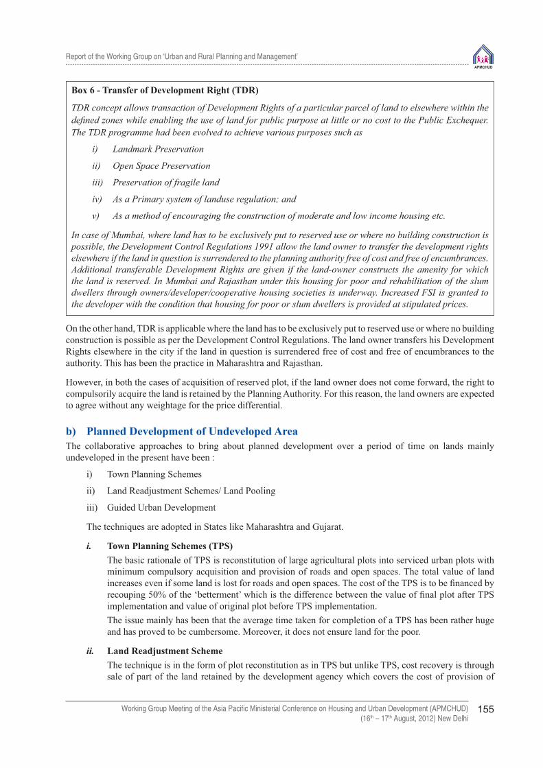
Report of the Working Group on ‘Urban and Rural Planning and Management’
Working Group Meeting of the Asia Pacifi c Ministerial Conference on Housing and Urban Development (APMCHUD)(16th – 17th August, 2012) New Delhi
155
Box 6 - Transfer of Development Right (TDR)
TDR concept allows transaction of Development Rights of a particular parcel of land to elsewhere within the defi ned zones while enabling the use of land for public purpose at little or no cost to the Public Exchequer. The TDR programme had been evolved to achieve various purposes such as
i) Landmark Preservation
ii) Open Space Preservation
iii) Preservation of fragile land
iv) As a Primary system of landuse regulation; and
v) As a method of encouraging the construction of moderate and low income housing etc.
In case of Mumbai, where land has to be exclusively put to reserved use or where no building construction is possible, the Development Control Regulations 1991 allow the land owner to transfer the development rights elsewhere if the land in question is surrendered to the planning authority free of cost and free of encumbrances. Additional transferable Development Rights are given if the land-owner constructs the amenity for which the land is reserved. In Mumbai and Rajasthan under this housing for poor and rehabilitation of the slum dwellers through owners/developer/cooperative housing societies is underway. Increased FSI is granted to the developer with the condition that housing for poor or slum dwellers is provided at stipulated prices.
On the other hand, TDR is applicable where the land has to be exclusively put to reserved use or where no building construction is possible as per the Development Control Regulations. The land owner transfers his Development Rights elsewhere in the city if the land in question is surrendered free of cost and free of encumbrances to the authority. This has been the practice in Maharashtra and Rajasthan.
However, in both the cases of acquisition of reserved plot, if the land owner does not come forward, the right to compulsorily acquire the land is retained by the Planning Authority. For this reason, the land owners are expected to agree without any weightage for the price differential.
b) Planned Development of Undeveloped AreaThe collaborative approaches to bring about planned development over a period of time on lands mainly undeveloped in the present have been :
i) Town Planning Schemes
ii) Land Readjustment Schemes/ Land Pooling
iii) Guided Urban Development
The techniques are adopted in States like Maharashtra and Gujarat.
i. Town Planning Schemes (TPS) The basic rationale of TPS is reconstitution of large agricultural plots into serviced urban plots with
minimum compulsory acquisition and provision of roads and open spaces. The total value of land increases even if some land is lost for roads and open spaces. The cost of the TPS is to be fi nanced by recouping 50% of the ‘betterment’ which is the difference between the value of fi nal plot after TPS implementation and value of original plot before TPS implementation.
The issue mainly has been that the average time taken for completion of a TPS has been rather huge and has proved to be cumbersome. Moreover, it does not ensure land for the poor.
ii. Land Readjustment Scheme The technique is in the form of plot reconstitution as in TPS but unlike TPS, cost recovery is through
sale of part of the land retained by the development agency which covers the cost of provision of

Report of the Working Group on ‘Urban and Rural Planning and Management’
Working Group Meeting of the Asia Pacifi c Ministerial Conference on Housing and Urban Development (APMCHUD)(16th – 17th August, 2012) New Delhi
156
infrastructure. Some portion of the developed land retained by the development agency can also be put to use for shelter for low income groups. The scheme, however, has certain problems. Besides that the land assembly is cumbersome, the valuation of property and equitable distribution of value added amongst land owners is complicated.
iii. Guided Urban Development Guided development promotes participation of land owners allowing them to develop the land. This
is in variation of the Town Planning Scheme and Land Readjustment scheme where the public agency carries out either the reconstitution of plots or land assembly and development. Here, the responsibility for assembling land, preparing the layout and developing the on-site infrastructure according to the guidelines is cast on the private developers who approach the authority to allow them to develop the notifi ed land for acquisition. This scheme provided an opportunity to the land owners to develop their land in a manner that assured reasonable return on land and for the public agencies to have assured large portion of serviced sites for allotment to low income families at a fi xed price. Part of the off-site infrastructure cost is also recovered by way of lease premium when the acquired land is leased to the same owners and in the process the diffi cultly in recovering the betterment charges is overcome.
c. Redevelopment of already developed areas: Land sharing is the technique to develop areas or lands which have been encroached. The principle in land sharing technique is that land is shared equitably between land owners and the tenants. The landowner develops land in such a manner that the original inhabitants in that area are given shelter in the same plot of land and land for public facilities is made available to the planning agency while the remaining area is developed and sold freely in the market. The technique is used in Andhra Pradesh, West Bengal and Maharashtra.
The approaches outlined above are in principle similar but for the modus-operandi and the scope. They allow the landowners/builders to develop land and gain returns on their land under certain terms and conditions.
ACTION PLAN SCHEME
Golden Quadrilateral - DMIC: To complement the National Spatial Strategy creating space for development is the Delhi Mumbai Industrial Corridor which is a spin off project of the Golden Quadrilateral initiative. It provides impetus to urban growth banking on the connectivity between the two most important urban as well as economic centres in India. It would attract bulk migration and if planned and developed proactively, these catchment areas would be able to provide better quality of life.
Provision of Urban Amenities in Rural Areas:The scheme is a Govt. of India formulated Centre sponsored scheme which envisages Public Private Partnership for the development of growth centres within rural hinterland to offer a new direction of growth to the existing settlements and also help in generating employment within the region itself. It would serve as an important tool for guided urban development.
OTHER INFLUENCES:
In addition to the above, policies, acts and programmes adopted in other sectors also have a direct and indirect bearing on management of land resources. The Environment (Protection) Act 1986 of MoEF formulates and carries out environmental policy at the national level, which recognises that effective management and control of natural resources requires the support and participation of the people. To ensure stakeholder participation, public hearing is made mandatory on all projects that require EIA while implementing area development programmes.
5.0 RECENT INITIATIVES
a) The Working Group on Urban Strategic Planning, 12th Five Year Plan Steering Committee on Urban Development and Management, 2011 (M/o HUPA):

Report of the Working Group on ‘Urban and Rural Planning and Management’
Working Group Meeting of the Asia Pacifi c Ministerial Conference on Housing and Urban Development (APMCHUD)(16th – 17th August, 2012) New Delhi
157
The Committee has set out major recommendations for urban planning in cities and towns of India adopting a regional planning framework having found that the efforts so far made have been fractional and disaggregate in approach(Box7.0). The recommendation for strategic plan preparation include :
i) Spatial Planning Referenceo For regional and urban planning as an instrument for guiding inclusive growth – spatial and development
planning to cover metropolitan regions, planning areas of cities (may be 5-8 kilometers around existing large cities, say those with more than 3 lakh population – transportation networks to be central pieces of planning to “lead” development.
o Prepare a National Spatial Strategy covering National Transportation Grids and National Priority Cities, propose new cities along emerging industrial and high-tech Growth Corridors/Transportation Grids connected to central cities with a high speed rail network and likely to generate agglomeration forces. Broad morphology of the future urbanisation needs – with existing cities, their peripheral extensions and new cities to be developed along the growth/transport corridors to be the critical element of the strategy with the new cities on growth corridors being located near existing large/metropolitan cities/growth centres connected with high speed transit networks so that they can take advantages of the agglomeration forces.
o Major thrust to Regional and Urban Planning and preparation of District, Metropolitan and City Spatial and Development Plans through strategic guidelines and fi nancial support. The regional plans to be in the form of structure plans to defi ne a range of fi scal incentives, industrial location policy and development transit networks – high speed rail network along the proposed highway development corridors for development of new cities.
o Planning in consonance with the income distribution structure of the city/region with the urban poor located near public transport nodes/links and providing space for the urban poor in master plans for living, selling and working – at city, zone and local levels.
o Strategic Densifi cation of Cities – The density regulations in Indian cities are archaic and don’t address the needs of the present day demands of the urban society. In fact, Indian cities have the lowest Floor Space Index (FSI) in the world. Strategic densifi cation as a planning strategy to be pursued to accommodate future urbanisation. Government of India may introduce incentives that encourage states and cities to pursue this strategy for future urban development. However, this strategy needs to go hand in hand with infrastructure development within the city facilitated by fl exible zoning.
o Urban Renewal and Regeneration – Policy to provide broad framework to facilitate the process of urban regeneration/renewal within the generic principle that the growth would pay for itself. This would require a fl exible planning approach and seed capital support.
ii) Strengthening the Institutional framework � Adopting the regime of 74th Constitutional Amendment Act for regional and urban planning.
� Establish institutional ownership for GIS data through State Urban Information Systems – Spatial plans are analytical documents that are based on scientifi c methodology and data collection. In order to create credible, useful, successful spatial development plans, the MA needs a Metropolitan Spatial Data Cell to collect and analyse data in a systematised, standardised and transparent manner.
iii) Clarity in Roles Under the Constitution, the DPC/MPCs are supposed to ‘consolidate’ the draft development plan of the district/metropolitan area. The constitution, is unclear on whether this plan is to be accepted by the government, and if so, by when.
The ‘Draft Development Plan (DP)’ to be produced by the MPC/DPC requires that due attention be paid to (1) integrate rural and urban through coordinated spatial planning; (2) covers all matters of common interest to municipalities and the Panchayats; (3) take into consideration all investments likely from various sources

Report of the Working Group on ‘Urban and Rural Planning and Management’
Working Group Meeting of the Asia Pacifi c Ministerial Conference on Housing and Urban Development (APMCHUD)(16th – 17th August, 2012) New Delhi
158
and sharing of resources; (4) facilitate integrated development of infrastructure, and (5) ensure environmental conservation. The plan at this level shall be strategic plan serving the long-term interest of the district/metro area as a whole over a 20 year period horizon. It shall be in the form of a structural plan and the State Government to notify Districts/ Metropolitan Areas, Municipalities and Panchayats as “Planning Areas” and notify their respective authorities as sole Planning Authorities.
Box 7 - Critical Issues in Land Policy
i. Lack of Comprehensive Planning Approach : The existing focus on expansion of towns is in isolation of their hinterlands and that of the region. The focus of the master planning approach is only on the core area of the city, without proper vision and strategy to integrate the peri-urban and rural areas within a regional framework resulting in haphazard development in the urban periphery, environmental degradation and depletion of natural resources. Industrial developments are planned with little or no provision for the EWS housing needs. There is a haphazard growth and proliferation of slums around industrial locations and peri-urban areas and randomly located new developments such as, SEZs and townships.
ii. Lack of clarity in roles and responsibilities of Institutions : The concept of decentralised planning has long been established but its implementation requires more emphasis on methods of its operationalization – the process involved in the preparation of development/master plans. The existing institutional framework for urban planning and governance does not specify clearly the roles and responsibilities of the State Government, parastatals like Water Supply and Sewerage Boards, Improvement Trusts, Urban Development Authorities, District Planning Committee(DPC) and Metropolitan Planning Committees (MPC) and urban and rural local governments in plan preparation, implementation, enforcement and monitoring.
iii. Lack of Capacity and Enabling Tools :Lack of human resources and enabling tools such as GIS and GIS enabled Management Information System (MIS) has been a major impediment to effective regional and urban planning system in India. The plan is often not participatory. All this hinders the effectiveness of the plan making and implementation process.
iv. Inadequate Infrastructure : The lack or absence of main infrastructure viz., the roads, water supply systems, sewerage systems, storm water drainage and electricity distribution are a major constraint on urban land delivery. The end result is the expanding of cities and town into the surrounding countryside in a haphazard manner. The ineffi cient public transport systems and defi cient road networks result in poor accessibility, long trip durations and congestion on the street both with city and extended periurban areas.
v. Inadequate Land Information and Registration Systems : The information needed by land sellers and buyers, real estate developers and government land development agencies relating to land prices, ownership and regulations is available albeit not easily. The situation is exploited by some thereby generating ineffi ciency and corruption and also unplanned development.
vi. Missing Plan-Finance Linkage : The master plans have lagged in projecting the fi nance issues in a meaningful manner. The absence of operating strategy has left plan implementation behind the schedule plan targets. Central and State funds are usually not enough to meet the needs making it necessary for municipalities to improve their revenue collection.
vii. Social Exclusion : As a result of failure to bring about urban-rural integration in a regional framework and to guide urbanisation and rural development in an integrated and holistic manner, a sharp divide between income groups in terms of access to housing and basic services has come up. Legal, mortgageable ownership housing has become unaffordable and rental markets being under-developed has resulted in large sections of the urban poor putting up in unserviced, unsafe and unmortgageable housing.

Report of the Working Group on ‘Urban and Rural Planning and Management’
Working Group Meeting of the Asia Pacifi c Ministerial Conference on Housing and Urban Development (APMCHUD)(16th – 17th August, 2012) New Delhi
159
b) Analysis of existing methods and strategies of land-use planning, Department of Land Resources (DoLR) under the Ministry of Rural Development (MoRD) (June 2012):
DoLR Government of India has identifi ed that land use planning in India is presently limited to urban areas and in some cases it also covers the adjoining rural areas where urbanisation may take place and consequently poses a big challenge for India to deal with increasing value of the land, competing land uses and land confl icts. A number of confl icts between farmers and the stakeholders arising due to procurement/acquisition of land for industrial and urban development are a reason of concern and attempt is being made at developing tools and methods, to demonstrate improvement of land management, to mitigate the potential confl icts between competing land use types in India.
6.0. CONCLUSION AND WAY FORWARD
Immigration to cities is natural and cannot be checked unless a regional framework is effectively put in place to handle planning issues on broader spatial basis. The complex nature of the regions surrounding the metropolitan cities in terms of their social, economic and physical structure is a proof of the growing realisation that these centres should be seen in the context of their regions. A number of metropolitan regional plans in the country have been prepared but the development of the area has been in the form of piecemeal, planning schemes and failed to be comprehensive and effective. There is a need to i) proactively visualise and identify land/zones that have the urbanisation potential enabling the authorities to respond accordingly to the growth pattern and ii) Allocate development rights to land owners as in case of Guided Land Development to avoid agitations/litigations while also safeguarding the basic interests of the government.
REFERENCES:
1- http://www.moef.nic.in/divisions/ic/wssd/doc2/ch13.html
2- http://www.fao.org/docrep/V8047E/V8047E00.htm
3- http://www.unescap.org/drpad/vc/conference/bg_in_15_la21.htm
4- http://www.mpl.ird.fr/crea/taller-colombia/FAO/AGLL/pdfdocs/lwbull2.pdf
5- http://www.niua.org/Publications/discussion_paper/basudha_paper.pdf
6- GoI strategic_plan_draft_new.pdf
7- Working group on urban strategic planning 2012, MoHUPA
8- Concept Note : Land Use Planning, MoRD GoI, June 2012

Report of the Working Group on ‘Urban and Rural Planning and Management’
Working Group Meeting of the Asia Pacifi c Ministerial Conference on Housing and Urban Development (APMCHUD)(16th – 17th August, 2012) New Delhi
161
Technical paper – 13Towards a Hybrid Land Policy for
Inclusive DevelopmentA.K. Jain
Former Commissioner (Planning), Delhi Development Authority, Member UN Habitat (HS Net)
Abstract
Various models of urban land assembly and development are being implemented by several states /cities in India and in other countries which provide important lessons. These experiences point out the need to evolve a plural approach to land policy and a differential development strategies. It should be based on minimum acquisition of new lands and self driven, incentivized redevelopment of built up areas, villages, unauthorized colonies, etc. The tools of Transferable Development Rights and Reservations for public greens, transport, physical and social infrastructure and housing can be used to ensure planned, inclusive development.
Introduction
India is on the path of massive urbanization. From 377 million urban population, living in 7936 cities and towns, it is projected that by the year 2030, 600 million people will live in urban areas and 68 cities in India will become metropolitan (million plus). Massive efforts and investments will be required for housing, slum rehabilitation and infrastructure development.
Land is the basis of all human activities, shelter development and infrastructure services. Traditional planning entailed large scale appropriation of rural lands for urban development, i.e. housing, commercial centres, industries, roads and highways, parks, recreational, educational and health facilities, etc. The recent agitations and court cases, e.g. at Manesar (Maruti Car Co.), Bhatta Parsaul, Greater NOIDA and Singur SEZ (WB), highlight the widespread discontentment against coercive land acquisition under the colonial Land Acquisition Act. A more democratic approach necessitates minimizing the need for conversion of agricultural land for urbanisation and controlling the urban sprawl by optimum densities, intensive development and decentralization. It is also necessary to adopt policies for more equitable distribution of the resources and to minimize the infrastructure costs and carbon footprints of urbanization.
Private Sector Participation (PSP) and Public-Private Partnership (PPP) in land assembly and development are being increasingly adopted in India in view of a) diffi culty in land acquisition under Land Acquisition Act, 1894, b) to generate private sector resources by a market led approach, c) land monetization so as to improve the fi nances for investments in social housing, infrastructure services, public transport, etc., and d) to meet the growing demands of urbanization.
Urbanisation and Land Policy
Initially, the socialist policies were adopted which started with large scale land acquisition, development and disposal policy in Delhi in 1961. Land Acquisition Act of 1894 had been applied for acquisition of land for planned development with government centric planning, land management and development, including infrastructure services, housing and construction. At present Public-private partnerships in urban development are being promoted by the government by an enabling policy framework. The Centrally sponsored JNNURM and various other schemes are based on a partnership approach in which the Central and state governments share

Report of the Working Group on ‘Urban and Rural Planning and Management’
Working Group Meeting of the Asia Pacifi c Ministerial Conference on Housing and Urban Development (APMCHUD)(16th – 17th August, 2012) New Delhi
162
the project cost. To mobilise private sector and institutional resources and get multiplier effect from budgetary allocations, a facilitating approach is being adopted by the government.
The liberalization of the Indian economy has facilitated a new urban pattern with a private sector partnership in real estate, housing and infrastructure projects including ports and airports, rail freight corridors and Special Economic Zones (SEZs). The emergence of transport corridors with a substantial increase in industrial investment, services, fl ow of goods and people along them has been a signifi cant feature of spatial change in recent years. The “Golden Quadrilateral” network of National Highways linking Delhi, Mumbai, Chennai and Kolkata as well as North-South and East-West Corridors, promote this type of growth. One of the recent initiatives is \Western (1,483 kilometre), Delhi-Mumbai Industrial Corridor (DMIC) and Eastern (1,279 kilometre,) Delhi-Kolkata Rail Freight Corridor. A separate corridor for freight trains would enable the Railways to achieve higher speed, facilitate guaranteed transit time to the customer, reduce unit cost of transportation and provide a competitive edge over the other modes of transport. Several Freight Logistics Parks, Industrial Parks and Special Investment Zones are proposed to be developed along the Corridors.
Land is a State subject and various State Governments in India have adopted their own land policies for urban development. Realising the potential of urban sector in economic development, the privatisation of urban development is being increasingly adopted by the state governments in order to:
• Gain revenue from value addition of erstwhile agricultural land for planned development;• Reduce the call on government funds;• Overcome capital shortages and making urban development self-fi nancing;• Obtain the gains of private sector effi ciency in land development, transport corridors, housing,
commercial development, educational and health facilities and infrastructure • Introduce competition in the supply of housing and other developments;• Open up new areas of business for the private sector and create jobs.• Better use of underutilised, idle, waste lands in improving the overall economy of the State/city.
Invariably in all States, the responsibility of preparation of Master Plan/Zonal Plans/ Infrastructure Plans (roads, water, sewerage, solid waste management (SWM), sewage, drainage, etc) is that of the government. However, the pace of external development, roads and services is often slow and faces defi cit, fi nancial constraints and administrative delays. Court cases in acquisition of certain land often upset the continuity of services, roads and other external development. The pace of buildings/township development by the private sector had been comparatively faster, who adopt an aggressive strategy to market their real estate.
UP Model
In UP the Ghaziabad Development Authority (GDA) has adopted a joint venture model of urban development in which a consortium/joint venture between the builders/develop-ers/GDA take up the development. Ghaziabad Development Authority acts as a facilitator.. The land is purchased by the developers by negotiations with the landowner failing which the GDA acquires the land under the Land Acquisition Act (LAA). For funding the acquisition, the JVP is selected on the basis of the bids. The private developer earns revenue from the sale of property/fl ats on 60% of land in the free market. Apart from the lesser investments, it provides free of cost facilities, plots to the GDA, who also earns annual revenue of 1% from the developer. 20% of the plots/fl ats are reserved for the EWS/LIG at predetermined rates. The model is applicable in selected residential areas with a minimum size of 50 acres.
The UP Government during recent years has adopted the policy of land- infrastructure bundling for coordinated development of infrastructure and real estate. In NOIDA/Greater NOIDA land is being used as a resource for infrastructure development. The private sector has been invited to develop the major roads, public facilities and utilities against allotment of land for residential, commercial and industrial development. The Formula one Racing Track and Yamuna Expressway in the Greater NOIDA have been developed in this manner with the entire investments of the private sector except land which was acquired by the NOIDA/Government of UP.

Report of the Working Group on ‘Urban and Rural Planning and Management’
Working Group Meeting of the Asia Pacifi c Ministerial Conference on Housing and Urban Development (APMCHUD)(16th – 17th August, 2012) New Delhi
163
Haryana Model
The Haryana Urban Development Authority acts as a facilitator by issuing licenses after permitting the acquisition of land by the private developers from the farmers directly at negotiated market prices. The minimum applicable size for the scheme is 40 hectares. The model takes care of the layout level facilities only. The entire process of negotiating the land purchase and development is to be completed within three years. It requires the colonizer to provide for 20% of the plots/fl ats to EWS/LIG categories at predetermined rates. Haryana Government attracted huge investments, industries and multi-nationals in the State by its private sector urban policy. The provision of the basic services and major roads is often defi cient which depends upon the payment of EDC and other charges to the HUDA/Local Bodies and Haryana Government.. Although the conditions of license impose a ceiling of 15% profi t, it is more of an academic prescription.
Town Planning Scheme of Gujarat
The responsibility of initiating Town Planning Scheme rests with the Development/Local Authority and the cost of implementation of a TP scheme is met through the annual budget of the local authority. Cost recovery from a TP scheme project is in the form of owner’s contribution which is upto half of the estimated increase in land value. The model is applicable in residential pockets with an average size of the scheme varying between 10 Ha to 400 Ha. The model is attractive to the landowner who gets back 50% to 70% of the land. To cater to EWS/LIG housing, reservation of 10% land is made, which is inadequate (Mehta, 1991).
Chennai- Guided Urban Development Model
The Chennai Metropolitan Development Authority (CMDA) guidelines for Guided Urban Development envisage private sector participation on a minimum project size of four hectares within the Chennai Metropolitan Area (CMA). The guidelines stipulate minimum of 60 plots per gross hectare of land of which 75 percent are to be reserved for EWS and LIG households. These can be purchased by the government at a fi xed price or disposed of by the developer at price fi xed the government/CMDA. The land assembly, provision of site infrastructure (roads, drainage, water supply, power, sewerage, street lights, etc.) are the responsibility of developer. The land under community facilities, roads and parks, etc. (30%) is handed over to the CMDA free of cost.
Rajasthan Model
In Rajasthan Integrated Township Scheme stipulates a minimum area of 100 acres in Jaipur, 50 acres in Divisional Headquarters (except Bharatpur) and 25 Acres in Municipal Towns. The local authority helps in procurement and consolidation of land including transfer of lands available with local authorities/Rajasthan Housing Board. The developer is encouraged to take up Township development, even if the developer owns at least 2/3rd of the prescribed area. About 65% of the land is available for disposal by the developer and 35% of facility/circulation area/parks are surrendered to local authority.
Conversion charges for land use for internal and external development are deposited by the developer for the development of roads, drainage, water supply and power, etc. As an option IDC and EDC can be paid by way of 15% and 5% of land respectively.
West Bengal Model
The West Bengal Housing Board allotted 25 acres of land to Gujarat Ambuja Company for develop¬ment of Group Housing, comprising of LIG, MIG and HIG. The LIG/MIG houses are 4 storeyed and HIG fl ats are 8 to 14 storeyed, with a permissible FAR of 250. The infrastructure development is the responsibility of JVC (Joint Venture Company). The water supply is managed through tube wells/underground tank/boosting arrangement. For sewerage disposal, a Mini Sewage Treatment Plant has been provided. The Storm Water is discharged into the canal with treatment of the affl uent.

Report of the Working Group on ‘Urban and Rural Planning and Management’
Working Group Meeting of the Asia Pacifi c Ministerial Conference on Housing and Urban Development (APMCHUD)(16th – 17th August, 2012) New Delhi
164
For development of Rajarhat New Town the State Government set up the West Bengal Infrastructure Development Corporation Limited (WBIDCO) in 1999. The new town area was declared as a ‘Planning Area’ under the West Bengal Town and Country Planning (Planning and Development) Act, 1979. The WBIDCO has now become the New Town Kolkata Development Authority. The land was acquired under the Land Acquisition Act 1894 which was supplemented by land procurement through direct purchase. For this purpose a Land Procurement Committee was set up with offi cials and land owners.
Andhra Pradesh-Land Pooling in Vijaywada for BSUP Housing Scheme
In 2007-08 the Vijaywada Municipal Corporation (VMC) was acquired 226 acres of agricultural land on land sharing basis under which land was shared between farmers and VMC in the ratio of 60:40 without cash compensation to the farmers. Several rounds of negotiation resulted in this partnership, wherein the farmers would part with their 40% land for development by Vijaywada Municipal Corporation (mainly for the construction of houses under BSUP Scheme) and related infrastructure and the rest 60% of serviced land is returned to the farmers for urban uses.
Kerala Plot Reconstitution
Trichur Urban Development Authority (TUDA) carried out an innovative Plot Reconstitution (PR) Scheme (1982-86) covering an area of 7.5 Ha. Earlier a proposal was framed for development of a central bus stand, market/shopping, hotel, etc. which involved the acquisition of land through Kerala LA Act, 1961. There were strong objections against the land acquisition. The TUDA decided to resort to the technique of plot reconstitution inviting the land owners for negotiations. As a result Plot Reconstitution Scheme was worked out where by the TUDA received more than 2 Ha of land free of cost and without lengthy land acquisition procedure. The nine land owners got developed land (about two-third of original land) with roads, services and enhanced value (about 7.7 times). The scheme was completed in six years from the date of agreement. Another land mark in Kerala is the adoption of Integrated District Development Planning (IDDP) dovetailed with participatory Local Development Planning (LDP). This ensures integrated urban and rural development with public participation.
Mumbai Experience
The Mumbai experience stands out for its plurality of land development strategies and is gradually moving beyond Town Planning Scheme which causes sprawl and does not cater to fast pace of urban growth and high value of land which demand compact, high density development. The various land management approaches in Mumbai are as follows:
Table: Land Policy and Management Strategies in Mumbai
Predominant Consideration Land PolicyPlanning/regularisation of existing/new development on private lands
Town Planning Scheme
Obtaining land for public purpose or conservation of heritage buildings in already developed areas
Transfer of Development Right and Accommodation Reservation (TDR &AR)
Mobilising fi nancial resources Development of Govt. land at vantage locations, use of air right at railway stations, etc.
Planned development in fringe areas including redevelopment/renewal of old areas.
Incentive based guided land development.
New Town Development in green fi eld sites Land acquisition under LA Act, 1894, option for one eighth land return.
In-situ slum rehabilitation Incentive based slum redevelopment and cooperatisation, cross subsidised by market sale component and bonus FSI

Report of the Working Group on ‘Urban and Rural Planning and Management’
Working Group Meeting of the Asia Pacifi c Ministerial Conference on Housing and Urban Development (APMCHUD)(16th – 17th August, 2012) New Delhi
165
Learning from the Asia Pacifi c
The political and cultural ideologies of a country are refl ected in its land policy. In China, land is viewed as a public resource, with use rights subject to government approval. In Thailand and Philippines, land is a subject of private ownership and market transactions. The approach in Indonesia is an intermediate stage between two extremes. These approaches have signifi cant impacts on the government’s land policies, which are integral to urban system and its cross-sectoral linkages.
How effi ciently the land market works can be seen from the perspective of the city administration, real estate developers, business and households, in particular the urban poor. From the viewpoint of the city government, a good example is the system under implementation in the Tokyo region, by designating “preferred and deferred” areas as part of land development strategy. From the view point of real estate developers, one of the best examples is that of Bangkok, where there are minimal planning and building regulations. From the urban poor viewpoint, good examples are mandatory loans and land sharing, and cross-subsidy system in Manila where lower interests are charged for smaller loans.
Planning and regulatory systems play an important role in land management by guiding and controlling the spatial impacts or externalities of the multitude of short term decisions by the private sector. These are linked to the issues of governance, sectoral investments, fi scal policies and other aspects of urban management. There are several examples of effi cient integrated planning and regulatory systems. In Seoul, fi scal policies are used to encourage the faster use of vacant land and to discourage speculation. In Jakarta, Manila and Dhaka, effective strategic planning/structural planning approaches are adopted rather than static, costly and urban centric master plans. In Manila, more effective forms of public participation in the development process have been introduced
There are variety of techniques to improve the urban poor’s access to land, involving direct subsidies through public housing, sites and services projects, housing credit schemes and slum upgrading programs. A number of innovative on-site slum rehabilitation policies have been tried such as land sharing in Bangkok and its variations in Kuala Lumpur. A good example is Myanmar’s hut-to-apartment scheme, where government sells land to private developers provided that they give a percentage of the houses constructed to its low income households on the site. The Community Mortgage Programs in Bangkok and Manila are also helping the urban poor.
The Capital Investment Folio (CIF) for the Metro Manila Commission in coordinating the spatial plans with infrastructure investment strategies and allocating responsibilities.. A similar process was developed for the Jabotabek Metropolitan Development Plan. The Kuala Lumpur Structure Plan is an example of effective delineation of functions, including coordination of planning and fi nancing systems for urban development at national, metropolitan and local levels.
Several cities in Bangladesh, Philippines and Australia have taken the initiatives to streamline land transaction procedures and integrate land information management. Such improvements includes cadastral mapping, land registration and titling, institutional streamlining and reduction in number of approvals for real estate projects.
Singapore has a comprehensive land information system which meets the needs of all government departments with particular interests in land as well as providing a ‘one stop shop’ for the public. Malaysia has developed a computer-assisted mapping system, originally intended for managing land registration information, but has now become a multi-purpose GIS.
In the Tokyo region, effective coordination of urban expansion is facilitated by meticulous planning of physical, fi nancial and regulatory mechanisms, including Spatial Data Infrastructure. In the National Capital Region (Philippines) urban expansion is coordinated by a comprehensive land information for growth centres (e.g. Subic, Clark, Mailaque), which support a decentralised urban structure.
To ensure planned development, while safeguarding the rights of land owners, land pooling and readjustment model envisages that an equal portion of land is deducted from every agricultural plot as contribution of land for physical and social infrastructure, and to raise resources. Land remaining with land owner is reconstituted so that he gets regular shaped plots and frontage on public road. Land owners contribute fund in proportion to land holding to fi nance infrastructure development cost. This method has been adapted in Town Planning Schemes

Report of the Working Group on ‘Urban and Rural Planning and Management’
Working Group Meeting of the Asia Pacifi c Ministerial Conference on Housing and Urban Development (APMCHUD)(16th – 17th August, 2012) New Delhi
166
in India and had its roots in “land pooling” in Germany, which is being followed in Australia, Japan, Thailand, Taiwan and South Korea (Archer, 1993).
Land Readjustment Scheme (LRS) in Korea is used as a major tool to secure the land for the construction of large complexes. Under the programme, once a certain area is declared as the development site, some portion (one-fourth) of land is set aside for public use such as roads, recreation area and other facilities (5%) and another portion of land is retained by the government/developer (9 to 10 %) to cover the cost of development. By the increase in land value after the development, the owner realises substantial profi t on his remaining land (60 to 65%). In order to prevent the speculation, the government introduced Public Development Scheme (PDS) under the Land Development Promotion Act. Under the Act land can be purchased compulsorily by the public authority. The LPR Scheme involves:
i. Land Pooling and Return without compensationii. Relaying of pooled landiii. Carrying out infrastructure work and subdivision of landiv. Re-allotted part of developed land back to the owners, andv. Selling surplus developed land to meet the cost of development.
The method minimises public expenditure in the conversion of raw land to developed urban land. At the same time, original owners end up with reasonable compensation, with the value added plots. The public agency obtains land for circulation, open spaces, etc. free of cost, besides getting residential, commercial and industrial plots through which the amount incurred towards provision of infrastructural facilities is ploughed back (Mishra, 1990). However, many original land owners feel deprived due to loss of occupation and agricultural income and the cost of moving/displacement. The process of LPR brings public investments in infrastructure and obviates the need for fi nancial transactions which both parties typically fi nd diffi cult. The public authority does not have to fi nd the cash for acquisition and the land owners do not have to pay a Betterment tax/EDC.
An Overview and Assessment
The following table gives an overview of the models of private sector participation in urban development in Haryana, Uttar Pradesh, Gujarat and Maharashtra. It also summarized the major issues involved.
Table: An Overview of Private Sector Participation in Urban Development
Particular Haryana Uttar Pradesh Gujarat Maharashtra
Legal Framework
• HUDA Act 1975 • Haryana Ceiling on Land
Holding Acts, 1972• Haryana SEZ Act 2005• NCRPB Act, 1985• E (PC) Act, 1985
• UP Land Ceiling Act 1973• UP Urban Planning and Develop-
ment Act, 1973• UPSEZ Development Authority
Act, 2002• NCRPB Act, 1985• E (PC) Act, 1985
Gujarat T P and Urban Development Act, 1976
• Mumbai MC Act, 1888• MRTP Act, 1966• MMRD Act, 1974• MHAD Act, 1976• Development Control
Regulations for MMR, 1999
Regulatory Framework
• PPP• HUDA : Rules, Regula-
tions, Building Bye-laws• Master Plan/Regional
Plan/Zonal Plan• Haryana Urban Land
Policy (2011), SEZ policy
• License pd. 2 Yrs(+3yrs)• Bank Guarantee 25% of
IDC and EDC
• Joint Venture Equity Sharing (10% private & 90% government)
• LDA/GDA/Noida/Greater Noida, etc. : Rules, Regulations, Building Bye-laws
• Master Plan/Regional Plan/Zonal Plan
• Integrated City Development Policy 2005
• Hi-tech Township Policy, 2003, SEZ policy
• UP State Housing Policy
• Town Planning Scheme• Transferable Development Rights• Slum Redevelopment• Incetivised Guided Development• Development Plans, Rules and Regulations• Development Control Regulations• Building Bye-laws,• Government/Executive Orders

Report of the Working Group on ‘Urban and Rural Planning and Management’
Working Group Meeting of the Asia Pacifi c Ministerial Conference on Housing and Urban Development (APMCHUD)(16th – 17th August, 2012) New Delhi
167
Land Assembly
• Negotiated market land purchase
• Government-under Land Acquisition Act, 1894:
• Negotiated market land purchase• Govt. land purchase at market
value linked/ to Consumer Price Index/ or against 20% developed land/ 5% of plots reserved for lan owners, + 15% uprooting allow-ance + 15 sqm shop
• Allotment of govt. land under Land Infrastructure Bundling
• Land Acquisition by Government: • TDR/ AR (Additional FSI)• Cash/one eighth developed land• Private @ market price
Minimum Area
• 100 Acres (10 acres for group housing projects)
• Minimum Area : 50 Acres (20 Ha)
• Not specifi ed • (10 Ha as per practice
for TPS)• Land return average
50-70%
• Not specifi ed • TPS 50 to 70 % land
return
Reservation for EWS/LIG
• 20% EWS/LIG (50-125 sq.m plot/fl at)
• 25% plot/fl ats (on no profi t no loss)
• 20% EWS/LIG plot/fl at)• 40% units (on no profi t no loss)
• Low priority to low cost housing, mainly serves middle and upper income
• Low priority to EWS
Scope and Coverage
• Mainly Greenfi eld • Mainly Greenfi eld • New TP Schemes, Old Area Redevelopment, Slums/ Unauthorized Colonies
• Incentive Based Guided Land DevelopmentTime Frame • 3 to 7 years • 3 to 7 years • 5 to 10 years upto plan
sanction, 3 to 5 years for development
• 5 to 15 years
Major In-novations
• Project cost mobilized from developer equity, users installments and commercial fi nancing.
• Equitable FAR for lands required for public roads/ corridors, etc.
• Lesser restrictions and interference in private sector development.
• Land Infrastructure Bundling• One window approval• Purchasable FAR
• Land sharing for public roads, greens and fa-cilities without need for acquisition
• 50-50 cost sharing for ED/ Internal Dev.
• Plural PPP Policy cov-ering TPS, infrastruc-ture services, /chawls/old city /slums
• TDR, Accommodation Reservation, Slum re-development,, mixed use development, etc
• Land monetization and effi ciency
• Incentivized guided de-velopment
Major Issues • Resistance from farmers for acquisition, inadequate compensa-tion, litigations/court cases,
• encroachment on govt. lands/roads• Piecemeal development due to withholding of land by the own-
ers/farmers/speculators • Delay in obtaining approvals• Huge profi ts despite ceiling• Scattered location of projects and urban sprawl• Redevelopment of existing urban areas not covered• Lack of external services and public transport• Lack of inter-departmental coordination• Development of services delayed being linked to EDC/ Cost
Recovery• Illegal subdivision of rural lands• Lack of social housing• Poor recovery of Betterment Charges• Poor maintenance of colony/project/roads
• Compromise with planned development• Fragmented land holdings and sprawl• Long time in fi nalization and approval of T P
Schemes• Poor land bank of government/ULB• TPS Popular in Gujarat but not suitable for large
scale development • Perceived bias in favour of land owners, ULB
subsidizing TPS development by 50 to 80% • Slow process vis-à-vis urban growth• Poor regulatory controls• Ineffi cient resource use, poor cost recovery (TPS)• Poor infrastructure standards• Poor environmental quality• Excessive Regulatory standards/ administrative/
political interference• Subdivision of plots without services and in antici-
pation of regularization• Lack of social housing• Delay in external & internal development and poor
maintenance.

Report of the Working Group on ‘Urban and Rural Planning and Management’
Working Group Meeting of the Asia Pacifi c Ministerial Conference on Housing and Urban Development (APMCHUD)(16th – 17th August, 2012) New Delhi
168
Cross-Cutting Issues
As analyzed above there are various cross-cutting issues in PPP in land policy and development which need to be addressed:
• Integrated Planning is a major challenge which needs to be balanced with spot zoning, minimum size of land holding, facilities and transport networks, etc. Integrated development addresses the issues of environmental sustainability, city expansion, restructuring, development controls and land use.
• Major transport corridors and external/peripheral infrastructure services need to be in place prior to real estate disposal to consumers/buyers.
• Inclusive Development – The city belongs to all and the poor, informal sectors have a claim on equitable access to land resource, housing, services, jobs, etc.
• Spatial- Financial – Infrastructure Interactions – Various aspects of land development have to be viewed in a regional context which integrates spatial, fi nancial and infrastructure services, such as water, power and drainage, transportation.
• Institutional Coordination – land management involves many public and private institutions and requires horizontal and vertical coordination. There is a need to clearly defi ne the roles and functions of the organizations involved in land management.
• Redevelopment of old, unplanned areas, unauthorized colonies and slum rehabilitation to be ensured by incentivized development rights. This needs innovative options of land assembly and planning.
• Legal frame and regulatory process reforms are the cornerstones of the land policy which include one window/online approval, simplifi ed procedures, protecting consumers interests, licensing and enforcement.
Emerging Concepts and Principles
The land and PPP policies as explained above manifest several innovative concepts that need to be adopted holistically to address the critical issues as given below:
Integrated and Sustainable Development: A compact city form has signifi cant implications on urban land, housing and sustainability. Critical instruments for this policy option include coordination with public transport, infrastructure development, mixed land use, and coordination of different levels of government. Data from international cities, such as that by Kenworthy and Laube (1999), indicate correlation of urban density with transport, energy use and carbon emissions. This leads to adaption of the “compact smart growth” and transit oriented development, which create more accessible land use patterns and reduce the amount of travel. This also supports a high transit share, and makes walking and cycling attractive. The examples of successful compact, smart city planning includes Singapore’s integration with radial and circumferential mass rapid transit, Curitiba’s integration with bus rapid transit on the linear main roads, Freibourg’s integration with light rail transit and environmental commuter pass, and Holland’s land use policy based on the categorisation of locations according to the accessibility to public and road transport.
Shanghai provides an interesting case study of urban turnaround. It has achieved densifi cation together with manifold increase in its green area, transport infrastructure, social facilities and urban services. Shanghai in 1990 had average road area per capita of 2.28 sq.m. and 1.02 sq.m of .public green area per capita. By 2003, it increased average road area per capita more than fi ve folds to 12.3 sq.m. and public green area per capita more than nine folds to 9.16sq.m. This was possible by the planned densifi cation and redevelopment. The planning strategy envisages that that the areas (disaggregated in a city/zone/sector/local hierarchy) under circulation/roads, green spaces and social infrastructure are around 10sq.m./per capita each. This should be the basic factor to determine the ‘carrying capacity’ of urban land and to compute the density and Floor Area Ratio (FAR) The focus of sustainable development is not the buildings but the greens, common social facilities/utilities, and roads/

Report of the Working Group on ‘Urban and Rural Planning and Management’
Working Group Meeting of the Asia Pacifi c Ministerial Conference on Housing and Urban Development (APMCHUD)(16th – 17th August, 2012) New Delhi
169
parking which determine the quality of urban development. With increasing demand for space, a balance is to be maintained between redevelopment and urban expansion.
The Concept of Land Pooling and Readjustment: In Indian cities it is becoming extremely diffi cult to acquire lands on large scale for planned development. The process of land pooling and readjustment can address this challenge. Land pooling and readjustment involves the preparation of a development plan which indicates the areas required for public uses such as streets, parks and schools, etc. The cost of providing the infrastructure for the entire area is calculated, and also the estimated market value of the improved land. A portion of the land, the estimated market value of which equals the cost of development is then transferred to the local government in return for carrying out the improvement. Alternatively, EDC, Conversion Charges, Betterment Levy, etc. are recovered against grant of development rights with compulsory surrender of land for common greens, transport infrastructure, social housing and facilities required at local level. The scheme does not envisage in-situ development of land but is returned in the nearest vicinity as per approved layout plan so as to ensure planned development. An advantage of land readjustment is that layout and reblocking are affected without the need of acquiring individual pieces of land for the facilities and infrastructure. At the same time, it provides an early return on the public investments through the sale of the land ceded to the local government.
The concept of “Excess Condemnation” is another method which can be employed to serve the twin objectives of providing a public road, highway or such facility and generate revenue by the acquisition of additional lands which are directly affected by such provision. The adjacent area is developed by the local body, the land value of which increases as a result of facility/road, and it accrues to the local body, rather than to individuals. The concept of property development along major public transport corridors/MRTS has been adopted in Delhi with grant of 50% additional FAR. This helps built up land bank of the local body.
Inclusive Development: A hazard of the market driven approach of urban development can be marginalization of the poor. The National Urban Housing and Habitat Policy (2007) suggests that the governments make mandatory provisions for the EWS, construction workers and informal sector, for which about 10 to 15% of residential land and 20 to 25% of FAR may be reserved in all housing developments, both by the private and public sectors. The developer is expected to hand over such housing/ land to the government after providing basic community infrastructure (access paths, water hydrants/hand pumps, toilet blocks, drains, sanitary provisions and street lights). The cost of land and development of basic infrastructure could be borne by government. The Master Plan for Delhi 2021 (MPD-2021) provides a mandatory component of social housing (35% of general housing units) for which an incentive Floor Area Ratio of 15% permissible FAR is given to the developer. This helps in citywide provision of EWS/LIG housing without need of extra land. Social housing thus generated could be given on rent, lease or license to slum dwellers, EWS/LIG families or their cooperatives.
Spatial, Financial and Infrastructure Integration: Land management involves coordination among the local, state and central governments with horizontal and vertical linkages among planning, engineering, fi nance, legal, housing and management departments. Coordinated spatial, fi nancial and infrastructure planning can be achieved by Capital Investment Folio (CIF), similar to what was developed for the Metro Manila Commission. This helps in coordinating the spatial plans with infrastructure investment strategies and allocating responsibilities. This also considers sustainability factors, e.g. forms of urban expansion, which minimizes energy use, minimize development on high value agricultural land, avoid vulnerable groundwater resources, optimize use of land (e.g. mixed use areas, redevelopment and redensifi cation, multiple use of buildings, etc.). The preparation of integrated District Plan that covers urban, peri-urban and rural areas dovetailed with the local plans based on a participatory, fi nancial planning and decentralized decision making process provide a strategic and effective mechanism that links spatial planning to fi nancial, economic and infrastructure development.
Infrastructure Bundling: Urban projects, such as slum redevelopment, roads, and airports are being fi nanced through award of land for market to partly compensate the cost of development. Slum Rehabilitation at Tekhand, IGI Airport, New Delhi, redevelopment of the New Delhi Railway Station, Sports City/F-1 Racing Track, Yamuna Expressway (UP) and Ganga Expressway in Uttar Pradesh are some of the examples of such projects where the cost of infrastructure development is part-funded by the award of land rights.

Report of the Working Group on ‘Urban and Rural Planning and Management’
Working Group Meeting of the Asia Pacifi c Ministerial Conference on Housing and Urban Development (APMCHUD)(16th – 17th August, 2012) New Delhi
170
Special Purpose Vehicle (SPV) mechanism is being adopted for integrated city level major infrastructure projects that can be fi nancially viable, but face diffi culties in raising resources. Such projects can be funded through fi nancial SPV having Rs. 10,000 crore for core project like Integrated Transit Corridors, Delhi Mumbai Industrial Corridors (DMIC), roads, highways, water supply, sanitation, public transport, land development, power generation, etc. The government provides support in the form of land, equity contribution, package of concessions, dedicated levies to repay loans and a transparent regulatory framework.
The Concept of White Zoning: As adopted in Singapore, white zoning allows fl exibility in land use. Depending upon the feasibility of land use and fl oor area permissibility, the developer pays the land use and FAR charges. This strengthens the fi nancial base of urban local body to provide services and amenities. The Old City, unplanned areas and major corridors can be taken up for white zoning. This way the old, dilapidated areas are renewed and upgraded with a wider participation of the owners and without need for acquisition of virgin, unserviced lands.
The Concept of Incentive/Additional Floor Area: Relatively low and uniform Floor Area Ratios (FAR) have distorted urban land market by promoting sprawl, increasing transportation and infrastructure overheads. It is necessary that the FARs are rationalised to permit higher density development in the areas with adequate infrastructure and public transportation capacities, both existing and future. Gains in property values can be recouped for infrastructure development.
Betterment Levy: For the sake of equity and fair distribution of public resources, the concept of betterment levy obliges the land owners to return a part of land value addition or profi t that results from public investments. Betterment levies help to fi nance urban development and public services by the ULB and service agencies.
Transferable Development Right: Transferable Development Right enables the land acquisition for public purpose without monetary compensation, but by way of grant of additional FAR /FSI. This helps in obtaining lands for road widening, new roads, development of parks, playgrounds, civic amenities, etc.
Accommodation Reservation: The Accommodation Reservation is a form of in-situ TDR which allows the land owners to develop the sites reserved for road widening or an amenity in the development plan using full permissible FSI/FAR on the plot. This way the reservations for social housing, parks, utilities, retail markets, dispensaries, etc. are implemented on private lands without the need to acquire the land by payment of compensation (MMRDA, 1996 and BDA 2007).
Evolving A Hybrid Land Policy
The Indian cities witness heterogeneous typologies of development for which a uniform approach would not work. The approach should ensure availability of basic transport corridors and services, causes minimum displacement with equity towards small land holders, slums/squatters and poor. This needs to a hybrid land policy that would be a combination of compulsory land acquisition through cash/ alternative land allotment, development rights, FAR/FSI, and Land Pooling & Adjustment. While in contiguous large tracts of lands, land pooling and return may work, for isolated developments and built up areas, in-situ redevelopment can be promoted by grant of development rights, including incentive FAR. The infrastructure development can be fi nanced through the recovery of EDC, conversion charges, FAR charges, Betterment levy, etc. However, to ensure the availability of infrastructure and corridors prior to real estate disposal it is necessary to separate the surrender/ return of land and payment of EDC, Betterment levy, Conversion Charges, FAR Charges, etc. vis-à-vis grant of development right and change of land use. The local authority may have to acquire lands for major services/corridors and amenities by offering return of developed land, development rights (TDR/AR), along with cash compensation and other incentives like jobs. The land owners can be given a choice or a combination of cash compensation, land barter and development right. Flexibility in planning and land management will facilitate innovative solutions, affordability and state of art services and facilities. Better information base, including GIS, computerization of land records and inventory of land, property and other assets are the pre-requisites for implementation of PPP in land policy.

Report of the Working Group on ‘Urban and Rural Planning and Management’
Working Group Meeting of the Asia Pacifi c Ministerial Conference on Housing and Urban Development (APMCHUD)(16th – 17th August, 2012) New Delhi
171
Planning norms, density, FAR, /TDR and AR can open up new avenues for using the land as a resource for urban turnaround through the public private partnership. It is essential to optimise utilization of urban land vis-a-vis Floor Area Ratio and residential density and enhance the land potential. A sustainable urban form depends upon mixed land use, reduction of automobile dependence, effi cient supply of open spaces, social and physical infrastructure and revitalization of dilapidated, old areas.
The infrastructure services and transportation play a major role in guiding PPP and local planning. A public land bank and planning with a futuristic vision are the pre-requisites to facilitate the provision of infrastructure, transportation corridors and public utilities/ amenities that promote private sector participation.
A hybrid land policy needs simultaneous process reforms for better control over time, bridging gap between demand and supply, overcoming delays and cost overruns, time-bound action planning and effective monitoring. Technological interface is necessary with respect to standards and specifi cations, infrastructure, construction, maintenance, vis-a-vis energy, climate change and environment concerns. There is a need to adopt new contracting procedures for effi ciency, quality of service, delivery and transparency.
Conclusions
To meet the huge urban targets there is no option, but to optimize and synergize the resources of both public and private sectors. Various models of land assembly and public- private partnerships are being implemented in India and other countries which provide important lessons. These experiences make explicit the need to evolve a plural approach and a hybrid land policy that ensures development of infrastructure and transport networks prior to real estate disposal. This needs a closer spatial, institutional, fi nancial interaction for planned development of physical and social infrastructure, social housing, public greens and transport networks. The tools of Land Pooling and Readjustment, Excess Condemnation, Accommodation Reservation, Transferable Development Rights, etc. can be effectively used for sustainable infrastructure while promoting private sector participation. In order to harness the advantages of both the government and private sectors a gradual transition by a hybrid approach can integrate best of the two worlds. This will help the cities becoming more competitive, inclusive and integrated.
References
1. Archer, RW. Urban redevelopment with landowner participation using the land pooling/readjustment technique. Bangkok: Asian Institute of Technology, 1993.
2. Bangalore Development. Authority (BDA) Report on Comprehensive Development Plan (Revised), Bangalore, 2007.
3. Baker, Lee and David Sims. “India Public/ Private Partnerships in Land Development.” New Delhi, 1991.
4. Bansal, A., and A.K. Jain. “Acquisition, Development and Colonisation of Land in Gurgaon: The Impact of Strategies and Programmes.” Research Study for Indian Human Settlement Program, New Delhi, 1986.
5. Banshree, Mitra. Lands Supply for Low Income Housing in Delhi. from The New Suburbs. Edited by P. and J., Van der Linden Edited by Paul Baross. New Delhi, 1989.
6. Billand, Charles J., Delhi Case Study: Formal Serviced Land Delivery. Prepared for A.I.D. PADCO Washington D.C., 1990.
7. Chennai Metropolitan Development. Authority, Master Plan for Madras Metropolitan Area-2011, Chennai, 1995.
8. Delhi Development. Authority, “Master Plan for Delhi -2021” Delhi Development Authority, New Delhi, 2007.

Report of the Working Group on ‘Urban and Rural Planning and Management’
Working Group Meeting of the Asia Pacifi c Ministerial Conference on Housing and Urban Development (APMCHUD)(16th – 17th August, 2012) New Delhi
172
9. Government of India, National Urban Housing and Habitat Policy.: Ministry of Urban Housing Poverty Alleviation and Employment, New Delhi, 2007.
10. Government of India, Ministry of Urban Development. Jawaharlal Nehru Natonal Urban Renewal Mission (Web-site), 2005.
11. Jain, A K. A sustainable vision for urban India.: Kalpaz Publications, Delhi 2008..
12. Jain, A K., Urban Planning and Governance: A New Paradigm: Bookwell, New Delhi, 2009.
13. Jain, A K.,. Urban Land Policy and PPP for Real Estate Projects, Readworthy, New Delhi, 2009
14. Mehta, Dinesh and Mira Mehta. Land for Shelter Delivery of Serviced Land in Metropolitan India, Prepared for USAID, Centre for Environmental Planning, Ahmedabad, 1991.
15. Misra, B. A Comparative Study of Urban Land Management (ULM) in Selected Developing Asian Countries and Japan in Economic Region Planning Besearch, No 93.: Economic Research Center Nagoya University, Nagoya Japan, 1990.
16. Mumbai Metropolitan Regional Development Authority (MMRDA), Development Control Regulations, Government of Maharashtra, Mumbai, 1999.

Report of the Working Group on ‘Urban and Rural Planning and Management’
Working Group Meeting of the Asia Pacifi c Ministerial Conference on Housing and Urban Development (APMCHUD)(16th – 17th August, 2012) New Delhi
173
Technical paper – 14DDA’s new initiative of participatory planning
for MPD-2021: A ReviewDr. S.P. Bansal
Engineer-Town PlannerCommissioner (Planning) II,
Delhi Development Authority, Delhi
1. Introduction:
Master Plan for Delhi with a perspective for the year 2021, prepared by DDA, within the framework of DD Act, after approval by the Central Govt. under section 11A (ii) of the DD Act 1957, was notifi ed on 7th February 2007. It was the 2nd extensive modifi cation in the comprehensive planning policies governing planned development of Delhi. The Master Plan was promulgated in 1962 and its fi rst extensive modifi cation was made on 1.8.1990 with a perspective of 2001.
Delhi is the focus of the socio-economic and political life of India, a symbol of ancient values and aspirations and capital of the largest democracy, is assuming increasing eminence among the great cities of the world. Growing at an unprecedented pace, the city needs to integrate its elegant past as well as the modern developments into an organic whole, which demands a purposeful transformation of socio-economic, natural and built environment.
Master Plan for Delhi 2021 (MPD-2021) incorporates several innovations for the development of the National Capital.
2. Major initiatives of the plan
MPD-2021 envisages vision and policy guidelines for comprehensive planning of Delhi with a perspective period upto 2021. Following are some of the innovative policies of the plan to push participatory planning & inclusive development in Delhi:
i A critical reform has been envisaged in the prevailing land policy (Large Scale Land Acquisition, Development and Disposal Policy), to facilitate “public private partnerships”.
ii A focused thrust on “incentivizing recycling of old, dilapidated areas”, for their rejuvenation/redevelopment.
iii A mechanism for re-structuring of the city based on mass transport.
iv Perspective plan of physical infrastructure prepared by the concerned service agencies, to help in better coordination and augmentation of services.
v Decentralised local area planning by greater participatory planning process, and fi ve yearly review of the plan to keep pace with the fast changing requirements of the society.
vi Emphasis on “inclusive planning” i.e. in-situ slum rehabilitation by using land as a resource & by involvement of private sector. Further to prevent growth of slums, mandatory provision of weaker section housing in all group housing projects to the extent of 15% of permissible FAR.
vii Incorporation of “informal sector in planned development” by earmarking “hawking zones”, sites for “weekly markets”, new areas for informal trade & involvement of NGOs etc.

Report of the Working Group on ‘Urban and Rural Planning and Management’
Working Group Meeting of the Asia Pacifi c Ministerial Conference on Housing and Urban Development (APMCHUD)(16th – 17th August, 2012) New Delhi
174
3. Renewed MPD-2021 review process
MPD-2021 has an inbuilt provision for periodic review of the plan at 5 year interval. Based on the experiences of last fi ve decades of plan implementation, it is concluded that no long range plan can be implemented as it is. A process of plan implementation has to be divided into various time frames depending on the projects and the schemes. MPD-2021 has also the recognized the need for scientifi c monitoring framework to evaluate the changes required, based on periodic review. The review is intended to provide the following useful input:
i To review the appropriateness of the plan policiesii To check unintended growth within the city; and iii To plug the time gap between implementation and the emerging needs of the people.
a) Major Issues: The success of the Master Plan depends on conversion of policies and strategies outlined in the plan into “time bound development” and “action plans”. Periodic review and close monitoring, besides the people’s will and willingness to adhere to discipline for the use of land, roads, public space and infrastructure, help in meeting the objective of the planned development. However, there are still many issues that need to be addressed:
i The planning process needs reforms and capacity building to meet projected targets adequately, such as preparation of sub-regional plans, zonal plans, layout plans etc.
ii Local level participation in the planning process, its coordination, planning and building approvals, slum rehabilitation, social housing and legal reforms also requires attention for implementation of provisions of the Master Plans.
iii Monitoring & Review of Master Plan should be done through indicators of physical and socio-economic changes.
b) A transparent & participatory planning process:i Management Action Groups: MPD-2021 has identifi ed establishment of 11 Management Action
Groups involving experts, concerned agencies and stakeholders. It is envisaged that these MAGs will ensure follow up planning and integrated implementation of plan policies. The details of these MAGs are as under:
• High level group on Sub-regional Plan for Delhi • Environment Planning and Coordination Group • Delhi Unifi ed Metropolitan Transport Group • Infrastructure Development Group • Common Platform for Building Approvals Group • Enforcement and Plan Monitoring Group • Spatial Data Infrastructure Group • Local Level Participatory Planning Group • Slum Rehabilitation and social Housing Group • Legal Framework Review Group • Heritage Conservation Group
ii High level Committee/Advisory Group: A High Level Committee under Lt. Governor, Delhi is proposed in MPD-2021 to guide periodic review and take up monitoring of the plan. The recommendations of the MAGs are being moderated by this Group/Committee. The Advisory Group comprises of various professional bodies e.g. Institute of Town Planners, Institute of Architects, SPA, INTACH, NCAER, IBC & other experts, besides the representatives of local bodies.

Report of the Working Group on ‘Urban and Rural Planning and Management’
Working Group Meeting of the Asia Pacifi c Ministerial Conference on Housing and Urban Development (APMCHUD)(16th – 17th August, 2012) New Delhi
175
iii Unique participatory process Instead of “public agency” driven process of making amendments in the plan, MPD review was initiated with a newspaper advertisement asking for “public suggestions” on major policies of MPD-2021. Public and stakeholders were also requested to post their suggestions and also “view on line”, all the suggestions in the link “Review of MPD-2021” on the DDA website www.dda.org.in. District/zone wise open house meets were also organized to involve public in plan formulation. Six such open house meets were organized by giving advertisement in the newspapers. All the suggestions received from individual/institutions/associations/ federations/departments were scanned and uploaded on DDA website. For each open house meeting, an independent experienced town planner as a moderator and anchor with planning experience was appointed. All those who turned up, were registered and given due hearing by an independent expert professional team. The approved/notifi ed master/zonal plans of the concerned area were also displayed during the open house meets.
iv A standard format has been designed for examining all the suggestions received by DDA. Each suggestion is classifi ed and coded in terms of source, subject, zone/area, major/minor/detailed head of suggestions/issues with a unique identifi cation for uploading on the DDA website. (Ref. Chart No.1,2,3,4)
v An IT fi rm is being engaged by the Systems Department of DDA for managing the DDA website for this work progress.
vi The process of review is so devised that each suggestion is fi rst discussed in one of the MAGs (where the person who had made the suggestion is also invited). The recommendation of the MAG is then put up to the Advisory Group and then to the DDA, before a ‘public notice’ is issued in the newspaper inviting objection/suggestion on the specifi ed amendment with the approval of the Govt. as per the provisions of DD Act (refer chart no.5).
The MPD-2021 review process being undertaken is likely to provide realistic mid-term corrections and modifi cations in the plan policies, norms/standards and the implementation procedure to suit the changing needs of the society. The review would also facilitate modifi cations and re-visiting of specifi c provisions of the plan that could not be foreseen / anticipated during the plan formulation. The proposed initiative of public participatory process in the midterm review of Master Plan is likely to make the planning process more people centric, and participatory in the real sense.
4. Local Area Plans
a. With a view to encourage participatory planning as envisaged in the 74th Constitutional Amendment Act - 1992 and in the JNNURM scheme; MPD-2021 provides for decentralization planning at electoral ward or sub-ward level by preparation of Local Area Plans (LAPs) within the framework of Master Plan and Zonal Development Plans.
b. National Capital Territory of Delhi has 3 local bodies namely MCD, NDMC & Cantonment Board. MCD has recently been split into 3 Municipal Corporation i.e. North, South & East Delhi MC. MCD has 12 zones and 272 Electoral wards which form the basic unit of governance in Delhi. MPD-2021 has 15 planning zones for which ZDPs are prepared under the DD Act. MPD-21 proposes synergy between Zonal Plan and LOP at local area/site level. It is to be achieved through LAP at ward or sub ward level. Since, the boundaries of MCD zones are not coterminus with the Master Plan zones, interpretation of MPD/ZDP in the context of overlapping boundaries is to be better addressed by the LAP. Access to the geographically mapped information, which may be easily understood by the citizens, is likely to ensure maximum transparency and also enhance responsiveness of ULBs.
c. The Local Area Plan so prepared are to be a statutory document to strategize sustainable development at ward level. Once LAPs of all the 272 wards are in place, they would facilitate identifi cation of projects and promote active monitoring of on-going projects. It may also enhance the accessibility of funds through JNNURM and other such schemes.

Report of the Working Group on ‘Urban and Rural Planning and Management’
Working Group Meeting of the Asia Pacifi c Ministerial Conference on Housing and Urban Development (APMCHUD)(16th – 17th August, 2012) New Delhi
176
d. The objectives of the LAP are as under:i Preserving and upgrading the Environment – greenery, water bodies, we lands and parks etc.ii Preservation of Heritageiii Upgrading Social Infrastructure – schools, sports facilities, dispensaries, community centres, cultural
centres, etc.iv Earmarking of Livelihood generating areas for informal sectors – vending zones, weekly markets etc.v Re-development of Degraded areas and congested areas.vi Road space and parking facilities for different modes of transport including cyclist, rickshaws and
other NMVs, pedestrians, etc.vii Civic infrastructure upgradation and removal of dis-functionalities.viii Transit Oriented Development i.e. densifi cation along public transport corridors/hub to maximize the
number of people having easy access to Public Transport.ix Disaster Mitigation.
e. Accountability has been built into LAP by adopting the Electoral Ward as a planning unit. An Electoral Ward Plan prepared in consultation with various stakeholders including elected ward Councilor, is likely to be the effective platform for wider citizen’s participation and support the desired grass route level development and governance, in the proposed bottom up approach.
5. Conclusion
Planning is a continuous process. The Master Plan/Zonal Plan generally prepared with a perspective period of 20 years is expected to not only guide the planned development, but is also to provide the sectoral policies, norms/standards and regulations to respond to the changing needs of the society. DD Act accordingly provides for section 11A to make amendments in the Master Plan/Zonal Plan.

Report of the Working Group on ‘Urban and Rural Planning and Management’
Working Group Meeting of the Asia Pacifi c Ministerial Conference on Housing and Urban Development (APMCHUD)(16th – 17th August, 2012) New Delhi
177
As per the past experiences to make modifi cations in the Master/Zonal Plans; actual process of making amendments based on objections/suggestions from public is often a long drawn process. Further in view of dynamics of growth, advancement and technology, changing socio-economic needs of the society, there has been a growing concern for period review of the Master/Zonal Plans. MPD-2021 notifi ed on 7.2.07 emphasizes on public participation and fi ve yearly review of the plan.
New participatory planning initiative of (a) preparing Local Area Plans for electoral wards and (b) the transparent planning process adopted for the review are likely to revive the confi dence of public and also push people’s priority in planning and development of their area and neighborhood. The fi rst response to both these initiatives by the media, public and the stakeholders is highly encouraging.

Report of the Working Group on ‘Urban and Rural Planning and Management’
Working Group Meeting of the Asia Pacifi c Ministerial Conference on Housing and Urban Development (APMCHUD)(16th – 17th August, 2012) New Delhi
178

Report of the Working Group on ‘Urban and Rural Planning and Management’
Working Group Meeting of the Asia Pacifi c Ministerial Conference on Housing and Urban Development (APMCHUD)(16th – 17th August, 2012) New Delhi
179
Technical paper – 15Planning for a Pilgrim Town – Master Plan for
KATRA, (J & K State, India)Prof. Madhu Bharti
Professor, Faculty of Planning & Public Policy, CEPT University, Ahmedabad
Abstract
Physical planning has emerged from small city plans to large regional plans. Remarkable success of planning is the evolution of Master plans, Development plans, Regional plans, Town planning schemes for different scales of physical form. The effectiveness of planning is in the output of social economic mergence and improved interdependence of the two palates of urban and rural areas, leading to sustainable development and ecological balance. Physical planning today is not limited to allocation of spaces for built environment but also includes social planning, economic planning and public participation in decision making.
This paper arises from the project commissioned by the Government of Jammu & Kashmir for revision of master plan of Katra town and details out the evolution of the plan. Despite a common approach to planning, each town demands planning strategies that are specifi c to the town depending on its location, economy, demography, topography etc.
Katra town in the State of Jammu & Kashmir has a distinct character where the economy of the town is dependent on the pilgrims that pass through the town to go to the holy temple of Mata Vaishnu Devi, thus leading to specifi c requirements in the Master Plan.
Urban and Rural Divide
India shares most characteristic features of urbanisation in the developing countries with 31.16% population residing in 7,935 towns. The top ten cities in India have a population of 93 million and around 160 million people live in metropolitan areas. Number of population residing in rural areas is 833 million (68.84%) in 6,40,867 villages (Census,2011). According to UN projection by 2050, 55% of population will be urban. This calls for an even distribution of natural resources and infrastructure among rural and urban areas to mitigate the issues of migration through holistic planning.
Since independence, planning commission in India has made constant effort to balance between urban and rural areas and yet the most urbanised states have reported better quality of life, in comparison to BIMARUi States.
Urban and Rural Planning
Regional planning deals with effi cient allocation of land use, infrastructure, and habitat across a larger area of land or a region. The primary objective of this Plan is to develop comprehensive spatial decision framework, which can support urban and economic growth with adequate infrastructure development, in conformity with existing natural resources, land utilization and ecological aspects. Often the master plans are not able to address this, as the plans have not evolved through a detailed study and requirements of the local area.
Legislative Framework
In the past years, traditional planning frameworks and their tools and techniques have failed to respond to current challenges of rapid urbanization, especially in India. Moreover, uncontrolled fringe developments are breaking

Report of the Working Group on ‘Urban and Rural Planning and Management’
Working Group Meeting of the Asia Pacifi c Ministerial Conference on Housing and Urban Development (APMCHUD)(16th – 17th August, 2012) New Delhi
180
the defi ned boundaries between urban and rural areas, increasing threat to future prospects of productivity, sustainability and quality of life. For these reasons, it is necessary to refi ne the existing planning approach.
Small towns like Katra have specifi c needs where the town has to perform all the necessary functions for the local population, fulfi l the needs of the population from surrounding village and caters to the needs of larger infl ux of pilgrim population who pass through the town.
Hence, preparation of master plan for such towns involves the assessment of future demand of the planning area for various land uses, public amenities and transportation needs, which in turn requires population estimations based on which area and activity proposals can be based for the area for a time span of 20-25 years.
CASE STUDY: Katra Town
Katra is a small town with a population of 10,881(Census, 2011) located in the State of Jammu and Kashmir, India. Katra town is located 635 Kms towards North–west of Delhi on National Highway IA and is about 50 Kms from the state’s winter capital i.e. Jammu, which at present is connected by rail and the air with the rest of the country.
The town is located at an altitude of 3000 feet above MSL at the foothills Shivalik Hills. Katra town is basically located on a Kerewaii, which is about 2 to 2.7 kms in length and about 1.25 kms in width. Town is famous for the fact that it is located at the foothills of Trikuta hills where the holy shrine of Shree. Kindly refer map 1.MataVaishno Devi is located. The decadal growth rate of the Katra town was 32.95% (1991-2001).
Pilgrim Attraction
Katra receives attention due to the fact that the Holy cave of Goddess Shree Mata Vaishno Devi is located about 16 kms towards the north of the town. Since town serves as the base camp for pilgrims, the population has increased at an average decadal growth rate of 67.70% for the decade 1991-2001. From the years 1980-2010(CAGR during last 4 decades 1980-2010 is 6.82 %). During the year 2010 the Pilgrim fl ow was approx. 87.49 lakhs of pilgrims arrived in the town, i.e. an average of 25,000 pilgrims per day.
As per local myths the original cave is believed to have been in existence since a very long time (geologist roughly illustrate this cave to be one million years old).
Need for the Revision of Master Plan
Considering the future population growth, the growing infl ux of pilgrim population, there is an urgent need to revise the master plan for provision of essential social amenities for the local and dependent population. Over and above, Katra town has to have earmarked and well-designed spaces to cater for tourists’ infl ux, pilgrims and the migrants (service providers-porters etc.). It is estimated that the tourist infl ow by 2035 would increase to 468 lakhs. The proposed master plan has to be such that the changing and dynamic needs of the town are met.
Objectives
Preparation of a master plan which recognises the character of the town and addresses specifi c issues with reference to traffi c & transportation, water supply, sewerage & sanitation, housing for comprehensive development. Formulation of regulations and guidelines to control future development which includes development control regulations, zoning, building bye-laws and contribute to planned development.
Project Methodology
The project is divided into 5 stages. Project initiation includes detail study of the existing region (population, socio economic activities, physical & social infrastructure) along with conceptualization of project area and literature

Report of the Working Group on ‘Urban and Rural Planning and Management’
Working Group Meeting of the Asia Pacifi c Ministerial Conference on Housing and Urban Development (APMCHUD)(16th – 17th August, 2012) New Delhi
181
study (study of previous planning initiatives for the project area, relevant policies/laws/legislative framework).Preparation of base map which is important for any planning project in reference to the zoning and landuse planning. Complete analysis of the existing data is followed by framing vision for the town. Final inclusive master plan will be a culmination of planning and implementation framework of all sectors for sustainable development of the town.
Study Area
The study area comprises of Katra town (Katra Municipal Committee) along with notifi ed area under Katra Development Authority.Fifty years ago, Katra was a village with few residential and linear pedestrian bazar. Today, Katra is a town spread over an area of approximately 4 sq.km. From 1.62 sq.km. in 1971. Increasing infl ux of pilgrimage population along Katra - Domail road and Katra - Panthal road, led to linear development of town embracing nearby villages into Katra Jurisdiction. Existing KMC is divided into 13 wards.
Katra Development Authority (KDA) is the designated development authority to carry out planning and development work in its jurisdiction. KDA area including the town and six villages which totals to an area of 2088 ha.
Management of Yatra, governance and administration of the Shrine is carried out by the Shri Mata Vaishno Devi Shrine Board. The most important activity that a pilgrim undertakes on reaching Katra is registering for the Yatra. Yatra registration is carried out at the Yatri Registration Centre (YRC) by Shri Mata Vaishno Devi Shrine Board, statutory & legal authority for the purpose. The registration process is free and computerized. Yatri’s are required to cross the fi rst Check Post located at Banganga (around 1.5 kilometres from the YRC) within 6 hours of the issue of the slip. During peak periods, the numbers of Yatri arrivals are in excess to the capacity in the main shrine, which results in waiting period for the Yatris in karta town. Generally, weekends in the month of May, June and second half of December or any public holidays invariably witness heavy rush, resulting in Yatri’s waiting in the town for longer duration, which may be from 1 to 2 days.
Physical growth of the town is largely infl uenced by presence of the holy shrine. From primary survey it is found that frequently commercial development has taken place on the linear roads connecting to the shrine from Katra. This includes general and retail shops, souvenir shops, restaurants, dhabas, hotels and guesthouses. The unprecedented rise in pilgrims visiting during auspicious days/seasons has resulted in haphazard growth, due to the large number of residential properties getting converted in hotels, restaurants and shops.
The villages around Katra are mostly dependent on agriculture and animal husbandry for livelihood. In the absence of employment opportunities at village level, there is a huge infl ux of locals to katra town.
Demography
As per census defi nition, Katra town falls under the category of Class V town. Total population of Katra was 29,591 (the KDA total area is 93.28 including Katra town and KDA villages). Katra is a place of opportunities for local population to work in the various sector of hospitality industry.
Projected Population:
Estimated residential population in KDA area for the year of 2021, 2031 & 2035 is 49330, 63760 and 70665 respectively. Katra, with existing high pilgrims fl ow and upcoming railway connectivity will become the major religious hub envisaged to continue & grow at medium CAGR of 3.02%.
Projected Pilgrim Population
Considering, the potential growth and developmental opportunities pilgrim population is projected the year 2021, 2031 and 2035 to be 183 lakhs, 358 lakhs and 468 lakhs respectively (Government of J & K).

Report of the Working Group on ‘Urban and Rural Planning and Management’
Working Group Meeting of the Asia Pacifi c Ministerial Conference on Housing and Urban Development (APMCHUD)(16th – 17th August, 2012) New Delhi
182
Topography & Climate
Katra, at approximately 914 mts above the MSL has an undulating terrain. The town slopes from northeast corner to the south-west corner with an approximate drop of 400 mts. Rainfall is through south-west monsoon that lasts from the month of July to September. The average annual rainfall varies between 120 cms to 180 cms.
Spatial Growth trend
Predominant land use in the town is of residential, commercial, hotels and guest houses (pilgrim accommodation) and institutional uses. The old core town is congested, having 2 to 4 storied houses closely knit and approachable by narrow lanes. High-density development can be seen in this part of the town without proper infrastructure. In new parts, far from the main town centre plotted development can be observed. The commercial development has mainly taken place near existing petrol pump on Domail-Katra road and extending along hotel Asia road up to the entry of main bazaar and extending up to Chintamani temple complex. There are shops located along the road from old bus stand up to Darshani Darwaza and along Panthal road up to existing veterinary hospital. Unprecedented growth has resulted in building of massive constructions, just around the existing bus stand, which has created congestion in the core area.
Efforts were made for planned development of Katra through the preparation of Master Plan 2021 for the town, which is based on data that was collected around late 1990s’. The existing master plan covers aspects such as population growth, land use, land policy, zoning regulations and byelaws. However, it does not refl ect the changing situationiii in the town. Moreover, plan proposals do not meet the demand of the existing population and the population that was forecasted in the plan. Till date (in last 4 years), only 2 or 3 major proposals from existing master plan, 2021 have been undertaken for implementation (including railway station, stadium, and bus stand).
Infrastructure and services
Availability and adequacy of infrastructure services has a larger role in wealth and well- being of citizens. Infrastructure services act as a catalyst for development, which foster economic growth and enhance public well-being. Hence, provision of infrastructure is defi ned as basic services which any developed and developing town requires in order to sustain its growth and development. The infrastructure section divides into 2 categories; 1) Physical infrastructure (water supply, sewerage, sanitation, storm water drains, solid waste management, and street light).2) Social infrastructure (health, education, parks, gardens, banks).
Physical Infrastructure: The main source of water in the Katra is Gobain and Ram spring contributing to the half of the water needs along with six other sources from adjoining areas through piped network. Surface water is polluted by sewage and wastewater from toilet complexes and commercial establishments. Katra lacks clean sewerage and sanitation facility in the absence of underground drainage network (households use septic tanks). From our observation it is found that Katra has 6 public toilets (poorly maintained) used by more than 500 persons maintained by KMC. Solid waste management practices are resulting in poor and unhygienic condition.
Social Infrastructure: The town has 8 government schools and 4 private schools which are mostly concentrated in the Katra town area. It has one Community Health Centre (CHC) with 30 beds capacity. Healthcare facilities in the existing hospital are insuffi cient and most of the time patients are referred to Jammu Medical Hospital, 40 km away from Katra. Other than CHC, there is one dispensary, which is run by a charitable trust. A three bay fi re and emergency station is located at Katra.
Connectivity and linkage issues between urban and rural areas
Traffi c and Transportation: Modes of transportation in the town includes buses, mini-buses, auto-rickshaws, two wheelers and four wheelers. Town serves intra-city traffi c and vehicular movement rather than inter-city traffi c and vehicular movement. Traffi c and transportation at Katra has worsened due to increasing pilgrims and

Report of the Working Group on ‘Urban and Rural Planning and Management’
Working Group Meeting of the Asia Pacifi c Ministerial Conference on Housing and Urban Development (APMCHUD)(16th – 17th August, 2012) New Delhi
183
poor enforcement. Main town centre, near the bus stand area is the most congested place of the town. Other major roads and corridors in the town are overcrowded and often result in blockage of vehicular movement.
Existing Transportation network: Katra is well connected with pucca metalled road to Reasi (29 kms), Udhampur 40 kms (District Headquarter) and Jammu, the winter capital of J&K State (50 KMS). Kindly refer map number 2.
Condition of sub-lanes and inner roads is very poor, lacking proper pavement. KDA villages which are at a far off distance have poor connectivity and most the roads are kuccha, having poor condition. The town lacks formal parking places for bus stand, taxi stand, auto rickshaw and other vehicles.
Bus terminal and bus standBus stand is located in the heart of the town with an area of 2.50 acres (inclusive of Taxi Stand) having a parking capacity of only 25-30 number of buses and 50- 60 number of taxies/cars respectively. Existing bus stand is inadequate to cater to the parking demands of buses and the taxi’s catering to pilgrims, leads to traffi c congestion in the bus stand area.
Review of Existing Master Plan
The Master Plan for Katra town and extended area, covering 11.02 sq.km. Area was prepared in the year 2005-06 for the year of 2021. The plan was proposed to take care of town’s future expansions, fl oating and pilgrim population, and addresses issues such as housing, transport, water supply, sanitation, drainage, environment etc.
As the pilgrims infl ow in expected to increase dramatically, the provisions made in the existing plans are not valid any more. Hence a revision in the master plan is an immediate requirement. Refer map number 3 for the boundary and limits of KDA.
Development issues / Emerging concerns
The following have been identifi ed as critical issues that need to be addressed immediately for strategic and comprehensive development of the town:

Report of the Working Group on ‘Urban and Rural Planning and Management’
Working Group Meeting of the Asia Pacifi c Ministerial Conference on Housing and Urban Development (APMCHUD)(16th – 17th August, 2012) New Delhi
184
Expansion of the development areaThe inner part of the town has exceeded its capacity to accommodate further development. Hence, it becomes necessary to expand the town to carry out future proposed development.
Transport NetworkRelatively high rainfall and overload of vehicles also cause severe damage to road surfaces. Major state and district highways pass through the town, heavy through traffi c is observed on district roads which connect Katra with other districts. There are several problems in respect of the surface quality of these roads, road width and maintenance.
Lack of Parking FacilitiesTown does not have organized parking spaces except bus stand area, taxi stand and auto-rickshaw stand, which are insuffi cient.
Hotel / Restaurant IndustryThe industry faces basic problems like water shortage and power cut or unscheduled power cut every day, which adds to the cost of running the hotel. Not having proper excess to the property hampers the pilgrims as well as service providers
Pilgrim FacilitiesAs it is expected that the pilgrims visiting Katra would increase, the existing facilities do not cater to this growing demand. Town does not have suffi cient camping sites, open grounds for facilities of the pilgrims.

Report of the Working Group on ‘Urban and Rural Planning and Management’
Working Group Meeting of the Asia Pacifi c Ministerial Conference on Housing and Urban Development (APMCHUD)(16th – 17th August, 2012) New Delhi
185
Housing for the migrant Many labours come from other parts of the state, and even other states to work as skilled/ semi-skilled workers in the hotel industry and in other supportive sectors to provide services as pithu boysiv, baggi walasv and ghoda walasvi. These people are often living in very poor conditions having no access to sanitation and water supply.
Waste disposalThe local body due to its extremely limited capacity is not able to provide house to house collection service. Also the waste generated by hotels is disposed off by the hotels themselves in the surrounding areas, mostly in the nalasvii and khudsviii.
Vision for Katra Master Plan
� To create an environmentally responsive and vibrant town.
� To re-energize the region with new job opportunities and ventures that will help in generating revenue for infrastructure and beautifi cation of the area with quality services available for the local population and for the pilgrims.
Steps to Sustainable Development
It is expected that to achieve the vision the town needs to focus on few specifi c areas.
� Urban Development: Development of basic services for the town population and the pilgrim population. The town need to focus on the physical as well as social amenities.

Report of the Working Group on ‘Urban and Rural Planning and Management’
Working Group Meeting of the Asia Pacifi c Ministerial Conference on Housing and Urban Development (APMCHUD)(16th – 17th August, 2012) New Delhi
186
Tourism development Development of physical and social infrastructure to cater to need of the tourist population.
Employment generation Enhancing the skills of the local youth through the skill building professional programmes so as to make
them employable for the tourist industry.
Balanced Ecology Development of programmes for protection of the fragile natural environment.
Evolution of Concept Plan – Development AlternativesDevelopment alternatives for KDA region were designed on the basis of the programme brief, with a view to implement the desired design principles and to test the workability and feasibility of achieving the project objectives.
Three alternatives were drawn with the vision and sustainability aspects as defi ned above as the basic principles.
Planning and Development Proposals
Considering the future increase in population whereby by year 2035, the population is expected to reach up to 53,000 for 19 villages and it is expected to increase by additional 10-15,000 for rest of the 12 villages.
The future area requirement with the assumed gross population density of 50pph would be 1761 ha. To be able to achieve this 1761 ha .the KDA limit needs to be extended up to 4335 ha. (43.35 sq.km.). 40% of area is assumed non-developable based on the existing land use/land-cover data. About 60% of the development authority area will have restricted development.
The work is in progress for the area of 93.27 sq.km covering 30 villages (1 urban & 29 village). For the 30 villages, it is expected that of the total area of 93.27 sq.km, the non-developable area would be near about 65-70 % (due to the specifi c terrain and characteristics of the local area). The rest of the 30 % would be used for development purpose which will include Residential, commercial, road and transportation, social and physical infrastructure required for local and tourists.
Katra town and surroundings have almost negligible recreational and open spaces. It is proposed to utilize this, across the river Banganga as public recreational spaces. The whole area has a number of streams, nallas; it is proposed to protect these natural features by developing a buffer zone. Similarly, dense vegetation cover would be protected.
The area around railway station is going to be the centre of activities in future. It is proposed to provide linkages around the railway station and also to provide cross over certain interval. Refer map number 4.
Provision of by-pass for National highways in the North-West part of the town to ease the traffi c in that stretch and also to ensure connectivity to development potential areas.
Various levels and types of tourist facilities need to be developed. It is proposed to have a variety of Dharamshalas, guest houses, hotels and high end hotels so as to cater to the diverse tourists’ population.
Conclusion (Planning Principles)
The Master Plan for KDA has evolved from a comprehensive understanding of area studies, land suitability analysis and population/ employment projections carried out for the area.
While the conceptual studies may differ in their design, the approach and underlying concerns, as briefl y stated below, are the same.

Report of the Working Group on ‘Urban and Rural Planning and Management’
Working Group Meeting of the Asia Pacifi c Ministerial Conference on Housing and Urban Development (APMCHUD)(16th – 17th August, 2012) New Delhi
187
Image of the town as modern pilgrimage tourism centre would be the central concept in its future development, with ecological sustainability being a major design criterion. The Master Plan will emphasizes the need for good education and health among the residents, and be in accordance with provision of adequate infrastructure and civic amenities.
The following guiding factors/principles taken into account while designing the Master Plan in order to achieve the above stated vision:
� Balance between Resource Conservation & development The topography and drainage system of this region presents a unique challenge towards attaining the perfect
balance between resource conservation and utilization. Steep and deep valleys and wide spread Non-perennial river beds would become a vital asset with proper planning initiatives. An appropriate balance between built and un-built areas is proposed to be established so as to provide a good quality of life to the people inhabiting the area.
� Mobility, Accessibility and Connectivity An effi cient road network is a primary requirement of a Master Plan. Based on the envisaged development
of the KDA area, the growth of the area would be greatly enhanced by the provision of private and public infrastructure that would afford easy accessibility and connectivity within the area, as well as facilitate connectivity between Katra and major settlements in the surrounding region.
� World Class Infrastructure Provision of fi rst-rate infrastructure is a necessity for any area to grow and develop with the desired
effectiveness. Rapid growth of tourism & service sectors in the area calls for the provision of world-class facilities and civic amenities for effective development and this plan would provide the means to achieve it.
� Pedestrian Friendly Development Wide footpaths proposed along the roads would be well-integrated with the green belts along the major
movement arteries, forming an intricately woven network of routes that encourage effi cient pedestrian and vehicular movement throughout the Area. This would be further complemented with the proposed open space network system.
Refrences:
1. Census of India’2011
2. Department of Tourism, J&K Govt.
3. Master plan Katra;2021
i BIMARU - means ‘sick’ in Hindi, and is used to refer to the four States Bihar, Madhya Pradesh, Rajasthan and Uttar Pradesh in unison.ii Kerewa is mostly composed of lime stone fi ssure rocks.iii Changing situation herein refers to the increase in pilgrims fl ow to visit holy shrine during last few years. The clearing capacity of the holy cave is only 20000 people per day, resulting into staying back of large number of pilgrims’ population in the Katra town.iv Labour who carry children and load on their back. v Who carry adults in a carriage, four people make a group. vi Who walk along the horse/pony man while horse/pony man be carrying adults/children/toads.vii River lets may be Non-perennial.viii Deep ravines or ravines type depression formed on the surface of earth.

Report of the Working Group on ‘Urban and Rural Planning and Management’
Working Group Meeting of the Asia Pacifi c Ministerial Conference on Housing and Urban Development (APMCHUD)(16th – 17th August, 2012) New Delhi
189
Technical paper – 16Inclusion of the poor in Asian Cities : the case of
participatory municipal planningBanashree Banerjee
Urban Management Consultant and Associate Staff Member, IHS
1.0 Introduction
There is evidence and acknowledgement of the comparative advantage of Asian countries within the global economy, and of the major part cities play in this. In the last two decades Asian urban policy and practice has changed radically from a basic needs approach to a transformation approach that seeks to make cities attractive for domestic and foreign investment. At the same time there is an effort to make cities more inclusive and equitable in order to address the contradictions between what drives their economic growth and what contributes to housing, infrastructure and service needs of the local population (Satterthwaite, 2005) particularly the poor. There is no doubt that the poor have benefi tted from improved economic opportunities and that urban poverty levels have declined in most countries1, but access to land, housing, water and sanitation has worsened. The region has the highest number of urban slum dwellers world wide with an estimated 505 million living in slums in 2010 (UN ESCAP & UN HABITAT. 2010) and the numbers a rapidly increasing. It is but natural, then for the concerns of inclusion to focus on improving access to land, housing and city services for the poor.
New forms of decentralization and local governance in countries such as Thailand, Bangladesh, India and Philippines potentially offer the possibility of responsive service delivery, better targeting of the poor and new spaces for citizens’ voice in local decision-making. However, exclusion of the poor and marginalized from development processes continues and has given rise to the concerns for active citizenship, responsible people’s participation and accountability in the development process (Tandon, 2002).
2.0 Participatory municipal planning for including the poor in Asian cities
This paper focuses on participatory municipal planning as an instrument of inclusion as part of decentralization practice in Asian cities. Greater citizens’ participation in local budget decisions, investment choices, and development planning is seen both as an outcome of and a contribution to decentralization processes in Asia2. Cambodia’s Poverty Reduction Strategy, for instance, articulates the expectations of decentralization as a tool for achieving participation:
“Decentralization has three objectives in Cambodia:
- Promote pluralist participatory democracy at local level . . . by creation of popularly mandated and autonomous local governments that are responsible to the citizens . . . and make decisions over delivery of public goods and services.
- Promote the culture and practice of participatory development (planning, management, resource mobilization) at local level.
- Contribute to reduction of poverty in the country through improvement of service conditions . . . and [service] improvement to poor and deprived ones” (Royal Government of Cambodia 2003, p. 108).
In countries like Philippines, Indonesia, Thailand and Cambodia country-wide development programs have been initiated to improve conditions of living and livelihood with community participation. They have led to greater citizen satisfaction with basic services and better coverage of previously excluded groups—particularly

Report of the Working Group on ‘Urban and Rural Planning and Management’
Working Group Meeting of the Asia Pacifi c Ministerial Conference on Housing and Urban Development (APMCHUD)(16th – 17th August, 2012) New Delhi
190
the poor, ethnic minorities, and women—while sowing the seeds for broader democratic participation (Peterson, 2005). Once established, these programs have found support from international funding agencies as part of their Community Driven Development (CDD) portfolio. However, they remain collections of community projects in villages and towns. Literature suggests that the experience of decentralization as well as participatory planning at municipal level has at best been mixed (Peterson, 2005).
In this context, the contribution of the City Development Strategy (CDS) in promoting participatory planning at city level is quite signifi cant. Since 1999 almost 100 Asian cities in 10 countries have opted to prepare the CDS developed by Cities Alliance and supported by its partners such as the World Bank, Asian Development Bank and UN-HABITAT. Founded on the principles of livability, bankability, competitiveness and good governance, the CDS process guides the cities in the preparation of comprehensive, long-term development strategies, where the city government involves local stakeholders in the entire strategic planning process - assessment, visioning, strategy formulation, project prioritization and capital investment planning - through a series of consultations . In general the CDS platform has proved to be valuable in stimulating public debate over investment priorities, but it has not always been possible for cities to fi nd funding for many priority actions. In addition government agencies, accountable for outcomes in their respective areas, do not always subscribe to priorities identifi ed in CDS (ADB, 2004).
The Philippines has used, to advantage the CDS approach to realize its decentralization goals and the Constitution’s vision of an inclusive “Peoples’ Government”. Unlike other countries, where each CDS is independently initiated by a city, Philippines developed a national CDS project in two stages to introduce a local government driven, integrated, comprehensive, and participatory approach to urban management. It represents a systematic approach to scaling up through knowledge transfer and technical support. Using the experience gained and lessons learnt from seven pilot CDSs initiated in 1999, knowledge resources were generated to help another 57 local government units to formulate their CDS. The League of Cities Philippines (LCP) has acted as an intermediary and provided guidance, hand-holding and capacity building support to cities in collaboration with other institutions. It has developed a CDS Toolkit and an internet based ‘knowledge management platform’ for cities to share experience and access international knowledge. These initiatives have been supported by the World Bank, UN-HABITAT and Cities Alliance as well as the national government3.
The CDSs of the Philippines display a large variety in terms of the proposals generated as well as commitment from local government and implementing partners, but the pro-poor thread runs through all of them in terms of building municipal capacity to partner with poor communities and mobilizing resources, as well as strengthening organizations of the poor. In this case the recurring barriers to successful preparation and implementation of CDSs include: the competing interests of stakeholders, a presumption that NGO’s always represent community consensus, differences in information available to stakeholders, corruption and elite capture of decision making. In spite of these, a number of good practices of inclusion have emerged (Peterson, 2005).
The Indian experience of participatory planning by city governments is quite different from the Philippines and other Asian countries. Only 7 Indian cities have prepared CDS. On the other hand, a large number of cities have carried out participatory planning exercises as part of national and donor programs, which have also provided funds for implementing actions identifi ed in the plans. The National Urban Renewal Mission (JNNURM) which was announced in 2005 for a seven year period, spans 63 of the largest and most important cities in the country. The program provides central government grants matched by state and local funding to cities to undertake projects for governance and infrastructure improvements and for housing and basic services for the poor. The projects should emerge from priorities identifi ed from a medium-term City Development Plan (CDP), which cities are required to prepare with participation of local stakeholders (Government of India, 2005). Given their capacity constraints in carrying out any form of planning, except annual budgeting, all the cities have engaged consultants empanelled by the Ministry of Urban Development to facilitate preparation of CDPs according to the guidelines issued by the Ministry. Cities such as Ahmedabad, Surat, Kolkata and Bangalore stand out for the quality of the participatory process, but in most other cities the process of participation and consultation has been reduced to a formality, the priority being early completion and approval of the CDP as a trigger for project funding (Sivaramakrishna, 2009).

Report of the Working Group on ‘Urban and Rural Planning and Management’
Working Group Meeting of the Asia Pacifi c Ministerial Conference on Housing and Urban Development (APMCHUD)(16th – 17th August, 2012) New Delhi
191
The newly launched Indian program, Rajiv Awas Yojana (RAY) for slum free cities has participatory elements built into the entire project cycle, including in mapping and surveys in poor settlements, prioritizing slums for investment, selecting housing options, undertaking local development and monitoring. RAY seeks to build partnerships between local government and NGOs to build capacity of groups from poor communities to participate effectively (Government of India, 2011). The effectiveness of RAY in enabling city wide participatory planning remains to be seen. Both JNNURM and RAY are accompanied by training and capacity building of municipal staff and supporting policy research through a network of institutions in the country and web-based knowledge resources.
This paper presents the case of the Municipal Action Plan for Poverty Reduction (MAPP), which was initiated in 2000 across 42 Class I towns4 of the Indian state5 of Andhra Pradesh as part of the Andhra Pradesh Urban Services for the Poor (APUSP) program undertaken with support from the Department of International Development (DFID) of the UK government. MAPP has since been up-scaled to cover all 136 towns of the state and has been replicated, with suitable modifi cations, in 40 towns in West Bengal and 14 cities of Madhya Pradesh. Since APUSP was completed in 2009, it provides an opportunity to review the MAPP as an innovation, and the challenges in putting it in place and how some of the barriers could be removed, while others remained and had to be managed.
3.0 Municipal Action Plan for Poverty Reduction (MAPP): main features
The APUSP program aimed at sustainable urban poverty reduction and the direct benefi ciaries of the project were about 16 million people living in the 42 towns, of which 30% were below the offi cial poverty line. APUSP design was based on three premises: First, reforms are required within municipalities in order to improve their performance in poverty reduction activities. Second, improvements in environmental infrastructure in slums have multiple impacts on poverty, but need to be based on their demands and on the capacity of the municipality to operate and maintain this infrastructure. Third, civil society5 should be strengthened as a way to invigorate the interaction between poor people and the municipality and to stimulate policies in favour of the poor (Banerjee, 2002). These three premises translated into three interlinked project components: (1) Municipal reforms; (2) environmental infrastructure for the poor; and (3) civil society5 strengthening. The fi rst two components were to be brought together in the MAPP, which was to be prepared by each of the municipalities as mandatory requirement of APUSP. The third component was to be independently managed by a civil society platform. The practical underpinnings of the participatory process emerged from these ground realities of municipal governance and poverty in urban Andhra Pradesh.
The key stakeholders of APUSP were municipalities and women-only community based organizations from poor settlements. The decentralization and democratization efforts of government as mandated by the 74th Constitutional Amendment Act gives urban local government a charter of responsibilities which includes, among others, poverty reduction and looking after the interests of vulnerable groups, slum upgrading and urban planning (Government of India, 1992). This, as well as the ongoing initiatives of the State Government towards good governance, fi nancial management and poverty reduction provided a good starting point for reforms to sustain poverty reduction. The other part of the strategy was to work with and strengthen the representative organizations of poor women, formed for the purpose of implementing government poverty alleviation programs. The structure consists of Resident Community Volunteers (RCV) who are elected by 20-30 slum families to represent them in their Neighborhood Committee (NHC), which are then federated into the Community Development Society (CDS) at city level (Banerjee, 2002).
However, a review of community structures and participatory mechanisms in the towns found that there were serious gaps in terms of representation, knowledge and skills. This was attributed to the low capacity of municipalities, most of which did not have appropriate staff, structures or systems in place to support the formation and working of community groups (APUSP, 2000). Neither did the low level of engagement of non-governmental organizations (NGOs) in urban affairs make up for municipal inadequacies.
In general the low capacity of municipalities pervaded all spheres of municipal activity. Even though there were substantial differences in technical, fi nancial and governance capabilities between municipalities, the common

Report of the Working Group on ‘Urban and Rural Planning and Management’
Working Group Meeting of the Asia Pacifi c Ministerial Conference on Housing and Urban Development (APMCHUD)(16th – 17th August, 2012) New Delhi
192
defi ciencies across all Class 1 towns were lack of planning skills, poor revenue position, inadequate data-bases, absence of active mechanisms for interfacing with citizens and lack of staff in most spheres of municipal responsibility. In short, critical preconditions for building a poverty focus and involving citizens in participatory planning were absent: organizations, stakeholder capacities and information base. The ideal situation would have been to fi rst overcome the existing shortcomings and then move ahead. However, that was not a realistic solution given the political expectation of immediate and visible results.
People of the respective towns, representing different and diverse interest groups were invited by the municipality to participate in the preparation of the MAPP. They included elected representatives from all parties, municipal offi cers and staff, poor women representing Neighborhood Committees (NHCs), residents welfare associations, trade associations, NGOs, professional bodies, chambers of commerce, government departments and others. A social impact assessment at the end of APUSP has shown a continued involvement of stakeholders even outside the MAPP and funding support from unexpected quarters such as the chambers of commerce. The association led to the Citizens Charters of several towns being activated (Thinksoft, 2008)
All these people went through a series of guided workshops and working sessions, in which they worked together to: articulate a shared vision for the town; identify problems related to service delivery to the poor and other citizens; analyze strengths and weaknesses of the municipality; agree on priority poor settlements for upgarding and priority municipal performance improvement measures. Based on this consultation, the municipality prepared an action plan specifying actions, locations, responsibilities, costs, resource requirements, including requirement for external fi nancial and professional support. Municipalities had to opt for MAPP preparation and be committed to agreed principles before they could embark on the process.
4.0 The MAPP: lessons in innovation management in urban settings
There is a great opportunity for participatory action planning in the municipal structure and in the mandate of the 74th Constitutional Amendment. But since the MAPP spelt out a way of planning that was completely different from conventional practice in municipalities, it required a huge effort in change management. It was not easy for municipalities to make the transition. A conscious methodology was adopted to make the MAPP acceptable and welcome. In retrospect the main strengths of the MAPP methodology and the challenges in putting it in place were:
Institutional support: Municipal Strengthening Unit (MSU) was set up as part of state level Directorate of Municipal Administration to hand hold and support municipalities in their process of change management. The Appraisal and Monitoring Unit (AMU) ensured the pro-poor focus of the MAPP and good practices in monitoring, including citizens’ monitoring of infrastructure and reforms.
Clear, simple and fl exible guidelines: The MSU developed a set of simple, step-by-step guidelines in consultation with selected municipal functionaries. The guidelines were in the local language and in English. They were fi nalized after being fi eld tested in three municipalities. The fi eld testing was observed by other municipalities and resulted in a tremendous buy-in by them and skeptics in the MSU. This initial acceptance went a long way in establishing the usefulness of the participatory approach. Even so, a program introspection carried out in 2003 found that middle level bureaucracy in municipalities was disgruntled because of what they saw as a burden of working with citizens and were doubtful whether such opening up of the municipality would actually lead to improvement (Dove, 2003). The fi nal guidelines have stood the test of rolling out into all the other towns, but it took almost a year for the State Government and DFID to endorse them before the program could move on. The MAPP preparation process was designed to take six to eight weeks spread over about three months. Invariably local contingencies like fl oods, water shortage, elections and special events put municipalities on a fi re-fi ghting mode resulting in delays and consequent loss of enthusiasm among stakeholders.
Simple to complex and strategic: The MAPP in APUSP was a rolling plan, updated annually. It began with a Basic MAPP, in keeping with the present limited capacity of municipalities. The Basic MAPP used existing data, included a few settlements for improvement and a few performance improvement measures. It later evolved to a Comprehensive MAPP to include a town-wide approach to infrastructure improvements in poor settlements

Report of the Working Group on ‘Urban and Rural Planning and Management’
Working Group Meeting of the Asia Pacifi c Ministerial Conference on Housing and Urban Development (APMCHUD)(16th – 17th August, 2012) New Delhi
193
and more complex reforms based on improved information and growing capacity of municipalities to implement proposals. Lessons were incorporated into subsequent cycles as implementation progresses. Some of the MAPPs ultimately went beyond DFID funding and served as instruments of municipal planning and resource mobilization.
The rolling nature of the MAPP and assured project funding for 7-8 years allowed longer term planning and continuity over several cycles of the MAPP and a gradual shift to a strategic approach for a number of municipalities. At the same time it encouraged realistic target setting to deliver results. The criteria of meeting self-set targets for approval of successive cycles and release of funds were expected to avoid over ambitious plans. However, at a later stage the urge to accelerate project spending, led to top-down targets and MSU changing its role to virtually leading the MAPP process. Several reforms were pushed by the State Government’s Directorate of Municipal Administration, irrespective of local capacity to absorb them or local priorities. A typical example is e-governance, a big spender in the reform portfolio, but for which the smaller and more remote municipalities were hardly prepared. The mandatory e-governance package did nothing to build in pro-poor elements, which were added on by some of the municipalities.
Quick tangible results: Beginning with the Basic MAPP meant that tangible results were visible in a short time frame, contributing to the credibility of the process and of the municipality and fulfi lling the political agenda. This was at the price of thoroughness and proper targeting because of lack of data and low capacity levels all round, which could be remedied later in the process. A somewhat damaging move on the part of the State Government was to set indicative fund allocations for the Basic MAPP. These were much higher than the annual budgets of 30% of the municipalities, but once announced they became cast in stone and to some extent defeated the purpose of starting in a modest way and scaling up reforms and project spending.
Simple hands-on tools and techniques: Commonly used planning tools and techniques were made simple and adapted for the MAPP process to assist municipalities to analyze their own situation and prepare their action plans. They included:
- Participatory workshops for problem identifi cation and strategy formulation
- Working in multi-stakeholder committees for problem analysis and planning
- Formation and operation of a Municipal Reform Committee in the town to guide and endorse the process
- SWOT analysis of the municipality and its departments
- Prioritisation of poor settlements using a simple scoring matrix with poverty and infrastructure defi ciency indicators
- Micro-planning in slums by poor communities supported by multidisciplinary municipal teams for planning infrastructure improvements.
- Project planning matrix for action planning
In the programme introspection (Dove, 2003) it was found that all stakeholders attached a lot of value to being able to develop local proposals with the help of “how to” tools rather than being told what they should be doing.
Accompanied by capacity building: The APUSP Team conducted interactive workshops to familiarize senior elected and executive functionaries of the municipalities with the guidelines and processes, and to build their capacity to undertake the preparation of their MAPPs. The fi rst cycle of MAPP workshops were heavily supported by MSU, who also conducted fi eld based training programmes for micro-planning and were often called in to support the working of different committees. Some municipalities have shown that they are capable of taking over the process right from the beginning, while others have needed substantial assistance. A group of experienced consultants were initially available to give professional support to the project team for developing guidelines and rolling out MAPPs.
Political acceptance: The complete involvement of elected representatives, irrespective of party affi liations, was possible because all were well informed of the activities and invited for various key events. In fact the success of the MAPP prompted state level leaders to “poach” on the process, in some cases even taking it over.

Report of the Working Group on ‘Urban and Rural Planning and Management’
Working Group Meeting of the Asia Pacifi c Ministerial Conference on Housing and Urban Development (APMCHUD)(16th – 17th August, 2012) New Delhi
194
‘Champions’: A handful of individuals saw the merits of the MAPP early on in the program, became its champions and worked relentlessly to make it a success, formally or informally taking a lead role in municipalities. The diverse group included municipal chairpersons, mayors, municipal offi cials, MLAs, councilors, state government offi cials, NGOs and CDS presidents. However, some over-enthusiastic and charismatic champions were actually encouraged by citizens to take over decision-making in a show of loyalty and confi dence, suppressing the participatory element.
Roles of poor women at critical decision-making stages: The MAPP used to advantage the federated structure of women’s groups already existing in the towns, with the functionaries of the apex level CDS participating at city-level workshops and working groups, with feedback loops to the middle and lower levels. RCVs and NHC Convenors, who constitute the base and middle levels of the CDS structure, were the led micro-planning in slums, with municipal staff providing technical solutions, which were then endorsed by the NHC, with or without modifi cations. Starting with the Basic MAPP, an effort was made to build the capacity of poor women to participate effectively. Micro planning was used as a means to streamlining participatory structures as well build capacity in local planning and infrastructure contract management. But this was hardly suffi cient, given the lack of basic capabilities. Community development staff was present only in eight municipalities but staff recruitment in the other municipalities took three years. The main reason was the restrictions to staff recruitment as part of the World Bank supported structural reform in the state. The civil society component of APUSP, which was supposed to strengthen women’s groups did not take off for two years mainly because of management diffi culties and was taken over by government in the third year of the project. So in the initial years quality of participation of the poor varied substantially in different municipalities (Banerjee, 2006). Even so, the program introspection and well as the social impact assessment (Dove, 2003; ThinkSoft, 2008) found that poor women were very appreciative of being able to “sit with big people” to make decisions and having a say in what should happen in their own settlements. They had also started approaching the municipality for resolving day to day problems.
The civil society component: The Participatory Poverty Assessments carried out in eight of the towns in the second year of the program were instrumental in sharpening the poverty focus of the MAPP. However, with the take-over by government, the watchdog function died a natural death. Social development issues were integrated with the Comprehensive MAPP and only specifi c identifi ed programs, such as vocational training, hygiene awareness, were implemented by NGOs, representing a severely diminished role for them.
The impact: The Social Impact Assessment (ThinkSoft, 2008) found that at the end of the program, municipalities still found merit in MAPP and were willing to continue with it. The state governments decision to channel all poverty programs through the MAPP and the World Bank supported urban infrastructure project adopting the MAPP methodology provided assured funding. Remarkably, a change of attitude towards the poor was noticed and there was much more willingness to acknowledge that they can be active partners and not just silent benefi ciaries. Surprisingly the engineers were most vocal in acknowledging the contribution of poor women. The pro-poor measures have got strengthened with community development departments in each municipality. In an urban setting it is diffi cult to decide success or failure because of the many interest involved, so it can be said that the MAPP has contributed to the start of an urban reform process that makes decision-making more transparent and accountable, that has place for the voice of the poor and that is responsive to the needs of the poor.
5.0 In conclusion: Overcoming challenges, crossing barriers
Decentralization efforts in Asia provide the opportunity for including the poor in the new Asian cities. But so far evidence shows that it cannot be taken for granted that they will lead to equitable practices in local government or that the benefi ts of economic development will lead to better conditions for living for the poor. There has to be a deliberate effort on the part of institutions to include the poor. The key to sustainable inclusion is for local government to become responsive and accountable to citizens, particularly poor people. On the other hand they also have to open up opportunities to strengthen the demand-making capacity of poor citizens and create spaces and mechanisms to legitimize the process of such demand making in forums that combine the interests of the various “publics’’ of the city. This is a challenging and diffi cult task but clearly demonstrated as a key feature of successful inclusive processes in the MAPP as well as the CDS approach.

Report of the Working Group on ‘Urban and Rural Planning and Management’
Working Group Meeting of the Asia Pacifi c Ministerial Conference on Housing and Urban Development (APMCHUD)(16th – 17th August, 2012) New Delhi
195
The numerous challenges to be overcome and barriers to be crossed include the poor capacity of local government in functional terms and well as entrenched attitudes and practices, which inadvertently exclude the poor. Sometimes the very reforms for improving the effi ciency and effectiveness of local government can lead to new barriers for the poor, for example, e-governance. One of the most diffi cult reform areas is to routinize participation in everyday practices of municipal governance, without offi cials feeling threatened by what they see as additional burden or exposure.
While the success of the MAPP process in creating a transparent decision making platform in favor of the poor and municipal strengthening is widely acclaimed and its acceptance and replication held as proof of good practice, the groundwork that went into preparing the guidelines, piloting and rolling them out is seldom discussed. The contention here is that some of the key strategies for success were and should not be overlooked:
- winning friends and champions for the process, - designing a process that is not daunting, yet robust enough for the required analytical approach to
decision making with a diverse group of stakeholders; - producing quick and tangible results in the beginning - creating familiarity and confi dence in municipalities to carry it through and providing technical
assistance on demand; - addressing the lack of capacity of a large number of citizens – the poor, to make demands on the state
because of multiple handicaps of unequal power relations, low incomes, illiteracy and adverse cultural practices
- putting municipalities in the driving seat, who then make demands to higher level of government for required supportive actions.
However, a robust participatory planning mechanism by itself does not ensure inclusion unless it is backed by assured funding for meeting the priority demands of the poor and other citizens. The MAPP had the advantage of funding from the APUSP program both for service improvements in slums and for reform actions benefi tting all citizens. Once it was accepted, it could evolve into a mechanism for bringing together different resources, especially as the Andhra Pradesh Government created the Mission for Poverty Eradication in Municipal Areas (MEPMA) with the mandate for mobilizing funds and supporting municipalities to strengthen their poverty reduction role. Not having had the advantage of initial assured funding, the potential of the CDS as a pro-poor participatory instrument could not be fully realized everywhere. The role of intermediary support institutions such as the League of Cities in the Philippines or the Municipal Support Unit (and later MEPMA) in Andhra Pradesh, India has also been critical for capacity building, technical support, setting up peer learning mechanisms and policy feedback.
One of the challenges to participatory planning is expectation management of funding agencies and higher levels of government. However well designed, the progress of participatory approaches has its uncertainties, being linked with local political imperatives, institutional capacities and social conditions. This may be well understood but when it interferes with expected timelines of programs and fund utilization, funding agencies and higher levels of government can be quite unforgiving. As it was seen in the APUSP case, the State Government at one stage actually changed its role into top-down decision making, with the urge to ensure program spending. While funding agencies welcome bottom-up participatory approaches, they still expect it to happen within top-down time frames.
In fact this tension between levels of decision making increases with the success of participatory planning and the bid for its “ownership”. In the Indian case proactive municipal commissioners and chairpersons, hailed as champions of participatory pro-poor planning in the fi rst place, actually took over decision making, smothering participation in some instances. There were also attempts by municipal councilors to capture micro-planning in slums. Again, state level political leaders tended to interfere with local decision-making. The other issue is that of the role of NGOs: donors and national policy see an important role for NGOs as intermediaries in mobilizing the poor, building their capacity and performing a “watchdog” function to ensure pro-poor local government as well as social policy. However, in Philippines, Indonesia and India, local government is not so open to such roles, but welcomes discreet project-based contributions.

Report of the Working Group on ‘Urban and Rural Planning and Management’
Working Group Meeting of the Asia Pacifi c Ministerial Conference on Housing and Urban Development (APMCHUD)(16th – 17th August, 2012) New Delhi
196
This paper concludes with the view that there are signifi cant opportunities for including the poor through participatory planning at city level in Asia, but there are also a number of hurdles to be overcome to put in place the required processes. There is no room for complacency: new challenges and barriers can surface at different times and unexpectedly. At the same time the discussion has shown that there are ways to overcome most of the barriers and there are always some gains towards including the poor.
References
1. Asian Development Bank (ADB). Asian Development Bank (ADB). 2004. City Development Strategies to Reduce Poverty. Manila, Asian Development Bank. http://www.adb.org
2. Banerjee, Banashree. 2006. “Giving Voice to the Poor in Municipal Planning : Learning from the Andhra Pradesh Urban Services for the Poor.” in Urban Governance and Management : Indian Initiatives’, ed. Rao,P.S.N. New Delhi: Indian Institute of Public Administration. Kanishka Publishers. pp.213-235
3. -------. 2002. Mainstreaming the urban poor in Andhra Pradesh, India in Development and Cities eds, Westendorff, David and Deborah Eade,, 2002, Oxfam GB, pp 204-225
4. Dove, Leslie. 2003. Providing Environmental Services to the Poor in Andhra Pradesh: Developing Strategic Decision Making. Paper presented at the World Bank Urban Research Symposium, December 2003, Washington, unpublished. http://siteresources.worldbank.org/INTURBANDEVELOPMENT/Resources/336387-1268963780932/6881414-1268963797099/dove.pdf
5. Government of Andhra Pradesh. 2001. Guidelines for the preparation of Municipal action Plan for Poverty Reduction. Hyderabad, Andhra Pradesh Urban Services for the Poor http://www.apusp.org
6. ------. 1999. Andhra Pradesh Urban Services for the Poor Program Document. Hyderabad. Andhra Pradesh Urban Services for the Poor http://www.apusp.org
7. Government of India. 2005. Overview of JNNURM. New Delhi, Government of India, Ministry of Urban Development http://www.urbanindia.nic.in
8. ----- 2011. Guidelines for Rajiv Awas Yojana. New Delhi, Government of India, Ministry of Housing and Urban Poverty Alleviation http://www.mhupa.gov.in
9. Hashim, SR. 2009. “Economic development and urban poverty.” in India Urban Poverty Report 2009. New Delhi: Oxford, Government of India, Ministry of Housing and Urban Poverty Alleviation.
10. Peterson, George E & Eliza Muzzini. 2005. Decentralizing basic infrastructure services. In East Asia Decentralizes: Making local government work. Washington DC, World Bank
11. Royal Government of Cambodia. 2003. National PovertyReduction Strategy 2003–2005. Phnom Penh: Council for Social Development
12. Satterthwaite, David. 2005. Understanding Asian Cities: A synthesis of the fi ndings from the city case studies. Asian Coalition for Housing Rights (ACHR) http://www.achr.net
13. Sivaramakrishna, KC. 2009. The JNNURM Story. New Delhi, Centre for Policy Research, Unpublished14. Tandon, Rajesh. 2002. ‘Linking Citizenship, Participation and Accountability’ IDS Bulletin, Vol 33 No 215. ThinkSoft Consultants Private Limited. 2008. APUSP social impact assessment study. Unpublished report
submitted to APUSP, Hyderabad, India.16. UN ESCAP & UN HABITAT. 2010. The State of Asian Cities 2010/2011. Nairobi, UN HABITAT17. UN-HABITAT. 2006. State of the World’s Cities 2006/2007. London, Earthscan
1 For example, urban poverty levels in India declined from 32.6% in 1993-94 to 25.7% in 2004-5 (Hashim, 2009)2 This is with the exception of China and Viet Nam, which have effective decentralization practices but citizens are not involved in decision-making.3 Philippine Urban Forum: http://home.earthlink.net/~lordprozen/PUF/bahang/GUG.html, League of Cities Philippines: http://www.lcp.org.ph/ visited on 25 august 20114 Class I towns are those with a population ranging from 100,000 to a million.5 Civil Society Organizations (CSOs), for the purpose of APUSP, include development NGOs, voluntary organizations, academic and research institutions, local media, community based organizations, private sector companies, professional and business bodies.

Report of the Working Group on ‘Urban and Rural Planning and Management’
Working Group Meeting of the Asia Pacifi c Ministerial Conference on Housing and Urban Development (APMCHUD)(16th – 17th August, 2012) New Delhi
197
Technical paper - 17Utilisation of Geospatial Technologies in
Karnataka under NRDMS Programme – An Overview
H. Hemanth Kumar Karnataka State Council for Science & Technology (KSCST),
Indian Institute of Science, Bangalore, India
Introduction
Over the years, the trend for planning and decision-making in India has begun to move from a macro level to micro (or local) level planning, and this is the case in Karnataka. The Karnataka State Council for Science & Technology (KSCST) recognizing the need for both spatial and non-spatial data to local level planning across Karnataka established Karnataka Natural Resources Data Management System (NRDMS) program in 1992 to develop a comprehensive spatial data management system for easy access of data and information. NRDMS is a joint project of Natural Resources Data Management System (NRDMS) of Department of Science & Technology, Government of India, and the Government of Karnataka.
District NRDMS centers were established in each district, tasked with empowering local communities to make informed decisions in local-level planning initiatives using geospatial technologies. The utilization of geospatial data and services for a wide range of uses has seen steady growth in the requests for both data and services by planners and administrators. The NRDMS program is continuously updating its datasets in diverse fi elds with an increasing set of application requirements. Application domains include, for example, public health and education, environmental analysis and mapping, transportation, water quality/quantity, watersheds, elections, disaster planning and management, and administration and planning. NRDMS centers provide value-added information, spatial decision support systems, training and support to planners and administrators in local governments. The NRDMS centres have continually updated the Center’s technology approaches to help meet this growing demand. Karnataka is the fi rst State to institutionalize spatial data for decision-making.
This federated method meant that data could not easily be shared between other systems within the state. Recognizing the power of providing spatial data services through web, the Council established Karnataka State Spatial Data Infrastructure (KSSDI) and planned KSSDI to be an Internet-based geospatial data directory for the entire state.
Karnataka Geoportal
KSSDI is dedicated to advancing applications of geographic information system technology within Karnataka State for local government applications. The open framework for Web-based delivery of data and services benefi ts clearinghouse users, clients and application developers.
Specifi cally, the KSSDI project sought to create a standards-based web-based Geoportal, implementing Open Geospatial Consortium (OGC) and International Organization for Standardization (ISO) standards, and a clearinghouse for spatial data generated by various agencies of the government of Karnataka. The KSSDI project required a solution to catalog vast stores of distributed geospatial data, and make this data available via OGC compliant web services to other systems whose interfaces and encodings are compliant with the same OGC standards. The portal enables organizations to describe, catalog, search, discover and securely disseminate

Report of the Working Group on ‘Urban and Rural Planning and Management’
Working Group Meeting of the Asia Pacifi c Ministerial Conference on Housing and Urban Development (APMCHUD)(16th – 17th August, 2012) New Delhi
198
massive volumes of data. KSSDI implements Standard OGC services including comprehensive Web Mapping Service (WMS), Web Coverage Service (WCS), Catalog Service for the Web (CS-W), Web Feature Service (WFS), Web Map Context (WMC), Web Processing Service (WPS) and ISO 19115/19139 metadata standards.
Geo-spatial data sets acquired, maintained, and provided by various concerned state-level Government/ Private/ Academic in Karnataka is proposed to be covered in the Project. The Geo-portal and the Clearinghouse provides access to spatial data/ metadata sets currently held by KSCST at different District Database Centres set up under NRDMS with certain restrictions under provisions of the prevailing rules and regulations of the Government of India. Other organisations/ agencies have been invited to share their data/ metadata sets held or provided by them by publishing their details in the Geo-portal /Clearinghouse. The goal is to implement a centralized hub and single-window access mechanism to assist users discovering geospatial datasets. This ultimately will be immensely useful in local planning initiatives across the state.
A Centralised Spatial Database forms the key component of the Karnataka GeoPortal. Using the expertise available with the district NRDMS centres and knowledge of end-users requirements at districts, content of the database has been defi ned. In this endeavor, KSCST sought the support of geo-spatial industry and experts. A detailed Need assessment report was taken up to understand the SDI Concepts, functional/non-functional components, potential applications, data, category of users and user requirements. First phase of the KSSDI project is already underway, with user acceptance testing in progress. Clearinghouse data published through portal includes spatial data with attributes for political and administrative boundaries, state geography, demography, agriculture, economy, resources and infrastructure. The plan is to publish both raster and vector data, but as of now the majority of available data are vector layers. For imagery provision, the portal is supported by integration of Google and Bhuvan Maps into the portal. This standards-based gateway will also allow for various data generating agencies, using systems from diverse software vendors, to share information across government organizations, scientifi c organizations and industry.
Karnataka Geoportal Services:The modules in the Karnataka GeoPortal are categorized into
• Map viewer - Web Map Service (WMS),• Product catalogue/metadata - Catalogue Service on Web (CS-W), • Services specifi c service/ feature data sets - Web Feature Service (WFS), • Simple Applications (Query based decision support)• Coverage services/images - Web Coverage Service (WCS) • Help/support
Development of Portlets:
In Karnataka state some of the line departments through various e-initiatives are providing on-line delivery of citizen services taking the discretion away from civil servants at operating levels. Most of these services do not have the spatial content. With the availability of Karnataka Geoportal, the council developed few Portlets at pilot level to monitor and evaluate few state funded program to showcase the power of web GIS.
i) KSCST with the support of Dept of Science and Technology, Government of India (DST-GOI) developed a pilot portlet to support the efforts of Ministry of Human resource Development by setting up a GIS database for managing MHRD schemes in the sector of school/ higher education and demonstrating the usefulness of related technologies. The Education Portal is expected to improve planning, organizational effi ciency, policy initiatives, centralized database accessibility, transparency, accountability and continuous updation. The EMIS has a centralized database of all the educational facilities and its attributes with photographs/videos. The web enabled GIS application allows user to display, query and basic analysis apart from the navigation tools like Zoom, Pan, etc. This pilot project has information on 50 schools located in n Tumkur taluk of Karnataka State.

Report of the Working Group on ‘Urban and Rural Planning and Management’
Working Group Meeting of the Asia Pacifi c Ministerial Conference on Housing and Urban Development (APMCHUD)(16th – 17th August, 2012) New Delhi
199
ii) The Council developed web based Biogas plant information system for monitoring the implementation biogas plants in the state under the centrally funded Ministry of New and renewable energy (MNRE) scheme. The portlet has detailed list of benefi ciaries under this scheme village wise for the state of Karnataka for the last three years. It has an online updating facility. The information is available both in spatial and attribute format.
Future perspectives:
The KSCST realizing the need for Web based GIS services and keeping in view of the expertise available and the need to introduce a synergic approach using multidisciplinary knowledge for addressing the present and future issues associated with geospatial technologies, is planning to develop web based geospatial applications to provide integrated solutions to user departments. Some of the future activities are listed below.
• Development of web based geospatial applications for Karnataka Watershed Development Department for monitoring and evaluation of IWMP projects and health sector.
• Institutional mechanism for Karnataka Geoportal to facilitate spatial datasets from concerned Line Departments to the monitoring, evaluation and formulation of developmental programmes/ schemes in watershed and health sectors.
• Data sharing by data generating agencies through Karnataka Geoportal • Development of multi-lingual search facility• Integration of Ortho-images on geospatial applications for visualization• Map comparison tool for assessing the quality of crowd-sourced data• Crowd sourcing of points of interest in Karnataka Geoportal

Report of the Working Group on ‘Urban and Rural Planning and Management’
Working Group Meeting of the Asia Pacifi c Ministerial Conference on Housing and Urban Development (APMCHUD)(16th – 17th August, 2012) New Delhi
201
Technical paper - 18Potential and Challenges in the use of SDI in
Decentralised Water Resources Planning – Case of Rural Almora District, Uttarakhand State, India
M.S.Vani and Rohit AsthanaDEVELOPMENT CENTRE FOR ALTERNATIVE POLICIES
Uttarakhand
1.0 SDI – Defi nition and Functions
Since the inception of SDI in early 1990s as a concept and then the development efforts in the United States and many other countries around the globe, the defi nitions of SDI have proliferated1. There is general agreement that the constituents of SDI include geographic data, metadata, framework, services, clearinghouse, standards, and partnerships (GSDI, 2006).
The goals of all SDI go beyond data access, discovery, and evaluation for use to their application in real problem-solving and decision-making settings.
A functional SDI could prove an important asset in societal decision and policy making, effective governance, citizen participation processes, and private sector opportunities, as it enables information transparency and sharing2. The effort to promote SDI in governance is based on the recognition that “spatial information is a national resource and citizens, society, private enterprises and a government have a right to access it, appropriately”. (ISRO 2001) SDIs are viewed as assets at local community, state, regional and national levels in responding to many societal challenges spanning from better environmental protection, effi cient transportation, and sustainable development to increased security (Masser, 2005; Craglia et al., 20043). SDI is a part e-governance strategy of many countries.
The challenge in India is to create and apply an SDI that support planning and implementation for strengthening democracy and achieving environmentally sustainable development. SDI-enabling geospatial technologies such as GIS, Remote Sensing and GPS are already available. GIS and SDI mutually support and enable each other.
GIS is a tool for developing and maintaining spatial, geo-referenced data, which by defi nition is localized. Through GIS, updated scientifi cally accurate information on environmental and infrastructural resources may be collected and maintained. With appropriate policy, legal and institutional support, such information may be successfully utilized for decentralized and environmentally sustainable development.
The successful use of SDI in governance and development will depend on the pervasiveness of the basic ICT infrastructure, which in India to date, has witnessed considerable progress.
With respect to ‘decentralizated governance’ as well, the basic ‘infrastructure’ is in place, in the shape of the 73rd and 74th Amendments of the Constitution mandating the establishment of Panchayats at the district, intermediate and village levels.
1 Rajabifard et al., 2003; Chan et al., 2001, cited in Zorica Nedović-Budić and Nama Raj Budhathoki, “Technological and Institutional Interdependences and SDI – The Bermuda Square?”, International Journal of Spatial Data Infrastructures Research, 2006, Vol. 1, 36-50.2 Pramod K. Singh, “Spatial Data Infrastructure in India: Status, Governance Challenges, and Strategies for Effective Functioning” International Journal of Spatial Data Infrastructures Research, 2009, Vol. 4, 359-388.3 Ibid.

Report of the Working Group on ‘Urban and Rural Planning and Management’
Working Group Meeting of the Asia Pacifi c Ministerial Conference on Housing and Urban Development (APMCHUD)(16th – 17th August, 2012) New Delhi
202
These Constitutional Amendments were preceded by highly centralized administration from the late sixties to the mid-eighties, and due to the absence of concerted political and administrative support, Panchayats had by the late sixties been superseded in most states4. The phenomenon of Centrally Sponsored Schemes (CSS), implemented mainly through line departments contributed to the virtual collapse of the district planning process. Thereafter, the growth and multiplication of sectoral departments and parastatal bodies consolidated vertical planning and “obscured information on the availability of resources for a decentralised planning process in districts”.
The 73rd and 74th Amendments of the Constitution were intended to reverse this hitherto centralised approach to planning. The amendments also established the overarching responsibility of the Central and State Governments to ensure the full implementation of Parts IX and IX A of the Constitution and empowering Panchayats and Municipalities as institutions of local self-government
As the Task Force on District Planning ‘Ministry of Panchayat Raj, [GOI] noted in its report, “We are at a unique juncture where participative decentralised planning is gathering momentum. Side by side, innovations in Information and Communication Technology (ICT) have made it possible for the vision of participative planning, articulated over a long period, to be effectively implemented on a countrywide scale. The time is now ripe for grounding participative planning from the grassroots level upwards led by local governments, so that plans relevant to the local area are prepared, with local communities and their local governments gaining a strong sense of ownership. This alone will lead to better outcomes and results”
2.0 The use of SDI in governance- planning and implementation- in India
In India, the development and utilization of information systems and resources and introduction of computer based decision support system (informatics-led development) in government ministries and departments to facilitate planning and programme implementation dates back to the Fifth Plan period(i.e.1972-77), with the Central Government Informatics Development Programme. The “National Informatics Centre (NIC)” was set up in 1976, which was brought under the newly formed Central Ministry of Information Technology in 1999, which later became Department of Information Technology of the Ministry of Communications and Information Technology.
Offi cial recognition of the importance of spatial data and its varied applications came much later in 2000, when the Government of India constituted a taskforce to suggest ways and means to create an SDI. The taskforce came out with a blueprint for national spatial data infrastructure (NSDI) – ‘NSDI: Strategy and Action Plan’ which defi ned its direction.
The GOI Cabinet Resolution on NSDI recognizes Spatial data infrastructure as a collection of technologies, policies and institutional arrangements to facilitate availability of and access to spatial data, acquired and held by different agencies and organizations to a vast, diverse and ever growing community of users and promote the use of the spatial data infrastructure at community, local, state, regional and national levels for sustained economic growth.
As on date 17 Nodal Agencies are affi liated to NSDI who are major contributors to NSDI development. India Geo-Portal was launched on 22 December 2008 by Govt. of India. Several states such as Delhi, Karnataka, Madhya Pradesh, North Eastern States, Kerala and West Bengal have established their geo-portals. Even so, to date, only a limited spatial metadata of the country is available. Many factors such as technical, organizational, cultural, and institutional ones are not encouraging the geo-information (GI) industry in India5.
The importance of SDI and its applications have however been recognized and noted in many national and sectoral plans and policies.
The 11th Five Year Plan lists SDI as one its many initiatives in the IT sector:
• “Project Relating to Spatial Data Infrastructure for Multi-Layered GIS for Planning: Starting with village as a unit, multilayered databases would be developed in stand-alone GIS, distributed GIS, and
4 Manual for Integrated District Planning, Planning Commission, Government of India, 20085 See Note 2 above.

Report of the Working Group on ‘Urban and Rural Planning and Management’
Working Group Meeting of the Asia Pacifi c Ministerial Conference on Housing and Urban Development (APMCHUD)(16th – 17th August, 2012) New Delhi
203
web-based network-centric GIS environments to demonstrate the benefi ts of GIS at various levels of planning and decision making”.
• “Computer-aided Digital Mapping Project for Six Cities—Ahmedabad, Bangalore, Chennai, Hyderabad, Kolkata, and Mumbai: The benefi ts of the project include better services to citizens at large and better preparedness for disaster management. This project involves preparation of digital maps along with the digital mapping of utilities such as water, sewage, electricity, roads, communications, gas, pipelines, etc”
In May 2006, the National e-Governance Plan (NeGP) was approved by Govt of India comprising 27 Mission Mode Projects (MMPs) and 10 components, with the centrality of citizen service delivery. One of the MMPs pertains to Panchayati Raj Institutions as one of the key projects under the NeGP.
An Expert Group constituted by the Ministry of Panchayat Raj submitted an exhaustive report in January 2008 covering almost all aspects of utilisation of ICT in the Panchayati Raj Institutions. The expert group recommended use of NICNET and SWAN for providing connectivity to the PRIs at the village and block level. While the suggestions pertained to a number of IT resources and solutions, the same would enable SDI and GIS as well, whenever the latter are adopted for local planning
The Twelfth Plan Approach paper recognizes the need to stimulate widespread deployment of ICT in the country to improve governance and proper service delivery to the benefi t of citizens.
The Planning Commission has identifi ed “Twelve Strategy Challenges” that refer to some core areas that require new approaches to produce the desired results. Among these, are Managing the Environment, Decentralisation, Empowerment and Information; and Technology and Innovation. The importance and necessity for using IT and spatial data are mentioned in this connection.
3.0 SDI and Local Bodies - Integrated district planning
The application of SDI for decentralized governance received a fi llip in the wake of the preparation of guidelines for Integrated District Planning by the Planning Commission in 2008, during the 11th FYP. The Eleventh Five Year Plan has stressed that it is absolutely critical for the inclusiveness of our growth process that the large numbers of elected local government representatives are fully involved in planning, implementing and supervising the delivery of essential public services.
Chapter 10 of the Plan, dealing with governance reform devotes considerable space to listing reforms required to put local governments in the centre of local planning, implementation and monitoring. Guidelines for Integrated District Planning were developed in the context of current highly sectoral, ‘silo’ approaches to planning and implementation by central and state agencies, as well as the relative reluctance of state governments to devolve suffi cient powers on PRIs as per the letter and spirit of the Constitution.
The Guidelines recognize the importance of placing strong emphasis on using ICT tools to anchor and thereby considerably enhance the quality of decentralised planning from the outset. As the guidelines state: ” --- Providing data spatially, graphically and by using animation can considerably improve decentralized decision-making”. Further, “ICT can throw open the entire planning process to public view and bring life to the ideal of decentralised planning”. Applying this approach to planning by Local Bodies with respect to the 29 subjects recommended by the Constitution for devolution to PRIs and 18 subjects to Urban Local Bodies, would bring alive the letter and spirit of the Constitutional Amendments.
Among the many IT initiatives of the Ministry of Panchayat Raj are :-
� National Panchayat Portal developed by NIC
� PlanPlus software developed by NIC
� PRIASoft - a PRI web and local language enabled accounting package prepared by NIC

Report of the Working Group on ‘Urban and Rural Planning and Management’
Working Group Meeting of the Asia Pacifi c Ministerial Conference on Housing and Urban Development (APMCHUD)(16th – 17th August, 2012) New Delhi
204
Other potentially supportive resources are
� Gram ++ - developed by IIT, Mumbai that permits the easy integration of numerical data onto a global information system (GIS) for spatial display.
� Riddhi soft - developed by a private company and provides a cost-effective and versatile GIS platform for local planning.
� DISnIC - an NIC initiative aimed at collecting extensive data on local resources in a detailed village-wise database
� NIC’s GIS system that accesses data from remote sensing sources and provides detailed topography, soil, land use and water cover details, which is ideal for watershed and agricultural planning.
� CDAC – providing Indian language interfaces that can be easily adapted and interlined with other software for easy multi-language use.
� Performance Tracking System from the Centre For Good Governance that allows for easy monitoring of implementation targets on a user-friendly MIS platform.
� District Information and Planning System (DIPS) developed by a private vendor, that integrates GIS applications with data and permits resource allocation to preferences indicated by people.
� NRDMS [The Natural Resources Data Management System – an initiative of the Ministry of Science and Technology to provide natural resource data gathered from remote sensing sources for local planning. The data is available on GIS maps in districts covered by the system.
4.0 Uttarakhand State- SDI and Local Planning
Uttarakhand - a Himalayan State, constituted out of Uttar Pradesh in 2000 – has a unique environmental profi le, with critical importance for the whole country. Its high-altitude ecosystem, terai-agro systems, glaciers, pastures, bio-diversity, Lakes, rivers constitute the basis of life of the whole Gangetic Plain, as well as the rest of the country. Its economy is based on natural resources. Environmental sustainability in this state is of prime importance. Its development paradigm needs to be defi ned with this central principle
However, due to inappropriate unsustainable approaches underlying its governance system, the natural resources of the state are deteriorating at a fast rate, as illustrated by the following indicators.
� loss of forest cover – decrease from 53.6 % of Total Geographical Area to just 28.1%� the forest area having more than 60% foliage canopy has been reduced to 4.4% of TGA � diminishing of water resources – water scarcity, frequent landslides, fl oods, soil erosion, and
diminishing quality of water, affecting the livelihoods and health of the population and environment
Though Uttarakhand is unique and different from Uttar Pradesh, it has inherited and continues the same legacy of Governance and development from parent state- U.P. This is characterized by a centralized administration- poor democratic participation – and low level of devolution of powers, functions and funds to local bodies, and sectoral, non-integrated approach to development. Schemes based planning, rather than spatial data based planning is the norm, often with poor assessment of resources and poor management and use of data. The casualty has been sustainability.
There is an urgent requirement for a sustainable Eco System approach to development in Law and Policy [Governance]. This in turn requires a decentralized approach, as micro-ecosystems need to be conserved fi rst for the sustenance of larger eco-systems. Therefore decentralized governance becomes a critical need and not a choice for this state.
Spatial data also assumes great importance in this context, as it supports decentralized approaches to conservation and development. The extent of data and information that is required to be gathered at micro level for proper understanding of ecosystems in order to make decisions for sustainable governance of these resources, is enormous.

Report of the Working Group on ‘Urban and Rural Planning and Management’
Working Group Meeting of the Asia Pacifi c Ministerial Conference on Housing and Urban Development (APMCHUD)(16th – 17th August, 2012) New Delhi
205
The human resource and institutional infrastructure required for this task is very much available. A population of 10116752 resides in a total of 16826 inhabited villages. Institutionally, there are :-
• 7541 Gram Sabhas and 57324 Panchayat Representatives functionaries at village level.• 95 Blocks and 3295 Kshettra panchayat representatives at Block level.• 13 Districts and 402 Zilla Panchayat Representatives at district level. • There are Also 673 Nyaya Panchayats at sub block level.
Total elected bodies at village, block and district level number 7649, and the total number of elected representatives are 61021.
State government issued executive orders in January 2005 delegating 14 departments and supervision of employees of these departments to the Gram Panchayats. However studies show that these orders do not seem to have taken effect- the decision making on activities, schemes and Programmes remain with the respective departments. At the District level, as well, ZP functions are still closely dependent on government – determined conditions and restrictions.
The District Planning Committee Act, 2007 was enacted to establish District Planning Committees as per the provisions of the Constitution, to consolidate the plans prepared by panchayats and Municipalities, and to prepare Draft District development Plan.
In preparing the plan, the DPC has to have regard, inter alia, to” “ matters of common interest between the Panchayats and Municipalities, including spatial planning, sharing of water and other physical and natural resources, the integrated development of infrastructure and environmental conservation”[emphasis added]
However, the DPCs are yet to be constituted / empowered in Uttarakhand.
By virtue of several state and central plans and policies, Local elected bodies at village and district level are involved in program planning and implementation, but however, in an uncoordinated, unplanned, unscientifi c manner, on a piece meal basis.
IT / SDI in Uttarakhand In Uttarakhand, the NRDMS Centre of the Department of Science and Technology located in the Department of Geography, Kumaun University, Almora has initiated district level spatial data infrastructure by setting up the Almora Geo Portal. The Uttarakhand Council of Science and Technology, Dehra Dun is presently planning to set up Spatial Data Infrastructure at the State level.
IT and E-Governance initiatives of Uttarakhand Government The state of Uttarakhand has taken major steps to introduce IT in all sectors of governance. An e-Governance Vision of the State has been pronounced.
“The Vision is to have the state of Uttarakhand fully digitized – a networked society where information fl ow and access across all sections of the society, enabled through effective ICT infrastructure, would propel the economic growth of the state leading to a very high quality of life of its citizens.”
The state Government has acknowledged that in Governance, transparency, public accountability, ease of transaction and effective delivery would be the key objectives.
An e-Governance Roadmap has been drawn up incorporating strategies that revolve around creating synergies by using common infrastructure, applications and policies across the state.
ICT Policy was accorded approval by the Cabinet on 27th June 2006. The state government has already got published a set of standards for application development for the state.
The ongoing e-Governance Projects in the state originate from the National E Governance Plan of GOI, NIC, World Bank funded projects in Uttarakhand and the State Government which has its own initiatives.

Report of the Working Group on ‘Urban and Rural Planning and Management’
Working Group Meeting of the Asia Pacifi c Ministerial Conference on Housing and Urban Development (APMCHUD)(16th – 17th August, 2012) New Delhi
206
Under the NeGP, the state has 3 Core Initiatives (State Wide Area Network [SWAN], State Data Centre [SDC], Common Service Delivery Centres [CSDC’s) and nine other major application initiatives that are either at Development/Design stage or at Pilot stage.
USWAN provides inter connectivity among 95 communities from District Headquarter to Block/Tehsil Headquarter over a 2 mbps link and 4 mbps link for data, voice and video communications. It is reported that currently 133 out of 135 PoPs under vertical connectivity are operational. The Treasuries of the State have been connected over SWAN.
The World bank is funding projects in the sectors of Education, Human Resource, Social Welfare, Agriculture and Public Works, whereas the NeGP has mission mode projects in the departments of Finance, Cooperatives, Tourism, Forest and Police.
A major initiative in the Revenue Department of Uttarakhand is the Land Records Computerisation in Uttarakhand, which has been completed in all the 84 Tahsils spread across 13 districts in the State with 100% fi nancial assistance from MoRD and Technical Support of NIC. The achievements of the project include complete replacement of manual land records, Automation of Mutation Work Flow Process, Setting up of Touch-Screen Kiosks in the Tahsils so that public can view their land records free of cost.
Capacity building has been recognized as a core input in building the IT sector. Training and capacity building has been incorporated in most of the IT sector projects, and more is envisaged.
The key objective as declared by Uttarakhand Government is not only to bridge the digital divide but also to not let it emerge in the fi rst place.
PRIs and IT SectorAn important lacuna in the current IT initiatives of Uttarakhand government is the relatively poor presence of the Panchayat Raj Department as an important stakeholder in the IT sector.
In the preparation of the state’s e-Governance Road Map, 15 departments were selected for study, the list of which did not include the Panchayati Raj Department. The stakeholders identifi ed by the eGRM are citizens, government departments and business, but not local elected bodies, as yet. The eGRM identifi es the PR department as one of the several departments that have not been taken up for IT mission so far either by NIC or World Bank projects.
The immense scope of applying IT in exercising Constitutional powers of planning and implementation of schemes by PRIs has not been thought of. The National Spatial Data Infrastructure policy, on the other hand, envisages the use of spatial data – at community, local, state and national level for planning for growth and development. Spatial Data Infrastructure has not yet been suffi ciently integrated into the IT initiatives of the state government in Uttarakhand, particularly at the local levels.
It is in the context of these national and state level developments in IT / SDI and Decentralized governance that an initiative was undertaken by the Development Centre for Alternative Policies, New Delhi with the support of the NRDMS Division of the Department of Science and Technology, Ministry of Science and Technology, Government of India, to demonstrate the application of SDI in planning at grass roots level, with the involvement of local elected bodies.
5.0 SDI in Decentralized Planning – Almora District, Uttarakhand.
The objective of the project6 which commenced in November 2009, is to empower local communities and Panchayat Raj Institutions in Takula Block, Almora District, to prepare local development plans [Annual and
6 [STRENGTHENING THE ROLE OF PRIs IN NATURAL RESOURCES INVENTORY AND WATER RESOURCES DEVELOPMENT PLANNING IN ALMORA DISTRICT, UTTARAKHAND]

Report of the Working Group on ‘Urban and Rural Planning and Management’
Working Group Meeting of the Asia Pacifi c Ministerial Conference on Housing and Urban Development (APMCHUD)(16th – 17th August, 2012) New Delhi
207
Five Year Plans] with the help of latest GIS tools, aimed at integrated natural resource management, with a focus on the conservation, development and management of water resources. The larger goal of the project is to recharge the endangered Kosi River, the lifeline of the district.
In this project, residents of 158 villages, and representatives of 8 Nyaya Panchayats, 89 Gram Panchayats, 1 Kshettra Panchayat [Takula] and the Almora District Zilla Panchayat will be involved in the preparation of NR data base and Plans. Through a strategy that combines a sequence of laboratory –based scientifi c work [GIS, computer cartography] and community based participatory survey and planning, the project enables integrated resource mapping and planning, covering all 158 revenue villages in the whole block of Takula in the fi rst phase.
In the second phase, the results are being consolidated for the purpose of preparation of Block Level Master Plan for Water Resources Conservation, Development and Management, through the agency of the Kshettra Panchayat, thus enabling this [usually most neglected] tier of Panchayat Institutions to participate in planning at macro-level[block level] based on scientifi c data inputs.
In essence, the main outputs of this ongoing program are:� Digitized Cadastral Maps of all villages in the Block� Natural resources data base for the block, covering all villages.

Report of the Working Group on ‘Urban and Rural Planning and Management’
Working Group Meeting of the Asia Pacifi c Ministerial Conference on Housing and Urban Development (APMCHUD)(16th – 17th August, 2012) New Delhi
208
� Block level Master Plan� Village Natural Resources Maps, based on the digitized cadastral maps and updated through PRA, for
158 villages.� Five Year Development Plans for each village, which are displayed in digitized Maps. � Skills and awareness among PRIs and village community members of area based participatory
planning.
Sample Outputs of the Project.
From Cadastral to Digitized Map
Cadastral Map Sheets of a Single Village
Community Resource Map - Kharaun Village Community Planning Map Kharaun Village
Digitally Mosaiced Map

Report of the Working Group on ‘Urban and Rural Planning and Management’
Working Group Meeting of the Asia Pacifi c Ministerial Conference on Housing and Urban Development (APMCHUD)(16th – 17th August, 2012) New Delhi
209
The planning exercise is conducted at below-Village Panchayat level, covering every single revenue village / hamlet, thus strengthening the role of the Gram Sabha in addition to elected Panchayat bodies, in planning processes.
The results – Digitized village cadastral maps incorporating community Five year Plans – are being uploaded on to the Almora Geo Portal and will be also uploaded on Uttarakhand geoportal.
Technical capacity is promoted at the level of the district administration through sharing the results of the program with the district Revenue and Developmental authorities. The implementation of developmental schemes according to the Village Plans is ensured by various departments at the district level, by the acceptance and utilization of the data and maps produced under this project
In the fi nal phase of the project, technical expertise in relation to GIS-based planning and database management will be transferred to fi eld level staff of the revenue and developmental departments and local youth, leaders and resource persons through the medium of decentralized GIS cells.
Planning ProcessJust as technologies such as GIS and Remote Sensing provide the opportunity to gather highly specifi c, even minute data, so too, decentralized planning processes yield information on local problems and needs in great and rich detail, that can never be matched by top down approaches.
The planning process in the villages covered so far shows that, by and large, natural resources related [particularly water resources] problems and needs predominate over other categories of needs, and the developmental schemes identifi ed by the villagers also shows a similar pattern
The problems and needs identifi ed by the villagers show that some are village specifi c, and some are area specifi c [See Annexure 1]. There are also several such issues which are common to many villages. This kind of information will be very useful in the planning and implementation process at the Gram Panchayat and Kshettra Panchayat level, as well as the district level.
It will also be useful at the level of each Kshettra Panchayat member who is charge of approximately 2-3 Gram Panchayats.

Report of the Working Group on ‘Urban and Rural Planning and Management’
Working Group Meeting of the Asia Pacifi c Ministerial Conference on Housing and Urban Development (APMCHUD)(16th – 17th August, 2012) New Delhi
210
Water resources as a priority is followed by forest, infrastructure and land issues. Natural Resources as a whole constitute the single most important category as well.
The following table shows that fi rstly water is the single most important issue identifi ed by villagers, with associated problems and needs. This is followed by forest, infrastructure and land issues. Natural Resources as a whole constitute the single most important category of problems and needs.
Category Wise Distribution of Problems Identifi ed
S. No. Problem Category Percentage
1. Water Resources – Systems and Sources 35% 2. Land 7%3. Forest 20%4. TOTAL NATURAL RESOURCES 62%5. Sanitation 5%6. Infrastructure 17%7. Social welfare rights 3.5%8. Local Institutions 5%9. Govt Institutions/ functioning 5%10. Right to Information 2.5%
Developmental schemes identifi ed by villagers in the fi ve Nyaya Panchayats also show both similarities and differences [Annexure 2]. Some schemes are village specifi c or area specifi c while some are common to all villages.
The following table shows that the single most important category of developmental programs identifi ed [in terms of number of schemes] by villagers in the three Nyaya Panchayats is with respect to water. Natural resources as a whole constitute the single largest category as well.
The second most important individual category is economic programs followed by infrastructural facilities.
Category Wise Distribution of Developmental Schemes Identifi ed by Villages in Takula, Chanauda, Basauli, Someshwar, and Donigaad Nyaya Panchayats collectively
S.No Scheme Category Percentage
1. Water 29%
2. Forest and barren land 14.5%
3. Total Natural resources 43.54%
4. Sanitation 3%
5. Infrastructure 16.12%
6. Health 3%
7. Housing 4.83%
8. Education 3%
9. Economic Programs 24.19%
10. Social Welfare 1.61%

Report of the Working Group on ‘Urban and Rural Planning and Management’
Working Group Meeting of the Asia Pacifi c Ministerial Conference on Housing and Urban Development (APMCHUD)(16th – 17th August, 2012) New Delhi
211
The above information confi rms the importance of natural resources from the perspective of the local communities in the project area, thereby endorsing the relevance of the current project. The economic / livelihood related programs identifi ed as needs by the communities are also almost all related to natural resources.
The results also show that programs and schemes need to be identifi ed at the local level and not imposed from the top as is the current practice, whether centrally sponsored schemes or state schemes
6.0 Potential and Challenges in the Use of SDI in Decentralized Natural Resources Inventory and Water Resources Development Planning in Almora District, Uttarakhand
In a governance context where the reach of information technology to grass root level is low; where plans and policies for e-governance are at commencement stage; where decentralization of governance has made very little progress; where the environment and natural resources are primary determinants of growth and development at the state level as well as nationally; where deteriorating hill conditions pose particular challenges in implementation processes, the current project under review has provided some valuable opportunities to demonstrate successfully the possibility and potential for applying latest scientifi c techniques for planning at the lowest level- the village or hamlet.
For the fi rst time in the history of the state land administration, the village cadastral maps are being utilized for preparing natural resource maps and for developmental planning, whereas hitherto they have only been used for revenue purposes. The maps provide a platform for combining information about land, water and forest resources, that too in an updated form.
The results achieved so far, in terms of completed Community resource Maps, Planning Maps and Data base – [74] prove that local communities are entirely capable of undertaking planning activities, when provided with suffi cient planning tools such as a printed digitized updated cadastral maps.
The digitized [single]cadastral map when printed out and shared with local communities became a very valuable tool and asset to local groups to recognize and understand their own contexts and discuss and debate their problems and issues realistically, with this visual aid.
The data base was prepared through participatory surveys, making the data both relatively accurate and updated than current databases prepared by state agencies sectorally.
The integration of data sets relating to various natural resources and village infrastructure as well as demography on a single platform facilitated the emergence of a holistic integrated perspective on environment and development and made the process of identifi cation of problems and needs and the appropriate responses or solutions easier and realistic.
The planning processes also showed that problems, solutions and priorities are very village specifi c, thus underscoring the need to devolve planning to the lowest level.
Some problems and issues that occur commonly across many villages are also a pointer to the impact of current developmental programs or policies that are imposed from the top, and which have a wide-scale negative impact [for eg. Forest policy; lack of information on government schemes and programs, lack of consultation with local communities]
A positive outcome of the project was the willing and proactive support given by the District Administration of Almora to the process of digitization of cadastral maps which is recognized as a necessity for district level planning as well. The plan priorities of local communities as shown in planning maps were also accepted by the administration for incorporation in district plans.

Report of the Working Group on ‘Urban and Rural Planning and Management’
Working Group Meeting of the Asia Pacifi c Ministerial Conference on Housing and Urban Development (APMCHUD)(16th – 17th August, 2012) New Delhi
212
The digitized maps and database were placed on public domain by uploading on Almora Geoportal, thus providing transparency and opportunities for updation.
Some of the operational challenges that were met include:-
• Lack of basic equipments such as large scale printers and scanners in the hill town of Almora
• Poor power supply
• The large size of cadastral maps of hill villages
• The diffi culty of terrain – very long distances, forests, wild life, steep slopes, unstable weather conditions, lack of motorable roads.
• The need for integration of scientifi c skills and community mobilization / facilitation skills in project staff
• Scattered habitations
• Lack of accurate, reliable and updated secondary data on village resources, necessitating extensive local surveys
7.0 Future challenges
The project under review has demonstrated the infrastructure and capacity required for planning at the grassroots level. For developing a full scale SDI, much more is required to be achieved at all levels.
Establishing connectivity and operational coordination between Gram Sabha, Gram panchayat, Kshettra Panchayat, Zilla Panchayat, State Government and administrative agencies at all levels, as well as public and private institutions requires a concerted, multidimensional effort technologically, politically and socially.
For such an SDI to materialize, fi rstly, strong and successful ICT application is required. ICT is “the broadest enabling element”, providing the underlying technological infrastructure including digital and wireless networks, database management systems, Internet, and various peripherals, that allow the collection, integration, management, transmission and use of information. R & D in ICT needs to be tailored to Uttarakhand’s specifi c environmental, social and institutional conditions, so that citizens in every corner of the state have access to these technologies.
ICT should be commensurate with the institutional structure that prevails for governance in the state, and vice versa. Such an institutional, social and technical base would then be ‘cultivated’ to gradually incorporate diverse actors in a networked environment, while providing space and opportunity for local circumstances and practices, thus establishing SDI.
Panchayat Raj Department of Uttarakhand and PRIs and Urban bodies have to be brought fully into the ICT and SDI initiatives in the state through policy and legal instruments.
The evolution of a knowledge based society obviously calls for capacity building at all levels. Innovative and effi cient capacity building initiatives need to be undertaken that reach every village and town in the state. Such capacity building needs also to take into account cultural specifi cities, practices and norms, if democratic norms and principles are to be upheld.
There is immense scope for SDI to be established at all levels of society in Uttarakhand state, given the political will for governance reform.

Report of the Working Group on ‘Urban and Rural Planning and Management’
Working Group Meeting of the Asia Pacifi c Ministerial Conference on Housing and Urban Development (APMCHUD)(16th – 17th August, 2012) New Delhi
213
ANNEXURE 1
Comparative Number of Villages Identifying Various Problems in Takula, Chanauda, Basauli, Someshwar and Donigaad Nyay Panchayats
S.No.
Problems Takula NP [14 villages]
ChanaudaNP [22villages]
Basauli NP [17 villages]
SomeshwarNP [11villages]
Donigaad NP [10 villages]
1 Deletion of names from fresh BPL List 10 9 3 1 1
2 Gadhera Dried 11 10 11 1
3 Frequent Landslide 4 9 4 7 5
4 Agriculture affected due to water shortage 14 10 15 9 10
5 Forest fi re created by the Forest Department 12 - 6 2 1
6 Water Schemes not implemented properly by the Depts.
12 11 14 7 9
7 Mismanagement of water systems in the village 14 12 14 8 7
8 Lack of awareness and unity among the villagers 14 - 14 4 2
9 Lack of Chowkidar for Forest 4 - 3 1
10 Denial of Wood for construction by Forest Department
4 - 6
11 Excessive River Bed Mining 3 5 1 5 6
12 FD neither plants trees nor allows villagers to plant in Banjar Land
2 1 2
13 Perennial Water Shortage / Sources getting dried 14 6 15 6 7
14 Villagers unable to afford 25% cost to get Swajal Scheme
4 - 1
15 Panchayat Ghar constructed at wrong location 2 - -
16 Govt's indifferent attitude towards village NR 9 4 10 2
17 Non availability of Park for children 1 3 1 2
18 Emphasis on Pine plantation by the FD 7 - 1
19 Only 8-10% Budget spent, rest siphoned off by Admn
10 - 6
20 Panchayat Ghar in dilapidated condition 3 - 1 4
21 RCC Path damaged, Culvert damaged 3 14 12 9 9
22 Lack of Garbage Collection Bin 3 - 1
23 Lack of Electricity 2 - - 2
24 Destruction of Forest due to Fire 7 - 5 2
25 Non availability of Fodder for Cattle 1 8 7 2
26 Risk to Life and damage of Agri due to wild boar 8 3 13 2 5
27 Lack of sanitation 1 - 1 2 2

Report of the Working Group on ‘Urban and Rural Planning and Management’
Working Group Meeting of the Asia Pacifi c Ministerial Conference on Housing and Urban Development (APMCHUD)(16th – 17th August, 2012) New Delhi
214
28 Gharat damaged and not repaired 3 - 4 2 1
29 Gul dried 7 7 7 1 8
30 Bad water quality 2 - 5 8 10
31 Medicinal herbs and plants destroyed due to forest fi re
1 - 2
32 Lack of full Rights and Powers in Forest 1 4 -
33 Lack of Water Filtration Facility 1 - 4 1 3
34 Arsenic in Drinking Water 1 - -
35 Lack of Mahila Mangal Dal or Social Organisations
3 6 3 1
36 Lack of maintenance of TDWS - Naulas, Dharas, Gadheras
7 7 11 1
37 Massive deforestation of Broad Leave Species by FD
8 - 9 3 7
38 Lack of Rain Water Harvesting Systems 6 - 11 2 4
39 Lack of RCC Path 1 10 11 8 9
40 Lack of Culvert on Gadhera, Risk to Cattle during Monsoon
1 - 8 2 6
41 Drinking Water Tank and distributory Pipelines completely damaged / under repair
1 6 7 7 3
42 Lack of House for BPL and other poor families 1 6 2 1
43 NR based Cottage Units shut down due to non availability of resource [wood]
1 1 1
44 Denial of Information about govt schemes and funds
14 5 13 10 10
45 No consultation / Villagers not involved in implementing Schemes
1 5 9
46 Dispute of Land with Another Village - 3 -
47 Gul destroyed by Disaster - 8 -
48 Lack of Bridge - 6 -
49 Problems due to Gram Panchayat Offi cer - 4 -
50 Lack Of Check dams in Gadhera - 12 -
51 Lack Of Boundary Wall for Forest - 7 -
52 Problems of Naula, Dhara for SC and ST - 4 -
53 Cleaning of Path - 2 -
55 Dhara Dried up - 1 -
58 Lack Of Barat Ghar - -
59 Lack of Transformer - 1
60 Lack of Gul 1

Report of the Working Group on ‘Urban and Rural Planning and Management’
Working Group Meeting of the Asia Pacifi c Ministerial Conference on Housing and Urban Development (APMCHUD)(16th – 17th August, 2012) New Delhi
215
ANNEXURE 2
Comparative Number of Villages Identifying Various Developmental Schemes in Takula, Chanauda, Basauli, Someshwar and Donigaad Nyaya Panchayats
S.No.
Schemes selected by Villagers Takula NP [14 villages]
ChanaudaNP [22villages]
Basauli NP [17 villages]
SomeshwarNP [11villages]
Donigaad NP [10 villages]
1 Afforestation / Reforestation 14 19 15 9 10
2 Fencing of Van Panchayat Land 12 12 15 4 6
3 Water Harvesting Tank / Rain Water Harvesting Tank
14 8 9 4 4
4 Nursery 8 1 - 1 1
5 Check Dams 13 20 15 9 10
6 Path Repair 11 12 15 7 9
7 Contour Trenches for Water Storage/Water Recharge
13 17 14
8 RCC Path 9 11 15 10 9
9 Unlined Gul Construction 10 9 8 8 10
10 Horticulture 2 - 1
11 Tea Plantation 3 - 1 1
12 Park for School Children 2 2 3 1 1
13 Garbage Bin 3 - - 1
14 Lift Pump Scheme for Irrigation 5 2 4 5
15 Community Toilets 4 - - 1 1
16 Temple Reconstruction 1 11 14 3 7
17 Stand Post 3 2 5
18 Maintenance / Cleaning of Naulas, Dharas 6 5 7 1 1
19 Lift Pump Scheme for Drinking Water 7 1 2
20 Community Bath Room for SC Community 1 - - 1 1
21 Baraat Ghar, Aangan Wadi 2 2 3 4
22 Culvert 2 1 4 2 7
23 Burning Ghat with Tin Shed 1 - -
24 Poly House 2 15 10 2 2
25 Poultry Farm 4 2 8 3
26 Bee Keeping 2 - 3
27 Introduce System of Rice Cultivation [SRI] 2 - - 2 1
28 Fencing of Agriculture Land 7 8 9 3
29 Water Filtration System 4 - - 2
30 A N M Centre/Primary Health Centre 1 2 5 1

Report of the Working Group on ‘Urban and Rural Planning and Management’
Working Group Meeting of the Asia Pacifi c Ministerial Conference on Housing and Urban Development (APMCHUD)(16th – 17th August, 2012) New Delhi
216
31 Gas Supply to Hotels [for protecting Forests] 1 1 -
32 Community Fish Tanks 2 7 9
33 Cottage Industry 1 - 1
34 Solar Power Generation 1 2 1 2
35 Water Tank 3 - - 7
36 Acquiring BPL Card for all deserving families 2 - -
37 Repair of old drinking water pipelines 1 - - 3
38 Housing under Indira Awas Yojana for SCs 1 - -
39 Boundary Wall for Forest 1 - - 1
40 Self Employment Programs 1 - - 3
41 Inter-college - - - 2
42 Water Testing System - - -
43 Tullu Pump for Irrigation 1 - -
44 Market for Horticulture Products 1 - -
45 Hand Pump for Drinking Water 1 - - 1
46 Boundary for Nursery 1 - -
47 Repair of old Drinking Water Tank 1 - - 3
48 Repair of Old Houses 1 - - 2
49 Fencing of Barren Land - 11 11
50 Repair of Water Tank - 8 4
51 Gul Reconstruction - 14 7
52 Grass Plantation for Animals - 1 1
53 Need of Best Quality Seed for Agriculture - 3 1
54 Fruit Garden - 4 3
55 Road Construction - 3 3
56 Institute of Cutting And Tailoring - 4 1
57 Developed Ecotourism village 1 -
58 Construction of Houses under Deendayal or Atal Awas Yojana
1 -
59 Need of ATM Machine - - 2
60 Reconstruction of Primary School - - 1
61 Veterinary Hospital - - -
62 New Transformer - - 1
63 Boundary wall for Temple 1 4
64 Repair of Gharat 1

Report of the Working Group on ‘Urban and Rural Planning and Management’
Working Group Meeting of the Asia Pacifi c Ministerial Conference on Housing and Urban Development (APMCHUD)(16th – 17th August, 2012) New Delhi
217
ANNEXURE 3
Category Wise Distribution of Problems Identifi ed
S. No. Problems Problem Category % age
1. Gadhera Dried Water Resources – Sources
35%
2. Water Schemes not implemented properly by the Depts. Water – Systems
3. Mismanagement of water systems in the village Water - Systems
4. Perennial Water Shortage / Sources getting dried Water - Sources
5. Excessive River Bed Mining Water – Sources
6. Villagers unable to afford 25% cost to get Swajal Scheme Water – Systems
7. Gharat damaged and not repaired Water – systems
8. Lack of maintenance of TDWS - Naulas, Dharas, Gadheras Water – systems
9. Problems of Naula, Dhara for SC and ST communities Water - Social welfare rights
10. Irrigation Gul dried up Water – source
11. Bad water quality Water – quality
12. Lack of Water Filtration Facility Water- quality
13. Dhara Dried up Water – sources
14. Arsenic in Drinking Water Water – Quality
15. Lack Of Check dams in Gadhera Water- Systems
16. Drinking Water Tank and distributory Pipelines completely damaged / under repair
Water – systems
17. Lack of Rain Water Harvesting Systems Water – systems
18. Gul destroyed by Disaster Water – system
19. Frequent Landslide Land
7%20. Agriculture affected due to water shortage Land
21. Risk to Life and damage of Agri due to wild boar Land
22. Dispute of Land with Another Village Land
23. Massive deforestation of Broad Leave Species by FD Forest
20%
24. Forest fi re created by the Forest Department Forest
25. Denial of Wood for construction by Forest Department Forest
26. FD neither plants trees nor allows villagers to plant in Banjar Land
Forest
27. Emphasis on Pine plantation by the FD Forest
28. Destruction of Forest due to Fire Forest
29. Medicinal herbs and plants destroyed due to forest fi re Forest
30. Lack of full Rights and Powers in Forest Forest – Rights
31. Lack Of Boundary Wall for Forest Forest

Report of the Working Group on ‘Urban and Rural Planning and Management’
Working Group Meeting of the Asia Pacifi c Ministerial Conference on Housing and Urban Development (APMCHUD)(16th – 17th August, 2012) New Delhi
218
32. NR based Cottage Units shut down due to non availability of resource [wood]
Livelihood – forest
33. Non availability of Fodder for Cattle Forest – Fodder
TOTAL NATURAL RESOURCES RELATED 62%
34. Lack of Garbage Collection Bin Sanitation
5%35. Lack of sanitation Sanitation
36. Cleaning of Path Sanitation
37. Panchayat Ghar constructed at wrong location Infrastructure
17%
38. Non availability of Park for children Infrastructure
39. Panchayat Ghar in dilapidated condition Infrastructure
40. RCC Path damaged, Culvert damaged Infrastructure
41. Lack of Bridge Infrastructure
42. Lack Of Barat Ghar Infrastructure
43. Lack of RCC Path Infrastructure
44. Lack of Culvert on Gadhera, Risk to Cattle during Monsoon Infrastructure
45. Lack of Electricity Infrastructure - Power Supply
46. Lack of Transformer infrastructure - Power
47. Deletion of names from fresh BPL List Social welfare rights62%
48. Lack of House for BPL and other poor families Social welfare - Housing
49. Lack of awareness and unity among the villagers Local Institutions
5%50. Lack of Chowkidar for Forest Local Institutions
51. Lack of Mahila Mangal Dal or Social Organisations Local Institutions
52. Only 8-10% Budget spent, rest siphoned off by Admn Govt Institutions/ functioning
5%53. Govt's indifferent attitude towards village NR Govt Institutions / functioning
54. Problems due to Gram Panchayat Offi cer Govt Institutions / offi cials
55. Denial of Information about govt schemes and funds Right to Information17%56. No consultation / Villagers not involved in implementing
SchemesRight of consultation

Report of the Working Group on ‘Urban and Rural Planning and Management’
Working Group Meeting of the Asia Pacifi c Ministerial Conference on Housing and Urban Development (APMCHUD)(16th – 17th August, 2012) New Delhi
221
Meeting of the Expert Group on ‘Urban and Rural Planning and Management’
Asia Pacifi c Ministerial Conference on Housing and Urban Development (APMCHUD) (16th – 17thAugust, 2012)
Venue: Gulmohar Hall, India Habitat Centre, Lodhi Road, New Delhi – 110 003
PROGRAMME SCHEDULEThe Asia-Pacifi c region is undergoing vibrant economic transformations with a number of countries recording remarkable economic and social gains. Home to 60 per cent of humanity, the region has vast human resources promising further potential for growth and development. At the same time, rapid urbanisation in the region is further enhancing the role of cities as engines of economic growth. Bringing together the various countries in the region this meeting of the working group offers a unique platform to address these regional challenges through collaborative efforts and sharing of experiences and best practices.
DAY-1 16th August 2012
Registration by Participants: 0900 – 1000 hrsInaugural Session (1010 – 1130 hrs) Lighting of the Inaugural Lamp 1010 hrs.Welcome Address Chief Coordinator& Joint Secretary (Housing), M/o HUPA 1015 hrsTheme Presentation CMD, HUDCO 1025hrsSpecial Address Secretary, M/o HUPA 1045hrsInaugural Address Hon’ble Minister of HUPA and Minister of Culture 1100hrsVote of Thanks Executive Director, HSMI 1125hrsTea Break (1130 – 1145 hrs)
Technical Session I (11.45 to 1315 hrs) Approaches to Urban and Rural Planning and Management in Asia Pacifi c RegionThe technical session shall cover aspects related to regional level planning for large urban agglomerations; address connectivity and linkage issues between rural and economic activities, transportation networks and connectivity; look into institutional mechanism and legislative framework for urban planning and management; address monitoring & review mechanisms as well as evaluation approaches for policies and projects for urban development. Chair – Mr. Istabraq Ibraheem Al- Shouk, Senior Secretary, Ministry of Construction & Housing, Govt. of IraqCo-Chair – Shri Ramesh Safaya, Urban Planning Expert Rapporteur – Dr HS Gill, Executive Director (P), HSMI- HUDCO
Presentation Topic SpeakerPresentation 1 Strategic Planning and Housing Sector in
Iraq (Country Paper from Iraq) Mr. Edan Salloomi Alwan Al – Sumaily, Director General, Planning Directorate, Iraq
Presentation 2 Country Paper from Armenia Ms. Sonya MatevosyanHead of Urban Development Policy and Spatial Planning Department,Ministry of Urban Development,Republic of Armenia
Presentation 3 Presentation on PURA Mr S. Rajesh BhushanJoint Secretary, MoRD, Govt. of India
Presentation 4 Urban, Non-Urban and Regional Dimensions of Urbanisation
Prof VK DharUrban Planning Expert
Presentation 5 Planning and Governance of Metropolitan Cities in India
Mr BN SinghUrban Planning Expert and Former Director, AMDA, New Delhi, India
Interaction & DiscussionLunch Break (1315 – 1415 hrs)

Report of the Working Group on ‘Urban and Rural Planning and Management’
Working Group Meeting of the Asia Pacifi c Ministerial Conference on Housing and Urban Development (APMCHUD)(16th – 17th August, 2012) New Delhi
222
Technical Session II (1415 to 1545 hrs)
Inclusive Planning and Practices The session shall cover traditional and indigenous planning methods, institutional mechanisms to facilitate participatory approaches in planning, look into the tools and methods for participatory planning; inclusive approaches for planning and urban management, inclusion of older city cores in planning and growth of urban areas and urban renewal strategies.
Chair – Mr MN Buch, IAS (Retd)
Co-Chair – Mrs. Sukumaporn Jongpukdee, Senior Architect of Commercialized Housing Project Development Department, ThailandRapporteur – Dr SK Gupta, General Manager (P), HSMI-HUDCO
Presentation 1 Overview of MoHUPA, GoI Policies and Programmes relating to Housing and RAY
Mr Susheel KumarJS, MoHUPA, India
Presentation 2 Country Paper from Thailand Mrs. Sukumaporn Jongpukdee, Senior Architect of Commercialized Housing Project Development Department, Thailand
Presentation 3 Inclusive Planning - Sustainable Growth Strategy
Ms RenuKhoslaDirector, CURE, Delhi
Presentation 4 Culture as the 4th pillar of Sustainable Development _ Creative Cities
Mr RK SafayaUrban Planning Expert
Interaction & DiscussionTea Break (1545 – 1600 hrs)
Technical Session III (1600 to 1730 hrs)
Urban – Rural Continuum – Imperative of Integrated Planned DevelopmentThis session shall deal with aspects related to holistic approach to planning for developing a symbiotic relationship between the rural and the urban. It shall look into integrated planned approaches for integrated and sustainable regional level planning. The session shall deal with the multiple issues connected with the disconnect between the urban and the rural.
Chair – Prof Dinesh Mehta, Professor Emeritus, School of Planning, CEPT University, Ahmedabad
Co-Chair – Mr. MDK Chandrasena, Director (Planning & Management Information System), Urban Settlement Development Authority, Srilanka
Rapporteur – Mr AK Joshi, Senior Fellow, HSMI-HUDCO
Presentation 1 Country Paper from Bhutan Mr. Kinzang Norbu, Director, Department of Human Settlement, Bhutan
Presentation 2 Integrated Planning for Metropolitan and District Regions
Dr KK PandeyIIPA, Delhi, India
Presentation 3 Land Assembly Pooling and Management for Organised Urban Development
Ms MamtaVermaCEO, AUDA, Ahmedabad,
Presentation 4 Peri-Urban Land Developments in India- Issues and Concerns
Dr PSN RaoSPA, Delhi India
Presentation 5 Inclusive Approach a Culture of Regional Indigenous Planning- case example of Jaipur
Dr Anjali Krishnan Sharma
Interaction & Discussion

Report of the Working Group on ‘Urban and Rural Planning and Management’
Working Group Meeting of the Asia Pacifi c Ministerial Conference on Housing and Urban Development (APMCHUD)(16th – 17th August, 2012) New Delhi
223
DAY-2 17th August 2012
Technical Session IV (1000 to 1130 hrs) Land related issues in Urban and Rural Planning and Management The session shall deal with land as a resource and its sustainable development. The session shall explore the various aspects related with land tenure systems and the role of institutions in providing a regulatory framework which safeguards the needs of the vulnerable groups while, at the same time, provide for the economic growth of the urban and rural populace and their burgeoning needs. Chair – Dr. Isher Judge Ahluwalia, Chairperson, Indian Council for Research on International Economic Relations (ICRIER)Co-Chair – Mrs. Khanitta Kolaka, Deputy Director, Technical Cooperation Division of Department of Housing Development Studies, Thailand Rapporteur - Dr Akshay Kumar Sen, Asst General Manager (Eco), HUDCOPresentation 1 Country Paper from Srilanka Mr. MDK Chandrasena, Director (Planning
& Management Information System), Urban Settlement Development Authority, Srilanka
Presentation 2 A Hybrid Land Policy for Inclusive Development
Mr.A.K. JainEx Commissioner (Planning) DDA
Presentation 3 DDA’s new initiative of participatory planning for MPD-2021 review
Dr. S.P. BansalCommissioner (Planning)-II, DDA, India
Presentation 4 Planning for a Pilgrim Town - Master Plan for KATRA (Jammu & Kashmir)
Prof Madhu BhartiCEPT, Ahmedabad, India
Presentation 5 Inclusion of the poor in Asian cities: the case of participatory municipal planning
Prof Banashree Banerjee, Urban Management Consultant and Associate Staff Member, IHS
Interaction & DiscussionTea Break (1130-1145 hrs)
Technical Session V (11.45 to 1315 hrs)Tools, Technologies and Capacity Building for Urban and Rural Planning and Management The session shall deal with aspects related to specifi c and innovative tools and technologies for effective delivery of services and sustainable urban and rural management. Capacity building of various stakeholders, policy makers and implementation agencies at various institutional levels of urban management is an imperative for effective rural and urban management. The session shall also deal with the identifying the needs and gaps in capacity building in the sector. Chair – Dr. PK Mohanty, Additional Secretary &Mission Director (RAY) Ministry of Housing and Urban Poverty Alleviation Co-Chair – Mr. Kinzang Norbu, Director, Department of Human Settlement, BhutanRapporteur – Mr Surender K Garg, Fellow, HSMI-HUDCOPresentation 1 Country Paper from Indonesia Delegate from Indonesia
Presentation 2 Capacity Building for Urban Planning for Urban Managers Dr Kulwant SinghRegional Advisor, UN-HABITAT
Presentation 3 Knowledge Management Tools for Urban Planning Dr SP SekarSAP, Anna University Chennai, India
Presentation 4 Utilisation of geospatial technologiesInKarnataka under NRDMS program– an overview
H. Hemanth KumarFellow, Indian Institute of Science, Bangalore, India
Presentation 5 Potential and Challenges in the Use of SDI in Decentralized Water Resources Planning – Case of Rural Almora District,Uttarakhand State, India.
Ms Vani and Rohit Asthana,Development Centre for Alternative Policies, New Delhi
Presentation 6 Some thoughts on Inclusive Planning Practices in Delhi Mr. AG Krishna MenonConvenor, INTACH Delhi Chapter
Interaction & DiscussionLunch Break (1315 – 1415 hrs)

Report of the Working Group on ‘Urban and Rural Planning and Management’
Working Group Meeting of the Asia Pacifi c Ministerial Conference on Housing and Urban Development (APMCHUD)(16th – 17th August, 2012) New Delhi
224
Special Session (1415 – 1515 hrs)
Discussion and Finalisation of Recommendation
During this session the deliberations of the working group including that during the presentations and ensuing discussions shall be summarised. Based on same the recommendations of the working group shall be fi nalised.
Chair – Prof Asesh Maitra, Former Director, School of Planning and Architecture, DelhiCo-Chair – Dr. P Jayapal, Executive Director, HUDCO Rapporteur – Ms Asha Kaul, Fellow, HSMI-HUDCO
Presentation of Recommendations by Rapporteur of each Session
Discussions and Finalisation
Tea Break (1515 – 1600 hrs)
Valedictory Session (1600 – 1700 hrs)
Welcome Address Director (Housing), HUPA 1600 hrs.Presentation of Recommendations
Dr P Jaypal, HUDCO 1610 hrs.
Interventions Secretary, MoHUPAJS(H), MoHUPACMD, HUDCO
1630 hrs.
Vote of Thanks Executive Director, HSMI 1650 hrs.

Report of the Working Group on ‘Urban and Rural Planning and Management’
Working Group Meeting of the Asia Pacifi c Ministerial Conference on Housing and Urban Development (APMCHUD)(16th – 17th August, 2012) New Delhi
225
Theme PaperBy
Chairman and Managing Director, HUDCO
Hon’ble Minister for Housing and Urban Poverty Alleviation and Minister of Culture, Government of India; Secretary, Housing and Urban Poverty Alleviation, Government of India; Excellencies; Dignitaries; Delegates; Ladies and Gentlemen.
On behalf of the Housing and Urban Development Corporation Ltd. and on my personal behalf, I am extremely happy to welcome you to this Working Group meeting of the Asia Pacifi c Ministerial Conference on Housing and Urban Development (APMCHUD) on the theme of Urban and Rural Planning and Management.
Roots of Urban Planning in Asia Pacifi c Region
Asia Pacifi c Region has been the cradle of civilizations. It has a rich and historic tradition of human settlements’ planning. The great wisdom of the civilizations of the region in adopting the modern principles of town planning in their ancient cities, thousands of years ago, is vividly demonstrated in many of the archaeological excavations of the historical past. The Indus valley, Mesopotamian, Yellow river, Persian and many more civilizations demonstrate their acumen in conceiving human settlements in harmony with nature.
The Mohanjo Daro, Harappa and Dholavira, dating back to about 3500 BC demonstrate utilisation of urban planning principles in terms of grid iron street pattern, use of zoning for activity as well as social groups, provision of underground sewerage and drainage, rain water harvesting system and also contour planning. These are lessons for us in the 21st century as well.
There are evidences being unearthed continuously in the Asia Pacifi c Region, indicating the richness of civilizations of the past, which amazes the present generation in many ways than one.
The Asia-Pacifi c Region – An emerging Economic Powerhouse
The Asia-Pacifi c region is home to over 60% of the world’s population today. The region is undergoing a vibrant transformation both in terms of economic progress as well as social development. It is experiencing an unprecedented level of urbanisation in the recent years, and the region constitutes about 43% of the world urban population. (UN-ESCAP, 2011). This Region is also an emerging economic power house in the world.
The World has about 7 billion population now. It was in 1805, the world population was assessed to have reached 1 billion. It took 122 years to reach 2 billion in 1927. Since then, in less than 85 years, the population has risen to 7 billion in 2011. Coming to urban population, the world had an urbanisation level of 13% in 1900. It became 30% in 1950, and today half of the humanity lives in urban areas. By 2030, the level of urbanisation is expected to reach about 60%. This is primarily because the countries of the Asia Pacifi c region are experiencing unprecedented increase in urban population. It is not an exaggeration that the trend of demographic transition of the globe is directed by the Asia Pacifi c region.
Determining the Demographic Trends of the Globe – An Urbanizing Region
Urbanisation is considered to be indeed good for socio-economic development of a country. It is associated with a higher level of productivity and increasing concentration of people and activity resulting in agglomeration economies. Notwithstanding the benefi ts of the rapid transition, these have also brought in some complex

Report of the Working Group on ‘Urban and Rural Planning and Management’
Working Group Meeting of the Asia Pacifi c Ministerial Conference on Housing and Urban Development (APMCHUD)(16th – 17th August, 2012) New Delhi
226
challenges for the city planners. The urban growth, has not been assessed to have resulted in equity. In the Asia-Pacifi c region alone, more than 650 million people are living on one-dollar-a-day or less. This constitutes about 65% of the world’s ultra poor. (Enhanced Framework for Sustainable Urbanisation in Asia-Pacifi c, 2006).
It is estimated that 43.2% urban population of Asia Pacifi c countries lives in slums. The UN-HABITAT has indicated that currently more than 1 billion people are living in slums. These slums lack basic amenities like water supply, sanitation facilities, roads and drains in addition to poor quality of education and health services. Every day, Asian cities will need to accommodate the 120,000 new residents, which equates to a daily housing demand of 30,000 dwelling units. At this stage I would like to recall the gist of what Mahatma Gandhi, Father of our Nation said about the Planning Process: “When you are in doubt……… recall the face of the poorest and the weakest man whom you may have seen, and ask yourself, if the step you contemplate is going to be of any use to him? ………. Will it lead to `Swaraj’ for the hungry and spiritually starving millions? Then you will fi nd your doubt melting away”.
Manifestations of Rapid Urban Growth in Asia-Pacifi c Region
Today’s city presents a scenario of paradoxes. On the one hand, the city exhibits considerable potential with economic vibrancy and on the other, it presents a scenario of inadequate opportunities for the teeming millions. Whereas this centre of prosperity is resulting in the improvement of quality of life of large number of urban population, it is also turning into an agglomeration of poverty, with even more population living in unacceptable conditions. While the city has created peaks of affl uence, it has also created depths of poverty and despair. And, even while, it acts as the centre of cultural synthesis, it also presents a scenario of `hollow of conscience’ with crimes against women and children rising to unbelievable heights. The increasing difference in the levels of income and quality of life of the people has resulted in the discernible demarcation of the `haves’ and `have nots’ in terms of spatial, economic, and cultural components in the city fabric.
The primary reason for the emergence of such a paradox is the inability of the urban system to respond to the requirements of the migrant population moving into the city. Whereas the response of the surrounding rural system to the requirements of the urban areas in providing cheap labour has been overwhelming, the urban areas have not been able to respond, in terms of providing affordable land or shelter to them, to the required extent.
Keeping such challenges in mind, the APMCHUD is organizing this Working Group on Urban and Rural Planning and Management, and India has been given the responsibility of organising this Meet. The Organising Committee has rightly identifi ed the following fi ve sub-themes for discussion and presentations by the Experts from the Asia-Pacifi c region.
1. Approaches to Urban and Rural Planning and Management in Asia-Pacifi c region2. Inclusive Planning and Practices3. Urban-Rural Continuum – Imperative of Integrated Planned Development4. Land related issues in Urban and Rural Planning and Management5. Tools, Technologies and Capacity Building for Urban and Rural Planning and Management
I would like to share some of my thoughts on these topics and pose many questions to the experts to deliberate over the next two days and come out with workable solutions and recommendations at the end of this Meet.
Basic Issues Needing Attention
a) Planning approaches to consider current realitiesThe fi rst one relates to the approach. As Shakespeare said, `What is the city but the people’. As Lewis Mumford (An american historian, urbanist, sociologist and writer) said, `Planning does n’t mean planning for big cities beyond their present areas, it is the re-invigoration and rehabilitation of the whole society….’. The primary concern should revolve on how do we incorporate all the sections of the city, in the planning process. What

Report of the Working Group on ‘Urban and Rural Planning and Management’
Working Group Meeting of the Asia Pacifi c Ministerial Conference on Housing and Urban Development (APMCHUD)(16th – 17th August, 2012) New Delhi
227
should be the approach to planning so as to promote our cities as humane cities? How do we promote our cities as gender sensitive, friendly to the differently abled, the elderly, the children, the youth and the pedestrians? What kind of building designs, lay-out plans, building regulations and bye-laws should facilitate this?
The spatial development process needs to be ‘people centric’ than ‘space centric’. We need to ensure participation of the maginalised at the grass-root level, so that the slum population is made a partner in development. The planning process should engineer integration through economic progress, culture, education and communication advances. Planning provisions need to encourage urban management innovations and inclusive urban governance initiatives.
Japan has enacted a revised City Planning Act in 1992, that calls for mandatory citizens’ participation in creating a city master plan. A strong political commitment coupled with a tradition of strategic planning has enabled Thailand to substantially reduce its slum growth since 1990’s. Turkey has succeeded in reducing slum growth from 23.1% to 17.9% during 1991-2001, through effective policy decentralization and enabling investments for improvement of slums. India is also successfully implementing a national level programme with capital subsidy linked to urban development and pro-poor reforms to improve the living conditions of the urban poor (JnNURM and RAY).
Over grown already, in relation to the extent of provision for services, due to incessant migration, and also occupation of large chunks of primarily public open spaces, most Urban Local Bodies face the great Shakespearean dilemma of `to be, or not to be’, in the form of `To regularize, or not to regularize’ the unauthorized occupations.
Environmental concerns need adequate emphasis in addition to economic aspects. Bhutan recognises the concept of ‘Gross National Happiness’, rather than Gross National Product as appropriate indicator to guide location of major industrial and commercial activities.
The UN-HABITAT’s Global Report on Human Settlements (2009) on the theme of Planning Sustainable Cities highlights that there is now a realisation, in many parts of the world, that urban planning systems have changed very little, and are often contributors to urban problems rather than functioning as tools for human and environmental improvement.
b) The Planning Tools to be appropriateIn addition to the process, the instrument of spatial and physical development needs to be appropriate. In most of the countries of the Asia-Pacifi c region, Master Plans and Building Bye-Laws have evolved as the legal tools for organised city development. These city planning tools have been often criticized on many counts. (i) urban development is a dynamic process, and the master plans with their long term perspective, are inadequate to deal with it, being too rigid to accommodate the rapid changes occurring in the cityscape, and thus we are attempting to regulate a dynamic phenomenon through a relatively static instrument; (ii) rather than `being development promoting’, these have become `development controlling’ and `restraining’; (iii) the process is more secretive rather than participatory; and that (iv) it addresses the `formal’ component of the city rather than the `whole’ of the city.
In this context, we need to ensure that the urban layout planning approach promotes increased interaction among the residents, even while ensuring household privacy. We also need housing design provisions that would be responsive to the requirements of urban poor and enable them to take up self employment activities. Planning tools should facilitate `growing house’ concept linking the shelter development to the increasing income and economic status of households. How to incorporate ‘Low rise High density’ principles and ‘Cluster Planning’ approaches so that while the land requirement is lesser, there is adequate community space, promoting social interaction and cohesion within the community? With nearly half of the population living in slums and slum like conditions, what provisions in the planning bye-laws and building construction standards would be in tune with the realities of city life?
c) Building `up’ or Building `out’ and Land related Issues The Cities in the Asia-Pacifi c Region are facing a dilemma – a dilemma which has substantial implication on the way urban development would happen in future. To build `up’ or build `out’. On the one hand, the cities have

Report of the Working Group on ‘Urban and Rural Planning and Management’
Working Group Meeting of the Asia Pacifi c Ministerial Conference on Housing and Urban Development (APMCHUD)(16th – 17th August, 2012) New Delhi
228
grown `sprawling’ out resulting in diffi culties in addressing the service extension and delivery, and also aerially becoming unmanageable, in addition to the precious land being `wasted’. On the other, building `up’ would mean concerns of energy and congestion, the implications are not fully clear yet. But more buildings can make accessible and city centred space more affordable as well. Edward Glaesar (Professor of Economics at Harvard University) in his book Triumph of the City’ indicates … it would be a lot better for the planet if their urbanised population lives in dense cities built around the elevator, rather than in sprawling areas built around the car’.
Further, land use planning, ultimately being a process of allocation of land for various competing uses, how do we ensure that land indeed becomes available for the unaffordable sections of the society? There are countries like India, which through conscious policies, are attempting to reserve a specifi c proportion of land in large lay-outs for low income groups.
d) Addressing the challenge of Urban-Rural ContinuumMost cities have gained growth in fringe areas. Primarily unorganized and unregulated, these areas utilize the services offered by their mother city, resulting in strain on the limited services. We need interventions that would appropriately incorporate the growth in the peripheral and fringe areas, so that this evolving urban-rural continuum is planned in an integrated manner, and their growth is mutually complementary and not parasitic in nature.
The Republic of Korea has undertaken focused reforms of its planning controls for an urban-rural continuum. National Land Planning Law – 2002 introduced a unitary planning control system for the urban-rural continuum. In India, in addition to recognizing the outgrowths as special `census towns’, the concept of `Providing Urban Amenities in Rural Areas, what is popularly known as PURA, to facilitate improved access to facilities in such areas, is also being tried.
As William Jennings Bryan, (a famous US lawyer and public fi gure) said `Burn down our cities and leave our farms, and your cities will spring up again as if by magic; but destroy our farms, and the grass will grow in the streets of every city in the country’. We need to take care of the periphery protecting it from unwarranted and unorganized urban development and nurturing it for its complementary role for city’s survival.
e) Ensuring Land use-Transportation tie-upArnold Toynbee (a British economic historian, writer and journalist) said `A city that outdistances man’s walking powers is a trap for man’. In the context of increasing mobility and the resultant impacts in terms of space requirements and environmental concerns, we need to ensure an appropriate tie-up between land use and transportation so that there is a reduction in mobility as well as reduction in use of personalised vehicles. This would involve both physical planning as well as governance issues.
Singapore pioneered congestion pricing 37 years ago, when it was far from wealthy, and there is no other way to make sure that drivers don’t turn city streets into parking lots. Most countries have utilised a fast and reliable transportation network between multiple locations, as an instrument to decongest existing congested cities and also to infuse dynamism towards achieving regional development. Whether it is the Sydney-Canberra Corridor Regional Strategy in Australia, the Greater Tokyo Area Plan in Japan, the Regional Communication Plan of Beijing, Tianjin and Hebei cluster in China, or the National Capital Region Plan of Delhi in India, the transport network of different modes have been used for achieving this objective.
As highlighted by UN-HABITAT, `Manhattan, New York, has 50 per cent of the land allocated to mobility and public spaces. In the developing cities, we have fi gures of percentage of land allocated to roads and communication systems which usually do not exceed 10 per cent. This is very low because these cities are growing very fast, and they can collapse very easily’. Hence, planning for urban transport needs become very important and essential.
f) The growing YoungMany countries in the Asia-Pacifi c Region are facing a special problem, i.e. increasing number of youth, particularly in the urban areas. Some economists and sociologists have often termed this as a country’s demographic dividend, an opportunity of the century in an otherwise aging world. However, in terms of real

Report of the Working Group on ‘Urban and Rural Planning and Management’
Working Group Meeting of the Asia Pacifi c Ministerial Conference on Housing and Urban Development (APMCHUD)(16th – 17th August, 2012) New Delhi
229
numbers for India, this translates into an estimated 180 million job seekers entering the workforce over the next two decades; a population size so huge that, if not managed properly, could well turn into our worse demographic nightmare. As Pandit Jawaharlal Nehru, India’s fi rst Prime Minister asserted `……. crises and deadlocks when they occur have at least this advantage, that they force us to think’, and it is indeed time that the Planners take a serious note of this evolving phenomenon.
In this context, what kind of planning provisions can facilitate opportunities for increased employment generation in the city, that can meet the aspirations of the younger generation?’ This question needs to be addressed.
g) Energy and citiesNotwithstanding its resultant material benefi ts, urbanisation has been associated with increasing energy demand. Unfortunately, energy as an essential requirement of a city’s survival and growth, is yet to receive adequate attention in town planning practices. The Club of Rome through its Limits to Growth studies in 1972 as well as about 30 years thereafter in 2004, based on the analysis of available resources has shown that the bearing capacity of fertile ground, atmosphere and the eco-system had already been exceeded many years ago.
According to United Nations, urban population of the World which is 50%, is responsible for over 75% of energy use. Though occupying only 2% of the earth’s surface, about 50% of global carbon dioxide emissions originate in towns and cities. Being the most urbanised society in the world, Australia extends a signifi cant emphasis in its planning efforts on sustainability, water sensitive urban designs, urban renewal and consolidation, climate change, heritage and conservation, community participation, integration of land use and public transport. But its ecological footprint has been assessed to be about 7.8 global hectares, nearly 2.8 times the planetary average, and in any case well in excess of the fi gure of 2.1, what the planet can regenerate on an annual basis.
Urban planners need to incorporate mechanisms that would reduce the ecological footprint by reducing the consumption of land and energy, and promote the city as an `ecopolis’.
h) Climate Change challengeMahatma Gandhi said, `This Planet can meet everybody’s needs, but not everybody’s greed’. The planners need to be guided by this simple yet profound thought in the planning process.
The rapid urbanisation continues to fuel unwanted emissions, particularly from energy consumption, industrial activities and transportation. The Intergovernmental Panel on Climate Change (IPCC) in its 2007 Report had recognized and highlighted this. It has been assessed that if international community is continuing the ‘business as usual’ attitude, global temperature will rise to more than two degrees Celsius in 2050 in which natural disasters with catastrophic proportion will occur.
Recent studies show that 360 million inhabitants live in urban areas less than 10 meters above sea level, making them vulnerable to sea level rise or other climate-related impacts (APMCHUD documents). The Asia Pacifi c cities with high concentration of people and buildings will be adversely affected by climate change in the future. International studies have projected the displacement of millions of people from the region’s coastal zone in the event of 1 metre rise in sea level. The State of Asian Cities Report – 2010 (UN-HABITAT) indicates that more than 75% of all people currently living in Asia in the Low Elevation Coastal Zone, i.e. areas below 10 metres elevation, would be affected by a rise in sea level. Mumbai, Shanghai, Jakarta and Dhaka – all with populations exceeding 5 million – are at particular risk. Bangladesh is projected to lose 17.5% of its land area if the sea level rises by 1 metre (IPCC, 2008). It has been further assessed that a one-metre rise in sea level in Shanghai would fl ood a third of the city, displacing as many as 6 million people.
The enhanced framework for sustainable urbanisation in Asia-Pacifi c region specially highlights that `the issue of small Island States with shortage of land, fragile eco-systems, resources, fragmented nature of the populations, high urban migration, sea transport constraints and lack of viable social and public infrastructure, affect urban governance and planning’. This calls for a different perspective in urban management and planning that is responsive to the particular needs of the small island states and countries in the Asia-Pacifi c Region.

Report of the Working Group on ‘Urban and Rural Planning and Management’
Working Group Meeting of the Asia Pacifi c Ministerial Conference on Housing and Urban Development (APMCHUD)(16th – 17th August, 2012) New Delhi
230
i) Nurturing and Promoting City’s identifyIn the past each city had its culture, lifestyle, beauty and identity. However, many new cities and extensions look the same. How to pursue a `humane’ quality of life in a modern city, while retaining the benefi ts of functional effi ciencies and technological advancement? And how to create culturally distinctive cities that will serve as the collective wealth and memory of all humankind in an era of globalization, is another challenge before us. UNESCO recognizes culture as a fourth pillar of sustainable development besides economic viability, social equity and environmental responsibility.
Patrick Geddes, famous British sociologist and town planner, nearly a century ago preached that every plan should have `respect for nature’, respect for democracy’ and `respect for tradition’ as its cornerstones. We need to practice this philosophy in our planning and management.
j) Capacity Building and use of Technological Advancements & ToolsWe need to constantly keep our knowledge updated, especially with the advancements in technology. We need to evolve models, tools and techniques that would improve the ability of the Planner to analyse the past, forecast the future and envision reality in advance. It is in this context, the emerging innovations need to be exchanged, tested and adopted or adapted depending on the situation. What strategies should enable such capacity building opportunities in the Asia-Pacifi c region?
Conclusion
As highlighted by the Enhanced Framework of APMCHUD, in a rapidly urbanising region, the promotion of balanced and sustainable urbanisation requires, more than ever, strategic, integrated planning, capacity building, as well as strong regional co-operation, knowledge sharing, networking and monitoring. The Vision 2020 of the APMCHUD, inter-alia, aims at achieving cities without slums, which are sustainable, liveable and economically viable especially for the urban poor. The ability of the planners to comprehend the problems of the city and its people, conceive alternatives to address the same, and conclude on appropriate options for adoption, would determine the sustainable growth of cities.
I am sure, in the next two days, these critical issues will be addressed by the experts in the fi ve technical sessions, towards evolving appropriate strategies for promoting sustainable urban and rural planning and management in the Asia-Pacifi c region.
Thank you

Report of the Working Group on ‘Urban and Rural Planning and Management’
Working Group Meeting of the Asia Pacifi c Ministerial Conference on Housing and Urban Development (APMCHUD)(16th – 17th August, 2012) New Delhi
231
Inaugural Address By
Hon’ble Minister for Housing and Urban Poverty Alleviation and Minister of Culture, Government of India
Excellences’, Dignitaries and distinguished Delegates, Secretary, CMD HUDCO, Ladies and Gentlemen!
It gives me great pleasure to be here on the occasion of the Expert Group Meeting of the APMCHUD on the theme of ‘Urban and Rural Planning and Management’. I would like to specially extend a warm welcome to all the Dignitaries and Delegates who have come here for this important occasion.
The importance of the Asia-Pacifi c Region in the global polity and economy is well established. This region accommodates more than 60 per cent of the global population and has registered an impressive and consistent economic growth in the last few years. At the same time, most of us are also facing a demographic transition. In the year 2010, 43% of the Asia and the Pacifi c population lived in urban areas, the second lowest urban proportion of a region in the world, however in the last two decades the Asia Pacifi c Urban portion has risen by 29%, more than any other region. Across the Asia-Pacifi c region, the urban proportion and urban population growth rates vary dramatically but studies indicate that the Region is becoming increasingly urban, and in the years to come, would lead the global demographic transition to an urban world.
In our countries, the growing urban agglomeration economies are facilitating an improvement in activity growth as well as the income levels. On the other hand, in many countries the rapid growth of urbanisation is also resulting in exclusion with a signifi cant proportion of urban population of the urban areas having little or no access to the basic services including housing. The ‘other-city’ syndrome is real today. It would not be an exaggeration to say that most of the Asia-Pacifi c Region countries are experiencing a dualistic pattern of development which is not economically and socially sustainable.
It is in this context, the fi rst Conference of the Asia-Pacifi c Ministerial Conference on Housing and Urban Development, held in Delhi in December 2006 resolved to foster collaboration amongst ourselves in the fi eld of housing and urban development, towards achieving sustainable urbanisation in the region. The Conference evolved an Enhanced Framework for Sustainable Urbanisation in the Asia Pacifi c region. The Framework highlighted various areas for focussed attention and collaboration such as pro-poor urban governance and planning, slum upgrading and prevention, Delivery of millennium Development Goals on Water and Sanitation, and fi nancing sustainable urbanisation. Recognising that the urban centres are the drivers of economic development, the framework specially highlighted that over half of the world’s inadequate housing units are located in Asia-Pacifi c – at roughly 500 million units, and stressed upon the need to involve various stakeholders, to meet the growing demand for infrastructure and services especially for urban poor.
With regard to pro-poor urban governance and planning, the Framework identifi ed the key challenge to be improving urban governance and management, through an enhanced local investment climate, that promotes economic growth and increases employment. It identifi ed that for tackling rapid urbanisation, sustaining high economic growth, eradicating poverty and inequity, the key areas of focus are urban planning, working with the private sector, embedding a pro-poor policy orientation, inclusiveness and empowerment.
The Framework urged for inclusive processes in decision-making, with particular emphasis on involvement of women, the poor and disadvantaged groups through involving them in planning programme development, implementation and monitoring. It insisted that the new culture of planning process should be inclusive and provide a valid space for urban poor livelihoods and their living, through comprehensive and intensive utilisation of land. This is sought to be done by promoting innovative policies for formal access to lands by the poor, such

Report of the Working Group on ‘Urban and Rural Planning and Management’
Working Group Meeting of the Asia Pacifi c Ministerial Conference on Housing and Urban Development (APMCHUD)(16th – 17th August, 2012) New Delhi
232
as land sharing, land pooling, equal land and property rights to women. In addition the planning needs are to be guided by innovative, imaginative, entrepreneurial principles of land management and administration. The process should establish pro-poor planning standards and building and construction regulatory framework that overcomes the rigidities often characterising urban development and delivery of services especially for the urban poor.
The Framework has envisioned a Vision 2020 for the Asia-Pacifi c Region – that governance and planning processes should aim at achieving cities without slums, cities which are environmentally sustainable, liveable and economically viable, especially for urban poor.
The Delhi Declaration adopted by the APMCHUD established the mechanism of taking the collaborative agenda forward. India, as the fi rst Chair, facilitated the way forward by establishing the permanent Secretariat in Delhi under the aegis of the Ministry of Housing and Urban Poverty Alleviation. As a vibrant Inter-ministerial forum, the APMCHUD progressed forward with the Tehran Declaration that fi rmed up the Action Plan for the Asia-Pacifi c Countries towards achieving the common objective of sustainable urbanisation. Further ahead, the Solo Declaration detailed out an implementation plan on the local areas. Setting up of 5 working groups on critical areas identifi ed for concerted action is major step forward in the implementation process. India has taken the responsibility to lead the working group on urban and rural planning and management. I am extremely happy that you would together evolve recommendations that would facilitate in fi nalising the report to be presented in the next APMCHUD Conference scheduled to be held in December 2012 in Jordan.
In the context of the working group which we are leading, it is important to understand the nature and character of urbanisation which is being experienced in this region. One important aspect in this regard is the growth of mega-cities – cities whose population exceeds 10 million. Of the world’s 21 mega-cities in 2010, 12 are in Asia, including 7 of the largest 10 cities. Although mega-cities are often portrayed as the face of urbanisation in Asia and the Pacifi c, the reality is that most of the region’s urban population lives in secondary cities and small towns which must also receive attention if we are to prevent them from facing the same problems which big cities are today facing.
I would like to take this opportunity to share with you in brief some of the important features of the approach, which we in India have adopted towards tackling the complex challenges posed by urbanisation i.e. provision of basic civic services, housing, social and physical infrastructure and establishment of participative governance frameworks. We have built our programmes and schemes on the foundation of legal empowerment of local bodies – both urban and rural. To enable human settlements development to be based on a ‘bottoms-up’ approach, our 73rd and 74th Constitutional Amendments empower the rural and urban local bodies to plan their habitats. In addition to the statutory master plans that exist and guide the city growth, in order to fast track and involve the citizens at large in the ‘vision evolution process’ for the growth of their cities we have adopted an approach of preparation of ‘city development plans’ for major cities under a National Programme ‘Jawaharlal Nehru Urban Renewal Mission’, which was launched in 2005. Under this programme, the Central Government provides assistance to States and Urban Local Bodies on the basis of their City Development Plans, to improve basic city level infrastructure like water supply, drainage, sewerage, solid waste management, public transport etc. About one-third of the total assistance given by the Centre is targeted towards a pro-poor component of providing basic civic services and shelter in slums and urban poor settlements. We through this component of about 7 billion dollars are supporting the construction of about 1.6 million houses across the country. The programme also envisages implementation of a pro-poor reform agenda including reservation of land for housing the weaker sections of the society, allocation of a specifi ed portion of the municipal funds for the urban poor etc. Unique in this approach is the citizen’s involvement as participants in city growth visioning, and also as partners in the entire development process. Learning from our experiences in implementing the above programme, we have recently launched a new scheme with the vision of ushering in a Slum Free India called Rajiv Awas Yojana. Assignment of property rights to the slum dwellers and credit enablement of the urban poor are the building blocks of this scheme. This scheme envisages a whole city approach by planning for redevelopment/ upgradation of all the slums in the city in a time bound manner. My offi cers will be sharing details of all these initiatives during the course of the technical sessions and I am eagerly looking forward to learning about your schemes and programmes.

Report of the Working Group on ‘Urban and Rural Planning and Management’
Working Group Meeting of the Asia Pacifi c Ministerial Conference on Housing and Urban Development (APMCHUD)(16th – 17th August, 2012) New Delhi
233
Another important aspect of the process of urbanisation is the growth of peri-urban areas or what are also called suburbs. These are transition areas, lying at the interface between urban and rural populations. Peri-urban areas particularly face special problems of rapid volatile land price increase, lack of spatial planning, lack of planned interventions and access to services and facilities. This underscores the need for Regional Planning or Integrated socio-economic and spatial planning. Rather than permitting an expansion of all towns our attention is now also shifting to setting a planning framework for a region. Within the region, the aim is to identify the towns or growing villages with locational or natural resource advantages in order to focus future socio-economic and spatial growth in such nodes, by the guided investment of funds for infrastructure. The scheme called Provision for Urban Amenities in Rural Areas (PURA) launched by the Ministry of Rural Development is one such planned intervention at the regional level. We are trying to implement the PURA schemes under a Public Private Partnership (PPP) framework between the village level rural local body and private sector partners. The scheme envisions building up of rural infrastructure along with providing livelihood enhancement projects through convergence of various Government of India schemes and several State Government schemes while also bringing in private investments and expertise in rural areas. The above interventions and schemes are steps in the directions of moving India towards a sustainable and balanced urban and regional development.
The aim of sustainable and inclusive development requires a reorienting of the existing planning paradigm and I am happy to note that many of the issues connected with this are being discussed in the technical sessions. How do we promote inclusive cities? What kind of approaches would ensure the cities treat all its inhabitants as ‘citizens’ rather than leaving an ‘other-half’? How do we and what all provisions should we incorporate in our plans that would ensure improved access to facilities and services to all people? What modifi cations and innovations in our building bye-laws would make our cities accommodate the requirements of weaker sections? How do we plan for integrated rural and urban development? What are the best practices in land management? Well, You are all experts in these fi elds. I am very sure when you interact amongst yourselves, and exchange your experiences and knowledge, we would be able to identify appropriate approaches and methodologies for addressing the concerns of urban and rural planning and management.
I look forward to receiving your recommendations, seeing the level of participation and enthusiasm here, which I am very confi dent, would go a long way in shaping the planning of human settlements in the coming years.
I also suggest to you that in addition to the hard work you are going to put in here, do take out some time to move around and see this beautiful historic city during your stay.
I convey my best wishes for intense, meaningful and successful interactions during the event.
Thank you,
Jai Hind

Report of the Working Group on ‘Urban and Rural Planning and Management’
Working Group Meeting of the Asia Pacifi c Ministerial Conference on Housing and Urban Development (APMCHUD)(16th – 17th August, 2012) New Delhi
235
List of International DelegatesS. No. Name & Designation Country Particulars
DELEGATES
1. Mr. Istabraq I. AlshoukSr. Deputy Minister
Iraq Republic of Iraq, Ministry of Construction and Housing, Baghdad- Karadat Mariam
2. Mr. Edan S. AlwanDG Planning & Follow up Directorate
Iraq Republic of Iraq, Ministry of Construction and Housing, Baghdad- Karadat Mariam
3. Ms Sonya Materosyan Armenia4. Mrs. Sukuma Pom Jongpukdee Thailand5. Mrs. Khanitta Kolaka Thailand6. Mr. Kinzang Norbu
DirectorBhutan Department of Human Settlements,
M/o Works and Human Settlement, Thimphu, Bhutan
7. Mr. M.D.K. ChandrasenaDirector (Planning & MIS)
Srilanka Urban Settlement Development AuthorityNo. 03, Weedagama, Bandaragama, Srilanka
8. Mr. Kolinw BolaDirector of Housing & Squatter
Fiji M/o Local Government, Urban Development Housing & Environment, Republic of Fiji, 2nd Floor, Fiji Football Association Building, PO Box 2131, 10 Gladstone Road, Suwa, Fiji
9. Mr. Caecilia Rini ParwatiSecond Secretary
Indonesia Embassy of Republic of Indonesia, New Delhi, India
INVITEES FROM EMBASSY
10. Mr. Bakur KvaratskheliaCounsellor
Georgia Embassy of GeorgiaNew Delh
11. Mr. Yuri K. KolobanovSecond Secretary
Russia Embassy of Russian FederationShantipath, Chanakyapuri, New Delhi – 21
12. Mr. Desh B. SaheeHony. Consul. Consultate of the Kingdom of Tonga,
Kingdom of Tonga
Treasurer, Hony. Consular Crops Diplomatique-New Delhi India(HCCD)
13. Mr Ahmad BerwariAmbassador
Iraq The Embassy of the Republic of Iraq, New Delhi – 110016
14. Mr. J.Moalemi Iran H.E. Mr. Neldi Nabi Zadeh15. Mr. Khadija Radman Ghanim
AmbassadorYemen Embassy of the Republic of Yemen,
New Delhi – 5716. Ms. Hendra Henny Andries
Minister CounsellorIndonesia Embassy of Republic of Indonesia,
New Delhi, India

Report of the Working Group on ‘Urban and Rural Planning and Management’
Working Group Meeting of the Asia Pacifi c Ministerial Conference on Housing and Urban Development (APMCHUD)(16th – 17th August, 2012) New Delhi
236
17. Mr. Kartar Singh BhallaVice President Emeritus, Hony. Consular Corps. Diplomatique, Director, World Federation of Consuls (FICAC)Chairman, World Federation of Counsuls South Asia Regional Committee
Nauru Honorary Consul General of Nauru in India
18. Mr. Pitchaya SonjaiSecond Secretary
Thailand Royal Thai Embassy, F 4/5, Vasant Vihar, New Delhi – 110 057
19. Mr. Ye Minn TheinFirst Secretary
Myanmar Embassy of the Republic of the Union of Myanmar, 3/50, F, Nyaya Marg, Chanakyapuri, New Delhi – 21
20. Mr. Le Thanh HungCounsellor,Head of Political Section
Vietnam Embassy of the Socialist Republic of Vietnam, 20, Kautilya Marg, Chanakyapuri, New Delhi-21
21. Mr. Tirtha Raj WagleCounsellor
Nepal Embassy of Nepal, Barakhamba Road, New Delhi- 110001
22. Mr. Babu Ram SigdyalThird Secretary
Nepal Embassy of Nepal, Barakhamba Road, New Delhi- 110001
23. Mr. Russell RollasonFirst Secretary
Australia Australian High Commission, 1/50 G, Shantipath, Chanakyapuri, New Delhi – 21
24. Mr. R. DayakarFormerly Ambassador of India to Iraq and Jordan
Indian Foreign Service (Retd.),

Report of the Working Group on ‘Urban and Rural Planning and Management’
Working Group Meeting of the Asia Pacifi c Ministerial Conference on Housing and Urban Development (APMCHUD)(16th – 17th August, 2012) New Delhi
237
List of Resource Persons S. No. Paper Title Author Particulars
Technical session I Approaches to Urban and Rural Planning and Management in Asia Pacifi c RegionChair – Mr. Istabraq Ibraheem Al- Shouk, Senior Secretary, Ministry of Construction & Housing, Govt. of IraqCo-Chair – Shri Ramesh Safaya, Urban Planning Expert 1 Strategic Planning and Housing Sector
in Iraq (Country Paper from Iraq)Mr. Istabraq I. Alshouk
Sr. Deputy MinisterRepublic of Iraq, Ministry of Construction and Housing, Baghdad- Karadat Mariam
2 Country Paper from Armenia Ms. Sonya Matevosyan,
Head of Urban Development Policy and Spatial Planning Department, Ministry of Urban Development, Republic of Armenia
3 Presentation on PURA Mr S. Rajesh Bhushan
Joint Secretary, MoRD, Govt. of India
4 Urban, Non-Urban and Regional Dimensions of Urbanisation
Prof VK Dhar Urban Planning Expert, India
5 Planning and Governance of Metropolitan Cities in India
Mr BN Singh Urban Planning Expert and Former Director, AMDA, New Delhi, India
Technical session IIInclusive Planning and PracticesChair – Mr MN Buch, IAS (Retd)Co-Chair – Mrs. Sukumaporn Jongpukdee, Senior Architect of Commercialized Housing Project
Development Department, Thailand1 Overview of GoI Policies and
ProgrammesMr Susheel Kumar
Joint Secretary and Coordinator APMCHUD,MoHUPA, India
2 Country Paper from Thailand Mrs. Sukumaporn Jongpukdee
Senior Architect of Commercialized Housing Project Development Department, Thailand
3 Inclusive Planning - Sustainable Growth Strategy
Ms Renu Khosla
Director, CURE, Delhi, India
4 Culture: Fourth Pillar of Sustainable Development - Creative Cities
Mr RK Safaya Urban Planning Expert, Delhi, India
Technical session IIIUrban – Rural Continuum – Imperative of Integrated Planned Development
Chair – Prof Dinesh Mehta, Professor Emeritus, School of Planning, CEPT, University, Ahmedabad Co-Chair– Mr. MDK Chandrasena, Director (Planning & Management Information System), Urban
Settlement Development Authority, Srilanka1 Country Paper from Bhutan Mr. Kinzang
NorbuDepartment of Human Settlement, Bhutan
2 Rurban Agenda for Metropolitan Regions and District Planning Committees
Prof. K. K. Pandey
Professor of Urban Management Indian Institute of Public Administration, I. P. Estate,New Delhi, India

Report of the Working Group on ‘Urban and Rural Planning and Management’
Working Group Meeting of the Asia Pacifi c Ministerial Conference on Housing and Urban Development (APMCHUD)(16th – 17th August, 2012) New Delhi
238
3 Land Assembly Pooling & Management for Organised Urban Development
Ms Neela Munshi
Urban Planning Expert, AUDA, Ahmedabad, India
4 Peri-Urban Land Developments in India- Issues and Concerns
Dr PSN Rao Professor, School of Planning and Architecture, Delhi, India
5 Inclusive approach a Culture of Regional indigenous planning: case example of Jaipur
Dr. Anjali Krishan Sharma
JP Group, India
Technical session IVLand related issues in Urban and Rural Planning and ManagementChair – Dr. Isher Judge Ahluwalia, Chairperson, Indian Council for Research on International
Economic Relations (ICRIER)Co-Chair – Mrs. Khanitta Kolaka, Deputy Director, Technical Cooperation Division of Department of
Housing Development Studies, Thailand1 Country Paper from Srilanka Mr. MDK
ChandrasenaDirector (Planning & Management Information System), Urban Settlement Development Authority, Srilanka
2 A Hybrid Land Policy for Inclusive Development
A.K. Jain Ex Commissioner (Planning) DDANew Delhi, India
3 DDA’s new initiative of participatory planning for MPD-2021-review
Dr. S.P. Bansal Commissioner (Planning)-II, Delhi Dev Authority, Delhi, India
4 Planning for a Pilgrim Town - Master Plan for KATRA (Jammu & Kashmir state, India).
Madhu Bharti Professor & Head, Department of Housing, Faculty of Planning and Public Policy, CEPT University, Ahmedabad, India
5 Inclusion of the poor in Asian cities: the case of participatory municipal planning
Ms.Banashree Banerjee
Urban Management Consultant and Associate Staff Member, IHSNew Delhi, India
Technical session VTools, Technologies and Capacity Building for Urban and Rural Planning and ManagementChair – Dr. PK Mohanty, Additional Secretary & Mission Director (RAY) Ministry of Housing and
Urban Poverty AlleviationCo-Chair – Mr. Kinzang Norbu, Director, Department of Human Settlement, Bhutan1 Country Paper from Indonesia Mr. Caecilia
Rini ParwatiSecond Secretary
Embassy of Republic of Indonesia, New Delhi, India
2 Capacity Building for Urban Planning for Urban Managers
Dr Kulwant Singh
Regional Advisor, UN HABITAT
3 Knowledge Management Tools for Urban Planning
Dr SP Sekar Professor, School of Architecture and Planning Anna University, Chennai, India
4 Utilisation of geospatial technologies In Karnataka under NRDMS program– an overview
H. Hemanth Kumar
Fellow & Principal Investigator-NRDMS, Karnataka State Council for Science & Technology, Indian Institute of Science, Bangalore
5 Rural Planning Ms M.S.Vani and Mr Rohit Asthana
Development Centre For Alternative PoliciesNew Delhi India
6 Some thoughts on Inclusive Planning Practices in Delhi
Mr. A.G. Krishna Menon
Convenor, INTACH Delhi ChapterNew Delhi, India

Report of the Working Group on ‘Urban and Rural Planning and Management’
Working Group Meeting of the Asia Pacifi c Ministerial Conference on Housing and Urban Development (APMCHUD)(16th – 17th August, 2012) New Delhi
239
Press ReleaseKumari Selja inaugurates Asia Pacifi c Meet on
Urban and Rural Planning and Management
Minister for Housing and Urban Poverty Alleviation and Minister of Culture Kumari Selja inaugurated a two day working group meeting of the Asia Pacifi c Ministerial Conference on Housing and Urban Development (APMCHUD) today. The meet is being held on the theme of Urban and Rural Planning and Management and would focus on the mechanisms for ensuring sustainable urbanisation in the Asia Pacifi c Region. The meet is being attended by more than 15 countries including Iraq, Sri Lanka, Armenia, Thailand and Bhutan. India is the lead country for the working group on Urban and Rural Planning and Management, set up by the APMCHUD, and the Human Settlement Management Institute of HUDCO is the nodal institution for coordination of the working group activities.
Inaugurating the International meet, the Minister indicated that the Asia Pacifi c Region is undergoing a rapid transition in both economic and urban growth terms. While the economic growth is indeed good for the region, the extraordinary urban growth in the region in resulting in a dichotomy in development. Where as the in-migrants into the city provide cheap labour sustaining the city’s economic growth, the urban centres are not providing adequately to meet the housing and infrastructure requirements for them. This is resulting in the proliferation of informal settlements and slums in the cities. Highlighting various initiatives of the Government of India such as land reservation for weaker sections in larger layouts, allocation of funds for urban poor by urban local bodies, through the JNNURM and also the Rajiv Awas Yojana for a slum free India, the Minister emphasised the need to focus on inclusive planning, whereby the requirements of all the sections of the society are taken into account, for holistic development of human settlements.
In his address, Shri AK Misra, Secretary, Housing and Urban Poverty Alleviation, identifi ed focus areas on which the city planners can contribute signifi cantly towards ensuring sustainable growth of cities. Appropriate density patterns in cities, orientation of city’s form and structure in terms developing vertical cities or horizontal cities in the context of urban land being scarce, and a pro-poor building bye-laws can go a long way in this regard, he highlighted.
Introducing the theme of the Asia Pacifi c meet, Shri VP Baligar, Chairman and Managing Director, HUDCO, highlighted that the meet would extensively deliberate on fi ve issues concerning urban and rural planning and management during the two days. This includes the various planning approaches for urban and rural areas, inclusive planning requirements, development of urban-rural continuum, land as a critical input for spatial development and various innovative tools and techniques and capacity building requirements for planning.
Welcoming the delegates, Shri Susheel Kumar, Chief Coordinator of APMCHUD and Joint Secretary (Housing), Ministry of Housing and Urban Poverty Alleviation indicated that the recommendations of this working group meeting on urban and rural planning and management would be presented by the Lead Country, India at the Housing and Urban Development Ministerial Conference meeting of the Asia Pacifi c Countries, scheduled in December, 2012 in Jordan.
The APMCHUD was established as an inter-governmental mechanism for cooperation and collaboration in the fi eld of housing and urban development among Asia Pacifi c countries, consequent to the fi rst APMCHUD conference held in India in 2006. India represented by Kumari Selja was the fi rst Chair of APMCHUD during 2006-2008, and India continues to be a member on the Bureau of APMCHUD since then in the subsequent two terms.
The countries that are participating in the Conference include Georgia, Russia, Kingdom of Tonga, Iran, Armenia, Iraq, Bhutan, Yemen, Indonesia, Fiji, Sri Lanka, Nauru, Thailand, Myanmar and Vietnam.

Report of the Working Group on ‘Urban and Rural Planning and Management’
Working Group Meeting of the Asia Pacifi c Ministerial Conference on Housing and Urban Development (APMCHUD)(16th – 17th August, 2012) New Delhi
243
Ministry of Construction&Housing
Republic of Iraq
Working Group on Urban and Rural Planning and Management of Asia Pacific Ministerial Conference on Housing and Urban Development (APMCHUD)
Meeting of the Experts Group from Asia-Pacific Countries(16-17 August,2012) New Delhi
Strategic Planning and Housing Sector In IRAQ
Istabraq AlshoukSenior Deputy Minister
INTRODUCTION :* For the last forty years, Iraq oriented by the central system,and during the period 1980 2003, it witnessed long wars andeconomic blockade, its development influenced with theseconditions that limiting the positive effects of developmentachieved for a period of the seventies.* The big shock came in 2003 with the fall of the regime, andtransition was made to adapt the strategic planning whichbecame a feature of civilized nations that based on a realisticapproach in the analysis for the path of development invarious aspects, including the housing sector.
The Iraqi Development Process has some attributes:
The oil revenues is the only source and the basis forfinancing the development process in Iraq.
Central system in the management of the Iraqi economy,making the public sector leader of the development process.
Capital accumulation process in Iraq have been achievedaccording to the style of the accumulation of oil revenues.
The absence of intellectual and practical base for sustainablehuman development.
lack of coherence and harmony Characterized the branchesof economic policy at the application and specifically thefiscal and monetary policies.
Social and Economic Development
The trend towards more decentralization, both in politicaland administrative aspect After 2003, represents a profoundtransformation in the way of governmental decision making,as the decentralization can promote more accountability andgreater responsiveness in service delivery. It also enhancesthe ability of citizens to participate in decision making andclaim their rights
System of Iraqi Government
There are common features of spatial development in Iraqcontinues to be characterized and which can be determined asfollows:
Spatial concentration of economic activity and population
Losing of hierarchy in the structure of human settlementsand the continuation of the dominant city
Urban and Rural Planning and Management
There is great variation in levels of economic and socialdevelopment and in services, both among the provinces andat the level of rural and urban areas.
With the adoption of new methodologies that have evolvedover the past few decades, which aims to address theproblems faced by traditional planning systems, which consistof common elements, including:
Current Planning and Management Tools
distinguish with the strategy rather than totalitarian
distinguish with flexible rather than specific targets,
distinguish with go towards the implementation andapplication,
directed by stakeholders or the community
reflect the urban concerns emerging
with an integrated role
is focused on the planning process
One of the successful experiences in this area is the programto strengthen the housing sector in Iraq, which is a project ofthe United Nations Human Settlements Programme tosupport the Iraqi government to face of the country'shousing deficit, that estimated at two million housing units:
The first phase of the project, was an analysis of the housingmarket in Iraq,
The second phase was to provide support to the Ministry ofConstruction and Housing in order to translate the analysisto a National Housing Policy for vulnerable groups and totransfer the government's role from the role of directprovider of housing to become the enabling to the privatesector in housing production,
While Phase three of the project is the evaluation ofNational Housing Policy and strategies for housing in Erbil,Hilla and Najaf in order to address the problems of thehousing sector that have been identified in the study ofhousing market in Iraq, and evaluate the development ofNational Housing Policy and the three housing strategies,and the formation of a detailed action plan for theimplementation of National Housing Policy, evaluation anddevelopment of institutional capacities in accordance with adetailed action plan.
Republic of Iraq

Report of the Working Group on ‘Urban and Rural Planning and Management’
Working Group Meeting of the Asia Pacifi c Ministerial Conference on Housing and Urban Development (APMCHUD)(16th – 17th August, 2012) New Delhi
244
The National Housing Policy with seven areas:
land management,development of production of housing,housing finance,infrastructure of housing,management of housing and maintenance,building materials andslums.
the last section deals with various aspects of theimplementation of National Housing Policy, includingstrategies and institutional reform and the development ofregulatory legislation .
The National Housing Policy formulated by five principles;
Focus the role of the public sector in the provision of anenabling environment for the production of housing;Support the private sector to produce housing withenough pace;Development of housing finance system;Decentralization of land use planning and infrastructure;The use of new methods to speed up the production of housing .
The institutional framework for the housing sector consistsof the National Council for Housing at the top of the pyramidwith the chairmanship of His Excellency the Minister ofConstruction and Housing and the membership of theGeneral Secretary of the Council of Ministers andrepresentatives of the Investment Authority, the Advisers,the Ministry of Construction and Housing, Planning,Municipality and Public Works, Displacement and Migration,Baghdad Governorate, Mayoralty of Baghdad , Real EstateState and the Real Estate Bank.
National Development Plan for the years 2010 2014characterized by issues including:Adopted a participatory approach in the preparation .
The plan is not limited in its handling of the matter on thedevelopment of government investment only, but theprivate sector was considered a key partner in thedevelopment process .
Iraqi Government Policies and Strategies
The plan calls for the strengthening decentralized management of development .
The plan included axes that has not received attention inprevious plans in Iraq .
The goals are :Provide adequate housing for the largest number of households across the country.Reduce the overcrowding and residential occupancy ratesto acceptable limits.Reduce the differences in the levels of residentialsatisfaction among the various provinces, and between urban and rural areas on the other.Raise the efficiency of housing production and reduce cost.Increase the government's ability to respond to the needsof special groups and segments that cannot get suitable accommodation.Improve the quality of new housing, including energy efficiency and environmental impacts.Improve the ability of homeowners to improve and expandexisting homes.
National Housing Policy In Iraq
The Ministry of Construction and Housing announced ofthe project of Affordable Housing that will house all of theneeded of housing in the urban and rural areas .
Future Direction and Prospects
In Marshes Area , there is the Housing Project of theMarshes in this part of Iraq with the unique naturalcharacteristics .
The Ministry is updating now the Housing Standards inIraq, which have not been updated since 1983 .
Republic of Iraq

Report of the Working Group on ‘Urban and Rural Planning and Management’
Working Group Meeting of the Asia Pacifi c Ministerial Conference on Housing and Urban Development (APMCHUD)(16th – 17th August, 2012) New Delhi
245
Regional Development is one of the most important functions of the government in urbanization and development.
Regional Planning serves as the basis of all other types of developments in the country, and only right planning will ensure the judicial use of natural and socialresources and ensure the safety and comfort of the people living in the region. The infrastructure of the region, the provision of right transport facilities and the safety of monuments of historical importance from natural calamities all depend on wise regional planning.
Armenia is a mountainous country
The limited regional and natural resources. Armenia is located on a high seismic zone prone to
earthquakes and landslides, which pose as a challenge to regional development.
Unequal development status of the different regions, with some areas being more developed than the other..
Constructions and building activities in areas that had been sketched to be left untouched, such as park and green areas that had to be left green and protected by the government.
Exploitation of cultivable land, with farmlands being used to build commercial centers rather than encouraging them to be used for cultivation.
National Level Regional and State Level City/Town and village level.
Chart/plan prepared for the development of the Republic of Armenia as a whole.
Char/plan t prepared for the development at state and regional level.
Chart/plan prepared for the development of the region at community level.
Financing
Financed by the GDP of the country.
Provided by the Government from the country’s GDP.
Financed by the funds generated from the community.
Proposal (Initiative)
Plan proposed/ initiated by the Government.
Can be initiated either by the Government or the regional head.
The head of the community.
Approved by.
The Government of the Republic Central Government Community head.
Reforms undertaken by the Ministry of Urban Development
. In 2010 the government adopted a new simplified process for drawing the topography of different villages, and checking for the authencity of the different developmental activities being undertaken in the region.. The classification of the different types of the development activities, based on the project or development proposed.. In 2011, the parliament of the Republic of Armenia amended the clause concerning regional development. Laws were also passed regarding regional self governance and the self governing status og the national capital Yerevan. The land law was also amended.. In June 2011, a bill was initiated in the parliament regarding the need to draw a master plan for each region and revise the old ones. This was passed by the parliament and became a law in December the same year.
Aims of the recent reforms.
The reforms done by the Government are mainly aimed at.
Simplification and minimization of requirements in drawing the master plan of the region – inclusion of modern technology.
Limiting the number of sheets used to make the master plan by removing unimportant points or including two or more points under one heading to make it to the point and user friendly.
Making the process cheaper and less time consuming.
Helping the different regions in establishing self governance and smooth functioning.
Armenia

Report of the Working Group on ‘Urban and Rural Planning and Management’
Working Group Meeting of the Asia Pacifi c Ministerial Conference on Housing and Urban Development (APMCHUD)(16th – 17th August, 2012) New Delhi
246
Working Group on Urban and Rural Planning andWorking Group on Urban and Rural Planning and Management of Asia Pacific Ministerial Conference onManagement of Asia Pacific Ministerial Conference on
H i d U b D l t (APMCHUD)Housing and Urban Development (APMCHUD)
M i f h E G f A i P ifi C i
g p ( )
Meeting of the Expert Group from Asia-Pacific Countries. g p p16 17 August 201216-17 August 2012
U b L d M t f U b H iUrban Land Management for Urban Housing:Urban Land Management for Urban Housing:
Cases of Land Readjustment in ThailandCases of Land Readjustment in Thailand.
Prepared byPrepared bySukumaporn Jongpukdee National Housing Authority ThailandSukumaporn Jongpukdee, National Housing Authority ,Thailand,
Ministry of Social Development and Human SecurityMinistry of Social Development and Human Security. B P tt h i L d R dj t t B D t t f P bli W kBunga Powattanachai, Land Readjustment Bureau, Department of Public Works
d T d C t Pl i Mi i t f I t iand Town and Country Planning, Ministry of Interior.16-17 August 2012g
Outline of PresentationOutline of Presentation.
B i f d i ti f th t• Brief description of the country.Brief description of the country.
• Housing and Urban Development in• Housing and Urban Development in g pTh il dThailandThailand
• New Urban Land Development Method :• New Urban Land Development Method : pLand Readjustment (LR)Land Readjustment (LR)j ( )
• Cases study : Urban Development Project• Cases study : Urban Development Project implemented byimplemented byp y
NHA DPT d L l G- NHA DPT and Local GovernmentNHA, DPT and Local Government
ThailandThailandTh il dThailandThailand
About 1 700 Mile South East of New DelhiAbout 1,700 Mile South East of New Delhi
Brief Description of the CountryBrief Description of the Countryp y
A 513 120 kil t• Area approx. 513,120 square kilometer.Area approx. 513,120 square kilometer.• Constitutional Monarchy• Constitutional Monarchy• 77 Provinces with Population 65 4 million• 77 Provinces with Population 65.4 million p
people ( as of 2010 census)people.( as of 2010 census)p p ( )H h ld 18 illi h h ld• Households 18 million householdsHouseholds 18 million households ( i b 20 illi d lli i(occupation about 20 million dwellings in(occupation about 20 million dwellings in f i )four regions)four regions).
• Religion : Buddhists (94%) Muslims (5%)• Religion : Buddhists (94%) Muslims (5%) g ( ) ( )and Other Religion (1%)and Other Religion (1%)g ( )
Brief Description of the CountryBrief Description of the Countryp y
GDP P C i 9 700 US$ ( f 2011)• GDP Per Capita 9 700 US$ (as of 2011)GDP Per Capita 9,700 US$ (as of 2011)• Poverty Rate 8 12% (as of 2009)• Poverty Rate 8.12% (as of 2009)y ( )• Urban Population approx 36 1% (as of 2009)• Urban Population approx 36.1% (as of 2009)
P l ti i b 23 6 illi• Population in urban area approx. 23.6 millionPopulation in urban area approx. 23.6 million peoplepeople.P l ti i l 41 8 illi• Population in rural area approx. 41.8 millionPopulation in rural area approx. 41.8 million
lpeoplepeople.
Demographic ChangeDemographic Changeg p g
• The rate of population growth has been• The rate of population growth has been p p g
declining from a high of 2 7% in 1970 to adeclining from a high of 2.7% in 1970 to a g g
low of 0 5% in 2009low of 0.5% in 2009.
• The population growth should remain close• The population growth should remain close p p g
to zero if in migration remains lowto zero if in-migration remains low. g
��
Home Ownership RateHome Ownership Ratep�
���
����
����
����
��
��
��������������������������������������������������������������������������������������������������������������������������� ���
� � � � �� � � � � ��� ������������������� ��� �����������
�Source: Calculated from Social and Economic Survey (National Statistical Office) �
Thailand
Report of the Working Group on ‘Urban and Rural Planning and Management’
Working Group Meeting of the Asia Pacifi c Ministerial Conference on Housing and Urban Development (APMCHUD)(16th – 17th August, 2012) New Delhi
247
Housing and Urban Development in ThailandHousing and Urban Development in Thailandg pSettlement PatternSettlement Pattern
Housing and Urban Development in ThailandHousing and Urban Development in Thailandg pSettlement PatternSettlement Pattern
H i d U b D l t i Th il dHousing and Urban Development in ThailandHousing and Urban Development in ThailandI tit ti l M h i U b Pl iInstitutional Mechanism: Urban Planningg
DPT and Local GovernmentDPT and Local Government
ComprehensiveComprehensive Land Use PlanLand Use Plan
S ifi L d U PlSpecific Land Use PlanSpecific Land Use Plan
Notice;Notice;DPT = Department of Public and Town and Country Planningp y gNHA = National Housing Authority
H i d U b D l t i Th il dHousing and Urban Development in ThailandHousing and Urban Development in ThailandI tit ti l M h i H i D l tInstitutional Mechanism: Housing Developmentg p
National HousingSuggest Policy to Govt. National Housing Policy BoardGovernment Policy BoardGovernment
Subsidize low-income people
Support dataSubsidize low income people
Support data
NHANHA
Transfer Knowledge and build capacity -Deliver affordable housing and Transfer Knowledge and build capacity gconduct urban development projects-Financial Institution
Local Government Low and moderate-incomeLocal Government Low and moderate incomehouseholdshouseholds.
Supply housing for Provincial Comprehensive Mortgage Loanmoderate-income
h h ld d hi hHousing Development Plan
households and higherHousing Development Plan
BankPrivate Developer BankPrivate Developer
LoanNotice;DPT = Department of Public and Town and Country Planning
LoanDPT = Department of Public and Town and Country PlanningNHA = National Housing Authority
�������� ������� �������� �������������������������
• The Thai government established• The Thai government established g
th N ti l H i A th it i 1973the National Housing Authority in 1973the National Housing Authority in 1973
as a state enterprise under the Ministry ofas a state enterprise under the Ministry of
InteriorInterior.
• Currently NHA is under the• Currently, NHA is under they
Ministry of Social DevelopmentMinistry of Social Developmenty p
d H S iand Human Securityand Human Security.
��
�������� ������� �������� �������������������������
Total 724 577U itTotal 724,577Units
�!� "��#�$�%�!��"��#�$�%�
&'( )(*
��+����,,������
&'(-)(*
.'& (/01
2�3����,����"��#�$�%�
.'&4(/01
&5*-(&*-
.(/4&&01.(/4&&01
��3���,����
�,���������%�� �� �
(5-)66
�,,����� ��%��
(5-)66
.6 7)01 �,,��������%�� �
*(* *5&
.647)01
*(*-*5&
.*5 (501.*54(501����������
�� �
�������
��������������������
����
�� ���������
!����" #��$���%&�������'#��!���'�&����!��$���
��
!����"�#��$���%&�������'�
��(������
�� ����
��(���
��)��
��Source: NHA 2010 ��������
�������
��
�� 8 � � � 8 8����� �% 8���� �� $�,�� 8�$�8�4����� �%��8���� ����$�,�� �8�$�8�4�
1. A continuing need for housing of low income1. A continuing need for housing of low income households will existhouseholds will exist.
2 In migration from rural to urban areas will be2. In migration from rural to urban areas will be l l i i i b hmostly rural in-migrants going to urban growth y g g g g
areasareas.3 Land available and pricing will continue to affect3. Land available and pricing will continue to affect
th t d l ti f NHA j t hi hthe type and location of NHA projects which may yp p j ybe relegated to fringe urban areabe relegated to fringe urban area.
What can we do to acquire urban land for low-What can we do to acquire urban land for low-income people and at the same time improveincome people and at the same time improve p p p
b i ?urban environment?urban environment?
N U b L d D l t M th dNew Urban Land Development Method : e U ba a d e e op e t et odL d R dj t t (LR)Land Readjustment (LR)Land Readjustment (LR)
Before LR .Before LR
After LR Project.
.Project
After LR Project.
Project
Utilities Facilities etcUtilities, Facilities,etc,.
Replotted LandReplotted Land
ParcelParcel
Contribution of landR d L d
Contribution of landReserved Land
33
Thailand

Report of the Working Group on ‘Urban and Rural Planning and Management’
Working Group Meeting of the Asia Pacifi c Ministerial Conference on Housing and Urban Development (APMCHUD)(16th – 17th August, 2012) New Delhi
248
� 8 � 8# � ����8 ���8#�%�,���9���8����8#�%�,���9
"����%�% �: �%�"����%�%��:��%�
1 T id i d l d1. To provide serviced land.p1 1 New Town Development project1.1 New Town Development project.p p j
B f AftBefore After
SSource : DPT
� 8 � 8# � ����8 ���8#�%�,���9���8����8#�%�,���9
"����%�% �: �%�"����%�%��:��%�
1 2 Prevent urban sprawl1.2 Prevent urban sprawl.p
B f AftBefore AfterBefore After
SSource : DPT
� 8 � 8# � ����8 ���8#�%�,���9���8����8#�%�,���9
"����%�% �: �%�"����%�%��:��%�
2 T t t i f t t2.To construct infrastructure.2 1Urban Renewal project2.1Urban Renewal project.p j
Before AfterBefore After
SSource : DPT
� 8 � 8# � ����8 ���8#�%�,���9���8����8#�%�,���9
"����%�% �: �%�"����%�%��:��%�
2 2 Redevelop CBD2.2 Redevelop CBD.p
B f AftBefore After
SSource : DPT
� 8 � 8# � ����8 ���8#�%�,���9���8����8#�%�,���9
"����%�% �: �%�"����%�%��:��%�
2 3 Redevelop disaster affected area2.3 Redevelop disaster affected area.p
B f AftBefore AfterBefore After
Source : DPTSource : DPT
� 8 � 8# � ����8 ���8#�%�,���9���8����8#�%�,���9
�� ���#�$� $��� ���%�8 +� �+#�$��3�%������#�$��$��� ���%�8 +���+#�$��3�%
LR j t (J C )• LR project (Japan Case)p j ( p )80% i l d i d l t f i d– 80% is employed in development of serviced p y pland for urban developmentland for urban development
• New Town Development (40%)• New Town Development (40%)• Urban Land Development or prevent urban• Urban Land Development or prevent urban
sprawl (40%)sprawl (40%)– 20% is employed in development of20% is employed in development of
infrastructureinfrastructure• Urban Renewal project (10%)• Urban Renewal project (10%)• Improve deteriorated infrastructure (10%)• Improve deteriorated infrastructure (10%)
Land Readjustment in ThailandLand Readjustment in ThailandInstitutional MechanismInstitutional Mechanism
DPT NHADPT NHAUrban DevelopmentUrban Development Project :EmployingProject :EmployingLand Readjustment (LR)Land Readjustment (LR) MethodMethod
Local GovernmentLocal Government
N tiNotice;DPT = Department of Public and Town and Country Planningp y gNHA = National Housing Authorityg y
� 8 � 8# � � � � 8 � � �� 8���8 ���8#�%�,��� ����8 �� ������84���8����8#�%�,��������8����������84
• Objectives : 1) To prepare serviced land for housing• Objectives : 1) To prepare serviced land for housing project development (low-income housingproject development (low income housing de elopment)development)p )
2) To cond ct rban de elopment project2) To conduct urban development project ) ji e urban renewal project New Town Developmenti.e. urban renewal project, New Town Development,
tetc.N ti l H i A th it (NHA)– National Housing Authority (NHA)g y ( )
• Objectives : To develop infrastructure i e trunk road• Objectives : To develop infrastructure i.e. trunk road, main road etcmain road, etc.– Department of Public Work and Town and CountryDepartment of Public Work and Town and Country
Pl i (DPT)Planning (DPT)g ( )L l G t (LG)– Local Government (LG)( )
Thailand

Report of the Working Group on ‘Urban and Rural Planning and Management’
Working Group Meeting of the Asia Pacifi c Ministerial Conference on Housing and Urban Development (APMCHUD)(16th – 17th August, 2012) New Delhi
249
R P d i d R dj A B E 2004LR Procedure in Land Readjustment Act B.E. 2004LR Procedure in Land Readjustment Act B.E. 2004คณะกรรมการ หนวยงานทเกยวของ แหลงสนบสนนเงนทน
โ ทดนจดหา
ประโยชน
หมายเหต
สวนจงหวด
ผดาเนนโครงการ คณะทปรกษา เจาของทดน
กรมโยธาฯ กรมทดน กรมธนารกษ ทองถน งบประมาณ กองทนประโยชน
1 ศ � �โ1.ศกษาภาพรวมพนทโครงการ
-ศกษาขอมลพ�นฐาน
age) -ศกษาความเป�นไปได
on Sta
g
2 วางแผนแมบทโครงการ
aration 2.วางแผนแมบทโครงการ
-วางผงแนวคด
(Prepa -วางผงแมบท
ร (
รงการ
3.วางแผนการดาเนนการ
ยมโค
ร
รางผงแปลงท�ดนใหม
นเต
รย
เบ�องตน
ขน
4.ประชมเจาของท�ดน และ จดทาคาขอจานวน
ม.3641
ดาเนนโครงการ2 ใน 3
ม.41
ม.415.เสนอคาขอฯตอคณะกรรมการสวนจงหวด
6.ประกาศเขต
ม.42สารวจโครงการจด
รปท�ดน
age)
7.สารวจ รงวด สอบเขต แนวรอบ
โครงการโดยกรมท�ดน หรอ บรษท
ม 43al Stag โครงการโดยกรมทดน หรอ บรษท
รงวดเอกชน
ป โ ป � ม.43
pprova 8.ประกาศโครงการจดรปทดน
(Ap
ไมอนมตโครงการงการ
9.พจารณา
ม.47ไมอนมตโครงการ
ตโค
รง
อนมตโครงการ
อนมตโครงการ
นอน
มต
อนมตโครงการ
ขน
10 ประกาศโครงการในราชกจจา
ม.5110.ประกาศโครงการในราชกจจา
นเบกษา
11.ประกาศเขตโครงการจดรปท�ดน
R P d i d R dj A B E 2004LR Procedure in Land Readjustment Act B.E. 2004LR Procedure in Land Readjustment Act B.E. 2004คณะกรรมการ แหลงสนบสนนเงนทนหนวยงานทเกยวของ
ทดนจดหา
ประโยชน
หมายเหต
สวนจงหวด กรมโยธาฯ กรมทดน กรมธนารกษ ทองถน งบประมาณ กองทน
ผดาเนนโครงการ คณะทปรกษา เจาของทดน
ประโยชน
ม.52age)
12.ประชมเจาของท�ดน จดต�งคณะท�ปรกษา
on St
a
ป � ม.62
entatio 13.ประเมนทรพยสนและราคาทดน
กอนโครงการ
mplem
e (I m
p
14.สรปและปรบแผนดาเนนโครงการ
R l tti Plการ
15.สารวจ รงวด ป*กหมดแนวถนนโครงการ Replotting Plan
โครงก
นการโ
16.ออกแบบผงการจดรปแปลงท�ดนใหม
ดาเ
นน
17 สารวจ รงวด ป*กหมดแปลงท�ดนใหม
ข
นด 17.สารวจ รงวด ปกหมดแปลงทดนใหม
18.แผนการกอสราง / แผนการโยกยาย
พจารณา
เหนชอบเหนชอบ
ม.5819.กอสรางโครงการ
เรมขายทดนจดหาประโยชนต งแตบดนจนถงสนสดโครงการ
ป � ใ 20.สารวจ รงวด แปลงทดนใหม
21 กาหนดแปลงท�ดนใหม และคาชดเชย22 ประกาศแปลงผงท�ดนใหม 21.กาหนดแปลงทดนใหม และคาชดเชย22.ประกาศแปลงผงทดนใหม
ม.70
ม7123.สารวจ รงวด สอบเขต เพ�อออก
ม.71
tage)
nal St
a
ม.69ม74
(Fin
24.ชาระคาชดเชย
25.ประกาศส�นสดโครงการจดรป
ท�ดนในราชกจจานเบกษาม.74ทดนในราชกจจานเบกษา
� 8 � 8# � � " # ����8 ���8#�%�,��� "��#�$�%4���8����8#�%�,����"��#�$�%4
I l t t NHA DPT BMA• Implementator : NHA+DPT+BMApRom Khlao Land Readjustment Project– Rom Khlao Land Readjustment Project
• Implementator : NHA+DPT+Petchaboon Province (LG)• Implementator : NHA+DPT+Petchaboon Province (LG)– Petchaboon Land Readjustment ProjectPetchaboon Land Readjustment Project
• Implementator : NHA• Implementator : NHA– Rama II Land Readjustment Project BangkokRama II Land Readjustment Project, Bangkok
I l t t DPT• Implementator : DPTpPit l k L d R dj t t P j t– Pitsanulok Land Readjustment Projectj jN L d R dj t t P j t– Nan Land Readjustment Projectj j
Rom Khlao Land Readjustment Project:Rom Khlao Land Readjustment Project: j jNHA DPT BMANHA, DPT,BMA
R Khl L dRom Khlao Land
ReadjustmentReadjustment
ProjectProjectj
55
Rom Khlao Land Readjustment Project:Rom Khlao Land Readjustment Project: j jNHA DPT BMANHA, DPT,BMA
R’S T A i BMALR’S Target Areas in BMAS a get eas
S BMASource : BMA
Rom Khloa Land Readjustment Project:Rom Khloa Land Readjustment Project: j jNHA DPT BMANHA, DPT,BMA
ObjectivesObjectives1) To be LR Pilot Project in BKK1) To be LR Pilot Project in BKK
2) To develop potential urban fringe area for urban expansion (utilized urban2) To develop potential urban fringe area for urban expansion (utilized urban l d ff ti l i d ith C t Cit C t)land effectively in accordance with Compact City Concept).
3) To improve quality of life of people living in the area and its vicinity by ) p q y p p g y yprovision of infrastructure (Green City)provision of infrastructure. (Green City)4) To bring isolated land to land market4) To bring isolated land to land market.
77
Urban Development Trend in the AreaUrban Development Trend in the Area
มความมความ
หนาแนนหนาแนน
� �เพมมากขน
ขยายจากการขยายจากการ
�เกดข �น 9เกดขน 9
Project’s BoundaryProject’s Boundaryj y
Project I
เคหะชมชนรมเกลา
P j t II
น
Project II
นน
น
NHA’ L d
องต NHA’s Land
องส
อค
ลอ
P2P2
งห
น�ง
P1/1
ลอ
ง
P1/1
2
ค
บท
2
4
P1/3
ชน
บ
บท
4P1/3
ฒน
าช
ชน
บ
P1/2
.พฒ
ฒน
าช P1/2
ถ
.พฒ
ถ
�ถ.iรมเกลาหนง
1010
Thailand

Report of the Working Group on ‘Urban and Rural Planning and Management’
Working Group Meeting of the Asia Pacifi c Ministerial Conference on Housing and Urban Development (APMCHUD)(16th – 17th August, 2012) New Delhi
250
Project IProject Ijถนนกรงเทพกรฑา-รมเกลา-Area approx
ท�ดนการเคหะแหงชาต (84 ไร)
Area approx 900 Rais ทดนการเคหะแหงชาต (84 ไร)900 Rais.-Previously : e ous ypaddy fieldpaddy fieldP t-Present :
นน
หน�ง
4Land Subdivision
งต
น
องห
บท
4Land Subdivision
Project
สอ
ง
คล
ชน
บ
ศนยวจยฮอนดา
Project.
ลอ
งส
ฒน
าช
ศนยวจยฮอนดา
คล
พฒ
ถน
น
หมบานสมลนรฟ
ถ
โรงเรยนพาณชยการเอเซยโรงเรยนพาณชยการเอเซย
ขอบเขตโครงการ1 ระยะท� 1ขอบเขตโครงการ1 ระยะท 1
คลอง
Project IIProject IIj
L t K b-Area approx Lat Krabang Area approx 100 Rais School100 Rais.P i l-Previously :
Paddy FieldPublic Park
y-Present : Public ParkPresent :Residential AreaResidential Area
NHA’SNHA’S Housing
RattanakosinHousing ProjectRattanakosin
Sompoj SchoolProject
Sompoj School
Project II
น
Project II
นน
องต
นงส
อล
อง
คล
Physical ConditionPhysical Condition
นน
นน
องต
งส
อล
อง
ค
K th K ithKrungthep Kritha-
Romkhlao Road
Khlong Song Ton N C lRomkhlao Road Noon Canal
Implementing Procedures: Project IImplementing Procedures: Project Ip g j
Survey and interview Meeting with land owners to explainSurvey and interviewl d
Meeting with land owners to explain b t th j t’ d t illand owners about the project’s details
Study visit to success LR project.Meeting with land owners to explain y p j
about the Master Planabout the Master Plan
Implementing Procedures: Project IIImplementing Procedures: Project IIp g jConduct PreliminaryConduct Preliminary Master PlanMaster Plan
Survey and interview land Meeting with land owners to Survey and interview landowners explain about the project’s owners
detail (Aug 2011)Impro eImprovemaster planmaster plan according toaccording to hearing.hearing.
Meeting with land owners toStudy visit (Dec 2011) Meeting with land owners toexplain about the project’s
Study visit (Dec 2011)explain about the project s Master Plan (Sept 2011)C d t D ft R l tti Pl Master Plan (Sept 2011)Conduct Draft Replotting Plan
Meeting with land owners to Meeting with land owners toMeeting with land owners toexplain about the project’s
Meeting with land owners toexplain about the project’s explain about the project s
Master Plan (Dec 2011)explain about the project s Master Plan (March 2012)
Before LR Project (Project II)ป � โ ป
Before LR Project (Project II)แปลงทดนกอนโครงการจดรป
j ( j )แปลงทดนกอนโครงการจดรป
�ทดน-Total Area approx 100 Rais
ทดน-Total Area approx. 100 Rais
-Private Land 19 plots.
-NHA’S LAND 2 PLOTS.
นน
ตน
นอ
งต
NHA’s Land
งส
อNHA s Land
คล
อง
ค
ขอบเขตโครงการ
NHA’s Land
ขอบเขตโครงการ
ป � ขอบเขตแปลงทดน
ใ โบานในโครงการ
พ �นท�พนท
สาธารณประโยชนรม
ถนนกรงเทพกรฑา รมเกลา
สาธารณประโยชนรม
คลอง ถนนกรงเทพกรฑา-รมเกลาคลอง
D ft M t Pl d D ft R l tti PlDraft Master Plan and Draft Replotting Plan.Draft Master Plan and Draft Replotting Plan.
นน
ตน
นส
องต
องส
�
คล
อ
ท�การเคหะแหงชาต
ค
โขอบเขตโครงการ
ป � ขอบเขตแปลงทดน
ใ โบานในโครงการ
� ไ บานทคาดวาจะไดรบผลกระทบ
� �ส ป โ พนทสาธารณประโยชนรมคลอง
Krungthep Kritha Romkhlao RoadKrungthep Kritha-Romkhlao Road
Draft Replotting planDraft Replotting planp g pขอบเขตโครงการขอบเขตโครงการ
ขอบเขตแปลงท�ดนขอบเขตแปลงทดน
บานในโครงการบานในโครงการ
บานท�คาดวาจะไดรบผลกระทบบานทคาดวาจะไดรบผลกระทบ
พ �นท�สาธารณประโยชนรมคลองพนทสาธารณประโยชนรมคลอง
นน
ตน
นส
องต
องส
คล
อค
Krungthep Kritha-Romkhlao RoadKrungthep Kritha Romkhlao Road
Thailand

Report of the Working Group on ‘Urban and Rural Planning and Management’
Working Group Meeting of the Asia Pacifi c Ministerial Conference on Housing and Urban Development (APMCHUD)(16th – 17th August, 2012) New Delhi
251
IImpactsImpacts
I lit f lif f l b• Improve quality of life of people byImprove quality of life of people by i i f i f t t ( t i dprovision of infrastructure. (create serviced p o s o o ast uctu e (c eate se ced
land)land)a d)• Bring about 100 rais isolated land to land• Bring about 100 rais isolated land to land
kmarketmarket.• Prepare serviced land for future urban• Prepare serviced land for future urban p
expansionexpansion.pA i d l d f L i• Acquire reserved land for Low-incomeAcquire reserved land for Low income H i P j t D l tHousing Project Development.Housing Project Development.
Petchaboon LR P ojects NHA+DPT+GLPetchaboon LR Projects: NHA+DPT+GLPetchaboon LR Projects: NHA+DPT+GL
P t h b L dPetchaboon Land
ReadjustmentReadjustment
ProjectProject.j
55
Petchaboon LR P ojects NHA+DPT+GLPetchaboon LR Projects: NHA+DPT+GLPetchaboon LR Projects: NHA+DPT+GL
LR Project.
Petchaboon LR P ojects NHA+DPT+GLPetchaboon LR Projects: NHA+DPT+GL
L d O hi
Petchaboon LR Projects: NHA+DPT+GL
Land Ownershipp
NHA’s Land 1 Plot approx 61.80 Rais.NHA s Land 1 Plot approx 61.80 Rais.
LR Project 208.21 RaisPrivate’s Land 31 Plots approx. 146.41 Rais
Petchaboon LR P ojects NHA+DPT+GLPetchaboon LR Projects: NHA+DPT+GLPetchaboon LR Projects: NHA+DPT+GL
Urban Planning RoadUrban Planning Road
Petchaboon LR P ojects NHA+DPT+GLPetchaboon LR Projects: NHA+DPT+GLPetchaboon LR Projects: NHA+DPT+GL
NHA’s existing
Housing Project not
included in the LR
project ( 144 10 Raisproject. ( 144.10 Rais
LR Project 208.21 Rais
NHA’s future project
in LR Project.j
Private Land in LR
Project.j
D aft Maste Plan Petchaboon LR P ojectDraft Master Plan, Petchaboon LR Project.Draft Master Plan, Petchaboon LR Project.
Concept;
• A Livable Community• A Livable Community
•Preserve green area along g g
th lthe canal
Road A width 10 meters.Road B width 12 meters.Road C width 16 meters.
Reserved Land 3 308 08 sq mReserved Land 3,308.08 sq.m
Thailand

Report of the Working Group on ‘Urban and Rural Planning and Management’
Working Group Meeting of the Asia Pacifi c Ministerial Conference on Housing and Urban Development (APMCHUD)(16th – 17th August, 2012) New Delhi
252
Rama II LR P ojects NHARama II LR Projects: NHARama II LR Projects: NHA
R II L dRama II LandRama II Land
ReadjustmentReadjustment
P ojectProject.j
55
Rama II LR P ojects NHARama II LR Projects: NHARama II LR Projects: NHA
P j t’ M t PlP j t’ M t PlProject’s Master PlanProject’s Master Planoject s aste aoject s aste a
Development of Reserved LandDevelopment of Reserved LandDevelopment of Reserved LandDevelopment of Reserved LandppLow and ModerateLow and Moderate income Housing Projectincome Housing ProjectLow and ModerateLow and Moderate--income Housing Projectincome Housing Projectg jg j
Development of Reserved LandDevelopment of Reserved LandDevelopment of Reserved LandDevelopment of Reserved Landpp
Development of Reserved LandDevelopment of Reserved LandDevelopment of Reserved LandDevelopment of Reserved Landpp
Development of Reserved LandDevelopment of Reserved LandDevelopment of Reserved LandDevelopment of Reserved Landpp
Development of Reserved LandDevelopment of Reserved LandDevelopment of Reserved LandDevelopment of Reserved Landpp
Thailand

Report of the Working Group on ‘Urban and Rural Planning and Management’
Working Group Meeting of the Asia Pacifi c Ministerial Conference on Housing and Urban Development (APMCHUD)(16th – 17th August, 2012) New Delhi
253
L d R dj t t P j t DPTLand Readjustment Project: DPTLand Readjustment Project: DPTBandkok Rama IV RdBandkok, Rama IV Rd.
Implementing Stage
Prayao
Implementing Stage
UthaithaniUthaithani
Prayao
Nan
Nan
L Petchaburi
y
L
Nan
Lampang PetchaburiLampang
SamutsakornS k th i Pit l k
Pitsanulok
Samutsakorn
Petchaboon
Sukothai Pitsanulok
P t h b *Yasothorn
Petchaboon
Y l Petchaboon*YasothornChaiyapoo
Uthaithani
Yala
S k th i
m
Uthaithani
iNarathivas
Supanburi
SukothaiSurinKanchanaburiNarathivas
BKKSupanburi
SumutprakarnSamutsakorn
Supanburi
BKK
Sumutprakarn
KrabiSupanburi
Petchaburi
KanchanaburiSamutprakarn
Yasothorn
p
Yasothorn
Bangkok Rama IV ParkLandowner Landowner
Surin
Bangkok, Rama IV Park
AssociationAssociation SurinAssociationAssociation
ChaiyapoomKrabi
Preparing Stage
Chaiyapoom
Preparing Stage
Narathivas
Supanburi 2 ,3
Narathivas
Yala Bangkok, g ,
Bang Khun TienBang Khun Tien
and Rom Khlao*
Land Readjustment Project:Land Readjustment Project: j jDPTDPT
N L dNan Land
ReadjustmentReadjustment
ProjectProjectj
55
Land Readjustment Project: Nan Province DPTLand Readjustment Project: Nan Province,DPTj j ,
Project SiteProject SiteProject SiteProject Site
AreaArea 282282--22--8181 8585 RaisRaisAreaArea 282282 22 8181..85 85 RaisRais
Land parcelLand parcel 121121 PlotsPlotsLand parcel Land parcel 121 121 PlotsPlots
LandownerLandowner 9999 personspersonsLandowner Landowner 99 99 personspersons
Land Readjustment Project: Nan Province DPTLand Readjustment Project: Nan Province,DPTj j ,BeforeBefore AfterAfterBeforeBefore AfterAfter
Road Network
Ri ht f 16
Road Network
Right of way 16 m.
Right of way 12 m.
Right of way 9m.
Right of way 7m.
L d R dj t t P j t N P i DPTLand Readjustment Project: Nan Province,DPTLand Readjustment Project: Nan Province,DPT
����
Land Readjustment Project:Land Readjustment Project: j jDPTDPT
Y l L dYala Land
ReadjustmentReadjustment
ProjectProjectj
55
L d R dj t t P j tLand Readjustment Project: a d eadjust e t ojectY l P i DPTYala Province,DPT
P j t Sit d b dP j t Sit d b dYala Province,DPT
Project Site and boundaryProject Site and boundaryj yj y
P j t SitP j t SitP j t SitP j t SitProject SiteProject SiteProject SiteProject Sitejjjj
L d R dj t t P j tLand Readjustment Project: a d eadjust e t ojectY l P i DPTYala Province,DPTYala Province,DPT
Thailand

Report of the Working Group on ‘Urban and Rural Planning and Management’
Working Group Meeting of the Asia Pacifi c Ministerial Conference on Housing and Urban Development (APMCHUD)(16th – 17th August, 2012) New Delhi
254
L d R dj t t P j tLand Readjustment Project: a d eadjust e t ojectY l P i DPTYala Province,DPT
N
Yala Province,DPT
แมน�าปตตาน
แ
ถนน
สโรรส
ถน
ถนนเวฬ
เวฬวน
D t ilDetail
•Area 356 Rais
•Landowner 100 Persons
•Land Parcel 248 PlotsLand Parcel 248 Plots
Land Readjustment Project:Land Readjustment Project: j jDPTDPT
L L dLampang Land p g
ReadjustmentReadjustment
ProjectProjectj
55
Land Readjustment Project:Land Readjustment Project: j jLampang Province DPTLampang Province,DPT
P j t SitProject Site
AreaArea 6868 RaisRaisAreaArea 68 68 RaisRais
Land parcelLand parcel 1616 plotsplotsLand parcel Land parcel 16 16 plotsplots
Landowner Landowner 15 15 personspersonspp
Land Readjustment Project:Land Readjustment Project: j jLampang Province DPTLampang Province,DPT
B fBeforee o e
Before AfterBefore After
L d R dj t t P j tLand Readjustment Project: a d eadjust e t ojectL P i DPTLampang Province,DPTLampang Province,DPT
Land Readjustment Project:Land Readjustment Project: j jDPTDPT
S b i L dSupanburi Land p
ReadjustmentReadjustment
ProjectProjectj
55
โ �
Land Readjustment Project:โครงการจดรปท�ดนฯจงหวดสพรรณบร
Land Readjustment Project: โครงการจดรปทดนฯจงหวดสพรรณบร
j jSupanburi Province DPT Supanburi Province,DPT
Project SiteProject SiteProject SiteProject Site
Hig
h
Project Site
hw
Project Site
wa
yy NN
o 3440
T KhlTa Khlong
Canalพ #นท�เปาหมายในเขตผงเมองรวม
Canalพนทเปาหมายในเขตผงเมองรวม
ส
AreaArea:: 199199-- 22 –– 2222..22 RaiRaiเมองสพรรณบร
AreaArea:: 199199 2 2 2222..22 RaiRai
Land parcel:Land parcel: 3232 parcelsparcels Land parcel: Land parcel: 32 32 parcelsparcels
Land owners:Land owners: 3636 Land owners: Land owners: 36 36
Land Readjustment Project:Land Readjustment Project: j jSupanburi Province DPTSupanburi Province,DPT
B fBefore AfterBefore After
Thailand

Report of the Working Group on ‘Urban and Rural Planning and Management’
Working Group Meeting of the Asia Pacifi c Ministerial Conference on Housing and Urban Development (APMCHUD)(16th – 17th August, 2012) New Delhi
255
Land Readjustment Project:Land Readjustment Project: j jSupanburi Province DPTSupanburi Province,DPT
Delivery of new Land Title DeedsDelivery of new Land Title Deeds.23 Sept 201023 Sept 2010
Th kThank youThank youy
Sukumaporn Jongpukdee, p gp ,Department of Commercialized Housing Project DevelopmentDepartment of Commercialized Housing Project Development
National Housing Authority ThailandNational Housing Authority, Thailand905 N i S Khl Ch905 Nawamin Street, Khlong ChanBangkapi, Bangkok 10510 Thailandg p , g
Tel :+66-2351-6591Tel :+66 2351 6591E mail : sukumaporn@gmail com
��
E-mail : [email protected]��
Thailand

Report of the Working Group on ‘Urban and Rural Planning and Management’
Working Group Meeting of the Asia Pacifi c Ministerial Conference on Housing and Urban Development (APMCHUD)(16th – 17th August, 2012) New Delhi
256
Urban and Rural Planning andManagement
Country Overview Presentation onBhutan
16th to 17th August 2012, New Delhi
1. Background
• Happiness is the ultimate desire of all human beingsand that all else is a means for achieving happiness
• Country’s Development Vision are: Peace,Prosperity and Happiness
• Recognizes unique challenges of rapid demographictransition from a subsistence rural economy to anurban society. Hence rapid urbanization @ 7.3%
• Estimated that by 2020, 70% of population willmigrate to urban areas.
2. Strategic Framework of Urban and RuralPlanning and Management
• Must be prepared to meet the challenges posed by rapidurbanization
• The challenges must be met by measures that respondimaginatively to both “push” and “pull” factor.
• Initiate regional growth centers to provide migrationalternative to existing bigger towns which are growing atrates which may soon prove to be unsustainable
• Possess an economic base that establishes conditions for selfsustaining growth.
2. Strategic Framework of Urban and RuralPlanning & Management Contd.
• Are supported by efficient and effective infrastructuredevelopment
• Can serve as focal points for the provision of socialservices
• Can serve as focal points for public services• Must give greater priority to securing measurable
improvements in the quality of built environment• Preservation of traditional built environment and
community spaces• Can be developed with minimum damage to the
environment
2. Strategic Framework of Urban and RuralPlanning & Management Contd.
• Build a society in which the benefits ofdevelopment are shared through:
i) Responding to challenges posed by rapidurbanization
ii) Ensuring equitable access to basic servicesiii) Responding to the needs of the vulnerable and
disadvantaged groups
3. Governance
• System of Governance continue to evolve alongBhutanese lines demonstrating its capacity to adaptto changing needs and situations.
• The devolution of new powers and responsibilitiesto the Local Governments and strengthening themanagement capacities that is becomingsubstantively complex.
4. Urban Scenario in Bhutan
• 4 towns with full fledged Municipal LocalGovernance
• 18 District Towns with Local Body• 8 Nos. Satellite towns• 31 Commercial Centers
5. Urban and Rural Planning Challenges
• Conservation of environmentally sensitive areasand resources in the face of land pressures
• Provision of low income housing• Integrating the heritage into the evolving built
environment because urban development have thepotential to negatively impact the cultural heritagestructures and systems
• Increasing social problems due to increasing youthunemployment
Bhutan

Report of the Working Group on ‘Urban and Rural Planning and Management’
Working Group Meeting of the Asia Pacifi c Ministerial Conference on Housing and Urban Development (APMCHUD)(16th – 17th August, 2012) New Delhi
257
5. Urban and Rural Planning ChallengesContd.
• Enormous demographic transition, Increasing unplanned growth and tremendous pressure on urbanservices against urban environmental degradation
• Weak urban institutional capacity at all levelsresulting in poor service delivery against increasingpublic expectations
• Conflict over limited land availability due to ruggedterrains and required to maintain forest cover of60% at all times
• Weak urban trading sector
5. Urban and Rural Planning ChallengesContd.
• Emerging trend of aging people becoming homelessdue to negative impact of changing lifestyles leadingto disintegrate the traditional extended familyculture.
• Lack of some important policy and legal instrumentssuch as: Human Settlement Policy, Planning Act,Building Act, etc.
• Urban society increasingly threatened by imminentnatural disasters.
• Lack of adequate and timely financing
6. Interventions to overcome the Challenges
1) Institutional – Department of Human Settlementinstituted to fully focus on human settlementissues
Mission:Promote safe, secure, responsible and responsivehuman settlements through preparation of planningstrategies and physical development plans that areconsistent with the national development polices.
6. Interventions to overcome ChallengesContd.
2) Induction of new planning and managementinstruments with provision for i) Human settelemntpolicy, ii) Acts, iii) preparation of regional land useplans; iv) development guidelines in the rural andany other informal settlements demandingdevelopment process that is becoming morecomplex.
6. Interventions to overcome ChallengesContd.
3) Considerable progress has been made to provideequitable access to basic services andinfrastructure
4) Higher density development land use plan withprovision for:Affordable housing for poorQuality/effective basic infrastructureEfficient road network and urban transportEnhanced environmental conditions
6. Interventions to overcome ChallengesContd.
5) Identified potential regional growth centers topromote regionally balance and coordinateddevelopment.
6) Implement economic policy of “PPP” modelthrough FDI, SEZ industrialization to generatevibrant economy and employment.
7) Adopt appropriate policy interventions to helpcanalize future settlement patterns.
8) Provide women’s participation at all levels ofurban development
7. What is the Way Forward
• Faced with crisis over crisis (economic, social& environmental) there is nothing less thantransformational shift of humanconsciousness, the way we act & react, theway we think and speak.
• Hence it is in our own hands to garner thebliss of planned space for all times to come!!!
A valley in Western Bhutan
Bhutan

Report of the Working Group on ‘Urban and Rural Planning and Management’
Working Group Meeting of the Asia Pacifi c Ministerial Conference on Housing and Urban Development (APMCHUD)(16th – 17th August, 2012) New Delhi
258
Thimphu the Capital City
A District Town
A District town
Traditional cantilever wooden bridge
Tallest Buddha statue in Thimphu
Holy temple inside the Cliff
Un spoiled Traditional Village
THANK YOU !!!
Bhutan

Report of the Working Group on ‘Urban and Rural Planning and Management’
Working Group Meeting of the Asia Pacifi c Ministerial Conference on Housing and Urban Development (APMCHUD)(16th – 17th August, 2012) New Delhi
259
M D KM D K Ch dCh dM.D.K. M.D.K. ChandrasenaChandrasena
Director (Planning & MIS)Director (Planning & MIS)
Urban Settlement Development Authority Urban Settlement Development Authority p yp y
� ������� ������ �� � �� ������ ���� ������ �� � ���� � ���� � �
� �� � �� �� ������� � �� � ���� ������
������ � � ��� ���� ��� � �� ���� ��� ��� ���� !"#����$������ � � ��� ���� ��� � ��%���� ��� ��� ���� !"#����$
"&" ��' �� � ( ��� � � ��� ��� ))� ��' �� � ��� � ���"&" ��' �� � ( ��� � � ��� ��� ))� ��' �� � ��� � ���
����� ������� ����� �� � )��
* � )+�
*� �
� �� )� & , !)���$ ����� �- )�'& ,� !)���$
����� � �� ���- � . # � �# !)��� )���$ ����� � �� ���- �'. #/ �'�# !)��� �)���$
����� ����� �- ��#
� � � � � � �� �� � �� � � ���� �� � ������ � ��� �� �� ���� ��� �� ��� ��� ����������
� 0��� �� ����� )�# �� )���1 &�# �� )�&�� 0��� �� ����� )�# �� )���1 &�# �� )�&�
�������� ���� - ���������� ��� ���� - ������
�+�� � �'2)�� � �� �
�+"� � +2��+"� � �'+2�� � �� � 2.71 3.00 2.36
2.162.50
)��� � &��� � �� �
2.16
1.82 1 582 00
2.50
)��� � �'&��� � �� � 1.58 1.44
1.221 50
2.00
1.22 0.98
0.80 1 00
1.50
)��� � �'&) �� � �� �
0.61 0.51 0.44 0.35 0.32 0 50
1.00
)��� �'&) �� � �� � 0.50
-
71 81 91 01 1 21 31 46 53 63 71 81 01 2
187
188
199
190
191
192
193
194
195
196
197
198
200
201
* ��� � �� 3 � � 4 � 5* � ���� � � �� 3����� 4���� 5���
����� ����� ��� �� �� �� ��������� ����� ���� ����������
� � �
����
�� ���������� ������
������� � ����� ��� � ��� � ��� ��� ��������� � ����� ��� � ��� � ��� ������
� ������� �������� �� ��� �� ������
�����!�� �������� �� ��� �� �� �� �����!�� �������� �� ��� �� �����
" � ��� � ��� � ��� ��� ��"��� ��� � ��� � ��� ������
Source: Urban Development Authority 2012Source: Urban Development Authority, 2012
� � � � ���� � � �� � � � � ��������� �� � � ������� ��� ������������ � ���� ��� �
������������� ��� ����� ��� � ���� � � ��������������� ��� ����� ��� � ���� � � ��
��������� � � �� � �������������� ��� �� �� �� 63� �� � ����������� � � �� � � ������������ ��� �� �� �� 63� �� � ��
������
• ,������������ �.'&#,������������ �.'&#
• * �������� � � .#* �������� � �'.#
• 7��������� ) � #• 7��������� )'� #
• 8���� �� �� �#• 8���� �� ��'�#
• 8��� )& )#• 8��� )&')#
• 9������ 2 +#• 9������ 2'+#
• :������ � 3������ ) 2# ��• :������ � 3������ )'2# ��'
� � ��� �� ��� ������� � ��� ������ ��� � 2 & � ��� � ��� � ��� �� ��� ������� � ��� ������ ��� � 2'& � ��� ��
����� ��� �� � ����� �� ��� �� � 2 � ��� �� ��� �� �� � �
��������� ����
����� ��� � ��������� ������� � )2 .�#����� ��� � ��������� ������� � )2'.�#
������� ������ � �. &�#������� ������ � �.'&�#
� �� �� � � �� � � � � �� �� � � � �� ��� �������� � ������ ������ �� ����� ����� ���� � � �� �����
� ������� ���� ������� ���
������ � �� �������������������� �������
�� &� � �� � �� � �� � � � ����� &� ���� ����� ����� ��� ���� ������ � ;��� � �
���� � � ���� ��� �� ��� �� ������� ������ �� ������ � � ����% ��� �� ��� �� ������� ������ �� ��
� ��� ��� <�� 7����� 7� � ��� � �� ���� ��� ��� <�� 7����� 7� � ��� � �� ���
�� ����� ��� � ������� � 4� � ����� )%2&� �� )��� �� � 4� %
� �� ) "�� � �� �� ����� )%"�� �� �� ��� �� ���
;���� � �� � � ��� �������� ���;���� � �� � � ��� �������� ���
������ �� �� ���� ���� ���-������ �� �� ���� ���� ���-
������ � �� � ��� �� ��� ���
� " ) � � )��� !" + � � )���$ � "') ���� �� )��� !"'+ � ��� �� )���$
Sri Lanka

Report of the Working Group on ‘Urban and Rural Planning and Management’
Working Group Meeting of the Asia Pacifi c Ministerial Conference on Housing and Urban Development (APMCHUD)(16th – 17th August, 2012) New Delhi
260
� ��� � � �� � * �� ����� ���� � �� �������� ;���� � *��� �
������ �� ������� ��� �� ���� ������� �� ������� ��� �� ���� �
= ��� 6 ������ ����� �� ��� =���� �� ��� ���������= ��� 6 ������ ����� �� ��� =���� �� ��� ���������
��� ��� �� � �������� ��� ��� ��������� � ���� �
� �+2. � � � � * �� !�*$ � � ��� � ��� �+2.% �� ������� * ����� !�*$ ����� ��� ���������
>( � � �� � � � �� ? � �>(��� ��� �������� �������� ����? ��� � ����
����� � ���� �������� � � �� � ���������� ������������ � ���� �������� � � �� � ���������� �������
������� �������� � �� � ����� ���� ����� ������ � ��������� �������� � �� � ����� ���� ����� ������ � ��
� ���� � � �� ���� ����� ���� � � �� ���� ����
� � � � � � � � ��������� ����� � � ���� ��� �� ��� ������ ���� ���������� � � �
�� * � �� ,�� ����� @�� � �������� ���� !*,@��$�� * � �� ,�� ����� @�� � �������� ���� !*,@��$
�� �� ��� � ���� � ������� ��� ��� �� ���� �� ��� � ���� � ������� ��� ��� �� ��
• ���������� � �������� � ������A �� ����� � ����• ���������� � �������� � ������A �� ����� � ����
� � � � �� � � �• ��������� � � � ���� � � ���� ����� ���� ����
�� � �� � � � � ��• ������� ������ ���� ���������� �
� ���� � ���������� ������� �������B� ���� � ���������� ������� �������
� � � � ��� �� � � ���������� �� ���� �� ���� �� �������
� � � �� � �� ����� ���� � �� � �����% � � �� � � �
� � � � � ����� � �� �� ��� ����� ���� �� ���
� � � � � ������ ������� ��������� �� ��� �����
���� � ( ����*�����% ( �����% 7����� ���
� ����7����� ���� �� �� � ����� �� � �
����� � ������� �� ���� ����� �� �
����� � �� � � ������� ������� * ���������� � �� � � ������� ������� * �����
C � ��� �� *����� D��� * ����� � �� ������C � ��� �� *����� D��� * ����� � �� ������
��� �� ���������� �� �������
9 � :�0 �� � 6:�=9� �� :�0����� � 6:�=-
� 2# 63� �� ���� 2# 63� �� ���
� ������� ��� ���� ������� ��� ���
� ���� �������� � �
4���� �����-4���� �����-
• ��# � * � �� E� ����� � ��� �� ���������
��� ���������
o � ��� 4��� ���� ��������o �%��� 4��� ���� ��������
o � ��� ���� � ��� ���� �����o �%��� ���� � ��� ���� �����
o ��%��� � ��� ���%
The under served settlements are not homogenous and variations can beThe under served settlements are not homogenous and variations can be
observed with regard to the size of dwellings, number of storeys, physicalobserved with regard to the size of dwellings, number of storeys, physical
condition of buildings, availability and adequacy of water and sanitation facilities,g , y q y ,
f f fdegree of permanency of the dwellings, land tenure, legal status of occupancy etc.
1 Slums1. Slums
2 Shanties or Squatter Settlements2. Shanties or Squatter Settlements
3. Relocated Houses (RHs)3. Relocated Houses (RHs)
4. Low Cost Flats (LCFs)( )
Old D i d Q (ODQ )5. Old Deteriorated Quarters (ODQs)
6 U l d P t D lli (UPD )6. Unplanned Permanent Dwellings (UPDs).
The most serious problems confronting the human settlements &The most serious problems confronting the human settlements &
their inhabitantstheir inhabitants:
Inadequate financial resources; Lack of job opportunities.
H l d i f l h iHomelessness and expansion of slums & shanties.
P t d id i b t i h dPoverty and widening gap between rich and poor.
Growing insecurity and rising crime ratesGrowing insecurity and rising crime rates.
Lack of access to adequate housing land health education water sanitation &Lack of access to adequate housing, land, health, education, water, sanitation &
infrastructure.infrastructure.
Rising traffic congestion, pollution, vulnerability to disaster.g g , p , y .
Lack of green spaces & ad�hoc urban development.g p p
Sri Lanka

Report of the Working Group on ‘Urban and Rural Planning and Management’
Working Group Meeting of the Asia Pacifi c Ministerial Conference on Housing and Urban Development (APMCHUD)(16th – 17th August, 2012) New Delhi
261
��������� ��-
� ( �� � �� � � �� � 3 � �� (��� ��� �������� �������� 3������
� 4���� 3�� ��� 5��� ����� 4���� 3�� ��� 5��� ����
� (��� ��� D ����� 3�� ��� 5��� ����� (��� ��� D ����� 3�� ��� 5��� ����
� 4���� ������� 3�� ��� 5��� ���� �
����������
� � � � � � � �� � �� �� � ��� ���� � � �������� � ����� � � ���� ������ �� � ��� � � ��� �� �����
� ���� ��� ���� ��'
3 � � � � � � � � � � � � �3�� ��� � � �� �� � ��� ��� �������� � ������ � ����� ���
����A� ���� ������ � ��� ��� �� ����E� ��������� ����A� ���� ������ � ��� ��� �� ���� � ���������'
F � ��� � � � � � � � � � � ��� ��� � �F��� ������ � � ��� ����� ����� ��� ��� ���� ���������% ������� � ���
����� ������� � � ��� � ������� ���� �� ���� ��� ��� �������� �������� ������� � � ��� � ������� ���� �� ���� ��� ��� �������� ���
�0 � �0�����'
< ����� ������� �������� � � � � ��� ���� ��� ���'< ����� ������� �������� � � � � ��� ���� ��� ���'
� � � � !� � � � � � �� �� � �� � ����������� !��� �� � �����% ���� ����% �������� �% ������ �% �����%
� ���� ������� ��'$ ���������� ��� ��� ������ ������� ����� ��������'� ���� ������� ��'$ ���������� ��� ��� ������ ������� ����� ��������'
7 ��� �� � � � � � � � � � � � �7������� ���� ��� ��� � ��� ��� � � � ������ �� � ����� ����A�
��� ����� � �������� ��� ��� ���������� ����� ����� ���������� ����� � �������� ��� ��� ���������� ����� ����� �������
� � � � � ����� ��� ��� ����� ������� �'
����������� ��� ������ � � �� � � � ���� ��� ���� ����������������� ��� ������ � � �� � � � ���� ��� ���� ������
� �������� ����������'
8� �8� �� ���-
Our mission is to fulfill the shelter aspirations of the urban population, creatingOur mission is to fulfill the shelter aspirations of the urban population, creating
sustainable human settlements within an overall urban development context by forgingsustainable human settlements within an overall urban development context by forging
b i lli t t l t t d l t th h th bli i tbusiness alliances to promote real estate development through the public – private
partnership.p p
K i i li i h d iKeeping in line with recommendations,p g ,
guidelines policies and strategies the scopeguidelines, policies and strategies the scope
d h i i f h GOSL i i iand the vision of the GOSL, institutions/,
implementation agencies promptly identifiedimplementation agencies promptly identified
h i b d la housing & urban development programmeg p p g
to fulfill the aspirations of the GOSL into fulfill the aspirations of the GOSL in
l d h h h ld i i lgeneral and the households in particular.g p
Our aims to rehouse poor families whoOur aims to rehouse poor families who
are encumbered with no titles on theare encumbered with no titles on the
b d d ttl t i durban under�served settlements in modern
neighborhoods without disturbing theirneighborhoods without disturbing their
livelihoods and the social networks, ande oods a d t e soc a et o s, a d
thereby to liberate those lands for urbanthereby to liberate those lands for urban
redevelopment.redevelopment.
� The programme goes beyond the conventional state�funded schemes of the� The programme goes beyond the conventional state funded schemes of the
pastpast.
� T� The process will liberate encumbered prime land in the city.
� These lands will be disposed for urban redevelopment� These lands will be disposed for urban redevelopment.
� The income will be reinvested to construct the re housing townships� The income will be reinvested to construct the re�housing townships,
complete with modern facilities.p
� State funding mainly for infrastructure & land acquisition� State funding mainly for infrastructure & land acquisition
�� TheThe sheersheer complexitycomplexity ofof thisthis massivemassive programmeprogramme calledcalled forfor aa newnew kindkind ofof coco���� TheThe sheersheer complexitycomplexity ofof thisthis massivemassive programmeprogramme calledcalled forfor aa newnew kindkind ofof coco
titi llll thth t k h ldt k h ldoperationoperation amongamong allall thethe stakeholdersstakeholders..
�� PrivatePrivate sectorsector developers,developers, contractors,contractors, banks,banks, financialfinancial institutionsinstitutions andand otherotherp ,p , ,, ,,
specializedspecialized serviceservice agenciesagencies areare invitedinvited toto directlydirectly participateparticipate inin thethespecializedspecialized serviceservice agenciesagencies areare invitedinvited toto directlydirectly participateparticipate inin thethe
ii ff ddconstructionconstruction ofof condocondo��apartmentsapartments..
�� GOSLGOSL facilitatesfacilitates thisthis processprocess onon aa partnershippartnership andand participationparticipation basis,basis, inin�� GOSLGOSL facilitatesfacilitates thisthis processprocess onon aa partnershippartnership andand participationparticipation basis,basis, inin
accordanceaccordance withwith prudentprudent marketmarket principlesprinciplesaccordanceaccordance withwith prudentprudent marketmarket principlesprinciples..
��������
SahasapuraSahasapura������������
������
SahasapuraSahasapura
������
“Sahasapura”Baseline Mawatha, Colombo 08.,Relocation Housing Relocation Housing UntisUntis = 671 Cost Per Housing Unit = 0.84 = 671 Cost Per Housing Unit = 0.84 MnMn..Commercial Units = 69 Total Project Cost = 571 Commercial Units = 69 Total Project Cost = 571 MnMn..Extent of Liberated Land Extent of Liberated Land ≈≈ 10 10 AcresAcres
��������SinghapuraSinghapura
������
g pg p
“Sinhapura” Baseline Mawatha, Colombo 08.Relocation Housing Relocation Housing UntisUntis = 60 = 60 Cost per Housing Unit = 1.17 Cost per Housing Unit = 1.17 MnMn..T t l P j t C t 70T t l P j t C t 70 MMTotal Project Cost = 70 Total Project Cost = 70 MnMn..Extent of Liberated LandExtent of Liberated Land 125 Perches125 PerchesExtent of Liberated Land Extent of Liberated Land ≈≈ 125 Perches125 Perches
����������
��������
WadulusevanaWadulusevana
��������
“Wadulusevana”WadulusevanaKolonnawaKolonnawaRelocation Houses = 23Relocation Houses = 23Relocation Houses = 23 Relocation Houses = 23 Cost Per Housing Unit (Avg.) = 1.21Cost Per Housing Unit (Avg.) = 1.21 MnMn..Cost Per Housing Unit (Avg.) 1.21 Cost Per Housing Unit (Avg.) 1.21 MnMn..Middle Class Houses = 27 Total Project Cost = 60.76 Middle Class Houses = 27 Total Project Cost = 60.76 MnMn. . jjExtent of Liberated Land Extent of Liberated Land ≈≈ 120 120 perchesperches
Sri Lanka

Report of the Working Group on ‘Urban and Rural Planning and Management’
Working Group Meeting of the Asia Pacifi c Ministerial Conference on Housing and Urban Development (APMCHUD)(16th – 17th August, 2012) New Delhi
262
��������
SinhghapuraSinhghapura IIII������������
����
SinhghapuraSinhghapura IIII
����
“Sinhapura II” Baseline Mawatha, Colombo 08.Relocation Housing Relocation Housing UntisUntis = 60 = 60
CCTotal Total Project Cost = Project Cost = 126 126 MnMn..E t t f Lib t d L dE t t f Lib t d L d 8787 P hP hExtent of Liberated Land Extent of Liberated Land ≈≈ 87 87 PerchesPerches
��������OnOn--Going ProjectsGoing Projects
������
g jg j
ColomboColomboNo of Housing Units: 20 000No of Housing Units: 20 000No. of Housing Units: 20,000No. of Housing Units: 20,000
“Sahasa” Housing Complex is managed by the Management CorporationSahasa Housing Complex is managed by the Management Corporation(MC) which is an entity established under Condominium Apartment(MC) which is an entity established under Condominium ApartmentO hi L It i b B d f M t i t fOwnership Law. It is overseen by a Board of Management consists ofrepresentative from the community and USDA.p y
The task of maintenance which include provision of common area lightingThe task of maintenance, which include provision of common area lightingand security cleaning of common areas disposal of garbage operation ofand security, cleaning of common areas, disposal of garbage, operation of
f f fsix passenger elevators, provision of a backup generator, a fire fightingsystem, management of two community centers, play areas, conducting ofy , g y , p y , gthe pre-school and the management of parking area etc is entrusted to thethe pre-school, and the management of parking area etc. is entrusted to theMCMC.
Cost of maintenance of the complex is funded by the MC through thep y grevenues yielding on a capital fund created with the deposit collected fromrevenues yielding on a capital fund created with the deposit collected fromeach family as a refundable deposit at the time of moving into occupationeach family as a refundable deposit at the time of moving into occupation.Th th h ll t d f th i d d t thThere are no other charges collected for the services rendered to thedwellers.
� �� �� � � ��� � � ������� �� ���� �� �� �� � � ��� � � ������� �� ���� ��' �� �� � � ��� � � ������� �� ���� �'�' �� �� � � ��� � � ������� �� ���� �'
)' �� �� � �� ���� � ��� ��� � � ���� � � ��� ��� ����� �� �� ����' :� �� �����% �� ���)' �� �� � �� ���� � ��� ��� � � ���� � � ��� ��� ����� �� �� ����' :� �� �����% �� ���
���� �� ������� �� � � � ��� �� �� ;�������� � ���� � ������� ��� ���� � ��� / �� ����������� �� ������� �� � � � ��� �� �� ;�������� � ���� � ������� ��� ���� � ��� / �� �������
�� �� ���������� �'�� �� ���������� �'
& �� ��� � ��� � ���� �� ������������ � � ��� ��������& �� ��� � ��� � ���� �� ������������ � � ��� ��������&' �� ��� � ��� � ���� �� ������������ � ����� ��������&' �� ��� � ��� � ���� �� ������������ � ����� ��������
"' �� �� ����� ���� ������ � ����� �� ��� ���� � ����� ���� �������"' �� �� ����� ���� ������ � ����� �� ��� ���� � ����� ���� �������
� 7� ����� � �� � �� ���� ������ � � � � � �� ����� ���� �� ���� � � � ��� ��� 7� ����� � �� � �� ���� ������ � � � � � �� ����� ���� �� ���� � � � ��� ���' 7� ����� � �� � �� ���� ������ � � � � � �� ����� ���� �� ���� � � � ��� ��
������ � � ����� ��� ������� � � �� ��������� ����� � � � ����
�' 7� ����� � �� � �� ���� ������ � � � � � �� ����� ���� �� ���� � � � ��� ��
������ � � ����� ��� ������� � � �� ��������� ����� � � � ���������� � � ����� ��� ������� � � ������������ ����� � � � ����'������ � � ����� ��� ������� � � ������������ ����� � � � ����'
�' *��� �� ���� ���� � ������ � ��� � �� � ���� �������� � � ������ � �� � ����'�' *��� �� ���� ���� � ������ � ��� � �� � ���� �������� � � ������ � �� � ����'
. 5� �� ��� �� � � � ��� ��� ���� ��� ����� �� �� 4��� �� ������� ���� ��� ��. 5� �� ��� �� � � � ��� ��� ���� ��� ����� �� �� 4��� �� ������� ���� ��� ��.' 5� �� ��� �� � � � ��� ��� ���� ��� ����� �� �� 4���% �� ������� ���� ��� ��
������ � ��������� � ��� ����� ����� � ���� �� ��� � ���� �� ��� � ����A �� � � ���
.' 5� �� ��� �� � � � ��� ��� ���� ��� ����� �� �� 4���% �� ������� ���� ��� ��
������ � ��������� � ��� ����� ����� � ���� �� ��� � ���� �� ��� � ����A �� � � ��������� � ��������� � ��� ����� ����� � ���� �� ��� � ���� �� ��� � ����A �� � � ���
����
������ � ��������� � ��� ����� ����� � ���� �� ��� � ���� �� ��� � ����A �� � � ���
��������'����'
2' ����� � � � ��� ��� �� � � �������� �������% �� ��� � �������� ��'2' ����� � � � ��� ��� �� � � �������� �������% �� ��� � �������� ��'
+ �� � �� ����� ����� �������� ������ � ������� � ��� ��������+ �� � �� ����� ����� �������� ������ � ������� � ��� ��������+' �� � �� ����� ����� �������� ������ � ������� ����� ��������+' �� � �� ����� ����� �������� ������ � ������� ����� ��������
��' 5 � ������ �� ��� � �� ���� ��� ��� ��� �� ��� ��� � ��������� � ���� � ������'��' 5 � ������ �� ��� � �� ���� ��� ��� ��� �� ��� ��� � ��������� � ���� � ������'
�� *���� � � � ����� � � ����� �� �� ���� � ������ �������� � � � �� �� ��� ����� *���� � � � ����� � � ����� �� �� ���� � ������ �������� � � � �� �� ��� �����' *���� � � � ����� � � ����� �� �� ����% � ������ �������� � � � �� �� ��� ���
���������� �� �� ����� ��� �
��' *���� � � � ����� � � ����� �� �� ����% � ������ �������� � � � �� �� ��� ���
���������� �� �� ����� ��� ����������� �� �� ����� ��� ����������� �� �� ����� ��� �
�)' 5 ���� ������� � � �� � �������� � �������� � ���� ��� � ��� � ������� � � ����)' 5 ���� ������� � � �� � �������� � �������� � ���� ��� � ��� � ������� � � ���
� �'� �'
List of Liberated LandsList of Liberated Lands# Name of the
S ttl tAddress No. of
R l t dCost of
R l tiExtent
(P h )Approx. Land
V l *Settlement RelocatedFamilies
Relocation(Rs Mn)
(Perches) Value*(Rs Mn)Families (Rs. Mn) (Rs. Mn)
4 W B li M C l 091 54 Watta Baseline Mw., Col 09. 208 187.60 370.20 185.10
2 60 Watta Baseline Mw., Col 09. 13 10.88 339.80 169.902 60 Watta Baseline Mw., Col 09. 13 10.88 339.80 169.90
3 66 Watta Baseline Mw., Col 09. 68 59.23 203.50 101.75
4 48 Watta Baseline Mw Col 09 58 50 92 174 80 87 404 48 Watta Baseline Mw., Col 09. 58 50.92 174.80 87.40
5 22 Watta Sri Vajiragnana Mw., CoL 10. 16 13.38 58.00 29.00
6 St Seb Mw St Sebastian Mw Col 01 04 3 35 41 4 20 706 St. Seb. Mw. St. Sebastian Mw., Col 01. 04 3.35 41.4 20.70
7 Bo Sevana 56 47.68 72.30 36.15
8 J h W tt D R Wij d M C l 10 104 87 008 Johnson Watta D.R. Wijewardana Mw., Col 10. 104 87.00
Mn
Mn
9 52/ 62/14/30 Panchikawatta 53 46.30 164 82.00 .5
.5 MM
Watta s. 0
s. 0
10 254 Watta Union Place, Col 02. 44 36.81 113.64 56.82 : Rs
: Rs
10 254 Watta Union Place, Col 02. 44 36.81 113.64 56.82
lue
lue
11 83/ Lockgate/ 105 W tt
Lock gate Lane, Col 10. 79 65.25 197 82.00 Val
Val
Watta
rch
rch
12 31 Watta Kolonnawa 23 25.29 194.65 97.33 Pe
Pe
TOTAL 726 633 69 1 929 29 964 65 per
per
TOTAL 726 633.69 1,929.29 964.65 * p
* p
This participatory housing developmentThis participatory housing development
j t t t th iti i bprojects targets the communities in urban,
semi�urban and rural areas who has thesemi urban and rural areas who has the
hi f l l d f l downership for only a land or for a landp y
with sub standard house but is not havingwith sub�standard house but is not having
the capability to build a house or upgradethe capability to build a house or upgrade
the prevailing sub standard house for thethe prevailing sub�standard house for the
familyfamily.
��������
Scattered HousingScattered Housing ProgrammeProgramme������������
������
Scattered Housing Scattered Housing ProgrammeProgramme
������
No of Housing Units 15 000No. of Housing Units: 15,000
����������������
��������
No. of Housing Units: 35,000No. of Housing Units: 35,000
Thi i d i d dd hThis programme is designed to address thep g g
issues in upgrading of slum and shantyissues in upgrading of slum and shanty
dwellings and primarily to undertake thedwellings and primarily to undertake the
development of infrastructure for suchdevelopment of infrastructure for such
settlement areas and also undertaking ofsettlement areas and also undertaking of
th h i l d l t f th ldthe physical development of the old�p y p
relocated projects under the severalrelocated projects under the several
relocation programme.e ocat o p og a e.
��������
Participatory Settlement UpgradingParticipatory Settlement Upgrading ProgrammeProgramme������������
������
Participatory Settlement Upgrading Participatory Settlement Upgrading ProgrammeProgramme
������
No. of Beneficiary Families: 671o. o e e c a y a es: 671
����������������
��������
No of Beneficiary Families: 110No. of Beneficiary Families: 110
Sri Lanka

Report of the Working Group on ‘Urban and Rural Planning and Management’
Working Group Meeting of the Asia Pacifi c Ministerial Conference on Housing and Urban Development (APMCHUD)(16th – 17th August, 2012) New Delhi
263
Utilization of liberated urban landsUtilization of liberated urban lands
(th h l ti ) f b(through relocation programme) for urban
redevelopment purposes while addingredevelopment purposes while adding
l i hi h h li i bvalues within the holistic urban
development contextdevelopment context.
The financial return yielded by thisThe financial return yielded by this
programme will be reinvested for theprogramme will be reinvested for the
rehousing programmerehousing programme.
Thi i t d l i i & lt lThis programme aims to develop socio�economic & culturalg
competencies of the households live in urban under�servedcompetencies of the households live in urban under�served
l i h i ’ isettlements to enter into the city’s mainstream.y
��������
SwashakthiSwashakthi Human DevelopmentHuman Development ProgrammeProgramme������������
������
SwashakthiSwashakthi Human Development Human Development ProgrammeProgramme
������
� ������ ��� ������ �� ������ ������ � � � � � � � �
�� � ������ � ���� ������������ ������ ��� ������ ��� ����� �� �
������ �������������������� ������� ���������� �� �
��������
����
� �������� ������� ���������� ��� ������ ���� �������� ������� ���������� ��� ������ ���
����� �������� ��� ������ � ��� �� � ��� ������� �������� ��� ������ � ��� �� � ��� ��
������������������������ !! ������������������������������ !! ������
����������������������������������
N f Id tifi d S ttl t 80No. of Identified Settlements: 80
No of Beneficiary Families: 12 000No. of Beneficiary Families: 12,000
D i d C i L dDesignated Community Leaders: 57g y
Designated Small�scale Entrepreneurs: 159Designated Small�scale Entrepreneurs: 159
No. of Beneficiary Children: 1,574No. of Beneficiary Children: 1,574
N f Id tifi d S ttl t 80 92No. of Identified Settlements: 80 + 92
No of Beneficiary Families: 30 000No. of Beneficiary Families: 30,000
D i d C i L dDesignated Community Leaders: 517g y
Designated Small�scale Entrepreneurs: 659Designated Small�scale Entrepreneurs: 659
No. of Beneficiary Children: 4,727No. of Beneficiary Children: 4,727
Thought implementing agencies it is very successful in mobilizing the occupants of theThought implementing agencies it is very successful in mobilizing the occupants of theg g g y g
settlements and to make them to accept the housing options, the project has met with a
g g g y g
settlements and to make them to accept the housing options, the project has met with asettlements and to make them to accept the housing options, the project has met with a
few constraints
settlements and to make them to accept the housing options, the project has met with a
few constraintsfew constraints.few constraints.
The success of the programme depends heavily on the cooperation and commitments ofThe success of the programme depends heavily on the cooperation and commitments ofThe success of the programme depends heavily on the cooperation and commitments of
the agencies legally owning the lands occupied by the settlers
The success of the programme depends heavily on the cooperation and commitments of
the agencies legally owning the lands occupied by the settlersthe agencies legally owning the lands occupied by the settlers.the agencies legally owning the lands occupied by the settlers.
1 It does not have enough financial resources to build the required infrastructure1 It does not have enough financial resources to build the required infrastructure1. It does not have enough financial resources to build the required infrastructure
facilities like sewerage electricity and similar utilities up to the development sites
1. It does not have enough financial resources to build the required infrastructure
facilities like sewerage electricity and similar utilities up to the development sitesfacilities like sewerage, electricity and similar utilities up to the development sites.facilities like sewerage, electricity and similar utilities up to the development sites.
2 The ownership of the lands designated for the programme are legally held by the2 The ownership of the lands designated for the programme are legally held by the2. The ownership of the lands designated for the programme are legally held by the
th i f th G t d thi h t d i di t i l ti t
2. The ownership of the lands designated for the programme are legally held by the
th i f th G t d thi h t d i di t i l ti tother agencies of the Government and this has created impediments in relation toother agencies of the Government and this has created impediments in relation to
the flexibility required in a programme of this nature and also to attract the initialthe flexibility required in a programme of this nature and also to attract the initialy q p g
funding required.
y q p g
funding required.funding required.funding required.
3. Procedural impediments in the process of vesting and acquisition of lands.3. Procedural impediments in the process of vesting and acquisition of lands.p p g qp p g q
4. Increasing cost of construction and financial cost very rapidly .4. Increasing cost of construction and financial cost very rapidly .
Sri Lanka

Report of the Working Group on ‘Urban and Rural Planning and Management’
Working Group Meeting of the Asia Pacifi c Ministerial Conference on Housing and Urban Development (APMCHUD)(16th – 17th August, 2012) New Delhi
264
National Level Initiatives:National Level Initiatives:National Level Initiatives:National Level Initiatives:
1. National Level Physical Infrastructure Development Programme1. National Level Physical Infrastructure Development Programmey p gy p g
2. National Level Social Infrastructure Development Programme2. National Level Social Infrastructure Development Programmeg
3 F ili b id f f
g
3 F ili b id f f3. Fertilizer subsidy for farmers3. Fertilizer subsidy for farmers
4 “G N ” (Vill E t) P4 “G N ” (Vill E t) P4. “Gama Neguma” (Village Empowerment) Programme4. “Gama Neguma” (Village Empowerment) Programme
5 Small and Medium Level Entrepreneurship Development Programme5 Small and Medium Level Entrepreneurship Development Programme5. Small and Medium Level Entrepreneurship Development Programme5. Small and Medium Level Entrepreneurship Development Programme
6 “Samurdhi” Programme for poor segments6 “Samurdhi” Programme for poor segments6. Samurdhi Programme for poor segments6. Samurdhi Programme for poor segments
7. Eco-Tourism Development Programme etc..7. Eco-Tourism Development Programme etc..7. Eco Tourism Development Programme etc..7. Eco Tourism Development Programme etc..
Thank YouThank You
Sri Lanka

Report of the Working Group on ‘Urban and Rural Planning and Management’
Working Group Meeting of the Asia Pacifi c Ministerial Conference on Housing and Urban Development (APMCHUD)(16th – 17th August, 2012) New Delhi
265
Indonesia Urban and Rural Development Plan
1
CURRENT CONDITION OF INDONESIAURBAN-RURAL AREAIn national scale, regional development still facing somemajor problems which are:
2
Problem of development in national/regional
Disparity of status of developmentbetween regions in Java-Bali and outsideJava-Bali.
Disparity between regions western andeastern Indonesia.
Disparity of growth between the majorcities and metropolitan areas with ruralareas, particularly the gap in economicdevelopment and social welfare.
National Spatial Planning Policy
3
Government Regulation Number 26 Year 2008 on the National Spatial Plan
(RTRWN)
The National Urban System defined urban areas that are expected to serve
as the National ActivityCentre (PKN)
Regional Activity Center (PKW)
The National Strategic Activity Center (PKSN).
National Urban and Rural Development Policy
In addition, the National Long-Term Development Plan/RPJPN 2005-2025(Law No. 17 of 2007) also has established a policy to balancethe development between metropolitan, large, medium, and smallcities with reference to the National Urban System.
Balancing the development is sought to be achieved throughprevention of uncontrolled physical growth and migration flowscontrol from rural areas to large cities and metropolitan areas bycreating employment opportunities in medium and small cities,especially in outside Java.
Linkages on the improvement of economic activities in urban andrural areas needs to be implemented from the beginning throughthe regional system of economic development, some of which werecarried out through expansion and diversification of economicactivity and trade in rural areas which linked to the markets.
4
Currently, the draft of National Urban Policy and Strategy(KSPN) has been arranged. KSPN is a long-term urbandevelopment policy that outlines the direction of urbandevelopment policy in RPJPN and RTRWN.
KSPN intended to be able to put the city as a base ofdevelopment (urban-led development) and reduce thedevelopment gap between cities (decentralized concentration).
Urban development vision outlined in KSPN is "Realization ofcities that are habitable, equitable, independent, and competitivein a sustainable manner for the welfare of the urban societies by2025, in accordance with the character of the local potential andculture".
5
8 VISIONS OF NATIONAL STRATEGYON CITY DEVELOPMENTS
(1) Enhance the cities’ role as drivers of growth.(2) Spread out urban growth centers.(3) Promote human and social-culture development.(4) Stimulate cities and their surrounding.(5) Push ahead the fulfillment of the needs of urban
infrastructure.(6) Stimulate the establishment of compact cities.(7) Stimulate cities in increasing the quality of
environmental.(8) Improve human resource and institutional
capacity.6
The Masterplan for Acceleration and Expansionof Indonesia Economic Development (MP3EI):
1. Economic potential development through economiccorridors (6 Economic Corridor namely Sumatra, Java,Kalimantan, Sulawesi, Bali, Nusa Tenggara, and Papua -Maluku Islands).
2. Strengthening the national connectivity.3. Strengthening national human resources capability and
science & technology.
7
The National Medium-Term Development Plan/RPJMN2010-2014 (Presidential Regulation No. 5 of 2010) has alsooutlined policies that seek to reduce the development gapbetween urban and rural areas. Inequality reduction ispursued through the development of cities as drivers ofnational growth and regional and as a dweller’ need-oriented place to stay, balanced by rural developmentthrough self-reliance and rural appeal development.
While the increase in economic activity linkages betweenurban and rural areas pursued through the development ofcommodity value chains, development of thesector/commodity based on the characteristics and needsand local aspirations, supported by the processing industryas the driving sector, and other supporting sectors, as wellas the market system development.
8
Indonesia

Report of the Working Group on ‘Urban and Rural Planning and Management’
Working Group Meeting of the Asia Pacifi c Ministerial Conference on Housing and Urban Development (APMCHUD)(16th – 17th August, 2012) New Delhi
266
While the linkage between the RPJPN, KSPN, MP3EI, and RPJMN can be described as follows :
9
National Long-Term Developmen t Plan
(RPJPN) 2005-2025
National Medium-Term Development
Plan (RPJMN)
To accelerate national economic transformation
To provide national urban development
policy
The Masterplan for Acceleration and Expansion of Indonesia Economic
Development (MP3EI)
National Urban Policy and Strategy (KSPN)
Role of Institution and Governance in PolicyImplementation
In order to implement those policies, role of institution andgovernance are very important. As has been formulated inKSPN, strategies to improve the institutional and goodgovernance is through:
(1) Increase cooperation among cities and regions, amongcountries, and among governments, businesses andcommunities in improving the capacity of localinstitutions.
(2) Increase the capacity of citizens to be involved in theplanning, development, monitoring, and evaluation ofurban development. But, currently in Indonesia, the effortsto improve the quality of institution and governance arenot implemented optimally yet.
10
Thank You
11
Indonesia

Related Documents