Old Sterling/Guilford Planning & Design Charrette Summary Charrette Dates: February 17, 2017 and March 17, 2017 REVISED Summary Published: November 2017 Loudoun County Design Cabinet Loudoun County, Virginia

Welcome message from author
This document is posted to help you gain knowledge. Please leave a comment to let me know what you think about it! Share it to your friends and learn new things together.
Transcript
Old Sterling/Guilford Planning & Design Charrette Summary
Charrette Dates: February 17, 2017 and March 17, 2017 REVISED Summary Published: November 2017
Loudoun County Design Cabinet
Loudoun County, Virginia

Old Sterling/Guilford Planning and Design Charrette Summary | 2
Old Sterling/Guilford Planning and Design Charrette Summary
Table of Contents
INTRODUCTION ........................................................................................................................................ 3
ROLE OF THE DESIGN CABINET ........................................................................................................... 3
CHARRETTE ATTENDEES ....................................................................................................................... 3
BACKGROUND OF STERLING DISTRICT ............................................................................................. 4
OLD STERLING / GUILFORD STATION HISTORY .............................................................................. 6
1800s ........................................................................................................................................................ 6
1900s ...................................................................................................................................................... 10
DESIGN CABINET CHARRETTE ........................................................................................................... 13
DESIGN CHARRETTE PART I SUMMARY .......................................................................................... 13
DESIGN CHARRETTE PART II SUMMARY ......................................................................................... 15
Scheme A - Drawing by Planning Group One: ...................................................................................... 16
Scheme B - Drawing by Planning Group Two: ..................................................................................... 18
Scheme C - Drawing by Planning Group Three: ................................................................................... 20
ADDITIONAL DOCUMENTATION OF THE EVENT ........................................................................... 22
Old Sterling/Guilford Planning and Design Charrette Summary | 3
INTRODUCTION The Planning and Design Charrette Summary that follows describes the history of a good part of Sterling and how it has changed since the years following the Civil War. It documents ideas for invigorating and redeveloping a part of Old Sterling north of West Church Road, ideas that have been hanging around for a long time, along with many fresh, new ones. In September 2008, the Loudoun Design Cabinet published its summary report related to the Belfort Park Task Force which is located south of West Church Road. We hope that the work of the Old Sterling/Guilford group will complement the vision of the Belfort Park Task Force and bring both initiatives closer to fruition thereby spurring a social and economic renaissance for the area.
ROLE OF THE DESIGN CABINET The Loudoun County Design Cabinet fills an important niche in supporting the planning and development activity occurring in Loudoun, with members volunteering time and energy to projects having a substantial public benefit. The work of the Design Cabinet aims to help reinforce Loudoun’s sense of place, identity, and community, as well as encourage the highest quality physical environment through urban, architectural, landscape, and ecological design. To assist the Department of Planning and Zoning, and the Department of Economic Development, the Design Cabinet provides a forum for discussion and advice on planning and design related issues, projects, and opportunities from its volunteer group of design professionals.
CHARRETTE ATTENDEES • Design Cabinet Members attending included: Al Hansen, Amol Deshpande, Al Gooden, Zac Lette,
John Martin, Lou Canonico, and Robert Harr. • The Team Leaders and Community Liaisons working with the Design Cabinet were Helena Syska,
Todd Gallant, and Craig and Elizabeth Fritsche. • The community was represented by these organizations: The Sterling Historical & Heritage
Preservation Committee (SHHPC) of The Sterling Foundation, The Sterling Foundation, Save Old Sterling (SOS), Bike Loudoun, Northern Virginia Regional Park Authority, and Preservation Virginia.
• Businesses who have participated include B. F. Saul Companies, Church Road Animal Hospital, Elegant Carpets Inc., Great Falls Landscaping, Hoops Plus, Indiana Flooring, Interior Design Flooring, DA Fences Corporation, Mona’s Lebanese Café, Old Town Carpet & Rug, Premier Home Center, Sauson Market, and Tart Lumber.
• Individual residents and representatives of HOAs were in attendance along with a Staff Aide from Sterling Supervisor Koran Saines’ office and 33rd District State Senator Jennifer Wexton.
• Loudoun Planner, Christopher Garcia, and Loudoun County Heritage Commission Staff Liaison, Heidi Siebentritt, provided valuable support and guidance for these charrettes.
If we have left anyone out of this report, our sincerest apologies for the oversight.
Old Sterling/Guilford Planning and Design Charrette Summary | 4
BACKGROUND OF STERLING DISTRICT Loudoun County’s Sterling District is comprised of 8.5 square miles and a population of approximately 40,152 according to the 2015 US Census. Over many years, boundaries for the District have changed and development has transformed the landscape from a bustling railroad and agricultural community, made up of a few large farms, into Sterling Park, “Loudoun County’s first suburban-style planned community – a place where working-class families could find jobs, affordable homes and a piece of the American dream.” (Source: http://www.washingtonpost.com/wp-dyn/content/article/2007/08/13/AR2007081301166.html)
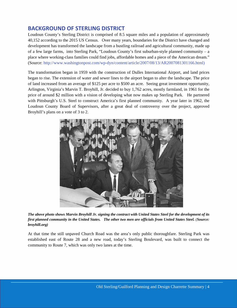
The transformation began in 1959 with the construction of Dulles International Airport, and land prices began to rise. The extension of water and sewer lines to the airport began to alter the landscape. The price of land increased from an average of $125 per acre to $500 an acre. Seeing great investment opportunity, Arlington, Virginia’s Marvin T. Broyhill, Jr. decided to buy 1,762 acres, mostly farmland, in 1961 for the price of around $2 million with a vision of developing what now makes up Sterling Park. He partnered with Pittsburgh’s U.S. Steel to construct America’s first planned community. A year later in 1962, the Loudoun County Board of Supervisors, after a great deal of controversy over the project, approved Broyhill’s plans on a vote of 3 to 2.
The above photo shows Marvin Broyhill Jr. signing the contract with United States Steel for the development of its first planned community in the United States. The other two men are officials from United States Steel. (Source: broyhill.org)
At that time the still unpaved Church Road was the area’s only public thoroughfare. Sterling Park was established east of Route 28 and a new road, today’s Sterling Boulevard, was built to connect the community to Route 7, which was only two lanes at the time.
Old Sterling/Guilford Planning and Design Charrette Summary | 5
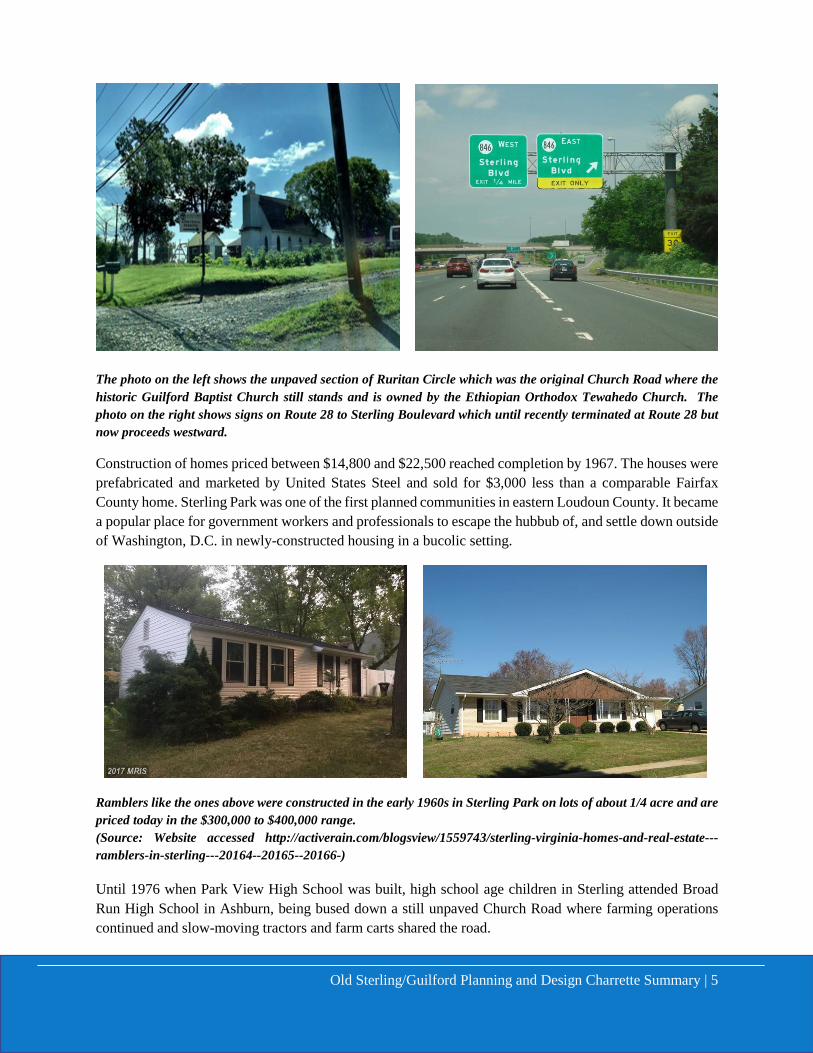
The photo on the left shows the unpaved section of Ruritan Circle which was the original Church Road where the historic Guilford Baptist Church still stands and is owned by the Ethiopian Orthodox Tewahedo Church. The photo on the right shows signs on Route 28 to Sterling Boulevard which until recently terminated at Route 28 but now proceeds westward.
Construction of homes priced between $14,800 and $22,500 reached completion by 1967. The houses were prefabricated and marketed by United States Steel and sold for $3,000 less than a comparable Fairfax County home. Sterling Park was one of the first planned communities in eastern Loudoun County. It became a popular place for government workers and professionals to escape the hubbub of, and settle down outside of Washington, D.C. in newly-constructed housing in a bucolic setting.
Ramblers like the ones above were constructed in the early 1960s in Sterling Park on lots of about 1/4 acre and are priced today in the $300,000 to $400,000 range. (Source: Website accessed http://activerain.com/blogsview/1559743/sterling-virginia-homes-and-real-estate---ramblers-in-sterling---20164--20165--20166-)
Until 1976 when Park View High School was built, high school age children in Sterling attended Broad Run High School in Ashburn, being bused down a still unpaved Church Road where farming operations continued and slow-moving tractors and farm carts shared the road.
Old Sterling/Guilford Planning and Design Charrette Summary | 6
OLD STERLING / GUILFORD STATION HISTORY
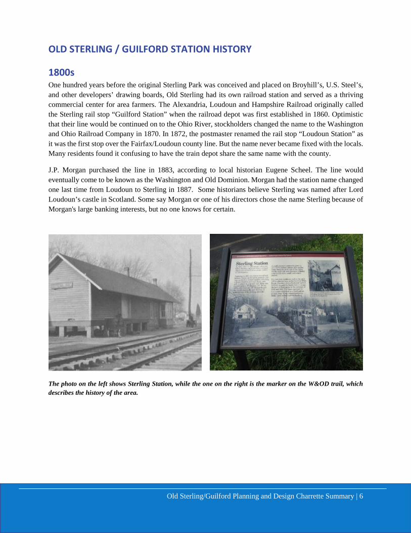
1800s One hundred years before the original Sterling Park was conceived and placed on Broyhill’s, U.S. Steel’s, and other developers’ drawing boards, Old Sterling had its own railroad station and served as a thriving commercial center for area farmers. The Alexandria, Loudoun and Hampshire Railroad originally called the Sterling rail stop “Guilford Station” when the railroad depot was first established in 1860. Optimistic that their line would be continued on to the Ohio River, stockholders changed the name to the Washington and Ohio Railroad Company in 1870. In 1872, the postmaster renamed the rail stop “Loudoun Station” as it was the first stop over the Fairfax/Loudoun county line. But the name never became fixed with the locals. Many residents found it confusing to have the train depot share the same name with the county.
J.P. Morgan purchased the line in 1883, according to local historian Eugene Scheel. The line would eventually come to be known as the Washington and Old Dominion. Morgan had the station name changed one last time from Loudoun to Sterling in 1887. Some historians believe Sterling was named after Lord Loudoun’s castle in Scotland. Some say Morgan or one of his directors chose the name Sterling because of Morgan's large banking interests, but no one knows for certain.
The photo on the left shows Sterling Station, while the one on the right is the marker on the W&OD trail, which describes the history of the area.
Old Sterling/Guilford Planning and Design Charrette Summary | 7
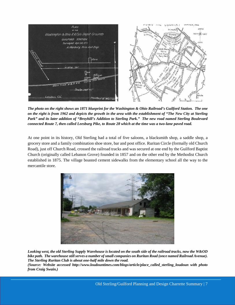
The photo on the right shows an 1871 blueprint for the Washington & Ohio Railroad’s Guilford Station. The one on the right is from 1962 and depicts the growth in the area with the establishment of “The New City at Sterling Park” and its later addition of “Broyhill’s Addition to Sterling Park.” The new road named Sterling Boulevard connected Route 7, then called Leesburg Pike, to Route 28 which at the time was a two-lane paved road.
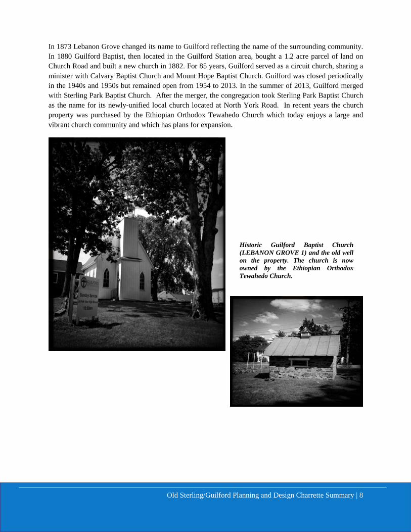
At one point in its history, Old Sterling had a total of five saloons, a blacksmith shop, a saddle shop, a grocery store and a family combination shoe store, bar and post office. Ruritan Circle (formally old Church Road), just off Church Road, crossed the railroad tracks and was secured at one end by the Guilford Baptist Church (originally called Lebanon Grove) founded in 1857 and on the other end by the Methodist Church established in 1875. The village boasted cement sidewalks from the elementary school all the way to the mercantile store.
Looking west, the old Sterling Supply Warehouse is located on the south side of the railroad tracks, now the W&OD bike path. The warehouse still serves a number of small companies on Ruritan Road (once named Railroad Avenue). The Sterling Ruritan Club is about one-half mile down the road. (Source: Website accessed http://www.loudountimes.com/blogs/article/place_called_sterling_loudoun with photo from Craig Swain.)
Old Sterling/Guilford Planning and Design Charrette Summary | 8
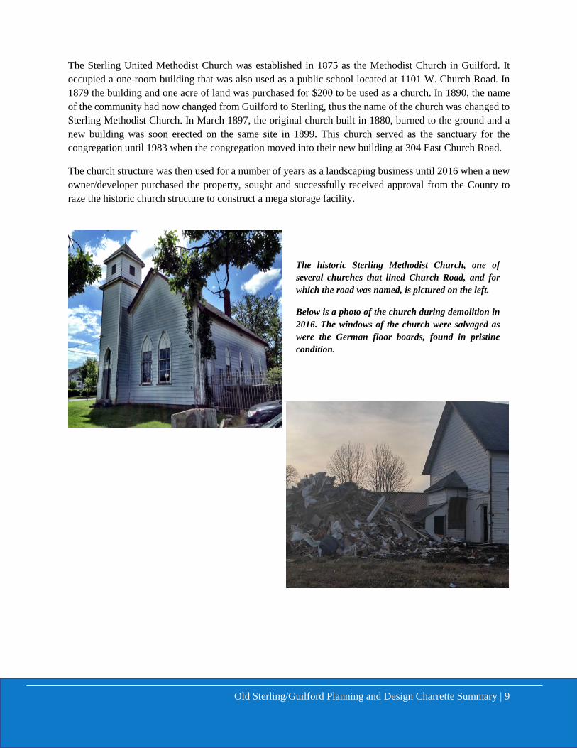
In 1873 Lebanon Grove changed its name to Guilford reflecting the name of the surrounding community. In 1880 Guilford Baptist, then located in the Guilford Station area, bought a 1.2 acre parcel of land on Church Road and built a new church in 1882. For 85 years, Guilford served as a circuit church, sharing a minister with Calvary Baptist Church and Mount Hope Baptist Church. Guilford was closed periodically in the 1940s and 1950s but remained open from 1954 to 2013. In the summer of 2013, Guilford merged with Sterling Park Baptist Church. After the merger, the congregation took Sterling Park Baptist Church as the name for its newly-unified local church located at North York Road. In recent years the church property was purchased by the Ethiopian Orthodox Tewahedo Church which today enjoys a large and vibrant church community and which has plans for expansion.
Historic Guilford Baptist Church (LEBANON GROVE 1) and the old well on the property. The church is now owned by the Ethiopian Orthodox Tewahedo Church.
Old Sterling/Guilford Planning and Design Charrette Summary | 9
The Sterling United Methodist Church was established in 1875 as the Methodist Church in Guilford. It occupied a one-room building that was also used as a public school located at 1101 W. Church Road. In 1879 the building and one acre of land was purchased for $200 to be used as a church. In 1890, the name of the community had now changed from Guilford to Sterling, thus the name of the church was changed to Sterling Methodist Church. In March 1897, the original church built in 1880, burned to the ground and a new building was soon erected on the same site in 1899. This church served as the sanctuary for the congregation until 1983 when the congregation moved into their new building at 304 East Church Road.
The church structure was then used for a number of years as a landscaping business until 2016 when a new owner/developer purchased the property, sought and successfully received approval from the County to raze the historic church structure to construct a mega storage facility.
The historic Sterling Methodist Church, one of several churches that lined Church Road, and for which the road was named, is pictured on the left.
Below is a photo of the church during demolition in 2016. The windows of the church were salvaged as were the German floor boards, found in pristine condition.

Old Sterling/Guilford Planning and Design Charrette Summary | 10
The area comprising the Sterling community around the turn-of-the century was made up of predominately large family farms involved in either dairy or cattle production. The growth of the dairy industry in Loudoun County during this period was a direct result of the presence of the railroad and the ability to transport milk, cream and butter daily to markets in Washington.
(Source: Archived photos of Loudoun County, VA on Historic Wanderings blogspot of a farm near Sterling and young farm boys.
1900s Folks living in Old Sterling in the 1920s and 1930s remember it as a close-knit community with an intimate population of give or take 200 people. According to Eugene Scheel, from whose writings the history incorporated in this report is taken, these were the people referred to when folks talked about "goin' down the country, as residents of Leesburg regularly did when they talked about Sterling. It was a sparsely populated area, also known as "The Redlands," for its sienna clay soils.
The area of Sterling near Leesburg Pike garnered huge interest and global significance when in 1930s the Jessee Hughes Dairy Farm property became the staging ground for national rural electrification. Participants of the Third World Power Conference from all over the world were bused from Washington, D.D. to see this new technology.
Education back then ended for many children from farm families after they graduated from the seventh grade in a two-room schoolhouse on Ruritan Circle. The two-room schoolhouse was built in 1879 and operated continuously until 1947. Although not recognizable with its modern siding, the building still exists today. It served as a rental unit in the 1970s and later as Sterling Schoolhouse Antiques managed by Grandma Betty Geoffroy (1980-2007) before it became an office for a landscaping company and then a heavy equipment contractor. Those who chose to matriculate to high school had to travel to Ashburn, the next stop west on the railroad line. Anyone who wanted to pursue high school with commercial courses had to commute to Fairfax County and attend Herndon High.
Old Sterling/Guilford Planning and Design Charrette Summary | 11
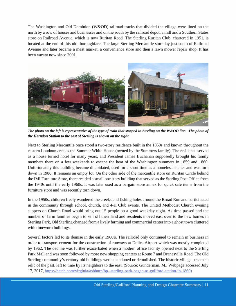
The Washington and Old Dominion (W&OD) railroad tracks that divided the village were lined on the north by a row of houses and businesses and on the south by the railroad depot, a mill and a Southern States store on Railroad Avenue, which is now Ruritan Road. The Sterling Ruritan Club, chartered in 1951, is located at the end of this old thoroughfare. The large Sterling Mercantile store lay just south of Railroad Avenue and later became a meat market, a convenience store and then a lawn mower repair shop. It has been vacant now since 2001.
The photo on the left is representative of the type of train that stopped in Sterling on the W&OD line. The photo of the Herndon Station to the east of Sterling is shown on the right.
Next to Sterling Mercantile once stood a two-story residence built in the 1850s and known throughout the eastern Loudoun area as the Summer White House (owned by the Summers family). The residence served as a house turned hotel for many years, and President James Buchanan supposedly brought his family members there on a few weekends to escape the heat of the Washington summers in 1859 and 1860. Unfortunately this building became dilapidated, used for a short time as a homeless shelter and was torn down in 1986. It remains an empty lot. On the other side of the mercantile store on Ruritan Circle behind the IMI Furniture Store, there resided a small one story building that served as the Sterling Post Office from the 1940s until the early 1960s. It was later used as a bargain store annex for quick sale items from the furniture store and was recently torn down.
In the 1950s, children freely wandered the creeks and fishing holes around the Broad Run and participated in the community through school, church, and 4-H Club events. The United Methodist Church evening suppers on Church Road would bring out 15 people on a good weekday night. As time passed and the number of farm families began to sell off their land and residents moved east over to the new homes in Sterling Park, Old Sterling changed from a lively farming and commercial center into a ghost town cluttered with timeworn buildings.
Several factors led to its demise in the early 1960's. The railroad only continued to remain in business in order to transport cement for the construction of runways at Dulles Airport which was mostly completed by 1962. The decline was further exacerbated when a modern office facility opened next to the Sterling Park Mall and was soon followed by more new shopping centers at Route 7 and Dranesville Road. The Old Sterling community’s century old buildings were abandoned or demolished. The historic village became a relic of the past, left to time by its neighbors to the east. (Source: Gunderman, M., Webpage accessed July 17, 2017, https://patch.com/virginia/ashburn/bp--sterling-park-began-as-guilford-station-in-1860)
Old Sterling/Guilford Planning and Design Charrette Summary | 12
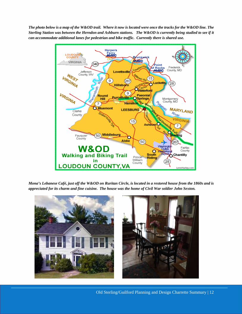
The photo below is a map of the W&OD trail. Where it now is located were once the tracks for the W&OD line. The Sterling Station was between the Herndon and Ashburn stations. The W&OD is currently being studied to see if it can accommodate additional lanes for pedestrian and bike traffic. Currently there is shared use.
Mona’s Lebanese Café, just off the W&OD on Ruritan Circle, is located in a restored house from the 1860s and is appreciated for its charm and fine cuisine. The house was the home of Civil War soldier John Sexton.
Old Sterling/Guilford Planning and Design Charrette Summary | 13
DESIGN CABINET CHARRETTE The Design Cabinet in cooperation with the teaming members from the Old Sterling / Guilford community, formatted the design charrette effort into two sessions. This first session held at Tart Lumber on February 17, 2017, to serve as a listening and learning session for the Design Cabinet to understand the history, concerns, needs and future aspirations for the future of the area. The second session held on March 17, 2017, also at Tart Lumber, was designed to be a table top planning exercise to take the ideas from the first session in February 2017 and develop potential schematic land use and site planning scenarios for the future. In all, over 50 interested community members and stakeholders attended the two charrette sessions to express their ideas for the future of Old Sterling / Guilford. Three potential development scenarios were developed during the table top exercises with input from community members which included land owners, business owners, HOAs representatives, residents and other stakeholders. Their ideas are captured in the Planning and Design Charrette Part II Summary.
DESIGN CHARRETTE PART I SUMMARY
The Planning and Design Charrette Part I focused on better understanding the history, concerns, needs, and aspirations for the future for the planning area. The comments received focused on the following principles and ideas: Shaping a Place, Land Ownership, Purpose of the Place, Audience, Competition (String of Pearls).
The charrette notes captured during the Part I session included:
• Metro Station Branding • Market Station model • Recognition of the Old Sterling Cemetery • Consideration of W&OD stop models
(Herndon – Ashburn) • Area has developed a hodgepodge of uses –
Ordinances influence and preclude reuse or revitalization
• BF Saul major landowner with interests in the area
• Residential, retail, and industrial are characteristic of the area
• Culturally-mixed town • Ruritan Club is of historical significance to
the area • Orbital Science is a major employer • W&OD offers great potential for
connectivity and as an amenity • W&OD study underway • Trolley line as a transit option should be
considered • Aging population, transport, W&OD • Boutique shops, hotels, and other
alternatives may be appropriate in the future
• Mix of age groups • Arts and entertainment are desirable uses • Restaurant with large hydroponic
greenhouse would be a unique addition. • Antiques, open space, green areas should be
considered in the planning. • Dog friendly, growing indoors • Shaping – Making space for public use and
activity o Quirkiness is a positive attribute o Sterling Annex – To be demolished o Historic should buildings
(renovated, repurposed, adaptively reused)
o Sexton-Groom House • Support growth in the area • Fresh revenue for the County and property
owners/business owners • Need cohesive development pattern • Focusing on possibilities • Put Guildford Station back on map • Focus on place we want to create, zoning
will follow in response • Rethink historic preservation
Old Sterling/Guilford Planning and Design Charrette Summary | 14
• How big is this “place”? What are the boundaries
• Develop like Herndon or Williamsburg, walkable and opportunities for street activity
• Solomon’s Island (Southern MD) is another example of similar scale and walkability
• Tourist, mixed-use, museum • Link to local colleges • 4 block area is the general size that should
be considered at the core of this exercise • Improve our image along W&OD • More art facilities • Restore our history • Loft spaces may be desirable housing • Sterling appears “shady” and an “eyesore” • Aesthetics are more important than size • Health and wellness in communities and
buildings will be integral for future development.
• This is a gateway to Loudoun – Pearl #1 • Cultural mix found nowhere else in
Loudoun – “edgy” • Think about neighborhood as opposed to
city in terms of scale for this area • Land use patterns and orientation of
buildings is important • Access to and from Route 28 can be a
constraint • Where is the (front) door or entry into the
area? • Challenges and opportunities
o More walkable o Where is the core? o Extend arts theme to crafts people o Intertwine what is with what we
want o Connectivity o Music venue – Jam & Java o Sterling Fest o People come from far away to
display
o Is the idea to form around existing businesses? Or displace those businesses?
o Financing o Curb appeal o What are the edges of the planning
area o Where do you view from o Where do you park your car? o 64 nationalities – attract others to
visit • Leave residential areas, out of picture? • Accessibility is very poor • Cottage industries, possibilities • Property rights must be respected • History to be preserved • Route 28 Tax District issues • BF Saul property issues / constraints
o Water and sewer is west of Route 28 making utility access cost prohibitive
o Multiple zones o Airport compatible o Application in process for: car rental
facility and a gas station at Route 28 and Waxpool Rd.
o Want to create a sense of place o Integrated to W&OD Trail o Interim uses o Access from both Church and
Atlantic • Potential Project name: Guilford Station • Walkable across Atlantic
o 4 pad sites o Restaurants and retail along Atlantic o Is Ethiopian church expanding to
larger facility o Better access to Ruritan Circle o Is there any discomfort on part of
property owners
After conclusion of the comment and discussion period, the Design Cabinet adjourned the session and informed the participants that the Design Cabinet would return in March 2017 to conduct a table top planning charrette to develop potential scenarios for the future.
Old Sterling/Guilford Planning and Design Charrette Summary | 15
DESIGN CHARRETTE PART II SUMMARY
The Planning and Design Charrette Part II focused on considering the comments and discussion from Part I and developing schematic diagrams with input from community members and stakeholders divided into three work groups. Each group worked independently to develop conceptual plans for approximately an hour and a half to two hours and then present their outcomes / schematic plans. In all three scenarios, the following thematic concepts were carried through the table top discussions: (1) recognition of and connectivity to the WO&D Trail and surrounding areas, (2) preservation of the remnants of the history of the area, (3) adaptive reuse and repurposing of existing structures, (4) creation of a pedestrian-friendly environment, (5) recognition of the industrial character of the area, (6) introduction of more parks, open spaces, and civic/public amenities, (7) provision for on-street and internalized (to building site) parking throughout the area, 8) opportunity for a mixed-use (horizontally and vertically mixed), walkable environment, and (9) creation for a variety/mix of industrial, services, businesses and retail opportunities in the area.
Structuring a Place Every great place capitalizes on a local community's assets, inspiration, and potential, with the intention of creating public spaces that promote people's health, happiness, and well- being. Creative Placemaking is an evolving field of practice that intentionally leverages the power of the arts, culture and creativity to serve a community's interest while driving a broader agenda for change, growth and transformation in a way that also builds character and quality of place. This place, the Old Sterling Railroad Station Area has great “bones” or structure from which to begin. Those bones include, the casual collision of Church Road, Atlantic Boulevard, Ruritan Circle and the Washington and Old Dominion Railroad Trail (W&OD Trail). All three Schemes (A, B, and C) have been structured to provide the following opportunities:
• Centralized, connected, and flexible outdoor spaces to encourage outdoor activity • Connectivity to surrounding land uses by streets, sidewalks, and bicycle trails (or shared use paths),
including access to and integration with the W&OD Trail • Grid of streets and sidewalks/trails to allow multimodal access within the Old Sterling area • Small spaces/buildings for a community of artisans or hobbyists, after all this is the heritage of the
Old Sterling area • Larger spaces/building for businesses compatible with the light industrial, commercial, cultural and
entertainment development in the area. For instance, a co-op of artisans/fabricators or farmers market of growers would be appropriate
• Continue and incorporate the industrial feel and uses currently in the area as a character defining feature

Old Sterling/Guilford Planning and Design Charrette Summary | 16
Scheme A - Drawing by Planning Group One:
Scheme A - Concepts The team working on Scheme ‘A’ focused on the following core concepts:

Old Sterling/Guilford Planning and Design Charrette Summary | 17
• The creation of an outdoor, public green space “spine” along the W & OD Trail connected to a perimeter, linear green space along the northern and eastern edge of the planning area
• The filling in of space gaps along Ruritan Circle in order to better shape the a pedestrian friendly streetscape that utilized existing structures in blue and new structures in orange of similar size, scale and design
• New landscaping, public furniture, graphics along Ruritan Circle to enhance the idea of a complete street
• Maintain a strong visual connection to the new BF Saul development to the immediate west. • Maintaining the industrial ‘edge’ and uses on the northern portions of the study area (in red) which
is currently a character defining feature of the area • And finally, create new gateway into the planning areas at the intersection to the new BF Saul
development entry from Atlantic Blvd. leading to public green and open spaces for outdoor activity • Employ stormwater management best practices to create water features on the western edge of the
planning area Transportation features of Scheme ‘A’ include:
• Internalized parking throughout the development scheme • A loop on the south side of Ruritan Circle to allow access to various activities and provide parking • All streets would be highly pedestrian and bicycle friendly • A transit stop for shuttle buses and Loudoun Transit buses integrated into the street and land design,
e.g., at the corner of Ruritan Circle and the site street parallel to Atlantic Blvd as this is already a place of great multi-modal movement
• Strong pedestrian connection with pedestrian amenities across Atlantic Blvd. from and to the B.F. Saul property

Old Sterling/Guilford Planning and Design Charrette Summary | 18
Scheme B - Drawing by Planning Group Two:
Scheme B - Concepts The Old Sterling Station is near the middle of the study area. In order to maximize the strength and success of this Place, this Team focused on the following core upgrades:
• The creation of an outdoor, public Town Green just north of Ruritan Circle
Old Sterling/Guilford Planning and Design Charrette Summary | 19
• The filling in of space gaps along Ruritan Circle in order to better shape the “circle”. The red blocks represent existing structures and the gray, new
• New landscaping, public furniture, graphics along Ruritan Circle to enhance the shaping • New village sized structures along the road that parallels the W and OD, creating a new shopping,
entertaining and relaxing opportunities similar to those along Ruritan Circle • Maintain a strong connection to the new BF Saul retail development to the immediate west • Create a new service road to for the 6-8 new structures that face Ruritan Circle or Church Road • And finally, Create new gateway signage at the intersection of Ruritan and Church and also to the
new BF Saul entry from Atlantic Blvd. And opportunities at the central, outdoor, flexible public space:
• Events (festivals, concerts, artisan markets, etc.) around a central flexible outdoor spaces (complete with a stage in the northeast corner or space for a temporary stage. This arrangement, because of the topography, provides a natural hillside for seating and enjoying the events)
• Shaped such that a stage in the NE corner would create an amphitheater effect, with events being visible from Church Street, Atlantic Blvd, and the W&OD Trail
• Parking for businesses and other spaces could be allowed when events are not being held Example space: Fairport, NY (http://www.village.fairport.ny.us/). This type of flexible use is analogous to the outdoor space in Fairport, NY, which hosts an annual music festival (fund-raiser for local children’s hospital) in late August, which has been extremely successful. This music fest has brought the community of Fairport together in so many ways. See http://www.fairportmusicfestival.com/. During other times of the year, the space serves as a parking lot and supports other festivals. During the winter, part of this space has an ice rink, similar to the multiple uses of space at the Reston Town Center. Transportation features of Scheme B include:
• On street parking along Ruritan Circle (parallel or angled) • A loop on the south side of Ruritan Circle to allow access to various activities and provide
parking • The street that’s parallel to Atlantic Boulevard would provide additional parking (90-degree
shown), as well as access to Ruritan Circle’s rail oriented, building to the north • This street would also provide access to balance of the Place, with perpendicular streets
connecting to a street that extends on the east side of the site northward from Ruritan Circle. • All streets would be highly pedestrian and bicycle friendly • Streets near the festival area should be blocked off (using pop-up bollards and even sawhorses)
during popular festivals/concerts • A transit stop for shuttle buses and Loudoun Transit buses could be integrated into the street and
land design, e.g., at the corner of Ruritan Circle and the site street parallel to Atlantic Blvd as this is already a place of great multi-modal movement.

Old Sterling/Guilford Planning and Design Charrette Summary | 20
Scheme C - Drawing by Planning Group Three:
Scheme C - Concepts The team working on Scheme ‘C’ focused on the following core concepts:
• The creation of an outdoor, public green space starting at Church Road and along the W & OD Trail connected to internal green spaces along the eastern portions of the planning area
• Integrated stormwater best management practices that also serve as water features as amenities on the site

Old Sterling/Guilford Planning and Design Charrette Summary | 21
• New landscaping, public street amenities along Ruritan Circle, Ruritan Road and a new road connecting to Magnolia Road to enhance the idea of a complete streets
• Maintain the industrial ‘edge’ and uses on the northern portions of the study area (outlined in blue) which is currently a character defining feature of the area
• Create new mixed use areas for /crafts-persons zone shown as the building in yellow • Reconfigure buildings along Church Road and Ruritan Circle to accommodate new, small scaled
retail buildings (colored in pink) • And finally, create new connections into the planning area from existing neighborhoods
Transportation features of Scheme ‘C’ include:
• Internalized parking throughout the development • A loop on the south side of Ruritan Circle to allow access to various activities and parking • All streets would be highly pedestrian and bicycle friendly • Create a pedestrian linkage to adjoining neighborhoods across Church Road with a pedestrian
bridge on the southern edge of the planning area and to the Dominion Station neighborhood northeast of the planning area. This is designed to create a connection to the surrounding neighborhoods as well as a destination for people outside the immediate area.
• Create improved streets for pedestrian access, but also maintain truck access for along Ruritan Road and portions of Ruritan Circle to support existing industrial / commercial uses.
• Reinforce pedestrian linkages along the W & OD Trail with active green/open spaces from Church Road north along the trail

Old Sterling/Guilford Planning and Design Charrette Summary | 22
ADDITIONAL DOCUMENTATION OF THE EVENT Photographs from the Old Sterling / Guilford Planning and Design Charrette Part I
Old Sterling/Guilford Planning and Design Charrette Summary | 23
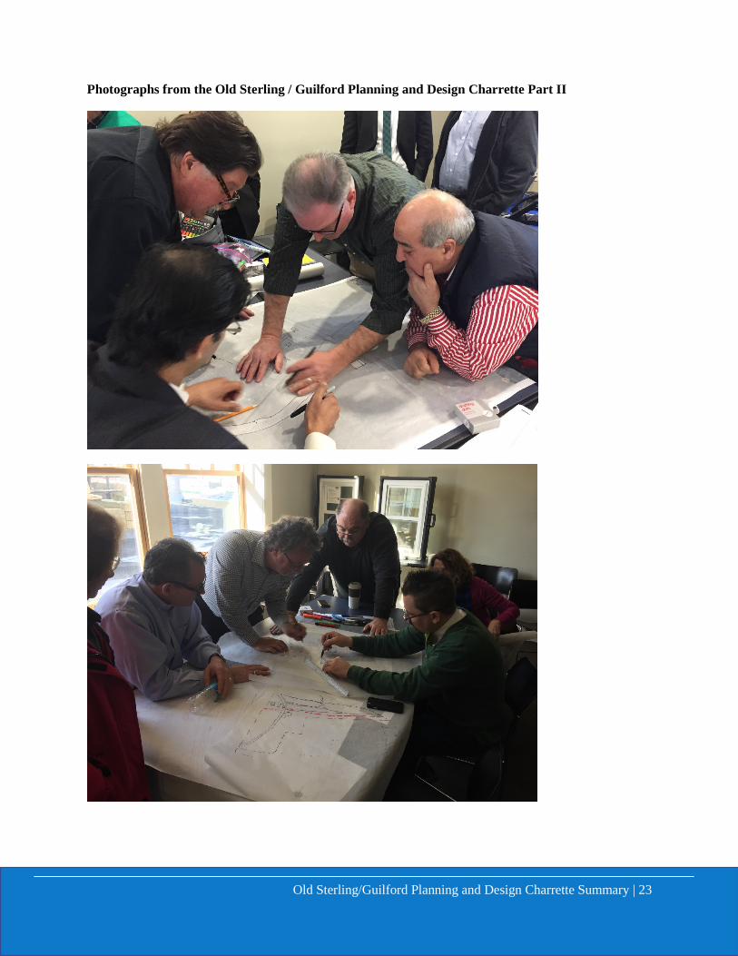
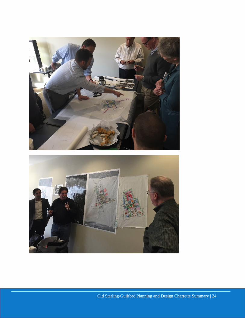
Photographs from the Old Sterling / Guilford Planning and Design Charrette Part II
Old Sterling/Guilford Planning and Design Charrette Summary | 24

Old Sterling/Guilford Planning and Design Charrette Summary | 25
Above are photos from the collection of Hugh Ball, a long-time resident and business owner of Old Sterling. Mr. Ball shared his treasures most of which had not been seen by the participants of the charrettes nor other Sterling residents.
This report will be available online at https://www.loudoun.gov/designcabinet.
Related Documents