Oceanic Circulation I. How oceans work II. Surface currents III. Deep Currents IV: The Air-Sea Interactions (ENSO)

Oceanic Circulation I. How oceans work II. Surface currents III. Deep Currents IV: The Air-Sea Interactions (ENSO)
Dec 22, 2015
Welcome message from author
This document is posted to help you gain knowledge. Please leave a comment to let me know what you think about it! Share it to your friends and learn new things together.
Transcript

Oceanic Circulation
I. How oceans work
II. Surface currents
III. Deep Currents
IV: The Air-Sea Interactions (ENSO)

The Role of Oceans in Global Climate Variability

The Role of Oceans in Hydrological Cycle
97% of the Earth’s free water86% of the global evaporation78% of global precipitation

I. How oceans work1. Area: covers 70% of the Earth’s surface
2. Volume: 97% of all the water on the Earth
3. Depth: 4 kilometers
4. Density: 1034-1035 kg/m3 (Pure water: 1000 kg/m3) over 90% of the ocean. Depends on temperature and salinity.
cold water high density
loss of water by evaporation increase salinity high density
precipitation and river discharge decrease salinity low density
5. Heat capacity: high
6. Temperature: less variable than in the atmosphere
7. Freezing point: – 1.9°C, not at 0°C because of salinity
8. Surface is not level due to currents, waves, atmospheric pressure differences, and variations in gravity.
9. Two main forms of circulation: wind-driven circulation (horizontal, surface waters, fast)
thermohaline circulation (vertical, deep waters, slow)

I. How oceans work (Cont’d)

Relative proportions of dissolved salts in seawater

Annual Mean Ocean Surface Temperature

Annual Zonal Mean Ocean Surface Temperature

Annual Mean Ocean Surface Salinity
Annual Zonal Mean Ocean Salinity
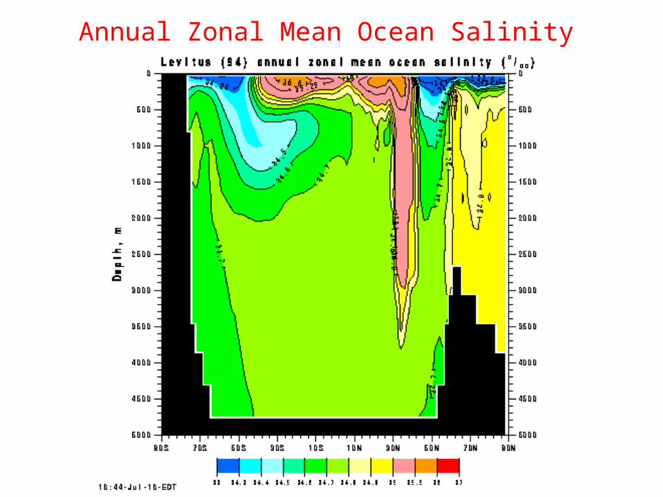
Ocean Meridional Overturning (Global)

Ocean Meridional Overturning in Atlantic

I. How oceans work (Cont’d)
A. Heated primarily by Sun, largely at the Equator, with global heat transfer by ocean currents profound effect of oceans on climate
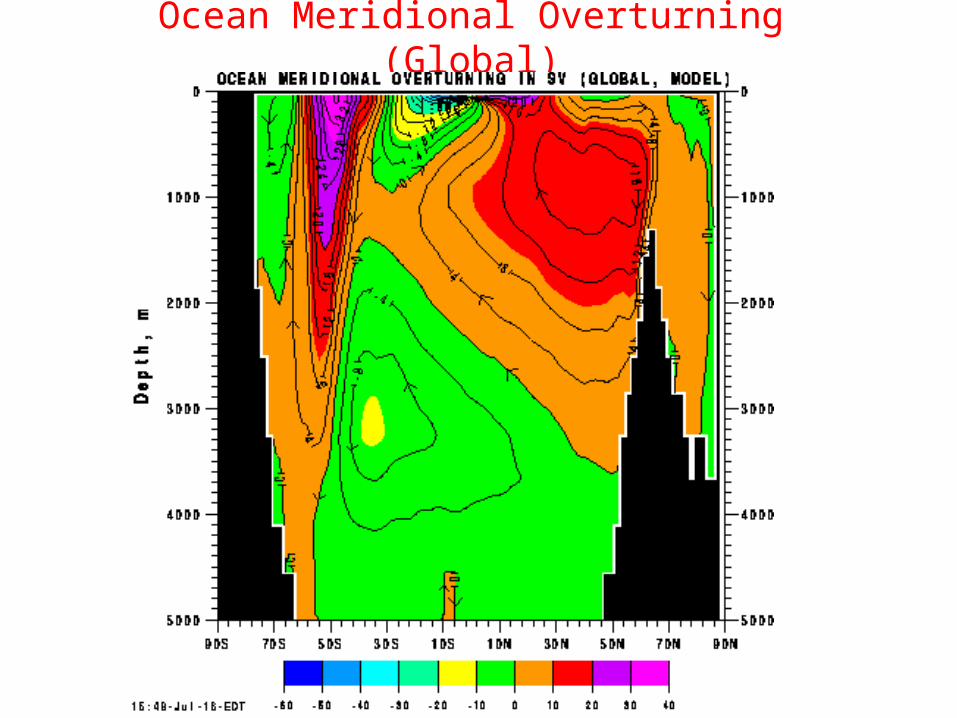
B. Two overall layers1. Thin, warm, less dense surface layer well mixed by turbulence
generated by wind
2. Thick, cold, more dense deep layer that is calm and marked by slow currents
3. Thermocline is the boundary between the layers
Mixed Layer Processes
Vigorous mixing processes lead to uniform conditions within the surface mixed layer.

Mixed Layer Processes

I. How oceans work (Cont’d)

Quiz1. Which of the following is NOT true about the oceans? A. Approximately 97% of the total water on Earth is located in the oceans B. The oceans cover about 70% of Earth’s surface C. The average depth of the oceans is about 4 km. D. The sea surface is level for all the oceans. E. Because it takes far more energy to change the temperature of water than land or air, water warms
up and cools off much more slowly than either.
2. The three largest reservoirs of water at the earth’s surface in decreasing order of volume are: A. oceans, ice caps/glaciers, and ground water B. oceans, ice caps/glaciers, and soils C. oceans, lakes/rivers, and soils D. oceans, atmosphere, and biosphere E. oceans, ground water, and soils
3. What is the primary salt in the ocean? A. methane B. CO2 C. FeO2 D. CaSO4 E. NaCl
4. Which of the following increase salinity? A. Evaporation B. Precipitation. C. Formation of sea ice. D. River runoff. E. A and C only.

II. Surface currents
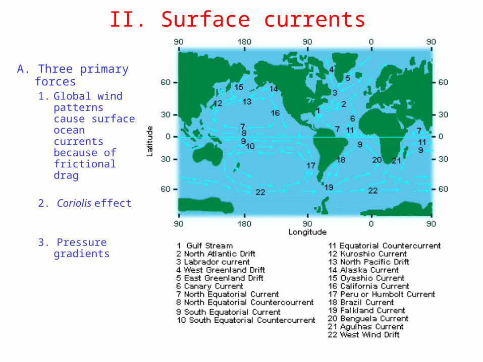
II. Surface currents
A. Three primary forces1. Global wind
patterns cause surface ocean currents because of frictional drag
2. Coriolis effect
3. Pressure gradients
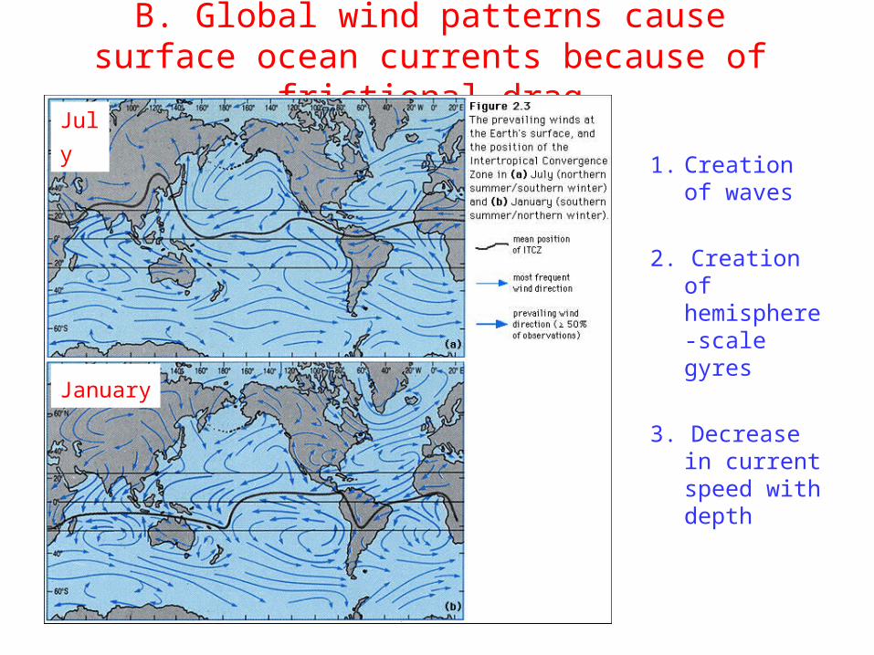
B. Global wind patterns cause surface ocean currents because of frictional drag
1. Creation of waves
2. Creation of hemisphere-scale gyres
3. Decrease in current speed with depth
January
July

C. Coriolis effect1. Earth rotation speed is greatest at Equator falling to zero at Poles
2. Conservation of angular momentuma. Deflection to the right for component of Equator-to-Pole flow in
Northern Hemisphere
b. Deflection to the left for component of Equator-to-Pole flow in Southern Hemisphere

C. Coriolis effect (Cont’d)
3. Creation of Ekman Spiral a. To depth of 100
m
b. Surface current moves 20-45o from the wind direction (45o in theory)
c. Deflection increases with depth, forming a spiral
d. Net transport of water is 90o from the wind direction

C. Coriolis effect (Cont’d)3. Creation of Ekman Spiral
a. To depth of 100 m
b. Surface current moves 20-45o from the wind direction (45o in theory)
c. Deflection increases with depth, forming a spiral
d. Net transport of water is 90o from the wind direction

D. Pressure gradients1. Differences in
water height (i.e., piling of water against a continent because of the wind)
2. Density differences because of temperature or salinity
3. Atmospheric pressure differences
E. Geostrophic currents - balance of Coriolis force by pressure gradient
F. Land forms barriers to global ocean currents

G. Resultant overall current pattern
1. Currents converge toward Equator following Trade Winds and ITCZ
2. Westward flow along Equator (i.e., North and South Equatorial Currents)
3. Equatorial Currents turn poleward where they encounter land barriers (e.g., Gulf Stream)
4. Eastward flow of currents is enhanced by the Westerlies
5. Currents turn toward the Equator where they encounter land barriers, completing the gyres

Effects of surface currents
6. Significant heat transfera. More solar heating and evaporation at Equator, less at Poles salinity
and temperature Equator/Pole gradient
b. Warm and salty water carried poleward

Effects of surface currents
7. Zones of upwelling
a. Deflection of water away from continent
b. Upwelling of deeper water to replace surface water
c. Commonly nutrient rich

7. Zones of upwelling
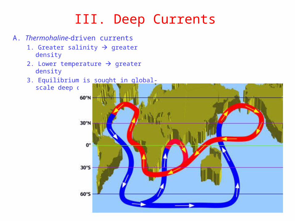
III. Deep CurrentsA. Thermohaline-driven currents
1. Greater salinity greater density
2. Lower temperature greater density
3. Equilibrium is sought in global-scale deep currents (conveyor belt)

B. Global Conveyor Belt (Cont’d)1. Warm and salty
shallow water from Tropics is carried northward through Atlantic
2. Water cools in North Atlantic and sinks east of Greenland as cold and salty dense water
3. North Atlantic Deep Water flows toward the Equator and into the South Atlantic, where it meets yet colder and denser Antarctic Bottom Water flowing toward the Equator
1
2
3

B. Global Conveyor Belt (Cont’d)4. Combined flow eastward
below Africa and into the Pacific Ocean
5. Deflected by Asia
6. Journey through Pacific causes warming and slow rise to surface
7. Warm and less dense Pacific surface waters move south and west to converge toward Equator as shallow surface water to continue warming
4
56
7

B. Global Conveyor Belt (Cont’d)8. 1,000 years for a complete
cycle
9. Conveyor Belt aided by imbalance between loss of water by evaporation in Atlantic and gain of water by precipitation and runoff
10. Bering Strait prevents free exchange between Arctic and Pacific Oceans inhibits Arctic-Pacific Conveyor Belt

The Role of Oceans
I. How oceans work II. Surface currents III. Deep Currents
IV: The Air-Sea Interactions (ENSO)
The Air-Sea Interactions
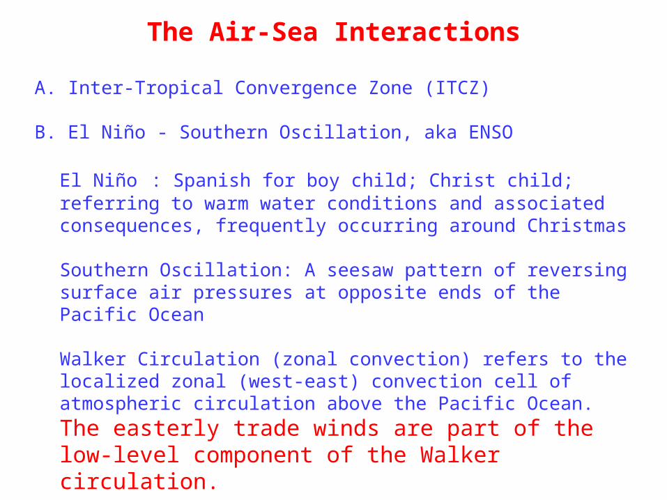
A. Inter-Tropical Convergence Zone (ITCZ)
B. El Niño - Southern Oscillation, aka ENSO
El Niño : Spanish for boy child; Christ child; referring to warm water conditions and associated consequences, frequently occurring around Christmas
Southern Oscillation: A seesaw pattern of reversing surface air pressures at opposite ends of the Pacific Ocean
Walker Circulation (zonal convection) refers to the localized zonal (west-east) convection cell of atmospheric circulation above the
Pacific Ocean. The easterly trade winds are part of the low-level component of the Walker circulation.
C. La Niña: (girl child) Opposite extreme of El Niño

A. Inter-tropical Convergence Zone (ITCZ)
1.What is ITCZ?
Region near the equator where the wind systems (trade winds) of the Northern Hemisphere and Southern Hemisphere meet.
2. Position changes with season. North of equator in July, (generally) south of equator in January.
3. Broad trough of low pressure, typical of cloudiness, thunderstorm, and heavy precipitation.
4. More intensely developed in the western Pacific because of warm water pool of surface seawater (T = 31 °C) and Asian monsoons.
5. Influences the ocean currents and salinity.

El Nino:El Nino:
How itHow itWorksWorks

Known for over 400 years ...Known for over 400 years ...
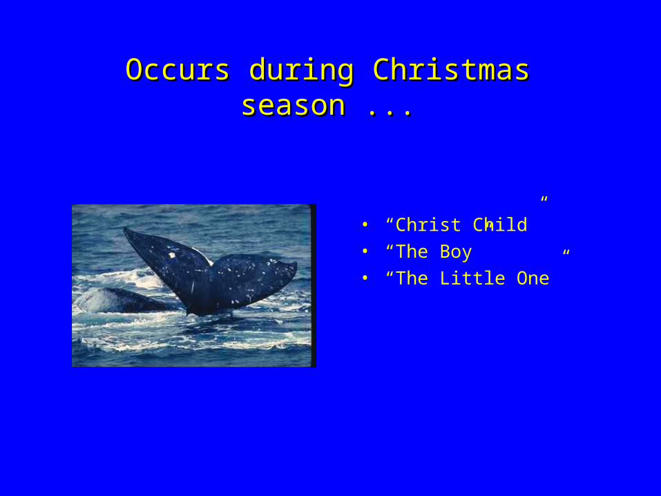
Occurs during Christmas season ...Occurs during Christmas season ...
• “Christ Child”• “The Boy”• “The Little One”

Food ChainFood Chain
P eop le
S ea B irds
F ish
N u tr ien ts

B. El Niño - Southern Oscillation, a.k.a. ENSO
1.What is ENSO?
ENSO is a periodic climatic phenomenon caused by ocean-atmosphere dynamics in the tropical Pacific Ocean.
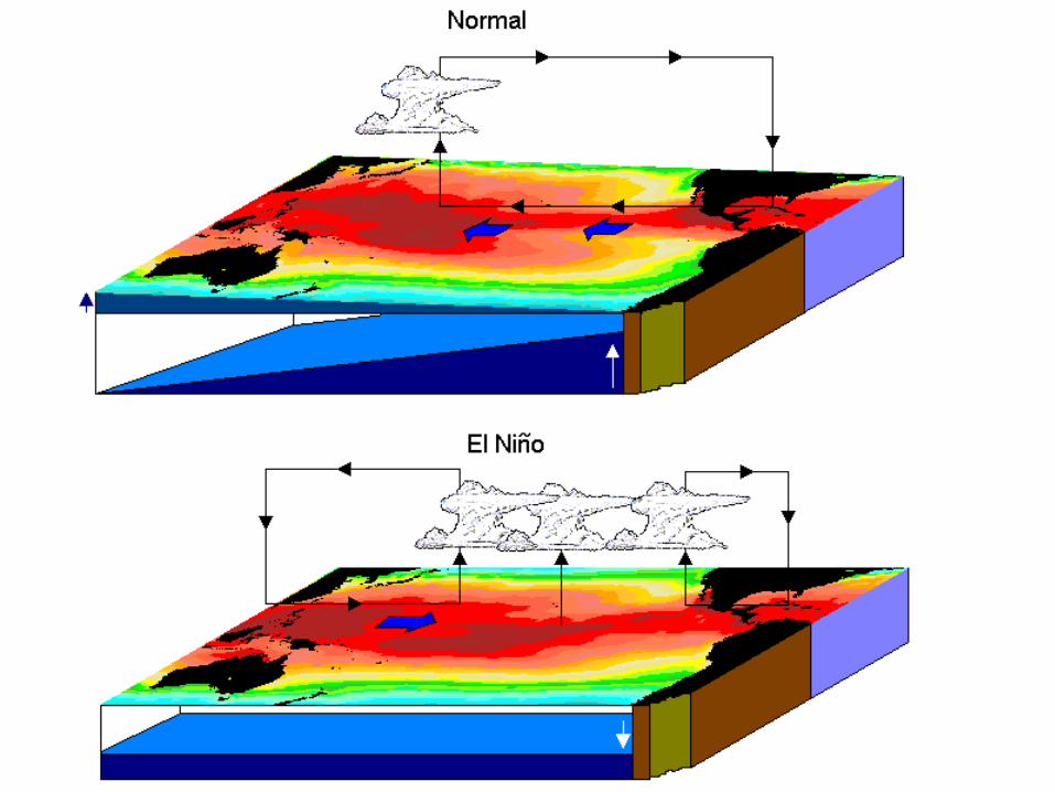
ENSO Process: Every two to seven years, strong westward-blowing SE trade winds subside. Warm water moves back eastward across the Pacific, like water shifting in a giant bathtub. The warm water and shifting winds interrupt the upwelling of cool, nutrient-rich water.

El Niño and SOI
El Niño / Southern Oscillation: an oscillation in the surface pressure (atmospheric mass) between the SE tropical Pacific and the Australian-Indonesian regions.
El Niño : Noticed at Christmas time by Peruvian fisherman; warm coastal waters leading to poor fishing


Reading Reading the the
IndexIndex

2. Importance of understanding ENSO
a. Severe rapid climate variations caused by El Niño are natural
b. El Niño has important consequences for famine and economics around the globe.

3. Basics of ENSO Western equatorial Pacific has some of the world's warmest ocean
water. To the east, cool water wells up, carrying nutrients (see Oceans lecture) that support large fish populations
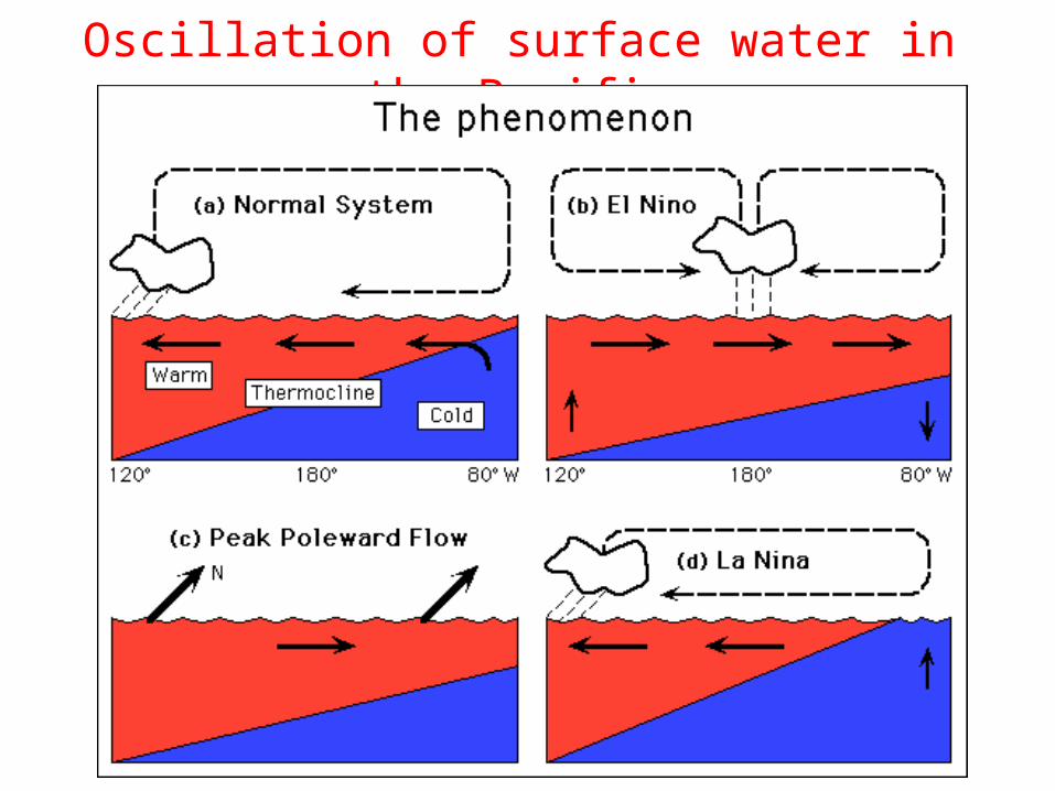
Oscillation of surface water in the Pacific

4. What causes ENSO? large-scale internal waves

During the warm phase of ENSO (El Niño phase) the West Pacific Warm Pool and its associated low pressure atmospheric center migrate to the east along the equator. The water is transported by these internal waves. Kelvin waves cross the Pacific in 2-3 months and lead to a warming of the surface waters and rise in sea level along Peru.
What Causes ENSO?

As sea level rises and warm water accumulates in the eastern Pacific, Rossby waves are generated that move west across the Pacific. The time it takes for these waves to cross the Pacific is strongly dependent on the latitude at which the wave is traveling (near the equator, they take a 9 month journey; 12 degrees from the equator, they take 4 years).
The Rossby waves reach the Western Pacific, travel along the coast as Kelvin waves to the equator and turn east and begin another crossing of the Pacific.
What Causes ENSO?

5. If it’s a tropical phenomenon, why does it affect us in Texas?
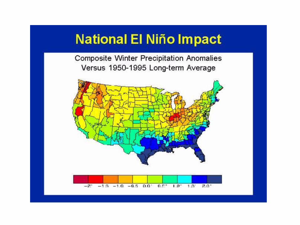
Teleconnection: during ENSO, warmer, moister air than usual is generated in the eastern part of the ITCZ in the Pacific. This changes atmospheric circulation patterns and deflects the jet stream that goes west-east across US at a more easterly longitude than during non-ENSO year. As a result, different amounts of moisture and heat than usual are delivered to different parts of the world


El Nino and TexasEl Nino and Texas
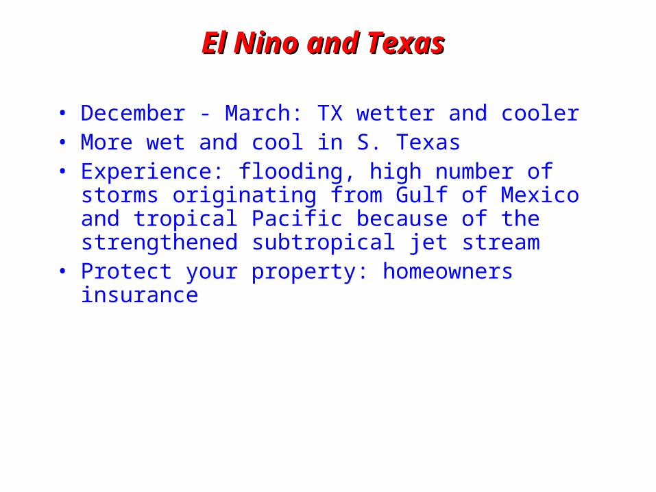
El Nino and TexasEl Nino and Texas
• December - March: TX wetter and cooler• More wet and cool in S. Texas• Experience: flooding, high number of storms
originating from Gulf of Mexico and tropical Pacific because of the strengthened subtropical jet stream
• Protect your property: homeowners insurance
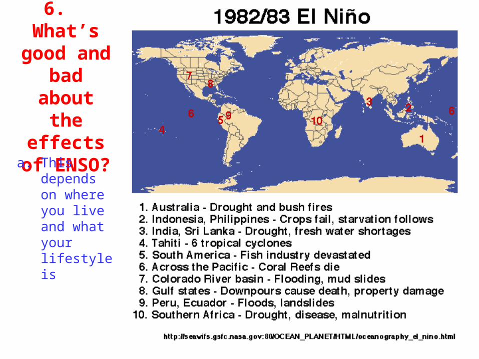
6. What’s good and bad about the effects of ENSO?
a. This depends on where you live and what your lifestyle is

b. 1997-1998 event and the media’s response

7. Measuring El Nino7. Measuring El Nino
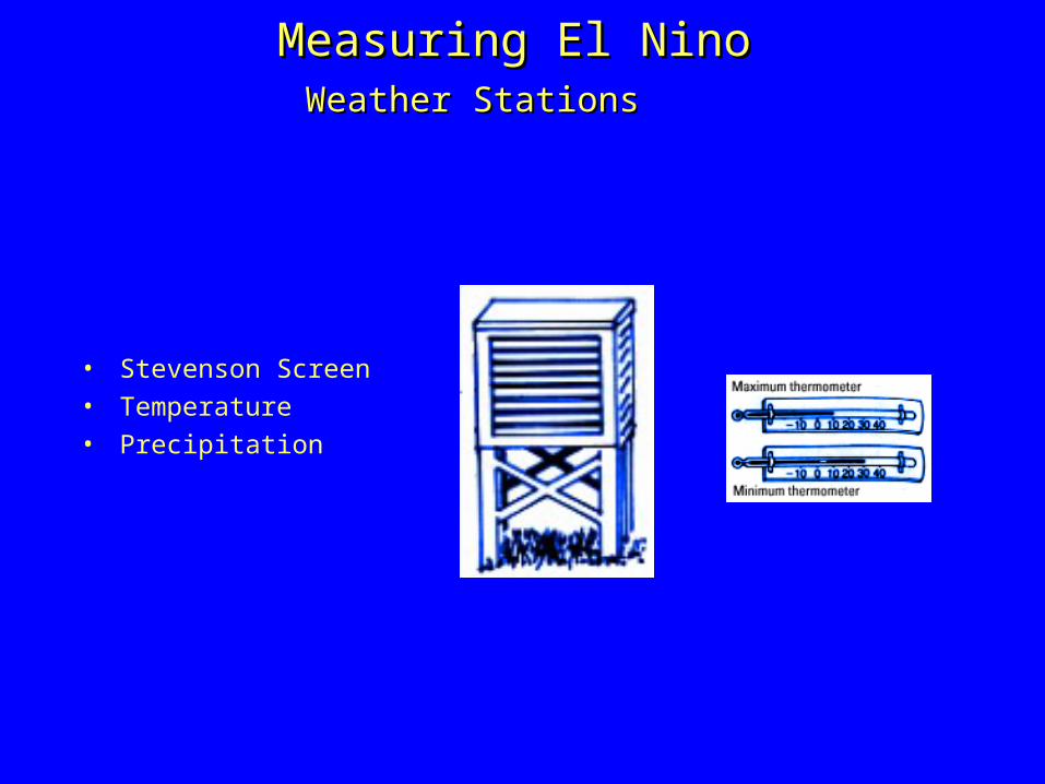
Measuring El NinoMeasuring El NinoWeather StationsWeather Stations
• Stevenson Screen
• Temperature
• Precipitation

Weather Station: ColoradoWeather Station: Colorado

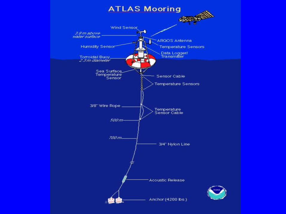
Measuring El NinoMeasuring El NinoBuoysBuoys


Measuring El NinoMeasuring El NinoSatellitesSatellites
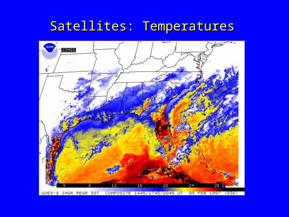
Satellites: TemperaturesSatellites: Temperatures

Measuring El NinoMeasuring El NinoSea Surface Temperatures

Measuring El Nino:Measuring El Nino:Coral Bleaching

Related Documents