A 7 s 1 CALENDAR ITEM C19 MINUTE ITEM This Calendar ftem No.CL '1 was or7roved as Item No. by the State lands Commission by a vote to--4- .. · ot Its L.y'./Q , 12/17/92 PRC 4918 J. Ludlow RECREATIONAL PIER PERMIT PERMITTEE: Peter L. Muhs and Robert M. Tomasello, Successor Trustees of Marsten Trust P. o. Box 404 Tahoe City, California 96145 AREA, TYPE LAND. AND LOCATION: A parcel of submerged land located in the bed of Lake Tahoe near Sunnyside, Placer county. LAND USE: Reconstruction of an existing pier, including addition of a low-level boatlift and retention of two existing mooring buoys. TERMS OF PROPOSED PERMIT: Permit period: Five (5) years beginning December 17, 1992. CONSIDERATION: Rent-free, pursuant to Section 6503.5 of the P.R.C. BASIS FOR CONSIDERATION: Pursuant to 2 Cal. Code Regs. 2003. APPLICANT STATUS: Applicant is owner of upland. PREREQUISITE CONDITIONS, FEES AND EXPENSES: Filing fee, environmental costs and Fish and Game fee have been received. -1- CALENDARPAGE___........... ,2. ... MINUTE PAGE ___ 3_7 __ 7_:Z:_ 1

Welcome message from author
This document is posted to help you gain knowledge. Please leave a comment to let me know what you think about it! Share it to your friends and learn new things together.
Transcript
A 7
s 1
CALENDAR ITEM
C19
MINUTE ITEM This Calendar ftem No.CL '1
was or7roved as Minut~ Item No. by the State lands Commission by a vote of~ to--4-.. · ot Its L.y'./Q t.i~ m~ ,
12/17/92 PRC 4918 J. Ludlow
RECREATIONAL PIER PERMIT
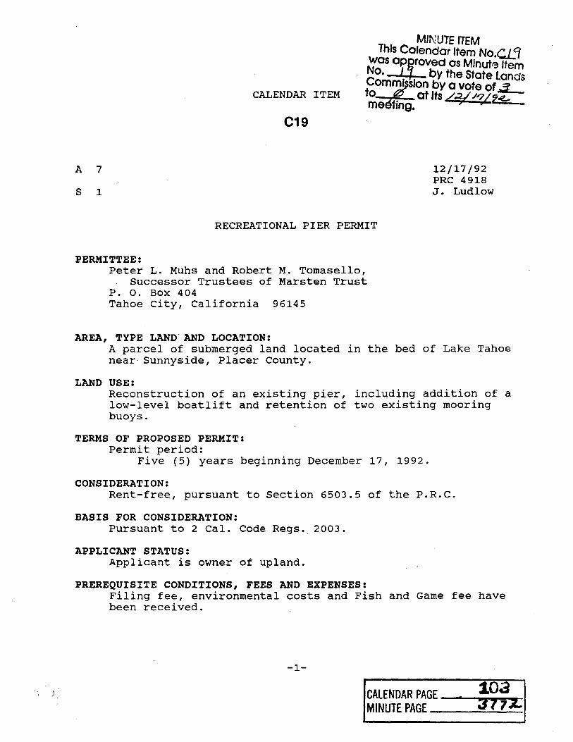
PERMITTEE: Peter L. Muhs and Robert M. Tomasello,
Successor Trustees of Marsten Trust P. o. Box 404 Tahoe City, California 96145
AREA, TYPE LAND. AND LOCATION: A parcel of submerged land located in the bed of Lake Tahoe near Sunnyside, Placer county.
LAND USE: Reconstruction of an existing pier, including addition of a low-level boatlift and retention of two existing mooring buoys.
TERMS OF PROPOSED PERMIT: Permit period:
Five (5) years beginning December 17, 1992.
CONSIDERATION: Rent-free, pursuant to Section 6503.5 of the P.R.C.
BASIS FOR CONSIDERATION: Pursuant to 2 Cal. Code Regs. 2003.
APPLICANT STATUS: Applicant is owner of upland.
PREREQUISITE CONDITIONS, FEES AND EXPENSES: Filing fee, environmental costs and Fish and Game fee have been received.
-1-
CALENDARPAGE___...........,2. ... ()P!!!!~~• MINUTE PAGE ___ 3_7 __ 7_:Z:_
1

CALENDAR ITEM NO. C19 (CONT'D)
STATUTORY AND OTHER REFERENCES: A. P.R.C.: Div. 6, Parts 1 and 2; Div. 13.
B. Cal. Code Regs.: Title 3, Div. 3; Title 14, Div. 6.
AB 884: 12/26/92
OTHER PERTINENT INFORMATION: 1. Pursuant to the Commission's delegation of authority
and the State CEQA Guidelines (14 Cal. Code Regs. 15025), the staff has prepared a Proposed Negative Declaration identified as EIR ND 602, state Clearinghouse No. 92082064. Such Proposed Negative Declaration was prepared and circulated for public review pursuant to the provisions of CEQA.
Based upon the Initial Study, the Proposed Negative Declaration, and the comments received in response thereto, there is no substantial evidence that the project will have a significant effect on the environment. (14 Cal. Code Regs. 15074(b))
2. This activity involves lands identified as possessing significant environmental values pursuant to P.R.C. 6370, et seq. Based upon the staff's consultation with the persons nominating such lands and through the CEQA review-process, it is the staff's opinion that the project, as proposed, is consistent with its use classification.
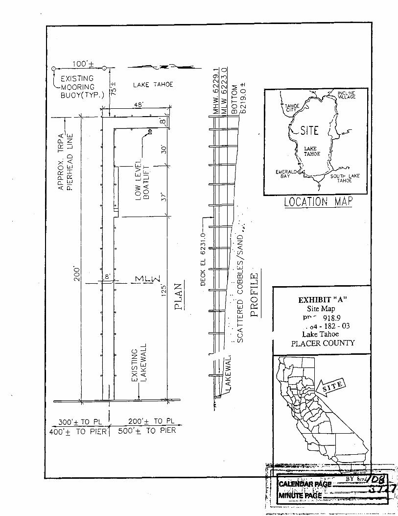
3. The applicant proposes to reconstruct an existing pier, including the addition of a low-level boatlift and retention of two existing mooring buoys. The pier will be reconstructed with an open-pile design.
4. The project will be accomplished using a barge-mounted pile driver. Anchorage of barge will be to existing structure and/or anchors required for adequate stabilization. During low water season, barge access and construction activity will be confined to the "footprint" of the pier. If disturbed shoreline/lake bottom sediments are found due to construction, rocks in the affected area will be dispersed by hand to reconsolidate shoreline sediments.
-2-
::·· wz;--_ CALENDAR PAGE ·· .., ,.,.4 '
MINUTE PAGE ~==--~-1 .......... ~~-

CALENDAR ITEM NO. C19 (CONT'D)
5. Commission staff will monitor the reconstruction of the pier in accordance with the Monitoring Program included within the proposed Negative Declaration, attached as Exhibit "D".
6. No materials will be stored or placed, nor will any activity associated with the construction or maintenance of the project be conducted, above the low water line (elevation 6,223 feet, Lake Tahoe Datum [L.T.D.]) of the subject property. This procedure will prevent any disturbance to the habitat of Rorippa subumbellata, commonly called the Tahoe Yellow Cress, a State-listed endangered plant species.
The permit includes specific provisions by which the Permittee agrees to protect and replace or restore, if required, the Rorippa habitat.
7. This property was physically inspected by staff for purposes of evaluating the impact of the proposed activity on the public trust.
8. If any structure hereby authorized is found to be in nonconformance with the Tahoe Regional Planning Agency's shorezone ordinance, and if any alterations, repairs, or removal required pursuant to said ordinance are not accomplished within the designated time period, then this permit is automatically terminated, effective upon notice by the State, and the site shall be cleared pursuant to the terms thereof. If the location, size, or number of any structure hereby authorized is to be altered pursuant to order of the Tahoe Regional Planning Agency, Permittee shall request the consent of the State to make such alteration.
9. The permit is conditioned on the public's right of access along the shorezone below the high water line (elevation 6,228.75 feet, Lake Tahoe Datum), pursuant to the holding in State v. Superior Court (Fogerty), 2 Cal.3d240 (1981), and provides that the Permittee must provide a reasonable means for public passage along the shorezone, including, but not limited to, the area occupied by the authorized improvements.
-3-4 . ;-.~·---------·--4·---·--:--·-·---=-.::- _,.............

CALENDAR ITEM NO. C19 (CONT'D)
10. Permittee agrees to conserve the natural resources on the subject property and to prevent pollution and harm to the environment; and acknowledges that failure to comply with this requirement constitutes a default or breach of the permit.
11. staff has determined that the Department of Fish and Game fee, dictated by Section 711.4 of the Fish and Game code, is applicable to the project as presented herein.
12. The issuance of this permit supersedes any prior authorization by the State Lands Commission at this location.
APPROVALS OBTAINED: Tahoe Regional Planning Agency, United States Army Corps of Engineers, and Placer County.
FURTHER APPROVALS REQUIRED: State Lands Commission.
EXHIBITS: A. Site Map B. Location Map c. Placer County Letter of Approval D. Negative Declaration/Mo~itoring Program
IT IS RECOMMENDED THAT THE COMMISSION:
1. FIND THAT THIS ACTIVITY IS CONSISTENT WITH THE USE CLASSIFICATION DESIGNATED FOR THE LAND PURSUANT TO P.R.C. 6370, ET SEQ.
2. CERTIFY THAT A NEGATIVE DECLARATION, EIR ND 602 STATE CLEARINGHOUSE NO. 92082064 WAS PREPARED FOR THIS PROJECT PURSUANT TO THE PROVISIONS OF THE CEQA AND THAT THE COMMISSION HAS REVIEWED AND CONSIDERED THE INFORMATION CONTAINED THEREIN.
3. ADOPT THE PROPOSED NEGATIVE DECLARATION AND DETERMINE THAT THE PROJECT, AS APPROVED, WILL NOT HAVE A SIGNIFICANT EFFECT ON THE ENVIRONMENT.
-4-
!
. CP.LENDAR p,;m~ ~-~.a ... __ 1._ . Q-~~- .· Mi NUTE Pl~Gr. ---==--................ ~7:..;..;7..;;... ~'g_

•, ~\ -
CALENDAR ITEM NO. C19 (CONT'D)
4. ADOPT THE MONITORING PROGRAM PREPARED PURSUANT TO P.R.C. 21081.6 INCLUDED WITHIN THE NEGATIVE DECLARATION, ATTACHED AS EXHIBIT "D".
5. AUTHORIZE ISSUANCE TO PETER L. MUHS AND ROBERT M. TOMASELLO, SUCCESSOR TRUSTEES OF MARSTEN TRUST, OF A FIVE-YEAR RECREATIONAL PIER PERMIT, BEGINNING DECEMBER 17, 1992, FOR THE RECONSTRUCTION OF AN EXISTING PIER, INCLUDING BOATLIFT AND RETENTION OF TWO EXISTING MOORING BUOYS ON THE LAND SHOWN ON EXHIBIT "A" ATTACHED AND BY REFERENCE MADE A PART HEREOF.
6. FIND THAT THE ISSUANCE OF THIS PERMIT SUPERSEDES ANY PRIOR AUTHORIZATION BY THE STATE LANDS COMMISSION AT THIS LOCATION.
-5-E 107 CALENDAR PAG --...1-~-1
MINUTE PAGE ---i3"4-7~. 1t1bi5'1
100'+
~ BUOY( TYP.) "
~ o_ z Cc:: .....J l-
o x <( ow Cc:: I o_ Cc:: 0.. w <( 0..
LAKE TAHOE
.....J --W1->u_
W.....J .....J
1-3 <{ oo .....J QJ
0 n
'
0 0 N 8 ' MLN
400' ± TO PIER1
_J
Cl .....J z <{ -3 1-w c.n~ x <{ W.....J
I{) N
200'± TO PL 500' t TO PIER
!= 0
n N co _J w :::.::: u w 0
c:::
..-- 0 Ol I"') N N N N <D <D
$'. 3 I .....J 2 2
==
==
:::::
2 +l 0 0
I- m I-0 N QJ c.o
..
~ . 0 z <( (/)
" (/) w .....J
..
QJ w QJ ,_:i 0 >---< u ~
..
..
-
0 0 w 0:: eJ p_, II<{ u (/)
•l INCLINE VILLAGE
~ "
~ .. ~.s l,s:E 0
II) , EMERALD (-
BAY
j
LOCATION MAP
EXHIBIT II A" Site Map
PP - 918.9 _. o4 - 182 - 03 Lake Tahoe
PLACER COUNTY
. ' ... '· ·,. . :'·" ,~, ~-
'~ ~~.~4~e~·,. ===~~ ~ { Ml~!»A~~:-~_:::-__ --·' --1 :,. ____ - ....... .

T 16 N
Sunnyside
T 15 N
EXHIBIT "B" PRC 4918.9
Homewood
I.I.I
IO
Qi::
Tahoe City
I.I.I ,....
~
T 14N
I
T 13 N
Kings Beach
Tahoe Vista
L A
TAHOE
~l'N!rald Bay
I I
~:~ ~:~
I
' ' ' '
South Lake Tahoe
' ' ' ' ' ' '
UJ UJ co O'I
T13N ',~~ T 12 N
' '
-- ~~~;.~:~~.::~~.--"~~··El~-~~~~:~ '. ---~~-----------·--·~.-- _._
~NDARPAGE ;a: MINUTE PAGE-..;;:~-4 ... rJ. ..... _,_'_8 __

·~
. ___ ....
r r EXHIBIT "C"
/
f~&r&rnaw~m UlJ NOV 1 6 1990 .
PLACc.H uOUNTY Date November 14, 1990
OE 0 T. OF PUBLIC WORKS
~s. Judv Ludlow Califori1ia State Lands Connnission 1807 13th Street Sacramento, California 95814
Subject: Building Permit for Pier
File Ref: PRC 4918.9
Name: Muhs/Tomasello c/o A.P. Marsten
Address P.O. Box 404
•Tahoe City, CA 95730
Placer County Assessor's Parcel No. 84-182-0J
Unland Address: 2360 Sur.nyside Lane
De•r '-ls. Ludlow~
Th•.· C0unty of Placer has received notice of the above- ref erenccd oruject in Lake Tahoe and has no objection to che pier repair/ construction or to the issuance of the State Lands Commission's pe :-mi c.
If you hav~ any questions, you may reach me at (916) 889-7584
Sincerely,
~ att ct~-t:v:.. ( JAN CHRISTIAN \_,I Associate CivLl En:;;ir.ee~
·---. --~~.~~~- ~~;-m;;.::~~::~~.--;~;--
. ---. ~----- ·-·:-. -· - --·--·.-· ,. -~.:"'·~~-
CALENDARPAGE--...._.a..a.._ __ MINUTE PAGE_ .... ,3......,1_'1_9L.--I

STATE OF CAU"'ORNIA
STATE LANDS COMMISSION LEO T. McCARTHY, Lieutenant Governor 'RAY DAVIS. Controller
JOMAS W. HAYES. Director of Finance
-· "·D/--/
PETE WILSON. Governor
EXECUTIVE OFFICE 1807 • 13th Street Sacramento, CA 95814
CHARLES WARREN Executive Officer
August 19, 1992 File: PRC 4918
ND 602
NOTICE OF PUBLIC REVIEW OF A PROPOSED NEGATIVE DECLARATION (SECTION 15073 CCR)
A Negative Declaration has been prepared pursuant to the requirements of the California Environmental Quality Act (Section 21000 et seq., Public Resources Code), the State CEQA guidelines (Section 15000 et seq., Title 14, California Code Regulations), and the State Lands Commission Regulations (Section 2901 et seq., Title 2, California Code Regulations) for a project currently being processed by the staff of the State Lands Commission.
The document is attached for your review. Comments should be addressed to the State Lands Commission office shown above with attention to the undersigned. All comments must be received by September 21, 1992.
Should you have any questions or need additional information, please call the undersigned at (916) 322-0530.
Attachment
(ioMfPA- /(. w~ GOODYEAR K. WALKER IL/))
. Division of Environmental ~ Planning and Management
~~J~·-.r,~.,;-;~_, .. -~.._:::.. ·~S.~~"')~"a"'!I"~ " __ :_~-·--·--·~------____ :_.-..,..& ___ . ---- .,
CALENDAR PAGE_,{_J._.,f __
MINUTE PAGE ,3'] Q 0
STATE OF CA'-IFORNIA PETE WILSON. Governor
STATE LANDS COMMISSION EXECUTIVE OFFICE 1807 - 13th Street Sacramento. CA 95814 LEO T. McCARTHY. Lieutenant Governor
GRAY DAVIS. Controller THOMAS W. HAYES. Director of Finance
Project Title:
Proponents:
Project Location:
Project Description:
Contact Person: .·.
CHARLES WARREN Executive Officer
PROPOSED NEGATIVE DECLARATION
Marsten Pier Repair
A. P. Marsten
File: PRC 4918 ND 602
SCH No. 92082064
Lake Tahoe, 2360 Sunnyside Lane, APN 84-192-03, Placer County.
Repair of existing recreational pier, installation of electric boatlift, and permitting of two existing buoys.
Goodyear K. Wal~er Telephone: 916/322-0530
This document is prepared pursuant to the requirements of the California Environmental Quality Act (Section 21000 et seq., Public Resources Code), the State CEQA Guidelines (Section 15000 et seq., Title 14, California Code Regulations), and the State Lands Commission regulations (Section 2901 et seq., Title 2, California Code Regulations).
Based upon the attached Initial Study, it has been found that:
LI this project will not have a significant effect on the environment.
LX./ mitigation measures included in the project will avoid potentially significant effects .
tll oQrf-4>
. -:·:~2;~_;;.~~~=-~~·:'7~:-:--=-
CALENDAR PAGE // 2, MINUTE PAGE "78 I

ST A TL lANOS COMMISSION
ENVIRONMENTAL IMPACT ASSESSMENT CHECKLIST- PART 11 File Ref .:.__f?~?0-~=--<-~__._~ 8"""""_ Form 13..20 (7/82)
BACKGROUND INFORMATION
A Applicant: A. P. Marsten PO Box 404
Tahoe City CA 95730
B. Checklist Date: __ 8_._/_1_3_..../ __ 9_2_
C. Contact Person: Goodyear K • W a 1 k e r
Telephone: ....___9_1_6_.._) _3_2_2_-_o_s_3_o ____ _
D. Purpose: _____ R_e_c_r_e_a_t_i_o_n_a_l_P_i_e_r __ P_e_r_m_i_·_t ________________________ _
E. Locati'On: _____ 2_3_6_0_s_u_n_n~y:.....s_i_d_e __ L_a_n_e_,'--_s_u_n_n_y_s_i_d_e_...., __ P_l_a_c_e_r_c_o_u_n_t_y'---c-a_l_i_f_o_r_n_i_a _____ __
f. Description: ___ R_e_p_a_i_r __ o_f_e_x_i_s_t_i_n __ g __ p __ i_e_r_, _i_n_s_t_-a_1_1_a_t_i_o_r_._o_f_b_o_a_t_l_i_f_t __ a_n_a_·~ ....... ~ ......... -
p er mitt in g of existing bouys.
G. Persons Contacted: ________________________________________ __
Kevin Agan, Vail Engineering
Kevin Roukey, US Army Corps of Engineers
Colleen L. Shade, Tahoe Regional Planning Agency
Russ Wickwire, California Dept. of Fish and Game
II. ENVIRONMENTAL IMPACTS. (Explain all "yes" and "maybe" answers}
A. Earrll. Will the proposal result in:
1. Unstable earth conditions or changes in geologi..; substructures? .•............................
2. Disruptions, displacements, compaction, or overcovering of the soil? .....•.....................
3. Change in topography or ground surf<ce relief features? ...............•...................
4. The destruction, covering, or modificc-tion of any unique geologic or physical features? ............. .
5. Any increase in wind or water erosion of soils, either on or off the site? ...................... · · ·
6. Changes in deposition or erosion of beach sands, or changes in siltation, deposition (fr erosion which may · modify the channel of a river or stream or the bed of the ocean or any bay, inlet, or lakf"i----======:::=:::::::!:=1C=*iS+:;,;;-

B. .·i fr. Will the proposal result in:
. 1. Substantial air emmissions or deterioration of ambient air Quality? ...................•........
2. The creation of objectionable odors? ..... .
3. Alteration of air movement, moisture or temperature, or any change in climate, either locally or regionally?.
C. Water. Will the proposal result in:
1. Changes in the currents, or the course or direction of water movements, in either marine or fresh waters? . ,
2. Changes in absorption rates, drainage patterns, or the rate and amount of surface water runoff? .....
3. Alterations to the course or flow of flood waters? ..... .
4. Change in the amount of surface water in any water body? ................................ .
5. Discharge into surface Naters, or in any alteration of surface water quality, including but not limited to temperature, dissolved c xygen or turbidity?. . . . . . . . . . . ............................. .
6. Alteration of tl)e direct on or rate of flow of ground waters' ............................... .
7. Change in the quantity of ground waters, either through direct additions or withdrawals, or through inter· ception of an aquifer by cuts or excavations? . . . . . . . ................................. .
8. Substantial reduction in the amount of water otherwise available for public water supplies? .......... .
9. Exposure of people or property to wat~r·related hazards such as flooding or tidal waves? ............ .
10. Significant changes in the temperature. flow or chemical content of surface thermal springs? .......... .
D. /'lam l.ij1'. Will the proposal re$ult in:
1. Change in the diversity of srecies, or number of any species of plants (including trees, shrubs, grass, crops, and aquatic plants)? ....... , ........ : ......................................... .
2. Reduction of the numb•~rs of any unique, rare or endangered species of plants? ..... · .............. .
J. Introduction of new species of plants into an area, or in a barrier to the normal replenishment of existing . ' species ................................................................... .
4. Reduction in acreage of any agricultural crop?
E. A111i11al Ufe. Will the proposal result in:
1. Change in the diversity of species, or numbers of any species of animals (birds, land animals including reptiles, fish and shellfish, benthic organisms, or insects)? ................................. .
2. Reduction of the numb•!rs of any unique, rare or endangered species of animals? .................. .
3. Introduction of new SP•?cies of animals into an area, or result in a barrier to the migration or movement of animals? . . . . . . . . . . . . . . . . . . . . . . . . . . . . . . . . . . . . . . . . . . . . ....... , . . . . . . . . . . . . ..
4. Deterioration to existin11 fish or wildlife habitat? ..................... , ......... .
F. Noi.\t.'. Will the proposal result in:
1. Increase in existing noise levels? .................................................. .
2. Exposure of people to severe noise levels? ..................................... ; ..... . G. l.('t;llt anti Glare. Will the proposal result in:
1. The production of new light or glare? ..................................•.•.•..•.•...
H. l.anJ v.(I'. Will the proposal result in:
1. A substantial alteration of the present or planned land use of an area? .....•.................
I. Natural Resources. Will the proposal result in:
1. Increase in the rate of use of any natural resources? ............•......................
2. Substantial depletion of any nonrenewable resources? ............................. · ...... .
.. 2 -
Yes
D D rJ
lJ [] ·: "] []
LJ []
[] lJ [] []
i ···1
l .~ ·1
[] !..l
r] [j
1-1 l_
D
LJ []
D
[]
[] 11 I . ,
Maybe No
lJ ~] [l fx I [ -.·1 Ix: r ;
ix i l. I
f I fx ! f. I fx i [J Ix l
lJ Ix l [ - I
. I [x I
f I [X j I
'
IX i l Ix: r Ix:
I I
I jx l I I I' !X
I rx I , I
r [xi
r I f.xJ . j
f l~l
[- l lxl [- I
. J l~I
[I fxi l.'
l I _I l~i
[J l !{]
1.· ! Ix!
[J : xi L. r ··1
r xl l I

J. R~ 11/ l.'llS*''· Does the p1oposal result in:
1. A ri!lt of an 'explosion or the release of hazardous substances (including. but not limited to, oil. pesticides. chemicals, or radiation) in the event of an accident or upset conditions? ••••••••••••••••••••••••
2. Possible interference with emergency response plan or an emergency evacuation plan? •••••••••••••••
Yes Maybe.No
0 0·[!] D D [gJ
K. Population. Will the proposal result in:
1. The alteration. distribution, density. or growth rate of the human population of the area? D 0 lKl L l/oain1:. Will th~ proposal result in: .•
1. Affecting existing housing. or create a demand for additional housing? ••••••••••••••••••••••••• DD 1RJ M. TnlllSJlll"I01iun/Circulotion. Will the proposal result in:
1. Generation of substantial additional vehicular movement? ••••••••••••• · ••••••••••••••••••••• · 0 0 {!]
D D rxi· 2. Affecting existing parking facilities. or create a demand for new parking?. • • • • • • • • • • • • • • • • • • • • • • • CJ
3. Substantial impact upon existing transportation systems? ••••••• ~ ••• ·• • • • • • • • • • • • • • • • • • • • • • 0 0 ~ 4. Alterations to present panems of circulation or "movement of people and/or goods? ••••••••••••..• ~· O· 0 ~ 5. Alterations to waterborne, rail, or air traffic? ••••••••••••••••••• , • • • • • • • • • • • • • • • • • • • • • • 0 D E:J 6. Increase in traffic hazards to motor vehicles, bicyclisu, or pedestrians? • • • • • • • • • • • • • • • • • • • • • • • • • D 0 ![]
. . N. P11bli~ s,.r:n~,.s. Will the proposal have an effect upon, or result in a need for new or altered governmental
services in any of the following areas: ·
1. Fire protection? . . . . • • . • • • • • • • • • • • • • • • • • • • • • • • • • • • • • • • • • • • • • • • • • • • • • • • • • • • • • • 0 0 gj 2. Police protection? . • • . • • • • • • • • • • • • • • • • • • • • • • • • • • • • • • • • • • • • • • • • • • • • • • • • • • • • • • • • 0 0 ~ 3. Schools? ••.....••••.••.••••••••••••.•••••••• · ••••••••••••••••••••••••••• • • • 0 0 ~ 4. Parks and other recreational facilities?. • • • • • • • • • • • • • • • • • • • • • • • • • • • • • • • • • • • • • • • • • • • • • • 0 0 (]] S. Maintenance of public facilities, including roads? •••••••••••••••••••••••••••••••••• , • • • • • 0 0 G 6. Other governmental services? •••••.••••.••••••••••••••••••• ~ • • • • • • • • • • • • • • • • • • • • • • 0 0. ~
0. J::nnxr. Will the proposal result in:
1. Use of substantial amounts of fuel or energy? •••••••• , • • • • • • • • • • • • • • • • • • • • • • • • • • • • • • • • • 0 D [i] 2. Substantial increase in demand upon existing sources ofenergy, or require the development of new sources? • 0 0 ~
P. U1ili1in. Will the proposal result in a need for new systems, or substantial alterations to the following utilities:
1. Power or natural gas? ••.•••••••••••••••••••••••••••••••••••••••••••••••••••.•••. D 0 00 2. Communication s•1stems? ••••••••••••••••••••••••••• ·• • • • • • • • • • • • • • • • • • • • • • • • • • • • 0 0 .[!} 3. Water? . .................................•.••••.. : • . . • . . • • . . . . • • . . . . . . . . . • . . 0 0 ~ 4. Sewer or septic tanks? • • • • • • • • • • • • • • • • • • • • • • • • • • • • • • • • • • • • • • • • • • • • • • • • • • • • • • • • • 0 0 liJ S. Storm water drainage? • . • • . • • • • • • • • • • • • • • • • • • • • • • • • • • • • • • • • • • • • • • • • • • • • • • • • • • • • 0 0 l!J 6. Solid waste and disposal? • • • . • • • • • • • • • • • • • • • • • • • • • • • • • • • • • • • • • • • • • • • • • • • • • • • • • • • 0 0 . f:J
Q. Human Hra/1h. Will the proposal result in:
1. Creation of any health haza.rd or potential health hazard (ex~uding mental health)? ••••••••• ~. • • • • • 0 0 [iJ 2. Exposure of people to potential health hazards? • • • • • • • • • • • • • • • • • • • • • • • • • • • • • • • • • • • • • • • • 0 0 . liJ
R. Anth~tia. Will the proposal result in:
1. The obstruction of any scenic vista or view open to the public, or will the proposal result in the creation of O D IV! ~ aesthetically offensive site open to public view? • • • • • • • • • • • • • • • • • • • .. • • • • • • • • • • • • • • • • • • ~J
S. Rttr~arion. Will the proposal result in:
1. An impact upon the Quality or Quantity of existing recreational opportunities?. • • . • . • • . • . . • . • . • . • . 0 . 0 [] ..
., -3- r~-·~~-GE---~""=

T. C11l1urul Rrsm1rus.
1. Will the proposal result in the alteration of _or the destruction of a prehistoric or historic archeological site 1.
2. Will the proposal result in adverse physical or aesthetic effects to a prehistoric or historic building, structure. or object? .......•••..•.•••...•..••.......•••••..•.•.••..••..•••.....
3. Does the proposal have the potential to cause a physical change which would affect unique ethnic cultural
values? ..........•....•.....•• : • · • · . • · • · • • • • • '. • • • • • • • • • • • • • • • • · • • • · · ·. · • · · ·
4. Will the proposal restrict existing religious or sacred uses within the potential impact area? •.••••...••.
U. lrlandawry fi"11di11gs nj"SignifiC"anu.
1. Does the project have the potential to degrade the quality of the environment. reduce the habitat of a fish or wildlife species, cause a fish or wildlife population to drop below self-sustaining levels. threaten to eliminate a plant or animal community, reduce the number or restrict the range of a rare or endangered plant or animal or eliminate important examples of the major periods of California history or prehistory? .•.•....
2. Does the project have the potential to achieve short·term, to the disadvantage of long·term, environmental goals? ..•......•...•.•..•...••.•••..•..• · ..•••...•..•••••.•••••••••.•••.•.•
3. Does the project have impacts which are individually limited. but cumulatively considerable? .•.•••..•.
4. Does the project have environmental effects which will cause substantial adverse effects on human beings, either directly or indirectly? ...•.....••..•....•..•...•....•. .- ••••••••.•.•.••.•..•
Ill. DISCUSSION OF ENVIRONMENTAL EVALUATION (See Comments Attached}
. IV. PRELIMINARY DETERMINATION
On the basis of this initial evaluation:
Yes Maybe No
D LJ D [;
D Ll D [J
D [i
D D D D
D D
r· . i X'
rx l_.
Lx'.
[XJ
[!"1 ~
Lt
0 I find the proposed project COULD NOT have a significa~t effect on the environment. and a NEGATIVE DECLARATION will } be prepared. •
[i} ~ fin~ that although the proposed project could have a significant effect on the environment, there will not be a significant etfict m this case because the mitigation measures described on an attached sheet have been added to the project. A NEGATIVE DECLARATION will be prepared.
L] I find the proposed project MAY have a significant effect.on the environment and an ENVIRONMENTAL IMPACT REPORT is requied. •
bate: 8. / /..3 1_.9;2._
' , ... . . .
-4- j!\::f : .. . .~'t- ;:- '""' ·: ~ '· · . - ·Fo m n:~171s21-

..
PRC 4918.9
PROJECT DESCRIPTION
PROJECT NARRATIVE
PRC 4918 authorizes a recreational pier and boathouse. The proposed project involves the reconstruction of the existing recreational pier, installation of an electric low level boat lift (hoist) immediately adjacent to the pier (See attached plan: Exhibit "A"), and authorization of two existing mooring buoys. The repairs will consist of removal and replacement of all rotten wood pilings, cross-pieces, and decking for the pier. The reconstruction will use 10.75" diameter steel pilings on approximate 15 foot centers, 6" steel "H" beams, 4" X 10" wood joists on 24" centers and 2" X 6" ceder decking. The repair will be accomplished through use of a floating barge with a pile driver. Access to the site will be completely from the water for both materials and equipment. The low level boat lift is affixed to a single self supportive 10 inch H beam driven into the lake bottom making the whole system independent of the pier. The H beam will be driven at the same time the rest of the pilings are driven.
The first stage of the construction will be to remove the old structure. Access will be from the barge and the existing pier. Disturbance will be restricted to the footprint of the existing structure The pier will be dismantled from the beach end to the lake end. The pilings will be removed by a clam-shell type attachment to the pile driver on the barge. The second phase will consist of driving the new steel piles in a double (paired) piling style spaced 15 ft. apart, for the entire 200 ft. length of the pier. The new pilings will be driven whenever possible into the old piling holes of the previous structure. If this is not possible, the new pilings will be driven as close to the old hole as structurally permissible. The pilings located below 6223 ft. will be driven by the pile driver mounted on the barge while it is in the lake. Pilings located above the lake level will be accessed from the existing structure. Next the H beams will be attached to the pilings, the joists mounted on the H beams and the decking installed. Finally, the boat lift will be installed. This will all be accomplished within the existing footprint of the pier. The materials generated by the demolition and materials for the reconstruction will be stored on the barge.
The two existing mooring buoys are attached to the upper end of a one inch chain of which the lower end is attached to a cast concrete anchor which rests on the lake bottom displacing about three square feet each. The buoys were in place prior to the TRPA Shorezone Ordinance adoption in May, 1976, but were omitted from the May, 1984, Commission action which authorized the pier. The proposed project includes authorization of these two buoys.
-------..___,,.,,r_ .. ~ ~~~.~!._::.::---·· •. ·~•:3-:::~~-r-.
H CALEN~~ U'l ; ~· j MINUTE PAGE YJ8fo f· L_________ ____ _. l --· _..,. _____ -- ------·-·

CONSTRUCTION METHOD
This project includes the removal and replacement of the existing wood pilings with 10-3/4" diameter steel piling, installation of steel "H" beams, installation of new wood joists, and replacement of the wood decking. The low level boat lift is proposed for the south side of the pier. Best practical control technology shall be employed to prevent earthen materials to be resuspended as a result of pier construction and from being transported to adjacent lake waters. The applicant shall use caissons or vertical cylinders (sleeves) to prevent the release of resuspended sediments during pile placement activities from entering the lake. Small boats and/ or tarps will be placed under the reconstruction area as necessary to collect construction debris. If disturbed lakebottom sediments are found due to the construction activity associated with the installation of this project, the affected areas Will be hand rolled and/or rock cobble to be hand picked to reconsolidate the lakebottom sediments. There will be no storage of materials above the low water line of the subject property.
DESCRIPTION OF ENVIRONMENTAL SEITING
The proposed reconstruction project is located at 2360 Sunnyside Lane, Sunnyside tract, Placer County, California. This is a private residence in the Sunnyside area, approximately 2.6 miles south of Tahoe City by Highway 89. The proposed site lies within the Ward Creek drainage area, and is 880 feet north of the inflow of Ward Creek to Lake Tahoe. The present use of the area is private recreation. A pier and 2 buoys presently exist on site. The Sunnyside shoreline is primarily rocky, generally offering little habitat for Tahoe Yellow Cress (Rorippa subumbellata). The site was surveyed on June 24 and 25, 1991.
SITE DESCRIPTION
The Marsten property and one of the two adjacent lots presently have piers. A two foot high concrete and cobble retaining wall is present on the site at the 6,229 foot elevation level (Mean High Water), extending from about 20 feet north of the pier southward 180 feet to the property line. A second one foot high concrete wall is in front of the first retaining wall, and runs parallel to it. This structure begins about 35 feet south of the existing pier and extends southward for about 90 feet. _ The second wall appears to be there to prevent erosion under the base of the first wall during periods of high water.
Landward of the retaining walls is an extensive lawn of non-native grasses which extends landward for about 100 feet to the residence on the property. There are approximately 40 trees scattered throughout the lawn, mostly Jeffrey Pine and White Fir. A single gravel path traverses the lawn from the residence to the pier.
The location of the two existing buoys is considered to be fish habitat, but no action is proposed at these sites. The buoys have been in place since prior to 1976, and this
rs 1 •A'"'"'~· ~-M ' l ~-
bi'li._...._. • .,......,..~._, 14'HWP•·f ''·" - - :..___~·s~-~:~ s;.---·---'f' .. ·, -ir.-:--.-'7-- - -·- - •
~· ---·--------· ---- --··------ - -· ---- ..
t i ['l ~,! r. r. !
CALENDAR PAGE_...1.,.18 ____ _ MINUTE PAGE 3 '] 8,
action merely recognizes this situation. The anchors for each buoy have long since become a part of the local benthic habitat, and no disturbance is proposed.
SUBSTRATE AND TOPOGRAPHY
lakeward of the 6229.1 (MHW) level, down to the 6222.7 elevation contour, the shoreline is currently exposed,· due to the low lake levels. The slope of the beach area is gradual between the 6,223 and 6,225 foot elevation contours, about 5 to 6 percent, and then increases slightly, to 8 or 9 percent, between the 6,225 and 6229 foot levels. The entire shoreline within 300 feet of the proposed project is composed of 1 to 4 inch cobbles underlain primarily with gravel and some small amounts of sand. Numerous plants have colonized this exposed shoreline, as much of the beach habitat has remained out of water for several years.
VEGETATION
The backshore area north of the existing pier is heavily vegetated with native plants. These include Jeffrey Pine (Pinus jeffreyi), Black Cottonwood (Populus trichocarpa), White Fir (Abies concolor), Willows (Salix sp.), Currents (Ribes sp.), Western Service Berry (Arnelanchier alnifolia), Mariposa Manzanita (Arctostaphylos rnariposa), Snow Brush (Ceanothus cordulatus), Swuaw Carpet (Ceanothus prostratus), Red dogwood (Cornus californica) and Mountain alder (Alnus tenufolia).
The shoreline vegetation has formed into delineated zones that are fairly apparent. North of the existing pier, four vegetative zones can be identified. From the 6,222.7 to the 6224 foot elevation, the dominant vegetation is Western Dock (Rurnex occidentalis). From 6,224 feet to 6,226 feet, the dominant vegetation is new growth of Common Mullein (Verbaseum thapsus). The third zone exists from the 6,226 foot elevation to the 6,227 foot contour, where Common Mullein is also dominant; however, the zone has numerous dremnant stems from the previous year's growth of that plant. The fourth zone, from 6,227 feet to 6,229 feet in elevation, has not been under water for the longest period of time, about five years, and consists of more woody plants, including Willow, Mountain Alder, young seedling Jeffrey Pine and White Fir, and Brewer's Lupin (Lupinus breweri).
South of the existing pier the vegetation has formed into three zones. The first zone up from the water, from 6,222.7 feet elevation to about 6,224 feet, is dominated by Western Dock as it is on the north side of the pier. Grasses are then dominant in a narrow band from 6,224 feet to the 6,224.5 foot elevation. Above this, up to the 6,227 foot contour, there is a mixture of plants including Common Mullein and Paintbrush (Castilleia sp.). Above these zones, into the southern backshore, two plants share dominance; Mountain alder and Common Mullein. The Alder plants form a distinct line near the 6,227 foot line, while new Mullein growth is more prevalent from 6,228 to 6,229 feet.
; r ---- .. ~._,._., :!_...,,.._
( .

HABITAT EVALUATION
Tahoe Yellow Cress (Rorippa subumbe11ata Ro11ins) was first described by Reed C. Rollins in 1941 from a collection made at Meeks Bay in 1919 by A A Heller. It is endemic to the Tahoe Basin with the exception of a single collection made from Truckee, a few miles to the north. It is a member of the mustard family (Brassicaceae ), and is characterized by yellow flowers with four petals and six stamens. The pref erred habitat for Rorippa has been described as a uniform granitic sand of medium grain size found in moist backshore areas and dry sandy soils on backshore bluffs. Rorippa has also been found in finer grain sand and some gravel to small cobble size substratum.
The shoreline and backshore areas at the proposed project site, and for 300 feet north and 880 feet south, were examined for presence of and suitability for Rorippa. The survey was extended to the south beyond the normal 300 feet because a major Rorippa population is known to exist on the south side of Ward Creek, 880 feet away from the project.
No specimens of Rorippa were found on the property where the project is proposed, or within 300 feet of the pier proposed for repair.
Because of the known populations of Rorippa on the south side of Ward Creek, the entire shoreline/backshore from the pier south to the creek was surveyed. Although no specimens of Rorippa have ever been found during previous surveys of the shoreline immediately north of Ward Creek, two small colonies were discovered during this present examination. The first colony was found at an elevation of 6,227 feet, 464 feet south of the proposed pier project, and 414 feet north of Ward Creek. The vigor of this colony (four plants within a 1 foot diameter circle) was poor, with the plant leaves yellow and size of the plants small. The second colony was closer to Ward Creek, also at an elevation of 6,227 feet, 638 feet south of the proposed project. The vigor of this colony (six plants within a 2 foot diameter circle) was very good, with the plants having very green leaves, many flowers, and being quite large {the largest was 8 inches in diameter).
Evaluation of the shoreline/backshore area north and south of Ward Creek provides valuable clues about what habitat characteristics are important for the Tahoe Yellow Cress. Such information is critical to the determination of potential habitat within the Tahoe Basin. The locations where over 60 % of the known existing Rorippa colonies have been found are areas near stream inflow points to the Lake. Fluvial inputs of sand, and subsequent within-lake transport of sand appear to enhance the habitat's suitability for Rorippa.
In. the specific situation associated with this proposed pier repair project, the net shoreparallel transport of littoral sediments near the inflow of Ward Creek to Lake Tahoe is southward. Verification of this southward transport at the inflow of Ward Creek is provided by the very large quantities of sand which have accumulated behind a rock crib pier about 200 feet south of the stream inflow. Net movement of fluvial inputs southward has also been substantiated by streamborne debris accumulation on the
shoreline as much as 1,000 feet south of the inflow point. Colonies of Rorippa are present all along the shoreline from the inflow to about 1,000 feet south.
The fluvial sand transport into the lake, moved down the shoreline by longshore currents and worked into the shoreline substrata is very likely to be a major significant process in the development of suitable habitat for Rorippa. For the Ward Creek area, the delimitation of potential habitat for this plant appears to be set by the extent to which fluvial inputs of sand and other materials are dispersed onto the shoreline, which is composed of glacial outwash and lake bed sediments. To the south of Ward Creek, the Rorippa habitat currently extends approximately 1,000 feet; however, if the rock crib pier were to be removed, the habitat would likely enlarge. To the north of the creek, the habitat only extends approximately 400 feet. At this point, the habitat appears to "pinch ofr as the poor vigor of the four plants at that location indicates. Further north beyond this point, the amount of sand substratum on the shoreline is greatly reduced and no other colonies of Rorippa are present.
CONCLUSIONS
No specimens of Tahoe Yellow Cress (Rorippa subumbellata Rollins) were found on the Marsten's property. There are no specimens of Rorippa within 300 feet of the proposed pier repair. The proposed project is about 880 feet from the inflow of Ward Creek to Lake Tahoe. The substrata of the shoreline in the immediate vicinity of the pier repair project contained only small amounts of sand which is believed to be important in the characterization of potential habitat for Rorippa.
In conclusion, the habitat where the proposed pier repair will take place, and the habitat for 300 feet in either direction from the pier is not conducive for the growth of Rorippa .
.,.....;:·-:::·,:;:-•:;;;;::·-:·:::;·=·-~·~lllli·------~rri:zir--;;
CAtf:rtattR PAGE··..;..: :.-.;' ---· .....,...~!!!"!ll"'l:r MINUlE f.AGE·---..w..i~!l-

A Earth
DISCUSSION OF ENVIRONMENT AL EVALUATION MARSTEN RECREATIONAL PIER REPAIR
PRC 4918.9
1. No. The pier reconstruction and boat lift project is confined to the surface and will not. create any unstable conditions or change any geological structure. The existing buoys are anchored by a concrete block which rests on the lake bottom substrate and will not create any geological changes.
2. No. This operation will not overcover or disturb any new areas. The existing concrete buoy anchors cover about three square feet of lake bottom substrate each. There will be no overcovering of upland soils.
3. No. This project will not create any changes in ground surface relief. There will not be any excavating. The mooring buoy anchors rest on the lake bottom substrate. This is a minimal impact.
4. No. The geology in the project area consists of glacial and alluvial deposits. The lake bed at the site is essentially flat and lacks unique features. The removal and driving of replacement piles for the pier and the H beam for the boat lift will not change any geological or physical features nor will the existing buoy anchors resting on the lake bed substrate.
5. No. This pier reconstruction project is simply repairing an existing structure and will have no effect on wind or water erosion on or off the site. The existing buoy anchors resting on the lake bottom will not cause any erosion or significant disturbance to the lake bed bottom profiles.
6. No. This project is a repair project confined to an existing structure which will not create any channel changes nor erosion of non-existent beach sands. The beach is comprised of cobble with very little sand present to erode. The buoy anchors resting on the lake bed substrate will not cause any erosion or significant disturbance to lake bottom profiles.
7. No. The reconstruction of the existing pier and installation of the low level boat lift are not deep enough to induce any seismic instabilities or ground failures. No impacts are anticipated.
B. Air
1. No. The reconstructed pier, boat lift, and existing buoys will not affect the air quality.
·rs.-=-::;::.;-.;;;:~------~~==.=:
t ~-- "' ';•'· tI~fi"PJ-·~.,.,~::::iip!~~2-1r-l· ,., ,~>- tj;·.~~ ~!-.', ·~'; .
1-~ MtNtifE PAGE-=---'~ ~=--=~-

2. No. The reconstructed pier, boat lift, and buoys will not create objectionable odors. However, during construction hours, there will be about a four week period when fumes from the diesel engine will be noticeable in the immediate vicinity of the project.
3. No. The reconstructed pier, boat lift, and existing buoys will not create any major changes in air movements, temperature, or climate, nor create any abnormal weather conditions.
C. Water
1. No. The existing buoys, boat lift (H beam piling), and replaced piles supporting the pier are of a static nature and will not create any changes in water currents or movements.
2. No. The existing buoys, boat lift, and replaced pilings of the existing pier will not affect absorption rates, drainage patterns, etc. The area adjacent to the pier is submerged.
3. No. The repaired existing pier, boat lift, and existing buoys will not create any new effects upon flood waters.
4. No. The reconstructed pier, boat lift, and the existing buoys are static in nature and will not affect the surface water volume of Lake Tahoe.
5. No. Mitigation measures required by the Tahoe Regional Planning Agency {TRPA) include the applicant using caissons or vertical cylinders (sleeves) to prevent the release of resuspended sediments during pile (includes H beams) placement activities from entering the lake. Small boats and/or tarps will be placed under the reconstruction area as necessary to collect construction debris. The reconstructed pier, boat lift, and existing buoys will not change the water quality.
6. No. The geology of the project area is composed of glacial and alluvial deposits. The replacement of the existing pilings, the H beam for the boat lift, and the existing buoys are all relatively shallow operations and should not affect not affect ground water flows.
7. No. There will not be any changes to ground water quantity caused by the existing buoys, installed boat lift, or repaired pier.
8. No. The existing buoys, boat lift,. and the repaired existing pier will have no effect on public water supplies.
9. No. The existing buoys, boat lift and repaired existing pier will not expose
-------~~-~---- ·-·.
people or property to water-related hazards such as tidal waves or induce flooding.
10. No. There are no thermal springs in the vicinity. The project will not affect any thermal springs.
D. .Plant Life
1. No. There will be a temporary change in aquatic sessile plants during the reconstruction period which will be approximately four weeks. This temporary change will only affect the construction area which will be isolated by a caisson. This will not constitute a permanent or significant change. The indigenous aquatic flora will shortly begin recolonizing the affected area after the project has been completed. The buoy anchors have more surface area for sessile aquatic plants to colonize than the lake bottom surface they occupy. The impact to aquatic plants will be temporary.
2. No. There are no rare or endangered species on the property. In the report for Tahoe Yellow Cress (Rorippa subumbellata) habitat, no TYC was found on the project property of adjacent properties, and the habitat was found to be unsuitable for TYC.
3. No. The pier reconstruction and boat lift project and the existing buoys will not introduce new species to the area nor bar existing species from becoming established.
4. No. There are no agriculture or aquaculture activities in this area; therefore, there will be no impacts.
E. Animal Life
1. No. There will be a temporary disruption in aquatic animal life confined to the actual reconstruction area by the caissons. The construction period will be approximately four weeks. Upon completion of the project, the indigenous aquatic fauna will re-occupy any voids created during the repair operation. The reconstruction project will be conducted during the non-spawning season, identified to be between July 1, 1992 and September 15, 1992 to minimize the impact on fish spawning habitat. The existing buoys will not create any new effect on aquatic animal life because of it's existence.
2. No. There have not been any rare or endangered aquatic animals reported within the project area.
3. No. The pier reconstruction and boat lift project will not introduce any new species to the area nor create a new barrier to aquatic animals.
i~NDAR PAGi , j2t~ . 'MINUTE PA~f: ~-=37S3 1-.·- ·-····-·· ._, .... ~~--~~---··--

4. No. The reconstruction project will not reduce the aquatic animal habitat area upon completion. The existing buoys will not change the existing habitat.
F. Noise
1. No. The repaired private recreational pier and new boat lift will not increase existing noise levels, nor will the existing buoys. There will be short term additional noises during the reconstruction period, but there will not be an increase in long term noise levels.
2. No. The repaired pier with its new boat lift will not create any new severe noise levels; however, there will be a temporary period when the noise levels increase during the period of reconstruction. Upon completion of the project, the noise levels will assume normality. The construction personnel will be subjected to higher noise levels, but they wear hearing protective devices. The general public will not be exposed to this increased noise level because the private property between the project and Highway 89 will act as a buffer. The existing buoys will not affect noise levels.
G. Light and Glare
1. No. Neither the reconstructed pier, boat lift, nor the existing buoys will result in creating new light or glare.
H. Land Use
1. No. The repair of the existing private recreational pier and boat lift will not alter the present or planned use of the area. The existing pier and buoys serve a private residence and not the general public. There are presently buoys and piers on adjacent properties. There is a pier to the north of the property line, and there are bouys to the south of the property line. This project will not substantially alter the land use in the area.
1 Natural Resources
1. No. The continued seasonal recreational use of this private pier and buoys by the Marsten family will not create any new effects upon the use rate of any natural resource.
2. No. The Marsten family's seasonal use of their private recreational pier and buoys will not create any changes which could deplete any nonrenewable resource. ·
J. Risk of Upset
1. No. The project involves the dismantling and reconstruction of an existing pier. The barge being used is diesel operated which reduces the risk of explosion.
;:5 j CALENDAR PAGE. ---...-.-~.....,7 ... MINUTE PAGE ___ 3_7_S_""'fC-.

Hazardous materials are not to be used during the reconstruction phase, but mitigation measures have been planned in the event that there is an accidental spill. Small boats and/or tarps will be placed under the reconstruction area as necessary to collect construction debris. The use of caissons or vertical cylinders (sleeves) will be required to prevent the release of resuspended sediments during the pile placement activities from entering the lake during reconstruction. The past limited seasonal use of this and adjacent private family recreational piers have not demonstrated a risk of releasing hazardous substances, creating upset conditions, or explosions in the Lake Tahoe Basin. Precautions will be taken to minimize these risks.
2. No. The seasonal use of the Marsten's existing private recreational pier, low level boat lift, and buoys will not create an interface with any emergency response or evacuation plan.
K Population
1. No. The seasonal use of the existing Marsten family recreational pier and buoys will not alter the population in the lake basin.
L Housing
1. No. Neither this existing private recreational pier, boat lift, nor the existing buoys will create a demand for additional housing.
M. Transportation/Circulation
N.
1. No. This is a private residence and the pier, boat lift, and existing buoys are for the benefit of the members of the Marsten family and not the general public. There are no facilities being added to attract more people. The use of this private residence will not be changed by this project nor will there be any substantial increase in vehicle movement created by this project.
2. No. See # 1 above.
3. No. See # 1 above.
4. No. See # 1 above.
5. No. See # 1 above.
6. No. See # 1 above.
Public Services
1. No. This is a private residence and the repaired pier, boat lift, and the
CALENDAR PAQE __ 1_:2. rr::: l MfNlrrE PAG~ ---....113._2._·=g..-r~-· .. ~;·

0.
existing buoys will not create any additional use or increase of use by the general public. This project will not create any new demands on government agencies and services such as fire, police protection, parks and recreation, road maintenance, etc.
2. No. See # 1 above.
3. No. See # 1 above.
4. No. See # 1 above.
5. No. See # 1 above.
6. No. See # 1 above.
Energy
1. No. This pier repair project and existing buoys will not have any affect on additional energy consumption. The boat lift is powered by a 1 hp., single phase 230 volt, 60 cycle, 7.15 amp electric motor. This is equivalent to about sixteen 100 watt light bulbs. The lift is only used when lowering or raising the boat. This use will not constitute a substantial increase in energy being used in the Lake Tahoe Basin.
2. No. See #1 above.
P. Utilities
Q.
1. No. The reconstruction of the private recreational pier and the existing buoys will not create any changes in utilities. This project is for the private benefit of the Marsten family. There will be no additions to the existing facilities which will significantly affect the current uses of power, communications, water, septic tanks, storm water drainage, or solid waste disposal.
2. No. See # 1 above.
3. No. See # 1 above.
4. No. See # 1 above.
5. No. See # 1 above.
6. No. See # 1 above.
Human Health

1. No. This repaired private recreational pier, boat lift, and existing buoys will not create any new health hazards to humans.
2. No. The existing buoys and repaired private recreational pier will not expose people to any new potential health hazards.
R. Aesthetics
1. No. The Marsten's recreational pier and buoys are existing facilities. There are no new facilities being added. The reconstruction of the pier will not be a distraction from the aesthetics of this residential recreational area consisting of homes, piers, buoys and boats.
S. Recreation
l. No. The repair of this private recreational pier will have no effect on public recreation in the area.
T. Cultural Resources
1. No. This project consists of repairing an existing private recreational pier, installing a boat lift adjacent to the pier, and maintaining two existing buoys. There are no identified cultural, ethnic, religious, or sacred uses pertinent to this project area.
2. No. See No.# 1 above.
3. No. See No.# 1 above.
4. No. See No.# 1 above.
U. Mandatory Findings of Significance
1. No. The pier is only to be repaired. There will be about a four week period during reconstruction when the indigenous aquatic biota will be displaced but will recolonize and return to normal after the project is completed. Mitigation measures, including caissons or vertical sleeves will be incorporated to protect Lake Tahoe during the reconstruction phase of the operation. The existing buoys will not create any new significant effects.
2. No. There will be a short term, approximately four weeks, disruption of the marine environment in the immediate vicinity of the pier being repaired. This area will be separated by the use of caissons or vertical cylinders (sleeves) to prevent the release of resuspended sediments during pile placement activities as determined by TRP A. Upon completion of the project, the indigenous marine biota will re-colonize and fill any voids created during the pier reconstruction.
\A.

j
There will not be any long term significant changes created by this project.
3. No. The Marsten's private family recreational pier is an existing facility. The pier repair project, the boat lift, and the existing buoys do not add or create impacts which will increase the propensity for considerable cumulative effects.
4. No. This private pier reconstruction project, boat lift, and the existing buoys will not create any new environmental effects which could create a significant adverse effect on human beings.

1.
2.
EXHIBIT 11 D11
MONITORING PROGRAM FOR THE MARSTEN'S PIER RECONSTRUCTION
Impact: The proposed project may have the possibility of an upset or spill of construction materials or debris.
Project Modification:
Monitoring:
Impact:
a) Small boats and/or tarps will be placed under the reconstruction area as necessary to collect construction debris; and,
b) Waste materials will be collected onto the barge or dumpsters for disposal at an approved landfill site.
Staff of the State Lands Commission, or its designated representative, will periodically monitor the pier reconstruction project during the placement of the pilings.
The proposed project may cause minimal turbidity to lake waters during the driving of piling into the lake bed, and there is the possibility of an upset or spill of construction materials or debris.
Project Modification:
a) The use of either a turbidity screen surrounding the project area will be installed prior to the commencement of operations or the use of caissons or vertical cylinders (sleeves) to prevent the release of resuspended sediments during pile placement activities will be determined by TRPA prior to construction;
b) Small boats and/or tarps will be placed under the reconstruction area as necessary to collect construction debris; and,
c) Waste materials will be collected onto the lark vehicle or dumpsters for disposal at an approved landfill site .
.... ....i,.,, ... _,._ .... _______ .. __ -. ______ .~ . ..-... . :: ~: ":,.~~;_~":~ .
t:' I;:=', ;: aW@ ;
3.
Monitoring:
Impact:
Staff of the State Lands Commission, or its designated representative, will periodically monitor the pier reconstruction and boat lift project during the placement of the pilings.
The proposed project is located in designated fish spawning habitat and could have an impact on the habitat.
Project Modification:
Monitoring:
The pier reconstruction project involving disturbance to the lake bed will be conducted during the non-spawning season, identified to be between July 1 - September 15, to reduce impacts to fish habitat. If disturbed lakebottom sediments are found due to the construction activity associated with the installation of this project, the affected areas will be hand rolled and/or rock cobble will be hand picked to reconsolidate the lakebottom sediments. There will be no storage of materials above the low water line on the subject property.
Staff of the State Lands Commission, or its designated representative, will periodically site inspect the pier reconstruction project to ensure the proposed activity will occur within the allowable construction time period.
frf?~~:-~~::~·~~~--~·~~:::=~==~~_:E~T~~-\ i L ~~~~pA~PAG€.. . .. ~ !
' . '. MINuTE. PAGE-· ----t-_.,__ I I
Related Documents