NWCG Geospatial Sub Committee GISS Webinar Wednesday April 26, 2017 3:00 PM Eastern 2:00 PM Central 1:00 PM Mountain 12:00 PM Pacific 11:00 AM Alaska National Wildfire Coordinating Group (NWCG) Geospatial Subcommittee (GSC) https://www.nwcg.gov/committees/geospatial-subcommittee 1

Welcome message from author
This document is posted to help you gain knowledge. Please leave a comment to let me know what you think about it! Share it to your friends and learn new things together.
Transcript
NWCGGeospatial Sub CommitteeGISS Webinar
Wednesday April 26, 20173:00 PM Eastern2:00 PM Central
1:00 PM Mountain12:00 PM Pacific11:00 AM Alaska
National Wildfire Coordinating Group (NWCG)Geospatial Subcommittee (GSC)
https://www.nwcg.gov/committees/geospatial-subcommittee1
Today’s Presenters
Andrew Bailey, DOI / WFM-RD&ASean Triplett, USFSSkip Edel, NPSKathie Hansen, NPSElizabeth Lile, USGSTom Mellin, USFS
2
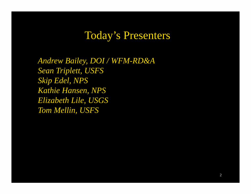
Objective:To inform wildland fire incident GIS resource people about the status of topics impacting the 2017 fire season.
Overview:• Sponsored by Geospatial Sub Committee (GSC) • Questions submitted via email or question box• One hour in length• Qualified GISS and GISS-T (trainee) invited• Situation unit leaders invited• Webinar recording to be posted at gis.nwcg.gov
3
4
5
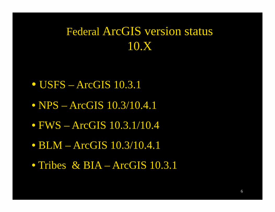
Federal ArcGIS version status 10.X
• USFS – ArcGIS 10.3.1
• NPS – ArcGIS 10.3/10.4.1
• FWS – ArcGIS 10.3.1/10.4
• BLM – ArcGIS 10.3/10.4.1
• Tribes & BIA – ArcGIS 10.3.1
6
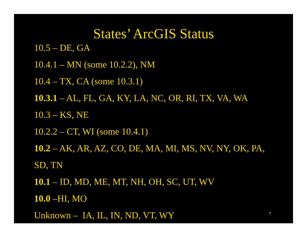
States’ ArcGIS Status 10.5 – DE, GA
10.4.1 – MN (some 10.2.2), NM
10.4 – TX, CA (some 10.3.1)
10.3.1 – AL, FL, GA, KY, LA, NC, OR, RI, TX, VA, WA
10.3 – KS, NE
10.2.2 – CT, WI (some 10.4.1)
10.2 – AK, AR, AZ, CO, DE, MA, MI, MS, NV, NY, OK, PA,
SD, TN
10.1 – ID, MD, ME, MT, NH, OH, SC, UT, WV
10.0 –HI, MO
Unknown – IA, IL, IN, ND, VT, WY 7
ArcGIS in 2017Poll
8
9
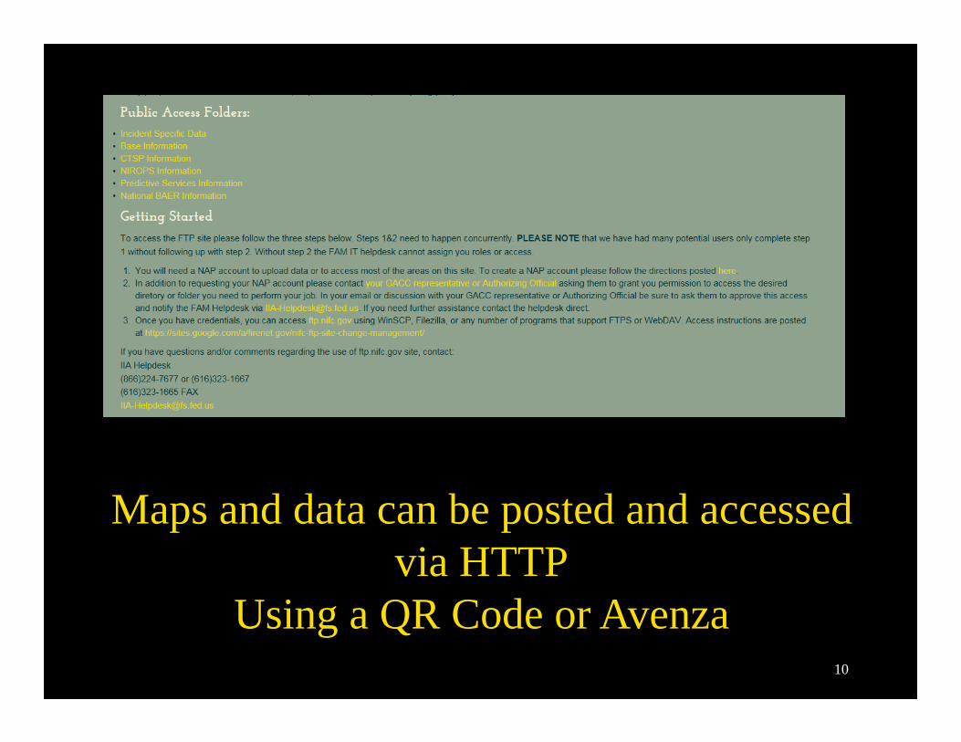
Maps and data can be posted and accessed via HTTP
Using a QR Code or Avenza10
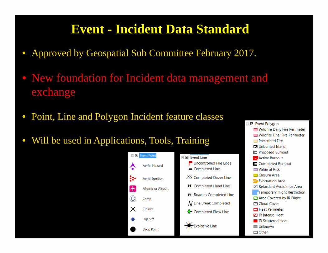
Event - Incident Data Standard
• Approved by Geospatial Sub Committee February 2017.
• New foundation for Incident data management and exchange
• Point, Line and Polygon Incident feature classes
• Will be used in Applications, Tools, Training
11
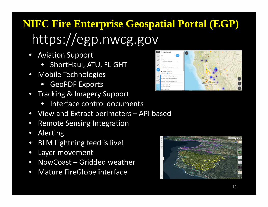
https://egp.nwcg.govNIFC Fire Enterprise Geospatial Portal (EGP)
• Aviation Support• ShortHaul, ATU, FLIGHT
• Mobile Technologies• GeoPDF Exports
• Tracking & Imagery Support• Interface control documents
• View and Extract perimeters – API based• Remote Sensing Integration• Alerting• BLM Lightning feed is live!• Layer movement• NowCoast – Gridded weather• Mature FireGlobe interface
12
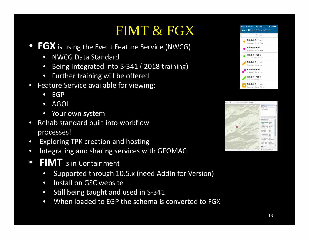
FIMT & FGX • FGX is using the Event Feature Service (NWCG)
• NWCG Data Standard• Being Integrated into S‐341 ( 2018 training) • Further training will be offered
• Feature Service available for viewing:• EGP• AGOL• Your own system
• Rehab standard built into workflow processes!
• Exploring TPK creation and hosting• Integrating and sharing services with GEOMAC
• FIMT is in Containment• Supported through 10.5.x (need AddIn for Version) • Install on GSC website• Still being taught and used in S‐341• When loaded to EGP the schema is converted to FGX
13

Fire Geospatial eXchange (FGX)
• Manages data in the Event Data Standard• Tested during 2016 fire season• Streamlined interface• ArcMAP tools used whenever possible
FGX General Release
Coming in Spring 2017
14
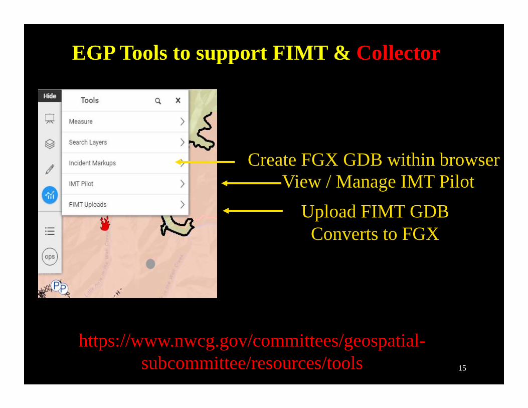
Upload FIMT GDBConverts to FGX
View / Manage IMT PilotCreate FGX GDB within browser
https://www.nwcg.gov/committees/geospatial-subcommittee/resources/tools
EGP Tools to support FIMT & Collector
15
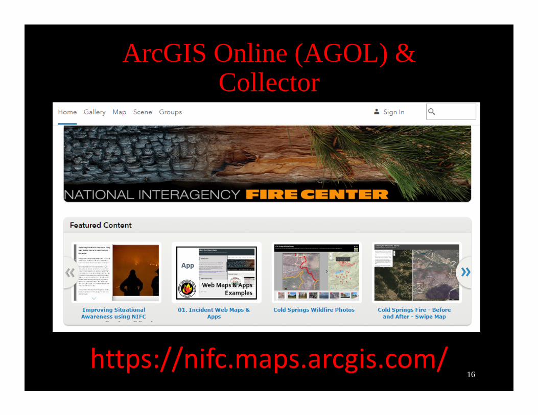
ArcGIS Online (AGOL) & Collector
https://nifc.maps.arcgis.com/16
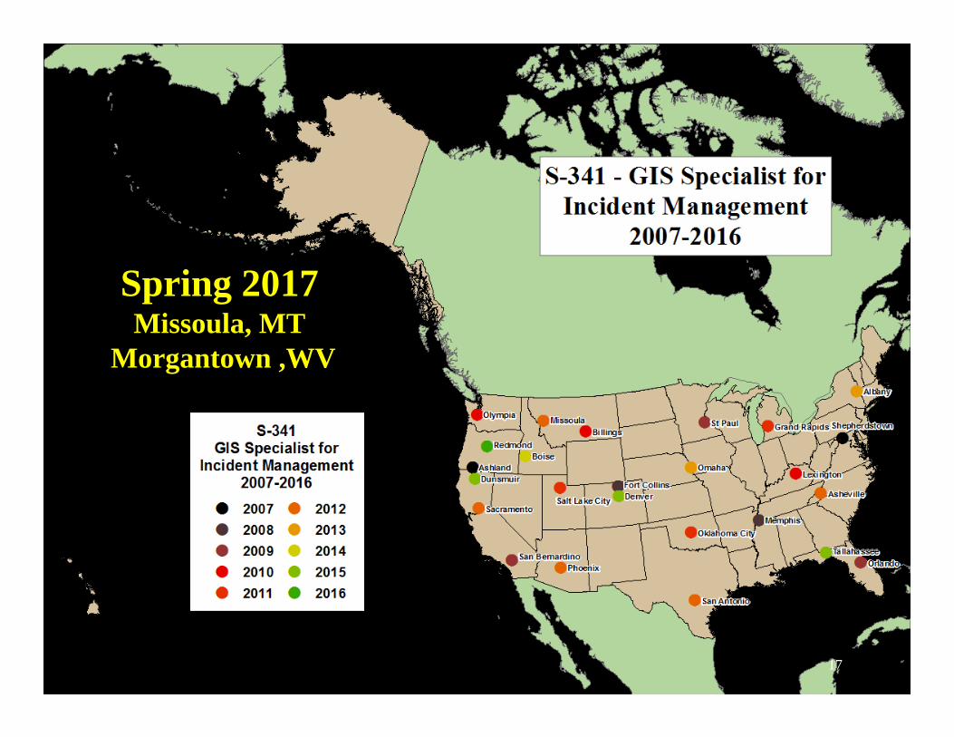
S-341 GIS Specialist for
Incident Management
Courses sponsored by GTU
Spring 2017Missoula, MT
Morgantown ,WV
17
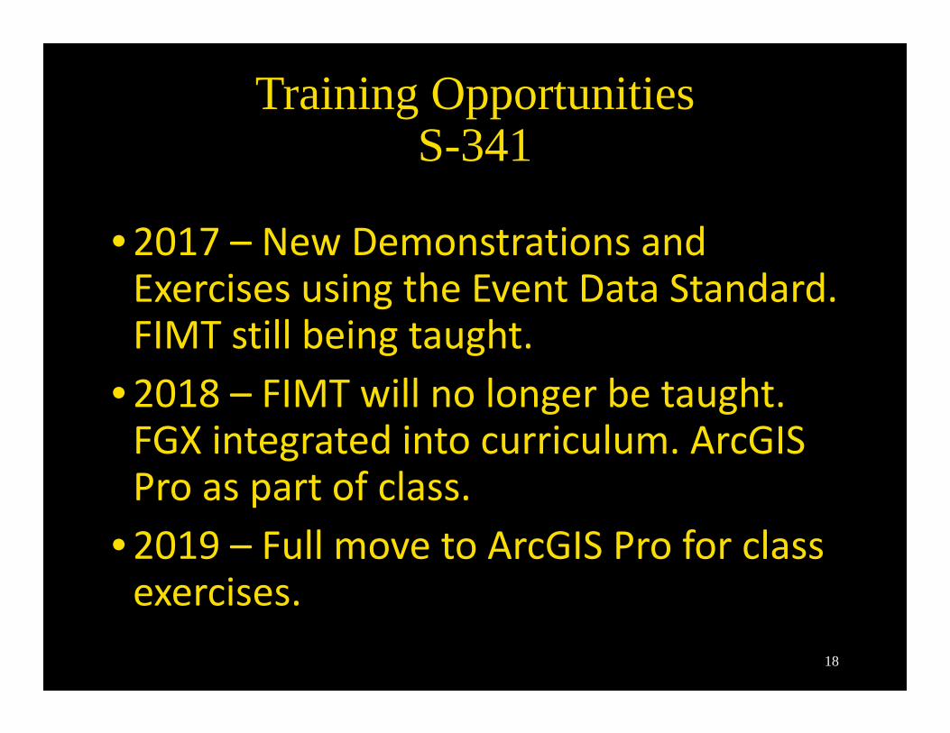
•2017 – New Demonstrations and Exercises using the Event Data Standard. FIMT still being taught.
•2018 – FIMT will no longer be taught. FGX integrated into curriculum. ArcGIS Pro as part of class.
•2019 – Full move to ArcGIS Pro for class exercises.
Training OpportunitiesS-341
18
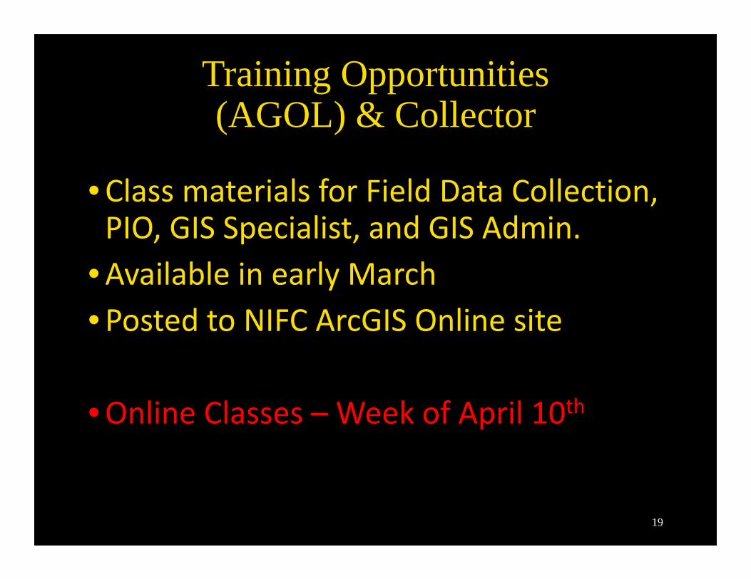
•Class materials for Field Data Collection, PIO, GIS Specialist, and GIS Admin.
•Available in early March•Posted to NIFC ArcGIS Online site
•Online Classes – Week of April 10th
Training Opportunities(AGOL) & Collector
19
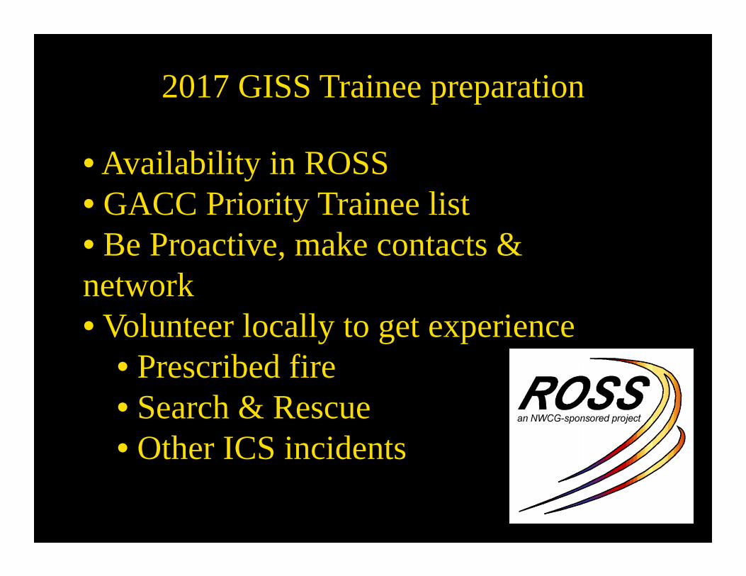
2017 GISS Trainee preparation
• Availability in ROSS• GACC Priority Trainee list• Be Proactive, make contacts & network• Volunteer locally to get experience
• Prescribed fire• Search & Rescue• Other ICS incidents
20
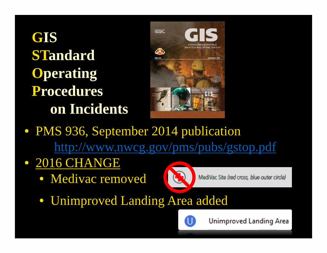
GISSTandardOperatingProcedures
on Incidents • PMS 936, September 2014 publication
http://www.nwcg.gov/pms/pubs/gstop.pdf• 2016 CHANGE
• Medivac removed
• Unimproved Landing Area added
21
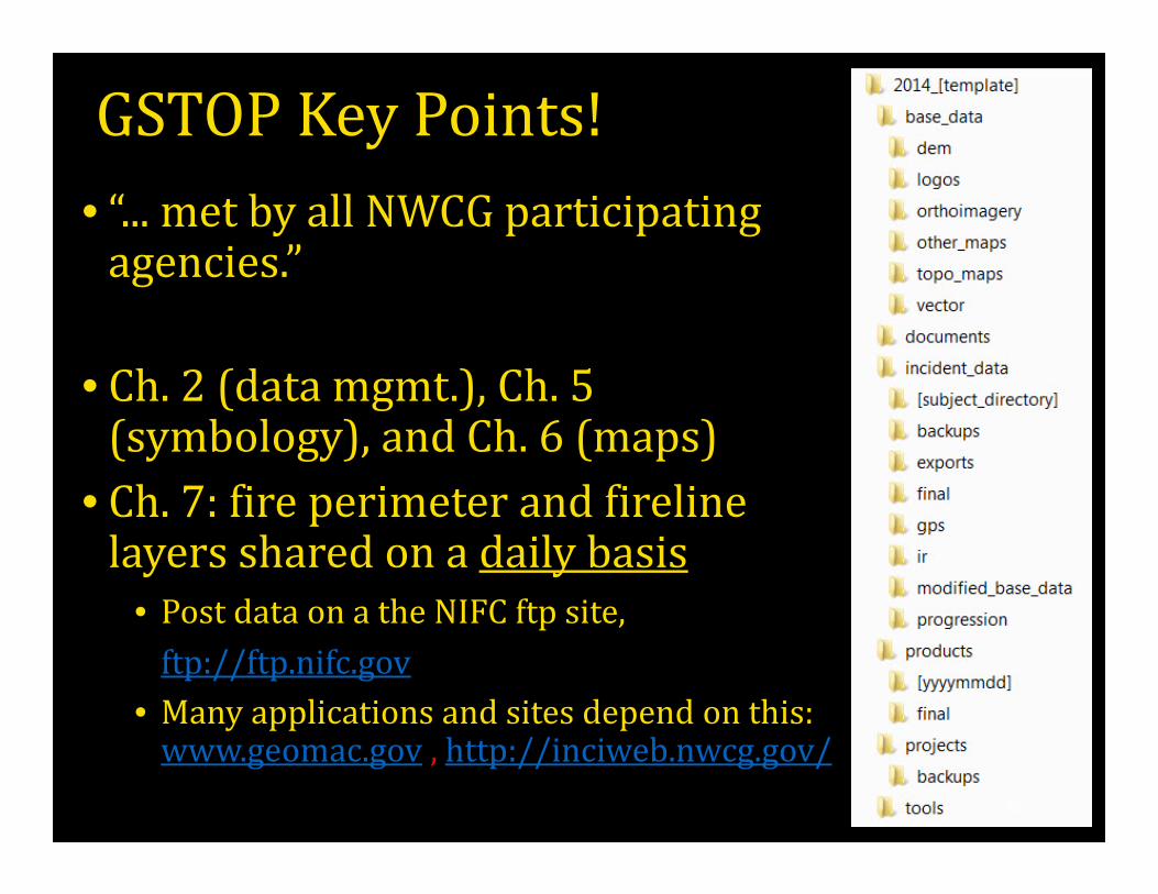
GSTOPKeyPoints!• “...metbyallNWCGparticipatingagencies.”
• Ch.2(datamgmt.),Ch.5(symbology),andCh.6(maps)
• Ch.7:fireperimeterandfirelinelayerssharedonadailybasis
• PostdataonatheNIFCftpsite,ftp://ftp.nifc.gov
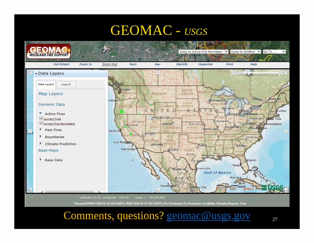
• Manyapplicationsandsitesdependonthis:www.geomac.gov ,http://inciweb.nwcg.gov/
22
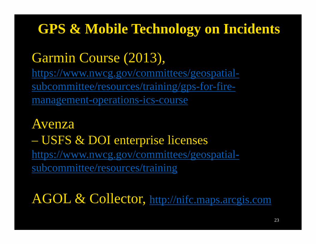
GPS & Mobile Technology on Incidents
Garmin Course (2013), https://www.nwcg.gov/committees/geospatial-subcommittee/resources/training/gps-for-fire-management-operations-ics-course
Avenza– USFS & DOI enterprise licenses https://www.nwcg.gov/committees/geospatial-subcommittee/resources/training
AGOL & Collector, http://nifc.maps.arcgis.com
23
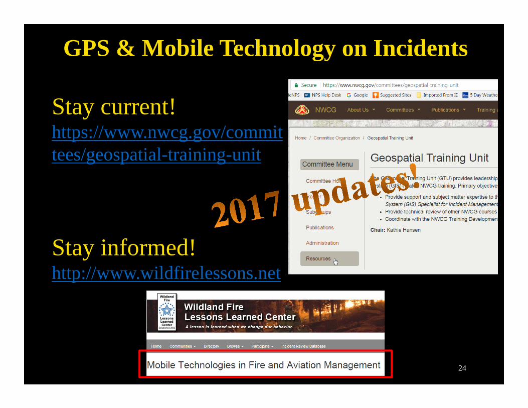
GPS & Mobile Technology on Incidents
Stay current! https://www.nwcg.gov/committees/geospatial-training-unit
Stay informed! http://www.wildfirelessons.net
24
GIS Licenses – All Hazard Support
GIS Licenses supporting All Hazards response:
GISS Advanced ArcGIS – for single installs - single use, authenticates to Esri, includes all Category A extensions (Spatial Analyst, 3D Analyst, etc), 2017/2018 expires April 2018
GISS-L Advanced ArcGIS – for server installs – concurrent use, 10 licenses, requires license manager install, authenticates to Esri, includes all Category A extensions (see above) - 2017/2018 expires April 2018
Licenses for 2017/2018 received and ready for distribution
Need a license? Contact – Sean Triplett, USFS NIFC, Boise, [email protected] 208-387-5284
208-908-9513208-908-9513
25
Technology Rentals
GIS Contracts for 2017/2018:Hartford (CA) – includes: Computers, Plotter, Printers, etc.SmartSource (National) – includes: Computers, Printers, etc.
GISS Computer: Win7 (64-bit), Intel i7, 16 GB RAM, 1280x960 resolution, Ethernet/WiFi/Bluetooth, etc.
GISS Software: ArcGIS 10.3.1installed (10.4.1install files will be available), 10 licenses, FIMT, FGX, DNR GPS, xTools, Google Earth, etc. Fire Rentals have the GISS-L license installed (10 concurrent)
Hartford and SmartSource –image under development –to vendors 4/1/17GIS software not working contact NIFC Geospatial Staff.
26
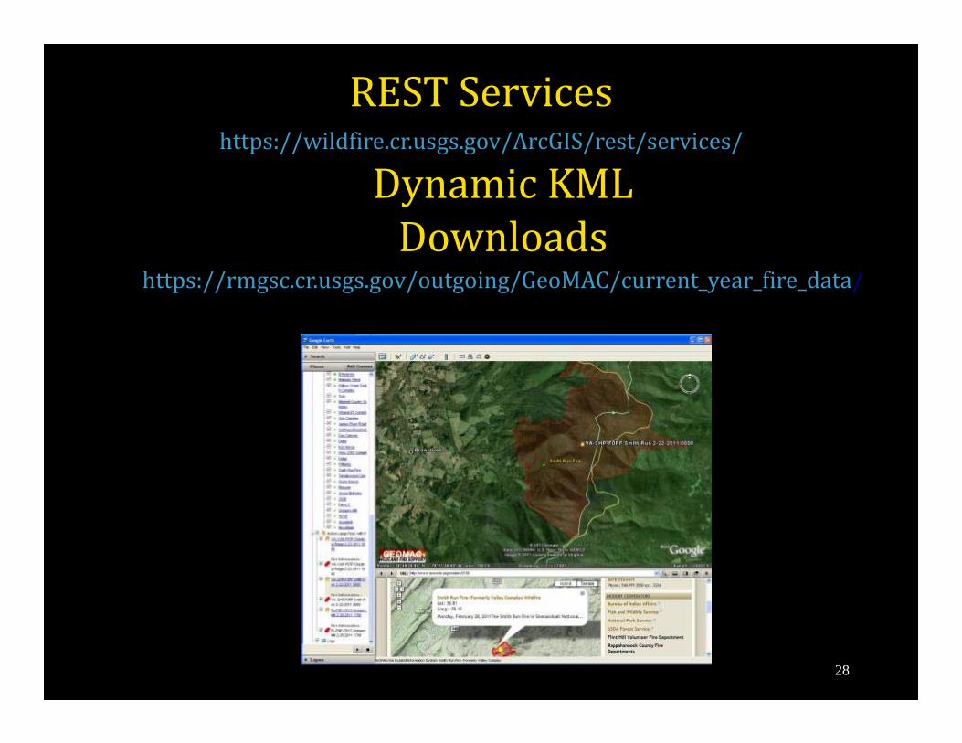
RESTServiceshttps://wildfire.cr.usgs.gov/ArcGIS/rest/services/
DynamicKMLDownloads
https://rmgsc.cr.usgs.gov/outgoing/GeoMAC/current_year_fire_data/
28
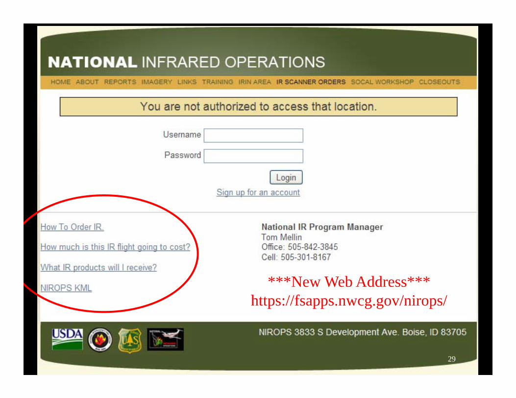
***New Web Address***https://fsapps.nwcg.gov/nirops/
29
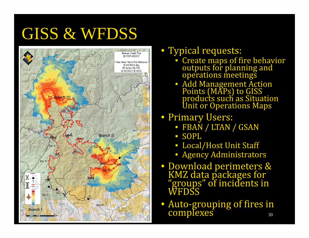
GISS & WFDSS• Typicalrequests:
• Createmapsoffirebehavioroutputsforplanningandoperationsmeetings
• AddManagementActionPoints(MAPs)toGISSproductssuchasSituationUnitorOperationsMaps
• PrimaryUsers:• FBAN/LTAN/GSAN• SOPL• Local/HostUnitStaff• AgencyAdministrators
• Downloadperimeters&KMZdatapackagesfor“groups”ofincidentsinWFDSS
• Auto‐groupingoffiresincomplexes 30
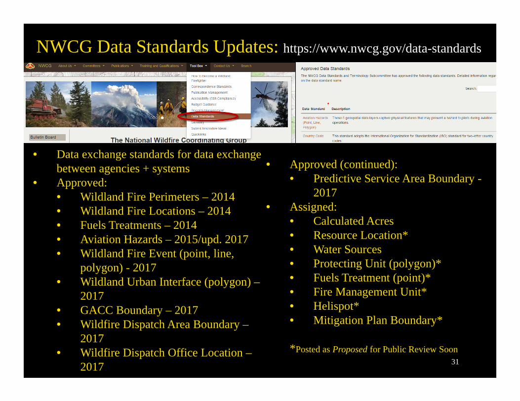
NWCG Data Standards Updates: https://www.nwcg.gov/data-standards
• Data exchange standards for data exchange between agencies + systems
• Approved:• Wildland Fire Perimeters – 2014• Wildland Fire Locations – 2014• Fuels Treatments – 2014• Aviation Hazards – 2015/upd. 2017• Wildland Fire Event (point, line,
polygon) - 2017• Wildland Urban Interface (polygon) –
2017• GACC Boundary – 2017• Wildfire Dispatch Area Boundary –
2017• Wildfire Dispatch Office Location –
2017
• Approved (continued):• Predictive Service Area Boundary -
2017• Assigned:
• Calculated Acres• Resource Location*• Water Sources• Protecting Unit (polygon)*• Fuels Treatment (point)*• Fire Management Unit*• Helispot*• Mitigation Plan Boundary*
*Posted as Proposed for Public Review Soon31
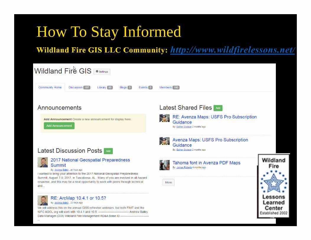
How To Stay Informed
32
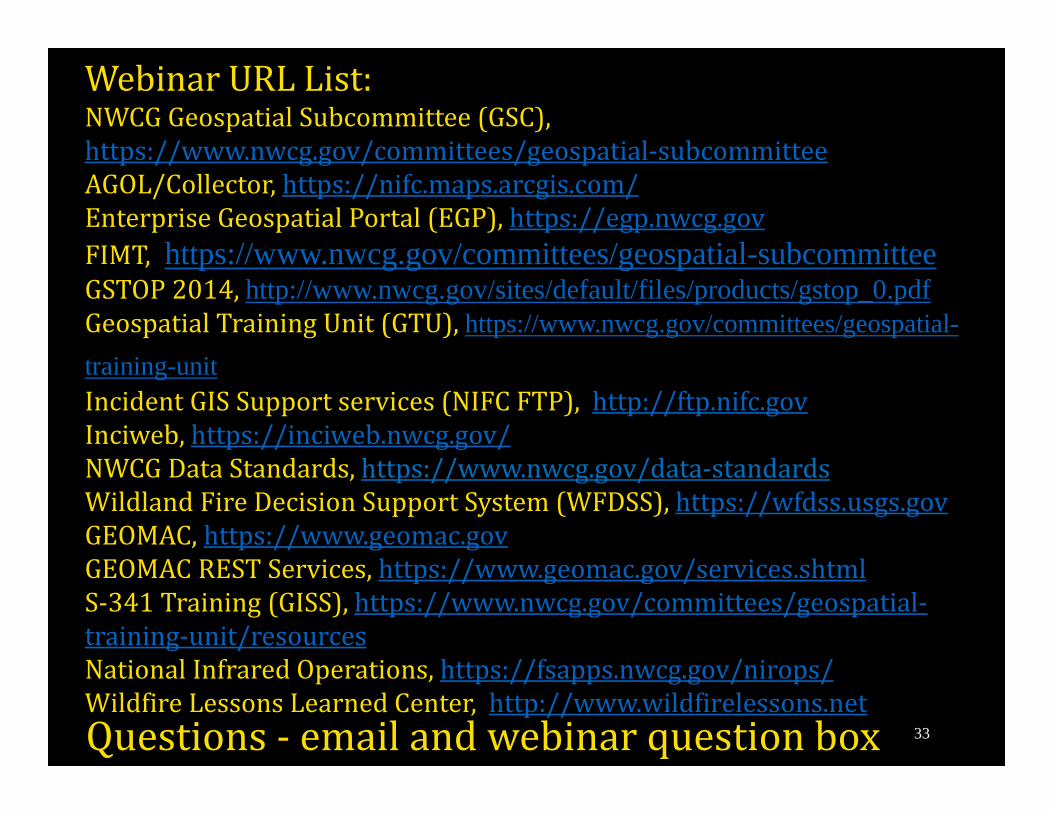
WebinarURLList:NWCGGeospatialSubcommittee(GSC),https://www.nwcg.gov/committees/geospatial‐subcommitteeAGOL/Collector,https://nifc.maps.arcgis.com/EnterpriseGeospatialPortal(EGP),https://egp.nwcg.govFIMT, https://www.nwcg.gov/committees/geospatial-subcommitteeGSTOP2014,http://www.nwcg.gov/sites/default/files/products/gstop_0.pdfGeospatialTrainingUnit(GTU),https://www.nwcg.gov/committees/geospatial-training-unitIncidentGISSupportservices(NIFCFTP),http://ftp.nifc.govInciweb,https://inciweb.nwcg.gov/NWCGDataStandards,https://www.nwcg.gov/data‐standardsWildlandFireDecisionSupportSystem(WFDSS),https://wfdss.usgs.govGEOMAC,https://www.geomac.govGEOMACRESTServices,https://www.geomac.gov/services.shtmlS‐341Training(GISS),https://www.nwcg.gov/committees/geospatial‐training‐unit/resourcesNationalInfraredOperations,https://fsapps.nwcg.gov/nirops/WildfireLessonsLearnedCenter,http://www.wildfirelessons.netQuestions‐ emailandwebinarquestionbox 33
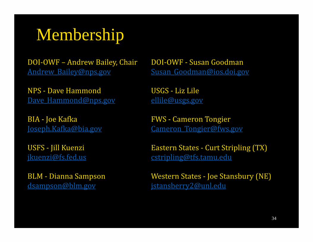
MembershipDOI‐OWF– AndrewBailey,[email protected]
NPS‐ [email protected]
BIA‐ [email protected]
USFS‐ [email protected]
BLM‐ [email protected]
DOI‐OWF‐ [email protected]
USGS‐ [email protected]
FWS‐ [email protected]
EasternStates‐ CurtStripling(TX)[email protected]
WesternStates‐ JoeStansbury(NE)[email protected]
34
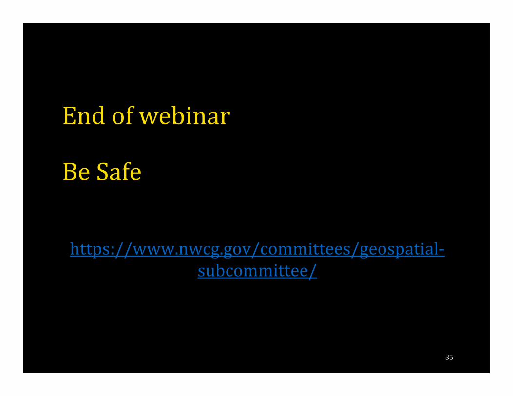
Endofwebinar
BeSafe
https://www.nwcg.gov/committees/geospatial‐subcommittee/
35
Related Documents