Noonan’s South Atlantic Chart. This is a digitally restored image of the map Fred Noonan used on the flight from Natal, Brazil to St. Louis, Senegal, French West Africa on June 7, 1937. The original map was sent back to the U.S. later in the world flight and is now in the Purdue Earhart Collection at Purdue University in West Lafayette, Indiana. The International Group for Historic Aircraft Recovery 2812 Fawkes Drive · Wilmington, DE 19808 · USA Voice 302.994.4410 · Fax 302.994.7945 · www.tighar.org · [email protected]

Welcome message from author
This document is posted to help you gain knowledge. Please leave a comment to let me know what you think about it! Share it to your friends and learn new things together.
Transcript
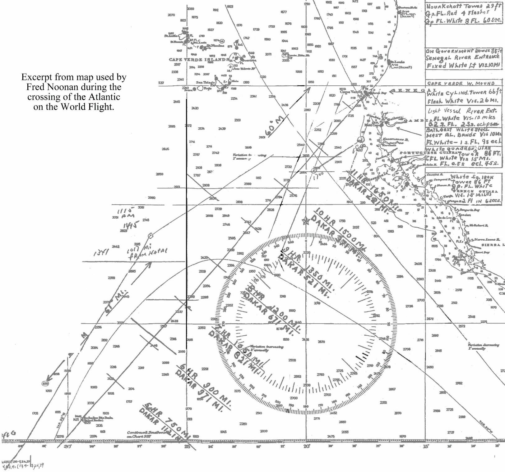
Noonan’s South Atlantic Chart.
This is a digitally restored image of the map Fred Noonan used on the flight from Natal, Brazil to St. Louis, Senegal, French West Africa on June 7, 1937. The original map was sent back to the U.S. later in the world flight and is now in the Purdue Earhart Collection at Purdue University in West Lafayette, Indiana.
The International Group for Historic Aircraft Recovery2812 Fawkes Drive · Wilmington, DE 19808 · USA
Voice 302.994.4410 · Fax 302.994.7945 · www.tighar.org · [email protected]
Related Documents