NOAA/NESDIS Satellite Analysis of Surface Oil

NOAA/NESDIS Satellite Analysis of Surface Oil
Dec 31, 2015
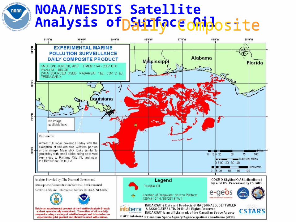
NOAA/NESDIS Satellite Analysis of Surface Oil. Daily Composite. NOAA/NESDIS Satellite Analysis of Surface Oil --. Product Dissemination. trajectories. Coast Guard Local/state responders. NOS/Emergency Response Division Coast Guard (Minerals Management Service). Pre-spill. - PowerPoint PPT Presentation
Welcome message from author
This document is posted to help you gain knowledge. Please leave a comment to let me know what you think about it! Share it to your friends and learn new things together.
Transcript
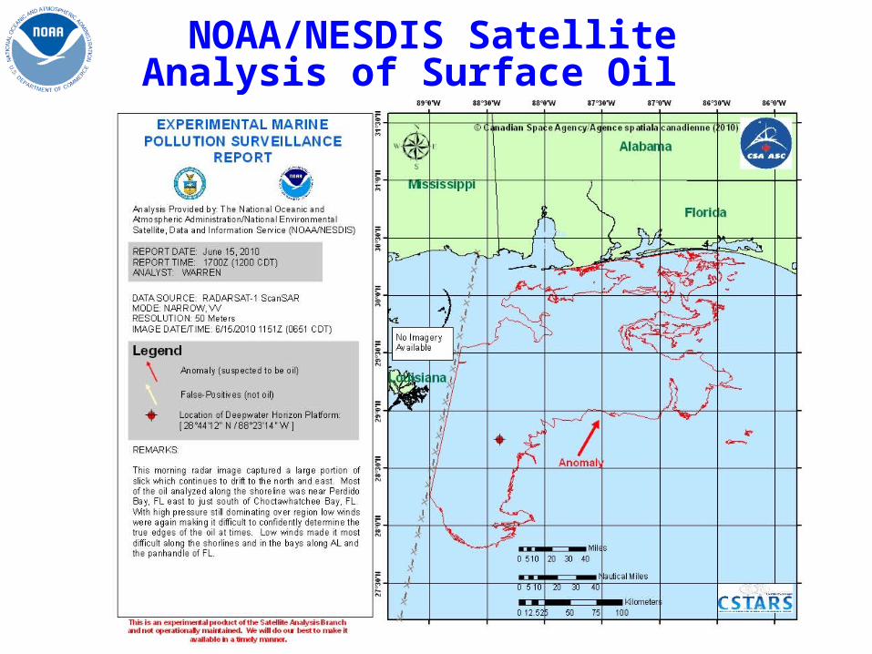
NOAA/NESDIS Satellite Analysis of Surface Oil
NOAA/NESDIS Satellite Analysis of Surface Oil --

NOAA/NESDIS Satellite Analysis of Surface Oil --
United States Geological Survey (USGS) Pentagon and Navy Dept of the Interior headquarters Department of Homeland Security Google, ESRI, NOAA Visualization Lab
NOS/Emergency Response Division
Coast Guard (Minerals Management
Service)
Pre
-spi
llN
ow
trajectories
affected areas
Coast Guard Local/state
responders

International Charter Space & Major Disasters
• Charter Activated on April 22, 2010– Serving as Project Manager– Charter is still ongoing
• Received Synthetic Aperture Radar from
ESA-Envisat ASARCSA-RADARSAT 1 &2JAXA-ALOS Palsar• Received high resolution
visible imagery fromCNES –SPOTISRO –Oceansat OCMESA-Envisat MERIS
Related Documents