NH Route 16 Corridor Safety Assessment June 2015

Welcome message from author
This document is posted to help you gain knowledge. Please leave a comment to let me know what you think about it! Share it to your friends and learn new things together.
Transcript
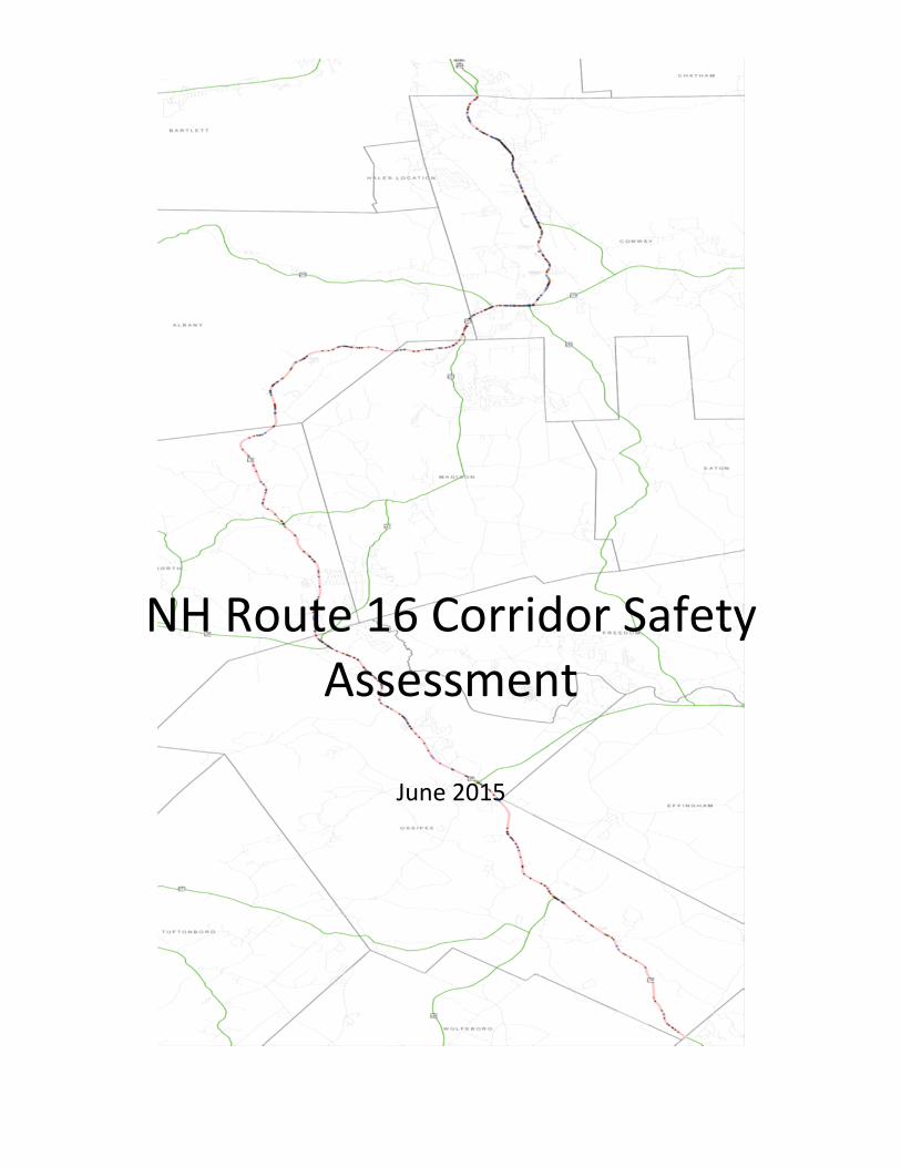
NH Route 16 Corridor Safety Assessment
June 2015

Prepared by: Lakes Region Planning Commission and North Country Council
June 2015
This report was funded in part through a grant from the Federal Highway Administration, US Department of
Transportation (USDOT) and administered by the New Hampshire Department of Transportation (NHDOT). The
views and opinions expressed herein do not necessarily state or reflect those of the USDOT or the NHDOT

1 | P a g e
NH Route 16 Safety Team:
Brad Harriman, Ossipee
Jack Rose, Albany
David Bowles, Tamworth
David Farley, Tamworth
James Eldridge
John Gotjen, Tamworth
Mark McConkey, Ossipee
Mark Morrill, NHDOT District 3
Michelle Marshall, NHDOT
Michael Dugas, NHDOT
James Steele, NCC
Michael Izard, LRPC
NH Route 16 Study Area:
Ossipee/Wakefield town line north approximately 27 miles on NH Route 16 to
Conway/Bartlett town line.
Study Area Critical Statistics:
Total Reported Accidents 2008-2012
Fatalities 11
Incapacitating 21
Possible Injury/Non-Incapacitating 194 No Apparent Injury/Unknown 731
957
Average Annual Daily Traffic Volume by Location
2013/2014
South of Pine River Road Ossipee 11,303
Tamworth Town Line 14,000
North of NH113 at Saco River 12,000
Albany Town Line 13,000
NH Route 16 Safety Team Meetings and Key Dates:
April 10, 2014 – Organizational meeting
May 22, 2014 – Consultation with NHDOT Safety Engineer
June 12, 2014 – Safety Team Meeting
July 2, 2014 – RPC and NHDOT Meeting re: Candidate Locations

2 | P a g e
August – Data Collection and Refine Primary Concerns List
September 18, 2014 – Letter to Board of Selectmen – historic accident data request
January 8, 2015 – Road Safety Audit Applications – submission to State Highway Safety
Improvement Program (HSIP) Committee
June 12, 2015 – Safety Review Site Assessments
NH Route 16 Corridor – Past Study Recommendations
Lakes Region Planning Commission staff reviewed past plans and studies for
recommendations within the NH Route 16 Safety Audit project limits. Noteworthy for their
potential applicability to this study were the following: 1) Route 16 Corridor Protection Program –
Travel and Tourism, May 1998; 2) Route 16 Corridor Protection Program – Corridor Management Plan,
December 1998; and 3) Madison Planning and Corridor Initiative, June 2000. The NH Route 16
Safety Team reviewed the recommendations to confirm their relevance today as a starting
point for discussion about specific areas of safety concern. The recommendations are listed
by document, followed by a review summary.
Route 16 Corridor Protection Program – Travel and Tourism, May 1998
1. Limited and informal pull off for view of Chocorua Lake/Mt. Chocorua in
Tamworth (curve to north presents safety hazard).
Recommendations:
Create small pull off or widen shoulder
Decrease speed limit through area along Chocorua and Little Lakes
Install informational signage
2. Chocorua beach public access in Tamworth directly adjacent to NH Route 16
creates traffic conflicts
Recommendations:
Turn lane for northbound traffic, extend shoulders for southbound
traffic
Install appropriate public access signage
3. View of Chocorua at pine lined section of NH Route 16 in Albany
Recommendation:
Monitor/enforce speeds which typically exceed posted limits
Route 16 Corridor Protection Program – Corridor Management Plan, December 1998
1. Accident rates from 1993 - 1995 indicate segments of NH Route 16 in
Tamworth and Conway that may warrant future investigation.
Other Modes

3 | P a g e
b. Bicycle and Pedestrian Facilities
2) Consider 10’ shoulders for all new construction projects along NH
Route 16.
Madison Planning and Corridor Initiative, June 2000
1. Extend NH Route 16 bypass southerly beyond Conway project scope.
2. Add southbound turn lane at intersection of Drake Hill Road.
3. Realign NH Route 16 at Davies Family Campground and add center turn lane to
facilitate slippage.
4. Pine Knoll Campground driveway realignment.
5. Realign NH Route 16 at Golden Age shop.
6. Realign from Brookwood Park to Bald Hill Road (south section).
7. Major reconfiguration at Albany Town Hall at Drake Hill Road (incorporate old
Route 16).
8. Create northbound left turn lane in area of Bald Hill Road (acquire right of way
for site distance).
9. Eliminate passing zone north of Town Hall in Albany (development density
issue).
10. Control access/egress at Bill’s Place (excess road frontage of driveway).
11. Realign intersection of NH Route 16 and West Main Street by Beep Beep Deli.
12. Center turn lane from Conway Bypass southbound to Ledge Pond Road.
The Safety Team noted that the recommendations related to Mt. Chocorua are as relevant
today. Motorist behavior appears to be affected by opportunities to view and photograph
this spectacular area attraction and scenic view. Increased shoulder widths would alleviate
many conflicts; however a formal pull-off would be preferred given the often witnessed
inattentiveness and actions of motorists. As a Safety Team member elaborated, “The ideal
shot apparently is knelling behind a tripod stationed on the centerline…I’ve seen it, more

4 | P a g e
This well-known view of Mt. Chocorua from NH Route 16 in
Tamworth looking through the white birches and across the
two lakes in the foreground is a painting done in the late
1950s by a well-known North Conway artist, Dick Packer.
than once.” Another frequently witnessed photo vantage point is simply from the car
window while stopped in the travel way.
The addition of signage would assist
visiting motorists that may not be aware
of the recreational users in close
proximity to the travel way. The type,
location, and placement of signage
should be coordinated with the
NHDOT Bureau of Traffic and DOT
District 3 in consultation with the
Manual on Uniform Traffic Control
Devices (MUTCD). The regional
planning commissions should assist
municipal officials in formalizing the
request for additional signs.
There was general Safety Team agreement that wider shoulders corridor-wide would
eliminate many of the concerns described in the past studies by providing: opportunity for
trailing vehicles to bypass left turning vehicles, space for right turning vehicles to get out of
the travel lane, a potentially safer place for non-motorized users, and to avoid future
roadway closures when accidents occur. The Safety Team is supportive of wider shoulders
within the study area and recommends (ideally) ten foot shoulders for NH Route 16 and
four foot shoulders on intersecting roads.
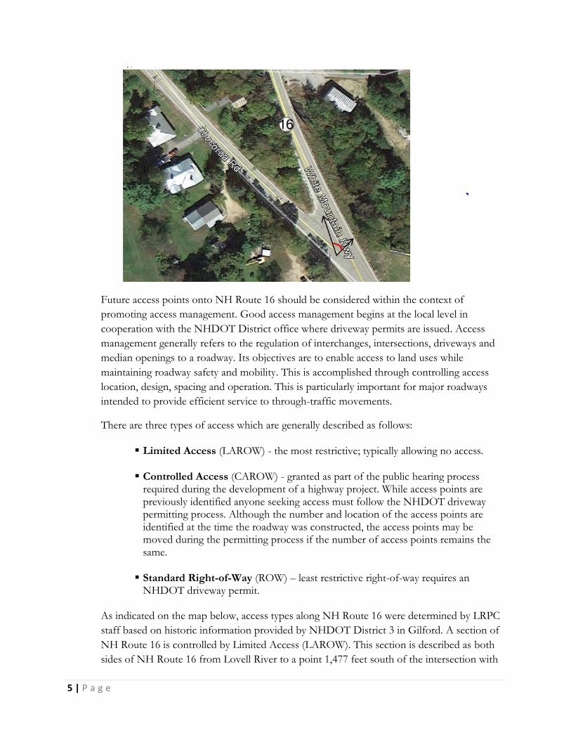
There are many examples of intersecting roads in the study area that approach NH Route 16
at skewed angles. These intersections are potentially challenging for turns onto NH Route 16
because the motorist is forced to look back over their shoulder to see oncoming traffic. The
aerial photograph below shows a prior NH Route 16 condition in Tamworth and illustrates
in red, the angle of view (beyond that required at a 90 degree intersection) for a motorist to
see oncoming traffic. An additional safety concern at such skewed intersections is the travel
speed of vehicles entering the side street; in this case a residential area on Chocorua Road.
The angle of approach requires little reduction in speed to negotiate the slight turn from NH
Route 16 onto Chocoura Road. The recent roadway improvements have eliminated these
concerns by reconfiguring the approach angle. Similar concerns exist in other areas. An
initial review of skewed intersections with highest crash history indicated Town Hall Road in
Albany as a candidate for further safety review.
5 | P a g e
Future access points onto NH Route 16 should be considered within the context of
promoting access management. Good access management begins at the local level in
cooperation with the NHDOT District office where driveway permits are issued. Access
management generally refers to the regulation of interchanges, intersections, driveways and
median openings to a roadway. Its objectives are to enable access to land uses while
maintaining roadway safety and mobility. This is accomplished through controlling access
location, design, spacing and operation. This is particularly important for major roadways
intended to provide efficient service to through-traffic movements.
There are three types of access which are generally described as follows:
Limited Access (LAROW) - the most restrictive; typically allowing no access.
Controlled Access (CAROW) - granted as part of the public hearing process required during the development of a highway project. While access points are previously identified anyone seeking access must follow the NHDOT driveway permitting process. Although the number and location of the access points are identified at the time the roadway was constructed, the access points may be moved during the permitting process if the number of access points remains the same.
Standard Right-of-Way (ROW) – least restrictive right-of-way requires an NHDOT driveway permit.
As indicated on the map below, access types along NH Route 16 were determined by LRPC
staff based on historic information provided by NHDOT District 3 in Gilford. A section of
NH Route 16 is controlled by Limited Access (LAROW). This section is described as both
sides of NH Route 16 from Lovell River to a point 1,477 feet south of the intersection with

6 | P a g e
NH Route 16B/Pine River Road. A section of NH Route 16 is subject to Controlled Access
(CAROW). This section, within the study area, is described as: both sides of NH Route 16,
8,850 feet north from Ossipee/Wakefield town line. This section originates from Pine River
Pond Road in Wakefield. The remainder of the corridor study area is classified as Right-of-
Way, which requires the NHDOT driveway permitting process.
Extent of Defined ‘Limited’ and ‘Controlled’ Right of Way Access in Study Area

7 | P a g e
It is not a DOT
practice to limit an
owner’s use of a
property when access
points are determined
and driveway permits
are granted.
Communities that
have established
access management
criteria in their local
land use practices
should coordinate
with the DOT District
Office during the
driveway permitting process to ensure local standards are considered. The aerial photograph
above is an example of an existing condition in the study area. As illustrated, the parking
proximity and orientation to NH Route 16 allows motorists to approach from the travel
lane. Not shown is the breadth of the access which measures approximately 190’ from
parking lot edge of pavement to edge of pavement (full extent of access not viewable in
photo) along NH Route 16. An access management approach at this location might include:
1) reducing access from NH16 to the onsite travel lanes defined by existing ‘in’ and ‘out’
arrows; 2) widening the isle between parking spaces if possible/needed to provide space to
turn in and back out of parking spaces closest to NH16; 3) removing and restriping the
parking space end line; 4) defining road shoulder and parking with raised curbing/plantings.
Remedial access management may present a challenge of persuading land owners who
currently have wide access points to refine them. This is especially true for commercial
properties where the perception is that unrestricted access is good for business and there is
limited crash history to substantiate a need for change. Collectively the lack of access
management in congested corridors can have the impact of elevated motorist stress due to
the increased conflict points. Considering the above example, two entry lanes and ten
parking spaces adjacent to the highway represent 12 potential points for autos to enter and
exit the highway. The alternatives described could reduce the potential conflicts points by 84
percent. Communities with Site Plan Regulations may have the opportunity to address access
management when a business changes or expands.
In addition to the study recommendations outlined above, in June 2006 a NHDOT Safety
Surveillance Team assessed a portion of NH Route 16 in Ossipee; the notes of this review
are outlined below:
Shoulder
NH Route 16

8 | P a g e
NHDOT Safety Surveillance Notes
Three fatalities in six weeks – all centerline cross-overs, during daylight hours.
A great deal of human behavior issues.
Deer Cove and Newman Drew intersections need signing (rear-end collisions).
Edge drop-off issue in Section 10431 (Ten Year Plan project for pavement rehabilitation
and intersection improvements) – lack of shoulder – three injury accidents due to
pavement drop-off.
Intersection issues at Pine River Road/NH Route 16.
Control access at: Cranky Frankie, Lobster Crest Restaurant, and Watson’s.
Centerline rumble strips (group recommendation).
The NH Route 16 Safety Team will review noted locations as time permits to assess if noted
conditions still remain. Due to lack of shoulders and shoulders with limited width in the
study area, safety related to vertical pavement edge drop-offs is of particular concern. The
United States Department of Transportation (USDOT) suggests that a drop-off with a
vertical differential of 3 inches or more is considered unsafe (USDOT 2004). The American
Association of State Highway and Transportation Officials (AASHTO 1996) suggests that
no vertical differential greater than 2 inches occur between lanes. A driver’s ability to recover
safely when encountering edge drop-off depends on numerous factors, including the
magnitude and geometry of the drop-off, driver ability, vehicle characteristics, and vehicle
speed (TRB 1987). As illustrated below, a tapered edge of pavement is preferable to a
vertical drop.
Road Safety Audit Candidates Selection Process
Planning Commission staff reviewed state historic accident data for the period from 2008 to
2010 as a first step in determining potential ‘hotspots’ to discuss with Safety Team.
Following input from the Safety Team, RPC staff met with NHDOT Safety Engineer to:
Federal Highway Administration Safety Edge Illustration
Source: Safety Impacts of Pavement Edge Drop-offs, Federal Highway Administration, September 2006.

9 | P a g e
clarify questions about how historic data is recorded and used; to refine the list of
intersection concerns based on Safety Analyst programming, and determine prime
candidates for Road Safety Audits (RSAs) based on crash rates that exceed a predicted crash
value.
A shortlist of Road Safety Audit (RSA) candidate locations was determined and shared with
the Safety Team. Each community was asked to provide up to ten-years of accident reports
for each location to support RSA applications. RPC Staff collected associated data at
candidate locations, prepared and submitted RSA applications to the State Highway Safety
Improvement Program Committee (HSIP Committee). Based on the HSIP Committee
response to the applications submitted, the Safety Team conducted safety reviews at the
following four NH Route 16 intersections: 1) Mt. Shaw Road, Ossipee (Appendix A, page
18); 2) Granite Road, Ossipee (Appendix B, page 21); 3) Washington Street, Conway; and 4)
East Main Street, Conway (Appendix D, Page 27). Independent of this study, NHDOT will
conduct a Road Safety Audit at NH Route 16B/Pine River Road (Appendix C, page 24).
Areas of potential concern were cross referenced with projects currently in the state 2015-
2024 Ten Year Plan as noted below.
2015-2024 Ten Year Plan Projects in the Route 16 Study Area
Noteworthy aspects of the Ten Year Plan projects within the study area are:
While currently scheduled for construction in 2023-2024, the Albany project (9004)
will be supplemented by a rumble strip test area in Albany which is currently

10 | P a g e
scheduled for spring/summer 2015. Rumble strips in the NH Route 16 corridor
were considered a priority regional project by North Country Council in a recent
update to the Ten Year Plan.
The scope and intent of the Ossipee NH Route 16 Ten Year Plan project pavement
(10431) has been defined as improvements from the NH28/NH16 intersection
north 3.36 miles to “address pavement condition and problem intersections only.”
The most recent Ten Year Plan is less descriptive. The historic project limits are
consistent with the 2006 Safety Surveillance review which includes the Pine River
Road intersection, Kranky Frankie’s access management, Jude Boulevard, potential
pavement drop-off issues and Pine River Road/NH16B intersection.
Historically, Ossipee (13910) has been discussed in terms of relocating NH Route
41 to form a four-way intersection at the NH16-NH25 signalized intersection.
Opportunity may exist, through an abandoned rail corridor, to eliminate
intersection queuing during peak hours that prevents left turning vehicles on NH41
from getting onto NH16. The community was recently consulted by NHDOT
project managers to fully understand community concerns at this intersection.
The scope for Ossipee (14749) includes replacement of three bridges: Lovell River
(#152/268), Bearcamp River (#137/297), and Bearcamp River Relief (#137/299).
Each bridge to include 12 foot travel lanes and five foot wide shoulders.
Safety Team Additional Considerations
Tamworth
NH16 at Depot Road (may be worth a look)
NH16 at South Way (discuss in terms of access management)
Ossipee
Review signage at Deer Cove and Newman Drew
Review access management opportunities at Watson’s?
Any feedback on Jude Boulevard? (this intersection is within the project limits for
Ten Year Plan project number 10431).
Albany
Review segments and intersections in proximity to Nickerson, Town Hall, and Pine
Knoll Roads
RPC Staff
Monitor safety aspects of existing Ten Year Plan projects

11 | P a g e
Safety Team Site Location Review Summaries and Recommendations
On Friday, June 12, 2015 the NH Route 16 Safety Team met at Albany Town Hall to discuss safety
review field sheets for assessing previously determined priority locations within the corridor. In
attendance were:
Bill Rollins, NHDOT District 3
Mark McConkey, Ossipee
John Gotjen, Tamworth
David Bowles, Tamworth
David Farley, Tamworth
J James Steele, NCC
Michael Izard, LRPC
Madison Resident
Sara Young-Knox, Conway Daily Sun
Safety Team members were divided into pairs to record areas of concern at each site from a prompt list
adapted from a Federal Highway Administration safety assessment field sheets. Each site included
independent small team review and opportunity to discuss observations with others. The field sheets were
collected and consolidated by NCC staff. The following is a summary of the review from the south to north.
Ossipee
NH16 Intersection with Granite Road / NH171
Vehicles turning left onto Granite Road or into Pizza parking lot cause SB traffic to use right turn lane for passing. May create head-on with NB vehicles turning left onto NH 171
Speed through intersection
Concern for Bicyclists
Vehicles turning left cause NB traffic to use right only turn lane.
Pizza sign in ROW obscures view when turning left onto NH 16 SB
Speed through intersection
Concern for Bicyclists
Figure 1: NH 16 headed south Figure 2: NH 16 / NH 171headed north

12 | P a g e
Difficult turning left to NB NH 16.
Alignment to NH 16
Alignment to NH 16
Recommendations:
1. Address left turn concerns 2. Not asking for lower speeds just manage intersection better 3. Work with pizza establishment to improve line of sight issue at entrance. 4. Establish left turn lanes in each direction on NH 16 NB-SB.
NH16 Intersection with Mt. Shaw Road
Mt. Shaw not readily visible, lack of adequate signage
Mt. Shaw Rd not readily visible, lack of adequate signage
Right turn causes traffic to slow on NH 16.
Left turn dangerous due to speed on NH 16 crosses two lanes of high speed traffic
Figure 3. NH 16 headed south Figure 4: NH 171 approaching NH 16 Figure 4: Granite Rd looking towards NH 171
Figure 5: NH 16 headed south Figure 6: NH 16 headed north

13 | P a g e
Condition of pavement is deteriorated Crossing three lanes to enter Mt. Shaw
Stop sign obscured by vegetation Speed of traffic on NH 16
Left turn onto NH16 crosses two lanes of high speed headed south.
Recommendations:
1. Increase turn radius to Mt. Shaw Road 2. Widen shoulders on NH 16 to 10’ 3. Clear vegetation blocking stop sign on approach, Mt. Shaw Road. 4. Improve signage 5. Repair pavement on first 12-15 feet of Mt. Shaw Road. 6. Consider reducing speed through this area
Additional Observations in Ossipee
There has been significant paving conducted recently in the corridor study area. In some cases the pavement
marking are yet to be painted and the shoulders backed up. Team members looked for pavement edge drop
offs in the section of highway between NH16/28 and NH16/16B (future Ten Year Plan improvement
area). There were a few areas noted with pavement drop-offs in excess of three inches.
Tamworth
NH16/ Depot Road Intersection
Depot Road cross NH16 and is misaligned at the intersection which situates eastbound vehicles facing
westbound vehicle. Safety Team members recommend looking into the potential to remedy this when future
paving is conducted.
Figure 8. NH 16 headed south Figure 4: Looking west towards Mt. Shaw Figure 7: Mt. Shaw Road approaching NH 16

14 | P a g e
NH16/ South Way Intersection The Safety Team noted the stop sign is missing at this intersection.
Conway
NH 16 / NH 113intersection with NH 153 / Washington Street
Lack of lane markings
Signage difficult to read
Motorist change lanes in or near intersection
Directional signage placed after intersection
Faded crossings
Congestion
Concern for bicyclists
Motorists turning left onto Washington may be confused by Dead End sign for local business parking lot.
Faded crossings
Faded lane markings
Congestion
Concern for bicyclists
Faded signs
Figure 9: NH16 headed east towards NH153 Figure 10: NH16 / NH113 headed
west towards NH 153

15 | P a g e
Vegetation blocks sign
Left turn onto NH 16 conflicts with traffic coming from Washington Street.
Vehicles block intersection
Faded crossings
Poles with no signs
Congestion
Turning radius for trucks. Large vehicles must go into oncoming traffic onto NH 16.
Concern for bicyclists
Left turn vehicles block intersection
Near misses with left turn vehicles from NH 153.
Faded crossings
Congestion
Concern for bicyclists
Recommendations:
1. Implement Conway Roundabout Study (long term solution) 2. Work with District 3 to perform a sign assessment study. 3. Earlier signage to inform motorists of lane selection. Motorists change lanes in or near
intersection. 4. Coordinate signals with traffic flow between intersections 5. Need protective left turn signal 6. Remove obsolete poles 7. Clear vegetation 8. Update signage 9. Update lane markings and crosswalks 10. Realign Dead End sign to avoid confusion from NH 16 NB vehicles turning onto Washington Street.
Figure 12. NH 16 headed south Figure 4: Washington St headed
towards NH16 / NH113 / NH153
Figure 11: NH153 headed towards
NH16 / NH113

16 | P a g e
NH 16 / NH 113 Intersection
Faded lane markings
Signage difficult to read
Directional signage placed after intersection
Congestion
Concern for bicyclists
Road section narrow with utility poles close to road, causes choke point
Signals do not coordinate with prior intersection
Islands critical to traffic smoothing.
No crosswalk
Vegetation encroaching on signage
Fading lane markings
Figure 13: NH16 headed east towards NH113 Figure 14 – NH16 SB to NH113
Figure 4: NH16 / NH113 NB lane
narrow lane “choke point”
Figure 15: NH113 headed WB to NH16

17 | P a g e
Signals do not coordinate w traffic or signals at NH 16 / NH 153 intersection
Lack of NB right turn lane
Congestion
Concern for bicyclists
No sidewalk for pedestrians on NB side NH 113
Traffic from Gas station turning left onto NH 113
Recommendations:
1. Implement Conway Roundabout Study (long term solution) 2. Work with District 3 to perform a sign assessment study. 3. Coordinate signals with traffic flow between intersections 4. Need protective left turn signal 5. Clear vegetation 6. Update signage 7. Update lane markings and crosswalks 8. Need for right turn lane on NH 113 headed WB to NH 16 9. Add sidewalk on NB side of NH 113 to connect with adjoining neighborhood. 10. Work with property owners to move utility poles back from travel lanes
Conway Roundabout Study Notes
In 2015, the North Country Council Transportation Advisory Committee rated a roundabout as the region’s
leading transportation improvement for consideration in the state Ten Year Plan. Replace signalized
intersections with oval roundabout in Conway Village, NH - the project area will incorporate the
intersections of NH 16/153 and NH16/US 113. (See concept drawing below)
Purpose: Improve traffic flow as existing intersections are rate below level F.
Need:
Conway Bypass Project No. 11339 Engineering Impact Study: Traffic Appendix shows failed signalized intersections at NH Route 16/153 and NH 16/US 113.
Goals and Objectives:
Improve pedestrian access and inter-modal transportation (bike lanes, etc.) through this high volume intersection.

18 | P a g e
Conway Roundabout Concept Drawing

19 | P a g e
Appendix A: Mt. Shaw Road
ROAD SAFETY AUDIT APPLICATION
1. Name, Position/Title, Address of Contact Person:
Ellen White, Town Administrator
PO Box 67
Center Ossipee, NH 03814
*
Phone Number: (603) 539-4181
Fax: (603) 539-4183
Email: [email protected]
2. Type of assessment requested (planning, design, construction, existing): Existing
3. Specific location of proposed RSA project (intersection, spot location, road segment or project, or new facility):
Route(s): NH Route 16 Intersecting Road: Mt. Shaw Rd. Project: ______________
From/To (if segment/project): _______________________________________ Segment Length: ______________
City/Town/County: Ossipee / Carroll County RPC: Lakes Region Planning Commission
4. Describe any improvement plans, including stage (scoping, design, construction, etc.), for this location: This intersection is within the limits of a project currently in the Ten Year Plan (# 14749), which includes resurfacing NH 16 at this intersection. A current study of the NH 16 corridor from the Wakefield/Ossipee town line through Conway was instigated by concerned citizens and municipal officials who contacted LRPC. LRPC’s investigation of corridor safety concerns was funded through their UPWP.
5. Reasons for requesting RSA:
A Route 16 Corridor Safety Committee was established in conjunction with recent studies of the corridor. The
committee identified the site as a priority safety concern for the corridor. Consulted with safety engineers at
NHDOT and used safety analyst to verify prevalence of accidents. A ten-year crash history has been summarized
and attached to this form (see below).
6. What is the crash experience for the most recent 10-year period (total crashes, fatal crashes, injury crashes, crash
rate, etc.)? (Attach Crash Records and Diagram (intersection) Not applicable for new facility)
Total Crashes (10 yr. history) = 9 Fatalities = 1 Injuries = 4/9 Crash Rate: 0.9/year

20 | P a g e
7. Does your agency have a method to identify and prioritize road safety issues? Yes. If yes, where does this location rank within your agency’s problem locations? Of the several intersections within the NH 16 study area from Wakefield/Ossipee town line through Conway; this was identified as one of the five priority locations.
8. Average Daily Traffic (ADT) volume for road(s), turning movement intersections - attached: AADT – NH16 North of Mt. Shaw Rd = 9,200 (2014); ADT = 9,787 (Sep 15 – 22, 2014). See attached turning movement count.
9. Please list month and/or days of week when safety issues are most prevalent, if applicable: Analysis of recent 10-year accident reports indicates 67 percent of the accidents occurred on either Friday or Saturday; 33 percent occurred in February – the most by month.
10. Describe any future development planned for this area:
The intersection lies within the rural zoning district, but serves as the sole access to a large residential
neighborhood that includes a number of undeveloped lots.
11. Please include any additional road owners, photos and/or other information that highlight the location:
See attached aerial map and street view photos.
21 | P a g e
Crash Diagram: NH 16 at Mt Shaw Road, Ossipee
N
Mt Shaw Rd.N
H 1
6
07/26/2012 Thu 22:30 12-73-AC
06/22/2012 Fri 22:47 12-58-AC
02/02/2010 Tue 13:50 10-17-AC
12/16/2005 Fri 15:57 06-1-AC
02/09/2008 Sat 10:12 08-12-AC
06/18/2010 Fri 16:29 10-52-AC
05/26/2007 Sat 09:25 07-61-AC
05/08/2012 Tue 15:54 12-36-AC
02/09/2008 Sat 09:56 08-11-AC
Mt Shaw Rd.
Out of Control Fixed Object
Rear-end Collision Stationary Vehicle
Right Turn Injury(s) Reported
Left Turn Fatality(s) Reported
NH
16
NH
16

22 | P a g e
Appendix B: Granite/Old Granite Road
ROAD SAFETY AUDIT APPLICATION
1. Name, Position/Title, Address of Contact Person:
Ellen White, Town Administrator
PO Box 67
Center Ossipee, NH 03814
*
Phone Number: (603) 539-4181
Fax: (603) 539-4183
Email: [email protected]
2. Type of assessment requested (planning, design, construction, existing): Existing
3. Specific location of proposed RSA project (intersection, spot location, road segment or project, or new facility):
Route(s): NH Route 16 Intersecting Road: Granite Rd. / Old Granite Rd Project: ______________
From/To (if segment/project): _______________________________________ Segment Length: ______________
City/Town/County: Ossipee / Carroll County RPC: Lakes Region Planning Commission
4. Describe any improvement plans, including stage (scoping, design, construction, etc.), for this location: A current study of the NH 16 corridor from the Wakefield/Ossipee town line through Conway was instigated by concerned citizens and municipal officials who contacted LRPC. LRPC’s investigation of corridor safety concerns was funded through their UPWP.
5. Reasons for requesting RSA:
A Route 16 Corridor Safety Committee was established in conjunction with recent studies of the corridor. The
committee identified the site as a priority safety concern for the corridor. Consulted with safety engineers at
NHDOT and used safety analyst to verify prevalence of accidents. A ten-year crash history has been summarized
and attached to this form (see below).
23 | P a g e
6. What is the crash experience for the most recent 10-year period (total crashes, fatal crashes, injury crashes,
crash rate, etc.)? (Attach Crash Records and Diagram (intersection) Not applicable for new facility)
Total Crashes (10 yr. history) = 8 Fatalities = 0 Injuries = 4/8 Crash Rate: 0.8/year
7. Does your agency have a method to identify and prioritize road safety issues? Yes. If yes, where does this location rank within your agency’s problem locations? Of the several intersections within the NH 16 study area from Wakefield/Ossipee town line through Conway; this was identified as one of the five priority locations.
8. Average Daily Traffic (ADT) volume for road(s), turning movement intersections - attached: AADT – NH16 North of Granite Rd = 6,413 (2014); ADT = 6,822 (Sep 15 – 22, 2014). See attached turning movement count.
9. Please list month and/or days of week when safety issues are most prevalent, if applicable: Analysis of recent 10-year accident reports indicates 50 percent of the accidents occurred on Wednesday; 25 percent occurred in December – the most by month.
10. Describe any future development planned for this area:
The area encompassing this intersection is zoned as “Corridor” district, which is intended to
accommodate commercial uses and clustered residential uses. The intersection provides the most direct
access from the south to the village district at Old Route 28 and Courthouse Square.

24 | P a g e
Crash Diagram: NH 16 at Granite Road / Old Granite Road, Ossipee
N
Old Granite Rd Granite Rd
NH
16
NH
16
07/02/2012 Mon 09:00 12-62-AC
08/07/2013 Wed 17:30 13-78-AC
06/24/2009 Wed 16:12 09-69-AC
10/25/2010 Mon 15:07 10-106-AC
12/20/2006 Wed 21:39 07-13-AC
11/03/2007 Sat 15:03 07-131-AC
07/24/2013 Wed 15:40 13-70-AC
01/07/2005 Fri 09:03 05-8-AC
Old Granite Rd Granite Rd
Out of Control Fixed Object
Rear-end Collision Stationary Vehicle
Right Turn Injury(s) Reported
Left Turn Fatality(s) Reported
NH
16
NH
16
25 | P a g e
Appendix C: Pine River Road
ROAD SAFETY AUDIT APPLICATION
1. Name, Position/Title, Address of Contact Person:
Ellen White, Town Administrator
PO Box 67
Center Ossipee, NH 03814
*
Phone Number: (603) 539-4181
Fax: (603) 539-4183
Email: [email protected]
2. Type of assessment requested (planning, design, construction, existing): Existing
3. Specific location of proposed RSA project (intersection, spot location, road segment or project, or new facility):
Route(s): NH Route 16 Intersecting Road: Route 16B / Pine River Rd. Project: ______________
From/To (if segment/project): _______________________________________ Segment Length: ______________
City/Town/County: Ossipee / Carroll County RPC: Lakes Region Planning Commission
4. Describe any improvement plans, including stage (scoping, design, construction, etc.), for this location: This intersection is approximately 0.3 miles north of a 3.2 mile long NH 16 bridge replacement and resurfacing project currently in the State’s Ten Year Plan (#14749). A study of the NH 16 corridor from the Wakefield/Ossipee town line through Conway was instigated by concerned citizens and municipal officials who contacted LRPC. LRPC’s investigation of corridor safety concerns was funded through their UPWP.
5. Reasons for requesting RSA:
A Route 16 Corridor Safety Committee was established in conjunction with recent studies of the corridor. The
committee identified the site as a priority safety concern for the corridor. Consulted with safety engineers at
NHDOT and used safety analyst to verify prevalence of accidents. A ten-year crash history has been summarized
and attached to this form (see below).
6. What is the crash experience for the most recent 10-year period (total crashes, fatal crashes, injury crashes, crash
rate, etc.)? (Attach Crash Records and Diagram (intersection) Not applicable for new facility)
Total Crashes (10 yr. history) = 33 Fatalities = 0 Injuries = 16/33 Crash Rate: 3.3/year

26 | P a g e
7. Does your agency have a method to identify and prioritize road safety issues? Yes. If yes, where does this location rank within your agency’s problem locations? Of the several intersections within the NH 16 study area from Wakefield/Ossipee town line through Conway; this was identified as one of the five priority locations.
8. Average Daily Traffic (ADT) volume for road(s), turning movement intersections - attached: AADT – NH16 South of Pine River Rd = 9,197 (2014); ADT = 9,784 (Sep 15 – 22, 2014). See attached turning movement count.
9. Please list month and/or days of week when safety issues are most prevalent, if applicable: Analysis of recent 10-year accident reports indicates that more accidents occurred on Monday or Tuesday (7 each) than any other day; and the months of March, May, and December (6 each) more than any other months.
10. Describe any future development planned for this area:
The intersection is adjacent to Roadside Commercial and Residential zones. The intersection provides direct
southerly access to the Village district and municipal services including the school and municipal offices.
27 | P a g e
Crash Diagram: NH 16 at Pine River Rd / Route 16B, Ossipee
N 08/08/2006 Tue 16:08 06-95-AC
12/28/2005 Wed 08:41 05-151-AC
NH 16B 03/08/2005 Tue 15:15 05-47-AC Pine River Rd
NH
16
NH
16
09/16/2014 Tue 06:47 14-115-AC 03/22/2006 Wed 10:51 06-38-AC
08/25/2010 Wed 14:44 10-87-AC 07/25/2011 Mon 17:47 11-69-AC
05/02/2012 Wed 17:27 12-35-AC 12/09/2011 Fri 17:00 11-111-AC
11/21/2008 Fri 11:46 08-129-AC 01/24/2009 Sat 08:20 09-12-AC
12/24/2012 Mon 14:39 12-150-AC 05/16/2012 Wed 16:07 12-39-AC
12/13/2008 Sat 09:38 08-140-AC 02/15/2010 Mon 13:52 10-20-AC
04/12/2010 Mon 16:42 10-40-AC 05/28/2012 Mon 17:30 12-52-AC
07/18/2008 Fri 15:24 08-91-AC 12/01/2012 Sat 00:01 12-135-AC
07/14/2013 Sun 13:32 13-65-AC 06/24/2014 Tue 12:21 14-58-AC
04/14/2014 Mon 09:00 14-39-AC
05/23/2014 Fri 16:23 14-52-AC
03/07/2008 Fri 18:26 08-33-AC
08/06/2006 Sun 13:51 06-99-AC
NH 16B Pine River Rd
03/28/2006 Tue 17:14 06-41-AC
03/31/2008 Mon 09:43 08-43-AC
03/19/2006 Sun 11:30 06-46-AC
05/22/2008 Thu 12:30 08-60-AC
12/29/2012 Sat 10:15 12-151-AC
05/05/2013 Sun 13:42 13-35-AC
08/15/2006 Tue 18:10 06-102-AC
10/28/2008 Tue 15:09 08-121-AC
Out of Control Fixed Object
Rear-end Collision Stationary Vehicle
Right Turn Injury(s) Reported
Left Turn Fatality(s) Reported
NH
16
NH
16

28 | P a g e
Appendix D: NH16 /NH153 /NH113
ROAD SAFETY AUDIT APPLICATION
1. Name, Position/Title, Address of Contact Person:
Earl Sires – Town Manager
Town of Conway
1634 East Main Street
Center Conway, NH 03813-0070
Phone Number: 603-447-3811 ext. 2
Fax: 603-447-1348
Email: [email protected]
2. Type of assessment requested (planning, design, construction, existing): Existing
3. Specific location of proposed RSA project (intersection, spot location, road segment or project, or new facility):
Route(s): NH 16 / NH 153 Intersecting Road: Washington St.
NH 16 / NH 113 Intersecting Road: NH 16 (White Mountain HWY) Project: _____________________
From/To (if segment/project): _______________________________________ Segment Length: ______________
City/Town/County: Conway / Carroll County RPC: North Country Council
4. Describe any improvement plans, including stage (scoping, design, construction, etc.), for this location: None at this time
5. Reasons for requesting RSA:
A Route 16 Corridor Safety Committee was established in conjunction with recent studies of the
corridor. The committee identified this area as a priority safety concern for the corridor. There are two
intersections within close proximity to one another that greatly affect one another resulting in the
committee combining them into one study area. Consulted with safety engineers at NHDOT and used
safety analyst to verify prevalence of accidents. A ten-year crash history has been summarized and
attached to this form (see attachment A).
6. What is the crash experience for the most recent 10-year period (total crashes, fatal crashes,
injury crashes, crash rate, etc.)? (Attach Crash Records and Diagram (intersection) Not
applicable for new facility)
NH 16 / NH 153/ Washington St. Total Crashes = 82, Fatalities = 0, Injuries = 16, Crash Rate = 8.2/year
NH 16 (Main St) / NH 113 (East Main St) Total Crashes = 54, Fatalities = 0, Injuries = 5, Crash Rate =
5.4/year

29 | P a g e
Combined intersections Total Crashes = 136, Fatalities = 0, Injuries = 21, Crash Rate = 13.6/year
7. Does your agency have a method to identify and prioritize road safety issues? YES If yes, where does this location rank within your agency’s problem locations. Of the several intersections within
the NH 16 study area from Wakefield/Ossipee town line through Conway; this was identified as one of
the five priority locations.
8. Average Daily Traffic (ADT) volume for road(s), turning movements intersections - attached: AADT NH 16 (Main St) west of NH 153 = 16,000 (2011), NH 16 (Main St) west of NH 113 (East Main St)
16,000 (2011), NH 16 (White Mountain HWY) north of NH 113 (East Main St) 12,000 (2013), NH 113
(East Main St) east of NH 16 (Main St) 8,700 (2011), NH 153 south of NH 16 (Main St) 2374 (2011).
Turning movement counts see attachment B.
9. Please list month and/or days of week when safety issues are most prevalent, if applicable: NH 16 / NH 153/ Washington St. – Most accidents (24.39%) occurred on Friday with the majority
happening in July & August.
NH 16 (Main St) / NH 113 (East Main St) – Most accidents (22.22%) occurred on Tuesday with a majority
happening in August.
Combined intersections – Most accidents (16.91%) occurred on Friday with a majority (37.04%)
happening in the month of August.
10. Describe any future development planned for this area: Construction of a 30+ unit senior housing project to be built on Rt. 16, .5 miles north of the two Conway
Village intersections
Related Documents