New Mexico Board of Licensure for Professional Engineers and Professional Surveyors Title 12, Chapter 8, Part 2, New Mexico Administrative Code [12.8.2 NMAC] MINIMUM STANDARDS FOR SURVEYING IN NEW MEXICO Effective July 24, 2016

Welcome message from author
This document is posted to help you gain knowledge. Please leave a comment to let me know what you think about it! Share it to your friends and learn new things together.
Transcript
New Mexico Board of Licensure
for
Professional Engineers and Professional Surveyors
Title 12, Chapter 8, Part 2, New Mexico Administrative Code
[12.8.2 NMAC]
MINIMUM STANDARDS FOR SURVEYING IN NEW MEXICO
Effective July 24, 2016

MINIMUM STANDARDS FOR SURVEYING IN NEW MEXICO
TABLE OF CONTENTS
12.8.2.1 Issuing Agency …………………………………………………………………………………………... 1 12.8.2.2 Scope …………………………………………………………………………………………………….. 1 12.8.2.3 Statutory Authority ………………………………………………………………………………………. 1 12.8.2.4 Duration ………………………………………………………………………………………………….. 1 12.8.2.5 Effective Date ……………………………………………………………………………………………. 1 12.8.2.6 Objective ………………………………………………………………………………………………… 1 12.8.2.7 Definitions………………………………………………………………………………………………... 1 12.8.2.8 Requirements …..………………………………………………………………………………………… 3 12.8.2.9 Boundary Surveying ……..…………………………………………………………………………...….. 3 12.8.2.10 Improvement Location Report …..………………………………………………………...…………..… 5 12.8.2.11 Topographic Surveying …...……………………………………………………………………………... 5 12.8.2.12 Easement Surveying ……………………………………………………...…...…………………………. 5 12.8.2.13 Right of Way Surveying …………………………………………………………………………………. 5 12.8.2.14 Control Surveying Reporting ………………………………..…………...……………………………… 7 12.8.2.15 Unclassified Surveying …………………………………………………………………………………... 7 12.8.2.16 Accuracy ………...……………………………………………………………………………………….. 7 12.8.2.17 Monuments ……...……………………………………………………………………………………….. 8 12.8.2.18 General …………………………………………………………………………………………………... 9 HISTORY OF 12.8.2 NMAC ………………………………………………………………………………………….. 9
Index for Title 12, Chapter 8, Part 2 NMAC i


12.8.2 NMAC 1
TITLE 12 TRADE, COMMERCE AND BANKING
CHAPTER 8 TRADE PRACTICES AND REGULATIONS
PART 2 MINIMUM STANDARDS FOR SURVEYING IN NEW MEXICO
12.8.2.1 ISSUING AGENCY: New Mexico Board of Licensure for Professional Engineers and
Professional Surveyors, 2550 Cerrillos Road, Santa Fe, NM 87507, telephone: (505) 476-4565, website:
www.sblpes.state.nm.us.
[12.8.2.1 NMAC - Rp, 12.8.2.1 NMAC, 5/01/2007; A, 7/24/2016]
12.8.2.2 SCOPE: Provisions for Part 2 apply to licensed professional surveyors engaging in the practice
of surveying and to licensed professional engineers who are authorized by the Engineering and Surveying Practice
Act.
[12.8.2.2 NMAC - Rp, 12.8.2.2 NMAC, 5/01/2007]
12.8.2.3 STATUTORY AUTHORITY: NMSA 1978, Section 61-23-10 (D) prescribes that "the
professional surveying committee shall adopt and promulgate rules of professional responsibility exclusive to the
practice of surveying. All such bylaws and rules shall be binding upon all individuals licensed pursuant to the
Engineering and Surveying Practice Act.”
[12.8.2.3 NMAC - Rp, 12.8.2.3 NMAC, 5/01/2007]
12.8.2.4 DURATION: Permanent.
[12.8.2.4 NMAC - Rp, 12.8.2.4 NMAC, 5/01/2007]
12.8.2.5 EFFECTIVE DATE: 5/01/2007, unless a later date is cited at the end of a section.
[12.8.2.5 NMAC - Rp, 12.8.2.5 NMAC, 5/01/2007]
12.8.2.6 OBJECTIVE: The objective of part 2 is to define the types of surveying, and to establish a
minimum standard of professional competency and performance to govern the performance of surveying and other
survey-related services by licensed professional surveyors in New Mexico. It is the responsibility of the licensee to
meet or exceed the minimum standards contained herein and to apply the technical knowledge and skill that would
be applied by other qualified licensees performing the same task in the same area at the same time.
[12.8.2.6 NMAC - Rp, 12.8.2.6 NMAC, 5/01/2007; A, 7/24/2016]
12.8.2.7 DEFINITIONS:
A. Professional competency and performance. A surveyor shall provide competent representation to
the client, their employer and the public interest. Competent surveying practice requires the knowledge, skill,
thoroughness, and preparation reasonably necessary for the engagement including the assessment of which his/her
skills, knowledge and experience befits the needs of the client and to advise or otherwise direct or decline the work
based on that assessment of their personal and professional competency.
B. Types of Surveying.
(1) Boundary surveying is the determination, description, portraying, measuring or
monumentation of the boundaries of a tract of land and reflecting the relationship of the boundaries of the surveyed
property (i.e. contiguity, gaps, or overlaps) with its adjoiners, where ascertainable from record documents or from
field evidence gathered during the process of conducting the survey of the property being surveyed. If the surveyed
property is composed of multiple parcels, the extent of any gaps or overlaps between those parcels shall be
identified.
(2) Improvement location reporting is the preparation of a report which complies with all
of the requirements and limitations of an improvement location report as set forth in 12.8.2.10 NMAC, and which is
issued to a title, abstract or escrow company or a lending institution for their exclusive use in determining such
things as insurability or value of a tract of land.
(3) Topographic surveying is the measurement and portrayal of the configuration of the
ground or the location and description of objects thereon. It can include the plotting and description of property
boundary monuments and property lines on a topographic map. Unless a boundary survey is being conducted
simultaneously, only existing monuments found at the time of the survey are shown, and no boundary monuments
are set; and the following words are prominently shown on the topographic map: THIS IS NOT A BOUNDARY
SURVEY OR A RIGHT-OF-WAY SURVEY. APPARENT PROPERTY CORNERS, RIGHT-OF-WAY LINES,
12.8.2 NMAC 2
OR PROPERTY LINES AS SHOWN ARE DERIVED FROM RECORD SURVEY PLATS, RIGHT-OF-WAY
MAPS, OR DEEDS REFERENCED HEREON AND ARE NOT GUARANTEED OR TO BE RELIED ON FOR
THE ESTABLISHMENT OF PROPERTY LINES.
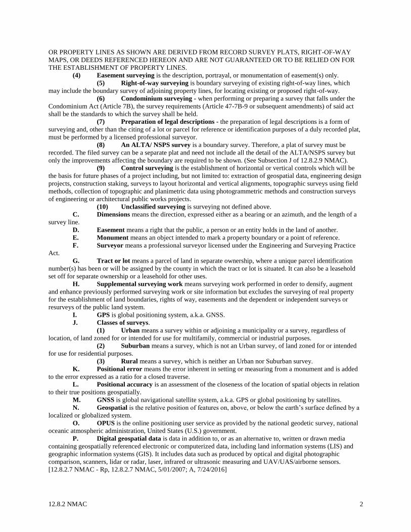
(4) Easement surveying is the description, portrayal, or monumentation of easement(s) only.
(5) Right-of-way surveying is boundary surveying of existing right-of-way lines, which
may include the boundary survey of adjoining property lines, for locating existing or proposed right-of-way.
(6) Condominium surveying - when performing or preparing a survey that falls under the
Condominium Act (Article 7B), the survey requirements (Article 47-7B-9 or subsequent amendments) of said act
shall be the standards to which the survey shall be held.
(7) Preparation of legal descriptions - the preparation of legal descriptions is a form of
surveying and, other than the citing of a lot or parcel for reference or identification purposes of a duly recorded plat,
must be performed by a licensed professional surveyor.
(8) An ALTA/ NSPS survey is a boundary survey. Therefore, a plat of survey must be
recorded. The filed survey can be a separate plat and need not include all the detail of the ALTA/NSPS survey but
only the improvements affecting the boundary are required to be shown. (See Subsection J of 12.8.2.9 NMAC).
(9) Control surveying is the establishment of horizontal or vertical controls which will be
the basis for future phases of a project including, but not limited to: extraction of geospatial data, engineering design
projects, construction staking, surveys to layout horizontal and vertical alignments, topographic surveys using field
methods, collection of topographic and planimetric data using photogrammetric methods and construction surveys
of engineering or architectural public works projects.
(10) Unclassified surveying is surveying not defined above.
C. Dimensions means the direction, expressed either as a bearing or an azimuth, and the length of a
survey line.
D. Easement means a right that the public, a person or an entity holds in the land of another.
E. Monument means an object intended to mark a property boundary or a point of reference.
F. Surveyor means a professional surveyor licensed under the Engineering and Surveying Practice
Act.
G. Tract or lot means a parcel of land in separate ownership, where a unique parcel identification
number(s) has been or will be assigned by the county in which the tract or lot is situated. It can also be a leasehold
set off for separate ownership or a leasehold for other uses.
H. Supplemental surveying work means surveying work performed in order to densify, augment
and enhance previously performed surveying work or site information but excludes the surveying of real property
for the establishment of land boundaries, rights of way, easements and the dependent or independent surveys or
resurveys of the public land system.
I. GPS is global positioning system, a.k.a. GNSS.
J. Classes of surveys.
(1) Urban means a survey within or adjoining a municipality or a survey, regardless of
location, of land zoned for or intended for use for multifamily, commercial or industrial purposes.
(2) Suburban means a survey, which is not an Urban survey, of land zoned for or intended
for use for residential purposes.
(3) Rural means a survey, which is neither an Urban nor Suburban survey.
K. Positional error means the error inherent in setting or measuring from a monument and is added
to the error expressed as a ratio for a closed traverse.
L. Positional accuracy is an assessment of the closeness of the location of spatial objects in relation
to their true positions geospatially.
M. GNSS is global navigational satellite system, a.k.a. GPS or global positioning by satellites.
N. Geospatial is the relative position of features on, above, or below the earth’s surface defined by a
localized or globalized system.
O. OPUS is the online positioning user service as provided by the national geodetic survey, national
oceanic atmospheric administration, United States (U.S.) government.
P. Digital geospatial data is data in addition to, or as an alternative to, written or drawn media
containing geospatially referenced electronic or computerized data, including land information systems (LIS) and
geographic information systems (GIS). It includes data such as produced by optical and digital photographic
comparison, scanners, lidar or radar, laser, infrared or ultrasonic measuring and UAV/UAS/airborne sensors.
[12.8.2.7 NMAC - Rp, 12.8.2.7 NMAC, 5/01/2007; A, 7/24/2016]
12.8.2 NMAC 3
12.8.2.8 REQUIREMENTS: Whenever a professional surveyor or a professional engineer undertakes
any surveying as authorized in the Engineering and Surveying Practice Act, the licensee shall determine which type
of surveying activity is being conducted from the definitions in Subsection A of 12. 8.2.7 NMAC shall then conform
to the requirements set forth in 12.8.2.9 NMAC through 12.8.2.14 NMAC for that type of surveying and must also
comply with accuracy standards in 12.8.2.16 NMAC when applicable. If the surveying is not defined, then the
surveyor shall conform to the requirements for unclassified surveying set forth in 12.8.2.15 NMAC.
[12.8.2.8 NMAC - Rp, 12.8.2.8 NMAC, 5/01/2007]
12.8.2.9 BOUNDARY SURVEYING: When performing a boundary survey, the surveyor shall be
responsible for accomplishing all of the following.
A. Obtain copies of relevant documents necessary to perform the survey.
B. Review recorded plats and plats known to and available to the surveyor that are germane to the
tract being surveyed.
C. Make a site visit and inspect the subject property and look for evidence of existing monuments
and for evidence of possession and usage.
D. Determine the relative location on the ground of all found existing monuments which pertain to
the survey using procedures which achieve the minimum accuracy standards in 12.8.2.16 NMAC.
E. Tag found monuments which are accepted by the surveyor and pertain to the boundary being
surveyed with a metal tag, bearing the surveyor’s license number, attached to the monument with a metal wire or
strap; monuments set by a government agency which are clearly identified by their markings need not be tagged.
F. Set new monuments in conformance with 12.8.2.17 NMAC at all corners of the tract being
surveyed using procedures which achieve the minimum accuracy standards in 12.8.2.16 NMAC, unless a permanent
monument already exists.
G. Follow the rules and procedures, except for the accuracy and monumentation standards, in the
applicable manual of surveying instructions for the survey of the public lands of the U.S., prepared by the United
States bureau of land management, if the tract being surveyed pertains to the United States survey of public lands in
any way including the following:
(1) is a section or an aliquot part of a section;
(2) is a small holding claim, private claim, land grant, mining claim or any other tract
described in the manual of instructions for the survey of the public lands of the United States (manual of surveying
instructions);
(3) has a boundary which is a boundary of a tract described in Subsection G of 12.8.2.9
NMAC, paragraphs (1) or (2) above;
(4) prior surveys and physical evidence within and adjacent to the section being surveyed
should be carefully considered as evidence of original corner locations.
H. Never move, remove nor obscure an existing monument unless it is first properly referenced and
all dimensions necessary to preserve its location are reported on a recorded plat.
I. Updating a prior survey - If an existing survey is updated for any reason, the surveyor shall
comply with the minimum standards in effect at the time of the update unless the update is only to correct a minor
scrivener’s error. If the update is solely to bring the survey into compliance with the minimum standards and the
location of the boundary has not changed, remonumentation is not required unless the original monumentation was
not in compliance with the minimum standards in effect at the time the original survey was performed.
J. Prepare a plat of the survey, unless the survey is only the re-monumentation of corners of a tract,
shown on a recorded plat, where some of the existing corners of the tract are recovered, whose measured dimensions
on the ground are reasonably close to the record dimensions. A plat of survey must be recorded only if it is a survey
of a parcel for which no previously recorded plat exists or, in the case of remonumentation, the surveyor finds that
field measurements are significantly different from record dimensions. The plat may contain as many sheets as
required, which meet the size and material requirements of the state statute and shall contain at least the following:
(1) the name, address and registration number of the surveyor responsible for the survey;
(2) a certificate followed by the dated signature and seal of the surveyor responsible for the
survey stating that the surveyor conducted an actual survey on the ground and is responsible for the survey and that
the survey and plat meet the minimum standards for surveying in New Mexico; only one surveyor’s signature and
seal shall appear on a plat; and the following model certification is considered to be an example of the minimum that
the surveyor should certify to:
I,______(surveyor’s name)________, New Mexico Professional Surveyor No. (surveyors’ license number), do
hereby certify that this Boundary Survey Plat and the actual survey on the ground upon which it is based were
12.8.2 NMAC 4
performed by me or under my direct supervision; that I am responsible for this survey; that this survey meets the
Minimum Standards for Surveying in New Mexico; and that it is true and correct to the best of my knowledge and
belief. I further certify that this survey is not a land division or subdivision as defined in the New Mexico
Subdivision Act and that this instrument is a Boundary Survey Plat of an existing tract or tracts.
(Surveyor’s Name) _____________ PS No. ______________ Date ______________;
(3) a title which shall include the county in which the survey is located and at least the
following:
(a) the lot, block or tract number and subdivision or district name if the survey is
within a subdivision or conservancy district;
(b) the city, grant, small holding, mining or private claim, or similar area in which
the survey is located;
(c) if neither subparagraph (a) nor (b) applies, then the section(s), township(s) and
range(s) in which the survey is located; if the survey is not within a section, then the projected section(s) shall be
stated and designated as such if required by the county clerk;
(4) a north arrow, equivalent scale and graphic scale for each sheet of the main drawing;
(5) a description of all monuments found or set, which shall include identifying
characteristics such as the material, shape and all pertinent information stamped or printed on any cap or tag and the
diameter (or the equivalent if other than round) when possible; a found monument which the surveyor has rejected
as a true property corner shall be designated as such;
(6) the basis of bearings used in the survey which shall be based upon:
(a) New Mexico (NM) state plane coordinates with specifics to elevation, vertical
datum, horizontal datum, zone, mapping angle, ground to grid factor used if using a modified ground system;
(b) a specific line between two points either found or re-established set points as
shown on an existing filed plat;
(c) measured and published geodetic control values based upon an online position
user service (OPUS) solution or geodetic control stations;
(d) a longitudinal line is acceptable based off GPS observation or other means for
determining the longitude of a basis of bearings as long as the longitudinal value is published on the survey with the
method used in determining the longitude; “GPS North” or similar notations without explanation as described above
is unacceptable; “assumed bearings” are prohibited.
(7) a description of pertinent documents, including filing information as applicable, used to
determine the boundaries and to prepare the plat of survey; if a particular document is not of record, this fact shall be
so stated and all information used from the document shall be shown on the plat; if significant discrepancies exist
between the documents used to determine the boundaries, the surveyor shall disclose the same and shall disclose
which document was ultimately relied upon to determine the boundaries;
(8) the boundary being surveyed including the dimensions as measured on the ground and
the record dimensions unless the two are equivalent in which case it shall be so stated; all dimensions which pertain
to the determination of the tract boundaries, and a tie to a suitable, permanent, existing monument;
(9) all dimensions which pertain to the restoration of a lost or obliterated corner or the
subdividing of a section under Subsection G of 12.8.2.9 NMAC;
(10) the location and description of any evidence of a boundary or line of occupation
including such things as a fence, building, wall or the remains thereof which is on a boundary or close enough to a
boundary to be confused with the boundary;
(11) the location and description of all easements known or disclosed to the surveyor which
cross, adjoin or serve a surveyed tract together with the recording data for the document that created the easement
and the location and description of any visible structures which encroach upon said easement;
(12) the radius, central angle, length and chord dimensions for all curves;
(13) the lot number, tract number, other designation or the apparent owner of all adjoining
tracts with the recording data of the last recorded plat;
(14) the relationship of the boundaries of the surveyed property (i.e. contiguity, gaps, or
overlaps) with its adjoiners, where ascertainable from record documents and from field evidence gathered during the
process of conducting the survey of the property being surveyed; if the surveyed property is composed of multiple
parcels, the extent of any gaps or overlaps between those parcels shall be identified;
(15) the location and description of any evidence of use by a nonowner of the surveyed tract
including such things as a road, trail, path, pipeline or utility which crosses a boundary of the tract;
12.8.2 NMAC 5
(16) a letter or number providing a unique designation of each surveyed tract on a plat with
more than one tract;
(17) access easement; if the surveyed tract is not contiguous to a public right-of-way, any
access easement of record which is known to the surveyor shall be described on the plat and its location shall be
determined; if no easement is known to the surveyor, a note prominently shown shall disclose that fact;
(18) the area of each surveyed tract.
K. Record the plat prepared under Subsection J of 12.8.2.9 NMAC with the county clerk of the
county or counties in which the survey is located. A plat of survey must be recorded only if it is a survey of a parcel
for which no previously recorded plat exists or, in the case of remonumentation, the surveyor finds that field
measurements are significantly different from record dimensions. The plat shall be recorded within sixty days of
completion. A plat which requires the approval of a government agency is complete upon final approval. Any other
plat is complete when the surveyor signs or seals it.
[12.8.2.9 NMAC - Rp, 12.8.2.9 NMAC, 5/01/2007; A, 7/24/2016]
12.8.2.10 IMPROVEMENT LOCATION REPORT: A. Improvement location reporting is the preparation of an improvement location report which is a
narrative report, which may be accompanied by a sketch, and which is issued only to a title, abstract or escrow
company or a lending institution for their exclusive use; it shall not be represented by the surveyor as being a
property boundary survey.
B. If the report contains a sketch, the sketch shall contain the following words which are printed as
large and as prominently as any other words upon the sketch: “This report is not for use by a property owner for any
purpose. This is not a boundary survey and may not be sufficient for the survey exception from an owner’s title
policy. It may or may not reveal encroachments, overlaps, conflicts in boundary lines, shortages in area, or other
matters which would be disclosed by an accurate boundary survey.”
[12.8.2.10 NMAC - Rp, 12.8.2.10 NMAC, 5/01/2007; A, 7/24/2016]
12.8.2.11 TOPOGRAPHIC SURVEYING: On topographic surveys with contour lines, the vertical
accuracy of ninety percent of the points tested shall be within one half of the contour interval, unless otherwise
stated on the survey. Every topographic map shall comply with 12.8.2.14 and 12.8.2.16 NMAC.
[12.8.2.11 NMAC - Rp, 12.8.2.11 NMAC, 5/01/2007; A, 7/24/2016]
12.8.2.12 EASEMENT SURVEYING: A. When performing easement surveying, the surveyor shall use procedures in any field
measurements which achieve the minimum accuracy standards in 12.8.2.16 NMAC.
B. If the easement does not run parallel to a boundary of the tract in which it is located, then the
surveyor shall prepare a plat which shows the dimensions of the easement and conforms with Paragraphs (1), (2),
(3), (4), (5) and (6) of Subsection J of 12.8.2.9 NMAC, and complies with one of the following:
(1) shows ties to record monuments at the beginning and ending of the easement and at least
at every mile along the easement; or
(2) shows the coordinates of the beginning, ending and all angle points in accordance with
the New Mexico coordinate system and shows the grid bearing and ground distance between said points; or
(3) shows ties to existing corners of a subdivision in which the easement is located.
C. These field procedures and subsequent plat preparation or legal description must be conducted
under the responsible charge of a professional surveyor.
D. Unless the easement runs parallel to the boundary of the tract, ties from points on the easement to
lot corners shall be shown for every tract the easement is affecting so that when a subsequent survey is being
prepared on the tract, the location can be defined based upon the ties.
[12.8.2.12 NMAC - Rp, 12.8.2.12 NMAC, 5/01/2007; A, 7/24/2016]
12.8.2.13 RIGHT OF WAY SURVEYING: When performing right of way surveying, the surveyor shall
do all of the following.
A. Obtain a copy of the last recorded deed for the tract(s) affected by the existing or contemplated
right of way and obtain copies of all existing right of way maps and conveyance documents available.
B. Obtain a copy of all available, relevant recorded plats and all plats and maps known to be available
to the surveyor for the tract(s) affected by the existing or contemplated right of way.

12.8.2 NMAC 6
C. Make a diligent search on the ground, including the use of a metal detector, for all existing
monuments, which pertain to the property boundaries intersecting the public highway right of way corridor being
surveyed.
D. Determine the relative location on the ground of all found existing monuments, which pertain to
the survey using procedures to achieve the minimum accuracy standards in 12.8.2.16 NMAC.
E. [RESERVED] F. Set new monuments conforming to 12.8.2.17 NMAC on the right of way limit lines at all changes
in direction and at all points where property lines intersect, using procedures which achieve the minimum accuracy
standards in 12.8.2.16 NMAC, unless a permanent monument exists; when monumenting existing right of way limit
lines, monuments at intersecting property lines need not be set.
G. Follow the rules and procedures, except for the accuracy and monumentation standards, in the
manual of instructions for the survey of the public lands of the United States (manual of surveying instructions)
prepared by the United States bureau of land management, if the tract being surveyed pertains to the United States
survey of public lands in any way including the following:
(1) is a section or an aliquot part of a section;
(2) is a small holding claim, private claim, land grant, mining claim or any other tract
described in the manual of instructions for the survey of the public lands of the United States (manual of surveying
instructions);
(3) has a boundary which is a boundary of a tract described in Subsection G of 12.8.2.13
NMAC, paragraphs (1) or (2) above.
H. Whenever a tract of land is to be severed by right of way acquisition, the surveyor shall locate
property lines that intersect the right of way limits. The surveyor shall use all available documents, field data,
including parol evidence and land title information to determine the length, location and bearing of the severed
property line relative to the right of way limits. This includes surveying as many additional parcel boundaries as
necessary which connect to the property lines intersecting the right of way in order to accurately locate the property
lines affected by the contemplated right of way.
I. [RESERVED] J. Prepare a plat of survey, containing as many sheets as required, and which contains at least the
following:
(1) the name, address, and registration number of the surveyor responsible for the survey;
(2) a certificate followed by the signature and seal of the surveyor responsible for the survey
and stating that the survey and plat meet the minimum standards for surveying in New Mexico;
(3) a title which shall include at least the following:
(a) the project number;
(b) the project's control number (PCN) of the project (if applicable);
(4) the section(s), township(s), range(s), grant or reservation, municipality, and county(s) in
which the project is located;
(5) a north arrow, equivalent scale, graphic scale, date of the fieldwork and a
location/vicinity map showing where the project is located;
(6) a description of all monuments found or set; a found monument, which the surveyor
rejected as a property corner, shall be designated as such;
(7) the basis of bearing used shall comply with the requirement Paragraph (6) of Subsection J
of 12.8.2.9 NMAC;
(8) a description of all documents used to determine the boundary of any tract surveyed and
to prepare the plat of survey; the recording information shall be stated; if the document is not of record, all
information used from the document shall be shown on the plat;
(9) the pertinent boundaries of the tract abutting the right of way being surveyed including
the dimensions as measured on the ground and the record dimensions unless the two are equivalent;
(10) the location and description of any evidence of a boundary line shall comply with
Paragraph (10) of Subsection J of 12.8.2.9 NMAC;
(11) all dimensions which pertain to the restoration of a lost corner or the subdivision of a
section under Subsection G of 12.8.2.13 NMAC;
(12) the location of permanent improvements lying in close proximity to the new right of way
limit line and which may be affected by the contemplated acquisition of land for public use;
(13) the radius, central angle, length and the chord bearing and dimension for all curves;
12.8.2 NMAC 7
(14) the lot number, tract number, other designation or the apparent owner of all adjoining
tracts with the recording data of the last recorded plat;
(15) the name of the owner of the parcel from which right of way is being acquired;
(16) the location and description of all easements known or disclosed to the surveyor which
cross, or adjoin the right of way;
(17) a letter/number or combined letter and number designation of each parcel acquired for
right of way.
K. Record the plat prepared under Subsection J of 12.8.2.13 NMAC with the county clerk of the
county or counties in which the project is located. The plat shall be recorded within sixty days of completion. The
plat is considered complete when the surveyor signs and seals it. For the New Mexico department of transportation
(NMDOT) right of way surveys, the plat(s) may carry multiple surveyor certifications, if necessary, in order to
reflect specific areas of individual responsibility when the scope, duration, or complexity of a NMDOT right of way
project so requires. Certifications of all other right of way surveys shall carry a single signature and seal of the
surveyor responsible for the survey.
[12.8.2.13 NMAC - Rp, 12.8.2.13 NMAC, 5/01/2007; A, 7/24/2016]
12.8.2.14 CONTROL SURVEYING REPORTING: Whenever a professional surveyor undertakes control
surveying as defined in 12.8.2.7 NMAC, where the coordinates and elevations of the control points established by
the survey will be relied upon by professionals other than the original surveyor for future phases of the work, the
licensee shall prepare a control survey report and shall provide the report to the prime client and to any other person
who makes a written submittal. Alternatively, if the entire report is contained on the face of the work product no
other reporting is required. The report will contain the following information as appropriate to work being
performed.
A. A listing of the final adjusted coordinates and elevations for all points within the control network
along with a complete description of all monuments established or recovered.
B. A complete description of the horizontal and vertical datum used including the basis of bearings.
C. A complete description of the state plane or UTM zone used including all pertinent metadata, if
appropriate.
D. Units used for coordinates and elevations.
E. Description of monument(s) used to constrain the control network including the reference
coordinates and elevations used for said monument(s).
F. If the final adjusted coordinates are based on a modified (ground datum) state plane coordinate
system or a low-distortion local coordinate system (ground referenced) derived from geospatial positions, a
complete description of the method(s) used to generate the modified coordinates shall be included in the report.
G. A brief description detailing the field methods and equipment used to conduct the control survey.
H. The date when the control monuments were set, the date when the control monuments were
positionally observed, and the date of the final network adjustment.
I. Nothing in this section dictates the spatial accuracy that will be required by any specific project. It
will be the responsibility of the individual licensee to determine the appropriate level of accuracy for each project.
However, the licensee shall report the spatial accuracy in both the horizontal and vertical components.
J. A certificate followed by the dated signature and seal of the surveyor responsible for the control
survey stating that the surveyor conducted an actual survey on the ground and is responsible for the survey. The
following model certification is considered to be an example of the minimum that the surveyor should certify to:
I, (surveyor’s name) , New Mexico Professional Surveyor No. (surveyor’s license number), do
hereby certify that this Control Survey Report was prepared by me or under my direct supervision based on an actual
survey on the ground as described herein; that I am responsible for this survey; and that the survey and report meets
the minimum standards for surveying in New Mexico.
[12.8.2.14 NMAC - N, 5/01/2007; A, 7/24/2016]
12.8.2.15 UNCLASSIFIED SURVEYING: When a surveyor does surveying of a type not described in
these standards, the surveyor shall do all that is necessary to fully determine and report all information which is
relevant to the project. The scope of the project may be stated and limited. The surveyor shall not prepare or sign a
document, which could mislead or misinform. If a surveyor issues a plat with the surveyor’s signature and seal,
which was not required by these minimum standards, the plat shall comply with the applicable portions of
Subsection J of 12. 8.2.9 NMAC.
[12.8.2.15 NMAC - Rp, 12.8.2.14 NMAC, 5/01/2007]

12.8.2 NMAC 8
12.8.2.16 ACCURACY: A. Topographic map accuracy standards.
(1) The required horizontal and vertical accuracy of a topographic map produced by field
procedures or photogrammetric methods shall be determined on a project by project basis and shall meet the
accuracy standards set forth in the current American society for photogrammetry and remote sensing (ASPRS)
positional accuracy standards for digital geospatial data. accuracy testing and reporting shall be pursuant to the
current ‘ASPRS positional accuracy standards for digital geospatial data’. Accuracy testing and reporting shall be
pursuant to the current ‘ASPRS positional accuracy standards for digital geospatial data’ as well.
(2) [RESERVED]
(3) [RESERVED] (4) Accuracy reporting - If testing by an independent source of higher accuracy has not or
cannot be followed, the final topographic map shall contain the following statement: “This map has been produced
according to procedures that have been demonstrated to produce data that meets or exceeds the minimum standards
for a topographic map compiled at a scale of (insert map scale here) with a contour interval of (insert contour
interval here).” If testing by an independent source of higher accuracy has been conducted pursuant to the guidelines
contained herein, the final topographic map shall contain the following statement: “This map has been tested from
an independent source of higher accuracy and meets the Minimum Standards for a topographic map compiled at a
scale of (insert map scale here) with a contour interval of (insert contour interval here).”
(5) Alteration of original mapping (scale): When the presentation scale of a map is other than
that of the compilation scale, that fact shall be stated in the legend. “This map is an enlargement of a 1:2,400 map”
or “This map is a reduction of a 1”=200’ map.”
B. Boundary surveying, easement surveying and right-of-way surveying accuracy standards. The
surveyor shall determine the class of a survey using the definitions in Paragraphs (1) through (3) of Subsection I of
12.8.2.7 NMAC, and achieve the accuracy specified for the class of survey. It is the responsibility of the surveyor to
select the appropriate procedures and equipment to obtain the accuracy required by the minimum field accuracy
standards below for boundary surveying, easement surveying and right-of-way surveying:
Urban Suburban Rural
Unadjusted closure (Traverse) 1 part in 15,000 1 part in 10,000 1 part in 7,500
Positional accuracy 0.10 ft. 0.10 ft. 0.25 ft.
Location of improvements 0.15 ft. 0.25 ft. 1.0 ft.
C. [RESERVED] [12.8.2.16 NMAC - Rp, 12.8.2.15 NMAC, 5/01/2007; A, 7/24/2016]
12.8.2.17 MONUMENTS: A. Except as prescribed in Subsections B and C of 12.8.2.16 NMAC, monuments set by the surveyor
shall be ferrous metal, at least one-half inch in diameter (or the equivalent if other than round) and at least 16 inches
long. They shall bear a metal or plastic cap stamped with the surveyor’s license number.
B. Corners which fall upon a hard surface shall be monumented with a chiseled cross or a nail in a
disk or tag bearing the surveyor’s registration number.
C. When a corner is located at a place where it is not practical to set a monument or a monument at
the corner is likely to be destroyed, at least one reference monument shall be set and dimensioned on the plat such
that the location of the corner can be reestablished.
D. Monuments for the exterior corners of a subdivision shall be set by the surveyor who certified the
plat of the subdivision prior to recordation of the subdivision plat. It is the responsibility of the subdivider to ensure
that interior corners of a subdivision are set within 30 days of completion of the construction of infrastructure
improvements but within one year after recordation of the subdivision plat. The board of licensure may elect to
extend the time period upon the showing of good cause. The surveyor certifying the subdivision plat shall be
responsible for notifying the subdivider by either including a statement regarding this responsibility in the executed
contract for services or by letter sent certified mail, return receipt requested. The requirements of this section are met
if any surveyor stakes the interior corners of the subdivision. If the subdivision is developed in phases, the interior
corners of each phase may be staked by separate surveyors, provided the above stated time limits are met or
12.8.2 NMAC 9
extended by decision of the board of licensure. Under this section, it is the responsibility of each surveyor who
stakes the interior corners of a subdivision to record an affidavit with the county clerk. Said affidavit shall be signed
and sealed by the surveyor and shall contain at least the following: subdivision name as shown on the recorded plat,
all recording information, name of subdivider, type of monuments set and, if the surveyor is staking a phase of the
subdivision, the limits of responsibility. If the surveyor is required to record a plat of survey under the requirements
of Subsection J of 12.8.2.9 NMAC, the affidavit may be included on said plat.
E. A surveyor shall perpetuate monuments established by the public land survey system which the
surveyor finds in need of rehabilitation or replacement. A description of the monument as found and as restored or
referenced and all available dimensions to other monuments shall be reported on a recorded plat. Said plat may be a
boundary survey plat. If circumstances do not require a boundary survey plat, a plat depicting only the rehabilitated
or replaced monuments will satisfy the requirements of this section.
F. For monuments which pertain to the survey, a surveyor shall perpetuate those monuments which
the surveyor finds in need of rehabilitation or replacement. A description of the monument as found and as restored
or referenced and all available dimensions to other monuments shall be reported on a recorded plat.
[12.8.2.17 NMAC - Rp, 12.8.2.16 NMAC, 5/01/2007; A, 7/24/2016]
12.8.2.18 GENERAL: A. Authority. These rules are authorized by the Engineering and Surveying Practice Act.
B. Penalties. The New Mexico board of licensure for professional engineers and professional
surveyors may take those actions prescribed in the Engineering and Surveying Practice Act against any surveyor
who has been found in violation of these standards, or against non-licensed practitioners.
C. Disclaimers. Any disclaimer by a surveyor purporting to disavow compliance with any of these
standards is prohibited.
D. Certifications. Professional surveyors should be prepared to certify to those things required in the
execution of their duties and those mandated by law or rule. They should be cautious, however, in certifying only to
conditions and facts falling within their areas of competency. Certification language that goes beyond the
obligations prescribed by law and the responsibilities assumed by the surveyor in the normal course of boundary
surveying should be carefully considered by the surveyor before signing and sealing any document.
E. Interpretation. The words “offers surveying services to the public” as used in Paragraph B of
Section 61-23-27 (10), NMSA 1978, includes the certification by a surveyor of a plat or map which may be used by
the public.
F. Advisory Opinions. The surveying committee of the board of licensure may issue its opinion
explaining the application of these standards to a specific situation.
[12.8.2.18 NMAC - Rp, 12.8.2.17 NMAC, 5/01/2007]
HISTORY OF 12.8.2 NMAC:
Pre-NMAC History: Material in this Part is derived from that previously filed with the commission of public records - state records center
& archives under: PELS Rule No. 83-1, Standards for Land Surveyors in New Mexico, filed 3-21-83; PELS Rule
No. 83-1, Amendment No. 1, filed 6-25-84; PE/PS rule No. 89-3 Minimum Standards for Land Surveying in New
Mexico, filed 10-25-89; Rule 91-1, Minimum Standards for Surveying in New Mexico - Purpose, filed 11-19-91,
Rule 500.1, Minimum Standards for Surveying in New Mexico/Requirements, filed 12-29-93; Rule 91-2, Minimum
Standards for Surveying in New Mexico- Authority, filed 11-19-91; Rule 500.12, Minimum Standards for Surveying
in New Mexico - General, filed 12-29-93, Rule 91-3, Minimum Standards for Surveying in New Mexico -
Definitions, filed 11-19-91; Rule 500.2, Minimum Standards for Surveying in New Mexico - Types of Surveying,
filed 12-29-93; Rule 91-4, Minimum Standards for Surveying in New Mexico - Requirements for Surveys, filed 11-
19-91; Rule 500.10 Minimum Standards for Surveying in New Mexico - Monuments, filed 12-29-93; Rule 91-5,
Minimum Standards for Surveying in New Mexico - Minimum Accuracy Standards, filed 11-19-91; Rule 500.9,
Minimum Standards for Surveying in New Mexico - Accuracy, filed 12-29-93; Rule 91-6, Minimum Standards for
Surveying in New Mexico - Penalties, filed 11-19-91; Rule 500.3, Minimum Standards for Surveying in New
Mexico/Property Boundary Surveying, filed 12-29-93; Rule 500.4, Minimum Standards for Surveying in New
Mexico/Inspection Report Surveying, filed 12-29-93; Rule 500.5, Minimum Standards for Surveying in New
Mexico/Topographic Surveying, filed 12-29-93; Rule 500.6, Minimum Standards for Surveying in New
Mexico/Easement Surveying, filed 12-29-93; Rule 500.7, Minimum Standards for Surveying in New
Mexico/Highway Right of Way Surveying, filed 12-29-93; Rule 500.8, Minimum Standards for Surveying in New
12.8.2 NMAC 10
Mexico/Unclassified Surveying, filed 12-29-93; Rule 500.11, Minimum Standards for Surveying in New
Mexico/Definitions, filed 12-29-93.
History Repealed Material:
12 NMAC 8.2, Minimum Standards for Surveying in New Mexico (filed 01-18-2000) repealed 10-01-2000.
12.8.2 NMAC, Minimum Standards for Surveying in New Mexico (filed 08-15-00) repealed 5/01/2007.
Other History: Rule 91-6, Minimum Standards for Surveying in New Mexico - Penalties, filed 11-19-91;
Rule 500.1, Minimum Standards for Surveying in New Mexico/Requirements (filed 12-29-93);
Rule 500.2, Minimum Standards for Surveying in New Mexico - Types of Surveying (filed 12-29-93);
Rule 500.3, Minimum Standards for Surveying in New Mexico/Property Boundary Surveying (filed 12-29-93);
Rule 500.4, Minimum Standards for Surveying in New Mexico/Inspection Report Surveying (filed 12-29-93);
Rule 500.5, Minimum Standards for Surveying in New Mexico/Topographic Surveying (filed 12-29-93);
Rule 500.6, Minimum Standards for Surveying in New Mexico/Easement Surveying (filed 12-29-93);
Rule 500.7, Minimum Standards for Surveying in New Mexico/Highway Right of Way Surveying (filed 12-29-93);
Rule 500.8, Minimum Standards for Surveying in New Mexico/Unclassified Surveying (filed 12-29-93);
Rule 500.9, Minimum Standards for Surveying in New Mexico - Accuracy (filed 12-29-93);
Rule 500.10 Minimum Standards for Surveying in New Mexico - Monuments (filed 12-29-93);
Rule 500.11, Minimum Standards for Surveying in New Mexico/Definitions (filed 12-29-93);
Rule 500.12, Minimum Standards for Surveying in New Mexico - General (filed 12-29-93) were all renumbered,
reformatted and replaced by 12 NMAC 8.2, Minimum Standards for Surveying in New Mexico, effective 03-02-03.
12 NMAC 8.2, Minimum Standards for Surveying in New Mexico (filed 01-18-00) was renumbered, reformatted,
and replaced by 12.8.2 NMAC, Minimum Standards for Surveying in New Mexico, effective 10-01-2000.
12.8.2 NMAC, Minimum Standards for Surveying in New Mexico (filed 08-15-00) was replaced by 12.8.2 NMAC,
Minimum Standards for Surveying in New Mexico, effective 5/01/2007.

Minimum Standards for Surveying in New Mexico ~ 2016
Related Documents