Aerial Photogrammetry for Volcanology Drew Silcock University of Bristol, Department of Earth Sciences Wednesday 17 th September, 2014

Welcome message from author
This document is posted to help you gain knowledge. Please leave a comment to let me know what you think about it! Share it to your friends and learn new things together.
Transcript

Aerial Photogrammetry forVolcanology
Drew Silcock
University of Bristol, Department of Earth Sciences
Wednesday 17th September, 2014

OutlineIntroduction
PhotogrammetryPhoto Taking Technique
Software UsedAgisoft PhotoScanMission Planner and APMCanon Hack Development Kit
UsesLava Flow
MetholodogyGeotaggingGround Control PointsAccuracy and Precision
ResultsAerial SurveyAvon Gorge
Future Projects
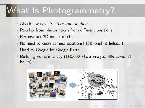
What Is Photogrammetry?▸ Also known as structure from motion▸ Parallax from photos taken from different positions▸ Reconstruct 3D model of object▸ No need to know camera positions! (although it helps...)▸ Used by Google for Google Earth▸ Building Rome in a day (150,000 Flickr images, 496 cores, 21hours):

Taking Photos
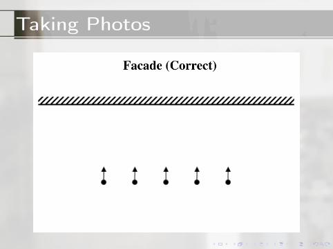
Taking Photos

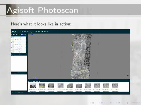
Agisoft Photoscan
▸ Input photos of an object from different positions▸ Uses parallax to generate sparse point cloud▸ Uses sparse point cloud to generate dense point cloud▸ Uses dense point cloud to generates mesh (connect the dots)▸ Overlaps texture from photos on top (texture)
Agisoft Photoscan
Here’s what it looks like in action:

Agisoft PhotoscanHere’s what it produces:

Mission Planner and APM
▸ ArduPilot Mega (APM):autopilot for UAV
▸ Takes instruction fromMission Planner (MP)
▸ MP can:1. Set waypoints for UAV2. Tell UAV to hover3. Tell UAV to take
photos (theoretically)4. Geotag photos from
log or time offset(more on this later)
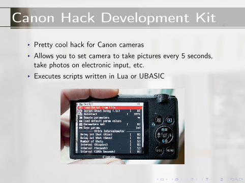
Canon Hack Development Kit
▸ Pretty cool hack for Canon cameras▸ Allows you to set camera to take pictures every 5 seconds,take photos on electronic input, etc.
▸ Executes scripts written in Lua or UBASIC

Uses
▸ As with Lidar (see Oscar’s presentation)▸ Studying lava flow▸ Lava flow prediction▸ UAVs able to get where traditionally it was not possible▸ Cheap (buy simply point and shoot from Amazon)▸ Light (especially useful for putting on UAVs)
Taking Photos
Two options:Time delay Tell CHDK to take pictures every 5 seconds, strap it
onto your UAV and you’re ready to goCAM messages Tell CHDK to take photos whenever it receives
an electronic signal of a particular kind (Pulse WidthModulation). APM then logs this event.
Latter is better for geotagging (next slide), but also a huge pain toget to work...

Geotagging - Time Delay
▸ APM keeps a log of GPS location, time, yaw and roll▸ Tell MP offset between first photo and first log message (takepicture of screen), give it log and photos and it geotags them
▸ Two types of logs:Telemetry logs (.tlog)
Taken while MP connected to APM by USB andsaved to MP computer
Dataflash logs (.log)Taken while the copter is armed and saved toAPM flash storage; download later whenconnected to MP
▸ Dataflash used when aerial
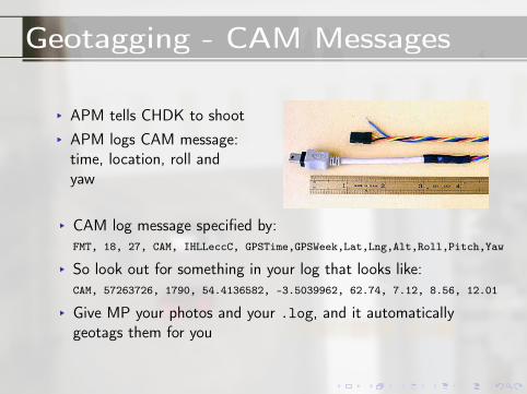
Geotagging - CAM Messages
▸ APM tells CHDK to shoot▸ APM logs CAM message:time, location, roll andyaw
▸ CAM log message specified by:FMT, 18, 27, CAM, IHLLeccC, GPSTime,GPSWeek,Lat,Lng,Alt,Roll,Pitch,Yaw
▸ So look out for something in your log that looks like:CAM, 57263726, 1790, 54.4136582, -3.5039962, 62.74, 7.12, 8.56, 12.01
▸ Give MP your photos and your .log, and it automaticallygeotags them for you

Ground Control Points
▸ To help with the photogrammetric reconstruction, we employGCPs
▸ Measure in the exact location of a coordinate, marked with adistinguishable feature (e.g. cross)
▸ Tell PhotoScan where that mark is geographically asco-ordinates in local reference or WGS 84
▸ PhotoScan optimises point cloud generation▸ Improved accuracy and precision

Ground Control Points

Accuracy and Precision▸ Meters per pixel as function of height▸ Minimum UAV speed needed to give required overlap (80%)▸ Agisoft generated reports give m/pix, error in pix, DEM errorin pix

Results
Aerial Survey
▸ Long Ashton field▸ Partly mapped, before everything broke▸ PhotoScan generated DEM, orthophoto, photooverlap, GCP data and accuracy
Avon Gorge
▸ Avon Gorge, big rock with cool fractures▸ Horizontal instead of vertical▸ PhotoScan generated DEM, orthophoto, photooverlap and accuracy

Aerial Survey Without GCPs
https://sketchfab.com/models/ec777be4b73f4e7a8fdd992c2b8d026a

Aerial Survey With GCPs

Avon Gorgehttps://sketchfab.com/models/ad8a1d9f8c324eb592a9e4beabc5a51e

Future Projects
▸ Figure out how to get MP to tell CHDK to take photos atwaypoints
▸ Investigate more possible uses for Earth Science/Volcanology▸ Write manual for future UAV/photogrammetry researcher▸ Rerun reconstruction of Avon Gorge with GCPs

Lidar vs. Photogrammetry
Pros of Photogrammetry▸ Cheap (doesn’t matter ifyou drop it in some lava)
▸ Light (good for putting onUAVs)
Pros of Lidar▸ Very accurate and precise▸ Real-time measurements -can make measurementsof dynamic, movingobjects
Related Documents