National Park Service Cultural Landscapes Inventory Brooks Farm Minute Man National Historical Park 2012

Welcome message from author
This document is posted to help you gain knowledge. Please leave a comment to let me know what you think about it! Share it to your friends and learn new things together.
Transcript
National Park Service
Cultural Landscapes Inventory
Brooks Farm
Minute Man National Historical Park
2012
Table of Contents
Inventory Unit Summary & Site Plan
Concurrence Status
Geographic Information and Location Map
Management Information
National Register Information
Chronology & Physical History
Analysis & Evaluation of Integrity
Condition
Treatment
Bibliography & Supplemental Information
Minute Man National Historical Park
Brooks Farm
Inventory Unit Summary & Site Plan
The Cultural Landscapes Inventory Overview:
Inventory Summary
Purpose and Goals of the CLI
The Cultural Landscapes Inventory (CLI), a comprehensive inventory of all cultural landscapes
in the national park system, is one of the most ambitious initiatives of the National Park Service
(NPS) Park Cultural Landscapes Program. The CLI is an evaluated inventory of all
landscapes having historical significance that are listed on or eligible for listing on the National
Register of Historic Places, or are otherwise managed as cultural resources through a public
planning process and in which the NPS has or plans to acquire any legal interest. The CLI
identifies and documents each landscape’s location, size, physical development, condition,
landscape characteristics, character-defining features, as well as other valuable information
useful to park management. Cultural landscapes become approved CLIs when concurrence
with the findings is obtained from the park superintendent and all required data fields are
entered into a national database. In addition, for landscapes that are not currently listed on the
National Register and/or do not have adequate documentation, concurrence is required from the
State Historic Preservation Officer or the Keeper of the National Register.
The CLI, like the List of Classified Structures, assists the NPS in its efforts to fulfill the
identification and management requirements associated with Section 110(a) of the National
Historic Preservation Act, National Park Service Management Policies (2006), and Director’s
Order #28: Cultural Resource Management. Since launching the CLI nationwide, the NPS, in
response to the Government Performance and Results Act (GPRA), is required to report
information that respond to NPS strategic plan accomplishments. Two GPRA goals are
associated with the CLI: bringing certified cultural landscapes into good condition (Goal 1a7)
and increasing the number of CLI records that have complete, accurate, and reliable
information (Goal 1b2B).
Scope of the CLI
The information contained within the CLI is gathered from existing secondary sources found in
park libraries and archives and at NPS regional offices and centers, as well as through on-site
reconnaissance of the existing landscape. The baseline information collected provides a
comprehensive look at the historical development and significance of the landscape, placing it in
context of the site’s overall significance. Documentation and analysis of the existing landscape
identifies character-defining characteristics and features, and allows for an evaluation of the
landscape’s overall integrity and an assessment of the landscape’s overall condition. The CLI
also provides an illustrative site plan that indicates major features within the inventory unit.
Unlike cultural landscape reports, the CLI does not provide management recommendations or
CLI General Information:
Cultural Landscapes Inventory Page 1 of 103
Minute Man National Historical Park
Brooks Farm
treatment guidelines for the cultural landscape.
Inventory Unit Description:
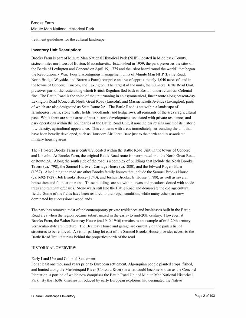
Brooks Farm is part of Minute Man National Historical Park (NHP), located in Middlesex County,
sixteen miles northwest of Boston, Massachusetts. Established in 1959, the park preserves the sites of
the Battle of Lexington and Concord on April 19, 1775 and the “shot heard round the world” that began
the Revolutionary War. Four discontiguous management units of Minute Man NHP (Battle Road,
North Bridge, Wayside, and Barrett’s Farm) comprise an area of approximately 1,040 acres of land in
the towns of Concord, Lincoln, and Lexington. The largest of the units, the 800-acre Battle Road Unit,
preserves part of the route along which British Regulars fled back to Boston under relentless Colonial
fire. The Battle Road is the spine of the unit running in an asymmetrical, linear route along present-day
Lexington Road (Concord), North Great Road (Lincoln), and Massachusetts Avenue (Lexington), parts
of which are also designated as State Route 2A. The Battle Road is set within a landscape of
farmhouses, barns, stone walls, fields, woodlands, and hedgerows, all remnants of the area’s agricultural
past. While there are some areas of post-historic development associated with private residences and
park operations within the boundaries of the Battle Road Unit, it nonetheless retains much of its historic
low-density, agricultural appearance. This contrasts with areas immediately surrounding the unit that
have been heavily developed, such as Hanscom Air Force Base just to the north and its associated
military housing areas.
The 91.5-acre Brooks Farm is centrally located within the Battle Road Unit, in the towns of Concord
and Lincoln. At Brooks Farm, the original Battle Road route is incorporated into the North Great Road,
or Route 2A. Along the south side of the road is a complex of buildings that include the Noah Brooks
Tavern (ca.1798), the Samuel Hartwell Carriage House (ca.1880), and the Edward Rogers Barn
(1937). Also lining the road are other Brooks family houses that include the Samuel Brooks House
(ca.1692-1728), Job Brooks House (1740), and Joshua Brooks, Jr. House (1780), as well as several
house sites and foundation ruins. These buildings are set within lawns and meadows dotted with shade
trees and remnant orchards. Stone walls still line the Battle Road and demarcate the old agricultural
fields. Some of the fields have been restored to their open condition, while many others are now
dominated by successional woodlands.
The park has removed most of the contemporary private residences and businesses built in the Battle
Road area when the region became suburbanized in the early- to mid-20th century. However, at
Brooks Farm, the Walter Beatteay House (ca.1940-1946) remains as an example of mid-20th century
vernacular-style architecture. The Beatteay House and garage are currently on the park’s list of
structures to be removed. A visitor parking lot east of the Samuel Brooks House provides access to the
Battle Road Trail that runs behind the properties north of the road.
HISTORICAL OVERVIEW
Early Land Use and Colonial Settlement:
For at least one thousand years prior to European settlement, Algonquian people planted crops, fished,
and hunted along the Musketequid River (Concord River) in what would become known as the Concord
Plantation, a portion of which now comprises the Battle Road Unit of Minute Man National Historical
Park. By the 1630s, diseases introduced by early European explorers had decimated the Native
Cultural Landscapes Inventory Page 2 of 103
Minute Man National Historical Park
Brooks Farm
American population.
Colonial settlement began in 1635 when Puritan families ventured inland to settle within the newly
established Concord Plantation, and in the following year house lots were allocated along an east-west
ridgeline as part of Concord’s First Division. In 1640 the town of Cambridge extended west to the
Concord Plantation’s eastern border, and the newly settled land was known as Cambridge Farms. The
farms would separate from Cambridge in 1713, becoming the town of Lexington. The town of Lincoln
formed in 1754, its boundaries including portions of Concord and Lexington. (Cultural Landscape
Report--hereafter CLR--2005: 9)
Settlement within the present-day Battle Road Unit occurred along the primary east-west road
paralleling the ridgeline and connecting the Concord Plantation and Cambridge Farms (later the towns
of Concord, Lincoln, and Lexington) to Boston. The road then was called by other names including the
Bay Road and Country Road, and is now known as the Battle Road or the North Great Road. On both
sides of the road were agricultural fields, which in the early to mid-17th century were commonly held in
large tracts a distance from the farmhouses. Farm production was subsistence based, each family
producing enough food for personal consumption and perhaps a small amount for local trade. As the
century progressed, the common field system dissolved and agricultural fields were clustered closer to
the farmsteads. By 1775 tilled fields, pastures, and meadows divided by fences and stone walls
occupied most of the acreage along the Battle Road. Intermixed were small woodlots, orchards, farm
buildings, taverns, and a number of small home-based businesses. Additional roads were constructed
throughout the 18th century. (CLR 2005: 9)
The Brooks Family:
The large Brooks family that farmed along Battle Road for more than three hundred years descended
from Captain Thomas Brooks, who settled in Watertown, MA in 1635. Captain Brooks moved to
Concord around 1650 and was one of the first individuals to receive property apportioned during
Concord’s First and Second Divisions. Captain Brooks’ son, Joshua, inherited several parcels from his
father, and Joshua distributed his holdings to four sons, Noah, Daniel, Joseph, and Job in 1695. (Job
Brooks House Historic Structure Report--hereafter JBHSR--1992: 13, 15)
Noah established a farm on the south side of Battle Road and built a tanyard on Elm Brook north of the
road and slightly east of the Brooks Farm area. Daniel received acreage north of the road and probably
built a house there. Job bought 17 acres of upland and meadow from his father on the north side of the
road and built a house and barn. Job died in 1697, and younger brother Hugh inherited Job’s property
by quit claim deed. (Joshua Brooks, Jr. House Historic Structure Report--hereafter JSHSR--2000: 3;
Samuel Brooks House Historic Structure Report--hereafter SHSR--2000: 3; JBHSR 1992: 15-17)
Land was transferred in Brooks Farm throughout the 18th century. Noah Brooks gave his son Joshua
the tannery and, in 1713, a dwelling house and two acres across from the tannery south of the Battle
Road. This property was the same land upon which was later built Joshua’s grandson’s house, the
Joshua Brooks, Jr. House. Noah’s other son, Thomas, received “10 acres with house and barn” just to
the west of Joshua’s land, including the future Noah Brooks Tavern land, around 1726. Meanwhile,
Cultural Landscapes Inventory Page 3 of 103
Minute Man National Historical Park
Brooks Farm
Daniel Brooks died in 1733, leaving a prosperous farm and dwelling house to his son, Samuel. In 1740
Hugh Brooks deeded land to his youngest son, Job, including the 20-acre homestead. By the end of the
18th century, the Brooks family was in its fifth generation on Battle Road, with Captain Brooks’
great-grandsons and great-great-grandsons owning the family land. (JSHSR 2000: 3; Noah Brooks
Tavern Site Historic Structure Report--hereafter NHSR--2000: 3; SHSR 2000: 3; JBHSR 1992: 20-21)
The American Revolution:
On April 19, 1775 colonists engaged in battle with British Regulars, widely recognized as the opening
shots of the American War of Independence. Colonial minutemen and militia confronted the British
troops along the entire length of the road from Concord to Boston, part of which has become known as
the Battle Road. Intense fighting took place at Brooks Hill, located just west of Brooks Road and south
of the Battle Road. Colonists were lying on the hill waiting to attack the British, but the British
discovered the ambush before entering the colonists’ firing range, and both sides mounted attacks.
Fighting continued in the Brooks Farm area as the British moved east along the Battle Road. Though
the fighting in this area was limited to one day, the war would continue until the Treaty of Paris was
signed in 1783. (CLR 2005: 9-10, 44; JSHSR 2000: 4; Malcolm 1985: 56)
Rural Economy:
Between 1802 and 1806, portions of the Battle Road were straightened and integrated with other
unaltered portions to form the North Great Road. Farmers could more efficiently carry goods to market
on the improved road, fueling the change from subsistence to commercial economy. Introduction of
railroad lines in the mid-19th century also compelled Battle Road farmers to specialize in perishable
products easily transported to regional urban markets, which were in need of farm goods to sustain a
growing workforce in textile mills and factories. The landscape reflected these changes as large tracts
of fancy fruit orchards, vegetable gardens, and dairy herds were plentiful along the Battle Road during
this time. As drinking habits changed in the early 19th century, fancy fruit orchards replaced the apple
orchards used for cider production. (CLR 2005: 10, 49-50, 53)
The Brooks properties continued to be transferred amongst members of the family between the
late-18th and mid-19th centuries. Joshua Brooks’ son, Deacon Joshua, died in 1790, leaving the “old
house” and two-acre parcel to his son Joshua, Jr., along with another 30 acres of land. Deacon Joshua’
s uncle, Thomas Brooks, and Thomas’ son, Noah, also died in 1790. As Noah died before his father,
Thomas’s property transferred directly his grandson, Noah, Jr., who received an innholder’s license and
constructed the Noah Brooks Tavern in the 1790s. Job Brooks died in 1794, leaving the farm to his
youngest son, Asa, who expanded the estate considerably. (Administrative History--hereafter AH-
-2010: 134; JSHSR 2000: 4; NHSR 2000: 3-4; JBHSR 1992: 24-25, 27; JBHSR 1963: 2)
All of the Brooks Farm land was sold outside the family in the 19th century. The Noah Brooks Tavern
would pass through different owners before it ceased functioning around the 1830s and was finally sold
to Samuel Hartwell in 1857. A large barn had been built behind the house by this time. Meanwhile, the
Brooks family tannery ceased operations in 1829. The Samuel Brooks estate was sold outside the
Brooks family in 1836, and the then-60-acre Job Brooks Site was sold to Emelius J. Leppleman in 1847.
The Joshua Brooks property was sold to George Smith in 1862. (NHSR 2000: 4-5; SHSR 2000: 4-5;
Cultural Landscapes Inventory Page 4 of 103
Minute Man National Historical Park
Brooks Farm
JBHSR 1992: 29, 31; JHSR 2000: 4)
In 1858 the Job Brooks site, now 27 acres, was sold to Charles A. Sawyer and his brother, Henry. The
Sawyers eventually made Victorian-style changes to the Job Brooks house, and, by 1885, Charles
Sawyer constructed a new barn and carriage house, a windmill, and a drinking trough. The Sawyers
sold the Job Brooks property in 1890. Meanwhile, between the 1870s and 1890s Samuel Hartwell
made several alterations to the Noah Brooks Tavern property. He tore down the barns and attached
sheds and replaced them with a carriage house and large, new barn. By 1880 he had planted ten acres
of apple trees and five acres of peach trees. (JBHSR 1992: 32-36; NHSR 2000: 6; CLR 2005:56)
By the 1880s, most descendents of the earliest Battle Road settlers had left their ancestral farms, many
leaving for the promise of more fertile land in the west. While some of the farms reverted to woodland,
others were cultivated by European immigrant farmers. Transportation between the towns and Boston
was further enhanced in the 1890s when large portions of the Battle Road were improved and
incorporated into Massachusetts’s first state highway system. The road bed was regraded and
resurfaced, improvements that allowed for use by bicycles and motor cars. (CLR 2005: 10)
20th Century Landscape:
The train and the motor car eventually brought tourists and increasing numbers of commuters to the
Battle Road. With the new residents came new homes, businesses, and residential roads. In the 1930s
a bypass was constructed in Brooks Farm, diverting traffic from the ever busier Route 2A south to the
Cambridge Turnpike. While a number of farms remained under cultivation, many more reverted to
woodland. A mix of woodland and agricultural land was present in Brooks Farm, and the various
Brooks properties were transferred between numerous owners in this period. One important addition
was made to Brooks Farm when the vernacular-style Walter Beatteay House was constructed between
1940 and 1946 west of the Samuel Brooks House. A garage was later added to the property, and the
yard was filled with ornamental plants and planting beds. (CLR 2005: 11, 81; National Register Section
7: 20, District Data Sheet)
Early Preservation Efforts and Minute Man National Historical Park:
New residential and commercial development compelled people to begin focusing on preservation of the
historic properties of the area. The first concerted effort to preserve historic sites along the Battle
Road occurred in 1924, when a commission appointed by the governor of Massachusetts proposed
acquisition of land along the Battle Road as part of a memorial in honor of the 150th anniversary of the
opening day of the American Revolution. The memorial was never established, and suburbanization of
the historic agricultural fields proceeded at a rapid rate, especially after World War II. Adding to the
suburban congestion was activity associated with the Hanscom Air Field, an Air Force base and
high-tech research center constructed in 1941 just north of the Hartwell and Nelson Farm areas. This
development brought both needed services and more traffic to the Battle Road Unit. (CLR 2005: 11, 89)
Public Law 86-321 established Minute Man National Historical Park on September 21, 1959. The law
resulted from the efforts of the Boston National Historic Sites Commission, appointed in 1955 by the
federal government to investigate the possibility of establishing a coordinated program between federal,
Cultural Landscapes Inventory Page 5 of 103
Minute Man National Historical Park
Brooks Farm
state, and local governments to preserve the most important colonial properties in and around Boston.
The park opened to the public in 1960 and several colonial properties and structures were researched
and documented during the 1960s and 1970s. All of the Brooks properties were sold to the United
States government during this period. (AH 2010: 206-208; JBHSR 1992: 36; NHSR 2000: 6; JHSR
2000: 5)
The mission of Minute Man National Historical Park is to “approximate the cultural environment that
existed in 1775 and preserve and interpret individual resources that contribute to understanding the
events of the Battle of Lexington and Concord.” The Brooks Farm area of the Battle Road Unit
contains a number of those individual resources and helps visitors interpret both events of the battle and
the general history and function of the Battle Road. Sometime in the 1990s the interior of the Job
Brooks House was modified for archeological collections storage. Construction of the Battle Road Trail
began in 1995. The trail, designed by the landscape architectural firm Carol R. Johnson Associates,
includes segments of the historic Battle Road closed to automobile traffic. Additional landscape
development included orchard and field restoration, removal of non-historic buildings and structures, and
construction of visitor parking lots along Route 2A. Much work was completed in the Brooks Farm
area, with the park completing significant rehabilitation work at the Samuel Brooks House, Noah
Brooks Tavern, and Joshua Brooks House between 2000 and 2002. (AH 2010: 255, 273, 308-309; CLR
2005: 110, 112)
SIGNIFICANCE SUMMARY
Minute Man National Historical Park (NHP) is nationally significant under National Register of Historic
Places criteria A, B, and D in the areas of Military History, Commemoration, and Literature. Its
primary significance as the site of the 1775 Battle of Lexington and Concord, which marked the
beginning of the American Revolutionary War and ranks among the most significant events in American
history. Among the extant properties relating to the battle are the Lexington and Concord Battlefield,
thirteen buildings present at the time of the battle, and a number of historical archaeological sites that
constitute the remains of homes of people or events associated with the fight. The importance of the
battle to the creation of the United States was recognized during the early years of the republic, and the
area subsequently became one of the first hallowed places in the new nation. The placement of
monuments and plaques to formally commemorate the event began with the construction of the Battle
Monument in 1836, and over the course of the ensuing century a number of other objects designed to
mark the site of important aspects of the battle were erected. The significance of the place in the area
of commemoration culminated with the creation of Minute Man NHP in 1959. Two properties in the
park, the Wayside and Old Manse, also possess national significance for their association with
prominent literary figures of the 19th and 20th centuries. Both properties have been designated as
National Historic Landmarks. The Literary significance of the district extends from 1834 when Ralph
Waldo Emerson began his short residence at the Old Manse, to 1924 when Harriet Lothrop left the
Wayside. (National Register 2002 Section 8:1)
The park also possesses local significance under National Register criteria A, C, and D in the areas of
Agriculture, Architecture, and Archaeology. The history of the district is inextricably tied to agriculture,
Cultural Landscapes Inventory Page 6 of 103
Minute Man National Historical Park
Brooks Farm
which was the primary economic activity carried on there through the 17th through 19th centuries. The
period of significance for Agriculture begins in c.1635 when plantation period settlement and agricultural
land use in Concord began to 1951 to encompass farm properties in Concord that were involved in
market gardening and dairying during the early and mid-20th century. Architecturally, the district
embodies a collection of dwellings that are representative of local building trends from the early 18th
century through the mid-20th century. The period of significance for Architecture extends from c.1705
when the Meriam House was constructed to 1946 when the Beatteay House was completed. (Note:
The c.1705 date is from the 2002 National Register documentation. Future revisions and updates to the
documentation should revisit this date because the William Smith House dates to c.1693). Numerous
historical archaeological sites have been investigated at the park and have yielded or are likely to yield
significant information pertaining to early settlement in the area and further information relating to the
appearance of the area at the time of the battle on April 19, 1775. The period of significance for
Archaeology extends from c.1665 when the John Meriam House was constructed to 1951. (National
Register 2002, Section 8:1-2).
There are two overall periods of significance that encompass the park’s resources: 7,500 to 500 years
ago, and c.1635 to 1959. The first period acknowledges archeological resources, which are beyond the
scope of this CLI and are therefore not addressed beyond information provided in National Register
documentation. The second period begins with the settlement and agricultural development of the area
and ends when the park was established.
Brooks Farm lies within the Battle Road Unit, the largest of the park’s four discontinuous units, and
contains part of the historical Battle Road along which colonial militia pursued and attacked the
retreating British during the Battle of Lexington and Concord. Numerous historic buildings, structures,
stone walls, monuments, and over 800 acres of former farm land contribute to the military,
commemorative, agricultural, architectural, archeological significance of the Battle Road Unit under
National Register criteria A, C, and D.
ANALYSIS AND EVALUATION SUMMARY AND CONDITION
The physical integrity of Brooks Farm is evaluated by comparing landscape characteristics and features
present during the periods of significance (c.1635 to 1959) with current conditions. Though they have
evolved over the years, many of the property’s historic landscape characteristics and features are intact
and help maintain the agricultural character of the area. The original route of the Battle Road still exists
and is now part of the North Great Road (Route 2A), the road constructed between 1802 and 1806.
Brooks Road still exists in its original location, helping to maintain the original layout and circulation
pattern of Brooks Farm. Also reinforcing the original layout of the area is the system of stone walls
marking the boundaries of agricultural fields, some of which have reverted to woods while others have
been restored. Set within the mosaic of open land, orchards, and woods are the various Brooks houses
that still stand in their original locations and have been restored to their Colonial and post-Colonial
appearances. Other extant structures include barns and a carriage house. Foundations of various farm
structures, such as the Charles Sawyer Barn Foundation, also remain.
Cultural Landscapes Inventory Page 7 of 103
Minute Man National Historical Park
Brooks Farm
While historic characteristics and features remain in Brooks Farm, many changes have also occurred.
The Charles Sawyer Barn was lost to fire in the 1930s. In the 1990s, the Battle Road Trail was
constructed behind, or north of, the Brooks houses, adding a recreational component and bolstering
opportunities for interpretation of the area. To support those uses, the National Park Service added
signage and parking to the site, but such features are generally inconspicuous. Though some stone
walls have remained untouched, many have been reconstructed with imported stones. Traffic volume
and noise on Route 2A continues to detract from the agricultural character, but the suburban
development that has occurred since 1959 in the Brooks Farm vicinity has largely spared the Brooks
Farm area itself. Today, Brooks Farm contains a mixture of field and forest, and the fields are mostly
open meadow and pasture rather than planted with crops. However, though the landscape has not
returned completely to its Revolutionary War appearance, it retains a rural and agricultural character.
As such, Brooks Farm retains overall integrity of location, design, setting, materials, workmanship,
feeling, and association.
The condition of the Brooks Farm landscape is “good.” There is no clear evidence of major negative
disturbance and deteriora¬tion by natural and/or human forces. The cultural and natural values are as
well preserved as can be expected under the given environmental conditions. No immediate corrective
action is re¬quired to maintain its current condition.
Cultural Landscapes Inventory Page 8 of 103

Minute Man National Historical Park
Brooks Farm
Site Plan
Cultural Landscapes Inventory Page 9 of 103
Minute Man National Historical Park
Brooks Farm
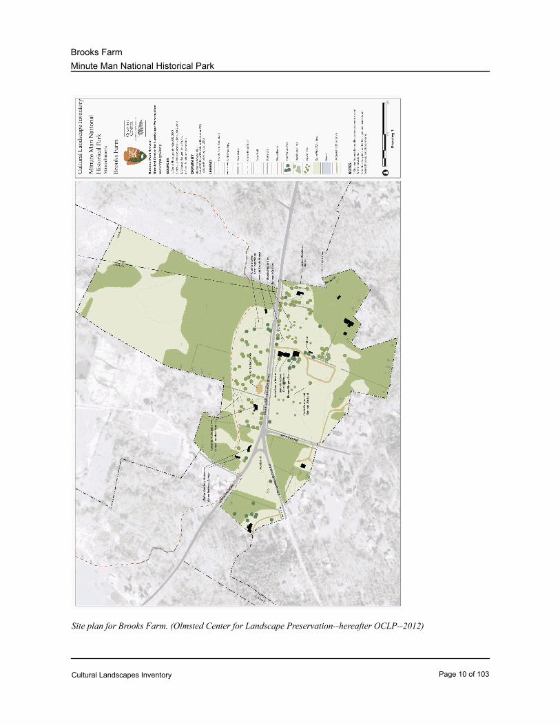
Site plan for Brooks Farm. (Olmsted Center for Landscape Preservation--hereafter OCLP--2012)
Cultural Landscapes Inventory Page 10 of 103

Minute Man National Historical Park
Brooks Farm
Enlargement of Brooks Farm area. (OCLP 2012)
Cultural Landscapes Inventory Page 11 of 103
Minute Man National Historical Park
Brooks Farm
Property Level and CLI Numbers
Brooks FarmInventory Unit Name:
Component LandscapeProperty Level:
650040CLI Identification Number:
Parent Landscape: 650037
Park Information
Park Name and Alpha Code: Minute Man National Historical Park -MIMA
Park Organization Code: 1820
Park Administrative Unit: Minute Man National Historical Park
CLI Hierarchy Description
Minute Man NHP is comprised of four landscapes: Battle Road, Wayside, North Bridge, and North
Bridge Visitor Center. Brooks Farm is one of seven component landscapes within the Battle Road
landscape. The other components are Meriam’s Corner, Jones/Stow Farm, Hartwell area, Paul
Revere site, Nelson Farm area, and Fiske Hill.
Cultural Landscapes Inventory Page 12 of 103
Minute Man National Historical Park
Brooks Farm
Concurrence Status
Inventory Status: Complete
Completion Status Explanatory Narrative:
A draft Level II CLI was completed in 1995 for the Battle Road unit of MIMA. That draft was
revised and entered into the CLI database during FY99.
This CLI is partly based on Deborah Dietrich-Smith’s “Cultural Landscape Report (CLR) for
Battle Road Unit: Minute Man National Historical Park,” completed in 2005. The CLR was
produced through extensive research of primary and secondary source materials, including town
meeting reports, historic structure reports, and various photographic collections. This CLI
incorporates CLR text with Brooks Farm-related information found mostly in other National
Park Service reports. In May 2012, Historical Landscape Architect John Hammond and
Student Conservation Association Intern Stephanie Weyer updated site maps and existing
conditions photographs. The park contact for the CLI is Curator Terrie Wallace, who may be
reached by telephone at (978) 318-7841 or by email at [email protected].
Concurrence Status:
YesPark Superintendent Concurrence:
Park Superintendent Date of Concurrence: 09/18/2012
Date of Concurrence Determination: 11/29/2002
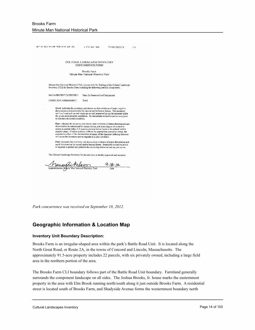
Concurrence Graphic Information:
Cultural Landscapes Inventory Page 13 of 103
Minute Man National Historical Park
Brooks Farm
Park concurrence was received on September 18, 2012.
Geographic Information & Location Map
Inventory Unit Boundary Description:
Brooks Farm is an irregular-shaped area within the park’s Battle Road Unit. It is located along the
North Great Road, or Route 2A, in the towns of Concord and Lincoln, Massachusetts. The
approximately 91.5-acre property includes 22 parcels, with six privately owned, including a large field
area in the northern portion of the area.
The Brooks Farm CLI boundary follows part of the Battle Road Unit boundary. Farmland generally
surrounds the component landscape on all sides. The Joshua Brooks, Jr. house marks the easternmost
property in the area with Elm Brook running north/south along it just outside Brooks Farm. A residential
street is located south of Brooks Farm, and Shadyside Avenue forms the westernmost boundary north
Cultural Landscapes Inventory Page 14 of 103
Minute Man National Historical Park
Brooks Farm
of Route 2A.
State and County:
MAState:
County: Middlesex County
Size (Acres): 91.50
Cultural Landscapes Inventory Page 15 of 103
Minute Man National Historical Park
Brooks Farm
Boundary UTMS:
Google EarthBoundary Source Narrative:
AreaType of Point:
NAD 83Datum:
19UTM Zone:
310,059UTM Easting:
4,702,385UTM Northing:
Google EarthBoundary Source Narrative:
AreaType of Point:
NAD 83Datum:
19UTM Zone:
309,978UTM Easting:
4,702,460UTM Northing:
Google EarthBoundary Source Narrative:
AreaType of Point:
NAD 83Datum:
19UTM Zone:
309,983UTM Easting:
4,702,471UTM Northing:
Google EarthBoundary Source Narrative:
AreaType of Point:
NAD 83Datum:
19UTM Zone:
309,873UTM Easting:
4,702,504UTM Northing:
Google EarthBoundary Source Narrative:
AreaType of Point:
NAD 83Datum:
19UTM Zone:
Cultural Landscapes Inventory Page 16 of 103
Minute Man National Historical Park
Brooks Farm
309,795UTM Easting:
4,702,586UTM Northing:
Google EarthBoundary Source Narrative:
AreaType of Point:
NAD 83Datum:
19UTM Zone:
309,759UTM Easting:
4,702,579UTM Northing:
Google EarthBoundary Source Narrative:
AreaType of Point:
NAD 83Datum:
19UTM Zone:
309,732UTM Easting:
4,702,664UTM Northing:
Google EarthBoundary Source Narrative:
AreaType of Point:
NAD 83Datum:
19UTM Zone:
309,855UTM Easting:
4,702,820UTM Northing:
Google EarthBoundary Source Narrative:
AreaType of Point:
NAD 83Datum:
19UTM Zone:
309,943UTM Easting:
4,702,747UTM Northing:
Google EarthBoundary Source Narrative:
AreaType of Point:
NAD 83Datum:
19UTM Zone:
Cultural Landscapes Inventory Page 17 of 103
Minute Man National Historical Park
Brooks Farm
309,997UTM Easting:
4,702,829UTM Northing:
Google EarthBoundary Source Narrative:
AreaType of Point:
NAD 83Datum:
19UTM Zone:
310,074UTM Easting:
4,702,800UTM Northing:
Google EarthBoundary Source Narrative:
AreaType of Point:
NAD 83Datum:
19UTM Zone:
310,075UTM Easting:
4,702,780UTM Northing:
Google EarthBoundary Source Narrative:
AreaType of Point:
NAD 83Datum:
19UTM Zone:
310,067UTM Easting:
4,702,784UTM Northing:
Google EarthBoundary Source Narrative:
AreaType of Point:
NAD 83Datum:
19UTM Zone:
310,060UTM Easting:
4,702,756UTM Northing:
Google EarthBoundary Source Narrative:
AreaType of Point:
NAD 83Datum:
19UTM Zone:
Cultural Landscapes Inventory Page 18 of 103
Minute Man National Historical Park
Brooks Farm
310,162UTM Easting:
4,702,738UTM Northing:
Google EarthBoundary Source Narrative:
AreaType of Point:
NAD 83Datum:
19UTM Zone:
310,194UTM Easting:
4,702,865UTM Northing:
Google EarthBoundary Source Narrative:
AreaType of Point:
NAD 83Datum:
19UTM Zone:
310,328UTM Easting:
4,703,089UTM Northing:
Google EarthBoundary Source Narrative:
AreaType of Point:
NAD 83Datum:
19UTM Zone:
310,379UTM Easting:
4,703,155UTM Northing:
Google EarthBoundary Source Narrative:
AreaType of Point:
NAD 83Datum:
19UTM Zone:
310,624UTM Easting:
4,703,026UTM Northing:
Google EarthBoundary Source Narrative:
AreaType of Point:
NAD 83Datum:
19UTM Zone:
Cultural Landscapes Inventory Page 19 of 103

Minute Man National Historical Park
Brooks Farm
310,520UTM Easting:
4,702,803UTM Northing:
Google EarthBoundary Source Narrative:
AreaType of Point:
NAD 83Datum:
19UTM Zone:
310,492UTM Easting:
4,702,617UTM Northing:
Google EarthBoundary Source Narrative:
AreaType of Point:
NAD 83Datum:
19UTM Zone:
310,517UTM Easting:
4,702,610UTM Northing:
Google EarthBoundary Source Narrative:
AreaType of Point:
NAD 83Datum:
19UTM Zone:
310,423UTM Easting:
4,702,436UTM Northing:
Google EarthBoundary Source Narrative:
AreaType of Point:
NAD 83Datum:
19UTM Zone:
310,409UTM Easting:
4,702,451UTM Northing:
Google EarthBoundary Source Narrative:
AreaType of Point:
NAD 83Datum:
19UTM Zone:
Cultural Landscapes Inventory Page 20 of 103
Minute Man National Historical Park
Brooks Farm
310,383UTM Easting:
4,702,449UTM Northing:
Google EarthBoundary Source Narrative:
AreaType of Point:
NAD 83Datum:
19UTM Zone:
310,367UTM Easting:
4,702,481UTM Northing:
Google EarthBoundary Source Narrative:
AreaType of Point:
NAD 83Datum:
19UTM Zone:
310,355UTM Easting:
4,702,483UTM Northing:
Google EarthBoundary Source Narrative:
AreaType of Point:
NAD 83Datum:
19UTM Zone:
310,251UTM Easting:
4,702,353UTM Northing:
Cultural Landscapes Inventory Page 21 of 103
Minute Man National Historical Park
Brooks Farm
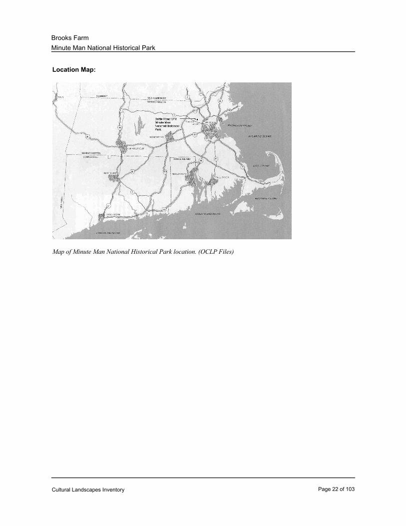
Location Map:
Map of Minute Man National Historical Park location. (OCLP Files)
Cultural Landscapes Inventory Page 22 of 103
Minute Man National Historical Park
Brooks Farm
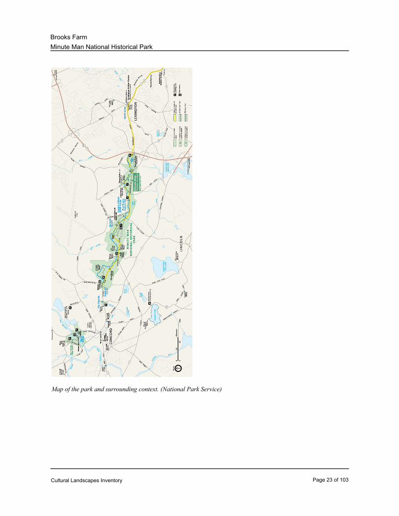
Map of the park and surrounding context. (National Park Service)
Cultural Landscapes Inventory Page 23 of 103
Minute Man National Historical Park
Brooks Farm
Regional Context:
CulturalType of Context:
Description:
Brooks Farm is named after the Brooks family, who owned much land in the area for about 210
years. Thomas Brooks established a farm in the area in the mid-1600s, and his descendants
eventually established the Samuel Brooks, Job Brooks, Joshua Brooks, Jr. and Noah Brooks
Tavern farms. The mid-20th-century Beatteay home was also constructed in Brooks Farm
towards the western boundary. After passing through many owners in the 19th and 20th
centuries, the Brooks properties were all acquired by the National Park Service sometime
during the 1960s or 1970s.
PhysiographicType of Context:
Description:
Minute Man NHP generally contains flat plains and low rolling hills composed of glacial till.
Brooks Farm slopes down towards Elm Brook on its eastern side. The majority of the area is
successional forest and the corridor along the path of Elm Brook has become a wetland with
scrub forest growth. The area contains land considered suitable for agriculture.
PoliticalType of Context:
Description:
Brooks Farm is located in Concord and Lincoln, Massachusetts. Within Brooks Farm, the
Battle Road Trail curves just north of, or behind, the houses and fields on the north side of the
original Battle Road, now part of the North Great Road. The North Great Road, or Route 2A,
runs straight in between the Brooks homes towards the southern portion of Brooks Farm (see
Regional Landscape Context graphic).
Cultural Landscapes Inventory Page 24 of 103
Minute Man National Historical Park
Brooks Farm
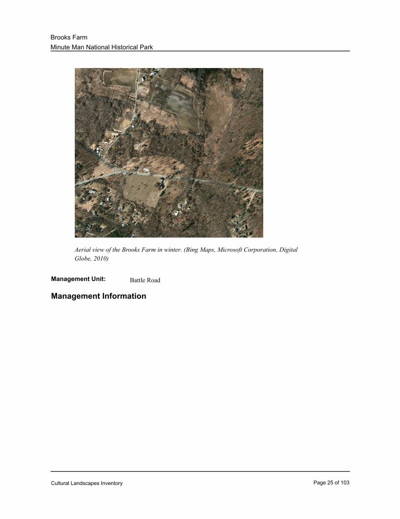
Aerial view of the Brooks Farm in winter. (Bing Maps, Microsoft Corporation, Digital
Globe, 2010)
Management Unit: Battle Road
Management Information
Cultural Landscapes Inventory Page 25 of 103
Minute Man National Historical Park
Brooks Farm
General Management Information
Must be Preserved and MaintainedManagement Category:
09/18/2012Management Category Date:
The Brooks Farm component landscape falls under the same management category as the Battle Road
landscape, which meets several criteria for the “Must Be Preserved and Maintained” management
category. The preservation of the site unit is specifically legislated; the site is related to the park’s
legislated significance; and the site serves as the setting for a nationally significant structure or object.
The 1959 enabling legislation for Minute Man NHP stated that the park was established to “preserve,
selectively restore, and interpret portions of the Lexington-Concord Battle Road, as well as its
associated structures, properties and sites so that the visitor may better appreciate and understand the
beginning of the American Revolution…” Congress expanded that initial mission in 1992 to include
more than interpretation of specific events associated with April 19, 1775: “the purposes of the Park
shall include the preservation and interpretation of (1) the historic landscape along the road between
Lexington and Concord, [and] (2) sites associated with the causes and consequences of the American
Revolution.” (“Environmental Assessment for ‘Save Historic Structures and Cultural Landscapes’”
1999: 2)
Management Category Explanatory Narrative:
Agreements, Legal Interest, and Access
Management Agreement:
Other AgreementType of Agreement:
Other Agreement: Conservation easements.
NAExpiration Date:
Management Agreement Explanatory Narrative:
Conservation easements from the Town of Lincoln.
NPS Legal Interest:
Fee SimpleType of Interest:
Public Access:
Other RestrictionsType of Access:
Explanatory Narrative:
The park grounds are open sunrise to sunset.
Adjacent Lands Information
Cultural Landscapes Inventory Page 26 of 103

Minute Man National Historical Park
Brooks Farm
Do Adjacent Lands Contribute? No
Cultural Landscapes Inventory Page 27 of 103

Minute Man National Historical Park
Brooks Farm
National Register Information
Cultural Landscapes Inventory Page 28 of 103
Minute Man National Historical Park
Brooks Farm
Existing National Register Status
National Register Landscape Documentation:
Entered Documented
National Register Explanatory Narrative:
Brooks Farm is within the boundaries of Minute Man National Historical Park (NHP), which was
established in 1959. On December 29, 1962, two properties within the park boundaries were
designated as National Historic Landmarks: the Wayside and Old Manse. On October 15, 1966, the
entire park was administratively listed without documentation in the National Register of Historic
Places with the passage of the National Historic Preservation Act.
In 1996-1997, consultations between the National Park Service and the Massachusetts Historical
Commission (SHPO) identified numerous contributing and non-contributing resources in the park.
Within the Brooks Farm area, contributing resources included the Job Brooks House, Joshua Brooks,
Jr. House, Noah Brooks Tavern, Noah Brooks Barn/Carriage House (now Samuel Hartwell Carriage
House), Noah Brooks Retaining Walls, and the Samuel Brooks House. Non-contributing resources
were the Samuel Brooks Area Concrete Foundation and the Joshua Brooks Terrace. The SHPO
suggested that additional research should be conducted on the Brooks Road Stone Walls, Job Brooks
Barn/Ramp Foundation, Job Brooks Area Retaining Wall, Joshua Brooks Property Stone Walls, Noah
Brooks Area Stone Walls, Rogers Barn, Samuel Brooks Property Stone Walls, Walter Beatteay House,
and the Walter Beatteay Garage. Additionally, the SHPO recommended the need to develop
documentation of the park’s resources in the National Register and that a period of significance should
extend “well into the 20th century to reflect the continued significance of this site as an important
reflection of our nation’s founding and how we commemorate, venerate, and interpret it.”
On November 29, 2002, the Keeper of the National Register of Historic Places accepted
documentation of the park as a historic district, which addressed many recommendations from the
SHPO. Significance was identified under criteria A, B, C, and D and Criteria Considerations B
(Moved Properties), F (Commemorative Properties), and G (Significance Within the Last Fifty Years).
The park is nationally significant in the areas of military, literature, and other (commemoration), and
locally significant in the areas of agriculture, archeology, and architecture. The period of significance
was listed on the cover sheet as 1655 to 1959, dates that correspond to the expansion of the town of
Concord and settlement of Fiske Hill, and the establishment of the Minute Man NHP, respectively.
Contributing features described in the documentation for Brooks Farm included the Walter Beatteay
House (77), Samuel Brooks House (79), Noah Brooks Tavern (80), Noah Brooks Tavern Carriage
House (80A, now Samuel Hartwell Carriage House), Noah Brooks Tavern (Rogers Barn) (81, now
Edward Rogers Barn), Job Brooks House (83), Hastings Barn Foundation (84, now Charles Sawyer
Barn Foundation ), and the Joshua Brooks, Jr. House (85). Portions of other contributing features that
spanned all four park units —the Battle Road, system of stone walls, and system of fields—were also
identified at Brooks Farm. One contributing archeological site was also described: Brooks House Site
(82). Non-contributing features included the Walter Beatteay Garage (78) and portions of the Battle
Road Trail.
Cultural Landscapes Inventory Page 29 of 103
Minute Man National Historical Park
Brooks Farm
On December 2, 2002, the Keeper accepted a Supplementary Listing Record for the National Register
documentation that amended the archeological area of significance to “Archeology: Prehistoric” and
“Archeology: Historic-Non-Aboriginal,” and added “7,500 to 500 years ago” to the period of
significance. On October 25, 2006, the Keeper accepted a resource count change and technical
corrections primarily related to building names (noted above), addresses, and dates of construction as
well as subsequent research.
Through a series of emails in January 2009 between the park and the National Park Service Northeast
Region History Program, the beginning date of the period of significance for the district was clarified as
being c.1635 due to inconsistencies in the 2002 National Register documentation. On the cover sheet
of the documentation, the beginning date was listed as 1655. However, internally in the documentation,
c.1635 was identified as the beginning of the agriculture area of significance. Additionally, c.1635 is
the date when English settlement began in the area and the town of Concord was established, and the
date of several archeological sites in the park: Thomas Flint Site (14), Battle Road/North Bridge (21),
and Battle Road/Fiske Hill (130). A Supplementary Listing Record will be submitted to the Keeper in
the future to correct the cover sheet.
According to research conducted for this CLI and the categories of National Register documentation
outlined in the “CLI Professional Procedures Guide,” the areas and periods of significance for Brooks
Farm are adequately documented in existing National Register documentation. The existing
documentation also adequately describes the site’s numerous historic resources that contribute to its
significance. Therefore, for purposes of the CLI, Brooks Farm is considered “Entered-Documented.”
Existing NRIS Information:
Name in National Register: Minute Man National Historical Park
NRIS Number: 66000935
Listed In The National RegisterPrimary Certification:
10/15/1966Primary Certification Date:
Name in National Register: Minute Man National Historical Park
NRIS Number: 02001445
11/29/2002Primary Certification Date:
National Register Eligibility
ContributingContributing/Individual:
DistrictNational Register Classification:
NationalSignificance Level:
Cultural Landscapes Inventory Page 30 of 103
Minute Man National Historical Park
Brooks Farm
A - Associated with events significant to broad
patterns of our history
Significance Criteria:
C - Embodies distinctive construction, work of
master, or high artistic values
Significance Criteria:
D - Has yielded, or is likely to yield, information
important to prehistory or history
Significance Criteria:
Cultural Landscapes Inventory Page 31 of 103
Minute Man National Historical Park
Brooks Farm
Period of Significance:
Time Period: 5498 BC - AD 1502
Historic Context Theme: Peopling Places
Subtheme: Post-Archaic and Prehistoric Developments
Facet: Eastern Farmers
NoneOther Facet:
Time Period: 5498 BC - AD 1502
Historic Context Theme: Peopling Places
Subtheme: Post-Archaic and Prehistoric Developments
Facet: Hunters and Gatherers
NoneOther Facet:
Time Period: AD 1635 - 1959
Historic Context Theme: Expressing Cultural Values
Subtheme: Architecture
Facet: Colonial (1600-1730)
NoneOther Facet:
Time Period: AD 1635 - 1959
Historic Context Theme: Expressing Cultural Values
Subtheme: Architecture
Facet: Federal (1780-1820)
NoneOther Facet:
Time Period: AD 1635 - 1959
Historic Context Theme: Expressing Cultural Values
Subtheme: Architecture
Facet: Period Revivals (1870-1940)
NoneOther Facet:
Time Period: AD 1635 - 1959
Historic Context Theme: Expressing Cultural Values
Subtheme: Architecture
Facet: Craftsman (1890-1915)
NoneOther Facet:
Cultural Landscapes Inventory Page 32 of 103
Minute Man National Historical Park
Brooks Farm
Time Period: AD 1635 - 1959
Historic Context Theme: Shaping the Political Landscape
Subtheme: The American Revolution
Facet: War in the North
NoneOther Facet:
Time Period: AD 1635 - 1959
Historic Context Theme: Developing the American Economy
Subtheme: The Farmer's Frontier
Facet: Farming the Northeast
NoneOther Facet:
Time Period: AD 1635 - 1959
Historic Context Theme: Developing the American Economy
Subtheme: Agriculture
Facet: Farming For Local Markets (Dairying, Fruits, And
Vegetables)
NoneOther Facet:
Time Period: AD 1635 - 1959
Historic Context Theme: Transforming the Environment
Subtheme: Historic Preservation
Facet: Regional Planning
NoneOther Facet:
Cultural Landscapes Inventory Page 33 of 103
Minute Man National Historical Park
Brooks Farm
Area of Significance:
AgricultureArea of Significance Category:
NoneArea of Significance Subcategory:
ArchitectureArea of Significance Category:
NoneArea of Significance Subcategory:
ArcheologyArea of Significance Category:
Historic-Non-AboriginalArea of Significance Subcategory:
ArcheologyArea of Significance Category:
PrehistoricArea of Significance Subcategory:
MilitaryArea of Significance Category:
NoneArea of Significance Subcategory:
OtherArea of Significance Category:
CommemorationArea of Significance Category Explanatory Narrative:
NoneArea of Significance Subcategory:
Statement of Significance:
MINUTE MAN NATIONAL HISTORICAL PARK
Minute Man National Historical Park (NHP) possesses significance under National Register criteria A,
B, C, and D. The park has national significance in the areas of Military History, Commemoration, and
Literature. Its primary significance as the site of the 1775 Battle of Lexington and Concord, which
marked the beginning of the American Revolutionary War and ranks among the most significant events
in American history. Among the extant properties relating to the battle are the Lexington and Concord
Cultural Landscapes Inventory Page 34 of 103
Minute Man National Historical Park
Brooks Farm
Battlefield, thirteen buildings present at the time of the battle, and a number of historical archaeological
sites that constitute the remains of homes of people or events associated with the fight. The
importance of the battle to the creation of the United States was recognized during the early years of
the republic, and the area subsequently became one of the first hallowed places in the new nation. The
placement of monuments and plaques to formally commemorate the event began with the construction
of the Battle Monument in 1836, and over the course of the ensuing century a number of other objects
designed to mark the site of important aspects of the battle were erected. The significance of the place
in the area of commemoration culminated with the creation of Minute Man NHP in 1959. Two
properties in the park, the Wayside and Old Manse, also possess national significance for their
association with prominent literary figures of the 19th and 20th centuries. Both properties have been
designated as National Historic Landmarks. The Literary significance of the district extends from 1834
when Ralph Waldo Emerson began his short residence at the Old Manse, to 1924 when Harriet Lothrop
left the Wayside. (National Register 2002, Section 8: 1)
The park also possesses local significance under National Register criteria A, C, and D in the areas of
Agriculture, Architecture, and Archaeology. The history of the district is inextricably tied to agriculture,
which was the primary economic activity carried on there through the 17th through 19th centuries. The
period of significance for Agriculture begins in c.1635 when plantation period settlement and agricultural
land use in Concord began to 1951 to encompass farm properties in Concord that were involved in
market gardening and dairying during the early and mid-20th century. Architecturally, the district
embodies a collection of dwellings that are representative of local building trends from the early 18th
century through the mid-20th century. The period of significance for Architecture extends from c.1705
when the Meriam House was constructed to 1946 when the Beatteay House was completed. (Note:
The c.1705 date is from the 2002 National Register documentation. Future revisions and updates to the
documentation should revisit this date because the William Smith House dates to c.1693). Numerous
historical archaeological sites have been investigated at the park and have yielded or are likely to yield
significant information pertaining to early settlement in the area and further information relating to the
appearance of the area at the time of the battle on April 19, 1775. The period of significance for
Archaeology extends from c.1665 when the John Meriam House was constructed to 1951. (National
Register 2002, Section 8:1-2)
There are two overall periods of significance that encompass the park’s resources: 7,500 to 500 years
ago, and c.1635 to 1959. The first period acknowledges archeological resources, which are beyond the
scope of this CLI and are therefore not addressed beyond information provided in National Register
documentation. The second period begins with the settlement and agricultural development of the area
and ends when the park was established.
THE BATTLE ROAD UNIT / BROOKS FARM
Brooks Farm is within the Battle Road Unit, the largest of the park’s four discontinuous units, which
contains part of the historic Battle Road along which Colonial militia pursued and attacked the retreating
British during the Battle of Lexington and Concord. Numerous historic buildings, structures, stone
walls, monuments, and over 800 acres of former farm land contribute to the military, commemorative,
Cultural Landscapes Inventory Page 35 of 103
Minute Man National Historical Park
Brooks Farm
agricultural, architectural, and archeological significance of the Battle Road Unit under National
Register criteria A, C, and D.
NATIONAL REGISTER CRITERION A
Military History:
Brooks Farm is nationally significant for its role in the Battle of Lexington and Concord, which marked
the beginning of the American Revolutionary War and ranks as one of the most important events in the
history of the United States. Significant resources include the Battle Road used by the British for both
their advance on and retreat from Concord, and numerous stone walls that were often used for cover
by the militiamen during the fight. The British retreat along the four-mile stretch of road within the
Battle Road Unit was characterized by a series of running engagements during which the British were
placed under almost constant fire by the American militia forces. (National Register 2002, Section 8: 3)
The Brooks Farm is part of the Battle of Lexington and Concord Battlefield. One particular skirmish
occurred at Brooks Hill, which takes its name from the Brooks family that owned it and a large amount
of land to the east, as well as a nearby tavern. On April 19, the hill was occupied by one or two
companies of militia from Sudbury and a signal company from Framingham in hopes of ambushing the
British. However, the British discovered the ambush before they were within range of the guns and
were able to mount an attack on the hill. The fighting was intense, especially in the immediate vicinity
of the Brooks Tavern. (National Register 2002, Section 8: 9)
Extant properties within the district that were owned by the Brooks family and were present during the
battle are the Samuel Brooks House, which was constructed about 1733, and the Job Brooks House, a
c.1740 house that underwent significant alteration in the late 19th century and was restored to its
Colonial period appearance by the National Park Service in 1995. (National Register 2002, Section 8:
15)
Commemoration:
Brooks Farm is nationally significant for its role in commemorative activities recognizing the importance
of the 1775 battle, which culminated with the establishment of Minute Man NHP by an act of Congress
in 1959. Although there are no battlefield memorials or monuments at Brooks Farm, during the early
part of the 20th century, visitation to this and other areas began to increase, leading to the erection of
roadside stops along the Battle Road, both in and outside of the future park, and the improvement of
roads throughout the area. With the creation of the park, the National Park Service began a
multi-decade program of “restoring” the character of the park to its 1775 appearance. (National
Register 2002, Section 8: 17, 22-23)
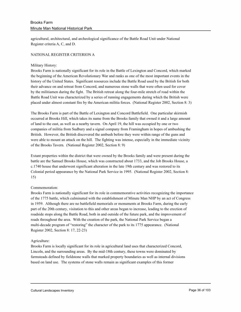
Agriculture:
Brooks Farm is locally significant for its role in agricultural land uses that characterized Concord,
Lincoln, and the surrounding areas. By the mid-18th century, these towns were dominated by
farmsteads defined by fieldstone walls that marked property boundaries as well as internal divisions
based on land use. The systems of stone walls remain as significant examples of this former
Cultural Landscapes Inventory Page 36 of 103
Minute Man National Historical Park
Brooks Farm
agricultural landscape. (National Register 2002, Section 8: 37)
During the first period of settlement, about 1650, the majority of the landscape now within the Battle
Road Unit was about 80 percent wooded with large common fields for tillage. The common field
system was not completely successful in supporting the settlement during the first few decades. In
1652, the plantation in Concord was subdivided into quarters to facilitate the granting of the remaining
open land. Over the next ten years, common land was divided among proprietors, based on their
original allotments. Land use shifted from the common field system to large individual land holdings.
There was some limited settlement in peripheral areas of town further away from the river meadows,
one of which was owned by Joshua Brooks in the1660s and consisted of a house and barn located in
the eastern section of Concord near Elm Brook. The area was one of the earliest areas to be settled
outside of the original village. Although land holdings were still quite scattered, the pieces were
somewhat larger and more consolidated than in the First Division village. Joshua, Caleb, and Gershom
Brooks, the three sons of Thomas Brooks, were all granted land in the area in the 17th century. Over
the next generation, more homesteads were created as land passed to Gershom's and Joshua’s sons.
This farmstead stayed in the Brooks family for almost 200 years, until the mid-19th century (Job Brooks
Site). (National Register 2002, Section 8: 38)
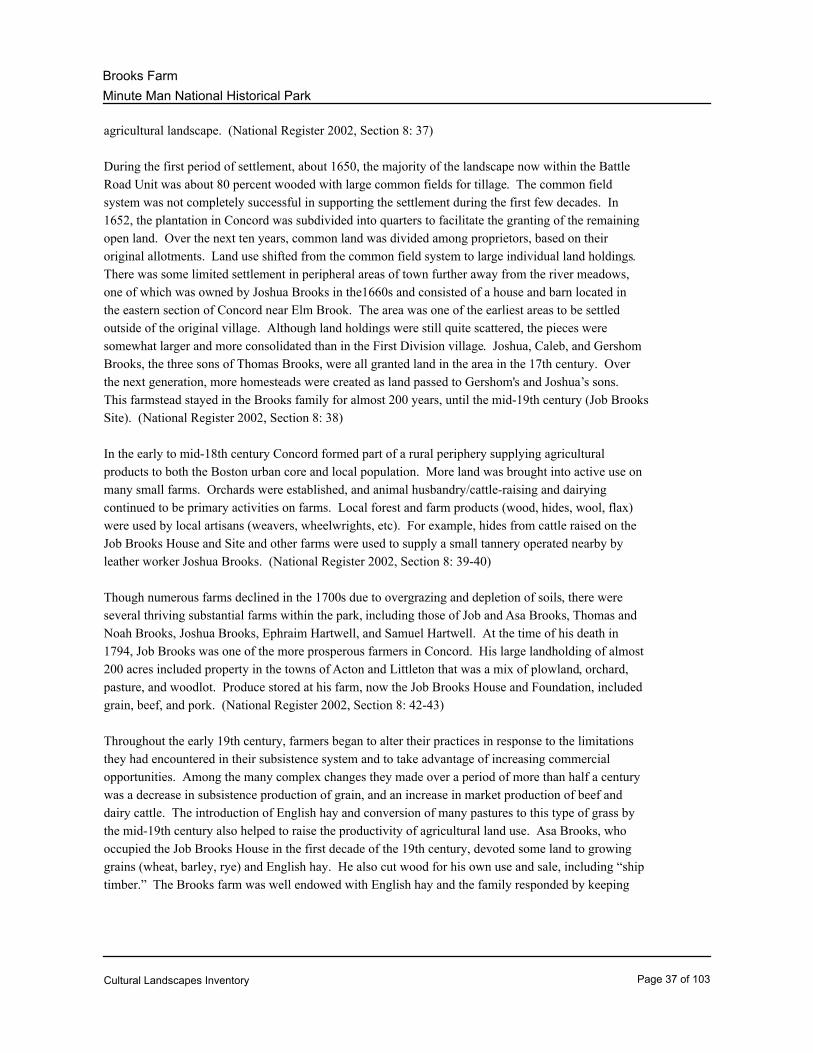
In the early to mid-18th century Concord formed part of a rural periphery supplying agricultural
products to both the Boston urban core and local population. More land was brought into active use on
many small farms. Orchards were established, and animal husbandry/cattle-raising and dairying
continued to be primary activities on farms. Local forest and farm products (wood, hides, wool, flax)
were used by local artisans (weavers, wheelwrights, etc). For example, hides from cattle raised on the
Job Brooks House and Site and other farms were used to supply a small tannery operated nearby by
leather worker Joshua Brooks. (National Register 2002, Section 8: 39-40)
Though numerous farms declined in the 1700s due to overgrazing and depletion of soils, there were
several thriving substantial farms within the park, including those of Job and Asa Brooks, Thomas and
Noah Brooks, Joshua Brooks, Ephraim Hartwell, and Samuel Hartwell. At the time of his death in
1794, Job Brooks was one of the more prosperous farmers in Concord. His large landholding of almost
200 acres included property in the towns of Acton and Littleton that was a mix of plowland, orchard,
pasture, and woodlot. Produce stored at his farm, now the Job Brooks House and Foundation, included
grain, beef, and pork. (National Register 2002, Section 8: 42-43)
Throughout the early 19th century, farmers began to alter their practices in response to the limitations
they had encountered in their subsistence system and to take advantage of increasing commercial
opportunities. Among the many complex changes they made over a period of more than half a century
was a decrease in subsistence production of grain, and an increase in market production of beef and
dairy cattle. The introduction of English hay and conversion of many pastures to this type of grass by
the mid-19th century also helped to raise the productivity of agricultural land use. Asa Brooks, who
occupied the Job Brooks House in the first decade of the 19th century, devoted some land to growing
grains (wheat, barley, rye) and English hay. He also cut wood for his own use and sale, including “ship
timber.” The Brooks farm was well endowed with English hay and the family responded by keeping
Cultural Landscapes Inventory Page 37 of 103
Minute Man National Historical Park
Brooks Farm
large herds of cattle. Brooks also pastured cattle on land in the central Massachusetts town of
Princeton. In the 1840s, the farm passed into the ownership of Emelius Leppelman from Denmark who
kept a substantial dairy herd. It was around this same time that milk farming took off in Concord as a
result of the new railroad connection to Boston. (National Register 2002, Section 8: 43-44)
In the mid-19th century, Concord was a center of agricultural innovation, with the development of the
Concord grape the most widely known product of this activity. As in many other towns in Middlesex
County, intensive vegetable gardening for Boston and overseas markets changed the nature of farming
in Concord, Lincoln, and Lexington. Commercial production of fruit, vegetables, and dairy products
soon became a mainstay of the farm economy. Links to the regional rail transportation system helped
drive the change from production of agricultural and dairy products for strictly local use to the supply of
larger markets in urban areas like Boston and Lowell. Although many farms were thriving in the new
agricultural economy, the farm of Joshua Brooks did not. Deacon Joshua Brooks had been a
prosperous farmer and tanner but had been hard-pressed to provide family farmlands in Concord and
Lincoln for his children. When he died in 1790, the bulk of his farm and tannery passed to his son
Joshua. Several of his other children had established themselves elsewhere. The younger Joshua
Brooks had fourteen children and appears to have been wealthy enough to engage in a number of land
deals. However, by the time of his death in 1825, he was in debt. His son Isaac inherited the farm and
later acquired the neighboring Noah Brooks Tavern. In 1844, Isaac went bankrupt and both farms then
passed to Isaac’s brother Nathan, a prominent Concord lawyer. The Joshua Brooks estate was sold to
Nathan’s nephew Joshua in 1859, and was then sold out of the family in 1862. The farm failed to adapt
and thrive in the new commercial environment. By the late 19th century much of the farm, as with
other farms in the area, had already returned to forest. (National Register 2002, Section 8: 44-45)
In the early to mid-20th century the towns of Concord, Lincoln and Lexington became an outer suburb
for the Boston metropolitan area and there was an increase in residential development. However,
throughout the period, farmers in the region continued their concentration on commercial markets. The
influx of cheap meat and grain from the Midwest led local farmers to specialize in market gardening,
orchards, and dairy. As farmers continued the commercialization of their farms, they began hiring more
wage laborers, some of whom bought old farms and actively participated in market gardening. One
such example is the Edward Rogers Barn adjacent to the Noah Brooks Tavern, built in the 1930s on the
foundation of an earlier barn that stood on the site. (National Register 2002, Section 8: 47)
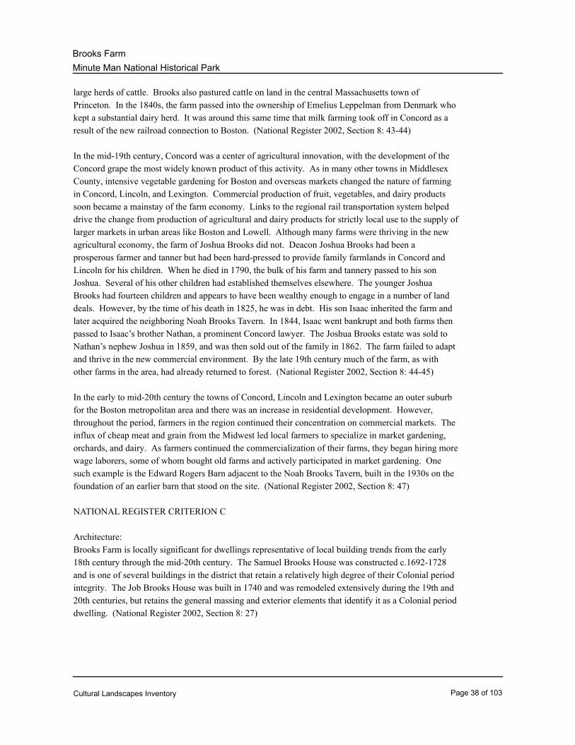
NATIONAL REGISTER CRITERION C
Architecture:
Brooks Farm is locally significant for dwellings representative of local building trends from the early
18th century through the mid-20th century. The Samuel Brooks House was constructed c.1692-1728
and is one of several buildings in the district that retain a relatively high degree of their Colonial period
integrity. The Job Brooks House was built in 1740 and was remodeled extensively during the 19th and
20th centuries, but retains the general massing and exterior elements that identify it as a Colonial period
dwelling. (National Register 2002, Section 8: 27)
Cultural Landscapes Inventory Page 38 of 103
Minute Man National Historical Park
Brooks Farm
The Joshua Brooks, Jr. House, built in 1780, is an excellent example of the transition from the Georgian
style of the Colonial period to the Federal style that occurred after the Revolutionary War. The building
retains the symmetrical 5-bay facade that was common in the Georgian period. Its classical entrance
surround, however, is more finely crafted than those of the Colonial period houses in the district. It
features a gable pediment on a molded entablature and fluted Doric pilasters. The only other example
of Federal period architecture in the district is the Noah Brooks Tavern. Built c.1798, it is a rare
example of a building that features a wood sheathed façade and brick side walls. The main block
features a low-pitched hip roof with slightly over-hanging eaves and a molded cornice. The
symmetrical, five-bay facade is framed by decorative quoins and the central entrance is slightly
recessed behind a simple surround consisting of a flat pediment and pilasters. Four interior, brick
chimneys are paired at each end. A two-story ell on the house's rear wall is connected to a one-story,
gable-roof addition, formerly the Samuel Hartwell carriage house. (National Register 2002, Section 8:
28-29)
The Walter Beatteay House is a unique vernacular adaptation of the Colonial Revival style. Built in
stages between 1940 and 1946, the low, rambling structure has an irregular plan, consisting of three
attached units. The easternmost portion was constructed using historic building fragments from earlier
houses, thereby giving the building the appearance of a much earlier building. The easternmost portion
of the building has a gambrel roof with a higher roof pitch and the middle and western section both have
gable roofs. The building is clad in wood shingles and set on a poured concrete foundation.
Fenestration consists of single-pane and diamond-pane windows set in rectangular openings. The
building’s main entrance is within the easternmost section, and is comprised of a Colonial period wood
plank door embellished with nail heads in a diamond pattern. (National Register 2002, Section 8: 31)
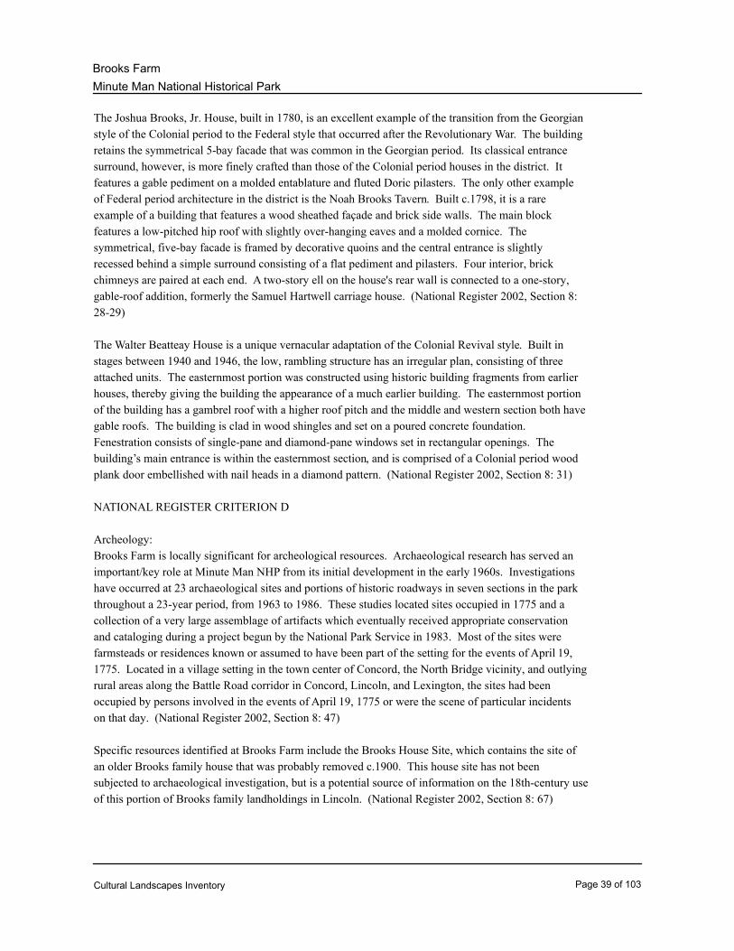
NATIONAL REGISTER CRITERION D
Archeology:
Brooks Farm is locally significant for archeological resources. Archaeological research has served an
important/key role at Minute Man NHP from its initial development in the early 1960s. Investigations
have occurred at 23 archaeological sites and portions of historic roadways in seven sections in the park
throughout a 23-year period, from 1963 to 1986. These studies located sites occupied in 1775 and a
collection of a very large assemblage of artifacts which eventually received appropriate conservation
and cataloging during a project begun by the National Park Service in 1983. Most of the sites were
farmsteads or residences known or assumed to have been part of the setting for the events of April 19,
1775. Located in a village setting in the town center of Concord, the North Bridge vicinity, and outlying
rural areas along the Battle Road corridor in Concord, Lincoln, and Lexington, the sites had been
occupied by persons involved in the events of April 19, 1775 or were the scene of particular incidents
on that day. (National Register 2002, Section 8: 47)
Specific resources identified at Brooks Farm include the Brooks House Site, which contains the site of
an older Brooks family house that was probably removed c.1900. This house site has not been
subjected to archaeological investigation, but is a potential source of information on the 18th-century use
of this portion of Brooks family landholdings in Lincoln. (National Register 2002, Section 8: 67)
Cultural Landscapes Inventory Page 39 of 103
Minute Man National Historical Park
Brooks Farm
State Register Information
LIN.F and LIN.GIdentification Number:
10/15/1966Date Listed:
Minute Man National Historical ParkName:
Chronology & Physical History
Cultural Landscape Type and Use
Cultural Landscape Type: Historic Site
Current and Historic Use/Function:
Primary Historic Function: Battle Site
Primary Current Use: Outdoor Recreation
Other Use/Function Other Type of Use or Function
Single Family House Both Current And Historic
Lodge (Inn, Cabin) Historic
Historic Furnished Interior Current
Monument (Marker, Plaque) Both Current And Historic
Agricultural Field Both Current And Historic
Agricultural Outbuilding Both Current And Historic
Woodlot/Forest (Managed) Both Current And Historic
Interpretive Trail Current
Current and Historic Names:
Name Type of Name
Battle Road Unit Current
Battle Road Historic
Noah Brooks Tavern Both Current And Historic
Brooks Farm Both Current And Historic
Ethnographic Study Conducted: No Survey Conducted
Ethnographic Significance Description:
Cultural Landscapes Inventory Page 40 of 103
Minute Man National Historical Park
Brooks Farm
In 1996, a research report for the National Park Service Ethnographic Program entitled “In Praise of
Sweet Corn: Contemporary Farming at Minute Man National Historical Park” was completed by
Steven Parish.
Chronology:
Year Event Annotation
Farmed/Harvested Human habitation begins in the region 12,000 years ago.10000 BC
Farmed/Harvested Algonquian people inhabit the area, planting crops and
constructing fishing weirs along the Musketequid River
(Concord River).
AD 600 - 1630
Established Puritans establish the Concord Plantation along the
Concord River. This marks the beginning of European
settlement and agricultural development.
AD 1635
Settled Captain Thomas Brooks settles in Watertown from
England.
Land Transfer By 1636, Concord Plantation begins allocating house lots
along the base of an east-west ridgeline (known today as
Revolutionary Ridge). This initial apportionment of land in
Concord became known as the First Division.
AD 1636
Developed By 1636, a four-rod (66’) wide road runs parallel to the
east-west ridgeline, bisecting the First Division house lots.
Expanded In the early 1640s, Cambridge extends its western border
to the eastern edge of the Concord Plantation. The
extended area is known as Cambridge Farms.
AD 1640
Platted Thomas Brooks moves to Concord around 1650 and is one
of the first individuals to receive property apportioned
during the First and Second Divisions.
AD 1650 - 1663
Land Transfer Between 1652 and 1663, Concord Plantation distributes
additional acreage during the town’s Second Division of
land. When completed, house lots extend throughout the
entire plantation, including within the park’s present-day
Battle Road Unit.
AD 1652 - 1663
Cultural Landscapes Inventory Page 41 of 103
Minute Man National Historical Park
Brooks Farm
Developed By 1666, the road bisecting the First Division house lots is
extended west through the entire length of the Battle Road
Unit. The Bay Road (as it was known during early colonial
times) is the primary route between Concord and Boston.
AD 1666
Land Transfer Thomas Brooks gives son, Joshua, several parcels of land
on December 1, 1666, including the Job Brooks site, a
“twenty five acres & a halfe of upland & swamp & ten
acres of meadow.”
Inhabited Joshua Brooks is living in the East Quarter of Concord on
the south side of the Battle Road, presumably at the
current Joshua Brooks site.
Expanded By 1679, Joshua Brooks has accumulated 350 acres in
Concord.
AD 1679
Land Transfer Joshua Brooks transfers land to -four sons – Noah, Daniel,
Joseph, and Job. Much of Joshua’s land on the south side
of the Battle Road and a few parcels to the north he gives
to his son Noah. Daniel receives what becomes the
Samuel Brooks farm.
AD 1690 - 1700
Land Transfer Job Brooks purchases land from his father, Joshua,
including the current Job Brooks site with a house and
barn. The property is 17 acres, bounded on the south by
the Battle Road, north by Joseph Fletcher’s ditch, west by
Joseph Brooks, and east by Noah Brooks.
AD 1695
Built Noah Brooks, a tanner, probably builds a tanyard on the
north side of the Battle Road around this time.
Land Transfer Job Brooks dies at age 22 on May 17, 1697. Job’s brother
Hugh (the youngest sibling) inherits the Job Brooks
property by quit claim deed on August 24.
AD 1697
Altered By 1700, thirty percent of the Concord Plantation forests
have been cleared.
AD 1700
Land Transfer Hugh Brooks adds three acres to the west side of his
property by purchasing land from his older brother, Joseph.
Established Cambridge Farms separates from Cambridge and
incorporates as the town of Lexington.
AD 1713
Cultural Landscapes Inventory Page 42 of 103

Minute Man National Historical Park
Brooks Farm
Land Transfer Noah Brooks’ son, Joshua receives the tannery site his
father constructed along with a dwelling house, and two
acres across the Battle Road to the south of the tannery.
Platted A survey of the Bay Road (Battle Road) in Concord
indicates the width of the road increased east to west from
four rods (66’) to ten rods (165’). The survey did not
extend into Lexington.
AD 1716
Land Transfer Thomas Brooks receives “10 acres with house and barn”
from father, Noah.
AD 1725 - 1726
Land Transfer Daniel Brooks dies, leaving a prosperous farm and
dwelling house to his son, Samuel. Samuel eventually
enlarges the house.
AD 1733
Built Concord constructs Brooks Road.AD 1736
Platted A survey of the Battle Road (Country Road then) in
Lexington indicates the width of the road varies between
four rods (66’) and seven rods (116’) from the
Concord-Lexington town line to the Ebenezer Fiske house
(western end of Battle Road Unit).
AD 1738
Land Transfer Hugh Brooks deeds land to his youngest son, Job that
includes the Job Brooks Site, then 20 acres. The present
house was probably constructed to replace an older
structure at this time.
AD 1740
Altered Concord town records from 1747 indicate that Hugh
Brooks has encroached upon the Battle Road
right-of-way. The next year, Concord votes to sell off
excess land near the Battle Road, narrowing the
right-of-way.
AD 1747 - 1748
Land Transfer Joshua Brooks, II gives his dwelling house and two acres
to his son, “Deacon” Joshua Brooks.
AD 1745
Land Transfer Hugh Brooks dies, and son Job becomes sole owner and
manager of the farm.
AD 1747
Cultural Landscapes Inventory Page 43 of 103
Minute Man National Historical Park
Brooks Farm
Land Transfer Job Brooks adds two acres of pasture to the west side of
his lot on March 8 and two acres of upland abutting the
southwestern portion of his lot on March 26. His property
is about 24 acres at this time.
Established The town of Lincoln is established. Included within its
boundary are the portions of the Concord Plantation and
the town of Lexington within the Battle Road Unit. Both
the Thomas Brooks and Joshua Brooks homesteads now
lay in the town of Lincoln.
AD 1754
Land Transfer When Samuel Brooks dies in 1758, his son Samuel, Jr.
inherits his father’s property, including over ten acres with
a house, barn, and upland.
AD 1758
Land Transfer Deacon Joshua Brooks purchases a six-acre parcel of
orchard and pasture from Timothy Wesson, just west of
Brooks Road and south of the Battle Road.
AD 1762
Developed About 25 house lots are located along Battle Road. The
typical house lot is 60 to 80 acres, includes a barn, several
outbuildings, orchard, and small garden.
AD 1770
Land Transfer Deacon Joshua Brooks purchases two acres of land north
of the Battle Road and just west of Brooks Road.
AD 1771 - 1775
Purchased/Sold The town of Lexington purchases land along the north side
of the Battle Road for road realignment.
AD 1773
Farmed/Harvested By 1775, all cultivatable land within the Battle Road Unit
supports subsistence crops of Indian corn, rye, and other
grains.
AD 1775
Military Operation On April 19, 1775, colonists engage in battle with British
Regulars, starting the American Revolutionary War.
Military Operation Colonial minutemen and militia confront the British troops
along the entire length of the road from Concord to Boston
with intense fighting taking place at Brooks Hill and
around Brooks Farm.
Built Around 1780, Deacon Joshua Brooks constructs a house
south of the “old house.” This new house Deacon Joshua
sells to his son, Joshua Brooks, Jr.
AD 1780
Cultural Landscapes Inventory Page 44 of 103
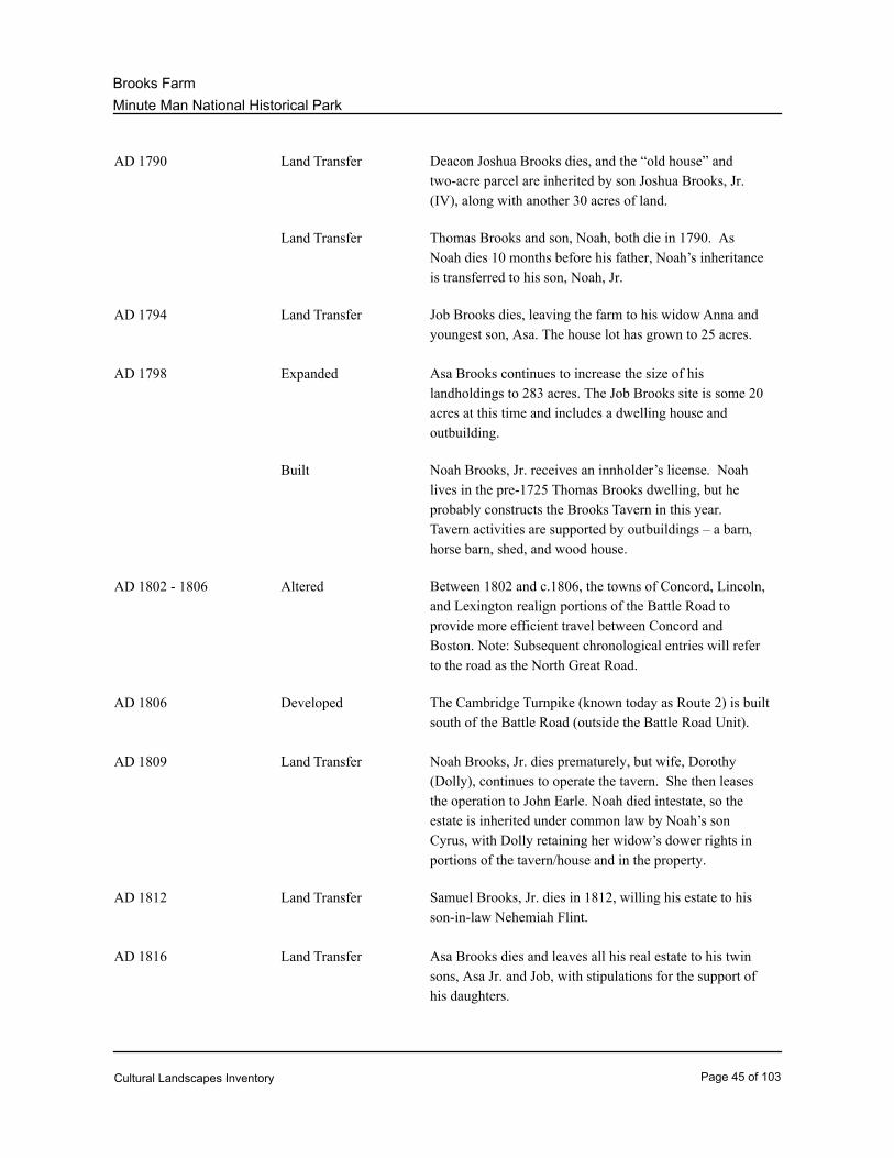
Minute Man National Historical Park
Brooks Farm
Land Transfer Deacon Joshua Brooks dies, and the “old house” and
two-acre parcel are inherited by son Joshua Brooks, Jr.
(IV), along with another 30 acres of land.
AD 1790
Land Transfer Thomas Brooks and son, Noah, both die in 1790. As
Noah dies 10 months before his father, Noah’s inheritance
is transferred to his son, Noah, Jr.
Land Transfer Job Brooks dies, leaving the farm to his widow Anna and
youngest son, Asa. The house lot has grown to 25 acres.
AD 1794
Expanded Asa Brooks continues to increase the size of his
landholdings to 283 acres. The Job Brooks site is some 20
acres at this time and includes a dwelling house and
outbuilding.
AD 1798
Built Noah Brooks, Jr. receives an innholder’s license. Noah
lives in the pre-1725 Thomas Brooks dwelling, but he
probably constructs the Brooks Tavern in this year.
Tavern activities are supported by outbuildings – a barn,
horse barn, shed, and wood house.
Altered Between 1802 and c.1806, the towns of Concord, Lincoln,
and Lexington realign portions of the Battle Road to
provide more efficient travel between Concord and
Boston. Note: Subsequent chronological entries will refer
to the road as the North Great Road.
AD 1802 - 1806
Developed The Cambridge Turnpike (known today as Route 2) is built
south of the Battle Road (outside the Battle Road Unit).
AD 1806
Land Transfer Noah Brooks, Jr. dies prematurely, but wife, Dorothy
(Dolly), continues to operate the tavern. She then leases
the operation to John Earle. Noah died intestate, so the
estate is inherited under common law by Noah’s son
Cyrus, with Dolly retaining her widow’s dower rights in
portions of the tavern/house and in the property.
AD 1809
Land Transfer Samuel Brooks, Jr. dies in 1812, willing his estate to his
son-in-law Nehemiah Flint.
AD 1812
Land Transfer Asa Brooks dies and leaves all his real estate to his twin
sons, Asa Jr. and Job, with stipulations for the support of
his daughters.
AD 1816
Cultural Landscapes Inventory Page 45 of 103

Minute Man National Historical Park
Brooks Farm
Land Transfer Dolly Brooks marries Stephen Patch of Ashby, who
operates the Noah Brooks tavern for the next 12 years.
Farmed/Harvested Beginning in 1820, pasture clearing and hayfield planting
significantly increased along the Battle Road, to support
larger cattle herds.
AD 1820
Land Transfer Job Brooks moves out of Concord, leaving the Job Brooks
house completely to Asa, Jr.
AD 1823
Land Transfer Heavily in debt, Joshua Brooks Jr. sells the “old house” to
his son Isaac and mortgages his own circa-1780 “mansion
house” to son Nathan.
Land Transfer In 1824 Cyrus Brooks sells all his property in Lincoln to his
stepfather Stephen Patch.
AD 1824
Land Transfer Nathan fully inherits the “mansion house” (the Joshua
Brooks, Jr. House) in 1825 upon Joshua, Jr.’s death.
AD 1825
Land Transfer Isaac Brooks purchases the Noah Brooks tavern property
to the west of the Joshua Brooks Jr. house site from
Stephen Patch.
AD 1828
Land Transfer Stephen and Dolly (Brooks) Patch sell the Noah Brooks
tavern property to their neighbor and Cyrus’ third cousin,
Isaac Brooks.
Land Transfer Plagued with debts, Isaac closes the tannery. He also
leases out the tavern.
AD 1829
Farmed/Harvested As a result of the temperance movement of the early
1800s, the consumption of hard cider decreases. Farmers
within the Battle Road Unit begin to replace cider
orchards with fancy fruit orchards.
AD 1830
Land Transfer Isaac Brooks sells the Noah Brooks tavern property in
1833. Isaac’s half-brother, Nathan, and brother, Hiram,
buy the tavern property in 1839.
AD 1833 - 1839
Land Transfer Nehemiah Flint sells the Samuel Brooks homestead to
Isaac Hurd.
AD 1836
Cultural Landscapes Inventory Page 46 of 103
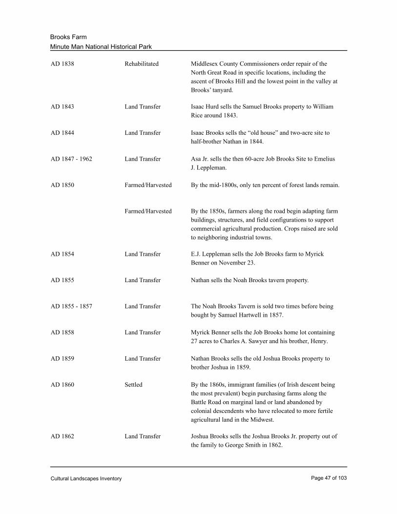
Minute Man National Historical Park
Brooks Farm
Rehabilitated Middlesex County Commissioners order repair of the
North Great Road in specific locations, including the
ascent of Brooks Hill and the lowest point in the valley at
Brooks’ tanyard.
AD 1838
Land Transfer Isaac Hurd sells the Samuel Brooks property to William
Rice around 1843.
AD 1843
Land Transfer Isaac Brooks sells the “old house” and two-acre site to
half-brother Nathan in 1844.
AD 1844
Land Transfer Asa Jr. sells the then 60-acre Job Brooks Site to Emelius
J. Leppleman.
AD 1847 - 1962
Farmed/Harvested By the mid-1800s, only ten percent of forest lands remain.AD 1850
Farmed/Harvested By the 1850s, farmers along the road begin adapting farm
buildings, structures, and field configurations to support
commercial agricultural production. Crops raised are sold
to neighboring industrial towns.
Land Transfer E.J. Leppleman sells the Job Brooks farm to Myrick
Benner on November 23.
AD 1854
Land Transfer Nathan sells the Noah Brooks tavern property.AD 1855
Land Transfer The Noah Brooks Tavern is sold two times before being
bought by Samuel Hartwell in 1857.
AD 1855 - 1857
Land Transfer Myrick Benner sells the Job Brooks home lot containing
27 acres to Charles A. Sawyer and his brother, Henry.
AD 1858
Land Transfer Nathan Brooks sells the old Joshua Brooks property to
brother Joshua in 1859.
AD 1859
Settled By the 1860s, immigrant families (of Irish descent being
the most prevalent) begin purchasing farms along the
Battle Road on marginal land or land abandoned by
colonial descendents who have relocated to more fertile
agricultural land in the Midwest.
AD 1860
Land Transfer Joshua Brooks sells the Joshua Brooks Jr. property out of
the family to George Smith in 1862.
AD 1862
Cultural Landscapes Inventory Page 47 of 103
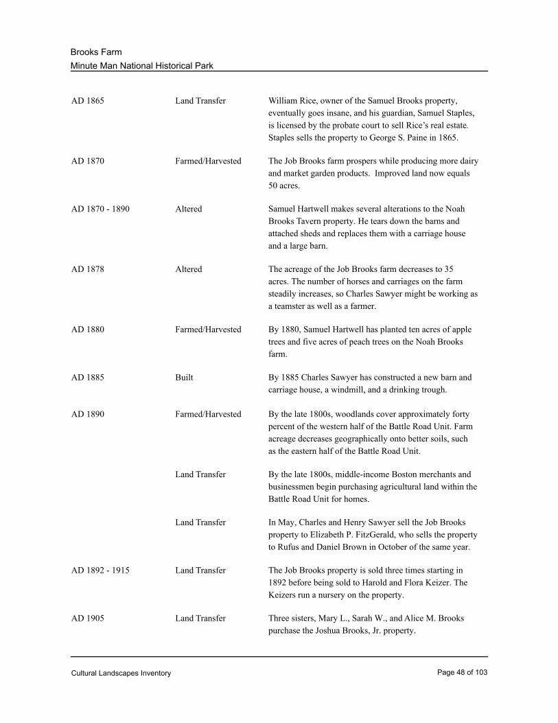
Minute Man National Historical Park
Brooks Farm
Land Transfer William Rice, owner of the Samuel Brooks property,
eventually goes insane, and his guardian, Samuel Staples,
is licensed by the probate court to sell Rice’s real estate.
Staples sells the property to George S. Paine in 1865.
AD 1865
Farmed/Harvested The Job Brooks farm prospers while producing more dairy
and market garden products. Improved land now equals
50 acres.
AD 1870
Altered Samuel Hartwell makes several alterations to the Noah
Brooks Tavern property. He tears down the barns and
attached sheds and replaces them with a carriage house
and a large barn.
AD 1870 - 1890
Altered The acreage of the Job Brooks farm decreases to 35
acres. The number of horses and carriages on the farm
steadily increases, so Charles Sawyer might be working as
a teamster as well as a farmer.
AD 1878
Farmed/Harvested By 1880, Samuel Hartwell has planted ten acres of apple
trees and five acres of peach trees on the Noah Brooks
farm.
AD 1880
Built By 1885 Charles Sawyer has constructed a new barn and
carriage house, a windmill, and a drinking trough.
AD 1885
Farmed/Harvested By the late 1800s, woodlands cover approximately forty
percent of the western half of the Battle Road Unit. Farm
acreage decreases geographically onto better soils, such
as the eastern half of the Battle Road Unit.
AD 1890
Land Transfer By the late 1800s, middle-income Boston merchants and
businessmen begin purchasing agricultural land within the
Battle Road Unit for homes.
Land Transfer In May, Charles and Henry Sawyer sell the Job Brooks
property to Elizabeth P. FitzGerald, who sells the property
to Rufus and Daniel Brown in October of the same year.
Land Transfer The Job Brooks property is sold three times starting in
1892 before being sold to Harold and Flora Keizer. The
Keizers run a nursery on the property.
AD 1892 - 1915
Land Transfer Three sisters, Mary L., Sarah W., and Alice M. Brooks
purchase the Joshua Brooks, Jr. property.
AD 1905
Cultural Landscapes Inventory Page 48 of 103
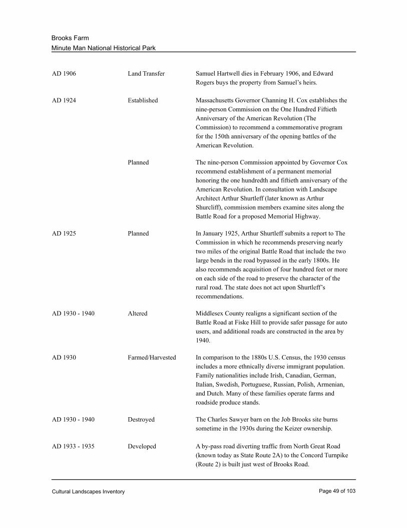
Minute Man National Historical Park
Brooks Farm
Land Transfer Samuel Hartwell dies in February 1906, and Edward
Rogers buys the property from Samuel’s heirs.
AD 1906
Established Massachusetts Governor Channing H. Cox establishes the
nine-person Commission on the One Hundred Fiftieth
Anniversary of the American Revolution (The
Commission) to recommend a commemorative program
for the 150th anniversary of the opening battles of the
American Revolution.
AD 1924
Planned The nine-person Commission appointed by Governor Cox
recommend establishment of a permanent memorial
honoring the one hundredth and fiftieth anniversary of the
American Revolution. In consultation with Landscape
Architect Arthur Shurtleff (later known as Arthur
Shurcliff), commission members examine sites along the
Battle Road for a proposed Memorial Highway.
Planned In January 1925, Arthur Shurtleff submits a report to The
Commission in which he recommends preserving nearly
two miles of the original Battle Road that include the two
large bends in the road bypassed in the early 1800s. He
also recommends acquisition of four hundred feet or more
on each side of the road to preserve the character of the
rural road. The state does not act upon Shurtleff’s
recommendations.
AD 1925
Altered Middlesex County realigns a significant section of the
Battle Road at Fiske Hill to provide safer passage for auto
users, and additional roads are constructed in the area by
1940.
AD 1930 - 1940
Farmed/Harvested In comparison to the 1880s U.S. Census, the 1930 census
includes a more ethnically diverse immigrant population.
Family nationalities include Irish, Canadian, German,
Italian, Swedish, Portuguese, Russian, Polish, Armenian,
and Dutch. Many of these families operate farms and
roadside produce stands.
AD 1930
Destroyed The Charles Sawyer barn on the Job Brooks site burns
sometime in the 1930s during the Keizer ownership.
AD 1930 - 1940
Developed A by-pass road diverting traffic from North Great Road
(known today as State Route 2A) to the Concord Turnpike
(Route 2) is built just west of Brooks Road.
AD 1933 - 1935
Cultural Landscapes Inventory Page 49 of 103
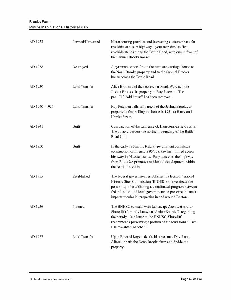
Minute Man National Historical Park
Brooks Farm
Farmed/Harvested Motor touring provides and increasing customer base for
roadside stands. A highway layout map depicts five
roadside stands along the Battle Road, with one in front of
the Samuel Brooks house.
AD 1933
Destroyed A pyromaniac sets fire to the barn and carriage house on
the Noah Brooks property and to the Samuel Brooks
house across the Battle Road.
AD 1938
Land Transfer Alice Brooks and then co-owner Frank Ware sell the
Joshua Brooks, Jr. property to Roy Peterson. The
pre-1713 “old house” has been removed.
AD 1939
Land Transfer Roy Peterson sells off parcels of the Joshua Brooks, Jr.
property before selling the house in 1951 to Harry and
Harriet Strum.
AD 1940 - 1951
Built Construction of the Laurence G. Hanscom Airfield starts.
The airfield borders the northern boundary of the Battle
Road Unit.
AD 1941
Built In the early 1950s, the federal government completes
construction of Interstate 95/128, the first limited access
highway in Massachusetts. Easy access to the highway
from Route 2A promotes residential development within
the Battle Road Unit.
AD 1950
Established The federal government establishes the Boston National
Historic Sites Commission (BNHSC) to investigate the
possibility of establishing a coordinated program between
federal, state, and local governments to preserve the most
important colonial properties in and around Boston.
AD 1955
Planned The BNHSC consults with Landscape Architect Arthur
Shurcliff (formerly known as Arthur Shurtleff) regarding
their study. In a letter to the BNHSC, Shurcliff
recommends preserving a portion of the road from “Fiske
Hill towards Concord.”
AD 1956
Land Transfer Upon Edward Rogers death, his two sons, David and
Alfred, inherit the Noah Brooks farm and divide the
property.
AD 1957
Cultural Landscapes Inventory Page 50 of 103
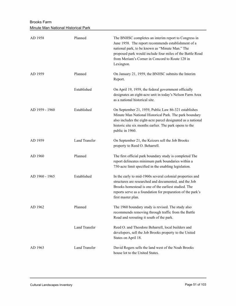
Minute Man National Historical Park
Brooks Farm
Planned The BNHSC completes an interim report to Congress in
June 1958. The report recommends establishment of a
national park, to be known as “Minute Man.” The
proposed park would include four miles of the Battle Road
from Meriam’s Corner in Concord to Route 128 in
Lexington.
AD 1958
Planned On January 21, 1959, the BNHSC submits the Interim
Report.
AD 1959
Established On April 19, 1959, the federal government officially
designates an eight-acre unit in today’s Nelson Farm Area
as a national historical site.
Established On September 21, 1959, Public Law 86-321 establishes
Minute Man National Historical Park. The park boundary
also includes the eight-acre parcel designated as a national
historic site six months earlier. The park opens to the
public in 1960.
AD 1959 - 1960
Land Transfer On September 21, the Keizers sell the Job Brooks
property to Reed O. Beharrell.
AD 1959
Planned The first official park boundary study is completed The
report delineates minimum park boundaries within a
750-acre limit specified in the enabling legislation.
AD 1960
Established In the early to mid-1960s several colonial properties and
structures are researched and documented, and the Job
Brooks homestead is one of the earliest studied. The
reports serve as a foundation for preparation of the park’s
first master plan.
AD 1960 - 1965
Planned The 1960 boundary study is revised. The study also
recommends removing through traffic from the Battle
Road and rerouting it south of the park.
AD 1962
Land Transfer Reed O. and Theodore Beharrell, local builders and
developers, sell the Job Brooks property to the United
States on April 18.
Land Transfer David Rogers sells the land west of the Noah Brooks
house lot to the United States.
AD 1963
Cultural Landscapes Inventory Page 51 of 103
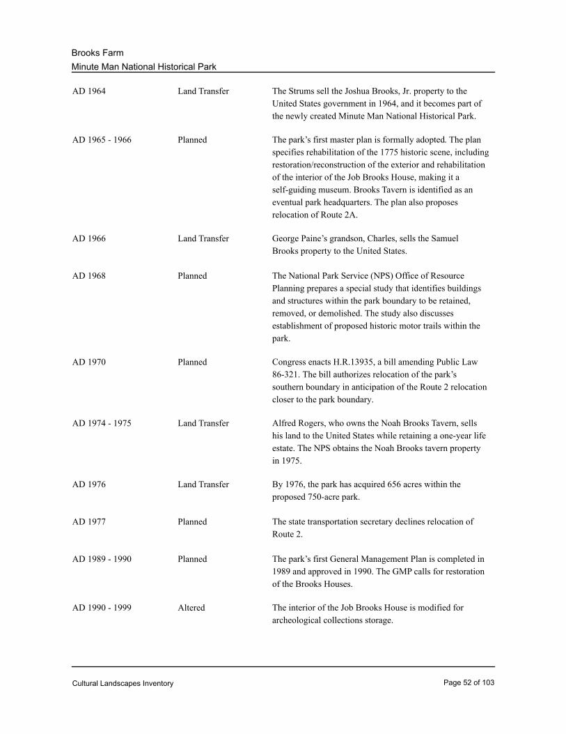
Minute Man National Historical Park
Brooks Farm
Land Transfer The Strums sell the Joshua Brooks, Jr. property to the
United States government in 1964, and it becomes part of
the newly created Minute Man National Historical Park.
AD 1964
Planned The park’s first master plan is formally adopted. The plan
specifies rehabilitation of the 1775 historic scene, including
restoration/reconstruction of the exterior and rehabilitation
of the interior of the Job Brooks House, making it a
self-guiding museum. Brooks Tavern is identified as an
eventual park headquarters. The plan also proposes
relocation of Route 2A.
AD 1965 - 1966
Land Transfer George Paine’s grandson, Charles, sells the Samuel
Brooks property to the United States.
AD 1966
Planned The National Park Service (NPS) Office of Resource
Planning prepares a special study that identifies buildings
and structures within the park boundary to be retained,
removed, or demolished. The study also discusses
establishment of proposed historic motor trails within the
park.
AD 1968
Planned Congress enacts H.R.13935, a bill amending Public Law
86-321. The bill authorizes relocation of the park’s
southern boundary in anticipation of the Route 2 relocation
closer to the park boundary.
AD 1970
Land Transfer Alfred Rogers, who owns the Noah Brooks Tavern, sells
his land to the United States while retaining a one-year life
estate. The NPS obtains the Noah Brooks tavern property
in 1975.
AD 1974 - 1975
Land Transfer By 1976, the park has acquired 656 acres within the
proposed 750-acre park.
AD 1976
Planned The state transportation secretary declines relocation of
Route 2.
AD 1977
Planned The park’s first General Management Plan is completed in
1989 and approved in 1990. The GMP calls for restoration
of the Brooks Houses.
AD 1989 - 1990
Altered The interior of the Job Brooks House is modified for
archeological collections storage.
AD 1990 - 1999
Cultural Landscapes Inventory Page 52 of 103
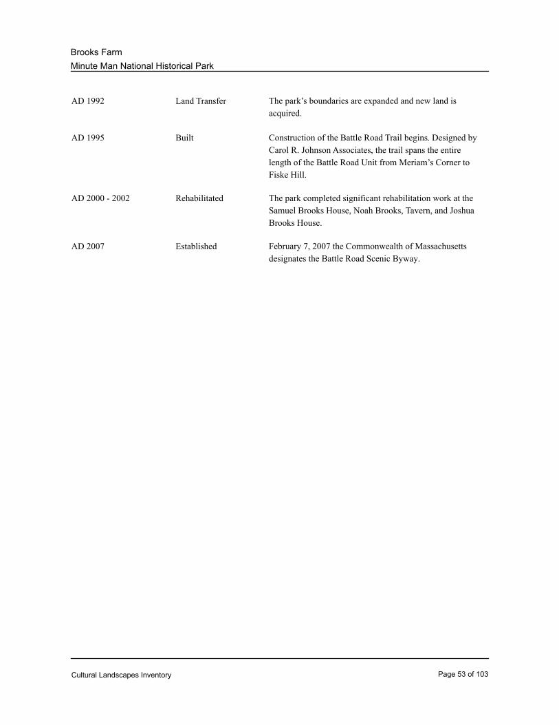
Minute Man National Historical Park
Brooks Farm
Land Transfer The park’s boundaries are expanded and new land is
acquired.
AD 1992
Built Construction of the Battle Road Trail begins. Designed by
Carol R. Johnson Associates, the trail spans the entire
length of the Battle Road Unit from Meriam’s Corner to
Fiske Hill.
AD 1995
Rehabilitated The park completed significant rehabilitation work at the
Samuel Brooks House, Noah Brooks, Tavern, and Joshua
Brooks House.
AD 2000 - 2002
Established February 7, 2007 the Commonwealth of Massachusetts
designates the Battle Road Scenic Byway.
AD 2007
Cultural Landscapes Inventory Page 53 of 103

Minute Man National Historical Park
Brooks Farm
Physical History:
The following section provides information on the physical development and evolution of the
site, organized by time periods. Much of the material is excerpted from the 2005 “Cultural
Landscape Report for Battle Road Unit: Minute Man National Historical Park.” Graphics
associated with this section are located at the end of this report.
Road Names:
Since its construction in the 17th century, the Battle Road has been given various names such
as the Bay Road and Country Road. The portions by-passed in the early 1800s have gained
names of their own. For the purposes of this document the term “Battle Road” is used when
describing the road as it existed in the 17th and 18th centuries. The road configuration formed
between 1802 and 1806, which by-passed the Hartwell and Nelson areas, is called the North
Great Road. All other roads are called by their present-day names.
PRE-COLONIAL PERIOD, to 1634
Between 15,000 and 18,000 years ago, the last glacier to cover New England created the
topography managed by Native Americans and settled by English Puritans. The western
portion of the present-day Battle Road Unit lies within the nutrient-rich geologic depression of
glacial Lake Concord. Less fertile uplands composed of glacial till characterize the eastern half
of the Battle Road Unit. (Cultural Landscape Report--hereafter CLR--2005: 13)
Human habitation in the region dates back 12,000 years when people hunted animals grazing
among open spruce forests. The forests evolved as the earth’s atmosphere warmed, and,
about 8,000 years ago, oak forests dominated a productive landscape that provided early Native
Americans with deer, squirrel, turkey, and a variety of tree nuts. Five thousand years later, a
cooler climate led to declining productivity and a sparser Native American population. Native
Americans gradually learned to exploit their environment, however, and those in southern New
England traveled between seasonal hunting, fishing, gathering, and agricultural grounds. (CLR
2005: 13-14)
By the early 17th century, Algonquian people had inhabited the area along the Musketequid
River, today’s Concord River, for about a thousand years. Native Americans cleared forest
land by fire, and the women planted corn seeds among the dead trees, which were removed
from the fields as they fell. Native American men fished in the spring, and people gathered
tubers, wild rice, and cranberries from the wet grassy meadows along the river to supplement
their diets. In autumn, the men hunted in forests that covered ninety percent of the future
Concord Plantation and Brooks Farm areas. The thick-canopied forests included species of
oak, hickory, chestnut, maple, ash, and probably pine, beech, birch, and hemlock. (CLR 2005:
14, 16-17)
Like European settlers who would inhabit the land along the Musketequid River in the early
17th century, Native Americans manipulated and reshaped the landscape to increase food
production. Pre-colonial Native American settlement along the Musketequid River ended in the
1630s, as European-introduced disease decimated the Native American population and
Cultural Landscapes Inventory Page 54 of 103
Minute Man National Historical Park
Brooks Farm
European settlers moved into their former hunting, fishing, gathering and agricultural grounds.
(CLR 2005: 17)
COLONIAL PERIOD, 1635 - 1783
Battle Road Area Development, 1635-1699:
Colonial settlement in North America is generally defined as the period between the settlement
in Jamestown, Virginia in 1607 and the conclusion of the Revolutionary War. In Massachusetts,
this period began with the arrival of English settlers in 1620. (CLR 2005: 19)
Inland settlement began when the Puritans established the six-mile-square Concord Plantation
on the Musketequid River (Concord River) in 1635. The Concord Plantation included portions
of present-day Concord and Lincoln townships within the present-day Battle Road Unit. In the
early 1640s, Cambridge extended its western border to the eastern edge of the Concord
Plantation. Known as Cambridge Farms, the land began near the center of present-day
Lexington and continued northwest to the Concord and Merrimack Rivers. Cambridge Farms
included parts of Lincoln and Lexington within the Battle Road Unit. (CLR 2005: 19)
By 1636, Concord Plantation, or simply Concord, allocated house lots along the base of an
east-west ridgeline (known today as Revolutionary Ridge) about a mile south of the Concord
River and extending to the western edge of the present-day Battle Road Unit. This
apportionment of land was called the First Division, and settlers received both six- to eight-acre
house lots and 30- to 50-acre agricultural lots within commonly held wet meadows, tillage fields,
and special pastures. The remaining acreage within the plantation, known as the “commons,”
was primarily forested and mostly served as communal pasture for livestock, which foraged
through the forest consuming the understory. A road ‘foure Rodes [rods]’ (66 feet) wide
paralleled the ridge line, bisecting the First Division house lots. This section of road would later
be incorporated into what is now known as the Battle Road, which was fully laid out by 1666.
(CLR 2005: 19, 21-22, 24)
During the Second Division (1652 to 1663), commonly held land was distributed to individuals,
and three sections – the North, South, and East Quarters – were formed to facilitate
distribution. In contrast to the “commons,” privately owned pastures were generally clear-cut
and enclosed by walls or fences. The number of stone walls within the Battle Road Unit
increased primarily due to clear-cutting, which reduced the insulating value of the topsoil and
promoted frost heaving that pushed stones to the surface. As stones accumulated, they were
often stacked to preserve space. (CLR 2005: 25-26)
Throughout the early Colonial period, farm production in the Battle Road area was subsistence
based, each family producing enough food for personal consumption and perhaps a small
amount for local trade. By the mid-1600s, cultivated varieties of English grasses began to
replace native grasses. By 1700, thirty percent of Concord’s forests had been cleared, and
only two expanses of woodland have been identified along the Battle Road at that time. During
the 18th century, Colonial settlement would continue to alter the landscape of the Battle Road
and Brooks Farm area. (CLR 2005: 9, 25)
Cultural Landscapes Inventory Page 55 of 103
Minute Man National Historical Park
Brooks Farm
Brooks Farm Area Development, 1635–1699:
The large Brooks family that settled and farmed along Battle Road for more than three hundred
years descended from Captain Thomas Brooks, who was born in England and settled in
Watertown, MA in 1635. Captain Brooks moved to Concord around 1650 and was one of the
first individuals to receive property apportioned during Concord’s First and Second Divisions,
receiving a large land grant in the East Quarter of Concord as part of the Second Division.
Captain Brooks married Grace Reynolds, and they had at least nine children together including
a son named Joshua. Joshua married Hannah Mason of Watertown in 1653, and they would
also have at least nine children. Joshua lived with his family south of the Battle Road,
presumably at the current Joshua Brooks site. (Job Brooks House Historic Structure Report-
-hereafter JBHSR--1992: 13)
On December 1, 1666, Captain Brooks gave Joshua several parcels from the Concord land
grant, including “twenty five acres & a halfe of upland & swamp & ten acres of meadow.”
Upon his father’s death a few months later, Joshua appears to have inherited several more
parcels of land along Battle Road, and by 1679 he owned 350 acres in Concord. (JBHSR 1992:
15) In 1695, Joshua distributed his holdings to four sons, Noah, Daniel, Joseph, and Job. Noah
(b. 1657), the eldest son, received the largest portion, including much land on the south side of
Battle Road and a few parcels on the north side of the road. (JBHSR 1992: 15; Joshua Brooks,
Jr. House Structure Report--hereafter JSHSR--2000: 3)
Noah established a farm on the south side of Battle Road and built a tanyard on the creek north
of the road. Daniel (b. 1663) received acreage north of the road and probably built a house on
the land after his 1692 marriage to Anna Meriam. Job (b. 1675) bought land from his father on
the north side of the road and built a house and barn. Job’s site consisted of 17 acres of upland
and meadow and was bounded on the west by lands of Joseph Brooks (b. 1671), north by a
neighbor’s ditch, east by land of Noah Brooks, and south by the Battle Road. Job died at age
22 on May 17, 1697, and younger brother Hugh (b. 1678) inherited Job’s property by quit claim
deed on August 24. (JSHSR 2000: 3; JBHSR 1992: 15-17; Samuel Brooks House Historic
Structure Report--hereafter SHSR--2000: 3)
Battle Road Area Development, 1700–1774:
During the 18th century, new house lots developed along the Battle Road, and old house lots
passed to fourth and fifth generations. Through inheritance, large 17th-century properties were
gradually subdivided, and as more land became privatized, fields and pastures were
consolidated around house lots. Political boundaries also changed. In 1713, Cambridge Farms
separated from Cambridge and incorporated as the town of Lexington. The town of Lincoln
was established in 1754, its boundary including portions of Concord and Lexington located
within the present-day Battle Road Unit. The cluster of properties owned by the Brooks family
straddled the town line between Concord and Lincoln. (CLR 2005: 26)
By the 1770s, about 25 house lots were located along Battle Road. A typical house lot
averaged 60 to 80 acres, significantly larger than the six to eight-acre house lots of Concord’s
First Division. In addition to a barn and several outbuildings, house lots often included a small
garden and an orchard. At least 15 orchards were located along the Battle Road in the 1770s,
Cultural Landscapes Inventory Page 56 of 103
Minute Man National Historical Park
Brooks Farm
the large number probably due to the popularity of hard cider in the 18th century. Fruit trees
could grow on the marginal upland soil that was less suited for grain, making hard cider less
expensive to produce than beer. According to Historical Landscape Architect Susan Dolan in
her 2009 publication, Fruitful Legacy, cider was the beverage of subsistence before potable
water. (CLR 2005: 26, 28; Dolan: 17)
While the communities remained subsistence oriented, a complex system of local exchange and
several commercial enterprises began to develop. Towns along the Battle Road had reached
an integrated system of land use by the mid-18th century. Local trades along the Battle Road
included the Brooks Tannery, several blacksmith and locksmith shops, and a cider mill on the
Jacob Whittemore farm. Taverns began to replace Puritan churches as centers of civic
influence. Local colonists and travelers visited taverns to rest, drink, and discuss politics. Four
taverns were located along the Battle Road. (CLR 2005: 26, 35)
Existing roads were altered and improved throughout the 18th century to provide better
transportation to neighboring towns, to market, to agricultural land, and between house lots. A
1716 Concord survey indicates that the Battle Road was widened substantially towards its
eastern end, from 66 feet wide west of Meriam’s Corner to 165 feet wide at today’s Bloody
Angle. In 1736 Concord constructed Brooks Road running southwest from the Battle Road
near the house of Daniel Brooks (the Samuel Brooks House). In 1747, Hugh Brooks was
found to have built within the Battle Road right-of-way. In 1748, Concord leaders voted to sell
off excess land near the Battle Road, narrowing the right-of-way between Meriam’s Corner
and the Bloody Angle. The town of Lexington purchases land along the north side of the Battle
Road for road realignment in 1773. (CLR 2005: 29-31)
Brooks Farm Area Development, 1700-1774:
In 1700 Hugh Brooks added three acres to the west side of his property by purchasing land
from his older brother, Joseph. The farm remained at a consistent value and 20-acre size
between 1700 and 1740. Livestock generally included two oxen, five to six cows, one horse,
and one or two swine. Sheep were also raised on the farm at least until 1723. Crops included
Indian acorn, English hay, meadow hay, rye, flax, and cider apples. A barn and a cider mill
were probably located on the property to store and process the crops. (JBHSR 1992: 17-18)
Noah Brooks gave his son Joshua (b. 1688) the tannery and, in 1713, a dwelling house and two
acres across from the tannery south of the Battle Road. This property was the same land upon
which was later built Joshua’s grandson’s house, the Joshua Brooks, Jr. House. Noah’s other
son, Thomas (b. 1701), received “10 acres with house and barn” just to the west of Joshua’s
land, including the future Noah Brooks Tavern land, around 1726. (JSHSR 2000: 3; Noah
Brooks Tavern Site Historic Structure Report--hereafter NHSR--2000: 3)
Daniel Brooks died in 1733, leaving a prosperous farm and dwelling house to his son, Samuel.
Over 40 years old, Samuel married in 1738 and fathered eight children, and it was probably
during this time that the house was enlarged. (SHSR 2000: 3)
Meanwhile, in 1740 Hugh Brooks deeded land to his youngest son, Job, including the 20-acre
Cultural Landscapes Inventory Page 57 of 103
Minute Man National Historical Park
Brooks Farm
homestead. The gift may have anticipated Job’s 1743 marriage to Anna Bridge of Lexington,
and the house currently located on the site was probably constructed before young Job’s
wedding, replacing the older dwelling given to the elder Job Brooks by his father Joshua in
1695. Job was a full partner in his father’s farm operations. Job also worked as a currier,
finishing skins at the tanyard owned by his uncle Noah Brooks. (JBHSR 1992: 20-21)
Joshua Brooks (Noah’s son) prospered as a farmer and tanner and became a leading citizen in
Concord. In 1745 Joshua gave his dwelling house and two acres to his son, “Deacon” Joshua
Brooks (b. 1720). Deacon Joshua continued his father’s tanning business and was active in
local politics and religious affairs. He agitated to form a new parish and town on religious
grounds, helping to establish the town of Lincoln, where the tannery site and Joshua Brooks, Jr.
House are located. (JSHSR 2000: 4)
Hugh Brooks died in 1747, and his son Job became sole owner and manager of the farm while
Hugh’s widow, Abigail, continued to occupy a portion of the house until her death in 1761. In
the same year Job added two acres of pasture to the west side of his lot and two acres of
upland at the southwestern portion of his lot, bringing the property to 24 acres. A fence ran
along the north side of the Battle Road from Deacon Joshua Brook’s tanyard to the corner of
Job Brooks’ land. (JBHSR 1992: 22)
Samuel Brooks died in 1758, and his son Samuel, Jr. inherited the Samuel Brooks property,
including over ten acres with a house, barn, and upland. Samuel Jr. was a farmer and active
Concord citizen. By 1771 he had amassed 44 acres in Concord – ten of pasture, 26 acres of
fresh meadow, four of upland meadow, and four acres of tillage. Samuel’s farm produced 18
barrels of cider, an amount requiring an orchard of at least an acre. The house stood on a plot
of pasture and orchard, while the barn was located in the four acres of tillage – the “home
field.” The fresh meadow was located north of the home and barn. Samuel also owned two
horses, two oxen, six cows, and three swine. Just west of Samuel Brooks lay the land of Job
Brooks of Lincoln and his son, Eleazer Brooks. The two lived in Lincoln but were taxed for
land along the Battle Road, where a five and three-quarter acres parcel of pasture and
plowland was located in Brooks Farm. (SHSR 2000: 3; Malcolm 1985: 82-84)
In 1762 Deacon Joshua Brooks purchased a six-acre parcel of orchard and pasture from
Timothy Wesson, just west of Brooks Road and south of the Battle Road in Lincoln. In 1771
Deacon Brooks was assessed for eighteen acres of fresh meadow in Concord, of which only
four acres were located along the north side of the Battle Road. He was also assessed for a
slaughter house, and he owned adjacent property, including the aforementioned tanyard, to the
east in the present-day Hartwell Area. Between 1771 and 1775 Deacon Brooks purchased
two acres of land north of the Battle Road and just west of Brooks Road and Samuel Brooks
Jr.’s property, a location separate from the rest of Joshua’s Concord acreage but just across
the Battle Road from the six acres Joshua purchased in 1762. The two acres contained a
house and barn, which were removed. (Malcolm 1985: 80)
In 1770, Job Brooks’ son, Asa, appeared on Concord tax records, and father and son split the
assets of the Job Brooks property in half. Asa married in circa 1770 and shared the east half
Cultural Landscapes Inventory Page 58 of 103
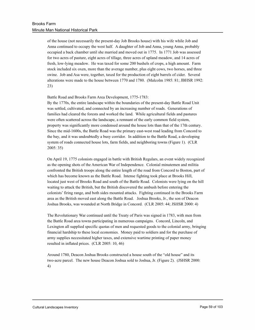
Minute Man National Historical Park
Brooks Farm
of the house (not necessarily the present-day Job Brooks house) with his wife while Job and
Anna continued to occupy the west half. A daughter of Job and Anna, young Anna, probably
occupied a back chamber until she married and moved out in 1775. In 1771 Job was assessed
for two acres of pasture, eight acres of tillage, three acres of upland meadow, and 14 acres of
fresh, low-lying meadow. He was taxed for some 200 bushels of crops, a high amount. Farm
stock included six oxen, more than the average number, plus eight cows, two horses, and three
swine. Job and Asa were, together, taxed for the production of eight barrels of cider. Several
alterations were made to the house between 1770 and 1780. (Malcolm 1985: 81; JBHSR 1992:
23)
Battle Road and Brooks Farm Area Development, 1775-1783:
By the 1770s, the entire landscape within the boundaries of the present-day Battle Road Unit
was settled, cultivated, and connected by an increasing number of roads. Generations of
families had cleared the forests and worked the land. While agricultural fields and pastures
were often scattered across the landscape, a remnant of the early common field system,
property was significantly more condensed around the house lots than that of the 17th century.
Since the mid-1600s, the Battle Road was the primary east-west road leading from Concord to
the bay, and it was undoubtedly a busy corridor. In addition to the Battle Road, a developing
system of roads connected house lots, farm fields, and neighboring towns (Figure 1). (CLR
2005: 35)
On April 19, 1775 colonists engaged in battle with British Regulars, an event widely recognized
as the opening shots of the American War of Independence. Colonial minutemen and militia
confronted the British troops along the entire length of the road from Concord to Boston, part of
which has become known as the Battle Road. Intense fighting took place at Brooks Hill,
located just west of Brooks Road and south of the Battle Road. Colonists were lying on the hill
waiting to attack the British, but the British discovered the ambush before entering the
colonists’ firing range, and both sides mounted attacks. Fighting continued in the Brooks Farm
area as the British moved east along the Battle Road. Joshua Brooks, Jr., the son of Deacon
Joshua Brooks, was wounded at North Bridge in Concord. (CLR 2005: 44; JSHSR 2000: 4)
The Revolutionary War continued until the Treaty of Paris was signed in 1783, with men from
the Battle Road area towns participating in numerous campaigns. Concord, Lincoln, and
Lexington all supplied specific quotas of men and requested goods to the colonial army, bringing
financial hardship to these local economies. Money paid to soldiers and for the purchase of
army supplies necessitated higher taxes, and extensive wartime printing of paper money
resulted in inflated prices. (CLR 2005: 10, 46)
Around 1780, Deacon Joshua Brooks constructed a house south of the “old house” and its
two-acre parcel. The new house Deacon Joshua sold to Joshua, Jr. (Figure 2). (JSHSR 2000:
4)
Cultural Landscapes Inventory Page 59 of 103
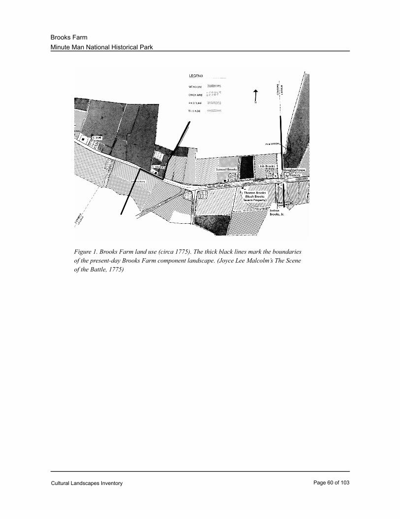
Minute Man National Historical Park
Brooks Farm
Figure 1. Brooks Farm land use (circa 1775). The thick black lines mark the boundaries
of the present-day Brooks Farm component landscape. (Joyce Lee Malcolm’s The Scene
of the Battle, 1775)
Cultural Landscapes Inventory Page 60 of 103
Minute Man National Historical Park
Brooks Farm
Figure 2. View southeast toward the Joshua Brooks, Jr. property, date unknown. Built
around 1780, the house on the right still stands today. The building on the left is no
longer extant. (MIMA Library)
RURAL ECONOMIC PERIOD, 1784 – 1899
Battle Road Area Development, 1784-1843:
Economic hardships persisted for a brief period after the war, but Massachusetts’s economy
recovered in the 1790s when high tariffs imposed on British goods prompted the growth of
domestic industries such as textile mills, tanneries, and shoe factories. A number of small
industries were located in Concord, Lincoln, and Lexington. New England farmers also
benefited from industrialization, as they raised sheep for use in textile mills and livestock to sell
in emerging urban centers. Beginning in 1820, woodland clearing for pastures and meadows
significantly increased along the Battle Road to support larger cattle herds. By the mid-19th
century only ten percent of local woodlands remained. Farmers along the road began adapting
farm buildings, structures, and field configurations to support commercial agricultural
production, and crops raised were sold to neighboring industrial towns. (CLR 2005: 47-48)
While secondary roads remained in poor condition, larger roads were improved, and new roads
were constructed to support vehicle traffic and livestock drives. The Battle Road was greatly
altered between 1802 and 1806, as the towns of Concord, Lincoln, and Lexington realigned
portions of the road to provide more efficient travel between Concord and Boston (Figure 3).
Just to the east of the Brooks Farm area, the Hartwell area bend was by-passed, rerouting
traffic away from the houses. The straightened sections became part of the North Great Road,
Cultural Landscapes Inventory Page 61 of 103
Minute Man National Historical Park
Brooks Farm
and their construction would make 20th-century restoration of the by-passed portions and
surrounding landscape feasible. Also in 1806, the Cambridge Turnpike (today’s Route 2) was
constructed south of the Battle Road. Although not within the bounds of the present-day Battle
Road Unit, the presence of the turnpike altered traffic flow along the Battle Road by the
mid-19th century, and a 20th-century realignment of the turnpike influenced early planning of
the present-day Minute Man National Historical Park. In 1838 Middlesex County
Commissioners ordered the repair of the North Great Road in specific locations, including the
ascent of Brooks Hill and the lowest point in the valley at Brooks’ tanyard. (CLR 2005: 48, 51,
55)
The improvement of the Battle Road and construction of new roads did not bolster area
industry for long. The small towns did not have sufficient water flow necessary to support
large-scale industry and could not compete with locations such as Lowell at the confluence of
the Concord and Merrimac Rivers. Battle Road area taverns also went out of business by the
1840s, though the Hartwell Tavern is thought to have stopped operating in the late 18th century.
While consuming alcohol during the Colonial Period was acceptable, by the early 19th century
drinking was perceived as a social problem. Additionally, the construction of the Cambridge
Turnpike undoubtedly diverted clientele away from the taverns along the Battle Road and North
Great Road. By the 1830s farmers along the Battle Road began to replace their cider orchards
with dessert fruit orchards. (CLR 2005: 53-54)
The 1840s landscape along the Battle Road would have included many similar features found in
the colonial landscape – stone walls, fences, pastures and fields, orchards, houses, and barns –
although their configuration was undoubtedly different. A view of the 19th-century roadside
would include larger pastures, barns, and outbuildings necessary to support commercial dairy
production, a mix of cider and fancy fruit trees as farmers responded to the declining cider
consumption, and the absence of local trade and tavern establishments. (CLR 2005: 55)
Brooks Farm Area Development, 1784–1843:
By the end of the 18th century, the Brooks family was in its fifth generation on Battle Road.
Captain Thomas Brooks’ great-grandsons Thomas and Job both owned property, as did his
great-great-grandsons Deacon Joshua (son of Joshua Brooks who died in 1768) and Samuel, Jr.
(son of Samuel Brooks, who died in 1758).
A 1784 tax assessment reported that the Job Brooks farm consisted of one dwelling, one barn,
and one “other shop.” The property included 8 acres of tillage, 6 acres of pasture, 5 oxen, 12
cows, 1 horse, and 2 swine. The house remained unchanged from its 1775 appearance. Job
died in 1794, leaving the farm to his widow Anna and youngest son, Asa. The house lot had
grown to 25 acres by that time. Asa increased the size of his landholdings in Concord, Lincoln,
and elsewhere to 283 acres by 1798, and he expanded his farm operations considerably.
Between 1794 and 1805 he owned 10 oxen, 26-30 cows, 2 horses, and 4swine. He also owned
tenant farms. (JBHSR 1992: 24-25, 27; JBHSR 1963: 2)
Deacon Joshua Brooks died in 1790, leaving the “old house” and two-acre parcel to his son
Joshua, Jr., along with another 30 acres of land. Joshua, Jr. continued the family tradition of
Cultural Landscapes Inventory Page 62 of 103
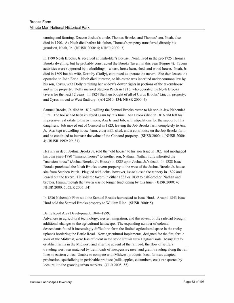
Minute Man National Historical Park
Brooks Farm
tanning and farming. Deacon Joshua’s uncle, Thomas Brooks, and Thomas’ son, Noah, also
died in 1790. As Noah died before his father, Thomas’s property transferred directly his
grandson, Noah, Jr. (JSHSR 2000: 4; NHSR 2000: 3)
In 1798 Noah Brooks, Jr. received an innholder’s license. Noah lived in the pre-1725 Thomas
Brooks dwelling, but he probably constructed the Brooks Tavern in this year (Figure 4). Tavern
activities were supported by outbuildings – a barn, horse barn, shed, and wood house. Noah, Jr.
died in 1809 but his wife, Dorothy (Dolly), continued to operate the tavern. She then leased the
operation to John Earle. Noah died intestate, so his estate was inherited under common law by
his son, Cyrus, with Dolly retaining her widow’s dower rights in portions of the tavern/house
and in the property. Dolly married Stephen Patch in 1816, who operated the Noah Brooks
tavern for the next 12 years. In 1824 Stephen bought of all of Cyrus Brooks’ Lincoln property,
and Cyrus moved to West Sudbury. (AH 2010: 134; NHSR 2000: 4)
Samuel Brooks, Jr. died in 1812, willing the Samuel Brooks estate to his son-in-law Nehemiah
Flint. The house had been enlarged again by this time. Asa Brooks died in 1816 and left his
impressive real estate to his twin sons, Asa Jr. and Job, with stipulations for the support of his
daughters. Job moved out of Concord in 1823, leaving the Job Brooks farm completely to Asa,
Jr. Asa kept a dwelling house, barn, cider mill, shed, and a corn house on the Job Brooks farm,
and he continued to increase the value of the Concord property. (SHSR 2000: 4; NHSR 2000:
4; JBHSR 1992: 29, 31)
Heavily in debt, Joshua Brooks Jr. sold the “old house” to his son Isaac in 1823 and mortgaged
his own circa-1780 “mansion house” to another son, Nathan. Nathan fully inherited the
“mansion house” (Joshua Brooks, Jr. House) in 1825 upon Joshua Jr.’s death. In 1828 Isaac
Brooks purchased the Noah Brooks tavern property to the west of the Joshua Brooks Jr. house
site from Stephen Patch. Plagued with debts, however, Isaac closed the tannery in 1829 and
leased out the tavern. He sold the tavern in either 1833 or 1839 to half-brother, Nathan and
brother, Hiram, though the tavern was no longer functioning by this time. (JHSR 2000: 4;
NHSR 2000: 5; CLR 2005: 54)
In 1836 Nehemiah Flint sold the Samuel Brooks homestead to Isaac Hurd. Around 1843 Isaac
Hurd sold the Samuel Brooks property to William Rice. (SHSR 2000: 5)
Battle Road Area Development, 1844–1899:
Advances in agricultural technology, western migration, and the advent of the railroad brought
additional changes to the agricultural landscape. The expanding number of colonial
descendants found it increasingly difficult to farm the limited agricultural space in the rocky
uplands bordering the Battle Road. New agricultural implements, designed for the flat, fertile
soils of the Midwest, were less efficient in the stone strewn New England soils. Many left to
establish farms in the Midwest, and after the advent of the railroad, the flow of settlers
traveling west was matched by train loads of inexpensive meat and grain traveling along the rail
lines to eastern cities. Unable to compete with Midwest products, local farmers adapted
production, specializing in perishable produce (milk, apples, cucumbers, etc.) transported by
local rail to the growing urban markets. (CLR 2005: 55)
Cultural Landscapes Inventory Page 63 of 103
Minute Man National Historical Park
Brooks Farm
Farmers adapted structures and field configurations to support increasingly commercialized
operations. Stone walls were often dismantled, for instance, to enlarge fields upon which
mechanized farming equipment would be used. Local farmers also relied more heavily on
wage laborers. Filling this need was a growing population of European immigrants arriving in
Boston, of which the Irish were among the most prevalent in the mid-19th century. By the
1860s, immigrant families begin purchasing farms along the Battle Road, generally on marginal
land or land abandoned by colonial descendants who had relocated to more fertile agricultural
land in the Midwest. (CLR 2005: 55-58)
With the influx of inexpensive hay and grains from the Midwest, local farm acreage contracted
geographically onto better soils, and worn out land reverted to woodland. A declining need for
firewood also contributed to the rejuvenation of local forests as efficient Rumford fireplaces
and Franklin stoves increasingly replaced colonial fireplaces, and coal replaced wood. By the
late 19th century, woodlands covered approximately forty percent of the western half of the
present-day Battle Road Unit. The eastern half remained open. (CLR 2005: 59-60)
By the late 19th century, the open, agricultural landscape of the Battle Road had changed.
Farms were much more condensed, and four monuments commemorating the April 1775 battles
had been placed along the Battle Road. These monuments and the battle sites and witness
structures drew an increasing number of tourists to the area. By the 1870s, wealthy Bostonians
had purchased agricultural fields and pastures within the towns bordering the Battle Road,
converting those properties into large summer estates. By the late 19th century, middle-income
Boston merchants and businessmen purchased agricultural land within the present-day Battle
Road Unit for smaller, permanent residences. Men from these families commuted daily to and
from Boston, primarily by train. The North Great Road was converted into a highway in the
1890s, and its sophisticated construction of compacted stone provided more efficient travel to
and from Boston and allowed for pleasurable use. The highway would primarily serve farmers
hauling produce to market, tourists in carriages and omnibuses, and bicyclists. (CLR 2005: 65,
69, 71)
Brooks Farm Area Development, 1844–1899:
Asa Brooks, Jr. sold the then-60-acre Job Brooks Site to Emelius J. Leppleman in 1847. On
November 23, 1854 Leppleman sold the farm to Myrick Benner, a trader from Boston. Benner
sold the Job Brooks home lot, containing 27 acres, to Charles A. Sawyer and his brother,
Henry, in 1858. During the Sawyer ownership livestock consisted of four horses, six milk
cows, two oxen, four other cattle, and two swine. The crop yield included 100 bushels of
Indiana corn, 100 bushels of Irish potatoes, and 100 tons of hay. (JBHSR 1992: 32-33)
In 1844 Isaac Brooks sold the “old house” and two-acre parcel from the Joshua Brooks, Jr.
property to half-brother, Nathan. By 1855 Nathan held title to the entire late-17th century
Noah Brooks farm. A large barn had been built on the property behind the house to the south.
In 1855, Nathan sold the Noah Brooks tavern property, which was then sold two more times
before being bought by local farmer Samuel Hartwell in 1857. In 1859 Nathan sold the Joshua
Brooks property, presumably with both the 1713 and 1780 dwellings to brother, Joshua. Joshua
Cultural Landscapes Inventory Page 64 of 103
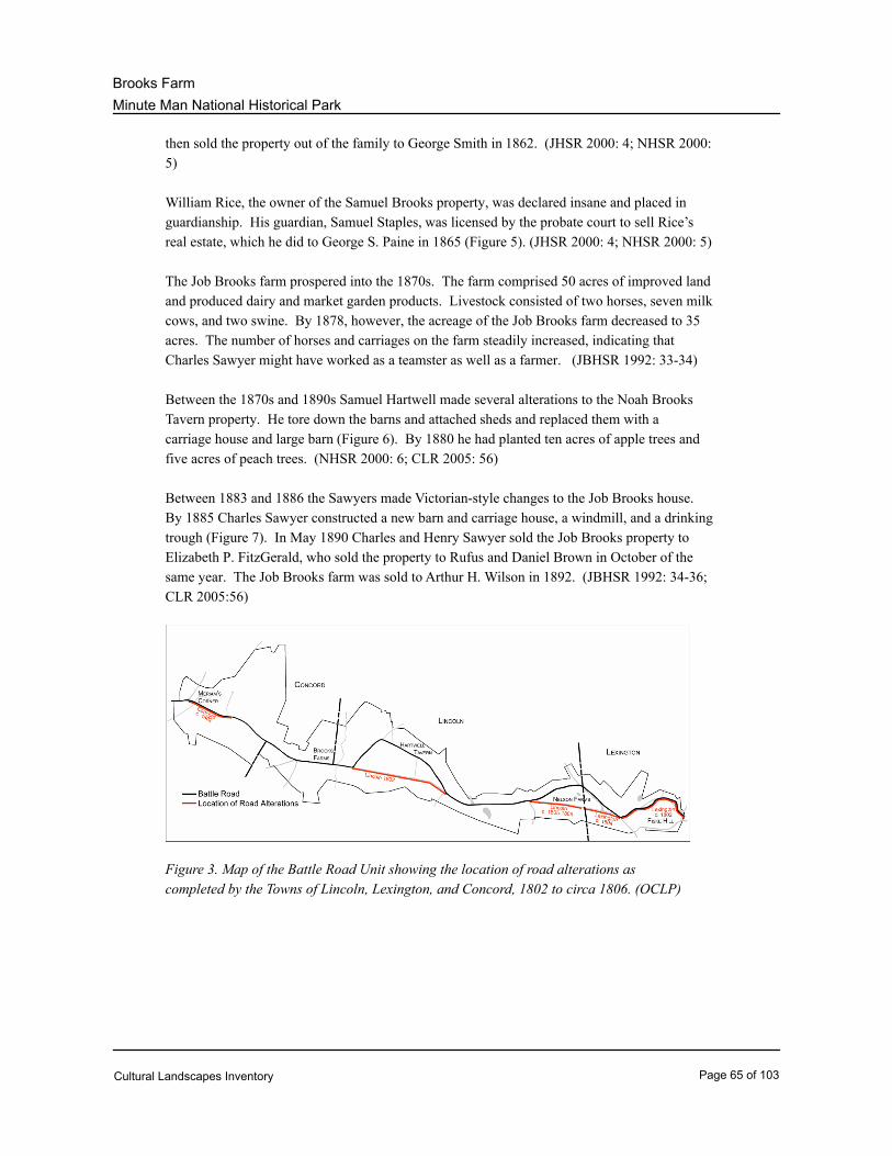
Minute Man National Historical Park
Brooks Farm
then sold the property out of the family to George Smith in 1862. (JHSR 2000: 4; NHSR 2000:
5)
William Rice, the owner of the Samuel Brooks property, was declared insane and placed in
guardianship. His guardian, Samuel Staples, was licensed by the probate court to sell Rice’s
real estate, which he did to George S. Paine in 1865 (Figure 5). (JHSR 2000: 4; NHSR 2000: 5)
The Job Brooks farm prospered into the 1870s. The farm comprised 50 acres of improved land
and produced dairy and market garden products. Livestock consisted of two horses, seven milk
cows, and two swine. By 1878, however, the acreage of the Job Brooks farm decreased to 35
acres. The number of horses and carriages on the farm steadily increased, indicating that
Charles Sawyer might have worked as a teamster as well as a farmer. (JBHSR 1992: 33-34)
Between the 1870s and 1890s Samuel Hartwell made several alterations to the Noah Brooks
Tavern property. He tore down the barns and attached sheds and replaced them with a
carriage house and large barn (Figure 6). By 1880 he had planted ten acres of apple trees and
five acres of peach trees. (NHSR 2000: 6; CLR 2005: 56)
Between 1883 and 1886 the Sawyers made Victorian-style changes to the Job Brooks house.
By 1885 Charles Sawyer constructed a new barn and carriage house, a windmill, and a drinking
trough (Figure 7). In May 1890 Charles and Henry Sawyer sold the Job Brooks property to
Elizabeth P. FitzGerald, who sold the property to Rufus and Daniel Brown in October of the
same year. The Job Brooks farm was sold to Arthur H. Wilson in 1892. (JBHSR 1992: 34-36;
CLR 2005:56)
Figure 3. Map of the Battle Road Unit showing the location of road alterations as
completed by the Towns of Lincoln, Lexington, and Concord, 1802 to circa 1806. (OCLP)
Cultural Landscapes Inventory Page 65 of 103
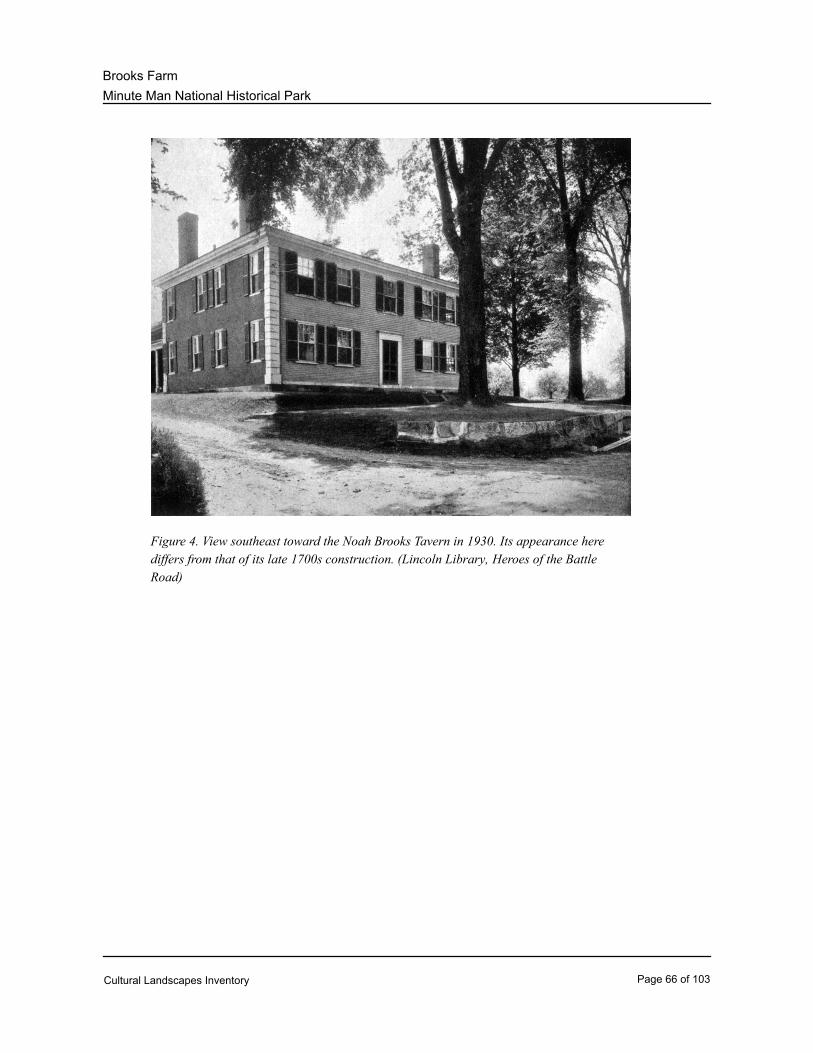
Minute Man National Historical Park
Brooks Farm
Figure 4. View southeast toward the Noah Brooks Tavern in 1930. Its appearance here
differs from that of its late 1700s construction. (Lincoln Library, Heroes of the Battle
Road)
Cultural Landscapes Inventory Page 66 of 103
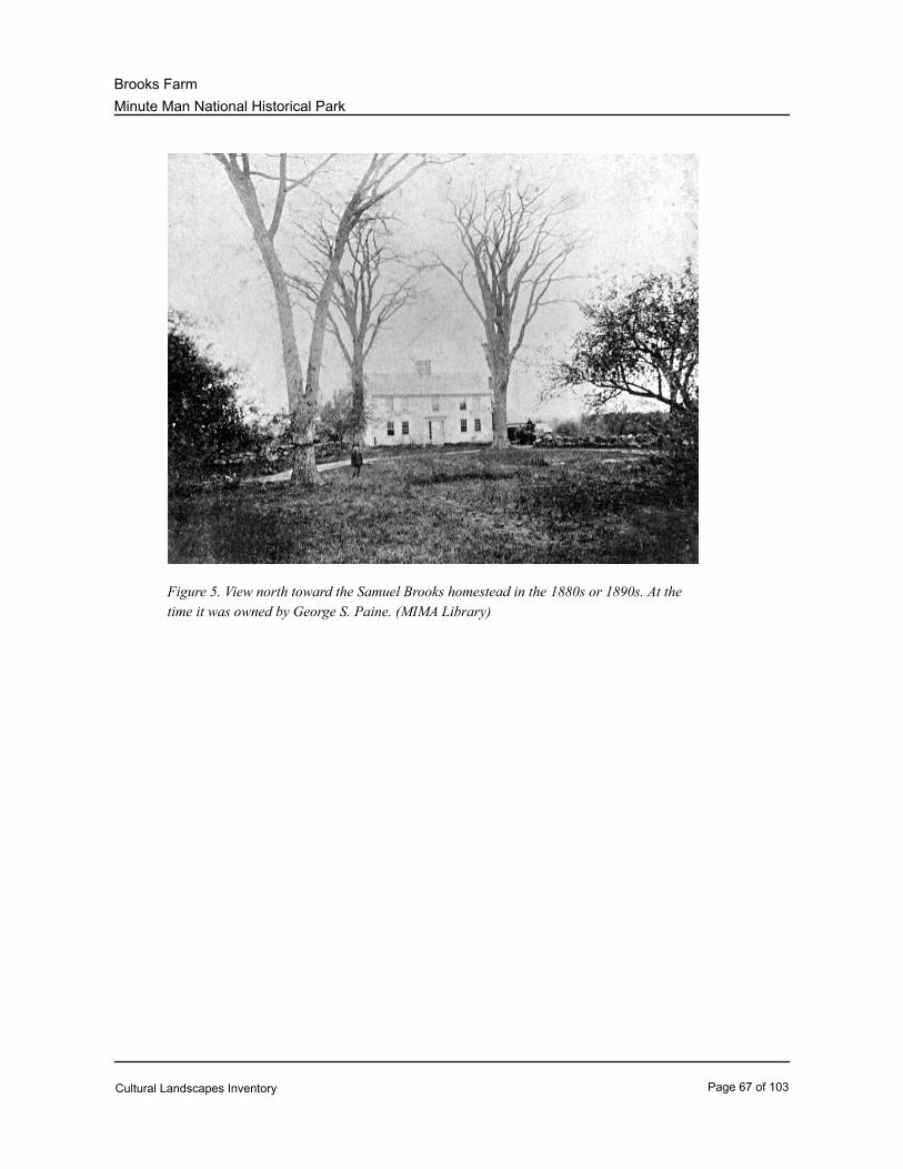
Minute Man National Historical Park
Brooks Farm
Figure 5. View north toward the Samuel Brooks homestead in the 1880s or 1890s. At the
time it was owned by George S. Paine. (MIMA Library)
Cultural Landscapes Inventory Page 67 of 103
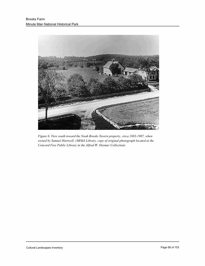
Minute Man National Historical Park
Brooks Farm
Figure 6. View south toward the Noah Brooks Tavern property, circa 1883-1907, when
owned by Samuel Hartwell. (MIMA Library, copy of original photograph located at the
Concord Free Public Library in the Alfred W. Hosmer Collection)
Cultural Landscapes Inventory Page 68 of 103
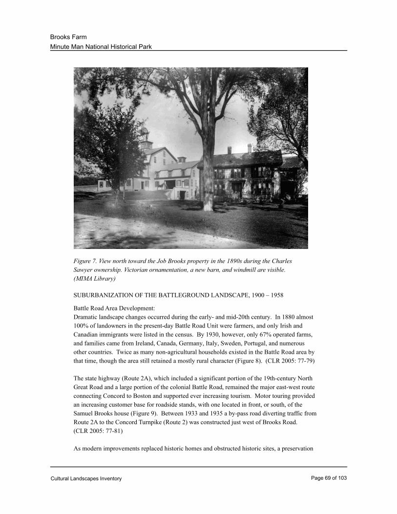
Minute Man National Historical Park
Brooks Farm
Figure 7. View north toward the Job Brooks property in the 1890s during the Charles
Sawyer ownership. Victorian ornamentation, a new barn, and windmill are visible.
(MIMA Library)
SUBURBANIZATION OF THE BATTLEGROUND LANDSCAPE, 1900 – 1958
Battle Road Area Development:
Dramatic landscape changes occurred during the early- and mid-20th century. In 1880 almost
100% of landowners in the present-day Battle Road Unit were farmers, and only Irish and
Canadian immigrants were listed in the census. By 1930, however, only 67% operated farms,
and families came from Ireland, Canada, Germany, Italy, Sweden, Portugal, and numerous
other countries. Twice as many non-agricultural households existed in the Battle Road area by
that time, though the area still retained a mostly rural character (Figure 8). (CLR 2005: 77-79)
The state highway (Route 2A), which included a significant portion of the 19th-century North
Great Road and a large portion of the colonial Battle Road, remained the major east-west route
connecting Concord to Boston and supported ever increasing tourism. Motor touring provided
an increasing customer base for roadside stands, with one located in front, or south, of the
Samuel Brooks house (Figure 9). Between 1933 and 1935 a by-pass road diverting traffic from
Route 2A to the Concord Turnpike (Route 2) was constructed just west of Brooks Road.
(CLR 2005: 77-81)
As modern improvements replaced historic homes and obstructed historic sites, a preservation
Cultural Landscapes Inventory Page 69 of 103
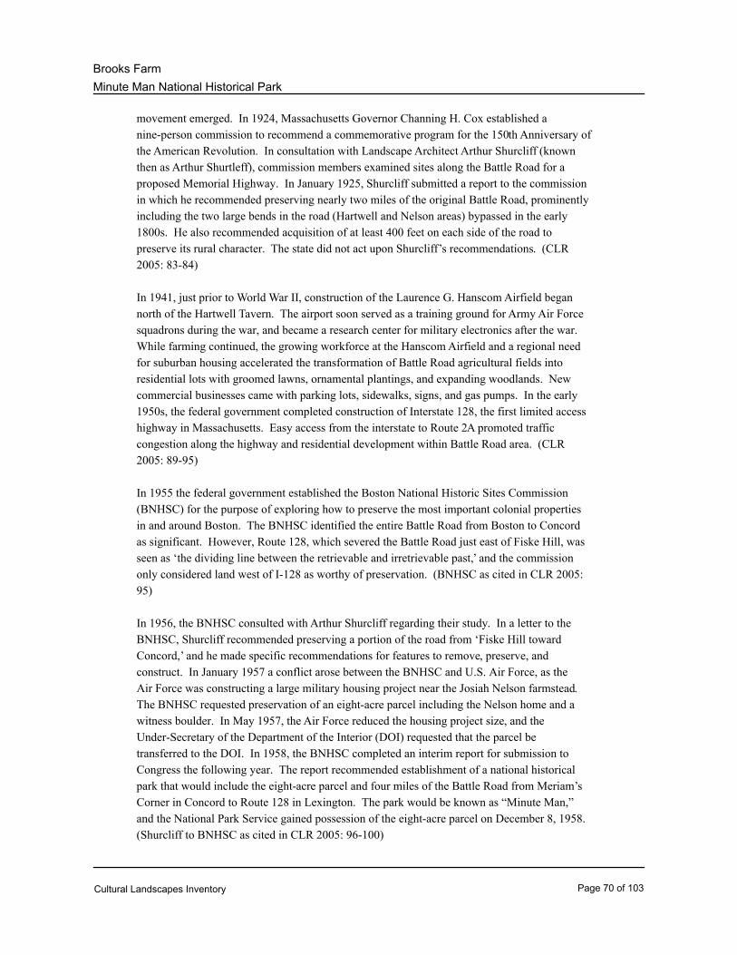
Minute Man National Historical Park
Brooks Farm
movement emerged. In 1924, Massachusetts Governor Channing H. Cox established a
nine-person commission to recommend a commemorative program for the 150th Anniversary of
the American Revolution. In consultation with Landscape Architect Arthur Shurcliff (known
then as Arthur Shurtleff), commission members examined sites along the Battle Road for a
proposed Memorial Highway. In January 1925, Shurcliff submitted a report to the commission
in which he recommended preserving nearly two miles of the original Battle Road, prominently
including the two large bends in the road (Hartwell and Nelson areas) bypassed in the early
1800s. He also recommended acquisition of at least 400 feet on each side of the road to
preserve its rural character. The state did not act upon Shurcliff’s recommendations. (CLR
2005: 83-84)
In 1941, just prior to World War II, construction of the Laurence G. Hanscom Airfield began
north of the Hartwell Tavern. The airport soon served as a training ground for Army Air Force
squadrons during the war, and became a research center for military electronics after the war.
While farming continued, the growing workforce at the Hanscom Airfield and a regional need
for suburban housing accelerated the transformation of Battle Road agricultural fields into
residential lots with groomed lawns, ornamental plantings, and expanding woodlands. New
commercial businesses came with parking lots, sidewalks, signs, and gas pumps. In the early
1950s, the federal government completed construction of Interstate 128, the first limited access
highway in Massachusetts. Easy access from the interstate to Route 2A promoted traffic
congestion along the highway and residential development within Battle Road area. (CLR
2005: 89-95)
In 1955 the federal government established the Boston National Historic Sites Commission
(BNHSC) for the purpose of exploring how to preserve the most important colonial properties
in and around Boston. The BNHSC identified the entire Battle Road from Boston to Concord
as significant. However, Route 128, which severed the Battle Road just east of Fiske Hill, was
seen as ‘the dividing line between the retrievable and irretrievable past,’ and the commission
only considered land west of I-128 as worthy of preservation. (BNHSC as cited in CLR 2005:
95)
In 1956, the BNHSC consulted with Arthur Shurcliff regarding their study. In a letter to the
BNHSC, Shurcliff recommended preserving a portion of the road from ‘Fiske Hill toward
Concord,’ and he made specific recommendations for features to remove, preserve, and
construct. In January 1957 a conflict arose between the BNHSC and U.S. Air Force, as the
Air Force was constructing a large military housing project near the Josiah Nelson farmstead.
The BNHSC requested preservation of an eight-acre parcel including the Nelson home and a
witness boulder. In May 1957, the Air Force reduced the housing project size, and the
Under-Secretary of the Department of the Interior (DOI) requested that the parcel be
transferred to the DOI. In 1958, the BNHSC completed an interim report for submission to
Congress the following year. The report recommended establishment of a national historical
park that would include the eight-acre parcel and four miles of the Battle Road from Meriam’s
Corner in Concord to Route 128 in Lexington. The park would be known as “Minute Man,”
and the National Park Service gained possession of the eight-acre parcel on December 8, 1958.
(Shurcliff to BNHSC as cited in CLR 2005: 96-100)
Cultural Landscapes Inventory Page 70 of 103
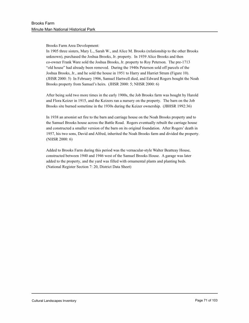
Minute Man National Historical Park
Brooks Farm
Brooks Farm Area Development:
In 1905 three sisters, Mary L., Sarah W., and Alice M. Brooks (relationship to the other Brooks
unknown), purchased the Joshua Brooks, Jr. property. In 1939 Alice Brooks and then
co-owner Frank Ware sold the Joshua Brooks, Jr. property to Roy Peterson. The pre-1713
“old house” had already been removed. During the 1940s Peterson sold off parcels of the
Joshua Brooks, Jr., and he sold the house in 1951 to Harry and Harriet Strum (Figure 10).
(JHSR 2000: 5) In February 1906, Samuel Hartwell died, and Edward Rogers bought the Noah
Brooks property from Samuel’s heirs. (JHSR 2000: 5; NHSR 2000: 6)
After being sold two more times in the early 1900s, the Job Brooks farm was bought by Harold
and Flora Keizer in 1915, and the Keizers ran a nursery on the property. The barn on the Job
Brooks site burned sometime in the 1930s during the Keizer ownership. (JBHSR 1992:36)
In 1938 an arsonist set fire to the barn and carriage house on the Noah Brooks property and to
the Samuel Brooks house across the Battle Road. Rogers eventually rebuilt the carriage house
and constructed a smaller version of the barn on its original foundation. After Rogers’ death in
1957, his two sons, David and Alfred, inherited the Noah Brooks farm and divided the property.
(NHSR 2000: 6)
Added to Brooks Farm during this period was the vernacular-style Walter Beatteay House,
constructed between 1940 and 1946 west of the Samuel Brooks House. A garage was later
added to the property, and the yard was filled with ornamental plants and planting beds.
(National Register Section 7: 20, District Data Sheet)
Cultural Landscapes Inventory Page 71 of 103
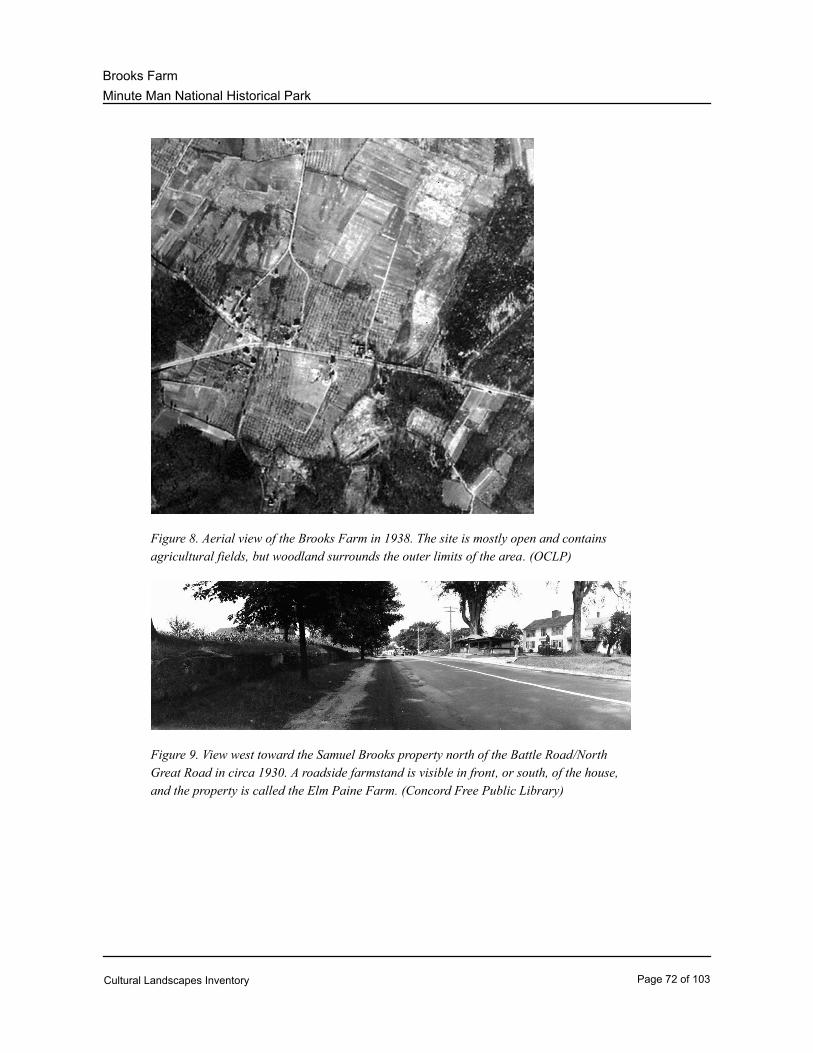
Minute Man National Historical Park
Brooks Farm
Figure 8. Aerial view of the Brooks Farm in 1938. The site is mostly open and contains
agricultural fields, but woodland surrounds the outer limits of the area. (OCLP)
Figure 9. View west toward the Samuel Brooks property north of the Battle Road/North
Great Road in circa 1930. A roadside farmstand is visible in front, or south, of the house,
and the property is called the Elm Paine Farm. (Concord Free Public Library)
Cultural Landscapes Inventory Page 72 of 103
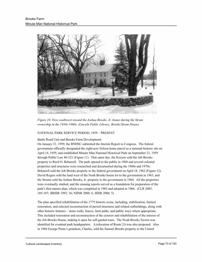
Minute Man National Historical Park
Brooks Farm
Figure 10. View southwest toward the Joshua Brooks, Jr. house during the Strum
ownership in the 1950s-1960s. (Lincoln Public Library, Brooks/Strum House)
NATIONAL PARK SERVICE PERIOD, 1959 – PRESENT
Battle Road Unit and Brooks Farm Development:
On January 21, 1959, the BNHSC submitted the Interim Report to Congress. The federal
government officially designated the eight-acre Nelson home parcel as a national historic site on
April 14, 1959, and established Minute Man National Historical Park on September 21, 1959
through Public Law 86-321 (Figure 11). That same day, the Keizers sold the Job Brooks
property to Reed O. Beharrell. The park opened to the public in 1960 and several colonial
properties and structures were researched and documented during the 1960s and 1970s.
Beharrell sold the Job Brooks property to the federal government on April 18, 1962 (Figure 12).
David Rogers sold the land west of the Noah Brooks house lot to the government in 1963, and
the Strums sold the Joshua Brooks, Jr. property to the government in 1964. All the properties
were eventually studied, and the ensuing reports served as a foundation for preparation of the
park’s first master plan, which was completed in 1965 and adopted in 1966. (CLR 2005:
105-107; JBHSR 1992: 36; NHSR 2000: 6; JHSR 2000: 5)
The plan specified rehabilitation of the 1775 historic scene, including, stabilization, limited
restoration, and selected reconstruction of period structures and related outbuildings, along with
other historic features – stone walls, fences, farm paths, and public ways where appropriate.
This included restoration and reconstruction of the exterior and rehabilitation of the interior of
the Job Brooks House, making it open for self-guided tours. The Noah Brooks Tavern was
identified for eventual park headquarters. A relocation of Route 2A was also proposed. Also
in 1966 George Paine’s grandson, Charles, sold the Samuel Brooks property to the United
Cultural Landscapes Inventory Page 73 of 103
Minute Man National Historical Park
Brooks Farm
States. (CLR 2005: 107; Master Plan 1965; AH 2010; 134; SHSR 2000: 5)
In 1968 the National Park Service Office of Resource Planning prepared a special study that
identified buildings and structures within the park boundary to be retained, removed, or
demolished. The study also discussed establishment of proposed historic motor trails within the
park, which depended on the relocation of Route 2. The state transportation secretary declined
the hotly contested relocation in 1977. Meanwhile, Alfred Rogers, who owned the Noah
Brooks Tavern, sold his land to the United States in 1974 while retaining a one-year life estate.
The National Park Service obtained the Noah Brooks tavern property in 1975 and re-roofed the
tavern in 1979. (CLR 2005: 108-109; NHSR 2000: 6; AH 2010: 204)
The park’s first General Management Plan (GMP) was completed in 1989 and approved July
10, 1990. Besides addressing traffic problems, the GMP directed a ‘selective restoration of the
18th-century environment [to] provide a flavor of the physical conditions on April 19, 1775
without requiring detailed replication of the entire landscape.’ Among the proposed projects
was the restoration of the Brooks houses. (AH 2010: 255; CLR 2005: 110)
Implementation of the GMP goals began in the early 1990s and continues today. Sometime in
the 1990s the interior of the Job Brooks House was modified for archeological collections
storage. In 1992, the park’s boundaries were expanded and new land acquired. Construction
of the Battle Road Trail began in 1995. The trail, designed by Carol R. Johnson Associates,
includes segments of the historic Battle Road closed to automobile traffic. Additional landscape
development included orchard and field restoration, removal of non-historic buildings and
structures, and construction of visitor parking lots along Route 2A. Much work was completed
in the Brooks Farm area, with the park completing significant rehabilitation work at the Samuel
Brooks House, Noah Brooks, Tavern, and Joshua Brooks House between 2000 and 2002. On
February 7, 2007, roads approximately following the route of the April 19, 1775 British retreat
were together designated the Battle Road Scenic Byway. (AH 2010: 273, 308-309; CLR 2005:
112; Battle Road CLI 2007: 84)
Cultural Landscapes Inventory Page 74 of 103
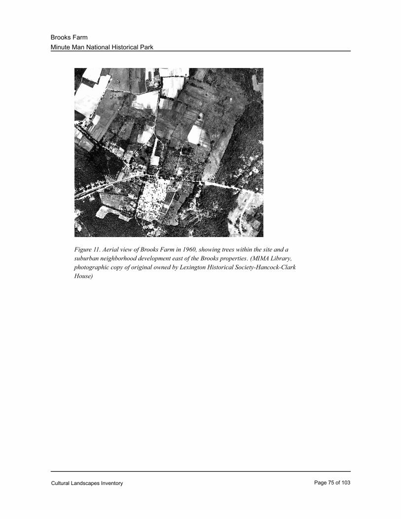
Minute Man National Historical Park
Brooks Farm
Figure 11. Aerial view of Brooks Farm in 1960, showing trees within the site and a
suburban neighborhood development east of the Brooks properties. (MIMA Library,
photographic copy of original owned by Lexington Historical Society-Hancock-Clark
House)
Cultural Landscapes Inventory Page 75 of 103
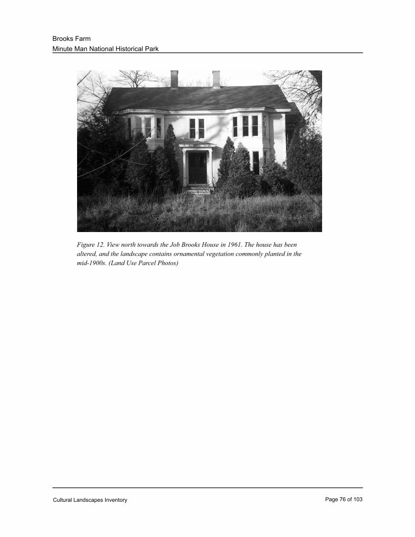
Minute Man National Historical Park
Brooks Farm
Figure 12. View north towards the Job Brooks House in 1961. The house has been
altered, and the landscape contains ornamental vegetation commonly planted in the
mid-1900s. (Land Use Parcel Photos)
Cultural Landscapes Inventory Page 76 of 103
Minute Man National Historical Park
Brooks Farm
Analysis & Evaluation of Integrity
Analysis and Evaluation of Integrity Narrative Summary:
Landscape characteristics identified for Brooks Farm include natural systems and features, land use,
spatial organization, circulation, topography, vegetation, buildings and structures, views and vistas,
small-scale features, and archeological sites. Many of these characteristics have associated with them
features that contribute to the site’s overall historic setting significance and identity, as well as features
that do not contribute. The features that do contribute were either present during the period of
significance or are in-kind replacements of such historic elements.
The physical integrity of Brooks Farm is evaluated by comparing landscape characteristics and
features present during the periods of significance (c.1635 to 1959) with current conditions. Though
they have evolved over the years, many of the property’s historic landscape characteristics and
features are intact and help maintain the agricultural character of the area. The original route of the
Battle Road still exists and is now part of the North Great Road (Route 2A), the road constructed
between 1802 and 1806. Brooks Road still exists in its original location, helping to maintain the original
layout and circulation pattern of Brooks Farm. Also reinforcing the original layout of the area is the
system of stone walls marking the boundaries of agricultural fields, some of which have reverted to
woods while others have been restored. Set within the mosaic of open land, orchards, and woods are
the various Brooks houses that still stand in their original locations and have been restored to their
Colonial and post-Colonial appearances. Other extant structures include barns and a carriage house.
Foundations of various farm structures, such as the Charles Sawyer Barn Foundation, also remain.
While historic characteristics and features remain in Brooks Farm, many changes have also occurred.
The Charles Sawyer Barn was lost to fire in the 1930s. In the 1990s, the Battle Road Trail was
constructed behind, or north of, the Brooks houses, adding a recreational component and bolstering
opportunities for interpretation of the area. To support those uses, the National Park Service added
signage and parking to the site, but such features are generally inconspicuous. Though some stone
walls have remained untouched, many have been reconstructed with imported stones. Traffic volume
and noise on Route 2A continues to detract from the agricultural character, but the suburban
development that has occurred since 1959 in the Brooks Farm vicinity has largely spared the Brooks
Farm area itself. Today, Brooks Farm contains a mixture of field and forest, and the fields are mostly
open meadow and pasture rather than planted with crops. However, though the landscape has not
returned completely to its Revolutionary War appearance, it retains a rural and agricultural character.
As such, Brooks Farm retains overall integrity of location, design, setting, materials, workmanship,
feeling, and association.
INTEGRITY
Location:
Brooks Farm encompasses a number of landscape features—buildings, structures, stone walls—that
remain in their same locations as in the historic period of significance. Additionally, North Great Road
(Route 2A) follows the same route as the original Battle Road in this area. Brooks Road also
Cultural Landscapes Inventory Page 77 of 103
Minute Man National Historical Park
Brooks Farm
continues to follow its original route.
Design:
Throughout the historic period of significance, lands within Brooks Farm were transferred to numerous
people, and the owners adapted their properties to their needs. Design integrity in the Battle Road
Unit was diminished during suburban development during the mid-20th century, but non-historic
residences have been removed, and park restoration projects have improved several historic structures
and sites. All of the Brooks houses have been partially restored to their Colonial or post-Colonial
appearances and therefore reflect the design-style of the mid-17th to late 18th centuries. The road
and stone wall systems reflect their original designs, and the present road system closely follows the
layout of the road system in the 18th century.
Setting:
Brooks Farm retains a rural, agricultural setting that was present throughout the period of significance,
though some notable changes exist. In 1775 Brooks Farm was entirely open, characterized by farm
fields with few trees. By the mid-1900s portions of Brooks Farm were dominated by orchards, while
other areas were open lands or wooded. Suburban homes were located in and around Brooks Farm
and the area lost some its agricultural character. Today, modern houses have been removed and fields
restored to suggest that the primary function of the area is agricultural rather than residential.
Materials:
Many original materials at Brooks Farm remain, and restoration work on the houses and walls has
included materials that approximate those of the Colonial era. Of notable material evolution is the
Battle Road, which was both unpaved and then paved during the period of significance. Today, the
original route is paved as part of the North Great Road (Route 2A), but the nearby, unpaved Battle
Road Trail more closely approximates the materials of the 1775 form of the Battle Road. There are
also numerous trees that remain from the 1950s and some remnant orchard trees.
Workmanship:
Brooks Farm retains workmanship characteristic of its development throughout the 17th, 18th, and
early 19th centuries. The Samuel Brooks House, Job Brooks House, Noah Brooks Tavern, and Joshua
Brooks House were all carefully rehabilitated, though the interiors of each structure were adapted to
the needs of the park. The exterior of the Job Brooks House was restored to its 18th-century
appearance, for instance, while the interior was adapted for use as a collection storage facility. The
workmanship of the original stone walls is also still evident.
Feeling:
Because Brooks Farm retains historic buildings, stone walls, and agricultural fields, the historic feeling
has been retained. Signage helps reinforce where certain actions took place and how the colonists
lived. The location of the unpaved Battle Road Trail allows visitors to separate themselves from heavy
traffic on the North Great Road. Additionally, though the density of tree coverage was much less in
1775, the trees help screen visitors from the sights of cars, modern structures, and the Hanscom
Airfield.
Cultural Landscapes Inventory Page 78 of 103
Minute Man National Historical Park
Brooks Farm
Association:
The Colonial and historic post-Colonial houses, stone walls, agricultural fields, archeological ruins, and
Battle Road route all help link the site to the Battle of Lexington and Concord. Monuments and
signage provide information about the battle, reinforcing the association of the site with the events of
April 19, 1775.
The section that follows presents an analysis of Brooks Farm landscape characteristics, their
associated features, and corresponding List of Classified Structures names and numbers, if applicable.
It also includes an evaluation of whether each feature contributes to the area’s National Register
eligibility for the period of significance (c.1635 to 1959), contributes to the property’s historic
character, or if it is non-contributing or undetermined.
In the tables of features that follow, features marked with an (*) are described in National Register
documentation.
Landscape Characteristic:
Natural Systems and Features
Historic and Existing Conditions:
Prior to European settlement, Brooks Farm was covered almost entirely by forest. During the
17th and 18th centuries and at the time of the April 1775 battle, however, most trees had been
cleared and the land converted into agricultural fields. As the trees were cleared, numerous
boulders and smaller stones were pushed to the surface rose, some of which provided cover
during the battle. Woodlands would overtake much of the area again once farm production
declined and suburban homes were constructed along the Battle Road and surrounding areas.
Brooks Farm contains both forest and field today, and some of the large boulders still exist in
their original locations. The woods and large boulders contribute to historic natural character of
Brooks Farm.
One notable natural water feature exists in Brooks Farm. Elm Brook runs north/south in the
southern portion of the area along the eastern boundary. According to a 1993 Management
Plan to Balance Cultural and Natural Resources, Elm Brook is the only well-oxygenated stream
habitat in Minute Man and its wetland ecosystem supports a few rare species (Figure 13). The
brook contributes to the historic natural character of the site. (Garvin, et al. 1993: 132-135)
Character-defining Features:
Brooks HillFeature:
156089Feature Identification Number:
ContributingType of Feature Contribution:
WoodsFeature:
156091Feature Identification Number:
Cultural Landscapes Inventory Page 79 of 103
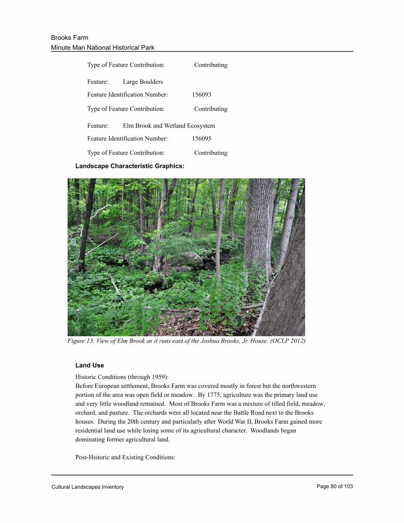
Minute Man National Historical Park
Brooks Farm
ContributingType of Feature Contribution:
Large BouldersFeature:
156093Feature Identification Number:
ContributingType of Feature Contribution:
Elm Brook and Wetland EcosystemFeature:
156095Feature Identification Number:
ContributingType of Feature Contribution:
Landscape Characteristic Graphics:
Figure 13. View of Elm Brook as it runs east of the Joshua Brooks, Jr. House. (OCLP 2012)
Land Use
Historic Conditions (through 1959):
Before European settlement, Brooks Farm was covered mostly in forest but the northwestern
portion of the area was open field or meadow. By 1775, agriculture was the primary land use
and very little woodland remained. Most of Brooks Farm was a mixture of tilled field, meadow,
orchard, and pasture. The orchards were all located near the Battle Road next to the Brooks
houses. During the 20th century and particularly after World War II, Brooks Farm gained more
residential land use while losing some of its agricultural character. Woodlands began
dominating former agricultural land.
Post-Historic and Existing Conditions:
Cultural Landscapes Inventory Page 80 of 103
Minute Man National Historical Park
Brooks Farm
Today Brooks Farm is a mix of agricultural and recreational uses, with residential streets
located just outside the area. Open meadow and pasture exists along Route 2A, surrounding
the Brooks houses. Land directly west of the Samuel Brooks house contains apple trees as
part of a small orchard. As the Battle Road Trail runs north of all the houses, Brooks Farm is
used for recreation and interpretation and contains a small visitor parking lot near the Samuel
Brooks house.
Spatial Organization
Historic Conditions (through 1959):
Early development within Brooks Farm occurred along the Battle Road, a route fully laid-out by
1666 that connected Concord residents with Boston. The Brooks family built houses and farm
structures along the road in Brooks Farm, with the Samuel Brooks and Job Brooks houses
located on the north side and the Noah Brooks Tavern and Joshua Brooks, Jr. House on the
south side of the road. Brooks Road was also constructed in the early 1700s to provide
residents with better access to nearby fields and towns. Fields, pastureland, and orchards were
spread throughout Brooks Farm, with the orchards generally located near homesteads. The
separate land uses were delineated by stone walls.
The Battle Road was greatly altered between 1802 and 1806, when the road was widened in
the Brooks Farm are and incorporated into the new North Great Road. The improved road
consequently increased traffic in the Brooks Farm area. In 1836, the North Great Road was
altered (probably straightened) as it ascended Brooks Hill, in the western portion of Brooks
Farm. Between 1933 and 1935 a by-pass to the Concord Turnpike (Route 2) was constructed
in the western portion of Brooks Farm, diverting traffic away from Concord but leading it into
the park. When post-World War II suburbs extended into and around Brooks Farm, houses and
businesses were built along the North Great Road (Route 2A) and on the bypass connecting
Route 2A with the turnpike. As the area became increasingly residential, agricultural fields
were succeeded by woodland.
Post-historic and Existing Conditions:
Certain spatial organization elements at Brooks Farm remain intact while others have been
altered. Woodland extends across much of Brooks Farm today, but open field and pasture
patterns are present, especially along either side of Route 2A. The land surrounding all the
homes remains open, and stone walls continue to demark old property lines and former
agricultural land. Notably, none of the historic houses have been moved, and the area roads
have not been realigned. The Battle Road Trail now meanders through Brooks Farm, north of
all the historic homes. Interpretive signs, or waysides, and a small parking lot near the Samuel
Brooks House support this recreational and education use.
Circulation
Historic Conditions (through 1959):
Extending from Boston to Concord, the full length of the Battle Road was laid out by 1666, and
development occurred along the road throughout the Brooks Farm area and what is now the
park’s Battle Road Unit. Brooks Road was constructed in 1736 to provide more efficient
means of transportation to fields and nearby towns. In the early 1800s, sections of the Battle
Cultural Landscapes Inventory Page 81 of 103
Minute Man National Historical Park
Brooks Farm
Road were straightened through the construction of two new road segments. The straightened
road was called the North Great Road, a name by which it is known today, along with its
designation as State Route 2A. In Brooks Farm, the North Great Road was simply built over
the original Battle Road route. Traffic flow along the Battle Road/Route 2A increased
significantly in the 1950s, after the construction of north/south Route 128/Interstate 95.
Post Historic and Existing Conditions:
Route 128/Interstate 95 continues to divert increasing amounts of commuter traffic onto the
North Great Road/ Route 2A, making the southern portion of Brooks Farm heavily traveled.
Brooks Road is still located in its original location, though it has since been paved. The Battle
Road Trail was constructed in the late 1990s north of the Brooks homes, and pedestrians and
cyclists may view historic houses, restored fields, and orchards along it today. The Battle Road
route is considered contributing to the site’s historic character along with the North Great Road.
The Battle Road Trail is non-contributing, as are the visitor parking area near the Samuel
Brooks house and the short path leading to the main trail.
Character-defining Features:
* Battle Road (present North Great Road/Route 2A) (1-173)Feature:
156097Feature Identification Number:
ContributingType of Feature Contribution:
919IDLCS Number:
Brooks RoadFeature:
156099Feature Identification Number:
ContributingType of Feature Contribution:
By-Pass RoadFeature:
156101Feature Identification Number:
ContributingType of Feature Contribution:
* Battle Road TrailFeature:
156103Feature Identification Number:
Non ContributingType of Feature Contribution:
Trail from Parking Area to Battle Road TrailFeature:
156105Feature Identification Number:
Non ContributingType of Feature Contribution:
Visitor Parking AreaFeature:
Cultural Landscapes Inventory Page 82 of 103
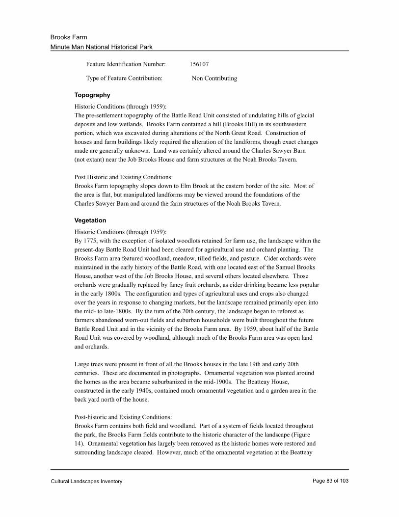
Minute Man National Historical Park
Brooks Farm
156107Feature Identification Number:
Non ContributingType of Feature Contribution:
Topography
Historic Conditions (through 1959):
The pre-settlement topography of the Battle Road Unit consisted of undulating hills of glacial
deposits and low wetlands. Brooks Farm contained a hill (Brooks Hill) in its southwestern
portion, which was excavated during alterations of the North Great Road. Construction of
houses and farm buildings likely required the alteration of the landforms, though exact changes
made are generally unknown. Land was certainly altered around the Charles Sawyer Barn
(not extant) near the Job Brooks House and farm structures at the Noah Brooks Tavern.
Post Historic and Existing Conditions:
Brooks Farm topography slopes down to Elm Brook at the eastern border of the site. Most of
the area is flat, but manipulated landforms may be viewed around the foundations of the
Charles Sawyer Barn and around the farm structures of the Noah Brooks Tavern.
Vegetation
Historic Conditions (through 1959):
By 1775, with the exception of isolated woodlots retained for farm use, the landscape within the
present-day Battle Road Unit had been cleared for agricultural use and orchard planting. The
Brooks Farm area featured woodland, meadow, tilled fields, and pasture. Cider orchards were
maintained in the early history of the Battle Road, with one located east of the Samuel Brooks
House, another west of the Job Brooks House, and several others located elsewhere. Those
orchards were gradually replaced by fancy fruit orchards, as cider drinking became less popular
in the early 1800s. The configuration and types of agricultural uses and crops also changed
over the years in response to changing markets, but the landscape remained primarily open into
the mid- to late-1800s. By the turn of the 20th century, the landscape began to reforest as
farmers abandoned worn-out fields and suburban households were built throughout the future
Battle Road Unit and in the vicinity of the Brooks Farm area. By 1959, about half of the Battle
Road Unit was covered by woodland, although much of the Brooks Farm area was open land
and orchards.
Large trees were present in front of all the Brooks houses in the late 19th and early 20th
centuries. These are documented in photographs. Ornamental vegetation was planted around
the homes as the area became suburbanized in the mid-1900s. The Beatteay House,
constructed in the early 1940s, contained much ornamental vegetation and a garden area in the
back yard north of the house.
Post-historic and Existing Conditions:
Brooks Farm contains both field and woodland. Part of a system of fields located throughout
the park, the Brooks Farm fields contribute to the historic character of the landscape (Figure
14). Ornamental vegetation has largely been removed as the historic homes were restored and
surrounding landscape cleared. However, much of the ornamental vegetation at the Beatteay
Cultural Landscapes Inventory Page 83 of 103
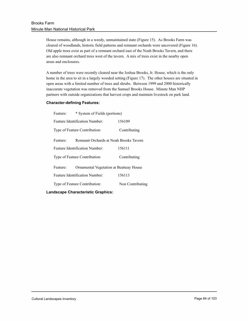
Minute Man National Historical Park
Brooks Farm
House remains, although in a weedy, unmaintained state (Figure 15). As Brooks Farm was
cleared of woodlands, historic field patterns and remnant orchards were uncovered (Figure 16).
Old apple trees exist as part of a remnant orchard east of the Noah Brooks Tavern, and there
are also remnant orchard trees west of the tavern. A mix of trees exist in the nearby open
areas and enclosures.
A number of trees were recently cleared near the Joshua Brooks, Jr. House, which is the only
home in the area to sit in a largely wooded setting (Figure 17). The other houses are situated in
open areas with a limited number of trees and shrubs. Between 1999 and 2000 historically
inaccurate vegetation was removed from the Samuel Brooks House. Minute Man NHP
partners with outside organizations that harvest crops and maintain livestock on park land.
Character-defining Features:
* System of Fields (portions)Feature:
156109Feature Identification Number:
ContributingType of Feature Contribution:
Remnant Orchards at Noah Brooks TavernFeature:
156111Feature Identification Number:
ContributingType of Feature Contribution:
Ornamental Vegetation at Beatteay HouseFeature:
156113Feature Identification Number:
Non ContributingType of Feature Contribution:
Landscape Characteristic Graphics:
Cultural Landscapes Inventory Page 84 of 103
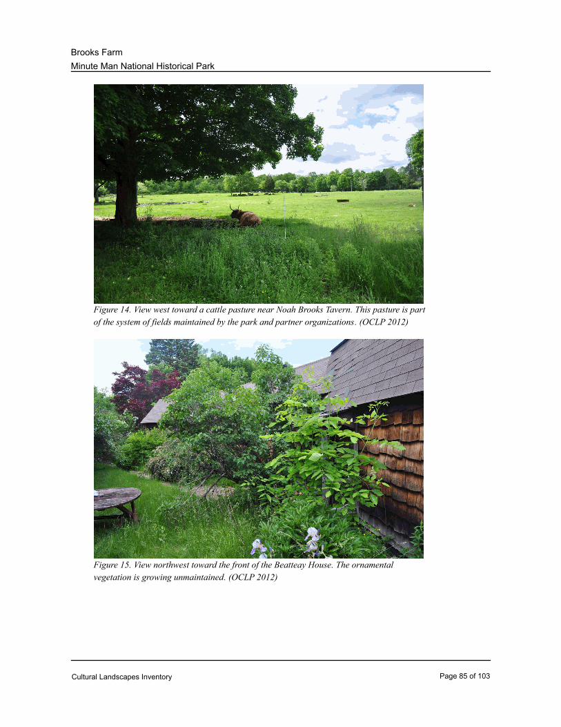
Minute Man National Historical Park
Brooks Farm
Figure 14. View west toward a cattle pasture near Noah Brooks Tavern. This pasture is part
of the system of fields maintained by the park and partner organizations. (OCLP 2012)
Figure 15. View northwest toward the front of the Beatteay House. The ornamental
vegetation is growing unmaintained. (OCLP 2012)
Cultural Landscapes Inventory Page 85 of 103
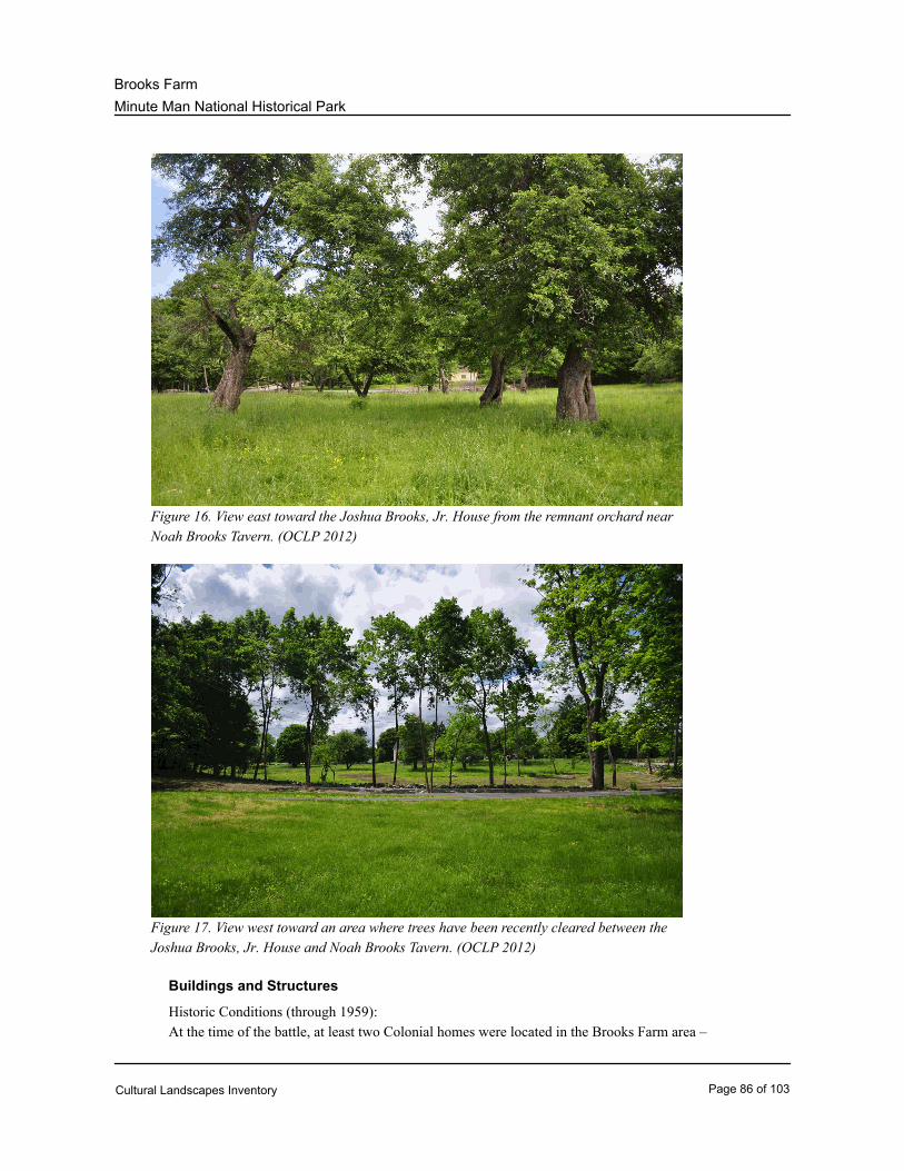
Minute Man National Historical Park
Brooks Farm
Figure 16. View east toward the Joshua Brooks, Jr. House from the remnant orchard near
Noah Brooks Tavern. (OCLP 2012)
Figure 17. View west toward an area where trees have been recently cleared between the
Joshua Brooks, Jr. House and Noah Brooks Tavern. (OCLP 2012)
Buildings and Structures
Historic Conditions (through 1959):
At the time of the battle, at least two Colonial homes were located in the Brooks Farm area –
Cultural Landscapes Inventory Page 86 of 103
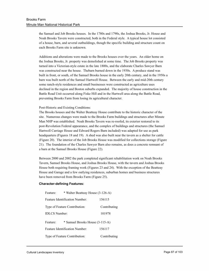
Minute Man National Historical Park
Brooks Farm
the Samuel and Job Brooks houses. In the 1780s and 1790s, the Joshua Brooks, Jr. House and
Noah Brooks Tavern were constructed, both in the Federal style. A typical house lot consisted
of a house, barn, and several outbuildings, though the specific building and structure count on
each Brooks Farm site is unknown.
Additions and alterations were made to the Brooks houses over the years. An older home on
the Joshua Brooks, Jr. property was demolished at some time. The Job Brooks property was
turned into a Victorian-style estate in the late 1800s, and the elaborate Charles Sawyer Barn
was constructed near the house. Thebarn burned down in the 1930s. A produce stand was
built in front, or south, of the Samuel Brooks house in the early 20th century, and in the 1950s a
barn was built north of the Samuel Hartwell House. Between the early and mid-20th century
some ranch-style residences and small businesses were constructed as agriculture uses
declined in the region and Boston suburbs expanded. The majority of house construction in the
Battle Road Unit occurred along Fiske Hill and in the Hartwell area along the Battle Road,
preventing Brooks Farm from losing its agricultural character.
Post-Historic and Existing Conditions:
The Brooks houses and the Walter Beatteay House contribute to the historic character of the
site. Numerous changes were made to the Brooks Farm buildings and structures after Minute
Man NHP was established. Noah Brooks Tavern was re-roofed, its exterior restored to its
post-Revolution Federal appearance, and the complex of buildings and structures (the Samuel
Hartwell Carriage House and Edward Rogers Barn included) was adapted for use as park
headquarters (Figures 18 and 19). A shed was also built near the tavern as a shelter for cattle
(Figure 20). The interior of the Job Brooks House was modified for collections storage (Figure
21). The foundation of the Charles Sawyer Barn also remains, as does a concrete remnant of
a barn at the Samuel Brooks House (Figure 22).
Between 2000 and 2002 the park completed significant rehabilitation work on Noah Brooks
Tavern, Samuel Brooks House, and Joshua Brooks House, with the tavern and Joshua Brooks
House both requiring framing work (Figures 23 and 24). With the exception of the Beatteay
House and Garage and a few outlying residences, suburban homes and business structures
have been removed from Brooks Farm (Figure 25).
Character-defining Features:
* Walter Beatteay House (3-126-A)Feature:
156115Feature Identification Number:
ContributingType of Feature Contribution:
101978IDLCS Number:
* Samuel Brooks House (3-115-A)Feature:
156117Feature Identification Number:
ContributingType of Feature Contribution:
Cultural Landscapes Inventory Page 87 of 103
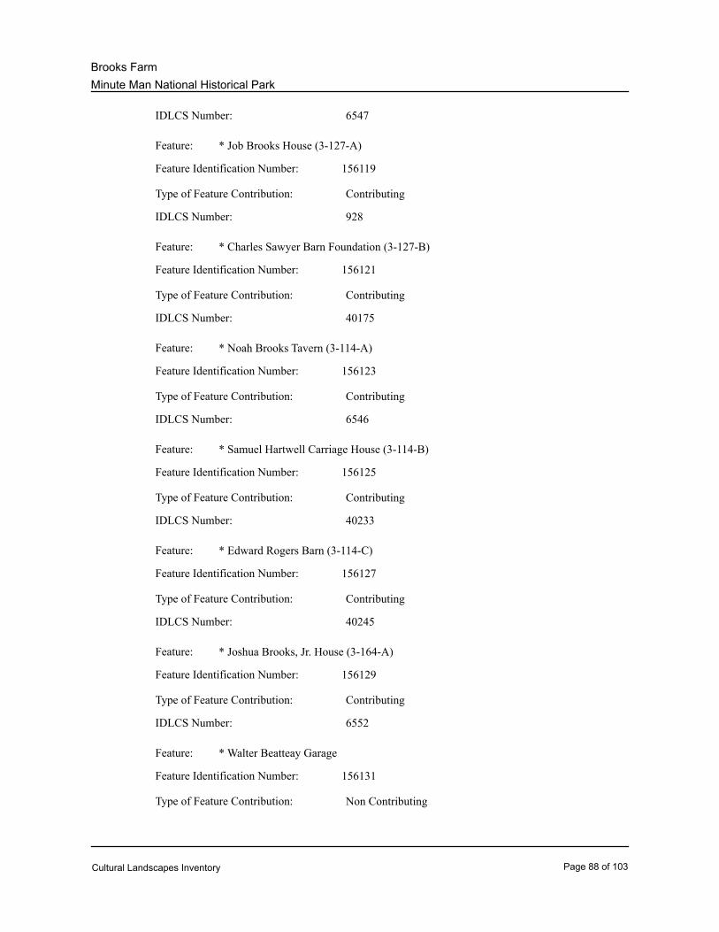
Minute Man National Historical Park
Brooks Farm
6547IDLCS Number:
* Job Brooks House (3-127-A)Feature:
156119Feature Identification Number:
ContributingType of Feature Contribution:
928IDLCS Number:
* Charles Sawyer Barn Foundation (3-127-B)Feature:
156121Feature Identification Number:
ContributingType of Feature Contribution:
40175IDLCS Number:
* Noah Brooks Tavern (3-114-A)Feature:
156123Feature Identification Number:
ContributingType of Feature Contribution:
6546IDLCS Number:
* Samuel Hartwell Carriage House (3-114-B)Feature:
156125Feature Identification Number:
ContributingType of Feature Contribution:
40233IDLCS Number:
* Edward Rogers Barn (3-114-C)Feature:
156127Feature Identification Number:
ContributingType of Feature Contribution:
40245IDLCS Number:
* Joshua Brooks, Jr. House (3-164-A)Feature:
156129Feature Identification Number:
ContributingType of Feature Contribution:
6552IDLCS Number:
* Walter Beatteay GarageFeature:
156131Feature Identification Number:
Non ContributingType of Feature Contribution:
Cultural Landscapes Inventory Page 88 of 103
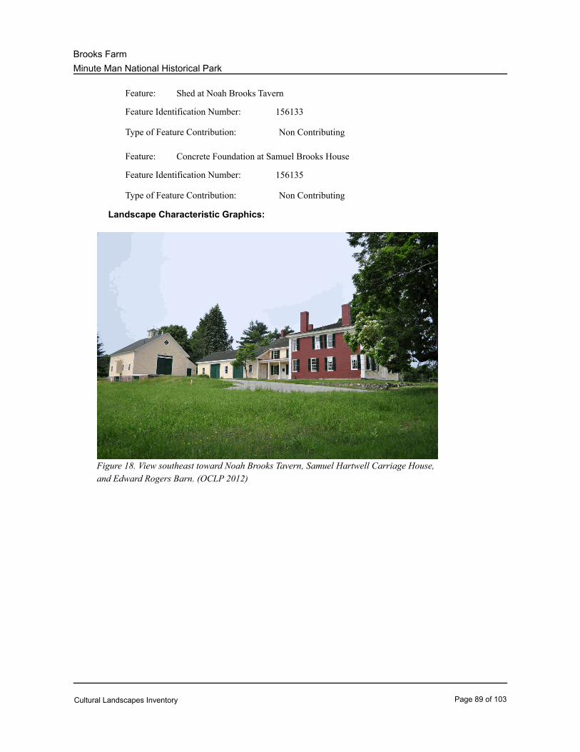
Minute Man National Historical Park
Brooks Farm
Shed at Noah Brooks TavernFeature:
156133Feature Identification Number:
Non ContributingType of Feature Contribution:
Concrete Foundation at Samuel Brooks HouseFeature:
156135Feature Identification Number:
Non ContributingType of Feature Contribution:
Landscape Characteristic Graphics:
Figure 18. View southeast toward Noah Brooks Tavern, Samuel Hartwell Carriage House,
and Edward Rogers Barn. (OCLP 2012)
Cultural Landscapes Inventory Page 89 of 103
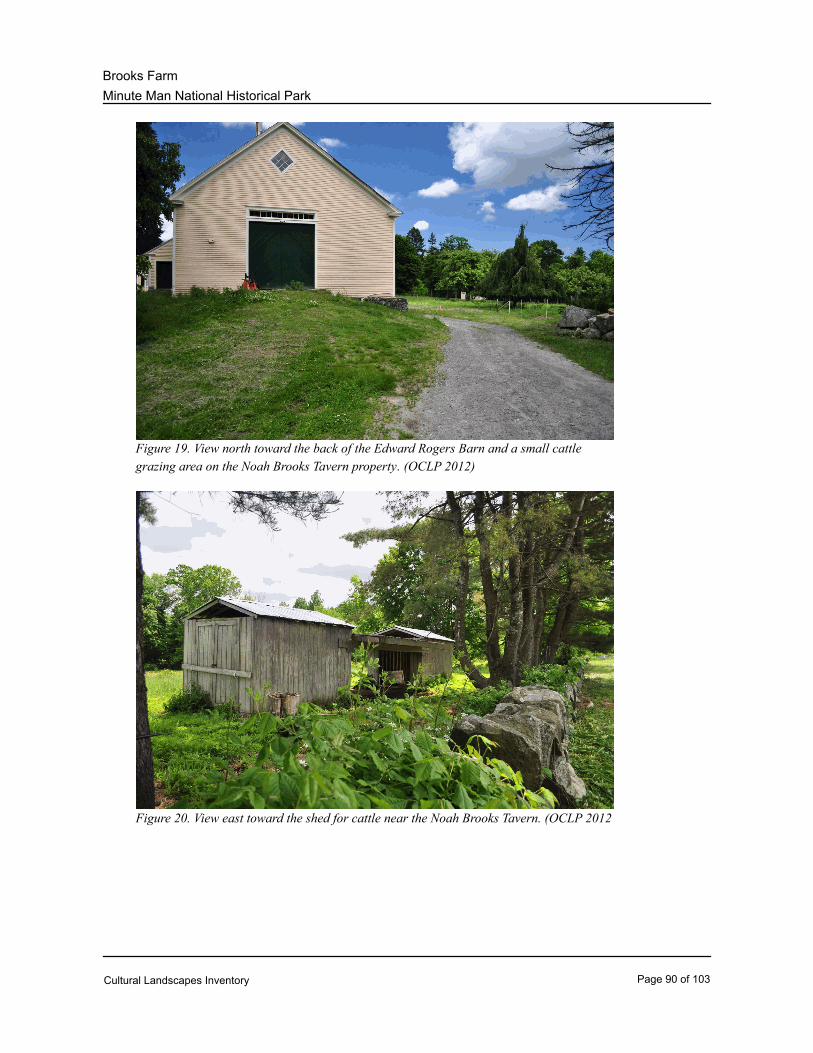
Minute Man National Historical Park
Brooks Farm
Figure 19. View north toward the back of the Edward Rogers Barn and a small cattle
grazing area on the Noah Brooks Tavern property. (OCLP 2012)
Figure 20. View east toward the shed for cattle near the Noah Brooks Tavern. (OCLP 2012
Cultural Landscapes Inventory Page 90 of 103
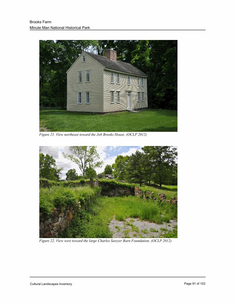
Minute Man National Historical Park
Brooks Farm
Figure 21. View northeast toward the Job Brooks House. (OCLP 2012)
Figure 22. View west toward the large Charles Sawyer Barn Foundation. (OCLP 2012)
Cultural Landscapes Inventory Page 91 of 103
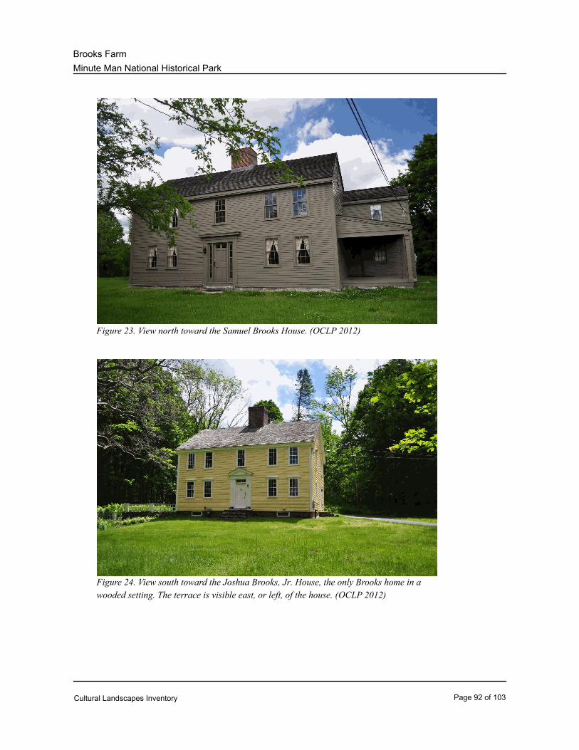
Minute Man National Historical Park
Brooks Farm
Figure 23. View north toward the Samuel Brooks House. (OCLP 2012)
Figure 24. View south toward the Joshua Brooks, Jr. House, the only Brooks home in a
wooded setting. The terrace is visible east, or left, of the house. (OCLP 2012)
Cultural Landscapes Inventory Page 92 of 103
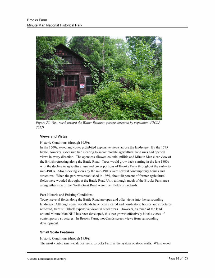
Minute Man National Historical Park
Brooks Farm
Figure 25. View north toward the Walter Beatteay garage obscured by vegetation. (OCLP
2012)
Views and Vistas
Historic Conditions (through 1959):
In the 1600s, woodland cover prohibited expansive views across the landscape. By the 1775
battle, however, extensive tree clearing to accommodate agricultural land uses had opened
views in every direction. The openness allowed colonial militia and Minute Men clear view of
the British retreating along the Battle Road. Trees would grow back starting in the late 1800s
with the decline in agricultural use and cover portions of Brooks Farm throughout the early- to
mid-1900s. Also blocking views by the mid-1900s were several contemporary homes and
structures. When the park was established in 1959, about 50 percent of former agricultural
fields were wooded throughout the Battle Road Unit, although much of the Brooks Farm area
along either side of the North Great Road were open fields or orchards.
Post-Historic and Existing Conditions:
Today, several fields along the Battle Road are open and offer views into the surrounding
landscape. Although some woodlands have been cleared and non-historic houses and structures
removed, trees still block expansive views in other areas. However, as much of the land
around Minute Man NHP has been developed, this tree growth effectively blocks views of
contemporary structures. In Brooks Farm, woodlands screen views from surrounding
development.
Small Scale Features
Historic Conditions (through 1959):
The most visible small-scale feature in Brooks Farm is the system of stone walls. While wood
Cultural Landscapes Inventory Page 93 of 103
Minute Man National Historical Park
Brooks Farm
fences were initially used to demark property and prevent the movement of livestock, stone
walls were eventually constructed throughout the Battle Road Unit and Brooks Farm. When
trees were cleared to make fields, the insulating value of the topsoil was lost and stones were
pushed to the surface, forcing farmers to pile the stones in the middle of fields and pastures.
Soon, the farmers moved the stones to the edges of existing wood fences, forming tossed walls.
Stone walls both confined livestock and protected orchards and crops from livestock, and also
marked property boundaries. Stones were also used in the construction of retaining walls
around the Noah Brooks and Joshua Brooks, Jr. areas.
During the Battle of Lexington and Concord, militia and minutemen used stone walls, boulders,
and other objects as cover from British fire. After the war, as farming evolved and property
use in Brooks Farm changed over the years, stone walls were demolished to enlarge fields and,
later, to construct new house foundations. Also during the 20th century, before park operations
were established in the area, many stones along the road were removed by people to be utilized
at their yards in other locations. Many of these people were unaware that they were in a
national park area and of the protected status of the stone walls.
Post-Historic and Existing Conditions:
Using imported stone, the National Park Service restored a number of stone walls in Brooks
Farm over the years, and the stone wall system today lines both sides of the North Great Road
(the original Battle Road route). Various original and restored stone walls run throughout
Brooks Farm, marking the extents of old fields and homesteads. The stone walls in the Joshua
Brooks terrace area include a barbecue and bird bath structure constructed at an unknown date
(Figure 26). The stone walls and retaining walls contribute to the historic character of the site.
Some small-scale features in Brooks Farm do not contribute to the historic character.
Wire-fence livestock enclosures are located near the Noah Brooks Tavern. Informational
signs, or waysides, are also located along the trail, informing visitors of the area history and
April 19, 1775 events.
Character-defining Features:
* System of stone walls (Noah Brooks Area) (3-114-D)Feature:
156137Feature Identification Number:
ContributingType of Feature Contribution:
40178IDLCS Number:
* System of stone walls (Noah Brooks Retaining Walls) (3-114-E)Feature:
156139Feature Identification Number:
ContributingType of Feature Contribution:
40179IDLCS Number:
* System of stone walls (Job Brooks Retaining Wall) (3-127-C)Feature:
Cultural Landscapes Inventory Page 94 of 103
Minute Man National Historical Park
Brooks Farm
156141Feature Identification Number:
ContributingType of Feature Contribution:
40174IDLCS Number:
* System of stone walls (Samuel Brooks Property) (3-153-A)Feature:
156143Feature Identification Number:
ContributingType of Feature Contribution:
40180IDLCS Number:
* System of stone walls (North Great Road) (portions) (1-115-A)Feature:
156145Feature Identification Number:
ContributingType of Feature Contribution:
40212IDLCS Number:
* System of stone walls (Joshua Brooks Property) (3-164-C)Feature:
156147Feature Identification Number:
ContributingType of Feature Contribution:
40176IDLCS Number:
* System of stone walls (Brooks Hill Area) (3-169-A)Feature:
156149Feature Identification Number:
ContributingType of Feature Contribution:
40189IDLCS Number:
* System of stone walls (Brooks Road) (3-170-B)Feature:
156151Feature Identification Number:
ContributingType of Feature Contribution:
40173IDLCS Number:
* System of stone walls (Joshua Brooks Terrace) (3-164-B)Feature:
156153Feature Identification Number:
ContributingType of Feature Contribution:
40177IDLCS Number:
Information and Wayside SignsFeature:
Cultural Landscapes Inventory Page 95 of 103
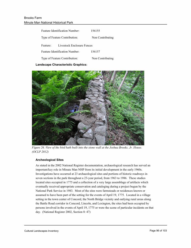
Minute Man National Historical Park
Brooks Farm
156155Feature Identification Number:
Non ContributingType of Feature Contribution:
Livestock Enclosure FencesFeature:
156157Feature Identification Number:
Non ContributingType of Feature Contribution:
Landscape Characteristic Graphics:
Figure 26. View of the bird bath built into the stone wall at the Joshua Brooks, Jr. House.
(OCLP 2012)
Archeological Sites
As stated in the 2002 National Register documentation, archaeological research has served an
important/key role in Minute Man NHP from its initial development in the early 1960s.
Investigations have occurred at 23 archaeological sites and portions of historic roadways in
seven sections in the park throughout a 23-year period, from 1963 to 1986. These studies
located sites occupied in 1775 and a collection of a very large assemblage of artifacts which
eventually received appropriate conservation and cataloging during a project begun by the
National Park Service in 1983. Most of the sites were farmsteads or residences known or
assumed to have been part of the setting for the events of April 19, 1775. Located in a village
setting in the town center of Concord, the North Bridge vicinity and outlying rural areas along
the Battle Road corridor in Concord, Lincoln, and Lexington, the sites had been occupied by
persons involved in the events of April 19, 1775 or were the scene of particular incidents on that
day. (National Register 2002, Section 8: 47)
Cultural Landscapes Inventory Page 96 of 103
Minute Man National Historical Park
Brooks Farm
In 1989 and 1990, an intensive level archaeological survey was conducted within Minute Man
NHP by The Public Archaeology Laboratory, Inc. Recent archaeological investigations in
Minute Man NHP have been carried out on several historic period sites in compliance with
Section 106 review. These surveys were done in advance of proposed construction or other
alterations to the settings of these sites from 1994 to 1998. (National Register 2002, Section 8:
54-55)
At Brooks Farm, the Brooks House Site was identified as archeologically significant in the
National Register documentation. (National Register 2002, Section 8: 67)
Character-defining Features:
* Brooks House SiteFeature:
156159Feature Identification Number:
ContributingType of Feature Contribution:
Cultural Landscapes Inventory Page 97 of 103
Minute Man National Historical Park
Brooks Farm
Condition
Condition Assessment and Impacts
PoorCondition Assessment:
09/30/1998Assessment Date:
Condition Assessment Explanatory Narrative:
The condition of the Brooks Farm landscape is "poor." The condition assessment for the Brooks Farm
landscape is based on the loss of historic character and features that has taken place since the site's
period of significance. The change in character that has developed has resulted in the park's inability to
properly preserve and interpret the significance of the landscape. In addition features that do exist, such
as historic roads and pathways, stone walls, foundations, historic viewsheds, and agricultural fields are
currently in danger of being lost or damaged due to erosion, invasive vegetation, deferred maintenance,
adjacent development, vandalism/theft or other influences.
The baseline information and condition assessment was established by David Uschold, CLI Coordinator,
New England, OCLP, in September 1998 in consultation with Dan D'Attilio, Chief Ranger, MIMA, and
Nancy Nelson, Superintendent, MIMA.
GoodCondition Assessment:
09/18/2012Assessment Date:
Condition Assessment Explanatory Narrative:
The condition of the Brooks Farm landscape is “good.” There is no clear evidence of major negative
disturbance and deteriora¬tion by natural and/or human forces. The cultural and natural values are as
well preserved as can be expected under the given environmental conditions. No immediate corrective
action is re¬quired to maintain its current condition.
Impacts
Type of Impact: Impending Development
External or Internal: External
Impact Description: Impending development of a large building on a hillside southeast
of the Noah Brooks Tavern just outside the park boundary
threatens the visual quality of the historic landscape, which
includes the early 19th century house, a barn, open fields, and
remnant orchards.
Type of Impact: Other
Other Impact: Automobile Traffic
External or Internal: Internal
Cultural Landscapes Inventory Page 98 of 103

Minute Man National Historical Park
Brooks Farm
Impact Description: State Route 2A runs through the center of the linear Battle Road
Unit. Route 2A includes large sections of the historic Battle
Road. The visual intrusion and noise created by heavy commuter
traffic on the road compromises the visitor experience. The
steady traffic also prohibits safe pedestrian access from the
northern section of the park, which includes the visitor center and
the Battle Road Trail, across Route 2A to the southern section of
the park. As a result, the area south of Route 2A is underutilized;
all visitor amenities and interpretative areas are confined to the
area north of Route 2A.
Treatment
Cultural Landscapes Inventory Page 99 of 103
Minute Man National Historical Park
Brooks Farm
Treatment
Approved Treatment: Rehabilitation
Approved Treatment Document: General Management Plan
Document Date: 09/01/1989
According to the 1999 report, “Environmental Assessment for ‘Save Historic Structures and Cultural
Landscapes’: Minute Man National Historical Park,” the 1989 General Management Plan (GMP) was
developed to accomplish the original goals set out by Congress in the park’s enabling legislation. The
GMP included the following management goals and objectives to “Protect, rehabilitate, and selectively
preserve 18th- and 19th- century buildings for interpretation, visitor use and adaptive use for park
purposes.” This goal was to be accomplished through a program of rehabilitation, restoration, and
maintenance of the Battle Road Unit’s historic structures. An additional goal stated in the GMP was to
“Protect and restore the historic scene of April 19, 1775, or the landscape and associated cultural
resources in selected areas…” (“Environmental Assessment for ‘Save Historic Structures and Cultural
Landscapes’” 1999: 2)
The 1999 report also specifically described rehabilitation of historic structures and historic landscapes as
the preferred treatment alternative:
“The Preferred Alternative…will provide the greatest balance between rehabilitating the park’s historic
structures, rehabilitating their associated landscapes, improving interpretation of these resources and
accommodating improved visitor access afforded by the Safe Visitor Access Trail (Battle Road Trail)
while protecting the Park’s natural and cultural features and providing a safe experience for visitors.
Maintaining the fabric of historic structures and the cultural landscape; conservation of natural and
archeological resources; and improving interpretive and education opportunities were the primary issues
considered during the development and selection of this alternative. (“Environmental Assessment for
‘Save Historic Structures and Cultural Landscapes’” 1999: 4)
Approved Treatment Document Explanatory Narrative:
Approved Treatment Completed: No
Approved Treatment Costs
Cost Date: 09/01/1989
Bibliography and Supplemental Information
Cultural Landscapes Inventory Page 100 of 103
Minute Man National Historical Park
Brooks Farm
Bibliography
Dietrich-Smith, DeborahCitation Author:
Citation Title: Cultural Landscape Report for Battle Road Unit: Minute Man
National Historical Park (NHP)
2005Year of Publication:
Citation Publisher: NPS, Olmsted Center for Landscape Preservation (OCLP)
Dolan, SusanCitation Author:
Citation Title: Fruitful Legacy: A Historic Context of Orchards in the United
States, with Technical Information for Registering Orchards in the
National Register of Historic Places
2009Year of Publication:
Citation Publisher: National Park Service (NPS), OCLP
Harrington, M. K., et al.Citation Author:
Citation Title: National Register of Historic Places Documentation: Minute Man
NHP
2002Year of Publication:
Citation Publisher: NPS, National Register (NR)
Gavrin, Beth J., et al.Citation Author:
Citation Title: A Management Plan to Balance Cultural and Natural Resources:
The Minute Man NHP Case Study
1993Year of Publication:
Citation Publisher: Massachusetts Agriculture Experiment Station
Malcolm, Joyce LeeCitation Author:
Citation Title: The Scene of the Battle, 1775: Historic Grounds Report, Minute
Man NHP
1985Year of Publication:
Citation Publisher: NPS, North Atlantic (Northeast) Regional Office, Division of
Cultural Resources
Cultural Landscapes Inventory Page 101 of 103
Minute Man National Historical Park
Brooks Farm
National Park ServiceCitation Author:
Citation Title: Cultural Landscapes Inventory: Battle Road, Minute Man NHP
2007Year of Publication:
Citation Publisher: NPS, OCLP
National Park ServiceCitation Author:
Citation Title: Environmental Assessment for “Save Historic Structures and
Cultural Landscapes”: Minute Man NHP
1999Year of Publication:
Citation Publisher: NPS
Phillips, Maureen K.Citation Author:
Citation Title: Historic Structure Report: Joshua Brooks Jr. House, Minute Man
NHP
2000Year of Publication:
Citation Publisher: NPS, Northeast Cultural Resources Center, Building Conservation
Branch
Phillips, Maureen K.Citation Author:
Citation Title: Historic Structure Report: Noah Brooks Tavern Site, Brooks
Tavern, Hartwell Carriage House, and Rogers Barn, Minute Man
NHP
2000Year of Publication:
Citation Publisher: NPS, Northeast Cultural Resources Center, Building Conservation
Branch
Phillips, Maureen K.Citation Author:
Citation Title: Historic Structure Report: Samuel Brooks House, Minute Man
NHP
2000Year of Publication:
Citation Publisher: NPS, Northeast Cultural Resources Center, Building Conservation
Branch
Cultural Landscapes Inventory Page 102 of 103
Minute Man National Historical Park
Brooks Farm
Quinn, Judith A. and David BittermanCitation Author:
Citation Title: Job Brooks House Historic Structure Report, Minuteman NHP
1992Year of Publication:
Citation Publisher: NPS, Northeast Cultural Resources Center, Building Conservation
Branch
Weinbaum, PaulCitation Author:
Citation Title: National Register of Historic Places Supplementary Listing
Record: Minute Man NHP
2002Year of Publication:
Citation Publisher: NPS, NR
Wallace, TerrieCitation Author:
Citation Title: National Register of Historic Places Additional Documentation:
Minute Man NHP
2006Year of Publication:
Citation Publisher: NPS, NR
Wallace, Terrie and Lou SiderisCitation Author:
Citation Title: Review Comments of CLI 8-7-12 draft
2012Year of Publication:
Citation Publisher: NPS
Zenzen, JoanCitation Author:
Citation Title: Bridging the Past: Minute Man NHP Administrative History
2010Year of Publication:
Citation Publisher: NPS, Northeast Region History Program
Cultural Landscapes Inventory Page 103 of 103
Related Documents