Maricopa County Elections Department Geographic Information Systems Gary Bilotta, GISP Maricopa County Elections GIS Director

Welcome message from author
This document is posted to help you gain knowledge. Please leave a comment to let me know what you think about it! Share it to your friends and learn new things together.
Transcript

Maricopa County Elections Department
Geographic Information Systems
Gary Bilotta, GISP
Maricopa County Elections GIS Director
Maricopa County, Arizona
9,224 square miles
3,817,117 residents according to 2010 Census
1,972,381 voters as of July 16th, 2015
1,276,501 permanent early voters
1,650,000+ addresses
8 congressional districts
20 legislative districts
5 board of supervisor districts
5 special health care districts
5 community college districts
26 justice of the peace precincts
724 voting precincts
25 cities & towns
49 elementary and unified school districts
6 high school districts
2 technical education districts
23 fire districts
GIS In Elections
In the Elections Department at Maricopa County, GIS is used in
many different aspects
• voter registration
• election setup
• election day management
• routing deliveries
• redistricting

Voter registration
When a voter registers or changes their address, districts are
assigned based on the given address
Spatially enabled databases make
integrating GIS into existing
applications easier

Voter registration
When addresses or boundaries change, triggers query and update
the database for voters that are affected.

Election setup
Determine which voting districts fall within a voting precinct for
ballot creation

Election setup
Assign voting precincts to troubleshooters interactively

Polling place delivery routing
Election delivery routes, route maps, and route manifest

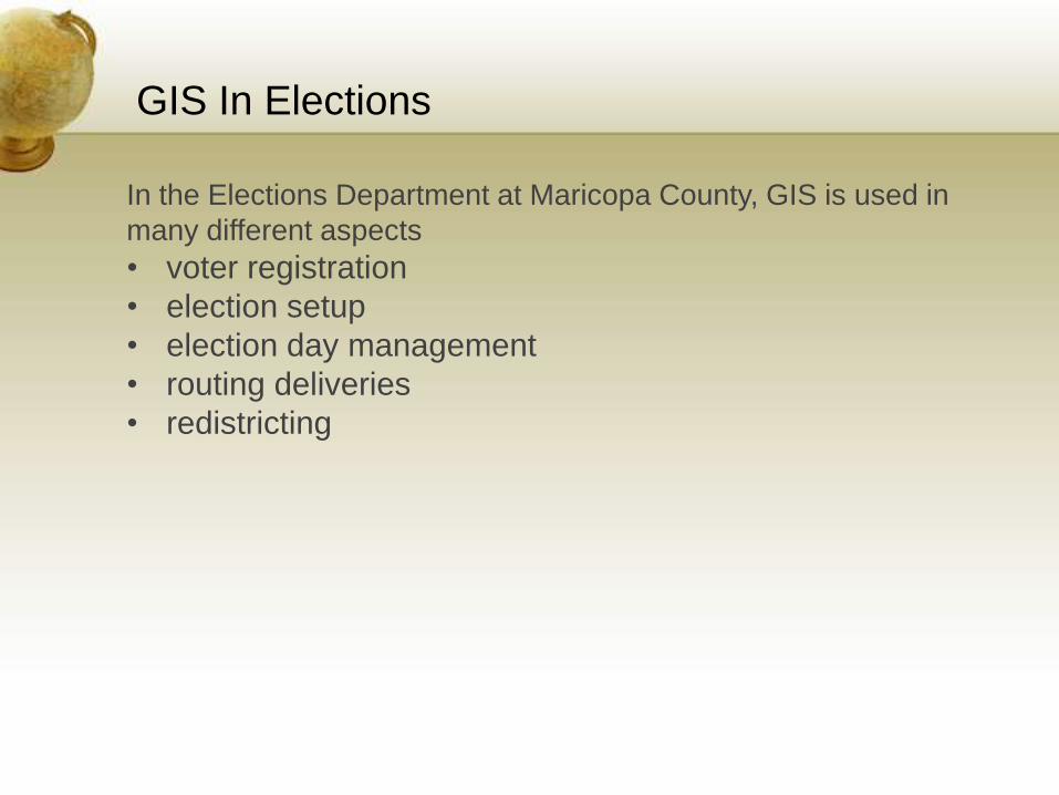
Election day
Polling Place Locator to help voters locate their polling place
Election day
Interactive map showing ballot boundaries, troubleshooter areas, polling places,
and polling place equipment return sites to help election staff.

Voters with Early Voting ballots can use our mobile website to locate the closest facility
where they can drop off their early ballot on election day
Election day

Election day
Polling place election maps showing adjacent
precinct polling place information

Election day
Polling place election maps to help determine ballot style for new or
unregistered voters in the precinct

Election day
Troubleshooter maps show the assigned polling places

Election night
Candidates, the media, election officials, and the public are interested in knowing which
precincts have reported results on election night

Public information
Interactive map for the public to look up district information

Redistricting
Using GIS, when Congressional and Legislative Districts from the state are received, we
can make the appropriate changes to our districts quickly.

Redistricting
District voter total changes can be seen real time as boundaries are adjusted

Redistricting
When we receive new ward boundaries from cities and towns, we try to align to their
boundaries as well.

Redistricting
The online redistricting website gives the public the ability to make suggestions for
new district boundaries

Redistricting
Create legal descriptions
Assign census blocks to voting precincts to
summarize demographics
Using decennial census data,
the department redraws voting
precinct, board of supervisor,
and justice of the peace
boundaries

Related Documents