GREATER PĨNA COLADA MULTICLIENT MARINE SEISMIC SURVEY ENVIRONMENT PLAN - PUBLIC SUMMARY DOLPHIN GEOPHYSICAL Ltd Issue Date - June 2015 Rev 1

Welcome message from author
This document is posted to help you gain knowledge. Please leave a comment to let me know what you think about it! Share it to your friends and learn new things together.
Transcript
GREATER PĨNA COLADA
MULTICLIENT MARINE SEISMIC SURVEY
ENVIRONMENT PLAN - PUBLIC SUMMARY
DOLPHIN GEOPHYSICAL Ltd
Issue Date - June 2015
Rev 1

Dolphin Geophysical - Greater Pĩna Colada MC MSS - Environment Plan
Rev 1 Page ii
Contents
1. INTRODUCTION ............................................................................................... 1
1.1. LOCATION OF THE ACTIVITY ................................................................................................... 2 1.2. COORDINATES OF THE PROPOSED ACTIVITY ...................................................................... 3
2. DESCRIPTION OF THE RECEIVING ENVIRONMENT ............................................. 4
2.1. PHYSICAL SETTING ................................................................................................................... 4 2.2. BIOLOGICAL ENVIRONMENT.................................................................................................... 4
2.2.1. Biological Communities ...................................................................................................................... 4 2.2.2. Protected Marine Fauna ..................................................................................................................... 5
2.3. SOCIO-ECOMOMIC ENVIRONMENT ......................................................................................... 4
2.3.1. Commercial Fisheries ......................................................................................................................... 4 2.3.2. Petroleum Exploration and Production .............................................................................................. 4 2.3.3. Commercial Shipping .......................................................................................................................... 4 2.3.4. Tourism and Recreation ..................................................................................................................... 4 2.3.5. Cultural Heritage ................................................................................................................................ 5 2.3.6. National Heritage ............................................................................................................................... 6 2.3.7. Marine Parks and Reserves ................................................................................................................ 6 2.3.8. Commonwealth Marine Reserves ...................................................................................................... 6 2.3.9. WA State Marine Reserves ................................................................................................................. 8 2.3.10. Other Protected Areas ...................................................................................................................... 10 2.3.11. Defence Activities ............................................................................................................................. 10
3. DESCRIPTION OF ACTIVITY ............................................................................. 11
3.1. SURVEY PARAMETERS ........................................................................................................... 11 3.2. ACOUSTIC MODELLING .......................................................................................................... 11
3.2.1. Horizontal Modelling ........................................................................................................................ 11 3.2.2. Received SEL at Various Sensitive Locations .................................................................................... 12 3.2.3. Vertical Modelling ............................................................................................................................ 12 3.2.4. TTS and PTS Threshold Levels ........................................................................................................... 12
3.3. SEISMIC SURVEY VESSELS ................................................................................................... 15
3.3.1. Support / Guard Vessel(s) ................................................................................................................. 15
4. DETAILS OF ENVIRONMENTAL IMPACTS AND RISKS ....................................... 16
4.1. ENVIRONMENTAL RISK ASSESSMENT METHODOLOGY ................................................... 16 4.2. RISK EVALUATION ................................................................................................................... 17
4.2.1. Demonstration of ALARP .................................................................................................................. 17 4.2.2. Demonstration of Acceptability........................................................................................................ 17
4.3. IDENTIFICATION OF RISKS AND IMPACTS ........................................................................... 18
4.3.1. Environmental Aspects ..................................................................................................................... 18 4.3.2. Environmental Impacts ..................................................................................................................... 18
4.4. ASSESSMENT OF ENVIRONMENTAL IMPACTS AND RISKS .............................................. 19
4.4.1. Vessel noise emissions (excluding seismic acoustic emissions) ....................................................... 19 4.4.2. Interaction with Commercial Fisheries, Recreational Fishers, Tourism, Shipping and Petroleum Service Vessels ................................................................................................................................................... 19 4.4.3. Biofouling of vessel hull, other niches and immersible equipment ................................................. 21 4.4.4. Underwater noise emissions from discharge of airgun array .......................................................... 21 4.4.5. Discharge of bilge water, sewage, grey water and food wastes ...................................................... 25 4.4.6. Collision between survey vessels / towed array and marine fauna ................................................. 25
Dolphin Geophysical - Greater Pĩna Colada MC MSS - EP - Public Summary
Rev 1 Page iii
4.4.7. Equipment dragging or loss .............................................................................................................. 25 4.4.8. Accidental release of hazardous or non-hazardous waste ............................................................... 25 4.4.9. Hydrocarbon release caused by topsides (vessel) loss of containment ........................................... 26 4.4.10. Hydrocarbon Release Caused by Vessel Collision or At-Sea Refuelling ............................................ 26
4.5. SUMMARY OF ENVIRONMENTAL RISK ASSESSMENT RESULTS ..................................... 27
5. SUMMARY OF THE CONTROL MEASURES ....................................................... 31
6. SUMMARY OF THE RESPONSE ARRANGEMENTS IN THE OIL POLLUTION EMERGENCY PLAN ............................................................................................................... 40
6.1. OIL POLLUTION EMERGENCY PLAN ..................................................................................... 40 6.2. VESSEL SOPEP ........................................................................................................................ 40
6.2.1. Drills and Training ............................................................................................................................. 40
6.3. EMERGENCY RESPONSE ARRANGEMENTS ....................................................................... 41
6.3.1. Commonwealth Waters .................................................................................................................... 41 6.3.2. State Waters ..................................................................................................................................... 41 6.3.3. Type 1 Operational Monitoring ........................................................................................................ 41 6.3.4. Type II Scientific Monitoring ............................................................................................................. 42 6.3.5. Reporting, Maintenance and review ................................................................................................ 43
7. SUMMARY OF THE ARRANGEMENTS FOR ONGOING MONITORING OF THE TITLEHOLDERS PERFORMANCE............................................................................................. 44
8. DETAILS OF CONSULTATION ALREADY UNDERTAKEN, AND PLANS FOR ONGOING CONSULTATION ................................................................................................................... 45
8.1. PHASE 2 - PRE-SURVEY CONSULTATION ............................................................................ 46
8.1.1. Phase 3 - Ongoing Consultation and Phase 4 - Post Survey Notification .......................................... 47
8.2. MERITS OF THE STAKEHOLDER OBJECTIONS AND CLAIMS ........................................... 47
9. DETAILS OF THE TITLEHOLDER AND LIAISON PERSON ..................................... 53
10. REFERENCES .................................................................................................. 54
11. APPENDIX 1 - BIOLOGICALLY IMPORTANT AREAS IN RELATION TO THE GREATER PINA COLADA MC MSS - REDUCED SCOPE POLYGON ............................................................ 56
Dolphin Geophysical - Greater Pĩna Colada MC MSS - EP - Public Summary
Rev 1 Page iv
TABLES
TABLE 1.1 - GPC MC MSS POLYGON COORDINATES ................................................................................................................ 3 TABLE 2.1 - MERMAID REEF NATURE RESERVE – APPLICABLE VALUES AND GOALS .......................................................................... 8 TABLE 2.2 - ROWLEY SHOALS MARINE PARK – APPLICABLE ECOLOGICAL VALUES ............................................................................ 9 TABLE 3.1 - PROPOSED SOUND LEVELS FOR VARIOUS LOCATIONS RELATIVE TO THE GPC MC MSS – REDUCED SCOPE POLYGON .......... 12 TABLE 3.2 - SUMMARY OF DRAFT NOAA UN-WEIGHTED AND WEIGHTED THRESHOLD LEVELS FOR TTS AND PTS ONSET FOR LF, MF AND
HF CETACEANS ........................................................................................................................................................ 14 TABLE 3.3 - PROPOSED SOUND LEVELS FOR MORTALITY AND IMPAIRMENT IN FISHES AND TURTLES ................................................. 14 TABLE 4.1 - ENVIRONMENTAL EVENT POTENTIAL MATRIX ........................................................................................................ 16 TABLE 4.4 -SUMMARY OF ENVIRONMENT RISK ASSESSMENT FOR GPC MC MSS ........................................................................ 29 TABLE 5.1 - SUMMARY OF THE CONTROLS AND MITIGATION MEASURES .................................................................................... 31
FIGURES
FIGURE 1.1 - GPC MC MSS LOCATION MAP .......................................................................................................................... 1 FIGURE 1.2 - GPC MC MSS POLYGON BOUNDARY RELATIVE TO MERMAID REEF COMMONWEALTH MARINE RESERVE ........................ 2 FIGURE 2.1 - SATELLITE TRACKING OF 11 BLUE WHALES IN 2009 & 2011 VS GPC MC MSS - REDUCED SCOPE POLYGON ................... 2 FIGURE 2.2 - MERMAID REEF MARINE HABITATS .................................................................................................................... 7
Dolphin Geophysical - Greater Pĩna Colada MC MSS - EP - Public Summary
Rev 1 Page 1
1. INTRODUCTION
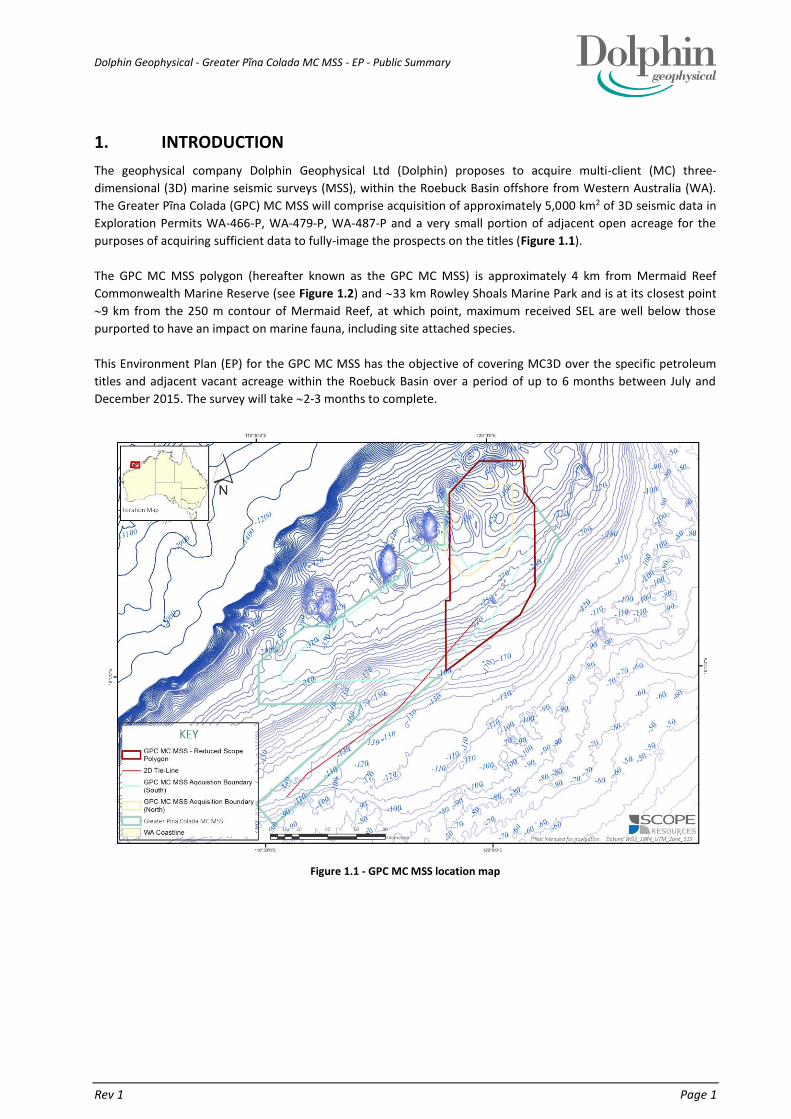
The geophysical company Dolphin Geophysical Ltd (Dolphin) proposes to acquire multi-client (MC) three-
dimensional (3D) marine seismic surveys (MSS), within the Roebuck Basin offshore from Western Australia (WA).
The Greater Pĩna Colada (GPC) MC MSS will comprise acquisition of approximately 5,000 km2 of 3D seismic data in
Exploration Permits WA-466-P, WA-479-P, WA-487-P and a very small portion of adjacent open acreage for the
purposes of acquiring sufficient data to fully-image the prospects on the titles (Figure 1.1).
The GPC MC MSS polygon (hereafter known as the GPC MC MSS) is approximately 4 km from Mermaid Reef
Commonwealth Marine Reserve (see Figure 1.2) and 33 km Rowley Shoals Marine Park and is at its closest point
9 km from the 250 m contour of Mermaid Reef, at which point, maximum received SEL are well below those
purported to have an impact on marine fauna, including site attached species.
This Environment Plan (EP) for the GPC MC MSS has the objective of covering MC3D over the specific petroleum
titles and adjacent vacant acreage within the Roebuck Basin over a period of up to 6 months between July and
December 2015. The survey will take 2-3 months to complete.
Figure 1.1 - GPC MC MSS location map

Dolphin Geophysical - Greater Pĩna Colada MC MSS - EP - Public Summary
Rev 1 Page 2
Figure 1.2 - GPC MC MSS polygon boundary relative to Mermaid Reef Commonwealth Marine Reserve
1.1. LOCATION OF THE ACTIVITY
The GPC MC MSS polygon lies entirely in Commonwealth waters within the Northwest Marine Region (NWMR). The
polygon incorporates Exploration Permits WA-466-P, WA-479-P, WA-487-P and adjacent open acreage areas (Figure
1.1) and a very small portion of adjacent open acreage for the purposes of acquiring sufficient data to fully-image
the prospects on the titles. The Greater Pĩna Colada (GPC) MC MSS will comprise acquisition of approximately 5,000
km2 of 3D seismic data.
The GPC MC MSS is located offshore from the Pilbara region between Onslow and Broome. The GPC MC MSS is
located 190 km from Coulomb Point on the mainland coast of WA, with the southern corner of the polygon located
270 km from Port Hedland and the eastern boundary 220 km west of Broome. The Mermaid Reef CMR is 4 km
from the boundary of the polygon. Water depths across the polygon range from 160 - 440 m (see Figure 1.1) with
the shallowest waters encountered to the south. Waters along the western boundary, closest to Mermaid Reef are
minimum 330 m.
Dolphin Geophysical - Greater Pĩna Colada MC MSS - EP - Public Summary
Rev 1 Page 3
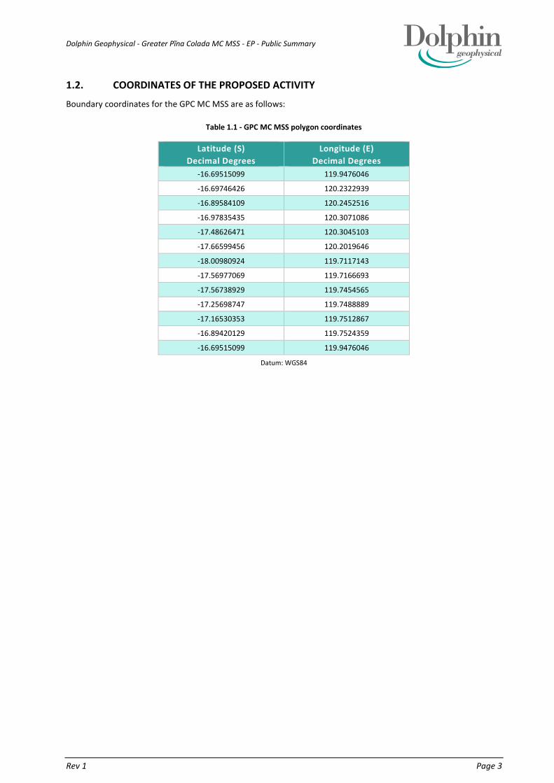
1.2. COORDINATES OF THE PROPOSED ACTIVITY
Boundary coordinates for the GPC MC MSS are as follows:
Table 1.1 - GPC MC MSS polygon coordinates
Latitude (S)
Decimal Degrees
Longitude (E)
Decimal Degrees
-16.69515099 119.9476046
-16.69746426 120.2322939
-16.89584109 120.2452516
-16.97835435 120.3071086
-17.48626471 120.3045103
-17.66599456 120.2019646
-18.00980924 119.7117143
-17.56977069 119.7166693
-17.56738929 119.7454565
-17.25698747 119.7488889
-17.16530353 119.7512867
-16.89420129 119.7524359
-16.69515099 119.9476046
Datum: WGS84

Dolphin Geophysical - Greater Pĩna Colada MC MSS - EP - Public Summary
Rev 1 Page 4
2. DESCRIPTION OF THE RECEIVING ENVIRONMENT
In accordance with Regulation 13(2) of the Environment Regulations, a description of the existing environment that
may potentially be affected by planned and unplanned activities relating to the Greater Pina Colada MC MSS is
presented in this section. It includes a description of relevant natural, cultural and socio-economic aspects of the
environment, as well as details of relevant values and sensitivities.
2.1. PHYSICAL SETTING
The GPC MC MSS polygon lies entirely within Commonwealth marine waters of the North-west Marine Region
(NWMR) which extends from offshore Kalbarri in Western Australia (WA) to the Western Australia / Northern
Territory (NT) border.
The region is generally characterised by two seasons: winter (May to August) and summer (September to April). The
Kimberley system is subject to episodic offshore cyclonic activity. On average, two to three tropical cyclones occur
during each tropical cyclone season, primarily in the December to April period, though cyclones have been recorded
as late as June (BoM, 2015).
Depth is the primary driver in the differences between inshore and offshore waters. Overall, the NWMR is relatively
shallow with more than 50% of the region at depths <500 m; therefore, surface currents exert a strong influence
over the region’s biophysical and ecological processes (DEWHA, 2008a). Oceanographic processes are also a key
driver, particularly the composition of each water mass, such as its physical and chemical composition and
temperature. Currents are the agents for movements of the differing water masses and therefore provide the link
between systems.
2.2. BIOLOGICAL ENVIRONMENT
2.2.1. BIOLOGICAL COMMUNITIES
Most of the NWMR species are tropical and are also found in other parts of the Indian and western Pacific oceans.
The NWMR has high species diversity said to be associated with the diversity of habitats available. These include
hard seafloor areas (e.g., limestone pavements on the NWS), submerged cliffs and coral reefs of the Kimberley, and
atolls and reefs on the edge of the shelf. These habitats support a high diversity of benthic filter feeders and
producers. Fish spawning in summer/autumn in the Kimberley is thought to correspond with peaks in production
and current movements. There is a strong delineation in demersal slope fish communities in the Kimberley in
comparison to systems further south.
The NWMR supports internationally important breeding and feeding grounds for a number of threatened and
migratory marine species that transit through the bioregion, including humpback whales. Significant turtle rookeries
are found on coastal beaches and offshore islands and the surrounding waters provide important resting and
internesting (i.e. in between egg laying periods) habitats (DEWHA, 2007; DEWHA, 2008a).
Significant areas of coral reefs within the NWMR include the Rowley Shoals, which is adjacent to the GPC MC MSS
polygon. The Rowley Shoals are a hotspot for biodiversity in this bioregion and contain intertidal and sub-tidal coral
reefs. These reefs support a diverse marine fauna typical of oceanic coral reef communities of the Indo-west Pacific.
The reefs are important stepping-stones in the maintenance of gene flow among the northwest Australian coral
reefs. Biological surveys of the reefs have identified 184 species of corals, 264 species of molluscs, 82 species of
echinoderms and 389 species of finfish (DEWHA, 2008a). Sponge diversity in the Rowley Shoals is unique and has no
similarity with any other locality.
The NWMR is thought to contain a high diversity of crustaceans with dominant species groups including copepods,
prawns, scampi and crabs. The North West Slope Trawl Fishery (NWSTF) targets scampi in the NWMR. Data from the
fishery suggests that muddy sediments support significant populations of crustaceans (Fletcher and Santoro, 2014).

Dolphin Geophysical - Greater Pĩna Colada MC MSS - EP - Public Summary
Rev 1 Page 5
Approximately 81 different species of cephalopod are believed to occur in the NWMR.
The NWMR supports a diverse assemblage of fish, particularly in shallow water near the mainland and around
islands. Most fish have tropical distributions and are well distributed throughout the Indo-west Pacific region. The
NWMR also supports large populations of cartilaginous fish such as sharks and rays; which are typically higher order
predators and perform an important ecological role through the regulation of prey species. Sharks are found in
considerable numbers on the Rowley Shoals, particularly the grey reef shark, the whitetip reef shark, and the silvertip
whaler.
The Rowley Shoals have over 500 species of fish inhabitants, including many species not found on nearshore coral
reefs. Giant potato cod, Maori wrasse, reef fish, trevally, mackerel and tuna are known to occur. As well as being
inhabited by a number of species not recorded from other WA coral reefs, the coral and fish communities of the
Rowley Shoals are unique in their composition, and in the relative abundance of species (DEC, 2007). The marine
communities of the Rowley Shoals are more characteristic of south-east Asia than any other WA reefs. In relation to
the proposed GPC MC MSS reduced, site-attached fish are only located around the reefs of the Rowley Shoals.
2.2.2. PROTECTED MARINE FAUNA
The Protected Matters Search Tool (PMST) from the DoE was used to determine whether matters of national
environmental significance (NES) or other matters protected by the EPBC Act were likely to occur in the GPC MC
MSS polygon. Nine (9) listed Threatened species may occur, or relate to, the GPC MC MSS polygon:
1. the blue whale
2. the humpback whale
3. the loggerhead turtle
4. the green turtle
5. the leatherback turtle
6. the hawksbill turtle
7. the flatback turtle
8. the great white shark
9. the whale shark
The GPC MC MSS polygon is not considered a habitat that is critical to the survival of any listed species. Similarly,
there are no EPBC Act-listed threatened ecological communities (TEC) or critical habitats within the vicinity of the
GPC MC MSS polygon.
The PMST report identified two Key Ecological Features (KEF) within or adjacent to the GPC MC MSS-Reduced Scope
Polygon:
the Ancient coastline at 125 m depth contour; and
the Mermaid Reef and Commonwealth waters around Rowley Shoals.
The BIA that overlap the GPC MC MSS polygon are as follows:
migration area (north and south) for the pygmy blue whale;
foraging area for the whale shark; and
breeding and foraging area for the white-tailed tropicbird.
The BIA for particular marine species are presented in Appendix 1.
There is one (1) additional BIA that is adjacent to the GPC MC MSS – Reduced Scope Polygon:
resting area for the little tern;
2.2.2.1. CETACEANS
The EPBC Act database (DoE, 2015a) lists 24 cetacean species that may occur within the GPC MC MSS polygon, all of
which are protected under the Act; one of which is also classified as Endangered, one as Vulnerable and seven as
Migratory. The pygmy blue whale is listed as Endangered and Migratory and the humpback whale is listed as
Vulnerable and Migratory.

Dolphin Geophysical - Greater Pĩna Colada MC MSS - EP - Public Summary
Rev 1 Page 2
Pygmy blue whales
Source: Modified from Double (2014)
Figure 2.1 - Satellite tracking of 11 blue whales in 2009 & 2011 vs GPC MC MSS - Reduced Scope Polygon
In the NWMR, pygmy blue whales (Balaenoptera musculus brevicauda) migrate offshore Augusta (southwest WA)
to Derby (northern WA) approximately along the 500 m to 1,000 m contour.
The GPC MC MSS overlaps a small portion of the pygmy blue whale BIA (migration area) (see Appendix 1)
encroaching 10 km into the BIA at a point where the migration route is 250 km wide. Migrating pygmy blue whales
are expected to have passed the GPC MC MSS Polygon on their northbound migration by end of June (before the
commencement of the survey) but may be encountered in the deeper waters of the northern part of the GPC MC
MSS during their southbound migration from October to November (Figure 2.1). However, the deepest waters of
the polygon are 440 m and the pygmy blue whale migration is centered on the 500 m contour and significant
numbers of individuals are unlikely to be encountered in the 160-440 depth range (Figure 2.1). Northbound animals
are thought to be heading to calving areas in the Banda Sea, therefore once animals have rounded the Northwest
Cape the shortest route is via Scott Reef (an ‘en-route’ opportunistic feeding location) and remaining on the 500 m
contour which is to the north of the GPC MC MSS. Figure 2-1 shows the location of the GPC MC MSS in relation to
the satellite tagging data and pygmy blue whale BIA.
Humpback whales
The humpback whale is the most commonly sighted whale in WA waters.
The GPC MC MSS may start as early as July 2015 coinciding with the humpback whale migration season. However,
given that the GPC MC MSS is located more than 100 km from the identified humpback whale migration BIA, the
distance offshore (closest point 200 km), and the water depths over the polygon (160-440 m), it is unlikely that
significant numbers of humpback whales will be encountered. Individuals that are present within the GPC MC MSS
are likely to be transient only. Nevertheless, adaptive management of impacts from seismic acoustic emissions on
humpback whales have been considered and adopted (Section 5).
Dolphins
Dolphins are relatively common in the waters of the NWS. Species known to occur in this region include the common,
bottlenose and Risso’s dolphins. The GPC MC MSS polygon does not contain any critical habitats or feeding grounds
for these dolphin species (DSEWPAC, 2012).
Marine Reptiles
The PMST identified five (5) species that may occur within or in the waters surrounding the GPC MC MSS polygon;
the green, hawksbill and flatback turtles (all listed as Vulnerable and Migratory); and the loggerhead and leatherback
turtles (both listed as Endangered, and Migratory). The closest marine reptile BIA is located more than 100 km from
the southern boundary of the GPC MC MSS polygon, this being the 80 km internesting buffer for flatback turtles.

Dolphin Geophysical - Greater Pĩna Colada MC MSS - EP - Public Summary
Rev 1 Page 3
Turtles do occur within the Rowley Shoals Marine Park (DEC, 2007) and around Mermaid Reef (DNP, 2013); however,
these reefs are not considered critical habitats for marine reptiles. There are no known significant breeding sites for
marine turtles in the Rowley Shoals Marine Park.
Sea Snakes
There are 14 protected species of sea snakes listed as marine species under the EPBC Act that may occur within or
adjacent to the GPC MC MSS polygon. However, given the water depths within the polygon (160-440 m) it is unlikely
that large numbers of sea snakes will be encountered during the survey.
Sharks and Ray-finned Fishes
EPBC Act protected marine species that may occur within the GPC MC MSS polygon and surrounding waters include
the great white shark, shortfin mako, longfin mako shark and various species of pipefishes and seahorses (Family
Syngnathidae). Information regarding the habitat, species numbers or life cycles of species from this family on the
NWS is limited (DSEWPaC, 2012); however, it is understood most syngnathid species prefer complex shallow water
habitats including seagrass and reefs.
Whale Shark
The whale shark is listed as Vulnerable and Migratory under the EPBC Act and is also classified as Vulnerable on the
World Conservation Union’s Red List of Threatened Species (IUCN, 2015). In WA, they are known to aggregate in the
reef front waters of Ningaloo Reef from March to July, and northward of the Ningaloo Marine Park along the 200 m
contour from July to November. However, the timing is variable and individual whale sharks have been recorded at
other times of the year, (Wilson et al., 2001). Based on information a likely ‘peak migration’ period (sensitive period)
for whale sharks through the GPC MC MSS Polygon is from 1 August - 31 October.
A BIA (foraging area) for the whale shark overlaps the GPC MC MSS polygon and so it is possible that whale sharks
may be encountered during the survey. However, due to the low numbers of the animals and their irregular
movements, it is not expected that whale sharks will be encountered in significant numbers and those individuals
that are encountered are likely to be transient.
Seabirds
The EPBC Protected Matters database search listed five (5) migratory bird species that may occur within the GPC MC
MSS polygon: the lesser frigatebird, little tern, streaked shearwater (two species), and the white-tailed tropicbird.
The nearest emergent land features to the GPC MC MSS polygon are the Rowley Shoals. Bedwell Island (connected
to Clerke Reef), is recognised as a BIA (breeding area and foraging) for the white-tailed tropicbird (a Listed migratory
CAMBA, JAMBA). The species nests in hollows and has been known to construct experimental artificial stone
structures for nesting. Red-tailed tropic birds nest in the autumn months, which also corresponds with the peak
Rowley Shoals visitor season, so there is a potential for human nature-based activities on the islands to affect
breeding birds (DEC, 2007). Tropicbirds are predominantly pelagic species, rarely coming to shore except to breed.
The white-tailed tropicbird forages in warm waters and over long distances, they have been known to forage up to
1,500 kilometres from breeding sites on fish and cephalopods by plunge-diving (DSEWPaC, 2012). Bedwell Island
and Cunningham Island (connected to Imperieuse Reef) are also identified as a BIA (resting) for the little tern which
is widespread in Australia.
Based on the ecology and habits of the species that may be present, the GPC MC MSS polygon activity is unlikely to
have significant impact on seabird populations.

Dolphin Geophysical - Greater Pĩna Colada MC MSS - EP - Public Summary
Rev 1 Page 4
2.3. SOCIO-ECOMOMIC ENVIRONMENT
2.3.1. COMMERCIAL FISHERIES
The GPC MC MSS has the potential to interact with Commonwealth and State-managed fisheries. The following
section details the commercial fisheries that may be operating within, or adjacent to, the operational area.
State fisheries administered by the Department of Fisheries (DoF) that can operate in the proposed GPC MC MSS polygon include the following:
Mackerel Managed Fishery (MMF);
Pilbara Demersal Scalefish Fisheries (PDSF);
o Pilbara Fish Trawl (Interim) Managed Fishery (PFTIMF)*;
o Pilbara Trap Managed Fishery (PTMF);
o Pilbara Line Fishery (PLF);
Northern Demersal Scalefish Managed Fishery (NDSF);
Pearl Oyster Managed Fishery (POMF);
North Coast Prawn Managed Fishery (NCPMF)*;
Broome Prawn Managed Fishery (BPMF)*;
West Coast Deep Sea Crustacean Managed Fishery (WCDSCF).
Commercial fisheries managed by the Australian Fisheries Management Authority (AFMA) that can operate in the GPC MC MSS polygon include the following:
North West Slope Trawl Fishery (NWSTF);
Western Skipjack Tuna Fishery (WSTF)*; and
Western Tuna and Billfish Fishery (WTBF)*.
*It should be noted that various state and commonwealth managed fisheries were not included in the stakeholder
consultation plan for the GPC MC MSS as their recognised fishing area did not overlap the polygon, and so therefore
it was deemed that their interestets or activities would not be affected by the survey.
2.3.2. PETROLEUM EXPLORATION AND PRODUCTION
The GPC MC MSS overlaps Exploration Permits WA-466-P, WA-479-P, WA-487-P, and adjacent open acreage areas.
There are no petroleum production facilities or pipelines within the polygon, however, there is one (1) petroleum
well. Therefore, there is no emergent infrastructure within the GPC MC MSS – Reduced Scope Polygon.
2.3.3. COMMERCIAL SHIPPING
Major shipping routes in the vicinity of the GPC MC MSS polygon are associated with entry to the Port of Dampier,
Port Hedland and Barrow Island with less traffic through the Port of Broome. The Australian Maritime Safety
Authority (AMSA) was identified as a stakeholder and contacted regarding the proposed GPC MC MSS and
subsequently supplied details of the location of shipping fairways that overlap and are adjacent to the polygon.
Consultation with AMSA will be ongoing prior to, and throughout the duration of the survey.
2.3.4. TOURISM AND RECREATION
The Rowley Shoals have limited visitation, with the major activities in the area being nature-based tourism and
recreational fishing; primarily by charter vessel and mostly occurring between September and December. Nature-
based tourism is based on the Department of Parks and Wildlife (DPaW) licensed charter boat operators who take
passengers to the Rowley Shoals on trips of up to 10 days in duration (DEC, 2007). The shallow sheltered lagoons
provide ideal conditions for snorkelling, while SCUBA divers can experience lagoon, channel, and wall dives. The
zoning scheme provides diving locations free from conflicting uses such as fishing in all the major habitats found in
the Park (DEC 2007).
2.3.4.1. SNORKELLING AND DIVING

Dolphin Geophysical - Greater Pĩna Colada MC MSS - EP - Public Summary
Rev 1 Page 5
Mermaid Reef is the least visited reef in the Rowley Shoals and is visited primarily for SCUBA divingneither within
the lagoon and outer reef (DEC 2007). Recreational diving is depth-limited to 40 m (www.padi.com). Physical
interaction with divers and dive boats is unlikely as the seismic vessels will not enter state waters and will be located
4 km from the edge of the Mermaid Reef Nature Reserve and more than 10 km from any credible divesite at
Mermaid Reef as the distance to the 40 m contour is 11 km. Furthermore, based on noise modelling, received SEL
to divers who are restricted to the atolls will be minimal. At the 250 m contour, seismic acoustic emissions are
reduced to SEL of 142 dB re 1 µPa2.s and is anticipated to be less than 140 dB re 1 µPa2.s at 11 km’s distance.
Further, reefs are known to be noisy places due to increased biotic activity and noise from SCUBA diving equipment
is known to emit higher sound levels than what is anticipated from the proposed sound source at the reef (Anthony
et al. 2009).
2.3.4.2. RECREATIONAL FISHING
The Rowley Shoals have had a relatively low level of fishing effort, primarily due to their isolation from major
population centres. There has been a prohibition on commercial fishing and a ban on the take of key demersal fish
by recreational fishers since 1987, with a proposal to extend this ban to more species of fish, and extending it out to
3 nm of the reef perimeter (align with the extent of the WA State waters limit (Dec, 2007).
At its closest point, the GPC MC MSS polygon is located 210 km from Broome. Recfishwest suggests that
recreational fishing activities mostly occur within a 40 nm radius of townships and that there are only a few select
charter boat operators that make the trip out to the Rowley Shoals (Ms Eileen Smith and Matt Gillet, Recfishwest,
pers. comm email, March 2014 and March 2015). Therefore, considering that the polygon is located more than 200
km from the nearest town site, recreational fishing activities are not likely to been encountered in great numbers.
Those that are encountered are likely to be transiting through the area en route to and from the Rowley Shoals and
/ or Mermaid Reef.
2.3.4.3. CHARTER BOAT OPERATORS
Charter Boats in the Rowley Shoals region primarily visit Clerke Reef as it provides easy access into the lagoon and a
protected mooring / anchorage site. The Department of Parks and Wildlife (DPaW) manage access and licencing
arrangements for the Rowley Shoals Marine Park. Because of their remote location, most visitors go to the Rowley
Shoals Marine Park and Mermaid Reef Marine National Nature Reserve by charter boat, and trips are generally a
minimum of five days. The boat trip to the Rowley Shoals takes about 12 hours. Charter operators usually depart
from Broome at sunset and arrive at the shoals at about midday. Mermaid and Clerke reefs are the most visited
sites. Most operators visit the shoals from September to December and vessels operate out of Broome (DEC, 2007).
Consultation has been undertaken with Commercial Tour Operators that hold a current licence to operate and
conduct tours at the Rowley Shoals (Section 8). One stakeholder requested clarification on whether there will be
impacts to diving tours, divers and marine life, to which Dolphin has responded to on the 10th May 2015. Another
tour operator identified that they forsee no impacts to their operations as long as the vessel remained more than
500 m away from their diving location whilst tours were underway.
In the Pilbara area, there are 13 charter vessels, five of which have commercial fishing boat licenses and target
demersal scalefish (Fletcher and Santoro, 2014). Therefore, it is possible that fishing charter boats may be
encountered within or adjacent to the polygon (Ryan and Wise et al., 2013).
2.3.5. CULTURAL HERITAGE
There are no Native Title Determination Areas overlapping or in the vicinity of the GPC MC MSS polygon. Under the
Historic Shipwrecks Act 1976 (Commonwealth), all historic wrecks and associated relics older than 75 years are
protected if located in waters from the Low Water Mark (LWM) out to the continental shelf edge (DoE, 2015c). A
search of the National Shipwrecks Database (DoE, 2015d) indicates that there is one shipwreck located in the vicinity
of the GPC MC MSS polygon. The Lively, a 240 ton sailing vessel, wrecked near Mermaid Reef in 1810, is 12 km from
the western boundary of the GPC MC MSS polygon (DoE, 2015d).

Dolphin Geophysical - Greater Pĩna Colada MC MSS - EP - Public Summary
Rev 1 Page 6
2.3.6. NATIONAL HERITAGE
There are no Commonwealth Heritage Places or National Heritage Places within the GPC MC MSS polygon. The
following places are listed on the Commonwealth Heritage List and are adjacent to the GPC MC MSS - Reduced Scope
Polygon:
Mermaid Reef - Rowley Shoals, 4 km from GPC MC MSS – Reduced Scope Polygon:
Listed Place (22/06/2004) Place ID 105255, Place File No 5/09/210/0033.
The following places are listed on the Register of the National Estate (non-statutory archive) and are adjacent to the
GPC MC MSS polygon:
Clerke Reef - Rowley Shoals 33 km from GPC MC MSS - Reduced Scope Polygon:
Registered (24/06/1997) Place ID 100378, Place File No 5/09/210/0033.
Imperieuse Reef - Rowley Shoals, 73 km from GPC MC MSS - Reduced Scope Polygon:
Registered (24/06/1997), Place ID 100377, Place File No 5/09/210/0033.
Mermaid Reef - Rowley Shoals, 4 km from GPC MC MSS - Reduced Scope Polygon:
Registered (24/06/1997), Place ID 100376, Place File No 5/09/210/0033.
2.3.7. MARINE PARKS AND RESERVES
The GPC MC MSS polygon abuts the following Commonwealth Marine Reserve (CMR) and WA State marine parks:
Rowley Shoals Marine Park
Argo Rowley Terrace CMR*
Multiple Use Zone - IUCN Category VI
Mermaid Reef CMR
Strict Nature Reserve - IUCN Category Ia
2.3.8. COMMONWEALTH MARINE RESERVES
Mermaid Reef has national and international significance due to its pristine character, coral formations, geomorphic
features and diverse marine life. The environmental values are its biodiversity; the marine ecosystems on which this
biodiversity depends; and the high water quality which is a key feature of the reserve's marine habitat (DNP, 2013).
To preserve Mermaid reef’s pristine condition it is essential to maintain its natural water quality.
The major marine habitats of Mermaid Reef have been mapped and classified as sand cay, lagoon, submerged sand,
deep reef flat, and emergent areas. The coral communities are one of the special values of Mermaid Reef and can
exist over a great range of depth due to the clear waters. Other benthic groups include sponges, bryozoans, ascidians
(sea squirts), polychaetes, molluscs such as cones, cowries, thaids, mitres and giant clams, echinoderms, crustaceans
and cnidarians. The corals, other benthic groups and site attached species associated with all areas of the reef,
including the submerged reef flat (as indicated in Figure 2.2) and outer reef slope which, at its closest point, is more
than 9 km from the outer boundary of the proposed GPC MC MSS.
Nine (9) km marks the closest distance between the GPC MC MSS polygon and the 250 m contour surrounding
Mermaid Reef and the distance between the GPC MC MSS polygon and the outer edge of the reef flat is 11.5 km.

Dolphin Geophysical - Greater Pĩna Colada MC MSS - EP - Public Summary
Rev 1 Page 7
Source: DNP 2000
Figure 2.2 - Mermaid Reef Marine Habitats
The strategic objectives for managing Mermaid Reef are in line with the reserves IUCN 1a category and the relevant
management principles set out in Schedule 8 of the EPBC Regulations, which means that it is a protected area
managed primarily for scientific research and environmental monitoring.
As outlined in the Mermaid Reef Marine National Nature Reserve Plan of Management 2000-2007 (DNP, 2000), the
strategic objectives for Mermaid Reef Marine National Nature Reserve are:
to manage the area as part of a comprehensive, adequate and representative system of marine protected
areas to contribute to the long-term ecological viability of marine and estuarine systems;
to ensure the preservation of Mermaid Reef in its natural condition and the protection of its special
features, including objects and sites of biological, historical, paleontological, archaeological, geological and
geographical interest;
to protect, conserve and manage the wildlife in the Marine National Nature Reserve;
to protect the Marine National Nature Reserve against damage; and
to encourage and regulate the appropriate use, appreciation and enjoyment of the Marine National Nature
Reserve.
To attain these objectives, the main management goals for the reserve include, relevant to the GPC MC MSS, include:
maintain the current high water quality;
minimise damage to coral and other features from boating and recreational activities;
To protect the diversity, distribution, abundance and community structure of fish and other vertebrate
fauna
educate visitors about the conservation values and significance of the Marine National Nature Reserve;
minimise potential impacts from exploration and extractive operations such as those for petroleum (oil and
gas).
Major ecological values of the Reserve include:
Best geological example of shelf atolls

Dolphin Geophysical - Greater Pĩna Colada MC MSS - EP - Public Summary
Rev 1 Page 8
Water quality
Rich and diverse marine communities/habitats (biodiversity)
Pristine, undisturbed marine communities and habitats, e.g. corals.
High abundance of marine fauna, e.g. fishes.
Wilderness character
Cultural Heritage: Shipwreck – Lively
Dolphin recognises the values of the Reserve and to help meet the objectives shall not tow deployed equipment
through, or undertake seismic acquisition activities within, the Reserve. Based on noise modelling results outlined
in Section 3.2, it is not anticipated that received levels will have significant impacts on fauna or benthic communities
within the Reserve. Table 2.1 outlines specific values and goals as outlined in the Mermaid Reef Marine National
Nature Reserve Plan of Management.
Table 2.1 - Mermaid Reef Nature Reserve – applicable values and goals
Value Management Goal Survey commitment
Water quality Maintain the current high water
quality, especially in the lagoon
All discharges to be in accordance with MARPOL.
No discharges within the Reserve
Survey vessels will not enter Reserve
physical damage from
boating and
recreational activities
To minimise damage to corals and
other benthic organisms.
No activities, including the deployment of streamers,
will occur within the Reserve
No anchoring within the Reserve
Survey vessels will not enter Reserve
Illegal collecting and
fishing
To protect the diversity, distribution, abundance and
Community structure of fish and
other vertebrate fauna.
No activities will occur within the Reserve
No fishing will be allowed within the Reserve
Survey vessels will not enter Reserve
Cultural heritage To preserve the remains of the
wreck in situ.
No activities will occur within the Reserve
Survey vessels will not enter Reserve
Petroleum and mineral exploration
and extraction
To ensure that there is no damage to the natural physical and biological features of Reserve from exploration and extraction activities within the Reserve.
To minimise damage to the natural physical and biological features of the Reserve from exploration and extraction activities in the vicinity of the
Rowley Shoals.
No activities within the Reserve
Noise impacts within the Park where site-attached fish
occur will be below those that may cause mortality,
permanent injury or TTS.
Noise impacts within the general waters around the
atoll will be below those that may cause mortality and
permanent injury. Pelagic fish can swim away from a
sound
Survey vessels will not enter Reserve
Environment Australia were contacted and they
provided advice on the seismic activity adjacent to the
Reserve.
With proposed discharge control measures in place; vessel separation distances from the reef and CMR waters
boundary; received noise levels at the reef predicted to be below those produced by visiting charter boats or dolphin
clicks; and mitigation to reduce likelihood of hydrocarbon spills, Dolphin believe that the impact of their activities
on the reef are light and will have minimal disturbance on individual species, populations or ecosystems.
2.3.9. WA STATE MARINE RESERVES
The Rowley Shoals Marine Park is characterised by intertidal and sub tidal coral reefs, diverse marine fauna and high
water quality. These attributes and the low level of use of the area contribute to the park’s unique wilderness
qualities, which are a significant draw card for visitors.

Dolphin Geophysical - Greater Pĩna Colada MC MSS - EP - Public Summary
Rev 1 Page 9
A strategic objective of the Rowley Shoals Marin Park Management Plan in relation to conservation, is to maintain
the marine biodiversity of the Marine Park and to maintain its ecological integrity and social values. To help achieve
this, the Park has been zoned based on a number of key principles including:
the value of the Shoals as an international coral reef reference site; and
recognition that a key value of the Shoals is wilderness and it relies on the area having a high degree of naturalness (e.g. presence of large fish)
In particular, sanctuary zones have been established to provide the highest level of protection for vulnerable or
specially protected species and to protect representative habitats from human disturbance so that marine life can
be seen and studied in an undisturbed or largely undisturbed state. Based on modelling results, due to the distance
of the MSS from the sanctuary zones, species will not experience noise levels that could adversely affect the
environment. The Rowley Shoals Marine Park is located more than 30 km from the GPC MC MSS polygon and so
impacts from GPC MC MSS activities are expected to be negligible.
The Rowley Shoals MP Management Plan (2007-2017) (DEC 2007) further highlights specific Ecological and social values and related objectives as outlined in Table 2.2.
Table 2.2 - Rowley Shoals Marine Park – applicable ecological values
Value Management
Objective Target Survey commitment
Geology and Geomorphology
To ensure the structural complexity of the Park’s geomorphology is not significantly affected by human activities.
No change of seabed structural complexity as a result of human activity in the Park.
No anchoring within the Marine Park
Water Quality
To ensure that the water quality of the Marine Park is not significantly impacted by sewage discharge from boats.
No change in water quality of all Park waters from background levels as a result of human activity in the Park.
All discharges to be in accordance with MARPOL. No discharges within the Marine Park
Intertidal coral reef communities:
To ensure species diversity and abundance of marine flora and fauna on the intertidal coral reef communities of the Park are not significantly impacted by reef-walking and collecting activities.
No loss of intertidal coral reef community diversity as a result of human activity in the Park. No loss of living intertidal coral reef community abundance* as a result of human activity in the Park.
No activities shall occur within the Marine Park
Subtidal coral reef communities:
To reduce damage to coral communities caused by mooring and anchoring activities.
No loss of subtidal coral reef community diversity as a result of human activity in the Park. No loss of living subtidal coral community abundance* as a result of human activity in the Park.
No anchoring or mooring within the Marine Park
Invertebrates (excluding corals)
To ensure that invertebrate diversity and abundance are not significantly impacted by recreational fishing and from illegal fishing activities in the Park.
No loss of invertebrate species diversity as a result of human activity in the Park. No loss of protected invertebrate species abundance* as a result of human activity in the Park. Abundance and size composition of invertebrate species in sanctuary zones to be at natural# levels. Management targets for abundance of targeted invertebrate species in all other areas to be determined in consultation with DoF and peak bodies.
No activities, including fishing, within the Marine Park. Noise impacts within the Park where invertebrates will mostly occur (reef areas) will be below those that may cause mortality, permanent injury or TTS.

Dolphin Geophysical - Greater Pĩna Colada MC MSS - EP - Public Summary
Rev 1 Page 10
Value Management
Objective Target Survey commitment
Finfish
To develop an understanding of the finfish diversity and abundance in the Park.
No loss of finfish species diversity as a result of human activity in the Park. No loss of protected finfish species abundance* as a result of human activity in the Park. Abundance and size composition of finfish species in sanctuary zones to be at natural# levels Management targets for abundance of targeted finfish species in all other areas to be determined in consultation with DoF and peak bodies.
No activities, including fishing, within the Marine Park. Noise impacts within the Park where site-attached fish occur will be below those that may cause mortality, permanent injury or TTS. Noise impacts within the general use area of the Park will be below those that may cause mortality and permanent injury. Pelagic fish can swim away from a sound source so TTS is not anticipated.
Turtles
To gain an increased understanding of the importance of habitats within the Park for turtles.
No loss of turtle diversity as a result of human activity in the Park. No loss in turtle abundance* as a result of human activity in the Park.
No activities within the Marine Park. Noise impacts within the Park where turtles will mostly occur (reef areas) will be below those that may cause mortality, permanent injury or TTS.
Seabirds
To ensure that breeding red–tailed tropic birds on Bedwell Island are not significantly disturbed by human activity.
No loss of seabird diversity as a result of human activity in the Park. No loss of seabird abundance* as a result of human activity in the Park.
No activities within the Marine Park.
Cetaceans
To gain an increased understanding of the use of the Park by cetaceans.
No loss of cetacean diversity as a result of human activity in Park. No loss of cetacean abundance* as a result of human activity in the Park.
No activities within the Marine Park.
*In this context a loss or change in “abundance” or “biomass” excludes losses of a minor, transient or accidental nature. This qualification does not apply to seabirds, turtles and cetaceans where minor or transient losses would be unacceptable (but does not apply to losses due to accidents).
# “Natural” in this case refers to the abundance that would occur in areas that are undisturbed and/or unexploited by human activities.
2.3.10. OTHER PROTECTED AREAS
There are no World Heritage Properties (WHP) or Ramsar Wetlands of International Importance located within the
GPC MC MSS polygon (DOE, 2015j; DOE, 2015k). The nearest WHP is the Ningaloo Coast, which is located
approximately 750 km from the survey polygon. The nearest RAMSAR Wetland is 250 km from the survey polygon.
2.3.11. DEFENCE ACTIVITIES
There are no defence activities overlapping the GPC MC MSS polygon (AMSIS, 2015)

Dolphin Geophysical - Greater Pĩna Colada MC MSS - EP - Public Summary
Rev 1 Page 11
3. DESCRIPTION OF ACTIVITY
3.1. SURVEY PARAMETERS
The MSS proposed is a typical 3D survey similar to most others conducted in Australian marine waters (in terms of
technical methods and procedures). No unique or unusual equipment or operations are proposed. The surveys will
be conducted using a purpose-built seismic survey vessel. Neither vessels nor equipment shall enter the Mermaid
Reef CMR at any time.
During the activities, the survey vessel will traverse a series of pre-determined sail lines within the polygon at a speed
of 8-9 km/hr. As the vessel travels along the survey lines a series of noise pulses (every 7-8 seconds) will be directed
down through the water column and seabed. The seismic array will comprise of twelve (12) solid streamers, with a
maximum length of 8,100 m. Streamer spacing will be 120 m, and sail line spacing will be 720 m. The total size
of the towed array is 1,550 m wide and 8,100 m long. The source (airgun array) tow depth will be 6 m (+/- 1 m) and
the streamer tow depth will be 18 to 25 m. The operating pressure for the airgun array will be 2,000 psi. The airgun
array will consist of two sub-arrays, each with a maximum volume of 4,100 in3. These sub-arrays will be fired
alternately, with a shotpoint interval of 25 m horizontal distance, and will produce at source (i.e. within a few
metres of the airguns) sound pulses in the order of 220 dB re 1μPa2 s (Sound Exposure Level - SEL), at frequencies
extending up to approximately 200 Hz.
The size of the source has been selected as low as reasonably possible to work in water depths from 160-440 m,
and to ensure the geophysical targets below the sea surface are imaged to an acceptable level. As the surveys will
be conducted in water depths greater than 160 m it is unlikely and operationally/ecologically undesirable, that any
of the towed equipment will make contact with the seabed or benthic communities.
The volume of the source that has been chosen is as low as reasonably practicable (ALARP) when considering the
geological target being aimed for. Dolphin has designed the 4,100 in3 source array to meet several criteria regarding
operational stability, predictable behaviour, and fit-for-purpose subsurface seismic imaging.
3.2. ACOUSTIC MODELLING
Source modelling was used to calculate sound levels within the water column, both vertically and up to several
kilometres away from the source, using the sound exposure level (SEL) and sound pressure level (SPL) units of
measurement suggested by Southall et al. (2007) (and further refined by NOAA (2013) and Popper et al. (2014) to
evaluate the effect of seismic noise on the receiving environment.
Sound levels have been calculated within the water column over a grid of locations around the array up to 20 km
distance from the seismic source at a depth of 10 m below the sea surface. The calculations of SEL and SPL have
been made according to the methods suggested by Southall et al. (2007) to calculate the sound field emitted by the
seismic source.
3.2.1. HORIZONTAL MODELLING
The horizontal modelling indicates the un-weighted SEL values at 500 m are a maximum of 179 dB re 1 µPa2 s; at 1
km a maximum of 171 dB re 1 µPa2 .s; at 3 km a maximum of 157 dB re 1 µPa2 s; at 4 km a maximum of 153 dB re 1
µPa2 s all in the crossline direction.
These results are in line with empirical measurements from a number of seismic airgun sources in western and
southern Australian waters (Dr Rob McCauley, CMST Curtin University, pers. comm., June 2009), in which a 4,000 in3
airgun array is expected to decrease to SEL in the order of 165 to 175 dB re 1µPa2.s within 1 km of the source.

Dolphin Geophysical - Greater Pĩna Colada MC MSS - EP - Public Summary
Rev 1 Page 12
On this basis, and as required by the EPBC Policy Statement 2.1, the following precaution zones will be applied for
the GPC MC MSS – Reduced Scope Polygon:
Observation zone: 3+ km horizontal radius from the acoustic source.
Low power zone: 2 km horizontal radius from the acoustic source.
Shut-down zone: 500 m horizontal radius from the acoustic source.
3.2.2. RECEIVED SEL AT VARIOUS SENSITIVE LOCATIONS
Based on horizontal modelling, Table 3.1 shows expected SEL at various locations where sensitivities may be located
adjacent to the GPC MC MSS – Reduced Scope Polygon.
At the closest point, the edge of the polygon is 9 km from the 250 m contour around Mermaid Reef (approximate
start of the steep reef incline) and 37 km from the 250 m contour around Clerke Reef. At this distance, received
SEL values are 142 dB re 1 µPa2.s and <131 dB re 1 µPa2.s, respectively. Shallower waters within the CMR and Marine
Park where site attached species associated with reef communities occur are further away again, and so will
experience reduced SEL.
Table 3.1 - Proposed Sound levels for various locations relative to the GPC MC MSS – Reduced Scope Polygon
Parameter Distance between Marine Park/ CMR
boundary and seismic acquisition area
polygon edge to 250m isobath at atoll
Distance
(km)
SEL
(dB re1µPa2.s)
Distance
(km)
SEL
(dB re 1µPa2.s)
Mermaid Reef ~4 km 153 ~9 km 142
Clerke Reef ~33 km < 131 (@20km) ~37 km < 131 (@20km)
Imperieuse Reef ~73 km < 131 (@20 km) ~77 km < 131 (@20 km)
3.2.3. VERTICAL MODELLING
Vertical modelling was undertaken to show received SEL directly below the sound source. The results of the
modelling indicates that 150 m directly under the sound source (160 m water depth and shallowest in the survey
polygon) SEL levels are reduced to 191 dB.
3.2.4. TTS AND PTS THRESHOLD LEVELS
Temporary Threshold Shift (TTS) is the limit at which the onset of reversible hearing loss occurs in marine fauna
including mammals, turtles, fish and larvae. Permanent Threshold Shift (PTS) is the estimated level at which the
onset of irreversible hearing loss occurs.

Dolphin Geophysical - Greater Pĩna Colada MC MSS - EP - Public Summary
Rev 1 Page 13
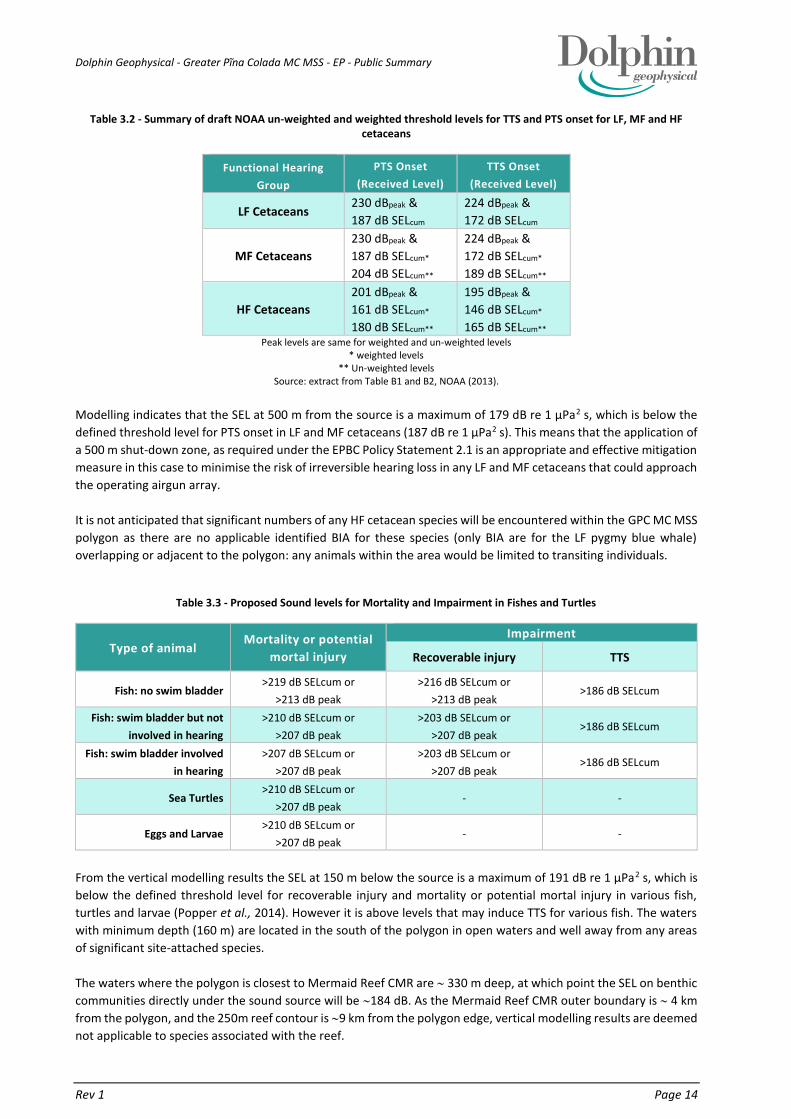
Table 3.2 shows the summary of the draft US (NOAA) weighted and un-weighted threshold levels for TTS and PTS
onset for low-frequency (LF) cetaceans (baleen whales), mid-frequency (MF) cetaceans (dolphins, toothed whales,
beaked whales, bottlenose whales) and high-frequency (HF) cetaceans (true porpoises, pygmy and dwarf sperm
whales, cephalorhynchid dolphins, Peale’s dolphin and hourglass dolphin) for impulsive sources of noise such as
seismic airgun arrays (NOAA, 2013).
Dolphin Geophysical - Greater Pĩna Colada MC MSS - EP - Public Summary
Rev 1 Page 14
Table 3.2 - Summary of draft NOAA un-weighted and weighted threshold levels for TTS and PTS onset for LF, MF and HF cetaceans
Functional Hearing
Group
PTS Onset
(Received Level)
TTS Onset
(Received Level)
LF Cetaceans 230 dBpeak &
187 dB SELcum
224 dBpeak &
172 dB SELcum
MF Cetaceans
230 dBpeak &
187 dB SELcum*
204 dB SELcum**
224 dBpeak &
172 dB SELcum*
189 dB SELcum**
HF Cetaceans
201 dBpeak &
161 dB SELcum*
180 dB SELcum**
195 dBpeak &
146 dB SELcum*
165 dB SELcum** Peak levels are same for weighted and un-weighted levels
* weighted levels ** Un-weighted levels
Source: extract from Table B1 and B2, NOAA (2013).
Modelling indicates that the SEL at 500 m from the source is a maximum of 179 dB re 1 µPa2 s, which is below the
defined threshold level for PTS onset in LF and MF cetaceans (187 dB re 1 µPa2 s). This means that the application of
a 500 m shut-down zone, as required under the EPBC Policy Statement 2.1 is an appropriate and effective mitigation
measure in this case to minimise the risk of irreversible hearing loss in any LF and MF cetaceans that could approach
the operating airgun array.
It is not anticipated that significant numbers of any HF cetacean species will be encountered within the GPC MC MSS
polygon as there are no applicable identified BIA for these species (only BIA are for the LF pygmy blue whale)
overlapping or adjacent to the polygon: any animals within the area would be limited to transiting individuals.
Table 3.3 - Proposed Sound levels for Mortality and Impairment in Fishes and Turtles
Type of animal Mortality or potential
mortal injury
Impairment
Recoverable injury TTS
Fish: no swim bladder >219 dB SELcum or
>213 dB peak
>216 dB SELcum or
>213 dB peak >186 dB SELcum
Fish: swim bladder but not
involved in hearing
>210 dB SELcum or
>207 dB peak
>203 dB SELcum or
>207 dB peak >186 dB SELcum
Fish: swim bladder involved
in hearing
>207 dB SELcum or
>207 dB peak
>203 dB SELcum or
>207 dB peak >186 dB SELcum
Sea Turtles >210 dB SELcum or
>207 dB peak - -
Eggs and Larvae >210 dB SELcum or
>207 dB peak - -
From the vertical modelling results the SEL at 150 m below the source is a maximum of 191 dB re 1 µPa2 s, which is
below the defined threshold level for recoverable injury and mortality or potential mortal injury in various fish,
turtles and larvae (Popper et al., 2014). However it is above levels that may induce TTS for various fish. The waters
with minimum depth (160 m) are located in the south of the polygon in open waters and well away from any areas
of significant site-attached species.
The waters where the polygon is closest to Mermaid Reef CMR are 330 m deep, at which point the SEL on benthic
communities directly under the sound source will be 184 dB. As the Mermaid Reef CMR outer boundary is 4 km
from the polygon, and the 250m reef contour is 9 km from the polygon edge, vertical modelling results are deemed
not applicable to species associated with the reef.

Dolphin Geophysical - Greater Pĩna Colada MC MSS - EP - Public Summary
Rev 1 Page 15
3.3. SEISMIC SURVEY VESSELS
Dolphin proposes to conduct the GPC MC MSS using a purpose-built seismic survey vessel similar to the MV Sanco
Swift, which is owned and managed by Sanco Shipping AS and operated by Dolphin. Any survey vessel used for the
GPC MC MSS polygon will have all necessary certification/registration and be fully compliant with all relevant
MARPOL and SOLAS convention requirements specific for the vessels’ size and purpose. The seismic survey vessel
will have an implemented and tested Shipboard Oil Pollution Emergency Plan (SOPEP), in accordance with Regulation
37 of Annex I of MARPOL 73/78. The vessel will travel within the GPC MC MSS polygon at an average speed of 4.5
knots (8.3 km per hour).
3.3.1. SUPPORT / GUARD VESSEL(S)
Dolphin proposes to use two support / guard vessel(s) that will accompany the seismic survey vessel to maintain a
safe distance between the survey array and other vessels, and assist in managing interactions with shipping vessels
and fishing activities if required. If required (i.e. for vessels over 400 GRT) the support / guard vessel(s) will have an
implemented and tested SOPEP.
The GPC MC MSS is expected to have an acquisition period of 2-3 months. It is likely that the survey vessel will be
refuelled at sea using the support / guard vessel(s) either within or immediately adjacent to the polygon. At sea
refuelling will only take place during daylight hours, and will not take place within a distance of 25 km from any
emergent land or shallow water features (<20 m water depth). Dolphin at sea refuelling procedures are outlined in
Section 5.4.5.5 of the EP.

Dolphin Geophysical - Greater Pĩna Colada MC MSS - EP - Public Summary
Rev 1 Page 16
4. DETAILS OF ENVIRONMENTAL IMPACTS AND RISKS
4.1. ENVIRONMENTAL RISK ASSESSMENT METHODOLOGY
An Environmental Risk Assessment (ERA) of the proposed GPC MC MSS has been undertaken to understand and manage the environmental risks associated with the activity to a level that minimises impacts on the environment and meets the objectives of the proposed survey.
The ERA methodology applied is consistent with the Australian/New Zealand Standard AS/NZS ISO 31000:2009 Risk management–Principles and guidelines, Handbook HB 203:2012 Managing environment-related risk, and Handbook HB 89-2012 Risk management - Guidelines on risk assessment techniques. The risk assessment has been undertaken to identify the sources of risk (aspects) and potential environmental impacts associated with the activity and to assign a level of significance or risk to each impact. This subsequently assists in prioritising mitigation measures to ensure that the environmental impacts are managed to ALARP.
The environmental risks associated with the proposed marine seismic survey have been assessed by a methodology
that:
identifies the activities and the environmental aspects associated with them;
identifies the values/attributes at risk within and adjacent to the polygon;
defines the potential environmental effects of the activities;
identifies the likelihood of occurrence and potential consequences; and
determines overall environmental risk levels using a likelihood and consequence matrix.
The Environmental Risk Assessment process identified, assessed and ranked the risks associated with each
environmental hazard in accordance with the environmetal risk matrix (Table 4-1).
Table 4.1 - Environmental event potential matrix
CO
NSQ
UE
NC
E L
EV
EL
LIKELIHOOD LEVEL
Remote Highly
Unlikely Unlikely Possible Likely
Highly
Likely
Catastrophic 2 2 1 1 1 1
Massive 3 2 2 1 1 1
Major 3 3 2 2 1 1
Moderate 4 3 3 2 2 1
Minor 4 4 3 3 2 2
Slight 4 4 4 3 3 2
Operational Risk Levels
Risk Level 1: SEVERE risk, apply strict Precautionary Principle. Risk Level 2: HIGH risk, apply industry best practice to reduce to ALARP. Risk Level 3: MEDIUM risk, apply standard cost-benefit approach to reduce risk to ALARP. Risk Level 4: LOW risk, apply normal business management practice to avoid impact.

Dolphin Geophysical - Greater Pĩna Colada MC MSS - EP - Public Summary
Rev 1 Page 17
4.2. RISK EVALUATION
Environmental risks cover a wider range of issues, multiple species, persistence, reversibility, resilience, cumulative
effects and variability in severity. The degree of environmental risk and the corresponding threshold for acceptability
has been adapted to include principles of ecological sustainability (given as an objective in the Environment
Regulations and defined in the EPBC Act), the Precautionary Principle and the corresponding environmental risk
threshold decision-making principles used to determine acceptability.
4.2.1. DEMONSTRATION OF ALARP
Impacts and risks are reduced to ALARP where:
The residual risk is LOW:
good industry practice or comparable standards have been applied to control the risk, because any
further effort towards risk reduction is not reasonably practicable without sacrifices grossly
disproportionate to the benefit gained.
The residual risk is MEDIUM or HIGH:
good industry practice is applied for the situation/ risk; or
alternatives have been identified and the control measures selected to reduce the impacts and
risks to ALARP. This may require assessment of Company and industry benchmarking, review of
local and international codes and standards, consultation with stakeholders etc.
4.2.2. DEMONSTRATION OF ACCEPTABILITY
The following process has been applied to demonstrate acceptability.
LOW residual risks are ‘Broadly Acceptable’, if they meet legislative requirements, industry codes and
standards, regulator expectations, Dolphin’s HSE Policy and industry guidelines.
MEDIUM and HIGH residual risks are ‘Broadly Acceptable’ if ALARP can be demonstrated using good
industry practice, risk based analysis, if societal concerns are accounted for and the alternative control
measures are disproportionate to the benefit gained.
SEVERE residual risks are ‘Intolerable’ and therefore ‘Unacceptable’. Risks will require further investigation
and mitigation to reduce the risk to a lower and more acceptable level. If after further investigation the risk
remains in the severe category, the risk requires appropriate business sign-off to accept the risk.
Dolphin Geophysical - Greater Pĩna Colada MC MSS - EP - Public Summary
Rev 1 Page 18
4.3. IDENTIFICATION OF RISKS AND IMPACTS
The risks identified during the ERA process (including Decision Type, residual risk level and acceptability of residual
risk) have been divided into two broad categories: Planned (routine and non-routine); and Unplanned (accidents or
incidents) activities. Both of these categories have then been further divided into impact assessment groupings
based on stressor type e.g. noise, equipment loss etc.
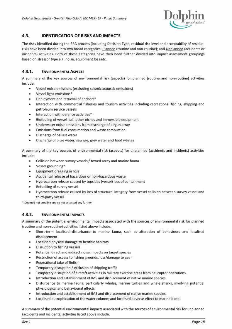
4.3.1. ENVIRONMENTAL ASPECTS
A summary of the key sources of environmental risk (aspects) for planned (routine and non-routine) activities
include:
Vessel noise emissions (excluding seismic acoustic emissions)
Vessel light emissions*
Deployment and retrieval of anchors*
Interaction with commercial fisheries and tourism activities including recreational fishing, shipping and
petroleum service vessels
Interaction with defence activities*
Biofouling of vessel hull, other niches and immersible equipment
Underwater noise emissions from discharge of airgun array
Emissions from fuel consumption and waste combustion
Discharge of ballast water
Discharge of bilge water, sewage, grey water and food wastes
A summary of the key sources of environmental risk (aspects) for unplanned (accidents and incidents) activities
include:
Collision between survey vessels / towed array and marine fauna
Vessel grounding*
Equipment dragging or loss
Accidental release of hazardous or non-hazardous waste
Hydrocarbon release caused by topsides (vessel) loss of containment
Refuelling of survey vessel
Hydrocarbon release caused by loss of structural integrity from vessel collision between survey vessel and
third-party vessel
* Deemed not credible and so not assessed any further
4.3.2. ENVIRONMENTAL IMPACTS
A summary of the potential environmental impacts associated with the sources of environmental risk for planned
(routine and non-routine) activities listed above include:
Short-term localised disturbance to marine fauna, such as alteration of behaviours and localised
displacement
Localised physical damage to benthic habitats
Disruption to fishing vessels
Potential direct and indirect noise impacts on target species
Restriction of access to fishing grounds, loss/damage to gear
Recreational take of finfish
Temporary disruption / exclusion of shipping traffic
Temporary disruption of aircraft activities in military exercise areas from helicopter operations
Introduction and establishment of IMS and displacement of native marine species
Disturbance to marine fauna, particularly whales, marine turtles and whale sharks, involving potential
physiological and behavioural effects
Introduction and establishment of IMS and displacement of native marine species
Localised eutrophication of the water column; and localised adverse effect to marine biota
A summary of the potential environmental impacts associated with the sources of environmental risk for unplanned
(accidents and incidents) activities listed above include:

Dolphin Geophysical - Greater Pĩna Colada MC MSS - EP - Public Summary
Rev 1 Page 19
Injury or fatality to protected marine fauna (cetaceans, marine turtles and whale sharks)
Localised physical damage to benthic habitats
Pollution and contamination of the environment and secondary impacts of marine fauna (e.g. ingestion,
entanglement)
Localised and temporary reduction in water quality due to hydrocarbon contamination
Toxic effects on marine fauna and flora
Localised and temporary reduction in water quality
Direct and indirect effects on commercial and recreational fisheries
4.4. ASSESSMENT OF ENVIRONMENTAL IMPACTS AND RISKS
This section briefly describes the potential risks and impacts that could occur as a result of the proposed activity.
Section 4 details the risk assessment and Section 6 summarises the control measures that will be implemented to
minimise impacts to receptors described herein.
4.4.1. VESSEL NOISE EMISSIONS (EXCLUDING SEISMIC ACOUSTIC EMISSIONS)
Noise emitted from the survey vessel and support / guard vessel(s) (i.e. engines, propellers, hull flow noise -
excluding noise generated by the seismic acoustic source) within the GPC MC MSS polygon may result in incidental
changes in behaviour of marine fauna (primarily cetaceans, whale sharks and marine turtles), such as disturbance,
avoidance or attraction. However, these impacts are likely to be localized and temporary. Furthermore, underwater
noise from the survey vessel is transient, in that the vessel will be moving across large areas rather than
concentrating activities in a small area, and the type of noise is no different to that emitted by the commercial
shipping traffic and fishing vessels operating in these areas.
4.4.2. INTERACTION WITH COMMERCIAL FISHERIES, RECREATIONAL FISHERS, TOURISM, SHIPPING AND
PETROLEUM SERVICE VESSELS
There are a number of commercial fisheries operating within the area of the GPC MC MSS, as well as significant
commercial shipping activity associated with entry to the Port of Dampier, Port Hedland and Barrow Island (Section
2.4.3). The Rowley Shoals (including Mermaid Reef) are a known tourist destination associated with diving, eco-
tourism and fishing. There is the possibility that fishing, tourism and commercial activities will be disrupted by the
physical presence of the seismic and support / guard vessel(s).
Commercial and Recreational Fisheries
Disruption to fisheries in the area could result from:
direct effects of underwater noise disturbance on target fish populations;
indirect effects of underwater noise disturbance on fish prey species;
restriction of access to fishing grounds due to vessel movements and operations;
seismic equipment loss and subsequent interference with fishing gear (entanglement);
loss of fishing gear e.g. buoyed fish traps, cray pots; and
recreational take of finfish species from the survey vessel and support / guard vessel(s).
The MMF, NDSF, PLF, PTMF, WCDSCF and NWSTF may be actively fishing in, or adjacent to the polygon. However,
an analysis of the current fishery closures, depth range of activity, historical fishing effort data, fishing methods (as
outlined in Section 2.4.1.3 and based on consultation feedback (see Section 8) has revealed that although there is a
potential for interaction with commercial fisheries, with proposed mitigation including ongoing consultation, the
potential for interaction is low.
Due to its distance offshore, recreational fishers to the area generally visit through charter boat operators offering
live aboard packages. The main targeted species are marlin and sailfish, as well as tuna, mackerel and trevally. The
best fishing for most species is between August and March. Although charters may be available all year, the majority
commence in September during the best fishing and weather periods. There is the possibility of interaction with
charter operated fishing vessels. However, as the numbers will be limited and likely contained to the waters

Dolphin Geophysical - Greater Pĩna Colada MC MSS - EP - Public Summary
Rev 1 Page 20
immediately around the Rowley Shoals; with proposed mitigation including ongoing consultation, the potential for
interaction is low.
Tourism Operations
Disruption to tourism operations in the area could result from:
direct effects of underwater noise disturbance on divers;
disruption to ‘wilderness character’ of Mermaid Reef and therefore diver/snorkler visual or auditory
experience;
restriction of access to tourism locations due to vessel movements and operations; and
divers exposed to high levels of underwater sound can suffer from dizziness, hearing damage or other
injuries to other sensitive organs, depending on the frequency and intensity of the sound.
The majority of vessels visiting the Rowley Shoals are Charter Boat Operators supporting various activities such as
eco-tourism, diving and recreational fishing and will generally be limited to the waters around the atolls of the
Rowley Shoals, including Mermaid Reef. As seismic activities will be limited to the waters outside the Marine Park
and Mermaid Nature Reserve (a minimum 4 km separation distance) any interaction would likely be limited to
vessels transiting between the shoals and the mainland. Marine Fauna Observers (MFO) as part of general fauna
observations shall look for diving/charter vessels, and survey support/guard vessel(s) shall be used to manage
interactions.
Predicted received SEL at the 250 m contour at Mermaid Reef (9 km from seismic source) is 142 dB re 1uPa2.s,
which is less than noise associated with many powerboats (Anthony et al. 2009) or snapping shrimp and is well below
those recommended for recreational and commercial diving:
Recreational divers: 154 dB (600 - 2500 Hz);
DMAC commercial diver guidelines: 191 dB; and
Predicted received SEL at the Mermaid Reef CMR boundary, which is 4 km from the GPC MC MSS operational area,
is 153 dB. Diving and snorkling is most likely to be undertaken in shallow water on the reef with the view of
observing predominantly site-attached wildlife and experiencing the ‘wilderness character’ of Mermaid Reef.
Consultation with charter boat stakeholders also suggest that no bluewater diving is planned and that maximum
dive depths is 40 m for exceptionally experienced divers (Section 8). Recreational diving is therefore usually
conducted in shallow waters of 40 m or less as this is the depth limit that standard recreational dive certification
allow (www.padi.com). The 40 m contour surrounding Mermaid Reef is more than 11 km from the GPC MC MSS
operational area and noise levels here are predicted to reach 140 dB re 1uPa2.s.
In the event that seismic operations look to extend into the diving season (1 September to 30 November) then a risk
assessment shall be undertaken jointly and SIMOPS plan developed jointly, if required, with individual operators
present on Mermaid Reef. The Diving Medical Advisory Committee guidelines on Safe Diving Distance from Seismic
Surveying Operations have been developed for commercial dive operations that can use underwater audio
communications equipment and that have the potential to come closer than 10 km of a seismic survey. Recreational
divers do not use underwater audio communication equipment and will not come closer than 11 km of the survey
given the distance between the 40 m contour and the GPC MC MSS operational area. Nevertheless, the guidelines
will be adopted for recreational diving.
At any point in time a dive operator can request that the sound source is shut down immediately before and during
dives/snorkel activities if they perceive that the risk to the visual/audio experience of divers will be compromised
and the survey vessel will comply with such a request. Dolphin believes that the negative interaction with tourism
from the GPC MC MSS activity will be managed to ALARP and acceptable levels given the above information and
controls outlined.
Shipping
The survey vessel and towed array represent a potential navigational hazard and other vessels will need to avoid the
survey vessel to prevent vessel collisions, entanglement of/damage to the streamer and other components of the
towed array, and other incidents. The highest potential risk will be during slow speed turning of the survey vessel
during line changes, or when it is moving perpendicular to the normal passage of commercial shipping.
Dolphin Geophysical - Greater Pĩna Colada MC MSS - EP - Public Summary
Rev 1 Page 21
A Safe Navigation Area (SNA) will be in place for the duration of the GPC MC MSS. The extent of this SNA will be
specific to the survey vessel and extent of the towed array. The SNA will cover ~10 km radius from the survey vessel,
to account for the length of the towed streamer array (8,100 m). A support / guard vessel(s) will be used to
implement the SNA if approaching vessels fail to heed navigational warnings (NAVAREA X warnings, Notices to
Mariners [NTM], beacons, lights, radio contact etc.).
4.4.3. BIOFOULING OF VESSEL HULL, OTHER NICHES AND IMMERSIBLE EQUIPMENT
Invasive Marine Species (IMS) are marine plants or animals that have been introduced into a region beyond their
natural range and have the ability to survive, reproduce and establish founder populations. In the case of Dolphin’s
proposed activities during the GPC MC MSS, the key vectors requiring management attention include:
discharge of high risk ballast water taken up at international or domestic sources;
biofouling on vessel hulls and other external niches (e.g. propulsion units, steering gear and thruster
tunnels);
biofouling of vessel internal niches (e.g. sea chests, strainers, seawater pipe work, anchor cable lockers and
bilge spaces etc.); and
biofouling on equipment that routinely becomes immersed in water.
Once introduced IMS can cause serious environmental, social and economic impacts through predation or
displacement of native species. These direct or indirect impacts have the potential to threaten a range of sectors
including commercial fisheries and aquaculture, the tourism industry, human health, shipping and infrastructure
Ballast Water
The Department of Agriculture (DoA) has introduced the mandatory Australian Ballast Water Management
Requirements (DoA, 2008) that are enforced under the Quarantine Act 1908. Under these arrangements all vessels
that have travelled from international waters are obligated to assess and manage their ballast water in accordance
with the AQIS requirements. These arrangements prohibit the discharge of high-risk ballast water within Australian
territorial seas (within 12 nautical miles of Australian territories) including Australian ports. It is also recommended
by AQIS that ballast exchanges be conducted as far as possible away from shore and in water at least 200 m deep.
Biofouling
Under the National Biofouling Management Guidance for the Petroleum Production and Exploration Industry
(Commonwealth of Australia, 2009) a risk assessment approach is recommended to manage biofouling. All vessels
contracted for the GPC MC MSS will have an IMS Risk assessment done prior to arriving in Australia, and all of the
necessary clearances to operate within Australia waters, as required. This includes meeting the biosecurity standards
of DAFF and the DoF, who have significant powers to prevent the arrival and establishment of IMS of concern.
Any vessel or marine infrastructure destined for WA waters is required to meet the aquatic biosecurity standards
set out under the Fisheries Resources Management Act 1994, including a Marine Biosecurity Inspection for the
presence of known and potential IMS to ensure compliance with Regulation 176. Vessels will be coated in an
appropriate antifouling system that is considered suitable for both coastal and deep sea vessels and is compliant
with the International Convention on the Control of Harmful Anti-Fouling Systems on Ships (IMO document
AFS/CONF/26).
4.4.4. UNDERWATER NOISE EMISSIONS FROM DISCHARGE OF AIRGUN ARRAY
Studies relating to the environmental effect of marine seismic surveys have largely focused on the potential effects
to fish stocks and marine mammals from the sound waves associated with the seismic energy source. Concerns have
included:
pathological effects (lethal and sub-lethal injuries) - immediate and delayed mortality and physiological
effects to nearby marine organisms;
behavioural change to populations;

Dolphin Geophysical - Greater Pĩna Colada MC MSS - EP - Public Summary
Rev 1 Page 22
disruptions to feeding, mating, breeding or nursery activities of marine organisms in such a way as to affect
the vitality or abundance of populations;
disruptions to the abundance and behaviour of prey species for marine mammals, seabirds and fish; and
changed behaviour or breeding patterns of commercially targeted marine species, either directly, or
indirectly, in such a way that commercial or recreational fishing activities are compromised.
In relation to cumulative noise levels, an environmental review recently published by the Bureau of Ocean Energy
Management (BOEM 2014) indicated a typical radius for a 160-dB threshold for a large airgun array was no more
than 10 km (BOEM, 2014). Consequently, the implementation of a 40 km geographic spacing between survey vessels
working simultaneously is a very conservative approach, as this would leave a potential 20 km ‘corridor’ between
vessels, rather than the 10 km ‘corridor’ as stated in the BOEM environmental review (BOEM, 2014).
Disturbance to Benthic Invertebrates
Few marine invertebrates have sensory organs that can perceive sound pressure, but many have organs or elaborate
arrays of tactile ‘hairs’ that are sensitive to hydro-acoustic disturbances (McCauley, 1994). These sensory hairs or
organs are collectively known as mechanoreceptors, and crustaceans are particularly well endowed with them. Close
to a seismic source, the mechano-sensory system of many benthic crustaceans will perceive the ‘sound’ of airgun
pulses, but for most species such stimulation would only occur within the near-field or closer, perhaps within
distances of several metres from the source (McCauley, 1994).
A summary of impacts of seismic airguns on marine invertebrates based on literature reviews concludes that “very
limited numbers of experiments were scientifically and reasonably conducted” but the results of nine quantitative
studies showed five cases of immediate (lethal or physical) impacts of seismic airguns on invertebrate species and
four cases of no impacts. One study showed physiological impacts and another showed no physiological impact.
Three cases showed behavioural impacts and one study showed no impact on behaviour.
Disturbance to Bivalve Molluscs
A review of studies (Parry et al. 2002) suggested that molluscs are at risk of damage from seismic airgun noise only
when they are closer than 1-2 m. However, previous studies have also suggested that most effects on invertebrates
without gas-filled cavities are likely to be too subtle to be measured in the field. It would appear that significant
impacts on bivalve molluscs, such as the pearl oyster, from airgun noise emissions will only occur within very short
distances from the source. A conservative estimate for a minimum distance beyond which significant effects are
unlikely, is approximately 10 m, but this will depend on the source dynamics and propagation characteristics of the
area. Benthic environments that may support bivalve molluscs are mostly limited to the reefal areas within the
Rowley Shoals, which are more than 4 km away.
Disturbance to Planktonic Organisms
Except for fish eggs, larvae and other minute planktonic organisms within a few meters of an airgun, no planktonic
organisms are likely to be affected significantly by airgun array discharges (McCauley, 1994). Sound exposure
guidelines published by Popper et al. in 2014 have indicated that for eggs and larvae, SEL (cum) levels >210 dB or
peak > 207 dB may incur mortality or potential mortal injury while animals near have a moderate risk of recoverable
injury or TTS. These predictions are based on work by Bolle et al. (2012) as cited in Popper et al 2014) on pile driving
signals. Modelled SEL levels undertaken by Dolphin are below those purported to induce mortality or potential
mortal injury in eggs or larvae (Popper et al 2014) at the 250m contour and the edge of the Mermaid Reef CMR.
Disturbance to Fish
Potential impacts on fish species related to the operation of survey airgun arrays include behavioural avoidance of
seismic sound sources, temporary threshold shifts (TTS) and pathological trauma or mortality. Indirect effects may
include reduced catches resulting from changes in feeding behaviour and vertical/horizontal distribution (Skalski et
al. 1992).
Behavioural responses to sounds are variable but include:
leaving the area of the noise source (avoidance);
startle/ alarm responses;
spatial changes in schooling behaviour/ swimming patterns; and

Dolphin Geophysical - Greater Pĩna Colada MC MSS - EP - Public Summary
Rev 1 Page 23
changes in depth/ vertical distribution.
These effects are expected to be short-lived, with duration of effect less than or equal to the duration of exposure,
are expected to vary between species and individuals, and be dependent on the properties of received sound (DFO
2004). The ecological significance of such effects is expected to be low, except where they influence reproductive
activity.
Based on existing information, impacts on fish populations (as opposed to individuals) resulting from seismic survey
noise are likely to be restricted to the following:
surveys that take place over protracted periods close to areas important for the purposes of feeding,
spawning or breeding;
surveys that take place over protracted periods close to areas that constitute narrow, restricted migratory
paths; or
populations that cannot move away from operating arrays (e.g., site-attached reef species that experience
short ranges and high sound intensities).
Considering the distribution range of key species in this area, adequate spawning biomass levels, that migratory
routes are not restricted, and distance from any area associated with site-attached species, the impact on fish
populations is considered to be low.
The potential effects of marine seismic surveys have been summarised as part of a detailed environmental
assessment of geophysical exploration for mineral resources on the Gulf of Mexico outer continental shelf (MMS
2004). This assessment concluded that negligible to potentially adverse effects on fish may occur from seismic
surveys. However, these effects were not considered biologically significant due to the following factors:
seismic survey noise may disturb fish and may produce temporary or permanent hearing impairment in
some individuals, but it is unlikely to cause death or life-threatening injury;
seismic surveys are not expected to cause long term or permanent displacement of any listed species from
critical/preferred habitat; and
seismic surveys are not expected to result in destruction or adverse modification of critical or essential fish
habitat.
Dolphin has undertaken vertical acoustic modelling to assess the impacts of the acoustic source on demersal species
or benthic organisms that may habitat the shallower waters of the GPC MC MSS, which has a minimum depth of 160
m. The received SEL will be 190 dB re 1µPa2.s. This level is below the limits Popper et al. (2014) state could result
in recoverable injury or mortality, or potential mortal injury to fish.
Based on the available information regarding active fisheries in the area of the proposed GPC MC MSS, the proposed
survey will have minimal effect on long-term fish abundances. Short-term commercial fish catches may decline in
the exclusion area, but this represents only a small percentage of the total fishing area available, and stocks are
anticipated to return within days. Considering the uncertainty in times and locations of fish spawning areas, and the
limited time of the proposed survey, no additional controls will be implemented to reduce the impacts and risks to
fish stocks during the GPC 3D MSS.
Based on the depths of the waters that the survey is being undertaken; the distance from the polygon boundary to
locations of site-attached species and benthic communities; that pelagic species can swim way from the sound
source; that the sound source is continually moving and the predicted minimal received SEL; the proposed survey
will have minimal effect on individual species or long-term fish abundances. Therefore Dolphin believes that the
impacts to site attached species associated with Mermaid Reef, demersal species that may habitat the shallowest
waters in the survey area (160 m), and pelagic species within and adjacent to the polygon are ALARP and acceptable.
Disturbance to Sharks and Whale Sharks
The available evidence indicates sharks will generally avoid seismic sources and the likely impacts on sharks are
expected to be limited to short-term behavioural responses, possibly including avoidance of the operating airgun
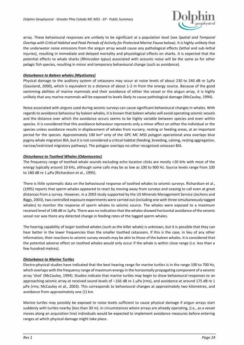
Dolphin Geophysical - Greater Pĩna Colada MC MSS - EP - Public Summary
Rev 1 Page 24
array. These behavioural responses are unlikely to be significant at a population level (see Spatial and Temporal
Overlap with Critical Habitat and Peak Periods of Activity for Protected Marine Fauna below). It is highly unlikely that
the underwater noise emissions from the airgun array would cause any pathological effects (lethal and sub-lethal
injuries), resulting in immediate and delayed mortality and physiological effects on sharks. It is expected that the
potential effects to whale sharks (Rhincodon typus) associated with acoustic noise will be the same as for other
pelagic fish species, resulting in minor and temporary behavioural change (such as avoidance).
Disturbance to Baleen whales (Mysticetes)
Physical damage to the auditory system of cetaceans may occur at noise levels of about 230 to 240 dB re 1µPa
(Gausland, 2000), which is equivalent to a distance of about 1-2 m from the energy source. Because of the good
swimming abilities of marine mammals and their avoidance of either the vessel or the airgun array, it is highly
unlikely that any marine mammals will be exposed to levels likely to cause pathological damage (McCauley, 1994).
Noise associated with airguns used during seismic surveys can cause significant behavioural changes in whales. With
regards to avoidance behaviour by baleen whales, it is known that baleen whales will avoid operating seismic vessels
and the distance over which the avoidance occurs seems to be highly variable between species and even within
species. It is considered that this avoidance behaviour represents only a minor effect on either the individual or the
species unless avoidance results in displacement of whales from nursery, resting or feeding areas, at an important
period for the species. Approximately 100 km² only of the GPC MC MSS polygon operational area overlaps blue
pygmy whale migration BIA, but it is not considered a critical habitat (feeding, breeding, calving, resting aggregation,
narrow/restricted migratory pathway). The polygon overlaps no other recognised cetacean BIA.
Disturbance to Toothed Whales (Odontocetes)
The frequency range of toothed whale sounds excluding echo location clicks are mostly <20 kHz with most of the
energy typically around 10 kHz, although some calls may be as low as 100 to 900 Hz. Source levels range from 100
to 180 dB re 1 µPa (Richardson et al., 1995).
There is little systematic data on the behavioural response of toothed whales to seismic surveys. Richardson et al.,
(1995) reports that sperm whales appeared to react by moving away from surveys and ceasing to call even at great
distances from a survey. However, in a 2003 study supported by the US Minerals Management Service (Jochens and
Biggs, 2003), two controlled exposure experiments were carried out (including one with three simultaneously tagged
whales) to monitor the response of sperm whales to seismic source. The whales were exposed to a maximum
received level of 148 dB re 1µPa. There was no indication that the whales showed horizontal avoidance of the seismic
vessel nor was there any detected change in feeding rates of the tagged sperm whales.
The hearing capability of larger toothed whales (such as the killer whale) is unknown, but it is possible that they can
hear better in the lower frequencies than the smaller toothed cetaceans. If this is the case, in lieu of any other
information, their reactions to seismic survey vessels may be akin to those of the baleen whales. It is considered that
the potential adverse effect on toothed whales would only occur if the whale is within close range (i.e. less than a
few hundred metres).
Disturbance to Marine Turtles
Electro-physical studies have indicated that the best hearing range for marine turtles is in the range 100 to 700 Hz,
which overlaps with the frequency range of maximum energy in the horizontally propagating component of a seismic
array ‘shot’ (McCauley, 1994). Studies indicate that marine turtles may begin to show behavioural responses to an
approaching seismic array at received sound levels of 166 dB re 1 µPa (rms), and avoidance at around 175 dB re 1
µPa (rms; McCauley et al., 2003). This corresponds to behavioural changes at approximately two kilometres, and
avoidance from approximately one (1) km.
Marine turtles may possibly be exposed to noise levels sufficient to cause physical damage if airgun arrays start
suddenly with turtles nearby (less than 30 m). In circumstances where arrays are already operating, (i.e., as a vessel
moves along an acquisition line) individuals would be expected to implement avoidance measures before entering
ranges at which physical damage might take place.

Dolphin Geophysical - Greater Pĩna Colada MC MSS - EP - Public Summary
Rev 1 Page 25
The GPC MC MSS polygon does not overlap any marine turtle biologically important areas, i.e. nesting, foraging or
internesting buffers.
4.4.5. DISCHARGE OF BILGE WATER, SEWAGE, GREY WATER AND FOOD WASTES
Routine discharge of bile water, sewage and food wastes to the ocean will cause a negligible and localised and
temporary increase in nutrient concentrations and reduction in water quality. The total nutrient loading from vessel
operations during surveys in the GPC MC MSS polygon will be insignificant in comparison to the natural daily nutrient
flux that occurs in marine waters within the region. No significant impacts are anticipated because of the minor
quantities involved, localised area of impact, high level of dilution into deep oceanic waters and high
biodegradability/low persistence of the wastes.
4.4.6. COLLISION BETWEEN SURVEY VESSELS / TOWED ARRAY AND MARINE FAUNA
The survey and support / guard vessel(s) may present a potential physical hazard (e.g. animal displacement or vessel
strike) to marine fauna including cetaceans, turtles and whale sharks. Additionally, the tail buoys that are attached
to the end of seismic streamers can represent an entanglement risk for turtles. The impact from vessel interactions
with marine fauna can be as minimal as behavioural changes by the marine fauna to severe impacts such as mortality
resulting from vessel strikes. Support vessel-marine fauna interaction procedures have been prepared to ensure any
interactions between the support vessel and cetaceans, whale sharks and turtles are managed in accordance with
EPBC Regulations 2000. Given the slow operating speed of the survey and support / guard vessel(s) (unless in an
emergency) and the low likelihood of large numbers of animals being present, the potential for vessel strike to
impact significantly on cetacean, whale shark or turtle populations in the polygon is assessed to be low.
4.4.7. EQUIPMENT DRAGGING OR LOSS
The accidental dragging or loss of seismic streamer equipment or vessel grounding has the potential to cause minor
physical damage to benthic habitats and biological communities. However, soft sediment benthic areas relatively
devoid of sensitive habitats and consisting of sandy /silt substrate is the predominant benthic receiving environment
within, and adjacent to, the GPC MC MSS area. The surveys will be operating at depths and distances from emergent
land that preclude any possible contact i.e. vessel is at least 9 km from nearest emergent land, and minimum 160 m
water depth.
In the unlikely event of damage to or loss of a solid seismic streamer, potential environmental effects will be limited
to physical impacts on benthic communities arising from the cable and associated equipment sinking to the seabed.
Seismic streamers and vanes are fitted with pressure-activated, self-inflating buoys that are designed to bring the
equipment to the surface if lost accidentally during a survey. As the equipment sinks it passes a certain water depth
at which point the buoys inflate and bring the equipment back to the surface where it can be retrieved by the support
/ guard vessel(s) or survey vessel workboats.
Dragging of the streamer along the seabed may result in localised physical disturbance of substrates, benthic
habitats and communities. However, given the water depth range across the GPC MC MSS polygon (160-440 m)
and the absence of any shallow waters (<20 m depth) or any emergent features within the polygon, the risk of
significant impacts resulting from equipment dragging or loss is considered to be low. The survey vessel will not
transit the Mermaid Reef CMR or the Rowley Shoals MP with the seismic equipment deployed, as per the Mermaid
Reef CMR transitional management arrangements (DNP, 2000).
4.4.8. ACCIDENTAL RELEASE OF HAZARDOUS OR NON-HAZARDOUS WASTE
The survey and support / guard vessel(s) will store and use a variety of hazardous materials such as paints, cleaning
chemicals and batteries. Both vessels will also produce a variety of other non-hazardous solid and liquid wastes,
including packaging and domestic wastes, such as aluminium cans, bottles, paper and cardboard.
Hazardous Materials
These materials have the potential to adversely impact the marine environment if accidentally released in significant
quantities. Chemicals e.g. solvents and detergents will typically be stored in small containers of 5-25 L capacity and

Dolphin Geophysical - Greater Pĩna Colada MC MSS - EP - Public Summary
Rev 1 Page 26
stored / used in internal areas where any leak or spill would be retained on board and cleaned up in accordance with
the Shipboard Oil Pollution Emergency Plan (SOPEP) and associated spill clean-up procedures. The realistic worst
case volume would be 25 L.
Non-hazardous Materials
These materials could potentially impact the marine environment if accidentally released in significant quantities
resulting in a reduction in water quality and physical impacts on marine fauna, such as becoming entangled in waste
plastics.
4.4.9. HYDROCARBON RELEASE CAUSED BY TOPSIDES (VESSEL) LOSS OF CONTAINMENT
The survey and support / guard vessel(s) store and use small quantities of lubricating oils and hydraulic fluid, which
have the potential to spill if not appropriately managed. Hydraulic fluid may also potentially be spilled from a leak
in hoses or lines on hydraulic equipment such as cranes or winches. The size of potential spills to deck of these
substances are likely to be between 50 and 200 L (0.05 m³ and 0.2 m³) based on expected volumes of fluids available
on deck typically stored in 50 to 200 L steel drums. Storage of these substances aboard the survey vessel would
typically be within a designated storage room or a contained (bunded) area on deck.
In the event a loss to sea does occur, impacts to the marine environment would be minimal, due to the small
potential volumes released, and the fact that spilt hydrocarbons will rapidly evaporate, disperse and weather.
4.4.10. HYDROCARBON RELEASE CAUSED BY VESSEL COLLISION OR AT-SEA REFUELLING
The hazards associated with hydrocarbon spills during the GPC MC MSS (that are considered most credible) are:
on-deck leak or spill of small quantities (between 50 and 200 L) of lubricating oils or hydraulic fluids;
loss of up to 648 L of diesel during at sea refuelling operations, as a result of hose failure;
larger volume (up to 135 m3) loss of diesel from a ruptured fuel storage tank, resulting from vessel-to-vessel
collision.
The accidental discharge of diesel has the potential to cause toxic effects on marine fauna and flora and a localised
reduction in water quality. Potentially affected biota includes seabirds, cetaceans, turtles and whale sharks that may
come into contact with a surface hydrocarbon slicks. If surface slicks or entrained diesel were to contact shallow
waters or emergent features adjacent to the survey polygon, then a range of benthic habitats and communities
could be at risk of impacts. Commercial fishing activities and shipping in the area could also be impacted in the event
of a major diesel spill.
The fuel that will be used during the GPC MC MSS is MGO (marine diesel). All fuel oil tanks are located in the interior
of the vessel, and are separated from the hull either by void spaces (empty tanks) or by tanks for other fluids (fresh
water, water ballast). The largest fuel oil tanks on the Sanco Swift that are closest to the side of the hull have a
maximum capacity of 149.5 m3. In accordance with Sanco Shipping and Dolphin vessel refuelling procedures, these
tanks are never filled to 100% of their capacity—instead they are filled to 90% capacity.
Therefore, in the extremely unlikely (improbable) event of a ruptured fuel oil tank as a result of collision, the
maximum spill size possible would be in the order of 135 m3 of MGO. However, this could only occur in the event
of a rupture of one of the vessels largest MGO tanks and complete loss of all of its contents. The ADIOS2 model was
run using the worst case scenario for an oil spill of MGO (Diesel Fuel Oil, API 37.2) from the largest tank at maximum
capacity of 135 m3 (90% full). Based on the ADIOS2 modelling output, 99% of the slick will have dispersed and
evaporated within about 10 hours, with a potential radius of 14.4 km if occurring in the winter months and 19
hours with a potential radius of 9.1 km if occurring in the summer months.
Mermaid Reef has an outer reef rim, which fully encloses an inner lagoon. Mermaid Reef has no landforms above
high water mark. The reef platform and small sandbank at the northern end of the lagoon are both completely
covered at high water, the latter being dry for only about 1.5 hours either side of low water (DEC / MPRA, 2007).

Dolphin Geophysical - Greater Pĩna Colada MC MSS - EP - Public Summary
Rev 1 Page 27
The small sandbank at the northern end of the lagoon of Mermaid Reef is located within the ZPI for a spill at location
A. Clerke Reef and Imperieuse Reef are too far away to be impacted and so shall not be discussed further.
The ZPI’s for a 135 m3 diesel spill in winter (circle with a radius of 14.4 km) and summer (circle with a radius of 19.1
km) for the GPC MC MSS polygon does not overlap islands that represent defined BIA for any turtle species in the
region - i.e. the emergent features within Mermaid, Clerke and Imperieuse Reefs do not represent a critical habitat
for large numbers of turtles.
Although the northern part of the survey polygon overlaps the edge of the defined BIA (migration) for pygmy blue
whales, and the survey period overlaps the timing of the northward migration of this species in the region, it is
unlikely that significant numbers of animals would be exposed to surface diesel slicks in the event of a major diesel
spill within the very short timeframe prior to natural weathering of these slicks (99% of the slick will have dispersed
and evaporated within about 10 hours in winter and 19 hours in summer).
Given the proximity of the survey polygon to the Rowley Shoals, there is the possibility of some impacts from a major
diesel spill if surface slicks were to contact the waters surrounding the reefs, and enter the lagoons within the reefs,
during periods when charter vessels are visiting the area for fishing, diving and snorkelling activities. Exclusion zones
surrounding spills will reduce access for recreational fishing and snorkelling/diving on intertidal and sub tidal reefs.
Stranding of oil on sandy beaches may impact some tourism activities.
The Rowley Shoals are not known to be key habitat for pearl oysters so any significant presence in the shallower
waters of the Rowley Shoals is not anticipated. Any presence at the Rowley Shoals of adult Pearl Oysters is not likely
to result in viable or significant recruitment from a September spawning event to the nearest active fishing ground
given the distance to Compass Rose (170 km) and the likely maximu drift distance for the duration of the larval
phase being <30km (Hart et al., 2010). Overall, impacts to the POMF are unlikely and minor.
4.5. SUMMARY OF ENVIRONMENTAL RISK ASSESSMENT RESULTS
The Environmental Risk Assessment (ERA) for the GPC MC MSS indicates that the residual environmental impacts
and risks associated with the activity will be reduced to ALARP and are of an acceptable level. The ERA identified 13
sources of environmental risk, seven planned and six unplanned types, which are all assessed as having a Low or
Medium residual risk following implementation of identified control measures.

Dolphin Geophysical - Greater Pĩna Colada MC MSS - EP - Public Summary
Rev 1 Page 28
Table 4.2 presents a summary of the assessed level of residual (post-mitigation) environmental risk associated with
the proposed seismic survey. The environmental aspects of the survey that have the potential to cause significant
environmental effects (Medium or High risk levels) have been determined through an evaluation of the proposed
activity, the surrounding environment, including specific sensitivities and values, and legislative requirements. These
environmental aspects are:
Interaction with commercial fisheries and tourism activities including recreational fishing
Interaction with shipping
Refuelling of survey vessel
Hydrocarbon release caused by loss of structural integrity from vessel collision between survey vessel and
third-party vessel
In this case a number of additional control measures were also assessed, and were found to be not practicable—i.e.,
the cost, time and effort required to implement the measure is grossly disproportionate to the benefit gained. A
summary of the control measures that will be implemented are shown in Section 5.

Dolphin Geophysical - Greater Pĩna Colada MC MSS - EP - Public Summary
Rev 1 Page 29
Table 4.2 -Summary of Environment Risk Assessment for GPC MC MSS
Source of Risk Key Potential Environmental Impacts
Risk Rating
Consequence
Likelihood Residual Risk
Vessel noise emissions (excluding seismic acoustic emissions)
Short-term localised disturbance to marine fauna, such as alteration of behaviours and localised displacement
Slight Unlikely Low
Vessel light emissions Short-term localised disturbance to marine fauna, such as alteration of behaviour and localised displacement
Slight Highly
Unlikely Low
Deployment and retrieval of anchors
Localised physical damage to benthic habitats Slight Unlikely Low
Interaction with commercial fisheries and tourism activities including recreational fishing
Disruption to fishing vessels Potential direct and indirect noise impacts on target species Restriction of access to fishing grounds, loss/damage to gear Recreational take of finfish
Minor Possible Medium
Interaction with shipping Temporary disruption / exclusion of shipping traffic
Minor Possible Medium
Interaction with defence activities
Temporary disruption of aircraft activities in military exercise areas from helicopter operations
Minor Remote Low
Biofouling of vessel hull, other niches and immersible equipment
Introduction and establishment of IMS and displacement of native marine species
Slight Highly
Unlikely Low
Underwater noise emissions from discharge of airgun array
Disturbance to marine fauna, particularly whales, marine turtles and whale sharks, involving potential physiological and behavioural effects
Slight Possible Low
Emissions from fuel consumption and waste combustion
Localised reduction in air quality Greenhouse gas emissions
Slight Highly
Unlikely Low
Discharge of ballast water
Introduction and establishment of IMS and displacement of native marine species
Slight Highly
Unlikely Low
Discharge of bilge water, sewage, grey water and food wastes
Localised eutrophication of the water column; and localised adverse effect to marine biota
Slight Unlikely Low
Collision between survey vessels / towed array and marine fauna
Injury or fatality to protected marine fauna (cetaceans, marine turtles and whale sharks)
Minor Highly
Unlikely Low
Vessel grounding Localised physical damage to benthic habitats Minor Highly
Unlikely Low
Equipment dragging or loss
Localised physical damage to benthic habitats Slight Unlikely Low
Accidental release of hazardous or non-hazardous waste
Pollution and contamination of the environment and secondary impacts of marine fauna (e.g. ingestion, entanglement)
Slight Unlikely Low
Hydrocarbon release caused by topsides (vessel) loss of containment
Localised and temporary reduction in water quality due to hydrocarbon contamination
Slight Unlikely Low
Refuelling of survey vessel
Toxic effects on marine fauna and flora Localised and temporary reduction in water quality Direct and indirect effects on commercial and recreational fisheries
Minor Unlikely Medium
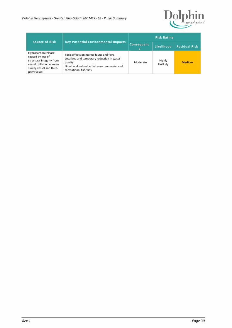
Dolphin Geophysical - Greater Pĩna Colada MC MSS - EP - Public Summary
Rev 1 Page 30
Source of Risk Key Potential Environmental Impacts
Risk Rating
Consequence
Likelihood Residual Risk
Hydrocarbon release caused by loss of structural integrity from vessel collision between survey vessel and third-party vessel
Toxic effects on marine fauna and flora Localised and temporary reduction in water quality Direct and indirect effects on commercial and recreational fisheries
Moderate Highly
Unlikely Medium

Dolphin Geophysical - Greater Pĩna Colada MC MSS - EP - Public Summary
Rev 1 Page 31
5. SUMMARY OF THE CONTROL MEASURES
Table 5.1 - Summary of the Controls and Mitigation Measures
Potential Impacts Control and Mitigation Measures
Prevent adverse impacts from survey and
support / guard vessel noise emissions
on cetaceans, marine turtles and whale
sharks
Interaction between the survey and support / guard vessel(s) and cetaceans, turtles and whale sharks within the polygon will be consistent
with EPBC Regulations 2000 - Part 8 Division 8.1 (Regulation 8.05) - Interacting with cetaceans:
during periods when the survey vessel is transiting the polygon without the seismic array deployed, or during the process of
deployment or retrieval of the array, the vessel will not travel at speeds greater than 6 knots within 300 m of a cetacean, turtle or
whale shark or 150 m of a dolphin (caution zone); and will not approach closer than 100 m from an animal (with the exception of
animals bow riding).
Interaction between vessels (not including a vessel that is towing or retrieving/deploying a seismic array) and cetaceans, turtles and whale
sharks within the polygon will be consistent with the vessel fauna interaction procedure flowchart (Figure 5.2):
vessel will not travel at speeds greater than 6 knots within 300 m of a cetacean, turtle or whale shark
Zero incidents of interference and
negative interactions with commercial or
recreational fishers, tourism or shipping
occur during the survey
Operations of the survey vessel must comply with the following:
International Regulations for Preventing Collisions at Sea 1972 (COLREG);
Standards of Training, Certification & Watchkeeping (STCW) Convention; and
Navigation Act 2012:
Marine Order 21 (Safety of navigation and emergency procedures) 2012;
Marine Order 30 (Prevention of collisions) 2009;
Marine Order 59 (Offshore industry vessel operations) 2011; and
Marine Order 28 (Operations standards and procedures) 2012, specifically:
o standard maritime safety procedures (including radar watch, radio contact, display of navigational beacons and lights)
o standards for watchkeeping
Operations of the survey vessel will be in accordance with Marine Notice 21/2013: Sound navigational practices; and with Marine Notice
4/2012: Safety of Fishing Vessels.
The Australian Maritime Safety Authority (AMSA) Rescue Coordination Centre (RCC) will be advised of the survey details (survey vessel, location,
timing etc.) prior to mobilisation to ensure NAVAREA X warnings can be issued and kept up to date. AMSA RCC will also be notified of survey
completion.
The Australian Hydrographic Service (AHS) will be advised of the survey details (survey vessel, location, timing etc.) not less than two weeks
prior to mobilisation for the promulgation of a Notice to Mariners (NTM) broadcast.
The survey vessel will have an Automatic Identification System (AIS) tracking device installed and operating to aid identification by other vessels.

Dolphin Geophysical - Greater Pĩna Colada MC MSS - EP - Public Summary
Rev 1 Page 32
Mariners will be alerted of survey vessels’ presence and extent of towed array. This includes the display of navigational beacons and lights to
indicate that the vessel has restricted manoeuvrability and the implementation of the Dolphin Geophysical Vessel Communications Protocol
(see Appendix K).
Notification of activity details to relevant stakeholders prior to the survey commencing, including the offer of a seven (7) to ten (10) day forecast
of operations and the promulgation of a Dolphin Geophysical ‘fact sheet’ (minimum one week) prior to the survey commencing containing
specific information of the survey vessels and contact information.
Use of a dedicated guard vessel to manage interactions with stakeholders including commercial fishing vessels, charter vessels and shipping,
during seismic acquisition operations including implementation of the Safe Navigational Area (SNA). The SNA is likely to cover at least a 10 km
radius from the survey vessel, to account for the length of the towed streamer spread.
Use of the smallest possible seismic source - lowest possible total capacity for the airgun array and sail lines in North/South racetrack
configuration.
Lost towed equipment will be relocated and recovered where safe and practicable to do so.
Recreational fishing from the survey vessel will be prohibited.
MFO’s will conduct a pre-start observation (as used for cetaceans, turtles and whale sharks) will include observations for charter vessels
particularly with the aim of determining if there are divers or small boats in the water on the outside of the reef.
If seismic operations occur between 1 September and 30 November and charter vessel operated dive/snorkling tours occur within Mermaid
Reef Nature Reserve during this time, Dolphin will undertake a joint risk assessment and, if required, jointly develop and implement a SIMOPS
plan in consultation with Dive Charter Vessel Operators. The SIMOPS plan will adopt the DMAC guidance including stopping seismic acquisition
all together immediately before and when divers are in the water if requested by the charter operator.
DPaW will be provided a pre-start fact sheet 1 week prior to activities commencing, and a daily seven (7) to ten (10) day forecast of operations
to disseminate to charter boat operators (covering diving and fishing activities) and visitors to the Rowley Shoals.
Zero incidents of introduction of IMS
from ballast water exchange during the
survey
Ballast water discharges for the survey and support / guard vessel(s) must comply with the requirements of the Australian Ballast Water
Management Requirements (as enforced under the Quarantine Act 1908 [Section 27A]; and Quarantine Regulations 2000):
no discharge of high-risk ballast water within Australian territorial seas (within 12 nautical miles of WA coastline) including any ports;
and
completion of Department of Agriculture Ballast Water Management Summary (BWMS) forms for any ballast water discharge in
Australian waters.
The Ballast Water Management Plan for the survey and support / guard vessel(s) must comply with:
Regulation B-1 of the International Convention for the Control and Management of Ship’s Ballast Water and Sediments 2004
and should have been prepared in accordance with:
the IMO Guidelines for Ballast Water Management and the Development of Ballast Water Management Plans (IMO Resolution
MEPC.127(53)

Dolphin Geophysical - Greater Pĩna Colada MC MSS - EP - Public Summary
Rev 1 Page 33
Whilst in Australian waters, the survey and support / guard vessel(s) must operate in accordance with the conditions detailed in the “Approval
to Berth” issued by DoA, and submitted a Quarantine Pre-arrival Report (QPAR).
Zero incidents of introduction of IMS
from biofouling of survey vessel hull,
other niches and immersible equipment
during the survey
The risks of introducing IMS via biofouling into WA waters and ports must be managed in accordance with marine pest management guidelines
(as enforced under the WA Fish Resources Management Act 1994; and Fish Resources Management Regulations 1995) for the survey and
support / guard vessel(s):
immersible equipment and the survey vessel hull, sea chests and other niches must be ‘clean’ before the survey vessel enters WA
waters and ports
The suspected or confirmed presence of any marine pests or disease must be reported within 24 hours by email
([email protected]) or telephone (FishWatch tel: 1800 815 507).
o This includes any organism listed on the WA Prevention List of Introduced Marine Pests, and any other non-indigenous
organism, that demonstrates invasive characteristics
Application of DoA guideline that ballast exchanges be conducted as far as possible away from shore and in water at least 200 m deep for the
survey and support / guard vessel(s).
Application of guidelines detailed in the National Biofouling Management Guidance for the Petroleum Production and Exploration Industry,
and in the IMO Guidelines for the Control and Management of Ships' Biofouling to Minimize the Transfer of Invasive Aquatic Species for the
survey and support / guard vessel(s).
The survey and support / guard vessel(s) will have had a recent dry dock, IMS inspection or antifoulant application prior to mobilising to
Australian waters.
If the survey vessel and / or support / guard vessel(s) (s) has to leave Australian waters before completion of the survey, they will be required
to undergo a further IMS inspection and cleaning (if required), prior to re-entering Australian waters to complete the survey.
Prevent adverse noise impacts on
whales, turtles, and whale sharks from
discharge of the airgun array
Operation of the seismic source at all times during the survey must comply with all requirements of the EPBC Act Policy Statement 2.1 -
Interactions between offshore seismic activities and whales Part A Standard Management Procedures (DEWHA 2008b & 2008c), including:
precaution zones (Observation zone: 3 km+; Low power zone: 2 km; and Shut-down zone: 500 m)
all of the Part A Standard Management Procedures will be applied for whale sharks as well as for whales.
Operation of the seismic source within the polygon at all times will comply with the following EPBC Act Policy Statement 2.1 Part B Additional
Management Procedures:
two dedicated Marine Fauna Observers (MFO) on the survey vessel for duration of the survey
Operation of the seismic source within the biologically important areas during the peak periods for migration of pygmy blue whales:
northbound 1 May to 30 June, and
southbound 1 October to 15 December
Must comply with the following EPBC Act Policy Statement 2.1 Part B Additional Management Procedures:
application of increased precaution zones (Observation zone: >3 km; Shut-down zone: 2 km)
application of an increased Pre Start-up Visual Observation of 45 minutes, rather than 30 minutes.

Dolphin Geophysical - Greater Pĩna Colada MC MSS - EP - Public Summary
Rev 1 Page 34
The increased pre start-up visual observation period is to allow for the possibility of longer dive times for whales, i.e. the time between surfacing
events is longer for animals that have longer down times or could be potentially be feeding
For pygmy blue whales, if during operation of the seismic source:
outside of the migration BIA; or
outside the abovementioned pygmy blue whale peak periods,
there have been 3 or more whale instigated power-downs or shut-downs in the preceding 48 hour period then the following measures shall
be implemented:
increased precaution zones (Observation zone: >3 km; Shut-down zone: 2 km); and
increased Pre Start-up Visual Observation of 45 minutes
For humpback whales, if during operation of the seismic source there have been 3 or more humpback whale instigated power-downs or shut-
downs in the preceding 48 hour period then the following measures shall be implemented:
• increased precaution zones (Observation zone: >3 km; Shut-down zone: 2 km); and
• increased Pre Start-up Visual Observation of 45 minutes
Operation of the seismic source within the whale shark BIA (1 August - 31 October) must comply with the following:
two dedicated Marine Fauna Observers (MFO) on the survey vessel for duration of the survey
undertake visual observations for whale sharks at least 10 minutes before the commencement of soft start procedures; and
application of a 500 m shut-down zone for whale sharks
Use of the smallest possible seismic source - 4,100 in3 - lowest possible total capacity for the airgun array (EPS #11).
Survey vessel personnel (marine and seismic) provided with pre-survey induction on EPBC Act Policy Statement 2.1 requirements.
Communication with any geophysical contractors planned or proposed to operate concurrently in the vicinity of the GPC MC MSS to agree
upon, and implement, a minimum separation distance of 40 km between their survey vessel and the MV Sanco Swift.
Pre-survey and during survey (as part of auditing arrangements) review of the NOPSEMA submissions website and available and contemporary
data on whales will be undertaken prior to activities commencing
No vessel or equipment shall enter the waters of the Mermaid Reef CMR or Rowley Shoals Marine Park
All activities that fall within the scope of this EP shall be limited to the GPC – Reduced Scope Polygon
Zero incidents of non-compliant
discharges of bilge water, sewage and
food wastes within the polygon during
the survey
Bilge water discharges (machinery space bilges) from the survey and support / guard vessel(s) must comply with the requirements of:
MARPOL Annex I - Oil
Protection of the Sea (Prevention of Pollution from Ships) Act 1983 - Section 9
Survey vessel - bilge water discharges can occur only if:
the vessel has an IMO approved / MARPOL compliant oily water separator (International Oil Pollution Prevention Certificate [IOPPC])
the vessel is proceeding en route (i.e. is not stationary); and
oil content less than 15 parts per million (ppm); and
oil discharge monitoring and control system and oil filtering equipment are operating

Dolphin Geophysical - Greater Pĩna Colada MC MSS - EP - Public Summary
Rev 1 Page 35
Support vessel(s):
oil and all oily mixtures must be retained aboard for onshore disposal
or: - the vessel is proceeding en route; and has in operation an IMO approved / MARPOL compliant oily water separator that ensures
oil content less than 15 ppm
All bilge water contaminated with chemicals must be contained and disposed of onshore, except if the chemical is demonstrated to have a low
toxicity (as determined by the relevant Material Safety Data Sheet; MSDS)
Sewage discharges from the survey and support / guard vessel must comply with the requirements of:
MARPOL Annex IV - Sewage
Protection of the Sea (Prevention of Pollution from Ships) Act 1983 - Section 26D
Marine Order 96 (Marine pollution prevention — sewage) 2013
Comminuted and disinfected sewage can be using an IMO approved / MARPOL compliant sewage treatment plant (International Sewage
Pollution Prevention Certificate [ISPPC]) can be discharged if:
the vessel is >3 nm from nearest land; and
sewage originating from holding tanks is discharged at a moderate rate (as defined in Marine Order 96) while the vessel is proceeding
en route at a speed not less than 4 knots
Sewage that is not comminuted or disinfected can be discharged if:
the vessel is >12 nm from nearest land; and
sewage originating from holding tanks is discharged at a moderate rate (as defined in Marine Order 96) while the vessel is proceeding
en route at a speed not less than 4 knots
Food waste discharges from vessels must comply with the requirements of:
MARPOL Annex V - Garbage
Protection of the Sea (Prevention of Pollution from Ships) Act 1983 - Section 26F
Marine Order 95 (Marine pollution prevention - garbage) 2013
Food wastes can be discharged from the survey and support / guard vessel(s) if:
it is comminuted or ground to a particle size <25 mm
the vessel is en route
the discharge takes place as far as practicable from the nearest land, but in any case, ≥ 3 nm from the nearest land
Food wastes that are not comminuted or ground can be discharged if:
the vessel is en route
the discharge takes place as far as practicable from the nearest land, but in any case, ≥ 12 nm from the nearest land
Operations of the survey and support / guard vessel will be in accordance with Marine Notice 6/2012: Revised Garbage Discharge Regulations
for Ships
Compliance will be in accordance with Marine Notice 6/2012: Revised Garbage Discharge Regulations for Ships.

Dolphin Geophysical - Greater Pĩna Colada MC MSS - EP - Public Summary
Rev 1 Page 36
Collision between Survey Vessels /
Towed Array and Marine Fauna
Any incidents of vessel or towed array collision with cetaceans, turtles and whale sharks must be reported as reportable incidents for the
activity, in accordance with:
Offshore Petroleum and Greenhouse Gas Storage (Environment) Regulations 2009 - Regulation 26 (see Section 7.3.3)
Interaction with marine fauna:
measures to minimise the likelihood of vessel collision with marine fauna: see EPS # 2
Operations of the survey and support / guard vessel(s) will be in accordance with Marine Notice 12/2011: Minimising the risk of ships colliding
with cetaceans, specifically that any incident of collision shall be reported to DoE
Streamer tail buoys either of a design that does not represent a turtle entrapment threat, or fitted with turtle guards
Zero incidents of physical damage to
benthic habitats and communities from
vessel grounding, dragging or loss of the
streamer and associated equipment
No vessel or equipment shall enter the waters of the Mermaid Reef CMR or Rowley Shoals Marine Park
Vessels will use approved navigation systems and depth sounders.
Streamers equipped with pressure-activated, self-inflating buoys designed to bring the equipment to the surface if lost accidentally.
Use of solid streamers, rather than fluid-filled streamers.
Steamers and associated equipment shall be checked/inspected prior to use.
Lost towed equipment will be relocated and recovered where safe and practicable to do so.
Zero incidents of accidental release of
hazardous or non-hazardous material to
the sea from the survey and support /
guard vessel(s)
Handling of hazardous wastes aboard the survey and support / guard vessel(s) must comply with the requirements of:
MARPOL Annex III - Noxious Liquid Substances
Protection of the Sea (Prevention of Pollution from Ships) Act 1983 - Section 26AB
Marine Order 94 (Marine pollution prevention - packaged harmful substances) 2014
Marine Order 95 (Marine pollution prevention - garbage) 2013
Handling of non-hazardous wastes (garbage) aboard the survey and support / guard vessel(s) must comply with the requirements of:
MARPOL Annex V - Garbage
Protection of the Sea (Prevention of Pollution from Ships) Act 1983 - Section 26F
Marine Order 95 (Marine pollution prevention - garbage) 2013
Operations of the survey and support / guard vessel(s) will be in accordance with Marine Notice 6/2012: Revised Garbage Discharge Regulations
for Ships.
Application of garbage, solid and liquid wastes handling and disposal requirements:
No discharge of plastics or plastic products of any kind from survey or support / guard vessel
No discharge of domestic wastes or maintenance wastes from survey or support / guard vessel
All waste receptacles aboard survey and support / guard vessel covered with tightly fitting, secure lids to prevent any solid wastes
from blowing overboard
All solid, liquid and hazardous wastes (other than bilge water, sewage and food wastes) will be incinerated or compacted (if possible)
and stored in designated areas and sent ashore for recycling, disposal or treatment

Dolphin Geophysical - Greater Pĩna Colada MC MSS - EP - Public Summary
Rev 1 Page 37
Hydrocarbons located above deck stored with some form of secondary containment to contain leaks or spills (e.g. bund, containment
pallet, transport packs)
Correct segregation of solid and hazardous wastes
Zero incidents of release of hydrocarbons
to the marine environment resulting
from spill to deck.
Control measures to prevent the release of hydrocarbons to the sea resulting from spill to deck aboard the survey and support / guard vessels
must comply with the requirements of:
MARPOL Annex I - Oil
Protection of the Sea (Prevention of Pollution from Ships) Act 1983 - Section 9
Marine Order 91 (Marine pollution prevention — oil) 2014
The survey vessel must have a Shipboard Oil Pollution Emergency Plan (SOPEP) in place that complies with the requirements of:
Regulation 37 of MARPOL Annex I
Marine Order 91 (Marine pollution prevention — oil) 2014
The survey vessel must have a valid International Oil Pollution Prevention Certificate (IOPPC]) applicable to vessel class
Storage:
Any hydrocarbon storage on deck of the survey vessel must be designed and maintained to have at least one barrier (i.e. form of
bunding) to contain and prevent deck spills entering the sea. This can include containment lips on deck (primary bunding) and/or
secondary containment measures (bunding, containment pallet, transport packs, absorbent pad barriers) in place
Equipment:
Equipment located on deck utilising hydrocarbons (e.g. cranes, winches or other hydraulic equipment) will have as a minimum
primary bunding (i.e. deck edge lips or up-stands) to prevent loss of hydrocarbons to the sea
Equipment located on deck utilising hydrocarbons (e.g. cranes, winches or other hydraulic equipment) will be maintained to reduce
risk of loss of hydrocarbon containment to the sea. Ongoing maintenance will be accordance with the planned maintenance system
(PMS) for the survey vessel.
Fuel day tank fitted with an overflow routed to a containment tank to prevent spills if overfilled.
Remote manually operated shut-down devices for pumps; mechanical closure devices are fitted to vents.
Spill Response:
The survey vessel SOPEP will be in the prescribed the format described in Guidelines for the Development of Shipboard Oil Pollution
Emergency Plans, adopted by IMO as Resolution MEPC.54(32)
A SOPEP drill will be conducted in Australian waters between the survey vessel’s arrival off the WA coastline and the commencement
of the GPC MC MSS
A further two SOPEP drills will be conducted during the course of the survey
All drills will be reported as per MARPOL Annex I (Regulation 15) requirements (see Appendix C) and reviewed as part of the ongoing
monitoring and improvement of emergency control measures
Spill response bins/kits are maintained and located in close proximity to hydrocarbon storage areas and deck equipment / bunkering
areas for use to contain and recover deck spills
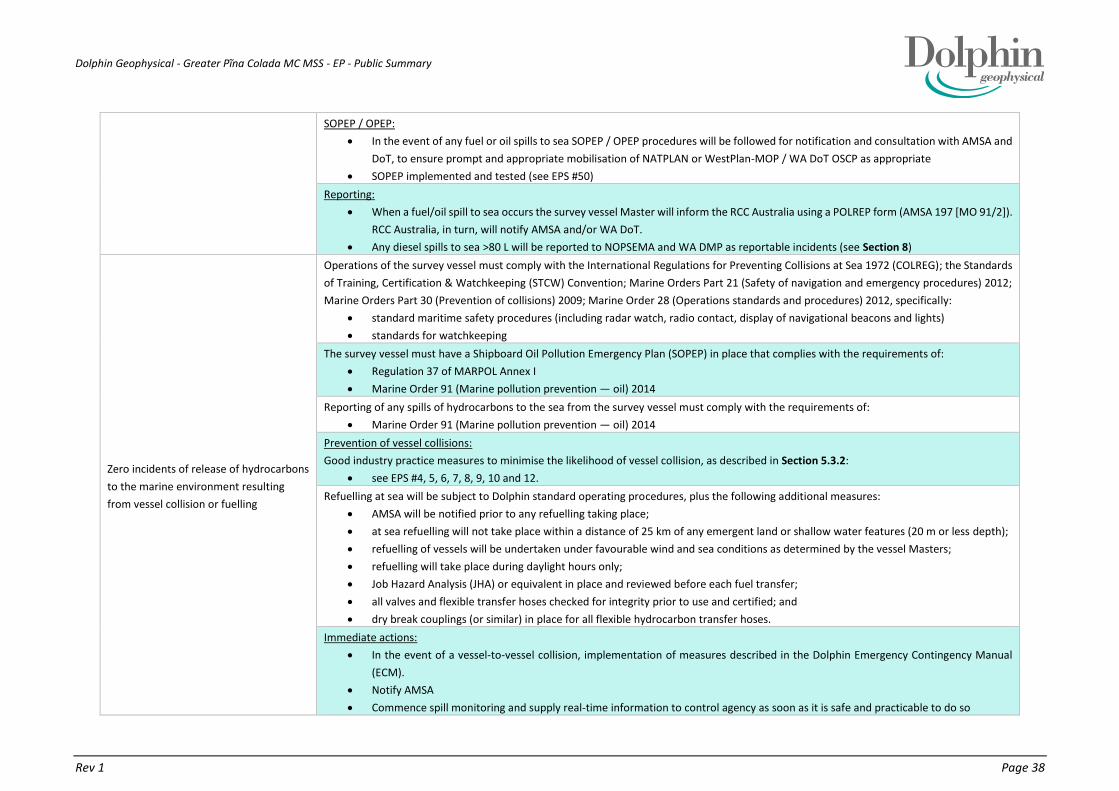
Dolphin Geophysical - Greater Pĩna Colada MC MSS - EP - Public Summary
Rev 1 Page 38
SOPEP / OPEP:
In the event of any fuel or oil spills to sea SOPEP / OPEP procedures will be followed for notification and consultation with AMSA and
DoT, to ensure prompt and appropriate mobilisation of NATPLAN or WestPlan-MOP / WA DoT OSCP as appropriate
SOPEP implemented and tested (see EPS #50)
Reporting:
When a fuel/oil spill to sea occurs the survey vessel Master will inform the RCC Australia using a POLREP form (AMSA 197 [MO 91/2]).
RCC Australia, in turn, will notify AMSA and/or WA DoT.
Any diesel spills to sea >80 L will be reported to NOPSEMA and WA DMP as reportable incidents (see Section 8)
Zero incidents of release of hydrocarbons
to the marine environment resulting
from vessel collision or fuelling
Operations of the survey vessel must comply with the International Regulations for Preventing Collisions at Sea 1972 (COLREG); the Standards
of Training, Certification & Watchkeeping (STCW) Convention; Marine Orders Part 21 (Safety of navigation and emergency procedures) 2012;
Marine Orders Part 30 (Prevention of collisions) 2009; Marine Order 28 (Operations standards and procedures) 2012, specifically:
standard maritime safety procedures (including radar watch, radio contact, display of navigational beacons and lights)
standards for watchkeeping
The survey vessel must have a Shipboard Oil Pollution Emergency Plan (SOPEP) in place that complies with the requirements of:
Regulation 37 of MARPOL Annex I
Marine Order 91 (Marine pollution prevention — oil) 2014
Reporting of any spills of hydrocarbons to the sea from the survey vessel must comply with the requirements of:
Marine Order 91 (Marine pollution prevention — oil) 2014
Prevention of vessel collisions:
Good industry practice measures to minimise the likelihood of vessel collision, as described in Section 5.3.2:
see EPS #4, 5, 6, 7, 8, 9, 10 and 12.
Refuelling at sea will be subject to Dolphin standard operating procedures, plus the following additional measures:
AMSA will be notified prior to any refuelling taking place;
at sea refuelling will not take place within a distance of 25 km of any emergent land or shallow water features (20 m or less depth);
refuelling of vessels will be undertaken under favourable wind and sea conditions as determined by the vessel Masters;
refuelling will take place during daylight hours only;
Job Hazard Analysis (JHA) or equivalent in place and reviewed before each fuel transfer;
all valves and flexible transfer hoses checked for integrity prior to use and certified; and
dry break couplings (or similar) in place for all flexible hydrocarbon transfer hoses.
Immediate actions:
In the event of a vessel-to-vessel collision, implementation of measures described in the Dolphin Emergency Contingency Manual
(ECM).
Notify AMSA
Commence spill monitoring and supply real-time information to control agency as soon as it is safe and practicable to do so
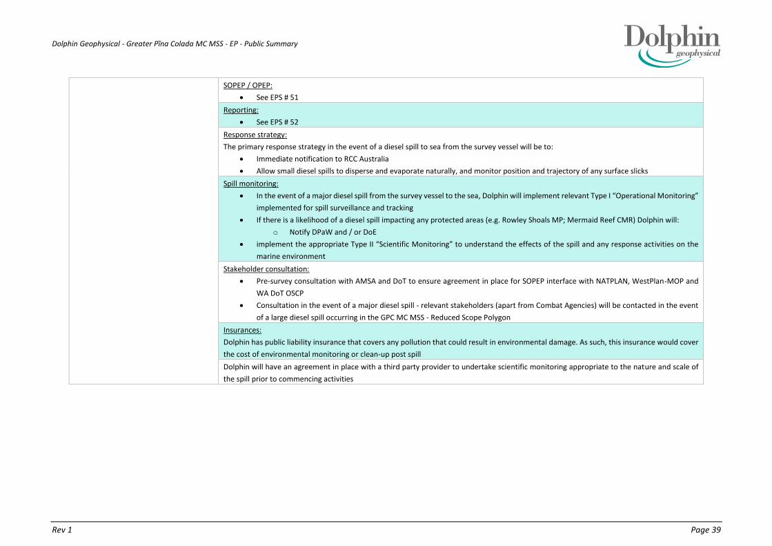
Dolphin Geophysical - Greater Pĩna Colada MC MSS - EP - Public Summary
Rev 1 Page 39
SOPEP / OPEP:
See EPS # 51
Reporting:
See EPS # 52
Response strategy:
The primary response strategy in the event of a diesel spill to sea from the survey vessel will be to:
Immediate notification to RCC Australia
Allow small diesel spills to disperse and evaporate naturally, and monitor position and trajectory of any surface slicks
Spill monitoring:
In the event of a major diesel spill from the survey vessel to the sea, Dolphin will implement relevant Type I “Operational Monitoring”
implemented for spill surveillance and tracking
If there is a likelihood of a diesel spill impacting any protected areas (e.g. Rowley Shoals MP; Mermaid Reef CMR) Dolphin will:
o Notify DPaW and / or DoE
implement the appropriate Type II “Scientific Monitoring” to understand the effects of the spill and any response activities on the
marine environment
Stakeholder consultation:
Pre-survey consultation with AMSA and DoT to ensure agreement in place for SOPEP interface with NATPLAN, WestPlan-MOP and
WA DoT OSCP
Consultation in the event of a major diesel spill - relevant stakeholders (apart from Combat Agencies) will be contacted in the event
of a large diesel spill occurring in the GPC MC MSS - Reduced Scope Polygon
Insurances:
Dolphin has public liability insurance that covers any pollution that could result in environmental damage. As such, this insurance would cover
the cost of environmental monitoring or clean-up post spill
Dolphin will have an agreement in place with a third party provider to undertake scientific monitoring appropriate to the nature and scale of
the spill prior to commencing activities

Dolphin Geophysical - Greater Pĩna Colada MC MSS - EP - Public Summary
Rev 1 Page 40
6. SUMMARY OF THE RESPONSE ARRANGEMENTS IN THE OIL POLLUTION EMERGENCY PLAN
6.1. OIL POLLUTION EMERGENCY PLAN
The Oil Pollution Emergency Plan (OPEP) for the proposed GPC MC MSS, taking into account the nature and scale of
the activity and the potential spill risks involved (see above) comprises components of the survey vessel SOPEP that
manage the environmental impacts of a spill, supported as required by applicable established, statutory OPEPs (e.g.
NATPLAN, WestPlan MOP, WA DoT OSCP). In summary, the following plans are in place as a contingency in the
unlikely event of an oil spill, which as a whole, represent the OPEP for this activity:
Survey vessel SOPEP - deals with spills which are either contained on the vessel or which can be dealt with
from / by the vessel.
National Plan for Maritime Emergencies (NATPLAN): Australian Maritime Safety Authority (AMSA) - is the
Jurisdictional Authority (JA) and Control Agency (CA) for spills from vessel which affect Commonwealth
waters, i.e. outside of 3 nm from the coast (AMSA, 2014b).
WA State Emergency Management Plan for Marine Oil Pollution (WestPlan-MOP) and Department of
Transport (DoT) Oil Spill Contingency Plan (OSCP) - deals with spills from the vessels which affect WA State
waters (AMSA, 2011).
6.2. VESSEL SOPEP
The survey vessels’ Shipboard Marine Pollution Emergency Plan Manual (SMPEP) plan constitutes the vessels’
SOPEP, which has been prepared in accordance with the IMO guidelines for the development of shipboard oil
pollution emergency plans (resolution MEPC.54(32) as amended by resolution MEPC.86(44)), includes emergency
response arrangements and provisions for testing the SOPEP (oil pollution emergency drills), as required under
Regulations 14(8AA), 14(8A) and 14(8B) to 14(8E) of the Environment Regulations
6.2.1. DRILLS AND TRAINING
A test of the oil spill emergency response arrangements will be conducted prior to commencement of survey
activities. A Standard Operating Procedure (SOP) for the survey vessel is to undertake a minimum of four scheduled
drills per annum. If response arrangements are significantly amended, testing of the updated response
arrangements shall occur. The components of the Sanco Swift SOPEP for managing environmental impacts of a spill
are included in Appendix C of the EP.
All drill tests will be reported as per MARPOL Annex I (Regulation 15) requirements and reviewed after each drill as
part of the ongoing monitoring and improvement of emergency control measures. Identified improvements or
recommendations shall be addressed as outlined in Section 7. The objective of testing is to ensure that the vessel
SOPEP is current and applicable (including contact details) for dealing with a spill specific to the nature and location
associated with the GPC MC MSS - Reduced Scope Polygon.
In compliance with Regulation 14(4) and 14(5) a designated Oil Pollution Prevention Team (OPPT) will be trained to
ensure they are familiar with their tasks and the equipment in the event of an oil spill.
Implementation and testing of the survey vessels’ SOPEP, plus adherence to the additional spill response and
reporting measures will enable Dolphin to demonstrate that environmental risks from fuel and oil spills during the
proposed survey have been reduced to ALARP.

Dolphin Geophysical - Greater Pĩna Colada MC MSS - EP - Public Summary
Rev 1 Page 41
6.3. EMERGENCY RESPONSE ARRANGEMENTS
The survey vessel Master will initiate the vessel SOPEP and first strike actions as outlined within it.
Due to the nature and scale of the activity, credible spill scenarios and characteristics of diesel, the initial response
to any spill will be to monitor and evaluate. The preferred strategy for diesel spills will be to allow small spills to
disperse and evaporate naturally, and monitor the position and trajectory of any surface slicks. Physical break up
(using prop wash from the support / guard vessel(s)) by repeated transits through the slick may be considered for
larger slicks (following consultation with the Combat Agency - AMSA or DoT).
Priority actions in the event of a fuel or oil spill are to make the area safe and to stop the leak and ensure that further
spillage is not possible. All deck spills aboard vessel(s) will be cleaned-up immediately, using appropriate equipment
from the on board spill response kits (e.g., absorbent materials etc.) to minimise any likelihood of discharge of spilt
hydrocarbons or chemicals to the sea. A planned maintenance system (PMS) will be implemented on the survey
vessel, to ensure that all equipment used during operations is in full working order, and does not represent a
hydrocarbon spill risk.
6.3.1. COMMONWEALTH WATERS
For Commonwealth waters, initial actions will be undertaken by the survey vessel with subsequent actions
determined in consultation with the regulatory authorities (AMSA) under NATPLAN, having regard to the potential
impacts posed by the spill. AMSA has indicated that it does not require titleholders to directly consult on OPEPs for
seismic surveys or those addressing the operations of offshore supply vessels (AMSA, 2014a). Such operations are
already covered by existing NATPLAN arrangements. AMSA is the responsible Combat Agency (CA) for oil spills from
vessels within the Commonwealth jurisdiction and will respond in accordance with its Marine Pollution Response
Plan as approved by the AMSA Executive. Upon notification of an incident, AMSA will assume control of the incident
(AMSA, 2014b).
6.3.2. STATE WATERS
If surface slicks appear likely to enter WA State waters (i.e. adjacent to the Rowley Shoals) then subsequent actions
will be determined in consultation with the DoT under WestPlan-MOP and the OSCP. The DoT is the designated
Hazard Management Agency (HMA) for oil spills from vessels within the WA State jurisdiction.
6.3.3. TYPE 1 OPERATIONAL MONITORING
In the event of an accidental event that resulted in a diesel spill to the waters surrounding the survey or support /
guard vessel(s), Dolphin will be responsible for undertaking Type I “Operational Monitoring” (unless AMSA as control
agency directs otherwise) that would have the primary objective of spill surveillance and tracking. This monitoring
will be implemented to:
determine the extent and character of a spill;
track the movement and trajectory of surface diesel slicks;
identify areas/ resources potentially affected by surface slicks; and
determine sea conditions/ other constraints.
This monitoring will enable the survey Vessel Master to provide the necessary information to the relevant Combat
Agency (AMSA or DoT) via a POLREP form to determine and plan appropriate response actions under NATPLAN (if
this plan is activated). Operational monitoring and observation in the event of a spill will inform an adaptive spill
response and scientific monitoring of relevant key sensitive receptors. In addition, provisions for real-time oil spill
monitoring can be undertaken by a third party provider such as RPS- Applied Science Associates or Cardno, or by
AMSA.
This Type I monitoring will be restricted to daylight hours only, when surface slicks will be visible from the vessel(s),
(or via aerial surveillance if available). The information gathered from this monitoring will be passed on to AMSA, via

Dolphin Geophysical - Greater Pĩna Colada MC MSS - EP - Public Summary
Rev 1 Page 42
the POLREP form, but also via ongoing SITREP reports following the initial spill notification to RCC Australia. Dolphin
believe that the arrangements in place are ALARP and acceptable.
6.3.4. TYPE II SCIENTIFIC MONITORING
ADIOS2 spill modelling indicates that surface slicks, and possibly entrained oil, from an MGO spill of 135 m3 may
contact Bedwell and Cunningham islands and associated shallow water environments within the Rowley Shoals
Marine Park. However, if this scenario occurs, Dolphin will work with the relevant stakeholders to develop and
implement appropriate Type II “Scientific Monitoring” to understand the effects of the spill and any response
activities on the marine environment. This scientific monitoring will have a focus on relevant environmental and
social values and sensitive receptors.
Relevant stakeholders may include, but not be limited to, the following:
Combat Agency (WA DoT);
WA Environmental Protection Authority (EPA);
WA Conservation and Parks Commission (CPC);
WA Department of Parks and Wildlife (DPaW);
NOPSEMA;
appropriate marine research and monitoring organisations, such as:
WA Marine Science Institution (WAMSI);
Australian Institute of Marine Science (AIMS);
UWA Oceans Institute; and
environmental consultancy companies with appropriate expertise and experience in hydrocarbon
spill monitoring
marine contractors able to provide appropriate vessels for inshore/shallow water work in the Rowley
Shoals; and
key marine users in these protected areas.
This scientific monitoring will focus on a number of key environmental and social values and sensitive receptors,
including (but not limited to):
sediment and water quality, particularly for the pristine waters of the Rowley Shoals and Mermaid Reef;
benthic primary producer habitat (BPPH):
coral reef communities;
macroalgal and seagrass communities; and
rocky shore/intertidal reef platform communities;
sub tidal soft-bottom communities;
whales;
whale sharks;
turtles
seabirds;
finfish;
benthic invertebrates;
commercial and recreational fishing; and
tourism.
Dolphin has financial assurance policies in place. Such as, Protection and Indemnity (P&I) insurance which is subject
to the GARD Club rules covering environmental liability. i.e. the costs of any Type I operational monitoring and Type
II scientific monitoring required in the event of a large hydrocarbon spill resulting from its’ activities, or required to
cover the costs of any clean-up or remediation activities following a spill. These policies cover activities in Australian
Commonwealth and State/Territory waters, including the GPC MC MSS.

Dolphin Geophysical - Greater Pĩna Colada MC MSS - EP - Public Summary
Rev 1 Page 43
6.3.5. REPORTING, MAINTENANCE AND REVIEW
Any fuel or oil spills aboard either the survey or support / guard vessel(s) must be reported to Dolphin via the internal
Dolphin Event Reporting Management. In the event of spillage of any oil or diesel spills to the sea, AMSA or DoT will
be notified by the survey vessel Master immediately (via RCC Australia using a POLREP form) to ensure prompt and
appropriate mobilisation of relevant response plans. Any significant spills (greater than 80 L) will be reported to
NOPSEMA by Dolphin, as reportable incidents.
A planned maintenance system (PMS) will be implemented on the survey and support / guard vessel(s), to ensure
that all equipment used during operations is in full working order, and does not represent a hydrocarbon spill risk.
Stocks of absorbent materials aboard the survey vessel will be checked for their adequacy and replenished as
necessary prior to the commencement of activities.
The OPEP will be regularly reviewed to ensure it is appropriate to the nature and scale of the activities within its
scope and to ensure maintenance of the response capability and the operator’s preparedness. In compliance with
Regulation 14(8AA) the OPEP will be continuously reviewed and kept up-to-date to ensure new information or
improved technology can be incorporated as specifies in the SOPEP.

Dolphin Geophysical - Greater Pĩna Colada MC MSS - EP - Public Summary
Rev 1 Page 44
7. SUMMARY OF THE ARRANGEMENTS FOR ONGOING MONITORING OF THE TITLEHOLDERS PERFORMANCE
The following arrangements will be established to review environmental performance of the activity:
A summary of the EPO, EPS and MC for the activity (ECR) will be distributed aboard the survey vessel. These
will be monitored on a regular basis, by the SEA via mechanisms such as:
Pre-start vessel inspection will be undertaken at the project mobilisation stage by the SEA. If a support /
guard vessel(s) is mobilised from another port, an environmental advisor will visit the vessel prior to the
survey start to conduct the initial inspection.
Weekly inspections completed by SEA. Support / guard vessel(s) will be visited when possible at crew
changes or via small boat transfers in the operational area. The SEA will check the NOPSEMA website for
new surveys as per environmental performance standard #66.
An inspection(s) of the vessels will be carried out before or during the activity to ensure that procedures
and equipment for managing routine discharges and emissions are in place to ensure compliance with the
EP.
A test of the oil spill emergency response arrangements will be conducted during the mobilisation phase of
the survey (unless a test has already been undertaken in Australian waters within a month prior to
mobilisation) to ensure vessel SOPEP is current and applicable.
Any non-conformances shall be reported, tracked and closed-out.
Dolphin Management will review environmental performance upon completion of the activity. The results of the
review and any identified improvements or recommendations will be incorporated into processes and procedures
for future surveys to help facilitate continuous improvement.
Management of changes to scope (e.g. timing, location or survey details described in this EP) are the responsibility
of the Dolphin VOM. The scope of this EP covers MC3D surveys over specific petroleum titles and adjacent vacant
acreage within the GPC MC MSS polygon over a period of up to 6 months (July to December 2015).
Notification to other government authorities, where required, will be undertaken by the TGS Vessel Operations
Manager. Notifications will include details of the change and procedures that will be put in place for managing or
mitigating the additional or modified risks.

Dolphin Geophysical - Greater Pĩna Colada MC MSS - EP - Public Summary
Rev 1 Page 45
8. DETAILS OF CONSULTATION ALREADY UNDERTAKEN, AND PLANS FOR ONGOING CONSULTATION
Consultation with stakeholder groups, primarily within the commercial fishing industry, concerning the proposed
GPC MC MSS has taken place prior to, and during the preparation of this EP. The stakeholder consultation will be
undertaken in phases as described below:
Phase 1: Preparatory Consultation:
Stakeholders notified of the proposed GPC MC MSS.
Phase 2: Ongoing Consultation:
Relevant key stakeholders (e.g. commercial fisheries and shipping stakeholders) informed of further
details of the proposed activity (e.g. start date, vessel communication information, extent of towed
array etc.).
Phase 3: Post-survey Notifications:
Includes complying with requests from stakeholders for notification of the completion of the survey.
The following fisheries bodies and organisations were originally informed of the survey, via letters or emails sent on
12 January 2015 as part of Phase 1: Preparatory Consultation.
Australian Fisheries Management Authority (AFMA)
Represents all Commonwealth fisheries licence holders: the North West Slope Trawl Fishery (NWSTF);
Western Skipjack Tuna Fishery (WSTF); and Western Tuna and Billfish Fishery (WTBF).
Australian Recreational Fishing Foundation (ARFF)
Broome Fishing Club
Commonwealth Fisheries Association (CFA)
Represents all Commonwealth fisheries licence holders.
Kimberley Professional Fishermen’s Association (KPFA)
Mary Island Fishing Club (Derby)
MG Kailis Group
Northern Wildcatch Seafood Australia (NWSA)
Represents WA State fishery licence holders in the Northern Demersal Scalefish Fishery (NDSF)
Recfishwest
Represents recreational fishers, divers / snorkelers, spear fishers and charter boat operators.
WA Department of Fisheries (DoF)
WA Fishing Industry Council (WAFIC)
Represents all State Fishery Licence holders & North West Slope Trawl and Western Deepwater Trawl
licence holders
Westmore Seafoods
Represents Commonwealth fishery licence holders in the North West Slope Trawl Fishery (NWST)
Mackerel Managed Fishery (MMF);
Northern Demersal Scalefish Managed Fishery (NDSF);
Pilbara Trap Managed Fishery (PTMF);
Pilbara Line Fishery (PLF); and
West Coast Deep Sea Crustacean (Interim) Managed Fishery (WCDSCF)
Eighty six (86) separate individuals or entities holding licences were identified across the seven WA State-managed
fisheries. These individuals or entities will often hold more than one licence either within a fishery or across multiple
fisheries. Stakeholder letters were sent on 12 February 2015 to all licence-holding individuals or entities, informing
them of the proposed activities.
In addition, the following government departments and agencies were informed of the proposed activities, via
letters or emails sent on 12 February 2015.

Dolphin Geophysical - Greater Pĩna Colada MC MSS - EP - Public Summary
Rev 1 Page 46
Australian Hydrographic Service (AHS)
Australian Maritime Safety Authority (AMSA)
Department of the Environment - including the Commonwealth Marine Reserves Branch (CMRB)
Department of Defence (DoD)
WA Department of Environment Regulation (DER)
WA Department of Mines and Petroleum (DMP)
WA Department of Parks and Wildlife (DPaW)
WA Department of Transport (DoT)
International Fund for Animal Welfare (IFAW)
Centre for Whale Research (CWR)
Department of Fisheries (DoF) was contacted on 24th March 2015 after it became apparent that they had not
received an initial notification.
The letter provides information concerning the location, timing and nature of the proposed activities, and provides
contact details should stakeholders wish to seek further information.
Charter Boat Operators’ that are licensed to visit Rowley Shoals were contacted on 19th May 2015 after DPaW
notified Dolphin they were unable to supply information to them on Dolphins behalf. This letter is a similar format
as the initial letter but showing the reduced polygon as was sent to:
Odyssey Expeditions
Absolute Ocean Charters
Reel Teasers
Lindblad Expeditions
Sealife Charters
The Great Escape Charter Company
K20 Kimberley To Ocean
Kimberley Expeditions
True North
Kimberley Quest
Blue Sun2
Kimberley Boat Cruises
8.1. PHASE 2 - PRE-SURVEY CONSULTATION
At least three (3) weeks prior to commencing the GPC MC MSS, Dolphin will contact relevant stakeholders to provide
detailed information for the proposed activity, location and geographical coordinates for the polygon, timing and
duration, parameters for the towed seismic array (airgun array, towed streamer equipment, tail buoy etc.), and
details of the survey vessel and support / guard vessel(s). At this point, stakeholders will have a further opportunity
to raise any specific concerns or issues with Dolphin, regarding the proposed survey.
Pre-start notifications were sent out to all stakeholders on 8th May 2015 in anticipation of mobilisation for the end
of May/ beginning of June. Three replies have been received: AHS, AMSA and DPaW.
As a change of scope, being a large reduction in the size of the polygon and its movement away from sensitive
environments of the Rowley Shoals and Mermaid Reef, resulted in no new or increased risk but a reduction of risk,
stakeholders were not be notified of the change. This is also to minimise stakeholder fatigue as individuals and
entities in the area have been inundated with stakeholder letters over recent months due to increased seismic
activity in the North West Shelf.
Prior to the commencement of the proposed survey, Dolphin will consult with the offshore E&P industry to
determine if other seismic operations may be in tha area.
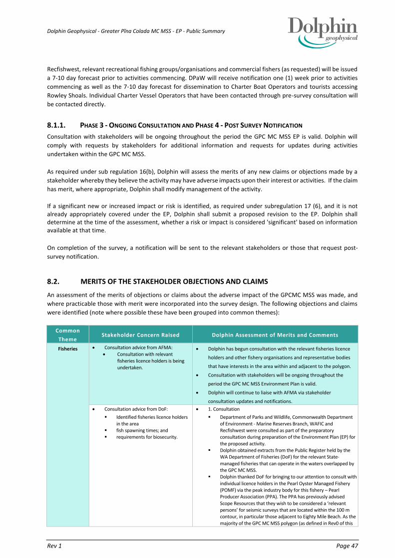
Dolphin Geophysical - Greater Pĩna Colada MC MSS - EP - Public Summary
Rev 1 Page 47
Recfishwest, relevant recreational fishing groups/organisations and commercial fishers (as requested) will be issued
a 7-10 day forecast prior to activities commencing. DPaW will receive notification one (1) week prior to activities
commencing as well as the 7-10 day forecast for dissemination to Charter Boat Operators and tourists accessing
Rowley Shoals. Individual Charter Vessel Operators that have been contacted through pre-survey consultation will
be contacted directly.
8.1.1. PHASE 3 - ONGOING CONSULTATION AND PHASE 4 - POST SURVEY NOTIFICATION
Consultation with stakeholders will be ongoing throughout the period the GPC MC MSS EP is valid. Dolphin will
comply with requests by stakeholders for additional information and requests for updates during activities
undertaken within the GPC MC MSS.
As required under sub regulation 16(b), Dolphin will assess the merits of any new claims or objections made by a
stakeholder whereby they believe the activity may have adverse impacts upon their interest or activities. If the claim
has merit, where appropriate, Dolphin shall modify management of the activity.
If a significant new or increased impact or risk is identified, as required under subregulation 17 (6), and it is not already appropriately covered under the EP, Dolphin shall submit a proposed revision to the EP. Dolphin shall determine at the time of the assessment, whether a risk or impact is considered 'significant' based on information available at that time.
On completion of the survey, a notification will be sent to the relevant stakeholders or those that request post-
survey notification.
8.2. MERITS OF THE STAKEHOLDER OBJECTIONS AND CLAIMS
An assessment of the merits of objections or claims about the adverse impact of the GPCMC MSS was made, and
where practicable those with merit were incorporated into the survey design. The following objections and claims
were identified (note where possible these have been grouped into common themes):
Common
Theme Stakeholder Concern Raised Dolphin Assessment of Merits and Comments
Fisheries Consultation advice from AFMA:
Consultation with relevant
fisheries licence holders is being
undertaken.
Dolphin has begun consultation with the relevant fisheries licence
holders and other fishery organisations and representative bodies
that have interests in the area within and adjacent to the polygon.
Consultation with stakeholders will be ongoing throughout the
period the GPC MC MSS Environment Plan is valid.
Dolphin will continue to liaise with AFMA via stakeholder
consultation updates and notifications.
Consultation advice from DoF:
Identified fisheries licence holders
in the area fish spawning times; and requirements for biosecurity.
1. Consultation
Department of Parks and Wildlife, Commonwealth Department
of Environment - Marine Reserves Branch, WAFIC and Recfishwest were consulted as part of the preparatory consultation during preparation of the Environment Plan (EP) for
the proposed activity. Dolphin obtained extracts from the Public Register held by the
WA Department of Fisheries (DoF) for the relevant State-
managed fisheries that can operate in the waters overlapped by the GPC MC MSS.
Dolphin thanked DoF for bringing to our attention to consult with
individual licence holders in the Pearl Oyster Managed Fishery (POMF) via the peak industry body for this fishery – Pearl Producer Association (PPA). The PPA has previously advised
Scope Resources that they wish to be considered a ‘relevant persons’ for seismic surveys that are located within the 100 m contour, in particular those adjacent to Eighty Mile Beach. As the
majority of the GPC MC MSS polygon (as defined in Rev0 of this
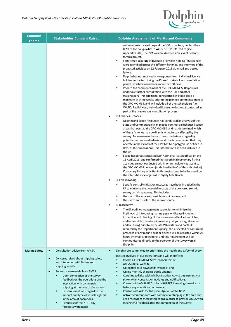
Dolphin Geophysical - Greater Pĩna Colada MC MSS - EP - Public Summary
Rev 1 Page 48
Common
Theme Stakeholder Concern Raised Dolphin Assessment of Merits and Comments
submission) is located beyond the 100 m contour, i.e. less than 0.2% of the polyg -100 m (see
Appendix I - 8a), the PPA was not deemed a ‘relevant persons’ for this project.
Forty-three separate individuals or entities holding (86) licences
were identified across the different fisheries, and informed of the proposed activities on 12 February 2015 via email and posted letters.
Dolphin has not received any responses from individual licence holders contacted during the Phase 1 stakeholder consultation period, which has now been more than 60 days.
Prior to the commencement of the GPC MC MSS, Dolphin will undertake further consultation with the DoF and other stakeholders. This additional consultation will take place a
minimum of three weeks prior to the planned commencement of the GPC MC MSS, and will include all of the stakeholders (i.e. WAFIC, Recfishwest, individual licence holders etc.) contacted as
part of the preparatory consultation process.
2. Fisheries Licences
Dolphin and Scope Resources has conducted an analysis of the
State and Commonwealth-managed commercial fisheries licence areas that overlap the GPC MC MSS, and has determined which of these fisheries may be directly or indirectly affected by the
survey. An assessment has also been undertaken regarding potential recreational fisheries and charter companies that may operate in the vicinity of the GPC MC MSS polygon (as defined in
Rev0 of this submission). This information has been included in the EP.
Scope Resources contacted DoF Aboriginal liaison officer on the
13 April 2015, and confirmed that Aboriginal customary fishing activities are not conducted within or immediately adjacent to the GPC MC MSS polygon (as defined in Rev0 of this submission).
Customary fishing activities in this region tend to be focussed on the intertidal zone adjacent to Eighty Mile Beach.
3. Fish spawning
Specific control/mitigation measures have been included in the EP to minimise the potential impacts of the proposed seismic survey on fish spawning. This includes:
the use of the smallest possible seismic source; and the use of soft starts of the seismic source.
4. Biosecurity
The EP outlines management strategies to minimise the likelihood of introducing marine pests or disease including inspection and cleaning of the survey vessel hull, other niches,
and immersible towed equipment (e.g. airgun array, streamer and tail buoy) prior to entry into WA waters and ports. As required by the Department’s policy, the suspected or confirmed
presence of any marine pest or disease will be reported within 24 hours by email or telephone, and this requirement will be communicated directly to the operator of the survey vessel
(Dolphin).
Marine Safety Consultation advice from AMSA:
Concerns raised about shipping safety
and interaction with fishing and shipping vessels
Requests were made from AMSA:
Upon completion of the survey, feedback on the operations and the
interaction with commercial shipping at the time of the survey.
Lessons learnt with regard to the
amount and type of vessels sighted in the area of operations.
Requests for the 7 - 10 day
forecasts were made
Dolphin are committed to prioritising the health and safety of every
person involved in our operations and will therefore:
Inform all GPC MC MSS vessel operators of: AMSA spatial website;
GIS spatial data downloads available; and Online monthly shipping traffic updates. Continue to liaise with AMSA’s Nautical Advice department via
stakeholder consultation updates and notifications. Consult with AMSA RCC to for NAVAREAX warnings broadcasts
before any operations commence.
Consult with AHS for the promulgation of the NTM. Actively communicate with commercial shipping in the area and
keep records of these interactions in order to provide AMSA with
meaningful feedback after the completion of the survey.

Dolphin Geophysical - Greater Pĩna Colada MC MSS - EP - Public Summary
Rev 1 Page 49
Common
Theme Stakeholder Concern Raised Dolphin Assessment of Merits and Comments
Display appropriate daytime warning beacons and appropriate night-time lighting in order to alert vessels in the area that the
vessel is towing equipment and is restricted in manoeuvrability. Maintain visual and radar watches at all times in accordance with
the Navigation Act 2012.
Dolphin will provide ASMA with Lessons learnt and information
regarding interactions with fishing and shipping vessels
Dolphin will provide the 7-10 day forecasts to stakeholders as
requested
EPBC Protected
Matters
Impacts
Concerns were raised by Centre for Whale Research regarding the survey timing (commencing in May 2015 for
3.5 months):
it will directly impact northbound humpback whales en route to their calving grounds in the Kimberley.
potential to block the calving grounds for pregnant females unwilling to pass your vessel, and at
the very last would result in numerous shutdowns for the ship.
Recommend that the survey be
completed by July 15 at the latest when the majority of the pregnant females in this population are likely
to be approaching the Kimberley.
The GPC MC MSS polygon (as defined in Rev0 of this submission) is not in the middle of the main northern migratory corridor.
It is possible that some humpbacks could be encountered during
surveys in the period May to mid-July 2015, but these encounters are
likely to be limited to activities in the south-eastern part of the polygon that overlaps shelf waters <200 m in depth.
Given the separation distance between the polygon and parts of the
migratory pathway where the majority of animals are likely to be
moving, it is unlikely that there will be a significant number of encounters.
The operational area is not in the middle of the main northern
migratory corridor. It is possible that some humpbacks could be encountered during surveys in the period May to mid-July 2015, but
these encounters are likely to be limited to activities in the south-eastern part of the operational area that overlaps shelf waters <200 m in depth. Given the separation distance between the operational
area and parts of the migratory pathway where the majority of animals are likely to be moving, it is unlikely that there will be a significant number of encounters.
The location of the defined BIA and the movements of humpbacks
during the northern migration has been further confirmed by recent satellite tagging and tracking work. The results described in the Double et al., (2012) report indicated that, for the 2011 season, the
whales tended to be within 50 km of the coast in the region between North-west Cape and Camden Sound. This report also concluded that “The width of the migratory corridor revealed by the tagged whales
was frequently less than 60 km. There was little evidence that the whales tended to venture further from shore and into deeper water at any point on their northward migration.”
The following control measures will be implemented to minimise
potential impacts on humpback whales:
Operation of the seismic source within the GPC MC MSS polygon (as defined in Rev0 of this submission) at all times during the survey must comply with all requirements of the EPBC Act Policy
Statement 2.1 - Part A Standard Management Procedures, including:
Precaution zones (Observation zone: 3 km+; Low power zone: 2
km; and Shut-down zone: 500 m); and if the acoustic source is required to power-down / shutdown
three or more times during the preceding 24-hour period as a
result of sighting pygmy blue whales, then the seismic operations must not be undertaken thereafter at night-time or during low visibility conditions. Seismic operations cannot resume at night-
time or during low visibility conditions, until there has been a 24-hour period, which included seismic operations during good visibility conditions, during which no power-downs / shut-downs
have occurred for pygmy blue whale sightings.
The following Part B Additional Management Procedures will also be
implemented:
Two dedicated Marine Fauna Observer (MFO) on the survey vessel for entire duration of the survey.
During the peak northbound migration period for humpback whales
in the region (1 July to 31 August):
application of increased precaution zones (Observation zone: >3 km; Shut-down zone: 2 km); and
application of an increased Pre Start-up Visual Observation of 45 minutes, rather than 30 minutes. The increased pre start-up
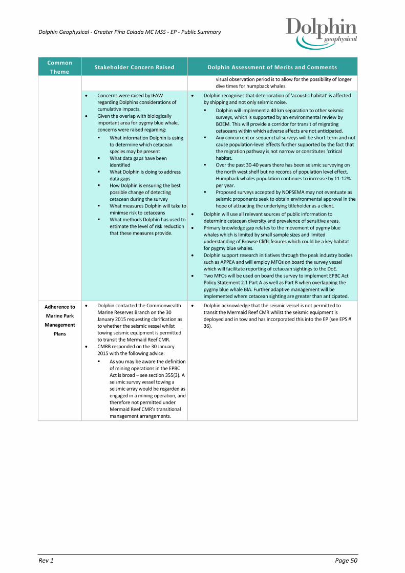
Dolphin Geophysical - Greater Pĩna Colada MC MSS - EP - Public Summary
Rev 1 Page 50
Common
Theme Stakeholder Concern Raised Dolphin Assessment of Merits and Comments
visual observation period is to allow for the possibility of longer dive times for humpback whales.
Concerns were raised by IFAW regarding Dolphins considerations of cumulative impacts.
Given the overlap with biologically important area for pygmy blue whale,
concerns were raised regarding:
What information Dolphin is using to determine which cetacean species may be present
What data gaps have been identified
What Dolphin is doing to address
data gaps How Dolphin is ensuring the best
possible change of detecting
cetacean during the survey What measures Dolphin will take to
minimse risk to cetaceans
What methods Dolphin has used to estimate the level of risk reduction that these measures provide.
Dolphin recognises that deterioration of ‘acoustic habitat’ is affected by shipping and not only seismic noise.
Dolphin will implement a 40 km separation to other seismic surveys, which is supported by an environmental review by
BOEM. This will provide a corridor for transit of migrating cetaceans within which adverse affects are not anticipated.
Any concurrent or sequenctial surveys will be short-term and not
cause population-level effects further supported by the fact that the migration pathway is not narrow or constitutes ‘critical habitat.
Over the past 30-40 years there has been seismic surveying on the north west shelf but no records of population level effect. Humpback whales population continues to increase by 11-12%
per year. Proposed surveys accepted by NOPSEMA may not eventuate as
seismic proponents seek to obtain environmental approval in the
hope of attracting the underlying titleholder as a client.
Dolphin will use all relevant sources of public information to determine cetacean diversity and prevalence of sensitive areas.
Primary knowledge gap relates to the movement of pygmy blue
whales which is limited by small sample sizes and limited understanding of Browse Cliffs feaures which could be a key habitat for pygmy blue whales.
Dolphin support research initiatives through the peak industry bodies
such as APPEA and will employ MFOs on board the survey vessel which will facilitate reporting of cetacean sightings to the DoE.
Two MFOs will be used on board the survey to implement EPBC Act
Policy Statement 2.1 Part A as well as Part B when overlapping the
pygmy blue whale BIA. Further adaptive management will be implemented where cetacean sighting are greater than anticipated.
Adherence to
Marine Park
Management
Plans
Dolphin contacted the Commonwealth Marine Reserves Branch on the 30
January 2015 requesting clarification as to whether the seismic vessel whilst towing seismic equipment is permitted
to transit the Mermaid Reef CMR.
CMRB responded on the 30 January
2015 with the following advice:
As you may be aware the definition of mining operations in the EPBC
Act is broad – see section 355(3). A seismic survey vessel towing a seismic array would be regarded as
engaged in a mining operation, and therefore not permitted under Mermaid Reef CMR’s transitional
management arrangements.
Dolphin acknowledge that the seismic vessel is not permitted to transit the Mermaid Reef CMR whilst the seismic equipment is
deployed and in tow and has incorporated this into the EP (see EPS # 36).

Dolphin Geophysical - Greater Pĩna Colada MC MSS - EP - Public Summary
Rev 1 Page 51
Common
Theme Stakeholder Concern Raised Dolphin Assessment of Merits and Comments
DPaW have requested Dolphin to acquire and interpret the following
information to assist with the assessment of the survey:
an inventory, relevant to the survey period, of species that may occur
within Rowley Shoals Marine Park and are specially protected under the Wildlife Conservation Act 1950;
maximum received sound exposure levels (SELs) within Rowley Shoals Marine Park;
a comparison between the received SELs in Rowley Shoals Marine Park and levels likely to trigger the
behavioural disturbance of specially protected species that may be present in the marine park during
the proposed seismic survey; survey design and operational
management procedures that will
be implemented in order to avoid, or minimise impacts on protected wildlife and marine park values;
clarification regarding the footprint of seismic data acquisition and any additional areas required for
proposed operations, in particular whether access to the marine park is proposed for vessel turns (guns
off, or powered down) or any other commercial purpose associated with the proposed survey.
Dolphin has acquired and undertaken all of the information requests as suggested by the DPaW and incorporated the findings into the GPC
MC MSS Environment Plan.
Acoustic modelling has been undertaken for the proposed acoustic
source size for the survey.
Source levels and sound propagation comparisons have been
assessed for the survey parameters.
Dolphin sent a reply to DPaW on the 9 March 2015. Dolphin also included the acoustic modelling results undertaken for the survey in
the response
Adherence to
WA State water
Regulations
DMP requested additional information from Dolphin:
Does the boundary shown in the maps provided account for line run
outs/vessel turns and soft start procedures?
How close will the vessel acquire to
the Mermaid Reef Marine Park and the Rowley Shoals Marine Park? How have impacts been
determined to be ALARP? The notification states that ‘at sea
refuelling will only take place
during daylight hours and will not take place within a distance of 25 km from any emergent land or
shallow water feature – does this include Clerke, Imperieuse and Mermaid reefs?
The survey is planned to commence in May for a duration of 3.5 months. How will Dolphin
Geophysical ensure that impacts to migrating whales will be managed to ALARP?
Has Dolphin Geophysical consulted recreational dive charters that operate at the Rowley Shoals?
Yes the polygon includes line run outs/vessel turns and soft start,
Rowley Shoals
Provide an overview of Dolphins risk assessment process and how
risks are determined to be ALARP, with detail provided for impacts relating to noise and hydrocarbon spills (Information taken directly
from EP)
That at-sea refuelling will only take place during the day and more
than 25 km from Mermaid and Rowley Reefs (being counted as emergent)
Proposed mitigation, including implementation of Policy 2.1, to
ensure impacts to migrating whales are ALARP.
Yes, Dolphin will / has consulted with dive charter boats
Diving and
Fishing
Concerns raisedby Odeyssey
Expeditions if survey is within 500m of the eastern and northern edge of Clerke and Mermaid Reef.
No blue water dives are proposed.
Dolphin explained (via phone conversation) that the seismic vessel
would be located more than 10 km from proposed dive sites at
Mermaid Reef.

Dolphin Geophysical - Greater Pĩna Colada MC MSS - EP - Public Summary
Rev 1 Page 52
Common
Theme Stakeholder Concern Raised Dolphin Assessment of Merits and Comments
Commercial
Tour Operators
Tour operator has experienced a
seismic survey at Scott Reef and they worked out a plan without disruption to
either party.
Concerns raised by True North regarding
noise pollution for divers and
snorklers whilst they are in the water.
what will the effect be on flora and
fauna. Polarcus will be conducting seismic
surveys in the area during the same
timeframe.
Dolphin responded 10th June 2015 outlining the distance between identified dive sites and the noise levels predicted at Mermaid reef,
which are anticipated to be well below thresholds that induce startle responses in marine fauna. The response further outlined that SCUBA equipment is expected to yield greater noise levels than the seismic
noise at the distances involved. Dolphin further highlighted that True North will be included in pre-mobilisation consultation and if they require can be issued with a 7-10 day forecast.
Dolphin outlined the strategies adopted to mitigate impacts to diver
experience including a joint risk assessment which could result in a SIMOPS plan being developed. Further Dolphin informed stakeholder that they may request that seismic acquisition is stopped
immediately prior to and while divers/snorkelers are in the water if they perceive that the diver experience is compromised.
Dolphin further highlighted strategies to maintain awareness of other
survey going at the same time as the GPC MC MSS and would
maintain a minimum separation distance of 40 km. In the case of Capreolus, the distance between the two would be more than 140 km and that therefore the two surveys would not have additive
effects on Mermaid or Clerke Reef.
Dolphin Geophysical - Greater Pĩna Colada MC MSS - EP - Public Summary
Rev 1 Page 53
9. DETAILS OF THE TITLEHOLDER AND LIAISON PERSON
As required under Regulation 15, details for Dolphin as the Titleholder and nominated liaison person for the GPC MC
MSS EP are as follows:
Nominated liaison person: Ian Edwards
Name: Dolphin Geophysical
Business address: Brockbourne House
77 Mount Ephraim
Tunbridge Wells
Kent TN4 8GN
Telephone: +44 (0) 1892 701 015
Email address: [email protected]
ABN: 95 585 497 039
The Regulator will be notified according to the requirements of Regulation 15(3), of changes to the titleholder or
nominated liaison. Dolphin will submit in writing to the Regulator; within 30 days of the change, information
regarding a change in:
the titleholder;
the titleholder‘s nominated liaison person;
contact details for the titleholder; and
contact details for the liaison person.

Dolphin Geophysical - Greater Pĩna Colada MC MSS - EP - Public Summary
Rev 1 Page 54
10. REFERENCES
AMSA (2011). National Marine Oil Spill Contingency Plan 2011. Australian Maritime Safety Authority. Australian Government. Canberra. Australia.
AMSA (2014b). National Plan for Maritime Environmental Emergencies. Australian Maritime Safety Authority. Australian Government. Canberra. Australia.
AMSIS (2015). Australian Marine Spatial Information System, Australian Maritime Boundaries Map. Geosciences Australia. Accessed 5 March 2015.
Anthony T G , Wright A & Evans M A. (2009). Review of diver noise exposure. Research Report RR735. Health and Safety Executive. 62 pp.
BOEM (2014). Proposed Geological and Geophysical Activities, Mid-Atlantic and South Planning Areas, Final Programmatic Environmental Impact Statement. U.S. Department of the Interior Bureau of Ocean Energy Management Gulf of Mexico OCS Region. New Orleans.
BOM (2015). Bureau of Meteorology - Australia Tropical Cyclone Information. Australian Government. Accessed 18 March 2015.
DEC (2007). Rowley Shoals Marine Park Management Plan 2007–2017. Adopted by the Marine Parks and Reserves Authority; Marine Management Plan No. 56. Department of Environment and Conservation, Perth, Western Australia.
DEWHA (2007). A Characterisation of the Marine Environment of the North-west Marine Region - A summary of an expert workshop convened in Perth, Western Australia, 5-6 September 2007. Prepared by the North-west Marine Bioregional Planning section, Marine and Biodiversity Division, Department of the Environment, Water, Heritage and the Arts. 47 pp.
DEWHA (2008a). The North-west Marine Bioregional Plan: Bioregional Profile. A Description of the Ecosystems, Conservation Values and Uses of the North-west Marine Region. Australian Government Department of the Environment, Water, Heritage and the Arts. Canberra. 288 pp.
DFO (2004). Potential impacts of seismic energy on snow crab. Department of Fisheries and Oceans, Canadian Scientific Advisory Secretariat. Habitat Status Report 2004/003. 5 pp.
DNP (2000). Mermaid Reef Marine National Nature Reserve, Plan of Management 2000-2007. Director of National DNP (2013). North-west Commonwealth Marine Reserves Network Management Plan 2014-24. Director of
National Parks, Canberra. DoA (2008). Australian Ballast Water Management Requirements. Version 4 – March 2008. Australian Quarantine
and Inspection Service, Commonwealth Department of Agriculture, Fisheries and Food. 14 pp. DoE (2015a). EPBC Act Protected Matters Reports. GPC MC MSS polygon. Australian Government Department of
the Environment, Canberra. Online database. Accessed 17 February 2015. DoE (2015c). Historic shipwrecks laws. Australian Government Department of the Environment, Canberra. Online.
Accessed 5 March 2015. DoE (2015d). Australian national shipwreck database. Department of the Environment, online database. Accessed
5 March 2015. DoE (2015j). Australia’s World Heritage List. Department of the Environment. Accessed 5 March 2015. DoE (2015k). Directory of Important Wetland. Department of the Environment. Accessed 5 March 2015. Double, MC, Andrews-Goff, V, Jenner, KCS, Jenner, M-N, Laverick, SM, Branch, TA and Gales, NJ (2014). Migratory
Movements of Pygmy Blue Whales (Balaenoptera musculus brevicauda) between Australia and Indonesia as Revealed by Satellite Telemetry. PLoS ONE 9(4): e93578. doi:10.1371/journal.pone.0093578.
DSEWPaC (2012). Marine Bioregional Plan for the North-west marine Region. Department of Sustainability, Fletcher, W.J. and Santoro, K. (eds). (2014). Status Reports of the Fisheries and Aquatic Resources of Western
Australia 2013/14: The State of the Fisheries. Department of Fisheries, Western Australia. Gausland, I (2000). Impact of seismic surveys on marine life. SPE 61127. SPE International Conference on Health,
Safety and the Environment in Oil and Gas Exploration and Production. 26-28 June 2000. 4 pp. Hart, A. M., Thomson, A. W., and Murphy, D. (2010) Environmental influences on stock abundance and fishing power
in the silver-lipped pearl oyster fishery. – ICES Journal of Marine Science, doi:10.1093/icesjms/fsq166. IUCN (2015). The IUCN Red List of Threatened Species. International Union for Conservation of Nature and Natural
Resources. Online. Jochens, AE, and Biggs, DC (2003). Sperm Whale Seismic Study in the Gulf of Mexico. US Minerals Management
Service OCS Study 2003-069. Report published by US Department of Minerals Management Service OCS Region, New Orleans. 135 pp
McCauley, RD (1994). The environmental implications of offshore oil and gas development in Australia – seismic surveys. In: Swan, J.M., Neff, J.M. and Young, P.C. (eds.), Environmental Implications of Offshore Oil and Gas

Dolphin Geophysical - Greater Pĩna Colada MC MSS - EP - Public Summary
Rev 1 Page 55
Development in Australia - The Findings of an Independent Scientific Review. 123-207 pp. Australian Petroleum Exploration Association, Sydney. 19-21 pp.
MMS (2004). Geological and Geophysical Exploration for Mineral Resources on the Gulf of Mexico Outer Continental Shelf. Final Programmatic Environmental Assessment. U.S. Department of the Interior Minerals Management Service, Gulf of Mexico OCS Region. MMS Report 2004-054, July 2004, 487 pp.
NOAA (2013). Draft Guidance for Assessing the Effects of Anthropogenic Sound on Marine Mammals. Acoustic Threshold Levels for Onset of Permanent and Temporary Threshold Shifts. National Oceanic and Atmospheric Administration, draft 23 December 2013. 83 pp.
Parry, GD and Gason, A (2006). The effect of seismic surveys on catch rates of rock lobsters in western Victoria, Australia. Fisheries Research, 79: 272–284.
Popper, A.N., Hawkins, A. D., Fay, R.R., Mann, D.A., Bartol, S., Carlson, T.J., Coombs, S., Ellison, W.T., Gentry, R.L., Halvorsen, M.B., Lokkeborg, S., Rogers, P.H., Southall, B.L., Zeddies, D.G., and Tavolga, W.N. (2014). ASA S3/SC1.4TR-2014 Sound Exposure Guidelines for Fishes and Sea Turtles: A technical report prepared by ANSI-Accredited Standards Committee S3/SC1 and registered with ANSI. SpringerBriefs in Oceanography
Richardson, WJ, Greene, CR(Jr), Malme, CI and Thomson, DH (1995). Marine Mammals and Noise. Academic Press, Sydney. 576 pp.
Ryan K. L., Wise B. S., Hall N. G., Pollock K. H., Sulin E. H., Gaughan D. J. (2013). An integrated system to survey boat-based recreational fishing in Western Australia 2011/12. Fisheries Research Report No. 249, Department of Fisheries, Western Australia, Perth. 162 pp.
Skalski, J.R., Pearson, W.H., and Malme, C.I. (1992). Effects of sounds from a Geophysical Survey Device on Catch-per-Unit-Effort in a Hook-and-line Fishery for Rockfish (Sebates spp.). Can. J. Fish. Aquat. Sci. 49:1357-1365.
Southall BL, Bowles AE, Ellison WT, Finneran JT, Gentry RL, Greene CR(Jr), Kastak D, Ketten DR, Miller, JH, Nachtigall PE, Richardson WJ, Thomas JA and Tyack PL (2007). Marine Mammal Noise Exposure Criteria: Initial Scientific Recommendations. Aquatic Mammals, 33: 1-521

Dolphin Geophysical - Greater Pĩna Colada MC MSS - EP - Public Summary
Rev 1 Page 56
11. APPENDIX 1 - BIOLOGICALLY IMPORTANT AREAS IN RELATION TO THE GREATER PINA COLADA MC MSS - REDUCED SCOPE POLYGON
Figure A - BIA for the pygmy blue whale, whale shark and white-tailed tropic bird
Related Documents