Mr. Threatt's Class Landform Projects Geomorphology: The study of the earth and its changing landforms

Mr. Threatt's Class Landform Projects Geomorphology: The study of the earth and its changing landforms.
Dec 14, 2015
Welcome message from author
This document is posted to help you gain knowledge. Please leave a comment to let me know what you think about it! Share it to your friends and learn new things together.
Transcript
Mr. Threatt's ClassLandform Projects
Geomorphology:The study of the earth and its
changing landforms
MAMMOTH CAVEBy Hunter Hughes & Vincent
Michel

Facts about MAMMOTH CAVE
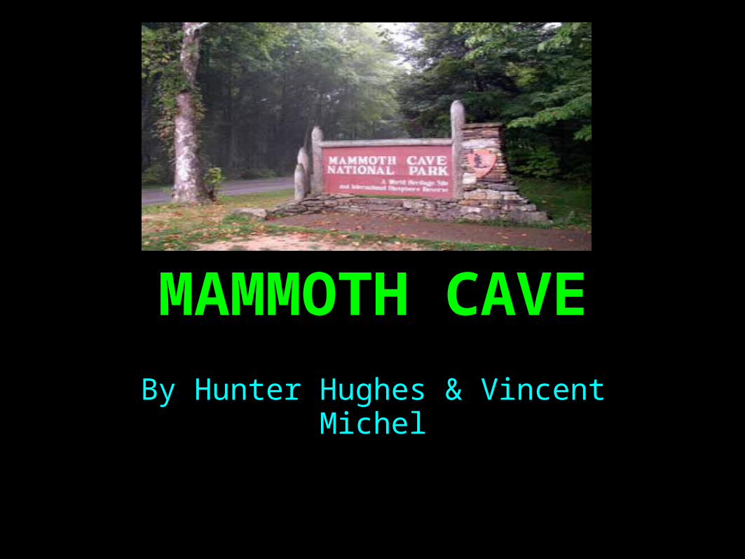
Cavemen have lived in mammoth cave. It is located in Kentucky.
It is impossible to explore the cave in a day. Maybe even a week.

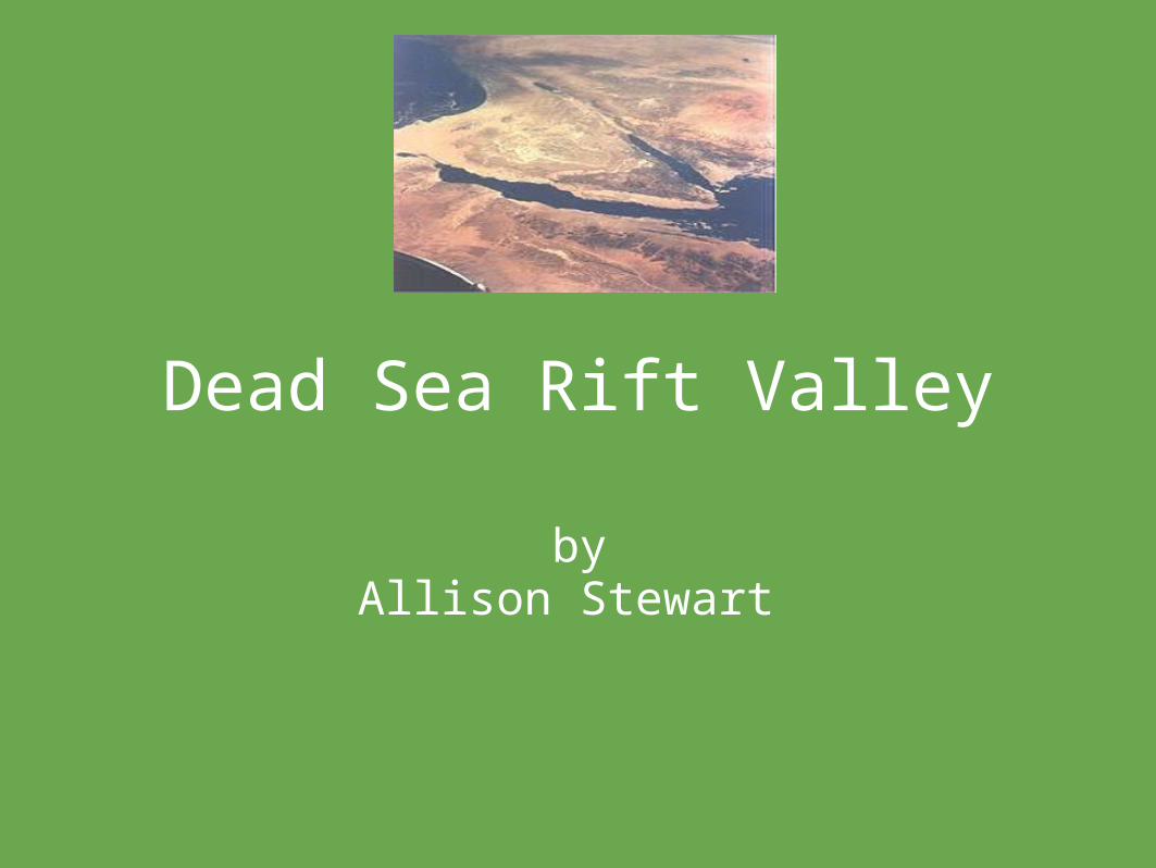
Dead Sea Rift Valley
byAllison Stewart

Facts1. The Dead Sea Rift Valley is 67 km. long & 18 km. wide.
2. It is part of the Great Rift Valley.
3. It extends from Lebandon to the north Mozambique in the south.

Formation
The Dead Sea Rift Valley was formed by continental drift called "subduction".

The Dead Sea Rift Valley
By Dalton Barron
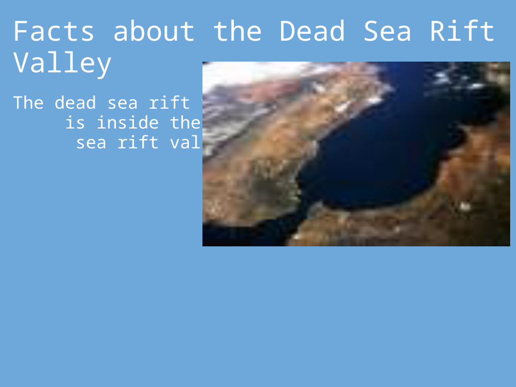
Facts about the Dead Sea Rift ValleyThe dead sea rift valley is inside the dead sea rift valley.

Niagra Falls
by Wilson Upchurchand Jacob Leer
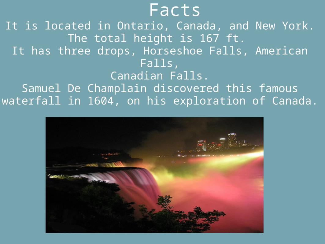
Facts It is located in Ontario, Canada, and New York.
The total height is 167 ft. It has three drops, Horseshoe Falls, American Falls,
Canadian Falls.Samuel De Champlain discovered this famous waterfall in
1604, on his exploration of Canada.

It was formed by........Glaciers receding at the end of the Wisconsin glaciation period carved the Niagara Falls.

HORSESHOE FALLS
By:Shaelyn H. &
Kelly J.Class of 2017CSI 2009-2010
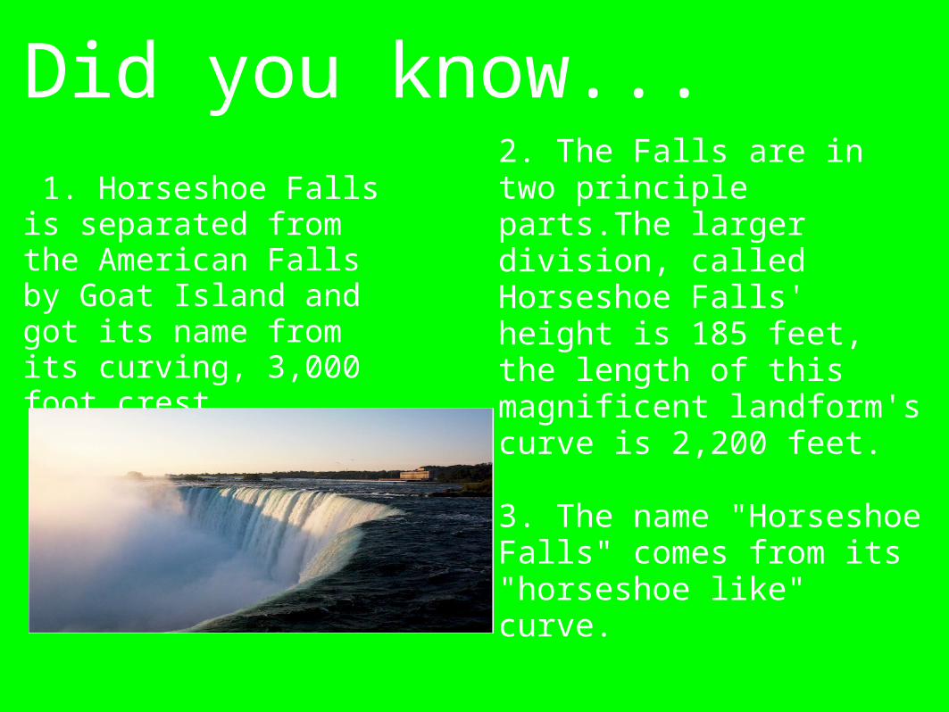
Did you know... 1. Horseshoe Falls is separated from the American Falls by Goat Island and got its name from its curving, 3,000 foot crest.
2. The Falls are in two principle parts.The larger division, called Horseshoe Falls' height is 185 feet, the length of this magnificent landform's curve is 2,200 feet.
3. The name "Horseshoe Falls" comes from its "horseshoe like" curve.
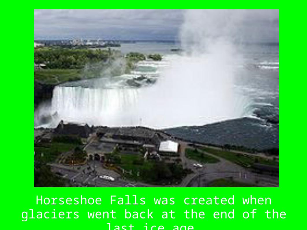
Horseshoe Falls was created when glaciers went back at the end of the last ice age.

THE GREAT SANDY DESERT!!!!!!!!!!!!!!
BY TY BUCHANANAND KORRIGAN KORTHAUER
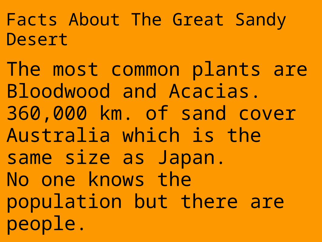
Facts About The Great Sandy Desert
The most common plants are Bloodwood and Acacias.360,000 km. of sand cover Australia which is the same size as Japan.No one knows the population but there are people.

Formation of theGreatSandyDesert

The Great Lakes Written by: Brette Kohring and
Gina Lopez
1Simple as
2 3

The Great Lakes gives the largest amount of fresh water to the people of the United States and Canada on the continent if North America.The Great Lakes are all connected by a series of dams and rivers.
INTERESTING Facts of The Great Lakes
That is very interesting!!
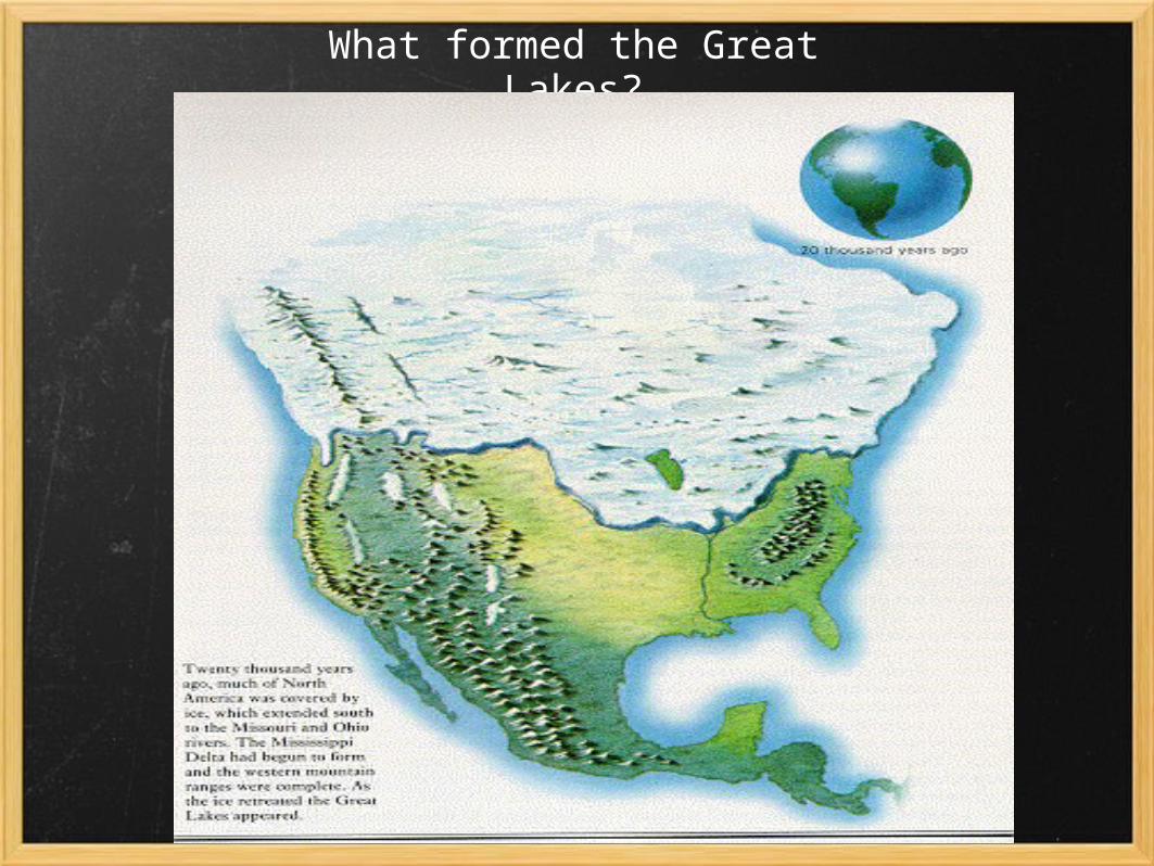
What formed the Great Lakes?

DEVIL'S HOLE (SINKHOLE)
BY: Jillian Werth & Jordan Newsome
FACTS
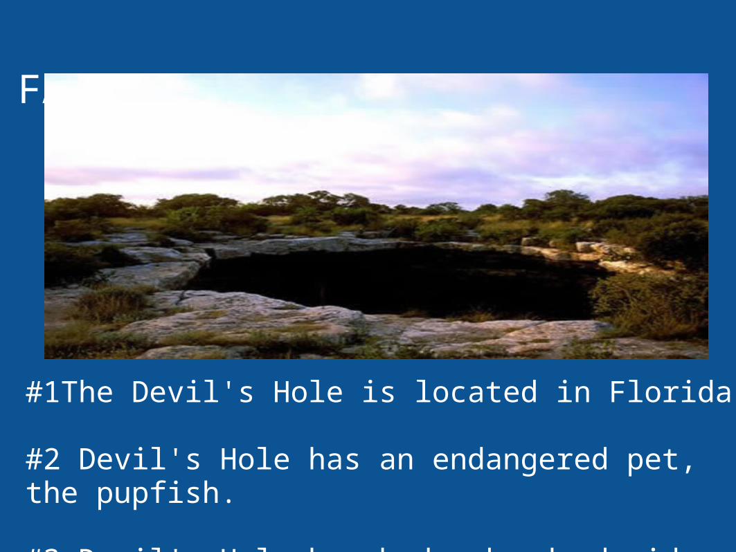
#1The Devil's Hole is located in Florida.
#2 Devil's Hole has an endangered pet, the pupfish.
#3 Devil's Hole has bedrock-edged sides.
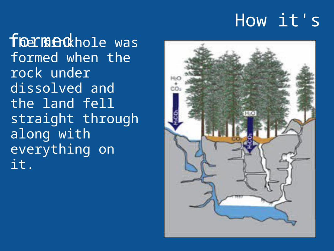
How it's formedThe sinkhole was formed when the rock under dissolved and the land fell straight through along with everything on it.

Paricutinby:Holden, Zachary
Facts..........
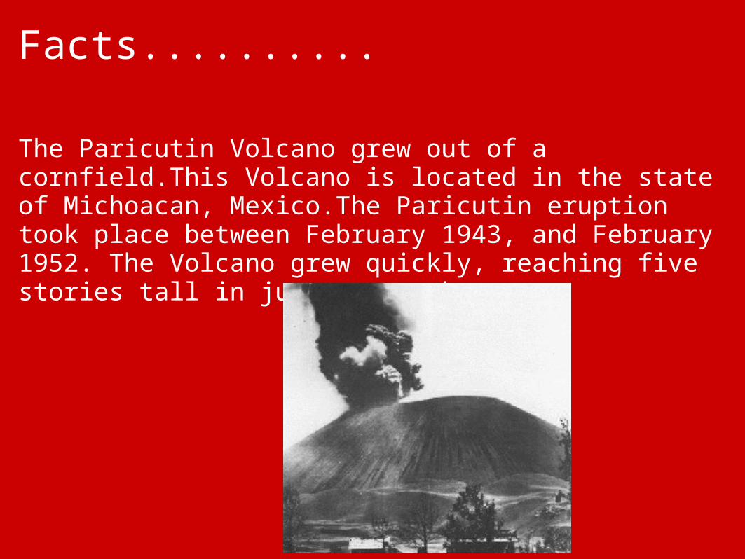
The Paricutin Volcano grew out of a cornfield.This Volcano is located in the state of Michoacan, Mexico.The Paricutin eruption took place between February 1943, and February 1952. The Volcano grew quickly, reaching five stories tall in just one week.
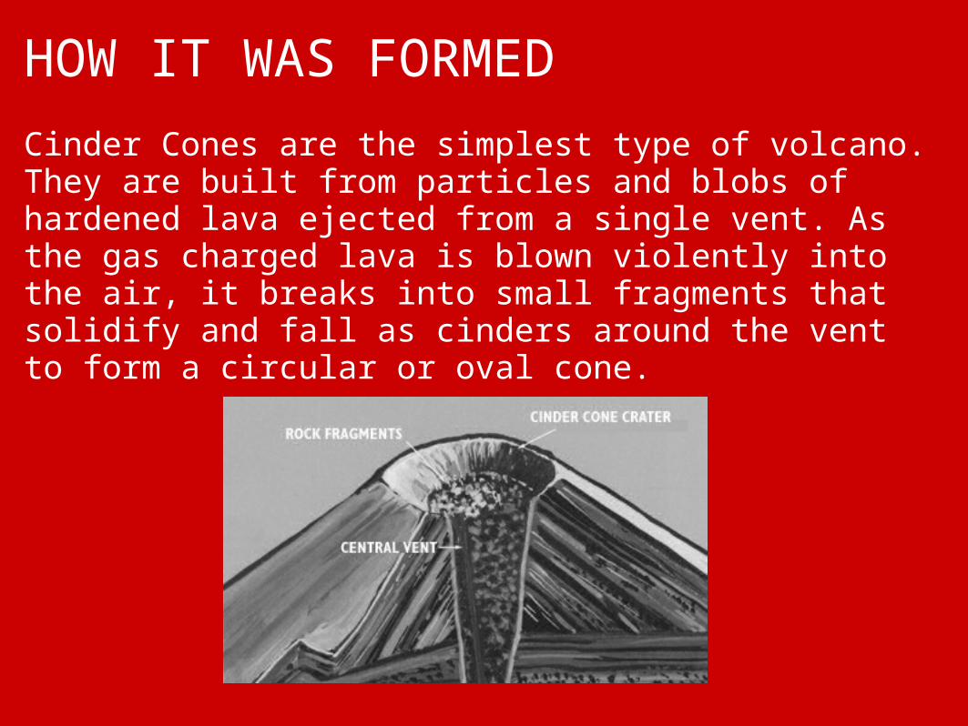
HOW IT WAS FORMED
Cinder Cones are the simplest type of volcano. They are built from particles and blobs of hardened lava ejected from a single vent. As the gas charged lava is blown violently into the air, it breaks into small fragments that solidify and fall as cinders around the vent to form a circular or oval cone.

Hawaiian Islands Archipelago
By: Lois Kate Kolkhorst andAnnie Cangelosi
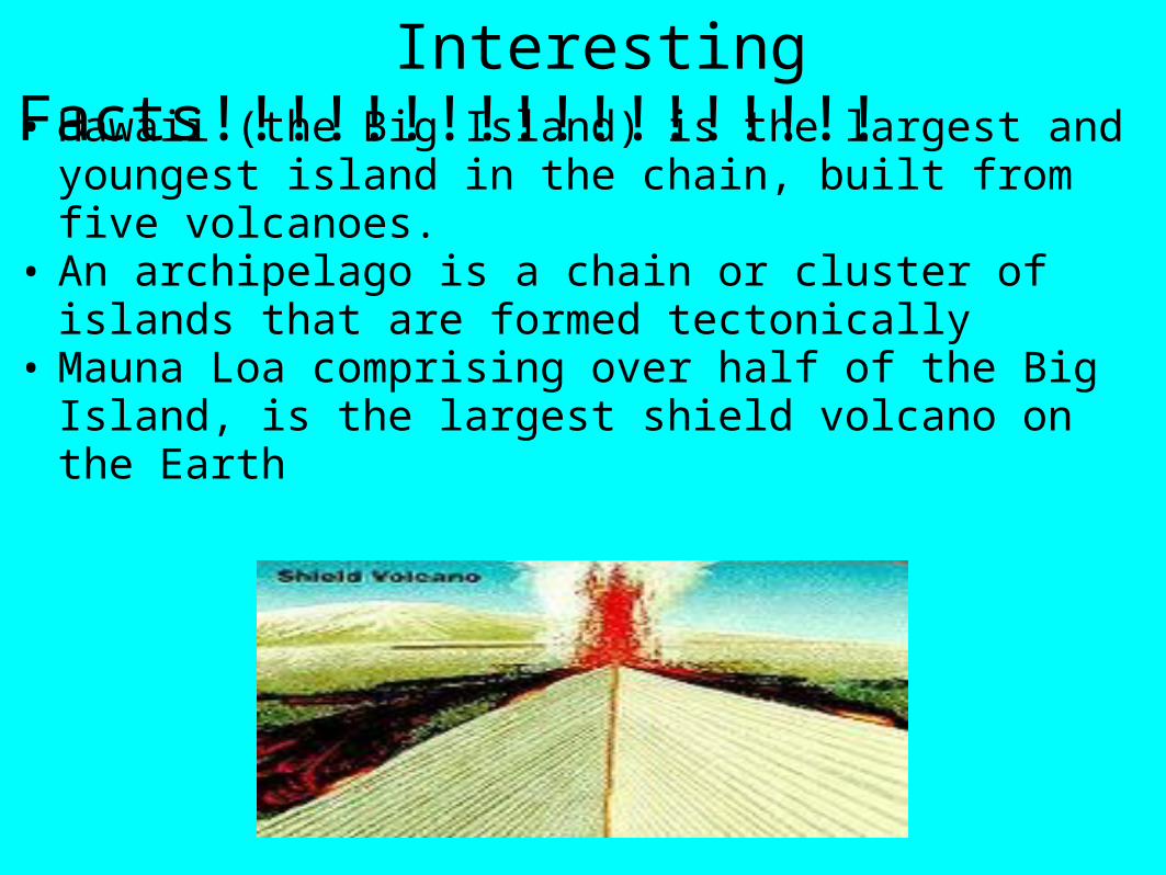
Interesting Facts!!!!!!!!!!!!!!!!!!• Hawaii (the Big Island) is the largest and youngest
island in the chain, built from five volcanoes.• An archipelago is a chain or cluster of islands that
are formed tectonically• Mauna Loa comprising over half of the Big Island,
is the largest shield volcano on the Earth

Formation of the Hawaiian Islands• The chain of islands or archipelago formed
as the Pacific plate moved slowly northwestward over a hotspot in the Hawaiian Islands.
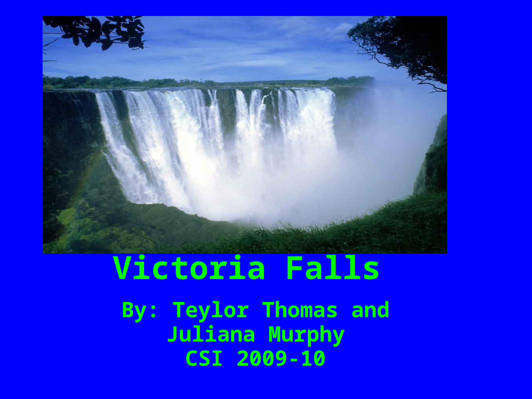
Victoria FallsBy: Teylor Thomas and
Juliana MurphyCSI 2009-10
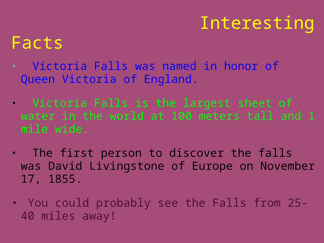
Interesting Facts
• Victoria Falls was named in honor of Queen
Victoria of England. • Victoria Falls is the largest sheet of water in
the world at 100 meters tall and 1 mile wide. • The first person to discover the falls was
David Livingstone of Europe on November 17, 1855.
• You could probably see the Falls from 25-40
miles away!
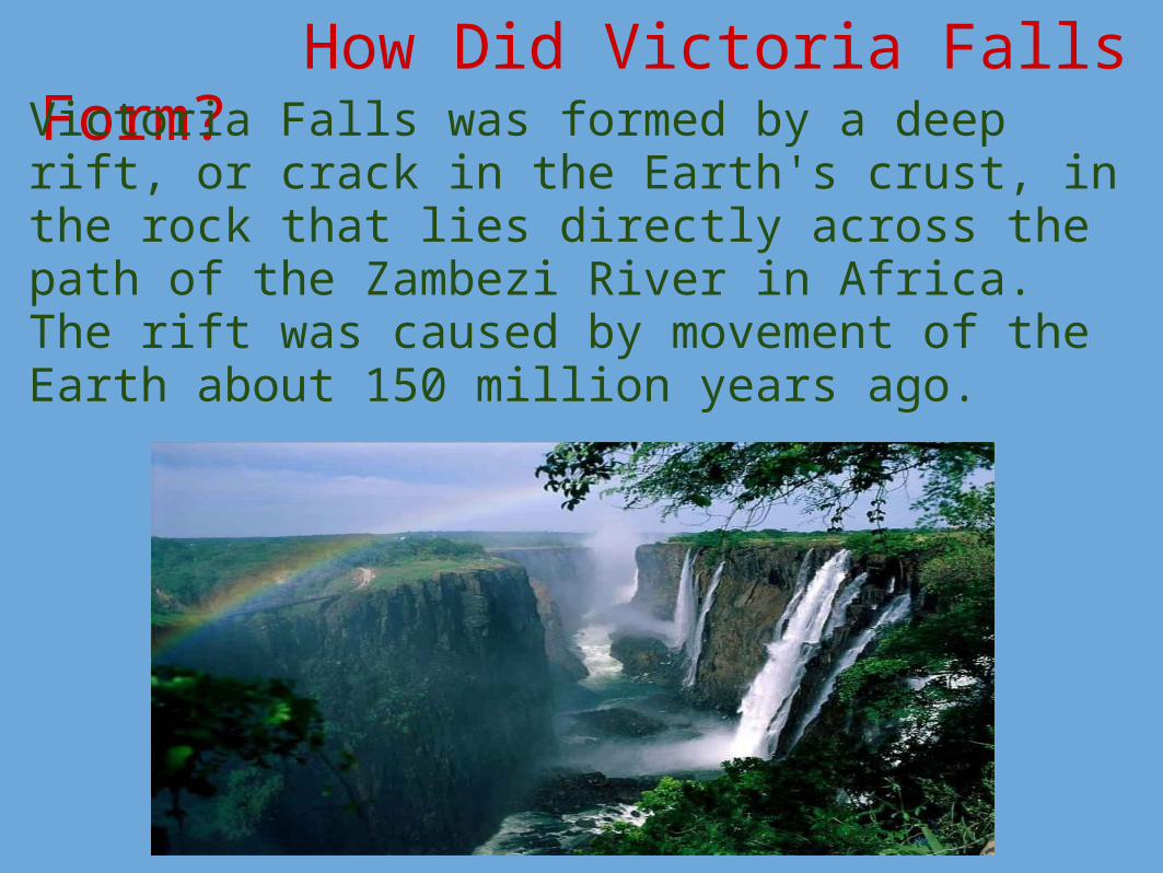
How Did Victoria Falls Form?Victoria Falls was formed by a deep rift, or crack in the Earth's crust, in the rock that lies directly across the path of the Zambezi River in Africa. The rift was caused by movement of the Earth about 150 million years ago.

The Grand Canyon: An Extraordinaire
By: Auggie Robertson and Sara Spencer

Cool Facts
• The Grand Canyon covers 1,904 square miles • The Grand Canyon was created about 6 million years
ago by the Colorado River. • The Grand Canyon is a deep valley located in the
Colorado Plateau, in Arizona

Grand Canyon Formation

BIBLIOGRAPHY FOR ALL SLIDE SHOWS!!!!!!!! BY:JULIANA DENNIS

http://www.volcanolive.com/vesuvius.htmlhttp://www.ask.com/bar?q=inside+Mt.Vesuius+pics&page=1&adt=0&qsrc=0&dm=all&ab=2&title=Italy+Pictures%2C+Photo%3A+Mount+Vesuvius+Victim+-+National+Geographic&u=http%3A%2F%2Ftravel.nationalgeographic.com%2Fplaces%2Fgallery%2Fitaly_mt-vesuvius-victim.html&sg=dmBqAvB9M9Y%2FFqd8fwo26EwJpQ2xfhVJ%2BKZ9tri3P9c%3D&tsp=1256755222571https://pantherfile.uwm.edu/mtharris/www/Lyell03/CN12.htmhttp://en.wikipedia.org/wiki/Niagara_Fallshttp://www.flickr.com/photos/tnflyboy/1400244350/http://www.101destinations.com/images/MammothCave.jpghttp://pubs.usgs.gov/ha/ha730/ch_a/gif/A038.gifhttp://static.howstuffworks.com/gif/mammoth-cave-national-park-ga-3.jpghttp://static.howstuffworks.com/gif/mammoth-cave-national-park-ga-2.jpghttp://www.pbs.org/wnet/nature/firebird/html/rift.htmlhttp://www.niagarafallslive.com/Facts_about_Niagara_Falls.htmtp://www.eyewitnesstohistory.com/pompeii.htmhttp://www.nflibrary.ca/Portals/0/HorseshoeFalls.jpghttp://www.histografica.com/pictures/large/l_n1orkf2h.jpghttp://www.socialstudiesforkids.com/articles/geography/mississippiriver.htmhttp://images.google.com/imgres?imgurl=http://www.stchas.edu/faculty/ewilson/Photos/SE%2520Coast/Mississippi%2520River%2520Delta%2520002.jpg&imgrefurl=http://www.stchas.edu/faculty/ewilson/Photos/SE%2520Coast/&usg=__sZCwpLv0a52J2EZjzT2cSDBP2Xs=&h=1001&w=1500&sz=650&hl=en&start=10&um=1&tbnid=3RZtZBXASHjsyM:&tbnh=100&tbnw=150&

prev=/images%3Fq%3DPictures%2Bof%2Bthe%2BMississippi%2BRiver%2BDeltahttp://en.wikipedia.org/wiki/Horseshoe_Fallshttp://www.safpar.com/photo_pictures/vf003.htm#athttp://hvo.wr.usgs.gov/gallery/maunaloa/1984/1984erupt.htmlhttp://www.nasamike.com/main/roadshow/Fundy_files/http://www.safpar.com/photo_pictures/vf003.htm#athttp://www.nasamike.com/main/roadshow/Fundy_files/http://www.gma.org/undersea_landscapes/Bay_of_Fundy/http://www.wildaboutrocks.com/canada2006.htmhttp://images.google.com/imgres?imgurl=http://veimages.gsfc.nasa.gov/8009/GreatLakes.A2005027.1635.250m.jpg&imgrefurl=http://visibleearth.nasa.gov/view_rec.php%3Fid%3D8009&usg=__2wEkQ74rciWiXvufxRaHb2CdNKA=&h=4000&w=5200&sz=5431&hl=en&start=67&um=1&tbnid=lHmUE5LadqblFM:&tbnh=115&tbnw=http://www.freebase.com/viehttp://images.google.com/imgres?imgurl=http://www.sfakia-crete.com/sfakia-crete/gorgeformation2.jpg&imgrefurl=http://www.sfakia-crete.com/sfakia-crete/gorges.html&uhttp://upload.wikimedia.org/wikipedia/commons/0/06/Royal_Gorge_1.jpghttp://images.google.com/imgres?imgurl=http://gohawaii.about.com/library/gallery/hawaiifromspace5.jpg&imgrefurl=http://gohawaii.about.com/cs/photogalleries/l/blgallery548.htm&usg=__ELhJ-J8QPv-Oc-v5hxw3UHi3ekc=&h=396&w=400&sz=37&hl=en&start=2&um=1&tbnid=wBX5uybYBe8bmM:&tbnh=123&tbnw=124&prev=/images%3Fq%3Dhawaiian%2Bislands%2Barchipelago%26hl%3Den%26safe%http://sanctuaries.noaa.gov/science/condition/pmnm/images/fig1_lg.jpghttp://en.wikipedia.org/wiki/Mendenhall_Glacierhttp://outdoors.webshots.com/photo/1002881036000926706PyAzvseaEfhttp://en.wikipedia.org/wiki/Great_Rift_Valley

http://images.google.com/imgres?imgurl=http://www.sfakia-crete.com/sfakia-crete/gorgeformation2.jpg&imgrefurl=http://www.sfakia-crete.com/sfakia-crete/gorges.html&uhttp://upload.wikimedia.org/wikipedia/commons/0/06/Royal_Gorge_1.jpghttp://images.google.com/imgres?imgurl=http://gohawaii.about.com/library/gallery/hawaiifromspace5.jpg&imgrefurl=http://gohawaii.about.com/cs/photogalleries/l/blgallery548.htm&usg=__ELhJ-J8QPv-Oc-v5hxw3UHi3ekc=&h=396&w=400&sz=37&hl=en&start=2&um=1&tbnid=wBX5uybYBe8bmM:&tbnh=123&tbnw=124&prev=/images%3Fq%3Dhawaiian%2Bislands%2Barchipelago%26hl%3Den%26safe%http://sanctuaries.noaa.gov/science/condition/pmnm/images/fig1_lg.jpghttp://en.wikipedia.org/wiki/Mendenhall_Glacierhttp://outdoors.webshots.com/photo/1002881036000926706PyAzvseaEf http://www.buzzle.com/articles/how-was-the-grand-canyon-formed.htmlhttp://en.wikipedia.org/wiki/Great_Blue_Hole http://www.askkids.com/pictures?qsrc=2058&q=great%20blue%20hole&o=0&l=dir
http://www.news-world.us/pics/2009/03/24/the-great-blue-hole-in-belize/http://www.enlightphoto.com/webpages/az1/az1_15.htm http://pomegranate.stores.yahoo.net/inartfrcado.htmlhttp://outdoors.webshots.com/photo/1002881036000926706PyAzvseaEfhttp://www.deadseaimage
Related Documents