KEYWORDS MOUNTAIN BUILDING AND CONTINENTAL DRIFT MATS MoL£N, M.SC. Box 3100, S-903 03 UMEA, SWEDEN Mountain building, continental drift, fountains of the great deep, thlxotrophy, earth history, philosophy ABSTRACT Philosophical constraints concerning creationist research are briefly discussed (reMlng arguments like "God of the Gaps") . Earlier creationist models of continental drift and mountain building are shortly criticized. Research performed and theories forwarded by various authors are Incorporated Into a novel model of mountain building and continental drift based on geological data, and are also compared to Biblical Interpretations. There Is geological and Biblical evidence Indicating the former presence pf huge subterranean water-filled caverns which became filled with sediments, I.e. geosynclines. BecausMhe water In the geosynclines was exchanged for sediments, the underlying lithosphere became Isostatically depressed and started to melt In Its lower parts. The magma formed, then rose and pushed up mountains. The tectonic movements accompanying this orogenesis may have triggered continental drift. Continents may have slid on a thixotropic crystal/magma layer at the litho- sphere/asthenosphere Interface. INTRODUCTION Philosophical constraints Christians have sometimes tried to explain observations In nature In an unfalslflable manner, which Is outside of the scientific method, and commonly not even based on Interpretations of the Bible. Observations or hypotheses which have not been possible to explain by current scientific knowledge, have been saved by Introducing flat Interventions from God. But, as scientific progress has produced explanations for many earlier "unexplainable" observations, God has been pushed away from reality - he was not needed - and nature has become more and more viewed as "athelstlc"/naturallstlc. Modern examples of "God of the Gaps' reasoning, which have been Introduced to save some creationist hypotheses, are: Radioactive decay rates are proposed to have been supernaturally changed during the flood [7,28,35,38], light has been proposed to be created In place from the most distant stars to the earth (which provides a philosophical problem similar to the one by Gosse, who proposed that God created the fossils In the earth strata so that it would look like the earth had a history even though It had none; [30]), It has been suggested that animals were recreated after the fall to be carnivores [26], and It has also been suggested that God helped to move the continents by changing natural laws [6, 7, 28, 35, 36) . If scientific research is to be possible, then miracles must not be Invoked as soon as there are no obvious natural explanations. The only time a Bible-believing Christian maya priori use God In his explanations, is when the Bible clearly describes that God miraculously intervened In earth history and what He performed. Even if the meaning of many Bible verses may be debatable, a few instances are clearly miraculous and Impossible to explain by current natural laws, e.g. creation of the universe and creation of different life-forms (Including man). But, as the Bible may not mention In a clear way every occasion when God has Intervened In earth history, some natural explanations may always prove Mlle. Hence, the correct place to Include God Is not when we do not know how to explain an observation, but when It Is obvious how something works. For example, a clock needs a watchmaker, a book an author, and the Intrinsic life based on the "book of life" written In chemical language (DNA) Is the work of an Intelligent being. As Christians, 353

Welcome message from author
This document is posted to help you gain knowledge. Please leave a comment to let me know what you think about it! Share it to your friends and learn new things together.
Transcript
KEYWORDS
MOUNTAIN BUILDING AND CONTINENTAL DRIFT
MATS MoL£N, M.SC. Box 3100, S-903 03
UMEA, SWEDEN
Mountain building, continental drift, fountains of the great deep, thlxotrophy, earth history, philosophy
ABSTRACT
Philosophical constraints concerning creationist research are briefly discussed (reMlng arguments like "God of the Gaps").
Earlier creationist models of continental drift and mountain building are shortly criticized. Research performed and theories forwarded by various authors are Incorporated Into a novel model of mountain building and continental drift based on geological data, and are also compared to Biblical Interpretations.
There Is geological and Biblical evidence Indicating the former presence pf huge subterranean water-filled caverns which became filled with sediments, I.e. geosynclines. BecausMhe water In the geosynclines was exchanged for sediments, the underlying lithosphere became Isostatically depressed and started to melt In Its lower parts. The magma formed, then rose and pushed up mountains. The tectonic movements accompanying this orogenesis may have triggered continental drift. Continents may have slid on a thixotropic crystal/magma layer at the lithosphere/asthenosphere Interface.
INTRODUCTION
Philosophical constraints
Christians have sometimes tried to explain observations In nature In an unfalslflable manner, which Is outside of the scientific method, and commonly not even based on Interpretations of the Bible. Observations or hypotheses which have not been possible to explain by current scientific knowledge, have been saved by Introducing flat Interventions from God. But, as scientific progress has produced explanations for many earlier "unexplainable" observations, God has been pushed away from reality - he was not needed - and nature has become more and more viewed as "athelstlc"/naturallstlc. Modern examples of "God of the Gaps' reasoning, which have been Introduced to save some creationist hypotheses, are: Radioactive decay rates are proposed to have been supernaturally changed during the flood [7,28,35,38], light has been proposed to be created In place from the most distant stars to the earth (which provides a philosophical problem similar to the one by Gosse, who proposed that God created the fossils In the earth strata so that it would look like the earth had a history even though It had none; [30]), It has been suggested that animals were recreated after the fall to be carnivores [26], and It has also been suggested that God helped to move the continents by changing natural laws [6, 7, 28, 35, 36).
If scientific research is to be possible, then miracles must not be Invoked as soon as there are no obvious natural explanations. The only time a Bible-believing Christian maya priori use God In his explanations, is when the Bible clearly describes that God miraculously intervened In earth history and what He performed. Even if the meaning of many Bible verses may be debatable, a few instances are clearly miraculous and Impossible to explain by current natural laws, e.g. creation of the universe and creation of different life-forms (Including man). But, as the Bible may not mention In a clear way every occasion when God has Intervened In earth history, some natural explanations may always prove Mlle.
Hence, the correct place to Include God Is not when we do not know how to explain an observation, but when It Is obvious how something works. For example, a clock needs a watchmaker, a book an author, and the Intrinsic life based on the "book of life" written In chemical language (DNA) Is the work of an Intelligent being. As Christians,
353

we are not supposed to believe in a 'God of the Gaps', but in the 'God of the Knowiedge'l
This philosophical approach is Biblically and scientifically consistent (even though it may not solve all scientific and theological problems); and will here be used when constructing a continental drift and mountain building hypothesis.
Continental drift
Throughout the 17th to the 19th centuries many different authors have suggested that the continents had drifted apart (14). These theories were based on the configuration of the continents and/or the Bible. The current mainstream plate tectonics/convection currents continental drift theory was first proposed by Wegener, In its pristine form, at the beginning of the 20th century, and has thereafter been continually revised. However, many unsolvable problems concerning this mainstream model has made some scientists sceptical to most hypotheses of continental drift, and lead some to suggest continental drift by earth expansion [e.g. 14, 57] . A few have even suggested that continental drift was catastrophic [e.g. 16).
Many creationists have published continental drift and mountain building models [e.g. 48], but many of these models have little or no support from geophysics or geological observations. Several authors suggest that giant meteorites provided the force needed to Initiate continental drift [e.g. 16,27,48). Cook [19,20) suggested that glaciers fractured tihe continents by brittle fracturing and made them drift apart. Brittle fracturing (spreading velocity of fractures at ca. 2 km/s) stili appears to be a valid explanation. However, there are some doubts about the force which is proposed to have split the continents (e.g. geological data shows that continental drift was pre-glacial; [54]), so there must be found another mechanism of splitting the continents.
Baumgardner [7) developed a model where the complete oceanic lithosphere was replaced. Seen from the perspective of life on earth - this kind of envisioned catastrophe would actually be too large - probably nothing would survive. The heat which originated from sinking slabs of oceanic crust, from cooling lava and frictional heating (see example In Appendix 3 of this paper) Is orders of magnitude too high. Also, too little consideration is given to the fact that density increases with pressure [23, pers. comm. Baumgardner), and if continental drift took place during the flood, there would be more differences in sedimentary strata, between the different continents, and between the continents and the sea (most sediments would have been deposited in the sea), than what is actually present today. However, the suggestion that oceanic lithosphere sank rather quickly to some depth, is a clear physical possibility and Is Incorporated in the model presented in this paper. But, in a flood model there is no need to replace the complete oceanic lithosphere, as most fossil-bearing sediments would be deposited close to the continents.
The model presented here is an attempt to compile the best data and interpretations from all continental drift and mountain building tiheories (i.e. I do not adhere to all interpretations proposed by the authors I refer to, but possibly only to the mechanisms/hypotheses which are referred to). As there is still no raw data available from below the earth's crust or lithosphere, except more or less questionable tectonic reflection data [21 , 41), the model proposed here must be developed further in the future. Since one purpose of this paper is to try to present a possible continental drift model, little time Is used to criticize the idea of continental drift itself.
EARTH HISTORY BASED ON GEOLOGICAL DATA
There are conflicting creationist models of earth history. The following are tihe scenarios most often proposed: 1) All of the Phanerozoic Is post-flood [e.g. 56, 81). 2) Large parts of the Phanerozoic (mainly Mesozoic and Cenozoic) is post-flood (e.g. Northtrup [64, 65) and Scheven [77, 78, 79, 80)) 3) Probably only Late Tertiary and Quaternary deposits are post-flood (the original Whitcomb and Morris 1961 hypothesis [94]).
Most scientists adhere to variations of the Scheven/Northrup (mainly in Europe) or Whitcomb and Morris (mainly in USNCanada) hypotheses. The present paper is not concerned with details presented In these theories, and may be compatible with different Interpretations. But, scientific research has to work with raw data. Hence, some fundamental geological observations are highlighted below, from Late Precambrian to Recent, which are pertinent to give a basis for the mountain building and continental drift theory presented here.
Weathering
In many Precambrian strata tihere are weathered horizons in situ, some even approaching soils (e.g. Ontario: [24, 55) and Scandinavia: [54, 55]). SO-ailled solis in Cambrian to Tertiary strata display no extended weathering, or have been shown to be parts of transported former weathered sediments [e.g. 54) . Hence, they are not soils in situ. Some Middle Tertiary InCipient soli horizons, exhibiting small stumps of trees, appear to have been formed in situ (70), and in the Quaternary there Is an abundance of weathered soil horizons. So, the Precambrian-Cambrian, and to some extent, the Tertiary-Quaternary boundary, are the two greatest unconformities of Phanerozoic earth history.
354

Sorting/grading
The sorting displayed by most sedimentary strata Indicates that they must have been deposited quickly, and for the most part uninterrupted.
The Late Precambrian terminates with a conglomerate or diamictite In many places throughout the world [52), followed by Cambrian fossiliferous sediments. In other places, the Cambrian, or other lowest lying strata (e.g. the Carboniferous of South Africa [52, 93)) starts with a conglomerate or diamictite. This may be Interpreted as the Initiation of a worldwide catastrophe.
Very often sediments, which according to the geological time scale have been deposited throughout millions of years, show grading. These graded strata may often (according to the geological time scale) be "Interrupted" by many 'millions of missing years", even though there Is no physical evidence that this Is the case [54).
Life communHlea
Fossils are, In general, sorted with the bottom-living (benthic) marine animals deepest down In the strata and the most moveable land animals at the top. This has been called ecological zonation (94). Marine animals are often better preserved than land animals, thus indicating that the latter often floated or were rafted on the water surface while their flesh rotted (compare Coffin [17, p. 81)). Almost all fossil graveyards containing land animals carry only the bones, and usually a mix of many dismembered animal skeletons, and many graveyards contain mostly broken and shattered bones (many examples are quoted by Vellkovsky (92)).
Footprints are often preserved in strata below where the bodyfosslls are burled [e.g. 9, 46, 54) - thus Indicating that the animals survived a while before becoming buried (e.g. Early Cambrian trilobite footprints at Lugnlls, Sweden, are preserved a few meters below body fossils of trilobites which are the correct size to make the footprints; pers. comm. Jan Johansson).
Post-Paleozoic strata often are different from Paleozoic strata, Indicating longer time of deposition during, what appear to be, post-flood conditions (e.g. Cretaceous biogenic chalk, compare Roth (75) and Scheven (80)). However, I do not claim that all post-Paleozoic strata are post-flood and display ecological succession.
Conclualon
The above argues a case for quick deposition of most of Paleozoic, Mesozoic and Cenozoic strata, with no or little Intervening time between different strata. The evidence also shows that there was extended time periods between different strata (from maybe tens, to hundreds, to thousands of years) mainly In the Precambrian and Quaternary. Geology should therefore, to a higher degree, resort to describing local superpositions which show the environment of deposition of different areas, rather than making large geographical time correlations based on similar fossil content.
MOUNTAIN BUILDING AND GEOSYNCUNES
A model hypothealzed from the Bible
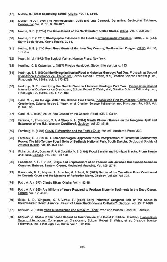
According to the Bible, all the fountains of the great deep burst open at the beginning of the flood (32). This could mean that large underground reservoirs opened up, by cracks In the overhanging ceiling (1; numbers refer to drawing), and an Immense amount of water burst forth (the reservoirs may have appeared more like a network of hollows, or highly porous rock, rather than one single large reservoir - compare to discoveries of porous rock containing circulating water at depths of 11.5 km [21, 40)). As the fountains were opened, and the ceiling collapsed, the former reservoirs would turn Into large troughs or depressions where sediment subsequently was deposited (2). Sediments would mainly be deposited In these depreSSions and at the coasts of continents, leaving the old high grounds and land areas more or less barren (i.e. many shield areas on our planet). As sediment Is more dense than water, the crust/lithosphere would become depressed below the areas of deposition (2) (see Appendix 1 for details). The deepest parts of the lithosphere, below the former 'fountains of the great deep", would begin to melt after becoming pressed Into the asthenosphere. Also, the crust may have partly melted at the Moho (compare Rosendahl et al. (73)) and at the SIAljSIMA boundary (i.e. compare Krauskopf [42, pp. 341-342, 430-431), Corliss [21, p. 24), and Tyler (91)). When the lithosphere melted it would become lower In denSity, as compared to the overlying layers. The magma thus formed would therefore move upwards, through the thick layers of sediments (3), forcing the formation of mountains (4) ([91) and Appendix 1). The rising of the magma would also cause many of the sedimentary beds to be laterally compressed, or, to slide by gravity to lower elevations and pile up upon each other and form nappes. Consequently much "crustal shortening" would take place.
355

2
~ ,,·,,".·x ...... ><..-:- ." ~"'')(''''.,.:0 )0. K )(. X
~~~c ---~ ~ c---~
3
Figure 1. Mounte/n building hypothe.' •• From ebove - Cl1Iat (divided Into upper SIAL end lower SIMA), lithosphere (dlegone/llne.) end esthenosphere (waved line.). (Not dfllwn to .ca/e. See text for detell •. )
Observed geological data
Throughout the world there are many so-<:alled geosynclines - large hollows/troughs which have been filled with huge layers of sediment at the fringe areas of Precambrian shields. In the middle of these geosynclines magmatism and volcanism commonly has occurred - mantle plumes, diapirs and/or batholiths have risen through the earth's crust and pushed up high mountain chains. For example, the Himalayas, the Alps and most other Paleozoic to Cenozoic subaerial mountain chains were produced from large troughs which were filled with sediments. Consequently the central parts of the Alps and the Himalayas are made up of magmatic rocks, and in most other mountain chains there are abundant magmatic rocks. Many nappes have formed and, hence, "crustal shortening' has taken place (compare Carey [14)). In the Andes, the Caledonides, the Variscides, the Western United States, the Himalayas, the Mongolian Plateau, and other mountain belts, there is evidence for extensional tectonics [1, 2, 11 , 22, 25, 31, 34, 38, 49, 68, 96), which would be easier explained during sliding and gravitational collapse from a high center of uplift [1, 33, 68), than from plate collision during continental drift. Furthermore, geological correlations (and paleobiogeography; e.g. the Glossopteris flora has been found far north of the Himalayas [10)) do not suggest a long isolation of India from Africa and Asia [10 and 14, p. 158-162), which may even suggest that they have been in close contact until after deposition of most of the earth 's strata, and that the Himaiayas, for the most part, is not a collisional orogen but a rising geosyncline.
Evidently the geosynclines and mountain chains observed on this planet show indications of having been formed in a way similar to what one would suspect from a Biblical scenario, as outlined in the preceding section. it may have taken perhaps a few hundred years for the lower lithosphere to melt enough to build up a great diapir or batholith, in a Biblical flood scenario (but of course, some mountains could have risen more quickly) (Appendix 1).
Because the energy transported to the troughs (I.e., transportation of heavy sediments to a new region, and isostatic depression) would be carried with the rising magma as heat from the mantle, there is a basis for expecting that some parts of the asthenosphere would cool down at the roots of the mountains. This could explain the deep roots of many mountains. Furthermore, because the crust was depressed below the "fountains of the great deep', larger concentrations of sediment would have been deposited here, thus giving a thicker lithosphere.
There is also much evidence In support for uplift and orogenesis while the sediments were still unconsolidated, as it is difficult or impossible to envisage bending of solid rocks, except during high heat and/or pressure leading to higher grade metamorphism. Evidently, sediments have often been contorted or squeezed without being heavily metamorphosed; for example in Scania [44) and Gotland [SO) in Sweden, in California and Colorado in USA [5). where ever clastic dikes are present [74) and commonly in mountain chains. This indicates short t ime scales.
CONTINENTAL DRIFT - ONE MORE HYPOTHETICAL CONTRIBUTION
It may seem quite impossible to believe that great scale continental drift could have taken place during just a few thousand years, or even more impossible If it all took place during one single year (as suggested by many creationists). To open up the Atlantic, which is about 6000 km at its widest, would require a drift of 1 km/year for
356

3000 years In opposite directions (2x3000 km = 6000 km), I.e. a dally drift of nearly 3 m In opposite directions. The highest estimate of relative plate velocities based on the uniformitarian model Is 0.38 m/year, I.e. about four orders of magnitude too slow [29] . The maximal time accepted by most creationists, between the flood and the present, Is less than 10 000 years, but even 10 000 years Is not much. There is, however, evidence Indicating a quick continental drift, as shown below.
Hypothetical geological mechanism
At the lithosphere/asthenosphere boundary there may be a stratum of solid crystals in magma. Such material may be thixotropic, i.e. If put under differentiated pressure (I.e. shearing stress) the material will give way and behave like a fluid . If the environment is stable, a thixotropic material will behave as a solid. If huge amounts of sediments were transported and relocated on the earth's surface, unloading some areas while depositing sediments into deep troughs where the '10untains of the great deep" had been, the earth's interior would become destabilized. The vertical movements during mountain building may have fractured the lithosphere at its weakest places, close to the geosynclines where the lithosphere would be weakened, and would also have forced the plates to move horizontally, Induced by gravity and horizontal pushing from the upwelling magma. (Cracks In the lithosphere may also have originated during the flood, and/or by large meteorite Impacts.)
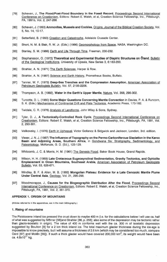
In this way a quick continental drift could have been Initiated, by sliding on the thixotropic layer when becoming fluidized (idea originally from Dr. Gary Parker, pers. comm.). Initial cracking accompanied by upwelling magma, would release the tension built up In the lithosphere during mountain building, and the continents would quickly start to move. After Initial acceleration the speed would slowly decrease, depending on the Inertia of the continents, the oceanic crust and the lubricating thixotropic layer (Fig. 2). It may also be possible that the lithosphere was thinner closer to creation, and cooled to a much higher degree after large amounts of heat was released during and after the flood. (See Appendix 2 for more details.)
If a layer of partly melted magma Is at the Moho (suggested by Rosendahl et a/. [73]), then I would suggest that some sliding below the continents, and some initial sliding below the oceanic crust, may have taken place at this surface too.
VELOCITY
TIME
Figure 2. D/agflm .howlng the hypothetical velocity of movement. of continents after Initial rupture. (There I. no scale on the d/agflm, since this I. only presented to show the general velocity varlatlon of the drift.)
The drift may be separated into two periods: 1. Small scale regional continental drift during the flood , maybe 100-1000 km (impossible to know if and how mUCh, at this stage of research) . 2. Large scale world-wide post-flood continental drift (starting during the days of Peleg, see below), amounting to a (strictly hypothetical) mean of 0.278 mm/s = 0.001 km/h = 9 km/year, during ca 200 years = 1800 km. This totals to 1800 + 1800 = 3600 km (I.e. continents will drift In directions opposite to each other, but the larger mass Eurasia/Africa would of course drift with less velocity and N-S America with higher velocity) . The mean drift may then have slowed down to 0.9 km/year for 500 years = 900 km, then 0.1 km/year for 1000 years = 100 km, then om km for 2000 years = 20 km. This is in total 4620 km. The above numbers may be arbitrarily changed, a little up or down, to reach the desired drift of 6000 km, for example 0.4 mm/s would mean a drift of 5050 km In 200 years. This speed is ca. four orders of magnitude lower than the highest inferred fluid velocities at the core-mantle boundary, 10 km/h (2.8 m/s), implied by changes In the magnetic field (these high velocities were doubted by Jacobs [37, p. 108], but not by Humphreys [36]). Observe that the drift decreases logarithmically and not linearly. Hence, the above hypothetical velocities show that very high drift speed is not needed In order to explain great scale post-flood continental drift.
357

The waves generated by the moving continents would be negligible compared to most normal tidal water (except for, of course, tsunamis generated by earthquakes that would accompany continental drift) . Considering the low velocity suggested above, not much would happen just because of the drift. The water would hardly rise much above the normal seashore.
The heat production ariSing from the drift is elaborated on in Appendix 3.
Geological observations suggest numerous post-flood catastrophes, and many of these must have been the consequence of mountain building and/or continental drift. Examples are large consolidated (or maybe semiconsolidated) blocks of Phanerozoic sediments, some as large as 200-600 km2 in size, which have slid many tens of kilometers [47, 72, 95), overthrusts which have been catastrophically moved [4, 64). and flood basalts in Washington (Columbia Plateau [59,60,61]) and India (the Deccan traps [13]). Flood basalts commonly accompany continental rifting (33), and are present at a few places on the Atlantic coast, i.e. in eastern central South America (in Brazil/Paraguay/Uruguay/Argentina), southwest Africa (Namibia), east Greenland, northern Ireland, the Atlantic just outside of the Norwegian coast and possibly the Caribbean (71). Pieces of continents seem to have also been left behind in the oceans, during drifting [14, 21) .
p N-A
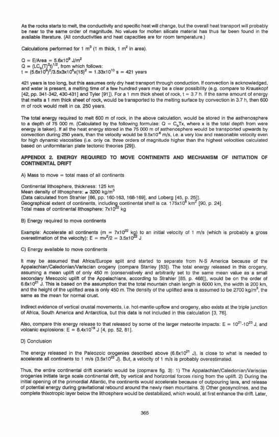
-Figure 3. Hypothetical continental drlff mechanism (not drawn to scale). (See text below, Appendix 2 and Appendix 4 for details.) (P = Pacific, N-A = North America, A = AUanUc, E = Europe. Black alTOws = forces. White alTOWS = movement of continents. Other marldngs as In fig. 1.)
During continental drift the oceanic crust may have sunk more or less straight down in front of the moving continents (fig. 3; mechanism slightly similar to Baumgardner (7); see Appendix 4) after the oceanic plates had been fractured (mechanism after Cook (20); brittle fracture spreading velocity of ca. 2 km/s). Actually, because the oceanic lithosphere is commonly denser than the undertying asthenosphere, it would be nearly inevitable that the oceanic lithosphere sank after splitting ([15), also see Appendix 4). This may be the reason why most so-called "subducting slabs" still display down-dip tensional faulting (18). The sinking slabs of oceanic lithosphere may even have enhanced continental drift, by creating vertical and horizontal drag in a direction away from the continents, during sinking. Almost near vertical Sinking of oceanic lithosphere may also explain the occurrence of undisturbed sediments, or absence of sediments, in the oceanic trenches [e.g. 14, 87) , which cannot be explained by the main stream model of subduction of oceanic lithosphere below continents.
MOUNTAIN BUILDING AND CONTINENTAL DRIFT IN A BIBUCAL PERSPECTIVE
The adjustments In the earth's lithosphere during the flood would have Initiated changes In the earth's interior, but the greatest period of mountain building and continental drift may have taken place a few hundred years after the flood, at the time of Peleg (Genesis 10-11). The root of the word Peleg means to be "divided by water" (65) . There could have been a beginning of continental drift and a division of the nations at approximately the same time. This also seems to be the opinion of one of the Old Testament apochryphs -"The Book of Yashar", 7:19 (62) "" . the name of one was Peleg, for in his days the sons of men were divided, and in the latter days, the earth was divided". This period of post-deluge catastrophes would have initiated the ice-age, by heating up the oceans and expelling large quantities of volcanic ash Into the atmosphere (a similar mechanism to the one proposed by Oard [66]) . Research conducted by myself [53, 54), Austin (61) , Scheven [77,79), and others, show that an ice age could not have started Immediately after the flood.
The geomagnetic field reversal data as presented by Humphreys [35, Fig. 2, p. 117) may suggest that shifts in the geomagnetic polarity took place both during the flood, and later during continental drift. If the core could be destabilized once, It could well have been destabilized many times, e.g. 1) as a consequence of the onset of the flood, 2) during small scale continental drift during the flood (compare Northrup [64]) , and 3) during large scale continental drift after the flood. As most Mesozoic and Cenozoic reversals have been recorded in marine strata, they may very well be post-flood (e.g. many marine Mesozoic strata are to a great part biogenic and would have needed extended time to build up). The destabilization of the upper mantle, may have '1ransmitted" movements to the outer core, which may have initiated the reversals of the magnetic field.
358
A post-flood continental drift, beginning a hundred or more years after the flood, explains recent biogeography more straightforward [51] than dispersal by the assistance of man [97].
CONCLUSIONS
The mountain building process here described fits the geological and geophysical data, even though many details need to be outlined and investigated. It Is valid independently of the more speculative continental drift hypothesis.
The continental drift model may be geophysically pOSSible, but of course, needs to be investigated more. One may wonder if some earth expansion is needed to explain all the data (e.g. that most plates seem to move away from each other [14 and 82, p. 28]. but then a plausible mechanism must be found [e.g. 57].
The exact timing of continental drift may be debated. It seems probable that most is post-flood, though some mountain building and some continental drift may have occurred during the later stages of the flood.
To conclude, earth models which are based on behaviour In the interior of the earth are always to some degree hypothetical, and therefore no mountain building or continental drift theory should be accepted without provisions. Also, probably no single model will explain all continental drift and mountain building on this planet, therefore models erected by many scientists may need to be incorporated.
ACKNOWLEDGEMENTS
Helpful comments and criticism came from Dr. Harold Coffin, Peter Olsson, Dr. Sune Petterson, Krister Renard and Dr. David Tyler. Drawings were made by Rebecca Ohmark and Pavia Korostenski. The language was corrected by Myles Dean. Those mentioned here are In no way responsible for any of the conclusions In this paper. They neither endorse nor disapprove the Interpretations done.
REFERENCES
[1] Anderson, R. E. (1993) The Newport Fault: Eocene Uatrlc Normal Faulting, Mylonlzatlon, and Cruatal Extension In Northeaatern Washington and Northweatern Idaho: Discussion and Reply, Geological Society of America Bulletin, Vol. 105, 1511-1514.
[2] Anderson, R. E. & Barnhard, T. P. (1993) Aspects of Three-Dimensional Strain at the Margin of the Extensional Orogeny, Virgin River Depreaslon Area, Nevada, Utah, and Arizona, Geological Society of America Bulletin, Vol. 105, 1019-1052.
[3] Antoine, l. A. G. & Moyes, A. B. (1992) Geophysical Evidence for a Causative Proceaa for Fragmentation In Weatern Gondwana, Geology, Vol. 20, 605-608.
[4] Austin, S. A. (1984) Catastrophes In Earth History. ICR.
[5] Austin, S. A. & Morris, J. D., TIght Folds and Claatlc Dikes as Evidence for Rapid Deposition and Deformation of Two Very Thick Stratigraphic Sequences, Proceedings First International Conference on Creationism, Editors: Robert E. Walsh, et ai, Creation Science Fellowship, Inc., Pittsburgh, PA, 1987, Vol. 2,3-15.
[6] Baumgardner, J. R., Numerical Simulation of the Large-Scale Tectonic Changes Accompanying the Flood, Proceedings First International Conference on Creationism, Editors: Robert E. Walsh, et ai, Creation Science Fellowship, Inc., Pittsburgh, PA, Vol. 2, 17-30.
[7] Baumgardner, J. R. 3-D Finite Element Simulation of the Global Tectonic Changes Accompanying Noah's Flood, Proceedings Second International Conference on Creationism, Editors: Robert E. Walsh, et ai, Creation Science Fellowship, Inc., Pittsburgh, PA, 1991, Vol. 2, 35-45.
[8] Boulton, G. S. (1990) Sedimentary and Sea Level Changea During Glacial Cycles and Their Control on Glacimarine Facies Architecture, in Glacimarine Environments: Processes and Sediments, Dowdeswell. J. A. & Scourse, J . D. (Eds.), Geological Society Spec. Publ. No. 53, 15·52.
[9] Brand, l. & Florence, J. (1982), Stratigraphic Distribution of Vertebrate Foaall Footprints Compared with Body Foeslla, Origins, Vol. 9, 67-74.
[10] Briggs, J . C. (1989) The Historic Biogeography of India: Isolation or Contact?, Systematic Zoology, Vol. 38, 322-332.
359
[11) Brodie, J. & White, N. (1994) Sedimentary BasIn Inveralon Caused by Igneous Underplating: Northweat European Con1lnental Shelf,~, Vol. 22,147-150.
[12) Brown, W. T., The Fountains ofthe Great Deep, Proceedings First International Conference on Creationism, Editors: Robert E. Walsh, et ai, Creation Science Fellowship, Inc., Pittsburgh, PA, 1987, Vol. 1, 23-38.
[13) Caldeira, K. G. & Ramplno, M. R. (1990) Deccan Volcanism, Greenhouse Warming, and the Crataceoua/Tertlary Boundary in Sharpton, V. L. & Ward, P. D. (Eds.) Global Catastrophes in Earth History. GSA Special Paper 247, 117-123.
[14) Carey, S. W. (1988) Theories of the Earth and Universe, Stanford University Press.
[15) Cloos, M. (1993) L1thoapherlc Buoyancy and Collisional Orogenesis: Subduction of Oceanic Plateaus, Continental Margine, Island Area, Spreading Ridges, and Seamounta, Geological Society of America Bulletin, Vol. 105,715-737.
[16) Clube, V. & Napier, B. (1982) Cloea Encounters With a Million Comats, New Scientist, Vol. 95, 148-151.
[17) Coffin, H. G. (1983) Origin by DeSign, Review and Herald Publ ., Washington, 81 .
[18) Comte, D. & SuArez, G. (1994) An Inverted Double Seismic Zone In Chile: Evidence of Phsse Transformation In the Subducted Slab, Science, Vol. 263, 212-215.
[19) Cook, M. A. (1966), Prehistory and Earth Models, Max Parrish, London.
[20] Cook, M. A. , How and When 'Pangea' Ruptured and the Continents Shifted, Proceedings First International Conference on Creationism, Editors: Robert E. Walsh, et ai, Creation Science Fellowship, Inc., Pittsburgh, PA, 1987, Vol. 2, 69-87.
[21) Corliss, W. R. (1991) Inner Earth: A Search for Anomalies, The Sourcebook Project, Glen Arm.
[22) Crouch, J. K. & Suppa, J. Late Cenozoic Tectonic Evolution of the Loa Angeles Basin and Inner California Borderland: A Model for Core Complex-Uke Cruetal Extension, Geological Society of America Bulletin, Vol . 105, 1415-1434.
[23] Dyrelius, D. & Elming, S. (1985) Bergarternas fysik, Kosmos 1985, Svenska Fysikersamfundet, 25.
[24) Easton, R. M. (1987) Paleozoic-Precambrian Unconformity Near Burleigh Falls, Ontario Highway 36, Ontario in Roy. D. C. (Ed.) Northeastern Section of the Geological Society of America, Geological Society of America, 337-338.
[25) England, P. & Houseman, G. (1989) Extension During Continental Convergence, With Application to the Tibetan Plateau, Journal of Geophysical Research, Vol. 94, No. B12, 17561-17579.
[26) von Fange, E. A. (1990) Genesis and the Dinosaur, Uving Word Services, Syracuse.
[27) Fischer, J. M. (1992) Dividing the Earth, CRSa, Vol. 28, 166-169.
[28) Gentry, R. V. , Radioactive Haloa: Implications for Creation, Proceedings First International Conference on Creationism, Editors: Robert E. Walsh, et ai, Creation Science Fellowship, Inc., Pittsburgh. PA. 1987, Vol. 2, 89-112.
[29) Gordon, R. G. (1991) Plate Tectonic Speed Umita, Nature, Vol . 349, 16-17.
[30] Gould, S. J. (1985) The Flamingo's Smile, W. W. Norton & Co., New York.
[31] Harms, T. A. & Price, R. A. (1993) The N_port Fault: Eocene Uatrlc Normal Faulting, Mylonlzatlon, and Cruatal Extension In Northeeatem Washington and Northweatem Idaho: Discussion and Reply, Geological Society of America Bulletin, Vol. 105, 1511 -1514.
[32) Hasel, G. F. (1974) The Fountains ofthe Great Deep, Origins, Vol. 1, No. 2, 67-72.
[33) Hill, R. I., Campbell. I. H., Davies, G. F. & Griffiths, R. W. (1992) Mantle Plumes and Continental Tectonlea, SCience, Vol. 256, 186-193.
360
(34) Holliger, K. & Levander, A. (1994) Lower Crustal Reflectivity Modeled by Rheological Controls on Maflc Intruslona, ~, Vol. 22, 367-370.
[35] Humphreys, D. R. , Reversals of the Earth's Magnetic Field During the Genesis Flood, Proceedings First International Conference on Creationism, Editors: Robert E. Walsh, et ai , Creation Science Fellowship, Inc., Pittsburgh, PA, Vol. 2,113-126.
(36) Humphreys, D. R., Physical Mechanism for Reversals of the Earth's Magnetic Field During the Flood, Proceedings Second International Conference on Creationism, Editors: Robert E. Walsh, et ai, Creation Science Fellowship, Inc., Pittsburgh, PA, 1991, Vol. 2, 129-142.
[37] Jacobs, J. A. (1992) Deep Interior of the Earth, Chapman & Hall, 108.
[38] John, B. E. & Foster, D. A. (1993) Structural and Thermal Constraints on the Innlstlon Angle of Detachment Faunlng In the Southern Basin and Range: The Chemehuevl Mountains Case Study, Geological Socletv of America Bulletin, Vol. 105, 1091 -1108.
(39) Kaye, G. W. C. & Laby, T. H. (1973) Tables of Physical and Chemical Constants, 14th ed., Longman, 55.
[40] Kerr, R. A. (1984) The Deepest Hole In the World, SCience, Vol. 224, 1420.
[41] Kerr, R. A. (1991) Coming up Short In a Crustal Quest, SCience, Vol. 254, 1456-1457.
(42) Krauskopf, K. B. (1979) Introduction to Geochemistrv, 2nd ed., McGraw-Hili, Tokyo.
(43) Kulinich, S. (1990) Down the Kola Well, Geoscience Canada, Vol. 17:3, 200.
(44) UndstrOm, M. (1967) 'Funnel Grabens' and Early Paleozoic Tectonism in South Sweden, Geological Society of America Bulletin, Vol. 78, 1137-1154.
[45] Loberg, B. (1987) Geologi, Norstedts.
(46) Lockley, M. G., Yang, S. Y. , Matsukawa, M., Fleming, F. & Urn, S. K. (1 992) The Track Record of Mesozoic Birds: Evidence and Implications, Philosophical Transactions of the Royal Society of London, series B, Vol. 336,113-134.
(47) Maxwell, J. C. (1959) Turbldne, Tectonic and Gravity Transport, Northern Appenine Mountains, Italy, American Association of Petroleum Geologists Bulletin, Vol. 43, 2701-2719.
[48] Mlnlsymposlum on Orogeny (1987), CRSa, Vol. 24, 53-69,125-136 (different authors).
[49] Mpodozis, C. & Allmendinger, R. W. (1993) Extensional Tectonlca, Cretaceous Andes, Northern Chile (27"S) , Geological Society of America Bulletin, Vol. 105, 1462-1477.
[50] Mol~n, M. (1986) Gotlands geologlska gAts (The Geologic Riddle of Gotland), Skapelsetro (Biblical Creation Society of Sweden), No. 1, Vol. 7, 7-23, 35.
[51] Mol~n, M. (1987) Hur kom &englngaren till Sydamerlka? (How did the Tree Sloth Reach South America?), Skapelsetro (Biblical Creation SOCiety of Sweden), No.3, Vol. 8, 12-19.
[52] Mol~n, M., Dlamlctnes: Ice-Ages or Gravity FlOWS?, Proceedings Second International Conference on Creationism, Editors: Robert E. Walsh, et ai, Creation Science Fellowship, Inc., Pittsburgh, PA, 1991, Vol. 2,177-190.
[53] Mol~n, M. (1990b) Discusalon, Proceedings Second International Conference on Creationism, Editors: Robert E. Walsh, et ai, Creation Science Fellowship, Inc., Pittsburgh, PA, 1991, Vol. 2, 198.
[54) MoISn, M. (1991) Vart Ursprung? (3rd rev. ed.), Umea FoU, 304 pp.
[55) Mol~n, M. (1992) SEM-Microtextures: Attempting to Solve the Problem of the Origin of Diamictons and Diamictites, M.Sc. thesis, York University, 182 pp.
[56] Morton, G. R. , Geologic Challenges to a Young Earth, Proceedings First International Conference on Creationism, Editors: Robert E. Walsh, et ai, Creation Science Fellowship, Inc., Pittsburgh, PA. 1987, Vol. 2, 137-146.
361
[57) Mundy, B. (1988) Expanding Earth?, Origins, Vol. 15,53-69.
[58) MOrner, N.-A. (1979) The Fennoscandian Uplift and Late Cenozoic Dynamlca: Oeologlcal Evidence, GeoJournal, Vol. 3, No.3, 304-317.
[59) Nevins, S. E. (1971 a) The Meae Ba .. lt of the Northwestern United Ststes, CRSa, Vol. 7, 222-226.
[50) Nevins, S. E (1971 b) Stratigraphic Evidence of the Flood in Symposium on Creation 3, Patten, D. W. (Ed.), Baker Book House, Grand Rapids, 32-65.
(61 ) Nevins, S. E (1974) Post-Flood Strsta of the John Day Country, Northeeatern Oregon, CRSa, Vol. 10, 191-204.
(62) Noah, M. M. (1972) The Book of Yashar, Hermon Press, New York.
(63) Nordling, C. & Osterman, J. (1987) Physics Handbook, Studentlitteratur, Lund, 153.
(64) Northrup, B. E. (1990a) Identifying the Noahlc Flood In Historical Geology: Part One, Proceedings Second International Conference on Creationism, Editors: Robert E. Walsh, et ai, Creation Science Fellowship, Inc., Pittsburgh, PA, 1991a, Vol. 1, 173-179.
(65) Northrup, B. E, Identifying the Noahlc Flood In Historical Geology: Part Two, Proceedings Second International Conference on Creationism, Editors: Robert E. Walsh, et ai , Creation Science Fellowship, Inc., Pittsburgh, PA, 1991 b, Vol. 1, 181-188.
(66) Oard, M. J., An Ice Age Within the Blbllcel TIme Frame, Proceedings First International Conference on Creationism, Editors: Robert E. Walsh, et ai, Creation Science Fellowship, Inc., Pittsburgh, PA, 1987, Vol. 2, 157-166.
(67) Oard, M. J . (1990) An Ice Age Caused by the Genesis Flood, ICA, EI Cajon.
(68) Parsons, T., Thompson, G. A. & Sleep, N. H. (1994) Mantle Plume Influence on the Neogene Uplift and Extension of the U.S. Western Cordillera?, Geology, Vol. 22, 83-86.
(69) Ramberg, H. (1981) Gravity Deformation and the Earth's Crust, 2nd ed., Academic Press, 332.
(70) Retallack, G. J. (1983), A Paleopedologlcal Approach to the Interpretation of Terrestrial Sedimentary Rocks: The Mid-Tertiary Fossil Solis of Badlands Nstlonal Park, South Dakota, Geological Society of America Bulletin, Vol. 94, 823-840.
(71) Richards, M. A., Duncan, R. A. & Courtillot V. E. (1989) Flood Beaelts and Hot-Spot Tracks: Plume Heads and Talis, SCience, Vol. 246, 103-106.
(72) Robertson, A. H. F. (1991) Origin and Emplacement of an Inferred Late Jura .. lc Subduction-Accretion Complex, Euboea, Eastern Greece, Geological Magazine, Vol. 128,27-41.
(73) Rosendahl, B. A., Meyers, J., Groschel, H. & Scott, D. (1992) Nature of the Transition From Continental to Oceanic Crust and the Meaning of Reflection Moho, Geology. Vol. 20, 721-724.
(74) Roth, A. A. (1977) Clastic Dikes, Origins, Vol. 4, 53-55.
(75) Roth, A. A. (1985) Are Millions of Years Required to Produce Biogenic Sediments In the Deep Ocean, Origins, Vol . 12, 48-56.
(76) Salda, L. D., Cingolani, C. & Varela, R. (1992) Early Paleozoic Orogenic Belt of the Andes In Southweatern South America: Result of Laurentla.oondwana ColIlslon? ,~, Vol. 20, 617-620.
(77) Scheven, J. (1988) Mega-Sukzesslonen und Kllmax 1m Tertillr, Wort und Wlssen, Band 19, Hllnssler.
(78) Scheven, J., Stasis In the Fossil Record as Confirmation of a Belief In Biblical Creation, Proceedings Second International Conference on Crestlonlsm, Editors: Robert E. Walsh, et ai, Creation Science Fellowship, Inc., Pittsburgh, PA, 1991a, Vol. 1, 197-215.
362
[79) Scheven, J., The Flood/Post·Flood Boundary In the Fossil Record, Proceedings Second International Conference on Creationism, Editors: Robert E. Walsh, et ai, Creation Science Fellowship, Inc., Pittsburgh, PA, 1991b, Vol. 2, 247-266
(80) Scheven, J. (1993) Ammonites, Mussels and Cockles, Origins, Journal of the Biblical Creation Society, Vol. 5, No. 14, 10-17,
[81) Setterfield, B. (1993) Creation and Catastrophe, Adelaide Crusade Center.
[82) Short, N. M. & Blair, R. W. Jr. (Eds.) (1986) Geomorphology from Space, NASA, Washington DC.
[83) Stanley, S. M. (1986) Earth and Ufe Through Time, Freeman, 230-232.
(84) Stephansson, O. (1972) Theoretical and Experimental Studies of Diapiric Structures on Oland, Bulletin of the Geological Institutions, University of Upsala, New Series 3, 6: 163-200.
[85) Strahler, A. N. (1971) The Earth SCiences, Harper & Row.
[86) Strahler, A. N. (1987) Science and Earth History, Prometheus Books, Buffalo.
[87) Tanner, W. F. (1973) Deep-Sea Trenches and the Compression Assumption, American Association of Petroleum Geologists Bulletin, Vol. 57,2195-2206.
(88) Thompson, A. B. (1992), Water In the Earth's Upper Mantle, Nature, Vol. 358, 295-302.
(89) Turcotte, D. L. (1980) Some Major Questions Concerning Mantle Convection in Davies, P. A. & Runcorn, S. K. (Eds.) Mechanisms of Continental Drift and Plate Tectonics, Academic Press, 173-182.
(90) Twidale, C. R. (1976) Analysis of Landforms, John Wiley & Sons, Sydney.
(91) Tyler, D. J., A Tectonlcelly-Controlled Rock Cycle, Proceedings Second International Conference on Creationism, Editors: Robert E. Walsh, et ai, Creation Science Fellowship, Inc., Pittsburgh, PA, 1991, Vol. 2, 293-301 .
(92) Velikovsky, I. (1976) Earth in Upheaval, Victor Gollancz & Sidgwick and Jackson, london, 3rd. edition.
(93) Visser, J. N. J. (1987) The Influence of Topography on the Permo-Carbonlferous Glaciation In the Karoo Basin and Adjoining Areas, Southern Africa, in Gondwana Six: Stratigraphy, Sedimentology, and Paleontology, McKenzie, G. D. (Ed.), 123-129.
(94) Whitcomb, J. C. & Morris, H. M. (1961) The Genesis Flood, Baker Book House, Grand Rapids.
(95) Wilson, H. H. (1969) late Cretaceous Eugeosyncllnal Sedimentation, Gravity Tectonlce, and Ophiolite Emplacement In Oman Mountains, Southeast Arabia, American Association of Petroleum Geologists Bulletin, Vol. 53, 626-671.
(96) Windley, B. F. & Allen, M. B. (1993) Mongolian Plsteau: Evidence for a late Cenozoic Mantle Plume Under Central Asia, Geology, Vol. 21 , 295-298.
(97) Woodmorappe, J., Causes for the Biogeographic Distribution After the Flood, Proceedings Second International Conference on Creationism, Editors: Robert E. Walsh, et ai, Creation Science Fellowship, Inc., Pittsburgh, PA, 1991, Vol. 2, 361-370.
APPENDIX 1. ORIGIN OF MOUNTAINS
(Articles referred to In the appendices, are in the main bibliography.)
1. Rising of mountains
The Pleistocene inland ice pressed the crust down to maybe 400 m (i.e. for the calculations below I will use ca. half of what was suggested by MOrner (58)and Strahler [86, p. 258); also some of the depression may be tectonic rather than glaCiO-isostatic in origin). The value of 400 m conforms well with the ca. 300 m of isostatiC depression suggested by Boulton (8) for a 2 km thick inland ice. The total maximum glacier thickness during the ice·age is impossible to know precisely, but I will assume a thickness of 2.6 km (which may be considered too much, compare Oard (67) and Mol~n [55)). If such a thick glacier would have covered 200,000 km2, its weight would have been ca. 4.8xl017 kg.
363

If a subterranean aquifer was of the same area and volume as the above glacier, the weight of the water would be ca. 5.2x10¹⁷ kg. If the water was exchanged for a 3.2 km thick layer of sediment (accounting for some initial depression) the weight of the material In the depression would rise to ca. 1.41x10'8 kg. (Assuming a density of 2.2 g/cm3 for the sediments, computed with 30% water, and 70% minerals with an average density of 2.7 g/cm3. The density of the upper crust Is 2.7 g/cm3, but sedimentary strata always contains some hollows, especially before compaction.)
The weight difference between the water and sediment Is 8.9x1 017 kg. If comparing this to the weight of the inland ice (which may have pushed the crust 400 m downwards), one may assume that the crust became depressed more than 600 m (i.e. closer to 700 m). The temperature rise In the crust Is ca. 2.5 K per 100m at great depth [43), which may imply that the temperature would rise ca. 15 K all around the depressed parts of the lithosphere. As the lowest part of the lithosphere is close to the melting pOint, It probably started to melt. (Based on interpretations of earthquake waves, approximately 1-10% of the asthenosphere Is assumed to be In liquid form [45, p. 12). In the following calculations it is assumed that the lithosphere melted.) The heat would then be transported upwards with the magma. If the geographical extent of the depressed area was 200,000 km2, then ca. 120,000 km3 of lithosphere would be depressed into the asthenosphere.
The above calculations of isostatic depression and temperature difference are, of course, speculative, containing many inferred factors. But they indicate that the present model may be possible.
The calculation of how quickly mountains will rise is simply made with Stokes law [91). The magma which has lifted most mountains would be called large intrusions, i.e. batholiths or even mantle plumes, rather than diapirs. It may also be assumed that not all magma Is rising as one large diapir. The below model calculation is performed only to show the rapid rising velocity.
v = 2r2g1p-pol 9 ..
v = velocity of rise of diapir (m/s) r = radius of diapir (m) g = gravity acceleration (m/S2) P-Po = density difference between diapir and surrounding rocks (kg/m~ 1& = dynamic viscosity (Pas = Ns/m2. 1 Pas = 10 poise.)
The following values are used for the calculations: g = 10 m/s2
P-Po = 50 kg/m3 (conservatively set) .. = 10'2 Pas (all known magmas are _ 10'2 Pas [69)) r = 10,000 m Mean thickness of continental lithosphere = 125 km
if 1& = 10'2 (the same as quartz at 770 K [23]), V wlll be 1.11x10⁻² m/s. At this velocity the magma would pass through the complete lithosphere In ca. 130 days. This Is based on the assumptions 1) that the lower lithosphere has nearly melted, and 2) that the magma rises through many sedimentary (partly unsolidified) layers which have lower viscosity than Precambrian magmatic bedrock (I.e. 104_10'8 Pas for most sedimentary strata [84); 10'9-102' Pas for magmatic bedrock [23]), and the well known facts that A) higher temperature reduces the dynamic viscosity, and B) water (in the newly depOSited sediments, and possible also small amounts released from crystals during melting) reduces both the melting point and the viscosity [BB). A dynamic viscosity of 10'2 Pas does not seem unjustified. Note that most rising magmas will probably not travel through continuous rocks, but fractures would be commonplace throughout (compare Cook [19, 20) and Brown [12]). Also, possible the lithosphere would partly melt at the Moho [73) and at the SIALJSIMA boundary (i.e. compare Krauskopf [42, pp. 341-342, 430-431), Corliss [21, p. 24), and Tyler [91]), which would explain the many granitic Intrusions present in mountains.
2. Melting of depressed lithosphere
The volume of a depressed '10untain" may be assumed to be ca. 120,000 km3, with a thickness of ca. 600 m. It may further be assumed that the heat source surrounding the depressed mass Is Infinite, since it is the asthenosphere. The energy required to heat the rocks to melting point (or to heat the lowest parts of the lithosphere, after melting, to T = 15 K above melting point) is negligible compared to the heat required to melt silicate rock.
Heat required to melt silicate rocks is 5.6x1 09 J/m3 [~. Total energy required to melt 120,000 km3 of basalt therefore is 6.72x10²³ J. Specific heat of basalt Is, Cb = 3x10 J/m3K [39) . Thermal conductivity for silicate rocks is ca., L = 3.5 W/mK [7).
364
As the rocks starts to melt. the conductivity and specific heat will change. but the overall heat transport will probably be near to the same order of magnitude. No values for molten silicate material has thus far been found in the available literature. (All conductivities and heat capacities are for room temperature.)
Calculations performed for 1 m3 (1 m thick. 1 m2 in area).
a = E/Area = 5.6xl09 J/m2
a = (LCb(1it) '12. from which follows: t = (5.6xl 0")2/3.5x3xl 06x(15)2 = 1.33xl 0'0 s = 421 years
421 years is too long. but this assumes only dry heat transport through conduction. If convection is acknowledged. and water Is present. a melting time of a few hundred years may be a clear possibility (e.g. compare to Krauskopf [42. pp. 341 -342. 430-431] and Tyler [91]). For a 1 mm thick sheet of rock. t = 3.7 h. If the same amount of energy that melts a 1 mm thick sheet of rock. would be transported to the melting surface by convection in 3.7 h. then 600 m of rock would melt in ca. 250 years.
The total energy required to melt 600 m of rock. in the above calculation. would be stored in the asthenosphere to a depth of 75 000 m. (Calculated by the following formulae: a = Cb Tx. where x is the total depth from were energy is taken). If all the heat energy stored in the 75 000 m of asthenosphere would be transported upwards by convection during 250 years. than the velocity would be 9.5xl0~ m/s. I.e. a very low and reasonable velocity even for high dynamic viscosities (i .e. only ca. three orders of magnitude higher than the highest velocities calculated based on uniformitarian plate tectonic theories [29]).
APPENDIX 2. ENERGY REQUIRED TO MOVE CONTINENTS AND MECHANISM OF INITIATION OF CONTINENTAL DRIFT
A) Mass to move = total mass of all continents
Continental lithosphere. thickness: 125 km Mean density of lithosphere: .. 3200 kg/m3
(Data calculated from Strahler [86. pp. 160-163. 168-169]. and Loberg [45. ~. 25)) . Geographical extent of continents. including_continental shelf is ca. 175xl0 km [90. p. 24]. Total mass of continental lithosphere: 7xl r:i'" kg
B) Energy required to move continents
Example: Accelerate all continents (m = 7xl if2 kg) to an initial velocity of 1 m/s (which is probably a gross overestimation of the velocity) : E = mv2/2 = 3.5xl if2 J
C) Energy available to move continents
It may be assumed that Africa/Europe split and started to separate from N-S America because of the Appalachian/CaledonianNariscian orogeny (compare Stanley [83]). The total energy released in this orogeny. assuming a mean uplift of only 450 m (conservatively and arbitrarily set to the same mean value as a small secondary Mesozoic uplift of the Appalachians. according to Strahler [85. p. 468]). would be on the order of 6.6xlo2' J. This is based on the assumption that the total mountain chain length is 6000 km. the width is 200 km. and the height of the uplifted area is only 450 m. The density of the uplifted area is assumed to be 2700 kg/m3• the same as the mean for normal crust.
Indirect evidence of vertical crustal movements. i.e. hot-mantle-upflow and orogeny. also exists at the triple junction of Africa. South America and Antarctica. but this data is not included in this calculation [3. 76].
Also. compare this energy release to that released by some of the larger meteorite impacts: E = 102'-1023 J. and volcanic explosions: E = 8.4xl0'9 J [4. pp. 52. 81].
D) Conclusion
The energy released in the Paleozoic orogenies described above (6.6xlo2' J). is close to what is needed to accelerate all continents to 1 m/s (3.5xlif2 J). But. a velocity of 1 m/s is probably overestimated.
Thus. the entire continental drift scenario would be (copmare fig. 3) : 1) The Appalachian/CaledonianNariscian orogenies initiate large scale continental drift. by vertical and horizontal forces rising from the uplift. 2) During the initial opening of the primordial Atlantic. the continents would accelerate because of outpouring lava. and release of potential energy during gravitational rebound around the newly risen mountains. 3) Other geosynclines. and the complete thixotropic layer below the lithosphere would be destabilized. which WOUld. at first enhance the drift. Later.
365

especially after orogenies, the continents would decelerate and start to move similar to today.
APPENDIX 3. HEATING OF THE OCEANS DURING CONTINENTAL DRIFT
The heating of the oceans during continental drift would mainly be from two sources: 1. Heat from melted lava. 2. Frictional heat rising from the movements.
While heating from melted lava is easy to calculate, frictional heating is not. Only an approximation, comparing to frictional heat rising from a sphere which is rolled In liquid media, has been possible to conduct for this paper. It may be speculated that this process may produce heat on the same order of magnitude as a continent sliding on a thixotropic layer of magma and crystals.
1. Heating from melted leva.
It will be assumed that the Atlantic had the same mean depth as today, and that all heat from the underlying magma was Instantaneously transported Into the water (which of course Is impossible - It would take many years). The following calculation Is for one square kilometer:
Mean depth of the Atlantic: 3800 m Volume of water: 3.8 km3
Temperature difference between water and magma: T = 1200 K (average upper asthenosphere temperature Is estimated to be ca. 1470 K (15), so a temperature difference of 1200 K is probably an overestimation).
Volume of magma = 0.1 km3 (If It Is assumed that the magma cools instantaneously down to a depth of 100 m).
Specific heat of basalt, Cb = 1.0 kJ/kgK Specific heat of water, Cw = 4.18 kJ/kgK Density of basalt, Pb = 3000 kg/m3
Density of water, Pw = 1000 kg/m3
Mass of basalt, mb = 3.Ox10" kg Mass of water, mw = 3.8x10'2 kg
Energy transported from basalt: E = CbmbT = 4.41x10'4kJ This energy (E) will warm the water: Tw = ElCwmw = 27.8 K
This Is a small temperature difference, which would by no means destroy life on earth or In the sea, because only water In the Atlantic would be heated and the heating would be spread over a long time period of continental drift. It would, though, help In giving moisture to rapidly growing glaciers during the Ice-age (compare to Oard (66)). Similarly, any heating of water in the Pacific, rising from ou1pourlng of lava after rapid lithospheric sinking, would stretch over a long time period (hundreds to thousands of years), and would raise the temperature even less than in the Atlantic.
2. Frictional heating.
Example: Comparing to a sphere which moves In a ilquld (63).
E = -KpVx
I' = dynamic viscosity (Pas) V = velocity of moving continents K = Ssr for a sphere x = distance traveiled by continent
V = 1 m/s (Initial hypothetical velocity, from Appendix 2) r = 7500 km (a sphere with the same radius as If all continents are made into one circle, including the continental shelves) x = 100 km (hypothetical magnitude of movement with Initial velocity, during brittle fracturing of continents) I' = 10'2 Pas (dynamic viscosity for the most viscous lava, which may be considered too high for a thixotropic material) (69) Total volume of ocean water: 1.4x10'S m3
Total frictional heating from movement of the continents: E = 1.4x1025 J This energy (E) will warm the water with: Tw = ElCw~ = 2.4 K
366

Even though it is impossible to know the total friction, and the above calculation has only been performed for a sphere moving in a liquid, the temperature will probably rise very little. The values of V and I' may also be greatly overestimated.
APPENDIX 4. SINKING OF OCEANIC UTHOSPHERIC SLABS AND DEPRESSION OF UTHOSPHERE
The present model works with time scales on the order of thousands of years, but the ocean-floor must have sunk in front of the moving continents in a time period of months or years at the most. Deformational (and some frictional) heating during sinking, which reduces the viscosity, would enhance the velocity until a depth of similar density as the sinking slab would be reached.
The sinking velocity is calculated by Stokes law (compare to Appendix 1):
V = 2r2g(p-Pc>
9J&
V = velocity of sinking lithosperic slab (m/s) r = radius of sinking slab, considered to be a sphere (m) g = gravity acceleration (m/s2) P-Po = density difference between sinking slab and surrounding I' = dynamic viscosity (Pas = Ns/m2)
The following values are used for the calculations: g = 10 m/s2 P-Po = 40 kg/m3 [15] '" = 1019 Pas (see below) r = 50,000 m (half the size of the length of the hypothetical postulated initial movement - see Appendix 3)
The value for 1', based on uniformitarian models, could be set to 1019 Pas for the following reasons: 1) Most estimates of the viscosity of the asthenosphere is on the order of 1019-1022 Pas. 2) According to ~relius & Elming [23] there is a viscosity minimum at the asthenosphere/lithosphere boundary. 3) A value of 4xl01 Pas is used by Turcotte [89] while calculating mantle convection.
The sinking velocity for a slab with r = 50,000 m is 2.2xl 0-9 m/s. This value is orders of magnitude too small for the lithosphere to sink during months or years. Even a viscosity decrease caused by deformational (and frictional) heating may not be enough to achieve quick sinking slabs. But, if the upper asthenosphere was in a thixotropical state, so that the dynamic viscosity was on the order of 1012 Pas (similar to the most viscous lava flows [69]), would the sinking velocity be the right order of magnitude (I.e. 2.2xl 0-2 m/s which would mean that an oceanic slab would sink 125 km in ca. 60 days). This would be the right order of magnitude during the first, initial breakup of the continents. Also, a low dynamic viscosity is needed for the postulated 600 m of sinking below the geosynclines. So, the present model needs to work with a viscosity 107 lower than uniformitarian estimates. This is a weak part of the present model, but, if there is (or formerly was) a thixotropic layer at the lithosphere/asthenosphere boundary, then quick sinking could be accomplished by just overloading the lithosphere. At any rate, any student of earth history which believes that glaciers depressed the earth's crust during a short post-flood ice-age, must also believe that the dynamic viscosity was less than the uniformitarian postulate (e.g. compare to Oard [67, p. 176-178]).
367

368
Related Documents