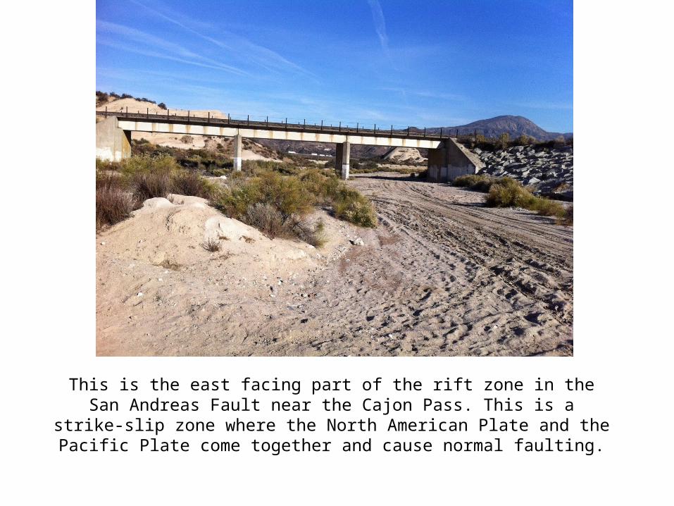
This is the east facing part of the rift zone in the San Andreas Fault near the Cajon Pass. This is a strike-slip zone where the North American Plate and the Pacific Plate come together and cause normal faulting.

Welcome message from author
This document is posted to help you gain knowledge. Please leave a comment to let me know what you think about it! Share it to your friends and learn new things together.
Transcript
This is the east facing part of the rift zone in the San Andreas Fault near the Cajon Pass. This is a strike-slip zone where the North American Plate
and the Pacific Plate come together and cause normal faulting.
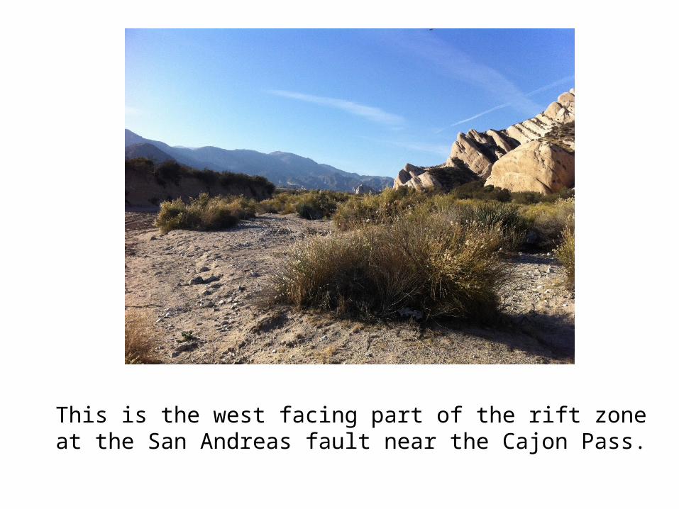
This is the west facing part of the rift zone at the San Andreas fault near the Cajon Pass.
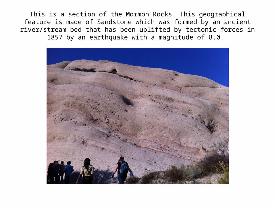
This is a section of the Mormon Rocks. This geographical feature is made of Sandstone which was formed by an ancient river/stream bed that has been
uplifted by tectonic forces in 1857 by an earthquake with a magnitude of 8.0.
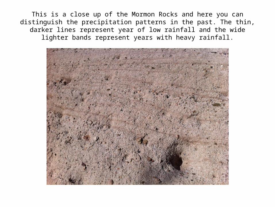
This is a close up of the Mormon Rocks and here you can distinguish the precipitation patterns in the past. The thin, darker lines represent year of low rainfall and the wide lighter bands represent years with heavy rainfall.
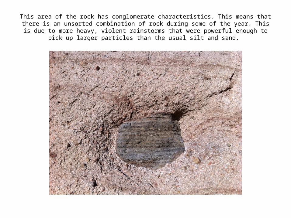
This area of the rock has conglomerate characteristics. This means that there is an unsorted combination of rock during some of the year. This is due to more heavy,
violent rainstorms that were powerful enough to pick up larger particles than the usual silt and sand.

The scrub Oak is an important part of Southern California’s ecosystem. This type of vegetation is know for it’s cloning abilities due to it’s inability to reproduce by sexual
means. After a fire, new sprouts grow from the base of old burned stems meaning that it is genetically identical to the previous shrub.
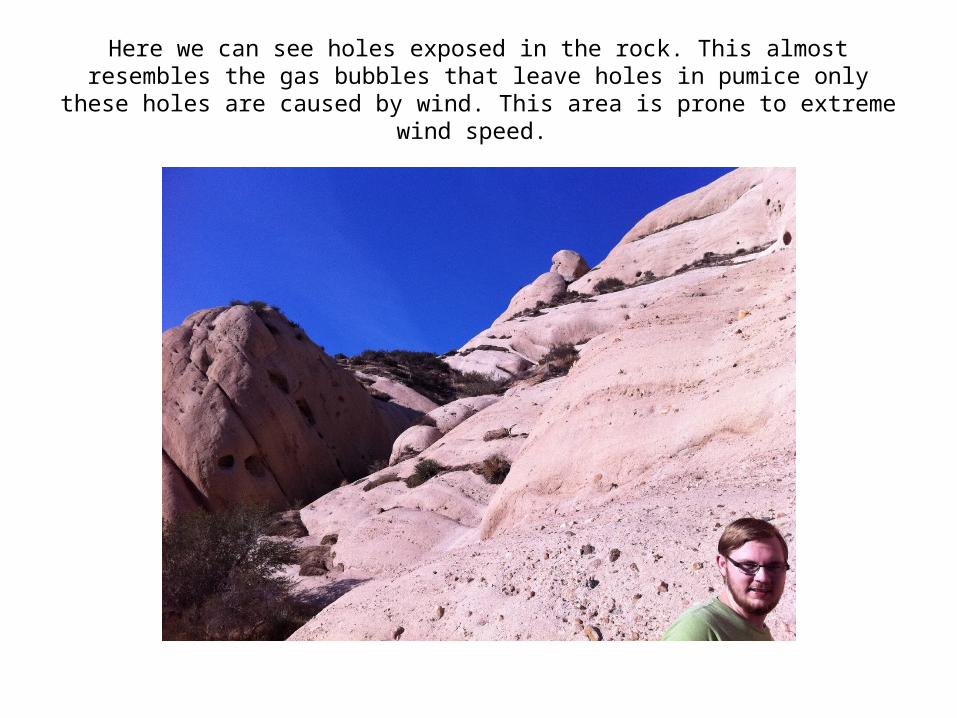
Here we can see holes exposed in the rock. This almost resembles the gas bubbles that leave holes in pumice only these holes are
caused by wind. This area is prone to extreme wind speed.
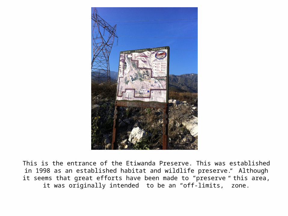
This is the entrance of the Etiwanda Preserve. This was established in 1998 as an established habitat and wildlife preserve. Although it seems that great efforts have been made to “preserve” this area, it was originally intended to be an “off-limits,”
zone.
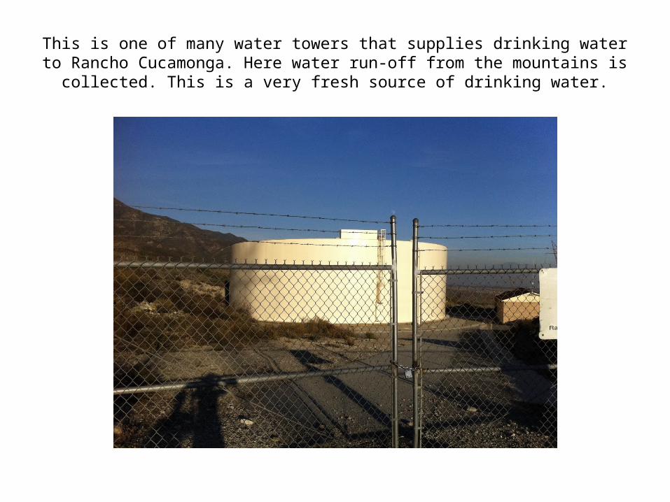
This is one of many water towers that supplies drinking water to Rancho Cucamonga. Here water run-off from the mountains is
collected. This is a very fresh source of drinking water.
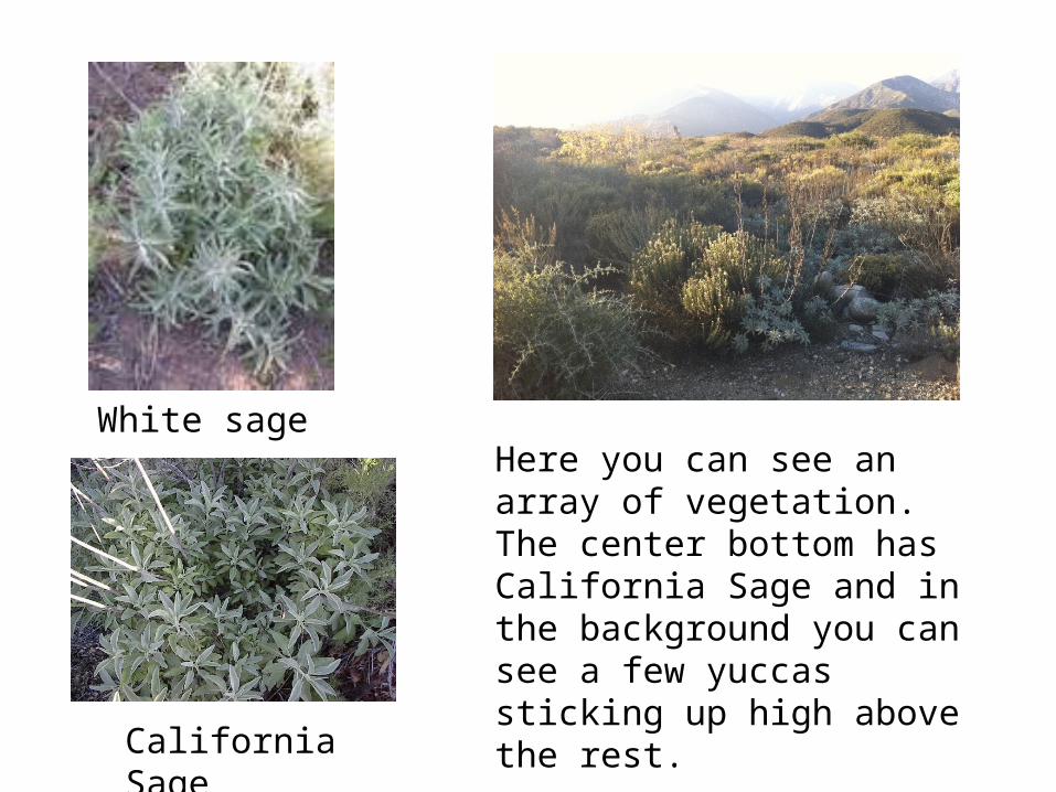
White sage
California Sage
Here you can see an array of vegetation. The center bottom has California Sage and in the background you can see a few yuccas sticking up high above the rest.

Here we can see evidence of a previous burn.

I picked this picture because it is a beautiful, smog-free, representation of what California should look like.

Here is where I identified evidence of the San Andreas Fault but the long wall-like geographical feature. This reveals that it is a normal fault because the hanging wall in moving down with respect to the foot wall.
Related Documents