Moran Township Master Plan Chapter 3 Page 1 CHAPTER THREE PROFILE OF MORAN TOWNSHIP Introduction A Master Land Use Plan is a statement of action or strategy for land uses in the Township. These strategies are based on an analysis of the physical, social, and economic characteristics of the area. This section of the report explores these characteristics of the Township. The Natural Features The primary factor in deciding the appropriateness of a particular land use in a specified area is its natural characteristics. These characteristics, including soils, topography, and ecology, present the opportunities and constraints a parcel or area has towards a particular land use. While, at times, an area of land may have the needed requirements for a specific land use, often times this is not the case. As a result, the land developer and the Township incur additional costs, both tangible and intangible. It is fundamental that new land uses and the expansion of existing land uses be directed toward areas that have limited development constraints to minimize social, economic, and environmental costs. The following is a review of these characteristics throughout Moran Township and their ramifications toward future growth. Topography and Surface Drainage This township has a great variation in topography. In the northwestern half, above Brevoort Lake, except for a few random areas including portions of Little Brevoort River, Silver Creek, and Carp River corridors, the land areas rarely exceed grades of more than 5%. In the southeastern half of the Township, the topography is considerably more varied. This is most notable within the land areas directly southwest of Hay Lake, around Silver Lake and Martin Lake, and in the coastline area between Pointe LaBarbe and Cut River. The topography along the coastline varies considerably with some shoreline areas being fairly flat and level while others having excessive slopes and high bluffs. There is an overall gradual rise in land elevation in the Township. This is particularly true in the northwestern half of the Township where elevations range from 585 feet above sea level along the shoreline to 915 feet above sea level just north of Ozark. In the southeastern half of the Township, the rise in elevation is not as great and reaches 640 feet above sea level just west of Hay Lake. However, bluffs near Silver Lake exceed elevations of 770 feet above sea level. The majority of surface drainage collects within the expansive marsh network where subsurface drainage is poor. Many of these wetland areas drain into the multitude of rivers and creeks that meander throughout the Township. Many of these rivers and creeks empty into inland lakes prior to reaching Lake Michigan.

Welcome message from author
This document is posted to help you gain knowledge. Please leave a comment to let me know what you think about it! Share it to your friends and learn new things together.
Transcript

Moran Township Master Plan
Chapter 3 Page 1
CHAPTER THREE PROFILE OF MORAN TOWNSHIP Introduction A Master Land Use Plan is a statement of action or strategy for land uses in the Township. These strategies are based on an analysis of the physical, social, and economic characteristics of the area. This section of the report explores these characteristics of the Township. The Natural Features The primary factor in deciding the appropriateness of a particular land use in a specified area is its natural characteristics. These characteristics, including soils, topography, and ecology, present the opportunities and constraints a parcel or area has towards a particular land use. While, at times, an area of land may have the needed requirements for a specific land use, often times this is not the case. As a result, the land developer and the Township incur additional costs, both tangible and intangible. It is fundamental that new land uses and the expansion of existing land uses be directed toward areas that have limited development constraints to minimize social, economic, and environmental costs. The following is a review of these characteristics throughout Moran Township and their ramifications toward future growth. Topography and Surface Drainage This township has a great variation in topography. In the northwestern half, above Brevoort Lake, except for a few random areas including portions of Little Brevoort River, Silver Creek, and Carp River corridors, the land areas rarely exceed grades of more than 5%. In the southeastern half of the Township, the topography is considerably more varied. This is most notable within the land areas directly southwest of Hay Lake, around Silver Lake and Martin Lake, and in the coastline area between Pointe LaBarbe and Cut River. The topography along the coastline varies considerably with some shoreline areas being fairly flat and level while others having excessive slopes and high bluffs. There is an overall gradual rise in land elevation in the Township. This is particularly true in the northwestern half of the Township where elevations range from 585 feet above sea level along the shoreline to 915 feet above sea level just north of Ozark. In the southeastern half of the Township, the rise in elevation is not as great and reaches 640 feet above sea level just west of Hay Lake. However, bluffs near Silver Lake exceed elevations of 770 feet above sea level. The majority of surface drainage collects within the expansive marsh network where subsurface drainage is poor. Many of these wetland areas drain into the multitude of rivers and creeks that meander throughout the Township. Many of these rivers and creeks empty into inland lakes prior to reaching Lake Michigan.
Moran Township Master Plan
Chapter 3 Page 2
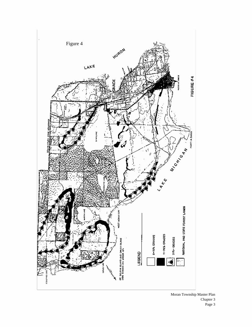
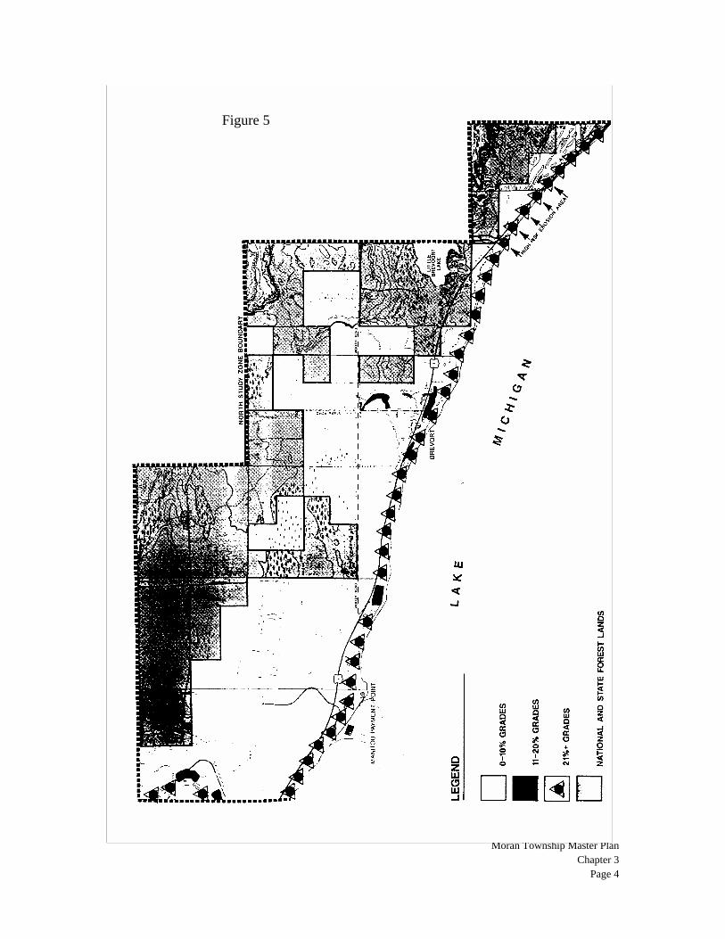
As Figure 4 illustrates, the South Study Zone is comprised vastly of lands with less than 10% grades. There are four areas where grades reach 21% or more. Three of these areas are the slopes associated with plateau areas in the vicinity of Silver Lake, Martin Lake, and Chain Lake. The fourth area is along the Lake Michigan coastline near Pointe LaBarbe Road. The majority of the surface drainage within the South Study Zone collects in the five inland lakes throughout the zone, the largest of which is Chain Lake covering approximately 250-acres. Lant Lake, the smallest of the larger inland lakes within this zone, covers approximately 10-acres. Silver Lake, the next largest, covers approximately 50-acres. The North Study Zone, as illustrated in Figure 5, is comprised almost entirely of level or mildly rolling areas with grades of less than 10% except along the Lake Michigan shoreline where nearly all grades exceed 21%. The coastline lands tend to have a greater susceptibility to erosion as a result of water and wind action, particularly during storm conditions. Numerous areas along the coastline of Moran Township are particularly vulnerable to erosion and have been identified as such by the Division of Land Resources Programs of the Department of Natural Resources. Geology The geology of Moran Township is similar to most of the eastern Upper Peninsula, which is the product of continental glaciations and the natural aging process of the Great Lakes resulting in a reduction of their original sizes. The eastern portion of Moran Township's surface geology consists predominantly of ancient lakebeds and bedrock formations. The western portion of the Township consists predominantly of outwash and glacial channels, as well as swamp-like areas with a high degree of peat and muck materials. The surface geology of the Township also includes sandy lakebeds along the Carp River Basin, bedrock in the area of Ozark south to the Carp River, and sand dunes south and west of Big Brevoort Lake. The South and North study zones surface geology is comprised of bedrock and outwash/glacial channels, respectively. A sand dune complex characterizes the Brevort area in the North Study Zone. The bedrock geology throughout the entire Township is comprised of Silurian Formations that are generally hard and resistant dolomites with evidence of embedded shale and gypsum. Much of the limestone bedrock has been fractured, recemented, and broken apart in the South Study Zone.
Moran Township Master Plan
Chapter 3 Page 3
Figure 4
Moran Township Master Plan
Chapter 3 Page 4
Figure 5
Moran Township Master Plan
Chapter 3 Page 5
Vegetative Cover The Township's land cover can be classified according to two covers, forested and marshlands. While open grassed areas do exist, they are limited to those immediate areas where houses have been established with associated yards and other small scale randomly cleared areas and do not represent a significant land cover in respect to quantity or location, except in the Ozark area. Most of Moran Township consists of glacial lake deposits with a large portion of this lake plain consisting of flat and poorly drained lands characterized by highly variable swamp, bog, fen and marsh communities. Swamp forests including hemlock, northern white cedar, balsam fir, white spruce, trembling aspen, balsam, poplar, and scattered white pine. The drier ridges associated with these areas are characterized by Dry Northern Forest and Dry-Mesic Northern Forest including jack pine, red pine, red oak, big tooth aspen, and paper birch. Lands along the Lake Michigan coastline associated with the extensive sand dunes are characterized by Northern Hardwoods. Forest vegetation includes beech, sugar maple, hemlock, black cherry and red oak. The low fore dunes are vegetated by herbaceous and shrub vegetation. The more interior dunes near Round Lake and Hay Lake, have forests of big tooth aspen, red pine, and white pine. Wet swales are located between the high dunes along Lake Michigan. The inland area supports a variety of wetland type vegetation including cedar, tamarack, and hardwood-conifer swamps, fens, bogs and marshes. Figures 6 and 7 delineate recognized wetland areas within the South and North Study Zones respectively. As the peat lands throughout the Township vary in thickness, so does the vegetation associated with those areas. These areas of greater depth reflect a muskeg or bog-like vegetation while those areas of a more shallow nature consist of conifer forests and swamps. Soils In 1984, the U.S. Forest Service prepared an inventoried the Sault Ste. Marie and St. Ignace Ranger Districts, which include Moran Township. According to the inventory, the soils within the South Study Zone tend to be poorly drained, the majority of which are of a loamy and sandy loam nature. The soils in the central portion of the Zone, between Martin Lake and Chain Lake, have wetland characteristics with a higher degree of peat and muck. The vast majority of privately owned lands within the North Study Zone have well drained loamy sands which are more supportive of site development than in the South Study Zone.

Figure 6
Moran Township Master Plan
Chapter 3 Page 6

Moran Township Master Plan
Chapter 3 Page 7
Figure 7
Moran Township Master Plan
Chapter 3 Page 8
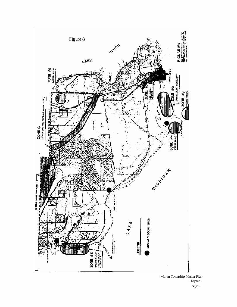
Special Natural Areas Driving throughout Moran Township, one could easily view the entire region as a "special natural area" due to the extensive expanses of woodlands, marshes, shoreline and other features. These resources are, in fact, very special due to the wildlife habitats they provide, the scenic quality they present, and the critical role they play in shaping the overall character of the Township. However, within the context of this report "special natural areas" refer to features within the Township that are of a more unique character and not nearly as visible. Because these special natural features are not typically as visible as other natural features, woodlands for example, they require much more attention when land planning for the present and future in order to support their healthy continuance. The Department of Natural Resources provides, through the staff of the Nature Conservancy, the Michigan Natural Features Inventory (MNFI) program that identifies these unique environmental features for the purposes of conservation programs and environmental planning. At the request of Moran Township Planning Commission, the Township Board contracted with the MNFI in 1986 to survey the Township. Moran Township was surveyed as part of the Michigan Natural Features Inventory program in which information was generated pertaining to Michigan's endangered, threatened, rare, or otherwise significant plant and animal species, plant communities, and other natural features. The general findings of this survey, as they pertain to the South and North Study Zones within this report are illustrated within Figures 8, 9 and 10. The vast majority of these special natural features contained within the study zones range in state ranking from "critically imperiled" (5 or fewer occurrences within entire state) to "rare or uncommon" (21 -100 occurrences within entire state). The complete study, including computerized mapping of all the known occurrences, is on file with the MDNR state land computer mapping system. Areas of critical concern on a national basis are found in the Pointe Aux Chenes Marshes and at selected areas along the Lake Michigan shoreline. These areas contain habitat for plant communities and specific species that are found nowhere else on earth. Preservation of these areas on the part of Moran Township are required for the betterment of society as a whole. Other significant areas of concern include state threatened habitats of high quality wetlands, critical dune complexes, peat lads, and mature forestlands. Each of these areas is identified in the Natural Features Inventory of Moran Township. Five areas within the Township are of such special concern that the federal and state governments have acted to protect these areas. These five areas are as follows:
1. Pointe Aux Chenes Research Natural Area. The United States Forest Service has designated this area for long-term preservation for scientific research purposes. The Forest Service owns and manages the majority of this land
Moran Township Master Plan
Chapter 3 Page 9
2. Carp River Wild and Scenic River. The River and a ¼ mile wide corridor on each side are protected as a wilderness area to remain in its natural state. This area is within the Hiawatha National Forest and there are no adjacent privately owned lands.
3. North Country National Scenic Trail. The North Country National Scenic
Trail was established by Congress to create a national hiking trail extending from the State of New York to the State of North Dakota. The trail is patterned after the Appalachian National Trail. This initiative provides for a hiking trail with a 1,000-foot buffer zone of natural habitat along the side of the trail. This hiking corridor is to be protected in its natural state for future generations. In Moran Township, the US Forest Service and a system of volunteers oversee the North Country Trail. The trail starts in St. Ignace, follows an old railroad grade along the north side of Chain Lake, crosses though the southwest corner of St. Ignace Township to re-enter Moran Township south of Castle Road, then follows along the south side of the road and exits Moran Township after crossing the Brevort River to cut across the extreme south west corner of Brevort Township. The trail re-enters Moran Township, skirts the south and west shores of Big Brevort Lake, then angles northeasterly to cross the Carp River before exiting the Township to continue on its way towards Lake Superior and eventually North Dakota. It should be noted that the trail impacts private lands only along the north side of Chain Lake in Moran Township.
4. Brevort Lake/Lake Michigan Critical Dunes Area. The area of sand dunes
between Brevort Lake and Lake Michigan is protected under the State Critical Dunes Act. This designated area starts at the west end of Point Aux Chenes Subdivision and extends to the Ozark Road right-of-way in the Village of Brevort. While the majority of dunes are within public ownership, a significant area immediately east of the Village of Brevort is privately owned.
5. Little Brevort Lake State Scenic Area. The area surrounding Little Brevort
Lake is designated as a protected scenic area under the State Natural and Scenic Areas Act. This area is owned and regulated by the State of Michigan.
St. Helena Island In addition, local land conservancies have acted to protect sensitive areas in the Township by purchasing them. Recently, the Little Traverse Conservancy purchased the 266-acre St. Helena Island. This island is located in the Straits of Mackinac six and one-half miles west of the Mackinac Bridge. There is a two-acre light station that has been in use since 1873 on the Island. This light station is owned and was restored by the Great Lakes Lighthouse Keepers Association. The island contains many environmental features, including a Great Blue Heron rookery and diverse plant life with three threatened species. Although the majority of the island is in its natural condition, there was a small village settlement in the 1850s. Remains of the village exist today. This island is a key visual feature of the area for individuals crossing the Mackinac Bridge and driving along US-2.
Moran Township Master Plan
Chapter 3 Page 10
Figure 8

Moran Township Master Plan
Chapter 3 Page 11
Figure 9

Moran Township Master Plan
Chapter 3 Page 12
Figure 10
Moran Township Master Plan
Chapter 3 Page 13
Groundwater Based upon studies by the Water Resources Division of the U.S. Geological Survey, water availability within the South Study Zone is quite limited and highly mineralized. Availability of water in the North Study Zone is considerably better although mineralization is a problem. Availability of groundwater within the glacial deposits throughout the entire Township is low, generally less than 10 gpm. Aquifers in the east portion of the Township are extremely vulnerable to contamination from surface sources including septic fields, and leaking underground storage tanks (LUST). This area, extending from I-75 west to the Brevort River, has little or no protective soil overlying the fractured limestone bedrock. Known as "Mackinac Breccia," this bedrock is easily penetrated by surface runoff, sewage effluents, and man-made chemicals. There are numerous cases of contaminated drinking water wells. In addition to failed wells, Moran Township has more cases of dry wells drilled than any other area in the eastern Upper Peninsula. Several wells have been drilled to the 700 to 800 foot depths, only to tap salt water and brine at these depths. The North Study Area has fewer of these problems, although it is less developed and may experience more of these problems as it develops. It should be noted that those areas experiencing the greatest development pressures are also exhibiting the signs of poorest water quality. Cultural Features While decisions of future land uses are dependent on the natural features of the physical environment, cultural features have a strong impact on the decision-making process. An examination of the cultural features provides insight into the existing development patterns that have evolved over the past years. While a Master Land Use Plan should not be dictated by past and present development conditions alone, they should be considered when planning for the future. Population, History and Economy Prior to visitors from European lands, Mackinac County was inhabited by a number of major Native American tribes, most particularly the Ottawa and Ojibwa tribes and, subsequently, the Huron Indians. The waters and lands of the area provided a haven for life with plentiful food sources and modes of transportation. French traders also found this area to be a land of abundance. As a result of the copious supply of furs and a very strong market, the French established a multitude of trading posts and forts. The City of St. Ignace was founded in 1671, when Pere Marquette established a mission. The French also established a trading post at Mackinaw City that became Fort Michilamackinac in 1715. Similarly, the British traders also had a quest for furs and followed the French traders to the region. Continuous battles among the French, British, and Indians ensued throughout the region. In 1780, under the control of the British, Fort Michilamackinac was moved to Mackinac Island. Although the United States took initial possession of the island in 1783, the British occupied the area during the War of 1812. It was not until 1815 that the U.S. regained possession of the island and Fort Michilamackinac returned to the mainland.
Moran Township Master Plan
Chapter 3 Page 14
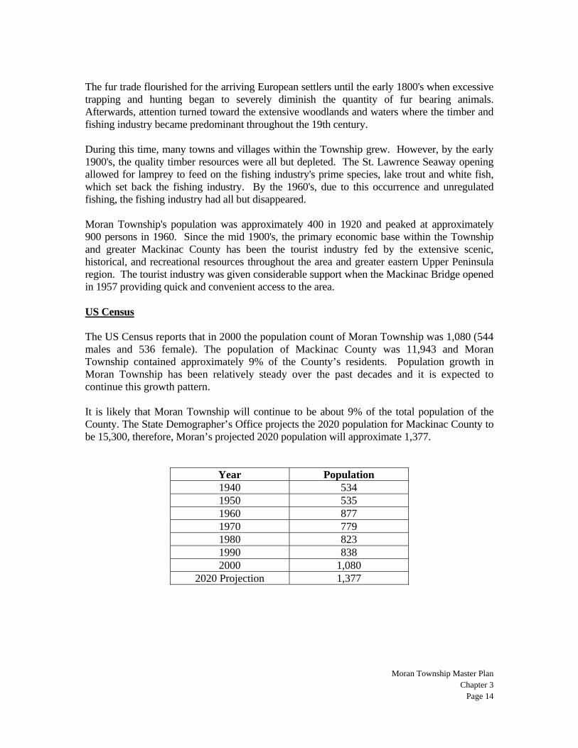
The fur trade flourished for the arriving European settlers until the early 1800's when excessive trapping and hunting began to severely diminish the quantity of fur bearing animals. Afterwards, attention turned toward the extensive woodlands and waters where the timber and fishing industry became predominant throughout the 19th century. During this time, many towns and villages within the Township grew. However, by the early 1900's, the quality timber resources were all but depleted. The St. Lawrence Seaway opening allowed for lamprey to feed on the fishing industry's prime species, lake trout and white fish, which set back the fishing industry. By the 1960's, due to this occurrence and unregulated fishing, the fishing industry had all but disappeared. Moran Township's population was approximately 400 in 1920 and peaked at approximately 900 persons in 1960. Since the mid 1900's, the primary economic base within the Township and greater Mackinac County has been the tourist industry fed by the extensive scenic, historical, and recreational resources throughout the area and greater eastern Upper Peninsula region. The tourist industry was given considerable support when the Mackinac Bridge opened in 1957 providing quick and convenient access to the area. US Census The US Census reports that in 2000 the population count of Moran Township was 1,080 (544 males and 536 female). The population of Mackinac County was 11,943 and Moran Township contained approximately 9% of the County’s residents. Population growth in Moran Township has been relatively steady over the past decades and it is expected to continue this growth pattern. It is likely that Moran Township will continue to be about 9% of the total population of the County. The State Demographer’s Office projects the 2020 population for Mackinac County to be 15,300, therefore, Moran’s projected 2020 population will approximate 1,377.
Year Population 1940 534 1950 535 1960 877 1970 779 1980 823 1990 838 2000 1,080
2020 Projection 1,377
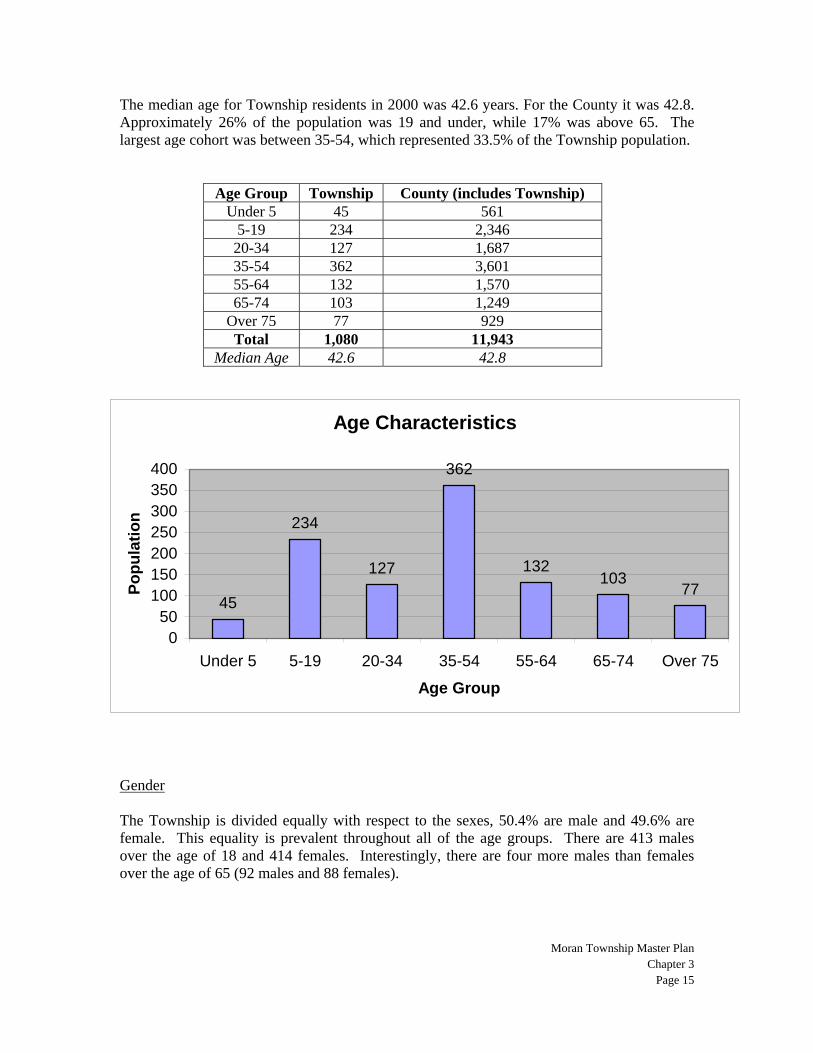
The median age for Township residents in 2000 was 42.6 years. For the County it was 42.8. Approximately 26% of the population was 19 and under, while 17% was above 65. The largest age cohort was between 35-54, which represented 33.5% of the Township population.
Age Group Township County (includes Township) Under 5 45 561
5-19 234 2,346 20-34 127 1,687 35-54 362 3,601 55-64 132 1,570 65-74 103 1,249
Over 75 77 929 Total 1,080 11,943
Median Age 42.6 42.8
Age Characteristics
45
234
127
362
132103
77
050
100150200250300350400
Under 5 5-19 20-34 35-54 55-64 65-74 Over 75
Age Group
Popu
latio
n
Gender The Township is divided equally with respect to the sexes, 50.4% are male and 49.6% are female. This equality is prevalent throughout all of the age groups. There are 413 males over the age of 18 and 414 females. Interestingly, there are four more males than females over the age of 65 (92 males and 88 females).
Moran Township Master Plan
Chapter 3 Page 15
Moran Township Master Plan
Chapter 3 Page 16
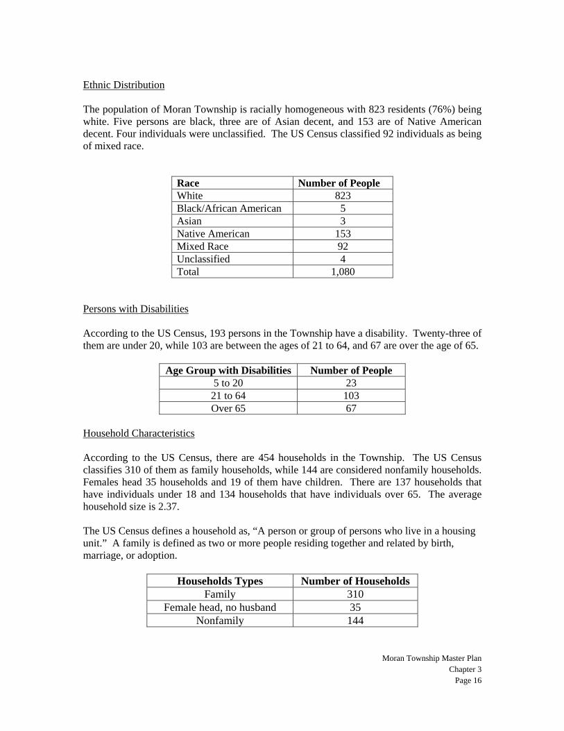
Ethnic Distribution The population of Moran Township is racially homogeneous with 823 residents (76%) being white. Five persons are black, three are of Asian decent, and 153 are of Native American decent. Four individuals were unclassified. The US Census classified 92 individuals as being of mixed race.
Race Number of People White 823 Black/African American 5 Asian 3 Native American 153 Mixed Race 92 Unclassified 4 Total 1,080
Persons with Disabilities According to the US Census, 193 persons in the Township have a disability. Twenty-three of them are under 20, while 103 are between the ages of 21 to 64, and 67 are over the age of 65.
Age Group with Disabilities Number of People 5 to 20 23 21 to 64 103 Over 65 67
Household Characteristics According to the US Census, there are 454 households in the Township. The US Census classifies 310 of them as family households, while 144 are considered nonfamily households. Females head 35 households and 19 of them have children. There are 137 households that have individuals under 18 and 134 households that have individuals over 65. The average household size is 2.37. The US Census defines a household as, “A person or group of persons who live in a housing unit.” A family is defined as two or more people residing together and related by birth, marriage, or adoption.
Households Types Number of Households Family 310
Female head, no husband 35 Nonfamily 144
Moran Township Master Plan
Chapter 3 Page 17
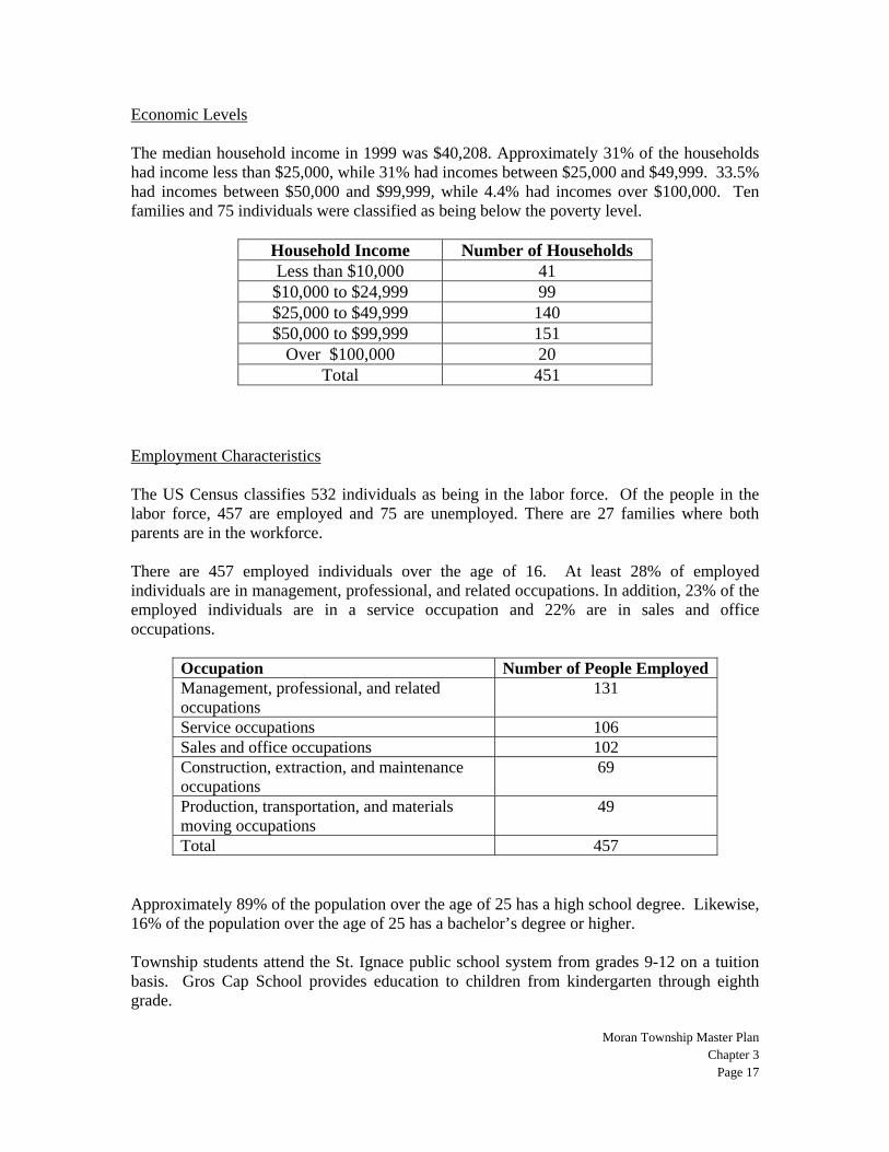
Economic Levels The median household income in 1999 was $40,208. Approximately 31% of the households had income less than $25,000, while 31% had incomes between $25,000 and $49,999. 33.5% had incomes between $50,000 and $99,999, while 4.4% had incomes over $100,000. Ten families and 75 individuals were classified as being below the poverty level.
Household Income Number of Households Less than $10,000 41 $10,000 to $24,999 99 $25,000 to $49,999 140 $50,000 to $99,999 151
Over $100,000 20 Total 451
Employment Characteristics The US Census classifies 532 individuals as being in the labor force. Of the people in the labor force, 457 are employed and 75 are unemployed. There are 27 families where both parents are in the workforce. There are 457 employed individuals over the age of 16. At least 28% of employed individuals are in management, professional, and related occupations. In addition, 23% of the employed individuals are in a service occupation and 22% are in sales and office occupations.
Occupation Number of People Employed Management, professional, and related occupations
131
Service occupations 106 Sales and office occupations 102 Construction, extraction, and maintenance occupations
69
Production, transportation, and materials moving occupations
49
Total 457 Approximately 89% of the population over the age of 25 has a high school degree. Likewise, 16% of the population over the age of 25 has a bachelor’s degree or higher. Township students attend the St. Ignace public school system from grades 9-12 on a tuition basis. Gros Cap School provides education to children from kindergarten through eighth grade.
Moran Township Master Plan
Chapter 3 Page 18
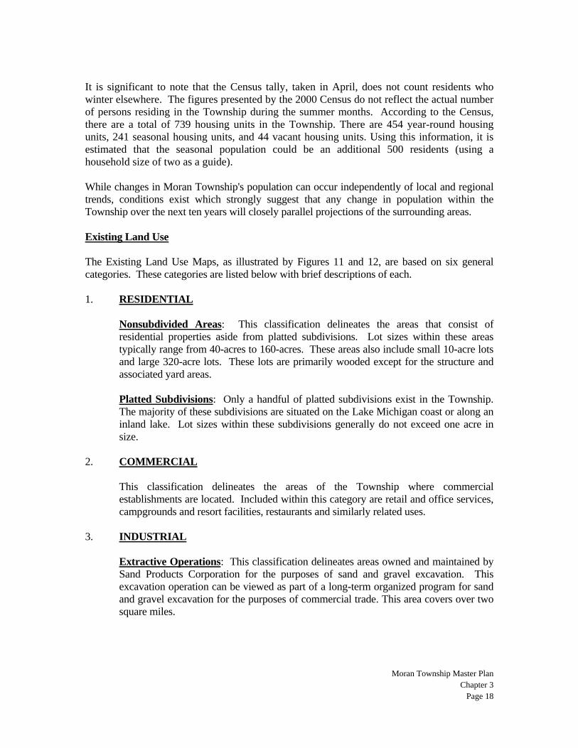
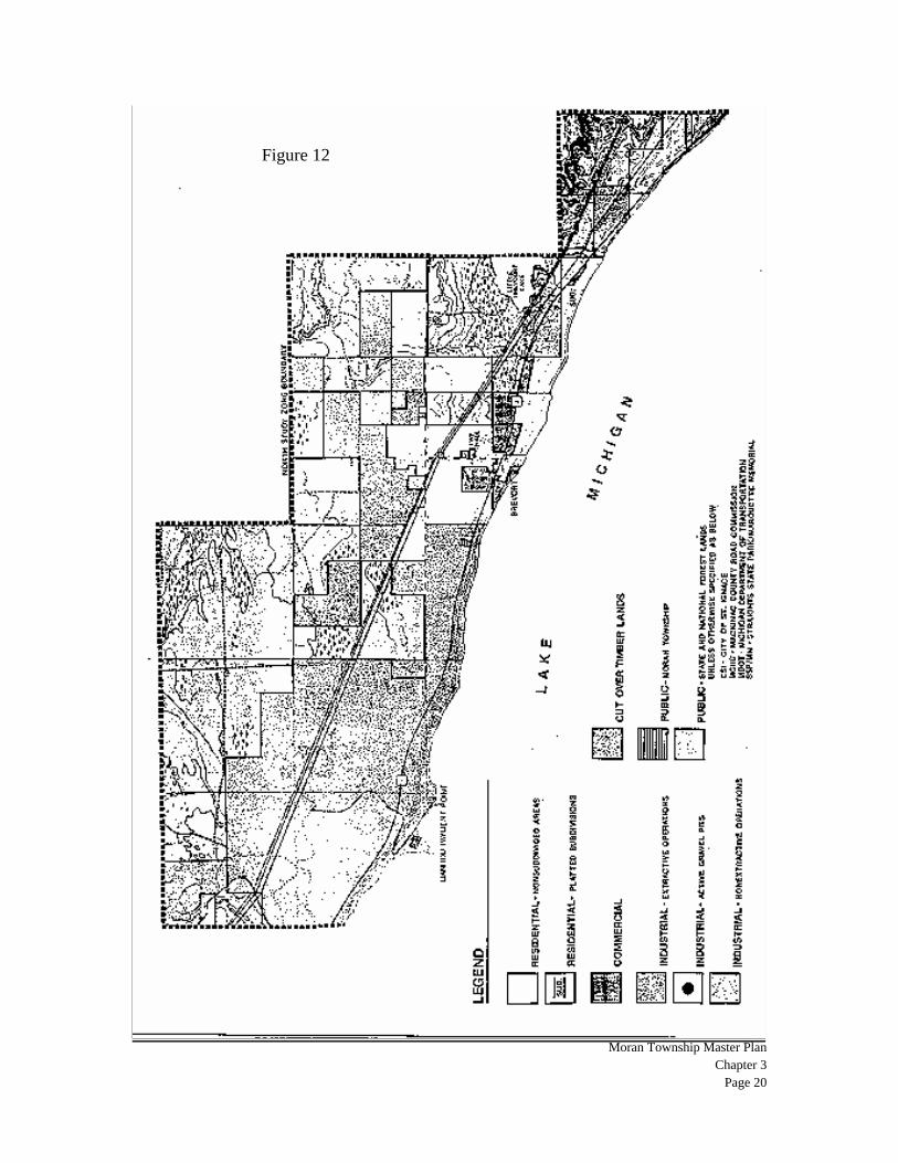
It is significant to note that the Census tally, taken in April, does not count residents who winter elsewhere. The figures presented by the 2000 Census do not reflect the actual number of persons residing in the Township during the summer months. According to the Census, there are a total of 739 housing units in the Township. There are 454 year-round housing units, 241 seasonal housing units, and 44 vacant housing units. Using this information, it is estimated that the seasonal population could be an additional 500 residents (using a household size of two as a guide). While changes in Moran Township's population can occur independently of local and regional trends, conditions exist which strongly suggest that any change in population within the Township over the next ten years will closely parallel projections of the surrounding areas. Existing Land Use The Existing Land Use Maps, as illustrated by Figures 11 and 12, are based on six general categories. These categories are listed below with brief descriptions of each. 1. RESIDENTIAL Nonsubdivided Areas: This classification delineates the areas that consist of
residential properties aside from platted subdivisions. Lot sizes within these areas typically range from 40-acres to 160-acres. These areas also include small 10-acre lots and large 320-acre lots. These lots are primarily wooded except for the structure and associated yard areas.
Platted Subdivisions: Only a handful of platted subdivisions exist in the Township.
The majority of these subdivisions are situated on the Lake Michigan coast or along an inland lake. Lot sizes within these subdivisions generally do not exceed one acre in size.
2. COMMERCIAL This classification delineates the areas of the Township where commercial
establishments are located. Included within this category are retail and office services, campgrounds and resort facilities, restaurants and similarly related uses.
3. INDUSTRIAL Extractive Operations: This classification delineates areas owned and maintained by
Sand Products Corporation for the purposes of sand and gravel excavation. This excavation operation can be viewed as part of a long-term organized program for sand and gravel excavation for the purposes of commercial trade. This area covers over two square miles.
Figure 11
Moran Township Master Plan
Chapter 3 Page 19
Moran Township Master Plan
Chapter 3 Page 20
Figure 12
Moran Township Master Plan
Chapter 3 Page 21
Active Gravel Pits: In contrast to "Extractive Operations" this classification identifies the locations of currently active gravel pits that are not necessarily State approved programs but have developed out of a "self-help" attitude by local persons in need.
Nonextractive Operations: This classification delineates areas that are not extractive
in nature but are, nevertheless, industrial in character and typically consist of utility easements and similarly related operations.
4. WOODLANDS This category consists of those areas that had been utilized for harvesting of wood
during the late 1800's and early 1900's. These areas have started to mature into the forest stands that existed prior to the lumber industry and are generally vacant of all structures.
5. PUBLIC LAND Approximately 80% of the lands within Moran Township are publicly owned, the vast
are contained within the Lake Superior State Forest and Hiawatha National Forest. This category delineates these areas as well as the numerous other publicly owned land parcels outside of these forest lands.
The majority of the commercial establishments are along U.S. Route 2, especially within the South Study Zone. These establishments cater to the tourist industry and consist of restaurants, supply depots, hotels/motels and tourist curio shops. When traveling along U.S. Route 2, one is faced with a multitude of highly visible tourist establishments directly fronting U.S. Route 2 with minimal landscaping, excessive signage, and a general lack of sensitivity to the aesthetic elements and character of the area. Once west of West Moran Bay, minimal development is seen until Brevort where tourist oriented establishments reappear. Archaeological and Historic Areas Not nearly as visible as existing land use patterns, but nevertheless a strong element of the Township's character are the archaeological and historic sites. These archaeological and historic elements provide insight into the past activities of the Township and should be valued for their past and continued mark upon the area's landscape and the cultural quality that they embody. Based upon data prepared by the Bureau of History of the Michigan Department of State, it is possible to locate the significant historical and archaeological features as they relate to the North and South Study Zones and have been illustrated in Figures 8 and 9. The archaeological sites include aboriginal and prehistoric burial grounds and the historical sites include the Ottawa Indian Village on West Moran Bay, High Rollway, Gros Cap Cemetery, the Village of Gros Cap, and St. Helena Island.

Moran Township Master Plan
Chapter 3 Page 22
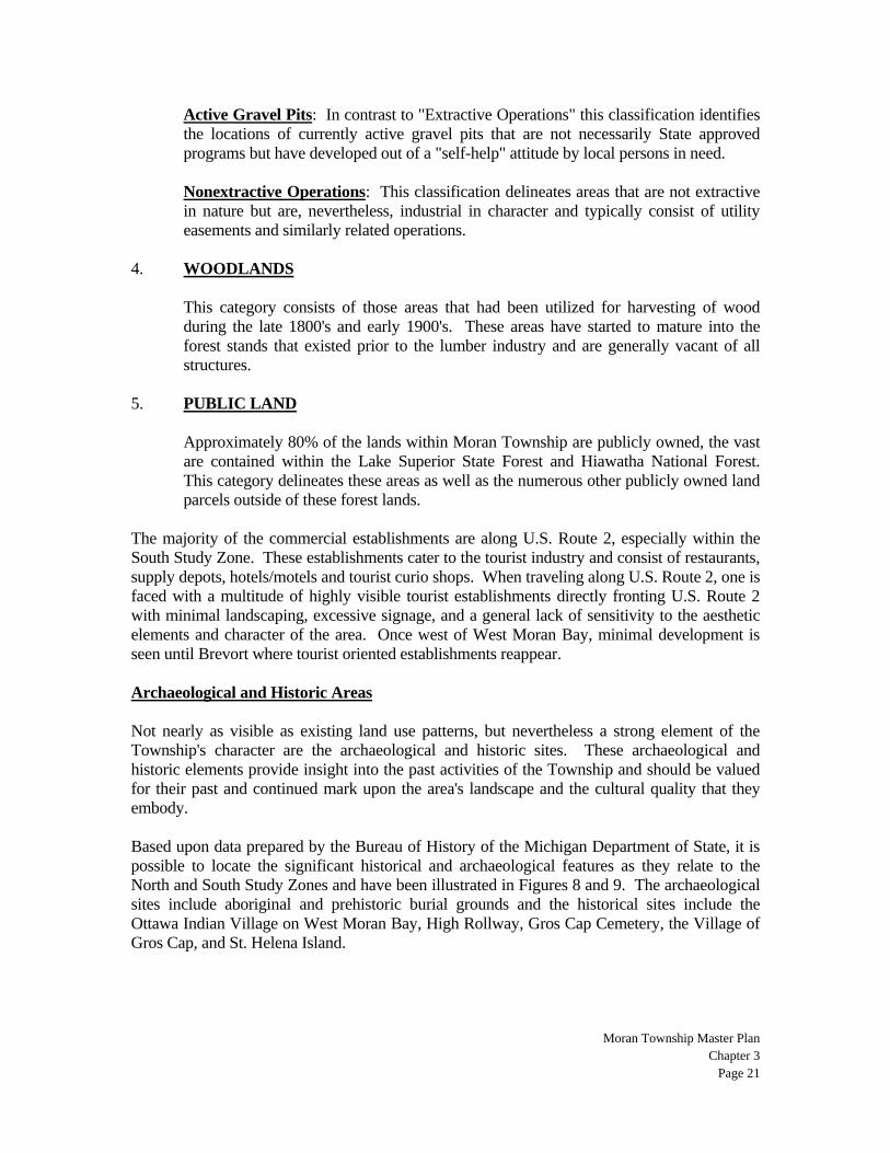
Transportation The vehicular network throughout the Township is limited by the amount of public forestlands. The major roads within the Township are U.S. Interstate 75 and U.S. Route 2. U.S. Interstate 75 runs north and south along the western and eastern boundaries of the City of St. Ignace and Moran Township, respectively. I-75 provides access, by way of the Mackinac Bridge, from the Lower Peninsula to the Upper Peninsula. Circulation east and west is provided by U.S. Route 2, a predominantly two-lane highway stretching from St. Ignace, through Moran Township following the Lake Michigan coastline, and continuing westward to Escanaba and Iron Mountain. U.S. 2 is five lane wide highway from the I-75 interchange westerly to Martin Lake Road, a distance of approximately four and a half miles. The vast interior of Moran Township is generally void of vehicular circulation except for a handful of paved and unpaved roads providing access to and from more remote areas of the Township and beyond. The far south region of the Township, that area south and west of Poupard Bay, reflects a greater degree of development and, as such, a more developed circulation network. There is currently no rail service within the Township. The Township is served by the Mackinac County Airport, which was recently updated. A special note should be made of the role the Mackinac Bridge commands across the state, nation, and local communities. Completed in 1957 at a cost of more than $100,000,000, the bridge is considered one of the greatest in the world and a tribute to man's engineering genius. Spanning nearly five miles across the Straits of Mackinac and its main towers more than 500 feet above the water, the bridge is a spectacular link between the Upper and Lower Peninsulas and serves as a primary tourist resource as well as a spectacular backdrop to the many other tourist and non-tourist elements in the area. As one travels across the Mackinac Bridge toward Moran Township, the bridge is an adventure unto itself and provides the driver with splendid panoramic views of Lake Michigan, Lake Huron, the Straits of Mackinac, Mackinac Island, and the foothills of the Upper Peninsula. Similarly, as one travels along the Township coastline, one is provided with a grandiose view of the Mackinac Bridge and the splendid grace it commands. Utilities The majority of residents rely on private wells and septic fields. In fact, throughout the entire Township, the only areas to have municipal water and sewer directly abut the City of St. Ignace and even these areas are small in size. The City of St. Ignace Golf Course along U.S. Route 2 and the local surrounding area, LaSalle High School on Portage Road and the local surrounding area, and the area just to the north of the far east end of Chain Lake are served by the City of St. Ignace's public water and sewer systems. These areas are illustrated in Figure 13.

Moran Township Master Plan
Chapter 3 Page 23
As Figure 13 illustrates, the issue of quality of drinking water is of great concern as there have been a considerable number of private wells that have been found to be contaminated as well as areas that would appear to have a high potential for future contamination. Other Cultural Elements Though not a part of Moran Township, the land uses and areas abutting and/or surrounding the Township are a factor in preparing a master land use plan. A master land use plan must recognize adjacent land uses as they can have direct ramifications on the Township's development. Certainly, the most significant of these land uses is the City of St. Ignace. This is the most urbanized area within the region and bounds Moran Township. As previously mentioned. The officially adopted land use plan for the City of St. Ignace proposes residential land uses along the majority of the area that interfaces with the Township, except in the area of the county airport that is proposed for public institutional use. The central business district of St. Ignace is located along the waterfront of Lake Huron and expansion of this district, to whatever degree it may occur, is somewhat restricted to the north and south. East and west expansion is limited due to Lake Huron and the steep escarpment respectively. Nearly all properties within Moran Township that are not privately owned are part of the Hiawatha National Forest and Lake Superior State Forest. As national and state forests, the intent of these lands is not managed for development but for wildlife, recreation, timber production and research, and other conservation programs.
Figure 14
Moran Township Master Plan
Chapter 3 Page 24
Related Documents