Mongolian Geodetic Reference System ENKHTUYA Sodnom, Head of Geodesy and Cartography Division The 20th UNRCC-AP and the 4th UN-GGIM-AP 5-10 October 2015 Jeju Island, Republic of Korea

Welcome message from author
This document is posted to help you gain knowledge. Please leave a comment to let me know what you think about it! Share it to your friends and learn new things together.
Transcript
Mongolian Geodetic Reference
System
ENKHTUYA Sodnom,
Head of Geodesy and Cartography Division
The 20th UNRCC-AP and the 4th UN-GGIM-AP
5-10 October 2015
Jeju Island, Republic of Korea

Content

Briefly about Mongolia
1. Location: in the Central
Asia.
2. Territory: 1,564,116 км²
/after Iran and 19th
place of the word/
3. Population: 3 million
/2014/
4. Capital city:
Ulaanbaatar
5. Official language:
Mongolian
6. Religion: Buddha
7. Currency: Tugrug
8. Political system:
Parliamentary type of
governance
9. Located at an average
altitude of 1,580 meters.
10. Highest point: Cold
mountain Altai Tavan
Bogd / sea above 4,374
m /
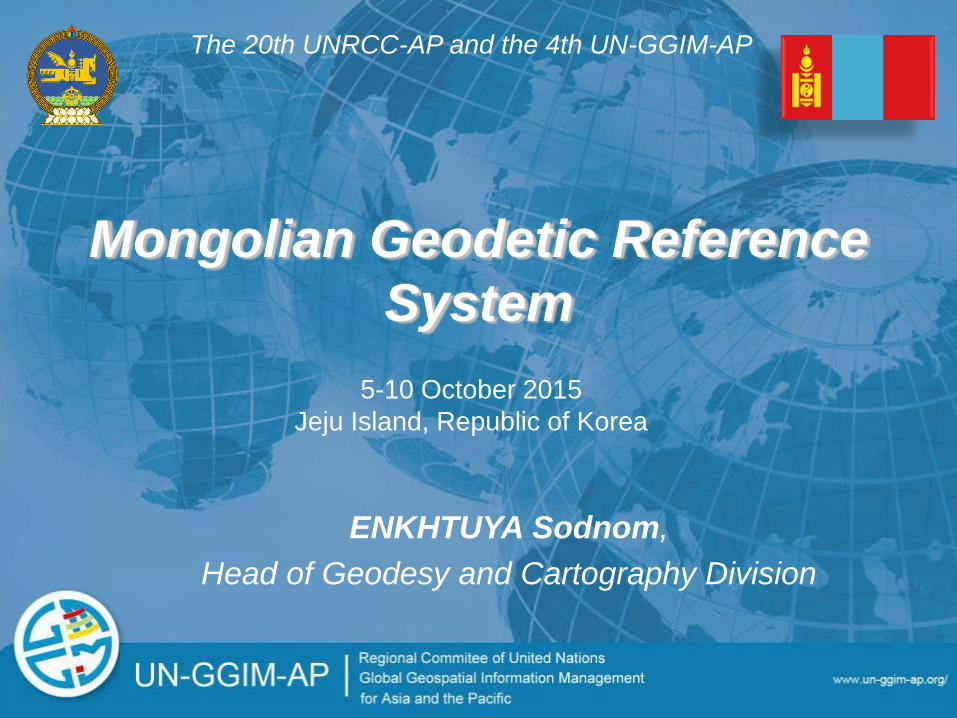
Outline
Brief history Mongolian Geodetic Network
The Mongolian triangulation, gravity and
leveling networks were connected to Russian
higher order /class/ triangulation, gravity and
leveling network points.
Network measurement and adjustment were
carried out by Russian specialists in 1940-1960.
The height system of Mongolia tied to Baltic sea
level.

Geodetic definition:
MONGOLIA ‐ Datum: Pulkovo1942
‐ Ellipsoid: Krassovsky
‐ Projection: Gauss-Kruger
Longitude of origin: 87, 93, 99, 105, 111, 117
Latitude of origin: 0
False Easting: 500000.0
False Northing: 0
Scale factor: 1.0
‐ Height system: Baltic sea level
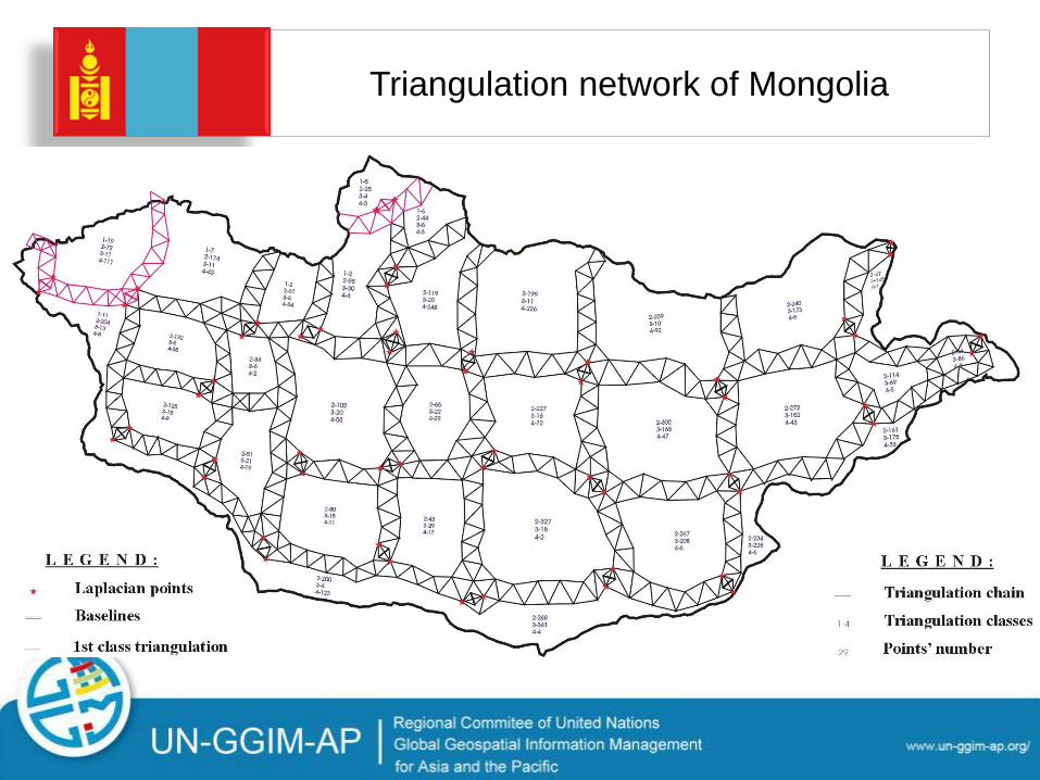
Triangulation network of Mongolia

Gravity network

Height network
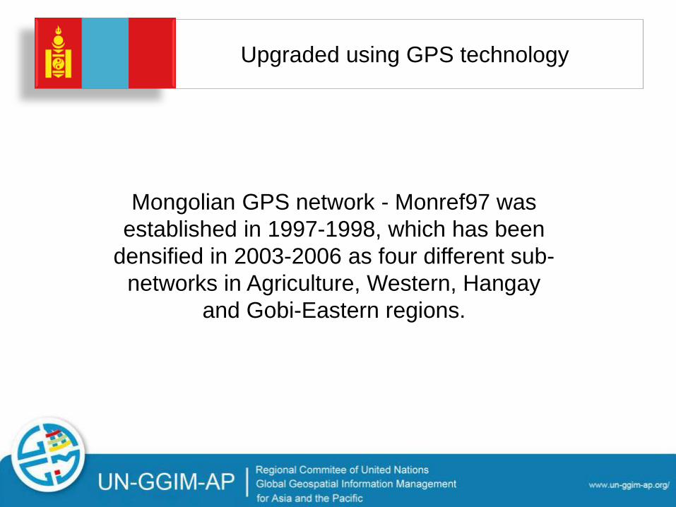
Upgraded using GPS technology
Mongolian GPS network - Monref97 was
established in 1997-1998, which has been
densified in 2003-2006 as four different sub-
networks in Agriculture, Western, Hangay
and Gobi-Eastern regions.
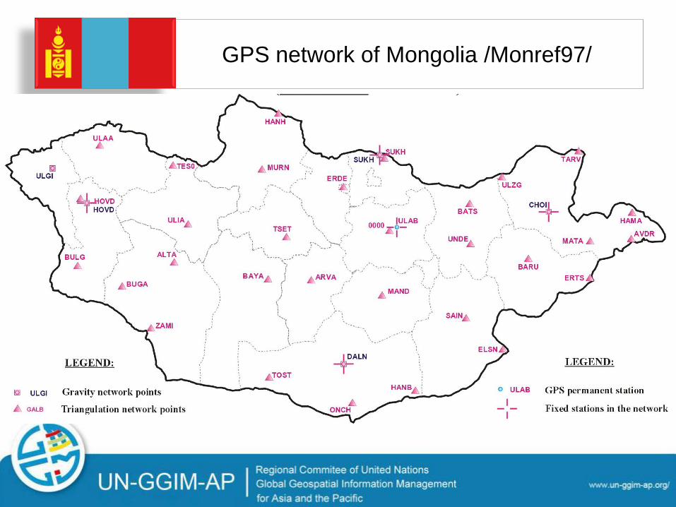
GPS network of Mongolia /Monref97/
The number of snow storms
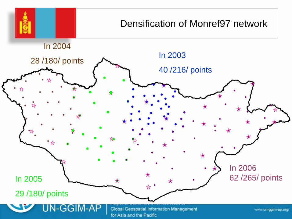
Densification of Monref97 network
In 2004
28 /180/ points In 2003
40 /216/ points
In 2005
29 /180/ points
In 2006
62 /265/ points
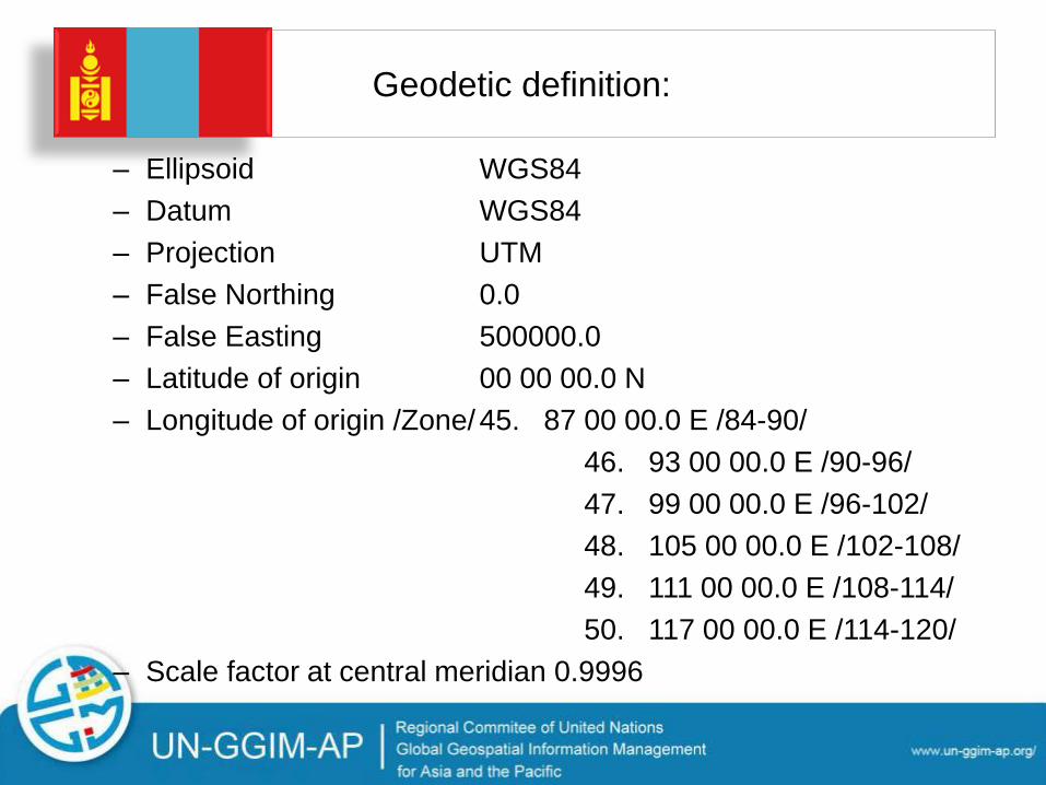
Geodetic definition:
– Ellipsoid WGS84
– Datum WGS84
– Projection UTM
– False Northing 0.0
– False Easting 500000.0
– Latitude of origin 00 00 00.0 N
– Longitude of origin /Zone/ 45. 87 00 00.0 E /84-90/
46. 93 00 00.0 E /90-96/
47. 99 00 00.0 E /96-102/
48. 105 00 00.0 E /102-108/
49. 111 00 00.0 E /108-114/
50. 117 00 00.0 E /114-120/
– Scale factor at central meridian 0.9996
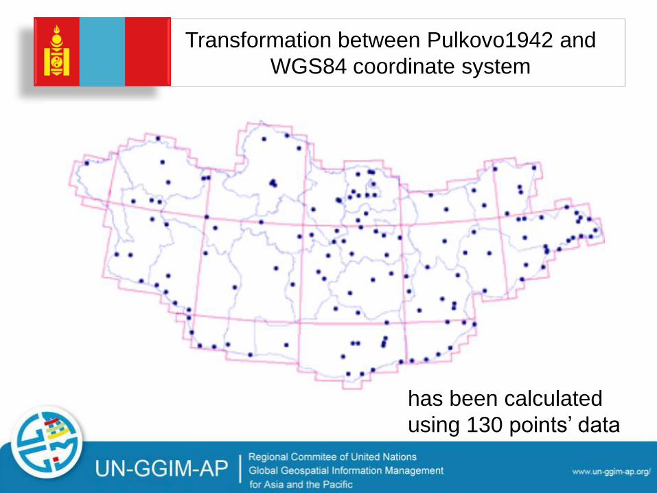
Transformation between Pulkovo1942 and
WGS84 coordinate system
has been calculated
using 130 points’ data
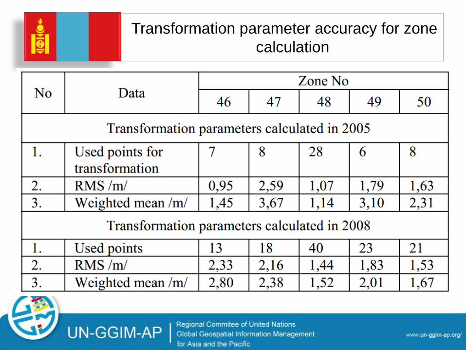
Transformation parameter accuracy for zone
calculation
Outline
Management
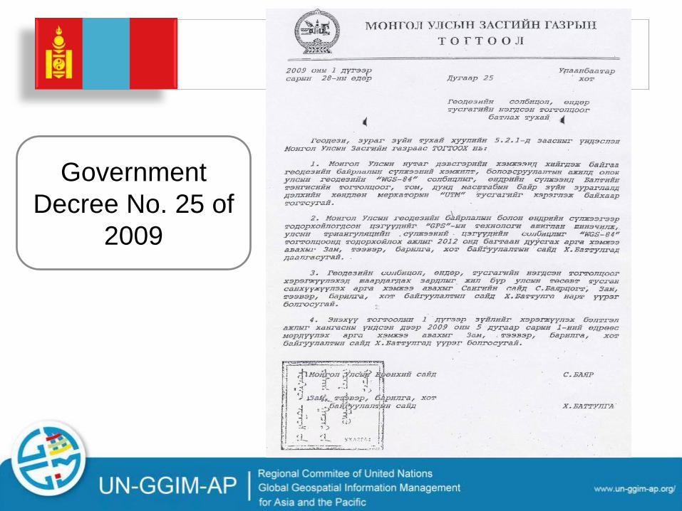
Government
Decree No. 25 of
2009
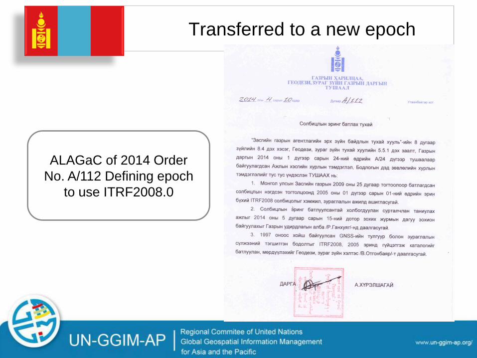
Transferred to a new epoch
ALAGaC of 2014 Order
No. A/112 Defining epoch
to use ITRF2008.0
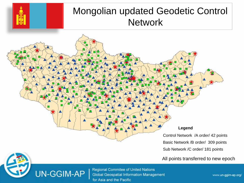
Mongolian updated Geodetic Control
Network
309 цэг
42 цэг
181 цэг
Legend
Control Network /A order/ 42 points
Basic Network /B order/ 309 points
Sub Network /C order/ 181 points
All points transferred to new epoch

Establishment of D order network /Mapping
network/
Before 2014 - 3760 points (Don’t transferred to new epoch)
2014-2015 - 265 points (Transferred to new epoch)
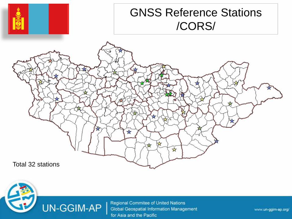
GNSS Reference Stations
/CORS/
Total 32 stations
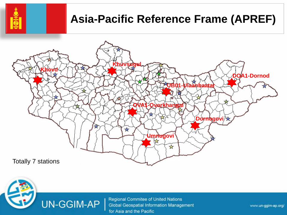
Asia-Pacific Reference Frame (APREF)
Totally 7 stations
UB01-Ulaanbaatar
DOA1-Dornod
OVA1-Ovorkhangai
Khuvsugul Khovd
Dornogovi
Umnugovi

Establishment of First order Levelling Network
• Network length: 2870 km
• Base points: 30
• Ground points: 287
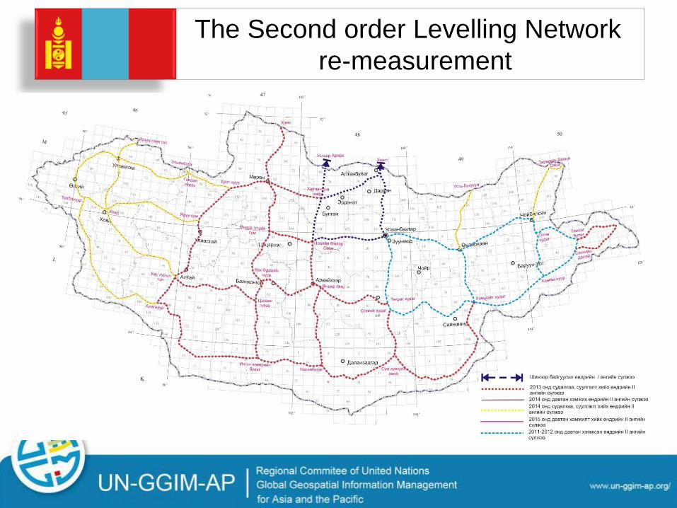
The Second order Levelling Network
re-measurement
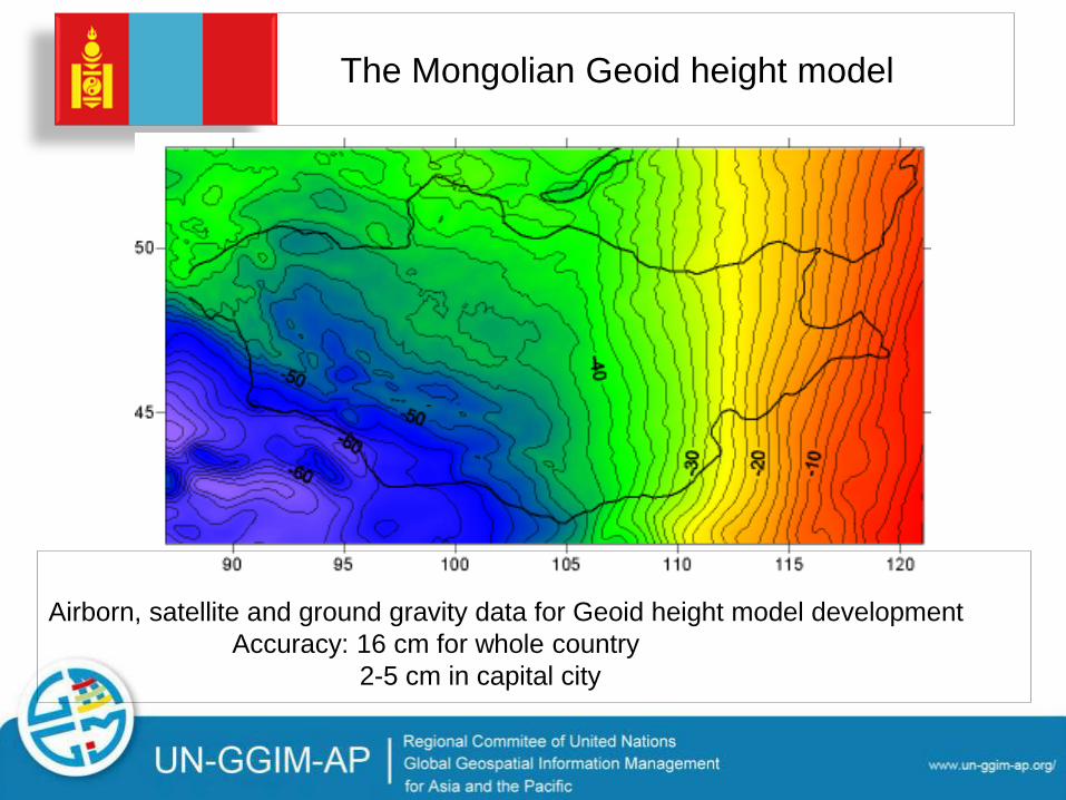
The Mongolian Geoid height model
Airborn, satellite and ground gravity data for Geoid height model development
Accuracy: 16 cm for whole country
2-5 cm in capital city

Outline

Challenges
• Human resources
• Technology
• Budget
Related challenges
with human resources
- Lack of qualified personnel, For example: Since 2014 in the local branches of
Geodesy and Cartography created position of officer
in charge of geodesy, but as of today, only 4
provinces are working professional people.
- Lack of research scientists,
- The poor quality of university education
- Absence of strategic plan for systematic
development of human resources,

Related challenges for
technology
• Don't have a geodetic origin point for all type Geodetic
Control Networks,
• No regular re-measurement /updates/ of national
geodetic control network,
• We don't have an unified control points: one control point
can not carry variety of information, such as latitude,
longitude, height, gravity.
• GNSS permanent station operations do not meet
international standards as inadequate use of the station.
• Gravimetric measurement is neglected last few decades,
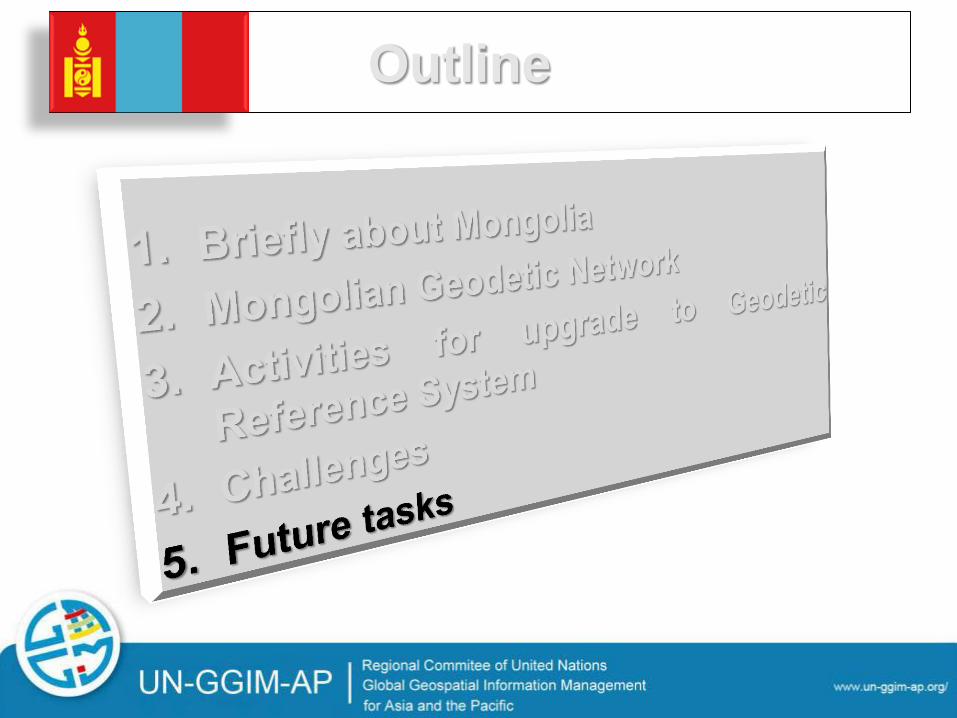
Outline
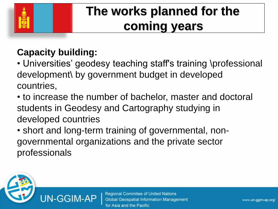
The works planned for the
coming years
Capacity building:
• Universities’ geodesy teaching staff's training \professional
development\ by government budget in developed
countries,
• to increase the number of bachelor, master and doctoral
students in Geodesy and Cartography studying in
developed countries
• short and long-term training of governmental, non-
governmental organizations and the private sector
professionals
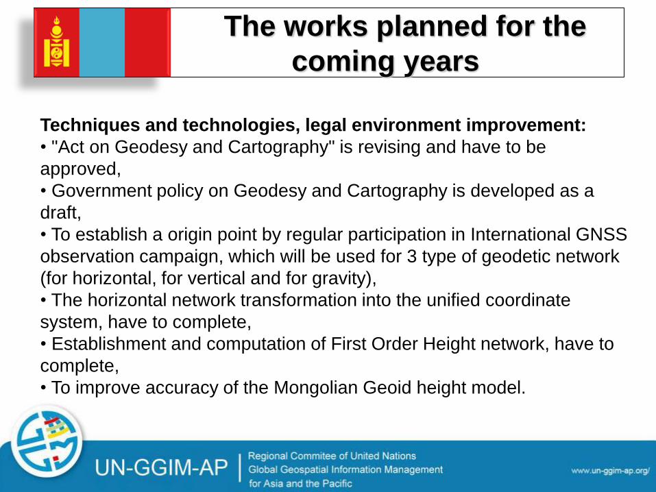
The works planned for the
coming years
Techniques and technologies, legal environment improvement:
• "Act on Geodesy and Cartography" is revising and have to be
approved,
• Government policy on Geodesy and Cartography is developed as a
draft,
• To establish a origin point by regular participation in International GNSS
observation campaign, which will be used for 3 type of geodetic network
(for horizontal, for vertical and for gravity),
• The horizontal network transformation into the unified coordinate
system, have to complete,
• Establishment and computation of First Order Height network, have to
complete,
• To improve accuracy of the Mongolian Geoid height model.
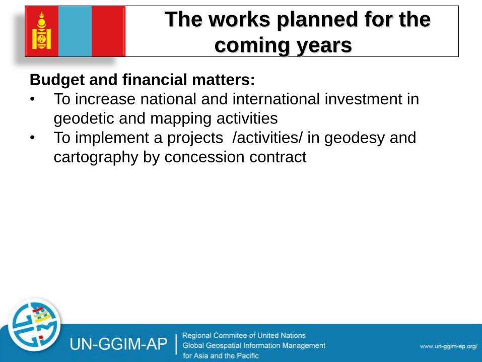
The works planned for the
coming years
Budget and financial matters:
• To increase national and international investment in
geodetic and mapping activities
• To implement a projects /activities/ in geodesy and
cartography by concession contract
Activities planned for the
future
• Build an experimental research center for advanced
technology implementation.
• Geodetic metrology laboratories and collation area
complete fittings by equipment, that meet international
standards and test certification standards,
• To establish a ground station to receive and send
satellite data.
• To involve into foreign scientific research and
implement projects and programs.
THANK YOU FOR YOUR
ATTENTION
Related Documents