1

Welcome message from author
This document is posted to help you gain knowledge. Please leave a comment to let me know what you think about it! Share it to your friends and learn new things together.
Transcript
1
Monday, February 20 A day-tour to the north of Israel:Nimrod Castle – guided by Prof. Reuven Amitai and Dr. Rabei Khamisy; Antiochia Hippos-Sussita and the Sea of Galilee – guided by Dr. Michael Eisenberg
Tuesday - Thursday, February 21-23 Three days of sessions at the University of Haifa Port Campus branch
Program of Sessions
Day One – Tuesday, February 21 0900 – 0930 Gathering and refreshments
0930 – 1000 Officialopeningoftheconference:
• Dr. Michael Eisenberg and Dr. Rabei Khamisy – Conference organizers
• Prof.GurAlroey–DeanoftheFacultyofHumanities
• Dr.SkyGross–Director,DepartmentofSocialSciences&Humanities,IsraelMinistryofScience, Technology and Space
• Prof.MinaWeinstein-Evron,HeadoftheInstituteofArchaeology
1000 – 1030 Keynote Speaker – Prof. Adrian Boas, Fighting the enemy: Some thoughts onappropriate means and methods
1040 – 1220 Session A: Military Architecture in the Levant from the Second Century BCE tothe Twelfth Century CE
1220 – 1320 Lunch break
1320 – 1500 Session B: Siege Warfare
1500 – 1520Coffeebreak
1520 – 1700 Session C: Knights, Heroes and Strategies of Warfare – New Interpretations
1830 – 1910 Keynote Speaker – Prof. Werner Eck, The Extraordinary Roman Military Presence in Iudaea from 70 CE till the Third Century
1920 – 2130Officialdinner
THE PROGRAM
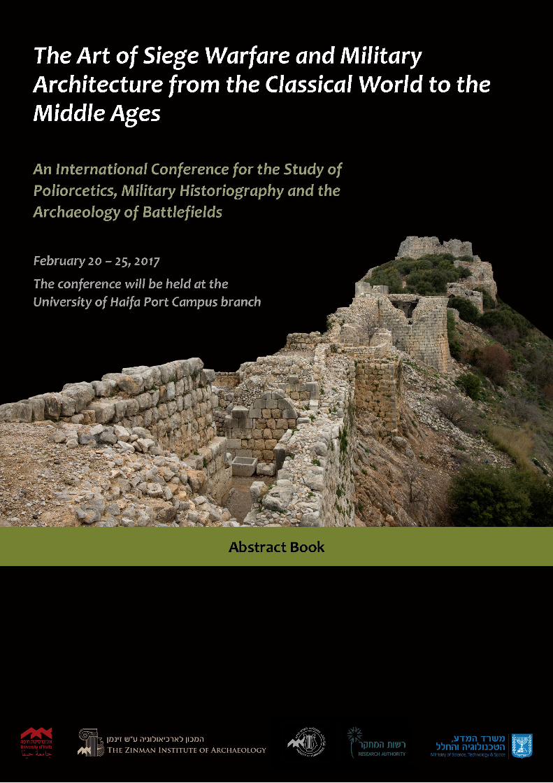
This conference is an international gathering for researchers to present and discuss recent studies in the historiography and archaeology of siege warfare, battlefields and military architecture from the Classical Period (5th century BCE) until the Middle Ages (15th century CE). Such a span of time will make possible a fruitful discussion of the continuous narrative of poliorcetics.
Day Two – Wednesday, February 22 0900 – 0920 Gathering and refreshments
0920 – 1040 Session D1: Regional Fortifications, Military Administration and Camps
Session D2: Regional Fortifications in the North of Israel
1100 Departure for the University of Haifa Mount Carmel Campus
1200 – 1250GreetingsbyProf.RonRubin,PresidentoftheUniversityofHaifa; Keynote Speaker (Hall 146, the library of the University of Haifa) – Prof. Denys Pringle, Crusader Castle Planning in Palestine and Syria
1300 – 1330 University observatory
1340 – 1500 Lunch at the University
1430 – 1500 Tour at the Hecht Museum
1515 – 1600 Visit the Zinman Institute of Archaeology
1600 Departure for Akko
1700 – 1830 A guided tour at Akko with Prof. Denys Pringle
1830 – 2000OfficialdinneratAkko–returntoPortCampusandhotels
Day Three – Thursday, February 23 0900 – 0920 Gathering and refreshments
0920 – 1100 Session E1: Military Equipment; Session E2: Military Architecture of the Classical Periods
1100 – 1120Coffeebreak
1120 – 1200 Posters session
1200 – 1340 Session F1: Settlements and Fortifications;
Session F2: Medieval Sieges and Battlefields
1340 – 1520 Lunch break at the Port Campus
1520 – 1700 Session G1: Classical and Medieval Military Architecture;
Session G2: The Fortifications of Side and Caesarea Maritima
1700 Summing up and farewell

Friday-Saturday, February 24-25 Two days of excursions southward – Lodgings at the Ein-Gedi Field School:
Atlit Castle (Château Pèlerin) –ObservationofthecastlefromadistanceandHorvat Qarta (Dustrey) including nearby phenomena – Guided by Dr. Ehud Galili;
Caesarea Maritima – Guided by Dr. Peter Gendelman;
Masada and the museum – Guided by Dr. Michael Eisenberg;
Ein-Gedi – Guided by Dr. Gideon Hadas;
Belvoir Castle – Guided by Simon Dorso
We wish everyone a fruitful, enjoyable
and friendly conference
Michael Eisenberg | Rabei KhamisyOrganizers
http://poliorcetics.haifa.ac.il
5
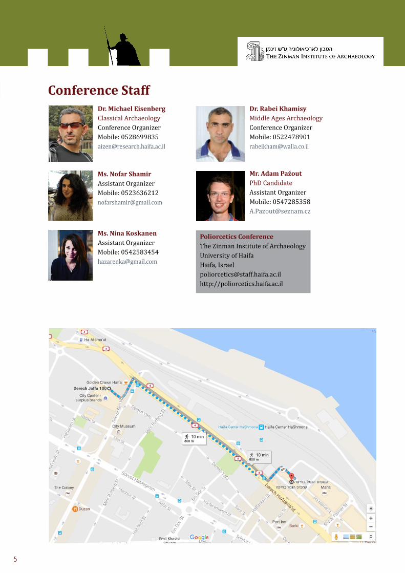
Conference StaffDr. Michael Eisenberg Classical ArchaeologyConference OrganizerMobile: [email protected]
Ms. Nofar ShamirAssistant OrganizerMobile: [email protected]
Ms. Nina KoskanenAssistant OrganizerMobile: [email protected]
Mr. Adam PažoutPhD CandidateAssistant OrganizerMobile: [email protected]
Dr. Rabei Khamisy Middle Ages ArchaeologyConference OrganizerMobile: [email protected]
Poliorcetics ConferenceThe Zinman Institute of ArchaeologyUniversity of HaifaHaifa, [email protected] http://poliorcetics.haifa.ac.il
5
GreetingsWe wish to welcome all the speakers and participants of the conference with the hope that it will be a successful and friendly one and that it will also prove to be an enjoyable visit to Israel. The speakers will be coming from various countries and cultures. We shall do our best to introduce you to the local diversity of Israeli culture without suffering from severe political correctness.
We do insist that anyone who encounters a technical problem concerning the conference will apply to the conference staff immediately. The staff will be glad to assist with any personal queries as well, such as lodging, transportation, museums, restaurants, pubs, wine suggestions, etc. We tried to cover a few of those aspects within the conference website.
The full conference program and some “extra mingling” opportunities would not have been possible without the assistance of the people and institutions listed below, whom we wish to thank:
• The Israeli Ministry of Sciences, Technology and Space for their significant financial support.
• The Zinman Institute of Archaeology and its director, Prof. Mina Weinstein-Evron for their logistic and financial support.
• The Faculty of Humanities, the Dean, Prof. Gur Alroey and the staff for their logistic and financial support.
• To the Israel Nature and Parks Authority and to Dr. Tsvika Tsuk, Director of the Archaeology Department, Development Division, for their assistance.
• Special thanks are due to the following for their personal support:
o Mrs. Anat Regev Gisis for the design and pre-press.
o Dr. Rebecca Toueg for the English editing.
o Dr. Mike Fulton for editorials.
• Last but not least, we extend our sincerest thanks to the great conference staff: Nofar Shamir, Nina Koskanen and Adam Pažout without whom the conference would not have been possible.
7
77
Day One – Tuesday, February 21
Session A | 1040 – 1220 | Chair – Silke Müth-Frederiksen Military Architecture in the Levant from the Second Century BCE to the Twelfth Century CE
Brita JansenBremen, Germany
The Hellenistic Fortifications of Seleukeia Gadara (Umm Qays/Jordan)
The first fortifications on the hilltop of the later Decapolis city of Gadara can be dated stratigraphically to the first half of the second century BCE. Although only the southern flank of the fortification is preserved, while most of the other parts were covered up during the construction of the Roman city, many of the most important features of its architecture are still to be seen and preserved up to a height of nearly 7 m. The building technique and style show characteristics typical of a Hellenistic fortification: header and stretcher masonry, elements of an active strategy like sally ports, and an indented trace with pentagonal towers. The construction is first and foremost a military installation, most probably to host a garrison in the newly captured region of Seleucid territory rather than to protect the city. Form and constructional details of the fortification elements, such as the pentagonal towers, compartment walls and segmental arches, display the global ‘Hellenistic’ character, sharing similarities with fortifications in western Asia Minor and central Syria, as well as in Palestine and Ptolemaic Egypt. The defensive layout can be seen in context with the capacities of the experienced architects of the Seleucid army which, after the treaty of Apamea in 188 BCE, had to compensate for a decrease in financial and human resources.
8
Guerilla War at Bar Kokhba’s Headquarters: The Unique Offensive and Defensive Systems of Herodium
Herodium, King Herod’s palace-fortress, served as the headquarters of the rebel administration during the Bar Kokhba revolt (132-136 CE). Even though partly in ruins, it served as a defensive strongpoint and base from which guerilla operations were carried out against the Romans. The archaeological data, unearthed during the last fifty years of excavations, and the information provided by the documents found in the refuge caves of Wadi Murrabaʿat, allow us to reconstruct a fairly reliable picture of the events at the site during the war.
The war strategy at the Herodium fortress during the Bar Kokhba revolt, which combined massive fortifications with a tunnel system that was clearly offensive in nature, was unique for the region. The system of defenses here differs significantly from the offensive and defensive Judean systems, prepared within existing villages and fortified sites, with rock-cut hiding systems beneath them and refuge caves outside them. The Herodium fortress is also distinguished by its scale and sophistication.
It seems that Bar Kokhba prepared Herodium and the fortress at its summit as a base for regional guerrilla warfare, from which fighters were dispatched for raids against the Romans in the surrounding region. When the Romans penetrated the fortress, they deliberately destroyed the walls and tunnels. Signs of a major conflagration (including charred wooden beams, ash and soot) were found throughout the entrance to the palace-fortress, in the vaulted underground chambers and in other areas where the rebels were active.
Ya’akov Kalman
Herodium Expedition, Hebrew University, Jerusalem, Israel
Rachel Chachy
Herodium Expedition, Hebrew University, Jerusalem, Israel
Boaz Zissu
Bar-Ilan University, Israel
Roi Porat
Herodium Expedition, Hebrew University, Jerusalem, Israel
9
Simon DorsoUniversité Lyon, France
Belinas (Bānyās) Under Siege (1129-1260): Siege Accounts as Sources for Building Activities and Warfare History
The city of Belinas (Bānyās), located at the foot of Mount Hermon, was one of the three walled inland urban sites of the Frankish Kingdom of Jerusalem. Its position, on the frontier between the Muslim principality of Damascus and the Latin kingdom, conferred a strategic importance to the site, as it controlled the main road from Damascus to Palestine. Both Arabic and Latin documents relay the site’s reputed strength and give detailed descriptions of the struggle for control of the town. No less than twelve sieges are recorded in the chronicles between 1129, when it was acquired by the Franks, and 1260, when Mamluk hegemony extended to Bānyās.
This paper proposes to establish a chronology of building activities in the town through a close examination of the siege accounts and of the rich epigraphic material discovered at the site. Attention will be paid to patrons and to the political significance of the works in their regional context. A detailed analysis of the settings of the sieges will also be provided, allowing for considerations regarding the way in which the topography of the site influenced construction choices and the methods used to besiege the city.
10
Jean-Michel PoissonEcole des Hautes Etudes en Sciences Sociales, France
The Hospitaller Castle of Belvoir: Defensive Architecture under Siege (12th. c.)
Between 1165 and 1168, the Knights of the Order of the Hospital of St John of Jerusalem acquired a Frankish rural estate (casal) in the Galilee on which they soon began to erect a strong fortress meant to defend the eastern frontier of the Kingdom of Jerusalem. The renewed archaeological project, led by two French universities since 2013, has allowed for a reassessment and analysis of the castle’s architecture (ringworks, flanking towers, gates, arrow slits, etc.) and a reconsideration of Saladin’s successful siege of 1189 in the light of contemporary accounts.
11
Session B | 1320 – 1500 | Chair – Boaz Zissu Siege Warfare
Gwyn DaviesFlorida International University, USA
‘Dig for Victory’! Competitive Fieldwork in Classical Siege Operations
Siege warfare in the classical world is often characterized by the employment of heavily engineered approaches designed either to isolate the target under attack or to overcome its natural or artificial defenses. Defenders would frequently seek to impede the progress of works constructed by the besieger by the expedient of aggressive sorties or other forms of direct deterrence. Less often encountered, however, are defensive counterworks designed to defeat the assailants’ efforts with an engineered response commensurate both in scale and effort to the industry expended by the attacker. This paper will discuss these countermeasures that resulted in the construction of fieldworks of various types by both parties to the siege, and will explain how victory in such cases might be determined both by the respective competence of those engaged in this competitive process and the resources that were to hand. Although the process of sinking countermines may be the most familiar of these techniques, at other times defenders had recourse to building mounds to thwart the raising of an assault ramp or even to extend defensive earthworks to hinder attempts by the assailant to isolate the besieged through circumvallation. In the course of the discussion, the psychological impact of such countermeasures will be acknowledged alongside the practical rationales that lay behind their construction.

12
Elie HaddadIsrael Antiquities Authority
Graffito of a Possible Macedonian Warship in Maresha
During the course of the excavations at Maresha, in the southeastern part of the lower city of Maresha (Subterranean Complex 89, Room 50), several wall drawings were discovered. The graffiti delineates four ships scratched into the soft chalk stone with a sharp tool. This is the first occurrence of warships depicted at Maresha. The graffito on the western wall depicts a very long warship (1.90 m, Maresha Ship C) as well as the prows of two additional warships, while a single merchant vessel is depicted on a wall in the entranceway. All these vessels can be typologically dated to the Hellenistic period, from the third to the second century BCE. The main focus was on the bow of the warship and its ram. The stern lacks details such as a steering gear or a rudder. The tholos on the bow extends inward resembling a rhino horn, which is stylistically typical of Macedonian warships. This type of prow first appears on coins minted in Arvad (Arados) after 332 BCE to honor Alexander the Great, and on the coins of Demetrius Poliorcetes, following his victory over Ptolemy I Soter at the sea battle of Salamis (306 BCE).
Michal ArtzyUniversity of Haifa, Israel
Ian SternMaresha project, Israel
13
John D. HoslerMorgan State University, USA
Countermeasures: The Destruction of Siege Equipment at Acre, 1189-1191
The Siege of Acre, 1189-1191, was the centerpiece of the Third Crusade. The event featured an array of military actions: siege warfare, set piece battles, skirmishes, and naval encounters. Acre’s walls were finally breached in July 1191, capping off nearly two years of concerted attacks upon the city and its defenders. Nearly all of these attacks had been unsuccessful, however, largely because the Muslim garrison effectively neutralized Crusader siege equipment. In fact, until June 1191, most of the towers, trebuchets, cats, rams and ships deployed against Acre were destroyed with Arab varieties of Greek Fire, artillery counter fire, archery, garrison sorties, and other combustibles and projectiles.
My paper will address these “countermeasures” in three parts. First, I will outline every instance in which Crusader siege engines were destroyed. Next, I will explain how the Crusaders eventually adjusted their tactics to accommodate such capital losses. In doing so, I will argue that the destruction of the Crusader engines was actually the principal reason for the long duration of the siege. Finally, I will offer some new thoughts on the most important Muslim countermeasure at Acre: naphtha, its composition and manner of deployment. This paper will utilize Arabic, French, and Latin narrative sources for its evidence and will be delivered in the English language.
14
Michael S. FultonUniversity of Haifa, Israel
The Development of Mechanical Artillery during the Crusades
Medieval mechanical artillery has interested historians for centuries. Unlike the classical and Renaissance periods, from which comprehensive technical treatises and detailed descriptions have survived, scholars have been forced to rely primarily on a collection of vague references found in narrative accounts to discern the power of medieval artillery. Far too often these studies fixate upon the most sensationalized accounts and dramatic depictions of destruction, leading to a skewed impression that these engines were more powerful than they were in reality. By taking into consideration all of the available evidence and looking past obvious exaggerations, by analyzing less celebrated anecdotes and comparing different types of sources, it is possible to reveal a more accurate picture of the development of these engines.
Taking the period and geographic context of the Crusades as an example, this paper will trace the advancement of artillery technology in the Levant during the twelfth and thirteenth centuries. It will reveal that these engines were initially light antipersonnel weapons – traction trebuchets; that sometime around the late twelfth century, heavier engines – counterweight trebuchets – came to supplement the traditional variety. But it was not until the late thirteenth century that these became particularly destructive engines, and even then their effect was less dramatic than is often suggested. By gaining a better understanding of these engines, we can more accurately appreciate their role in medieval poliorcetics.
15
Session C | 1520 – 1700 | Chair – Adrian Boas Knights, Heroes and Strategies of Warfare – New Interpretations
André Laury-NuriaUniversité de Lyon II, France
From Battlefield to Fortifications, a Brief Story of the Locus Epicus: The Landscape of War Between Text, History and Aesthetics
Does the modern concept of battlefield and of defensive architecture exist in ancient societies? If so, is it possible for us to understand the battlefield and defensive architecture as a landscape (a locus epicus)? Do these landscapes of war depend only upon military strategy or do they have another way of existing in an ancient society? I will focus on these landscapes of war not only from an historical point of view (i.e. military) but will also question their nature and function from an aesthetic point of view because it will help to understand how important these war landscapes were for an ancient city in order to build up and assert its identity.
I will also show how that process of changing value and register has evolved by focusing the inquiry on the epic genre, especially on the Hellenistic epic (such as the post-Homeric epics of Apollonius Rhodius, Quintus Smyrnaeus, Triphiodorus etc.) and the Roman one (the epics of Silius Italicus and Statius), as well as through North African epigraphy. I will create a dialogue, where possible, between the iconographic and the written material, so as to construct what may be called the history of the locus epicus, the landscape genre devoted to the literary and iconographic treatment of the ancient battlefield.
16
Elena KalmykovaMoscow State University, Russia
Medieval Siege and Individual Heroic Acts in the Representation of Warfare in the Late Middle Ages
Sieges played a central role in late medieval warfare. Taking and defending castles and cities was a serious business, which often defined the outcomes of particular military campaigns and wars. But when medieval authors described sieges in chronicles, they often paid more attention to episodes that may seem unimportant or even absurd from a purely rational military perspective. Instead of analyzing fortifications and besieging tactics, medieval chroniclers focused on individual acts of heroism, sometimes in the form of staged ritualized combats, doomed from the outset. How do we make sense of this puzzling representational lens and of the practice itself?
To tackle this question, this paper will start by considering a particular case: Thomas Gray’s mid-fourteenth-century description of the siege of Norham and Sir Marmion’s challenge and single-handed attack against the whole Scottish army besieging the castle. Gray, who was instructively a layman and an experienced knight himself, portrayed the episode as follows: Sir Marmion wanted to glorify his Dame and the golden helmet she gave him, and so chose to die in a desperate ‘duel’ with the enemies’ army. But in Gray’s representation, this was not simply an individual act tied to the period’s ethics and chivalric code, it actually played a key role in the eventual victory of the English army. Examining this and other comparable passages from fourteenth- and fifteenth-century English and French chronicles, this paper will investigate both the symbolic meaning and the practical military aspects of individual heroic deeds in late medieval siege warfare.
17
Alexander BaranovFree University of Berlin, Germany
“Contra multitudinem Ruthenorum armatorum”: The Russian-Livonian Battle of Lake Smolino (1502) Reconsidered
On 13 September 1502, during the Russian-Livonian War of 1501-1503, a fierce battle took place between the Teutonic Order in Livonia and the Grand Duchy of Moscow on the shores of Lake Smolino, south of Pskov. The outnumbered Livonian army managed to defeat the Muscovite, Novgorodian, and Pskovian forces. Limited documentary evidence concerning the battle has resulted in the growth of historiographic ‘legends’, and thus a new battleground was created in terms of the interpretation of the battle. While the Livonian sources, and Baltic German scholarship, considered the Battle of Lake Smolino as a momentous event that had a significant impact on the future course of history, Soviet and Russian historiography indicates otherwise. Attempts to reconstruct the battle are contradictory. Moreover, there has been no scholarly attempt to locate the battlefield. In this paper, a new framing of the Battle of Lake Smolino and its location will be suggested based on an analysis of both Livonian and Russian primary sources. It proposes a fresh look at the battle itself, as well as its place in historiography.

18
Reuven AmitaiThe Hebrew University of Jerusalem, Israel
Early Mamluk Strategy and Its Execution, 1260-1340
Before 1260, the Mamluks ruled an unstable, ad hoc polity in Egypt. After their victory at `Ayn Jalut that year, they gained possession of Syria and soon found themselves rulers of a nascent empire. Immediately the leadership of the Mamluk Sultanate needed to come up with a way to deal with various challenges: the Mongols across the Euphrates, the Franks (Crusaders) along the coasts, the Armenians in Cilicia, the Bedouins in Syria and Egypt, as well as Byzantines and Franks in the Mediterranean. Under the firm leadership of Sultan Baybars and most of his successors, successful strategies were worked out: The Ilkhanids Mongols were generally kept beyond the Euphrates; the Mongols of the Golden Horde became the Sultanates most important ally; the Franks in the Levant were gradually reduced and finally eliminated; Armenian aggression in north Syria was pushed back and war brought to Cilicia; the Bedouins were brought into the Mamluk military and administrative system; relations with the Byzantines were worked out; regarding the Franks of Europe, some became allies, while preparations were made for those seen to be enemies. The linchpin of this strategic approach was the strong mobile field army that the sultans created and maintained. The results of this long-term planning and execution was the eradication of the Franks in 1291, and the peace with the Ilkhanids in 1320. This long-term military success permitted and went hand in hand with the institutionalization of the state, stability in the territories under its rule, economic prosperity and cultural activity, all matters for which the early Mamluk Sultanate is well known.
19
Day Two – Wednesday, February 22
Session D1 | 0920 – 1040 | Chair – Elena Kalmykova Regional Fortifications, Military Administration and Camps
Adam PažoutUniversity of Haifa, Israel
The Geo-Spatial Military-based Analysis of Outworks and Watchtowers: Regional Fortifications in the Chora of Hippos-Sussita in the Hellenistic and Roman Periods
The study of regional fortification systems is an emerging subfield of military archaeology over the past few years. The aim of this paper is to apply some of the new approaches and methodologies on the region of the city of Hippos. The city of Hippos upon the Sussita Mountain is a Hellenistic foundation, located 2 kms east of the Sea of Galilee at the southwestern fringes of the Golan Heights. The present research focuses on two periods with different political and military considerations that could have shaped the assumed fortification system. The hypothesis is that during the Hellenistic period, after the foundation of the city, the system was centered on Hippos and organized to control its chora from external threat, while in the Roman period, with the establishment of a provincial administration and the involvement of the Roman army, the system should have changed and become more focused on the control of provincial communication networks and also on the surveillance of the local population. GIS-based spatial analysis is used to analyze the resulting spatial patterns in the different distribution of sites. Questions regarding visual control and intervisibility of both fortified and unfortified sites, using the viewshed tool, will be addressed. The road system will be reconstructed using least-cost path analyses, allowing for a better understanding of the relationship between settlements, with a focus on Hippos, the road network, and regional fortifications. This paper will present a preliminary model of the region based on the results of ongoing research.
20
Shlomit Weksler-BdolahIsrael Antiquities Authority
The “Starting Point” of Aelia Capitolina in Relation to the Camp of the Tenth Legion
Archaeological remains attest to the paving of roads that led to the camp of the Tenth Legion before Aelia Capitolina was founded. The remains include milestones carrying the names of Vespasian and Titus, Nerva and Trajan, a late first- to early second-century bridge carrying a road connecting the camp with the Temple Mount, and a monumental inscription in honor of Hadrian that was set up by the Tenth Legion along the northern road leading to the camp. The starting point of these roads was associated with the military camp of the Tenth Legion, which was stationed in Jerusalem at that time. Apparently legionnaires prepared access roads to the camp immediately after the camp was established, in 70 CE.
Under Hadrian, as Aelia Capitolina was built around the military camp, the site of the “starting point” became located in the middle, between the military camp and the city. Like other cities – it is likely that the site was marked with a monument, perhaps a tetrapylon.
I propose to identify the starting point of the road at ‘Café Bashourah’, in the center of the Old City of Jerusalem. This is supported by archaeological remains at the site and the layout of the main streets of Aelia Capitolina around the site, as well as the distances between this point and milestones that were discovered along the imperial roads diverging off Jerusalem.
21
Michael EhrlichBar-Ilan University, Israel
Roads, Castles and Battles in the Hula Valley, 1129-1179
For more than a millennium, international borders were far from the Hula Valley. As a result, it was a remote marshy area, which attracted little governmental, military, or economic attention. That situation changed in 1129, when the area of Bānyās was transferred to the Franks by the Muslim holder of that area. Subsequently, Bānyās and the Hula Valley became the main scene of military conflict between Franks and Muslims for the next 50 years, until Saladin conquered and destroyed Vadum Iacob.
In my opinion, the marshy nature of the area was a key factor in the history of the Hula Valley during the twelfth century. It dictated the routes of important roads, the placement of adjacent castles and the location of contemporary battles. In this paper I would like to reconstruct the twelfth century landscape, and thus to propose new explanations for important events that took place in this area between 1129 and 1179.

22
Session D2 | 0920 – 1040 | Chair – Simon Dorso Regional Fortifications at the North of Israel
Mordechai Aviam Kinneret Academic College, Israel
Rural Fortifications of the First Jewish Revolt, a Casus Belli the Test Case of Galilee
"Agrippa fortified the walls of Jerusalem… had not Marsus, the governor of Syria, reported by letter to Claudius Caesar what was being done. Claudius, suspecting that a revolution was on foot, earnestly charged Agrippa in a letter to desist from the building of the walls; and Agrippa thought it best not to disobey" (Jewish Antiquities 19, 326).
This paragraph from Josephus is usually used to show that Roman emperors were not tolerant towards the building of city walls by client-kings, since they considered it as a sign of a forthcoming rebellion.
Since Josephus, the Governor of Galilee, was probably the only survivor amongst all the Revolt’s governors, and the only one who wrote and described the war, the Galilee seems to represent quite accurately the phenomenon of the fortification of towns and villages, a project that was a casus belli. In this paper, I bring evidence from the rural fortifications in Galilee, plans and results of excavations, comparing it with a few examples from other parts of the Jewish territories, analyzing the defending systems and its method, and connecting them all with the attitude of Jewish society of the Galilee towards the war and their governor. Finally I will discuss the results of the entire defending system according to the results of the battles on two of the main fortifications in the north, Yodefat and Gamla, and two from the south, Machaerus and Masada.
23
Hervé Barbé Ministry of Culture, France/Israel Antiquities Authority
Kafar Lām Castle (Habonim): A Ribāṭ of the Levantine Coastal Defensive System in the First Centuries of Islam
Although, at the beginning of the 20th century CE, Count von Mülinen, relying on an Arabic reference to the geographer Yāqūt al-Ḥamawī�, attributed the Kafar Lām fortified site to the Umayyad period, Joshoua Prawer described it again more recently as a small Crusader castle. Eventually, the archaeological excavations carried out in 1999 by the Israel Antiquities Authority dated the construction unequivocally to the Umayyad period.
Its architecture, a combination of Roman-Byzantine and Sassanid influences, shows unquestionable similarities with many constructions of the first centuries of Islam in the Levant. Whereas contemporaneous structures displaying the same ground plan can serve different functions (castle, palace, khan...), the comparisons with Ashdod-Yam castle and their geographical location allows us to identify the complex of Kafar Lām as a ribāṭ.
We will show that Kafar Lām belonged to an early stage in the establishment of a maritime defense line of the Dār al-Islām, which remained effective along the Palestinian Coast during later centuries.

24
Ehud GaliliIsrael Antiquities Authority
and University of Haifa, Israel
The Crusader Rock-cut Defense Walls and Quarries on the Atlit Sandstone Ridge
The Crusader castle Chateau Pelerin was built in the thirteenth century on the Atlit peninsula, on the Mediterranean shore. It is surrounded by the sea on three sides with only its eastern flank vulnerable to attack. Two massive walls and a ditch were built across the neck of the peninsula. The town east of the castle was surrounded by a wall that extended into the sea at both its northern and southern ends. Building stones were quarried from the sandstone ridge east of these defenses. It was crucial to complete the defenses rapidly. By applying a sophisticated, pre-planned quarrying technique and working in several places simultaneously, the Templars extracted immense, irregular stone masses from the eastern flank of the ridge, which were later cut into building stones. The quarry created a steep wall 2.1 km long and up to 6 m high, constituting the castle’s easternmost line of defense. Seven rock-cut roads crossed the ridge westward from the rock-cut wall and two causeways leading to the castle crossed the trough. The rock-cut defense wall, the quarrying technique and the roads will be presented and discussed.
Avraham RonenUniversity of Haifa, Israel
25
Day Three – Thursday, February 23
Session E1 0920 – 1100 | Chair – Michael Fulton Military Equipment
Johannes EberUniversity of Oxford, GB
Can We Gauge the Economic Impact of Equipping the Roman Army from the First to Third Centuries CE?
This paper considers the economic factors of equipping the Roman imperial army from the time of Augustus until Diocletian’s reforms in the late third century CE. While previous studies have focused on the economic stimulus generated by the army’s grain supply and the roads it built, this paper will concentrate on the production of military equipment. On the basis of archaeological and written evidence, it will argue that the increasing size of the Roman army led to changes in the armor that was used, and that the simplifications made in its production process were due to economic reasons.
Through quantification of the raw materials that were crucial for supplying the army with basic equipment, it is evident that the Roman army was presumably the most consistent large-scale consumer of metal and leather. The manufacture of this equipment will also be analyzed. Due to the massive scale of the army, it will be argued that it was incapable of supplying itself. Finally, the development of basic arms and armor (gladius, pugio, lorica, helmet) will be examined in order to identify reasons for the changes made in their production process. It will be argued that primarily economic considerations influenced the development of Roman arms and armor, since an overall trend towards the production of easier and more sustainable armament is clearly apparent.
26
Tomasz DziurdzikUniversity of Warsaw, Poland
Between Real and Symbolic Protection: Roman Helmets with Face-Masks in Military Cults
Helmets with masks are among the most spectacular pieces of Roman military equipment. Their rarity and beauty focuses public attention, as in the controversial case of the Crosby Garrett helmet auctioned off by Christie’s for £2.3 million to a private collector despite a massive fund-raising campaign to secure its acquisition by a public museum. Yet their function still remains disputed. It is assumed that they were used during the hippika gymnasia, a cavalry mock battle combining elements of show and training, and as such they are included in the rather ill-defined category of ‘cavalry sports equipment’. The fiercest argument over them is whether they were sturdy and convenient enough to be used also during real combats; the common view being that early types could be used on the battlefield, while the sole purpose of later types was to look spectacular during shows. The aim of this paper is to challenge those views by presenting the links between the iconography of helmets and the religious cults practiced by the army and soldiers. Combined with a re-analysis of the context of several finds, it will be demonstrated that such helmets played an important role in military cults, acting as votive objects or even cultic images through their symbolic association with protection. In fact, some pieces could have been manufactured just to serve such purposes and were never meant to be worn at all.
27
Vassiliki G. StamatopoulouAristotle University of Thessaloniki and Ephorate of Antiquities of Thessaloniki, Greece
The Hoplite Shield – Design and Decoration Repertoire
The hoplite shield, the main piece of armor of a heavily armed infantryman, dominated Greek battlefields from the late eighth to the early third century BCE with no significant change in its form.
After inventorying the surviving pieces of hoplite shields, this paper will explore the technological aspects of this composite artifact, built with standard specifications for use with standard panoplies and in standard tactics. An examination of the shape and technological features of every one of the many components of the hoplite shield will contribute to our understanding of their design and function.
The selection of suitable materials (wood, metal, leather and textile), using advanced mechanized tools such as lathes and presses, and sophisticated carpentry work for wooden parts, led to the construction of a sturdy yet resilient and lightweight piece of armor. This paper will also focus on the interpretation of the decorative repertoire on the various parts of the hoplite shield, a matter that has not been examined to date.
28
Sven EkdahlUniversity of Gothenburg, Sweden
Battlefield Archaeology at Tannenberg (Grunwald, Žalgiris): Physical Remains of the Defeat of the Teutonic Order in Prussia in 1410
This paper presents the main features of the battlefield archaeology at Tannenberg up to the present day. Special interest is devoted to an intriguing question: Have historians and archaeologists accepted a fallacious theory about the march routes and battlefield deployment of the armies, as created by the famous Prussian historian Johannes Voigt in 1836? Research by the author has led to the conclusion that the main battlefield was situated elsewhere than the place proposed by Voigt and his followers, thus presenting new archaeological challenges.
In September 2014, in order to verify the modern Polish thesis of Andrzej Nadolski, which is a variant of Voigt’s theory, the Grunwald Museum had the terrain to the south and east of Stębark (Tannenberg) scanned with metal detectors by about 50 persons, mainly people from Denmark, Norway, Great Britain, and Poland; however, no battlefield was found. Therefore, in August 2015, this author’s alternative thesis that the main battlefield should be searched for to the south and east of Grunwald (Grünfelde) was tested. Although only parts of that area could be scanned, because some crops had not yet been harvested, the results were promising, and the search was continued in September 2016. This paper will provide information about the project and its findings.

29
Session E2 0920 – 1100 | Chair – Vardit Shotten-Hallel Military Architecture of the Classical Periods
Silke MüthNational Museum of Denmark
Strategy versus Representation? The Late Classical City Wall of Messene
The Late Classical city walls of Messene, in the southwestern Peloponnese, are some of the most prominent fortifications in Greece due to the marvelous state of preservation of considerable parts, their monumental appearance, and the beautiful effectuation of their masonry, particularly at the famous Arcadian Gate. A closer look at these walls, built in the second quarter of the fourth century BCE, confirms that they represented a strong defensive obstacle, revealing sophisticated strategic planning and the latest developments in the art of fortification. Owing to the rapid succession of inventions in catapult technology, the fourth century saw a particularly lively interplay between poliorcetics and fortification techniques. The constructors of the walls of Messene, therefore, experimented with innovative features, which they incorporated into towers, curtain walls and gates, and at the same time managed to follow a stringent economic plan.
Closer investigation, however, also reveals various details that deliberately and elaborately increased the monumentality and decorative effect of the walls. These ostentative features, that partially even contradict defensive logic, clearly indicate the strong representative and symbolic value of the Messene fortifications. The proposed talk will examine the apparent tension between strategic and symbolic aims, during the very particular historical context of the walls’ construction, and show that both worked together in protecting the newly acquired independence of Messene’s population.
30
Yannis NakasAthens, Greece
Windows and Shutters at the Towers of Ancient Messene
The Hellenistic fortifications of ancient Messene in the Peloponnese are some of the best preserved in Greece. Thanks to their good state of preservation, several attributes of their construction have survived; one of them is the rectangular through-holes placed on the four corners of the tower windows, an element found in other Hellenistic towers as well. Scholars have usually interpreted these as supports for the awning window panels but also as supports for cranes that would raise soft protective material around the towers’ upper parts. These interpretations do not, however, explain various technical details of the placement and form of the holes. This paper will attempt a reevaluation of the data and of the previous interpretations of these through-holes and suggest some new ideas on their function.
31
Panagiotis FaklarisAristotle University of
Thessaloniki, Greece
The Fortifications of Vergina, Northern Greece
Excavation of the fortifications of Vergina began in 1981 under the aegis of the Aristotle University of Thessaloniki and is continuing under the direction of Prof. P. Faklaris and Dr. V. Stamatopoulou. So far, most of the trace’s 3.3 km length has been uncovered. Architectural characteristics and portable finds date its construction to the reign of Cassander, and its destruction to the mid-second century BCE. The foundations and the lower part of the wall are built with porous blocks while the upper part is constructed of mud bricks. Part of the enceinte climbs up a steep hill where it encloses the upper part of the city and the acropolis. Another part, of stronger construction, wraps around a part of the defensively disadvantageous lowland. Until today, four gates of different types and eighteen semi-circular and rectangular towers have been excavated. This paper presents the key data from the excavations of these fortifications, which are some of the best preserved from this period in Macedonia.
Vassiliki G. StamatopoulouAristotle University of
Thessaloniki, Greece
32
Ayşe Dalyancı-BernsTechnical University of Berlin, Germany
The Fortifications of Nicaea: The Defensive Features of a Third-Century Rampart and their Transformation through History
The well-preserved fortifications of Nicaea are one of the most remarkable examples of late Roman and Byzantine ramparts in Asia Minor. They reflect the multifaceted history of the city from when they were built in the third century CE up to the present, and form a significant historical source for such constructions. Although the monumental fortifications have been an imposing object of marvel for travelers and researchers from the 16th century onwards, a systematic study of its building history is still lacking.
The Nicaean walls are distinctive for their sophisticated arrangement of defensive features, true of both their original design and the extensive modifications that were carried out throughout their history. These alterations include, for example, the multiplication of the towers, extensions to the gates, and raising of the curtain walls. This paper will discuss these features with regard to the defensive purposes of the fortifications as well as the general development of poliorcetics in the Late Roman and Byzantine periods.
33
Posters Session | 1120-1200
Enno Bron Israel Antiquities Authority
Ptolemaic Fortress over Wadi Ruqqad in the Southern Golan Heights
In December 2014 a rescue excavation was carried out to the east of Moshav Eliad in the southern part of the Golan Heights. During this excavation a fortified square building was exposed measuring 12x12 m and built of basalt stone. The walls are constructed of two double walls attached to each other, and as they were originally built according to our estimation. The inner wall was of ashlars in the stretcher method while the outer one had alternate headers and stretchers, each with dressed margins and a crude central boss. This style of construction resembles the type known to us from the Hellenistic period. The building is located at a strategic point above Wadi Ruqqad with an excellent range of observation.
The small finds include pottery and coins which indicate that the building was erected in the third century BCE and was abandoned at the end of third and the beginning of the second century BCE. Its renewed use occurred during the Middle Roman period and the beginning of the Late Roman period, around the middle of the third century CE, and was finally abandoned at the end of the third century and the beginning of the fourth century CE.
According to the pottery survey, there were Late Hellenistic findings, mainly those from the beginning to the end of the third century CE. The plan of the building, its style, its strategic location, and the small finds enable us to propose the following stages: a. In the third century BCE a Ptolemaic fortress was built to guard the eastern border of the Land of Israel facing the Seleucid border in Syria on the eastern side of Wadi Ruqqad. This fortress ceased to function during the second century or at the beginning of the first century BCE.
The Ruqqad fortress could be associated with the Fifth Syrian War and the Battle of Panium (c. 199 BCE) which ended with the transfer of the territory into Seleucid hands, as described by Polybius.
Oren ZingboymIsrael Antiquities [email protected]
34
Melanie Jonasch Deutsches Archäologisches Institut, Berlin
A Greek Military Outpost in Eastern Sicily: New Research on the Fortress of Monte Turcisi (CT)
Monte Turcisi is a small hilltop fortress, probably of Late Classical times, that towers above the fertile plain of Catania. The visible remains of this unpublished site were subjected in September 2016 to a campaign of geodetic measurement and architectural documentation. As a purely military establishment the fortress is currently unique for its kind in Greek Sicily.
The fieldwork on Monte Turcisi is part of a broader project to map, contextualize and visualize colonial military infrastructure in Greek Sicily on the basis of a Geographic Information System. The poster will introduce both the fortress on Monte Turcisi as well as the overarching project to an expert audience.
35
Rafeh Abu-RayaIsrael Antiquities Authority
Tel Daʻuk: Evidence of a Roman Bath and Crusader and Mamluk Saqiya (Antilia) Jars
Following plans for the installation of a new water pipe, an excavation was carried out by the IAA in November 2015 near a saqiya well situated northwest of Tel Daʻuk. The finds of this excavation include evidence of a Roman bath as well as Mamluk saqiya or antilia jars.
According to Crusader-period documents, the tell and its surroundings were owned by the Knights Templar, who operated a mill in the area. The name appears in Crusader sources variably as Dok, Dauk, Castiel Dock and in contemporary Arabic sources as Burj Daʻuk or Burj Dahuq.
During the Crusader period a ‘tower’ stood on the summit of the tell, guarding the road from Acre to Shefarʻam. This tower may have been destroyed by the Mamluk sultan Baybars in 1263. Later, following the occupation of Acre in 1291, it served as part of a khan whose ruins are still visible today. Victor Guérin visited the site on August 4, 1875 and reported on the ruins of a square khan measuring approximately 75 x 75 paces (almost 75 x 75 m), surrounded by storerooms, some of which have survive including their vaulted roofs. Guérin also described the saqiya well, to which one descends by a few steps and a well-preserved pool next to it. These remains are still extant, including a room with a vaulted roof over the well and a wide pool attached on the north side, both of which presumably date to the Ottoman period.
This poster aims to present the excavations, the finds and the strategic importance of this site.
36
Riccardo ConsoliMediterranea University of Reggio Calabria, Italy
Pentadattilo – A Byzantine Fortress in Reggio Calabria, Southern Italy
The purpose of this poster is to present the Pentadattilo Castle (Pentadaktylòs) in order to contribute to the study of the fortresses in Reggio Calabria and its province between the 9th and 13th centuries CE. The main aim is to analyze the importance of Pentadattilo with regard to the southern defense system in Italy during the Middle Ages, and also to allay any doubts relating to the topography during the above-mentioned period. The investigation will cover three specific topics: History – the analysis of the existing documents and the studies conducted in the area; Architecture – the survey of all that has endured; Archaeology – the inspection of masonry and its chronological sequence. The final result will contribute towards our understanding of the history of this site and its various building phases, as well as to the study of the history of fortifications in the Mediterranean area.
37
Moshe BramUniversity of Haifa, Israel
Belvoir Fortress Door Locking Systems
While revisiting in the Belvoir fortress, the door locking system was examined and surveyed. The locking system is based on a horizontal beam mounted behind the door to prevent it from opening into the protected area. In most of the locking systems the horizontal beam was retracted into a deep niche on one side of the opening which was in most cases deeper than the length of the beam. When fully drawn out, the beam meets a shallow niche which enables locking of the door.
Following this survey, a few research questions arose:
• What was the structure of the locking beam that would make it possible to have it replaced when it became damaged or eroded?
• What can we understand about the protection rings of the fortress when examining the orientation of the door openings inside or outside the protected area? The plan of the Belvoir fortress is built of two fortresses one inside the other, both of which includes towers, arrow slits, entrances etc. The first “protection ring” is the outer walls and towers (the “big ring”). If this part is captured, the inner castle (“a smaller ring”) must be breached, and if the courtyard of this smaller fortress is entered, the towers will then be the final protection for the garrison.
• How was the door and the wall around it built step by step in relation to the locking system?
• Why was the locking systems not completed in some of the doors?
38
Session F1 | 1200 – 1340 | Chair – Aliénor Rufin Solas Settlements and Fortifications
Chang-Ho JiLa Sierra University, USA
Khirbat as-Sur, Khirbat al-Mahatta, and Tobiad Military Architecture and Historiography in Western Jordan
This paper will deal with Khirbat as-Sur and Khirbat al-Mahatta, two large and important military forts in western Jordan possibly dating to the Early Hellenistic period, and will synthesize archaeological data and literary sources related to the sheikdom of the Tobiads of this region. The archaeological data is based on the results of comprehensive archaeological soundings and surveys conducted at the sites on behalf of the Iraq al-Amir Regional Project in 1996-2004. Few urban sites, and very few forts, dating to the Early Hellenistic period have been identified in Transjordan, rendering these two military forts exceptional. The two sites parallel each other in many ways; both are massive in size, are orthogonal in shape, and have a dozen corner and interval towers; and the collected pottery indicates that they were built at around the same time. The forts were associated with two important trade routes that ran through the territory of Tobiah and protected his northern and southern borders. Research has revealed new evidence about the geopolitics of the Tobiads and their military power as well as some important details about Tobiah’s regional defense strategy and the Hasmonean-Herodian incursions into the region during the Late Hellenistic and Early Roman periods.

39
Turgut SanerIstanbul Technical University, Turkey
The Fort and Settlement of Larisa East (Buruncuk) as Representative of a Multi-Centered Defense System in Classical Asia Minor
Larisa (Buruncuk) is an Aeolian site in western Anatolia, occupied from the seventh century to the beginning of the third century BCE. The settlement consists of an eastern and a western center, as well as surrounding structures for agricultural purposes. In the fifth century BCE, “Larisa East” was furnished with a well-designed fort accompanied by a settlement on its lower slopes. The fort was probably built to control the surrounding areas, provide an acropolis for the western settlement, the seat of local rulers, and accommodate a smaller group of people responsible for maintaining defenses and the agricultural system.
The remains of the triangular fort in Larisa East occupy a 180m high hill. The masonry is of the “Lesbian” type. Architectural surveys, carried out from 2010 onwards, show that the settlement of Larisa East extends across several terraces towards the Hermos plain and consists of small houses of one or two units. Larisa East, with its fort and traces of settlement, reveals the ambitions of absolute rulers of the Late Archaic and Classical periods. At the same time, it clearly displays the measures taken to defend this particular region of Asia Minor under Persian rule.
Ilgın KülekçiIstanbul Technical University, Turkey

40
Anna MechUniversity of Warsaw, Poland
Veterans and Soldiers in the Hinterland of a Roman Colony: Epigraphy on the Role of the Military in the Romanization of Narona’s Surroundings
Narona, one of the most important cities in the Roman province of Dalmatia, served as a military bridgehead during the conquest of the area. Its hinterland, particularly the area of modern Ljubuški (West Herzegovina Canton, Bosnia and Herzegovina) underwent rapid development during the first century CE, transforming from a region characterized by a traditional Illyrian lifestyle to a zone interconnected culturally and economically.
The aim of this paper is to reconstruct the role played by the settlement of veterans released from the legions by Tiberius, as well as that of auxiliary soldiers present in the region, in the Romanization of the area, through the study of the epigraphic monuments documented during the 2015 and 2016 research campaigns. The Ljubuški Archaeological Project is a joint Polish-Herzegovinian research project in cooperation with the University of Warsaw, the University of Mostar and the Municipality of Ljubuški.
It appears that the military personnel, both active and veteran, played a central role in the development of the area. Their presence, attested to by numerous inscriptions, created the economic possibilities that enabled the transformation of a rural area into one with a highly-developed settlement system. The subsequent withdrawal of the military seems to have caused a decline in settlement density and in the attested sharp fall in the number of epigraphic monuments.
Tomasz DziurdzikUniversity of Warsaw, Poland

41
Yinon Shivtiel Zefat Academic College
"He fortified the most suitable places" - Jewish Defense Methods in the Galilee according to the Writings of Josephus: Cliff Shelters and Hiding Complexes
In The Jewish War and The Life of Flavius Josephus, the author states his intention to fortify 18 settlements, all of which were identified archaeologically. The methods he claimed to have used were never attested. However, research has shown that in the vicinity of each settlement a steep mountain exists full of natural caves. A method of defense called “cliff shelters” was found to have been employed, but settlements that were not close to steep mountains, used “hiding complexes” hewn under the houses.
Research has resulted in the discovery of a central defense method characteristic of ten settlements surveyed. Five settlements among those Josephus claimed he had fortified are in close proximity to precipitous cliffs, in which karstic caves were formed. The finds in these caves, such as built walls, shards of pottery, coins, vessels, loops of tied ropes and ritual baths are mostly dated to the Early Roman period.
The cliff shelter findings indicate intense activities in the area during the time when Josephus served as commander of the Galilee before and during the Great Revolt. These discoveries also teach us that the fortifications Josephus ascribes to himself were not his invention but were a technique known in the Galilee well before his arrival.
42
Session F2 | 1200 – 1340 | Chair – Yvonne Friedman Medieval Sieges and Battlefields
Faith C. GarrettUniversity of Haifa, Israel
“What a Knight He Would Make, Were He Only a Christian!” Crusader Depictions of The Worthy Muslim Knight
Our general understanding of the relationship between the Crusaders and the Muslim armies is not a positive one. Christian accounts of the Crusades typically emphasize the perceived depravity of the Muslims, who were regarded by the 11th century Christians as a race that had rejected Christ as God, and were therefore doomed to suffer at the hands of the “righteous” Christians. Many artistic renderings of that time portray the enemies of the Crusaders as monstrous, barbarous, and barely human. This perspective, however, is a limited one. It does not capture the complex relationship the Crusaders had with their enemy; a relationship that is expressed both artistically and literarily. Chronicles of the Crusades often take the time to emphasize how deeply impressed the Crusaders were by the Muslim forces for their tactical skill on the battlefield, their bravery, and their devotion to their leaders. The Crusaders’ recognition of their worthy, admirable enemy seeps seamlessly into Crusader art. From depictions of famous battles to the religious art of the Crusaders, the Muslim warriors are consistently portrayed in a positive light, demonstrating how deeply felt was the Crusaders’ respect for the Muslims. This paper will attempt to demonstrate, particularly through the unique depictions of the Muslim warriors in the art created in and around the Crusader kingdom and through examples from the chronicles of the Crusades, the honor and worth the Christians readily bestowed upon their Muslim enemy.

43
Shlomo LotanBar Ilan University, Israel
Accounts of Sieges and Fighting in the History of the Templar Knights: The Case Studies of Ascalon and Acre in the Latin Kingdom of Jerusalem
The Templars were one of the most influential military forces in the Crusader Kingdom of Jerusalem. Their contribution to the kingdom’s survival was considerable, and they participated in all of its perilous battles alongside the other military orders.
In this lecture, I will trace two major confrontations: one at the siege of Ascalon (1153) and at Acre during the Third Crusade (1189). The Templars fought courageously during these engagements as they sought to capture the Muslim cities. These conflicts were well documented, featuring prominently in medieval Latin chronicles; but the conduct of the Templars appears to have been interpreted differently by chroniclers. These differences might be due to numerous reasons, such as political or religious rivalries. Most importantly, I will present descriptions of military history, examining different types of sieges and fighting in Crusader history. Finally, I will assess the contribution of the Templar Knights to the resilience and strength of the Latin Kingdom.

44
Ilya BerkovichLudwig Maximilian University of Munich, Germany
Forbie (October 17, 1244): Reconstructing a Medieval Battle
The Battle of Forbie was one of the largest and most important battles in the history of the Latin East. It marked a turning point in the fortunes of the Second Frankish Kingdom of Jerusalem, whose army, allied with the Ayyūbid sultans of Damascus, Homs and Kerak, was soundly defeated and largely destroyed by the combined forces of the Sultan of Egypt and his Khwarizmian auxiliaries. This paper seeks to identify the precise site of the battle. In addition to a thorough examination of the terrain features between Gaza and Ascalon, including topography, hydrology and geology, this study also employs archaeological and onomastic data. The paper concludes by bringing evidence that, as at Hattin (1187), Beit Hānūn (1239) and ‘Ayn Jālūt (1260), a Muslim victory dome was constructed on the battlefield of Forbie.
45
Krzysztof KwiatkowskiNicolaus Copernicus University, Poland
The Structures and Practices of Siege Warfare in Late Medieval Prussia: Between Stability and Variability, 13th – early 16th century
In the historiography of medieval military affairs, the predominance of siege warfare over open battles can be widely observed. However, with the exception of a thorough study by W. Paravicini on the so-called Preußenreisen/Litauenreisen, this observation does not seem to extend to Late Medieval Prussia, where the vivid picture of the battle of Tannenberg/Grunwald (1410) continues to dominate scholarship. This paper will examine the issue by undertaking a systematic analysis of all known sieges carried out in Late Medieval Prussia by the Teutonic Order and its opponents, as well as the sieges organized by the Teutonic Order in neighboring areas. An attempt will be made to capture the variable elements of siege warfare during the three centuries between 1230 and 1525, and to identify the invariant elements, which can be interpreted in terms of ‘long duration’. It will examine whethr the resulting image of siege warfare, as practiced in Late Medieval Prussia, and its role and significance in the military activities, correlates with characteristics of Western military structures and practices, or whether there was something unique to Prussia – a trans-cultural region on the outskirts of the Latin world.
46
Session G1 | 1520 – 1700 | Chair – Gwyn Davies Classical and Medieval Military Architecture
Elke Richter Brandenburgisch Technische Universität Cottbus-Senftenberg, Germany
Fortifying a Buffer State: The Historical Development of the City Walls of Triphylia (Greece)
In the course of our research project, ”The Ancient Settlements of Triphylia” the city walls of Samikon, Platiana and Vrestos were analyzed in detail. As Tracey Rihll asserted, the city walls themselves are difficult to date, and the hypothesis that the Triphylian fortifications were newly erected during the period of the Triphylian League (400 -371 BCE) as part of the civic image cultivation, has still to be verified.
The construction types of Greek fortifications were modified to a great extent during the fifth and fourth centuries BCE. Thus the typological method and the systematic comparison of the elements can be used to classify the Triphylian fortifications within the chronological system.
The chronology suggests that the city walls were erected between the end of the fifth century and the end of the fourth century BCE, when Triphylia, was a buffer state between the regional hegemonial powers of Elis, Sparta and Arcadia. Strangely enough, there is no evidence that any of the walls was built during the period of the Triphylian League. Thus Triphylia’s fortifications landscape must have been formed by “strong partners”, who initiated and financed these large-scale projects.
Proposed Dating
Polis Building phases Dating CriteriaVrestos 1 End of 5th/beginning of 4th century
BCE Course of wall, size and layout of towers
Samikon 1 Second half of the 4th century BCE Hollow towers at ground floor, towers not bonding into curtain wall, ?? width ofcurtain wall, indented traces
Platiana main phases 4 End of 5th until end of 4th century BCE, development from a militarypost to a multiple-fortified polis
Differences in width of curtain wall, layoutof gates, hypoteichisma

47
Chaim Ben David Kinneret College, Israel
A Siege Wall and the Nabatean Fortified City of Mudayna as-Saliya in Eastern Moab
Our knowledge of the historical landscape of central Jordan, from the Late Hellenistic, Nabatean, and Early Roman periods, has increased considerably as a result of archaeological surveys and excavation projects carried out in the Dhiban Plateau over the past three decades. The region includes a density of Nabatean and Late Hellenistic-Early Roman sites. The research suggests that Mudayna as-Saliya is particularly noteworthy in conjunction with the military history of the Nabateans in the region. It is a large fortified site on an isolated oval-shaped table mountain in Wadi Saliyah, an upper tributary of Wadi Mujib. Near the site is an impressive siege wall, which runs a few hundred meters along the southern bank of Wadi Saliyah, reminiscent of the Roman circumvallation walls surrounding Masada and Machaerus. This is the first identified siege wall in Nabatea. Mudayna as-Saliyah was inhabited in the Late Hellenistic and Early Roman periods. The large amount of Nabatean pottery from the site means that it was also heavily inhabited by the Nabateans. This paper will present the siege wall in detail along with the defense system of the city and other Nabatean remains in the region. We will then discuss a couple of historical options surrounding the battle that took place at the site, which will help us to date the siege wall and suggest who built it.
Chang-Ho JiLa Sierra University, USA

48
Aliénor Rufin SolasUniversité Paris, France
Greek Fortifications in Thrace, 5th c. - 2nd c. BCE: An Historial Reappraisal
The defensive arrangements of the Greek fortifications in Thrace have been unanimously interpreted in the light of the systematic prejudice and hostility of the local population towards newcomers. Their construction as well as their destruction during the course of their history have been interpreted as evidence of conflicts between the Thracians and their enemies. More generally, the defensive arrangements have been interpreted through the alleged insecurity of the Greek cities in the “Barbaricum”.
Because of the same prejudice, the military studies have focused on the conflicts in ancient times between Greeks and Thracians whom scholars have considered as being irreducible enemies. Taking an opposite view, my previous research has uncovered various forms of military alliances between Greeks and Thracians in the 1st millennium BCE.* These results can partially reinterpret the history of Greek fortifications in Ancient Thrace. I will especially demonstrate that the Greek fortified settlements have been, in some cases at least, regarded by the local peoples themselves as having a defensive purpose.
Challenging the prejudice mentioned above, the military ententes established between the Greeks and the Thracians will thus be taken as a new approach to enlighten the history of Greek fortifications and siege warfare in Thrace between the fifth and the second centuries BCE.
* Phd thesis: S’entendre et combattre. Grecs et Thraces d’Homère à la disparition du royaume de Macédoine en 168 av. J.-C., Université Paris Sorbonne, 2013.
49
Mikko SuhaUniversity of Helsinki, Finland
The Enceintes of Gitana and Pyrgos Ragiou: Two Epirote Fortifications with Exceptional Features
In Thesprotia, Epirus, in northwestern Greece, there are several imposing Classical-Hellenistic fortifications. Two distinctive sites, Gitana and Pyrgos Ragiou, will be the focus of this paper. The ancient settlement of Gitana is protected by a formidable enceinte, the most notable feature of which is a large horseshoe-shaped artillery tower on the Vrysella ridge. Due to its vast size and architectural details, the tower is unique in Epirus and a rare structure in general. A different, but equally unique structure, is the small but exceptionally sturdy fort of Pyrgos Ragiou, in the Kalamas delta. Both the towers and curtain walls of the fort have a double outer facing bound by regular headers, a feature used very rarely in connection with solidly filled socles and internal cross-walls.
The paper will discuss the remains and the structural details of both sites and analyze the features with an aim to date the structures and present reconstruction drawings of both. Comparable structures from around the Greek world will be presented and compared with these sites. Defensive aspects and the motivations for their construction will also be considered, as will the catapult armament, both undoubtedly housed within.

50
Session G2 | 1520 – 1700 | Chair – Ilya Berkovich The Fortifications of Side and Caesarea Maritima
Matthias GrebienUniversität Graz, Austria
Urban Fortifications from the Classical to the Byzantine Periods: The Land Wall of Side in the Context of Fortification Systems in Asia Minor
According to prevailing opinion, the land wall of Side dates to the beginning of the second century BCE. Most theories supporting this dating are premised on aesthetic features or the weapon frieze at the East Gate. It was assumed that the frieze, interpreted as a tropaion, had been created at the same time as the gate, and that it would therefore date the building of the land wall to the years shortly after 188 BCE. New excavations at the gate have revealed evidence that the gate was built in the first century BCE and the frieze was subsequently incorporated into it in late antiquity. Based on these results, the frieze cannot be used to date the land wall.
New theories relating to Perge and its defensive walls, which serve as an established comparison for the land wall of Side, suggest that the fortifications of the city were built in the first century BCE or later, not in the second century BCE as is generally thought. The city walls of Pompeiopolis, which were founded in the late republican period show strong similarities to the land wall of Side. In light of these new theories and research, carried out in 2015-2016, a new date for the construction of these Sidetian fortifications will be considered.
51
Ute Lohner-UrbanUniversity of Graz, Austria
From Public Space to Private Space: Trends of Development and Function Change in View of Stratigraphic Evidence at the East Gate of Side
The east gate of Side is part of an elaborate fortification system consisting of the so-called ‘main gate’ and a well preserved fortification wall. Under the field direction and project coordination of the presenter, the Institute of Archaeology of the University of Graz has undertaken archaeological investigations at the east gate of Side since 2011. The gate court complex had previously been dated to the Hellenistic period; however, current excavations have not revealed any Hellenistic context. The earliest building period dates to the time of Augustus Caesar, when the gate takes the form of a gate court flanked by two towers. This paper will present the process in which the gate, a public building connected to an urban structure, developed into a possible fortress for the protection of the Episcopal Palace.
The east gate of Side has always been considered in terms of its defensive aspects; however, a new conclusion, focusing on its representative function and place within the urban setting, will be suggested based on the results of recent excavations.
52
Peter GendelmanIsrael Antiquities Authority
Caesarea Maritima Fortifications: From the Time of Herod the Great till Late Antiquity
It seems it was the dream of King Herod the Great—a client king of Emperor Augustus—to reinforce the connections between Judaea and Rome. With the foundation of Caesarea Maritima this dream came to fruition. This marine gate strengthened the administrative and commercial connections between Judea and the rest of the Roman Empire. As early as the first century CE, Caesarea became the capital of the province and one of the major port-cities in the Roman East.
The fortifications of Caesarea date to two periods. The trace of the Herodian walls encircled the entire city, the eastern perimeter of which was modified during the First Jewish Revolt. The later fortification walls enclosed a greater area. This paper will reexamine the results of the excavations conducted during the 1980s and 1990s, along with the data gleaned from more recent excavations. The latter have brought to light further information, essential to our understanding of the urban development of the city and its fortifications.
53
Uzi AdIsrael Antiquities Authority
The Eastern Line of Fortification of Caesarea, from the Early Islamic Period to the Middle Ages
This paper seeks to present the recent excavations and research of the eastern line of fortifications in Caesarea, which in its final stage was attributed to the work of the French king, Louis IX. During 2015, a large excavation campaign concentrated on an area that was partly excavated in the 1960’s by A. Negev. This area comprised the northeastern end of the Temple Podium, from the Herodian Period, eastward to the Frankish domestic quarters and the eastern line of fortifications in the city.
Further to the excavations of Y. Porath and J. Mesqui in the southeastern area of the fortifications, excavations here have provided, for the first time, a clear and coherent interpretation of the stratigraphy. This has allowed the various phases of the town’s fortifications, from the Early Islamic Period to the Middle Ages, to be distinguished and their unique features to be identified.
In this paper, we will present the patterns of Early Islamic architecture and their transformation and integration into the buildings of the Middle Ages. In tracing the development of the fortifications throughout the final stage in the thirteenth century, we will include a discussion of the architectural elements and their association with earlier structures.
Vardit Shotten-HallelThe Hebrew University of Jerusalem, Israel
Related Documents