INTERNATIONAL THE GLOBAL MAGAZINE FOR GEOMATICS WWW.GIM-INTERNATIONAL.COM ISSUE 4 • VOLUME 32 • JULY/AUGUST 2018 MOBILE MAPPING TRENDS AND INSIGHTS POINT CLOUDS: LASER SCANNING VERSUS UAS PHOTOGRAMMETRY . GEO PLUS BIM DOES NOT MAKE GEOBIM . Mobile Lidar Systems Today and Tomorrow The Promising Future of Mobile Mapping and Laser Scanning

Welcome message from author
This document is posted to help you gain knowledge. Please leave a comment to let me know what you think about it! Share it to your friends and learn new things together.
Transcript

I N T E R N A T I O N A L
THE GLOBAL MAGAZINE FOR GEOMATICSWWW.GIM-INTERNATIONAL.COM
ISSUE 4 • VOLUME 32 • JULY/AUGUST 2018
MOBILE MAPPING TRENDS AND INSIGHTS
POINT CLOUDS: LASER SCANNING VERSUS UAS PHOTOGRAMMETRY.
GEO PLUS BIM DOES NOT MAKE GEOBIM.
Mobile Lidar Systems Today and TomorrowThe Promising Future of Mobile Mapping and Laser Scanning
01_cover.indd 1 05-07-18 16:02
Teledyne OPTECH / MaverickGIM International / July Issue
210 mm x 297 mm deep (+ bleed) / ColourThursday, June 21, 2018
Teledyne DALSA, 605 McMurray Road, Waterloo, Ontario, Canada N2V 2E9T: 519-886-6000 | [email protected]
SEE MAVERICK LIVE at ESRI UC July 10-12, San Diego, CA, Booth #1927
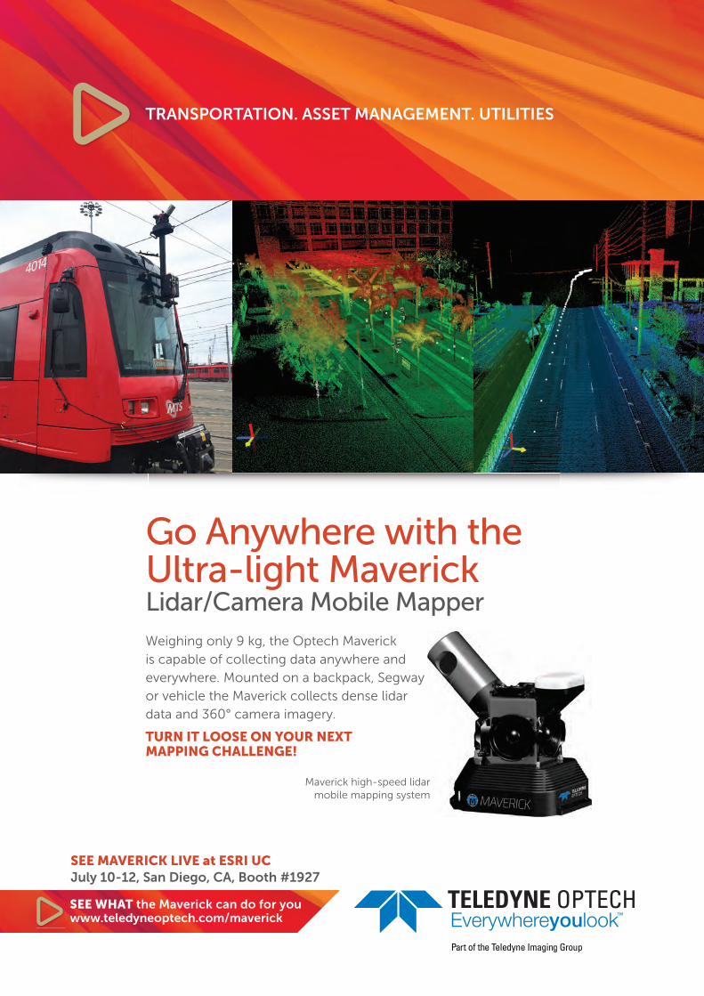
Go Anywhere with the Ultra-light MaverickLidar/Camera Mobile Mapper Weighing only 9 kg, the Optech Maverick is capable of collecting data anywhere and everywhere. Mounted on a backpack, Segway or vehicle the Maverick collects dense lidar data and 360° camera imagery.
TURN IT LOOSE ON YOUR NEXT MAPPING CHALLENGE!
SEE WHAT the Maverick can do for youwww.teledyneoptech.com/maverick
TRANSPORTATION. ASSET MANAGEMENT. UTILITIES
Maverick high-speed lidar mobile mapping system
3JULY/AUGUST 2018 | INTERNATIONAL |
DIRECTOR STRATEGY & BUSINESS DEVELOPMENT Durk HaarsmaFINANCIAL DIRECTOR Meine van der BijlSENIOR EDITOR Dr Ir. Mathias LemmensCONTRIBUTING EDITORS Dr Ir. Christiaan Lemmen, Dr Rohan Bennett, Huibert-Jan Lekkerkerk, Frédérique Coumans, Ir. Sabine de MillianoCONTENT MANAGER Wim van WegenCOPY-EDITOR Lynn Radford, Englishproof.nlMARKETING ADVISOR Sybout WijmaMARKETING ADVISOR Sharon RobsonMARKETING ADVISOR Thomas StuiverMARKETER Myrthe van der SchuitCIRCULATION MANAGER Adrian HollandDESIGN ZeeDesign, Witmarsum, www.zeedesign.nl
GIM INTERNATIONALGIM Inter na tion al, the global mag a zine for geo mat ics, is pub lished bimonthly by Geomares. The mag azine and related e-newsletter pro vide top i cal over views and ac cu rate ly presents the lat est news in geo mat ics, all around the world. GIM Inter na tion al is or ien tat ed towards a pro fes sion al and man a ge ri al read er ship, those lead ing de ci sion mak ing, and has a world wide cir cu la tion.
SUBSCRIPTIONS GIM International is available bimonthly on a subscription basis. Geospatial professionals can subscribe at any time via https://www.gim-international.com/subscribe/print.Subscriptions will be automatically renewed upon expiry, unless Geomares receives written notification of cancellation at least 60 days before expiry date.
AD VER TISE MENTSIn for ma tion about ad ver tising and dead lines are avail able in the Me dia Plan ner. For more in for ma tion please con tact our marketing advisor: [email protected].
ED I TO RI AL CON TRI BU TIONS All ma te ri al sub mit ted to Geomares and re lat ing toGIM Inter na tion al will be treat ed as un con di tion al ly as signed for pub li ca tion under copy right sub ject to the editor’s un re strict ed right to ed it and of fer ed i to ri al com ment. Geomares as sumes no re spon sibil ity for un so lic it ed ma te ri al or for the ac cu ra cy of in for ma tion thus re ceived. Geomares as sumes, in ad di tion, no ob li ga tion to return ma te ri al if not ex pli cit ly re quest ed. Con tri bu tions must be sent for the at ten tion of the content manager: [email protected].
GeomaresP.O. Box 112, 8530 AC Lem mer, The Neth er lands T: +31 (0) 514-56 18 54 F: +31 (0) 514-56 38 [email protected]. gim-international.com
No ma te ri al may be re pro duced in whole or in part with out writ ten per mis sion of Geomares.Copy right © 2018, Geomares, The Neth er lands All rights re served. ISSN 1566-9076
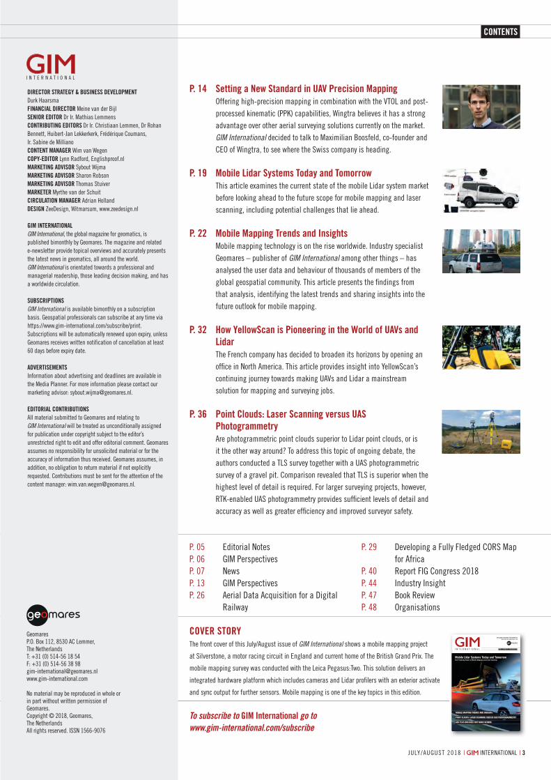
P. 14 Setting a New Standard in UAV Precision Mapping Offering high-precision mapping in combination with the VTOL and post-
processed kinematic (PPK) capabilities, Wingtra believes it has a strong advantage over other aerial surveying solutions currently on the market. GIM International decided to talk to Maximilian Boosfeld, co-founder and CEO of Wingtra, to see where the Swiss company is heading.
P. 19 Mobile Lidar Systems Today and Tomorrow This article examines the current state of the mobile Lidar system market
before looking ahead to the future scope for mobile mapping and laser scanning, including potential challenges that lie ahead.
P. 22 Mobile Mapping Trends and Insights Mobile mapping technology is on the rise worldwide. Industry specialist
Geomares – publisher of GIM International among other things – has analysed the user data and behaviour of thousands of members of the global geospatial community. This article presents the fi ndings from that analysis, identifying the latest trends and sharing insights into the future outlook for mobile mapping.
P. 32 How YellowScan is Pioneering in the World of UAVs and Lidar
The French company has decided to broaden its horizons by opening an offi ce in North America. This article provides insight into YellowScan’s continuing journey towards making UAVs and Lidar a mainstream solution for mapping and surveying jobs.
P. 36 Point Clouds: Laser Scanning versus UAS Photogrammetry
Are photogrammetric point clouds superior to Lidar point clouds, or is it the other way around? To address this topic of ongoing debate, the authors conducted a TLS survey together with a UAS photogrammetric survey of a gravel pit. Comparison revealed that TLS is superior when the highest level of detail is required. For larger surveying projects, however, RTK-enabled UAS photogrammetry provides suffi cient levels of detail and accuracy as well as greater effi ciency and improved surveyor safety.
P. 05 Editorial NotesP. 06 GIM PerspectivesP. 07 NewsP. 13 GIM PerspectivesP. 26 Aerial Data Acquisition for a Digital
Railway
P. 29 Developing a Fully Fledged CORS Map for Africa
P. 40 Report FIG Congress 2018P. 44 Industry InsightP. 47 Book ReviewP. 48 Organisations
COVER STORYThe front cover of this July/August issue of GIM International shows a mobile mapping project
at Silverstone, a motor racing circuit in England and current home of the British Grand Prix. The
mobile mapping survey was conducted with the Leica Pegasus:Two. This solution delivers an
integrated hardware platform which includes cameras and Lidar profi lers with an exterior activate
and sync output for further sensors. Mobile mapping is one of the key topics in this edition.
I N T E R N A T I O N A L
THE GLOBAL MAGAZINE FOR GEOMATICSWWW.GIM-INTERNATIONAL.COM
ISSUE 4 • VOLUME 32 • JULY/AUGUST 2018
MOBILE MAPPING TRENDS AND INSIGHTS
POINT CLOUDS: LASER SCANNING VERSUS UAS PHOTOGRAMMETRY.
GEO PLUS BIM DOES NOT MAKE GEOBIM.
Mobile Lidar Systems Today and TomorrowThe Promising Future of Mobile Mapping and Laser Scanning
01_cover.indd 1 05-07-18 16:02
To subscribe to GIM International go to www.gim-international.com/subscribe
CONTENTS
03_contents.indd 3 05-07-18 16:55
9july/august 2018 | international |
More news giM-international.coM
Synchro 4D construction modelling of Crossrail Station.
Lidar imagery, captured by Velodyne LiDAR technology.
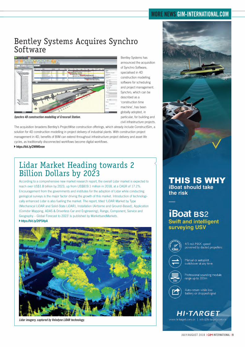
Bentley Systems Acquires Synchro Software
Bentley Systems has
announced the acquisition
of Synchro Software,
specialised in 4D
construction modelling
software for scheduling
and project management.
Synchro, which can be
described as a
‘construction time
machine’, has been
globally adopted, in
particular, for building and
civil infrastructure projects.
The acquisition broadens Bentley’s ProjectWise construction offerings, which already include ConstructSim, a
solution for 4D construction modelling in project delivery of industrial plants. With construction project
management in 4D, benefits of BIM can extend throughout infrastructure project delivery and asset life
cycles, as traditionally disconnected workflows become digital workflows.
https://bit.ly/2MM6noe
Lidar Market Heading towards 2 Billion Dollars by 2023According to a comprehensive new market research report, the overall Lidar market is expected to
reach over US$1.8 billion by 2023, up from US$819.1 million in 2018, at a CAGR of 17.2%.
Encouragement from the governments and institutes for the adoption of Lidar while conducting
geological surveys is the major factor driving the growth of this market. Introduction of technologi-
cally enhanced Lidar is also fuelling the market. The report, titled ‘LiDAR Market by Type
(Mechanical LiDAR and Solid-State LiDAR), Installation (Airborne and Ground-Based), Application
(Corridor Mapping, ADAS & Driverless Car and Engineering), Range, Component, Service and
Geography – Global Forecast to 2023’ is published by MarketsandMarkets.
https://bit.ly/2tP5HpA
07-08-09-10-11-12_news.indd 9 05-07-18 13:31
5july/august 2018 | international |
EDITORIAL NOTES
Mobile MappingThe demand for detailed, up-to-date 3D maps of cities, roads and large buildings is steadily growing. This demand is nourished by the ongoing exponential decrease in the cost of collecting point clouds (PCs). A major source of PCs are mobile mapping systems (MMSs), usually mounted on a car, van or other vehicle that can travel at the normal speed of traffic on roads and highways. An MMS usually consists of a positioning and orientation system, one or more laser scanners, one or more digital cameras and a control unit. However, the ongoing miniaturisation of sensors and
electronics is leading to the construction of laser scanners which are light enough to be mounted on unmanned aerial systems (UASs), trolleys, backpacks or sticks. The stick can be held in a surveying layman’s hand to capture rooms, corridors and many other indoor spaces and outdoor scenes. Many construction engineers, facilities managers and architects already acquire dense points by walking through the scene with just a handheld laser scanner on a stick. Hence, the acquisition of point clouds is no longer the sole domain of geomatics specialists. The key to this are easy-to-use, reliable sensors accompanied by robust software. Operating in buildings, tunnels and mines requires advanced solutions since there is no GNSS coverage. As a result, the role of the geomatics specialist is shifting from surveyor to advisor and software developer. An essential part of the knowledge spectrum concerns the understanding of the nitty-gritty of geospatial datasets, their fusion with other data as well as the storage demands of big data.
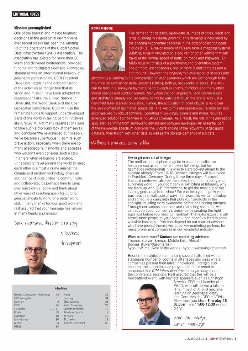
Mathias Lemmens, senior editor
How to get more out of IntergeoThe northern hemisphere may be in a state of collective holiday mood as summer is now in full swing, but for geomatics professionals it is wise to start looking ahead to the autumn already. From 16-18 October, Intergeo will take place in Frankfurt, Germany. During these three days, Europe’s financial centre will also be the epicentre of the mapping and surveying world. If your company is exhibiting at Intergeo, why not team up with GIM International to get the most out of this leading geospatial trade show? We can help you to grow your business in a multitude of ways. For example, we can develop and schedule a campaign that puts your products in the spotlight, building extra awareness before and during Intergeo. Through our various channels and marketing solutions, we can support your company’s presence by creating the right buzz just before you head to Frankfurt. That extra exposure will attract more people to your booth – and hopefully lead to some valuable business... You can depend on our team of advisors who have proved themselves to be key marketing partners for many prominent companies in our wonderful industry.
Want to learn more? Contact our marketing advisors:Thomas Stuiver (Europe, Middle East, Africa) - [email protected] Wijma (Rest of the world) - [email protected]
Besides the exhibition comprising several halls filled with a staggering number of booths in all shapes and sizes where companies present their latest innovations, Intergeo also encompasses a conference programme. I am proud to announce that GIM International will be organising one of the conference sessions. Rest assured that this will be a must-attend event, with keynote speakers such as Christoph
Strecha, CEO and founder of Pix4D, who will deliver a talk on ‘The impact of AI and machine learning on geospatial data’, and Gerd Hesina, CEO of VRVis. Make sure you block Thursday 18 October from 11:00-12:30 in your diary!
Wim van Wegen, content manager
Mission accomplishedOne of the bravest and maybe toughest decisions in the geospatial environment over recent weeks has been the winding up of the operations of the Global Spatial Data Infrastructure (GSDI) Association. The association has existed for more than 20 years and delivered conferences, provided funding and facilitated extensive knowledge-sharing across an international network of geospatial professionals. GSDI President Dave Lovell explains the discontinuation of the activities as recognition that its vision and mission have been adopted by organisations like the United Nations in UN-GGIM, the World Bank and the Open Geospatial Consortium. GSDI will use the remaining funds to support underdeveloped parts of the world in taking part in initiatives like UN-GGIM. Not many organisations dare to take such a thorough look at themselves and conclude ‘We’ve achieved our mission, we’ve become superfluous’. I admire such brave action, especially when there are so many associations, networks and societies who wouldn’t even consider such a step. In an era when resources are scarce, unnecessary travel around the world to meet each other is almost a crime against the climate and modern technology offers an abundance of possibilities to communicate and collaborate, it’s perhaps time to jump over one’s own shadow and think about other ways of reaching goals for putting geospatial data to work for a better world. GSDI, many thanks for your good work and rest assured that your message has landed in many hearts and minds!
Durk Haarsma, director strategy
& business
development
Beijing GreenValley Technology 34CHC Navigation 51Comnav 4FOIF 46Hi-Target 7, 9, 11Kolida 38LidarUSA 18MicroSurvey 16Myzox 24RIEGL 10
Ruide 31Sanding 34SBG Systems 38South Surveying 28Spectra Precision 12Teledyne Optech 2TI Asahi 42TI Linertec 18Trimble Geospatial 52
Advertisers
05_editorialnotes.indd 5 06-07-18 08:27
GIM PERSPECTIVES
66 | international | july/august 20186
Jantien Stoter.
By Prof Dr Jantien Stoter, Delft University of technology, the netherlanDs
The added value of integrating geoinformation
(Geo) with building information modelling
(BIM) to solve contemporary multidisciplinary
challenges of our urban environment is widely
recognised.
An architect (BIM) can take environmental
information (Geo) into account while designing
a building, and a municipality can then
automatically check the design (BIM) against its
environmental impact (Geo), such as whether it
is below the maximum building height, the level
of noise exposure for residents, and how much
solar irradiation the building will receive. Building
permission procedures will thus become both
faster and more reliable. Furthermore, 3D city
models will be more detailed and up to date; the
design of a permitted construction or building
is a source for the 3D city model, with added
information such as building materials and
energy-related attributes that can be used for the
construction’s life-cycle management.
It seems straightforward. Much research
and many projects have shown how geodata
has been successfully used in design and
construction activities, how BIM data serves as
source for geodata, and how BIM semantics (as
defined for example in the IFC standard) map
to geo semantics (as defined in, for example,
CityGML). But in practice IFC models are not
structured according to these mappings. In
addition, the fundamental differences between
BIM and Geo geometry models have hardly been
Geo Plus BIM Does Not Make GeoBIM
investigated until now. With over a thousand IFC
classes available, there are many different ways
to model a specific situation, which makes it
impossible to develop a uniform translation that
works for any IFC model. How can we translate
the hundreds and often even thousands of
constructional elements (modelled as volumes)
that together define a house in a BIM model into
a single, closed building object, defined with
surfaces as required for geospatial analysis?
The Open Geospatial Consortium (OGC)
confirmed these challenges in a project on the
use of IFC and CityGML in Urban Planning . OGC
identified inconsistencies in coding IFC elements
that complicate the transformation to CityGML
and concluded that, in order to adopt IFC in
urban planning, a clear set of specifications
needs to be set for the preparation of IFC files.
Another problem is that IFC models from practice
contain errors, making it hard to use them in
spatial analysis. In a project in The Netherlands
with stakeholders from both domains , invalid
objects were found to be widespread in the IFC
models that are obtained from architectural and
design software. Interestingly, some errors were
disallowed by the IFC standard, but not enforced
by most current implementations. Users of the
software have little notion of this problem, but
these errors make it hard to reuse the data in
other software.
Mainstream software vendors have partly solved
the interoperability problem between their
proprietary formats, but this is not sufficient
for a fundamental Geo and BIM integration.
In addition, with IFC mainly covering buildings
until now, little is known about the Geo and BIM
integration for infrastructure (currently being
standardised in IFC). For example, how can 3D
profiles of roads, generated in BIM by extruding
a profile along a 2D road axis, be understood
outside the software in which they are generated?
Models of buildings are produced in both
domains for different purposes, such as
for design and construction in BIM and for
geospatial analysis in GIS. The question of how
the data can be better reused is difficult to
answer as long as there is insufficient knowledge
of where Geo and BIM data should or could
meet in practice, and how fundamental solutions
can be developed accordingly.
Many experts are knowledgeable in only
one of the two domains, and professionals
who understand the data needs, the work
processes, the techniques, the software and the
standards in both domains are rare. To bridge
this fundamental knowledge gap, a EuroSDR
collaboration between 11 national mapping and
cadastral agencies will analyse two use cases in
detail by intensively involving the stakeholders:
a) the workflow from global design to a building
permit, and b) the workflow of the object life
cycle in asset management. Which process
steps and information flows do these use cases
have or wish to have, and what are the needs at
every step to use Geo data in a BIM environment
and vice versa? To what extent does BIM
software support Geo data and vice versa, and
what further developments are required? What
agreements are needed on geometric definitions
to make the level of development of the models
interoperable, and levels of detail useful to both?
How can the reuse of Geo data and BIM data
in these use cases be improved beyond the
exchange of data between a few professionals or
between the main software vendors?
The result will be a ‘best practice for Geo data in
a BIM environment’ and a ‘best practice for BIM
data in Geo information’, a contribution from an
international perspective to fulfil the promises of
Geo and BIM integration.
About the AuthorProf Dr Jantien Stoter chairs the 3D geoinformation research group at the Delft university of technology (Faculty of the Built environment and architecture). she also works as an innovation advisor at both Kadaster and geonovum. jantien did her PhD on 3D Cadastre (2004), received a prestigious grant of the Dutch science Foundation on 5D modelling (2011) and was recently awarded a grant from the european research Council for research into urban modelling in higher dimensions. she leads and co-leads several studies on geo and BiM integration, one of which is the eurosDr geoBiM project.
06_perspectives.indd 6 05-07-18 16:50
news
7july/august 2018 | international |
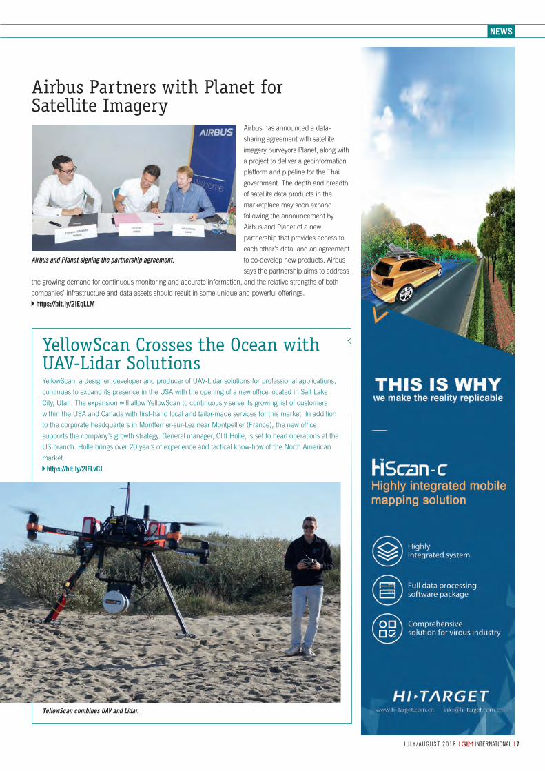
Airbus Partners with Planet for Satellite Imagery
Airbus has announced a data-
sharing agreement with satellite
imagery purveyors Planet, along with
a project to deliver a geoinformation
platform and pipeline for the Thai
government. The depth and breadth
of satellite data products in the
marketplace may soon expand
following the announcement by
Airbus and Planet of a new
partnership that provides access to
each other’s data, and an agreement
to co-develop new products. Airbus
says the partnership aims to address
the growing demand for continuous monitoring and accurate information, and the relative strengths of both
companies’ infrastructure and data assets should result in some unique and powerful offerings.
https://bit.ly/2leqLLM
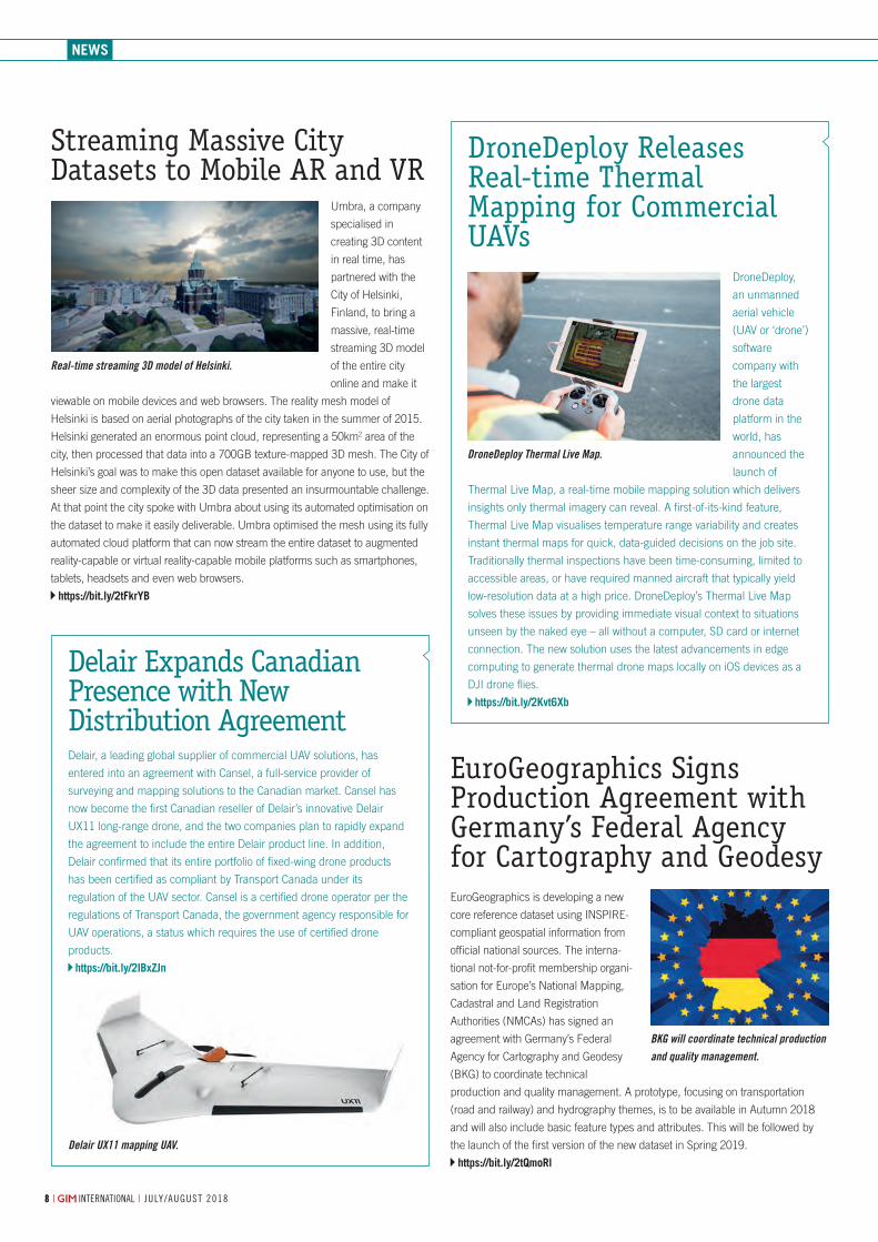
YellowScan combines UAV and Lidar.
Airbus and Planet signing the partnership agreement.
YellowScan Crosses the Ocean with UAV-Lidar SolutionsYellowScan, a designer, developer and producer of UAV-Lidar solutions for professional applications,
continues to expand its presence in the USA with the opening of a new office located in Salt Lake
City, Utah. The expansion will allow YellowScan to continuously serve its growing list of customers
within the USA and Canada with first-hand local and tailor-made services for this market. In addition
to the corporate headquarters in Montferrier-sur-Lez near Montpellier (France), the new office
supports the company’s growth strategy. General manager, Cliff Holle, is set to head operations at the
US branch. Holle brings over 20 years of experience and tactical know-how of the North American
market.
https://bit.ly/2lFLvCJ
07-08-09-10-11-12_news.indd 7 05-07-18 13:31
news
BKG will coordinate technical production and quality management.
EuroGeographics Signs Production Agreement with Germany’s Federal Agency for Cartography and GeodesyEuroGeographics is developing a new
core reference dataset using INSPIRE-
compliant geospatial information from
official national sources. The interna-
tional not-for-profit membership organi-
sation for Europe’s National Mapping,
Cadastral and Land Registration
Authorities (NMCAs) has signed an
agreement with Germany’s Federal
Agency for Cartography and Geodesy
(BKG) to coordinate technical
production and quality management. A prototype, focusing on transportation
(road and railway) and hydrography themes, is to be available in Autumn 2018
and will also include basic feature types and attributes. This will be followed by
the launch of the first version of the new dataset in Spring 2019.
https://bit.ly/2tQmoRl
88 | international | july/august 2018
Delair Expands Canadian Presence with New Distribution AgreementDelair, a leading global supplier of commercial UAV solutions, has
entered into an agreement with Cansel, a full-service provider of
surveying and mapping solutions to the Canadian market. Cansel has
now become the first Canadian reseller of Delair’s innovative Delair
UX11 long-range drone, and the two companies plan to rapidly expand
the agreement to include the entire Delair product line. In addition,
Delair confirmed that its entire portfolio of fixed-wing drone products
has been certified as compliant by Transport Canada under its
regulation of the UAV sector. Cansel is a certified drone operator per the
regulations of Transport Canada, the government agency responsible for
UAV operations, a status which requires the use of certified drone
products.
https://bit.ly/2IBxZJn
DroneDeploy Releases Real-time Thermal Mapping for Commercial UAVs
DroneDeploy,
an unmanned
aerial vehicle
(UAV or ‘drone’)
software
company with
the largest
drone data
platform in the
world, has
announced the
launch of
Thermal Live Map, a real-time mobile mapping solution which delivers
insights only thermal imagery can reveal. A first-of-its-kind feature,
Thermal Live Map visualises temperature range variability and creates
instant thermal maps for quick, data-guided decisions on the job site.
Traditionally thermal inspections have been time-consuming, limited to
accessible areas, or have required manned aircraft that typically yield
low-resolution data at a high price. DroneDeploy’s Thermal Live Map
solves these issues by providing immediate visual context to situations
unseen by the naked eye – all without a computer, SD card or internet
connection. The new solution uses the latest advancements in edge
computing to generate thermal drone maps locally on iOS devices as a
DJI drone flies.
https://bit.ly/2Kvt6Xb
Streaming Massive City Datasets to Mobile AR and VR
Umbra, a company
specialised in
creating 3D content
in real time, has
partnered with the
City of Helsinki,
Finland, to bring a
massive, real-time
streaming 3D model
of the entire city
online and make it
viewable on mobile devices and web browsers. The reality mesh model of
Helsinki is based on aerial photographs of the city taken in the summer of 2015.
Helsinki generated an enormous point cloud, representing a 50km2 area of the
city, then processed that data into a 700GB texture-mapped 3D mesh. The City of
Helsinki’s goal was to make this open dataset available for anyone to use, but the
sheer size and complexity of the 3D data presented an insurmountable challenge.
At that point the city spoke with Umbra about using its automated optimisation on
the dataset to make it easily deliverable. Umbra optimised the mesh using its fully
automated cloud platform that can now stream the entire dataset to augmented
reality-capable or virtual reality-capable mobile platforms such as smartphones,
tablets, headsets and even web browsers.
https://bit.ly/2tFkrYB
DroneDeploy Thermal Live Map.
Delair UX11 mapping UAV.
Real-time streaming 3D model of Helsinki.
07-08-09-10-11-12_news.indd 8 05-07-18 13:31
news
Token Generation Event to Fund Decentralised Global Super-map Using DronesAustralian geospatial mapping technology company
Soar has announced its highly anticipated Token
Generation Event (TGE) designed to fund the
launch of the world’s fi rst decentralised global
platform for the distribution of unmanned aerial
vehicle (UAV or ‘drone’) content and maps. The
TGE will be facilitated by an international
consortium of blockchain advisors including Fidem
and Digital Capital Management. The Soar TGE is
expected to raise up to US$20 million through the
sale of its SKYM token and has already secured
several cornerstone investments from technology
funds including Lateral Capital Ventures, Peregrine
Corporate, Alium Capital and Otsana Capital. Soar’s
stage 1 is the initiation of its global drone content
marketplace platform, which company founder and
CEO Amir Farhand believes will be the go-to place
for almost any content that drones produce at both
consumer and commercial levels. According to
Farhand, both professional and hobbyist drone
operators will be able to monetise unused content,
the majority of which is sitting on old hard drives
and forgotten. They have already onboarded over
450 drone operators globally, and this still is just
scratching the surface of this opportunity, he said.
https://bit.ly/2lLeHIp
Drone imagery as provided by the Soar platform.
RIEGL LMS GmbH, Austria | RIEGL USA Inc. | RIEGL Japan Ltd. | RIEGL China Ltd.
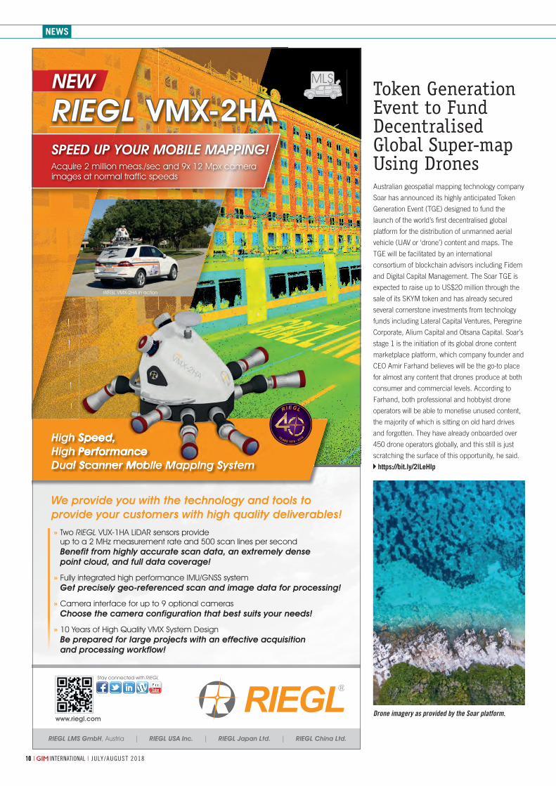
High Speed, High PerformanceDual Scanner Mobile Mapping System
» Two RIEGL VUX-1HA LiDAR sensors provide up to a 2 MHz measurement rate and 500 scan lines per second Benefit from highly accurate scan data, an extremely dense point cloud, and full data coverage!
» Fully integrated high performance IMU/GNSS system Get precisely geo-referenced scan and image data for processing!
» Camera interface for up to 9 optional cameras Choose the camera configuration that best suits your needs!
» 10 Years of High Quality VMX System Design Be prepared for large projects with an effective acquisition and processing workflow!
We provide you with the technology and tools to provide your customers with high quality deliverables!
NEW
RIEGL VMX-2HA in action
Dual Scanner Mobile Mapping System
High Speed, High PerformanceDual Scanner Mobile Mapping System
High Speed, High PerformanceDual Scanner Mobile Mapping System
SPEED UP YOUR MOBILE MAPPING!Acquire 2 million meas./sec and 9x 12 Mpx camera images at normal traffic speeds
RIEGL VMX-2HA
www.riegl.com
Stay connected with RIEGL
YEARS 1978 - 2018
R I E G L
1010 | international | july/august 2018
07-08-09-10-11-12_news.indd 10 05-07-18 13:31
More news giM-international.coM
iSTAR Pulsar mounted on a vehicle.
360-degree Big Data Capture on the Move
Whether from the air, by car or on foot – the
ability to capture 360-degree images on the
move to create immersive virtual environments
is becoming increasingly desirable in many
applications. From urban planning and city
asset management, to transportation analytics
and crowd fl ow monitoring, big imaging data
can empower many aspects of the modern
smart city. Recently, NCTech – an Edinburgh-
based developer of reality imaging systems –
announced the availability of iSTAR Pulsar, a professional edge-to-cloud big data system optimised
for capture on the move. Developed in association with Sony and Intel, iSTAR Pulsar is specifi cally
designed to capture 360-degree data while mounted on a vehicle or drone or used on foot. The
system is designed for ease of use and does not require any photography experience or even a
computer to operate. The iSTAR Pulsar app provides the ability to plan routes, as well as to view and
share content online.
https://bit.ly/2MtXntl
OGC Calls for Participation in Indoor Mapping and Navigation Pilot
The Open Geospatial Consortium (OGC) has released a Call for Participation to
solicit proposals for the OGC Indoor Mapping and Navigation Pilot initiative. The
Indoor Mapping and Navigation Pilot, sponsored by the Public Safety
Communications Research Division of the National Institute of Standards and
Technology (NIST), will create and advance solutions to complex geospatial challenges related to indoor
mapping and navigation for fi rst responders. First responders typically survey high-risk facilities in their juris-
diction at least once per year as part of a preplanning process. Outputs from preplanning are often in report
form, and fi rst responders may annotate available fl oor plans (e.g. from computer-aided design models) or
generate their own hand-drawn maps during the process. Preplanning is time-consuming, ineffi cient and
inherently complex, considering the information and level of detail that should or could be captured, the lack
of automation and the diffi culty identifying notable changes to facilities and infrastructure during successive
preplanning surveys.
https://bit.ly/2tQQ1lu
Accurate Georeferencing for UAV Surveying without Base StationKlau Geomatics, specialised in post-processed kinematic (PPK) direct georeferencing technology,
has announced its new No-Base-Station high-accuracy georeferencing solution for unmanned aerial
vehicles (UAVs). This innovative new solution is the result of close collaboration between Klau
Geomatics and Hexagon’s Geosystems Division, enabling users to conduct UAV surveying projects
without running a local GPS receiver, producing high-accuracy 3D survey data. In addition to
accuracy, which is the most important feature, this georeferencing solution offers a simplifi ed and
effi cient workfl ow. Users do not need any survey equipment to place ground control points (GCPs) or
even a local base station for their PPK. They can collect precise georeferenced UAV data and even
capture ground checkpoints just using their UAV, said Adam Chabok, technical director of Klau
Geomatics. With the simplifi ed plug-and-play payload, the system can be easily attached to any UAV
or manned aircraft.
https://bit.ly/2teZz3w
11july/august 2018 | international |
07-08-09-10-11-12_news.indd 11 05-07-18 13:31
news
5 Need-to-know ArticlesEducation is a key pillar of the mapping
and surveying profession. At GIM
International we do our very best to keep
you informed with the latest knowledge,
tailored to the demands of the geospatial
industry’s broad spectrum of interests and
applications. This week, we are
highlighting fi ve articles providing need-to-
know information for everyone involved
with the aspects concerned: UAV photo-
grammetry software, spectral image
cameras, the latest Lidar developments,
the main challenges to consider when
selecting a UAV for your mapping project
and, last but not least, information about
how to use the captured geospatial data
effectively.
http://bit.ly/needtoknowgeoLearn more at www.spectraprecision.com
RANGER 7DATA COLLECTOR
Welcome to the fourth generation Ranger data collector. Its all-new design is based on the experience gained over the last 18 years of demanding field operations. The guiding principles have never changed: productivity, reliability, and quality. A down day is simply not an option.
The Ranger 7 continues the history of the Ranger data collector by focusing on what is important. 7-inch Gorilla glass touch screen, full keyboard, Windows 10 Professional operating system. Available with Survey Pro and Layout Pro software.
Quality results are what you produce. Partner with the Ranger 7 to produce more.
WITHOUT COMPROMISE
©2018 Trimble Inc. All rights reserved. Spectra Precision is a Division of Trimble Inc. Spectra Precision and the Spectra Precision logo are trademarks of Trimble Inc.
COMPROMISE
Teaming up for Canada’s Largest BVLOS Drone TrialOne of Canada’s leading commercial drone
operators, IN-FLIGHT Data, is embarking upon the
country’s largest beyond-visual-line-of-sight
(BVLOS) UAS operations trial to date. It is receiving
support from senseFly, the industry’s leading
provider of professional mapping drones and a
commercial drone subsidiary of Parrot Group. The
project’s goal is to demonstrate that BVLOS UAS
fl ights can be conducted safely and effi ciently,
while providing cost reductions and/or operational
effi ciencies for the different use cases involved.
Chris Healy, the owner of IN-FLIGHT Data, said his
team is excited to get the go-ahead for this
ambitious project. Working closely with senseFly
and the company’s 20 partner organisations, they
will be collecting a huge amount of geo-accurate
data – across many types of long-range drone
applications – which will help contribute to the
creation of pragmatic future BVLOS legislation.
https://bit.ly/2n9kmVp
Chris Healy, IN-FLIGHT Data, with a senseFly UAV.
1212 | international | july/august 2018
07-08-09-10-11-12_news.indd 12 05-07-18 13:31
GIM PERSPECTIVES
july/august 2018 | international | 13
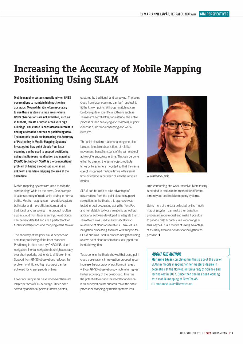
Marianne Løvås.
By Marianne Løvås, TerraTec, Norway
Mobile mapping systems usually rely on GNSS
observations to maintain high positioning
accuracy. Meanwhile, it is often necessary
to use these systems to map areas where
GNSS observations are not available, such as
in tunnels, forests or urban areas with high
buildings. Thus there is considerable interest in
finding alternative sources of positioning data.
The master’s thesis on ‘Increasing the Accuracy
of Positioning in Mobile Mapping Systems’
investigated how point clouds from laser
scanning can be used to support positioning
using simultaneous localisation and mapping
(SLAM) technology. SLAM is the computational
problem of finding a robot’s position in an
unknown area while mapping the area at the
same time.
Mobile mapping systems are used to map the
surroundings while on the move. One example
is laser scanning of roads while driving in normal
traffic. Mobile mapping can make data capture
both safer and more efficient compared to
traditional land surveying. The product is often
a point cloud from laser scanning. Point clouds
can be very detailed and are a perfect tool for
further investigations and mapping of the terrain.
The accuracy of the point cloud depends on
accurate positioning of the laser scanners.
Positioning is often done by GNSS/INS-aided
navigation. Inertial navigation has high accuracy
over short periods, but tends to drift over time.
Support from GNSS observations reduces the
problem of drift, and high accuracy can be
achieved for longer periods of time.
Lower accuracy is an issue whenever there are
longer periods of GNSS outage. This is often
solved by additional points (‘known points’),
Increasing the Accuracy of Mobile Mapping Positioning Using SLAM
captured by traditional land surveying. The point
cloud from laser scanning can be ‘matched’ to
fit the known points. Although matching can
be done quite efficiently in software such as
Terrasolid’s TerraMatch, for instance, the entire
process of land surveying and matching of point
clouds is quite time-consuming and work-
intensive.
The point cloud from laser scanning can also
be used to obtain observations of relative
movement, based on scans of the same object
at two different points in time. This can be done
either by passing the same object multiple
times or by scanners mounted so that the same
object is scanned multiple times with a small
time difference in between due to the vehicle’s
motion.
SLAM can be used to take advantage of
observations from the point cloud to support
navigation. In the thesis, this approach was
tested in post-processing using the TerraPos
and TerraMatch software solutions, as well as
additional software developed to integrate them.
TerraMatch was used to automatically find
relative point cloud observations. TerraPos is a
navigation processing software with support for
SLAM and was used to process navigation using
relative point cloud observations to support the
inertial navigation.
Tests done in the thesis showed that using point
cloud observations in navigation processing can
increase the accuracy of positioning in areas
without GNSS observations, which in turn gives
higher accuracy of the point cloud. This has
the potential to reduce the need for additional
land-surveyed points and can make the entire
process of mapping by mobile systems less
time-consuming and work-intensive. More testing
is needed to evaluate the method for different
terrain types and mobile mapping systems.
Using more of the data collected by the mobile
mapping system can make the navigation
processing more robust and make it possible
to provide high accuracy in a wider range of
terrain types. It is a matter of taking advantage
of as many available sensors for navigation as
possible.
About the AuthorMarianne Løvås completed her thesis about the use of slaM in mobile mapping for her master’s degree in geomatics at the norwegian university of science and technology in 2017. since then she has been working with mobile mapping at terratec as.
13_perspectives2.indd 13 05-07-18 16:08
14 | international | july/august 2018 july/august 2018 | international |
Switzerland-based start-up Wingtra has developed a vertical-take-off-and-landing (VTOL) unmanned aerial vehicle (UAV or ‘drone’) that rises straight up, tilts and flies off like an aeroplane. The WingtraOne is a broad-coverage drone that is used particularly in the surveying, construction and precision agriculture industries and which can capture images in photogrammetric resolution. Offering high-precision mapping in combination with the VTOL and post-processed kinematic (PPK) capabilities, the manufacturer believes it has a strong advantage over the other aerial surveying solutions currently on the market. GIM International decided to talk to Maximilian Boosfeld, co-founder and CEO of Wingtra, to see where the Swiss company is heading.
Wingtra was founded in 2016 as a spin-off of the Autonomous Systems Lab at ETH Zurich. Can you tell us more about the early days?The story of Wingtra started with an ambitious
research project called Pacflyer which Basil
Weibel, our current chief revenue officer
(CRO), and Sebastian Verling, now senior
software engineer, were working on at Prof Dr
Roland Siegwart’s Autonomous Systems Lab.
The aim of the project was to build a
new-generation drone that would overcome
the limitations faced by current drone
solutions. Basil and Sebastian along with the
other two founders of Wingtra – Elias
Kleimann and myself – shared an idea of
making a global positive impact. Therefore,
when the initial research was over, we
decided to join forces and make the idea
come alive. We wanted our drone to carry the
most valuable goods on Earth, and realised
that aerial information has the best value-to-
weight ratio. This epiphany was the motivation
behind assembling the team and creating
Wingtra.
How would you describe your company today?Wingtra has grown to become an international
company with distribution partners on every
continent (except Antarctica). Our customers
have completed more than a thousand flights
and the interest in the industry is continuing
to increase at a rapid pace. I believe we are
very much on track to fulfil our initial goal of
delivering high-accuracy data robustly and
efficiently. Today, our WingtraOne drone
collects thousands of gigabytes of aerial data
and is used by mapping professionals in
applications that range from surveying and
mining to wildlife monitoring.
What distinguishes Wingtra from other UAV companies within the mapping and surveying industry?WingtraOne is the first VTOL drone to be
equipped with professional photogrammetry
sensors. I also feel confident enough to say
that, currently, we are the largest commercial
VTOL player in the surveying, construction
and precision agriculture industries. The
VTOL advantage is threefold. Firstly, vertical
take-off and landing means our users can
reach previously ‘unsurveyable’ areas; one of
our customers in Australia, for example,
operates the WingtraOne from a boat. This
helps them pursue their research in wildlife
monitoring of a vulnerable sea mammal, the
dugong. Secondly, the sensors are always
protected – unlike the case of belly landings
that fixed wings have to resort to. We can
Setting a New Standard in UAV Precision Mapping
InTErVIEW WITH MAxIMILIAn BooSfELd, CEo, WIngTrA
By Wim van Wegen, content manager, gIm InternatIonal
14-15-17_interview.indd 14 05-07-18 11:45
INTERVIEW
15| international | july/august 2018 july/august 2018 | international |
We like to joke that WingtraPilot is so easy
to use that even a child could operate the
drone!
Mapping generates a massive amount of data. What about the challenge of processing all the data?We live in a data-driven society where data
storage is becoming cheaper while
computational power keeps increasing. Cloud
solutions especially are becoming more
robust, which makes me think they are likely
to become the future of data processing. In
the mapping industry, several post-processing
solutions already make use of this. Last year
we partnered with Pix4D to deliver a full
mapping drone combo – a drone to ensure
the smoothest data collection and the
software which turns the data into actionable
insights.
Aerial mapping is not limited to photogrammetry. What are your thoughts on
UAV-Lidar mapping, and can we expect any movement in this direction from your side?Lidar mapping could definitely be an option
for the future. However, with the recent
launch of the WingtraOne PPK drone, we are
keen to focus on our current and prospective
users and are keeping our eyes and ears
open for all the feedback they have.
What is the secret behind ETH Zurich – and Switzerland in general – in terms of generating so many successful start-ups in the geospatial business?For one, Switzerland has a long history of
innovation in high-precision technology –
after all, it’s the land of the watchmakers!
Another way to look at it is that the beautiful
mountain landscape that makes Switzerland
famous has also presented big challenges for
the geospatial business. Engineering
achievements such as the Gotthard Tunnel
are world famous. In fact, WingtraOne itself
was used in projects like mapping of the
Alpine region for building wind farms and
terrace farming locations near Lake Biel
where vineyards are cultivated.
The second piece of puzzle in terms of the
impact of aerial solutions for geospatial
applications comes from the large talent pool
concentrated at ETH Zurich and EPFL, both
world-famous universities that attract
equip our drone with ultra-high-accuracy
sensors without the fear of damage, which
helps us achieve unprecedented aerial
accuracy in the sub-centimetre range. Thirdly,
VTOL ensures a completely hands-off
experience for our users. They can focus on
data acquisition, without having to worry
about drone operation.
Strictly speaking, a drone is just a device. Which range of payloads are you offering to mapping and surveying professionals?WingtraOne is a device enabling what was not
possible before, namely photogrammetric
resolution with a broad-coverage drone.
When it comes to RGB cameras, for surveying
professionals looking for ultra high precision,
we offer the Sony RX1RII: a full-frame 42MP
camera. This payload can also be bundled
with our PPK upgrade for ultra-precise
mapping (accuracy down to 1cm) without the
use of ground control points. For surveyors
looking for an entry-level bundle or 3D
reconstruction, we offer the Sony QX1 Pro,
and Sony QX1 Pro with a 15mm lens,
respectively. Besides these RGB cameras, we
offer the Micasense Rededge M to
professionals looking for an advanced
solution for precision farming and plant
analysis. FLIR Duo Pro for thermal mapping
and monitoring is coming soon. Crucially, the
WingtraOne has been designed to be
completely modular, so any of the payloads
can be swapped for the other in no time!
Can you explain more about the software aspect of the data acquisition?The WingtraOne drone is operated through
the intuitive flight planning app called
WingtraPilot. WingtraPilot includes various
ways to plan missions, monitor and revise
them during the flights and inspect the data
output while out in the field. We designed
WingtraPilot to maximise successful aerial
data acquisition. Before the flight,
WingtraPilot runs background checks like
battery health, GPS reception and imaging to
make sure that everything is in order for the
mission. It also guides the operator through
the pre-flight process and catches oversights.
THE BEAUTIfUL MoUnTAIn LAndSCApE THAT MAkES SWITZErLAnd fAMoUS HAS ALSo prESEnTEd BIg CHALLEngES for THE gEoSpATIAL BUSInESS
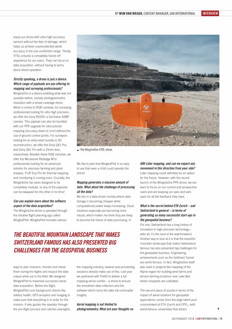
The WingtraOne VTOL drone.
By Wim van Wegen, content manager, gIm InternatIonal
14-15-17_interview.indd 15 05-07-18 11:45

SURVEYSOLUTIONMicroSurvey CAD 2018 gives you thefeatures you need to get the job doneon budget and on time!
Packed with support for AutoCAD® 2018 .dwg files, Esri® Shapefiles, Trimble® JobXML files and powered by the latest IntelliCAD® 8.4, MicroSurvey CAD continues to be the absolute best choice for land surveyors and civil engineers.
The new toggle under the CAD drawing controls tab called 3D
point labels causes point labels to be drawn at the same
elevation as the point node.
Import Trimble® and Spectra Precision® JobXML data files
including point coordinates, GPS coordinates, and total station
measurements.
MicroSurvey CAD 2018 can import Esri shapefiles and other
GIS data formats and the features will be drawn as CAD
objects including points polylines and boundary hatches.
What’s New?
YOUR
SURVEYSURVEYSURVEYSURVEYSURVEYSURVEYSURVEYSOLUTIONSOLUTIONSOLUTIONSOLUTIONSOLUTIONSOLUTIONSOLUTIONSOLUTIONSOLUTIONSOLUTIONSOLUTIONSOLUTIONSOLUTIONSOLUTIONSOLUTIONMicroSurvey CAD 2018 gives you theMicroSurvey CAD 2018 gives you theMicroSurvey CAD 2018 gives you theMicroSurvey CAD 2018 gives you theMicroSurvey CAD 2018 gives you theMicroSurvey CAD 2018 gives you theMicroSurvey CAD 2018 gives you theMicroSurvey CAD 2018 gives you theMicroSurvey CAD 2018 gives you theMicroSurvey CAD 2018 gives you theMicroSurvey CAD 2018 gives you theMicroSurvey CAD 2018 gives you theMicroSurvey CAD 2018 gives you theMicroSurvey CAD 2018 gives you theMicroSurvey CAD 2018 gives you theMicroSurvey CAD 2018 gives you theMicroSurvey CAD 2018 gives you theMicroSurvey CAD 2018 gives you theMicroSurvey CAD 2018 gives you theMicroSurvey CAD 2018 gives you theMicroSurvey CAD 2018 gives you theMicroSurvey CAD 2018 gives you theMicroSurvey CAD 2018 gives you theMicroSurvey CAD 2018 gives you theMicroSurvey CAD 2018 gives you theMicroSurvey CAD 2018 gives you thefeatures you need to get the job donefeatures you need to get the job donefeatures you need to get the job donefeatures you need to get the job donefeatures you need to get the job donefeatures you need to get the job donefeatures you need to get the job donefeatures you need to get the job donefeatures you need to get the job donefeatures you need to get the job donefeatures you need to get the job donefeatures you need to get the job donefeatures you need to get the job donefeatures you need to get the job donefeatures you need to get the job donefeatures you need to get the job donefeatures you need to get the job donefeatures you need to get the job donefeatures you need to get the job donefeatures you need to get the job donefeatures you need to get the job doneon budget and on time!on budget and on time!on budget and on time!on budget and on time!on budget and on time!on budget and on time!on budget and on time!on budget and on time!on budget and on time!on budget and on time!on budget and on time!
Packed with support for AutoCAD® 2018 Packed with support for AutoCAD® 2018 Packed with support for AutoCAD® 2018 Packed with support for AutoCAD® 2018 Packed with support for AutoCAD® 2018 Packed with support for AutoCAD® 2018 Packed with support for AutoCAD® 2018 Packed with support for AutoCAD® 2018 Packed with support for AutoCAD® 2018 Packed with support for AutoCAD® 2018 Packed with support for AutoCAD® 2018 Packed with support for AutoCAD® 2018 Packed with support for AutoCAD® 2018 Packed with support for AutoCAD® 2018 Packed with support for AutoCAD® 2018 .dwg files, Esri® Shapefiles, Trimble® .dwg files, Esri® Shapefiles, Trimble® .dwg files, Esri® Shapefiles, Trimble® .dwg files, Esri® Shapefiles, Trimble® .dwg files, Esri® Shapefiles, Trimble® .dwg files, Esri® Shapefiles, Trimble® .dwg files, Esri® Shapefiles, Trimble® .dwg files, Esri® Shapefiles, Trimble® .dwg files, Esri® Shapefiles, Trimble® .dwg files, Esri® Shapefiles, Trimble® .dwg files, Esri® Shapefiles, Trimble® .dwg files, Esri® Shapefiles, Trimble® .dwg files, Esri® Shapefiles, Trimble® JobXML files and powered by the latest JobXML files and powered by the latest JobXML files and powered by the latest JobXML files and powered by the latest JobXML files and powered by the latest JobXML files and powered by the latest JobXML files and powered by the latest JobXML files and powered by the latest JobXML files and powered by the latest JobXML files and powered by the latest JobXML files and powered by the latest IntelliCAD® 8.4, MicroSurvey CAD continues IntelliCAD® 8.4, MicroSurvey CAD continues IntelliCAD® 8.4, MicroSurvey CAD continues IntelliCAD® 8.4, MicroSurvey CAD continues IntelliCAD® 8.4, MicroSurvey CAD continues IntelliCAD® 8.4, MicroSurvey CAD continues IntelliCAD® 8.4, MicroSurvey CAD continues IntelliCAD® 8.4, MicroSurvey CAD continues IntelliCAD® 8.4, MicroSurvey CAD continues to be the absolute best choice for land to be the absolute best choice for land to be the absolute best choice for land to be the absolute best choice for land to be the absolute best choice for land to be the absolute best choice for land to be the absolute best choice for land to be the absolute best choice for land to be the absolute best choice for land to be the absolute best choice for land to be the absolute best choice for land to be the absolute best choice for land to be the absolute best choice for land to be the absolute best choice for land surveyors and civil engineers.surveyors and civil engineers.surveyors and civil engineers.surveyors and civil engineers.surveyors and civil engineers.surveyors and civil engineers.surveyors and civil engineers.surveyors and civil engineers.
What’s New?
YOUR
INTERVIEW
july/august 2018 | international | 17
to count sea mammals in the water, monitor
their behaviour and ensure better protection
of endangered species.
The other implication of machine learning for
geospatial applications is likely to be in the
field of computer vision. We’re seeing this
already in the case of orthomosaic generation
(map stitching) software that not just matches
individual pictures from the collected dataset,
but also corrects camera orientation. This
leads to higher accuracy in mapping. Besides
this, we can perhaps expect improvements in
the arena of dynamic obstacle avoidance
using vision, or more robust localisation in the
case of GPS loss. However, these
improvements are still limited by the low
computational power and memory offered by
current embedded devices, which need to
stay small and lightweight for UAVs.
What are your thoughts on the legislation and regulations for commercial drone use?I believe that the latest regulatory
developments have mainly had a positive
effect on our business. Rules are converging
and this helps our professional customers to
reduce planning uncertainty. Many of the
regulations are aimed at respecting the
enormous potential of commercial drone use
for the economy while still making flying safer.
Privacy is the other hot topic in drone
regulations, but this applies much more to
recreational drones and their operators and is
less of an issue in the professional surveying
segment.
Which other developments do you expect to have a major influence on UAV mapping in the years ahead?At Wingtra we strongly believe that the VTOL
technology will be the one to disrupt the
industry. After all, Wingtra was founded
based on high ambitions to overcome those
limitations. With ever-more sophisticated
VTOL technologies, the gap between fixed
wings and multirotors should slowly disappear
which will rapidly broaden the application
scenarios. Besides that I believe that much
more powerful batteries will be developed,
breaking the limits of imagination regarding
what can be achieved with drones during long
missions.
intelligent and passionate engineers from
around the globe. ETH Zurich’s history in
control and robotics has given rise to many
start-ups and innovative organisations, such
as PX4 which can be considered the gold
standard for open-source software for drones.
Your company recently appointed Cyril Halter – former COO and co-founder of what could be seen as one of your competitors, senseFly – to take over your role as COO. What’s the strategy behind that decision?Our strategy is the launch of the high-
precision drone WingtraOne PPK. The
Wingtra team expects it to become the most
desired drone in high-precision surveying and
mapping applications. Cyril Halter is exactly
the person we need to help us reach this
goal. He will focus on the industrialisation and
the ramp-up of production. His tremendous
industry experience will definitely be put to
good use at Wingtra.
Zooming in on the future of drones for geospatial applications, how do you think new developments such as artificial intelligence (AI) and machine learning will influence aerial mapping?We’re already seeing the use of machine
learning kicking in for environmental and
research applications. Take our customers
from Murdoch University in Australia, for
example, who are operating WingtraOne from
a boat to collect aerial images of a vast area
of ocean for their wildlife research project.
They are using machine learning algorithms
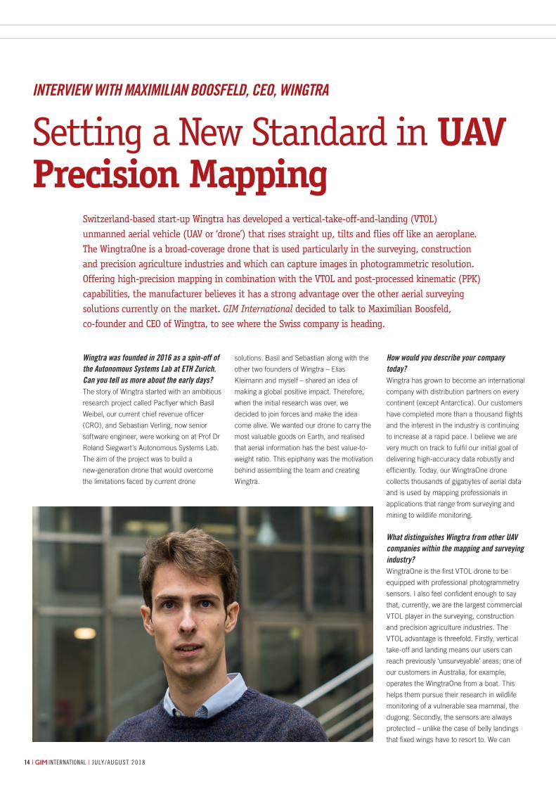
AbOUt MAxIMIlIAn bOOsFeldMaximilian Boosfeld is co-founder and Ceo of Wingtra, a manufacturer of high-precision Vtol drones that collect survey-grade aerial data. From the very start, Maximilian has helped Wingtra to become an international company with distribution partners across the globe and supplier of the very first Vtol drone to be equipped with professional aerial photography sensors. Prior to Wingtra, Maximilian studied mechanical engineering at etH Zurich and in parallel ran his very first successful company: the open-air café called ‘Kleine Freiheit’.
More Informationwww.wingtra.com
14-15-17_interview.indd 17 05-07-18 11:45

feature
19july/august 2018 | international |
By Bharat Lohani, IIT Kanpur, and Manohar Yadav, MnIT allahaBad, IndIa
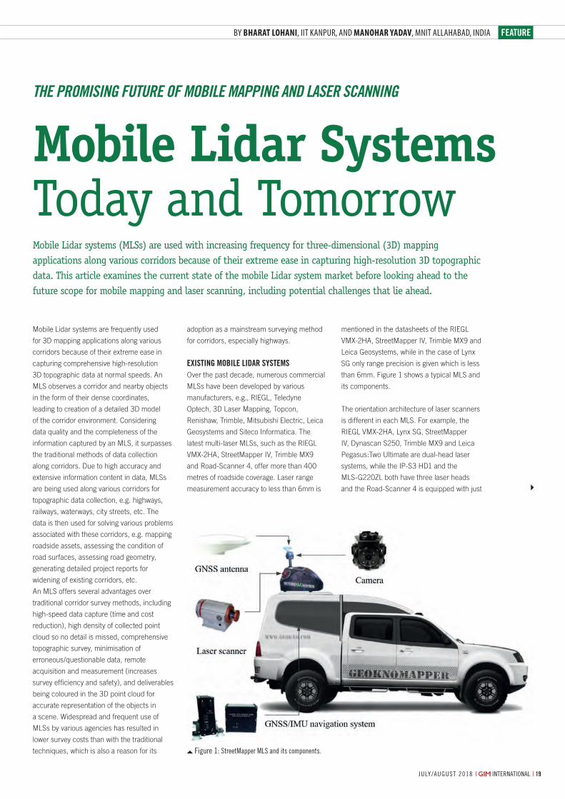
Figure 1: streetMapper Mls and its components.
Mobile Lidar systems are frequently used
for 3D mapping applications along various
corridors because of their extreme ease in
capturing comprehensive high-resolution
3D topographic data at normal speeds. An
MLS observes a corridor and nearby objects
in the form of their dense coordinates,
leading to creation of a detailed 3D model
of the corridor environment. Considering
data quality and the completeness of the
information captured by an MLS, it surpasses
the traditional methods of data collection
along corridors. Due to high accuracy and
extensive information content in data, MLSs
are being used along various corridors for
topographic data collection, e.g. highways,
railways, waterways, city streets, etc. The
data is then used for solving various problems
associated with these corridors, e.g. mapping
roadside assets, assessing the condition of
road surfaces, assessing road geometry,
generating detailed project reports for
widening of existing corridors, etc.
An MLS offers several advantages over
traditional corridor survey methods, including
high-speed data capture (time and cost
reduction), high density of collected point
cloud so no detail is missed, comprehensive
topographic survey, minimisation of
erroneous/questionable data, remote
acquisition and measurement (increases
survey efficiency and safety), and deliverables
being coloured in the 3D point cloud for
accurate representation of the objects in
a scene. Widespread and frequent use of
MLSs by various agencies has resulted in
lower survey costs than with the traditional
techniques, which is also a reason for its
Mobile Lidar systems (MLSs) are used with increasing frequency for three-dimensional (3D) mapping applications along various corridors because of their extreme ease in capturing high-resolution 3D topographic data. This article examines the current state of the mobile Lidar system market before looking ahead to the future scope for mobile mapping and laser scanning, including potential challenges that lie ahead.
adoption as a mainstream surveying method
for corridors, especially highways.
Existing mobilE lidar systEmsOver the past decade, numerous commercial
MLSs have been developed by various
manufacturers, e.g., RIEGL, Teledyne
Optech, 3D Laser Mapping, Topcon,
Renishaw, Trimble, Mitsubishi Electric, Leica
Geosystems and Siteco Informatica. The
latest multi-laser MLSs, such as the RIEGL
VMX-2HA, StreetMapper IV, Trimble MX9
and Road-Scanner 4, offer more than 400
metres of roadside coverage. Laser range
measurement accuracy to less than 6mm is
mentioned in the datasheets of the RIEGL
VMX-2HA, StreetMapper IV, Trimble MX9 and
Leica Geosystems, while in the case of Lynx
SG only range precision is given which is less
than 6mm. Figure 1 shows a typical MLS and
its components.
The orientation architecture of laser scanners
is different in each MLS. For example, the
RIEGL VMX-2HA, Lynx SG, StreetMapper
IV, Dynascan S250, Trimble MX9 and Leica
Pegasus:Two Ultimate are dual-head laser
systems, while the IP-S3 HD1 and the
MLS-G220ZL both have three laser heads
and the Road-Scanner 4 is equipped with just
Mobile Lidar Systems Today and Tomorrow
The Promising FuTure oF mobile maPPing and laser scanning
19-20-21_featurelohani.indd 19 05-07-18 12:14
| international | july/august 20182020 july/august 2018 | international |20
one. Generally, these multi-laser-head MLSs
are expensive (in excess of US$250,000),
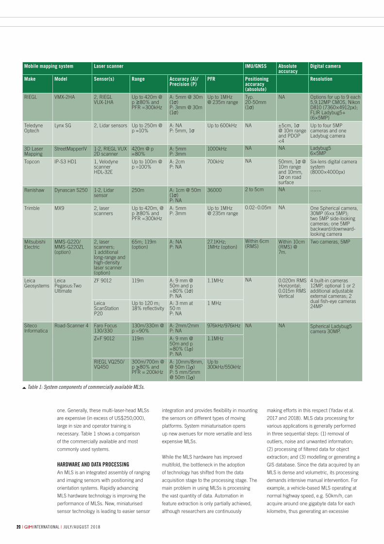
large in size and operator training is
necessary. Table 1 shows a comparison
of the commercially available and most
commonly used systems.
HardwarE and data procEssing An MLS is an integrated assembly of ranging
and imaging sensors with positioning and
orientation systems. Rapidly advancing
MLS hardware technology is improving the
performance of MLSs. New, miniaturised
sensor technology is leading to easier sensor
integration and provides flexibility in mounting
the sensors on different types of moving
platforms. System miniaturisation opens
up new avenues for more versatile and less
expensive MLSs.
While the MLS hardware has improved
multifold, the bottleneck in the adoption
of technology has shifted from the data
acquisition stage to the processing stage. The
main problem in using MLSs is processing
the vast quantity of data. Automation in
feature extraction is only partially achieved,
although researchers are continuously
making efforts in this respect (Yadav et al.
2017 and 2018). MLS data processing for
various applications is generally performed
in three sequential steps: (1) removal of
outliers, noise and unwanted information;
(2) processing of filtered data for object
extraction; and (3) modelling or generating a
GIS database. Since the data acquired by an
MLS is dense and volumetric, its processing
demands intensive manual intervention. For
example, a vehicle-based MLS operating at
normal highway speed, e.g. 50km/h, can
acquire around one gigabyte data for each
kilometre, thus generating an excessive
Mobile mapping system Laser scanner IMU/GNSS Absolute accuracy
Digital camera
Make Model Sensor(s) Range Accuracy (A)/Precision (P)
PFR Positioning accuracy (absolute)
Resolution
RIEGL VMX-2HA 2, RIEGL VUX-1HA
Up to 420m @ p ≥80% and PFR =300kHz
A: 5mm @ 30m (1σ)P: 3mm @ 30m (1σ)
Up to 1MHz@ 235m range
Typ. 20-50mm (1σ)
NA Options for up to 9 each 5,9,12MP CMOS, Nikon D810 (7360×4912px); FLIR Ladybug5+ (6×5MP)
Teledyne Optech
Lynx SG 2, Lidar sensors Up to 250m @ p =10%
A: NAP: 5mm, 1σ
Up to 600kHz NA ±5cm, 1σ@ 10m range and PDOP <4
Up to four 5MP cameras and one Ladybug camera
3D Laser Mapping
StreetMapperIV 1-2, RIEGL VUX 2D scanner
420m @ p =80%
A: 5mmP: 3mm
1000kHz NA NA Ladybug56×5MP
Topcon IP-S3 HD1 1, Velodyne scanner HDL-32E
Up to 100m @ p =100%
A: 2cmP: NA
700kHz NA 50mm, 1σ @ 10m range and 10mm, 1σ on road surface
Six-lens digital camera system(8000×4000px)
Renishaw Dynascan S250 1-2, Lidar sensor
250m A: 1cm @ 50m (1σ)P: NA
36000 2 to 5cm NA …….
Trimble MX9 2, laser scanners
Up to 420m, @ p ≥80% and PFR =300kHz
A: 5mmP: 3mm
Up to 1MHz@ 235m range
0.02–0.05m NA One Spherical camera,30MP (6×x 5MP); two 5MP side-looking cameras; one 5MP backward/downward-looking camera
Mitsubishi Electric
MMS-G220/MMS-G220ZL (option)
2, laser scanners; 1 additional long-range and high-density laser scanner (option)
65m; 119m (option)
A: NAP: NA
27.1KHz; 1MHz (option)
Within 6cm (RMS)
Within 10cm (RMS) @ 7m.
Two cameras, 5MP
Leica Geosystems
Leica Pegasus:Two Ultimate
ZF 9012 119m A: 9 mm @ 50m and p =80% (1σ)P: NA
1.1MHz NA 0.020m RMS Horizontal; 0.015m RMS Vertical
4 built-in cameras 12MP, optional 1 or 2 additional adjustable external cameras; 2 dual fish-eye cameras 24MP Leica
ScanStation P20
Up to 120 m; 18% reflectivity
A: 3 mm at 50 mP: NA
1 MHz
Siteco Informatica
Road-Scanner 4 Faro Focus 130/330
130m/330m @ p =90%
A: 2mm/2mmP: NA
976kHz/976kHz NA NA Spherical Ladybug5 camera 30MP.
Z+F 9012 119m A: 9 mm @ 50m and p =80% (1σ)P: NA
1.1MHz
RIEGL VQ250/ VQ450
300m/700m @ p ≥80% and PFR = 200kHz
A: 10mm/8mm, @ 50m (1σ)P: 5 mm/5mm @ 50m (1σ)
Up to 300kHz/550kHz
Table 1: System components of commercially available MLSs.
19-20-21_featurelohani.indd 20 05-07-18 12:14
feature
| international | july/august 2018 july/august 2018 | international | 21
amount of data which may require one full
week of processing on one work station.
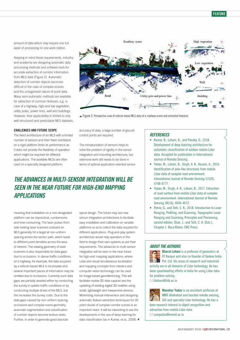
Keeping in mind these requirements, industry
and academia are designing automatic data
processing methods and software tools for
accurate extraction of corridor information
from MLS data (Figure 2). Automatic
detection of corridor objects becomes
difficult in the case of complex scenes
and the unorganised nature of point data.
Many semi-automatic methods are available
for extraction of common features, e.g. in
case of a highway, high and low vegetation,
utility poles, power lines, wall and buildings.
However, their applicability is limited to only
well-structured and predictable MLS datasets.
cHallEngEs and futurE scopE The fixed architecture of an MLS with a limited
number of sensors and their fixed orientation
on a rigid platform limits its performance as
it does not provide the flexibility of operation
which might be required for different
applications. The available MLSs are often
used on a specially designed platform,
meaning that installation on a non-designated
platform can be impractical, cumbersome
and time-consuming. The laser pulses from
side-looking laser scanners onboard an
MLS generally hit a target at non-uniform
spacing across the sensor path, which leads
to different point densities across the area
of interest. The viewing geometry of laser
scanners is also responsible for data gaps
due to occlusions. In dense traffic conditions
on a highway, for example, the data acquired
by a vehicle-based MLS is incomplete and
several important pieces of information may be
omitted due to occlusions. Currently such data
gaps are partially avoided either by conducting
the survey in quieter traffic conditions or by
conducting multiple drives of the MLS, but
this increases the survey costs. Due to the
data gaps caused by non-uniform spacing,
occlusions and complex scene geometry,
automatic segmentation and classification
of corridor objects become tedious tasks.
Further, in order to generate good absolute
accuracy of data, a large number of ground
control points are required.
The miniaturisation of sensors helps to
solve the problem of rigidity in the sensor
integration and mounting architecture, but
extensive work still needs to be done in
terms of optimal application-oriented sensor
layout design. The future may see new
sensor integration architectures to facilitate
easy installation and calibration on variable
platforms so as to collect the data required for
different applications. Plug-and-play system
architecture would help operators in the
field to design their own systems as per their
requirements. The advances in multi-sensor
integration will be seen in the near future
for high-end mapping applications, where
Lidar and visual simultaneous localisation
and mapping concepts from robotics and
computer vision technology can be used
for image-based georeferencing. This will
facilitate mobile 3D data capture and the
updating of existing digital 3D realities using
small, lightweight and inexpensive devices.
Minimising manual intervention and designing
automatic feature extraction techniques for 3D
point clouds of complex corridor scenes is an
important need. It will be interesting to see the
developments in the use of deep learning for
data classification (as in Kumar, et al., 2018).
abouT The auThorsbharat lohani is a professor of geomatics at iit Kanpur and also co-founder of geokno india Pvt. ltd. His areas of research and industrial
activity are in all domains of lidar technology. He has been spearheading efforts in india for using lidar data for problem-solving.
manohar yadav is an assistant professor at Mnit allahabad and teaches remote sensing, gis and specially lidar technology. He has a
keen research interest in object recognition and extraction from mobile lidar data.
reFerences• Kumar,B.,Lohani,B.,andPandey,G.,2018,
Development of deep learning architecture for automatic classification of outdoor mobile lidar data. accepted for publication in international journal of remote sensing.
• Yadav,M.,Lohani,B.,Singh,A.K.,Husain,A.,2016.identification of pole-like structures from mobile lidar data of complex road environment. international journal of remote sensing 37(20), 4748-4777.
• Yadav,M.,Singh,A.K.,Lohani,B.,2017.Extractionof road surface from mobile lidar data of complex road environment. international journal of remote Sensing38(16),4645-4672.
• Petrie,G.,andToth,C.K.,2018.IntroductiontoLaserranging, Profiling, and scanning. topographic laser ranging and scanning: Principles and Processing, secondedition,Shan,J.,andToth,C.K.(Eds.),Chapter1.BocaRaton:CRCPress.
Figure 2: Perspective view of vehicle-based Mls data of a roadway scene and extracted features.
The advances in mulTi-sensor inTegraTion will be seen in The near FuTure For high-end maPPing aPPlicaTions
19-20-21_featurelohani.indd 21 05-07-18 12:14
july/august 2018 | international || international | july/august 20182222 july/august 2018 | international |22
By Peter taPken, content manager, geo-matching.com
Recent advances in mobile mapping
technology are enabling new capabilities
and complementing – or even replacing –
traditional survey methods of topographical
surveying. Futhermore, widespread
investment in city planning and ‘smart
city’ projects is expected to further
accelerate the adoption of mobile mapping
Mobile mapping technology is on the rise worldwide. Industry specialist Geomares – publisher of GIM
International among other things – has analysed the user data and behaviour of thousands of members of the global geospatial community. This article presents the findings from that analysis, identifying the latest trends and sharing insights into the future outlook for mobile mapping.
technology worldwide. 450,000 geomatics
professionals visited the GIM International
and/or Geo-matching websites in 2017, and
a large percentage of those online visitors
were interested in mobile mapping systems.
This puts Geomares in a unique position to
analyse website behaviour to discover trends
and insights related to mobile mapping
systems. To provide a balanced overview,
this analysis is based on a combination
of Geo-matching website data, the GIM
International readers’ survey, Google search
statistics and market research.
Behaviour of Geo-matchinG usersData from the Geo-matching website
shows strong growth in interest in mobile
mappers. Geo-matching is the world’s largest
product platform for surveying, positioning
and machine guidance, listing more than
2,000 products from 500 manufacturers
and attracting more than 250,000 users in
2017. Mobile mapping technology is one of
Geo-matching’s most important sections,
featuring 52 products from 25 manufacturers.
In mid-2017 and 2018, Geo-matching started
paying extra special attention to mobile
mapping systems, with direct success. Since
September 2017 the number of page views
has more than doubled (see Figure 1). This
shows that there is a strong interest in mobile
mapping systems. In June 2018 more than
3,300 mobile mapping pages were viewed –
an absolute record.
readers’ survey data GIM International regularly surveys its readers
on a number of topics, and the latest survey
was conducted in December 2017 (615
respondents). 67% of the respondents
indicated plans to invest in new systems in
2018 (Figure 2).
GIM International also asked its readers which
type of systems they plan to invest in. 20%
of the respondents plan to invest in mobile
Mobile Mapping Trends and Insights
Data analysis by Geomares
5 important ConsiDerations When purChasinG a mobile mappinG system1. Application – Type of Mobile Mapperthe application is a very important consideration for purchasing a mobile mapping system. if you want to map outdoor terrain (e.g. a mine or a highway) a vehicle-mounted mobile mapping system is usually most suitable. if you plan to map indoor environments (e.g. rooms, corridors, production locations) a portable and indoor mobile mapper may be more suitable.2. Photogrammetric or Lidar CameraPhotogrammetry or lidar point clouds? Both have their advantages, and the most suitable one depends on the particular application. there is one key difference that distinguishes photogrammetry from lidar, namely rgB. Photogrammetric point clouds have an rgB value for each point, resulting in a colourised point cloud. on the other hand, when it comes to accuracy lidar is hard to beat. But not all projects require the same accuracy, which is why it is always good to do some research first before you decide which method works best for you.3. Processing Softwarein the article called ‘Comparing lidar and Photogrammetric Point Clouds’, which appeared in GIM International’s january/February 2018 issue, point clouds are compared for inspecting a flood control structure. in this scenario, lidar output takes far less time to process and provides a clean and sharp point cloud that is easy to work with. the photogrammetric data collection and processing took slightly longer and the point cloud required extensive cleaning.4. GNSS/INS Positioning Systemoperating in buildings, tunnels and mines requires advanced solutions since there is no gnss coverage. this is important to consider when choosing a gnss/ins system for your mobile mapper. 5. Compatibility the ongoing miniaturisation of sensors and electronics has led to the construction of laser scanners which are light enough to be mounted on an unmanned aerial system (uas), trolley, backpack or stick. some mobile mapping systems are compatible with a variety of applications from multiple systems (uas, backpack, car, etc.).
22-23-25_featuretapken.indd 22 05-07-18 12:05
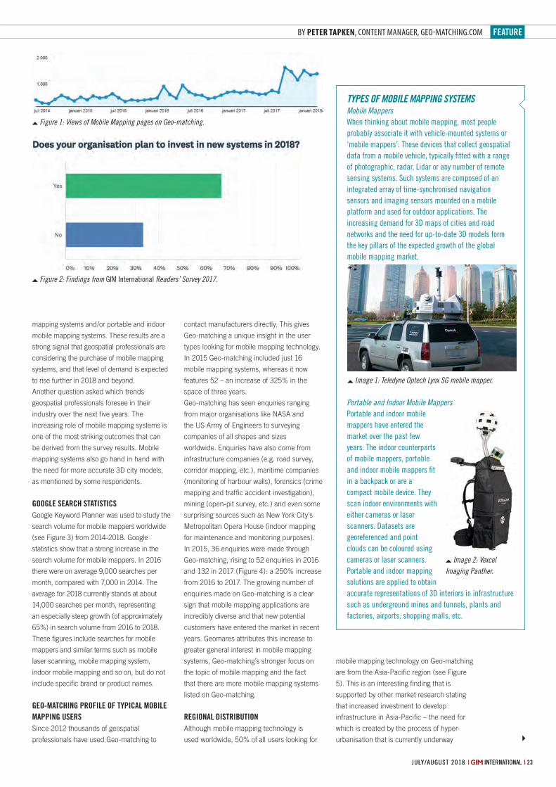
feature
23july/august 2018 | international || international | july/august 2018 july/august 2018 | international |
By Peter taPken, content manager, geo-matching.com
contact manufacturers directly. This gives
Geo-matching a unique insight in the user
types looking for mobile mapping technology.
In 2015 Geo-matching included just 16
mobile mapping systems, whereas it now
features 52 – an increase of 325% in the
space of three years.
Geo-matching has seen enquiries ranging
from major organisations like NASA and
the US Army of Engineers to surveying
companies of all shapes and sizes
worldwide. Enquiries have also come from
infrastructure companies (e.g. road survey,
corridor mapping, etc.), maritime companies
(monitoring of harbour walls), forensics (crime
mapping and traffi c accident investigation),
mining (open-pit survey, etc.) and even some
surprising sources such as New York City’s
Metropolitan Opera House (indoor mapping
for maintenance and monitoring purposes).
In 2015, 36 enquiries were made through
Geo-matching, rising to 52 enquiries in 2016
and 132 in 2017 (Figure 4): a 250% increase
from 2016 to 2017. The growing number of
enquiries made on Geo-matching is a clear
sign that mobile mapping applications are
incredibly diverse and that new potential
customers have entered the market in recent
years. Geomares attributes this increase to
greater general interest in mobile mapping
systems, Geo-matching’s stronger focus on
the topic of mobile mapping and the fact
that there are more mobile mapping systems
listed on Geo-matching.
reGionaL distriBution Although mobile mapping technology is
used worldwide, 50% of all users looking for
mobile mapping technology on Geo-matching
are from the Asia-Pacifi c region (see Figure
5). This is an interesting fi nding that is
supported by other market research stating
that increased investment to develop
infrastructure in Asia-Pacifi c – the need for
which is created by the process of hyper-
urbanisation that is currently underway
mapping systems and/or portable and indoor
mobile mapping systems. These results are a
strong signal that geospatial professionals are
considering the purchase of mobile mapping
systems, and that level of demand is expected
to rise further in 2018 and beyond.
Another question asked which trends
geospatial professionals foresee in their
industry over the next fi ve years. The
increasing role of mobile mapping systems is
one of the most striking outcomes that can
be derived from the survey results. Mobile
mapping systems also go hand in hand with
the need for more accurate 3D city models,
as mentioned by some respondents.
GooGLe search statistics Google Keyword Planner was used to study the
search volume for mobile mappers worldwide
(see Figure 3) from 2014-2018. Google
statistics show that a strong increase in the
search volume for mobile mappers. In 2016
there were on average 9,000 searches per
month, compared with 7,000 in 2014. The
average for 2018 currently stands at about
14,000 searches per month, representing
an especially steep growth (of approximately
65%) in search volume from 2016 to 2018.
These fi gures include searches for mobile
mappers and similar terms such as mobile
laser scanning, mobile mapping system,
indoor mobile mapping and so on, but do not
include specifi c brand or product names.
Geo-matchinG ProfiLe of tyPicaL moBiLe maPPinG users Since 2012 thousands of geospatial
professionals have used Geo-matching to
types oF mobile mappinG systemsMobile MappersWhen thinking about mobile mapping, most people probably associate it with vehicle-mounted systems or ‘mobile mappers’. these devices that collect geospatial data from a mobile vehicle, typically fi tted with a range of photographic, radar, lidar or any number of remote sensing systems. such systems are composed of an integrated array of time-synchronised navigation sensors and imaging sensors mounted on a mobile platform and used for outdoor applications. the increasing demand for 3D maps of cities and road networks and the need for up-to-date 3D models form the key pillars of the expected growth of the global mobile mapping market.
Portable and Indoor Mobile MappersPortable and indoor mobile mappers have entered the market over the past few years. the indoor counterparts of mobile mappers, portable and indoor mobile mappers fi t in a backpack or are a compact mobile device. they scan indoor environments with either cameras or laser scanners. Datasets are georeferenced and point clouds can be coloured using cameras or laser scanners. Portable and indoor mapping solutions are applied to obtain accurate representations of 3D interiors in infrastructure such as underground mines and tunnels, plants and factories, airports, shopping malls, etc.
Image 1: Teledyne Optech Lynx SG mobile mapper.
Image 2: Vexcel Imaging Panther.
Figure 1: Views of Mobile Mapping pages on Geo-matching.
Figure 2: Findings from giM international Readers’ Survey 2017.
22-23-25_featuretapken.indd 23 05-07-18 12:05
SPONSORS:
Host: DVW e.V.Conference organiser: DVW GmbHTrade fair organiser: HINTE GmbH
WWW.INTERGEO.DE
GLOBAL HUB OF THE GEOSPATIAL COMMUNITY
FRANKFURT 2018
16 – 18 OCTOBER
GET YOUR FREE TICKET NOW!VOUCHER CODE: GIM_INTERGEO18
DIGITALIZATION
SMART CITIESINTERAERIAL
SOLUTIONS
BIM
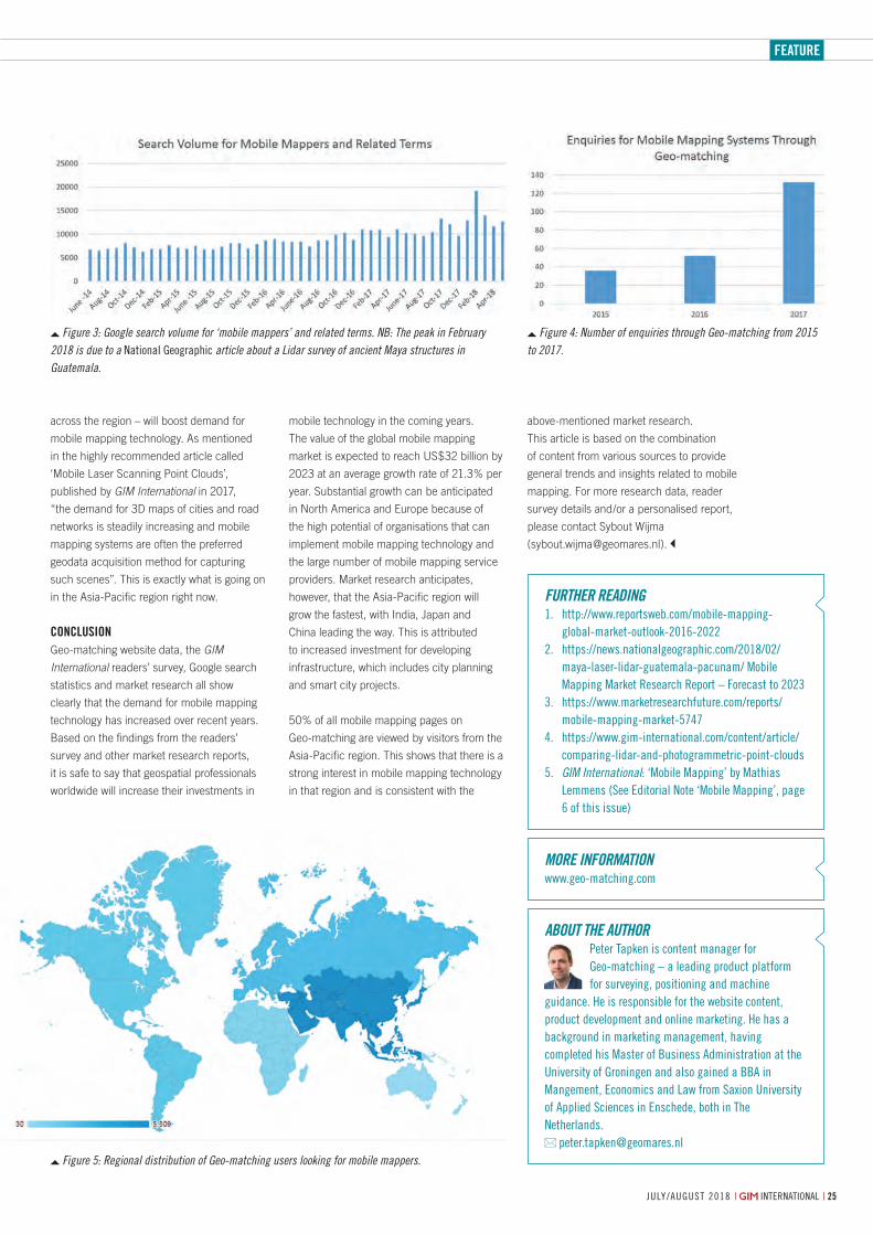
feature
july/august 2018 | international | 25
across the region – will boost demand for
mobile mapping technology. As mentioned
in the highly recommended article called
‘Mobile Laser Scanning Point Clouds’,
published by GIM International in 2017,
“the demand for 3D maps of cities and road
networks is steadily increasing and mobile
mapping systems are often the preferred
geodata acquisition method for capturing
such scenes”. This is exactly what is going on
in the Asia-Pacific region right now.
ConClusionGeo-matching website data, the GIM
International readers’ survey, Google search
statistics and market research all show
clearly that the demand for mobile mapping
technology has increased over recent years.
Based on the findings from the readers’
survey and other market research reports,
it is safe to say that geospatial professionals
worldwide will increase their investments in
mobile technology in the coming years.
The value of the global mobile mapping
market is expected to reach US$32 billion by
2023 at an average growth rate of 21.3% per
year. Substantial growth can be anticipated
in North America and Europe because of
the high potential of organisations that can
implement mobile mapping technology and
the large number of mobile mapping service
providers. Market research anticipates,
however, that the Asia-Pacific region will
grow the fastest, with India, Japan and
China leading the way. This is attributed
to increased investment for developing
infrastructure, which includes city planning
and smart city projects.
50% of all mobile mapping pages on
Geo-matching are viewed by visitors from the
Asia-Pacific region. This shows that there is a
strong interest in mobile mapping technology
in that region and is consistent with the
above-mentioned market research.
This article is based on the combination
of content from various sources to provide
general trends and insights related to mobile
mapping. For more research data, reader
survey details and/or a personalised report,
please contact Sybout Wijma
About the AuthorPeter tapken is content manager for geo-matching – a leading product platform for surveying, positioning and machine
guidance. He is responsible for the website content, product development and online marketing. He has a background in marketing management, having completed his Master of Business administration at the university of groningen and also gained a BBa in Mangement, economics and law from saxion university of applied sciences in enschede, both in the netherlands.
More InforMAtIonwww.geo-matching.com
further reAdIng1. http://www.reportsweb.com/mobile-mapping-
global-market-outlook-2016-20222. https://news.nationalgeographic.com/2018/02/
maya-laser-lidar-guatemala-pacunam/ Mobile Mapping Market research report – Forecast to 2023
3. https://www.marketresearchfuture.com/reports/mobile-mapping-market-5747
4. https://www.gim-international.com/content/article/comparing-lidar-and-photogrammetric-point-clouds
5. GIM International: ‘Mobile Mapping’ by Mathias lemmens (see editorial note ‘Mobile Mapping’, page 6 of this issue)
Figure 3: Google search volume for ‘mobile mappers’ and related terms. NB: The peak in February 2018 is due to a national geographic article about a Lidar survey of ancient Maya structures in Guatemala.
Figure 4: Number of enquiries through Geo-matching from 2015 to 2017.
Figure 5: Regional distribution of Geo-matching users looking for mobile mappers.
22-23-25_featuretapken.indd 25 05-07-18 12:06
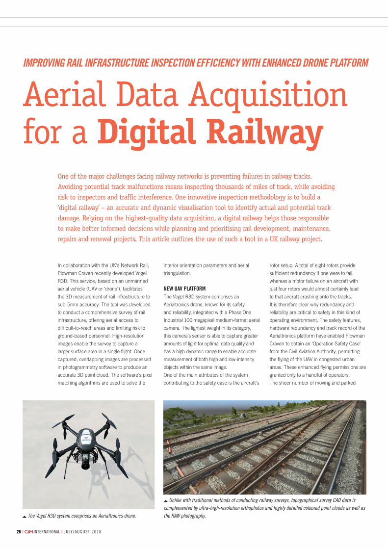
july/august 2018 | international || international | july/august 2018262626
By James Dunthorne, Plowman Craven, United Kingdom
The Vogel R3D system comprises an Aerialtronics drone.
Unlike with traditional methods of conducting railway surveys, topographical survey CAD data is complemented by ultra-high-resolution orthophotos and highly detailed coloured point clouds as well as the RAW photography.
In collaboration with the UK’s Network Rail,
Plowman Craven recently developed Vogel
R3D. This service, based on an unmanned
aerial vehicle (UAV or ‘drone’), facilitates
the 3D measurement of rail infrastructure to
sub-5mm accuracy. The tool was developed
to conduct a comprehensive survey of rail
infrastructure, offering aerial access to
difficult-to-reach areas and limiting risk to
ground-based personnel. High-resolution
images enable the survey to capture a
larger surface area in a single flight. Once
captured, overlapping images are processed
in photogrammetry software to produce an
accurate 3D point cloud. The software’s pixel
matching algorithms are used to solve the
One of the major challenges facing railway networks is preventing failures in railway tracks. Avoiding potential track malfunctions means inspecting thousands of miles of track, while avoiding risk to inspectors and traffic interference. One innovative inspection methodology is to build a ‘digital railway’ – an accurate and dynamic visualisation tool to identify actual and potential track damage. Relying on the highest-quality data acquisition, a digital railway helps those responsible to make better informed decisions while planning and prioritising rail development, maintenance, repairs and renewal projects. This article outlines the use of such a tool in a UK railway project.
interior orientation parameters and aerial
triangulation.
New UAV plAtform The Vogel R3D system comprises an
Aerialtronics drone, known for its safety
and reliability, integrated with a Phase One
Industrial 100 megapixel medium-format aerial
camera. The lightest weight in its category,
this camera’s sensor is able to capture greater
amounts of light for optimal data quality and
has a high dynamic range to enable accurate
measurement of both high and low-intensity
objects within the same image.
One of the main attributes of the system
contributing to the safety case is the aircraft’s
rotor setup. A total of eight rotors provide
sufficient redundancy if one were to fail,
whereas a motor failure on an aircraft with
just four rotors would almost certainly lead
to that aircraft crashing onto the tracks.
It is therefore clear why redundancy and
reliability are critical to safety in this kind of
operating environment. The safety features,
hardware redundancy and track record of the
Aerialtronics platform have enabled Plowman
Craven to obtain an ‘Operation Safety Case’
from the Civil Aviation Authority, permitting
the flying of the UAV in congested urban
areas. These enhanced flying permissions are
granted only to a handful of operators.
The sheer number of moving and parked
Aerial Data Acquisition for a Digital Railway
ImprovIng raIl Infrastructure InspectIon effIcIency wIth enhanced drone platform
26-27_featuredunthorne.indd 26 05-07-18 11:50
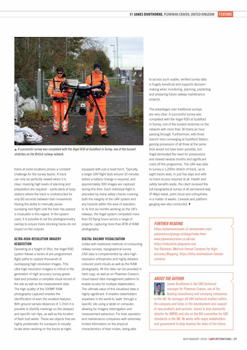
feAtUre
july/august 2018 | international | 27| international | july/august 2018
By James Dunthorne, Plowman Craven, United Kingdom
A successful survey was completed with the Vogel R3D at Guildford in Surrey, one of the busiest stretches on the British railway network.
Aerial Data Acquisition for a Digital Railway
ImprovIng raIl Infrastructure InspectIon effIcIency wIth enhanced drone platform
equipped with just a head torch. Typically,
a single UAV flight lasts around 10 minutes
before a battery change is required, and
approximately 300 images are captured
during this time. Each individual flight is
preceded by many safety checks covering
both the integrity of the UAV system and
any hazards within the area of operation.
In its first six months working on the UK’s
railways, the Vogel system completed more
than 50 flying hours across a range of
projects, capturing more than 8TB of RAW
photography.
DigitAl rAilwAy VisUAlisAtioNUnlike with traditional methods of conducting
railway surveys, topographical survey
CAD data is complemented by ultra-high-
resolution orthophotos and highly detailed
coloured point clouds as well as the RAW
photography. All this data can be provided in
hard copy, as well as on Plowman Craven’s
cloud-based data management platform to
enable access for multiple stakeholders.
The ultimate value of this visualised data is
highly significant. It enables stakeholders
anywhere in the world to ‘walk’ through a
specific site using a tablet or computer,
allowing for imagery interrogation and
measurement extraction. For train operators
and maintenance companies with extremely
limited information on the physical
characteristics of their routes, being able
to access such usable, verified survey data
is hugely beneficial and supports decision-
making when monitoring, planning, predicting
and preparing future railway maintenance
projects.
The advantages over traditional surveys
are very clear. A successful survey was
completed with the Vogel R3D at Guildford
in Surrey, one of the busiest stretches on the
network with more than 30 trains an hour
passing through. Furthermore, with three
branch lines converging at Guildford Station,
gaining possession of all three at the same
time would not have been possible, but
Vogel eliminated the need for possessions
and shaved several months and significant
costs off the programme. The UAV was able
to survey a 1,200m stretch of track, up to
eight tracks wide, in just five days and with
no track access required at all. Health and
safety benefits aside, the client received the
full topographical survey of all permanent-way
(P-Way) detail, point cloud and orthophotos
in a matter of weeks. Lineside and platform
gauging was also conducted.
trains at some locations proves a constant
challenge for the survey teams. A track
can only be perfectly viewed when it is
clear, meaning high levels of planning and
preparation are required – particularly at busy
stations where the track is unobstructed for
only 60 seconds between train movements.
Having the ability to manually pause
surveying mid-flight until the train has passed
is invaluable in this regard. In the system
used, it is possible to set the photogrammetry
overlap to ensure trains blocking tracks do not
impact on the outputs.
UltrA-high-resolUtioN imAgery AcqUisitioNOperating at a height of 35m, the Vogel R3D
system follows a series of pre-programmed
flight paths to capture thousands of
overlapping high-resolution images. This
ultra-high-resolution imagery is critical in the
generation of high-accuracy survey-grade
data and provides a complete visual record of
the site as well as the measurement data.
The high quality of the 100MP RAW
photography captured enables the
identification of even the smallest features.
With ground sample distances of 1-2mm it is
possible to identify markings on the sleepers
and specific rail clips, as well as the location
of flash butt welds. These are objects that are
highly problematic for surveyors to visually
locate when working on the tracks at night,
about the authorjames Dunthorne is the uaV technical manager for Plowman Craven, one of the leading consultancy and surveying companies
in the uK. He manages all uaV technical matters within the company and helps in the development and support of new products and services. james is also standards director for arPas and sits on the Bsi committee for uaV standards in the uK. He works with major stakeholders and government to help develop the skies of the future.
further readInghttps://plowmancraven.s3.amazonaws.com/panoramics/grange-slidings/index.htmlwww.plowmancraven.co.uk/uavhttps://industrial.phaesone.comyuri raizman; Medium-format Cameras for High-accuracy Mapping, https://bitly.com/medium-format-cameras
26-27_featuredunthorne.indd 27 05-07-18 11:50
www.southinstrument.com www.southsurvey.com
New G1 Plus
FLYme
DISTolite NT-023DISTolite NT-023• A theodolite that also measures DISTANCE• Angle/Distance/Axis programs on board
• SURVEYOR-ORIENTED flight planning software• Single flight coverage up to 2500 hectares
• PPP (Precise Point Positioning) at cm level• DUAL hot-swappable battery standby
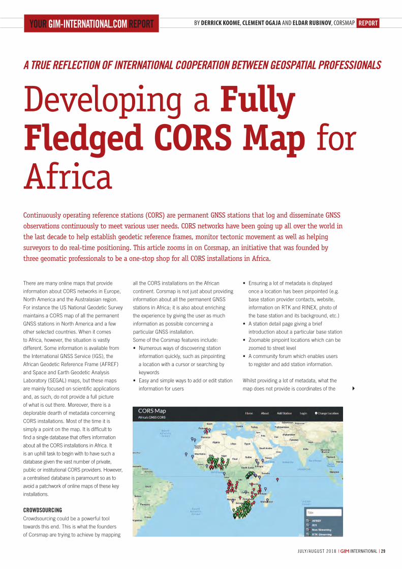
RepoRtBy Derrick koome, clement ogaja and elDar rubinov, CorsmapYoUR gim-inteRnational.com RepoRt
29july/august 2018 | international |
There are many online maps that provide
information about CORS networks in Europe,
North America and the Australasian region.
For instance the US National Geodetic Survey
maintains a CORS map of all the permanent
GNSS stations in North America and a few
other selected countries. When it comes
to Africa, however, the situation is vastly
different. Some information is available from
the International GNSS Service (IGS), the
African Geodetic Reference Frame (AFREF)
and Space and Earth Geodetic Analysis
Laboratory (SEGAL) maps, but these maps
are mainly focused on scientific applications
and, as such, do not provide a full picture
of what is out there. Moreover, there is a
deplorable dearth of metadata concerning
CORS installations. Most of the time it is
simply a point on the map. It is difficult to
find a single database that offers information
about all the CORS installations in Africa. It
is an uphill task to begin with to have such a
database given the vast number of private,
public or institutional CORS providers. However,
a centralised database is paramount so as to
avoid a patchwork of online maps of these key
installations.
cRowdsoURcingCrowdsourcing could be a powerful tool
towards this end. This is what the founders
of Corsmap are trying to achieve by mapping
Continuously operating reference stations (CORS) are permanent GNSS stations that log and disseminate GNSS observations continuously to meet various user needs. CORS networks have been going up all over the world in the last decade to help establish geodetic reference frames, monitor tectonic movement as well as helping surveyors to do real-time positioning. This article zooms in on Corsmap, an initiative that was founded by three geomatic professionals to be a one-stop shop for all CORS installations in Africa.
all the CORS installations on the African
continent. Corsmap is not just about providing
information about all the permanent GNSS
stations in Africa; it is also about enriching
the experience by giving the user as much
information as possible concerning a
particular GNSS installation.
Some of the Corsmap features include:
• Numerouswaysofdiscoveringstation
information quickly, such as pinpointing
a location with a cursor or searching by
keywords
• Easyandsimplewaystoaddoreditstation
information for users
• Ensuringalotofmetadataisdisplayed
once a location has been pinpointed (e.g.
base station provider contacts, website,
information on RTK and RINEX, photo of
the base station and its background, etc.)
• Astationdetailpagegivingabrief
introduction about a particular base station
• Zoomablepinpointlocationswhichcanbe
zoomed to street level
• Acommunityforumwhichenablesusers
to register and add station information.
Whilst providing a lot of metadata, what the
map does not provide is coordinates of the
Developing a Fully Fledged CORS Map for Africa
A True reflecTion of inTernATionAl cooperATion BeTween GeospATiAl professionAls
29-30-31_reportrubinov.indd 29 05-07-18 16:20
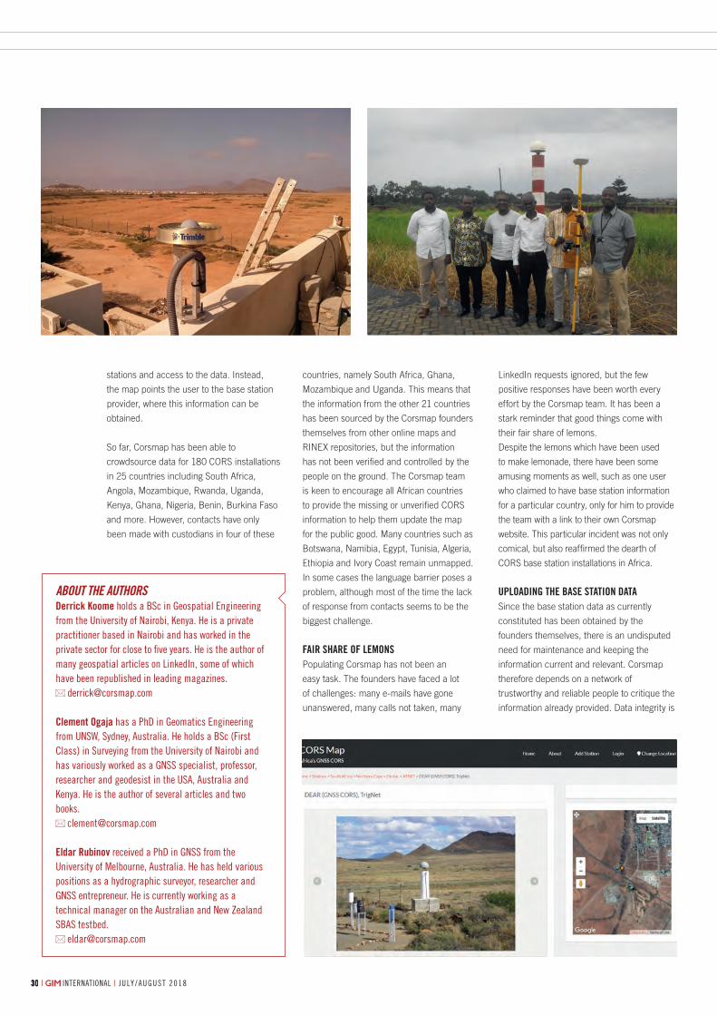
| international | j u ly / a u g u s t 20183030 july/august 2018 | international |30
ABouT The AuThorsderrick Koome holds a Bsc in geospatial engineering from the university of nairobi, Kenya. He is a private practitioner based in nairobi and has worked in the private sector for close to five years. He is the author of many geospatial articles on linkedin, some of which have been republished in leading magazines.
clement ogaja has a PhD in geomatics engineering from unsW, sydney, australia. He holds a Bsc (First Class) in surveying from the university of nairobi and has variously worked as a gnss specialist, professor, researcher and geodesist in the usa, australia and Kenya. He is the author of several articles and two books.
eldar Rubinov received a PhD in gnss from the university of Melbourne, australia. He has held various positions as a hydrographic surveyor, researcher and gnss entrepreneur. He is currently working as a technical manager on the australian and new Zealand sBas testbed.
stations and access to the data. Instead,
the map points the user to the base station
provider, where this information can be
obtained.
So far, Corsmap has been able to
crowdsource data for 180 CORS installations
in 25 countries including South Africa,
Angola, Mozambique, Rwanda, Uganda,
Kenya, Ghana, Nigeria, Benin, Burkina Faso
and more. However, contacts have only
been made with custodians in four of these
countries, namely South Africa, Ghana,
Mozambique and Uganda. This means that
the information from the other 21 countries
has been sourced by the Corsmap founders
themselves from other online maps and
RINEX repositories, but the information
has not been verified and controlled by the
people on the ground. The Corsmap team
is keen to encourage all African countries
to provide the missing or unverified CORS
information to help them update the map
for the public good. Many countries such as
Botswana, Namibia, Egypt, Tunisia, Algeria,
Ethiopia and Ivory Coast remain unmapped.
In some cases the language barrier poses a
problem, although most of the time the lack
of response from contacts seems to be the
biggest challenge.
FaiR shaRe oF lemonsPopulating Corsmap has not been an
easy task. The founders have faced a lot
of challenges: many e-mails have gone
unanswered, many calls not taken, many
LinkedIn requests ignored, but the few
positive responses have been worth every
effort by the Corsmap team. It has been a
stark reminder that good things come with
their fair share of lemons.
Despite the lemons which have been used
to make lemonade, there have been some
amusing moments as well, such as one user
who claimed to have base station information
for a particular country, only for him to provide
the team with a link to their own Corsmap
website. This particular incident was not only
comical, but also reaffirmed the dearth of
CORS base station installations in Africa.
Uploading the base station dataSince the base station data as currently
constituted has been obtained by the
founders themselves, there is an undisputed
need for maintenance and keeping the
information current and relevant. Corsmap
therefore depends on a network of
trustworthy and reliable people to critique the
information already provided. Data integrity is
29-30-31_reportrubinov.indd 30 05-07-18 16:21
RepoRt
| international | j u ly / a u g u s t 2018 july/august 2018 | international | 31
furTher reAdinGwww.corsmap.com
key. It is better to provide limited yet accurate
base station information than to have a flood
of information that is not factual and truthful.
Looking ahead, it is the Corsmap team’s
dream to have such a network of dependable
people uploading the base station data
themselves. This will be a true reflection of
international cooperation between geospatial
professionals. Interestingly, perhaps, the
Corsmap founders have created the online
map without actually ever having met face to
face. Clement is based in California (USA),
Eldar in Australia and Derrick in Kenya. Their
conversation started on LinkedIn, and the
online map is the product of extensive e-mail
correspondence and Skype meetings, mostly
at odd hours of the day.
pRecision agRicUltURePermanent GNSS stations can open up a world
of opportunities in many sectors. Since African
economies are mainly agriculturally based,
the mass adoption of precision agriculture
would increase the output tremendously.
Machine control is another industry waiting
to be unravelled in Africa. These industries
are reliant on CORS installations providing
GNSS observables to their machines.
Most surveyors in Africa use base and rover
setups when doing their RTK surveys. This
means the initial cost of equipment is high
should a surveyor think of becoming an
independent contractor. If more of these
CORS installations were known and, in the
case of a lack of CORS, could be speedily
installed, the initial cost of acquiring geodetic
GPS would be halved.
datUm RealisationLast but not least, datum realisation is of
paramount importance and CORS networks
help to provide that. Each country in Africa
needs to have at least one high order station
providing data continuously to the African
Geodetic Reference Frame (AFREF) in
order to have a unified reference frame for
the continent. This has been a continuous
challenge since the beginning of the AFREF
project and one where Corsmap can
potentially help in identifying the gaps.
As the Corsmap team continue to map
permanent GNSS stations in Africa, their
eyes are set on building a central database
of CORS stations for the global community:
a database that is people centred since
crowdsourcing is a permanent cog in its
wheel. It is a journey that has begun and
will hopefully have a happy ending. If you
would like to be part of the narrative, join the
Corsmap community forum.
29-30-31_reportrubinov.indd 31 05-07-18 16:21

july/august 2018 | international || international | july/august 2018323232
YellowScan is one of the most eye-catching companies in today’s world of unmanned aerial vehicles (UAVs) and Lidar. From its beginnings as a small start-up created by professional surveyors with the goal to revolutionise the market, YellowScan has since become an established name thanks to a passionate team keen to deliver the best Lidar solutions that enable customers to achieve the best results from their projects. The French company has now decided to broaden its horizons by opening an office in North America. This article provides insight into YellowScan’s continuing journey towards making UAVs and Lidar a mainstream solution for mapping and surveying jobs.
It all started in Montferrier-sur-Lez, a small
town in the southeast of France, in 2012
when a group of surveyors decided to create
their first Lidar system. The prototype was
such a success that they set up a company
as a spin-off of L’Avion Jaune, a service-
based company providing high-definition
aerial imagery. The first Mapper was born,
a turnkey Lidar system for under-vegetation
3D modelling. A complete product range has
been created since then.
A teAm beyond the LidAr soLutionsYellowScan started with a team of four but
over the years this has increased to a crew
of 30 highly dedicated experts in their own
disciplines, with the company’s determination
to continuously improve products driving
How YellowScan is Pioneering in the World of UAVs and Lidar
Crossing the oCean Marks new Milestone in CoMpany’s advanCe
systems include a laser scanner, IMU, GPS,
embedded computer, storage and battery.
They are designed to be easy to use, robust
and reliable in order to provide surveyors,
civil engineers, archaeologists and
environmental scientists with a turnkey
solution that can be mounted on any drone
to meet their short-time data processing
needs. All the systems are delivered with a
software package including POSPac UAV (for
trajectory post-processing) and YellowScan’s
own processing software (to generate
georeferenced LAS point clouds in the
desired projection).
For the IMU, YellowScan works together with
Applanix. The integrated GNSS-inertial OEM
solutions combined with YellowScan software
are designed to improve the productivity
of Lidar acquisition by eliminating ground
control points (GCPs) and streamlining the
data processing. The newest systems, the
Surveyor Ultra (the high-density and long-
range Lidar system) and YellowScan Vx (the
high-precision and long-range Lidar system)
complete the ‘Just Press the Yellow Button’
product line. The successful YellowScan
Surveyor is the world’s lightest fully integrated
Lidar for UAV, and the Mapper II is the
upgrade of YellowScan’s first Lidar system.
LiveStation, the real-time in-flight Lidar
monitoring kit (software and radio modems),
complements this series.
WeLcome to the usATo support this growth, YellowScan is
expanding its presence in the United States
this exciting growth. With a huge investment
in R&D, YellowScan designs, develops and
produces all of its Lidar systems for UAVs.
By constantly improving the technical
specifications and the ease of use of its
systems, YellowScan’s passionate team aims
to make it possible for surveyors to fly drones
longer and higher, to access remote rugged
terrains and to acquire meaningful accurate
data.
‘Just Press the yeLLoW button’All the YellowScan Lidar instruments are built
in line with the same vision: ‘Just Press the
Yellow Button’. The user-friendly element
is regarded as a key pillar underpinning
the successful roll-out of the company’s
UAV-Lidar solutions. The fully integrated
This article is brought to you by YellowScan
32-33-35_company39;sview.indd 32 06-07-18 10:50
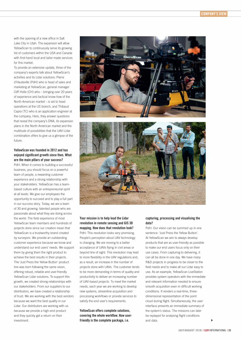
comPAny’s VieW
july/august 2018 | international | 33| international | july/august 2018
How YellowScan is Pioneering in the World of UAVs and Lidar
with the opening of a new office in Salt
Lake City in Utah. The expansion will allow
YellowScan to continuously serve its growing
list of customers within the USA and Canada
with first-hand local and tailor-made services
for this market.
To provide an extensive update, three of the
company’s experts talk about YellowScan’s
activities and its Lidar solutions: Pierre
d’Hauteville (PdH) who is head of sales and
marketing at YellowScan, general manager
Cliff Holle (CH) who – bringing over 20 years
of experience and tactical know-how of the
North American market – is set to head
operations at the US branch, and Thibaud
Capra (TC) who is an application engineer at
the company. Here, they answer questions
that reveal the company’s DNA, its expansion
plans in the North American market and the
multitude of possibilities that the UAV-Lidar
combination offers to give us a glimpse of the
future.
yellowscan was founded in 2012 and has enjoyed significant growth since then. What are the main pillars of your success? PdH: When it comes to building a successful
business, you should focus on a powerful
team of people, a rewarding customer
experience and a strong relationship with
your stakeholders. YellowScan has a team-
based culture with an entrepreneurial spirit
at all levels. We give our employees the
opportunity to succeed and to play a full part
in our success story. Today, we are a team
of 30 and growing: talented people who are
passionate about what they are doing across
the world. The field experience of most
YellowScan team members and hundreds of
projects done since our creation mean that
YellowScan is a trustworthy brand created
by surveyors. We provide an outstanding
customer experience because we know and
understand our end users’ needs. We support
them by giving them the right product to
achieve the best results in their projects.
The ‘Just Press the Yellow Button’ product
line was born following the same vision,
offering robust, reliable and user-friendly
YellowScan Lidar solutions. To support this
growth, we created strong relationships with
our stakeholders. From our suppliers to our
distributors, we have created a relationship
of trust. We are working with the best vendors
because we want the best quality in our
Lidar. Our distributors are working with us
because we provide a high-end product
and they quickly get a return on their
investment.
your mission is to help lead the Lidar revolution in remote sensing and Gis 3d mapping. how does that revolution look?PdH: This revolution looks very promising.
People’s perception about UAV technology
is changing. We are moving to a better
acceptance of UAVs flying in civil areas or
beyond line of sight. This revolution may lead
to more flexibility in the UAV regulations and,
as a result, an increase in the number of
projects done with UAVs. The customer tends
to be more demanding in terms of quality and
productivity to deliver an increasing number
of UAV-based projects. To meet the market
needs, each year we are working to develop
new systems, streamline acquisition and
processing workflows or provide services to
satisfy the end user’s requirements.
yellowscan offers complete solutions, covering the whole workflow. how user-friendly is the complete package, i.e.
capturing, processing and visualising the data?PdH: Our vision can be summed up in one
sentence: ‘Just Press the Yellow Button’.
At YellowScan we aim to always develop
products that are as user-friendly as possible
to make our end users focus only on their
use cases. From capturing to delivering, it
can all be done in one day. We have many
R&D projects in progress to be closer to the
field needs and to make all our Lidar easy to
use. As an example, YellowScan LiveStation
provides system operators with the immediate
and relevant information needed to ensure
smooth acquisition even in difficult working
conditions. It renders a real-time, three-
dimensional representation of the point
cloud during flight. Simultaneously, the user
interface presents an immediate summary of
the system’s status. The missions can later
be replayed for analysing flight conditions
and data.
32-33-35_company39;sview.indd 33 06-07-18 10:50
LiBackpack Mobile 3D Mapping System
Minimal Data Processing--
LiDAR/SLAM Integration- Handheld and Backpack Modes- Real-Time Point Cloud Display
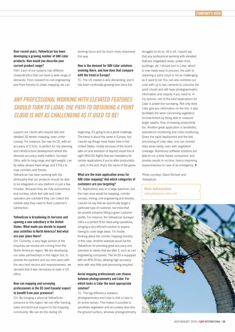
Company’s View
july/august 2018 | international | 35
Over recent years, YellowScan has been developing a growing number of UAV-Lidar products. How would you describe your current product range?PdH: Each of our systems has different
characteristics that can meet a wide range of
demands. From research to civil engineering
and from forestry to urban mapping, we can
support our clients who require fast and
detailed 3D terrain mapping, even under
canopy. For instance, the new Vx-20, with an
accuracy of 2.5cm, is perfect for city planning
and infrastructure development where the
absolute accuracy really matters. Surveyor
Ultra, with its long range and light weight, can
fly safely aboard fixed-wings and VTOLs to
map corridors and forests.
YellowScan has been working with the
philosophy that our products should be able
to be integrated on any platform in just a few
minutes. Because they are fully autonomous
and turnkey, pilots feel safe and Lidar
operators are confident they can collect the
reliable data they need to their customer’s
satisfaction.
YellowScan is broadening its horizons and opening a new subsidiary in the United States. What made you decide to expand your activities to North America? And what are your plans there?CH: Currently, a very large portion of the
enquiries we receive are coming from the
North American region. We are developing
our sales partnerships in this region but, to
provide the partners and our end users with
the very best service and responsiveness, we
decided that it was necessary to open a US
office.
How can mapping and surveying professionals in the US (and Canada) expect to benefit from your presence?CH: By bringing a physical YellowScan
presence to this region, we can offer training,
sales and technical support to the mapping
community. We can do this during US
working hours and be much more responsive
this way.
How is the demand for UAV-Lidar solutions evolving there, and how does that compare with the trend in Europe?TC: The US market is very demanding, and it
has been continually growing ever since the
beginning. It’s going to be a great challenge.
The trend is about the same in Europe, but
I would say things move faster here in the
United States, mostly because of the recent
talks on and evolution of beyond visual line of
sight (BVLOS) flights that are mandatory for
certain applications if you’re after productivity
– and, in the end, that’s the name of the game.
What are the main application areas for UAV-Lidar mapping? And which categories of customers are you targeting?TC: Applications vary on a large spectrum, but
the main ones would be mapping, corridor
surveys, mining, civil engineering and forestry.
I would not say that we specifically target a
particular type of customer, but more that
we provide solutions fitting a given customer
profile. For instance, the YellowScan Surveyor
Ultra is a perfect fit for fixed-wing operations,
bringing a very efficient solution to anyone
having to cover large areas. I’m mostly
thinking about the corridor mapping industry
in this case. Another example would be the
YellowScan Vx providing great accuracy and
precision to clients that are after it, such as civil
engineering companies. The Vx-20 is equipped
with an APX-20 too, allowing high-accuracy
work with very little post-processing required.
Aerial mapping professionals can choose between photogrammetry and Lidar. For which tasks is Lidar the most appropriate solution?TC: The big difference between
photogrammetry and Lidar is that a Lidar is
an active sensor. This makes it possible to
penetrate vegetation and accurately describe
the ground surface, whereas photogrammetry
struggles to do so. All in all, I would say
that any professional working with elevated
features (vegetated areas, power lines,
buildings, etc.) should turn to Lidar, which
is now made easy to process; the path to
obtaining a point cloud is not as challenging
as it used to be! You can also combine our
units with up to two cameras to colourise the
point clouds and still have photogrammetric
information and outputs if you need to. In
my opinion, one of the best applications for
Lidar is power-line surveying. Not only does
Lidar give you information on the line, it also
facilitates the work concerning vegetation
encroachment by being able to measure
larger swaths, thus increasing productivity
too. Another great application is landslides,
subsidence monitoring and crisis monitoring.
Given the rapid deployment and the fast
processing of Lidar data, one can monitor
risky areas easily, even with vegetation
coverage. Numerous software solutions are
able to run a time-based comparison and
provide results in no time, hence improving
responsiveness in case of an emergency.
Photo courtesy: David Richard and
YellowScan.
Any professionAl working with eleVAteD feAtUres shoUlD tUrn to liDAr; the pAth to obtAining A pointcloUD is not As chAllenging As it UseD to be!
More informationwww.yellowscan-lidar.com
32-33-35_company39;sview.indd 35 06-07-18 10:50
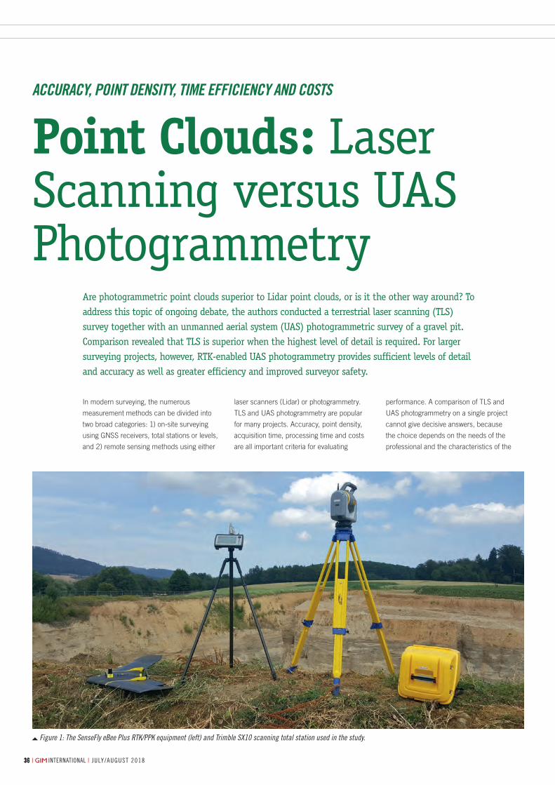
july/august 2018 | international || international | july/august 20183636 july/august 2018 | international |36
By Armin Weber and ThomAs Lerch, Lerch WeBer aG, SWitzerLand
Figure 1: The SenseFly eBee Plus RTK/PPK equipment (left) and Trimble SX10 scanning total station used in the study.
In modern surveying, the numerous
measurement methods can be divided into
two broad categories: 1) on-site surveying
using GNSS receivers, total stations or levels,
and 2) remote sensing methods using either
Are photogrammetric point clouds superior to Lidar point clouds, or is it the other way around? To address this topic of ongoing debate, the authors conducted a terrestrial laser scanning (TLS) survey together with an unmanned aerial system (UAS) photogrammetric survey of a gravel pit. Comparison revealed that TLS is superior when the highest level of detail is required. For larger surveying projects, however, RTK-enabled UAS photogrammetry provides sufficient levels of detail and accuracy as well as greater efficiency and improved surveyor safety.
laser scanners (Lidar) or photogrammetry.
TLS and UAS photogrammetry are popular
for many projects. Accuracy, point density,
acquisition time, processing time and costs
are all important criteria for evaluating
performance. A comparison of TLS and
UAS photogrammetry on a single project
cannot give decisive answers, because
the choice depends on the needs of the
professional and the characteristics of the
Point Clouds: Laser Scanning versus UAS Photogrammetry
AccurAcy, Point Density, time efficiency AnD costs
36-37-39_featureweber.indd 36 05-07-18 11:50
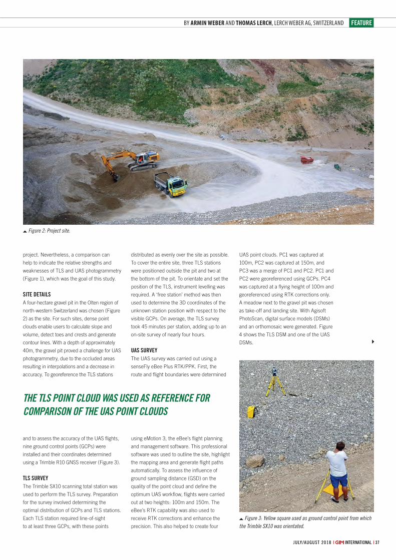
feature
37july/august 2018 | international || international | july/august 2018 july/august 2018 | international |
By Armin Weber and ThomAs Lerch, Lerch WeBer aG, SWitzerLand
the tLs Point cLouD wAs useD As reference for comPArison of the uAs Point cLouDs
Figure 3: Yellow square used as ground control point from which the Trimble SX10 was orientated.
Figure 2: Project site.
distributed as evenly over the site as possible.
To cover the entire site, three TLS stations
were positioned outside the pit and two at
the bottom of the pit. To orientate and set the
position of the TLS, instrument levelling was
required. A ‘free station’ method was then
used to determine the 3D coordinates of the
unknown station position with respect to the
visible GCPs. On average, the TLS survey
took 45 minutes per station, adding up to an
on-site survey of nearly four hours.
UAS SUrveyThe UAS survey was carried out using a
senseFly eBee Plus RTK/PPK. First, the
route and flight boundaries were determined
using eMotion 3, the eBee’s flight planning
and management software. This professional
software was used to outline the site, highlight
the mapping area and generate flight paths
automatically. To assess the influence of
ground sampling distance (GSD) on the
quality of the point cloud and define the
optimum UAS workflow, flights were carried
out at two heights: 100m and 150m. The
eBee’s RTK capability was also used to
receive RTK corrections and enhance the
precision. This also helped to create four
UAS point clouds. PC1 was captured at
100m, PC2 was captured at 150m, and
PC3 was a merge of PC1 and PC2. PC1 and
PC2 were georeferenced using GCPs. PC4
was captured at a flying height of 100m and
georeferenced using RTK corrections only.
A meadow next to the gravel pit was chosen
as take-off and landing site. With Agisoft
PhotoScan, digital surface models (DSMs)
and an orthomosaic were generated. Figure
4 shows the TLS DSM and one of the UAS
DSMs.
project. Nevertheless, a comparison can
help to indicate the relative strengths and
weaknesses of TLS and UAS photogrammetry
(Figure 1), which was the goal of this study.
Site detAilSA four-hectare gravel pit in the Olten region of
north-western Switzerland was chosen (Figure
2) as the site. For such sites, dense point
clouds enable users to calculate slope and
volume, detect toes and crests and generate
contour lines. With a depth of approximately
40m, the gravel pit proved a challenge for UAS
photogrammetry, due to the occluded areas
resulting in interpolations and a decrease in
accuracy. To georeference the TLS stations
and to assess the accuracy of the UAS flights,
nine ground control points (GCPs) were
installed and their coordinates determined
using a Trimble R10 GNSS receiver (Figure 3).
tlS SUrveyThe Trimble SX10 scanning total station was
used to perform the TLS survey. Preparation
for the survey involved determining the
optimal distribution of GCPs and TLS stations.
Each TLS station required line-of-sight
to at least three GCPs, with these points
36-37-39_featureweber.indd 37 05-07-18 11:50
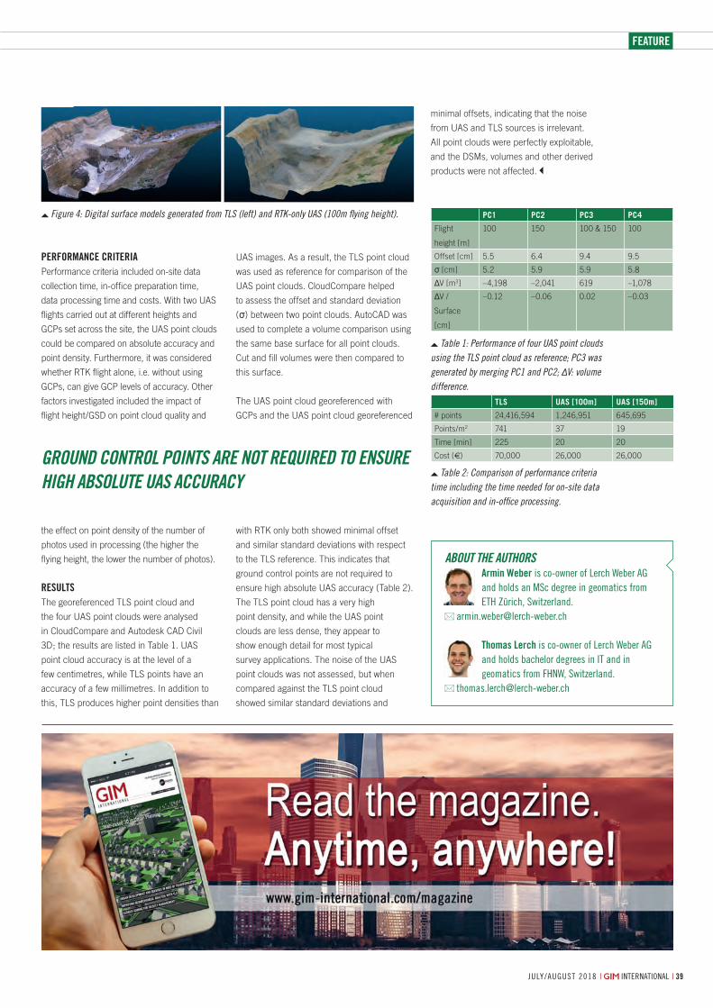
feature
july/august 2018 | international | 39
Performance criteriaPerformance criteria included on-site data
collection time, in-office preparation time,
data processing time and costs. With two UAS
flights carried out at different heights and
GCPs set across the site, the UAS point clouds
could be compared on absolute accuracy and
point density. Furthermore, it was considered
whether RTK flight alone, i.e. without using
GCPs, can give GCP levels of accuracy. Other
factors investigated included the impact of
flight height/GSD on point cloud quality and
the effect on point density of the number of
photos used in processing (the higher the
flying height, the lower the number of photos).
resultsThe georeferenced TLS point cloud and
the four UAS point clouds were analysed
in CloudCompare and Autodesk CAD Civil
3D; the results are listed in Table 1. UAS
point cloud accuracy is at the level of a
few centimetres, while TLS points have an
accuracy of a few millimetres. In addition to
this, TLS produces higher point densities than
UAS images. As a result, the TLS point cloud
was used as reference for comparison of the
UAS point clouds. CloudCompare helped
to assess the offset and standard deviation
(σ) between two point clouds. AutoCAD was
used to complete a volume comparison using
the same base surface for all point clouds.
Cut and fill volumes were then compared to
this surface.
The UAS point cloud georeferenced with
GCPs and the UAS point cloud georeferenced
with RTK only both showed minimal offset
and similar standard deviations with respect
to the TLS reference. This indicates that
ground control points are not required to
ensure high absolute UAS accuracy (Table 2).
The TLS point cloud has a very high
point density, and while the UAS point
clouds are less dense, they appear to
show enough detail for most typical
survey applications. The noise of the UAS
point clouds was not assessed, but when
compared against the TLS point cloud
showed similar standard deviations and
minimal offsets, indicating that the noise
from UAS and TLS sources is irrelevant.
All point clouds were perfectly exploitable,
and the DSMs, volumes and other derived
products were not affected.
PC1 PC2 PC3 PC4
Flight
height [m]
100 150 100 & 150 100
Offset [cm] 5.5 6.4 9.4 9.5
σ [cm] 5.2 5.9 5.9 5.8
ΔV [m3] –4,198 –2,041 619 –1,078
ΔV /
Surface
[cm]
–0.12 –0.06 0.02 –0.03
Table 1: Performance of four UAS point clouds using the TLS point cloud as reference; PC3 was generated by merging PC1 and PC2; ΔV: volume difference.
TLS UAS [100m] UAS [150m]
# points 24,416,594 1,246,951 645,695
Points/m2 741 37 19
Time [min] 225 20 20
Cost (€) 70,000 26,000 26,000
Table 2: Comparison of performance criteria time including the time needed for on-site data acquisition and in-office processing.
About the Authorsarmin Weber is co-owner of lerch Weber ag and holds an Msc degree in geomatics from etH Zürich, switzerland.
thomas lerch is co-owner of lerch Weber ag and holds bachelor degrees in it and in geomatics from FHnW, switzerland.
Figure 4: Digital surface models generated from TLS (left) and RTK-only UAS (100m flying height).
Ground control points Are not required to ensure hiGh Absolute uAs AccurAcy
36-37-39_featureweber.indd 39 05-07-18 11:50
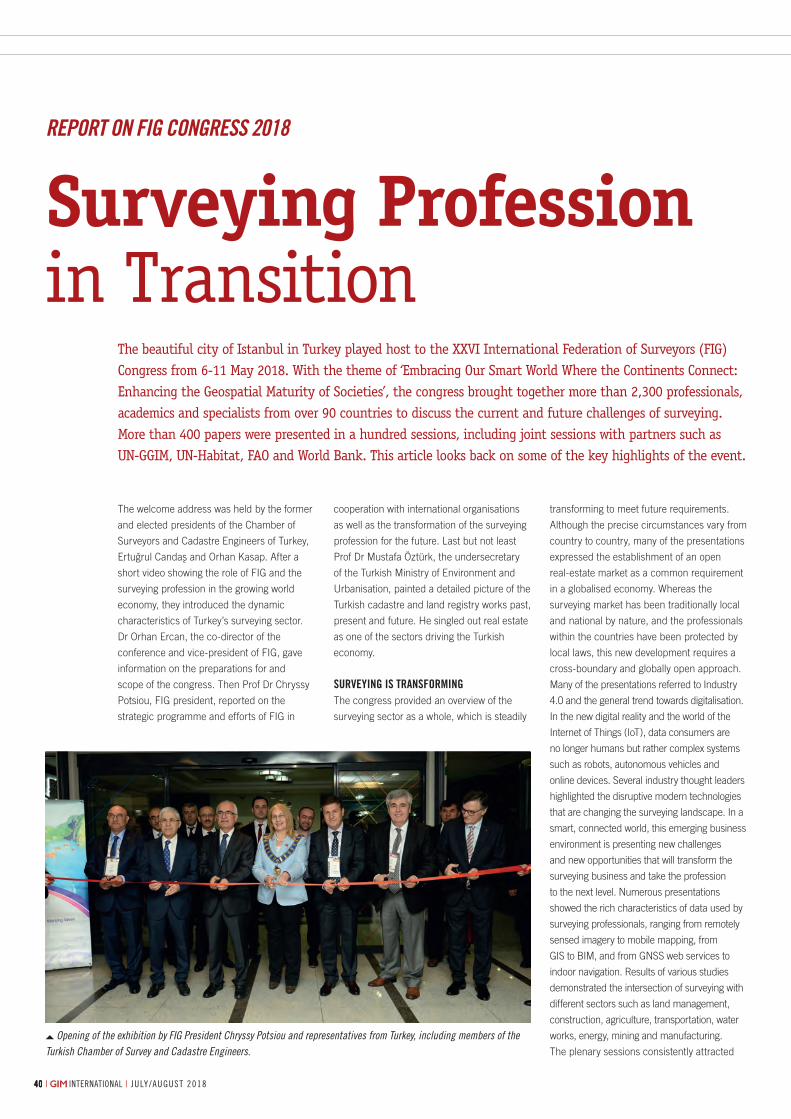
4040 | international | july/august 2018 july/august 2018 | international |40
The welcome address was held by the former
and elected presidents of the Chamber of
Surveyors and Cadastre Engineers of Turkey,
Ertugrul Candas and Orhan Kasap. After a
short video showing the role of FIG and the
surveying profession in the growing world
economy, they introduced the dynamic
characteristics of Turkey’s surveying sector.
Dr Orhan Ercan, the co-director of the
conference and vice-president of FIG, gave
information on the preparations for and
scope of the congress. Then Prof Dr Chryssy
Potsiou, FIG president, reported on the
strategic programme and efforts of FIG in
The beautiful city of Istanbul in Turkey played host to the XXVI International Federation of Surveyors (FIG) Congress from 6-11 May 2018. With the theme of ‘Embracing Our Smart World Where the Continents Connect: Enhancing the Geospatial Maturity of Societies’, the congress brought together more than 2,300 professionals, academics and specialists from over 90 countries to discuss the current and future challenges of surveying. More than 400 papers were presented in a hundred sessions, including joint sessions with partners such as UN-GGIM, UN-Habitat, FAO and World Bank. This article looks back on some of the key highlights of the event.
cooperation with international organisations
as well as the transformation of the surveying
profession for the future. Last but not least
Prof Dr Mustafa Öztürk, the undersecretary
of the Turkish Ministry of Environment and
Urbanisation, painted a detailed picture of the
Turkish cadastre and land registry works past,
present and future. He singled out real estate
as one of the sectors driving the Turkish
economy.
Surveying iS TranSformingThe congress provided an overview of the
surveying sector as a whole, which is steadily
transforming to meet future requirements.
Although the precise circumstances vary from
country to country, many of the presentations
expressed the establishment of an open
real-estate market as a common requirement
in a globalised economy. Whereas the
surveying market has been traditionally local
and national by nature, and the professionals
within the countries have been protected by
local laws, this new development requires a
cross-boundary and globally open approach.
Many of the presentations referred to Industry
4.0 and the general trend towards digitalisation.
In the new digital reality and the world of the
Internet of Things (IoT), data consumers are
no longer humans but rather complex systems
such as robots, autonomous vehicles and
online devices. Several industry thought leaders
highlighted the disruptive modern technologies
that are changing the surveying landscape. In a
smart, connected world, this emerging business
environment is presenting new challenges
and new opportunities that will transform the
surveying business and take the profession
to the next level. Numerous presentations
showed the rich characteristics of data used by
surveying professionals, ranging from remotely
sensed imagery to mobile mapping, from
GIS to BIM, and from GNSS web services to
indoor navigation. Results of various studies
demonstrated the intersection of surveying with
different sectors such as land management,
construction, agriculture, transportation, water
works, energy, mining and manufacturing.
The plenary sessions consistently attracted
Surveying Profession in Transition
RepoRt on FIG ConGRess 2018
Opening of the exhibition by FIG President Chryssy Potsiou and representatives from Turkey, including members of the Turkish Chamber of Survey and Cadastre Engineers.
40-41-43_reportfigcongress.indd 40 05-07-18 16:12
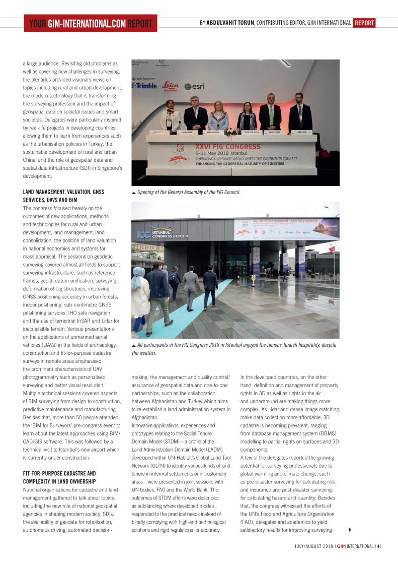
reporTBy AbdulvAhit torun, contriButing editor, giM internationalyour gim-inTernaTional.com reporT
| international | july/august 2018 41july/august 2018 | international |
making, the management and quality control/
assurance of geospatial data and one-to-one
partnerships, such as the collaboration
between Afghanistan and Turkey which aims
to re-establish a land administration system in
Afghanistan.
Innovative applications, experiences and
prototypes relating to the Social Tenure
Domain Model (STDM) – a profile of the
Land Administration Domain Model (LADM)
developed within UN-Habitat’s Global Land Tool
Network (GLTN) to identify various kinds of land
tenure in informal settlements or in customary
areas – were presented in joint sessions with
UN bodies, FAO and the World Bank. The
outcomes of STDM efforts were described
as outstanding where developed models
responded to the practical needs instead of
blindly complying with high-end technological
solutions and rigid regulations for accuracy.
In the developed countries, on the other
hand, definition and management of property
rights in 3D as well as rights in the air
and underground are making things more
complex. As Lidar and dense image matching
make data collection more affordable, 3D
cadastre is becoming prevalent, ranging
from database management system (DBMS)
modelling to partial rights on surfaces and 3D
components.
A few of the delegates reported the growing
potential for surveying professionals due to
global warming and climate change, such
as pre-disaster surveying for calculating risk
and insurance and post-disaster surveying
for calculating hazard and quantity. Besides
that, the congress witnessed the efforts of
the UN’s Food and Agriculture Organization
(FAO), delegates and academics to yield
satisfactory results for improving surveying
a large audience. Revisiting old problems as
well as covering new challenges in surveying,
the plenaries provided visionary views on
topics including rural and urban development,
the modern technology that is transforming
the surveying profession and the impact of
geospatial data on societal issues and smart
societies. Delegates were particularly inspired
by real-life projects in developing countries,
allowing them to learn from experiences such
as the urbanisation policies in Turkey, the
sustainable development of rural and urban
China, and the role of geospatial data and
spatial data infrastructure (SDI) in Singapore’s
development.
land managemenT, valuaTion, gnSS ServiceS, uavS and BimThe congress focused heavily on the
outcomes of new applications, methods
and technologies for rural and urban
development, land management, land
consolidation, the position of land valuation
in national economies and systems for
mass appraisal. The sessions on geodetic
surveying covered almost all fields to support
surveying infrastructure, such as reference
frames, geoid, datum unification, surveying
deformation of big structures, improving
GNSS positioning accuracy in urban forests,
indoor positioning, sub-centimetre GNSS
positioning services, IHO safe navigation,
and the use of terrestrial InSAR and Lidar for
inaccessible terrain. Various presentations
on the applications of unmanned aerial
vehicles (UAVs) in the fields of archaeology,
construction and fit-for-purpose cadastre
surveys in remote areas emphasised
the prominent characteristics of UAV
photogrammetry such as personalised
surveying and better visual resolution.
Multiple technical sessions covered aspects
of BIM surveying from design to construction,
predictive maintenance and manufacturing.
Besides that, more than 50 people attended
the ‘BIM for Surveyors’ pre-congress event to
learn about the latest approaches using BIM/
CAD/GIS software. This was followed by a
technical visit to Istanbul’s new airport which
is currently under construction.
fiT-for-purpoSe cadaSTre and complexiTy in land ownerShipNational organisations for cadastre and land
management gathered to talk about topics
including the new role of national geospatial
agencies in shaping modern society, SDIs,
the availability of geodata for robotisation,
autonomous driving, automated decision-
All participants of the FIG Congress 2018 in Istanbul enjoyed the famous Turkish hospitality, despite the weather.
Opening of the General Assembly of the FIG Council.
40-41-43_reportfigcongress.indd 41 05-07-18 16:12
Aiming at the future together!
R-1500N & R-2800N
Reflectorless Total StationsTotal surveying solutions
W-1500N & W-2800
Windows CE Total StationsTruly integrated systems
S-3180V
Scanning System3D laser measurement system
www.pentaxsurveying.com/en/
TI Asahi Co., Ltd.International Sales Department 4-3-4 Ueno Iwatsuki-Ku, Saitama-ShiSaitama, 339-0073 Japan
Tel.: +81-48-793-0118Fax: +81-48-793-0128E-mail: [email protected]
GNSS ReceiversPrecision Satellite Surveying with wireless communications
G6 Ti |Ni & G5
D-600
Precise Aerial Imaging System6 Rotor Multicopter with Autopilot
PEN-ADV-LINEUP-2017-GIM 6.indd 1 10/25/17 9:30 AM
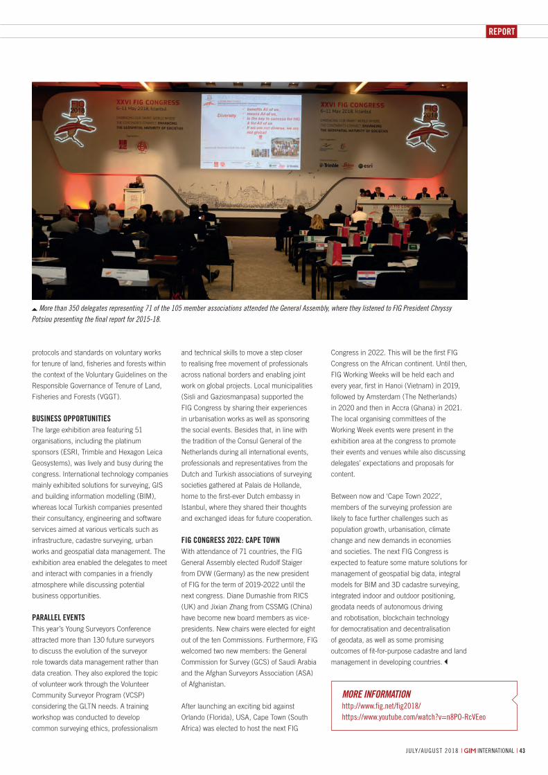
RepoRt
july/august 2018 | international | 43
MORE INFORMATIONhttp://www.fig.net/fig2018/https://www.youtube.com/watch?v=n8Po-rcVeeo
More than 350 delegates representing 71 of the 105 member associations attended the General Assembly, where they listened to FIG President Chryssy Potsiou presenting the final report for 2015-18.
protocols and standards on voluntary works
for tenure of land, fisheries and forests within
the context of the Voluntary Guidelines on the
Responsible Governance of Tenure of Land,
Fisheries and Forests (VGGT).
Business OppOrtunitiesThe large exhibition area featuring 51
organisations, including the platinum
sponsors (ESRI, Trimble and Hexagon Leica
Geosystems), was lively and busy during the
congress. International technology companies
mainly exhibited solutions for surveying, GIS
and building information modelling (BIM),
whereas local Turkish companies presented
their consultancy, engineering and software
services aimed at various verticals such as
infrastructure, cadastre surveying, urban
works and geospatial data management. The
exhibition area enabled the delegates to meet
and interact with companies in a friendly
atmosphere while discussing potential
business opportunities.
parallel eventsThis year’s Young Surveyors Conference
attracted more than 130 future surveyors
to discuss the evolution of the surveyor
role towards data management rather than
data creation. They also explored the topic
of volunteer work through the Volunteer
Community Surveyor Program (VCSP)
considering the GLTN needs. A training
workshop was conducted to develop
common surveying ethics, professionalism
and technical skills to move a step closer
to realising free movement of professionals
across national borders and enabling joint
work on global projects. Local municipalities
(Sisli and Gaziosmanpasa) supported the
FIG Congress by sharing their experiences
in urbanisation works as well as sponsoring
the social events. Besides that, in line with
the tradition of the Consul General of the
Netherlands during all international events,
professionals and representatives from the
Dutch and Turkish associations of surveying
societies gathered at Palais de Hollande,
home to the first-ever Dutch embassy in
Istanbul, where they shared their thoughts
and exchanged ideas for future cooperation.
FiG COnGress 2022: Cape tOwnWith attendance of 71 countries, the FIG
General Assembly elected Rudolf Staiger
from DVW (Germany) as the new president
of FIG for the term of 2019-2022 until the
next congress. Diane Dumashie from RICS
(UK) and Jixian Zhang from CSSMG (China)
have become new board members as vice-
presidents. New chairs were elected for eight
out of the ten Commissions. Furthermore, FIG
welcomed two new members: the General
Commission for Survey (GCS) of Saudi Arabia
and the Afghan Surveyors Association (ASA)
of Afghanistan.
After launching an exciting bid against
Orlando (Florida), USA, Cape Town (South
Africa) was elected to host the next FIG
Congress in 2022. This will be the first FIG
Congress on the African continent. Until then,
FIG Working Weeks will be held each and
every year, first in Hanoi (Vietnam) in 2019,
followed by Amsterdam (The Netherlands)
in 2020 and then in Accra (Ghana) in 2021.
The local organising committees of the
Working Week events were present in the
exhibition area at the congress to promote
their events and venues while also discussing
delegates’ expectations and proposals for
content.
Between now and ‘Cape Town 2022’,
members of the surveying profession are
likely to face further challenges such as
population growth, urbanisation, climate
change and new demands in economies
and societies. The next FIG Congress is
expected to feature some mature solutions for
management of geospatial big data, integral
models for BIM and 3D cadastre surveying,
integrated indoor and outdoor positioning,
geodata needs of autonomous driving
and robotisation, blockchain technology
for democratisation and decentralisation
of geodata, as well as some promising
outcomes of fit-for-purpose cadastre and land
management in developing countries.
40-41-43_reportfigcongress.indd 43 05-07-18 16:13
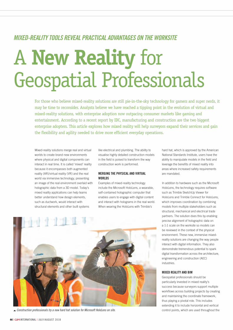
july/august 2018 | international || international | july/august 2018444444
By DaviD Burczyk, TrimBle, USA
Construction professionals try a new hard hat solution for Microsoft HoloLens on site.
Mixed-reality solutions merge real and virtual
worlds to create brand-new environments
where physical and digital components can
interact in real time. It is called ‘mixed’ reality
because it encompasses both augmented
reality (AR)/virtual reality (VR) and the real
world via immersive technology, presenting
an image of the real environment overlaid with
holographic data from a 3D model. Today’s
mixed reality applications can help teams
better understand how design elements,
such as ductwork, would interact with
structural elements and other built systems
For those who believe mixed-reality solutions are still pie-in-the-sky technology for gamers and super nerds, it may be time to reconsider. Analysts believe we have reached a tipping point in the evolution of virtual and mixed-reality solutions, with enterprise adoption now outpacing consumer markets like gaming and entertainment. According to a recent report by IDC, manufacturing and construction are the two biggest enterprise adopters. This article explores how mixed reality will help surveyors expand their services and gain the flexibility and agility needed to drive more efficient everyday operations.
like electrical and plumbing. The ability to
visualise highly detailed construction models
in the field is poised to transform the way
construction work is performed.
Merging the physical and virtual worldsExamples of mixed-reality technology
include the Microsoft HoloLens, a wearable,
self-contained holographic computer that
enables users to engage with digital content
and interact with holograms in the real world.
When wearing the HoloLens with Trimble’s
hard hat, which is approved by the American
National Standards Institute, users have the
ability to manipulate models in the field and
leverage the benefits of mixed reality into
areas where increased safety requirements
are mandated.
In addition to hardware such as the Microsoft
HoloLens, the technology requires software
such as Trimble SketchUp Viewer for
HoloLens and Trimble Connect for HoloLens,
which improves coordination by combining
models from multiple stakeholders such as
structural, mechanical and electrical trade
partners. The solution does this by enabling
precise alignment of holographic data on
a 1:1 scale on the worksite so models can
be reviewed in the context of the physical
environment. These new, immersive mixed-
reality solutions are changing the way people
interact with digital information. They also
demonstrate tremendous potential to spark
digital transformation across the architecture,
engineering and construction (AEC)
industries.
Mixed reality and BiMGeospatial professionals should be
particularly invested in mixed reality’s
success because surveyors support multiple
workflows across building projects by creating
and maintaining the coordinate framework,
thus playing a pivotal role. This includes
extending it to include horizontal and vertical
control points, which are used throughout the
A New Reality for Geospatial Professionals
Mixed-reality tools reveal Practical advantages on the Worksite
44-45_industryinsight.indd 44 05-07-18 13:26
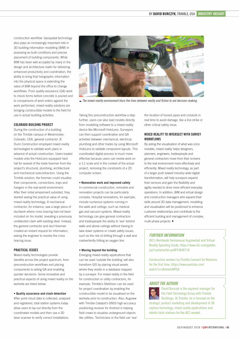
industry insight
july/august 2018 | international | 45| international | july/august 2018
By DaviD Burczyk, TrimBle, USA
The mixed-reality environment blurs the lines between reality and fiction to aid decision-making.
A New Reality for Geospatial Professionals
Taking this preconstruction workflow a step
further, users can also load models directly
from modelling software to a mixed-reality
device like Microsoft HoloLens. Surveyors
can then support coordination and QA
activities between mechanical, electrical,
plumbing and other trades by using Microsoft
HoloLens to validate component layouts. This
coordinated digital process is much more
effective because users can review work on
a 1:1 scale and in the context of the actual
project, removing the constraints of a 2D
computer screen.
• Renovation work and improved safety
In commercial construction, remodels and
renovation projects can be particularly
complex. Hospital renovations, for example,
include numerous systems running in
the walls and ceilings, such as medical
gas and vacuum systems. Mixed-reality
technology can give general contractors
and tradespeople the ability to ‘see’ behind
walls and above ceilings without having to
take down systems or create safety issues,
such as the risk of drilling through a wall and
inadvertently hitting an oxygen line.
• Moving beyond the building
Emerging mixed-reality applications that
can be used ‘outside the building’ will also
transform GIS by placing visual assets
where they reside in a database mapped
by a surveyor. For mixed reality in the field
for construction or utility contractors, for
example, Trimble’s SiteVision can be used
for project coordination by enabling the
constructible model to be visualised on the
worksite prior to construction. Also, Augview
with Trimble Catalyst’s GNSS high-accuracy
positioning receiver for Android is helping
field crews to visualise underground objects
like utilities. Technicians in the field can ‘see’
the location of buried pipes and conduits in
real time to avoid damage, like a line strike or
other critical safety issue.
Mixed reality to intersect with survey workflowsBy aiding the visualisation of what was once
invisible, mixed reality helps designers,
planners, engineers, tradespeople and
general contractors move from their screens
to the real environment more effectively and
efficiently. Mixed reality technology, as part
of a larger push toward industry-wide digital
transformation, will help surveyors expand
their services and gain the flexibility and
agility needed to drive more efficient everyday
operations. In addition, BIM and virtual design
and construction managers who expand their
skills around 3D data management, modelling
and visualisation will be positioned to enhance
customer relationships and contribute to the
efficient building and management of complex,
multi-phase projects.
construction workflow. Geospatial technology
also plays an increasingly important role in
3D building information modelling (BIM) in
assessing as-built conditions and precise
placement of building components. While
BIM has been well accepted by many in the
design and architecture realm for delivering
enhanced productivity and coordination, the
ability to bring that holographic information
into the physical space is extending the
value of BIM beyond the office to change
workflows. From quality assurance (QA) work
to check forms before concrete is poured and
to comparisons of work orders against the
work performed, mixed-reality solutions are
bringing constructible models to the field for
use in actual building activities.
colorado Building projectDuring the construction of a building
on the Trimble campus in Westminster,
Colorado, USA, general contractor JE
Dunn Construction employed mixed-reality
technologies to validate work plans in
advance of actual construction. Users loaded
models onto the HoloLens-equipped hard
hat for several of the trade foremen from the
project’s structural, plumbing, architectural
and mechanical subcontractors. Using the
Trimble solution, the foremen could visualise
their components, connections, trays and
hangers in the real-world environment.
After their initial amazement subsided, they
started seeing the practical value of using
mixed-reality technology. A mechanical
contractor, for instance, saw a large piece of
ductwork where cross bracing had not been
included on his model, revealing a previously
undetected clash with existing steel. Instead,
the general contractor and duct foreman
created an instant request for information,
asking the engineer to resolve the cross
bracing issue.
practical issuesMixed-reality technologies provide
benefits across the project spectrum, from
preconstruction workflows and placing
components to aiding QA and enabling
quicker decisions. Some innovative and
practical aspects of using mixed reality on the
worksite are listed below:
• Quality assurance and clash detection
After point cloud data is collected, analysed
and registered, total station systems today
allow users to lay out directly from the
coordinated models and then use a 3D
laser scanner to verify correct installations.
about the authorDavid Burczyk is the segment manager for the Field technology group with trimble Buildings. at trimble, he is focused on the
strategic product marketing and development of 3D capture technology, mixed reality applications and robotic total stations for the aeC market.
Further inForMationiDC’s Worldwide semiannual augmented and Virtual reality spending guide, https://www.idc.com/getdoc.jsp?containerid=praP43848718
Construction workers try trimble Connect for Hololens for the first time, https://www.youtube.com/watch?v=tamimhdWyja
44-45_industryinsight.indd 45 05-07-18 13:26
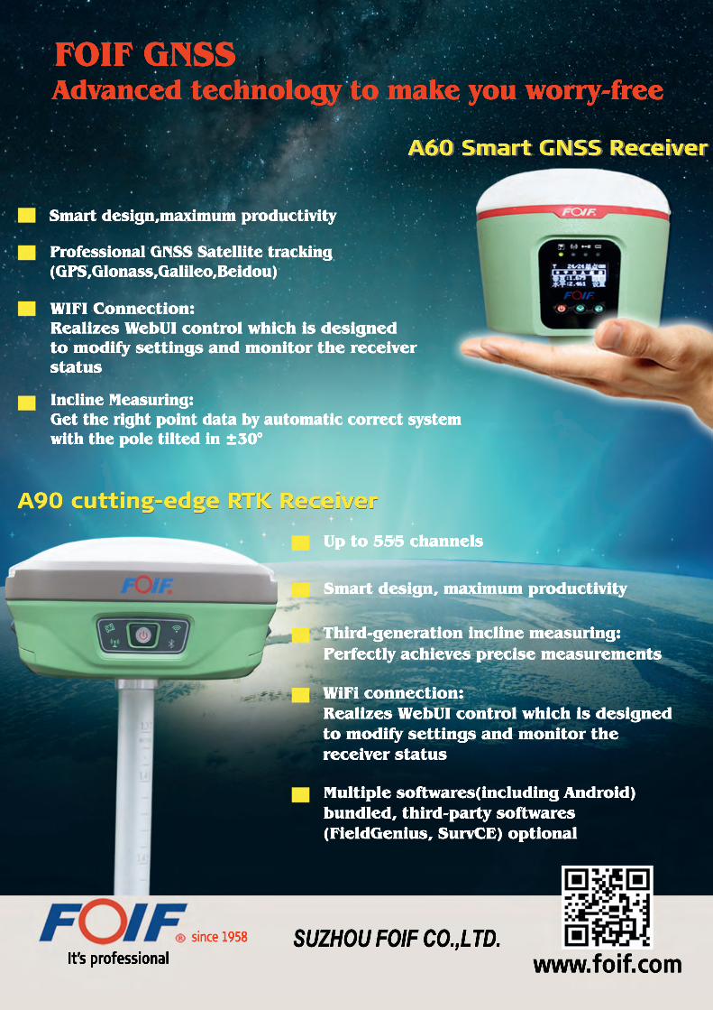
A90 cutting-edge RTK Receiver
Multiple softwares(including Android) bundled, third-party softwares(FieldGenius, SurvCE) optional
WiFi connection:Realizes WebUI control which is designed to modify settings and monitor the receiver status
Third-generation incline measuring:Perfectly achieves precise measurements
Smart design, maximum productivity
Up to 555 channels
A90 cutting-edge RTK Receiver
Incline Measuring:Get the right point data by automatic correct system with the pole tilted in ±30°
WIFI Connection:Realizes WebUI control which is designed to modify settings and monitor the receiver status
Professional GNSS Satellite tracking(GPS,Glonass,Galileo,Beidou)
Smart design,maximum productivity
A60 Smart GNSS ReceiverA60 Smart GNSS Receiver
FOIF GNSS Advanced technology to make you worry-free
It’s professional www.foif.com since 1958 SUZHOU FOIF CO.,LTD.
_FOIF_GIM_4-2018.indd 6 05-07-18 14:29
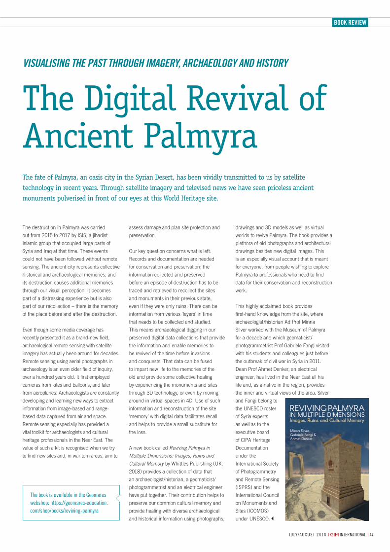
Book Review
47july/august 2018 | international |
The destruction in Palmyra was carried
out from 2015 to 2017 by ISIS, a jihadist
Islamic group that occupied large parts of
Syria and Iraq at that time. These events
could not have been followed without remote
sensing. The ancient city represents collective
historical and archaeological memories, and
its destruction causes additional memories
through our visual perception. It becomes
part of a distressing experience but is also
part of our recollection – there is the memory
of the place before and after the destruction.
Even though some media coverage has
recently presented it as a brand-new field,
archaeological remote sensing with satellite
imagery has actually been around for decades.
Remote sensing using aerial photographs in
archaeology is an even older field of inquiry,
over a hundred years old. It first employed
cameras from kites and balloons, and later
from aeroplanes. Archaeologists are constantly
developing and learning new ways to extract
information from image-based and range-
based data captured from air and space.
Remote sensing especially has provided a
vital toolkit for archaeologists and cultural
heritage professionals in the Near East. The
value of such a kit is recognised when we try
to find new sites and, in war-torn areas, aim to
The fate of Palmyra, an oasis city in the Syrian Desert, has been vividly transmitted to us by satellite technology in recent years. Through satellite imagery and televised news we have seen priceless ancient monuments pulverised in front of our eyes at this World Heritage site.
assess damage and plan site protection and
preservation.
Our key question concerns what is left.
Records and documentation are needed
for conservation and preservation; the
information collected and preserved
before an episode of destruction has to be
traced and retrieved to recollect the sites
and monuments in their previous state,
even if they were only ruins. There can be
information from various ‘layers’ in time
that needs to be collected and studied.
This means archaeological digging in our
preserved digital data collections that provide
the information and enable memories to
be revived of the time before invasions
and conquests. That data can be fused
to impart new life to the memories of the
old and provide some collective healing
by experiencing the monuments and sites
through 3D technology, or even by moving
around in virtual spaces in 4D. Use of such
information and reconstruction of the site
‘memory’ with digital data facilitates recall
and helps to provide a small substitute for
the loss.
A new book called Reviving Palmyra in
Multiple Dimensions: Images, Ruins and
Cultural Memory by Whittles Publishing (UK,
2018) provides a collection of data that
an archaeologist/historian, a geomaticist/
photogrammetrist and an electrical engineer
have put together. Their contribution helps to
preserve our common cultural memory and
provide healing with diverse archaeological
and historical information using photographs,
drawings and 3D models as well as virtual
worlds to revive Palmyra. The book provides a
plethora of old photographs and architectural
drawings besides new digital images. This
is an especially visual account that is meant
for everyone, from people wishing to explore
Palmyra to professionals who need to find
data for their conservation and reconstruction
work.
This highly acclaimed book provides
first-hand knowledge from the site, where
archaeologist/historian Ad Prof Minna
Silver worked with the Museum of Palmyra
for a decade and which geomaticist/
photogrammetrist Prof Gabriele Fangi visited
with his students and colleagues just before
the outbreak of civil war in Syria in 2011.
Dean Prof Ahmet Denker, an electrical
engineer, has lived in the Near East all his
life and, as a native in the region, provides
the inner and virtual views of the area. Silver
and Fangi belong to
the UNESCO roster
of Syria experts
as well as to the
executive board
of CIPA Heritage
Documentation
under the
International Society
of Photogrammetry
and Remote Sensing
(ISPRS) and the
International Council
on Monuments and
Sites (ICOMOS)
under UNESCO.
The Digital Revival of Ancient Palmyra
Visualising the past through imagery, archaeology and history
the book is available in the geomares webshop: https://geomares-education.com/shop/books/reviving-palmyra
47_bookreview.indd 47 05-07-18 16:09

OrganisatiOns
| international | j u ly / a u g u s t 2018484848 j u ly / a u g u s t 2018 | international |
GSDI Announces Wind-down of Association
Rudolf Staiger Elected as FIG President
Since its first international conference in
1996 and especially after its formal
constitution in 2004, the Global Spatial Data
Infrastructure Association (GSDI) has led a
global campaign to advance awareness and
implementation of spatial data infrastructures
worldwide. Today, the association considers
its mission to be largely completed and has
announced the wind-down of its existence as
a legal entity. Throughout the past two
decades, the association’s mission and
purpose has been to enable society to
leverage the power of geospatial information
and associated tools to improve decision-
making relating to, amongst other things,
economic, social and environmental
challenges that permeate local, regional and
international boundaries. Today, many nations
around the world have aligned with common
SDI principles, practices and standards to
facilitate improved collaboration and sharing
of geospatial information across multiple
domains and thus realised the benefits of
doing so.
CapaCity buildingWith a focus on prioritising assistance to
developing nations, the GSDI has led
educational programmes and capacity
building activities, funding over 100 small
grants to enable communities to benefit from
SDI practices. GSDI members were first in
creating knowledge resources like ‘The GSDI
Cookbook’ to help communities rapidly adopt
SDI practices for creating, cataloguing,
managing, delivering and exchanging
geospatial information.
Today those members look back with
considerable satisfaction on the successes of
their association and the GSDI movement.
Whilst acknowledging that additional work,
particularly in the developing world, is still
required to expand capabilities, and that
practices worldwide must be continually
updated to take advantage of developments
in information technology and evolving
policies, they see that their original core
mission and purpose has been achieved in
During the FIG Congress 2018 that was held
in Istanbul, Turkey, Rudolf Staiger from DVW,
Germany, was elected as president of FIG for
the 2019-2022 term. Prof Dr-Ing Rudolf
Staiger currently teaches surveying
engineering at the University of Applied
Sciences in Bochum (Germany). His areas of
special interest are instrumentation and
calibration of geodetic sensors, laser
scanning and data analysis. He studied
geodesy in Karlsruhe, Germany, and in Paris,
France. Rudolf spent six years in the industry
with KERN and Leica-Geosystems (both in
Switzerland) as a systems engineer, product
manager and software developer. From 1994
to 2005 he taught surveying engineering at
the University of Essen (Germany). Since
then he has been teaching in Bochum, where
he also served as vice-president of the
university’s Institute for Research & Transfer
(2009-2016).
Rudolf is a well-known face in FIG and has
been active for more than 18 years. Starting
as the national delegate from DVW, Germany,
for FIG Commission 5: Positioning and
Measurement, he chaired a working group on
Standards, Quality Assurance and Calibration
from 2003-2006. He was the chair of
Commission 5 for the 2007-2010 term.
Besides that, he was chief editor of the peer
review paper system for the FIG Congress
2010 where he also worked on refining the
peer review process. Nationally, Rudolf has
also served DVW as chair of the Commission
3 (national equivalent to FIG Commission 5)
but international relations and cooperation are
especially close to his heart. In his campaign
for the presidency, Rudolf Staiger stated: “FIG
is the only organisation that is representing
surveying and geodesy as a profession
worldwide. ln the times of globalisation, this
role of representing our profession is
extremely important”. Rudolf therefore wanted
to continue serving FIG, first as vice president
for the 2011-2018 term, and now as president
for the 2019-2022 term. In support of his
international profile, he speaks not only
German but also French and English fluently.
After Heinz Draheim (1970-1972) and Holger
Magel (2003-2006) Rudolf is the third
German president in the 140 years of FIG.
His presidency will start on 1 January 2019.
Dave Lovell, GSDI president.
More informationwww.fig.net
48-49-50_organisations.indd 48 05-07-18 16:11
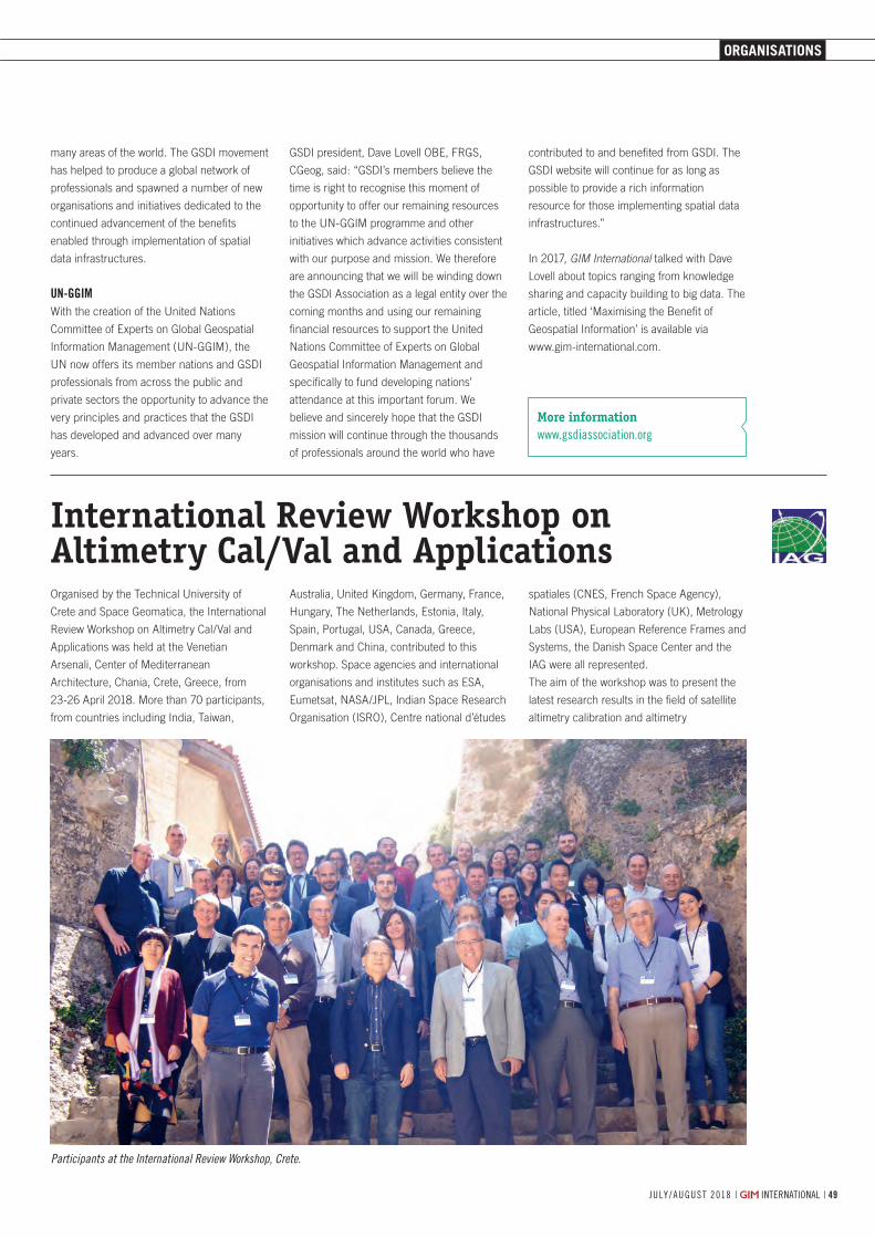
| international | j u ly / a u g u s t 2018
OrganisatiOns
49j u ly / a u g u s t 2018 | international |
International Review Workshop on Altimetry Cal/Val and Applications
Participants at the International Review Workshop, Crete.
many areas of the world. The GSDI movement
has helped to produce a global network of
professionals and spawned a number of new
organisations and initiatives dedicated to the
continued advancement of the benefits
enabled through implementation of spatial
data infrastructures.
un-ggiMWith the creation of the United Nations
Committee of Experts on Global Geospatial
Information Management (UN-GGIM), the
UN now offers its member nations and GSDI
professionals from across the public and
private sectors the opportunity to advance the
very principles and practices that the GSDI
has developed and advanced over many
years.
GSDI president, Dave Lovell OBE, FRGS,
CGeog, said: “GSDI’s members believe the
time is right to recognise this moment of
opportunity to offer our remaining resources
to the UN-GGIM programme and other
initiatives which advance activities consistent
with our purpose and mission. We therefore
are announcing that we will be winding down
the GSDI Association as a legal entity over the
coming months and using our remaining
financial resources to support the United
Nations Committee of Experts on Global
Geospatial Information Management and
specifically to fund developing nations’
attendance at this important forum. We
believe and sincerely hope that the GSDI
mission will continue through the thousands
of professionals around the world who have
contributed to and benefited from GSDI. The
GSDI website will continue for as long as
possible to provide a rich information
resource for those implementing spatial data
infrastructures.”
In 2017, GIM International talked with Dave
Lovell about topics ranging from knowledge
sharing and capacity building to big data. The
article, titled ‘Maximising the Benefit of
Geospatial Information’ is available via
www.gim-international.com.
Organised by the Technical University of
Crete and Space Geomatica, the International
Review Workshop on Altimetry Cal/Val and
Applications was held at the Venetian
Arsenali, Center of Mediterranean
Architecture, Chania, Crete, Greece, from
23-26 April 2018. More than 70 participants,
from countries including India, Taiwan,
Australia, United Kingdom, Germany, France,
Hungary, The Netherlands, Estonia, Italy,
Spain, Portugal, USA, Canada, Greece,
Denmark and China, contributed to this
workshop. Space agencies and international
organisations and institutes such as ESA,
Eumetsat, NASA/JPL, Indian Space Research
Organisation (ISRO), Centre national d’études
spatiales (CNES, French Space Agency),
National Physical Laboratory (UK), Metrology
Labs (USA), European Reference Frames and
Systems, the Danish Space Center and the
IAG were all represented.
The aim of the workshop was to present the
latest research results in the field of satellite
altimetry calibration and altimetry
More informationwww.gsdiassociation.org
48-49-50_organisations.indd 49 05-07-18 16:11
OrganisatiOns
| international | j u ly / a u g u s t 2018505050
More informationhttp://www2.isprs.org/commissions/comm5.htmlhttp://tc5-symposium2018.isrs-india.org/
ISPRS Symposium on Education and Outreach 2018
With great pleasure, we invite you to the
International Society for Photogrammetry and
Remote Sensing (ISPRS) Technical
Commission V (TCV) Symposium on
Education & Outreach – ‘Geospatial
technology: Pixel to People’ – at the Indian
Institute of Remote Sensing in Dehradun,
India, from 20-23 November 2018.
In view of the increasing need for geospatial
information to support nations’ sustainable
development goals, innovative approaches for
capacity building to cope up with advanced
technologies and software solutions are in
high demand. Through eight working groups
(WGs), the ISPRS TCV is actively involved
with pioneers to develop multi-tier training for
all levels; cross-border education; e-learning
and online web-based resource sharing;
citizen science and its societal benefit
applications; innovative technologies for
training civil engineers and architects;
open-source tools and geo-web services.
During the symposium, the WG leaders will
present the outcomes of activities and share
with the participants their ideas and
experiences over the past two years.
Four pre-symposium tutorials are planned on
the emerging topics: big data analytics,
ground-based 3D modelling, citizen science
and its applications, and space education for
educators as part of APRSAF. There will be
also special lectures from ISPRS and the
Indian Society of Remote Sensing (ISRS).
The abstracts and papers will be published in
ISPRS Achives and Annals. These will be
published in ISPRS Archives and Annals. The
deadline for submitting abstracts and papers
has now closed.
A. Senthil Kumar
More informationwww.iag-aig.org
applications. The intention is to support
long-term monitoring of climate change
through better understanding of
environmental changes in the world’s oceans,
terrestrial surface waters and the Arctic and
Antarctic regions.
Presentations covered topics such as fiducial
reference measurements for altimetry, time
systems for altimetry standardisation, new
altimetry missions from ESA, NASA, CNES,
China and ISRO, precise orbit determination,
trends in altimetry calibration, estimation of
uncertainties for satellite observations based
upon metrology standards, calibration of
future satellite altimetry, the ESA Climate
Change Initiative, polar region applications,
modelling of bathymetry, geoid, sea level
gravity, heights, etc.
The final outcome has been to establish and
promote a scientific roadmap with
procedures, protocols, guidelines and best
practices, so as to attain traceability of
measurements, results and data products.
Support from a number of organisations is
gratefully acknowledged. These include ESA,
Eumetsat, the IAG, the EU and its Copernicus
programme, the Technical University of Crete,
Space Geomatica and the Center of
Mediterranean Architecture.
Stelios P. Mertikas
48-49-50_organisations.indd 50 05-07-18 16:11
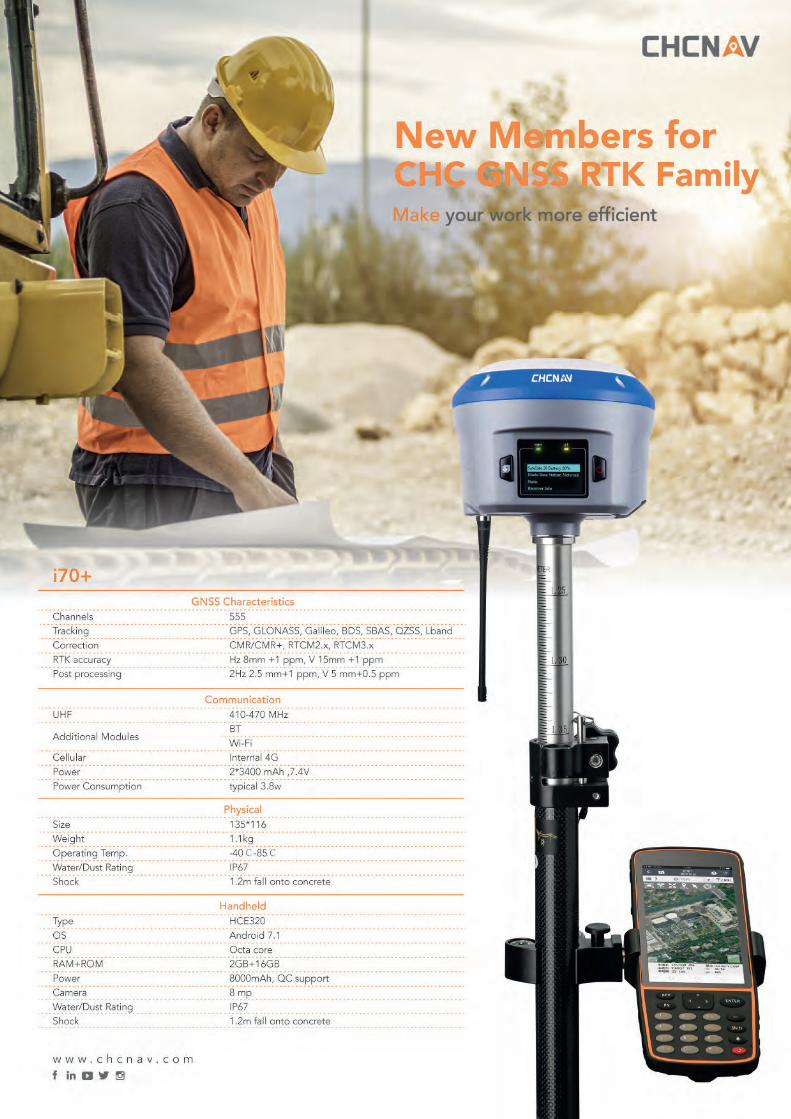
Related Documents