. , MINISTERS COMMITTEE 0 FLOODS AND FLOOD RELIEF VOLU E - 1972

Welcome message from author
This document is posted to help you gain knowledge. Please leave a comment to let me know what you think about it! Share it to your friends and learn new things together.
Transcript

. ,
MINISTERS COMMITTEE 0 FLOODS AND FLOOD RELIEF
VOLU E -1972

MINISTERS COMMITTEE ON FLOODS AND FLOOD RELIEF

LETTER OF TRANSMITTAL
80VERMMENT OF I MDI A
MINISTRY OF IRRIGATION ANO POWER
MINISTERS COIIIIITTEE ON FLOODS AND FLOOD RELIEF
No.l/16/72-FCD New Delhi, the
From:
Shri B. N. Kureel, Union Deputy Minister of I & P and Chairman of the Committee.
To
Sir,
Dr. K.L. Rao, Union Minister of Irrigation and Power, Government of India, New Delhi.
March, 1972
In pursuance of the recommendations made in the 5th Conference of State Ministers of Irrigation and Power held at Ootacamund in September 1970, the Government o! India in the Ministry o! Irrigation and Power constituted a Committee vide Resolution No. FC 37(50)/70 dated the 24th October, 1970. The Ministers-in-Charge of Flood Control in the States of Assam, Bihar, Uttar Pradesh, Orissa, Madhya Pradesh, Gujarat, Andhra Pradesh, Maharashtra and Adviser to Governoq West Bengal and Director-General, India Meteorological Department were mem'bers. Member (Floods), Central Water and Power Commission was the Member-Secretary of the Committee.
(iii)

2. The terms of reference of the Committee were specified as follows:
i) To enquire into heavy loss of lives and property from floods and heavy rainfall;
ii) To examine and draw up suitable proposals for avoidance or such heavy loss or lives etc. in future; and
ill) To study the question of coordinated action by various agencies in organising flood relief measures.
3. On behalf of the Committee, I have great pleasure in forwarding herewith the Report of the Committee for further necessary action.
The Report is in two volumes; Volume I deals with the main report and Volume II contains appendices and maps.
4. The scope of work was mainly restricted to measures intended for reducing the loss of human lives and p_!'operty like flood forecasting, flood warning, flood fighting, coordination or relief arrangements, prevention of epidemics etc. However, the steps required for prevention of breaches in embankments which result in grave situations involving loss of lives and property etc. have also been outlined by the Committee as these have a direct bearing on the reduction in the loss of life and property. Similarly the Committee has touched upon some of the engineering methods of flood control particularly for the protection of villages, as most of the loss of human lives take place in the villages situated in the chronically flood affected areas. The Committee has not dealt with the problems of flood control in individual States, as such an examination was outside the scope of the Committee's work.
The Committee has also given suggestions on the pattern of financing of flood control schemes, as it has a bearing on implementation of Committee's recommendations.
5. The main conclusions and the recommendations of the Committee have been summarised in Chapter XII of the Report.
6. I would like, in conclusion, to convey my appreciation of the cooperation rendered by all the Members of the Committee. I am also grateful to the Members from Maharashtra and Orissa who took great
(iv)

pains in arranging the Committee's meetings in their respective States. I would also like to place on record the deep appreciation ot the assistance rendered by Flood Wing of the Central Water and Power Commission in carrying out secretarial work ot the Committee and in the preparation and finalisation ot the report. The Committee also appreciates the assistance rendered by Assistant Director-General, Ministry of Health and Family Planning and other otficers ot the India Meteorological Department and the State Governments who participated in the deliberations.
Yours faithfully,
Sd/-(B.N. KUREEL)
Chairman ot the Committee
(v)

2. The terms of reference of the Committee were specified as follows:
i) To enquire into heavy loss of lives and property from floods and heavy rainfall;
ii) To examine and draw up suitable proposals for avoidance of such heavy loss of lives etc. in future; and
iii) To study the question of coordinated action by various agencies in organising flood relief measures.
3. On behalf of the Committee, I have great pleasure in forwarding herewith the Report of the Committee for further necessary action.
The Report is in two volumes; Volume I deals with the main report and Volume II contains appendices and maps.
4. The scope of work was mainly restricted to measures intended for reducing the loss of human lives and p_!operty like flood forecasting. flood warning. flood fighting. coordination of relief arrangements. prevention of epidemics etc. However. the steps required for prevention of breaches in embankments which result in grave situations involving loss of lives and property etc. have also been outlined by the Committee as these have a direct bearing on the reduction in the loss of life and property. Similarly the Committee has touched upon some of the engineering methods of flood control particularly for the protection of villages. as most of the loss of human lives take place in the villages situated in the chronically flood affected areas. The Committee has not dealt with the problems of flood control in individual States, as such an examination was outside the scope of the Committee's work.
The Committee has also given suggestions on the pattern of financing of flood control schemes. as it has a bearing on implementation of Committee's recommendations. ·
5. The main conclusions andthe recommendations oftheCommittee have been summarised in Chapter XII of the Report.
6. I would like, in conclusion, to convey my appreciation of the cooperation rendered by all the Members of the Committee. I am also grateful to the Members from Maharashtra and Orissa who took great
(iv)

pains in arranging the Committee's meetings in their respective States. I would also like to place on record the deep appreciation of the assistance rendered by Flood Wing of the Central Water and Power Commission in carrying out secretarial work of the Committee and in the preparation and finalisation of the report. The Committee also appreciates the assistance rendered by Assistant Director-General, Ministry of Health and Family Planning and other officers of the India Meteorological Department and the State Governments who participated in the deliberations.
(v)
Yours faithfully,
Sd/-( B.N. KUREEL)
Chairman of the Committee

CONTENTS
,.,. Letter of Transmittal • • • • • • •• (iii)
Chapter I Introduction • • • • • • •• 1
Chapter II Heavy Rainfall and Floods • • • • •• 4
Chapter III A Review of Flood Damage in the Country •• 13
Chapter IV Causes of Heavy Loss of Life and Property with Specific Instances of Occurrences • • 22
Chapter V Flood Forecasting • • • • • • • • 37
Chapter VI Flood Warning •• • • . . •• • • 50
Chapter VII Flood Fighting and Prevention of Breaches in &mbankments . . •• • • •• 59
Chapter VIII
Part I Co-ordination of Relief Arrangements • • • • 68
Part II Plan for Medical Care and Prevention of Epidemics in Flood Affected Areas • • •• 75
Chapter IX Engineering and Other Methods of Flood Control . . • • •• • • • • • • 84
Chapter X Flood Plain Zoning • • • • •• • • 91
Chapter XI Financing of Flood Control Schemes •• • • 97
Chapter XII Summary and Recommendations • • • • 100
(vi)

CHAPTER I
INTRODUCTION
1. 1 coaatitatioa of tbe coaaittee
The country witnessed serious floods in the years 1968 to 1970. The 5th Conference of State Ministers of Irrigation and Power held at Ootacamund in September 1970 reviewed the problem of floods and viewed with great concern the loss of human lives due to floods and collapse of houses due to heavy rainfall. The Conference, therefore, recommended that a Committee of the Ministers-in-Charge of Flood Control in the seriously affected States be set up to go into the various reasons for the occurrence of floods and to draw up suitable proposals for avoidance of such loss of lives in future. The Government of India, in the Ministry of Irrigation and Power, in pursuance of the above recommendation of the State Ministers' Conference set up a Committee vide their Resolution No. FC 37(50)/70 dated 24-10-70. The resolution of the Government of India outlining the composition and terms of reference of the Committee is at Annexure 1.1.
1.2 Teras of aefereoce
The following were the terms of reference of the Committee:
i) To enquire into heavy loss of lives and property from floods and heavy rainfall;
ii) To examine and draw up suitable proposals for avoidance of such heavy loss of lives etc. in future; and

1. 3 lnbersbiP
The Committee was headed by Union Deputy Minister of Irrigation and Power. The Ministers-in-Charge of Flood Control in the States of Assam, Bihar, Uttar Pradesh, Orissa, Madhya Pradesh, Gujarat, Andhra Pradesh, Maharashtra, Adviser to Governor of West Bengal and Director-General, India Meteorological' Department were the Members. Member (Floods), Central Water and Power Commission was the Member-Secretary of the Committee. Representatives of the Union l'viinistries of Health and Home Affairs were also associated with the work of the Committee. A list of Ministers and officers participated in the various meetings of the Committee is enclosed at Annexure 1. 11.
1. 4 MeeUocs
Six meetings of the Committee were held to discuss and exchange ideas on various issues involved and to finalise the recommendations. The first meeting was held at New Delhi on 15-11-70, The second and third meetings were also held at New Delhi on 5-4-71 and 10-9-71. The fourth meeting was held at Aurangabad, Maharashtra on 29-10-71 and the 5th meeting at Bhubaneswar, Orissa when the Committee inspected cyclone affected areas and also finalised a part of its report. The 6th and the last meeting was held at New Delhi on 11th & 12th January, 1972 when the report of the Committee was finally adopted.
1.11 Scope of work
Brief notes reviewing the flood problem, progress of the flood control works and the benefits achieved and the present line of thinking of the States for tackling the flood control programme in future are enclosed at Annexures 1. 2 to 1. 10.
The scope of the work as outlined in the terms of reference of the Committee does not include examination of flood problems in the various States and suggesting remedial measures thereof. Being essentially a Committee of Ministers it was also thought that examination of such problems would be mostly technical and as such could best be left to the various flood control organisations in the States and at the Centre. The scope of the work was, therefore, restricted to measures intended for reducing the loss of human lives and property like flood forecasting. flood warning, flood fighting. coordination of relief and rehabilitation arrangements, prevention of epidemics etc.
2

However, the steps required for prevention of breaches in tlie embankments, which result in grave situation as the people protected by the embankments are taken unawares resulting in not only the loss of property but also loss of lives. etc., have been outlined by the Committee as these have a direct bearing on the reduction in the loss of life and property. Similarly the Committee has touched upon sollle of the engineering methods of flood control like raising of villages, construction of ring bunds to protect isolated villages and shifting of villages etc. Since most of the loss of human lives take place in the villages situated in chronically flood affected areas and as such, a loss cannot be reduced till flood control measures are undertaken in all parts of the country, the Committee thought that it would be useful to highlight the attention for demarcating such areas and planning necessary measures for the same.
As some rn:embers also desired that it would be useful if the Committee might indicate broadly various flood control methods and their suitability for the different regions of the country, this aspect has also been briefly touched upon by the Committee in the report.
Similarly, the Committee has given some suggestions on financing of flood control schemes. Although this aspect is not covered under the terms of reference, most of the members felt that various measures being recommended have a bearing on financing and as such, the Committee should give its suggestions on this aspect also.
The data presented and analysed in the report are mainly as were available in the Central Water and Power Commission supplemented by the data received from the State Governments. The Committee hopes that its report presented in the succeeding pages will be useful and its recommendations will be implemented by the various State Governments affected by floods as early as possible.
3

CHAPTER II
HEAVY RAINFALL AND FLOODS
J, 1 Iatroductloa
Since time immemorial, floods have been responsible for loss of crops, property and human misery in the world and India is no exception. These floods are due to excessive rainfall in the river catchments and their magnitude depends upon the nature and extent of the rainfall and the characteristics of the catchments. Whereas a sporadic fall of very heavy rain may not produce floods in the plain areas of a river catchment, there may be flash floods if the affected portion of the catchment happens to be in hilly terrain. On the other hand, moderately heavy rainfall occurring over a very large area of the catchment for more than a day may result in floods, particularly if the catchment is saturated.
India which is traversed by a large number of river systems. experiences seasonal floods. The rivers of north and central India are prone to frequent floods during the southwest monsoon season, particularly in the months of July. August and September. The Brahmaputra river system can have floods even in late May or June, Floods in the river Godavari. are less frequent and generally occur during the later part of the monsoon period.
During the month of October. although the frequency of occurrence of floods in northeast and central India is much less than during the monsoon months, those that occur are generally very devastating due to the severity of the weather systems responsible for them and the antecedent soil moisture conditions.
The coastal belt oflndia specially the areas of Orissa. Andhra Pradesh and Tamil Nadu often get flooded in association with the

movement of pre- and post-monsoon cyclonic storms forming in the Bay of Bengal. Such floods generally occur in May, October and November. Thus the proneness of various parts of the country to floods is mainly due to heavy rainfall over those areas in association with tropical lows, depressions and cyclones.
z.z laiafall reaturea Ia ladia
Daily rainfall data for over 3, 000 stations scattered over the country are available with the India Meteorological Department for the last 50 to 70 years and in respect of some stations even for 100 years. Based on the data of about 2, 700 raingauge stations for the period 1901 to 1950, normals have been worked out and a map showing the annual normal rainfall over the country is shown in Figure - 1. The mean annual rainfall of India is estimated to be 105 em., but its areal distribution shows that certain parts of Assam and Western Ghats receive annual rainfall of more than 400 em., whereas less than 40 em. of rainfall is recorded in West Rajasthan. In general, the southern slopes of the Himalayas and the western slopes of the Western Ghats receive rainfall more than 100 em. and 200 em. respectively, while about 60- 80 em. is recorded over the eastern slopes of the Western Ghats. About 80 per cent of the annual rainfall occurs over the country, outside Jammu and Kashmir and Tamil Nadu, during the southwest monsoon season (June to September) which is the major rainy season of the country. Tamil Nadu receives the major portion of its annual rainfall during the post-monsoon season October to December. Besides its spatial variation, the rainfall also varies from year to year due to vagaries of the monsoon. In some years, the monsoon is sustained and active, in some it is weak and punctuated by breaks. Even in individual years there are wide variations in the distribution of rainfall from one part of the country to another. For the purpose of making an assessment of variability of rainfall over the country, the coefficient of vari-
Standard Deviation ation ( C. V.% • Mean x 100 ) of rainfall based on in-
'dividual long term rainfall data, has been evaluated and shown in Figure - 2. With the help of this map, areas of rainfall dependability can be demarcated. These maps have been prepared on monthly and seasonal basis as well. These are contained in the publication "Rainfall Atlas of India (India Meteorological Department), 1971 11
• The monthly variability maps show large variation of rainfall even in the areas where the seasonal or annual variability of rainfall is not large. On statistical considerations alone, the deficits or excesses in any
5

particular month may be made up, to a large extent by excess or deficit rainfall in other months of the season. Similarly in any specific area, the rainfall during any particular month may be made up of a few spells of heavy to very heavy rain. These heavy spells of rainfall are the ones which cause floods. The maps of weekly rainfall departures prepared by the India Meteorological Department show those parts (meteorological divisions/sub-divisions) of the country which experience excessive rainfall responsible for floods.
As mentioned earlier, thes~ heavy rainfall spells occur in association with certain synoptic systems and the most common one is the formation and movement of depressions or cyclonic storms originating in the Bay of Bengal and occasionally in the Arabian Sea. The India Meteorological Department has already collected the statistics of such systems which occurred since 1877. Other synoptic systems which are generally responsible for causing flood producing rainstorms are:(i) the formation and movement of low pressure systems, and (ii) shifting of the axis of the monsoon trough northwards towards the foot of Himalayas. Unusually severe summer conditions over snow covered regions of Himalayas can produce appreciable excessive discharges due to snow-melt in the Brahmaputra, Ganga and Sutlej river systems during the summer months.
1.3 &raoptic S7ate•a aad Areas Proae to Floods
2.1.1 Tropical Cyclon ..
The term "Cyclone", derived from the Greek word meaning "Coil of a Snake" was first used by Henry Piddington, about the middle of the last century for tropical revolving storms occurring in the Bay of Bengal and the Arabian Sea. They originate over comparatively warm oceanic surfaces as feeble anti-clockwise circulations in the northern hemisphere. Their common breeding grounds a.re the Andaman Sea and the southeast Arabian Sea off Kerala Coast and the periods of occurrence are the pre-monsoon months of April-May and post-monsoon months of October-November. Many of them become severe after long sea travel and are comparable in intensity to the Typhoons of the Pacific and Hurricanes of the Atlantic ocean. The chief hydrological features of these cyclones are the occurrence of very heavy rain in spiralling rain bands surrounding the eye of the cyclone which is a calm area of 20-30 km. in diameter and tidal inundation when the
6

storms strike coast. Violent winds circulate anti-clockwise in a narrow ring of 20-30 km. round the eye. Most of these cyclones form north of latitude 5°N and move in a westerly or northwesterly direction st,riking the east coast of India. Some of them, however, recurve and move towards north or northeast and strike the coasts of West and East Bengal. Cyclones recurving northeast or east in the Arabian Sea strike the western coasts of Maharashtra and Gujarat. These, however, are relatively rare.
'
2. 3. 2 Mon eoon Oep re 111 on a du r In g th e Sou th wee t Monaoon
During the months June-September when the southwest monsoon is established over the country, cyclonic storms of severe inten
. sity do not occur. Weaker cyclones called monsoon depressions periodically form in the head of the Bay of Bengal and move westnorthwestwards over the Gangetic Plains. These monsoon depressions are the main causes of the floods over the Himalayas and the central Indian rivers. Heavy to very heavy rainfall of the order of 10-20 em. per day occurs in the southwest sectors of depressions i.e., to the left of the track. During the years when tracks of these depressions all lie over north India, heavy floods occur in the Himalayan rivers. When the tracks are displaced further south, floods take place in the Narmada, Tapti, Damodar, Mahanadi, etc. Monsoon depressions following a track over north peninsula give rise to floods in the Godavari. Years when monsoon depressions are scarce are characterised by droughts .
. 2.8.1 Tradle of Cyclone• 111d Oeprenlona
Based on a systematic study of tracks of cyclonic storms/ depressions which occurred in the Indian Seas during the period 1891 to 1960, the following conclusions can be made:-
(1) January, February and March
Cyclonic storms are rare. They originate in the Bay of Bengal between 5° and 8°N during these months and move in a westerly or northwesterly direction and strike the Madras Coast. They have a tendency to weaken over the sea area and occur, on an average, only once in about 7 years.
(ii) April
Most of the Bay storms in this month originate between 8°N and 13°N and move initially towards northwest or north; later they
7

recurve towards northeast and strikes the Arakan Coast. There are a few exceptions when they have struck Madras-Andhra Coasts. On an average, Bay storms occur once in about 4 years. Those which originate in theArabian Sea also behave like the Bay cyclones and strike the Kutch-Saurashtra Coast. They occur on an average once in about 14 years.
(iii) May
There is appreciable increase in the frequency of storms in this month. Storms in May originate in the Bay of Bengal once in about 2! years whereas in the Arabian Sea they occur. on an average once in about 5 years. Most of the Bay storms originate between 10° and 15~ and move initially in a northwesterly or northerly direction. Some of them recurve towards northeast. The entire east coast of India. the coastal areas of East Bengal and the Arakan Coast are liable to be affected by storms in May. Coastal Andhra Pradesh and adjoinilg Orissa including the deltas of Godavari and Mahanadi are prone to occasional floods during this month. As far as the Arabian Sea is concerned. the storms move either northwestward& towards the Arabian Coast or in a northnortheasterly direction towards Konkan-Saurashtra Coast. Figure - 3 gives the storm tracks during this month.
(iv) June
The Bay depression in this month originate in the northwest Bay. move northwestward& crossilag the Orissa coast. In the course of their further movement. the tracks curve towards north or northnortheast. The frequency of such depression is one or two per month. The States of Orissa. West Bengal. Assam. Bihar and east Uttar Pradesh and Madhya Pradesh experience spells of heavy rainfall during this month but the areas prone to floods are the river basins of eastem India particularly the Brahmaputra system where the soil is almost saturated. The systems forming in the Arabian Sea. often ahead of the advancing monsoon current. sometimes cause heavy rainfall over the coastal belt of the Peninsula and the Gujarat - Saurashtra Coast.
(v) July and August
Monsoon depressions during these months generally originate in the head Bay of Bengal and move in a westnorthwesterly direction and travel sufficiently inland before they recurve in a northwesterly or
8

northerly direction. The average number of depressions which can also lead to floods is about 2 per month. The States of Orissa. West Bengal •. Bihar. Uttar Pradesh. Madhya Pradesh. Punjab. Haryana. Himachal Pradesh andRajasthan receive spells of heavy rainfall during this period. The river systems of Ganga. Yamuna. Sutlej. Narmada. Tapi. Mahanadi. Damodar. etc. are prone to floods during this period .
. Figure - 4 gives the typical tracks of depressions during the month of July.
(vi) September
Depressions originate in this month in the Northwest Bay and move in a west to northwesterly direction. Some of them later recurve towards northnortheast. On an average. number of depressi~ns forming during this month is about 2 per year. Some of them intensify into tropical cyclones particularly towards the end of the month. The same regions which are prone to floods in the months of July and August. are vulnerable to floods in September also. The floods can sometimes be more severe during this month. In September. no cyclonic storms from the Arabian ·Sea affect the Indian Coast.
(vii) October
The area of origin of the storms shifts back to the south Bay of Bengal Between S0 N and 14~ in this month. They move initially in a northwesterly direction and later recurve and ·move towards northeast. There are. however. cases when they move further northwest and emerge into the Arabian Sea where they reintensify before moving away westwards. The entire eastern coast of India extending right upto the East Bengal Coast and occasionally the interior of peninsula are vulnerable to heavy rainfall in association with them. On an average. two cyclonic storms form during this month. In the Arabian Sea. on an average. one storm forms in about 4 years and moves g(lnerally westwards. A few. however. recurve northeast and strike Konkan-Gujarat
. Coast. Coastal areas of Tamil Nadu. Andhra Prad~sh. Orissa and West Bengal are prone to floods owing to heavy rainfall and tidal waves along the coastal areas during this month. Figure - 5 gives the storm tracks during this month.
(viii) November
The Bay storms originate between latitudes S0
N and 13°N and move in a westnorthwesterly direction. strike the Tamil Nadu-Andhra
9

coasts and emerge into the Arabian Sea where they reintensify. Some of them, however, move northwest initially and later recurve northeast towards Orissa, West Bengal, East Bengal or Arakan Coast. On an average two storms occur every year. During this month floods are rare in Himalayan and Central India rivers. However, the coastal areas of Andhra Pradesh, Orissa, West Bengal and East Bengal are vulnerable to floods in association with these storms. In the Arabian Sea, storms form, on an average once in about 3 years and move initially northwest and later some of them recurve northeast and strike the Konkan-Gujarat coast causing locally heavy rainfall.
(ix) December
The frequency of formation of storms or depressions decreases appreciably both in the Bay of Bengal and the Arabian Sea and these systems do ~ot cause floods in any part of the country.
The regions which generally come under the influence of these cyclonic storms/ depressions have been shown in Figures 3, 4 and 5 for the typical months of May, July and October respectively.
2.3.11 Weak Lows and Upper Air Cyclonic Circulations
While cyclonic storms and depressions described above, are often responsible for floods, it has to be remembered that floods can also happen due to the formation and movement of weaker low pressure systems which may not appear on the surface synoptic charts but are evident as cyclonic circulation in the middle troposphere.
2.3.5 Breaks in Monsoon
When the axis of the monsoon trough shifts northwards and lies along the foot of Himalayas, the belt of heavy rainfall shifts over the Himalayas and rainfall decreases considerably in the Gangetic Plains and over Central India. Weak cyclonic circulations form in the low latitudes over the Bay of Bengal, in the lower troposphere and travel westwards. This situation is characterised as "Break in the Monsoon". Such breaks may last for a week or more, and generally occur in the months of August and September. The eastern end of the axis of the monsoon trough sometimes shifts northwards even in the month of July. Under such situations, the upper catchment areas of the river systems of north India are prone to floods, specially the rivers Brahmaputra and Ganga.
10

2.3.6 The Mortheast Monsoon
During the months November to January. the northeast monsoon sets in along the Tamil Nadu Coast and produces copious rains there. Heavy rains and floods are produced with the westward passage of waves or troughs in the easterly current and tropical depressions from the south Bay of Bengal. Heavy rain is generally concentrated to the rear of an easterly wave and in the northeastern sector of a tropical depression. Tropical cyclones hitting the coast also produce very heavy rains over an extensive area to their north and cause floods in Coastal Tamil Nadu and south Andhra Pradesh.
2. 3. 7 Flood Proneness
It can, therefore, be said that the States of Assam, West Bengal. Orissa. Bihar and Uttar Pradesh are vulnerable to frequent floods during the southwest monsoon season, whereas the States of Madhya Pradesh, Punjab, Haryana. Gujarat. East Rajasthan and Andhra Pradesh are prone to occasional floods. During the northeast monsoon season Coastal Tamil Nadu and south Coastal Andhra Pradesh are likely to get occasional floods.
2. 4 Orocrllllbic Rain fall
It is well-known that mountain ranges play a vital part in concentration of rainfall on their windward slopes. The Himalayas. KhasiJaintia hills and the western Ghats are spectacular examples of orographic effects on rainfall. Cherrapunji on the Khasi-Jaintia Hills holds the world's record of the highest seasonal rainfall 802 em. during the southwest monsoon season. Darjeeling. Mahabaleshwar and Dharamsala are some examples of heavy rainfall due to the mountain effect. Heavy rainfall at these stations does not occur every day but falls in short spells in association with synoptic disturbances in the upper air. Such concentrated spells of very heavy rain in a short time leads to flash floods in the rivers and riverlets originating from the mountains. Flash floods in the Himalayan rivers and also the peninsular rivers due to orographic rainfall are not uncommon. Such flash floods sometimes occur even in the Cauvery river in Tamil Nadu which is otherwise free from floods.
2.5 Colltribution fro• Snow•lllelt
While heavy monsoon rain undoubtedly contributes to major floods in the Himalayan rivers, snow-melt from the Himalayas and
11

avalanches play a significant part particularly in causing flaSh floods. Floods in the Brahmaputra during May and early June seem to be caused by snow-melt in the upper catchments. A good part of discharges from rivers like the Sutlej appears to have been derived from snow-melt. A careful study of the snow hydrology of the rivers is required, to estimate the flood potential of these rivers. The study of the Himalayan snowfields with the aid of photographs and radiation data from meteorological satellite should throw significant light on this difficult problem.
From the foregoing paragraphs, it is clear that sustained floods in various parts of the country occur mainly during the southwest monsoon season and are associated mainly with monsoon depressions which can be traced on day-to-day meteorological charts. From the direction of movement of these depressions and the extent to which they affect the country, the catchment areas which are likely to get flooded can be delineated 2 or 3 days in advance. Techniques are being developed for giving quantitative indication of expected rainfall in the different catchments which will be extremely useful for flood predictions and designing flood protection measures sufficiently in advance. A comprehensive scheme for a Flood Meteorological Organisation for the country is presented in Chapter - 4 (Appendix) of this report.
12

CHAPTER Ill
A REVIEW OF FLOOD DAMAGE IN THE COUNTRY
3.1 Necessity of collection of Flood ltalloa&e Data
The magnitude or the severity of the floods can only be judged by the damage they cause. Therefore, flood damage becomes the main yardstick for assessing the magnitude of floods in the country as a whole as well as to get a comparative picture of its magnitude in different parts of the country. The success of flood control programme is also judged by the public in terms of reduction in flood damage from year to year. Therefore, collection of accurate flood damage data assumes considerable significance.
Apart from helping in getting a qualitative picture of the magnitude of the flood problem, statistics of flood damage is important in working out the economic feasibility of individual flood control schemes. With the prevalent practice in the country, a flood control scheme is sanctioned only if the benefit cost ratio is more than unity, that is, the annual benefits to be achieved from the scheme are more than the annual cost of the scheme including maintainance, interest charges, amortization etc. Flood damage data also serves to determine the long term and short term physical targets and to judge the progress achieved from time to time. It is also being utilised to determine the basis for grants of revenue remissions by the States and also the grants and loans to be advanced by the Government of India to the various State Governments as per laid down procedures.
3. 2 Available Statistics -
Flood damage data under various classified heads is being collected in the country from 1953 onwards. The statistics for a period of 19 years from 1953 to 1971 is enclosed at Appendix 3. 1. It may be

seen therefrom that the average area affected is about 67 lakh ha. including a cropped area of 26 lakh ha. On an average, a population of 1. 9 crores gets affected. Damage to crops is of the order of Rs. 87 crores per year. Damage to.public utilities is about Rs. 18 crores per year. The floods also take a toll of 735 human lives and over 41, 600 cattle heads on an average per year. The total average annual damage from 1953 to 1970 was estimated at Rs. 98 crores. If the W1precedented damage caused by the floods of 1971, is also included, the average damage works out to Rs. 124 crores. It is significant to note that this figure represents the direct damage caused by floods. In addition, considerable indirect damage is also caused due to disruption in communications, loss in subsequent production, expenditure on relief and rehabilitation etc. At present there are no scientific methods of assessing such indirect damage. Thus the total direct average lou to the country by floods is of the order of Rs. 124 crores per year. :ln other words, the total loss to the coW1try during the period 1953-1971 is as much as Rs. 2, 360 crores, excluding indirect damage.
3.3 Maxiaua and tbe Averace oaaace
While the figures of the average damage indicated above give a rough idea of the annual loss, in some years like that of 1971 or 1968, floods cause considerable damage which may be 300 to 400 per cent above the average damage. In order to get an idea of the maximum damage that has been c3:used in the country in any one year, an analysis has been made of the average and maximum damage W1der various categori.es and is presented below in Table No, 1.
Table No.1
MAXIMUM AND AVERAGE DAMAGE
I Maximum I A I Percentage I . I verage I f . many
1955_
1971 o max1mum
I one year I I to average t 1 t 2 t 3
1. Area affected in lakh ha. 125 67 190
2. Population affected in lakhs 570 192 300
3. Cropped area affected in lakh ha. 59 26 225
14

1 2 3
4. Value of crops damaged in Rs. crores. 404 87 460
5. No. of houses damaged in lakhs. 22 7 310
6. Value of houses damaged in Rs. crores. 72 18 400
Human lives lost (Nos.) * 7. 3,498 735 475
8, Cattle lost in lakh (Nos.) 2.7 0.42 630
9. Damage to public utilities in Rs. crores. 120 19 630
10. Total damage 596 124 483
* The loss of lives due to cyclones and tidal floods in Orissa in 1971 has not been taken into account in showing the maximum loss in any one year.
It will be seen from the above table that the proportion of maximum damage to the average damage varies from 190 per cent in the case of total area affected to 630 per cent in the case of damage to public utilities. Even the maximum crop damage is over 460 per cent of the average crop damage. It is somewhat fortunate that severe floods are not experienced in all parts of the country simultaneously. Otherwise damage in any one year would be colossal. The experience of floods of 1971 bears a clear testimony to this aspect. The floods of 1971 were concentrated in the three States of Uttar Pradesh, Bihar and West Bengal in Ganga basin and Orissa where an . unprecedented damage amounting to Rs. 516 crores occurred and the total damage in the country touched Rs. 596 crores.
3. 4 . Is the Flood Damage Increasin&?
3.'1. I Total Oanage
If the statistics of damage as collected is to be relied upon, the inevitable conclusion is that the flood damage is increasing in recent
15

years. Against the average annual total damage of Rs. 98 crores for a period of 18 years between 1953 and 1970, the damag~ in the last four years has exceeded Rs. 200 crores mark in two ~rears, Rs. 300 crores in one year and has touched the all time high of Rs. 5 96 crores in the year 1971. In order to get a clear idea, the total damage in the country in various years in the descending order is presented below in Table No, 2.
~ Table No.2
TOTAL DAMAGE IN THE COUNTRY IN DESCENDING ORDER
Sl, No.
1. 2. 3. 4. 5. 6. 7. 8. 9.
10. 1 11. 12. 13. 14. 15. 16. 17. 18, 19.
Year
1971 1969 1970 1968 1967 1955 1962 1959 1960 1964 1966 1954 1953 1958 1956 1963 1961 1957 1965
Total damage in
Rs. crores
596 333 287 204 137 118
93 79 67 67 64 58 54 52 51 38 32 24
6 2,361
If the period of 9 years between 1953 and 1961 and the period of 10 years between 1962 anq 1971 is separated for calculating the average damage the following picture emerges:
1. Average Annual damage during 1953-1961
16
... Rs. 55 crores

2. Average Annual damage during 1962-1971 ..• Rs. 183 crores
Further, if the period of only last 5 years that is 1967 to 1971 is taken into account, the average shoots up toRs, 311 crores.
3.11. 2 Hum an L I vea
Against the average annual loss of 73 human lives, the annual average loss during the four years 1968 to 1971 has been above 1, 000. The maximum loss of human lives took place in 1968 when as many as 3, 498 human lives were lost. Table No. 3 indicates the loss of human lives in various years in descending order; excluding the loss in Orissa in 1971.
Table No. 3
LOSS OF HUMAN LIVES IN DESCENDING ORDER
Loss of human Year lives
1968 3, 498 1969 1, 401 1961 1, 389 1970 1, 076 1971 1, 023 1955 889 1964 695 1959 622 1960 520 1956 462 1963 419 1958 400 1967 358 1962 354 1957 304 1954 279 1966 165 1965 88 1953 34
Average 735
17

3. ~. 3 Crop O""'age
The general trend of the picture remains the same. in crop damage also as may be seen from the statistics presented m Table No. 4 below:
Sl. I Year I No. I I
1. 2. 3. 4. 5. 6. 7. 8. 9.
10. 11. 12. 13. 14. 1!J. 16. 17. 18. 19.
I I
1971 1969 1970 1968 1967 1962 1955 1966 1959 1964 1960 1958 1956 1953 1954 1963 1961 1957 1965
CROP DAMAGE
Damage to I crops in I Rs.crores I
404 211 162 137 120 80 78 64 57 57 46 44 42 42 41 31 25 15
5
1,661
Cropped area I affected in I lakh ha. I
59 43 48 26 33 36 54 16 15 25 27 15 21
9 26 20 18
5 3
Average 87 crores 499
26
Table No. 4
Damage in Rs. /ha.
690 490 337 527 364 222 145 400 380 228 170 293 200 466 158 155 139 300 166
Rs. 327/ha.
The average annual crop damage during the period 1953 to 1961 was Rs. 43 crores. This has increased almost three times during the period 1962- 1971 when the average works out toRs. 122 crores. Here again, the worst years are 1967 to 1971.
18

3. ll Reasons for Increase in Dam ace
3. 5. I Olaparl tlea In Aaseesment
In Table No. 4 presented above damage in various years in terms of Rs. per ha. has been worked out. It may be seen therefrom that in 1955, the cropped area affected was 54 lakh ha. involving a crop damage of Rs. 78 crores. In 1971, the area affected remained almost the same that is 59 lakh ha.; but the crop damage was Rs. 404 crores which is almost 500 per cent of the damage in 1955. Similarly, in the four years 1968, 1964, 1960 and 1954, the cropped area affected was almost same, being around 25-26 lakh ha. However, the damage to crops as assessed varied considerably as indicated below:
1968 1964 1960 1954
Rs. crores
137 57 46 41
The above. analysis clearly indicates that the present techniques of assessment are neither uniform nor rational. ln the absence of these, the data reported from the various States are not strictly comparable. Even the damage in the same State in different years also does not become comparable. This, therefore, highlights the need of uniform, rational and scientific assessment of flood damage all over the country, particularly in view of the importance of flood damage as a yardstick for various purposes as indicated in para 3.1 above.
3.5.2 Increase In Prices
A sizable portion of the increase in monetary value of flood damage can be attributed to the increase in prices in the country from the fifties to seventies. For example, the index number of wholesale price of food articles which was 85 in 1955 (base being 100 in 1952-53 ) increased to 235 in 1968 registering an increase of 260 per cent. The consumer price index increased from 101 in 1950 to 207 in 196 9. Similarly-the wholesale price index rose from 109 in 1950 to 210 in 1969. This indicates a general rise of 100 per cent in wholesale and consumer prices.
19

3.5.3 Increase In Yield of Crops
With the ushering of green revolution in the country, particularly during the last few years, which introduced various varieties of high yielding crops and progressive use of fertilizers, the yields of principal crops have registered a sharp increase in various parts of the country. The yield per ha. of rice which was 87 in 1950-51 increased to 126 in 1967-68. Similarly the yield of wheat increased from 101 to 160 during the same period. The increase in yield is, therefore, roughly 60 per cent over 1950-51.
Therefore, if the increase in prices as well as in yields of principal crops is taken into account, the net effect will be the increase in value of crops over the same area between 1951 and 1969 to 200 per cent. This will, therefore, account for about 50 per cent of the increase in crop damage between the period 1953 - 1961 and 1962 - 1971. Even then, it is difficult to explain the balance increase excepting possibly to the increased awareness on the part of both the public and the State Governments in collecting and compiling the flood damage figures in greater detail. It is also a fact that extraordinary heavy floods were experienced in 1968 and 1971, which were almost unprecedented in magnitude thus causing widespread damage. The damage figures of these years have shot up the average during the period 1962-1971.
).6 C0••1ttee'a Beco••endationa
In order to set this important work of collection of flood damage data on a scientific and reliable basis, the Ministry of Irrigation and Power in 1964 requested the National Council of Applied Economic Research to carry out a pilot survey in selected areas of North Bihar and to evolve a standard scientific procedure for assessment of flood damage. The Council after carrying out this survey presented a report setting out the guidelines for collecting damage data as also the machinery required for such a purpose. This report was circulated to all the States Governments for adoption of the recommendations contained in the report. The Committee, however, notes that so far the procedures recommended by the National Council have not been implemented in any of the States. In view of the. increasing figures of damage in the country and in view of the importance of the statistics of flood damage for planhing the future programme of flood control as well as to assess the success from time to time, the Committee strongly
20

suggests that the recommendations of the National Council of Applied Economic Research should be implemented by all the States without any further delay, If the existing organisations are not adequate to collect the data in the manner prescribed, it will be worthwhile to incur extra expenditure in arranging for the additional staff for collecting such data,
3. 7 Expenditure on Relief Measures
Appendix 3, 2 indicates the financial assistance sanctioned by the Government of India to various States toward flood relief expenditure during the Third Plan period and the years 1966-67 to 1969-70. It will be seen that the average annual relief expenditure, excluding the amount spent by the States from their own resources during four years period 1966-1970 works out to an average of Rs, 20 crores per year. The total average expenditure may be of the order of Rs, 25 crores per year including the expenditure incurred by States,
The statistics of expenditure on flood relief is also as important as the collection of damage data, as ultimately the total loss in the country is assessed on the basis of the flood damage data and the relief expenditure. This is also utilised in working out the benefit .cost ratios of individual schemes.
3. 8 COIIIIi ttee' • Recoaaendationa
In order to collect and compile this information the Committee recommends that after completing the assessment in respect of each flood season, each State Government should send details of relief expenditure incurred by them as well as the assistance received from the Government of India to Central Water and Power Commission who can compile this data and publish for the country as a whole, A proforma for the purpose is enclosed at Appendix 3. 3. Such publication will provide valuable guidelines in assessing the problem, the success of the programme and the need for increasing the tempo of investment in the flood control programme,
21

CAUSES OF HEAVY LOSS OF LIFE AND PROPERTY
WITH SPECIFIC INSTANCES OF OCCURRENCES
4. 1 Introduction
CHAPTER IV
The first term of the reference of the Committee is to enquire into heavy loss of lives and property from floods and heavy rainfall. The main cause of heavy floods leading to widespread damage is heavy and concentrated rainfall, which results in swelling of the rivers spilling over their natural banks. The pecularities of the rainfall, its in
. tensity and distribution leading to floods have already been discussed in Chapter 2. In Chapter 3, the Committee has made a review of damage caused by floods in the country from 1953 onwards. In this chapter, the Committee has attempted to analyse specific instances of occurrences where heavy loss of lives have taken place in the recent past. The summary of the findings of Committee and individuals who have gone into the causes and remedial measures of such occurrences involving heavy loss of lives and property have also been indicated below and based on these and further studies made by the Committee recommendations have been given in the concluding paragraphs.
t. Z A.nalyda of Available StatiaUca
In table No. 3 of chapter 3, the loss of human lives in descending order in various years has already been indicated. It may be seen therefrom that the maximum loss of lives was during the years 1968, 1969 and 1970. The maximum loss of lives in any one year was 3, 498 in 1968. The States where the heavy loss of life took place in these three years as well as in 1971 is as given below:
1. 1968 West Bengal • • • 2,730 Gujarat ••• 341 Other States • • • 427
Total ••• 3,498

2. 1969 Andhra Pradesh ... 993 Uttar Pradesh ••• 113 Other States ••• 295
Total ••• 1, 401
3. 1970 Gujarat ... 432 Uttar Pradesh ••• 344 Andhra Pradesh ••• 99 Other States • • • 201
Total ••• 1, 076
4. 1971 Uttar Pradesh ••• 605 Bihar ... • • • 123 West Bengal ••• 153 Other States • • • • 142
Total ••• 1,023
The above figures exclude the extraordinary heavy loss of life that took place due to heavy cyclones in Orissa in the month of October 19'11, Similarly the figure of 993 in Andhra Pradesh in 1969 was due to series of two cyclones experienced in that year.
The loss of lives due to cyclones mainly takes place due to lack of sufficient warning to the affected people to enable them to move to safer places, In order to devise such measures as will be necessary to avoid loss of life and damage to property by cyclones in particular, the Government of India had appointed a Committee in 1969 known as Cyclone Distress Mitigation Committee in Andhra Pradesh. This Committee after examining the problem and the existing arrangements had given a number of suggestions for improving the warning system, Another Committee for similar purpose ha.s been appointed for mitigation of cyclones in Orissa, recommendations of which will be extremely useful,
The following table gives the overall loss ot human lives and the maximum loss in any one year in 8 major flood affected States. For
23

comparison purpose, the average total damage is also shown in the table:
I Average I Average I Maximum in State I flood damage I loss of I any one
I in Rs. crores I human lives I year
Andhra Pradesh 17.6 134 993 (1969)
Assam 7.0 21 115 (1962)
Bihar 13.2 44 551 (1961)
Gujarat 6.0 81 432 (1970)
Maharashtra 1.3 33 91 (1957)
Orissa 7.2 30 126 (1965)
Uttar Pradesh 28.5 141 344 (1970) 605 (1971)
West Bengal 18.5 213 2730 (1968)
From the above table, it may be seen that the maximum loss of lives in any one year has been in the States of West Bengal, Uttar Pradesh Gujarat, Andhra Pradesh and Bihar. Since the loss in Bihar took place in 1961, this case has not been taken up for analysis. Similarly the loss in 1969 in Andhra Pradesh was due to cyclone which has already been indicated above. The Committee, therefol_'e, decided to analyse the causes in respect of West Bengal in 1968, Gujarat in 1970, Uttar Pradesh in 1970 and also Orissa in 1971. The causes leading to the heavy loss in the case of these four instances are discussed below.
4. 3 Floods of 1968 Ia leat Beaaal
ll. 3. I arl ef Ducrlptlon of Flooda
The North Bengal experienced unprecedented floods in October 1968, which resulted in not only heavy loss of lives but also large scale
24

damage to property and communications. There was an extremely heavy rainfall in Sikkim, Bhutan and the plains of North Bengal as a result of the cyclonic storm which developed in the Bay of Bengal and moved northnortheastwards in first week of October. Between October 3 and 5, rainfall of the order of 57 em. in Darjeeling, 24 em. in Kalimpong, 37 em. in Jalpaiguri, 41 em. in Cooch Behar and 32 em. in Siliguri occurred. The heavy rainfall caused a number of land slides. As a result of both the heavy rainfall and the land slides, Teesta experienced floods of unprecedented magnitude and its level rose to a height of 20. 4 m. above the extreme danger level at Anderson Bridge. The Teesta overtopped Jalpaiguri embankment upstream of the Jalpaiguri railway bridge causing 8 breaches. The waters from the breaches rushed through Jalpaiguri town and a large portion of the town was flooded to a depth of 2m to 3m. The waters entered the town in the early hours of the morning and the population of the town were taken completely unawares. The deluge .in the town lasted for over 18 hours resulting in a large number of deaths and heavy deposit of silt all over the town. The river also overtopped the Domohini embankment opposite Jalpaiguri as a result of which severe damage was caused to Domohini and Mainaguri towns and the National Highway.
A number of deaths were also caused due to land slides and washing away of the highways. The land slides alone took a toll of 704 human lives. The.totalloss of life was assessed as 2, 730.
11.3.2 North Bengal Technical Experts Committee
The Government of India had appointed a Technical Experts Committee to analyse the causes of October 1968 floods and to suggest remedial measures. In the report of that Committee submitted to Government of India in March 1971, the main causes of October 1968 floods are indicated as below:
i) The rainfall during the period 3 to 5 October 1968 was very heavy. Although the rain storm of October 1968 was not unprecedented and the average total depths of precipitation during the storm were less than that in June 1950, resultant floods were more severe. This was largely due to different conditions of catchment in 1950 and 1968 and the time of occurrence of the storm. The 1968 storm occurred in October when the catchment was already saturated by the earlier rainfall. As a result, the resulting floods were more in magnitude and severity.
25

ii) Developments in North Bengal since 1950 particularly in regard to the construction of highways, railways, marginal embankments and other development works prevented to some extent the spread of flood waters resulting in higher flood peaks.
iii) Temporary blocking of the river Teesta had occurred upstream of the Anderson Bridge resulting in sudden floods of high magnitude on the 5th October.
iv) The floods in October 1968 were largely higher than the earlier observed ones and consequently caused higher afflux and contributed to higher flood levels upstream of the bridges, particularly at the Tista Railway bridge.
v) The higher flood levels might also be to some extent due to tl:: aggradation of the bed.
~.3.3 Results of Enquiry In the Flood Warning System
The Government of West Bengal had also an enquiry conducted by Shri S. N. Ray, Retired Chief-Secretary of the State Government on the working of the flood warning system for Jalpaiguri during the October floods. In his report, the Enquiry Officer stated that the warning messages sent by Kalimpong Wireless were not conveyed to the public of Jalpaiguri town. It was further stated by him that even after information about threats to Domohani and Barnes on the opposite bank and Mandalghat to the south of Jalpaiguri town had been received, none of the officers either of the Civil Branch or the Irrigation Department apprehended any real danger to the town. The receipt of flood warning messages had, according to the Enquiry Officer, become a routine affair and very little activity was shown by all concerned to prepare themselves or prepare the public against possible danger. The Enquiry Officer has concluded that some lives mght have been saved had the public been warned on the morning of 4th October, or during the early afternoon of the same day. although this would not have prevented any o.f the damage to property and crops and loss of cattle.
The Enquiry Officer suggested that the flood warning rules should be supplemented by issue of detailed instructions as to what should be done by the officials both on the Civil side and the irrigation, to cope with the situation and undertake rescue operations if floods come.
26

~.3.~ Committee's Observations
From the above account, the Committee feels that although the floods were of an unprecedented magnitude, an efficient flood warning system could have minimised the loss of lives. The Government of West Bengal after receiving thEf report of Shri S. N. Ray constituted another Committee for reviewing the flood warning system set up in the State. The Committee understands that although new arrangements for warning have been introduced by the State Government on the basis of the draft recommendations of that Committee from the flood season of 1969, the Committee's final report has yet to be published. Therecommendations made by this Committee with regard to the improvements in flood warning in subsequent chapters if implemented will go a long way in preventing recurrence of such heavy loss of human lives.
The North Bengal Technical Experts Committee have also suggested a number of engineering and soil conservation measures estimated to cost Rs. 80 crores for implementation in a period of 15 years. These measures when implemented will also provide considerable protection from the floods in the region. The Committee notes that a separate flood control commission for North Bengal has re-cently been set up to investigate and prepare individual schemes and comprehensive plans on a scientific basis and to implement it effectively. The Committee hopes that this Commission will implement the various recommendations of the two Committees referred to above.
4. 4 Floods of 1970 I< 1971 1n Uttar Pradesh
1970 FLOODS
11.11. I Brief oescri p ti on
In 1970, there were extremely heavy and flash floods in the Alalmanda river and its tributaries. The Ghagra, the Rapti and other ~ivers were also in spate. Due to heavy rainfall experienced in the hilly regions of the State, there were a number of land slides also.
11.11. 2 Loss of Human Ll vee
The total loss of human lives was 344. This was distributed in a number of districts as may be seen from the figures given below:
District
Pithorgarh Chamoli
27
No.
37 55

District No.
Lucknow 34 Barabanki 31 Fatehpur 36 Allahabad 30 Kanpur 23 Unao 22 Rai Bareli 22
While specific details of the causes leading to floods in the Alaknanda and the consequent loss of lives are known, the Committee could not ascertain the causes of loss of lives in other districts of Uttar Pradesh. The Committee understand that in most of the cases, the loss might have been caused due to collapse of houses as a result of heavy rainfall and land slides.
The main cause of floods in the Alaknanda river was heavy concentrated rainfall in the western Himalayas. For example, Joshimath recorded 22 em. of rain during 24 hours. Consequently there were flash floods in the Alaknanda and its tributaries. There were also a number of land slides leading to blockages in the main river and also in some of its tributaries specially the Pathalaganga one mile upstream of Belakuchi. These blockages ponded up water upstream and when suddenly gave way, resulted in quick rise in the level of the Alaknanda in the evening of 20th July, 1970. The water rose by about 15m. above the road level near Belakuchi. In this reach, the road level was only about 15 m. above the river bed. The sudden and abnormal rise of water level engulfed and washed away a large number of vehicles totalling to 25 which were trapped on the road near Belakuchi. In addition, a number of bridges were also washed away leading to the disruption of traffic etc. It is reported that about 420 people were travelling in the vehicles which were trapped on the road, but fortunately the local people of Belakuchi warned them of the rising of waterlevel. As a result, people left the vehicles and began to climb the hills for safety. In attempting to escape, about 29 pilgrims held up near Belakuchi lost their lives. There would have been far greater loss of life but for the timely warning given by the local people at Belakuchi. Besides the tragic event mentioned above, about 23 people died in Chamoli district due to house collapse and land slides,
28

11,11.3 Floods In 1971
On account of very heavy rains in its catchment, the river Comti caused extensive flooding in the towns of Lucknow, Sultanpur and Jaunpur and also in th~ districts of Lakhimpur, Kheri, Sitapur, Lucknow and Sultanpur during September 1971. Almost 2/3 of the Jaunpur city was submerged causing complete dislocation of life in the city. Similarly many parts of Lucknow town were inundated. 197 persons lost their lives due to floods in the Comti and its tributary Sarain in the rural areas. In addition, loss of life also occurred in the district of Barabanki due to floods in Chagra and in Hardoi district due to floo'ds of river Sai and Carra, total loss being 92 persons as reported by the State Government.
River Chagra also crossed its highest known flood peak at Turtipar in district Bhallia and remained above the danger level for two months from July to September 1971. Turtipar Srinagar bund along the river Chagra breached unexpectedly near village Chandpur at Mile 3 7. Flood waters entering through this breach inundated large areas to the north of the district upto Ballia Chapra Railway line. The abnormally high flood in the Chagra and Ganga also caused inundation of vast at·eas of this district lying to the south and east of Ballia Chapra Railway line due to the gaps left between Baria Sansartola.
11.11.11 Committee's Observations
As in the case of Teesta river in West Bengal in October 1968, the floods in the Alaknanda were also very sudden and unexpected. The river flows through gorges and is subject to land slides and consequent temporary blockages. When such blockages give way there is sudden on rush of water lower down and the level of flow goes much higher than in normal floods. During heavy rains, therefore, it is necessary to keep close watch of the river conditions a.ndits flow&. The Committee understand that the Border Roads Organisation in consultation with the Central Road Research Institute are looking into the measures required to provide maximum safety on the road between Chamoli and Joshimath which can be achieved within rational limits of efforts and cost. A survey of the critical area was made by the experts of the Central Road Research Institute and Geological Survey of India which indicated that realigning of the road in vulnerable reaches was called for. The Committee also understand that the Border Roads Organisation are also taking steps for the improvement of wireless communication in the area.
29

The National Academy of Sciences had also constituted a Study Team with a view to analyse the causes which were responsible for the Alalmanda tragedy in all its aspects and to suggest the course of action to be adopted either to avert or mitigate the possibility of such disasters in future. The report of this Team has not yet been finalised, The findings will no doubt be helpful in preventing such disasters in that and similarly situated other regions.
4.:1 Floods of 1970 in Guj arat
11. 5. I Brief Description
In 1970, the Gujarat State experienced one of the heaviest monsoons !mown in living memory. In the entire State, heavy incessant and widespread rainfall was experienced. In some places, the intensity of the rainfall was 10" to 20" in a single day. Another peculiar feature was that two wet spells were followed in quick succession -- one between 27-29 August and the other between 5- 7 September. During these spells, the rainfall was not only heavy in Gujarat State, but there was also simultaneous heavy rainfall in catchment areas of most of the rivers in adjoining States, resulting in heavy floods in almost all the rivers of Gujarat State.
The Narmada recorded a level of 41.5 ft. at Broach on the 7 September which was the highest ever. The Tapi recorded a level of 100. 5( feet at Sur at which was only 1. 25' below the highest recorded level in 1968. Other rivers were also in very high floods. As a result, considerable dam damage was caused to agricultural areas, communications and property.
After the experience of 1968 floods, the Central Flood Forecasting Centre was set up at Surat for forecasting the flood levels of the Tapi and Narmada rivers at Surat and Broach respectively. Accordingly, the villages which were likely to be endangered were warned sufficiently in advance by the district authorities and were advised to evacuate. However, some villagers ignored such warnings as a result of which heavy loss of lives took place in some villages which were located on the left bank of the Narmada river. The total loss of lives was 432. The two worst affected villages on the left bank of the Narmada upstream of Broach were Tarsali and Tothidra. These villages were under 8' to 10' depth of water. Except f0r a few pucca buildings which were also badly damaged, nothing ret.'lained of these villages. It was reported that out of a population of about 1, 100 in Tothidra, 84 persons lost their lives and out of a population of hhout 1, 200 in Tarsali, 347 people lost their lives. The Deputy Minister
30

of Irrigation and Power during his inspection was told by the Collector of Broach that even though the people of these villages were warned and evacuated well in time, they went back quietly and were engulfed by the floods leading to loss of lives.
ij, 5. 2 Action taken by the State Govt.
The Union Deputy Minister of Irrigation and Power had inspected the flood affected areas and held discussions with the State Ministers and other officials. To prevent recurrence of such cases measures undertaken so far include shifting of villages which are vulnerable to floods to higher areas, construction of raised platforms and embankments in the vulnerable reaches and also to improve the flood forecasting and warning system by further strengthening it,
II. 5. 3 Committee' 1 Observations
The Committee understands that the Government of Gujarat have already taken steps to shift some low lying villages on the b'lnks of Narmada river to higher areas. With the completion of Ukai dam and the embankments on the Tapi river lower down, chances of heavy loss of life and property on this river will be mostly eliminated. These steps combined with efficient system of flood forecasting and dissemination of the same will go a long way to prevent recurrence of heavy loss of lives along these rivers in Gujarat.
4. 6 Tidal Floods of 1971 in Orissa
II. 6.1 Brief Description
A severe cyclone struck the coastal areas of Orissa on the night of October 29 and lasted from 9. 00 PM on October 29 to 1 PM on October 30 except for four· hours of calmness from 2. 30 AM to 6. 30 AM on October 30. The maximum wind speed of the cyclone was estimated as 175 km. per hour and accompanying tidal wave was about 2.8 to 3.8 m. high. The cyclone struck the land near Paradip and then moved parallel to the coast with some portion going over the sea als•>. The coastal area beyond Mahanadi river upto Gomaei in Balasore district was subjected to severe damage. The tidal bore went inland and the standing crops were completely destroyed due to saline water.
The full assessment of the damage is yet being made by the State Government. However, as per the assessment so far, about 6 lakhs of
31

population in 8, 845 villages over an area of 7, 621 sq. miles were affected. Nearly 8,5 lakh houses were damaged and 101 200 human lives and 52,610 cattle heads were lost. Crops over an area of 10.6 lakh ha. were damaged.
11.&.2 Inspection of union r~inister of lrrlyatlon & Power
The Union Minister of Irrigation and Power inspected the affected areas on 6-7 November and discussed the measures that are required to be taken. Some of the suggestions made by him are as below:
1. In order to give clear warnings regarding the region where cyclone will hit the coast, it is necessary to install a 10 em, radar, which will assist in locating the cyclone about 24 hours ahead,
2. Precise forecasting can be made if the assistance of a reconnaissance aircraft with minimum meteorological instrumentation is available,
3, At present the American Orbitting Weather Statellite gives photos of any particular region once a day, But by having geo-stationary statellite pictures can be taken continuously once every 20 minutes. The Government of Japan is planning to install a similar satellite which will cover Bay of Bengal and Arabian sea. Preliminary discussions have taken place between the Meteorological Departments of India and Japan for collaboration. If this project materialises this will help greatly in forecasting the cyclones in India with great accuracy.
4. All along the coast of Orissa especially from Devi river northwards coastal wind breaker Casurina trees over half a mile width may be planted.
5, High mounds may be constructed in each village and community buildings should be built on high grounds which can be used in emergency by the people to save themselves from tidal floods.
6, Inaccessible villages may be provided with tele-communication facilities to receive warnings,
32

7. Roads must be p l'OVided connecting evel'y village in tlw coastal area within 10 miles from the coast to areas furtlwr· away so that people may be evacuated to safety.
8. The area between the 1\Iahanac.ii ,md I3rahmani had frequently suffered from floods and cyclones. To pi·ovide banks to protect against both it is necessary to quickly construct rese1·voirs at Rengali and I3himkund.
The Union Minister of Irrigation and Power has also I'eq:H:>!U'd the State Government to appoint a Committee of Technical Ex-pens to study the various measures prevent damage due to tidal flood pa:· ;_ cularly in the region affected during this year.
~. ~. 3 Committee's Inspection of the Cyclone and Tl dal flooa Afhctc•J Areas and Observations
4.6.3.1 Inspection
On the 3 December, the Committee inspected some of the villages badly affected by cyclones in the vicinity of Bhubanes\\'ar. The villages inspected were Guntuni, Dhanmandal, Borchara, Harid.1spur and Kasotia. The"se villages are situated at a distance of about 2J-23 km from Bhubaneswar near Bhubaneswar-Cuttack highway. These villages were affected only by the cyclone and not by the tidal floods. These villages are situated in front of a small hill. The heavy winds afte1· striking the hill struck the villages and caused considerable damage. In village Guntuni which has a population of about 2000, excepting Z houses, all the houses had collapsed. The loss of human lives was fortunately limited to only 2. However, almost all the cattle l:eads in the village were destroyed. The houses destroyed included the primary and secondary school buildings as well.
On 4th December, the areas affected by both the cyclones as well as tidal floods were inspected partly by road and partly through a motor launch passing through Hansua Nadi, Tiarkot Creek and Nuna nadi upto Jambu Island. The Committee also visited the Paradip Pol't.
During inspection, it was noticed that the saline embankments on both banks were considerably damaged. In some places, the embankments were completely destroyed while in other reaches the embankments were overtopped and breached at a number of places. Most of the houses were destroyed. These were mainly kuchha houses. One of the
33

villages inspected was Tantipur where out of a population of 500 people, there were only 50 survivOl'S, The standing crops were completely destroyed and the lands were affected by saline waters for vast stretches. In this area, the damage was more due to tidal bore which was stated to be about 15' high. The people were caught almost unawares. The maximum loss of human lives took place on Jambu Island.
4. 6. 3. 2 Committees' Observations
It was observed that wherever the buildings consisted of stone masonry walls in cement mortar and roofs of R. C. C. slabs, these did not suffer any damage. However, the buildings with dry stone masonry or mud walls with roofs of corrugated iron sheet or tiles or thatches suffered considerable damage resulting in almost complete collapse. The houses situated in the area affected by tidal bore were mostly kuchha and were completely destroyed.
On an enquiry from the affected villagers, it was learnt that although they had heard the news of coming cyclones on radio, the impact of the same on the safety of their lives and property could not be comprehended by them. In the villages affected only by cyclone, people came in the open only after the roofs had started getting blown off and the walls started crumbling. However, as there was no time to remove the cattle, most of them were killed. On the Jambu Island where the maximum loss of lives took place, people could not evacuate to any safer place due to lack of communications to higher regions.
The Committee was indeed appalled to witness the extensive damage caused to both fertile and cultivated areas due to high wind and saline inundation. Loss of life and other properties were also staggering. Government of India have already appointed a Technical Committee to suggest measures for mitigation of distress due to cyclones which hit these coastal areas of Orissa. Similarly the State Government have constituted a Technical Experts Committee to suggest remedial measures to prevent loss of life and property due to tidal fioods. The Committee hopes that the findings and recommendations of the above two committees and implementation of the same will help in preventing such heavy loss in future. As these two committees have been appointed to study all aspects of cyclone and tidal floods in Orissa, this Committee would not deal with the subject in details. However, the Committee would like to mention that mere communication of warnings of the likely cyclone and the wind velocity etc. in technical terms on radio is not sufficient. It is most
34

essential that people of vulnerable areas are made fully conscious of the likely dangers from such cyclones and tidal waves. Warnings including such information if clearly announced over the radio in local dialect at frequent intervals would enable the people to make necessary arrangements for their safety as well as the safety of the catUe heads. It is also necessary that the people of vulnerable areas are educated in advance. on the measures to be taken during such cyclones, places to which they could evacuate etc. Recommendations made by the Union Minister of Irrigation and Power in his inspection note as already indicated in para 4. 6. 2 of this report should be implemented. These alongwith the suggestions to be offered by the Orissa cyclone distress mitigation committee when implemented would surely go a long way to prevent recurrences of such tragedies in future.
4. 'l CO••l ttee' • Recoaaendatione
4. 7.1 The analysis of the specific cases of heavy loss of lives dis-cussed above brings out the important causes leading to each of the occurrences. The causes and reasons are bound to vary from place to place. However, the general causes leading to heavY loss of lives and property can broadly be summarised as under:
1) Occurrence of unprecedented floods due to causes beyond human control;
ii) Non-existence of flood protection measures;
iii) Lack of flood forecasting and efficient warning system;
iv) Breaches in embankments;
v) Inadequate arrangements of evacuation of affected people due to various reasons such as lack of communications, insufficiency of boats and want of suitable sites in the vicinity for shelter etc;
vi) Inadequate relief arrangements;
vii) During the post-flood periods loss of life also takes place due to break of epidemics etc. Such losses can be prevented by providing adequate medical facilities particularly to fiood prone areas.
35

4. 7. 2 Los~> of property cannot be minimised to any appreciable extent unless flood pr·otection measur·es are carried out. Therefore, in order to reduce the loss of property, the implementation of flood control programme has to be accelerated so that the damage to property etc. is minimised as early as possible. In this connection, the Committee notes that recently separate organisations for expediting such programme! in a scientific way have been set up like Brahmaputra and North Bengal Flood Control Commissions. The Committee also notes that proposals to set up a separate flood control Commission for the Ganga is under consideration. fhe Committee hopes that with the setting up of these organisations, flood control programme in these regions will receive undivided attention and also a greater tempo in implementation.
4. 7. 3 The loss of human lives will also be automatically reduced, once the flood protection measures are completed in major portions of the vulnerable areas. However, in the intervening period, the loss of lives can be considerably reduced, if not prevented altogether, by undertaking a number of measures like setting up efficient flood forecasting and flood warning systems, flood fighting and prevention of breaches in embankments, setting up coordinated relief arrangements, taking measures for medical care and prevention of epidemics and flood plain zoning etc. These methods have been discussed in the subsequent chapters and specific recommendations indicated.
4. 7. 4 However, the Committee would like to emphasise that in the collection of statistics particularly with regard to the loss of human lives, all the State Governments should take care to see that loss of lives only due to floods is included. Losses due to other reasons like landslides, , heavy rainfall, boat capsizes etc, occurring during the flood season shoul1 not be treated as loss of lives due to floods. This will enable the variot Governments to correctly assess the problems and to take necessary remedial measures,
36
CHAPTER V
FLOOD FORECASTING
ll. 1 Intro<luction
It has been the experience that floods occur almost every year in one or the other part of the country. There is considerable loss of not only crops and public utilities but also of human lives, cattle and valuable movable property. Flood control measures are being carried out for reducing such losses. It is, however, not possible to provide protection at all places for all magnitudes of floods. Experience has shown that loss of human lives etc. can be reduced to a considerable extent by giving advance information of the coming floods. By this, the people can move to safer places in an organised manner as soon as information about flood warnings are received. Even valuable movable property and cattle can be saved from floods by transferring them to places of safety.
ll. 2 Earlier Arraoseaents
Earlier to 1958, some flood warning arrangements were Pxisting in a few of the States, but these were mainly transmitting flood levels from upstream points to the areas lower down. Such warnings had limited utility in as much as they did not indicate the likely levels and the time of arrival of floods at the vulnerable places. Further, they did not also give adequate advance notice.
5.3 EK1st1DI Set Up
(a) At the Centre - A beginning in scientific flood forecasting was made in 1959 when a Flood Forecasting Unit was set ~p for Jamuna at Delhi for giving timely warnings of the floods to the villages around the capital located in the riverine areas. The experience and functioning
37

of this Unit was very encouraging. An additional Forecasting Unit for Sahibi Nadi was opened under this unit during 1967.
The need for having network of flood forecasting systems for chronically vulnerable river basins like Ganga, Brahmaputra, Narmada etc., had been felt from quite some time. The Ministry of Irrigation and Power set up a Technical Committee on Flood Forecasting and Warning in December, 1963 under the Chairmanship of Prof. K. R. Ramanathan for studying the needs and to suggest suitable arrangements The Committee after detailed study emphasised the necessity of setting up Flood Forecasting Centres backed up by adequate meteorological organisation with sub-Centres at different vulnerable points of the country for issue of timely forecasts. It was, however, the disastrous floods of 1968 in many parts of the country notably at Sur at and Jalpaiguri which causing considerable loss of life, pinpointed the immediate necessity of setting up of Flood Forecasting Centres at suitable points of the country. Accordingly, in early 1969, six Flood Forecasting Centres were set up at places mentioned in Appendix 5. 3. 1. These Centres have 22 sub-Centres or Control Rooms at places indicated at Appendix 5. 3. 2.
The six new Centres and one previously set up at Delhi are issuing flood forecasts on concerned rivers and places from the flood season of 196 9 and the forecasts issued by them have been found to be of immense benefit to the people residing in the riverine areas and also to the agencies connected with rescue and relief operations. The details of rivers and places where forecasts were issued from these Centres in 1971 are indicated in Appendix 5. 3. 3. The organisation chart of the existing flood forecasting set up is indicated in Appendix 5. 3. 4.
(b) In the States - Scientific flood forecasting is being adopted only for Mahanadi in Orissa and Damodar and its tributaries in West Bengal. Andhra Pradesh and Maharashtra have also schemes for scientific flood forecasting on the river Godavari. The other States have only flood warning arrangements.
The flood forecasting in Hirakud is being systematically done from 1962 based on the information and data collected by a system of wireless network installed in the catchment area of Hirakud Dam and also along the Mahanandi river below the dam. The flood forecasting in Damodar river is being done by the D. V. C. Authorities since 1961, utilising the network of wireless stations above the D. V. C. dams.
38

The forecast in the lower Damodar is based on tlie releases from the reservoirs of the DVC system.
The flood warning is being done in the Krishna river in Andhra Pradesh, Kosi in Bihar, Teesta, Torsa and Mahananda in West Bengal.
On the Godavari river the present arrangements in Andhra Pradesh is limited to transmission by Police Wireless, information regarding the flood stages from Dummagudam, Bhadrachalan, Kunavaram and Buragampadu to Dowlashawaram. However, it is reported that a scheme has been prepared by the State Engineers for a comprehensive flood forecasting on the river covering the catchment in Maharashtra also and has been submitted "to the Andhra Pradesh Government for sanction.
Maharashtra Government has set up a flood forecasting centre at Nanded on Godavari river, on an experimental basis, which has started functioning in 1971.
5. ~ WorkiDI of Flood ForecastiDI ceutres
The modus operandi of the flood forecasting operation is briefly enumerated below;
The forecasts are issued by the control rooms whenever the rivers are in high flood stage. At present, forecasts are being i~sued based on the river stages with the help of the multiple correlation diagrams drawn up for each of the forecasting stations. The parameters utilised are the actual flood stages at the base and the forecasting stations, the rainfall and the antecedent precipitation index of the intervening catchment. Improvements on this technique is envisaged in the coming years, when basic data covering a longer period is available.
The Flood Forecasting consists of the four operations -Collection, Communication and Analysis of the data for formulation of forecasts and lastly the Dissemination of the forecasts to the concerned persons. The basic hydrological data required for the day-to-day forecasts are collected by different agencies like - the State Government, Ganga Water Resources Organisation, the Gauging Circles of the CW&PC and the hydrometeorological data from the India Meteorological Department's regional centres at Bombay, Calcutta, Nagpur and New Delhi. At present these meteorological centres issue qualitative
39

forecasts of expected heavy rain in various river catchments exceeding certain specified limits about 48 hours in advance and also provide actual reports of heavy rainfall from rain-registering stations in the catchment areas. The above data ob~ained from these organisations is augmented by further information collected by this Directorate and then utilised for formulation of forecasts. Data from nearly 180 hydrological and 500 hydrometeorological stations are being utilised for issuing the forecasts.
For the efficient transmission of the basic data to the various Control Rooms, a wireless network comprising of 165 stations have been proposed in the river basins for which forecasts are currently under issuE The normal Post and Telegraph Channels are also used for communication of the rainfall da~a from outlying stations. In addition to the above, it is also proposed to have Automatic Water Level Recorders and Automat Raingauges fitted with Radio Reporting facilities at crucial stations.
The hydrological and hydrometeorological data received in the Control Rooms are analysed and with the help of the correlation diagrams prepared in the Directorate based on the records of the previous years, the forecasts are issued. The results obtained from the correlation diagrams require certain corrections to take care of the peculiar circumstances prevailing in the different river basins which are carried out on the basis of the intimate knowledge of the river of the forecaster.
The forecasts are passed on to the Civil Authorities, the State Engineers and other agencies connected with the flood control works and also to the All India Radio for dissemination to the public and also for arranging inspection and strengthening of the flood protection and control works.
Various steps have been undertaken to improve and strengthen these Flood Forecasting Units. The important ones are installation of self-recording raingauges, and additional raingauges at salient points and setting up of gauge and discharge stations to obtain more reliable and adequate data, installation of wireless network to provide an independent communication system. These are mainly directed towards introducing medium range forecasting techniques at all the Centres, whereby advance notice of three to five days can be given.
40

II. II success Aclli eved So Far
(a) Central- As indicated earlier, the Flood Forecasting Centres are functioning since 1969. A brief resume of the work done during the different flood seasons are given below:
1969
In view of the limited time that was available before the flood season of 196 9, only a beginning was made in the forecasting work, mainly confined to the main rivers like Narmada, Tapi, Ganga (at Varanasi, Buxar, Patna etc.), Tista, Brahmaputra (at Gauhati) and Subernarekha. Details of the forecasts issued during this season are indicated in Appendix 5. 5. 1.
1970
During this season, considerable difficulty was experienced in making proper communication arrangements at all Centres. In spite of best efforts, only six wireless sets could be procured and installed for communication purposes. However, through the help and cooperation of the State Police Wireless Departments wireless communication was possible between 65 stations. The technique of forecasting was also improved by the inclusion of daily rainfall data and the witness factor of the intermediate catchment (between the base and forecasting station) in the formulation of forecasts. With these arrangements flood forecasts were issued not only on the main rivers where work had been done during 1969 but also on some important tributaries of Ganga like Ghaghra, Rapti, Burhi-Gandak, Kamla Balan as well as other rivers of Orissa like Brahmani, Baitarni etc. During this season the river Narmada recorded a peak flood stage of 41.5 Ct. nearly 19.!) Ct. above the danger level. This peak was forecast accurately and in time which enabled Gujarat State authorities to take prompt action in evacuation of people and cattle from the flood plain. The usefulness of the timely forecasts issued on this river has been acknowledged by the Gujarat State authorities. The details of the forecasts issued during 1970 flood season are indicated in Appendix 5. 5. 2.
1971
During this se:lson, 24.additional wireless sets could be installed under Surat, Gauhati, Lucknow and Patna Centres. These provided a
41

skeleton network for communication of vital data. With this arrangement, flood forecasting work was extended to other important tributaries of Ganga and additional vulnerable places on main Brahmaputra.
During the year 1971, Bihar witnessed one of the worst floods in living memory. As per preliminary assessment of the State Government, the total damage has been about Rs. 177 crores. The maximum damage in any one year during the period 1950 to 1970 was only Rs. 39 crores, which occurred in the year 1966. The total damage in a period of 10 years from 1961 to 1970 was Rs. 160 crores. Thus, the damage this year has exceeded the total damage in the last 10 years in that State. During the same period, that is, 1961-1970, the total loss of human lives was 712, that is, an average of 70 per year. The total loss of cattle heads was 20,000, that is, an average of 2, 000 per year. As against this, the loss of human lives and cattle during 1971 floods is only 123 and 426 respectively, as reported by the Govt. of Bihar. The forecasts issued by the Patna Centre were accurate, within 2 ems. of the actual levels that the river attained. The forecasts given with an advance notice of 24 to 30 hrs., considerably helped the State authorities in taking timely action for protection of embankments and prompt evacuation and relief arrangements. Thus, the flood forecasts issued in that Division was responsible in minimising the loss of human lives and cattle heads. They were also of great help in saving Patna town from an imminent threat by the overtopping of Patna Canal banks, as the authorities could take timely action in raising the bunds.
Similar is the case in the case of U. P., where the flood forecasts issued on Gomti and Ghaghra rivers, were of immense help to the State authorities connected with relief and evacuation operations. The details of the forecasts issued on the various rivers during the flood season of 1971 are indicated in Appendix 5. 5. 3.
The usefulness and effectiveness of flood forecasting has been felt at all the Centres where flood forecasts are being issued, The people affected and the Governments concerned have accepted the essentiality of the establishment of flood forecasting facilities. With the advance notice of the incoming floods, the concerned authorities have been able to arrange systematic evacuation of people, live stock and in many cases movable property as well. The concerned State Governments and other orga.,isations have acknowledged the help and have req~~ested for extension of the flood forecasting facilities to other rivers and areas. When the flood forecasting facilities cover the entire region
42

which are subjected to chronic flood, only then we can expect the loss of ·life and damage to property to be minimised.
(b) States - The Hirakud and Damodar flood forecasting centres are using forecasts which have been found extremely useful.
The one set up at Nanded by Maharashtra Government. on Godavari has functioned only this year, 1971.
5.1 Extensio11 of Flood Forecastin& Facilities to otber !';l.ates ana Rivera
From the functioning of the Flood Forecasting Centres during the past three years, it will be seen that these centres have burgeonned into effective forecasting centres. The work of these centres became evident specially during the floods of 1970 and 1971 when the States of Gujarat, Bihar and Uttar Pradesh were hit by the severest floods in living memory. But for the timely warning given by the forecasting centres there would have been heavy loss of lives. There is no doubt that these centres played a commendable roles in the relief and rescue operation organised by the concerned State authorities. This has also highlighted the usefulness and the necessity of setting up of similar centres on other vulnerable riv.ers in the country.
The Committee has gone into the needs and necessity of establishing similar stations in other parts of the country. It is felt that providing suitable forecasting facilities for the following rivers and places are urgently necessary:
1 • Ganga Basin
a) Ganga at Hardwar for proper operation of the Ganga Headworks.
b) Main Ganga for the benefit of Malda and Murshidabad Districts.
c} Forecasting on tributaries of Ganga namely Alakhnanda in U. P. and Sone and Kiul in Bihar.
43

2. Godavari
a) Godavari basin for the benefit of Andhra Pradesh, Madhya Pradesh and Maharashtra.
b) Wain Ganga in Maharashtra.
3. Other Rivers
a) D.V.C. system.
b) Ajoy, Mayurakshi and other rivers of North Bengal like Torsa, Jaldhaka, Mahananda etc. in West Bengal.
c) Betwa at Vidisha, Kunwari at Morena and on Narmada at Mandla in Madhya Pradesh.
d) Kankai and Mahananda in Bihar.
e) Krishna at Vijayawada in Andhra Pradesh.
f) Bhima in Maharashtra.
The Committee recommends setting up of forecasting facilities in the above rivers at places recommended by the State Government.
The Committee also recommends extension of the flood forecasting facilities to all flood prone river basins.
It is further recommended that the flood forecasting may also include the issue of warnings of the likely damage due to floods caused by cyclone. In this connection all the precautions and warnings which have already been recommended by the Cyclone Distress Mitigatfon Committee for Andhra Pradesh and as are likely to be recommended by the Committee on the Mitigation of Cyclone Damage in Orissa (the report of which is expected by the middle of 1972) have to be followed.
A map of the country showing the flood forecasting stations covered under the existing programme and also those recommended by the Committee is enclosed as plate No. 9 in Volume II.
44

5.7 Moderatatac Flood Forecaatiac tecbaiquea
As already mentioned in para 5. 4, the techniques currently being used for flood forecasting in the country is with the help of correlation diagrams. With this technique, it is possible to obtain only a limited advance warning. It would be necessary to progressively adopt refined techniques so as to obtain increased warning time and also more reliable forecasts. For achieving this it would be essential to establish rainfallrunoff relationship correlated to observed discharges in various stems of the river and then to utilise this to arrive at the cumulative discharge at the forecasting station. For this, methods of observation of rainfall and runoff as well as their communication has to be improved. To save time in computation of discharges at various stems of the river, use of computers become necessary. The improvement in the communication system can be achieved by having telemetering devices. The analysis can be improved by the adoption of mathematical model, electrical analogue etc. To match with the advanced techniques of flood forecasting it would be necessary to improve the Meteorological Organisation to assist the flood forecasting operations. This aspect has been covered in the next para.
The Committee recommends progressive adoption of improved techniques for flood forecasting at all the centres by strengthening the existing set up and augmenting the technical facilities.
5. 8 I•prove•eata to •eteoroloctcal Oraaataatioa for Aaahttac 1a Flood Forecaattac
At present the required meteorological backing to flood forecasting is afforded by the Regional Meteorological Centres of Bombay, Calcutta, Madras, Nagpur and New Delhi to the flood forecasting centres in the respective regions. In addition small meteorological units are attached to the flood forecasting centres at Gauhati, Jalpaiguri, Patna, Luclmow, Bhubaneswar, Surat and New Delhi which help in maintaining the rain gauge networks for the catchment and in interpreting and making available in a readily utilisable form the daily weather reports and synoptic information furnished by the Regional Meteorological Centres. The present data made available for flood forecasting is limited to qualitative forecasts of expected heavy rain in various rain catchments and, of course, the actual rainfall precipitations - daily or at more
frequent intervals.
45

For a reliable forecasts of floods sufficiently in advance the following meteorological set up would be necessary:
i) An adequate network of raingauges of the measuring, recording and telemetering variety in order to provide a reliable estimate of the total rainfall over a catchment area during a specified period.
ii) A reliable network of telecommunications for quickly transmitting the data from the raingauge stations to the flood forecast centre.
iii) A forecast facility for indicaLmg quantitatively the expected rainfall over the catchment area during the forecast period.
iv) A computational facility for quick conversion of actual and forecast rainfall over the catchment into the expected run-off.
v) A research unit for constantly updating computational procedures and forecast formulae and reviewing -the results of the techniques developed.
The scheme outlined above may be implemented in convenient stages in coordination with the development of flood forecasting set up. The facilities of the World Weather Watch (WWW) Scheme of the World Meteorological Organisation where certain forecast material is computed at the (World) Regional Meteorological Centre (R. M. C~ at New Delhi and/or received from the World Meteorological Centres CW. M. C.) at Moscow, Melbourne and Washington DC is also to be made use to the extent possible. This would be in addition to the existing and projected facilities of India Meteorological Department in the shape of observation stations, radars, satellite reception (APT) stations etc. which are always available for being used for forecasting rainfall precipitation and its special distribution.
A detailed scheme for meteorological organisational set up for efficient flood forecasting as prepared by the Director General (Observatories), I. M. D.is enclosed as Appendix 5. 7.
The Committee agrees to the necessity of modernising and strengthening the meteorological organisations and suggests that the
46

details be finalised early by the I. M.D. and C. W. & P. C.
The Committee recommends that Flood Meteorological Offices (F. M. 0.) may be established at the various flood forecasting centres to be set up in the country and that these should be under the administrative and technical control of the India Meteorological Department and work in close collaboration with the authorities of flood forecasting centres. The improvements in the flood forecasting, Meteorological Organisation may be implemented in stages as specified below:
Stage I : Each Flood Meteorological Office may be equipped to install, maintain and supervise the functioning of an adequate number of raingauge of different types required for the concerned river catchment areas and provide quantitative precipitation forecasts on a semi-empirical basis for periods of 24 to 48 hours ahead to the forecast centres and develop forecast techniques for rainfall-runoff.
The present set up is in the initial phases of this stage.
Stage II : Utilising the output products oi the World Weather Watch Regional Meteorological Centre, New Delhi as well as other world meteorological centres in the shape of short and medium rainfall quantitative precipitation over large areas covering India, quantitative precipitation forecasts for the concerned river catchments may be issued. In this stage estimates of snow-melt by use of satellite data may also be utilised to provide flood data in the Himalayan catchment of the riv~rs. The Meteorological computers at New Delhi can be successfully utilised for computing quantitative precipitation forecasts for different river catchment on a real time basis.
Stage III : In this stage S-Band (10 ems) radar may be installed and brought into service for detecting rainfall areas and estimating precipitation in the catchment areas. Integrated forecasts of rainfall and run-off based on the data obtained by telemetering raingauges and radar may be issued. For assessment of quantitative precipitation, a computer available at stations nearest the Flood Meteorological Office may be utilised. For the transmission of forecast data to the flood forecasting centres telecommunication links from the computer centre to the forecast centres may be provided.
Stage IV : In this stage small computers may be installed at each of the flood meteorological office to collect and process the necessary
47

data from the raingauge network in the river catchment along with the quantitative precipitation forecasts and radar determination or catchment rainfall and satellite information. The operation at this stage will be more or less completely automatic.
Stage V: In this stage the radio-reporting raingauges, snow-gauge at remote locations may be transmitted to the Flood Meteorological Offices by the Geo-stationary Meteorological Satellite which is likely to be positione' in Indian areas by 1976. Use may also be made of the data to be supplied by the Geo-stationary Meteorological Satellite which would provide continuous information about the development of tropical cyclones, depression and other rain bearing phenomena affecting the other river catchments. By the time this stage is reached, it would be possible to estimate the rain bearing capacity of the clouds with the help of orbitting satellites carrying microwave probes.
5. 9 A&eac:J for Operatia& aad lecoaaeaded Flood Forecaat1a1 Ceatrea
The question of setting up and operation of the suggested flood forecasting centres has been examined in detail. As relief and rescue operation: are to be undertaken by concerned State Departments, it would be in their interest to fully associate themselves in the organisational and executional set up of these centres. Keeping this in view, the Committee feels that in the case of rivers confined to a particular State, the concerned State Governments themselves will set up and operate the flood forecasting centres. However. in the case of inter-State and international rivers basins involving two or more States or countries the Flood Forecasting Centres will have to be set up and operated by a Central Agency. This will facilitate collection and communication of hydrological data across the inter-State barriers to the forecasting stations. In this connection, it is to be pointed out that the hydrological data collected by the Central Flood Forecasting Centres from different States should be treated as confidential..
5. 10 Ftaaac:ea
The staffing pattern proposed for a Flood Forecasting set up on interState and international river will be on a pattern already sanctioned for the existing Centres, as in Appendix 5. 9. It is recommended that this pattern rnay be followed in the case of all forecasting systems set up on inter-State rivers. In the case of single-State rivers also, a similar pattern depending upon the actual requirements and the set up already existing at the concerned places, may be adopted. ·
48

As regards the finances, inter-State forecasting systems are recommended to be financed by the Centre and such systems will be operated under the Central Sector. In the case of single-State rivers, they will have to be entirely financed by th"e concerned State. However, to create incentives for setting up of as many systems as possible, the Committee recommends that the cost involved in the collection of hydrological data for flood forecasting should be financed by the Centre (the cost of_hydrometeorological operations being already borne by the Central Government), the rest of the cost being borne by the State itself. The hydrological data collected by the States will be made available to the Centre for compilation and record.
49

CHAI'TER VI
fLOOD WARNING
i. 1 Introduction
A great deal of damage and suffering particularly to the human lives and cattle heads caused by floods is due to the following factors:
i) Unpreparedness;
ii) Failure to give timely warnings to the people concerned;
iii) Lack of accurate information regarding the areas already isolated by floods or likely to be affected by floods;
iv) Inability of administrative machinery to establish immediate contact with the affected areas;
v) Timelag in mobilising resources to face the situation particularly regarding the evacuation of marooned people; and
vi) Reluctance of the people to move out of their houses in spite of advance warning.
In Chapter 4, the Committee has analysed causes of heavy loss of lives in a few specific areas in the recent years. This analysis has revealed that although a number of factors were involved leading to heavy loss of lives, one factor common to all the cases is that the flood warning arrangements were not adequate or effective. As such, it would be seen that lack of proper warning system is a major contributory factor to the heavy loss of lives and sufferings of the people.

Flood forecasting and flood warning are two distinct operations and should not be mixed up. The Committee wish to emphasize this fact because there is a great deal of misunderstanding and confusion regarding such a distinction. Flood forecasting envisages forecasting in advance of the occurrence of floods, the likely stages/levels to which the river may rise at a particular location and at a particular time. Such a forecasting system was set up in some parts of the country under the central sector after the floods of 1968. As this has been found to be extremely useful, the Committee has already recommended in the previous chapter not only the extension of such a system to other flood affected areas in the country but also its progressive modernisation. The flood forecasts are issued by the flood forecasting units stationed in various States to the engineering and civil authorities. These forecasts are normally issued 24 to 48 hours in advance.
Flood warning comes into play after the flood forecasts are received by the engineering and civil authorities. Flood warning essentially consists of communicating and disseminating the information of the incoming floods, its magnitude and consequent damage that is likely to result, to the affected people in time so that both the civil authorities as well as the people likely to be affected can take necessary measures like evacuation to safer places etc. before they are engulfed by floods. Thus flood warning is essentially an arrangement of informing the people likely to be affected in an efficient and expeditious manner. Wherever forecasting systems already exist, the warning system will have to be based on such forecasts. Wherever such a system is not existing, it will have to be based on the daily readings of river stages at various places and forecasts of rainfall on the basis of which the likely danger will have to be evaluated by the engineering hydrological authorities in charge of flood control and quickly transmitted to the civil authorities who in turn will communicate the information to the people in the flood prone areas.
The Committee would also like to bring out another clear distinction between the flood forecasting and flood warning viz., that flood forecasting is essentially a function of engineering hydrological officers; while flood warning is that of the civil officers in charge of rescue, evacuation and relief operations in each State.
6. 2 Existing set up in Uifferent States
The existing arrangements of flood warning in some of the major flood affected States are described below on the basis of the information received from various members.
51

6.2.1Bihar
The flood levels are communicated by telephones, telegrams or special messengers as per the situation to the concerned officers of the ,. irrigation department and civil officers like the Chief Engineer, Superintending Engineer, Commissioner, District Magistrate and Civil S.D. Os. These are based on the forecasts issued by the flood fore-casting division at Patna for the rivers and places at which flood forecasting is being done and on the other rivers on the basis of observations of gauges by the State Irrigation Department.
There is a systematic arrangement for communicating the warnings to the people and at present flood warnings are mostly confined to the official circles. The inadequacy of the present system was clearly brought out in the disastrous floods of 1971 when the people residing in the lower reaches of some rivers like the Sone were caught unawares by the sudden rise of the flood levels and as such had to suffer considerable damage.
6. 2. 2 0 r I saa
At present the flood situation in general is broadcast through All India Radio and published through local papers. The concerned departmental officers are however informed by wireless, telephones and telegrams to be in readiness. The population sometimes take precautionary measures on hearsay information or on intuition. Thus the present system leaves much to be desired.
i. 2. 3 Uttar Pradesh
The forecasts issued by the Central Flood Forecasting Division at Lucknow are communicated by radio telephones to control rooms at Lucknow, Varanasi, Allahabad, Gorakhpur where wireless sets have been installed. In other parts of the State, gauges of important rivers are sent through telegrams by the persons in charge of the gauge and discharge sites, to district magistrates of the districts situated lower down. The district magistrates in turn send the information to the areas likely to be affected to Tehsildars and Lekhpal etc. in accordance with the system in force in a particular district.
The present method of dissemination of flood warning is a slow pro: cess and does not give adequate time to the affected population to shift them· selves to safer places in time.
52

t.2.~ Weet Bengal
After the extraordinary floods witnessed in North Bengal region in 1968, the State Government appointed a Flood Warning Review Committee. Although the report of this Committee has not yet been finalised, based on the draft recommendations, the State Government introduced a revised flood warning system in the flood season of 1969 for the Teesta and Torsa rivers. Based on the experience in 1969, some modifications were carried out in the flood season of 1970 and the system was also extended to Jaldhaka river in North Bengal. Under this system now in vogue, the vulnerable areas have been classified under two groups: (a) area,c; protected by marginal embankments, and (b) unprotected areas or flood plains. For the protected areas, 3 kinds of signals viz., Yellow, Amber and Red are issued; while for unprotected areas only two signals viz., Yellow and Red are issued. The significance of these three signals is as below:
(a) Yellow Signal
This indicates in advance the approach of floods in a river in the reach concerned either protected or unprotected and is meant to be communicated to both to Irrigation engineers as well as district official:;. This signals does not indicate damaging capacity of the floods unless the conditions worsen sufficiently. It is only meant to alert the authorities of the probability of incoming floods.
(b) Amber Signal
This is meant only for irrigation department engineering staff calling for a greater degree of alertness and vigilance on their part and is intended to indicate in advance the approach of a high flood. This signal is meant only for the protected areas and not for unprotected ones,
(c) Red Signal
This is meant for both irrigation engineers as well as district officials indicating the approach of a high flood of such an order as may cause damage to the flood protection works in case of protected areas or likely inundation to a depth of a meter or more in unprotected areas. The red signal is meant to be treated as a serious warning both by the engineers for attention of protected works and by the district authorities for communicating signals to the people concerned and taking up other necessary measures.
53

For each of the three river systems of river Teesta, Torsa and Jaldhaka, different river reaches have been classified as protected or unprotected and flood warning stations for each reach have been fixed.
For the rivers in the central and southern districts of the State, there is no such warning system. Whenever, these rivers cross their danger and extreme danger level marks concerned authorities are informed over radiogram mentioning gauge readings and indicating whether the rivers are rising or falling.
Although the system in vogue in North Bengal is a definite improvement, it does not clearly lay down the details of the methods by which the '.'"ellow and Red Signals are to be communicated to the affected people. Since no serious floods have been experienced in North Bengal region, during the period 1969 to 1971, the system has not been put to rigid test to indicate its effectiveness •
•. 3 Coeetttee' a lecomeendattone
1.3.1 FlxlngofWarnlnglevela
In most of the States, flood warning stages on various major rivers have already been fixed by the State Chief Engineers. This should be done for all the remaining rivers in the country and published. The warning stages also need a periodical review depending on the changes in the river conditions. The Committee, therefore, recommends that all the warning stages should be reviewed regularly at an interval of 3 years and the revised stages published. Such a publication should include the name of the river, the name of the place where gauge readings are observed, the previous highest recorded levels/discharges with year of occurrence, its distance from the important towns or villages downstream which are likely to be affected etc. It should also indicate the levels at which Yellow, Amber and Red signals will be given. This publication should be widely distributed to all the engineering and civil authorities in the State.
6.3.2 Pre-deterelnatlon of Areaa
The State Government should carry out detailed studies to predetermine areas which are likely to be affected by the various rivers at various stages above the warning stages. In case of chronically affected areas and important towns or thickly populated villages, the areas likely
54

to be affected at different river stages should be marked on maps and published and widely circulated to all the officers. This will enable the civil authorities to concentrate their attention on the areas which are likely to be affected due to rise in the river level at a particular place.
6. 3. 3 Demarcation of Areu In the Fl el d
Wherever possible, the areas to be severely affected should also be demarcated on the fields by erection of boundary pillars as recommended subsequently by the Committee in Chapter 10.
6.3 •• Co•munlcatlon of Warning to the People
The exact method to be adopted for communicating and disseminating the warnings to the people in each State or a district will depend on various factors like the vulnerability of the area, communication facilities etc. Therefore, it will not be possible to adopt a uniform procedure for all the States or even to various districts of each State. The Committee would therefore recommend broad guidelines of various methods to be adopted, which should be reviewed by each State Government and the best method applicable decided upon, published and circulated to all the concerned officers as well as the people in the flood affected areas. The methods to be adopted will be as follows:
(i) All India Radio
During the flood season, apart from the usual news bulletins of All India Radio, regional .stations in each State should be requested to issue additional bulletins devoted to the communication of flood warnings and flood situation in the State. The frequency of such bulletin should be increased when the situation becomes serious. The frequency and nature of broadcasts to be given should be fixed by each State Government in consultation with the All India Radio authorities. Such broadcasts should be in local dialects apart from being in English, Hindi and the regional language so that the entire population can benefit from such broadcasts.
Once the areas liable to be affected have been identified, the broadcasts can also indicate not only the river levels but also the villages and in case of towns the areas likely to be affected, approximate time of flooding and the depth of inundation to a rough extent if possible. On the basis of advice to be rendered by the Engineering authorities, the broadcast
55

should also intimate to the people instructions to evacuate to safer places which have also to be pre-determined, after obtaining the information from the authority nominated by the State Government,
Normally in most of the villages, village panchayats have community receiving sets. A survey will have to be made to find out whether most of the villages in the flood affected regions have such sets, Wherever these are ~10t available the State Governments should provide the villages with radio sets. The Sarpanch of each village should be made responsible for listening to the flood bulletins from All India Radio and immediately disseminating the information to the people of his village.
The Committee feels that dissemination of warnings by All India Radio will be the best, the cheapest and the easiest method, as other means of communications like telephones etc. very often get disrupted during floods,
(ii) Visual Signals
With the progress in the rural electrification in the country, a good number of villages have already been provided with electricity, In such villages, towers can be constructed on high spots on which Yellow, Red and Green light signals can be provided. In some cases, particularly in flat regions, it may also be possible to erect one such tower for a group of villages provided the signals can easily be seen by the people in such a group. This method pre-supposes that the people would have been educated in advance of the significance of the various signals. This would be that a Yellow signal would indicate the likelihood of incoming flood and that the public should take all precautionary steps and be in readiness, as WE;!ll as keep a watch for red signal. The red signal would imply that people should immediately evacuate to safer places with their cattle heads, belongings etc, The green signal would signify all clear situation. After the red signal people should not return to their places till the green signal is flashed.
In the villages which are not electrified or even in the villages which are electrified, during day time instead of electric signals, coloured flags of the same type that is Yellow, Red and Green can be hoisted on the tops of high poles to be erected at high spots so as to be visible from a distance. The responsibility for giving the electrically operated signals and hoisting of flags should rest with the Tehsildars or Sarpanch etc, to tie specified by each district magistrate. The
56

significance of the coloured flags would be the same as that of electric signals.
(iii) Sirens
In addition to visual signals indicated above, sirens can be effectively used. In places where electricity has already been provided, electric sirens can be used; while in the non-electrified villages, hand operated sirens can be used, The sounding of sirens in different manner to indicate the danger and all clear situation can be explained to the public in advance, as is being done for civil defence measures, The responsibility of operating sirens should also be fixed on specific individuals who on the receipt of information from either the All India Radio or telephone or wireless etc. from the concerned autHorities would sound the sirens.
(iv) Telephone/Wireless/Radio Telegram
Wherever feasible, arrangements. should be made for installing telephone radio telephone/wireless facilities in the chronically affected areas particularly in case of thickly populated villages. In towns, such facilities already exist. These facilities should be made use of in communicating the warnings in addition to broadcasts from All India Radio,
In case of important protection works, which are likely to be endangered, arrangements should be made to have field magneto sets or wireless sets so that the engineering authorities in charge of maintenance and protection of the embankments can immediately convey the warnings to the concerned officers as soon as there is any threat of breach etc. in the embankment which might endanger the population and the areas protected.
(v) Education of Public
Once arrangements of flood warning for a particular area are decided upon, a programme should be launched to educate the public regarding the significance of different types of warnings and the actions to be taken by them. This can be done by distribution of informative pamphlets and by exhibition of large scale posters at prominent places in various flood affected areas in local languages. Such posters I pamphlets should also indicate the action to be taken by the various officials, places to which people should evacuate, the officers to whom they should
· contact for evacuation, relief etc. This information can also be published
57

periodically in the nswspapers and broadcast from the local stations of All India Radio.
(vi) Regular Exercise of Warning System
As in the case of civil defence programme, before the flood season in the chronically affected areas, regular exercises should be held for the flood warning system so that it will ensure that not only various instruments to be used in warnings are tested for their use but also the officials and the public are reminded of the system and its implications.
(vii) Periodical Revision of System
The success of the system should be reviewed every year to see its deficiencies if any and the improvements necessary. This would be particularly necessary for some years initially, so that as far as possible a fool proof system is established on the basis of experience gained.
The Committee strongly recommends that all the flood affected States should take immediate steps to introduce and establish such systems in all the flood affected areas. Priority should be given to establish such system in chronically affected areas, important towns and thickly populated villages. The Committee hopes that this should be possible to be introduced before the monsoon of 1972.
(viii) Coordination of Flood and Cyclone Warnings
In States where cyclones warnin:'s system exists, flood warning system should be coordinated with cyclone warning system, since cyclones cause floods also and a single agency should take care of both.
58

1.1 Introduction
FLOOD FIGHTING AND PREYENTION OF
BREACIIES IN E\IBANKMENTS
CHAPTER VII
Since the initiation of Flood Control Programme in 1954, considerable work has been done in different parts of the country to provide protection against floods. The works executed so far include construction of embankments, improvements of river channels, raising of villages above high flood level, construction of drainage channels and town protection works etc. However, the main choice has so far been on the construction of embankments, mainly because these could be constructed quickly with the local resources and larger areas could be protected by comparatively smaller outlays. It was also thought that these could be constructed on the basis of available meagre hydrological data and could be raised and strengthened subsequently as more data became available. As a result, a total length of over 7, 000 km of embankments have been constructed after 1954, with a total investment of about Rs. 100 crores out of the total expenditure of Rs. 228 crores between 1954-1971 on flood control and drainage measures. The length of embankments constructed prior to 1954 is about 5, 300 km. Thus a total length of over 12, 000 km of embankments exist in the country.
While, by and large, the embankments have withstood the fury of successive floods and afforded the desired protection, there have been breaches varying in number almost every year. Such breaches cause considerable loss of property as well as human lives and cattle heads, as the people are caught unawares. Secondly, with the sense of security with the construction of an embankment, areas and lands protected by embankments develop at a fast rate. Consequently, there is more local damage with the occurrence of breaches than what it would have been had there been no embankments.

To m1mmise such damage. if not to prevent it altogether. Committee feels that a number of steps need to be taken to prevent breaches in the embankments and to set up flood fighting organisation in each flood affected State with adequately trained and equipped flood fighting forces. With this end in view. the Committee have dealt with these two important aspects below.
'J. Z Prneath1 Breacbea ta tbe Eabaallaeata
7.2.1 Cau~ea of Breachn
Breaches in embankments are caused due to many varied factors either single or a combination thereof. These can be faulty alignment. defective construction. inadequate designs. poor maintenance etc. Unfortunately. so far results of detailed investigations which are carried out for various breaches that occur from time to time in various States are generally not circulated for benefit of others concerned. Such reports would give valuable information on defects which can be avoided in future. However. generally the causes of the breaches can be attributed to:-
i) Seepage through and under the embankments due to:
a) Leaks caused by rats or rodents;
b) Inadequate cover over the saturation lines;
c) Defective foundation conditions; and
d) Faulty construction. particularly inadequate compaction.
ii) Erosion due to river current or wave action.
iii) Qvertopping of embankments due to:
a) Inadequate free-board;
b) Higher flood heights than designed; and
c) Settlement of embankment in certain portions either due to defective construction or lack of proper maintenance.
In order to overcome these shortcomings. the Committee recommends the following measures.
60

7.2.2 Suggestions for Preventing Breaches
7. 2. 2. 1 Planning and Designs
As most of the embankments have been constructed on the inadequate and meagre hydrological data which were available, it is necessary that the existing embankments are reviewed to see that these are safe for a flood of 50 years frequency for major rivers and at least 25 years frequency for small tributaries. Similarly all the future proposals of embankments should also be based on the above criteria.
The sections of the embankments should be designed after analysing the soil and foundation conditions, instead of basing them on ad hoc practices which have been usually followed in the past.
Alignment of the embankments has also to be carefully selected, so that it is sufficiently away from the active river course and is not subject to river attacks due to development of meanders etc. The alignments should also be straight as far as possible with no sharp bends.
In framing the proposals of land acquisition, additional land in a width of about 20' should be acquired beyond countryside toe, so that an additional service road becomes available for maintenance and flood fighting. No occupation or building of structures and cultivation should . . be allowed in this land width.
7. 2. 2. 2 Compaction by Mechanical Equipment
Most of the flood embankments are exposed to floods immediately after construction with the result that when there is no compaction, seepage lines develop quickly resulting in failures. It is, therefore, desirable that in future programme of construction, mechanical equipment is used for compaction.
7. 2. 2. 3 Quality Control Organisation
In each State having a sizable programme of construction of embankments, a separate unit for quality control in the construction o! embankments should be created, which should be directly under the State Chief Engineer-in-Charge of Flood Control. This will be necessary to ensure strict compliance of specifications during construction. This organisation should have field laboratories to check at site the soil characteristics and the density of compaction from time to time.
Sl

7. 2. 2. 4 Adequate Maintenance
Adequate maintenance is an essential pre-requisite. At present allocation of funds for maintenance is not sufficient as may be seen from the details of maintenance expenditure in some States at Appendix 7. 1. Further, the present allocation for maintenance is inclusive of flood fighting with the result that neither proper maintenance nor flood fighting is done to the required standards. The Committee therefore feels that some standards should be laid down for the annual maintenance expenditure. This will depend upon the height of the embankment, its importance and vulnerability and year of construction. As a rough guide, the Committee recommends that annual maintenance expenditure should be about 4-5 per cent of the capital cost. In fixing the standard for maintenance in case of old embankments, its capital cost will have to be worked out at the prevailing rates. The Committee therefore recommends that each State Government should fix the standard of annual maintenance expenditure for various embankments on the basis of above guideline before the monsoons of 1972. The Committee also strongly recommends that State Governments should ensure that funds for maintenance as per standards to be fixed are made available. The Committee would like to emphasize that any economy in maintenance will be a false economy leading to considerable subsequent expenditure on repairs and restoration, apart from danger to protected areas and population.
River Training and anti-erosion works also need regular maintenance. The Committee recommends that annual expenditure on these works should also be of the order of 5o/o of their capital cost.
Most of the embankments now being constructed have a crest width of 15', which can be used for vehicular traffic on the tops of the embankment for maintenance and flood fighting. It is also seen that in many areas, where there are no other roads, embankments are used by the people as the only means of communication in the area.
The Committee feels that minimum crest width of these embankments should be as per standards of village roads laid down by Indian Roads Congress. In such cases, it will be better to provide suitable topping of moorum, or gravel or brick flats etc. depending on availability. This ·will facilitate movement of vehicular traffic. Expenditure on such item should, however, be provided by the Roads and Communications departments of each State. This suggestion should easily be acceptable, as provision of new alternate roads will be much more costly.
62

The Committee, therefore, recommends that a review of existing embankments should be made by the State Governments and a phased programme for making the embankments suitable for vehicular traffic should be drawn up for implementation in consultation with their Roads & Communications departments.
The standards of maintenance (including requirements of material and labour) have been outlined in the Embankment Manual prepared by C. W. & P. C. and these will have to be strictly enforced,
7. 2. 2. 5 Education of Public
The public should also be educated so that they actively cooperate with the officials in their work of preventing and closing of breaches during flood period. For this purpose, publicity media like rural programmes on regional stations of All India Radio, large posters in local dialect and documentary films in various languages etc. can usefully be employed.
7. 2. 2. 6 Investigations of Breaches
It should be enjoined that detailed enquiry is conducted for every breach in the embankment as a routine procedure. Such an enquiry should be conducted by an officer not below the rank of Superintending Engineer who is not connected with the works. For major breaches, State Chief Engineer should himself conduct enquiries.
Findings of such enquiries should be printed and circulated to serve as guidelines in future planning, designs and construction of embankments.
'7. 3 Flood Fi&htin&
7. 3. I IMportance of Flood Fl ghtlng
While the implementation of steps outlined above will prevent to a large extent the occurrence of breaches, there can be occasions when the embankments may stand a risk of failure due to floods, higher than for which the embankments have been designed or due to development of new locations of erosion etc. Similarly, anti-erosion works protecting natural river banks are exposed to grave dangers due to sudden changes in river regime/behaviour, development of new channels or revival of old channels, etc. Such situations with grave potential
63

danger can be minimised or averted by taking prompt measures in time on an emergent basis. The use of various methods on an organised basis to prevent failure of embankments and other flood protection works like spurs, revetments etc. under emergency conditions is known as "Flood Fighting". It, however, needs to be stressed that Flood Fighting is not intended to substitute regular pre-monsoon and post-monsoon maintenance of embankments and other structures. Flood fighting is essentially an an emergency operation to minimise damage and to prevent disasters by adequate advance planning of men and materials and orderly readiness to tackle imminent dangers/failures.
7.3.2 Method• of Flood Fighting
The details of various methods of flood fighting, requirement of materials and personnel etc. have fully been described in the manual of flood operations prepared by C. W. & P.C. and circulated to various State Governments. The Committee, therefore, recommends that such a manual for each flood affected State may be finalised by the various States and given effect to before the monsoons of 1972 and the necessary organisation for the purpose be set up. ·
The Committee would like to reiterate some of the important steps outlined in the above stated manual which are reproduced below:
i) A review of the normal annual maintenance establishment shall be made periodically with a view to determine whether any changes are required. The establishment shall be engaged on a safe side based on the previous experience and not necessarily on a flat rate. A time scale of pay shll.ll be provided for the establishment engaged on maintenance and flood fighting with opportunities for promotion in order to induce them to stay on in the work.
ii) In order to enable the Officers-in-Charge to implement flood fighting works promptly, the Chief Engineers, in consultation with the State Governments, should fix emergent financial powers for various officers taking into account the existing powers and procedures and also the magnitude of the flood fighting works which are to be undertaken in a particular area. Within the financial powers so laid down, the officers shall carry out emergent flood fighting works (if they are not covered under routine
64

maintenance sanctioned estimates) without waiting for the usual sanctions -- administrative, fillancial and technicalif in their opinion, any delay would pose a grave threat to life and property.
iii) Prior arrangements shall be made for procurement of additional labour at short notice. The executive engineer should have full power to engage extra labourers in emergency. However, as far as possible, this should be arranged from the villages near the flood protective works and in consultation with the village panchayats, Such a practice will be advantageous since the workers are likely to take more interest in the work which are intended for their own protection.
iv) Before the onset of floods, it should be ensured that all the stores located in vulnerable and other areas are adequately stocked with requisite materials. The type of materials and quantum that has to be kept at storage points should also be reviewed every season. The locations of the stores and the materials available should be made knowu to all the staff engaged in flood fighting operations.
v) For arranging the extra material that may be required fo flood fighting operations, rate contracts should be entered into with reliable suppliers I contractors in the area and a list of such contractors with details of rate contracts should be made available to all the Executive and Assistant engineers. This will obviate delays that are likely to occur on account of formalities in calling quotations, tenders etc.
vi) Wherever telephone facilities are not available arrangements may be made to provide field magnate telephones to the flood fighting staff. In vulnerable areas requiring constant contacts wireless sets should be provided,
vii) As a rule, army should not be called for flood fighting operations unless the situation gets completely out of control of the flood fighting organisation in the State and is likely to pose a grave danger to the population and important installations. Similarly army's assistance for evacuation of the people shall be sought only in exceptional circumstances when the resources of the civil officers are inadequate for prompt and effective action.
65

7.3.3 Training In Flood Fighting
(a) Refresher Courses for Officers .
While the general principles of maintenance of embankments and other flood control works as well as methods required for saving them in emergency are known, it will be desirable if the officers of the rank of Executive Engineers and Assistant Engineers engaged in flood fighting are given periodical training by way of refresher courses. The Committee understands that Central Water and Power Commission have already requested t~e Vice-Chancellor of Roorkee University to organise such refresher courses. The Committee, therefore, recommends that once such a course is introduced, all State Governments should avail of this facility and nominate officers for attending these courses. It will also have an advantage that the officers from different States can exchange their ideas and experience in the various problems tackled in their States with regard to the flood fighting.
(b) Training for Maintenance Staff and Demonstrations
In order to effectively carry out flood fighting operations, it is absolutely essential that the maintenance staff is well trained and equipped with the methods of flood fighting. For this \P':lrpose, the Committee recommends that periodical training courses should be held at the site of works in each flood affected State so that section officers I overseers and other staff are trained in various methods so that no time is lost in tackling a particular emergent situation.
Apart from training, it will also be useful if demonstrations in flood fighting are held every year before the monsoon so that the operational readiness of maintenance staff is tested .
(c) Training of Home Guards
While normally the staff available with the flood control departments should be in a position to tackle the various problems of flood fighting, situations niay arise when it may become necessary to get assistance from other authorities. For this purpose, assistance of Home guards can be obtained in each State. However, in order to make such assistance useful, it will be necessary to train the Homeguards in methods of flood fighting. This proposal was discussed by the Central .Water and Power Commission with the Director-General, Civil Defence, when it was agreed that such trainin.g could be given to Homeguards in
66

different training institutes located in various States. Initially, it will be necessary to train the Homeguard instructors who in turn will train the Homeguards. The syllabus of training has already been finalised by the CW&PC and is given in the manual of flood operations. The actual details and type of training should be finalised by each State Government in consultation with the Commandant General Homeguards of his State. The Committee recommends that this proposal should also be implemented before the floods of 1972,
7.3.11 Exchange of Experience
Each river poses different problems during floods. Even the same river may pose different problems from year to year. It will, therefore, be desirable if the State Chief Engineer can prepare a teclmi· cal note dealing with the problems of flood fighting tackled by him successfully in a particular flood season. He may send such note to the Flood Control Wing of C. W. & P. C. who may circulate them to other States so that the benefit of his experience is made available to others as well. Even in cases, where the flood fighting operation is not successful, the experience should be made available to others so that the shortcomings, if any, can be known and taken care of by others. The Committee, therefore, recommends that as a matter of routine, after the flood season every year, such notes should be prepared by the State Chief Engineer and sent to the CW&PC for circulation.
67

CHAPTER VI I I
P A R T
COORDINATION OF RELIEF ARRANGEMENTS
8. I. 1 Necessity
The Committee in the earlier chapters have dealt with various measures to be taken before the occurrence of floods in order to minimise the loss of human lives, cattle heads and property, etc. Although the relief operations come into picture after the occurrence of floods, properly planned and coordinated relief arrangements reduce chances of loss of human lives due to hunger, exposure on account of loss of shelter, epidemics etc. Although, there is no doubt that the State Governments are conscious of their responsibilities on this aspect, there is necessity of evolving a systematic and uniform pattern of advance preparedness for all chronically flood prone areas in the country.
Since a number of departments are involved in the relief operations like the Revenue and Relief, Food and Supply, Transport, Public Health, Animal Husbandry and Veterinary, Agricultural etc. proper coordination of the work of the different departments becomes an essential requisite for the successful relief operations. Besides, the coordination has to be ensured at different levels of the administration starting at the state headquarters level and going down to the block level. It is also observed that in emergencies during and after floods assistance of the army has to be obtained by the State Governments. Such assistance can also be minimised if the relief arrangements are planned and coordinated in advance.
Arrangements for relief operations are different in various States. While the Committee appreciates the fact that such differences
68

will continue to exist in different States on account of varying conditions obtaining in each State, the Committee feels that on the basis of exchange of experience of relief operations during the past few years, broad uniform procedures can be adopted in various States alongwith some modifications necessary on account of local conditions, On the basis of the review of the existing set up and prevalent arrangements in some of the major flood affected States and the difficulties experienced by them, the Committee has formulated broad guidelines embracing various aspects of relief operations. These guidelines are given below.
8-I.Z Committees Suc&estions on a Broad Guideline of Belief Operation Scbeae
8-1.2.1 Organisational Set Up
In order to ensure prompt and adequate relief operations, it is necessary to earmark the responsibilities of various officers dealing with relief work. At the State level, the Relief Commissioner should be in overall charge of relief operation in the State. At the district level, the Collector will be the coordinating authority and principal executive for relief operations. He will be assisted by sub-divisional officers in charge of sub-divisions affected and officers in charge of Food, Health, Veterinary, Transport, Flood Control etc, Actual operations have to be done by the Block Development officers who may organise the same with the help of Gram Panchayats. Control rooms should be set up in each flood affected district and sub-control rooms should be set up in the subdivisional headquarters or other seriously flood affected places as may be considered necessary by the State Governments.
In order to guide the above officials, it will be desirable to have relief committee· at the State Level which may be presided over by the Chief Minister or the Minister-in-01.arge of Revenue. The Committee can have as members the Ministers-in-Charge of Departments connected with various relief operations. They can be assisted by the Secretaries in-charge of the various departments. The Relief Commissioner should be the member-secretary of this Committee, The broad functions of this Committee will be to advise the Government regarding the precautionary measures to be taken, to assess the flood situation and ensure the State's readiness to meet the situation, to recommend the policy to be adopted in giving the relief and to recommend the nature and quantum of such relief. The Committee should also co-opt the members of parliament so that the policy to be adopted becomes broad-based. Similar committees
69

should also be formed at the district level to be presided over by the District Collector. On these Committees, district officers of various departments connected with relief operations should be represented, In addition, some members of the legislative bodies should also be associated, In coastal States, the Relief Committee should be incharge of tloods as well as cyclone relief.
1.1.2.2 Trained Steff
One of the difficulties experienced in organising the relief operations efficiently is inadequacy of trained workers, To overcome this in addition to Government staff engaged in these operations it will be worthwhile to train up some volunteer workers in tlood prone areas so that their services can be available in emergencies at short notice, There are Home-Guards scattered all over the country; services of these Home-Guards can also be requisitioned for emergent flood relief works.
8.J.2.3 Advance Planning
In all States where floods are an annual feature, it will be necessary to have the meetings of relief coordination committees at the State and district levels to check up whether the advance preparation have been made or are being made by each department. Each department should furnish an account to the Relief Commissioner as well as to the coordination committees of measures taken by them upto the beginning of the flood season. Such meetings should preferably be held in the second week of May so that shortcomings, i1' any, can be made up before the setting in of monsoon.
8.1.2., Arrange•enh of Boah
Evacuation of marooned people becomes the first task of the relief organisations. For this purpose, it is necessary to have sufficient number of boats located in different vulnerable areas, On the basis of the experience of floods during the last 17 years, it should be possible for the State Governments to assess the normal requirements of boats. In assessing this requirement it is necessary to have both country boats as well as power boats fitted with outboard motors, List of these boats and their locations should be known to the Relief Commissioner in respect of all flood affected areas in the State. The Collectors must have similar information relating to boats pertaining to the district so that these can be
70

pressed into service at short notice, In the event of extraordinary floods, it may become necessary to procure additional boats, For this purpose, in each district, the district collector should take advance action in fixing the contracts with private individuals for hiring of country boats. Only after all the resources are exchausted, assistance of Army should be sought,
In some of the States it is found that number of boats maintained is not adequate. Some States have expressed that the Gaonsabhaa who are given 60o/o non-recurring expenditure to purchase boats do not come forward to meet the remaining 40% of the cost. Further even if the boats are purchased they do not ensure that they remain in working order, In this connection, the Committee would like to recommend the practice adopted in Orissa where a number of power boats are maintained by a special organisation known as State Port Engineers Organisation attached to the Board of Revenue, which is entrusted with the responsibility of maintenance and operation of these boats which are pressed into service at different locations during floods.
8-1.2.5 Food Stocke
It becomes necessary to distribute foodgrains to the people who are dislocated from their homes and take shelter in safe areas during floods. For this purpose, it is necessary to keep adequate stocks of foodgrains in vulnerable areas. On the basis of experience the locations where stock of food should be kept and quantity required should be reported to the Relief Commissioner by each District Officer .. Proper storage arrangements should be made at all such places to ensure that food grains do not deteriorate. Building up of stock at the selected locations should be completed by the end of May or early June, The Relief Commissioner in consultation with the Food and Supply Department will allot foodgrains to the respective district officers well in advance of the flood season.
8.I.2.6 Milk Powder
It will also be useful if sufficient reserve stocks of milk powder are built up at various locations for use in emergency. Such arrangements can be finalised in consultation with the authorities in charge of milk distri'l?ution as is being done in West Bengal. Precautions will have to be taken that the stocks do not deteriorate.
71

8.1.2.7 Readymade Food Packets
In the event of extraordinary floods as were witnessed in some parts of the country in 1971, mere distribution of foodgrains will not be enough, as the people in marooned areas may not have cooking facilities. In such cases, it becomes necessary to supply ready-made food packets. It may not be possible for the State Governments to keep sufficient stock of such packets. Therefore, arrangements will have to be made so that at short notice these can be made available.
8.1.2.8 Blankets, Clothea, Tarpaullnea, etc:.
The authorities in charge of relief should also have some stocks of tarpaulines, blankets, dhoties, sarees and children garments well ahead of the flood season so that these may be despatched promptly to the places where required and distributed. These should be distributed at different places in chro~;~ically affected areas and the list of places and stocks should be made lmown to all concerned authorities.
8.1.2.9 Water Suppl 'I Arrangements
During floods it is observed that in villages where people use open wells for getting drinking water, serious problems arise during and after floods as they can not get clean water from such wells which get submerged with flood water resulting in water pollution. Similarly, in coastal areas affected by tidal floods, the entire area gets covered with saline water, affecting open and shallow wells, as happened in 1971 in Orissa. It will therefore be desirable to sink deep tube-wells in such areas at convenient locations, so that this basic need of portable water supply is met.
8-I· 2. 10 Dl esel Pumps
Floods create waterlogged areas in towns and villages which affect sanitation badly: It becomes necessary to pump out water from such pockets. It is, therefore, necessary to keep in readiness sufficient number of pumps in advance. As electrieity is not likely to be available at most of the places, diesel pumps would be more suitable. Apart from the stock of the pumps directly purchased, the availability of pumps with various other authorities working in the State should be ascertained and prior arrangements made so that at short notice additional pumps can be made available.
72

I. I. 2. II CommunI cat I on 1
Every year, a review should be made of the availability of communication facilities in the vulnerable areas like telephones, wireless sets etc. Wherever, police wireless facilities are available, these should be used, At other places, particularly which get severely affected and cut-off from other parts of the State, it may be necessary to install mobile wireless units, Arrangements for this should also be made.
8.1.2.12 Stock of Fodder
Animal husbandry am veterinary departments of the State Governments should make arrangements for stocking of sufficient quantities of fodder for supplying to the marooned cattle. These stocks should also be built up on the basis of previous experience and the lists of places and the materials stocked should be made known to various authorities. This department should also be responsible for preventing cattle diseases for which purpose sufficient amount of medicines etc. should be stocked and trained people made available at short notice.
8.1.2.13 Houae-Bulldlng Loans
Normally house building loans are given as a part of relief measures to assist the people in repairing or rebuilding the houses damaged due to floods. However, the committee feel that in areas which get affected frequently, there is no point in rebuilding the houses in the same areas which will get affected by floods frequently. Such recurring expenditure will not be a worthwhile investment. The Committee therefore, suggests that in chronically affected areas, where no flood protection measures are planned in near future, house building loans should be given only to reconstruct houses at higher places above flood levels.
8.I.2.11l Non-Official 8rganlsatlona
It is seen that in many cases, many non-official charitable organisations come forward to the assistance of the State Governments in taking up relief work in different parts of the country. Procedure for relief work through these organisations should be settled earlier in consultation with them. ln order to avoid duplication of efforts proper coordination of official and private relief works should be ensured.
73

The Committee strongly recommends that based on the above broad guidelines each State Government should formulate a plan of relief operations, or modify the plan already existing to the required extent. In some States like Bihar, there is a code for famine and flood relief purposes. As the requirements in famine and floods are to some extent different, the Committee would suggest that a separate flood relief code should be formulated for each chronically flood affected State giving as far as possible the details of the various arrangements covering the points discussed above, as well as the names and designation of various officers responsible, the places of storage of materials etc. This should be published and widely circulated so that in emergencies there is no confusion with regard to the responsibilities and at the same time people would lmow to whom they will have to approach for their relief needs. The Committee recognises that such a code once formulated cannot remain in the same form. As such it will be necessary to review this periodically at intervals of about 2 years or so in the light of experience to be gained in subsequent floods. The committee also suggests that before the floods of 1972, each State Government having a serious problem of floods should prepare and publish such a code and circulate· copies to the Government of India in the Ministries of Irrigation and Power, Food and Agriculture, Home Affairs, as well as to Planning Commission and Central Water and Power Commission.
Recommendations given by the representative of the Ministry of Health regarding ensuring medical care and prevention of epidemics as given in Part II of this chapter should be implemented.
74

P A R T I I
l'LA.~ FOR ~IEVICAL CARE AND PRHF.'HIO:"l OF EPIDE:'.IICS IN
FLOOD AFFECTlU AnlAS
8·1l. 1 Introduction
Medical care and prevention of epidemics services in the country should be so organised that they are able to serve all kinds of emergencies that may arise during floods. Flood may occur suddenly and without much warning, Unless the nation is prepared at all times to meet these emergencies, chaos, disruption and undue loss of life may occur, This applies particularly to the health services which play such an important part in saving life and ameliorating human sufferings, Much of the damage resulting from calamities, diseases can be lessened and human suffering reduced if there is an organised and planned effort to meet this problem.
It is essential in the circumstances to evolve a suitable medical and public health organisation throughout the country which will be ready at all times to deal with any emergency that may arise. Such an organisation should take into account all the available governmental resources as well as the voluntary cooperation of non-official agencies and members of the public who may be willing to help, Detailed operational plans should be prepared at all levels at the Centre and in the States administrative authority should also be clearly defined to ensure efficient and prompt execution of plans.
8·11. 2 Orcanisation and Control
8-II. 2. I Central Qovern111ent
The Ministry of Health in the Government of India coordinates the health services at the Centre, the executive functions being assigned to the Director-General of Health Services. Their's is:-
a) to assist the States in formulating their own plans to produce an integrated flood emergency health organisation.
b) to assist the states in obtaining their shortages in personnel, equipment and stores whenever possible.
c) to build up Central resources of supply and personnel.
75

1•11.2.2 State Govern•ent
The co-ordinating authority at State level will be the Director of Health Services, The Health Department through the Director of Health Services would be responsible for the following:-
Districts
a) Planning emergency health services for flood affected areas within the State,
b) Setting up of an emergency health advisory committee for the state at the time of flood.
c) Making adequate provision for personnel, equipment and stores to meet any emergency,
d) Training of personnel.
The coordinating authority here will be the District Medical Officer who will be responsible for medical care and prevention of epidemics in the flood affected areas of the district.
\
mocks
Medical Officer of the Primary Health Centre in consultation with Block Development Officer should, well in advance of flood seasor remain ready to provide medical care and prevention of epidemics, under the guidance of District Medical Officer of Health,
8·11. 3 Planninc for Emerceney Medical Care
8-11.3. I Nature of Control Measures
Measures for the medical care during an emergency caused by flood should as far as possible be devised in advance of the occurrence of the calamities. In this respect past experience and data collected over a period of 3 years by the States should afford valuable guide towards devising control measures.
76

1-11.3.2 Pre-plennlng Stage
Certain factors have to be taken into consideration to help in planning as follows:-
a) Assessment of Problem: It is necessary to find out which particular area/areas is/are particularly susceptible to floods. For purpose of planning different areas and localities within each district should be classified on the basis of frequency and intensity of flood that have occurred in the past. A suggested classification is:
1. Very vulnerable areas: Areas which have been affected by naturaldisastersmost often and with some severity.
2. Vulnerable areas: Areas wherein such disasters are not of very frequent occurrence but are nevertheless to be seriously reckoned with.
3. Other Area: This classification should also be done with reference to particular types of Flood.
The quantum of relief required of the medical services will also vary from area to area. Casualties during floods should be much fewer needing perhaps a lesser degree of medical relief, but extensive public health measures.
b) Collection of Statistics: Every district medical officer for the purpose of planning should collect data with reference to flood in the proforma given below in respect of disasters that had occurred in various parts of his district in the past.
PROFORMA
Statement showing details of floods, that have occurred in the district
1. Name of the district.
2. Period of Review.
3. Nature of flood. 4. Actual period of occurrence of the flood.
77

5. Location of disaster (such as sub-division/rivers affected) and approximate extent of area ofdisasterln square miles.
6. Population affected.
7. Number of persons died or injured.
8. Medical Relief Measures adopted by the State Government.
9. Types of Epidemic occurred during last flood.
c) Assessment of requirements, availabilities and deficiencies: An assessment should be made of (1) requirements, (2) availabilities; and (3) deficiencies, if any in respect of (i) personnel, (ii) stores and equipment, and (iii) accommodation.
Based on past experience, requirements of trained man power, medical stores and equipment and any additional accommodation should be drawn up in respect of each of the emergency services. that is, first aid, emergency medical aid hospitalisation and public health measures.
8-II. 3. 3 Stagn of PI ann In 11
In order to plan methodically and to avoid confusion abOut the duties and responsibilities of those concerned ..yith the implementation it is desirable that planning should be developed in two stages, (a) Planning stage, and (b) Operational stage.
(a) Planning stage: Pl3.I1Ding stage is concerned with the setting up of the state and district advisory committees and paper plans relating to the approximate requirements. availabilities and deficiencies in respect of man power, equipment etc. at various levels are prepared on the basis of the data collected from various sources. The duties and responsibilities of the medical and public health services should be laid down and procedure to be followed in rendering assistance to people affected should be tentatively settled.
After, the above, all arrangements for implementing the plans should be finalised and necessary personnel recruited. Duties and responsibilities undertaken should be specifically allotted to voluntary agencies or particular in individuals selected for the
78

purpose. Training in first aid, home nursing, sanitation and other subjects concerned, should be arranged. Supplies and equipment should be arranged and where necessary stores and additional requirements during the emergency should be earmarked for procurement at the proper time.
(b) Operational stage: Operational stage consists of:
(i) Precautionary stage when more or less definite information regarding the probable occurrence of flood becomes available and steps are taken to :-
(a) alert the services;
(b) post them to the places of duty;
(c) finalise arrangements in respect of despatch of stores and equipments already collected, to the place likely to be affected; and
(d) indenting for additional supplies previously earmarked.
(ii) Action Stage: This is the stage when disaster strikes and. emergency services come into action. In case where disaster strikes suddenly planning in respect of very vulnerable areas should be such that the precautionary and action stages are merged into one. It would be desirable to provide for a nucleus of volunteers with all the essential supplies so that this nucleus, can before further arrangements are made, go into action on their own. This nucleus should be placed under the local authority responsible for conducting the operations.
8·11. '!I Public Health Measures for Prevention of Epideaica
The sanitation staff for prevention of epidemics should include sanitary inspectors sanitary subordinate~ .• lady health visitors, vaccinators, sweepers and watermen. The sanitation staff should work under the direction of the medical officer of the Primary Health Centre.
Besides D. D. T. Squads should be organised to fight fly and mosquito menace in the camps and to keep the surroundings disinfected. Sources of water supplies, should be frequently chlorinated. Mass inoculations, wherever necessary, should be enforced with firmness to ward off any threat of epidemics. Diarrhoea, dysentery andentericfever
79

are frequent complaints of camp life gen~rally arising out of impurity · of water in camps. Camp dispensaries should be well stocked with supply of specific medicines to meet these threats effectively.
The existing sanitary arrangements should be expanded with voluntary efforts. The sanitary authorities should have in hand emergency sanitation plans. Adequate Health Education in the form of films and posters are very necessary to educate the population.
1-11.~.1 Dutle•
for: The Emergency sanitary authorities will be responsible
a) Maintenance and restoration of safe water supply and also temporary measures required for rendering water safer for drinking purposes and for other essential uses.
b) Adequate food inspection during emergency, especially inspection of emergency kitchens, canteens and cafa. terias.
c) Tightening up of existing sanitary regulations regarding milk supply and preventing diseases among milch cattles.
d) Maintenance of high standard of sanitation in the disposal of sewage and solid waste.
e) Maintenance of sanitation of high degree in emergency camps •
• f) Prevention of epidemics by massive inoculation with
T .A. B. and Cholera vaccine.
g) Anti-fly and anti-mosquito measures to be intensified specially after raids when the normal sanitation arrangements will be disrupted.
h)· Stocking of essential hygiene chemicals as bleaching powder and D.D.T.
i) Proper disposal of the dead by the corpse disposal organisation.
80

8-II. 4. 2 Emergency stock to be kept separately for the flood emergencies in Primary Health Centres:
Assorted adhesive dressing Triangular Bandages Roller Bandages 1 11
, 2", 3 11
Adhesive Plaster 111 x 5 yds. Medicine Glass Graduate-Min, 2cc, 4cc Scissor 5" Blunt pointed Safety Pins (Assorted rust proof ill box) Tie-on-labels Cotton Wool 1 lb,,40z.,l0z. Sterile absorbenta gouse Sal. Volatile or Smelling Salt Tr, Iodine Tr. Bensoin Co. Dettol Kidney Tray (med. size) Gulucose Sweets or cube sugar Constrictive Bandage (Rubber) Small square of Mackntosh or plastic
Sheeting Soap for hand wash etc. Alcohol or Spirit Rectified Spirit Methylated Solution Mercurochrome 2o/o Aquous Vaseline Hotwater bottle Ice Bag Warm Blankets Eye droppers Anti-verom Serum (snake poison) Tetracycline Sulpha Gunadine Entero Quinole Burnol Anti-septic ointment Anti-boitic ointment Needles Catgut Stretcher
81
2 doz. 6 4 each 2 rolls 1 each 1 1 box, 1 box 1 each 6 pes. 2 bottles 4 oz. 4 oz. 1 bottle 1 1 box 1
2 pes, 1 4 oz. 1 bottle 100 oz.
1 1 2 1 doz. 50 dozens 100 tablets 100 tablets 100 tablets 5 tubes 5 tubes 5 tubes 1 packet 1 packet 1 (Standard army
pattn.)

Syringe (hypdermic Sec with two needles)
Spilints, arm, wood, plain sets of 8 Mouth Gag Forceps Tongue
1 case one one one (cross
action)
Clear instructions by the Director Health Authorities should be given to the medical officer of the primary health centres to keep this stock of medicines only for use during the flood emergency.
8-11.11.3 Rural Ambulance Servl,ce
It has been observed during the floods that for lack of transportation, many people do not get adequate medical relief and medical care and for lack of such arrangements, a large number of deaths take place. It is necessary to arrange first aid boats for rescue of persons and for immediate care of the patients and after rendering some medical care, some of the patients might require to be transferred to the referral or district hospitals for prolonged treatment, where necessary As such the States may arrange rural ambulances through State budget or request the International Agencies like UNICEF • WHO for giving motor boats and motor vehicles as an aid for the flood emergency relief. In the chronically flood affected areas, it should consist of-
i) motor boat for rescue and immediate first aid treatment for the drowned or otherwise injured persons, and
ii) motor vehicle for taking the serious patients from the primary health centre to the referral or district hospital.
This transport is necessary to transfer patients from PHC because there is no provision of dietary beds at the primary health centre level.
8-11.11.11 Trained Per•onnel In Medical Care and Prevention of Epidemics
Persons joining the flood fighting training course of 15 days may be imparted with the training on medical care and prevention of epidemics during flood emergencies.
82

Lecture has to be given by the District Health Officer or staff from the Social and Preventive Department of the medical college.
Three lectures may be taken on the following three subjects during the training course of 15 days:-
1) First-Aid Course --- by demonstration and practice.
ii) Preventionof epidemics - lecture and practical demonstration in application ol insecticides and disinfectants and disposal of dead bodies etc.
iii) Emergency sanitation -- lecture and demonstration on purification of water, disposal of sewage, construction of latrines, maintenance ol cleanliness.
For the training of general public in the chronically flood affected area, health education measures have to be implemented prior to the flood season through specially prepared mass medias,· like posters, pamphlets,· film strips and cinema shows.
83

CHAPTER II
ENGINEERING AND OTHER METHODS OF FLOOD CONTROL
9. 1 letbods of Flood Control
The various methods of minimising flood damage can very broadly be classified into two main categories viz. (i) administrative measures; and (ii) engineering measures.
The administrative measures include flood forecasting, flood warning, flood zoning etc. These have already been dealt with by the Committee in the earlier chapters.
The various engineering measures like construction of storage reservoirs and detention basins, embankments and ring bunds, river diversions, channel improvements, antierosion works, raising of villages etc. are welllmown. The applicability of a particular method
1of flood control depends on the problem in a particular area and the topographical and hydrological conditions. The terms of reference of the Committee do not include examination of flood problems in each State and suggesting remedial measures or type of protection that will be necessary in each State. As already pointed out in Chapter I, such an examination can best be left to the technical organisations of flood control in the States and at the Centre. However, the Committee would like to only broadly touch upon the salient points of some of these measures for highlighting attention of the various State Governments. These are discussed below:
9.2 Storace Reservoirs
Prior to 1951, storage dams had been planned in India mainly with the object of providing irrigation facilities. There were practically no storage dams for flood moderation. However, since 191

storage dams have been planned and executed for multipurpose development like irrigation, hydro-electric generation and also for moderation of floods. So far, there have not been many instances where dams purely for flood control have been executed, Specific storage for flood moderation has been provided only in the Hirakud dam on the Mahanandi in Orissa and dams on the river Damodar in Bihar and West Bengal. These reservoirs have been in operation for more than a decade now and have helped in moderating the flood peaks in the lower valleys. The other large multipurpose reservoirs such as Bhakra Nangal, Nagarjunasagar, Rihand, Tungabhadra etc. even though do not have any specific storage, provide incidental flood control benefits, in as much as they moderate the floods in most of the years during the filling period,
While the flood problem is quite serious and acute in the Ganga and Brahmaputra basins, the need for construction of a series of storage reservoirs in these river basins as well as in certain other river basins would deserve to be considered. However, this has not been possible so far particularly in the Ganga and Brahmaputra basins due to lack of suitable sites within the limits of the country, high seismicity of the region and high sediment contents of the rivers which will reduce the life and utility of the reservoirs. Even so, investigations are being made to find suitable sites where some flood storage can be provided.
Construction of storage reservoirs generally involve heavy investments and to make such schemes economically viable it becomes necessary to combine various facilities like flood control, irrigation and hydro-electric generation etc.
In framing the long range comprehensive plans for flood control, the Committee recommends that various States should carry out investigations for determining the feasibility of constructing storage reservoirs for flood moderation. The long range plans should discuss both the technical and economical aspects of such proposals including possibilities of utilizing the stored waters for other uses like irrigation, power etc. In addition, while framing projects either purely for irrigation, or hydro-electric generation, the possibilities of providing additional storage for flood moderation, wherever necessary, should always be examined, In fact, the project reporfs should invariably contain a chapter on floods dealing with the problems in the lower regions, the safe channel carrying capacities of the river, the maximum flood discharges, frequency of floods, damage etc. and the possibility or otherwise of providing storage for flood moderation. Wherever it is
85

not possible to provide specific flood storage due to topographical and other limitations, at least the operation schedules should be drawn up in such a fashion that optimum use is made of the reservoir capacity for moderating the floods lower down.
As already pointed in chapter VII, the major activity in the field of flood control has so far been on the construction of embankments. Due to the limitations on constructing storage reservoirs as already pointed out in para 9. 2, the embankments will continue to be the predominant method of flood protection. A number of suggestions have already been outlined in chapter VII for improvement in the planning, designs, construction and maintenance of embankments.
In addition, the Committee would recommend that in order to evaluate adverse effects of embankments, if any, like the rise in beds of the rivers, rise in flood heights due to cutting off the spill areas etc., periodical observations should be taken at fixed points along the rivers to determine both the rise in bed levels and flood levels. Similarly, where large programme of embankment is envisaged, hydrologic studies should be carried out to evaluate the overall effects on the river system as a whole due to construction of embankments as construction of embankments at a few places initially leads to a series of embankments in other places due to rise in flood levels etc. Further the embankments should be planned and designed as indicated in Chapter VII under para 7. 2. 2. 1.
Generally, it is found that during floods affected people take shelter on the embankments. This obstructs movement of engineering and maintenance personnel and vehicles for maintenance and emergency works. At the same time, people are reluctant to leave embankments for want of other suitable places of shelter. The Committee therefore suggests that it might be desirable to construct raised platforms adjoining the embankments at intervals of 5 to 10 miles, depending on the locations of villages, for temporary shelters.
9. 4 Anti Erosion lorks
As a rule, anti erosion works are costly both in initial construction as well as in subsequent maintenance. Secondly, if these are not planned properly, adverl!le effects are likely to result in upstream
86

and downstream reaches of the rivers. The Committee, therefore, recommends that such measures should be restricted only where valuable properties, important lines of communication etc. are in danger. Special care should also be takeu.to plan these measures arter carrying out sufficient studies, including the model studies wherever necessary, to obviate any adverse effects.
9.1 River Diveraioua aud Cbauuel Iaprove.euta
The works carried out under this category in the country so far include two rivers improvement works in hand, one on the river Jhelum in Kashmir and the other on the river Uppeteru in Andhra Pradesh, The river diversions have also been carried out only at two places, that is, the Budameru in Andhra Pradesh and the Ghaggar river in Rajasthan where the waters have been diverted to the sand dunes. Similar work is now proposed for the protection of Jaunpur town on the Gomii in Uttar Pradesh.
In framing future programmes of flood control, the possibility of these measures should be investigated in detail before other measures of flood control are decided upon.
9. fi Protectfou of VUlacea
In all the States, there are a number of villages which lie in the flood plains of the rivers. Loss of human lives and cattle heads mainly takes place in such low lying villages which have not been protected, So far no statistics is available regarding the number of such villages in each State. The Committee have therefore, prescribed a proforma which is given at Appendix 9.1 on which the information regarding the chronically flood affected villages should be collected. The Committee recognises that collection of this information is a voluminous task and may take some time. However, the Committee feels that unless this pasic information is collected, the magnitude of the problem to be tackled will not be known, nor will it be possible to judge the progress of flood control programme. The Committee, therefore, strongly recommends that all the flood affected States should collect this information as early as possible. In case it is not possible to collect this information with the staff already available, special squads of technical personnel should be employed for this purpose.
On completion of the programme of collection of data on the basis of the proforma prescribed by the Committee, it will be possible
87

for the State Governments to assess the situation in this regard. The information collected will then have to be analysed scientifically to examine the number of villages that can be protected by different methods which are:-
a) Construction of embankments;
b) Construction of ring bunds to protect isolated villages;
c) Raising of villages;
d) Construction of raised platforms in a village or groups of villages; and
e) Shifting of the villages which cannot be protected by the above means,
The State Governments will have to determine the type of protection applicable to various villages, Urgent action will then have to be taken to shift those villages which cannot be protected, Schemes for other categories of villages will then have to be drawn in a phased programme,
A pilot scheme for raising of a village has been framed by the CW&PC and has been circulated to all the State Governments by the Ministry of Irrigation and Power to serve as a guideline,. The State Governments may, therefore, prepare schemes on these lines.
Pending the impelementation of such a programme, immediate action should be taken to establish flood forecasting, flood warning etc, to reduce the loss of lives and property in the chronically affected areas.
9. 1 Soil Conaervatlon
Although some attention has been paidto the programme of soil conservation in the catchments of river valley projects, not much progress has been made in the field of soil conservation in relation to flood control. The problems of erosion experienced at various rivers arise both on account of the high flood discharges as well as the sediment concentration. In order to control or minimise the sediment load in the rivers, it is necessary to carry out soil conservation
88

measures in the catchments of such rivers. This problem is particularly severe in the rivers in the Ganga and Brahamputra basins although to some extent~ it is also experienced in other parts of the country. Soil conservation measures including scientific water-shed management and land use are also essential to increase the useful life of the storage reservoirs by reducing the sediment load, It may thus become possible to utilise some storage sites which at present have to be discarded due to high sediment load.
The North Bengal Technical Experts Committee which had examined the problems of floods and erosion in North Bengal region after the severe floods of 1968 had stressed upon the importance on carrying out soil conservation measures. That Committee had recommended an outlay of Rs. 50 crores for this purpose.
The Committee, therefore, recommends that in framing the long range comprehensive plans for flood control, each flood affected State should frame programmes of soil conservation in consultation with the State Agricultural and Forests Departments after detailed investigations. As the programme of soil conservation necessarily involve considerable time before the results start accruing, it is all the more necessary that initiation of these programmes is made without any further delay. The Committee also recommends that in the States where problems of soil erosion are acute, a separate department for soil conservation should be set up so that an integrated approach is made and suitable programmes evolved and implemented, In the case of major inter-State rivers causing floods, soil conservation works will have to be carried out in upstream catchments lying in other States, which may not give due importance to this work, being of no direct benefit to them. The Committee therefore, suggests that work of soil conservation on inter-State flood affected rivers should be taken up by Government of India under the central sponsored programme as is being done now in case of selected major river valley projects.
9. 8 Preparatioo of Co•prebeoaive Plaoa
The flood .affected States had prepared long range plans or draft Master Plans for flood control a few years back. These were examined in 'C .-w. & P. C. and certain suggestions were offered. The States were also requested to revise the plans taking into account the suggestions of C. W. & P. C. and the experience of heavy floods in the recent past. These plans have not yet been revised. In order to minimise the damage from floods as early as possible, it is necessary that
89

these plans are revised at an early date. For this purpose, it is also necessary that detailed investigations are carried out for the purpose. If necessary, special staff should be engaged by the States for this purpose.
After detailed investigations, the suitability of various methods of flood control shoUld be studied in detail and discussed in the Technical Committees before recommending a particular method of fiood protection. In some cases a combination of methods llke moderation of floods by construction of reservoirs in the upstream reaches and improving the capacity of the river channel and embanking the river in the lower reaches to prevent spilling etc. as have been planned on the river Tapi in Gujarat may have to be adopted. This will ensure the optimum use of the available topographical and hydrological conditions. Preparation of such plans will also ensure that the individual schemes to be t~en up in the near future fit in with the over-all programme and do not cause adverse effects either in the same State or in other States. Although ihe Committee recognises that such plan cannot remain a permanent document, as the rivers pose new problems from year to year, all the same, such a plan will provide a broad perspective in the light of which future programmes will have to be carried out. Such a plan will also need constant review in the light of floods to be experienced subsequently and changes in river behaviour. However, the Committee hopes that with the experience of floods so far, it should not be difficult to frame such plans which will reasonably hold good for the various conditions to be experienced subsequently.
90

CHAPTER X
fLOOD PLAIN ZONING
10. 1 Neeessit:r
A flood plain is the portion of the river which is occupied by flood waters when the river overflows its natural banks during floods. Thus every river has its own flood plain, which extends to a considerable distance on either bank depending on the nature and magnitude of the river. However, the entire flood plain is not occupied by the flood waters every year. The degree of occupation depends on the intensity and magnitude of floods in various years.
It is well known that bulk of the damage takes place only in the flood plains, as these are habitated as well as used for various purposes particularly for cultivation. It is, therefore, necessary to regulate the uses in flood plains to restrict the damage. This is the basic concept of flood plain zoning.
Instances are not lacking where heavy' occupancy of flood• plains has resulted in' considerablj! restrictions on framing of suitable flood control schem~s. For example, on the Tapi river in Gujarat, permanent structures •nd important villages have been built close to the river bank, As a result, the embankments could not be located at distance of more than 500' from either bank for controlling the spill of the river. There are several such instances where the embankments cannot be aligned properly due to heavy encroachments upto the edge of the river. Lucknow and Jaunpur towns are instances of such problems. Close spacing of the embankments makes them vulnerable to river attack and involves considerable recurring expenditure.
Apart from the above difficulties, the Government also have to incur considerable expenditure on evacuation, relief and rehabilitation of persons occupying flood plains every year. While it is difficult

to do much about the flood plains which are already occupied, there is a great deal of scope for restricting the occupancy of flood plains in other areas so that similar problems are not created there.
10.2 Earlier Attempts
The Central Flood Control Board have discussed the importance and necessity of flood plain zoning in number of meetings dating back to 1957. In the 6th meeting of the Board held in August 1957, the importance of flood plain zoning was fully recognised. A relevant abstract from the agenda of the 6th meeting is reproduced below, as it brings out significant aspects of the problem.
"The use of the flood plain disregards the basic fact that it is a part of the river. Indiscriminate development and settlement on natural flood plains is consequently bound to create problems and increase the quantum of damage. There are m~ situations where it is impossible to afford flood protection or, even if it is possible to do so, the schemes are economically unjustifiable. Such areas would have to be left unprotected and, if developed, must face flood hazards. Even in areas where flood protection can be afforded, such protection is seldom complete and must involve a certain amount of flood risk.
It is logical, therefore, that some limit should be placed on the indiscriminate development of the unprotected as well as protected areas. In the former case, boundaries of forbidden areas should be established. In the protected areas, however, some development may be allowed which will not involve unduly heavy damage in case the protective measures fail. Zoning cannot be extended to remove existing or prevailing uses. However, restrictions on new developments are practicable."
The Board after discussions accepted in principle the proposal that legislation should be undertaken for demarcating flood zones to prevent indiscriminate development of flood plains and for stopping occupation and cultivation of beds of drainage channels. The Board then suggested that the Ministry of Irrigation and Power should examine the matter from the constitutional point of view before commending it to the States. The Ministry of Irrigation and
92

Power examined the position in consultation with the Union Ministry of Law and expressed an opinion that
"F lood Zoning as such does not require any legislation. All that is necessary is that data should be collected by the State Governments over a number of years and the areas liable to be flooded demarcated on the survey maps, For most of the flood affected areas such data and maps should be already available with the State authorities, People concerned can be cautioned against the erection of permanent structures and the cultivation of the lands in the monsoon season, anywhere in the flood zone. Normally nobody in his own interest is likely to erect permanent structures in flood affected areas, If, however, anybody puts up embanlanents or other structures likely to affect the flow of water, he is liable to punishment and the structures are liable to be removed, under the present laws, including the Indian Penal Code. Thus there is no need for fresh legislation to prevent the building of embankments or other structures, Huts on village sites are usually moved out in the flood season; this is a simple process as these huts are generally 'katcha' and flimsy. Persuading the villagers to move to sites outside the flood zone does not require legislation but this rarely succeeds unless the area becomes altogether uninhabitable and uncultivable. In any case, the zoning and cautioning against 'indiscriminate development 1 does not require legislation".
The Board reviewed this question from time to time and requested the various State Governments to initiate action for demarcation of the flood zones stressing that this was very important work and State Governments should fix up pillars indicating the warning stages so as to prevent habitation below the warning stages. In the 14th meeting of the Board held in September 1968 the Board also suggested that in case the State Governments felt that the above method is not adequate they might bring forward sui table legislation. The same position was reiterated in the 15th meeting of the Board held in November 1970. The progress made by the various States in regard to the demarcation of flood zones as intimated to the Central Flood Control Board is indicated in Appendix 10.1.
93

It will be seen from the above stated Appendix that the importance or demarcation or flood zones has either not been fully appreciated yet or vigorous action for the same has been lacking. The Committee was also informed that Government of Maharashtra tried to introduce legislation for restricting development in the flood plain zones along Mutha River at Poona but as a result of stiff opposition from the residents, the act passed for this purpose in 1961 had to be repeated in 1965.
10.3 \'lew of tbe llliniaters Co••ittee on Flood Control in 1964
The problem was also considered by the Ministers Committee on Flood Control which was appointed by the Government of India in 1964. The relevant abstract from the recommendations of the Committee on this aspect is given below:
''we note that no special legislation is necessary in thi1!i regard but only determined administrative action.
We, therefore, recommended to the State Governments:-
a) to take steps for the preparation of maps or the different river basins showing different flood zones. ,
b) to widely disseminate such information as will be contained in the maps referred to in (a); and
c) to issue administrative orders for restricting the occupancy of zones specified in such maps. This calls for close coordination between flood controldepartments, revenue departments, community development blocks, municipalities etc., but we believe that such coordination should be a simple matter, once action is initiated by the flood control departments".
10.4 Committee' B Recommendations
The Committee fully agrees with the recommendations given by the earlier Ministers Committee in 1964 and reiterates the same recommendation for implementation by the various State Governments. As this is an important aspect in prevention of loss of lives and property, the Committee strongly recommends that the task of demarcation of flood zones should be completed by all the State Governments before the flood
94

season of 1973. As a first priority, for thickly populated towns and villages, both protected as well as unprotected detail contour maps to
'' . a scale of 1 = 1 mile should be prepared showing areas likely to be flooded at different stages of the river. These should be printed, published and circulated. The public should be educated about the likely dangers in various areas and advisability of refraining from building structures etc. The Committee hopes that this time limit is extremely reasonable and it should not be difficult for the State Governments to adhere to this target.
10.5 Preveotioo of Eocroacbaeota oo Rivera aod Natural llraioaa;e Cbaooela
Closely associated with the question of flood zoning is the problem of prevention of encroachments of rivers and natural drainage channels. Such encroachments reduce the carrying capacity of the rivers and give rise to increased flood heights.
Situations like this can be averted if suitable action for preventing encroachments are taken.
This question has also been reviewed by the Central Flood Control Board along with the question of flood plain zoning from time to time. On the Boards' request, the legal aspects of enacting a legislation for this purpose was also examined by the Union Ministry of Irrigation and Power in consultation with the Union Ministry of Law. It was felt that no legislation for this purpose was also necessary. It was further suggested that if the streams are to be cleared for drainage purpose and the cultivation of the beds prevented for good, such areas will have to be acquired and reasonable compensation paid to the occupants. This could be done under the existing Land Acquisition Act. It was further held that if a long and wide drainage channel had to be cleared completely there may be hundreds of such owners and the normal land acquisition procedure may become prolonged and costly. If such cases arise and it is still necessary to clear the old drainage channels, then special legislation may have to be enacted by the State Government for making this acquisition expeditious and cheap. There are many models for this. Even under the present I,.and Acquisition Act, the acquisition of any area for a flood emergency can be done very promptly under Section 17 of the Act.
On apprehensions expressed by some members of the Board in the subsequent meetings regarding the practical difficulties in acquisition
95

of land, the aspect was further studied by the Ministry of Irrigation and Power in consultation with the Ministry of Law and the Central Water and Power Commission when it was decided that the question of framing le g:l.slation in this regard need not be pursued as the term "flood plain" cannot be defined precisely for th~ purpose of legislation.
10. 8 Co••l ttee' e Reeo••endatlone
The Committee has been informed that in Andhra Pradesh the River Conservancy Act enacted in 1933 prevents such encroachments of rivers and there have been no difficulties in implementation of this Act. The Committee feels that since encroachments on the rivers and drainage channels by few persons can give rise to widespread damage which Will affect alar~ section of the community and as such can be classified as "social evil', it is absolutely necessary to prevent such encroachments. For this purpose, the State Governments should review the acts already in force to ensure whether such encroachments can be prevented. If this could be achieved either under the existing acts or by strict administrative action, it will not be necessary to enact further legislation. However, if the difficulties are unsurmountable, the Committee recommends that a uniform legislation should be framed by all the State Governments in consultation with the Union Ministry of Law. The Committee feels that the difficulties in defining the "flood plain" should not be unsurmountable and this aspect can be reviewed again by the Union Ministry of Law.
The Committee also recommends that regimes of rivers downstream of storage reservoirs should be kept under watch, as they tend to deteriorate due to reduction in quantum of flood discharges. In order to keep the channels in regime conditions, it may be desirable to provide flushing doses at intervals.
96

CHAPTER XI
FINANCING OF FLOOD CONTBOL SCHEMES
11. 1 Although the question of financing of the flood control schemes is not covered under the terms of reference of the Committee, it is considered that the various measures recommended by the CommittP.e for reducing the loss of human lives and property cannot be implemented effectively and urgently unless some change is made in the existing financing system of flood control schemes, as it is not possible for the State Governments to meet the expenditure on the flood control schem-es within their own resources.
11. Z Present Pattern of Finllllcin&
Under the Constitution, flood control is a State subject. Consequently expenditure on flood control forms part of the State Plan. The Government of India, however, gives Central assistance to States for implementing their plan programmes and also for flood relief. The basis and pattern of plan assistance is decided from time to time by the National Development Council on which all the State Chief Ministers are represented. Before the beginning of the Fourth Plan, loan assistance was being advanced to the State Governments for earmarked schemes or sectors of development like flood control. However, from the beginning of the Fourth Plan, this pattern has been changed on the basis of the recommendations of the Committee of National Development Council and Administrative Reforms Commission. It was decided that Central assistance should be given to the States in the shape of block loans and grants and would not be related to any individual scheme, group of schemes or head of development as was being done before, It was also decided that out of the total Central loan assistance 30 per cent would be grant and 70 per cent would be loan.

11.3 llecoaaeadatioaa or Prevtoua Coaatttee' e/aoerde
Suggestions had been made in the past by Committees and Boards for changing the financing pattern. The Ministers Committee on Flood Control in their report submitted in 1964 had recommended that the then pattern of cent per cent loan assistance should be converted ib.to at least 50 per cent central grant ..
The Central Flood Control Board in its 14th meeting held in September 1968 also considered this problem and recommended that the pattern of financial assistance should be revised as below:
i) Flood control works like embanlunents, anti-erosion works etc. which are liable to attack and severe damage by rivers
ii) Drainage schames which confer considerable advantages to the beneficiaries
50o/o grants of the Centre and 50% loan,
33 ~ % as grant by the Centre.
33to/o to be met by the State from loan from the Centre.
33 ~% to be met by beneficiaries.
However the above recommendations have not yet been materialised.
11. 4 Coa11t ttee' a llecomaendations
The Committee has already highlighted the necessity of accelerating the tempo of implementation of flood control programme in order to reduce the recurring annual heavy damage to property and loss of human lives and expenditure on flood relief. The Committee, however, feels that this will not be implemented in practice unless additional resources are made available to State Governments for executing flood control schemes. This is particularly important in
98

view of the fact that in spite of number of works already carried out, the flood damage in recent years has increased as analysed by the Committee in Chapter III and also-in view of the fact that a substantial amount of relief expenditure had to be incurred by the States and by the Government of India in recent years.
The Committee, therefore, reiterates the recommendations made by the Central Flood Control Board in its 14th meeting as pointed out above namely that in the case of flood control schemes 50o/o should be grants by the Centre and 50% by loans. In the case of drainage schemes, however, the expenditure should be shared equally by the Centre, the States and the beneficiaries. The Committee also recommends that the various State Governments should take up this matter before the National Development Council at the beginning of the Fifth Plan when the pattern of financing is likely to be reviewed again.
The Committee also recommends that the State Governments may also consider ways and means of raising additional resc..urces by levying an annual cess on the beneficiaries both for capital works and their efficient maintenance.
99

CHAPTER XI I
SUMMARY AND RECOMMENDATIONS
CHAPTER
12. 1 Scope of lorll.
The Committee have examined the causes of heavy loss of human lives of four specific cases. where such heavy loss had occurred in the recent past. In order to reduce such heavy loss of human lives and property in future the Committee has given recommendations with regard to the measures to be taken like flood forecasting, flood warning, flood fighting and prevention of breaches in embankments. coordination of relief arrangements. prevention of epidemics etc. The committee has highlighted the urgent necessity of demarcating chronically flood affected areas and planning necessary precautionary measures for the same,
(Para 1.5)
CHAPTER II
12.2 Heavy Rainfall and Floods
Although the mean annual rainfall in the country is about 105 em •• some parts of the country receive more than 400 em •• whereas some parts receive less than 40 em, About 80 per cent of the annual rainfall occurs during the south-west monsoon season (June to September). Sustained floods in various parts of the country occur mainly during this period and are associated with monsoon depressions.
(Para 2. 2)
Tropical cyclones generally originate in the Andaman sea and the south-east Arabian sea off Kerala coast and their periods of

occurrence are pre-monsoon months of April - May and post-monsoon months Octob.er - November. Normally during the period of south-west monsoon, cyclonic storms of severe intensity do not occur.
(Para2.3.1)
CHAPTER Ill
12.3 Review of Flood Da•ase
12. 3. I Magnl tude of Damage and Yarlatlona
The total direct loss to the country by floods during the period 1953 to 1971 is of the order of Rs. 2,400 crores, giving an average annual damage of about Rs. 126 crores.
(Para3.2)
Proportion of maximum damage to average flood damage varies from 190 per cent in case of total area affected to 800 per cent in the case of damage to public utilities. The maximum crop damage in any one year is about 500 per cent more than the average crop damage.
(Para 3.3)
While the average annual damage during 1953 to 1961 was Rs. 55 crores, the average during 1962 to 1971 is of the order of Rs. 183 crores. Similarly the average annual crop damage has increased from Rs. 43 crores during 1953 to 1961 toRs. 122 crores during 1962 to 1971.
(Para 3.4)
12.3.2 Disparities In Assessments
The present techniques of assessment are neither uniform nor rational. As a result, the data received are not strictly comparable. One of the reasons for increase in damage in recent years is combined effect of the increase in prices and increase in the yields of crops.
(Para 3.5)
12.3.3 Com~lttee'a Recommendations
In view of the importance of the flood damage statistics for planning future programme of flood control as well as to assess the success of the programme from time to time the Committee urges that
101

the recommendations of the National Council of Applied Economic Research as given in their report on "Scientific Assessment of Damage" should be implemented by all the States without any further delay,
(Para 3.6)
At the enll of each fiood season, each State Government should send details of fiood damage and relief expenditure incurred by them to Central Water and Power Commission who can compile this data and publish the same for the country as a whole.
(Para 3, 7)
C H APTER IV
12. 4 Cauaea or Heavy Loa a or L1 vea
12. 4.1 While the average annua1loss of lives is 735, the maximum in any one year has been 3498 in 1968, This figure excludes the extraordinary heavy loss of lives caused by the cyclone and tidal noods in 1971 in Orissa, when over 10,000 human lives were lost.
(Para 4.2)
12. 4. 2 The Committee have analysed the causes leading to heavy loss of lives in 5 specific instances, that is, in West Bengal in 1968, Uttar Pradesh in 1970 and 1971, Gujarat in 1970 and Orissa in 1971. This analysis has revealed that the general causes leading to such heavy loss are as wider:
i) Occurrence of unprecedented floods,
ii) Non-existence of flood protection measures;
iii) Lack of sufficient flood forecasting and flood warning system;
iv) Breaches in embankments;
v) Inadequate arrangements for evacuation of marooned people;
vi) Inadequate relief arrangements; and
vii) Inadequacy of medical care and prevention of epidemics.
102
(Para 4. 7.1)

Lon of property cannot be minimised to any appreciable extent unless flood protection measures are carried out. The Committee hopes that with the setting up of separate organisations for flood control like the Brahmaputra and North Bengal Flood Control Commissions and the proposal to set up a similar commission for the Ganga river, flood control programme in these regions will receive undivided attention and also a greater tempo in implementation,
(Para 4. 7. 2)
12. 4. 4 Loss of human lives can be considerably reduced by undertaking a number of measures like setting up of efficient flood forecasting and warning system, flood fighting, prevention of breaches in embankments, planned and coordinated relief arrangements, taking measures for medical care and prevention of epidemics and nood plain zoning etc. The Committee has given specific suggestions in connection with each of the above measures.
(Para 4. 7. 3)
CHAPTER Y
12.D Flood Forecaatiol
12. 6. I Existing Set UP
After the floods of 1968, 6 flood forecasting centres have been established in different parts of the country apart from one at Delhi which has been in existence since 1959. These centres have been found to be of immense benefit to the people in the affected areas and also to the officials concerned with the rescue and relief operations.
(Para 5, 3)
12.5.2 Extension of Flood Forecasting Facilities to Other States and Rivera
The Committee recommends setting up of flood forecasting systems in all flood prone river basins. ln the first instance, the systems should be established on Ganga river at Hardwar and in Malda and Murshidabad districts of West Bengal.Similarly, it should be established on important tributaries of the Ganga like Alaknanda
103

in Uttar Pradesh, Sone and Kiul in Bihar. Flood forecasting system should also be established on the following rivers:-
1, Godavari
a) Godavari basin for the benefit of Andhra Pradesh, Madhya Pradesh and Maharashtra.
b) Wain Ganga in Maharashtra.
2. Other rivers
a) D. V. C. system.
b) Ajoy, Mayurakshi and other rivers of North Bengal like, Torsa, Jaldhaka, Mahananda etc. in West Bengal.
c) Betwa at Vidisha, Kunwari at Morena and on Narmada at Mandla in Madhya Pradesh.
d) Kankai and Mahananda in Bihar.
e) Krishna at Vijayawada in Andhra Pradesh.
f ) Bhima in Maharashtra.
12. 5. 3 luroveunh In the Syatem
The existing system should be modernised for more reliable and accurate forecasts. For this purpose, the Committee recommends progressive adoption of improved techniques for flood forecasting at all the Centres by strengthening the existing set up and augmenting the technical facilities. The Committee also recommends that the scheme submitted by the India Meteorological Department should be implemented in stages after details .are finalised by the I. M.D. and CW&PC. The Committee further recommends that flood meteorological offices may be established for various flood forecasting centres to be set up in the country and that these should be under the Administrative and technical control of I. M.D. and work in close collaboration with the authorities of flood forecasting centres.
12.5.~ Agency for Flood Forecasting (Para 5. 7)
In the case of rivers confined to a particular State, the concerned State Governments should set up and operate the flood
104

forecasting centres, However, in case of Inter-State and international river basins involving two or more States, the flood forecasting system should be set up and operated by a Central agency.
The inter-State forecasting systems should be financed by the Centre ; while on rivers confined to a single State, financing should be done by the concerned State. However, to provide incentives for setting up of flood forecasting system, the cost involved in the collection of hydrological data should be financed by the Centre while the rest of the colrt be borne by the State itself. The hydrological data collected by the State should be made available to the Centre for compilation and record.
(Para 5,8 and 5,9)
C H A P T E R VI
12. 8 Flood larn1D1
12.6.1 Flood Forecaatlna and Flood Warning Difference
Lack of proper warning system is a major factor contributing to the heavy loss of lives and suffering of the people. Flood forecasting and flood warning are two distinct operations. Flood forecasting envisages forecasting in advance, the likely stages /levels to which the river may rise at a particular location and particular time. The flood forecasts are issued mainly to the engineering and civil officers. On the other hand, flood warning essentially consists of communicating and disseminating the information of the incoming floods, its magnitude and the consequent damage that is likely to result to' the affected people in time so that both the civil authorities as well as the people likely to be affected can take necessary measures like evacuation to safer places etc. in time.
(Para 6,1)
12.6.2 Exlatlng Set Up
The Committee have reviewed the existing set up of flood warning system in some of the major flood affected States. The Committee feels that there is a considerable scope for improvement in the existing set up.
(Para 6, 2)
105

IZ. 1.1 C:o••l ttea' a Reco .. •n dati on a
12. 6, 3.1 Fixing of Warning Levels
Flood warning stages for all the fiood affected areas should be fixed and published, The warning stages so fixed should also be reviewed regularly at an interval of 3 years or so.
(Para 6, 3,1)
12, 8. 3. 2 Pre-determination of Areas
The State Governments should carry studies to predetermine areas which are likely to be affected by the various rivers at various stages above the warning stages, In caee of chronically affected areas, important towns and thickly populated villages, areas should be marked on maps, pub~shed and widely circulated.
(Para 6.3.2)
12. 8, 3. 3 Demarcation of Areas
Wherever possible, areas likely to be severely affected should also be demarcated on the fields by erection of boundary pillars.
(Para 6. 3, 3 )
12, 8, 3. 4 Communication of Warnings
i) All India Radio
Dissemination of warnings through regional stations of All India Radio in local dialect will be the best, the cheapest and the easiest method. During the fiood season, special fiood bulletins should be issued from the regional stations of All India Radio, Apart from communicating the levels, if possible, the areas, towns and villages likely to be affected should also be indicated in these bulletins. Sarpanch of each village should be made responsible for listening to the bulletins and immediately disseminating the information to the people of his village,
[Para 6, 3, 4(1)]
106

ii) Visual signals
In the villages already electrified, towers can be constructe< on high spots on which Yellow, Red and Green light signals can be provided for either a single village or a group of villages. Yellow signal would indicate the likelihood of incoming nood and that the public should take all precautionary steps and be in readiness for evacuation, The red signal will imply that people should immediately evacuate to safer places. Green signal would signify all clear situation,
In villages which are not electrified, instead of electric signals, coloured flags should be hoisted on the top of the high poles to be erected at selected spots,
(Para 6, 3, 4(ii)]
iii) Sirens
In addition to visual signals, electric sirens can be used in electrified villages; while in non-electrified villages hand operated sirens can be used. The soundings of sire11s to indicate danger and all clear situation can be explained to the public in advance as is being done for civil defence measures.
[Para 6.3.4(lli)]
iv) Telephone/wireless/radio telephone
Wherever possible, arrangements should be made for installing telephone/radio telephone/wireless in chronically affected areas, particularly in case of thickly populated villages. On important works, arrangements should be made to have mobile wireless sets or field magnet sets so that the engineers can convey immediately to the concerned officer• any imminent danger to the works.
[Para 6,3.4 (ivl]
v) Education of public
Once the arrangements for particular area is decided, the programme of educating the public regarding the significance of the works and their duties should be launched by means of large scale posters by local newspapers and by All India Radio.
[Para 6.3.4(v>]
107

vi) Regular exercises and periodical revision of fiood warning system
Before the fiood season, regular exercises should be held to test the system and to remind the public of its implications. Similarly the success of the system should be reviewed every year to see the deficiencies and improvements necessary.
The Committee hopes that it would be possible for various State Governments to introduce fiood warning system on the basis of the guide lines given by the Committee before the monsoon of 1972.
[Para 6, 3. 4(vi)]
CHAPTER VII
12.7 Flood F1&bt1na and Prevention of Breac:bea in Ellbanheah
12.7. I C•UI•• of Breachea
The causes of breaches can be attributed to:
i) Seepage through and under the embanlanents due to-
a) leaks caused by rats or rodents; b) inadequate cover over the saturation lines; c) defective foundation conditions; and d) faulty construction, particularly inadequate
compaction.
ii) Erosion due to river current or wave action,
iii) Overtopping of embanlanents due to-
a) inadequate free-board; b) higher flood heights than designed; and c) settlement of embanlanent in certain portions
either due to defective construction or lack of proper maintenance.
(Para 7. 2. 1 )
108

12.7.2 Suggutlon• for Preventing aruchn
12.7.2.1 Planning & Designs
All the future embankments should be designed for floods of 50-year return period for major rivers and 25-year return period for small tributaries. Design of existing embankments should also be reexamined. Sections of the embankments should be designed after investigating the son· and foundation conditions. Alignment of the embankments should be sufficiently away from the active river course. Additional land for a width of about 20' should be acquired beyond countryside toe for additional service road,
(Para 7. 2. 2.1)
12.7. 2. 2 Compaction by Mechanical Equipment
It will be desirable that in future programme of construction of embankments mechanical equipment is utilized for compaction.
(Para 7.2.2.2)
12.7. 2. 3 Quality Control Organisation
In each State having a sizable programme of construction of embankments, separate unit for quality control should be created which should be directly under the Chief Engineer-in-Charge of flood control. This organisation should have field laboratories to check at site the soil characteristic and density of compaction.
(Para 7.2.2.3)
12. 7. 2. 4 Adequate Maintenance
Adequate maintenance of embankments is an essential prerequisite. The present allocation of funds for maintenance is not sufficient, either for proper maintenance or for flood fighting. As a rough guide, the Committee recommends that the annual maintenance expenditure should be of the order of 4-5 per cent of the capital cost (Present Value) in case of embankments and 5 to 10 per cent in case of river training and anti-erosion works. The Committee strongly recommends that State Government should ensure that funds for maintenance as per standards to be fixed in each State are made available.
109

Minimum crest width of the embankment should be as per the standards of village roads laid down by Indian Road Congress. Suitable topping of moroom or gravel or brick flats should be provided to facilitate movement of vehicular traffic on the top of the embankments. Expenditure on such items should however be provided by the Roads and Communications Departments in each State.
(Para 7. 2. 2. 4)
12. 7. 2. 5 Education of Public
The public should be educated through various publicity media so that they actively cooperate with the officials in the work of preventing and closing af breaches during floods.
(Para 7.2.2.5)
12. 7. 2. 6 Investigations of Breaches
Detailed enquiry should be conducted for every breach in the embankment as a routine by an officer not below the rank of Superintending Engineer who is not connected with the work. For major breaches the State Chief Engineer should himself conduct enquiries. Findings of such enquiries should be printed and circulated to serve as guidelines for future.
(Para 7.2.2.6) 12.7. 3 Flood Fl ghtlng
12.7. 3. 1 Importance of Flood Fighting
The use of various methods in an organised manner to prevent failure of embankments and other 'flood protection works under emergency conditions is known as flood fighting. It however needs to be stressed that flood fighting is not intended to substitute regular pre-monsoon and post-monsoon maintenance.
(Para 7. 3. 1)
12.7. 3. 2 Methods of Flood Fighting
Each State Government should prepare a manual for flood operations including flood fighting on the basis of the manual circulated by the C. W. & P. C. and the organisations for flood fighting should be set up before the monsoon of 1972. Some of the important
110

steps needing immediate attention of the State Governments are:
i) Review of annual maintenance establishment shall be made periodically to see its adequacy.
11) In order to enable engineers to implement fiood fighting works promptly, emergent financial powers for various officers should be laid down.
iii) Prior arrangement should be made for procurement of additional labour. at short notice as far as possible from the villages near the fiood protection works in consultation with the village panchayats.
iv) Mobilisation of Home Guards trained in fiood fighting.
v) Before the onset of floods. it should be ensured that all the stores located in vulnerable areas are adequately stocked with requisite materials. The locations of the stores and the materials available should be made known to all the staff engaged in flood fighting.
vi) For arranging the extra material at a short notice rate contracts should be entered into with reliable contractors in the area.
vii) Arrangements should be made to provide field magneto telephone or mobile wireless sets to fiood fighting staff particularly on important works.
vi.ii) As a rule, army should not be called for flood fighting unless the situation gets completely out of control.
(Para 7. 3 . 2 )
12 , 7. 3. 3 Training in Flood Fighting
a) Refresher course for officers
It is proposed to introduce a refresher course for officers at the Roorkee University. All State Governments should avail of this facility and nominate officers for attending these courses.
111

b) Training for maintenance staff and demonstrations
Periodical training courses should be held at the site of work in each flood affected State so that Section Officers and other Staff are trained in various flood fighting methods, It will also be useful if demonstrations in flood fighting are held before the monsoon so that the operational readiness of maintenance staff is tested.
c) Training of Homeguards
On the basis of the syllabus of training fixed by the C, W, &. P, C., each State Government should finalise the details and type of training to be given to the Homeguards in consultation with Commandant-General Homeguards in each State.Services of trained Homeguards can then be availed for assistance by the State Governments in case of emergency,
(Para 7. 3 • 3 )
12.7, 3. 4 Exchange of Experience
Each State Chief Engineer should prepare a technical note dealing with the problems of flood fighting tackled by him in each year and send the same to C. W. &. P. C. who will compile this for various states and circulate so that the benefit of experience in one State is available to others.
(Para 7, 3. 4)
C H A P T E R VIII
12.8 Coordination of Relief Arru&eaeota
12. 8. I llecenl ty
Although the various State Governments are conscious of their responsibilities on this aspect, the Committee feels that there is necessity of evolving a systematic and uniform pattern of advance preparedness for relief operations for chronically flood prone areas in the country. Since a number of departments ar@ involved, proper coordination of work and advance planning becom!lli essential requisite for successful relief operations.
(Para 8-I. 1)
112

12.8.2 Com•lttee•a Suggeatlona on Broad Guide Linea of Relief Operation Sch emea
12. 8. 2. 1. Organisational Set Up
At the State level, relief commissioner should be in overall charge of relief operations. At the district level, the collector will be the coordinating authority and principal executive. He will be assisted by sub-divisional officers and officers in charge of various departments at the district level like food, health, transport, flood control etc. Actual operations will have to be done by the block development officers with the help of gram panchayats.
It will be desirable to have relief committees at the State and district levels. At the State level, the Committee may be presided over l;)y the Chief Minister or the Minister-in-Charge of Revenue with Ministers-in-Charge of various departments concerned being members. The Committees will advise the Government regarding the precautionary measures, will assess the flood situation and evolve State's readiness to meet the situation as well as will recommend the nature and quantum of relief to be given. In coastal States the relief Committee should be in charge of floods as well as cyclones.
(Para 8rl.2.1)
12. 8. 2. 2 Trained Staff
In addition to Government staff engaged in relief operations, it will be worthwhile to train some volunteer workers in flood prone areas so that their services can be available at short notice.
(Para 8-I. 2. 2)
12. 8. 2. 3 Advance Planning
The meetings of the relief coordination committees should be held before the flood season to check up the advance preparation made by respective departments.
(Para 8-I. 2. 3)
12.8.2.4 Arrangements of Boats
On the basis of experience of floods during the last 17 years, each State Government should assess the normal requirement of boats
113

and ensure that they are available in working condition in different vulnerable areas: The boats should be of both types - country and power boats.
(Para 8-1. 2.4)
12.8.2.5 Food Stocks
Adequate stocks of foodgrains should be kept in vulnerable areas on the basis of the previous experience. (Para 8-1. 2 . 5)
12. 8. 2. 6 Milk Powder Readymade Food Packets and Other Materials
Sufficient stocks of milk powder, blankets. clothes, tarpaulines etc. should be built and kept at various locations. Arrangements should also be made so that at short notice readymade food packets can be made available to the marooned people.
(Paras 8-1. 2. 6, 8-1. 2. 7 & 8-I. 2. 8.
12. 8. 2. 7 Water Supply Arrangements
In some flood affected villages, open wells get polluted and in coastal areas these get affected by saline water brought in by tidal floods. It will, therefore, be desirable to sink deep tubewells at convenient locations in such flood prone areas to meet with the basic need of potable water supply.
(Para 8-I. 2. 9)
12.8.2.8 Diesel Pumps
A sufficient number of diesel pumps should be kept in readiness at different locations to pump out waters from the waterlogged areas of towns and villages, which are liable to regular flooding.
(Para 8-1. 2.10)
12.8.2.9 Communications
Every year review should be made of availability of communication facilities in the vulnerable areas. In isolated places. arrangements should be made to install mobile wireless units.
(Para 8-1. 2. 11)
114

12. 8. 2. 10 Stock of Fodder
Sufficient quantities of fodder for supplying to the marooned cattle should be kept. In addition, arrangements should be made for prevention of cattle diseases.
(Para 8-1. 2. 12)
12. 8. 2.11 House-Building Loans
The Committee feels that in areas which get affected frequently there is no point iii. rebuilding the houses at the same locations which get affected by floods frequently. The Committee, therefore, suggests that in chronically affected areas where no flood protection measures are planned in a near future, house-building loans should be given only to reconstruct houses at higher places above the flood levels.
(Para 8-1. 2.13)
12.8.2.12 Non-Official Organisations
Procedure for relief work through non-official charitable organisations should be settled earlier to avoid duplication of efforts.
(Para 8-1.2.14)
12.8.3 Relief Code
Based on the guide-lines given by the Committee each State Government should formulate a relief code for flood relief purposes. This should be published and widely circulated. The Committee suggests that this should be done before the floods of 1972.
(Para 8-1. 3)
12.8.11 Medical Care and Prevention of Epidemics
The recommendations given in Part II Chapter VIII of the Committees report regarding the medical care and prevention of epidemics should be implemented by the Health Departments of the various State Governments.
C H APTER IX (Para 8-11.4)
12.9 Encioeerioc and Otber Metbode of Flood Control
Even though this item does not come under terms of reference the members of the Committee felt that the methods may
115

be discussed in a broad way. The Committee has, therefore, given some broad suggestions.
12.9. I Storage Reurvol ra
In framing long range comprehensive plans for flood control, the Committee recommends that various States should carry out investigations for determining the feasibility of constructing storage reservoirs for flood control taking into account the likely benefits for irrigation, hydro-electric generation etc. so as to make such projects economically viable. In addition, even in projects purely for other uses like irrigation, power etc. possibilities of providing additional storage for flood moderation should also be examined. Wherever it is not possible to do so, at least the operation schedules should be drawn up in such a fashion that optimum use is made of the reservoir capacity for moderating the floods lower down.
(Para 9.2)
The suggestions given by the Committee in Chapter VII with regard to the planning, designs, construction and maintenance of embankments should be implemented.
It might be desirable to construct raised platforms adjoining the embankments at intervals of 5 to 10 miles depending on the locations of the villages for providing temporary shelters to the affected people. In the absence of such shelters people occupy the embankment tops during floods which obstruct vigilance and flood fighting works considerably.
(Para 9. 3)
12.9.3 Anti-Erosion Works
The Committee recommends that ant~rosion works, which are costly both in initial construction as well as in subsequent maintenance, should as far as possible be restricted to locations where valuable properties, important lines of communications etc. are in danger.
(Para 9,4)
116

12.9.1l River Olveralon and Channel leproveeenh
In framing future programmes of flood control, possibility of such measures should also be investigated in detail along with other measures of flood control.
(Para 9.5)
12.9.5 Protection of Vlllagn
So far no statistics is available regarding the number of low lying villages in the flood plains of various rivers in the country where loss of human lives and cattle heads mainly takes place. The Committee therefore recommends that all the State Governments should collect the information of such chronically affected villages as per proforma prescribed at Annexure 9.1. In case it is not possible to collect thi11 information with the staff already available, special squads of technical personnel should be employed for this ,purpose.
After the collection of the data indicated above various methods of protecting the villages as detailed in chapter IX will have to be studied and phased programme drawn up. A pilot scheme for raising of villages as framed by the C. W. & P. C. will serve as a guide line for this purpose. Urgent action will have to be taken to shift those villages which cannot be protected by any of the methods. Pending the implementation of protection of such villages, immediate action should be taken to establish flood forecasting, flood warning and· adequate relief arrangements to reduce the loss of lives and property in the chronically affected areas.
(Para 9. 6)
11.1.6 Soli Conaervatlon
The Committee notes that not much progress has been made in the field of soil conservation in relation to flood control. The problem of soil erosion leading to problema of bank erosion and change of river courses is particularly so in the rivers in the Ganga and Brahmaputra basins. The Committee therefore, recommends that in framing the long range comprehensive plana for flood control, each flood affected State should frame programmes of soil conservation after detailed investigations. In the States where problems of soil erosion are acute, separate department for soil conservation should be set up so that an integrated approach is made and suitable programmes evolved and implemented.
117

In the case of major inter-State rivers, soil conservation works may have to be done in the upstream catchments lying in other States, which may not derive direct benefits from the same. The Committee, therefore, suggests that work of soil conservation on inter-State flood affected rivers should be taken up by the Government of India under the centrally sponsored programme as is being done now in the case of selected major river valley projects.
(Para 9.7)
12.8.7 Preparation of Co111prehenelve Plane
In order to minimise the damage from floods as ~arly as possible and to ensure that the urgent schemes being executed from time to time fit in with the overall proposals, it is necessary that the long range comprehensive plans are prepared by the various States after carrying out detailed investigations as early as possible. If necessary, special staff should be engaged by the States for this purpose. The comprehensive plans should take into account the broad guide lines for various methods of flood control recommended by the Committee in Chapter IX.
(Para 9. 8)
CHAPTER X
U. 10 Flood Plaia ZoDiac
12. 10. I llecenl ty
It is necessary to regulate the uses in flood plains to restrict the damage, as bulk of the damage takes place in the fiood plains. While it may be difficult to do much about the flood plains already occupied, there is a great' scope for restricting the occupancy of flood plains in other areas so that similar problems are not created there.
(Para 10.1)
12. 10.2 Coni tte•'• Reco•••ndatlon•
After reviewing the discussions on this subject in the various meetings of the Central Flood Control Board from time to time and taking into account the recommendations given by the Ministers Committee on Flood Control in their report in 1964, this \Committee
118

also feels that no special legislation is necessary for flood plain zoninll but only determined administrative action is required, The Committee therefore strongly recommends that immediate action should be taken by the various State Governments for preparation of maps of the different river basins demarcating therein the areas where human habitation will have to be restricted by administrative measures.
As a first priority, for thickly populated towns and villages detailed contour maps to a scale of 1 11 = 1 mile should be prepared • showing areas likely to be flooded at different stages of the river in floods. These should be printed, published and circulated. The public should also be educated of the likely dangers in various areas and advisability of refraining from building structures etc,
(Para 11)-.4)
12.10.1 Prevention of Encroach•enta of Rivera and •atural Drainage Channel a
Encroachments reduce the carrying capacity of the rivers and natural drainage channels thus giving +tse to increased flood heights. Situations like this can be averted if suitable action for preventing the· encroachments are taken. In some states like West Bengal, Bihar there are eJQ.sting Acts under which State Governments can prevent any encroachment on rivers and drainage channels by necessary notification. The Committee suggests that in States where such Acts are not in existence necessary steps should be taken to enact suitable legisiative measures on similar lines so that encroachments on rivers and drainage channels can be prevented effectively.
(Para 10. 5)
C H A P T E R XI
12. 11 FiallllciDI of Flood Coatrol Scbe•e•
In order to accelerate the tempo of implementation of flood control programme with a view to reduce the recurring annual damage to property and loss of human lives and expenditure on flood relief, the Committee feels that additional resources will have to be made available to State Governments. For this purpose, the existing pattern of financing of flood control schemes will have to be reviewed. In this connection, the Committee reiterates the recommendations made by the Central Flood Control Board in its 14th meeting
119

viz., that in case of flood control schemes 50o/o of the finances should be given by the Centre as grants and balance 50% as loans. In the case of drainage schemes, however, the expenditure should be shared equally by the Centre, the States and the beneficiaries. The Committee also recommends that the various State Governments should take up this matter before the National Development Council at the beginning of the Vth Plan when the pattern of financing is likely to be reviewed again.
The Committee also recommended that the State Governments may also consider ways and means of raising additional resources by bringing an annual cess on the beneficiaries, both for capital works and their efficient mairitenance.
(Para 11. 4)
120

C'lJ De•igned,and Printed by the c. W. P.C. orr .. t Pre••· New Delb.i-22.
r:;c No. 268 800 March 1172

MINISTERS COMMITTEE ON FLOODS AND FLOOD RELIEF
IIINBI'RY OP IRRIGATION A POWER --------------""""~-- GOVBRNIIBNT OF INDIA ~ NhDELHI
VOLUME • 11 1972

MINISTERS COMMITTEE ON FLOODS AND FLOOD RELIEF

CONTENTS
A&Jpead111 P•u
1.1 Resolution •• . . • • 1
1.2 Brief Review of Flood Control Programme in Andhra Pradesh • • •• . . . . . . . . 3
1.3 Brief Review of Flood Control Programwc in . 6 i..l..':; ~a;ll ..
1.4 Brief Review of Flood Control Programme in Bihar 9
1.5 Brief Review of Flood Control Programme in Gujarat .. 12
1,.6 Brief Review of Flood Control Programme in Maharashtra • • •• • • . . . . 14
1.7 Brief Review of Flood Control Programme in Madhya Pradesh •• • • • • . . . . 17
1.8 Brief Review of Flood Control Programme in Orissa •• 19
1.9 Brief Review of Flood Control Programme in Uttar Pradesh • • • • • • • • • • •• 23
1.10 Brief Review of Flood Control Programme in West Bengal • • . . . . . . . . •• 25
1 ~ 11 List of Ministers and Officers who Participated in the Various Meetings of.the Ministers Committee on Flood and Flood Relief • . • . • • • • 29
3.1 Statement of Flood Damage from 1953-1971 • •
3. 2 Financial Assistance Sanctioned to States by the Government of India Towards Flood Relief Expenditure • • • • • •
3. 3 Proforma for Expenditure Incurred on Flood Relief . . . . · · • ·
(iii)
..
•• 33
34
35

Appeadt• Paae
5. 3.1 Statement Showing the Names of New Flood Forecasting Centres Set up During 1969 Under Central Sector o o 36
5. 3o 2 Name of Sub-centres under the New Flood Forecasting Centres Set up During Early 1969 o o • o
5. 3. 3 Statement Showing the Places and Rivers Where Flood Forecasts are Issued at Present • o o o
5o 3. 4 Organisation Chart for Existing Flood Forecasting Set up . . . . . . • . . .
5. 5.1 Details of Forecasts Issued on the Various Rivers During the Flood Season of 1969 o o • o
5.5.2 Details of Forecasts Issued on the Various Rivers During the Flood Season of 1970 o o o o
5o 5o 3 Details of Forecasts Issued on Various Rivers During the Flood Season of 1971 •• • •
5. 7 Integrated !Plan for Flood Forecasting Flood Meteorological Organis~tion • • • • • •
5o 9 Organisation Chart for Proposed Flood Forecasting Set up on Inter-State Rivers • o • • • 0
7 ol Expenditure Being Incurred an Embanlanents in
9,1
Various States • o • o o o • o 0.
Proforma for Supplying Information Regarding Towns and Villages Which are Chronically Affected by Floods Causing Heavy Loss of Lives and Property , .
10.1 Progress made by Various States in Demarcation of Flood Zones • , , , , • , •
{iv)
0 0
0 0
0 0
• 0
0 0
• •
• •
0 0
0.
0 •
••
37
38
40
41
42
49
87
88
Facing 88
89

PLATES Page
1. Rainfall in Cm.
2. Co-efficient of Variation of Rainfall
3. Tracks of Cyclonic Storms for Period 1891-1960 for May
4. Tracks of Cyclonic Storms for Period 1891-1960 for July
5. Tracks of Cyclonic Storms for Period 1891-1960 for October Facing 92
6. Total Damage and Loss of Human Lives Due to Floods (1953-71)
7. Crop Damage in Various Years
8. Map of India Showing Chronically Flood Affected Areas
9. Map of India Showing Existing and Recommended Flood Forecasting Centres
(v)

APPENDIX 1.1
Government of India
Ministry of Irrigation and Power
New Delhi, the 24th Cktober, 1970
RESOLUTION
No. FC 37{50)/70. The problem of floods was discussed at the Fifth Conference of State Ministers of Irrigation and Power held at Ootacamund on the 24th and 25th September, 1970. The conference viewed with greaf sorrow the loss of human lives in the present monsoon season due to floods and collapse of houses due to heavy rainfall. The Conference recommended that a Committee be set up to go into the various reasons for the occurrence of floods and to draw up suitable proposals for avoidance of such loss of lives in future. The Government of India have, in pursuance of this recommendation, decided to set up a Committee accordingly.
The Committee shall consist of:-
i)
ii)
iii)
iv)
Union Deputy Minister of Irrigation and Power
Minister in charge of Flood Control, Assam
Minister in charge of Flood Control, Bihar
Minister in charge of Flood Control, Uttar Pradesh
Chairman
Member
II
II

v) Minister in charge of Flood Control, Member Orissa
vi) Minister in charge of Flood Control, II
Madhya Pradesh
vii) Minister in charge of Flood Control, II
Gujarat
viii) Minister in charge of Flood Control, II
Andhra Pradesh
ix) Minister in charge of Flood Control, II
Maharashtra
x) Adviser to Governor of West Bengal "
xi) Director General, India Meteorological II
Department
xi i) Member (Floods), Central Water and Member-Power Commission Secretary
The terms of reference of the Committee shall be as follows:-
i) To enquire into heavy loss of lives and property from floods and heavy rainfall.
ii) To examine and draw up suitable proposals for avoidance of such heavy loss of lives etc. in future.
iii) To study the question of co-ordinated action by various agencies in organising flood relief measures.
Sd/-(N. C. Saksena)
Joint Secretary to the Government of India
2

APPENDIX 1.2
BRIEF REVIEW OF fLOOD CONTROL PIIOGRAMME IN ANDHRA PRADESH
1. FLOOD PROBLEM
a) Krishna and Godavari Deltas floods
The fertile Krishna and Godavari Deltas and adjoining upland areas of Andhra Pradesh are frequently subjected to floods and drainage congestion and consequent submersion of vast areas of land in the five coastal districts of Ongale, Guntur, Krishna, West Godavari and East Godavari. This is on account of the very flat nature of the deltas and heavy incidence of rainfall due to frequent de press ions in. the Bay of Bengal and consequent cyclones. Thus the Krishna and Godavari Deltas are chronically flood affected areas.
b) Flood problem in the basins of Coastal Rivers
Central Rivers like the Sarada, the ,Varaha and the Nagavalli as well as the Thandava, the Yalaru, Gundlakamma and the Swarnamukhi present problems of inundation when they enter the coastal plains. The floods in the coastal rivers are caused by heavy intensity short duration eye Ionic rainfall.
c) Flood problem by the Kolleru lake system
The Kolleru lake is a natural depression between the major river systems, the Godavari and the Krishna. Submersion of valuable agricultural land as a result of rise in the lake level caused by the inflow of upland rivers and poor outfalling capacity into the sea has been an acute problem in the State.

2. ACHIEVEMENTS UPTO MARCH 1969
a) Physical Progress
b)
c)
i) Embankments
ii) Diversion of part discharge of Budameru into the Krishna
Area benefited
Expenditure
3. PROORAMME IN FOURTH PLAN
a) Physical Targets
800 km.
7, 500 cusecs
0. 34 lakh ha.
Rs. 4. 53 crores
The major scheme under execution is the first phase overall scheme of flood control and improvement of drainage in the Krishna and Godavari deltas, which also includes improving the capacity of Uppeteru river and construction of a reservoir on Thammileru river. In addition, other schemes of construction of embankments in isolated reaches and local protection works are also proposed.
b) Area to be benefited
To be furnished by the State.
c) Outlay
The approved outlay is Rs. 10 crores. The overall scheme of drainage improvement and flood control in Krishna and Godavari Deltas and Kolleru Lake is being executed outside the State Plan by meeting part of the cost from levy of cess on beneficiaries.
4

SUGGESTIONS MADE BY THE STATE GOVT. FOR FUTURE FLOOD PROORAMMES
i) Construction of storage detention reservoirs on the coastal rivers;
ii) Construction of embankments;
iii) Improvement of drainage; and
iv) River Channe 1 improvement inc ltd ing straight cuts to sea etc.
5

APPENDIX 1.3
BRIEF REVIEW OF FLOOD CONTROL PROGRAMME IN ASSAM
1. FLOOD PROBLEM
The State suffers extensive annual damage both in the Brahmaputra Valley and the Barak Valley. the predominant damage being in the Brahmaputra Valley.
The Brahmaputra
The Brahmaputra and its tributaries spill over their banks during high floods causing considerable damage to limited cultivated areas available. In addition, in the process of building its valley. the Brahmaputra has been swinging between the hills on its north and south. This process is continuing and the river is still changing its course laterally as is clear from the recent changes in the outralls of the various tributaries, particularly of the south bank tributaries. Similar action is also noticeable on the north bank, though to a less degree. Besides the lateral movements, the river attacks its banks through active erosion resulting in considerable loss of land every year.
The Brahmaputra basin is also subject to severe and frequent earthquakes which cause numerous land slides in the hill and upset the regime of the rivers. After the great earthquake of 1950, the bed of the Brahmaputra river rose by about 3 m. at Dibrugarh and to a considerable extent in other reaches also. The instability of the river is the main cause of considerable bank erosion, which is caused by excessive sediment brought by the rivers. The sediment charge is due to denudation of forests in the friable hills, disturbances caused by the earthquakes and erosion by faulty land use. A number of important towns like Dibrugarh,Dhubri, Palasbari, Sadiya, Goalpara etc. has been seriously affected by erosion.

As the country is largely low between two tributaries and has a slope towards the main river, there are a number of depressions which get filled up by rain waters and spill and do not drain easily resulting in drainage congestion.
The Barak Valley
The flat terrain with numerous depressions in the Valley, the heavy rainfall and the flat gradient of the river have made the valley liable to frequent flooding. When the main river is in floods, there is backing up effect in the tributaries resulting in spilling over their banks also. The Barak does not erode its banks to any appreciable extent, although some problem of erosion does exist.
2. ACHIEVEMENTS UP TO MARCH 1969
a) Physical Progress
b)
c)
i) Length of embankments constructed ii) Length of drainage channels excavated
iii) No. of towns protected iv) No. of villages raised
Area benefited
Expenditure incurred up to the end of March, 1969
3. PROORAMME IN FOURTH PLAN
a) Physical Targets
3,205 km. 770 II
30 Nil
7. 28 lakh ha.
27.22 crores
During the IV Plan apart from carrying out important antierosion and town protection works like Dibrugarh, Dhubri, Kokilamukh etc., it is proposed to raise and strengthen the existing embankments which have been subject to breaches, to construct new embankments particularly fi lUng the gaps in the existing eMbankments and improve-menta of drainage.
b) Area to be benefited Not furnished
c) Outlay Rs.32 crores
7

4. SUGGESTIONS MADE BY THE STATE GOVERNMENT FOR FUTURE FLOOD CONTROL PROGRAMME
1) Construction of storage/detention reservoirs in some of the tributaries of the Brahmaputra like Pagladiya, Subansiri, Dehang etc. apart from a storage reservoir on the main Barak river;
2) Construction of new embankments and filling the gaps in the existing embankments;
3) Raising and strengthening of existing embankments;
4) Improvement of drainage; and
5) River training and anti-eros ion works.
8

APPENDIX 1.4
BRIEF REVII.:W Of FLOOD CONTROL PROf~RA.\IME IN BIHAR
1. FLOOD PROBLEM
From the flood point of view, the State can be divided into two distinct parts viz. North and South Bihar. North Bihar poses serious recurring flood problem. In this region, the major rivers spill over their banks and some of them have tendencies of avulsions. South Bihar is comparatively free from floods, although floods of considerable magnitude occur in South Bihar rivers occasionally as in 1971 when considerable damage takes place. Apart from the tributaries Joining the Ganga which cause damage, the main Ganga also spills over its banks and causes considerable damage. Moreover, whenever the Ganga is in high floods, it causes backing up action in all its tributaries. Worse conditions oc-cur when the floods in the Ganga and its tributaries synchronise. Such phenomenon is not infrequent.
Embankments have already been constructed on most of the major rivers in North Bihar, viz. the Gandak, Ghaghra, Burhi Gandak, Bagmati, Kamla Balan, Kosi and in some reaches on the Ganga and the Punpun. However, some reaches on these rivers are still un-embanked through which the flood waters spread in the country side. Besides, there are other rivers on which no embankments have yet been constructed like the Mahanadi, Sone, Right Bank of Punpun, the Kankai, upper reaches of Bagmati etc. As a result, these rivers spill and cause damage.

2. ACHIEVEMENTS UPTO MARCH 1969
a) Physical Progress
b)
c)
i) Length of embankment constructed (including Kosi).
ii) Length of drainage channels excavated.
iii) Number of towns protected
iv) No. of villages raised
v) No. of major anti-erosion works executed.
Area Benefited
Expenditure incurred upto end of March, 1969 (including expenditure on the Kosi Project)
3. PROORAMME IN IV PLAN
a) Physical Targets
b)
c)
i) Length of embankments to be ) completed. )
ii) Length of drainage channe 1s to be excavated.
Area to be Benefited
Outlay
10
) ) )
2,646 km.
1, 284 km.
16 nos.
Nil
1
22.7 lakh ha.
43.98 crores
To be furnished by the state
2. 35 lakh ha.
Rs. 10 crores (including Rs.3.2 crores for Kosi Flood Control Scheme).

4. SUGGESTIONS MADE BY THE STATE GOVT. FOR FUTURE FLOOD CONTROL PROGRAMME
i) Construction of reservoirs in head reaches.
ii) Construction of new embankments and filling the gaps in the existing embankments.
iii) Soil conservation measures.
iv) Construction of irrigation barrages for spreading flood waters through the net work of canals for irrigation.
v) Raising the villages in the chronically flood affected areas abqve the average flood levels.
11

APPENDIX I.S
DRHF IIEVIEW OF FLOOD CONTROL rltOGRAMME IN GUJARAT
1.· FLOOD PROBLEM
The main flood problem in the State is due to the spilling· of the rivers Tapi and Narmada on account of their inadequate capacity particularly in the lower reaches. Continued silting of the estuaries and the gulf of Can,bay have also contributed to progressive rise in flood level and consequent flood damage. Apart from the above 2 major rivers, other small rivers like, Sabarmati, Vishawamitry, Bhadar, Bhogavo etc. also rise in floods occasionally as a result of heavy and concentrated rainfall as happened in 1970.
2. ACHIEVEMENTS UPTO MARCH 1969
a) Physical Progress
The works completed so far include local protection works mainly in the nature of spurs, retaining walls and small embankments in isolated reaches.
b) Area benefited
The works completed so far have benefited an area of 575 ha.
c) Expenditure
The total expenditure incurred upto March 1969 is Rs. 1.17 crores.

3. PROORAMME IN IV PLAN
a) Physical Targets
The important scheme to be corr.pleted during the IV Plan is the flocxl protection schen1e on the Lower Tapi including the raising and strengthening of Surat city walls and protection of important villages from river erosion. This scheme when COIT.pleted alongwith the completion of the Ukai dam on the Tapi will afford considerable protection to the lower Tapi Valley from recurring flocxls. Apart from this major scheme a number of small schemes mainly for protection of villages from river erosion will be undertaken.
b) Area to be benefited
The area to be benefited by the schemes to be completed during the Fourth Plan will be 36,684 ha.
c) Outlay
The outlay approved during the IV Plan pericxl is Rs. 7 cr ores.
4. SUGGESTIONS MADE BY THE STATE GOVERNMENT FOR FUTURE FLOOD CONTROL PROORAMME
i) As the embankments alone will not. be effective and economical in the case of big rivers like the Narmada flocxl control should be effected by constructing storage reservoirs with large capacities to absorb flocxls.
ii) Watershed management of heavily silt laiden rivers will be very desirable to prevent aggradation of river beds.
iii) Villages situated dangerously close to the river banks should be shifted to safer places.
iv) In all major rivers mcxlernised flocxl forecasting arrangements should be established.
13

APPEND I X I. 6
llRI EF CEVI Elf OF FLOOD OJNTliDL PflOGUAI\h\IE IN M.WAIUSU1RA
1. FLOOD PROBLEM
The State suffers from both the floods and sea-erosion.
Floods
The flood problem can be divided into two categories, In the coastal districts of Thana, Ratnagiri and Colaba, the problem is mainly due to the deposition of the silt at the river mouths by the joint action of river flows as well as sea tides. In addition, the capacity of the rivers being inadequate, they spill their banks and cause inundation. In the Upghat areas comprising Western Maharashtra, Marathwada and Vidarbha, the problems are mainly due to over-flowing of banks resulting in damages to the towns and villages on banks, river erosion and ravine formation.
Sea Erosion
The problem of sea erosion affects a total length of about 480 kms. of the coast line in the districts of Thana, Colaba, Ratnagiri and Greater Bombay. A large number of villages are affected by erosion affecting agricultural lands, fishing yards and human habitation. The urban areas of Bombay near Versova are also affected.
2. ACHIEVEMENTS UPTO MARCH 1969
a) Physical Progress
No major flood control works have been carried out in the State so far. In the first two plans, no work was carried out. In the

Third Plan some schemes of constructing small embanlanents and antierosion works were carried out. Besides anti-sea-erosion works were carried out at Alibag, Burondi, Vashi, Versova etc. at a total cost of about Rs. 5 lakhs.
b) Area Benefited
These have benefited an area of 206 ha., 7 villages and one town.
c) Expenditure
No expenditure was incurred in the first two plans, The expenditure incurred up to March 1969 is Rs, 14.80 lakhs.
3. PROGRAMME IN FOURTH PLAN
a) Physical Targets
In the Fourth Plan, local protection works and anti-seaerosion works are proposed to be carried out.
b) Area to be benefited
The schemes aim at protection of large and small and prevention of erosion at vulnerable places rivers and sea-coast.
c) Outlay
towns along
A prov1s1on of Rs. 100 lakhs has been made, out of which Rs. 20 lakhs are proposed to be spent on anti-sea-erosion works.
4. SUGGESTIONS OF THE STATE GOVERNMENT FOR FUTURE FLOOD CONTROL PROGRAMME
i) In the storage reservoirs separate capacity should be reserved for absorption at fioods.
ii) Construction of embanlanents for protecting the inundated areas on the river banks.
15

iii) Soil conservation measures to be undertaken to avoid de position of silt in lower reaches of rivers.
iv) Dredging of river mouths for improving the capacity in the lower reaches.
16

MPENDII 1.7
BRIEF REVIEW OF FLOOD CONTROL PROGRAMME IN IIADOYA PIWlESil
1. FLOOD PROBLEM
Madhya Pradesh is the largest State in the country and number of major rivers have their upper catchments areas in this State totalling to 4.43.459 sq.kms. Due to its topography. although the floods get cleared quickly. lot of damage is caused due to gullying and sheet erosion of the soil. The important river Narmada also causes problem due to the spilling over its banks particularly in important towns like Hoshangabad. There is also a problem of erosion in some of the rivers and tributaries due to which available cultivable land is lost.
In Chambal ravines in the three northern districts of the State viz. Gwalior. Bhind and Morena. the total area which has got eroded is estimated at about 7 lakh acres which works out to about 15 per cent of the total area of these districts and about 33 per cent of the total cultivable area in the districts. The intensity of erosion in certain cases has been up to 3 to 4 acres over a period of 10 years.
2. ACHIEVEMENTS UP TO MARCH 1969
a) Physical Progress
The works undertaken so far include mainly local river protection works and protection of vulnerable places in important towns like Hoshangabad. So far five towns have been protected.
b) Area benefited
c) Expenditure
A total expenditure of Rs.19. 7 lakhs has been incurred up to the end of March 1969.

3. PROORAMME IN FOURTH PLAN
a) Physical Targets
The scheme likely to be taken up in the Fourth Plan mainly consists of local protection works and anti-erosion works, apart from protection of Hoshangabad town by the flooding oC the Narmada.
b) Area to be benefited Not available
c) Outlay
The outlay approved by the Planning Commission during the Fourth Plan was Rs. 50 lakhs.
4. SUGGESTIONS MADE BY THE STATE GOVERNMENT FOR FUTURE FLOOD CONTROL PROORAMME
1) Construction of storage and detention reservoirs on the main rivers arxl the tributaries.
2) Construction of river training and anti-erosion works.
3) Construction of ring bunds Cor protection of isolated villages /lands.
4) Comprehensive water-shed management programme including construction of check dams, contour bunding, terracing, diversion works and other sediment control measures.
5) Adequate flood forecasting and warning system.
18

APPEND I I I. I
BRIEF REVIEW OF fLOOD CONTROL PROGRAMME IN ORISSA.
1. FLOOD PROBLEM
Floods in the river Mahanadi, the Brahmani, the Baitarni, the Subarnarekha, the Budhabalang and the Rushikulya pose a serious problem to the coastal districts of Cuttack, Puri, Balas ore, Ganjam and Dhenkanal. The main problems of these rivers are:
i) Inadequate capacity cl. the river channels.
ii) With the spilling a huge quantity of sand is deposited in the cultivated lands. As a result, the fields get damaged due to sarld casting.
iii) Due to meandering nature of the rivers, they erode the banks at some places.
iv) In the deltaic reaches passage of flood waters is retarded with the result that even in low floods submergence is prolonged. The problem gets further aggravated due to formation of sand bars at the river mouths.
v) During high tides saline water enters the main river and the tributaries and gets deposited on agricultural lands. Besides, the coast line is subject to saline inundation due to sea tides.
In addition to above flood problems, there are some problems
of sea-erosion also.

2. ACIUEVEMENTS UPTO MARCH 1969
a) Physical Progress
The c cnstruction of H irakud dam on the Mahanadi has considerably helped in mitigating the problem of floods on the Mahanadi river. With the dam, the floods are moderated to 9 lakh cusecs at the head of the delta. Occasional higher floods, however cause damage in the delta even after moderation by the Hirakud dam. A reservoir on the Salandi, a tributary of Baitarni has recently been completed, This will completely moderate the floods of the Salandi river, although it may not have much effect on the floods in the lower reaches of the Baitarni.
Considerable lengths of marginal protective embankments have also been constructed for preventing flood inundation. Further, a number of drainage improvement schemes, anti-erosion schemes and river training works have also been taken up and completed for flood protection. The following statement gives the abstract of physical progress achieved:
i) ii)
iii) iv) v)
Length of embankments completed Drainage channels excavated Towns and villages protected Villages raised Anti-erosion works completed
b) A rea benefited
3,883 km. 400 II
42 Nos. 12 II
157 II
The various flood control works completed so far benefited a total area of 6. 16 lakh hectares.
c) Expenditure
A total expenditure of Rs.6.07 crores has been incurred up to the end of March 1969.
3. PROORAMME IN THE IV PLAN
a) Physical Targets
The schemes likely to be completed in the IV Plan mainly consist of raising and strengthening of the existing embankments and
20

providing some new embankments in isolated reaches.
In addition, some major schemes like construction of dams on the Brahmani and Baitarni, construction of embankments on these two rivers as well as Subernarekha are likely to be taken up and work on which will spill over in the subsequent plains. The physical ta1
0ets to
be achieved are as be low:
i) Length of new embankments ) ) To be
ii) Length of embankments to be ) furnished by raised and strengthened ) the State.
) iii) Length of new drainage channels )
) b) A rea to be benefited 1. 02 lakh ha.
c) Outlay
The outlay approved is only Rs. 3 crores.
4. SUGGESTIONS MADE BY THE STATE GOVT. FOR FUTURE FLOOD CONTROL PROGRAMME
The following suggestions have been made by the State Government1 :
i)
ii)
iii)
iv)
Raising and strengthening of the embankments in Mahanadi delta so as to make them safe for floods upto 11 lakh cusecs at Naraj and construction of new embankments in some reaches.
Construction of storage reservoirs on the Brahmani at Rengali and on Baitarni at Bhimkund, to be supplemented by marginal embankments in the low~r reaches.
Construction of storage reservoirs on the Budhabalang and marginal embankments.
Construction of double embankments on the Subernarekha river.
21

v) Construction of embankments and river training works on the Rushikulya river,
vi) Construction of embankments in the coastal reaches to prevent both floods and saline inundation.
vii) River improvements including the construction of new cuts to the sea at the mouths of the rivers: including dredging out sand bars at the river mouths.
22

APPENDIX I .9
BRIEF REVIEW OF FLOOD CONTROL PROGRAMME IN UTTAR PRADESH
1. FLOOD PROBLEM
The State suffers heavy damage due to floods and drainage congestion. The floods are mainly caused by the rivers Ganga, Yamuna, Ghagra, Rapti and Gandak which originate from the Himalayas and traverse Indo-Gangetic plains covering almost HOo/o of the total area of the State. During floods, these rivers cause inundation and also erode their banks. In addition, heavy rains create problems of drainage con· gestion, which are particularly severe when their outfalls in natural drainages and rivers are blocked due to their floods. The problem is more severe in Eastern Districts of the State.
2. ACHIEVEMENTS UPTO MARCH 1969
a) Physical Progress
The progress achieved is as below:
i) ii)
iii) iv)
b)
c)
Embankments Drainage channels Towns protected Villages raised
Area benefited
Expenditure
862 kms. 1,880kms.
16 nos. 4,500
7.2 lakh ha.
Rs .20.63 crores

PROORAMME IN IV PLAN
a) Physical Targets
In the Fourth Plan, the following works are proposed to be completed:
i) Construction of new marginal bunds, retirement to existing bunds and additional protection to existing bunds and river training works;
ii) Town protection works;
iii) Drainage improvement works; and
iv) River improvement and anti-erosion works.
Additional works under these categories will also be taken up in the IV Plan which will be completed during the Fifth Plan.
b) Area to be benefited 0. 78 lakh ha.
c) Outlay
The total approved outlay is Rs. 8 crores.
4. SUGGESTIONS MADE BY THE STATE GOVT. FOR FUTURE FLOOD CONTROL PROORAMME
The State Govt. have suggested the following measures:
i) Construction of storage reservoirs;
ii) Construction of new embankments;
iii) Effective protection of the existing embankments and prevention of breaches;
iv) Construction of new drains and improvement of existing drains and small rivers which have sluggish flow;
v) Widening of narrow bridges over the natural drainages and rivers; and
vi) Protection of important towns.
24

APPEND II I. 10
BRIEF REVIEW OF ft.OOD mNtROL PROGRAMME IN lEST BmGAL
1. FLOOD PROBLEM
The State su1'fers from serious and recurring floods almost every year. Flood problems of the State can be divided in three separate categories on the basis of affected zones. viz.; i) North Bengal comprising Darjeeling. Jalpaiguri and Cooch Bihar districts; ii) Central Bengal comprising Malda. Murshidabad. Nadia. Birbhum;and iii) South and Southern Bengal comprising 24-Parganas. Hooghly. Howrah. Midnapore districts and their coastal regions. The nature of flood problem in above three zones are briefly described below:
North Bengal
The important rivers of North Bengal carry a large quantity of silt and debris which is deposited in the plains of North Bengal. As a result. they give rise to the following problems:
l) Rising of river beds due to deposition of detritus and silt;
il) Tendency to widen by bank erosion;
iii) Inundation by overtopping the banks; and
iv) Changing of the river course from time to time.
Central Bengal
Although the flood problem in this region is not very acute. low areas are affected every year. as their levels are lower than the river levels. As a result. large areas remain submerged during flocxis

causing acute drainage congestion, which becomes serious when the floods in the rivers and local heavy rainfall synchronise. The flood problem has increased gradually due to continued deterioration of main rivers like the Bhagirathl. Mahananda, Ajoy, Mayurakshi etc. Flooding also occurs, due to breaching of private and ex-zamindari embankments which have also cut off large spill areas being located very near the river margins.
South and Southern West Bengal
The problems of this region are as follows:
i)
ii)
iii)
iv)
v)
vi)
vii)
viii)
ix)
Premature reclamation of land resulting in silting of river beds, reduction in drainage capacity and raising of flood levels.
Tidal effect and lockage of drainage for long periods.
Difficulties in gravity drainage due to rising of bed levels with gradual deterioration of rivers.
Cyclonic storrr.s and coastal erosion.
Gradual deterioration of the entire Bhagirathi river system and connected drainage channels due to cutting off of the Ganga supply.
Inadequate sections of ex-zamindari embankments and resulting frequent breaches.
Insufficient drainage sluices in the embankments.
Inadequate capacity of the drainage channels which have been designed with a lower drainage index.
Encroachment and obstructions in the river sections.
26

2. ACHIEVEMENTS UPTO MARCH 1969
a) Physical Progress
S.ince 1954 a number of drainage schemes, embankments and anti-eroslOn works have been executed. In addition, some of the exzamindari embankments have also been raised and strengthened to bring to standard sections. The actual progress is as below:
l) New embankments constructed. 480 kms. ii) Ex-zamindari embankments raised
and strengthened. 400 "
iii) Length of drainage channels excavated. 278 kms.
b) Area benefited 6. 29 lakh ha,
Towns protected 23
Villages raised Nil
c) Exeenditure upto March 1969
The total expenditure of Rs. 8. 84 crores has been incurred.
PROGRAMME IN FOURTH PLAN
a) Physical Targets
A number of important drainage schemes have been taken up and are proposed to be taken up during the IV Plan, These include Lower Damodar Scheme, Eastern Mograhat Drainage Scheme, Dubda Basin Drainage Scheme, Resuscitation of Kaliaghye,construction of sluices in the Sunderbans embankments etc. In addition, a number of other drainage schemes spilling over into the Fourth Plan are proposed to be continued. These include Nowi Basin Drainage Scheme, Sonar pur Arapanch Phase I, Burhi Shyam Sunder pur, Contai Basin Phase II etc.
In addition, it is proposed to construct embankments on the left bank of the Subernarekha river, raising and strengthening of existing embankments and construction of new embankments on the Ajoy river etc.
27

In North Bengal region, construction of embankments on the Mahananda river will be taken up. It is also proposed to construct a secood af!lux bund on the left bank of the Ganga to protect the areas in Malda district. A number of anti-erosion works on various North Bengal rivers will be up. In addition, a scheme for the diversion of Karala river waters in Jalpaiguri town and construction of an embankment on the right bank of the Teesta downstream of Jalpaiguri will also be taken up.
b) Area to be benefited
c) Outlay
The approved outlay is Rs. 10.55 crores.
...• To be furnished by the State Govt.
SUGGESTIONS MADE BY THE STATE GOVERNMENT FOR FUTURE FLOOD CONTROL PROGRAMME
The future programme envisaged by the State Govt. comprises the following works:
i) Flood storage/detention dams; ii) Construction of new embankments;
iii) Drainage schemes in the Central and Southern portion; iv) Anti-river-erosion and river training works; v) Raising and strengthening of ex-zamindari embankments;
vi) Town protection works; and vii) Raising of villages.
28

APPEND I X I. II
LIST OF mNISTEHS Ai'iD OFFICEllS WIIU PAUTICIPATED IN TilE
VAIIIOUS MEETINf.S OF TilE MINISTEIIS COM~Il'fTEE UN
FLOOUS & FLUOD RELIEF
Shri Siddheswar Prasad Union Deputy Jl;linister of Irrigation & Power.
Shri B. N. Kureel Union Deputy Minister of Irrigation and Power.
ASSAM
Shri M. M. Choudhry
Shri P. N. Kumra
Shri A. Rashid
BIHAR
Shri L. P . Shahi Shri R. Alam Shri F. Ahmed Shri K. K. Verma Shri B. K. Sahay
UTTAR PRADESH
Shri Ram Lakhan
Shri · Bir Bahadur Singh
Chief Minister
Chairman, Brahmaputra Flood Control Commission.
Member, Brahmaputra Flood Control Commission.
Minister of Irrigation Minister of Irrigation Secretary, Irrigation Chief Engineer, Irrigation Technical P. A. to Chief Engineer, Ir_rigation.
Minister of Irrigation and Floods. Dy. Minister of Irrigation.
Chairman
Chairman
Member
Member Member Member
Member

Shri S. B. Khare
Shri M. N. Tan don
ORISSA
Shri Prahlad Malik
Shri J. Das Shri J. Tripathi Shri R. C. Patre
MADHYA PRADESH
Kwnari Vimla Verma
Shri R. L. Gupta Shri D. R. Sikka
GUJARAT
Shri K. Si vraj Shri P. A. Raj
ANDHRA PRADESH
Shri R.N. Reddy
Shri B. Siddha Reddy
Shri V. Suryanarayana
Shri V. Sundar son
MAHARASHTRA
Shri S. B. Chavan Shri M.A. Kulkarni
Shri M. C. Sarvate
Additional Chief Engineer, Irrigation. P.A. to Chief Engineer, Irrigation.
Minister of Irrigation & Floods. Secretary, Irrigation & Power Chief Engineer, Irrigation Additional Chief Engineer, Irrigation.
Minister, Irrigation & Floods. Chief Engineer, Irrigation Dy. Secretary, Irrigation.
Secretary, P. W.D. Chief Engineer & Joint Secretary.
Minister-in-charge of Floods. Minister-in-charge of Floods. Chief Engineer, Irrigation and General. Joint Secretary, P. W. D.
Minister of Irrigation Secretary, Irrigation & Power. Chief Engineer & Joint Secretary, Irrigation.
30
Member
Member
Member
Member
Member
Member

Shri S. S. Apte Chief Engineer, & Joint S~cretary Irrigation. · ..
WEST BENGAL
Shri A. K. Ghosh
Shri R. Ganguli
Shri D.P. Chatterjee
Adviser to Governor of West Bengal. Secretary, Irrigation and Waterways. Chief Engineer, Irrigation and Waterways.
INDIA METEOROLOGICAL DEPARTMENT
Dr. P. Koteswaram Shri Y.P,, · R·-
1 ao
Director-General Dy. Director-General of Observatories.
MINISTRY OF IRRIGATION & POWER
Shri B. S. Bansal Shri K. Ramesh Rao
Joint Secretary (Indus) Dy. Secretary (Floods)
MINISTRY OF HEALTH & FAMILY PLANNING
Shri B. N. Bhattacharya Shri A. N. Verma
Asstt. Director-General Deputy Secretary
MINISTRY OF HOME AFFAIRS
Dr. G. D. Gupta Dy. Secretary
CENTRAL WATER AND POWER COMMISSION
Shri S. K. Banerjee, Shri B.R. Shori·
Shri G:s. Jakhade
Member (Floods) •
~Chief Engineer
Director, Flood Control & Drainage Directorate.
31
Member
Member
Member
Member-Secretary

Shri K. Chandrashekhar Superintending Engineer. Central Flood Forecasting.
Shri Gopal Krishna Dy. Director, Central Flood Forecasting.
Shri R. B. Shah Dy. Director. Flood Control and Drainage Directorate.
32

s. No.
0 0 0 Year 0
I
APPEND II 3. I
STATEMENT OF FLOOD DAMAGE FROM 1953 TO 1971
0 Total. I Popu- 0 0 6 0 ODamage 0 Total OR 0 area 0 lation 0 Damage to Crops 0 Damage to Houses 0 Cattle 0 HUIIlan Oto public 0 damage to OE 0 affect-0 affect-~ i i lost 0 livesO utilit- 0 crops, OM 0 ed in 0 ed in Area inO Value No. in I Value Nos. 0 lost 0 ies in 0 houses a: OA 0 lakhs 0 lakhs 0 lakhs baO in Rs. 0 lakhs 0 in Is. 0 0 Nos. 0 ls.croresO public OR 0 ba. 0 0 0 erores 0 0 crores 0 0 0 0 utilitie:: OK
0 0 0 0 0 0 0 0 0 0 0 (Col.6+8+-111S 0 0 0 0 0 0 0 0 0 0 OinRs.croresO
-,----2--------3--------~--------s---~---6----~---,--------a--------9------,o-------11 ________ 12 ________ 13 1. 1953 59.4 252.8 9-3 42.1 1.0 9.2 47028 34 2.9 54.2 2. 1954 74.8 18~.4 26.5 41.0 0.2 6.7 22514 279 10.2 57.9 3 •• 1955 111.7 3o9:5 54.0 78.o 17.4 32.8 77437 889 8.o 118.7 4 1956 80.1 148.4 21.0 42.0 7-2 8.1 16903 lj.62 1.2 51.3 5. 1957 49.7 77.9 4.5 14.6 3.2 5.3 7537 3Qij.
0 4.2 21j..o
6. 1958 62.4 114.1j. 15.0 43.5 4.6 6.2 18766 4o 1.8 51.5 7-. 1959 42.0 1368 •• 9 15.1j. 57.2 6.5 9.1j. 66479 622 12.0 78.7 8 1960 76.3 8 8 26.5 46.1 6.5 11j..8 13982 520 6.5 67.1j. 9. 1961 65.3 93.0 18.3 25.0 8.2 9-7 18061 1389 6.3 32-3
10. 1962 61.2 157-3 35.6 80.3 5'.2 11.5 39611j. 354 1.0 92.8 11. 1963 35.6 111.0 19.7 31.2 4.1 3-.7 4915 419 3-1 38.0 12. 1964 46.2 14o.o 21j.,7 57.0 2.7 If. 8 5430 695 5.1j. 67.2 13. 1965 10.4 33.0 2.5 ,,lj. 0.3 0.2 7291j. 88 o.o 5.6 111-. 1966 42.3 121+.1 15.1 64.o 1.6 o.8 8868 165 o.lj. 64.2 15. 1967 70.8 265.0 33.0 119.6 6.0 9.9 5'921 358 7.1j. 136.8 16. 1968 82.5 211j..7 26.0 137.1 8.0 lj.Q.3 130356 3498 25'.3 20lt.lt 17. 1969 95.4 320.0 lj.3,1j. 211.0 12.1j. 53.8 270173 11j.Q1 68.5' 333·3 18. 1970 85.5 322.lt lj.8.5 161.8 1lt.3 48.6 19198 1076; 76.1j. 286.8 19. 1971 125.3 570.0 58.7 4Qij.,6 22.3 71.8 10678 1023 120.1 596.5 -----------------------------------------------------------------------------------------------------------Total 1275.9 3661.6 498.7 1661.5 131.7 347.6 791152 13976 360.7 2361.E ---------------------------------------------------------------------------------------------·----- ·------
Avera~re 67.15 192.72 26.25 8?.75 6.93 18.29 lj.1639 735 18.98 121j..29
= - ========'2:===='"'=======-==== • Excluding the loss of human liTeS in Orissa
due to eyelones in 1971 when 10,200 human liTel "·ere lost.

APPENDIX 3.2
FINANCIAL ASSISTANCE S~~CTIONEU TO STATES BY THE
f.OVT. OF INDIA TOWARDS FLOOU IIFLIEF EXPENDITUUE @
(Rs. crores)
State III Plan period 1966-67 1967-68 1968-69 1969-70 1970-71
1. Andhra 1. 55£ 15.30£ Pradesh
2. Assam 2.59 3.90 4.00 3. Bihar 1. 00 1. 36 1. 50 1. 80 4. Gujarat 7.00 4.70 5. Jammu & 0.51
Kashmir 6. Kerala 2.00 1. 60 7. Maha- 3.00* 0.50£
rashtra 8. Mysore 1. 00 9. Orissa 1. 28* 3.50* 4.50£ 3.00£
10. Punjab 4.78 11. Raj as than - 5.27* 2.00 12. Tamilnadu 1. 00 2.36£ 2. 50£ 13. Uttar 2.40*
Pradesh 14. West 5. 74* 1. 00* 20.04 5.76
Bengal
Total 20.90 6.76 13.63 42.59 34.56
@ Source - Ministry of Finance.
£ Assistance for cyclone relief measures. In case of Orissa for 196 9-70 includes floods also.
* Includes assistance for drought.

APPENDIX 3. 3
PIIOH)RMA f'Oll EXI'E.~DITURE I~CURREIJ ON FLOOD RELIEF
Sl. No. Category of Relief Amount spent from State resources Rs.lakhs
Amount spent from Central Grant/loans Rs.lakhs
1) Gratutious Relief
2) House Building Loans
3) Taccavi Loans
4) Agriculture/seed/loans
5) Test relief
6) Miscellaneous relief expenditure
Total

APPENDIX 5.3. I
S. No.
1.
2.
3.
4.
5.
6.
STATEMENT SUOIING TUE NAMES OF NEI FLOOD FORECASTING CENTRES
SET VP DVIIING 1969 VNDEB CENTRAL SECTOR
Name of Centre State Rivers at which flood forecasts issued.
Gauhati Assam Brahmputra and Barak Basins.
Jalpaiguri West Teesta. Bengal
Patna Bihar Ganga and Tributaries in Bihar.
Lucknow Uttar Ganga & Tributaries Pradesh in U.P.
Bhubaneswar Orissa Rivers of Orissa.
Surat Gujarat Narmada and Tapi.

S. No.
1.
2.
3.
4.
5.
6.
AI' PEN Oil 5. 3.1
NAME OF SUB·CENTKES UNDEI THE NU FLOOD ··OUCASTINQ
CENTRES SilT UP DURING EARLY 1919
Name of centre No. of Sub- Places where sub-centres centres are located
Gauhati 7 i) Gauhati ii) Nalbari
iii) Goalpara iv) Neamatighat v) Silchar
vi) Dibrugarh vii) Barpeta Road.
Jalpaiguri 1 i) Jalpaiguri.
Patna 5 i) Patna ii) Muzaffarpur iii) Dl.rbhanga iv) Monghyr v) Birpur.
Lucknow 4 i) Luclmow ii) Allahabad
iii) Varanasi iv) Gorakhpur.
Bhubaneswar 3 i) Bhubaneswar ii) Balas ore
iii) Rajahmundhry.
Surat 2 i) Sur at ii) Broach.

APPENDII 5.3.3
S.No.
1.
2.
3.
4.
IUIDIENI SIIOIING IBE PLACES AND IIYEIS IHEIE
PLOID FOIECASIS AlE ISSllED AI PRESENT
Centre Control Room River Station
Delhi Delhi 1. Yamuna Delhi Rly. Bridge. 2. Sahibi Dhasa Bund.
Gauhati Gauhati 1. Brahmaputra Dibrugarh. Dibrugarh 2. -do- Neamatighat (Jorhat). Jorhat 3. -do- Gauhati. Silchar 4. -do- Goalpara, Nalbari 5. Burhi Dihing Khwong, Goalpara 6. Kopili Dharmatul. Barpeta Road 7. Puthimari N. T. Road Crossing.
8. Pagladiya -do- (Nalbari). 9. Manas & Beki -do- (Barpeta).
10. Barak Silchar.
Jalpaiguri Jalpaiguri 1. Teesta Jalpaiguri.
Patna Patna 1. Ganga Buxar. Muzaffarpur 2. -do- Patna (Gandhighat). Darbhanga 3. -do- Hathidah. Monghyr 4. -do- Monghyr. Birpur 5. -do- Bhagalpur.
6. Kamla Balan Jhanjharpur. 7. Burhi Gandak Muzaffarpur
(Sikandarpur). 8. -do- Samastipur.

S. No. Centre Control Room River Station
9. Kosi Birpur. 10. Bagmati Benibad. 11. -do- Hayaghat. 12. Gandak Chatia.
5. Lucknow Lucknow 1. Ganga Varanasi. Allahabad 2. Yamuna Baluaghat. Varanasi 3. Ghagra Elgin Bridge. Gorakhpur 4. -do- Ayodhya.
5. -do- Turtipar. 6. Rapti Bird's ghat. 7. Gomti Lucknow.
6. Bhubaneswar Bhubaneswar 1. Subarnarekha Raj ghat. Balasore 2. Burhabalang Fulari (Balasore).
Rajahmundhry 3. Barhmoni Jenapur Rly. Bridge.
4. Baitarni Akhuapada (NH5 Bridge).
5. Mahanadi Delta. below bifurcation.
6. Rishikulya 7. Vamsadhara
7. Sur at Sur at 1. Narmada Broach.
Broach 2. -do- Hoshangabad. 3. Tapi Surat. 4. -do- Ukai.
39

APPfiiiOIX 5.3. f
Planning and Co-ordination
I
Dy. Dir. (Engg) 1 Dy. Dir. (Met.) 1 A. D. /E. A. D. (Engg) 2 A. D./E.A.D. (Met.) 1 A. E. (Wireless)
ORGANISAtiON CIIMIT FOR EXIStiNG FLOOD IJOIECAStiNG SET UP
Dy. Dir. (Engg) Dy. Dir. (Met.) A.D./E.A.D. (Engg) A.D./E.A.D. (Met.) A.E. (Wireless
!\!EMBER (FLOODS) CW&PC I
S. E. (C. F. F. Dte.)
Operation I I I
Delhi Surat Lucknow Patna
1 1 1 l 1 1 1
2 2 4 5 1 1 1 1 1 1 2 2
Bhubaneswar Jalpaiguri Gauhati
1 1 1 1 1 1 1 7 1 1 1 1 1 2

S,No.
1.
2.
3.
4.
5.
8.
APPENDU 5.5.1
DIUJLS OP IFOIICASTS ISSl!ED ON THE YAIIOliS
IJVEIS DUliNG mK n.OOD SEASON OP 1968
River Station Total No. of forecasts issuP.d
Narmada Broach 22
Tapi Sur at 24
Ganga Varanasi 8 Buxar 23 Patna (Gandhighat) 35 Hathidah 30 Azamabad 39
Teesta Jalpaiguri 48
Brahmaputra Gauhati 8
Subarnarekha Balas ore 1

API'ENDII 5.5.2
S. No.
1.
2.
3.
4.
5.
6.
7.
8.
9.
DETAILS OF FORECASTS ISSVIED ON THE \'AaiOUS
RIVERS DURING THE FLOOD SEASON OF 1911
River Station
Narmada Broach
Tapi Sur at
Ganga Varanasi Buxar Gandhighat (Patna) Azamabad Hathidah.
Ghagra Turtipar Elgin Bridge Ayodhya (Faizabad)
Rapti Birds ghat
Burhi Gandak Sikandarpur Samastipur
Kamla Balan Jhanjharpur
Teesta Kings ghat
Burhabalang Fulari
Total No. of forecasts issued
8
6
3 10 36 56 66
57 59 29
60
28 38
46
15
8

S. NQ. River Station Total No. or forecasts issued
10. Subamarekha. Rajibat 11
11. Baitarni NH-5 Road Bridge 5
12. Brahman! Jenapur Rly. Bridge 23
13. Brahmaputra Dibrugarh 86 Neamatighat 92 Gauhati 101 Goalpara 60
14. Yamuna Delt.i Railway Bridge 12
43

APPENDIX 5.5.~
S. No.
1.
2.
3.
4.
5.
6.
7.
DETAILS OF FORECASTS ISSUED ON 111E UIIOUS
liVERS DUliNG THE FLOOD SEASON OF 1171
River Station Total No. of forecasts issued
Yamuna Delhi Railway Bridge 76 Baluaghat 16
Sahibi Dhasa Bund nil
Brahmaputra Dibrugarh 86 Neamatighat (Jorhat) 84 Gauhati 10 Goalpara 6
Pagladiya N. T. Road Crossing (Nalbari) nil
Teesta Jalpaiguri 36 Domohini 34
Ganga Varanasi 17 Buxar 58 Patna (Gandhighat) 95 Hathidah 80 Monghyr 55 Bhagalpur 47
Kamla Balan Jhanjharpur 69

S.No. River Station Total No. of forecasts issued
a·. Bur hi Musaffarpur Gandak (Sikandarpur) nil
Samastipur 6
9. Bagmati Benibad 45 Hayaghat 43
10. Gandak Chatia nil
11. Ghagra Elgin Bridge 41 Ayodhya 39 Turtipar 56
12. Raptl Birds ghat 44
13. Gomti' Lucknow 24
14. Subamarekha Raj ghat 40
15. Burhabalang Fulari 15
16. Brahmani Jenapur Rly. Bridge 45
17. Baitarni Akhuapada N. H.- 5 Bridge 6
18. Narmada Broach 8
19. Tapi Sur at nil
Total 1181
45

1.
2.
3.
4.
4.1 4.2
4.3
4.4
5.
5.1
5.1. 1 5.1. 2 5.1. 3 5.1. 4 5.1. 5 5. 1. 6 5. 1. 7 5.1. 8 5.1. 9
INDIA METEOROLOGICAL DFPAllTMENT
INTEGRATED PLAN FOR FLOOD FORECASTING
FLOOD METEOROLOGICAL UIIGANISATION
CONTENTS
Introduction.
Present Meteorological Organisation for Flood Forecasting.
Scope of Proposed Organisation.
Management of Flood Meteorological Organisation.
Flood Meteorological Offices. Auxiliary Services - Strengthening of Existing India Meteorological Department Units. Absorption of Central Water and Power Commission Meteorological Staff. Financial Arrangements.
Phasing of the Flood Meteorological Organisation,
Flood Meteorological Offices.
Flood Meteorological Office, New Delhi. - do - Lucknow. - do - Jalpaiguri. -do- Patna, - do - Gauhati. - do - Ahmedabad. - do - Bhubaneshwar. -do- D. V. C. and Farakka.
Additional Flood Meteorological Offices.

5.2
5.2.1
5.2.2
5.2.3 5.2.4
5.2.5
5.3
Staff requirements.
H. Q. Office: Directorate or Flood Meteorological Organisation. Deputy Director General or Organisation, (Instruments). Dy. D. G. C 1s. (Office for Climatological Work). Staff for increased Administrative work on account of the above Organisation, Summary of Staff requirements.
Financial Implications.
48

APPENDIX 5.7
INlf.f.HAUD I'L.l'l fOR I:LCJOD FOUECAS1HH;
Fl.Oull MEHUHULUGICAL 01\GAl'IISATIU~
India Meteorological Organisation
1. INTRODUCTION
The importance of meteorology in any scheme of flocxl .forecasting is well recognised all over"the world. The Committee on Scientific Flood Forecasting appointed by the Government of India in 1963 under the Chairmanship of Prof. K.R. Ramanathan laid particular emphasis on the need for an adequate meteorological organisation for the country's flocxl forecasting services. The World Meteorological Organisation, at its Sixth Congress in 1971 decided to incorporate "Operational Hydrology" as one of its activities and set up an "Advisory Panel for Hydrology" to assist the Executive Committee and the Congress. The "Flocxl Meteorological Organisation" described below is designed to provide the necessary meteorological support for an efficient flocxl forecast system in the country.
2. PRESENT METEOROLOGICAL ORGANISATION FOR FLOOD FORECASTING
The present meteorological Organisation for flocxl forecasting in the country issues qualitative forecasts of expected heavy rain in various river catchments exceeding certain specified limits about 48 hours in advance and also provides actual reports of heavy rainfall from main registering stations in the catchment areas. These forecasts and reports are issued by five Regional Meteorological Centres at Bombay, Calcutta, Madras, Nag pur and New Delhi to the respective flocxl warning services. A flocxl forecast centre was established by the Central V. ater and Power Com miss ion at Delhi as early as in 1958. During the past 2 or 3 years, new flood forecast centres have been established by the Central Water and Power Commission at Gauhati, Jalpaiguri, Patna, Lucknow, Bhubaneshwar and Surat to serve different river systems. These centres have provision for small meteorological units for maintaining raingauge net works for the catchment and for other meteorological work connected with flood forecasting.

3. SCOPE OF THE PROPOSED ORGANISATION
In order to enable a flood forecasting authority of a particular river to issue reliable forecasts of flood sufficiently in advance so as to enable precautionary measures to be taken for evacuation of personnel, saving of property, etc., the following meteorological organisation is necessary:
i) An adequate network of raingauges of the measuring, recording and telemetering variety in order to provide a reliable estimate of the total rainfall over a catchment area during a specified period.
ii) A reliable network of telecommunications for quickly transmitting the data from the raingauge stations to the flood forecast centre and installation of S-Band (10 em.) radars.
iii) A forecast facility for indicating quantitatively the expected rainfall over the catchment area during the forecast period.
iv) A computational facility of quick conversion of actual and forecast rainfall over the catchment into the expected run-off in the river during the forecast period.
v) A research unit for constantly uptodating computational procedures and forecast formulae and reviewing the results of the techniques developed. ·
The scheme outlined in the following sections is designed to provide the above mentioned facilities in stages, to the flood forecast organisation set up/to be set up by the Central Water and Power Commission in the cmntry. The projected meteorological requirements of the seven existing Flood Foree as t Centres, of the Central Water and Power Commission during the current Plan period have been taken into account. The organisation required for the rivers where such centres have not yet been established are also considered. Existing and projected facilities of the India Meteorological Department in the shape of observing stations, radars, satellite reception (APT) stations and meteorological telecommunications are integrated into the scheme, in the interest of economy and efficiency. The facility of the World Weather Watch (WWW) Scheme of the World Meteorological Organisation wherein certain forecast material is computed at the (World) Regional Meteorological Centre (R. M.C.) at New Delhi and/or received from the World Meteorological Centre (W .M.C.

at Moscow, Melbourne and Washington D.C. will also be channelled to the extent, required for use by the various flood forecast centres in the country.
4. MANAGEMENT OF FLOOD METEOROLOOICAL ORGANISATION
4. 1 Flood Meteorological Offices
For the convenience of unified management, it is proposed that Flood Meteorological Offices (F. M. 0.) be established at the various flood forecast centres in the country and these should be under the administrative and technical control of the India Meteorological Department and work in close collaboration with the authorities of the Flood Forecast Centres. The arrangement will be similar to that obtaining. at various airports where Aeronautical Meteorological Offices are maintained exclusively for the benefit of aviation - national and international. By this process, it would be possible to organise a continuous channel of communication between the Flood Meteorological Centres and the appropriate Regional and State Meteorological Centres .of the India Meteorological Department as well as the World Weather Watch Regional Meteorological Centre at New Delhi.
4. 2 Auxiliary Services - Strengthening of Existing
India Meteorological Department Units_
Provision has also been made for appropriate additional staff required at the following offices of the India Meteorological Department which will be charged to provide additional services required by the Flood Meteorological Organisation:
i) Office of the Director of Instruments, Poona for manufacture of additional ordinary, recording and tetemetering raingauges.
ii) Office of the Deputy Director General of Cbservatories (Instruments), New Delhi (Directorate of Radiometeorology) for installation and maintenance of additional radar stations and research for use of radar to estimate rainfall.
iii) Office of the Deputy Director General of Observatories
(Climatology & Geophysics), Poona (Hydromet.Section)
51

for technical supervision of the additional raingauge organisation and processing of the additional data for climatological purposes.
iv) Offices of the Directors of the different regions of the India Meteorological Department (including State Meteorological Centres) for installation and maintenance of the raingauge network in the river catchments falling in their respective areas of jurisdiction.
v) Office of the Director General of Observatories, New Delhi (Directorates of Hydrology, Satellite Meteorology and Telecommunications) for overall administrative and technical supervision of the flood meteorological organisation, meteorological telecommunications and research for developing improved forecast techniques using among other things meteorological sate Hites.
4.3 Absorption of Central Water and Power Commission
Meteorological Staff
Qualified meteorological staff at present recruited directly by or on deputation to the Central Water and Power Commission will be absorbed by the proposed Flood Meteorological Organisation of the India Meteorological Department and will be eligible for promotion and betterment opportunities like the rest of the staff of the department.
4, 4 Financial Arrangements
Financial allocations required by the India Meteorological Department on account of the proposed Flood Meteorological Organisation during the current Plan period should be provided by the Central Water and Power Commission and State Agencies requiring the services of the Flood Meteorological Offices. Necessary budgetary allocation will be included in the 5th Plan of the department as a continuing scheme from the 4th Plan period.
52

5. PHASING OF THE FLOOD METEOROLOGICAL ORGANISATION
Stage - I
Each flood meteorological office will be equipped to install, maintain and supervise the functioning of an adequate number of raingauges of different types required for the concerned river catchment areas, arrange for necessary telecommunication facilities, provide Quantitative Precipitation Forecasts on a semi-empirical basis for periods of 24 to 48 hours ahead to the flood forecast centres and develop forecast techniques for rainfall and run-off at points required by the Flood Forecasting Centres.
Recent researches have indicated that it is possible to make useful estimates of the rainfall over a large catchment with the aid of fairly small number of representative and reliable raingauge stations say 1 per 2000 -5000 sq. km. This concept will be tried out by organising !iUCh basic raingauge networks (manned and telemetering) for each catchment area. Statistical correlations between the catches of these representative raingauges and the rainfall over the whole area will have to be worked out in order to provide suitable estimates of areal rainfall from the reading of these representative (basic) raingauges,
Stage -II
At this stage the output products of the World Weather Watch Regional Meteorological Centre, New Delhi as well as other World Meteorological Centres in the shape of short and medium range Quantitative Precipitation Forecasts over large areas covering India will be available. These will be utilised for issuing Quantitative Precipitation Forecasts for the concerned river catchment. Estimates of snowmelt by use of satellite data will be. provided by Flood Meteorologic-al Offices serving Himalayan rivers. The Meteorological Computer at New Delhi will be used for computing Quantitative Precipitation Forecasts for different river catchments on a real time basis and supplied to the concerned flood meteorological office through Meteorological Teleprinter Organisation of India Meteorological Department.
Stage - III
S-Band (10 chl.) radars will be installed arxi brought into service for detecting rainfall areas and estimating precipitation in the catchment area. Rainfall telemetering systems will be improved and
53

stabilized. Integrated forecasts of rainfall and run-off will be i:;:;ued with the aid of telemetering raingauges and radar data as well as Quantitative Precipitation Forecasts. Computers available at statiuns nearest to the flood meteorological offices will be used for providing these integrated forecasts. The computer centres will be provided with necessary telecommunication links with the Flood Meteorological Offices.
Stage -IV
Small computers will be installed at each flood meteorological office to collect and process the necessary data from the raingauge network in the river catchment alongwith the Quantitative Precipitation Forecasts and radar determination of catchment rainfall and satellite information. They will compute the forecast flood levels at different stages in space and time. The operation will become completely autorna tic at this stage.
Stage - V
Data of the radio-reporting raingauges and snowgauges at remote locations will be collected and transmitted to the Flood Meteorological Offices by a geo-stationary meteorological satellite which is likely to be positioned over the Indian Ocean area by 1976. The geostationary meteorological satellite would, in addition, provide continuous information about the development of tropical cyclones, depressions and other rain-bearing phenomena affecting the various river catchments. Orbiti~
satellites carrying micro-wave probing systems would give estimates of the precipitation capacity of these cloud sys terns.
5. 1 Flood Meteorological Offices
The detailed set up of the proposed Flood Meteorological Offices will be as follows:-
5.1.1 Flood Meteorological Office, New Delhi
This will cater to the meteorological requirements of the CW & PC Flood Forecasting Centre, New Delhi for Yamuna Catchment and will be located at the Meteorological Office, Lodi Road, New Delhi.
54

a) Raingauge Network in the Catchment
i) . Ordinary Raingauges
There are 62 ordinary raingauges existing within the Yamuna Catchment. 8 more raingauges are to be installed, making a total of 70. This will work out to one raingauge for every 275 sq. km. which is considered adequate. The existing raingauges of various makes will be replaced by standard I.Met.D. F.R.P. raingauges.
ii) Recording Raingauges
There are 8 recording raingauges (including C.W.&P,C. gauges) in this catchment. 4 additional recording raingauges are proposed under different schemes making a total of 12. In order to have a closer network, 7 more recording raingauges are proposed to be installed in this catchment. The recording raingauge network will then come to about 1 recording raingauge for every 1000 sq. km.
iii) Telemetering Raingauges
There are no telemetering (radio-reporting) raingauges in the catchment, For observations in the inaccessible parts of the upper reaches of the catchment area, 3 telemetering raingauge stations are proposed.
The recording raingauge stations will be manned by the Part-time Observers of State Governments or staff of the C. W. & P. C. and supervised by the Flood Meteorological Office of the India Met. Deptt.
b) Telecommunications
About 10 stations of the above mentioned raingauge network will be required as basic stations from which data will be obtained every six hours. Consequently, these basic stations will have to be connected by H. F. W /T or R/T Channels to the flood meteorological office. Single Side band transmission will be provided at the stations and the data will be received at the F. M. 0., Delhi.

c) Precipitation Forecasts
The synoptic weather charts being prepared at Main meteorological Office, Delhi will be utilised. In addition, special charts depicting the rainfall data of representative raingauge stations will be prepared based on which Q. P .F. and effective rainfall forecasts will be issued. The existing facilities at New Delhi will be utilised in full by the Flood Meteorological Office.
STAGEWISE BREAK UP OF STAFF FOR FLOOD METEOROLOGICAL OFFICE, NEW DELin
The following is the stagewise breakup of the combined staff of those sanctioned uooer Central Water and Power Commission and the additional staff required:
Stage - I Met Met AM PA SA SO RM Steno LA Peon I II II
1972-73/CWPC - 1 1 2
1973-74/Addl. 1 X 1 1 3 1 2 1
Six W /T sets will be installed at this stage for representative raingauge data.
Stage - II
At this stage 4 more W /T stations will be established bringing the total number to 10 and installation of one radio reporting raingauge will be taken up.
1974-75) 1975-76) Special Charts
SO D 1man OA
4 1 1
The staff proposed in this stage will be utilised for Climatological work during non-monsoon months.
56

Stage - III
In this stage remaining radio-reporting raingauges will be installed and remaining installations, if' any will be completed.
1976-77) Radio Reporting 1977 -78) Raingauges
(The staff provided for single Side Band (receiver will be utilised to receive this (data as well.
Stage -IV
At this stage a S-Band radar will be installed and action for small computers will be initiated.
Met PA SA so RM Mech OA Swee- Chow- Maz-I II per kidar door
1978-79 Radar 1 1 5 1 2 1 1 1 3 1
NOTE: Additional staff required only for radar unit.
5.1.2 Flood Meteorological Office, Lucknow
The centre will cater to the needs of meteorological requirements of the CW&PC Flood Forecasting Centre at Lucknow for Ganga and its tributaries, viz. Yamuna, Ghagra, Rapti, Gomti and will be located at the State Meteorological Centre of the India Meteorological Department to be set up.
a) Existing Raingauge Network
i) Network of ordinary raingauges
There are 78 ordinary raingauges in all in the area serving the forecast points at Allahabad on Ganga, Gorakhpur on Rapti, Lucknow on Gomti and Ballia on Ganga. Under the scheme of additional raingauges in the country, 44 more raingauges are proposed to be installed. With these additional raingauges, the total number will come to 122. This is considered
57

quite adequate and, therefore, no additional ordinary raingauges are required to be ins tailed. However, the existing raingauges will be replaced by Indian Standard F. R. P. raingauges.
ii) Recording Raingauges
There are 14 recording raingauges existing in the concerned catchment areas. In addition 22* more recording raingauges are proposed to be installed under the scheme of augmenting the recording raingauges netw.:>rk in the country. Regarding recording raingauge network, for flood forecasting work and for flood studies, the present network will have to be augmented. For the area under discussion, about 25 more recording raingauges will be necessary to improve the present network.
iii) Telemetering Raingauges
In order to obtain rainfall data from inaccessible area, 5 telemetering stations are proposed to be set up.
b) Telecommunication for representative raingauge network
For operational purposes, a representative network has to be designated, where from special communication arrangements will be made to obtain the data within an hour of the observation and at intervals of every six hours, during flood season. The number of representative raingauge stations in this area where special communications will be necessary are 25. For the above purpose, all these representative stations will be connected by H.F.W/T channels to flood meteorological office, Lucknow. The existing facilities of T/P link with Delhi will also be utilised for obtaining· data from other observatories ..
* - This takes into account the S.R. Raingauges proposed to be installed by CW &. PC under Flood Forecasting.
58

c) Precipitation Forecasts
All India Synoptic Weather Charts prepared at Meteorological Centre, Lucknow, will be utilised. A fascimile recorder will be installed at Lucknow under departmental scheme to obtain additional data broadcast by Regional Meteorological Centre, New Delhi. Analytic and prognostic charts as well as satellite pictures will be obtained from New Delhi on this channel.
STAGEWISE BREAKUP OF STAFF FOR FLOOD METEOROLOGICAL OFFICE, LUCKNOW
Met AM PA SA I
Stage - I
1972-73 1973-74
Staff at SMC
1
Provision 1 in CW&PC
Addl.
1 1
1 1 2
1 1
SO RM Steno II
1
3 1
LDC
1
LA Peon
1 1
16 W /T Sets will be installed in this stage for representative raingauge data and provision for installation of ordinary and recording raingauges etc., under CW & PC will be fully utilised in this stage.
Stage - II
In this stage 9 more W /T stations will be established bringing the total number to 25. Installation of 1 or 2 radio-reporting raingauges will be taken up. S-Band Radar will also be installed during this stage.
59

Met PA SA SO RM D1man Mech LA OA Swee- Chow- Maz I II ~ kidar door --- -
1974-75 Spl.Chrts. 4 1 1
W/T 1 2 1
1975-76 Radar 1 1 5 1 2 1 1 1 3
Stage - III
In this stage the remaining radio-reporting raingauges will be installed and remaining installations. if any. will be completed.
1976-77 ) Climatology 1977-78 )
so 4
5.1. 3 Flood Meteorological Office. Jalpaiguri
This will meet the requirements of the flood forecasting centre set up by C. W. & P .C. at Jalpaiguri for forecasting floods in Teesta. Torsa and other North Bengal rivers. This will have to function independently since there is no India Met. Deptt. Forecast Office at the station.
a) Existing Raingauge Network
i) Ordinary Raingauges
There are 70 ordinary raingauges existing in the catchment areas of Teesta. Torsa and other North Bengal rivers. Under the scheme of additional raingauges in the country 29 more ordinary raingauges are proposed to be installed. When this is completed. the total number of ordinary raingauges would come to 99. The existing ordinary raingauge network is considered adequate for the flood forecasting work. However • the existing ordinary raingauges should be replaced by Indian Standard F.R.P. Raingauges.
60
1

ii) R~cording Raingauges
There are 18 existing recording raingauges in this area and an additional number of 5 more recording raingauges are proposed to be installed under the scheme of augmentation of recording raingauges in the country which includes the recording raingauges proposed to be installed by CW&PC,
Regarding recording raingauges, this is still inadequate particularly for flood forecasting studies and so an additional number of 10 recording raingauges are proposed in this scheme to augment the number.
iii) Telemetering Raingauges
For obtaining data from inaccessible and hilly regions in Bhutan and Sikkim Himalayas which data is essential for estimating and forecasting rainfall in upper reaches of Teesta and Torsa, 6 telemetering raingauges are proposed in this scheme.
b) Telecommunication facilities for a representative Network
For operational purpose, this network is proposed which involves selection and designation of a minimum required number of stations from where special communication facilities will be made to obtain data at flood meteorological office within one hour of observation. Such representative stations in this area are 12. For the purpose in view .H. F. W /T will be established and connected with flood meteorological office, Jalpaiguri.
c) Precipitation Forecasting
A T /P link will be established with meteorological office Dum Dum for reception of All India Synoptic Weather data. Synoptic weather charts for the required area of interest will be prepared at Jalpaiguri. In addition, special charts will be prepared indicating the basic rainfall data from representative stations, based on which Q. P.F. and
61

effective rainfall will be forecast. For facility of receiving analysed prognostic charts from New Delhi and satellite pictures from Calcutta a fascimile recorder will be installed at Jalpaiguri.
STAGEWISE BREAKUP OF STAFF FOR FLOOD METEOROLOGICAL OFFICE. JALPAIGURI
Stage -I
Met AM PA SA SO RM Steno LA OA Peon I II -- ----
1972-73 1973-74 Provision 1 1 1 2 in CW&PC New staff proposed 1 2 4 1 2 2
Spl.charts 4
W/T 1 1 2 1
Sweeper
1
Eight W /T sets will be installed in this stage for representative raingauge data and provision for installation of ordinary and recording raingauges etc. under C,W. & P.C. will be fully utilised in this stage.
Stage - II
In this stage 4 more W /T stations will be established bringing the total number to 12. lor 2 radio-reporting raingauges will also be installed.
197 4-75) 1975-76)
F.M.O. W/T
Facs.
62
SA RM D 'man LA
1 1 1
2

Stage -III
In this stage the remaining radio reporting raingauges will be installed and remaining installations, if any, will be completed.
5. 1. 4 Flood Meteorological Office, Patna
This office will cater to the needs of the CWPC flood forecasting centre at Patna for the eastern Ganga and its tributaries such as Burhi Gandak, Kamla-Balan, Kosi, Bagmati etc. The office will be located at the State Met. Centre of the India Met. Deptt. to be established during the current 5-year Plan.
a) Existing Raingauge Network
i) Ordinary Raingauges
There are 200 existing ordinary raingauges in this area. In addition, under the scheme of installation of additional raingauges in the country, 95 more raingauges are expected to be installed. This when completed, will bring the total to 295. The ordinary raingauges existing will be replaced by Indian Standard F.R.P. raingauges, for which pr.ovision is made in this scheme.
11) Recording Raingauges
There are 24 recording raingauges existing in the area, and an additional number of 13 more recording raingauges are proposed to be installed under the scheme of augmentation of recording raingauges network in the country. This additional number also includes those proposed by C. W. & P .c. for flood forecasting work. The network of recording raingauges is still inadequate and hence a further number of 40 more recording raingauges are proposed in this scheme.
iii) Telemetering Raingauges
In order to obtain rainfall data from inaccessible areas, 6 telemetering raingauges will be set up under this scheme.
63

b) Telecommunication for Representative Raingauge Network
For operational flood forecasting purpose, a number of 30 is selected which is designated as representative network, where special communication facility will be established and connected with Flood Meteorological Office at Patna. The existing facility of Met. T/P link with Dum Dum Met. Office will be available for Flood Meteorological Office for obtaining data from other observatory stations.
c) Precipitation Forecasting
All India Synoptic Weather Charts are being prepared at Patna. For facility of receiving analytic and prognostic charts from New Delhi R. M.C. a fascimile recorder would be installed. In addition to the charts being prepared, special charts depicting the basic rainfall data obtained from representative raingauge stations will be prepared and Q.P.F. and effective rainfall forecasts will be issued.
STAGEWISE BREAKUP OF STAFF FOR FLOOD METEOROLOOICAL OFFICE, PATNA
Stage -I
Met AM PA SA SO RM Steno Mech LA OA Peon I II II --- -- -- --
1972-73 SMC NIL
1972-73 CWPC 1 1 1 2
Addl. 1 1 3 1 1
1973-74 SMC 1 1 1 1 1 1 1
Twenty W /T sets will be installed in this stage for representative raingauge data and provision for installation of ordinary and recording raingauges etc., t1nder C.W. & P.C. will be fully utilised in this stage.
64-

Stage - II
In this stage 10 more W /T stations will be established bringing the total number to 30. Installation of 1 or 2 radio-reporting raingauges will be done.
PA SA so RM D 1man LA OA - -1974-75) F .M. 0. 1 4 2 1 1 1 1975-76)
Stage - III
In this stage the remaining radio-reporting raingauges will be installed and remaining installations. if any. will be completed. S-Band Radar will also be installed in this stage.
1976-77 Clima
tology
1977-78 Radar
Met PA SA SO RM Mech OA Swee- Chow- Maz-11 per kidar door
7
1 1 5 1 2 1 1 1 3 1
5. 1. 5 Flood Meteorological Office, Gauhati
This will cater to the meteorological requirements of the CWPC flood forecasting at Gauhati for Brahmaputra river at Dibrugarh, Neamtighat etc. and its tributaries Pagladiya. Manas. Beki and Barak at Nalbari, Barpeta Road and Silchar respectively. This office will be located at the State Meteorological Centre.- Gauhati.
a) Existing Raingauge Network
i) Ordinary Raingauges
There are 186 ordinary raingauges existing in this area, In addition 54 more ordinary raingauges are
li5

proposed under the scheme of installation of additional raingauges in the country. When this is completed the total ordinary raingauge network would become 240. However, these ordinary raingauges will be replaced by Indian Standard F.R.P. raingauges for uniform and standard observations.
ii) Recording Raingauges
There are 42 recording raingauges existing in this area and under additional schemes 44 more recording raingauges are proposed. This includes those proposed by CW&PC for flood forecasting work. Thus the total number when the existing schemes are completed would come to 86. Considering the various points at which forecast is required and considering the flash flooding particularly in Brahmaputra and its tributaries, 10 more recording raingauges are proposed under this scheme to further improve the network.
iii) Telemetering Raingauges
In order to obtain data from inaccessible and hilly areas of the catchment, 6 telemetering stations are proposed to be set up under this scheme.
b) Telecommunications for representative raingauge network
For operational purposes of flood forecasting, a minimum number of raingauge stations are designated, wherefrom arrangements of communication will be made for transmitting rainfall data to Flood Meteorological Office, Gauhati. The existing facility at State Meteorological Office, Gauhati of T/P and fascimile will be available for the Flood Meteorological Office and will be utilised. The number of representative raingauge stations proposed under this scheme are about 30. H.F. W /T links will be established from these stations with Flood Meteorological Office, Gauhati,
c) Precipitation Forecasting
All India Synoptic Weather Charts are being prepared at Gauhati and the facilities of State Meteorological Centre set up at Gauhati as departmental activity will be available for the Flood :M!teorological
66

Office. The facility of reception of analytic and prognostic charts from New Delhi Regional Met. Centre by fascimile available at the station will be utilisP.d by the Flood Met. Office, India Met. Deptt. has also plan to install an A. P. T. receiver at Gauhati during this year for reception of satellite pictures. Additional rainfall charts depicting basic rainfall collected from representative stations will be prepared based on which Q. P. F. and effective rainfall forecasts will be issued.
Minimum additional staff and equipments required for Flood Met. Office are given below:-
1972-73 SMC.
1973-74 CWPC Addl.
STAGEWISE BREAKUP OF STAFF FOR FLOOD METEOROLOGICAL OFFICE. GAUHATI Stage - I
Met AM PA SA SO RM Steno/ LA OA LDC
1 2 1 1
1 1 1 2 4
1 1 3 1 1
Peon
1
1
Thn W /T sets will be installed in this stage for representative raingauge data.
Stage - II
In this stage 20 more W /T stations will be installed bringing the total number to.30. Installation of one or t~o radio-reporting 1 raingauges will be completed. S-Band Radar wtll also be installed b'l
this stage.
Met PA SA SO RM D'man Mech LA OA Swee- Chow- Maz-
1974-75 Spl. Charts
W /T addl.
1975-76 Radar
I II per kidar door
4 1 1
1 2 1
1 1 .5 1 2 1 1 1 3 1
67

Stage - III
In this stage the remaining radio-reporting raingauges will be installed and remaining installation, if any. will be completed.
1976-77 Climatology SO 9
5.1.6 Flood Meteorological Office, Ahmedabad
This office will cater to the meteorological requirements of the CWPC flood forecasting centre at Surat in respect of Tapi and Narmada rivers and will be located at the State Meteorological Centre, Ahmedabad.
a) Existing network of ordinary and recording raingauges
i) Ordinary Raingauges
There are 250 ordinary raingauges in the catchment of Narmada and Tapi. In addition, under the scheme of installation of additional raingauges in the country. 36 more are expected to be installed. This when completed wruld bring the total to 286 ordinary raingauges. These are to be replaced withindianStandard F.R.P. raingauges for which provision has been made in this scheme.
ii) Recorfiing Raingauges
There are 21 recording raingauges existing in the catchment areas of Narmada and Tapi. In addition, 20 more recording raingauges are proposed to be installed under other schemes. This includes those proposed by C,W. & P.C. for flood forecasting. The network is still rather inadequate and 10 more recording raingauges are proposed under this scheme to improve the network of recording raingauges.
iii) Telemetering Raingauges
In order to obtain rainfall data from inaccessible areas of these catchments, in addition to one existing telemetering station, 4 more telemetering raingauge stations
68

will be set up under this scheme for which provision has been made.
b) Telecommunications for representative raingauge network
For operational purposes, a certain selected number of stations are proposed in the catchments of Narmada and Tapi, where special communication facility will be provided to obtain the rainfall data on realtime basis at Flood Met. Office, Ahmedabad. These representative stations for this flood meteorological office are 30 in number. H. F. W /T channels will be established from these stations to Flood Meteorological Office, Ahmedabad so that data is received within 15 minutes of observations.
In addition, a T /P link is available from Ahmedabad to Bombay on which rainfall data of other observatory stations can be received at Ahmedabad. For purpose of making this meteorological information available, a tie line will be provided between Ahmedabad and Sur at so that the Q. P. F. and effective rainfall forecasts can be trans mit ted to Surat.
c) Rainfall Forecasting
The aviation meteorological office, functioning at Ahme<,iabad will soon be converted to State Met. Centre. All India Synoptic Weather Charts are already being prepared at Ahmedabad, and the facilities of State Met. Centre also will be available for Flood Met. Office. For facility of reception of analysis and prognosis as well as satellite pictures from Regional Met. Centre, New Delhi fascimile recorders would be installed by India Met. Deptt. Special rainfall <;harts will also be prepared showing the basic rainfall data from representative stations, based on whichQ.P.F. and effective rainfall forecasts will be issued.
Minimum necessary staff has been proposed for Flood Met. Office, Ahmedabad. The Ahmedabad Flood Met. Office will also later cover the flood forecasting with respect to the Sabarmati.
69

STAGEWISE BREAKUP OF STAFF FOR FLOOD METEOROLOGICAL OFFICE, AHMEDABAD
Stage - I
Met AM PA SA so RM Steno Mech LA Peon I II II
1972-73 1 1 1 2 CWPC
W/T 1 1 2 1
1973-74 1 1 1 1 1 1 S.M.C
Ten W /T sets will be installed in this stage for representative raingauge data and provision for installation of ordinary and recording raingauges etc. under CWPC will be fully utilised in this stage.
Stage - II
In this stage 20 more W /T stations will be established bringing the total number to 30. One or two radio-reporting raingauges will be installed.
1974-75 Spl. Chart
W /T Addl.
Stage - III
PA SA SO RM D 1man LA
4 1
1 3 1
In this stage the remaining radio-reporting raingauges will be installed and remaining installations, if any, will be completed. S-Band Radar will be installed at Kandla.
70
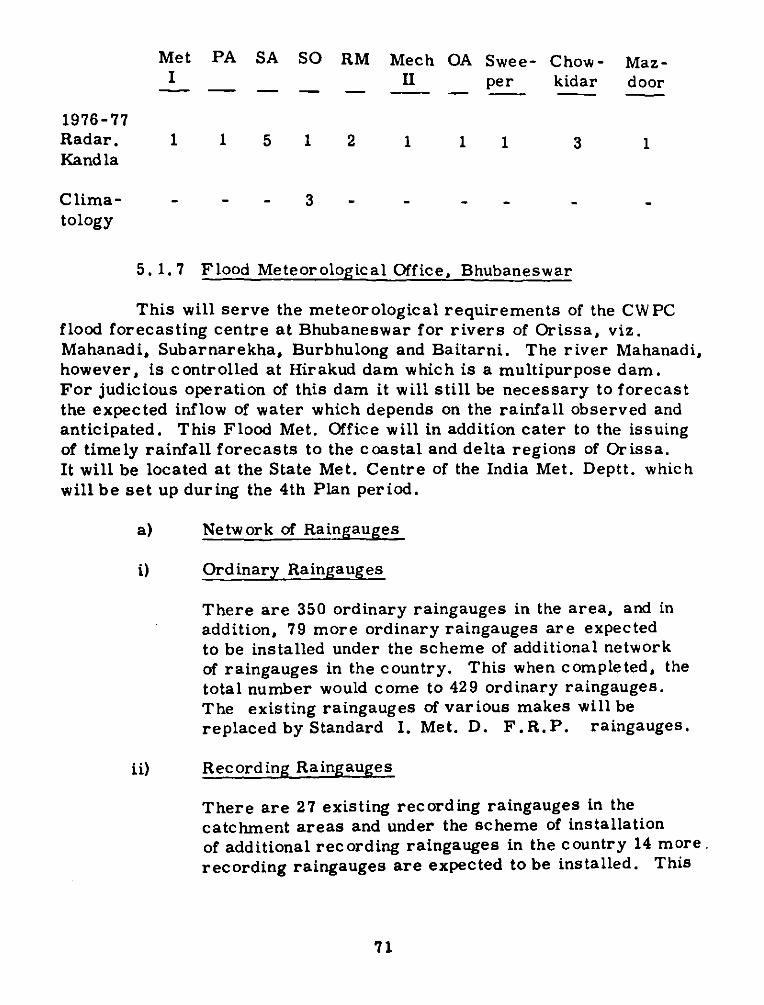
1976-77 Radar. Kandla
Climatology
Met I
1
PA SA SO RM Mech OA Swee- Chow-11 per kidar
1 5 1 2 1 1 1 3
3
5. 1. 7 Flood Meteorological Office, Bhubaneswar
Mazdoor
1
This will serve the meteorological requirements of the CWPC flood forecasting centre at Bhubaneswar for rivers of Orissa, viz. Mahanadi, Subarnarekha, Burbhulong and Baitarni. The river Mahanadi, however, is con trolled at Hirakud dam which is a multipurpose dam. For judicious operation of this dam it will still be necessary to forecast the expected inflow of water which depends on the rainfall observed and anticipated. This Flood Met. Office will in addition cater to the issuing of timely rainfall forecasts to the coastal and delta regions of Orissa. It will be located at the State Met. Centre of the India Met. Deptt. which will be set up during the 4th Plan period.
a) Network of Raingauges
i) Ordinary Raingauges
There are 350 ordinary raingauges in the area, and in addition, 79 more ordinary raingauges are expected to be installed under the scheme of additional network of raingauges in the country. This when completed, the total number would come to 429 ordinary raingauges. The existing raingauges of various makes will be replaced by Standard I. Met. D. F.R.P. raingauges,
ii) Recording Raingauges
There are 27 existing recording raingauges in the catchment areas and under the scheme of installation of additional recording raingauges in the country 14 more. recording raingauges are expected to be installed. This
71

number includes also those proposed by CW&PC. 10 more recording raingauges are proposed to be installed in this scheme to improve the network. The additional ordinary and recording raingauges will be installed by India Met. Deptt. and manned by part-time observers of State Govts. or C.W. & P.C •.
iii) Telemetering Raingauges
There are no telemetering raingauges in this area. For obtaining rainfall data from inaccessible areas, 3 telemetering raingauges are proposed to be set up.
b) Telecommunications for representative raingauge network
For operational flood forecasting work, a certain selected stations are designated as representative raingauge network where special communication facility will be established to obtain the rainfall data expeditiously. For the purpose in view. 15 representative stations will be set up. H.F. W/T channels will be established for receiving this data within about an hour of observation. The existing facility at Bhubaneswar T /P link with Dum Dum will also be available for Flood Met. Office for obtaining data from other observatory stations.
c) Precipitation Forecasting
All India Synoptic Weather Charts will be prepared at Bhubaneswar, and the facilities of State Met. Centre which is shortly to be established at Bhubaneswar as a departmental activity will be available for Flood Meteorological Office.
A fascimile recorder will be installed at Flood Met. Office, Bhubaneswar, to obtain the analysis and prognoses of all India weather in chart form from New Delhi.
Special rainfall charts depicting the basic rainfall data obtained from representative stations will be prepared based on which Q. P.F. and effective rainfall forecasts will be issued.
12

Minimum necessary staff has been proposed for Flood Met. Office, Bhubaneswar.
· STAGEWISE BREAKUP OF STAFF FOR FLOOD METEOROLOGICAL OFFICE, BHUBANESWAR
Stage - I
Met AM PA SA so RM Steno/ Mech LA OA Pe- Swee-I L.D.C. II on per
1972-73 1 1 1 2 CWPC
Addl. 1
W/T. 1 1 1
1973-74 1 2 2 4 8 1 1 2 2 1 S.M.C
Five W /T sets will be installed in this stage for representative raingauge data.
Stage -II
In this stage 10 more W /T stations will be established bringing the total number to 15. One radio-reporting raingauge will also be installed.
PA SA RM D'man LA
1974-75. F.F.C. 1
1975-76 Facs. 2
W/T (Addl.) 1 2 1
Stage - III
In this stage the remaining radio-reporting raingauges will be installed and remaining installations, if any, will be completed.
1976-77 C~imatology
73
. ~ .....

5.1.8 FloodMeteorologicalOffice, D.V.C. &Farakka
The D. V .C. Met. Unit at Calcutta which is at present functioning for operation of Maithon Reservoir is proposed to be taken over under Flood Meteorological Organisation. At present only semi-quantitative rainfall forecasts are being supplied to the Manager of Maithon Reservoir. Under this scheme Q. P .F. is envisaged. This will involve augmentation and improvement of the present communication system. In addition, this Unit will also cater to the meteorological requirements of G.B. Organisation for the operation and regulation of Farakka Barrage. For transmission of Quantitative Precipitation Forecasts and rainfall data, a T/P link will be provided between Calcutta and Jangipur.
a) Network of Raingauges
The network of ordinary and recording raingauges is found to be accurate. However, the rainfall data of 10 representative gauges are proposed to be obtained at Flood Met. Office by W /T Channel. The staff of the State Governments/D. V .C. will be utilised for observational purposes.
b) For obtaining data from inaccessible areas, three tele-metering raingauges are proposed to be set up.
c) Charts
The existing charts at the Meteorological Office, Calcutta will be made use of and only additional rainfall charts from representative network will be prepared. Charts for Q. P.F. and effective rainfall monograms will be prepared by the Flood Meteorological Office.
S-Band radar study proposed at Calcutta under other departmental schemes and A.P.T. which is already functioning at Calcutta will be utilised by the Flood Meteorological Office.
74

STAGEWISE BREAKUP OF STAFF FOR FLOOD METEORO-LOGICAL OFFICE. D. V. C. MET; UNIT & F ARAKKA
Stage - I
Met AM PA SA so RM UDC LA OA Peon I
1972-73 Existing (DVC) 1 1 2 7 1 1 1
Existing (CBU) 1* 1 3 2 1 Addl. 1 1
W/T 1 1 1
* to be surrendered
Five W /T sets will be installed in this stage for representative raingauge data,
Stage - ll
In this stage 5 more W /T stations will be established bringing the total number to 10, One radio-reporting raingauge will _also be installed,
PA RM
1974-75 F.M.O.
1975-76 W/T (Addl.) 1 2
Stage - lli
D'man
1
Steno II
1
LA
1
In this stage the remaining radio-reporting raingauges will be installed and remaining installations. if any. will be completed,
75

5.1. 9 Additional Flood Meteorological Offices
In addition to the above 8 Flood Meteorological Offices, 3 more Flood Meteorological Offices will be established to cater to the flood forecasting requirements for the rivers Narmada, Godavari arid Krishna at Bhopal, Visakhapatnam (for the point at Rajamundry) and Hyderabad respectively.
The establishment of W /T stations to serve the needs of Flood Meteorological Offices at Bhopal, . Visakhapatnam and Hyderabad will be decided after ascertaining the zone for which flood forecasts are required to be provided. However, required provision has been made in the following proposals for the installation of a certain number of W/T sets.
Regarding radar, it is not considered necessary to install radar for the exclusive requirements of Hyderabad Flood Met. Office.
No provision has been made for radio-reporting raingauges for these Flood Meteorological Offices. However, provision exists for 13 radio-reporting raingauges in the total plan of 50 radio-reporting raingauges. This number may be expected to serve as spares and for any installations required to be made for these three Flood Meteorological Offices.
STAGEWISE BREAKUP OF STAFF FOR FLOOD METEOROLOGICAL OFFICE, BHOPAL
Stage - I
Stage -II
NIL
In this stage efforts will be made to establish 5 W/T stations.
Met AM PA SA SO RM D 'man Steno Peon LA I LDC
1974-75) NIL 1 1975-76) F.M.O. 1 1 1 2 4 1 1 2
FACS 2
T/P 2
W/T 1 1 1
76

Stage - III
In this stage efforts will be made to set up 10 more W /T stations and one radio-reporting rain gauge.
PA RM LA
1976-77) W/T (Addl. ) 1 2 1
Stage - IV
Met PA SA so RM Mech OA Swee- Chow- Maz-I II per kidar door --
1977-78) (Radar at 1 1 5 1 2 1 1 1 3 1 Bhopal/ Nagpur).
Proposals are under consideration by Ministry of Food & Agriculture for a Hydrometeorological Unit at Bhopal. If this materialises, the above proposal for Bhopal will be suitably modified.
1972-73) 1973-74)
STAGEWISE BREAKUP OF STAFF FOR FLOOD METEOROLOGICAL OFFICE, VISAKHAPATNAM
Stage - I
NIL
Stage - II
In this stage efforts will be made to set up 5 W /T stations.
Regarding staff, proposals are already under consideration for radar hydrological studies at Visakhapatnam. The staff proposed under this scheme will be utilised for the Flood Meteorological Office as well except for specialised items mentioned below.
1974-75) 1975-76)
W/T
77
AM
1
RM LA
1 1

Stage -III
In this stage efforts will be made to set up 10 more WIT stations.
PA RM LA
1976-77) W /T (Additional) 2 1
STAGEWISE BREAKUP OF STAFF FOR FLOOD METEOROLOGICAL OFFICE, HYDERABAD
Stage - I
Met AM SA so LDC Mech Peon I II - -
1972 -73) NIL
1973-74) S.M.C. 1 1 1 1 1 1
Stage -II
In this stage efforts will be made to set up 5 W /T stations.
Met AM PA SA MA so RM D'man Steno LA OA I II --
1974-75) NIL
1975-76) F.M.O. 1 1 1 1 4 1 1 1
W/T 1 1 1
78

Stage -III
In this stage efforts will be made to set up 10 more W /T stations.
PA RM LA
1976-77) W /T (Adell.) 1 2 1
5. 2 STAFF REQUIREMENTS (OTHER THAN AT FLOOD METEOROLOGICAL OFFICES)
5. 2.1 H.Q. Office: Directorate of Flood Meteorological Organisation
The organisation described above would require a proper coordination for achieving the objectives of the scheme, and to bring about expeditious implementation of the operational requirements of flood meteorological offices. For this purpose, it is proposed to have a Director for Flood Meteorological Organisati'on, as the present Director,. Hydro-meteorology would not be able to perform effectively various functions of flood forecasting in addition to looking after the general Hydrometeorological aspects of water resources planning and development.
In the Directorate of Flood Meteorological Organisation, will be included the required organisation for coordination, and also a wing for the research and development,. which is essential to support the operational base of the flood forecasting organisation. Augmentation of the Telecommunication Directorate for supply, maintenance of the required telecommunication network and for training purpose will be necessary. The details of staff at H.Q. Office are given below:-
Staff for Organisation and Coordination.
Director Assistant Met. Prof. As stt. Sc. Asstts.
1 1 1 3
79
Staff for Research and Development
Meteorologist Gr. I Assistant Met. Prof. Assistants Sc. Assistants
1 2 2 4

Stafffor Organisation and Staff for Research and Coordination. Development.
Sr. Observers 2 Steno.Gr. -II 1 U.D.C. 1 Draftsman 1 Steno.Gr.-II 1 L.D.C. 1 Obsy. Attendant 1 Lab. Attendant Peons 2 Peons 2
Telecommunication Directorate and Directorate of Satellite Meteorology
(when established)
Meteorologist Gr. -I 1 Assistant Mets. 2 Prof. Asstts. 2 Sc. Asstts. 4 Radio Mechanics 4 Lab. Assistants 4
5. 2. 2 Deputy Director General of Organisation (Instruments):
Staff requirement at Deputy Director General of Observatories (Instruments) office for manufacture of ordinary raingauges, selfrecording and radio-reporting raingauges and for maintenance of radar installations.
i) Ordinary Raingauges
The replacement of the existing ordinary raingauges totalling about 2000 by Indian Standard F. R. P. raingauges will involve the work of manufacture, testing and supply of these rain gauges. This work will be taken up by the Instruments Division, Poona.
Rn

Staff for manufacture, testing & supply of ordinary raingauges:
Meteorologist Gr. -II 1 Prof. Assistant 1 Scientific Assistants 2 U.D.C. 1 Mechanical Assistant 1 Mechanic Gr. -1 2 Mechanic Gr. -II 1
Carpenter Gr. -1 1 Mate 1 Lab. Assistant 1 Observatory Attdt. 1 Mazdoors 2 Peon 1
ii) Self Recording Raingauges
For about 150 additional recording raingauges proposed in this scheme, the following staff will be required for manufacture, testing and supply:
Assistant Meteorologist 1 Scientific Assistant 1 Mechanic Gr. -I 1 Mechanic Gr. -II 2 Carpenter Gr. -I 1 Mazdoor 1
ill) Radio-reporting Raingauges
For manufacture, testing and supply of 50 radio-reporting rai.ngauges the following staff will be necessary at the Instruments Division, Poona.
Meteorologist Gr. -II 1 Assistant Meteorologists 2 Professional Assistants 4
81

Mechanical Assistant 1 Mechanic Gr. -I 4 Lab. Assistants 2 O.As 2 Peon 1
iv) Maintenance of Radar Installations
5.2.3
For installation and maintenance purposes, the following staff at the office of D. D. G. -I, New Delhi is proposed:
Meteorologist Gr. -I 1 Assistant Met. 1 Professional Asstts. 4 Scientific Asstts. 12 Mechanics Gr. -I 4 Electricians 2 O.As 2 Mazdoors 2
D. D. G. C's Office for Climatological Work
For climatological work and correspondence connected with rainfall registration and inspection work, the following additional staff will be required at D.D.G.C's Office, Poona:
Assistant Met. 1 Scientific Asstts, 2 U.D.C.s 4 O.As 2 Peons 2
82

5. 2. 4 Staff for increased administrative work on account of the above organisation:
The staff so far proposed make an establishment of 47 Gazetted Officers and about 402 Non-Gazetted. The administrative establishment at H.Q. Office will need strengthening commensurate with the extra establishment work involved in both Gazetted and Non-Gazetted cadres. The following additional staff is proposed:
Assistant Met. Assistants U.D.Cs L.D.Cs O.As Peons
1 6 9 4 1 2
5. 2. 5 Summary of Staff Requirements
A summary of the staff requirements for the integrated plan is given in Appendix-1.
5. 3 FINANCIAL IMPLICATIONS
The total anticipated expenditure on the scheme during the first 7 years will be of the order of Rs.4. 73 crores (including Rs,0.49 crores Foreign Exchange). The following has been taken into consideration while arriving at this figure.
i)
ii)
Cost of 6 radar equipments including foreign exchange components Rs. 5, 8 lakhs each,
50 radio-reporting raingauges (with relay stations) @ Rs. 85, 000/- each including Rs. 18, 000/- foreign exchange each.
83
COST
Rs. 126.0 Lakhs
Rs. 42.5 Lakhs

iii) Cost of 2000 F. R. P. raingauges and 4000 measure glasses @ Rs. 200/- for one F.R.P. rain-gauge with 2 measure glasses, Rs. 4. 0 Lakhs
iv) Cost of 150 self-recording raingauges@ Rs.llOO/-each. Rs. 1. 65 Lakhs
v) Cost of 5 Fascimile equipments. Rs. 6.48 Lakhs
vi) Cost of 245 W/T sets@ Rs. 20.000/- each. Rs. 49. 00 Lakhs
This does not include provision for the small computers at Flood Meteorological Offices and collection and transmission of data through Geo-stationary Satellites. The additional whole-time staff required for maintaining the W /T sets with generators to be installed at stations withou electricity will also depend upon the number of such stations and hence hr not been taken into account at present.
84

AD:liTIONAL STAFF R1CRUITMENT IN CON;qpTION WITH FLOOD METEOROLO~ICAL 0RGA..~I3ATION
1972-73
Dir Met Met AM PA SA Meoh SO Radio D'man Steno um LDC Mech Meeh El.eet LA Carp Lab OA Peon Mate Swee- MazMech II I II I Atd. Per door
'!). G. 0 •
Po ::>na I. s. F.n.o., Luc!tnow F.M.o., Gau.hat1
F.H.O., New Delhi
:H' .:M. o. , P atna F.M.o., J alpaigur1 F.M.o., Bhubaneswar F.M.o., Ahme<!abad F.M.o., n,v.c.
----------
I II Asst
1
-1 1
1 1 1 1
1
-
-1
--------
l
-2
2
2 3 2
2
2
-1 2
2
2
2
2
1 2
-
-2
2
2
2
2
4 2
1
-1
--------
------8
---
--3 3
3
3
2 1 2 l
-r , ··,; .. -------
--1 1 1 1 1 1 1
-
- -1 -- . -- -- -- -- -- -- -- -
-2
--------
- - -1 - -- - -- -- - -- - -- - -- - -- - -- - -
-1 .. .. --
I ---
- -1 1
1 -
1 -2 -
1 -1 2
1 -
1 -1 -
-1"
1 1
1
-2 -1
-
-1
--------
------1
---
-2
--------
2
16 13 13 14 12 'Z1
9 12
5
----·-----------------------------------------------------------------------------------------------------------------·---· TOTAL -
DGO (Coord., ~eleeom., 1 Res.& Dev.) ·
l)G0(Adm1nistrat1on) -
RC,New Delhi(Amin.) -
RC,Nagpur(Admin.) -
RC, Madras ( Adrdn.) -
RC, Bombay( A <bin.) -
RC,Calcutta(Admin.) -
UUGI., New Delhi -Poona, I. S.
DT)GC. ,Poona F.M.o., New Delhi ?.~.o., Lucknow
li'.M.o., Patna
F.~·l.O., Jalp81gur1 F.~.o., Bhubaneswar F.M.o., Ahmedabad F.H.o., uauhati F.M.o., D .v.c.
TOTALs
---------
8
2
------1
---------
1 18 14 19
--------1
--------..
5
1
------1
1
--------
5 11
------2 2
--1 1
-
2 1
-1
1 1 6
1 2
---2 2
1
--------.. 1
-----
8
2
---------4 4 4
-
18
4
------- . ---
- 7 1 -1973-74
No additional statt. J.974-7§
1 2 1 1
- -.. -- -- .. - -- -- -- -- -
5
1
1
--2
--4
3
----.1
---
2 1
- -- -- -- -- -- -- -
1 -3 2
- -
- - 1 10 3 7 1 1 2 123 ------------------------·------------------·--·
- - - 4 1 .4 - - - 4-4
- - - - 1 2 - - -- - - - - - - - -- - - - - - - - -- - - - - - - - -- - - - - - - - -- - - - - - - - -1 - - - 1 - - - 1
- 1 1 - - 1 - - 1 - - - - 2 2 - - -- 1 -
Met AM PA SA Mech SO LCfto I ' Asst Mach.
DDGI • , N ev Delhi
Poona, I.s. FMO, Luelmov(Raa&r) »tO, Vi zag
FMO, Gauhati(Badar) FM0 1 Bhopal FMO, Hyderabad
--1
-1
1 1
1
1
-1
-2
2
1 1 1
-1 1 1
4
-5
-5 4
1
TOTJL 4 7 6 19
DDGI. , New Delhi ..
Poona, I.s. -FMO I Hyderabad(Addl. W/TJ. • W.O. ,Bhopal(Addl. W/T) •
~o., Lucknov
mo, Gauhat1 --
FMO., Bhubanesvar -w.o., .Ahmedabad ..
FMO., V1zag(A4dl.W/T) ..
W.O., Patna(Radar) 1
Radar, Kan~a 1
-1
1 1
--------
1 1
-.. --1 1
- 1
2
-. . -------5 5
TOTAL 2 l 7 12
Radar, Bhopal 1 - 1
Radar, Xew Delhi 1 - 1
-------
.. -1
-1 6
4
- 12
1 •
-.. • ,.
• .. ..
----4
9
1 3 ,.
8 1
1 26
- 1
- 1
--2
1 2
1 1
7
--2 2
----2 2 2
10
2
2
!>•man
-----1 1
2
------------
--
1975-76
Steno Mech Mech Elect II I II
----• 1 1
2
----.. • ---•
--
. -
2
2
-----4
-1 1
-1 --3
1976-77
----• -----• -..
-·•
-------1
1
2
1977-?Q
- 1
- 1
1
----; --1
----------
' -.. -
' i I
I -
Lab. LA OA Peon Swee-Asstt. ~er
-1
--.. --1
-----------..
. ..
-
---1
-1
1
1
-1
-1
-1
3 4
--1
1
----1
--
-1
-------1 1
3 3
- 1
- 1
-----2
-2
--------.. ---
-
-
--1
-1 .. .. 2
---------1
1
2
1
1
c&;w~ct-dar
--3
-3 --
---------3
3
6
3
3
Mazdoor
1
-1 .. 1
--3
-.. ------1 1
2
1
1
TOTAL
11 6
17 3
17 20
14
88
4
3
4
4
4 9
1 3 4
24
17
77
17
17

YEABIIS£ BREAKUP OF THE ESTI.ATED EXPENDITURE ON IPLOOD •Et. OBGANISATION
Other Charges Recurring Non-recurring (Equip-
Year Establish- Interim Travelling menta and Stores) Total ment Relief Expenses Charges I. c. F.E. I. c. F.E.
Rs. Rs. Rs. Rs. Rs. Rs. Rs. Rs. 1972-73 8,89,900 43,800 1,00,000 1,35,000 13,48,000 25,16,700 1973-74 9, 39,300 44,000 1, 00, 000 2, 02, 500 10,88,000 23, 73, 800 1974-75 19, 84, 600 1, 04, 600 2, 50, 000 3, 27,500 53,32,200 15, 89,200 95, 88, 100 1975-76 25,87,000 1, 34, 600 2,00,000 4, 83, 500 20,000 53,60,400 14,54,400 1. 02, 39,900 1976-77 30,98,600 1,60,300 2,00,000 5,94,600 35,000 35,09,400 7,55,900 83, 53, BOG 1977-78 32,81,500 1, 65, 900 1,50,000 6, 78, 100 42,500 35,79,400 7, 55,900 86,53,300 1978-79 34,33,700 1, 71,500 1, 50, 000 7,64,600 50, 000 8,15,000 1, 80, 000 55,64,800
TOTAL: 1,62,14,6GO 8,24,700 11,50,000 31,85,800 1.47,500 ~10,32,400 47,35,4004,.72,90,400 (including Foreign Exchange
48, 82, 900)
85

PIJICIASE SCII81JLI
1972-73 1973-74 1974-75 1975-76 1976-77 1977-78 1978-79
W/T Sets (245) 40 40 40 40 40 45
Radio-reporting Raingauges 10 10 10 10 10
Facsimile 3 2 --Ordinary Raingauges 400 400 800 400 --Self-Recording Raingauges -- 30 30 30 30 30
Radars 2 2 1 1
T /P Machines 3 2 --Machines Machines Testing equipment&
for Rgs. for R. R. Rgs.
Punches&. Verifier Machines -- 5 5 --
86

Organisation Chart for proposed Flood Forecasting set up on Inter-State Rivers '
Member (Floods)., CW&Pq
I S. E. ( CFF Dte • )
I I
I I Planning & Coordination
I I I Field Centre-1 I
Dy. Dir. (Engg) A.D. (Engg) A.D. (Met.) Design Asstt.
1 2 1 2
Executive Engi.neer 1 A.E.E. 4 A. D. {Met. ) 1 A. E. (Wireless) 2
Operation
Field Centre-2
I I
Executive Engineer 1 A.E.E. 4 A.D. (Met.) 1 A. E. (Wireless) 2
Note: Other Technical and Non-Technical staff required not indicated.
87
UrENDII 5.9
Field Centre-3
Executive Engineer 1 A.E.E. 4 A.D. (Met.) 1 A. E. (Wireless) 2

APPENDIX 7.1
EXPENDITURE BEING INCURRED ON EMBANKMENTS IN VARIOUS STATES
S.No.
1.
2.
3.
4.
5.
State
Bihar
Uttar Pradesh
Orissa - Plan Pre-Plan
Andhra Pradesh
West Bengal
Existing length of embanlanents in miles
1500
432
1470 428
500
Average Maintenance annual expenditure expenditureper mile. Rs. lakhs
37 Rs.2500
a. 32 1500
1841 850
-----Not indicated----
7300 180 24601 ( l...,c.l '-'~l"'f'l,_ ~o(CL-_flcu,) .
Average Rs. 6268 18 30
Remarks
Rs. 1675 excluding West Bengal,
NOTE: 1) In West Bengal average expenditure incurred on restoration and repair works during 1968-69 to 1971-72 is Rs,3,2 crores per year.
2) lf the average capital cost is taken at Rs. 2-3 lakhs per mile the maintenance expenditure being incurred at present works out to only 0. 75-0. 50o/o of the capital cost, exGl.udi'Ag the calM! of-We-st13~al, whex e it is ase11t Bo/o,
3) Similar information has not been received from other States.

1. State
2. Name o t Tri bu tar;r.
3· Name ot main river
a.. District
'· Tebsil
a 0 0 No. of houses 0
Names otO in each villa.ge Q Tillages~
0 i and Towns 0 Kutcha 0 Pucca 0
0 0 0 0 0 0 0 0 0 0 0 0
1 2 0 3
NOTE:
1.
2.
! I I
' PR>FORM.A. FOR SUPPLYING INFORMATION REGARDING TOWNS AND : APPENDIX 9.1 VILLAGES WHICH ARE CHRONICALLY AFFEX:TED BY FLOODS CAUSING HEAVY LOSS OF LIVES &: PROPERTY
6 0 Population or the Village 0 Average 0
~ distance 0 0 or the 0
Affected 0 Affected I village 0 by maximum 0 by normal from the 0 noods 0 noods 0 river 0
0 0 bank 0 0 0 0 0 0
6 . I 0
•
t Average 0 ground 0 level 0 Maximum or the 0 H.F.L. village 0 (obser-
0 ved) 0 0 0
7 8
o o G 0 0 0 Depth or 0 Dura- 0 Frequency
or· noods 0 0 submersion . tion 0 0 Normal L \ in Q,__ __ ,_ ___ _ 0 H.F.L. V I days 0 0 0 0 Maxi- 0 Normal 0 0 Once/ 0 0 nee 0 0 mum 0 0 0 twice 0 in •• 0 0 0 0 0 in • • 0 years 0 0 0 0 0 years 0
1 0 0 0 0 0
13 i 9 11 14-
Notes: 1. Villages on right and left listed separately.
2. A map to accompany the proforma giving locations or villages, area subject t flooding, etc. ~
~ Information for eaeb village to be given separatel7. 3. If there are any permanent ildings like schools,
panchayat office, etc. whic are safe from inundation, and where people ean be temporarily accommoda~ed, such informat on may be given specifically. 4.
~

1 APP~tiDIX 9.1 (Contd.) PRO:roBMA. FOR SUPPLnNG INFORMATION REGARDING TOWNS AND
VILLAGES WHICH ARE CHRONICALLY AFFECTED BY FU)ODS CAUSING HEAVY U>SS OF LIVES &: PROPERTY
I
1. State..__ _____ _, _____ _
2. Name or TributalT.--;.------
3. Name or main river -~------
.... District~....-____ _,_ _____ _
~. TehsU~----------~----------
Details or existing tlood protection works
I 0 0 0 0 Works Ave~,_ge annual damage incurred 0 Average annual G Total 0 0 Communi-proposed, 80 tar to 0 expenditure .a expenditure a Existing 0 cation it any t--~r--1.l.!Rs~~~....~~~1-u..ynl~.A.::t:tk~hLs.J.-l'P'"-___ ~6 incurred on 0 on damage 0 arrange- 0 rae ili ties
I ~ ~ Rel1et/Rebabi- Q and relief 0 ments 0 available: Crops Houses ~ Others 0 Total ! litation/ 0 (Cols. 0 for evacu- 0 Telegraph/
I ;, 0 01
~ Rem1ss1/ohn in~ 0 19 + 20 )~ 0 at ion 00
Telephone/
io I revenue ouse 0 Wireless
building loans,
II Addition-~ al 0 inrorma- 0 tion,it 0 all7 0
0 0
Medical rac111-t1es available
0 D 0 etc.(Rs.lakhs) 0 0 0 ___ 1~5--~0~_16 __ ~0 _1_7~!~~~-1_8~~19~. ~~~~~~-JL-~21~----~~L---~22 ____ L-~~23~~~L--2-~----~-2~~--~---~----

PROGRESS MADE BY VARIOUS STATES IN
DEMARCATION OF FLOOD ZONES
ANDHRA PRADESH
APPENDIX 10.1
. The flood problem in the State is mainly confined to the sub-mersion of cultivated lands along the margins of the rivers and along the Kolleru lake. As such the State Government does not consider it necessary to demarcate the flo<XIed areas. All the people of the localities are well aware of the flood levels.
ASSAM
The low-lying areas in the State are well-known to the people, and they do not construct permanent structures thereon. It is, therefore, not necessary to aemarcate the flood zones in the State.
BIHAR
Large areas in the State !;lave been protected from floods by embankments and remaining areas are also proposed to be protected by execution of new schemes. After completion of the new schemes only small areas would be exposed to the floods. People residing in the flood affected zones are well conversant with the extent and intensity of flood in the areas. An attempt to prevent habitation be low the warning stages is likely to be resisted by the people residing in the areas and will also cause heavy expenditure to the Government on rehabilitation problem. The State Government does not, therefore, consider it advisable to implement the recommendation.

GUJARAT
Flocxl plain zoning is under the active consideration or the Government.
KERALA
In view of the heavy density of population and high in tensity or cultivation along the fertile banks of the rivers. which are exposed to flocxls • flood zones. as envisaged, may not be workable in the State.
Maps of low-lying areas usually affected by flocxls have been published. Gauges have been fixed on all roads which get submerged during flocxls to avoid any possible danger to traffic.
MADHYA PRADESH
Out of the total 58 towns/villages, flocxl zones for 29 towns/ villages have been demarcated and maps prepared.
MAHARASHTRA
The matter is still under consideration of the State Government.
MY SORE
The flocxl problem in the State is not so serious as to warrant demarcation of flocxl zones. The State Technical Advisory Committee has, therefore, decided to defer the question for the present and to review it at a later date, if required.
TAMIL NADU
As there are no areas which are submerged every year by flocxls, demarcation or flocxl zones is not considered necessary in the State.
UTTAR PRADESH
A map ~howing vulnerable areas, which are susceptible to flocxling has been prepared and the areas are well known. In addition
90

to this, there is a flood Committee in each district set up for looking into this aspect. The State Government does not consider it necessary to fix up pillars for sue h demarcation.
WEST BENGAL
The matter ls under consideration.
TRIPURA
Surveys of the Gumti Basin for demarcating the flood zones have been taken up by the .Survey of India and are ln progress.
91

PA Kl ~TAN
SEA
:"""" .. . . ,
l ACCAOIVE, MLNICOV ANO
AMINOIVI ISLANO ~
(INDIA) Mf4e
•
C. HI NA
RAINFALL Cm.
& AY
0 F
6E."6AL
A PPAO•IM ATI &CAL& •~•ooooooo
MHH
100 0 100 IOOMM
~• ( INDit. J

..
00 • • I AMtt
o I .
LACC.IIDI .. lf, "'to«oy AHO Ct'
AHI~VI ISI-A HDS
( INOlA)
• lfiNC
. ·CO-EFFICIENT
OF . VAlUATION Of RAINFALL
ANNUAL
/.. I
AP',IIIOlllfoCATI SCALI
1 : 10000000
•
~A"CCIHO'\MI ''"t"~J
I 2°
e·

--- --------------~~--------~----------~-- -----~----------~-----------»~1
I. Tkl TIKIIlTCRIAL. •aTifiS 0, ••DIA IITIND INTO T ... II&; TO A IIITANO& lew Tll' t LVE "A UTIO AL. MIL.IS MUSUIIIO '"0~ TMI &PPIIO,Iti&!T& IAII LINI, i
. I ;
TRACKS Of CYCLONIC STORMS
.. . "-·-; ·:. ===-=....___,
I L ~:
I I
.. MONlMtMAY
n•••o t till· •••• ...... _ ........... ... ••• ·-----------------------------i-----~L--r---~-------r---~----~--------~----------+-----------~· ~ .·
\• ~ I
)
. •
. • .
. . . .
f
'" I
~· .
• tOoS.

~----------------+--------------~-----------
1. THE TERRIT9RIAL WATERS OF DIA EXTEND INTO'THE SEA TO A TANG£ OF TWEL £ • ~----------~---------~----------~----------.--------------------------------.~
NAUTICAL N ' ES MEASURED F OM THE APPRDP LATE BASE LIN • l RACKS OF CYCLON\C Sl O~MS
MONlH :JUL'f
P E RlOO
De pr~ ss'o"
,. ..s I') I • I ' • • ot
' ' • • .. ' ' I I ., I
' ~ -~ I \' '-,,
.... -........ : ' ... ~ .. \ ' ....... ' . "'-- ......
' . ....... ... ' "'-...... .... ..
l------+-r--l-~--~~--t---r--~~ I
• ~A---4--------------,zo
----- -----·-- _____ ........ _
• •
• ' \ . •
.. , • • ..0 ••
.~ 0
•
• ·'
..

0 ------------.-----------T-----------------------~----------~----------~----------~------------------------~~~~~35 N I. THE TERRI ORIAL WATERS F INDIA EXTEN INTO THE SE TO A DIS1ANCE OF TWfLVE
LINE • NAUTICAL MILES IU! A SUR D FROM THE A PROPRIATE BAS TRACKS OF CYCLONIC
MONT"t: OCTOBER
PERIOD~ ,,,, -1960'
STORMS
~-----------+------------~----------4-----------~------------+-----~sr---~----------~----------~------------~----------~3oo .,.
" " ,
,rS '"' ,
' ' ' " ~
' ~
-, .... _ -.... ........
~~, ~
~~----Y-~------------;ZS
0
~r.,.L-+--V\+-~~,f-~-~~-7'!T---------t 2 0
0
l_------------~~~--------~~----------~6~5~.-----------,7~o;. • .---------~,~s~----------~st.o;;o----------8s;s~~.---------~~~o~o;---------~g~s~o----------\.,o;~ soo 550 600

.,. -2500~!10
... 0 "' II: 0 0 ... .,; : II: > ..:ZOOOI:400 :; -
Ill z ., c c z 2 ~ ~ Z J!IOO 30 .... ... 0 ~ 0 0 z ...
-1000
_!100
YEAilS ---•-':l e
TOTAL DAMAGE AND LOSS OF HUMAN LIVES DUE TO FLOODS
(1953-19711
•
' ,. I I r I
I r I I I I I I I ..... 'WE""\ \
I I
• .. • .. .. !!! • !!!
... ... • • ! i
DAIIAGl IN liS. CROIIEI
"' !! • .. !!!
_ ...
... "' ~
-~ , \ , \ ,
• "' !!!
,, _, • • !!
, , ,
' ' I • .. • !!!
I I
I I I
I I I 1
' I I
'
• • e : !!!
PLATE NO'Vl.
, .............. ............... , ................ ...

PLATt: NO.ft •
tl t CROP" OA."'IAGE IN VAIIIOUS YEARS
DAIIAIE TO CliO ....... ll•o•u
• s .1!! .. 0 • • , :0:
I /01101' All£& AFFECTED .. LAIIN Nacnu , z II
" . I 1 , c : I tl ... , , , !' I , , Q
I I .. I I .. I I u , I .. I ... I It ...
c I
" I I ' c ' I \ I . .. ' 0: I
' I c I I
' ; I I ..
, \ I .. i ' \ 0
I ' ; ,~ I 0: ' ' ' .., I \ , '
~ I I I(' ' I \ , I
' I ' , ' ' '· I ' ' ,._ .... I
' I
.Q ' '
• 'IIAIIS~ .. .. .. • • .. :1 .. : .. • • -· .. I .. .. .. ; • • ; • • • .. ..
e !! ~ ! !! !! !! !! !! !! !! !! !! !! !!

ROPRlATE BASELINE,
r· .
. ",_.-I . ./
. .I I" •
('""' RAJASTHAN
c_, ., "'-..1'1 .~ -:,... '-
• • • a •• • •
LACCADIV!: MIN"OY . : AND
AMI"'Plvl l-'lANI>S
(INDrll)
MAP OF INDIA SHOWING
CHRONICALLY AFFECTED AREAS
rr. I J ~00 100 4oo SOO tOO Kt&.ON&T~"· I t I I I
CHIN A
BAY OF BENGAL
, eNIIIIICOI'IDAM I
a .AIIIIIIN I
\ ~· , ........ , CH"ONICALLY AFfECTED AREAS l ~ ('.;'""')-
~· r-d
2 ~a ~(. ~ 0 -..;.
711 THE BOUNDARY OF t4EGHALAYA SHOWN ON THIS ~ • • MAP IS AS INTERPRETED FROM THE ASSAN REO- \.' RGATION t MEGHALAYA) ACT, 19C9, BUT HAS YET BE ~
0'-
VERIFIEO.

I. THE TERRITORIAL WATERS OF INOlA [lCTENOEO IMTO
THE SEA TO A DISTANCE OF Twtl.VE NAUTICAl.
flll.ts a,.[AS~EO PROM THE APPROI'RIAT[ BASli.IMI·
2. THE BOUNDARY Of MEGHAl.AYA SHOWN ON THIS
folAP IS AS lAT(Rf'RE'TEO FROM THE ASSAM AEO
MAP OF INDIA SHOWING
RGANISATIONlMEGHAl.AYAIACT,I969,8UT Has nT EXIST! NG a RECOMMEN oEo FLOOD FORECASTING CENTREs TO 8( VERIFIED. '""--'
• • . • I ... .
LACeA.DIV[ 0
MINI Coy • ' I
AMI~ AWD DIVf It LANDS
{INDIA)
,..S>' \ r.' ·, , SCALE 100 o 100 aoo Joo 400 soo •oo ICILONITAII t...~..- ·-",1 · I I I I I ~ I I I I I
N
; C HI N A
BAY OF BENGAL
URMA
o NAace .. u.,l ........ )
• & ........ ~-)
DETAILS OF FLOOD FORECASTING CENTRES EXISTING
S.NQ RIVERS
I. YAMUNA 2 . SAHIBI 3 . BRAHMAPUTRA 4 . - DO-5. - DO-6. • DO. 7. ·DO-a. KOPILI
9. PUTHIMARI 10. PAGLADIYA II. MANAS a BEKI 12. BARAK 13. TlSTA 14. GANGA 15. ·DO· 16. -D0-17. -D0-18. -Do-19. KAMLABAL.AN 20. BUR HIGANDAK 21. -Do-22· KOSI
23. BAGMATI
24. -D0-25. GANDAK 26. GANGA 27. YAMUNA
28. GHAGRA 29. -DO· 30. • D0-
31. RAPTI !2 . GOMTI
33. SUBARNAREKHA
34. BURHABALO NGA 35. BRAHMAN! 36. BAITARANI 37. MAHANADI BELOW
BIFURCATION 38. RISHI<ULYA
39. VAMSADHARA 40. NARMADA 41. -00-42. TAPI 43. -00-
STATIONS
DELHI RAILWAY BRIDGE DHASA BUND OIBRUGARH
NEAMATIGHAT ( JORHAn GAUHATI GOALPARA I< HWANG DHARMATUL
N. T. ROAD CROSSING N.T. ROAD( NAL8ARI) N. T. ROAD CBARPETA) SILCHAR JALPAIGURI BUXAR PATNA (GANDHIGHAT) HATHIDAH MONGHYR BHAGALPUR JHANJHARPUR MUZAFFARPUR SAMASTIPUR BIRPUR
BEN I BAD HAYAGHAT CHATIA VA.RANASI BALUGHAT
ELGIN BRIDGE AYOOHYA
TURTJPUR
BIRDGHAT LUCKNOW RAJGHAT FULARI (BALASORE)
JENAPUR RLY. BRIDGE AKHUAPADA( N.H.5 BRIDGE)
DELTA
BROACH HOSHANGABAD SUR AT
UKAI
RECOMMENOEO BY THE COMMITTEE
S.NQ RIVERS
44. ALAKNANDA 45. GANGA 46. -DO-47. :-00-48. SON£ 49. GODAVARI
SO. ·DO-51 . • DO.
52. ·D0-
53. WAINGANGA 54. AJOY S5. MAYURAI<SHI S6. TORSA 57. JALDHAKA 58. MAHANANDA &9. BETWA 60. D.v.c. 61. KUNWAR I 62 . tcANKAI C3. RAMGANGA 64. RIHAND 65. KIUL
66. SABR I 67. PUNPUN 68. NARMADA
69. KRISHNA
NOTE~-
STATIONS
RUDRAPRAYAG HARDWAR MALDA
MURSHIDABAD JHAPLA IN MAHARASHTRA
NIZAMABAO DOWLAESHWARAM RAJHAMUNDHRY IN MADHYA PRADESH
IN WEST BENGAL • DO -• DO • • DO • • DO.
VIDISHA MAITHON a PANCHET MORfNA INBI HAR NAULA DAM SITE (IN U. P.) IN BIHAR
KONTA IN BIHAR MANDL A
VIJAYAWADA
I. ACTUAL LOCATION OF THE ABOVE
STATIONS YC:T TO BE DECIDED.
2 . FEW ADOITIO NAL STATIONS 0 N INTERSTATE AND INTERNATIONAL
RIVERS YET TO BE PLANNED.

D','j Designed and Printed by the C.W.P.C. Offset Press, New Delhi-22.
r:.t: No, 267 800 March 1972
Related Documents


