FURTHER TO EXECUTIVE COMMITTEE MEETING #4/12 To be held on Friday, June 1, 2012 FURTHER TO: Pages EX4. DELEGATIONS EX4.1 A delegation by Mr. Ross Vaughan, agent for Rob and Renata Ford, speaking in regard to item EX8.1 - Request for Disposal of Toronto and Region Conservation Authority-owned Land. 154 EX7. HEARING REPORT Material from the Applicant, Mr. Jason Pantalone, Director of Lands Acquisition and Development, National Homes Inc. c/o IreYonge Developers Inc. 155 EX8. SECTION I - ITEMS FOR AUTHORITY ACTION EX8.1 REQUEST FOR DISPOSAL OF TORONTO AND REGION CONSERVATION AUTHORITY-OWNED LAND List of Additional Comments Received for Inclusion with Attachment 2 175 NEW ITEM EX 8 . 9 EX8.9 ALBION HILLS FIELD CENTRE PHASE 4 RETROFIT PROJECT Contract PMO12-05 176 EX11. APPLICATION FOR PERMITS UNDER ONTARIO REGULATION 166/06 Development, Interference with Wetlands and Alterations to Shorelines and Watercourses ERRATA UPDATE SHEET 180 PERMIT APPLICATIONS EX 11 . 74 - EX 11 . 78 ARE MAJOR APPLICATIONS CITY OF BRAMPTON EX11.74 HABITAT FOR HUMANITY BRAMPTON To construct, reconstruct, erect or place a building or structure on Block H, Plan M-126, (20A Hoskins Square (Units 20B and 20C)), in the City of Brampton, Etobicoke Creek Watershed as located on the property owned by Habitat for Humanity Brampton. The purpose is to undertake works within a TRCA Regulated Area and the Regional Storm Floodplain of the Etobicoke Creek Watershed in order to facilitate the construction of two residential dwellings. 183

Welcome message from author
This document is posted to help you gain knowledge. Please leave a comment to let me know what you think about it! Share it to your friends and learn new things together.
Transcript

FURTHER TO EXECUTIVE COMMITTEE MEETING #4/12To be held on Friday, June 1, 2012
FURTHER TO: Pages
EX4. DELEGATIONS
EX4.1 A delegation by Mr. Ross Vaughan, agent for Rob and Renata Ford, speaking in regard to item EX8.1 - Request for Disposal of Toronto and Region Conservation Authority-owned Land. 154
EX7. HEARING REPORTMaterial from the Applicant, Mr. Jason Pantalone, Director of Lands Acquisition and Development, National Homes Inc. c/o IreYonge Developers Inc. 155
EX8. SECTION I - ITEMS FOR AUTHORITY ACTION
EX8.1 REQUEST FOR DISPOSAL OF TORONTO AND REGION CONSERVATION AUTHORITY-OWNED LANDList of Additional Comments Received for Inclusion with Attachment 2 175
NEW ITEM EX8.9EX8.9 ALBION HILLS FIELD CENTRE PHASE 4 RETROFIT PROJECT
Contract PMO12-05 176
EX11. APPLICATION FOR PERMITS UNDER ONTARIO REGULATION 166/06Development, Interference with Wetlands and Alterations to Shorelines and Watercourses
ERRATA UPDATE SHEET 180
PERMIT APPLICATIONS EX11.74 - EX11.78 ARE MAJOR APPLICATIONS
CITY OF BRAMPTON
EX11.74 HABITAT FOR HUMANITY BRAMPTONTo construct, reconstruct, erect or place a building or structure on Block H, Plan M-126, (20A Hoskins Square (Units 20B and 20C)), in the City of Brampton, Etobicoke Creek Watershed as located on the property owned by Habitat for Humanity Brampton. The purpose is to undertake works within a TRCA Regulated Area and the Regional Storm Floodplain of the Etobicoke Creek Watershed in order to facilitate the construction of two residential dwellings. 183

CITY OF TORONTO [NORTH YORK COMMUNITY COUNCIL AREA]
EX11.75 CITY OF TORONTOTo construct, reconstruct, erect or place a building or structure and temporarily or permanently place, dump or remove any material, originating on the site or elsewhere on St. Margarets Drive, Donwoods Drive (from Knightswood Road to St. Margarets Drive) and Knightswood Road, in the City of Toronto (North York Community Council Area), Don River Watershed as located on the property owned by City of Toronto. The purpose is to install new storm sewers, replace watermains, and reconstruct roadway on St. Margarets Drive, Donwoods Drive (from Knightswood Road to St. Margarets Drive) and Knightswood Road. Works will also involve replacement of two outfalls, each discharging into the Don River at the end of Donwoods Drive and Knightswood Road. A Letter of Advice will be written by TRCA staff on behalf of the Fisheries and Oceans Canada (DFO). 186
CITY OF VAUGHAN
EX11.76 TRANSCANADA PIPELINE LIMITEDTo construct, reconstruct, erect or place a building or structure, site grade, temporarily or permanently place, dump or remove any material, originating on the site or elsewhere, interfere with a wetland and alter a watercourse between Kipling and Weston Road - north of Teston Road and south of Kirby Road, in the City of Vaughan, Humber River Watershed as located on the property owned by TransCanada Pipeline Limited. The purpose is to permit the construction of approximately 3 km of pipeline between TransCanada's Maple Compressor Station and Kipling Avenue. The Ministry of Natural Resources (MNR) will apply the appropriate fisheries timing window under the Endangered Species Act due to the presence of redside dace. The works will be performed in accordance with the Fisheries and Oceans Canada (DFO) Operational Statement for Isolated or Dry Open Cut Stream Crossings. 189
TOWN OF MARKHAM
EX11.77 11 BILLY JOEL CRESCENTTo construct, reconstruct, erect or place a building or structure on Lot 6, Plan 5879, (11 Billy Joel Crescent), in the Town of Markham, Rouge River Watershed. The purpose is to undertake works within a TRCA Regulated Area of Rouge River Watershed, in order to facilitate the construction of a second storey addition above the existing garage. 191

EX11.78 DILAWRI GROUP OF COMPANIESTo site grade on Part Lot 1, Plan 2196, Part Lot 1, Plan 65R-25652, PART 30, 31, Part Lot 1, Plan 65R-7974, PART 7, 8, 10, (7, 13, 21 Main Street), in the Town of Markham, Rouge River Watershed as located on the property owned by Dilawri Group of Companies. The purpose is to undertake works within a TRCA Rouge River Watershed, in order to facilitate the re-construction of an existing parking lot with a permeable paved surface and infiltration features. 192
CITY OF PICKERING
EX11.79 REGIONAL MUNICIPALITY OF YORKTo construct, reconstruct, erect or place a building or structure near Fairport Road and Lynn Heights Drive, in the City of Pickering, Frenchman's Bay Watershed as located on the property owned by the City of Pickering. The purpose is to permit the construction of a new pressure and hydrogen sulfide monitoring station associated with the Southeast Collector sanitary sewer project. 195
EX11.80 REGIONAL MUNICIPALITY OF YORKTo construct, reconstruct, erect or place a building or structure near Rosebank Road and Finch Avenue, in the City of Pickering, Frenchman's Bay Watershed as located on the property owned by the City of Pickering and the Toronto and Region Conservation Authority. The purpose is to permit the construction of a new pressure and hydrogen sulfide monitoring station associated with the Southeast Collector sanitary sewer project. 196
CITY OF TORONTO [SCARBOROUGH COMMUNITY COUNCIL AREA]
EX11.81 REGIONAL MUNICIPALITY OF YORKTo construct, reconstruct, erect or place a building or structure and temporarily or permanently place, dump or remove any material, originating on the site or elsewhere near Beare Road and Plug Hat Road, in the City of Toronto (Scarborough Community Council Area), Rouge River Watershed as located on the property owned by the City of Toronto and the Toronto and Region Conservation Authority. The purpose is to permit the construction of a new pressure and hydrogen sulfide monitoring station associated with the Southeast Collector sanitary sewer project. 198

EX11.82 REGIONAL MUNICIPALITY OF YORKTo construct - reconstruct - erect or place a building or structure, temporarily or permanently place - dump or remove any material - originating on the site or elsewhere near Gordon Murison Lane and Steeles Avenue, in the City of Toronto (Scarborough Community Council Area), Rouge River Watershed as located on the property owned by the City of Toronto and the Toronto and Region Conservation Authority. The purpose is to permit the construction of a new pressure and hydrogen sulfide monitoring station associated with the Southeast Collector sanitary sewer project. 200
CITY OF VAUGHAN
EX11.83 102 GAMBLE STREETTo construct, reconstruct, erect or place a building or structure, site grade and temporarily or permanently place, dump or remove any material, originating on the site or elsewhere on Part 2, 3 Lot 2, Plan 8467, (102 Gamble Street), in the City of Vaughan, Humber River Watershed. The purpose is to construct an inground pool within a Regulated Area of the Humber River watershed at 102 Gamble Street in the City of Vaughan. 202
TOWN OF AJAX
EX11.84 LANDWIN DEVELOPMENT CORPORATIONTo construct, reconstruct, erect or place a building or structure, site grade and temporarily or permanently place, dump or remove any material, originating on the site or elsewhere on Part Lot 3, 4, 5, Concession 1 , Part Lot ROAD ALLOWANCE BETWEEN LOTS 2, 3, 4, 5, Concession 1, (Achilles Road, east of Salem Road), in the Town of Ajax, Carruthers Creek Watershed as located on the property owned by Landwin Development Corporation. The purpose is to construct a new sanitary sewer line to service new employment lands along Achilles Road within two Regulated Areas adjacent to the Carruthers Creek. 204
TOWN OF MARKHAM
EX11.85 33 BILLY JOEL CRESCENTTo construct, reconstruct, erect or place a building or structure, site grade and temporarily or permanently place, dump or remove any material, originating on the site or elsewhere on Lot 17, Plan 5879, (33 Billy Joel Crescent), in the Town of Markham, Rouge River Watershed. The purpose is to undertake works within a TRCA Regulated Area of Rouge River Watershed, in order to facilitate the removal of an existing deck and replace the structure with a smaller, enclosed sunroom. 206

154
EX4.1DELEGATIONSSubmission by Mr. Ross Vaughan, agent for Rob and Renata Ford, speaking in regard to item EX8.1 - Request for Disposal of Toronto and Region Conservation Authority-owned Land
Friday June 1st
, 2012
Chair and Members of the Executive Committee
Good Morning
Thank you for the opportunity to speak once again, to this matter.
Rob and Renata recognize the mandate of, and support the important work, the TRCA does in preserving our natural resources.
They appreciate this committee’s choice at the last meeting to request a staff report to illuminate the various factors that you needed to consider before making a final decision today.
As they stated in their letter to you of April 27th
, 2012 their desire is to secure a greater level of security of their home for their children and themselves.
They have reviewed the staff report prepared for today’s meeting which includes comments from staff at the City of Toronto.
One item to correct in Toronto report is this property is at the rear of the building, as the front faces south toward the river. Rob and Renata are, as could be expected, disappointed with the conclusions reached in that report and not all decisions are agreeable to all parties in all cases.
Please consider that Toronto City Staff have indicated this is passive park land, too small and isolated from the rest of the park area to be used effectively for any recreational purpose.
They are hopeful that you, the members of this committee, will consider this aspect and respectfully request that the TRCA consider, and agree to the sale of this land
Thank you once again for your time and I am prepared to answer any additional questions you have to the best of my ability.

155
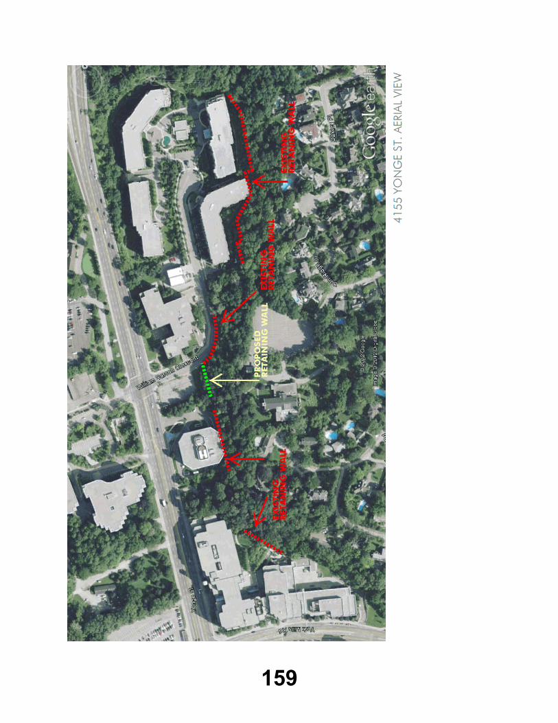
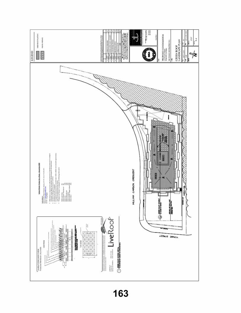
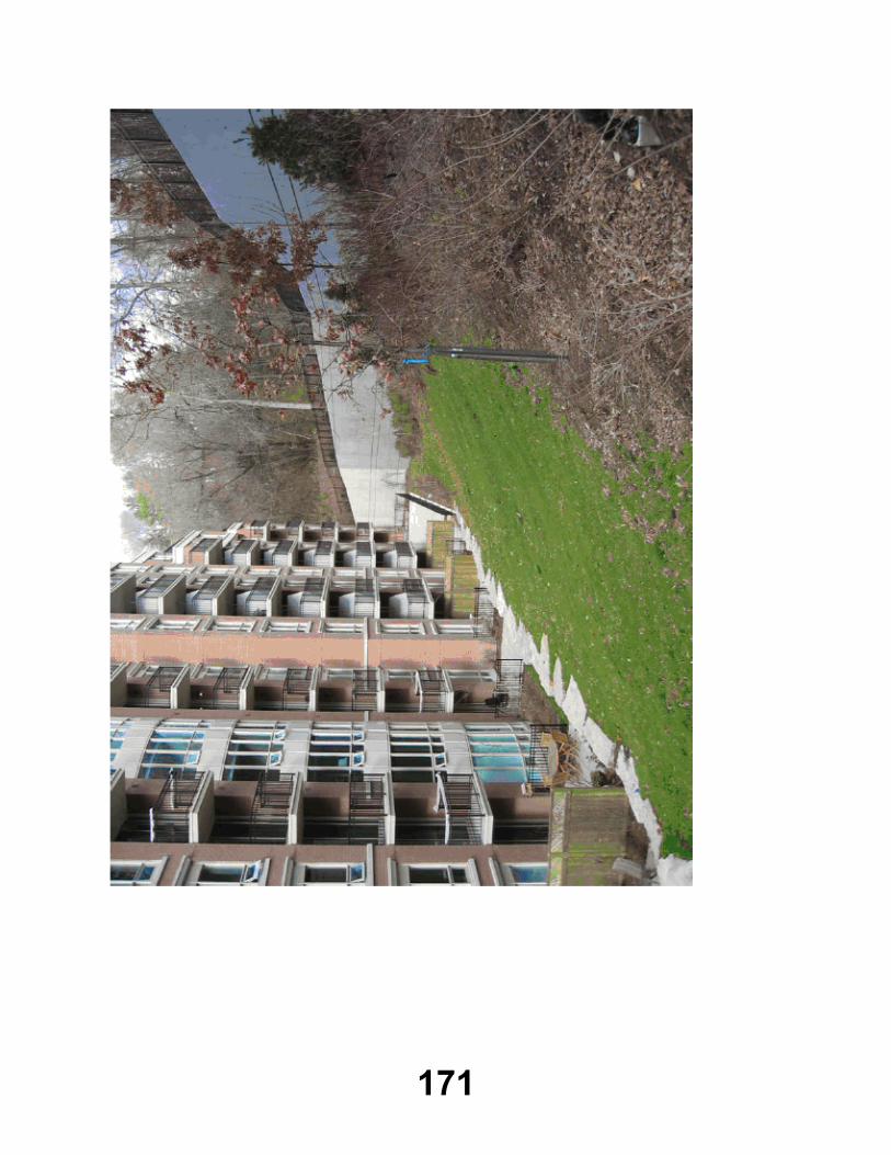
EX7.HEARING REPORTMaterial from the Applicant, Jason Pantalone, Director of Lands Acquisition and Development, National Homes Inc. c/o IreYonge Developers Inc.

156

157

158
159

160

161

162
163

164
165

166

167

168

169

170
171

172

173

174
175
EX8.1
REQUEST FOR DISPOSAL OF TORONTO AND REGION CONSERVATION AUTHORITY-OWNED LANDList of Additional Comments Received for Inclusion with Attachment 2
Additional correspondence in regard to Request for Disposal of TRCA-owned land was received from the following after the agenda was posted, objecting to the sale of the subject parcel of land.
Email dated May 26, 2012 from Kathy and Pat Johnston, 87 Rosevear Avenue, Toronto.1.
Email dated May 27, 2012 from Mr. Doug Thompson.2.
Email dated May 28, 2012 from Michel Joly de Lotbinière, 14 Blong Avenue, Toronto.3.
Email dated May 29, 2012 from Mr. Caroline MacPhail, Toronto resident.4.

176
Item EX8.9 TO: Chair and Members of the Executive Committee
Meeting #4/12, June 1, 2012
FROM: Adele Freeman, Director, Watershed Management
RE: ALBION HILLS FIELD CENTRE PHASE 4 RETROFIT PROJECTContract PMO12-05
_____________________________________________________________________________KEY ISSUEAward of Contract PMO12-05 for exterior recladding, new windows and doors, and interior alterations at the Albion Hills Field Centre, Town of Caledon.
RECOMMENDATION
THE EXECUTIVE COMMITTEE RECOMMENDS THAT Contract PMO12-05 for renovations to the exterior siding, windows and doors, and the construction of a new interior partition of the Albion Hills Field Centre be awarded to Vema Corp. Constructors at a cost not to exceed $325,000.00, plus HST, subject to receipt of all necessary approvals, permits and funding, it being the lowest bid meeting Toronto and Region Conservation Authority (TRCA) specifications;
THAT a contingency allowance of $65,000.00 to be expended as authorized by TRCA staff be approved;
THAT staff be authorized to direct Vema Corp. Constructors to proceed immediately, upon approval by the Executive Committee, with the supply and delivery of all windows and doors as part of the contract cost of $111,200.00, plus HST, to ensure the fabrication lead time will fall within the construction window of mid-June to late-September;
AND FURTHER THAT authorized TRCA officials be directed to take such action as is necessary to implement the contract, including the signing and execution of documents.
BACKGROUNDConstructed in 1962, the Albion Hills Field Centre (AHFC) is an existing one and half storey residential environmental education field centre located at Albion Hills Conservation Area, north of the Village of Bolton. Set deep into the rolling topography of the Oak Ridges Moraine, the cedar and granite chalet-style building is equipped with bedrooms, washrooms, classrooms, offices, cafeteria, lounge, dining hall and commercial kitchen facilities.

177
As part of the Region of Peel's Climate Change Mitigation Program, TRCA engaged Montgomery Sisam Architects Ltd. to undertake a facility assessment and conceptual redesign of the AHFC. The purpose of the assessment and redesign program was to provide a framework for major renovations and system retrofits to improve the environmental performance of the building while supporting climate change and sustainability learning programs for visiting students. In February of 2008, Montgomery Sisam began the detailed architectural work for the complete retrofit and renovation of AHFC. In order to minimize disruption to student use throughout the school year, renovation and construction activities at AHFC are limited to mid-June through late-September. As such, the complete retrofit of the field centre is being phased over a number of years with entire segments of the building being completed in each phase.
Three phases of the retrofit have been completed and consisted of a new roof, electrical, mechanical and fire code upgrades, and a major kitchen renovation. The existing building envelope is reaching the end of its lifecycle and is the main focus for Phase 4 of the retrofit. The scope of work for Phase 4 consists of new exterior siding, the replacement of all the windows and doors, and a new interior partition between the cafeteria and lounge. To increase the R-Value (insulation value) of the building, an added spray foam layer will be applied before the new siding is installed and the new windows will be double glazed to improve the building temperature. The new interior partition has been designed as a solid structure with opaque glazing that will act as a sound barrier and still allow the transfer of light between the two rooms, thus improving the functionality of the AHFC programming. The AHFC will be shut down from June to September to accommodate the 2012 construction. This major facility upgrade and retrofit will significantly contribute to AHFC’s business sustainability and strengthen its position as an important environmental and sustainability education resource.
RATIONALERequest for Pre-Qualification (RFPQ) for general contractors was advertised on-line with biddingo.com on April 27, 2012 and closed on May 3, 2012. The work includes, but is not necessarily limited to, the supply of labour, material, supervision and equipment to perform the prescribed scope of work. The general contractor will coordinate all construction activities which will comprise of demolition; window installation; finish carpentry; drywall finisher; flooring; insulation; cladding; minor mechanical and electrical; and millwork.
General contractors interested in pre-qualifying were advised that the criteria for evaluation will include:
completeness of submission;
past experience in the renovation of older buildings of similar size;
past experience with the proposed scope of work;
ability to meet construction schedule milestones;
ability to coordinate work by others; and
experience dealing with projects with construction budgets of $500,000.00 to
$1,000,000.00.

178
All interested general contractors will need to be bondable and required to produce a bid bond of 10% of the contract price at the time of the tender submission. Pre-qualification information was requested by the following nine firms:
ARC General Contracting;
Compass Construction Resources Ltd.;
JJM McGuire General Contractors;
Martinway Contracting Limited;
Morosons Construction Limited;
R-Chad General Contracting Inc.;
Spectre Construction and Management Inc.;
Struct-Con Construction; and
Vema Corp. Constructors.
The pre-qualifying documents were reviewed by the selection committee made up of TRCA staff that have extensive backgrounds in new building and retrofit construction projects. The proposals were evaluated using the following criteria being met in order to receive a tender package:
CCDC 11 (Canadian Construction Documents Committee) Contractor's Qualification
Statement;company experience and background in similar works;
experience of suggested personnel for this project;
project record over the past five years; and
references focusing on firms history of project control and experience.
Based on the evaluation process, Tender documents were made available to the following seven general contractors:
Compass Construction Resources Ltd.;
JJM McGuire General Contractors;
Martinway Contracting Limited;
Morosons Construction Limited;
R-Chad General Contracting Inc.;
Struct-Con Construction Ltd.; and
Vema Corp. Constructors.
All pre-qualified companies attended a mandatory site meeting on May 11, 2012.
Tenders closed on May 24, 2012 and were opened by the Tender Opening Committee on May 25, 2012 with the following results:

179
BIDDERS TOTAL(Plus HST)
Vema Corp. Constructors $325,000.00
R-Chad General Contracting Inc. $340,000.00
Morosons Construction Limited $367,876.00
Martinway Contracting Limited $384,160.00
JJM McGuire General Contractors $470,000.00
Struct-Con Construction Ltd. $749,000.00
Having previously pre-qualified the bidders qualifications, TRCA staff evaluated the tenders on the bid prices and the ability to complete the project within the specified construction window. TRCA staff reviewed the bids against its own cost estimates and has determined that the bids are of reasonable value with the exception of Struct-Con Construction Ltd.. As part of the bid submission, a separate cost for the supply and delivery of the windows and doors was requested to expedite the order to avoid any potential delays due to the high volume of window material orders during the summer period. Based on an evaluation of the bids received, staff recommends that Contract PMO11-05 be awarded to Vema Corp. Constructors for the total cost not to exceed $325,000.00, plus a 20% contingency, plus HST, as they are the lowest bidder that meets TRCA specifications. In addition, staff recommends that the supply and delivery of the windows and doors for a cost of $111,200.00, plus HST, be executed by Vema Corp. Constructors prior to final approval at Authority Meeting #5/12, scheduled to be held on June 22, 2012.
FINANCIAL DETAILSFunds are being provided by Peel Region in the Peel Climate Change Mitigation capital budget of 129-70.
Report prepared by: Aaron D'Souza, 416-661-6600 extension 5775 Emails: [email protected] Information contact: Darryl Gray, 416-791-0327Emails: [email protected]: May 25, 2012
180
EX11 APPLICATION FOR PERMITS UNDER ONTARIO REGULATION 166/06Development, Interference with Wetlands and Alterations to Shorelines and Watercourses
Information has been received and reviewed by staff for the following Scheduled Errata items. The recommendations within the staff reports should be amended to include the following:
EX11.2 CITY OF BRAMPTON• Letter of Undertaking, dated May 29, 2012, prepared by M. McCollum, City of
Brampton, to address outstanding TRCA engineering concerns.
EX11.3 LYNGATE DEVELOPMENTS• Letter of Undertaking, dated May 29, 2012, prepared by M. Zuccaro, EMC Group
Limited, to address all outstanding TRCA ecology concerns.
EX11.4 CITY OF MISSISSAUGA• Letter of Undertaking, prepared by E. Jain, dated May 25, 2012, to address all
outstanding TRCA concerns.
EX11.5 REGIONAL MUNICIPALITY OF DURHAM• Letter of Undertaking to provide a letter committing to address the remaining water
resource comments as part of the Seaton development application; Dated May 22, 2012; received May 23, 2012; prepared by the Region of Durham.
EX11.6 ENBRIDGE PIPELINES INC.• Figure 1; Don River Crossing Site Sensitivity; prepared by Stantec; on behalf of
Enbridge; dated April, 2012; received by TRCA on April 17, 2012;• Figure 1; Don River Crossing Proposed Borehole Location; prepared by Stantec;
on behalf of Enbridge; dated April, 2012; received by TRCA on April 17, 2012;• Site photos of Temporary Enbridge Slope Stabilization Works; prepared by
Enbridge; date unknown; received by TRCA on April 17, 2012;• Letter Re: East Don River Slope Failure; prepared by Enbridge; dated April 24,
2012; received by TRCA on May 10, 2012.
EX11.7 BERKLEY HOMES (KLEINBURG) INC.• Letter of Undertaking, prepared by EMC Group Limited, dated May 29, 2012,
received by TRCA on May 29, 2012.
EX11.8 NASHVILLE MAJOR DEVELOPMENTS INC./NASHVILLE DEVELOPMENTS INC./NASHVILLE DEVELOPMENTS (SOUTH) INC.
• Letter of Undertaking dated May 28, 2012 prepared by Schaeffers Consulting Engineers, indicating the applicant will undertake to work with TRCA to resolve any outstanding issues to the satisfaction of TRCA prior to the release of the permit, received by TRCA on May 28, 2012.

181
EX11.21 REGIONAL MUNICIPALITY OF YORK• Dwg. No. CV23-ER002, Station 1+517 Work Area - Cross Section and Details,
prepared by AECOM on behalf of the Regional Municipality of York, dated April 23, 2012, received by TRCA on May 1, 2012;
• Dwg. No. CV23-ER001, Station 1+517 Work Area - Siltation & Erosion Control Plan, prepared by AECOM on behalf of the Regional Municipality of York, dated April 30, 2012, received by TRCA on May 1, 2012;
• Dwg. No. CV22-SP001, Construction Compound - Site Plan Details 1, prepared by AECOM on behalf of the Regional Municipality of York, dated May 2, 2011, received by TRCA on May 1, 2012;
• Dwg. No. CV22-ER001, Siltation & Erosion Control Details 1, prepared by AECOM on behalf of the Regional Municipality of York, dated February 23, 2012, received by TRCA on May 1, 2012;
• Dwg. No. P041, Plan and Profile - Hydro Corridor, prepared by AECOM on behalf of the Regional Municipality of York, dated May 2, 2011, received by TRCA on May 1, 2012, red-line revised by TRCA staff on May 28, 2012.
EX11.22 CITY OF TORONTO• Letter of Undertaking Re: Lanyard Road Reconstruction; prepared by the City of
Toronto; to provide revised engineering drawings to the satisfaction of TRCA; dated May 23, 2012; received by TRCA on May 25, 2012.
EX11.23 CITY OF TORONTO• Letter of undertaking Re: Woolner Avenue Sidewalk; prepared by the City of
Toronto; to provide engineering drawings to the satisfaction of TRCA; dated May 25, 2012; received by TRCA on May 25, 2012.
EX11.24 44 GEORGE HENRY BOULEVARD• Drawing unnumbered, Concept B R2, prepared by Pool Craft Company Limited,
dated March 1, 2012, received by TRCA staff on April 16, 2012.
EX11.25 JOSEPH AND WOLF LEBOVIC JEWISH COMMUNITY CAMPUS• Letter of Undertaking, prepared by Cosburn Nabouris, dated May 14, 2012,
received by TRCA on May 15, 2012.
EX11.26 16 FIELDCREST COURT• Site Plan, Drawing No. A1, prepared by Katakkar Engineering Associates Inc.,
revise dated May 1, 2012, received by the TRCA May 2, 2012.
EX11.27 BEECHRIDLetter of UGE FARMS INC.• Undertaking, dated May 29, 2012, from Mr. Tom Scanlan, Vice-President, Land
Development Engineering, committing to address all outstanding comments from TRCA staff.
EX11.28 HIGHWAY 9 AND REGIONAL ROAD 50 (SOUTH-WEST CORNER)• Letter of Undertaking, prepared by M. McConville, dated May 29, 2012, to address
all outstanding TRCA ecology related issues.

182
EX11.29 HIGHWAY 9 AND REGIONAL ROAD 50 (SOUTH-WEST CORNER)• Letter of Undertaking, prepared by M. McConville, dated May 29, 2012, to address
all outstanding TRCA ecology related issues.
EX11.30 REGIONAL MUNICIPALITY OF YORK• Letter of Undertaking, prepared by the Regional Municipality of York, dated May
23, 2012, received by TRCA on May 23, 2012.
EX11.31 TOWN OF MONO• Letter of Undertaking to provide landowner authorizations; dated May 22, 2012;
received May 25, 2012; prepared by the Town of Mono.
EX11.32 VALLEY KING DEVELOPMENTS LIMITED• Letter of Undertaking, prepared by Valdor Engineering Inc., dated May 29, 2012,
received by TRCA on May 29, 2012.
183
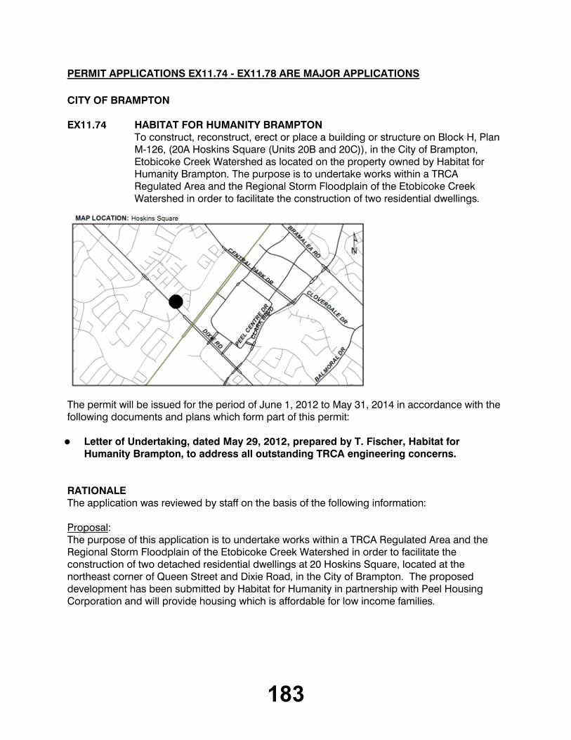
PERMIT APPLICATIONS EX11.74 - EX11.78 ARE MAJOR APPLICATIONS
CITY OF BRAMPTON
EX11.74 HABITAT FOR HUMANITY BRAMPTONTo construct, reconstruct, erect or place a building or structure on Block H, Plan M-126, (20A Hoskins Square (Units 20B and 20C)), in the City of Brampton, Etobicoke Creek Watershed as located on the property owned by Habitat for Humanity Brampton. The purpose is to undertake works within a TRCA Regulated Area and the Regional Storm Floodplain of the Etobicoke Creek Watershed in order to facilitate the construction of two residential dwellings.
The permit will be issued for the period of June 1, 2012 to May 31, 2014 in accordance with the following documents and plans which form part of this permit:
Letter of Undertaking, dated May 29, 2012, prepared by T. Fischer, Habitat for
Humanity Brampton, to address all outstanding TRCA engineering concerns.
RATIONALEThe application was reviewed by staff on the basis of the following information:
Proposal:The purpose of this application is to undertake works within a TRCA Regulated Area and the Regional Storm Floodplain of the Etobicoke Creek Watershed in order to facilitate the construction of two detached residential dwellings at 20 Hoskins Square, located at the northeast corner of Queen Street and Dixie Road, in the City of Brampton. The proposed development has been submitted by Habitat for Humanity in partnership with Peel Housing Corporation and will provide housing which is affordable for low income families.
184
Based on the initial discussions with the applicant, the preferred development envisioned by Habitat for Humanity involved the construction of three detached residential dwelling units. As such, City of Brampton Council passed By-law No. 177-2011 (City File No. C04E06.025) on June 22, 2012 to amend the City of Brampton Zoning By-law to permit the development of one to three non-profit dwelling units on the subject lands.
On August 5, 2011 at TRCA Executive Committee Meeting #7/11, the Authority's Executive Committee approved a TRCA permit (Permit No. C-110597) to construct one detached residential dwelling on the subject property. This TRCA permit application represents the second phase of a two-staged development proposal envisioned by Habitat for Humanity.
The entire site is located within the Regional Storm Floodplain, which is associated with a tributary of the Etobicoke Creek Watershed located immediately west of the subject property. The subject property was subsequently owned by first the Province of Ontario and more recently the Region of Peel, during which time the lot remained vacant, and has on occasion been used for overflow parking. This property was recently conveyed by the Region of Peel to Habitat for Humanity, such that Habitat for Humanity could pursue opportunities for low income housing on this site. In considering Habitat for Humanity's proposal for development on this site, TRCA staff have taken into consideration the infill nature of this site and this proposal, and have analyzed the floodplain characteristics within this area. Although the site is located within the floodplain, TRCA staff feel that it is appropriate to view this proposal as an infill project, for which consideration must be given for the surrounding development form. Given that the floodplain within this local area displays characteristics similar to that of a flood spill zone, it is staff's opinion that some development opportunities on-site may be feasible provided flood protection measures can be incorporated into the design of the proposed development. Based on TRCA staff's review of existing flood data and recognizing the limitations associated with the existing flood model that are specific to the Dixie-Queen Street area, TRCA senior staff are satisfied that the proposed off-site flooding impacts, although measurable, are acceptable. With consideration for this project being infill, and the limitations of existing floodplain model for this area as noted above, and the potential for additional affordable housing in Brampton, TRCA senior staff are satisfied that the proposed development represents an acceptable balance between a slight localized increase in flooding and the social benefits associated with this project.
In order to address concerns regarding "safe" ingress and egress, as a component of this application, the applicant has submitted a report that details the steps in response to a flood emergency for the subject property, including actions to be undertaken by the City of Brampton departments and partnering agencies. Additionally, based on the plans submitted with this application, it appears the proposed development is adequately floodproofed in accordance with TRCA policy and has been designed to withstand the flood water depths and velocities expected during a Regional Storm event.

185
In order facilitate the construction of the two additional detached residential dwelling units, the creation of two additional lots at this location is necessary. On October 14, 2011 at TRCA Executive Committee Meeting #9/11, the Authority's Executive Committee approved for TRCA Authority Committee action Resolution #B156/11, which supported TRCA's acquisition of 0.006 ha (0.01 acres) of land from the subject property. The purpose of this acquisition was to facilitate the creation of two additional lots by way of natural severance to support this TRCA permit application. On October 28, 2011 at TRCA Authority Committee Meeting #9/11, the TRCA's Authority Committee approved Resolution #A221/11, which instructed staff to complete the land transaction. The City of Brampton supports the creation of the two additional residential lots at this location.
Control of Flooding:The proposed development is located within the Regional Storm Floodplain, and minor localized impacts to the floodplain are anticipated as a result of the proposed development. However, the potential impacts must be balanced with the potential gains that would result from the proposed development. With the nature of this floodplain, and with consideration for the localized impact that may result, TRCA senior engineering staff are satisfied that this proposal represents an acceptable balance.
Pollution:Appropriate erosion and sediment controls (i.e., silt fence) will be installed and maintained throughout all phases of construction.
Dynamic Beaches:Not applicable.
Erosion:There are no geotechnical and/or slope stability concerns associated with this project.
Conservation of Land:No significant vegetation will be removed as a result of construction. As such, no plantings are required.
PlantingsNo plantings are proposed with this application.
Policy Guidelines:This application meets the intent of Section 4.2.2 (G) - Development & Redevelopment/Intensification Within Non-Established Communities/Highly Urbanized Areas - Infilling - of the Authority's Valley and Stream Corridor Management Program (VSCMP).
CFN: 47462 - Application #: 0408/12/BRAMReport Prepared by: Adam Miller, extension 5244For information contact: Adam Miller, extension 5244Date: May 29, 2012

186
CITY OF TORONTO [NORTH YORK COMMUNITY COUNCIL AREA]
EX11.75 CITY OF TORONTOTo construct, reconstruct, erect or place a building or structure and temporarily or permanently place, dump or remove any material, originating on the site or elsewhere on St. Margarets Drive, Donwoods Drive (from Knightswood Road to St. Margarets Drive) and Knightswood Road, in the City of Toronto (North York Community Council Area), Don River Watershed as located on the property owned by City of Toronto. The purpose is to install new storm sewers, replace watermains, and reconstruct roadway on St. Margarets Drive, Donwoods Drive (from Knightswood Road to St. Margarets Drive) and Knightswood Road. Works will also involve replacement of two outfalls, each discharging into the Don River at the end of Donwoods Drive and Knightswood Road. A Letter of Advice will be written by TRCA staff on behalf of the Fisheries and Oceans Canada (DFO).
The permit will be issued for the period of June 1, 2012 to May 31, 2014 in accordance with the following documents and plans which form part of this permit:
Letter of undertaking from the City of Toronto to TRCA to provide revisions to the
engineering and landscape drawings to the satisfaction of TRCA; dated May 28, 2012; received by TRCA on May 29, 2012.
RATIONALEThe application was reviewed by staff on the basis of the following information:
187
Proposal:The City of Toronto is proposing to install new storm sewers, replace watermains and reconstruct roadway on St. Margarets Drive, Donwoods Drive (from Knightswood Road to St. Margarets Drive) and Knightswood Road. The study area is located in the City of Toronto near Yonge Street and York Mills Road, within a regulated area of the Don River watershed. These works were identified in a Municipal Environmental Assessment (EA) that the City completed in 2006. The EA recommended upgrades to the existing watermain and sanitary sewers, as well as for a new stormwater management system for this area of Hoggs Hollow. The EA also recommended installing new storm sewer outfalls and implementing stormwater quality measures. Works will also involve replacement of two existing outfalls discharging into the West Don River, one at the end of Donwoods Drive and the other at the end of Knightswood Road. The work is expected to occur between July and December 2012, and shall constitute the second phase of the Hoggs Hollow stormwater quality and road improvements project.
Control of Flooding:Staff has confirmed that the proposed road and stormwater improvements will have no impact to flooding, flood storage or conveyance of floodwaters. The proposed works will improve the existing storm runoff conditions in this area, and all grades in the floodplain will be maintained or matched. As a precautionary measure and upon TRCA request, the City contractor has provided a Construction Flood Contingency Plan to be in effect during active construction periods. This contingency plan outlines the procedures to be followed by the City and its consultants in the event of a flood, including receiving flood warnings, site monitoring and evacuations.
Pollution:Standard erosion and sediment control measures will be installed prior to construction and maintained for its duration, and until the site is stabilized and restored. These measures are being implemented to prevent the release of construction generated sediment into the West Don River. Filter fabric (Terra Fix 270R or approved equivalent) is to be placed under grates on all catchbasins to trap sediment. These silt traps are to be cleaned regularly, and are not to be removed until the curbs are constructed and the boulevards are sodded. Construction of the new outfalls and concrete collars, as well as the laying of rip-rap from the outfall to the river edge, shall occur in the “dry”. The work area for the outfall headwalls shall be isolated using coffer dams, comprised of pea gravel filled with sand bags on native ground. An impermeable plastic layer will also be incorporated into the coffer dams to create a watertight barrier. Coffer dams shall be constructed to a height of 0.3m above the 2-year water levels.
All sediment control devices are to be routinely inspected and maintained in proper working order until the area is stabilized. Mud mats measuring 20m are to be used at the entrances to lay down areas, and if necessary, trucks will be washed down before leaving the site. Erosion and sediment control measures have been provided in accordance with the TRCA 2006 Erosion and Sediment Control Guideline for Urban Construction.
188
Dynamic Beaches:Not applicable
Erosion:There are no geotechnical engineering issues associated with the proposed work, and no impacts identified to slope stability or erosion as a result of these works.
Conservation of Land:With erosion and sediment control plans in effect, the potential for a Harmful Alteration, Disruption or Destruction (HADD) to fish habitat will be mitigated. Construction of the new outfalls and concrete collars, as well as the laying of rip-rap from the outfall to the river edge, shall occur in the “dry”. The warmwater fisheries timing window will apply to this project, and as such, work will be restricted between April 1 and June 30. Direct impact to fish habitat will be minimized since both the Donwoods and Knightswood sewer outfalls will be installed in the “dry”. A Letter of Advice regarding mitigation of negative impacts will be written by TRCA staff on behalf of Fisheries and Oceans Canada (DFO).
PlantingsA detailed vegetation inventory report has been prepared to identify vegetation within the study area, including the ones to be removed/impacted and the ones to be protected during construction. The removal of nine (9) trees and injury to an additional thirty-seven (37) will be required to complete the proposed works. Plywood tree protection hoarding will be installed in accordance with City of Toronto urban forestry requirements. A tree establishment plan to compensate for tree injury and removal will be provided once the final number of removals and injuries is known.
Policy Guidelines:This proposal complies with Section 4.3, Infrastructure and Servicing, of the TRCA’s Valley and Stream Corridor Management Program.
CFN: 47075 - Application #: 0115/12/TORReport Prepared by: Daniel Brent, extension For information contact: Renee Afoom-Boateng, extension 5714Date: May 29, 2012
189
CITY OF VAUGHAN
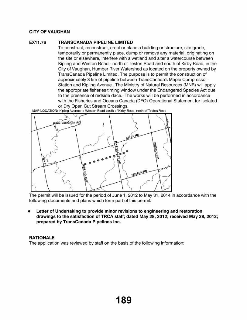
EX11.76 TRANSCANADA PIPELINE LIMITEDTo construct, reconstruct, erect or place a building or structure, site grade, temporarily or permanently place, dump or remove any material, originating on the site or elsewhere, interfere with a wetland and alter a watercourse between Kipling and Weston Road - north of Teston Road and south of Kirby Road, in the City of Vaughan, Humber River Watershed as located on the property owned by TransCanada Pipeline Limited. The purpose is to permit the construction of approximately 3 km of pipeline between TransCanada's Maple Compressor Station and Kipling Avenue. The Ministry of Natural Resources (MNR) will apply the appropriate fisheries timing window under the Endangered Species Act due to the presence of redside dace. The works will be performed in accordance with the Fisheries and Oceans Canada (DFO) Operational Statement for Isolated or Dry Open Cut Stream Crossings.
The permit will be issued for the period of June 1, 2012 to May 31, 2014 in accordance with the following documents and plans which form part of this permit:
Letter of Undertaking to provide minor revisions to engineering and restoration
drawings to the satisfaction of TRCA staff; dated May 28, 2012; received May 28, 2012; prepared by TransCanada Pipelines Inc.
RATIONALEThe application was reviewed by staff on the basis of the following information:

190
Proposal:The proposal is to install approximately 3 km of 42 inch (NPS) diameter pipeline between TransCanada's Maple Compressor Station west to Kipling Avenue in the City of Vaughan, Regional Municipality of York. The works will cross 5 watercourses and will be installed no deeper than 3 m below ground with a minimum cover of 1.2m. The crossings will be constructed by dry open cut as per the Fisheries and Oceans Canada Operational Statement for Isolated or Dry Open Cut Stream Crossings and are subject to review by MNR under Endangered Species Act.
Control of Flooding:The proposed project is not anticipated to have impacts on the storage or conveyance of floodwaters.
Pollution:Standard erosion and sediment control measures (sediment fencing) will be implemented prior to construction and maintained for the duration of construction, and until the site is stabilized and restored, in order to prevent construction generated sediments from entering any watercourse or wetland. Erosion and sediment control measures have been provided in accordance with the TRCA Erosion and Sediment Control Guideline for Urban Construction.
Dynamic Beaches:Not applicable
Erosion:No geotechnical or slope stability issues have been identified for the proposal.
Conservation of Land:The Ministry of Natural Resources will be responsible for determining risk and assigning an appropriate timing window due to the presence of redside dace. The Fisheries and Oceans Canada Operational Statement for Isolated or Dry Open Cut Stream Crossings.
PlantingsAll disturbed areas will be restored with native, non-invasive species following construction.
Policy Guidelines:This proposal is consistent with Section 4.3 - Infrastructure and Servicing - of the Toronto and Region Conservation Authority's Valley and Stream Corridor Management Program.
CFN: 47216 - Application #: 0238/12/VAUGReport Prepared by: Suzanne Bevan, extension 5759For information contact: Suzanne Bevan, extension 5759Date: May 29, 2012

191
TOWN OF MARKHAM
EX11.77 11 BILLY JOEL CRESCENTTo construct, reconstruct, erect or place a building or structure on Lot 6, Plan 5879, (11 Billy Joel Crescent), in the Town of Markham, Rouge River Watershed. The purpose is to undertake works within a TRCA Regulated Area of Rouge River Watershed, in order to facilitate the construction of a second storey addition above the existing garage.
The permit will be issued for the period of June 1, 2012 to May 31, 2014 in accordance with the following documents and plans which form part of this permit:
Letter of Undertaking, Prepared by Bruce Borgundvaag, Dated May 29, 2012, Received
May 30, 2012
RATIONALEThe application was reviewed by staff on the basis of the following information:
Proposal:The purpose of this application is to undertake works within a TRCA Regulated Area of the Rouge River Watershed, in order to facilitate the construction of a second storey addition above the existing garage. The subject property is located east of Markham Road and south of Highway 7, with the Rouge River located to the south of the property. The majority of the dwelling is located within the TRCA's regulated area, within an established neighbourhood. While this dwelling is located above the top of bank, it is located within close proximity of the feature. The second storey addition is proposed to be built above the existing garage and does not increase the overall footprint of the structure. A geotechnical investigation was submitted and reviewed by TRCA staff which confirmed that the proposed second storey addition will be structurally stable as it will utilize the existing foundation and load bearing walls. As the addition does not extend beyond the existing structure, the existing buffer from the stable top of slope is maintained, and therefore the proposed addition does not introduce any additional risk to the property or adjacent natural features. As such, TRCA staff concur with the findings and agree that the proposed addition is appropriately located on the property.

192
Control of Flooding:The proposed structure is located outside of the Regional Storm Floodplain. As such, no impacts to the storage and/or conveyance of floodwaters are anticipated.
Pollution:Appropriate sediment and erosion controls will be installed and maintained on the subject property throughout all phases of construction.
Dynamic Beaches:Not applicable
Erosion:All geotechnical concerns have been addressed by the applicant and approved by TRCA staff.
Conservation of Land:No significant vegetation will be removed as a result of construction.
PlantingsNo plantings are proposed as the site will remain in its current state.
Policy Guidelines:The proposal is consistent with Section 4.2.2 (C) - Existing Development, of the Authority's Valley and Stream Corridor Management Program (VSCMP).
CFN: 47179 - Application #: 0191/12/MARKReport Prepared by: Uton Samuels, extension 5386For information contact: Uton Samuels, extension 5386Date: May 29, 2012
EX11.78 DILAWRI GROUP OF COMPANIESTo site grade on Part Lot 1, Plan 2196, Part Lot 1, Plan 65R-25652, PART 30, 31, Part Lot 1, Plan 65R-7974, PART 7, 8, 10, (7, 13, 21 Main Street), in the Town of Markham, Rouge River Watershed as located on the property owned by Dilawri Group of Companies. The purpose is to undertake works within a TRCA Rouge River Watershed, in order to facilitate the re-construction of an existing parking lot with a permeable paved surface and infiltration features.

193
The permit will be issued for the period of June 1, 2012 to May 31, 2014 in accordance with the following documents and plans which form part of this permit:
Letter of Undertaking, Prepared by Dilawri Group of Companies, Dated April 27, 2012
RATIONALEThe application was reviewed by staff on the basis of the following information:
Proposal:The purpose of this application is to undertake works within a TRCA Regulated Area of the Rouge River Watershed in order to facilitate the re-construction of a an existing parking lot. The subject property is located north of Hwy 407, west of Kennedy Road and adjacent to a Rouge River tributary. The existing parking lot was approved by the Executive Committee October 9, 2009 (Permit # C-10073) and included a retaining wall feature and a porous grass surfaced parking lot. The porous surface was to provide both stormwater quantity and quality control and the grass surface was implemented as an environmental initiative to implement low impact development (LID) on the property. Unfortunately the grass surface parking lot is failing, as the constant high volume of traffic is preventing the grass from establishing and performing its intended function.. As a result, the applicant placed sod on the parking lot in an attempt to expedite the growth of the grass. This has negatively impacted the function of the permeable surface, resulting in a loss of infiltration as the honeycomb structure is now underneath a thick layer of soil and sod, clogging the porous surface and defeating its overall purpose. The result is a failed LID which is impermeable and is resulting in mud and sediment to migrate towards the creek and onto the road during storm events.
194
The permeable parking lot was a component of the original application as an enhancement opportunity to mitigate the encroachment of the parking lot on the natural feature. The applicant is now proposing to provide paved surfacing for the parking area, with bio-swales and landscaped areas to perform a similar function as the permeable parking lot. This includes ensuring that quantity and quality controls for stormwater is maintained within the parking lot as originally intended. The re-construction of this parking lot will not result in any adverse impacts to the corridor and will enhance its current state. TRCA staff are satisfied that the proposed works will not have any negative impacts on the feature as the works are located outside of the Regional Storm Floodplain.
Control of Flooding:The proposed structure are located outside of the Regional Storm Floodplain. As such, no impacts to the storage and/or conveyance of flood waters are anticipated.
Pollution:Appropriate sediment and erosion controls will be installed and maintained throughout all phases of construction.
Dynamic Beaches:Not applicable
Erosion:There are no geotechnical and/or slope stability concerns related to this application.
Conservation of Land:No significant vegetation will be removed as a result of construction. There are no fisheries related concerns associated with this project.
PlantingsThe applicant will be providing plantings in accordance to TRCA guidelines.
Policy Guidelines:
The proposal is consistent with Section 4.2.2 (E) - Existing Development, of the Authority's Valley and Stream Corridor Management Program (VSCMP).
CFN: 47412 - Application #: 0356/12/MARKReport Prepared by: Uton Samuels, extension 5386For information contact: Uton Samuels, extension 5386Date: May 30, 2012
195
CITY OF PICKERING
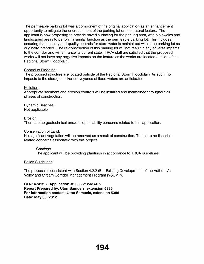
EX11.79 REGIONAL MUNICIPALITY OF YORKTo construct, reconstruct, erect or place a building or structure near Fairport Road and Lynn Heights Drive, in the City of Pickering, Frenchman's Bay Watershed as located on the property owned by the City of Pickering. The purpose is to permit the construction of a new pressure and hydrogen sulfide monitoring station associated with the Southeast Collector sanitary sewer project.
The permit will be issued for the period of June 1, 2012 to May 31, 2014 in accordance with the following documents and plans which form part of this permit:
Letter of Undertaking, prepared by the Regional Municipality of York, dated May 28,
received by TRCA on May 29, 2012.
RATIONALEThe application was reviewed by staff on the basis of the following information:
Proposal:The proposal is to permit the construction of a new pressure and hydrogen sulfide monitoring station associated with the Southeast Collector sanitary sewer project, north of Finch Avenue, west of Fairport Road, in the Frenchman's Bay Watershed, City of Pickering, Regional Municipality of Durham. The monitoring station and antenna will be constructed on a concrete slab and an underground conduit will connect the station to the nearby sewer manhole.

196
Control of Flooding:The project is not located within the Regional Storm Flood Plain, and the proposed work is therefore not anticipated to affect the conveyance or storage of flood waters.
Pollution:Standard erosion and sediment control measures (sediment fence) will be implemented prior to construction, maintained for the duration, and removed only after the site is stabilized and restored. Erosion and sediment control measures have been provided in accordance with the TRCA Erosion and Sediment Control Guidelines for Urban Construction.
Dynamic Beaches:Not applicable
Erosion:No impacts to slope stability or erosion have been identified.
Conservation of Land:Sediment control fencing will be installed to isolate the work area. No vegetation removals are proposed.
PlantingsThe site will be restored with a native seed mix once the work has been completed.
Policy Guidelines:This proposal is consistent with Section 4.3 - Infrastructure and Servicing - of the Toronto and Region Conservation Authority's Valley and Stream Corridor Management Program.
CFN: 47353 - Application #: 0311/12/PICKReport Prepared by: Brian Storozinski, extension 5744For information contact: Brian Storozinski, extension 5744Date: May 29, 2012
EX11.80 REGIONAL MUNICIPALITY OF YORKTo construct, reconstruct, erect or place a building or structure near Rosebank Road and Finch Avenue, in the City of Pickering, Frenchman's Bay Watershed as located on the property owned by the City of Pickering and the Toronto and Region Conservation Authority. The purpose is to permit the construction of a new pressure and hydrogen sulfide monitoring station associated with the Southeast Collector sanitary sewer project.

197
The permit will be issued for the period of June 1, 2012 to May 31, 2014 in accordance with the following documents and plans which form part of this permit:
Letter of Undertaking, prepared by the Regional Municipality of York, dated May 28,
2012, received by TRCA on May 29, 2012.
RATIONALEThe application was reviewed by staff on the basis of the following information:
Proposal:The proposal is to permit the construction of a new pressure and hydrogen sulfide monitoring station associated with the Southeast Collector sanitary sewer project, north of Finch Avenue, west of Rosebank Road, in the Frenchman's Bay Watershed, City of Pickering, Regional Municipality of Durham. The monitoring station and antenna will be constructed on a concrete slab and an underground conduit will connect the station to the nearby sewer manhole. An access road will be constructed to link the site to Rosebank Road.
Control of Flooding:The project is not located within the Regional Storm Flood Plain, and the proposed work is therefore not anticipated to affect the conveyance or storage of flood waters.
Pollution:Standard erosion and sediment control measures (sediment fence) will be implemented prior to construction, maintained for the duration, and removed only after the site is stabilized and restored. Erosion and sediment control measures have been provided in accordance with the TRCA Erosion and Sediment Control Guidelines for Urban Construction.

198
Dynamic Beaches:Not applicable
Erosion:No impacts to slope stability or erosion have been identified.
Conservation of Land:Sediment control fencing will be installed to isolate the work area. Two dead trees will be removed to accommodate the construction. They will be left on site to maintain their habitat value.
PlantingsThe site will be restored with a native seed mix once the work has been completed.
Policy Guidelines:This proposal is consistent with Section 4.3 - Infrastructure and Servicing - of the Toronto and Region Conservation Authority's Valley and Stream Corridor Management Program.
CFN: 47355 - Application #: 0313/12/PICKReport Prepared by: Brian Storozinski, extension 5744For information contact: Brian Storozinski, extension 5744Date: May 29, 2012
CITY OF TORONTO [SCARBOROUGH COMMUNITY COUNCIL AREA]
EX11.81 REGIONAL MUNICIPALITY OF YORKTo construct, reconstruct, erect or place a building or structure and temporarily or permanently place, dump or remove any material, originating on the site or elsewhere near Beare Road and Plug Hat Road, in the City of Toronto (Scarborough Community Council Area), Rouge River Watershed as located on the property owned by the City of Toronto and the Toronto and Region Conservation Authority. The purpose is to permit the construction of a new pressure and hydrogen sulfide monitoring station associated with the Southeast Collector sanitary sewer project.

199
The permit will be issued for the period of June 1, 2012 to May 31, 2014 in accordance with the following documents and plans which form part of this permit:
Letter of Undertaking, prepared by the Regional Municipality of York, dated May 28,
received by TRCA on May 29, 2012.
RATIONALEThe application was reviewed by staff on the basis of the following information:
Proposal:The proposal is to permit the construction of a new pressure and hydrogen sulfide monitoring station associated with the Southeast Collector sanitary sewer project, south of Steeles Avenue, west of Beare Road, in the Rouge River Watershed, City of Toronto. The monitoring station and antenna will be constructed on a concrete slab and an underground conduit will connect the station to the nearby sewer manhole. An access road will be constructed to link the site to Beare Road.
Control of Flooding:The project is not located within the Regional Storm Flood Plain, and the proposed work is therefore not anticipated to affect the conveyance or storage of flood waters.
Pollution:Standard erosion and sediment control measures (sediment fence) will be implemented prior to construction, maintained for the duration, and removed only after the site is stabilized and restored. Erosion and sediment control measures have been provided in accordance with the TRCA Erosion and Sediment Control Guidelines for Urban Construction.
Dynamic Beaches:Not applicable
Erosion:No impacts to slope stability or erosion have been identified.
200
Conservation of Land:Sediment control fencing will be installed to isolate the work area. Some small trees and shrubs will be removed to accommodate the construction.
PlantingsThe site will be restored with a native seed mix once the work has been completed.
Policy Guidelines:This proposal is consistent with Section 4.3 - Infrastructure and Servicing - of the Toronto and Region Conservation Authority's Valley and Stream Corridor Management Program.
CFN: 47351 - Application #: 0309/12/TORReport Prepared by: Brian Storozinski, extension 5744For information contact: Brian Storozinski, extension 5744Date: May 29, 2012
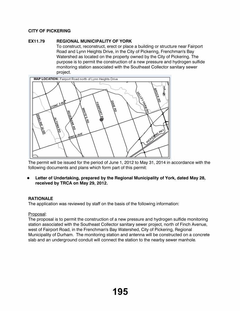
EX11.82 REGIONAL MUNICIPALITY OF YORKTo construct - reconstruct - erect or place a building or structure, temporarily or permanently place - dump or remove any material - originating on the site or elsewhere near Gordon Murison Lane and Steeles Avenue, in the City of Toronto (Scarborough Community Council Area), Rouge River Watershed as located on the property owned by the City of Toronto and the Toronto and Region Conservation Authority. The purpose is to permit the construction of a new pressure and hydrogen sulfide monitoring station associated with the Southeast Collector sanitary sewer project.
The permit will be issued for the period of June 1, 2012 to May 31, 2014 in accordance with the following documents and plans which form part of this permit:
Letter of Undertaking, prepared by the Regional Municipality of York, dated May 28,
2012, received by TRCA on May 29, 2012.

201
RATIONALEThe application was reviewed by staff on the basis of the following information:
Proposal:The proposal is to permit the construction of a new pressure and hydrogen sulfide monitoring station associated with the Southeast Collector sanitary sewer project, south of Steeles Avenue, west of Gordon Murison Lane, in the Rouge River Watershed, City of Toronto. The monitoring station and antenna will be constructed on a concrete slab and an underground conduit will connect the station to the nearby sewer manhole. An access road will be constructed to link the site to Gordon Murison Lane.
Control of Flooding:The project is not located within the Regional Storm Flood Plain, and the proposed work is therefore not anticipated to affect the conveyance or storage of flood waters.
Pollution:Standard erosion and sediment control measures (sediment fence) will be implemented prior to construction, maintained for the duration, and removed only after the site is stabilized and restored. Erosion and sediment control measures have been provided in accordance with the TRCA Erosion and Sediment Control Guidelines for Urban Construction.
Dynamic Beaches:Not applicable
Erosion:No impacts to slope stability or erosion have been identified.
Conservation of Land:Sediment control fencing will be installed to isolate the work area. No vegetation removals are proposed.
PlantingsThe site will be restored with a native seed mix once the work has been completed.
Policy Guidelines:This proposal is consistent with Section 4.3 - Infrastructure and Servicing - of the Toronto and Region Conservation Authority's Valley and Stream Corridor Management Program.
CFN: 47352 - Application #: 0310/12/TORReport Prepared by: Brian Storozinski, extension 5744For information contact: Brian Storozinski, extension 5744Date: May 29, 2012

202
CITY OF VAUGHAN
EX11.83 102 GAMBLE STREETTo construct, reconstruct, erect or place a building or structure, site grade and temporarily or permanently place, dump or remove any material, originating on the site or elsewhere on Part 2, 3 Lot 2, Plan 8467, (102 Gamble Street), in the City of Vaughan, Humber River Watershed. The purpose is to construct an inground pool within a Regulated Area of the Humber River watershed at 102 Gamble Street in the City of Vaughan.
The permit will be issued for the period of June 1, 2012 to May 31, 2014 in accordance with the following documents and plans which form part of this permit:
Pool Layout, Drawing No. A1, prepared by Maple Group, revise dated May 14, 2012,
received by the TRCA May 18, 2012, redline revised to indicate removal of excess fill material and location of sediment control fencing
RATIONALEThe application was reviewed by staff on the basis of the following information:
Proposal:The purpose is to construct an inground pool within a Regulated Area of the Humber River watershed. The subject property is partially located along the valley wall of a draw feature associated with the Main Humber River valley corridor. TRCA staff conducted a site visit to the property as part of our pre-consultation process on October 21, 2010. The subject property contains a relatively steep, heavily vegetated slope with a configuration of 1 horizontal : 2.5 vertical and an old retaining wall approximately 2 metre in maximum height is located at the top-of-slope.

203
Based upon a recent site visit on May 29th, 2012 and a Geotechincal Brief prepared by Soil Engineers Ltd., dated May 2, 2012, TRCA geotechnical staff are satisfied that the existing retaining wall and slope are stable and the proposed pool is adequately setback from these features. The proposed pool is to be located on tableland, within an existing patio area, 8 metres away from the existing retaining wall. No vegetation will be disturbed or removed to accommodate the construction of the pool.
Control of Flooding:The subject property is not located within the Regional Storm Flood Plain. There will be no impacts on the storage or conveyance of flood waters.
Pollution:Sediment control fencing will be erected and maintained for the duration of construction to prevent the transport of sediment into the draw feature.
Dynamic Beaches:Not applicable.
Erosion:Based upon the Geotechnical Brief prepared by Soil Engineers Ltd., TRCA geotechnical staff are satisfied that the existing slope conditions are stable and the proposed works are adequately set back from the slope.
Conservation of Land:As a watercourse will not be impacted by the proposal, no fisheries concerns will result. There are no other significant natural features on or adjacent to the site that may be negatively impacted by the project.
PlantingsAll disturbed area will be restored to the existing sodded condition and will not affect any significant natural features.
Policy Guidelines:The proposal is consistent with Section 4.2.2 E) - Property Improvements and Ancillary Structures - of the Authority's Valley and Stream Corridor Management Program.
CFN: 47433 - Application #: 0385/12/VAUGReport Prepared by: Anthony Sun, extension 5724For information contact: June Little, extension 5756Date: May 29, 2012
204
TOWN OF AJAX
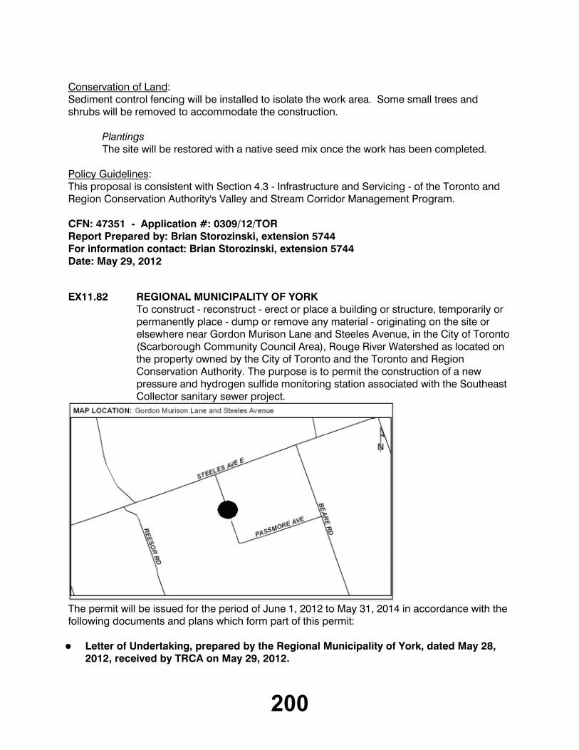
EX11.84 LANDWIN DEVELOPMENT CORPORATIONTo construct, reconstruct, erect or place a building or structure, site grade and temporarily or permanently place, dump or remove any material, originating on the site or elsewhere on Part Lot 3, 4, 5, Concession 1 , Part Lot ROAD ALLOWANCE BETWEEN LOTS 2, 3, 4, 5, Concession 1, (Achilles Road, east of Salem Road), in the Town of Ajax, Carruthers Creek Watershed as located on the property owned by Landwin Development Corporation. The purpose is to construct a new sanitary sewer line to service new employment lands along Achilles Road within two Regulated Areas adjacent to the Carruthers Creek.
The permit will be issued for the period of June 1, 2012 to May 31, 2014 in accordance with the following documents and plans which form part of this permit:
Drawing No. P-101, Achilles Road From STA 10+000.000 to STA 10+260.000,
prepared by Sernas Associates, dated January 2012, Received by TRCA on April 28, 2012;Drawing No. P-102, Achilles Road From STA 10+260.000 to STA 10+515.000,
prepared by Sernas Associates, dated January 2012, Received by TRCA on April 28, 2012;Drawing No. ERS-101, Erosion & Sediment Control Plan, prepared by Sernas
Associates, dated January 2012, Received by TRCA on April 28, 2012.
RATIONALEThe application was reviewed by staff on the basis of the following information:

205
Proposal:The applicant seeks permission to construct a new 200 mm (7.9 inch) sanitary sewer along the north side of Achilles Road extending from the existing trunk sewer located within the Carruthers Creek valleylands westward to a point east of the existing car dealership at the intersection of Salem Road and Achilles Road. The works are required to provide municipal sanitary sewer services to a developing section of employment lands located along Achilles road, parallel to Highway 401 in the southeast portion of the Town of Ajax. The sewer is to be constructed along an existing road right of way, crossing over an existing culvert conveying a tributary to the Carruthers Creek.
Control of Flooding:The proposed works are not located within in a Regional Storm Flood Plain and will have no impact upon the storage and conveyance of flood waters.
Pollution:An Erosion and Sediment control plan has been submitted in support of the application. The plan provides for site stabilization and isolation of the work area from the Carruthers Creek tributary in order to prevent sedimentation of the creek.
Dynamic Beaches:Not applicable
Erosion:There are no geotechnical or slope stability concerns associated with this proposal.
Conservation of Land:The proposed sewer has been sited within the existing road right of way so as to protect the tributary corridor and vegetation beyond Achilles Road.
PlantingsNo plantings have been required as part of this approval. However disturbed areas are to be re-seeded upon completion of the works.
Policy Guidelines:This proposal is consistent with Section 4.3, Infrastructure and Servicing, of TRCA's Valley and Stream Corridor Management Program.
CFN: 47071 - Application #: 0120/12/AJAXReport Prepared by: Chris Jones, extension 5718For information contact: Chris Jones, extension 5718Date: May 30, 2012

206
TOWN OF MARKHAM
EX11.85 33 BILLY JOEL CRESCENTTo construct, reconstruct, erect or place a building or structure, site grade and temporarily or permanently place, dump or remove any material, originating on the site or elsewhere on Lot 17, Plan 5879, (33 Billy Joel Crescent), in the Town of Markham, Rouge River Watershed. The purpose is to undertake works within a TRCA Regulated Area of Rouge River Watershed, in order to facilitate the removal of an existing deck and replace the structure with a smaller, enclosed sunroom.
The permit will be issued for the period of June 1, 2012 to May 31, 2014 in accordance with the following documents and plans which form part of this permit:
Topographic Survey, Prepared by Salna Surveying, Dated January 20, 2012, Received
April 18, 2012;Sheet No. SP1, Site Plan, Prepared by Four Seasons Home Products, Received April
18, 2012;Sheet No. A1, Framing Plan, Prepared by Four Seasons Home Products, Received
April 18, 2012;Sheet No. A2, Floor Plan, Prepared by Four Seasons Home Products, Received April
18, 2012;Sheet No. A4, Section, Prepared by Four Seasons Home Products, Received April 18,
2012;Sheet No. A5-A7, Elevations, Prepared by Four Seasons Home Products, Received
April 18, 2012;Geotechnical Investigation, Prepared by Soiltest Services Ltd., Received April 18,
2012.
RATIONALEThe application was reviewed by staff on the basis of the following information:

207
Proposal:The purpose of this application is to undertake works within a TRCA Regulated Area of the Rouge River Watershed, in order to facilitate the replacement of an existing deck with a smaller, enclosed sunroom. The subject property is located east of Markham Road and south of Highway 7, with the Rouge River located to the south of the property. The majority of the dwelling is located within the TRCA's regulated area and is located within an established neighbourhood. While this dwelling is located above the top of bank, it is located within close proximity of the feature. The existing deck is located close to the top of bank. Once the deck is removed, the proposed sunroom will be located closer to the home, away from the valley feature, and will have an overall reduced floor plate in comparison to the existing deck. A geotechnical investigation was submitted and reviewed by TRCA staff which confirmed that the proposed sunroom is appropriately set back and buffered from the stable top of slope. Therefore the proposed sunroom will provide a larger buffer and an overall reduction in risk. As such, TRCA staff concur with the findings and agree that the proposed sunroom is appropriately located on the property.
TRCA staff are satisfied that the proposed sunroom will not have any negative impacts on the feature as it will be located within the existing footprint of the existing deck structure. The proposed works are located outside of the Regional Storm Floodplain.
Control of Flooding:The proposed structures are located outside of the Regional Storm Floodplain. As such, no impacts to the storage and/or conveyance of floodwaters are anticipated.
Pollution:Appropriate sediment and erosion controls will be installed and maintained on the subject property throughout all phases of construction.
Dynamic Beaches:Not applicable
Erosion:All geotechnical concerns have been addressed by the applicant and approved by TRCA staff.
Conservation of Land:No significant vegetation will be removed as a result of construction.
PlantingsNo plantings are proposed as the site will remain in its current state.
Policy Guidelines:The proposal is consistent with Section 4.2.2 (D) and (E) - Existing Development, of the Authority's Valley and Stream Corridor Management Program (VSCMP).
CFN: 47317 - Application #: 0284/12/MARKReport Prepared by: Uton Samuels, extension 5386For information contact: Uton Samuels, extension 5386Date: May 29, 2012
Related Documents