James, Heather Frances (2009) Medieval rural settlement: a study of Mid- Argyll, Scotland. PhD thesis. http://theses.gla.ac.uk/1380/ Copyright and moral rights for this thesis are retained by the author A copy can be downloaded for personal non-commercial research or study, without prior permission or charge This thesis cannot be reproduced or quoted extensively from without first obtaining permission in writing from the Author The content must not be changed in any way or sold commercially in any format or medium without the formal permission of the Author When referring to this work, full bibliographic details including the author, title, awarding institution and date of the thesis must be given. Glasgow Theses Service http://theses.gla.ac.uk/ [email protected]

Welcome message from author
This document is posted to help you gain knowledge. Please leave a comment to let me know what you think about it! Share it to your friends and learn new things together.
Transcript
James, Heather Frances (2009) Medieval rural settlement: a study of Mid-Argyll, Scotland. PhD thesis. http://theses.gla.ac.uk/1380/ Copyright and moral rights for this thesis are retained by the author A copy can be downloaded for personal non-commercial research or study, without prior permission or charge This thesis cannot be reproduced or quoted extensively from without first obtaining permission in writing from the Author The content must not be changed in any way or sold commercially in any format or medium without the formal permission of the Author When referring to this work, full bibliographic details including the author, title, awarding institution and date of the thesis must be given.
Glasgow Theses Service http://theses.gla.ac.uk/
Medieval Rural Settlement:
A Study of Mid-Argyll, Scotland
Two Volumes
Volume 1
Heather Frances James
Thesis submitted to the University of Glasgow for the degree of
Doctor of Philosophy in the Faculty of Arts,
Department of Archaeology.
November 2009.
© H F James
ii
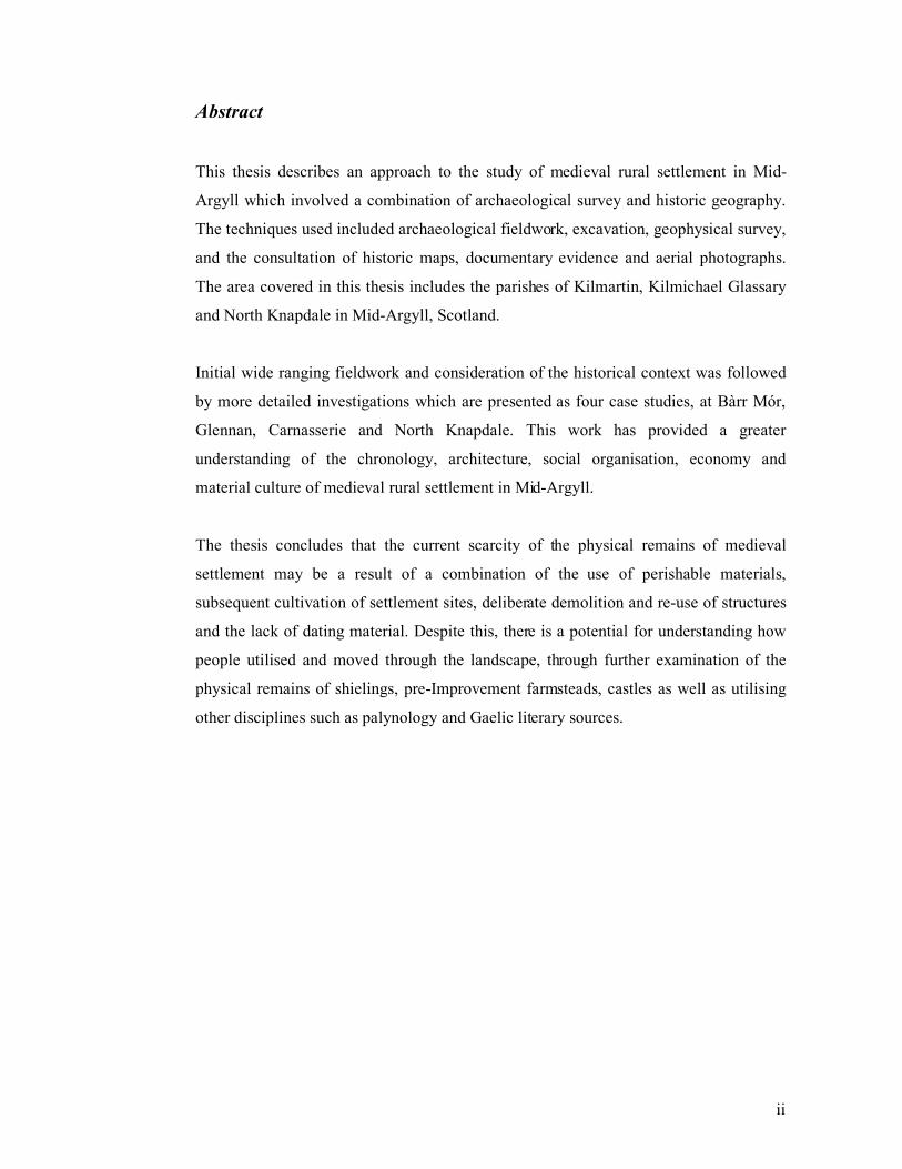
Abstract
This thesis describes an approach to the study of medieval rural settlement in Mid-
Argyll which involved a combination of archaeological survey and historic geography.
The techniques used included archaeological fieldwork, excavation, geophysical survey,
and the consultation of historic maps, documentary evidence and aerial photographs.
The area covered in this thesis includes the parishes of Kilmartin, Kilmichael Glassary
and North Knapdale in Mid-Argyll, Scotland.
Initial wide ranging fieldwork and consideration of the historical context was followed
by more detailed investigations which are presented as four case studies, at Bàrr Mór,
Glennan, Carnasserie and North Knapdale. This work has provided a greater
understanding of the chronology, architecture, social organisation, economy and
material culture of medieval rural settlement in Mid-Argyll.
The thesis concludes that the current scarcity of the physical remains of medieval
settlement may be a result of a combination of the use of perishable materials,
subsequent cultivation of settlement sites, deliberate demolition and re-use of structures
and the lack of dating material. Despite this, there is a potential for understanding how
people utilised and moved through the landscape, through further examination of the
physical remains of shielings, pre-Improvement farmsteads, castles as well as utilising
other disciplines such as palynology and Gaelic literary sources.
iii
Acknowledgements
I would like to thank my supervisor Professor Stephen Driscoll and to members of my
panel, Michael Given, Coleen Batey and Ewan Campbell for their guidance and
comments over these years. I would also like to thank John Raven and Steve Boyle for
their advice and assistance and Professor Dauvit Broun for his very useful comments on
Chapter 4. The initial fieldwork was assisted financially by the Forestry Commission
and Historic Scotland with encouragement from Brent Meakin, Sarah Govan and Olwyn
Owen.
The work at Bàrr Mór was undertaken with the assistance of a grant from the Forestry
Commission, Historic Scotland, the Society of Antiquaries for Scotland and the Hunter
Archaeological Trust. The small bones retrieved from Bàrr Mór were kindly examined
by Clayton M Tinsley of New York University. The botanical remains were examined
by Jennifer Miller and Susan Ramsay. The work at Glennan was undertaken with the
assistance of the landowner Dr Hugh Willison and family, with additional financial
assistance from Historic Scotland. Permission to excavate Structure 017 was granted by
the landowners Mr and Mrs McNair of Stronesker Farm.
Many friends and undergraduate students from University of Glasgow accompanied me
into the hills including Alice Blackwell, Clare Cross, Fran Croal, Tessa Poller, Alan
Duffy, Dave Swan, Nicola Hall, Sandra Rosendahl, Nicholas Edgar, Mhairi Murning,
Chris Muirhead, Louise Craig, Mark MacDonald, Asuko Gamo, Kylie Seretis, John
Raven, Amanda Brend, Sarah Thomas, Krisjana Eyjolfsson, Clare Casey, Amanda
Gow, Cheryl Leggett and Matthew Bell. The geophysical surveys were carried out by
Tessa Poller, Emily Heinz, Amanda Gow and Kirsten Thomas. My special thanks also
go to Archie Gillies of the Forestry Commission for sharing his unique knowledge of
the woods.
The excavations were also greatly assisted by enthusiastic members of the Lorn
Archaeological and Historical Society, who included Alison Blackwood, Roy Parish,
Martin Petrie and Michael Turner. The work at Carnasserie was assisted by Rosemary
Campbell of Carnasserie Farm - it would have taken much longer and been less
iv
productive without her generous guidance. Accommodation over the years was kindly
provided by Gilly Hind of Ardfern and Kilmartin House Museum. Special thanks go to
Sharon Webb and Richard Adair for allowing us to dirty the hallway. John Arthur,
Tessa Poller and Ingrid Shearer have all kindly assisted with the line illustrations and
Jen Cochrane cheerfully helped with the printing.
I would like to thank my mother for her generous support over these years without
which this research would not have been possible. Finally I would like to thank Tessa
for her inspiration to start this in the first place, her insightful comments on the text, her
support and encouragement to just get it finished.
v
Contents
Volume 1
Abstract ii
Acknowledgements iii
Contents v
List of Figures viii
List of Tables xvi
1.0 Introduction and Methodology 1
2.0 Review of Medieval Settlement Studies 21
2.1 Introduction 21
2.2 The contribution of the vernacular architecture approach, early
excavations and topographic surveys
22
2.3 The contribution of architectural typologies 40
2.4 The contribution of historical geography 46
2.5 Regional models based on the results of survey and excavation 51
2.6 Review of the archaeological evidence from Mid-Argyll 83
2.7 Maritime and coastal resources in Mid-Argyll in the medieval priod 99
2.8 Discussion 100
3.0 An Overview of the Social and Economic History of Argyll in the
Medieval and Post-Medieval Period
103
3.1 Introduction 103
3.2 The Kingdoms of Dalriada and Somerled and the extension of
Scottish royal power - The 5th
to the 13th
Centuries
103
3.3 Wars, famine and economic contraction in the 14th
– 15th
centuries 108
3.4 Power, politics and rebellion, the Campbell Earls of Argyll in the
16th
and 17th
centuries
119
3.5 Economy and society in the 18th
and 19th
centuries 127
vi
4.0 An Overview of Historic Maps and Documentary Sources 135
4.1 Introduction 135
4.2 Historic maps 135
4.3 Documentary sources 144
4.4 Place-names 171
5.0 Results of Preliminary Fieldwork 179
5.1 Introduction 179
5.2 Survey of deserted settlements 181
5.3 Structures not depicted on the 1st edition OS maps 192
5.4 Bennan (Site 44) NGR NM 805 001 196
5.5 Shielings 200
5.6 Platform sites 207
5.7 Circular enclosures and large irregular enclosures 208
5.8 Duns and forts 209
5.9 Land boundaries 212
5.10 Possible medieval tower houses 214
5.11 Places of assembly and inauguration 216
5.12 Ecclesiastical sites 219
5.13 Conclusions from preliminary fieldwork 223
6.0 Bàrr Mór, Kilmartin: Case Study 1 226
6.1 Introduction 226
6.2 The results of the excavation 227
6.3 Historical research 236
6.4 Conclusions 239
7.0 Glennan, Kilmartin: Case Study 2 242
7.1 Introduction 242
7.2 The results of excavations 243
7.3 The landscape context 248
7.4 Historical research 250
7.5 Conclusions 256
vii
8.0 Carnasserie, Kilmartin: Case Study 3 259
8.1 Introduction 259
8.2 Known archaeological sites with background historical research 260
8.3 Results of the walkover survey 267
8.4 Conclusions 275
9.0 North Knapdale: Case Study 4 278
9.1 Introduction 278
9.2 Known archaeological sites 279
9.3 Historic maps and documents 281
9.4 Aerial photographs 288
9.5 Walkover survey 289
9.6 Conclusions 296
10.0 Discussion & Conclusions 298
11.0 References 317
Volume 2
Figures 344
Appendices 477
viii
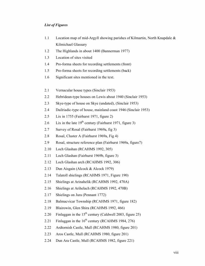
List of Figures
1.1 Location map of mid-Argyll showing parishes of Kilmartin, North Knapdale &
Kilmichael Glassary
1.2 The Highlands in about 1400 (Bannerman 1977)
1.3 Location of sites visited
1.4 Pro-forma sheets for recording settlements (front)
1.5 Pro-forma sheets for recording settlements (back)
1.6 Significant sites mentioned in the text.
2.1 Vernacular house types (Sinclair 1953)
2.2 Hebridean-type houses on Lewis about 1940 (Sinclair 1953)
2.3 Skye-type of house on Skye (undated), (Sinclair 1953)
2.4 Dailriadic-type of house, mainland coast 1946 (Sinclair 1953)
2.5 Lix in 1755 (Fairhurst 1971, figure 2)
2.6 Lix in the late 19th
century (Fairhurst 1971, figure 3)
2.7 Survey of Rosal (Fairhurst 1969a, fig 3)
2.8 Rosal, Cluster A (Fairhurst 1969a, Fig 4)
2.9 Rosal, structure reference plan (Fairhurst 1969a, figure7)
2.10 Loch Glashan (RCAHMS 1992, 305)
2.11 Loch Glashan (Fairhurst 1969b, figure 3)
2.12 Loch Glashan arch (RCAHMS 1992, 306)
2.13 Dun Aisgain (Alcock & Alcock 1979)
2.14 Talatoll shielings (RCAHMS 1971, Figure 190)
2.15 Shielings at Arinahelik (RCAHMS 1992, 470A)
2.16 Shielings at Arihelach (RCAHMS 1992, 470B)
2.17 Shielings on Jura (Pennant 1772)
2.18 Balmacvicar Township (RCAHMS 1971, figure 182)
2.19 Blairowin, Glen Shira (RCAHMS 1992, 466)
2.20 Finlaggan in the 15th
century (Caldwell 2003, figure 25)
2.21 Finlaggan in the 16th
century (RCAHMS 1984, 276)
2.22 Ardtornish Castle, Mull (RCAHMS 1980, figure 201)
2.23 Aros Castle, Mull (RCAHMS 1980, figure 201)
2.24 Dun Ara Castle, Mull (RCAHMS 1982, figure 221)
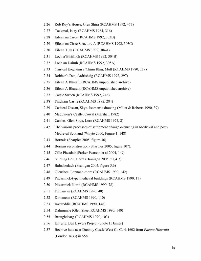
ix
2.26 Rob Roy’s House, Glen Shira (RCAHMS 1992, 477)
2.27 Tockmal, Islay (RCAHMS 1984, 316)
2.28 Eilean na Circe (RCAHMS 1992, 303B)
2.29 Eilean na Circe Structure A (RCAHMS 1992, 303C)
2.30 Eilean Tigh (RCAHMS 1992, 304A)
2.31 Loch a’Bhàillidh (RCAHMS 1992, 304B)
2.32 Loch an Daimh (RCAHMS 1992, 305A)
2.33 Caisteal Eòghainn a’Chinn Bhig, Mull (RCAHMS 1980, 119)
2.34 Robber’s Den, Ardrishaig (RCAHMS 1992, 297)
2.35 Eilean A Bharain (RCAHMS unpublished archive)
2.36 Eilean A Bharain (RCAHMS unpublished archive)
2.37 Castle Sween (RCAHMS 1992, 246)
2.38 Fincharn Castle (RCAHMS 1992, 284)
2.39 Casiteal Uisean, Skye. Isometric drawing (Miket & Roberts 1990, 39).
2.40 MacEwen’s Castle, Cowal (Marshall 1982)
2.41 Castles, Glen Strae, Lorn (RCAHMS 1975, 2)
2.42 The various processes of settlement change occurring in Medieval and post-
Medieval Scotland (Whyte 2000, Figure 1, 148)
2.43 Bornais (Sharples 2005, figure 36)
2.44 Bornais reconstruction (Sharples 2005, figure 107).
2.45 Cille Pheadair (Parker Pearson et al 2004, 149)
2.46 Shieling B58, Barra (Branigan 2005, fig 4.7)
2.47 Balnabodach (Branigan 2005, figure 5.6)
2.48 Glenshee, Lennoch-more (RCAHMS 1990, 142)
2.49 Pitcarmick-type medieval buildings (RCAHMS 1990, 13)
2.50 Pitcarmick North (RCAHMS 1990, 78)
2.51 Dirnanean (RCAHMS 1990, 40)
2.52 Dirnanean (RCAHMS 1990, 110)
2.53 Invereddie (RCAHMS 1990, 146).
2.54 Dalmunzie (Glen Shee, RCAHMS 1990, 140)
2.55 Broughdearg (RCAHMS 1990, 103)
2.56 Kiltyrie, Ben Lawers Project (photo H James)
2.57 Beehive huts near Dunboy Castle West Co Cork 1602 from Pacata Hibernia
(London 1633) iii 558.
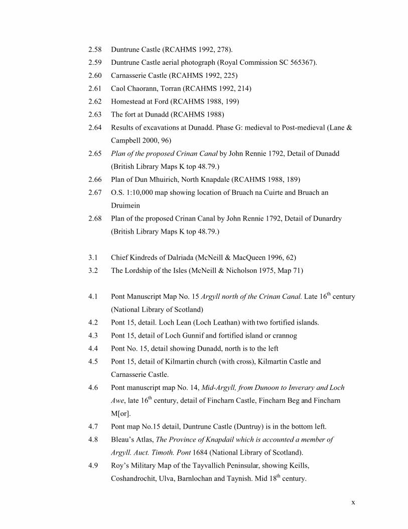
x
2.58 Duntrune Castle (RCAHMS 1992, 278).
2.59 Duntrune Castle aerial photograph (Royal Commission SC 565367).
2.60 Carnasserie Castle (RCAHMS 1992, 225)
2.61 Caol Chaorann, Torran (RCAHMS 1992, 214)
2.62 Homestead at Ford (RCAHMS 1988, 199)
2.63 The fort at Dunadd (RCAHMS 1988)
2.64 Results of excavations at Dunadd. Phase G: medieval to Post-medieval (Lane &
Campbell 2000, 96)
2.65 Plan of the proposed Crinan Canal by John Rennie 1792, Detail of Dunadd
(British Library Maps K top 48.79.)
2.66 Plan of Dun Mhuirich, North Knapdale (RCAHMS 1988, 189)
2.67 O.S. 1:10,000 map showing location of Bruach na Cuirte and Bruach an
Druimein
2.68 Plan of the proposed Crinan Canal by John Rennie 1792, Detail of Dunardry
(British Library Maps K top 48.79.)
3.1 Chief Kindreds of Dalriada (McNeill & MacQueen 1996, 62)
3.2 The Lordship of the Isles (McNeill & Nicholson 1975, Map 71)
4.1 Pont Manuscript Map No. 15 Argyll north of the Crinan Canal. Late 16th
century
(National Library of Scotland)
4.2 Pont 15, detail. Loch Lean (Loch Leathan) with two fortified islands.
4.3 Pont 15, detail of Loch Gunnif and fortified island or crannog
4.4 Pont No. 15, detail showing Dunadd, north is to the left
4.5 Pont 15, detail of Kilmartin church (with cross), Kilmartin Castle and
Carnasserie Castle.
4.6 Pont manuscript map No. 14, Mid-Argyll, from Dunoon to Inverary and Loch
Awe, late 16th
century, detail of Fincharn Castle, Fincharn Beg and Fincharn
M[or].
4.7 Pont map No.15 detail, Duntrune Castle (Duntruy) is in the bottom left.
4.8 Bleau’s Atlas, The Province of Knapdail which is accounted a member of
Argyll. Auct. Timoth. Pont 1684 (National Library of Scotland).
4.9 Roy’s Military Map of the Tayvallich Peninsular, showing Keills,
Coshandrochit, Ulva, Barnlochan and Taynish. Mid 18th
century.
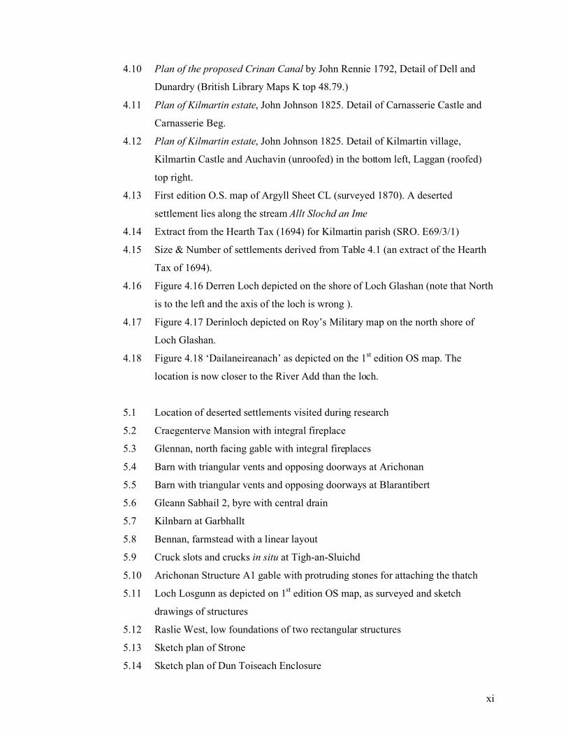
xi
4.10 Plan of the proposed Crinan Canal by John Rennie 1792, Detail of Dell and
Dunardry (British Library Maps K top 48.79.)
4.11 Plan of Kilmartin estate, John Johnson 1825. Detail of Carnasserie Castle and
Carnasserie Beg.
4.12 Plan of Kilmartin estate, John Johnson 1825. Detail of Kilmartin village,
Kilmartin Castle and Auchavin (unroofed) in the bottom left, Laggan (roofed)
top right.
4.13 First edition O.S. map of Argyll Sheet CL (surveyed 1870). A deserted
settlement lies along the stream Allt Slochd an Ime
4.14 Extract from the Hearth Tax (1694) for Kilmartin parish (SRO. E69/3/1)
4.15 Size & Number of settlements derived from Table 4.1 (an extract of the Hearth
Tax of 1694).
4.16 Figure 4.16 Derren Loch depicted on the shore of Loch Glashan (note that North
is to the left and the axis of the loch is wrong ).
4.17 Figure 4.17 Derinloch depicted on Roy’s Military map on the north shore of
Loch Glashan.
4.18 Figure 4.18 ‘Dailaneireanach’ as depicted on the 1st edition OS map. The
location is now closer to the River Add than the loch.
5.1 Location of deserted settlements visited during research
5.2 Craegenterve Mansion with integral fireplace
5.3 Glennan, north facing gable with integral fireplaces
5.4 Barn with triangular vents and opposing doorways at Arichonan
5.5 Barn with triangular vents and opposing doorways at Blarantibert
5.6 Gleann Sabhail 2, byre with central drain
5.7 Kilnbarn at Garbhallt
5.8 Bennan, farmstead with a linear layout
5.9 Cruck slots and crucks in situ at Tigh-an-Sluichd
5.10 Arichonan Structure A1 gable with protruding stones for attaching the thatch
5.11 Loch Losgunn as depicted on 1st edition OS map, as surveyed and sketch
drawings of structures
5.12 Raslie West, low foundations of two rectangular structures
5.13 Sketch plan of Strone
5.14 Sketch plan of Dun Toiseach Enclosure
xii
5.15 Sketch plan of Bàrr Mór
5.16 Sketch plan of Loch Glashan
5.17 Loch Glashan Structures A & B on the shore
5.18 Bennan as depicted on the 1st edition OS map, as surveyed, and sketch plans of
structures
5.19 Sketch plans of some of the shielings found during this research (see file
539REA.ai)
5.20 Graph showing the length/width ratio of shielings recorded during this research
5.21 Druim Buidhe, a probable lambing pen
5.22 Garbh Sron shieling with substantial drystone walls
5.23 Altitude in metres of 32 shieling sites
5.24 Comparison of shieling length/width ratio and their altitudes in metres.
5.25 Carnasserie shielings & cultivation
5.26 Corlach shieling, with a lambing pen in the top left corner
5.27 Corlach in 1st edition OS map (Argyllshire Sheet CXXXVIII)
5.28 Glennan platform (Site 68), sketch plan
5.29 Features seen on aerial photographs shown against 1st edition OS map of
Fearnoch
5.30 Caol Chaoruinn, Torran (RCAHMS 1992, 214)
5.31 Location of Caol Chaoruinn
5.32 Area covered by Geophsyical surveys at Caol Chaoruinn
5.33 Interpretation of Resistivity survey at Caol Chaoruinn (Poller 2004)
5.34 O’Neill Inauguration in about 1600 (Dartmouth Map no. 25, National Maritime
Museum, Dublin).
5.35 Bruach na Cuirte, S of Slockavullin
5.36 Kilmartin Churchyard gravestone
5.37 Galley on carved gravestone at Kilmichael Glassary (RCAHMS 1992, 144)
5.38 Galley on carved stone Kilmory Knap (RCAHMS 1992, 165)
5.39 Effigy of Sir Duncan Campbell, Kilmun (Boardman 2006, Plate 3)
6.1 Bàrr Mór location plan
6.2 Bàrr Mór topographic survey
6.3 Bàrr Mór site with moss removed
6.4 Bàrr Mór Structure A plan
6.5 Bàrr Mór Structure A from the east

xiii
6.6 Bàrr Mór Structure B plan
6.7 Bàrr Mór Structure A hearth (016)
6.8 Bàrr Mór Structure A, hearth section
6.9 Bàrr Mór non ceramic finds
6.10 Bàrr Mór Structure B, cobbles (026)
6.11 Bàrr Mór, 16th
/17th
century French pottery found within Structure B
7.1 Glennan location
7.2 Glennan topographic survey Grids for Geophysical surveys shown in red (Poller
2003) and green (Hinz 2005).
7.3 Roy’s Military map of the Glennan area. Craegenterve (the farm opposite
Glennan) is at the top of the map.
7.4 ‘Glenan’, George Langlands 1801 This map of Argyllshire (National Library of
Scotland)
7.5 Glennan, 1st edition OS map of Argyllshire
7.6 Glennan, Structure 017 after the rubble was removed
7.7 Glennan, Structure 051 exposed in a narrow trench.
7.8 Glennan, Gradiometer Survey of Area 1 (Poller 2004)
7.9 Glennan, Gradiometer survey of Area 2 (Hinz 2005)
7.10 Glennan, Gradiometer survey of Area 3 (Hinz 2005)
7.11 Glennan, DGPS survey
7.12 Glennan, enclosure & shieling (NM80SE 20)
7.13 Glennan, Platform Site 68
7.14 Extract from Hearth Tax 1694 (SRO E69/3/1).
8.1 Location of Carnasserie
8.2 Carnasserie Castle from the south, compare with Pont’s image Figure 8.4
8.3 Carnasserie Castle by Pont (National Library of Scotland)
8.4 Carnasserie, earlier castle or dun seen from Carnasserie Castle
8.5 Carnasserie Castle, Roy’s Military map
8.6 Carnassary (Carnasserie Mor) a) 1st edition OS map of Argyllshire
Sheet CXXXVIII, 1875 b) sketch plan c) floor plans of surviving structures
8.7 Carnasserie Mor, Structures A & B
8.8 Carnasserie Mor, Structure A
8.9 Carnasserie Structure M
xiv
8.10 Carnassserie, field survey plan
8.11 Carnasserie, Sron an Tighe Dhuibh, shielings, Site 246, broad landscape
8.12 Carnasserie, Sron an Tighe Dhuibh shielings, Site 246, detail
8.13 Carnasserie, Sron an Tighe Dhuibh shielings, Site 246, topographic survey
8.14 Carnasserie. Site 260, a large enclosure which incorporates four oval-shaped
structures
8.15 Carnasserie. Site 245, a hill-top circular enclosure
8.16 Carnasserie. Site 261, a circular structure, possibly a hut circle
8.17 Carnasserie. Site 257, oval-shaped shieling
9.1 North Knapdale detail from Blaeu’s Atlas, The Province of Knapdail which is
accounted a member of Argyll, dated 1654.
9.2 Detail of Castle Sween (Castel Suyn) from Blaeu’s Atlas, The Province of
Knapdail which is accounted a member of Argyll,dated 1654
9.3 Roy Military Survey of Scotland, 1747-1755 (National Library of Scotland).
Detail of Castle Sween.
9.4 Roy Military Survey of Scotland, 1747-1755 (National Library of Scotland).
Detail of Kilmory
9.5 19th
century photograph of Kilmory township (RCAHMS)
9.6 Kilmory and Ardnaw survey
9.7 Kilmory, turf-built structure (Site 325). The location is by slightly greener patch
in the centre of the picture. The chapel is in the background to the left.
9.8 Ardnaw Farm, Structure E, late 19th
century in date
9.9 Gortan Ghobhainn, three structures survived as low stone walls protruding from
the turf
9.10 Daltote, re-built deserted structure (Site 331)
9.11 Daltote, possible rectangular turf-built structure within felled forestry (Site 332)
9.12 Sites on the Tayvallich peninsular, North Knapdale
9.13 Barnashalig new site (271), two rectangular structures and a kiln
9.14 Barnashalig new site (271), possible dwelling
9.15 Roy Military Survey of Scotland, 1747-1755 (National Library of Scotland).
Detail of Tayvallich peninsular
9.16 South Ardbeg, Site 276, Structure G.
9.17 Keills Chapel and turf-built structures

xv
9.18 Keills, turf-built structure beneath later drystone enclosure
9.19 Roy Military Survey of Scotland, 1747-1755 (National Library of Scotland).
Detail of Keills
9.20 Keills Port, slight mound in the vicinity of settlement shown on Roy’s military
map.
9.21 Dun Mhuirich, drystone walls of Structure I
xvi
List of Tables
2.1 Crannogs within survey area
4.1 Numbers of hearths per settlement from Hearth Tax of 1694 (geographically, by
parish and by larger landholding.
4.2 Place-names in Kilmartin parish referenced in Origines Pariochiales Scotiae
(Innes 1855a).
4.3 Place-names in North Knapdale parish referenced in the Origines Pariochiales
Scotiae (Innes 1855a).
4.4 Sites in Kilmichael Glassary parish referenced in the Origines Pariochiales
Scotiae (Innes 1854).
4.5 Place-names mentioned in Scrymgeour Papal Petition of 1501 (Fuller 1994, 317-
8).
4.6 Sites with the baile-, acha(dh)- and airigh- prefix in Mid-Argyll.
5.1 Results of fieldwork
5.2 All settlement sites shown on Pont 15: Argyll north of the Crinan Canal with
their equivalent names on Roy and the 1st edition where they can be traced.
5.3 Settlement sites on Blaeu’s map of Lorne (only those west of what would
become the Crinan canal) and in North Knapdale are included, with their
equivalent names on Roy and the 1st edition OS maps.
5.4 Sites with structures not depicted in the 1st edition OS map.
5.5 Newly discovered sites (excluding shielings).
5.6 Shape of shielings.
6.1 Table 6.1. Radiocarbon dates from Bàrr Mór. NB calibrated ages are determined
from the University of Oxford Radiocarbon Accelerator Unit calibration
program (OxCal3).
8.1 All archaeological sites on Carnasserie farm prior to this research.
8.2 Sites identified at Carnasserie during a walkover survey
Chapter 1: Introduction and methodology
1
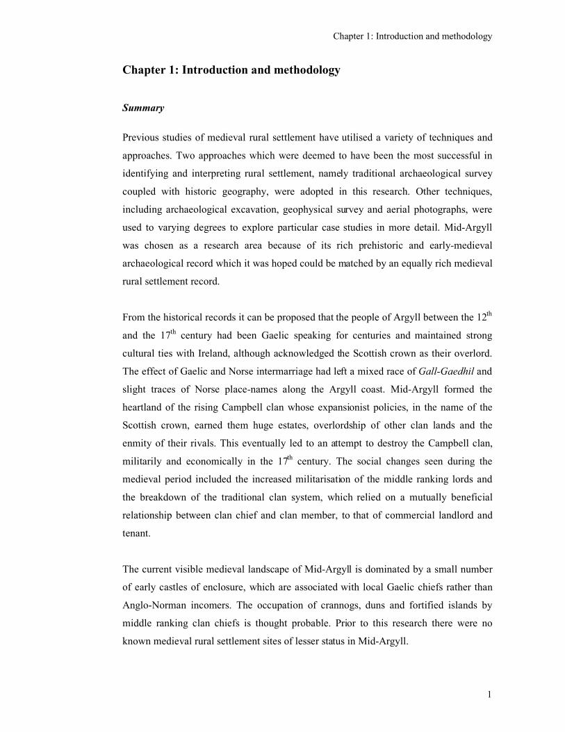
Chapter 1: Introduction and methodology
Summary
Previous studies of medieval rural settlement have utilised a variety of techniques and
approaches. Two approaches which were deemed to have been the most successful in
identifying and interpreting rural settlement, namely traditional archaeological survey
coupled with historic geography, were adopted in this research. Other techniques,
including archaeological excavation, geophysical survey and aerial photographs, were
used to varying degrees to explore particular case studies in more detail. Mid-Argyll
was chosen as a research area because of its rich prehistoric and early-medieval
archaeological record which it was hoped could be matched by an equally rich medieval
rural settlement record.
From the historical records it can be proposed that the people of Argyll between the 12th
and the 17th century had been Gaelic speaking for centuries and maintained strong
cultural ties with Ireland, although acknowledged the Scottish crown as their overlord.
The effect of Gaelic and Norse intermarriage had left a mixed race of Gall-Gaedhil and
slight traces of Norse place-names along the Argyll coast. Mid-Argyll formed the
heartland of the rising Campbell clan whose expansionist policies, in the name of the
Scottish crown, earned them huge estates, overlordship of other clan lands and the
enmity of their rivals. This eventually led to an attempt to destroy the Campbell clan,
militarily and economically in the 17th century. The social changes seen during the
medieval period included the increased militarisation of the middle ranking lords and
the breakdown of the traditional clan system, which relied on a mutually beneficial
relationship between clan chief and clan member, to that of commercial landlord and
tenant.
The current visible medieval landscape of Mid-Argyll is dominated by a small number
of early castles of enclosure, which are associated with local Gaelic chiefs rather than
Anglo-Norman incomers. The occupation of crannogs, duns and fortified islands by
middle ranking clan chiefs is thought probable. Prior to this research there were no
known medieval rural settlement sites of lesser status in Mid-Argyll.
Chapter 1: Introduction and methodology
2
The preliminary fieldwork confirmed that the landscape is dominated by 19th century
deserted remains, the result of landlord investment during the Improvement, which was
swiftly followed by the Clearances. Despite the historic maps and documents revealing
a high degree of continuity of farm names back to the late 16th century (and in some
cases back to the 13thcentury) very few sites showed any evidence for being multi-
period. The potentially pre-19th-century remains consisted of low stone wall foundations
for rectangular structures, which could have been medieval or Post-medieval in date.
Four case studies were chosen for more detailed study because of their high potential for
medieval remains. The excavations at Bàrr Mór proved it to be a rare survival of a late-
medieval farmstead, which represents late-medieval colonisation of moorland. The use
of drystone for gable height walls (which has aided its survival) was previously not
thought to have been introduced until the 18th century. Charters record the existence of a
farm at Glennan in the 13th century and a laird’s house by the 17
th century, but despite
excavation and geophysical surveys, no structures of such dates were uncovered,
although potential sites still remain to be examined. The hill ground surrounding
Glennan is filled with shielings and areas of cultivation which may represent medieval,
or Post-medieval, short-distance transhumance.
The relationship between a medieval castle, two settlements and shieling grounds were
examined at Carnasserie. There was evidence of a possible earlier hall-house ditch and
bank and a possible small dun in the vicinity of the 16th century tower house, which
would attest to continuity of high status use at this site. Carnasserie Mor, which was
farmed separately from the castle since the 16th century, had a relatively stable location
in the landscape, while Carnasserie Beg shifted in the landscape in the vicinity of the
castle. The shielings and cultivation in the hills, as at Glennan, may contain remnants of
medieval short-distance transhumance. The medieval landscape of North Knapdale was
dominated by Castle Sween, although there is tangible evidence for possible continued
use of fortified islands. The continuity of place-names from the 16th to the 19
th centuries
was again notable, as was the evidence for the use of turf walls in buildings into the 19th
century.
The numerous 19th century settlements were relatively self-sufficient joint-tenancy
farms which were occupied by a number of families when the population was at its
Chapter 1: Introduction and methodology
3
peak. There is no visible evidence that these are multi-period sites and the process of
settlement shift may have been continuous throughout the medieval period. The historic
maps indicate that some new settlements were created in the Post-medieval period, with
the colonisation of shieling sites with permanent farms, and this process was also seen
in the late-medieval period as at Bàrr Mór. Many other new settlements were the result
of settlement splitting, possibly prompted by population pressure. Evidence for
settlement splitting was generally found in the 16th century, although there is one
reference dating to the mid 14th century, the period when the population was thought to
be falling.
Based on a combined analysis of the historical records (extrapolating back from the
late-16th century) with the results of archaeological fieldwork it is possible to suggest
that the pattern of medieval rural settlement consisted of a sparse population living in
small farmsteads, with on average four households. These mixed farms were located
near available arable ground and had access to summer pasture for pasturing stock. The
nature of the landscape meant short-distance transhumance was practiced. Pre-
Improvement farming practices were adapted to the environment and were non-
intensive, and would have been sensitive to periods of famine. The clan system,
involving mutual support between clan chiefs and members would have ameliorated this
situation. Despite studies which suggest that there were significant changes to climate
and population numbers in the medieval period, the evidence so far would suggest
continuity rather than dramatic change was the dominant process.
The following thesis will present in detail the combined results of archaeological
fieldwork and the historical review which has explored the medieval rural settlement of
Mid-Argyll.
Introduction
Little is known about medieval rural settlement in Scotland which has led to such
statements as ‘archaeology of the medieval farming communities is one of the greatest
mysteries of our past’ (Yeoman 1995). One reason for this is that while numerous
prehistoric sites are known and many have been excavated (Ritchie 1997), very few
sites of the medieval period relating to the rural society have been found. This has, until
Chapter 1: Introduction and methodology
4
quite recently, been true for the whole of Scotland and not just for Argyll. The aim of
my research is to examine the medieval settlement of Mid-Argyll (specifically the
parishes of Kilmartin, North Knapdale and Kilmichael Glassary. See Figure 1.1) in
order to see what evidence exists, or can be discovered, which will indicate the location
and nature of this settlement. This research utilises a wide range of analytical techniques
including archaeological fieldwork, geophysical survey, examination of historical maps
and aerial photographs. Mid-Argyll lies in the west of Scotland between the true
‘Highlands’ and the Scottish islands (see Figure 1.2).
For the purposes of this research the chronological span of the medieval period is
broadly defined as the 12th to the 17
th centuries. The early 12
th century has been taken
by several as a starting point of the medieval period as this saw a transformation of the
Scottish church and government during the reign of David I (Fawcett 1994, 22;
Boardman & Oram 2003, 15; Oram 2005, 1; Harris & MacDonald 2007). MacQuarrie
(2004) presents an extremely wide overview of Scottish medieval history starting with
the Roman invasion, and sees the ‘High Medieval Period’ starting towards the end of
the 11th century. From an archaeological viewpoint Yeoman saw medieval Scotland
commencing with the reign of Malcolm Canmore in the later 11th century (Yeoman
1995, 11). A brief consideration of the previous centuries (the 5th - 11
th centuries) is
included here in order to understand the historical and ethnic background to the
medieval period.
Likewise, the transition from the medieval to early modern period is also not clear cut
and researchers have chosen different dates which relate to their particular area of study.
MacQuarrie (2004) ended his study of ‘Kingship and Nation’ in medieval Scotland with
the reign of James II in 1460. Yeoman took the Reformation of 1560 as his end point as
he saw this as the beginning of significant developments in the urban areas of Scotland
rather than reflecting any changes in the rural archaeology (Yeoman 1995, 11).
Boardman & Ross’s book on Medieval Power (2003) deals specifically with the period
from 1200 until 1500 while Oram & Stell’s book on the Lordship and Architecture in
Medieval and Renaissance Scotland covers a period until 1660 (Oram & Stell 2005,
293). One could argue that while changes could be seen in lordly architecture and urban
life as a result of the Renaissance and the Reformation, their effect on the rural
landscape was less profound (Dawson 2007, 326). As Breen has pointed out ‘settlement
Chapter 1: Introduction and methodology
5
patterns, landscape usage and material culture do not change overnight (Breen 2005,
22). It is not until the commercialisation of the rural economy between the 16th and 17
th
centuries followed by the abolition of heritable jurisdictions in 1747 that significant
changes in the rural economy can be seen (Macinnes 1996, ix & 46). This thesis
therefore continues its consideration of medieval rural settlement into what some have
considered to be the Post-medieval period, after 1660 (Breen 2005, 13) and into what
has been described as the early modern period, which ends with the Improvements in
the early 18th century (Harris & MacDonald 2007). A brief consideration of the 18
th and
19th centuries, which included the agricultural Improvements, suppression of the clans
and the Clearances (Dodgshon 1998, 3-4), has also been considered necessary in order
to understand the surviving archaeological remains in the landscape and to appreciate
the biased contemporary view of the late-medieval economic situation.
Interest in rural settlement was boosted in the 1990s with the coining of the term
‘Medieval or Later Rural Settlement’ (MoLRS) covering pre-Improvement /pre-
Clearance settlement in Scotland and also the medieval and post-Clearance settlements
(Hingley 1993). An initial Historic Scotland sponsored seminar included useful ‘where
we are now’ type reviews (especially Corser 1993, Dixon 1993 discussed below). There
was some discussion of the ‘way forward’ which consisted of the creation of an
advisory group the main priorities of which were the preservation and management of
the known resource. However, research into the unknown, ie enhancing the
archaeological record, was considered secondary. This was followed by the publication
of ‘Townships to Farmsteads’ (Atkinson et al 2000) which opened out the discussion to
rural settlement in Scotland, England and Wales. While there was still an emphasis on
the management and protection of sites, some valuable survey and excavation work was
being undertaken and was reported especially at Easter Raitts (Lelong & Wood 2000),
on Islay (Caldwell, McWee & Ruckley 2000), Bragar (Banks & Atkinson 2000) and a
pilot season at Ben Lawers (Atkinson 2000). There were also papers on the historical
archaeology of Milton South Uist (Symonds 2000) and the historical geography of
highland field systems (Dodgson 2000), lowland settlement Whyte (2000) and highland
settlement of Assynt (Bangor-Jones 2000), some of which will be referred to later. In
2003 a Conference entitled ‘Medieval or Later Rural Settlement in Scotland 10 Years
on’ (Govan 2003) picked up on developments since the earlier seminar (Hingley 1993).
Many of the themes of the earlier seminar were expanded on with papers on finding
Chapter 1: Introduction and methodology
6
medieval settlement in the Highlands and Islands (Lelong 2003), further survey work at
Ben Lawers, Perthshire (Boyle 2003), experiments in vernacular architecture (Noble
2003) and medieval lowland settlement (Dixon 2003). These are also discussed further
below. Although still used by some, the term MoLRS has proved unpopular, not just
because of its association with dentistry, but because the issues of management and
preservation of the numerous deserted settlements of the 18th and 19
th centuries have
received far more attention than the issues associated with the less visible medieval
settlements, which soon seemed to be forgotten. The term ‘MoLRS’ is now being
replaced with ‘Historic Rural Settlement’ (National Trust Research Seminar held in
March 2007) which reflects an attempt to widen the scope of the studies.
A variety of approaches have been applied in recent years to the study of medieval/Post-
medieval, pre-Improvement/post-Improvement settlement and their associated field
systems. Rural settlement studies has greatly benefited from the survey work
undertaken recently by the Royal Commission. These have not only added greatly to the
total number of probable pre-Improvement sites, but have also highlighted what can be
achieved through an approach which combines historical research, environmental
history and field survey (RCAHMS 1990; 1994; 1997a; 2001; 2008). The last
publication in particular has developed this ‘evolutionary landscape history’ approach
(Dalglish 2009, 234) by drawing on, in much greater detail than before, available
historical data and the palynological evidence, although the meshing of the various
strands of data has not been without its challenges.
Another technique has looked for medieval settlement through geophysical survey and
soil analysis (Banks & Atkinson 2000). A semi-automated classification of field
systems utilising computerised image recognition techniques, has also been coupled
with examination of soil signatures within identified functional areas, and followed by
radiocarbon dating of features to identify and characterise relict field systems associated
with settlement (Chrystall & McCullagh 2000). Another study examined historical
documents, place names and compared surviving remains of settlement and house types
on Islay (Caldwell et al 2000). Another undertook topographic survey and excavation of
a site at Easter Raitts, Badenoch (Lelong & Wood 2000; Lelong (forthcoming)). In
addition, the Royal Commission has also used aerial photographs to identify and
quickly map shieling sites and areas of cultivation (RCAHMS 2001, 14).
Chapter 1: Introduction and methodology
7
Other disciplines have also contributed to this area of study with the examination of the
medieval economy by historians and historical geographers (Dodgson 2000; Campbell
2000, 2002, 2004; Boardman 2006; Whyte 1981, 1995, 1998, 2000) and palynologists
(Davies & Watson 2007). A study of medieval rural settlement in Ireland (part of the
Discovery Programme) has highlighted this need for historical research among the
available manorial records, archaeological fieldwork, instrument survey, geophysical
survey, pollen analysis and animal bones (O’Conor 1998, 16, 135, 138 & 140).
Annalistic and literary sources which relate to Gaelic society have been have been
identified as a useful source of information (O’Conor 1998, 135). A study of the Gaelic
Lordship of the O’Sullivan Beare, is a strongly empirical archaeological survey of the
later medieval landscape which also considers the latest theoretical approaches to
landscape studies (Breen 2005). This landscape approach sought to incorporate the
human experience of the landscape, which include the ideological background to the
period as well as the day to day rural practices. These approaches are reviewed in
Chapter 2 and they informed the choice of methodology chosen for this research.
One of the main problems with medieval settlement is the ephemeral nature of the
evidence and the difficulty in detecting structures. While stone is used as a building
material for castles, churches, manor houses, shielings and beehive huts, the majority of
structures occupied by the Scottish population in the medieval and into the Post-
medieval period may have been predominantly of organic materials such as timber, turf,
soil, branches and peat (Walker et al 1996). The lack of visibility in the landscape,
compared to the stone built castles and hall-houses, has resulted in a lack of attention,
exacerbated by the enigmatic nature of the remains, even after excavation. One
example of this is in the excavations at Meldalloch Island (Rennie & Newall 2001).
This site on excavation produced evidence for a round house, radiocarbon dated to the
Iron Age, and two probably 18th-century ‘long houses’ with stone foundations, while the
only evidence for a medieval presence was a single sherd of Scottish Redware pottery
dated to the 13th - 15
th centuries. These excavations were clearly not complete, but it
does illustrate a common feature, which is that structures belonging to the medieval
period are less often identified than Iron Age or Post-medieval structures. Some sites
may not have been occupied during the medieval period and, if this is the case, then one
could ask what were these special conditions which prevented occupation of sites which
were seen as suitable in other periods?
Chapter 1: Introduction and methodology
8
This research addresses several questions relating to medieval rural settlement.
• What is known about medieval settlement in Argyll?
• What do we know about the nature of the medieval population in terms of history
and economy and how could this be reflected in the settlement type and pattern?
• Are there potential medieval sites in the landscape which have not yet been
recognised and recorded?
• What evidence is there for medieval origins for the deserted 18th and 19
th-century
townships?
• Are the remains of medieval settlement dispersed in the landscape, and if so what
form could they take and how could they be detected by the archaeological
techniques that are now available?
• Is there any continuity of use at prehistoric fort and dun sites?
Methodology
Techniques utilised
The lack of known upstanding remains of medieval settlement has meant that such sites
are unlikely to be identified and recorded through archaeological survey methods
directly. Previous studies have attempted to find these sites through a variety of
techniques with varying success (see above and also Chapter 2). Bearing these previous
studies in mind I have chosen to combine some of the more successful techniques which
are familiar in the discipline of archaeology, namely archaeological fieldwork,
excavation, topographic survey, geophysical survey and the analysis of aerial
photographs, with an historical geography approach which looks at historic maps and
documents, and the study of place-names. It was hoped that this particular combination
of techniques chosen and drawn together for this research would be able to tease out the
surviving strands of information on settlement and provide the most compatible data.
The research area was chosen because it was known to have significant archaeology in
the prehistoric period (RCAHMS 1988; Butter 1999) and in the early-medieval period
(Abernethy 2002b; Lane & Campbell 2000) but where the medieval remains, apart from
Chapter 1: Introduction and methodology
9
the high status sites (RCAHMS 1992) were little known. The survey work by the Royal
Commission was undertaken here before they had extended their remit to cover
medieval rural settlement in as much detail as they did later for Aberdeenshire
(RCAHMS 2008). Therefore very little published survey work had been done here since
the 1960s (Campbell & Sandeman 1962). This was therefore seen as an area with
potential for the discovery of medieval rural settlement.
Initially a database of all existing archaeological sites in the Sites and Monuments
Register (SMR) for the research area was obtained from the West of Scotland
Archaeology Service (WoSAS). This information included all the current entries in the
National Monuments Record of Scotland (NMRS). Digital versions of the first edition
OS maps and 1:10,000 OS maps of the area were also obtained from WoSAS and this
data was loaded into a Geographical Information System (ArcGIS) so that the location
of the sites could be viewed in relation to the maps. This enabled the known medieval
and potentially medieval sites to be identified, located and a review of the known
medieval sites to be undertaken (see Section 2.6). This highlighted the gaps in
knowledge especially in regard to medieval rural settlement and assisted locating sites
on the ground.
Archaeological fieldwork was undertaken with three main aims. Firstly to visit the
known medieval sites such as castles, churches, and chapels, in order to record their
landscape setting and to briefly review their architectural development. Secondly, to
visit known deserted settlements within the landscape to see whether these had been the
focus for medieval settlement that might still be recognisable as low mounds in the
vicinity of the later structures. And thirdly to find and record new sites, such as
shielings and low settlement remains which survive in the landscape. The fieldwork
methodology included ‘prospective fieldwork’ which involved walking over large areas
of the landscape with specific attention to areas where there was the greatest potential
for the discovery of new sites (RCAHMS 1997, 9). These areas included south facing
slopes, river valleys, stream sides, plateaus and hill tops. The areas examined was
thought to be a representative sample of the various landscape types of Mid-Argyll,
including open hill ground, forestry and cultivated fields. During this process, newly
discovered sites, such as shielings, or low foundations for structures and occasionally
standing buildings were recorded (see Figure 1.3). At the request of the Forestry
Chapter 1: Introduction and methodology
10
Commission, known sites, within the Ormaig and North Knapdale Forests, that had
been identified by foresters, were also visited, assessed and recorded. This provided a
contrast with the open areas of pasture.
Recording of deserted settlements included a handheld GPS reading of their location,
photography, written record on pro-forma sheets (see Figures 1.4 & 1.5) and sketch
drawings with internal measurements. Individual structures within the deserted
settlements were identified on a sketch plan with letters and any distinct architectural
features were described and photographed. In an attempt to identify morphological
types of structures and to assess their function and place them in a chronological
framework, any surviving architectural features were recorded and characterised. These
architectural features included rectangular or curved corners, the quality of the
stonework, the size of stones used, whether the walls were drystone or lime-mortared,
the height of gable ends, protruding stones in gables for roof attachments, doorways,
windows, triangular ventilation holes, inserted or original fireplaces, cruck slots and
drains. Secondary features such as inserted fireplaces and lambing (or twinning) pens
were also noted. From a reading of published sources (Grant 1995, Fenton 1997,
Dalglish 2003, RCAHMS 1997; 2001, 2008) it was anticipated that the rural townships
and farmsteads would include structures with functions that included dwellings, byres,
barns, sheds, kilns, stock enclosures and kale yards. It was thought that developing a
familiarity with the visible remains would assist an understanding of the development of
structural remains.
The layout of the existing deserted settlements was compared with what was recorded
on the 1st edition OS maps of the mid 19
th century. This comparison enabled many of
the standing remains (and low, turf-covered foundations) to be identified as roofed (and
therefore probably in use) or unroofed (and ruinous) at the time of the survey in the mid
19th century. Those low-lying remains not depicted on the 1
st edition OS map were
therefore potentially earlier, perhaps medieval in date. Therefore, by a comparison of
the layout with the 1st edition map the beginnings of a chronological framework for the
settlements could be established.
Newly discovered structures, shielings and enclosures were recorded with sketch plans
and photographs and were located with GPS. Each site was given a unique number
Chapter 1: Introduction and methodology
11
which is referred to in the text and a gazetteer of sites was built up (see Appendix 1).
Collection of this data was seen as an essential first step in order to redress the lack of
data on medieval rural settlement in Mid-Argyll observed at the start of this research
and the second step was to select case studies from this initial wide review for the
application of appropriate detailed analysis.
Topographic surveys, utilising Sokkia Electronic Distance Measuring (EDM)
equipment, were carried out on specific sites that were chosen as case studies in order to
illustrate the size and morphology of structures and their relationship to each other and
to the landscape. These included Glennan, Bàrr Mór and Carnasserie shielings, which
had been identified during the initial walkover survey.
Geophysical surveys were carried out at two sites, Glennan and Caol Chaorann, Torran.
These two sites lay within cultivated ground and were targeted as it was hoped that sub-
surface features, which had become masked by the effect of ploughing, might be
detected and would indicate the presence of medieval settlement. Glennan was the
location of known 18th and 19
th century settlement and historical records indicated that a
farm was in existence by the 13th century, although its location was unknown. The area
around a possible ruined medieval tower house at Caol Chaorann, was also targeted to
see if there was evidence for settlement, either medieval or Post-medieval in date,
clustered around its base as has been found at some other medieval sites such as at
Threave Castle, Castle Douglas (Tabraham 1997). Two techniques, resistivity and
gradiometry, were used. The resistivity survey was conducted using a Geoscan
Research Ltd RM15 Basic Resistivity Meter, with a mobile probe separation of 0.5m
providing readings to the depth of 0.5m below the surface. Resistivity readings were
taken every 1m by 0.5m. The gradiometry survey was conducted using a Geoscan
Research Ltd FM36 Fluxgate Gradiometer and readings were taken every 0.5m by
0.5m. All the geophysical results were processed using GeoPlot v.3.00 and presented
visually using a grey-scale palette. All geophysical anomalies and areas of interest were
identified by letters.
The examination of vertical aerial photographs was carried out in the National
Monuments Register of Scotland in Edinburgh for an area of North Knapdale, the fourth
case study. This was undertaken to see whether the use of aerial photographs could
Chapter 1: Introduction and methodology
12
speed up the process of identification of potential medieval sites in the landscape, so
that the fieldwork could be more targeted and yet retain a broad overview. These
consisted of the 1:10,000 verticals taken in 1947 (CPE/SCOT/UK/249 August 47) and
the 1:24,000 colour photographs taken in 1988 (51388 224), see Appendix 5. Some sites
identified by aerial photographs were followed up by field visits in order to verify their
character.
The available historic maps for the research area were examined for evidence for
medieval place names, in particular their spelling and location. The most useful
included Timothy Pont’s manuscript maps of the late 16th century, the 17
th-century
Blaeu Atlas of Scotland, William Roy’s Military maps of the mid-18th century and the
1st edition 6 inch to the mile Ordnance Survey maps of the mid-19
th century. These are
all available on line from the National Map Library (http://www nls.uk/maps/) and the
1st edition OS maps were available from the University of Glasgow Library and latterly
also on line from the National Library of Scotland. Towards the end of the research
period references to further estate maps dating to the 18th and 19
th centuries were found,
but could not be followed up at this time.
The historical documentary work primarily involved the examination of place names in
easily accessible sources (and in English) which included the Hearth Tax Records of
1694 held in the National Archives of Scotland, Edinburgh, the Argyll Sasines and the
Origines Parochiales Scotiae. The Malcolm of Poltalloch Papers were consulted in the
Lochgilphead Archives. The historical context for this research was provided by a
review of published material, particularly that regarding the Campbells, who were the
dominant clan in Mid-Argyll in the later medieval period, by Boardman (2006) and
Campbell (2000, 2002 & 2004). A brief assessment was made of the potential
contribution that Gaelic historical and literary sources could have to the study of
medieval settlement in Mid-Argyll.
Sequence of research
This research was undertaken on a part-time basis and fieldwork took place between
2002 and 2007. The SMR data and background maps were acquired at the start of the
project. The research relating to the historic maps and documents was also initiated at
Chapter 1: Introduction and methodology
13
the start of the project, notably the Pont manuscript maps, Bleaus’s Atlas and Origines
Pariochiales Scotiae as these contained the earliest historic evidence. As the research
developed there was a continual referring back to the available historic data in the
search for relevant information.
The first field season consisted of visits to known archaeological sites in the vicinity of
Kilmartin village, recording and photographing the structures and remains. This
included a day trip to Eilean Mor with the Mid-Argyll Archaeological Society where
new sites were found. The site descriptions and some initial historical research
associated with each site were initially brought together into a data structure report in
order to satisfy the funding bodies (James 2003).
A second season continued the process of familiarisation with the study area and
identification of potential areas for further work and involved a series of site visits and
recording within all three parishes, including the forestry areas of Ormaig and North
Knapdale. In the third season, based on the results of the previous broad overview, it
was possible to focus on particular case studies which included the partial excavation of
the site at Bàrr Mór and a geophysical survey at the ruined tower house at Torran. Work
at Glennan included topographic and geophysical surveys, a standing building survey of
the laird’s house and excavation of the building interior.
The fourth season consisted of further site visits, mainly in North Knapdale, in order to
extend the area covered by the broad overview. In addition, further work was also
carried out at Glennan with a differential GPS survey of the shielings, earthen banks and
areas of cultivation in the hills around the site, completion of the excavations within the
house and excavation of a farmstead in the vicinity of Glennan. A fifth season consisted
of an examination of the aerial photographs held in the Royal Commission in
Edinburgh, for the areas of North Knapdale including Tayvallich, Loch Sween and
Fearnoch and a series of field visits took place in these areas to ground truth the
potential archaeological sites. A final series of targeted site visits took place in North
Knapdale in June 2007. The following is a summary of how this research will be
presented.
Chapter 1: Introduction and methodology
14
Chapter 2: A review of medieval settlement studies in Scotland and Argyll in
particular.
The review of medieval settlement studies in Scotland and explores how different
approaches have contributed to our current understanding. These approaches include
vernacular architecture, archaeological excavation, topographic survey, architectural
typologies, historical geography and regional modelling. These have highlighted the
hierarchical nature of society and settlement types, the use of perishable materials,
possible continuity of settlement from the prehistoric to the early-medieval periods and
settlement shift in the medieval period perhaps with an increased dependence on the
pastoral economy. Rather than being static, rural settlement is seen as being in a
constant state of flux with nucleation being perhaps an extremely late phenomenon in
the west of Scotland.
The review of the known archaeological sites for Mid-Argyll showed that there are
relatively few high status castle sites, compared with the east of Scotland. Of these,
Castle Sween and Fincharn, are thought to have been built by Gaelic lords rather than
Anglo-Normans, perhaps reflecting an unusually close relationship with the Scottish
crown, and therefore influenced by the Anglo-Norman architectural style. There are also
few other stone built hall-houses (and none in North Knapdale), which may be a result
of a lack of the middle ranking lords and clan chiefs who were more prevalent in the
richer agricultural areas of the east of Scotland. Although the archaeological evidence
was still lacking for occupation of fortified islands and strongholds by clan chiefs and
middle ranking lords, the documentary evidence does link such sites with the elite in the
later-medieval period.
Chapter 3: An overview of the social and economic history of Argyll in the
medieval and Post-medieval period
Chapter 3 provides a broad historical overview of the political, economic and cultural
background of Mid-Argyll in the centuries prior to the medieval period, during the 12th
to 17th centuries and during the subsequent Improvements and Clearances. This review
indicated that by the 12th century, Mid-Argyll had been Gaelic speaking for several
centuries. It had close social and cultural ties with Ireland, although the local Gaelic
Chapter 1: Introduction and methodology
15
lords recognised the Scottish king as their overlord. The place-name evidence suggests
that there was little direct Norse settlement in Mid-Argyll, although intermarriage had
led to a group of mixed Norse/Gaelic people called the Gall-Gaedhil, who occupied the
coast of Argyll After the death of Somerled, the main clan rivalry in this area was
between the MacDougals and the McDonalds and, after the forfeiture of the MacDonald
Lordship of the Isles, it was the Campbells who successfully extended their
overlordship with the support of the Scottish crown. The military strength and
possession of galleys enabled the Campbells to take control of much of Argyll, entering
into bonds of friendship and mutual defence with neighbouring clan chiefs. However,
the rise of the Campbells was at the expense of the McDonalds causing great resentment
and resulted in an attempt to wipe them out, militarily and economically, in the mid 17th
century. Continued support from the Crown enabled the Campbells to re-gain their
lands and position and they were then in a position to take full advantage of the
commercial and agricultural Improvements on their, by then, vast estates. After an
initial period of great investment in agriculture and buildings in the late 18th and 19
th
centuries, the effect of the potato famine and keen commercial interests saw the removal
of tenants from joint-tenancy farms and the creation of single crofts and large sheep
farms which resulted in the numerous deserted farms seen throughout Mid Argyll.
The broad climatic changes in Scotland from the 12th to the 19
th centuries included the
medieval ‘warm period’, the end of which coincided with wars, famine and the plague
in the 14th century. The climatic deterioration of the Little Ice Age, between the 14
th and
the 17th centuries was, however, matched with the introduction of a more
commercialised attitude towards land tenure and agricultural production which allowed
for an increased population which boomed in the 19th century with the introduction of
the potato as a staple food and vaccination against smallpox.
Chapter 4: Overview of historic maps and documentary sources
An overview of the potential contribution of historic maps (Pont, Blaeu, Roy and the 1st
edition O.S. surveys) has revealed 133 place-names many of which can be traced
through from the late 16th to the mid-19
th centuries. Some site names can be traced back
to the 14th century, although these sites have generally not been located. The available
documentary sources examined included the 1694 Hearth Tax, Argyll Sasines and the
Chapter 1: Introduction and methodology
16
Origines Pariochiales Scotiae. Through these it was possible to trace early documentary
references to many of the settlement names that are depicted on Pont’s late-16th-century
manuscript maps, although there were some inconsistencies. The Hearth Tax indicated
that in the late-16th century, the pattern of settlement was dispersed, consisting
predominantly small farms with, on average, four tenants, each occupying a dwelling
with a single hearth. Sites with more than one hearth were associated with higher status
clan chiefs and ecclesiastics. The available documentary evidence suggested that the
MacGilchrists and the Scrymgeours lords of Glassary parish had a keener interest in
using written charters than the MacDonalds of North Knapdale or the Campbells of
Kilmartin. From a combination of the historic maps and documents it was possible to
identify a small number of sites which are potentially medieval in date and which have
not been built over by 19th century Improved farmsteads.
An examination of place-name evidence revealed a few Norse names located on the
coast. This is suggestive of a Norse influence rather than direct settlement and would be
consistent with intermarriage and the occupation by mixed Gael/Norse peoples where
Gaelic was dominant. The appearance of baile-, acha(dh)- and airigh- names was also
examined. This research was unable to trace the baile- names back before the 16th
century, although it is thought to have been in use by the 11th or 12
th century. The baile-
place-name had a long period of usage as it was used for new settlements well into the
19th century. The acha(dh)- and airigh- names were used for settlements which
colonised earlier fields and shieling sites and these are thought to belong to the 16th to
18th centuries. The process of settlement splitting was in evidence by the place-names
which included ‘mor’ and ‘beg’, ‘easter’ and ‘wester’, ‘neather’ and ‘upper’. Some
settlement name disappearance has also occurred and is thought to relate, generally, to
ownership changes rather than settlement abandonment.
Chapter 5: Results of preliminary fieldwork in Mid-Argyll
During preliminary fieldwork carried out in the parishes of Kilmartin, North Knapdale
and Kilmichael Glassary, over 200 sites were found which were new to the
archaeological record. The majority of these were 19th century deserted settlements, but
shielings, single structures and prehistoric sites were also numbered among them. Many
deserted settlements consisted only of visible structures which were 19th century in date
Chapter 1: Introduction and methodology
17
although their place-names could be traced back to Pont’s map of the late 16th century.
A few examples included ruined rectangular structures that pre-dated the O.S. survey of
the mid-19th century and so could potentially be medieval or late-medieval in date. The
local clan chiefs could have occupied these structures. The medieval carved
gravestones, found in several parish churches, are a physical reminder of the presence of
a military caste in the late-medieval period.
Numerous shielings, of a variety of shape and size, were found. This perhaps reflects a
difference in function or date. There was little evidence for longevity of occupation in
the form of noticeable ‘mounds’ or enriched soils suggesting that these sites may be
Post-medieval in date. Potentially medieval sites were thought to include platform sites
and circular enclosures.
Chapter 6: Bàrr Mór
The first of the more detailed case studies was a previously unknown site within
forestry, which was chosen because of the presence of drystone-built, oval-shaped
structures. The excavation confirmed that it was a small farmstead occupied in the late-
medieval period. The extensive use of stone in a rural settlement of this kind was
previously not thought to have occurred before the Improvements of the 18th and 19
th
centuries. The botanical analysis indicated the environment was predominantly
moorland and peat, but with some woodland available. This site therefore represented
colonisation of the moorland in the late-medieval period, a process observed elsewhere
in Scotland at this time.
Chapter 7: Glennan
The second case study was Glennan (Kilmartin parish) where the potential for medieval
settlement was prompted by a reference to it in the earliest surviving Argyll charter
dated 1240 and by several subsequent historical records. A topographic survey,
geophysical surveys and excavation revealed a possibly pre-18th or 18
th-century
settlement focus near a stream, not far from the present late-18th-centuty laird’s house
and associated 19th – 20
th-century farmstead. There was evidence for at least three stone
built structures at an earlier focus by the stream, which may conceal even earlier
Chapter 1: Introduction and methodology
18
remains. Field walking within the hills nearby revealed several shieling sites and a
building platform which also have potential to be medieval in date.
The historical research revealed that, although mentioned in a 13th century charter, the
farm was not of high status and may not have been occupied by a ‘laird’ until the 17th
century. The documentary references suggest that it supported a relatively consistent
number of households throughout the medieval period. This would appear to be
inconsistent with what is believed to be the effect of the climatic deterioration, warfare
and plague on the population in the late-medieval period.
Chapter 8: Carnasserie
The third case study at Carnasserie (Kilmartin parish) was chosen because of the
presence of a medieval castle constructed by the Bishop of Argyll (which is documented
from the mid-15th-century). The work at Carnasserie has examined the relationship
between the 16th century tower house and the two settlements of Carnasserie (Mor and
Beg). The documentary and map evidence indicate that the two settlements were in
existence by the late 16th century, with Carnasserie Beg close to the castle and
Carnasserie Mor some distance away. The ecclesiastic nature of this lordship may have
led to the separation of the lands form the castle property towards the end of the
medieval period as his particular lordship was personal and not reliant on the income
from agriculture. The subsequent map evidence suggests that Carnasserie Beg had
shifted away from the castle ruins by the 18th century, but was nestled around the ruined
walls in the early 19th century, only to be removed completely by the mid 19
th century.
Carnasserie Mor was farmed separately from the castle by a neighbouring laird. There
was an extensive building programme in the 19th century which may have obliterated
much of the medieval structures, although there are two rectangular structures on the
south side of the settlement which may be remnants of an earlier focus.
A walkover survey of the farm revealed many new sites of prehistoric and later date.
There are groups of shielings associated with cultivation, a large circular enclosure,
possible hut circles and a square structure, some of which have the potential to be
medieval in date.
Chapter 1: Introduction and methodology
19
Chapter 9: North Knapdale
The final case study examined a large area on the west coast of North Knapdale,
including Kilmory Knap and Keills peninsula which lie to either side of Loch Sween.
This area was dominated by Castle Sween, one of the earliest stone-built castles in
Scotland. Historic maps, documentary sources and aerial photographs were examined
and a walkover survey was undertaken.
Castle Sween is the largest castle within the research area and there are no other known
hall-houses or tower houses in this area. The displacement of the McDonald middle
ranking clan chiefs by the Campbells in the late 15th century and the installation of
obedient tenant farmers in their place may go some way towards explaining the absence
of the later tower houses, in the later medieval period. There seems to be a lack of
substantial stone-built hall-houses in the earlier period also, perhaps reflecting the
Gaelic preference for less substantial residences. A few sites are noted as having
occupants with more than one hearth in the late 17th century and it is possible that these
are the sites of earlier clan chiefs residences. They include Oib (the Grahames),
Tayneish (the McNeills), Ardbeg (unknown), Barbe (unknown), Dentaynish (unknown),
and Kilmorrie (unknown), (see Table 4.1).
Some place-names could be dated back to the 14th century, although no structural
evidence for these could be found on the ground. From the 16th to the 19
th centuries
there was strong evidence for continuity of settlement names. While the majority of the
structures within the deserted settlements belonged to the 19th century Improvements,
there was also evidence for turf buildings still being roofed, and presumably still in use,
well into the 19th century. Some settlements included rectangular structures with low
stone foundations which were thought to pre-date the mid-19th century. The
examination of aerial photographs revealed the extensive areas of cultivation along the
coastal strips, which reached its ‘high tide’ in the 19th century. A few ‘possible’ sites
were followed up with field visits, but proved not to be medieval in date.
The pattern of rural settlement in North Knapdale in the Post-medieval period was
sparse and distributed around the coastal edge where there was available arable land.
The interior hill ground was utilised for summer grazing as shown by the presence of
Chapter 1: Introduction and methodology
20
shielings. The documentary and historic map evidence suggests that this was very
similar to the medieval settlement pattern, although there was evidence for settlement
splitting and an increase in settlement size by the late 16th century.
Chapter 10: Discussion & Conclusions
This chapter considers what this research has contributed towards an understanding of
the chronology, architecture, social organisation, agriculture, economy and material
culture of medieval rural settlement in Mid-Argyll. The potential for medieval sites to
be found in the Scottish landscape is also discussed.
The approach of this research primarily combines archaeological survey with historical
research. This has provided a broad appreciation of the rural landscape of Mid-Argyll
which was found, throughout, to be dominated by the 19th century remains. The historic
maps and documents provided some chronological depth to this landscape and assisted
with the identification of potentially earlier remains. Other methodologies utilised here,
to different extents, included aerial photography, topographic survey and geophysical
survey. Generally, it was thought that these were beneficial but could have been utilised
over larger areas.
One of the main themes to emerge from this research is mobility, or lack of, with regard
to settlements. There is a strong contrast between the continuity of high status
settlement sites, in the form of castles, and the lack of continuity of lower status
settlement sites. The place-names associated with farm properties, the land, have been
shown to have a high degree of continuity from the 16th to the 19
th centuries with
examples traced back into the 13th century, however the settlements within these farms
have been highly mobile in the landscape. They have shifted, split, become deserted or
been amalgamated. The middle ranking clan chiefs possibly continued to occupy early-
medieval sites such as crannogs, duns and fortified islands, but this did not survive to
the end of the medieval period.
Chapter 2: Review of medieval settlement studies
21
Chapter 2: Review of medieval settlement studies
2.1 Introduction.
The aim of this chapter is to critically review the archaeological evidence for medieval
rural settlement in Scotland generally and for Mid-Argyll in particular. It will evaluate
the different approaches to rural settlement that have been taken by archaeologists,
historical geographers and architectural historians and assess how useful they are to an
understanding of medieval settlement in Mid-Argyll. Within the term ‘settlement’ I will
consider the houses, outhouses, barns, byres, fields and enclosures inhabited and
worked in by the ordinary people. I will also examine the structures inhabited by the
high-status clan chiefs and lesser lords who organised and controlled the people within
their estates. The apparent gap in the evidence for rural settlement in Scotland extends
from the end of the Iron Age to the 18th
century. While my research is mainly focused
on the period between the 12th
and the end of the 17th
centuries, I will also consider the
earlier and later material as well, in order to understand the visible remains and the
wider chronological framework.
Prior to the 1960s the medieval period was studied separately by different disciplines.
Archaeologists tended to concentrate on the ruined castles, churches and monumental
sculpture reflecting their history inspired focus on the actions of kings and queens.
Architectural historians studied these upstanding remains as buildings isolated from the
society which constructed and occupied them. Historical geographers were among the
first to see the need to incorporate the disciplines of archaeology, history and geography
if an understanding of the nature of medieval rural settlement is to be achieved.
Rural settlement will be considered here at various levels. There are likely to be
economic and social processes that are working at the national or regional levels which
might cause regional differences. At the local level, settlement morphology is concerned
with the evolution of settlements, their changes in size, shape and layout in relation to
the surrounding fields, pasture and waste, which are influenced by economic conditions
and decisions made by the individual owners of the estate. Finally, structural
Chapter 2: Review of medieval settlement studies
22
morphology is concerned with the shape, floor plan and building techniques of
individual structures and this may well be the result of decisions made at a very local
level.
A consideration of the current regional models for rural settlement in the Western Isles,
Perthshire, the Highlands, the Lowlands and Gaelic Ireland are presented and this is
followed by an assessment of the current state of knowledge in Argyll prior to this
research.
2.2 The contribution of the vernacular architecture approach, early excavations and
topographic surveys
Early rural settlement studies were concerned with the architecture of upstanding
vernacular houses and the numerous stone-built deserted settlements seen within the
Scottish landscape. Although these structures are now acknowledged to date, no earlier
than the mid-18th
century (Fenton & Walker 1981, Crawford 1983, RCAHMS 1992, 32-
36) a consideration of these because they are the final stage in a long process of rural
settlement expansion and it is anticipated that by understanding the 18th
and 19th
-century
structures this will enable the earlier structures to be more easily identified.
Some early work on vernacular architecture took place, fortuitously, in Argyll and was
prompted by an interest in contemporary thatched domestic houses (Sinclair 1953).
Sinclair identified three ‘types’ which he called, (because of their broad geographic
spread) ‘Dailriadic’, ‘Skye’ and ‘Hebridean’ (Figure 2.1). These types were
differentiated, in particular, by the thickness and construction of their walls, use of
either hip-ended or gable-ended roofs and the location of the fireplace (see Figures 2.2,
2.3 & 2.4). Only the Hebridean type had a truly geographical spread, being found
primarily in the Outer Hebrides, where the extremely wide, double skinned, walls
enabled rainwater to consolidate the wall core (Figure 2.2). Although early fieldwork
appeared to show some difference in the geographical spread of the Skye house (hip-
ended) and the Dailriadic house (gable-ended), Sinclair noted that in some instances
both types of gable could be found in the same settlement and even in the same
structure. He concluded that the Hebridean house type was a design adapted to the
specific environment, probably contemporaneous with the Skye type while the
Chapter 2: Review of medieval settlement studies
23
Dailriadian was a more recent introduction, perhaps in the 19th
century. He also noted
that even within these groups, while they were overall generally similar, there was a
significant level of variation. Sinclair’s work was useful in that it recorded structure
which have since disappeared, highlighted the variety of structural forms, which he over
simplified into three ‘types’ and thus recognised that rural vernacular housing was not a
static remnant of the past.
Fieldwork in Argyll was continued by Gailey (1962a & b), who was a geographer and
so combined an historical geographer’s approach with an examination of vernacular
architecture. By this time no examples of the Skye house type survived in Argyll. Nor
could he identify any surviving examples of houses built of clay or turf that were
described by travellers to the Highlands and Islands in the mid-18th
century (Pennant
1790; Burt 1754). So the buildings Gailey recorded were all variants of the ‘Dailriadic’
type with high gable ends. Gailey noted that in South Knapdale, stone foundations
tended to overlie earlier stone foundations representing narrower buildings. He assumed
these were a transitional type between narrow turf walled structures and the wider
‘Dailriadic’ type. Gailey also suggested that the cruck roof support, which were either
set within the stone walls or extended to ground level, were also a feature left over from
when walls were made of turf and wattle and therefore could not be weight bearing.
Gailey seems to assume that all these structures served similar functions and that the
change in width was purely an evolution in building technique. He does not consider
that the narrow stone foundations may still have been for turf walled structures, and that
prior to the use of quarried stone, drystone walls were not load bearing. Gailey also
noticed that excavated medieval structures in Wales that had remarkably similar floor
plans to the pre-Improvement structures in Scotland (Jope & Threlfall 1958; Fox 1958)
which suggested, was due to a shared Celtic culture and environmental conditions,
although he does not try to explain why medieval examples should not survive so well
in Scotland. Another type of structure, also identified in Wales, and dated by
documentary sources to the medieval period, were ‘building platforms’ which consisted
of a flat area where a structure may have once stood (Gresham 1954). Gailey noted that
platforms had been identified near Skipness in Knapdale, but these had been interpreted
as pre-Improvement charcoal burning stances (Clarke 1956).
Chapter 2: Review of medieval settlement studies
24
From a combination of his own field observation, documentary sources and a
comparison with sites elsewhere in the ‘Celtic west’ Gailey very tentatively suggested
an evolutionary sequence for rural settlement in the south-west Highlands (Gailey
1962a, 242).
1. During the medieval period the houses were varied in shape (round, oval or
rectangular) and built of organic material (turf, wattle & mud). Only the few
wealthy and powerful people, used stone.
2. In the 18th
century a gradual change occurred in construction with the introduction of
stone walls. Features from the earlier period were retained for a time, such as the
narrow width, hipped roofs and cruck roof supports.
3. By the 19th
century the houses were wider, did not use crucks and had straight gable
ends (Dalriadian).
Gailey suggested three reasons why stone was not adopted as a building material until
the 18th
century. Firstly, because the land was held at the will of the tacksman or
proprietor there was no incentive for tenants to build permanent houses as there would
be no compensation for his effort if they were evicted. Secondly, the endemic clan
warfare (which only ended after 1745) acted as a disincentive as homes could be burnt
down at any time. Finally, by the mid-18th
century the iron smelting at Bonawe and
Furnace had contributed to a significant reduction in available wood for construction
purposes (Gailey 1962a, 239-40). These factors may well have contributed during the
Post-medieval period, but his assumption seems to be that people would prefer to build
in stone rather than locally and easily available organic materials.
A study of aerial photographs, Roy’s Military map and old estate plans provided a basic
chronological framework for changes in settlement form in Argyll (Gailey 1962b). The
pre-Improvements settlements were located in the vicinity of arable, with a few isolated
tacksmen’s or minor laird’s houses in the vicinity and bothies located up in the summer
pasture These settlements were generally amorphous-shaped and pre-dated the
Improvements when a more linear form was introduced.
Chapter 2: Review of medieval settlement studies
25
The pre-Improvement settlements were occupied solely by tenants and their dependents,
including tradesmen and cottars with no schools or shops, with more dispersed
settlement in the form of small numbers of two or three structures at the margins of the
settlement (Gailey 1962b, 155). He speculated that the origins of these settlements was
at least in the 17th
century, quoting Captain Dymes who described Lewis in 1630 where
‘…towns are some half a score of cottages built together neare some piece of arable
land where they make their abode in winter, for the most part of the common people in
the somer they remaine in the hills to graze theire cattle’ (Grant 1995, 44). Gailey
borrowed terminology to separate the hierarchical elements of society (Clark 1956) and
suggested that while the ‘peasants’ occupied the pre-Improvements or ‘clachans’, the
‘aristocratic’ element of society occupied ‘duns, crannogs and similar settlements’
(Gailey 1962b, 173) citing the work of Fairhurst at the dun at Kildonan Bay, Kintyre, to
support this (Fairhurst 1939). However, the medieval material he is referring to at
Kildonan consists of one medieval cooking pot and a jug (Fairhurst 1939, 207) which
are not necessarily indicative of ‘aristocratic’ occupation, although does indicate some
medieval activity. Gailey suggests that the rest of society lived in ‘unenclosed clusters
of dwellings, constructed of impermanent materials’ which were archaeologically
indistinguishable from those of Dark Age date (Gailey 1962b, 173).
Despite Gailey’s primary interest in vernacular architecture, his appreciation of the
value of a multi-disciplined approach has produced some insightful observations on
settlement in Argyll. However, there was a complete lack of archaeological evidence or
chronological framework to back up his theory of settlement evolution and his
explanation of the social conditions reflected a contemporary bias towards the historical
approach. Overall, Gailey’s observations are extremely useful as a starting point, but his
explanations for change or lack of change are rather limited and his lack of
chronological information means that his observations may not be relevant for the
medieval period.
The more recent work by Bruce Walker and others in the field of vernacular building
studies (Walker & McGregor 1993; Walker & MacGregor 1996; Walker, MacGregor &
Little 1996) has highlighted the range of building techniques and materials used in the
late 18th
and 19th
centuries. They have noted the use of a wide range of plants for
thatching (including heather, flax, reeds, seaweed or turf) reflecting the local availability
Chapter 2: Review of medieval settlement studies
26
of suitable materials. They note that roofing could also utilise wooden panels, or
shingles as depicted on hog-backed burial stones at Govan, Glasgow, which represent
houses dating to the 10th
century (Ritchie 2004). Such a roofing style could have been in
use throughout the Norse influenced western regions of Scotland. Walker has also
highlighted how walls have been made of turves (sods), turves and stone, wattle and
daub or ‘stake and rice’ as it is known in Scotland (the term ‘rice’ being derived from
the old Norse word for brushwood) drystone, mortar, or a combination of these
(Walker, MacGregor & Little 1996, 38). Another significant factor they identified was
the often insubstantial nature of the foundations, with roof timbers resting on padstones
or directly on the ground, which would leave little or no archaeological evidence in the
form of sub-surface foundations. The work of Walker McGregor has therefore
highlighted that the use of perishable materials was common practice for buildings well
into the 19th
century.
Turning then to the contribution of archaeological excavation to the study of rural
settlement. Horace Fairhurst’s work provided a specifically archaeological element to
the study of rural settlement that was lacking in Gailey’s work (Fairhurst 1960, 1963).
His work at Lix in Perthshire (1971a), Rosal in Sutherland (1969a) and Loch Glashan in
Argyll (1969b) have been particularly useful in providing morphological information
and dating evidence for pre-Improvement settlement. At both Lix and Rosal the visible
ruins could be dated only as far back as the late 18th
and 19th
centuries despite the
documentary evidence for earlier occupation in 1559 in the case of Lix (Drummond
Papers 1569) and in 1269 for Rosal (Registrum Episcopatus Moraviensis 1837).
The work at Lix (See Figure 1.6) was undertaken specifically in order to examine the
morphology of a deserted settlement, provide dating evidence and to look for the
medieval settlement which Fairhurst felt must be there. Lix was chosen because of the
existence of an estate plan of 1755 by Cockburn (Commission for the Forfeited Estates)
which showed the land divisions and settlements of West, Mid and East Lix (Figure
2.5). Fairhurst noted that the surviving clusters of ruins (Figure 2.6) were in
significantly different locations from those on Cockburn’s plan which suggested that
there had been a re-organisation of the settlement pattern prior to the re-organisation
which was prompted by the introduction of sheep farming in the late-18th
century.
Fairhurst’s small excavations found no clear evidence for the structures on Cockburn’s
Chapter 2: Review of medieval settlement studies
27
plan which he claimed had ‘vanished’ because of the use of organic materials, absence
of foundation trenches and earth floors (Fairhurst 1971, 190). He detected only a very
shallow carbonised layer just beneath the turf in one area. His trench sizes and locations
are not published and so it is difficult to assess whether it was the limited size of the
trenches or the excavation technique that hampered the identification of ephemeral
remains, especially as the area has been subsequently ploughed. The presence of the
carbonised layer does, however, suggest that a structure could have burned to the
ground.
Fairhurst examined six of the visible pre-Clearance structures and confirmed them to be
the latest structures on the site. There was no pottery retrieved from their floors but they
were sealed by layers containing Post-medieval pottery (Fairhurst 1971, 183). Fairhurst
did note occasional ‘hollows, shallow ‘scoops’ and pits’ which may have belonged to an
earlier phases of building, but because of the lack of artefacts or pottery and the because
of the lack of botanical analysis and radiocarbon dates (not conventionally undertaken at
that time) Fairhurst could not prove this to be medieval. Fairhust utilised aerial
photography to assist identification of two types of stone and turf built shieling, one
roughly rectangular and the other smaller and oval in shape. He identified three groups
of shielings which Fairhurst suggested belonged to each of the three settlements, West,
Mid and East Lix. He suggested that the occupants would graze their stock in the hills
during the summer, away from the growing crops but this practice was abandoned at the
end of the 18th
century when the joint-tenancy farms were amalgamated into single
farms (Fairhurst 1971, 180).
Fairhurst also noted the presence of a pear-shaped enclosure, 20 yards (18.3m) across,
near Middle Lix that he tentatively suggested was similar in nature to the possible
prehistoric ring-forts seen in Perthshire (Watson 1912; Watson 1914). He speculated
that as several 18th
-century settlements in Strathtay had ‘dun’ names, these ‘ring-forts’
and ‘duns’ may have been ‘forerunners’ of the later joint-tenancy farms (Fairhurst 1971,
181). It is interesting that he should make a connection between the enclosures and
possible pre-Improvement activity without any dating evidence, as this has been
suggested by more recent excavation results in Perthshire (see below).
Chapter 2: Review of medieval settlement studies
28
At the site of Rosal (see Figure 1.6), Fairhurst again attempted to find medieval
settlement where there was documentary evidence for medieval activity (Fairhurst
1969a). Rosal was surrounded by a roughly circular, dry-stone enclosure and consisted
of the ruins of a souterrain and about 70 pre-Improvement structures interspersed with
areas of arable and bog (Figure 2.7). Methodologically, Fairhurst made good use of
aerial photographs to map the areas of cultivation. There was considerable variety in the
construction of the visible remains including rectangular structures, long-houses,
structures with rounded corners and structures with both rounded and rectangular
corners (Fairhurst 1969a, 144). Fairhurst identified clusters of structures consisting of a
house/byre, outhouses, yards and corn drying kilns as the individual farming units
belonging to the pre-Clearance period. Excavation, limited to one of these clusters
(Complex A) and only part of a long-house, highlighted some of the problems with
excavating pre-Clearance structures (Figure 2.8). The low drystone foundation walls did
not have foundation trenches. The only negative features were ‘bowl-like depressions’
which were the bases of cruck slots and sunken earth floors and the finds all dated from
19th
century. A nearby structure had slightly bowed walls, rounded ends and a fire-
reddened area, suggestive of a hearth and was suggested to be medieval in date
(Fairhurst 1969a, 150).
From his observation of all 70 of the structures on the site (see Figure 2.9) Fairhurst
noted some variety in the construction techniques and their condition of survival which
he suggested was an indication of chronological depth from the prehistoric period, but
the limited excavation, lack of artefacts and absence of radiocarbon dates, made it
difficult for him to produce a chronological framework. The souterrain was located on
the top of a small mound (Corcoran 1969) but there were no indications of an associated
hut circle despite some excavation in the vicinity and this was perhaps because of the
cultivation which had taken place within the site. A single sherd of a late-medieval
glazed jug handle and a whetstone were found to the south of the entrance to the
souterrain (Corcoran 1969, 117). This pottery sherd was the only evidence that Fairhurst
found of a medieval presence on the site. Some soil analysis produced evidence for a
‘change in the method of cultivation at some time before the evictions’ which could not
be dated and raised levels of phosphate (the result of manuring) within a cultivated
terrace and near the souterrain (Fairhurst 1969a, 159). This work was innovative for its
time on an archaeological excavation, but now seems very limited in its scope.
Chapter 2: Review of medieval settlement studies
29
So, apart from a single medieval pot sherd, Fairhurst failed to find evidence for a
medieval presence on the site, although he did suggest a medieval date for the three
circular enclosures. Fairhurst did date the construction of the drystone enclosure around
the site, but it is possible that it is Post-medieval in date. If this is the case, then it is
probable that any medieval settlement would survive better outside the enclosure as this
would not have been affected by the intense agricultural activity which took place
within it.
The variety of structures at Rosal may be because of their different functions (still
difficult to determine even after excavation) or because they represent a deep
chronological span, but the limited work undertaken here has not enabled these factors
to be unravelled satisfactorily. Nor did Fairhurst relate his excavated floor plans to any
of Sinclair and Gailey’s types of vernacular architecture. He noted the use of cruck slots
but, apart from the building material used, did not speculate on the nature of the roof or
gable. This work also highlighted the huge problems that are encountered when
excavating and interpreting rural structures where there are few artefacts, remains are
generally ephemeral and when radiocarbon dates were not available.
A third excavation site in Loch Glashan, Argyll was more successful in identifying
medieval occupation (Fairhurst 1969b). He partially excavated several structures on an
island on the south-east shore of the Loch (Figures 2.10 and 2.11). This site consisted of
five structures, a revetment and a causeway to the shore with an offshore crannog. A
small structure at the west end of the site was interpreted as Post-medieval in date on
the basis of its poor construction and the presence of an iron saucepan found within it
(annotated as ‘Recent Bothy’ on Figure 2.11). Structure (IV) was also thought to be
Post-medieval because it was a ‘formless heap of earth and stones’ with a clay floor and
some 17th
-century pottery found ‘in the vicinity’. Two more substantial rectangular
buildings (II & III) were found at right angles to each other which were constructed of
walls made of a mixture of stone and turves. No post-holes or cruck slots were found.
Building II was the largest on the site and so far is one of the best preserved medieval
structures in Argyll. It had a clay floor, a hearth consisting of a single fire-cracked
stone, two entrances and the walls had incorporated cut corner stones and quoins which
Fairhurst interpreted as being re-used from an ecclesiastical structure. He dated the
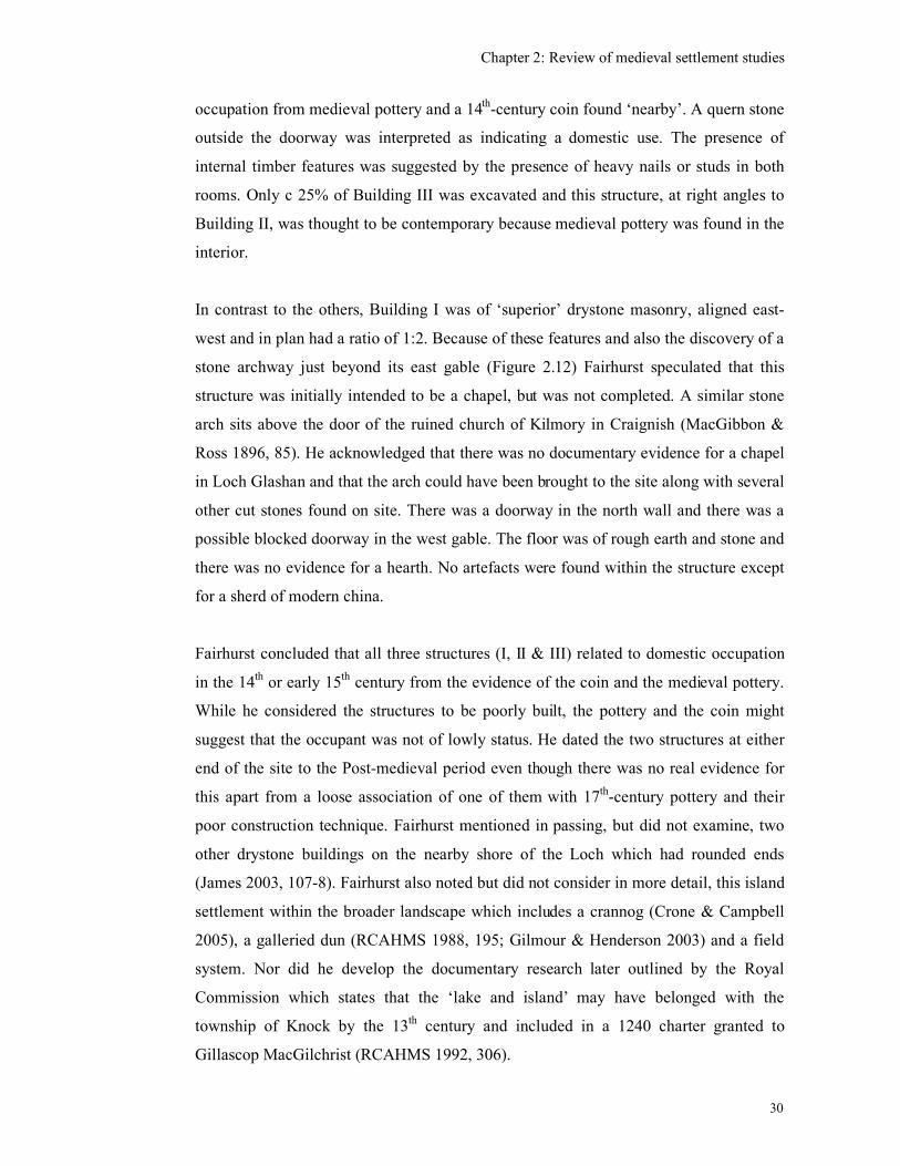
Chapter 2: Review of medieval settlement studies
30
occupation from medieval pottery and a 14th
-century coin found ‘nearby’. A quern stone
outside the doorway was interpreted as indicating a domestic use. The presence of
internal timber features was suggested by the presence of heavy nails or studs in both
rooms. Only c 25% of Building III was excavated and this structure, at right angles to
Building II, was thought to be contemporary because medieval pottery was found in the
interior.
In contrast to the others, Building I was of ‘superior’ drystone masonry, aligned east-
west and in plan had a ratio of 1:2. Because of these features and also the discovery of a
stone archway just beyond its east gable (Figure 2.12) Fairhurst speculated that this
structure was initially intended to be a chapel, but was not completed. A similar stone
arch sits above the door of the ruined church of Kilmory in Craignish (MacGibbon &
Ross 1896, 85). He acknowledged that there was no documentary evidence for a chapel
in Loch Glashan and that the arch could have been brought to the site along with several
other cut stones found on site. There was a doorway in the north wall and there was a
possible blocked doorway in the west gable. The floor was of rough earth and stone and
there was no evidence for a hearth. No artefacts were found within the structure except
for a sherd of modern china.
Fairhurst concluded that all three structures (I, II & III) related to domestic occupation
in the 14th
or early 15th
century from the evidence of the coin and the medieval pottery.
While he considered the structures to be poorly built, the pottery and the coin might
suggest that the occupant was not of lowly status. He dated the two structures at either
end of the site to the Post-medieval period even though there was no real evidence for
this apart from a loose association of one of them with 17th
-century pottery and their
poor construction technique. Fairhurst mentioned in passing, but did not examine, two
other drystone buildings on the nearby shore of the Loch which had rounded ends
(James 2003, 107-8). Fairhurst also noted but did not consider in more detail, this island
settlement within the broader landscape which includes a crannog (Crone & Campbell
2005), a galleried dun (RCAHMS 1988, 195; Gilmour & Henderson 2003) and a field
system. Nor did he develop the documentary research later outlined by the Royal
Commission which states that the ‘lake and island’ may have belonged with the
township of Knock by the 13th
century and included in a 1240 charter granted to
Gillascop MacGilchrist (RCAHMS 1992, 306).
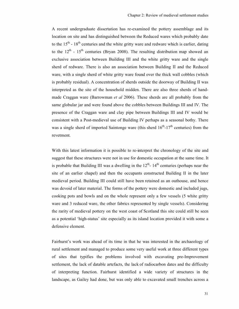
Chapter 2: Review of medieval settlement studies
31
A recent undergraduate dissertation has re-examined the pottery assemblage and its
location on site and has distinguished between the Reduced wares which probably date
to the 15th
- 18th
centuries and the white gritty ware and redware which is earlier, dating
to the 12th
- 15th
centuries (Bryan 2008). The resulting distribution map showed an
exclusive association between Building III and the white gritty ware and the single
sherd of redware. There is also an association between Building II and the Reduced
ware, with a single sherd of white gritty ware found over the thick wall cobbles (which
is probably residual). A concentration of sherds outside the doorway of Building II was
interpreted as the site of the household midden. There are also three sherds of hand-
made Craggan ware (Barrowman et al 2006). These sherds are all probably from the
same globular jar and were found above the cobbles between Buildings III and IV. The
presence of the Craggan ware and clay pipe between Buildings III and IV would be
consistent with a Post-medieval use of Building IV perhaps as a seasonal bothy. There
was a single sherd of imported Saintonge ware (this sherd 16th
-17th
centuries) from the
revetment.
With this latest information it is possible to re-interpret the chronology of the site and
suggest that these structures were not in use for domestic occupation at the same time. It
is probable that Building III was a dwelling in the 12th
- 14th
centuries (perhaps near the
site of an earlier chapel) and then the occupants constructed Building II in the later
medieval period. Building III could still have been retained as an outhouse, and hence
was devoid of later material. The forms of the pottery were domestic and included jugs,
cooking pots and bowls and on the whole represent only a few vessels (5 white gritty
ware and 3 reduced ware, the other fabrics represented by single vessels). Considering
the rarity of medieval pottery on the west coast of Scotland this site could still be seen
as a potential ‘high-status’ site especially as its island location provided it with some a
defensive element.
Fairhurst’s work was ahead of its time in that he was interested in the archaeology of
rural settlement and managed to produce some very useful work at three different types
of sites that typifies the problems involved with excavating pre-Improvement
settlement, the lack of datable artefacts, the lack of radiocarbon dates and the difficulty
of interpreting function. Fairhurst identified a wide variety of structures in the
landscape, as Gailey had done, but was only able to excavated small trenches across a
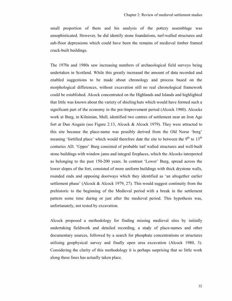
Chapter 2: Review of medieval settlement studies
32
small proportion of them and his analysis of the pottery assemblage was
unsophisticated. However, he did identify stone foundations, turf-walled structures and
sub-floor depressions which could have been the remains of medieval timber framed
cruck-built buildings.
The 1970s and 1980s saw increasing numbers of archaeological field surveys being
undertaken in Scotland. While this greatly increased the amount of data recorded and
enabled suggestions to be made about chronology and process based on the
morphological differences, without excavation still no real chronological framework
could be established. Alcock concentrated on the Highlands and Islands and highlighted
that little was known about the variety of shieling huts which would have formed such a
significant part of the economy in the pre-Improvement period (Alcock 1980). Alcocks
work at Burg, in Kilninian, Mull, identified two centres of settlement near an Iron Age
fort at Dun Aisgain (see Figure 2.13, Alcock & Alcock 1979). They were attracted to
this site because the place-name was possibly derived from the Old Norse ‘borg’
meaning ‘fortified place’ which would therefore date the site to between the 9th
to 13th
centuries AD. ‘Upper’ Burg consisted of probable turf walled structures and well-built
stone buildings with window jams and integral fireplaces, which the Alcocks interpreted
as belonging to the past 150-200 years. In contrast ‘Lower’ Burg, spread across the
lower slopes of the fort, consisted of more uniform buildings with thick drystone walls,
rounded ends and opposing doorways which they identified as ‘an altogether earlier
settlement phase’ (Alcock & Alcock 1979, 27). This would suggest continuity from the
prehistoric to the beginning of the Medieval period with a break in the settlement
pattern some time during or just after the medieval period. This hypothesis was,
unfortunately, not tested by excavation.
Alcock proposed a methodology for finding missing medieval sites by initially
undertaking fieldwork and detailed recording, a study of place-names and other
documentary sources, followed by a search for phosphate concentrations or structures
utilising geophysical survey and finally open area excavation (Alcock 1980, 3).
Considering the clarity of this methodology it is perhaps surprising that so little work
along these lines has actually taken place.
Chapter 2: Review of medieval settlement studies
33
Fieldwork was also undertaken in the late 1970s in Caithness and Sutherland (Mercer
1980) where three types of pre-Clearance settlement were identified.
1. Numerous shielings near streams were set in large mounds of debris, which
suggested a long period of use.
2. Individual farmsteads of the immediate pre-Clearance period were characterised by
compartmentalised long houses, some with bow-shaped walls perhaps indicating a
Norse influence. These structures were associated with other smaller rectangular
houses.
3. Finally there were small rectilinear and sub-rectilinear houses concentrated in large
numbers and associated with large enclosures. This type was, however, found in
only one area of south Sutherland at Dalchork where it is known from documentary
evidence that ‘cottar towns’ existed.
Mercer recognised that only excavation and the provision of radiocarbon dates would
provide the necessary chronological framework for the relationship between all these
sites to be properly understood. He noted the existence of a possibly Norse influenced
longhouse with bow-shaped long walls, which may be a regional type, perhaps only to
be found within areas of Norse occupation. They also identified settlement within large
enclosures and have associated these enclosures with small plots cultivated by a ‘cottar’
population. Cottars were a particular class of tenant who sublet a small amount of land
from the main tenant in return for his labour (Dodgshon 1980, 71).
A survey on the shores of Loch Tay, Perthshire, incorporated a study of historic maps
including Pont, Roy’s Military map and an estate plan of 1769 which enabled
recognition of four types of structures in this area (Morrison 1980).
1. Shielings, round or oval in shape, built of drystone or turf in the hills above the head
dykes.
2. Low, hip-ended, drystone longhouses or byre-dwellings clustered together with
accompanying outhouses, barns, kilns and smaller ‘cottars’ houses as depicted on a
1769 survey of the estate.
3. Clustered or isolated 19th
-century buildings as depicted on the 1st edition O.S. map,
but not depicted on the 1769 survey.
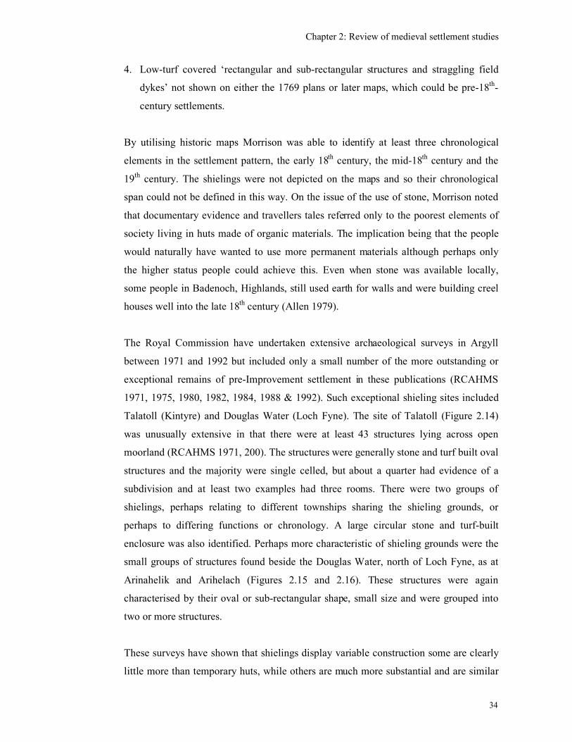
Chapter 2: Review of medieval settlement studies
34
4. Low-turf covered ‘rectangular and sub-rectangular structures and straggling field
dykes’ not shown on either the 1769 plans or later maps, which could be pre-18th
-
century settlements.
By utilising historic maps Morrison was able to identify at least three chronological
elements in the settlement pattern, the early 18th
century, the mid-18th
century and the
19th
century. The shielings were not depicted on the maps and so their chronological
span could not be defined in this way. On the issue of the use of stone, Morrison noted
that documentary evidence and travellers tales referred only to the poorest elements of
society living in huts made of organic materials. The implication being that the people
would naturally have wanted to use more permanent materials although perhaps only
the higher status people could achieve this. Even when stone was available locally,
some people in Badenoch, Highlands, still used earth for walls and were building creel
houses well into the late 18th
century (Allen 1979).
The Royal Commission have undertaken extensive archaeological surveys in Argyll
between 1971 and 1992 but included only a small number of the more outstanding or
exceptional remains of pre-Improvement settlement in these publications (RCAHMS
1971, 1975, 1980, 1982, 1984, 1988 & 1992). Such exceptional shieling sites included
Talatoll (Kintyre) and Douglas Water (Loch Fyne). The site of Talatoll (Figure 2.14)
was unusually extensive in that there were at least 43 structures lying across open
moorland (RCAHMS 1971, 200). The structures were generally stone and turf built oval
structures and the majority were single celled, but about a quarter had evidence of a
subdivision and at least two examples had three rooms. There were two groups of
shielings, perhaps relating to different townships sharing the shieling grounds, or
perhaps to differing functions or chronology. A large circular stone and turf-built
enclosure was also identified. Perhaps more characteristic of shieling grounds were the
small groups of structures found beside the Douglas Water, north of Loch Fyne, as at
Arinahelik and Arihelach (Figures 2.15 and 2.16). These structures were again
characterised by their oval or sub-rectangular shape, small size and were grouped into
two or more structures.
These surveys have shown that shielings display variable construction some are clearly
little more than temporary huts, while others are much more substantial and are similar
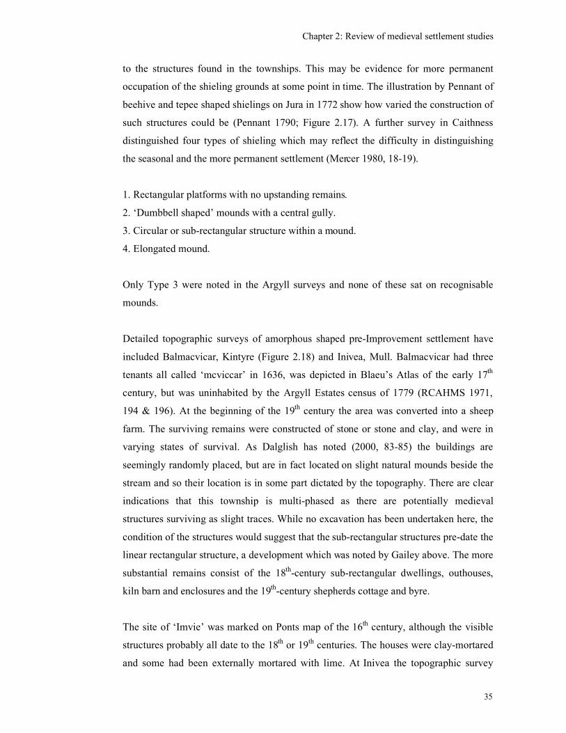
Chapter 2: Review of medieval settlement studies
35
to the structures found in the townships. This may be evidence for more permanent
occupation of the shieling grounds at some point in time. The illustration by Pennant of
beehive and tepee shaped shielings on Jura in 1772 show how varied the construction of
such structures could be (Pennant 1790; Figure 2.17). A further survey in Caithness
distinguished four types of shieling which may reflect the difficulty in distinguishing
the seasonal and the more permanent settlement (Mercer 1980, 18-19).
1. Rectangular platforms with no upstanding remains.
2. ‘Dumbbell shaped’ mounds with a central gully.
3. Circular or sub-rectangular structure within a mound.
4. Elongated mound.
Only Type 3 were noted in the Argyll surveys and none of these sat on recognisable
mounds.
Detailed topographic surveys of amorphous shaped pre-Improvement settlement have
included Balmacvicar, Kintyre (Figure 2.18) and Inivea, Mull. Balmacvicar had three
tenants all called ‘mcviccar’ in 1636, was depicted in Blaeu’s Atlas of the early 17th
century, but was uninhabited by the Argyll Estates census of 1779 (RCAHMS 1971,
194 & 196). At the beginning of the 19th
century the area was converted into a sheep
farm. The surviving remains were constructed of stone or stone and clay, and were in
varying states of survival. As Dalglish has noted (2000, 83-85) the buildings are
seemingly randomly placed, but are in fact located on slight natural mounds beside the
stream and so their location is in some part dictated by the topography. There are clear
indications that this township is multi-phased as there are potentially medieval
structures surviving as slight traces. While no excavation has been undertaken here, the
condition of the structures would suggest that the sub-rectangular structures pre-date the
linear rectangular structure, a development which was noted by Gailey above. The more
substantial remains consist of the 18th
-century sub-rectangular dwellings, outhouses,
kiln barn and enclosures and the 19th
-century shepherds cottage and byre.
The site of ‘Imvie’ was marked on Ponts map of the 16th
century, although the visible
structures probably all date to the 18th
or 19th
centuries. The houses were clay-mortared
and some had been externally mortared with lime. At Inivea the topographic survey
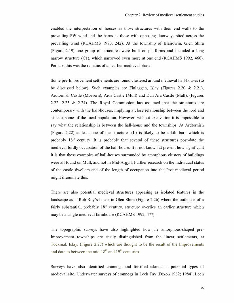
Chapter 2: Review of medieval settlement studies
36
enabled the interpretation of houses as those structures with their end walls to the
prevailing SW wind and the barns as those with opposing doorways sited across the
prevailing wind (RCAHMS 1980, 242). At the township of Blairowin, Glen Shira
(Figure 2.19) one group of structures were built on platforms and included a long
narrow structure (C1), which narrowed even more at one end (RCAHMS 1992, 466).
Perhaps this was the remains of an earlier medieval phase.
Some pre-Improvement settlements are found clustered around medieval hall-houses (to
be discussed below). Such examples are Finlaggan, Islay (Figures 2.20 & 2.21),
Ardtornish Castle (Morvern), Aros Castle (Mull) and Dun Ara Castle (Mull), (Figures
2.22, 2.23 & 2.24). The Royal Commission has assumed that the structures are
contemporary with the hall-houses, implying a close relationship between the lord and
at least some of the local population. However, without excavation it is impossible to
say what the relationship is between the hall-house and the townships. At Ardtornish
(Figure 2.22) at least one of the structures (L) is likely to be a kiln-barn which is
probably 18th
century. It is probable that several of these structures post-date the
medieval lordly occupation of the hall-house. It is not known at present how significant
it is that these examples of hall-houses surrounded by amorphous clusters of buildings
were all found on Mull, and not in Mid-Argyll. Further research on the individual status
of the castle dwellers and of the length of occupation into the Post-medieval period
might illuminate this.
There are also potential medieval structures appearing as isolated features in the
landscape as is Rob Roy’s house in Glen Shira (Figure 2.26) where the outhouse of a
fairly substantial, probably 18th
century, structure overlies an earlier structure which
may be a single medieval farmhouse (RCAHMS 1992, 477).
The topographic surveys have also highlighted how the amorphous-shaped pre-
Improvement townships are easily distinguished from the linear settlements, at
Tockmal, Islay, (Figure 2.27) which are thought to be the result of the Improvements
and date to between the mid-18th
and 19th
centuries.
Surveys have also identified crannogs and fortified islands as potential types of
medieval site. Underwater surveys of crannogs in Loch Tay (Dixon 1982; 1984), Loch
Chapter 2: Review of medieval settlement studies
37
Awe (Hardy, McArdle & Miles 1973; Dixon 1984; Morrison 1985; Holley 2000; Taylor
2003) and the Lake of Menteith (Henderson 1994) have generally found crannogs to
date from the later prehistoric to the early-medieval periods. Dry land surveys have also
shown that crannogs extend into south-west Scotland (Barber & Crone 1993) and the
central Inner Hebrides (Holley 2000). Of the 23 radiocarbon dates from Scottish
crannogs in south-west Scotland only one site (Lochrutton) produced two medieval
dates of the 11th
to 13th
centuries (Crone 1993, 246) which suggests that in the south-
west of Scotland re-use of crannogs in the medieval period was not a common
phenomenon.
In the west of Scotland, however, there is more evidence that crannogs were utilised for
settlement well into the medieval period. At the Moss of Achnacree, Lorn, a crannog
was excavated in the 19th
century and this produced artefacts including two wooden
double-sided combs, a wooden ladle, fragments of antler and skin shoe soles which
were thought to be medieval in date. Sites classified as fortified islands may also have
been originally built on crannogs as well as on suitably located rocky islands
(RCAHMS 1975, 94-95). At several sites in Kintyre, Mull, Tiree, Coll, Loch Lomond
and Mid-Argyll there is evidence for crannogs and islands being occupied by stone
buildings (RCAHMS 1963; RCAHMS 1971; RCAHMS 1980). Several examples have
been surveyed by the Royal Commission, as at Eilean na Circe, N Knapdale (RCAHMS
1992, 303), Eilean Tigh, S Knapdale (RCAHMS 1992, 303), Loch a’Bhàillidh, S
Knapdale (RCAHMS 1992, 304) and Loch an Daimh, Craignish (RCAHMS 1992,
305),(see Figures 2.28-2.32). At Loch na Buaile, Tiree (RCAHMS 1980, 122) the island
was occupied by an oval-shaped, turf-built rather than a stone built structure (which is
similar to one found at MacEwan’s Castle, Cowal (see below) which is medieval in
date). Some sites had outer revetments walls offering some degree of defence, which
otherwise was provided by their island location.
Documentary evidence suggests that these lightly fortified islands were often associated
with clan chiefs and used as refuges in the 16th
and 17th
centuries. A crannog on Mull,
Caisteal Eoghainn a’Chinn Bhig (Figure 2.33) was associated with the son of John Og
5th
Maclean of Loch Buy, who lived in the mid-16th
century (RCAHMS 1980, 119).
There is also a reference in 1549 to this site and another at Loch Ba as being inhabited
strongholds (Macleod 1999). Loch an Daimh (RCAHMS 1992, 304-5; Figure 2.32) was
Chapter 2: Review of medieval settlement studies
38
also said to have been used as such by the Campbells of Asknish during Alasdair
MacColla’s campaigns of the 1640s. Eilean Mhuirell, in Loch Finlaggan, has two
drystone structures each with round corners, thought to be dated to the 14th
to 17th
centuries and a local tradition of being used as a prison by the Lords of the Isles
(RCAHMS 1984, 154-5; Holley 2000, 209).
On Eilean na Circe, North Knapdale, there are two structures. Structure A (Figure 2.29)
has walls up to 1.1m high and there is evidence for cruck slots, including one in the SW
end indicating that it had a hipped roof. None of the buildings are aligned E-W and are
therefore unlikely to be a chapel, the presence of which suggested by the name ‘Yl(en)
Kerk’ seen on Pont’s map. These structures were thought to be Post-medieval in date,
used by the laird of Oib as a refuge, but perhaps overlying an earlier ecclesiastical
structure.
Similarly late medieval dates are ascribed to sites which, although are not islands, have
an element of defence, such as the Robber’s Den at Ardrishaig (Figure 2.34) where a
rectangular building occupies a promontory. This may have a similar status and function
as the island dwellings (RCAHMS 1992, 296-7). The Royal Commission suggests that
the remains are 16th
or 17th
centuries in date as it is by tradition the last refuge of a
member of the MacVicar family. This site (NR 848 865) has subsequently been
evaluated but no evidence for medieval occupation was detected (Regan & Webb 2006).
A more recent survey by the Royal Commission found an example of a late-medieval
farmstead occupying an ‘island’ at Eilean a’Bharain, Loch Tromlee (NMRS
unpublished archive). This potentially important medieval site (outside the research
area) provides an example of what may have been more common throughout Argyll and
what this project is looking for. There were seven structures, none of which were noted
on the 1st edition O.S. map (see Figures 2.35 & 2.36). The main structure (407) had
stone-built walls 1m thick and there were two other smaller stone built structures (406
& 409). There were also three sub-rectangular turf-built structures (408, 411 & 412) and
one oval-shaped turf-built structure (410). This farmstead was perhaps associated with
Eilean Tighe Bhain (NN02SW 13) a small fortified dwelling, also in Loch Tromlee,
which was the seat of the McQuorquodales of Phantilands until it was attacked by
Alasdair MacColla in 1646 (RCAHMS 1975, 212). The variety of building types would
Chapter 2: Review of medieval settlement studies
39
suggest that they were of different date and function, but the historical record would
suggest all these structures pre-dated the mid-17th
century and are very likely to
represent a late-medieval farm site.
Another more recent approach to the task of detecting rural medieval settlement has
been the application of scientific techniques. Work at Bragar and Gásig in Lewis
utilised geophysical survey and phosphate analysis to tentatively identify potential
hearths, walls, ditches and anthropogenic enhancement of soils usually as a result of
manuring (Banks & Atkinson 2000). Problems with the geophysical survey technique
included interference from the background geology and the probable ‘blanketing’ effect
of waterlogged soils. The phosphate analysis was badly affected by acidic soils,
weathering, continued cultivation and the effect of modern manuring. Because of the
financial constraints of the project a very small area of ground was examined with these
techniques and was not followed up with a programme of excavation, which might have
detected earlier settlement within the identified ‘hot spots’.
Another approach has been a combination of the ‘semi-automated classification’ of field
systems utilising computerised image recognition techniques, examination of soil
signatures, targeted small-scale excavation and radiocarbon dating (Chrystall &
McCullagh 2000). The upstanding remains in the two areas that were chosen for
analysis had previously been surveyed by the RCAHMS as part of their Afforestable
Land Surveys. Within the two field systems, this ambitious project sought to identify
the nature of the soils, their date, past land-use practices and the presence of peat or
other ‘masking’ factors. The success of this approach can be measured simply by
whether potential medieval settlement was identified or not. At Boyken, Eskdalemuir,
an isolated rectangular house was investigated with a small trench and it produced two
radiocarbon dates of cal AD 1200. A date of approximately AD 1000 was also produced
from a possible stock enclosure. The majority of the remaining field remains were
interpreted as being Post-medieval in date. At Badentarbet, Wester Ross, dates obtained
from immediately beneath large dykes suggested that they were constructed between
about AD 1000 to 1200, although (as Chrystall & McCullagh admit) if the soil had been
scarped prior to construction, then this date would be too early. This analysis has
provided potential chronologies of the visible remains but highlighted the complexity
involved with the study of a field system utilised over a long period of time. Apart from
Chapter 2: Review of medieval settlement studies
40
one structure at Boyken, this technique has contributed little towards the discovery of
actual medieval sites as the radiocarbon dating of material from poorly stratified and re-
worked context is rather meaningless as the carbonised plant remains can last for
hundreds or thousands of years.
In summary, techniques of fieldwalking, topographic survey, excavation, the study of
old maps and the inspection of aerial photographs have been very productive. The
surveys have been essential for providing the evidence of the sites, their setting in the
landscape and for identifying the morphological types of structures which are most
probably associated with medieval settlement. Excavation has provided some detail of
construction techniques, dating evidence and revealed the varied amounts of material
culture associated with different types of sites. The examination of old maps and aerial
photographs has also provided evidence for the location of sites and for their dating.
The combination of these techniques enable some broad statements to be made on
medieval rural settlement to be made. There are three very generalised categories of
settlements within the landscape. The high-status sites looked at in this section includes
fortified islands and are characterised by the use of stone, having a defensive element
and having a relatively rich material culture. The undefended (and potentially lower
status) rural settlements are amorphous-shaped groups of sub-rectangular or oval-
shaped structures constructed of a stone, a mixture of stone and organic materials or just
organic materials, located near to arable land. These structures have unsubstantial
foundations, may be narrow compared to their width and have a relatively poor material
culture. The third group consisting of settlements in the hills which were occupied
during the summer months (shielings) were small, came in a variety of shapes and used
a variety of construction techniques. These categories are not distinct, as there are sites
which share the characteristics of more than one group.
2.3 The contribution of architectural typologies
The most significant contribution to our understanding of the medieval architecture of
Argyll has been the work of John Dunbar and the Royal Commission Inventories. In his
review of medieval architecture in the Highlands, John Dunbar was concerned primarily
with the nature and scale of architectural building activity, which included the major
Chapter 2: Review of medieval settlement studies
41
standing buildings such as the castles, hall-houses, tower houses, churches and chapels
(Dunbar 1981). He proposed that a consideration of the high-status sites illuminated the
changing fortunes of the clan chiefs as they either successfully extended their territory
or were absorbed into other territories while the scale of building indicated the resources
that the clan chiefs had at their disposal.
Dunbar saw most architectural activity taking place between the 12th
century and the
Wars of Independence in the late-13th
century after which there was a lull. Once peace
was restored in the mid-14th
century, building work resumed towards the end of the 14th
century. Dunbar identified the earliest stone built castles as the simple ‘castles of
enclosure’ which consist of a massive stone encircling wall with few openings or
datable architectural features and internal structures of timber. The earliest example of
such a castle is Castle Sween associated with Suibhne, the powerful Lord of Knapdale
(Figure 2.37). The historical records do not provide an accurate date for its construction
and so it has been dated from its association with Suibhne, who was known to be active
in the late-12th
century and from the simple corner and mid-wall buttresses that are
thought to be of Romanesque character (Dunbar 1981, 44). Inis Chonnell, Loch Awe, is
also seen as an early castle of enclosure as it was of a similar size to Castle Sween and
because of its fishtail arrow slits that were introduced into Britain at the turn of the 13th
century. It may have been built by either the Campbells of Loch Awe (although they are
not in the historical record until the late 13th
century) or perhaps the MacDougalls of
Lorn.
There are several other rectangular-shaped castles of enclosure in the West Highlands
that Dunbar considers to be of 13th
century date that were constructed by major lords,
such as Duart on Mull (constructed by the MacDouglas of Lorn), Castle Roy in
Speyside (by the Comyn Lords of Badenoch), Achadun on Lismore (by Bishop William
of Argyll) and the earlier Skipness Castle (by the MacSweens). Again Dunbar relies on
the scanty documentary records to provide a historical framework for the construction
of these castles, as there are few datable architectural features. Even the royal castle at
Tarbet he could only say was ‘probably’ built in the reign of William the Lion or
Alexander II.
Chapter 2: Review of medieval settlement studies
42
Castles with a polygonal shape include Mingary (possibly built by the MacDonald
Lords of Islay), Castel Tioram (by the Macruarie Lords of Garmoran), Duntroon (by the
Campbells of Loch Awe) and Dunoon which was another royal castle. More elaborate
castles with gateways and flanking towers include Dunstaffnage (MacDougall Lords of
Lorn) and Inverlochy (Comyn Lords of Badenoch and Lochaber). Dunbar does not
speculate on why these castles were built, except for the one at Tarbert which was a
royal castle built to consolidate the kings power in the west.
On a smaller scale the more numerous hall-houses found throughout the West
Highlands, Dunbar interpreted as an indication of a degree of local stability and
prosperity (Dunbar 1981). The hall-houses include Skipness (South Knapdale),
Fincharn (Loch Awe, Figure 2.38), Fraoch Eilean (Loch Awe), Castle Coeffin
(Lismore), Ardtornish (Islay) and Casiteal Uisean (Skye, Figure 2.39). There are no
examples in the Outer Hebrides and only one possible example on Skye (at Camus).
Dunbar suggests that these form a well-defined group with close parallels in Ireland.
Again these structures are difficult to date from their upstanding remains alone and so
after consultation of the documentary sources Dunbar suggested that they belonged to a
period of stability which started in the late 12th
to 13th
century, was interrupted by the
Wars of Independence and came to an end with the forfeiture of the Lordship of the
Isles in 1493. The Royal Commission has suggested that Fincharn Castle on Loch Awe
was of 13th
century construction perhaps relating to a royal charter of 1240 confirming
the lands to the local MacGilchrist family (RCAHMS 1992, 283). This is also supported
by several Irish examples of hall-houses which have been confidently dated to the 13th
century (McNeill 1997, 149) and subsequently, other excavated examples in Scotland
are proving to be of a similarly early date (Tabraham 1997, 37).
Dunbar suggests the fashion for building tower houses in Scotland came in after the
Wars of Independence with some evidence for a regional style in West Highlands with
no vaults or mural fireplaces, that were characteristic of tower houses elsewhere in
Scotland. They did not, therefore, differ very greatly from the earlier hall-houses and he
suggests that they fulfilled a similar function for a similar class in society. Examples of
tower houses are Dunvegan on Skye, Moy on Mull, Kisimul on Barra and Breachacham
on Coll. Their date of construction is also not clearly defined as they have few
Chapter 2: Review of medieval settlement studies
43
mouldings or datable features. Existing castles such as Castle Sween, Duart, Innis
Chonnel and Urquart castles had tower houses constructed within their enclosure walls.
In contrast to these substantial stone built castles, the main residence of the Lord of the
Isles in the 14th
and 15th
centuries at Finlaggan (Islay) was a hall-house surrounded by
smaller domestic buildings with no massive enclosure wall or tower house (Figures 2.20
& 2.21). Dunbar suggested this undefended site reflected the ‘unchallengeable’ position
of power that the MacDonalds enjoyed as Lords of the Isles, suggesting that, surrounded
as he was by his kin and supporters, the Lord of the Isles had no need for defence.
It is useful to discuss the results of the excavations at Finlaggan here (Caldwell, McWee
& Ruckley 2000; Caldwell 2003). Finlaggan consists of two islands, the larger of which
(Eilean Mor) was occupied by a variety of structures including two halls (one a great
hall), a chapel, a burial ground and a garden (Figures 2.20). The smaller island (Eilean
na Comhairle) was connected by a causeway and was occupied by the remains of a
castle that was in existence by the late-13th
century (Caldwell 2003, 67). This castle had
been built over by three structures, which were interpreted as a council chamber, a hall
or house for the keeper and a storehouse. Finlaggan was used for meetings of the
Council of the Isles during the summer months, as a place of inauguration. It was
possibly also used as the setting for annual assemblies of the major secular barons of the
Isles and the Bishop and Abbot of Icolmkill (Iona) that were equivalent to the Irish
kings óenaige (Caldwell 2003, 69-71) which combined games, a market with political
assembly (Aitchison 1994, 61-66; FitzPatrick 2001). After the forfeiture of the
Lordship, the medieval structures at Finlaggan were subdivided, re-used and built over
by smaller more oval-shaped structures similar to other pre-Improvement settlements
(Figure 2.21) (RCAHMS 1984; Caldwell, McWee & Ruckley 2000).
Dunbar’s consideration of ecclesiastical buildings in Argyll show that the significant
building activity was predominantly in the period prior to the early 14th
century with
Saddle, Iona and Ardchatten abbeys, followed by a modest cathedral on Lismore in and
a Priory on Oronsay in the 14th
century. The architecture of the ecclesiastical buildings
in the west had strong Irish connections, perhaps utilising Irish masons. Because of the
dispersed population, the parish churches tended to be small, simple buildings which
were established by the local lords, with more numerous dependent chapels which could
Chapter 2: Review of medieval settlement studies
44
administer to the general population. There is no suggestion that during the medieval
period the parish churches were the focus for settlement.
Other potential medieval sites such as forts and duns will be considered here from an
architectural point of view. One of the most common archaeological sites in the Argyll
landscape are the stone-built, hill top duns and forts, however these are normally dated
from the late prehistoric to early-medieval periods. Traces of re-occupation of duns in
the medieval period has been recognised, but is scanty. For example the galleried dun at
Kildonan in Kintyre has evidence for paving, hearths and huts which were associated
with pottery dating from the late 12th
to the early 14th
centuries (Fairhurst 1939).
MacEwen’s Castle, in Cowal, is an example where medieval structures were built
within a prehistoric dun (see Figure 2.40, Marshall 1982). The prehistoric fort sits on an
exposed promontory and consists of a dry-stone enclosure that has been severely robbed
for its stone. Excavations within the dun revealed an oval-shaped, turf-walled structure
(A) with walls up to 3 ft thick, a small circular building constructed of stones (C) and a
rectangular stone-built structure (B) which produced a mid-18th
-century pot sherd. To
the north was a small rectangular structure (D) which had slightly bow shaped side
walls, one rounded end and one square end. A Romanesque crucifix, a James I coin and
green glazed pottery were found on the site and indicate a broadly medieval and late-
medieval date for its occupation (RCAHMS 1992, 296). The castle was associated with
the MacEwans of Ottar, a branch of the MacSweens (Sellar 1971, 32) who lost their
status as landowners by the late 15th
century when their lands passed to the Campbells
(RCAHMS 1992, 296). This may explain the abandonment of this site and its re-use as
a farmstead.
The Royal Commission have described several duns and forts in Argyll where the
interiors are occupied by a range of structures from shielings to substantial stone-built
structures with associated cultivation (RCAHMS 1971, 64-94; RCAHMS 1975, 64-93).
At the dun at Castles, Lorn, (Figure 2.41) for example, there are the remains of a sub-
rectangular building possibly contemporary with the nearby remains of Castle Strae and
documentary references associate this site with the MacGregors of Glenstrae in the 15th
and 16th
centuries (RCAHMS 1975, 81-82, 187). Although clearly having potential for
re-use the Royal Commission does not suggest that these sites could have been occupied
Chapter 2: Review of medieval settlement studies
45
in the medieval period unless there are either documentary references or an oral
tradition of an association with a historic family.
A survey of surviving cruck-framed buildings in Scotland (Stell 1981) found 220
examples of houses where the roof was supported by the main timber rafters (or
couples) which were either were supported on low stone foundation walls or rested on
the ground. These surviving examples are not likely to date to before the 18th
century,
but may follow a much older tradition. Dixon has suggested that a building technique
which involved earth-fast roofing timbers was replaced in the 13th
and 14th
centuries by
crucks supported on low walls, perhaps as a result of timber shortages and the need to
preserve the timber (Dixon 2002).
This consideration of the architecture of the west of Scotland has shown that, prior to
the effects of the Wars of Independence, Argyll was at the forefront of Scottish
architectural developments with the construction of castles of enclosure and hall-houses.
Further building resumed in Argyll in the mid-14th
century, but this was not on such a
grand scale as seen elsewhere in Scotland as there are relatively few tower houses. The
site of Finlaggan is anomalous in that it was of the highest status and yet did not display
highly defensive qualities. The Lord of the Isles possessed castles elsewhere on Islay at
Dunivaig and Kilchoman (both also on Islay) which perhaps fulfilled the role of the
stone castle when required, leaving Finlaggan as a more traditional Gaelic centre for
political assembly. Ecclesiastical architecture displayed a similar Irish influence and
slump about the time of the Wars of Independence. The re-use of prehistoric duns and
forts was also seen, but on a limited scale and the date of this re-use may be Post-
medieval rather than medieval in date. In general, a purely architectural approach does
not take sufficient consideration of the society which produced this architecture and
how the high-status sites related to the settlements of the rest of the population. This is
redressed by a consideration of the contribution of historical geographers.
Chapter 2: Review of medieval settlement studies
46
2.4 The contribution of historical geography
As historical geographers, Dodgshon and Whyte’s approaches to the study of rural
settlement have been to emphasise the contribution of estate rentals, charters, historic
maps and aerial photographs. They have suggested that rather than being static and
conservative until the advent of the Improvements, medieval settlement was in a
constant state of flux (Dodgshon 1980, 1993; Whyte 1981). As an archaeologist with an
interest in Gaelic society, Crawford has highlighted the deeply hierarchical nature of
Medieval society which is thought to be reflected in settlement morphology (Crawford
1983).
Dodgshon examines the processes involved during the medieval and Post-medieval
period which included population pressure, the influence of feudalisation from the 13th
century and the introduction of commercialism from the later medieval period onwards.
An overall population rise during the medieval period is attested by estate rentals, which
led to population pressure. The effect on the settlement pattern was a combination of the
splitting of existing settlements (into Easter and Wester for example) and the
establishment of new settlements through colonisation of waste land, moorland and
hunting forests. The rise in population was not steady as there was a period of decline
during the 14th
and 15th
centuries which he blames on climatic deterioration leading to
poor harvests, hunger and pestilence. This is supported by Parry’s earlier work in the
marginal land of the Lammermuirs where settlements were abandoned between 1300
and 1600 probably because of the worsening climatic conditions (Parry 1975).
Dodgshon set out a model of settlement change from a dispersed form with enclosed
fields to a nucleated form with large fields in the runrig system, which he proposed took
place in Scotland from the 13th
century onwards, perhaps influenced by the introduction
of feudalisation (Barrow 1973). He examined early 19th
-century estate plans of two sites
at Greaulin and Glen Hinnisdal, Lewis, and suggested that areas depicted as rough
ground in between the nucleated settlements were sites of earlier dispersed settlements
(Dodgshon 1993, 428). When he checked these areas in the field he found the remains
of walls and kailyards and the aerial photographs indicated that there were further
remains in the landscape which could be late-medieval if not earlier in date. This work
has not been followed up by any investigative excavation which could have provided a
Chapter 2: Review of medieval settlement studies
47
chronology for such change in the settlement pattern. Dodgshon also referred to earlier
work by Geddes at Bragar, Lewis, where two early-18th
-century rentals indicated that
within the division of North and South Bragar the tenants were listed in sub-groups
which he suggested was evidence for a more dispersed pattern of small farms than the
two place-names would suggest (Dodgshon 1993, 425).
Dodgshon highlighted the lack of visibility of medieval rural settlement which he
thought was primarily because of the use of perishable materials, as attested by 18th
-and
19th
-century travellers and tenants leases. Dodgshon proposed that people chose to build
in organic materials because it was part of the system of husbandry which required
intensive fertilisation of the infield by all available materials including the roofing and
walling materials. Even when stone was available, people still preferred to use organic
materials. Dodgshon has emphasised the changing nature and location of rural
settlement that can be traced through an examination of historical records, plans and
aerial photographs. However, without a chronological framework for his observations
and similar work carried out in other regions, it would be difficult to assess how local
the patterns he observes are and how relevant they are to developments elsewhere in
Scotland. For example he linked feudalisation with nucleation of settlement. While this
may have had a profound effect on settlement in the Lowlands, it was less significant in
the Highlands and Dodgshon has not presented any evidence that nucleation of
settlement occurred here before the 19th
century.
Another historical geographer, Whyte, undertook his research predominantly in the
Lowlands. He found that the traditional model of the pre-Improvement ‘fermtoun’
consisting of a group of between four and eight families working a farm together (as
suggested by the Statistical Accounts of the late-18th
century) does not take into account
the great variety of settlement size and variable social status of inhabitants that he could
identify from the historical records for the 17th
and 18th
centuries (Whyte 1981).
Whyte utilised the 1691 Hearth tax for south-east Scotland to show how the population
density and size of settlements varied across and between different areas. But he also
analysed the social status of the inhabitants and noted that while settlements could have
similar population numbers their occupants could be of different status. Rentals
described the occupiers of the land of varied status including husbandi, firmari, cotari,
Chapter 2: Review of medieval settlement studies
48
and bondagia. Some settlements could be held as joint farms while others were tenanted
by a single farmer assisted by cottars and hired help. He also highlighted one of the
drawbacks of utilising old maps such as Pont, Roy and Adair to identify the location of
sites mentioned in the historical records as he found that small sites of between 1 –3
households which were mentioned in the historical records could not always be located
on the contemporary maps. Whyte also found that the 1696 Poll tax returns for
Aberdeenshire revealed a varying effect of commercialisation in that the more
commercial farms were large and predominantly farmed by single tenants with cottars
and hired servants and that the joint tenant farms (found in the more remote upland
areas) were less commercially orientated.
Whyte indicated that the documentary evidence can reveal several processes at work
during the Post-medieval period, including the consolidation of jointly held runrig farms
into single larger farms, the growth and splitting of fermtouns and the colonisation of
waste. He also looked back into the medieval period and identified various processes of
settlement change including the colonisation of forests, the colonisation of shieling
grounds and the conversion of shielings to permanent farms (see Figure 2.42). The
development of settlements, he noted, was not uniform and steady as there were periods
of stability, growth and decline.
In addition to field survey, what is required in order to understand medieval rural
settlement in the west of Scotland, is an understanding of the hierarchical clan system
which, according to Iain Crawford (working in the Uists and the small isles) consisted
of three major levels (Crawford 1983, 353). The upper stratum consisted of clan chiefs
and the major landowners, beneath whom were the lesser chiefs and tacksmen who
would have consisted of their ‘lesser kin, adherents and minor lines’. On the bottom
rung were the tenant farmers, crofters and cottars. He suggested that these differences in
social status would be reflected in the physical settlement remains, so for the West
Highlands and Islands he attempted to correlate the known archaeological sites with the
anticipated social strata they represented. The residences of the major clan chiefs, the
castles, tower houses and fortified islands, are the most visible in the landscape.
Crawford has suggested that the minor chiefs lived either in small fortlets, or were
archaeologically indistinguishable from the lesser clan members as they lived close to
or among their settlements which have still not been found (Crawford 1983, 355). In
Chapter 2: Review of medieval settlement studies
49
order to incorporate the archaeological evidence, Crawford proposed three levels of
habitation (apart from the major castles) based on social status, which splits the
tacksmen into an upper and lower strata.
At the top was the tacksman’s fort, which he identified as the fortified islands, artificial
island forts and minor fortifications (which would include crannogs) which often have
documented associations with known clans. From the known archaeological sites in
Lorne and Kintyre (RCAHMS 1971 & 1975) he tentatively suggested three further
subdivisions of these defensive structures which he identified as,
1. Simple small towers of stone or wood in loch shallows or on islets.
2. Small forts of the above or similar type with a major rectangular building
incorporated or inserted.
3. Fortified or apparently defensively chosen islands with farm townships upon
them.
He placed Loch Glashan (Fairhurst 1969b) in the third category, although there is no
specific family association.
Crawford’s second group was the unfortified tacksman’s baile which were single large
domestic buildings and ancillary structures without defence, often called Tigh Mór or
‘seanbhaile’. He puts forward an example of such a site from his excavations at the
Udal, North Uist where a structure called Tigh Mór had rounded corners, walls over 6ft
thick and opposing doorways (Crawford 1983 Fig 151, 160; Crawford & Switzur 1977).
This example is certainly pre-Improvement as there is archaeological and documentary
evidence that it was overwhelmed by a sandstorm in 1697.
The third group was the ‘baile’ or township of the people of lesser status, the
subordinate tenants, of which there appears to be a complete absence in the
archaeological record. At sites which were depicted on Pont and Roy’s maps Crawford
could only identify structures that dated to the immediate pre-Clearance period. As a
result of this fieldwork Crawford speculated that (with the exception of the machair) the
location of the medieval predecessors of the pre-Improvement baile were either
incorporated within, were built over by, or were in the close vicinity of the later
settlements. He gives the example of Siabaidh (Shiaby) on Berneray, Harris which, like
Chapter 2: Review of medieval settlement studies
50
the Udal, was overwhelmed by a sand storm in 1697 and now lies beneath the 18th
-
century settlement (Crawford 1967). Crawford also suggests that the number and nature
of subdivisions within a baile would be related to whether a tacksman was resident and
what his relative status was.
Crawford suggests that as fieldwork alone has not produced medieval sites then what is
required is a study of the estate archives, place-names with the addition of linguistic
evidence and oral traditional. It was through this method that he decided on the site of
the Udal to concentrate his attention on. His excavations at the Udal have indeed
produced a settlement dating from the Norse through and beyond the medieval period.
He concluded that it had been occupied by a person of relatively high-status, such as a
tacksman until the 17th
century, because of the rich artefact assemblage, after which it
was ‘on the social slide’ (Crawford 1983, 365). Unfortunately, the full results of the
lengthy excavations are not yet fully published apart from a consideration of the pottery
sequence which is of limited assistance outside the Western Isles as these areas were
largely aceramic (Lane 2007).
Crawford has put forward a useful model for rural settlement based on the available
archaeological evidence, but has attempted to fit the observed archaeological evidence
into his neatly hierarchical model. For example, the Udal is put forward as an example
of the second group the tacksmans baile, which one would assume must have once been
quite common, and yet, so far, this site would appear to be quite unique even in the
Western Isles. The site of Finlaggan also does not fit neatly into his model either, being
of the highest status, although Crawford argues that the island nature of the site was
sufficient for it to be classified as defensive.
The approach of the historical geographer therefore highlights the potential contribution
of the historical records and historic maps to an understanding of the location and nature
of rural settlement and the organisation of society. It also, however, shows up some of
the problems associated with the interpretation of historical data and with the
relationship of the historical data to the archaeological record.
This consideration of the contribution of vernacular architecture, excavations,
topographic surveys, architectural models and historical geography has highlighted
Chapter 2: Review of medieval settlement studies
51
three main themes. The first is the hierarchical and pyramidical nature of society which
is likely to be reflected in the settlement pattern. The second is the complicating factor
of the fluctuating nature of settlement both spatially and socially with time and the third
is the use of perishable materials for rural settlement that may be a positive choice of
Gaelic society given the pastoral economy and troubled times. This chapter will now
take into consideration the more recent archaeological and survey work undertaken in
the various Gaelic speaking regions of Scotland which might provide a model for
settlement in Mid-Argyll.
2.5 Regional models based on the results of survey and excavation
It has been recognised for some years that there are regional variations in rural
settlement in Scotland (Fenton & Walker 1981, Bruntskill 1981, Naismith 1989,
Atkinson 1995). The criteria used by these researchers for defining regions vary, but are
essentially concerned with environmental factors such as geology, topography and
climate as well as social, economic and historical factors. Areas where recent fieldwork
and excavation have taken place which may provide comparable material, as they are
also in the (until recently) Gaelic speaking areas, are Perthshire to the east, the
Highlands to the north, South Uist in the west and Ireland. Perthshire straddles the
southern edge of the Scottish Highlands with a range of altitudes from low-lying to well
over 600m AOD and the mountain ranges of the Highlands, consisting of the
Grampians and the Cairngorms, contain Scotland’s highest peaks. In contrast South Uist
is low lying and maritime and consists of the alkaline sand machair and the acid
blacklands. Ireland is also low lying, with a mixture of good pasture, cultivated ground,
bogs and woods. Some work undertaken in the non-Gaelic speaking Lowlands has also
been considered as the discovery of medieval rural settlement has proved more
successful there than elsewhere.
Western Isles
In addition to Iain Crawford’s work in the Western Isles there has been the Sheffield
Environmental and Archaeological Research Campaign in the Hebrides (SEARCH)
project in South Uist and Barra (Parker Pearson et al 2004; Sharples 2005, Branigan
Chapter 2: Review of medieval settlement studies
52
2005) and an Afforestable Land Survey undertaken by the Royal Commission in
Waternish, Skye (Dixon 1993a, Dixon 1993b) These have produced a useful model for
settlement change and provides examples of different methodologies.
The SEARCH archaeological excavations and survey in South Uist produced evidence
for a shift away from arable to a more pastoral economy which was detected in a change
in an ecofactual assemblage and the presence of seasonal shelters. There was also some
evidence that after a considerable period of stability in the prehistoric and Norse
periods, there was a significant re-organisation of settlement in the medieval period
which possibly post-dated the shift in the economy.
The SEARCH project found that townships were often formed around a nuclei of Early
Iron Age sites (Parker Pearson et al 2004, 162) and formed a dispersed settlement
pattern from the Late Iron Age. At Bornais a series of mounds on the machair were
examined with geophysical surveys and excavations (Sharples 2005). Numerous
artefacts and ecofacts were retrieved which indicated that the site had been the focus for
settlement since the Middle Iron Age. At the site of Balnagraig a Neolithic cairn lay
beneath a possibly Middle Iron Age round house and was overlain by two phases of
small structures of oval, square and sub-rectangular shaped ‘cabins’ which might have
been medieval in date (Branigan 2005, 31). At the deserted settlement of Gortein there
were varied structures, consisting of field walls and enclosures. What may have been
the earliest structure was a possibly Iron Age round house perhaps surrounded by
contemporary circular and oval-shaped huts. The medieval period was thought to be
represented by huts and temporary shelters during a period of ‘occasional use by
shepherds’ (Branigan 2005, 38-40).
There was evidence for a shift in settlement at Bornais and Cille Pheadir, located on the
machair, which were abandoned for perhaps more defensive sites in the inland
blacklands (Parker Pearson et al 2004, 155-163; Sharples 2005, 195). This was not a
clear cut shift as some Norse sites either continued in use into the medieval period or
were replaced by medieval sites nearby. Some of these abandoned sites were then re-
occupied as temporary settlement sites.
Chapter 2: Review of medieval settlement studies
53
At Bornais, the radiocarbon dates revealed that a Norse farmstead (Figures 2.43 & 2.44)
was built on the site in the 13th
or early-14th
centuries and remained in use until the 14th
or late-15th
centuries when it was abandoned. The construction of a small stone
structure, measuring less than 2m across, into a sand filled kiln-barn was interpreted as
seasonal re-use of the site as a herders shelter, or a shieling, although the lack of an
entrance, hearth and its small size would argue against it being other than a sheep
shelter or lambing pen.
Sharples suggests that this settlement shift could have been caused by machair
instability as a result of continued cultivation of the machair after a long period of
drought, economic changes after the Treaty of Perth in 1266 or political instability after
the end of the Lordship of the Isles. He suggests that any of these factors could have
resulted in an increase in importance of cattle to the economy that were grazed primarily
in the blacklands (Sharples 2005, 196). He does not however take into consideration the
effect of an increase in storminess, associated with the climatic deterioration, which
might have discouraged people from living near the exposed west coast.
At Bornais and Cille Pheadair the results of the excavations suggested there was a
change in social practice in the 14th
century. The Norse longhouses developed into a
layout consisting of a main room and subsidiary rooms (Figure 2.45) and the internal
arrangements were transformed from the long hearths to small hearths which were
moved to the doorways. This could be interpreted as a change in social practice from a
communal arrangement to a more private, perhaps family orientated, one. The last
longhouse at Cille Pheadair was replaced, possibly in the medieval period, by two small
temporary shelters from which no domestic material was recovered (Parker Pearson et
al 2004, 149).
The analysis of the animal bones at Bornais supported a shift in the economy, during the
Norse period, from predominantly milk production to the consumption of meat, which
Sharples suggests would be a by-product of an increase in importance of the cattle trade.
This would indicate that a corresponding decrease in the importance of arable pre-dated
the move to the machair for reasons as yet unknown.
Chapter 2: Review of medieval settlement studies
54
Another feature of Bornais and Cille Pheadair was the lack of byres which would
indicate that animals were kept outdoors all year. This contrasts with the 18th
and 19th
-
century structures on South Uist which have a byre at one end and a living area at the
other, but is similar to the remains of Post-medieval settlement further south on Barra
where the blackhouses were relatively ‘short’ and did not share space with animals
(Branigan & Marrony 2000, 8). It is perhaps still too early to interpret these differences
as they may be a result of a response to environmental or economic pressures on a
regional scale or to a development of local social practices.
Emerging from the SEARCH project, John Raven’s PhD thesis explored the medieval
landscapes and Lordship in South Uist. He examined the possibility that after about
1400 there was a change in agricultural practices from a mix of arable and pastoral to a
predominantly pastoral practice which was reflected in the settlement pattern as a shift
away from the Norse enclosed farms (Raven 2005, 363). He hoped to detect a shift of
settlement away from the coastal machair to inland sites in the cnoc-an-lochan zone and
the adoption of small temporary structures of which would leave little trace in the
archaeological record. He anticipated that factors causing this change may have been a
drop in population numbers, environmental deterioration or the plague. He thought this
change may also have corresponded with a revival in Gaelic culture after the Norse
invasion and reinforced links with Gaelic Ireland.
Raven tested his belief in a shift in settlement from the machair at the end of the Norse
period and investigated the origins of the Post-medieval bailtean. Following on from a
survey undertaken by Parker Pearson, he undertook geophysical surveys and excavation
of a series of test trenches over several mounds on the machair and the cnoc-an lochan.
The results were not conclusive, but did reveal that there was no clear cut abandonment
of sites in the machair, in fact he suggests that there was some continuity of activity on
some sites as at Aisgernis and Machair Mheadhanach (Raven 2005, 379). The structures
identified in his fieldwork were constructed with stone foundations and turf walls and
some consisted of a complex sequence of buildings, although nothing on the scale of the
Udal. A medieval presence on sites was suggested from the discovery of late-medieval
pottery, although in some cases there were problems in differentiating between the Iron
Age pottery and the medieval (ibid 378). This form of test pitting is a relatively efficient
way of examining the sub-surface features of several sites over a wide geographical area
Chapter 2: Review of medieval settlement studies
55
and of retrieving potential dating material. However, the small size of the trenches does
hamper the understanding of complex sites and does not often allow for the association
of finds with structural features.
Raven also noted that there were no major castles in South Uist and he suggested that it
was from island dwellings, re-occupied after the 13th
century, that clan chiefs managed
their land and interacted with their clans (Raven 2005, 365). By the end of the medieval
period the land was held directly from the lord by communities which occupied baltean
and farmed the land in open-fields in the runrig system. He suggested that there was
little archaeological evidence for an intermediate economic and social system
dominated by pastoralism, between the Norse and the late-medieval periods, possibly
because of its insubstantial nature.
The work by the SEARCH project on Barra, Vatersay and Sandray consisted primarily
of field survey with some small-scale excavation (Branigan 2005) which contributed
towards the model put forward above by Parker-Person and Sharples, and discovered a
large number of new sites and explored the morphology and interpretation of rural
settlement sites.
A multi-period landscape was identified at Borve where Iron Age settlement was
indicated by the presence of a broch and several wheelhouses. Some of the structures or
‘huts’ were also thought to be of this date. A Norse presence was indicated by a burial
and medieval occupation was represented by several shielings, huts and a 12th
-century
soil beneath a clearance cairn. One of these shielings was excavated and found to be
merely a circle of stones for a tent-like structure (Branigan 2005, 31). There is therefore
support for a medieval pattern of temporary structures or shielings re-occupying
existing settlement sites. Branigan agrees that this indicates a predominance of
pastoralism in the economy during the medieval period. At another site of Bruernish,
Branigan identified a predominance of pastoralism and fishing in the economy which
extended into the Post-medieval period from the lack of lazybeds or other evidence for
cultivation in the vicinity of several of the blackhouses (Branigan 2005, 43).
A group of shieling structures near Earsary were excavated and found to be of at least
three phases. The earliest structure was thick-walled and oval-shaped. From the
Chapter 2: Review of medieval settlement studies
56
presence of Norse pottery and hand made Craggan ware, Branigan suggested that the
site was occupied sporadically from the Norse period until the 13th
to 15th
centuries
(Branigan, 2005, 50). Above this were three structures, two of which were oval-shaped
structures possibly contemporary with each other, from which two sherds of
undiagnostic pottery were retrieved. These were therefore dated to the later medieval or
modern period.
Seventy-five potential early historic and medieval sites were identified and some of
them were excavated. The excavations almost invariably revealed that the initial
identifications of morphology type were incorrect. For example, Branigan realised that
there was no clear distinction between prehistoric round houses and Norse oval-shaped
houses, as some Iron Age houses were oval and some Norse houses were only
‘marginally oval’ (Branigan 2005, 30). Of three structures initially identified as round
houses, one turned out to be a D-shaped structure and two others were probably tent
emplacements (ibid, 31). He classified sites as ‘round huts’ or ‘oval huts’ when they sat
directly on the ground surface but as ‘shielings’ if they sat on mounds which suggested
multi-seasonal use, although he also accepted that some of the round and oval huts
could also have been used as shielings. Thus, site descriptions incorporating functional
and morphological elements were both being used, which is perhaps not helpful.
Branigan identified six different types of ‘shelters’ that were less substantial than ‘huts’
and varied in shape, including oval, circular and rectangular. These shelters were
commonly found on high ground. He interpreted these as shelters for lambs or calves, or
as shelters or stores for fishermen or herders. When two of these sites were excavated
they, unfortunately provided no artefacts to aid dating or interpretation of function. The
excavation of a shieling on Barra revealed it to be formed of a single course of stones
possibly for holding down a temporary shelter, such as a tent. The oval-shaped shieling
B58 (Figure 2.46) produced Craggan ware which suggested to Branigan that it was in
use between the 13th
and the 16th
centuries (Branigan 2005, 53-54). The pottery
consisted of predominantly globular jars which would have been used for a variety of
cooking and food storage purposes (Cheape 1993). Another structure identified
originally as circular in shape was excavated and found to have been originally a well-
built rectangular structure. There was no hearth and a single sherd of 17th
/ 18th
-century
pottery was retrieved and so it was interpreted as a Post-medieval shepherds hut that
Chapter 2: Review of medieval settlement studies
57
had been modified into a less well constructed D-shaped structure in the 19th
century.
Another structure (E19) was an example of a substantial stone building which had been
almost completely removed by stone robbing as it survived as only a few isolated
blocks of masonry (Branigan 2005, 59). The artefacts within the floor layer indicated
late 19th
and 20th
century occupation by rabbit catchers although its original purpose
was unclear.
The presence of pottery on South Uist was certainly different from the situation on the
mainland for between 1300 and 1500 hand-made pottery with an everted rim called
Craggan ware is often found. In the 14th
century this pottery was plain, but by the 15th
and 16th
centuries the decoration became similar in style to that found in the Middle Iron
Age (Parker Pearson et al 2004, 160) which would clearly confuse any chronology
unless radiocarbon dates were also available. A few sherds of wheel-thrown pottery
which originated on the (eastern) mainland have also been found and during the 16th
and
17th
century. The pottery was similar to the Irish ‘Crannog’ ware (now called Medieval
Ulster Coarse Pottery (McSparron 2009) in having a high collar and being decorated.
There is some evidence for the Post-medieval re-use of sites in South Uist perhaps as a
result of a population increase. For example at Bornais a tacksman’s house occupied the
site between the mid-17th
and the 19th
centuries after a period of two centuries when the
only structural evidence was a possible lambing pen (Parker Pearson et al 2004, 164).
Despite the potentially multi-phased appearance of a settlement at Balnabodach, Barra
(Figure 2.47), excavation confirmed that these ‘blackhouses’ were of 19th
century date,
with prehistoric settlement beneath, and no evidence for an intermediate medieval phase
(Branigan 2005, 106). There was no documentary evidence for the site before the 19th
-
century and so it is likely to have been a newly established settlement on a site that had
not been used since the prehistoric period.
On Waternish, Skye the pre-Improvement settlement was found to consist of an
‘irregular sprawl’ of houses with nearby spade-dug narrow rig and small globular
enclosures (Dixon 1993a, 25). Shielings on mounds were seen along the sides of
streams and prehistoric hut circles and ‘dogs tooth’ walls were overlain by the rig. The
largest fermtoun of Halistra consisted of about 100 structures grouped into four main
clusters which were located at the boundary of the best cultivatable land and the higher
Chapter 2: Review of medieval settlement studies
58
ground behind. Each farmstead consisted of a long (10m- 20m) sub-rectangular building
lying across the contours. The walls were thick, over 1m, and were built earth with a
protective rubble face. These long structures were often divided into two compartments
and were entered from the lower part. They were accompanied by smaller structures,
some of which had corn-drying kilns within them. The globular enclosures which post-
dated the rig (presumably as they overlay the rig) were interpreted as stock enclosures.
Although Dixon admits that not all the 100 buildings are likely to be contemporary he
suggests that these structures dated to the immediate pre-Improvement period, the 18th
century and, disappointingly, did not identify any as being possibly of medieval in date
because of their different morphology or visible phasing. Perhaps the high density of the
settlement here during the 18th
century, before it was shifted in the late 18th
century to
crofting townships elsewhere, has obliterated the surface remains of earlier settlement.
The SEARCH project has increased the number of rural settlement sites in the Western
Isles enormously and because of Branigan’s specific interest in shielings, no hut or
slight structural traces were beneath the notice of his recording team. He attempted to
classify these structures as shielings, shelters, huts, or round houses although after
excavation the shape was generally found to be incorrect and even their functions were
not clear. The interpretation of round structures as prehistoric and oval structures as
potentially prehistoric is still evident, but was not proved. Re-use and changes of
function were also noted. The dating of sites proved difficult. A few of the structures
produced some pottery, either Craggan ware, which is difficult to date, or very
occasionally wheel-thrown medieval pottery which provides a broad medieval context.
Generally finds were few. The work in South Uist and Barra has shown that there were
changes in settlement form from the Norse to the pre-Improvement period which might
be associated with an increased dependence on pastoralism, but the dating of this
change was not consistent as the Bornish site suggested a shift to pastoralism from
dairying in the Norse period rather than later in the medieval period as is suggested by
the other evidence. The clear evidence for migration may be limited to some areas of
South Uist as on Barra there is not such a clear-cut division of the landscape between
machair and the blacklands. This work has therefore provided a potential model of
settlement shift in the medieval, but it will require many more excavations before we
can see how representative it is of the region.
Chapter 2: Review of medieval settlement studies
59
While dealing with the Western Isles, it is useful to consider briefly the results of some
recent excavations of shielings which are more substantial than those described by the
SEARCH project. A site at Druim nan Dearcag, North Uist, produced many sherds of
hand-made pottery (Craggan ware) thought to be dated to between the 15th
and 18th
centuries, some glazed wares of the 15th
to 17th
centuries, a 17th
-century copper-alloy
buckle and some ferrous slag (Armit 1997). One structure had a hearth and so domestic
occupation was suggested. Other structures, with no hearths, were interpreted as stores
and one as a boat noost because of its lochside location. Only the structures themselves
were excavated and so activities carried out outside the shielings have not been
detected. The author suggested that these structures could be interpreted as shielings
associated with seasonal transhumance, but because of their location within formerly
cultivated grounds may instead have been part of a ‘settled landscape of discrete
farming settlements’ which were close to the permanent settlement (Armit 1997, 918).
Another more recent excavation of a blackhouse and multi-period site has taken place
on Eilean an Tighe (House Island) one of the Shiant islands (Foster 2004). Here pottery
thought to date to the Iron Age and to the 15th
/16th
centuries was found beneath the
18th
/19th
-century deposits. The Iron Age deposits were pitted with post- and stake-holes
and spreads of hearth material. No specific medieval deposits have been reported as yet,
but perhaps awaits full publication and the possibility of these deposits being medieval
is quite possible. Another site where the medieval activity in the form of stake-holes,
hearths, craggan ware and wheel thrown medieval pottery was found immediately
beneath the Post-medieval structures was at the author’s excavations on Gunna
(between Coll & Tiree, James 1998b). It was thought that at this temporary structures
were overlain by more permanent buildings in the Post-medieval period perhaps
because of the restricted nature of the site.
Perthshire
Work in Perthshire has included field surveys by the Royal Commission and survey and
excavation by the Ben Lawers Project. The Royal Commission have published a
synthesis of the field remains within the wider landscape rather than as individual
monuments, and there is a lack of dating evidence with which to validate their view that
circular structures are prehistoric and rectangular structures are medieval or later
(RCAHMS 1990, RCAHMS 1994). Despite this they have fully adopted this division
Chapter 2: Review of medieval settlement studies
60
and, for example, have separated the landscape of Dirnanean into two illustrations, one
for prehistoric sites and another for the medieval and later sites.
The survey of north-east Perthshire revealed that the heather-covered hills are dotted
with settlements predominantly below the 450m contour. Although few sites have been
dated, the Royal Commission have suggested that in the prehistoric period the
settlement pattern consisted of dispersed farmsteads, made up of numerous groups of
circular hut circles, concentrated around areas of arable land (RCAHMS 1990, 4). The
groups of hut circles were generally located above the margins of medieval and Post-
medieval activity, which might support the idea that there was a shift in settlement at
some point in, or just prior to, the medieval period.
The Commission suggested that the pre-Improvement landscape was represented by two
forms of settlement. One tended to be an amorphous groups of buildings such as at
Lennoch-more, Glenshee (Figure 2.48, RCAHMS 1990, 142) which was depicted on
Roy’s map of the mid 18th
century and so is likely to be immediately pre-Improvement.
The other was a more linear or arranged around a yard, as at Ashintully (RCAHMS
1990, 96). However, the linear or courtyard form of fermtoun is more likely to be a
product of the early Improvements and so also of 18th
or early 19th
century date
(Dalglish 2000). Both forms of settlement were often located at the break of slope on
the valley sides between the arable and the pasture land. A few of these fermtouns were
located in the upper valleys in the vicinity of shielings (RCAHMS 1990, 5) which might
be Post-medieval re-occupation of the hill grounds. In the highest ground only shielings
were found. As seen in the Western Isles, the shieling huts were of varying shape,
including rectangular, oval and circular and were rarely found singly, often in groups of
up to 40 structures.
A possible transitional form of structure has been recognised during these surveys in
Perthshire and is referred to as the ‘Pitcarmick-type’. These are distributed across north-
east Perthshire in four general areas, Pitcarmick, Balnabroich, Knoclali & Lair (Figure
2.49, RCAHMS 1990, 12-13). The Pitcarmick-type buildings have rounded ends with
bowed, or slightly curving, side walls and they are generally narrow towards one end.
Most are between 15m and 25m long and are constructed of low stone foundations with
partially sunken floors. There is generally a single entrance slightly off-centre, protected
Chapter 2: Review of medieval settlement studies
61
by an outer porch and often with annexes. They are found within the same locality as
hut circles which they occasionally overlie and are generally not found near Improved
farmsteads of fermtouns. Examples of Pitcarmick-type buildings close to hut circles and
other less substantial remains are seen at Lair (RCAHMS 1990, 150) and Pitcarmick
North (Figure 2.50, RCAHMS 1990, 78). An excavation project undertaken by Glasgow
University of sites at North Pitcarmick awaits final publication, but radiocarbon dates of
the mid-7 th
to mid-9th
and the late 9th
to early 11th
centuries have been produced from
the interior of two structures of this Pitcarmick-type (Barrett & Downes 1993 & 1994;
Corser 1993; Hooper 2002, 190). These structures, found as they are in the vicinity of
prehistoric sites, show a degree of continuity of settlement location, if not of settlement
morphology, which is consistent with the Western Isles model.
A further type of structure was identified which consisted of sub-rectangular single
chambered structures which were engagingly called ‘chalets’ by Barrett & Downes and
‘cots’ by Hooper, which post-dated the Pitcarmick-type structures (Banks 1996, 219). It
is likely that these are what other fieldworkers refer to as shielings. Also, from the
rectangular ‘cots’ in the vicinity, 13th
to 14th
-centuries pottery was recovered as well as
a jug of the 14th
to 15th
centuries (Hooper 2002, 222). A limited amount of soil analysis
was undertaken and evidence for localised phosphate enhancement was interpreted as
evidence that there were further structural remains beneath the surface (Banks 1996,
223).
As well as providing some data which would seem to agree with the continuity of
prehistoric and early-medieval settlement with its replacement by temporary shielings in
the later medieval period, these excavations have also highlighted a problem with taking
the Royal Commission survey data on face value, in that what had been classed as a
double hut-circle, turned out to be a sequence of three separate hut circles, the earliest of
which had left no trace on the surface (Banks 1996, 219). A geophysical survey over a
large round house (Structure A in RCAHMS 1990, 78) produced evidence for the round
house walls and at least one other circular anomaly (Banks 1996, Illus 8.3.6).
At Dirnanean (RCAHMS 1990, 109 -113) a Royal Commission survey of an area about
4km by 5km, revealed a variety of structure types and size of structure groupings
(Figures 2.51 & 2.52). There were several groups of shieling huts, one of which
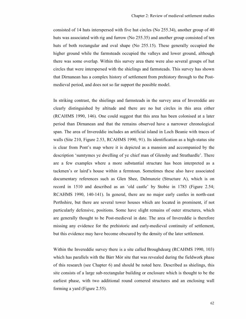
Chapter 2: Review of medieval settlement studies
62
consisted of 14 huts interspersed with five hut circles (No 255.34), another group of 40
huts was associated with rig and furrow (No 255.35) and another group consisted of ten
huts of both rectangular and oval shape (No 255.15). These generally occupied the
higher ground while the farmsteads occupied the valleys and lower ground, although
there was some overlap. Within this survey area there were also several groups of hut
circles that were interspersed with the shielings and farmsteads. This survey has shown
that Dirnanean has a complex history of settlement from prehistory through to the Post-
medieval period, and does not so far support the possible model.
In striking contrast, the shielings and farmsteads in the survey area of Invereddie are
clearly distinguished by altitude and there are no hut circles in this area either
(RCAHMS 1990, 146). One could suggest that this area has been colonised at a later
period than Dirnanean and that the remains observed have a narrower chronological
span. The area of Invereddie includes an artificial island in Loch Beanie with traces of
walls (Site 210, Figure 2.53, RCAHMS 1990, 91). Its identification as a high-status site
is clear from Pont’s map where it is depicted as a mansion and accompanied by the
description ‘sumtymes ye dwelling of ye chief man of Glenshy and Strathardle’. There
are a few examples where a more substantial structure has been interpreted as a
tackmen’s or laird’s house within a fermtoun. Sometimes these also have associated
documentary references such as Glen Shee, Dalmunzie (Structure A), which is on
record in 1510 and described as an ‘old castle’ by Stobie in 1783 (Figure 2.54;
RCAHMS 1990, 140-141). In general, there are no major early castles in north-east
Perthshire, but there are several tower houses which are located in prominent, if not
particularly defensive, positions. Some have slight remains of outer structures, which
are generally thought to be Post-medieval in date. The area of Invereddie is therefore
missing any evidence for the prehistoric and early-medieval continuity of settlement,
but this evidence may have become obscured by the density of the later settlement.
Within the Invereddie survey there is a site called Broughdearg (RCAHMS 1990, 103)
which has parallels with the Bàrr Mór site that was revealed during the fieldwork phase
of this research (see Chapter 6) and should be noted here. Described as shielings, this
site consists of a large sub-rectangular building or enclosure which is thought to be the
earliest phase, with two additional round cornered structures and an enclosing wall
forming a yard (Figure 2.55).
Chapter 2: Review of medieval settlement studies
63
To provide some historical background information for the Invereddie survey, the Royal
Commission consulted the documentary records of the Cistercian Abbey in Cupar
Angus (RCAHMS 1990, 11). The ecclesiastical influence on rural settlement was
discernable from the records which indicated that the system of leasing to individual
tenants was established on abbey lands by the mid-15th
century and the cooperative
system of runrig was not utilised at this point. The leases generally lasted for 5 to 7
years, although some life-rents were known. The practice of splitting fermtouns in the
15th
and 16th
centuries, could be identified as at Persie for example where three groups
of buildings were seen, one a ‘bow-sided building’ of low, turf covered stone
foundations with two enclosures, which may relate to the late-medieval period and two
possibly 18th
or 19th
-century farmsteads (RCAHMS 1990, 154).
In contrast south-east Perthshire is predominantly under 150m in height and the remains
of medieval settlement have been largely eradicated by Post-medieval cultivation. Early
motte and bailey castles and moated sites have been identified (RCAHMS 1994, 104-
109) the latter particularly from aerial photographs. Tower houses were built from the
late 14th
to early 15th
centuries in this area (RCAHMS 1994, 139). Several other tower
houses are associated with the leading families of the area throughout the 15th
and 16th
centuries. One example occupied an island in the Loch of Clunie (RCAHMS 1994, 141)
a location similar to the crannogs and island dwellings of Argyll. The abandonment of
the ‘defensive’ nature of architecture is marked by the construction of laird’s houses in
the 17th
and 18th
centuries.
There are far fewer remains of pre-Improvement settlement in south-east Perthshire than
in the north-east and those that survive are concentrated in the Sidlaw Hills which are
over 150m AOD. They consist of a fermtoun at Arnbathie, several farmsteads (some
with associated field systems), isolated buildings and shielings. No Pitcarmick-type
buildings were identified. Some sherds of medieval pottery collected from mole-casts
which were unassociated with structures were the only evidence for medieval activity
here, although there is documentary evidence for Arnbathie (or Arybothy) in the middle
15th
century (RCAHMS 1994 123) which suggests that it started out as a shieling site.
The medieval landscape of south-east Perthshire was dominated by three major
ecclesiastical establishments, Scone Abbey, Dunkeld Cathedral and Coupar Angus
Chapter 2: Review of medieval settlement studies
64
Abbey. The Coupar Angus records reveal how the church lands were administered from
granges serviced by the labour of lay brothers. The records reveal that an initial period
of expansion, when marshy lands and moorlands were reclaimed, ended by the middle
of the 14th
century, linked to climatic deterioration, pestilence and political instability. A
shortage of labour resulted in an increase in the number of leases of church lands to
secular tenants. In contrast to the theory that the absence of medieval settlements was
partly due to the brevity of leases, a study of the leases of Coupar Angus has revealed
that leases in the mid 15th
to early 16th
centuries were generally 5 years and often for life
(RCAHMS 1994, 117, quoting Sanderson 1982).
With the aid of the documentary references the Royal Commission have been able to
suggest that the pre-Improvement rural settlement pattern within this lowland area
consisted of nucleated villages (with a parish church near a motte) as at Kinnaird,
Clunie, Errol and Cargill with a large number of fermtouns and cottartouns, a wide
scatter of smaller fermtouns and individual farmsteads (RCAHMS 1994, 113 & 130). A
number of these fermtouns developed into burghs in the 16th
and 17th
centuries with the
associated markets and crafts, a characteristic which occurred more rarely in the less
populated west of Scotland.
The Ben Lawers Historic Landscape Project, located on the north shore of Loch Tay,
Perthshire, has been undertaking multi-disciplinary work on rural settlement history
involving topographic survey, geophysical survey, excavation, soil analysis and
documentary and map based research (Atkinson et al 2004). This work has yet to be
published but will provide essential chronological and morphological information with
which to test the settlement model. In the meantime there are several sites that have
been investigated as part of this project that are of particular interest. One is at Kiltyrie
17 above the head dyke, where a group of shielings, were found to consist of two small
oval-shaped shielings overlying both ends of a longer sub-rectangular turf-built
structure with a hearth (see Figure 2.56). There were no datable finds, but radiocarbon
dates of the 12th
to early 13th
century were produced from samples of the hearth (John
Atkinson, pers. comm.). A nearby site of Kiltyrie 16 produced evidence for late-9th
century post-holes and pits beneath an oval-shaped turf structure dated to the early 12th
and 13th
centuries, above which were shielings dated to the 14th
and 15th
centuries.
These structures are similar to, but not as long as the Pitcarmick structures. This
Chapter 2: Review of medieval settlement studies
65
confirms that the remains of medieval structures can be found above the head-dyke
where they have not been affected by later cultivation. They also show continuity of
settlement until 14th
century or so after which it was replaced with temporary
settlement.
The excavation of a shieling at Meall Greigh at an altitude of about 605m AOD
(Atkinson et al 2004, 23) revealed drystone walling forming an oval-shaped structure
with a doorway to the south. What were interpreted as aumbrys in the middle of the end
walls along the long side walls are more likely to be bases for timbers supporting a hip-
ended roof. There was a fire spot just inside the doorway with a setting for a stone
fireguard. Hollows beneath the floor that were unexplained could possibly relate to an
earlier structure on the same site. On the south side of the structure an earth mound had
been built up from turves and ashes from domestic fires. The few artefacts found
consisted of five stone pot-lids, two from inside the structure and three from the mound.
Two sherds of salt-glazed pottery dated to the 16th
or 17th
centuries and a sherd of
Scottish Redware retrieved from the external turf mound provided a broad, late-
medieval date for the occupation of the structure but did not indicate for how long it
was occupied. Other excavations at Ben Lawers concentrated on structures which dated
from the late-18th
and early-19th
centuries and need not be discussed in detail here.
However, it is clear that there had been a re-ordering of the landscape in the 14th
century
as well as in the 18th
century.
Aberdeenshire
The Royal Commission survey of Donside extends in 30k wide swathe about from the
coast around Aberdeen to the Ladder hills in the west, up to about 750m above sea level
(RCAHMS 2008). This report has developed the thematic approach to the archaeology
of the area, which was first introduced in the Perthshire reports (RCAHMS 1990;
RCAHMS 1994). This area contrasts with Argyll in that there is a strong Anglo-
Norman presence in Aberdeenshire from the 12th
century. Early ‘monuments of
Lordship’ are identified as Anglo-Norman mottes and moated sites which are often
located near to churches. The building of stone castles by royalty, the major landowners
and the church is identified from the 13th
century and lesser nobility and ecclesiastics
also occupied halls within ditched enclosures (RCAHMS 2008, 150-163). Tower houses
Chapter 2: Review of medieval settlement studies
66
were built within the numerous baronies between the 14th
and the 17th
centuries. There
is no suggestion that the prehistoric sites, such as the forts, were occupied beyond the
early-Medieval period (RCAHMS 2008 109).
The medieval and later settlement pattern showed evidence of an earlier land unit, the
dabhach, and of Anglo-Norman burghs and planned villages, some of which have left
no trace, although are known from documentary evidence (RCAHMS 2008, 183-188).
From the late medieval period the RCAHMS have identified five types of rural
settlement, the fermtoun, the milltoun, the cottertoun, the individual croft and manorial
sites. Fermtouns and cottartouns were occupied by different sections of society, the
fermtoun by joint farm tenants and cottartouns by sub-tenants with little or no land
attached. Processes such as the splitting of townships was recognised and included the
spread into marginal lands in the 15th
and 16th
centuries as well as an increased density
of settlement within the existing farmland.
The Royal Commission also identified what they interpreted as medieval buildings
which consisted of large sub-rectangular structures, often with rounded corners and low
stone footings (RCAHMS 2008, 199-201). These structures were large, in the region of
15m long and 7m wide and were found singly or in pairs within the marginal areas
among shielings and prehistoric hut circles. These were presumably cruck-built
although there was no evidence to indicate whether the timbers were earthfast or
supported on low walls. There was, they admitted, little evidence for a medieval date for
these structures, but were thought to be clearly different from the later pre-Improvement
settlement, which consisted of small clusters of narrower structures (4m-6m wide).
Shieling sites were identified as smaller structures, generally single-celled, with no
evidence for kilns or enclosures, which was interpreted as evidence of seasonal rather
than permanent settlement (RCAHMS 2008, 204-206). At one site in particular, Allt
Tobair Fhuair, stone huts overlay turf huts and there were midden deposits lying outside
the single entrances which would be an excellent site for excavation, containing as it
does at least two phases of occupation and surviving midden deposits which could
provide dating evidence (RCAHMS 2008, Figure 8.78). Three sites, which consisted of
turf structures and enclosures, were interpreted as probable 18th
century intakes of land,
although there is no explanation of why these should have been built of turf when
contemporary shielings could have been of stone and turf. In general, this survey has
Chapter 2: Review of medieval settlement studies
67
identified a great number of rural settlement sites of different types and an attempt has
been made to date these from their morphology, location and documentary and historic
map evidence. No sites of the Pitcarmick type were identified, which does suggest that
they are a regional type. While these dates may well prove to be correct, archaeological
investigation is required to provide a chronological framework to back up their
proposed settlement model. There is also no consideration of any continuity of sites
from the prehistoric or early-medieval period into the medieval period.
The Highlands
A survey in the Strath of Kildonan by the Royal Commission (Dixon 1993a) and the
survey and excavation undertaken at Easter Raitts (Lelong and Wood 2000) are
considered here. In the Strath of Kildonan, the density of settlement, even before the
Clearances, was noticeably sparse (Dixon 1993a, 30-35). There were few farm
boundaries, the settlement and fields being enclosed by a ring-dyke. The houses were
particularly long and narrow which was thought to be characteristic of Sutherland. The
walls were of drystone and not load bearing, implying the presence of cruck slots
although none could be seen within the collapse. These long buildings were grouped
together with a shared corn-drying kiln. At only one site, Learable, was a sequence of
phases detected which ‘hinted’ at the presence of an earlier, medieval phase. Within the
strath generally there was archaeological and documentary evidence for the
establishment of new farms on old shieling grounds in the 18th
century. The particularly
long buildings noted in the strath had the ability to accommodate larger numbers of
stock and this might be reflection of large herds being accommodated in a small number
of settlements. Alternatively, perhaps more of the stock required accommodation
because of the harsh winters in the Highlands, while elsewhere in Scotland, many of the
non-milking herd were left in the open all year. The publication of this survey has
concentrated on the medieval and later settlement and has not considered the
relationship of the prehistoric sites with the medieval, but has identified the re-
occupation of shieling sites.
At Easter Raitts, Badenoch, there was documentation from the Post-medieval period
although Lelong suggested that the origins of the settlement could be taken much
further back (Lelong & Wood 2000, 41; Lelong (forthcoming)). Easter Raitts was part
Chapter 2: Review of medieval settlement studies
68
of a larger estate which had become divided into Easter, Wester and Mid Raitts by the
early 17th
century. The chapel of Rate is documented from the 13th
century and Lelong
suggests therefore that that there would have been a settled population served by this
chapel from pre-Norman times, but does not say why the population needed to have
been ‘settled’. By 1380 the ‘lands and chapel’ of ‘Rate’ was in the control of the Bishop
of Moray, and later belonged to the Gordon family with surviving rentals from the 15th
century onwards. Pont’s map of the late 16th
century showed that the settlements had
been separated by this time into ‘West’, ‘Mid’ and ‘Rait’ and Lelong presumes that
Easter Raitts relates to either ‘Mid’ or ‘Rait’.
After six seasons of excavation at Easter Raitts the results were similar to Fairhurst’s
experience at Rosal, in that the visible structures were found to be Post-medieval in date
and no medieval remains were discovered. Lelong put this down, partly to the scouring
of the site by later occupation and also perhaps to their fieldwork methodology,
although traces of Mesolithic, Early-Neolithic and Bronze Age material was found.
Perhaps settlement shift has meant that the Post-medieval settlement is not overlying the
medieval sites, which lie elsewhere on the Raitt estate, perhaps in the vicinity of the
Iron Age sites.
Lowland rural settlement
Even within the Lowlands, the remains of rural settlement are still relatively rare. One
such site was excavated at Springwood Park, Kelso (Dixon 1998; Dixon 2001). This site
was originally found from scatters of medieval pottery within a ploughed field. It
consisted of three periods, the first included building terraces, post-set structures and
ditches, and the later phases included cruck-framed structures with clay walls, stone
footings and cobbled areas. The settlement has been dated from the pottery and four
coins to between the late 12th
and the 14th
centuries. The walls of one of the later
buildings was 1.2m wide, but only survived one course high. There was a significant
number of metal objects, including four buckles, a key, two harness pendants, a ring, a
needle, as well as sheets, tubes and strips, as well as iron horseshoes, knives and a
hammer. The stone objects included spindle whorls, a loomweight, a stone hone and
sharpening stones, millstones. The pottery was equally abundant with over 5000 sherds
consisting of White Gritty Ware, Kelso Abbey Redware, Scarborough Ware, Reduced
Chapter 2: Review of medieval settlement studies
69
Gritty Ware, as well as foreign imports. This site was located close to the royal burgh of
Roxburgh, Roxburgh Castle and Kelso Abbey, and which may explain why it was
unusually rich in material culture (Martin & Oram 2007). Although the objects were
associated with a rural economy, no scythes or sickles were found and the presence of
the silver coins would suggest that this was a rural settlement occupied by tenants at the
higher end of the social scale.
In 2006 a lost medieval village was found at Archerfield, near Eldbotle, East Lothian as
a result of the construction of a golf course (Hindmarch 2006). Here the substantial
remains of rectangular stone-built, clay bonded structures, some still standing several
feet high were found and there was evidence for more than one period of buildings.
Further details of this project await its full publication. At the site of Laigh Newton,
Ayrshire a series of sunken medieval houses was revealed through extensive topsoil
stripping associated with quarrying (James et al 2007).
The survey of Eastern Dumfriesshire for example incorporated historical research,
historic maps, and examination of aerial photographs (RCAHMS 1997a). Consideration
of the geology, climate and soils was also included, although very little dealt with the
post-1000 AD period. The section on climate, for example, concluded that from the
evidence from one site a ‘stable and settled agricultural economy ... persisted’ from the
14th
to the 19th
centuries (RCAHMS 1997a, 22), despite the medieval Warm Period and
Little Ice Age. Tipping admitted that there were weak dating controls which may have
had a blanketing effect on these results. The field survey was undertaken on ‘several
different levels of intensity’ and included the concept of ‘prospective survey’ in which
the experience of the surveyor played a major role in deciding where, and to what level,
areas should be surveyed (RCAHMS 1997a, 9). Some areas were subject to a rapid
survey where only selective sites were visited, while the uplands received ‘consistent
coverage’. Areas of greatest potential for the discovery of monuments, in their opinion,
did not include forestry plantations. The results were presented within a thematic
framework consisting of ‘Pre-improvement agricultural remains and patterns of former
land-use’, and for the early-medieval and medieval periods the themes were ‘Lordship’,
‘Settlement’ and ‘The archaeology of the church’. While the introduction of such
themes is to be welcomed, this choice effectively separated settlement from the
Chapter 2: Review of medieval settlement studies
70
cultivation remains, which is unhelpful, if an understanding of how settlement
functioned within the landscape is to be achieved.
In the Menstrie Glen, on the southern edge of the Ochill hills, a survey undertaken by
the Royal Commission utilised the historical sources to illuminate the changes in land
ownership and farming practices during the medieval period (RCAHMS 2001).
Straddling the Highland and Lowland zones, the farming practices of the Menstrie Glen
was complex, varied and showed characteristics of both zones. The historical records
suggest that transhumance went out of use by the early 17th
century and new farmsteads
expanded into old shieling grounds during the 17th
century. The records of James
Wright detail the practices of this particular Improving landowner, including the liming
of the land, the creation of new land divisions and the conversion to a sheep-farm. The
identified archaeological remains included the shielings, small turf-built farmsteads of
the 17th
century located above the head dykes, turf-built byre-dwellings of the 18th
century, lairds houses and finally stone-built farmsteads of the 19th
century (RCAHMS
2001, 30). Although a medieval origin was suggested for a small number of settlements,
no remains dating to this period were identified, apart from perhaps the shielings, which
were seen as the earliest features. These groups have been dated by their morphological
appearance and documentary records, but without archaeological dating evidence these
proposed types should be considered provisional as the reality is likely to be more
complex and overlapping.
In contrast to the large area covered by the Eastern Dumfriesshire survey, the Royal
Commission survey of the much smaller Menstrie Glen, was presumably more intensive
and evenly spread, although this is not specifically stated (RCAHMS 2001). Historic
documents and maps were again extensively utilised and the survey greatly benefited
from the survival of a particular landlords papers dating from the mid-18th
century. The
RAF vertical aerial photographs taken just after World War II were especially useful for
mapping areas of rig and furrow. There were, however, no specific considerations of the
environmental history or geology of the area (perhaps because the detailed work has not
been done) that would have provided a broader background to this landscape approach.
The recent Royal Commission survey of Donside covered a large area in Aberdeenshire
in the east of Scotland (RCAHMS 2008). Although there was no description of the
Chapter 2: Review of medieval settlement studies
71
survey methodology, one can assume that it was similar to that utilised in the Eastern
Dumfriesshire, including educated ‘prospective survey’. There is a lengthy section on
environmental history with the latest radiocarbon dates from pollen cores, however
much of what is included here is not relevant to the medieval period, which is put down
to ‘the uncertainties of chronology and the possible truncation of sediments’ (RCAHMS
2008, 42). Pollen cores from only two sites are used to cover the medieval period and
the interpretation of such limited results should be treated with caution. There are,
however both solid geology and superficial drift maps and a map of the distribution and
extent of present blanket peat and its possible extent in the Holocene. These are a clear
reminder of that the landscape environment in which the medieval population lived and
interacted with, did not just consist of different relief, but also of different soil types and
quality, where the presence of blanket peat could be seen as a fuel resource as well as a
constraint to cultivation. There has been extensive use of historic maps and documents,
a consideration of place-names and aerial photographs (many clearly specially
commissioned) that compliment the site plans. The thematic approach to the
presentation of the results has been developed further, with a division between early
medieval and the medieval and later periods. Within the latter period the themes relate
to mapping the medieval Lordships, the extent of parishes and estates, the monuments
of Lordship (1150-1700), the medieval and later settlement pattern and finally the
archaeology of rural buildings and settlements.
The problems arising from attempting to reconcile data produced by different
disciplines, which is part of the landscape approach, has been addressed by a recent
study which brought together environmental data and that from historical sources
(Davies & Watson 2007). This interdisciplinary study combined detailed analysis of
two pollen cores from a shieling site near Loch Awe with historical data available in the
Breadalbane archive. The results were initially presented separately so that their
limitations were clear and were jointly assessed in the discussion. Both data sets had
problems relating to their chronological spread and geographical scale. However, by
bringing them together the value of each source could be to be assessed against the
other and has brought out the complexities which would perhaps not otherwise have
been appreciated.
Chapter 2: Review of medieval settlement studies
72
Survey work in Eskdale, Dumfriesshire has also highlighted the well preserved site of
Boyken (Corser 1982; 1993; RCAHMS 1997b). Here there are four or five main
clusters of buildings and four other individual farmsteads and large areas of cultivation
within the boundaries of the farm. Corser has suggested that each cluster may represent
the settlement of an individual tenant, an idea which is supported by the Hearth Tax
data of the 1690s. The remains here consist of about 30 sub-rectangular buildings which
sit on artificially scarped platforms. Boyken was apparently not built over during a later
phase and so is a rare example of a pre-Improvement farmstead. The survey of Eastern
Dumfriesshire also produced several other examples of ‘platform-buildings’ which
consisted of sub-rectangular platforms, often crossing the contour, upon which the
structures themselves survived as only slight stone or stone and turf remains (RCAHMS
1997, 228). These platforms were found within Eskdale, but not in Annandale. Late
medieval estate centres, in the form of stone built halls or small towers were identified
and the suggestion was made that perhaps these could be identified in the Hearth Tax
records of 1691 where more than 1 hearth was recorded against a single name
(RCAHMS 1997a, 215).
These few lowland rural settlement sites, serve to highlight the great difference in
settlement morphology and artefactual richness that existed between the Gaelic west
and English speaking southern Scotland, and it is not perhaps to this area that
confirmation of Gaelic settlement patterns should be sought.
Gaelic Ireland
As the economy of Ireland, outside the English dominated Pale, was pastoral and its
Gaelic speaking people had close family and social ties with the west of Scotland, it
could be useful to explore what evidence there is for rural settlement in Ireland. It has
been suggested that in Gaelic Ireland rural settlement took the form of either isolated
farmsteads or house clusters (O’Conor 1998, 74). Two main types of lower status
houses have been identified. The first was called the ‘creat’ similar to the Scottish
‘creel’ house (Walker 1808, Vol. 1, 95; Dixon 2002, 190) in that it was a ‘small, one-
roomed, mostly windowless house of circular or oval form …very simply built of post-
and-wattle, or wickerwork and roofed with thatch or sods’ (O’Conor 2002, 201-204).
These structures were thought to be associated with boolying (transhumance), but there
Chapter 2: Review of medieval settlement studies
73
is documentary and pictorial evidence which suggests that by the 16th
century small
clusters of creats were located in the vicinity of the larger nucleated settlements such as
Carrickfergus (Horning 2001, 378), Armagh (O’Conor 2002, 202) and around tower-
houses and castles, as at Dunboy Castle, West Co Cork (Figure 2.57), (O’Conor 1998,
104). This suggests that these structures were acting as the permanent dwellings of the
poorer members of society as well as the seasonal dwellings in the hill pastures. The
evidence for this type of structure having existed in Ireland is principally late 16th
-
century documents and pictures (O’Conor 2002, 202).
There has been, until recently, a lack of archaeologically excavated examples of creats
in Ireland. Possible 16th
or 17th
century examples have been found at Dunamase Castle,
Co. Laois, although the author thought that these were for storing grain rather than
occupation (Hodkinson 2003). A possible creat was found at Blackrock, although this
was rectangular in plan with rounded corners (Breen 2005, 92-94). The walls were
defined by shallow trenches and stake holes were thought to represent the supports for
wattle walls. There was no evidence for ground fast roof supports, cruck supports or sill
beams and so this was interpreted as perhaps a rectangular version of a creat which
could have had a tent-shaped roof as it was only 1.19m wide. There was evidence for
burning at the south end but no specific hearth or other evidence for activities within it
and so it was interpreted as a small domestic house. A single sherd of red undecorated
earthenware pot was the only find. Horning has suggested that the origin of the creats
lies in the circular post-and-wattle houses of the early medieval period (Horning 2001,
377) but it would seem that the construction post-and wattle buildings also continued
into the medieval periods as is shown by examples from Ballysimon, Co. Limerick and
Mooghaun, Co. Clare (O’Conor 2002, 203). The construction of creats and the post-
and-wattle buildings are closely related and perhaps there was a variety of structures
with shared characteristics in use in the medieval period in Ireland, depending on
function, available resources and personal preferences.
The second type of structure, the cruck building, was more substantial, sub-rectangular
in shape with rounded corners, a central hearth, walls of clay, wattle and daub or sods
that were not load bearing and roof supports consisting of timber crucks which lay
directly on the ground or on stone pads (O’Conor 2002, 204-206). In Ireland these
structures have also been associated with boolying and excavated examples have been
Chapter 2: Review of medieval settlement studies
74
found at Glenmakeeran (Williams & Robinson 1983), Goodlands (over 120 structures),
(Sidebotham 1950; Case et al 1969), Tildarg (Brannon 1984) Craigs (Williams 1988)
and Canalough (Breen 2005, 94-98). One example, at Tilderg, produced a radiocarbon
date of 1185-1375 AD and a few sherds of everted rim ware (now referred to as
Medieval Ulster Coarse Pottery), (Brannon 1984, 168; McSparron 2009). Another site
at Glenmakeeran was dated to broadly the medieval period from the presence of
Medieval Ulster Coarse Pottery as there were no other diagnostic finds (Williams &
Robinson 1983, 36). The site at Canalough consisted of a cluster of ten houses,
rectangular in shape with rounded corners. Where one structure had been cut by the sea,
its stone foundation for a probable turf wall was seen. Although there was no direct
evidence for a cruck-frame, this was thought the most probable roofing method (Breen
2005, 94). More substantial rectangular buildings were seen at Caheravart (Breen 2005,
102-106). One of the two structures measured 14.7m by 7.6m externally, with sod walls
on a stone footing and opposing entrances. These have been dated to earlier than the
post-Medieval period as they were not shown on the 1st edition map, nor are there any
17th
century references to the site. It was suggested that such structures could have been
one of the residences of the O’Sullivan Beare lords.
Documentary sources suggest that these cruck built structures were introduced into
Ireland by Anglo-Norman lords at the end of the 13th
century. These were then adopted
by Gaelic-Irish lords as the most valuable element in the construction, the crucks, could
be taken down and moved to another location relatively easily, which could have suited
their more mobile lifestyle. This style of building seems to have been in use by men of
both high and low status by the beginning of the 14th
century (O’Conor 2002, 205-6).
However, other researchers have suggested that the change from circular to rectangular
houses occurred earlier than this, in the 9th
century, influenced by the church, although
there is little archaeological evidence for the nature of the roofing structure (Lynn 1994,
91).
The analysis of Irish sites is complicated by the strong evidence for some rural
settlements being occupied by incomers as at Goodlands, where documentary evidence
and the presence of clay pipe stems have shown that it may have been part of a
Highland Scottish village occupied during the Plantation period (Horning & Brannon
2004, 31). The presence of Scottish Gaelic mercenaries (gallóglaigh) in Ireland,
Chapter 2: Review of medieval settlement studies
75
between about c. 1250-1600, including the Mac Suibhnes and Mac Dubhghaills having
lost their hereditary lands, will have provided the opportunity to strengthen cross-
cultural links (McLeod (2004). Fosterage and intermarriage strengthened political links
in both directions and it is possible that there was a pan-Celtic settlement pattern within
which the terms ‘Irish’ and ‘Scottish’ have no particular distinction (John Raven, pers.
comm.). There was a close link between Scotland and Ireland with a shared Gaelic
language and probably also building techniques and yet these links were ‘not on a
sufficient scale to produce an homogenous cultural province’ (Campbell 2001, 6).
At the upper end of the social hierarchy the Irish occupation of castles is also
illuminating. There has been discussion regarding whether stone-built castles were built
solely by the Anglo-Normans or whether they were constructed by the native Gaelic
Irish (Leask 1951, 153; Sweetman 1995, 5; McNeill 1997, 72-74). O’Conor has
suggested that within a clan-based social system, land was owned by a patrilineal family
group among whom clan lands were periodically redistributed. There was therefore no
incentive for an individual chief to invest his wealth in substantial building projects as
there was no guarantee that the Chieftainship would pass on to his own son, as was the
case with the Anglo-Norman practice of primogeniture (O’Conor 2002, 207). Instead,
social status was displayed though public feasting, keeping of armed retainers,
patronage of learned classes and ownership of cattle and the buildings where the chiefs
lived were not the primary elements of social distinction (O’Conor 2005, 219). It is
thought that because of this attitude to inheritance, the Irish Gaelic Lords did not
construct impressive castles, but preferred to be more mobile within the landscape,
living off the produce of his estate and when under pressure using the tactics of guerrilla
warfare, retreating into the wild hills and bogs (O’Conor 2002, 207-8; 2005, 218). There
were strong differences between Gaelic and Anglo-Norman society during the later
medieval period and this was reflected in the structures they occupied (O’Conor 2005,
213). It was not till after 1400 that the native Irish began to build stone castles and
towers or to occupy the existing Anglo Norman castles (O’Conor 2005, 214). They also
occupied a variety of strongholds after 1400 which included strong houses, courts, piles,
holdes and comfortable seats. These were used as centres of their estates in much the
same way as the Anglo-Normans had done. The construction of wooden castles or
structures of wattle and daub were also used by those lords who were lower down the
hierarchical scale some which differed little from the ordinary native population
Chapter 2: Review of medieval settlement studies
76
(Loeber 2001, 274-5; O’Conor 2002, 206-7). By the 16th
and 17th
centuries there is
evidence that mercenaries were also living in castles while other members of the
professional classes (the counsellors, poets, historians and mercenaries) lived in
substantial stone houses (Loeber 2001, 301-4).
Some researchers have suggested that the lack of permanent rural settlements in Ireland
was because of the nomadic nature of the population. The creaghts, or roving herds of
cattle with their herdsmen, were said to follow a nomadic existence throughout the
summer months (Nicholls 2003, 136). There is a reference to the people of Munster by
Bishop Lyon which states that ‘the tenants continue not past three years in a place, but
run roving about the country like wild men fleeing from once place to another’ (Barry
1988, 355). There was clearly disapproval of a population which was allowed to move
freely about the countryside, rather than being tied to the land and a particular lord. The
extent of nomadism may therefore have been over emphasised with settlement mobility
taking the form of pastoral transhumance from the sean bhaile to the booley (pers
comm. Kieran O’Conor) and may have been restricted to the lower status members of
the population (Loeber 2001, 275). The particular nomadic existence and final
extinction of the Clan Murtagh O’Conors in the 14th
century, can be seen to be a result
of clan feuds and territorial disputes, which saw the O’Conors seeking refuge wherever
they could, rather than being a common experience (Simms 2001). Nor was this
nomadic status one that was sought after, as they did all they could be avoid becoming
‘landless men’.
In addition to the castles, hall-houses, creats and sod walled structures, there is evidence
in Ireland that crannogs, moated sites, ringforts and cashels were also occupied
throughout the medieval and into the Post-medieval periods (Davies 1950; O’Conor
2001, 337; Finan & O’Conor 2002). The moated sites appear to have been introduced
by the Anglo-Normans and were generally associated with wealthy free tenants and
members of the knightly class (Bradley 2002, 213). At Cloonfree (see below) a moated
site was constructed and occupied by Aodh O’Conor, king of Connacht, a Gaelic Irish
king, however he ruled only because of support from the Anglo-Norman William de
Vescy, lord of Kildare and this may explain why he chose an English style of building
(Simms 2001, 9; Finan & O’Conor 2002, 78).
Chapter 2: Review of medieval settlement studies
77
The documentary references indicate that crannogs were also used as defensive lordly
residences throughout the medieval period (O’Conor 1998, 79-84; Brady & O’Conor
2005). There are references to Irish lords dying either ‘on Lough…’ or ‘on Inis…’
which would appear to refer to islands, which could have been either natural islands or
crannogs (Fredengren 2002, 274-5). An archaeological survey has found a specific type
of crannog in Loch Gara, which is topped with a ‘high cairn’ of stones over timber work
which have been dated to the medieval period (Frendengren 2002, 80, 83-85, 273).
Other examples have also been found at Island McHugh, Co Tyrone, Cró Inis , Co
Westmeath, Balywillin, Co Longford, and Ardakillen, Co Roscommon which were high
status residences, centres of lordly and even royal estates, and were not just temporary
refuges (Brady & O’Conor 2005). A recent survey in Fermanagh, undertaken by Jacqui
O’Hara, has also found crannogs in continuous use up to 1600, but has not noted the
presence of a stone cairn (pers. comm. Kieran O’Conor). Fredengren has suggested that
during the medieval period in Ireland, lakes were taken over by the ruling families and
that a small number of crannogs were re-used by the addition of stones and a clay
capping which raised the surface of the crannog above the water. A close geographical
connection has been shown between crannogs and lake shore moated sites (O’Conor
1998, 82; 2001 338-40) and with other medieval strongholds (Fredengren 2002, 276)
although the reasons for this has yet to be fully explored.
The continued occupation of early medieval promontory forts, ringforts or raths into the
medieval period has also been much debated (O’Conor 2008, 89; Breen 2005 48-62).
O’Conor argues that many of these sites were chosen for the construction of mottes by
the invading Anglo-Normans and used as their estate centres. There was no reason why
such sites should have been abandoned by the native Irish lords outside the areas
dominated by the Anglo-Normans and so one would expect there to be evidence for this
continued occupation. So far the evidence is sparse consisting of stray medieval finds
and no significant medieval deposits. However, O’Conor has drawn attention to a site at
Thady’s fort, Co.Clare, which he believes consisted of a bivallate ringfort and a
contemporary late medieval rectangular house (O’Conor 1998, 91). It is thought that
other such sites may be found once archaeological investigation has takes place in the
Gaelic occupied areas of Ireland and indeed a survey of the county of Meath has found
many more ringforts in the Gaelic areas than in the areas taken over by the Anglo-
Normans (Barrett & Graham 1975, 37-43). Cashels also seem to have been occupied in
Chapter 2: Review of medieval settlement studies
78
the medieval period including Rathgall, Co. Wicklow, Ballynaveenoragh, Co Kerry and
Cahirmacnaghten, Co Clare (O’Conor 1998, 85-6). These examples were associated
with rectangular wattle and daub buildings and significant amounts of medieval pottery.
Other cashels were re-occupied with tower houses in the later medieval period, and may
well have been in continuous use since the early medieval period. The Anglo-Normans
are also thought to have introduced the ringwork type of structure which was very
similar to the ringfort except that the ringwork has a larger rampart and an entrance
faced with stone (Breen 2005, 43).
Irish praise-poems have proved to be a useful source of information on house
construction, although as Simms reminds us, the poems were not intended to be truthful
descriptions, but to praise and are therefore sometimes ambiguous (Simms 2001, 250-
252). The seat of the chief of Magauran in Co. Cavan, was described in the 13th
century
as a cluster of houses which included a drinking hall or banqueting hall, made of
hazelwood and the ‘ribs’ of the doorpost were decorated with gold. A great house of
Aodh O’Conor, king of Connacht, at Cloonfree Co. Roscommon, which burned down in
1306, had been defended with a stout dyke, an earthen palisade and a moat, which was
seen as unusual for the times suggesting that there may have been an English influence
on the design (O’Conor 2002, 205; Finan & O’Conor 2002). Within this enclosure were
several buildings with windows, including a banqueting hall built of willow wands with
a thick thatch, which presumably would have required the support of crucks. One poem
mentions Gall-gabhla in relation to this site at Cloonfree, which has been interpreted as
meaning ‘foreign forks’ or English style crucks (O’Conor 2002, 206). A house at
Rudhraighe, co Monaghan included a ‘citadel’ within a moat, probably dating to
between the 15th
to 17th
centuries (Simms 2001, 252- 256). The thatched house was on
an elevated site, had a high ridgepole and was constructed of oak planks and wattle-and-
daub. Oak boards were painted and carved with animals. These poems have therefore
provided evidence for high-status houses built of oak planks and wattle-and-daub,
which were located within a cluster of other buildings.
The review of the Irish material has provided a wide range of possible structures
occupied during the medieval period, which were linked to social status. Prior to 1400
the Gaelic lords occupied a range of sites many of which was a continuing presence
from the early-medieval period. So sites such as cashels, ring-forts, raths were occupied
Chapter 2: Review of medieval settlement studies
79
as well as other fairly simple post-and-wattle structures, because these could be
abandoned quickly in advance of an attack. Rectangular cruck built houses came into
use by the 14th
century, perhaps influenced by the Anglo-Normans, but some Gaelic
lords also continued to build circular wattle built halls throughout the medieval period
up until the 17th
century. Irish lords therefore did have permanent residences but these
were not always stone built. After 1400 there is evidence that stone built castles were
built by the Gaelic Irish lords. A change from circular to rectangular houses was evident
in the archaeological record, although circular structures also continued in use. Post-
and-wattle also continued as a building construction method as well as the more cruck-
built structures. There is some documentary and pictorial evidence for ephemeral
circular structures in use in the medieval period, including circular post-and-wattle
structures and creats, although these remain scarce in the archaeological record.
Scottish Gaelic Literature
In the light of what the Irish material can contribute to medieval settlement, as outlined
above, the Scottish Gaelic sources were also examined briefly to see whether there were
similar useful references to settlements or structures. Compared with the material from
Ireland and Wales, the Scottish Gaelic sources are relatively few, but there are a number
of relevant works (Black 1989; Thomson 1974). Three Scottish sources were recognised
as potentially useful and include The Book of the Dean of Lismore (McLeod & Bateman
2007; MacGregor 2006), The Black Book of Taymouth and The Red Book of Clan
Ranald (Gillies 2006) however, there is no published analysis of these works from an
archaeological point of view and to undertake a comprehensive study of these sources
was not within the scope of this research.
The Book of the Dean of Lismore has been described as the ‘single most precious
manuscript to have survived from late medieval Gaelic Scotland’ (MacGregor 2006). It
is a compilation of poetry, prose and history, written in vernacular Gaelic, Classic
Gaelic, Latin and Scots. The collection was made by members of the MacGregor clan,
based at Fortingall in the 15th
and 16th
centuries and contains material which dates from
about 1200 to 1520. As this material has originated from Argyll, the Highlands and
Ireland, and even includes works written by the Earl of Argyll, it is relevant to the study
area of this research. In general terms, the works reveal much about the Gaelic literary
Chapter 2: Review of medieval settlement studies
80
culture of the Gàidhealtachd with its strong influence and connections with Ireland and
the preoccupations of the aristocratic and professional members of Scottish Gaelic
society (MacGregor 2006; Watson 1937).
For example, the Book of the Dean of Lismore includes the poem Dál Chabhlaigh ar
Chaistél Suibhne ‘A meeting of a Fleet against the Castle of Suibhe’ which is an
incitement to an attempt by the MacSweens to regain their castle from the Earls of
Menteith in the early 14th
century and it displays a strong Norse influence -
‘The prows of the ships, festooned with jewels
are decked out with coats of mail
for the warriors of the brown-faced baldrics –
they are Norsemen and brave chiefs’.
(McLeod & Bateman 2007, 220-228).
There is a reference to the castle, as a ‘shining fortress of stones’ and to a ‘happy haven
in the breast of Knapdale’. An heroic account of the genealogy of the MacGregors is
given in a poem A Ughdar so Mac Giolla Fhionntóg an Fear Dána (The author of this
is a Mac Giolla Fhionntóg). This mentions the practice of sorning.
’11. From Hallow’en to Beltane
the warrior bands had right of quarters in every house;
the hunt (good cheer was there for falcons)
they had in the hunting season.
’18. In his court of many doors
is many a fair-wrought helmet and thin blade;
gold gleameth on their hilts,
the weapons of the Lion of Loch Awe
(Watson 1937, 29-31).
Other poems have references to a drinking house (Watson 1937 89) or a house of
feasting (Watson 1937, 101 & 149) and even to the roof couples and lighting
arrangements.
Chapter 2: Review of medieval settlement studies
81
‘Thus did the masons leave aright
the coupled house of MacGregor,
nor is there any lack of masonry in our time,
since thou has come to its demesne.
Wine is drunk by stately dames,
MacGregor, in thy spacious hall;
in thy wide firm mansion, as I deem,
wax is ablaze even to the door-post.
(Watson 1937, 151).
Other potentially significant works include the Red Book and Black Book of Clan
Ranald. Although the Red Book and Black Book date to the beginning of the 18th
century, they belong to the medieval Gaelic literary tradition as they contain material
which was composed and written down during the period of the Lordship of the Isles, or
earlier (Gillies 2006). The Red Book was compiled by Niall MacMhurich, poet to the
Clan Donald and the Black Book, partly a copy of the Red Book, was complied
primarily by Christopher Beaton, a member of the medical family whose patrons were
the Macleans. These Books contain genealogy, Scottish and Irish Gaelic poems,
chronicles, annals and oral accounts (including the campaigns of Alistair McColla) and
many other miscellaneous writings. They provide a ‘wonderful window into the life and
work of the Classical poet-historians and of the scholastic literary culture in the
Highlands before the demise of the patronage of the Gaelic arts’ (Gillies 2006).
Other potential sources of Gaelic writing include the 15th
century Glenmasan
manuscript (Glenmasan, Cowal, Argyll) which was possibly copied from a 13th
century
original (Mackinnon 1904). This includes heroic poems of Irish origin that illustrate the
strong literary links between Ireland and the west of Scotland. The existence of
manuscripts belonging to the MacLachlans of Kilbride, in Lorn, Argyll (who included
the Machlans of Craigenterve in the Kilmartin parish) have also been highlighted and
their potential should be tapped (Bannerman 1977a). There is also a brief study of the
West Highland galley in poetry and song (Rixon 1998, 188-199).
Chapter 2: Review of medieval settlement studies
82
The existing studies of Gaelic literature have therefore contributed significantly to our
understanding of the literary and cultural values and preoccupations of the Scottish
Gaelic elite. However, a comprehensive index of specific references to place-names,
structures or topographic information, as has been undertaken for the Post-medieval
period (Meek 1995, 281-332) has yet to be attempted for the medieval period. This
work on the medieval sources would be worthwhile, but could not be undertaken in the
timeframe available of this current research.
Summary of Scottish Rural Settlement
This review of rural settlement has revealed many factors at work which have had an
effect on rural settlement, the most profound include war, famine, plague, increased
commercialisation and climatic deterioration. The effect of these would not have been
felt equally all over the country and so the responses also would have been complex and
varied both spatially and chronologically. It might prove difficult therefore to provide a
‘model’ of rural settlement for Scotland which would fit all the evidence. However,
from the above it is possible to put forward a very basic ‘model’ for rural settlement in
the Gaelic west.
During the medieval period, when the vast majority of people lived in the countryside,
settlement was probably in small, dispersed, amorphous-shaped farms near to the
available pockets of arable land. Many people would have spent the summer months
living in shielings in the hill pasture with their herds of cattle, although sheep and goats
were also important in the economy. The hierarchical society was reflected in a range of
settlement types from the small number of castles, hall-houses, strongholds (duns, forts,
crannogs, islands) and substantial houses, down to the numerous settlements consisting
of individual houses or huts (including wicker-built creelhouses). Several high-status
sites have the remains of low structures in their vicinity, but not enough work has been
done to show whether these are contemporary or Post-medieval occupation. The site at
Finlaggan, however, proved to be an exception, as it was of the highest status in the
west, being associated with the Lord of the Isles, and yet had few traditionally
recognised defences. It is a reminder that perhaps the Gaelic Lords had less need or
desire for stone-built castles than the Anglo-Norman lords.
Chapter 2: Review of medieval settlement studies
83
Settlement continuity has been recognised on some sites from the prehistoric into the
early-medieval period. During the medieval period there was initial growth with
expansion, into forests, wastes and moorland and perhaps into older shieling grounds,
but in the 14th
century there is evidence for a shift in population and a hiatus in stone
building works which probably relates to the effect of wars, plague, pestilence and
famine. This may also have been contemporary with an increased reliance on
pastoralism.
The rural houses occupied in the medieval period were extremely varied in size and
construction. They were generally rectangular or round-cornered, probably with hipped
roofs. There was no chimney, the hearth being in the floor, either central of to one side
of the entrance. The walls were of stone, a mixture of stone turf, wattle or clay or just of
organic materials. The thatched roof was supported paired on timber crucks which
either sat directly on the ground or on padstones. The structures were narrower than in
the Post-medieval period and were sometimes of great length, perhaps to accommodate
over-wintering animals. These structures could be constructed along the contour, or
down the slope in the case of byres, or on terraces. Sometimes it is only this terrace that
survives.
The material culture found on rural settlement is poor and organic materials such as
wood and bone were probably used extensively. There was little wheel thrown pottery
used except in relatively high-status sites, but locally made craggan wares were used
mainly in the outer isles.
2.6 Review of the Archaeological evidence from Mid-Argyll
This section looks at current state of knowledge for rural settlement in Mid-Argyll, prior
to this research, in the light of the above assessments. The sources used were National
Monuments Record and the Royal Commission Inventories.
Curtain-walled castles
In Argyll, the major castles of the 13th
century (Castle Sween, Dunstaffnage and
Skipness) are thought to have been built by the major Gaelic clan chiefs and these are
Chapter 2: Review of medieval settlement studies
84
all in prominent positions overlooking the sea. Castle Sween (RCAHMS 1992, 245-
259) and Skipness (RCAHMS 1997b, 26) are said to have been built by the MacSweens
and Dunstaffnage by the McDougalls of Lorn (RCAHMS 1997b, 47). Of these major
early castles only Castle Sween lies within the research area of Mid-Argyll.
Castle Sween occupies a prominent position in Knapdale on the east shore of Loch
Sween and is thought to be one of the earliest curtain-walled castles in Scotland, built
about 1200 by the clan chief Suibhne (RCAHMS 1992 (245-259, RCAHMS 1997b, 89:
Tabraham 1997, 33:). Suibhne ‘the Red’, father of the MacSween clan, was probably of
mixed Norse/Gaelic descent and his ancestors were said to include Irish Kings and a
Scottish princess (Sellar 1971, 24-28; Tabraham 1997, 38). The MacSweens were
therefore of the ‘first rank of Gaelic aristocracy’ who held extensive lands as ‘Thane of
Knapdaill and Glassrie’ (Sellars 1971, 31; MacPhail 1916a, 82). Their title of ‘thane’
indicates a close connection with the Scottish crown which may explain their ability and
desire to build such a substantial stone-built castle in the Anglo-Norman style at such an
early date. Excavations which have taken place within the castle produced limited
dating evidence for this first phase in the form of a single pot sherd (Ewart & Triscott
1996).
Castle Sween maintained its prominent strategic position, but the MacSweens lost
control of the castle by 1262 to the Earl of Menteith, who extended Stewart control in
the west of Scotland for the duration of the Wars of Independence (Barrow 1988, 58;
Brown 2004, 111). The castle was later held by Robert II and then by the Lords of the
Isles. In about 1440 Torquil MacNeill was appointed constable of Castle Sween and this
family was succeeded by the MacMillans in the late 15th
century, hence the presence of
MacMillan’s Tower and MacMillans cross at nearby Kilmory chapel. After the
forfeiture of the Lordship of the Isles in the late-15th
century, possession of the castle
passed to Colin Campbell, Earl of Argyll (RCAHMS 1997b, 89-90), and during the
Campbell rebellion in 1647 it was ‘captured and burnt’ by Alasdair MacColla and was
not re-occupied as a lordly residence.
Excavations at Castle Sween have produced evidence for the high-status of this lordly
residence. Part of the castle was as used as a forge during the Wars of Independence and
some re-building and occupation occurred in the 14th
to 16th
centuries, when the castle
Chapter 2: Review of medieval settlement studies
85
was in the hands of the Lords of the Isles. After the Campbells took possession of the
castle, there is evidence for three kilns, possibly associated with metalworking and most
of the pottery assemblage. Many of the artefacts reflected the lordly status of the site,
including bone pins, a 14th
-15th
century harp peg, armour fragments, dagger blades,
spearheads, brooches, arrowheads, knives, keys along with more domestic items such as
fish-hooks, quern fragments, pins and gaming pieces (Ewart & Triscott 1996).
Although remote to present day eyes, during the medieval period, when the sea acted as
a major routeway to communication, the castle occupied a strategic position on the
approach up the Sound of Jura and was surrounded by flat cultivatable along the coastal
strip and on Danna island. There are also three significant medieval chapels nearby
including Keills, Eilean Mor and Kilmory. In the medieval period therefore Castle
Sween was an important administrative and military centre, in the possession of those
who held the primary position within the social hierarchy of Knapdale. The lack of
material after the mid-17th
century corresponds with the abandonment of the site after
the raids by Alasdair MacColla. No archaeological investigations have taken place
outside the walls of the Castle and so the presence of an extra-mural settlement during
the medieval period is untested. The earliest documentary reference to a township of
‘Castlesween’ does not appear until the late-17th
century when Neill McNeill of Castle
Sween was robbed of cattle in 1685 (Fraser 1964, 51) and in 1693 the settlement had
five tenants and a mill (RCAHMS 1997b, 89-90; Ewart & Triscott 1996). These
references are consistent with the abandonment of the castle as a lordly residence and its
downgrading to a farmstead or township held by a tacksman.
Duntrune Castle, in Kilmartin parish, occupies a similarly prominent, coastal position,
at the mouth of the River Add (Figures 2.58 & 2.59). The curtain wall has proved
difficult to date and despite its simple plan, the Royal Commission has suggested that it
was not built until the 15th
century (RCAHMS 1992, 281). The place-name, however
would suggest that it was built on the site of an earlier fort (Campbell & Sandeman
1964, 87; RCAHMS 1992, 281). Duntrune lies within the barony of Ardskeodnish
which has been associated with the Campbells of Loch Awe from at least the early-14th
century, although the first documentary reference to the Campbells ‘of Duntrune’ was
not until 1448 (RCAHMS 1992, 552). From 1423 the Ardskeodnish estate was occupied
by a cadet branch of the Campbells in return for the service of a twelve-oared galley
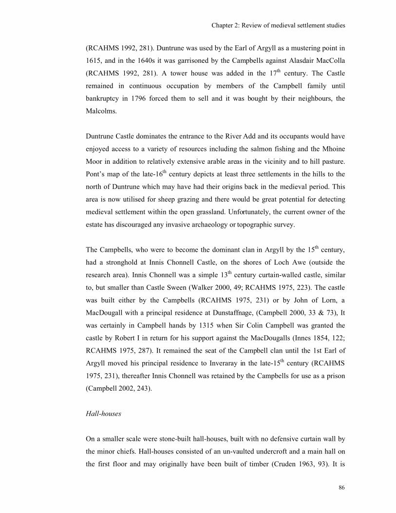
Chapter 2: Review of medieval settlement studies
86
(RCAHMS 1992, 281). Duntrune was used by the Earl of Argyll as a mustering point in
1615, and in the 1640s it was garrisoned by the Campbells against Alasdair MacColla
(RCAHMS 1992, 281). A tower house was added in the 17th
century. The Castle
remained in continuous occupation by members of the Campbell family until
bankruptcy in 1796 forced them to sell and it was bought by their neighbours, the
Malcolms.
Duntrune Castle dominates the entrance to the River Add and its occupants would have
enjoyed access to a variety of resources including the salmon fishing and the Mhoine
Moor in addition to relatively extensive arable areas in the vicinity and to hill pasture.
Pont’s map of the late-16th
century depicts at least three settlements in the hills to the
north of Duntrune which may have had their origins back in the medieval period. This
area is now utilised for sheep grazing and there would be great potential for detecting
medieval settlement within the open grassland. Unfortunately, the current owner of the
estate has discouraged any invasive archaeology or topographic survey.
The Campbells, who were to become the dominant clan in Argyll by the 15th
century,
had a stronghold at Innis Chonnell Castle, on the shores of Loch Awe (outside the
research area). Innis Chonnell was a simple 13th
century curtain-walled castle, similar
to, but smaller than Castle Sween (Walker 2000, 49; RCAHMS 1975, 223). The castle
was built either by the Campbells (RCAHMS 1975, 231) or by John of Lorn, a
MacDougall with a principal residence at Dunstaffnage, (Campbell 2000, 33 & 73), It
was certainly in Campbell hands by 1315 when Sir Colin Campbell was granted the
castle by Robert I in return for his support against the MacDougalls (Innes 1854, 122;
RCAHMS 1975, 287). It remained the seat of the Campbell clan until the 1st Earl of
Argyll moved his principal residence to Inveraray in the late-15th
century (RCAHMS
1975, 231), thereafter Innis Chonnell was retained by the Campbells for use as a prison
(Campbell 2002, 243).
Hall-houses
On a smaller scale were stone-built hall-houses, built with no defensive curtain wall by
the minor chiefs. Hall-houses consisted of an un-vaulted undercroft and a main hall on
the first floor and may originally have been built of timber (Cruden 1963, 93). It is
Chapter 2: Review of medieval settlement studies
87
likely that such structures occupied the interior of the curtained walled castles, such as
Castle Sween, Duntrune and at Carnasserie (see below). The only other known hall-
house in Mid-Argyll is Fincharn (Figure 2.38) which is located on a promontory on the
south shore of Loch Awe (RCAHMS 1992, 283-86). There is documentary evidence
that Fincharn and other lands in Argyll were granted to Gillascop MacGilchrist in 1240
by Alexander II (McPhail 1916b) and he may have constructed the castle soon after
being granted this charter. His name indicates that he is an indigenous Gael rather than
an Anglo-Norman incomer and the charter may be a written confirmation of his existing
property. The granting of land directly from the crown in this way, might suggest a
close relationship which was reflected in the construction of a castle in the Anglo-
Norman style. The 13th
century document is the earliest example in Argyll of the
replacement of unwritten land ownership by feudal tenure being recorded with a written
charter (McPhail 1916b, 121). It is probably Fincharn Castle which is being referred to
in 1296 when Alexander MacDonald of Islay took possession of ‘Glasrog’ in Glassary
and Kintyre after James the Steward was defeated by Edward I (Barrow & Royan 1985,
177). In 1374 the estate passed by marriage into the hands of Alexander Scrymgeour,
who was hereditary Constable of Dundee and Standard-bearer of Scotland (RCAHMS
1992, 285) and therefore a significant lord and supporter of the Scottish Crown, who
probably did not use this castle as his principal residence. There is no evidence for a
settlement in the vicinity in the medieval period, although a settlement called Nether
Fincharn, at a distance of about 0.5 km from the castle, was depicted on Roy’s map of
the mid-18th
century.
Tower Houses
By the 14th
century the fashion for castle building had shifted away from the large
curtained walled enclosures to tower houses (Cruden 1963, 103) which could act as
administrative centres, lordly residences while also providing their immediate
household with some defence. They were often surrounded by other structures such as
stables, offices and workshops within an enclosure or barmekin as at Threave in
Dumfriesshire (Tabraham 1997, 69). New stone accommodation blocks were added to
the existing curtained-walled castles at Castle Sween and Duntrune, but generally there
are relatively few tower houses in Mid-Argyll, perhaps reflecting a smaller number of
‘middle ranking landed gentry’ (Tabraham 1997).
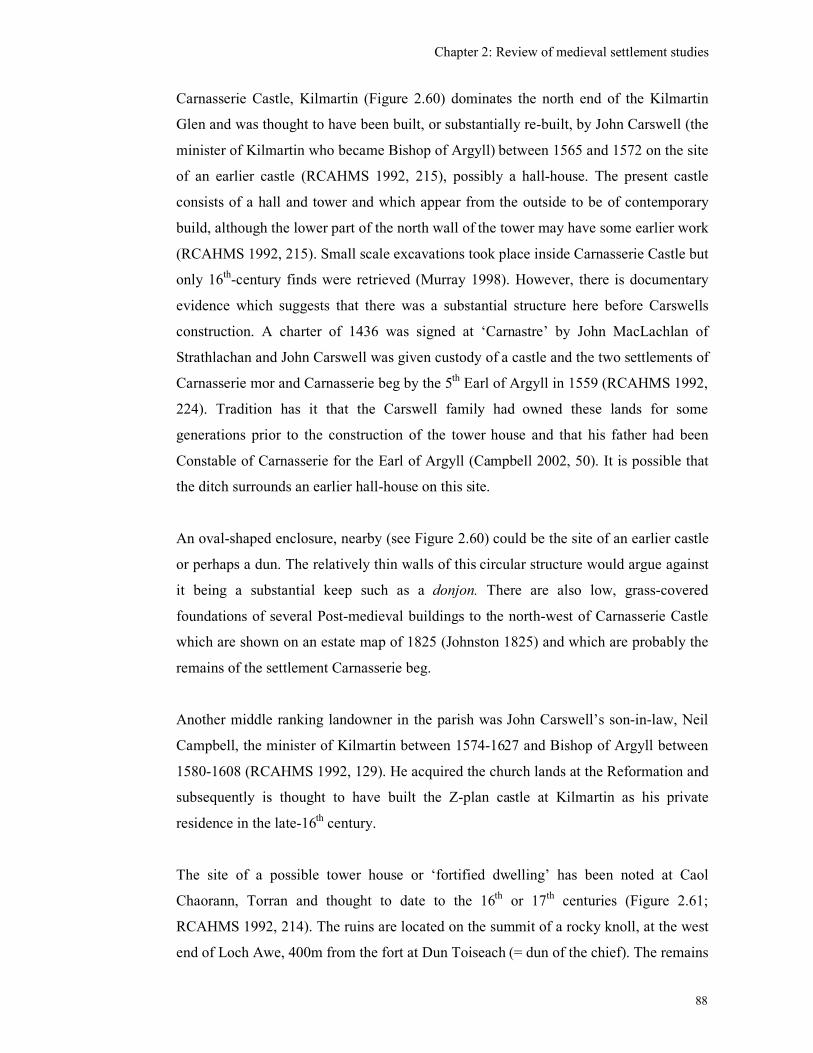
Chapter 2: Review of medieval settlement studies
88
Carnasserie Castle, Kilmartin (Figure 2.60) dominates the north end of the Kilmartin
Glen and was thought to have been built, or substantially re-built, by John Carswell (the
minister of Kilmartin who became Bishop of Argyll) between 1565 and 1572 on the site
of an earlier castle (RCAHMS 1992, 215), possibly a hall-house. The present castle
consists of a hall and tower and which appear from the outside to be of contemporary
build, although the lower part of the north wall of the tower may have some earlier work
(RCAHMS 1992, 215). Small scale excavations took place inside Carnasserie Castle but
only 16th
-century finds were retrieved (Murray 1998). However, there is documentary
evidence which suggests that there was a substantial structure here before Carswells
construction. A charter of 1436 was signed at ‘Carnastre’ by John MacLachlan of
Strathlachan and John Carswell was given custody of a castle and the two settlements of
Carnasserie mor and Carnasserie beg by the 5th
Earl of Argyll in 1559 (RCAHMS 1992,
224). Tradition has it that the Carswell family had owned these lands for some
generations prior to the construction of the tower house and that his father had been
Constable of Carnasserie for the Earl of Argyll (Campbell 2002, 50). It is possible that
the ditch surrounds an earlier hall-house on this site.
An oval-shaped enclosure, nearby (see Figure 2.60) could be the site of an earlier castle
or perhaps a dun. The relatively thin walls of this circular structure would argue against
it being a substantial keep such as a donjon. There are also low, grass-covered
foundations of several Post-medieval buildings to the north-west of Carnasserie Castle
which are shown on an estate map of 1825 (Johnston 1825) and which are probably the
remains of the settlement Carnasserie beg.
Another middle ranking landowner in the parish was John Carswell’s son-in-law, Neil
Campbell, the minister of Kilmartin between 1574-1627 and Bishop of Argyll between
1580-1608 (RCAHMS 1992, 129). He acquired the church lands at the Reformation and
subsequently is thought to have built the Z-plan castle at Kilmartin as his private
residence in the late-16th
century.
The site of a possible tower house or ‘fortified dwelling’ has been noted at Caol
Chaorann, Torran and thought to date to the 16th
or 17th
centuries (Figure 2.61;
RCAHMS 1992, 214). The ruins are located on the summit of a rocky knoll, at the west
end of Loch Awe, 400m from the fort at Dun Toiseach (= dun of the chief). The remains
Chapter 2: Review of medieval settlement studies
89
consist of a rectangular building slightly smaller than Fincharn Castle, along with other
possible structures and a revetted enclosure. There are documentary references to
‘Mekill Torrane’ in 1529 and to Toranbeg in 1621 (Innes 1854, 94), but it is not known
who was responsible for building this substantial structure, when it went out of use, or
even if it was ever finished.
Other references to ‘castles’ at Ormaig, Kilmartin parish (depicted on Roy’s 18th
-
century map), Lochgair, Kilmichael Glassary (RCAHMS 1992, 2132) and on Danna
island (Campbell & Sandeman 1961, No. 530, 86) are more likely to be Post-medieval
mansion houses. Some enigmatic ruins at Barnasload Plantation, Kilmartin (NR 89NW
92) have been tentatively identified as a tower, but the heavy overgrowth hampers their
interpretation.
Fortified islands, crannogs and refuges
Perhaps occupied by members of lower social status than the hall-houses were the
strongholds and fortified island dwellings. There are two such sites described as island-
dwellings in the research area, at Loch Glashan, Glassary (Figure 2.10 & 2.11) and
Eilean na Circe, Knapdale (Figure 2.28). Both have already been mentioned above,
along with the similarity of these sites to re-used crannogs seen elsewhere in the west of
Scotland. The isolated nature of these sites may be partly defensive and partly to create
a distinctive space separated from the rest of the population on the mainland. There are
11 recorded crannogs in the research area (see Table 2.1) but of these only two, Lochan
Taynish and Loch Leathan, have any evidence which could suggest medieval or Post-
medieval occupation.
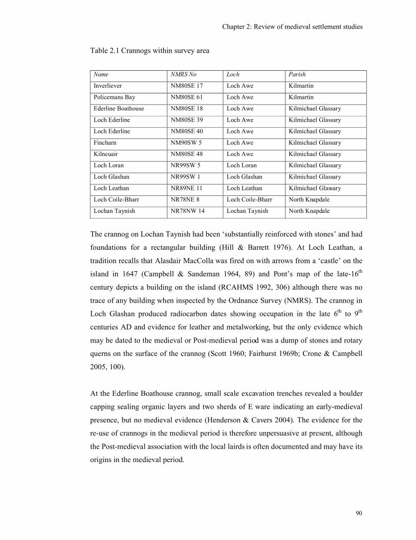
Chapter 2: Review of medieval settlement studies
90
Table 2.1 Crannogs within survey area
Name NMRS No Loch Parish
Inverliever NM80SE 17 Loch Awe Kilmartin
Policemans Bay NM80SE 61 Loch Awe Kilmartin
Ederline Boathouse NM80SE 18 Loch Awe Kilmichael Glassary
Loch Ederline NM80SE 39 Loch Awe Kilmichael Glassary
Loch Ederline NM80SE 40 Loch Awe Kilmichael Glassary
Fincharn NM90SW 5 Loch Awe Kilmichael Glassary
Kilneuair NM80SE 48 Loch Awe Kilmichael Glassary
Loch Loran NR99SW 5 Loch Loran Kilmichael Glassary
Loch Glashan NR99SW 1 Loch Glashan Kilmichael Glassary
Loch Leathan NR89NE 11 Loch Leathan Kilmichael Glassary
Loch Coile-Bharr NR78NE 8 Loch Coile-Bharr North Knapdale
Lochan Taynish NR78NW 14 Lochan Taynish North Knapdale
The crannog on Lochan Taynish had been ‘substantially reinforced with stones’ and had
foundations for a rectangular building (Hill & Barrett 1976). At Loch Leathan, a
tradition recalls that Alasdair MacColla was fired on with arrows from a ‘castle’ on the
island in 1647 (Campbell & Sandeman 1964, 89) and Pont’s map of the late-16th
century depicts a building on the island (RCAHMS 1992, 306) although there was no
trace of any building when inspected by the Ordnance Survey (NMRS). The crannog in
Loch Glashan produced radiocarbon dates showing occupation in the late 6th
to 9th
centuries AD and evidence for leather and metalworking, but the only evidence which
may be dated to the medieval or Post-medieval period was a dump of stones and rotary
querns on the surface of the crannog (Scott 1960; Fairhurst 1969b; Crone & Campbell
2005, 100).
At the Ederline Boathouse crannog, small scale excavation trenches revealed a boulder
capping sealing organic layers and two sherds of E ware indicating an early-medieval
presence, but no medieval evidence (Henderson & Cavers 2004). The evidence for the
re-use of crannogs in the medieval period is therefore unpersuasive at present, although
the Post-medieval association with the local lairds is often documented and may have its
origins in the medieval period.
Chapter 2: Review of medieval settlement studies
91
Late-medieval mansion houses
At a site just north of Loch A’Bharain (= Loch of the Baron) on the Crinan Canal, there
are said to be the ruins of a house belonging to the McTavish barons of Dunardry in the
17th
century ((NR89SW 19; Campbell & Sandeman 1964, 89; Bradford 1991, 1). The
place-name itself refers to a connection with a high-status individual, but suggests that
the medieval seat of these minor lairds was in the vicinity as the link between the
McTavish clan and Dunardry had its origins in the medieval period (Bradford 1991).
Within the research area therefore, a hierarchy of lordship can be detected from the size
and location of the castles and hall-houses. North Knapdale was dominated by the
Gaelic MacSweens from Castle Sween as there are no other major castles within North
Knapdale. Kilmartin and Glassary parishes were in the hands of lesser lords occupying
smaller castles (Duntrune, Innis Chonnel, Findcharn and possibly Carnasserie) whose
overlords were the MacDougalls of Dunstaffnage and then the Crown. By the late-
medieval period tower houses had been built within the earlier castle walls or on new
sites such as Kilmartin Castle and possibly Caol Chaorann by new middle-ranking lords
and ecclesiastics. The whole area was by then dominated by the Campbell Earl of
Argyll based at Inveraray Castle. By the end of the medieval period there is evidence for
several lightly fortified islands, which were associated with local clan chiefs who
probably used them as lightly fortified dwellings or strongholds and latterly as refuges
during the 17th
century. From the evidence from Loch Glashan, it is possible that islands
also served as dwellings for clan chiefs or substantial tenant farmers during the
medieval period.
Medieval baile
Turning now to the ordinary people, there is less evidence for where and how these
people lived. The only medieval burgh was at Inveraray (NN00NE 13) the seat of the
Earls of Argyll from the mid-15th
century (Campbell (A) 2000, 142; Campbell 2002,
250). The remains of the burgh were, unfortunately, demolished in the mid- to late-18th
century to make way for the new town and castle. Of the modern villages of Kilmartin,
Kilmichael Glassary, Lochgair, Ardrishaig, Tayvallich and the town of Lochgilphead, it
can be seen that a few are located on the sites of early-Christian or medieval churches,
Chapter 2: Review of medieval settlement studies
92
but otherwise their development is obscure and undated. Kilmartin had a medieval
church and graveyard but it is not until 1627 that there is a documentary reference to ‘all
the tenements, as well houses as gardens, of the town called the Clachan of Kilmartein
in Ardskeonis’ (Innes 1854, 94). So far no archaeological evidence has been found for
medieval settlement in the village (RCAHMS 1992, 128; Campbell 1996, Baker 1999;
Abernethy 2002a; Lewis 2002, 19).
According to the First Statistical Account for the parish of Kilmartin, dated 1792, over
60% of people lived in farms of between three and six households and it is the remains
of these farms which dominate archaeological remains in the rural landscape
(RCAHMS 1992, 32; First Statistical Account 1792, 97). Lists of these sites have been
attempted for parts of Argyll but this work is not complete or exhaustive (See Campbell
MSS in the Lochgilphead Archives). These deserted settlements are therefore
underrepresented in the archaeological record and few have been surveyed or recorded.
For example, the RCAHMS have highlighted that the hearth-tax of 1693 listed about
500 settlements in the area of Mid-Argyll & Cowal (RCAHMS 1992, 32) and yet (at the
start of this research) the NMRS included only 85 ‘deserted settlements’ for the whole
of Argyll & Bute. The majority of these are on the islands of Mull and Bute reflecting
the extent of archaeological work rather than a real distribution. When this research
began only 24 ‘deserted settlements’ or ‘townships’ appeared in the NMRS in the parish
of North Knapdale, 13 in Kilmichael Glassary and 9 in Kilmartin. Fieldwork and
archive research by a local resident, Allan Begg, had begun to rectify this situation with
the identification of 90 deserted settlement sites in the parish of Kilmichael Glassary
and 95 in Kilmartin (Begg 2002; Begg 1999). He did not, unfortunately, publish any
lists for North Knapdale. Begg’s reports are an extremely useful starting point in that
they provide some contemporary descriptions and local stories of the last known
inhabitants, but they lack systematic survey, grid references and any consideration of
the history of the sites prior to the 18th
century.
The 18th
and 19th
century changes in settlement patterns associated with the introduction
of large sheep farms, as at Arichonan, or the amalgamation of multiple tenancy farms
into single tenant farms, can be relatively easily detected and their under-representation
has been partly addressed by the survey of unroofed rural settlement depicted on the 1st
edition O.S. maps, the First Edition Survey Project (RCAHMS 2002). The first edition
Chapter 2: Review of medieval settlement studies
93
maps did not, however, include any structures that were less than three feet high (about
1m) so the FESP data is still an incomplete record of the current field remains.
It has also been noted that many 18th
and 19th
century farm names are mentioned in
medieval charters, 17th
century historical documents, or are depicted on Pont’s
manuscript map of the barony of ‘Ardskeodnish’ (which is equivalent to the Kilmartin
parish) dated to the late-16th
century. These farms include sites such as Carnasserie beg,
Glennan, Garvald, Bennan, and Ardifuer (James 2003). This suggests that while the
visible stone-built structures may well be no earlier than the 18th
or 19th
centuries, the
origin of the farm to which the place-name refers existed in some form back in the
medieval period
There is a dearth of pre-Improvement settlement in the archaeological record for Mid-
Argyll. One strand of this research is therefore to examine the remains of deserted
settlements, especially those with documentary references dating to the medieval period
or those depicted on late-medieval maps, to see if any earlier remains can be detected in
the field.
Shielings
Shieling sites are also under-represented in the archaeological record. A search of the
NMRS when this research began, listed only two examples in North Knapdale, seven in
Kilmichael Glassary and 13 in Kilmartin, none of which had been surveyed by the
Royal Commission and none had been excavated. A survey by Campbell and Sandeman
(1964) included a classification of ‘huts and houses’ as follows,
A Large circles with either massive walls (6ft to 14ft thick) or light walls (2 ft
thick)
B Large ovals (75 ft. by 50 ft.) with light walls
C Small circles (6 ft. to 10 ft. diameter) with light walls or beehive cells (5ft to 10
ft diameter).
D Half-moon walls against cliffs
E Small ovals (18 ft. by 13 ft. average)
F Paired ovals (‘figure-of-eight‘ plan)
Chapter 2: Review of medieval settlement studies
94
G Sub-rectangular (23 ft. by 15 ft. average).
Only a representative sample of these huts and houses were listed for Argyll, 19 in total,
which included a possible Norse boat noost. One example of Type F, turf-built ‘paired
ovals’ is located on the Mhoine Moor only 6 ft above sea level and are more likely to be
modern shooting stances rather than medieval settlement. Campbell and Sandeman
acknowledged that there was a confusing variety of structures within the landscape and
clearly intended to publish more on these structures once they had done more work, but
in the event this never appeared.
This lack of settlement evidence for the people of lower status may be because, as
suggested above, the structures they built were of organic materials or perhaps they
have not been recognised in the landscape because of the archaeologists lack of
familiarity with what to expect of a medieval settlement, and the lack of datable
artefacts. It was thought worthwhile therefore to consider the possibility of continuity of
settlement from the prehistoric and early-medieval periods by looking at the
homesteads, enclosures, forts and duns for their potential for medieval settlement.
Homesteads and Enclosures
Circular structures characterised by banks of stone or stone and earth (sometimes
classified by the RCAHMS as ‘homesteads’) are all termed ‘enclosures’ in the
Inventory for Mid-Argyll and Cowal and were distinguished from ‘forts’ and ‘duns’
because of their non-defensive location and thinness of their walls. (RCAHMS 1988,
33, 197-201). They were categorised by Campbell & Sandman as Type A (see above).
The Inventory for Mid-Argyll & Cowal includes 20 examples of ‘earthworks and
enclosures’, which includes eight in North Knapdale, one in Kilmartin and two in
Kilmichael Glassary parishes (RCAHMS 1988,197-201). Some ‘possible’ enclosure
sites within the research area have been identified in the past but were dismissed by the
O.S. because nothing could be seen on the surface when they visited, as at Crinan Moss
(NR89SW 47) and Craeganterve beg (Craw 1930). Other examples such as Dun Dubh
(Wilson & Hurst 1964) now lies within forestry and may not have survived.
Chapter 2: Review of medieval settlement studies
95
These circular monuments are generally assumed to be prehistoric, although some re-
use in the early medieval or later period is sometimes suggested by the presence of
pottery. There is growing archaeological evidence, from elsewhere in Scotland that
challenges this belief (Gregory 2001; Taylor 1990; Fiddes 1953). This evidence
includes the presence of medieval pottery and radiocarbon dates and shows that an
assumption of a prehistoric date is not always justified. However, the few enclosures
which have been excavated in Mid-Argyll have not produced any diagnostic medieval
material. These include Cnoc nam Fiantan (RCAHMS 1988, 198) and Barnluasgan
(Regan, Webb & Abbot 2005; Regan & Webb 2006). Where there is a relationship
between an enclosure and a turf or stone built structures, the enclosures appear to be the
earlier features (as at Barnakill, and Na Coireachan (RCAHMS 1988, 198-200), but this
is not enough to prove a medieval date.
The circular rath or ringfort is a common type of site in Gaelic Ireland and is generally
dated to the early-medieval period, although there are a few examples that stretch the
chronological span from the Bronze Age into the Post-medieval period (Stout 1997, 23-
29). Why there is not a similarly high density of ringforts in the territory of the Dál
Riada in the early medieval period, given the close links between these areas, is perhaps
not a question that can be discussed here, but the fact that some raths continued in use
into the medieval period could be relevant. This would reinforce the point made earlier
that circular enclosures or homesteads in Argyll should not be excluded from the
potential medieval landscape. The fact that ringforts have defensive ditches, the number
of which is thought to reflect the status of the occupant, might indicate the occupants of
the Argyll enclosures were not of a high-status.
Even if these enclosures were originally prehistoric, they could have been used in the
medieval period, perhaps as stock enclosures or small farms, occupied by a family or
other small social group. If used as stock enclosures then one might expect there to be
some re-building of the enclosure wall and the entrance to be maintained. There may be
minimal other structural evidence associated with this use and no associated artefacts.
The factors affecting the location of these features as stock enclosures are perhaps the
need for security (i.e. be hidden from general view), be close to water, or be near a route
to a market, or pasture land. If utilised as a farm either for a family or other group, then
one could suggest that the requirements would need to be close to water and close to
Chapter 2: Review of medieval settlement studies
96
cultivatable land. Both Ford (RCAHMS 1988, 199, Figure 2.62) and Carnasserie
enclosures (RCAHMS 1988, 115) are fairly hidden from the main valleys, are close to
cultivatable land and are not far from a source of water which could be ideal for ‘hiding’
stock temporarily in the hills. The existence of many other turf-built enclosures within
the outfield, will have been obscured by the practice of spreading of the turf and
ploughing it in when the outfield came into cultivation (Dodgshon 1981, 161).
Duns and forts
Rectangular and sub-rectangular structures have been noted within several forts and
duns in Argyll such as Dùn Chonallaich Dùn na Ban-òige, Beinn an Dùin, Caisteal nan
Con Diobh, Dun Dubh, Shirvan and Dun Mhuirich (RCAHMS 1988, 160 - 189). While
many of these interior structures may well be associated with Post-medieval sheep
farming, the remains at two sites Dun Dubh, Shirvan (outside the research area) and
Dun Mhuirich, North Knapdale, could well be earlier and excavations at Dunadd,
Kilmartin, there was evidence for possible medieval feasting.
The low-lying, fort of Dunadd (which was the centre of the kingdom of Dalriada until it
was sacked by the Picts in AD 736 (Annals of Ulster) was surveyed by the Royal
Commission (Figure 2.63) and has been partially excavated (Lane & Campbell 2000).
These excavations produced some evidence for possible medieval re-use in the form of
fragmentary rectangular buildings within two enclosures E and F (Figure 2.64). Outside
the fort there were other structures that were thought to represent further medieval
structures, although not excavated (Lane & Campbell 2000, 96). On the summit of the
fort the excavations in the 1930s had removed large quantities of animal bone from a
deep midden and one bone from this assemblage was radiocarbon dated to CAL AD
1040-1280 (GU-2459). However, no medieval pottery was found during any of these
excavations. Lane & Campbell’s tentative interpretation of this as being evidence for
feasting on the summit of the site (Lane & Campbell 2000, 96) would seem to be quite
plausible because there are medieval documentary references to Dunadd which suggest
that the site was the chief residence of the MacLachlan clan chiefs (Steer & Bannerman
1977, 142). In 1436 Alan, son of John Riabhach MacLachlan of Dunadd was granted by
John MacLachlan of Strathlachan the ‘offices of seneschall and thoisseachdeowra’ of
land in Glassary (Bannerman & Steer 1977, 143). In 1506 Dunadd was being used as a
Chapter 2: Review of medieval settlement studies
97
meeting place for the commissioners of assessments ….to compose the feuds of the
isles’ (Nicholson 1974, 541-9). In the same year, the Earl of Argyll was also at ‘Dunnad
in Ergile’ to issue proclamations about the future control of the Isles on behalf of James
IV and rents were paid by the lords of the southern isles at ‘Dunnod’ (Stuart 1878-1908,
xii, 703-04). Two days later the Earl of Argyll, the bishop of Argyll, the Bishop of the
Isles and other royal officials met three Highlands lords at ‘Dounaide’ in order to
resolve a feud’ (ibid 709-10). Dunadd was therefore being utilised by the Earl of Argyll
in the early-16th
century as a symbolic place from which to assert his delegated royal
authority over the old Lordship of the Isles (Lane & Campbell 2000, 40). Dunadd
therefore remained a significant landmark in the medieval landscape despite losing its
royal status in the 8th
century AD (Campbell 2000, 39-40). By the 18th
century there was
still a settlement of Dunadd, but it lay to the east of the fort (see Figure 2.65).
At Dun Mhuirich, North Knapdale, (Figure 2.66) there are at least two stone-built,
rectangular structures occupying the interior of the dun and further rectangular-shaped
ruins can be seen to the north (RCAHMS 1988, 189-90). Dun Mhuirich is located on a
small knoll near the sea and close to the road towards the early Christian and medieval
chapel at Keills. Its accessible location, in contrast to the interior hilltop duns, may well
be related to its choice as a site for re-use as a medieval settlement. Its name indicates
that it was associated with the MacMhurich clan, hereditary bards of the Lords of the
Isles and writers of the Books of Clanranald (Kingston 2001, 113) and so it is probable
that one of their kin had a settlement here during the 14th
and 15th
centuries when Castle
Sween was held by Clan Donald (see Chapter 3).
There are clearly dun sites that have traditional associations with medieval clan chiefs,
such as, Dunadd, Dun Mhurich and McEwans Castle in Cowal. Several duns in Argyll
were excavated at the beginning of the 20th
century and of these Ardifuir 1, Eilean Righ
1 and Dùn Chonallaich produced artefactual material dated to the early-medieval period,
but no evidence for medieval occupation (Christison 1904; RCAHMS 1988, 33-35).
Dun and fort sites were therefore used selectively in the medieval period. Given the
importance of the sea to communication in the medieval period, it was those forts or
duns in relatively accessible positions, low lying and close to the sea which were
utilised by the lords as places of public assembly or perhaps as strongholds. Those sites
Chapter 2: Review of medieval settlement studies
98
within the hills probably remained within the pastoral landscape as places for shelter or
temporary refuge.
Courts and places of assembly
There are other types of sites, such as baronial courts and places of assembly, which are
not settlement forms, but still belong to the medieval landscape and will be considered
briefly here, because they are evidence for significant medieval activity which has left
very little or no physical trace. They are a reminder that not all significant activities in
the medieval period took place within four walls.
The site of Bruach Na Cuirte (= Bank of the Court, NR89NW 67) is located south of
Slockavullin, Kilmartin parish (see Figure 2.67). It lies at the north end of a linear
promontory overlooking the Kilmartin valley. Prior to gravel quarrying here, there was
evidence of a curving bank cutting off the north end of the promontory (Craw 1929,
189). At the south end of the same promontory is the site of Bruach an Druimein where
a curving bank and both short and long cists were found (Craw 1929, 156-162). The
long cists were possibly contemporary with an early-medieval chapel known as Kil y
Kiaran (Craw 1929). Excavation here in the 1960s produced evidence for Iron Age
settlement and early-medieval metalworking (Cregeen 1960, 1961 & 1962, Cregeen &
Harrington 1981; RCAHMS 1988, 204; Abernethy 2002b, Abernethy 2008). The only
evidence for medieval activity were a few sherds of pottery which were either retrieved
from the topsoil or from insecure contexts. Some paved surfaces and amorphous
features that could have been of medieval date were noted by the excavators, but were
poorly understood because of the nature of the rescue excavation.
The site of Dùn Domhnuill, at Kilmahumaig, Crinan (NR79SE11), is by tradition a
moot hill where Donald, Lord of the Isles (late-14th
to early-15th
centuries) granted
Kilmahumaig to the first of the Mackay clan (Currie 1830, 18-19; Campbell &
Sandeman 1961, No 549, 90). This site was described in 1964 as a steep-sided, grassy
mound 33 ft high with a flattened summit, possibly a cairn, although later surveyors
considered the mound to be natural (NMRS, O.S. 1973).
Chapter 2: Review of medieval settlement studies
99
Other meeting places have been noted at Barnakill, Kilmory Knap and Kilmichael of
Inverlussa (Campbell & Sandeman 1961, 89). A verbal tradition survived that a west-
sloping field at Barnakill (near Dunardry) was the site of a local barony court and
Wapenshaw. At Kilmory Knap, the Clach an Dhobhrain (= The Otter’s Stone) was a
flat-topped boulder marked on an estate plan of 1776. This was said to be a meeting
place for settling differences and concluding agreements between the neighbouring
districts. At Kilmichael of Inverlussa, an outcrop of blackish rocks was said to be where
Sir James Campbell of Achnabreck held courts in the 18th
century which may have been
following a more ancient tradition.
2.7 Maritime and coastal resources in Mid-Argyll in the medieval period.
Occupying such a coastal region the people of Mid-Argyll would have interacted within
the marine as well as the rural environment and the sea would have been a source of
food as well as providing contact with other communities. Mid-Argyll has access to the
Irish Sea via the Sound of Jura, Loch Sween and Loch Caolisport to the west and to
Loch Fyne to the east. Many farms therefore would have had access to the coast and its
resources.
As a very basic level, without the need for a boat, foreshore could provide sea shells
such as mussels, oysters, cockles and limpets which could be collected for food and for
bait. Fishing off the rocks with lines and catching fish with wicker baskets, nets or traps
would also have been possible, although controlled by the local lord. Collection of sea-
weed as a fertiliser was never as commercialised in Argyll as it was in the Outer
Hebrides, but it would still have taken place at a local level.
Mid-Argyll had a strong boat-building tradition inherited from the Norse invaders and
so were familiar with the sea. The medieval West Highland galley (or birlinn) would
have been too big an investment for any but the most wealthy lords to have built. There
is the suggestion that these galleys would have also been used for fishing in the 16th
century, extending into the Irish fisheries (Rixon 1997, 36). These galleys had shallow
draughts and so could be dragged ashore on a sandy beach with out the need for a
harbour. Loch Crinan, at the mouth of the River Add, would have provided shelter and
access to marine resources. Before it was drained in the 19th
century, the Mhoine Moor
Chapter 2: Review of medieval settlement studies
100
at the mouth of the River Add, would have been a marshy coastal wetland which would
have provided access to a variety of other resources, including reeds for thatch and birds
for food. Loch Crinan was controlled by the Campbells from Duntrune Castle which
was located on its north side. Further south, at Carsaig Bay there could well have been
an early stronghold overlooking the bay, as is suggested by the Norse place-name.
Castle Sween overlooks a small sheltered bay, and would have controlled access to
Loch Sween. Smaller clinker built boats, curraghs and even dug-out canoes would also
have been used in the medieval period (Grant 1995, 250-277, Rixon 1997, 5) and these
could have been launched from any small bay or cove. There are at least 16 place-names
between Kintraw in the north and Loch Caolisport in the south which includes ‘Port’
and this is an indication of the frequency of potential access points to the sea along this
relatively exposed coastline.
No major harbours developed within Mid-Argyll in the medieval period, for when the
Campbells controlled the herring fishing in the Firth of Clyde in the 15th
century, the
fish were channelled through their burghs further east at Inveraray, Kilmun and
Dumbarton. In the 17th
century the fishing rights of the River Add, which was rich in
salmon, were shared between Sir Dougal Campbell of Auchinbreck and the Marquis of
Argyll and shows that this valuable resource was strictly controlled (No 346, Campbell
1933, 121-22).
2.8 Discussion
By looking at rural settlement in different parts of Scotland and Ireland it is possible to
identify several types of buildings in the landscape and to build up a chronological
framework.
1. Stone built rectangular structures which appear on the 1st edition OS maps and
are 19th
century in date.
2. Drystone, hip ended buildings which may be 18th
or 19th
century.
3. Rectangular or sub-rectangular structures, with low turf covered stone wall
foundations. These are likely to be pre-Improvement, perhaps introduced after
the 13th
or 14th
centuries to lift roof timbers off the ground.
4. Long low structure with turf walls (perhaps a regional type eg Pitcarmick type).
Chapter 2: Review of medieval settlement studies
101
5. Shielings, which themselves have a varied morphology, perhaps reflecting their
varied function or date.
The higher status sites include,
1. Stone built rectangular or sub-rectangular buildings, with a cruck-frame, which
may be medieval in date, perhaps occupying crannogs or re-used duns which
may be acting as strongholds for the local lairds.
2. Curtain walled castles, or castles of enclosure, usually built by the Anglo-
Normans although perhaps later occupied by Gaelic lords
3. Hall houses, stone built and possibly 12th
or 13th
century in date.
4. Tower houses of the 15th
– 16th
centuries.
It has also been possible to put forward a tentative model of settlement change for Mid-
Argyll.
1. Expansion of the population, economy and settlement in the 12th
and 13th
centuries, with some evidence for continuity of settlement from the prehistoric
period.
2. Decline or settlement shift in the 14th
century because of the wars, famine,
plague and environmental deterioration. Perhaps an increased dependence on the
pastoral economy.
3. Some recovery in the late 14th
century and a revival of links with Gaelic Ireland.
4. Ending of the Lordship of the Isles in the late 15th
century causing increased
political instability, an increase in feuding and an increase in the non-productive
military caste.
5. Settlement splitting and establishment of new settlements on previously
marginal land as the population expands in the 16th
century.
6. Consolidation of joint-tenancy farms into single larger farms in the 19th
century.
The examination of existing medieval settlement in Argyll has shown that there is
evidence for a hierarchy of settlement types from the castles, tower houses, and hall-
houses to smaller island dwellings, deserted settlements and shielings. There is little
evidence in Argyll for the potentially medieval, amorphous-shaped pre-Improvement
settlements seen occasionally elsewhere in the west of Scotland. It is anticipated that the
Chapter 2: Review of medieval settlement studies
102
pre-Improvement settlement will have been constructed primarily of perishable
materials, survival of which will depend on the later extent of cultivation and expansion
of nucleated settlements. The stone-built settlements that do survive in great numbers,
mark the period of expansion and nucleation in the 18th
and 19th
centuries.
It has been suggested that an examination of Post-medieval settlement and vernacular
architecture is ‘a way of getting back, step by step, to the customs and practice of pre-
Improvement times’ (Stell 1993). However, rather than being a continuation of the
medieval past, particular consideration must be made of the continually changing
economic and social processes which were affecting the population and settlement
throughout the medieval and later periods, which are highlighted by the historical
geographer and which would have had an effect on settlement density, location and
character.
This review has shown that a wide range of methodologies have been utilised in the
study of rural settlement, the most successful being a consideration of vernacular
architecture, field survey, aerial photography, geophysics, archaeological excavation,
historical research, linguistic evidence and oral tradition. Individually each method
offers a slightly different slant on the issue of medieval settlement and combined
together they begin to reveal the issues involved, the processes taking place and the
structural remains that exist in the landscape. This research will therefore utilise a
similar variety of techniques, in order to explore what can be detected of medieval
settlement in Mid-Argyll. But first an over view of the social and economic history of
the area is presented in order to provide the historical context for this work.

Chapter 3: An overview of the social and economic history
103
Chapter 3: An Overview of the social and economic history of Argyll in
the medieval and Post-medieval period
3.1 Introduction
The history of Argyll (and Scotland generally) in the medieval period (taken here to be
from the 12th to the 17
th centuries) has been described by many writers as turbulent
(Duncan & Brown 1957, Stevenson 1980, Barrow 1981, Campbell 2000, Campbell
2002). But is difficult to ascertain the level of turmoil for the ordinary people as they
barely enter the historical record until the 17th century. This chapter will present a broad
economic and social overview of Argyll during the medieval and Post-medieval period
and examine: evidence for the linguistic, cultural and social make up of the population,
periods social unrest or population displacement which may have affected the
settlement pattern and the suggestion that pastoralism was preferred when society was
under political or social stress.
This overview is divided into four chronological parts. The first looks at the early-
medieval Kingdom of Dalriada (see Figure 3.1), Norse settlement and the first two
centuries of the medieval period. The second part deals with the onset of the climatic
deterioration, plague, warfare and famine of the 14th and 15
th centuries. The third part
deals with the 16th and 17
th centuries. Finally the Post-medieval period is considered in
order to aid an understanding of the surviving archaeological remains.
3.2 The Kingdoms of Dalriada and Somerled and the extension of Scottish royal
power - The 5th to the 13
th Centuries
By the 8th century, Argyll had been Gaelic speaking for many centuries and had strong
cultural and kinship ties with Ireland (Bannerman 1974, Duncan 1975, Foster 1996,
Campbell 2001, Nieke 2004; Woolf 2004). Society at this time was hierarchical, headed
by a warrior caste which ruled through a complex series of client relationships and were
occupied in heroic exploits, feasting and feuding, measuring its wealth predominantly in
movable cattle (Duncan 1975, 73). Pastoralism would therefore have been the
predominant economic activity with any available cultivatable land being utilised for
Chapter 3: An overview of the social and economic history
104
growing crops for human consumption and to feed the cattle in winter. The Senchus
Fear nAlban provides some information on the method of tax assessment at the time as
it is based on the tech or ‘house’ within each district, the ‘house’ or as Bannerman
suggests the ‘household’ being the basis on which the people owed tribute or food rent
to their chief or king (Bannerman 1974, 49, 133, 145). Another significant characteristic
of society at this time was the importance of seafaring as indicated by the requirement
of every 20 ‘houses’ to man two seven-bench boats in the service of their chief. This
naval power would have enabled the chiefs to maintain their close links with Ireland and
to undertake trade with Britain and the Continent.
The impact of the Norse raids was felt initially along the east coast of Britain but soon
extended around the north coast and into Argyll, the first raid on Iona being in A.D.
795. From then onwards there was an influx of Scandinavian people into the west of
Scotland and Ireland and the kingdom of Dalriada may have been divided between the
native dynasties and the Norse who settled predominantly along the coastal edge and in
the islands (Woolf 2004, 94). The Norse intermarried with the Gaelic speakers resulting
in a mixed Norse-Gaelic society that was referred to in Ireland as the Gall-Gaedhil. The
Hebrides became known as the Innse Gall meaning ‘Island of the Foreigners’ (referring
to the Norse) and Argyll as Airer Gaedel meaning ‘coastline of the foreigner’ (Woolf
2004, 95).
Somerled, according to tradition, was a powerful warior of Norse-Gaelic descent who
became the regulus (king) of Argyll in about 1130 and married Ragnhild, daughter of
King Olaf of Man, sometime before 1150 (Marsden 2000, 42). The period of
Somerled’s rule in the first half of the 12th century saw much of Argyll ruled by a
westward-looking, Christian, Gaelic-Norse leader of an independent kingdom, with
strong kinship and cultural ties to Ireland, alternately making war and seeking political
alliances with his neighbours the King of Man and the King of Scots. Marriage
contracts were, however, only made within the Gaelic-Norse dynasties (McDonald
2000, 176). While Somerled led his warriors into battle outside Argyll, there are no
historically recorded incursions into Argyll during his reign and the strength of his
overlordship may also have deterred fighting and feuding within Argyll and also
prevented the Scottish crown extending its control into the west of Scotland. So this
may have been a period of relative peace.
Chapter 3: An overview of the social and economic history
105
In the aftermath of Somerled’s death in 1164, the conflicting claims of his sons brought
civil war to the Kingdom of the Isles (Woolf 2004, 105-7; Duncan & Brown 1957, 197-
8; Sellar 2000, 194-95) resulting in a division of territories between three clans
descended from Somerled. From this period clan Dugald held Mull and Lorn, clan
Donald held Islay, Kintyre and Morvern and clan Ruari held the Uists and Garmoran
(Munro 1981, 23; Woolf 2004, 105). Mainland Argyll was left in the hands of ‘loyal’
descendants of Somerled, including Duncan MacDougall of Argyll, whose principal
stronghold was Dunstaffnage in Lorn (Duncan & Brown 1957, 202). The outer isles
remained under the control of the Norse, and in 1248 Duncan of Argyll’s son Ewan
became king of the Sudreys (the Hebrides) which he ruled on behalf of King Hakon of
Norway.
In the Treaty of Perth in 1266, the Norwegian king, Magnus, recognised that his hold on
the outer isles was weak and sold them to the Scottish king. This ended the dual
loyalties of the MacDougalls and they became more integrated within Scottish society
(Duncan & Brown 1957, 215; Sellar 2000, 210-11). Alexander was made sheriff of
Lorn, which meant he was responsible for law and order across Argyll, all the way from
Ardnamurchan to Knapdale, far beyond his own lands (Duncan & Brown 1957, 216;
Boardman 2006, 18-19). The principal lords of the sheriffdom were Alexander de
Ergadia (Lord of Lorn), John de Glenurchy, Gilbert McNaughton (of Dunderave in
Loch Fyne), Malcolm McIvor, Dugald Campbell of Craignish, John son of Gilchrist,
Radulph of Dundee, Gillespic McLachlan and the Earl of Menteith (Skene 1890, 88-
89).
North Knapdale was in the hands of the clan chief Swein, based at Castle Sween, until
exiled by Walter Stewart, Earl of Menteith in 1262 (Barrow 1988, 58; RCAHMS 1992,
258). There is little historical information of any lesser lords within Knapdale at this
time. The lesser lords within Ardskeodnish and Glassary included the MacGilchrists at
Fincharn castle and the Campbells of Lochawe, probably at Duntroon as well as their
main stonghold of Innis Chonnell (Duncan & Brown 1957, 205, RCAHMS 1992, 281;
RCAHMS 1975, 223).
Chapter 3: An overview of the social and economic history
106
There is evidence that these western clans were being drawn into the feudal system as
the Scottish king was determined to bring Argyll under his control (Murray 2005, 300).
There is charter evidence for Gillascop MacGilchrist being granted lands in Mid-Argyll
and Cowal by Alexander II in 1240 (MacPhail 1916b, 114-5, 121-4 & 227-245). These
lands included Fincharn and Glennan and in return Gillascop owed service directly to
the Scottish king, in the form of a knights service in time of war. The MacGilchrists
were, by tradition of Irish descent and may well have been of mixed Gaelic and Norse
blood. The hall-house at Fincharn (thought to date to the period of this charter) may
have been in the hands of the MacGilchrists until taken over by Master Ralf of Dundee
in 1290 (Duncan & Brown 1957, 205). Master Ralf may have been either a son or son-
in-law of Gillascop MacGilchrist and so his descendants were still from the local Gaelic
dynasty, although with a strengthened connection with the east of Scotland (MacPhail
1916b, 117).
The origins of the Campbell clan have been traced back to Duncan MacDuibne who
may have held lands in the region of Loch Awe (Skene 1890, 79) although it has been
argued that the Campbells were originally from Lennox (Sellar 1973). The tradition that
the Campbells were descended from the British King Arthur would be consistent with a
British Lennox/Lowland origin. In 1292 Colin Campbell ‘Lord of Lochow’ was listed
as a landowner within the sheriffdom of Lorne with close family connections to Robert
the Bruce (Sellar 1973, 116-7, Boardman 2006, 18). Colin was bailie of Loch Awe and
Ardscotnish in 1296 responsible for collecting the royal revenues on behalf of Edward I
(King of England). Perhaps it was while carrying out this commission that Colin Mór
Campbell was killed by the MacDougalls in a skirmish near Loch Avich, north of Loch
Awe on the border with Lorn (Sellar 2000, 212; Boardman 2006, 21).
So between the mid-12th and the end of the 13
th century Mid-Argyll was in the hands of
either local Gaelic/Norse lords or Gaelic/British lords, both of whom recognised the
Scottish crown as their overlord. Incoming Norman lords, the Stewarts, had taken
control of parts of Knapdale and there may well have been localised unrest associated
with this change in lordship, but it is not historically recorded, apart from a poem
describing an attempt by the MacSweens to re-gain their lands in 1310 (Thomson 1977,
27). Apart from this change in overlordship and the ‘skirmish’ between the Campbells
Chapter 3: An overview of the social and economic history
107
and the MacDougalls in 1296 one could suggest that after the conflict and civil wars of
the 12th century, the 13
th century was a time of relative peace for Mid-Argyll as the
Norse threat had been removed. In general the reign of Alexander III (1249-86) was
seen by later chroniclers as a ‘golden age’, a period of plenty (Whyte 1995, 49) which
Mid-Argyll could have shared.
Population and economy in the 12th
and 13th
centuries
Historical information on the size of the population and the economy in Scotland at this
time is sparse and so only general comments can be made about those factors which
would have influenced the settlement pattern. From the 11th to the 13
th century the
North Atlantic enjoyed a ‘Medieval Warm Period’ and overall it was a period of
expansion in population and economic wealth (Fagan 2000, 3-21; Houghton et al 2001).
There are a few stray references to famines in the 13th century, but there were no major
epidemics. Population size for the whole of Scotland is estimated to have been about 1
million by the early 14th century and this population would have been concentrated in
the rich agricultural lands of the Lowlands, with a more sparse population in the
mountainous Highlands and the west.
Where recorded in historical documents, the exports from the eastern Scottish ports,
were wool, hides, cattle and some fish supporting the idea that the economy was
predominantly pastoral. On a lesser scale, there were also trade links along the west
coast, between Loch Fyne, Bristol and Ireland, including the import of luxury goods,
such as wine, into Scotland by the clan chiefs (Sellar 2000, 208; Boardman 2006, 295).
The Scottish economy was based on money from the early 13th century, but there would
have been little currency circulating in Argyll where rents were principally paid in kind
and in labour and where property exchanges were paid partly in cattle and partly in cash
(Whyte 1995, 49).
It is generally assumed that, as a pastoral society, the settlement pattern in Argyll
consisted of small hamlets and single farms located near available pockets of
cultivatable land. These farms would have been surrounded by large areas of
unenclosed hill pasture which was most suited to livestock rearing. Place-name
evidence suggests that summer shielings were used in the medieval period (Fenton
Chapter 3: An overview of the social and economic history
108
1999, 130; Bil 1990, 3) although seasonal transhumance was probably a much more
ancient practice. The favourable climate and lack of famines and epidemics would have
enabled the population to grow, resulting in the division of properties and expansion of
settlement into newly cleared forests and more marginal areas throughout Scotland.
3.3 Wars, famine and economic contraction in the 14th – 15
th centuries
The turn of the 14th century brought an end to the period of plenty as Scotland suffered
the damaging effects of decades of war, famine, the plague and climatic deterioration
known as the ‘Little Ice Age’ (Matthes 1939). The Scottish struggle for independence
from England at the end of the 13th century saw the Scottish King (John Balliol) at war
with Edward I, the ‘Hammer of the Scots’. The major rivalry at this time in the west of
Scotland was between two clans, both descended from Somerled, the MacDougalls who
supported John Balliol and the MacDonalds who supported the rival claimant to the
Scottish throne, Robert the Bruce. The Campbells, as kin of Robert and allies of the
MacDonalds, were therefore supporters of the Bruce claim. The effect of this territorial
rivalry was not immediately felt in Mid-Argyll and Knapdale as the significant fighting
took place elsewhere on MacDonald lands (Boardman 2006, 21). Peace must have been
restored for a while as Alexander MacDougall was made baillie of Loch Awe and
Ardscotnish, in 1304 which was MacDonald and Campbell territory (Boardman 2006,
21).
Once he became king in 1306 Robert the Bruce sought to reduce the power of the
MacDougalls, defeating John MacDougall at the Pass of Brander (to the north of Lorne
between Loch Awe and Loch Etive) in 1308 (Sellar 2000, 214). It was probably with
the help of the Campbells, that the MacDougall Lords of Argyll were ousted from
Argyll in about 1308/9 and Robert was able to take control of Dunstaffnage Castle in
Lorn in 1309. In 1314 at the Battle of Bannockburn, Stirlingshire, Robert the Bruce
finally defeated the combined English and Scottish army of Edward II. This situation
favoured the fortunes of the MacDonalds and the Campbells as they were loyal
supporters of Robert the Bruce. The MacDougall lands seem to have then been
redistributed by Robert between his supporters, the Campbells, the MacDonalds and the
Macleans (Boardman 2006, 39). Sir Neil Campbell married Robert’s sister and was
made the Earl of Atholl. The Campbell fortunes continued to rise with the granting of
Chapter 3: An overview of the social and economic history
109
the castle of Innis Chonnel and the baronies of Loch Awe and Ardscotnish to Sir Neil
Campbell’s son, Colin, in 1315, in return ‘for the service of forty oars for forty days’.
Boardman has suggested that this extended overlordship by the Campbells may have
been resisted by the existing families, such as the MacGilcrists, and that this new
position may have had to be enforced militarily (Boardman 2006, 41). However, the
Campbells may have thought it expedient at this time to make alliances with the local
clan chiefs rather than remove them, as the names of several local clans continued to be
associated with the area for several centuries.
Lordship of the Isles
By the mid-14th century the MacDonalds had taken over from the MacDougalls as the
main force in the west of Scotland. John MacDonald was in possession of Mull, Lewis,
the Uists and Gamorran and styled himself Lord of the Isles, with his castle at
Ardtornish (Munro 1981, 24). The Lordship of the Isles was to become one of the most
powerful semi-independent provinces in Scotland in the 15th century (Bannerman 1977,
211; Oram 2004, 126, see Figure 3.2). The Lordship became a focus of Gaelic culture
and language within an increasingly Anglicised Scotland. To increase their status and
wealth they maintained a large standing army of warriors (caterans) who formed a
military caste in society and this is reflected in the numerous carved gravestones
depicting armed warriors with their two-handed claymores, clad in shoulder mail,
helmets and acketons (quilted jackets), (Steer and Bannerman 1977).
A marriage between John MacDonald and Margaret, Robert the Steward’s eldest
daughter, brought Knapdale and Kintyre into the Lordship of the Isles (Oram 2004, 124-
5) and the title Rí Airir Goídel (king of Argyll) disappeared in favour of Rí Innse Gall
(king of the Hebrides), (Bannerman 1977, 211). By the mid-15th century the Lord of the
Isles had inherited the Earldom of Ross and moved his attention to the east of Scotland,
which enabled the cadet branches of the MacDonald clan to become stronger in the west
(Oram 2004, 134). A secret treaty of Ardtornish in 1462 between John and the English
king Edward IV, to overthrow the Scottish king, came to light in 1474 and James III
forfeited the Lordships lands, including Knapdale and Kintyre (Oram 2004, 136). Castle
Sween was briefly held against the King during a rebellion by Angus the son of the
Lord of the Isles. The MacMillans of Knapdale, keepers of Castle Sween on behalf of
Chapter 3: An overview of the social and economic history
110
the Lords of the Isles, were probably expelled by the crown at this time because of their
support for the Lordship (Bannerman 1977, 219).
The territorial losses of the MacDonalds became gains for the Campbells. In 1481
Castle Sween and much of Knapdale were granted to Colin Campbell, the first Earl of
Argyll. The Lordship was finally forfeited in 1493 and James IV granted the lands to
the former vassals, thus ensuring some continuity of land occupation (Munro 1981, 33).
The Lordship of the Isles was officially over by the end of the 15th century, but support
for the restoration of the MacDonalds remained strong in the west, although strongly
resisted by the Campbells in Mid-Argyll. An example of Campbell opposition to a
restoration of the MacDonalds was the incarceration of Donald Dubh, the heir to the
Lordship, for most of his early life in Innischonnel castle on Loch Awe by Colin
Campbell, the first Earl of Argyll, even though Donald Dubh was his grandson.
Rise of the Campbells
During the 14th and 15
th centuries the Campbells grew from being lords of Loch Awe
and baillies of ‘Ardskeodnish’ to Earls of Argyll, eventually replacing the power of the
MacDonalds. In 1323, after Colin’s death, a dispute over the lordship of ‘Ardscotnish’,
between two lines of the Campbell family was taken to a meeting of the three estates at
Scone, where an agreement was made for the 20 merks of land in Ardscotnish to be left
in the hands of Dugald, Colin’s brother, and this later became the Duntroon branch of
the Campbell clan (Boardman 2006, 42, 43 & 103).
By the time of Robert the Bruce’s death in 1329, there were several cadet branches of
the Campbell clan holding lands in Argyll and Atholl. In Mid-Argyll these lords of
‘middling stature’ included several other branches of the Campbells: the MacArthur
Campbells, the MacGilchrists, the MacNaughtons, the MacIvers, and the Glassarys.
Although the Campbells were their kin, these lords were keen to assert their
independence and preferred to hold their land directly from the crown (Boardman, 2006,
61-70). Gilbert of Glassary had received the lands of brothers John and Gillascop
MacGilchrist (including Fincharn, Loch Awe and Ederline), from the Crown (MacPhail
1916b, 115-18, 136-8).
Chapter 3: An overview of the social and economic history
111
Gillespic Campbell steadily acquired territory in Arran, Cowall and Knapdale, including
Castle Sween and the hereditary lieutenancy in Mid-Argyll (Boardman 2006, 63-67).
He became unpopular with neighbouring families who lost their lands by his cunning
use of marriage alliances and the acquisition of the rights of widows. In Craignish, (the
parish to the north-west of Kilmartin) he acquired the overlordship while the original
MacDuill owners retained possession of the land (RCAHMS 1992, 261; Boardman
2006, 70-71). By 1361 Gillespic’s son, Colin Iongantach, had a personal lordship in
Glassary and Craignish and he was also bailie of the lands of Gilbert of Glassary. Colin
married Mariota, the Campbell heiress of Ardscotnish, Menstrie and Glenorchy which
brought him the overlordship of these lands, although they were still occupied by the
existing clans. This takeover was not without conflict as there is a traditional story of an
attempted murder of Colin by the Clanchallums in Ardscotnish on behalf of Duncan,
Colin’s brother. According to a 17th century version of the story Colin escaped from a
burning house and only survived by running into a pool ‘under Kilmartine town’.
Towards the end of the 14th century Gillespic Campbell was Lieutenant of Argyll on
behalf of the crown, thus responsible for law and order across a large area, beyond his
own lordship (Boardman 2006, 74-75).
The Campbell lordship was, at this time, no less Gaelic orientated than the MacDougalls
or the MacDonalds in the west, and like them they possessed a large number of galleys
which contributed significantly to their military power. Like the Lords of the Isles, the
Campbells wanted to be seen as Highland Gaelic-speaking aristocrats and their choice
of marriage partners and the fosterage of children were kept within the families of the
Gaelic west (Boardman 2006, 83). They used charters to strengthen their hold of
property, which has been seen as a tool of the feudal system, as did the Lords of the
Isles when it suited them (Munro & Munro 1986). But the Campbells differed from the
Lords of the Isles in that the Campbells were loyal supporters of the Scottish crown
(Boardman 2006, 82-83), although used their position to extend their own power in the
west of Scotland, on their own behalf. Therefore there is no suggestion that, despite
their potential British origin, the takeover of lands by the Campbells would have
resulted in a less Gaelic orientated form of lordship or culture.
During the 15th century the Campbells continued their acquisition of lands and
positions, although it was intermittent progress as they were embroiled in the political
Chapter 3: An overview of the social and economic history
112
storms of the Scottish court. Within the barony of Ardskeodnish, the cadet branch of the
Campbells ‘of Duntrune’ was first referred to in a document in 1448 (RCAHMS 1992,
281). The establishment of such cadet branches and the alliances with other local chiefs,
provided the Campbells with loyal support in their heartland of Mid-Argyll and Cowal.
From the mid-15th century onwards the Campbells became ever more orientated towards
the royal court and the differences between the MacDonald and the Campbell lordships
increased. Duncan’s son, Colin Campbell, became the first Earl of Argyll and moved
his seat from Innis Chonnel to Inveraray on Loch Fyne, a sea loch which connected to
the Firth of Clyde. This would have provided the local cadet branches of the Campbells
an opportunity to extend their own power and local position.
After the forfeiture of the Lordship of the Isles Earl Colin was made Lieutenant of the
Isles, thus responsible for law and order across the whole of the Inner and Outer Isles.
He received lands in Knapdale in 1481 and custody of Castle Sween. Colin continued to
be a patron of Gaelic history and culture, bringing into his service the MacEwan poets
who had previously been the court poets for the MacDougalls. However, with the
acquisition of the earldom, an emphasis on primogeniture and the use of charters,
Campbells moved away from the Gaelic tradition which required ‘communal
validation’ for lordship to a position which was more difficult for other clan members to
challenge (Boardman 2006, 189-278) and led to a significant shift of power away from
clan members.
The accusations of the use of unscrupulous methods for the advancement of the
Campbell clan is illustrated by one traditional story which recounts that in 1498 some
Campbells kidnapped Muriel, the child heiress of John Calder, Thane of Cawdor, so
that she could marry a Campbell when she was of marriageable age and thus bring her
inheritance into Campbell hands (Campbell 1916a, 401; Boardman 2006, 273-4).
Boardman suggests that the control of the heiress was a royal gift and therefore
legitimate, but such action would have caused great resentment by the clans who lost
territory to the Campbells in this way.
Another local clan whose origins may date back to this period are the MacTavishes of
Dunardry. A Duncan MacThamais was recorded as a Baron of Argyll in 1355 and was
possibly a descendant of Sir Thomas Campbell, a landowner in Kintyre in 1292. The
Chapter 3: An overview of the social and economic history
113
MacTavishes were therefore kin of the Campbells, and although formed their own clan
by the mid-14th century, still considered themselves Campbells. They were therefore
part of the Campbell expansion into Mid-Argyll, replacing the local lairds. (Campbell
2000, 243-247). There were several other branches or septs of the Campbell clan who
held property in Mid-Argyll including the Malcolms, the MacKellers and the
MacArthurs. Whether they were truly descendants of Campbells or had assumed an
association with the Campbells for protection is not now known. Local clans who were
ousted by the Campbells and their allies at this time include the MacGilchrists and the
MacNaughtons.
Onset of The Little Ice Age and The Great Famine
The environmental degeneration or ‘Little Ice Age’ is thought to have become
noticeable in the Northern Atlantic by the beginning of the 14th century and to have
worsened in the 17th century, before the climate warmed again in the mid-19
th century
(Parry 1985; Fagan 2000; Houghton et al 2001). Colder winters and wetter summers
would have resulted in poor harvests and, within a subsistence economy, led to more
frequent famines. In 1310 ‘so great was the famine and derth of provisions…[in
Scotland]..that in most places, many were driven, by the pinch of hunger, to feed on the
flesh of horses and other unclean cattle’ (Skene 1872, 338). A particularly severe
famine occurred across Northern Europe between 1315-18, as a result of particularly
heavy rains (Lucas 1930; Kershaw 1973; Jillings 2003, 55). This ‘Great Famine’ was a
severe crisis, causing perhaps 10% – 15% of population mortality and reports of
cannibalism across Europe and in Ireland (Lucas 1930, 364, 376; Aberth 2000). In 1321
there was a particularly ‘hard winter [in Scotland] which distressed men, and killed
nearly all animals’ (Skene 1872, 340-1).
Harvest failures in Scotland resulted in shortages and higher prices which would hit the
poorest the most and through malnutrition would have made them more susceptible to
diseases such as typhoid and dysentery. Famine in Scotland was followed by livestock
epidemics of sheep in 1319 and cattle in 1321 (Kershaw 1973, 14). The consumption of
these diseased stock, under famine conditions, would have hastened the spread of
disease among the population. Thus, the combined harvest failure and stock disease and
labour shortage would have affected both the arable and the pastoral elements of the
Scottish economy. Unlike in Ireland, where the Gaelic pastoralists could (under normal
Chapter 3: An overview of the social and economic history
114
conditions) find pasture for their stock all year round (Lennon 2005, 45) in Scotland
stock would not survive the winters without grain. It has been suggested that the famine
would have affected the peasants of the marginal areas of the Highlands even more than
elsewhere as surpluses would have been less frequent even under normal circumstances
(Kershaw 1973, 36). Highland landlords would have had to write off rents because of
the shortages and would have had to delve into their own resources to re-stock their
tenants. So all echelons of society would have suffered (although to differing extents).
Because cattle were movable wealth, perhaps the pastoral part of the economy could be
restored more quickly than the arable, thus encouraging more dependence on
pastoralism.
The Plague
While still recovering from famine and pestilence, the country was hit by the Black
Death in the mid 14th century. Because of the lack of statistics regarding births and
deaths in this period it is difficult to ascertain the effect of the plague on the population
of Scotland. History records its arrival in Scotland in 1349, brought by English soldiers,
followed by another plague in 1362 (Skene 1872, 369). Further plagues arrived in 1379-
80 and there were nine other outbreaks before 1500 (Whyte 1995, 40; Jillings 2003, 34,
59). It is thought that, across Europe in general, about a third of the population died
(Skene 1872, 359; Jillings 2003, 60) while in Scotland it was perhaps about a quarter or
less who died because the rural population was more isolated (Jillings 2003, 7).
Wars of Independence
The problems of famine and pestilence were exacerbated by warfare. War with England
broke out in 1296 and lasted until 1323, then continuing from 1332 until the Treaty of
Berwick in 1357. It has been suggested that it was the Great Famine of 1315-18 that
prompted the Scottish raids into England in the 1320s (Kershaw 1973, 13, 15; Whyte
1995, 39). As the Lowlands saw the worst of the fighting it would have been the arable
lands which would have suffered the most significant agricultural and economic
disruption (Jillings 2003, 51). The war also interrupted Scotland’s traditional trade with
England, forcing it to find other trading partners abroad (Whyte 1995, 72).
Chapter 3: An overview of the social and economic history
115
Population
There was a severe fall in population across Europe resulting in a shortage of labour
which resulted in rents dropping, wages increasing and lands being leased out to new
tenants. Class tension caused by these changes resulted in peasants revolts across
England and France. Scotland did not experience such revolts, perhaps because it was
less severely affected by the plague and the effects of the labour shortage or perhaps
because the landowners still had a close relationship with clan members.
The mid-14th century saw the official end of serfdom or slavery in Scotland, which it is
suggested was a result of a shortage of labour (Smout 1998, 36-7). It has been estimated
that the population in Scotland in the late-14th century had dropped to between 250,000
and 350,000 (Lythe 1977, 66) and the population of rural Argyll was probably a small
proportion of this. The effects on society of the famines, wars, animal epidemics and the
plague would have been interrelated and probably impossible for historians to
distinguish. Argyll, although not affected directly by warfare, would have suffered
along with the rest of Scotland from animal pestilences and famine, but perhaps less so
than other areas from the plague.
The Economy in the 14th
and 15th
Centuries
The national land assessments of 1366 (for which the returns for Argyll are incomplete)
show that the rents had fallen by half since the previous century, an effect of war
(Jillings 2003, 60, 65, 81) and the agricultural crisis. The subsistence economy of the
Highlands was based on oats and bere (a variety of barley) with small amounts of hemp,
flax and rye and depended heavily on livestock production. Cattle were an integral part
of Gaelic society and there is documentary evidence for cattle being used as movable
wealth, for marriage dowries and for small-scale cattle-droving trade from Argyll and
the Highlands well before the 16th century (Dodgshon 1995, 105; Haldane 1997, 11-14).
In general, Scotland was still a poor country compared with Europe. Its foreign trade
was small scale and was predominantly in wool with the Low Countries via the eastern
ports, although there was some contact with Ireland from the west coast. Scotland’s
other major exports were of hides, sheepskins, fish, goatskins and coarse woollen cloth.
Chapter 3: An overview of the social and economic history
116
Historians have noted a boom in exports of wool and leather in the 1370s and 80s
(Exchequer Rolls II, xc). This level of export declined at the beginning of the 15th
century perhaps indicating that there had been a temporary switch from arable to
livestock farming, as a result of a population fall, labour shortages and higher labour
costs (Whyte 1995, 73-7). An alternative explanation could be that as the urban trades
were interrupted, merchants found alternative sources of commerce in the traditional
rural products.
The economic difficulties caused by the disruption of the wars, famine and plague were
exacerbated by the need to raise money for David II’s ransom and prompted the
introduction of the feu-ferm form of lease (Lythe 1977, 67) which attempted to
standardise the forms of leases, with a fixed term, usually of three to five years with an
initial down payment on entry. Use of this form of lease introduced a more commercial
element to landholding and contributed to the erosion of the traditional Gaelic system.
It has been suggested that the infield and outfield agricultural system evolved in
Scotland in the late-medieval period, as it is in the 15th century that the term outfield
first appears in charters (Dodgshon 1981). There was evidence for a system of ‘infield’
land close to the settlements, being intensively cultivated and manured during the winter
months and rotating areas of pasture (outfield) being manured in the summer by
enclosing the grazing cattle at night within turf dykes. Another possible development
was the joint-tenancy farms and runrig, where arable farming was organised on a
communal rather than on an individual basis (Dodgshon 1993). Joint tenancy farms (if
indeed a new phenomenon during this period) could perhaps be seen as an increase in
communal cooperation during periods of low population and economic stress, when
people needed to help each other in order to survive. Alternatively, it could have been a
situation forced upon them by the landlords eager to secure higher rents by dividing
properties among several families, when none had the money to pay the whole rent for a
property. Part of this research will therefore be to investigate whether evidence for the
introduction of the joint tenancy farms can be detected.
Chapter 3: An overview of the social and economic history
117
The Campbells in the 15th
century
Against this background of famine, wars, plague and slow economic recovery, the
Campbells were the most successful in Argyll at enlarging their clan territory and
personal wealth, partly because of their cooperation with the Scottish crown (Cregeen
1968, 153; Boardman 2006). They provided the crown with a significant military force
and could mobilise thousands of men and transport them quickly in their galleys, as they
did on behalf of the crown at the Battle of Flodden in 1513.
The Campbells relied on the loyalty of the lesser lords and in Mid-Argyll these included
the Malcolms who were to become very significant in this area in later centuries. Their
origins are not clear, but their name is said to mean ‘Slave of Columba’. In 1414 Ranald
MacCallum of Corbarron was made hereditary Constable of Craignish castle and
Donald McGillespie vic O’Challum had a charter of Poltalloch from Duncan Campbell
of Duntrune in 1562 (Moncreiffe 1967, 107). Other septs of the Campbells who begin to
appear in charters included the MacTavishes of Dunardry.
By the beginning of the 15th century, the Campbells were significantly wealthy as
shown by the choice of Duncan Campbell ‘lord of Argile’ to be one of the hostages sent
to England as surety for James I’s ransom in 1424. There is documentary evidence for
large sums being paid as entry fees when Archibald, earl of Argyll took over his
extensive lands, for numerous dowries, extensive building works and for purchasing
lands and offices. The Campbell presence at court would also have involved substantial
expenditure (Boardman 2006, 291-2).
The Campbell income was only partly from rents. It was greatly enhanced by the profits
from administering justice and other lordly rights, which were significant (Boardman
2006, 293). Within their territories the Campbells were engaged in the traditional
practice of Gaelic lordship which included feasting, feuding and tribute taking, but it
was their access to the Firth of Clyde which opened up new opportunities for trade and
income. The royal burghs of Inveraray and Kilmun (established in 1474 and 1491
respectively) were within reach of the burghs of Glasgow, Paisley, Dumbarton and the
Firth of Clyde. It was the location of Argyll, close to the Firth of Clyde between the
fishing areas of the west coast and the markets in the Lowlands, which enabled the
Chapter 3: An overview of the social and economic history
118
Campbells to profit from new economic opportunities, without needing to make
changes within their traditional Gaelic lordship. The Campbells were engaged in the
rapidly expanding herring trade, channelled through the burghs, which provided them
with an additional source of income not available to other Gaelic lordships (Boardman
2006, 296-7).
Cattle also played a significant part in trade in the Campbell lordships with the export of
cow hides from this cattle-rich area. The numbers of cows owned by a chief remained a
measure of his wealth and social status and cattle continued to act as a currency. There
are documentary records for land exchanges being paid in cattle sometimes
accompanied by cash payments (Boardman 2006, 300-1). A temporary rise in the trade
of pastoral products is the only suggestion that the population became more stock
orientated than they already were.
The Campbells, MacMillans and MacMhurichs in Knapdale
While the Campbells extended their power in Mid-Argyll, they also gained land in
Knapdale as subjects of the Stewart Earls of Menteith. In 1357 Sir John Menteith’s
grandson granted the pennyland of ‘Castle Swine’ to Archibald Campbell of Lochawe
(RCAHMS 1992, 259). The Lordship was later inherited by Robert II, who in turn
granted half of the lands in Knapdale to John, Lord of the Isles. The keepership of
Castle was granted to the MacMillans who gave ‘sword service’ to the Lord of the Isles,
having been ousted from the Barony of Lawers by David II in 1360 (Macmillan 1960,
12). They established a chieftainship in the south of Knapdale and after marrying into
the family of the MacNeills of Taynish, became Constables of Castle Sween, possibly
building the MacMillans tower between 1472 and 1475 (RCAHMS 1992, 259). It is
recorded that the dowry of Erca MacNeill was ten farms between Castle Sween and
‘Kenlochkillsport’ (Loch Caolisport), (MacMillan 1960, 13).
After the forfeiture of the Lordship of the Isles, the MacMillans lost their lands in
Knapdale and they were ousted by force from Kenlochkillisport by the MacAllisters
who, according to tradition, drove them into the sea and left them stranded on a rock
(Steer & Bannerman 1977, 152; MacMillan 1960, 30). One branch of the MacMillans
became tenant farmers within Knapdale and Kintyre while another became one of the
Chapter 3: An overview of the social and economic history
119
largest landowning families in Argyll in the 18th century (MacMillan 1960, 18-20). The
rest of Knapdale forfeited by the Lords of the Isles in 1475 was granted to Colin Earl of
Argyll in 1481.
Other clans owing service to the Lords of the Isles included the MacMhuirichs who
were the hereditary Sennachies (poets and historians) of the Clan Ranald from the 16th
to the 18th centuries (Skene 1890, 397). After the forfeiture of the Lordship they moved
to Clan Ranald territory in South Uist (Thomson 1963; Gillies 2000; Raven 2005). The
MacMhuirich family held lands mainly on Mull, Tiree, Bute and Islay, but there are also
references to members of the MacMhuirich’s family being granted tacks of royal lands
in Kintyre after the forfeiture of the Lordship of the Isles, which they then left sometime
between 1541 and 1596 (Mckerral 1946, 14; Thomson 1963, 295-98; Gillies 2000, 42).
There is no mention in these sources of lands in Knapdale being held by MacMhuirichs,
however it would seem likely that during possession of Castle Sween by the Lord of the
Isles, a member of the clan could have held the lands associated with the site called Dun
Mhuirich, just across from Castle Sween. These MacMhurichs may have been ousted
with the MacMillans after 1474. Dun Mhuirich and its associated farm was then
probably taken over by a Campbell or one of their supporters, although retained its
name.
3.4 Power, politics and rebellion, the Campbell Earls of Argyll in the 16th and 17
th
centuries
The 16th and 17
th centuries saw the politics of Scotland change from being a pro-French,
Catholic country ruled by the Stewarts, to a Protestant, pro-English country ruled by the
Hanoverians. The Campbell Earls, as prominent magnates, played no small part in this
transformation, but their actions had incurred the hatred of the Galic clans that they had
displaced in the west with devastating results for Argyll in the mid-17th century.
Rise of Anti-Campbell feelings
The lack of royal control in the west resulted in an increase in lawlessness and feuding
in the west which the King was unable, or could not afford, to control. As hereditary
Chapter 3: An overview of the social and economic history
120
Justiciars of Scotland, the Campbell Earls of Argyll were made responsible for peace
throughout the west of Scotland, in those areas previously part of the Lordship of the
Isles. They used this position, and accompanying powers of ‘Fire and Sword’, to repress
rebellions in the west by MacDonalds and their allies trying to re-kindle the forfeited
Lordship (Campbell 2002, 2). The Earls were accused of encouraging the unrest so that
they could benefit from the forfeiture of their enemy’s lands (Cregeen 1968, 156) and
also acquired lands though the acquisition of debts. During the 16th century, the Earls
greatly increased their landholdings in Knapdale, Lorne, Glassary and Lennox,
Ardnamurchan and Kintyre. Existing tenants were evicted and replaced with loyal clans
(Campbell 2002, 139). In particular, the ‘unruly and barbarous’ tenants of Kintyre were
replaced with Lowlanders who were forbidden to sublet the land to any one with the
names MacDonald, Maclean, MacAlister or MacNeil (Campbell 2002, 145-151).
The worst feuding generally involved the MacDonalds, the MacLeans and the
Campbells. For example the MacDonalds devastated Craignish in 1529, resulting in
retaliatory raids by the Campbells. In the 1530’s there were raids and counter raids
between the Campbells and the MacLeans of Duart which involved ‘killings, burning
property and driving off beasts’. The invasion of Argyll by Donald Dubh MacDonald in
1543 can be seen in this context when he burned houses, killed and drove off a huge
number of cattle. It is not known which locality of Argyll was attacked by him, but the
Campbells were clearly the target. Towards the end of the 16th century the feuding
escalated into more extreme violence and atrocities were carried out on both side
including massacres on Rathlin Island, Luing, Islay, Mull, Tiree, Glenisla and Glencova
(Campbell 2002, 80, 85, 93; MacLean-Bristol 1999). In 1602 killing and burnings were
carried on Bute by a group of Campbells from Mid-Argyll including Donald Campbell
of Duntroon, Colin Campbell of Barbreck, Campbell of Inverliever the younger, Donald
Campbell of Oib, Neill McNeill of Taynish and Angus Campbell the younger of Danna.
All of them were declared rebels and the Earl was held responsible for them, but was
not punished, presumably because of the powerful position he held in Scotland.
The Scottish Civil war, which started in 1644, therefore provided a focus for anti-
Campbell feelings as the Campbells were on the side of the Covenanters and the Gaelic
clans in the west generally supported the Royalists. Alasdair McColla, fighting with the
Chapter 3: An overview of the social and economic history
121
Marquis of Montrose on behalf of the Stewart crown, led a Royalist army against the
Covenanters and was chased by the Earl of Argyll through the Highlands.
In the winter of 1644/5 Alasdair led a surprise attack into the Campbell heartland of
Mid-Argyll with the specific intention of destroying the Campbell clan (Byrne 1997,
158, Campbell 2004, 218). The forces stayed for about two months, burning farms,
crops and stealing cattle across 18 parishes. During this raid about 900 men of fighting
age may have been killed and Alasdair earned the title ‘fear thollaidh nan tighean’
meaning ‘destroyer’ or ‘piercer of houses’ (Campbell 2002, 220; Stevenson 1980, 147-
8). While one historian suggests that the women and children were spared, although left
destitute, without shelter or food in the middle of winter (Campbell 2002, 220) another
has said that ‘neither age or sex found any security against the savage, and
indiscriminate fury with which they butchered’ (Campbell 1916b, 319). It is difficult to
know now which to believe as the historical records consist of a small number of,
probably biased, contemporary accounts, deliberate propaganda and oral tradition. The
earlier Campbell version is probably influenced by oral tradition while the later has tried
to rely on historically recorded facts, which are few. Stevenson is of the opinion that
there was a deliberate attempt to destroy the Campbell clan by killing their fighting men
and destroying their source of food by burning houses and crops. After McColla moved
on, the inhabitants ventured from their ‘hiding places in the hills’ to behold the
destruction of their dwellings and the devastation (Campbell 1916b, 346). The Marquis
had escaped by boat from Inveraray Castle, which was then burned.
In 1646 Alasdair devastated Mid-Argyll again, this time staying 20 months revealing
the weakness of the Campbells. Their traditional allies, the Lamonts, MacDougalls and
Camerons, deserted them. Only the castles and strongholds of the Campbells remained
in their hands while the countryside was left mostly undefended and at the mercy of the
invading army. In he absence of artillery, Campbell occupation of their stone-built
castles, strongholds and ‘rocks within loghs and lakes’ enabled them to maintain a
presence in Argyll and as the MacDonald army roved around the countryside, the
Campbells attempted to re-supply their strongholds from Ireland and elsewhere in
Argyll (Stevenson 1980, 213-5). This emphasises the clear distinction between the
castles of the clan chiefs, that could successfully withstand the attacks of a poorly
equipped Irish army, and the settlements of the farming communities which were not
Chapter 3: An overview of the social and economic history
122
defended and were abandoned to the enemy. The main exception to this was Inveraray
Castle, which the Marquis did not attempt to defend. It was only after the Royalist
forces were defeated elsewhere in Scotland and General Leslie drove Alasdair out of
Argyll in 1647, that the Earl could return (Campbell 2002, 236).
There were further raids into Argyll in 1679 and in 1685, after the unsuccessful
rebellion of the Earl, Argyll was again invaded by Royalist forces led by the Earl of
Atholl, and occupied for two years. At this time about 23 Campbell landowners were
hanged, Carnasserie Castle was burned, sixty horses were driven away and twenty of
the garrison were wounded (Campbell 2004, 24; Campbell 1916b, 343; Fraser 1964, 48;
RCAHMS 1992, 225). The immediate Campbell family and about 35 heritors were
banished, and their lands forfeited. About 150 clansmen were sent to the Jamaica
plantations where they were to labour as slaves (Campbell 2004, 59). The Earl of Atholl
allowed his men to pillage and burn the lands around Inveraray, boats and nets were
destroyed and all transportable goods were taken away. For the third time in a few
decades the people of Mid-Argyll were left destitute. There is an account of these
‘depredations’, in the form of a list of the goods and animals which were said to be
stolen at this time (Anon 1816). Many farms in Kilmartin, Glassary and Knapdale were
affected, including Bennau, Duntroon, Glennan, and Fearnoch. They even stole several
thousand fruit trees from Inveraray Castle (Campbell 2004, 60). It took the Privy
Council to put a stop to the attacks, by removing the Marquis of Atholl from his
position as Lord Lieutenant.
This hatred and devastation was specifically targeted towards the Campbells in a way
that no other clan experienced (except for the proscribed MacGregors). The
MacDonalds were able to undertake this surprise attack and maintain an occupation
because the Campbells did not expect anyone to attack them in their heartland. Their
power had relied strongly on the cooperation and support of their neighbouring clans,
and when the Campbells looked weakened, some clans took the risk of changing sides.
By killing their fighting men the Campbells were weakened militarily and by burning
the settlements and crops they were hit financially, by removing the tenants ability to
pay rent. It took the overthrow of the Stewart crown by the Protestant Hanoverians to
save Argyll. The Earl returned to Inveraray by 1689 and the castles (apart from
Carnasserie) were re-garrisoned (Campbell 2004, 68-9).
Chapter 3: An overview of the social and economic history
123
Settlement and clan society
The widespread burning of settlements across Argyll during the second half of the 17th
century could be put forward as one of the reasons why medieval settlement in this area
is so hard to detect. And yet there was clearly a high degree of continuity of place-
names, which suggests that while the houses themselves were destroyed the farms
remained intact, probably with new buildings on a new site. The tenants would have
relied on the landowner or clan chief to assist with restocking of the farms and it would
have taken several years for them to become rent paying again. This disruption to the
economy and social situation would have provided the landowners with an ideal
opportunity to redefine their relationship with their tenants and, in the spirit of increased
commercialisation of the economy, choose friendly and loyal tenants who would be
hardworking, rent paying and be more distanced socially from the clan chief. The
commercialisation and militarisation of society, and the adoption of primogeniture led
to an increased social and economic distance between the clan chiefs and the clan
members and further eroded the traditional responsibility of the clan chief for the
welfare of the clan.
In the 16th century the high costs associated with the Earls attendance at court and
incurred on behalf of the crown, led to financial problems. One way of raising money
was by borrowing from their ‘gentlemen heritors’ in exchange for freeing them from
their traditional obligations of military assistance and hospitality. These heritors
included many names from Mid-Argyll including the Campbells of Auchinbreck,
Barbreck, Inverliever, Duntroon, Castle Sween, Blairintibbert, Knap and Oib, Duncan
MacTavish of Dunardry and McKay of Kilmahumaig (Campbell 2004, 9). The
Campbells also introduced commercialisation to their estates prompted by their
acquisition of new lands in Kintyre and the Inner Isles. They brought in more fixed term
leases either to joint tenants or to a single tenant, or tacksman (Whyte 1995, 134;
Dodgshon 1981, 255-65; Whyte 1995, 125). The tacksmen sought to make a profit from
sub-letting their lands to clan members, and provided a safety net for the people in times
of trouble. The Campbells moved away from an exclusively Gaelic environment, which
involved a social contract with their clan members and allies, to a Lowland (Anglo-
Norman) commercial relationship of landlord and tenant. The adoption of primogeniture
Chapter 3: An overview of the social and economic history
124
reduced the role of their nearest kin group (the daoine uasile) to that of middle
managers or tacksmen rather than potentially rival clan chiefs.
The distinct warrior class of medieval society had expanded greatly in the 16th century
and were involved with feuding and fighting in Scotland and hired out as mercenary
soldiers in Ireland and Europe. These ‘redshanks’ did no manual labour and were
supported by the tenants of the overlord, a practice called sorning (Dodgshon 1995, 106;
Campbell 2002, 40-41). Gaelic traditions in the west were seen as a cause of their
rebelliousness and so with the Statutes of Iona in 1609 the government sought to reduce
the power of the clan chiefs. Highland chiefs were forbidden to keep armed forces and
so those of the military caste who did not emigrate turned to agriculture, piracy or
sorning (Campbell 2004, 105). Sorning was not restricted to the Outer Isles. In Glassary
there were ‘wild men who cannot be coerced or punished by secular judge or power….’
based at Fincharn castle, ‘Lochquho’ (Loch Awe) and Ford, from where they committed
murder, theft, burnings, and ‘lesornyng’. In 1506 Earl Archibald and other
commissioners had held a judicial and political tour of Knapdale, Kintyre and Argyll,
which involved mass gatherings of Hebridean lords at Dunadd, Lochgilphead and
Dunstaffnage. One of the practices particularly criticised at Dunadd was the practice of
sorning, which was seen as an oppression on the people (Boardman 2006, 322 –5, 339).
Sir Dougall Campbell of Auchinbreck and Archibald Campbell of Barbreck were both
accused of oppressing the inhabitants of Knapdale and Glassary in 1612. The Earls
attempted to distance himself from this behaviour, but did nothing to stop it.
It is difficult to assess the effectiveness of pre-Improvement farming in the Highlands as
it was much criticised by the later Improvers who saw the economy in commercial
rather than social terms. The old breed of black cattle, although smaller and produced
less milk than the improved breeds, could reach steep inaccessible grazings and
overwinter without shelter. The old native breeds of sheep were also smaller and
produced less meat, but had finer wool and more of them could be supported on the
same amount of ground than the Lowland breeds. However, they did not survive so well
without winter fodder and so would have been more vulnerable in the increasingly hard
winters (Sinclair 1792, 261). Traditional farming utilised additional animal resources in
that the sheep and cattle also provided a source of dung for manure and fuel and the
sheep could also be milked. Traditional farming was perceived as inefficient and
Chapter 3: An overview of the social and economic history
125
conservative and yet it would have provided adequately for a small, widely dispersed
population, especially during the Medieval Warm period. As the Little Ice Age took a
grip and the climate worsened, the traditional methods would have come under
pressure, especially as the population was still growing (Whyte 1995, 112).
The export of cattle and hides continued to rise into the 16th and 17
th centuries, under
varying degrees of state control. The economy of Argyll was already heavily dependent
on stock rearing, but it was the landlords who promoted an increase in commercial
pastoralism, as they saw potential profits from the burgeoning droving trade.
Regulations were brought in during the 16th and 17
th centuries which indicate that there
were attempts to stop the selling of stolen cattle which was associated with the
traditional practice of clan raiding (Haldane 1997, 10). This all indicates a strong trade
in cattle from Scotland to the Lowlands and England during this period which was to
expand enormously, during the 18th and 19
th centuries.
The effect of the cattle trade and increased population would have resulted in the hill
grazing became more intensively utilised and controlled (Whyte 1995, 139). The
numbers of settlements increased as farms were split and new ones expanded into the
old shieling grounds (Bil 1990, 255-277). Already well established shieling grounds
were increasingly controlled as their value increased. The women and girls took the
dairy cattle to the shielings where they made butter and cheese while other cattle were
taken further afield by the herdsmen and boys. At night the dairy cattle were corralled
within turf walled enclosures and the resulting manured land was later cultivated as
outfield. The number of animals kept by a township was limited by the amount of
winter feed that was available which was usually provided in the Highlands by growing
cereals and grazing on the stubble within the infield. The surplus cattle were killed off at
Martinmas (November 11th) possibly a very ancient practice, although this became more
necessary with the onset of the Little Ice Age. Such subsistence farming was very
dependent on good harvests, in good years they would have been able to put grain aside
to pay their rents, save a third as seed crop for the next year and a third to feed
themselves and their stock over winter, but after a bad harvest there was an immediate
threat of famine and rent arrears which took years to clear. This situation contrasts with
the agricultural practices of Gaelic Ireland where a greater degree of tenant mobility and
a greater dependence on pastoralism was possible.
Chapter 3: An overview of the social and economic history
126
Population Mobility and Pastoralism
It was said in Gaelic Ireland that the tenants were able to ‘migrate from one territory to
another at set times of year in search for better conditions’, did not stay more than three
years in one place and then moved about the country ‘like wild men fleeing from one
place to another’. This would appear to describe a transient, semi-nomadic, society
which could ‘melt into the landscape’ in times of trouble. This situation was perhaps
made possible by a low population, mild winters and spare winter pasture (O’Conor
1998, 105; Lenon 2005, 47-8; Nicholls 2003, 137). Such mobility, if it were practiced in
Scotland, might be another reason why medieval settlement is difficult to detect.
There is documentary evidence that the population in Scotland during the 16th and early
17th centuries was in some ways highly mobile. People headed for the Lowlands into
land vacated by the wars, into Kintyre and Ulster as settlers and many thousands of men
left Scotland as mercenaries for Ireland, France and Holland (Whyte 1995, 120). As the
estates became commercialised, those tenants who found their leases had expired would
have needed to find new lands to farm. There was also the traditional small scale
transhumance movement from the winter settlements to the hill pastures in summer.
Another, possibly rather extreme, example were the clan MacGregor who sought
whatever protection and land they could as they had been proscribed. Another strong
indication that the population in Argyll was mobile was after the depredations of the
1640s, the Marquis and the lairds and gentlemen of Argyll decided that there should be
no more ‘wandering around at pleasure’ (Campbell 2002, 249). As labour was short,
they decided that people had to attach themselves to a master by each November and
have a written certificate for their land. All ‘kindly’ (i.e. loyal to Campbell) tenants
were encouraged and could have as much land as they could work at a reasonable rate
(Campbell 2002, 249). Tenant mobility was thus brought under control by the Earl who
sought to tie the people to the land.
The little evidence that exists therefore suggests that elements of the labour force in the
17th century were mobile, as farm tenancies were becoming shorter and changing hands
more frequently with a more commercial motivation for the letting of land. However,
there is no evidence for semi-nomadic pastoralism as seen in Ireland. The reasons for
this were probably the harsher environment in Scotland which required access to arable
Chapter 3: An overview of the social and economic history
127
land to grow winter fodder and the greater intensity of land utilisation. When Mid-
Argyll was attacked in the winter of 1644 those people who had enough warning took to
the hills with what cattle and possessions they could carry. But this was a short-term
solution only, as without winter fodder for the cattle or food for themselves they would
have soon perished in the hills. Although not as mobile as groups in Ireland, a degree of
population mobility in Scotland was probably still a contributing factor to the lack of
evidence for medieval settlement.
3.5 Economy and society in the 18th and 19
th centuries
Although this thesis is primarily a consideration of settlement in the medieval period, it
is useful to consider briefly the period of the Improvements and the Clearances, in order
to see the deserted farmsteads, that predominantly make up the archaeological record, in
context. These stone-built structures would have required significant resources for their
construction, but were abandoned after a relatively short period of use, which highlights
an abrupt change in the rural economy in the 19th century.
Dukes of Argyll and the Jacobite Rebellions
In 1701 the Earl of Argyll was rewarded for his support of William of Orange, by being
made the 1st Duke of Argyll and ‘Marquis of Kintire and Lorne, Earl of Campbell and
Cowal, Vicount of Lochow and Glenila, Lord Inveraray, Mull, Morvern and Tiry’
(Campbell 2004, 100) and was restored to his position of power and authority. The
threat of a Jacobite invasion in 1692 had prompted the creation of a list of men available
for defence in each parish. Unsurprisingly, in Kilmartin parish this consisted principally
of Campbells, although McArthurs, ‘McCalims’ and others are represented (MacTavish
1935). In Glassary there are several ‘McThavishs’, a few Campbells and a small number
of Lowland names such as Brown and Glass. In 1715 a second list for Kilmartin
included Campbells of Duntroon, Kilmartin, Nether Rudle, Ederline and Stroneskir, as
well as MacLachlans of Craginterive, Innischonnell and Dunadd, MacCallum of
Poltalloch and MacNeil of Arischonan (Campbell 2004, 106-7). So, despite the severe
depredations and enforced emigrations of the past decades, the Campbells and their
Chapter 3: An overview of the social and economic history
128
allies were back in possession of the principal properties in Mid-Argyll with some
inroads by Lowlanders into Glassary.
When the Jacobites rebelled in 1715 and 1745-6, it was said that they were as much
anti-Campbell as they were anti-Protestant (Cregeen 1968, 159). In the aftermath of
Culloden in 1746, the Campbells were confirmed in their position as the enemy of the
Gael in the eyes of the defeated Highlanders (Campbell 2004, 151-2).
Entrepreneurial emigrants, held back by the social control practiced by the Duke of
Argyll, left Argyll for Jamaica and North Carolina in the 17th and early 18
th centuries
(Campbell 2004, 222). A total of 350 emigrants from North Knapdale left in 1739 for
Cape Fear River in North Carolina and in 1700 Colonel John Campbell of Torbhlaren
left for Jamaica. By the mid-18th century the Malcolms of Poltalloch had established
themselves as successful sugar planters in Jamaica (Macinnes 1998). The abolition of
the heritable jurisdictions of the clan chiefs in 1747 finally saw the end of the feudal
rights of Scottish landowners who could no longer ‘hang people without trial or jury’. It
was said at the time that ‘[n]o sooner were men emancipated from their fetters than they
began to improve their properties’ (Sinclair 1792, 258-9).
The rise in commercialism led to increased debt for many Campbells which, in the
second half of the 18th century, resulted in financial ruin for some. Sir James Campbell
of Auchenbreck went bankrupt in 1762, as did the Campbells of Duntroon in 1772,
following the collapse of the Ayr Bank (Campbell 2004, 170). In 1773 Campbell of
Danna put his lands into the hands of trustees, Castle Sween was sold in 1773 and in
1776, Campbell of Knap sold his estate. In 1776 the incoming Campbell family at
Duntroon went bankrupt and McTavish of Dunardry sold up. The Malcolms of
Poltalloch, previously tenants of the Campbells, but now wealthy sugar planters and
slave traders, bought up the old Campbell estates of Dunadd, Duntroon, Dunardry and
later Kilmartin. Other wealthy merchants from Glasgow also bought estates for hunting
and shooting.
During the 18th century the population of the Highlands continued to rise, a trend which
has been attributed to the introduction of vaccination against smallpox, the introduction
of the potato as the staple food supply and the income from the kelp industry (Campbell
Chapter 3: An overview of the social and economic history
129
2004, 182). The Napoleonic wars kept the prices for beef and mutton high, encouraging
the droving trade as a commercial venture. This in turn saw the demise of the smaller
native white faced breed of sheep as the fear of cross-breeding with the Blackface sheep
(the English buyer’s preference) prevented both breeds being grazed on the hills
together (Bil 1990, 309; Smout 1998, 328).
In Argyll, the growing population was not initially seen as problematic as there was
land to cultivate and the British Empire to supply with men, but this attitude changed.
The early Improvements involved the amalgamation of joint-tenancy farms into single
tenant farms for specialised arable, sheep or cattle, the introduction of new crops for
winter fodder and liming of the soil. It was the wealthier tacksmen who had access to
cash who generally benefited from these improvements. As a result a small number of
people were employed as paid labourers, shepherds or herdsmen on farms which had
previously supported four to eight families (Cregeen 1959; Cregeen 1963). There is a
reference from the late 18th century to about 40 tenants in Kilmartin parish being
‘deprived of their farms’ and the land being turned over to pasture. There was an
experimental element to this venture as the cottars were kept on and the houses
remained lived in ‘in case they were needed later to return to tillage’ (Old Statistical
Account 1792). In Glassary and North Knapdale some farms were amalgamated for
black cattle at this time, but there is no mention of whether the people were kept on the
estate or emigrated. The increased commercialisation of the landowners estates resulted
in greatly increased levels of rents in Scotland. These higher rents put an excessive
burden on the tenants to provide cash which engendered resentment and widened the
gulf between the landlords and the ordinary people. Generally in Scotland the result was
an increasing level of poverty and emigration (Smout 1998, 330).
By the early 19th century the Malcolms were the largest landowners in Mid-Argyll.
Neill Malcolm I commissioned reports on the state of the houses on his estates
(Malcolm of Poltalloch Papers, Lochgilphead Archives DR /2/1/10). These reports
show that the Malcolms initially acted in a paternalistic manner towards their tenants.
For example, the report states that all the buildings at ‘Ardifuire East’ and ‘Ardifuir
West’ were ‘delivered to the tenants as sufficient habitable houses’ and they were to
‘uphold them and deliver them so at their removal’. At ‘Barminluasgun’ the houses
were all of ‘fail’ (turf) and deemed in not good condition. At Arichonan the houses were
Chapter 3: An overview of the social and economic history
130
found to have been built by the tenants themselves and ‘by that way were not built right
at first’. Neill Malcolm I and his son of the same name invested in new buildings where
required and found new employment for their tenants. Their investments in industry in
the area including assistance with the construction of the Crinan Canal, in slate, timber,
fishing and whisky.
The Potato Famine and the Clearances
At the end of the Napoleonic wars in the early 19th century, the prices of beef, mutton,
kelp and fish dropped drastically in Scotland and the rural economy suffered, causing
tenant farmers to sell their stock in order to buy food. The kelp industry was never as
important in Argyll as it had been in the Outer and Northern Isles and so its demise in
the early 19th century was proportionally less damaging to the local economy.
However, with an increasing population and failing economy the Potato Famine of 1846
hit the rural population hard. The Scottish Government’s relief efforts and charitable
committees ensured that the levels of starvation in Scotland were less than were
experienced in Ireland at this time, but as they did not want to interfere with the forces
of the market economy, and considered that it was the obligation of the landowner to
provide subsistence, their response was limited (Devine 1994, 157-9).
This resulted in destitution and a mass migration to the Lowlands or abroad (Devine
1994, 149-50). Unfortunately, Alistair Campbell’s History of the Clan Campbell From
the Restoration to the Present Day does not deal with the Clearances or the famine in
Argyll in any detail, which is rather an omission, but states that Argyll was ‘free of the
worst excesses of the Clearances’ and justifies any evictions by saying that the ‘land
just could not cope’ with the hugely increased numbers of people after such a disastrous
crop failure. The Argyll Estate ledgers record large rent arrears after 1846, after which
the proprietors apparently ‘did what they could but the situation was beyond them’
(Campbell 2004, 182-3). The unwanted people, although not perhaps burned out as
elsewhere in the Highlands, were still ‘weeded out’ (Mackenzie 1883, 226). The Duke
of Argyll was among those who practiced ‘assisted passage’ which involved exporting
people abroad and his expenditure on such ‘relief’ was significant (Devine 1994, 150-
1).
Chapter 3: An overview of the social and economic history
131
For a few decades at the end of the 19th century, the landowners were attempting
Improvements to their estates, amalgamating properties into crofts, but retained a
significant number of joint-tenancy farms (Hunter 2000). The Malcolms managed their
estates differently on either side of the Crinan Canal. In Knapdale there were still some
joint-tenancy farms, which concentrated on cattle, while in Kilmartin and Glassary there
were predominantly single-tenanted farms or crofts, some arable farms and some
specialised sheep or cattle ranges, which employed people from the surrounding
villages when required (Macinnes 1998, 182). This differentiation was perhaps because
the hilly terrain in North Knapdale was less suited to improvement and could perhaps be
picked up in the archaeological record.
Neill Malcolm III brought estate management ideas back from his slave plantations in
Jamaica which involved employing estate managers with permanent resident workers
rather than tenant farmers and cottars with leases (Macinnnes 1998, 182-3). This ended
the paternal attitude towards the tenants, many of whom were now seen as ‘redundant’
and evictions followed (Crofters Commission 1884). The infamous evictions at
Arichonan in 1848 were particularly insensitive because they took place during the
Potato Famine, and prompted a violent, but unsuccessful response by the tenants
(McFarlane 2004). Some of those evicted from Mid-Argyll emigrated to Canada and
America, some were retained as staff at the Malcolm’s New Poltalloch mansion house
and others would have made their way to nearby villages or the Lowlands (Begg 2002).
It was this process of population displacement which has resulted in the numerous
‘deserted settlements’ which are seen throughout Mid-Argyll dating from the mid- to
late 19th century. Further desertion of the amalgamated crofts took place during the 20
th
century as a result of the loss of men to farm them during the two World Wars
(Campbell 2004, 177).
This historical overview has highlighted several points which relate to medieval
settlement. Firstly is the lack of historical evidence relating to ordinary settlement
compared to the castles, strongholds and land possessions of the clan chiefs and their
high-status followers. While castles are associated with numerous historical events the
ordinary farms are mentioned only occasionally by name in a small number of land
charters.
Chapter 3: An overview of the social and economic history
132
The environmental conditions of the west of Scotland, being hilly, wet with acid soils
would be most suited to an economy based on a mixture of pastoral and arable farming
with settlement located near the limited pockets of arable land. The farming was at
subsistence level and the population predominantly self-sufficient. The general
assumption is that with a relatively sparse population this would have resulted in a
dispersed population occupying small farms within a changing territory controlled by
the clan to which they belonged or were in alliance with. Food rents or tributes were
paid to the local lord, who could also require certain services to be rendered or
hospitality to be provided. At the local level there was probably a degree of bartering
and exchange, but trade as such with other regions or countries was limited to the higher
echelons of society who exchanged pastoral goods for luxury items. There is no
evidence that people came together in permanent settlements to support specialist crafts,
educational facilities or commercial markets until the Post-medieval period. Land was
acquired by the sword and was held by unwritten ‘hereditary right’ by the kin and
followers of the clan chiefs. The strong clan system seems to have relied on and
encouraged the maintenance of traditional values and a strict social hierarchy which
could have resulted in the continuity of settlement types and pattern in the landscape,
although this would have been working within a changing clan territory. From the little
evidence there is it can be seen that the population of Mid-Argyll was sparse and rural,
with no evidence for nucleated settlements clustered around a lord’s castle and church
in the English feudal manner.
The already sparse population of the 12th century may have risen during the 13
th, which
may have resulted in an expansion of settlement, but this was checked in the 14th
century by the effects of the climatic deterioration, wars and the plague when the
population may have fallen by a quarter. Some recovery took place in the 15th and 16
th
century, but this was accompanied by an increase in lawlessness and feuding which
would have caused social and economic unrest and the commercialisation of farms led
to some displacement of traditional tenants. Because of the already heavy reliance on
pastoralism, it would be difficult to detect historically whether the economy of Mid-
Argyll became more stock orientated during such times of economic stress. There is
certainly evidence that the national exports were geared towards the traditional pastoral
products when the urban economy was disrupted, but whether this reflected a change in
the rural economy is unclear.
Chapter 3: An overview of the social and economic history
133
Joint-tenancy farms had become a characteristic of the pre-Improvement rural economy
and historical geographers have highlighted the documentary evidence for their
existence only as far back as the late-medieval period, suggesting that they were a new
phenomenon. These farms consisted of clusters of several houses, barns and byres
belonging to, on average, four tenants who were often closely related. Rents were set at
a level to maximise the income of the landlords. With the sense of communal
responsibility for tax as indicated by the early-medieval ‘house’ it is possible that
farming by a small group of kin could have been a much older practice, which was
formalised into joint-tenancy farms with the introduction of written charters. They could
also have been a means of maximising rents. When interpreting the archaeological
record, historical geographers have suggested that it would probably prove difficult to
differentiate a joint-tenancy farm, from one farmed by a single tenant assisted by
cottars.
There are three significant historical reasons why medieval settlement may be difficult
to detect. One is the relative poverty of rural Argyll. The people survived on subsistence
farming which was vulnerable to the effects of poor harvests. The surpluses of the self-
sufficient rural society, previously re-invested in the clan members of the locality in the
form of feasting, protection and support in times of famine were (towards the end of the
medieval period) increasingly seen as a source of income for the landlords. While the
Campbell chiefs increased their control of the natural resources and amassed land and
fortunes for themselves, this wealth was only partially shared by their cadet branches
and tacksmen. The ordinary people were left to pay increasing amounts of rent and
having restricted access to the natural resources such as woods and fishing. It is
assumed that this poverty would have been reflected in a limited material culture and
house construction techniques would have relied on locally available organic materials.
Their houses are likely to have been rapidly constructed, perhaps tent-like constructions,
of perishable materials, while the clan chiefs began to build stone castles, hall-houses
and fortified houses in lakes.
The second reason for the difficulty of detecting medieval settlement is the population
boom of the 18th and 19
th centuries which resulted in the construction of numerous stone
built settlements coupled with an expansion of the areas under cultivation. These have
probably obliterated much of the evidence for earlier, medieval farms. The third reason
Chapter 3: An overview of the social and economic history
134
which is relevant particularly in Mid-Argyll, but was probably seen elsewhere at
different times is the clan warfare and effects of the Civil War, which resulted in the
destruction of houses and property across 18 parishes in Argyll in the 17th century,
including the area of this research.

Chapter 4: Overview of historic maps and documents
134
Chapter 4: Overview of historic maps and documents
135
Chapter 4: Overview of historic maps and documentary sources for
Mid-Argyll
4.1 Introduction
This chapter considers the contribution of historic maps and documentary sources to the
study of medieval settlement in Mid-Argyll. This information dates from the 14th
century to the 20th century and provides some useful insight into the existence of
medieval place-names, their origins and the level of continuity of settlement during the
medieval and Post-medieval period.
4.2 Historic Maps
The historic maps consulted include two of Pont’s manuscript maps, Blaeu’s Atlas, the
Roy Military Survey of Scotland, the 1st edition 6 inch to 1 mile Ordnance Survey maps
and 19th-century estate plans.
Pont’s manuscript maps
The Pont manuscript maps were surveyed in the late-16th century and are the earliest
maps that include local place-names. The Pont surveys of Scotland were completed
before he became minister of the Parish of Dunnet in Caithness in 1601. The impetus
for these surveys appears to have been a desire, inspired by the politics of the day, to
provide an accurate record of the nature of the country which would inform
Presbyterian and secular administrative affairs (Stone 2001, 26; Withers 2001, 151).
Much of Pont’s work has not survived, but what has been preserved consists of
manuscript maps (some overwritten by Robert and James Gordon) written descriptions
and some complete maps. Fortunately, many of Pont’s maps were published later by the
Blaeu Brothers of Amsterdam in 1654, and so some evidence for his surveys survive
where the manuscript map does not.
Of particular interest here is Pont’s manuscript map of the barony of Ardskeodnish
(Pont 15, Argyll north of the Crinan Canal) held in the National Library of Scotland,

Chapter 4: Overview of historic maps and documents
136
which corresponds roughly with the parish of Kilmartin and parts of Kilmichael
Glassary (see Figure 4.1). Another of Pont’s manuscript maps (No 14, Mid-Argyll from
Dunoon to Inverary and Loch Awe) includes the south-western shore of Loch Awe,
including Fincharn Castle. These maps are not accurate topographic maps as we would
understand today, rather they are mental maps of the landscape depicting what Pont
considered to be significant features. They were conducted in the contemporary spirit of
a ‘chorography’ and were specifically not measured maps to an accurate scale. These
maps have been described as ‘landscapes of power’ as they generally depict the
significant properties and the residences of the landed gentry (Goodare & Lynch 2000).
The Pont maps are extremely useful to this research as they provide a record of many
place-names that were in use in the late 16th century with their approximate
geographical locations. These place-names include the major townships (bailtean),
castles and churches. It is therefore possible to list all the significant settlement names
for the barony of Ardskeodnish in the late 16th century as depicted by Pont on Map 15
(see the first column in Table 5.2). It is immediately noticeable that many of these
names (taking into account changes in spelling) are still recognisable in the landscape,
such as ‘Pooltalach’, ‘Lairges’ ‘Ederling’ and ‘Kilneuir’ indicating a level of continuity
of settlement place-names. The relative density of settlement can be seen to vary across
the parish, from the closely grouped settlements of the Kilmartin valley to the sparsely
populated hills of Kilmichael Glassary. The depiction of these place-names with their
16th-century spellings also assists with their identification in contemporary historical
documents.
These maps also depict significant natural features including rivers, lochs, islands, hills,
mountains, moorland, moss and woods. While keeping in mind that these are not scaled
maps, they do provide an indication of the extent of woodland and moorland which
would have been affected by the level of settlement and land use intensity. Unlike some
other areas of Scotland (Smout 2001) Pont’s map of Ardskeodnish, for example, depicts
only groups of two or three trees, for example, in the vicinity of Rowedall, Kear[nan]
and Shyruam ouer. This suggests that in the late 16th century the woodland resources of
Kilmartin and Kilmichael Glassary had been much depleted.
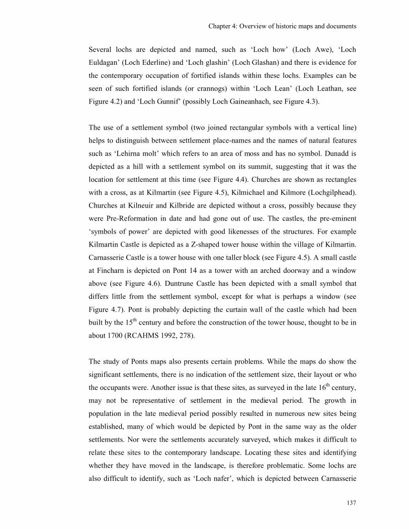
Chapter 4: Overview of historic maps and documents
137
Several lochs are depicted and named, such as ‘Loch how’ (Loch Awe), ‘Loch
Euldagan’ (Loch Ederline) and ‘Loch glashin’ (Loch Glashan) and there is evidence for
the contemporary occupation of fortified islands within these lochs. Examples can be
seen of such fortified islands (or crannogs) within ‘Loch Lean’ (Loch Leathan, see
Figure 4.2) and ‘Loch Gunnif’ (possibly Loch Gaineanhach, see Figure 4.3).
The use of a settlement symbol (two joined rectangular symbols with a vertical line)
helps to distinguish between settlement place-names and the names of natural features
such as ‘Lehirna molt’ which refers to an area of moss and has no symbol. Dunadd is
depicted as a hill with a settlement symbol on its summit, suggesting that it was the
location for settlement at this time (see Figure 4.4). Churches are shown as rectangles
with a cross, as at Kilmartin (see Figure 4.5), Kilmichael and Kilmore (Lochgilphead).
Churches at Kilneuir and Kilbride are depicted without a cross, possibly because they
were Pre-Reformation in date and had gone out of use. The castles, the pre-eminent
‘symbols of power’ are depicted with good likenesses of the structures. For example
Kilmartin Castle is depicted as a Z-shaped tower house within the village of Kilmartin.
Carnasserie Castle is a tower house with one taller block (see Figure 4.5). A small castle
at Fincharn is depicted on Pont 14 as a tower with an arched doorway and a window
above (see Figure 4.6). Duntrune Castle has been depicted with a small symbol that
differs little from the settlement symbol, except for what is perhaps a window (see
Figure 4.7). Pont is probably depicting the curtain wall of the castle which had been
built by the 15th century and before the construction of the tower house, thought to be in
about 1700 (RCAHMS 1992, 278).
The study of Ponts maps also presents certain problems. While the maps do show the
significant settlements, there is no indication of the settlement size, their layout or who
the occupants were. Another issue is that these sites, as surveyed in the late 16th century,
may not be representative of settlement in the medieval period. The growth in
population in the late medieval period possibly resulted in numerous new sites being
established, many of which would be depicted by Pont in the same way as the older
settlements. Nor were the settlements accurately surveyed, which makes it difficult to
relate these sites to the contemporary landscape. Locating these sites and identifying
whether they have moved in the landscape, is therefore problematic. Some lochs are
also difficult to identify, such as ‘Loch nafer’, which is depicted between Carnasserie
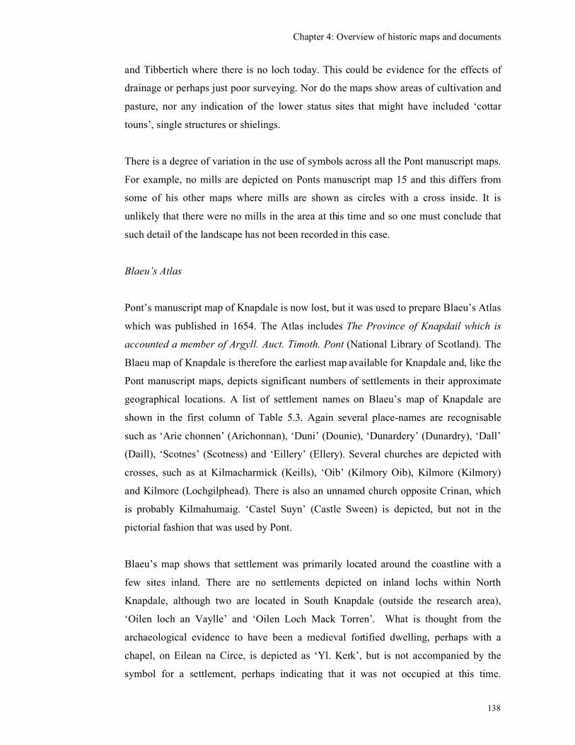
Chapter 4: Overview of historic maps and documents
138
and Tibbertich where there is no loch today. This could be evidence for the effects of
drainage or perhaps just poor surveying. Nor do the maps show areas of cultivation and
pasture, nor any indication of the lower status sites that might have included ‘cottar
touns’, single structures or shielings.
There is a degree of variation in the use of symbols across all the Pont manuscript maps.
For example, no mills are depicted on Ponts manuscript map 15 and this differs from
some of his other maps where mills are shown as circles with a cross inside. It is
unlikely that there were no mills in the area at this time and so one must conclude that
such detail of the landscape has not been recorded in this case.
Blaeu’s Atlas
Pont’s manuscript map of Knapdale is now lost, but it was used to prepare Blaeu’s Atlas
which was published in 1654. The Atlas includes The Province of Knapdail which is
accounted a member of Argyll. Auct. Timoth. Pont (National Library of Scotland). The
Blaeu map of Knapdale is therefore the earliest map available for Knapdale and, like the
Pont manuscript maps, depicts significant numbers of settlements in their approximate
geographical locations. A list of settlement names on Blaeu’s map of Knapdale are
shown in the first column of Table 5.3. Again several place-names are recognisable
such as ‘Arie chonnen’ (Arichonnan), ‘Duni’ (Dounie), ‘Dunardery’ (Dunardry), ‘Dall’
(Daill), ‘Scotnes’ (Scotness) and ‘Eillery’ (Ellery). Several churches are depicted with
crosses, such as at Kilmacharmick (Keills), ‘Oib’ (Kilmory Oib), Kilmore (Kilmory)
and Kilmore (Lochgilphead). There is also an unnamed church opposite Crinan, which
is probably Kilmahumaig. ‘Castel Suyn’ (Castle Sween) is depicted, but not in the
pictorial fashion that was used by Pont.
Blaeu’s map shows that settlement was primarily located around the coastline with a
few sites inland. There are no settlements depicted on inland lochs within North
Knapdale, although two are located in South Knapdale (outside the research area),
‘Oilen loch an Vaylle’ and ‘Oilen Loch Mack Torren’. What is thought from the
archaeological evidence to have been a medieval fortified dwelling, perhaps with a
chapel, on Eilean na Circe, is depicted as ‘Yl. Kerk’, but is not accompanied by the
symbol for a settlement, perhaps indicating that it was not occupied at this time.
Chapter 4: Overview of historic maps and documents
139
Woodland is depicted, particularly in areas around Kald Challie and the Oib peninsula,
but again no cultivation or shielings are shown.
The Blaeu Atlas shares similar drawbacks as the Pont manuscript map, being
geographically inaccurate. For example, the Tayvallich peninsula (Figure 4.8) is
squashed lengthwise and the two coastlines, north-west and south-east appear off-set to
each other when compared with the more accurate modern maps. The sites along each
coast seem to be located correctly relative to each other, but not with sites on the other
side of the peninsula, which probably reflects how Pont undertook the survey, travelling
along one coastline and then the other.
Despite the problems with these early maps they are invaluable to the study of medieval
settlement as they provide 133 place-names in Kilmartin, North Knapdale and
Kilmichael Glassary which were in existence by the end of the 16th century along with
their approximate locations. Some of these may have been recent, established as a
response to a growing population, but others will have their origins in the medieval
period. These lists are therefore an extremely useful starting point in the analysis of
settlement development.
The inaccuracy of the Pont/Blaeu maps made identification of sites in the field difficult,
especially as the place-names were not generally noted on the modern O.S. maps.
Therefore the Roy Military Survey of Scotland, 18th & 19
th century estate plans and the
1st edition O.S. maps of the mid-19
th century were utilised to trace the location of the
place-names.
Roy’s Military Maps
The Military Survey of Scotland, undertaken between 1747 and 1755 by William Roy
depicts the Post-medieval rather than the medieval landscape which is the subject of this
research. However, consultation of these maps is useful in that they show continuity of
many of the earlier place-names, or alternatively, indicate where spellings have changed
and occasionally where settlements seem to have disappeared (see Table 5.2 and 5.3
second columns). These maps generally depict the settlements as nucleated clusters of
structures, surrounded by areas of cultivation, with hills, mosses, woods, roads, and
Chapter 4: Overview of historic maps and documents
140
lochs also shown (see Figure 4.9). There are also unnamed sites with between one and
three buildings. Because of the more accurate surveying techniques and the topography
depicted in the Roy maps it is possible to reconcile many of the settlements with the
contemporary landscape. Generally, shielings are still not depicted on the Military
maps and so this essential element of the economy is still absent from the mapped
landscape.
There is only a slight increase in the number of settlements depicted in the mid-18th
century as there was in the late 16th. Given the greatly increased population since the
end of the 16th century, this may have been accommodated in the larger size of the
settlements, hence the nucleated appearance. There are also several small un-named
settlements shown by Roy, but we do not know if these are new sites or ones that have
not been thought significant enough to depict before.
18th & 19
th century estate plans and surveys
A survey was undertaken along the proposed route of the Crinan Canal in the late-18th
century from Loch Fyne to Loch Crinan (British Library Maps K top 48.79.). As well as
depicting the route of the canal, there are several nucleated settlements and single
houses shown, some of which are not depicted by Roy (see Figure 4.10). An estate map
of the Kilmartin village and environs by John Johnston, is dated 1825, shows the
location of structures which have disappeared from the landscape, such as Carnasserie
Beg and buildings to the south of Kilmartin church (see Figures 4.11 & 4.12,
Lochgilphead Archives, AGD/957/2). Both these maps have been used to identify the
location of settlements (see Tables 5.2 & 5.3).
The main drawback of these later maps for a study of the medieval period is, of course,
that they are showing the landscape at a much later period in its development. However,
there is the potential for some of these sites have been continuously occupied since the
medieval period, perhaps as medieval shieling sites or single structures, later becoming
the focus for more permanent named settlement.
It is acknowledged that any further research into medieval settlement should involve
examination of all existing estate maps. Those that are known about but have not yet
Chapter 4: Overview of historic maps and documents
141
been consulted include a few estate maps of the Glassary parish held in the National
Archive, Charlotte Square, Edinburgh and a map of the Taynish estate dated 1747 in the
British Library (King’s Maps XLIX:28).
First Edition Ordnance Survey maps
The 1st edition (6 inches to 1 mile) O.S. maps, surveyed in the mid-19
th century, have
proved to be the most useful maps for locating (and displaying the extent of) deserted
settlements in the landscape. All buildings (un-roofed as well as roofed) along with
mills, field walls, enclosures, tracks, areas of moorland and prehistoric sites were
accurately surveyed. Many of the deserted sites have place-names that are also depicted
by Pont or Blaeu, indicating continuity of farm names from the 16th to the 19
th centuries.
One of the drawbacks of the 1st edition maps is that only structures or ruins that were
more than three feet high were included in the survey. Therefore potentially medieval
drystone or turf-built structures and shielings surviving only as low ruins, would not
have been included.
Some sites which are depicted by Pont or Blaeu, but not shown on subsequent maps
could not be located and were therefore interpreted as potential Post-medieval
desertions. Other sites not shown by Roy, but subsequently shown on the 1st edition
O.S. maps clearly had some element of continuity. For example, a group of three
settlements (none of which have been located) lay to the north of Duntrune Castle and
include ‘Culknuk’, ‘Tillegre’ and ‘Bargirgaig’ (see Figure 4.7). Of these three only
Culknuk can be tentatively identified on Roy’s map as ‘Collarack’ and none are shown
on the 1st edition map. These sites may have been early clearances by the Campbells of
Duntroon. However, the absence of these sites on the Roy maps should not be taken as
proof that they were already cleared by the mid-18th century. George Langland’s map of
1801, depicts a site called ‘Coilchroick’ in the approximate vicinity of where Pont
depicts ‘Culknuk’ and so, if this is the same settlement, it must have survived until the
beginning of the 19th century, although had gone by the middle of the century.
After consultation of the 1st edition maps for Argyll, it was possible to identify many
more of the Pont/Blaeu sites and provide a national grid reference for them (see column
5, Tables 5.2 & 5.3). An important point to note here is that the grid reference relates to
Chapter 4: Overview of historic maps and documents
142
the 19th-century incarnation of the place-name, and is not necessarily the location of the
medieval settlement of that name.
Apart from the sites which are the result of settlement splitting, many of the settlements
depicted by Pont or Blaeu are potentially of medieval origin and by utilising the historic
maps many sites with the same or similar place-name have been pinpointed in the
landscape. This provided a good starting point for the field survey which sought to
identify these sites on the ground and to investigate whether there were any remains of
potential medieval structures in the vicinity.
It was taken on board that the Post-medieval settlement history of a site would have
affected the potential for discovering medieval settlement at these sites. For instance,
unlocated sites may have been deserted and therefore may not have experienced
subsequent building development. If the land use has remained as rough pasture then
there is a high potential for the late-medieval or earlier settlement to survive as
upstanding remains. Whereas, for those sites with a continuous occupation, the earlier
settlement focus may have been obscured by the 19th-century expansion of settlement
and cultivation. A third possibility is that the subsequent settlement has shifted away
from the medieval focus although retaining the same place-name.
Significant ‘disappearances’ of settlements since the late 16th century include Shyruam
ouer, Shyrua middle & Shyrwa N which were located between the settlements of
Kilmartin and Kilmichael Glassary. There is a single site called ‘Nether Seroin’ on
Roy’s map, but there is no sign of this name in the area on the 1st edition map.
Subsequent examination of a map of the Crinan Canal dated 1823 shows a site of
‘Sheurvin’ to the south-west of Kilmartin village in the vicinity of what is now called
Slockavullin (Crinan Canal by David Smith RHP 5489). One could speculate that the
disappearance of these three related sites, within the well-populated Kilmartin valley, is
perhaps more to do with a change of name associated with a change of ownership,
rather than a change in the rural economy associated with the Clearances. Further
historical research could illuminate this example.
This preliminary research has found evidence for settlement shift, perhaps several times
over a few hundred years. For example, there is map evidence that a site called
Chapter 4: Overview of historic maps and documents
143
Fearnoch was originally located to the north-east of Loch Leathan in the 16th century
and has moved possibly three times (James 2006). Pont depicts the site of ‘Fairnach’ on
the north-east shore of ‘Loch Lean’, and I would argue that this is a fairly accurate
location because another site ‘Soccoch’ is also shown to the north of the loch and the
name ‘Lehrna Molt’ (without a settlement symbol) is also shown to the north-east of the
loch (see Figure 4.3). Both Soccoch’ and ‘Lehrna Molt’ can be found on later maps in
the same vicinity. ‘Leacann nam Mult’ is depicted on the modern OS 1:25,000 map
(Explorer 358) with no symbol, to the north-east of the loch and Socach is located to the
north of the Loch on the 1st edition OS map (Argyllshire Sheet CL). Roy’s maps are not
useful here as they do not depict ‘Fairnach’. However, the 1st edition OS map shows a
site called ‘Fearnoch’, accompanied by rectangular fields, about 1.25 km to the south-
east of Loch Leathan, as well as an unnamed settlement straddling a stream about 0.75m
south of the loch (See Figure 4.13). The named site is likely to be an Improved
farmstead and I propose that the unnamed site was its predecessor, possibly dating to
the 18th century, which has been cleared and become unroofed. These are potentially the
second and third locations for the site of Fearnoch. Finally, the modern 1:50,000 OS
map locates ‘Fearnoch’ (a Forestry Commission cottage) beside the road about 0.5km
south of the loch. So, within the extent of the farm of Fearnoch, the settlement of that
name has moved at least three times since the mid-16th century.
An examination of the estate map of the Kilmartin village and environs by John
Johnston, dating to 1825 (Lochgilphead Archives AGD/957/2), provided evidence
which enabled the identification of another site. Johnston depicted an unroofed
settlement south of Kilmartin village, which he names ‘Auchavin’ (see Figure 4.12).
The site of ‘Auchavin’ is in approximately the same location (south of Kilmartin) that
Pont depicts a site called ‘Achaind’ and I would propose that these are the same.
In conclusion, the examination of the historic maps have provided several useful
avenues of further research. The Pont and Blaeu maps have provided a list of place-
names which were in existence at the end of the 16th century and many of these have the
potential to be medieval in date. These maps represent a ‘landscape of power’ depicting
the aristocratic properties (castles) and high-status farms. They show the settlement
pattern of Mid-Argyll consisting of dispersed farms located predominantly along the
coast and river valleys. The small number of castles occupied by the elite, dominated
Chapter 4: Overview of historic maps and documents
144
the landing points and waterways. The size of these farms is not known, nor the extent
of cultivated ground and these early maps probably do not include all the settlements
that existed in the landscape, as seasonal shielings were not depicted. By comparing the
Pont/Blaeu maps with later maps the potential medieval sites can be identified on the
ground and the Post-medieval processes of settlement shift and splitting can be
investigated.
4.3 Documentary Sources
The aim of the initial documentary work was to expand upon the historic map work by
tracing the existence and continuity of place-names as far back as possible into the
medieval period. There are relatively few historic charters and written documents
referring to settlements or the ordinary population dating to the medieval period. Parish
registers, for instance, did not start in Kilmartin until the 17th century. Not being a
trained historian, the sources that were selected for examination during this research
were those which were easily accessible, in English and would provide a wide coverage
of Argyll. These included the Origines Pariochiales Scotiae compiled in 1854, the 17th-
century Argyll sasines, an account of the 17th-century ‘Depridations’, 17
th-century lists
of Fencible men, and the 1694 Hearth Tax.
Argyll sasines
The Argyll sasines recorded land ownership exchanges and grants of land to tenants
from the 17th century and include useful place-names, personal names and some
indication of the type of land ownership and rentals that were in existence at this time
(Campbell 1933 & 1934). The information provided in the sasines has been
incorporated into the results on individual settlements and presented in the following
chapter. The sasines have also recorded the use of historical titles such as
‘Toiseachdeor’ well into the 17th century which are evidence of continuity of social
practice relating to the control of local power. The ‘Toiseachdeor’ was an ancient office
of the law, often equated with the coroner (McNeill & MacQueen 2000, 190) and the
‘Toiseachdeora of Glassary’, for example, was granted to Sir Dougall Campbell of
Auchinbreck in 1652 (No 346, Campbell 1933, 121-3). There is an earlier reference, in
Chapter 4: Overview of historic maps and documents
145
1436, to Alan son of John Riabhach MacLachlan of Dunadd being granted the ‘offices
of seneschall and thoisseachdeowra’ of Glassary (Steer & Bannerman 1977, 143). The
‘Tosseochdeora of all Kintyre’ was granted to John M’Connell in 1627 (No. 218
Campbell 1934, 70) and the same title to ‘John M’Neill, now of Taynish’ in 1652 (No.
347, Campbell 1933, 123). Other titles mentioned include ‘bailliary, seneschalate,
Crownership and sergeandry of the said Barony’ (Gigha), and the ‘Crownership and
Mairship of fee of North and South Knapdale’ which were also granted to John McNeill
of Taynish in 1652 (No 347, Campbell 1933, 123-4). The sasines have therefore been a
very useful source of information, the only drawback being the dependence on the
interpretation from the Latin by Campbell and the fact that they do not go further back
than the 17th century.
‘Account of the Depridations’
Another useful document is entitled ‘Account of the Depridations committed on the
Clan Campbell and their followers, during the years 1685 and 1686….’ which lists the
losses that were suffered by the Campbell clan members (and their allies) at the hands
of their enemies following the Campbell rebellion (Lochgilphead Archives Ref 941.423
L.C.). This lists place-names, tenants and the goods that were claimed to have been
taken away and so provides some indication of the size of the farms and their
possessions and stock in the late 17th century. One of the problems with this document
is that it is anonymous and is apparently a transcription from a ‘lost’ original. As part of
a potential insurance claim, it also possibly contains some inflated sums, but is
presumably an accurate list of settlements and their occupants.
List of rebels and fencible men
The ‘List of rebels’ dated 1685 includes place-names and the relevant tenants or owners
who were said to have supported the Campbell rebellion (MacTavish 1935). The ‘List
of fencible men’ 1692, includes those who were eligible to be called up for military
service or defense. Only the tenants names are listed for Kilmartin parish, but for
Glassary parish both the settlement and tenants names are listed. One would have
expected the ‘List of rebels’ and the ‘List of fencible men’ to be mutually exclusive
lists. At Stronesker the four rebels are listed in 1685 as Duncan Roy Campbell, Dugall
Chapter 4: Overview of historic maps and documents
146
Clerk, John Campbell and Dugald Campbell (MacTavish 1935, 19) and in 1692, only 7
years later, the ‘fencible men’ are listed as Donald mc Cally, Duncan mc Cally, Ard. mc
Chruter, Donald McNeill and Dugald Clerk’ (MacTavish 1935, 41). One name (Dugall
Clerk) remained on both lists and could have been the same person, perhaps receiving a
pardon after pleading that he had had no choice. Otherwise the change of tenantry is
most likely to be connected to the aftermath of the Campbell Rebellion. Whether the
others (all Campbells) had died, been imprisoned, were evicted or had emigrated is not
known.
Extracts from Poltalloch Writs
Title deeds dating back to the mid 15th century relating to property in Dunadd,
Kilchoan, and Inverneill purchased by Edward Malcolm of Poltalloch have been
transcribed from notes made by the Duke of Argyll (Campbell 1922). The potential of
these deeds has not been properly assessed as part of this research although some deeds,
such as one dated 1436 relating to a charter signed at Carnasserie Castle (see Chapter 8)
have been noted from other sources.
Hearth Tax
The Hearth Tax returns for Argyll & Bute dated 1694 are held in the Scottish Record
Office, Edinburgh (SRO E69/3/1). The returns for each settlement are grouped by parish
and by larger land holdings, which has resulted in those with a geographical proximity
being grouped together (see Figure 4.14). For each settlement, the names of the heads of
the household or tenants are listed and the number of hearths and kilns given. The only
exemptions to the Hearth Tax were hospitals and the poor living on the charity of the
parish (http:/www.nas.gov.uk/guides/taxation.asp). This is therefore an extremely useful
source of information on place-names and size of settlements in the late-17th century.
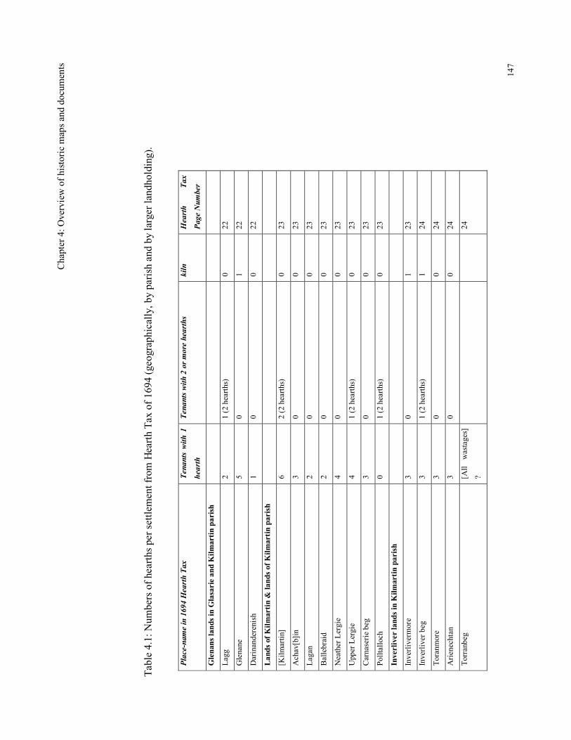
Chap
ter 4: Overview of historic maps and documents
147
Table 4.1: Numbers of hearths per settlement from Hearth Tax of 1694 (geographically, by parish and by larger landholding).
Place-name in 1694 Hearth Tax
Tenants with 1
hearth
Tenants with 2 or more hearths
kiln
Hearth
Tax
Page Number
Glenans lands in Glasarie and Kilmartin parish
Lagg
2
1 (2 hearths)
0
22
Glenane
5
0
1
22
Darinanderenish
1
0
0
22
Lands of Kilmartin & lands of Kilmartin parish
[Kilmartin]
6
2 (2 hearths)
0
23
Achav[b]in
3
0
0
23
Lagan
2
0
0
23
Ballebraid
2
0
0
23
Neather Lergie
4
0
0
23
Upper Lergie
4
1 (2 hearths)
0
23
Carnaserie beg
3
0
0
23
Polltalloch
0
1 (2 hearths)
0
23
Inverliver lands in Kilmartin parish
Inverlivermore
3
0
1
23
Inverliver beg
3
1 (2 hearths)
1
24
Toranmore
3
0
0
24
Arienechtan
3
0
0
24
Torranbeg
[All wastages]
?
24
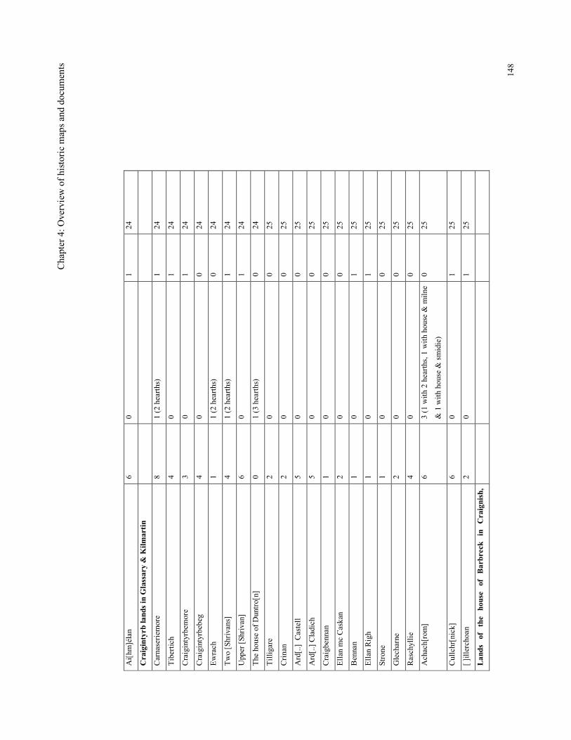
Chap
ter 4: Overview of historic maps and documents
148
Ai[hm]élan
6
0
1
24
Craigintyrb lands in Glassary & Kilmartin
Carnaseriemore
8
1 (2 hearths)
1
24
Tibertich
4
0
1
24
Craigintyrbemore
3
0
1
24
Craigintyrbebeg
4
0
0
24
Ewrach
1
1 (2 hearths)
0
24
Two [Shrivans]
4
1 (2 hearths)
1
24
Upper [Shrivan]
6
0
1
24
The house of Duntro[n]
0
1 (3 hearths)
0
24
Tilligare
2
0
0
25
Crinan
2
0
0
25
Ard[..] Castell
5
0
0
25
Ard[..] Cladich
5
0
0
25
Craigbennan
1
0
0
25
Ellan mc Caskan
2
0
0
25
Bennan
1
0
1
25
Ellan Righ
1
0
1
25
Strone
1
0
0
25
Glecharne
2
0
0
25
Raschyllie
4
0
0
25
Achach[rom]
6
3 (1 with 2 hearths, 1 with house & milne
& 1 with house & smidie)
0
25
Cullchr[nick]
6
0
1
25
[ ]illerchoan
2
0
1
25
Lands of the house of Barbreck in Craignish,
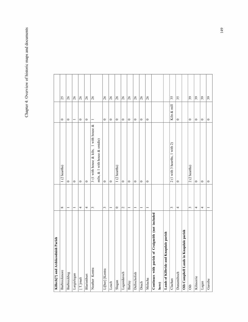
Chap
ter 4: Overview of historic maps and documents
149
Killech[?] and Ardskeodnish Parish
Barbreckmore
8
1 (2 hearths)
0
25
Barbreckbeg
1
0
0
26
Largielegan
1
0
1
26
[ T.]rnalt
4
0
0
26
Blarintibert
4
0
0
26
Neather Kentra
3
3 (1 with house & kiln, 1 with house &
miln, & 1 with house & smidie)
1
26
Li[ber] [Kentra
3
0
0
26
Leach
1
0
0
26
Slugan
0
1 (2 hearths)
0
26
Lagandaroch
2
0
0
26
Barlay
1
0
0
26
Dallocholish
1
0
0
26
Drach
1
0
0
26
Melacha
1
0
0
26
Continues with parish of Craigneith (not included
here)
Lands of Kilbride and Knapdale parish
Clachan
3
2 (1 with 3 hearths, 1 with 2)
Kiln & mill
35
Dunamiltoch
4
0
0
35
Oib Campbell Lands in Knapdale parish
Oib
3
2 (2 hearths)
0
39
Kilmorrie
4
0
0
39
Lagan
4
0
0
39
Garoibe
1
0
0
39
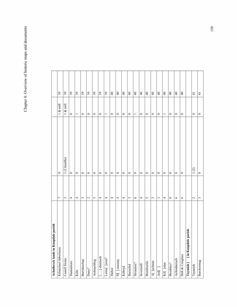
Chap
ter 4: Overview of historic maps and documents
150
Achnibreck lands in Knapdale parish
Kilmichael Inberlussa
7
0
1 & mill
39
Castell Swine
3
1 (2 hearths)
1 & mill
39
Dannamore
4
0
0
39
Kills
4
0
1
39
Barrinlochan
3
0
0
39
Duny?
2
0
0
39
Ardmachbeg
3
0
0
39
[…..] ebernoch
4
0
0
39
Lerna[ ]sson?
4
0
1
39
Daltot
4
0
0
40
D[ ] orasnay
4
0
0
40
Kilbryd
4
0
0
40
Barnafad
3
0
0
40
Strondoir?
6
0
1
40
Inverneill
4
0
0
40
Brenfeorlin
5
0
0
40
A[ ]echnan
3
0
0
40
Ard[ ]
1
0
0
40
Kil[ ]olan
4
0
1
40
Bronbley?
8
0
0
40
Achindarroch
6
0
0
40
Dell & Craiglass
6
0
0
40
Taymish [ ] in Knapdale parish
Tayneish
2
1 (2)
0
41
Barchormag
3
0
0
41
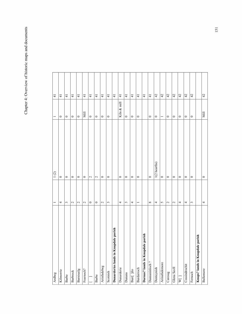
Chap
ter 4: Overview of historic maps and documents
151
Ardbeg
1
1 (2)
1
41
Kilmorrie
4
0
0
41
Barbe
3
0
0
41
Barbreck
2
0
0
41
Barnisailg
2
0
0
41
Fearnoch?
2
0
Mill
41
[ ]
0
2
0
41
Barbe
0
2
0
41
Arinfadebeg
2
0
0
41
Scotnish
3
0
0
41
Dunarderies lands in Knapdale parish
41
Dunarderie
4
0
Kiln & mill
41
Dunans
3
0
0
41
Barr[ ]ilo
4
0
0
41
Bardarroch
1
0
0
41
Darnas? lands in Knapdale parish
41
Dannaninloch ?
8
0
0
41
Dentaynish
4
1(2 hearths)
0
42
Arinafademore
5
0
1
42
Caresag
2
0
0
42
Glena Savll
2
0
0
42
W[ ]
4
0
0
42
Cossindrochit
4
0
0
42
Fernoch
3
0
0
42
Knaps? lands in Knapdale parish
Ballemore
4
0
Mill
42
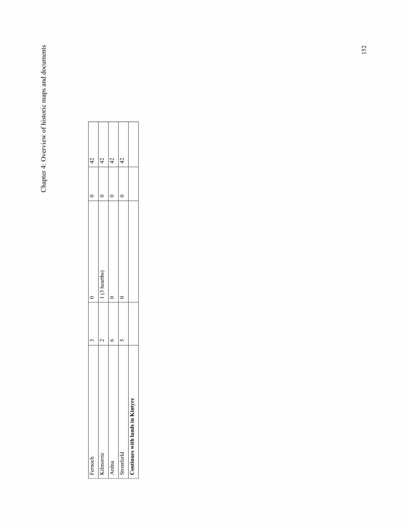
Chap
ter 4: Overview of historic maps and documents
152
Fernoch
3
0
0
42
Kilmorrie
2
1 (3 hearths)
0
42
Ardna
6
0
0
42
Stronferld
5
0
0
42
Continues with lands in Kintyre
Chapter 4: Overview of historic maps and documents
153
The numbers of households per settlement can be extracted from this data. The graph in
Figure 4.15 shows that of the 111 sites included in Table 4.1, the majority (c 78%) of
the settlements consist of between one and four households. The most frequently
recorded number of households is four. The highest recorded number of households is
nine, as at Barbreckmore, Carnaseriemore and Achach[rom]. Kilmartin at this time has
eight households, one of which is headed by a Campbell who presumably resided at
Kilmartin Castle. The number of people actually living in each household is not
recorded.
Generally, each household has a single hearth, although there are a few examples of
tenants with two, or even three hearths. The ‘house of’ Duntroon (the castle) has three
hearths and although the owners name is not recorded, one can assume that it was the
Campbell laird. Houses with more than one hearth were clearly of a higher status than
the others and presumably these are where a local laird or ecclesiastic had their
residence. Curiously, Poltalloch (thought by this time to be associated with the Malcolm
family) was occupied by a Campbell. The effect of the depredations which took place in
the mid-17th century may explain the entry for Torranbeg as ‘all wastages’ in 1694, but
surprisingly, given the extent of the damage, this is not a common entry. The Royal
Commission have suggested that some of the structures with more than a single hearth
in East Dumfriesshire could have been stone built pele or bastle type houses (RCAHMS
1997a, 215).
There is not an exact correspondence between the above table and the areas covered by
Pont’s and Blaeu’s maps, as some farms may be included within other large properties
in the Hearth Tax records. So it has not been possible to state categorically if there are
sites on Pont that are not included in the Hearth Tax and vice versa. However, it can be
seen that in the vicinity of Kilmartin, most of the sites in the Hearth Tax are also
depicted by Pont (eg Kilmartin, Achaybin, Nether Lergie, Upper Lergie, Carnasserie
Beg and Poltalloch). One exception to this is Ballibrad which is not depicted by Pont.
Either Ballibrad post-dated Pont’s survey or perhaps it was excluded from Pont’s survey
because of its small size (two households each with a single hearth in 1694) and yet
other sites, recorded with single households in 1694 are included on Pont e.g. Bennan.
Chapter 4: Overview of historic maps and documents
154
One example of how this research can highlight a potential medieval site is the site of
Tilligare. This site was noted in the Hearth Tax in the vicinity of Duntroon and is
presumably the same places as that recorded by Pont as Tillegre, but it did not survive
into the 18th century. There is documentary evidence therefore, for this settlement in the
Duntroon area, consisting of a small settlement with two households which was
probably cleared by the mid-18th century. This site has great potential for the discovery
of medieval remains, as it was not built over in a later period. Unfortunately, only a
rapid walkover of this area was possible as it was not available for the comprehensive
and detailed fieldwork.
The data provided by the Hearth Tax also has discrepancies with the map evidence
which are not easy to resolve or explain, but for the purposes of this research into
medieval settlement, the sites depicted by Pont have been given priority as the maps are
the earlier source. Another drawback with the Hearth Tax data is that it is written in
17th-century ‘secretary’ hand that requires some training in deciphering. Any mistakes
in the transcriptions here are the authors own.
Origines Pariochiales Scotiae
One of the more useful historical source utilised was the Origines Pariochiales Scotiae
(Innes 1854 and 1855) as it enabled the place-names to be traced further back into the
medieval period. The intention at this time was primarily to record the earliest use of
each place-name, so that an indication of the antiquity of particular settlements could be
ascertained.
Kilmartin Parish (see Table 4.2)
The earliest reference that relate to areas of land in Kilmartin parish is in 1296 when
Nicholas Cambel was ‘bailie of Leghor’ (=Lochawe) and ‘Ardescothyn’
(=Ardskeodnish), (Innes 1855a, 92). These lands (‘Louchaw’ and ‘Ardscodynche’)
were granted by Robert the Bruce in 1315 to Sir Colin Campbell, the son of Nicholas
‘for his loyalty’ after the Battle of Bannockburn. This would suggest that these two
properties were separate land holdings, which were perhaps more ancient lordships.
Lochawe included lands at the west end and south side of Lochawe and Ardskeodnish
Chapter 4: Overview of historic maps and documents
155
was the area bordering this to the south, which became, approximately, the parish of
Kilmartin.
Both Lochawe and Ardskeodnish were held by the Campbells from the 13th century and
throughout the medieval period. In 1323 there is a reference to the 20 merklands of
Ardscodniche (Innes 1855a) and to Sir Duncan Campbell being lord of Lochaw in 1414.
In 1448 both properties were held by Sir Duncan, ‘lord le Cambell’. Lochawe appears to
have been the major property as the Campbells were referred to as Lord of Lochawe,
who were granted the additional barony of Ardskeodnish. In the same year, ‘Duncan
Yong Cambell of Duntrone’ (Duntrune) was acting as steward of Ardskeodnish for Sir
Duncan Campbell of Lochawe. So within the barony of Ardskeodnish, it was the castle
of Duntrune that occupied the highest status. Duntrune is mentioned (with various
spellings) between 1448 and 1565 (Innes 1855a, 93) which pre-dates the construction at
Carnasserie by Bishop Carswell.
A charter was signed at ‘Carnastre’ (= Carnasserie) by John MacLachlan of
Strathlachlan in 1463 (RCAHMS 1992, 224), suggesting that there was a significant
residence here by this time. These two castles would seem to be the predominant high-
status sites during the late-medieval period in Kilmartin. Further up Loch Awe the
Campbell Earls were using Innis Chonnel as a prison and Fincharn (in Glassary parish)
was sub-let to tenants.
There are also early references to the church and its properties. For example the vicar of
‘Killmartin’ is mentioned in 1304 (Innes 1855a, 91). However, it is not until after the
Reformation that there is a reference to anything other than the church or vicar, as in
1575 when the ‘bishops quarter’ was granted to a Gawine Hammiltoun. In 1587 the
‘bishops quarter’ of Kilmartine was granted to Christian, sister of Archibald Carswell of
Carnasserie and her son John Campbell. In 1617 there is again a reference to the leasing
of church property when ‘the teinds of two-forths of the parsonage and vicarage of the
chapel of Kilbryde at Lochgersyde which were part of the patrimony of the parsonage of
Kilmartine’ (Innes 1855a, 92). After the Reformation many church lands came into the
hands of secular lords and this process is probably reflected here.
Chapter 4: Overview of historic maps and documents
156
This source has taken a few of the place-names back to earlier in the 16th century, eg.
Ponts ‘Tibberdick’ is mentioned as ‘Tibberchit’ in 1529, but does not include any
settlement place-names in Kilmartin which pre-date the 16th century.
The Origines Pariochiales Scotiae has included several place-names which are not
depicted by Pont, including Slauchcaure and Innerbeg in 1529 and Kandtrais Uffir,
Kandtrais Neddir with mill and aqueduct, Leacha and Corredowlachane in 1599.
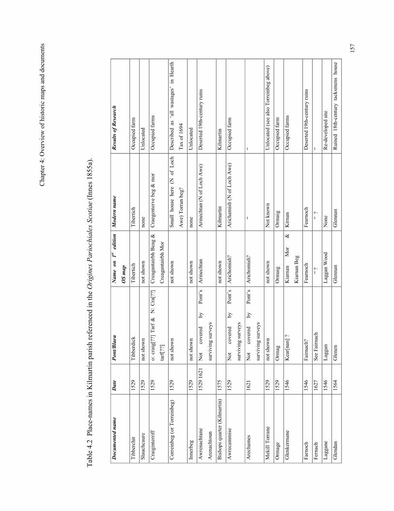
Chap
ter 4: Overview of historic maps and documents
157
Table 4.2 Place-names in Kilmartin parish referenced in the Origines Pariochiales Scotiae (Innes 1855a).
Documented name
Date
Pont/Blaeu
Name on 1st edition
OS map
Modern name
Results of Research
Tibberchit
1529
Tibberdick
Tibertich
Tibertich
Occupied farm
Slauchcaure
1529
not shown
not shown
none
Unlocated
Craiginterriff
1529
o: craig[??] Tarf & N: Cra[??]
tarf[??]
Creagantairbh Beag &
Creagantairbh Mor
Craegenterve beg & mor
Occupied farms
Correinbeg (or Torreinbeg)
1529
not shown
not shown
Small house here (N of Loch
Awe) Torran beg?
Described as ‘all wastages’ in Hearth
Tax of 1694
Innerbeg
1529
not shown
not shown
none
Unlocated
Awrenachtane
Arenachtoun
1529 1621 Not
covered
by
Pont’s
surviving surveys
Arinechtan
Arinechtan (N of Loch Awe)
Deserted 19th-century ruins
Bishops quarter (Kilmartin)
1575
not shown
Kilmartin
Kilmartin
Awrecammise
1529
Not
covered
by
Pont’s
surviving surveys
Arichomish?
Arichamish (N of Loch Awe)
Occupied farm
Arechames
1621
Not
covered
by
Pont’s
surviving surveys
Arichomish?
“
“
Mekill Torrane
1529
not shown
not shown
Not known
Unlocated (see also Torreinbeg above)
Ormage
1529
Ormag
Ormaig
Ormaig
Occupied farm
Glenkermane
1546
Kear[nan] ?
Kiarnan
Mor
&
Kiarnan Beg
Kirnan
Occupied farms
Farnoch
1546
Fairnach?
Fearnoch
Fearnoch
Deserted 19th-century ruins
Fernach
1627
See Fairnach
“ ?
“ ?
“
Laggane
1546
Laggan
Laggan Wood
None
Re-developed site
Glendan
1564
Glenen
Glennan
Glennan
Ruined 18th-century tacksmens house
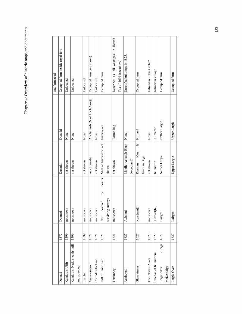
Chap
ter 4: Overview of historic maps and documents
158
and farmstead
Dunnad
1572
Dunnad
Dunadd
Dunadd
Occupied farm beside royal fort
Kandtrais Uffir
1599
not shown
not shown
None
Unlocated
Kandtrais Neddir with mill
and aqueduct
1599
not shown
not shown
None
Unlocated
Leacha
1599
not shown
not shown
None
Unlocated
Arevekanerich
1621
not shown
Arichomish?
Arichamish (N of Loch Awe)?
Occupied farm (see above)
Corredowlachane
1621
not shown
not shown
None
Unlocated
mill of Innerliver
1621
Not
covered
by
Pont’s
surviving surveys
Mill at Inverliver not
shown
Inverliever
Occupied farm
Torranbeg
1621
not shown
not shown
Torran beg
Described as ‘all wastages’ in Hearth
Tax of 1694 (see above)
Aucheynd
1627
Achaind
Maoile Achaidh Bhan
(woodland)
None
Unroofed buildings in 1825.
Glencairnan
1627
Kear[nan]?
Kiarnan
Mor
&
Kiarnan Beg?
Kirnan?
Occupied farm
The Clerk’s Aiker
1627
not shown
not shown
None
Kilmartin – The Glebe?
Clachan of Kilmertein
1627
Kilmart[h?]
Kilmartin
Kilmartin
Kilmartin village
Lergineddir
(Lergi
McKessaig)
1627
Lairges
Nether Largie
Nether Largie
Occupied farm
Lergie Over
1627
Lairges
Upper Largie
Upper Largie
Occupied farm
Chapter 4: Overview of historic maps and documents
159
North Knapdale (see Table 4.3)
The Origines Pariochiales Scotiae includes several medieval references for Knapdale.
In 1292 ‘Knapedale’ was included in the sheriffdom of Lorne or Argyle (Innes 1855a,
40) and by 1472, just before the breakup of the Lordship of the Isles, had been divided
into North and South Knapdale territories (Innes 1855a, 41). The church of St Charmaig
(or McCharmaig), which could have been at Keills or Eilean Mor, is said to have been
granted after the Battle of Largs in 1263 (Sinclair 1792). However, there is an earlier
church place-name of Chillmacdachormes dated to about 1250 (Innes 1855a, 39) which
suggests that it was already in existence by the time of the battle. Throughout the
medieval period Knapdale (Killvick Ocharmaig) was a single parish that was divided
into two parishes (North and South) in 1734 (Sinclair 1792, 255).
There are several sites that are referred to from the mid-14th century, but are not
depicted by Pont. These sites (the location of which is not now known) include Apenad,
Skondenze, Dressag, Barrandayb, Thivinche (island of), Barmore and Contynich. One
could argue that all these were deserted by the late-16th century, except for the fact that
two other sites Blairnatibrade and Glenansaule/Glennasaull, which are also not shown
by Pont, can be identified from the 1st edition maps as the modern Blarantibert and
Gleann Sabhail. This would suggest that for these two sites at least, there was continuity
of the place-name in the form of farmland and/or settlement of some sort, which were
perhaps not significant enough to be recorded by Pont. While Blarantibert now refers to
a large 19th century settlement, the name Gleann Sabhail refers to a valley within which
there are three deserted settlements of 19th century construction. The conclusion drawn
here is that either Pont has not depicted all the settlements that were in existence or that
these settlements were deserted by the late-16th century but the place-name associated
with the vicinity was preserved in local tradition and was re-introduced perhaps when
new sites were established in the area. The other sites mentioned above were
presumably not re-occupied or there has been a change of name. The various changes of
ownership since the breakup of the Lordship of the Isles could provide a context for
such place-name changes. The two place-names Ulva and Dallechelicha have been
identified as Old Ulva (on Ulva island) and Daill (to the south of the Crinan Canal) and

Chapter 4: Overview of historic maps and documents
160
are therefore two of the oldest, still used, farm names in Mid Argyll dating from at least
the mid-14th century.
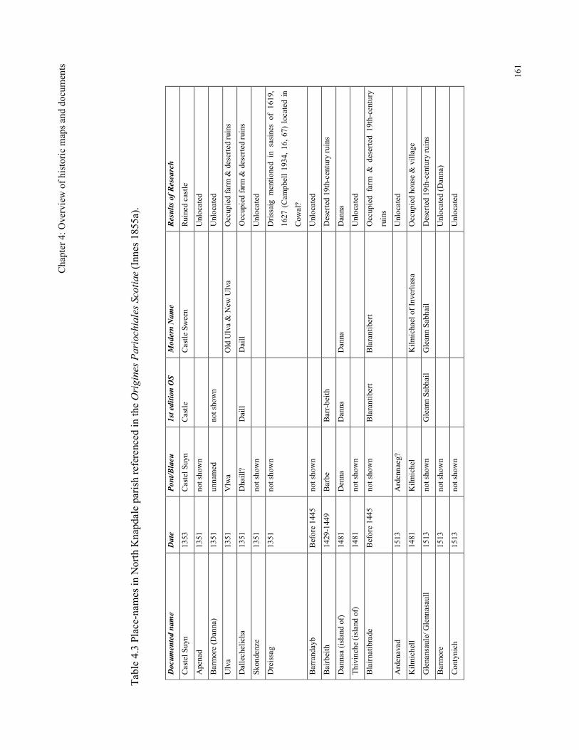
Chap
ter 4: Overview of historic maps and documents
161
Table 4.3 Place-names in North Knapdale parish referenced in the Origines Pariochiales Scotiae (Innes 1855a).
Documented name
Date
Pont/Blaeu
1st edition OS
Modern Name
Results of Research
Castel Suyn
1353
Castel Suyn
Castle
Castle Sween
Ruined castle
Apenad
1351
not shown
Unlocated
Barmore (Danna)
1351
unnamed
not shown
Unlocated
Ulva
1351
Vlwa
Old Ulva & New Ulva
Occupied farm & deserted ruins
Dallechelicha
1351
Dhaill?
Daill
Daill
Occupied farm & deserted ruins
Skondenze
1351
not shown
Unlocated
Dreissag
1351
not shown
Drissaig mentioned in sasines of 1619,
1627 (Campbell 1934, 16, 67) located in
Cowal?
Barrandayb
Before 1445
not shown
Unlocated
Bairbeith
1429-1449
Barbe
Barr-beith
Deserted 19th-century ruins
Dannaa (island of)
1481
Denna
Danna
Danna
Danna
Thivinche (island of)
1481
not shown
Unlocated
Blairnatibrade
Before 1445
not shown
Blarantibert
Blarantibert
Occupied farm & deserted 19th-century
ruins
Ardenavad
1513
Ardennaeg?
Unlocated
Kilmichell
1481
Kilmichel
Kilmichael of Inverlussa
Occupied house & village
Glenansaule/ Glennasaull
1513
not shown
Gleann Sabhail
Gleann Sabhail
Deserted 19th-century ruins
Barmore
1513
not shown
Unlocated (Danna)
Contynich
1513
not shown
Unlocated
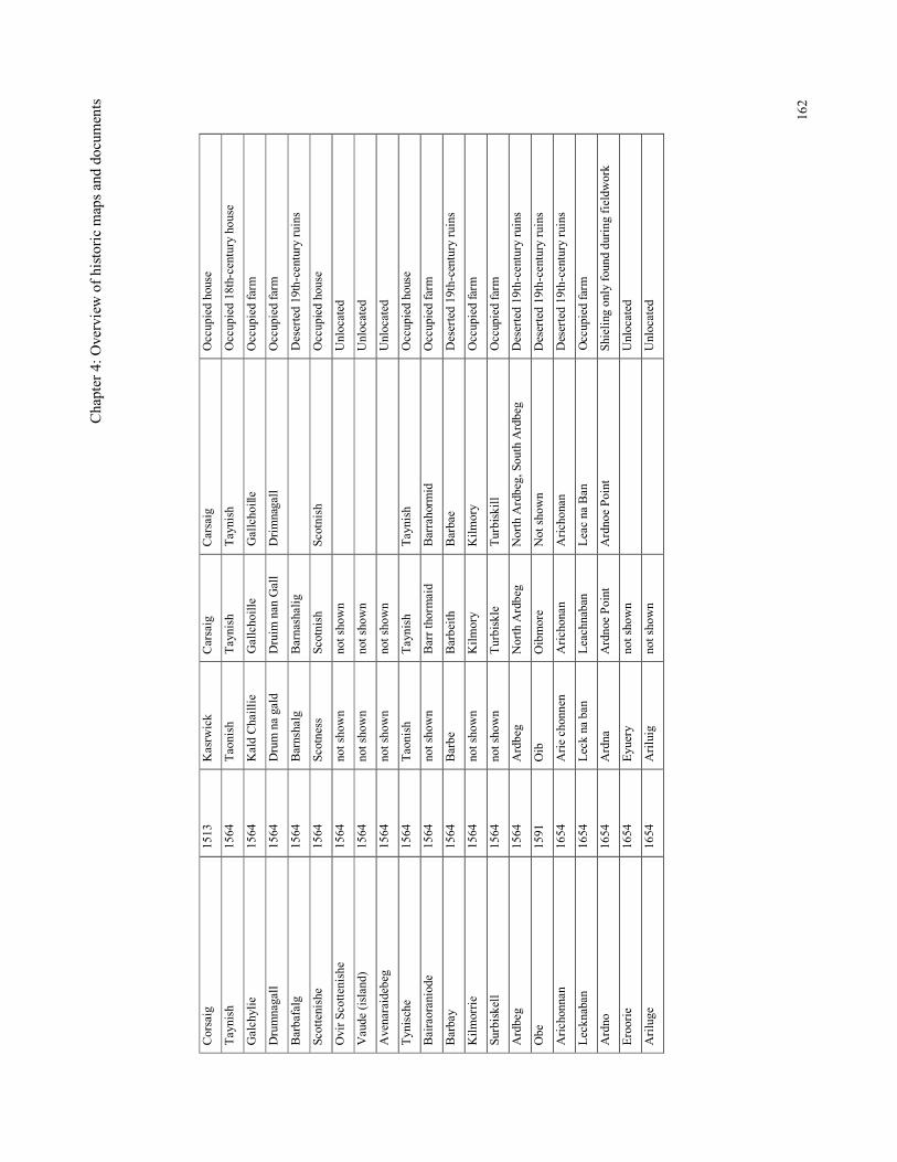
Chap
ter 4: Overview of historic maps and documents
162
Corsaig
1513
Kasrwick
Carsaig
Carsaig
Occupied house
Taynish
1564
Taonish
Taynish
Taynish
Occupied 18th-century house
Galchylie
1564
Kald Chaillie
Gallchoille
Gallchoille
Occupied farm
Drumnagall
1564
Drum na gald
Druim nan Gall
Drimnagall
Occupied farm
Barbafalg
1564
Barnshalg
Barnashalig
Deserted 19th-century ruins
Scottenishe
1564
Scotness
Scotnish
Scotnish
Occupied house
Ovir Scottenishe
1564
not shown
not shown
Unlocated
Vaude (island)
1564
not shown
not shown
Unlocated
Avenaraidebeg
1564
not shown
not shown
Unlocated
Tynische
1564
Taonish
Taynish
Taynish
Occupied house
Bairaoraniode
1564
not shown
Barr thormaid
Barrahormid
Occupied farm
Barbay
1564
Barbe
Barbeith
Barbae
Deserted 19th-century ruins
Kilmorrie
1564
not shown
Kilmory
Kilmory
Occupied farm
Surbiskell
1564
not shown
Turbiskle
Turbiskill
Occupied farm
Ardbeg
1564
Ardbeg
North Ardbeg
North Ardbeg, South Ardbeg
Deserted 19th-century ruins
Obe
1591
Oib
Oibmore
Not shown
Deserted 19th-century ruins
Arichonnan
1654
Arie chonnen
Arichonan
Arichonan
Deserted 19th-century ruins
Lecknaban
1654
Leck na ban
Leachnaban
Leac na Ban
Occupied farm
Ardno
1654
Ardna
Ardnoe Point
Ardnoe Point
Shieling only found during fieldwork
Eroorie
1654
Eyuery
not shown
Unlocated
Ariluge
1654
Ariluig
not shown
Unlocated
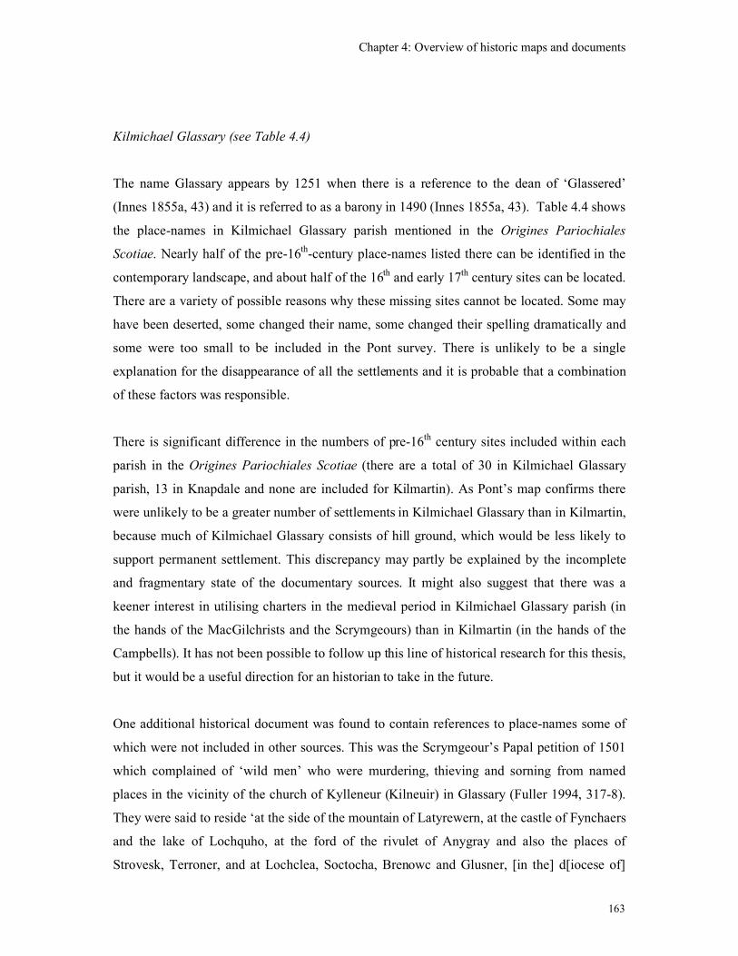
Chapter 4: Overview of historic maps and documents
163
Kilmichael Glassary (see Table 4.4)
The name Glassary appears by 1251 when there is a reference to the dean of ‘Glassered’
(Innes 1855a, 43) and it is referred to as a barony in 1490 (Innes 1855a, 43). Table 4.4 shows
the place-names in Kilmichael Glassary parish mentioned in the Origines Pariochiales
Scotiae. Nearly half of the pre-16th-century place-names listed there can be identified in the
contemporary landscape, and about half of the 16th and early 17
th century sites can be located.
There are a variety of possible reasons why these missing sites cannot be located. Some may
have been deserted, some changed their name, some changed their spelling dramatically and
some were too small to be included in the Pont survey. There is unlikely to be a single
explanation for the disappearance of all the settlements and it is probable that a combination
of these factors was responsible.
There is significant difference in the numbers of pre-16th century sites included within each
parish in the Origines Pariochiales Scotiae (there are a total of 30 in Kilmichael Glassary
parish, 13 in Knapdale and none are included for Kilmartin). As Pont’s map confirms there
were unlikely to be a greater number of settlements in Kilmichael Glassary than in Kilmartin,
because much of Kilmichael Glassary consists of hill ground, which would be less likely to
support permanent settlement. This discrepancy may partly be explained by the incomplete
and fragmentary state of the documentary sources. It might also suggest that there was a
keener interest in utilising charters in the medieval period in Kilmichael Glassary parish (in
the hands of the MacGilchrists and the Scrymgeours) than in Kilmartin (in the hands of the
Campbells). It has not been possible to follow up this line of historical research for this thesis,
but it would be a useful direction for an historian to take in the future.
One additional historical document was found to contain references to place-names some of
which were not included in other sources. This was the Scrymgeour’s Papal petition of 1501
which complained of ‘wild men’ who were murdering, thieving and sorning from named
places in the vicinity of the church of Kylleneur (Kilneuir) in Glassary (Fuller 1994, 317-8).
They were said to reside ‘at the side of the mountain of Latyrewern, at the castle of Fynchaers
and the lake of Lochquho, at the ford of the rivulet of Anygray and also the places of
Strovesk, Terroner, and at Lochclea, Soctocha, Brenowc and Glusner, [in the] d[iocese of]
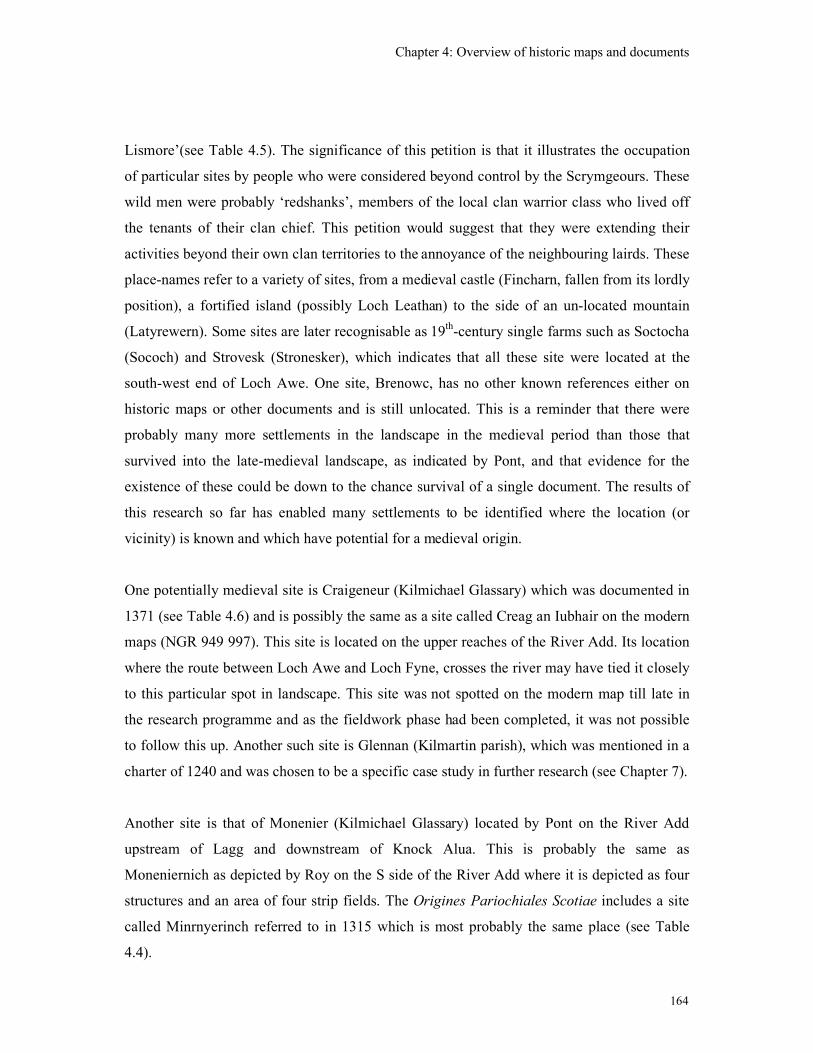
Chapter 4: Overview of historic maps and documents
164
Lismore’(see Table 4.5). The significance of this petition is that it illustrates the occupation
of particular sites by people who were considered beyond control by the Scrymgeours. These
wild men were probably ‘redshanks’, members of the local clan warrior class who lived off
the tenants of their clan chief. This petition would suggest that they were extending their
activities beyond their own clan territories to the annoyance of the neighbouring lairds. These
place-names refer to a variety of sites, from a medieval castle (Fincharn, fallen from its lordly
position), a fortified island (possibly Loch Leathan) to the side of an un-located mountain
(Latyrewern). Some sites are later recognisable as 19th-century single farms such as Soctocha
(Sococh) and Strovesk (Stronesker), which indicates that all these site were located at the
south-west end of Loch Awe. One site, Brenowc, has no other known references either on
historic maps or other documents and is still unlocated. This is a reminder that there were
probably many more settlements in the landscape in the medieval period than those that
survived into the late-medieval landscape, as indicated by Pont, and that evidence for the
existence of these could be down to the chance survival of a single document. The results of
this research so far has enabled many settlements to be identified where the location (or
vicinity) is known and which have potential for a medieval origin.
One potentially medieval site is Craigeneur (Kilmichael Glassary) which was documented in
1371 (see Table 4.6) and is possibly the same as a site called Creag an Iubhair on the modern
maps (NGR 949 997). This site is located on the upper reaches of the River Add. Its location
where the route between Loch Awe and Loch Fyne, crosses the river may have tied it closely
to this particular spot in landscape. This site was not spotted on the modern map till late in
the research programme and as the fieldwork phase had been completed, it was not possible
to follow this up. Another such site is Glennan (Kilmartin parish), which was mentioned in a
charter of 1240 and was chosen to be a specific case study in further research (see Chapter 7).
Another site is that of Monenier (Kilmichael Glassary) located by Pont on the River Add
upstream of Lagg and downstream of Knock Alua. This is probably the same as
Moneniernich as depicted by Roy on the S side of the River Add where it is depicted as four
structures and an area of four strip fields. The Origines Pariochiales Scotiae includes a site
called Minrnyerinch referred to in 1315 which is most probably the same place (see Table
4.4).
Chapter 4: Overview of historic maps and documents
165
Another potentially significant place-name that can be traced from a 14th century
documentary reference is ‘Derrenaneranach’ (Innes 1854, see Table 4.4). This is possibly the
site depicted as ‘Derren Loch’ on the south shore of Loch Glashan by Pont (see Figure 4.16).
Roy depicts a site of ‘Derinloch’ on the N side of the loch (Figure 4.17) and the 1st edition
O.S. map shows ‘Dailaneireanach’ also on the N shore of Loch Glashan (see Figure 4.18).
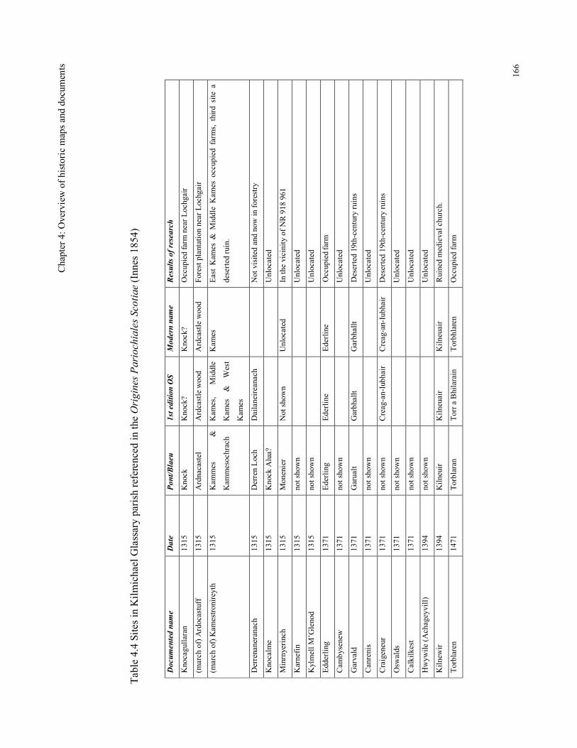
Chap
ter 4: Overview of historic maps and documents
166
Table 4.4 Sites in Kilmichael Glassary parish referenced in the Origines Pariochiales Scotiae (Innes 1854)
Documented name
Date
Pont/Blaeu
1st edition OS
Modern name
Results of research
Knocagullaran
1315
Knock
Knock?
Knock?
Occupied farm near Lochgair
(march of) Ardocastuff
1315
Ardnacastel
Ardcastle wood
Ardcastle wood
Forest plantation near Lochgair
(march of) Kamestronireyth
1315
Kammes
&
Kammesochrach
Kames,
Middle
Kames & West
Kames
Kames
East Kames & Middle Kames occupied farms, third site a
deserted ruin.
Derrenaneranach
1315
Derren Loch
Dailaneireanach
Not visited and now in forestry
Knocalme
1315
Knock Alua?
Unlocated
Minrnyerinch
1315
Monenier
Not shown
Unlocated
In the vicinity of NR 918 961
Karnefin
1315
not shown
Unlocated
Kylmell M’Glenod
1315
not shown
Unlocated
Edderling
1371
Ederling
Ederline
Ederline
Occupied farm
Cambysenew
1371
not shown
Unlocated
Garvald
1371
Garualt
Garbhallt
Garbhallt
Deserted 19th-century ruins
Canrenis
1371
not shown
Unlocated
Craigeneur
1371
not shown
Creag-an-Iubhair
Creag-an-Iubhair
Deserted 19th-century ruins
Oswalds
1371
not shown
Unlocated
Calkilkest
1371
not shown
Unlocated
Hwywile (Achageyvill)
1394
not shown
Unlocated
Kilnewir
1394
Kilneuir
Kilneuair
Kilneuair
Ruined medieval church.
Torblaren
1471
Torblaran
Torr a Bhilarain
Torbhlaren
Occupied farm
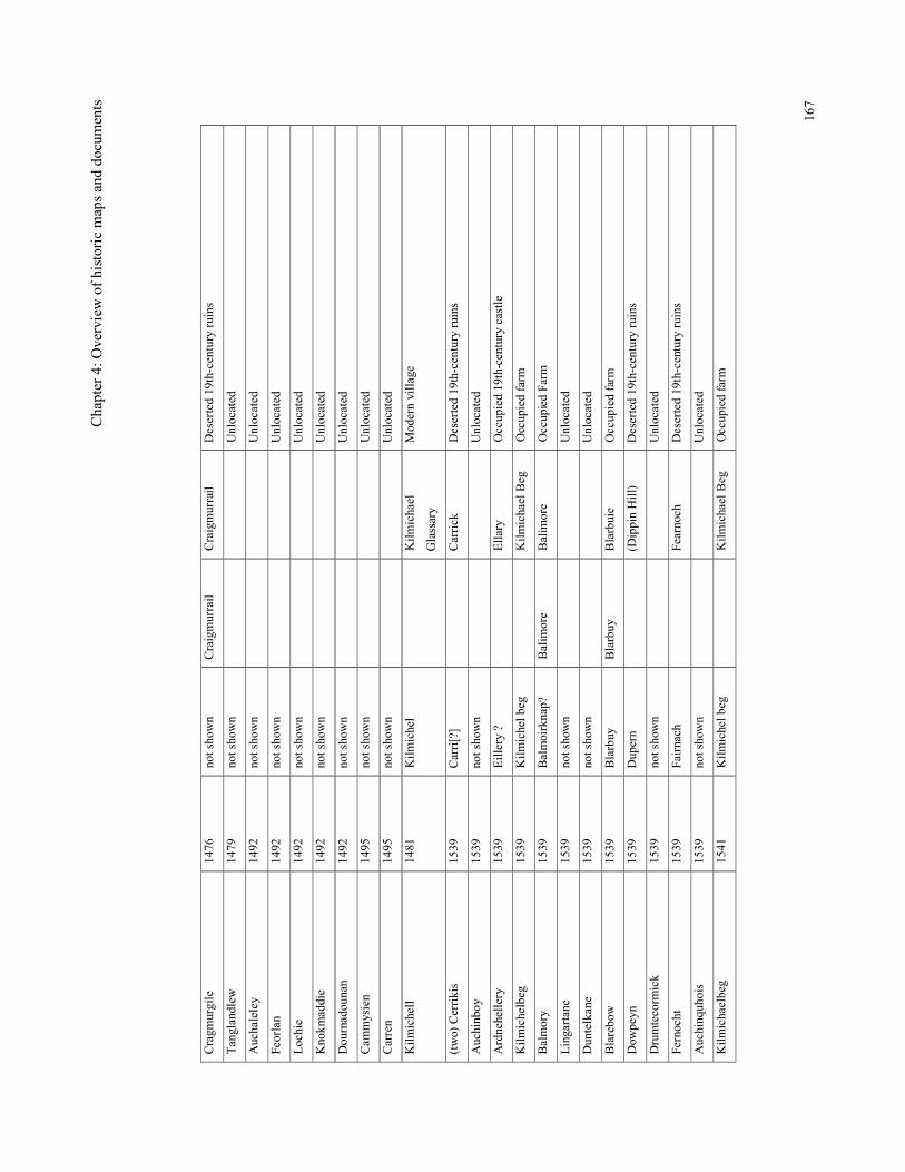
Chap
ter 4: Overview of historic maps and documents
167
Cragmurgile
1476
not shown
Craigmurrail
Craigmurrail
Deserted 19th-century ruins
Tanglandlew
1479
not shown
Unlocated
Auchaleley
1492
not shown
Unlocated
Feorlan
1492
not shown
Unlocated
Lochie
1492
not shown
Unlocated
Knokmaddie
1492
not shown
Unlocated
Dournadounan
1492
not shown
Unlocated
Cammysien
1495
not shown
Unlocated
Carren
1495
not shown
Unlocated
Kilmichell
1481
Kilmichel
Kilmichael
Glassary
Modern village
(two) Cerrikis
1539
Carri[?]
Carrick
Deserted 19th-century ruins
Auchinboy
1539
not shown
Unlocated
Ardnehellery
1539
Eillery ?
Ellary
Occupied 19th-century castle
Kilmichelbeg
1539
Kilmichel beg
Kilmichael Beg
Occupied farm
Balmory
1539
Balmoirknap?
Balimore
Balimore
Occupied Farm
Lingartane
1539
not shown
Unlocated
Duntelkane
1539
not shown
Unlocated
Blarebow
1539
Blarbuy
Blarbuy
Blarbuie
Occupied farm
Dowpeyn
1539
Dupern
(Dippin Hill)
Deserted 19th-century ruins
Drumtecormick
1539
not shown
Unlocated
Fernocht
1539
Fairnach
Fearnoch
Deserted 19th-century ruins
Auchinquhois
1539
not shown
Unlocated
Kilmichaelbeg
1541
Kilmichel beg
Kilmichael Beg
Occupied farm
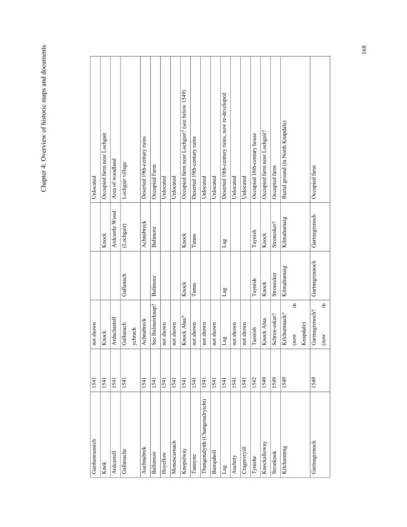
Chap
ter 4: Overview of historic maps and documents
168
Garthenrannich
1541
not shown
Unlocated
Knok
1541
Knock
Knock
Occupied farm near Lochgair
Ardcastell
1541
Ardachastell
Ardcastle Wood
Area of woodland
Gallanache
1541
Gallanach
ychrach
Gallanach
(Lochgair)
Lochgair village
Auchnabrek
1541
Achnabreck
Achnabreck
Deserted 19th-century ruins
Ballemoir
1541
See Balmoirknap? Balimore
Balimore
Occupied Farm
Hoyellow
1541
not shown
Unlocated
Monencarnach
1541
not shown
Unlocated
Knopalway
1541
Knock Alua?
Knock
Knock
Occupied farm near Lochgair? (see below 1549)
Tunnyne
1541
not shown
Tunns
Tunns
Deserted 19th-century ruins
Thangenalyith (Changenalryicht)
1541
not shown
Unlocated
Bairquholl
1541
not shown
Unlocated
Lag
1541
Lag
Lag
Lag
Deserted 19th-century ruins, now re-developed
Auchety
1541
not shown
Unlocated
Cragmvryill
1541
not shown
Unlocated
Tynishe
1542
Taonish
Taynish
Taynish
Occupied 18th-century house
Knockalloway
1549
Knock Alua
Knock
Knock
Occupied farm near Lochgair?
Stronknok
1549
Schron-eskar?
Stronesker
Stronesker?
Occupied farm
Kilchammig
1549
Kilchumnack?
(now
in
Knapdale)
Kilmahumaig
Kilmahumaig
Burial ground (in North Knapdale)
Gartnagrenoch
1549
Garmagrenoch?
(now
in
Gartnagreanoch
Gartnagrenoch
Occupied farm
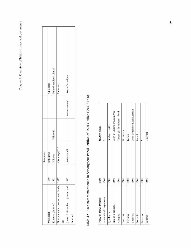
Chap
ter 4: Overview of historic maps and documents
169
Knapdale)
Muckarich
1549
not shown
Unlocated
Kilnewir (lands of)
1572
Kilneuir
Kilneuair
Ruined medieval church
Gortinrannich (towns and lands
of)
1617
Gortenaga[?] ?
Unlocated
(two) Ardchastles (towns and
lands of)
1617
Ardachastell
Ardcastle wood
Area of woodland
Table 4.5 Place-names mentioned in Scrymgeour Papal Petition of 1501 (Fuller 1994, 317-8)
Name in Papal Petition
Date
Modern name
mountain of Latyrewern
1501
?
Fynchaers
1501
Fincharn castle
lake of Lochquho
1501
Loch a’ Choire or Loch Awe
Anygray
1501
Anagra (18th-century). Ford
Strovesk
1501
Stronesker
Terroner
1501
Torran
Lochclea
1501
Loch Leachd or Loch Leathan
Soctocha
1501
Sococh
Brenowc
1501
?
Glusner
1501
Glasvaar
Chapter 4: Overview of historic maps and documents
170
This brief examination of the historic maps has established that many settlement names
have origins which can be traced back to the 16th century and a small number back into
the 13th - 14
th centuries. These maps provide very little other information. It is only in
the 17th century that a wider range of information is available from the Argyll Sasines
(and later still the Valuation Rolls and Census Records which have not been consulted).
This documentary evidence indicates that in the late-16th century, the pattern of
settlement was dispersed, consisting predominantly of sites with a small number of
tenants (generally between one and four) each occupying a dwelling with a single
hearth. These are presumably the permanent settlement sites and there is no evidence for
seasonal sites such as shielings. There is a small number of larger settlements and it is
interesting to see that only one of these, Kilmartin (which was not the largest in the 17th
century), developed into a village in the Post-medieval period, the others all became
deserted. The high-status sites, such as the castles, remain significant sites associated
with the aristocracy throughout the medieval period and into the 17th century. However,
at the next level down, the survival of site names seems to be related to the fortunes of
the particular families in possession, the Campbells being the most successful of these
locally. Some sites become the sites of 18th-century tacksmen’s houses, others become
joint-tenancy farms while others are cleared, probably for sheep and cattle farms. The
continuity of place-names at the same location should not be taken as evidence for the
continuity of settlement location as there is evidence for a degree of settlement shift
within properties. This has been mentioned in the case of Fearnoch above and has also
been followed up in the field survey (see Chapter 5).
Examination of the Pont and Blaeu maps and the Hearth Tax records have provided
selective late-medieval ‘snapshots’ of the settlement pattern in the late-medieval period.
However, they cannot be used to extrapolate back into the medieval period as there are
too many unknown factors. We cannot assume that all the sites had medieval origins as
there is evidence for settlements splitting by the 16th century as in the cases of
Carnasserie Mor and Beg, Ederling and Ederling Beg. It some cases it may not be
immediately obvious which was the original settlement. In general we do not know
enough about the processes involved with settlement growth, decline and evolution
during the medieval period. The divisions of Easter and Wester or Nether have also
been mentioned previously. These are likely to be later than the mor and beg divisions
as they show the influence of the English language.
Chapter 4: Overview of historic maps and documents
171
This comparison of the map and easily available documentary evidence has also
illustrated some of the difficulties encountered when dealing with two different types of
historical information, in that they are often inconsistent with each other, leading to
problems of interpretation. For example a comparison of the sites mentioned in
documentary sources in the mid- and late-16th century includes many which are not
depicted by Pont or Blaeu at the end of the 16th century. Were some deserted at a time
when population was apparently increasing? Or is it that many of the existing
settlements were not depicted on the maps because they were not considered significant
enough?
In addition to the examination of historical maps and documents, the possibility of
dating a place-name linguistically has also been examined and it is to this aspect that
this research now turns.
4.4 Place-names
Place-name study can be helpful to the study of settlement in that they can provide
evidence for the cultural background of the population, language changes, land
divisions and land usage. Chapter 3 has shown that Argyll was Gaelic speaking from an
early period and this is reflected in the absence of any recognisably Pictish place names
in Argyll (Campbell 2000, 4).
In Orkney, Shetland and the Outer Hebrides there is a high proportion of Norse names
but these fall away on the inner isles and on the mainland (Johnston 1995,111).
Crawford has discussed the location of bólstaðr (= homestead) and byr (= farm) names
in Scotland in particular, and has not identified any on the mainland of Argyll
(Crawford 1995, 9-11) which would suggest that Norse settlement was restricted to the
outer isles. However, there have been a few suggested examples of Norse names within
Mid-Argyll. Some include the generic element dalr (= valley) such as Knapdale (knappr
= knob/hill) and Rudale (ru = red), (Gillies 1906, 9, 34 & 237). The element aig (=
creek or small bay) appears in Ormaig (Orm = serpent) and Carsaig (car = Gaelic for
rock or cliff (Gillies 1906, 9 &36)). The element nes (= a headland) appears in Scotnish
(Gillies 1906, 36; Watson 2002, 72) and Taynish. Other suggested place-names include
Chapter 4: Overview of historic maps and documents
172
Ulva = Wolf island and Danna = Dane island (Macmillan 1960, 2). The place-name
Gallanach ychrach, which includes the element gall (= Gaelic for foreigner) usually
referred to the Norse foreigner (Taylor 1995, 142). The gall element in Druim–nan-gall
as seen on the 1st edition OS map, may however, be a red herring as it is spelled Drum
na gald by Pont which is presumably nearer to its original spelling.
This smattering of Norse names, some mixed with Gaelic, would support the idea that
Mid-Argyll did have some Norse influence, as a result of a short term conquest, or
intermarriage, but did not form part of the main Norse kingdom. These predominantly
coastal place-names probably represent the establishment of Norse or mixed Norse/Gael
settlements which can therefore be dated to between the 9th and the 13
th centuries (when
Gaelic regained predominance). The type of settlement may also have been distinctive,
consisting of possibly bow-shaped, long-houses, as the excavations at Jarlshof
(Hamilton 1956) and the Udal (Crawford & Switzur 1977) have shown.
Gaelic names that are of particular relevance to settlement are derived from baile- (=
farm (Taylor 2001, 483)), achadh- (= field or secondary farm (Taylor 2001, 483)) and
airigh-/ airidh- (= shieling (Bil 1990, 34; Gillies 1906, 187)). Nicolaison has suggested
that the baile- names were used over an extremely wide period, possibly originating in
the early-medieval period and that achadh-names were secondary settlements
established sometime after the baile- names (Nicolaison 2001, 168 & 182). Other work
has suggested that the baile- names of the east of Scotland and in Ireland dates to the
late 11th or early 12
th century at the earliest (Davit Broun pers. comm.) with a gradual
extension across Scotland as Gaelic usage spread. There was not, however, a clear
replacement of baile- names by achadh- names as they were both used for settlements
within the Gaelic speaking areas well after English was becoming more widespread
(Thomson 1994, 233). A further complication is that a later use of baile- names has also
observed in Ireland as translations of the English -tun in the 14th century (Nicolaison
2001, 172). Neither Nicolaison or Thomson suggest a date for the origin of the use of
the airigh- and airidh- place-name, but Bil observed that by the 18th century they were
used in Perthshire for permanent settlements which had been established on old shieling
sites which themselves may have originated in the Medieval period (Bil 1990, 35).
Chapter 4: Overview of historic maps and documents
173
In order to develop a strategy for investigating the baile-, achadh- and airigh- place-
names an initial search was made of the above documentary sources and historic maps
for Mid-Argyll for examples of their use (see Table 4.6)
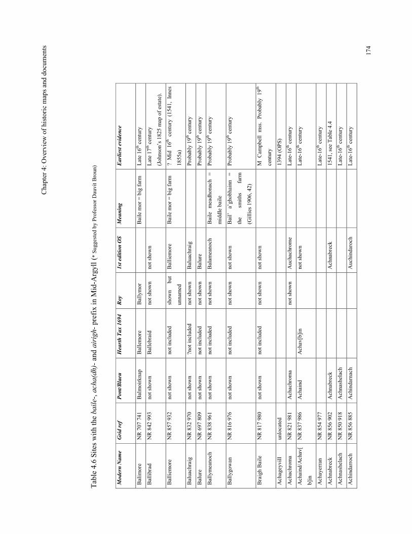
Chap
ter 4: Overview of historic maps and documents
174
Table 4.6 Sites with the baile-, acha(dh)- and airigh- prefix in Mid-Argyll (* Suggested by Professor Dauvit Broun)
Modern Name
Grid ref
Pont/Blaeu
Hearth Tax 1694
Roy
1st edition OS
Meaning
Earliest evidence
Balimore
NR 707 741
Balmoirknap
Ballemore
Ballymor
Baile mor = big farm
Late 16th century
Ballibrad
NR 842 993
not shown
Ballebraid
not shown
not shown
Late 17th century
(Johnson’s 1825 map of estate).
Balliemore
NR 857 932
not shown
not included
shown but
unnamed
Balliemore
Baile mor = big farm
? Mid 16th century (1541, Innes
1855a)
Baluachraig
NR 832 970
not shown
?not included
not shown
Baluachraig
Probably 19th century
Balure
NR 697 809
not shown
not included
not shown
Balure
Probably 19th century
Ballymeanoch
NR 838 961
not shown
not included
not shown
Balameanoch
Baile meadhonach =
middle baile
Probably 19th century
Ballygowan
NR 816 976
not shown
not included
not shown
not shown
Bail’ a’ghobhainn =
the
smiths
farm
(Gillies 1906, 42)
Probably 19th century
Braigh Baile
NR 817 980
not shown
not included
not shown
not shown
M Campbell mss. Probably 19th
century
Achageyvill
unlocated
1394 (OPS)
Achachroma
NR 821 981
Achachroma
not shown
Auchachrome
Late-16th century
Achaind/Achav[
b]in
NR 837 986
Achaind
Achav[b]in
not shown
Late-16th century
Achayerran
NR 854 977
Late-16th century
Achnabreck
NR 856 902
Achnabreck
Achnabreck
1541, see Table 4.4
Achnashelach
NR 850 918
Achnashelach
Late-16th century
Achindarroch
NR 856 885
Achindarnach
Auchindaroch
Late-16th century
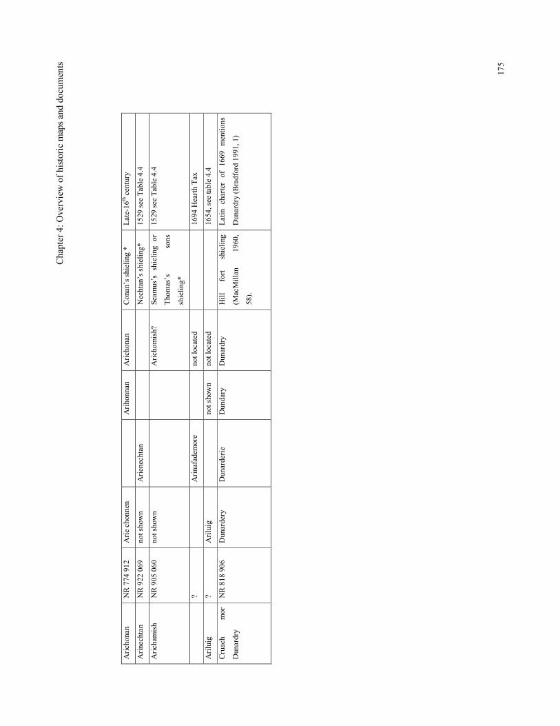
Chap
ter 4: Overview of historic maps and documents
175
Arichonan
NR 774 912
Arie chonnen
Arihonnan
Arichonan
Conan’s shieling *
Late-16th century
Arinechtan
NR 922 069
not shown
Arienechtan
Nechtan’s shieling*
1529 see Table 4.4
Arichamish
NR 905 060
not shown
Arichomish?
Seamus’s shieling or
Thomas’s
sons
shieling*
1529 see Table 4.4
?
Arinafademore
not located
1694 Hearth Tax
Ariluig
?
Ariluig
not shown
not located
1654, see table 4.4
Cruach
mor
Dunardry
NR 818 906
Dunardery
Dunarderie
Dundary
Dunardry
Hill
fort shieling
(MacMillan
1960,
58).
Latin charter of 1669 mentions
Dunardry (Bradford 1991, 1)
Chapter 4: Overview of historic maps and documents
176
Table 4.6 shows that the earliest documentary or historical map evidence so far found
for these baile-, acha(dh)- and airigh- sites is a single unlocated example from the 14th
century and further examples from the 16th century which is a reflection of the limited
sources that have been consulted. Further research into medieval charters could reveal
earlier references, and it is acknowledged that this is somewhere that future research
should be directed.
Some of the baile- sites can be traced back to the 16th century, but for others, such as
Ballygowan, there is no evidence that they existed before the mid-19th century. So, as
others have suggested, the coining of settlement names with the element baile- is
perhaps not restricted to the medieval period in Mid-Argyll and may have been in use
for settlements over a wide chronological span and well into the 19th century. So far this
research as shown that there are several place-names with the acha(dh)- and airigh-
elements and that these pre-date the mid-17th century and were therefore in existence
before the Improvements. Until the earliest forms of these place-names can be traced, or
the archaeological evidence can be found, it is not really possible to explore further at
this point Nicholaison’s idea of a progression from baile- place-names to secondary
achadh- sites.
It is interesting that several arigh- names are combined with a personal name.
Arichonan (Knapdale) for example could be the seasonal settlement of Nechtan
(perhaps an ancestor of the MacNaughtons based in Loch Awe (Dauvit Broun,
pers.comm.). Arichonan is depicted on Blaeu’s map of Knapdale, and the earliest
documentary evidence for Arichonan is dated to the mid-17th century. So there is the
potential for this settlement to have been established on an already existing shieling site
of that name sometime before the end of the 16th century. It has been suggested that the
place name Dunardry (N Knapdale, clan seat of the McTavishes from the 14th century)
is derived from Dun-ard-airigh meaning ‘high fort shieling’ which would suggest that a
fort was re-used as a shieling site and then re-used as a clan seat early in the medieval
period and that this gave its name to the estate (MacMillan 1960, 58), although this
interpretation is questioned by Professor Dauvit Broun. (Another interpretation could be
Dun-ard-righ meaning fort of the king’s point). Earlier references to both these sites
could in the 14th and 15
th-century charters might clarify their original forms.
Chapter 4: Overview of historic maps and documents
177
Place-name evidence has also provided several examples of settlements splitting by the
late 16th century as the divisions ‘mor’ and ‘beg’, meaning ‘big’ and ‘little’ were
depicted by Pont. These include Carnasserie Mor and Carnasserie Beg, Fincharn Mor
and Beg, ‘Y. na uaid M’ and ‘Yrin na uaid B’, ‘Kilmacharmick M. B.’, ‘Kilmichael’
and ‘Kilmichael beg’ ‘Ederling’ and ‘Ederling Beg’ (see Tables 5.2 & 5.3). The specific
reference to one of these sites being larger than the other may not relate directly to
status as the example of Carnasserie shows. Carnasserie Beg refers to the (seemingly in
the 19th century) small settlement that lay just outside the walls of the castle, while (the
more extensive) Carnasserie Mor lay in the hills to the north. Some ‘beg’ sites seem to
have no known accompanying ‘mor’ site such as ‘Ardmachbeg’ and ‘Ardbeg’. Perhaps
‘beg’ relates to the size of the ‘ard’ rather than the size of the settlement which was
named after it and is therefore not an example of settlement splitting. Another division
refers to ‘the two …’ as in the two ‘Cerrikis’ (see Table 4.4).
Other split place-names reflect the influence of English words, such as ‘Shyruam ouer’,
Shyrua middle and Shyrwa N[orth] (Table 5.2), ‘Kandtrais Uffir’ and ‘Kandtrais
Neddir’ (Table 4.2), ‘Scottenishe’ and ‘Ovir Scottenishe’ (Table 4.3). By the end of the
17th century there were additional examples of mor and beg names, such as
‘Craigintyrbemore’ and ‘Craigintyrebebeg’ (Table 4.1) although these could have been
coined in an earlier century but not documented. Other split names recorded by the 17th
century include ‘Neather Kentra’ and ‘Li[ber] Kentra’, ‘Upper Lergie’, ‘Neather Lergie’
(Table 4.1) and ‘Lergie Over’ (Table 4.2). Settlement splitting was clearly a process
which was taking place at least by the 16th century and continued into the Post-medieval
period with more sites using the English ‘North’, ‘South’, ‘Easter’ and ‘Wester’ names.
This investigation of the historic maps and documents has provided much information
on the nature of settlement towards the end of the medieval period. The maps indicate
that in the late-16th century there were a number of dispersed farms located
predominantly on coastal sites. The Hearth Tax shows that the settlements were
predominantly of 1 - 4 households each with a single hearth, but some had up to 9
households. Some of the households with more than 1 hearth were associated with the
significant landowning families such as the Campbells of Duntrune, Kilmartin, and Oib,
and the MacNeills of Taynish, The survival of these settlements into the Post-medieval
period is variable, and seems to be dependent on the particular fortunes of the associated
Chapter 4: Overview of historic maps and documents
178
families. Some of these high-status sites do not continue as such, eg Oib Campbell,
probably because this branch of the Campbells moved to Duntrune Castle in the 18th
century and abandoned their old residence in North Knapdale. The sites which remained
as single-tenanted farms are probably those which were the main residences of the
significant families. Their other properties were rented out as joint-tenancy farms, such
as Arichonan, and these benefited from the initial Improvements, but later suffered the
effects of the Clearances in the 19th century. While many of the farms names continued
as significant properties through the 18th and into the 19
th century, and appeared to have
become nucleated settlements by the 18th century, only a very few of these sites
developed into villages in the 19th and 20
th centuries, i.e. with a church and other trades
(e.g. Kilmartin and Kilmichael Glassary) reflecting that Argyll remained a rural, under
developed economy.
Consultation of the Origines Pariochiales Scotiae in particular has enabled the
identification of several settlement place-names in Kilmichael Glassary, which have
been found to date back to the early-14th century, such as Knocagullaran, Ardocastuff,
Kamestronireyth, Derrenaneranach, Knocalme, Minrnyerinch, Karnefin and Kylmell
M’Glenod and from the late-14th include Edderling, Cambysenew, Garvald, Canrenis,
Craigeneur, Calkilkest, Oswalds, Hwywile (Achageyvill) and Kilnewir. In North
Knapdale the 14th century sites include Apenad, Barmore (Danna), Ulva, Dallechelicha,
Skondenze and Dreissag. The OPS has not provided similarly early place-names for
Kilmartin parish. From the map work alone, only a small number of these settlements
could be located in the modern landscape. This may be because of significant changes
to their spelling, their loss through amalgamation of farms, desertion because of
climatic deterioration, the plague or settlement shift. Clearly, the investigation of the
historic documents has been limited in its scope, but has enabled some sites to be traced
back into the 14th century. Further work on medieval charters would be a useful line of
research to follow in order to find the earliest forms of place-names. The most useful
aspect of this kind of work has been the identification of sites, or the likely areas of
sites, which could be targeted for more detailed field walking and it is towards this
evidence that this research now turns.
Chapter 5: Results of preliminary fieldwork
179
Chapter 5: Results of preliminary fieldwork
5.1 Introduction
This chapter describes the results of an initial phase of fieldwork which took place over
about 50 days between 2001 and 2004. A total of 82 deserted settlements in the parishes
of Kilmartin, Kilmichael Glassary and North Knapdale were visited and many were
recorded during the course of this research (see Figure 1.3 showing the area covered). It
was hoped that in the vicinity of the 19th-century remains there may be evidence for the
pre-19th-century period of occupation as suggested by the fact that many of these place-
names are depicted on Pont’s manuscript map of the late-16th century or in Blaeu’s
Atlas. This survey also included extensive field walking in forestry areas and in open
pasture while on the way to known sites. This led to the discovery of 28 deserted
settlement sites which were not included in the archaeological record at that time, of
which 11 were not depicted on the 1st edition O.S. maps. There were also 27 new single
buildings, and 48 shielings or groups of shielings (see Table 5.1). This initial survey
covered a wide landscape, the methodology of which is described in Chapter 1. This
work helped to define areas for further investigation which included fieldwork, detailed
topographic survey, geophysical survey and excavation. These subsequent case studies
are presented in Chapters 6 to 9.
Because much of the fieldwork was carried out prior to the completion of the historical
and map research, the potentially medieval sites identified in the previous chapter
(Craigeneur, Monenier and Derrenaneranach) were not targeted in the field as it would
now seem obvious to do. The identification of these sites has been a success for this
type of research and is clearly a priority for further work.
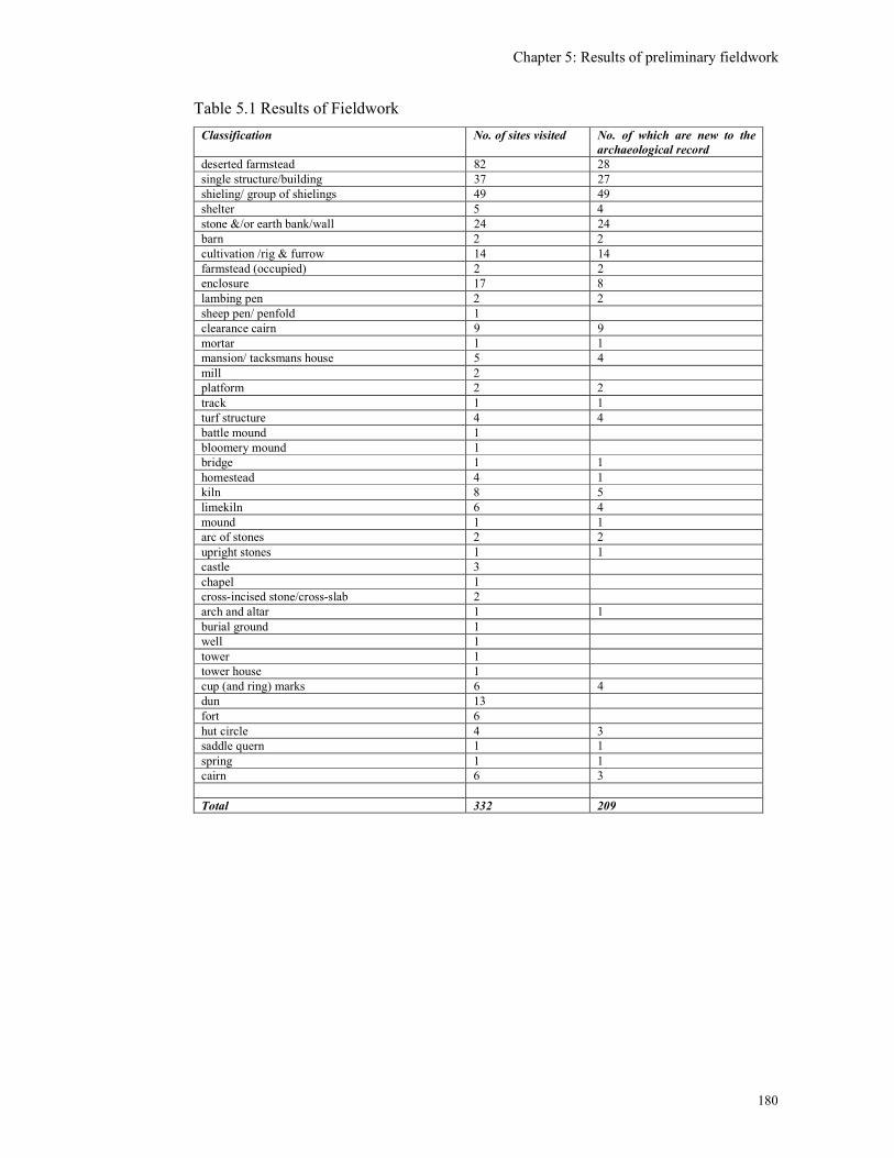
Chapter 5: Results of preliminary fieldwork
180
Table 5.1 Results of Fieldwork
Classification No. of sites visited No. of which are new to the
archaeological record
deserted farmstead 82 28 single structure/building 37 27 shieling/ group of shielings 49 49 shelter 5 4 stone &/or earth bank/wall 24 24 barn 2 2 cultivation /rig & furrow 14 14 farmstead (occupied) 2 2 enclosure 17 8 lambing pen 2 2 sheep pen/ penfold 1 clearance cairn 9 9 mortar 1 1 mansion/ tacksmans house 5 4 mill 2 platform 2 2 track 1 1 turf structure 4 4 battle mound 1 bloomery mound 1 bridge 1 1 homestead 4 1 kiln 8 5 limekiln 6 4 mound 1 1 arc of stones 2 2 upright stones 1 1 castle 3 chapel 1 cross-incised stone/cross-slab 2 arch and altar 1 1 burial ground 1 well 1 tower 1 tower house 1 cup (and ring) marks 6 4 dun 13 fort 6 hut circle 4 3 saddle quern 1 1 spring 1 1 cairn 6 3 Total 332 209
Chapter 5: Results of preliminary fieldwork
181
The number of 19th-century deserted settlements within the parishes under study was
not known when this research started, as this site-type was only just beginning to be
added to the National Monuments Record of Scotland. However, the amateur study by
Begg (1999) had suggested that there were in the region of 129 deserted settlement sites
in the Kilmartin and Kilmichael Glassary parishes alone.
The main aim of this initial fieldwork was to see if there were any signs of structures at
these deserted settlements that could date from the period when Pont was undertaking
his surveys, in the late 16th century. A second aim was to see whether there was any
significant difference in the remains at sites which were depicted by Pont and those
which were not, as this might shed some light on how the settlements had developed.
The third aim was to seek the remains of sites in the vicinity of the deserted settlements.
Finally, it was hoped that a detailed examination of these settlements would assist with
an understanding of rural settlement.
The term ‘deserted settlement’ is used here to include the ruins of what might be
classified as ‘fermtouns’ or ‘townships’ which had been permanent settlements, distinct
from seasonal ‘shielings’ (Bil 1990). The term ‘deserted settlement’ includes all
settlements which have become deserted, and does not differentiate between those that
were cleared in the 18th and 19th centuries and those which have seen occupation within
living memory. Farmsteads are those sites which are still in occupation.
5.2 Survey of deserted settlements
The structures identified at deserted sites served a range of functions within the rural
landscape including houses, house/byres, barns, corn-drying kilns, kilnbarns, wells,
stackyards, sheds, pens and enclosures. The joint-tenancy farms would have had
multiple dwellings, barns and enclosures, although perhaps a single shared kiln. The
term ‘croft’ is one which refers to single-occupancy farms which date from the
Improvement period (the mid-18th century to mid-19th centuries). Shielings functioned
as small temporary dwellings that were occupied seasonally, either occurring alone or in
groups.
Chapter 5: Results of preliminary fieldwork
182
The place-names depicted by Pont were generally found to refer to a wide variety of
sites, such as,
1. occupied 19th-century farmhouses deserted settlements
2. deserted 19th-century fermtouns or townships
3. natural features such as woods, moorlands and hills
4. castles, prehistoric forts, crannogs, medieval churches or burial grounds
5. unlocated sites, or
6. modern villages or re-developments.
Tables 5.2 & 5.3 include the 16th-century place-names as depicted by Pont or Blaeu and
their subsequent spellings as traced through Roy’s Military map and the 1st edition O.S.
maps. Those visited during this research have been given a Site Number, (column 7)
which relates to the site gazetteer (see Appendix 1).
Several of the Pont/Blaeu place-names could not be located on the 1st edition maps and
were subsequently not detected in the field. It is presumed that these late-medieval sites
have become deserted, been amalgamated into single farms or perhaps their names have
changed. The methodology used here of targeting the known sites first has been
successful in identifying the 19th-century deserted settlements, but has not been able to
identify these unnamed sites. One of the results of this research will be a strategy for
dealing with these unlocated place-names.
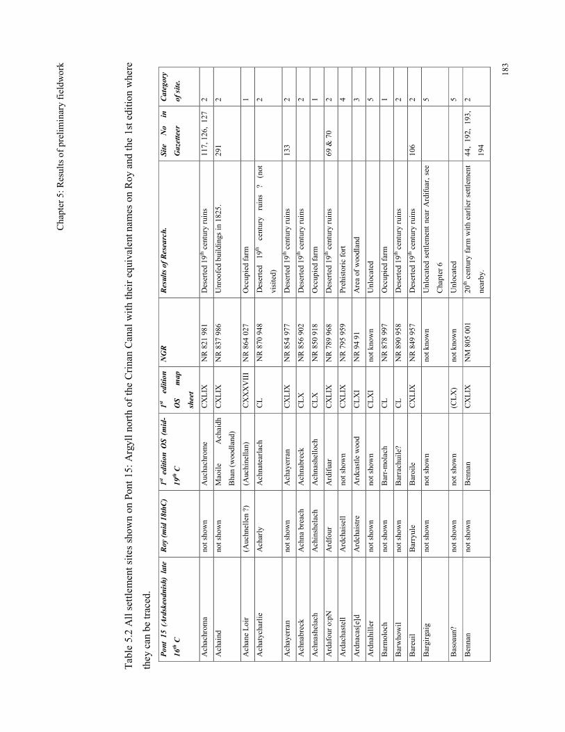
Chap
ter 5: Results of prelim
inary fieldw
ork
183
Table 5.2 All settlem
ent sites show
n on Pont 15: Argyll north of the Crinan Canal with their equivalent nam
es on Roy and the 1st edition where
they can be traced.
Pont 15 (Ardskeodnish) late
16th C
Roy (mid 18thC)
1st edition OS (mid-
19th C
1st edition
OS
map
sheet
NGR
Results of Research.
Site No in
Gazetteer
Category
of site.
Achachrom
a not shown
Auchachrome
CXLIX
NR 821
981
Deserted 19
th century ruins
117, 126, 127
2
Achaind
not shown
Maoile
Achaidh
Bhan (w
oodland)
CXLIX
NR 837
986
Unroofed bu
ildings in 182
5.
291
2
Achane Loir
(Auchnellen ?)
(Auchinellan)
CXXXVIII
NR 864
027
Occup
ied farm
1
Achatycharlie
Acharly
Achnatearlach
CL
NR 870
948
Deserted
19th century
ruins
? (not
visited)
2
Achayerran
not shown
Achayerran
CXLIX
NR 854
977
Deserted 19
th century ruins
133
2
Achnabreck
Achna breach
Achnabreck
CLX
NR 856
902
Deserted 19
th century ruins
2
Achnashelach
Achinshelach
Achnashelloch
CLX
NR 850
918
Occup
ied farm
1
Ardafour o:pN
Ardfour
Ardifuar
CXLIX
NR 789
968
Deserted 19
th century ruins
69 &
70
2
Ardachastell
Ardchaisell
not shown
CXLIX
NR 795
959
Prehistoric fort
4
Ardnacas[e]d
Ardchaistre
Ardcastle wood
CLXI
NR 94 91
Area of woodland
3
Ardnahiller
not shown
not shown
CLXI
not k
nown
Unlocated
5
Barmoloch
not shown
Barr-molach
CL
NR 878
997
Occupied farm
1
Barwhowil
not shown
Barrachuile?
CL
NR 890
958
Deserted 19
th century ruins
2
Bareuil
Barryule
Baroile
CXLIX
NR 849
957
Deserted 19
th century ruins
106
2
Bargirgaig
not shown
not shown
not k
nown
Unlocated settlem
ent near A
rdifuar, see
Chapter 6
5
Basoaun?
not shown
not shown
(CLX)
not k
nown
Unlocated
5
Bennan
not shown
Bennan
CXLIX
NM 805
001
20th century farm w
ith earlier settlement
nearby.
44, 192, 1
93,
194
2
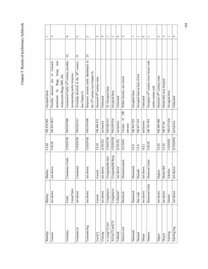
Chap
ter 5: Results of prelim
inary fieldw
ork
184
Blairbuy
Blarbuy
Blarbuy
CLXI
NR 878
889
Occup
ied farm
1
Carnain
not shown
not shown
CXLIX
NR 855
981?
Possibly
deserted site of Carnach,
mention
ed
by
Begg
being
near
Achayerran (B
egg 20
02, 2
0).
2
Carnastre
Castle
Carna[?]aire
Carnassary Castle
CXXXVIII
NM 839
008
Carnasserie Castle 16
th century, p
ossibly
incorporating earlier structure.
22,
4
Carnastre m
not shown
Carnassary
CXXXVIII
NM 838
011
Tow
nship deserted in the 20
th century.
See Chapter 8.
21
2
Carnastre beg
not shown
not shown
CXXXVIII
NM 839
008
Structures around
castle abandoned in
the 19
th century (see Chapter 8).
23
2
Carri[?]
Carrick
Carrick
CLXI
NR 908
872
Deserted 19
th century ruins
2
Claisaig
not shown
not shown
(CXLIX
) not k
nown
Unlocated
5
o: craig[??] Tarf
Craigintarve
Creagantairbh
Mor
CXXXVIII
NM 848
015
25. O
ccupied farm
1
N:Cra[??] tarf[??]
Craigintarve
Creagantairbh
Beag
CXXXVIII
NM 858
016
Occup
ied farm
1
Culkn
uk
Collarack?
not shown
(CXLIX
) not k
nown
Unlocated
5
Derren Loch
Derinloch
Dailaneireanach
(CLXIX
) Vicinity
of
NR
899 93
9
Within forestry, not visited
5
Dunmuck
Dunim
och
Dunam
uck
CLX
NR 843
922
Occup
ied farm
1
Dunnad
Dun Add
Dunadd
CLX
NR 837
935
Occup
ied farm
at b
ase of fort
1
Dunan
not shown
not shown
(CL)
not k
nown
Unlocated
5
Duntruy
Duntroon Castle
Duntroon Castle
CXLIX
NR 793 955
Occup
ied 16
th century tow
er house w
ith
earlier curtain wall.
1
Dupen
not shown
Dup
ern
CLXI
NR 880
900
Deserted 19
th -century ruins
2
Druyin
not shown
Druim
Hill
CLXI
NR 87 88
Druim
Hill, now forested
3
Ederling
Ederlin
Ederline
CXXXIX
NM 873
026
Occup
ied farm
1
Ederling beg
not shown
not shown
(CXXXIX
) not k
nown
Unlocated
5
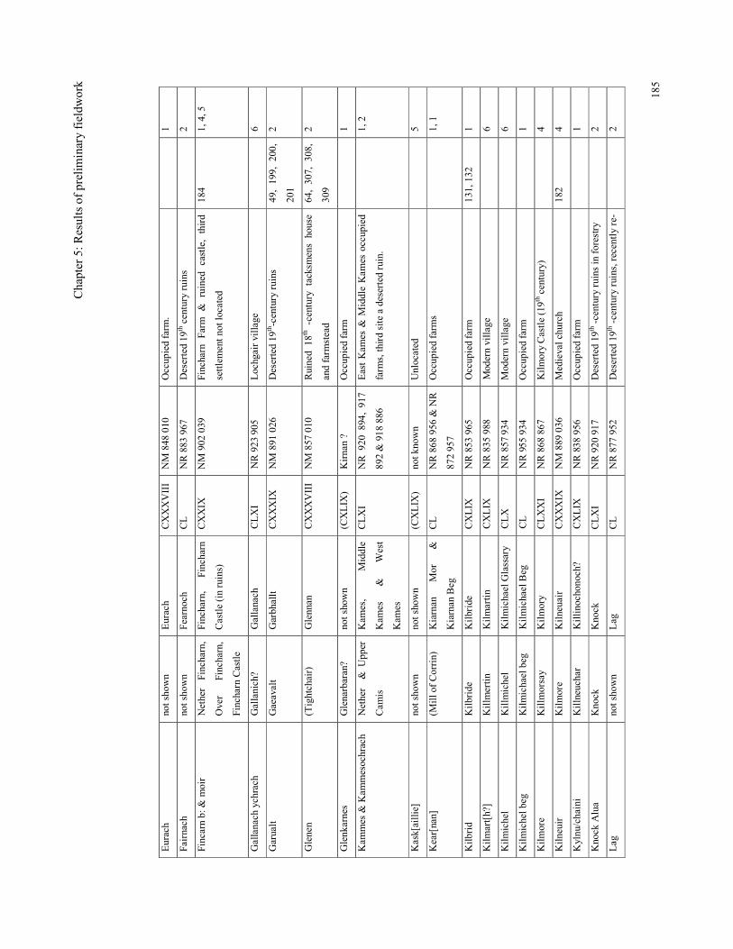
Chap
ter 5: Results of prelim
inary fieldw
ork
185
Eurach
not shown
Eurach
CXXXVIII
NM 848
010
Occup
ied farm
.
1
Fairnach
not shown
Fearnoch
CL
NR 883
967
Deserted 19
th century ruins
2
Fincarn b: &
moir
Nether
Fincharn,
Over
Fincharn,
Fincharn Castle
Fincharn,
Fincharn
Castle (in ruins)
CXXIX
NM 902
039
Fincharn Farm & ruined castle, third
settlement not located
184
1, 4, 5
Gallanach ychrach
Gallanich?
Gallanach
CLXI
NR 923
905
Lochgair village
6
Garualt
Gaeavalt
Garbhallt
CXXXIX
NM 891
026
Deserted 19
th-century ruins
49, 199, 2
00,
201
2
Glenen
(Tightchair)
Glennan
CXXXVIII
NM 857
010
Ruined
18th -century
tacksm
ens house
and farm
stead
64, 307, 3
08,
309
2
Glenk
arnes
Glenarbaran?
not shown
(CXLIX
) Kirnan ?
Occup
ied farm
1
Kam
mes &
Kam
mesochrach
Nether &
Upp
er
Cam
is
Kam
es,
Middle
Kam
es
&
West
Kam
es
CLXI
NR 920
894, 917
892 & 918
886
East Kam
es &
Middle Kam
es occup
ied
farm
s, th
ird site a deserted ruin.
1, 2
Kask[aillie]
not shown
not shown
(CXLIX
) not k
nown
Unlocated
5
Kear[nan]
(Mill o
f Corrin)
Kiarnan
Mor
&
Kiarnan Beg
CL
NR 868
956
& NR
872 95
7
Occup
ied farm
s
1, 1
Kilbrid
Kilbride
Kilbride
CXLIX
NR 853
965
Occup
ied farm
13
1, 132
1
Kilmart[h?]
Killm
ertin
Kilmartin
CXLIX
NR 835
988
Modern village
6
Kilmichel
Killm
ichel
Kilmichael Glassary
CLX
NR 857 934
Modern village
6
Kilmichel b
eg
Kilmichael beg
Kilmichael Beg
CL
NR 955
934
Occup
ied farm
1
Kilmore
Killm
orsay
Kilmory
CLXXI
NR 868
867
Kilmory Castle (19t
h century)
4
Kilneuir
Kilmore
Kilneuair
CXXXIX
NM 889
036
Medieval church
182
4
Kylnu
/chaini
Killneuchar
Killinochon
och?
CXLIX
NR 838
956
Occup
ied farm
1
Knock Alua
Knock
Knock
CLXI
NR 920
917
Deserted 19
th -century ruins in forestry
2
Lag
not shown
Lag
CL
NR 877
952
Deserted 19
th -century ruins, recently re-
2
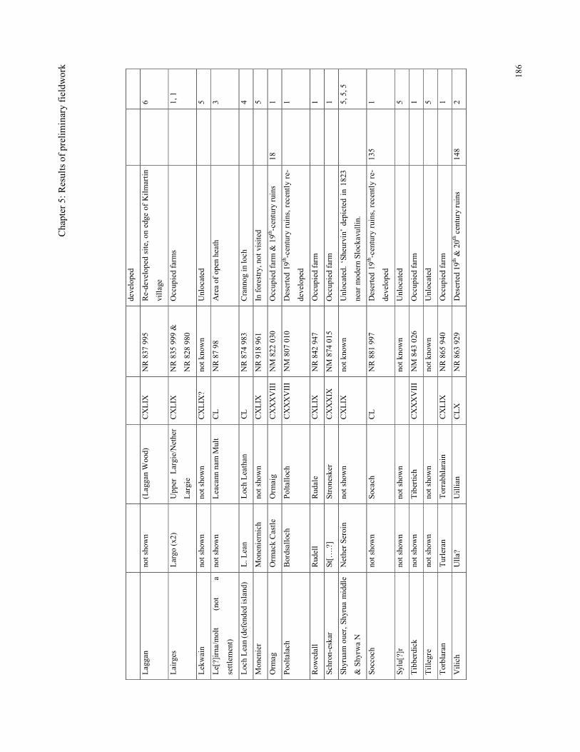
Chap
ter 5: Results of prelim
inary fieldw
ork
186
developed
Laggan
not shown
(Laggan Wood)
CXLIX
NR 837
995
Re-developed site, on edge of K
ilmartin
village
6
Lairges
Largo (x2)
Upp
er Largie/Nether
Largie
CXLIX
NR 835
999 &
NR 828
980
Occup
ied farm
s
1, 1
Lekwain
not shown
not shown
CXLIX
? not k
nown
Unlocated
5
Le[?]irna/m
olt
(not
a
settlement)
not shown
Leacann nam
Mult
CL
NR 87 98
Area of open heath
3
Loch Lean (defended island)
L. L
ean
Loch Leathan
CL
NR 874
983
Crannog in
loch
4
Monenier
Moneniernich
not shown
CXLIX
NR 918
961
In forestry, not visited
5
Orm
ag
Orm
ack Castle
Orm
aig
CXXXVIII
NM 822
030
Occupied farm
& 19th -century ruins
18
1
Pooltalach
Bordsalloch
Poltalloch
CXXXVIII
NM 807
010
Deserted 19
th-century ruins, recently re-
developed
1
Row
edall
Rudell
Rudale
CXLIX
NR 842
947
Occup
ied farm
1
Schron-eskar
St[…
.?]
Stronesker
CXXXIX
NM 874
015
Occup
ied farm
1
Shyruam ouer, Shyrua middle
& Shyrw
a N
Nether Seroin
not shown
CXLIX
not k
nown
Unlocated. ‘Sheurvin’ depicted in 1823
near m
odern Slockavullin.
5, 5, 5
Soccoch
not shown
Socach
CL
NR 881
997
Deserted 19
th-century ruins, recently re-
developed
135
1
Sylu[?]r
not shown
not shown
not k
nown
Unlocated
5
Tibberdick
not shown
Tibertich
CXXXVIII
NM 843
026
Occup
ied farm
1
Tillegre
not shown
not shown
not k
nown
Unlocated
5
Torblaran
Turleran
Torrabh
larain
CXLIX
NR 865
940
Occup
ied farm
1
Vilich
Ulla?
Uillian
CLX
NR 863
929
Deserted 19
th &
20t
h century ruins
148
2
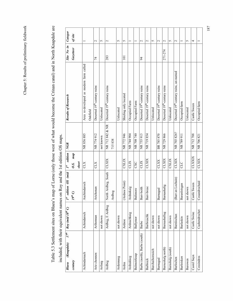
Chap
ter 5: Results of prelim
inary fieldw
ork
187
Table 5.3 Settlem
ent sites on Blaeu’s m
ap of Lorne (o
nly those west of what would becom
e the Crinan canal) and in North Knapdale are
included, w
ith their equivalent nam
es on Roy and the 1st edition OS maps.
Blaeu (Knapdale)
17th
century
Roy (mid 18th C)
1st edition OS (mid
19th C)
1st edition
O.S. map
sheet
NGR
Results of Research
Site No in
Gazetteer
Categor
of site
Achindarnach
Achindaroch
Auchindaroch
CLX
NR 856
885
Area re-develop
ed as mod
ern farm
called
Oakfield
1
Arie chonnen
Arihonnan
Arichonan
CLX
NR 774
912
Deserted 19
th-century ruins
74
2
Ariluig
not shown
not k
nown
Unlocated
5
Ardbeg
Ardbeg, E Ardbeg
North A
rdbeg, South
Ardbeg
CLXIX
NR 712
842 &
NR
715 838
Deserted 19
th-century ruins
283
2
Ardennaeg
not shown
Unlocated
5
Ardna
Ardnoe
(Ardnoe Point)
CXLIX
NR 772
946
Sh
ieling only located
101
5
Ardnakkeg
Ardnachkaig
Ardnakaig
CLIX
NR 744
904
Occup
ied Farm
1
Balmoirknap
Ballymor
Balim
ore
CXC
NR 708
740
Occup
ied Farm
1
Barbe (north), B
arbe (south)
Barbe
Barr-beith
CLIX
NR 755
913
Deserted 19
th-century ruins
94
2
Barbreck
Barbreachk
Barr-breac
CLXIX
NR 719
854
Deserted 19
th-century ruins
2
Barchaihornoich
not shown
Unlocated
5
Barnagad
not shown
Barnagad
CLXX
BR 785
870
Deserted 19
th-century ruins
2
Barneshalg north)
Barnashallag
Barnashalig
CLXIX
NR 729
866
Deserted 19
th-century ruins
271-274
2
Barnshalg (south)
not shown
CXLIX
Unlocated
5
Barlochen
Barnlochan
(Barr an Lochain)
CLXIX
NR 703 826
? Deserted 19
th-century ruins, un-named
2
Barloisken
Barlaskin
Baranloisgan
CLC
NR 789
911
Occup
ied farm
1
Barow
en
not shown
not shown
Unlocated
5
Castel S
uyn
Castle Sw
ine
Castle Sween
CLXXIX
NR 712 788
Castle Sween
4
Cossindros
Cushendrochet
Cosandrochaid
CLXIX
NR 706 821
Occup
ied farm
1
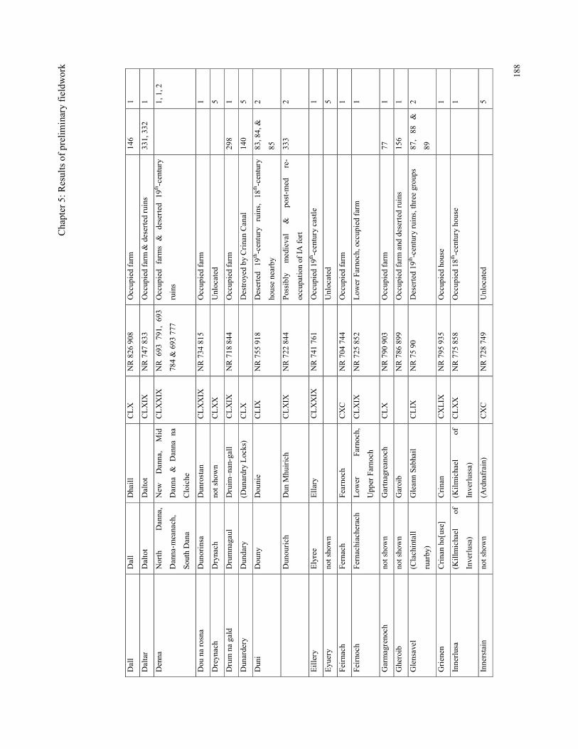
Chap
ter 5: Results of prelim
inary fieldw
ork
188
Dall
Dall
Dhaill
CLX
NR 826
908
Occup
ied farm
14
6 1
Daltar
Daltot
Daltot
CLXIX
NR 747
833
Occup
ied farm
& deserted ruins
331, 332
1
Denna
North
Danna,
Danna-m
eanach,
South Dana
New
Danna,
Mid
Danna & Danna na
Cloiche
CLXXIX
NR 6
93 7
91, 693
784 & 693
777
Occup
ied
farm
s & deserted 19
th-century
ruins
1, 1, 2
Dou na rosna
Dunorinsa
Dunrostan
CLXXIX
NR 734
815
Occup
ied farm
1
Dreynach
Drynach
not shown
CLXX
Unlocated
5
Drum na gald
Drumnagaul
Druim
–nan-gall
CLXIX
NR 718 844
Occup
ied farm
29
8 1
Dunardery
Dundary
(Dunardry Locks)
CLX
Destroyed by Crinan Canal
140
5
Duni
Douny
Dounie
CLIX
NR 755
918
Deserted
19th-century ruins, 18
th-century
house nearby
83, 84, &
85
2
Dunourich
Dun M
huirich
CLXIX
NR 722
844
Possibly
medieval
&
post-m
ed
re-
occupation of IA
fort
333
2
Eillery
Elyree
Ellary
CLXXIX
NR 741
761
Occup
ied 19
th-century castle
1
Eyuery
not shown
Unlocated
5
Feirnach
Fernach
Fearnoch
CXC
NR 704
744
Occup
ied farm
1
Feirnoch
Fernachiacherach
Low
er
Farnoch,
Upp
er Farnoch
CLXIX
NR 725
852
Low
er Farnoch, occup
ied farm
1
Garmagrenoch
not shown
Gartnagreanoch
CLX
NR 790
903
Occup
ied farm
77
1
Gheroib
not shown
Garoib
NR 786
899
Occup
ied farm
and deserted ruins
156
1
Glensavel
(Clachintall
ruarby)
Gleann Sabh
ail
CLIX
NR 75 90
Deserted 19
th-century ruins, three group
s 87
, 88
&
89
2
Grienen
Crinan ho[use]
Crinan
CXLIX
NR 795
935
Occupied house
1
Innerlusa
(Killm
ichael
of
Inverlusa)
(Kilmichael
of
Inverlussa)
CLXX
NR 775
858
Occup
ied 18
th-century house
1
Innerstain
not shown
(Ardnafrain)
CXC
NR 728
749
Unlocated
5
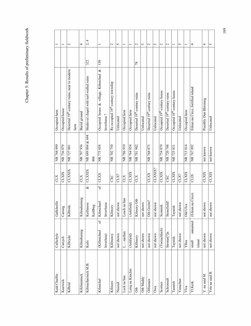
Chap
ter 5: Results of prelim
inary fieldw
ork
189
Kald Chaillie
Callichyle
Gallchoille
CLX
NR 768
899
Occup
ied farm
1
Kasrw
ick
Carsych
Carsaig
CLXIX
NR 736
879
Occup
ied house
1
Kilbrid
Kilbryde
Kilbride
CLXXIX
NR 727
801
Deserted 19
th-century ruins, n
ear to m
odern
farm
2
Kilchum
nack
Kilmahum
ag
Kilmahum
aig
CLX
NR 787
936
Burial g
round
4
Kilmacharm
ick M.B.
Keils
Keillmore
&
Keillbeg
CLXXIX
NR 689
804
& 694
806
Medieval chapel w
ith turf-w
alled ruins
322
2, 4
Kilmichel
(Killm
ichael
of
Inverlusa)
Kilmichael
of
Inverlussa
CLXX
NR 775
858
Occup
ied house & village, Kilmichael &
Inverlussa ?
150
1
Kilmore
Killm
orey
Kilmory
CXC
NR 702
750
Re-occupied 19t
h -century township
2
Naseuil
not shown
not shown
CLX?
Unlocated
5
Leck na ban
L…
.nachan
Leach na ban
CLX
NR 786
919
Occup
ied farm
1
Leirg na Kinchin
(Ashfield)
(Ashfield)
CLXIX
NR 764 854
Occup
ied farm
1
Oib
Killm
ory
Kilmory Oib
CLX
NR 781
902
Deserted 19
th-century ruins
78
2
Oib M
addy
not shown
not shown
Unlocated
5
Oilinenen
not shown
Oib Greim
? CLXX
NR 768
873
Deserted 19
th-century ruins
2
Owa
not shown
not shown
CLXXIX
?
Unlocated
5
Scotnes
(Tornachlach)
Scotnish
CLXIX
NR 754
879
Occup
ied 19
th-century house
2
Schronselt
Stronar[?]n
Ston
efield?
CXC
NR 720
748
Deserted 19
th-century ruins
2
Taonish
Taynish
Taynish
CLXIX
NR 725
831
Occup
ied 18
th-century house
1
Vanachan
not shown
not shown
CLX?
Unlocated
5
Vlva
Ylloa
Old Ulva
CLXIX
NR 713
814
Occup
ied farm
1
Yl.K
erk
small
unnamed
island
(Eilean na Circe)
CLIX
NR 767
892
Eilean na Circe, fortified island
4
Y. na uaid M
. not shown
not shown
CLXIX
not k
nown
Possibly Dun Bhronaig
4
Yrin na uaid B.
not shown
not shown
CLXIX
not k
nown
Unlocated
5
Chapter 5: Results of preliminary fieldwork
190
Architectural features
The following section is a summary of the observations made at the deserted sites
visited (see Figure 5.1). These features include consideration of the distinctive
architectural features encountered, settlement layout and chronology (James 2003).
Architectural features such as doorways, windows, cruck slots, fireplaces and drains
were recorded where visible. When these features were present, then the function of
some of the observed structures could sometimes be suggested, but for many featureless
structures, it would have required intrusive work, such as debris clearance or excavation
before a function could be identified. For example, when fireplaces were present, then a
dwelling could be suggested, however the majority of fireplaces observed were not
original, having been inserted in a later phase. Prior to the 19th century, fireplaces would
have been centrally placed. Inserted fireplaces were usually up against one of the gable
walls and may, in some cases, indicate conversion from an earlier use. Structures where
the fireplace was an original feature were few and included Creaganterve Mansion and
Glennan (see Figures 5.2 & 5.3) which are both thought to be 18th century mansion
houses and therefore of high-status. It is said that dwellings would have had their gable
end towards the prevailing wind, which can also be a clue to the function.
The presence of opposing doorways has been interpreted as evidence for winnowing
barns as seen at Arichonan and Blarantibert (see Figures 5.4 & 5.5). Winnowing barns
would have been orientated across the prevailing winds thus taking advantage of the
draught when both doors were open. However, it has also been noted that an animal
feeding passage between the domestic area and the animal barn of rural houses were a
feature of long-houses in Brittany, which can be also associated with opposing doors
(Meirion-Jones 1973, 1 & 18). Barns also tended to have triangular vents in the walls or
ceramic pipes inserted just below the wall head. Examples of stone-built barns were
also seen at Carnasserie Mor, Ardifuar, Gartnagreanoch and Kilmahumaig croft.
Byres were identified by the presence of an external drain, as at Structure A at Gleann
Sabhail 2 (see Figure 5.6). Gleann Sabhail 2 was a particularly good example of a croft
where all the individual elements of dwelling, byre, winnowing barn, animal pens, kiln
and enclosures could be identified clearly from the visible evidence. Corn-drying kilns
Chapter 5: Results of preliminary fieldwork
191
were often noted at some distance from the main group of structures, and substantial
kilnbarns were noted at Garbhallt (see Figure 5.7), Old Ardifuar, Dounie and
Auchachrome Farmstead West. Secondary features, including blocked windows or
doorways and the insertion of lambing pens, testify to the re-use of the sites, often as
sheep farms or as outhouses in the 19th and 20th centuries.
Layout
Whether the layout of the deserted settlements could be described as ‘clustered’, ‘linear’
or set in a ‘courtyard’ was recorded during the survey. The existence of nucleated
settlements by the 18th century is consistent with what was seen on the old estate plans
of Lix, for example, discussed in Chapter 2. It had been suggested that the linear and
courtyard layouts were a result of the Improvements of the 19th and 20th centuries
(Dalglish 2000) and indeed settlements with these layouts had structures dating to this
period e.g. Bennan with a linear layout (Figures 5.8 & 5.18) and Soccoch as a courtyard
(not illustrated). The layout of other settlements varied greatly, but there was often a
sense of some order. When only two structures were found together these either lay
parallel to each other or were at right angles to each other. When three or more
structures formed a cluster, these generally were aligned either with or across the
contours.
Chronology
As a result of the work described in Chapter 2 and comparisons with what was found in
the field, it has been possible to suggest which architectural features might indicate that
a structure could be ‘early’ (i.e, be pre-18th or 18th century in date). These features
include the use of massive boulders or rough undressed stones in the foundations,
rounded corners forming an oval-shaped structure in plan, low foundation walls
surviving as grass-covered stone or turf banks, structures with a narrow width compared
to length or a central fireplace. Features thought to indicate 19th-century construction or
re-use included the use of faced stone, the presence of lime mortar, integral fireplaces
within gables, square corners and the presence of window frames or other timber
fittings. The use of cruck slots, as a form of roof support, seems to have been retained
until quite a late date, and only when lime-mortared walls were built well enough to
Chapter 5: Results of preliminary fieldwork
192
take the weight of the roof, were they abandoned as a construction method, which is not
thought to have occurred until the mid to late-19th century. The identification of round-
ended structures was hampered by the presence of tumble which often disguised the
shape of the gable end.
Assumptions of age based on the height of structural remains is also not a reliable
criterion. I was informed by a local farmer that some old drystone walls survived better
than more recently built ones because in the drystone construction the builder had relied
on the quality of the stonework, rather than the presence of mortar to hold the structure
together. Once the mortar was washed out the more modern structures fell apart.
The majority of structures examined during this field survey were found to be relatively
late in date (i.e. early-19th century) as they could be identified on the 1st edition OS
maps, often as roofed and therefore, presumably occupied, structures. These 19th-
century structures have a very similar appearance, being single storey, with rectangular
corners, high gable ends (Dalriadic), cruck-slots (Figure 5.9) and external stones (see
Figure 5.10) for attaching ropes to hold down the thatched roof.
5.3 Structures not depicted on the 1st edition OS maps
In order to investigate whether there were remains of potential medieval sites in the
vicinity of the deserted settlements, the layout of deserted settlements in the field were
compared with how they were surveyed for the 1st edition O.S. maps. There were
several settlements where additional structures, not depicted on the 1st edition O.S.
maps, were identified (see Table 5.4). These additional structures could either have been
already ruinous by the mid-19th century or constructed after the O.S. survey. Earlier
dates (i.e. 18th century) could be suggested for a few structures which were less well-
built and constructed of drystone e.g. Carnasserie Mor and Bennan and sometimes as
relict features within later stonework (as at Arichonan). Some other structures were
clearly later in date and were associated with sheep farming or forestry (e.g. a tin shed at
Crinan).
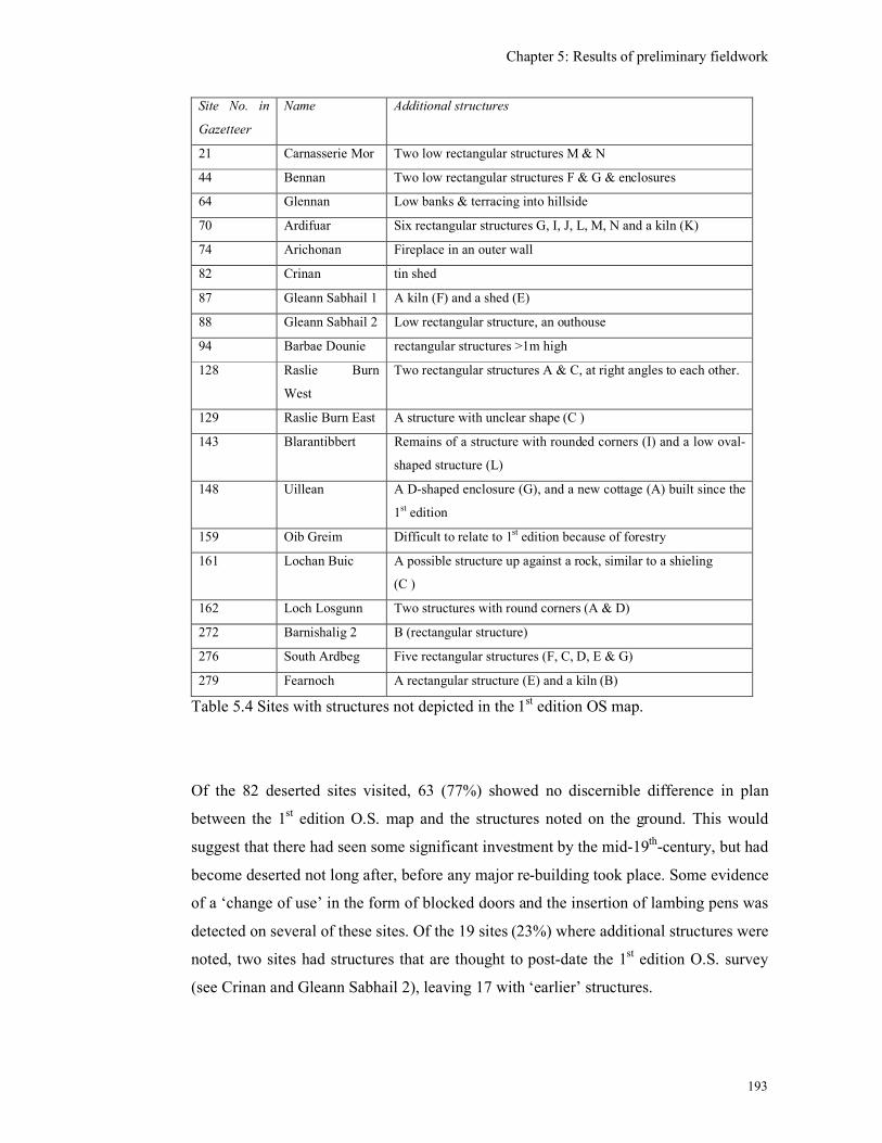
Chapter 5: Results of preliminary fieldwork
193
Site No. in
Gazetteer
Name Additional structures
21 Carnasserie Mor Two low rectangular structures M & N
44 Bennan Two low rectangular structures F & G & enclosures
64 Glennan Low banks & terracing into hillside
70 Ardifuar Six rectangular structures G, I, J, L, M, N and a kiln (K)
74 Arichonan Fireplace in an outer wall
82 Crinan tin shed
87 Gleann Sabhail 1 A kiln (F) and a shed (E)
88 Gleann Sabhail 2 Low rectangular structure, an outhouse
94 Barbae Dounie rectangular structures >1m high
128 Raslie Burn
West
Two rectangular structures A & C, at right angles to each other.
129 Raslie Burn East A structure with unclear shape (C )
143 Blarantibbert Remains of a structure with rounded corners (I) and a low oval-
shaped structure (L)
148 Uillean A D-shaped enclosure (G), and a new cottage (A) built since the
1st edition
159 Oib Greim Difficult to relate to 1st edition because of forestry
161 Lochan Buic A possible structure up against a rock, similar to a shieling
(C )
162 Loch Losgunn Two structures with round corners (A & D)
272 Barnishalig 2 B (rectangular structure)
276 South Ardbeg Five rectangular structures (F, C, D, E & G)
279 Fearnoch A rectangular structure (E) and a kiln (B)
Table 5.4 Sites with structures not depicted in the 1st edition OS map.
Of the 82 deserted sites visited, 63 (77%) showed no discernible difference in plan
between the 1st edition O.S. map and the structures noted on the ground. This would
suggest that there had seen some significant investment by the mid-19th-century, but had
become deserted not long after, before any major re-building took place. Some evidence
of a ‘change of use’ in the form of blocked doors and the insertion of lambing pens was
detected on several of these sites. Of the 19 sites (23%) where additional structures were
noted, two sites had structures that are thought to post-date the 1st edition O.S. survey
(see Crinan and Gleann Sabhail 2), leaving 17 with ‘earlier’ structures.
Chapter 5: Results of preliminary fieldwork
194
Some of the additional structures were kilns, which (given that the general agricultural
trend was moving away from arable farming towards sheep rearing) were unlikely to
have been built after the mid-19th century, It seems likely therefore that kilns were
occasionally excluded from the original O.S. surveys, either because they were not seen
or were not considered significant. These are still probably of 18th and 19th century date.
Some of these additional structures were rectangular in shape and had recognisably
square corners as at Carnasserie Mor (Structures M & N). If these structures belonged to
the late 18th or early 19th centuries, then they must have had a short life-span, as they
must have been ruinous (and not just roofless) by the mid-19th century. Alternatively
they could be earlier, perhaps 17th-century tacksman’s houses. Only two of these
settlements, Blarantibert and Loch Losgunn, included structures with rounded corners.
At Blarantibert, a curving length of wall was incorporated into an enclosure wall (I) and
is thought to be the remains of an oval-shaped structure. There were also low
foundations of an oval-shaped structure (L) which was a possible whisky still. At Loch
Losgunn there were two structures (B & C) with rounded corners and one (A) had two
rounded and two square corners (see (Figure 5.11). Structure D, to the north, was a
short length of curving walling 1m wide. It was thought possible that these structures
are slightly earlier than the square-cornered structures, perhaps being 18th century in
date. In general, the visible morphology of the deserted sites visited displayed very little
evidence of being multi-phased, as the structures were predominantly 19th century in
date, although some possible 17th-or 18th-century structures were suggested. There
seemed to be no sites with the potential for being multi-period as seen at Balmacvicar,
Kintyre (see Chapter 2).
Of the 28 deserted sites which were new to the archaeological record, 11 were not
depicted on the 1st edition O.S. map (see Table 5.5).
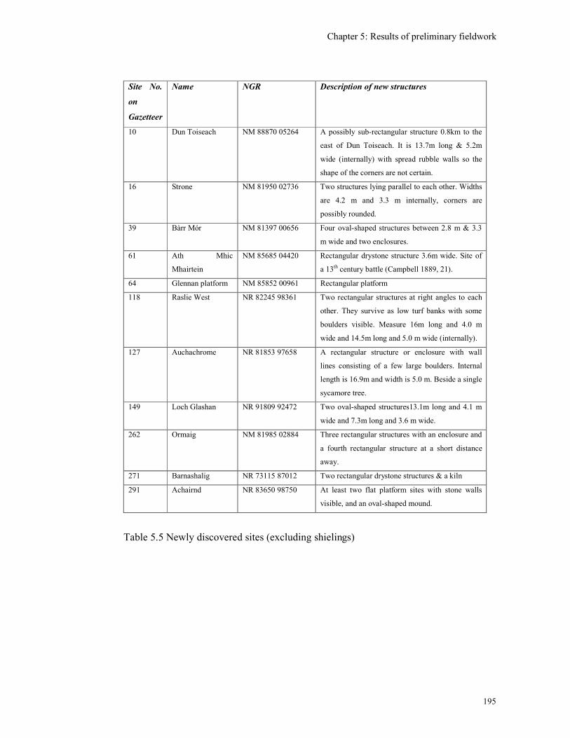
Chapter 5: Results of preliminary fieldwork
195
Site No.
on
Gazetteer
Name NGR Description of new structures
10 Dun Toiseach NM 88870 05264 A possibly sub-rectangular structure 0.8km to the
east of Dun Toiseach. It is 13.7m long & 5.2m
wide (internally) with spread rubble walls so the
shape of the corners are not certain.
16 Strone NM 81950 02736 Two structures lying parallel to each other. Widths
are 4.2 m and 3.3 m internally, corners are
possibly rounded.
39 Bàrr Mór NM 81397 00656 Four oval-shaped structures between 2.8 m & 3.3
m wide and two enclosures.
61 Ath Mhic
Mhairtein
NM 85685 04420 Rectangular drystone structure 3.6m wide. Site of
a 13th century battle (Campbell 1889, 21).
64 Glennan platform NM 85852 00961 Rectangular platform
118 Raslie West NR 82245 98361 Two rectangular structures at right angles to each
other. They survive as low turf banks with some
boulders visible. Measure 16m long and 4.0 m
wide and 14.5m long and 5.0 m wide (internally).
127 Auchachrome NR 81853 97658 A rectangular structure or enclosure with wall
lines consisting of a few large boulders. Internal
length is 16.9m and width is 5.0 m. Beside a single
sycamore tree.
149 Loch Glashan NR 91809 92472 Two oval-shaped structures13.1m long and 4.1 m
wide and 7.3m long and 3.6 m wide.
262 Ormaig NM 81985 02884 Three rectangular structures with an enclosure and
a fourth rectangular structure at a short distance
away.
271 Barnashalig NR 73115 87012 Two rectangular drystone structures & a kiln
291 Achairnd NR 83650 98750 At least two flat platform sites with stone walls
visible, and an oval-shaped mound.
Table 5.5 Newly discovered sites (excluding shielings)
Chapter 5: Results of preliminary fieldwork
196
The new sites included rectangular structures, oval-shaped structures and rectangular
platforms. As mentioned above, even the rectangular-shaped structures have a potential
to be pre-19th century in date. The site at Raslie West (see Figure 5.12) has a traditional
association with a cadet branch of the Campbells and therefore has potential to be a
tacksman’s house perhaps dating to the 17th or 18th centuries. The site at Auchachrome
contains massive boulders in its foundations and may be a large structure or perhaps an
unroofed enclosure. The platform sites are discussed further below.
The oval-shaped structures in Table 5.5 are thought to be potentially late-medieval of
17th century in date. The sites of Strone and Dun Toiseach were ambiguous in shape as
the rounded corners may have been the result of wall collapse (see Figures 5.13 &
5.14). However, two sites, Bàrr Mór (see Figure 5.15) and Loch Glashan (see Figures
5.16 & 5.17), consisted of structures with rubble foundation walls which were clearly
oval-shape and have strong possibility of being medieval or late-medieval in date. Bàrr
Mór, in particular, had walls surviving up to a metre high and was chosen as one of the
case studies for further survey and excavation (see Chapter 6). The remains at Loch
Glashan were extremely low and had been eroded during periods of submersion beneath
the loch when the water level was high, and so was not chosen for further work at this
time. One site was chosen for further historical work to illustrate how an understanding
of the field remains could be enhanced with a more detailed historical background.
5.4 Bennan (Site 44) NGR NM 805 001
The site of ‘Bennan’ is depicted on Pont’s manuscript map and also on Blaeu’s map of
Lorn dated 1663 (see Figure 4.7) and the spelling of Bennan is one of the more
consistent since the late-16th century. On Langland’s map of 1801 the site is named
‘Benan’, but it is not shown on Roy’s map of the mid-18th century, however it returns to
the original spelling of ‘Bennan’ on the 1st edition OS map by the mid-19th century,
where it is depicted as two roofed structures and a well (Argyllshire CXLIX, see Figure
5.18). These structures have been identified in the field as a linear range with an
enclosure and a separate single structure with an annex and two enclosures. The long
range (A, B & C) is characterised by high gable ends, integral fireplaces, chimneys and
the use of cement and mortar, which indicates its fairly recent occupation (see Figure
Chapter 5: Results of preliminary fieldwork
197
5.8). This is confirmed by the record of the last tenant of Bennan dying in 1917 (Begg
1999, 26). Begg interpreted the long range as a dwelling house with a barn and byre
attached and the separate Structure E as a small stable.
What is not shown on the 1st edition OS map are two other structures (F & G) which
were found during this survey, at a distance of 56m to the east (see Figure 5.18). Both
structures were rectangular in shape and Structure F had walls 0.6m high while
Structure G had walls up to 1.1m high. The only architectural features were a possible
central doorway in F and rounded corners at the southern end of G. To the east of
structures F & G there was another large drystone enclosure. If these structures are
interpreted correctly as an earlier focus for the farm of Bennan, perhaps dating to the
18th century, then this could be an example of settlement shift that has taken place over
the past 200 years. The surrounding ground is undulating and bracken-covered with
many rocky outcrops and so is not conducive to the identification of unsubstantial
remains. There are several, such small, well drained sites in the vicinity which could
have been suitable for building and therefore it is thought unlikely that the earliest
settlement would lie beneath the 19th century structures A, B & C.
The earliest documentary references to Bennan found so far are in the Argyll Sasines
that dates from the early-17th century. These references illustrate the different
measurements of land and rent in use at that time and the names of the person granting
the charter and of the recipient. The early sasines show the close relationship between
the cadet branches of the Campbell clan and with the other leading families of the area.
A Sasines of 1621 refers to the ‘20/- land of Bennand in Ariskeodnish’ given on a
charter by Donald Campbell of Duntroon ‘to his beloved cousin’… ‘Archibald
Campbell of Ylanrie’ (Eilean Righ) and signed at Duntroon (No 172, Campbell 1933,
55). In 1632 a sasine refers to the ‘1d land of Bennan’ and the charter is to Duncan
Campbell, now of Duntroon (and heir of Donald Campbell) ‘on a precept of clare
constat by Lord Lorne’ (No 446, Campbell 1934, 141). The use of ‘pennylands’ with
reference to Bennan in the 17th century may be an indication of the use of a pre-Norse
form of land share (Easson 1987, 9; Bangor-Jones 1987, 20). In 1643 the ‘1d land of
Bennan’ (along with other lands and titles) was given to Niall Campbell, son and heir to
Duncan Campbell of Duntroon, on his marriage to Mary, daughter of Hector McNeill of
Taynish (No 232, Campbell 1933, 76).
Chapter 5: Results of preliminary fieldwork
198
In 1658 the ‘20/- land of Bennand’ (only) was given to John McIndeor in Kilchoan, on a
‘ wadset charter to him (price 800 merks)’ by Archibald Campbell of Ellanrie…‘with
consent of Patrick Campbell of Duntroon, the Superior’ (No 381, Campbell 1934, 238).
This wadset charter, or mortgage, is evidence for a lower strata of land administration.
This may have provided an opportunity to introduce new tenants and raise cash at the
same time, but may also have been a continuation of an earlier situation for which we
have no charter evidence, and thus not affecting the situation on the ground.
In 1659 the ‘1d land of Bennan’ was again included among other lands ‘on a charter by
Argyll’ to John Campbell heir of Patrick Campbell of Duntroon (No. 418, Campbell
1934, 154). There is also a reference to the ‘Kaynes, presents and casualties of Bennan,
Barghirgaig and the two Ardifuirs [easter and wester]’ (ibid). In 1661 the reference is to
an ‘annual rent of 48 merks furth of the lands of Bennan’, given to ‘John M’Indeor in
Bennan, on a bond (capital sum 800 merks)’ by Patrick Campbell of Duntroon (No.
1017, Campbell 1934, 334). That John M’Indeor is now ‘in Bennan’ would indicate that
he was the occupant of this farm. Niall M’Indeor, also ‘in Bennan’ (probably a close
relative) acted as a witness. In March 1668 John M’Indeor was still ‘in Bennan’ (No.
1418, Campbell 1934, 460) but by December 1668 a John M’Dow was described as
‘indweller in Bennan’ and there is a ‘sasine of the liferent of the 20/- land of
Bennan…given personally by Angus Campbell, fiar of Bennan’ as part of his marriage
contract to Katherine M’Callum, daughter of Archd. Campbell of Ellanrie (No 1453,
Campbell 1934, 471).
Another documentary source, The List of Rebels dated 1685, provides some further
detail in the name of a tenant as it mentions the confiscation of two cows from ‘Duncan
mc Brain in Bianan’ (MacTavish 1935, 21). With regard to this particular spelling, it
was reported to this author, by a neighouring landowner, that the local pronunciation of
Bennan is ‘Bianan’ with an emphasis on the first ‘a’. In 1715 there is reference to the
deceased John M’Callum in Bennan (Campbell 1916b, 192). By 1775 the tenant of
Bennan was a Duncan Gillies and in 1836 it was Angus Kennedy (Begg 1999, 27 &
28).
The place-name ‘Bennan’ can therefore be traced back to at least the late-16th century.
The structural remains so far identified consist of at least two phases, but they probably
Chapter 5: Results of preliminary fieldwork
199
date no further back than the 18th century. The documentary evidence is relatively
sparse and does not provide any indication of tenants prior to the 18th century, although
the sasines reveal a hierarchy of land administration from the Earls of Argyll, to the
Campbells of Duntroon and then down to their lesser tenants.
Further work in the historical records has subsequently uncovered a reference to a
document dated 1422 which refers to Duncan Campbell of Lochawe and includes the
ten properties of ‘Ayrdechaistol’, ‘Ayrdiefur’, ‘Acha…’ (Achachrom?), ‘Poltaluch’,
‘Beannan’, ‘Balg…’ (Baraltroof), ‘Peulcair’, ‘Culachmuic’, ‘Crenanmore’ and ‘Crenan
beg’ in ‘Ayrdaskondynsche’ (Campbell 1915, 239- 40). Campbell states that this
document was transcribed by Craufurd from an original then in (Campbell of)
Duntroon’s hands. Campbell notes that this is exactly the same order of place-names
that were used in an 18th-century charter and would testify to a high degree of continuity
of landholding by the Campbells from the early 15th to the 18th century. Campbell had
not seen this document for himself, but did not doubt its authenticity. This charter was
not found among the Poltalloch Papers by the archivist at the Lochgilphead archives and
so may be still in the possession of the Malcolms of Poltalloch. It can therefore be
suggested that Bennan was one of a group of farms which was associated in the
medieval period with the ‘Ayrdechaistol’ or Duntroon estate which belonged to one of
the cadet branches of the Campbells from at least the 14th century and from where they
oversaw the rest of the barony of Ardskeodnish (see Chapter 3).
The following section moves on to a consideration of other potentially medieval sites
which were visited during this research, such as shielings, circular enclosures, duns,
forts, castles and tower houses.
Chapter 5: Results of preliminary fieldwork
200
5.5 Shielings
Shielings sites were investigated and recorded during this research because it was
thought that they might provide evidence for medieval settlement that has survived in
the hills, above the head-dykes, away from the low-lying Improved farmland, where
cultivation may have masked the ephemeral remains of earlier settlement.
Shielings were not depicted on early maps until the Improvers estate plans of the 18th
century and even the 1st edition OS maps did not depict shielings as a matter of course.
The more recent maps are beginning to include the location of ‘old shieling’ sites (e.g.
O.S. Explorer Series 358, sites at NGR NM 955 007 & NM 922 014). There were few
shieling sites recorded on the NMRS when this research began, in Kilmartin there were
11 sites, North Knapdale had 3 sites and Kilmichael Glassary had 7 sites. Earlier
researchers had also noted some which had not reached the record, such as a group of
perhaps 17 shielings within loops of the River Add in Gleann Airigh, Kilmichael
Glassary (Campbell & Sandeman 1964). The total number of shielings for Kilmartin
was expanded to 24 by a survey by Regan & Webb (2005). Therefore it was recognised
that there were potentially huge numbers of shielings surviving within the landscape
and, as shown in Chapter 2, these had potential to be medieval in date.
Shielings are small seasonal shelters located near pasture land which are associated with
a pre-Improvement, pastoral way of life, also known as transhumance, practiced
throughout the uplands of Europe (Bil 1990, 1). Transhumance has a long history, back
into the medieval period if not before, as attested by the use of the Norse name ‘saetr
and ‘skali’ in the Northern Isles, introduced prior to the introduction of Gaelic. The
shileings of Caithness and Sutherland were often located on mounds, which suggested
some degree of longevity and re-use (Mercer 1980). It is possible, therefore, that some
shieling sites may have been utilised on a seasonal basis since the medieval period.
Shielings have been shown to be morphologically varied, ranging from substantial sub-
rectangular shaped ‘houses’ to small oval or circular-shaped ‘cells’.
At present the term ‘shieling’ has been used here to describe almost any small, oval,
circular or D-shaped, drystone structure that is located in a remote, rural location. While
some of these may well be shielings proper, i.e. shelters for people, many more may be
recent enclosures, including lambing pens or shepherds shelters. Lambing (or twinning)
Chapter 5: Results of preliminary fieldwork
201
pens are small drystone enclosures, that are circular or oval in shape, the distinguishing
feature being the absence of an entrance. These were used for penning a lamb in with its
mother (or adopted mother) to encourage suckling. They were often found on deserted
settlement sites built into the corner of an old house or barn, presumably because of the
availability of the stone.
During this fieldwork a total of 49 new shielings or groups of shielings were discovered
(of which 32 were measured, see Appendix 2). Many of these were concentrated in the
vicinity of Carnasserie Farm as the owner knew their location and was keen to have
them recorded (see also Chapter 8). The location of these shielings was included in the
database and their shape, dimensions and altitude (where recorded) were noted. Because
the name of the shieling sites was not now known, they were given the name of the
nearest geographical feature and the place-name therefore has little significance.
The open grazed grassland areas of Mid-Argyll proved excellent for site visibility.
Within the forested areas the visibility was varied depending on the age of the trees; the
oldest plantings provided good visibility, because the trees were further apart and the
canopy was above head height, although in some cases the forestry ploughing and
planting had been driven straight through sites. The Forestry Commission are now
actively recording all structures encountered during felling operations and creating a
buffer around them during re-planting so that the identified structures are preserved
within the new planting. The ‘middle-aged’ trees 10-20 years old proved the most
difficult for visibility. Several of the shieling sites were initially identified by the
Forestry Commission during this procedure and had usually been described as
‘structures’.
The newly discovered shielings were predominantly single-celled (see Figure 5.19) and
there were only three examples with visible evidence for a sub-division into two cells,
Corlach, Ardnoe and Barr an Daimh 5. Another example, Bàrr Mór shieling 3 has a
possible annex on one side and a ‘porch’. Unlike the results of a shieling survey of the
Leckan Muir, Kilmichael Glassary (Stott 2002, 60) no multi-phased structures were
found during this survey. No further work was done on these sites at this stage.
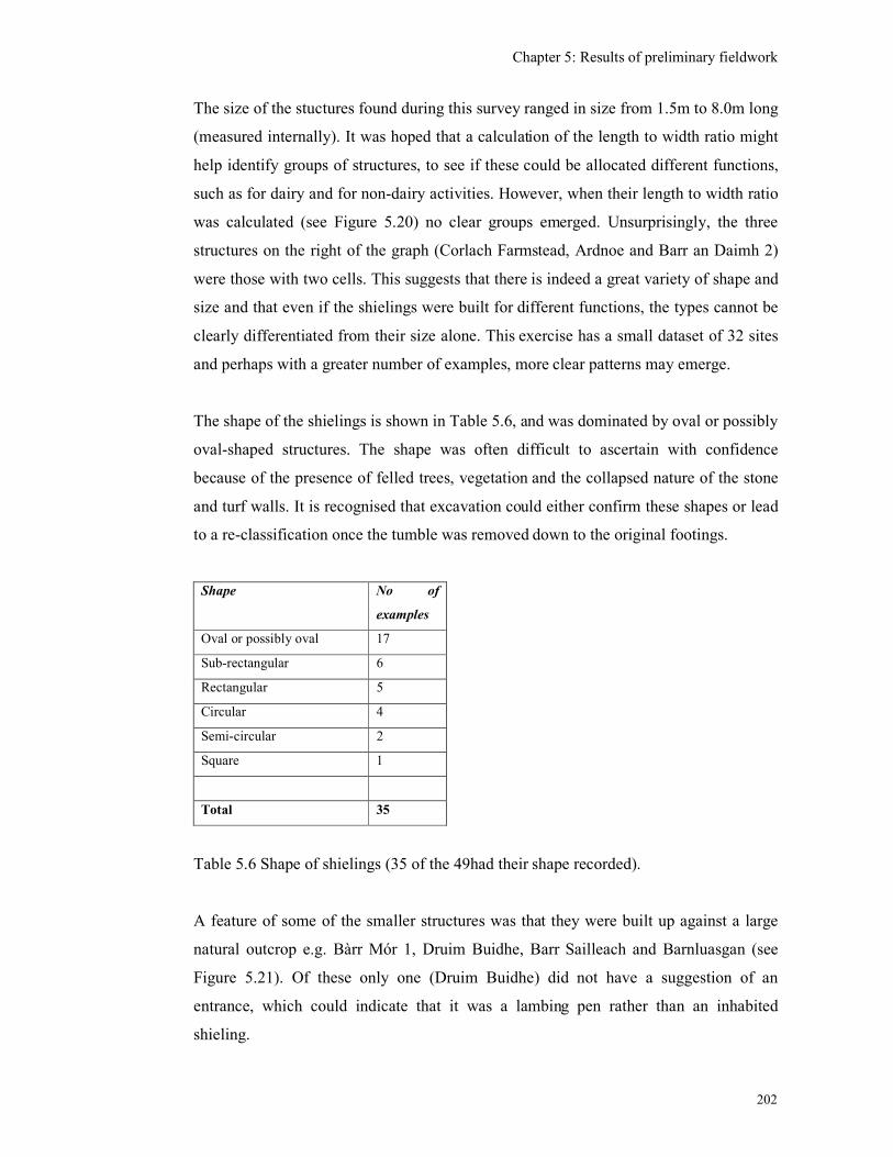
Chapter 5: Results of preliminary fieldwork
202
The size of the stuctures found during this survey ranged in size from 1.5m to 8.0m long
(measured internally). It was hoped that a calculation of the length to width ratio might
help identify groups of structures, to see if these could be allocated different functions,
such as for dairy and for non-dairy activities. However, when their length to width ratio
was calculated (see Figure 5.20) no clear groups emerged. Unsurprisingly, the three
structures on the right of the graph (Corlach Farmstead, Ardnoe and Barr an Daimh 2)
were those with two cells. This suggests that there is indeed a great variety of shape and
size and that even if the shielings were built for different functions, the types cannot be
clearly differentiated from their size alone. This exercise has a small dataset of 32 sites
and perhaps with a greater number of examples, more clear patterns may emerge.
The shape of the shielings is shown in Table 5.6, and was dominated by oval or possibly
oval-shaped structures. The shape was often difficult to ascertain with confidence
because of the presence of felled trees, vegetation and the collapsed nature of the stone
and turf walls. It is recognised that excavation could either confirm these shapes or lead
to a re-classification once the tumble was removed down to the original footings.
Shape No of
examples
Oval or possibly oval 17
Sub-rectangular 6
Rectangular 5
Circular 4
Semi-circular 2
Square 1
Total 35
Table 5.6 Shape of shielings (35 of the 49had their shape recorded).
A feature of some of the smaller structures was that they were built up against a large
natural outcrop e.g. Bàrr Mór 1, Druim Buidhe, Barr Sailleach and Barnluasgan (see
Figure 5.21). Of these only one (Druim Buidhe) did not have a suggestion of an
entrance, which could indicate that it was a lambing pen rather than an inhabited
shieling.
Chapter 5: Results of preliminary fieldwork
203
The majority of structures were only identified because they had a stone element in their
walls, either as low spreads of stones, or as large natural boulders protruding from the
vegetation. This stone probably formed the foundation for the turf and timber
superstructure. A few examples, such as at Garbh Sron (Site 264) had substantial,
battered drystone walls up to 1m high and an oval-shape which were suggestive of a
pre-Improvement blackhouse that may not have used much turf in its construction (see
Figure 5.22).
The altitude at which the shielings were found ranged from 81m to 211m AOD, which
is not high by Highland standards and clearly reflects the relatively low lying nature of
Mid-Argyll. There is a suggestion of two plateaux in the altitude of shielings, at about
150m and just over 200m, but with such a small sample it is not possible to say whether
this is significant (Figure 5.23). Given the topography of Argyll this is likely that the
altitude of sites reflects the nature of the landscape rather than a significant difference in
the use of the landscape. In contrast at Ben Lawers the medieval shieling sites
discovered were at a height of about 320m above AOD, well above any subsequent
cultivation. When a comparison is made between the length/width ratio and altitude,
again no significant pattern is seen (see Figure 5.24). So there was no evidence, for
instance, for a particular shape of structures to be found at a particular altitude.
Some shielings were found in groups of up to six structures as at Lochan an Druim an
Rathaid. Some of the shielings within the groups were the same size and shape. Two out
of the five shielings at Barr an Daimh were circular and both were the same size and
two of the oval-shaped structures were also the same size. At Lochan an Druin an
Rathaid, there were 5 oval-shaped shielings and two are identical in size and two were
similar in size (5m by 2m and 5m by 3m). In general, there seem to be more similarities
within groups of shielings than between groups. Some shielings appeared to be isolated
features such as Ardnoe Shieling and the shelter at Druim Buidhe. However, it should
be borne in mind that in felled forestry, as at Ardnoe for instance, not all the features
may have been visible and this isolation may not be real.
Many of the shielings were sited near cultivated ground in the form of rig and furrow. In
a rocky and boggy landscape such as Mid-Argyll, which does not offer many areas of
extensive arable land, it is assumed that all areas of cultivatable land have had some
Chapter 5: Results of preliminary fieldwork
204
degree of settlement at some time in the past. The present extent of cultivation is much
reduced from the 19th-century level when the population of the countryside was far
greater than it is now and much land was drained and improved. So there are extensive
areas of rig and furrow (outfield) beyond the current cultivated areas. These higher and
more remote areas of cultivation have to a large extent been turned over to rough
grazing and, more recently, to forestry. In the former case cultivation ridges can still be
detected in the landscape, but within the forestry they have often been eradicated by the
forestry ploughing. The location of cultivation is of interest to this research because
where there is cultivation there may also have been settlement, even if only temporary
while the outfields were being tended. However, as mentioned in Chapter 3, much of
this cultivation in the higher ground may belong to the 19th century, some sites may
have been established during the 13th-century warm period.
Four groups of shielings were incorporated within enclosed outfields, at Carnasserie,
Corlach, Kilbride, and Ballibrad. The shielings at Carnasserie (Site 260), which were
incorporated within the enclosure bank, were small and oval-shaped (see Figure 5.25).
We should, however, not assume that all such structures functioned as summer
dwellings as these structures are only 1km from the presumed main settlement of
Carnasserie Mor, are at much the same altitude and may instead have functioned as
stores or even small animal pens, associated with this patch of outfield.
The longevity of structures is thought to be reflected in the size of the mound upon
which it sits, and shieling grounds in other regions have been noted as being more green
than the surrounding land, indicative of occupation deposits (see Chapter 2). However,
none of the shielings noted in this work were located on particularly noticeable mounds,
and the vegetation was not visibly more verdant than the surrounding landscape
(perhaps because the fieldwork took place early in the growing season before any
differentiation in the vegetation would have become noticeable). The wet climate, acid
soil conditions and the absence of sand blow in Mid-Argyll, are not conducive to the
accumulation of occupation deposits which are noted elsewhere in western Scotland.
There may therefore be fewer possibilities for the survival of deep midden deposits
surrounding occupied sites that are seen in the Outer Isles such as the Udal (Crawford &
Switzur 1977) on Gunna (James 1998a) and in Iceland (Simpson et al 2004).
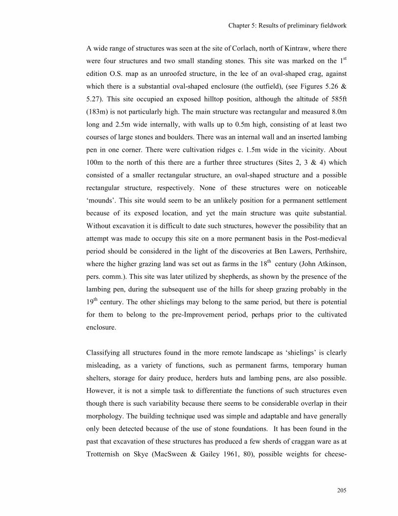
Chapter 5: Results of preliminary fieldwork
205
A wide range of structures was seen at the site of Corlach, north of Kintraw, where there
were four structures and two small standing stones. This site was marked on the 1st
edition O.S. map as an unroofed structure, in the lee of an oval-shaped crag, against
which there is a substantial oval-shaped enclosure (the outfield), (see Figures 5.26 &
5.27). This site occupied an exposed hilltop position, although the altitude of 585ft
(183m) is not particularly high. The main structure was rectangular and measured 8.0m
long and 2.5m wide internally, with walls up to 0.5m high, consisting of at least two
courses of large stones and boulders. There was an internal wall and an inserted lambing
pen in one corner. There were cultivation ridges c. 1.5m wide in the vicinity. About
100m to the north of this there are a further three structures (Sites 2, 3 & 4) which
consisted of a smaller rectangular structure, an oval-shaped structure and a possible
rectangular structure, respectively. None of these structures were on noticeable
‘mounds’. This site would seem to be an unlikely position for a permanent settlement
because of its exposed location, and yet the main structure was quite substantial.
Without excavation it is difficult to date such structures, however the possibility that an
attempt was made to occupy this site on a more permanent basis in the Post-medieval
period should be considered in the light of the discoveries at Ben Lawers, Perthshire,
where the higher grazing land was set out as farms in the 18th century (John Atkinson,
pers. comm.). This site was later utilized by shepherds, as shown by the presence of the
lambing pen, during the subsequent use of the hills for sheep grazing probably in the
19th century. The other shielings may belong to the same period, but there is potential
for them to belong to the pre-Improvement period, perhaps prior to the cultivated
enclosure.
Classifying all structures found in the more remote landscape as ‘shielings’ is clearly
misleading, as a variety of functions, such as permanent farms, temporary human
shelters, storage for dairy produce, herders huts and lambing pens, are also possible.
However, it is not a simple task to differentiate the functions of such structures even
though there is such variability because there seems to be considerable overlap in their
morphology. The building technique used was simple and adaptable and have generally
only been detected because of the use of stone foundations. It has been found in the
past that excavation of these structures has produced a few sherds of craggan ware as at
Trotternish on Skye (MacSween & Gailey 1961, 80), possible weights for cheese-
Chapter 5: Results of preliminary fieldwork
206
making (John Atkinson, pers. comm.) but generally no artefacts which could clarify
their function.
In the 19th century, items noted at an inhabited shieling in the Outer Hebrides were
sparse and consisted of a single blanket, an iron pot, a basin, a spoon, a bag of meal and
some utensils for milk, which the observer noted would have previously been made
from hand-made pottery or craggan ware (Curwen 1938, 276 & 281).
The excavation of a shieling mound in Trotternish on Skye found peat and wood ash, a
stone edged hearth and two sherds of craggan ware (MacSween & Gailey 1961, 80).
There were three main occupation phases ending in the mid-19th century. The
excavation of a turf-banked structure at Kennox in South Lanarkshire, was recently
interpreted as a shieling. Excavation was restricted to the mound itself and produced
only residual Mesolithic flints, although the site was radiocarbon dated to 410-650 AD
(Johnson 2005, 143). The recent excavations of shielings at High Pasture Cave, Skye,
have been more promising in that animal bone, crucible fragments, a smelting hearth
base, a quernstone, fire-cracked stones and some unspecific fragments of pottery were
found in 2007 (Birch 2007). However, the site is known to date back to at least the Iron
Age and so until the radiocarbon dates are returned it is not certain that the finds do not
represent prehistoric activity. Other excavations of 18th-century shielings on Canna have
produced various pieces of pottery, iron and shell at one site and no artefacts or
archaeological layers at all at another (Harden 2004). Where hearths are found then
radiocarbon dating is possible and it might be necessary to look outside the shieling
structure for signs of cooking and other activities.
Shieling structures found during this research probably served a range of functions and
belonged to a wide time period. One would anticipate that the less substantial, smaller
structures, with only slight stone foundations, could be remains of turf and timber
structures which could have been used as temporary occupation during the summer as
part of a small scale transhumance system. These could be of any date. There are also
slightly more substantial structures with battered dry stone walls which resemble
blackhouses (the vernacular houses of the Outer Hebrides), which might represent
medieval settlement or perhaps more permanent settlement of a later phase. Occupying
the same landscape are the structures associated with the more recent economic system
Chapter 5: Results of preliminary fieldwork
207
of sheep farming and cattle herding, such as shepherds and herders bothies and lambing
pens.
To answer the question of whether any of these structures could be evidence for
medieval settlement, one should initially exclude those which are associated with the
19th-century developments, such as the lambing pens and poorly constructed shepherds
shelters. One could then consider the more substantial structures such as the Bàrr Mór
shielings 2 & 3 and the structures on Garbh Sron with their battered walls and oval
shapes which are likely to be the remains of more permanent settlement, perhaps in the
18th century. The site at Corlach is likely to be an example of a farmstead being
established on an old shieling ground, perhaps in the late 18th century. Excavation of
these structures and of the surrounding vicinity could provide evidence for their date
and perhaps identify activities which took place in the vicinity. As there are no shielings
located on a significant mound, it is not possible to immediately point to sites in Mid-
Argyll with potential occupation over a long period of time, but there is a wide variety
of types which could provide a good chronological and morphological framework
5.6 Platform sites
One particular ‘type’ of site which may provide evidence for medieval settlement was
discussed in Chapter 3, is the platform site. Some medieval sites in Wales and Cornwall
were constructed on rectangular platforms dug into a hillside, but did not necessarily
have evidence for any upstanding walls. During this fieldwork, rectangular platforms
were found at two sites. The first one at Glennan was a rectangular-shaped platform
(Site 68) that has been cut into the sloping hillside, just north of a stream, above a Post-
medieval farmstead and tacksmen’s house. The platform measured 6.4m by 2.8m and
was surrounded on the north, east and south sides by a grass-covered bank up to 1.2 m
high, extending overall to 13.3m north-south and 6.8m east-west (see Figure 5.28). This
site was included in a survey as part of the detailed case study of Glennan (see Chapter
7) but no further work took place here. Other explanations, such as a shooting or
feeding stance, should also be kept in mind.
The second platform site was located just south of the village of Kilmartin, on the south
side of the stream within forestry planting. This site (291) was depicted as six unroofed
Chapter 5: Results of preliminary fieldwork
208
structures and three roofed structures on an estate plan of 1825 and was named
‘Auchavin’ (Johnson 1825, see Figure 4.12). As noted in Chapter 4 a site of ‘Achaind’
was noted in this approximate location south of Kilmartin, by Pont in the late-16th
century. When visited during this survey, a track could be identified within the wood,
extending from the main road up the south side of the stream towards the location of the
mill (Figure 4.12). Between this track and the main road, at least two flat platforms,
with occasional structural stones protruding from the vegetation, could be seen. It is
thought probable that these platforms are associated with the structures that were still
roofed at the beginning of the 19th century. The undergrowth here is thick and the
ground surface uneven which may have hampered the identification of other platforms.
This site is thought to have great potential to be the site of a late-medieval settlement as
it was recorded by Pont. Although the forestry may have disturbed some of the
archaeological remains, the site has been free of subsequent cultivation.
5.7 Circular enclosures and large irregular enclosures
The circular enclosure may also have contributed to the medieval landscape as
described in Chapter 2. Within this thesis, the ‘circular enclosures’ are differentiated
from the much larger areas of enclosed cultivation termed ‘irregular-shaped enclosures’
because of their size, shape and probable function. The large irregular shaped enclosures
are likely to be enclosed ‘out-field’ within which cultivation took place, while the
smaller circular enclosures could have been partially roofed and used for habitation or
storage. The circular enclosures are of interest to this research because excavated
examples of circular enclosures elsewhere in Scotland are beginning to provide
evidence for some activity or re-use of these sites in the early-medieval and medieval
period.
In addition to the enclosures already known in Mid-Argyll mentioned in Chapter 2, this
fieldwork has identified two new circular enclosures. One was at Carnasserie (Site 24,
NGR: NM 83473 01291). This is a low, circular earth bank with an internal diameter of
16.7m. Four large upright stones protruded from the bank, unevenly distributed around
its south-eastern side which was similar to the site at Chippermore (Fiddes 1953). The
earth banks at Carnasserie were spread about 1.5m wide and were less than 0.4 m high.
Chapter 5: Results of preliminary fieldwork
209
No entrance could be discerned. This site would traditionally be interpreted as a
prehistoric ‘homestead’, but may have been re-occupied in the medieval period.
The second at Fearnoch (Site 281, NGR: NR 87947 97199) consisted of a substantial
circular-shaped, stone-walled enclosure, with an internal diameter of 16m, with stone
banks to either side, externally. This was, however, interpreted as a 19th century sheep
fank as its walls were in fairly good condition despite the recent forestry planting. An
examination of the aerial photographs of this area taken in 1950 showed that this
enclosure was in fact part of a much larger landscape consisting of five large curvilinear
enclosures, turf banks and other possible structures, in the vicinity of Fearnoch and
Loch Leathan (AP’s 1:10,000 58/A/438 1950, 5070 & 5071, see No 2 on Figure 5.29).
Although now planted with trees, rig and furrow could be seen within the large
curvilinear enclosures on the aerial photographs.
In this case the circular enclosure (281) is indeed thought to be a Post-medieval stock
enclosure, associated with the cultivation of an area of out-field, perhaps contemporary
with a settlement beside the stream (Site 279, No 1 on Figure 5.29). However, the
suggestion that the late-medieval location of ‘Fairnach’ lies to the north-east of Loch
Leathan (see Chapter 4) might mean that one or other of these more northerly
curvilinear enclosures, perhaps of turf rather than stone, pre-dates the 19th century.
Unfortunately, these enclosures lay deep within recent forestry and were not visited.
There are therefore a few circular enclosures (at Carnasserie, Barnakill, Kintraw and at
Ford, see Chapter 2) and perhaps some curvilinear enclosures at Fearnoch, which have
potential for being medieval in date that would be worth investigating in the future. All
the sites mentioned above are fairly low lying and are within reach of cultivated ground
and water. As mentioned in Chapter 2 the circular enclosures could have been re-used in
the medieval landscape within a system of curvilinear enclosures as stock enclosures
providing some protection from wolves or raiders, and were perhaps partly roofed.
5.8 Duns and forts
The re-use of duns and forts in Scotland was explored in Chapter 3 and it was seen that,
where ‘recent’ activity was recognised, the structures ranged from probably temporary
Chapter 5: Results of preliminary fieldwork
210
shieling sites to more substantial stone-built structures and farmsteads with associated
cultivation such as at Bàrr Crom, Cruach a’Bharra, Dùn Beag and Drimnagall
(Appendices 3 & 4). A small number of these duns and forts were visited during this
research and any internal structures which could potentially be medieval or Post-
medieval in date were noted. It is unlikely that medieval and Post-medieval society
differentiated between duns and forts when utilising these sites as their concerns were
probably more associated with the presence of an existing enclosure, a source of
building stone, provision of a vantage point and accessibility to the high grazing
grounds. The following consideration of duns and forts as separate structure types is
merely a convenience as this is the way the archaeological record is organised.
A total of 33 ‘dun’ sites were noted in the Mid-Argyll and Cowal Inventory within the
parishes of Kilmartin, North Knapdale and Kilmichael Glassary (RCAHMS 1988, 169-
197) of which 8 were visited during this research. A total of 19 ‘forts’ were noted by the
Royal Commission and 3 were visited during this research (RCAHMS 1988, 143-169).
The tables in Appendices 3 and 4 identify where the Royal Commission had identified
such ‘recent’ or modern activity and includes the results of the field visits.
Of the 34 dun sites, 14 (41%) had some evidence for later activity in the form of rough
drystone structures which have been interpreted as herdsmen’s shelters, shielings and
animal pens. Of the 18 forts, 9 (50%) have some evidence for either ‘recent’ structures
or possible platforms for timber structures. Those sites that have been excavated have
not produced any clear evidence for medieval settlement and the artefacts retrieved are
undiagnostic, but could date from the prehistoric to the medieval period. The visits
undertaken as part of this research did not reveal any further evidence for re-use, and
instead noted less surviving remains than were seen by either Campbell and Sanderson
(1964) or the Royal Commission. At Dùn Beag, Drimnagall, for instance there was no
surviving evidence for the collapsed structure, flint pebbles, shells or bone that were
seen in 1960. This emphasises the fragile nature of midden deposits once exposed to the
Argyll climate.
The dating of these rough drystone structures found within the duns and forts is difficult
to ascertain from their surface morphology alone. Because of their rough construction
they have tended to be interpreted as structures associated with Post-medieval sheep
Chapter 5: Results of preliminary fieldwork
211
farming. It is possible these stone-built structures are indeed all Post-medieval,
however, the duns and forts would also have been available for use in the medieval
period. The duns and forts would have provided good vantage points for monitoring
movements across the landscape, passing warnings back to the local inhabitants if
danger was approaching, or animals straying into a neighbours territory. The place-
name Achadh Cnoc na Faire (= ‘field of the lookout hillock’ (Appendix 3), would
support the idea of these hill-top duns being used in this way.
There are a few sites where the evidence for medieval occupation is more convincing as
at Dùn Mhuirich, North Knapdale (NR78SW3) for example. This dun was clearly re-
occupied with the construction of two substantial rectangular-shaped drystone structures
within the dun and possibly two other structures outside which could be medieval or
late-medieval in date (see Figure 2.66). This dun is unusual in that it has ‘considerable
natural strength’ as well as a coastal location (RCAHMS 1988, 189-90). It lies near to
the road to Keills chapel and the old cattle crossing to Jura, which has probably
contributed to its re-use, in contrast to the other more inaccessible, inland hilltop duns.
The place-name suggests that the site is associated in some way with the MacMhuirich
clan who were the hereditary bards for the Clan Donald, the Lords of the Isles
(Boardman 2006, 209) and were an important family on Colonsay and Oronsay
(RCAHMS 1984, 32). It is possible that the site was used as a fortified house during the
period of the Lords of the Isles and was subsequently taken over by the MacNeills, as
there is documentary evidence in the mid-16th century when Neill MacNeill of Taynish
is referred to as ‘of Dunworich’ in a charter of 1553 (SRO, GD 437/7). The site is not
depicted by Blaeu, but Roy’s map of the area depicts ‘Dunourich’. This site is
potentially one of the most significant medieval sites in the research area because of the
presence of potentially medieval structures and a possible association with a known
medieval clan.
The early-medieval royal site of Dunadd has rectangular foundations on one of the
lower terraces (Area F, see Figure 2.63 & 2.64) and the excavations produced medieval
mammal bones suggesting that feasting was taking place on the summit (Lane &
Campbell 2000). This site also has documentary evidence for its use as a high-status
meeting point in the late-medieval period. Despite its significance during the medieval
period, there was no other artefactual evidence for medieval activity found during the
Chapter 5: Results of preliminary fieldwork
212
excavations. This is perhaps related to the nature of its use as an open air meeting place,
where tents perhaps were erected but otherwise no substantial constructions were
required. Pont’s map (Figure 4.4) gives the impression of a settlement at the top of
Dunadd and yet this has left no trace. It is perhaps more likely that the MacLachlan
residence was the foot of the hill, possibly on the east or north sides where Post-
medieval settlement was located (see Figure 2.65; Crinan Canal Plan (Rennie 1792)).
If low lying, and possibly coastal, duns are the most likely ones to be re-used as
medieval fortified dwellings, then other examples in similar locations are worthy of
investigation, despite there being no visible evidence at present. Such sites include Dùn
Beag and Dùn na Doide (North Knapdale), although their proximity to Castle Sween
may have influenced whether they were re-used in the medieval period. Another small
dun site, re-discovered in 1998 at Trevenek (NR89NW 129) near Slockavullin in the
Kilmartin valley, would fulfill the criteria of being low-lying and with good access to
the Kilmartin valley, although there are no visible features in the interior (Abernethy
1998).
While there are a significant number of duns and forts to which ‘later’ structures
(consisting of level platforms and rough drystone structures) have been added, the
majority of these structures could well prove to be Post-medieval in date when
population pressure was at its height. However, it is thought probable that such sites
could also have been utilised as high-status sites in the early-medieval period, but were
abandoned as such towards the end of the early-medieval period. Re-use of these hill
top sites was perhaps as stock enclosures in times of danger, as look-out posts or as
refuges for the people whose only defence against an invading army would be to flee to
the hills. So far, excavations of such sites have produced very little clearly medieval
material, which could well be related to the use of organic building materials, a paucity
of material culture and a lack of radiocarbon dates.
5.9 Land boundaries
The remains of drystone dykes are extremely common features of the Mid-Argyll
landscape and date to the period of the Improvements of the 19th century when farmland
and pasture was enclosed. These drystone dykes are usually marked on the 1st edition
Chapter 5: Results of preliminary fieldwork
213
OS map. However, during the survey, several substantial earth and stone banks were
also encountered, snaking across the countryside, sometimes following similar lines to
the drystone dykes and sometimes not. These earth and stone banks are earlier than the
drystone dykes and are often not depicted on the 1st edition O.S. map. These are thought
to date to the 18th and early 19th centuries. Some may be head-dykes, constructed to
separate the cultivated in-field from the moorland and the out-field (Bil 1990, 58). As
mentioned in Chapter 4, there was little need to enclose estates prior to the 18th century
and apart from the head-dyke and the enclosed out-field, the hills and the cultivated in-
field were left unenclosed.
The earth and stone banks have not been systematically surveyed as part of this
research, but have been included in the more detailed case studies where appropriate. It
is acknowledged that these features should be considered when studying the medieval
landscape as some could be features of greater antiquity than the 18th century, being
either head dykes or enclosing areas of out-field.
In general, the types of land boundaries observed in Mid-Argyll were not as varied as
those seen during the survey of Barra, where eight types of boundary were identified
(Branigan 2005, 27). Excluding the modern wire fences, there were two types in Mid-
Argyll, the drystone dyke and the earth and stone banks. No attempt has been made to
differentiate different types of drystone bank as these are all Post-medieval. The earth
and stone banks varied in height, from low remnants (perhaps only 0.3m high) to
massive banks as seen at Carnasserie, where one length was up to 1.5m high and spread
up to 3m wide. This particular bank is shown on the 1st edition OS, map where it is
marking the boundary between the improved grassland to the east (probably equivalent
to the infield) and the unimproved hill ground to the west (the outfield). Given the
proximity and importance of Carnasserie Castle in the late-medieval period, it is
possible that this bank relates to the development of this estate and could well be the
medieval head dyke. More systematic surveying and dating of such earthen banks
around all the settlements, as well as mapping the properties and areas of pasture, bog
and moorland within the landscape would be a huge task, but could help to understand
the layout, extent and development of the medieval and Post-medieval landscape.
Chapter 5: Results of preliminary fieldwork
214
5.10 Possible medieval tower houses
While this thesis is primarily concerned with the lower status sites, the location of the
castles and tower houses is also being considered because of their role as the
administration centres for the rural estates and the fact that they are often the only sites
with significant historical records prior to the 17th century. Castles were usually located
at strategic positions commanding good access to the sea or to inland lochs reflecting
the use of seaways and lochs as the most important means of communication in the
medieval period. The castles of Castle Sween, Duntrune, Fincharn, Innis Chonnel,
Carnasserie, and Duntrune have been discussed briefly in Chapter 3 and Carnasserie is
discussed further in Chapter 8. This research has also highlighted that there are other
possible castles or hall houses in the landscape.
The ruins of what is interpreted as a ‘fortified dwelling’, possibly a tower house was
surveyed and described by the Royal Commission at Caol Chaoruinn, Torran
(RCAHMS 1992, 214). This site lies at the west end of Loch Awe, on the north shore, a
site which would have controlled access between Loch Awe and the Kilmartin glen.
Nearby is an Iron Age and possibly early-medieval dun, Dun Toiseach (=dun of the
chief, see Appendix 3). Fragments of substantial upstanding walls protrude from a knoll
in an otherwise fairly flat field (see Figure 5.30). It is thought to consist of two, or
possibly three, rectangular structures, probably of different builds, forming a
substantial, roughly rectangular building. The castle’s full extent was difficult to
ascertain because it has been covered with field clearance stones.
There are no historical references to a castle located here, but there are a few references
to the local farm name, Torran. The land of ‘Meikill Torrane’ was granted by the
Campbell Earl of Argyll to Sir John Campbell of Calder in 1529 and it was sold by John
Campbell of Inverliever in 1574 (RCAHMS 1992, 214) and there are mid-17th century
sasines referring to ‘Torranbeg in the Lordship of Lochawe’ (Campbell 1933, 79 &
149). The List of Rebels 1685 (MacTavish 1935) includes three occupants of Torranmor
(John Campbell, Dougall Buchanan, and Malcolm Mc gilichurin) and three at
Torranbeg (Hugh Campbell, Alexr Campbell and Ard mc Ferson), (MacTavish 1935,
8). The Hearth Tax of 1694 refers to the lands of ‘Torran beg’ being ‘all wastages’
while ‘Toranmore’ has three households each with a single hearth. There is no Pont or
Chapter 5: Results of preliminary fieldwork
215
Blaeu map for this area, the earliest map being Roy’s map of the mid-18th century which
depicts ‘Torran Mor’ with six structures, ‘Torran beg’ with four and no sign of a
structure at the site of the castle. The area where the loch narrows is named
‘Culcharraig’ which becomes ‘Caol Chaoruinn’ on the 1st edition OS map from which
the Royal Commission have presumably taken the name for the castle (see Figure 5.31).
It is unusual that such a substantial structure should have no historical references to it
and one can surmise that it had ceased to be a significant residence prior to the 16th
century, by which time the two settlements of Torran mor and Torran beg had become
established. This area could have been part of the lands granted to Gillascop
MacGilchrist in the mid-13th century, with his stronghold at Fincharn (see Chapter 3).
When Colin Iongantach (Campbell) extended his personal lordship in the mid-14th
century, perhaps one of the cadet branches built this castle at the west end of the Loch.
The Battle of Flodden in 1513 saw an end to several of the Campbell cadet branches
and allied clan chiefs and their lands would probably have been taken over by surviving
Campbell clan leaders, whose main residences were elsewhere. Perhaps the occupants
of the castle perished at Flodden and the site was amalgamated into another Campbell
estate. This would seem to be consistent with the lands of Torran being in the hands of
the Campbell Earl of Argyll by the beginning of the 16th century.
A geophysical survey was carried out in the vicinity of Caol Chaoruinn in order to see
whether there was any evidence for settlement close to the castle. This survey consisted
of a resistivity and magnetometer surveys of a flat area on the landward side of the
castle (see Figures 5.32 & 5.33, Poller 2004). The anomalies in the magnetometer
survey were interpreted as reflecting the underlying geology, however the anomalies in
the resistivity survey were interpreted as follows,
C & D - natural geology
E & F - possible wall lines
G - cultivation ridges or field drains.
So the geophysical survey, unfortunately, did not reveal any evidence for settlement in
the vicinity of the castle. However this site remains a significant site for the medieval
Chapter 5: Results of preliminary fieldwork
216
period as it is probably a high-status residence belonging to a narrow chronological
period from the mid-14th to the early 16th century.
The only other possibly medieval ‘tower’ is the site of Barnasload Plantation (NR89NW
92, Site 125), located on a ridge overlooking the Kilmartin Glen, but this site was
obscured by dense vegetation and old tree stumps and was difficult to survey. It
appeared to be rectangular in shape, measuring about 7.4m wide and 17m long, with
low turf-covered stone walls up to 0.4 m high and spread about 1.5m wide. No structure
was depicted on the 1st edition O.S. map and so it is thought to be potentially medieval
in date.
Two other sites were referred to as castles but were more likely to be Post-medieval
mansion houses. Roy’s map of the mid-18th century, depicts ‘Ormack Castle’ to the
north-west of Kilmartin village. This site is marked as ‘Ormag’ by Pont but there is no
indication that there was a castle here, nor has any documentary evidence surfaced
which suggests that there was a castle at Ormaig. It is thought more likely that this was
instead a substantial 17th or 18th century mansion house which was demolished in the
20th century to make way for the present modern bungalow, although the 19th-century
steading still survives.
The ‘site of’ a castle at Loch Gair is depicted on the 1st edition O.S. map (Argyllshire
CLXI). This was the principal residence for the Campbells of Auchenbreck, which was
possibly built in the 17th century (RCAHMS 1992, 24, 295 & 320). A sundial dated
1695 has the initials of Sir Duncan Campbell of Auchenbreck and his wife Lady
Henrietta Lindsay who were married in 1679. The house was substantial as it was taxed
for 55 windows in 1748, but was demolished by the late-18th century. There is no
suggestion that this house replaced a castle on the same site as Pont depicts ‘Loch gher’,
the sea loch and a settlement of Loch Gherr, and the symbol depicts a settlement rather
than a castle.
5.11 Places of assembly and inauguration
Within a sparsely distributed, and possibly transient, population, clan cohesion could be
reinforced through known and repeatedly used places of assembly associated with
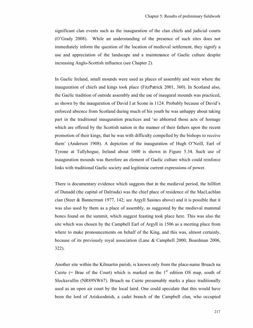
Chapter 5: Results of preliminary fieldwork
217
significant clan events such as the inauguration of the clan chiefs and judicial courts
(O’Grady 2008). While an understanding of the presence of such sites does not
immediately inform the question of the location of medieval settlement, they signify a
use and appreciation of the landscape and a maintenance of Gaelic culture despite
increasing Anglo-Scottish influence (see Chapter 2).
In Gaelic Ireland, small mounds were used as places of assembly and were where the
inauguration of chiefs and kings took place (FitzPatrick 2001, 360). In Scotland also,
the Gaelic tradition of outside assembly and the use of inaugural mounds was practiced,
as shown by the inauguration of David I at Scone in 1124. Probably because of David’s
enforced absence from Scotland during much of his youth he was unhappy about taking
part in the traditional inauguration practices and ‘so abhorred those acts of homage
which are offered by the Scottish nation in the manner of their fathers upon the recent
promotion of their kings, that he was with difficulty compelled by the bishops to receive
them’ (Anderson 1908). A depiction of the inauguration of Hugh O’Neill, Earl of
Tyrone at Tullyhogue, Ireland about 1600 is shown in Figure 5.34. Such use of
inauguration mounds was therefore an element of Gaelic culture which could reinforce
links with traditional Gaelic society and legitimise current expressions of power.
There is documentary evidence which suggests that in the medieval period, the hillfort
of Dunadd (the capital of Dalriada) was the chief place of residence of the MacLachlan
clan (Steer & Bannerman 1977, 142; see Argyll Sasines above) and it is possible that it
was also used by them as a place of assembly, as suggested by the medieval mammal
bones found on the summit, which suggest feasting took place here. This was also the
site which was chosen by the Campbell Earl of Argyll in 1506 as a meeting place from
where to make pronouncements on behalf of the King, and this was, almost certainly,
because of its previously royal association (Lane & Campbell 2000; Boardman 2006,
322).
Another site within the Kilmartin parish, is known only from the place-name Bruach na
Cuirte (= Brae of the Court) which is marked on the 1st edition OS map, south of
Slockavullin (NR89NW67). Bruach na Cuirte presumably marks a place traditionally
used as an open air court by the local laird. One could speculate that this would have
been the lord of Ariskeodnish, a cadet branch of the Campbell clan, who occupied
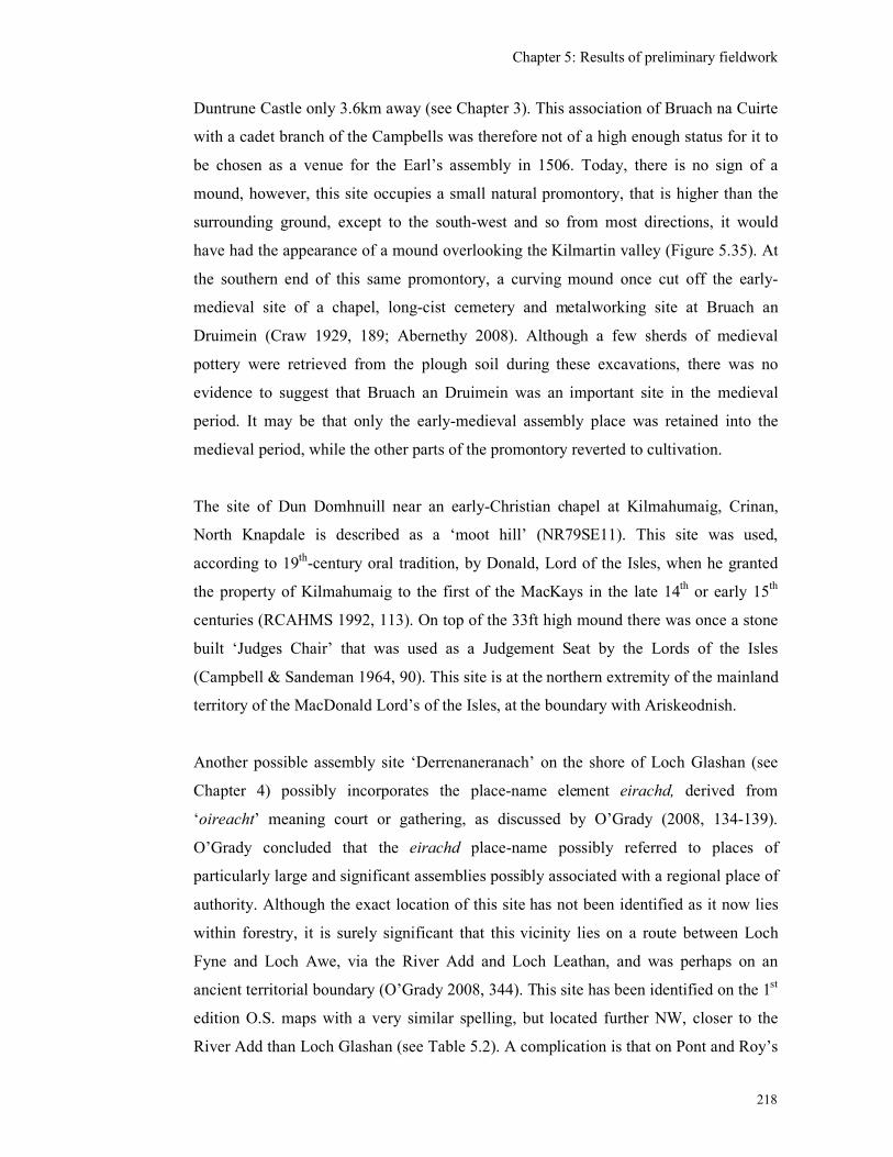
Chapter 5: Results of preliminary fieldwork
218
Duntrune Castle only 3.6km away (see Chapter 3). This association of Bruach na Cuirte
with a cadet branch of the Campbells was therefore not of a high enough status for it to
be chosen as a venue for the Earl’s assembly in 1506. Today, there is no sign of a
mound, however, this site occupies a small natural promontory, that is higher than the
surrounding ground, except to the south-west and so from most directions, it would
have had the appearance of a mound overlooking the Kilmartin valley (Figure 5.35). At
the southern end of this same promontory, a curving mound once cut off the early-
medieval site of a chapel, long-cist cemetery and metalworking site at Bruach an
Druimein (Craw 1929, 189; Abernethy 2008). Although a few sherds of medieval
pottery were retrieved from the plough soil during these excavations, there was no
evidence to suggest that Bruach an Druimein was an important site in the medieval
period. It may be that only the early-medieval assembly place was retained into the
medieval period, while the other parts of the promontory reverted to cultivation.
The site of Dun Domhnuill near an early-Christian chapel at Kilmahumaig, Crinan,
North Knapdale is described as a ‘moot hill’ (NR79SE11). This site was used,
according to 19th-century oral tradition, by Donald, Lord of the Isles, when he granted
the property of Kilmahumaig to the first of the MacKays in the late 14th or early 15th
centuries (RCAHMS 1992, 113). On top of the 33ft high mound there was once a stone
built ‘Judges Chair’ that was used as a Judgement Seat by the Lords of the Isles
(Campbell & Sandeman 1964, 90). This site is at the northern extremity of the mainland
territory of the MacDonald Lord’s of the Isles, at the boundary with Ariskeodnish.
Another possible assembly site ‘Derrenaneranach’ on the shore of Loch Glashan (see
Chapter 4) possibly incorporates the place-name element eirachd, derived from
‘oireacht’ meaning court or gathering, as discussed by O’Grady (2008, 134-139).
O’Grady concluded that the eirachd place-name possibly referred to places of
particularly large and significant assemblies possibly associated with a regional place of
authority. Although the exact location of this site has not been identified as it now lies
within forestry, it is surely significant that this vicinity lies on a route between Loch
Fyne and Loch Awe, via the River Add and Loch Leathan, and was perhaps on an
ancient territorial boundary (O’Grady 2008, 344). This site has been identified on the 1st
edition O.S. maps with a very similar spelling, but located further NW, closer to the
River Add than Loch Glashan (see Table 5.2). A complication is that on Pont and Roy’s
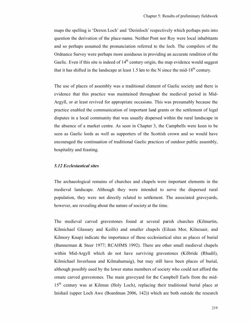
Chapter 5: Results of preliminary fieldwork
219
maps the spelling is ‘Derren Loch’ and ‘Derinloch’ respectively which perhaps puts into
question the derivation of the place-name. Neither Pont nor Roy were local inhabitants
and so perhaps assumed the pronunciation referred to the loch. The compilers of the
Ordnance Survey were perhaps more assiduous in providing an accurate rendition of the
Gaelic. Even if this site is indeed of 14th century origin, the map evidence would suggest
that it has shifted in the landscape at least 1.5 km to the N since the mid-18th century.
The use of places of assembly was a traditional element of Gaelic society and there is
evidence that this practice was maintained throughout the medieval period in Mid-
Argyll, or at least revived for appropriate occasions. This was presumably because the
practice enabled the communication of important land grants or the settlement of legal
disputes in a local community that was usually dispersed within the rural landscape in
the absence of a market centre. As seen in Chapter 3, the Campbells were keen to be
seen as Gaelic lords as well as supporters of the Scottish crown and so would have
encouraged the continuation of traditional Gaelic practices of outdoor public assembly,
hospitality and feasting.
5.12 Ecclesiastical sites
The archaeological remains of churches and chapels were important elements in the
medieval landscape. Although they were intended to serve the dispersed rural
population, they were not directly related to settlement. The associated graveyards,
however, are revealing about the nature of society at the time.
The medieval carved gravestones found at several parish churches (Kilmartin,
Kilmichael Glassary and Keills) and smaller chapels (Eilean Mor, Kilneuair, and
Kilmory Knap) indicate the importance of these ecclesiastical sites as places of burial
(Bannerman & Steer 1977; RCAHMS 1992). There are other small medieval chapels
within Mid-Argyll which do not have surviving gravestones (Kilbride (Rhudil),
Kilmichael Inverlussa and Kilmahumaig), but may still have been places of burial,
although possibly used by the lower status members of society who could not afford the
ornate carved gravestones. The main graveyard for the Campbell Earls from the mid-
15th century was at Kilmun (Holy Loch), replacing their traditional burial place at
Inishail (upper Loch Awe (Boardman 2006, 142)) which are both outside the research
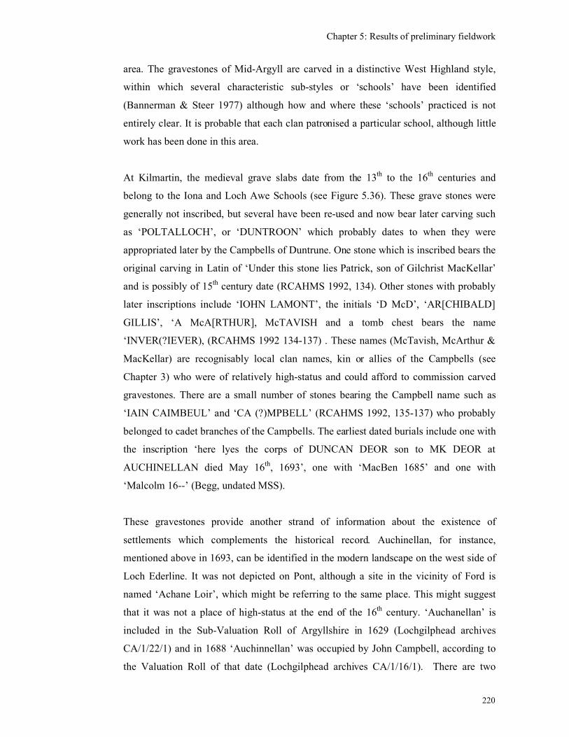
Chapter 5: Results of preliminary fieldwork
220
area. The gravestones of Mid-Argyll are carved in a distinctive West Highland style,
within which several characteristic sub-styles or ‘schools’ have been identified
(Bannerman & Steer 1977) although how and where these ‘schools’ practiced is not
entirely clear. It is probable that each clan patronised a particular school, although little
work has been done in this area.
At Kilmartin, the medieval grave slabs date from the 13th to the 16th centuries and
belong to the Iona and Loch Awe Schools (see Figure 5.36). These grave stones were
generally not inscribed, but several have been re-used and now bear later carving such
as ‘POLTALLOCH’, or ‘DUNTROON’ which probably dates to when they were
appropriated later by the Campbells of Duntrune. One stone which is inscribed bears the
original carving in Latin of ‘Under this stone lies Patrick, son of Gilchrist MacKellar’
and is possibly of 15th century date (RCAHMS 1992, 134). Other stones with probably
later inscriptions include ‘IOHN LAMONT’, the initials ‘D McD’, ‘AR[CHIBALD]
GILLIS’, ‘A McA[RTHUR], McTAVISH and a tomb chest bears the name
‘INVER(?IEVER), (RCAHMS 1992 134-137) . These names (McTavish, McArthur &
MacKellar) are recognisably local clan names, kin or allies of the Campbells (see
Chapter 3) who were of relatively high-status and could afford to commission carved
gravestones. There are a small number of stones bearing the Campbell name such as
‘IAIN CAIMBEUL’ and ‘CA (?)MPBELL’ (RCAHMS 1992, 135-137) who probably
belonged to cadet branches of the Campbells. The earliest dated burials include one with
the inscription ‘here lyes the corps of DUNCAN DEOR son to MK DEOR at
AUCHINELLAN died May 16th, 1693’, one with ‘MacBen 1685’ and one with
‘Malcolm 16--’ (Begg, undated MSS).
These gravestones provide another strand of information about the existence of
settlements which complements the historical record. Auchinellan, for instance,
mentioned above in 1693, can be identified in the modern landscape on the west side of
Loch Ederline. It was not depicted on Pont, although a site in the vicinity of Ford is
named ‘Achane Loir’, which might be referring to the same place. This might suggest
that it was not a place of high-status at the end of the 16th century. ‘Auchanellan’ is
included in the Sub-Valuation Roll of Argyllshire in 1629 (Lochgilphead archives
CA/1/22/1) and in 1688 ‘Auchinnellan’ was occupied by John Campbell, according to
the Valuation Roll of that date (Lochgilphead archives CA/1/16/1). There are two

Chapter 5: Results of preliminary fieldwork
221
clusters of houses seemingly called ‘Auchnellan’ depicted by Roy in the mid-18th
century. Perhaps this is an example of a site only acquiring a relatively high-status in
the 17th century.
Kilmartin parish church was a significant place for burial in the medieval period, but
there is no evidence that there was a settlement attached to it prior to the 17th century.
The earliest reference to a settlement is dated 1627 which refers to ‘all the tenements, as
well houses as gardens, of the town called the Clachan of Kilmartein in Ardskeonis’
(Innes 1854, 94). The 1694 Hearth Tax entry for what is probably Kilmartin (see Table
4.1) records 6 households each with a single hearth and two households each with two
hearths (one of which would have been the minister in Kilmartin Castle). At Kilneuair,
which was the parish church for Glassary until the 16th century, there are grave slabs of
the Loch Awe School, depicting swords and knights, but none with inscriptions. Pont
depicts a site at ‘Kilneuir’ but with no cross presumably because it was no longer the
parish church. There was a Post-medieval township and market there (Campbell 1916b,
352) although Roy’s map and the 1st edition O.S. map do not reflect this. The
foundations for four rectangular structures just outside the church enclosure have,
however, been identified in the field (RCAHMS 1992, 186) but were not found during
this research perhaps due to the dense undergrowth in the vicinity.
At the parish church of Kilmichael Glassary there are similar undated, unnamed grave
slabs of the Loch Awe School (RCAHMS 1992, 143-149). There are a few amongst
them with original inscriptions, such as (in translation from the Latin) ‘Here lies
Alexander MacIver of Kirnan’. Alexander’s son John McIver held Kirnan in 1570 and
so this gravestone is likely to date to the mid-16th century. This site is depicted on Pont
as ‘Kear[nan]’. Another has the inscription ‘Here lies Duncan Roy, son of Alan
MacLachlan, thane of …’. Duncan Roy was a witness to charters in 1511 and 1533 and
his father Alan MacLachlan of Dunadd, was the ‘thoisseachdeowra’ of Glassary, here
translated into the Latin as ‘THA[N]E’. By the late 17th century the inscriptions are
written in English eg ‘HEIR LYES DONALD / McGILKCHRIST CLER/K TO S(IR)
D(?UNCAN) C(AMPBELL) OF AUCHE/NBRECK WHO DEID /13 JULY 1672 /
AND PHINGUEL ST/EUART HIS SPOUS WHO DIED APP(RIL) 1688’. The
MacGilchrists, once the most significant landowners in the area, have now become mere
Chapter 5: Results of preliminary fieldwork
222
clerks to the Campbells, although could still afford to have gravestones carved for
themselves.
At Keills, the parish church for Knapdale, there are graves slabs of a variety of
‘Schools’ including the Iona, Loch Awe, Loch Sween and Kintyre schools (Bannerman
& Steer 1977) which perhaps reflects wider territorial connections, but they tend not to
include a settlement name which would confirm this. One bears the inscription in Latin
translated as ‘Here lies Cormac MacPhedran’ and is thought to be 15th century in date
(RCAHMS 1992, 90). Another bears the inscription ‘Here lies John, son of Cristinus,
and Aithbheac, daughter of Molmalmi’ and is dated to the 14th or15th centuries. Another
has the inscription ‘…Ó Cuinn had me made’ and ‘Here lie….Alan, his son’ dated to
the 15th century (RCAHMS 1992, 91). An early 16th-century inscription is translated
from the Latin as ‘here lies Torquil, son of Malcolm, son of Neil…’ is thought to be
referring to the grandson of Neill, keeper of Castle. Another possibly 15th-century slab
has the inscription ‘NINIANV[S] (possibly ‘Ninian’ or ‘Niven’). These names would
seem to have been predominantly Gaelic, referring to members of the local powerful
clans and were translated into Latin for the inscriptions.
At Kilmory Knap there are several decorated grave slabs in a range of styles including
the Iona, Loch Awe, Kintyre and Loch Sween schools (RCAHMS 1992, 164-172) along
with two freestanding crosses. One is inscribed with ‘This is the cross of Alexander
MacMillan’ which refers to the keeper of Castle Sween for the Lord of the Isles before
1481. The symbolism on the MacMillan cross reflects the preoccupations of the
aristocracy, a crucifixion and sword on one side and a hunting scene with a huntsman
and battle-axe on the other. Another cross is marked with a Latin inscription ‘This is
the cross made by Duncan for himself and his father Colinus (?Malcolm) MacMillan’
possibly of early 16th-century date. This cross bears a mounted horseman with a spear.
The male-dominated, military nature of society in Mid-Argyll is reflected in these grave
slabs as many depict swords, or fully armoured warriors. The galley is also a common
decoration, a symbol of the power and importance of the sea to the Lords of the Isles
(Figure 5.37 & 5.38). Only occasionally were ecclesiastics depicted and very few
women are represented or mentioned, one of the few being Mariota de Ros, Lady of the
Isles’ on a cross on Eilean Mor dated to the early 15th-century (RCAHMS 1992, 73).
Chapter 5: Results of preliminary fieldwork
223
The symbolism displayed on the grave slabs also reflects high-status occupations and
preoccupations. The slab made by Ó Cuinn at Keills bears several symbols, including a
sword, a harp, a casket, a comb, shears, a mirror and a winged griffon. The symbols are
generally signifiers of high-status, the sword representing a warrior, the harp being
associated with the display of Gaelic musical culture and the casket was possibly a
money chest or charter container. The griffon is also common in medieval heraldry.
The comb and shears are perhaps associated with wool and cloth making, which could
have been an important source of income. One 14th or 15th century cross-shaft also at
Keills bears an inscription translated as ‘Cristinus the smith, son of Celestinus Macicui,
caused this cross to be made’ (RCAHMS 1992, 93). Smithying was a high-status
occupation and many clans supported their own smith who would have been responsible
for weaponry and armour.
Clearly in the medieval period churches and chapels were places of burial as well as for
administering spiritually to the parishioners. There is, however, no evidence that these
churches and chapels were the focus for settlement until after the Reformation, perhaps
after the church lands were appropriated by the secular lords.
The distinctiveness of the carved grave slabs emphasises the cultural differences
between the Gaelic west and the Anglo-Scottish Lowland style which was supported by
Sir Duncan Campbell for the effigies if himself and his wife at Kilmun (Figure 5.39,
Boardman 2006, Plate 3). This shows that while the most senior member of Argyll
society sought to identify himself in the mid-15th century with Lowland Scottish society,
the other Gaelic families of the west were happy to retain their own local distinctive
style, perhaps reflecting the distinctiveness of their Gaelic, rural, militaristic society as a
whole.
5.13 Conclusions from preliminary fieldwork
This research has identified a number of medieval or late-medieval place-names and has
linked many of these with what are probably later incarnations of these settlements. At
some sites there are the slight remains of structures which have the potential to be of
medieval date. In general, there seems to be little evidence in Mid-Argyll area for multi-
period settlements or shielings, perhaps because of a combination of the severe
Chapter 5: Results of preliminary fieldwork
224
destruction of the 17th century, the extent of the 19th century cultivation which has
obscured earlier remains and the availability of alternative sites enabling settlement
shift.
In general, the preliminary fieldwork has shown that the landscape is far more
‘occupied’ than the present archaeological record would suggest. As discussed in
Chapters 2 and 3, the land outside the extent of the taxed farmstead or township was
extensively utilised for seasonal grazing of dairy cows, beef cattle, horses and goats.
The land was not enclosed apart from a head dyke above the settlement and perhaps
earthen dykes to protect outfield cultivation from the stock. People moved across this
landscape on a daily and seasonal basis, bringing milk, cheese and butter back to the
main settlements.
The coastal strip and river terraces above the boggy valley bottoms are likely to have
been the focus for arable farming and settlement throughout the medieval period. With
the Improvements and drainage of peatlands in the Post-medieval period, cultivation
would have become more intense and have extended across the drained valley bottoms
and up into the surrounding hills. This extension of cultivation will have affected the
survival of medieval settlements and the best remains are likely to be found above the
‘high tide’ of 19th-century cultivation and there may be small areas below this line in
which medieval remains have not been affected. The impermanent medieval structures
made from organic materials will have decayed and been recycled and yet there may be
surviving evidence for sub-surface features such as hearths and middens, occupation
deposits and perhaps even remains of turf or stone-built foundations, which could be
detected though detailed field walking, geophysics and excavation.
The methodology used here, consisting of the examination of the historic maps,
documents and place-names and extensive fieldwork has shown that the significant farm
properties, which formed the basis for taxation, have displayed both continuity and
change. Some farms became the sites for Post-medieval tacksmen’s houses and are still
occupied as contemporary farms, while some single-tenanted farms and joint-tenancy
farms were deserted in the 19th century. A few potentially medieval sites have been
identified. Some sites had disappeared by the end of the 16th century, perhaps
Chapter 5: Results of preliminary fieldwork
225
amalgamated into other properties or abandoned after the plague and some other sites
did not disappear until the 19th century.
Although the farm names can be documented, there is still little that can be said about
the makeup of these settlements prior to the records of the 17th century. Whether the
tenant farmers lived with their paid labourers is not known, but the suggestion from an
Irish comparison would be that the labourers lived in separate settlements in the vicinity
(Barry 1988 350) which have generally not been noted. The significant farms were
occupied by an average of four households by the 17th century, as shown by the Hearth
Tax, which provides an indication of the size and density of settlement and the presence
of higher status families with more than one hearth.
Several changes can be seen to the upper echelons of society from the medieval period
to the 17th century. Initially, the area was dominated by the major clans from their
castles of Innis Chonnel, Castle Sween and Dunstaffnage. Smaller castles and hall-
houses were constructed by either cadet branches of the Campbells e.g. Duntroon or by
allied clan chiefs directly from the crown, as at Fincharn from the 13th century onwards.
Prior to this it is still assumed that some low-lying early-medieval and prehistoric sites
such as duns, crannogs and islands were still used by the clan chiefs as their strongholds
and the majority of the population would have continued to occupy the valley sides and
coastal strips. There was no impetus in Mid-Argyll for the establishment of market
centres and the population remained predominantly dispersed, dependent on agriculture
and fishing. The large castles were gradually taken over by the Campbells who moved
the centre of their Earldom east to Inveraray. The castles in Mid-Argyll were then held
for the Earls, by constables or kinsmen on their behalf and occupied as strongholds.
There is also evidence that the duns, crannogs and islands were still used as lightly
fortified strongholds by clan chiefs, well into the 17th century.
As a result of this research, four case studies were chosen for examination in more detail
utilising topographic survey, geophysics, aerial photography and excavation, enhanced
by further historic research where appropriate. These were designed to be on a variety
of scales, from the site specific to a wider landscape.
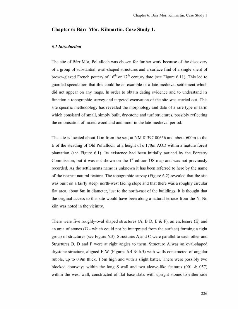
Chapter 6: Bàrr Mór, Kilmartin. Case Study 1
226
Chapter 6: Bàrr Mór, Kilmartin. Case Study 1.
6.1 Introduction
The site of Bàrr Mór, Poltalloch was chosen for further work because of the discovery
of a group of substantial, oval-shaped structures and a surface find of a single sherd of
brown-glazed French pottery of 16th
or 17th
century date (see Figure 6.11). This led to
guarded speculation that this could be an example of a late-medieval settlement which
did not appear on any maps. In order to obtain dating evidence and to understand its
function a topographic survey and targeted excavation of the site was carried out. This
site specific methodology has revealed the morphology and date of a rare type of farm
which consisted of small, simply built, dry-stone and turf structures, possibly reflecting
the colonisation of mixed woodland and moor in the late-medieval period.
The site is located about 1km from the sea, at NM 81397 00656 and about 600m to the
E of the steading of Old Poltalloch, at a height of c 170m AOD within a mature forest
plantation (see Figure 6.1). Its existence had been initially noticed by the Forestry
Commission, but it was not shown on the 1st edition OS map and was not previously
recorded. As the settlements name is unknown it has been referred to here by the name
of the nearest natural feature. The topographic survey (Figure 6.2) revealed that the site
was built on a fairly steep, north-west facing slope and that there was a roughly circular
flat area, about 8m in diameter, just to the north-east of the buildings. It is thought that
the original access to this site would have been along a natural terrace from the N. No
kiln was noted in the vicinity.
There were five roughly-oval shaped structures (A, B D, E & F), an enclosure (E) and
an area of stones (G - which could not be interpreted from the surface) forming a tight
group of structures (see Figure 6.3). Structures A and C were parallel to each other and
Structures B, D and F were at right angles to them. Structure A was an oval-shaped
drystone structure, aligned E-W (Figures 6.4 & 6.5) with walls constructed of angular
rubble, up to 0.9m thick, 1.5m high and with a slight batter. There were possibly two
blocked doorways within the long S wall and two alcove-like features (001 & 057)
within the west wall, constructed of flat base slabs with upright stones to either side
Chapter 6: Bàrr Mór, Kilmartin. Case Study 1
227
which had both partly collapsed. Structure B was aligned N-S on a slightly higher
terrace than Structure A (see Figures 6.6). The walls were about 0.7m wide and up to
0.7m high. There was a gap in the wall in the south-west corner of the west wall and a
single ‘alcove’ could be seen in the NW corner of this structure (025). Although the side
stones of the alcove extended through the entire width of the wall, as in feature (057)
the back of the alcove was blocked by smaller stones, which were thought to be
primary. Structure C was a sub-rectangular shaped structure with rounded corners, and
walls 0.7m wide and up to 1.3m high. Because the walls were topped with flat coping
stones, unlike A & B, this structure was interpreted in the field as a stock enclosure with
an entrance in the north wall. However the coping stones may have been associated with
a secondary use of the structure, and it may have also originally been a dwelling. The
west end of the enclosure had been built over by Structure F. Structure D was an oval-
shaped structure with walls spread over 1m wide and up to 1m high. There was an
entrance in the NE wall and a lambing pen had been constructed within the southern
half of the structure. Structure E was another enclosure, the wall of which abutted
Structure C on its southern side. Its walls were 0.7m thick and up to 1.5m high. There
were two entrances, one to the north, which had been partially blocked with secondary
walling and another to the east. Structure F was also an oval-shaped structure which had
been divided into three rooms of unequal size, each with a doorway to the east.
Structure G was mostly low tumble and after some clearing of vegetation, a substantial
drain with a lintel stone at its northern end was exposed. Given the limited resources of
the project it was decided to examine the two structures A & B and excavate two test
trenches, one within Structure E and another outside the site to the north-east.
6.2 The Results of the Excavation
Structure A.
The details of the excavation have been reported as a Data Structure Report and are
summarised here (James 2004a). Because of the deep rubble (007) that infilled the
eastern part of Structure A and the presence of a lambing pen in the north-east corner,
only the western half of the structure was excavated. Here, two roughly constructed
dividing walls (003 & 005) created two separate compartments with very rough faces to
either side.
Chapter 6: Bàrr Mór, Kilmartin. Case Study 1
228
Within the west room a clay floor was sealed by a series of orange ash and clay lenses
(contexts 016 and 048), (Figure 6.7). The only finds were a single piece of slag and an
unidentifiable mammal bone. The orange coloured ash deposit (016) was initially
interpreted by this author as peat ash, however the botanical analysis revealed that the
presence of carbonised heather type stems and roots indicated burned, below ground,
turves (Miller & Ramsay 2005). This ash also contained significant amounts of
carbonised cereal grains, chaff and arable weed seeds. The grains included hulled six-
row barley, oats, along with oat and barley chaff. There were also small quantities of
flax, weed seeds (including marigold) corn spurry, nipplewort and ribwort plantain,
which are all characteristic of fertile arable land. The hearth deposit (048) contained a
similar assemblage of charcoal to 016, plus hazelnut shells and carbonised brown
seaweed. This suggests that wild food was being collected for consumption, locally
available wood collected for fuel and perhaps seaweed was being burnt. Above this was
a small informal hearth abutting the southern wall, containing patches of charcoal and a
single piece of undiagnostic flint. Three radiocarbon dates from the hearth layers 016,
048 and 043 (see Table 6.1 and Figure 6.8) are all mid-15th
to mid-17th
century AD (at 2
sigma) in date, thus confirming the late-medieval date for the occupation of this
structure. These layers were sealed by a mid-brown silty soil, thought to represent the
collapse of a turf roof, which contained three iron objects, including a small ball, a flat
object and a fragment of a hook (see Figure 6.9). This material was sealed by tumble
about 0.3m deep.
The middle room in Structure A was diamond shaped, formed by short lengths of
straight walls. The lowest layer exposed here was an unburnt peaty material which was
interpreted as either a peat store or as the remains of the collapsed roofing material. It
was sealed by tumble, probably from the internal walls. A second phase of occupation
was indicated by a small informal hearth that overlay this tumble in one corner and was
sealed by further tumble.
The walls of Structure A would have been about 1.5m high all the way round, forming
an oval-shaped building. The two ‘alcoves’ in the south-west corner are similar to
storage alcoves seen in shielings in Lewis (Miller 1967, Plate VII) and Perthshire
(Atkinson et al 2004, 18) and could have been used for storing milk products. However,
they could also have served a structural purpose as they were located in the corners and
Chapter 6: Bàrr Mór, Kilmartin. Case Study 1
229
on the main axis of the end walls. They could have been the bases for sloping timbers
for a hip-ended roof of the ‘Skye’ type discussed in Chapter 3. To have acted as such
supports one would expect matching slots at the other end of the building, which were
not seen possibly as a result of wall collapse.
Structure B
As there was less tumble within Structure B the whole structure could be excavated (see
Figure 6.6). The outer drystone wall was again oval-shaped in plan but survived here to
a maximum height of only 0.7m. The long north-west facing wall had collapsed and it
was not clear if there was a single door, or two, one into each of the two rooms. A very
rough, low, dividing wall separated the structure into two roughly equal rooms,
although its presence would not preclude a connecting doorway. A single ‘alcove’ was
seen in the north corner, the base of which was only about 0.3m above the floor level
and no back stone survived. Within the northern room the uneven, sloping bedrock was
infilled with a brown peaty soil (040) which contained charcoal and carbonsied cereal
grains, including oat and barley chaff, various arable weed seeds and flax, which was
very similar to the assemblage from context 016 in Structure A. A hearth deposit (050)
contained peat ash and charcoal. A layer of rough cobble stones sealed this infill across
the western (lower) side of the compartment (see Figure 6.10).
On the eastern side the floor had been levelled up with mottled grey brown silt and a
small, flat, fire-reddened stone was set into the floor. This hearth was surrounded by a
peaty soil with patches of charcoal and orange peat (033). A second sherd of 16th
/17th
century French pottery was found within context 033, beside the hearth stone (see
Figure 6.11). Within this layer there was a particularly dense patch of charcoal which
contained a significant amount of heather, although this time it consisted of the above-
ground leafy shoots and flowers, indicating that green leaf heather had been collected
perhaps for bedding (either for humans or animals) or thatch and was later burnt here.
In the southern room a rough sub-dividing wall was suggested by some tumbled stones
and to the south of this was a slight mound (0.14 m high) of brown gravel which
contained charcoal and a large number of burnt mammal bones. These bones proved to
be unidentifiable as they were completely calcined from heavy burning. To the south of
Chapter 6: Bàrr Mór, Kilmartin. Case Study 1
230
this mound was a drain, 0.2m wide, though the outer wall. To the north and east of the
revetment wall was a rough floor of small stones that sloped down from east to west.
Two further late-medieval radiocarbon dates from Structure B were derived from a peat
ash deposit (050) and from the soil beneath the cobbled floor (040) (see Table 6.1)
which indicate that occupation of Structures A & B were broadly contemporary. A third
radiocarbon date from charcoal beside the hearth (033) produced an Iron Age date and
so is probably residual charcoal. The circular flat area just to the east of this structure
was not investigated, but was perhaps a prehistoric site such as a hut platform.
Structure B was sealed by a thin layer of dark brown peaty soil which was interpreted as
collapsed roofing material and this also sealed a fragment of Medieval green glazed jug
handle. This deposit was then sealed by tumbled stones, presumably derived from the
collapsing walls.

Chapter 6: Bàrr Mór, Kilmartin. Case Study 1
231
Lab code Context
(Structure)
Material δ 13
C relative
to VPDB
Radiocarbon
age BP
Calibrated date (2
sigma)
SUERC-
9514 (GU-
13839)
050 (B) Grain: Hordeum
vulgare sl.
-23.3 305 + 35 1470 AD -1660
AD
SUERC-
9515 (GU-
13840)
048 (A) Charcoal: Alnus
(young branch
wood)
-26.9 375 + 35 1440 AD -1640
AD
SUERC-
9516 (GU-
13841)
043 (A) Charcoal:
Corylus (young
branch wood)
-27.0 315 + 35 1470 AD - 1650
AD
SUERC-
9517 (GU-
13842)
033 (B) Charcoal:
Corylus (young
roundwood)
-27.1 2355 + 35 720 BC - 370 BC
SUERC-
9518 (GU-
13843)
040 (B) Grain: Hordeum
vulgare var
vulgare
-23.8 365 + 35 1440 AD - 1640
AD
SUERC-
9522 (GU-
13844)
016 (A) Grain: Hordeum
vulgare var
vulgare
-23.4 395 + 30 1430 AD - 1630
AD
Table 6.1. Radiocarbon dates from Bàrr Mór. NB calibrated ages are determined from
the University of Oxford Radiocarbon Accelerator Unit calibration program (OxCal3).
Chapter 6: Bàrr Mór, Kilmartin. Case Study 1
232
Test Trenches
Two test trenches were excavated on this site. Test Trench 1 (TT1) was located on the
edge of the circular flat area, in the vicinity of where the first sherd of French pottery
was found. This trench revealed the foundation stones for what might have been an
enclosure wall which would once have extended E-W across the northern edge of the
flat area from Structure B. No other features or finds were identified in this area. The
soil on either side of the foundation wall contained small amounts of charcoal identified
as alder, hazel, heather and a single hazelnut shell. The presence of this material outside
the structures may indicate the spread of midden material during the occupation of this
site, or perhaps was the residual material from an earlier occupation. No carbonised
cereals or seeds were found in the samples from this area.
Test Trench 2 (TT2) was located against the inner wall of Structure E. Here the natural
subsoil was found at a depth of only 0.1m and again no finds or features were seen. The
wall for Structure E had been constructed directly onto the subsoil. As there was no
significant build up of material and because of the presence of the coping stones, the
structure was interpreted, in its final stages at least, as a stock enclosure. Very little of
the interior was examined and if the coping stones were secondary then it is possible
that this was another dwelling, perhaps the largest on the site.
Taylor Bennie, a post-graduate student at Glasgow, undertook soil analysis in the
vicinity of the site and compared it with the hearth material from Structure A. A total of
seven background cores were taken from the area to the north of Structure G and the pH
and phosphate levels were compared with 12 cores taken from Structure A (Hearth 1,
Bennie 2004). His research was aimed at examining the potential for 3D mapping of
hearths. He noted elevated levels of phosphate within the hearth and to the north of
Structure A, in two areas, one just outside what may have been another doorway to the
north and another on the edge of a flatter area which may mark the start of the cultivated
land.
The partial excavation of two structures has shown that Bàrr Mór was occupied during
the late-medieval period (sometime between the mid-15th
and the mid-17th
century). The
presence of the three sherds of pottery would also fit within this time frame. The two
Chapter 6: Bàrr Mór, Kilmartin. Case Study 1
233
sherds of thin walled, brown glazed pottery have been identified as being of French
origin and dating to the 16th
or 17th
century. The only other sherds of this fabric found in
Scotland come from recent excavations in Glasgow (George Haggerty, pers. comm.).
The only other pottery sherd, a green glazed jug handle, is of a similar date. The
absence of any modern material such as clay pipe, glass or industrial ceramics would
also suggest that the site was abandoned well before the 18th
century when this material
was being introduced into the rural economy.
Artefacts
The use of pottery was clearly rare on this site and the presence of the two sherds of this
foreign commodity would suggest that this site had a connection with a relatively high-
status site. This is perhaps consistent with its proximity to Poltalloch, the ancestral
home of the Malcolms or to Duntrune Castle held by a cadet branch of the Campbells in
the late medieval period. The absence of finds within the structures is thought to suggest
that the majority of materials used on this site were organic, although useful metal tools
would probably have been taken away when the tenants left. The few fragments of
ironwork from the upper layer of Structure A, may have fallen down with the roofing
material, or have been deposited during some post-abandonment temporary occupation.
The fragment of hook was thought to resemble part of a rabbit trap (Rosemary
Campbell, pers. comm.) which again is indicative of fairly modern activity. The
presence of slag is indicative of small scale, self-sufficient, metal working taking place
on site.
Site stratigraphy
From the layout of the structures and the few stratigraphical relationships it can be seen
that there was more than one phase of construction. The first phase is possibly
represented by Structures A and C as they are parallel with each other and may
represent a single family farm with a house and byre. Structure C was overlain by
Structure F which is therefore a later addition. Structures B and D abut each other, are
on a higher terrace than the other structures and may represent one or two further
phases. The final phase is represented by the conversion of Structure C into a stock
enclosure, the addition of an enclosure E to the south and a lambing pen within
Chapter 6: Bàrr Mór, Kilmartin. Case Study 1
234
Structure D and probably relates to the temporary utilisation of the site by shepherds,
possibly in the 18th
or 19th
centuries.
Structures
The single-skinned, oval-shaped drystone walls of Structure A would probably have had
a hipped roof resting partly on the wall head and perhaps partly supported on corner
posts set into alcoves (or cruck-slots) within the corners and main axis of the walls. The
roofing material may have been partly of peaty turves as is used in the Faroes and
Iceland (Susan Bain, pers. comm.) or perhaps of heather thatch. The walls were battered
on the outside and they would probably have needed to be faced on the inside and
outside with a dung and mud matrix in order to keep the structures wind and water tight.
There was no evidence for a timber interior lining. There were probably two doorways
and perhaps three rooms in Structure A, although this subdivision could have taken
place in a later phase. The eastern room was not excavated and so its function is not
known. The middle room may have been a peat store and the west room was used as an
informal hearth with a variety of uses. This structure could have been dwelling if the
unexcavated east end was the sleeping quarters. The walls of Structure B did not survive
so high as Structure A and the lack of tumble within Structure B would suggest that
either the wall stones were robbed or that they were low foundations for turf walls. The
roof could have been supported on timbers (perhaps driftwood) with a turf or heather
thatch. The presence of a hearth would suggest that this too was a dwelling and the
south end perhaps a byre. The flat capping stones around Structure C were thought to
indicate that this was an unroofed enclosure, but it is possible that this too could have
originally been an inhabited structure.
Economy
The botanical evidence retrieved from within Structures A and B suggests that they
functioned as part of a small mixed farm which cultivated hulled barley, oats and flax. It
is thought that these crops were processed on site within both Structures A and B with
heather charcoal being used in the drying process. The use of these structures in this
way may explain the absence of a separate corn-drying kiln. The weed seeds are
Chapter 6: Bàrr Mór, Kilmartin. Case Study 1
235
suggestive of a fertile soil nearby and it is possible that the flax would have been grown
on the best ground with the hulled barley and oats in the less fertile areas.
Heather-type charcoal was present in all the soil samples and this seems to represent the
burning of heather turves rather than peat. This could have been the hearth fuel or burnt
turf roofing. The wood charcoal consisted of small amounts of alder, hazel and birch
plus very small amounts of oak, willow and apple type. This suggests that there was a
scarcity of woodland in the area, or that there was a prohibition about using it. The
occupants were therefore making use of both the moorland and woodland resources that
were available. Hazelnut shells were being broken into small pieces which is consistent
with consumption rather than for its use as tinder. A single context (048) contained
seaweed which is usually associated with fertilisation of soil or burning for potash.
Whichever it was used for, it was in small quantities. The presence of the hearths in
Structure A and B indicated that these were used at least partly as dwellings. These are
small for dwellings, but are of similar size to the peripheral structures seen at Finlaggan
in the 16th
century (see Figure 2.21).
The presence of animals on site is suggested by the presence of a drain in Structure B
and the later substantial sub-rectangular enclosure (Structure C) and enclosure (E)
formed of less substantial connecting walls created a courtyard which could keep
animals in or out depending on the seasonal requirements. The drain in Structure B is
thought to be a byre drain, however, from the size of Structure B, perhaps small animals
such as sheep or goats were more likely occupants than cows or horses. The burnt
mammal bones are thought to be the result of domestic cooking, but whether this was
the result of a succession of meals or a single ‘feast’ is not known. The species could
not be identified because of their highly burnt condition, but would be consistent with
sheep or goat. This could this be an example of people consuming their own stock,
during a time of famine.
The contribution of the soil analysis to this research is that it has highlighted the
possibility and usefulness of soil analysis in the identification of human activity. It is to
be hoped that through works such as Bennie (2004) and Banks & Atkinson (2000) a
geochemical and geophysical fingerprint of a hearth may be developed. This would be
Chapter 6: Bàrr Mór, Kilmartin. Case Study 1
236
useful in targeting areas of potential settlement or human activity in areas where there
are otherwise no visible signs on the surface.
The occupation of the site may have lasted only two or three generations sometime
between the mid-15th
and the mid-17th
centuries. While we can observe evidence for
arable farming, the enclosure of animals and some additional use of the hearth for small
scale metalworking, which are consistent with a relatively self-sufficient lifestyle, the
lack of more complete excavation and more refined dating methods means that we
cannot identify yet any changes in the economy over the period of occupation which
might have reflected the changing political situation (see Chapter 3), or suggest whether
the site was seasonally or permanently occupied.
Bàrr Mór lies to the east of Poltalloch and at a higher altitude which would have
provided views out over Loch Craignish and down the Sound of Jura. The occupants of
this farm could have acted as ‘look outs’, spotting any signs of approaching danger from
other clans in the west (such as the MacNeills of Barra). Two similar oval-shaped
drystone structures (interpreted at the moment as shielings) occupy a westward looking
hillside site at Garbh Sron (Figure 5.22). Both of these sites overlook the west and
south rather than the east towards Kilmartin, perhaps they were both late-medieval
‘satellite sites’ around Poltalloch or the castle at Duntrune. They are clearly not
‘defended’ sites, their natural defence being their remoteness and ability to blend into
the vegetation on the hillside, which was a mixture of sparse woodland and moorland
plants. From the archaeological evidence, the date of the abandonment of Bàrr Mór as a
mixed farm would be in the 17th
century. This might have been a result of the incursions
of Argyll during that century and so this site would be one of the few which was not re-
occupied and re-built.
6.3 Historical research
Unfortunately, the absence of a name for the site has hampered the level of historical
research that can be done. This site does not appear on the 1st edition OS map which is
usually a good source of place-name evidence and there is no local knowledge about its
name. Pont’s manuscript map depicts three known sites near to the shore of Loch
Craignish, ‘Bennan’, ‘Pooltalach’ and ‘Ormag’ (see Figure 4.7). These three sites are
Chapter 6: Bàrr Mór, Kilmartin. Case Study 1
237
known today and are marked on the 1st edition OS map in corresponding locations.
Pont also indicated the presence of two other sites in the vicinity, ‘Bargirgaig’ and
‘Kask[aillie]’. Pont clearly has Bargirgaig to the south of Pooltalach (Poltalloch).
Bleau’s map of Lorn (1663) also shows only the coastal sites of ‘Bennan’, ‘Pooltalach’
and ‘Ormaig’, but ‘Bargeirgaig’ is located to the north of Poltalloch, rather than to the
south. This causes some confusion as the Bleau maps are thought to have been derived
from Pont’s survey. Neither ‘Bargeirgaig’ nor ‘Kask[aillie]’ are depicted on any later
maps. By the mid-18th
century, Roy’s map of the area shows ‘Bordsallach’ (presumably
‘Poltalloch’), but not ‘Bargeirgaig’ or anything resembling ‘Kask[aille]’. There are
however, by this time, new sites called ‘Stron’ and ‘Sallachy’ in the vicinity.
It is tempting to suggest that the site of Bàrr Mór could be ‘Bargeirgaig’, but there is
really no evidence for this except for the contemporary date and a very approximate
location on Pont, which is contradicted rather than confirmed by Bleau’s Atlas. There
are as yet no other known sites that could be a serious candidate for the site of
Bargeirgaig. The place-name Kask[aillie] is another possibility, but this name has not
been found in documents that have been examined so far, and until there is some
information about the size of Kask[aillie] it would be premature to suggest that this
could be either Bàrr Mór or Garbh Sron. There could well be several other sites as yet
undiscovered in this area.
Despite the lack of an authentic place-name it was thought worthwhile examining the
documentary evidence for Bargeirgaig which might aid its identification in the field.
The documentary evidence indicates that there was a settlement called Bargeirgaig
which was ‘earlier known as Bargáltraiff’ (Campbell 1933, 117) in the vicinity of
Poltalloch, opposite the island of Eilean Righ. Campbell is therefore suggesting that this
site had two recognised names and that it may have been changed to Bargeirgaig in the
17th
century, although he does not say what his evidence for this was. The earliest sasine
is dated 1621 where it is referred to as ‘Barzergeg’ with two witnesses from a place of
this name, called John McCallum and Malcolm M’Olphatrak, probably tenants
(Campbell, 1933, 55). There is a sasine of 1632 referring to the ‘1d land of Bargaltraiff’
(Campbell 1934, 141). Bargaltraiff was later included in the marriage agreement in
Chapter 6: Bàrr Mór, Kilmartin. Case Study 1
238
1643 between Niall Campbell (later of Duntroon) and Mary daughter of Hector M’Neill
of Taynish’.
‘Sasine of the 5d land of Ardachastell, 5d land of Achachrom, 5d land of
Poltalloch, 1d land of Bennan, 1d land of Piellarie, 1d land of Bargaltraiff,
all the lands called Coulknok [Cul’a’chnuic], 1d land of Crenan mor, and ½
d land of Crenan Beg, half the fishing of the Add, an annual rent of 26/8 out
of the lands of Kilchoan and the superiority thereof, the bailliary of
Ariskeodnish, and the 2 merk land of Raschoille and bailliary thereof, all in
the lordship of Ariskeodnish….given to Niall Campbell, lawful son and
apparent heir of Duncan C. of Duntroon’. (No 232, Campbell 1933, 76).
In the 17th
century the farm of Barghirgaig (along with Ardachastell, Achachrom,
Poltalloch, Bennan and Piellarie) forms part of the inheritance of Niall Campbell of
Duntroon.
In 1685 the List of Rebels (MacTavish 1935, 8) includes a Donald Mc Caill at
‘Baryergag’ in the Kilmartin parish, listed in between the entries for ‘Strones’ (= Strone,
Survey No 16) and ‘Ilanrie’ (= Eilean Righ) which are both close to Poltalloch. Donald
McCaill is also included in the List of Fencible men in 1692, although he is not
associated with any particular site (MacTavish 1935, 37). The valuation roll of 1751 and
the directory of landownership c 1770 notes that Archibald MacCallum of Poltalloch
was then the owner of ‘Bargeirgaig’ (Begg 1999, 23). Begg has suggested that the site
of Bargeirgaig lay to the north of Poltalloch, nearer Strone and he described it as being
beside a small burn and near a waterfall. He does not give a grid reference or a
description of the ruin he is referring to, but from his use of the term ‘the ruin’ rather
than ‘ruins’, this sounds more like a single structure. No single structure has yet been
recognized during this survey in the area he describes, which is within forestry, and so it
awaits re-discovery. I would suggest that the group of structures described above as
Bàrr Mór is more likely to be a settlement of the status of Bargeirgaig mentioned in the
Sasines, than a single structure, especially as there were two tenants, with different
surnames, in occupation in 1621, suggesting a shared tenancy.
Chapter 6: Bàrr Mór, Kilmartin. Case Study 1
239
Although Bargeirgaig cannot be found on maps after the 16th
century, it does survive
into the 19th
century as a property, as there is a reference to rent being paid from
‘Bargirgaig’ (along with Poltalloch, Strone & Glenan) in 1818 (Poltalloch Papers,
Lochgilphead Archives, DR/2/6/2). This might suggest that Bàrr Mór is not the site of
Bargeirgaig as there is no evidence from the excavation for permanent occupation in the
19th
century. However, as not all the structures at Bàrr Mór have been investigated it
would be premature to rule it out completely. Alternatively, this may be an earlier
incarnation of Bargeirgaig which subsequently moved to another, as yet unidentified,
site.
6.4 Conclusions
The excavation of this site has proved it to be a farm of late-medieval date as was
suggested by the oval-shaped structures and presence of glazed pottery. Although there
are other, oval-shaped structures within the research area as isolated features or as pairs
(as at Garbh Sron, Loch Losgunn and Loch Glashan), no other group of structures such
as seen at Bàrr Mór have been found during this research in Mid-Argyll and so this site
should be considered as unusual or rare. Its survival is perhaps because of its
remoteness coupled with the lack of substantial Post-medieval re-occupation. Bàrr Mór
does not seem to fit into the model of settlement development suggested by previous
research, which said that the replacement of turf-walled structures by stone, did not take
place until the 18th
or 19th
centuries. Here at Bàrr Mór the radiocarbon dates indicate
that these stone-built structures were built between the mid-15th
and mid-17th
centuries.
These drystone walls were probably still not load bearing and so pairs of timber crucks
would have been used to support the roof. The ‘alcoves’ have not been decisively
interpreted as cruck slots as they were not found in all the corners. However,
considering the ruinous state of the walls it is thought to be a likely explanation. The
surviving alcoves were either in the corners or in the main axes of the structures, where
cruck slots would have been located. It is supposed that the structures at Bàrr Mór
would have had a single pair of central timber roof supports, or couples, with a hipped
arrangement of three roof timbers at either end (see Figure 2.3). Such timber supports
would have supported the thatch of heather or turves, with a smoke hole in the roof
ridge. Unlike the Skye type of house seen in Figure 2.3, it is not thought likely that the
structures at Bàrr Mór would have had windows. The Iron Age charcoal and the circular
Chapter 6: Bàrr Mór, Kilmartin. Case Study 1
240
flat area beside the settlement suggests that there was some prehistoric activity here, but
there is no evidence that there had been any occupation between the prehistoric period
and the late-medieval period.
The establishment of the farm at Bàrr Mór is indicated from the radiocarbon dates and
the pottery to be between the mid-15th
and the mid-17th
centuries. This would fit broadly
into the processes of settlement change as suggested by Whyte (2000, Figure 2.42). The
processes of colonisation of forests, moors and moss has been observed in Scotland
between the 15th
and 16th
centuries, while the colonisation of shielings grounds has been
seen to be prior to the decline of the 14th
century or to the 17th
and 18th
centuries. There
are shielings in the vicinity of Bàrr Mór, but these are as yet undated, so we do not
know if Bàrr Mór was perhaps colonising an existing shieling ground or whether these
are later. The evidence for heather, turves, peat and some woodland, would suggest that
Bàrr Mór represents colonisation of a landscape that was predominantly moorland and
peat, but with some woodland available. The use of stone in the walling and not just for
the wall footings, is thought to be earlier than seen elsewhere in Scotland, and is
perhaps partly a response to the availability of stone locally.
The excavated remains indicate that this was a mixed farm. The grain was probably
dried over fires within the dwellings, rather than in a specifically constructed kiln, for
which there was no evidence found. Structure C may have originally been the primary
dwelling. The question of whether this site was a permanent or a seasonal settlement is
difficult to answer. The variety of structures and substantial drains, along with its low
altitude, are suggestive of a permanent settlement. The multiple phasing of the site
indicates that it was not short lived, but could have lasted only a few generations. The
relatively low altitude of this site would argue against it being abandoned because of
climatic deterioration, and other probably social or economic reason are more likely,
such as Alistair McColla’s raids of the mid 17th
century, or a change of ownership. The
later incarnation of Structure E and the lambing pens in Structures A and D (see Figure
6.2) belong to a Post-medieval period when the site acted as a sheep farm. The absence
of any Post-medieval material, such as clay pipes, glass or pottery, suggests that the
human presence here at that time was still extremely limited. It is not known from the
excavated remains whether the site was abandoned immediately prior to its conversion
to a sheep farm or whether it was already a ruined site.
Chapter 6: Bàrr Mór, Kilmartin. Case Study 1
241
This case study has provided detailed archaeological information about the medieval
origin of a farm consisting of several oval-shaped, stone-built structures. At present it
seems to be a comparatively rare type of site in Mid-Argyll, although not unique, as is
shown by other oval-shaped structures such as at Garbh Sron, Loch Losgunn and Loch
Glashan. Further fieldwork may reveal other sites of a similar nature surviving in the
landscape, however subsequent occupation and re-building may have destroyed the
earlier remains. This case study has also highlighted the difficulty of relating the
archaeological remains to the historical record, especially when the place-name for the
site has not been preserved. Although Bargeirgaig and Bargaltraiff are two possible
names for this site we cannot assume that this is the same site as that mentioned in the
sparse documentary references.
Chapter 7: Glennan, Kilmartin, Case Study 2
242
Chapter 7: Glennan, Kilmartin, Case Study 2
7.1 Introduction
The second case study is Glennan which was chosen for further study because of a
particularly early documentary reference to the property dating to the 13th century and
the presence of a relatively high status, possibly late 18th century tacksman’s house
(along with evidence for a nearby farmstead) which were thought could be the focus for
medieval as well as the Post-medieval settlement. The initial field work had also
identified a possibly medieval platform site nearby (see Chapter 2).
The site of Glennan (meaning little glen) is located on the south side of the B840
between Kilmartin and Ford (NGR NM8573 0106, see Figure 7.1). The place name
Glennan refers to where a tributary of the River Add, opens out to form a crescent-
shaped, terraced river valley (similar in nature to the Kilmartin Glen) with low hills to
the north and south. This area of flat cultivatable land occupies two natural river
terraces, the upper one is well drained, being glacial sand and gravel, while the lower
one, a relict river meander, has been stripped of peat and drained, but is still quite
boggy. Within the attached hill land to the south-east, about 1km from Glennan, there is
a bowl-shaped ‘upper valley’ (centred on NM 865 008) with a boggy area at its centre.
The nearest neighbours are the occupied farms of Eurach, to the west and Creganterve
Beg, to the north.
As result of the work done here, clear evidence for extensive cultivation and shieling
occupation in the hills was found, but not dated. Excavations of the tacksman’s house
and one of the farmstead buildings proved them to be no earlier than the late-18th
century and so this particular site was thought not to be the focus for the medieval
settlement. However, the geophysical surveys revealed a few anomalies nearby,
particularly at the boundary between a flat river terrace and the hillside, which still have
the potential to be medieval. This case study therefore confirms how difficult it is to see
medieval settlement even when there is good documentary evidence, although further
potential sites have been identified.
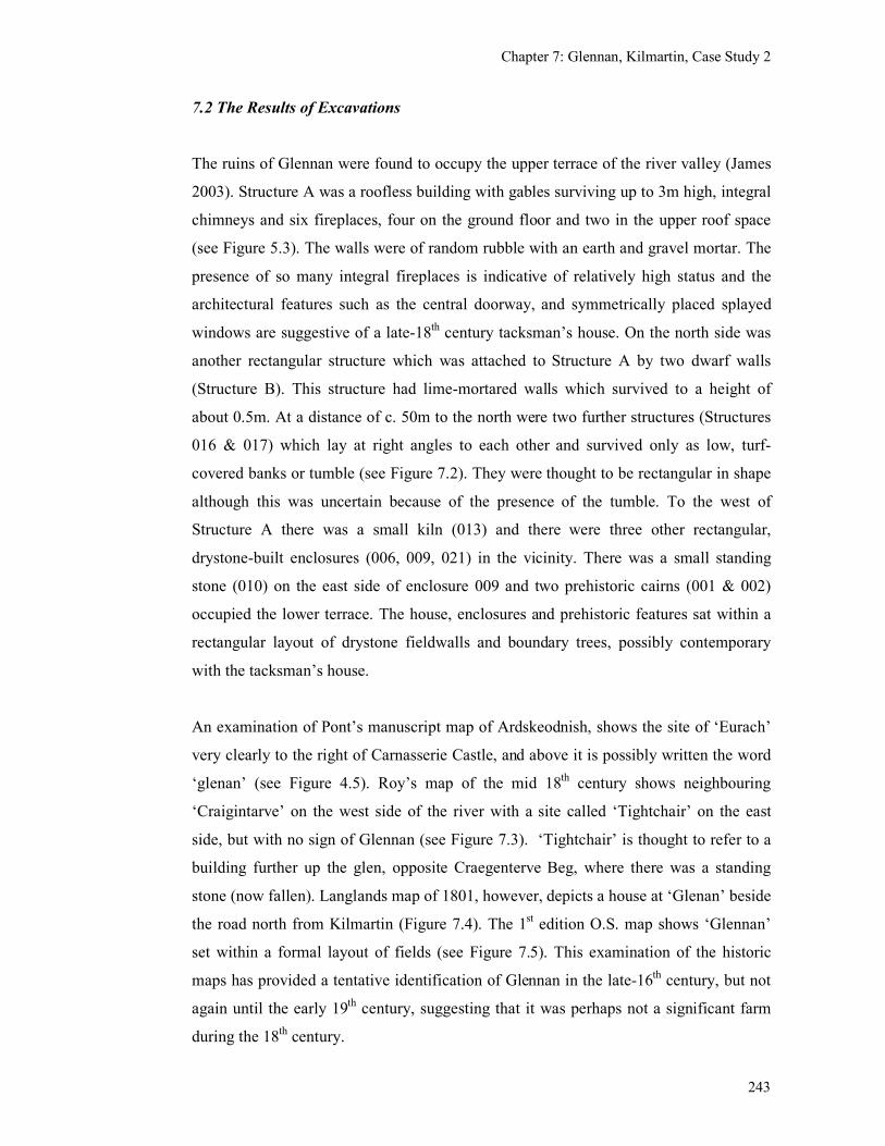
Chapter 7: Glennan, Kilmartin, Case Study 2
243
7.2 The Results of Excavations
The ruins of Glennan were found to occupy the upper terrace of the river valley (James
2003). Structure A was a roofless building with gables surviving up to 3m high, integral
chimneys and six fireplaces, four on the ground floor and two in the upper roof space
(see Figure 5.3). The walls were of random rubble with an earth and gravel mortar. The
presence of so many integral fireplaces is indicative of relatively high status and the
architectural features such as the central doorway, and symmetrically placed splayed
windows are suggestive of a late-18th century tacksman’s house. On the north side was
another rectangular structure which was attached to Structure A by two dwarf walls
(Structure B). This structure had lime-mortared walls which survived to a height of
about 0.5m. At a distance of c. 50m to the north were two further structures (Structures
016 & 017) which lay at right angles to each other and survived only as low, turf-
covered banks or tumble (see Figure 7.2). They were thought to be rectangular in shape
although this was uncertain because of the presence of the tumble. To the west of
Structure A there was a small kiln (013) and there were three other rectangular,
drystone-built enclosures (006, 009, 021) in the vicinity. There was a small standing
stone (010) on the east side of enclosure 009 and two prehistoric cairns (001 & 002)
occupied the lower terrace. The house, enclosures and prehistoric features sat within a
rectangular layout of drystone fieldwalls and boundary trees, possibly contemporary
with the tacksman’s house.
An examination of Pont’s manuscript map of Ardskeodnish, shows the site of ‘Eurach’
very clearly to the right of Carnasserie Castle, and above it is possibly written the word
‘glenan’ (see Figure 4.5). Roy’s map of the mid 18th century shows neighbouring
‘Craigintarve’ on the west side of the river with a site called ‘Tightchair’ on the east
side, but with no sign of Glennan (see Figure 7.3). ‘Tightchair’ is thought to refer to a
building further up the glen, opposite Craegenterve Beg, where there was a standing
stone (now fallen). Langlands map of 1801, however, depicts a house at ‘Glenan’ beside
the road north from Kilmartin (Figure 7.4). The 1st edition O.S. map shows ‘Glennan’
set within a formal layout of fields (see Figure 7.5). This examination of the historic
maps has provided a tentative identification of Glennan in the late-16th century, but not
again until the early 19th century, suggesting that it was perhaps not a significant farm
during the 18th century.
Chapter 7: Glennan, Kilmartin, Case Study 2
244
An initial review of the Argyll Sasines revealed that ‘Glennan’ was mentioned from the
early 17th century onwards. However, most significantly for this research, there is a very
early charter dated to 1240 which mentions the granting of Glennan to Gillascop
MacGilchrist by Alexander II (see details below). This site was identified early on as a
site with potential medieval remains because of the early charter reference and its
possible depiction on Pont. Although the existing structures were rectangular in shape
and Structure A was thought to be of probable late-18th-century construction, it was not
taken for granted that the other structures were also of this late date. It was hoped that
through geophysical survey and excavation, some remnants of earlier phases of
settlement might be detected.
An initial topographic survey of the site within the rectangular field boundaries
highlighted the presence of several new features in the landscape including what is
possibly a very large prehistoric cairn (005) and Post-medieval boundary bank (003)
(James 2004b). The topographic survey was followed by excavation of Structure 017 in
order to see whether it was a pre-18th century focus for the farm. Three areas in the
vicinity of Structure A were examined by geophysical survey and some small test
excavations were dug to investigate the resulting anomalies. A walkover survey of the
hills to the east was carried out with a differential GPS and hand held GPS (see Figure
7.6; James 2004b; James 2005a; James 2005b). As this research was also tied in with
the re-development of Glennan House (Structure A) on behalf of its new owner, a
standing building survey and excavation of its interior was also carried out.
Excavation of Structure A (Glennan House)
Structure A was constructed of roughly coursed rubble with a coarse gravel and mortar
matrix and excavation of its interior produced no evidence that it was built earlier than
the late-18th century. The foundations of the house sat onto natural clay and there was
no evidence for any earlier structure beneath. It is presumed from the positions of the
fireplaces that there were at least four rooms on the ground floor, two to either side of
the central doorway at the front and two rooms at the back. The eastern half of the
interior had a wooden floor laid onto joists supported by dwarf walls. A thimble and
several dressmakers pins were found in the south-east corner of the structure, near the
window, which were thought to relate to the use of this room as a parlour for
Chapter 7: Glennan, Kilmartin, Case Study 2
245
needlework. It is thought that the stairs would have been at the back of the house, above
a doorway to the rear of the building.
The interior of the building contained a secondary rough cobbled surface which was
sealed by collapsed debris containing numerous pottery sherds, glass, iron objects, clay
pipe fragments and fragments of slate roofing tiles. The pottery and glass was
predominantly 19th-century material with nothing earlier than the late-18
th century and
with nothing suggesting particularly high status.
Structure B
Structure B was only partially excavated and a stone flagged floor was revealed in its
southern entrance. The gap between Structures A and B was enclosed on either sides by
dwarf walls, within which was deep debris, consisting of slate, stones, pottery and glass
dating to the 19th and 20
th centuries. A black and white photograph of this structure,
probably taken in the early 20th century, shows Structure B standing to gable height and
is referred to as the kitchen (John Campbell collection (Pallister 2005, 188)).
Structure 017
Although shown as roofed in the 1st edition O.S. map, Structure 017 was originally
thought to relate to a pre-18th century farmstead. The excavation of its interior, however,
revealed that it had been originally constructed in the 19th century as a house and byre
and then occupied solely as a house into the 20th century (see Figure 7.6). The finds
consisted of the base of a rotary quern, a copper alloy belt buckle and fragments of 19th
and 20th century glass, pottery, iron objects and leather. A horse harness buckle dating
to the 19th or 20
th century (S Campbell, pers.comm.) was found among the debris from
the collapsed walls.
Structures 051, 052, 053, 054 & 055
A number of slight, rectangular-shaped, terraces were visible to the south-east of
Structure A, just beyond the drystone field wall, which suggested the presence of further
buildings (see Figure 7.2). One of these structures (Structure 051) was investigated with
a narrow trench (see Figure 7.7) and two substantial drystone walls were exposed.
These formed either side of a rectangular building which was 4.5m wide and was
probably about 13m long (internally). Its walls were 0.8m thick and 0.35m high and
Chapter 7: Glennan, Kilmartin, Case Study 2
246
were constructed of rounded boulders, roughly faced with a core of smaller stones. The
interior of the building consisted of a rough cobbled surface which had been laid
directly onto natural clay. The finds from above the cobbled floor consisted of two
sherds of Post-medieval stoneware and a wrought iron buckle of 18th or 19
th-century
date. While the construction of this building was not directly dated, the presence of the
Post-medieval material from within it strongly suggests that it was in use in the 18th or
19th centuries and that it functioned as an animal byre or stables for the occupants of
Structures A and B (although no drain was seen within the small area exposed).
To the south of a stream there was another rectangular terrace (Structure 052, see Figure
7.2) around which were the slight remains of an enclosure bank (053). This area was
examined by geophysical survey (see below), but was not excavated. Straddling the
stream at its junction with the field wall, were tumbled stones forming a roughly square
shape (054), which was not investigated at this time, but which were suggestive of a
structure, perhaps a small mill. To the north of Structure 51 another possible terrace
(055) was seen at the edge of the hillside. The Post-medieval farmstead was clearly not
restricted to the area enclosed by the rectangular field walls.
Geophysical surveys
Three geophysical surveys were carried out in the vicinity of Structure A to see if there
were any sub-surface features in the vicinity which might suggest earlier occupation
(Poller 2003, see Figure 7.2). Within Area 1 (immediately to the south of the house)
there were four distinctive linear features (Anomalies B, C, D & E, see Figure 7.8)
which were interpreted as the remains of earlier walls or drainage features associated
with the 18th and 19
th century landscape. There were also small discrete anomalies
which were interpreted as buried metal objects (e.g. three were grouped as Anomaly F).
One of these anomalies was examined with a small trench (Trench D). A large lump of
iron (possibly a spade) was found at a depth of 0.10m, revealing the cause of the
anomaly. The topsoil within this trench contained numerous 19th and 20
th century
pottery sherds, but nothing medieval, nor were there any features which could be
interpreted as potentially medieval in date.
Chapter 7: Glennan, Kilmartin, Case Study 2
247
The other two geophysical surveys (Areas 2 & 3) were carried out beyond the field wall
and these confirmed the presence of rectangular structures (Hinz 2005). Area 2 lay to
the south of the stream and produced a possibly circular feature (A), a roughly
rectangular area of disturbance relating to the terrace 052 (B) and an area of natural
geology (C) (see Figures 7.2 and 7.10). Area 3 was located to the north of the stream
and east of the field wall surrounding the Glennan settlement where the trench over
Structure 051 had been excavated. Here the gradiometer survey revealed two anomalies,
one of which related to the rectangular structure 051 and the other to another possible
structure measuring 3-5m wide (Figure 7.11).
The combination of field survey, geophysics and small scale excavation has therefore
revealed a previously unrecorded group of structures to the south of Structure A. The
trench across structure 051 confirmed the presence of a substantial rectangular structure
which was probably of 18th or 19
th century date. With the absence of any medieval
dating material from any of the excavated areas it is thought likely that the other
structures (055, 052 and the possible structure 054) are also of Post-medieval date.
However, the segment of a possible circular structure to the south-west of Glennan may
be a prehistoric hut circle, or perhaps, more likely, a more modern fenced animal
enclosure. While the morphology and date of such a structure awaits further
examination, the existence of this anomaly shows that across the flat cultivated area to
the south of the stream there is potential for the survival of further archaeological
remains.
It is possible that, prior to Glennan House being built in the late-18th century, the focus
for the farm was about 60 metres to the south, where a stream enters the flat upper
terrace of the river valley. The buildings here (Structures 51, 52 and 54, see Figure 7.2)
may have been constructed as early as the late-18th century and probably continued in
use into the early-19th century. These old farm buildings had been demolished or
reduced to foundation level by the mid-19th century when the 1
st edition O.S. survey
was carried out, sometime after the re-alignment of the field wall and the planting of the
boundary trees as part of a designed landscape. A new farmstead was then constructed
to the north-east of Glennan House (Structures 016 and 017).
Chapter 7: Glennan, Kilmartin, Case Study 2
248
The earlier settlement focus had a water supply, was close to flat cultivatable ground
and was in a sheltered location. It may well have been the focus for even earlier
settlement in the medieval period, although there is as yet no archaeological evidence
for this. There were prehistoric sites in the vicinity as mentioned above, including two
small cairns (001 & 002), a standing stone (010, which may well have moved) and a
massive (possibly kerbed) cairn of rounded boulders and stones (005), but as yet there is
no indication of where a medieval settlement at Glennan may have been.
7.3 The landscape context
A walkover survey was undertaken of the surrounding un-improved hill-ground to
search for evidence for medieval activity beyond the extent of the Post-medieval
cultivated ground. To the east of Glennan House, just beyond the 19th century field
walls, the ground rises steeply out of the river valley and into the low hills which extend
eastwards towards the neighbouring farm of Stroneskar in the valley of the
Clachandubh Burn (see Figure 7.1). The summit of the highest hill in the vicinity of
Glennan (Beinn Bhàn) is at 319m and so this landscape is relatively low lying in
comparison with the Highlands and is therefore suitable for cultivation and settlement.
Glennan has access to this hill ground via a track, which is marked on the 1st edition OS
map (see Figure 7.5).
This area was previously known to contain a small number of archaeological sites,
including a Bronze Age cremation burial (MacGregor 2000), a cup-and-ring marked
rock (NM80SE21) and a shieling with an enclosure (NM80SE20) (see Figure 7.11). The
shieling and enclosure consisted of a drystone built, sub-rectangular enclosure about 9m
in diameter and the probable ‘shieling’ was a low, rectangular structure with turf
covered, stone banks (Figure 7.12). These were described by the O.S. as being ‘of
recent date’, by which they presumably meant 19th century. The walkover survey has
added several new sites to the archaeological record, including several earthen banks, a
possible medieval house platform (Site 68), two groups of shielings and three areas of
rig and furrow (see Figure 7.11).
Chapter 7: Glennan, Kilmartin, Case Study 2
249
Possible medieval house platform (Site 68)
A platform, measuring 6.4m long by 2.8m wide, was surrounded on three sides by earth
and stone upcast, up to 2m wide (see Figure 5.28 & 7.13). This platform was located on
a steep slope and was open on the western, down slope, side. There was no local
knowledge regarding its function and the possibility of this site being an example of a
medieval house platform was considered, but unfortunately could not be examined
further at this time. This site looks similar to the medieval platforms identified in
Eskdale, Dumfriesshire (Corser 1982). Other possible interpretations of this feature
include a cattle feeding stance or a shooting stance, which could be contemporary with
Glennan House.
Earthen banks, cultivation & shielings (Site 308)
Within the hills to the south-east of Glennan there were several earthen banks, only
some of which have been surveyed (see Figure 7.11). The linear banks ran along the top
of the breaks of slope or were at right angles to this alignment. Other banks surrounded
areas of rig and furrow. One of the areas of cultivation, in the centre of the upper glen,
incorporated three small, single-celled, oval-shaped shielings (Site 308).
Shielings, Site 307 (NM 186252 701064)
High up on a ridge, overlooking the upper glen, there was a group of three shielings
(Site 307). One of these structures was subdivided into two rooms while the other two
structures consisted of single compartments. These structures survived as very low, turf-
covered banks. The two-roomed structure was of a comparable size to Structure A at
Bàrr Mór, although it appeared to have square, rather than oval-shaped, corners.
This walkover survey has shown that there is evidence for agricultural activity within
the hills above the 18th/19
th century landscape, that had not previously been recorded.
This includes areas of rig and furrow, shielings and earthen banks. The boundary with
the neighbouring farm of Stroneskar is probably along the Clachandubh burn which is
followed by a 19th-century drystone field wall and the earthen banks may be earlier
divisions of the pasture for stock control. Within the Glennan hill ground there are at
Chapter 7: Glennan, Kilmartin, Case Study 2
250
least three areas of cultivation. While this use of the hill ground probably relates to the
period of highest population in the 19th century, it raises the possibility that a medieval
use was made of these shieling grounds, perhaps as settlement sites. A more detailed
analysis of the type and extent of the cultivation ridges and their relationships with the
shielings, might reveal different patterns and periods of use. For instance, the shielings
located at the top of the ridge (Site 307) are 40m above and 100m to the east of the
nearest cultivation in the valley bottom, and might therefore be taking advantage of the
hilltop position, possibly for protection and to provide a lookout. This is very different
from the shielings within the bottom of the upper glen (Site 308) that are set within and
surrounded by the cultivation ridges. There may well be a difference in date or function
between these two groups of shielings. Nearer to Glennan House, there is a third area of
cultivation, a possible house platform site and a shieling with an associated stock
enclosure, all at about the same height above the valley floor (about 75m AOD). If these
sites are contemporary then this would provide evidence for a mixture of arable and
pastoral farming within the Glennan property, but if they are not then this raises the
potential for specialisation in one economy at different times.
7.4 Historical research
Turning now to the historical sources, these were examined in order to illuminate the
development of the Glennan property and to help interpret the features that have been
identified.
Glennan in the medieval Period
Glennan lies within Glassary parish and was mentioned in the earliest surviving Scottish
charter relating to lands in Argyll, which was written in Latin, the official language of
Scottish government and dated 1240. This charter referred to Alexander II, King of
Scotland’s gift of the ‘five penny lands of Fyncharne and others’ to Gillascop
MacGilchrist for ‘his homage and service in Argyll’ (MacPhail 1916b, 114-5, 121-4 &
227-245). These extensive lands also included the ‘five penny lands [quinque
denariatas] of Glennane’, ‘Rudol’, and other lands in Cowal. In total, 51 penny lands
were granted to Gillascop at this time (Easson 1987, 7) making him a significant
landowner who was probably based at Fincharn Castle (Loch Awe side, about 5km
Chapter 7: Glennan, Kilmartin, Case Study 2
251
away, see Figure 4.6). Gillascop MacGilchrist’s Gaelic name suggests that he was an
existing landowner in the area, rather than an incoming Norman lord. Gillascop would
have held the position of a local baron as he was granted lands cum furca et fossa (the
power of pit and gallows (McPhail 1916b, 241)). The payment for this land was half a
knights service ‘in the host and in the matter of an aid what pertains to the full service
of one Knight, and also doing Scottish Service as the barons and knights on the same…’
(MacPhail 1916b). Thus the charter has been seen as a combination of the traditional
Gaelic system with the new feudal tenure (Easson 1987, 7) within an area of Argyll that
had probably been under the control of the crown since 1220 (see Chapter 3). MacPhail
suggests that as the lands being granted to Gillascop were spread throughout the
parishes of Glassary and Cowal, this showed how, in this area of Argyll, ‘clan tenure
was superseded by private ownership at a very early stage’ (MacPhail 1916b, 121).
Little else is known about Gillascop MacGilchrist, apart from his brother’s name,
‘Ewen’ who was also mentioned in the charter as the owner of neighbouring Craignure
(‘Crag Enywyr’). Ewan’s son, John, was also a magnate in Argyll in 1292 (MacPhail
1916b, 136), but his heirs forfeited the lands, perhaps because they supported the wrong
side in the Wars of Independence. In 1296 John Ewynsone MacGilchrist paid homage
to the English king, Edward I (Calendar of Documents ii, 169, 202) which presumably
took place after Edward I’s defeat of John Balliol when 1500 people swore an oath of
allegiance to him (Barrell 2000, 107).
Ralf of Dundee, who was possibly the son or, more likely, the son-in law of John
Ewynsone MacGilchrist, acquired extensive lands in ‘Glassarie’ that were once held by
Gillascop. He perhaps brought together the lands that had been divided between the
brothers Gillascop and Ewan. He was probably able to do this because he had been a
supporter of Robert the Bruce during the Wars of Independence. His daughter,
Margaret, married Dugald, son of Colin Campbell of Lochaw, indicating that he was
well connected with the most significant landowning family of the area (MacPhail
1916b, 116-117).
Several other medieval charters deal with lands in Glassary, but do not mention
Glennan by name. A charter dated about 1315, granted a third of the lands in ‘Glassery’
to Dugal Cambel and his wife Margaret. This charter included ‘totam terram de
Chapter 7: Glennan, Kilmartin, Case Study 2
252
Cairnfin’ which McPhaill suggests is Fincharn. If this gift included the Glennan lands,
then they were held from then on by the Campbells. In 1342 the lands of Dugal
Campbell were forfeited in the reign of David II and lands conferred to his brother
Gillespyk (McPhaill 1916b, 133).
Another charter from David II, dated 1346 (not included in the Origines Pariochiales
Scotiae, Table 4.4), gave other lands in Glassary, consisting of ‘Edyrling, Cambysenu,
Garwalde the two Carvenys, Craggenure, the two Oywoldys and Calkykest …which
once belonged to the deceased John, son of Ewan, and were in the king’s hands by
reason of the forfeiture of the heirs of the aforesaid John’ to ‘Gilbert of Glasstre’. In an
undated charter, of about 1355, John Cambel ‘Lord of Ardsceodanich’ granted ‘his
beloved kinsman Gilbert, Lord of Glassary, for his life two penny lands and an obol
land of his lands of Glasserie’ (MacPhail 1916b, 137 & 142).
In 1374, the Glassary estate was acquired by Alexander Scrymgeour Constable of
Dundee (MacPhail 1916b, 119) through marriage to Agnes, a descendant of Ralf of
Dundee. The Glassary estate was held by their descendents until 1668 when it fell to the
crown and was awarded to Charles Maitland of Halton, who became Earl of Lauderdale.
Whether Glennan was part of the Scrymgeour’s Glassary estate during the medieval
period is not clear, as by the mid-16th century, Glennan had come into the hands
(perhaps as tenants) of the MacKellor clan, who were being buried in Kilmartin
graveyard by the late-15th century (RCAHMS 1992, 134). In 1564 ‘Gilbert McKellor of
Ardorie’ and his son swapped the four merklands of Glennan with the Campbell Earl of
Argyll for the 15 shilling lands of Drumdarroch and the keeping of the woods of
Doweart (Innes 1855a, 94).
Glennan in the 17th century
The documentary references to Glennan in the Post-medieval period become more
frequent and are of interest here because they help to understand the development of the
property and to interpret the structures observed in the field.
Alexander Campbell of Glennan was a younger son of Colin Mor of Kilberry, Knapdale
who died in 1619 (MacMillan 1960, 42-3). In 1615, Moir Campbell, wife of Duncan
Chapter 7: Glennan, Kilmartin, Case Study 2
253
Campbell of Glennan, sought a divorce from him because of his adultery (Paton 1918,
148). In 1621 there was a sasine of the ‘4 merk land of Glennan in Kilmartin parish,
given by Donald Maclachlan of Carnaym, as baillie, to Donald Campbell, brother of
Duncan C of Glennan… on a charter ….signed 1618…’(Campbell 1933, Vol 1, No 140,
44). In 1629 there is a reference to ‘Glennan’ being owned by Patrick Campbell of
Inverhea (Teinds subvaluation role, copied in 1802, Lochgilphead archives, CA/1/22/1).
A charter dated 1672 referred to ‘Colin Campble of Glenen’ and three probable tenants,
‘Donald M’Illnohesadge’, John Campble’ and ‘Archibald M’Tuttill’ (MacPhail 1916b,
215). This charter related to the attempt by Charles Maitland of Hatton to acquire the
feu-duties of the estate that he had been granted by Charles II after the death of John
Scrymgeour which had fallen to the crown as ‘ultimus haeres’. The fact that Colin is
described as being ‘of Glenen’ would suggest that he had his main residence there and
we can also suppose that along with the main house there would have been a small
settlement accommodating the other three households.
Glennan suffered during the depredations of the late 17th century as the ‘Account of the
Depredations committed on the Clan Campbell and their followers, during the years
1685 and 1686…’ lists 14 cows, 15 horses, 24 sheep and 30 goats taken from Colin
Campbell of Glennan (Lochgilphead Archives, mss dated 1816). It is likely also that all
the houses were burned and the stored grain and food destroyed by the occupying
forces. Glennan was clearly being run as a mixed farm with a wide range of animals as
well as the arable which would have contributed to the 4 merk land valuation. The
possession of 15 horses, probably a combination of work horses and riding horses,
could be an indication of high status, but does not necessarily indicate a big settlement.
As a Campbell, the owner of Glennan would have been expected to join the Earl of
Argyll’s Rebellion of 1685 (see Chapter 3) and yet no occupant of Glennan was
mentioned in the List of Rebels (MacTavish 1935). Perhaps Colin Campbell had
managed not to get involved, but still suffered from the indiscriminate depredations as if
he had been. The Rebellion may have prompted a break in the Campbell tenancy as the
Hearth Tax of 1694 for Glennan included the following five names (and a kiln) none of
which were the same as in the list of 22 years earlier (see Figure 7.14). None of these
have more than one hearth which is suggestive of low status.
Chapter 7: Glennan, Kilmartin, Case Study 2
254
Dougal Mc[??] 1
Ard McKec[?]irk 1
Donald Mc [?]keard 1
Anna McBean 1
Patrick McGrior 1
Ano kiln 1
Glennan in the 18th century
However, by 1712 the Campbells were back in residence as Colin Campbell (of
Glennan) died in that year (Registers of Testaments CC2/3/8, p72) and the property was
acquired by his nephew Duncan Campbell of Coulgaltro (Paton 1915, 182). The farm
was then tenanted by Dugald McEun, who died in 1714 (Register of Testaments
CC2/3/11, 266) followed by his son, Duncan McEown, who died in 1753 (Edicts of
Executry CC2/8/48, 1753).
By 1751 Glennan had been acquired by the Malcolm family (Valuation Roll, 1751) and
a letter from ‘Alexander Malcolm of Glennan’ to John Morrison in Edinburgh indicates
that he was resident there (Poltalloch Estate Accounts/Letters, Lochgilphead Archives,
Poltalloch Papers, DR/2/8/8). In 1773 the property was acquired by Dugald Malcolm
(ibid). He had become a merchant in Jamaica in about 1750 and had acquired a
plantation there on his marriage to an heiress of the Clarks of Braeleckan (MacInnes
1998, 174). Dugald was then succeeded by his cousin Neill Malcolm in 1785 (ibid). In
1789 Anna Malcolm Ruthven (presumably a Malcolm heiress) was described as
‘proprietrix of the lands of Glennan’ and her spouse Donald Ruthven Esq of Glennan
gave Glennan to Susanna Brown as liferent on her marriage to their son Robert Clerk
Ruthven (Poltalloch Papers, DR/2/8/8). It was perhaps upon this marriage that the new
house was built and the improvements to the landscape made at the end of the 18th or at
the beginning of the 19th century.

Chapter 7: Glennan, Kilmartin, Case Study 2
255
Glennan in the 19th century
In 1803 Glennan had a ‘heritable debt’ of eight hundred pounds sterling owed to Neill
Malcolm of Poltalloch (No 14, Poltalloch Papers, DR/2/8/8). Donald Ruthven had died
by this time and their younger son Dugald Malcolm Ruthven, a ‘merchant in Greenock’
was in Jamaica, presumably involved in the family plantation business (No 15.
Poltalloch Papers, DR/2/8/8).
In 1804 Dugald Malcolm Ruthven went bankrupt and John McNair esq. became trustee
of the estate (Poltalloch Papers, DR/2/8/8). The property was described at that time as
‘four merk lands of old extent of Glennan with houses, beggings yards, orchards,
woods, fishings, parts, pendicles and pertinents of the said lands lying within the
Barony of Ariskodnish, parish of Kilmartin...’ (ibid). In 1805 the lands were sold by
public roup to Neill Malcolm (Poltalloch Papers, DR/2/8/8) and in 1806 there is a
reference to a tenant in Glennan ‘Donlad MacNeill’ and a Residenter ‘John MacFarlane’
(Poltalloch Papers, DR/2/8/8). Further tenants are referred to in the Poltalloch Papers
for 1817 and 1818. In the 1841 census there are five families resident at Glennan, a total
of 28 people and another at ‘Glenan Cottage’ (Mitchell Library). By 1851 the
population had increased to about 38 people, but the 1st edition O.S. map of Glennan
(surveyed 1871-2) shows the main house unroofed, the kitchen is possibly roofed and
one of the farmstead buildings (Structure 017) is still roofed. A house (known in the
contemporary landscape as Glennan) is depicted on the west side of the road near
Craganterve, but is unnamed. This is probably ‘Glenan Cottage’.
Glennan in the 20th & 21
st centuries
By 1906 there is a reference to ‘Glennan croft’ and a ‘Glennan Farm’ while ‘Glennan
House’ was unoccupied (1906 Valuation Roll, Mitchell Library). The house of ‘Old
Glennan’ and the small pocket of land surrounding it were sold by Sir Ian Zachary
Malcolm of Poltalloch in 1944 to Humphrey J Talbot. The remaining farmland of
Glennan was bought by its tenant farmer, Hugh John McLachlan in 1945/6 and it was
farmed from Stronesker (Mr McNair, (Stronesker Farm) pers comm.). In 1962 Glennan
was inherited by Oliver Hill and then in 1995, through his wife, passed to her nephew
Tom Denny from whom Hugh Willison, the present owner, bought it in 2004 (Hugh
Chapter 7: Glennan, Kilmartin, Case Study 2
256
Willison, pers comm.). A final note on the 1975 1:10,000 OS map is that a cottage is
depicted to the north-east of Glennan is called Tigh a Charnain (the name shown in
Roy’s map) although this cottage is not old enough to have existed in the mid 18th
century.
7.5 Conclusions
The spelling of the name Glennan has been remarkably consistent since at least the 13th
century and it is an apt description of the farm’s general location. The documentary
evidence provides several references to the place-name, its owners and occasionally to
its taxable value. It is referred to as being five pennylands in the 13th century and to
being four merk lands in the 15th century. It is probable that, throughout the medieval
period, and perhaps for several centuries before that, Glennan was a small farm, worked
by about five households. Glennan formed part of the Glasserie estate which was held
by a Gaelic lord, but who had close ties to the Scottish crown. In the 13th century
‘Glenane’ was part of the territory owned by Gillascop MacGilchrist who may have
been responsible for the building of Fincharn Castle and where he probably lived. With
the local lord resident at nearby Fincharn Castle, one should perhaps not expect to find a
high-status medieval site at Glennan which was one of his many properties. This
perhaps echoes the relationship of high and low status early-medieval ringfort sites seen
in the south-west midlands of Ireland where the vicinity of high status sites was
occupied only by low status sites and the middle range ringforts were further away
(Stout 1997, 89). While one should not necessarily expect to find the remains of a high
status house at Glennan in the medieval period, one would still hope to find evidence
for lower-status houses and farm buildings. It is not until the 17th century that a
Campbell is referred to as being ‘of Glennan’ suggesting that it had become high-status,
being the main residence of a cadet branch of the Campbell clan. One would expect
there to be a significant structure here in the 17th century. The prosperity of the farm
reaches a peak at the end of the 18th century with the construction of a two-storied house
and a farmstead (probably with money from the Malcolm family estates in Jamaica) but
debt and bankruptcy see an end to this particular line of the family and the farm
becomes absorbed into the neighbouring Stronesker farm.
Chapter 7: Glennan, Kilmartin, Case Study 2
257
The existence of five tenants at Glennan in the 17th century can perhaps be seen as
evidence for a degree of continuity of settlement size and economy. Easson’s
examination of pennylands in the west of Scotland suggests that the number of men
required for military service or to row the galleys was generally 1 man per pennyland
and that this was paralleled with the Dalriadic ‘house’ (as mentioned in the Senchus fer
nAlban) where levies were due from each individual house (Easson 1987, 4-9). Thus the
five pennylands of Glennan may be a remnant of a much more ancient land tax system
which was based on its ability to support five houses or family units. The presence in
1672 of Colin Campbell and three tenants could reflect a recovery of the population
after a drop in the 14th century. Perhaps the relatively higher status of Colin Campbell
enabled him to possess a larger household equivalent to two tenant households. Thus, in
the pre-Improvement farm economy, the number of people which could be supported
remained broadly consistent, although the climatic deterioration and the other factors of
warfare and plague must have had an impact for certain periods of time.
As Fairhurst found at Rosal, despite the good documentary evidence for Glennan since
the 13th century, there has been little success in locating any definite medieval features,
although several potential sites have been identified. Initially the examination of historic
maps, aerial photographs and fieldwalking provided a wide ranging view of the area and
enabled the identification of several potentially medieval upstanding monuments.
Secondly, the geophysical surveys targeted specific areas and revealed the existence of
sub-surface features and confirmed the regular (and therefore probably anthropological
nature) of other amorphous surface features. Thirdly, targeted excavation enabled the
removal of some sites from the ‘potential medieval’ list of sites. Sites still on the list
include the platform (Site 68), two groups of shielings (Sites 307 & 308) and
geophysical anomalies (Figure 7.9 Anomaly A & B). Additional techniques not used
here, but which might reveal settlement hot spots, would be an extensive programme of
phosphate analysis and trial pitting.
In the absence of archaeological evidence for medieval settlement at Glennan, one can
propose that in the medieval period, the focus for settlement would have been, as now,
on the upper river terrace as this was flat, well-drained ground, above the probably
boggy valley bottom. The stripping of peat from this valley bottom during the medieval
and later periods probably revealed the prehistoric cairns and standing stones, just as the
Chapter 7: Glennan, Kilmartin, Case Study 2
258
prehistoric landscape was revealed within the Kilmartin Glen. Thus Glennan would
have provided a suitable area for cultivation above the boggy valley bottom and pasture
in the surrounding hills. The location of settlement in the medieval period could well
have moved about in the landscape, perhaps in the vicinity of Structures 051 and 052, so
as to maximise the amount of flat land available for cultivation and be close to a water
source. The single platform site, which may be of medieval date, may have been the site
of one of the five households, the others being dispersed in the landscape, perhaps in the
vicinity of the shieling Sites 307 and 308.
The difficulty of detecting medieval settlement remains evident here, probably because
what we are looking for were initially unsubstantial wattle and daub structures, other
signifiers such as tools and utensils were made from organic materials which have
decayed, the stone foundations and metal tools were probably re-cycled. The extensive
areas of lazy-beds also indicate the extent of later cultivation which will have
contributed to the disappearance of the medieval settlement. The possibility exists that
the medieval settlement has been effectively destroyed by the Post-medieval cultivation,
but the results of the geophysics suggests that there are still subsurface features which
have potential. A systematic programme of test pitting coupled with more extensive
geophysics could be effective in pinpointing any medieval deposits which do survive.
Chapter 8: Carnasserie, Kilmartin. Case Study 3
259
Chapter 8: Carnasserie, Kilmartin. Case Study 3
8.1 Introduction
Carnasserie was chosen as a case study because of the presence of a high-status medieval
castle, built for the Bishop of Argyll, within a multi-period landscape which offered the
opportunity to examine the relationship between the seat of an ecclesiastical lordship and
the surrounding remains. The known sites in the vicinity of the castle included an ‘earlier
castle’ or probable dun, a low bank (possibly the remains of a ringwork) within which the
castle was constructed (see Figure 2.60) and a deserted, possibly Post-medieval settlement
(Carnasserie Beg). At a short distance (0.35km) to the N was a second Post-medieval
deserted settlement (Carnassarie Mor) and local information indicated that that there were
further unrecorded shielings and enclosures in the hills beyond.
It has been suggested that Carnasserie (Gaelic = Carn asaraidh) takes its name from airigh
(= a shieling) and a large cairn to the NE of the castle (Carn Ban, NM80SW 28), (Gillies
1906, 40), which indicates the pastoral nature of the farm’s origins. Carnassarie lies to the
north of the village of Kilmartin, west of the Kilmartin Burn and is not extensive, being
bounded today by the farms of Tibbertich to the north, Upper Largie to the south,
Creaganterve to the east and Ormaig to the west (see Figure 8.1). The topography of
Carnasserie consists of low ridges aligned SW-NE with a maximum height of about 220m.
The farm was especially suitable for fieldwork as it was kept under permanent pasture for
sheep grazing and bracken was kept down with spraying which aided the visibility of
archaeological remains. The surrounding farms are extensively forested. The work
undertaken here consisted of initial historical research and examination of historic maps,
field visits to the known sites, a walkover survey of the vicinity and a topographic survey
of a group of shielings.
This work revealed a series of shielings and areas of cultivation which indicate a landscape
utilised for arable and pastoral farming probably since the prehistoric period. At least one
of the shielings has similarities of size and plan with the remains seen at Bàrr Mór, and so
has a potential medieval date. The shielings appear to form an exclusion zone around the
Carnasserie Castle, a 16th century tower house which owed its existence to a connection
Chapter 8: Carnasserie, Kilmartin. Case Study 3
260
with the Bishop of Argyll rather than being the possession of a local clan chief. The
management of the farm was therefore run separately from the household of the high-status
ecclesiastic.
8.2 Known archaeological sites with background historical research
Carnasserie castle (Site 22)
Carnasserie Castle (NM80SW2) is a tower house which is thought to have been built
between 1565 and 1572 with masons from Stirlingshire hired by John Carswell, Bishop of
the Isles and remodelled in the seventeenth century (RCAHMS 1992, 214-226). The castle
has been discussed in detail by the Royal Commission and by Frank Walker and so only a
brief description is included here (Walker 2000, 174 -177). The castle consists of a three
story hall-house and a five story tower, which appear to be of continuous build. It is the
most substantial, high-status, late-medieval building in the research area (see Chapter 3 &
Figures 8.2). The possibility of ‘earlier works’ being incorporated into the base of the north
tower was suggested by the Royal Commission, but any such changes in build were not
described in detail (RCAHMS 1992) and are not obvious.
The earliest historical map of the area, Pont’s manuscript map Number15, dated to the end
of the 16th century, depicts a substantial and realistic view of the castle of ‘Canastre’ (see
Figure 8.3), prior to the addition of larger windows. However, we know that there was a
significant dwelling here before Carswell’s castle was built as there are documentary
records referring to Carnasserie prior to the 16th century. A charter dated 1463 was signed
at ‘Carnastre’ by John MacLachlan of Strathlachlan in favour of one of his kinsmen and it
is thought that at this time the property probably belonged to the Campbells of Lochawe
(RCAHMS 1992, 224). In 1529 Carnasserie was part of a marriage settlement of the wife
of the future 4th Earl of Argyll (a Campbell). John Carswell was born in Kilmartin in about
1522 and became chaplain to the 5th Earl of Argyll. In 1559 the 5th Earl,
‘granted in blenchferm to his ‘familiar servant’, Master John Carswell, rector
of Kilmartin, and to his heirs, lands including the eight merklands of the two
‘Carnestris’ with the custody of the castle of the same, an office which
according to later tradition had been held by earlier members of the Carswell
Chapter 8: Carnasserie, Kilmartin. Case Study 3
261
family. Carswell, who used the style ‘of Carnassarie’, obtained a royal
confirmation of this and other grants in 1565, by which time he was
superintendent of Argyll in the reformed church and a substantial landowner,
and two years later he also became Bishop of the Isles, with the annexed
revenues of Iona Abbey’ (RCAHMS 1992, 224).
It was to his patron, the Earl of Argyll, that Carswell dedicated his building work at
Carnasserie in the Gaelic armorial panel ‘Diet le ua nduibhne’ (= God be with Ó Duibhne).
Carswell was therefore a significant landowner, as well as an ecclesiastic, who was closely
associated with the Campbell Earls and whose family had been in the Kilmartin area for at
least a generation. This site was therefore chosen to build his castle, because there was
already a significant hall here in the possession of his family. Carswell was a supporter of
Gaelic culture although his formal education had been in English and he is most famous
for being the first translator of John Knox’s ‘Liturgy’ (Book of Common Order) into
Gaelic. Carswell’s daughter married Mr Neill Campbell who later became vicar of
Kilmartin and who is thought to have built Kilmartin Castle in the late-16th century (see
Chapter 2). Carnasserie Castle was therefore built to reflect the personal status of the
Bishop of Argyll which perhaps goes towards explaining why it only remained in the
hands of the Carswell family for two generations, after which it reverted to the Campbells.
The Campbells used the castle as a stronghold and as a prison during the power struggles
between rival lines of the Campbell clan. In 1594 John Campbell of Ardkinglas was
imprisoned in the castle by a jailer Donald Campbell (RCAHMS 1992, 225) and in the
early 17th century the Campbell heir of Inverawe was kept in Carnasserie Castle while he
remained a minor as his uncle, the Tutor of Inverawe, had attempted to kill him (Campbell
2002, 142).
The Castle was granted to Dugald Campbell of Auchenbreck in 1643 by the Marquis of
Argyll and, along with Carnasserie Beg, was in his hands when Alasdair MacDonald
invaded Argyll in 1644-6. But there are apparently no references to any role that
Carnasserie may have played in these events (RCAHMS 1992, 225). A gateway, dated
1681, marked the marriage of Sir D[uncan] Campbell. It is to this period in the 17th century
that the enlargements of the windows and other alterations are thought to date. In 1690,
during the rebellion of the 9th Earl of Argyll, the castle was garrisoned by the Campbells of
Chapter 8: Carnasserie, Kilmartin. Case Study 3
262
Auchenbreck. It was attacked by Lachlan MacLean of Torloisk (Mull), other leading
MacLeans, and a neighbour Archibald MacLachlan of Creaganterve. The castle was
burned and partially blown up, sixty horses were driven away and twenty of the garrison
were wounded (Campbell 1916b, 343; Fraser 1964, 48; RCAHMS 1992, 225). A total of
2000 cows were stolen from the area and the ‘goods and plenishing’ of the [Campbells of
Auchenbreck] house at Lochger were stolen. Carnasserie Castle remained as a roofless ruin
thereafter.
Only small scale excavations have taken place inside Carnasserie Castle to allow for
drainage works and these provide no evidence to indicate a date earlier than the 16th
century for its construction (Murray 1998). Despite examination by this author, no ‘earlier
works’ in the base of the north tower could be discerned. There is still the potential for the
castle to have replaced an earlier structure, perhaps a hall-house built within an earlier
ringwork, the remains of which can be seen to the north of the castle (see Figure 2.60).
This hall-house may have been built by a local lord, perhaps a MacLachlan or a Campbell
in the 13th century, as the MacGilchrists are thought to have done at Fincharn Castle. The
hall-house at Carnasserie was then demolished and replaced with the 16th century tower
house to show off the greatly enhanced status of John Carswell on his advancement to
Bishop of Argyll.
Earlier castle or dun
There is also a potentially even earlier site to the north-east of the castle, in the form of
fragmentary remains of an oval-shaped enclolsure consisting of an arc of stone walling
(NM80SW31, see Figure 8.4). These remains could have formed a structure measuring
internally 15m - 20m, with walls 2m thick. As this site has not been investigated, there is
no dating evidence.
Medieval circular towers are not common in Scotland, the only upstanding one is dated to
the mid-15th century at Orchardton in Dumfries & Galloway and it is not known why this
shape was chosen, although an Irish influence has been suggested (Stell 1996, 114 –115).
The distribution of round towers in Britain tend to be in Wales and Ireland (McNeill 2003,
96). The structure at Carnasserie is therefore more likely to be a ruined prehistoric dun, its
role as a chief’s stronghold perhaps continued into the Medieval period, prior to the
Chapter 8: Carnasserie, Kilmartin. Case Study 3
263
dominance of the Campbells, in a similar way to MacEwan’s Castle in Cowal (see Chapter
3). This structure could then have been replaced successively be a ringwork, timber hall
and stone hall-house as mentioned above.
Carnasserie Beg (Site 23)
As well as the castle and possible dun there is evidence for unfortified settlement in the
vicinity. The first reference to a settlement at Carnasserie is in 1559 as one of the two
‘Carnestris’ (see above) and there is a specific reference to ‘the 2 merk land of Carnastrie
beg’ in an Argyll Sasine dated 1618 (Campbell 1933, No.23, 7). ‘Carnastre beg’ is
depicted by Pont in the vicinity of the castle. By 1694 Carnasserie Beg and the ruined
castle were in the possession of the Campbells of Kilmartin and there were three tenants
each with a single hearth (see Table 5.3). In the mid-18th century, Roy’s military map
depicted a square enclosed garden at Carnasserie, attached to the castle (which is
smudged). There is a settlement a short distance to the west of it called Largo (see Figure
8.5) which is probably the site of Carnasserie Beg, but with the wrong name.
John Johnson’s map of the Kilmartin estate, dated 1825, depicts six, unnamed, roofed
structures immediately to the north and west of the castle (see Figure 4.11; AGD/957/4).
Carnasserie Beg and the castle were acquired by Neill Malcolm of Poltalloch in 1829
(RCAHMS 1992, 224-5) and so there may be further references to the settlement in the
Poltalloch papers (Lochgilphead Archives). By the mid 19th century, the 1st edition OS map
(Argyllshire CXXXVIII) depicts the castle, but no outbuildings, nor mention of
Carnasserie Beg and so the remaining structures surrounding the castle and their occupants
were presumably cleared by the Malcolms sometime between 1825 and 1871-2 when the
O.S. map was surveyed.
To the north and west of Carnasserie Castle there are low, turf-covered banks forming the
foundations of rectangular structures that are assumed to be the remains of the settlement
of Carnasserie Beg (RCAHMS 1992, 224). The RCAHMS have produced a plan of the
site, but these structures are less clear on the ground now (see Figure 2.60) and were
presumably once more extensive (as depicted by Johnson). The garden on the south side of
the castle has been reduced in size and become rectangular in shape, probably in the 19th
century, and there is no visible evidence for the ringwork bank continuing in this area.
Chapter 8: Carnasserie, Kilmartin. Case Study 3
264
What is illustrated well here is the speed with which structures which are shown as roofed
in the early 19th century have now almost completely disappeared from view. In this case
their disappearance may be less due to the their flimsy construction and more to the
deliberate removal of low-status buildings near to the castle.
The existence of two settlements at Carnasserie is known from documentary sources from
at least the mid-16th century, which is broadly contemporary with the construction of John
Carswell’s tower house, although the splitting of the settlement was probably not related to
the rise in status of the castle. As the Post-medieval structures nestle close to the castle
base, it has been assumed that the medieval site of Carnasserie Beg was also located near
to the castle, in a similar way to the timber structures identified around the base of Threave
Castle (see Chapter 2). However, it is possible that these structures have spread (after the
castle was abandoned in the 17th century) from an original focus of Carnasserie Beg which
was slightly further west (as suggested by Roy).
Carnasserie Mor (Site 21)
Carnasserie Mor was the second of the two ‘Canestris’ referred to in the mid-16th century
and was depicted on Pont’s map as ‘Carnastre m’ (see Figure 8.3). There is documentary
evidence that by 1633 Carnasserie Mor was being farmed by the MacLachlan family of
neighbouring ‘Craiginterve’ separately from the castle and Carnasserie Beg, as is shown by
a sasine which refers to
‘the 6 merk land of Carnassarie mor in Ariskeodnish, given by Donald
Campbell of Stroneskir, as baillie, to John M’Lachlan, lawful son of Archibald
M’L of Craiginterve….with the consent of his wife Christine Campbell, and
also with the consent of Niall Carswell of Carnasserie and his wife….signed at
Kilmartin before Duncan Campbell of Duntroon, Mr Niall Campbell of
Ederline, rector of Glassary, and Alexander Campbell, of Kilmartin. Christine
C signed at Dunoon before Hugh Boyd, lawful son of said bishop. Witness to
sasine: Duncan dow Carswell in Ormaig and Archibald M’Ilmachessag in
Carnasserie Mor.’ (Campbell 1934, No. 456, 144).
Chapter 8: Carnasserie, Kilmartin. Case Study 3
265
The Carswells still had an interest in the property as it was redeemable by Niall Carswell
of Carnassarie for 3,000 merks and he also reserved his turf-rights on Carnasserie Mor
(Campbell 1933, No 258, 85). It would seem that at some time prior to the early 17th
century the farm lands of the Carnasserie estate were separated from the castle itself. The
Hearth Tax of 1694 lists eight occupants at Carnasserie Mor each with 1 hearth and one
tenant, John McArthur, with two hearths ‘for house and miln’. Carnasserie Mor and the
mill still belonged to the MacLachlans of Craeganterve in 1751. Carnasserie Mor was
never acquired by the Malcolm family and so there would be no references to it in the
Poltalloch Estate papers.
Roy’s map depicts what is probably Carnasserie Mor to the north-west of Carnasserie
Castle although named it ‘Sallachy’(see Figure 8.5). Carnasserie Mor is depicted as a
group of four structures with two rectangular-shaped enclosures (which is the same size as
Carnasserie Beg (Largo). It is possible that ‘Largo’ and ‘Sallachy’ are alternative names
for Carnasserie Beg and Mor, but it is more likely to be a surveyor error. The two Largo’s
(Nether and Upper) are already depicted further south in their correct location and there is
a ‘Salachary’ further north, towards Kintraw by the 19th century.
The 1st edition OS map, surveyed in 1871-2, shows the extent of the Carnasserie township
in 1871-2 (note it is not called Carnasserie Mor here). It consisted of seven roofed, two
partially roofed and one unroofed buildings and six enclosures (Argyllshire Sheet
CXXXVIII, published 1875, see Figure 8.6a). On the O.S. map the township straddles both
sides of a small stream and a sinuous head dyke runs through Carnasserie and the
neighbouring farm of Tibertich, parallel to the contours of the valley, separating the
improved land to the east from the unimproved land to the west.
This review of the historical record and maps have provided the bare bones of the history
of Carnasserie. Initially the property was known for its pasturage and it might have been
used by people occupying the dun in the prehistoric and perhaps the early-medieval period.
In the medieval period it is possible that a ringwork was built (only the slight bank of
which survives) perhaps surrounding a timber built hall. Major castles of this period were
built to dominated the sea-ways and so the inland location of this site, within the Kilmartin
valley, would support the idea that this site was lower down the social status, although
perhaps still the seat of a local lord or chief.
Chapter 8: Carnasserie, Kilmartin. Case Study 3
266
This property was held from the king by the Campbell Earls of Argyll throughout the
Medieval period and by the mid-15th century there was a significant dwelling, probably a
stone built hall-house which could still have required the defensive bank and ditch. By the
mid-16th century Carnasserie had split into two settlements, Mor and Beg. Carnasserie Beg
was closer to the castle but probably did not ‘nestle’ around its base. The son of the keeper
of the castle, John Carswell, became Bishop of Argyll which enabled him to build a tower
house on land already in his families possession. The castle was therefore a reflection of
his personal status (with due deference to his patron, the Earl of Argyll) rather than being a
significant church property. This probably contributed to the situation by the early-17th
century whereby the lands of Carnasserie Mor were being farmed separately by the secular
MacLachlans, who were based at the neighbouring farm of Creagenterve.
Carnasserie Castle was held by the Campbells during the invasions of Alistair McColla in
the mid-17th century, but was destroyed during the Campbell Rebellion of 1690. Thereafter
Carnasserie Castle and Carnasserie Beg were in the hands of the Campbells of Kilmartin,
while Carnasserie Mor and the mill remained in the hands of the MacLachans of
Craegenterve.
The extent of the farm can be suggested from an examination of the historic maps and
documents. The neighbouring farms of Tibbertich, Upper Largie, Creaganterve and
Ormaig are all depicted on Pont’s manuscript map of the late 16th century (see Table 4.1)
and so they were clearly in existence at this time and ‘Tibbertchit’, ‘Craiginterriff’ and
‘Ormage’ can be been traced further back in documents to 1529 (see Table 4.4). So
Carnasserie was bounded by these farms at least by the early 16th century which would
give it an extent (based on the modern farm extents) of about 4.5 square km. It is not
possible at this stage to say when these neighbouring settlements came into existence. The
possibilities include them being already in existence in the early-medieval period, or
created when the Campbells took possession of the barony in the 14th century or that they
came into being just prior to the documentary evidence (perhaps associated with the arrival
of the Carswells in Carnasserie). What can be said is that in the early 16th century the farm
did not form an extensive tract of land and without John Carswell’s ecclesiastic income,
would not have enabled the construction of the castle.
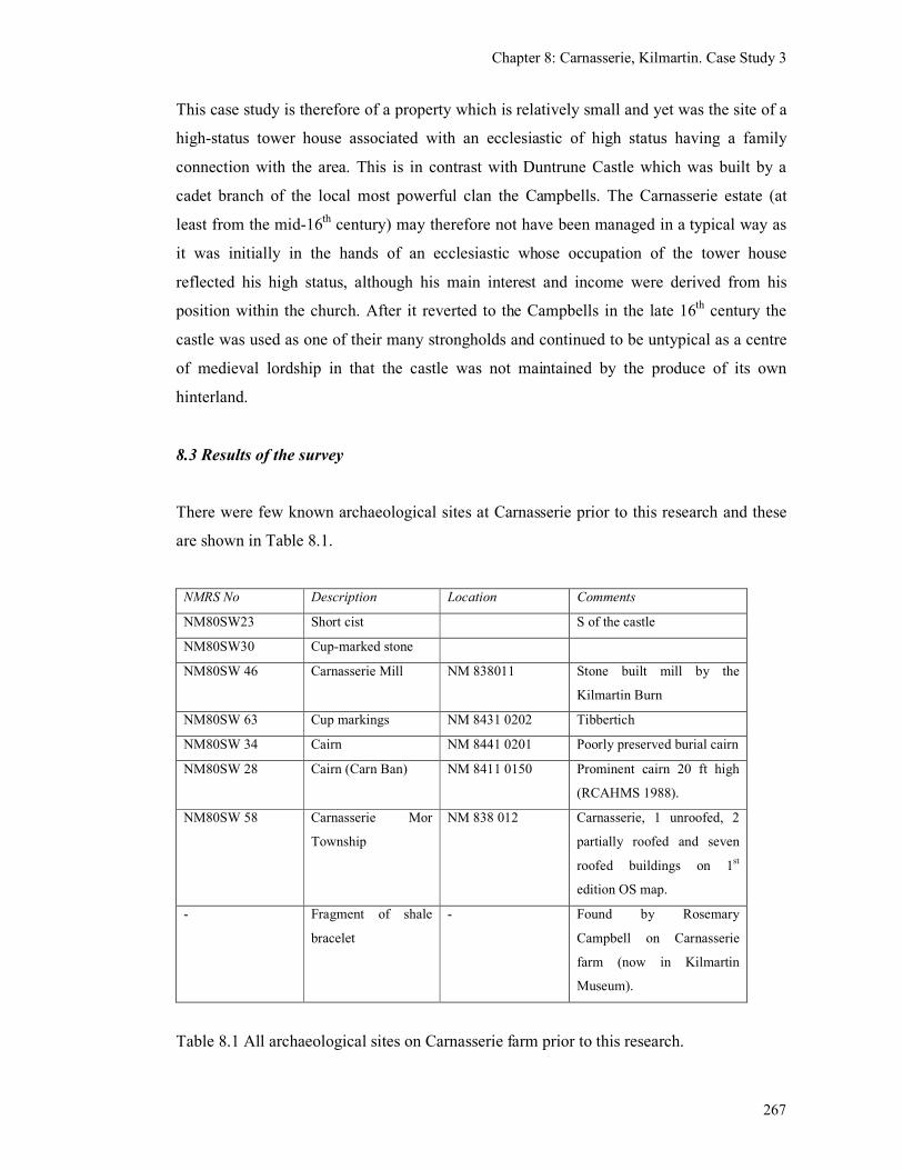
Chapter 8: Carnasserie, Kilmartin. Case Study 3
267
This case study is therefore of a property which is relatively small and yet was the site of a
high-status tower house associated with an ecclesiastic of high status having a family
connection with the area. This is in contrast with Duntrune Castle which was built by a
cadet branch of the local most powerful clan the Campbells. The Carnasserie estate (at
least from the mid-16th century) may therefore not have been managed in a typical way as
it was initially in the hands of an ecclesiastic whose occupation of the tower house
reflected his high status, although his main interest and income were derived from his
position within the church. After it reverted to the Campbells in the late 16th century the
castle was used as one of their many strongholds and continued to be untypical as a centre
of medieval lordship in that the castle was not maintained by the produce of its own
hinterland.
8.3 Results of the survey
There were few known archaeological sites at Carnasserie prior to this research and these
are shown in Table 8.1.
NMRS No Description Location Comments
NM80SW23 Short cist S of the castle
NM80SW30 Cup-marked stone
NM80SW 46 Carnasserie Mill NM 838011 Stone built mill by the
Kilmartin Burn
NM80SW 63 Cup markings NM 8431 0202 Tibbertich
NM80SW 34 Cairn NM 8441 0201 Poorly preserved burial cairn
NM80SW 28 Cairn (Carn Ban) NM 8411 0150 Prominent cairn 20 ft high
(RCAHMS 1988).
NM80SW 58 Carnasserie Mor
Township
NM 838 012 Carnasserie, 1 unroofed, 2
partially roofed and seven
roofed buildings on 1st
edition OS map.
- Fragment of shale
bracelet
- Found by Rosemary
Campbell on Carnasserie
farm (now in Kilmartin
Museum).
Table 8.1 All archaeological sites on Carnasserie farm prior to this research.
Chapter 8: Carnasserie, Kilmartin. Case Study 3
268
The site visit confirmed that the deserted settlement of Carnasserie Mor (Site 21) is one of
the largest deserted settlements in the research area, consisting of 14 structures located on
either side of a small stream (see Figure 8.6b). Structures A & B have three and two rooms
respectively and each has a fireplace incorporated into one of the gable ends (see Figures
8.6c, 8.7 & 8.8). The fireplaces appear to be original features which would suggest that the
buildings were constructed in the late 19th century. The walls are of drystone construction
and the original roofing has been replaced by corrugated iron. These two structures were
still occupied in the late 20th century by the uncle of the current owners and so Carnasserie
Mor has not been deserted for long. There is evidence for several alterations and additions
to these structures, reflecting their change of use.
Surrounding these structures are the remains of 12 other rectangular-shaped drystone
structures the majority of which are shown as roofed on the 1st edition O.S. map (Figure
8.6a). These include a sheepfold with external enclosures (I) and two barns with triangular
vents in the walls (E & F). There are two possible animal pens or sheds (J & L) and an
unroofed enclosure (C). Structure H is a ruined structure with lime-mortared walls, which
have now collapsed. There are two other possible sheds (G & K) and a low rectangular
structure of unknown purpose (D). These structures (A to L) are thought to date to the late
18th and 19th century because of their square corners, high gable ends, triangular vents in
the ‘barns’ and, in the case of Structure I, its association with sheep farming.
At the south end of the site there are the remains of two further structures (M & N) which
are not depicted on the 1st edition O.S. map. These structures lie at right angles to each
other on a rocky outcrop and survive only as slight, grass-covered banks, less than 0.5m
high, with no surviving architectural features that would indicate what their function had
been (see Figure 8.9). Structure M is 11.8 m long and 4.3m wide internally and Structure N
is 5.8m long and 3.0m internally. They are thought to be potentially earlier in date than the
other structures because of their more ruinous condition, coupled with the fact that they are
not depicted on the 1st edition O.S. map. However, Structures M & N are still recognisably
rectangular in shape, unlike the late-medieval structures found at Bàrr Mór and the work at
Glennan has shown how deceptive the low, ruinous nature of structures can be when
determining the age of a structure. So it is possible that these structures are still Post-
medieval in date, perhaps from the late-18th or very early 19th century. They may have
Chapter 8: Carnasserie, Kilmartin. Case Study 3
269
gone out of use quite quickly and the stone walls robbed, or perhaps the walls were of turf
or wattle.
Their location at the southern end of the site may be an earlier focus for Carnasserie Mor,
situated on higher rocky ground which was unsuitable for cultivation. This would have left
the lower flatter ground, to either side of the stream, available for cultivation, but was later
utilised for building on. It is possible that Structures M & N are similar to those seen near
the stream at Glennan (Sites 051, 052 & 055) which are also thought to be Post-medieval.
The documentary evidence indicates that that Carnasserie Mor was in existence by the
mid-16th century and from the early 17th century was farmed separately by the
MacLachlans at Craegenterve. The settlement was a relatively large with eight households
by the late-17th century. The surviving structures all date from the high point of population
expansion in the 19th century. Roy’s map of the mid-18th century locates the settlement to
the NW of the castle which is approximately where Carnasserie Mor still lies. There is
therefore no evidence for major settlement shift, a phenomenon noted elsewhere (see
Chapter 3).
Further fieldwork took place on the Carnasserie farm, in order to identify other unrecorded
sites that could belong to the medieval landscape. By distinguishing what are the probable
prehistoric and the Post-medieval sites, it was hoped that the remaining sites could be
considered potentially medieval in date. This fieldwork consisted of a ‘guided’ walkover
survey of the Carnasserie Farm with the owner and a topographic survey of the largest
group of shielings found.
This walkover survey provided an additional 21 new sites which were previously not
known in the archaeological record, which is a significant increase in density. The new
sites included a natural spring, two possibly prehistoric or early-Medieval circular
enclosures, a possible prehistoric hut circle, four prehistoric cup and ring mark sites, a
prehistoric saddle quern, a square-shaped structure of unknown date, three clearance cairns
of unknown date, a sinuous head dyke probably of medieval or Post-medieval date, nine
groups of shielings which could also be medieval or Post-medieval and a modern
shepherd’s shelter (see Table 8.2 and Figure 8.10).
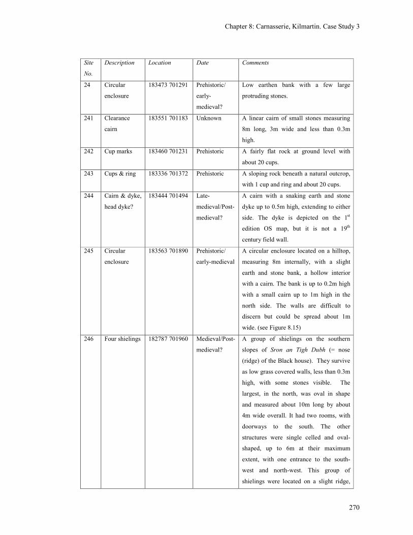
Chapter 8: Carnasserie, Kilmartin. Case Study 3
270
Site
No.
Description Location Date Comments
24 Circular
enclosure
183473 701291 Prehistoric/
early-
medieval?
Low earthen bank with a few large
protruding stones.
241 Clearance
cairn
183551 701183 Unknown A linear cairn of small stones measuring
8m long, 3m wide and less than 0.3m
high.
242 Cup marks 183460 701231 Prehistoric A fairly flat rock at ground level with
about 20 cups.
243 Cups & ring 183336 701372 Prehistoric A sloping rock beneath a natural outcrop,
with 1 cup and ring and about 20 cups.
244 Cairn & dyke,
head dyke?
183444 701494 Late-
medieval/Post-
medieval?
A cairn with a snaking earth and stone
dyke up to 0.5m high, extending to either
side. The dyke is depicted on the 1st
edition OS map, but it is not a 19th
century field wall.
245 Circular
enclosure
183563 701890 Prehistoric/
early-medieval
A circular enclosure located on a hilltop,
measuring 8m internally, with a slight
earth and stone bank, a hollow interior
with a cairn. The bank is up to 0.2m high
with a small cairn up to 1m high in the
north side. The walls are difficult to
discern but could be spread about 1m
wide. (see Figure 8.15)
246 Four shielings 182787 701960 Medieval/Post-
medieval?
A group of shielings on the southern
slopes of Sron an Tigh Dubh (= nose
(ridge) of the Black house). They survive
as low grass covered walls, less than 0.3m
high, with some stones visible. The
largest, in the north, was oval in shape
and measured about 10m long by about
4m wide overall. It had two rooms, with
doorways to the south. The other
structures were single celled and oval-
shaped, up to 6m at their maximum
extent, with one entrance to the south-
west and north-west. This group of
shielings were located on a slight ridge,
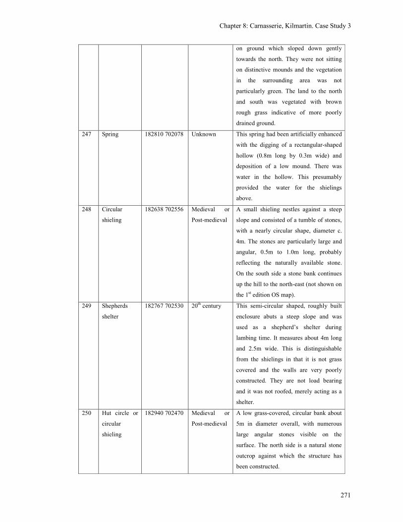
Chapter 8: Carnasserie, Kilmartin. Case Study 3
271
on ground which sloped down gently
towards the north. They were not sitting
on distinctive mounds and the vegetation
in the surrounding area was not
particularly green. The land to the north
and south was vegetated with brown
rough grass indicative of more poorly
drained ground.
247 Spring 182810 702078 Unknown This spring had been artificially enhanced
with the digging of a rectangular-shaped
hollow (0.8m long by 0.3m wide) and
deposition of a low mound. There was
water in the hollow. This presumably
provided the water for the shielings
above.
248 Circular
shieling
182638 702556 Medieval or
Post-medieval
A small shieling nestles against a steep
slope and consisted of a tumble of stones,
with a nearly circular shape, diameter c.
4m. The stones are particularly large and
angular, 0.5m to 1.0m long, probably
reflecting the naturally available stone.
On the south side a stone bank continues
up the hill to the north-east (not shown on
the 1st edition OS map).
249 Shepherds
shelter
182767 702530 20th century This semi-circular shaped, roughly built
enclosure abuts a steep slope and was
used as a shepherd’s shelter during
lambing time. It measures about 4m long
and 2.5m wide. This is distinguishable
from the shielings in that it is not grass
covered and the walls are very poorly
constructed. They are not load bearing
and it was not roofed, merely acting as a
shelter.
250 Hut circle or
circular
shieling
182940 702470 Medieval or
Post-medieval
A low grass-covered, circular bank about
5m in diameter overall, with numerous
large angular stones visible on the
surface. The north side is a natural stone
outcrop against which the structure has
been constructed.
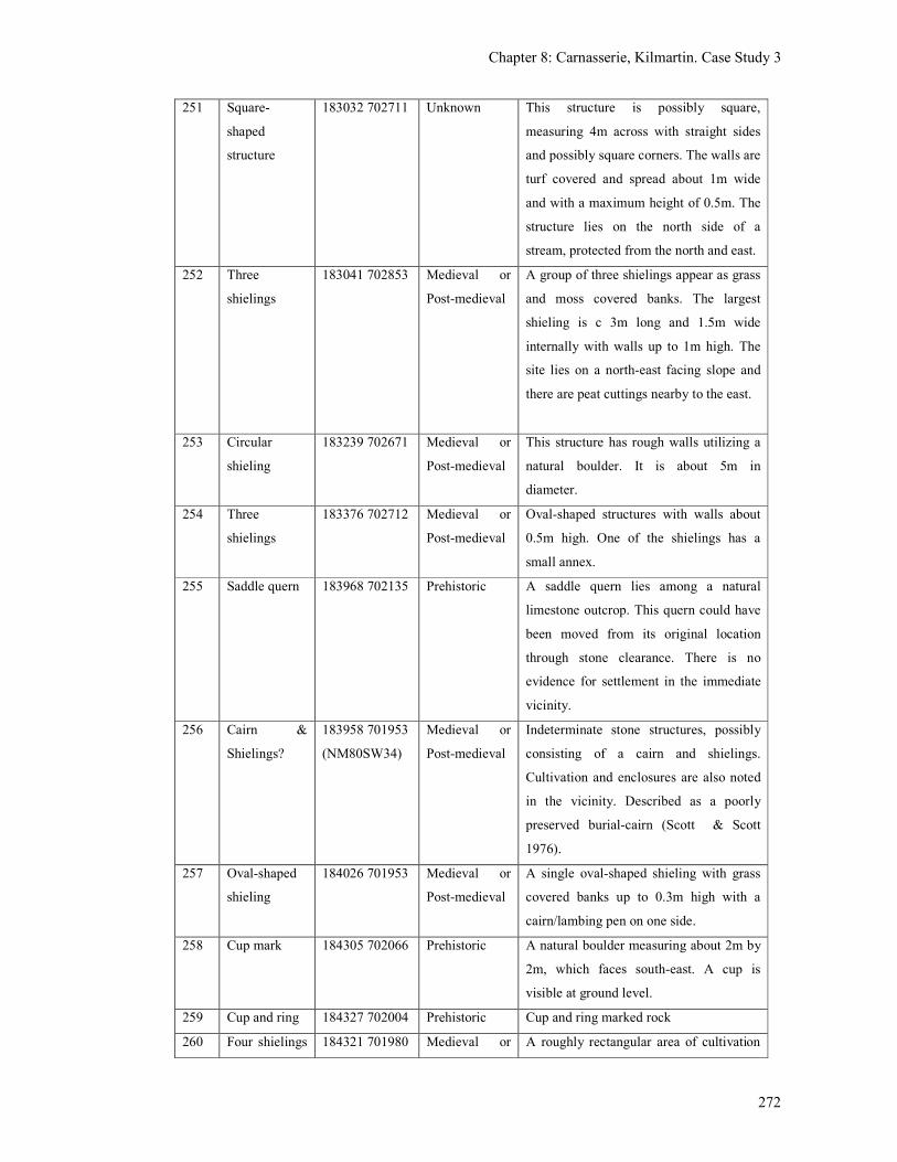
Chapter 8: Carnasserie, Kilmartin. Case Study 3
272
251 Square-
shaped
structure
183032 702711 Unknown This structure is possibly square,
measuring 4m across with straight sides
and possibly square corners. The walls are
turf covered and spread about 1m wide
and with a maximum height of 0.5m. The
structure lies on the north side of a
stream, protected from the north and east.
252 Three
shielings
183041 702853 Medieval or
Post-medieval
A group of three shielings appear as grass
and moss covered banks. The largest
shieling is c 3m long and 1.5m wide
internally with walls up to 1m high. The
site lies on a north-east facing slope and
there are peat cuttings nearby to the east.
253 Circular
shieling
183239 702671 Medieval or
Post-medieval
This structure has rough walls utilizing a
natural boulder. It is about 5m in
diameter.
254 Three
shielings
183376 702712 Medieval or
Post-medieval
Oval-shaped structures with walls about
0.5m high. One of the shielings has a
small annex.
255 Saddle quern 183968 702135 Prehistoric A saddle quern lies among a natural
limestone outcrop. This quern could have
been moved from its original location
through stone clearance. There is no
evidence for settlement in the immediate
vicinity.
256 Cairn &
Shielings?
183958 701953
(NM80SW34)
Medieval or
Post-medieval
Indeterminate stone structures, possibly
consisting of a cairn and shielings.
Cultivation and enclosures are also noted
in the vicinity. Described as a poorly
preserved burial-cairn (Scott & Scott
1976).
257 Oval-shaped
shieling
184026 701953 Medieval or
Post-medieval
A single oval-shaped shieling with grass
covered banks up to 0.3m high with a
cairn/lambing pen on one side.
258 Cup mark 184305 702066 Prehistoric A natural boulder measuring about 2m by
2m, which faces south-east. A cup is
visible at ground level.
259 Cup and ring 184327 702004 Prehistoric Cup and ring marked rock
260 Four shielings 184321 701980 Medieval or A roughly rectangular area of cultivation
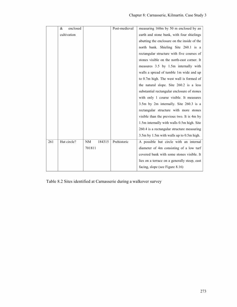
Chapter 8: Carnasserie, Kilmartin. Case Study 3
273
& enclosed
cultivation
Post-medieval measuring 160m by 50 m enclosed by an
earth and stone bank, with four shielings
abutting the enclosure on the inside of the
north bank. Shieling Site 260.1 is a
rectangular structure with five courses of
stones visible on the north-east corner. It
measures 3.5 by 1.5m internally with
walls a spread of tumble 1m wide and up
to 0.7m high. The west wall is formed of
the natural slope. Site 260.2 is a less
substantial rectangular enclosure of stones
with only 1 course visible. It measures
3.5m by 2m internally. Site 260.3 is a
rectangular structure with more stones
visible than the previous two. It is 4m by
1.5m internally with walls 0.5m high. Site
260.4 is a rectangular structure measuring
3.5m by 1.5m with walls up to 0.5m high.
261 Hut circle? NM 184315
701811
Prehistoric A possible hut circle with an internal
diameter of 4m consisting of a low turf
covered bank with some stones visible. It
lies on a terrace on a generally steep, east
facing, slope (see Figure 8.16)
Table 8.2 Sites identified at Carnasserie during a walkover survey
Chapter 8: Carnasserie, Kilmartin. Case Study 3
274
The new sites are found to either side of a high rocky ridge, Cnoc Creach which is
generally devoid of archaeological remains (see Figure 8.10). To the north-west of Cnoc
Creach there are three types of structure found which have the potential to be medieval or
Post-medieval in date.
The first consists are oval-shaped structures, interpreted as shielings, found in three groups,
each with 3 or 4 structures (Sites 246, 252 & 254). One of these groups (Site 246) is
located at Sron an Tighe Dhuibh and includes one double celled structure and three single
celled structures (see Figures 8.11, 8.12 & 8.13). The second type are isolated circular
shielings which are interspersed between the groups of oval-shaped shielings. There are
three examples of this type and they appear to be fairly evenly distributed (Sites 248, 250
& 253). The third type is a single example of a square structure (Site 251) which is located
beside a small stream. This structure is similar to a shepherds shelter on Barra, which was
thought from the pottery evidence to be earlier than the 17th or 18th centuries (Branigan
2005, 57). The location of this site at Carnasserie, beside a stream, is suggestive of a
sheltered stock enclosure or perhaps a mill.
Without any dating evidence it is very difficult to suggest how these groups of structures
relate to each other as they could all be broadly contemporary or be utilised successively
over many centuries. There is little to suggests that any of them were in use for a
considerable amount of time as they neither sit on mounds, nor is the vegetation
surrounding them particularly green (features identified as possible indication of some
antiquity by Roger Mercer (1980)). There was also no clear indications of cultivation in the
form of rig and furrow, suggesting that this area has primarily been utilised for grazing
rather than cultivation. The possibility of the circular shielings (246, 250 & 253) being
prehistoric hut circles is worth considering, and it was only the roughness of their
construction which prompted their interpretation as shielings.
To the south-east of Cnoc Creach (nearer the Castle) the potential medieval or Post-
medieval sites were more varied as they included two circular enclosures (Sites 245 and 24
(Figure 8.15), some rather indeterminate remains which could be shielings and cairns
(256), a single oval-shaped shieling (257, see Figure 8.17) and clearance cairns (241 and
244). The most substantial remains include an extensive area of cultivation with four oval
shaped shielings incorporated into its enclosure wall (Site 260, see Figure 8.14). The
Chapter 8: Carnasserie, Kilmartin. Case Study 3
275
remains in this area include clear evidence for the existence of cultivation in the form of
clearance cairns and rig and furrow as well as a small number of small structures which
could be shielings or storage huts.
Towards the end of this research a walkover survey was also carried out of the areas of
Carnasserie, Sron an Tigh Dubh, Barr an Daimh and Ormaig by Kilmartin Museum with
local volunteers. This survey produced a total number of 80 ‘structures’ and five ‘possible
structures’ which included several Post-medieval sheep fanks, twinning pens, circular and
oval-shaped shielings and 34 areas of rig and furrow (Regan & Webb 2007). While this
survey did increase the overall number of sites, it is not thought to have discovered any
significant additional potentially medieval sites.
8.4 Conclusions
The survey has examined the relationship between the late-medieval castle and the
settlement sites and shows that (in contrast to the contemporary situation) the castle once
sat within a much more populated landscape. The construction of the tower house and the
documentary references to the two Carnasserie settlements appear to be broadly
contemporary, but it is not known which of the two settlements was the original and which
one split away. One could speculate that Carnasserie Mor, being the largest and most
important, was the original settlement associated with, but at some distance from, the
significant structure (a possible hall-house) of the 15th century (which may have had
ancillary buildings around its base). There is no evidence that the site of Carnasserie Mor
has shifted significantly during the medieval period, although the earlier structures may be
located towards the southern end of the site, where the ground is rocky. Carnasserie Mor
was farmed as a joint tenancy farm during the 17th and 18th centuries. The Improvements of
the 19th century included the re-building in drystone of most of the structures at
Carnasserie Mor which has destroyed or obscured any surface evidence of earlier remains.
In the 20th century the farm of Carnasserie was amalgamated into a single holding.
When the tower house was built in the mid-16th century the smaller settlement of
Carnasserie Beg was also established in order to serve the needs of the castle occupants.
Whether it was beneath the castle walls or some distance away is not known, although in
the mid-18th century (after the castle’s destruction) it is depicted a short distance away.
Chapter 8: Carnasserie, Kilmartin. Case Study 3
276
Since then, this settlement gradually shifted closer to the walls, only to be cleared away in
the 19th century by the new owners. There is no evidence therefore that settlement was
clustered around the castle base until the Post-medieval period and in the medieval period
the castle may well have had an exclusion zone around it.
The location of this tower-house is perhaps slightly unusual for Argyll in that it is not
beside either a loch or the sea. This choice can be explained by the fact that the builder of
the castle, John Carswell, was an ecclesiastic rather than a secular lord, whose position did
not rely on sea power, and who probably chose this site because it had been in the hands of
his father and was the place of his own birth. Oram has noted the keenness of prelates such
as the Bishop of Argyll to utilise the ‘architectural symbolism of lordship’ (Oram 2005, 8)
without expressing the associated land acquisitiveness. The majority of the farm was
therefore let to the neighbouring MacLachlan clan who were resident at Craegenterve and
whose primary interest would have been the income from their tenants.
The archaeological remains within the hills at Carnasserie consist of both pastoral and
arable elements with the suggestion of an emphasis on the pastoral further away from the
castle. This is consistent with the model of permanent settlement being concentrated
around the patches of cultivatable land and the hill ground beyond being used for grazing
stock (Site 260). The presence of prehistoric remains in the form of cairns, a hut circle and
a saddle quern are also indicative of prehistoric settlement in the area and suggests that
colonisation of the forest (see Figure 2.42) had already taken place well before the
medieval period, although this was likely to consist of irregular patches. It is probable that
the prehistoric fields were subsumed into and enlarged on by the medieval fields and these
in turn have been obliterated by the intense cultivation of the Post-medieval rig and furrow.
The structures also exhibit a variety of morphology for which the chronological framework
is scanty. There are no examples of structures with high drystone walls as were found at
Bàrr Mór, which are known to be of late-medieval date (Chapter 6). However the two-
celled structure at Site 246, at 10m long and 4m wide, is of similar length to, although
perhaps slightly narrower than, Structure A. The walls of the two-celled structure are only
0.3m high, probably a result of a low foundation wall of stone supporting turf walls as was
seen at Structure B. As has been shown this technique could date from the early-medieval
period to the 19th century. The grouping of shielings some with cultivation is also
Chapter 8: Carnasserie, Kilmartin. Case Study 3
277
reminiscent of the findings at Glennan, the potential of which to be medieval has been
suggested. The structures incorporated into an enclosing wall at Site 260 (Carnasserie) is
also similar to the ‘outhouse’ at Rosal Complex A which Fairhurst speculated was
medieval in date (Figure 2.8).
The shielings have proved easy to identify and survey, but there is a great deal of work
which still needs to be done on their date and function. In the meantime it would perhaps
be unwise to date all the circular features as prehistoric hut circles purely from the visible
surface remains alone. There is after all very little difference between an oval-shaped
shieling and a circular-shaped turf covered hut circle. The circular sites identified at
Carnasserie are relatively small for hut circles being only 5m to 8m in diameter and these
may well prove to be circular shielings as seen on Jura (see Figure 2.17). The great variety
of shapes and sizes of shielings was also displayed by the survey of Barra (Branigan 2005,
45-47).
Future work at Carnasserie could involve greater use of aerial photography enabling
particular areas to be focused on and allowing areas of cultivation to be mapped rapidly.
Excavation of some of the oval shieling sites and circular hut circles would clarify their
function and provide information on how the utilisation of the landscape developed.
Chapter 9: North Knapdale, Case Study 4
278
Chapter 9: North Knapdale, Case Study 4
9.1 Introduction
This case study takes a wider view of the landscape than the previous studies in that it
encompasses the west coast of North Knapdale, particularly Kilmory Knap and the Keills
peninsula located on either side of Loch Sween, the east part of North Knapdale being
mostly forestry plantation (see Figure 1.1). The purpose of this case study was to examine
the potential for medieval settlement in a large area dominated by a significant lordship
which was based at Castle Sween (one of the earliest stone castles in Scotland). The area
was also served by two significant medieval chapels at Keills and Kilmory (as evidenced
by the presence of several medieval carved burial slabs, see Chapter 5) and a potentially
medieval re-used dun at Dun Mhurich.The only difference to the methodology used by the
other case studies was a greater emphasis on the use of aerial photographs. This was
undertaken to see whether the use of aerial photographs could speed up the process of
identification of potential medieval sites in the landscape, so that fieldwork could be more
targeted.
North Knapdale is not a rich agricultural area as it is generally rocky with few areas
suitable for cultivation. Castle Sween is located on a thin coastal strip on the north-west
side of a wide peninsula between Loch Sween and Loch Caolisport, known as Kilmory
Knap. Inland from the low-lying coastal strip, the landscape consists of rocky ridges
aligned north-east to south-west, rising up to about 300m above sea level. In between
these ridges there are small inland lochs, streams and unimproved ground, largely devoid
of natural woodland. The only natural woodland by the mid-18th century was along the
north shore from Daltote to Drynach and in patches along the south coast (as depicted by
Roys’ military map). The Keills peninsula lies on the north side of Loch Sween, extending
south-westwards between Loch Sween and the Sound of Jura, from Tayvallich to the island
of Danna. The landscape is similar to Kilmory Knap being low-lying, with rocky ridges
inland up to a height of about 100m, but the cultivated coastal strip faces south-east, the
north-west coast being rocky and exposed. The Taynish peninsular is the only area where
natural woodland survived in the mid-18th century.
Chapter 9: North Knapdale, Case Study 4
279
This case study has revealed that the settlement pattern of this area consisted of small
farms distributed thinly around the coastal edges since at least the 16th century. Prior to this
the changes in lordship since the 13th century would have provided opportunities for
modifications to be made to the tenant population and settlement pattern, but was probably
still sparse and non-nucleated until the 17th or 18
th century. The fieldwork has highlighted
the potential presence of lesser lordships in the Keills peninsular with an absence of these
in Kilmory Knap, in the vicinity of Castle Sween.
9.2 Known archaeological sites
The recorded archaeology sites are relatively sparse in this area and the medieval sites are
relatively under represented considering the level of activity in the prehistoric and Post-
medieval periods. The sites of prehistoric date on the Keills peninsula include several duns
and forts (RCAHMS 1988, Nos 292, 245, 247, 302, 311, 301, 251, 289), cup-marked
rocks, Bronze age cists, standing stones, rock shelters and kerbed cairns. On Kilmory Knap
there are also several duns, forts, cairns, cup-marked rocks, caves and rock shelters which
all attest to a prehistoric presence in the region. Of the duns and forts, a few have crudely
built internal structures which have been interpreted as re-use in the recent (Post-medieval)
past (Royal Commission 1988, Sites 300, 295, 254 & 246). Only two hut circles have been
recorded, both located near the coast, one at Doide (NR77NW 24) and another possible
one at Dun Rostan (NR78SW20).
The early-medieval period is represented only by ecclesiastic sites such as the early
Christian crosses at Keills, Kilmory and Cladh a’Bhile and burial grounds at Kilmory,
Daltote and ‘Druim a Chladha’ (near Castle Sween).
The medieval period is represented on the Keills peninsular primarily by Keills chapel
which dates to the last quarter of the 12th century, with its early-Christian crosses, medieval
grave slabs and graveyard (NR68SE2; RCAHMS 1992, 83), although around the chapel
several rectangular building foundations and enclosures have been identified as the
remains of a depopulated settlement (NR68SE5). The prehistoric site of Dun Mhuirich also
has rectangular structures within it which indicate that it is a complex, potentially multi-
period site. Other duns and forts have only crudely built shelters which are thought to be
fairly modern (RCAHMS 1988 190; Royal Commission Site 311). There is a fortified
Chapter 9: North Knapdale, Case Study 4
280
island dwellings at Eilean na Circe which lies at the head of Caol Scotnish (see Chapter 2)
and a possible crannog with a rectangular structure on an island within Lochan Taynish
(NW78NW14, Hill & Barrett 1976) which has potential to be a medieval island dwelling
utilising an earlier prehistoric crannog site.
Kilmory Knap in the medieval period would have been dominated by Castle Sween which
is thought have been built by a powerful local chieftain (Suibhne) in the late 12th century.
Kilmory was chosen to be the site of a medieval chapel in the early 13th century and
throughout the medieval period was a focus for aristocratic burial is shown by the presence
of several medieval carved burial slabs (RCAHMS 1992, 161-172; Fisher 2001). The only
other recorded medieval site is a stone quarry at Doide, which provided stone for Castle
Sween and for St John’s Cross on Iona and the crosses on Oronsay.
There are a few sites which have been described as being of indeterminate date and are
therefore potentially medieval in date. Near Keills, these include enclosures, clearance
cairns and cultivation remains at Droineach (NR78SW26, NGR NR 702 811), a group of
possible oval and rectangular shaped shielings at Torr Mor (NE78NW19, NGR 745 878)
and a possible building (or stone circle) at Leachive (NR78NW 8). On Taynish island the
foundations of several rectangular and oval shaped buildings have been noted, which may
be shielings (NR78SW6). Sites of unknown date in Kilmory Knap include a millstone
quarry at Balimore (NGR NR711 746) which may be ‘considerably earlier than the 19th
century’ (RCAHMS 1992, 483) and ‘small enclosures and hut foundations’ at Corran
Buidhe (NR77NW 16, NR723 798).
The Post-medieval period is well represented in Kilmory Knap and Keills peninsula. There
are charcoal burning platforms in Taynish (NR78NW11 & 15; Sneddon 2003) and several
deserted townships as depicted on the 1st edition OS map (FESP data). There is also a corn-
drying kiln (NR78NW12) 300m NE of Barnashalg standing stone. In Kilmory Knap the
Post-medieval sites include a sheepfold, a shieling at Cnoc Stighseir (NR77NW14, NGR
NR 7125 7652), a 17th century mill at Stronefield (NR77SW7, NGR 715 741) and a
number of deserted farmsteads or townships.
This review of the known archaeological sites has shown that although there was a
significant human presence here during the prehistoric period, the medieval period is

Chapter 9: North Knapdale, Case Study 4
281
under-represented, consisting primarily of the stone built remains of Castle Sween, and the
medieval chapels and burial grounds of Keills and Kilmory, a fortified dwelling at Eilean
na Circe and a possible multi-period dun at Dun Mhuirich. The problem is that, as seen
elsewhere in Scotland, the rural settlements of those who farmed the land controlled by the
castle occupants and administered to by the chapels have not been identified. There are a
few potentially medieval sites, including a shieling, a few ‘indeterminate’ sites and a
possible depopulated settlement, but all of these currently lack dating evidence. The
reasons for this lack of sites are probably the relative remoteness of the interior and the
consequent lack of detailed survey work that has taken place here, which could therefore
be ameliorated by this research programme.
9.3 Historic maps and documents
Knapdale was the ancestral lands of the MacSweens and the Gaelic lord Suibhne was by
tradition the thane of Knapdale and Glasserie, a considerable area, which enabled him to
build Castle Sween (see Figure 2.37, RCAHMS 1992, 258) The MacSweens were major
landowners in Scotland who moved in the highest circles. Dugald, son of Suibhne, signed a
charter in Paisley along with Walter Stewart the Justiciar of Scotland (RCAHMS 1992,
258). The MacSweens were ousted in the 13th century by the Stewart Earl of Menteith for
reasons not recorded, but probably relates to Norman expansion at the expense of the
native Gaelic lords. The MacSweens were unsuccessful in their attempted to regain their
lands with the backing of the English King during the wars of Independence. Castle Sween
is first referred to in documents in 1353 as ‘Castle Suyn’ (see Tables 4.3 & 5.5) and there
is a reference to its associated farmland as the pennyland of ‘Castle Swine’ in 1357
(RCAHMS 1992, 259). If the connection between 1 man per pennyland (see Chapter 7) is
corret then this would mean that the farmland associated with the castle was not extensive,
(compared to the five pennylands of Glennan for instance) which would also support the
idea that the castle was not a focus for a large population outwith the household of the lord.
As heir to the Menteith lands Robert Stewart, later Robert II, inherited the estate.
The lands of Knapdale were granted by the crown to the Lords of the Isles and after the
forfeiture of the Lordship in the late 15th century, Knapdale passed to the Campbell Earls
of Argyll. The lesser clans, holding lands in Knapdale, included the MacNeills and the
MacMillans, who were in turn keepers of the castle for the Lords of the Isles. While the
Chapter 9: North Knapdale, Case Study 4
282
MacNeills changed loyalties at the forfeiture of the Lordship and thereby retained control
of some of their lands, the MacMillans (who were closely tied to the Clan Donald) were
ousted because of their hostility to the Campbells. The Campbells took their lands by force
as they were met with opposition to their new ownership from many of the traditional
MacDonald tenants. This loss of the traditional MacDonald lands led eventually to the
rebellion by James MacDonald of Dunneyveg and his son Alistair MacColla in the 17th
century. The castle acted as the primary lordly residence throughout the medieval period,
the additions and alterations reflecting the requirements and status of the resident keepers.
After being burned by Alisdair McColla in 1647, the castle was re-occupied as a farmstead
rather than as a lordly residence. A sasine dated 1652 refers to a mill at Castle Sween
(location unknown) and to the sharing of fishing rights and responsibilities between the
lord Sir Dougal Campbell of Auchinbreck and his superior, the Marquis of Argyll.
… ‘Seneschlate of Knapdale’ including the ‘Mill of Castleswyne, all in
Knapdale, together with the custody of Castleswyne’. Also the ‘office of
Toiseachdeors of Glassary…..and half fishing of the river Add…..
Auchinbreck and his heirs being required to maintain a boat and fishing tackle
....while Argyll and his heirs are to pay the average expense of the nets…and
for the Glassary and Ardcallum said offices, the usual services, with a ten-
oared ship… witness Patrick Campbell of Kilmorie, Castleswyne’ (Campbell
1933, 121-22, No 346).
Although there is no direct reference to a settlement, the miller and fishermen would have
required accommodation in settlements, presumably in the vicinity. The earliest useful map
of settlement place-names is provided in Blaeu’s Atlas dated 1654 (see Table 5.3) which
was based on Pont’s manuscript maps (which have not survived). This includes ‘The
Province of Knapdail’ (see Figure 4.8 for a detail of the Keills peninsula and Figure 9.1 for
Kilmory Knap). ‘Castle Suyn’ is depicted with a slightly different symbol to the
neighbouring settlements (see Figure 9.2), reflecting the different character of the castle
and its occupation.
Blaeu’s Atlas depicts several settlements and clearly shows that the significant farms were
all located around the coastal edge. Ten farms between Castle Sween and Loch Caolisport
Chapter 9: North Knapdale, Case Study 4
283
were owned as a unit in the late 15th century as they formed the dowry of Erca when she
married the 5th MacMillan of Knap in the late-15
th century (MacMillan 1960, 13). This
historical evidence is broadly consistent with Blaeu’s Atlas which depicts nine settlements
of Ken Loch Cheuhispurt, Eillery, Owa, Schronsselt, Innerstain, Balmoirknap, Feirnach,
Ardennaeg and Castle Swyn and a chapel at Kilmore (still with a cross). It would seem
probable that this whole peninsula was owned as a unit by the keepers of Castle Sween,
including coastal settlements and upland pasturage, which probably resulted in a degree of
consistency of economy, building techniques and farming practices.
Blaeu’s map of the Keills peninsula also depicts several settlements many along the coastal
edge (see Figure 4.8 and Table 5.3). There is some map evidence for the existence of
fortified settlements. Two inland settlements, called Y na uaid M and Yrin na uaid B to the
south of Glensavel have place-names which suggest that they may be located on islands
and are therefore potentially fortified settlements perhaps of the lesser aristocracy. These
are potentially two island strongholds or settlements which have divided from a single
origin Yrin na uaid M[or] and B[eg]. Pont uses ‘Y’, ‘Yle’ and ‘Ylen’ to refer to islands, as
seen in Loch Lomond (National Library of Scotland, Pont No. 17) and so the use of ‘Y’
and ‘Yrin’ here is thought also to be signifying islands. Consultation of the modern maps
shows that the site of Dun Bhronaig lies in this vicinity at the northern edge of Loch Duin
Calltainn. Prior to the Improvements and drainage, this loch could have been more
extensive with the dun sitting as an island within it. To the south the modern maps shows
another small loch inland from Tayvullin, shown on modern maps, which might be the
location of ‘Yrin na uaid B’.
The historical records for residences of lesser lordships within North Knapdale are few and
consist of a fortified dwelling on the island of Eilean na Circe (said to be the refuge for the
laird of Ob (the Campbells of Oib)) and the Robbers Den at Ardrishaig (used in the late
medieval period by the MacIver and MacVicar families). The crannog at Duntaynish has
no known family connection. Loch Sween is called ‘Cheulis na Kerk’ by Blaeu in
reference to Yl Kerk’ (the fortified island Eilean Circe). The inlet known today as Linne
Mhuirich where Dun Mhuirich is located, is missing from Blaeu’s Atlas, perhaps
indicating that Pont did not travel up this particular section of the coast. Not all settlements
are important enough to be named as the five unnamed sites of the island of ‘Denna’
shows.
Chapter 9: North Knapdale, Case Study 4
284
By the mid 18th century Castle Sween has an enclosure to the south and is separated from a
small cluster of buildings by a coastal track (see Roy’s military map, Figure 9.3). The Post-
medieval settlement at Castle Sween, focused a short distance from the castle, may have
only been established after the burning of the castle in 1647.
Castle Sween dominated the medieval landscape of Knapdale, in that there are no other
known castles in the vicinity, the nearest being Tarbet, Skipness and Dunaverty castles, all
further south in Kintyre. The castle is located on the coast between two anchorages Sgeir
Dubh and Traigh Bhan from where it could control sea traffic along the sound of Jura. On
the landward side, there is a slightly more extensive coastal strip here than elsewhere in
Knapdale, which would have provided the best cultivatable land in North Knapdale. With
access to the resources of the sea, arable fields and pasture, the lords could maximise the
economic potential of this area. The existence of such a large castle as Castle Sween in this
area at an early period, indicates access to some considerable wealth, by the MacSweens as
is supported by the historic records which records Suibhne as ‘Thane of Knapdale and
Glassrie’ and later MacSweens as lords of much of Knapdale (RCAHMS 1992, 258).
As with the other case studies, a comparison was made between Blaeu’s Atlas, Roy’s
military map of the mid 18th century and the 1
st edition OS map in order to identify sites on
the ground. An examination of the earliest documentary references (Table 4.3) and other
sources such as the Argyll Sasines and List of Fencible Men enabled some observations to
be made about settlement size and continuity in the late medieval and Post-medieval
period.
Firstly, the majority of sites on Blaeu’s Atlas can be found either on Roy’s map of the mid-
18th century or on the 1
st edition OS maps of the mid-19
th century and so represents
continuity of settlement place-names from the late-16th century into the Post-medieval
period. Very few of these names could be traced further back than the 16th century which is
probably mainly due to a lack of historical documents from this earlier period. The
exceptions were Castle Sween (1353), the island of Ulva (1351) and Barbeith (1429-1449)
(see Table 4.3). There is a significant number of place-names which are recorded in the
period from the mid-14th to the 16
th centuries, but have since disappeared from the records
(Tables 4.3 & 5.3). There are several reasons why place-name changes may have occurred
including scribal error, unfamiliarity with Gaelic, change of ownership or perhaps
Chapter 9: North Knapdale, Case Study 4
285
desertion though war, famine or disease. The sites which have disappeared include
Apenad, Barmore (Danna) Skondenze, Dreissag, Barrandayb, the island of Thivinche,
Ardennaeg, Innerstain, Schronsselt and Owa.
An attempt was made to link these names with later place-names. An example is that of
Apenad (1351) which is similar to Ardenavad (1513) and also to Ardennaeg (depicted by
Blaeu). However, none of these names are mentioned in the Argyll Sasines and they cannot
be identified in the modern landscape. Without further research one could not confidently
claim that they are the same place. Place-name changes in the later medieval period can be
traced with more confidence. For example, Schronselt, via Stronfyll to Stonefield. A sasine
dated 1632 refers to the
‘12 merk lands of Knap, in Knapdale (viz., the 2 merk land of Kilmoir, 2 merk
land of Fernach, 4 merk land of Ballimore and 4 merk land of Stronfyll),
given… to John Campbell, now of Knap’ (Campbell 1933, No 425, 135).
The inclusion of Stronfyll after Ballimore is consistent with the location ‘Schronselt’
depicted by Blaeu on the south coast of the peninsula, and may be the same place. In 1643
there is a
‘sasine of the 2 merk land of Kilmorie, 2 merk land of Fernoch, 4 merk land of
Ballimore and 4 merk land of Stronsyle, all in Knapdale, given by Hector
MacNeill of Caldchailzie [Gallachelly], as baillie to Patrick Campbell, now of
Knap, as lawful son and nearest heir male of deceased John C. of Knap, on a
precept of clare constat by the Marquess of Argyll’ (No 250, Campbell 1933,
82).
Campbell particularly mentions the change of name from ‘Strontill’ to ‘Stronfield’ in
various writs (Campbell 1934, 135) and in 1724 there is a reference to ‘John Campbell of
Stronfield, with a reservation regarding the mill of Stronfield…..four merk lands of
Stronfield’ (Campbell 1916b, 1).
The migration of settlement sites can be occasionally detected as at Kilbride (Kilmory
Knap) which is depicted on the 1st edition OS map as a roofed settlement, just south of a
Chapter 9: North Knapdale, Case Study 4
286
stream, the Allt Bealach an Eich. However about 150m upstream there is a deserted
settlement of five unroofed structures and three enclosures, which is probably the site
depicted by Roy and possibly also by Blaeu. There is also an example of an unnamed site,
near Keills Port, disappearing from the maps since Roy’s survey of the mid-18th century.
This unnamed can be located fairly confidently at the back of the bay at Keills Port, a
location which would provide some shelter, access to cultivated ground and the sea.
There are a small number of sites have split since the 16th century. Ardbeg is depicted as a
single site by Blaeu, but has become Ardbeg and E[ast] Ardbeg by the mid-18th century.
Roy also depicts two sites ‘Fernach iacherack’ and a ‘Fernach-uacherack’ rather than the
single Feirnoch as in Blaeu. Kilmacharmick (which becomes Keills) is the only site in
North Knapdale appears to have split into the two forms mor and beg by the late 16th
ccnetury, although only one settlement symbol is actually depicted by Blaeu. Two sites
depicted by Roy, Tornacleach beg and Ardfind beg, have no corresponding mor sites. In
North Knapdale the splitting of sites would appear to be a rare and generally Post-medieval
phenomenon.
Examination of the Hearth Tax data of 1694 shows that the settlements remained small
well into the 17th century (see Table 4.1). But this data is problematic as it does not always
correspond with the information in the List of Fencible men of 1692 (see Table 9.1). For
example Ballemore and Fernoch have respectively 4 and 3 occupants, each with a single
hearth, according to the 1694 list, but the List of Fencible men in 1692 lists 3 and 2 names
respectively. This difference may not be hugely significant as the size of both settlements
can be seen to be small in the 17th century, generally between 2 and 4 households, and a
maximum of 6, each with a single hearth. Other sites in North Knapdale which have more
than one hearth and so are probably occupied by lairds or clan chiefs include Oib (the
Grahames), Tayneish (the McNeills), Ardbeg (unknown), Barbe (unknown), Dentaynish
(unknown), and Kilmorrie (unknown), (see Table 4.1).
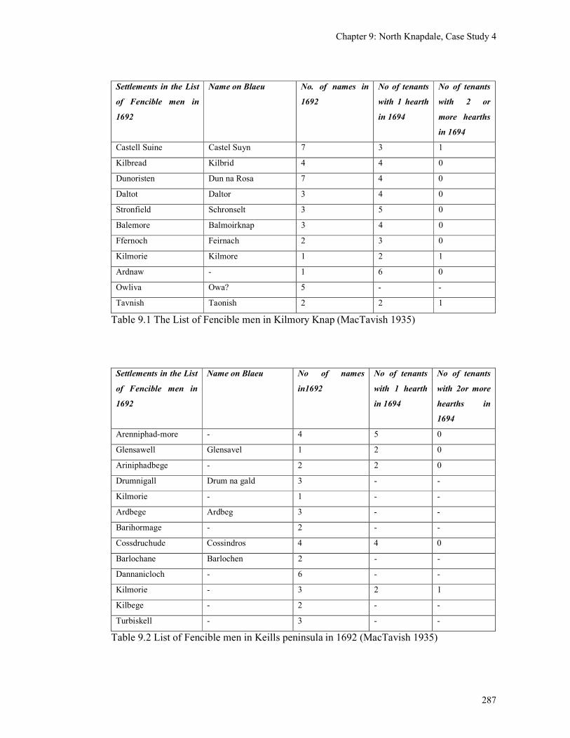
Chapter 9: North Knapdale, Case Study 4
287
Settlements in the List
of Fencible men in
1692
Name on Blaeu No. of names in
1692
No of tenants
with 1 hearth
in 1694
No of tenants
with 2 or
more hearths
in 1694
Castell Suine Castel Suyn 7 3 1
Kilbread Kilbrid 4 4 0
Dunoristen Dun na Rosa 7 4 0
Daltot Daltor 3 4 0
Stronfield Schronselt 3 5 0
Balemore Balmoirknap 3 4 0
Ffernoch Feirnach 2 3 0
Kilmorie Kilmore 1 2 1
Ardnaw - 1 6 0
Owliva Owa? 5 - -
Tavnish Taonish 2 2 1
Table 9.1 The List of Fencible men in Kilmory Knap (MacTavish 1935)
Settlements in the List
of Fencible men in
1692
Name on Blaeu No of names
in1692
No of tenants
with 1 hearth
in 1694
No of tenants
with 2or more
hearths in
1694
Arenniphad-more - 4 5 0
Glensawell Glensavel 1 2 0
Ariniphadbege - 2 2 0
Drumnigall Drum na gald 3 - -
Kilmorie - 1 - -
Ardbege Ardbeg 3 - -
Barihormage - 2 - -
Cossdruchude Cossindros 4 4 0
Barlochane Barlochen 2 - -
Dannanicloch - 6 - -
Kilmorie - 3 2 1
Kilbege - 2 - -
Turbiskell - 3 - -
Table 9.2 List of Fencible men in Keills peninsula in 1692 (MacTavish 1935)
Chapter 9: North Knapdale, Case Study 4
288
Higher status sites are indicated by the presence of an occupant with more than one hearth
as are recorded at Castell Swine, Kilmorrie and Taynish (Table 9.2). Castle Sween was by
the 17th century held by the Campbells and Taynish by the MacNeills. It is more difficult to
relate Kilmorie to a family name as there are at least three Kilmory place-names in North
Knapdale (Kilmory Oib, Kilmory Knap and Kilmory (south of Dun Mhuirich)). The three
leading families in North Knapdale in the late medieval period, the MacMillans, Campbells
and the MacNeills were all incomers to Knapdale, the MacMillans in the mid-14th century
and the Campbells and the MacNeills in the 15th century. They took over existing lordships
and were all associated at some time with Castle Sween.
9.4 Aerial photographs
The main difference in methodology utilised in this case study was the more extensive
consultation of aerial photographs prior to the walkover survey. It was hoped that
additional potential sites would be identified on the aerial photographs which could then be
checked during the walkover survey.
The aerial photographs consulted included black and white vertical photographs taken in
1947 and colour photographs taken in 1988 (see Appendix 5). As a result of this several
areas of rig and furrow and three potential settlement sites were identified. The rig and
furrow was seen particularly well along the sides of the road between Kilmory and
Cosandrochaid (Kilmory Knap). The deserted settlements already identified on the 1st
edition O.S. map could generally be seen clearly, but it was not possible, from this altitude,
to identify additional structures in the vicinity of them. Potentially new sites identified
from the aerial photographs included the following (not illustrated).
1. Coshandrochaid shieling. About 100m to the west of this farm, what looked like a two-
celled rectangular structure was identified (CPE/SCOT/UK/249 4058-59). This building
was above the head dyke and so could be a shieling or a shelter (NR 705 821). It is not
marked on the 1st edition OS map.
2. Barr an Lochain platform. About 200 m to the east of Barr an Lochain there is an oval-
shaped platform with what looks like a bank at its western edge. This platform measures
about 40m N-S by 30m E-W. It does not have any structures or cultivation ridges on it (NR
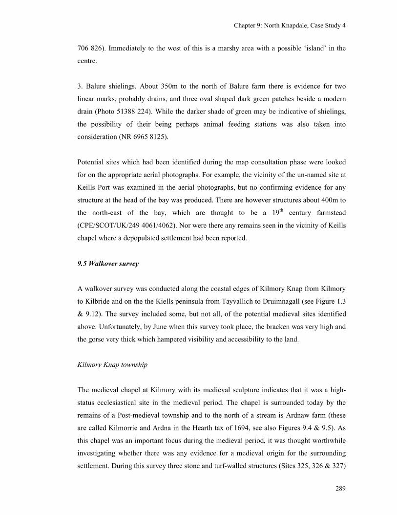
Chapter 9: North Knapdale, Case Study 4
289
706 826). Immediately to the west of this is a marshy area with a possible ‘island’ in the
centre.
3. Balure shielings. About 350m to the north of Balure farm there is evidence for two
linear marks, probably drains, and three oval shaped dark green patches beside a modern
drain (Photo 51388 224). While the darker shade of green may be indicative of shielings,
the possibility of their being perhaps animal feeding stations was also taken into
consideration (NR 6965 8125).
Potential sites which had been identified during the map consultation phase were looked
for on the appropriate aerial photographs. For example, the vicinity of the un-named site at
Keills Port was examined in the aerial photographs, but no confirming evidence for any
structure at the head of the bay was produced. There are however structures about 400m to
the north-east of the bay, which are thought to be a 19th century farmstead
(CPE/SCOT/UK/249 4061/4062). Nor were there any remains seen in the vicinity of Keills
chapel where a depopulated settlement had been reported.
9.5 Walkover survey
A walkover survey was conducted along the coastal edges of Kilmory Knap from Kilmory
to Kilbride and on the the Kiells peninsula from Tayvallich to Druimnagall (see Figure 1.3
& 9.12). The survey included some, but not all, of the potential medieval sites identified
above. Unfortunately, by June when this survey took place, the bracken was very high and
the gorse very thick which hampered visibility and accessibility to the land.
Kilmory Knap township
The medieval chapel at Kilmory with its medieval sculpture indicates that it was a high-
status ecclesiastical site in the medieval period. The chapel is surrounded today by the
remains of a Post-medieval township and to the north of a stream is Ardnaw farm (these
are called Kilmorrie and Ardna in the Hearth tax of 1694, see also Figures 9.4 & 9.5). As
this chapel was an important focus during the medieval period, it was thought worthwhile
investigating whether there was any evidence for a medieval origin for the surrounding
settlement. During this survey three stone and turf-walled structures (Sites 325, 326 & 327)
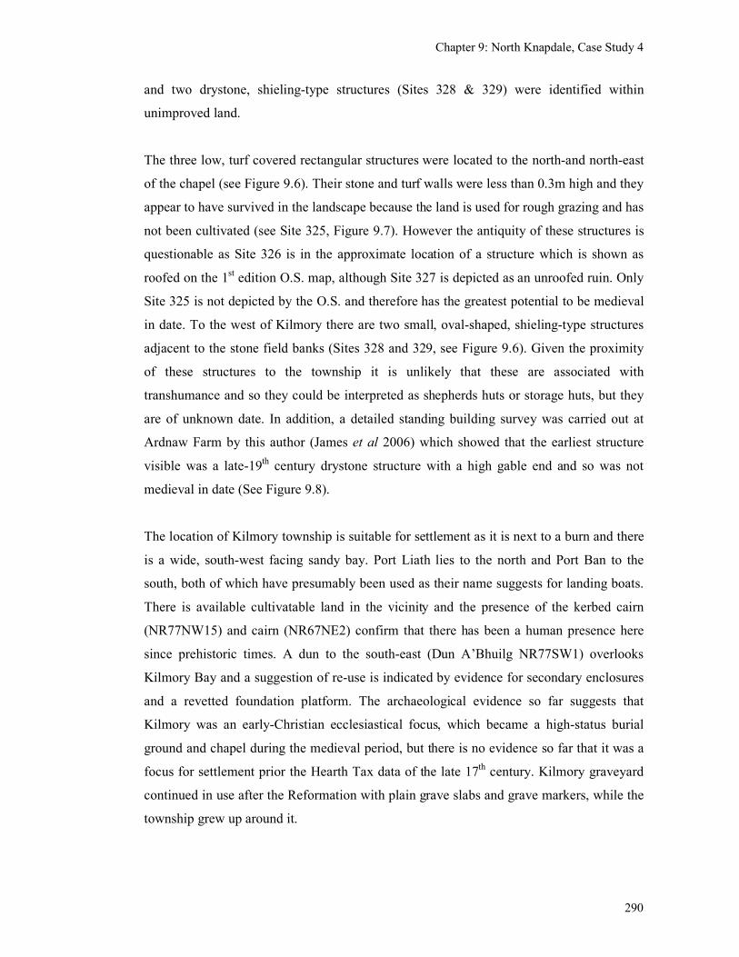
Chapter 9: North Knapdale, Case Study 4
290
and two drystone, shieling-type structures (Sites 328 & 329) were identified within
unimproved land.
The three low, turf covered rectangular structures were located to the north-and north-east
of the chapel (see Figure 9.6). Their stone and turf walls were less than 0.3m high and they
appear to have survived in the landscape because the land is used for rough grazing and has
not been cultivated (see Site 325, Figure 9.7). However the antiquity of these structures is
questionable as Site 326 is in the approximate location of a structure which is shown as
roofed on the 1st edition O.S. map, although Site 327 is depicted as an unroofed ruin. Only
Site 325 is not depicted by the O.S. and therefore has the greatest potential to be medieval
in date. To the west of Kilmory there are two small, oval-shaped, shieling-type structures
adjacent to the stone field banks (Sites 328 and 329, see Figure 9.6). Given the proximity
of these structures to the township it is unlikely that these are associated with
transhumance and so they could be interpreted as shepherds huts or storage huts, but they
are of unknown date. In addition, a detailed standing building survey was carried out at
Ardnaw Farm by this author (James et al 2006) which showed that the earliest structure
visible was a late-19th century drystone structure with a high gable end and so was not
medieval in date (See Figure 9.8).
The location of Kilmory township is suitable for settlement as it is next to a burn and there
is a wide, south-west facing sandy bay. Port Liath lies to the north and Port Ban to the
south, both of which have presumably been used as their name suggests for landing boats.
There is available cultivatable land in the vicinity and the presence of the kerbed cairn
(NR77NW15) and cairn (NR67NE2) confirm that there has been a human presence here
since prehistoric times. A dun to the south-east (Dun A’Bhuilg NR77SW1) overlooks
Kilmory Bay and a suggestion of re-use is indicated by evidence for secondary enclosures
and a revetted foundation platform. The archaeological evidence so far suggests that
Kilmory was an early-Christian ecclesiastical focus, which became a high-status burial
ground and chapel during the medieval period, but there is no evidence so far that it was a
focus for settlement prior the Hearth Tax data of the late 17th century. Kilmory graveyard
continued in use after the Reformation with plain grave slabs and grave markers, while the
township grew up around it.
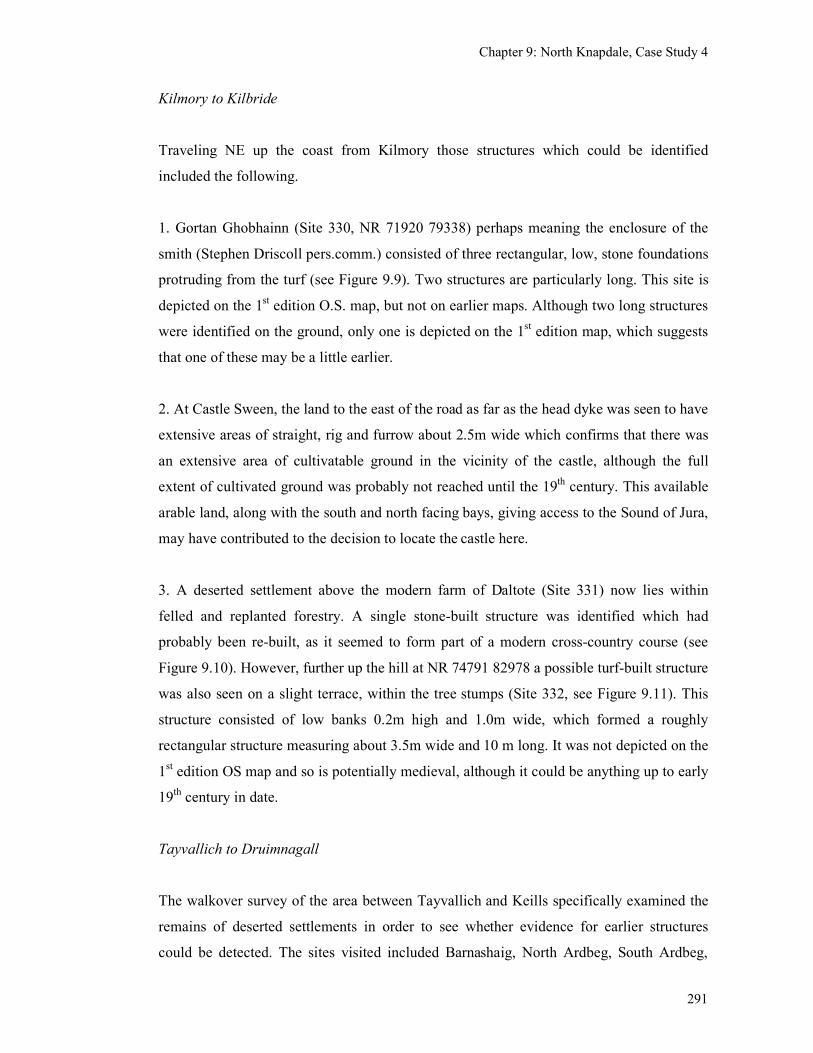
Chapter 9: North Knapdale, Case Study 4
291
Kilmory to Kilbride
Traveling NE up the coast from Kilmory those structures which could be identified
included the following.
1. Gortan Ghobhainn (Site 330, NR 71920 79338) perhaps meaning the enclosure of the
smith (Stephen Driscoll pers.comm.) consisted of three rectangular, low, stone foundations
protruding from the turf (see Figure 9.9). Two structures are particularly long. This site is
depicted on the 1st edition O.S. map, but not on earlier maps. Although two long structures
were identified on the ground, only one is depicted on the 1st edition map, which suggests
that one of these may be a little earlier.
2. At Castle Sween, the land to the east of the road as far as the head dyke was seen to have
extensive areas of straight, rig and furrow about 2.5m wide which confirms that there was
an extensive area of cultivatable ground in the vicinity of the castle, although the full
extent of cultivated ground was probably not reached until the 19th century. This available
arable land, along with the south and north facing bays, giving access to the Sound of Jura,
may have contributed to the decision to locate the castle here.
3. A deserted settlement above the modern farm of Daltote (Site 331) now lies within
felled and replanted forestry. A single stone-built structure was identified which had
probably been re-built, as it seemed to form part of a modern cross-country course (see
Figure 9.10). However, further up the hill at NR 74791 82978 a possible turf-built structure
was also seen on a slight terrace, within the tree stumps (Site 332, see Figure 9.11). This
structure consisted of low banks 0.2m high and 1.0m wide, which formed a roughly
rectangular structure measuring about 3.5m wide and 10 m long. It was not depicted on the
1st edition OS map and so is potentially medieval, although it could be anything up to early
19th century in date.
Tayvallich to Druimnagall
The walkover survey of the area between Tayvallich and Keills specifically examined the
remains of deserted settlements in order to see whether evidence for earlier structures
could be detected. The sites visited included Barnashaig, North Ardbeg, South Ardbeg,
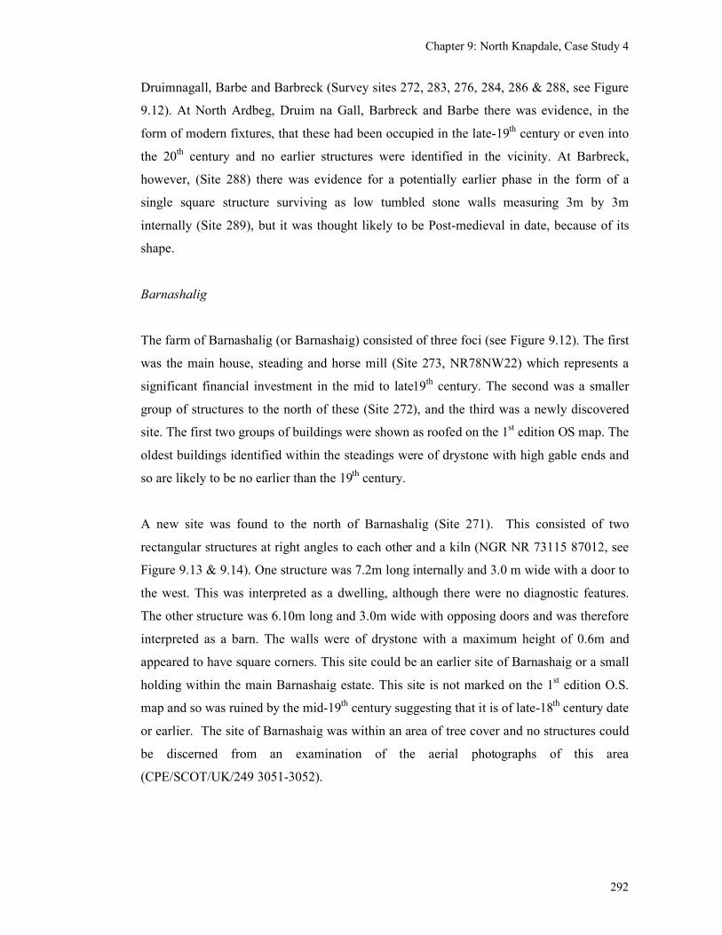
Chapter 9: North Knapdale, Case Study 4
292
Druimnagall, Barbe and Barbreck (Survey sites 272, 283, 276, 284, 286 & 288, see Figure
9.12). At North Ardbeg, Druim na Gall, Barbreck and Barbe there was evidence, in the
form of modern fixtures, that these had been occupied in the late-19th century or even into
the 20th century and no earlier structures were identified in the vicinity. At Barbreck,
however, (Site 288) there was evidence for a potentially earlier phase in the form of a
single square structure surviving as low tumbled stone walls measuring 3m by 3m
internally (Site 289), but it was thought likely to be Post-medieval in date, because of its
shape.
Barnashalig
The farm of Barnashalig (or Barnashaig) consisted of three foci (see Figure 9.12). The first
was the main house, steading and horse mill (Site 273, NR78NW22) which represents a
significant financial investment in the mid to late19th century. The second was a smaller
group of structures to the north of these (Site 272), and the third was a newly discovered
site. The first two groups of buildings were shown as roofed on the 1st edition OS map. The
oldest buildings identified within the steadings were of drystone with high gable ends and
so are likely to be no earlier than the 19th century.
A new site was found to the north of Barnashalig (Site 271). This consisted of two
rectangular structures at right angles to each other and a kiln (NGR NR 73115 87012, see
Figure 9.13 & 9.14). One structure was 7.2m long internally and 3.0 m wide with a door to
the west. This was interpreted as a dwelling, although there were no diagnostic features.
The other structure was 6.10m long and 3.0m wide with opposing doors and was therefore
interpreted as a barn. The walls were of drystone with a maximum height of 0.6m and
appeared to have square corners. This site could be an earlier site of Barnashaig or a small
holding within the main Barnashaig estate. This site is not marked on the 1st edition O.S.
map and so was ruined by the mid-19th century suggesting that it is of late-18
th century date
or earlier. The site of Barnashaig was within an area of tree cover and no structures could
be discerned from an examination of the aerial photographs of this area
(CPE/SCOT/UK/249 3051-3052).
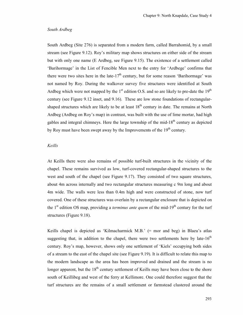
Chapter 9: North Knapdale, Case Study 4
293
South Ardbeg
South Ardbeg (Site 276) is separated from a modern farm, called Barrahomid, by a small
stream (see Figure 9.12). Roy’s military map shows structures on either side of the stream
but with only one name (E Ardbeg, see Figure 9.15). The existence of a settlement called
‘Barihormage’ in the List of Fencible Men next to the entry for ‘Ardbege’ confirms that
there were two sites here in the late-17th century, but for some reason ‘Barihormage’ was
not named by Roy. During the walkover survey five structures were identified at South
Ardbeg which were not mapped by the 1st edition O.S. and so are likely to pre-date the 19
th
century (see Figure 9.12 inset, and 9.16). These are low stone foundations of rectangular-
shaped structures which are likely to be at least 18th century in date. The remains at North
Ardbeg (Ardbeg on Roy’s map) in contrast, was built with the use of lime mortar, had high
gables and integral chimneys. Here the large township of the mid-18th century as depicted
by Roy must have been swept away by the Improvements of the 19th century.
Keills
At Keills there were also remains of possible turf-built structures in the vicinity of the
chapel. These remains survived as low, turf-covered rectangular-shaped structures to the
west and south of the chapel (see Figure 9.17). They consisted of two square structures,
about 4m across internally and two rectangular structures measuring c 9m long and about
4m wide. The walls were less than 0.4m high and were constructed of stone, now turf
covered. One of these structures was overlain by a rectangular enclosure that is depicted on
the 1st edition OS map, providing a terminus ante quem of the mid-19
th century for the turf
structures (Figure 9.18).
Keills chapel is depicted as ‘Kilmacharmick M.B.’ (= mor and beg) in Blaeu’s atlas
suggesting that, in addition to the chapel, there were two settlements here by late-16th
century. Roy’s map, however, shows only one settlement of ‘Kiels’ occupying both sides
of a stream to the east of the chapel site (see Figure 9.19). It is difficult to relate this map to
the modern landscape as the area has been improved and drained and the stream is no
longer apparent, but the 18th century settlement of Keills may have been close to the shore
south of Keillibeg and west of the ferry at Kellimore. One could therefore suggest that the
turf structures are the remains of a small settlement or farmstead clustered around the
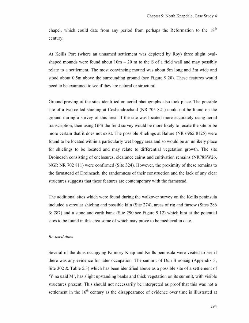
Chapter 9: North Knapdale, Case Study 4
294
chapel, which could date from any period from perhaps the Reformation to the 18th
century.
At Keills Port (where an unnamed settlement was depicted by Roy) three slight oval-
shaped mounds were found about 10m – 20 m to the S of a field wall and may possibly
relate to a settlement. The most convincing mound was about 5m long and 3m wide and
stood about 0.5m above the surrounding ground (see Figure 9.20). These features would
need to be examined to see if they are natural or structural.
Ground proving of the sites identified on aerial photographs also took place. The possible
site of a two-celled shieling at Coshandrochaid (NR 705 821) could not be found on the
ground during a survey of this area. If the site was located more accurately using aerial
transcription, then using GPS the field survey would be more likely to locate the site or be
more certain that it does not exist. The possible shielings at Balure (NR 6965 8125) were
found to be located within a particularly wet boggy area and so would be an unlikely place
for shielings to be located and may relate to differential vegetation growth. The site
Droineach consisting of enclosures, clearance cairns and cultivation remains (NR78SW26,
NGR NR 702 811) were confirmed (Site 324). However, the proximity of these remains to
the farmstead of Droineach, the randomness of their construction and the lack of any clear
structures suggests that these features are contemporary with the farmstead.
The additional sites which were found during the walkover survey on the Keills peninsula
included a circular shieling and possible kiln (Site 274), areas of rig and furrow (Sites 286
& 287) and a stone and earth bank (Site 290 see Figure 9.12) which hint at the potential
sites to be found in this area some of which may prove to be medieval in date.
Re-used duns
Several of the duns occupying Kilmory Knap and Keills peninsula were visited to see if
there was any evidence for later occupation. The summit of Dun Bhronaig (Appendix 3,
Site 302 & Table 5.3) which has been identified above as a possible site of a settlement of
‘Y na uaid M’, has slight upstanding banks and thick vegetation on its summit, with visible
structures present. This should not necessarily be interpreted as proof that this was not a
settlement in the 16th century as the disappearance of evidence over time is illustrated at
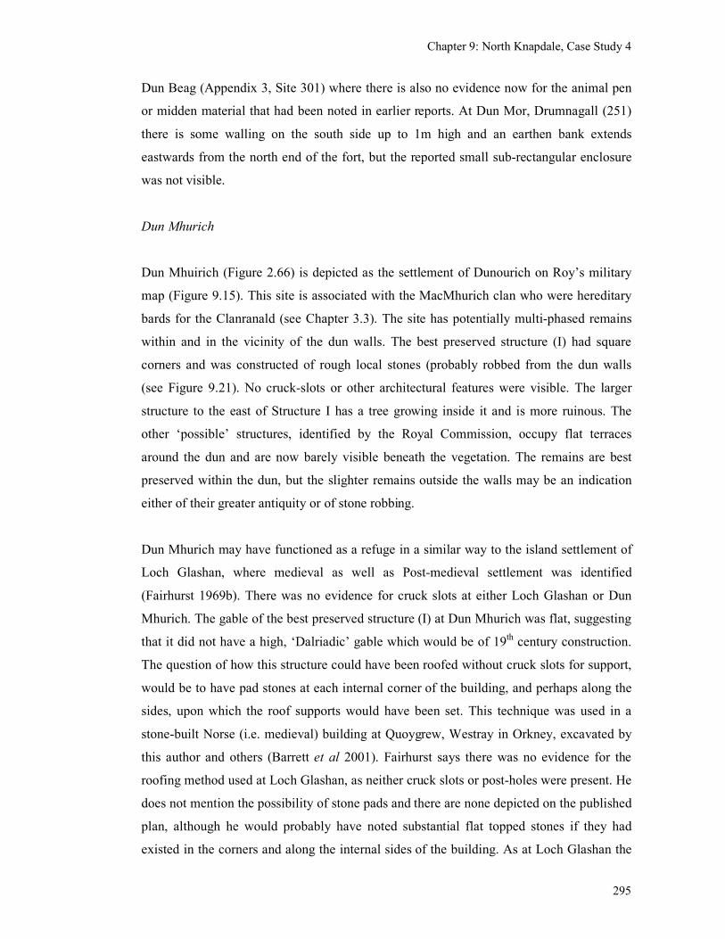
Chapter 9: North Knapdale, Case Study 4
295
Dun Beag (Appendix 3, Site 301) where there is also no evidence now for the animal pen
or midden material that had been noted in earlier reports. At Dun Mor, Drumnagall (251)
there is some walling on the south side up to 1m high and an earthen bank extends
eastwards from the north end of the fort, but the reported small sub-rectangular enclosure
was not visible.
Dun Mhurich
Dun Mhuirich (Figure 2.66) is depicted as the settlement of Dunourich on Roy’s military
map (Figure 9.15). This site is associated with the MacMhurich clan who were hereditary
bards for the Clanranald (see Chapter 3.3). The site has potentially multi-phased remains
within and in the vicinity of the dun walls. The best preserved structure (I) had square
corners and was constructed of rough local stones (probably robbed from the dun walls
(see Figure 9.21). No cruck-slots or other architectural features were visible. The larger
structure to the east of Structure I has a tree growing inside it and is more ruinous. The
other ‘possible’ structures, identified by the Royal Commission, occupy flat terraces
around the dun and are now barely visible beneath the vegetation. The remains are best
preserved within the dun, but the slighter remains outside the walls may be an indication
either of their greater antiquity or of stone robbing.
Dun Mhurich may have functioned as a refuge in a similar way to the island settlement of
Loch Glashan, where medieval as well as Post-medieval settlement was identified
(Fairhurst 1969b). There was no evidence for cruck slots at either Loch Glashan or Dun
Mhurich. The gable of the best preserved structure (I) at Dun Mhurich was flat, suggesting
that it did not have a high, ‘Dalriadic’ gable which would be of 19th century construction.
The question of how this structure could have been roofed without cruck slots for support,
would be to have pad stones at each internal corner of the building, and perhaps along the
sides, upon which the roof supports would have been set. This technique was used in a
stone-built Norse (i.e. medieval) building at Quoygrew, Westray in Orkney, excavated by
this author and others (Barrett et al 2001). Fairhurst says there was no evidence for the
roofing method used at Loch Glashan, as neither cruck slots or post-holes were present. He
does not mention the possibility of stone pads and there are none depicted on the published
plan, although he would probably have noted substantial flat topped stones if they had
existed in the corners and along the internal sides of the building. As at Loch Glashan the
Chapter 9: North Knapdale, Case Study 4
296
structures at Dun Mhurich probably belong to a variety of structures broadly dating to the
medieval and pre-Clearance period. This would make it a very significant, rare high-status
site in North Knapdale, with a documented association with a Gaelic clan who were ousted
from the area in the late 15th century and replaced by new tenants of the Campbell’s
choosing.
9.6 Conclusions
The evidence suggests that in the medieval period North Knapdale had a relatively sparse
population which was concentrated in small farms located around the coastal edge, with
access to the available arable and to fishing grounds. The rocky interior was primarily
utilised for summer grazing and for the other resources it contained, including peat wood
for fuel and hunting for small animals and birds for food. The area was initially dominated
by the MacSween Gaelic lordship, but the MacSweens were ousted by the Norman
Menteiths, who may have introduced some changes to the estate management. More
significant changes were made when the MacDonald lordship was forfeited and a hostile
takeover by the Campbells introduced a host of new tenant farmers.
Castle Sween, located on the Kilmory peninsular, was centre of the lordship. A certain
number of retainers and servants could have been resident within the castle walls and it is
quite probable that some supporters occupied modest houses within the nearby settlements,
but it was not a focus for settlement. The origin of the settlement just outside the castle
walls has yet to be traced back further than the mid-18th century and it probably dates to
after the castle was destroyed in 1647. Around the castle there is also a lack of lesser
fortified sites. The only small potentially fortified sites identified so far are at Dun
Mhuirich, Eilean na Circe and possibly Dun Bhronaig and the crannog on Lochan Taynish,
which are all on the Keills peninsula. This is another possible example of where the more
important sites are surrounded by the least important and the sites of middling status are
ranged around the periphery of the territory. In contrast, each peninsula is served by a
medieval chapel and burial ground, which act as a focus for the display of militaristic
gravestones, celebrating the aristocratic concerns of the hunt, the galley and the knights
sword.
Chapter 9: North Knapdale, Case Study 4
297
This case study has identified a few place-names of medieval settlements dating back to
the 14th century, but has confirmed their presence on the ground. There are several sites
which have their origins in at least the 16th century and which display a high degree of
continuity of land organisation from then until the desertions of the 19th century. These
farms were located so as to take advantage of the coastal arable lands, and would also have
had access to the unpopulated hill ground and the marine resources. These farms could
therefore have been largely self-sufficient with little surplus for trade above their dues to
the overlord.
The present remains on these sites are dominated by the Improved 19th century buildings,
but there are a few sites, such as South Ardbeg where potentially earlier structures have
been seen. These consist of the low stone foundations of rectangular structures, the
superstructure of which could have been stone or a combination of stone and turf, or just
turf. Other settlements are known only from their place-names in 17th century documents.
Turf and stone built structures in the vicinity of Keills and Kilmory chapels attest to the use
of local, easily available materials. These structures are extremely slight upstanding
remains, which could easily be destroyed by cultivation, forestry or later construction.
While it is tempting to date these structures to the medieval period, the evidence so far
suggests that some may be as late as the early 19th century as they are depicted on the 1
st
edition O.S. maps. The possible turf structure at Daltote however, could well be medieval
in date as it is not depicted on any maps. In addition this field survey has identified
potentially earlier settlement sites, areas of cultivation, earth and stone banks, kilns and
shielings which all attest to a sparse, dispersed, rural settlement pattern, with a mixed
pastoral and arable economy in North Knapdale.
Chapter 10: Discussion and Conclusions
298
Chapter 10 Discussion and Conclusions
This research has contributed to the understanding of several interrelated aspects of
medieval rural settlement in Mid-Argyll including chronology, architecture, social
organisation, agriculture, economy and material culture.
Chronology
Although by the beginning of the 15th century the population numbers are thought to have
been recovering from a downward turn in the 14th century and resulted in the re-
colonisation of old ground and strengthened links with Gaelic Ireland by the 16th century,
increased political instability, fighting and feuding from the late-15th and 16
th centuries
could have had an effect on the nature and survival of rural settlement. Colonisation of new
ground would have resulted from population pressure as the 16th century progressed.
In Mid-Argyll there is a lack of physical evidence for settlement in the earlier period from
the 12th to the 16
th century, the main contribution being place-names derived from the
historical records, but few could be accurately located today. This lack of physical
evidence has limited what can be said regarding the model of advance and retreat between
the 12th and 14
th centuries. A greater number of early place-names was identified from the
Glassary parish than either Kilmartin or North Knapdale. This may reflect a more frequent
use of charters in this area, perhaps due to its geographical proximity to the Lowlands,
where feudal charters were in more general use at this time. Yet the historical and map-
based research has highlighted the contrasting high degree of continuity of place-names in
the rural landscape of Mid-Argyll from the 16th to the 19
th centuries, when the Campbell
clan and their supporters were the predominant landholders in the area.
Each case study has contributed some detail towards the chronological framework. The
excavations at Bàrr Mór brought to light an example of a late-medieval farm which had
been established in an area of woodland and moor in the mid-15th to mid-17
th centuries,
possibly on the site of earlier, prehistoric, occupation. This site was in use as a farm for a
relatively short period of time, being cleared or abandoned before the 18th century, after
Chapter 10: Discussion and Conclusions
299
which it was then used as temporary shepherd’s shelter. There was no evidence that it had
been re-occupied in the modern period.
The historical work at Glennan has highlighted the development of the property since the
12th century and suggested that it could have been occupied by five households throughout
the medieval period. It only achieved a degree of status when it became the property of a
Campbell in the 17th century who described himself as being ‘of Glennan’. The
excavations however, found that the two-storied house was no earlier than the late-18th
century, probably constructed by a cadet member of the Malcolm clan with the profits
from a plantation in Jamaica. The excavations have mainly illuminated the later, Post-
medieval history of the site, which showed it to be a joint-tenancy farm occupied until the
early 20th century.
At Carnasserie the historical research has revealed that the earliest documentary references
to a significant structure at this site (perhaps a hall-house surrounded by a bank and ditch)
are from the mid-15th century. A possible dun immediately to the north of the ditch
indicates a potential continuity of occupation on this site from the prehistoric period. The
tower house was built in the late-16th century on the site of the earlier hall-house, and this
was broadly contemporary with the first references to two settlements at Carnasserie.
Carnasserie Mor was depicted by Pont and Roy, but the surviving architecture is 19th
century in date. There are potentially earlier structures (perhaps 18th or early 19
th century)
at the south end of the current site, but no potentially medieval structures were recognised
from the surface remains. Carnasserie Beg was also depicted by Pont and Roy in the
vicinity of the Castle. It may have shifted closer to the castle during the 18th century, only
to be cleared away in the 19th century.
The work in North Knapdale has provided documentary and map evidence for the
distribution and size of settlements in the late-medieval period when they were small and
located primarily around the coastal strip. The majority of these place-names can still be
found (with the assistance of the 1st edition O.S. maps) in the contemporary landscape in
the vicinity of their late-medieval locations. This indicates a high degree of continuity of
farms from the late-16th to the 19
th century, after which many were amalgamated into
single farms or were cleared. The period between the mid-15th to the 16
th centuries (after
the forfeiture of the Lordship of the Isles) had been a period of population change and
Chapter 10: Discussion and Conclusions
300
political unrest as the Campbell domination of Mid-Argyll spread into North Knapdale and
MacDonald tenants were replaced by Campbell supporters. This may well have resulted in
changes to farm names as the new tenants made an attempt to break with the past.
In general, the fieldwork has discovered a great variety of structures within the landscape
which are probably a result of the superimposition of structures associated with changing
economic patterns over a long period of time. As Ward (1997) has suggested for the
Brecon Beacons in Wales, we are probably seeing medieval expansion of permanent
settlement into the hills, followed by a gap as they retreated into the sheltered glens during
the Little Ice Age, overlain by a second advance of pattern of permanent settlement and
associated seasonal shielings during the subsequent centuries.
Architecture
On the basis of this research it is possible to outline the main differences between medieval
and Post-medieval architecture, but also to highlight some of the difficulties in recognising
medieval architecture from the shape of the structures alone. The architecture of the 19th
century Improvements is generally characterised by drystone walls, square corners, integral
chimneys, high gables, windows and a thatched roof supported on a cruck frame.
Excavated examples of medieval houses at Ben Lawers and Pitcarmick have shown them
to be turf-walled structures of oval or sub-rectangular shape, often with central doorways
(Atkinson et al 2004; RCAHMS 1990). Norse structures in Barra have been seen to be
oval-shape, with massively thick earth (turf) walls and stone facings (Sharples 2005).
Apart from these clear groups there are many structures which appear to share certain
characteristics of more than one group. For example, 18th or early 19
th century
Improvement buildings could be made of dry stone, have rounded corners, flat gables for a
hip-ended roof and central fireplaces. The Post-medieval houses in the Outer Hebrides also
had thick earth walls lined with stone and were oval in shape. What can be identified here
is the overlap between structures which served different functions, belonged to a different
chronological period and reflected regional preferences. In addition a small number of
building platform sites, upon which timber or turf structures once stood, similar to ones
found in Wales (Gresham 1954).
Chapter 10: Discussion and Conclusions
301
Although it is thought that the Improving landlords were the first to discourage the use of
turf as a building material, this research has shown that dry stone was already being used
as a building material in rural settlements in the late-medieval period as in Structure A at
Bàrr Mór (although turf walls were still evident for Structure B, at the same time). Also,
the presence of turf and stone and turf structures, such as at Keills and Kilmory, were still
roofed in the mid-19th century and so the presence of turf walls is not necessarily an
indication of antiquity.
The oval-shaped, drystone structures found at Bàrr Mór are rare in Mid-Argyll, the only
other examples of similar structures were found singly or in pairs. But it is not unique to
this area, a similar group of oval-shaped structures and enclosure has been identified at
Broughdearg, Perthshire (see Figure 2.55). These oval-shaped structures, may be a rare
type of settlement in this area, and therefore be unrepresentative of the medieval settlement
here, or more likely, these structures are a rare survival of a once more prevalent type,
having been destroyed by later buildings works or robbed for building stone.
Many simple structures found in the hills of Mid-Argyll have been identified as shielings.
They have a particularly varied morphology, being oval, round or even square in shape,
sometimes double-celled and utilising stone and turf or just turf as a construction material.
These have generally been dated to anything from the medieval period to the 19th century.
Temporary shielings are often difficult to differentiate from the more permanent structures
when they are at low altitudes, as at Glennan, Carnasserie and Kilmory. Such sites are
likely to be outhouses or storage huts although they may have been used as occasional
dwellings.
The morphological variability of shielings has been mentioned above. The shape of a
structure would have been related to its ‘constructional techniques’. Light walls of
wickerwork would have gained stability from being in a circular shape (unless it also
incorporated larger structural timbers) and a structure using jointed timbers would have
suited a rectangular shape (Lynn 1978, 37). Turf walls, having a wide wall base, would
have been more inherently stable than a wickerwork wall and so, in the absence of larger
structural timbers, would not have been restricted to a circular shape. An oval-shaped
structure of turf would therefore combine the advantage of an increased floor space with
the minimal need for large roof timbers and bracing end supports. Thus the shape of
Chapter 10: Discussion and Conclusions
302
structures would have been related to the availability and choice of materials which were
probably locally sourced. Only high-status inhabitants could have afforded to pay for the
felling and cutting of mature trees for pre-dominantly timber buildings.
Whether people had the knowledge and tools for joinery will also have influenced what
choices were made in the structural shape and materials used. In Ireland, there seems to
have been a replacement of circular structures by rectangular ones by the end of the 10th
century, which may have been related to the spread of technological developments in
joinery associated with church building (Lynn 1978, 37; Lynn 1996, 83-85). In Scotland,
early churches were said to have been built of ‘hewn oak’ (Hist Ecc iii, 25) and so the
spread of Christianity would have been linked with a spread of skilled workmen from
whom joinery techniques could have been learned by the wider population. The use of
timber in medieval buildings in Scotland has probably been under estimated because of its
poor survival rate in the cold wet environment. During the medieval period, as society
became more under the control of the king and other powerful lords, rather than being in
the hands of local clans, and so access to valuable resources, such as timber, would have
become more restricted.
Medieval Scots, like the 12th century Welsh, probably ‘content[ed] themselves with wattle
huts on the edge of the forest, put up with little labour or expense, but strong enough to last
a year or so’ (Gerald of Wales, translation 1978, 252). This speed of construction and lack
of ‘investment’ would have been an advantage during times of clan warfare and raiding,
when homes, with their thatched roofs and timber crucks, could easily be burned down.
Settlement organisation
In Mid-Argyll it has been shown that a small number of castles (including a ruined castle
with an unknown history) and tower houses were occupied by the major clan chiefs and it
has been shown that an equally small number of fortified island sites were occupied by the
middle ranking clan chiefs and followers. Some middle ranking sites are known to have
been destroyed. The MacTavish’s house at Dunardry was destroyed by the building of the
Crinan Canal at the end of the 18th century and the Malcolm’s principle residence at
Poltalloch was deliberately demolished in the late-18th century to make way for the
construction of a new mansion (later called Old Poltalloch). Seemingly small settlements,
Chapter 10: Discussion and Conclusions
303
as found at Raslie and Ormaig, consisting of two or more rectangular structures could be
late-medieval unfortified residences, as both have associations with cadet branches of the
Campbells. Other sites which are of relatively high status in the 17th century, as evidenced
by the presence of occupants with more than one hearth, are site with the potential to be
occupied by middle ranking lords in the medieval period.
The most numerous structures found in Mid-Argyll include the seasonal shielings and
single structures which were presumably occupied by the rest of society which consisted of
tenant farmers, cottars and the landless labourers. However, these presumably do not
represent the complete range of settlement types as there are so few examples of small
permanent farms, like Bàrr Mór, which in all probability were the most numerous
settlement type. Their absence in the archaeological record is seen partly as a product of
the use of organic materials coupled with settlement shift which resulted in the recycling of
materials (including stone for field walls) and subsequent cultivation and destruction of
many old settlement sites.
It is thought that settlement shift was a significant process during the medieval period.
With buildings made of perishable organic material and earthen floors (ideal homes for
vermin) there would have been a need to replace old and decaying houses and to improve
hygiene by moving to a new location and building afresh, perhaps every few years. Soil
exhaustion in pre-Improvement times, would also have prompted the moving of
settlements sites as associated fields were abandoned and new sites cultivated. Such
mobility was identified by Dodgshon (1993) in Lewis and has been illustrated during this
research from the map evidence at Fearnoch. Only when there is a physical and
topographic restriction to a location, such as an island, or where a landlord has restricted
tenants access to land for settlement, might one expect farm buildings to be superimposed
over one another. The landlord’s encouragement to build in stone was primarily to prevent
the stripping of increasingly valuable pasture and perhaps also to introduce a greater
degree of social control through the imposition of the landlords choice of settlement
location.
There is no evidence for the clustering of medieval settlement around higher status sites
such as castles or churches in Mid-Argyll (as is seen in parts of Ireland and England) until
at least the Post-Medieval period, as work at Carnasserie Castle, Fincharn Castle,
Chapter 10: Discussion and Conclusions
304
Kilmartin church, Kilmory chapel and Keills chapel as shown. At the castle sites the
immediate family, supporters and servants were presumably accommodated within the
castles or hall-houses or perhaps in outbuildings (the remains of which are not visible). At
the chapels the only accommodation required would have been for the priests and perhaps
any servants. The late date at which the clustering is observed could be related to the loss
of status at the castle sites (such as after the burning of Carnasserie Castle) or to the change
of status of chapels at after the Reformation when the ownership of church lands was
appropriated by secular lords.
The process of settlement nucleation which has been seen elsewhere in Scotland from the
medieval period is difficult to identify in Mid-Argyll. In general, the evidence suggests that
the farms remained as small, dispersed settlements until the population boom of the 19th
century. This resulted in ever increasing numbers of people being accommodated in the
existing farms and hence only the appearance of nucleation, as there was not a
contemporary abandonment of other sites.
Agriculture, economy and material culture
The medieval evidence for settlement consists predominantly of farm names which relate
to areas of arable farm land that were the original base for taxation and did not refer to
specific settlements in a specific location. The low density of settlements would
correspond with a non-intensive mixed pastoral economy, with plenty of unenclosed hill
land available for summer grazing for stock. The poor nature of the terrain in Mid-Argyll
and the non-intensive nature of the farming techniques used might explain why there may
have been a broadly consistent number of households per farm recorded between the
medieval period and the 17th century as suggested at Glennan. This does not take into
account the variations which may have occurred as a result of wars and the Plague, but any
such changes would be difficult to detect archaeologically if the population quickly
recovered in a few decades.
A process of change in the rural economy that can be seen in the pre-Improvement period
include an increase in population after the set back of the 14th century which would have
led to a gradual increase in farming intensity and colonisation into woodlands and
moorland. Trade of cattle with the Lowlands and England which is recorded in the late-
Chapter 10: Discussion and Conclusions
305
medieval period, also led to the ever increasing commercialisation and specialisation of
stock rearing associated with the droving trade.
There has been the suggestion from work undertaken on mammal bones in the Outer
Hebrides that an increased dependence on pastoralism may have been a result of warfare
and political instability during the medieval period (Sharples 2005). Unfortunately
mammal bones are generally absent from sites in Argyll because of the acid soils, Dunadd
being a rare exception. It is probable that mixed farming was practised throughout the
medieval period, with varying proportions of arable and pastoral farming. This mix
depended on several factors, such as the amount of labour available, animal epidemics,
plague as well as climatic changes and disruption by warfare. Because of the cool wet
climate, there was not enough pasture in Scotland to provide winter as well as summer
pasture for stock and so some arable farming was always necessary to provide winter feed
for the animals. This would have prevented people from becoming nomadic pastoralists, as
occurred in parts of Gaelic Ireland during the late-medieval times of stress and turmoil.
The excavation at Bàrr Mór has revealed a small late-medieval farm practicing a mixed
pastoral and arable economy as evidenced by the presence of dwellings, a byre, carbonised
grain and stock enclosures. This site is thought to represent the establishment of a new
farm colonising perhaps the site of a prehistoric hut circle. The material culture of this farm
was extremely scanty, comprising a single sherd of green glazed medieval pottery and two
sherds of a foreign import along with few fragments of slag and metalwork. The tools and
utensils used were likely to be made of organic materials, bone and wood which have not
survived. The evidence suggests that the farm went out of use after a relatively short time,
perhaps a few generations, but there is little to indicate why this occurred. There is no
archaeological evidence indicating that the structures were burned during in the political
unrest of the mid 17th century, but rather they collapsed and so their abandonment may
have been associated with a change of economy, perhaps an early experimental
introduction of sheep farming by the Malcolms. The site was then used as a shepherds
shelter and enclosure and the absence of industrially made ceramics, glass and tobacco
pipes suggests that it had been abandoned and forgotten completely by the mid-19th
century. This perhaps reflects its rather remote location within the Poltalloch estate and
may be contemporary with the abandonment of the partly built Old Poltalloch House in the
Chapter 10: Discussion and Conclusions
306
early 19th century because of the death of, the then owner, George Malcolm in Jamaica
(James 2005c).
The most common structure discovered during the surveys at Carnasserie, North Knapdale
and elsewhere in the research area were the various small shielings, sometimes found
singly but more often in small groups. These all attest to the seasonal use of the hill pasture
for the grazing of stock. Without excavation there is no chronological framework for these
structures, but although shielings were used from the early-medieval period onwards, the
majority are likely to belong to the period of highest population pressure in the 19th
century, the earlier ones possibly being subsumed beneath later farms or beneath
cultivation. There has been no clear evidence for the re-use of shielings on mounds as was
found in the north of Scotland.
The excavations at Glennan, within a river valley routeway from Kilmartin to Loch Awe,
in contrast to Bàrr Mór, produced a large amount of 19th and 20
th century pottery and glass
which placed its occupation in the modern period. The historical research has shown that it
was held as a joint farm and occupied by up to 38 people in the mid-19th century. The
archaeological evidence revealed dwellings and a byre and the artefacts included a quern
stone and a horse harness, all indicative of a mixed farming community. The site of the
earlier medieval farm is as yet unknown, but is likely to have been at the boundary of the
hill ground and the valley bottom, beside a stream, with perhaps outlying farm buildings,
belonging to other joint tenants within the higher valley to the east.
The material culture retrieved from these low-status mixed farms contrasts noticeably with
those found at the high-status site of Castle Sween which contained artefacts associated
with a military presence (weapons and armour) and leisure pursuits (a harp peg and gaming
pieces) as well as domestic material (wheel-thrown pottery and numerous metal knives),
(Ewart & Triscott 1996). This technology was clearly in the hands of the elite and rarely
filtered down to the rural population. It is thought that this reflects subsistence level
economy of the majority of the population who herded the stock, milked the cows, churned
the butter, and toiled in the fields in order to produce enough surplus to feed themselves,
pay their rents, keep them over the winter and provide seeds for the following year. There
was no need for official markets within such a self-sufficient economy, cattle being driven
Chapter 10: Discussion and Conclusions
307
away on the hoof, and other pastoral products either consumed at or channelled through the
high-status sites.
The potential for medieval sites in the Scottish landscape
So in regard to medieval rural settlement what are we looking for, where is it likely to
survive and how can we find it? To understand the medieval settlement pattern we need to
recognise all the elements in the settlement hierarchy, which include the castles,
strongholds, tacksmen’s houses, winter farmsteads and summer shielings. The extensive
field walking undertaken during this research has recorded numerous sites which could
fulfil some of these roles and which could be of medieval date. However, as Branigan’s
(2005) work on Barra has shown, the visible morphology of structures prior to excavation
can often be very misleading in terms of shape, date and function. Invasive exploration of
these structures is needed if the truly medieval ones are to be identified.
Unlike some areas of the Outer and Inner Hebrides and the Scottish Lowlands, medieval
rural settlements have not been found in Mid-Argyll by the presence of pottery scatters.
While this may be partly due to the lack of ploughed fields or coastal erosion which would
bring pottery to the surface, it is also likely that the western mainland was largely aceramic
in the medieval period, utilising organic materials such as bone, leather and wood for
containers and utensils, which have not survived within the acid soils. One could also
argue that poorly made Craggan ware, which was found on the mainland at Loch Glashan,
would not survive well within a soil once it has been cultivated.
Tell-like sites, such as the Udal (Crawford & Switsur 1977), also seem to be largely absent
from mainland Argyll. However there may be some re-use of lowlying dun and forts as at
Dun Mhuirich, where rectangular structures lie within the prehistoric dun. Cropmarks
have, so far, added little to the discovery of new medieval sites in Argyll, which is partly
because of the climate and nature of the landscape, in that only a small proportion of the
land is under cultivation, the high rainfall prevents the creating of parch marks and the
numerous rocky outcrops or bracken disguise even upstanding remains from view. There
has also been a lack of modern aerial survey of the limited areas which would be suitable.
Chapter 10: Discussion and Conclusions
308
Substantial stone built structures have been found on Medieval sites in a lowland
environment at Archerfield (Hindmarch 2006) and Springwood Park (Dixon 1998), but the
more recently excavated sites at Nether Gogar (James 2008) and Laigh Newton (James
2007) show that not all medieval remains in the Scottish Lowlands are so substantial. At
Nether Gogar, near Edinburgh, there was a corn-drying kiln, several linear ditches, an
extensive cobbled surface and medieval pottery. But, within the limits of the 25m wide
development corridor at least, no dwellings or barns were identified. At Laigh Newton in
Ayrshire, more extensive excavations revealed several sunken, oval-shaped structures
which would have had turf walls, containing hearths and medieval pottery, post-holes and
remnants of stone walls which have been badly damaged by ploughing (James 2007). Here
the structures were interpreted as the remains of turf and timber dwellings. Both Nether
Gogar and Laigh Newton were uncovered during commercial development in areas where
no existing surface remains or evidence from aerial photographs provided prior evidence
for the existence of medieval remains. Nether Gogar was, however, known to have existed
from historical documents. Field survey in the Lowlands, where cultivation since the
medieval period has been intense, would be of limited use in finding medieval settlement if
it was not for the pottery scatters that are usually associated with them. In Argyll, there
may well have been less intense cultivation, but what has taken place would have been in
the areas where medieval settlement is most likely to have been located. This, in addition
to the lack of pottery and open plan archaeological excavation, associated with commercial
development, has hampered the identification of medieval settlement so far.
Choice of settlement location is likely to have taken altitude, aspect, closeness to water and
drainage into account. Having level ground seems not to have been important in the later
period although terraces have sometimes been cut into hillsides perhaps in the late-
medieval period as at Glennan and Achaind, just outside Kilmartin. Winter settlement may
well also have been located at the boundary of the best cultivatable land and the hill
pasture, providing access to both. The survival of settlement remains will have been
affected by the 19th century high tide of cultivation. Above this level, it is possible that
remains of medieval settlement will be better preserved in the form of turf walled
structures or building terraces.
Flood plains are unlikely places for medieval settlement and cultivation because, prior to
the Improvements, they would generally have been peat, bog or marsh covered. That is not
Chapter 10: Discussion and Conclusions
309
to say that they were not utilised for their range of natural resources, such as fish, fowl,
reeds and peat. A rare example of a development on a gravel river terrace in Kilmartin at
Upper Largie found remains of prehistoric ritual and funerary activities and a timber circle,
but no evidence for medieval activity (Barclay et al 1983, Radley 1993, Terry 1997, Ellis
2000). The terrace had been covered by peat growth since the late prehistoric period and
while this had preserved the earlier prehistoric remains, it meant that the land was not
available for settlement or cultivation in the medieval period. Settlement would probably
have been located higher up the valley sides or on higher terraces which have not,
unfortunately, been subject to any extensive archaeological scrutiny. Another excavation at
Bruach an Druimein, Kilmartin, was a poorly resourced rescue excavation undertaken in
the 1960s (Abernethy 2002a). The excavations concentrated on the most obvious remains
under very difficult circumstances and the handful of medieval pottery retrieved, were
largely unstratified. The presence of the medieval sherds was interpreted as the result of
manuring of fields with midden containing occupation debris during the medieval period.
The excavators noted the presence of ‘paved surfaces and amorphous features’, which
might have represented the occupied structures, but their potential to be medieval remains
could not be realised under the circumstances of the rescue excavation.
Settlement landscape dynamics & historical processes
This research has discovered numerous stone built deserted settlements within the
landscape of Mid-Argyll which attest to the huge investment into the agricultural economy
undertaken by landowners in the 19th century. These were predominantly nucleated joint-
tenancy farms supporting several families. They were generally self-sufficient, although
the hilly nature North Knapdale encouraged specialisation in cattle for the droving trade
(Cregeen 1959). The fact that so many of these settlements are now deserted is a result of
commercial decisions by the landowners to maximise their income from the land, turning
to sheep and cattle production, that made the need for a large workforce redundant. Some
joint tenancy farms were turned into individual holdings and these are still occupied by the
present inhabitants.
Although the upstanding structures in these deserted settlements are 19th century in date,
the historic maps and documents have shown that the majority of the place-names existed
in the landscape by the late-16th century. This research therefore looked for evidence of
Chapter 10: Discussion and Conclusions
310
this late-medieval settlement at these deserted settlement sites and found a few examples
where there were earlier structures, such as at Carnasserie Mor, Blarantibbert and South
Ardbeg (see Table 5.4). These have the potential to be anything from medieval to late 18th
century in date. In general, there was limited physical evidence for multi-period sites
among these deserted settlements.
Place-name evidence also indicated that settlement was dynamic within the landscape in
the pre-Improvement period. The splitting of settlements is shown by the use of ‘mor’ and
‘beg’, or ‘nether’ and ‘over’ suffixes. Other references imply that splitting has taken place
such as ‘the two Carvenys’ and ‘the two Oywoldys’ as in a charter of David II, dated 1346
(MacPhail 1916b). Presumably a single farm was divided up to create two smaller, more
intensively farmed properties, which could support more people. The historic map and
documentary evidence generally indicate that this process had already begun by the mid-
14th century and, judging by the use of the English language, continued into the 18th and
19th centuries. The pressure to split was presumably result of population pressure
(Dodgshon 1980, 1993; Whyte 1981).
Evidence was also found of settlement shift where probably earlier structures were seen
within a few hundred metres of a deserted settlement. In one example, Fearnoch, it was
possible to trace four successive settlement locations with the same name. This shift may
be a result of several factors, including changes to property ownership, changes to the
economy of the farm or structural improvements. Therefore, while continuity of farm
names from the 16th to the 19
th century has been observed, settlement shift has meant that
continuity of habitation at a particular site has not.
Some deserted farm sites were found within areas dominated by shielings and these may
represent the conversion of shieling grounds to permanent farms, a process seen elsewhere
in Scotland in the Post-medieval period. This process has been observed from the late-
medieval period, as at Bàrr Mór, to the 19th century, as at Corlach.
The many shielings observed within the hills attest to short-distance transhumance taking
place within Mid-Argyll. Each farm needed access to summer pastures and because of the
hilly but relatively low-lying nature of Argyll, such areas of pasture were never far away
from the home farm. It has not been possible to date these shielings and so it is not clear
Chapter 10: Discussion and Conclusions
311
whether these represent medieval or Post-medieval seasonal occupation, although shielings
were going out of use in the Highlands by the late 18th century (Bil 1990; White 2000).
The varying sizes, shapes and numbers of rooms within the shielings does suggest a variety
of functions or perhaps different dates. Therefore there is great potential for medieval
shielings to be numbered among the later ones. The shieling grounds also tend to be above
the 19th century ‘high tide’ of intensive cultivation, so that there is a good chance that
medieval sites have survived among them.
In contrast to the scarce physical evidence for rural settlement, there is clear evidence for
high status medieval castles and hall-houses. If the current historical and architectural
evidence is correct, then these castles and hall-houses were constructed by local Gaelic
clan chiefs, with close connections to the Scottish crown. This is in contrast to Gaelic
Ireland where it seems to have been the Anglo-Norman incomers who built stone castles.
In Mid-Argyll, the high status of the castles is maintained throughout the medieval period
with the addition of tower houses providing more comfortable accommodation and they
were still used as strongholds into the 17th century. Kilmartin Castle and Carnasserie Castle
were different in that they were constructed by newly elevated ecclesiastics and were not
constructed so as to dominate the seaways. This research has highlighted the possibility of
other castles in the research area including a possible early hall-house with surrounding
ditch and bank at Carnasserie and a ruined tower house at Torran.
The middle ranking chiefs are thought to have occupied small fortified houses and
strongholds. This research has identified a few island, crannog and dun sites which have
evidence for rectangular or sub-rectangular stone buildings that may belong to the
medieval period, such as Loch Glashan, Eilean na Circe, Lochan Taynish, and Loch
Leathan (see Table 2.1). Such sites were often associated with local clan chiefs in the
documentary records and some were still used as refuges in the 17th century. Their
preservation in the landscape is partly because of the stone element used and also because
they are specifically located away from cultivated ground, on islands and hilltops. This
then begs the question of whether there were once many more sites of substantial houses
which were located within cultivated ground, that have been lost. This research has located
a small number of substantial rectangular structures which could be remnants of such a
group, such as at Raslie West, Ormaig and Auchachrome (see Table 5.5).
Chapter 10: Discussion and Conclusions
312
This would suggest that there was a degree of continuity of settlement type from the early-
medieval into the medieval period for both the lower and the middle ranking clan
members, although those at the highest echelons sought to maintain their power and
influence by emulating the Anglo-Norman architectural style.
As there is still currently a lack of strong evidence for settlement in the medieval period
and a paucity of historical records before the 16th century, it is not generally possible to see
what effect climatic deterioration, wars, plague, and famine would have had on settlement
in the 14th century. However, where there historical evidence, as at one site, Glennan, the
records suggest that the size of the farm remained stable throughout the pre-Improvement
period.
Review of methodology
The research initially utilised the techniques of archaeological survey and historical
geography to provide a broad overview of the research area. The historic research was
carried out between the various periods of fieldwork, and each aided the progress of the
other.
The historical research could not be comprehensive for all the many hundreds of sites in
the Mid-Argyll area and so a selective number of sites were looked at in more detail,
guided by the remains found on the ground. Once a site was selected, such as Bennan, then
a more detailed history of the tenants could be brought together from the records for the
period from the 17th to the 20
th century. A single reference to the site in 1422 indicates that
this had also been a farm in the medieval period (see Chapter 5).
There are several problems with utilising historic data. Firstly the historic data is extremely
sparse prior to the 16th century and consists of references to the actions of kings, queens
and clan chiefs, events of national importance, battles and castles. There are very few
charters which include local place-names, such as the rare example of Alexander II’s gift
of the five penny lands of Fyncharne to Gillascop MacGilchrist which included ‘Glennane’
and ‘Rudol’. A charter of David II, dated 1346 includes several names some of which can
be located through historic map work such as ‘Edyrling, Garwalde and Craggenure’, but
also other names which cannot, such as ‘Cambysenu, the two Carvenys, the two Oywoldys
Chapter 10: Discussion and Conclusions
313
and Calkykest’. Until these sites can be located or linked with other historic records these
place-names are of little use.
The historic records which do exist for the 16th and 17
th centuries are records of land
grants, hearth tax records, lists of rebels names or of men available for defence. These
records were written down for a variety of specific purposes that did not include a desire to
record everyday life in rural Scotland. These records are therefore very selective in their
content, biased and in the case of the ‘Account of the Depridations’ possibly even
fraudulent. Thus they require great care when attempting to reconcile them firstly with
each other and secondly with the field remains.
When the historic records refer to specific events, such as the Irish invasion of Argyll in
the 17th century, evidence for such events could be searched for in the landscape. But what
evidence would such events leave? One would expect that the complete destruction of
settlements within 18 parishes and the murder of over 900 men only 350 years ago, would
leave some archaeological trace in the form of burials or the occurrence of burnt horizons
at settlement sites, however neither of these have yet been observed. There does not seem
to be even any folk memory of such an event, which contrasts strongly with the
Clearances, stories of which continue to be told around the fireside (pers comm Dolly
MacDonald).
The historic maps, particularly the 1st edition OS maps, have been extremely useful in
locating sites in the landscape. But one of the problems encountered with reconciling the
map information includes how to interpret the absence of a site on a map, when it has
already been depicted on an earlier and perhaps even a later map. This does not necessarily
mean that it has disappeared. It is more likely that it was not considered important enough
by the cartographer to depict.
There can be problems when reconciling the different data sets from the survey and
historical research. For example, there may be a lack of correspondence between the data
sets. There are sites with no associated historical data because the site name is not known,
as with the castle at Torran and at Bàrr Mór. There is also historical data for sites which
cannot now be located. However, such a lack of correspondence provides an impetus to
direct the research into resolving the perceived discontinuity. Also, if there has been
Chapter 10: Discussion and Conclusions
314
settlement shift and splitting it may not always be clear which settlement is being referred
to in documents, especially as the spelling of place-names can continually change. Rarely
have shielings be mentioned in historic documents. There may also be a lack of
chronological correspondence, especially as the records do not become common until the
17th century. One alternative approach could have been to choose an area which has earlier,
more comprehensive historical records. Such areas could include that covered by the
Campbell of Breadalbane Estate Papers (Davis & Watson 2007).
Once the broad overview of Kilmartin and Kilmichael parishes had been achieved, then the
intensive techniques of geophysics, topographic survey and archaeological excavation
were brought to bear on three of the case studies. Other techniques could have been
introduced at this time, including aerial photographs and soil analysis, and in retrospect
these could well have proved useful.
The technique of geophysics is an extremely useful technique for detecting sub-surface
features (called anomalies) that have become masked by cultivation. Both types of
geophysics can detect disturbed ground, but the magnetometry is especially good for
detecting hearths and metal objects, while resistivity is good for subsurface walls or
ditches. Generally both techniques are used together to maximise the results (pers. comm.
Tessa Poller). Geophysics is affected by geology and by waterlogged soils both of which
can mask weak anomalies. At Glennan the technique was used successfully to confirm the
relative isolation of Glennan House and also detected the presence of ‘spikes’ which turned
out to be large metal lumps, possible remains of a circular structure, and several
rectangular features to the south, near the stream, one of which had already been found
through excavation. This enabled other similar anomalies to be identified as structures in
the vicinity with more confidence. At Glennan, the geophysics clearly worked and
probably should have been used more extensively across the cultivated valley floor and the
other, possibly circular, anomalies investigated further. At Torran, the conditions at the
time of the geophysical survey were extremely wet and it was thought at the time that this
might have affected the results. It would have been useful to return to this site and try again
under different weather conditions, and over a larger area, to confirm whether the isolation
of the castle was real. The Argyll landscape is rocky and rugged with numerous outcrops
of bedrock which generally not suitable for geophysical surveys, this, coupled with the wet
climate, suggest that this technique should be used selectively.
Chapter 10: Discussion and Conclusions
315
The analysis of aerial photographs was introduced towards the end of the project for North
Knapdale, after much of the work on Kilmartin and Kilmichael Glassary was well
underway. It had been assumed that the rocky, roughly vegetated landscape of Argyll
would not be suitable for the identifications of cropmarks, which are more visible in
cultivated fields. The flatter more cultivated areas along the coastal edge of North
Knapdale were therefore considered a better testing ground. This technique has also been
shown to be of use when mapping areas of rig and furrow (RCAHMS 2001) and was
considered useful for searching and mapping specific areas, where perhaps medieval
settlement is suspected or has already been identified. Unfortunately, this work in North
Knapdale did produce several potential sites, but when checked on the ground none proved
to be of particular interest. As a tool for finding medieval settlement in Argyll this
technique is as yet unproven, but it would probably be worthwhile undertaking over
extensive areas of upland which would be difficult to cover by foot and for mapping areas
of cultivation. The survey work at Kilmory and Glennan could have benefited from the
mapping of cultivation and field boundaries from aerial photographs.
Archaeological excavation is considered by this author to be the most useful tool for
investigating the character and date of settlement structures, in that it can reveal subsurface
morphological details and provide artefacts or material for radiocarbon dating, as was
shown at Bàrr Mór. At Glennan also, the excavations confirmed that the laird’s house was
not occupied before the late 18th century and that the neighbouring farmstead, rather than
being an earlier settlement, was actually built in the 20th century, something which was not
obvious from the surface. A slight platform near to the stream was investigated, and this
revealed a stone built, Post-medieval rectangular structure. Excavation is time consuming
and expensive to undertake and so should generally be targeted either with the assistance
of upstanding remains, geophysical anomalies or perhaps the identification of ‘hot spots’
though soil analysis. Only by utilising excavation can the chronological framework of
identified sites be confirmed, which is what would be required for areas surveyed in so
much detail by the Royal Commission (2008) and for their settlement model to be tested.
The combination of techniques utilised here has successfully identified a late-medieval
farm and suggested several potentially medieval sites. These could be targeted with more
detailed analysis, such as excavation. This study started with a strongly empirical
approach, as this was considered necessary in order to provide data that could be discussed
Chapter 10: Discussion and Conclusions
316
and analysed. However, this has not just been a data collecting exercise as certain themes
have been highlighted which could be followed up by further research. One of these
themes is clanship, which was the underpinning social system of Mid-Argyll in the
medieval period. The social practices associated with clanship, such as the lack of
primogeniture, may have had an effect on settlement morphology. Another theme is
continuity of settlement. There is a clear difference between continuity of site occupation,
which has been observed at the high status castles, with what has been observed at the
other end of the social scale where continuity of farm names has not involved continuity of
site occupation. The middle ranking clan chiefs, possibly occupying early-medieval
crannogs, duns and fortified islands, had mostly abandoned such sites by the end of the
medieval period, except for a few examples which were used as refuges. As tacksmen they
occupied houses which were possibly very similar to the other rural structures, except for
perhaps possessing more than one hearth. Another theme is mobility, where the processes
of settlement shift, settlement splitting, seasonal transhumance and problems of
landlessness have been identified.
Future work could therefore expand on these themes bringing out a consideration of how,
when and which people moved within the Gaelic cultural landscape, also looking at clan
territorial expansion and contraction. It could also incorporate other themes such as the
management of woodland and marine resources, and how they were accessed and utilised
within the physical and cultural boundaries of the farm and clan territories. Other
disciplines which could be incorporated into this research include palynology (Housley et
al 2004) and Gaelic literary sources (MacGregor 2006) to provide a understanding of how
and where people occupied, utilised and were shaped by, the medieval landscape.
317
11: References
Abbreviations
BAR - British Archaeology Reports
Discovery Excav Scot – Discovery and Excavation in Scotland
Glasgow Archaeol J - Glasgow Archaeological Journal
J Roy Soc Antiq Ireland - Journal of the Society of Antiquities of Ireland
Medieval Archaeol- Medieval Archaeology
Post Med Arch – Post Medieval Archaeology
Proc Soc Antiq Scot – Proceedings of the Society of Antiquaries of Scotland
Scot Arch Rev – Scottish Archaeological Review
Scot Archaeol Forum – Scottish Archaeology Forum
Scot Geog Mag - Scottish Geographic Magazine
Scot Hist Rev – Scottish Historical Review
Scott Studies - Scottish Studies
Trans American Geophys Union – Transactions of the American Geophysical Union
Ulster J of Archaeol – Ulster Journal of Archaeology
Edited Sources
Origines Parochiales Scotiae: The Antiquities Ecclesiastical and Territorial of the
Parishes of Scotland Innes, C (ed) 1854 & 1855a, Volumes 1 & 2 Bannatyne
Club, Edinburgh.
Pacata Hibernia: A History of the Wars in Ireland during the reign of Queen Elisabeth.
Sir Thomas Stafford 1633. Hibernia Press, Dublin.
References
Abernethy, D 1995 ‘Dunamuck Cottage (Kilmichael Glassary parish) enclosure’,
Discovery Excav Scot (1995), 64.
Abernethy, D 1998 ‘Trevenek (Kilmartin parish), dun’, Discovery Excav Scot (1998),
20.
Abernethy, D 2002a ‘Kilmartin House Garden (Kilmartin parish)’, Discovery Excav
Scot (2002), 19.
318
Abernethy, D 2002b Bruach an Druimein, Kilmartin Glen, Mid Argyll: Data Structure
Report, GUARD Project 977, Unpublished mss, GUARD, University of
Glasgow.
Abernethy, D 2008 ‘Bruach An Druimein, Poltalloch, Argyll: excavations directed by
the late Eric Cregeen 1960-62’, Scottish Archaeological Internet Reports 27.
Aberth, J 2002 From the Brink of the Apocalypse: Confronting Famine, Plague, War
and Death In the Later Middle Ages. Routledge, London.
Aitchison, N B 1994 Armagh and the Royal Centres in Early Medieval Ireland.
Cruithne Press, Woodbridge.
Aiton, W 1811 Agriculture of the County of Ayr. County Agriculture Reports, London.
Alcock, L 1980 ‘Early historic settlement problems in Scotland’, in Morrison, A (ed)
Rural Settlement Studies: Some Recent Work, 1-6, Department of Archaeology,
University of Glasgow.
Alcock, L 1988 ‘The activities of potentates in Celtic Britain, AD 500-800: a positivist
approach’, in Driscoll, S & Nieke, M (eds) Power and Politics in Early
Medieval Britain and Ireland, 22-46, Edinburgh University Press, Edinburgh.
Alcock, L E A & Alcock, P A 1979 ‘Deserted settlements at Burg, Kilninian, Isle of
Mull’, Vernacular Buildings 5, 25-32, Scottish Vernacular Buildings Working
Group Newsletter, Dundee & Edinburgh.
Alcock, L E A & Alcock, E 1980 ‘Scandinavian settlement in the Inner Hebrides: recent
research on place-names and in the field’, Scot Archaeol Forum 10, 61-73.
Alcock, L E A & Alcock, E 1987 ‘Reconnaissance excavations on Early Historic
fortifications and other royal sites in Scotland, 1974-84: 2, Excavations at
Dunollie Castle, Oban, Argyll 1978’, Proc Soc Antiq Scot 117, 119-147.
Allen, N G 1979 ‘Walling Materials in the Eighteenth Century Highlands’. Scottish
Vernacular Buildings Working Group Newsletter 5 1979.
Anderson, A O 1908 Scottish Annals from English Chroniclers: AD 500 to 1286. David
Nutt, London.
Anon. 1816 An Account of the Depredations committed on the Clan Campbell, and their
followers, during the years 1685 and 1686, By the Troops of the Duke of
Gordon. Marquis of Athol, Lord Strathnaver, and others; when the Earl of
Argyll rose in arms to oppose the Tyranny of James VII with an estimate of the
losses sustained, and the names of the Sufferers. Edinburgh, Lochgilphead
Archives Ref 941.423 L.C.
319
Armit, I 1997 ‘Post-medieval settlement at Druim Nan Dearcag’, Proc Soc Antiq Scot
127, 899-919.
Atkinson, J A A 1995 Medieval or Later Rural Settlement (MOLRS) Study:
Recommendations Towards a Policy Statement. GUARD Report 202,
Unpublished mss, GUARD, University of Glasgow.
Atkinson, J A A 2000 ‘Rural settlement on north Lochtayside: understanding the
landscapes of change’, in Atkinson, J A A, Banks, I & MacGregor, G (eds)
Townships to Farmsteads: Rural Settlement Studies in Scotland England &
Wales, 150-160, BAR British Series 293, Oxford.
Atkinson, J A A, Banks I & MacGregor G (eds) 2000 Townships to Farmsteads: Rural
Settlement Studies in Scotland England & Wales. BAR British Series 293,
Oxford.
Atkinson, J A A, Lelong, O, MacGregor, G & MacLellan, K G 2004 Ben Lawers
Historic Landscape Project: Excavations at Kiltyre and Meall Greigh. GUARD
Report 1580. Unpublished mss, GUARD, University of Glasgow
Baker, F 1999 ‘Kilmartin (Kilmartin parish)’, Discovery Excav Scot (1999), 19.
Bangor-Jones, M 1987 ‘Pennylands and ouncelands in Sutherland and Caithness’, in
Macgregor, L J & Crawford, B E (eds) Ouncelands and Pennylands, 13-23.
University of St Andrews, St Johns House Papers No 3, St Andrews.
Banks, I & Atkinson, J A A 2000 ‘Bragar Townships Project: developing a
methodology for locating hidden settlement patterns’, in Atkinson, J A A,
Banks, I & MacGregor, G (eds) Townships to Farmsteads: Rural Settlement
Studies in Scotland England & Wales, 69-77, BAR British Series 293, Oxford.
Banks, I 1996 Rural Society & Settlement: Isolated Monuments and Farming
Communities in Northern and Western Scotland in the Late Atlantic Iron Age.
Unpublished PhD Thesis, University of Glasgow.
Bannerman, J 1974 Studies in the History of Dalriada. Scottish Academic Press,
Edinburgh.
Bannerman, J 1977a ‘The MacLachlans of Kilbride and their Manuscripts’ Scottish
Studies Vol 21, 1-34.
Bannerman, J 1977b ‘The Lordship of the Isles’, in Brown, J M (ed) 1977 Scottish
Society in the Fifteenth Century, 209-249, Edward Arnold, London.
320
Barber, J & Crone, B A 1993 ‘Crannogs; a diminishing resource? A survey of the
crannogs of south-west Scotland and excavations at Buiston’, Antiquity 67, 520-
534.
Barclay, G, Mercer, R, Rideout, J & Ritchie, G 1983 ‘Upper Largie (Kilmartin parish)’
Discovery Excav Scot (1983), 22-23.
Barrell, A D M 2000 Medieval Scotland. Cambridge University Press, Cambridge.
Barrett, G F & Graham, B J 1975 ‘Some considerations concerning the dating and
distribution of ringforts in Ireland’ Ulster J of Archaeol 38, 33-45.
Barrett, J C & Downes, J 1993 ‘North Pitcarmick (Kirkmichael parish)’, Discovery
Excav Scot (1993), 102-103.
Barrett, J C & Downes, J 1994 ‘North Pitcarmick (Kirkmichael parish)’, Discovery
Excav Scot (1994), 87-88.
Barrett, J, James, H, O'Connor, T & Dobson, S 2001 ‘Quoygrew-Nether Trenabie’.
Discovery Excav Scot (2001), 69-70.
Barrow, G W S 1973 The Kingdom of the Scots. Edinburgh University Press,
Edinburgh.
Barrow, G W S 1981 Kingship and Unity: Scotland 1000-1306. Edinburgh University
Press, Edinburgh.
Barrow, G W S 1988 Robert Bruce and the Community of the Realm of Scotland.
Edinburgh University Press, Edinburgh.
Barrow, G W S & Royan, A 1985 ‘James fifth Stewart of Scotland, 1260? - 1309’ in
Stringer, K J Essays on the Nobility of Medieval Scotland. 166-190. John
Donald, Edinburgh..
Barrowman, R, Becket A, Dalglish, C & McHardy I 2006 Dùn Èistean Archaeology
Project Excavations 2006: Data Structure Report. GUARD Project 2217,
Unpublished mss, GUARD, University of Glasgow.
Barry, T B 1988 ‘‘The people of the country…dwell scattered’ The pattern of rural
settlement in Ireland in the later middle ages’, in Bradley, J (ed) Settlement and
Society in Medieval Ireland, 345-360, Boethius Press, Kilkenny.
Begg, A (Undated mss) Old Section of Kilmartin Churchyard. Transcribed by Alan
Begg with additional information by Tommy Semple and Margaret Semple.
Begg, A 1999 Deserted Settlements of Kilmartin Parish. Argyll & Bute Library Service,
Dunoon.
321
Begg, A 2002 Deserted Settlements of Glassary Parish. Argyll & Bute Library Service,
Dunoon.
Bennie, T D 2004 The Analysis and 3-D Mapping of a Hearth by Soil Phosphate
Analysis. Unpublished MPhil, University of Glasgow.
Bil, A 1990 The Shieling 1600-1840. John Donald, Edinburgh.
Birch, S 2007 ‘High Pasture Cave Fieldwork Update’, http://www.high-pasture-
cave.org/index.php/news/comments/144/, (Last viewed 22/09/07).
Black, R I M 1989 ‘The Gaelic manuscripts of Scotland’ in Gillies W (ed) Gaelic and
Scotland: Alba Agus A’Ghàidhlig. Edinburgh University Press, Edinburgh.
Boardman, S 2006 The Campbells 1250-1513. John Donald, Edinburgh.
Boardman, S & Ross, A 2003 The exercise of power in medieval Scotland, c. 1200-
1500. Four Courts Press, Dublin.
Boyle, S 2003 ‘Ben Lawers: an Improvement-period landscape on Lochtayside,
Perthshire’, in Govan, S (ed) Medieval or Later Rural Settlement in Scotland: 10
Years on, 17-29, Historic Scotland, Edinburgh.
Bradford, E F 1991 MacTavish of Dunardry. E F Bradford, Whitby.
Bradley, J 2002 ‘The rural house in medieval Ireland’ in Ruralia 4, 211-215.
Brady, N & O’Conor, K 2005 ‘The later medieval usage of crannogs in Ireland’ in
Ruralia 5, 127-136.
Branigan, K & Merrony, C 2000 ‘The Hebridean Blackhouse on the Isle of Barra’ Scot
Arch J 22(1), 1-16.
Branigan, K 2005 From Clan to Clearance: History and Archaeology on the Isle of
Barra, c.850-1850 AD. Oxbow Books. London.
Brannon, N F 1984 ‘A small excavation in Tildarg Townland, near Ballyclare, county
Antrim’, Ulster J of Archaeol 47 (1984), 163-170.
Breen, C 2005 The Gaelic Lordship of the O’Sullivan Beare: a landscape cultural
history. Four Courts Press. Dublin.
Brown, M 1997 ‘The Norse in Argyll’, in Ritchie, G (ed) The Archaeology of Argyll,
205-235. Edinburgh University Press, Edinburgh.
Brown, M 2004 The Wars of Scotland 1214-1371. Edinburgh University Press,
Edinburgh.
Bruntskill, R W 1981 Traditional Buildings of Britain. Gollancz in association with
Peter Crawley, London.
322
Bryan, J 2008 A Medieval Island Settlement in Loch Glashan, Argyll: A Review of the
Ceramic Assemblage. Unpublished undergraduate dissertation, University of
Glasgow.
Burt, E 1754 Letters from a Gentleman in the North of Scotland to his Friend in
London, 59. London.
Butter, R 1999 Kilmartin: Scotland’s richest prehistoric landscape. Kilmartin House
Trust. Kilmartin.
Byrne, K 1997 Colkitto! A Celebration of Clan Donald of Colonsay (1570-1647).
House of Lochar, Argyll.
Caldwell, D H, McWee, R & Ruckey, N A 2000 ‘Post-medieval settlement in Islay –
some recent research’, in Atkinson, J A A, Banks, I & MacGregor, G (eds)
Townships to Farmsteads: Rural Settlement Studies in Scotland England &
Wales, 58-68, BAR British Series 293, Oxford.
Caldwell, D H 2003 ‘Findlaggan, Islay – stones and inauguration ceremonies’, in
Welander, R, Breeze, D J & Clancy, T O (eds) The Stone of Destiny, 61- 75, Soc
Of Antiqs Scot Monograph Series No 22, Edinburgh.
Campbell, Lord A 1889 Waifs and Strays of Celtic Tradition Vol. I Argyllshire Series.
David Nutt, London.
Campbell, A 2000 A History of Clan Campbell, Volume 1, From Origins to Flodden.
Edinburgh University Press, Edinburgh.
Campbell, A 2002 A History of Clan Campbell, Volume 2, From Flodden to the
Restoration. Edinburgh University Press, Edinburgh.
Campbell, A 2004 A History of Clan Campbell, Volume 3, From the restoration to the
Present Day. Edinburgh University Press, Edinburgh.
Campbell, D 1916a The Clan Campbell: Abstracts of Entries Relating to Campbells
from Various Sources. Second Series, 4, O. Schulze, Edinburgh.
Campbell, D 1916b The Clan Campbell: Argyll Sheriff Court Book at Inveraray.
Second Series, 8, O. Schulze, Edinburgh.
Campbell, E 1996 ‘Kilmartin Manse (Kilmartin parish)’, Discovery Excav Scot (1996),
22.
Campbell, E 2001 ‘Were the Scots Irish?’ Antiquity 75 (2001), 1-7.
Campbell, H 1915 ‘Further notes on the Campbells of Duntroon’, The Genealogist 31,
239-243.
323
Campbell, H 1922 ‘Extracts from Poltalloch Writs’. The Genealogist 38 (71-77, 135-
145, 183-193.
Campbell, H 1933 Abstracts of the Particular Register of Sasines for Argyll, Bute and
Dunbarton Otherwise known as the Argyll Sasines. 1. Edinburgh.
Campbell, H 1934 Abstracts of the Particular Register of Sasines for Argyll, Bute and
Dunbarton Otherwise known as the Argyll Sasines, 2. Edinburgh.
Campbell, M & Sandeman, M 1964 ‘Mid-Argyll: an archaeological survey’, Proc Soc
Antiq Scot 95 (1961-2), 1-125.
Campbell, S (Undated mss) ‘Glennan buckles’, Unpublished report. National Museums
of Edinburgh.
Carmichael, S, Kehane, A & Hall, N 1983 ‘Gallanach Bay (Kilmartin parish) circular
depression, circular enclosure’, Discovery Excav Scot (1983), 24-25.
Case, H J, Dimbleby, G W, Mitchell, G F, Morrison, M E S & Proudfoot, V B 1969
‘Land use in Goodland townland, Co. Antrim, from Neolithic times until today’,
J Roy Soc Antiq Ireland 99 (1969), 39-53.
Cheape, H 1993 ‘Crogans and Barvas Ware: handmade Pottery in the Hebrides’,
Scottish Studies 31 (1992-3), 109-128.
Christison, D 1904 ‘The forts of Kilmartin, Kilmichael Glassary, and North Knapdale,
Argyle’, Proc Soc Antiq Scot 38, 205-251.
Christison, D 1905 ‘Report on the Society’s excavations of forts on the Poltalloch
Estate, Argyll, in 1904-5’, Proc Soc Antiq Scot 39 (1904-5), 259-70.
Chrystall, F & McCullagh, R 2000 ‘The classification of field systems by shape and
function’, in Atkinson, J A A, Banks, I & MacGregor, G (eds) Townships to
Farmsteads: Rural Settlement Studies in Scotland England & Wales, 117-129,
BAR British Series 293, Oxford.
Clarke, J 1956 ‘The archaeology of Dark Age Scotland’, Trans Glasgow Archaeol Soc
New Series 14 (1956), 134.
Commission for the Forfeited Estates, 1755 A Plan and Survey of Lix in the Parish of
Killin, Part of the Estate of Perth. Anno by William Cockburn 1755. Register
House, Edinburgh.
Cooper, T M 1947 ‘The numbers and distribution of the population of medieval
Scotland’, Scot Hist Rev 26, 2-9.
Corcoran, J X W P 1969 ‘The souterrain at Rosal, Strath Naver, Sutherland’, Proc Soc
Antic Scot 100 (1967-68), 114-118.
324
Corser, P 1982 ‘Platform-buildings: medieval and later settlements in Eskdale.
Dumfriesshire’, Scot Arch Rev 1, Part 1, 38-44.
Corser, P 1993 ‘Pre-Improvement settlement and cultivation remains in Eastern
Scotland’, in Hingley, R (ed) Medieval or Later Rural Settlement in Scotland,
15-23, Historic Scotland Occasional paper Number 1, Edinburgh.
Cowan, E J & McDonald, R A (eds) 2000 Alba: Celtic Scotland in the Medieval Era.
Tuckwell Press, East Linton.
Cowie, T G 1980 ‘Excavations at Kintraw, Argyll, 1979’, Glasgow Archaeol J 7
(1980), 27-31.
Craw, J H 1929 ‘On a jet necklace from a cist at Poltalloch, Argyll’, Proc Soc Antiq
Scot 63 (1928-29), 154-189.
Craw, J H 1930 ‘Excavations at Dunadd and at other sites on the Poltalloch Estates,
Argyll’, Proc Soc Antiq Scot 64 (1929-30), 111-146.
Crawford, B E (ed) 1995 Scandinavian Settlement in Northern Britain. Leicester
University Press, London.
Crawford, I & Switzur, R 1977 ‘Sandscaping and C14: the Udal, N Uist’, Antiquity LI,
124-136.
Crawford, I A 1983 ‘The present state of settlement history in the West Highlands and
Islands’, in O’Connor, A & Clarke, D V (eds) From the Stone Age to the ‘Forty-
five, 350-67, John Donald, Edinburgh.
Crawford, I A 1967 ‘Hebridean settlement at Siabaidh, Berneray, Harris’, Post-Med
Archaeol 1, 110-113.
Cregeen, E R & Harrington, P 1981 ‘Excavations on the cist cemetery at Poltalloch’,
Glasgow Arch J 8, 19-28.
Cregeen, E R 1959 ‘Recollections of an Argyllshire drover with historical notes on the
West Highland cattle trade’, Scottish Studies 3, Part 2, 143-163.
Cregeen, E R 1960 ‘Poltalloch’, Discovery Excav Scot (1960), 10.
Cregeen, E R 1961 ‘Poltalloch’, Discovery Excav Scot (1961), 10-12.
Cregeen, E R 1962 ‘Poltalloch’, Discovery Excav Scot (1962), 8-10.
Cregeen, E R 1963 Inhabitants of the Argyll Estate 1779. Scottish Record Society,
Edinburgh.
Cregeen, E R 1968 ‘The changing role of the House of Argyll in the Scottish
Highlands’, in Lewis, I M (ed) History and Social Anthropology, 153-192,
Tavistock, London.
325
Crofters Commission, 1884 Report of Her Majesty's Commissioners of Inquiry into the
condition of the crofters and cottars in the Highlands and Islands of Scotland:
with appendices. Neill, Edinburgh.
Crone, B A & Campbell, E 2005 A Crannog of the First Millenium AD. Society of
Antiquaries of Scotland, Edinburgh.
Crone, B A 1993 ‘Crannogs and chronologies’, Proc Soc Antiq Scot 123, 245-254.
Crossley, D 1990 Post-Medieval Archaeology in Britain. Leicester University Press.
Leicester.
Cruden, S 1963 The Scottish Castle. Edinburgh.
Cunninghame, I C (ed) 2001 The Nation Surveyed: Timothy Pont’s Maps of Scotland.
Tuckwell Press, East Linton.
Currie, A 1830 A Description of the Antiquities and Scenery of the Parish of North
Knapdale, Argyllshire. A Currie, Glasgow.
Curwen, E C 1938 ‘The Hebrides: a cultural backwater’, Antiquity 12, No. 47, 261-289.
Dalglish, C J 2000 Rural Settlement in the Age of Reason. Unpublished PhD Thesis,
University of Glasgow.
Dalglish, C J 2002 ‘Highland rural settlement studies: a critical history’ Proc Soc Antiq
Scot 132, 475-497.
Dalglish, C J 2003 Rural society in the Age of Reason: an archaeology of the
emergence of modern life in the Southern Scottish Highlands. Kluwer
Academic/Plenum Publishers. London.
Dalglish, C J 2009 ‘Understanding landscape: inter-disciplinary dialogue and the Post-
medieval Countryside’ in Horning, A & Palmer, M (eds) Crossing Paths or
Sharing Tracks? Future directions in the archaeological study of post-1550
Britain and Ireland. Woodbridge, Boydell Press, 233-254.
Davies, A & Watson, F 2007 ‘Understanding the changing value of natural resources:
and integrated palaeoecological-historian investigation into grazing-woodland
interactions by Loch Awe, Western Highlands of Scotland’ in Journal of
Biogeography 34, 1777-1791.
Davies, O 1950 ‘Excavation at Island MacHugh’, Suppliment to the Proceedings and
Reports of the Belfast Natural History and Philosophical Society, Belfast.
Dawson, J E A 2007 Scotland Re-formed 1488-1587 New Edinburgh History of
Scotland Volume 6. Edinburgh.
326
Devine, T M 1994 Clanship to Crofters’ War: The Social Transformation of the
Scottish Highlands. Manchester University Press, Manchester.
Dixon, P 1993b Waternish, Skye and Lochalsh: Afforestable Land Survey. RCAHMS,
Edinburgh.
Dixon, P 1993a ‘A review of the archaeology of rural medieval and Post-medieval
settlement in highland Scotland’, in Hingley, R (ed) Medieval or Later Rural
Settlement in Scotland, 24-35. Historic Scotland Occasional Paper Number 1,
Edinburgh.
Dixon, P 1998 ‘A rural medieval settlement in Roxburghshire: excavations at
Springwood Park, Kelso 1985-6’, Proc Soc Antiq Scot 128 (1998), 671-751.
Dixon, P 2002 ‘The medieval peasant building in Scotland: the beginning and end of
crucks’ in Ruralia 4, 187-200.
Dixon, P 2003 ‘Champagne country: a review of medieval settlement in Lowland
Scotland’, in Govan, S (ed) Medieval or Later Rural Settlement in Scotland: 10
Years on, 53-64, Historic Scotland, Edinburgh.
Dixon, T N 1982 ‘A survey of crannogs in Loch Tay’, Proc Soc Antiq Scot 112, 17-38.
Dixon, T N 1984 Scottish Crannogs: Underwater Excavation of Artificial Islands with
Special Reference to Oakbank Crannog, Loch Tay. Unpublished PhD Thesis,
University of Edinburgh.
Dodgshon, R A 1981 Land and Society in Early Scotland. Clarendon Press, Oxford.
Dodgshon, R A 1993 ‘West Highland and Hebridean settlement prior to crofting and the
Clearances: a study in stability or change?’ Proc Soc Antiq Scot 123 (1993),
419-38.
Dodgshon, R A 1998 From Chiefs to Landlords: Social and Economic Change in the
Western Highlands and Islands c1498-1820. Edinburgh University Press,
Edinburgh.
Dodgshon, R A 1980 ‘The origins of traditional field systems’, in Parry, M L & Slater,
T R (ed) The Making of the Scottish Countryside, 69-92. Croom Helm, London.
Dodgshon, R A 1995 ‘Modelling chiefdoms in the Scottish Highlands and islands prior
to the ‘45’, in Arnold, B & Gibson, D B (eds) Celtic Chiefdom, Celtic State, 99-
109, Cambridge University Press, Cambridge.
Dodgshon, R A 2000 ‘Traditional highland field systems: their constraints and
thresholds’, in Atkinson, J A A, Banks, I & MacGregor, G (eds) Townships to
327
Farmsteads: Rural Settlement Studies in Scotland England & Wales, 109-116,
BAR British Series 293, Oxford.
Drummond Papers (held within the Breadalbane Titles) Register House. Edinburgh.
Duffy, P J, Edwards, D & FitzPatrick, E (eds) 2001 Gaelic Ireland. Four Courts Press,
Dublin.
Dunbar, J 1981 ‘The medieval architecture of the Scottish Highlands’, in The Middle
Ages in the Highlands, 38-70, Inverness Field Club, Inverness.
Duncan, A A M & Brown, A L 1957 ‘Argyll and the Isles in the earlier Middle Ages’,
Proc Soc Antiq Scot 90 (1956-57), 192-220.
Duncan, A A M 1989 Scotland The Making of the Kingdom. Edinburgh History of
Scotland, Volume 1. Mercat Press, Edinburgh.
Dyer, C 1997 ‘Medieval settlement in Wales: a summing up’ in Edwards (ed) 1997,
Landscape and settlement in medieval Wales 165-168. Oxbow Monograph 81.
Oxford.
Easson, A R 1987 ‘Ouncelands and pennylands in the West Highlands and Islands of
Scotland’, in Macgregor, L J & Crawford, B E (eds) Ouncelands and
Pennylands, 11. University of St Andrews, St Johns House Papers No 3, St
Andrews.
Edwards, N (ed) 1997 Landscape and settlement in medieval Wales. Oxbow Monograph
81. Oxford.
Ellis, C 2000 ‘Upper Largie (Kilmartin parish)’ Discovery Excav Scot (2000), 16.
Ewart, G & Triscott, J 1996 ‘Archaeological excavations at Castle Sween, Knapdale,
Argyll & Bute, 1989-90’ Proc Soc Antiq Scot 126, 517-557.
Fagan, B 2000 The Little Ice Age: How Climate Made History 1300-1850. Basic Books,
New York.
Fairhurst, H 1939 ‘The galleried dun at Kildonan Bay, Kintyre’, Proc Soc Antiq Scot 88
(1938-9), 185-228.
Fairhurst, H 1960 ‘Scottish clachans’, Scottish Geographical Magazine 76, 67-76.
Fairhurst, H 1963 ‘Auchindrain’, Scott Studies 7, 230-4.
Fairhurst, H 1969a ‘Rosal: a deserted township in Strath Naver, Sutherland’, Proc Soc
Antiq Scot 100 (1967-8), 135-169.
Fairhurst, H 1969b ‘A medieval island settlement in Loch Glashan, Argyll’, Glasgow
Arch J 1, 47-67.
328
Fairhurst, H 1971 ‘The deserted settlement at Lix, West Perthshire’, Proc Soc Antiq
Scot 101 (1968-9), 160-99.
Fawcett, R 1994 Scottish Abbeys and Priories. Historic Scotland. Edinburgh.
Fenton, A & Walker B 1981 The Rural Architecture of Scotland. John Donald,
Edinburgh.
Fenton, A 1997 The Northern Isles: Orkney and Shetland. John Donald, Edinburgh.
Fenton, A 1999 Scottish Country Life. Tuckwell Press, East Linton.
Fiddes, J 1953 ‘A "fort" in Mochrum parish’, Trans Dumfries Galloway Natur Hist
Antiq Soc 30 (1951-2), 3rd series, 143-55.
Finan, T & O’Conor, K 2002 ‘The moated site at Cloonfree, Co Roscommon’ Journal
of the Galway Archaeological and Historical Society 54, 72-87.
Fisher, I 2001 Early medieval sculpture in the West Highlands and Islands. RCAHMS
Monograph, Edinburgh.
FitzPatrick, E 2001 ‘Assembly and inauguration places of the Burkes in late medieval
Connacht’, in Duffy, P J, Edwards D & Fitzpatrick E (eds) Gaelic Ireland c
1250 - c 1650, 357-374, Four Courts Press, Dublin.
Foster, P 2004 ‘Eilean and Tighe (House Island)’, Discovery Excav Scot (2004), 136-7.
Foster, S M 1996 Picts Gaels & Scots. Batsford, London.
Foster, S M, Macinnes A & MacInnes, R 1998 Scottish Power Centres from the Early
Middle Ages to the Twentieth Century. Cruithne Press, Glasgow.
Fox, A A 1958 ‘Monastic homestead on Dean Moor, S Devon’, Medieval Arch 2
(1958), 141-157.
Fraser, A 1964 North Knapdale in the XVII and XVIIIth Centuries. A Fraser, Oban
Fredengren, C 2002 Crannogs: A Study of People’s Interaction with Lakes, with
Particular Reference to Loch Gara in the North-west of Ireland. Brey, Ireland.
Fuller, A P (ed) 1994 Calendar of Entries in the Papal Registers Relating to Great
Britain and Ireland. Volume 17, Part Two. HMSO, London.
Gailey, R A 1962a ‘Peasant houses of the South-west Highlands and Islands:
distribution, parallels and evolution’, Gwerin 3 (1960-2), 227-42.
Gailey, R A 1962b ‘The evolution of Highland rural settlement, with particular
reference to Argyllshire’, Scott Stud 6 (1962), 155-77.
Gillies, H C 1906 The Place-Names of Argyll. London.
Gillies, W 2000 ‘Alexander Carmichael and Clann Mhuirich’, Scottish Gaelic Studies
20, University of Aberdeen, 1-66.
329
Gillies, W 2006 ‘The Red Book and Black Book of Clanranald’
http://www.celtscot.ed.ac.uk/research2/redbook.html consulted 12/09/09.
Gilmour, S & Henderson, J C 2003 'Loch Glashan dun (Kilmichael Glassary parish),
simple Atlantic round house or dun', Discovery Excav Scot (2003), 35.
Giraldus Cambrensis, 1191 Itinerarium Cambriae. Translated by Lewis Thorpe (1978)
The Journey Through Wales. Harmondsworth, Penguin.
Goodare J & Lynch M (eds) 2000 The Reign of James VI. Tuckwell Press, East Linton.
Govan, S (ed) 2003 Medieval or Later Rural Settlement in Scotland: 10 Years On.
Historic Scotland, Edinburgh.
Grant, I F 1995 Highland Folk Ways (First published 1961). Birlinn, Edinburgh.
Gregory, R A 2001 ‘The excavation of a medieval ring-ditch enclosure at Hayknowes
Farm, Annan, Dumfries and Galloway’, Scot Arch J 23 (2), 119-139.
Gresham, C 1954 ‘Platform houses in North-west Wales’, Archaeol Cambrensis 103,
18-53.
Haldane, A R B 1997 The Drove Roads of Scotland. Birlinn, Edinburgh.
Hall, N 1981 ‘Slockavullin (Kilmartin parish) circular enclosure’, Discovery Excav Scot
(1981), 30.
Hamilton, R J C 1956 Excavations at Jarlshof, Shetland. H.M.S.O., Edinburgh.
Hanson, W S & Slater, E A 1991 Scottish Archaeology: New Perceptions. Aberdeen
University Press, Aberdeen.
Harden, J 2004 ‘A glimpse of Canna’s past’, National Trust for Scotland Archaeology
Bulletin No 24, Spring (2004). Accessed on
http://www.nts.org.uk/conserve/downloads/bulletins/NTS_Archaeology_Bulleti
n24.pdf, Last viewed 30/05/08.
Hardy, B L, McCardle, T D & Miles, D L 1973 A Report on the Survey of Loch Awe for
Evidence of Lake Dwellings. Naval Air Command SubAqua Club.
Harris, B & MacDonald, A R (eds) 2007 Scotland: The making and Unmaking of the
Nation c 1100-1707. The Open University, Dundee.
Henderson, J & Cavers, M G 2004 ‘Ederline boathouse, (Kilmichael Glassary parish)’,
Discovery Excav Scot (2004), 30.
Henderson, J 1994 Loch and Landscape: An Underwater Survey and Investigation of
the lake of Menteith and its Drainage Catchment. Unpublished MA Thesis
University of Edinburgh.
330
Hill, P & Barrett, J C 1976 ‘Tayvallich, Lochan Taynish’ Discovery Excav Scot (1976),
16.
Hindmarch, E 2006 Medieval Village discovered at Archerfield, East Lothian. Accessed
in http://www.aocarchaeology.com/field-archaeology/archerfield.htm. Last
viewed 21/07/2008.
Hingley, R (ed) 1993 Medieval or Later Rural Settlement in Scotland: Management and
Preservation. Historic Scotland Occasional Paper No. 1, Edinburgh.
Hinz, E 2005 Glennan, Kilmartin, Geophysical Report. Unpublished mss.
Hodkinson, B 2003 ‘A summary of recent work at the Rock of Dunamase, Co. Laois’ in
Kenyon, J & & O’Conor, K (eds) The Castle in Ireland and Wales. Dublin, 32-
49.
Holley, M W 2000 The Artificial Islets/Crannogs of the Central Inner Hebrides. BAR
British Series 303, Archaeopress, Oxford.
Hooper, J 2002 A Landscape Given Meaning: An archaeological perspective on
landscape history in highland Scotland. Unpublished PhD Thesis, University of
Glasgow.
Horning, A J & Brannon, N 2004 ‘Rediscovering Goodland’, Archaeology Ireland 18,
No 2, Issue 69, 28-31.
Horning, A J 2001 ‘‘Dwelling houses in the old Irish barbarous manner’ archaeological
evidence for Gaelic architecture in an Ulster plantation village’, in Duffy, P J,
Edwards, D & FitzPatrick, E (eds) 2001 Gaelic Ireland. 375-396 Four Courts
Press, Dublin.
Houghton, J T, Ding, Y, Griggs, D J, Noguer, M, van der Linden, P J, Dai, X &
Maskell, K (eds) 2001 Climate Change 2001: The Scientific Basis.
Intergovernmental Panel on Climate Change. Accessed in
http://www.grida.no/climate/ipcc_tar/wg1/070.htm, Last viewed 5/11/2008.
Housley, R A, Campbell, E, Miller, J & Ramsay, S 2004 ‘A high-resolution study of
human impact and land use around the first millennium AD royal centre at
Dunadd, Argyll’ in Housley, R A, & Coles, G Atlantic Connections and
Adaptations: Economies environments and subsistence in lands bordering the
North Atlantic, 12-26. Symposia of the Association for Environmental
Archaeology No 21. Oxbow Books, Oxford.
331
Hunter, James 2000 (original edition 1976) The Making of the Crofting Community.
John Donald, Edinburgh.
Hunter, J R 1996 Fair Isle: The Archaeology of an Island Community. HMSO,
Edinburgh.
James, H F 1998a ‘Isle of Gunna (Coll parish)’, Discovery Excav Scot (1998), 17.
James, H F 1998b Gunna. GUARD Project Report 502, Unpublished mss, GUARD,
University of Glasgow.
James, H F 2003 Medieval and later Landscape and Settlement in Mid-Argyll and
Knapdale, 2003. GUARD Project Report 1416, 1446 & 1447, Unpublished mss,
GUARD, University of Glasgow.
James, H F 2004a Bàrr Mór, Kilmartin, Argyll: Data Structure Report. GUARD Project
1445, Unpublished mss, GUARD, University of Glasgow.
James, H F 2004b Glennan, Argyll. GUARD Project Report 1795, Unpublished mss,
GUARD, University of Glasgow.
James, H F 2005a Glennan, Ford, Argyll: Standing Building Survey and Archaeological
Excavation. GUARD Project Report1796, Unpublished mss, GUARD,
University of Glasgow.
James, H F 2005b Glennan, Kilmartin, Argyll: Excavations 2005. GUARD Project
Reports 2018 & 2033, Unpublished mss, GUARD, University of Glasgow.
James, H F 2005c Old Poltalloch House: Standing Building Survey. GUARD Project
Report 1492. Unpublished mss, GUARD, University of Glasgow.
James, H F 2006 Mid-Argyll Medieval Rural Settlement Project: Data Structure Report.
GUARD Project Report 2166, Unpublished mss, GUARD, University of
Glasgow.
James, H F 2008 The Edinburgh Tram Scheme: Medieval Gogar. GUARD Project
Report 2006, Unpublished mss, GUARD, University of Glasgow.
James, H F, Miller, C & Seretis, K 2006 Ardnaw Farm, Kilmory Knap, Argyll, Standing
Building Survey and Watching Brief. GUARD Project Report 1864,
Unpublished mss, GUARD, University of Glasgow.
James, H F, Swan, D & Francoz, C 2007 Laigh Newton: Data Structure Report.
GUARD Project Report 2490, Unpublished mss, GUARD, University of
Glasgow.
Jillings, K 2003 Scotland’s Black Death: the foul death of the English. Tempus, Stroud.
332
Johnson, M 2005 ‘An early historic turf-banked structure at Kennox, near Glespin,
South Lanarkshire’, Scot Arch J 27.2, 139-146.
Johnston, A 1995 ‘Norse settlement patterns in Coll & Tiree’, in Crawford, B E (ed).
1995 Scandinavian Settlement in Northern Britain,108-126. Leicester University
Press, London.
Johnston, J 1825 Kilmartin Estate (Plan, reference number AGD/957/4) Argyll and
Bute Archives, Lochgilphead.
Jope, E M & Threlfall, R I 1958 ‘Excavation of a medieval settlement at Beere, North
Tawton, Devon’, Medieval Arch 2 (1958), 112-139.
Kehane, A & Hall, N 1981 ‘Poltalloch (Kilmartin parish), circular enclosure’, Discovery
Excav Scot (1981), 30.
Kehane, A 1995 ‘Poltalloch (Kilmartin parish) circular enclosure’, Discovery Excav
Scot (1995), 64.
Kenyon, J R & O’Conor, K (eds) 2003 The Medieval Castle in Ireland and Wales. Four
Courts Press, Dublin.
Kershaw, I 1973 ‘The great famine and agrarian crisis in England 1315-1322’, Past and
Present 59, 3-50.
Kingston, S 2001 ‘Delusions of Dál Riada: the co-ordinates of Mac Domnailll power,
1461-1550’, in Duffy, P J, Edwards, D & FitzPatrick, E (eds) 2001 Gaelic
Ireland 98-114. Four Courts Press, Dublin
Lane, A & Campbell, E 2000 Dunadd: An Early Dalriadic Capital. Oxbow, Oxford.
Lane, A 2007 Ceramic and Cultural Change in the Hebrides AD 500-1300. Cardiff
Studies in Archaeology Specialist Report 29, Cardiff.
Leask, H G 1951 Irish Castles and Castellated Houses. 3rd edition. Dundalgan, P (W
Tempest) Dundalk.
Lelong, O & Wood, J 2000 ‘A township through time: excavation and survey at the
deserted settlement of Easter Raitts, Badenoch, 1995-99.’ in Atkinson, J A A,
Banks I & MacGregor G (eds) Townships to Farmsteads: Rural Settlement
Studies in Scotland England & Wales, 40-49, BAR British Series 293, Oxford.
Lelong, O (forthcoming) ‘Excavations at Easter Raitts, Badenoch’.
Lelong, O 2003 ‘Finding medieval (or later) settlement in the highlands and islands: the
case for optimism’, in Govan, S (ed) 2003 Medieval or Later Rural Settlement in
Scotland: 10 Years On. 7-16. Historic Scotland, Edinburgh.
Lennon, C 2005 (1994) Sixteenth Century Ireland. Gill & Macmillan, Dublin.
333
Lewis, J 2002 ‘Kilmartin House (Kilmartin parish)’, Discovery Excav Scot (2002), 19.
Lewis, J 2004 ‘Excavations at Melgund Castle, Angus, 1990-96’ Tayside and Fife
Archaeological Journal 10, 134-510.
Loeber, R 2001 ‘An Architectural History of Gaelic Castles and Settlements, 1370-
1600’, in Duffy, Edwards & Fitzpatrick (eds) 2001 Gaelic Ireland. 271-314.
Four Courts Press, Dublin.
Lucas, A T 1989 Cattle in Ancient Ireland. Boethius Press, Kilkenny.
Lucas, H 1930 ‘The Great European Famine of 1315, 1316 and 1317’, Speculum 5, No
4, 343-377.
Lynn, C 1994 ‘Houses in rural Ireland AD 500-1000’, Ulster J Archaeol 57, 81-94.
Lynn, C 1978 ‘Early Christian period domestic structures: a change from round to
rectangular plans?’ Irish Archaeological Research Forum 5 (1978), 29-45.
Lythe, S G E 1977 ‘Economic Life’ in Brown, J M (ed) 1977 Scottish Society in the
Fifteenth Century 66-84. Edward Arnold, London.
MacGibbon, D & Ross, T 1896 The Ecclesiastical Architecture of Scotland 1. David
Douglas, Edinburgh.
MacGregor, G & Dalglish C 1999 Tibbertich Farm, Kilmartin, Argyll. GUARD Project
Report 708.6, Unpublished mss, GUARD, University of Glasgow.
MacGregor, G 2000 Glennan, Kilmartin: Human Remains Call-off Contract. GUARD
Project Report 920, Unpublished mss, GUARD, University of Glasgow.
MacGregor, M 2006 ‘Creation and Compilation: The Book of the Dean if Lismore and
Literary Culture in Late Medieval Gaelic Scotland’ in Clancy, T O & Pittock, M
(eds) The Edinburgh History of Scottish Literature Volume I: From Columba to
the Union (until 1707) 209-218.
Macinnes, A I 1998 ‘Scottish Gaeldom from clanship to commercial landlordism, c
1600 - c 1850’, in Foster, S, Macinnes A & MacInnes, R 1998 Scottish Power
Centres from the Early Middle Ages to the Twentieth Century, 162-190.
Cruithne Press, Glasgow.
Mackenzie, A 1883 (reprinted 1966). The History of the Highland Clearances. Mercat
Press, Glasgow.
Maclean-Bristol, N 1999 Murder Under Trust: Crimes and Death of Sir Lachlan Mor
Maclean of Duart, 1558-1598. Tuckwell Press, East Lothian.
Macleod, J (ed) 1999 A description of the Western Islands of Scotland circa 1695 by
Martin Martin; Including A Voyage to St. Kilda by the same author, and, A
334
Description of the Occidental i.e. Western Isles of Scotland by Sir Donald
Monro. Birlinn Edinburgh.
MacMillan, S 1960 Families of Knapdale: their history and their place-names.
McMillan, Ipswich, Massachusetts, USA.
MacPhail, J R N 1916a ‘Ane accompt of the genealogie of the Campbells’, Highland
Papers 2, 69-111.
MacPhail, J R N 1916b ‘Writs relating chiefly to the lands of Glassarie and their early
possessors’, Highland Papers 2, 114 -245.
MacSween, M & Gailey, A 1961 ‘Some shielings in North Skye’, Scott Studies 5, 77–
99.
MacTavish, D C 1935 The Commons of Argyll. Lochgilphead.
MacQuarrie, A 2004 Medieval Scotland: Kingship and Nation. Sutton Publishing,
Stroud.
Marsden, J 2000 Somerled and the Emergence of Gaelic Scotland. Tuckwell Press, East
Linton.
Marshall, D N 1982 ‘Excavations at Macewan’s Castle, Argyll, in 1968-69’, Glasgow
Arch J 9 (1982), 131-142.
Martin, C & Oram, R 2007 ‘Medieval Roxburgh: a preliminary assessment of the burgh
and its locality’ Proc Soc Antiq Scot (2007) 357-404.
Matthes, F 1939 ‘Report on the committee on glaciers’, Trans American Geophys
Union 20, 518-523.
MacKinnon, D 1904 The Celtic Review 1 (1904-5), 12-17.
McDonald, R A 2000 ‘Rebels without a cause? The relations of Fergus of Galloway and
Somerled of Argyll with the Scottish Kings, 1153-1164’, in Cowan, E J &
McDonald, R A (eds) 2000 Alba: Celtic Scotland in the Medieval Era, 166-186.
Tuckwell Press, East Linton
McFarlane, H 2004 Arichonan: A Highland Clearance Recorded. Authorhouse, Indiana,
USA.
McKerral, A 1947 ‘The tacksman and his holding in the South-West Highlands’,
Scottish Historical Review 26 (1946), 10-25.
McLeod, W 2004 Divided Gaels: Gaelic Cultural Identities in Scotland and Ireland c
1200-1650. Oxford University Press, Oxford.
McLeod, W & Bateman M (eds) 2007 Duanaire Na Sracair: Songbook of the Pillagers:
Anthology of Scotland’s Gaelic Verse to 1600. Birlinn. Edinburgh.
335
McNeill, P G B & Nichols, R (eds) 1975 An Atlas of Scotland c.400-c 1600. Atlas
Committee of the Conference of Scottish Medievalists, St Andrews.
McNeill, P G B & MacQueen, H L (eds) 2000 An Atlas of Scottish History to 1707.
Scottish Medievalists: Department of Geography, University of Edinburgh,
Edinburgh.
McNeill, T 1997 Castles in Ireland: Feudal Power in a Gaelic world. Routeledge,
London.
McNeill, T 2003 ‘Squaring circles: flooring round towers in Wales and Ireland’, in
Kenyon, J R & O’Conor, K (eds) 2003 The Medieval Castle in Ireland and
Wales, 96-106. Four Courts Press, Dublin.
McSparron, C 2009 ‘A Potted History’ in Archaeology Ireland Spring 2009, 13-15.
Meirion-Jones, G I 1973 ‘The long-house in Brittany: a provisional assessment’, Post-
Med Archaeol 7, 1-19.
Meek, D E (ed) 1995 Tuath is Tighearna Tenants and Landlords: An Anthology of
Gaelic Poetry of Social and Political Protest from the Clearances to the Land
Agitation (1800 – 1890). Scottish Gaelic Texts Society, Edinburgh.
Mercer, R J 1980 ‘Field survey and settlement location in Northern Scotland’, in
Morrison, A (ed) 1980 Rural Settlement Studies: Some Recent Work, 21-34.
Glasgow Department of Archaeology, University of Glasgow.
Micket, R & Roberts, D L 1990 The Mediaeval Castles of Skye and Lochalsh. MacLean
Press, Portree.
Miller, J & Ramsay, S 2005 Bàrr Mór: Archaeological Report. GUARD Project Report
2011, Unpublished mss, GUARD, University of Glasgow.
Miller, R 1967 ‘Land use by summer shielings’, Scottish Studies 2, 193-221.
Moll, H 1745 Argyle: Lorn, Knapdale, and Cowal. All Parts of Argyle Shire. (Map),
Bowles and Bowles, London.
Moncreiffe, I 1967 The Highland Clans. Barrie & Rockliff, London.
Morrison, A (ed) 1980 Rural Settlement Studies: Some Recent Work. Glasgow
Department of Archaeology, University of Glasgow.
Morrison, I 1985 Landscape with Lake Dwellings. Edinburgh University Press,
Edinburgh.
Munro, J & Munro R W, 1986 Acts of the Lords of the Isles 1336-1493. Scottish History
Society, Edinburgh.
336
Munro, J 1981 ‘The Lordship of the Isles’, in Inverness Field Club 1981 The Middle
Ages in the Highlands, 23-37. Inverness Field Club, Inverness.
Murray, D 1998 ‘Carnasserie Castle (Kilmartin Castle)’, Discovery Excav Scot (1998),
19.
Murray, N 2005 ‘Swerving from the path of Justice’, in Oram, R D (ed) The Reign of
Alexander II, 1214-49, 285-305, Brill, Leiden.
Naismith, R J 1989 Buildings of the Scottish Countryside. Gollancz in association with
Peter Crawley, London.
Nicholls, K W 2003 Gaelic and Gaelicized Ireland in the Middle Ages. Lilliput Press,
Dublin.
Nicholson, R 1974 Scotland: The Later Middle Ages. Oliver and Boyd, Edinburgh.
Nicolaison, W F H 2001 (1976) Scottish Place Names. John Donald, Edinburgh.
Nieke, M 2004 ‘Secular society from the Iron Age to Dal Riata and the kingdom of the
Scots’, in Omand, D (ed) 2004 The Argyll Book, 60–70. Berlinn, Edinburgh.
Noble, R 2003 ‘Earth buildings in the central Highlands; research and reconstruction’,
in Govan, S (ed) 2003 Medieval or Later Rural Settlement in Scotland: 10 Years
On. 45-52. Historic Scotland, Edinburgh.
O’Conor, K 1998 The Archaeology of Medieval Rural Settlement in Ireland. Discovery
Programme Monograph 3, The Royal Irish Academy, Dublin.
O’Conor, K 2001 ‘The morphology of Gaelic lordly sites in North Connacht’, in Duffy,
P J, Edwards, D & FitzPatrick, E (eds) 2001 Gaelic Ireland 329-345. Four
Courts Press, Dublin.
O’Conor, K 2002 ‘Housing in later medieval Gaelic Ireland’ in Ruralia 4. 201-210.
O’Conor, K 2005 ‘Gaelic lordly settlement in 13th and 14
th century Ireland’ in ‘Utmark’
the Outfield as Industry and Ideology in the Iron Age and the middle ages.
Holm, I, Innselet, S & Øye, I (eds). University of Bergen, Bergen, 209-221.
O’Grady, O J T The Setting and Practice of Open-air Judicial Assemblies in Medieval
Scotland: A Multi-disciplinary study. Un-published PhD thesis, University of
Glasgow.
O’Keeffe, T 2000 Medieval Ireland: An Archaeology. Tempus, Stroud.
Omand, D (ed) 2004 The Argyll Book. Berlinn, Edinburgh.
Oram, R 2004 ‘The Lordship of the Isles: 1336-1545’ in Omand, D (ed) The Argyll
Book, 123-139, Berlinn, Edinburgh.
337
Oram, R 2005 ‘Prelatical builders: a preliminary study, c.1124-c.1500’ in Oram, R &
Stell, G (eds) Lordship and architecture in Medieval and Renaissance Scotland,
1-25. John Donald, Edinburgh.
Pallister, M 2005 Lost Argyll: Argyll’s Lost Heritage. Berlinn, Edinburgh.
Palsson, H & Edwards, P 1978 Orkneyinga Saga: The History of the Earls of Orkney.
Penguin, Middlesex.
Parker Pearson, M, Sharples, N & Symonds, J 2004 South Uist: Archaeology and
History of a Hebridean Island. Tempus, Stroud.
Parry, M L & Slater, T R 1980 The Making of the Scottish Countryside. Croom Helm,
London.
Parry, M L 1975 ‘Secular climatic change and marginal agriculture’, Trans Instit Br
Geogr 64, 5-11.
Parry, M L 1985 ‘Upland settlement and climatic change: the medieval evidence’, in
Spratt D & Burgess C (eds) Upland Settlement in Britain, 35-49, BAR British
Series 143, Archaeopress, Oxford.
Paton, H (ed) 1918 The Clan Campbell: Abstracts of Entries Relating to Campbells in
the Books of Council and Session, Register of Deeds, 1554-1660. 4. O. Schulze,
Edinburgh.
Paton, H (ed) 1915 The Clan Campbell: Abstracts of Entries Relating to Campbells in
the Sheriff Court Books of Argyll at Inveraray. Second Series. O. Schulze,
Edinburgh.
Pennant T 1790 A Tour in Scotland and Voyage to the Hebrides, 1772. Reprinted in
1979 by the Melven Press, Perth.
Poller, T 2003 Glennan Geophysical Survey Report. Unpublished manuscript.
Poller, T 2004 Geophysical Survey in the Vicinity of Caol Chaorann, Torran.
Unpublished manuscript.
Poltalloch Papers, Historical papers relating to the Poltalloch Estate. Held by Argyll
Co. Record Office, Lochgilphead.
Radley, A 1993 ‘Upper Largie (Kilmartin parish)’, Discovery Excav Scot (1993), 75.
Raven, J 2005 Medieval Landscapes and Lordship in South Uist. Unpublished PhD
Thesis. Department of Archaeology, University of Glasgow.
RCAHMS 1963 Stirlingshire An Inventory if the Ancient Monuments HMSO,
Edinburgh.
RCAHMS 1971 Argyll An Inventory of Monuments Vol 1 Kintyre. HMSO, Edinburgh.
338
RCAHMS 1975 Argyll An Inventory of Monuments Vol 2 Lorn HMSO, Edinburgh.
RCAHMS 1980 Argyll An Inventory of Monuments Vol 3 Mull, Tiree, Coll & Northern
Argyll HMSO, Edinburgh.
RCAHMS 1982 Argyll An Inventory of Monuments, Vol 4 Iona. HMSO, Edinburgh.
RCAHMS 1984 Argyll An Inventory of Monuments Vol 5 Islay, Jura, Colonsay &
Oransay. HMSO, Edinburgh.
RCAHMS 1988 Argyll An Inventory of Monuments Vol 6 Mid Argyll & Cowal,
Prehistoric & Early Historic Monuments. HMSO, Edinburgh.
RCAHMS 1990 North-East Perth an Archaeological Landscape HMSO, Edinburgh
RCAHMS 1992 Argyll An Inventory of Monuments Vol 7 Mid Argyll & Cowal
Medieval and later Monuments. HMSO, Edinburgh.
RCAHMS 1994 South East Perth an Archaeological Landscape HMSO, Edinburgh.
RCAHMS 1997a Eastern Dumfriesshire an archaeological landscape HMSO,
Edinburgh.
RCAHMS 1997b Argyll Castles in the Care of Historic Scotland: Extracts from the
RCAHMS Inventories of Argyll Vols 1, 2, & 7. HMSO, Edinburgh.
RCAHMS 2001 ‘Well Sheltered and Watered’ Menstrie Glen, a farming landscape
near Stirling RCAHMS, Edinburgh.
RCAHMS 2002 But the Walls Remained: A Survey of Unroofed Rural Settlement
Depicted on First Edition of the Ordnance Survey 6-inch map of Scotland.
RCAHMS, Edinburgh.
RCAHMS 2008 In the Shadow of Bennachie: A field archaeology of Donside,
Aberdeenshire. RCAHMS & Soc of Antiqs Scot, Edinburgh.
Regan, R & Webb, S 2005 North Knapdale Forest: Forestry Commission, an
Archaeological Survey. Unpublished mss.
Regan, R & Webb, S 2006 ‘Barnluasgan archaeological excavation’, Discovery Excav
Scot (2006), 41.
Regan, R & Webb, S 2007 Carnasserie Walkover Survey. Unpublished mss.
Regan, R 2006 ‘Robber’s Den evaluation’, Discovery Excav Scot (2006), 44.
Regan, R 2007 ‘Carnasserie’ Discovery Excav Scot (2007), 41.
Regan, R, Webb, S & Abbot, M 2005 Barnluasgan Dun and Enclosure: Interim Survey
Report. Kilmartin Museum, Kilmartin.
Registrum Episcopatus Moraviensis 1837, edited by Cosmo Innes. Bannatyne Club.
Edinburgh.
339
Rennie, E B & Newall F (eds) 2001 An Excavation of an Early Iron Age Enclosure and
Description of Adjacent West Highland Long Houses on Meldalloch Island,
Kilfinan, Argyll. Association of Certificated Field Archaeologists Occasional
paper No 52, Glasgow University, Glasgow.
Rennie, J 1792 Plan of the Proposed Crinan Canal between the Lochs of Crinan and
Gilp. British Library Maps K top 48:79a.
Ritchie, A 2004 Hogback Gravestones: Govan and Beyond. Society of Friends of
Govan Old, Glasgow.
Ritchie, G (ed) 1997 The Archaeology of Argyll. RCAHMS, Edinburgh University
Press, Edinburgh.
Rixson, D 1998 The West Highland Galley. Birlinn, Edinburgh.
Sanderson, M H B 1982 Scottish Rural Society in the Sixteenth Century. John Donald,
Edinburgh.
Scott, J G & Scott, M 1976‘Carnasserie possible chambered cairn’, Discovery Excav
Scot (1976), 15.
Scott, J 1960 ‘Loch Glashan’, Discovery Excav Scot (1960), 8-9.
Sellar, W D H 1966 ‘The origins and ancestry of Somerled’, Scot Hist Rev 45 (1966),
124-42.
Sellar, W D H 1971 ‘Family origins in Cowal and Knapdale’, Scott Studies 15 (1971),
21-37.
Sellar, W D H 1973 ‘The earliest Campbells – Norman, Briton or Gael?’ Scott Studies
17 (1973), 109-126.
Sellar, W D H 2000 ‘Hebridean sea kings: the successors of Somerled, 1164-1316’, in
Cowan, E J & McDonald, R A (eds) 2000 Alba: Celtic Scotland in the Medieval
Era. 187-219. Tuckwell Press, East Linton.
Sharples, N 2005 Bornais: a Norse Farmstead in the Outer Hebrides : Excavations at
Mound 3, Bornais , South Uist. Oxbow Books, London.
Sherley-Price, L 1972 Bede: A History of the English Church and People. Translated
and with an Introduction by Leo Sherley-Price. Penguin Books, Middlesex.
Sidebotham, J M 1950 ‘A settlement in Goodland townland, Co Antrim’, Ulster J
Archaeol 13 (1950), 46-7.
Simms, K 2001 ‘Native sources for Gaelic settlement: the house poems’, in Duffy, P J,
Edwards, D & FitzPatrick, E (eds) 2001 Gaelic Ireland 246-267. Four Courts
Press, Dublin.
340
Simpson, I A , Guomundsson, G, Thomson, A M & Cluett, J 2004 ‘Assessing the role
of Winter Grazing in Historic Land Degradation, Myvatnssveit, Northeast
Iceland’, Geoarchaeology 19, No 5, 471-502.
Sinclair, C 1953 Thatched Houses of the Old Highlands. Oliver & Boyd, Edinburgh.
Sinclair, G 1792 First (Old) Statistical Account 1792. Edinburgh.
Skene, W F (ed) 1872 John of Fordun’s Chronicle of the Scottish Nation. Edmonston &
Douglas, Edinburgh.
Skene, W F 1890 Celtic Scotland: a History of Ancient Alban. D Douglas, Edinburgh.
Smout, T C 1998 (first published 1969) A History of the Scottish People 1560-1830.
Fontana, London.
Smout, C 2001 ‘Woodland in the Maps of Pont’ in Cunningham, I C (ed) 2001, 77-92.
Sneddon, D 2003 Lochan Taynish Excavation of Recessed Platform. GUARD Project
Report 1522, Unpublished mss, GUARD, University of Glasgow.
Steer, K A & Bannerman, J 1977 Late Medieval Monumental Sculpture in the West
Highlands. RCAHMS, Edinburgh.
Stell, G 1981 ‘Crucks in Scotland: a provisional list’ in Alcock N W (ed) Cruck
construction: An Introduction and catalogue, Council of British Archaeology
Research Report No 42. London, 82-86.
Stell, G 1993 ‘Pre-Clearance settlement: evidence of standing buildings’, in Hingley, R
(ed) 1993 Medieval or Later Rural Settlement in Scotland: Management and
Preservation, 13-14. Historic Scotland Occasional Paper No. 1, Edinburgh.
Stell, G 1996 Dumfries and Galloway. The Stationery Office, Edinburgh.
Stevenson, D 1980 Alasdair MacColla and the Highland Problem in the Seventeenth
Century. John Donald, Edinburgh.
Stone, J C 2001 ‘Timothy Pont: three centuries of research, speculation and plagiarism’,
in Cunninghame, I C (ed) 2001 The Nation Surveyed: Timothy Pont’s Maps of
Scotland, 1-26. Tuckwell Press, East Linton.
Stott, D 2002 Beyond the Head Dyke: Livestock, Landscape and the Leckan Muir c
1650-1800. Unpublished MA dissertation, University of Glasgow.
Stout, M 1997 The Irish Ringfort. Four Courts Press, Dublin.
Strathclyde Regional Council, 1993 ‘Barbreck 9 (Kilmartin parish) defensive
enclosure’, Discovery Excav Scot (1993), 71.
Stuart, J & Burnett, G (ed) 1878-1908 Rotuli scaccarii regum Scotorum: the Exchequer
Rolls of Scotland.
341
Sweetman, P D 1995 Irish Castles and Fortified Houses. Bantry Design Studios,
Dublin.
Sweetman, P D 2003 ‘The hall-house in Ireland’, in Kenyon, J R & O’Conor, K 2003
The Medieval Castle in Ireland and Wales, 121-132. Four Courts Press, Dublin.
Symonds, J 2000 ‘The dark island revisited: an approach to the historical archaeology
of Milton, South Uist’, in Atkinson, J A A, Banks, I & MacGregor, G (eds) 2000
Townships to Farmsteads: Rural Settlement Studies in Scotland England &
Wales, 197-210, BAR British Series 293, Oxford.
Tabraham, C 1997 Scotland’s Castles. Batsford, London.
Taylor, D B 1990 Circular Homesteads in North West Perthshire. Abertay Historical
Scoiety Publication No 29, Dundee.
Taylor, M 2003 ‘A survey of the Loch Awe crannogs’, Accessed in
http://www.crannogs.com/lochawe/aweshortreport.html Last viewed
05/11/2008.
Taylor, S 1995 ‘The Scandinavians in Fife and Kinross: the onomastic evidence’ in
Crawford B E (ed) 1995, 141-168.
Taylor, S 2001 ‘Place-names’, in Lynch M (ed) The Oxford Companion to Scottish
History, 479-484, Oxford University Press, Oxford.
Terry, J 1997 ‘Upper Largie (Kilmartin parish)’, Discovery Excav Scot (1997), 19-21.
Thomson, D S 1963 ‘The MacMhuirich bardic family’, Gaelic Society of Inverness 43,
276-304.
Thomson, D S 1974 Introduction to Gaelic Poetry. Victor Gollanz Ltd. London.
Thomson, D S 1994 (2nd edition) The Companion to Gaelic Scotland. GAIRM,
Glasgow.
Tinslay, C M 2005 Bàrr Mór Faunal Report. Unpublished report.
Valuation Roll 1906. Mitchell Library. Glasgow City Libraries.
Walker, B & McGregor, C 1993a ‘Evidence from vernacular building studies’, in
Hingley, R (ed) Medieval or Later Rural Settlement in Scotland, 4- 10, Historic
Scotland Occasional paper Number 1, Edinburgh.
Walker, B & MacGregor, C 1996 The Hebridean Blackhouse:A Guide to Materials,
Construction and Maintenance. Historic Scotland Technical Advice Note 5,
Edinburgh.
342
Walker, B, MacGregor, C & Stark, G 1996 Thatches and Thatching: A Guide to
Conserving Scottish Thatching Traditions. Historic Scotland Technical Advice
Note 4, Edinburgh.
Walker, B, McGregor, C & Little, R 1996 Earth Structures and Construction in
Scotland. Historic Scotland Technical Advice Note 6, Edinburgh.
Walker, F A 2000 Argyle and Bute: The Buildings of Scotland. Penguin, London.
Walker, J 1808 An Economical History of the Hebrides and Highlands of Scotland.
Edinburgh University Press, Edinburgh.
Ward, A 1997 ‘Transhumance and settlement on the Welsh uplands: a view from the
Black Mountains’, in Edwards (ed) 1997, Landscape and Settlement in Medieval
Wales 97-111. Oxbow Monograph 81. Oxford.
Watson, W J 1993 (first published 1926). The History of the Celtic Place Names of
Scotland. Birlinn, Edinburgh.
Watson, W J 1912 ‘The circular forts of North Perthshire’, Proc Soc Antiq Scot. 47
(1912-13), 30-60.
Watson, W J 1914 ‘The circular forts of Lorn and North Perthshire’, Proc Soc Antiq
Scot. 49 (1914-5), 17-32.
Watson, W J 2002 Scottish Place-name Papers. Steve Savage, London & Edinburgh.
Whyte, I 2000 ‘Historical geographical dimensions of Medieval or later rural settlement
in Scotland’, in Atkinson, J A A, Banks, I & MacGregor, G (eds) 2000
Townships to Farmsteads: Rural Settlement Studies in Scotland England &
Wales, 145-149, BAR British Series 293, Oxford.
Whyte, I 1981 ‘The evolution of rural settlement in Scotland in medieval and early-
modern times: and exploration’, Scot Geog Mag 97, 4-16.
Whyte, I 1995 Scotland Before the Industrial Revolution: An Economic and Social
History c 1051-c 1750. Longman, London.
Whyte, I 1998 ‘Pre-improvement rural settlement in Scotland: progress and prospects’,
Scot Geog Mag 114, 76-84.
Williams, B B & Robinson, P S 1983 ‘The excavation of Bronze Age cists and a
medieval booley house at Glenmakeeran, County Antrim, and a discussion of
booleying in North Antrim’, Ulster J Archaeol 46, 29-40.
Williams, B B 1988 ‘A late medieval rural settlement at Craigs, County Antrim’, Ulster
J of Archaeol 51 (1988), 91-103.
343
Wilson, D M & Hurst, D G 1964 'Medieval Britain in 1961', Medieval Archaeol 6-7
(1962-3), 340.
Withers, C 2001 ‘Pont in Context: Chorography, Mapmaking and National Identity in
the Late Sixteenth Century’, in Cunninghame, I C (ed) 2001 The Nation
Surveyed: Timothy Pont’s Maps of Scotland. 139-154. Tuckwell Press, East
Linton.
Watson, W J (ed) 1937 Scottish Verse from the Book of the Dean of Lismore. Scottish
Gaelic Texts Society. Edinburgh.
Woolf, A 2004 ‘The age of the sea-kings: 900-1300’, in Omand, D (ed) 2004 The Argyll
Book. 94-109, Berlinn, Edinburgh.
Yeoman, P 1995 Medieval Scotland: An Archaeological Perspective. Historic
Scotland/Batsford, London.
Medieval Rural Settlement:
A Study of Mid-Argyll, Scotland
Two Volumes
Volume 2
Heather Frances James
Thesis submitted to the University of Glasgow for the degree of
Doctor of Philosophy in the Faculty of Arts,
Department of Archaeology.
November 2009.
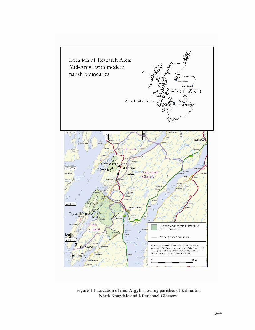
344
Figure 1.1 Location of mid-Argyll showing parishes of Kilmartin,
North Knapdale and Kilmichael Glassary.
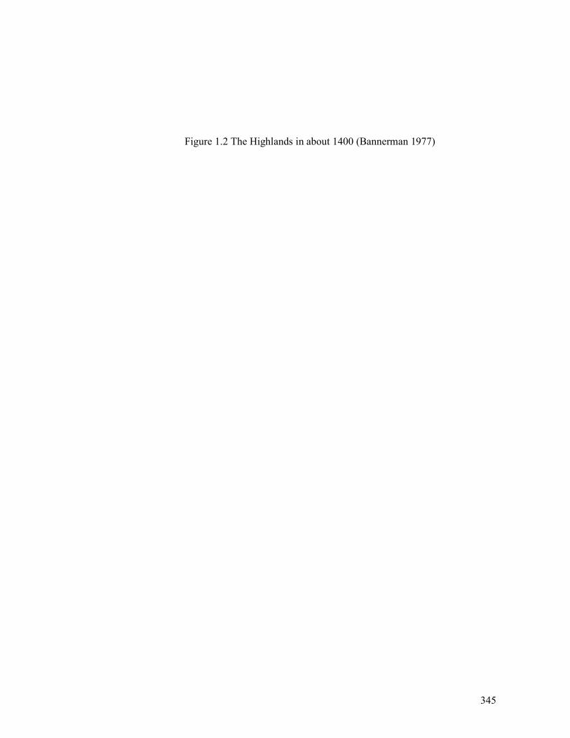
345
Figure 1.2 The Highlands in about 1400 (Bannerman 1977)
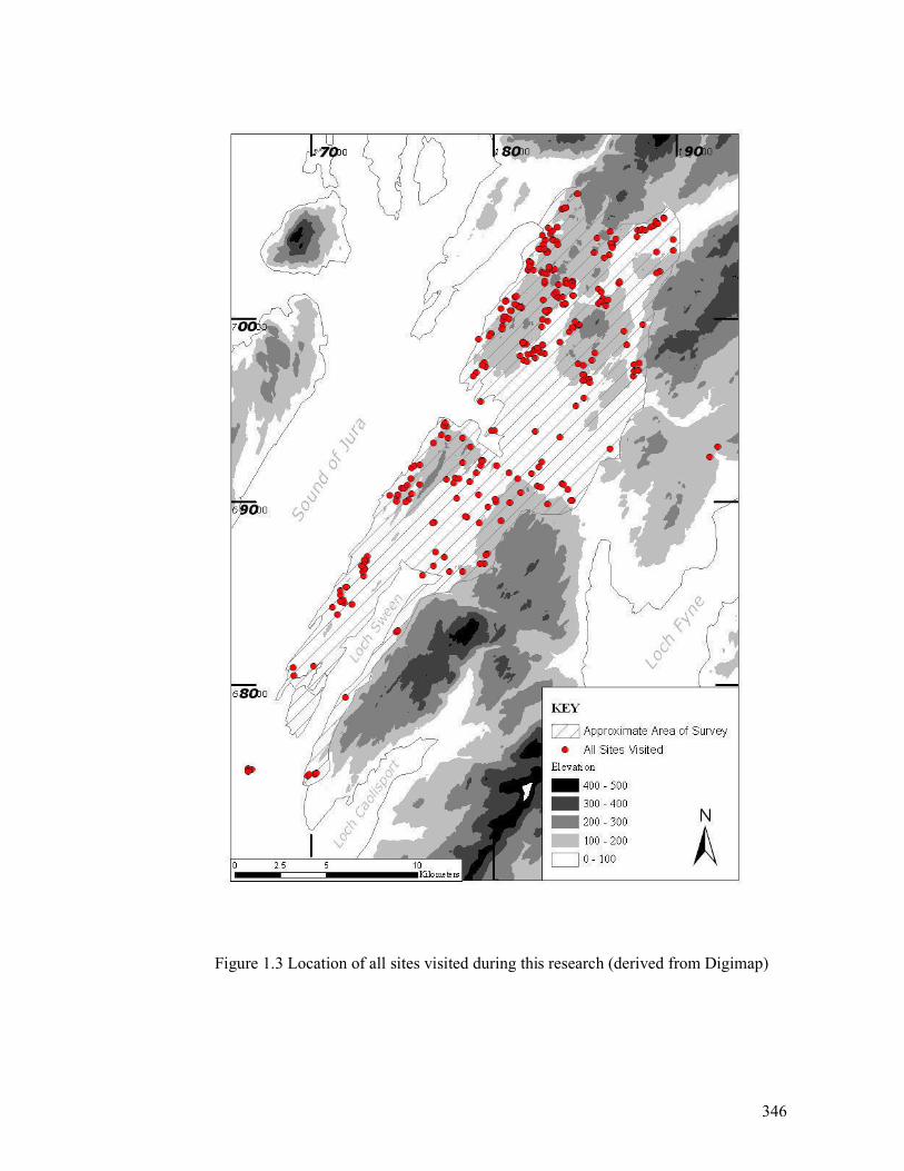
346
Figure 1.3 Location of all sites visited during this research (derived from Digimap)
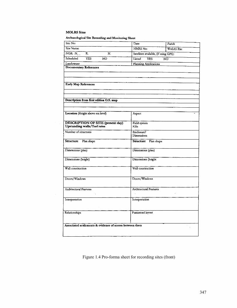
347
Figure 1.4 Pro-forma sheet for recording sites (front)
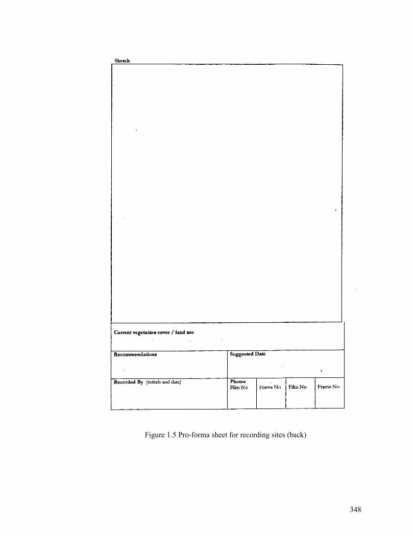
348
Figure 1.5 Pro-forma sheet for recording sites (back)
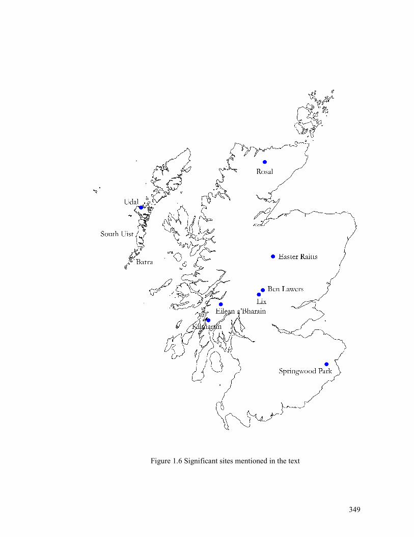
349
Figure 1.6 Significant sites mentioned in the text
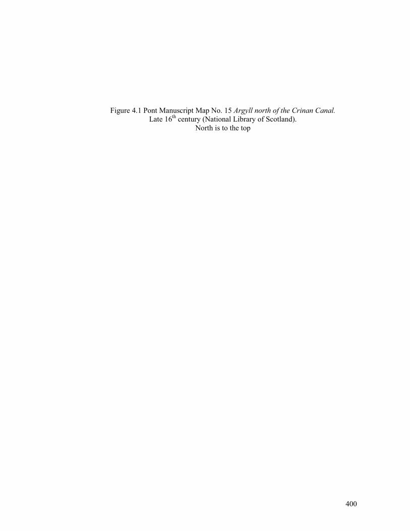
400
Figure 4.1 Pont Manuscript Map No. 15 Argyll north of the Crinan Canal.
Late 16th century (National Library of Scotland).
North is to the top
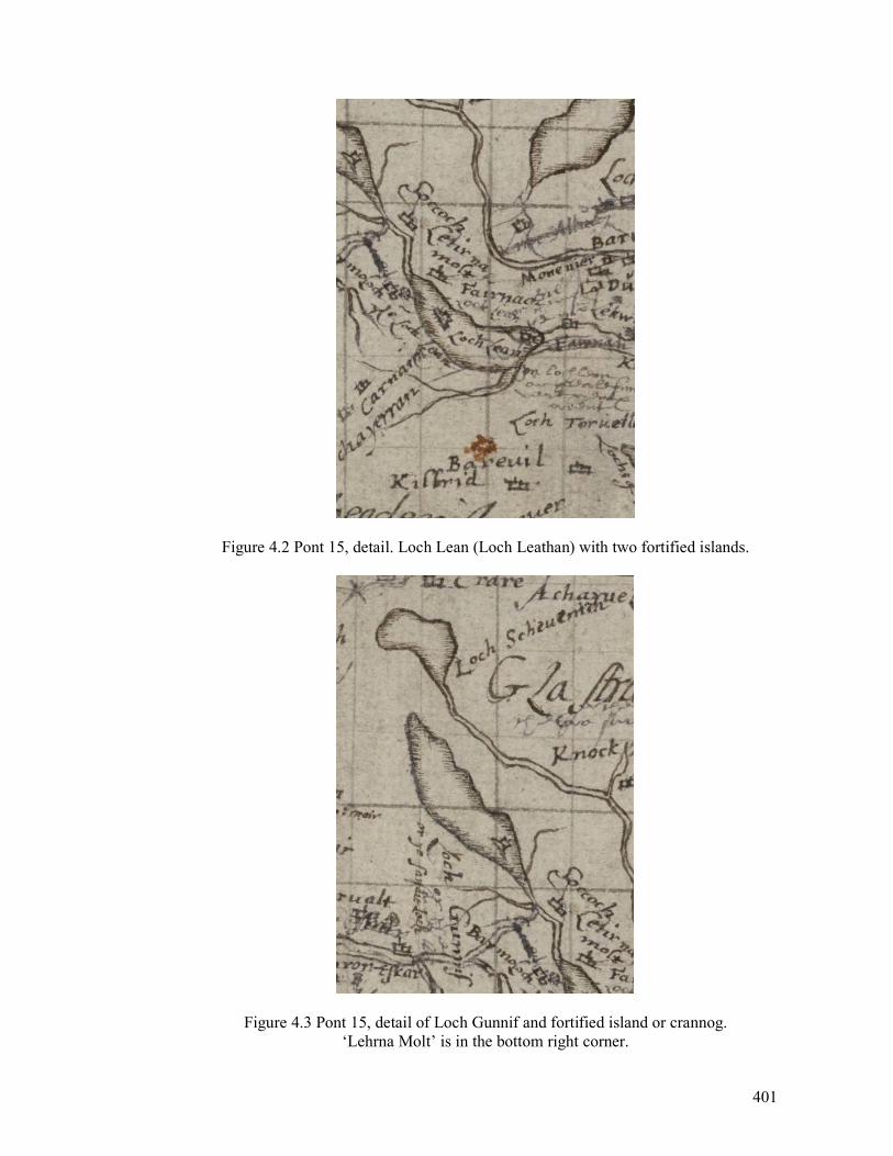
401
Figure 4.2 Pont 15, detail. Loch Lean (Loch Leathan) with two fortified islands.
Figure 4.3 Pont 15, detail of Loch Gunnif and fortified island or crannog.
‘Lehrna Molt’ is in the bottom right corner.
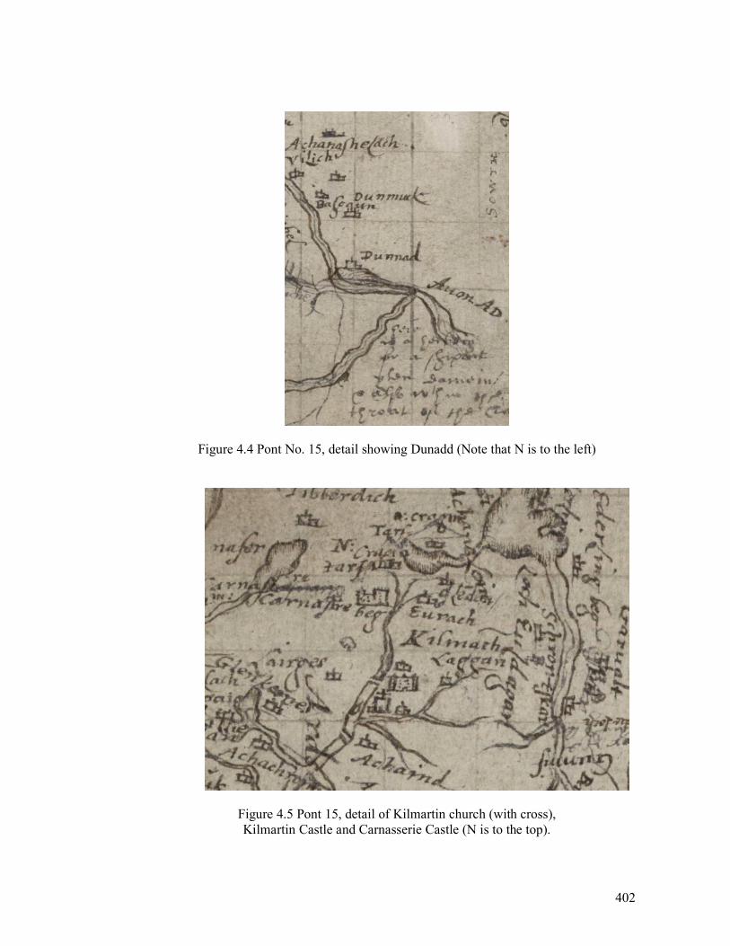
402
Figure 4.4 Pont No. 15, detail showing Dunadd (Note that N is to the left)
Figure 4.5 Pont 15, detail of Kilmartin church (with cross),
Kilmartin Castle and Carnasserie Castle (N is to the top).
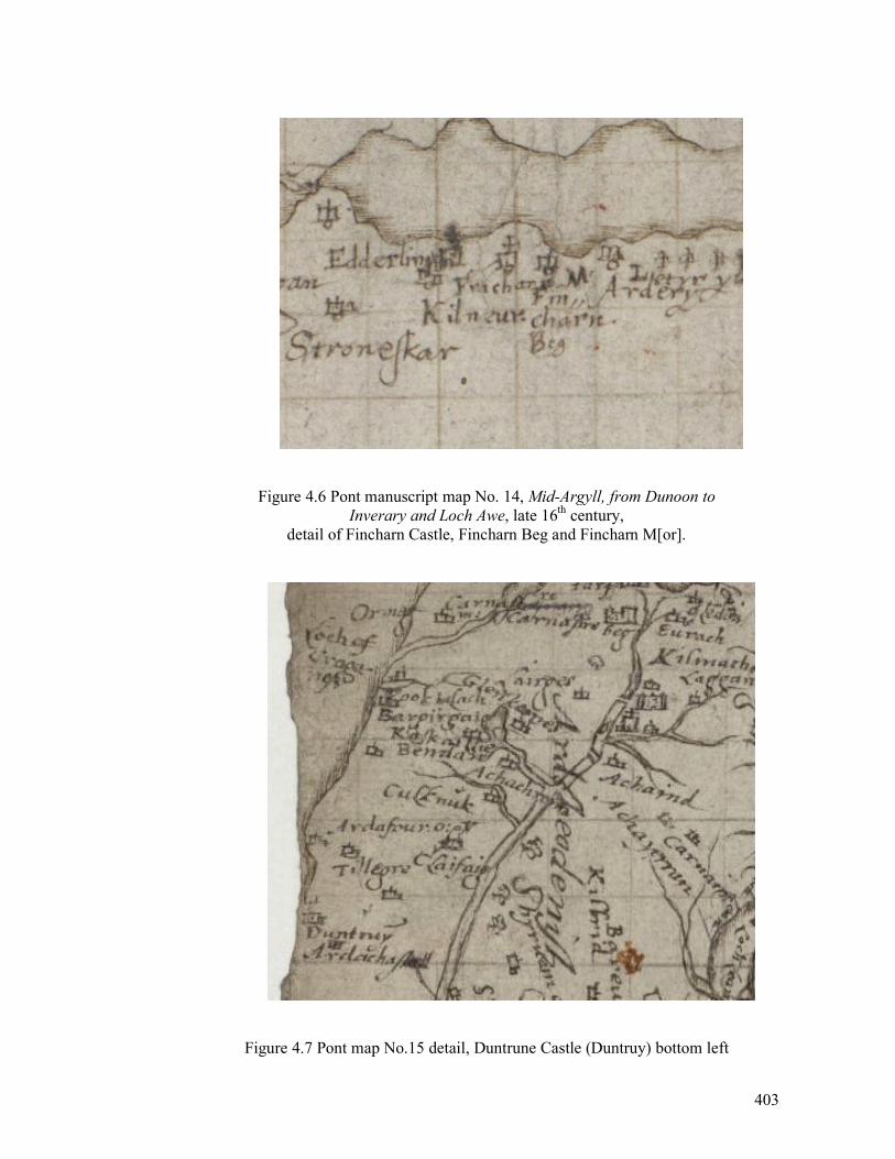
403
Figure 4.6 Pont manuscript map No. 14, Mid-Argyll, from Dunoon to
Inverary and Loch Awe, late 16th century,
detail of Fincharn Castle, Fincharn Beg and Fincharn M[or].
Figure 4.7 Pont map No.15 detail, Duntrune Castle (Duntruy) bottom left
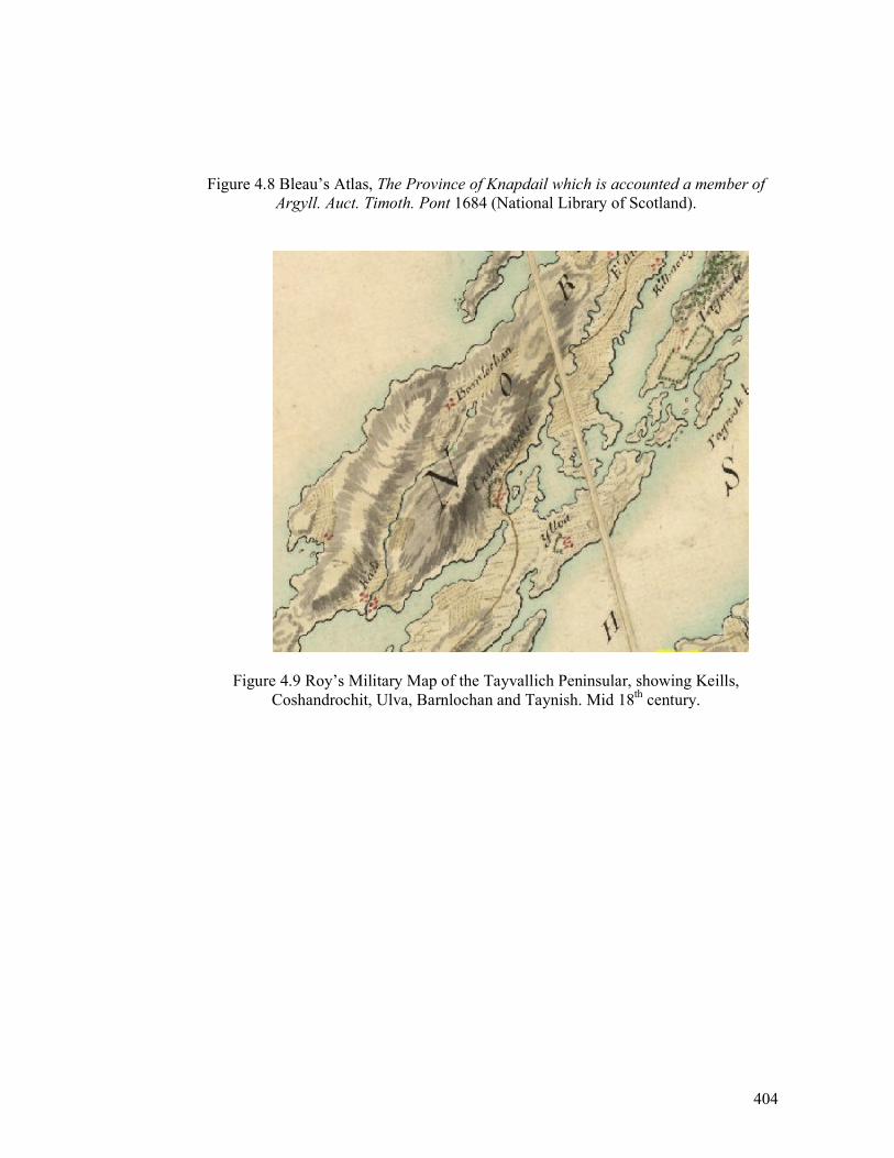
404
Figure 4.8 Bleau’s Atlas, The Province of Knapdail which is accounted a member of
Argyll. Auct. Timoth. Pont 1684 (National Library of Scotland).
Figure 4.9 Roy’s Military Map of the Tayvallich Peninsular, showing Keills,
Coshandrochit, Ulva, Barnlochan and Taynish. Mid 18th century.
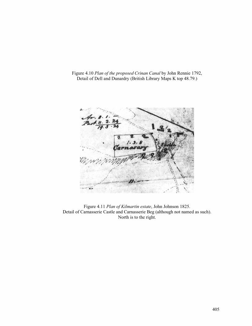
405
Figure 4.10 Plan of the proposed Crinan Canal by John Rennie 1792,
Detail of Dell and Dunardry (British Library Maps K top 48.79.)
Figure 4.11 Plan of Kilmartin estate, John Johnson 1825.
Detail of Carnasserie Castle and Carnasserie Beg (although not named as such).
North is to the right.
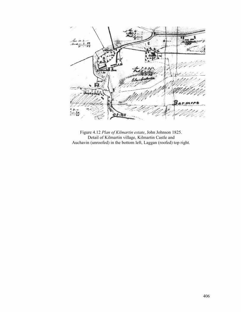
406
Figure 4.12 Plan of Kilmartin estate, John Johnson 1825. Detail of Kilmartin village, Kilmartin Castle and
Auchavin (unroofed) in the bottom left, Laggan (roofed) top right.
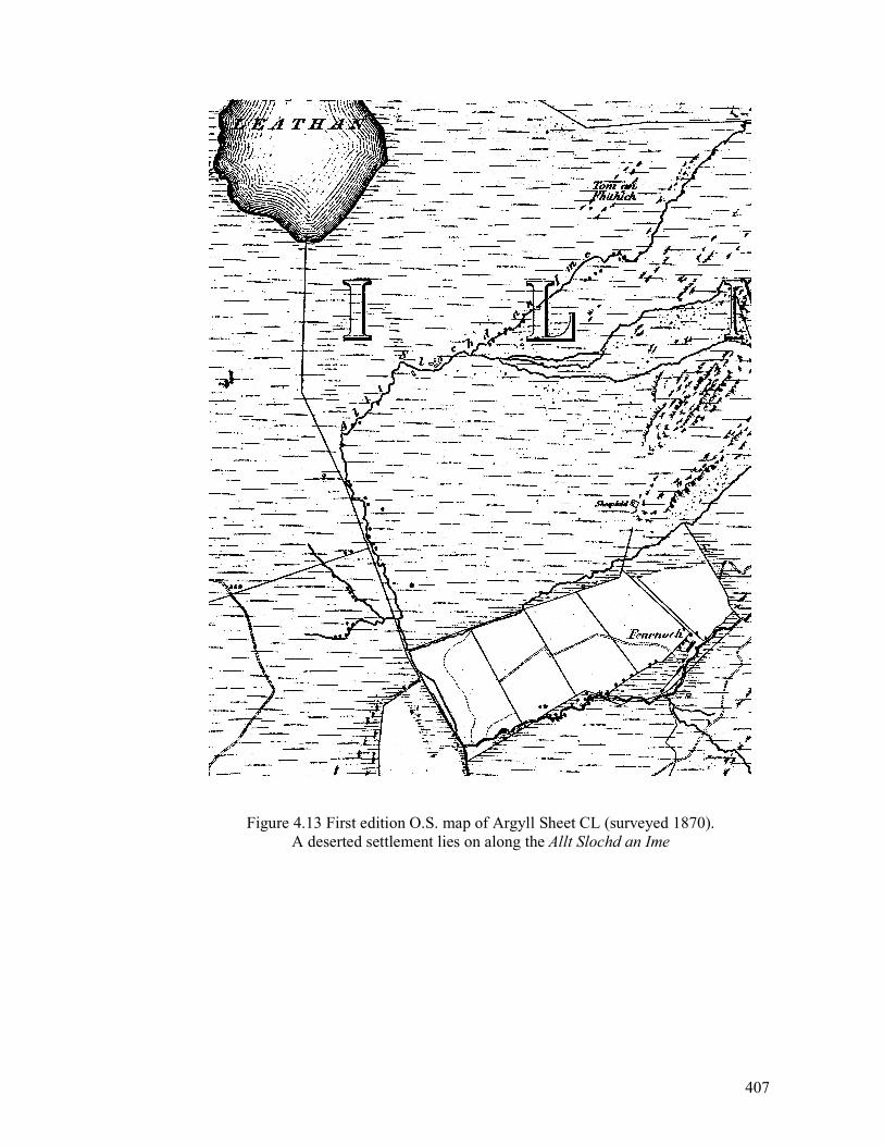
407
Figure 4.13 First edition O.S. map of Argyll Sheet CL (surveyed 1870).
A deserted settlement lies on along the Allt Slochd an Ime
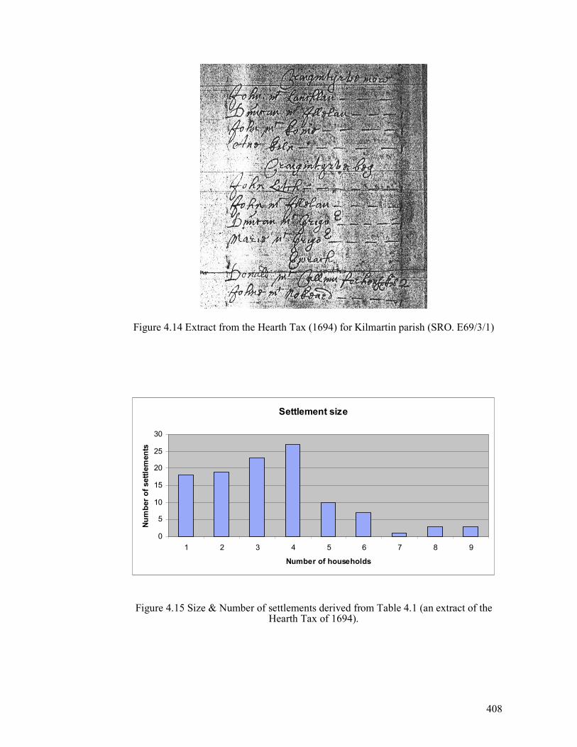
408
Figure 4.14 Extract from the Hearth Tax (1694) for Kilmartin parish (SRO. E69/3/1)
Settlement size
0
5
10
15
20
25
30
1 2 3 4 5 6 7 8 9
Number of households
Number of settlements
Figure 4.15 Size & Number of settlements derived from Table 4.1 (an extract of the
Hearth Tax of 1694).
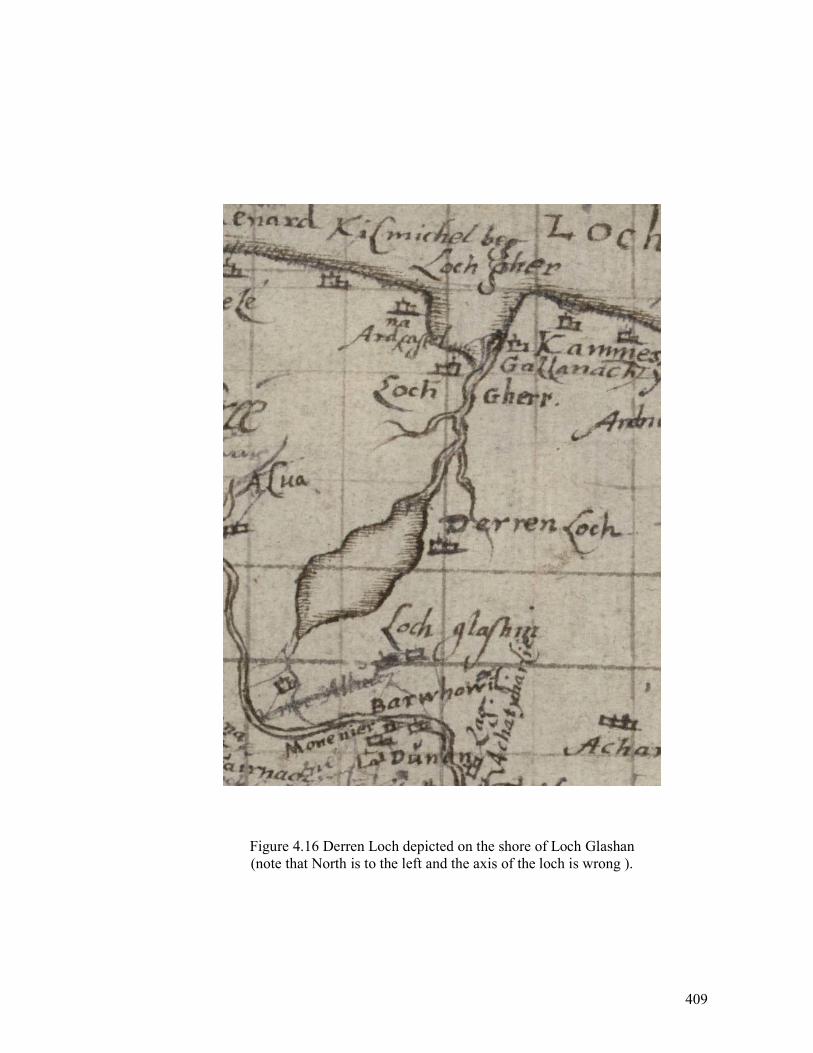
409
Figure 4.16 Derren Loch depicted on the shore of Loch Glashan
(note that North is to the left and the axis of the loch is wrong ).
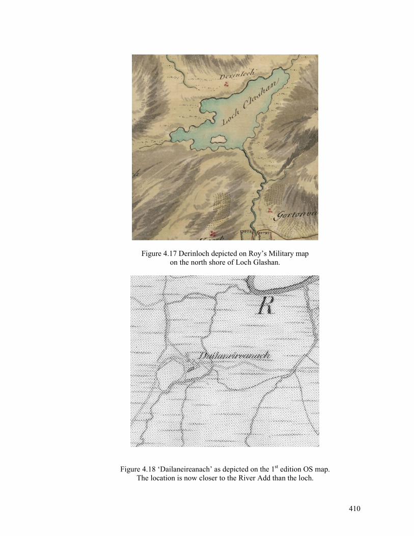
410
Figure 4.17 Derinloch depicted on Roy’s Military map
on the north shore of Loch Glashan.
Figure 4.18 ‘Dailaneireanach’ as depicted on the 1st edition OS map.
The location is now closer to the River Add than the loch.
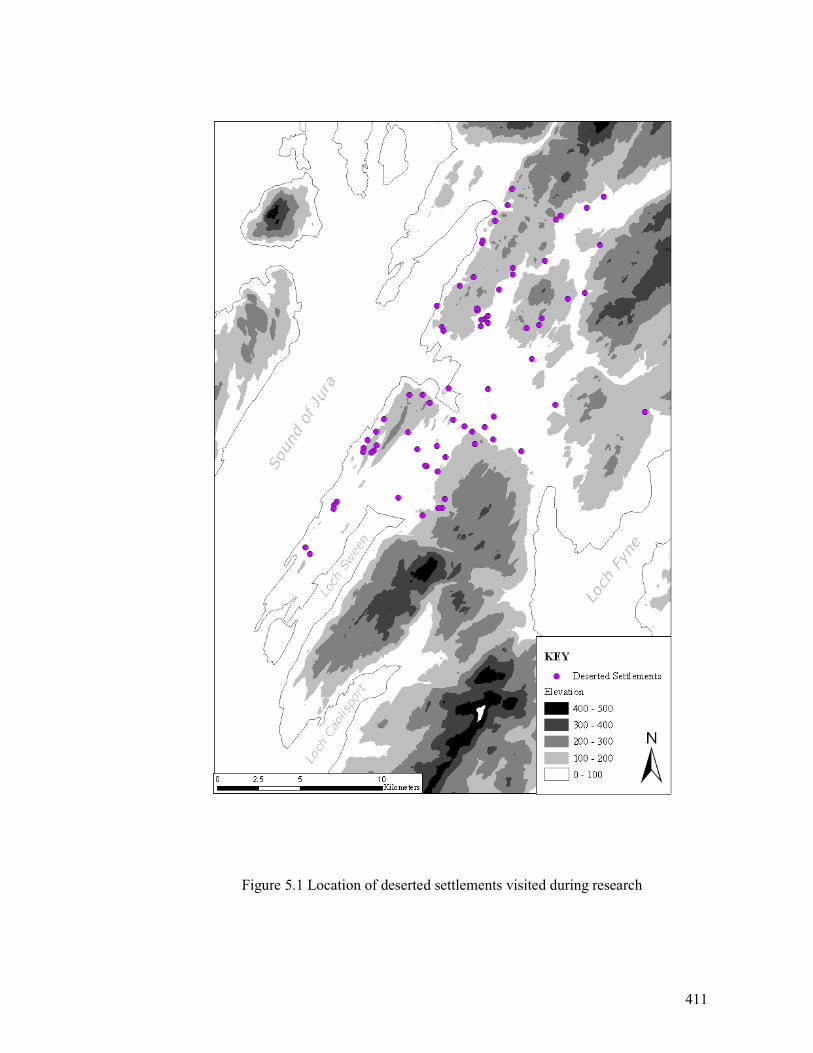
411
Figure 5.1 Location of deserted settlements visited during research
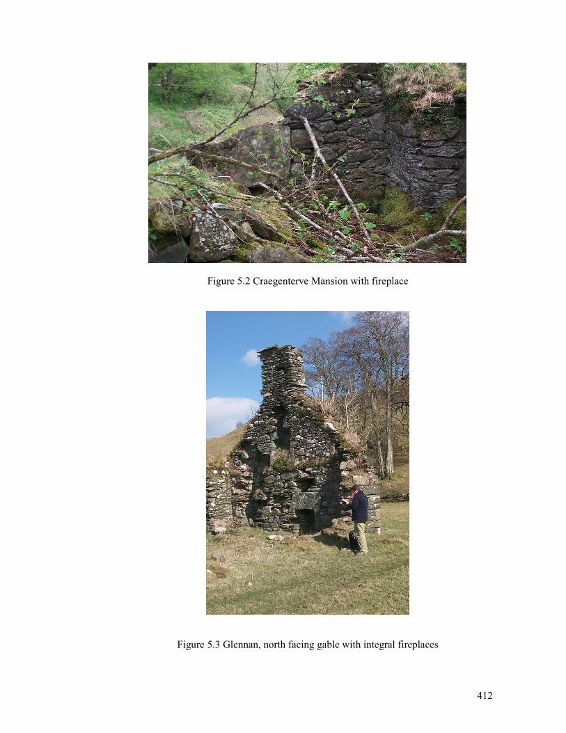
412
Figure 5.2 Craegenterve Mansion with fireplace
Figure 5.3 Glennan, north facing gable with integral fireplaces
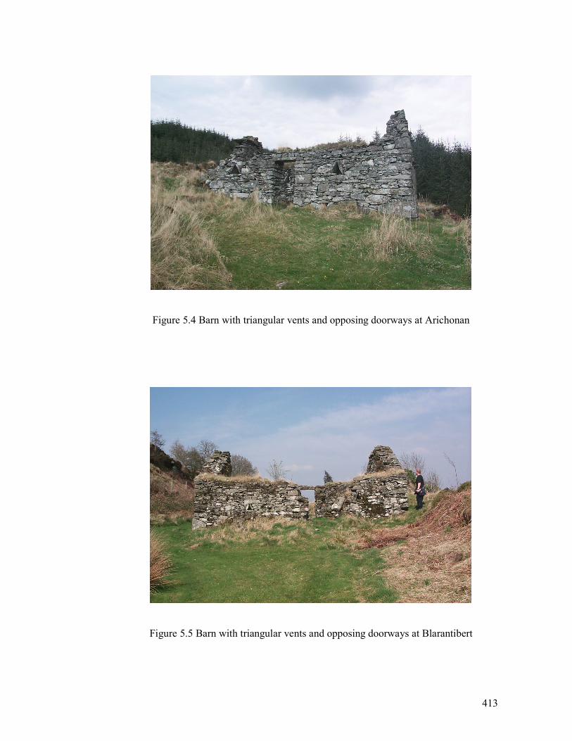
413
Figure 5.4 Barn with triangular vents and opposing doorways at Arichonan
Figure 5.5 Barn with triangular vents and opposing doorways at Blarantibert
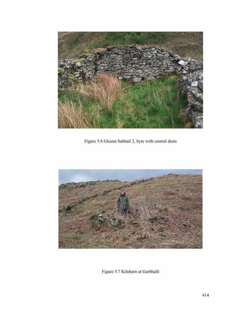
414
Figure 5.6 Gleann Sabhail 2, byre with central drain
Figure 5.7 Kilnbarn at Garbhallt
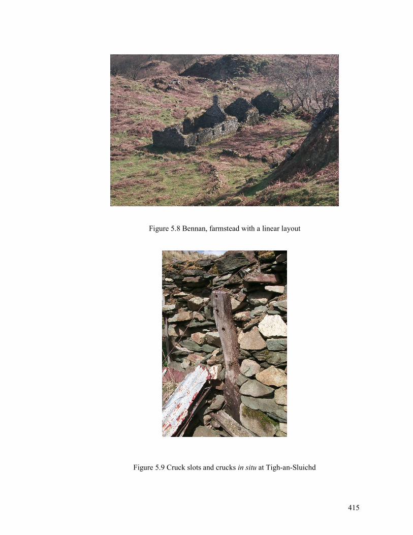
415
Figure 5.8 Bennan, farmstead with a linear layout
Figure 5.9 Cruck slots and crucks in situ at Tigh-an-Sluichd
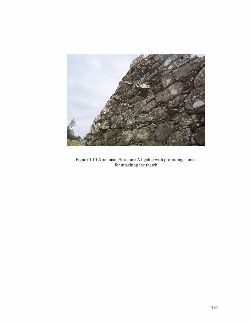
416
Figure 5.10 Arichonan Structure A1 gable with protruding stones
for attaching the thatch
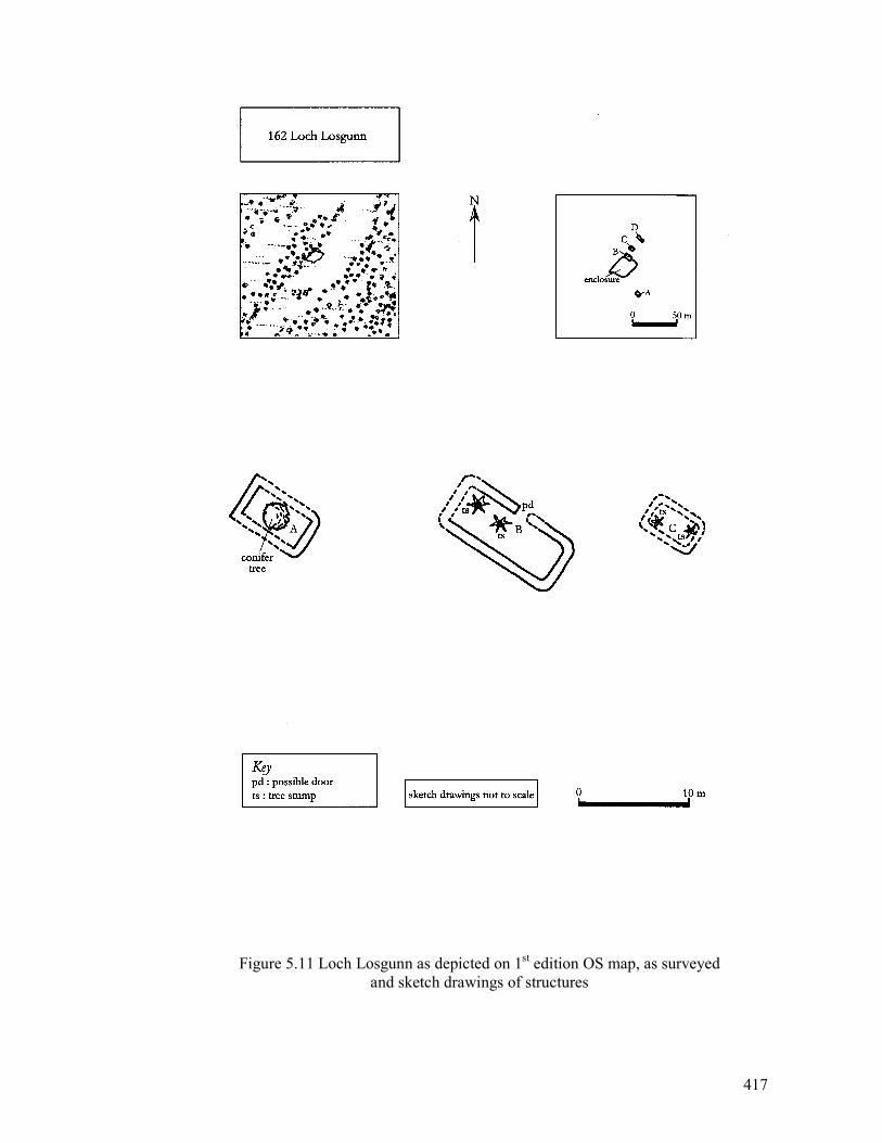
417
Figure 5.11 Loch Losgunn as depicted on 1st edition OS map, as surveyed
and sketch drawings of structures
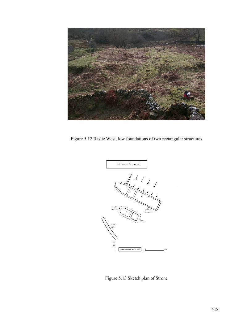
418
Figure 5.12 Raslie West, low foundations of two rectangular structures
Figure 5.13 Sketch plan of Strone
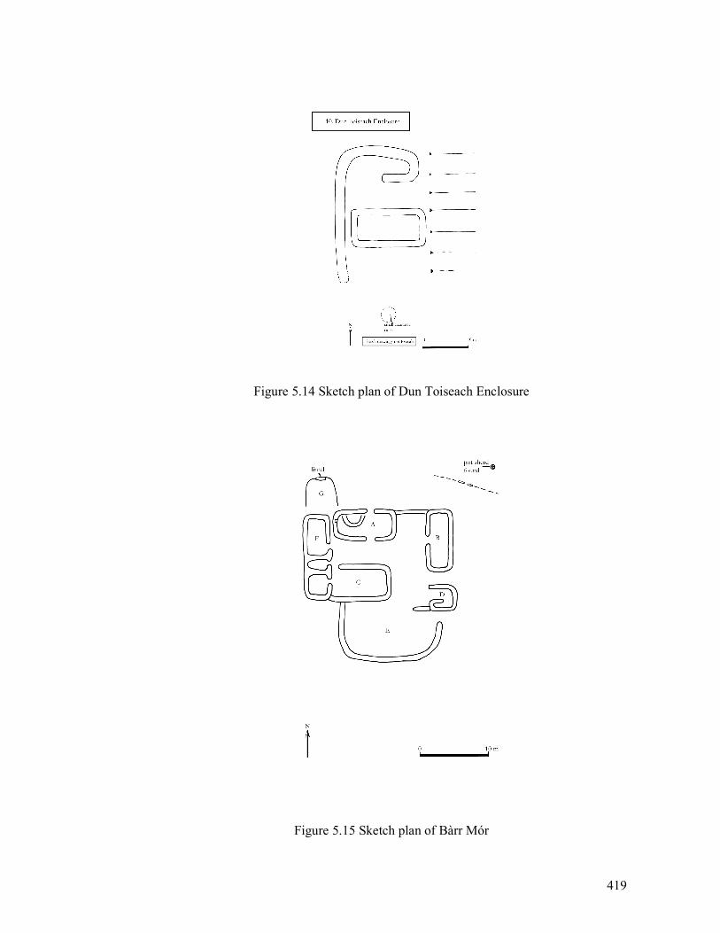
419
Figure 5.14 Sketch plan of Dun Toiseach Enclosure
Figure 5.15 Sketch plan of Bàrr Mór
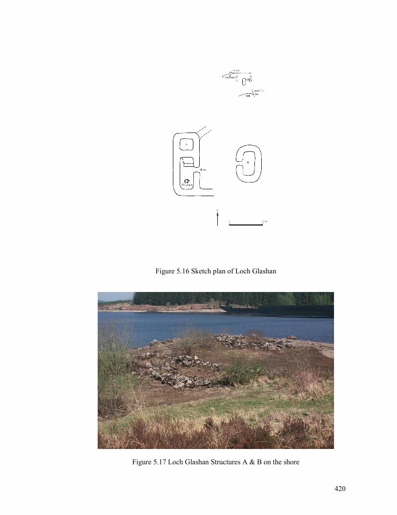
420
Figure 5.16 Sketch plan of Loch Glashan
Figure 5.17 Loch Glashan Structures A & B on the shore
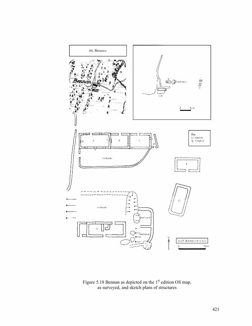
421
Figure 5.18 Bennan as depicted on the 1st edition OS map,
as surveyed, and sketch plans of structures
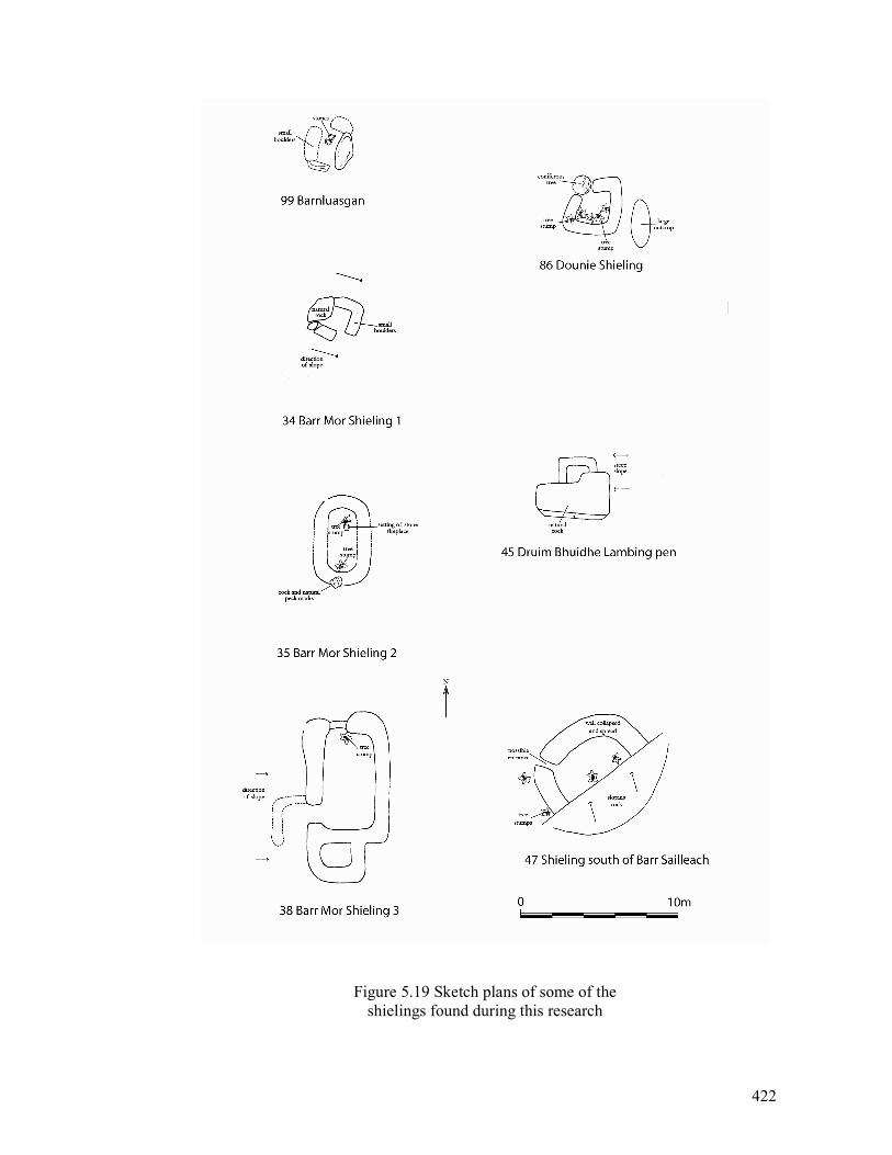
422
Figure 5.19 Sketch plans of some of the
shielings found during this research
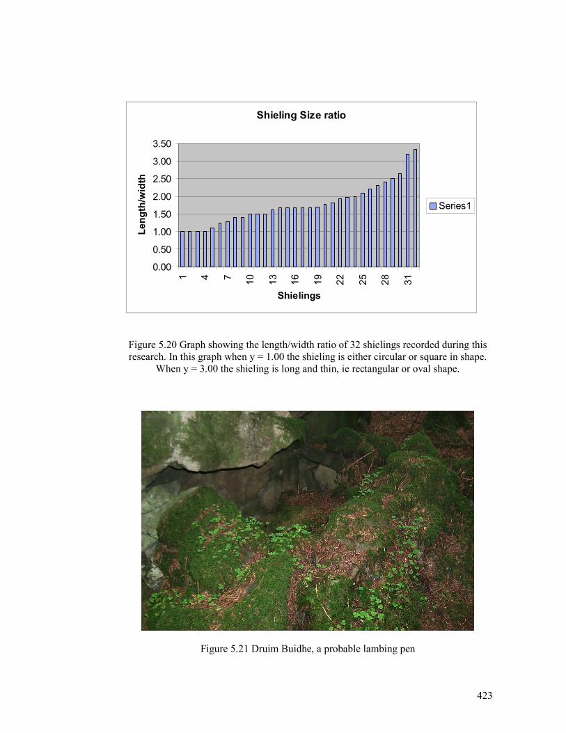
423
Figure 5.20 Graph showing the length/width ratio
of shielings recorded during this research
Figure 5.20 Graph showing the length/width ratio of 32 shielings recorded during this
research. In this graph when y = 1.00 the shieling is either circular or square in shape.
When y = 3.00 the shieling is long and thin, ie rectangular or oval shape.
Figure 5.21 Druim Buidhe, a probable lambing pen
Shieling Size ratio
0.00
0.50
1.00
1.50
2.00
2.50
3.00
3.50
1 4 7
10
13
16
19
22
25
28
31
Shielings
Length/width
Series1
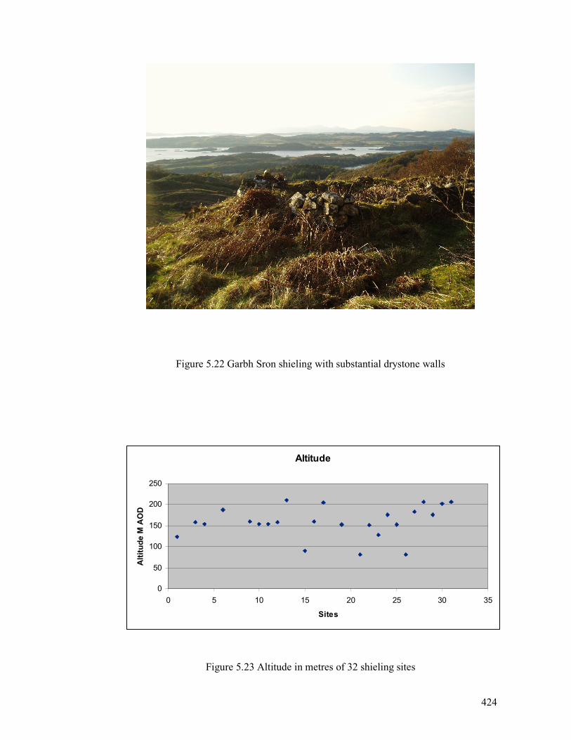
424
Figure 5.22 Garbh Sron shieling with substantial drystone walls
Figure 5.23 Altitude in metres of 32 shieling sites
Altitude
0
50
100
150
200
250
0 5 10 15 20 25 30 35
Sites
Altitude M AOD
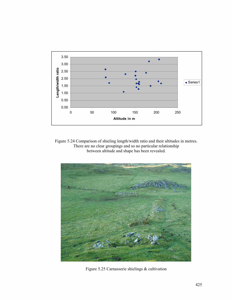
425
Figure 5.24 Comparison of shieling length/width ratio and their altitudes in metres.
There are no clear groupings and so no particular relationship
between altitude and shape has been revealed.
Figure 5.25 Carnasserie shielings & cultivation
0.00
0.50
1.00
1.50
2.00
2.50
3.00
3.50
0 50 100 150 200 250
Altitude in m
Length/width ratio
Series1
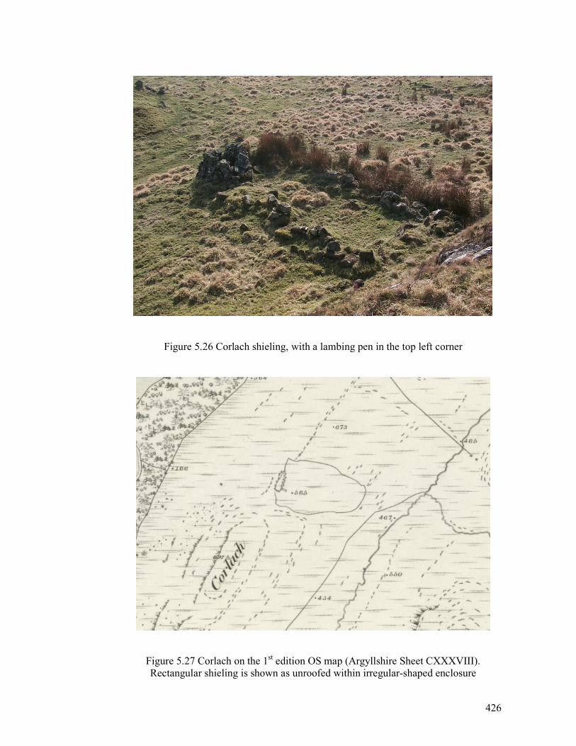
426
Figure 5.26 Corlach shieling, with a lambing pen in the top left corner
Figure 5.27 Corlach on the 1st edition OS map (Argyllshire Sheet CXXXVIII).
Rectangular shieling is shown as unroofed within irregular-shaped enclosure
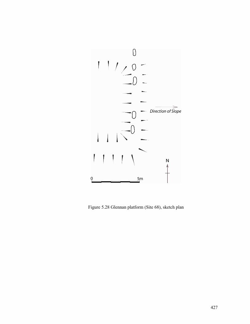
427
Figure 5.28 Glennan platform (Site 68), sketch plan
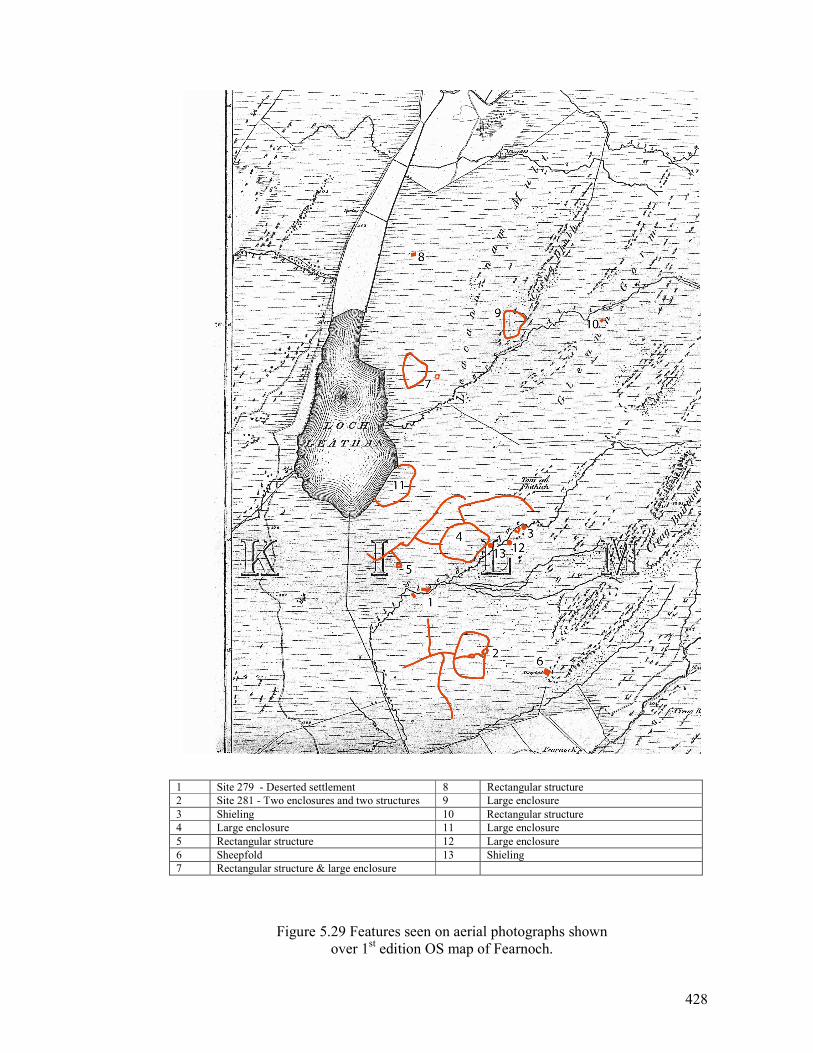
428
1 Site 279 - Deserted settlement 8 Rectangular structure
2 Site 281 - Two enclosures and two structures 9 Large enclosure
3 Shieling 10 Rectangular structure
4 Large enclosure 11 Large enclosure
5 Rectangular structure 12 Large enclosure
6 Sheepfold 13 Shieling
7 Rectangular structure & large enclosure
Figure 5.29 Features seen on aerial photographs shown
over 1st edition OS map of Fearnoch.

429
Figure 5.30 Caol Chaoruinn, Torran (RCAHMS 1992, 214)
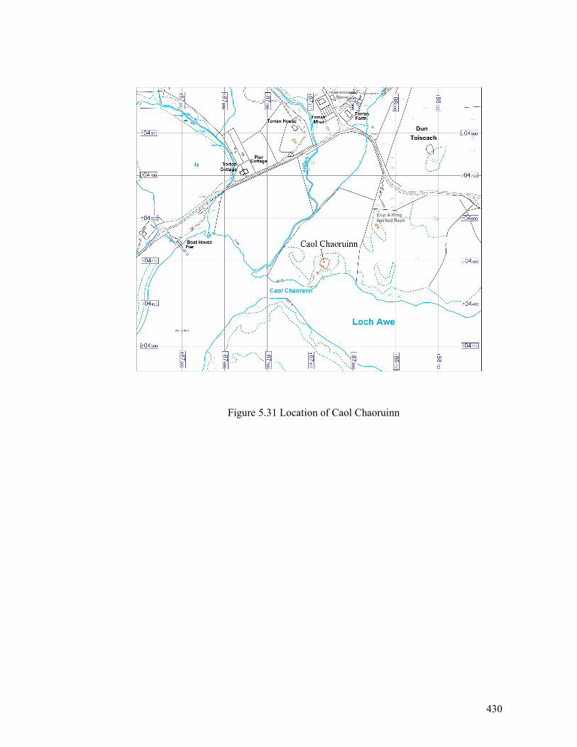
430
Figure 5.31 Location of Caol Chaoruinn
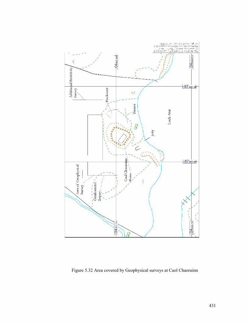
431
Figure 5.32 Area covered by Geophysical surveys at Caol Chaoruinn
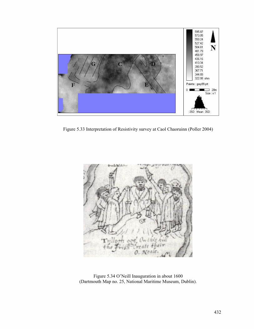
432
Figure 5.33 Interpretation of Resistivity survey at Caol Chaoruinn (Poller 2004)
Figure 5.34 O’Neill Inauguration in about 1600
(Dartmouth Map no. 25, National Maritime Museum, Dublin).
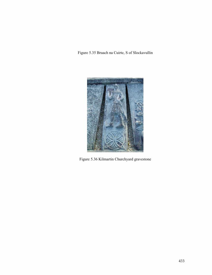
433
Figure 5.35 Bruach na Cuirte, S of Slockavullin
Figure 5.36 Kilmartin Churchyard gravestone

434
Figure 5.37 Galley on carved gravestone
at Kilmichael Glassary (RCAHMS 1992, 144)
435
Figure 5.38 Galley on carved stone Kilmory Knap (RCAHMS 1992, 165)
Figure 5.39 Effigy of Sir Duncan Campbell, Kilmun (Boardman 2006, Plate 3)
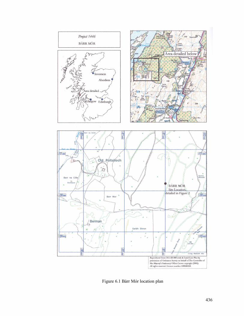
436
Figure 6.1 Bàrr Mór location plan
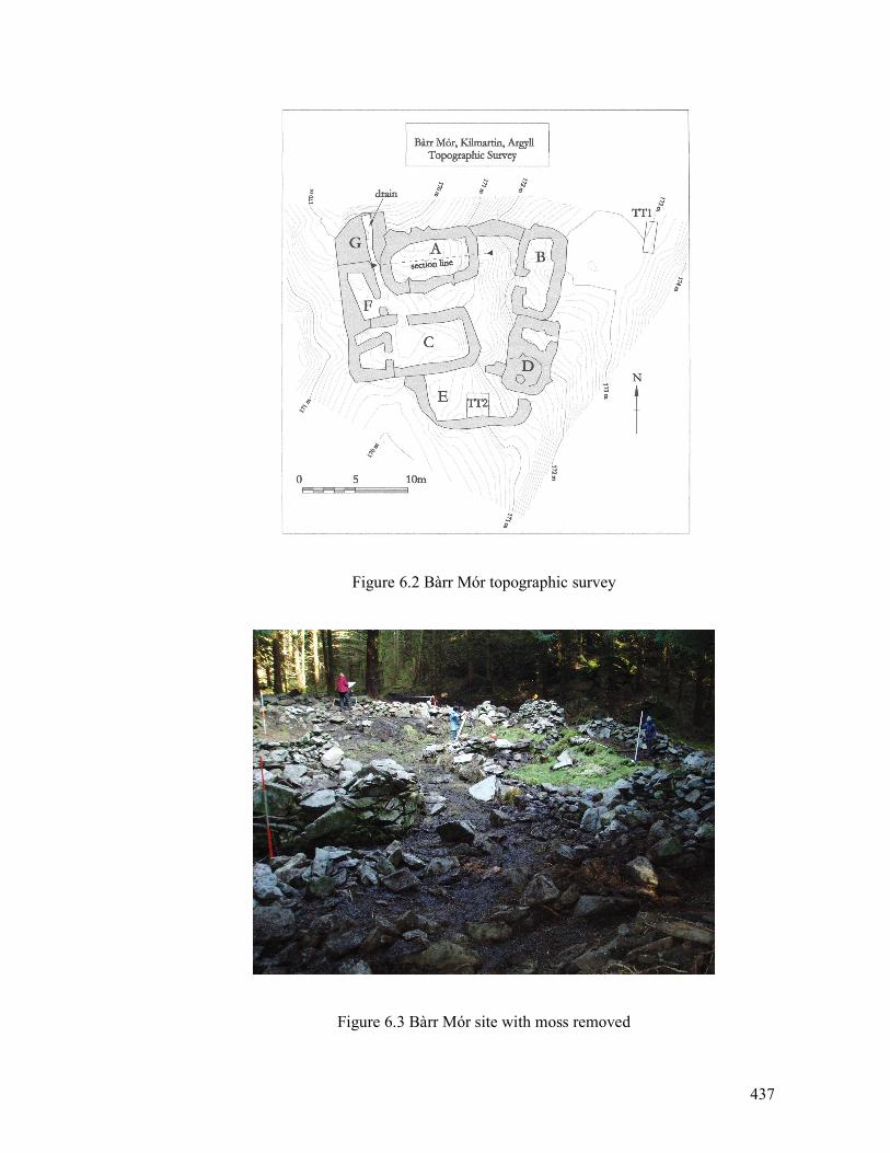
437
Figure 6.2 Bàrr Mór topographic survey
Figure 6.3 Bàrr Mór site with moss removed
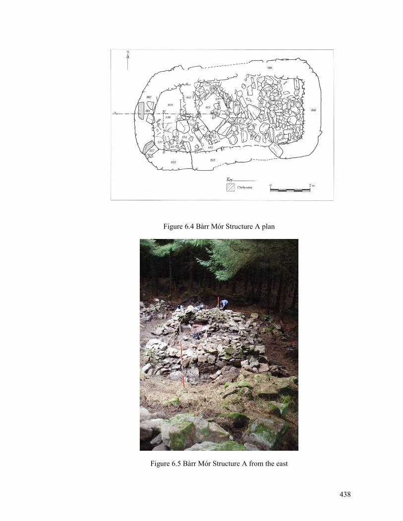
438
Figure 6.4 Bàrr Mór Structure A plan
Figure 6.5 Bàrr Mór Structure A from the east
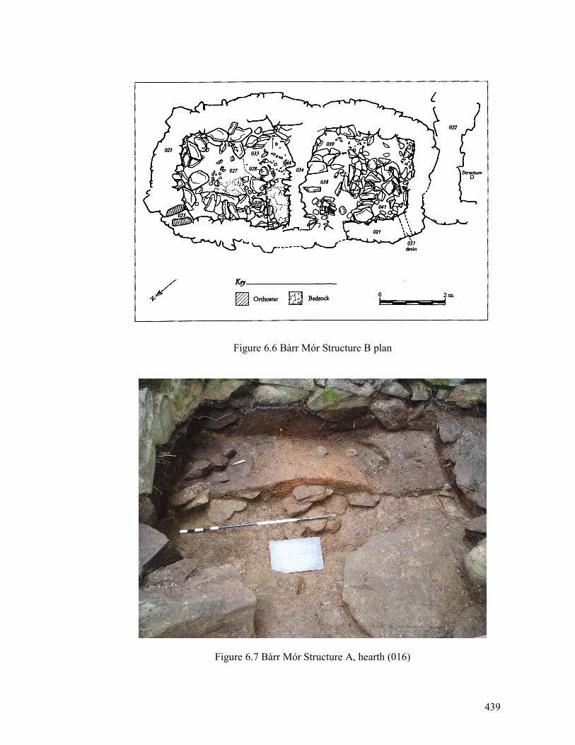
439
Figure 6.6 Bàrr Mór Structure B plan
Figure 6.7 Bàrr Mór Structure A, hearth (016)
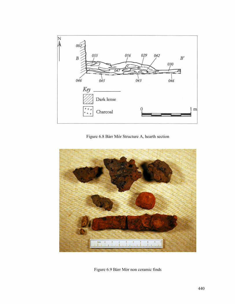
440
Figure 6.8 Bàrr Mór Structure A, hearth section
Figure 6.9 Bàrr Mór non ceramic finds
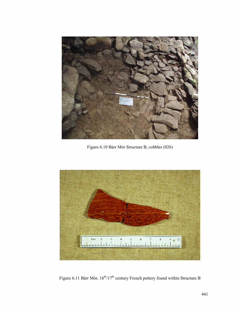
441
Figure 6.10 Bàrr Mór Structure B, cobbles (026)
Figure 6.11 Bàrr Mór, 16th/17
th century French pottery found within Structure B
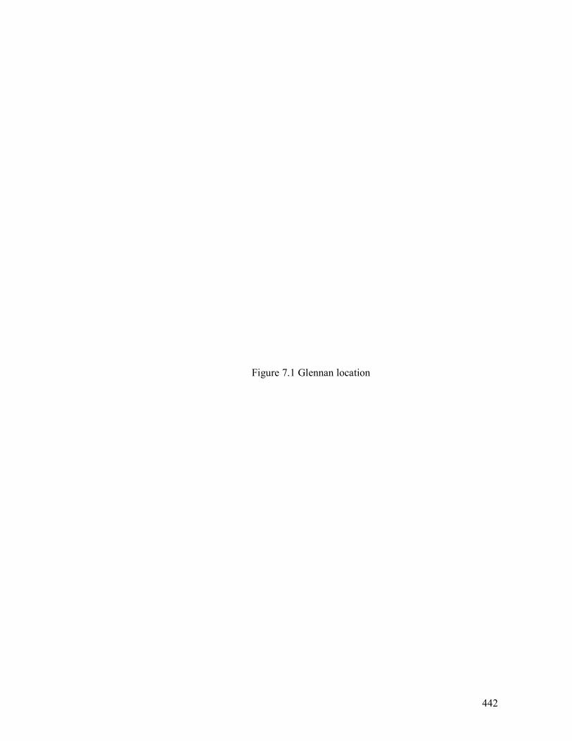
442
Figure 7.1 Glennan location
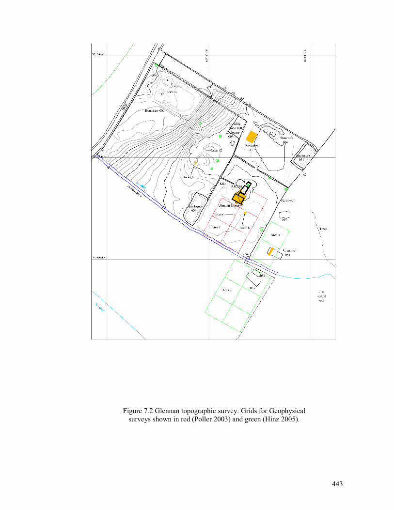
443
Figure 7.2 Glennan topographic survey. Grids for Geophysical
surveys shown in red (Poller 2003) and green (Hinz 2005).
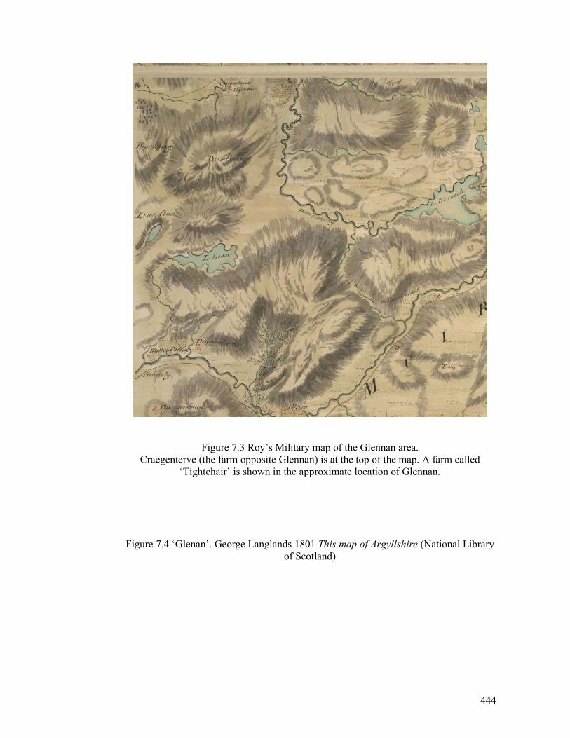
444
Figure 7.3 Roy’s Military map of the Glennan area.
Craegenterve (the farm opposite Glennan) is at the top of the map. A farm called
‘Tightchair’ is shown in the approximate location of Glennan.
Figure 7.4 ‘Glenan’. George Langlands 1801 This map of Argyllshire (National Library
of Scotland)
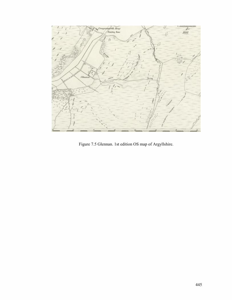
445
Figure 7.5 Glennan. 1st edition OS map of Argyllshire.
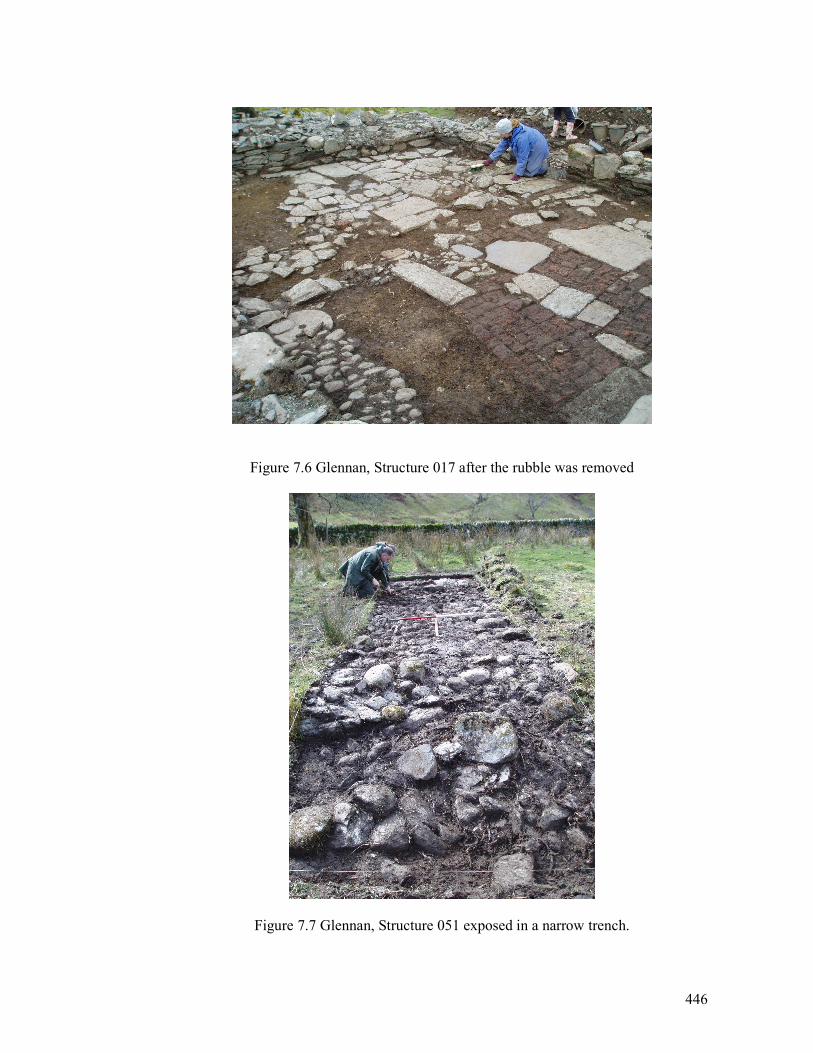
446
Figure 7.6 Glennan, Structure 017 after the rubble was removed
Figure 7.7 Glennan, Structure 051 exposed in a narrow trench.
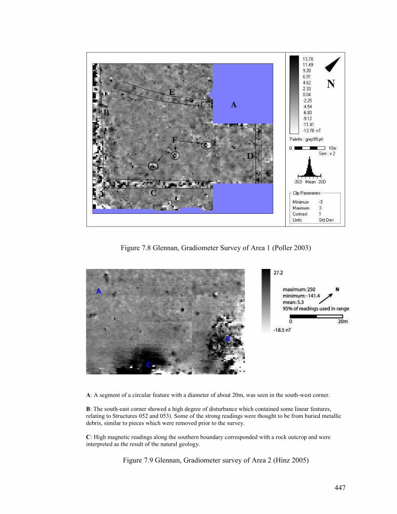
447
Figure 7.8 Glennan, Gradiometer Survey of Area 1 (Poller 2003)
A: A segment of a circular feature with a diameter of about 20m, was seen in the south-west corner.
B: The south-east corner showed a high degree of disturbance which contained some linear features,
relating to Structures 052 and 053). Some of the strong readings were thought to be from buried metallic
debris, similar to pieces which were removed prior to the survey.
C: High magnetic readings along the southern boundary corresponded with a rock outcrop and were
interpreted as the result of the natural geology.
Figure 7.9 Glennan, Gradiometer survey of Area 2 (Hinz 2005)
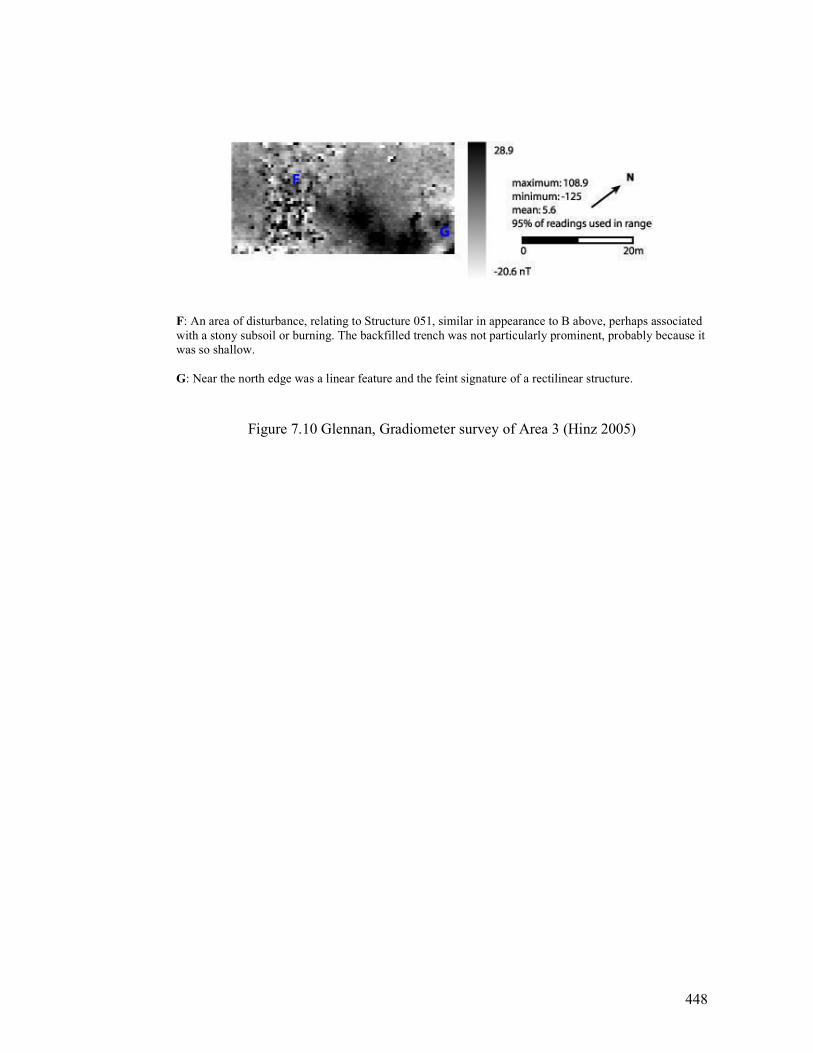
448
F: An area of disturbance, relating to Structure 051, similar in appearance to B above, perhaps associated
with a stony subsoil or burning. The backfilled trench was not particularly prominent, probably because it
was so shallow.
G: Near the north edge was a linear feature and the feint signature of a rectilinear structure.
Figure 7.10 Glennan, Gradiometer survey of Area 3 (Hinz 2005)
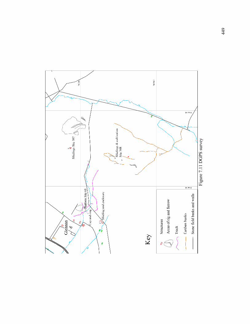
449
Fig
ure
7.1
1 D
GPS surv
ey
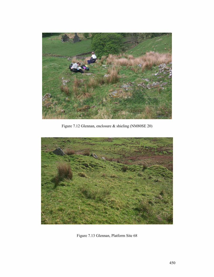
450
Figure 7.12 Glennan, enclosure & shieling (NM80SE 20)
Figure 7.13 Glennan, Platform Site 68
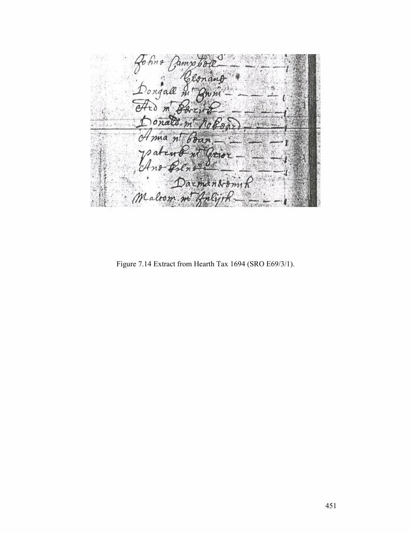
451
Figure 7.14 Extract from Hearth Tax 1694 (SRO E69/3/1).
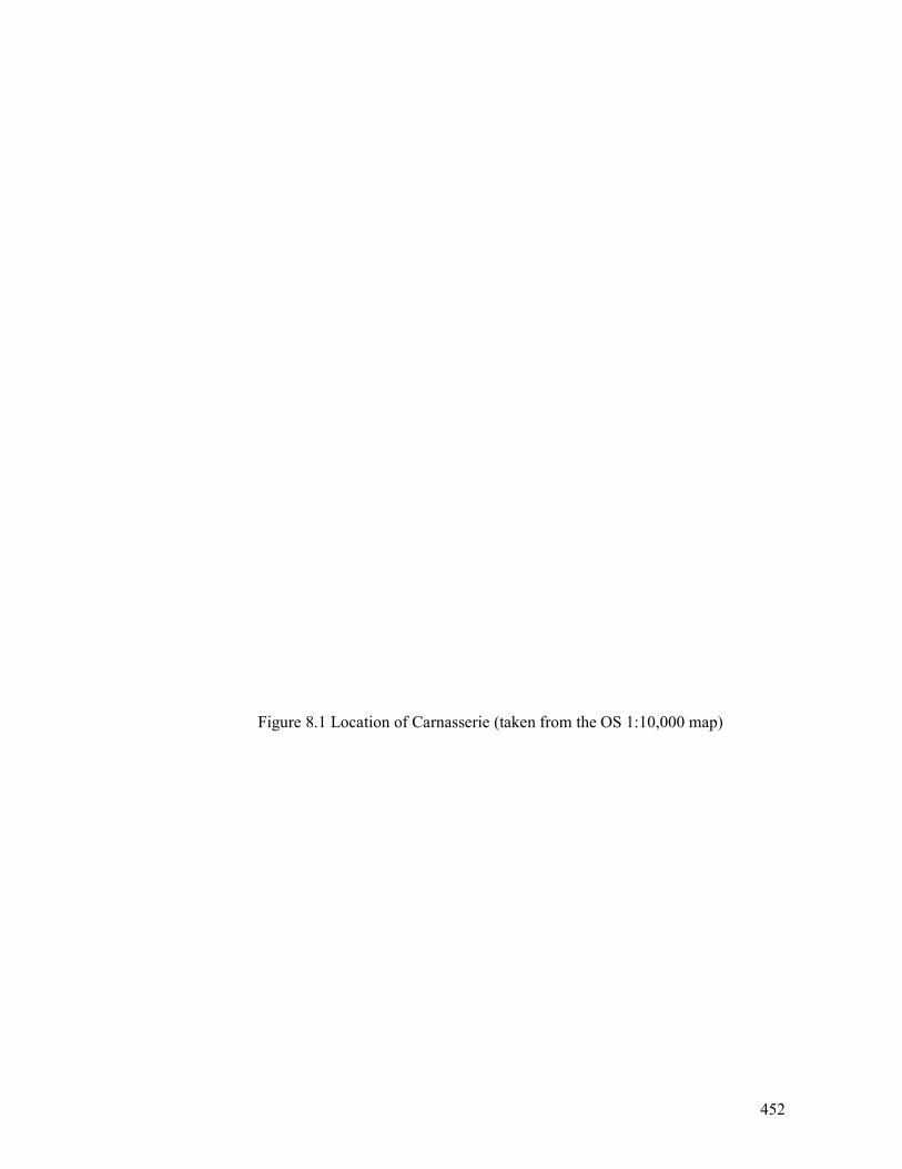
452
Figure 8.1 Location of Carnasserie (taken from the OS 1:10,000 map)
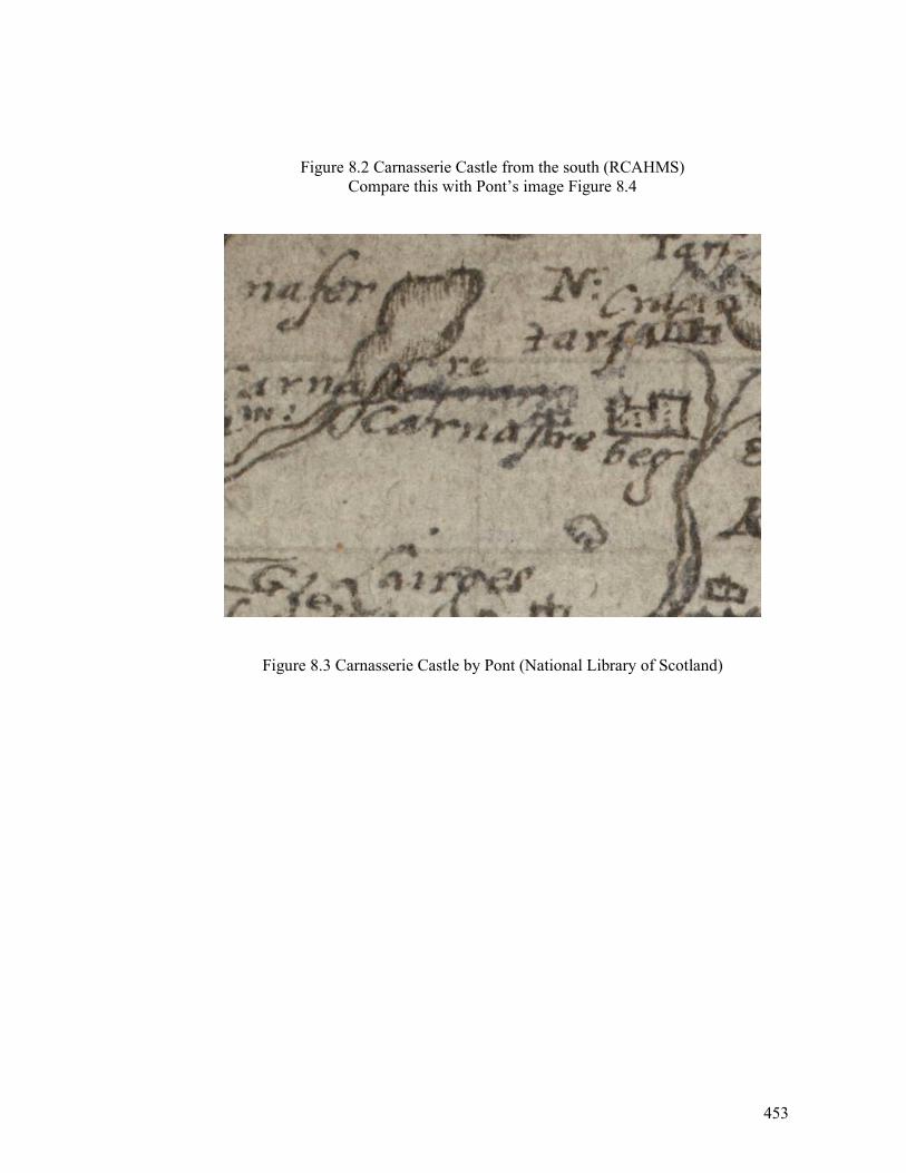
453
Figure 8.2 Carnasserie Castle from the south (RCAHMS)
Compare this with Pont’s image Figure 8.4
Figure 8.3 Carnasserie Castle by Pont (National Library of Scotland)
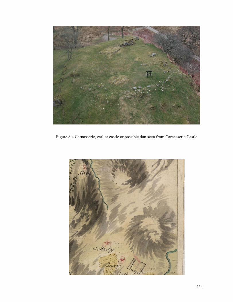
454
Figure 8.4 Carnasserie, earlier castle or possible dun seen from Carnasserie Castle
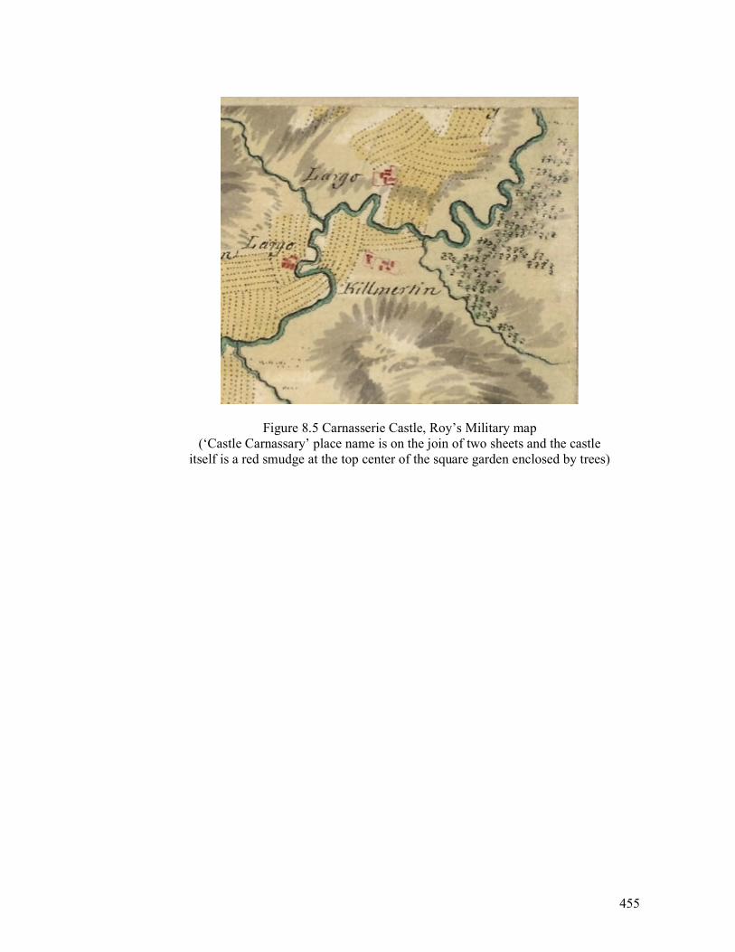
455
Figure 8.5 Carnasserie Castle, Roy’s Military map
(‘Castle Carnassary’ place name is on the join of two sheets and the castle
itself is a red smudge at the top center of the square garden enclosed by trees)
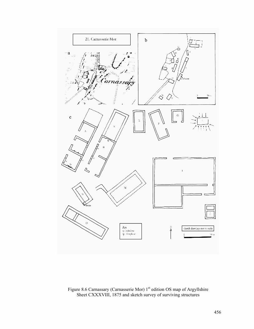
456
Figure 8.6 Carnassary (Carnasserie Mor) 1st edition OS map of Argyllshire
Sheet CXXXVIII, 1875 and sketch survey of surviving structures
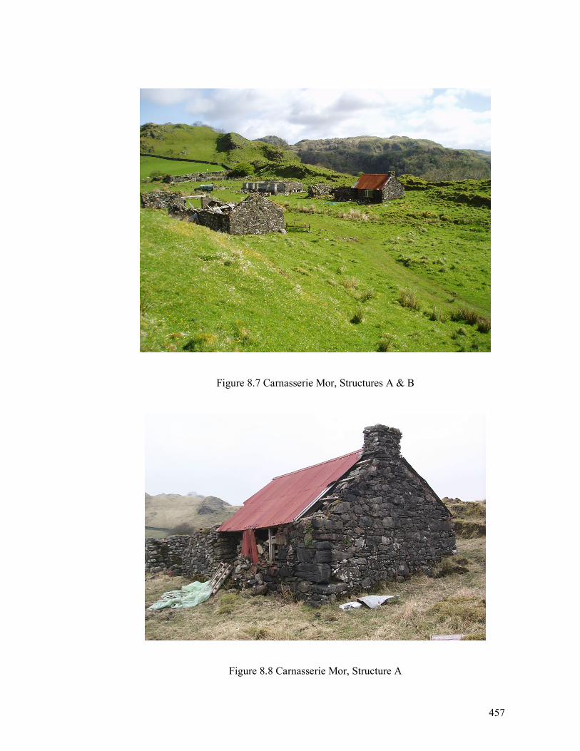
457
Figure 8.7 Carnasserie Mor, Structures A & B
Figure 8.8 Carnasserie Mor, Structure A
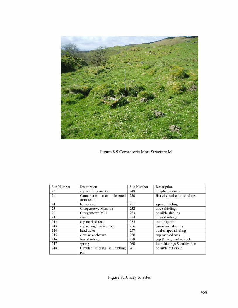
458
Figure 8.9 Carnasserie Mor, Structure M
Site Number Description Site Number Description
20 cup and ring marks 249 Shepherds shelter
21 Carnasserie mor deserted
farmstead
250 Hut circle/circular shieling
24 homestead 251 square shieling
25 Craegenterve Mansion 252 three shielings
26 Craegenterve Mill 253 possible shieling
241 cairn 254 three shielings
242 cup marked rock 255 saddle quern
243 cup & ring marked rock 256 cairns and shieling
244 head dyke 257 oval-shaped shieling
245 circular enclosure 258 cup marked rock
246 four shielings 259 cup & ring marked rock
247 spring 260 four shielings & cultivation
248 Circular shieling & lambing
pen
261 possible hut circle
Figure 8.10 Key to Sites
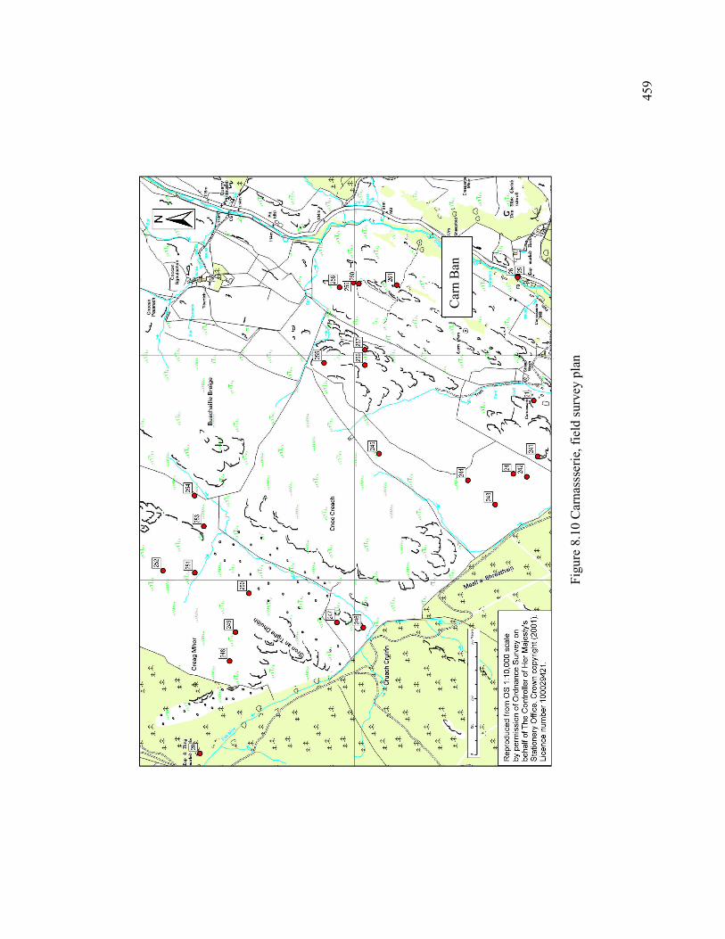
459
Figure 8.10 Carnassserie, field survey plan
Carn Ban
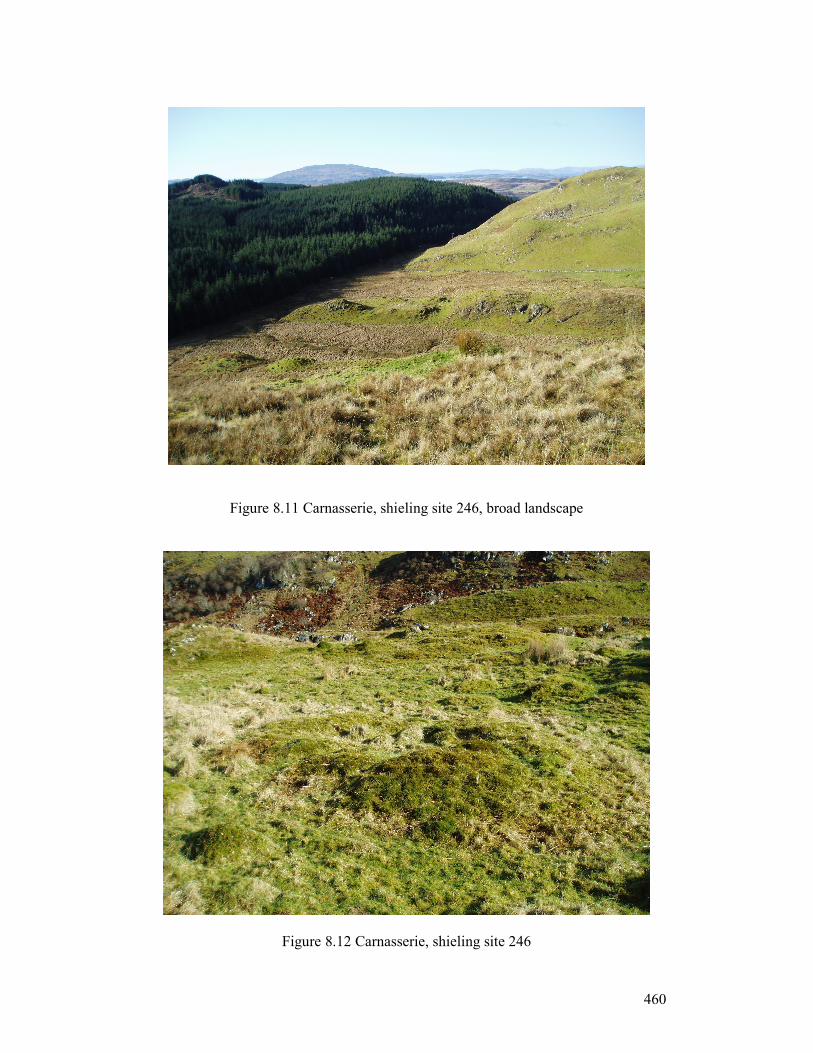
460
Figure 8.11 Carnasserie, shieling site 246, broad landscape
Figure 8.12 Carnasserie, shieling site 246
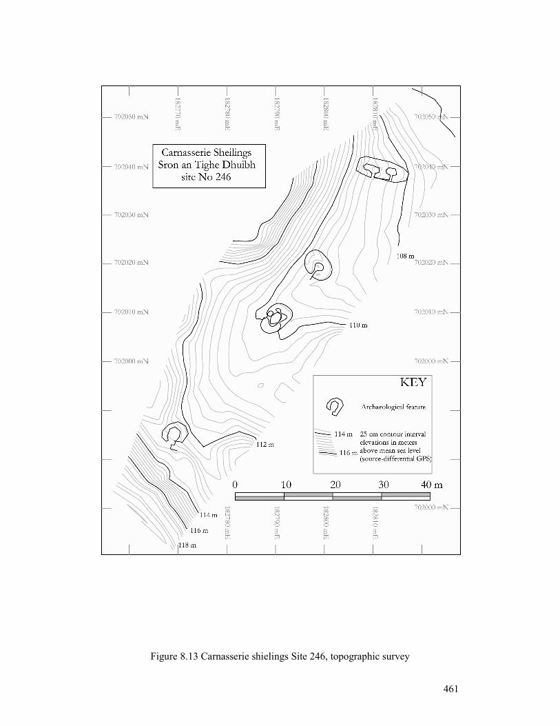
461
Figure 8.13 Carnasserie shielings Site 246, topographic survey
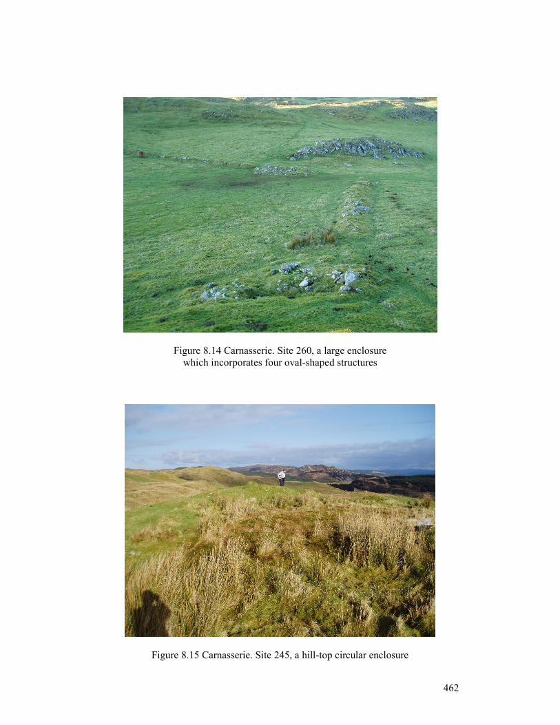
462
Figure 8.14 Carnasserie. Site 260, a large enclosure
which incorporates four oval-shaped structures
Figure 8.15 Carnasserie. Site 245, a hill-top circular enclosure
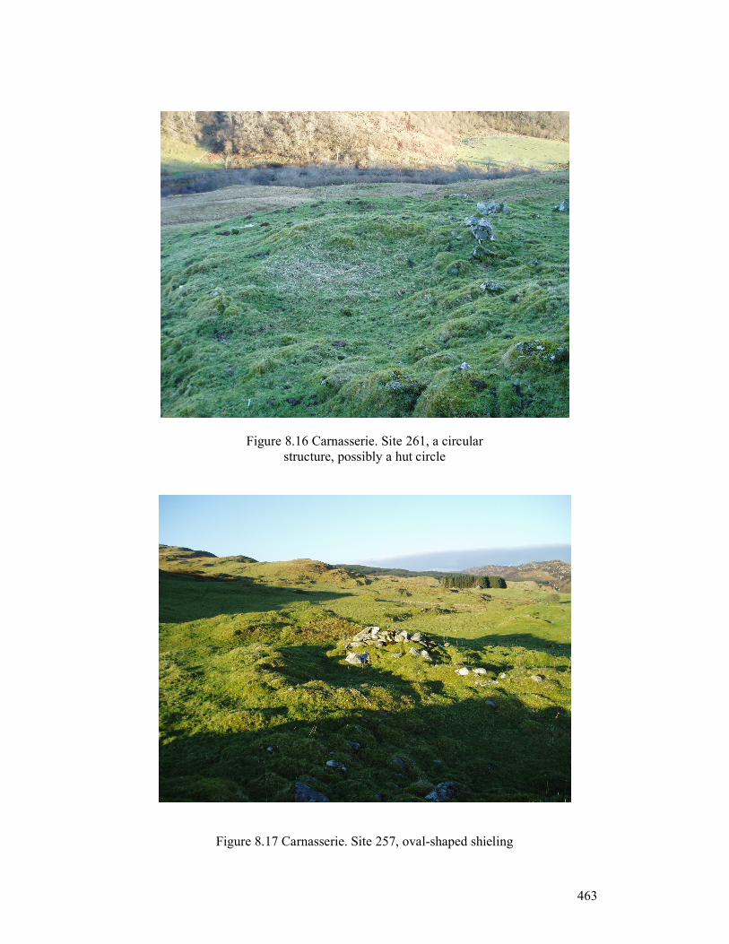
463
Figure 8.16 Carnasserie. Site 261, a circular
structure, possibly a hut circle
Figure 8.17 Carnasserie. Site 257, oval-shaped shieling
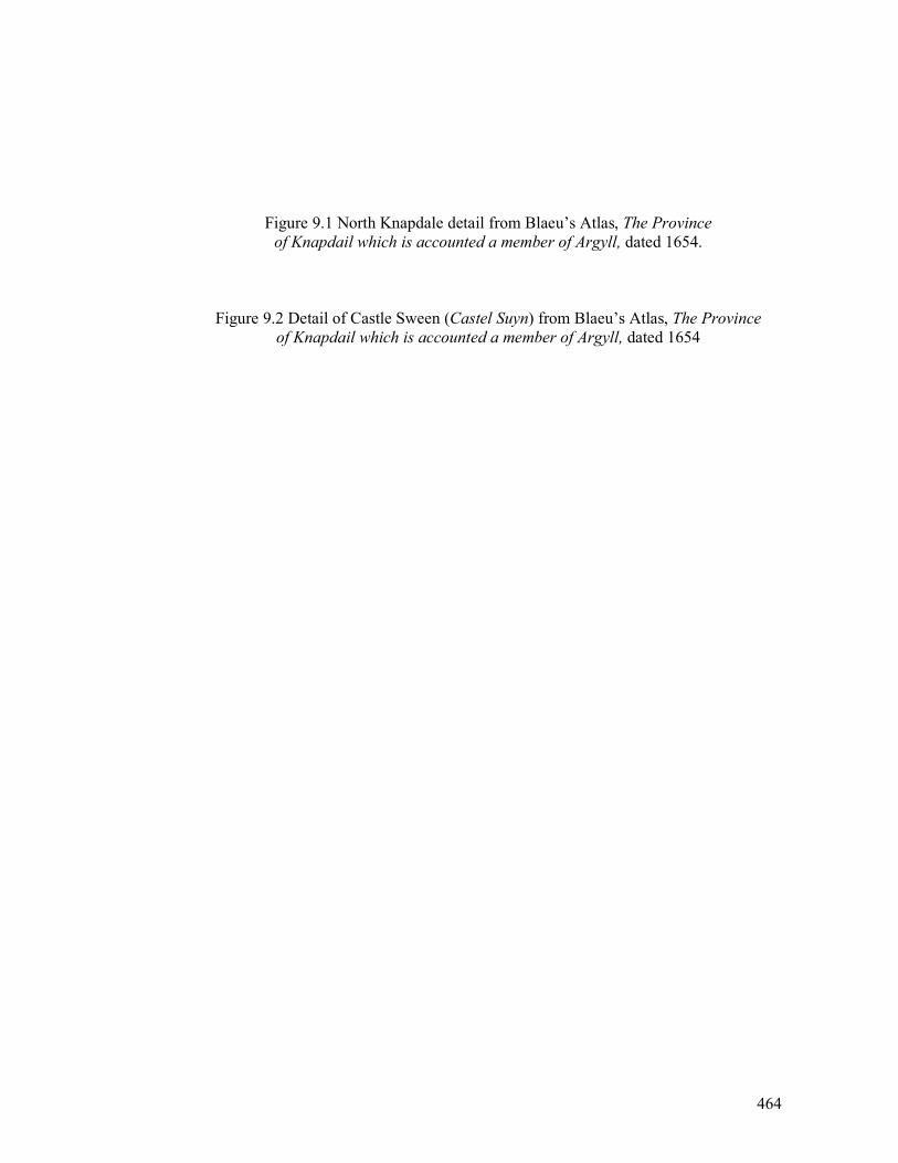
464
Figure 9.1 North Knapdale detail from Blaeu’s Atlas, The Province
of Knapdail which is accounted a member of Argyll, dated 1654.
Figure 9.2 Detail of Castle Sween (Castel Suyn) from Blaeu’s Atlas, The Province
of Knapdail which is accounted a member of Argyll, dated 1654
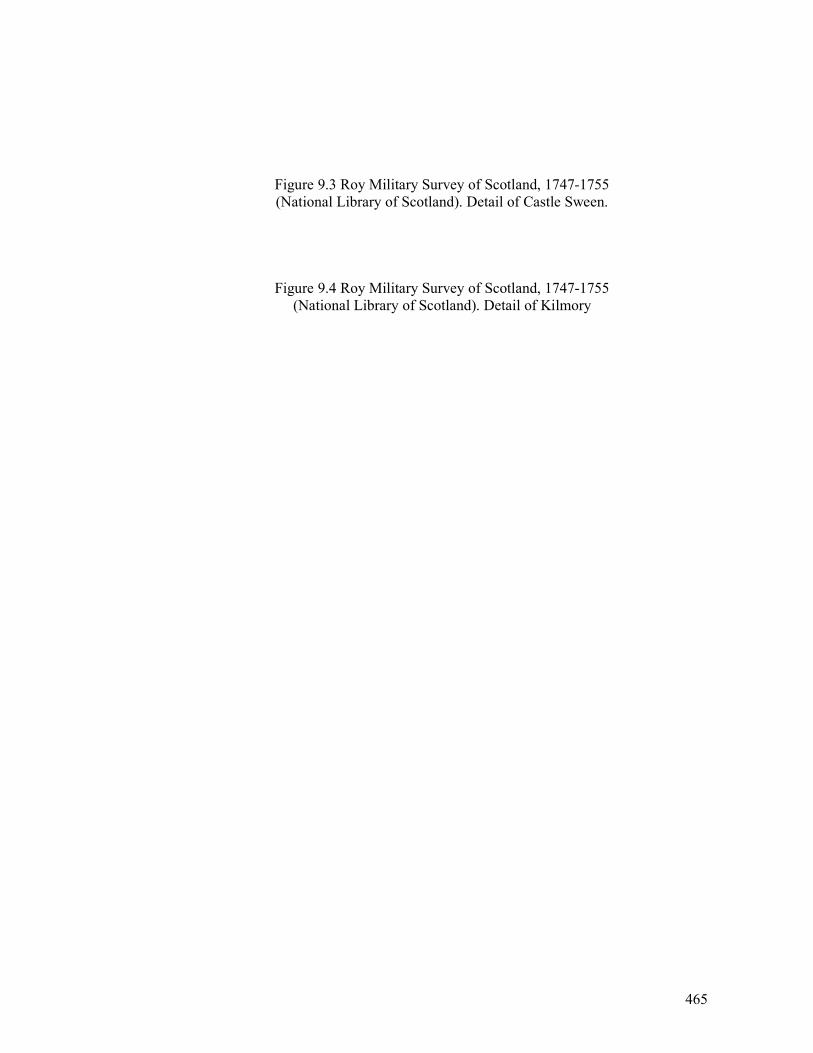
465
Figure 9.3 Roy Military Survey of Scotland, 1747-1755
(National Library of Scotland). Detail of Castle Sween.
Figure 9.4 Roy Military Survey of Scotland, 1747-1755
(National Library of Scotland). Detail of Kilmory

466
Figure 9.5 19th century photograph of Kilmory township (RCAHMS).
Ardnaw Farm is in the middle, behind the horse and figure.
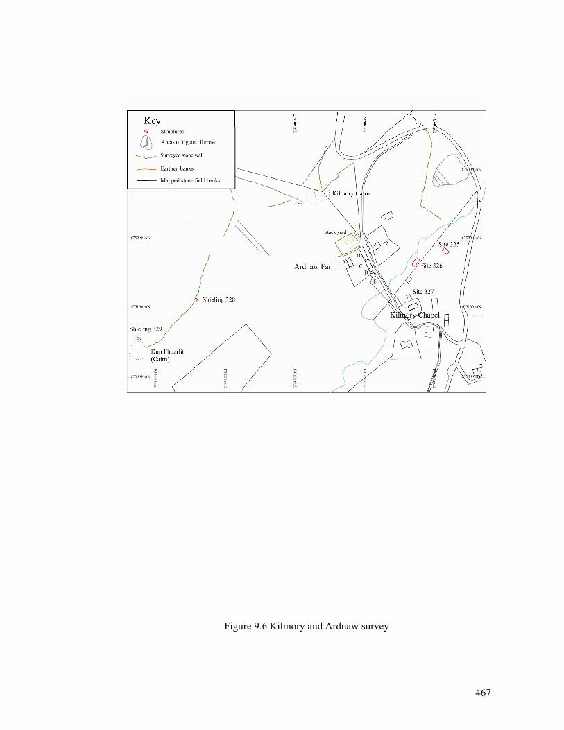
467
Figure 9.6 Kilmory and Ardnaw survey
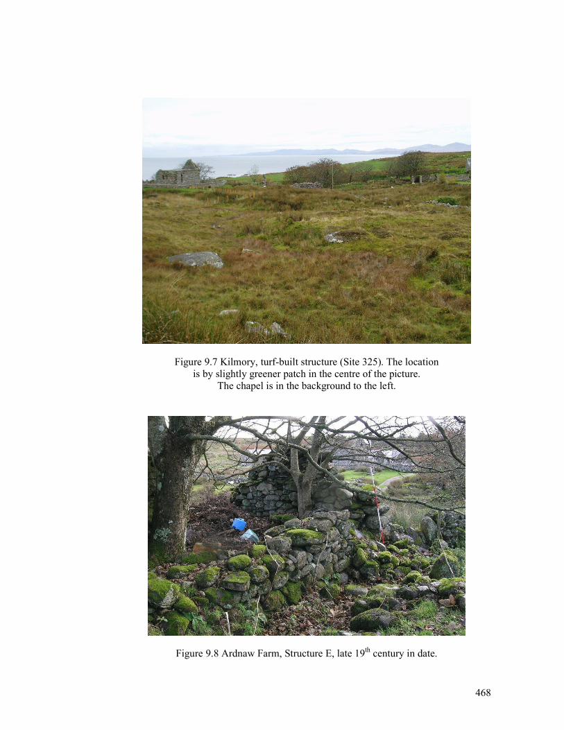
468
Figure 9.7 Kilmory, turf-built structure (Site 325). The location
is by slightly greener patch in the centre of the picture.
The chapel is in the background to the left.
Figure 9.8 Ardnaw Farm, Structure E, late 19th century in date.
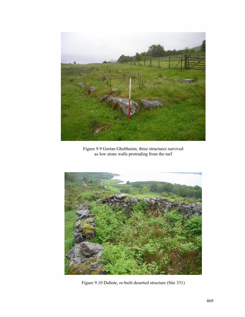
469
Figure 9.9 Gortan Ghobhainn, three structures survived
as low stone walls protruding from the turf
Figure 9.10 Daltote, re-built deserted structure (Site 331)
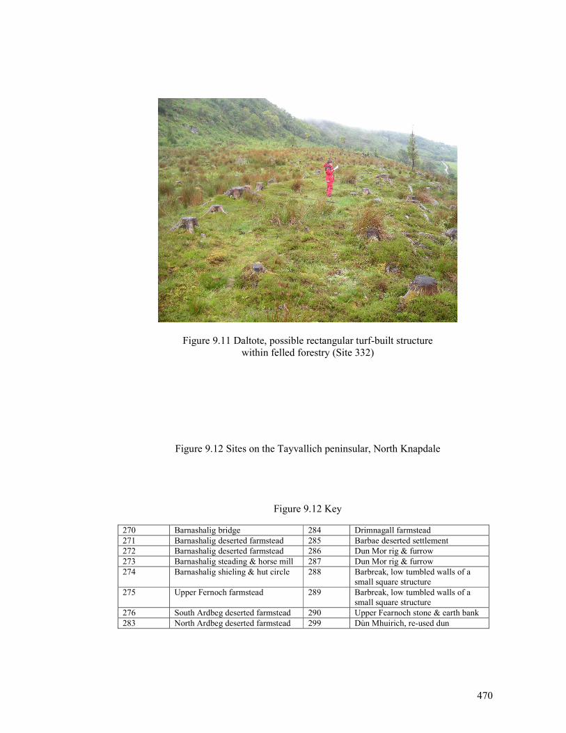
470
Figure 9.11 Daltote, possible rectangular turf-built structure
within felled forestry (Site 332)
Figure 9.12 Sites on the Tayvallich peninsular, North Knapdale
Figure 9.12 Key
270 Barnashalig bridge 284 Drimnagall farmstead
271 Barnashalig deserted farmstead 285 Barbae deserted settlement
272 Barnashalig deserted farmstead 286 Dun Mor rig & furrow
273 Barnashalig steading & horse mill 287 Dun Mor rig & furrow
274 Barnashalig shieling & hut circle 288 Barbreak, low tumbled walls of a
small square structure
275 Upper Fernoch farmstead 289 Barbreak, low tumbled walls of a
small square structure
276 South Ardbeg deserted farmstead 290 Upper Fearnoch stone & earth bank
283 North Ardbeg deserted farmstead 299 Dùn Mhuirich, re-used dun

471
A3 pull out for Figure 9.12
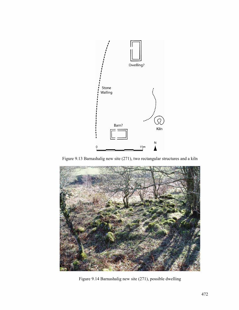
472
Figure 9.13 Barnashalig new site (271), two rectangular structures and a kiln
Figure 9.14 Barnashalig new site (271), possible dwelling
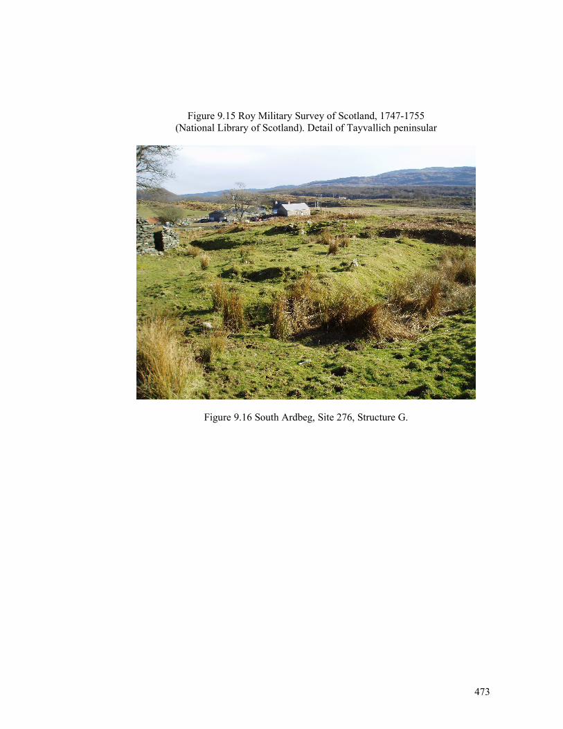
473
Figure 9.15 Roy Military Survey of Scotland, 1747-1755
(National Library of Scotland). Detail of Tayvallich peninsular
Figure 9.16 South Ardbeg, Site 276, Structure G.
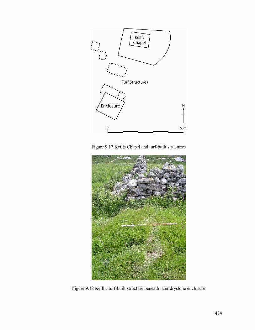
474
Figure 9.17 Keills Chapel and turf-built structures
Figure 9.18 Keills, turf-built structure beneath later drystone enclosure
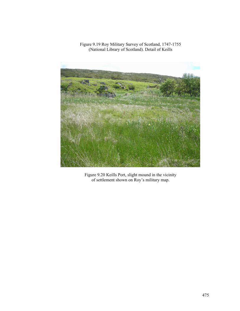
475
Figure 9.19 Roy Military Survey of Scotland, 1747-1755
(National Library of Scotland). Detail of Keills
Figure 9.20 Keills Port, slight mound in the vicinity
of settlement shown on Roy’s military map.
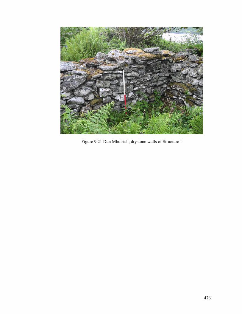
476
Figure 9.21 Dun Mhuirich, drystone walls of Structure I
Appendix 1- Gazetteer of sites
Site
Name
Description
Easting
Northing
NMRS Number
1Barbreck
deserted farm
stead
183494
705016
NM80NW47
2Corlach
deserted farm
stead
183755
706022
NM80NW65
3Corlach
shieling
183888
706067
4Corlach
shieling
183953
706079
5Corlach
structure?
183934
706077
6Barbreck
limekiln
184582
706869
7Dun Toiseach
structure
188601
705008
NM80NE15
8Dun Toiseach
clearance cairn
188793
705137
9Dun Toiseach
clearance cairn
188779
705113
10
Dun Toiseach
enclosures
188870
705264
11
Angel Well (Tobar Na H'Aingeil)
well
188887
705333
NM80NE2
12
Inverliver
cairn
189007
705215
NM80NE3
13
Inverliver
deserted farm
stead
189332
705542
NM80NE6
14
Inverliver
kiln
189303
705490
15
Strone
cottage
181879
702682
NM80SW44
16
Strone
deserted farm
stead
181950
702736
17
Cnocan Dubha, Orm
aig
structure
181982
703140
NM80SW57
18
Orm
aig
enclosure ? & clearance cairn
182080
703042
19
Orm
aig
clearance cairn
181978
703113
20
Orm
aig
cup and ring mark
182226
702688
NM80SW8
21
Carnasserie Mor
deserted farm
stead
183800
701200
NM80SW58
22
Carnasserie Castle
castle
183900
700800
NM80SW2
23
Carnasserie Beg
deserted farm
stead
183800
700800
24
Carnasserie
homestead
183473
701291
25
Creaganterve
mansion
184354
701271
26
Carnasserie Mill (or Craiganterve Mill).
mill
184350
701272
NM80SW46
27
Kintraw
fort
183210
704831
NM80SW33
28
Cruachan
cultivation
183107
704673
29
Creag Nam Fitheach
track
182864
704316
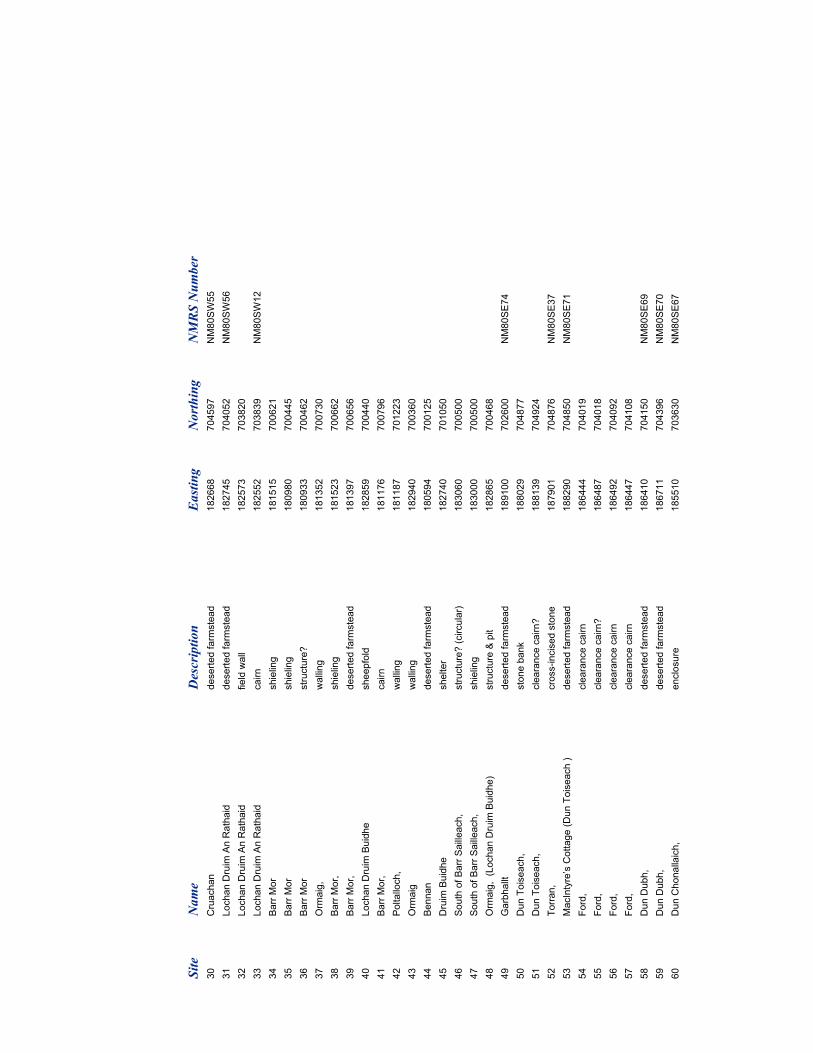
Site
Name
Description
Easting
Northing
NMRS Number
30
Cruachan
deserted farm
stead
182668
704597
NM80SW55
31
Lochan Druim An Rathaid
deserted farm
stead
182745
704052
NM80SW56
32
Lochan Druim An Rathaid
field wall
182573
703820
33
Lochan Druim An Rathaid
cairn
182552
703839
NM80SW12
34
Barr Mor
shieling
181515
700621
35
Barr Mor
shieling
180980
700445
36
Barr Mor
structure?
180933
700462
37
Orm
aig,
walling
181352
700730
38
Barr Mor,
shieling
181523
700662
39
Barr Mor,
deserted farm
stead
181397
700656
40
Lochan Druim Buidhe
sheepfold
182859
700440
41
Barr Mor,
cairn
181176
700796
42
Poltalloch,
walling
181187
701223
43
Orm
aig
walling
182940
700360
44
Bennan
deserted farm
stead
180594
700125
45
Druim Buidhe
shelter
182740
701050
46
South of Barr Sailleach,
structure? (circular)
183060
700500
47
South of Barr Sailleach,
shieling
183000
700500
48
Orm
aig, (Lochan Druim Buidhe)
structure & pit
182865
700468
49
Garbhallt
deserted farm
stead
189100
702600
NM80SE74
50
Dun Toiseach,
stone bank
188029
704877
51
Dun Toiseach,
clearance cairn?
188139
704924
52
Torran,
cross-incised stone
187901
704876
NM80SE37
53
MacIntyre’s Cottage (Dun Toiseach )
deserted farm
stead
188290
704850
NM80SE71
54
Ford,
clearance cairn
186444
704019
55
Ford,
clearance cairn?
186487
704018
56
Ford,
clearance cairn
186492
704092
57
Ford,
clearance cairn
186447
704108
58
Dun Dubh,
deserted farm
stead
186410
704150
NM80SE69
59
Dun Dubh,
deserted farm
stead
186711
704396
NM80SE70
60
Dun Chonallaich,
enclosure
185510
703630
NM80SE67
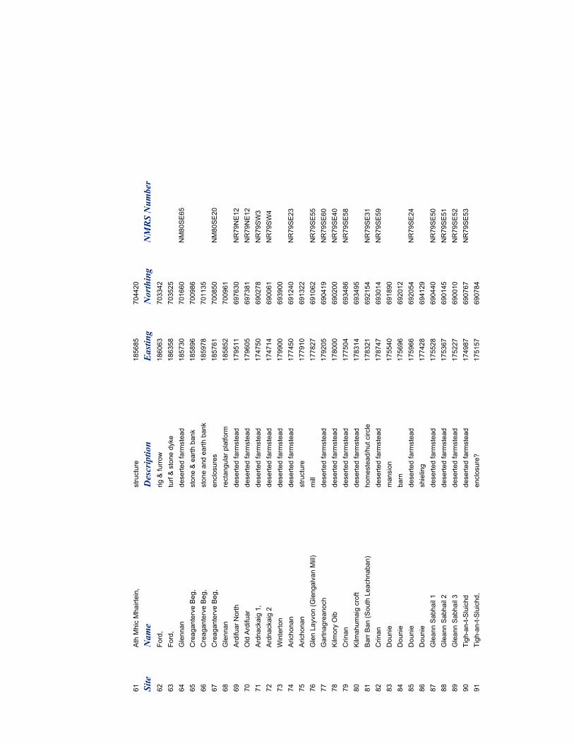
61
Ath Mhic Mhairtein,
structure
185685
704420
Site
Name
Description
Easting
Northing
NMRS Number
62
Ford,
rig & furrow
186063
703342
63
Ford,
turf & stone dyke
186358
703525
64
Glennan
deserted farm
stead
185730
701660
NM80SE65
65
Creaganterve Beg,
stone & earth bank
185896
700986
66
Creaganterve Beg,
stone and earth bank
185978
701135
67
Creaganterve Beg,
enclosures
185761
700850
NM80SE20
68
Glennan
rectangular platform
185852
700961
69
Ardifuar North
deserted farm
stead
179511
697630
NR79NE12
70
Old Ardifuar
deserted farm
stead
179605
697381
NR79NE12
71
Ardnackaig 1,
deserted farm
stead
174750
690278
NR79SW3
72
Ardnackaig 2
deserted farm
stead
174714
690061
NR79SW4
73
Winterton
deserted farm
stead
179900
693900
74
Arichonan
deserted farm
stead
177450
691240
NR79SE23
75
Arichonan
structure
177910
691322
76
Glen Layvon (Glengalvan Mill)
mill
177827
691062
NR79SE55
77
Gartnagreanoch
deserted farm
stead
179205
690419
NR79SE60
78
Kilm
ory Oib
deserted farm
stead
178000
690200
NR79SE40
79
Crinan
deserted farm
stead
177504
693486
NR79SE58
80
Kilm
ahumaig croft
deserted farm
stead
178314
693495
81
Barr Ban (South Leachnaban)
homestead/hut circle
178321
692154
NR79SE31
82
Crinan
deserted farm
stead
178747
693014
NR79SE59
83
Dounie
mansion
175540
691890
84
Dounie
barn
175696
692012
85
Dounie
deserted farm
stead
175966
692054
NR79SE24
86
Dounie
shieling
177428
694129
87
Gleann Sabhail 1
deserted farm
stead
175528
690440
NR79SE50
88
Gleann Sabhail 2
deserted farm
stead
175367
690145
NR79SE51
89
Gleann Sabhail 3
deserted farm
stead
175227
690010
NR79SE52
90
Tigh-an-t-Sluichd
deserted farm
stead
174987
690767
NR79SE53
91
Tigh-an-t-Sluichd,
enclosure?
175157
690784
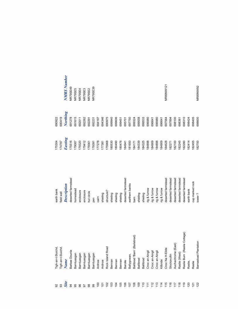
92
Tigh-an-t-Sluichd,
earth bank
175304
690922
93
Tigh-an-t-Sluichd,
field wall
174787
690419
Site
Name
Description
Easting
Northing
NMRS Number
94
Barbae Dounie
deserted farm
stead
175516
691278
NR79SE49
95
Barnluasgan
homestead
179087
691615
NR79SE5
96
Barnluasgan
enclosure
179320
692011
NR79SE4
97
Barnluasgan
enclosure
179412
692262
NR79SE3
98
Barnluasgan
hut circle
179361
692291
NR79SE2
99
Barnluasgan
pen
179391
692231
NR79SE39
100
Ardnoe
cairn
177278
694197
101
Ardnoe
shieling
177381
694346
102
Rock Island Road
structure?
175968
690975
103
Bennan
shieling
180530
699940
104
Bennan
shieling
180490
699606
105
Bennan
shieling
180476
699451
106
Baroile
deserted farm
stead
184941
695701
107
Ballygowan,
earthern banks
181650
697750
108
Ballibrad ‘Barn’ (Bailebrad)
barn
184171
699324
109
Ballibrad
shieling
184339
699558
110
Ballibrad
shieling
184325
699533
111
Cnoc an-Aingil
rig & furrow
184898
696980
112
Cnoc an-Aingil
rig & furrow
184909
696641
113
Cnoc an-Aingil
rig & furrow
184898
696980
114
Kilbride
rig & furrow
184909
696641
115
Cnoc Na H-Eilde
deserted farm
stead
184628
697564
NR89NW121
116
Slockavullin
deserted farm
stead
182271
697894
117
Auchachrome (East)
deserted farm
stead
182100
698100
118
Raslie (West)
deserted farm
stead
182245
698361
119
Raslie Burn (Raslie Cottage)
deserted farm
stead
182280
698310
120
Raslie,
earth bank
182414
698424
121
Raslie
cup marked rock
182455
698405
122
Barnasload Plantation
tower ?
182700
698600
NR89NW92
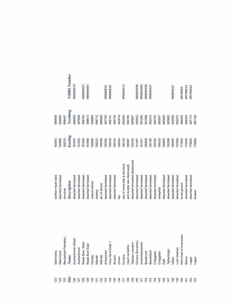
123
Glenmoine,
earthern head dyke
182643
699588
124
Glenmoine
deserted farm
stead
182960
699890
125
Barnasload Plantation,
structure
182510
698447
Site
Name
Description
Easting
Northing
NMRS Number
126
Auchachrome (West)
deserted farm
stead
181875
698065
NR89NW19
127
Auchachrome
deserted farm
stead
181853
697658
128
Raslie Burn, West
deserted farm
stead
181600
698700
NR89NW91
129
Raslie Burn East
deserted farm
stead
181666
698613
NR89NW91
130
Orm
aig
(natural stone)
182689
699999
131
Kilbride
shieling
185223
696712
132
Kilbride,
arc of stones
185066
696686
133
Achayerran
deserted farm
stead
185392
697750
NR89NE22
134
Cnoc Na H-Eilde 1
deserted farm
stead
185539
698141
NR89NE29
135
Socach
deserted farm
stead
188150
699720
136
Crinan
kiln
180055
693918
137
Dunans,
site of cross-slab & structure
180130
690005
NR89SW12
138
Clach na beithir,
arch & altar site (destroyed)
180087
690185
139
Tighean Leacainn
deserted farm
stead (destroyed)
182422
690897
140
Dunans (Dunardry)
deserted farm
stead
181497
690522
NR89SW46
141
Achantheanbhaile
deserted farm
stead
181341
691295
NR89SW62
142
Bardarroch
deserted farm
stead
180858
691589
NR89SW59
143
Blarantibert
deserted farm
stead
180190
692010
NR89SW37
144
Craigglass
deserted farm
stead
184300
690100
145
Craigglass
sheepfold
184225
690097
146
Daill
deserted farm
stead
182600
690800
147
Tighantraigh
deserted farm
stead
182286
693862
148
Uillian
deserted farm
stead
186400
692900
NR89SE23
149
Loch Glashan
deserted farm
stead
191809
692472
150
Kilm
ichael of Inverlussa,
burial ground
177600
686200
NR78NE5
151
Balure
deserted farm
stead
178300
686204
NR78NE23
152
Lagan
deserted farm
stead
179652
687172
NR78NE24
153
Lagan
limekiln
179589
687106
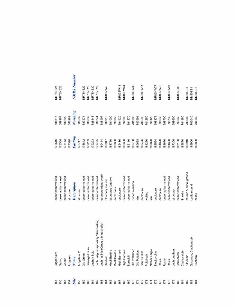
154
Laganruere
deserted farm
stead
179516
686615
NR78NE25
155
Gariob
deserted farm
stead
178554
689187
NR78NE28
156
Gariob
deserted farm
stead
178473
689200
157
Ardglass
structure
177328
686982
Site
Name
Description
Easting
Northing
NMRS Number
158
Ardgalass 2
structure
176717
686532
159
Oib Greim
deserted farm
stead
176842
687271
NR78NE22
160
Barnagad Burn
deserted farm
stead
179253
686639
NR78NE26
161
Lochan Buic
deserted farm
stead
179223
688846
NR78NE30
162
Loch Losgunn (possibly ‘Barinloskin’)
deserted farm
stead
179725
689744
NR78NE29
163
Loch na Bric (Creag a-bhuachaille)
structure (destroyed)
180414
688997
164
Oakfield
bloomery mound
182947
689910
NR88NW4
165
Meall Buidhe
structures (quarry)
183750
691000
166
Meall Buidhe
earth bank
183850
690950
167
High Barnakill
enclosure
182480
691920
NR89SW13
168
High Barnakill
deserted farm
stead
182650
692200
NR89SW44
169
Barnakill
deserted farm
stead
182110
691570
170
Old Poltalloch
ruined mansion
180700
701000
NM80SW38
171
Old Poltalloch
kiln
180668
700991
172
Barr na Cille
enclosure
180426
700595
NM80SW11
173
Poltalloch
walling
181250
701250
174
Nether Largie
kiln
182820
698120
175
Slockavullin
enclosure
182554
698176
NR89NW77
176
Raslie
enclosure
181820
698638
NR89NW70
177
Raslie
deserted farm
stead
181670
698700
178
Raslie
deserted farm
stead
181600
698730
NR89NW91
179
Loch Leathan
structure
187300
698600
180
Barm
olloch
deserted farm
stead
187130
699360
NR89NE30
181
Clachandubh
limekiln
186870
701960
182
Kilneuair
church & burial ground
188910
703680
NM80SE3
183
Gocumgo, Clachandubh
battle mound
186900
702040
NM80SE1
184
Fincharn
castle
189830
704360
NM80SE2
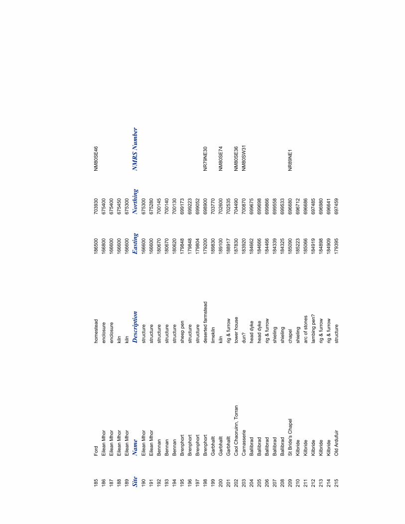
185
Ford
homestead
186500
703930
NM80SE46
186
Eilean Mhor
enclosure
166800
675400
187
Eilean Mhor
enclosure
166600
675400
188
Eilean Mhor
kiln
166600
675450
189
Eilean Mhor
kiln
166600
675300
Site
Name
Description
Easting
Northing
NMRS Number
190
Eilean Mhor
structure
166600
675300
191
Eilean Mhor
structure
166600
675280
192
Bennan
structure
180670
700145
193
Bennan
structure
180670
700140
194
Bennan
structure
180620
700130
195
Brenphort
sheep pen
179848
699173
196
Brenphort
structure
179848
699223
197
Brenphort
structure
179804
699052
198
Brenphort
deserted farm
stead
179200
698900
NR79NE30
199
Garbhallt
limekiln
189830
703770
200
Garbhallt
kiln
189100
702600
NM80SE74
201
Garbhallt
rig & furrow
188917
702535
202
Caol Chaoruinn, Torran
tower house
187830
704490
NM80SE36
203
Carnasserie
dun?
183920
700870
NM80SW31
204
Ballibrad
head dyke
184662
699675
205
Ballibrad
head dyke
184666
699698
206
Ballibrad
rig & furrow
184466
699866
207
Ballibrad
shieling
184339
699558
208
Ballibrad
shieling
184325
699533
209
St Bride's Chapel
chapel
185090
696680
NR89NE1
210
Kilbride
shieling
185223
696712
211
Kilbride
arc of stones
185066
696686
212
Kilbride
lambing pen?
184919
697485
213
Kilbride
rig & furrow
184898
696980
214
Kilbride
rig & furrow
184909
696641
215
Old Ardufuir
structure
179395
697459
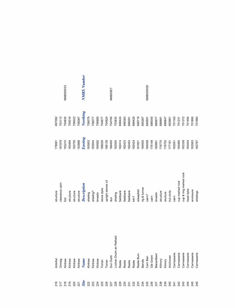
216
Ardufuir
structure
179081
697092
217
Orm
aig
clearance cairn
181978
703113
218
Kintraw
fort
183210
704830
NM80SW33
219
Kintraw
structure
183494
705016
220
Kintraw
structure
183755
706022
221
Kintraw
structure
183888
706067
Site
Name
Description
Easting
Northing
NMRS Number
222
Kintraw
shieling
183953
706079
223
Kintraw
shieling?
183934
706077
224
Kintraw
limekiln
184582
706869
225
Torran
stone dyke
188029
704877
226
Torran
upright stones x3
188139
704924
227
Dun Dubh
dun
186400
704790
NM80SE7
228
Lochan Druim an Rathaid
shieling
182500
703830
229
Raslie
fieldbank
182414
698424
230
Raslie
fieldbank
182423
698363
231
Raslie
fieldbank
182453
698291
232
Raslie
kiln?
182424
698429
233
Raslie Burn
sheepfold
181601
698719
234
Baroile
rig & furrow
184505
695267
235
Carn Ban
cairn?
184058
690691
NM80SW28
236
Oib Greim
cairn
176148
686005
237
Blarantibert
limekiln
180891
689977
238
Kilm
ory
structure
176770
688881
239
Kimory
stucture
176702
688847
240
Arichonan
hut circle
177181
693661
241
Carnasserie
cairn
183551
701183
242
Carnasserie
cup marked rock
183460
701231
243
Carnasserie
cup & ring marked rock
183336
701372
244
Carnasserie
head dyke
183444
701494
245
Carnasserie
enclosure
183563
701890
246
Carnasserie
shielings
182787
701960
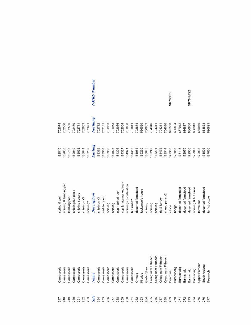
247
Carnasserie
spring & well
182810
702078
248
Carnasserie
shieling & lambing pen
182638
702556
249
Carnasserie
lambing pen
182767
702530
250
Carnasserie
shieling/hut circle
182940
702470
251
Carnasserie
shieling square
183032
702711
252
Carnasserie
shielings x3
183041
702853
253
Carnasserie
shieling?
183239
702671
Site
Name
Description
Easting
Northing
NMRS Number
254
Carnasserie
shielings x3
183376
702712
255
Carnasserie
saddle quern
183968
702135
256
Carnasserie
shieling
183958
701953
257
Carnasserie
shieling
184026
701953
258
Carnasserie
cup marked rock
184305
702066
259
Carnasserie
cup & ring marked rock
184327
702004
260
Carnasserie
shielings & cultivation
184321
701980
261
Carnasserie
hut circle?
184315
701811
262
Orm
aig
deserted farm
stead
181985
702884
263
Kilbride
tacksman's house
185260
696530
264
Garbh Shron
shieling
180845
700003
265
Creag nam Fitheach
shieling
183249
704346
266
Creag nam Fitheach
shieling
183291
704311
267
Creag nam Fitheach
rig & furrow
183472
704211
268
Creag nam Fitheach
sheep pens x2
183514
704080
269
Duntrune
castle
179300
695500
NR79NE3
270
Barnashalig
bridge
173057
686804
271
Barnashalig
deserted farm
stead
173115
687012
272
Barnishaig
deserted farm
stead
172970
686837
273
Barnishaig
deserted farm
stead
172900
686600
NR78NW22
274
Barnishaig
shieling & hut circle
172947
686343
275
Upper Fernoch
farm
stead
172936
685976
276
South Ardbeg
deserted farm
stead
171505
683853
277
Fearnoch
turf structure
187660
696893
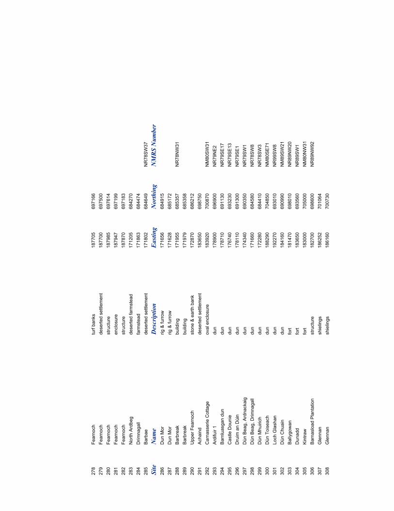
278
Fearnoch
turf banks
187705
697166
279
Fearnoch
deserted settlement
187700
697500
280
Fearnoch
structure
187985
697614
281
Fearnoch
enclosure
187947
697199
282
Fearnoch
structure
187870
697183
283
North Ardbeg
deserted farm
stead
171205
684270
284
Drimnagall
farm
stead
171863
684474
285
Barbae
deserted settlement
171802
684649
NR78SW37
Site
Name
Description
Easting
Northing
NMRS Number
286
Dun Mor
rig & furrow
171656
684915
287
Dun Mor
rig & furrow
171628
685172
288
Barbreak
building
171955
685357
NR78NW31
289
Barbreak
building
171979
685358
290
Upper Fearnoch
stone & earth bank
172870
686212
291
Achaind
deserted settlement
183650
698750
292
Carnasserie Cottage
oval enclosure
183920
700870
NM80SW31
293
Ardifuir 1
dun
178900
696900
NR79NE2
294
Barnluasgan dun
dun
178710
691130
NR79SE17
295
Castle Dounie
dun
176740
693230
NR79SE13
296
Druim an Dùin
dun
178110
691300
NR79SE1
297
Dùn Beag, Ardnackaig
dun
174340
690350
NR79SW1
298
Dùn Beag, Drimnagall
dun
171660
684580
NR78SW8
299
Dùn Mhuirich
dun
172280
684410
NR78SW3
300
Dùn Toiseach
dun
188290
704850
NM80SE71
301
Loch Glashan
dun
192270
693010
NR99SW8
302
Dùn Chuain
dun
184160
690990
NM89SW21
303
Ballygowan
fort
181470
698010
NR89NW20
304
Dunadd
fort
183650
693560
NR89SW1
305
Kintraw
fort
183000
705000
NM80NW31
306
Barnasload Plantation
structure
182700
698600
NR89NW92
307
Glennan
shielings
186252
701064
308
Glennan
shielings
186160
700730
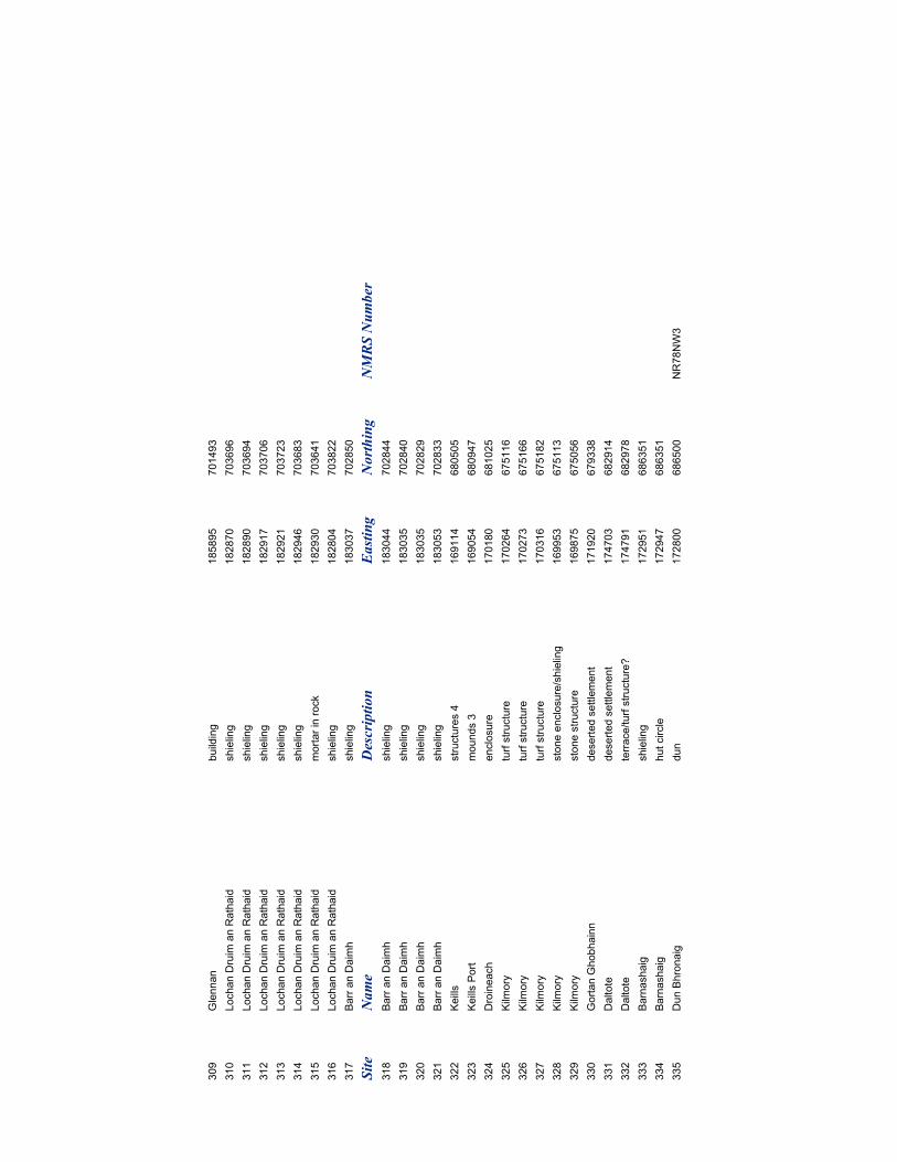
309
Glennan
building
185895
701493
310
Lochan Druim an Rathaid
shieling
182870
703696
311
Lochan Druim an Rathaid
shieling
182890
703694
312
Lochan Druim an Rathaid
shieling
182917
703706
313
Lochan Druim an Rathaid
shieling
182921
703723
314
Lochan Druim an Rathaid
shieling
182946
703683
315
Lochan Druim an Rathaid
mortar in rock
182930
703641
316
Lochan Druim an Rathaid
shieling
182804
703822
317
Barr an Daimh
shieling
183037
702850
Site
Name
Description
Easting
Northing
NMRS Number
318
Barr an Daimh
shieling
183044
702844
319
Barr an Daimh
shieling
183035
702840
320
Barr an Daimh
shieling
183035
702829
321
Barr an Daimh
shieling
183053
702833
322
Keills
structures 4
169114
680505
323
Keills Port
mounds 3
169054
680947
324
Droineach
enclosure
170180
681025
325
Kilm
ory
turf structure
170264
675116
326
Kilm
ory
turf structure
170273
675166
327
Kilm
ory
turf structure
170316
675182
328
Kilm
ory
stone enclosure/shieling
169953
675113
329
Kilm
ory
stone structure
169875
675056
330
Gortan Ghobhainn
deserted settlement
171920
679338
331
Daltote
deserted settlement
174703
682914
332
Daltote
terrace/turf structure?
174791
682978
333
Barnashaig
shieling
172951
686351
334
Barnashaig
hut circle
172947
686351
335
Dun Bhronaig
dun
172800
686500
NR78NW3
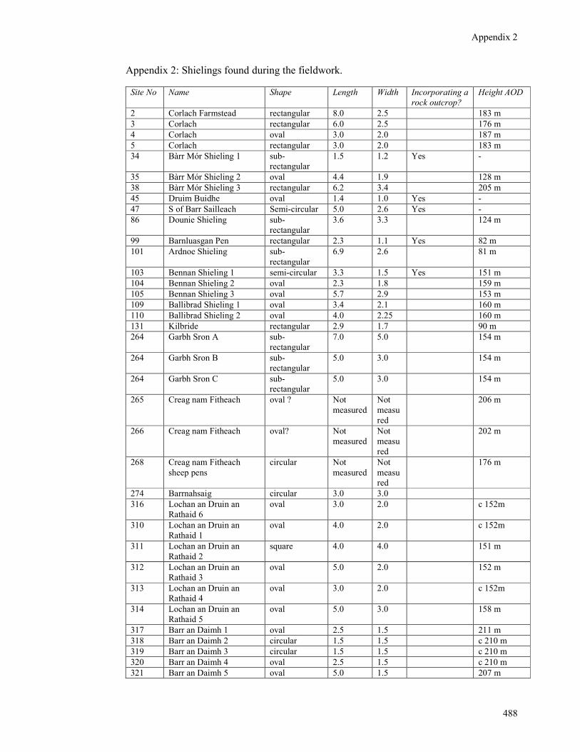
Appendix 2
488
Appendix 2: Shielings found during the fieldwork.
Site No Name Shape Length Width Incorporating a
rock outcrop?
Height AOD
2 Corlach Farmstead rectangular 8.0 2.5 183 m
3 Corlach rectangular 6.0 2.5 176 m
4 Corlach oval 3.0 2.0 187 m
5 Corlach rectangular 3.0 2.0 183 m
34 Bàrr Mór Shieling 1 sub-
rectangular
1.5 1.2 Yes -
35 Bàrr Mór Shieling 2 oval 4.4 1.9 128 m
38 Bàrr Mór Shieling 3 rectangular 6.2 3.4 205 m
45 Druim Buidhe oval 1.4 1.0 Yes -
47 S of Barr Sailleach Semi-circular 5.0 2.6 Yes -
86 Dounie Shieling sub-
rectangular
3.6 3.3 124 m
99 Barnluasgan Pen rectangular 2.3 1.1 Yes 82 m
101 Ardnoe Shieling sub-
rectangular
6.9 2.6 81 m
103 Bennan Shieling 1 semi-circular 3.3 1.5 Yes 151 m
104 Bennan Shieling 2 oval 2.3 1.8 159 m
105 Bennan Shieling 3 oval 5.7 2.9 153 m
109 Ballibrad Shieling 1 oval 3.4 2.1 160 m
110 Ballibrad Shieling 2 oval 4.0 2.25 160 m
131 Kilbride rectangular 2.9 1.7 90 m
264 Garbh Sron A sub-
rectangular
7.0 5.0 154 m
264 Garbh Sron B sub-
rectangular
5.0 3.0 154 m
264 Garbh Sron C sub-
rectangular
5.0 3.0 154 m
265 Creag nam Fitheach oval ? Not
measured
Not
measu
red
206 m
266 Creag nam Fitheach oval? Not
measured
Not
measu
red
202 m
268 Creag nam Fitheach
sheep pens
circular Not
measured
Not
measu
red
176 m
274 Barrnahsaig circular 3.0 3.0
316 Lochan an Druin an
Rathaid 6
oval 3.0 2.0 c 152m
310 Lochan an Druin an
Rathaid 1
oval 4.0 2.0 c 152m
311 Lochan an Druin an
Rathaid 2
square 4.0 4.0 151 m
312 Lochan an Druin an
Rathaid 3
oval 5.0 2.0 152 m
313 Lochan an Druin an
Rathaid 4
oval 3.0 2.0 c 152m
314 Lochan an Druin an
Rathaid 5
oval 5.0 3.0 158 m
317 Barr an Daimh 1 oval 2.5 1.5 211 m
318 Barr an Daimh 2 circular 1.5 1.5 c 210 m
319 Barr an Daimh 3 circular 1.5 1.5 c 210 m
320 Barr an Daimh 4 oval 2.5 1.5 c 210 m
321 Barr an Daimh 5 oval 5.0 1.5 207 m

Appendix 2
489
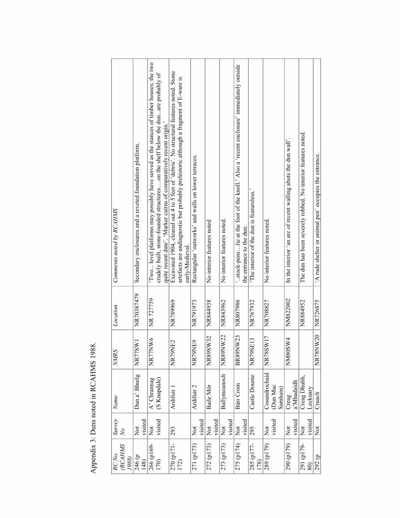
Appendix 3: Duns noted in R
CAHMS 1988.
RC No.
(RCAHMS
1988)
Survey
No
Name
NMRS
Location
Comments noted by RCAHMS
246 (p
148)
Not
visited
Dun a’ Bhuilg
NR77SW
1
NR70387479
Sec
ondary enclosures and a rev
eted
foundation platform
.
266 (p169-
170)
Not
visited
A’ Chrannag
(S K
nap
dale)
NR77NW
6
NR 727759
‘Two... level platform
s may possibly have served as the stance
s of timber houses; the tw
o
crudely built, stone-founded structures…
.on the shelf below the dun...are probably of
quite recent date’. ‘M
arker cairns of co
mparatively rec
ent origin.’
270 (p171-
172)
293
Ardifuir 1
NR79NE2
NR789969
Exca
vated 1904, cleared out 4 to 5 feet of ‘debris’. No structural features noted. Stone
artefacts are undiagnostic but probab
ly prehistoric although a fragmen
t of E-w
are is
early-M
edieval.
271 (p173)
Not
visited
Ardifuir 2
NR79NE9
NR791973
Rectangular ‘outw
orks’ and w
alls on lower terrace
s.
272 (p173)
Not
visited
Baile M
ór
NR89SW
32
NR844938
No interior features noted
273 (p173)
Not
visited
Ballymea
noch
NR89NW
22
NR843962
No interior features noted.
275 (p174)
Not
visited
Bàrr Crom
BR89NW
23
NR807986
‘..stock-pen
s…lie at the foot of the knoll.’ A
lso a ‘recent enclosu
re’ im
mediately outside
the en
trance
to the dun.
285 (p177-
178)
295
Castle Dounie
NR79SE13
NR767932
‘The interior of the dun is featureless.’
289 (p179)
Not
visited
Cosandroch
aid
(Dun M
ac
Sam
hain)
NR78SW
17
NR708827
No interior features noted.
290 (p179)
Not
visited
Creag
a’M
had
aidh
NM80SW
4
NM822002
In the interior ‘an arc of rece
nt walling abuts the dun w
all’.
291 (p179-
80)
Not
visited
Creag
Dhubh,
Lec
kuary
NR884952
The dun has been sev
erely robbed
. No interior features noted.
292 (p
Not
Cruac
h
NR78NW
20
NR726875
‘A rude sh
elter or anim
al pen’ occupies the entran
ce.
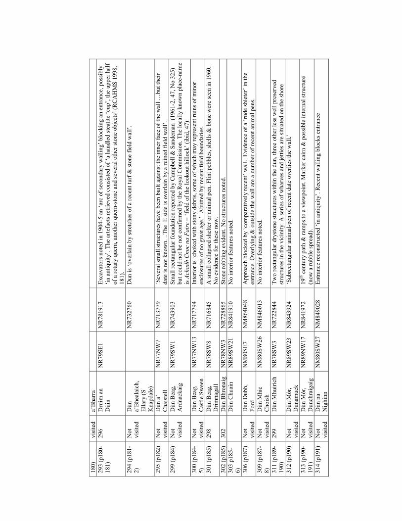
180)
visited
a’Bharra
293 (p180-
181)
296
Druim
an
Dùin
NR79SE1
NR781913
Exca
vators noted in 1904-5 an ‘arc of secondary w
alling’ blocking an entran
ce, possibly
‘in antiquity’. The artefacts retrieved
consisted
of ‘a han
dled steatite ‘cup’, the upper half
of a rotary quern, an
other quern-stone and sev
eral other stone objects’ (RCAHMS 1998,
181).
294 (p181-
2)
Not
visited
Dùn
a’Bhea
laich,
Ellary (S
Knapdale)
NR732760
Dun is ‘overlain by stretches of a rece
nt turf &
stone field w
all’.
295 (p182)
Not
visited
Dùn a’
Chaistell
NR77NW
7
NR713779
‘Several small structures have bee
n built ag
ainst the inner face of the wall …
but their
date is not known. ..The E side is overlain by a ruined
field w
all’.
299 (p184)
Not
visited
Dùn B
eag,
Ardnac
kaig
NR79SW
1
NR743903
Small rectan
gular foundation rep
orted by C
ampbell & San
deman
(1961-2, 47, No 325)
but could not be not co
nfirm
ed by the Royal Commission. The loca
lly known place
-name
is Achadh Cnoc na Faire = ‘field of the lookout hillock’ (ibid, 47).
300 (p184-
5)
Not
visited
Dùn B
eag,
Castle Sween
NR77NW
13
NR717794
Interior is ‘choked
with stony deb
ris, some of which m
ay rep
resent ruins of minor
enclosu
res of no great age.’ A
butted
by rec
ent field boundaries.
301 (p185)
298
Dùn B
eag,
Drimnagall
NR78SW
8
NR716845
A small collap
sed shelter or anim
al pen
. Flint peb
bles, shells &
bone were seen in 1960.
No evidence
for these now.
302 (p185)
302
Dùn B
hronaig
NR78NW
3
NR728865
Stone robbing evident. N
o structures noted.
303 p185-
6)
Dùn C
huain
NR89SW
21
NR841910
No interior features noted.
306 (p187)
Not
visited
Dùn D
ubh,
Ford
NM80SE7
NM864048
Approac
h block
ed by ‘comparatively recent’ w
all. Evidence
of a ‘rude sh
leter’ in the
entran
ce. Overlying &
outside the wall are a number of rece
nt an
imal pens.
309 (p187-
8)
Not
visited
Dùn M
hic
Choish
NM80SW
26
NM846013
No interior features noted.
311 (p189-
190)
299
Dùn M
huirich
NR78SW
3
NR722844
Two rectangular drystone structures within the dun, three other less well preserved
structures in the vicinity. A series of wharves and jetties are situated on the sh
ore
312 (p190)
Not
visited
Dùn M
ór,
Dunam
uck
NR89SW
23
NR843924
‘Subrectangular anim
al-pen of recent date overlies the wall.’
313 (p190-
191)
Not
visited
Dùn M
ór,
Dunch
raigaig
NR89NW
17
NR841972
19th cen
tury path &
ramps to a viewpoint. M
arker cairn &
possible internal structure
(now a rubble spread
).
314 (p191)
Not
visited
Dùn na
Nighinn
NM80SW
27
NM849028
Entran
ce rec
onstructed
‘in antiquity’. R
ecent walling blocks en
tran
ce
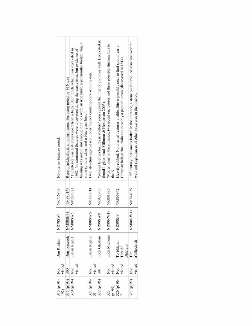
315 (p191-
192)
Not
visited
Dùn R
ostan
NR78SW
1
NR736809
No interior features noted.
315 (p193)
300
Dùn Toisea
ch
NM80SE71
NM880147
Recen
t fieldwalls &
a m
odern cairn. Terracing noted by M
Nicke
320 (p194)
Not
visited
Eilea
n R
igh 1
NM80SW
5
NM803021
‘The interior was featureless apart from a bac
kfilled
trench
, which w
as exca
vated in
1982. No structural features were uncovered during the ex
cavation, but eviden
ce of
burning w
as noted, an
d among the finds were an
iron knife, a pen
annular bronze
ring, a
stone sp
indle-w
horl and a blue glass bea
d’.
321 (p194-
5)
Not
visited
Eilea
n R
igh 2
NM80SW
6
NM800014
Oval structure against w
all, possibly not contemporary w
ith the dun.
322 (p195)
301
Loch
Glash
an
NR99SW
8
NR922930
‘Several later enclosu
res & shelters’ seen
against the interior an
d over w
all. Exca
vated
&
found 1 glass bea
d (Gilmour & H
enderson 2003).
323
(p195)
Not
visited
Loch
Michea
n
NR89NW
19
NR801986
‘Modern pen
’ in the en
trance
, tw
o recen
t enclosu
res an
d three possible shieling huts to
the N.
326 (p196-
7_
Not
visited
Torbhlaran
Torr A
’
Bhlarain
NR89SE9
NR866942
Hea
vily robbed
. No internal features visible. Site is possibly near to find spot of early-
Christian bell-shrine, chain and possibly a pec
toral-cross (disco
vered
in 1814)
327 (p197)
Not
visited
Tùr
a’Bhodaich
NM80NW
11
NM844059
19th cen
tury ‘herdsm
ens bothy’ in the entran
ce, a stone built co
rbelled structure over the
wall an
d slight trac
es of other structures in the interior.
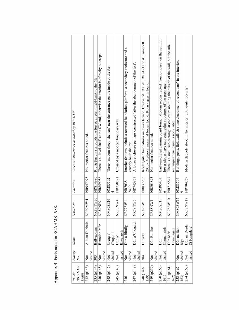
Appen
dix 4: Forts noted in R
CAHM
S 1988.
RC No.
(RCAHMS
1988)
Surevy
No
Name
NMRS No.
Location
‘Recent’ structures as noted by RCAHMS
232 (p143)
Not
visited
Allt an
Dubhair
NR99MW
4
NR947975
No interior features noted.
235 (p144)
303
Ballygowan
NR89NW
20
NR814980
Rig &
furrow surrounds the fort &
a recen
t field-ban
k to the NE.
240 (p145)
Not
visited
Binneinn M
ór
NR89NE9
NR859958
There is a ‘level shelf’ at the SW
end, otherwise the interior is of rocky outcrops.
243 (p147)
Not
visited
Creag
a’
Chapuill
NM
80SE16
NM
85502
4
Three ‘m
odern shee
p-shelters’ near the en
tran
ce on the inside of the fort.
245 (p148)
Not
visited
Dùn a’
Bhea
laich
NR78NW
4
NR738871
Crossed by a m
odern boundary w
all.
246
Not
visited
Dun a B
huilg
NR77SW
1
NR7038
7479
Interior features include a revetted
foundation-platform
, a seco
ndary enclosu
re and a
crudely built shelter
247 (p149)
Not
visited
Dùn a’C
hogaidh
NR78NW
5
NR745877
A lower enclosu
re perhap
s constructed
‘after the abandonmen
t of the fort’.
248 (149-
159)
304
Dunad
d
NR89SW
1
NR837935
Rec
tangular foundations on lower terrace
. Excavated 1903 &
1980-1 (Lan
e & C
ampbell
2000). M
edieval m
ammal bones found. Rotary querns found.
249 (p259)
Not
visited
Dùn B
uidhe
NR88NW
1
NR801893
No interior features noted.
250 (p160-
161)
Not
visited
Dùn
Chonallaich
NM
80SE15
NM
85403
6
Early-m
edieval gaming board found. M
odern rec
onstructed ‘round-house’ on the su
mmit,
lower slopes hav
e su
brectan
gular structures of ‘no great age’.
251 (p161-
162)
Dùn M
ór,
Drimnagall
NR78SW
10
NR715847
There is a small su
b-rec
tangular en
closu
re abutting the outside of the wall, but the su
b-
rectan
gular en
closu
re is not visible.
253 (p162-
163)
Not
visited
Dùn na Ban
-
òige
NM
80SW
15
NM
83704
9
Buildings, pen
s, fieldwalls &
stone clea
rance ‘of rece
nt date’ in the interior.
254 (p163)
Not
visited
Dùn na Doide
(S K
nap
dale)
NR77NW
17
NR704769
Modern flagpole stood in the interior ‘until quite rece
ntly’.
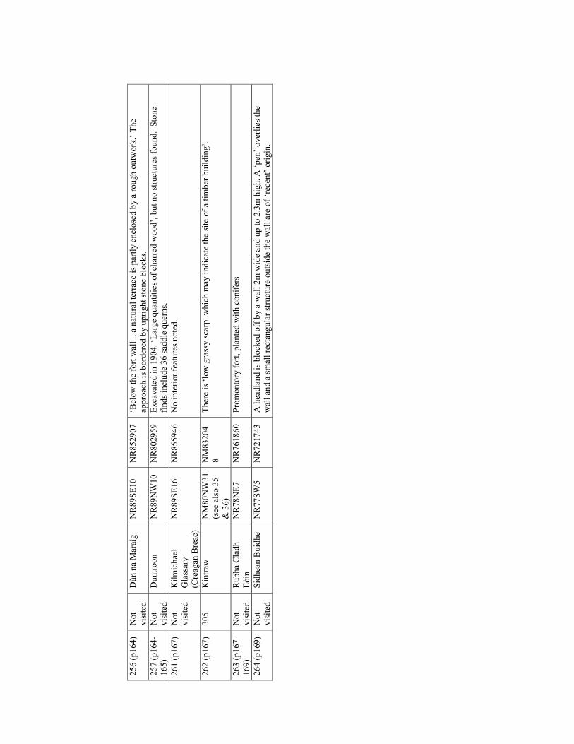
256 (p164)
Not
visited
Dùn na Maraig
NR89SE10
NR852907
‘Below the fort w
all .. a natural terrac
e is partly enclosed by a rough outw
ork.’ The
approac
h is bordered by upright stone blocks.
257 (p164-
165)
Not
visited
Duntroon
NR89NW
10
NR802959
Exca
vated in 1904. ‘L
arge quan
tities of ch
arred w
ood’, but no structures found. Stone
finds include 36 saddle querns.
261 (p167)
Not
visited
Kilmichael
Glassary
(Creagan
Breac
)
NR89SE16
NR855946
No interior features noted.
262 (p167)
305
Kintraw
NM
80NW
31
(see
also 35
& 36)
NM
83204
8
There is ‘low grassy scarp..which m
ay indicate the site of a timber building’.
263 (p167-
169)
Not
visited
Rubha Cladh
Eòin
NR78NE7
NR761860
Promontory fort, planted w
ith conifers
264 (p169)
Not
visited
Sidhean B
uidhe
NR77SW
5
NR721743
A hea
dland is blocked
off by a w
all 2m w
ide and up to 2.3m high. A ‘pen’ overlies the
wall an
d a small rectan
gular structure outside the wall are of ‘rec
ent’ origin.
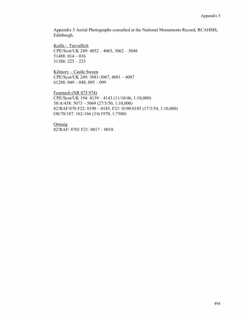
Appendix 5
494
Appendix 5 Aerial Photographs consulted at the National Monuments Record, RCAHMS,
Edinburgh.
Keills – Tayvallich
CPE/Scot/UK 249: 4052 – 4063, 3062 – 3048
51488: 014 – 016
51388: 225 – 223
Kilmory – Castle Sween
CPE/Scot/UK 249: 3081-3087, 4081 – 4087
61288: 049 – 048, 095 – 099
Fearnoch (NR 875 974)
CPE/Scot/UK 194: 4139 – 4143 (11/10/46, 1:10,000)
58/A/438: 5073 – 5069 (27/3/50, 1:10,000)
82/RAF/870 F22: 0190 – 0185, F21: 0190-0185 (17/3/54, 1:10,000)
OS/70/187: 162-166 (3/6/1970, 1:7500)
Ormaig
82/RAF/ 8701 F21: 0017 – 0018
Related Documents