Marine GIS Applications for Integrated Coastal Zone Management 13. Overview of Data Needs, Data Management & Data applications UNESCO/IOC Project Office for IODE Ostend, Belgium 26 - 30 November 2018 International Oceanographic Data and Information Exchange With the support of the Government of Flanders, Belgium Except where otherwise noted, OTGA content is licensed under a Creative Commons Attribution-NonCommercial-ShareAlike 4.0 . The UNESCO/IOC Project Office for IODE is certified as a Learning Services Provider

Welcome message from author
This document is posted to help you gain knowledge. Please leave a comment to let me know what you think about it! Share it to your friends and learn new things together.
Transcript
Marine GIS Applications for Integrated Coastal Zone Management13. Overview of Data Needs, Data Management & Data applications
UNESCO/IOC Project Office for IODEOstend, Belgium
26-30 November 2018
InternationalOceanographicData and InformationExchange
With the support of the Government of Flanders,
Belgium
Except where otherwise noted, OTGA content is licensed under a Creative Commons Attribution-NonCommercial-ShareAlike4.0.
The UNESCO/IOC Project Office for IODE is certified as a Learning Services Provider

Using Coastal Data• This week we have already seen a
wide variety of applications built to suit users in ICZM or MSP situations
• In most cases the data in these applications is just part of a large message that is being communicated
• Every application or tool is built for an audience, and it is critical to understand that audience and their needs

Who is ICAN?• Members: Over 70 organisations
are registered as members of ICAN covering more than 20 countries.
• Duration: ICAN is supporting coastal and marine web atlas developers and users since 2006.
• Support and Recognition: ICAN became a project of UNESCO IOC´s International Oceanographic Data and Information Exchange (IODE) Programme in 2013.
• Website: http://ican.iode.org/

International Coastal Atlas Network
ICAN is a global reference for the development of Coastal Web Atlases (CWAs)
What is a Coastal Web Atlas?“A collection of digital maps and datasets with supplementary
tables, illustrations, and information that systematically illustrate the coast, oftentimes with cartographic and decision
support tools, all of which are accessible via the Internet.” (O’Dea et al., 2007)

ICAN members develop their atlases at a range of scales and ICAN CWAs can cover areas of different sizes e.g. local, national, regional or even
continental.
International Coastal Atlas Network

ICAN Objectives
North Carolina Coastal Atlas, USA
• Have Global Representation• Inform Technical & Policy Guidelines• Improve Interoperability• Undertake Collaborative Activities• Align Atlas Efforts• Provide Technical Support• Active Stakeholder Engagement• Contribute to technical capacity
building
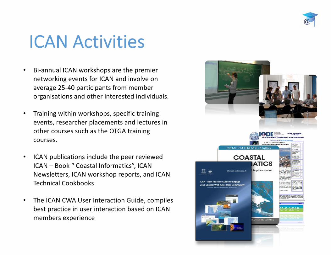
ICAN Activities• Bi-annual ICAN workshops are the premier
networking events for ICAN and involve on average 25-40 participants from member organisations and other interested individuals.
• Training within workshops, specific training events, researcher placements and lectures in other courses such as the OTGA training courses.
• ICAN publications include the peer reviewed ICAN – Book “ Coastal Informatics”, ICAN Newsletters, ICAN workshop reports, and ICAN Technical Cookbooks
• The ICAN CWA User Interaction Guide, compiles best practice in user interaction based on ICAN members experience

Building Atlases• ICAN members have collaborated
on several helpful reference publications
• Select chapters are available online via OceanDocs:https://www.oceandocs.org/bitstream/handle/1834/6671/ICAN_Handbook.pdf
• Other chapters available on request to ICAN

Building Atlases• Coastal Web Atlas Features• Coastal Web Atlas Implementation• Coastal Atlas Interoperability• Atlas Case Studies
• Ireland• Oregon• Virginia & Maryland• Wisconsin• Belgium• Africa• Caribbean• UK• Spain
• Coastal Atlases and SDIs• Creating a Useable Atlas• Improving a Growing Atlas• Supporting a Successful Atlas

Working with Users• ICAN has produced a best
practices guide for working with users
• Contains lots of helpful information for understanding user needs and then designing your application to meet those needs
• Available via OceanDocs:http://hdl.handle.net/1834/9579

Working with UsersThis hand book was compiled by gathering information from ten atlas developers as well as extracting relevant information from ICAN workshop reports.
The information is summarised and analysed leading to two sets of recommendations, one focused on the development of new atlases and the other focused on how to maintain interactions with audiences of already developed atlases

Think about the StoryCoastal Atlases have always had curated maps, and related coastal data and information products
More recently ICAN member have been experimenting with tools from online journalism to enhance the stories that atlases can tell
A recent workshop in Columbia contained an excellent overview of some of the tools available:
https://classroom.oceanteacher.org/pluginfile.php/15174/mod_resource/content/1/13_HART_HADDAD.pdf
http://projects.propublica.org/louisiana/

Finding the correct tools
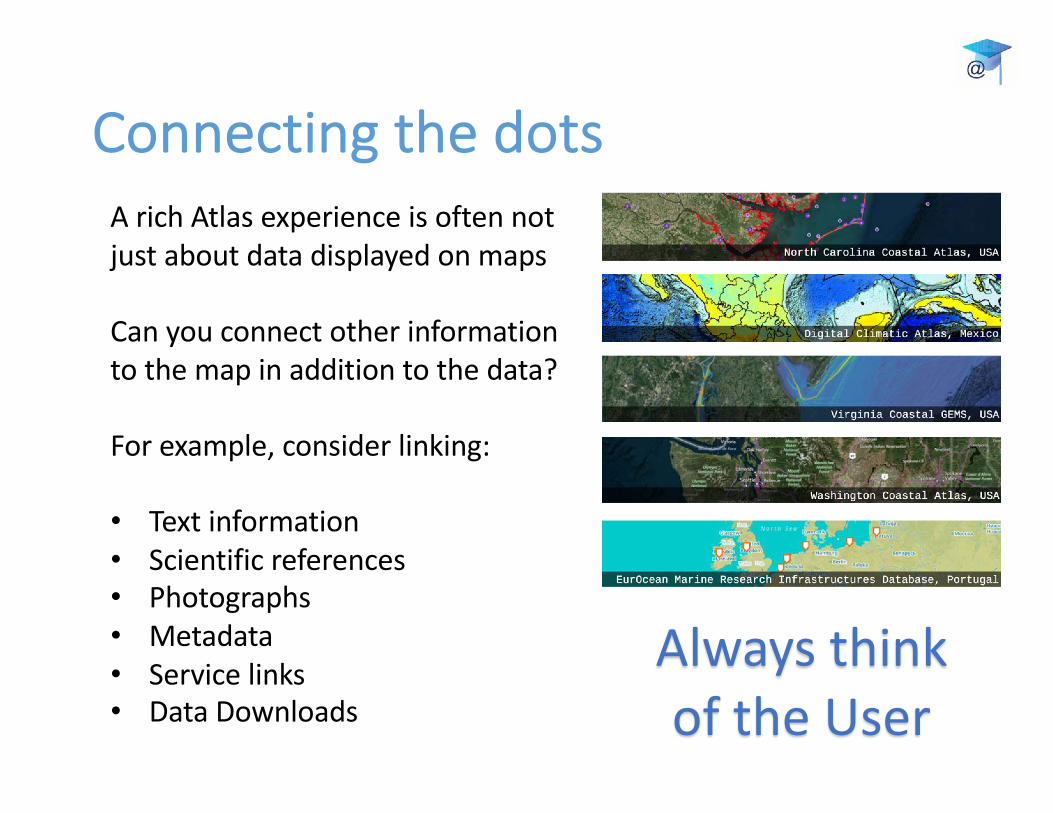
Connecting the dotsA rich Atlas experience is often not just about data displayed on maps
Can you connect other information to the map in addition to the data?
For example, consider linking:
• Text information• Scientific references• Photographs• Metadata• Service links• Data Downloads
Always think of the User

Thank you!
Please contact us with any questions, or if you think ICAN be helpful to your projects!
Co-Chairs:Kathrin Kopke: [email protected] Haddad: [email protected]
Related Documents