Maps, Graphs, Charts Oh My! Geography Review

Maps, Graphs, Charts Oh My! Geography Review. Which of the four oceans would have the least amount of sea traffic? A.Atlantic B.Pacific C.Indian D.Arctic.
Dec 25, 2015
Welcome message from author
This document is posted to help you gain knowledge. Please leave a comment to let me know what you think about it! Share it to your friends and learn new things together.
Transcript

Maps, Graphs, Charts Oh My!
Geography Review
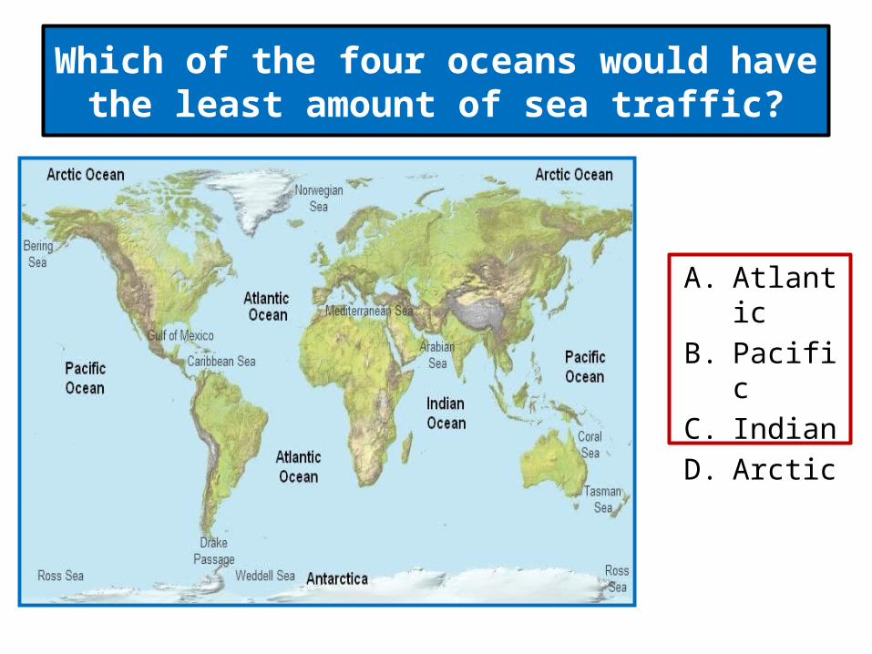
Which of the four oceans would have the least amount of sea traffic?
A. Atlantic
B. Pacific
C. Indian
D. Arctic
Most of the people in the world are members of which religion?
A. Christianity
B. Judaism
C. Islam
D. Hinduism
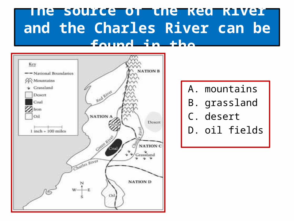
The source of the Red River and the Charles River can be found in the
A. mountains B. grassland C. desert D. oil fields
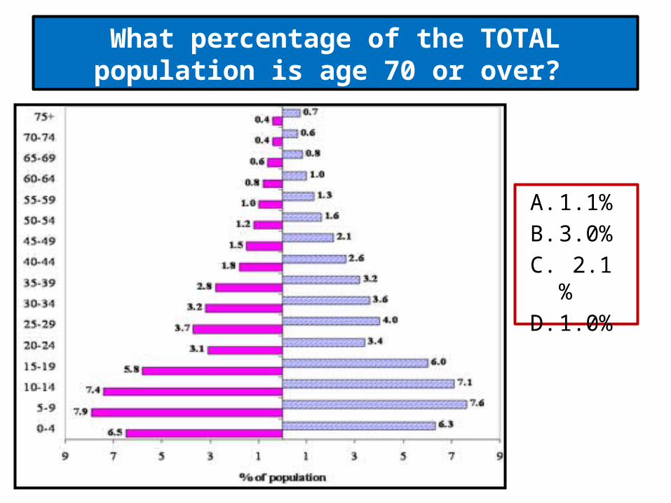
A. 1.1% B. 3.0% C. 2.1 % D. 1.0%
What percentage of the TOTAL population is age 70 or over?

In order to grow food in the desert, farmers would need to
A. build new houses B. irrigate the land C. herd animals D. cut down trees
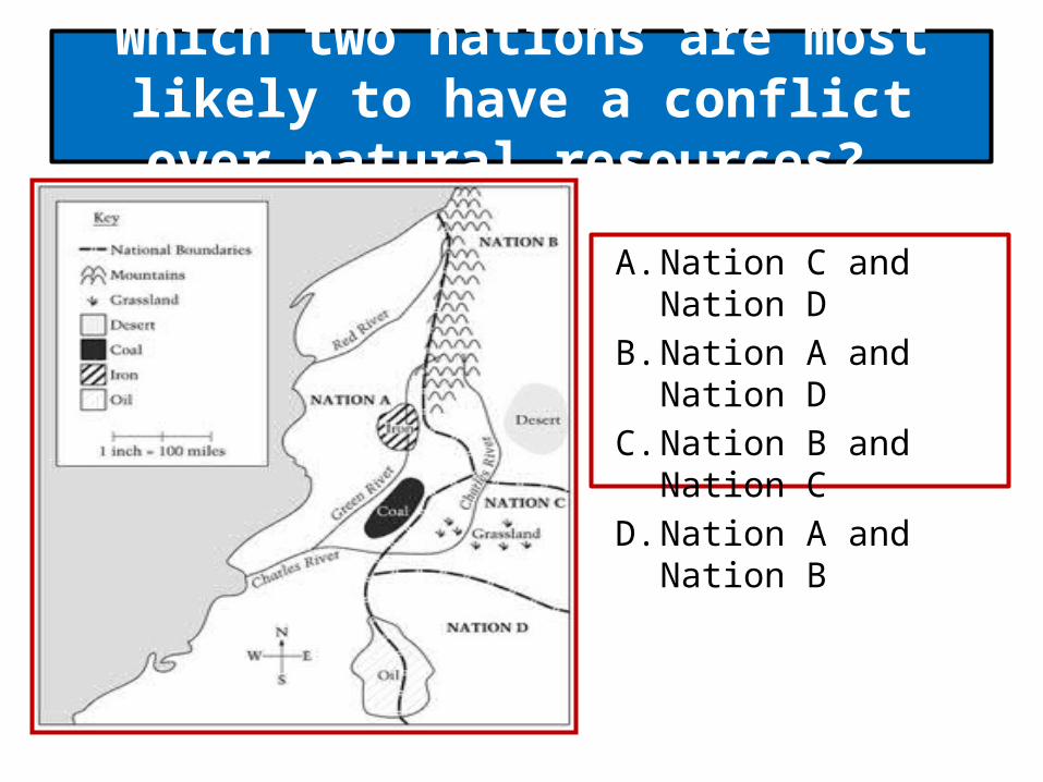
Which two nations are most likely to have a conflict over natural resources?
A. Nation C and Nation D B. Nation A and Nation D C. Nation B and Nation C D. Nation A and Nation B
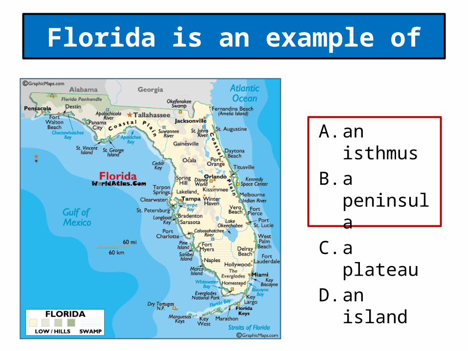
Florida is an example of
A. an isthmus B. a peninsula C. a plateau D. an island
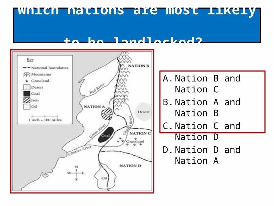
Which nations are most likely to be landlocked?
A. Nation B and Nation C B. Nation A and Nation B C. Nation C and Nation D D. Nation D and Nation A

According to the graph, the largest oil reserves by the end of 2009 were in the
A. Northern Siberia B. Caribbean region C. Gulf of Guinea D. Persian Gulf region

Traditional agriculture or subsistence farming depends on
A. pesticides B. machinery C. fertilizers D. human labor
Which of the following people would probably have the greatest choice of places to live?
A. cattle rancher B. nurse C. oil refinery technician D. miner

The regions of the world that are the most developed are regions
A. 3, 4, 6, 7 B. 1, 2, 5, 6 C. 1, 4, 7, 9 D. 2, 5, 6, 7

The Amazon Rainforest is located in region
A. 3 B. 9 C. 1 D. 2
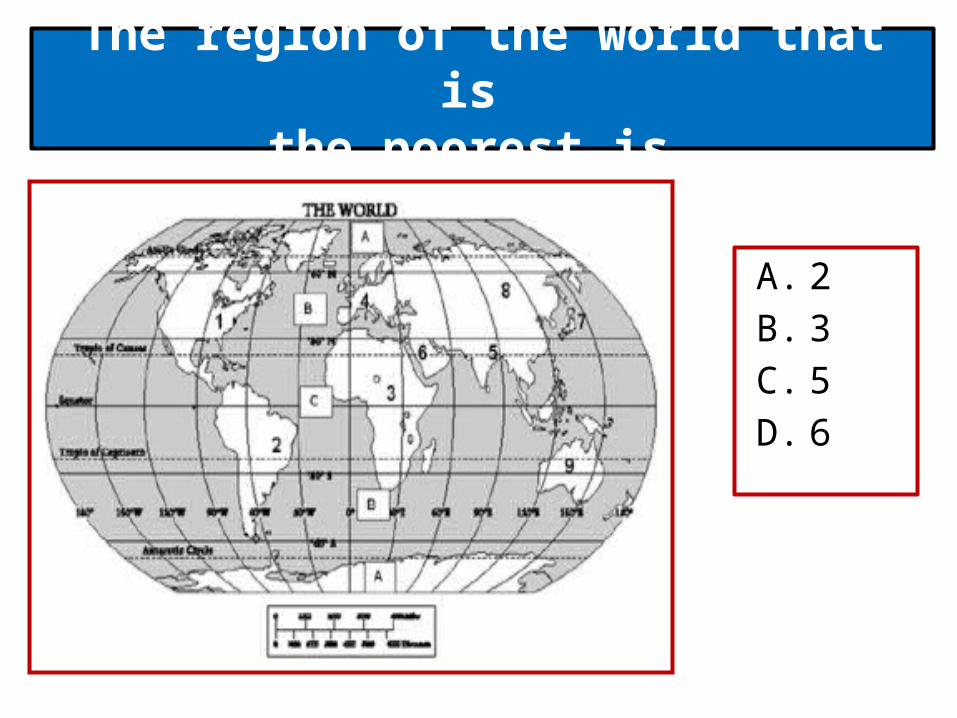
The region of the world that is the poorest is
A. 2 B. 3 C. 5 D. 6
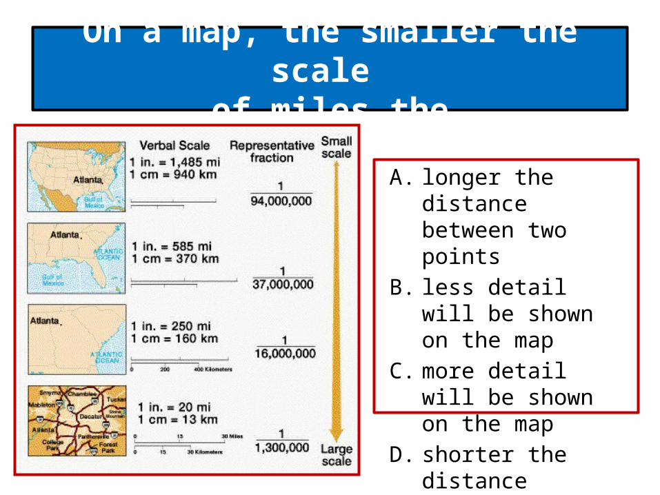
On a map, the smaller the scale of miles the
A. longer the distance between two points
B. less detail will be shown on the map
C. more detail will be shown on the map
D. shorter the distance between two points
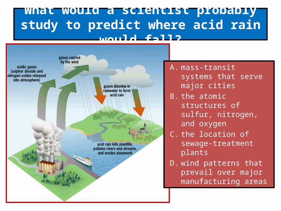
What would a scientist probably study to predict where acid rain would fall?
A. mass-transit systems that serve major cities
B. the atomic structures of sulfur, nitrogen, and oxygen
C. the location of sewage-treatment plants
D. wind patterns that prevail over major manufacturing areas
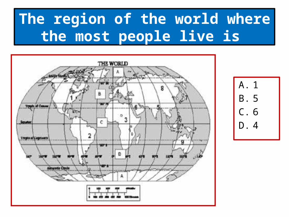
The region of the world where the most people live is
A. 1 B. 5 C. 6 D. 4

A. promoting the production of high-quality fossil fuels
B. increasing their control of markets and prices for their product
C. improving communication and transportation among developing nations
D. limiting access of other nations to solar power
Major oil-producing nations joined together to form the Organization of Petroleum Exporting Countries
(OPEC) as a means of
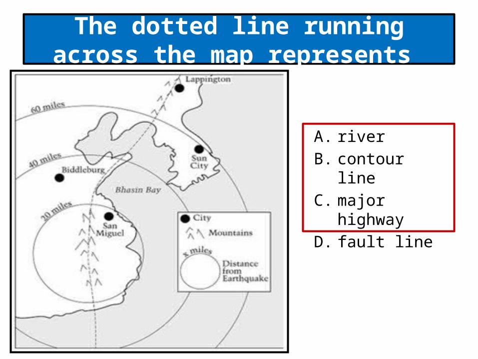
The dotted line running across the map represents
A. river B. contour line C. major highway D. fault line
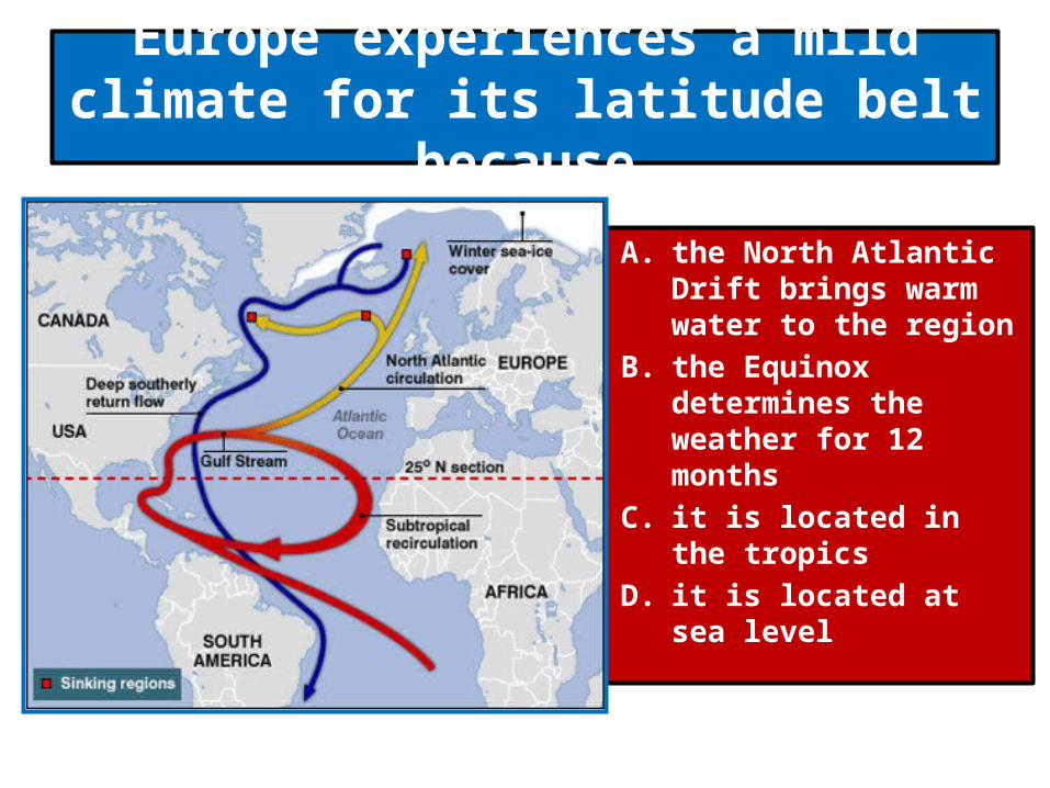
Europe experiences a mild climate for its latitude belt because
A. the North Atlantic Drift brings warm water to the region
B. the Equinox determines the weather for 12 months
C. it is located in the tropics
D. it is located at sea level
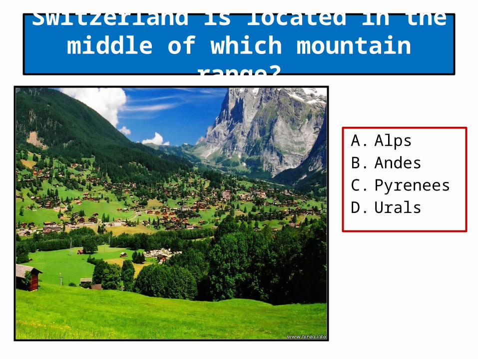
Switzerland is located in the middle of which mountain range?
A. Alps B. Andes C. Pyrenees D. Urals
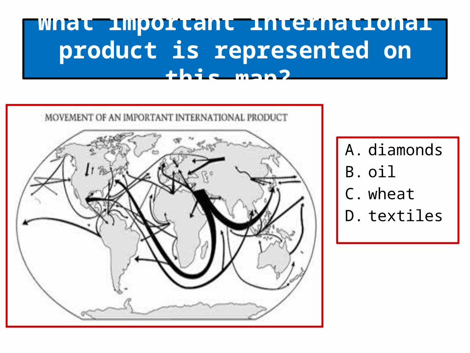
What important international product is represented on this map?
A. diamonds B. oil C. wheat D. textiles
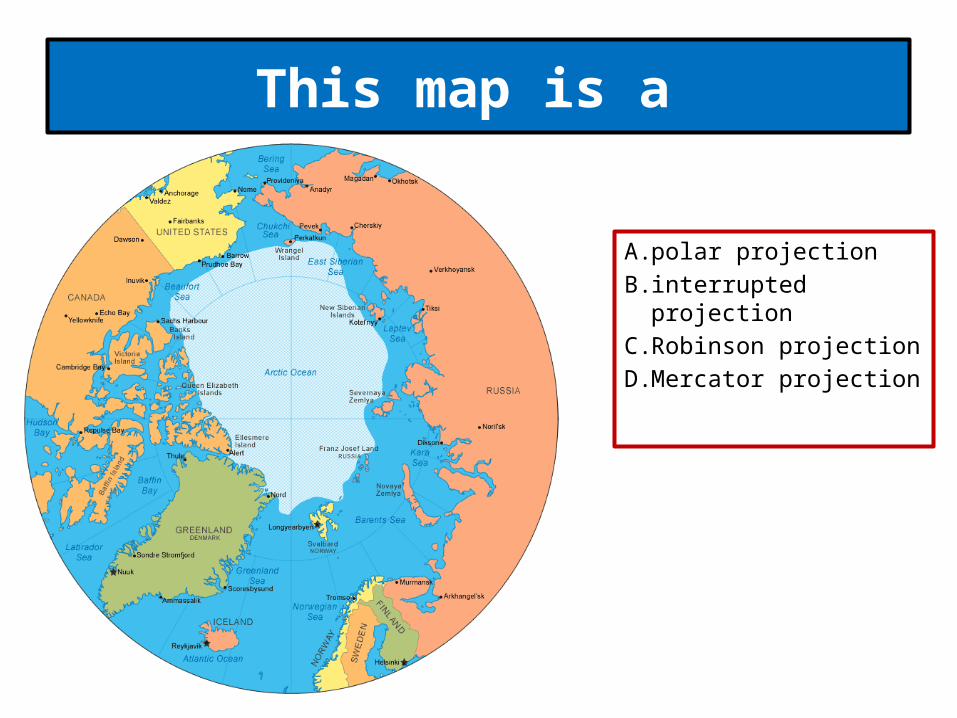
This map is a
A. polar projection B. interrupted
projection C. Robinson projection D. Mercator projection

This map would be most useful to a
A. pilot flying from Canada to Scandinavia
B. pilot flying from Europe to South America
C. person sailing to Antarctica
D. person sailing in tropical seas
Which is the main reason that many early peoples settled in river valleys?
A. River valleys tended to be cooler than highland regions.
B. River valleys were fertile because floodwaters left rich soil on the banks.
C. River valleys were easier to defend from attack than were highland regions.
D. River valleys were virtually free of danger from wild animals.
People in developed countries generally
A. have shortages of food.B. have poor medical care.C. are traditional farmersD. are technologically advanced
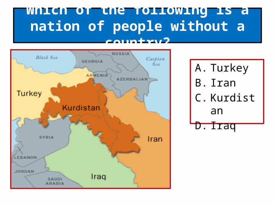
Which of the following is a nation of people without a country?
A. Turkey B. Iran C. Kurdistan D. Iraq

Which nation is most likely to have a shipping port?
A. Nation D B. Nation A C. Nation C D. Nation B

Under which of the following circumstances would you be most likely
to find snow in equatorial regions?
A. in areas at high latitudes B. in winter C. in areas below sea level D. in areas at high elevations

The island shown on the map has four cities: A, B, C, and D. Based only on the geographical
features shown on the map, which city probably has the largest population?
A. City B B. City D C. City C D. City A

What religion is practiced by most people in India?
A. Buddhism B. Hinduism C. Confucianism D. Christianity
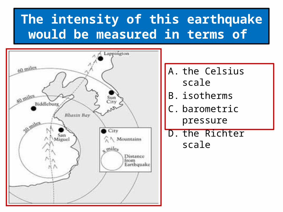
The intensity of this earthquake would be measured in terms of
A. the Celsius scale B. isotherms C. barometric pressure D. the Richter scale
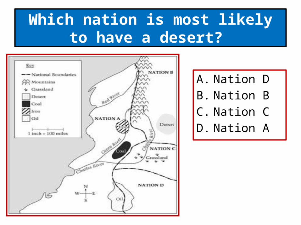
Which nation is most likely to have a desert?
A. Nation D B. Nation B C. Nation C D. Nation A

This pyramid represents the population distribution of
A. a country in Asia
B. a country in Africa
C. a developing country
D. a developed country
femalemale
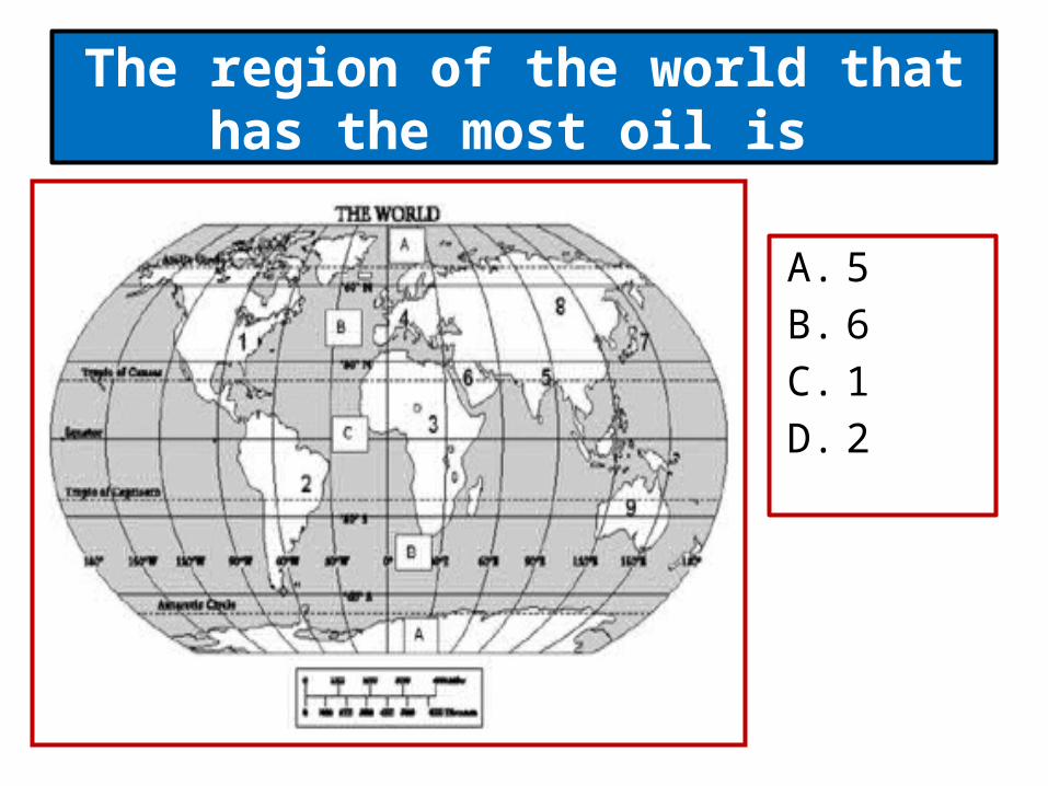
The region of the world that has the most oil is
A. 5 B. 6 C. 1 D. 2
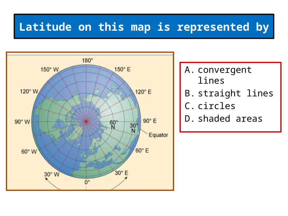
Latitude on this map is represented by
A. convergent lines B. straight lines C. circles D. shaded areas

The varying widths of the lines on the map most probably indicate the
A. type of transportation used
B. strength of ocean currents
C. volume of trade D. type of trade
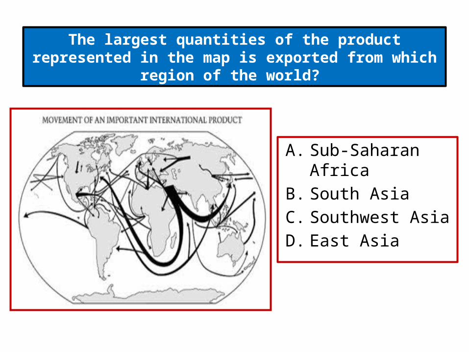
The largest quantities of the product represented in the map is exported from which region of the world?
A. Sub-Saharan Africa B. South Asia C. Southwest Asia D. East Asia
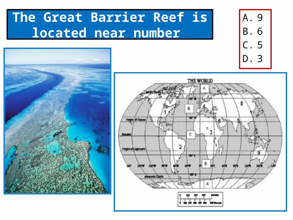
The Great Barrier Reef is located near number
A. 9 B. 6 C. 5 D. 3
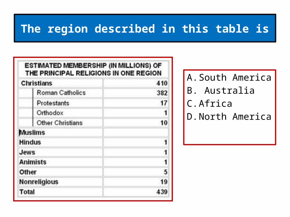
The region described in this table is
A. South America B. Australia C. Africa D. North America

In which area of the world can one expect to find the most active earthquakes and
volcanoes?
A. The Pacific Rim B. Caribbean Sea C. Mediterranean Sea D. Mid Atlantic Ocean
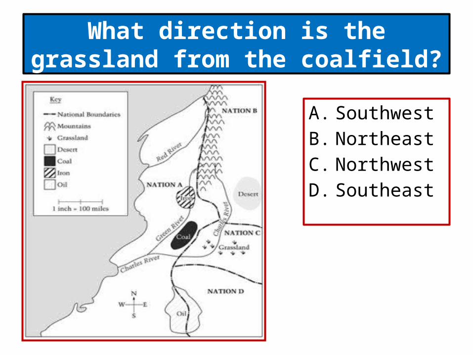
What direction is the grassland from the coalfield?
A. Southwest B. Northeast C. Northwest D. Southeast
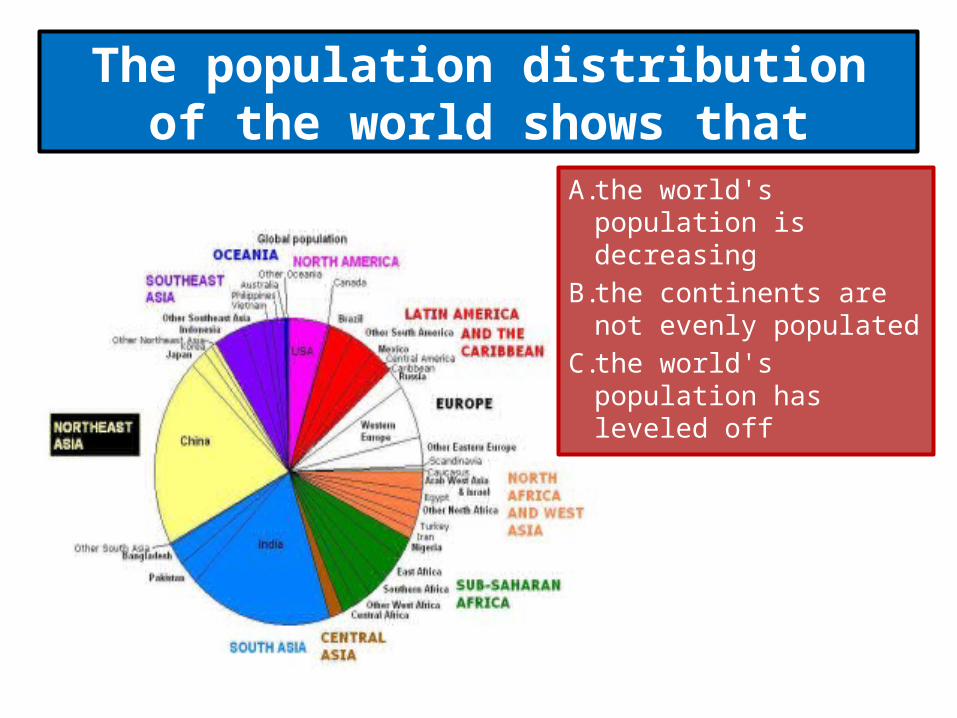
The population distribution of the world shows that
A. the world's population is decreasing
B. the continents are not evenly populated
C. the world's population has leveled off
What is an important reason that countries join international organizations like the United
Nations?
A. Such organizations force countries to join. B. Many of the world's problems involve more than
one country. C. Citizens want their countries to join as many
international organizations as possible. D. Countries who do not join usually lose their
independence and sovereignty.

What is an important reason that skyscrapers were built in American cities?
A. Construction companies liked the really high buildings.
B. Skyscrapers allowed people to use small amounts of land more efficiently.
C. Citizens wanted to be safe from street crimes. D. Skyscrapers allowed tenants to create a closer
community.
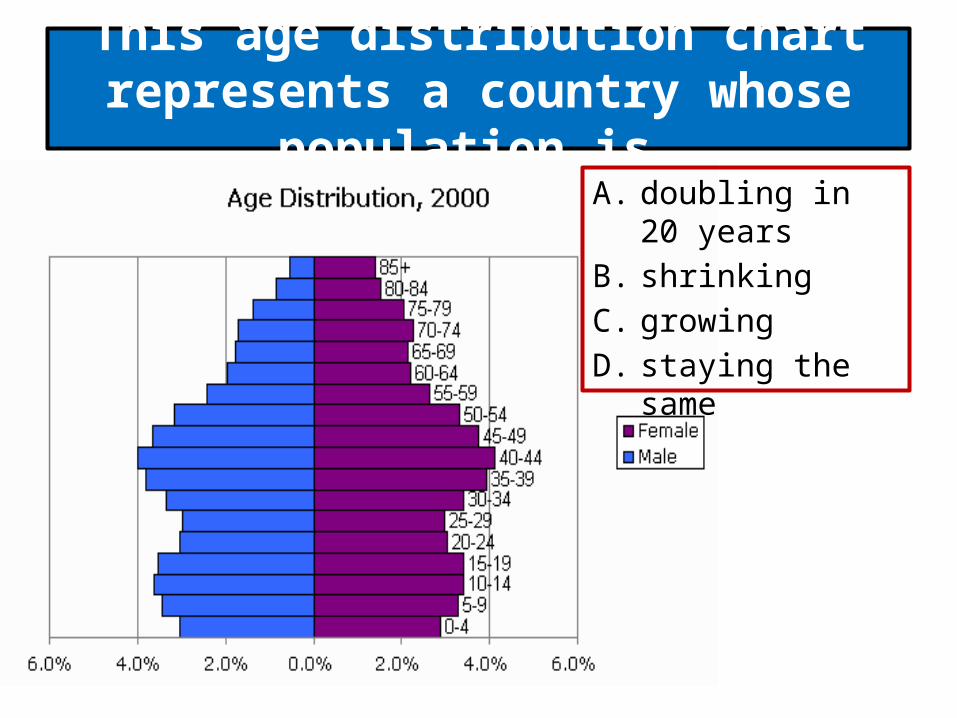
This age distribution chart represents a country whose population is
A. doubling in 20 years B. shrinking C. growing D. staying the same
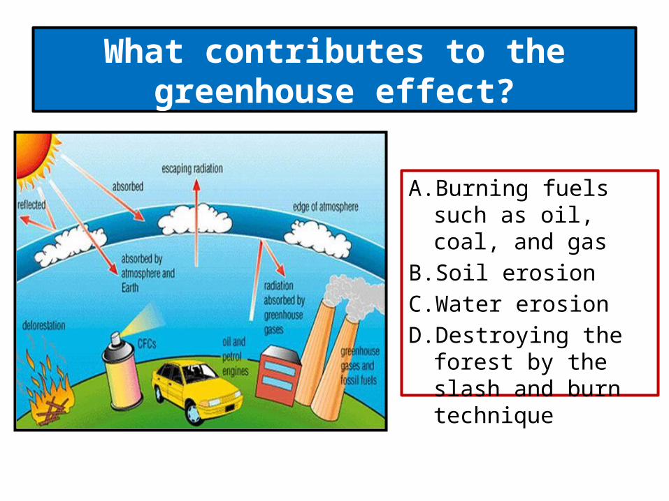
What contributes to the greenhouse effect?
A. Burning fuels such as oil, coal, and gas
B. Soil erosion C. Water erosion D. Destroying the forest by
the slash and burn technique

This age chart represents the population distribution of
A. a developing country B. a developed country C. a country in Europe D. a country in North
America
Quebec, Canada can be considered a cultural region because of its
A. climate B. landforms C. language D. economy
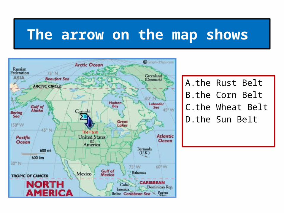
The arrow on the map shows
A. the Rust Belt B. the Corn Belt C. the Wheat Belt D. the Sun Belt
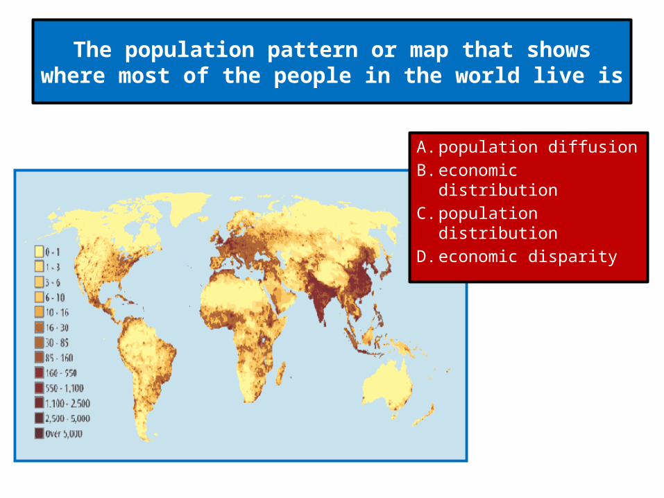
The population pattern or map that shows where most of the people in the world live is
A. population diffusion B. economic distribution C. population distribution D. economic disparity
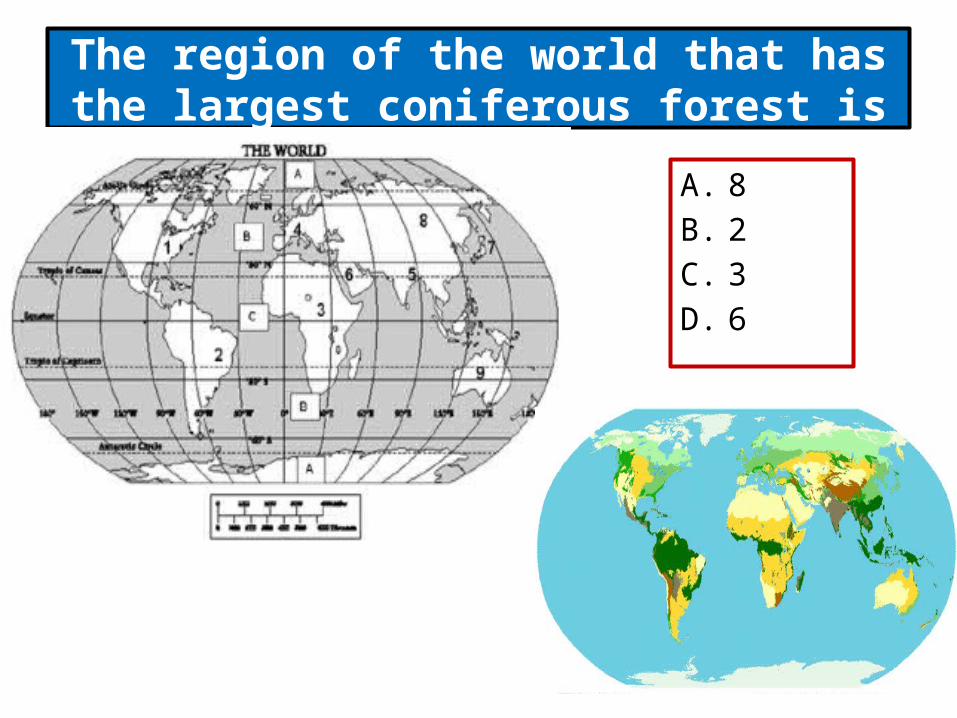
The region of the world that has the largest coniferous forest is
A. 8 B. 2 C. 3 D. 6
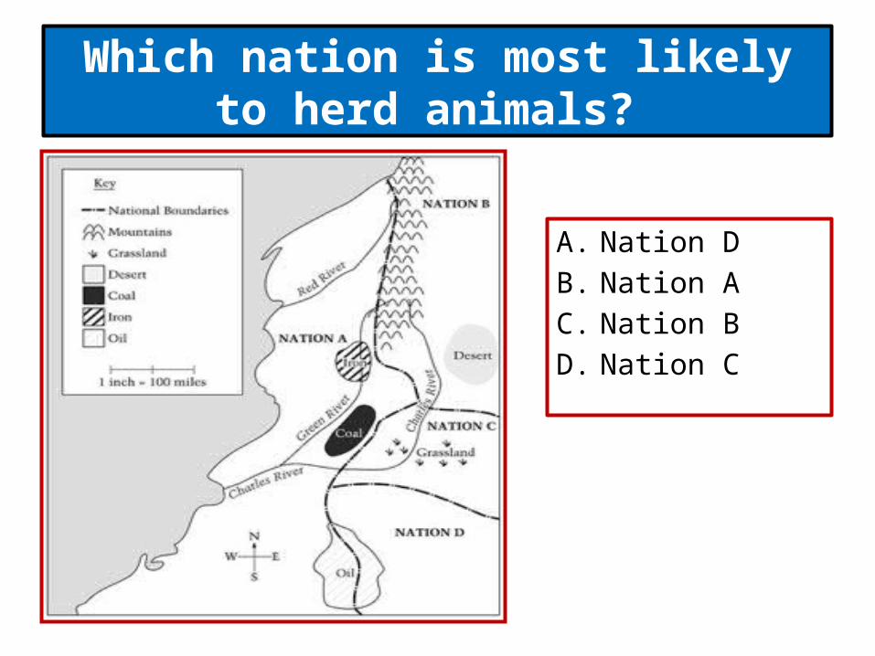
Which nation is most likely to herd animals?
A. Nation D B. Nation A C. Nation B D. Nation C

The "Corn Belt" is a region in the United States defined on the basis of
A. political organization B. transportation networks C. population D. economic activity
Related Documents