Maps and More Maps Maps are representations, usually on a flat surface, of the whole or a part of an area .

Maps and More Maps Maps are representations, usually on a flat surface, of the whole or a part of an area.
Dec 29, 2015
Welcome message from author
This document is posted to help you gain knowledge. Please leave a comment to let me know what you think about it! Share it to your friends and learn new things together.
Transcript

Maps and More Maps
Maps are representations, usually on a flat surface, of the whole or a part of an area.

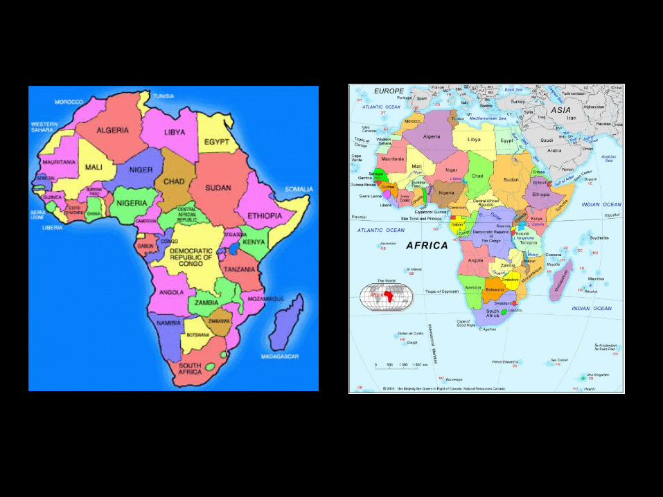
Political Maps• reveal the presence of human beings• show boundaries, either natural or
man-made• natural boundaries are rivers, oceans
and seas, lakes, and sometimes mountain ranges
• man-made (artificial) boundaries are lines of latitude and/or longitude
• colors have no particular meaning• show countries, states, counties, cities,
neighborhoods


Physical Maps
• show relief, or landforms, including elevation
• their colors are consistent, showing various shades of brown, yellow, and
green• darkest brown is the highest elevation
and light green the lowest (sea level)• yellows and tans indicate areas of
little precipitation• cities , states, and countries can be
shown but are not necessary


Thematic Maps• focus on a specific theme or subject area• can show physical, political, economic,
religious, or social information about an area
In the past twenty years,
which states have increased the most (percentage-wise)
in population?

From this map, what general area of the
United States has the smallest population?
In what general area of the U. S. do you think major league baseball
began?

U. S. presidentialelection of 2012

Various World Maps
Why are there so many different kinds
of world maps?
Related Documents