Mapping Skills & Topography 7 th grade Science Packet #3

Mapping Skills & Topography 7 th grade Science Packet #3.
Dec 21, 2015
Welcome message from author
This document is posted to help you gain knowledge. Please leave a comment to let me know what you think about it! Share it to your friends and learn new things together.
Transcript

Mapping Skills & Topography
7th grade Science Packet #3

We will learn some essential features of maps-fill in your vocabulary chart

Can you identify North Pole and South Pole on this map?

Map makers always orient their maps to show North at the top

Run your finger along the mountain range

Run your finger along the mountain range again

Can you find where north is on the left picture?

What do you know about longitude and latitude?

Prime Meridian


Latitude lines run east-west, but are measured in degrees North or degrees South. Longitude lines run
North-South, but measured east or west.

Mental help:Latitude, Flatitude!

Like coordinates in Math!

Steps for reading latitude and longitude
• P. 3 in packet• Glue in grid, try together in notebook• Follow steps 1-7 on the grid.• Now follow the same steps and label the
globe.

Use the world map in your packet to answer the following questions
1. What is located at:
•31 degrees North, and 121 degrees East
Answer: Shanghai, China

Question 2
•What language would you hear spoken at 30° S / 135° E?
Answer: English Mate!

Question 3
• Do people speak Spanish or Italian at 41° N / 4°W?
Answer: Española!
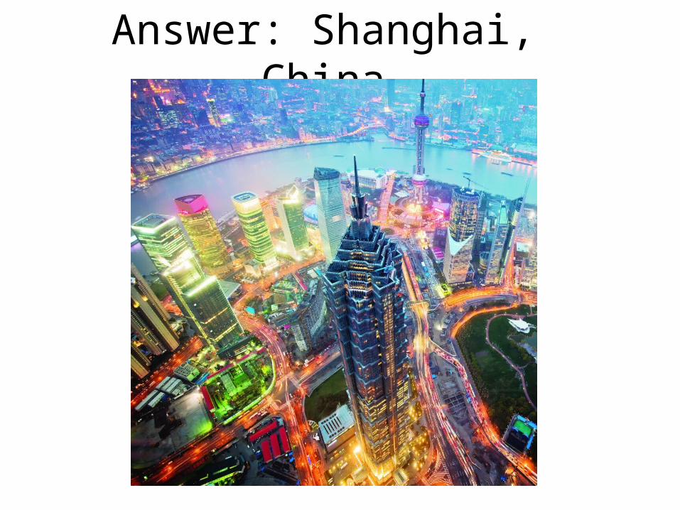
Question 4
• If you are at 27° N / 78° E, would you see the Eiffel Tower or the Taj Mahal?

Determining Latitude and Longitude
• Find the latitude and longitude questions in the middle of p. 3.
• Use the map on p. 2 in the packet to determine the latitude and longitude of each location. Record next to the letters on p. 3.
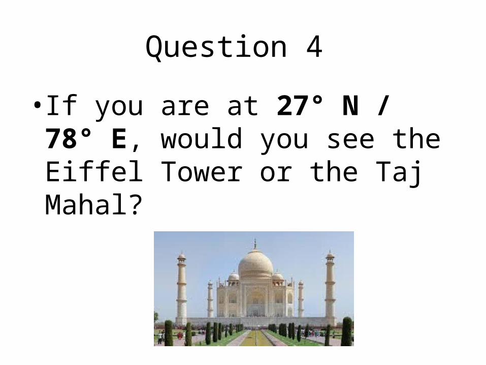
Scale on maps

Scale• A ratio of a distance on the
map to the actual distance on the ground is called the scale.

Do the scale problems on p. 4in your packet.

Legend• Legend is the explanatory list
of the symbols on the map.

Legend

Related Documents