Luky Adrianto. Yudi Wahyudin, Alan F Koropitan and Benny Okta Nababan Center for Coastal and Marine Resources Studies Bogor Agricultural University, Indonesia Mapping and Valuing Pelagic Ecosystem Services in the Lesser Sunda Ecoregion Preliminary Results on the Manta Rays Pelagic Fisheries for Tourism

Welcome message from author
This document is posted to help you gain knowledge. Please leave a comment to let me know what you think about it! Share it to your friends and learn new things together.
Transcript

Luky Adrianto. Yudi Wahyudin, Alan F Koropitan and Benny Okta NababanCenter for Coastal and Marine Resources Studies
Bogor Agricultural University, Indonesia
Mapping and Valuing Pelagic Ecosystem Services in the Lesser Sunda Ecoregion
Preliminary Results on the Manta Rays Pelagic Fisheries for Tourism
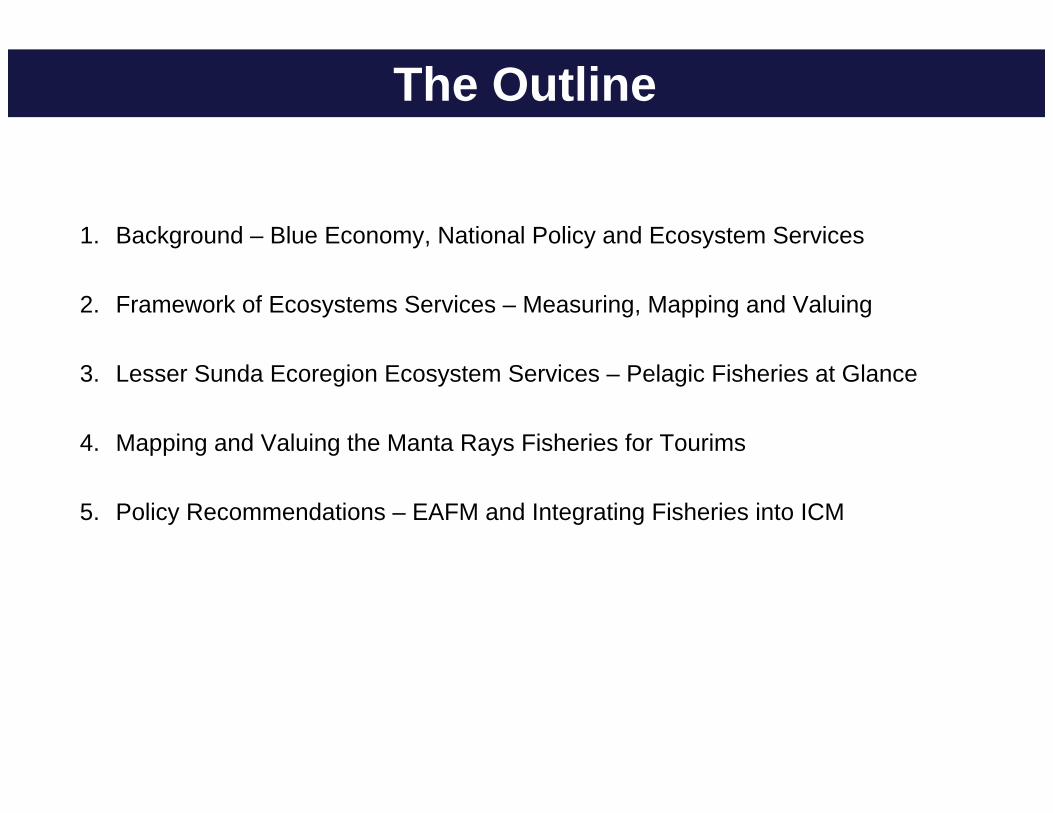
The Outline
1. Background – Blue Economy, National Policy and Ecosystem Services
2. Framework of Ecosystems Services – Measuring, Mapping and Valuing
3. Lesser Sunda Ecoregion Ecosystem Services – Pelagic Fisheries at Glance
4. Mapping and Valuing the Manta Rays Fisheries for Tourims
5. Policy Recommendations – EAFM and Integrating Fisheries into ICM

An Insight of Blue Economy – A Paradigm
Exploring and utilizing ecosystem services through the ecosystems functions and structures
Creating new opportunities through innovation
Creating cheaper inputs and outputs
Working with nature and strong sustainability paradigm
Ecosystem as control for human activities (social-ecological system)
Modified from Pauly (2010)

Focusing on ecosystemIntegrity, capacity andsustainability
Creating new opportunities throughinovations
Ecosystem as control forhuman system (social-ecological system)
Coastal and Marine Area as Multi-sectoral uses
ICM as tools for Ocean Based Blue Economy
Ecosystem BasedManagement
Integration andCoordination
Adaptive ManagementPrinciple of Integrated Coastal Management
Operational Tools : Marine and Coastal Spatial Planning
Adrianto (2013)

LesserSundaEcoregion
PelagicEcosystemServices
Measuring
Mapping
Valuing
Fisheries Services
Sustainability Policy Feedback Lesser SundaEcoregions PolicyInputs (e.g. marine spatialplanning)
Mapping Ocean Wealth
Tourism Services
EcosystemServices Mapping
Adrianto, et.al (2015)

Coastal and Ocean System

Source : CI (2010)
Coastal and Ocean Ecosystem Services

Coastal and Ocean Ecosystem Services
PEMSEA (2013)

Mapping of the Ocean Wealth – the Objectives
1. To measure the ecosystem services of the Lesser Sunda Ecoregion with particular focus on pelagic ecosystem services;
2. To map pelagic ecosystem services regarding to the fisheries system and tourism system of the Lesser Sunda Ecoregion;
3. To value the ecosystem services with emphasizing on fisheries and tourism pelagic system of the Lesser Sunda Ecoregion

Biodiversity
Ecosystem
Species
Human Welfare
1
2
3
4
5
6
Link 1-6 : benefits for human fromecosystem supportingfunctions
Link 1-4-5 : benefits of biodiversityfor human in the contextof habitat protection andconservation
Link 2-5 : benefits of biodiversity in the context as input for ecosystem goods and
services
Link 3 : benefits of diversity in termsof bio-ethics framework ofthinking
Approach to Mapping Ocean Wealth – Lesser Sunda
Algorithm of ValuationVan den Berg (2010)

Coastal andMarineEcosystems
Ecosystem structruresand functions
Ecosystem Services
EcosystemServicesValuation
Mapping ofES Value
Approach to Mapping Ocean Wealth – Lesser Sunda
Algorithm of Mapping

General Approach to Mapping Ocean Wealth
Coastal and Marine EcosystemsLittoral Neritic Pelagic Oceanic Pelagic
Ecosystem ServicesProvisioning Regulating Supporting Cultural
Ecosystem Services Valuation MethodologyIntrinsic Value Instrumental Value
Ecosystem Services MappingSpatial Temporal
Tier 1
Tier 2

MOW PES
Fisheries
Tourism
Setting the PES
Quantifying value of the PES
Mapping of the PES
Marine Tourism Planning
Marine Spatial
Planning
VM
MOW, VM and MSP
PES = Pelagic Ecosystem ServicesMOW = Mapping of Ocean WealthVMs = Value Mapping

Lesser Sunda Ecoregion

Lesser Sunda Ecoregion - FMAs
• FMA 573• FMA 713• FMA 714

Research Methodology
Pelagic System
Provisioning Services (ES1)
Cultural Services (ES3)
Fisheries
Valuing Ecosystem Services
Tourism
Biomass Attractiveness
Measuring - Mapping
LiteratureReviews
PreliminaryMaps

Upwelling (monsoon effect) and ENSO effect on Sardine Production in Bali Strait
Lumban Gaol et al., 2004
April Jun Aug
Lumban Gaol, 2009
Oceanographic Backgrounds

The finestructure in the Indonesian seas region averaged over 18 years between 100 and 300 m depths and plotted along the XBT transects (5359 profiles) (Ffield and Robertson, 2005)
Internal mixing induced nutrients pumpingOceanographic Backgrounds

Jan
Feb
Monthly mean of Fish Biomass Distribution during 2004-2014

Mar
Apr
Monthly mean of Fish Biomass Distribution during 2004-2014

May
Jun
Monthly mean of Fish Biomass Distribution during 2004-2014

Jul
Aug
Monthly mean of Fish Biomass Distribution during 2004-2014

Sep
Oct
Monthly mean of Fish Biomass Distribution during 2004-2014

Nov
Dec
Monthly mean of Fish Biomass Distribution during 2004-2014

The world distribution of Manta birostris (IUCN Redlist, 2014)

Mapping of Manta Rays in Indonesia

Sources: BPSPL (2015), Dewar et al (2008), Dharmadi et al (2015), Jaiteh et al (2015), Nijman (2015), Richards et al (2013), Rochimat et al (2013),
White & Cavanagh (2006), White & Fahmi (2015)
Mapping of Manta Rays in Lesser Sunda

Mapping of Manta Rays in Lesser Sunda

A Case map result of PSAT Manta Rays in Nusa Penida (BPSPL Denpasar, 2015)

Manta rays migration route suggests mantas travels alongside southern Lesser Sunda (Bali-Lombok-Sumbawa-Flores) (BPSPL Denpasar, 2015)
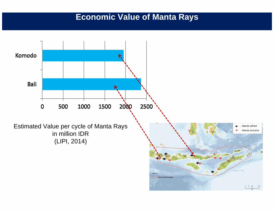
Economic Value of Manta Rays
Estimated Value per cycle of Manta Raysin million IDR(LIPI, 2014)

Economic Value of Manta Rays
Estimated Value total revenues of Manta Rays in million IDR
(LIPI, 2014)

particularcoastal
ecosystem : seagrass
coastaland oceanecosystem
coastal, oceanecosystem and human activities
coastal, oceanEcosystem, human activities and policies
Integrated Coastal Resources Management
Good
s an
d se
rvic
esflo
wPreservation and
Rehabilitation
ICM and Seagrass Ecosystems Management

EAFM as tools of ICM – Systematic Thinking
FisheriesManagement
SustainableFisheries
Coastaland MarineEcosystem
Sector A
Sector B
Sector C
Sector D
Inte
grat
ed C
oast
alM
anag
emen
t Ecosystem Approach to Fisheries Management
system integration
policy and functional integration
State of the Coast
ICM Framework
ICM Framework

Thank You
Related Documents