MapCoast Technology Tools for Subaqueous Soil Mapping Report for New Technology Demo – by Maggie Payne and Jim Turenne. A Side Scan sonar survey onboard the MapCoast Pontoon Boat.

Welcome message from author
This document is posted to help you gain knowledge. Please leave a comment to let me know what you think about it! Share it to your friends and learn new things together.
Transcript

MapCoast Technology Tools for Subaqueous Soil Mapping
Report for New Technology Demo – by Maggie Payne and Jim Turenne.
A Side Scan sonar survey onboard the MapCoast Pontoon Boat.
RTK GPS – Real Time Kinematic Surveying
Centimeter vertical accuracy Known base location makes accuracy possible. OPUS Solution to get NAVD-88
Used in bathymetric surveyingCurrently can survey within 1-3 miles of base.With Airlink Raven cell phone link can survey within 30 miles of base.Used for mapping shallow areas and tide-correction.
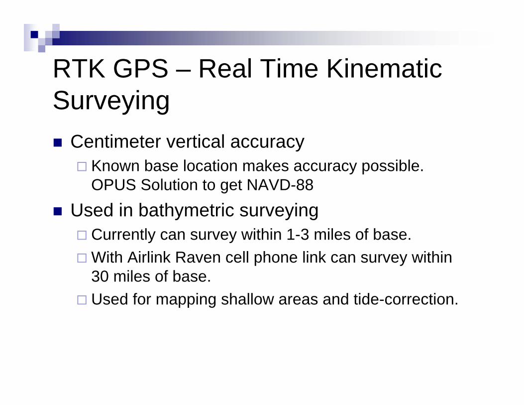
4800 and R-8 Models used.
Left: 4800 setup, middle: rover interfaced with fathometer, right: Tide Gauge.

“Turenne Terrain Navigator”
Cell Modem Link – allows for surveying up to 30 miles from base!

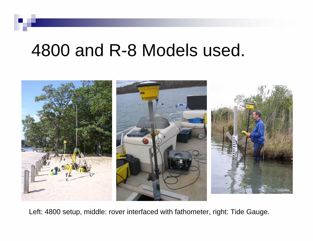
SPI – Sediment (soil) profile imaging camera

Provides high resolution image of upper 10 to 15 cm of soil surfaceIdentify oxidized surface Assess benthic habitat and soil health.
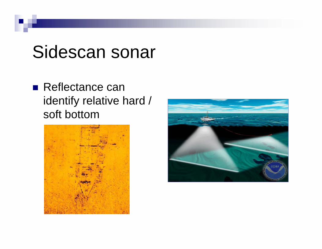
Sidescan sonar
Reflectance can identify relative hard / soft bottom

Side Scan Sonar
Used in MapCoast protocol to provide map of benthic geology habitat.
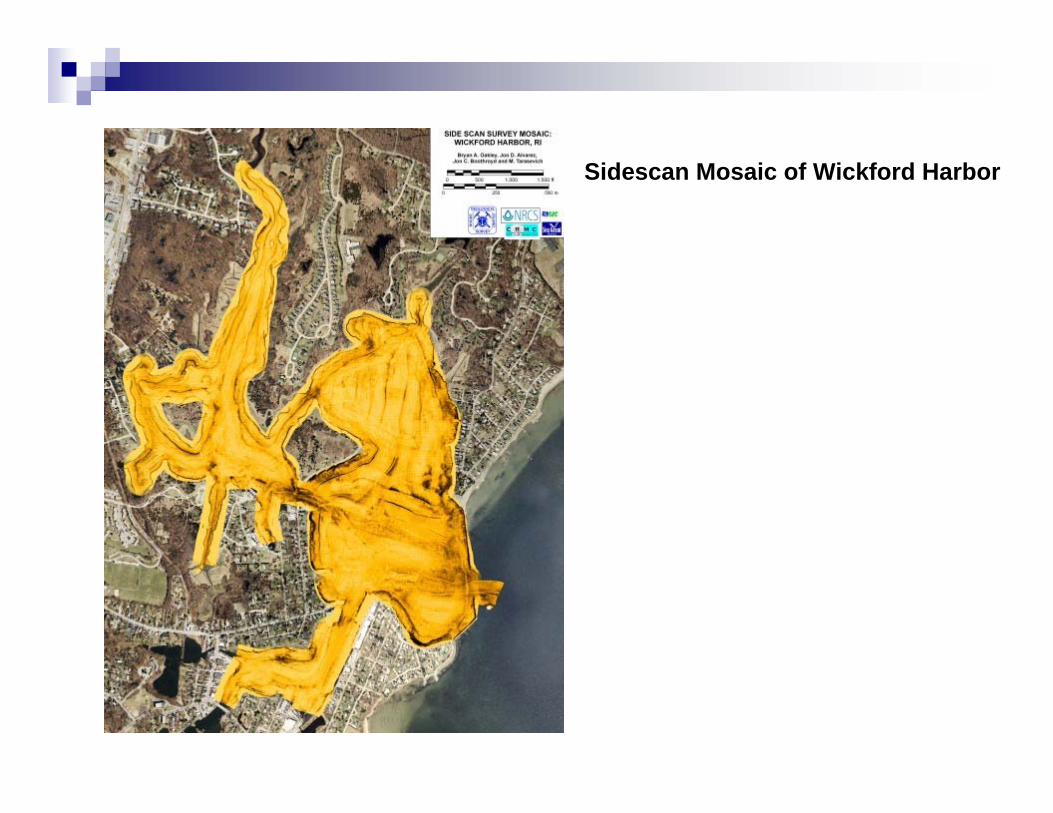
Sidescan Mosaic of Wickford Harbor

Bathymetry
Variety of tools used to collect bathymetry data and shallow water areas – LIDAR, RTK readings, Orthometric.Top data need from user conference –detailed bathymetry!

YSI Meter
Provides data on water column.Salinity, temp, EC, DO, etc.Data collected at each soil observation point added to log sheet.

Underwater Video and Still Image
Video images or photo of bottom taken at each soil description location to provide info on habitat and bottom type.

Vibra Coring
Used to collect soil cores.3” aluminum cores.Up to 20 foot cores obtained.Pontoon Boat is rigged with tripod, moon pool.
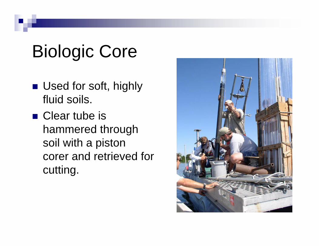
Biologic Core
Used for soft, highly fluid soils.Clear tube is hammered through soil with a piston corer and retrieved for cutting.

Core Cutting
Left: a core cutting device using dual routers. Right: sheet metal sheers.

Analyzing the Cores
Geotech Core Analyzer and Data.
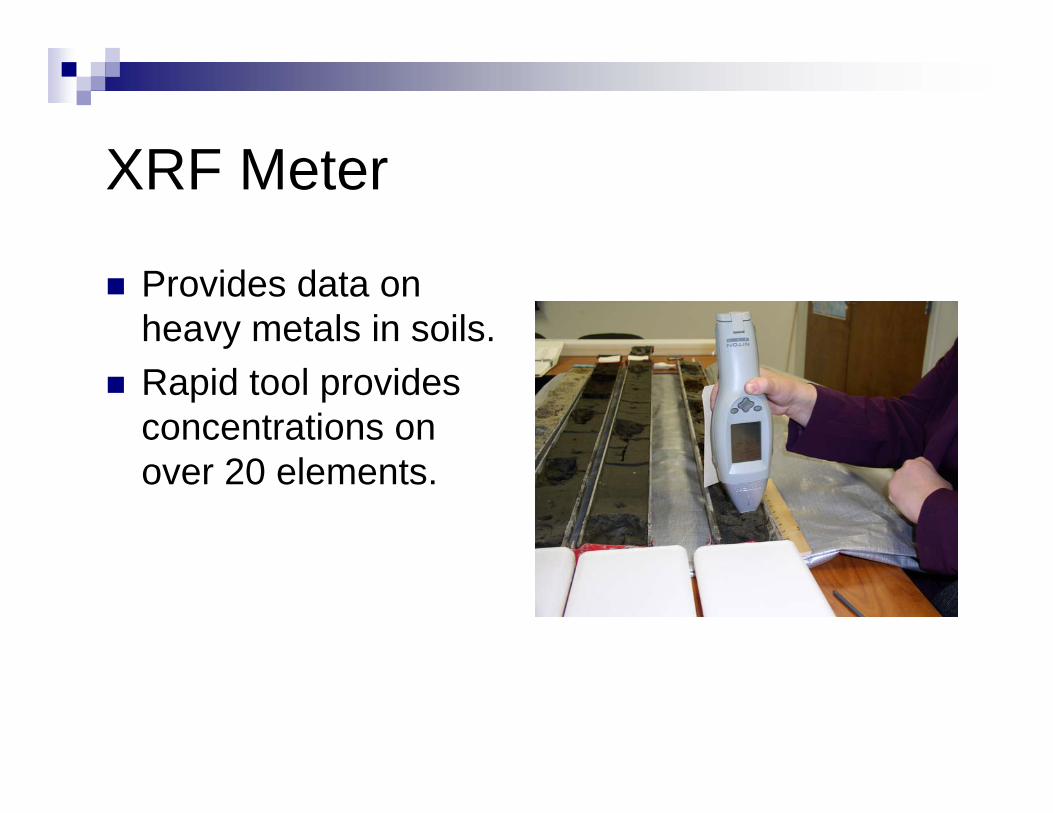
XRF Meter
Provides data on heavy metals in soils.Rapid tool provides concentrations on over 20 elements.

Field Data Collection & Navigation
Tablet PC used for navigating (ArcMap, Ortho Image, Bathy, and GPS interfaced, data collection – all descriptions entered directly into pedon PC and spread sheet on boat, variety of GPS, handhelds, rugged PC, etc. Broadband connection used to connect to Internet (weather alerts!).
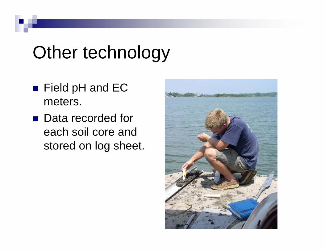
Other technology
Field pH and EC meters.Data recorded for each soil core and stored on log sheet.
Related Documents