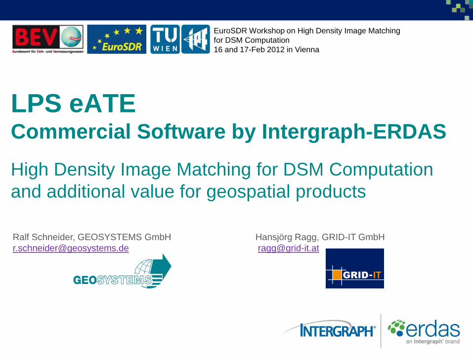
EuroSDR Workshop on High Density Image Matching for DSM Computation 16 and 17-Feb 2012 in Vienna LPS eATE Commercial Software by Intergraph-ERDAS High Density Image Matching for DSM Computation and additional value for geospatial products Ralf Schneider, GEOSYSTEMS GmbH [email protected] Hansjörg Ragg, GRID-IT GmbH [email protected]

Welcome message from author
This document is posted to help you gain knowledge. Please leave a comment to let me know what you think about it! Share it to your friends and learn new things together.
Transcript
EuroSDR Workshop on High Density Image Matching
for DSM Computation
16 and 17-Feb 2012 in Vienna
LPS eATE Commercial Software by Intergraph-ERDAS
High Density Image Matching for DSM Computation
and additional value for geospatial products
Ralf Schneider, GEOSYSTEMS GmbH
Hansjörg Ragg, GRID-IT GmbH
LPS eATE - 2
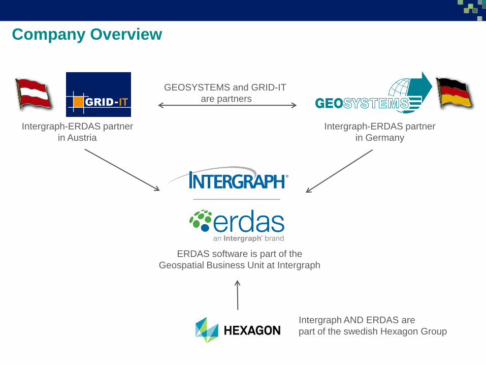
Company Overview
Intergraph-ERDAS partner
in Austria
Intergraph-ERDAS partner
in Germany
GEOSYSTEMS and GRID-IT
are partners
Intergraph AND ERDAS are
part of the swedish Hexagon Group
ERDAS software is part of the
Geospatial Business Unit at Intergraph
LPS eATE - 5
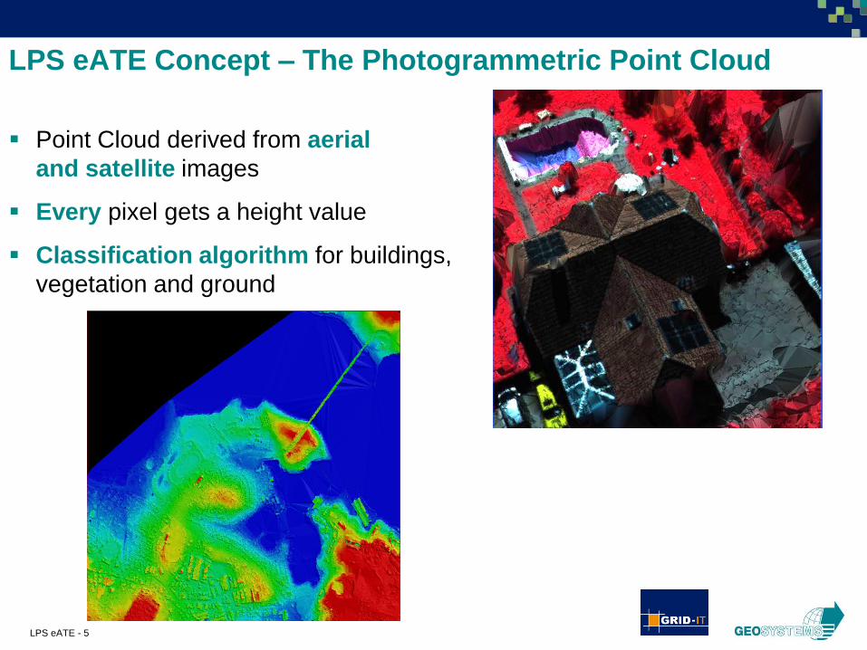
Point Cloud derived from aerial
and satellite images
Every pixel gets a height value
Classification algorithm for buildings,
vegetation and ground
LPS eATE Concept – The Photogrammetric Point Cloud
LPS eATE - 6
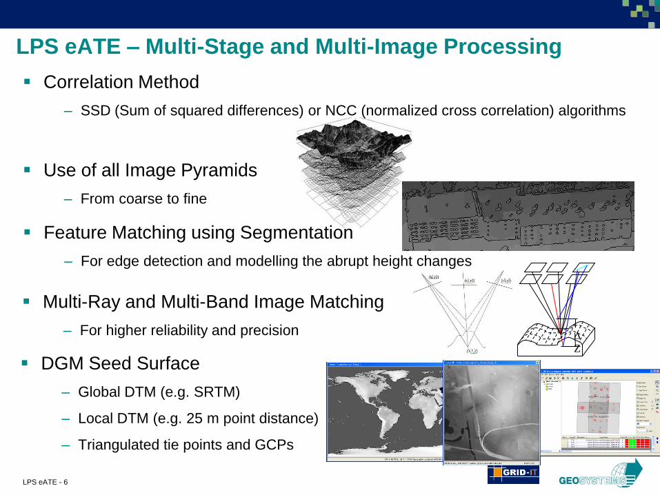
LPS eATE – Multi-Stage and Multi-Image Processing
Use of all Image Pyramids
– From coarse to fine
Multi-Ray and Multi-Band Image Matching
– For higher reliability and precision ∆
Z
DGM Seed Surface
– Global DTM (e.g. SRTM)
– Local DTM (e.g. 25 m point distance)
– Triangulated tie points and GCPs
Correlation Method
– SSD (Sum of squared differences) or NCC (normalized cross correlation) algorithms
Feature Matching using Segmentation
– For edge detection and modelling the abrupt height changes
LPS eATE - 7
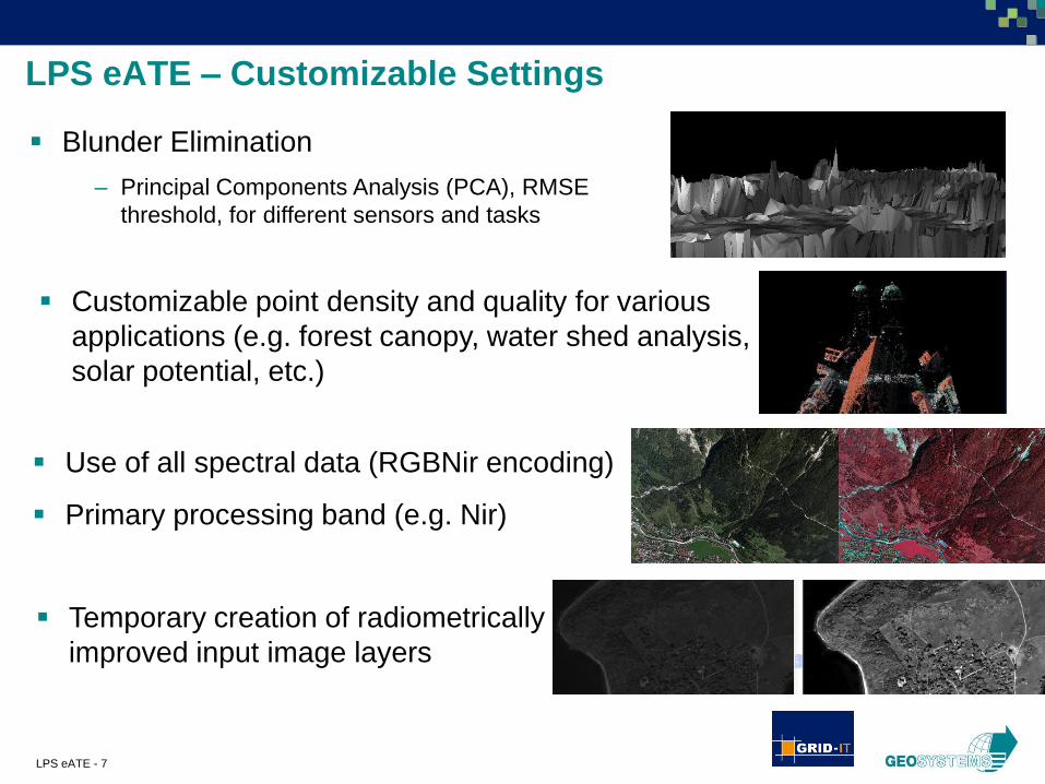
LPS eATE – Customizable Settings
Blunder Elimination
– Principal Components Analysis (PCA), RMSE
threshold, for different sensors and tasks
Use of all spectral data (RGBNir encoding)
Primary processing band (e.g. Nir)
Temporary creation of radiometrically
improved input image layers
Customizable point density and quality for various
applications (e.g. forest canopy, water shed analysis,
solar potential, etc.)

LPS eATE - 8
Sensor Support in LPS
Orbital Pushbroom
Rational Functions
Camera
LPS eATE - 9
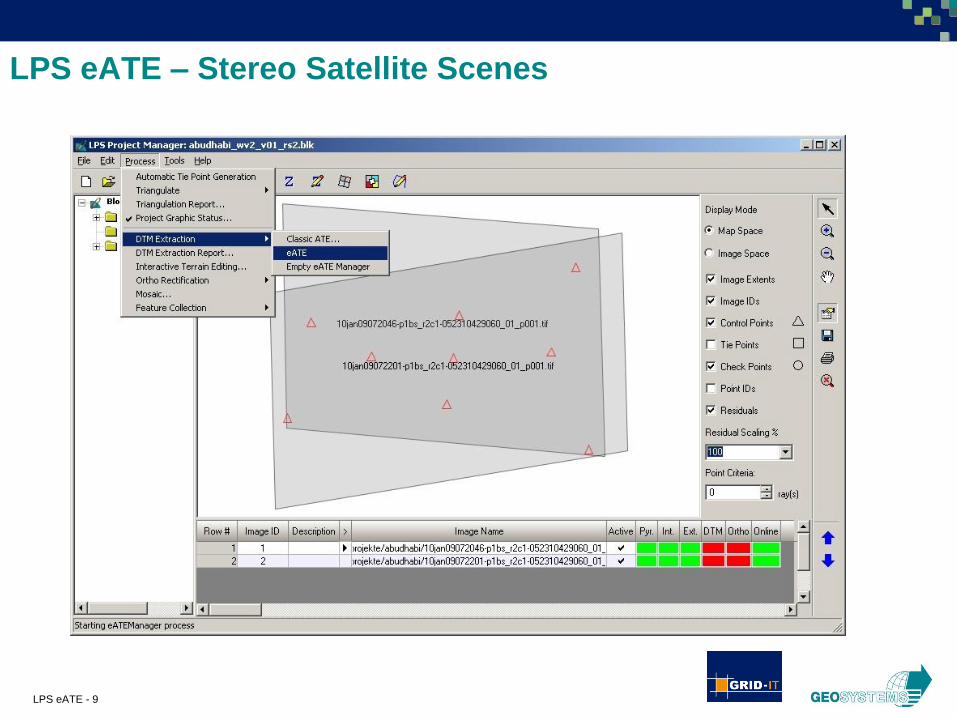
LPS eATE – Stereo Satellite Scenes
LPS eATE - 10
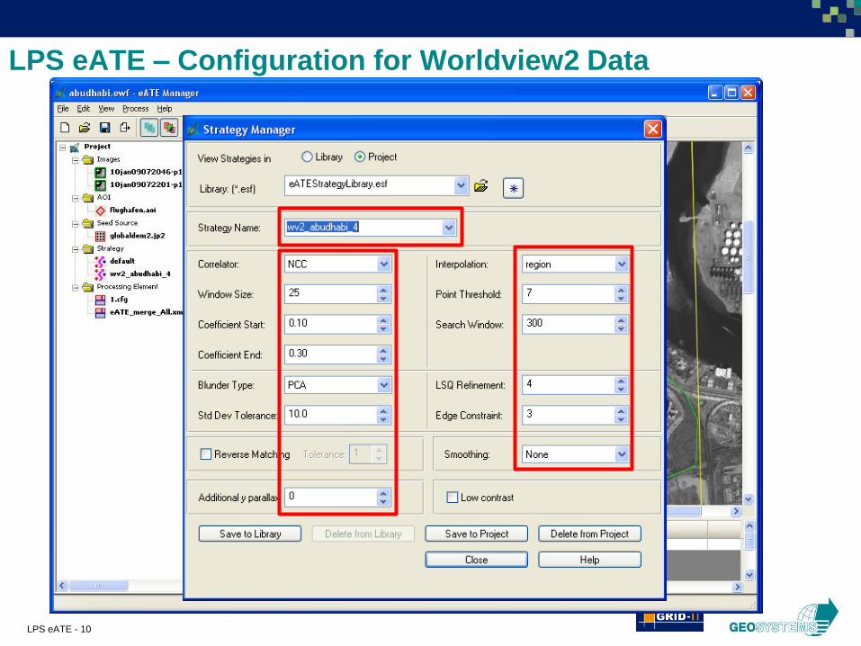
LPS eATE – Configuration for Worldview2 Data
LPS eATE - 11
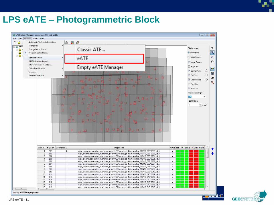
LPS eATE – Photogrammetric Block
LPS eATE - 12
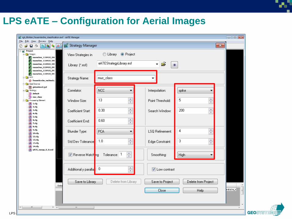
LPS eATE – Configuration for Aerial Images
LPS eATE - 13
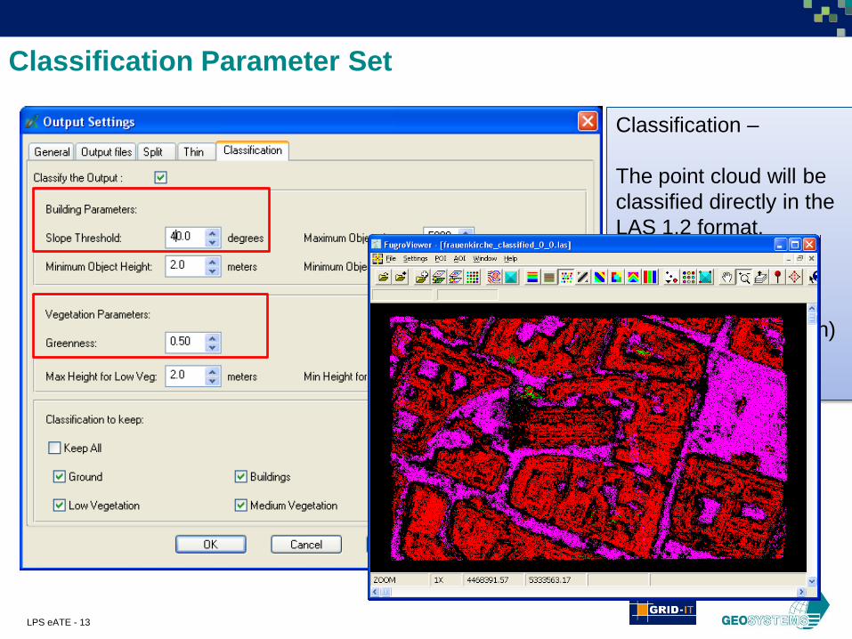
Classification Parameter Set
Classification –
The point cloud will be
classified directly in the
LAS 1.2 format.
Possible classes:
• Ground
• Vegetation (low, high)
• Buildings
LPS eATE - 14
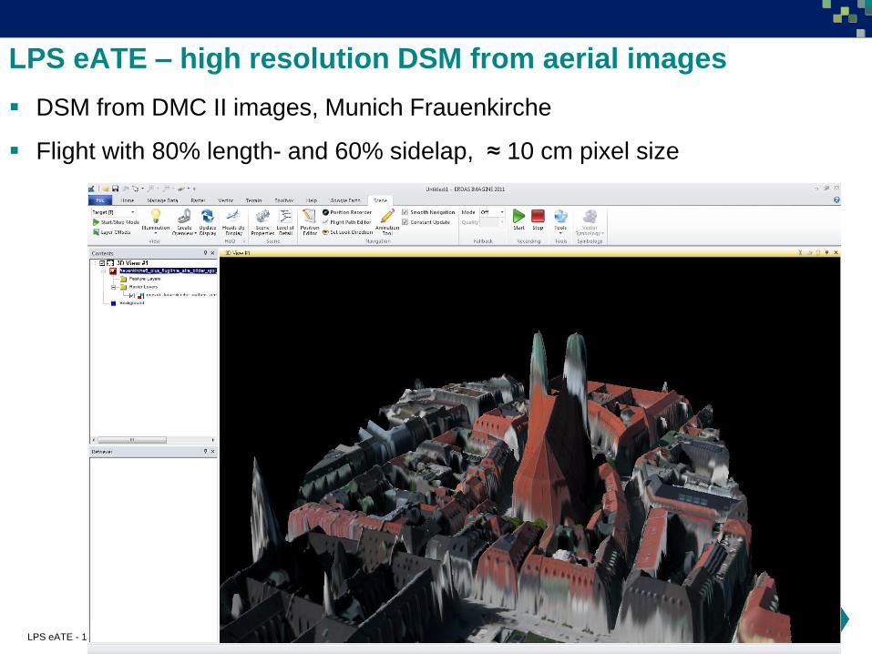
LPS eATE – high resolution DSM from aerial images
DSM from DMC II images, Munich Frauenkirche
Flight with 80% length- and 60% sidelap, ≈ 10 cm pixel size
LPS eATE - 15
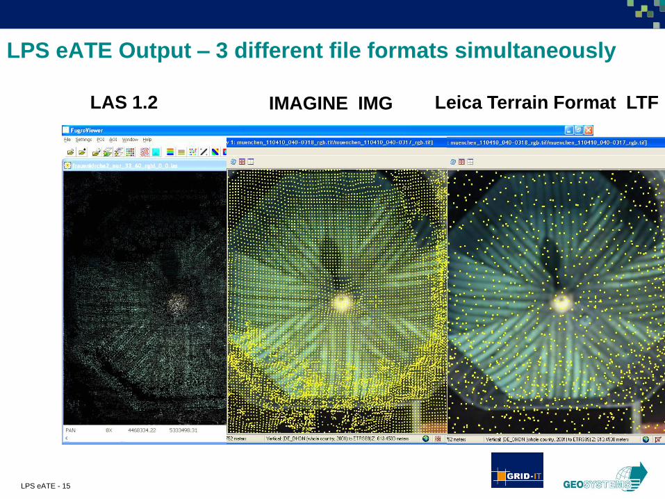
LAS 1.2
LPS eATE Output – 3 different file formats simultaneously
IMAGINE IMG Leica Terrain Format LTF
LPS eATE - 16
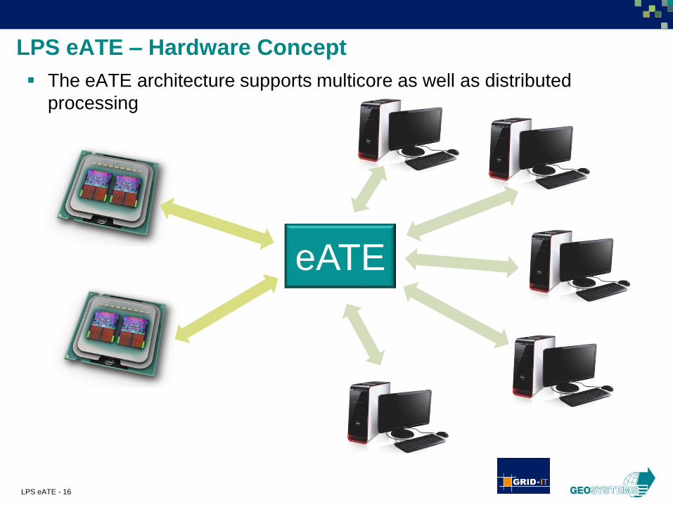
LPS eATE – Hardware Concept
The eATE architecture supports multicore as well as distributed
processing
eATE

LPS eATE - 17
LPS eATE – parallel Processing
Condor for distributed processing within the computer network

EuroSDR Workshop on High Density Image Matching
for DSM Computation
16 and 17-Feb 2012 in Vienna
LPS eATE Commercial Software by Intergraph-ERDAS
High Density Image Matching for DSM Computation
and additional value for geospatial products
Ralf Schneider, GEOSYSTEMS GmbH
Hansjörg Ragg, GRID-IT GmbH
LPS eATE - 19
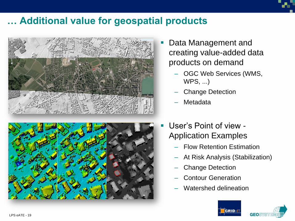
… Additional value for geospatial products
Data Management and
creating value-added data
products on demand
– OGC Web Services (WMS,
WPS, ...)
– Change Detection
– Metadata
User’s Point of view -
Application Examples
– Flow Retention Estimation
– At Risk Analysis (Stabilization)
– Change Detection
– Contour Generation
– Watershed delineation

LPS eATE - 20
Use Case – Mount St. Helens (2950m / 2550m)
Eruption in May 18, 1980
Since then
– Earthquakes
– New Crater Glacier
– New Rock Glaciers
– New Lava Dome
– Steam and ash plumes
Photos: National Geographic online
LPS eATE - 21
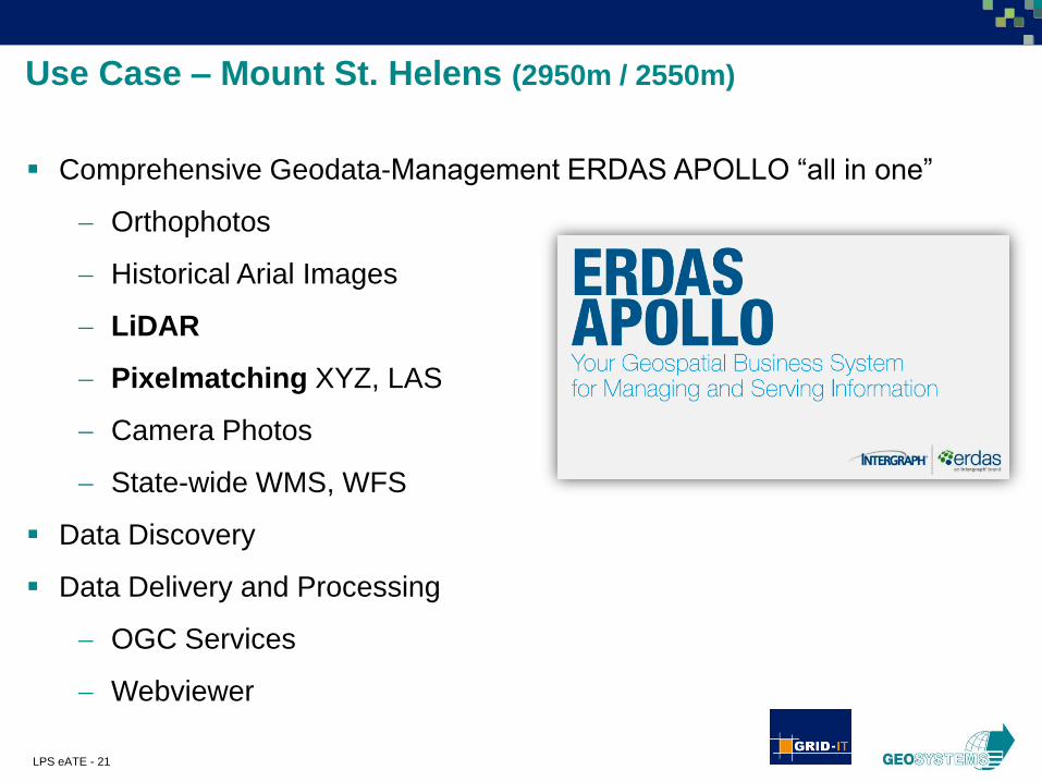
Use Case – Mount St. Helens (2950m / 2550m)
Comprehensive Geodata-Management ERDAS APOLLO “all in one”
Orthophotos
Historical Arial Images
LiDAR
Pixelmatching XYZ, LAS
Camera Photos
State-wide WMS, WFS
Data Discovery
Data Delivery and Processing
OGC Services
Webviewer
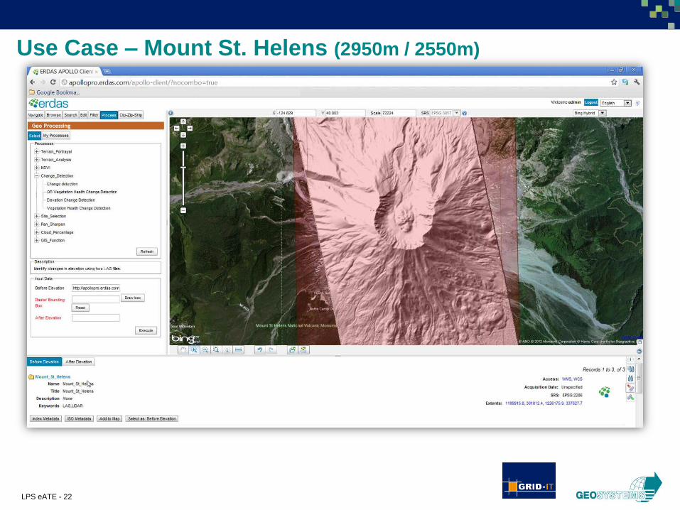
LPS eATE - 22
Use Case – Mount St. Helens (2950m / 2550m)

LPS eATE - 23
Use Case – Mount St. Helens (2950m / 2550m)

LPS eATE - 24
Use Case – Mount St. Helens (2950m / 2550m)
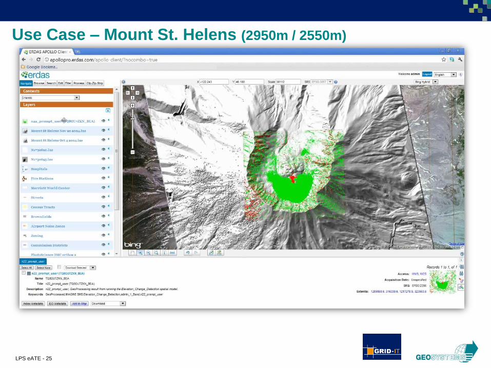
LPS eATE - 25
Use Case – Mount St. Helens (2950m / 2550m)
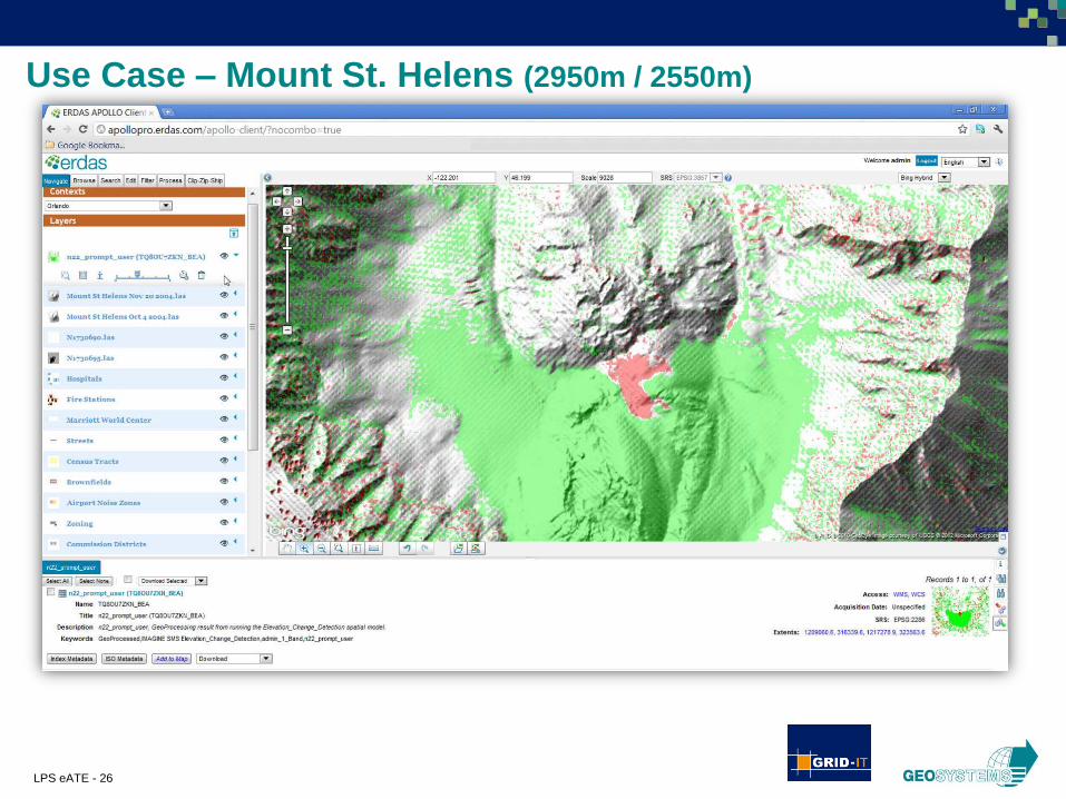
LPS eATE - 26
Use Case – Mount St. Helens (2950m / 2550m)
LPS eATE - 27
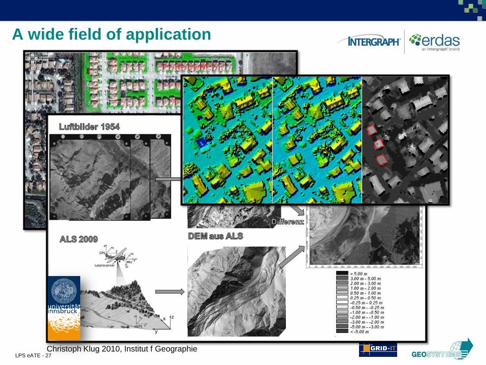
A wide field of application
Christoph Klug 2010, Institut f Geographie
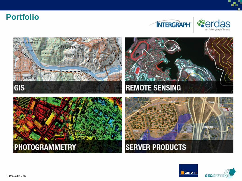
LPS eATE - 30
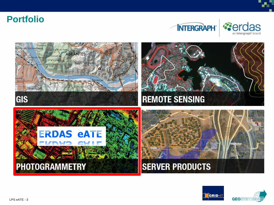
Portfolio
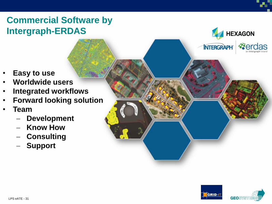
LPS eATE - 31
Commercial Software by
Intergraph-ERDAS
• Easy to use
• Worldwide users
• Integrated workflows
• Forward looking solution
• Team
Development
Know How
Consulting
Support

LPS eATE - 32
Ralf Schneider, GEOSYSTEMS GmbH
Hansjörg Ragg, GRID-IT GmbH
Related Documents