Local Planning Strategy shaping our future 2013 - 2033 Live, work, play Administration centre City of Kalgoorlie Boulder 577 Hannan Street, Kalgoorlie Western Australia Opening hours Monday to Friday: 8:00am to 5:00pm General enquiries Phone: (08) 9021 9600 Fax: (08) 9021 6113 Email: [email protected] www.kalbould.wa.gov.au

Welcome message from author
This document is posted to help you gain knowledge. Please leave a comment to let me know what you think about it! Share it to your friends and learn new things together.
Transcript
Local Planning Strategyshaping our future
2013 - 2033
Live, work, play
Administration centreCity of Kalgoorlie Boulder577 Hannan Street, KalgoorlieWestern Australia
Opening hoursMonday to Friday: 8:00am to 5:00pm
General enquiriesPhone: (08) 9021 9600 Fax: (08) 9021 6113Email: [email protected]
www.kalbould.wa.gov.au
Contents
Mayor’s foreword 3
Executive summary 4
1 Background to the City of Kalgoorlie-Boulder 5
2 Strategic maps 9
3 Strategic direction 10
4 Local planning 12
4.1 Infrastructure 12
4.2 Social 18
4.3 Economic 25
4.4 Environment 31
5 Planning Area Development 35
6 State, regional and local planning context 44
6.1 State planning context 44
6.2 Regional planning framework 49
6.3 Local planning framework 51
7 Priority projects regional and local 53
8 Community consultation 57
9 References 58
10 Appendices 61
List of tablesTable 1: Infrastructure strategic action plan 18
Table 2: Residential land availability 19
Table 3: Potential residential yield/lots 20
Table 4: Social Strategic Action Plan 26
Table 5: City of Kalgoorlie-Boulder visitor summary 28
Table 6: Purpose of visit to Kalgoorlie-Boulder 28
Table 7: Top three visitor accommodation types 29
Table 8: Room occupancy rate 29
Table 9: Economic strategic action plan 32
Table 10: Environment strategic action plan 36
Table 11: Hannans planning area 38
Table 12: Karlkurla planning area development 39
Table 13: Piccadilly planning area development 40
Table 14: Kalgoorlie planning area development 41
Table 15: Boulder planning area development 42
Table 16: South Boulder planning area development 43
Table 17: O’Connor planning area development 44
Table 18: West Kalgoorlie planning area development 45
Table 19: State Planning Policies 48
Table 20: General development controls 50
Table 21: Residential development controls 50
Table 22: Industrial/Commercial development controls 50
Table 23: Priority projects for Kalgoorlie-Boulder 55
Table 24: Priority projects for Goldfields-Esperance Region 56
List of figures Figure 1: Local government area 8
Figure 2: Country of birth by persons 9
Figure 3: Population growth scenario 9
Figure 4: Industry of employment of Kalgoorlie-Boulder residents 10
Figure 5: State Planning Framework 53
ADVERTISINGThe City of Kalgoorlie-Boulder Local Planning Strategy certified for advertising on 24 January 2012.
Signed for and on behalf of the Western Australian Planning Commission.
an officer of the Commission duty authorised by the Commission (pursuant to the Planning and Development Act 2005)
Date________________
ADOPTEDThe City of Kalgoorlie-Boulder hereby adopts the Local Planning Strategy, at the Ordinary meeting of the Council held on___________ the day of 20______
MAYOR
CHIEF EXECUTIVE OFFICER
ENDORSEMENTEndorsed by the Western Australian Planning Commission on 9 July 2013.
an officer of the Commission duty authorised by the Commission (pursuant to the Planning and Development Act 2005)
Date________________
Postal address: Locked Bag 2506 Perth WA street address: 140 William Street Perth WA 6000tel: (08) 655 19000 Fax: (08) 655 19001 tty: 655 19007 InFolIne: 1800626477 abn: 35 482 341 493
[email protected] www.planning.wa.gov.au
wa.gov.au
2
Executive summary
The City of Kalgoorlie-Boulder has prepared this Local Planning Strategy to enable delivery of the community’s vision of shaping Kalgoorlie-Boulder to be a place where people choose to live, work, and play, now and in the future. Together, we as a City must strive to meet this vision, whilst ensuring not to impede future growth, nor compromise our unique natural environment and our renowned assets of mining and tourism. To achieve our community’s vision, this document sets out a number of strategic directions and achievable actions that will guide the City’s future decision making. The consultative approach taken in the creation of this Strategy will be carried forward in future planning, to provide the community with both ownership and responsibility in shaping our future city. The recommendations of this strategy will ultimately be administered through the creation of a new Town Planning Scheme for the city.Today we are a rapidly growing modern city that must cater for the needs of a culturally diverse and youthful community. To accommodate for the needs of the current and future generations of our city, we must provide meaningful employment opportunities, a clean and healthy environment, affordable housing
and a place that people are proud to call home. In our attempt to achieve this, we must not lose sight of continuing to protect our extractive resources and our unique heritage assets, whilst at the same time diversifying local industry and commerce. I am confident that the City has a bright future ahead and I thank the Kalgoorlie-Boulder community for participating in the development of the Local Planning Strategy to ensure we can achieve this vision.
City of Kalgoorlie-Boulder, Mayor Ron Yuryevich
The City of Kalgoorlie-Boulder’s Local Planning Strategy, hereon referred to as the LPS is the framework document for local planning and the strategic foundation for the City’s future Town Planning Scheme No.02. Its purpose is to engage with the community to establish the 20 year strategic direction which will help develop a vibrant, unique, diverse and dynamic city that provides a high quality of life for all.
The LPS provides a clear statement of the overall strategic land use management and planning objectives for the City upon which to make planning decisions and drive future land use planning. This includes consideration of State Government and regional bodies’ strategic objectives, together with major infrastructure projects, targets and overall directions.
The LPS examines four main planning themes: society, infrastructure, environment and economy. Each theme delves into specific strategies which aim to ensure the City’s strategic directions are translated into positive planning outcomes for the current and future generations of our community.
Users of this document should be mindful that the LPS is not a zoning document, nor is it the intention of this strategy to determine zoning outcomes for individual sites. Rather, the intent is to provide the rationale for future zoning decisions, supported by sound research, current data and local knowledge.
The City of Kalgoorlie-Boulder’s LPS has been prepared in plain English and endeavours to be user-friendly, refraining from the use of planning jargon. To ensure the strategy is comprehensible, it has been structured in the following format:
• By way of introduction, the scene is set by examining the city’s background, its demographics and strategic maps of the city that highlight key areas of interest;
• This leads on to the visionary section, outlining the City’s vision for the future and how it intends to achieve this;
• Following this, is the identification of the major issues affecting the city’s future and how together we as a community can tackle them;
• The next section divides the city into individual planning areas based on geographic location, and discusses the future objectives and planning considerations for each area;
• This is followed by an outline of the City’s external influences such as State and regional infrastructure projects and policies; giving an overview of the policy context in which the LPS has been shaped.
• The LPS then wraps up with a summary on how the City has engaged with the local community throughout this process.
Mayor’s foreword
3 4
1.1 Setting the scene
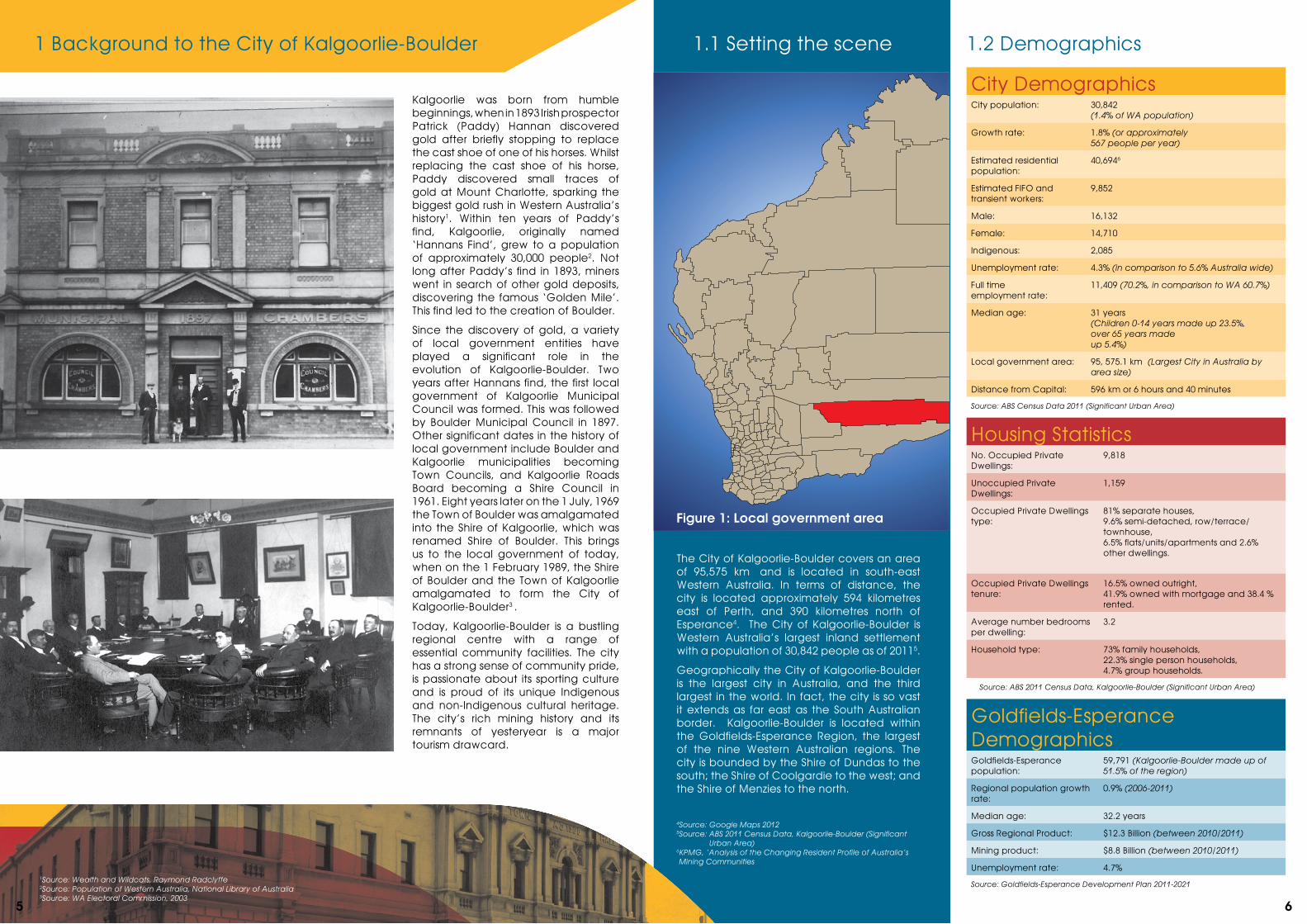
Kalgoorlie was born from humble beginnings, when in 1893 Irish prospector Patrick (Paddy) Hannan discovered gold after briefly stopping to replace the cast shoe of one of his horses. Whilst replacing the cast shoe of his horse, Paddy discovered small traces of gold at Mount Charlotte, sparking the biggest gold rush in Western Australia’s history1. Within ten years of Paddy’s find, Kalgoorlie, originally named ‘Hannans Find’, grew to a population of approximately 30,000 people2. Not long after Paddy’s find in 1893, miners went in search of other gold deposits, discovering the famous ‘Golden Mile’. This find led to the creation of Boulder.
Since the discovery of gold, a variety of local government entities have played a significant role in the evolution of Kalgoorlie-Boulder. Two years after Hannans find, the first local government of Kalgoorlie Municipal Council was formed. This was followed by Boulder Municipal Council in 1897. Other significant dates in the history of local government include Boulder and Kalgoorlie municipalities becoming Town Councils, and Kalgoorlie Roads Board becoming a Shire Council in 1961. Eight years later on the 1 July, 1969 the Town of Boulder was amalgamated into the Shire of Kalgoorlie, which was renamed Shire of Boulder. This brings us to the local government of today, when on the 1 February 1989, the Shire of Boulder and the Town of Kalgoorlie amalgamated to form the City of Kalgoorlie-Boulder3 .
Today, Kalgoorlie-Boulder is a bustling regional centre with a range of essential community facilities. The city has a strong sense of community pride, is passionate about its sporting culture and is proud of its unique Indigenous and non-Indigenous cultural heritage. The city’s rich mining history and its remnants of yesteryear is a major tourism drawcard.
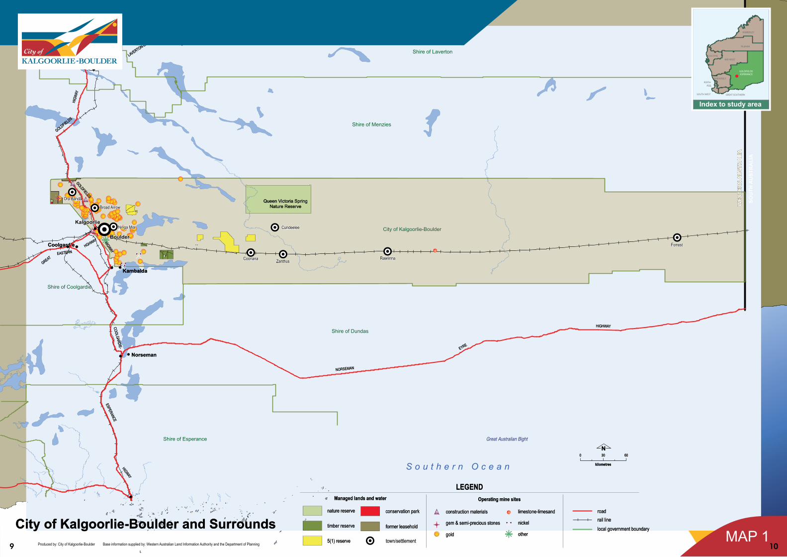
The City of Kalgoorlie-Boulder covers an area of 95,575 km² and is located in south-east Western Australia. In terms of distance, the city is located approximately 594 kilometres east of Perth, and 390 kilometres north of Esperance4. The City of Kalgoorlie-Boulder is Western Australia’s largest inland settlement with a population of 30,842 people as of 20115.
Geographically the City of Kalgoorlie-Boulder is the largest city in Australia, and the third largest in the world. In fact, the city is so vast it extends as far east as the South Australian border. Kalgoorlie-Boulder is located within the Goldfields-Esperance Region, the largest of the nine Western Australian regions. The city is bounded by the Shire of Dundas to the south; the Shire of Coolgardie to the west; and the Shire of Menzies to the north.
4Source: Google Maps 2012 5 Source: ABS 2011 Census Data, Kalgoorlie-Boulder (Significant
Urban Area)6 KPMG, ‘Analysis of the Changing Resident Profile of Australia’s Mining Communities
1.2 Demographics
City DemographicsCity population: 30,842
(1.4% of WA population)
Growth rate: 1.8% (or approximately 567 people per year)
Estimated residential population:
40,6946
Estimated FIFO and transient workers:
9,852
Male: 16,132
Female: 14,710
Indigenous: 2,085
Unemployment rate: 4.3% (in comparison to 5.6% Australia wide)
Full time employment rate:
11,409 (70.2%, in comparison to WA 60.7%)
Median age: 31 years (Children 0-14 years made up 23.5%, over 65 years made up 5.4%)
Local government area: 95, 575.1 km² (Largest City in Australia by area size)
Distance from Capital: 596 km or 6 hours and 40 minutes
Source: ABS Census Data 2011 (Significant Urban Area)
1 Background to the City of Kalgoorlie-Boulder
1Source: Wealth and Wildcats, Raymond Radclyffe 2Source: Population of Western Australia, National Library of Australia 3Source: WA Electoral Commission, 2003
Figure 1: Local government area
Housing StatisticsNo. Occupied Private Dwellings:
9,818
Unoccupied Private Dwellings:
1,159
Occupied Private Dwellings type:
81% separate houses, 9.6% semi-detached, row/terrace/townhouse, 6.5% flats/units/apartments and 2.6% other dwellings.
Occupied Private Dwellings tenure:
16.5% owned outright, 41.9% owned with mortgage and 38.4 % rented.
Average number bedrooms per dwelling:
3.2
Household type: 73% family households, 22.3% single person households, 4.7% group households.
Source: ABS 2011 Census Data, Kalgoorlie-Boulder (Significant Urban Area)
Goldfields-Esperance DemographicsGoldfields-Esperance population:
59,791 (Kalgoorlie-Boulder made up of 51.5% of the region)
Regional population growth rate:
0.9% (2006-2011)
Median age: 32.2 years
Gross Regional Product: $12.3 Billion (between 2010/2011)
Mining product: $8.8 Billion (between 2010/2011)
Unemployment rate: 4.7%
Source: Goldfields-Esperance Development Plan 2011-2021
5 6
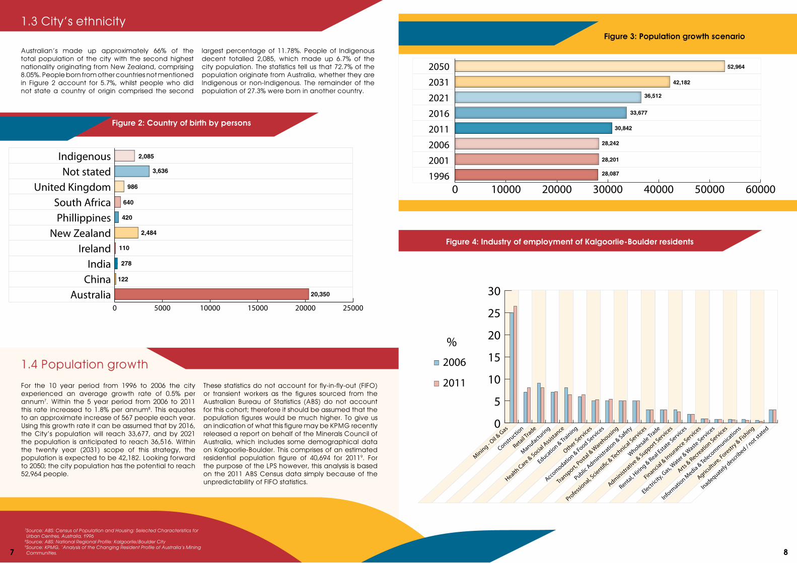
For the 10 year period from 1996 to 2006 the city experienced an average growth rate of 0.5% per annum7. Within the 5 year period from 2006 to 2011 this rate increased to 1.8% per annum8. This equates to an approximate increase of 567 people each year. Using this growth rate it can be assumed that by 2016, the City’s population will reach 33,677, and by 2021 the population is anticipated to reach 36,516. Within the twenty year (2031) scope of this strategy, the population is expected to be 42,182. Looking forward to 2050; the city population has the potential to reach 52,964 people.
These statistics do not account for fly-in-fly-out (FIFO) or transient workers as the figures sourced from the Australian Bureau of Statistics (ABS) do not account for this cohort; therefore it should be assumed that the population figures would be much higher. To give us an indication of what this figure may be KPMG recently released a report on behalf of the Minerals Council of Australia, which includes some demographical data on Kalgoorlie-Boulder. This comprises of an estimated residential population figure of 40,694 for 20119. For the purpose of the LPS however, this analysis is based on the 2011 ABS Census data simply because of the unpredictability of FIFO statistics.
Figure 2: Country of birth by persons
Australian’s made up approximately 66% of the total population of the city with the second highest nationality originating from New Zealand, comprising 8.05%. People born from other countries not mentioned in Figure 2 account for 5.7%, whilst people who did not state a country of origin comprised the second
largest percentage of 11.78%. People of Indigenous decent totalled 2,085, which made up 6.7% of the city population. The statistics tell us that 72.7% of the population originate from Australia, whether they are Indigenous or non-Indigenous. The remainder of the population of 27.3% were born in another country.
Figure 4: Industry of employment of Kalgoorlie-Boulder residents
Figure 3: Population growth scenario
52,964
42,182
36,512
33,677
30,842
28,242
28,201
28,087
0 10000 20000 30000 40000 50000 60000
2050
2031
2021
2016
2011
2006
2001
1996
0
5
10
15
20
25
30
Inadequately described / n
ot stated
Agricultu
re, Forestry & Fish
ing
Informatio
n Media & Te
lecommunications
Arts & Recreatio
n Services
Electricity
, Gas, W
ater & W
aste Services
Financial & In
surance Services
Rental, Hirin
g & Real Esta
te Services
Administrativ
e & Support Services
Wholesale Trade
Professional, S
cienti�c & Te
chnical Services
Public Administ
ration & Safety
Transport,
Postal &
Warehousin
g
Accomodation & Food Services
Other Services
Education & Training
Health Care & Social A
ssista
nce
Manufacturing
Retail Trade
Constructio
n
Mining - Oil &
Gas
%
2006
2011
0 5000 10000 15000 20000 25000
AustraliaChinaIndia
IrelandNew Zealand
PhillippinesSouth Africa
United KingdomNot stated
Indigenous
20,350
122
278
110
2,484
420
640
986
3,636
2,085
7 Source: ABS: Census of Population and Housing: Selected Characteristics for Urban Centres, Australia, 1996
8Source: ABS: National Regional Profile: Kalgoorlie/Boulder City9 Source: KPMG, ‘Analysis of the Changing Resident Profile of Australia’s Mining Communities.
1.3 City’s ethnicity
1.4 Population growth
7 8
2. Strategic mapsEntire local government area
9 10
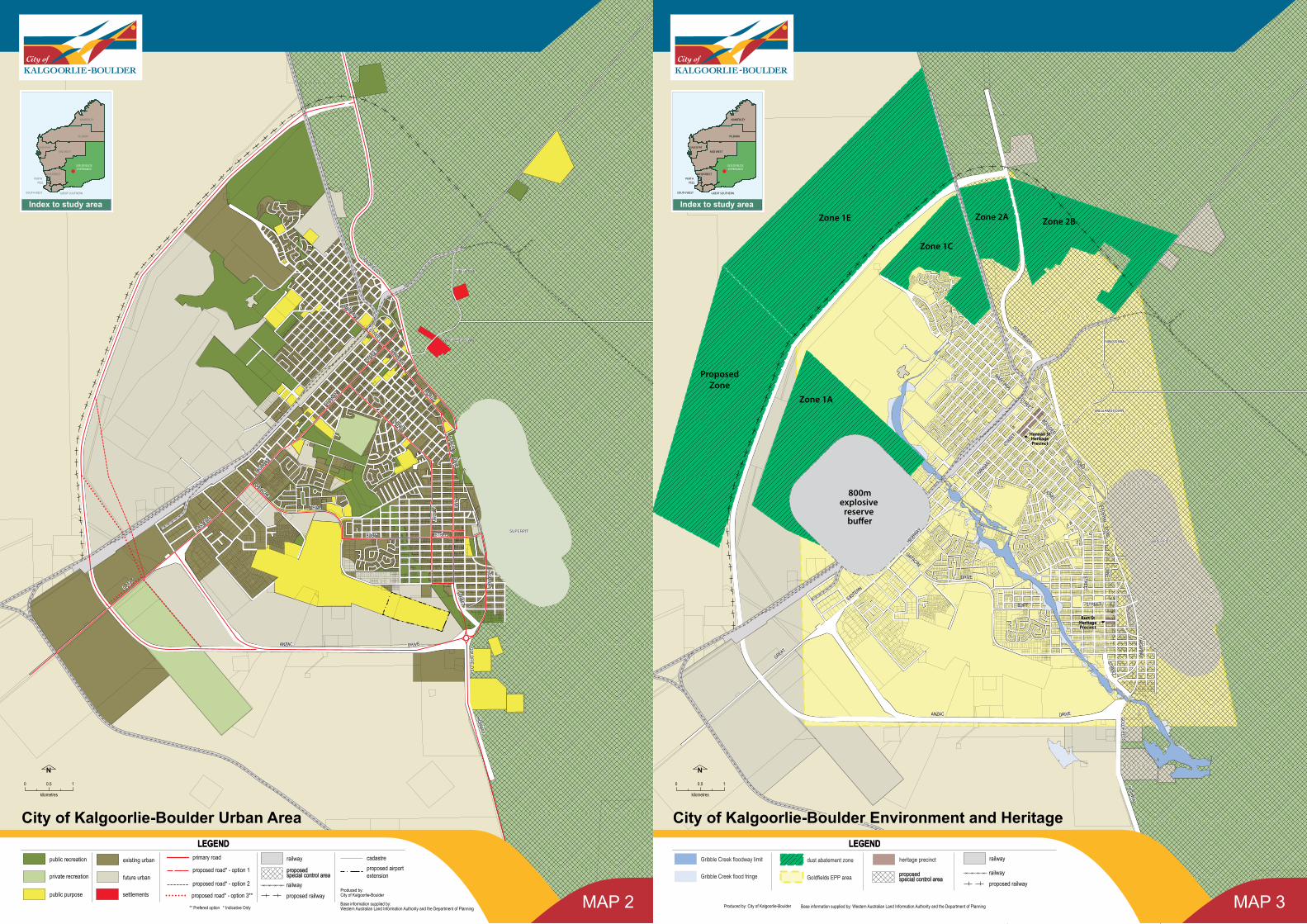
City area showing precincts City map showing environmental/mining constraintsCity area showing existing and future urban areas
ANZAC
LANE
BURT
HIGHW
AY
HANNAN
GREAT
LIONEL
GATACRE
BOULDER
FEDERAL
MARITANA
EASTERN
GOLDFIELDS
STREET
ROAD
STREET
HIGHWAY
DRIVE
STREET
DRIVE
ROAD
STRE ET
STREET
HIGHW
AY
GO LDF IELDS
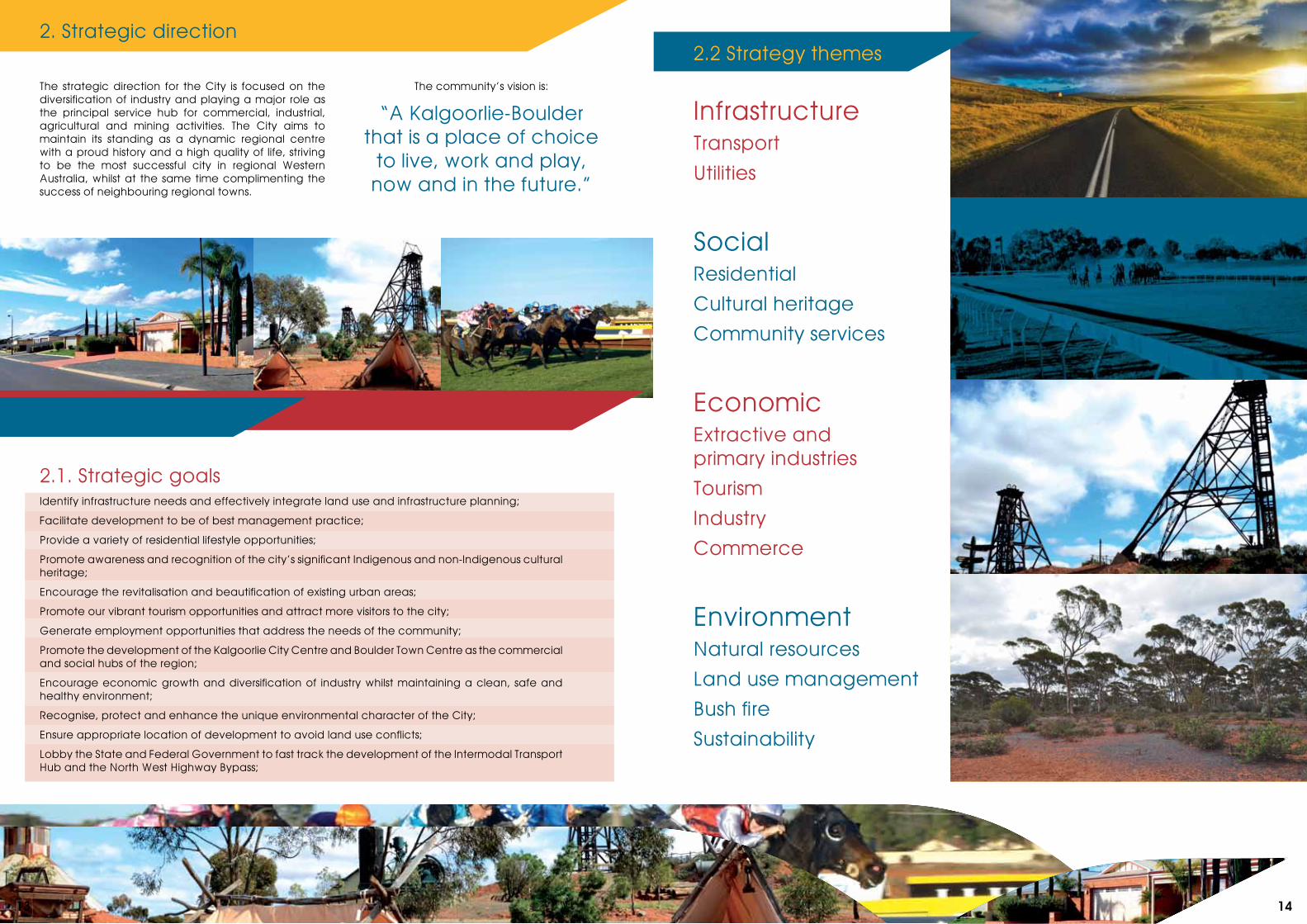
The strategic direction for the City is focused on the diversification of industry and playing a major role as the principal service hub for commercial, industrial, agricultural and mining activities. The City aims to maintain its standing as a dynamic regional centre with a proud history and a high quality of life, striving to be the most successful city in regional Western Australia, whilst at the same time complimenting the success of neighbouring regional towns.
The community’s vision is:
“A Kalgoorlie-Boulder that is a place of choice
to live, work and play, now and in the future.”
2. Strategic direction
2.1. Strategic goalsIdentify infrastructure needs and effectively integrate land use and infrastructure planning;
Facilitate development to be of best management practice;
Provide a variety of residential lifestyle opportunities;
Promote awareness and recognition of the city’s significant Indigenous and non-Indigenous cultural heritage;
Encourage the revitalisation and beautification of existing urban areas;
Promote our vibrant tourism opportunities and attract more visitors to the city;
Generate employment opportunities that address the needs of the community;
Promote the development of the Kalgoorlie City Centre and Boulder Town Centre as the commercial and social hubs of the region;
Encourage economic growth and diversification of industry whilst maintaining a clean, safe and healthy environment;
Recognise, protect and enhance the unique environmental character of the City;
Ensure appropriate location of development to avoid land use conflicts;
Lobby the State and Federal Government to fast track the development of the Intermodal Transport Hub and the North West Highway Bypass;
2.2 Strategy themes
InfrastructureTransport
Utilities
SocialResidential
Cultural heritage
Community services
EconomicExtractive and primary industries
Tourism
Industry
Commerce
EnvironmentNatural resources
Land use management
Bush fire
Sustainability
13 14
Rail
Aviation3. Local planning issues
3.1 Transport
In terms of road usage, there is a consensus that travel times and distances need to be reduced in order to improve the overall safety of the road network and to prevent congestion as population levels continue to grow. There are a number of key projects which have been outlined in the infrastructure action plan below which will help to achieve this objective including the construction of a proposed NW transport corridor.
Kalgoorlie-Boulder has efficient heavy haulage routes to the east and south-west that largely avoid the urban area. There currently is no such route around the north-western side of the urban area. A bypass around the western edge of the city has been proposed by Main Roads WA, in liaison with the City and other key stakeholders. Three options for this have been identified (shown on map 2) and are summarised briefly to the right:
RoadOption 1:This alignment is based on the 1999 Kalgoorlie-Structure Plan. It includes the extension of Anzac Drive to the western side of the Western Australia Rifle Association (WARA) site, where it diverts towards the Great Eastern Highway and continues around the North West boundary of the city
Option 2:The City’s existing scheme map shows the alignment of Anzac Drive and the future Proposed NW transport corridor road similar to option 2. It proposes the introduction of a bypass road from the existing Great Eastern Highway towards the North West portion of the city
Option 3:This option would involve a deviation of the planned realignment of Anzac Drive along the eastern boundary of the WARA site, crossing the Great Eastern Highway and connecting to the Proposed NW transport corridor road to the north. Alternatively, as part of this option, a staggered intersection configuration was proposed on the Great Eastern Highway with the preferred bypass road north and running parallel with the Eastern Highway.
The Kalgoorlie-Boulder airport is owned and managed by the City of Kalgoorlie-Boulder. Upgrades to the terminal building were recently completed to help alleviate congestion during peak periods.
There are some concerns over the location of the airport, both in terms of future development of the surrounding areas and the airport/runway itself. The existing airport site allows for the extension of the runway from 2000 metres to 2500 metres, which would be sufficient to accommodate the A320 or Boeing 737-800 aircraft without any restrictions. In addition, the planned future incorporation of land currently occupied by the Boulder Golf Course would create the potential for the runway to be extended to 3500 metres which would be sufficient to support the expansion of the airport. Given the close proximity of the existing and possible
future industrial/service distribution areas to the airport, it would be advisable to consider the development of ‘air-side access’ industrial and commercial sites on land to the south of the current airport land.
In 2007, Rehbein AOS Airport Consulting was commissioned by Council to prepare an updated set of noise contours for the Kalgoorlie-Boulder airport for the year 202711 For the purpose of this LPS, it is recommended that the status quo remains in terms of existing regulations in the TPS regarding buildings affected by aircraft. However should any extension to the airport be considered, these regulations will need to be revised as well as carrying out the necessary noise and ambience studies to investigate potential impacts this would have upon neighbouring and future residential areas.
The more favourable option for Main Roads is Option 1 however the City has concerns regarding the impact this would have upon the proposed ‘Noisy and hard-to-locate Sports Precinct’ (discussed under 4.3.3.4). This is the only suitable site identified for the relocation of the Kalgoorlie Rifle Range and the co-location of ‘noisy sports,’ therefore efforts to achieve minimal disruption to this site need to be made in conjunction with the plans for the Proposed NW transport corridor construction. With this in mind, the City’s preferred route is Option 3 which avoids conflictions with this site.
With the continued development of the Kalgoorlie Business Park together with a proposal for additional industrial zoned land to the south and south-west, there will be increased pressure on Anzac Drive.
Furthermore, there will be increased traffic movement in northern parts of the urban area as development proceeds in Karlkurla, Hannans and remainder of the NW sector localities. At present the most northerly connection between the urban area and Goldfields Highway is at Hare Street. With development of the Proposed NW transport corridor, there will be potential for east-west links to the Bypass alignment allowing traffic to link with the Goldfields Highway north of the urban area. Graeme Street is currently proposed to link through to the Bypass in the future. An additional linkage to the south of Graeme Street, linking central areas with the Proposed NW transport corridor through the NW Sector, would optimise road connections in this area. Residential development in the Fairways West and Fairways South area may necessitate the extension of Vivian/Hopkins Streets to Gatacre Drive.
With the potential release of land for residential purposes at the back of lots fronting O’Connor Street and to the north west of the Oasis playing fields, road access could potentially be improved via an easterly extension of McCleery Street. A further extension of McCleery Street or Osmetti Drive through to Maxwell Street would improve access to the O’Connor Centre and the Oasis Recreation Centre from the east of Gribble Creek.11Source: Rehbein AOS on behalf of Kalgoorlie City Council, Kalgoorlie-Boulder Airport Noise Contours
10Source: Department of Planning and Infrastructure, Kalgoorlie Rail Realignment: Community Consultation and Benefit Cost Analysis.
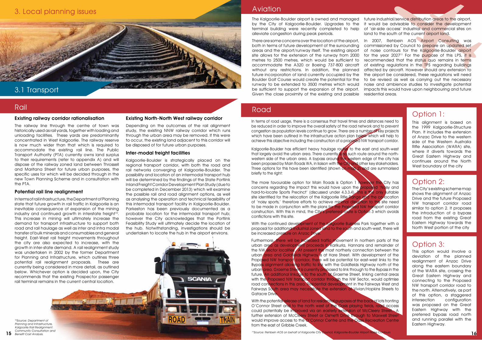
Existing railway corridor rationalisationThe railway line through the centre of town was historically used as rail yards, together with loading and unloading facilities. These yards are predominantly concentrated in West Kalgoorlie. The railway reserve is now much wider than that which is required to accommodate the existing rail line. The Public Transport Authority (PTA) currently owns land surplus to their requirements (refer to appendix A) and will dispose of the railway zoned land between Throssell and Maritana Street for future urban purposes, the specific uses for which will be decided through in the new Town Planning Scheme and in consultation with the PTA.
Potential rail line realignmentIn terms of rail infrastructure, the Department of Planning state that future growth in rail traffic in Kalgoorlie is an inevitable consequence of expansion of the mining industry and continued growth in interstate freight10. This increase in mining will ultimately increase the demand for transport infrastructure to support both road and rail haulage as well as inter and intra modal transfer of bulk minerals and consumables and general freight. East-West rail freight movements throughout the city are also expected to increase, with the growth in inter-state demand. A rail realignment study was undertaken in 2002 by the former Department for Planning and Infrastructure, which outlines three potential rail realignment proposals. These are currently being considered in more detail, as outlined below. Whichever option is decided upon, the City recommends that the existing Prospector passenger rail terminal remains in the current central location.
Existing North-North West railway corridorDepending on the outcomes of the rail alignment study, the existing NNW railway corridor which runs through the urban area may be removed. If this were to occur, the existing land adjacent to this corridor will be disposed of for future urban purposes.
Inter-modal freight facilitiesKalgoorlie-Boulder is strategically placed on the regional transport corridor, with both the road and rail networks converging at Kalgoorlie-Boulder. The possibility and location of an intermodal transport hub will be determined by the findings of the State Portlink Inland Freight Corridor Development Plan Study (due to be completed in December 2013) which will examine the possible rail and road alignment options, as well as analysing the operation and technical feasibility of this intermodal transport facility in Kalgoorlie-Boulder. Parkeston has been previously documented as a probable location for the intermodal transport hub; however the City acknowledges that the Portlink Feasibility Study will ultimately decide the location of the hub. Notwithstanding, investigations should be undertaken to locate the hub in the airport environs.
15 16
Potable water supplyPotable water is supplied by the Goldfields and Agricultural Water Supply (G&AWS), operated by the Water Corporation. There are some capacity limitations in the original collection systems, particularly north of the railway line in Piccadilly. A new catchment pump station and collection mains is required in order to support the future residential development within the Hannans planning area.
Water infrastructure upgradesThe The Water Link project is reviewing potential improvements to the current system and expansion of the existing supply which includes a water pipeline from Esperance to Kalgoorlie-Boulder, a desalination plant upgrading of the G&AWS pipeline as well as increasing storage capacity. A secondary water supply needs to be determined in the short term. The Water and Rivers Commission has forecast that water use by mining could increase considerably in the future. The Water Corporation has committed to spending $18million on capital works in the region, including $7.7million which was invested in the new Binduli Storage Reservoir. This $65million project was completed in January 2008 and almost doubled the supply of the existing reservoirs combined, taking Kalgoorlie’s water capacity from 440 mega litres to 800 mega litres.
LandfillThe City of Kalgoorlie-Boulder is responsible for the provision and management of waste facilities throughout the city. The City’s waste disposal is currently facilitated by the Yarri Road refuse facility, a landfill and waste disposal plant located approximately 7km north east of Kalgoorlie-Boulder. The capacity of this site is limited however and it is likely that a new facility will be required within the next five years. The City have identified a potential site opposite the current facility and are currently awaiting further mineralogy details from KCGM in order to confirm if this would be feasible. If KCGM and the Department of Mines and Petroleum determine that this location has a high potential of being mined, then the City will investigate a new location outside of the urban area.
Wastewater The City of Kalgoorlie-Boulder is also responsible for the operation of the City’s waste water (sewerage) scheme. The current waste water treatment facility, located in South Boulder has the capacity to continue its use for the foreseeable future. However in preparation for such times when the optimum capacity of this facility is reached, the City has identified a suitable site for a new facility. It is recommended that should a new facility be required, a proportion of Reserve R45564 (former landfill site) South of the Airport will be used for this purpose.
Energy Western Power is the regional distributor who provides electricity to Kalgoorlie-Boulder. Mining companies also generate a large proportion of their own power. Although there are no significant impediments to the provision of Kalgoorlie-Boulder’s existing and future power needs, alternative methods of generating power via renewable energies should be investigated as part of the regional sustainability objectives. The inclusion of energy efficient measures in future development will be a subject for investigation in the new TPS. This will be in line with the sustainable objectives outlined in the draft State Planning Strategy.
3.2 Utilities
Table 1: Infrastructure strategic action plan
Infrastructure action plan
Transport
RailAction Priority Project Responsibility
Issue: Rail as the dominant transport mode for freight movement / rail haulage
Objective: Provide strategic transport linkages within and to the Goldfields-Esperance Region
Investigate land supply requirements and feasibility of providing an inter-modal transport hub. The City’s preferred option is to locate the hub in the vicinity of the airport.
High Portlink Feasibility Study / Inter modal Transport Hub
Dept of Regional Development and Lands(RDL), Department of Transport, GEDA
Continue to upgrade regional road, rail and air infrastructure to support mineral developments. Medium Airport Upgrade Department of Transport,
Department of Main Roads
Continue to work with the State Government to realign the railway network around the North West sector of the City. Medium Portlink Feasibility Study /
Inter modal Transport HubCity of Kalgoorlie-Boulder Department of Transport
Continue to support the rationalisation of the South-West to North-East rail corridor through Kalgoorlie. High TPS No.2 Scheme Map,
Planning Scheme PolicyDepartment of Transport., City of Kalgoorlie-Boulder
Dispose of unused bulk railway zoned land between Throssell and Maritana Street for future urban purposes. High TPS No.2 Scheme Map City of Kalgoorlie Boulder, Public
Transport Authority
Identify and secure land adjacent to any new railway alignment to accommodate inter-modal facilities and associated warehousing and industrial development.
Medium Portlink Feasibility Study / Inter modal Transport Hub
Department of Transport, City of Kalgoorlie-Boulder
Issue: Upgrade transport infrastructure
Objective: Ensure transport infrastructure is adequate to service industrial, commerce, commuter and mining requirements
Continue to upgrade regional road, rail and air infrastructure to support mineral developments Medium Upgrade transport
infrastructureDepartment of Transport, Department of Main Roads
Issue: Railway land surplus to requirements
Objective: Dispose of unused bulk railway zoned land
Rezone surplus railway zoned land between Throssell and Maritana Street for future urban purposes High TPS No.2 Scheme Map City of Kalgoorlie Boulder, Public
Transport Authority
AirAction Priority Project Responsibility
Issue: Location of the airport within the Kalgoorlie-Boulder urban area
Objective: Avoid land use conflict between the airport and incompatible land uses.
Identify frame area around the Kalgoorlie-Boulder airport site and initiate strategies and policies for the planning and management of the frame area
High Local planning policy, TPS No.2 scheme map overlay City of Kalgoorlie-Boulder
Issue: Expand the existing airport and its ancillary infrastructure
Objective: Ensure airport infrastructure is adequate to support the needs of the community
Support the expansion of the current Kalgoorlie–Boulder airport site into the current Boulder Golf Course site to accommodate the extension of the runway. If expansion is permitted, necessary noise and ambience studies will need to be undertaken to determine the impact on existing and future urban development
Medium Airport Upgrade City of Kalgoorlie-Boulder
Support the development of additional hangar space and other airport related development within the Kalgoorlie-Boulder Airport site and investigate the development of ‘air-side access’ industrial/commercial land to the south of the airport
Medium Airport Upgrade City of Kalgoorlie-Boulder
Public Transport
Trans-Goldfields currently operates three public bus routes around the urban area, one linking Hannans with the City Centre, the second linking Boulder and Kalgoorlie, and the third linking Boulder and Kalgoorlie via O’Connor local centre. Services run hourly during weekday daytimes, and hourly on Saturday mornings. With further development occurring within the city it would be appropriate to investigate possible extensions and additions to the local bus service to provide an optimal level of service to the local community, workers and visitors.
There is a high dependency on private transport in and around the city and efforts should be made to try and reduce these levels. One mechanism that the City will consider to reduce private transport dependency is the introduction of a planning policy which addresses the principles of Transit Oriented Development. This would include providing public transport nodes in and around new residential developments, and increasing residential densities around neighbourhood and activity centres.
17 18
WaterAction Priority Project Responsibility
Issue: Reliance on and increasing demand for water from the Goldfields and Agricultural Water supply
Objective: Improve and expand domestic and industrial water supply to Kalgoorlie-Boulder
Implement strategies to reduce water usage and re-use wastewater for areas with limited potable water Medium Water Link Project Water Corporation,
City of Kalgoorlie-Boulder
A new catchment pump station and collection mains is required for further residential development at Hannans Medium Hannans catchment pump
station City of Kalgoorlie-Boulder
WasteAction Priority Project Responsibility
Issue: Reliance on and increasing demand for water from the Goldfields and Agricultural Water supply
Objective: Improve and expand domestic and industrial water supply to Kalgoorlie-Boulder
Support waste minimisation and recycling initiatives as a means of extending waste disposal facilities lifespan and providing other environmental benefits
High Waste Minimisation City of Kalgoorlie-Boulder
As a strategic planning priority gain approval for the relocation of the Yarri Road waste disposal facility, on site indicated on map 2. Should this not be feasible, another site should be identified
High Yarri Road Waste Service relocation
City of Kalgoorlie-Boulder, KCGM
Issue: Increased pressure of waste water systems
Objective: Ensure waste water treatment facilities are effectively placed and appropriately sized to manage demand
Investigate the feasibility of a new waste water treatment facility on Reserve R45564 as part of longer term planning Medium Waste Water facility
relocation City of Kalgoorlie-Boulder
In the planning of the western part of the NW sector, ensure that waste-water services are provided for, either via connection into existing facilities or identification and development of a new facility
Medium Water security for NW residential development City of Kalgoorlie-Boulder
Ensure that any new waste-water treatment facilities allow for waste-water re-use, including possibility of potable re-use Medium Waste water re-use City of Kalgoorlie-Boulder
EnergyIssue: Increased pressure on natural energy resources / supply
Objective: Address the sustainable objectives of the Draft State Government Strategy
Investigate alternative methods of power generation and introduce measures into the new TPS Development Standards
Medium TPS No. 2 scheme review City of Kalgoorlie-Boulder, Western Power
TelecommunicationsAction Priority Project Responsibility
Issue: With the expected increase in population, demand for telecommunication facilities will increase, putting pressure on the Kalgoorlie-Boulder landscape.
Objective: Appropriately plan for the provision of telecommunication facilities whilst ensuring that they are sympathetic to the local landscape.
Inclusion of appropriate planning controls in the new Town Planning Scheme to allow for the development of telecommunication facilities as required to meet the future development needs of the city. These controls will ensure that any telecommunication facilities are appropriately integrated into the landscape and do not have any adverse effects on the community.
Medium TPS No.2 scheme review City of Kalgoorlie-Boulder
RoadAction Priority Project Responsibility
Issue: Identify additional road linkages in combination with release of land for urban development
Objective: Plan for additional road linkages to manage traffic and meet road user requirements
Continue to work with the State Government to identify an alignment, assemble land for and subsequently develop the Proposed NW transport corridor and the realignment of Anzac Drive/creation of additional SE Bypass road to intersect with the Proposed NW transport corridor. The City’s preferred proposal is (option 3)
HighProposed NW transport corridor and Anzac Drive realignment
Department of Main Roads, City of Kalgoorlie-Boulder
Consider appropriate NW/SE linkages through the urban area, linking the NW sector with land east of the railway, to include extension of Graeme Street to the Proposed NW transport corridor once constructed
Medium North-West sector Road Network
Department of Main Roads, City of Kalgoorlie-Boulder
Continue to protect the Vivian/Hopkins Streets extension alignment and consider the need to develop this route as development of the Fairways West and Fairways South areas proceeds.
Medium Burt Street Bypass Department of Main Roads, City of Kalgoorlie-Boulder
Identify, in association with further industrial subdivision, a future road link between Percy Road and Anzac Drive. Medium Percy Road – Anzac Drive
LinkDepartment of Main Roads, City of Kalgoorlie-Boulder
Identify an appropriate road alignment to link O’Connor and Maxwell Streets in association with further residential development in the area
Medium Maxwell Street – O’Connor Street Link
Department of Main Roads, City of Kalgoorlie-Boulder
Issue: The capacity of the existing road infrastructure to support the needs of the community
Objective: Provide additional road infrastructure and/or new design methodology
Identify appropriate solutions to meet the increased demand for north-south travel through the centre of the urban area Medium Central North-South Route Department of Main Roads,
City of Kalgoorlie-Boulder
Development of a more northerly connection to meet the demand for travel between the northern part of urban areas as development proceeds in the Hannans and Karlkurla areas
Medium Hannans-Goldfields Highway Link
Department of Main Roads, City of Kalgoorlie-Boulder
Develop and implement a strategy to consolidate and increase effective car parking provision and improve traffic safety at the Maritana Centre
Medium City Centre revitalisation project
Department of Main Roads, City of Kalgoorlie-Boulder
Public transport Issue: The capacity of the existing public transport network to support future growth
Objective: Work with public transport stakeholders to provide a sustainable and efficient public transport service
Continue to consult with the Department of Transport/ Trans-Goldfields in relation to their current public transport strategy /revision of bus routes
High Ongoing Department of Transport
Investigate the feasibility of introducing a new planning policy which addresses the principles of transit-oriented development
High Local planning policy, TPS No.2
Department of Transport, City of Kalgoorlie-Boulder
Revision of the City’s current Cycle Strategy High Kalgoorlie-Boulder Cycle Strategy
Department of Transport, City of Kalgoorlie-Boulder
Utilities
19 20
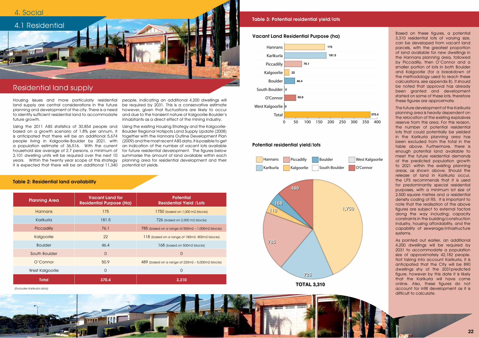
Table 3: Potential residential yield/lots
Potential residential yield/lots
Vacant Land Residential Purpose (ha)Based on these figures, a potential 3,310 residential lots of varying size, can be developed from vacant land parcels, with the greatest proportion of land available for new dwellings in the Hannans planning area, followed by Piccadilly, then O’Connor and a smaller portion of lots in both Boulder and Kalgoorlie (for a breakdown of the methodology used to reach these calculations, see appendix B). It should be noted that approval has already been granted and development started on some of these lots, therefore these figures are approximate.
The future development of the Karlkurla planning area is heavily dependent on the relocation of the existing explosives reserve from this area. For this reason, the number of potential residential lots that could potentially be yielded in the Karlkurla planning area has been excluded from the total in the table above. Furthermore, there is enough potential land available to meet the future residential demands of the predicted population growth to 2021 within the existing planning areas, as shown above. Should the release of land in Karlkurla occur, the LPS recommends that it is used for predominantly special residential purposes, with a minimum lot size of 2,500 square metres and a residential density coding of R5. It is important to note that the realisation of the above figures are subject to external factors along the way including; capacity constraints in the building/construction industry, housing affordability, and the capability of sewerage/infrastructure systems.
As pointed out earlier, an additional 4,200 dwellings will be required by 2031 to accommodate a population size of approximately 42,182 people. Not taking into account Karlkurla, it is anticipated that the City will be 890 dwellings shy of the 2031predicted figure, however by this date it is likely that the Karlkurla will have come online. Also, these figures do not account for infill development as it is difficult to calculate.
4. Social
Housing issues and more particularly residential land supply are central considerations in the future planning and development of the city. There is a need to identify sufficient residential land to accommodate future growth.
Using the 2011 ABS statistics of 30,854 people and based on a growth scenario of 1.8% per annum, it is anticipated that there will be an additional 5,674 people living in Kalgoorlie-Boulder by 2021, with a population estimate of 36,516. With the current household size average of 2.7 persons, a minimum of 2,101 dwelling units will be required over the next 10 years. Within the twenty year scope of this strategy it is expected that there will be an additional 11,340
people, indicating an additional 4,200 dwellings will be required by 2031. This is a conservative estimate however, given that fluctuations are likely to occur and due to the transient nature of Kalgoorlie-Boulder’s inhabitants as a direct effect of the mining industry.
Using the existing Housing Strategy and the Kalgoorlie-Boulder Regional Hotspots Land Supply Update (2008) together with the Hannans Outline Development Plan (2009) and the most recent ABS data, it is possible to get an indication of the number of vacant lots available for future residential development. The figures below summarise the amount of land available within each planning area for residential development and their potential lot yields.
Table 2: Residential land availability
4.1 Residential
Residential land supply
Planning Area Vacant Land for Residential Purpose (Ha)
Potential Residential Yield /Lots
Hannans 175 1750 (based on 1,000 m2 blocks)
Karlkurla 181.5 726 (based on 2,500 m2 blocks)
Piccadilly 76.1 785 (based on a range of 500m2 – 1,000m2 blocks)
Kalgoorlie 22 118 (based on a range of 180m2- 800m2 blocks)
Boulder 46.4 168 (based on 500m2 blocks)
South Boulder 0 0
O’Connor 50.9 489 (based on a range of 220m2 – 5,000m2 blocks)
West Kalgoorlie 0 0
Total 370.4 3,310
(Excludes Karlkurla data)
0 50 100 150 200 250 300 350 400
Total
West Kalgoorlie
O'Connor
South Boulder
Boulder
Kalgoorlie
Piccadilly
Karlkurla
Hannans 175
181.5
76.1
22
46.4
0
50.9
0
370.4
West Kalgoorlie
O'ConnorSouth Boulder
Boulder
Kalgoorlie
Piccadilly
Karlkurla
Hannans
1,7501,750
726726
785785
TOTAL 3,310TOTAL 3,310
118118168168
489489
West Kalgoorlie
O'ConnorSouth Boulder
Boulder
Kalgoorlie
Piccadilly
Karlkurla
Hannans
1,7501,750
726726
785785
TOTAL 3,310TOTAL 3,310
118118168168
489489
21 22
Non-Indigenous Settlements
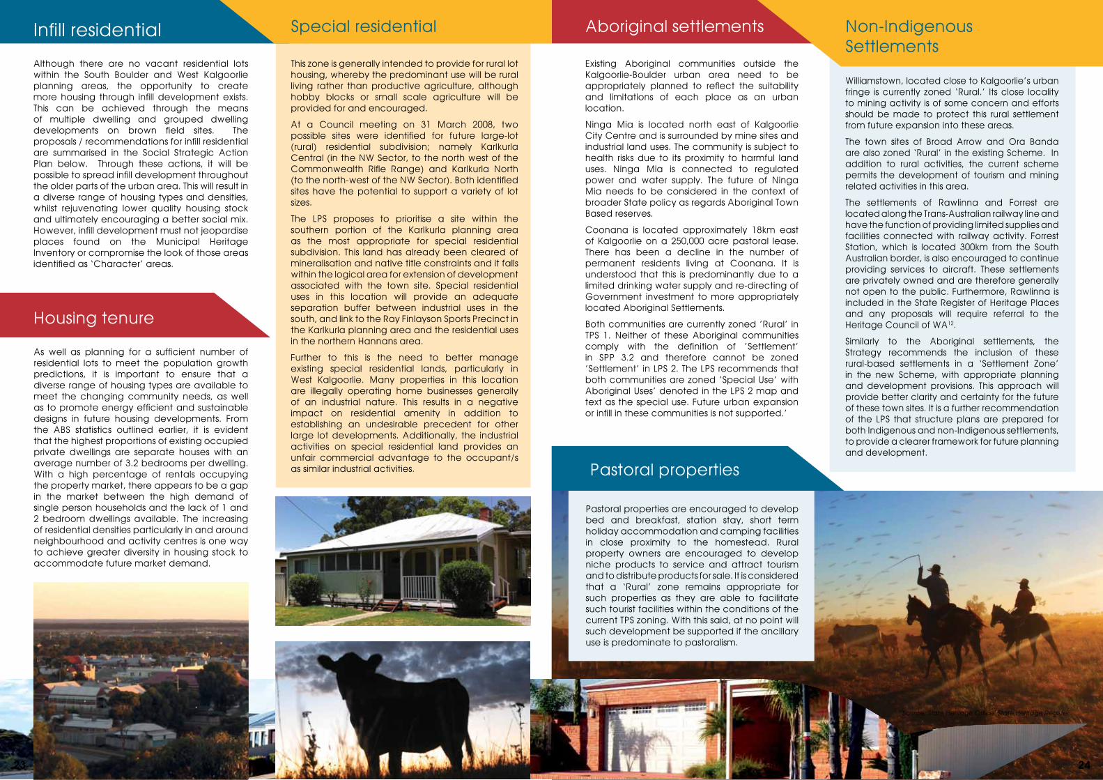
Although there are no vacant residential lots within the South Boulder and West Kalgoorlie planning areas, the opportunity to create more housing through infill development exists. This can be achieved through the means of multiple dwelling and grouped dwelling developments on brown field sites. The proposals / recommendations for infill residential are summarised in the Social Strategic Action Plan below. Through these actions, it will be possible to spread infill development throughout the older parts of the urban area. This will result in a diverse range of housing types and densities, whilst rejuvenating lower quality housing stock and ultimately encouraging a better social mix. However, infill development must not jeopardise places found on the Municipal Heritage Inventory or compromise the look of those areas identified as ‘Character’ areas.
Infill residential Aboriginal settlements
Williamstown, located close to Kalgoorlie’s urban fringe is currently zoned ‘Rural.’ Its close locality to mining activity is of some concern and efforts should be made to protect this rural settlement from future expansion into these areas.
The town sites of Broad Arrow and Ora Banda are also zoned ‘Rural’ in the existing Scheme. In addition to rural activities, the current scheme permits the development of tourism and mining related activities in this area.
The settlements of Rawlinna and Forrest are located along the Trans-Australian railway line and have the function of providing limited supplies and facilities connected with railway activity. Forrest Station, which is located 300km from the South Australian border, is also encouraged to continue providing services to aircraft. These settlements are privately owned and are therefore generally not open to the public. Furthermore, Rawlinna is included in the State Register of Heritage Places and any proposals will require referral to the Heritage Council of WA12.
Similarly to the Aboriginal settlements, the Strategy recommends the inclusion of these rural-based settlements in a ‘Settlement Zone’ in the new Scheme, with appropriate planning and development provisions. This approach will provide better clarity and certainty for the future of these town sites. It is a further recommendation of the LPS that structure plans are prepared for both Indigenous and non-Indigenous settlements, to provide a clearer framework for future planning and development.
Pastoral properties
Pastoral properties are encouraged to develop bed and breakfast, station stay, short term holiday accommodation and camping facilities in close proximity to the homestead. Rural property owners are encouraged to develop niche products to service and attract tourism and to distribute products for sale. It is considered that a ‘Rural’ zone remains appropriate for such properties as they are able to facilitate such tourist facilities within the conditions of the current TPS zoning. With this said, at no point will such development be supported if the ancillary use is predominate to pastoralism.
12Source: State Heritage Office, State Heritage Register
This zone is generally intended to provide for rural lot housing, whereby the predominant use will be rural living rather than productive agriculture, although hobby blocks or small scale agriculture will be provided for and encouraged.
At a Council meeting on 31 March 2008, two possible sites were identified for future large-lot (rural) residential subdivision; namely Karlkurla Central (in the NW Sector, to the north west of the Commonwealth Rifle Range) and Karlkurla North (to the north-west of the NW Sector). Both identified sites have the potential to support a variety of lot sizes.
The LPS proposes to prioritise a site within the southern portion of the Karlkurla planning area as the most appropriate for special residential subdivision. This land has already been cleared of mineralisation and native title constraints and it falls within the logical area for extension of development associated with the town site. Special residential uses in this location will provide an adequate separation buffer between industrial uses in the south, and link to the Ray Finlayson Sports Precinct in the Karlkurla planning area and the residential uses in the northern Hannans area.
Further to this is the need to better manage existing special residential lands, particularly in West Kalgoorlie. Many properties in this location are illegally operating home businesses generally of an industrial nature. This results in a negative impact on residential amenity in addition to establishing an undesirable precedent for other large lot developments. Additionally, the industrial activities on special residential land provides an unfair commercial advantage to the occupant/s as similar industrial activities.
Special residential
Housing tenure
Existing Aboriginal communities outside the Kalgoorlie-Boulder urban area need to be appropriately planned to reflect the suitability and limitations of each place as an urban location.
Ninga Mia is located north east of Kalgoorlie City Centre and is surrounded by mine sites and industrial land uses. The community is subject to health risks due to its proximity to harmful land uses. Ninga Mia is connected to regulated power and water supply. The future of Ninga Mia needs to be considered in the context of broader State policy as regards Aboriginal Town Based reserves.
Coonana is located approximately 18km east of Kalgoorlie on a 250,000 acre pastoral lease. There has been a decline in the number of permanent residents living at Coonana. It is understood that this is predominantly due to a limited drinking water supply and re-directing of Government investment to more appropriately located Aboriginal Settlements.
Both communities are currently zoned ’Rural’ in TPS 1. Neither of these Aboriginal communities comply with the definition of ’Settlement’ in SPP 3.2 and therefore cannot be zoned ’Settlement’ in LPS 2. The LPS recommends that both communities are zoned ’Special Use’ with Aboriginal Uses’ denoted in the LPS 2 map and text as the special use. Future urban expansion or infill in these communities is not supported.’
As well as planning for a sufficient number of residential lots to meet the population growth predictions, it is important to ensure that a diverse range of housing types are available to meet the changing community needs, as well as to promote energy efficient and sustainable designs in future housing developments. From the ABS statistics outlined earlier, it is evident that the highest proportions of existing occupied private dwellings are separate houses with an average number of 3.2 bedrooms per dwelling. With a high percentage of rentals occupying the property market, there appears to be a gap in the market between the high demand of single person households and the lack of 1 and 2 bedroom dwellings available. The increasing of residential densities particularly in and around neighbourhood and activity centres is one way to achieve greater diversity in housing stock to accommodate future market demand.
23 24
4.3 Social infrastructure
Education
The City of Kalgoorlie-Boulder is renowned for its mining history, as well as its cultural heritage including built and environmental heritage assets. It is imperative that these positive features are preserved and enhanced where possible. In June 1999 a heritage study was conducted on behalf of the City to identify culturally significant places in Kalgoorlie-Boulder. The intent was to group them together into designated heritage precincts to facilitate better planning, conservation and management of these areas. As a result of the study, two heritage precincts were created at Hannan Street and Burt Street. The City currently has measures
in place to preserve and improve these areas through maintaining a Municipal Heritage Inventory (MHI), complimented by measures in the current Town Planning Scheme.
Additional measures to extend protection to heritage places will consist of a program to map all MHI and State Heritage places to determine which areas outside of Burt and Hannan Street Heritage Precincts could be classified as ‘Character’ areas. Planning controls will be put in place to minimise amenity impacts in these areas.
4.2 Cultural heritage
Due to the city’s early growth and retention of a large proportion of its early buildings, it hosts a large and varied array of European heritage assets. The Town Centres in particular are home to a number of authentic, well preserved and significant heritage buildings which should be conserved. The Heritage of Western Australia Act 1990 provides for the identification and protection of European heritage places of State-wide significance and places a requirement on every local government to prepare a ‘Municipal Heritage Inventory’ (MHI) to identify places of local heritage significance. The MHI will be reviewed as part of the TPS review. The MHI and the TPS will be reviewed concurrently.
There are currently 48 places of State-wide heritage significance in Kalgoorlie-Boulder. A number of other places are also under assessment, including the Kalgoorlie and Boulder Town Centres as ‘heritage precincts.’ There are 222 places in total identified on the City’s current MHI. Policies relating to heritage conservation and urban design have also been adopted for those precincts. As a component of the MHI review, these policies will also need to be reviewed.
The Kalgoorlie-Boulder urban area and neighbouring land is home to a large number of Aboriginal heritage sites. The importance of protecting areas of Aboriginal heritage and cultural places should be advocated through future planning. The Aboriginal Heritage Act 1972 provides for the identification and protection of Aboriginal heritage sites. The LPS proposes that this is
supported through the development of an inventory of Indigenous cultural heritage places as well as undertaking a mapping study of those identified on the MHI register. This will allow for more efficient management and consideration of Indigenous cultural heritage sites in preparing future structure plans.
Non-Indigenous cultural heritage
Preservation and conservation
Indigenous cultural heritage
Education facilities need to be properly planned for to attract and retain younger people to the city and meet the changes in population levels as the city continues to grow. Kalgoorlie-Boulder presently hosts twelve primary schools (including three private) and four secondary schools. In addition to this, it also hosts two annexes of Curtin University; including the WA School of Mines (WASM) and Curtin (VTEC).
The Department of Education is concerned about over enrolment at O’Connor Primary School and is currently looking at the establishment of alternative schooling facilities. The department is also seeking to fund the redevelopment of Kalgoorlie-Boulder Middle School campus. To ease the pressures on existing State school facilities, an additional primary school location has been identified in the new Hannans residential area as part of the Structure Plan Development. The
department have also identified the need for a future State high school; the recommended location for this is at the former Kalgoorlie Golf Course site.
A factor which must be taken into consideration in future planning is the anticipated expansion of high schools given that from 2013 year seven (7) students will be attending high school as opposed to primary school. This too will place increased pressure on high school facilities.
The Kalgoorlie City Centre Strategy recommends that a Cultural & Education Precinct is developed; starting from St. Barbara’s square and including the length of Cassidy Street to the existing education facilities in and around Curtin University School of Mines and Williams House. This area will expectantly become the educational hub of the city, with the co-location of education related facilities.
Community facilities
As a city with a strong community focus, it’s crucial to continue to ensure the adequate provision of new community facilities and improvement of existing amenities.
The Oasis is currently the recreational hub of the City and will remain so for the life of this Strategy. The centre is of regional significance with courts for indoor sports, a 50m heated Olympic swimming pool, leisure pool, spa and sauna, swimming lessons, Flow-Rider and water slides, state of the art health club, group fitness classes, a crèche, function rooms, kiosk and outdoor netball courts and playing fields.
Despite this, the development of new facilities is strongly encouraged, to compliment the above and promote a broad range of activities for existing and future communities. The LPS recommends the identification of appropriate sites in the northern part of the urban area to cater for new community facilities such as childcare, healthcare and aged-facilities in addition to educational facilities in line with future urban development.
The new Kalgoorlie Golf Course will facilitate the construction of a new community centre and resort facility. Presently, in the North West sector of the city there are no such community centre facilities. Consideration will also be given to the development of a community / recreational centre in the Hannans planning area.
The redevelopment of the former Lord Forrest Olympic Pool site will provide an exciting new facility for the community. The City will continue to work with the State Heritage Office to see this project through to fruition.
In addition, the Strategy recommends the identification and development of a community facility precinct within the Kalgoorlie planning area where community facilities will be co-located; including the William Grundt Memorial Library and the Eastern Goldfields Community Centre.
Medical facilities Kalgoorlie-Boulder has a State hospital system located within the Piccadilly planning area. The City does not currently have a private hospital. Several ancillary medical facilities have collocated around the hospital which has resulted in car parking issues. The principle of collocating similar uses within the one vicinity is ideal; however there are no planning provisions that adequately deal with parking issues and development standards. The LPS proposes to develop a Special Control Area around the hospital and to term the control area a ‘Medical Precinct’.
25 26
Table 4: Social Strategic Action Plan
Residential land supplyAction Priority Project Responsibility
Issue: Provide land for housing and accommodation options to meet future population growth
Objective: Promote residential infill development where appropriate
Facilitate an increase in multiple residential development in existing urban areas Medium TPS No.2 scheme map City of Kalgoorlie-Boulder
Increase the residential density code for all land zoned for residential development directly adjacent to neighbourhood centres to a minimum of R40
Medium TPS No.2 scheme map City of Kalgoorlie-Boulder
Increase the residential density code for all land (outside the mixed use area) fronting and within close proximity of Hannan Street, Graeme Street and Lionel Street, south to Oberthur Street to a minimum of R50
Medium TPS No.2 scheme map City of Kalgoorlie-Boulder
Increase the residential density code to a minimum of R60 for all land zoned for residential development and located in close proximity to Kalgoorlie and Boulder Town Centres
Medium TPS No.2 scheme map City of Kalgoorlie-Boulder
Introduce ‘split-code’ provisions to provide ‘density bonuses’ in certain areas where criteria are met in terms of size, location and design
Medium TPS No.2 scheme map City of Kalgoorlie-Boulder
Increase the residential density code of all land currently coded R12.5 or R15 within the older residential areas to R20, except within the Lamington suburb
Medium TPS No.2 scheme map City of Kalgoorlie-Boulder
Social action plan
Residential SettlementsAction Priority Project Responsibility
Issue: Appropriately reflect the current status and future requirements of settlements outside the main Kalgoorlie-Boulder urban area
Objective: Limit urban expansion of Settlements
Rezone settlements outside of the urban area as ‘Special Use’ with Aboriginal Uses denoted in the TPS No.02 Scheme Map and Text.
High TPS No.2 scheme map City of Kalgoorlie-Boulder
Prepare structure plans for each settlement to provide a future planning and development framework Medium Rural settlements structure
plans City of Kalgoorlie-Boulder, Landcorp
Support the continuation of agriculture and rural industries in the rural zone Medium TPS No.2 scheme map City of Kalgoorlie-Boulder
Gribble Creek reserve plays an important role in accommodating stormwater run-off from the urban area and providing a space for passive recreation. Segments of Gribble Creek are also used as extensions to recreation facilities. The development of the Kalgoorlie Golf Course in the Hannans Precinct is an opportunity to link the existing green corridor via the golf course with Karlkurla Park at the northern end of the urban area creating an uninterrupted corridor.
Provision of a variety of small open spaces for passive recreation is an important element in all future developments; however, careful consideration must be given to when/if public open space is required as part of a subdivision application. Use of public streets for recreation purposes particularly for pedestrian and
cycling is an important community resource. In terms of this, the City will investigate developing strategic documents for open space13 and other related activities with parks such as pedestrian activity and cycling.
Equine activities are of cultural importance to the Kalgoorlie-Boulder community. Current equestrian facilities are not co-located. In effect, future urban encroachment may result in rendering equestrian activities unsustainable. In order to manage ongoing demand for equestrian facilities, and the desire for horse-owners to live in close proximity to such facilities, the Cityhas established a national standard equestrian facilityarea at the Ray Finlayson Sporting Complex.
Public open space Issue: Facilitate ‘Rural Residential’ living
Objective: Encourage ‘Rural Residential’ development by zoning land that can accommodate large size lots
Lobby the State Government to relocate the existing Explosive Reserve, thus allowing land in this area to be zoned Rural Residential
Low District Structure Plan City of Kalgoorlie-Boulder, Landcorp
Identify priority areas for rural residential development Medium TPS No.2 scheme map City of Kalgoorlie-Boulder
Issue: Residential development is well planned
Objective: Ensure structure plans provide a variety of residential opportunities
Support and facilitate the completion of Structure Plans for all residential release areas within the City High Ongoing City of Kalgoorlie-Boulder
Review the existing Housing Strategy to ensure it is up to date High Housing Strategy City of Kalgoorlie-Boulder
Issue: Protect future fully service urban areas from inappropriate land uses, subdivision and development
Objective: Identify appropriate locations for future urban development and supporting larger lot development
Prepare a 'District Structure Plan' to guide future planning and development of the NW Sector Medium District Structure Plan "City of Kalgoorlie-Boulder,
Landcorp" High Housing Strategy City of Kalgoorlie-Boulder
Objective: Minimise the impact of development on the environment and reduce land-use conflict.
Prevent further expansion of areas identified as 'Settlements'. Only permit infill development for these areas.
Medium TPS No.2 scheme map City of Kalgoorlie-Boulder
For any future special/rural residential areas, ensure that appropriate planning and environmental controls are in place, including adding further provisions for these zones to the new Local Planning Scheme.
High TPS No.2 Review City of Kalgoorlie-Boulder
Noisy and hard-to-locate sports
‘Noisy Sports’ generally encompasses motor and firearm sports. The potential has been identified to consolidate all noisy sports in Kalgoorlie-Boulder into one appropriately sited location. Such a consolidation would remove issues of land use conflict associated with some of the existing noisy-sports sites, and would provide the opportunity for the establishment of new noisy sports facilities at the new location.
One of the noisy-sport land uses that the City considers it a priority to relocate is the Kalgoorlie (Commonwealth) Rifle Range. To expedite this, the City proposes to make formal approaches to the Commonwealth Government encouraging them to dispose of the site and recommends a site in West Kalgoorlie for the location of the ‘noisy sports’ precinct.
13Source: Department of Sport and Recreation, Classification framework for public open space.
27 28
Community facilityAction Priority Project Responsibility
Issue: Meeting residents community infrastructure needs
Objective: Ensure the adequate provision of community facilities
Identify sites in appropriate locations to develop community facilities such as childcare, healthcare, aged care facilities, private and secondary schools in the northern part of the urban area
Medium
Structure Plan for remainder of new Hannans residential development
City of Kalgoorlie-Boulder, Landcorp
Identify and facilitate development of a community facility precinct within the Kalgoorlie planning area; to include the William Grundt Memorial Library and Eastern Goldfields Community Centre
LowCommunity Facility Precinct for Kalgoorlie planning area
City of Kalgoorlie-Boulder
Investigate the possibility of introducing a Medical Precinct in the Piccadilly planning area Medium
Medical Precinct Piccadilly for planning area
City of Kalgoorlie Boulder
Redevelopment of Lord Forrest Olympic Pool site Medium Lord Forrest Olympic Pool redevelopment
City of Kalgoorlie-Boulder, State Heritage Office
Develop a community/recreation centre in the Hannans Planning Area Medium Community Centre for
Hannans Planning Area City of Kalgoorlie-Boulder
Open SpaceIssue: Provide appropriate open space and passive recreation opportunities for the community
Objective: Provide a wide range of open spaces throughout the City
All new residential developments to include Public Open Space in accordance with the 'Liveable Neighbourhoods' Policy document and Department of Sport and Recreation 'Classification Framework for Public Open Space'
High Planning Scheme Policy, Open Space Strategy, City of Kalgoorlie-Boulder
Formulate policies to ensure stormwater treatment measures are incorporated as part of open spaces Medium Planning Scheme Policy City of Kalgoorlie-Boulder
Facilitate development of open spaces that are strategically placed, practical, convenient and safe Medium Open Space Strategy City of Kalgoorlie-Boulder
Issue: Plan for future open space needs
Objective: Undertake detailed analysis of existing open space
Development of an Open Space Strategy Medium Open Space Strategy City of Kalgoorlie-Boulder
Undertake an audit of existing open space and dispose of open space surplus to requirements High Open Space Strategy City of Kalgoorlie-Boulder
Facilitate development of open spaces that are strategically placed, practical, convenient and safe Medium Open Space Strategy City of Kalgoorlie-Boulder
Issue: Provide sustainable public recreation facilities
Objective: Ensure adequate provision of recreational facilities for the community of Kalgoorlie-Boulder that reflect the aspirations of the community
Formulate appropriate planning policies for the 'noisy and hard to locate sport precinct' Medium Planning scheme policy City of Kalgoorlie-Boulder
Request that the Federal Government dispose of the Commonwealth Rifle Range site to allow for future urban development.
High Future urban expansion City of Kalgoorlie-Boulder
Investigate linking large-lot residential properties in the vicinity of the new equestrian centre at Ray Finlayson Sports Precinct.
Medium Rural residential subdivision City of Kalgoorlie-Boulder
Cultural heritage Community Services
Preservation and conservationAction Priority Project Responsibility
Issue: Enhance and protect significant heritage places and character areas
Objective: Ensure that new residential development in the established areas of the City are sympathetic to the character of Kalgoorlie-Boulder
Protect areas of historic significance through the TPS development overlays Medium Local planning policy and
scheme map overlays City of Kalgoorlie-Boulder
Develop specific design guidelines to retain the historic significance of character areas and specific heritage places
Medium Local planning policy City of Kalgoorlie-Boulder, State Heritage Office
Non-Indigenous Cultural HeritageIssue: Protect the City’s non-indigenous cultural heritage
Objective: Conserve and where possible enhance existing non-Indigenous cultural heritage items
SPP 3.5 to be applied when dealing with heritage places and heritage buildings High TPS No.2 scheme review City of Kalgoorlie-Boulder
Review the Municipal Heritage Inventory (MHI) and review associated heritage policies following that review High Municipal Heritage
Inventory ReviewCity of Kalgoorlie-Boulder, State Heritage Office
Undertake mapping of all places identified on the MHI and State Heritage Register Medium TPS overlays City of Kalgoorlie-Boulder
Through a mapping exercise, identify areas outside of Burt St. And Hannan St. To be recognised as character areas with specific controls in place to protect their significance.
Medium TPS No.2 Scheme Map City of Kalgoorlie-Boulder
Reflect heritage and cultural assets when preparing precinct plans and structure plans High Ongoing City of Kalgoorlie-Boulder
Indigenous Cultural HeritageIssue: Recognise the importance of Indigenous cultural heritage and introduce planning controls for its protection
Objective: Identify and protect Indigenous cultural heritage places of significance
Develop an inventory of Indigenous cultural heritage places Medium Indigenous Heritage
InventoryCity of Kalgoorlie-Boulder, State Heritage Office
Undertake mapping of all places identified on the Indigenous cultural heritage inventory Medium TPS No.2 scheme map City of Kalgoorlie-Boulder,
State Heritage Office
Develop planning controls to protect identified Indigenous cultural heritage places of significance Medium Local planning policy City of Kalgoorlie-Boulder,
State Heritage Office
Continue to protect existing heritage precincts of Burt Street and Hannan Street Medium TPS overlays City of Kalgoorlie-Boulder,
State Heritage Office
29 30
Related Documents


