MET 4410 Remote Sensing: Radar and Satellite Meteorology MET 5412 Remote Sensing in Meteorology Lecture 2: Brief history of radar and satellite meteorology

Welcome message from author
This document is posted to help you gain knowledge. Please leave a comment to let me know what you think about it! Share it to your friends and learn new things together.
Transcript

MET4410RemoteSensing:RadarandSatelliteMeteorologyMET5412RemoteSensinginMeteorology
Lecture2:Briefhistoryofradarandsatellitemeteorology
HistoryofRadarMeteorology
� WillcovertheperiodfromjustbeforeWorldWarIIthroughabout2013
� Willcoverboththehardwaredevelopment,meteorologicalapplicationsofradar,andUSradarnetworks

Pre-WorldWarII� 1904:GermanEngineerHulsmeyer’spatent:Adevicetodetectradiowavesreflectedbyships
� U.S.Navy(amongothers)triedusingradiowavestodetectships.
� 1920’s-1930’s:MeteorologistRobertWalson-WattinBritainisregardedastheinventorofradar(Fatherofradar)
Robert Walson-Watt

Pre-WorldWarII� Memo(“DetectionofAircraftbyRadioMethods”)draftedbyWatson-WattonFebruary12,1935:◦ – MemoearnedWatson-Wattthetitleof“thefatherofradar”◦ – Inthememo,“radar”wascalled“RadioDirectionFinding(RDF)”!

WorldWarII(1939-1945)
� 1940:ThetermRADAR(RadioDetectionAndRanging)wasfirstused:◦ Term“RADAR”officiallycoinedasanacronymbyU.S.NavyLt.Cmdr.SamuelM.TuckerandF.R.FurthinNovember1940

RadarHardwareAdvancesduringWorldWarII(1939-1945)
� Bigdevelopment:cavitymagnetron◦ – Capableofincreasingpoweroutputtenfoldplus,generatehighfrequenciesinmicrowaveband◦ – InventedbyJohnRandallandHenryBootattheUniversityofBirmingham(inBritain)onFebruary21,1940◦ – Openedthedoorwideforsignificantdevelopment
� TheradiationLabinMIT,USAmanufacturedtheradarmagnetrontransmittertubedevelopedinBritain.
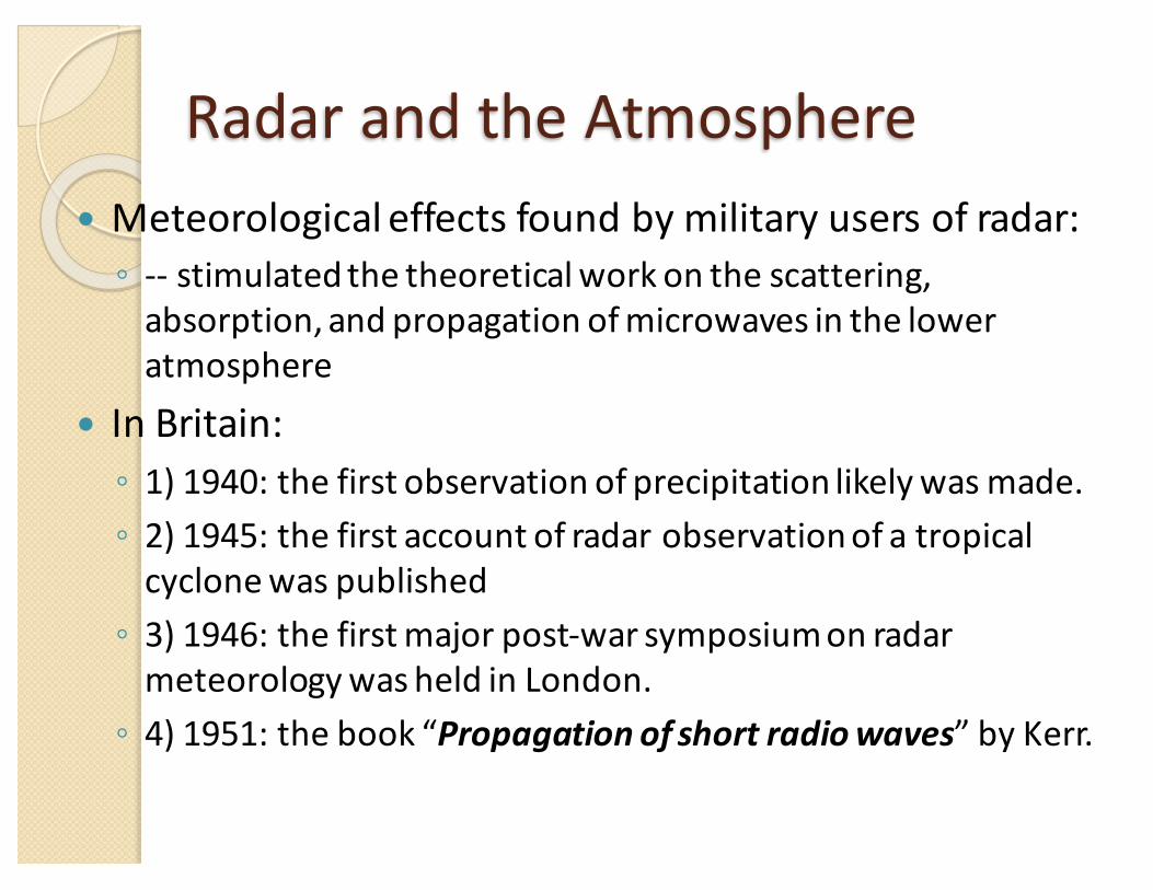
RadarandtheAtmosphere� Meteorologicaleffectsfoundbymilitaryusersofradar:◦ -- stimulatedthetheoreticalworkonthescattering,absorption,andpropagationofmicrowavesintheloweratmosphere
� InBritain:◦ 1)1940:thefirstobservationofprecipitationlikelywasmade.◦ 2)1945:thefirstaccountofradarobservationofatropicalcyclonewaspublished◦ 3)1946:thefirstmajorpost-warsymposiumonradarmeteorologywasheldinLondon.◦ 4)1951:thebook“Propagationofshortradiowaves”byKerr.

RadarandtheAtmosphere� IntheUS:◦ 1)1941:FirstdetectionatRadLab,MIT:7February1941◦ 2)1943:FirstU.S.publicationregardingmeteorologicalweatherechoes:“Radarechoesfromatmosphericphenomena”(Bent,1943)◦ 3)1946:WeatherRadarResearchProjectatMIT� – Initialprojectdirector:AlanBemis◦ 4)1945:U.S.AirForceAllWeatherFlyingDivision:projectAW-MET-8� – DavidAtlasamongthefirsttolead
Alan Bemis
David Atlas

EarlyEquipment� Innovativeusesofmilitaryradarbymeteorologists:◦ 1)Trackingballoonstodetermineupper-levelwinds◦ 2)Detectionofprecipitatingcloudsystems
� Firstradarformeteorologicaluse:◦ -- AN/CPS-9,3-cmradarproducedinU.S.in1949
� FirstmeteorologicalobservationwithDopplerradar:◦ -- wasmadeinBritainin1953.

MoreinU.S.� 1946-1947:ThunderstormProject(FloridaandOhio)◦ – Firstmultiagencyfieldexperimentforthunderstormstudyandthatreliedsoheavilyonradarforresearch
� 14March1947:firstWeatherRadarConferenceheldatMIT◦ – Over90attendeesfromvariousagencies
� 1950s:Operationalradarmeteorologyforming◦ –WeatherBureauobtained25AN/APS-2radars,modifiedthem,andrenamedthemWSR-1s,1As,3s,and4s.
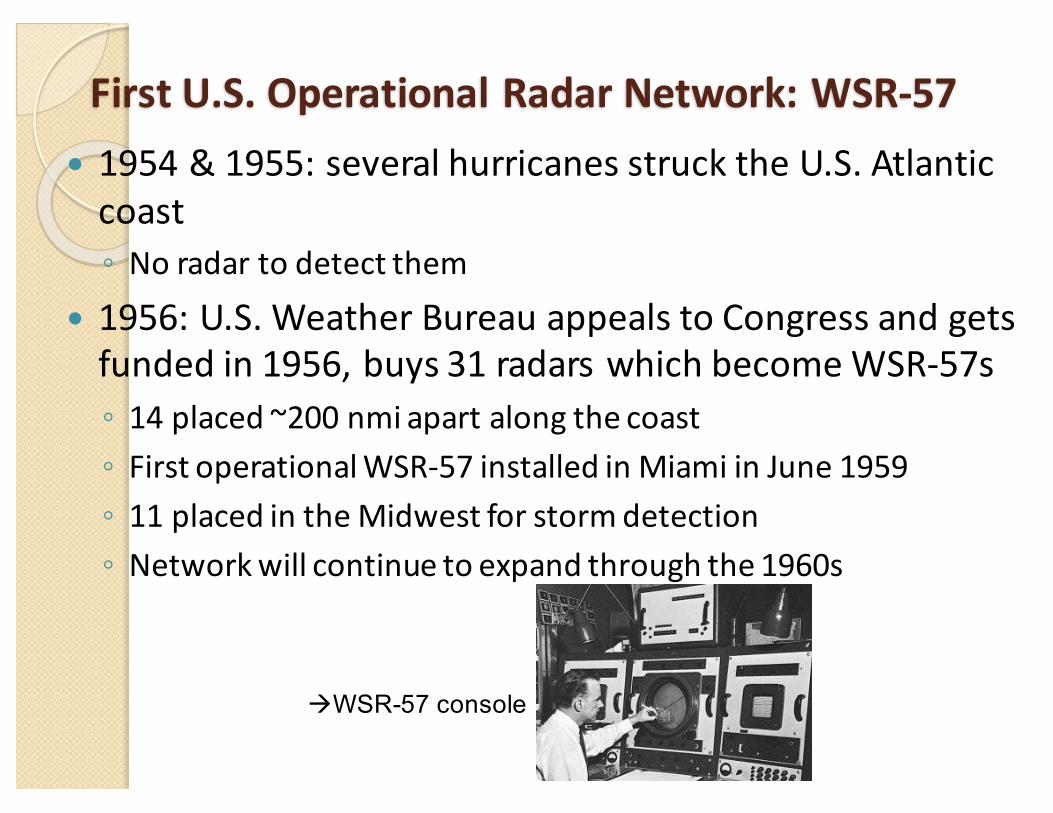
FirstU.S.OperationalRadarNetwork:WSR-57� 1954&1955:severalhurricanesstrucktheU.S.Atlanticcoast◦ Noradartodetectthem
� 1956:U.S.WeatherBureauappealstoCongressandgetsfundedin1956,buys31radarswhichbecomeWSR-57s◦ 14placed~200nmi apartalongthecoast◦ FirstoperationalWSR-57installedinMiamiinJune1959◦ 11placedintheMidwestforstormdetection◦ Networkwillcontinuetoexpandthroughthe1960s
àWSR-57 console
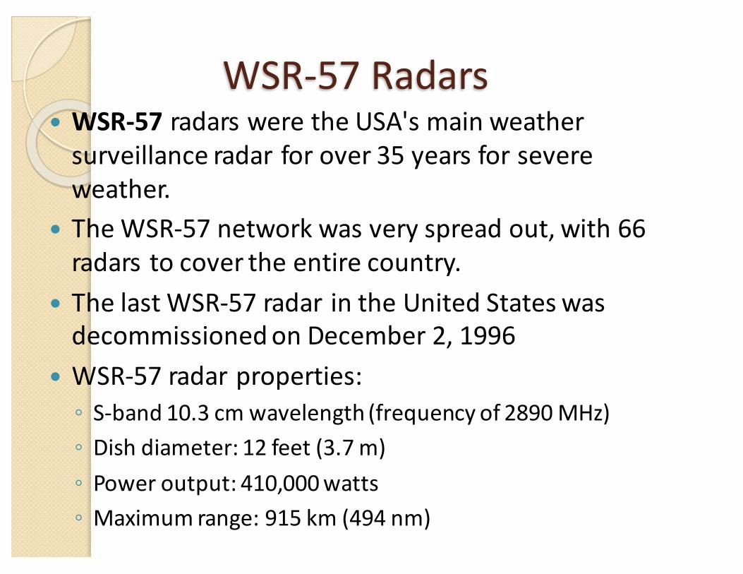
WSR-57Radars� WSR-57 radarsweretheUSA'smainweathersurveillanceradarforover35yearsforsevereweather.
� TheWSR-57networkwasveryspreadout,with66radarstocovertheentirecountry.
� ThelastWSR-57radarintheUnitedStateswasdecommissionedonDecember2,1996
� WSR-57radarproperties:◦ S-band10.3cmwavelength(frequencyof2890MHz)◦ Dishdiameter:12feet(3.7 m)◦ Poweroutput:410,000watts◦ Maximumrange:915 km(494 nm)

Last image of the Miami's WSR-57 blown off by Hurricane Andrew on August 24, 1992

AdditionofWSR-57Network:WSR-74radars� WSR-74radarswereWeatherSurveillanceRadars(WSR)designedin1974fortheNWS.
� WSR-74wereaddedtotheexistingnetworkoftheWSR-57modeltofillinthegaps.(SomehavebeensoldtoothercountrieslikeAustralia,Greece,andPakistan.)
� WSR-74radarproperties:◦ WSR-74S:S-band,sameasWSR-57radars◦ WSR-74C(usedforlocalwarnings):C-band,wavelengthof5.4 cm;dishdiameterof8feet;amaximumrangeof579 km(313 nm)asitwasusedonlyforreflectivities

Circles showing the coverage of the WSR-57 and WSR-74 radars. Note the large gap over the western
United States.

AdventofDopplerradar� – IanBrowneandPeterBarratt(Cambridge)firsttodemonstratetheuseofDopplertechniquestocalculatemotion◦ 27May1953:verticalmotionmeasured inarainshower
� – Dopplerspectrumconsistentwith2m/sdowndraft� – Paperreportingthis(BarratandBrowne, 1953)notpublishedorpublicizedat
conferencesforafewyears
� – JamesBrantleyandBarczysgotthatworkpublishedandpresented◦ BrantleyandBarczys(1957):CWDopplermeasurements ofweatherechoes
� – BrantleyconvincedVaughnRockneythatthiscouldbeusedfortornadodetection;appliedforgrant◦ 92m/swindsmeasuredbyradarintornado inElDorado,KSon10June1958
� – ThusbegantheDopplerera

USNext-GenerationRadar(NEXTRAD)Network:WSR-88D
� NEXRAD isanetworkof159high-resolutionS-bandDopplerweatherradarsoperatedbytheNationalWeatherService(NWS).ItstechnicalnameisWSR-88D,whichstandsforWeatherSurveillanceRadar,1988,Doppler.
� WSR-88DreplacestheWSR-57andWSR-74nationalradarnetwork,whichdidnotutilizeDopplertechnology.
� NEXRADdetectsprecipitationandwind.� WSR-88Ddevelopment,maintenance,andtrainingarecoordinatedbytheNEXRADRadarOperationsCenter (ROC)locatedattheNationalWeatherCenter (NWC)inNorman,Oklahoma.

NEXTRAD/WSR-88DRadarPropertiesandScanStrategies� S-band� Dishdiameterof9.1m(30ft);Antennadiameterof8.5m(28ft).� Spatial resolution varieswithdatatypeandscanangle - levelIIIdatahasa
resolution of1kmx1degreeinazimuth,whilesuper-res levelII,(implemented in2008nationwide), hasaresolution of250mby0.5degreesinazimuthbelow2.4degreesinelevation.
� 9VolumeCoveragePattern(VCPs)available.EachVCPisapredefinedsetofinstructions thatcontrolantennarotation speed,elevationangle,transmitter pulse repetition frequencyandpulsewidth.◦ ClearAirorLightPrecipitation:VCP31and32◦ ShallowPrecipitation:VCP21◦ Convection:VCP11,12,121,211,212,and221
� Traditional elevationminimum andmaximumranging from0.1to19.5degrees,although thenon-operational minimum andmaximumspans from-1to+45degrees.

DualPolarizationUpgradeofNEXTRADNetwork
� Thedeploymentofthedualpolarizationcapability(Build12)toNEXRADsitesbeganin2010andwascompletedbythesummerof2013.
� TheradaratVanceAirForceBase inEnid,Oklahoma isthefirstoperationalWSR-88Dtobemodifiedtoutilizedualpolarizationtechnology;themodifiedradarwentintooperationonMarch3,2011.
� Dual-polradaraddsverticalpolarizationtothehorizontalradarwaves,inordertomoreaccuratelydistinguishbetweenrain,hail,andsnow,thereforeimprovingwarningsofwinterstormsandthunderstorms.

NEXRAD sites within the Contiguous U.S.

NEXRAD sites in Alaska, Hawaii, U.S. territories, and military bases.

WorksinOther Countries� In Canada: Project Stormy Weather,
1943–AKA the “Stormy Weather Group” after 1950 at McGill University–First led by J. Stewart Marshall
–Pioneer work on precipitationand cloud microphysics:• Marshall-Palmer raindrop size distribution• The definition of radarreflectivity factor• Melting band studies• CAPPI (Constant AltitudePlan Position Indicator)

WorksinOtherCountries� InJapan:◦ – 1954:First3-cmradarmade.◦ – 1965:AremotecontrolledweatherradarwassetuponMt.Fuji(3776mabovesealevel)todetecttyphoons◦ --1997:TRMM precipitationradar(PR,thefirstweatherradaronsatellite)waslaunched.TheradarwasmadebyJapan.◦ --2014:GPMsatellitedualfrequencyprecipitationradar(DPR)wasmadebyJapantoo. GPM radar (DPR)
TRMM Satellite

HistoryofSatelliteMeteorology

Aerial Photography� The invention of photography in
1839 made remote sensing (eventually) possible.
� Remote sensing began in the 1860sas balloonists took pictures of theEarth's surface.�Pigeon fleets were anotherform of remote sensing at thebeginning of the 20th century.
Boston City, 1860

EarlyAeronautics
Robert Goddard’s first rocket,1926
Wright brothers and the earliest airplane

First Images from space (1940s):V2 Rocket

EarlyMeteorologicalSatellites (Metsat)� The first satellite with a meteorological instrument:Vanguard 2, launched in
Feb 1959.--Supposed to get a visible Earth image. But the data were unusable because thesatellite wobbled on its axis.� Explorer 6: the satellite with meteorological instruments launched in Aug.
1959, carried an imaging system and a Suomi radiometer.The data were unusable too.
� The first successful meteorological instrument on an orbiting satellite was the Suomi radiometer, which flew on Explorer 7, launched Oct 1959. The Suomi radiometer was developed by Verner Suomi and colleagues at the Univ. of Wisconsin, and designed for measuring solar and infrared radiation.
� The first satellite completedly dedicated to satellite meteorology wasTIROS 1 (Television and Infrared Observational Satellite), launched in April 1960.-- Image-making instrument: a vidicon camera� TIROS series: TIROS 1-10 (1960-1965) -- with improved meteorological
instruments.� Nimbus series: Nimbus 1-7 (1964-1978) – An extremely important series of
experimental metsats. Nimbus 1 was the first sunsynchronous satellite (passedover any point on Earth at approximately the same local time).

First Satellites
NASA was foundedin 1958 to advanceAmerican interestsin space.
Explorer 11958
Sputnik(USSR),1957
Vanguard 2,1959

Explorer 7E7 (1959): Firstsatellite with a successful instrument for meteorological remote sensing.
Designed by VernerSuomi, U Wisconsin
Postcards (US and Brazil) celebrating E7
JupiterClaunch rocket

The TIROS ISeries (1960)

TheNimbusSeries 1963

ESSASatellites� TheEnvironmentalScienceServicesAdministration(ESSA)satelliteprogramwasdesignedtoprovideoperationalcloud-covermonitoring.
� ESSA1waslaunchedinFebruary1966.
� ThelastESSA(9)waslaunchedin1969.
� ESSAwasabsorbedintowhatisnowNOAA(NationalOceanographicandAtmosphericAdministration).
Hurricane Faith (1966) as it moves towards Cape

RecentDecades� Sincethemid-1960s,noundetectedTCsanywhereonEarth.� GOES1:ThefirsttrulyoperationalgeostationarymetsatwaslaunchedinOct.1975.� DefenseMeteorologicalSatelliteProgram (DMSP)satellites(SSM/I,SSMISonDMSP):◦ InitiatedbyUSDepartmentofDefense(DOD)in1973◦ Providescloudcoverimageryfrompolarorbits thataresun-synchronous atnominalaltitudeof450nauticalmiles(830 km)◦ OnJune1,1998thecontrolandmaintenanceofthesatellitesweretransferredtoNationalOceanicandAtmosphericAdministration (NOAA)inordertoreducecosts..

Defense MeteorologicalSatellite Program (DMSP)

GOES: Geostationary OperationalEnvironmental Satellite

Previous Geostationary satellite coverage (2004)
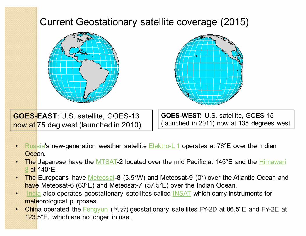
Current Geostationary satellite coverage (2015)
GOES-EAST: U.S. satellite, GOES-13 now at 75 deg west (launched in 2010)
GOES-WEST: U.S. satellite, GOES-15 (launched in 2011) now at 135 degrees west
• Russia's new-generation weather satellite Elektro-L 1 operates at 76°E over the Indian Ocean.
• The Japanese have the MTSAT-2 located over the mid Pacific at 145°E and the Himawari 8 at 140°E.
• The Europeans have Meteosat-8 (3.5°W) and Meteosat-9 (0°) over the Atlantic Ocean and have Meteosat-6 (63°E) and Meteosat-7 (57.5°E) over the Indian Ocean.
• India also operates geostationary satellites called INSAT which carry instruments for meteorological purposes.
• China operated the Fengyun (风云) geostationary satellites FY-2D at 86.5°E and FY-2E at 123.5°E, which are no longer in use.
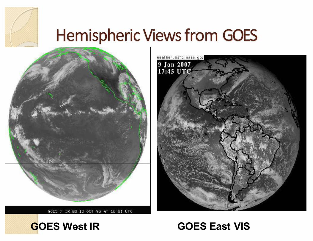
HemisphericViewsfrom GOES
GOES West IR GOES East VIS

GMS:GeostationaryMeteorologicalSatellite(Japan)

Meteosat: theEuropeangeostationarymetsat

INSAT:theIndiangeostationarymetsat

POES: Polar Orbiting Operational Environmental Satellite

WorldwideNetworkofMeteorologicalSatellites(till
2014)

StatusofCurrentandFutureSatellitesContributingtotheWMOIntegratedGlobalObservingSystem(WIGOS)
http://www.wmo.int/pages/prog/sat/satellitestatus.php
CoreMeteorologicalSatelliteProgrammesContributingtoWIGOS
SustainedorR&DSatelliteProgrammesContributing toWIGOS
GeostationaryorbitCurrentGEOSatellites
FutureGEOSatellites
Highlyellipticalorgeosynchronousorbit
CurrentHEOSatellites
FutureHEOSatellites
Sun-synchronousCurrentSun-sync.Satellites
FutureSun-sync.Satellites
LowEarthorbit
CurrentLEOSatellites
FutureLEOSatellites
Specificorbits(forspaceweather)
CurrentotherSatellites
FutureotherSatellites
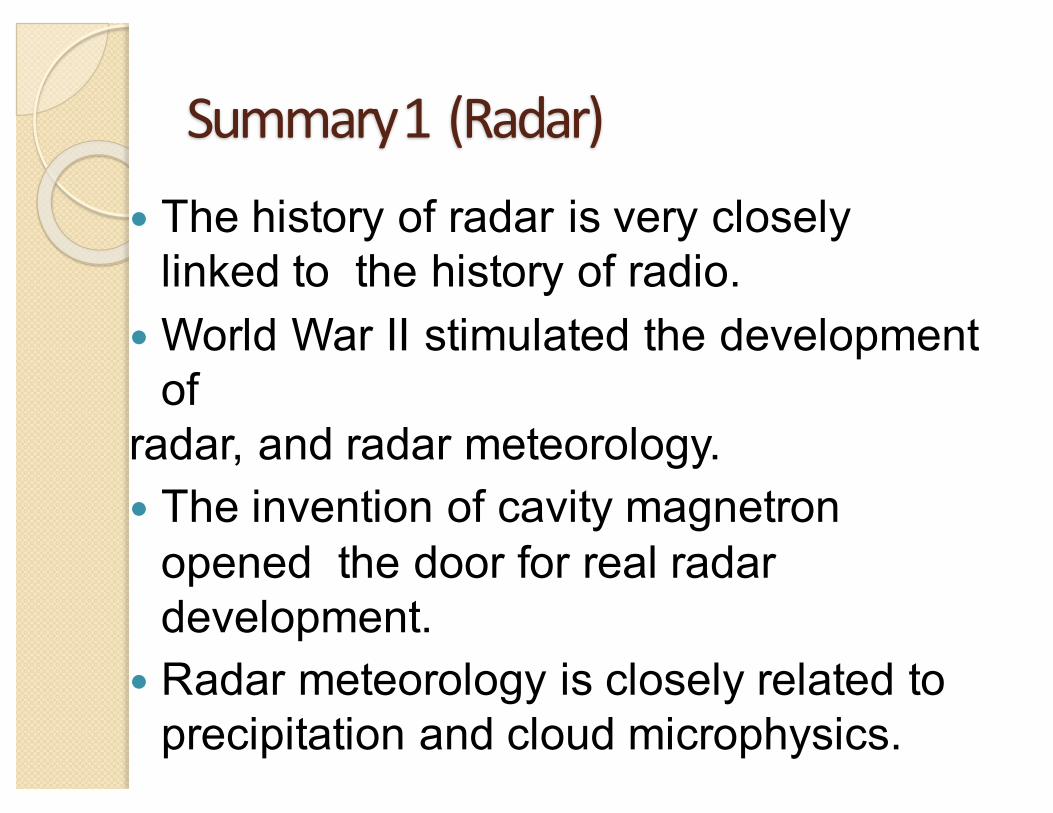
Summary1 (Radar)� The history of radar is very closely
linked to the history of radio.� World War II stimulated the development
ofradar, and radar meteorology.� The invention of cavity magnetron
opened the door for real radar development.
� Radar meteorology is closely related to precipitation and cloud microphysics.

Summary2 (satellite)� Satellite remote sensing science started with
thedevelopment of cameras in the mid 19th century.� The development of aircraft and rockets,
particularly during WWII, made meteorological remote sensing possible.
� Low earth orbiting satellites (TIROS, DMSP) operational became operational in the 60’s.
� High earth orbiting (geostationary) satellites such as GOES became operational in the 70’s.
� Both are used for a wide range of geophysical applications in addition to meteorology.
Related Documents