Lecture 11: Global Positioning Global Positioning System (GPS) System (GPS)

Lecture 11: Global Positioning System (GPS) Lecture 11: Global Positioning System (GPS)
Dec 14, 2015
Welcome message from author
This document is posted to help you gain knowledge. Please leave a comment to let me know what you think about it! Share it to your friends and learn new things together.
Transcript
Lecture 11:Global Positioning Global Positioning
System (GPS)System (GPS)
Lecture 11:Global Positioning Global Positioning
System (GPS)System (GPS)
Introduction to GPS
GPS is funded by and controlled by the US Department of Defense (DOD).
GPS provides specially coded satellite signals that can be processed in a GPS receiver, enabling the receiver to compute position, velocity, and time.

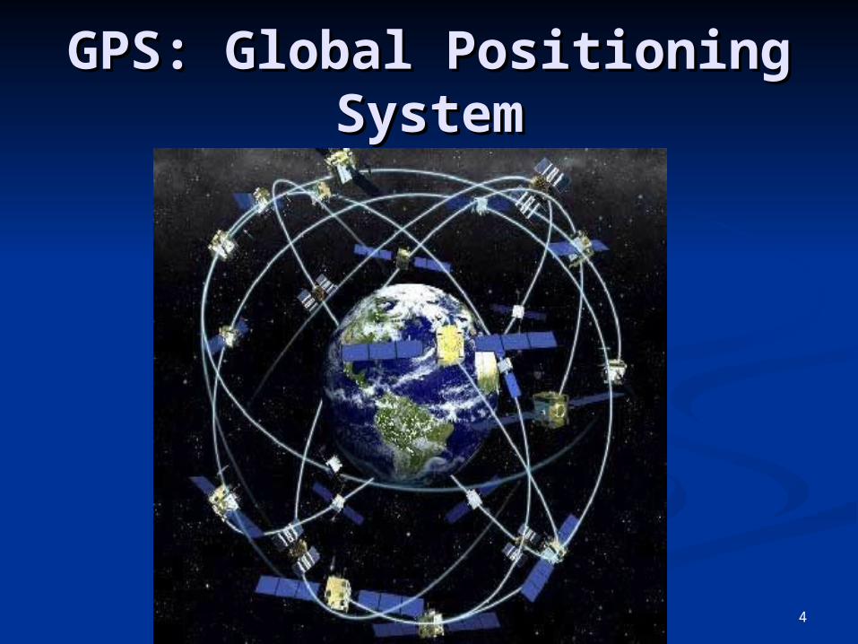
What is GPS?
GPS, which stands for Global Positioning System, is the only system today able to show you your exact position on the Earth anytime, in any weather, anywhere.
GPS: Global Positioning GPS: Global Positioning SystemSystem
4
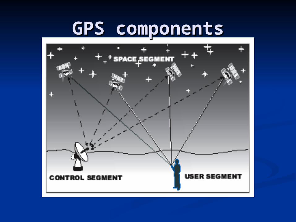
GPS componentsGPS components

The three parts of GPS are:
GPS systems are made up of 3 segments Space Segment (SS) Control Segment (CS) User Segment (US)

Space SegmentSpace Segment
24 satellites in orbit dedicated to GPS that orbit the Earth in very precise orbits twice a day.
6 satellites are within view of any location at one time.
Satellites constantly transmit their location information and time data.

Control Segment Ground antennas monitor and track
the satellites. They also transmit correction
information to individual satellites.

Kwajalein Atoll
US Space Command
Control SegmentControl Segment
Hawaii
Ascension Is.
Diego Garcia
Cape Canaveral
Ground AntennaMaster Control Station Monitor Station

User Segment
GPS receivers include a display for showing location and speed information to the user.

User segmentUser segment GPS antennas & receiver/processorsGPS antennas & receiver/processors PositionPosition VelocityVelocity Precise timingPrecise timing Used byUsed by
AircraftAircraft Ground vehiclesGround vehicles ShipsShips IndividualsIndividuals

Handheld GPS ReceiversHandheld GPS Receivers
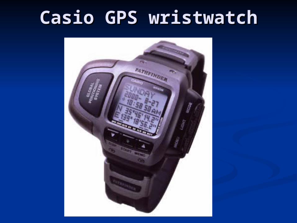
Casio GPS wristwatchCasio GPS wristwatch

GPS Applications
Military: fighters, bombers, detect missiles, weapons, nuclear.
Automobiles: show moving maps (highways, buildings)
Aviation: for aircraft navigation Marine: Provides precise navigation
information to boaters.


How GPS worksHow GPS works GPS uses satellites as reference points to
calculate accurate positions. Each satellite orbits the earth every 12
hours (2 complete rotations every day). This ensures that every point on the Earth
will always be in radio contact with at least 4 satellites.
Ground stations are used to precisely track each satellite's orbit.

How GPS worksHow GPS works GPS satellites transmit signals to equipment on
the ground. GPS receivers passively receive satellite
signals; they do not transmit. GPS operations depend on a very accurate time
reference, which is provided by atomic clocks. Each GPS satellite has atomic clocks on board.
Each GPS satellite transmits signals that indicates its location and the current time.
The signals, moving at the speed of light, arrive at a GPS receiver at slightly different times because some satellites are farther away than others.

How GPS worksHow GPS works The distance to the GPS satellites can be
determined by estimating the amount of time it takes for their signals to reach the receiver.
When the GPS receiver estimates the distance to at least four GPS satellites, it can calculate its position (in terms of latitude and longitude).
It also can tell you What direction you are heading How fast you are going Your altitude A map to help you arrive at a destination

How GPS worksHow GPS works
GPS also can tell you
How far you have traveledHow long you have been traveling
Estimated time of arrival
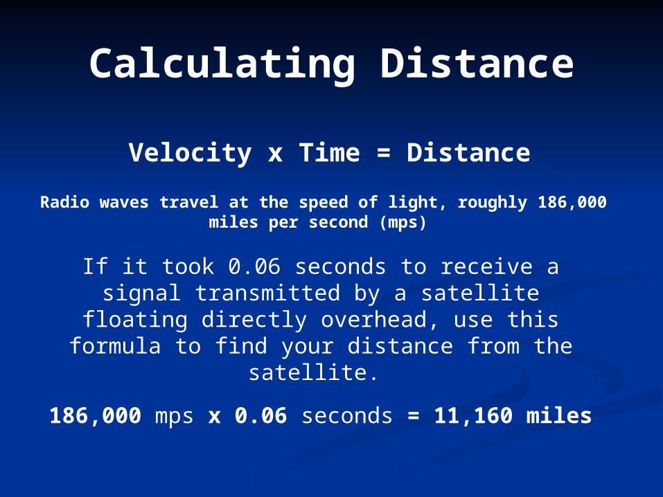
Calculating Distance
Velocity x Time = Distance
Radio waves travel at the speed of light, roughly 186,000 miles per second (mps)
If it took 0.06 seconds to receive a signal transmitted by a satellite floating directly
overhead, use this formula to find your distance from the satellite.
186,000 mps x 0.06 seconds = 11,160 miles
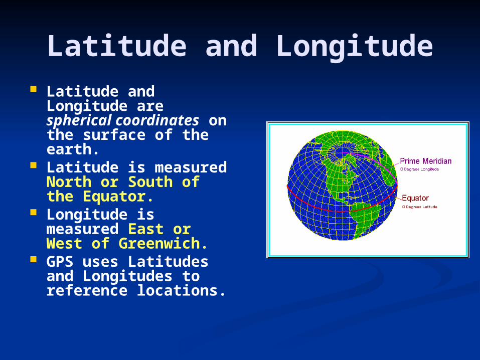
Latitude and Longitude Latitude and
Longitude are spherical coordinates on the surface of the earth.
Latitude is measured North or South of the Equator.
Longitude is measured East or West of Greenwich.
GPS uses Latitudes and Longitudes to reference locations.

Aircraft Navigation using GPS
Civil aircraft typically fly from one waypoint to another.
With GPS, an aircraft's computers can be programmed to fly a direct route to a destination.
This can save fuel and time GPS also can simplify and improve the
method of guiding planes to a safe landing, especially in poor weather.
With advanced GPS systems, airplanes can be guided to touchdown even when visibility is poor.

Waypoints Waypoints are locations or landmarks
that can be stored in your GPS. Waypoints may be entered directly by
taking a reading with the unit at the location itself, giving it a name, and then saving the point.
Once entered and saved, a waypoint remains unchanged in the receiver’s memory until edited or deleted.
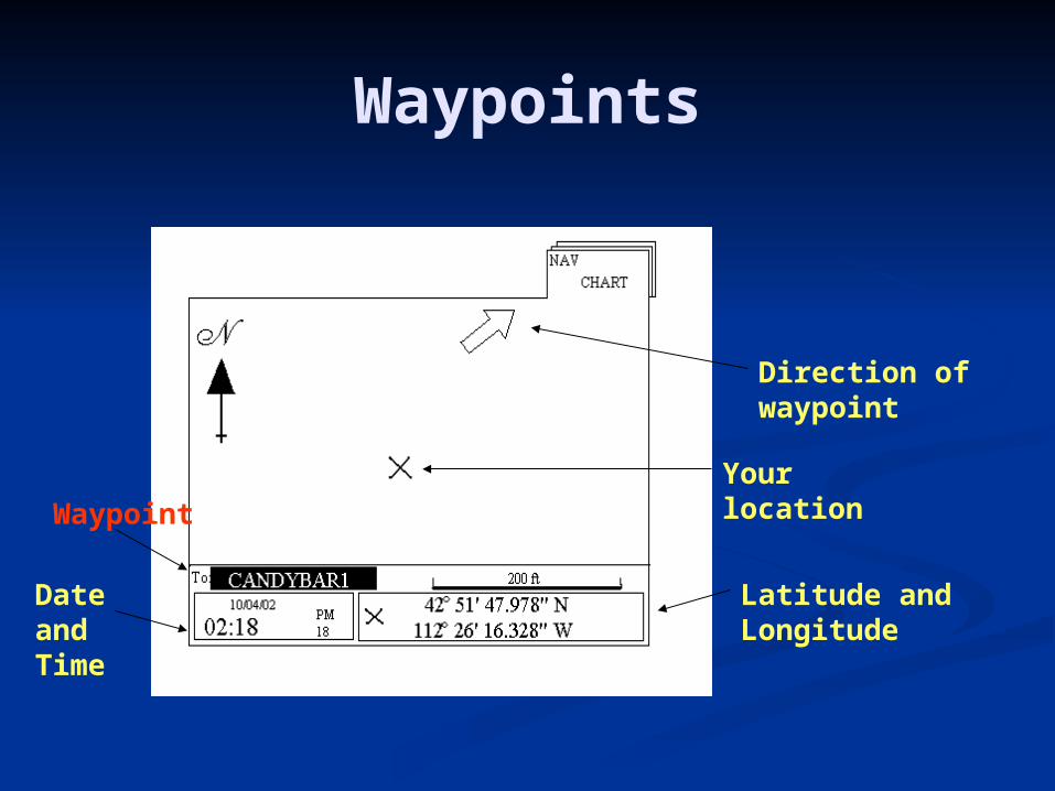
Waypoints
Latitude and Longitude
Your location
Direction of waypoint
Date andTime
Waypoint

Using GPS, aircraft can fly the most direct routes
between airports

A GPS receiver in the cockpit provides the pilot
with accurate position data and helps him keep the
airplane on course.
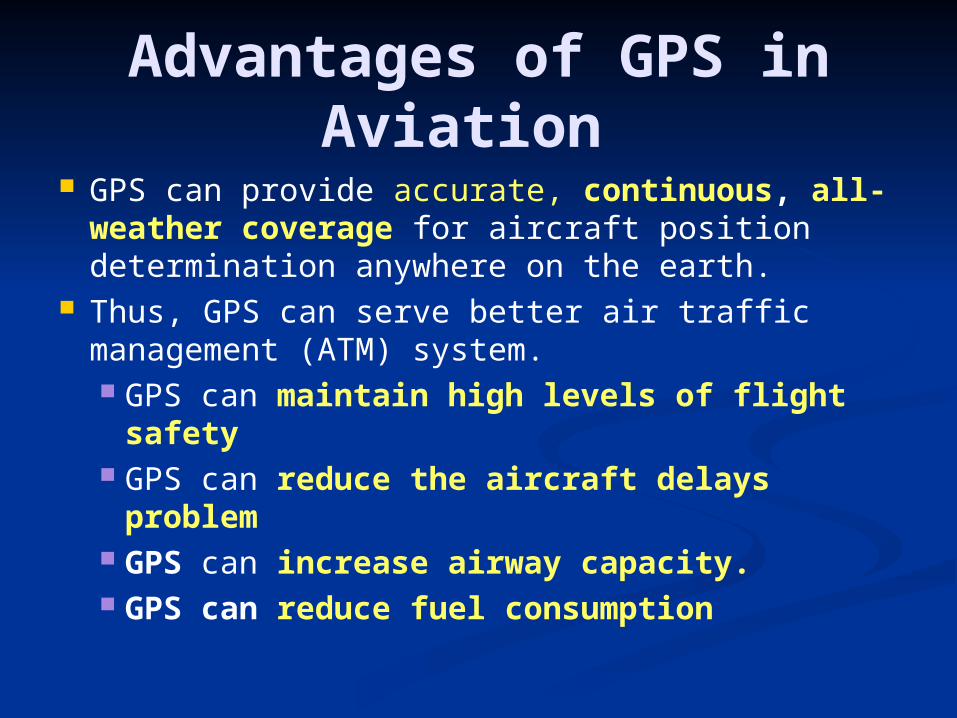
Advantages of GPS in Aviation
GPS can provide accurate, continuous, all-weather coverage for aircraft position determination anywhere on the earth.
Thus, GPS can serve better air traffic management (ATM) system. GPS can maintain high levels of flight
safety GPS can reduce the aircraft delays
problem GPS can increase airway capacity. GPS can reduce fuel consumption

Advantages of GPS in Aviation
Reduced costs to each individual State while increasing overall benefits to individual States
Maintain economies from reduced maintenance and operation of ground-based systems (such as VOR/DME/NDB station)
Improved ground and cockpit situational awareness
Increased landing capacity for aircraft More efficient, optimized, flexible, and user-
preferred route structures
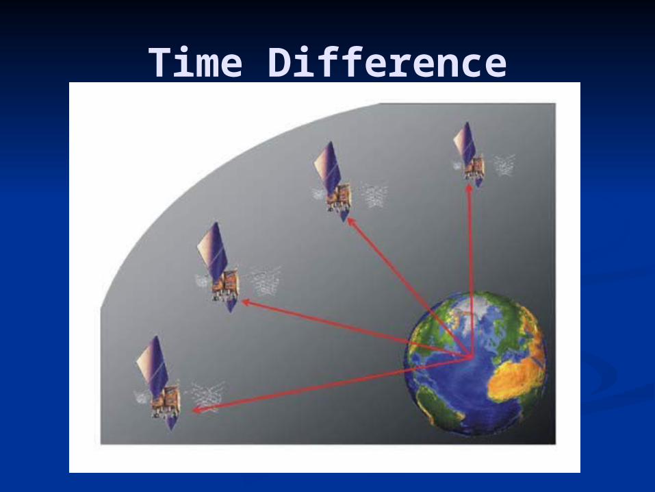
Time Difference

GPS Distance D = Speed of Light x Time;
or D = CT
D

GPS Limitations
Line of Sight Transmissions: Obstructions such as trees, buildings may prevent clear line of sight.
Refraction: GPS signal from the satellite doesn’t follow a straight line
Signal Interference: Sometimes the signals interfered before they hit the receivers.

Obstruction
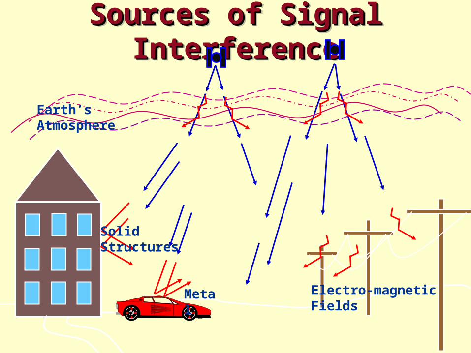
Sources of Signal Sources of Signal InterferenceInterference
Sources of Signal Sources of Signal InterferenceInterference
Earth’s Atmosphere
Solid Structures
Metal Electro-magnetic Fields

GPS Frequencies
L1 (1575.42 MHz) - For CivilianL2 (1227.60 MHz) - For CivilianL3 (1381.05 MHz) – For MilitaryL4 (1379.913 MHz) – For ResearchL5 (1176.45 MHz) – For Civilian

Local Area Augmentation Local Area Augmentation System (LAAS)System (LAAS)
““LAAS is a precision approach and LAAS is a precision approach and landing system that relies on the Global landing system that relies on the Global Positioning System (GPS) to broadcast Positioning System (GPS) to broadcast highly accurate information to aircraft on highly accurate information to aircraft on the final phases of a flight. the final phases of a flight.
LAAS support precision approaches and LAAS support precision approaches and landing capability to aircraft operating landing capability to aircraft operating within a 20- to 30-mile radius of the within a 20- to 30-mile radius of the airport. airport.
LAAS approaches will be designed to LAAS approaches will be designed to avoid obstacles, restricted airspace, noise-avoid obstacles, restricted airspace, noise-sensitive areas, or congested airspace.”sensitive areas, or congested airspace.”

GPS Local Area Augmentation GPS Local Area Augmentation System (LAAS)System (LAAS)
One LAAS covers multiple runway endsOne LAAS covers multiple runway ends
LAAS

QuestionQuestion
The latest addition to The latest addition to navigational aid system is GPS.navigational aid system is GPS. Explain briefly how GPS works. Explain briefly how GPS works. Describe the advantages GPS has Describe the advantages GPS has
over the other navigational aids over the other navigational aids such as VOR/DME or NDB.such as VOR/DME or NDB.
Related Documents