Learning Target 7.9A – Locate the geographical landmarks in Texas to include Geographic Regions, physical characteristics, political and cultural regions, and indigenous peoples. 7.9B – Compare places and regions of Texas in terms of physical and human characteristics.

Learning Target 7.9A – Locate the geographical landmarks in Texas to include Geographic Regions, physical characteristics, political and cultural regions,
Dec 29, 2015
Welcome message from author
This document is posted to help you gain knowledge. Please leave a comment to let me know what you think about it! Share it to your friends and learn new things together.
Transcript

Learning Target7.9A – Locate the geographical landmarks in Texas to include Geographic Regions, physical characteristics, political and cultural regions, and indigenous peoples.
7.9B – Compare places and regions of Texas in terms of physical and human characteristics.

TexasGlue this map into page of INB.
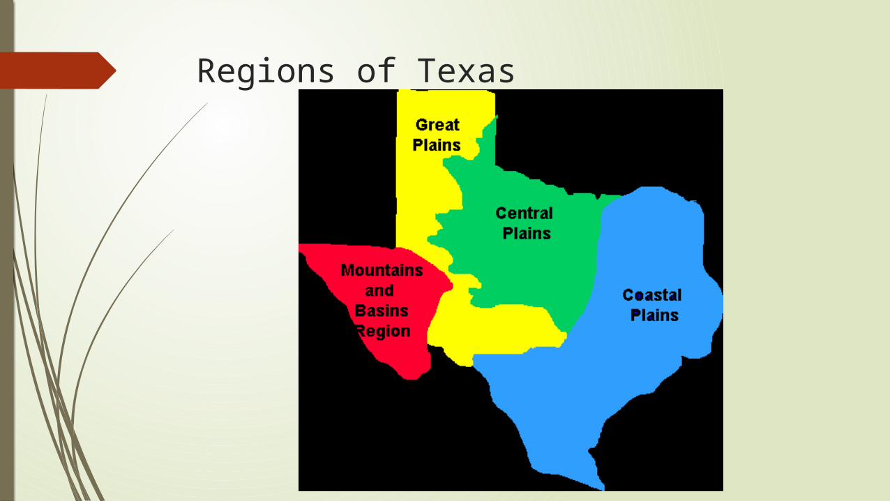
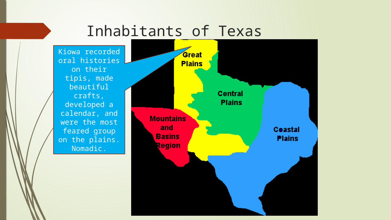
Regions of Texas

Coastal Plains
The Coastal Plains region is made up of East Texas, South Texas, and the Gulf Coast
East Texas is also known as the “Piney Woods” because it is full of pine trees along with oak and cedar. The earth here is very sandy.
The area around the Gulf of Mexico has very similar tree life. Houston is located here, and is one of the nation’s biggest ports and chemical processing cities. This region is where oil was first discovered in Texas, and still has plenty of oil both on and off shore.
South Texas is very dry, sandy, and full of mesquite and cactus. Laredo is a major border crossing for trucks carrying produce and goods from Mexico.
Other cities here are Tyler, Texarkana, Beaumont, and COLLEGE STATION!

Coastal Plains (continued)
Piney woods Houston Ship Channel South Texas
Kyle Field, the home of Mr. Fulton’s Fightin’ Texas Aggie Football Team!

Central Plains
The Central Plains are home to much of Texas’ farmland, with some of the best soil for farming in the state. Cattle ranching, wheat production, cotton, peaches, and pecans are important parts of the economy here. The Western parts of the Central Plains have rolling hills and are home to cities like Abilene and Wichita Falls (Where Dyess AFB and Shepherd AFB are located).
Further east, the land is flatter and there is more rain each year. Cities like Fort Worth, Arlington, Denton, and Killeen are located here.
Historically, Fort Worth was once a major meat processing town. The Stockyards are still there today, but are more of a tourist destination now. Arlington is home to Six Flags and AT&T Stadium, where the Dallas Cowboys currently play.

Central Plains
Fort Worth Stockyards Dyess Air Force Base Six Flags Over Texas
The Great Place! Fort Hood!

Great Plains
The part of the Great Plains that lies in Texas is much higher in elevation than Eastern Texas. It is also much drier and colder than other parts of Texas. There are not many big cities here, and the ones that are there are mostly centered around agriculture and oil.
Big cities in this part of Texas include Amarillo and Lubbock in the Panhandle and Midland and Odessa in the southern part of the Great Plains. Midland and Odessa are the biggest cities in the West Texas oil fields. Most of the best jobs around those cities involve the oil business.
The Llano Estacado (Spanish for “staked plains” is located here. It was named that by Spanish explorers who could only have landmarks if they put down stakes in the ground.

Great Plains
Amarillo, Texas Texas Tech University Oil Fields in West Texas

Mountains and Basins
The Mountains and Basins region is in the far west of Texas, and is hot, dry, and home to the Davis Mountains. The Rio Grande, the river that separates Texas and Mexico, enters Texas here. Big Bend National Park is here, as well as the city of El Paso. It is home to Fort Bliss, where the First Armored Division is based.
This area is full of cactus and other desert plants, and is home to mule deer, cougars, and roadrunners.

Mountains and Basins
The Rio Grande, Big Bend National Park Fort Bliss, El Paso, TX

Texas
College Station!

Rivers of Texas

Geographic Features of Texas
Davis Mountains
Llano Estacado
Palo Duro Canyon

Inhabitants of Texas Karankawas live in the southeast.
They used dugout canoes to
fish and hunt small animals.

Karankawa
The Karankawa Tribe lived along the Texas coast of the Gulf of Mexico. Their territory was from the west end of Galveston Island down the coast to where Corpus Christi is today. There were several bands, or maybe even several tribes. We are not sure, because much of the history of the Karankawa is lost. No one bothered to study them in any detail while they were still around to study. Making things worse, the Karankawa were favorite targets of many false myths and made up stories.
Karankawa
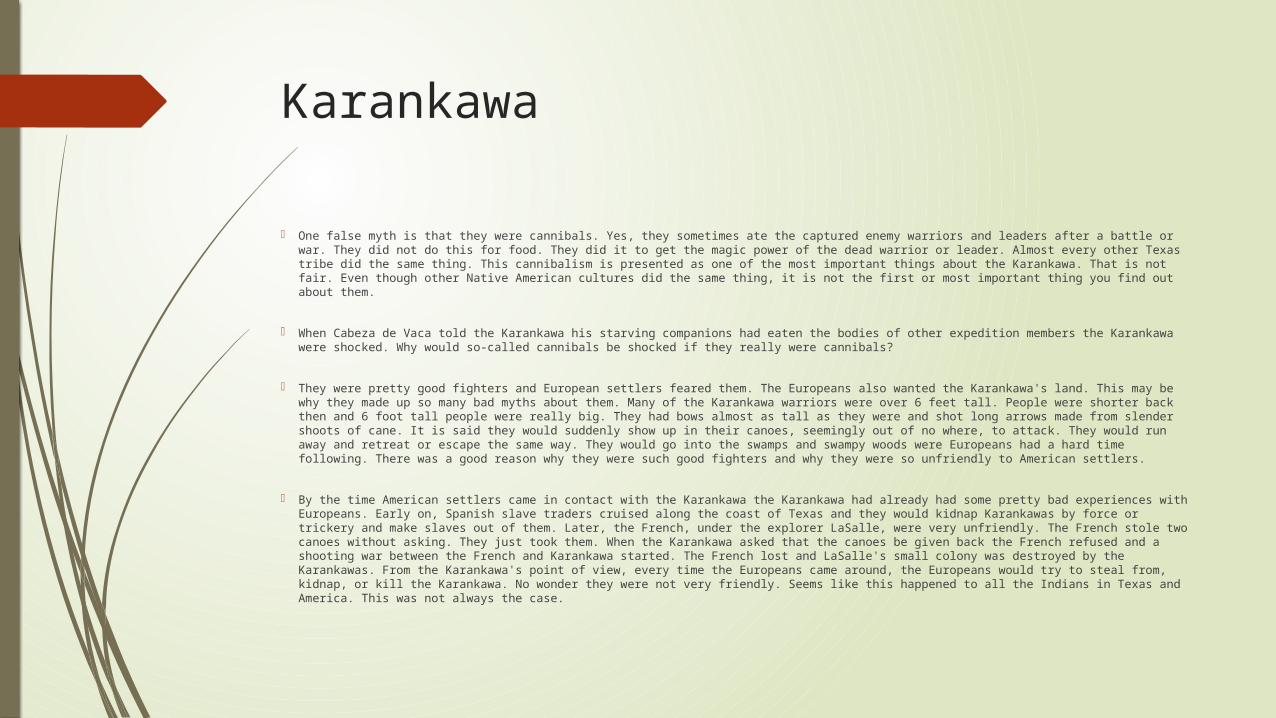
One false myth is that they were cannibals. Yes, they sometimes ate the captured enemy warriors and leaders after a battle or war. They did not do this for food. They did it to get the magic power of the dead warrior or leader. Almost every other Texas tribe did the same thing. This cannibalism is presented as one of the most important things about the Karankawa. That is not fair. Even though other Native American cultures did the same thing, it is not the first or most important thing you find out about them.
When Cabeza de Vaca told the Karankawa his starving companions had eaten the bodies of other expedition members the Karankawa were shocked. Why would so-called cannibals be shocked if they really were cannibals?
They were pretty good fighters and European settlers feared them. The Europeans also wanted the Karankawa's land. This may be why they made up so many bad myths about them. Many of the Karankawa warriors were over 6 feet tall. People were shorter back then and 6 foot tall people were really big. They had bows almost as tall as they were and shot long arrows made from slender shoots of cane. It is said they would suddenly show up in their canoes, seemingly out of no where, to attack. They would run away and retreat or escape the same way. They would go into the swamps and swampy woods were Europeans had a hard time following. There was a good reason why they were such good fighters and why they were so unfriendly to American settlers.
By the time American settlers came in contact with the Karankawa the Karankawa had already had some pretty bad experiences with Europeans. Early on, Spanish slave traders cruised along the coast of Texas and they would kidnap Karankawas by force or trickery and make slaves out of them. Later, the French, under the explorer LaSalle, were very unfriendly. The French stole two canoes without asking. They just took them. When the Karankawa asked that the canoes be given back the French refused and a shooting war between the French and Karankawa started. The French lost and LaSalle's small colony was destroyed by the Karankawas. From the Karankawa's point of view, every time the Europeans came around, the Europeans would try to steal from, kidnap, or kill the Karankawa. No wonder they were not very friendly. Seems like this happened to all the Indians in Texas and America. This was not always the case.

Inhabitants of Texas
Coalhuiltecan live in south Texas. They ate bugs
and small animals.

CoalhuiltecanLets start with one important fact about this so-called tribe. There is no one "Coahuiltecian" tribe or culture. It never existed. There is a Coahuiltecan / Group region in South Texas and northeastern Mexico. Over a hundred similar Indian cultures lived there. These Natives of the Coahuiltecan region shared very similar ways of living. But they were not one tribe or culture.What has emerged from this new research is a picture of many groups of Native peoples all living in the same region, all sharing the same environment and all living in a very similar way. But, these people were not all parts of one big tribe. They were actually of two or more language families we know of found in these many groups. Two languages mean there were at least two cultures. These are then divided up even more into hundreds of small bands and groups. The various San Antonio Mission records give us hundreds of "tribal" names just for the small area around San Antonio.

Inhabitants of TexasAtakapan hunted
small animals and fished in
dugout canoes, and some
farming. Central Coastal Plains.

Inhabitants of Texas
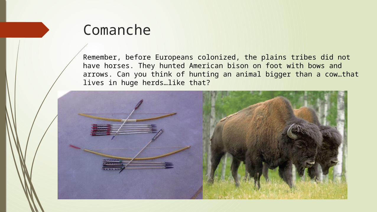
Comanche were nomadic. Primary food and clothing was from buffalo. Used every part of the buffalo. Domesticated animals long before horses
were introduced by the
Europeans.
Comanche
Remember, before Europeans colonized, the plains tribes did not have horses. They hunted American bison on foot with bows and arrows. Can you think of hunting an animal bigger than a cow…that lives in huge herds…like that?

Inhabitants of TexasApache used buffalo hide a
protection from the harsh
landscape. For part of the year lived in farming
communities along rivers and streams called
Rancherias.Nomadic.
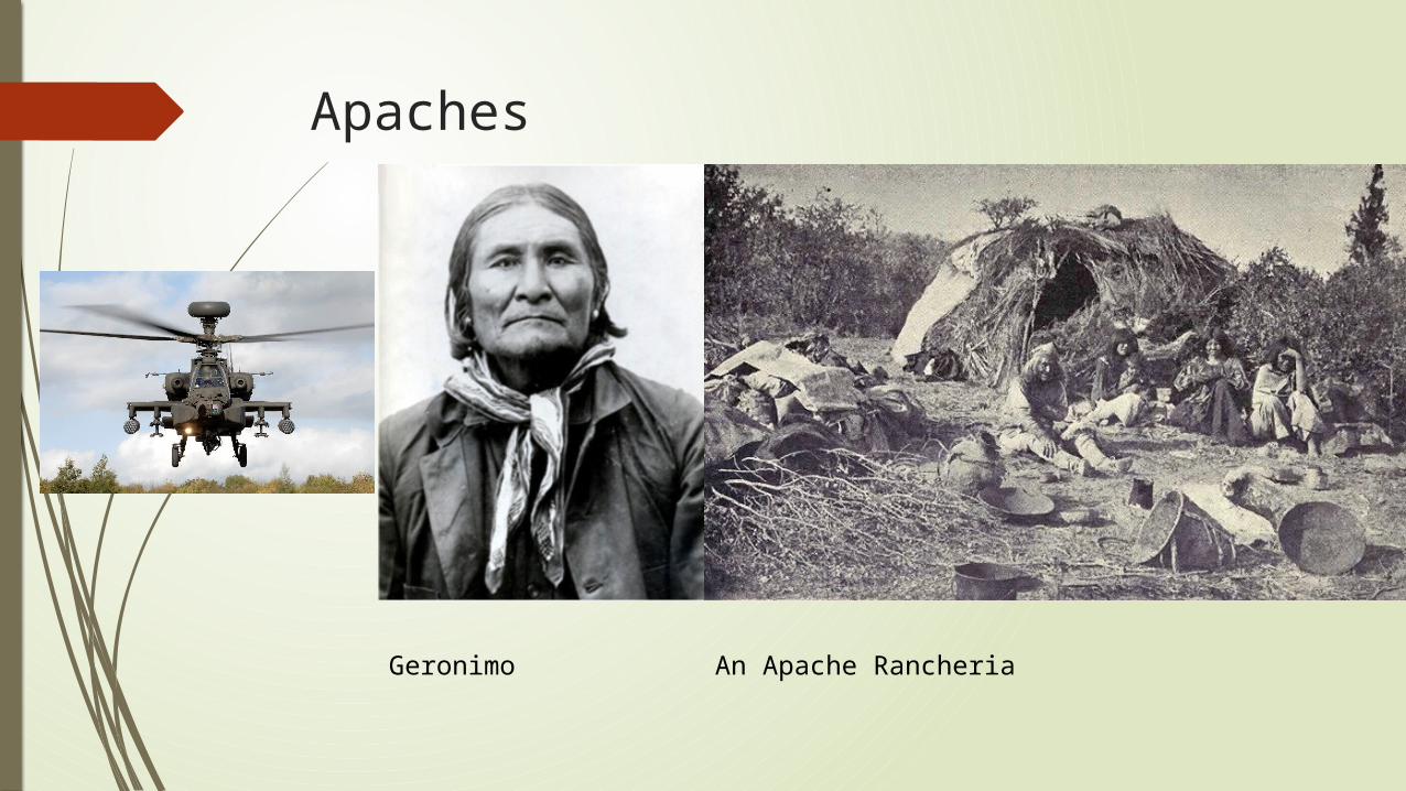
Apaches
An Apache RancheriaGeronimo
Inhabitants of Texas
Kiowa recorded oral histories on their tipis, made beautiful crafts,
developed a calendar, and were the most
feared group on the plains.Nomadic.

Kiowa
Kiowa history painted on a teepee

Inhabitants of Texas
Jumano farmed, hunted, traded,
and lived in painted adobe
homes

Jumano

Inhabitants of Texas
Tigua were known for their
beautiful pottery. Hunted, fished,
and lived in Adobe huts.

Tigua Pottery

Inhabitants of TexasCaddo built dome
shaped huts, organized
government system led by a chief. Used the term “Tejas” which means
friends. Tejas was later changed to Texas by English-Speaking Texan
settlers.

Caddo

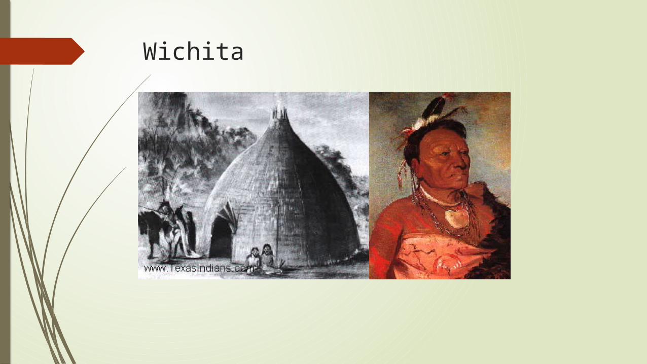
Inhabitants of TexasWichita were
buffalo hunters, farmers, and known for the tattoos around
their eyes known as Raccoon Eyes.
Wichita
Related Documents