PLANNING POLICY GUIDANCE 2 PLANNING POLICY GUIDANCE 2 Le Morne Cultural Landscape Le Morne Cultural Landscape Ministry of Housing and Lands M a u r i t i u s Revised September 2007

Welcome message from author
This document is posted to help you gain knowledge. Please leave a comment to let me know what you think about it! Share it to your friends and learn new things together.
Transcript
DESIGN GUIDANCE LE MORNE CULTURAL LANDSCAPE
DESIGN GUIDANCE LE MORNE CULTURAL LANDSCAPE Ministry of Housing and Lands, September 2007
PLANNING POLICY GUIDANCE 2PLANNING POLICY GUIDANCE 2Le Morne Cultural LandscapeLe Morne Cultural Landscape
Ministry of Housing and Lands
M a u r i t i u s
Revised September 2007

DESIGN GUIDANCE LE MORNE CULTURAL LANDSCAPE
DESIGN GUIDANCE LE MORNE CULTURAL LANDSCAPE Ministry of Housing and Lands, September 2007
This document is the second in a series of Planning Policy Guidance. It is being issued under the title:
‘PPG 2 – Le Morne Cultural Landscape’ Revised September 2007
It has to be used together with PPG 1 Design Guidance – November 2004, Revised in September 2006, regarding the following :
o Design Sheets for Design for Sloping Sites
o Design Sheets for Residential Coastal Development
o Design Guidance Hotels and Integrated Resorts Development
o Technical Sheets for Provision of Infrastructure A planning policy guidance on Le Morne Cultural Landscape was issued in June 2007. Following consultation, it has been revised.
Application:
This Planning Policy Guidance is applicable to Le Morne Cultural Landscape area in the Black River District.
Effective Date:
With effect from September 2007.
Please do not hesitate to call on the Ministry of Housing and Lands on Tel No. 2134868 and the Ministry of Arts and Culture on 212 8377 if you have any queries. For your information, the Planning Policy Guidance 2 – Le Morne Cultural Landscape is available on the website of the Ministry of Housing and Lands at http://housing.gov.mu
1
DESIGN GUIDANCE LE MORNE CULTURAL LANDSCAPE
DESIGN GUIDANCE LE MORNE CULTURAL LANDSCAPE Ministry of Housing and Lands, September 2007
1. INTRODUCTION
1.1 Statement of Universal Value
2. Design Guidance
2.1 Context and Support 2.2 Status of the Planning Policy Guidance for the Le Morne Cultural Lanscape 2.3 Who Should Use the Planning Policy Guidance 2.4 How to Use the Planning Policy Guidance?
3. Design Principles
3.1 Context 3.2 Consultation 3.3 Carrying Capacity 3.4 Landscape Resource and Ecological Value 3.5 Heritage, Historical and Archaeological Value 3.6 Access 3.7 Activity Centres, Facilities and Services
4. Design Sheet
4.1 Core Zone 4.2 Buffer Zone 4.2.1 The Biodiversity Corridor 4.2.2 Mountain Slopes 4.2.3 Area A - Public Beach west of Le Morne Mountain 4.2.4 Area B - Public Beach - Pas Géométriques La Bonté 4.2.5 Area C - sea-facing area at north-east of Le Morne Peninsula, from the northern Buffer zone boundary to the peninsula access road at L’Embrazure. Behind Pas Géométriques Comtesse La Marque to Coastal Road 4.2.6 Area D - South-west of Le Morne Mountain ( Rogers Land ) 4.2.7 Area E - North-east, east and south-east of Le Morne Mountain and West of Black River Coastal Road 4.2.8 Area F - East of Black River Savanne Coastal Road north and south of Biodiversity corridor 4.3 Area G - Renovation, redevelopment of existing tourism facilities 4.4 Area H - Existing residential Morcellement Cambier 4.5 Uncommitted State Land 4.6 Planning Conditions and Obligations
5. Development outside the Buffer Zone
2
DESIGN GUIDANCE LE MORNE CULTURAL LANDSCAPE
DESIGN GUIDANCE LE MORNE CULTURAL LANDSCAPE Ministry of Housing and Lands, September 2007
3
Introduction
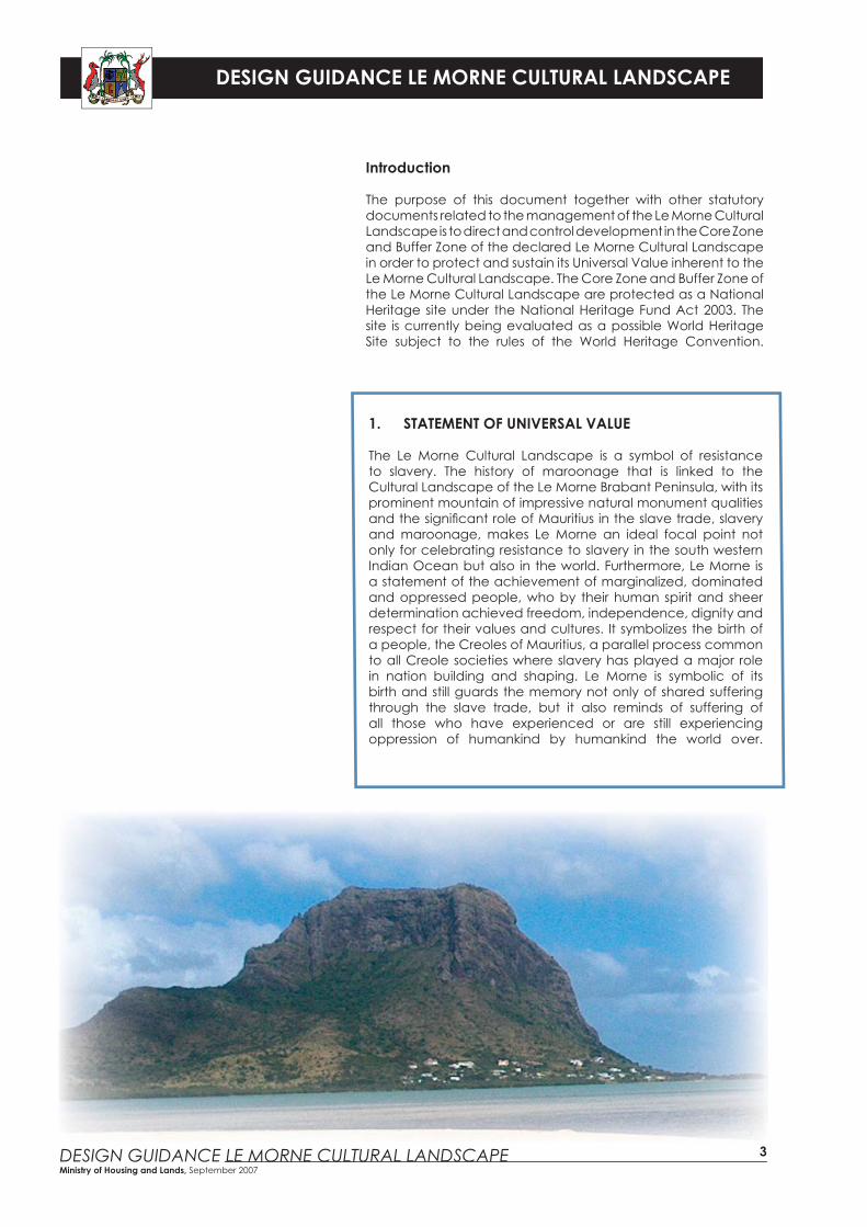
The purpose of this document together with other statutory documents related to the management of the Le Morne Cultural Landscape is to direct and control development in the Core Zone and Buffer Zone of the declared Le Morne Cultural Landscape in order to protect and sustain its Universal Value inherent to the Le Morne Cultural Landscape. The Core Zone and Buffer Zone of the Le Morne Cultural Landscape are protected as a National Heritage site under the National Heritage Fund Act 2003. The site is currently being evaluated as a possible World Heritage Site subject to the rules of the World Heritage Convention.
1. STATEMENT OF UNIVERSAL VALUE
The Le Morne Cultural Landscape is a symbol of resistance to slavery. The history of maroonage that is linked to the Cultural Landscape of the Le Morne Brabant Peninsula, with its prominent mountain of impressive natural monument qualities and the signifi cant role of Mauritius in the slave trade, slavery and maroonage, makes Le Morne an ideal focal point not only for celebrating resistance to slavery in the south western Indian Ocean but also in the world. Furthermore, Le Morne is a statement of the achievement of marginalized, dominated and oppressed people, who by their human spirit and sheer determination achieved freedom, independence, dignity and respect for their values and cultures. It symbolizes the birth of a people, the Creoles of Mauritius, a parallel process common to all Creole societies where slavery has played a major role in nation building and shaping. Le Morne is symbolic of its birth and still guards the memory not only of shared suffering through the slave trade, but it also reminds of suffering of all those who have experienced or are still experiencing oppression of humankind by humankind the world over.
DESIGN GUIDANCE LE MORNE CULTURAL LANDSCAPE
DESIGN GUIDANCE LE MORNE CULTURAL LANDSCAPE Ministry of Housing and Lands, September 2007
Developers.Politicians.Util
ities
.
Sc
heme Promoters.Individuals.Householders.The
Pub
lic.
Architects.Town Planners.Ur
ban
De
signers.
4
2. Design Guidance
The objective is to defi ne a set of performance criteria and design standards that are applicable to supportive development for use by individual site owners, developers, Non-governmental organizations, and for assisting Government and the Local Authority when processing development applications.
It aims to promote sustainable and equitable development that will protect and enhance the Authenticity and Integrity of Le Morne Cultural Landscape in line with the Operational Guidelines of UNESCO and the Le Morne Cultural Landscape Management Plan.
It may also bring sustainable economic and social benefi ts to the Le Morne Cultural Landscape and surrounding areas and to Mauritius as a whole, open new opportunities for supportive development and promote responsible tourism and local economic development
Design Sheets for Le Morne consider special design circumstances and supplement key land use design guidance. Design Sheets for Le Morne are provided in Section 4 and are supplemented by already available Design Sheets in the Planning Policy Guidance (PPG 1 fi rst issued in November 2004 and revised in September 2006) for the following uses:
• Design Sheets for Design for Sloping Sites.
• Design Sheets for Residential Coastal Development.
• Technical Sheets for Provision of Infrastructure.
And the underlying principles in the Design Guidance for Hotels and Integrated resorts (PPG 1) revised September 2006.
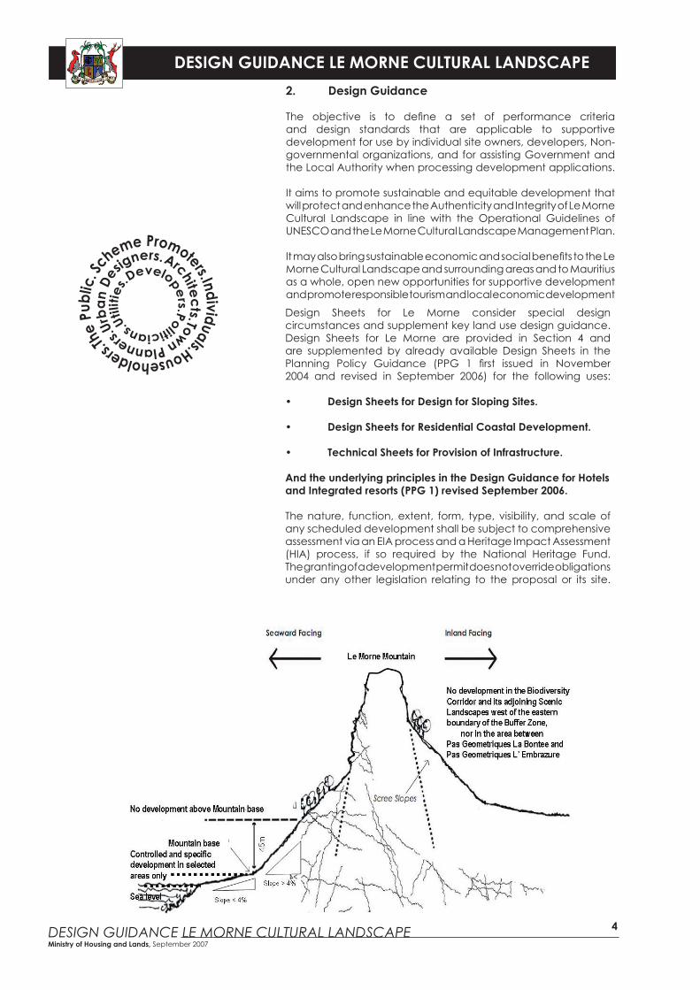
The nature, function, extent, form, type, visibility, and scale of any scheduled development shall be subject to comprehensive assessment via an EIA process and a Heritage Impact Assessment (HIA) process, if so required by the National Heritage Fund. The granting of a development permit does not override obligations under any other legislation relating to the proposal or its site.
DESIGN GUIDANCE LE MORNE CULTURAL LANDSCAPE
DESIGN GUIDANCE LE MORNE CULTURAL LANDSCAPE Ministry of Housing and Lands, September 2007
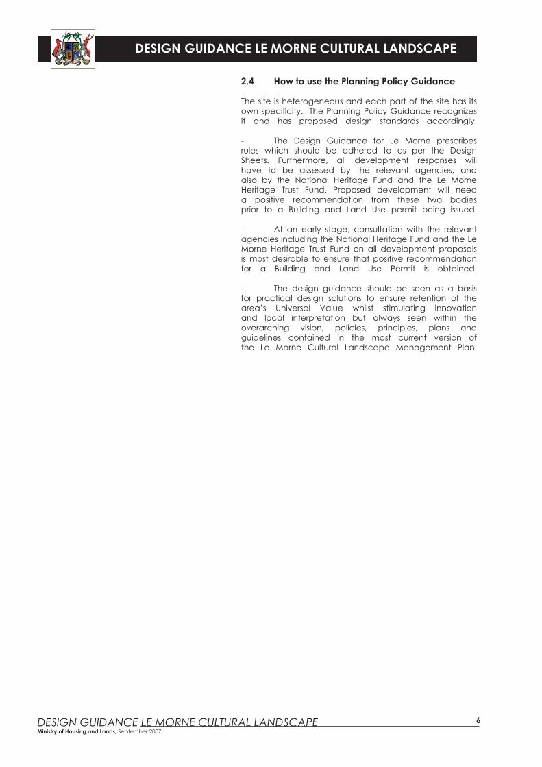
No two places are identical and there is no such thing as a single blueprint for good design. Good design arises from a thorough and caring understanding of site and
context.
FLEXIBILITY RESPONSIVE IMAGINATIVE PROACTIVE
��RIGIDITY
UNRESPONSIVE
MONOTONOUS
REACTIVE
5
2.1 Context and Support
This document is to be used together with any relevant legislation, policy documents and guidelines, including, inter alia,• The National Heritage Fund Act 2003;• The Le Morne Heritage Trust Fund Act 2004;• The Environmental Protection Act 2002; and• The District Council Outline Planning Scheme for Black River 2006.
2.2 Status of the Planning Policy Guidance for Le Morne Cultural Landscape
This Planning Policy Guidance applies to the Le Morne Cultural Landscape under section 13 of the Planning and Development Act 2004. Applicants for Building and Land Use Permits should demonstrate, through a Design Statement, how they have taken account of the requirements of the Le Morne Cultural Landscape through the Le Morne Cultural Landscape Management Plan, the relevant Design Guidance and Design Sheets in their development proposals so as to preserve the Authenticity and Integrity of the Cultural Landscape.
2.3 Who should use the Planning Policy Guidance
The overall message is that there is a need for everyone involved in land development to contribute to a culture of high quality design in Mauritius which will respect the setting and character of the area.
• Government and Local authority offi cers, the National Heritage Fund and Le Morne Heritage Trust Fund will use this Planning Policy Guidance in the context of the sustained conservation of Universal Value as per the Le Morne Heritage Fund Act and the Le Morne Cultural Landscape Management Plan to enable the practical application of national and local planning policies and the management and control of the heritage site.
• Project promoters, developers, designers and individual property owners should use this Planning Policy Guidance to prepare proposals using appropriate design principles whilst equally conforming to all relevant legislations.
DESIGN GUIDANCE LE MORNE CULTURAL LANDSCAPE
DESIGN GUIDANCE LE MORNE CULTURAL LANDSCAPE Ministry of Housing and Lands, September 2007
6
2.4 How to use the Planning Policy Guidance
The site is heterogeneous and each part of the site has its own specifi city. The Planning Policy Guidance recognizes it and has proposed design standards accordingly.
- The Design Guidance for Le Morne prescribes rules which should be adhered to as per the Design Sheets. Furthermore, all development responses will have to be assessed by the relevant agencies, and also by the National Heritage Fund and the Le Morne Heritage Trust Fund. Proposed development will need a positive recommendation from these two bodies prior to a Building and Land Use permit being issued.
- At an early stage, consultation with the relevant agencies including the National Heritage Fund and the Le Morne Heritage Trust Fund on all development proposals is most desirable to ensure that positive recommendation for a Building and Land Use Permit is obtained.
- The design guidance should be seen as a basis for practical design solutions to ensure retention of the area’s Universal Value whilst stimulating innovation and local interpretation but always seen within the overarching vision, policies, principles, plans and guidelines contained in the most current version of the Le Morne Cultural Landscape Management Plan.
DESIGN GUIDANCE LE MORNE CULTURAL LANDSCAPE
DESIGN GUIDANCE LE MORNE CULTURAL LANDSCAPE Ministry of Housing and Lands, September 2007
7
- 3. Design Principles
3.1 Context
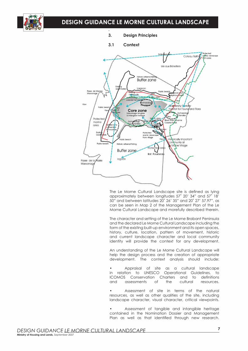
The Le Morne Cultural Landscape site is defi ned as lying approximately between longitudes 57˚ 20’ 34” and 57˚ 18’ 50” and between latitudes 20˚ 26’ 35” and 20˚ 27’ 57.97”, as can be seen in Map 2 of the Management Plan of the Le Morne Cultural Landscape and morefully described therein.
The character and setting of the Le Morne Brabant Peninsula and the declared Le Morne Cultural Landscape including the form of the existing built-up environment and its open spaces, history, culture, location, pattern of movement, historic and current landscape character and local community identity will provide the context for any development.
An understanding of the Le Morne Cultural Landscape will help the design process and the creation of appropriate development. The context analysis should include:
• Appraisal of site as a cultural landscape in relation to UNESCO Operational Guidelines, to ICOMOS Conservation Charters and to defi nitions and assessments of the cultural resources.
• Assessment of site in terms of the natural resources, as well as other qualities of the site, including landscape character, visual character, critical viewpoints.
• Assessment of tangible and intangible heritage contained in the Nomination Dossier and Management Plan as well as that identifi ed through new research.
DESIGN GUIDANCE LE MORNE CULTURAL LANDSCAPE
DESIGN GUIDANCE LE MORNE CULTURAL LANDSCAPE Ministry of Housing and Lands, September 2007
8
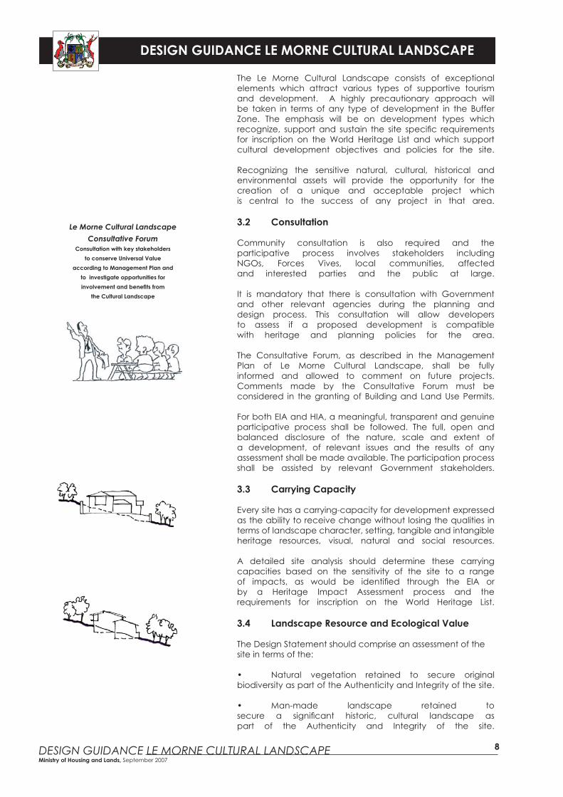
Le Morne Cultural LandscapeConsultative Forum
Consultation with key stakeholdersto conserve Universal Value
according to Management Plan andto investigate opportunities forinvolvement and benefi ts from
the Cultural Landscape
The Le Morne Cultural Landscape consists of exceptional elements which attract various types of supportive tourism and development. A highly precautionary approach will be taken in terms of any type of development in the Buffer Zone. The emphasis will be on development types which recognize, support and sustain the site specifi c requirements for inscription on the World Heritage List and which support cultural development objectives and policies for the site.
Recognizing the sensitive natural, cultural, historical and environmental assets will provide the opportunity for the creation of a unique and acceptable project which is central to the success of any project in that area.
3.2 Consultation
Community consultation is also required and the participative process involves stakeholders including NGOs, Forces Vives, local communities, affected and interested parties and the public at large.
It is mandatory that there is consultation with Government and other relevant agencies during the planning and design process. This consultation will allow developers to assess if a proposed development is compatible with heritage and planning policies for the area.
The Consultative Forum, as described in the Management Plan of Le Morne Cultural Landscape, shall be fully informed and allowed to comment on future projects. Comments made by the Consultative Forum must be considered in the granting of Building and Land Use Permits.
For both EIA and HIA, a meaningful, transparent and genuine participative process shall be followed. The full, open and balanced disclosure of the nature, scale and extent of a development, of relevant issues and the results of any assessment shall be made available. The participation process shall be assisted by relevant Government stakeholders.
3.3 Carrying Capacity
Every site has a carrying-capacity for development expressed as the ability to receive change without losing the qualities in terms of landscape character, setting, tangible and intangible heritage resources, visual, natural and social resources.
A detailed site analysis should determine these carrying capacities based on the sensitivity of the site to a range of impacts, as would be identifi ed through the EIA or by a Heritage Impact Assessment process and the requirements for inscription on the World Heritage List.
3.4 Landscape Resource and Ecological Value
The Design Statement should comprise an assessment of the site in terms of the:
• Natural vegetation retained to secure original biodiversity as part of the Authenticity and Integrity of the site.
• Man-made landscape retained to secure a signifi cant historic, cultural landscape as part of the Authenticity and Integrity of the site.
DESIGN GUIDANCE LE MORNE CULTURAL LANDSCAPE
DESIGN GUIDANCE LE MORNE CULTURAL LANDSCAPE Ministry of Housing and Lands, September 2007
9
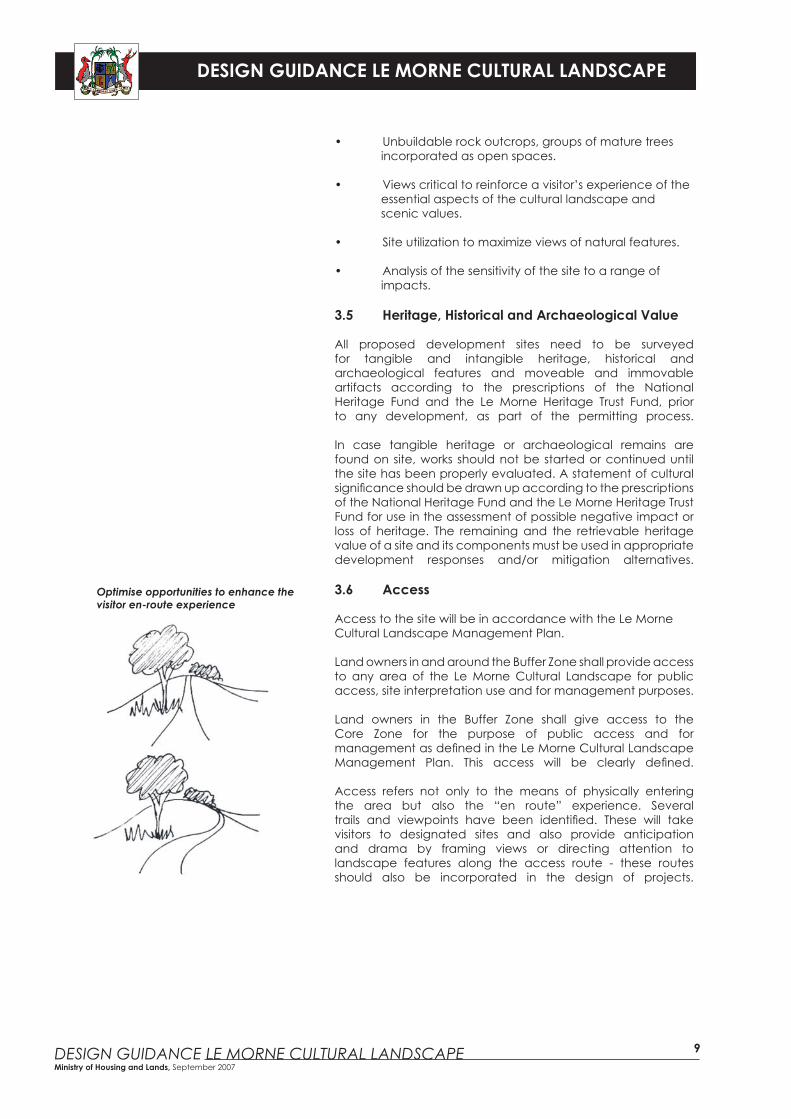
Optimise opportunities to enhance the visitor en-route experience
• Unbuildable rock outcrops, groups of mature trees incorporated as open spaces.
• Views critical to reinforce a visitor’s experience of the essential aspects of the cultural landscape and scenic values.
• Site utilization to maximize views of natural features.
• Analysis of the sensitivity of the site to a range of impacts.
3.5 Heritage, Historical and Archaeological Value
All proposed development sites need to be surveyed for tangible and intangible heritage, historical and archaeological features and moveable and immovable artifacts according to the prescriptions of the National Heritage Fund and the Le Morne Heritage Trust Fund, prior to any development, as part of the permitting process.
In case tangible heritage or archaeological remains are found on site, works should not be started or continued until the site has been properly evaluated. A statement of cultural signifi cance should be drawn up according to the prescriptions of the National Heritage Fund and the Le Morne Heritage Trust Fund for use in the assessment of possible negative impact or loss of heritage. The remaining and the retrievable heritage value of a site and its components must be used in appropriate development responses and/or mitigation alternatives.
3.6 Access
Access to the site will be in accordance with the Le Morne Cultural Landscape Management Plan.
Land owners in and around the Buffer Zone shall provide access to any area of the Le Morne Cultural Landscape for public access, site interpretation use and for management purposes.
Land owners in the Buffer Zone shall give access to the Core Zone for the purpose of public access and for management as defi ned in the Le Morne Cultural Landscape Management Plan. This access will be clearly defi ned.
Access refers not only to the means of physically entering the area but also the “en route” experience. Several trails and viewpoints have been identifi ed. These will take visitors to designated sites and also provide anticipation and drama by framing views or directing attention to landscape features along the access route - these routes should also be incorporated in the design of projects.
DESIGN GUIDANCE LE MORNE CULTURAL LANDSCAPE
DESIGN GUIDANCE LE MORNE CULTURAL LANDSCAPE Ministry of Housing and Lands, September 2007
10
3.7 Activity Centres, Facilities and Services
The scope and nature and location of activity centres, facilities and services shall be subject to the policies, strategies and guidelines of the Le Morne Cultural Landscape Management Plan.
It is important to locate certain facilities, paths and roads away from sensitive areas that are sensitive to certain impacts. However, certain facilities will not be allowed unless it can be clearly shown that negative impacts can be mitigated suffi ciently. Confl icts between users should be avoided.
Where required, parking locations should be assessed for any impact on the Universal Value and layout should be designed to minimize visual impact on the site. Services should have little or no visual or audible impact on the area.
4 Design Sheets
The vision and policies of the Le Morne Cultural Landscape Management Plan remain the basis for the elements of the Design Sheets.
4.1 Core Zone
The area will be developed as a heritage site in accordance with provisions contained in the Le Morne Cultural Landscape Management Plan.
Only supporting services as approved by the National Heritage Fund and the Le Morne Heritage Trust Fund will be allowed. Development will focus on site conservation and preservation of specifi c areas namely :
• Pas Geometriques around Trou Chenilles and the area of the historic village.• The public beach on the east side of the southern spur of the peninsula.• The site of Macaque.• And any other archaeological heritage site or structures that may be identifi ed in the future.
The development of these sites will follow guidelines contained in the Le Morne Cultural Landscape Management Plan.
There shall be a presumption against any private commercial development in the Core Zone.
DESIGN GUIDANCE LE MORNE CULTURAL LANDSCAPE
DESIGN GUIDANCE LE MORNE CULTURAL LANDSCAPE Ministry of Housing and Lands, September 2007
11
4.2 Buffer Zone
Development in the Buffer Zone will follow the Design Guidance provided in this document.
It is important that project promoters apply the principles for development on sloping sites (Design Sheet for Sloping Sites) to their projects.
The Design Sheet for Resort Hotel development in the Planning Policy Guidance will, however, not be applicable to the Le Morne Cultural Landscape. Development should, however, have regard to the underlying principles in the Design Guidance for Hotels and Integrated Resorts.
Only development that sustains and supports the development vision of the Cultural Landscape will be allowed.
Any proposal should include quality in roofs, walls and openings design and a colour scheme acceptable to the Authorities.
Quality/luxury retreats and eco-tourism lodges can be considered provided there are no adverse impacts to the Cultural Landscape.
Any structures or buildings, materials used, function and topology must be designed to be compatible with the qualities of the natural and cultural landscape.
The following additional Guidance is pertinent to the specifi c sections of the Buffer Zone:
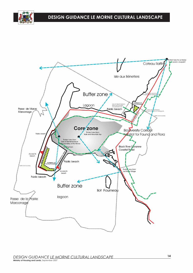
4.2.1 The Biodiversity Corridor
The Biodiversity Corridor from the eastern Buffer Zone boundary to the Black River Savanne Coastal Road, shown as habitat for fl ora and fauna in the District Council Outline Planning Scheme for Black River 2006, links the peninsula to the mainland. It is an important part of the Cultural Landscape.
• Linkage of this zone to the Black River Gorges National Park must be strengthened and maintained.
• The scenic areas north and south of the biodiversity corridor must be retained.
• The biodiversity corridor should be managed without large infrastructure or commercial development.
• Commercial signage should not be allowed in the area.
• Light infrastructure can be constructed. Caution must be taken in respect of works likely to adversely affect the Universal Value of the Cultural Landscape. Major infrastructure or large commercial development may be detrimental to the character of the area. However, any regional infrastructure (overhead lines, road widening) will be visually integrated in the Cultural Landscape.
DESIGN GUIDANCE LE MORNE CULTURAL LANDSCAPE
DESIGN GUIDANCE LE MORNE CULTURAL LANDSCAPE Ministry of Housing and Lands, September 2007
The maximum height of buildings on sloping sites
10.5
m -
max
imum
hei
ght
of c
umul
ativ
e el
evat
ion
7.5m
Max7.
5m M
ax
12
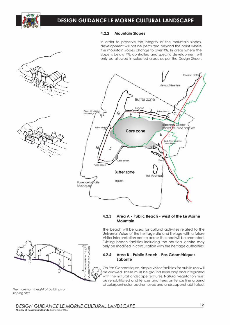
4.2.2 Mountain Slopes
In order to preserve the integrity of the mountain slopes, development will not be permitted beyond the point where the mountain slopes change to over 4%. In areas where the slope is below 4%, controlled and specifi c development will only be allowed in selected areas as per the Design Sheet.
4.2.3 Area A - Public Beach - west of the Le Morne Mountain
The beach will be used for cultural activities related to the Universal Value of the heritage site and linkage with a future Visitor interpretation centre across the road will be promoted. Existing beach facilities including the nautical centre may only be modifi ed in consultation with the heritage authorities.
4.2.4 Area B - Public Beach - Pas Géométriques Labonté
On Pas Geometriques, simple visitor facilities for public use will be allowed. These must be ground level only and integrated with the natural landscape features. Natural vegetation must be rehabilitated and fences and trees on fence line around circular peninsular road removed and landscape rehabilitated.
DESIGN GUIDANCE LE MORNE CULTURAL LANDSCAPE
DESIGN GUIDANCE LE MORNE CULTURAL LANDSCAPE Ministry of Housing and Lands, September 2007
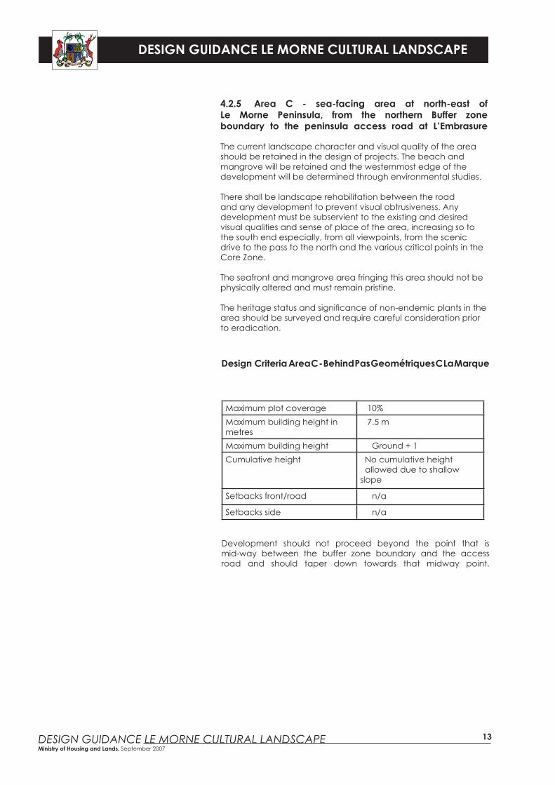
Design Criteria Area C - Behind Pas Geométriques C La Marque
Maximum plot coverage 10%Maximum building height in metres
7.5 m
Maximum building height Ground + 1Cumulative height No cumulative height
allowed due to shallow slope
Setbacks front/road n/a
Setbacks side n/a
Development should not proceed beyond the point that is mid-way between the buffer zone boundary and the access road and should taper down towards that midway point.
13
4.2.5 Area C - sea-facing area at north-east of Le Morne Peninsula, from the northern Buffer zone boundary to the peninsula access road at L’Embrasure
The current landscape character and visual quality of the area should be retained in the design of projects. The beach and mangrove will be retained and the westernmost edge of the development will be determined through environmental studies. There shall be landscape rehabilitation between the road and any development to prevent visual obtrusiveness. Any development must be subservient to the existing and desired visual qualities and sense of place of the area, increasing so to the south end especially, from all viewpoints, from the scenic drive to the pass to the north and the various critical points in the Core Zone.
The seafront and mangrove area fringing this area should not be physically altered and must remain pristine.
The heritage status and signifi cance of non-endemic plants in the area should be surveyed and require careful consideration prior to eradication.
DESIGN GUIDANCE LE MORNE CULTURAL LANDSCAPE
DESIGN GUIDANCE LE MORNE CULTURAL LANDSCAPE Ministry of Housing and Lands, September 2007
14
DESIGN GUIDANCE LE MORNE CULTURAL LANDSCAPE
DESIGN GUIDANCE LE MORNE CULTURAL LANDSCAPE Ministry of Housing and Lands, September 2007
Design Criteria Area D - Rogers LandMaximum plot coverage 10%Maximum building height in metres
7.5 m
Maximum building height Ground + 1Cumulative height No cumulative height
allowed due to shallow slopeSetbacks front/road 6 mSetbacks side 5m with trees between
buildings
15
4.2.6 Area D - South-west of Le Morne Mountain (Rogers Land)
Ideally, the land should retain its current character and state. However, if development is allowed, it should:
• Support and sustain the values of the cultural landscape and fi t into the development vision of the cultural landscape.
• Retain the current landscape character and visual quality as well as that forthcoming from detailed research on the historical character, resources and quality.
• The introduction of non-endemic plants will aim at retaining the existing vegetation character of the area.
• The area can be viewed from various critical viewpoints in the Core Zone - the development must therefore be subservient to the existing and desired visual qualities and sense of place of the area. When viewing the site from the road at the “Valley of the Bones”, the majority of the site must remain treed, with the roofscape of any development hidden behind the remaining existing, or reestablished plantation. The site is also a visual receptor from the Le Morne village; if allowed, any development must retain an adequate area of trees on the east edge as visual screen.
• Linkage between the future Visitor interpretation centre and the public beach will be promoted and access to the public beach on the eastern side of site should be designed so as not to detract from the Core Zone. The existing dirt track between the main road at the public beach on the west and Trou Chenilles should be used to provide access to the Trou Chenilles archaeological works and heritage site.
The other design considerations with respect to this particular site are:• Development should follow the existing roads on the western and southern edges of site.• Buildings on boundaries facing the plantation of existing trees should present a transition, i.e. a “knitted” horizontal and vertical transition between development and plantation.• Roofs of buildings on the south edge of site must not be visible from the “Valley of the Bones” but be hidden behind trees.• Key objectives with respect to materials, architectural forms and image and function should refl ect the development image, visual context, the site’s setting and the vision of the Cultural Landscape.• Development will carefully consider its relationship with the east-west dirt track, the eastern public beach and the Core Zone to support and conserve the Universal Value of the site.
DESIGN GUIDANCE LE MORNE CULTURAL LANDSCAPE
DESIGN GUIDANCE LE MORNE CULTURAL LANDSCAPE Ministry of Housing and Lands, September 2007
16
4.2.7 Area E - North-east, east and south-east of Le Morne Mountain and West of Black River Coastal road
The area will be developed as a heritage site in accordance with provisions contained in the Le Morne Cultural Landscape Management Plan.
Only supporting services as approved by the National Heritage Fund and the Le Morne Heritage Trust Fund will be allowed. Development will focus on site conservation.
Part of the site is also known to contain remains of settlements and remains of Colonial era land-uses that may be declared as National Heritage.
Development on site is to be limited to infrastructure and elements required to support cultural activities and site interpretation as part of the Le Morne Cultural Landscape.
In case tangible heritage or archaeological remains are found on site, works should not be started or continued until the site has been properly evaluated. A statement of cultural signifi cance should be drawn up in accordance with the provisions of the National Heritage Fund and the Le Morne Heritage Trust Fund for use in the assessment of possible negative impact or loss of heritage. The remaining and the retrievable heritage value of a site and its components must be used in appropriate development responses and/or mitigation alternatives.
The archaeological remains and graves in the area will require protection in line with practice to be monitored by heritage authorities.
The area can be seen from several critical viewpoints in the Core Zone as well as from the three important roads, namely• Black River Savanne Coastal road.• Trou Chenilles access.• Circular peninsular access.
Any development must be subservient to the existing and desired visual qualities and sense of place of the area. All remaining views of coastal plains and undulating hills should be protected from development and visual qualities enhanced through detailed studies.
The mangrove areas in the corner of the lagoon south-west of the Black River Savanne Coastal Road is a sensitive habitat for birds and wild life and should be protected.
The heritage status and signifi cance of non-endemic plants in the area should be surveyed and require careful consideration prior to eradication.
The Biodiversity Corridor on this property, west of the Black River Savanne Coastal Road must remain free of any buildings or infrastructure development. If approved, any supportive infrastructure, interpretative elements or simple visitor facilities should be designed to preserve the defi ned qualities of the natural and cultural landscape.
DESIGN GUIDANCE LE MORNE CULTURAL LANDSCAPE
DESIGN GUIDANCE LE MORNE CULTURAL LANDSCAPE Ministry of Housing and Lands, September 2007
Design Criteria Area F - East of Black River coastal roadMaximum plot coverage n/aMaximum building height in metres
7.5 m
Maximum building height Ground + 1Cumulative height 10.5 m
Setbacks front/road n/aSetbacks side n/a
17
4.2.8 Area F - East of Black River Savanne Coastal Road and north and south of Biodiversity corridor
This part of the Buffer Zone comprises land east of the Black River Savanne Coastal road outside the biodiversity corridor between the road and the eastern border of the Buffer Zone which runs along the crest of the Le Petit Morne mountain range and the agricultural land located east of the Black River Savanne Coastal road.
The currently undeveloped land east of the Black River Savanne Coastal Road and lying north of the Biodiversity corridor should not be commercially developed.
There shall be a presumption in favour of minor development in line with the historic origin of site (1795 Chevaliers estate) and the historical elements of the farm identifi ed and conserved. Cultural activities and support activities for the Le Morne Cultural Landscape such as a restaurant, eco-tourism lodges and living heritage activities will be encouraged.If agricultural land use is abandoned in future, the existing farm complex should be rehabilitated and re-used in line with guidelines from the heritage authorities.
4.3 Area G - Renovation, redevelopment of existing tourismfacilities
Existing establishments will be allowed to redevelop their sites in line with the provisions of existing development rights but subject to the following:
• There shall be an enhanced commitment to the sustainability of the Le Morne Cultural Landscape values. • There shall be an enhanced commitment to conserve and restore the marine environment of the lagoon.• Additions and alterations shall not exceed the existing development density and should be subject to all relevant clearances being obtained.• Roofscapes will be a key element to be allowed in consultation with relevant heritage and planning agencies.
DESIGN GUIDANCE LE MORNE CULTURAL LANDSCAPE
DESIGN GUIDANCE LE MORNE CULTURAL LANDSCAPE Ministry of Housing and Lands, September 2007
18
4.4 Area H - Existing residential Morcellement Cambier
Infi ll development will be allowed on vacant plots as per any “Cahier des Charges” available for the morcellement or as per Design Sheet for Residential Coastal Development, except for maximum height of buildings. Maximum height is to be ground fl oor only. No new double storey will be allowed on vacant plots and only one residential dwelling will be allowed per plot.
New development, alterations or additions must not detract or diminish the Universal Value of the Cultural Landscape and shall be carried out in consultation with relevant stakeholders and subject to scrutiny by the National Heritage Fund and the Le Morne Heritage Trust Fund.
In case tangible heritage or archaeological remains are found on site, works should not be started or continued until the site has been properly evaluated. A statement of cultural signifi cance should be drawn up in accordance with the provisions of the National Heritage Fund and the Le Morne Heritage Trust Fund for use in the assessment of possible negative impact or loss of heritage. The remaining and the retrievable heritage value of a site and its components must be used in appropriate development responses and/or mitigation alternatives.
The morcellement should remain strictly residential and no sub-division of plots will be allowed.
4.5 Uncommitted State Land
There shall be a presumption against private commercial development on these sites. Visitors’ facilities and supporting services by Government or Statutory Bodies shall be considered favorably. The approval of the Ministry of Housing and Lands will be required on State Land.
4.6 Planning conditions and obligations
Developers should respond positively to planning agreements designed for the benefi t of the local community. The requirements of the local community will be determined in consultation with the local stakeholders and managed by relevant agencies. Public participation and consultation are compulsory. A Local Economic Development Policy will be put in place for implementation. The planning agreements should be fair and reasonable to all parties concerned.
5.0 Development outside the Buffer Zone
Development outside the Buffer Zone will be governed by provisions laid down in the District Council Outline Planning Scheme for Black River 2006 and Planning Policy Guidance. Being given the sensitivity of the Le Morne Cultural Landscape, recommendations from the Le Morne Heritage Trust Fund and the National Heritage Fund for sites immediately adjacent to the Buffer Zone are required especially for the following:• Le Morne Village. • Isle aux Bénitiers.• Sea-facing area north of Le Morne Peninsula, from Coteau Raffi n to the northern Buffer Zone boundary.• The lagoon inside the coral reef located immediately adjacent to the Buffer Zone boundary.
September 2007
Related Documents