to table of contents next las vegas wash coordination committee 2008 year-end report

Welcome message from author
This document is posted to help you gain knowledge. Please leave a comment to let me know what you think about it! Share it to your friends and learn new things together.
Transcript
1
to table of contents next
las vegas wash coordination committee2008 year-end report

back to table of contents nextprevious
las vegas wash coordination committee2008 year-end report
contentslas vegas valley watershed advisory committee chair letter . . . . . . 4mission and background . . . . . . . . . . . . . . . . . . . . . . . . . . . . . . . . 5las vegas wash 2008 activities maps . . . . . . . . . . . . . . . . . . . . . . . 6stabilization . . . . . . . . . . . . . . . . . . . . . . . . . . . . . . . . . . . . . . . . . 8bioassessment monitoring . . . . . . . . . . . . . . . . . . . . . . . . . . . . . . 10water quality . . . . . . . . . . . . . . . . . . . . . . . . . . . . . . . . . . . . . . . 12wetland demonstration projects . . . . . . . . . . . . . . . . . . . . . . . . . . 14wildlife . . . . . . . . . . . . . . . . . . . . . . . . . . . . . . . . . . . . . . . . . . . . 16vegetation enhancement and management . . . . . . . . . . . . . . . . . . 18archaeological resources . . . . . . . . . . . . . . . . . . . . . . . . . . . . . . 20education and outreach . . . . . . . . . . . . . . . . . . . . . . . . . . . . . . . . 22data resources . . . . . . . . . . . . . . . . . . . . . . . . . . . . . . . . . . . . . . 242008 progress summary . . . . . . . . . . . . . . . . . . . . . . . . . . . . . . . 26
2008 year-end report
Above, left to right: an American kestrel; Pabco Road Weir
On the cover, clockwise from left: 10-year anniversary commemorative stone; a view at the
Wash; a mockingbird sits in a mesquite tree; a cottonwood tree overlooks the landscape; proud Green-Up volunteers
Photography throughout this report is provided by Dick Barrett, Andy Cattoir, Gene Hertzog, Raymond
Saumure and members of the Project Team.
Please note that to the far left of each section’s spread, a side bar contains a list of numbers which correspond to the CAMP action items listed here.
relevance to CAMP ERoSion & SToRmwATER, administered by the Operations Study Team
1 Install erosion control structures ongoing 12 Obtain topography and geophysical data complete 23 Conduct sediment transport modeling ongoing 34 Establish off-stream wetlands with alternate discharge considerations ongoing 45 Evaluate stormwater detention/retention basins complete 5
AlTERnATE DiSCHARGE, administered by the Clean Water Coalition (CWC)
6 Implement the discharger’s scope of services 67 Incorporate options and selection criteria 78 Utilize the Alternate Discharge Study Team in process 89 Integrate work done by other study teams into process 9
10 Update public officials and interested parties 10lAnD USE, administered by the Environmental Review and Planning Study Team, completed in 2005
11 Focus land use recommendations on a priority zone of influence 1112 Support development and implementation of environmental review process 1213 Develop best management practices 1314 Develop educational materials for developers 1415 Identify opportunities for interagency coordination 15JURiSDiCTionAl & REGUlAToRy, administered by the Las Vegas Valley Watershed Advisory Committee and the Las Vegas Wash Coordination Committee
16 Further investigate/define structure for local oversight of process complete 1617 Ensure interagency coordination ongoing 17PUBliC oUTREACH, administered by the Administrative Study Team
18 Establish method to continue implementation of public outreach complete 1819 Continue implementation of feedback mechanism/progress measure ongoing 1920 Provide updates to elected officials ongoing 20FUnDinG, administered by the Administrative Study Team
21 Further investigate potential funding sources ongoing 2122 Anticipate future funding needs ongoing 2223 Work with Las Vegas Valley Watershed Advisory Committee to review funding options ongoing 2324 Develop method to identify specific projects for grant funding complete 2425 Utilize existing resources and staff whenever possible ongoing 25SHAllow GRoUnDwATER, administered by the Research and Environmental Monitoring Study Team
26 Develop a central database complete 2627 Locate and inventory existing shallow monitoring wells complete 2728 Identify issues of concern ongoing 2829 Develop a long-term monitoring plan complete 2930 Develop method to identify the potential for future contaminants complete 3031 Develop and implement a notification plan 3132 Promote interagency coordination ongoing 3233 Develop a bibliography complete 33wETlAnDS PARk, administered by Clark County Parks and Recreation (Clark County)
34 Identify water resources needed to maintain park 3435 Develop long-term monitoring plan 3536 Develop long-term operations & maintenance plan 3637 Ensure implementation of mitigation measures 3738 Identify funding needs 3839 Ensure interagency coordination 39EnviRonmEnTAl RESoURCES, administered by the Research and Environmental Monitoring Study Team
40 Develop long-term management and monitoring plans complete 4041 Conduct additional research ongoing 4142 Preserve and address cultural resource issues ongoing 4243 Identify funding needs ongoing 4344 Facilitate interagency coordination to ensure project implementation ongoing 44
handled by CWC
handled by individual assigned agencies
handled by Clark County
handled by other agencies
CAMP action items
back to table of contents nextprevious
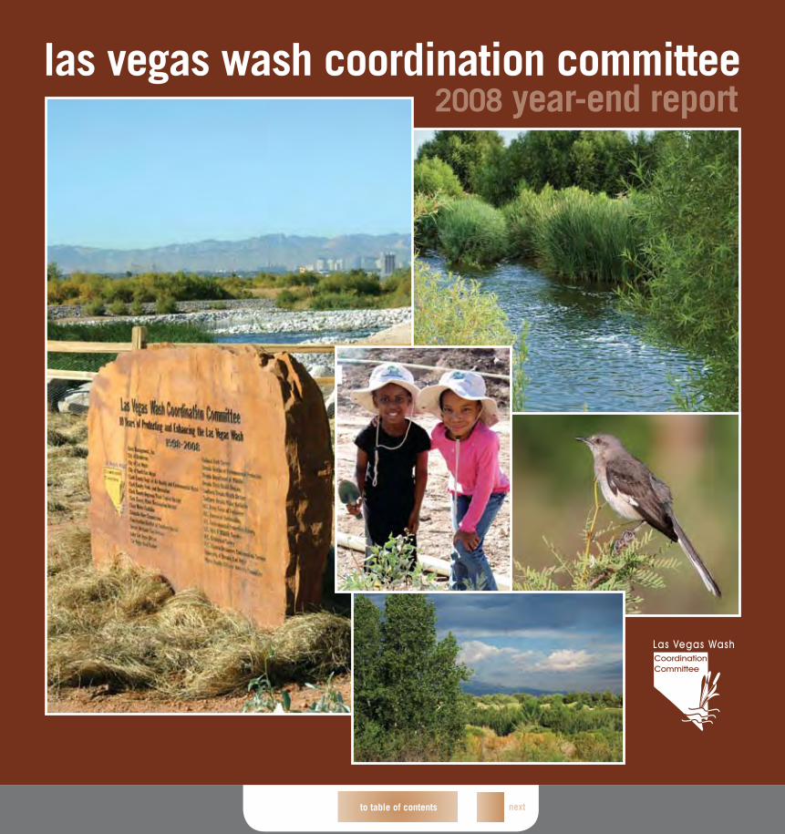
backgroundThe Las Vegas Wash (Wash) carries more than 170 million gallons of water a day. It exists in its present capacity because of the metropolitan population in Southern Nevada. Decades ago, the flows of the Wash created more than 2,000 acres of wetlands. By the 1990s, only about 200 acres of wetlands remained. The dramatic loss of vegetation reduced both the Wash’s ability to support wildlife and serve as a natural filter for water that flows to Lake Mead, the source of our community’s water supply.
In 1997, a citizens advisory committee made recommendations to manage and protect the Wash. While many area organizations were concerned with the Wash’s deteriorating state, no single agency was responsible for managing it. To bring these interests together, the Las Vegas Wash Coordination Committee (LVWCC) was formed. The LVWCC includes representatives from more than two dozen local, state and federal agencies, environmental groups, business owners and concerned citizens. The committee’s goal was two-fold: Develop a long-term management plan for the Wash, and oversee implementation of the plan.
Within two years, the committee completed the Las Vegas Wash Comprehensive Adaptive Management Plan (CAMP)—a several-hundred page roadmap that includes 44 specific action items related to water quality, habitat management, erosion control and other key Wash issues. The LVWCC also created internal sub-committees and an advisory committee, the Las Vegas Valley Watershed Advisory Committee (LVVWAC), which derives its management authority through its members’ boards and councils.
This document, provided by the LVVWAC, offers a closer look at the progress of the CAMP action items, focusing on the accomplishments of 2008. Additionally, this report highlights the effort and work of the LVWCC and the resulting activities along the Wash.
5
mission Working to stabilize and enhance the valuable environmental resources of the Las Vegas Wash
ProjeCt Funding SourCeS, 2008Local Contributions $1,150,000Federal Contributions $909,230
operating Budget Total $2,059,230
Grants, Other, etc. $2,719,200
Wash Capital Improvements Project (CIP) $73,908,776
4
LAS VegAS WASh CoordinAtion CoMMitteeBasic Management, Inc.Citizen MembersCity of HendersonCity of Las VegasCity of North Las VegasClark County Department of Air Quality and Environmental ManagementClark County Parks and RecreationClark County Regional Flood Control DistrictClark County Water Reclamation DistrictClean Water CoalitionColorado River CommissionConservation District of Southern NevadaDesert Wetlands ConservancyLake Las Vegas ResortLas Vegas Boat HarborNational Park ServiceNevada Department of WildlifeNevada Division of Environmental ProtectionNevada State Health DivisionSouthern Nevada Health DistrictSouthern Nevada Water AuthorityU.S. Army Corps of EngineersU.S. Bureau of ReclamationU.S. Environmental Protection AgencyU.S. Fish and Wildlife ServiceU.S. Geological SurveyU.S. Natural Resources Conservation ServiceUniversity of Nevada, Las Vegas
Dear Friends:
Another productive year for the Las Vegas Wash Coordination Committee (LVWCC) has reached its end. As 2008 marked the 10th year that we have worked to protect, manage and enhance the Las Vegas Wash (Wash), it is important to remember that the continued success of this effort relies heavily on our ability to work cooperatively in meeting our common goals and objectives.
Since 2000, the LVWCC’s Management Advisory Committee (MAC) has focused on providing local oversight and funding to support the stabilization and enhancement efforts along the Wash. This year, however, the MAC broadened its focus to include the entire Las Vegas Valley watershed. Formally known as the MAC, the Las Vegas Valley Watershed Advisory Committee (LVVWAC) will continue working on issues related to the Wash, as well as protecting the quality of our community’s water resources by recommending management strategies and developing regional water quality goals for the Las Vegas Valley watershed, including the Wash and Lake Mead. Additionally, the LVVWAC will develop a cohesive and integrated watershed management approach to address issues relating to wastewater, drinking water and stormwater.
Research efforts will continue to expand our knowledge of the Wash’s delicate ecosystem and help protect the various species inhabiting the area. Additionally, the ongoing engineering activities to stabilize the Wash’s banks and minimize erosion will continue playing an important role in protecting our community’s drinking water supply and increasing the sustainability of this vital waterway.
This 2008 year-end report summarizes the numerous activities conducted by the LVWCC during the past year. Guided by the Las Vegas Wash Comprehensive Adaptive Management Plan, the LVWCC will continue to coordinate and implement various action items necessary to protect and enhance the Wash. Although a decade of hard work and substantial progress is now complete, we must continue to focus on the path ahead, as there remains much work to be done.
Sincerely,
Kay Brothers Chairperson, Las Vegas Valley Watershed Advisory Committee Las Vegas Wash Coordination Committee
LAS VegAS VALLey WAterShed AdViSory CoMMittee City of HendersonCity of Las VegasCity of North Las VegasClark CountyClark County Regional Flood Control DistrictClark County Water Reclamation DistrictClean Water CoalitionLas Vegas Valley Water DistrictSouthern Nevada Water Authority
Banded gecko
back to table of contents nextprevious
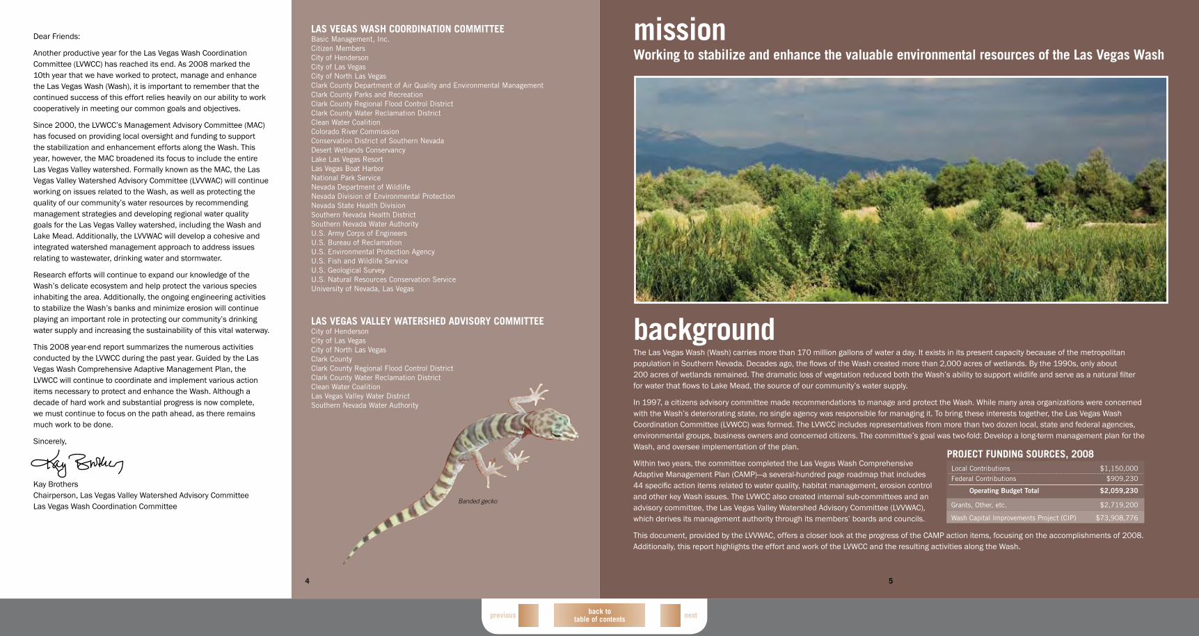
StAbiLizAtion & reVegetAtion ACtiVitieS
Revegetation Sites
Upper Diversion Weir, Bypass Channel and Pedestrian Bridge
0 .25 .5 1 1.5 2
MILES
MILES
N0 .5 1 2 3 4
N
CHARLESTON
HO
LLYWO
OD
VEGAS VALLEY
7
SANTIAGO DR
ARROYO GRANDESPORTS COMPLEX
AMERICAN PACIFIC DR
AR
RO
YO G
RA
ND
E B
LVD
WAter quALity Monitoring SiteS
Real-Time Water Quality Stations
Mainstream Monitoring Sites
Total Suspended Solids Sampling Sites
Tributary Sampling
Tributary to Las Vegas Wash
PittMAn WASh PiLot WetLAndS ProjeCt
Pittman Wash Pilot Wetlands
Tributary to Las Vegas Wash
0 .25 .5 1 1.5 2
MILES
MILES
N0 .5 1 2 3 4
N
6
generAL Legend
Clark County Nature Preserve
Clark County Wetlands Park
Las Vegas Wash
Lake Las Vegas
Demonstration Wetland at the City of Henderson WRF
Privately Owned
bird And bAt Study SiteS
Bat Live Capture Locations
Acoustic Bat Monitoring Stations
Avian Point Count Survey Locations
Marsh Bird Monitoring Locations
Southwestern Willow Flycatcher Survey Route
inVertebrAte Study SiteS
Butterfly Points
Aquatic Macroinvertebrate Points
Terrestrial Invertebrate Sampling Points
0 .25 .5 1 1.5 2
MILES
MILES
N0 .5 1 2 3 4
N
0 .25 .5 1 1.5 2
MILES
MILES
N0 .5 1 2 3 4
N
las vegas wash 2008 activities maps*
*maps only illustrate activities completed during 2008
back to table of contents nextprevious
decreasing channel bed downcutting, reducing stream bank erosion, armoring the channel with vegetation, balancing sediment transport and enhancing the ecosystem.
2008 MAjor ACCoMPLiShMentSStarting early in the year and finishing in May, Bureau crews were busy with stabilization activities. Crews installed an additional 5,400 feet of bank protection along the Wash, cleared 25 acres of tamarisk and removed areas of large woody vegetation from several weirs that were creating flood hazards. Additionally, the north bank upstream of Rainbow Gardens Weir was re-sloped for public safety.
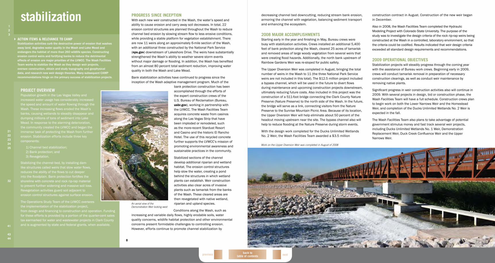
The Upper Diversion Weir was completed in August, bringing the total number of weirs in the Wash to 11 (the three National Park Service weirs are not included in this total). The $12.5 million project included a bypass channel, which will be used in the future to divert flows during maintenance and upcoming construction projects downstream, ultimately reducing future costs. Also included in this project was the construction of a 511-foot bridge connecting the Clark County Nature Preserve (Nature Preserve) to the north side of the Wash. In the future, the bridge will serve as a link, connecting visitors from the Nature Preserve to the Sunrise Mountain Picnic Area. Because of its location, the Upper Diversion Weir will help eliminate about 50 percent of the headcut moving upstream near the site. The bypass channel also will help to reduce flooding at the Nature Preserve during storm events.
With the design work completed for the Ducks Unlimited Wetlands No. 2 Weir, the Wash Facilities Team awarded a $3.5 million
construction contract in August. Construction of the new weir began in December.
Also in 2008, the Wash Facilities Team completed the Hydraulic Modeling Project with Colorado State University. The purpose of the study was to investigate the design criteria of the rock rip-rap weirs being constructed at the Wash in a controlled, laboratory environment, so that the criteria could be codified. Results indicated that weir design criteria exceeded all standard design requirements and recommendations.
2009 oPerAtionAL objeCtiVeSStabilization projects will steadily progress through the coming year with the assistance of Bureau work crews. Beginning early in 2009, crews will conduct tamarisk removal in preparation of necessary construction clearings, as well as conduct weir maintenance by removing native plants.
Significant progress in weir construction activities also will continue in 2009. With several projects in design, bid or construction phase, the Wash Facilities Team will have a full schedule. Construction crews plan to begin work on both the Lower Narrows Weir and the Homestead Weir, and completion of the Ducks Unlimited Wetlands No. 2 Weir is expected in the fall.
The Wash Facilities Team also plans to take advantage of potential government stimulus money and fast track several weir projects, including Ducks Unlimited Wetlands No. 1 Weir, Demonstration Replacement Weir, Duck Creek Confluence Weir and the Upper Narrows Weir.
Work on the Upper Diversion Weir was completed in August of 2008
8
ProgreSS SinCe inCePtionWith each new weir constructed in the Wash, the water’s speed and ability to cause erosion and carry away soil decreases. In total, 22 erosion control structures are planned throughout the Wash to reduce channel bed erosion by slowing stream flow to less erosive conditions, while providing a stable platform for vegetation establishment. There are now 11 weirs along an approximately 6-mile section of the Wash, with an additional three constructed by the National Park Service (nps.gov) downstream of Lakeshore Drive. The weirs have substantially strengthened the Wash’s ability to weather severe storm events without major damage or flooding. In addition, the Wash has benefited from an almost 80 percent total sediment reduction, improving water quality in both the Wash and Lake Mead.
Bank stabilization activities have continued to progress since the inception of the Wash adaptive management program. Much of the
bank protection construction has been accomplished through the efforts of the expert construction crews of the U.S. Bureau of Reclamation (Bureau, usbr.gov), working in partnership with the LVWCC. The Wash Facilities Team acquires concrete waste from casinos along the Las Vegas Strip that have been imploded or remodeled, such as the more-recent Stardust Resort and Casino and the historic El Rancho Hotel. The use of this recycled concrete further supports the LVWCC’s mission of promoting environmental awareness and sustainable practices in the community.
Stabilized sections of the channel develop additional riparian and wetland habitat. The erosion control structures help slow the water, creating a pond behind the structures in which wetland plants can establish. Weir construction activities also clear acres of invasive plants such as tamarisk from the banks of the Wash. These cleared areas are then revegetated with native wetland, riparian and upland species.
Conditions along the Wash, such as increasing and variable daily flows, highly erodable soils, water quality concerns, wildlife habitat protection and other environmental concerns present formidable challenges to controlling erosion. However, efforts continue to promote channel stabilization by
stabilization123
2122232425
32
41
4344
ACtion iteMS & reLeVAnCe to CAMPStabilization activities curb the destructive power of erosion that washes away land, degrades water quality in the Wash and Lake Mead and endangers the habitat of more than 260 wildlife species. Constructing erosion control weirs and fortifying banks to reduce the detrimental effects of erosion are major priorities of the LVWCC. The Wash Facilities Team works to stabilize the Wash as they design weir projects, oversee construction, obtain and study topography and geophysical data, and research new weir design theories. Many subsequent CAMP recommendations hinge on the primary success of stabilization projects.
ProjeCt oVerVieWPopulation growth in the Las Vegas Valley and increased water usage has considerably increased the speed and amount of water flowing through the Wash. These increasing flows eroded the Wash’s banks, causing wetlands to steadily disappear and dumping millions of tons of sediment into Lake Mead. In response to the alarming deterioration, the community created the LVWCC and began the immense task of protecting the Wash from further erosion. Stabilization efforts include three key components:
1) Channel bed stabilization; 2) Bank protection; and 3) Revegetation.
Stabilizing the channel bed, by installing dam-like structures called weirs that slow water flows, reduces the ability of the flows to cut deeper into the floodplain. Bank protection fortifies the shoreline with concrete and rock rip-rap material to prevent further widening and massive soil loss. Revegetation activities guard soil adjacent to erosion control structures against surface erosion.
The Operations Study Team of the LVWCC oversees the implementation of the stabilization project, from design and financing to construction and operation. Funding for these efforts is provided by a portion of the quarter-cent sales tax earmarked for water and wastewater projects in Clark County and is augmented by state and federal grants, when available.
An aerial view of the Demonstration Weir looking west
PH
oTo
Co
UR
TES
y U
.S. B
UR
EA
U o
F R
EC
lAm
ATio
n
back to table of contents nextprevious
11
testing to validate findings and establish a baseline of comparison for future analysis.
2008 MAjor ACCoMPLiShMentSBioassessment activity in 2008 focused on procuring experts to study and analyze the samples gathered in 2007. Contracted scientists completed water and sediment sample analyses. Analyses of the whole fish and bird egg samples also were completed, and the results were stored in a centralized database. In addition to the traditional five sites, the third round of sample collections also included Burns Street and the Henderson Bird Viewing Preserve, which is located in the City of Henderson Water Reclamation Facility and includes one of the Project Team’s demonstration wetland projects.
The toxicologist reviewing the 2005 samples finalized and delivered the bioassessment report, Las Vegas Wash Monitoring and Characterization Study: Ecotoxicologic Screening Assessment of Selected Contaminants of Potential Concern in Sediment, Whole
Fish, Birds Eggs, and Water, 2005-2006, which concluded the second round of bioassessment monitoring studies conducted at the Wash. The study results were presented to the REM Study Team. The results of the study identified several COPCs at
each sampling location. Furthermore, some COPCs are exceeding their levels of concern (LOCs).
Sediment samples from each location contained at least one COPC (nickel, selenium or both) that exceeded a LOC. Likewise, at every location where fish and bird eggs were sampled, at least one COPC in at least one sample exceeded the minimum LOC. Based on these results several recommendations were made, including: in order to be more consistent, fish should be monitored for selenium concentrations during the same season as water, sediment and
Seining the Wash for fish
Preparing a carp for processing
Sediment sampling
birds eggs; depending on the area, extra consideration for sensitive species might be warranted; to develop screening benchmarks for razorback suckers, a detailed search of toxicity data should be used; efforts should be made to analyze the samples of LOCs based on certain metal species, specific metabolites or degradation products of organic chemicals; and identification and research on COPC benchmarks should be conducted.
2009 oPerAtionAL objeCtiVeSThe coming year’s activities will include a bioassessment monitoring report that summarizes the 2007 sample collection. This report also will compare the findings with previous bioassessment studies. With the completion
of the three reports from 2003, 2005 and 2007, the Project Team will be able to identify potential LOCs for contaminants in water, sediment, fish and bird egg samples and evaluate the potential risks of different contaminants to the ecosystem of the Wash and adjacent areas.
10
ProgreSS SinCe inCePtionSample collection and analysis associated with the bioassessment monitoring plan is ongoing. These studies compile critical information about the water quality and biology of the Wash. More than 100 samples of fish, bird eggs, water and sediment are typically collected biannually and then analyzed the following year for more than 50 contaminants of concern, such as selenium and mercury. The Pahranagat National Wildlife Refuge (Pahranagat) serves as a reference site where fish and bird egg samples are collected.
Pahranagat has minimal urban influence found in its watershed, so samples from this area serve as a baseline comparison.
In 2003, the Las Vegas Wash Project Coordination Team (Project Team), aided by the U.S. Fish and Wildlife Service (fws.gov), began gathering fish tissue and bird egg samples from strategic areas in the Wash. Since then, three rounds of sample collections for bioassessment monitoring have occurred. Water, sediment, fish and bird egg samples were collected from
strategic sites along the Wash, select tributaries and the Nature Preserve. All samples were analyzed by U.S. Environmental Protection Agency (epa.gov) certified laboratories for a selected batch of contaminants of potential concern (COPCs).
The first round of studies in 2003 provided researchers with a snapshot of environmental conditions of the Wash and its tributaries, helping them to isolate issues of concern. The report identified several contaminants of concern in the samples that warranted further testing. The follow-up 2005 and 2007 studies repeated the
ProjeCt oVerVieWErosion control structures along the Wash have led to some promising water quality improvements and ecosystem enhancements; however, these structures have the potential to change the flow regime. As the slowed waters pool behind the weirs, there is a potential for contaminants to accumulate and affect both the water and area wildlife.
Directed by the Research and Environmental Monitoring (REM) Study Team of the LVWCC, the bioassessment monitoring program tracks the impacts of the weirs and monitors the potential for contaminants in the Wash. Specifically, the objectives of bioassessment monitoring include:
1) Determining the presence or absence of contaminants of concern in the Wash and select tributaries;
2) Comparing data results to established levels of concern;
3) Comparing data results from the same media among sample collection sites; and
4) Using the data for future bioassessment studies.
Biologists and hydrologists rely on bioassessment monitoring data to aid them in understanding the delicate balance in the Wash’s ecosystem.
bioassessment monitoring1
4
2122232425
28
32
41
4344
ACtion iteMS & reLeVAnCe to CAMPOn its journey toward Lake Mead, the Wash provides habitat for a rich variety of wildlife and supports diverse vegetation. Strategically placed weirs guide and slow the Wash’s flows and deter erosion, allowing vibrant wetland habitats to re-emerge along the banks. These returning wetlands and thriving biota require regular monitoring and oversight to prevent potentially harmful contaminant accumulation in the waters and to provide background data for future water and wildlife management decisions.
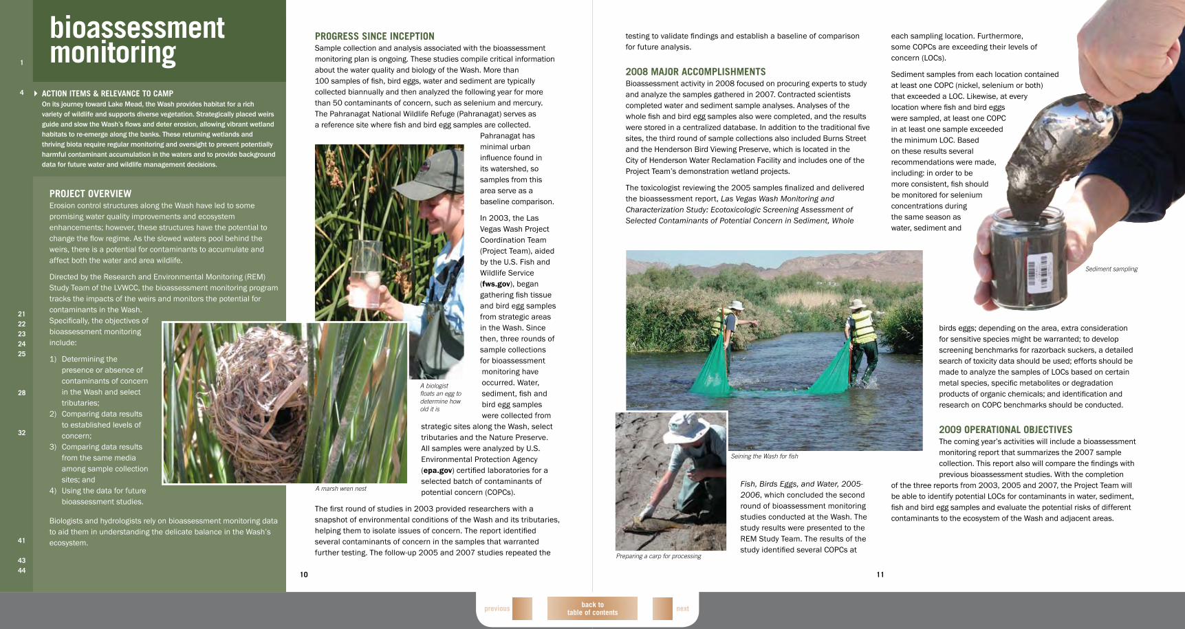
A biologist floats an egg to determine how old it is
A marsh wren nest
back to table of contents nextprevious
13
in June. This project is conducted on a quarterly basis and is an expansion of the selenium monitoring conducted as part of the bioassessment monitoring program. Under this new sampling project three tributaries (Duck Creek, Pittman Wash and Whitney Drainage) are sampled for selenium at half-mile increments along each channel. Samples also are collected at all dewatering pipes that discharge into the channels. These three channels are the largest contributors of selenium to the Wash. Quarterly selenium sampling is conducted in order to develop a selenium management plan for the watershed.
Water quality data, collected by the Project Team from 2003-2007, finished undergoing analysis. Two reports were completed based on the analysis of this data. The Las Vegas Wash Mainstream Water Quality
Report, 2003-2007, was released in final form in December. This report not only summarizes the data from 2003-2007, but also includes the individual results from all the sampling events conducted as part of the mainstream Wash water quality monitoring program during that five-year period. A similar report detailing the data collected as part of the quarterly tributary monitoring program was drafted and is under review.
A new measuring device, an Acoustic Doppler Velocimeter, was purchased by the Project Team in order to improve the quality of the monthly tributary flow measurements. This device can measure flows under more varied hydrological conditions with a higher accuracy than the traditional mechanical meters.
Juvenile quagga mussels, the planktonic veliger stage, were found during all 12 months of the year, ranging from less than 10 percent to over 90 percent of the total zooplankton community. Also, Lake Mead National Recreation Area divers found adult quagga mussels attached to rock surfaces near the inflowing Colorado River, confirming the identification of adult mussels in all parts of Lake Mead. The impact of quagga mussels on water quality is unclear. While there is some indication the mussels may be clearing the open waters of Lake Mead, there is no indication of changes attributable to quagga mussels in nutrient, dissolved oxygen, total organic carbon, zooplankton or phytoplankton concentrations. It is nearly impossible to separate changes that have arisen because of quagga mussels and those associated with the ongoing lowered lake levels.
Also, the Project Team presented papers at the annual meetings for the North American Lake Management Society and the California Lake Management Society, as well as continued ongoing efforts to evaluate and standardize water quality measurements.
2009 oPerAtionAL objeCtiVeSWater quality monitoring programs in the mainstream Wash and its tributaries will continue in 2009, however, sample locations and frequencies may be modified to ensure program efficiency. Mainstream water quality sampling may move from a monthly frequency to a bimonthly frequency, as long as the between-month periods are captured adequately by the City of Henderson during regular monitoring. Also, the TSS and perchlorate monitoring programs may be combined with the mainstream sampling program to achieve greater efficiencies. Shallow groundwater monitoring adjacent to the Wash may be conducted on a quarterly basis instead of the monthly basis previously used.
Hydrolab sampling sites also may be altered in 2009. For example, hydrolabs from the Flamingo Wash and Las Vegas Creek sites may be removed and a replacement hydrolab would then be installed at the LW 10.75 site. A decision about removing the hydrolab at site LW 3.4 will be made in 2009. The Project Team also will finalize and distribute the tributary monitoring report.
Water quality monitoring programs
Quarterly tributary sampling monitors the effects of the Monson Channel runoff on the WashPermanent real-time water quality monitoring stations
PRoGRAm RAnGE FREqUEnCy
mainstream sampling 8 locations Monthly
Tributary sampling 8 locations Quarterly
Real-time monitoring 5 locations Continuously
Shallow groundwater monitoring wells 5 locations Monthly
nDEP TSS and perchlorate monitoring 10 locations Monthly
Extensive selenium sampling 3 tributaries Quarterly
Tributary stream gaging 7 locations Monthly
12
ProgreSS SinCe inCePtionRoutine water quality monitoring continues to assist in providing a comprehensive understanding of the Wash. Data collected since 2000 shows that the overall quality of the Wash improves with each year. The positive effects of bank stabilization and revegetation efforts are reflected in the water quality data. Total suspended solids (TSS) in the Wash have been reduced 77 percent at site LW0.8 (below Lake Las Vegas), from an average of 34.5mg/L in 2001 to an average of 8mg/L in 2008. The Project Team has continually worked to expand and shape the water quality monitoring efforts to meet the evolving needs of the watershed. Most recently, extensive selenium monitoring was conducted to aid the Clean Water Coalition (cleanwatercoalition.com) in the development of a comprehensive selenium management program for the watershed. This collaboratively developed program will help maintain the future health of the Wash and its inhabitants.
The tributary sampling program, conducted to meet the Las Vegas Valley’s stormwater discharge permit requirements, was designed to monitor the effects of urban runoff on the Wash. Water quality samples obtained from the tributaries provide important information on non-point sources of contamination of the Wash and Las Vegas Bay in Lake Mead. The flow data collected from these sites allows hydrologists to quantify urban runoff entering the Wash. It is also used in other applications of water quality monitoring, such as determining
mass-flux concentrations of contaminants and analyzing seasonal changes in water quality.
Five permanent, real-time water quality stations were built along the Wash and its tributaries to continuously monitor water quality data, including temperature, pH, electrical conductance and dissolved oxygen every 20 minutes. Two stations are located in the mainstream of the Wash and the others are located in Duck Creek, Flamingo Wash and Las Vegas Creek. This first-hand water quality data, along with those from other water quality investigations, informs design and management decisions on the Wash, maximizing its environmental benefits.
Eleven erosion control structures have been constructed in the Wash. Wetland systems formed around these structures are very efficient in removing TSS from the Wash water. The TSS monitoring program was designed to determine the efficiency of these structures on the removal of suspended solids.
2008 MAjor ACCoMPLiShMentSThe Project Team continued to assess and enhance water quality programs in 2008. A new project involving extended selenium monitoring was implemented
water quality4
2122232425
26272829
3233
41
4344
ACtion iteMS & reLeVAnCe to CAMPWater quality sampling provides an unbiased glimpse into the daily conditions of Wash waters. As ongoing construction of weirs and other stabilization activities occur, the approximately 170 million gallons of water that winds through the Wash each day requires routine monitoring. Collected data allows hydrologists to keep an eye on water quality as they work to protect the watershed and its role in our community’s water supply. Water is sampled at sites along the Wash, its tributaries and at Lake Mead. Interagency cooperation also is promoted as collected data is shared among member agencies and interested groups.
ProjeCt oVerVieWLong-term water quality monitoring in the Wash and its tributaries provides a comprehensive understanding of Wash flows and potential impacts on the drinking water from Lake Mead. Several water quality monitoring programs have been implemented since 2000. Each of these programs plays a valuable role in creating a comprehensive overview of water quality that is reviewed regularly.
The water quality monitoring efforts conducted on the mainstream Wash are used to evaluate the baseline conditions of the Wash, to demonstrate water quality variations over time, to quantify the effects of increased wetland vegetation on water quality and to provide a long-term history of data that can be used to make watershed-based decisions.
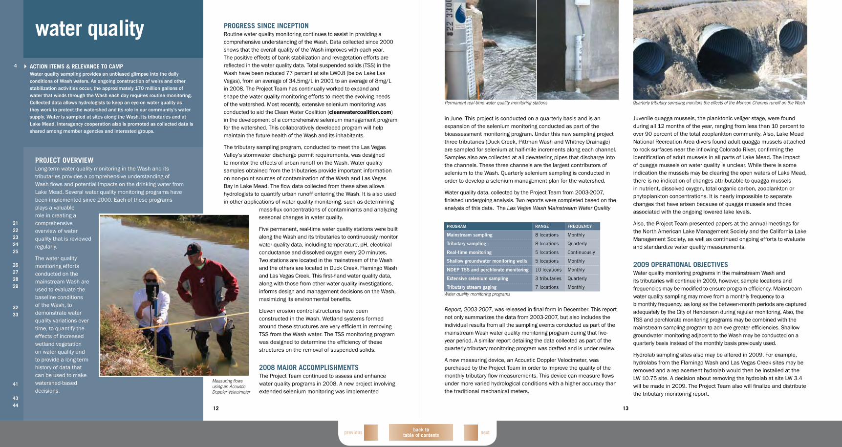
Measuring flows using an Acoustic Doppler Velocimeter
back to table of contents
nextprevious
15
and survival rate. Additionally, the total cover is estimated for each hummock and cell. Plant tissue samples also are collected and analyzed for arsenic, selenium, mercury, total nitrogen and total phosphorus.
These projects demonstrate wetland concepts in a desert environment and provide information on the effectiveness of water quality improvement and the establishment of wetlands.
2008 MAjor ACCoMPLiShMentSDemonstration wetland at the Henderson wRFThe Demonstration Wetland at the Henderson WRF marked its fourth complete year of monthly to bimonthly water quality sampling in 2008, which showed reductions in some metals, nitrate and bacteria. In January, a continuous water quality monitoring station was deployed near the outlet of the wetland. This data has provided information regarding the diurnal and seasonal fluctuations in the wetland system. The Project Team also was able to track total inflow to the pond, which helped calculate mass balance removal of nutrients and metals.
Four new bird species (hooded merganser, rock pigeon, black-chinned hummingird and savannah sparrow) were detected, bringing the total number to 110. At least 15 of these species have either been confirmed or are likely to be breeding onsite. Vegetation monitoring was completed in May and November. A field crew cut and removed the bulrush from one-third of the hummocks in March, removing large amounts of dead material and stimulating and making room for new growth. Within two months, California and hardstem bulrush stems grew an average of approximately 5 feet and Olney bulrush stems grew an average of more than 3 feet.
Pittman wash Pilot wetlandsThe Pittman Wash Pilot Wetlands completed its second year of water quality sampling in 2008. Monthly samples showed no significant changes in water quality between the sampling locations. In 2008, several attempts to calculate flow into the Pittman Wetland system and outflow of the system were made. While no viable way to accurately calculate flow into the wetland was found, the Project Team was able to continually calculate the outflow of the system.
Vegetation monitoring concluded that Olney bulrush dominates the surface flow cell. While California and hardstem bulrush also were planted, the Olney species proved best suited for the cell. Olney has grown densely and entirely excluded the hardstem bulrush, and it has kept the California bulrush to less than 20 percent of the total cover. In the subsurface flow cell, Olney is the dominant bulrush species, accounting for more than 25 percent of the cell’s cover. However, various weeds have encroached on the cell and represent the largest total percent cover. In spring, rabbitsfoot grass had greater than 75 percent cover and in fall, Bermuda grass had more than 50 percent cover.
wetlands Characterization StudyIn spring, the Project Team initiated a one-year study with the Desert Research Institute (DRI) to compile data from the two constructed wetland projects as well as wetlands on the Wash and in the tributaries to help characterize the efficiency of these systems in improving water quality. DRI will use data gathered by the Project Team, and supplemental data collected, to research and compare the wetland systems as a whole.
2009 oPerAtionAL objeCtiVeSBoth wetland projects will conclude in 2009. The goals of each study have been met and the fundamental questions have been fully addressed. The capstone for these projects will be final reports summarizing the data from the two projects. The Project Team will work with the City of Henderson and other project partners to determine the future of each site. At minimum, the Demonstration Wetlands at the Henderson WRF will be used as a bulrush nursery for transplants to the Wash.
In addition, the Project Team and DRI will complete the wetlands characterization study, draft a report and present management with recommendations.
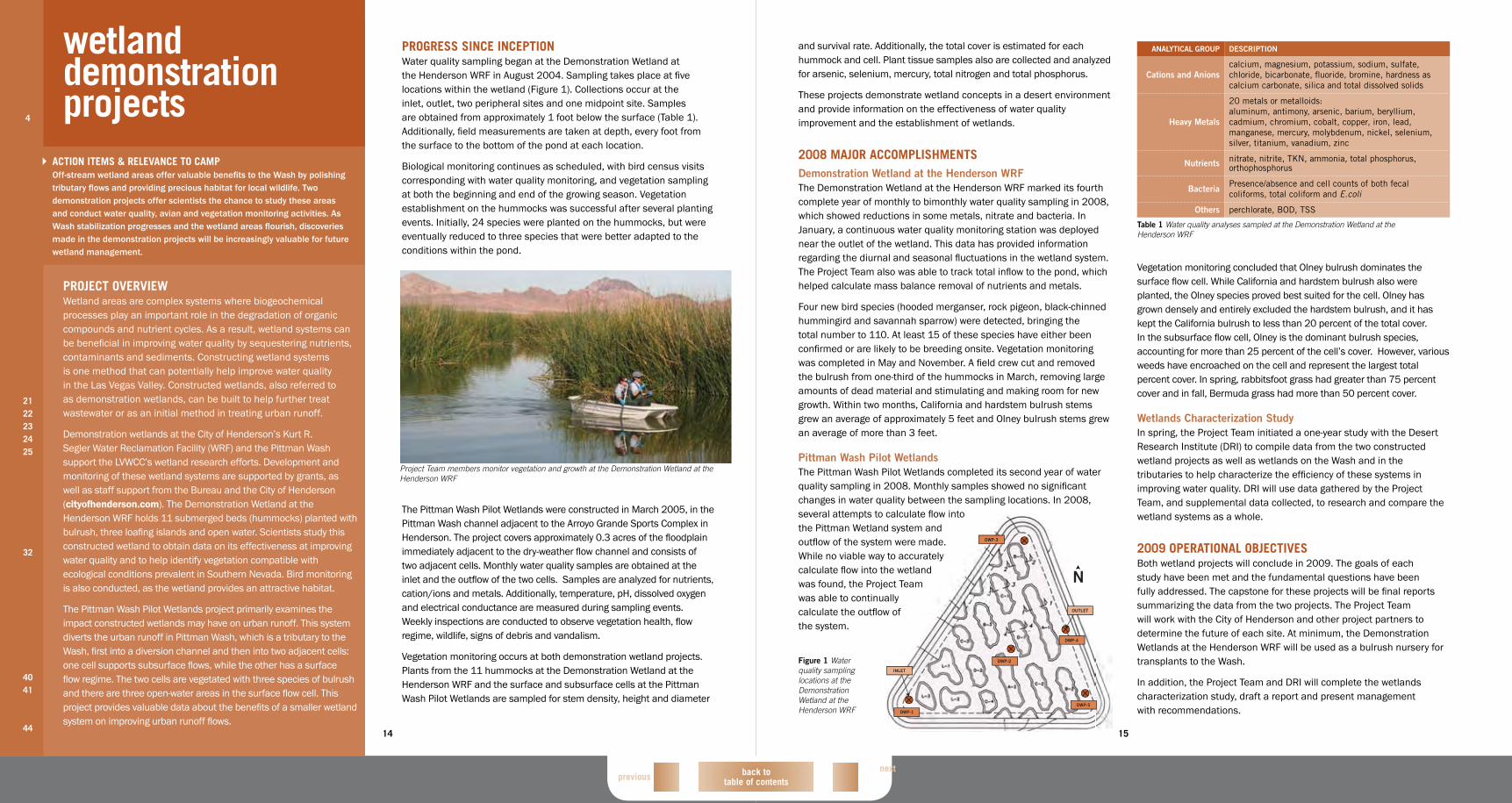
Figure 1 Water quality sampling locations at the Demonstration Wetland at the Henderson WRF
AnAlyTiCAl GRoUP DESCRiPTion
Cations and Anionscalcium, magnesium, potassium, sodium, sulfate, chloride, bicarbonate, fluoride, bromine, hardness as calcium carbonate, silica and total dissolved solids
Heavy metals
20 metals or metalloids: aluminum, antimony, arsenic, barium, beryllium, cadmium, chromium, cobalt, copper, iron, lead, manganese, mercury, molybdenum, nickel, selenium, silver, titanium, vanadium, zinc
nutrients nitrate, nitrite, TKN, ammonia, total phosphorus, orthophosphorus
Bacteria Presence/absence and cell counts of both fecal coliforms, total coliform and E.coli
others perchlorate, BOD, TSS
Table 1 Water quality analyses sampled at the Demonstration Wetland at the Henderson WRF
14
ProgreSS SinCe inCePtionWater quality sampling began at the Demonstration Wetland at the Henderson WRF in August 2004. Sampling takes place at five locations within the wetland (Figure 1). Collections occur at the inlet, outlet, two peripheral sites and one midpoint site. Samples are obtained from approximately 1 foot below the surface (Table 1). Additionally, field measurements are taken at depth, every foot from the surface to the bottom of the pond at each location.
Biological monitoring continues as scheduled, with bird census visits corresponding with water quality monitoring, and vegetation sampling at both the beginning and end of the growing season. Vegetation establishment on the hummocks was successful after several planting events. Initially, 24 species were planted on the hummocks, but were eventually reduced to three species that were better adapted to the conditions within the pond.
The Pittman Wash Pilot Wetlands were constructed in March 2005, in the Pittman Wash channel adjacent to the Arroyo Grande Sports Complex in Henderson. The project covers approximately 0.3 acres of the floodplain immediately adjacent to the dry-weather flow channel and consists of two adjacent cells. Monthly water quality samples are obtained at the inlet and the outflow of the two cells. Samples are analyzed for nutrients, cation/ions and metals. Additionally, temperature, pH, dissolved oxygen and electrical conductance are measured during sampling events. Weekly inspections are conducted to observe vegetation health, flow regime, wildlife, signs of debris and vandalism.
Vegetation monitoring occurs at both demonstration wetland projects. Plants from the 11 hummocks at the Demonstration Wetland at the Henderson WRF and the surface and subsurface cells at the Pittman Wash Pilot Wetlands are sampled for stem density, height and diameter
wetland demonstration projects4
2122232425
32
4041
44
ACtion iteMS & reLeVAnCe to CAMPOff-stream wetland areas offer valuable benefits to the Wash by polishing tributary flows and providing precious habitat for local wildlife. Two demonstration projects offer scientists the chance to study these areas and conduct water quality, avian and vegetation monitoring activities. As Wash stabilization progresses and the wetland areas flourish, discoveries made in the demonstration projects will be increasingly valuable for future wetland management.
ProjeCt oVerVieWWetland areas are complex systems where biogeochemical processes play an important role in the degradation of organic compounds and nutrient cycles. As a result, wetland systems can be beneficial in improving water quality by sequestering nutrients, contaminants and sediments. Constructing wetland systems is one method that can potentially help improve water quality in the Las Vegas Valley. Constructed wetlands, also referred to as demonstration wetlands, can be built to help further treat wastewater or as an initial method in treating urban runoff.
Demonstration wetlands at the City of Henderson’s Kurt R. Segler Water Reclamation Facility (WRF) and the Pittman Wash support the LVWCC’s wetland research efforts. Development and monitoring of these wetland systems are supported by grants, as well as staff support from the Bureau and the City of Henderson (cityofhenderson.com). The Demonstration Wetland at the Henderson WRF holds 11 submerged beds (hummocks) planted with bulrush, three loafing islands and open water. Scientists study this constructed wetland to obtain data on its effectiveness at improving water quality and to help identify vegetation compatible with ecological conditions prevalent in Southern Nevada. Bird monitoring is also conducted, as the wetland provides an attractive habitat.
The Pittman Wash Pilot Wetlands project primarily examines the impact constructed wetlands may have on urban runoff. This system diverts the urban runoff in Pittman Wash, which is a tributary to the Wash, first into a diversion channel and then into two adjacent cells: one cell supports subsurface flows, while the other has a surface flow regime. The two cells are vegetated with three species of bulrush and there are three open-water areas in the surface flow cell. This project provides valuable data about the benefits of a smaller wetland system on improving urban runoff flows.
Project Team members monitor vegetation and growth at the Demonstration Wetland at the Henderson WRF
back to table of contents nextprevious
17
2008 MAjor ACCoMPLiShMentSThe wildlife management plan, development of which began in 2005, was approved by the LVVWAC in March. The Project Team initiated a process for prioritizing the 31 recommended actions with the REM and Administrative Study Teams in July.
Avian studies advanced in 2008. The Avian Point Count Survey completed its fourth year of surveys and associated vegetation monitoring. Eight new species were identified, bringing the total number of species detected to 162. In addition, the year-two draft report was completed.
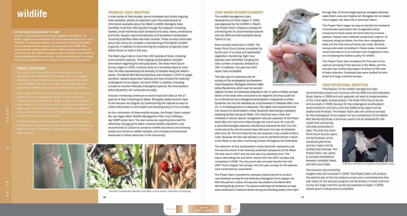
This also was an important year for surveys of the endangered southwestern willow flycatcher. Biologists detected eight willow flycatchers, which was the second-highest number of individuals detected in the 11 years of Wash surveys. Seven of the birds were concluded to be migrants and thus could not be confirmed as the endangered southwestern subspecies (a willow flycatcher can only be classified as a southwestern if detected after June 21, or if breeding activity is observed). The eighth bird represented the first record of a southwestern willow flycatcher attempting to establish breeding territory along the Wash. The individual was a male and inhabited a mature riparian revegetation site just upstream of the Pabco Road Weir from the end of May through the end of June. On June 25, a permitted biologist captured, banded and released the bird. The bird continued at the site for several days afterward, but was not detected after June 30. The bird likely left the site because it was unable to find a mate. Because the bird was banded, it can be identified should it return to the Wash or any other monitoring location throughout the Southwest.
The detection of this southwestern willow flycatcher represents just the second record of the federally protected subspecies at the Wash. The first was in 2007 and the bird was only detected once. The report describing this and other results from the 2007 surveys was completed in 2008. The document also included results from the 2007 Yuma clapper rail surveys, the final year surveys for the species were conducted by consultants.
The Project Team received the necessary federal permit to conduct call broadcast surveys for the federally endangered Yuma clapper rail. With this permit in place, the species was added to the Marsh Bird Monitoring Study protocol. The passive listening/call broadcast surveys were conducted in wetland habitat during the breeding season from April
through May. Of the six target species, biologists detected least bittern, sora and Virginia rail. Biologists did not detect Yuma clapper rail, black rail or American bittern.
The Project Team began surveys to identify the terrestrial invertebrates associated with revegetated areas compared to those areas still dominated by invasive species. Insects were collected using sticky traps at 10 locations along the Wash, five that were revegetation sites and five that were primarily salt cedar. Butterfly surveys also were completed in these areas. Increased insect abundance is an indicator that revegetation sites are increasing the habitat quality for wildlife.
The Project Team also completed the first year of live capture surveying of bat species in the Wash, and the acoustic bat monitoring program finished its fifth year of data collection. Proposals also were drafted for both small and large mammal surveys.
2009 oPerAtionAL objeCtiVeSPrioritization of the wildlife management plan
recommended actions will continue with the REM and Administrative Study Teams in 2009 and with approval will lead to implementation of the most highly ranked actions. The Avian Point Count Survey will conclude in 2009. Surveys for the endangered southwestern willow flycatcher will occur, and the 2008 survey report will be drafted and finalized. The Project Team also will continue surveys for the endangered Yuma clapper rail as a component of the Marsh Bird Monitoring Study. A summary report will be prepared for the marsh bird monitoring activities conducted to date. The year-two Avian Point Count Survey report will be finalized, and a combined year-three and four report will be drafted and finalized. The Project Team, too, plans to conduct correlations between compiled insect and bird count data.
The acoustic bat-monitoring program also will conclude in 2009. The Project Team will conduct the second year of the live capture survey and a comprehensive five-year report of the acoustic program will be drafted. A small mammal survey and large mammal survey are expected to begin in 2009, should grant funding become available.
Southwestern willow flycatcher with new bands
A Mexican free-tailed bat captured during Wash surveys
16
ProgreSS SinCe inCePtionA wide variety of field studies, some completed and others ongoing, have validated, altered or expanded upon the existing body of information available about the Wash’s wildlife. Biologists have identified more than 260 species through this research including: reptiles, small mammals (both terrestrial and bats), fishes, amphibians and birds. Aquatic macroinvertebrates and terrestrial invertebrates including butterflies have also been studied. These surveys continually prove their value as a broader understanding of the Wash’s wildlife is gained, in addition to documenting the presence of species never before known to exist in the area.
The Wash plays host to more than 200 species of birds, including some sensitive species. Three ongoing studies gather valuable information regarding the bird population. The Avian Point Count Survey, begun in 2005, monitors birds on a bi-weekly basis at more than 30 sites representing the diversity of habitats along the Wash’s banks. The Marsh Bird Monitoring Study was initiated in 2007 to target secretive, wetland-dependent species and has included the federally endangered Yuma clapper rail since 2008. In addition, breeding surveys for another federally endangered species, the southwestern willow flycatcher, are conducted annually.
Acoustic monitoring continues to record important data on the 17 species of bats inhabiting the Wash. Biologists added another layer to the five-year old program by implementing live capture surveys to collect information on the health and breeding status of the animals.
As the culmination of these wildlife studies, the Project Team created the Las Vegas Wash Wildlife Management Plan, thus fulfilling a key CAMP action item. The plan serves as a guiding document for effectively managing the Wash’s diverse wildlife population, and recommends 31 actions to conserve wildlife abundance and diversity, protect and enhance wildlife habitats, and increase environmental awareness of these resources in the community.
wildlife
2122232425
32
4041
4344
ACtion iteMS & reLeVAnCe to CAMPThanks to restoration efforts and native vegetation recruitment, the Wash’s rugged banks and nutrient-rich waters provide habitat for an array of wildlife. Evaluating, protecting and responsibly managing the wildlife that call the Wash home supports the mandates of the CAMP. Field studies identify existing wildlife, monitor wildlife changes over time and provide data for the wildlife management plan mandated by the CAMP. As ongoing stabilization efforts continue, their greater impact on the ecology surrounding the Wash also will continue to be monitored and assessed.
ProjeCt oVerVieWThe diverse and abundant wildlife at the Wash not only emphasizes the importance of the Wash area to Las Vegas residents, but also to the valley’s ecosystem. Working closely with the REM Study Team, the Project Team evaluates and implements wildlife monitoring and management activities.
Since 1998, biologists have studied vertebrate and invertebrate wildlife currently inhabiting the Wash. Studies have been completed on small mammals, fishes, reptiles and amphibians while others, such as the bird and bat monitoring programs, are ongoing. In addition to these studies, surveys for endangered species also are conducted as a mitigation measure that allows erosion control activities to continue.
The Project Team conducts long-term research and monitoring to expand the knowledge and understanding of all wildlife in the Wash and further the LVWCC’s ability to protect and conserve these species.
Terrestrial invertebrates detected at the Wash include spiders, butterflies and ladybugs

back to table of contents nextprevious
19
2008 MAjor ACCoMPLiShMentSThe Project Team invested a significant amount of time and resources into vegetation enhancement and monitoring initiatives this past year. Wash biologists completed the 2003-2007 Vegetation Monitoring Report, which overall found that the majority of revegetation sites were successful, or along a trajectory of success. Some of the major trends documented in the report include: total vegetative cover increased with time, unless management actions were performed to intentionally remove material; several years of growth were required for a non-wetland site to achieve 80 percent cover, while wetland sites were typically covered by more than 80 percent in the first growing season; and survivorship was greater than 80 percent after the second year of growth and this value increased with time.
Volunteers revegetated approximately 18 total acres, 5.5 at the Upstream Historic Lateral South Upper Plateau (UHLSUP) and 12.4 at the Upper Diversion Weir, with catclaw acacia, mesquite and other species. Bureau crews cleared UHLSUP of tamarisk specifically for the volunteer planting. The site’s rolling topography was left in place and played a vital role in the planting design.
As in years past, partnerships proved valuable to endeavors on the Wash. Clark County Parks and Recreation (accessclarkcounty.com) authorized the Project Team to salvage 2.7 acres of saltgrass from the Nature Preserve at the Ducks Unlimited Project site and transplant it to the Downstream Pabco North location.
The partnership with the Clark County Water Reclamation District (CCWRD, cleanwaterteam.com) also forged on in 2008. This affiliation allows the Project Team to use CCWRD land to conduct revegetation activities, with a portion of the revegetation counting towards required wetland mitigation for the CCWRD. The design of the joint project was completed this past year.
In celebration of the 10-year anniversary of the LVWCC, the community partnership that drives the enhancement efforts on the Wash, each member planted mesquite, creosote, baccharis or brittlebush within a fenced commemorative garden.
The Project Team also continued its aggressive management of invasive weeds in the Wash environment. The National Park Service's Lake Mead Exotic Plant Management Team (LMEPMT) worked more than 350 hours from March through September treating tall whitetop and other noxious species along the length of the Wash and in the revegetation sites. During these efforts, the team treated nearly 9 acres of weeds, including more than 8 acres of tall whitetop. Less than
0.05 acres of tall whitetop that had been treated during previous years required retreatment.
Tamarisk removal progressed in 2008 as well. The Project Team conducted the sixth controlled burn at the Wash in October. More than 12,000 cubic yards of woody debris was burned. The material represented approximately 10 acres of plant material, most of which was tamarisk. More than 5 acres of tamarisk also was removed from two other sites along the Wash.
2009 oPerAtionAL objeCtiVeSThe Project Team expects to remove approximately 30 acres of tamarisk from the CCWRD property and plant on the site in fall 2009. The team will utilize Downstream Pabco North to study invasive weed encroachment using various ground-cover treatments. The LMEPMT will continue its biannual tall whitetop treatment, and with the assistance of the Nevada Division of Forestry and the Bureau, the Wash will receive continual weeding and maintenance. Also, there will be a controlled burn at Bostick Weir in the winter.
The Project Team will harvest pole cuttings from the cottonwood cells and replant them along the banks at Upper Diversion, Rainbow Gardens North, Downstream Pabco North and Downstream Calico South in the coming year. Extensive pole planting of willows also will be performed throughout restoration areas. The Project Team will harvest hardstem bulrush and other emergents from Powerline Crossing Weir and other locations and plant them at sites throughout the Wash. Bulrush was planted at the Powerline Crossing Weir site less than two years ago and is already so dense that it can provide plant material for other sites.
Screwbean mesquite, yerba mansa, catclaw acacia, globemallow and hardstem bulrush
18
ProgreSS SinCe inCePtionWash biologists have crafted an extensive body of knowledge for effectively planting and monitoring vegetation. Initially, the Project Team worked to understand the specific needs of the area, such as when planting should occur to optimize survival rates and which plants thrive in the Wash’s unique locale. Through research and testing, the team created a list of suitable native plants for the Wash that continues to grow and expand as consistent monitoring yields new information. In addition, ideal irrigation practices have been explored and developed to ensure that every area laboriously planted thrives and meets the performance criteria outlined in permits.
To date, the Project Team has revegetated more than 195 acres of Wash land. Of the completed acres, 57 can be applied toward mitigation goals for the erosion control program. The remaining 138 acres have been planted to satisfy requirements for various grants provided to the Southern Nevada Water Authority (SNWA, snwa.com) by the Southern Nevada Public Land Management Act program, NDEP, Nevada Division of State Parks and the Clark County Multiple Species Habitat Conservation Plan.
Vegetation management activities have been ongoing since 2001. These activities primarily consist of finding innovative and economical ways of removing non-native species from the Wash and ensuring that these species do not return to revegetated sites. Effective invasive
weed control helps improve wildlife habitat and allows native plants to thrive that benefit both water and soil quality. Since 2003, more than 37,000 cubic yards of tamarisk have been removed and eliminated through controlled burns at the Wash. The LVWCC has removed approximately 205 acres of tamarisk to date.
Contributing to the continued success of the vegetation enhancement program, the Project Team
utilizes a wide variety of native plant material and planting techniques for revegetation projects. This effort includes a seed collection program, as well as the use of hydroseeding techniques. The Project Team also harvests material from outside areas and transplants it to the Wash.
vegetation enhancement and management
1
18
2122232425
32
4344
ACtion iteMS & reLeVAnCe to CAMPStabilization activities limit erosion and reinforce the Wash’s banks, yet these efforts displace valuable vegetation in the process. When construction ends, the Project Team and volunteers replant disturbed sites with suitable native vegetation. These actions comply with the 404 permits issued by the U.S. Army Corps of Engineers (Corps) and stormwater permits issued by the Nevada Division of Environmental Protection. In response to the permit requirements, the Project Team utilizes long-term vegetation enhancement and monitoring plans to ensure vegetation survival rates, limited invasive plant encroachment, desired species composition and appropriate cover. Other CAMP initiatives, including interagency cooperation and community involvement, are also addressed.
ProjeCt oVerVieWThe planting, monitoring and invasive management components of the program, conducted with oversight by the REM Study Team, directly fulfill construction permit requirements, without which stabilization efforts would cease. There are additional gains associated with this work also, such as habitat enhancement, public outreach and bank stabilization benefits.
The health of the vegetation and variety of plant life dictate the animal species that will reside in an area. Plant life helps control erosion by stabilizing soils, weirs and adjacent banks. In addition, vegetation filters urban water flows helping to improve the water quality in the Wash. The Project Team diligently works to clear invasive vegetation such as rapid-spreading tamarisk, which degrades habitat quality and increases soil salinity, and replants these areas with diverse native vegetation.
Equally important, vegetation activities also reflect the mission of the LVWCC “…to stabilize and enhance the valuable environmental resources of the Las Vegas Wash.”
Scientists conduct vegetation monitoring to ensure plant success

back to table of contents nextprevious
21
period in order to meet its responsibilities under Section 106 of the National Historic Preservation Act. This agreement will serve as a directive outlining the regulatory process for any project within the Wetlands Park that may impact cultural resources.
The Project Team also supported the creation of a research document that details the historic period of the Wash, from the 1820s to the 1940s. The report compiles and summarizes research from various other reports and adds additional information and background about the settling of the Las Vegas Valley.
A significant archaeological discovery marked 2008, as well. A historic site was discovered adjacent to the site of the future Lower Narrows and Homestead weirs. During a preconstruction survey, several suspiciously organized stones protruding from the soil surface
family home, both associated with the Bishop Ranch. Bishop was one of the first white settlers on the Wash, and the excavated structures are thought to have belonged to one of his sons.
2009 oPerAtionAL objeCtiVeSOne of the most significant accomplishments of 2009 will be the finalization of the Programmatic Agreement among Clark County, the Bureau, the Corps, the SNWA, the Nevada State Historic Preservation Office and the Advisory Council on Historic Preservation. The agreement will provide a streamlined and more efficient process for meeting the requirements of the National Historic Preservation Act.
The Project Team will also concentrate on the relocation of the historic structure discovered this past year. Due to the significance of the
Excavation and study of an archaeological site near the site of the future Lower Narrows and Homestead weirs
were noticed. The Project Team postponed construction and worked with the Bureau, the State Historic Preservation Office and professional archaeologists to put together a site treatment plan. Excavation of the site began in July and was completed in November. Once surface soil in the surrounding area was cleared, site investigators identified a below-ground structure and revealed a larger foundation to the east. Artifacts from this excavation included nails, children’s toys, tobacco bins and drinking glasses. Archaeologists believe the below-ground structure was a root cellar, while the excavated foundation was from a
structure, the abundance of artifacts and the good condition of the cellar, there will be a collaborative effort between the SNWA, the Bureau and Clark County to extract and relocate the structure to the Clark County Museum. Once in its new location the structure will be utilized for future educational outreach.
Also in the upcoming year, the Project Team and archaeologists will analyze each of the artifacts residing in the newfound structure and produce a report of the findings.
20
ProgreSS SinCe inCePtionAlmost 10 years ago, the Bureau partnered with the Project Team to conduct archaeological surveys as a step toward preserving the historically significant area. This effort was necessary since early surveys had been greatly under-funded and the collected information was incomplete. In addition, the topography of the land had changed significantly due to erosion, road construction and impacts from off-road vehicles, further justifying the effort.
Archaeological excavations of buried cultural deposits at the Wash have identified pit houses, hearths and food storage pits dating from 300 B.C. to A.D. 1600. These digs have allowed researchers to study artifacts corresponding to different periods of occupation. Archaeologists have uncovered the foundation of a house along with an irrigation ditch, a collapsed 4-foot timber wall and a stepping-stone pathway dating from the early 1900s. These discoveries and research suggest that the Wash was a central lifeline for early inhabitants and explorers of Southern Nevada.
Typically, archaeologists excavate sites along the Wash to ensure that historically significant artifacts are catalogued and collected prior to being disturbed by necessary construction activities. In 2001, a pit house structure was unearthed. The pit house was at risk of being lost due to erosion, and information gathered from it gave researchers evidence that the Wash sheltered long-term inhabitants and not just temporary hunters. Again in 2005, archaeologists excavated two sites in the area of a planned weir project. One site resulted in several significant finds, indicating that Wash occupants lived in earth lodges, probably stored edible plants and cooked their food in pits. The other site contained nearly 60 pit features, most likely used to store food. Potsherds and other artifacts also were discovered.
A significant result of these archaeological surveys was the revitalization of the previously defined Las Vegas Wash Archaeological District, which has been found eligible for listing on the National Register of Historic Places. This eligibility provides a framework for preserving the archaeological sites that are located within the Clark County Wetlands Park (Wetlands Park). Most of the
important sites within the park, including those that are known to contain significant subsurface deposits, are in one
of two settings: some lie beneath the surface of the Wash’s historic floodplain; and others are situated on the toes of the
alluvial fans that overlook the floodplain. To date, more than 40 eligible cultural sites have been identified at the Wash.
2008 MAjor ACCoMPLiShMentSThis past year the Project Team continued efforts to finalize the Programmatic Agreement created by the Bureau over a three-year
archaeological resources
2122232425
32
41424344
ACtion iteMS & reLeVAnCe to CAMPThe Wash’s stretch of verdant wetlands began attracting visitors to its banks as early as 300 B.C. Valuable information about the lifestyle of Las Vegas’ earliest inhabitants lies buried beneath the soil, waiting to reveal the story of a people who long ago used the area’s water, plant and animal resources to sustain a life in the harsh Mojave Desert. As directed by the CAMP, the Project Team and archaeologists work to identify potential cultural resource sites and excavate noteworthy areas to ensure that historically significant artifacts are appropriately collected and catalogued.
ProjeCt oVerVieWThe Wash contains a number of cultural resource sites that are providing significant data about the historic and prehistoric desert culture in Southern Nevada, proving to be one of the most significant concentrations of cultural resources in the area. In 1977, the area was designated as the Las Vegas Wash Archaeological District in an effort to recognize and protect these resources.
Any feature more than 50 years old discovered in the area may be eligible for listing on the National Register of Historic Places. Archaeological surveys have been conducted throughout the district to further uncover the historical significance of the Wash. Today, the Project Team works with oversight from the REM Study Team to preserve this area and mitigate the impacts of construction-related disturbances.
Potsherds discovered at the Wash
back to table of contents nextprevious
23
accomplishments. Last year, almost 4,300 E-mail Updates were sent out across the valley. This number has grown by 48 percent since 2006, when 2,900 people received the E-mail Updates. Also, the SNWA’s annual Water Smart Calendar, funded in part by a grant from the Nevada Department of Environmental Protection (NDEP, ndep.nv.gov), incorporates tips on protecting the local watershed and reducing nonpoint source pollution and is mailed to all local homeowners.
2008 MAjor ACCoMPLiShMentSThis past year marked the 10-year anniversary of the LVWCC. On November 17, approximately 80 participants attended the celebration at the commemorative event site near the Upper Diversion Weir. The event was emceed by SNWA General Manager Pat Mulroy, with additional guest speakers from Senator Harry Reid’s office, the Bureau, the SNWA board and the Nevada Department of Conservation and Natural Resources, highlighting the significant progress made along the Wash over the past decade. Attendees from member organizations also participated in a commemorative tree planting.
Volunteer numbers for Wash Green-Up events continued to grow in 2008. In spring, 460 volunteers planted 1,996 plants on 5.5 acres near the Historic Lateral Weir. And in fall, 595 volunteers planted 4,690 plants on 12.4 acres near the newly completed Upper Diversion Weir and Bridge. The volunteer turnout in fall was the largest in the 13 Wash Green-Up events hosted to date.
Additional accomplishments include installing plant labels at the Bostick Weir Interpretive Area gardens to aid in public education. The plant signs were funded by a grant from the NDEP. The Project Team also coordinated the translation of the field trip notebooks into Spanish. The books were re-printed, and are now bilingual (English and Spanish). The tour books also were updated and redesigned into a new format.
At Mabel Hoggard Math & Science Magnet School, the greenhouse project continued. Fifteen fifth-grade students planted 220 arrowweed plants in 2008. The Project Team also gave a tour of the Master Gardener orchard to the students. The gardeners donated soil and mulch for use in the school's greenhouse, which grows native species that will later be returned to grace the banks of the Wash.
During the year, the Project Team also conducted several
tours, field trips and presentations, and attended community outreach events, reaching more than 20,000 people (see chart).
2009 oPerAtionAL objeCtiVeSTwo Green-Ups are planned for 2009, one in spring and one in fall. The spring event will include eight acres at Downstream Pabco North. Community volunteers will plant 2,100 plants at the event. The Project Team plans also to use hand seeding at the volunteer planting event for the first time. The fall Green-Up event will be at the CCWRD property.
The Mabel Hoggard Math & Science Magnet School greenhouse project will transfer from the fifth grade students to the fourth graders. This will enable the students to have the opportunity to participate in a Wash Green-Up event during their fifth grade year and utilize their plants in the revegetation efforts.
Agency representatives participate in a commemorative planting to mark the 10th anniversary of the LVWCC
Tours 131Green-Ups 1055Education Outreach 1001Mabel Hoggard Outreach 183Presentations 320Community Outreach Events
UNLV Volunteer Fair 1400Spring in the Desert 500Summerlin Earth Fair 7500City of Las Vegas Earth Fair 6200UNLV Earth Day Celebration 1200Clear Wire Earth Day Celebration 150HSBC World Environment Day 1000Hard Rock Hotel/Casino, Save the planet 25
The number of attendees by event type in 2008, with a breakdown of the number of attendees for Community Outreach Events, our highest attended programs.
The often-used field trip notebooks were translated into Spanish this year
22
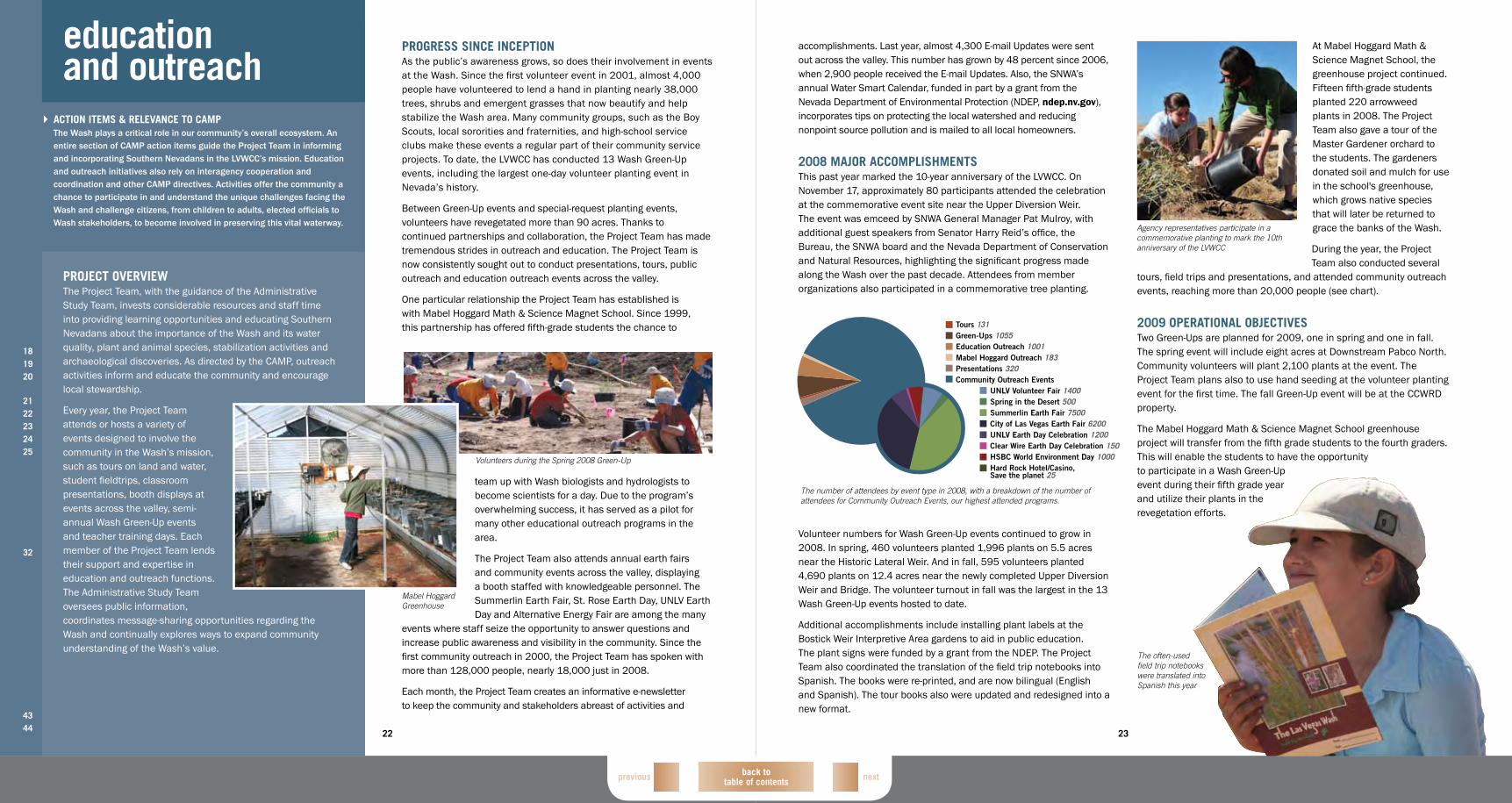
ProgreSS SinCe inCePtionAs the public’s awareness grows, so does their involvement in events at the Wash. Since the first volunteer event in 2001, almost 4,000 people have volunteered to lend a hand in planting nearly 38,000 trees, shrubs and emergent grasses that now beautify and help stabilize the Wash area. Many community groups, such as the Boy Scouts, local sororities and fraternities, and high-school service clubs make these events a regular part of their community service projects. To date, the LVWCC has conducted 13 Wash Green-Up events, including the largest one-day volunteer planting event in Nevada’s history.
Between Green-Up events and special-request planting events, volunteers have revegetated more than 90 acres. Thanks to continued partnerships and collaboration, the Project Team has made tremendous strides in outreach and education. The Project Team is now consistently sought out to conduct presentations, tours, public outreach and education outreach events across the valley.
One particular relationship the Project Team has established is with Mabel Hoggard Math & Science Magnet School. Since 1999, this partnership has offered fifth-grade students the chance to
team up with Wash biologists and hydrologists to become scientists for a day. Due to the program’s overwhelming success, it has served as a pilot for many other educational outreach programs in the area.
The Project Team also attends annual earth fairs and community events across the valley, displaying a booth staffed with knowledgeable personnel. The Summerlin Earth Fair, St. Rose Earth Day, UNLV Earth Day and Alternative Energy Fair are among the many
events where staff seize the opportunity to answer questions and increase public awareness and visibility in the community. Since the first community outreach in 2000, the Project Team has spoken with more than 128,000 people, nearly 18,000 just in 2008.
Each month, the Project Team creates an informative e-newsletter to keep the community and stakeholders abreast of activities and
education and outreach
181920
2122232425
32
4344
ACtion iteMS & reLeVAnCe to CAMPThe Wash plays a critical role in our community’s overall ecosystem. An entire section of CAMP action items guide the Project Team in informing and incorporating Southern Nevadans in the LVWCC’s mission. Education and outreach initiatives also rely on interagency cooperation and coordination and other CAMP directives. Activities offer the community a chance to participate in and understand the unique challenges facing the Wash and challenge citizens, from children to adults, elected officials to Wash stakeholders, to become involved in preserving this vital waterway.
ProjeCt oVerVieWThe Project Team, with the guidance of the Administrative Study Team, invests considerable resources and staff time into providing learning opportunities and educating Southern Nevadans about the importance of the Wash and its water quality, plant and animal species, stabilization activities and archaeological discoveries. As directed by the CAMP, outreach activities inform and educate the community and encourage local stewardship.
Every year, the Project Team attends or hosts a variety of events designed to involve the community in the Wash’s mission, such as tours on land and water, student fieldtrips, classroom presentations, booth displays at events across the valley, semi-annual Wash Green-Up events and teacher training days. Each member of the Project Team lends their support and expertise in education and outreach functions. The Administrative Study Team oversees public information, coordinates message-sharing opportunities regarding the Wash and continually explores ways to expand community understanding of the Wash’s value.
Volunteers during the Spring 2008 Green-Up
Mabel Hoggard Greenhouse

back to table of contents nextprevious
25
2008 MAjor ACCoMPLiShMentSAn active year for the Project Team resulted in more than 29,000 unique visitors to the lvwash.org Web site, averaging more than 2,400 per month. The site also experienced more than 52,000 visits during 2008. On average, users visited six pages per visit. Web site users also experienced new photo and video galleries. These galleries were created to provide visitors with more options in their viewing of Wash photos and videos. Twelve E-mail Updates were sent to monthly subscribers.
The Project Team handles increasingly larger amounts of information each year, requiring enhanced efficiency on their part. In 2008, team members managed and supported:
• 397 contact requests• 114 images added to
ImageRepo, bringing the total to 11,359 images
• 381 documents added to document library, now holding 7,224 documents
• 4,221 contacts• 668 user accounts• 180,025 Hydrolab© readings,
totaling more than one million since 1998
Updates were made to the look and feel of the Web site, making it much more user-friendly. The newly updated lvwash.org was launched in December. With these modifications, the Project Team expects user statistics to improve in 2009.
For the real-time water quality program, a new interface was developed that allows user customization of data and graphic use. Also during 2008, progress was made on uploading the water quality data from all the projects into a centralized database. This database allows all the members of the LVWCC to readily access and download the data from any of the water quality monitoring programs.
A content management system was implemented this past year, improving maintenance efficiency for the Project Team. Staff is now able to update content in a matter of hours, rather than days and even weeks. This allows the public, Wash staff, member agencies and stakeholders access to more up-to-date information.
2009 oPerAtionAL objeCtiVeSUpcoming projects for the year will include content maintenance of lvwash.org. The Project Team will continue to look for opportunities to improve the Web site and keep up with industry standards, ensuring timely, concise and relevant applications, databases and repositories. Ongoing research, continued biannual updates and monthly E-mail Updates also will continue. The water quality database will continue to grow as agencies add their data to the collection providing a central database for other members to access. The team hopes to upload video throughout the public Web site by the end of 2009.
New digital aerial photography will be flown and imagery processed, stored and new baseline maps will be created. These aerial flights take place every six months. Additional flights may take place as
researchers needs arise or if a significant event like a flood or fire occurs. This imagery data will be processed, warehoused and made available to researchers and scientists.
Because interagency coordination is so critical to long-term management activities to the Wash, the Project Team will continue to liaison with information technology professionals to facilitate the efficient and accurate transfer of information among participating agencies.
Web site users experienced a new site design in 2008, which included more options to view Wash photos and videos
24
ProgreSS SinCe inCePtionIn 1999, two Web sites were established to support the LVWCC’s efforts. The first, lvwash.org/members, helps facilitate communication amongst the study teams, LVWCC members and the Project Team. The password-protected Web site includes several applications such as: Project Tracking, the Image Repository, a Water Quality Database and the Contact Request System.
The Wash’s public Web site, lvwash.org, provides instantaneous information to the community around the clock. Designed to inform and energize the public about the LVWCC’s efforts, the Web site features monthly articles and information about upcoming Wash events and provides a multi-faceted look at the Wash’s past, present and future. Users can also volunteer and request tours or field trips through the site. The Project Team redesigned the Web site in 2004 to give it a fresh new look and enhance its ability to serve as an outreach tool to the community. Additional updates were made in 2008 that also improved its usability.
Continued maintenance on the sites includes: monthly news updates, E-mail Updates and bi-annual updates to both the public Web site and the members’ Web site. In 2007, major improvements to the Water Quality Database Application increased efficiency and provided a standardized process allowing member agencies to load data into a central repository. Other enhanced features are added to existing applications for both sites every year.
The Project Team also provides the ever expanding storage, maintenance and processing of high-resolution aerial maps. Aerial photographs (4-6 inch resolution) are flown every six months to create highly accurate baseline maps. These photographs are processed and
stored electronically for use in such mapping applications as ArcMap. These photographs provide the baseline maps for researchers to use for vegetation analysis, planning, erosion control, water quality and overall documentation of historical changes.
data resources
181920
2425
2627
2930
3233
4344
ACtion iteMS & reLeVAnCe to CAMPThe Project Team diligently creates, monitors and maintains a variety of technology-driven projects to support the ongoing research and activities of the LVWCC. From water quality to bioassessment monitoring, the ability to store, access and share data significantly enhances the ability of the LVWCC members to collaborate efficiently. The data management tools developed to support implementation of the CAMP improve interagency collaboration vital to keeping the Wash and watershed enhancement activities on track.
6,000
5,000
4,000
3,000
2,000
1,000
0JAN FEB MAR APR MAY JUN JUL AUG SEP OCT NOV DEC
Number of visits
Number of visitors
ProjeCt oVerVieWAlthough data-related projects run the gamut from the public lvwash.org Web site to specific mapping applications, a focus of the Project Team is development and maintenance of a central data repository accessible to participating agencies. This includes providing up-to-date aerial imagery and maintaining large databases of information, from water quality to bioassessment monitoring.
Coordinating with other agencies to optimize compatibility of data management practices, along with providing a high level of technical support to the staff utilizing the repository, remain priorities for the Project Team.
A vast amount of information is shared through the Web site, which provides an avenue for stakeholders and the public to access and request information from the LVWCC and the Project Team. The tools developed by the Project Team have been critical in answering water resource management questions. These innovative applications, databases and repositories have continued to help Southern Nevada meet its watershed goals.
Unique visitors and number of visits per month to lvwash.org, 2008
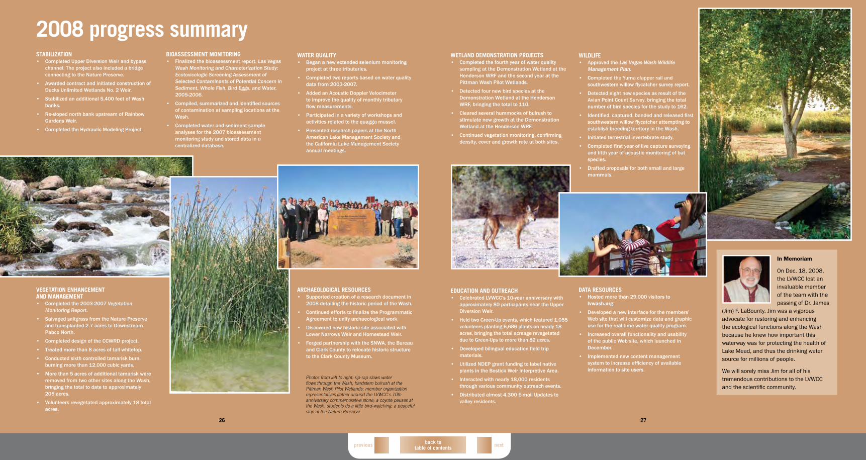
27
back to table of contents nextprevious
StAbiLizAtion• Completed Upper Diversion Weir and bypass
channel. The project also included a bridge connecting to the Nature Preserve.
• Awarded contract and initiated construction of Ducks Unlimited Wetlands No. 2 Weir.
• Stabilized an additional 5,400 feet of Wash banks.
• Re-sloped north bank upstream of Rainbow Gardens Weir.
• Completed the Hydraulic Modeling Project.
bioASSeSSMent Monitoring• Finalized the bioassessment report, Las Vegas
Wash Monitoring and Characterization Study: Ecotoxicologic Screening Assessment of Selected Contaminants of Potential Concern in Sediment, Whole Fish, Bird Eggs, and Water, 2005-2006.
• Compiled, summarized and identified sources of contamination at sampling locations at the Wash.
• Completed water and sediment sample analyses for the 2007 bioassessment monitoring study and stored data in a centralized database.
WAter quALity• Began a new extended selenium monitoring
project at three tributaries.
• Completed two reports based on water quality data from 2003-2007.
• Added an Acoustic Doppler Velocimeter to improve the quality of monthly tributary flow measurements.
• Participated in a variety of workshops and activities related to the quagga mussel.
• Presented research papers at the North American Lake Management Society and the California Lake Management Society annual meetings.
26
2008 progress summary
VegetAtion enhAnCeMent And MAnAgeMent• Completed the 2003-2007 Vegetation
Monitoring Report.
• Salvaged saltgrass from the Nature Preserve and transplanted 2.7 acres to Downstream Pabco North.
• Completed design of the CCWRD project.
• Treated more than 8 acres of tall whitetop.
• Conducted sixth controlled tamarisk burn, burning more than 12,000 cubic yards.
• More than 5 acres of additional tamarisk were removed from two other sites along the Wash, bringing the total to date to approximately 205 acres.
• Volunteers revegetated approximately 18 total acres.
ArChAeoLogiCAL reSourCeS• Supported creation of a research document in
2008 detailing the historic period of the Wash.
• Continued efforts to finalize the Programmatic Agreement to unify archaeological work.
• Discovered new historic site associated with Lower Narrows Weir and Homestead Weir.
• Forged partnership with the SNWA, the Bureau and Clark County to relocate historic structure to the Clark County Museum.
Photos from left to right: rip-rap slows water flows through the Wash; hardstem bulrush at the Pittman Wash Pilot Wetlands; member organization representatives gather around the LVWCC's 10th anniversary commemorative stone; a coyote pauses at the Wash; students do a little bird-watching; a peaceful stop at the Nature Preserve
WetLAnd deMonStrAtion ProjeCtS• Completed the fourth year of water quality
sampling at the Demonstration Wetland at the Henderson WRF and the second year at the Pittman Wash Pilot Wetlands.
• Detected four new bird species at the Demonstration Wetland at the Henderson WRF, bringing the total to 110.
• Cleared several hummocks of bulrush to stimulate new growth at the Demonstration Wetland at the Henderson WRF.
• Continued vegetation monitoring, confirming density, cover and growth rate at both sites.
WiLdLiFe• Approved the Las Vegas Wash Wildlife
Management Plan.
• Completed the Yuma clapper rail and southwestern willow flycatcher survey report.
• Detected eight new species as result of the Avian Point Count Survey, bringing the total number of bird species for the study to 162.
• Identified, captured, banded and released first southwestern willow flycatcher attempting to establish breeding territory in the Wash.
• Initiated terrestrial invertebrate study.
• Completed first year of live capture surveying and fifth year of acoustic monitoring of bat species.
• Drafted proposals for both small and large mammals.
27
eduCAtion And outreACh• Celebrated LVWCC’s 10-year anniversary with
approximately 80 participants near the Upper Diversion Weir.
• Held two Green-Up events, which featured 1,055 volunteers planting 6,686 plants on nearly 18 acres, bringing the total acreage revegetated due to Green-Ups to more than 82 acres.
• Developed bilingual education field trip materials.
• Utilized NDEP grant funding to label native plants in the Bostick Weir Interpretive Area.
• Interacted with nearly 18,000 residents through various community outreach events.
• Distributed almost 4,300 E-mail Updates to valley residents.
dAtA reSourCeS• Hosted more than 29,000 visitors to
lvwash.org.
• Developed a new interface for the members’ Web site that will customize data and graphic use for the real-time water quality program.
• Increased overall functionality and usability of the public Web site, which launched in December.
• Implemented new content management system to increase efficiency of available information to site users.
In Memoriam
On Dec. 18, 2008, the LVWCC lost an invaluable member of the team with the passing of Dr. James
(Jim) F. LaBounty. Jim was a vigorous advocate for restoring and enhancing the ecological functions along the Wash because he knew how important this waterway was for protecting the health of Lake Mead, and thus the drinking water source for millions of people.
We will sorely miss Jim for all of his tremendous contributions to the LVWCC and the scientific community.
back to table of contentsprevious
lvwash .org
Mission: working to stabilize and enhance the valuable environmental resources
of the Las Vegas Wash
printed on 100% post-consumer recycled paper
Related Documents