Landforms and bodies of water 1 What Are Landforms? A landform is any natural formation of rock and dirt, found on Earth. A landform can be as large as a mountain range, or as small as a hill. It can be as large as a continent, or as small as a pond. Geologists study how landforms are created, and how they interact with one another. One quarter of the earth’s surface is covered by land. At some places the land may be very high, at some places very low. Any shape on the earth’s surface is known as a landform. The various landforms that we have, came into existence due to natural processes such as erosion, wind, rain, and weather conditions such as ice. Natural events and disasters such as earthquakes, volcanic eruptions and floods created the various shapes of the land that we see. The greatest natural disaster in history was the great Flood, in Noah’s time, which covered the whole earth. Some examples of landforms are mountains, hills, valleys, plateaus, plains and deserts. Draw a picture of a landscape with different landforms and bodies of water. Label them. Landforms and bodies of water 2 Facts about Mountains A mountain is the highest landform on the surface of the earth. It is usually found to be cone shaped with steep sides and a pointed tip called a peak. A mountain range is a series of mountains. Mountains could be steep and snow covered or they could be gently sloping having rounded tops. The highest mountain range in the world is the Himalayas. Mount Everest is the tallest mountain in the world. Some mountains are found under the sea and could be taller than the Mount Everest. 1. What is a mountain peak? 2. What is a mountain range? 3. What is the highest mountain in the world? 4. Draw some different types of mountains.

Welcome message from author
This document is posted to help you gain knowledge. Please leave a comment to let me know what you think about it! Share it to your friends and learn new things together.
Transcript

Landforms and bodies of water 1
What Are Landforms?
A landform is any natural formation of rock and dirt, found on Earth.
A landform can be as large as a mountain range, or as small as a hill.
It can be as large as a continent, or as small as a pond. Geologists
study how landforms are created, and how they interact with one
another.
One quarter of the earth’s surface is covered by land. At some
places the land may be very high, at some places very low. Any
shape on the earth’s surface is known as a landform. The various
landforms that we have, came into existence due to natural
processes such as erosion, wind, rain, and weather conditions such
as ice. Natural events and disasters such as earthquakes, volcanic
eruptions and floods created the various shapes of the land that we
see. The greatest natural disaster in history was the great Flood, in
Noah’s time, which covered the whole earth.
Some examples of landforms are mountains, hills, valleys, plateaus,
plains and deserts.
Draw a picture of a landscape with different landforms and bodies of
water. Label them.
Landforms and bodies of water 2 Facts about Mountains
A mountain is the highest landform on the surface of the earth. It is
usually found to be cone shaped with steep sides and a pointed tip
called a peak. A mountain range is a series of mountains.
Mountains could be steep and snow covered or they could be gently
sloping having rounded tops.
The highest mountain range in the world is the Himalayas. Mount
Everest is the tallest mountain in the world. Some mountains are
found under the sea and could be taller than the Mount Everest.
1. What is a mountain peak?
2. What is a mountain range?
3. What is the highest mountain in the world?
4. Draw some different types of mountains.

Landforms and oceans 3
How mountains formed Mountains can be folded, volcanic or block.
The earth’s crust is made up of plates. Sometimes the plates move
towards each other. Layers of soft rock below the earth’s surface are
squeezed up to form mountain ranges.
Mountains can form when molten rocks from deep within the earth
rise to the surface, pouring out in the form of lava from volcanoes.
Blok mountains were formed when part of the land drops because
of an earthquake.
During the Great Flood, all of these things happened.
1. Draw four different types of mountains and label them.
2. Explain how each type was formed.
Landforms and oceans 4
Plants and animals living in the mountains There are many mountains that remain covered with snow
throughout the year. These mountains are very cold. Therefore,
there is not much vegetation or life found in here. Trees like pine
trees are found in the lower ranges or foothills.
Animals that have a thick fur coat can survive the extreme cold in
the high mountain regions. The yak, the mountain puma, snow
leopard or the mountain goat are some of the animals found in
mountain areas.
Mountains are very useful to us as they act as shields for the country
blocking the cold winds and also protect us from invading enemies.
Trees provide us with commercial and medicinal value.
Melting snow from the snowcapped mountains fills the rivers and
they are a source of water.
Mountains make beautiful tourist destinations.
1. Why is there no life on snow-covered mountain tops?
2. What kind of tree grow in the lower foothills?
3. Name and draw some animals that live in mountain areas.
4. Why are mountains useful to us?
Landforms and oceans 5
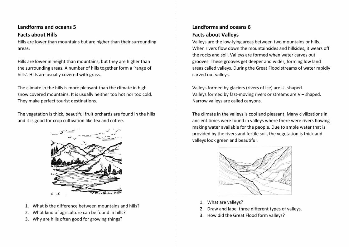
Facts about Hills Hills are lower than mountains but are higher than their surrounding
areas.
Hills are lower in height than mountains, but they are higher than
the surrounding areas. A number of hills together form a ‘range of
hills’. Hills are usually covered with grass.
The climate in the hills is more pleasant than the climate in high
snow covered mountains. It is usually neither too hot nor too cold.
They make perfect tourist destinations.
The vegetation is thick, beautiful fruit orchards are found in the hills
and it is good for crop cultivation like tea and coffee.
1. What is the difference between mountains and hills?
2. What kind of agriculture can be found in hills?
3. Why are hills often good for growing things?
Landforms and oceans 6
Facts about Valleys Valleys are the low-lying areas between two mountains or hills.
When rivers flow down the mountainsides and hillsides, it wears off
the rocks and soil. Valleys are formed when water carves out
grooves. These grooves get deeper and wider, forming low land
areas called valleys. During the Great Flood streams of water rapidly
carved out valleys.
Valleys formed by glaciers (rivers of ice) are U- shaped.
Valleys formed by fast-moving rivers or streams are V – shaped.
Narrow valleys are called canyons.
The climate in the valleys is cool and pleasant. Many civilizations in
ancient times were found in valleys where there were rivers flowing
making water available for the people. Due to ample water that is
provided by the rivers and fertile soil, the vegetation is thick and
valleys look green and beautiful.
1. What are valleys?
2. Draw and label three different types of valleys.
3. How did the Great Flood form valleys?
Landforms and oceans 7
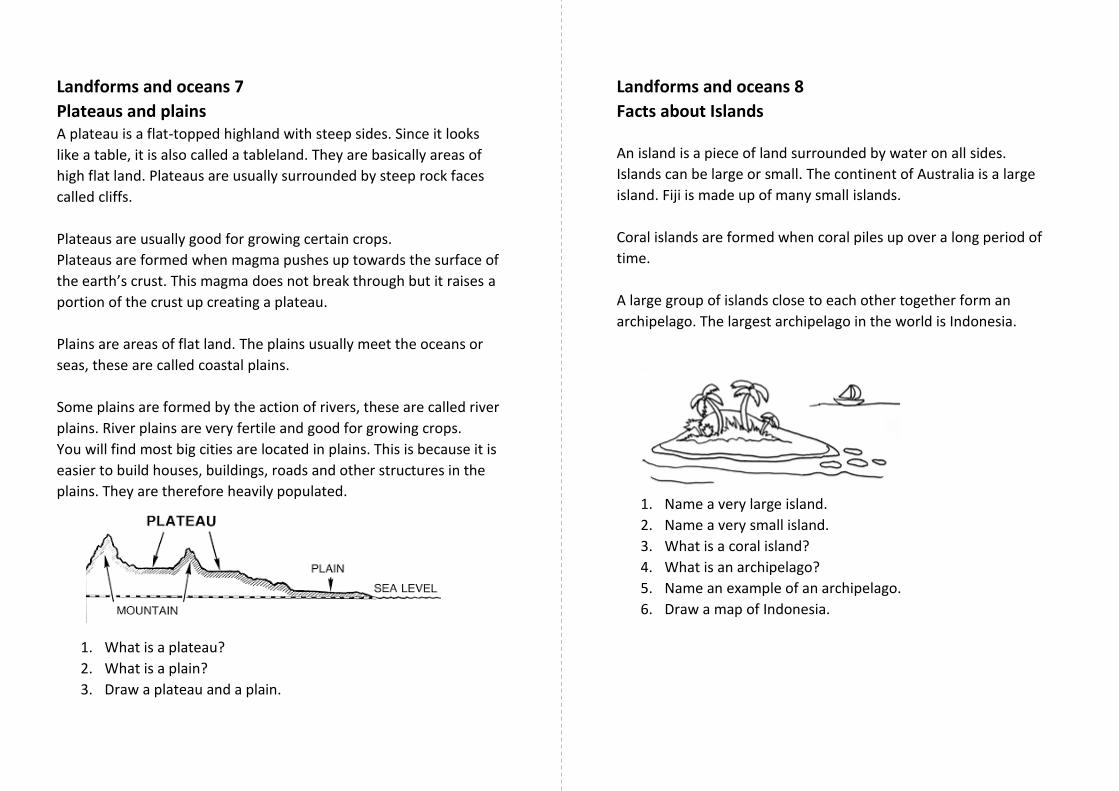
Plateaus and plains A plateau is a flat-topped highland with steep sides. Since it looks
like a table, it is also called a tableland. They are basically areas of
high flat land. Plateaus are usually surrounded by steep rock faces
called cliffs.
Plateaus are usually good for growing certain crops.
Plateaus are formed when magma pushes up towards the surface of
the earth’s crust. This magma does not break through but it raises a
portion of the crust up creating a plateau.
Plains are areas of flat land. The plains usually meet the oceans or
seas, these are called coastal plains.
Some plains are formed by the action of rivers, these are called river
plains. River plains are very fertile and good for growing crops.
You will find most big cities are located in plains. This is because it is
easier to build houses, buildings, roads and other structures in the
plains. They are therefore heavily populated.
1. What is a plateau?
2. What is a plain?
3. Draw a plateau and a plain.
Landforms and oceans 8
Facts about Islands
An island is a piece of land surrounded by water on all sides.
Islands can be large or small. The continent of Australia is a large
island. Fiji is made up of many small islands.
Coral islands are formed when coral piles up over a long period of
time.
A large group of islands close to each other together form an
archipelago. The largest archipelago in the world is Indonesia.
1. Name a very large island.
2. Name a very small island.
3. What is a coral island?
4. What is an archipelago?
5. Name an example of an archipelago.
6. Draw a map of Indonesia.

Landforms and oceans 9
Deserts : Facts and Types Deserts are large, dry and hot areas of land which receive little or no
rainfall throughout the year. The vegetation is scanty due to the
shortage of water. Deserts are covered with sand. Sand dunes are
huge hills of sand formed by the winds.
Deserts have extreme weather conditions, days could be very hot
and nights very cold. This is because the sand absorbs heat fast
during the day and gives off heat quickly at night.
The main vegetation found in the deserts are the cacti and the
baobab trees. The baobab tree can store nearly up to 1000 litres of
water in its trunk which enables it to survive the harsh conditions.
There are two types of deserts – Hot Deserts and Cold Deserts.
Hot Deserts
Hot deserts are vast areas of land that are covered with sand and
dust. These areas receive little or no rainfall and are very dry.
The animals found in the hot deserts are camels, snakes, lizards and
rats.
Cold Deserts
The cold deserts are large areas of land covered with snow. These
deserts receive little or no rainfall. They receive snowfall during the
winters. Animals such as penguins, whales and fur seals survive in
the cold deserts. The Antarctica is the world’s biggest cold desert.
Life in these cold deserts is impossible.
Write a description of either a hot desert or a cold desert. Use
both words and drawings. Also name the place.
Landforms and oceans 10
Types of landforms: definitions
Draw and write a definition for all of the following landforms:
Valley, mountain, plateau, island, hill, plain.
Landforms and oceans 11 Earthquakes
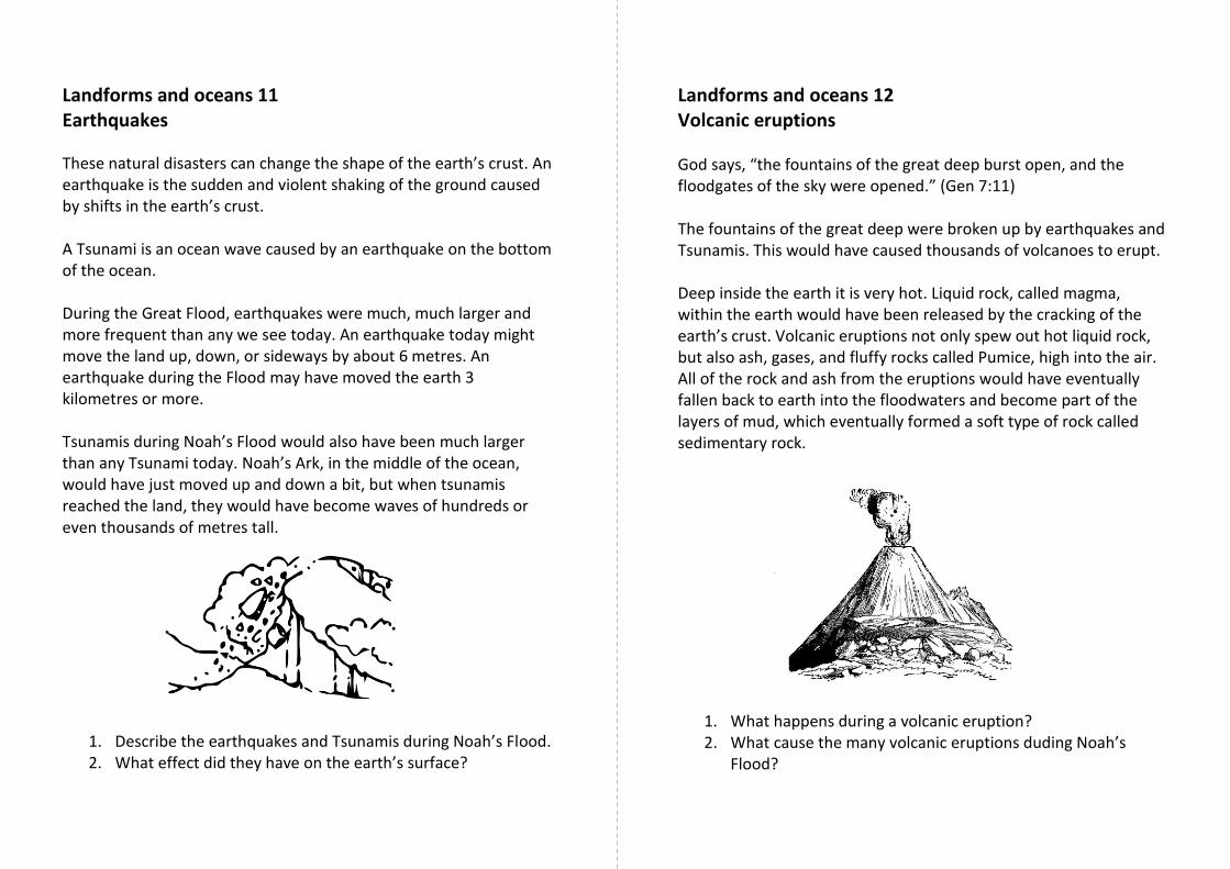
These natural disasters can change the shape of the earth’s crust. An earthquake is the sudden and violent shaking of the ground caused by shifts in the earth’s crust. A Tsunami is an ocean wave caused by an earthquake on the bottom of the ocean. During the Great Flood, earthquakes were much, much larger and more frequent than any we see today. An earthquake today might move the land up, down, or sideways by about 6 metres. An earthquake during the Flood may have moved the earth 3 kilometres or more. Tsunamis during Noah’s Flood would also have been much larger than any Tsunami today. Noah’s Ark, in the middle of the ocean, would have just moved up and down a bit, but when tsunamis reached the land, they would have become waves of hundreds or even thousands of metres tall.
1. Describe the earthquakes and Tsunamis during Noah’s Flood. 2. What effect did they have on the earth’s surface?
Landforms and oceans 12 Volcanic eruptions God says, “the fountains of the great deep burst open, and the floodgates of the sky were opened.” (Gen 7:11) The fountains of the great deep were broken up by earthquakes and Tsunamis. This would have caused thousands of volcanoes to erupt. Deep inside the earth it is very hot. Liquid rock, called magma, within the earth would have been released by the cracking of the earth’s crust. Volcanic eruptions not only spew out hot liquid rock, but also ash, gases, and fluffy rocks called Pumice, high into the air. All of the rock and ash from the eruptions would have eventually fallen back to earth into the floodwaters and become part of the layers of mud, which eventually formed a soft type of rock called sedimentary rock.
1. What happens during a volcanic eruption? 2. What cause the many volcanic eruptions duding Noah’s
Flood?
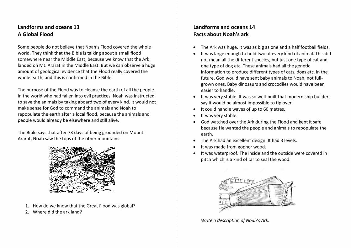
Landforms and oceans 13 A Global Flood Some people do not believe that Noah’s Flood covered the whole world. They think that the Bible is talking about a small flood somewhere near the Middle East, because we know that the Ark landed on Mt. Ararat in the Middle East. But we can observe a huge amount of geological evidence that the Flood really covered the whole earth, and this is confirmed in the Bible. The purpose of the Flood was to cleanse the earth of all the people in the world who had fallen into evil practices. Noah was instructed to save the animals by taking aboard two of every kind. It would not make sense for God to command the animals and Noah to repopulate the earth after a local flood, because the animals and people would already be elsewhere and still alive. The Bible says that after 73 days of being grounded on Mount Ararat, Noah saw the tops of the other mountains.
1. How do we know that the Great Flood was global? 2. Where did the ark land?
Landforms and oceans 14 Facts about Noah’s ark
The Ark was huge. It was as big as one and a half football fields.
It was large enough to hold two of every kind of animal. This did not mean all the different species, but just one type of cat and one type of dog etc. These animals had all the genetic information to produce different types of cats, dogs etc. in the future. God would have sent baby animals to Noah, not full-grown ones. Baby dinosaurs and crocodiles would have been easier to handle.
It was very stable. It was so well-built that modern ship builders say it would be almost impossible to tip over.
It could handle waves of up to 60 metres.
It was very stable.
God watched over the Ark during the Flood and kept it safe because He wanted the people and animals to repopulate the earth.
The Ark had an excellent design. It had 3 levels.
It was made from gopher wood.
It was waterproof. The inside and the outside were covered in pitch which is a kind of tar to seal the wood. Write a description of Noah’s Ark.

Landforms and oceans 15 The formation of mountains and oceans During the Great Flood, entire continents rose up out of the floodwater while the ocean floor sank at the same time. This forced the floodwaters to rush off the continents into the oceans. All this activity caused the sedimentary (soft) rocks to tilt, and fold, by squeezing of layers, or layers being pushed upwards. This created mountains and valleys. Just as there are valleys in the oceans, there are also underwater mountains. In the Atlantic Ocean, there is a range of undersea mountains 16,000 km. long. A few of the mountains rise above the surface to form islands. Many people ask, “Where did all the water go after the Great Flood?” The answer is in the mountains and valleys formed by the volcanic eruptions, earthquakes and Tsunamis. Mountains rose up and huge valleys were formed. The water ran into the huge valleys which are now our seas and oceans. 1. What was the surface of the earth like before the Great Flood? 2. What was is like after the Great Flood?
Landforms and oceans 16 The Ocean Until modern times, no one knew what the bottom of the ocean was like. People thought it was like the deserts: flat and sandy. They believed the ocean floor was mostly saucer shaped and deepest in the middle. But in the 1900s, oceanographers found that the sea has many deep valleys and canyons. The deepest of these canyons are called trenches and are amazingly deep. How did the mountains and valleys get there? They were formed during the Great Flood, (Genesis 6-8). Genesis 7:11 tells us not only about the rain that fell but also about the underground waters which erupted from the earth. The Bible mentions both the mountains and the valleys of the sea in the books of Jonah and Job: Jonah 2:5-6 tells about Jonah who was thrown into the sea. He sank down to the very roots of the mountains in the sea. In Job 38:16, one of the questions God asks Job is, “Have you walked in the valleys of the sea?” How did the writers of these books of the Bible know about the mountains and valleys of the ocean thousands of years before scientists discovered them? God told them of course! 1. Write out the Bible verses that tell us that the ocean has mountains and valleys. 2. When did scientists find out?
Landforms and oceans 17 Ocean currents The fact that the ocean has currents was discovered by a U.S. Navy officer, Matthew Maury, in the 1800s. Matthew was not only interested in oceans but also liked to read the Bible. One day he was reading Psalm 8 which tells us that God put human in charge of everything He made the birds in the sky, the fish in the sea, and everything that swims the ocean currents. (Some older versions of the Bible, like the one that Matthew was reading, call the currents “the paths of the sea”.) It was because of this Psalm that Matthew got the idea that there could be paths in the sea. So, he set out to discover them. He discovered that the world’s oceans have many paths, or currents, which are like rivers flowing through the sea. There are warm currents and cold currents, fast currents and slow currents. In 1855 he wrote the first text book on oceanographic physics and became known as “the pathfinder of the seas” and “the father of navigation.” His discover and his books helped to make ocean travel much quicker and easier. 1. What are ocean currents? 2. How do ocean currents make sea travel easier?
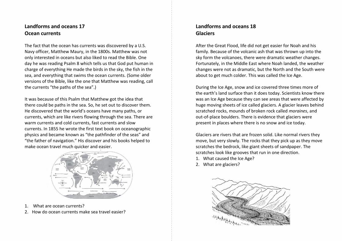
Landforms and oceans 18 Glaciers After the Great Flood, life did not get easier for Noah and his family. Because of the volcanic ash that was thrown up into the sky form the volcanoes, there were dramatic weather changes. Fortunately, in the Middle East where Noah landed, the weather changes were not as dramatic, but the North and the South were about to get much colder. This was called the Ice Age. During the Ice Age, snow and ice covered three times more of the earth’s land surface than it does today. Scientists know there was an Ice Age because they can see areas that were affected by huge moving sheets of ice called glaciers. A glacier leaves behind scratched rocks, mounds of broken rock called moraines, and out-of-place boulders. There is evidence that glaciers were present in places where there is no snow and ice today. Glaciers are rivers that are frozen solid. Like normal rivers they move, but very slowly. The rocks that they pick up as they move scratches the bedrock, like giant sheets of sandpaper. The scratches look like grooves that run in one direction. 1. What caused the Ice Age? 2. What are glaciers?
Related Documents