BUM LIBRARY 880 58 LAND OF CONTRAST A History of Southeast Colorado Frederic J. Athearn CULTURAL RESOURCES SERIES Number 17 Bureau of Land Management Colorado

Welcome message from author
This document is posted to help you gain knowledge. Please leave a comment to let me know what you think about it! Share it to your friends and learn new things together.
Transcript
BUM LIBRARY
880 58
LAND OF CONTRASTA History of Southeast Colorado
Frederic J. Athearn
CULTURALRESOURCES
SERIES
Number 17
Bureau ofLand Management
Colorado

h
LAND OF CONTRAST: A HISTORY OF SOUTHEAST COLORADO
Frederic J. Athearn
BUREAU OF LAND MANAGEMENT LIBRARYDenver, Colorado
88014158
Bureau of Land ManagementDenver, Colorado
1985 Bureau of land Management
Library
Bldg 50, Denver Federal Center
Denver, CC 30225
COPIES OF THIS DOCUMENT ARE AVAILABLE FROM:
BUREAU OF LAND MANAGEMENTCANON CITY DISTRICT OFFICE3080 EAST MAIN STREETCANON CITY, COLORADO 81212
OR
BUREAU OF LAND MANAGEMENTCOLORADO STATE OFFICE2020 ARAPAHOE STREETDENVER, COLORADO 80205
This document is in the public domain and may be quoted. Please credit either the Bureau of Land Management and/or the
author.
This document is printed in conjunction with the Southeast (Colorado) Planning Analysis Update and the Raton Basin
Coal Leasing Project. In addition, this volume serves as support for both the Update and Coal Leasing. This document is
also integral to the Canon City District Cultural Resource Management Plan.
DESIGNED BY: Leigh Wellborn
SERIES EDITOR: Frederic J. Athearn


FOR
Robert G. Athearn
Historian, Friend, Father

FOREWORD
This publication represents our final Class I History of Colorado. The volume
provides baseline information about the history of the Bureau of Land Manage-
ment's Royal Gorge and San Luis Resource Areas. This work contains the history
of thirteen Colorado counties and a large geographic region ranging from South
Park to the San Luis Valley, and eastward down the lower Arkansas River.
A major objective of the Bureau of Land Management, U.S. Department of the
Interior, is to study and preserve significant cultural values. Evidences of our his-
tory and national heritage cover large areas of public lands. In order to provide
for the orderly and careful evaluation of these places, these baseline narratives
give our specialists and managers information by which to wisely conserve our his-
toric traditions.
This volume is the last of five histories that have been prepared by the Colorado
State Office, Bureau of Land Management. I am pleased to note that in 1984 this
series was presented with a Certificate of Commendation by the American Associ-
ation of State and Local History for its excellence. I am pleased to share this
award winning book with you, and I hope that BLM's contribution to the body of
history is both long lasting and useful, to the professional and the general public
alike.
/fct+i+t^v /<£*>&\*&*
Kannon Richards
State Director, Colorado
Bureau of Land Management

ACKNOWLEDGMENTS
In the course of writing a book of this size; any author accumulates manydebts. Such an enterprise cannot be undertaken by just one person, any number of
others help support projects like this. History is, by nature, the use of written
documents, oral tradition, and other means by which mankind reveals his past. In
this manner, many people helped me create this document.
First, John Beardsley, Canon City District Archaeologist, provided direction
and balance for this project. His pointed comments and useful insights made this
a far better work. Mel Clausen, Stub Freer, and Stu Wheeler, of our Canon City
District Office, helped by providing field support and encouragement. Thanks to
them, life was much easier. Since the primary resources used in this compilation
are located in Denver, the staffs of the Colorado Historical Society's Steven Hart
Library, the Western History Collection of the Denver Public Library, and the
Western History Collection of the University of Colorado (Boulder) Library are
to be thanked. Also, the Las Animas Public Library, the La Junta Public Library,
the Lamar Public Library, and other local sources like newspapers, were most
helpful. A special thanks to the late Fred M. Betz, Sr., of Lamar, who took time
to give me some extra help. The folks at the Prowers County Historical Society
(Big Timbers Museum) and at the Bent's Old Fort National Monument were very
useful in their assistance and providing me with "leads."
Various persons read and critiqued this work. Among them, Steven F. Mehls,
John Beardsley and the late Robert G. Athearn provided comments that pointed
up errors of fact and grammar. Steve Mehls, in particular, is owed a great big
"thanks" for his work that provided some of the notes that were used in this
document. Equally Paul O'Rourke's partial manuscript detailing the history of
the Royal Gorge Resource Area was liberally used by this author. Also, both Cecil
Roberts and Dave Strunk, of the BLM's Colorado State Office, were major con-
tributors to this book, for they allowed me the time to write it. Were it not for
their open encouragement and direct actions, this project could never have been
completed. Of equal importance to this effort is Donna Diercks, who typed the
manuscript from my crude draft. She kindly made corrections in grammar as she
went, and entered the whole thing on her magic word processor. Thank you,
Donna. Thanks also to Tricia Lucero, who typed, and Bettie Smith, who retyped,
the Bibliography in a most efficient manner.
Frederic J. Athearn
Denver, Colorado
1984
in

TABLE OF CONTENTS
Chapter Page
1 THE NATURAL SETTING 3
2 THE FIRST EUROPEANS 13
3 AN AMERICAN INVASION 25
4 THE NEW WEST IS EXPLORED 39
5 EARLY AGRICULTURAL SETTLEMENT 49
6 PIKE'S PEAK OR BUST 61
7 CONFRONTATIONS: REMOVAL AND TRANSITION 75
8 A PERIOD OF TRANSITION: INTO THE 1870's 85
9 A TIME OF BUILDING, 1870-1880 99
10 INTO MATURITY, 1880-1900 1 19
1
1
A PERIOD OF CHANGE: 1900-1920 137
12 HARD TIMES: 1920-1940 153
13 FROM WAR TO PROSPERITY: 1940-1980 171
Bibliography 187


INTRODUCTION
Vll

INTRODUCTION
Southeast Colorado, defined as that area from the Continental Divide east to
the Kansas line, north to about Colorado Springs, and south to the New Mexican
border, is a land of far-ranging contrasts. From the snowy Rockies to the wind-
swept eastern plains, history has seen this land change from nomadic natives wan-
dering its peaks and valleys to heavy industrialization by modern society. While
the first humans to use this region were Native Americans, who survived by ex-
ploiting natural resources, the first Europeans into the southeast corner were
Spanish. Spain's attempts to expand her empire were not overly successful, and
there were no settlements of consequence in this part of what was later to become
Colorado. Perhaps the greatest Eighteenth century event was the Comanches'
1779 defeat near the Greenhorn Mountains.
The early 1800's saw a new invasion of Europeans, this time Americans in
search of fur. The fur trade lasted until about 1840. Forts were established, and
the plains boomed. The famous Santa Fe Trail was established to bring goods into
Santa Fe, New Mexico. Bent's Fort served as the primary outpost of civilization
on the eastern prairies. However, like everything else, the fur days were not des-
tined to last. As beaver fur ran out, hunters turned to the plains and buffalo. Thegreat herds were decimated, and by 1860 nothing was left to exploit. The land was
abandoned except for a few New Mexican settlers, who clung to the earth in the
San Luis Valley. The New Mexicans came to the Valley to take up land grants
from Mexico's government. However, the Mexican War of 1846 caused this re-
gion to become part of the United States, and the older Mexican land grants were
in litigation for a number of years. Nevertheless, settlers from 1850 forward built
little villages, particularly San Luis, in 1852. They dug irrigation ditches and tilled
the soil. On the other side of the Sangre de Cristo Mountains, settlements were es-
tablished along the Huerfano and Purgatoire Rivers. These plazas barely sustain-
ed agriculture. On the Arkansas River, El Pueblo (or Milk Fort) provided passers-
by and local farmers with supplies and food. This place was wiped out in 1854 by
Ute warriors.
The Pike's Peak gold rush of 1859 is where modern history begins for south-
eastern Colorado. In that year some 100,000 would-be miners rushed into the
Rockies when gold was discovered along Cherry Creek, later the site of Denver.
By 1860, South Park was flooded with miners; the Upper Arkansas saw prelimin-
ary exploration activity; and gold seekers crossed the San Luis Valley ready to in-
vade the San Juans. As it happened, a primary beneficiary of the gold rush was
the Valley, for its first settlers now sold scarce food to thousands of miners.
Equally, the Arkansas River corridor was used to move the argonauts to the gold
fields. Pueblo was founded at this time, as were numerous small way stations. TheSmoky Hill Trail crossed this area, as did the ever-popular Santa Fe Trail. Raton
Pass was put into use. By 1865, cattle were being trailed up the Goodnight-Loving
IX

Trail through Pueblo. The gold rush stimulated considerable settlement in this re-
gion, but by 1865 things were slowing down. It turned out that there was not as
much gold in "them thar hills" as expected. South Park's camps died slowly. TheArkansas River corridor, no longer the route of thousands, fell back on agricul-
ture as did the San Luis Valley. The Raton Basin languished, for the gold rush
hardly touched the valleys of the Huerfano and the Purgatoire.
The era of the 1860's was one of quiet. The cattle industry got its start along
the Arkansas River at this time, and agriculture expanded modestly in southeast
Colorado. Thanks to the collapse of the great rush of 1859, there was not muchsignificant settlement. This changed, however, in 1872 when the newly incorpor-
ated Denver and Rio Grande Railway chugged south from Denver to Colorado
City. Here is where William Jackson Palmer founded Colorado Springs and
where his railroad brought tourists. The Rio Grande moved on to Pueblo and then
Trinidad, hoping to cross Raton Pass, but there were rivals. The Atchison, To-
peka and Santa Fe Railroad (Santa Fe) marched across the Colorado plains, along
the Arkansas, preparing to meet the Rio Grande head on. At this time, Las Ani-
mas, La Junta, Granada, and other little settlements on the river became railroad
towns. As the Santa Fe reached Trinidad, an event on the Upper Arkansas
changed everything.
The discovery of huge amounts of silver at Leadville in 1878 touched off a
boom that was astonishing. Overnight, Leadville's population reached into the
tens of thousands. Siver kings like H.A.W. Tabor, David Moffat, Jerome
Chaffee, and D.R.C. Brown made their fortunes here. The rival Santa Fe and Rio
Grande turned, at Pueblo, ready to rush into Leadville. The Royal Gorge was not
big enough for two railbeds and the "Royal Gorge War" broke out. After
extensive litigation, the Rio Grande won this route and built into the rich Lead-
ville market in 1882. The Santa Fe got trackage rights to Denver, which also
boomed, because of Leadville. Pueblo, the lower Arkansas, Trinidad, and,
thanks to William J. Palmer, the San Luis Valley all had, by 1882, rail transport.
The importance of this cannot be underestimated, for now reliable, relatively
cheap transportation was available to previously isolated regions. Farmers bene-
fitted because they could export their crops back east, or to the booming moun-tains, or to a growing Denver market. Cattlemen, wheat growers, and various
others all saw the day when the dry plains would bloom. The silver boom, the ad-
vent of rails, and a strong national economy all came together in a ten-year period
and helped southeast Colorado solidify its position in agriculture and mining.
The 1880's saw development from new coal mining activity that took place in
the Raton Basin. Trinidad, Walsenburg, Aguilar, and, to a lesser extent, CanonCity, all supported numerous company coal towns. Rail lines extended like a
spiderweb all over the foothills of southeastern Colorado. Even the isolated WetMountain Valley underwent a silver boom. In the late 1870's, Rosita and Querida
became the sites of a silver rush. Silver Cliff, founded in 1882, became a town of
10,000 souls overnight. The Rio Grande built a line up Grape Creek into the
Valley; however, 1893 saw an end to this, for in that year, silver prices collapsed.
The Panic of 1893 was the coup de grace to an ailing industry. Leadville's mines
closed, Silver Cliff was all but abandoned, and the nation was cast into a deep
depression. Railroads that once were money-makers went broke. The Denver,
South Park and Pacific (DSP&P) slipped into receivership, while the Colorado
Midland (from Colorado Springs to Leadville) was on the verge of collapse. Even
the big outfits like the Santa Fe or the Rio Grande suffered, which in turn did not
bode well for local farmers and miners. As the crisis deepened, homesteaders tried
to farm the arid plains more extensively (so-called dryland farming), without
benefit of water or irrigation. Technical advances like "Turkey Red" wheat madethis possible, but 1893 also wiped out drylanders. Prices were too low to makefarming profitable. Industry, like the steel mill at Pueblo, suffered badly, as did
area coal mining. Production dropped, and prices fell. Workers were laid off.
Yet, there was one bright spot in this gloom.
Cripple Creek townsite was platted in 1893 to take advantage of gold discover-
ies made in 1890. The Cripple Creek boom was not only huge and the creator of
two cities; it was also the last major discovery of precious minerals in this State.
Cripple Creek and Victor lasted until about 1910 when the price of gold was too
low to make mining profitable. During this boom, some 25,000 persons madeCripple Creek and Victor their homes. Labor violence during the late 1890's
marked Cripple Creek as hostile to workers. The infamous Independence Station
bombing made national headlines; but in the end, Cripple Creek faded like other
mining districts. After an agonizingly slow death, Cripple Creek and Victor nowcater to tourists, not miners.
The turn of the century saw recovery from the devastation of the Panic of
1893. As businesses struggled to their feet, they found that there were not as manybuyers. The lack of a strong mineral industry did not help much. Farmers, ever
hopeful, began returning to the plains. Irrigation, a development of the 1880's
along the Arkansas River and throughout the San Luis Valley, was once again
popular. Where irrigated lands could not be obtained, dryland homesteaders went
back at it. From 1900 to 1920, the last great homestead boom occurred on the
Great Plains. Thousands of last-minute, would-be farmers poured onto the plains
in a last-ditch effort to own land. In 1914, just prior to the Great War, most dry-
landers, indeed all farmers, were having a hard time. However, war in Europe
brought about high food prices due to increased exports. Local industry also pro-
fited from the war; steel prices soared; and CF&I, at Pueblo, had all the business
it could handle. Coal production rose to keep pace with increased rail traffic and
industrial use. Alloys like molybdenum became popular and were increasingly
mined. Climax (AMAX) began its operations on Fremont Pass, and by the late
1930's had developed this area near Leadville into the world's largest such mine.
While the four years between 1914 and 1918 were prosperous, the latest boom
XI
ended in 1919 with a serious recession that wiped out farmers, miners, and indus-
try. Drylanders were particularly hard hit, as was the precious mineral industry.
Gold and silver production dropped, and other industrial metals like lead, copper,
and zinc lost ground. This caused the population to seek a scapegoat for their
woes. At first, Communists were the target. The Red Scare of 1919 had all the
overtones of witch-hunting, but a worse threat was the reemergence of the KuKlux Klan during the early 1920's. The Klan managed to seize the governor's man-sion in 1924, and the Colorado legislature had all it could do to stop these extrem-
ists. In southeast Colorado, Klan activity centered around Pueblo (a large Cath-
olic and Hispanic population), Walsenburg, and, to a lesser extent, Trinidad.
Canon City had a strong chapter, too. Other than a few cross burnings, the Klan
did little real harm. They were out of political power in 1926, and the KKK slid
downhill from that point forward. The Roaring Twenties was not prosperous for
most Coloradans. The nation might have boomed, but the local economy did not.
Farmers, as mentioned, faced hard times. They banded into cooperative groups to
market their wares in 1924, after passage of the Cooperative Marketing Act per-
mitted such activity. San Luis Valley potato growers, in particular, were leaders in
co-op ventures. Dryland wheat farmers grew more and more to cover their losses.
This not only glutted the market, but also had a devastating effect on southeast
Colorado's fragile topsoil.
If the twenties were bad, the thirties were far worse. In 1929, the American
economy totally collapsed, not that eastern Colorado's farmers noticed right
away. More important was the Federal Government's intervention in the market-
place. Republican President Herbert Hoover's "wait-and-see" policy failed
miserably. In 1932, Franklin D. Roosevelt, a Democrat, was elected President. Heimmediately began Federal aid to industry, farmers, and the dispossessed. Farm-
ers living in the Dust Bowl, of which southeastern Colorado was part, were aided
in numerous ways, including heavy farm subsidies. The national forests, created
in 1891, were improved by Civilian Conservation Corps (CCC) labor, while the
Public Works Administration (PWA) built post offices and city halls. This Fed-
eral aid worked well for a while, but by the late 1930's the economy once more
sagged. Again, war saved the day.
When the United States entered World War II in 1941, America's industry and
farmers were both producing full tilt. Food prices skyrocketed, mining demandwas up, and industry could not keep up with local wartime demands. CF&I, at
Pueblo, made steel at full output, and railroads hauled goods and troops at full
capacity. World War II cast southeastern Colorado into its present mold, for at
this time various facilities that are still in use were built. Foremost among these
was Camp (later Fort) Carson, placed just south of Colorado Springs. Pueblo got
an army depot, while La Junta was given an air base. These military additions
strengthened the economy of this region, while bringing in new population. After
the war, many newcomers remained and helped further develop local industry and
XII
services. While agriculture was predominant in the San Luis Valley, South Park,
and on the lower Arkansas during the 1950's, Pueblo, Colorado Springs, and, to a
lesser extent, Trinidad, saw new growth. Coal mines that closed down during the
1930's were replaced by service industries. Tourism, for instance, took up some of
the economic slack. Trinidad, gateway to Raton Pass, got a boost when Interstate
Highway 25 was built through that city. Fast food places, motels, and other ser-
vice facilities helped fuel the local economy. Schools like junior colleges also
grew, thanks to an influx of World War II veterans. Pueblo, Alamosa, Trinidad,
and Lamar all had either four-year or two-year institutions of higher learning that
saw student population increases as a result of the recent war.
The last twenty years in southeastern Colorado have been stable and moder-
ately prosperous. Agriculture, mainly wheat, is the mainstay of the plains. Coal is
still mined for CF&I in the Purgatoire Valley, and oil is being discovered in the
Raton Basin, the San Luis Valley and, of course, around Florence. There has been
fairly low recent population growth, although Pueblo suffers from pollution
caused by autos, more people, and Denver's "brown cloud" drifting southward.
Tourism still remains a major force in this region. Subdivisions are scattered
throughout the Wet Mountain Valley, west of Pueblo, and in other spots like
South Park. They appeal to the summer home resident, but are generally not well
developed. Skiing, something new in this area, is taking hold. Conquistador, in
the Wet Mountain Valley, is showing signs of becoming a serious tourist area.
Westcliffe caters to both winter and summer visitors these days. Canon City
serves tourists who come to ogle the Royal Gorge, drive scenic U.S. 50 to BuenaVista, or do a little camping in the surrounding national forests. Longer term visi-
tors are housed in a new State Prison located east of Canon City. Pueblo nowsuffers from hard times because its main industry, steel, is not in demand. Unem-ployment is high, and city fathers worry about their future. The San Luis Valley
remains timeless. There really has not been much change since the early 1900's.
Agriculture still dominates the Valley. Potatoes, corn, wheat, barley, and other
grains provide a stable economy. Tourists come into the Valley to see the Great
Sand Dunes National Monument or pass through on their way into nearby nation-
al forests, but this is hardly a booming trade in visitors. The Valley remains quiet,
"pristine," and possibly the most charming region in this State. To visit this place
is truly a pleasure.
The southeast corner of Colorado is, perhaps, one of the least changed areas
of this State. The eastern plains have always been, and remain, agricultural.
Towns along the front range, like Pueblo and Trinidad, were traditionally indus-
trial or supply cities. They are still that. South Park, after mining peaked, reverted
to agriculture, like cattle raising. It remains a livestock area. Leadville is still
highly dependent upon mining, although not silver. The Wet Mountain Valley,
originally settled for mining purposes, is presently used by ranchers. The San Luis
Valley was and still is predominantly agricultural in nature. The land, its people,
xin
and its dreams remain much the same as one hundred years ago. As time movesforward, changes are bound to occur here; but if the past is an indicator, they will
not be massive, and they may not be permanent. This region's history is like that.
xiv

CHAPTER ONE

CHAPTER I
THE NATURAL SETTING
Southeastern Colorado consists of at least three unique geographic areas,
ranging from high plains to rugged mountains. Regional extremes are striking.
From semiarid plains, to towering mountains, along with large "parks," that is,
valleys, the land exhibits a diversity of climate and flora that are quite unusual.
Perhaps the southeast corner of Colorado is a perfect example of transition from
prairie to mountain in the American West. Within this area are three distinct com-
ponents. First, there are plains that are relatively featureless highlands uponwhich sparse vegetation exists with only 14 inches of annual moisture. The plains
rise into foothills to the west where rivers cut through these hills. The main water-
course, the Arkansas River, exits near Canon City; the Purgatoire River, rising in
the Spanish Peaks, meets the flatlands at Trinidad; the Apishapa, also a product
of Spanish Peaks, comes out at Aguilar while the Huerfano emerges near Walsen-
burg, Colorado. These waterways are fed by dozens of tributary streams through-
out the foothills and plains. Water, nevertheless, remains scarce and must be al-
located with care. Beyond the foothills, rise the Rocky Mountains. The Continen-
tal Divide provides a 14,000-foot barrier between the plains and Colorado's west-
ern valleys. The largest east slope valley is the San Luis, extending from PonchaPass into New Mexico, and representing the single biggest mountain "park" in
the world. The San Luis is about 100 miles long and 70 miles across. It is intersect-
ed by the Rio Grande, New Mexico's primary river, which rises in the San Juans
near Rio Grande reservoir. This stream is a major drainage for the Valley and
tends southeasterly from Del Norte, leaving the north end of the San Luis Valley
rather dry. One unique feature of what natives call "the Valley" is the Sangre de
Cristo Mountains that rise 14,000 feet to the east. On the west lie the San Juans,
equally high, trapping potential moisture while the Sangre de Cristos stop upslope
rainfall on the eastern side. Because of these peaks, annual rainfall is limited to
6.9 inches. Nestled against the west side of the Sangre de Cristos lie the famous
Sand Dunes, a natural phenomenon rarely found in this region. 1
The other major "park" in the area is South Park, or as it was first called,
Bayou Salado. South Park was used early and frequently by both Native Amer-icans and Europeans. It was the best known area in Colorado prior to 1830. Thepark lies at an altitude of some 9,000 feet and is 40 miles long by 15 miles wide.
The South Platte River intersects the entire valley on a northeasterly trend and
provides a regular water source. To the west rises the Mosquito Range that shields
the upper Arkansas Valley. Beyond, westward, lie the Rocky Mountains. To the
east, the Tarryall Mountains provide another barrier. Moisture falls in the form
of snow and thundershowers and averages 20 inches per year.2 South Park also
contains portions of Colorado's famous "Mineral Belt" where gold, silver, and
non-precious minerals are found. Equally, the upper Arkansas Valley is the homeof the fabulous silver veins of Leadville. The upper Arkansas River region consists
of a narrow valley running from Leadville to Salida with the Collegiate Range on
the west and the Mosquito Range to the east. As the Arkansas flows south, it cuts
through the granite canyons of Fremont County, carves the Grand Canyon of the
Arkansas (the Royal Gorge), a chasm some 1,200 feet deep, and then exits near
Canon City. From here, the river flows past Pueblo and out to the eastern plains.
In its higher locations the Arkansas is fed by numerous streams that originate in
mountain valleys. 3
Another geographic feature of this region is a small basin south of Canon City
called the Wet Mountain Valley. Here the Sangre de Cristo Mountains on the
west, and the Wet Mountains to the east, create an inter-montane "park" that is
high, dry, and mineralized. The valley contains silver-bearing veins and was the
scene of a major silver boom in the 1880's. Today it is dedicated to cattle ranch-
ing.4 South of the Wet Mountain Valley lies what is commonly called Raton
Basin. This land consists of broken terrain intersected by numerous watercourses,
including the Huerfano and Apishapa Rivers. Westward lie the twin Spanish
Peaks, and the basin descends slowly to meet the plains at Walsenburg, Aguilar,
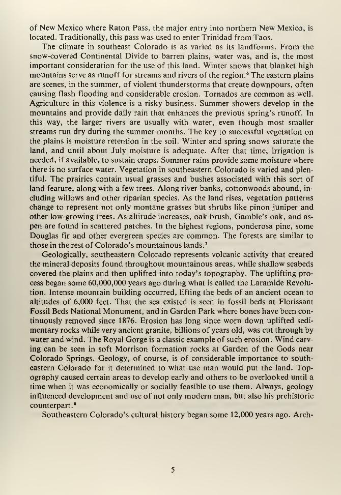
and Trinidad. South, the Purgatoire River very nearly approximates the NewMexico-Colorado border. The Raton Basin is characterized by vast coal deposits that
belie its presently arid climate. This area was once a swamp that lay at the edge of
a shallow sea extending from the Gulf of Mexico across Texas and into south-
eastern Colorado. Valleys created by modern streams are quite narrow and mar-
ginally useful for agriculture. East of Trinidad the land is broken by waterways
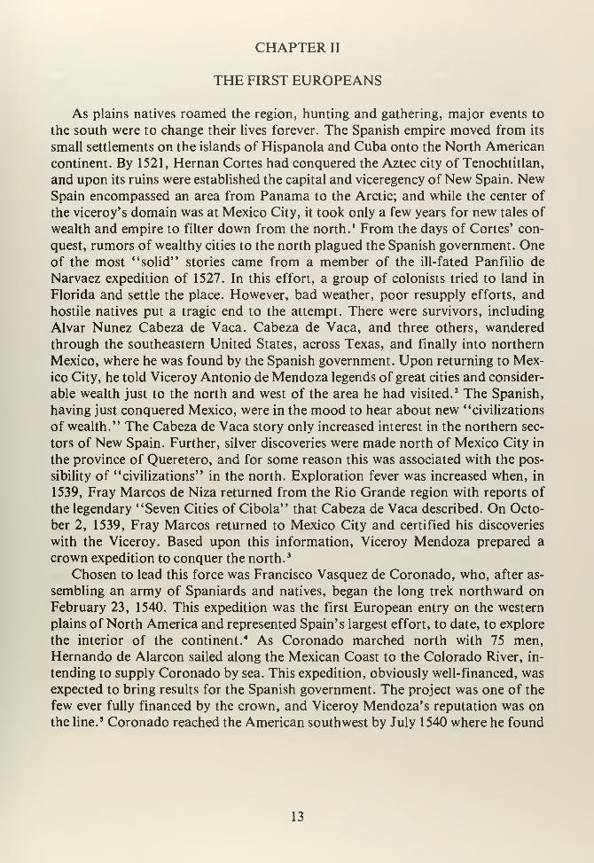
and deeply cut by erosion. Here a series of high mesas run east about 50 miles, the
largest being Mesa de Maya. The southern part runs west to the Raton Mountains
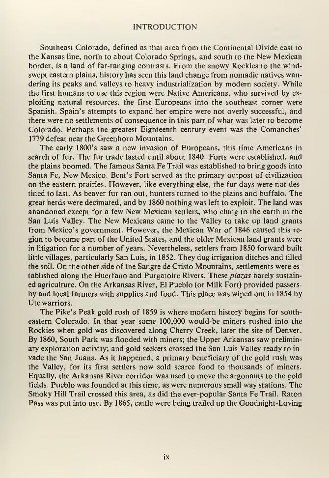
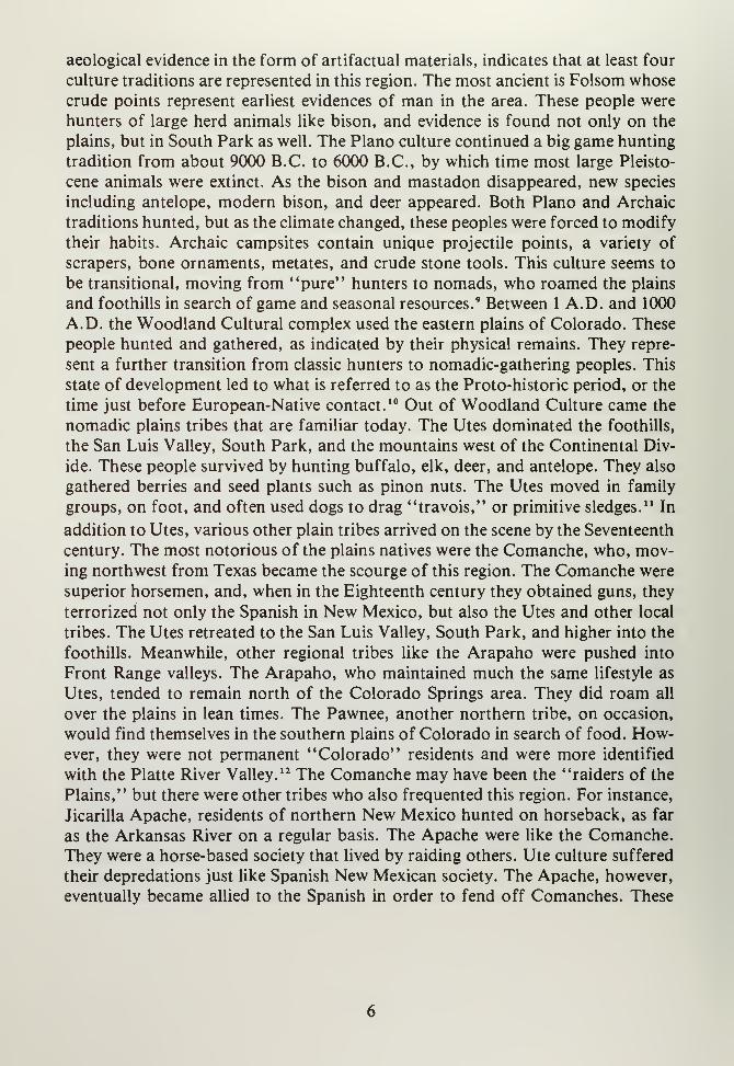
The Purgatoire River Valley, east of Trinidad, Colorado, is typical of the deeply eroded land
found in southeastern Colorado's foothills. (Photo by A.J. Senti)
of New Mexico where Raton Pass, the major entry into northern New Mexico, is
located. Traditionally, this pass was used to enter Trinidad from Taos.
The climate in southeast Colorado is as varied as its landforms. From the
snow-covered Continental Divide to barren plains, water was, and is, the most
important consideration for the use of this land. Winter snows that blanket high
mountains serve as runoff for streams and rivers of the region.* The eastern plains
are scenes, in the summer, of violent thunderstorms that create downpours, often
causing flash flooding and considerable erosion. Tornados are common as well.
Agriculture in this violence is a risky business. Summer showers develop in the
mountains and provide daily rain that enhances the previous spring's runoff. In
this way, the larger rivers are usually with water, even though most smaller
streams run dry during the summer months. The key to successful vegetation on
the plains is moisture retention in the soil. Winter and spring snows saturate the
land, and until about July moisture is adequate. After that time, irrigation is
needed, if available, to sustain crops. Summer rains provide some moisture where
there is no surface water. Vegetation in southeastern Colorado is varied and plen-
tiful. The prairies contain usual grasses and bushes associated with this sort of
land feature, along with a few trees. Along river banks, cottonwoods abound, in-
cluding willows and other riparian species. As the land rises, vegetation patterns
change to represent not only montane grasses but shrubs like pinon juniper and
other low-growing trees. As altitude increases, oak brush, Gamble's oak, and as-
pen are found in scattered patches. In the highest regions, ponderosa pine, someDouglas fir and other evergreen species are common. The forests are similar to
those in the rest of Colorado's mountainous lands. 7
Geologically, southeastern Colorado represents volcanic activity that created
the mineral deposits found throughout mountainous areas, while shallow seabeds
covered the plains and then uplifted into today's topography. The uplifting pro-
cess began some 60,000,000 years ago during what is called the Laramide Revolu-
tion. Intense mountain building occurred, lifting the beds of an ancient ocean to
altitudes of 6,000 feet. That the sea existed is seen in fossil beds at Florissant
Fossil Beds National Monument, and in Garden Park where bones have been con-
tinuously removed since 1876. Erosion has long since worn down uplifted sedi-
mentary rocks while very ancient granite, billions of years old, was cut through by
water and wind. The Royal Gorge is a classic example of such erosion. Wind carv-
ing can be seen in soft Morrison formation rocks at Garden of the Gods near
Colorado Springs. Geology, of course, is of considerable importance to south-
eastern Colorado for it determined to what use man would put the land. Top-
ography caused certain areas to develop early and others to be overlooked until a
time when it was economically or socially feasible to use them. Always, geology
influenced development and use of not only modern man, but also his prehistoric
counterpart."
Southeastern Colorado's cultural history began some 12,000 years ago. Arch-
aeological evidence in the form of artifactual materials, indicates that at least four
culture traditions are represented in this region. The most ancient is Folsom whose
crude points represent earliest evidences of man in the area. These people were
hunters of large herd animals like bison, and evidence is found not only on the
plains, but in South Park as well. The Piano culture continued a big game hunting
tradition from about 9000 B.C. to 6000 B.C., by which time most large Pleisto-
cene animals were extinct. As the bison and mastadon disappeared, new species
including antelope, modern bison, and deer appeared. Both Piano and Archaic
traditions hunted, but as the climate changed, these peoples were forced to modify
their habits. Archaic campsites contain unique projectile points, a variety of
scrapers, bone ornaments, metates, and crude stone tools. This culture seems to
be transitional, moving from "pure" hunters to nomads, who roamed the plains
and foothills in search of game and seasonal resources. 9 Between 1 A.D. and 1000
A.D. the Woodland Cultural complex used the eastern plains of Colorado. These
people hunted and gathered, as indicated by their physical remains. They repre-
sent a further transition from classic hunters to nomadic-gathering peoples. This
state of development led to what is referred to as the Proto-historic period, or the
time just before European-Native contact. 10 Out of Woodland Culture came the
nomadic plains tribes that are familiar today. The Utes dominated the foothills,
the San Luis Valley, South Park, and the mountains west of the Continental Div-
ide. These people survived by hunting buffalo, elk, deer, and antelope. They also
gathered berries and seed plants such as pinon nuts. The Utes moved in family
groups, on foot, and often used dogs to drag "travois," or primitive sledges.11 In
addition to Utes, various other plain tribes arrived on the scene by the Seventeenth
century. The most notorious of the plains natives were the Comanche, who, mov-ing northwest from Texas became the scourge of this region. The Comanche were
superior horsemen, and, when in the Eighteenth century they obtained guns, they
terrorized not only the Spanish in New Mexico, but also the Utes and other local
tribes. The Utes retreated to the San Luis Valley, South Park, and higher into the
foothills. Meanwhile, other regional tribes like the Arapaho were pushed into
Front Range valleys. The Arapaho, who maintained much the same lifestyle as
Utes, tended to remain north of the Colorado Springs area. They did roam all
over the plains in lean times. The Pawnee, another northern tribe, on occasion,
would find themselves in the southern plains of Colorado in search of food. How-ever, they were not permanent "Colorado" residents and were more identified
with the Platte River Valley. 12 The Comanche may have been the "raiders of the
Plains," but there were other tribes who also frequented this region. For instance,
Jicarilla Apache, residents of northern New Mexico hunted on horseback, as far
as the Arkansas River on a regular basis. The Apache were like the Comanche.They were a horse-based society that lived by raiding others. Ute culture suffered
their depredations just like Spanish New Mexican society. The Apache, however,
eventually became allied to the Spanish in order to fend off Comanches. These
two tribes were the most powerful groups on Colorado's southeastern plains well
into the ninteenth century. It is questionable as to whether either the Jicarilla
Apache or the Comanche actually dominated southeastern Colorado. After 1778,
Comanche terror was broken, and the Ute again moved freely along the foothills.
Nevertheless, for all tribes the arrival of the Europeans was of incalculable im-
portance. When the Spanish arrived on the plains during the late Sixteenth cen-
tury, they brought with them two major technological wonders: horses andguns. 13
There was no greater change in native lifestyles than at this time, for here is
where the American native became a raiding machine. No longer was he depend-
ent upon his feet for hunting and gathering. With horses, the range for game was
greatly extended and lives of the various tribes were changed forever. Animals
now became the basis of trade and life. Skins were used for shelter and clothing
while newly gained surpluses were traded with other tribes or Europeans. Guns, of
course, made killing game that much easier, and for the first time excesses in food
supplies occurred. The late Sixteenth century saw the last time that American na-
tives roamed the region alone. For, less than thirty years after the conquest of
Mexico's Aztec Empire, Europeans found their way into the American southwest,
lured by tales of gold, vast civilizations, and rich lands. 14

NOTES
CHAPTER I
1
.
For a physical description of the San Luis Valley see: Virginia McConnell
Simmons, Land of the Six-Armed Cross (Boulder, Colorado: Pruett Press,
1980.)
2. South Park's physical description is contained in: Virginia McConnell, BayouSalado: The Story ofSouth Park (Denver, Colorado: Sage, 1966.)
3. A general description of the Arkansas Valley is contained in: Pachel D. Lewis,
"Official Exploration and Improvement of the Arkansas River, 1806-1900"
(M.A. Thesis: University of Colorado, 1937.)
4. See: Robert A. Murray, Las Animas, Huerfano and Custer: Three Colorado
Counties on a Cultural Frontier, A History of the Raton Basin (Denver, Colo-
rado: Bureau of Land Management, 1979.)
5. Ibid.,p.4.
6. For climatological information regarding this region, see: Colorado State
Board of Immigration, Year Book of the State of Colorado, 1918 (Denver:
Welch-Haffner, 1918), pp. 81, 111, 132, 162-163.
7. Ibid., p. 164, and see: Simmons, op. cit.; McConnell, op. cit.
8. The region's geology is discussed in: R.D. George, "Geology," in History ofColorado, Vol. I, James H. Baker and Leroy R. Hafen (eds.) (Denver: Linder-
man, 1927), pp. 93-98.
9. For a discussion of this part of Colorado's prehistory, see E.B. Renaud,
(Comp.), The Archaeological Survey of Colorado: Fourth Report (Denver:
University of Denver, 1935.)
10. This phase is described in Marcia J. Tate, "A Synopsis of Colorado Pre-
history," in the Colorado Parks Archaeology Manual, (Comp.) Tate, Rip-
peteau and Stuart (Denver: Office of the State Archaeologist, Technical Pub-
lication Series 13, 1978.)
11. A detailed discussion of prehistory on the eastern plains of Colorado is con-
tained in: James Gunnerson, "Class I Overview of the High Plains" (Manu-
script located at U.S. Forest Service, Region II, Lakewood, Colorado, and
Bureau of Land Management, Colorado State Office, Denver, Colorado,
1981.)
12. George E. Hyde, Indians of the High Plains (Norman: University of Okla-
homa Press, 1959), pp. 26-29.
13. See: J. Donald Hughes, American Indians in Colorado (Boulder: Pruett
Press, 1977), pp. 29-34.
14. As related in: George P. Winship, The Journey of Coronado, 1540-1542 NewYork: Greenwood, 1969.)
10

CHAPTER TWO
11

CHAPTER II
THE FIRST EUROPEANS
As plains natives roamed the region, hunting and gathering, major events to
the south were to change their lives forever. The Spanish empire moved from its
small settlements on the islands of Hispanola and Cuba onto the North American
continent. By 1521, Hernan Cortes had conquered the Aztec city of Tenochtitlan,
and upon its ruins were established the capital and viceregency of New Spain. NewSpain encompassed an area from Panama to the Arctic; and while the center of
the viceroy's domain was at Mexico City, it took only a few years for new tales of
wealth and empire to filter down from the north. 1 From the days of Cortes' con-
quest, rumors of wealthy cities to the north plagued the Spanish government. Oneof the most "solid" stories came from a member of the ill-fated Panfilio de
Narvaez expedition of 1527. In this effort, a group of colonists tried to land in
Florida and settle the place. However, bad weather, poor resupply efforts, and
hostile natives put a tragic end to the attempt. There were survivors, including
Alvar Nunez Cabeza de Vaca. Cabeza de Vaca, and three others, wandered
through the southeastern United States, across Texas, and finally into northern
Mexico, where he was found by the Spanish government. Upon returning to Mex-
ico City, he told Viceroy Antonio de Mendoza legends of great cities and consider-
able wealth just to the north and west of the area he had visited.2 The Spanish,
having just conquered Mexico, were in the mood to hear about new "civilizations
of wealth." The Cabeza de Vaca story only increased interest in the northern sec-
tors of New Spain. Further, silver discoveries were made north of Mexico City in
the province of Queretero, and for some reason this was associated with the pos-
sibility of "civilizations" in the north. Exploration fever was increased when, in
1539, Fray Marcos de Niza returned from the Rio Grande region with reports of
the legendary "Seven Cities of Cibola" that Cabeza de Vaca described. On Octo-
ber 2, 1539, Fray Marcos returned to Mexico City and certified his discoveries
with the Viceroy. Based upon this information, Viceroy Mendoza prepared a
crown expedition to conquer the north. 3
Chosen to lead this force was Francisco Vasquez de Coronado, who, after as-
sembling an army of Spaniards and natives, began the long trek northward on
February 23, 1540. This expedition was the first European entry on the western
plains of North America and represented Spain's largest effort, to date, to explore
the interior of the continent. 4 As Coronado marched north with 75 men,
Hernando de Alarcon sailed along the Mexican Coast to the Colorado River, in-
tending to supply Coronado by sea. This expedition, obviously well-financed, was
expected to bring results for the Spanish government. The project was one of the
few ever fully financed by the crown, and Viceroy Mendoza' s reputation was onthe line.
5 Coronado reached the American southwest by July 1540 where he found
13
"Cibola." What a disappointment that must have been. Instead of a city "madeof gold," he found a mud pueblo on a mesa full of hostile natives. This was
Hawikuh, located near present-day Zuni. After a fierce battle, the place was
captured and Coronado set up headquarters. 6 At this point, Coronado dispatched
Garcia Lopez de Cardenas westward to find Alarcon, while Hernando de Alvar-
ado was sent east to explore. Lopez de Cardenas, in August 1540, found the
Grand Canyon of the Colorado, but was unable to locate the Alarcon expedition
at the mouth of that great river. Meanwhile, Hernando de Alvarez discovered the
Rio Grande and the pueblo of Tiguex. This place represented the river pueblos of
New Mexico and was populated by sedentary natives who grew such crops as
corn, cotton, and wheat. Coronado moved his headquarters to Tiguex in Septem-
ber 1540 where he began subjugating the people of the river pueblos. 7 Coronado
spent that winter putting down rebellions in the pueblos and trying to keep his
little army together. While at Tiguex, the expedition heard a story from a native
named "the Turk," who described a "vast civilization" northeast of Tiguex
called Gran Quivira. This place was supposed to be fabulously wealthy and would
put "Cibola" to shame. Coronado, desperate for results, planned a march on
Quivira when winter broke. The spring of 1541 found an expedition on its wayacross the Llano Estacado of western Texas working its way east. The Turk led
thirty of Coronado' s men to eastern Kansas where they found a motley collection
of stick and mud houses inhabited by primitive natives. There was no gold, there
were no great civilizations. In frustration, Coronado' s men tortured and killed
their guide at Quivira. 8 The party started back to Tiguex, crossed western Kansas
to southeastern Colorado, followed the Arkansas River west, and then went downto the Rio Grande. By November 1541 Coronado, having transmitted his findings
to the Viceroy, tried to decide what to do next. That December, he fell from his
horse and was badly injured. In the spring of 1542, Coronado began the long
return to Mexico City, arriving at the capitol in the late autumn of that year.' Cor-
onado, in disgrace from not having found the "Seven Cities," resigned his posi-
tion as governor of Nueva Galicia and retired; he died in poverty. Mendoza had to
answer to the crown why so much money was spent on the 1540 expedition and
why there were no results.10
Coronado' s expedition brought first contacts between Europeans and natives
in the western interior of what later became the United States. The natives, while
brutally treated, did gain the technology of horse and gun. Spain learned that
there were no cities, that there was no gold, but that there were sedentary popula-
tions ready for Christianization. The buffalo was recorded for the first time, and
native cultures at the time of European contact were described by various chron-
iclers of the expedition. This was an important time for both natives and Span-
iards, for here two cultures met and were well documented by contemporaries.
While New Mexico (as this land was called) was written off as "worthless" by the
greedy Spanish, it was not forgotten. Expeditions still went north, out of New
14
Spain, seeking not gold this time, but a place to settle. Both settlers and church-
men were interested in New Mexico for it offered natives for conversion, land,
water, and "free" labor. For example, an illegal expedition led by Bernaldino
Beltran and Antonio de Espejo occurred in 1582. However, the partners fell to ar-
guing among themselves and were eventually disposed of by plains natives.11
The first serious attempt at settlement in New Mexico came in 1598 when Juan
de Onate led an expedition from lower New Spain into the Rio Grande Valley. By1600 the City of Santa Fe was founded, the second oldest European city in the
present-day United States. As the Rio Grande Valley became occupied by Spanish
colonists, pueblo natives were more and more abused by their conquerers. Forced
labor, confiscated lands, and other brutalities were common. Settlement extended
north to Taos, and during this time the San Luis Valley was visited by potential
colonists.12 That place was not suitable for colonization due to lack of useable
water, and hostile Utes promptly drove out their Spanish visitors. Since existing
pueblo towns ended at Taos, there was really no incentive to move much farther
north. The eastern plains also held interest for the Spanish because there were also
pueblos. The Pecos Pueblo, east of Santa Fe, represented Spanish interests on the
plains and, because it was the object of continual plains native raids, the Spanish
were forced to patrol the eastern part of New Mexico north into southeast Colo-
rado. 13 As the seventeenth century progressed, Spanish settlers found themselves
in even more trouble. Not only did plains raiders cause never-ending problems,
but the province's economy was on the verge of collapse. Finally, in 1680, pueblo
dwellers at Taos rose in rebellion and removed the Spanish to El Paso del Norte. 14
Rebels then took over New Mexico and proceeded to revert to what Spanish mis-
sionaries called "barbarism." The province was abandoned to its original owners
until 1692. 15 In that year, Diego de Vargas began the "reconquest" of New Mex-
ico. Vargas, with 100 soldiers, settlers, and allied natives, marched from El Paso
del Norte on August 21, 1692, subduing pueblo after pueblo until they reached
Santa Fe on September 12. Here, the reconquerors engaged in battle with natives
who held the city. The Spanish retook the capital on September 14, 1692. This
day is still celebrated in New Mexico every year as Vargas Day. 16 He then spent the
next several years reestablishing Spanish settlements throughout New Mexico.
Vargas faced a new Pueblo native revolt in 1696. Again, Taos was the hotbed of
resistance, and Vargas moved swiftly to crush this uprising. In the army's move-
ment north to Taos, Vargas took the occasion to march into the San Luis Valley
to demonstrate Spain's strength. He found some Utes who, after limited discus-
sion, agreed that the Spanish were indeed rulers of the region. Vargas then return-
ed to Santa Fe, and the Valley was forgotten. 17
Life in New Mexico during the Eighteenth century was anything but pleasant.
The economy was shaky, settlement was slow and dangerous, and there was a
continual fear of Pueblo uprisings. To further complicate the situation, plains
raiders, most notably the Comanche and Apache, began to encroach on the east-
15
ern plains. Taos, the most outlying pueblo, was constantly attacked. Comanchessoon raided the upper Rio Grande, and, in cooperation with the Utes, Taos was
nearly cut off from the rest of the province. 18 The problem became so serious that
the government established an outpost on the eastern plains to warn of Comancheraids while, at the same time, looking out for supposed French traders. This estab-
lishment, called El Cuartelejo, was built about 1709 and was manned by allied
Apache natives. Where this place was actually located is in some doubt. Leroy
Hafen, Colorado historian, places the site somewhere in far southeastern Colo-
rado. 19 However, Kansas historians claim that the fort was farther east in Kansas
and therefore was the first European settlement in that state. Wherever El Cuar-
telejo was located, it served as the northern-most outpost of Spanish civilization
in North America. While El Cuartelejo was Spain's "early warning" post, its ef-
fectiveness was doubtful. There were only six men posted, and they were wholly
ineffective against Comanche hordes.
In 1719, rumors of French traders in the region filtered into Santa Fe. TheSpanish were concerned about French influence because of a closed and restrictive
trade system within the Spanish Empire. Spain, very early, decided that a mercan-
tile system was the only way to extract maximum profit from the New World.
Hence, all trade was funneled from Seville, Spain, to Vera Cruz, Mexico (in the
case of New Spain), and then on to the provinces. This pattern allowed full con-
trol of goods. No citizen was allowed to buy from any merchant other than Span-
ish. No imports were permitted except through specified ports. Naturally, whengoods reached their destination, they were terribly expensive. New Mexico, being
at the end of the line, having a cash flow problem, and being nonself-supporting,
suffered greatly from this trade system. 20 The situation grew more intense whenFrance, in the late 1600's, colonized the Mississippi River Valley. French traders
soon found their way into east Texas, and, as goods became readily obtainable for
the natives of that area, word spread that cheap European merchandise was avail-
able. The Comanche brought some trade goods into New Mexico which, in turn,
caused poverty-stricken settlers in New Mexico to look to Texas rather than NewSpain (Mexico) for goods. 21 In addition, the Comanche started a vicious circle of
trade that involved raiding New Mexican settlements, stealing food, animals,
goods, and hostages, then trading them back to settlers for food, animals, and
goods. These various problems, a small trade with the French, a drain on the local
economy, and the "Comanche Barrier" on the eastern plains all concerned NewMexico's government. 22
To deal with this perceived threat, Governor Antonio Valverde sent his lieu-
tenant north onto the plains in search of "Frenchmen." In June 1720, Pedro de
Villasur and about 100 men set forth from Santa Fe, crossed southeastern Colo-
rado, and in August ended up on the South Platte River where they found a
Pawnee village. After exchanging written messages, the Spanish got a reply (in
French) that "proved" the French were there. During one night, the Spanish were
16
attacked by a Pawnee war party, and all but 13 Spaniards perished." The Villasur
disaster caused Santa Fe to demand more protection. Mexico City failed to help,
but rather, an inspector, Pedro de Rivera, was sent to the province for the purpose
of assessing defenses. Rivera recommended the establishment of an outpost
among the Jicarilla Apache of southeast Colorado, a suggestion that was ignored. 24
The unprotected Jicarilla were absorbed by both the Comanche and the Ute
during the 1730's. This left New Mexico's northeastern flank exposed. In 1739,
the Santa Fe government got a real shock when French traders wandered into the
capital. Two brothers, Pierre and Paul Mallet, from Illinois country, made it to
Santa Fe by following the Arkansas River to the foothills near Pueblo, and then
proceeding south along the Front Range, over Raton Pass, and into New Mexico.
The party was welcomed at Santa Fe, and after some limited trading, the little
group, less two Frenchmen who chose to stay, went back to Illinois. This was the
first record of Europeans crossing the plains by way of what later became a tradi-
tional route along the Arkansas River and over Raton Pass."
The French at New Orleans, hearing of Mallet's success, began planning a
"trade invasion" of New Mexico, using the plains route of 1739. A party led by
Fabry de la Bruyere made it part way up the Canadian River in 1741, but had to
turn back due to low water and hostile natives. Santa Fe saw another expedition
led by Pierre Mallet in 1750, who was arrested this time and sent to Mexico City.
Governor Tomas Velez Capuchin had just found three Frenchmen at the 1749
Taos Fair and was in no mood for more incursions. Two more Frenchmen appear-
ed in 1752, and they too were sent packing to Mexico City for questioning. Only
the French and Indian War of 1754 put an end to French traders in New Mexico.
With most tribes of the Mississippi Valley in arms, France and Spain were nolonger involved in commerce. 26 Northeast New Mexico became an international
no man's land because of the French and Indian War. Peace, in 1763, divided the
North American interior between Spain and France. The English, established
since 1607 on the east coast, took over that part of the continent. As war raged in
the Mississippi Valley, New Mexico was left out. The region of southeast Colo-
rado, western Kansas, northern Texas and northeastern New Mexico was overrun
by the Comanche. These raiders continued to harass New Mexico, and in confed-
eration with the Utes, kept the plains closed to all.27 Comanche terror continued
well into the 1770's when the crown decided to do something about New Mexico.
This was part of an overall reorganization of the Empire and included an "inspec-
tion" by the Marques de Rubi in 1766-67. Rubi viewed defenses in the province
and made recommendations as to improvements. This included a suggested line of
presidios from California to Texas so as to stop both French and natives. In 1772
a Reglamento (order) was published that required the establishment of presidios,
moving of some older ones, and the creation of the Provincias Internas, a newgovernmental organization. 28
In 1776, the Provincias Internas were put into operation and Teodoro de Croix
17
was named commandante-general of these Provinces. Within a year campaignswere begun to subdue natives of the north. Teodoro de Croix, given this task, sawthat it was accomplished by a "presidio volante, " or the "flying presidio." This
was a rapid deployment concept that sought speedy response when hostile natives
attacked. Horse-mounted soldiers could chase the offenders. 29 Yet, by 1779 the
Comanche were still such a problem that Governor Juan Bautista de Anza as-
sembled a force of some 600 men to track down the powerful Comanche Chief
Cuerno Verde (Greenhorn) and stop him for good. To accomplish this feat, Anzaenlisted the help of 200 Ute and Apache allies, who, coincidently, had just been
defeated at San Luis Lake by the Comanche. 30 Anza marched from Santa Fe into
the San Luis Valley with the largest Spanish force ever gathered in the NorthAmerican interior. His army pushed over Poncha Pass, forded the Arkansas
River at future Salida, and then moved into South Park seeking Comanche. Anzacrossed the park to near where Cripple Creek was founded over 100 years later,
and then proceeded down Little Fountain Creek, emerging on the flatlands. Atthis point, Anza found a Comanche encampment, and on August 31, 1779, en-
gaged in battle.31 Anza's troops easily overcame the women and children in camp,
but Cuerno Verde and his 200 warriors were out on the plains. Anza gave chase,
and on September 3, 1779, he found Cuerno Verde near the Greenhorn Moun-tains. Here the Comanche and Spanish fought a pitched battle where CuernoVerde was resoundingly defeated. Comanche power broken, the eastern plains
were freed from continual raiding, and northeast New Mexico was secure for the
first time in nearly 100 years. Finally, in 1786, a peace was negotiated between
Spain and the Comanche. The Ute also made peace, and the eastern plains were
open to all. While the native menace was gone, a new threat appeared on the hori-
zon in the form of American traders.
18
NOTES
CHAPTER II
1. George P. Winship, The Journey of Coronado, 1540-1542 (New York: Green-
wood Press, 1969), p. vi. Also: John Francis Bannon, The Spanish Border-
lands Frontier, 1513-1821 (New York: Holt, Rinehart and Winston, 1970), p. 9.
2. Bannon, op. cit., p. 13.
3. Winship, op. cit., p. vi, and Bannon, ibid, p. 15.
4. As related by Winship, ibid., p. viii, and Bannon, ibid, pp. 17-18.
5. Bannon, ibid, p. 19.
6. Winship, ibid., pp. 32-33.
7. Bannon, op. cit., p. 18
8. Bannon, ibid, p. 20, and Winship, op. cit., p. 77.
9. Bannon, ibid., p. 26.
10. Ibid., p. 27.
11. Ibid., p. 32.
12. Ibid., pp. 35-38, and George P. Hammond and Agapito Rey (eds. and Trans.),
Don Juan de Onate, Colonizer of New Mexico, 1595-1628 (Albuquerque:
University of New Mexico Press, 1953), Vol. I, pp. 225-228; Ralph E. Twitchell,
The Spanish Archives of New Mexico (Cedar Rapids: Torch Press, 1914),
Vol. 2, pp. 279-280.
13. Frederic J. Athearn, "Life and Society in Eighteenth Century New Mexico,
1692-1776" (Austin, Texas: Ph.D. Dissertation, University of Texas, 1974),
p. 78.
14. Bannon, op. cit., p. 83.
15. Ibid., p. 82, and Athearn, op. cit., p. 15.
19
16. Bannon, op. cit., p. 87 and Athearn, op. cit. See also: Charles W. Hackett,
Revolt of the Pueblo Indians ofNew Mexico and Otermin's Attempted Re-
conquest, 1680-1692 (Albuquerque: University of New Mexico Press 1942),
2 vols.
17. Jesse B. Bailey, Diego de Vargas and the Reconquest of Mexico (Albu-
querque, University of New Mexico Press, 1942): and J. Manuel Espinosa,
First Expedition of Vargas into New Mexico (Albuquerque: University of
New Mexico Press, 1940.)
18. As related in Bailey and Athearn, op. cit., p. 43.
19. See: Alfred B. Thomas, After Coronado, Spanish Exploration Northeast ofNew Mexico, 1696-1727 (Norman: University of Oklahoma Press, 1935),
pp. 134-137.
20. LeRoy R. Hafen, Colorado: A Story of the State and Its People (Denver:
Old West Publishing Co., 1945), pp. 52-55.
21. Thomas, op. cit., p. 15, and Athearn, op. cit., p. 110.
22. Athearn, ibid., pp. 110-111.
23. Alfred B. Thomas, Plains Indians and New Mexico (Norman: University of
Oklahoma Press, 1940), p. 18.
24. Alfred B. Thomas, "The Massacre of the Villasur Expedition at the Forks of
The Platte River," Nebraska History Magazine, pp. 67-81.
25. Bannon, op. cit., p. 130.
26. Athearn, op. cit., p. 182.
27. As related in Bannon, p. 142.
28. See: Thomas, Plains Indians, op. cit.
29. The Reglamento is translated in: Sidney Brinckerhoff and Odie Faulk, Lancers
for the King (Phoenix: Arizona Historical Foundation, 1965.)
30. Bannon, op. cit., p. 180.
20
3 1
.
McConnell, Bayou Salado, op. cit. , pp. 49-50.
32. Ibid., p. 51.
21


CHAPTER THREE
23

CHAPTER III
AN AMERICAN INVASION
The Comanche defeat of 1779 led to increasingly friendly relations between
these natives and their Spanish victors. In the best missionary tradition, GovernorJuan Bautista de Anza selected a site along the Arkansas River (near future Pueblo)
for the purpose of founding a settlement that would convert the Comanche into
sedentary Christians. 1 This place, called San Carlos, was operating by 1787. How-ever, after a hard first year, the Comanche preferred to roam the plains, and this
site was abandoned. Outside of El Cuartelejo (location in question), this was the
first Spanish settlement in the present state of Colorado. 2 The late 1700's also saw
a steady increase of trappers and traders into the interior. St. Louis, at this time a
French city, was jumping off point for these men. Manuel Lisa, perhaps the most
famous early name in the fur trade, opened the Missouri River country in the
1790's. This Spanish trader brought back beaver fur, and soon St. Louis was the
most important trading center in the midwest. Lisa's exploits were legendary and
created new opportunities for an emerging American nation.
The American revolution changed an already tense international situation in
western North America. Because the British lost the Revolutionary War, a newelement was introduced to the scene. Not only did Spain face French incursions
from the Mississippi River Valley, but the British, in the form of Hudson's Bay
Company, moved south from Canada into rich fur regions of the Upper Missouri
River. Additionally, Russia was settling northern California, while American trad-
ers, eager for quick profits, entered an already crowded field.3 Spain, even with
recently reformed trade laws, still refused to allow free trade with other nations.
New Mexico was in a position of wanting French and English goods, but could
not obtain them overland. However, 1803 changed the picture greatly, for in that
year Napoleon Bonaparte of France sold what was called "Louisiana" to the
United States for $15 million dollars.4Instantly, the United States doubled in size
and became Spain's neighbor. The land was totally unknown except that the
boundaries ran from New Orleans up the Mississippi to its headwaters, west to the
Pacific, and along the Red River to the Rockies. The description was hardly pre-
cise, and President Thomas Jefferson wanted to know what he had purchased. 5 In
1804 Jefferson commissioned Meriweather Lewis and William Clark to explore up
the Missouri River, across the Rockies, and on to the Pacific Coast. This task was
accomplished in 1806, and Louisiana became a better known place. However,
only the northern third was explored. Jefferson still wanted to know what else was
out west.
To further southern exploration, Lieutenant Zebulon M. Pike was sent to the
central Rockies in 1806. The Pike expedition left St. Louis in July 1806 with fifteen
men. They moved up the Arkansas River and entered southeastern Colorado on
25
November 1, 1806. On November 23, the group reached the future site of Pueblo,
where a crude shelter of logs was built while Pike and three others explored Foun-
tain Creek adjacent to the peak that now bears his name. 6 On November 27, they
tried to climb Pike's Peak but failed. The expedition continued up the Arkansas
to the mouth of the Royal Gorge and crossed into South Park along Oil (Four
Mile) Creek. Upon crossing this valley, they followed the South Platte westward
back to the Arkansas, near future Buena Vista. Pike wrongly assumed that these
were the headwaters of the Yellowstone River. 7 Pike then marched downstream
and ended up back at their old campsite near Royal Gorge, having gone in a circle.
At the site of present-day Canon City, the party build a small blockhouse and
Pike left two men and the party's horses. The expedition turned south, struggled
up Grape Creek and into the Wet Mountain Valley. They crossed over the Sangre
de Cristo range, by way of Sand Creek Pass (Music Pass), down Sand Creek and
into the San Luis Valley. This passage was brutal for, while in the Wet MountainValley, winter struck with vengeance and these men suffered from cold and lack
of food. Upon reaching the Rio Grande, near future Alamosa, Pike's little group
built a sturdy stockade in January 1807. 8 Pike claimed he thought he was at the
head of the Red River, the supposed international boundary. However, Spanish
officials in New Mexico were less sure. A member of the party, Dr. Robinson, was
sent on to Santa Fe, which caused the Spanish to send out an armed force to find
the Americans. Pike's expedition was arrested and hauled into the New Mexican
capital for questioning. Eventually, Pike and his men were returned to the United
States where his journal was published, revealing for the first time the extent of
Louisiana. This also was the first written record of southeastern Colorado and
proved invaluable for later explorations. 9
Pike's intrusion onto Spanish soil heralded the beginning of an American in-
vasion into New Mexico. James Purcell had met Pike in New Mexico during 1807
and was trading with plains natives as early as 1805. He had been in South Park
and found some gold flakes there.10 Ezekial Williams was, however, the first man
to trap the streams of South Park, working for two years in that area for ManualLisa's Missouri Fur Company. Williams, in 1811, with a small group of men,
worked the Upper Arkansas River, camping along that stream during the winter.
By June 1813, the party moved into South Park, trapping high in the Mosquito
Range. They then separated and found their way back to St. Louis. 11 Purcell andWilliams opened the door for trapping in the central Rockies. Through their ef-
forts, beaver fur trade flourished on a limited scale. Trappers sold their goods at
the annual Taos fair or traded with natives using American goods acquired at St.
Louis. 12 These first incursions caused Spanish officials to worry about Americantraders who could cause unrest among the New Mexican population. Expeditions
were sent out from Santa Fe to find intruders. For instance, Pike's party was
tracked by a Lieutenant Malgares (?) in 1806. 13 Individual trappers were left
pretty much alone, for they did not bring commercial goods and did not generally
26
get to Santa Fe. Taos, the center of fairs since the late 1700's, provided an outlet
for native goods, American trappers' furs, and local New Mexican merchants.
Comanche, Ute, Apache, New Mexicans, and others had gathered at Taos for
years to exchange goods, buy things and enjoy famous "Taos Lightning," a po-
tent liquor. Perhaps this was the first "rendezvous." The fair served an important
role in bringing trade to proverty-stricken New Mexico. Here is where Americans
learned of the profits to be made in this trade. Equally, this is where Spanish of-
ficials came to fear American intrusion, knowing that cheap trade goods could
not be stopped once introduced. Further evidence of Spain's concern for "intrud-
ers" could be seen in 1819, when a small fortress was built along South Oak Creek
to guard Sangre de Cristo Pass. The place was soon abandoned and turned over to
the Comanche who roamed this region. 14 That Spanish fear was real is seen by the
fact that in 1812 Robert McKnight was arrested and thrown into jail at Santa Fe
for illegal trading. In 1815, August Chouteau and Jules de Mun came up the Ar-
kansas River, then the Huerfano, across Sangre de Cristo Pass and into Taos with
trade goods. Here they were arrested and their goods were confiscated by Spanish
officials.15
All this changed in August 1821, when Spain was overthrown by Mexican rev-
olutionaries led by Augustin de Iturbide. New Spain declared her independence
and in January 1822 became the Republic of Mexico. New Mexican Governor
Facundo Melgares promptly announced that the province would be opened to all
traders. William Becknell of Missouri was already there and in business. 16 By fall
1822, trade into New Mexico began. Hugh Glenn and Jacob Fowler came to Taos
that same fall, having followed the Huerfano River route over the Sangre de
Cristos, down South Oak Creek and past the old Spanish fort.17 From the days of
the Taos fair to 1822, New Mexico saw a mixture of trappers, traders and natives
all trying to break into her trade cycle. It took independence to accomplish the
feat; and by 1822 not only was New Mexico booming, but so was the fur business
to the north. Generally, fur trappers sought beaver pelts. These animals were de-
manded by Europe and Russia where they were made into fur hats. Due to up-
heaval caused by the Napoleonic Wars, Siberia's fur trade was interrupted and
there was a fur shortage. The British, in Canada, were able to sell all they could
trap. Naturally, American interest in the west was high. Pike's expedition sparked
concern, and older trappers familiar with the Taos trade brought news to St.
Louis that there were "unlimited" resources in the Rockies. As noted, first Amer-
ican fur trade was on the Upper Missouri River and was linked to St. Louis. How-ever, by the 1820's this region was depleted and new areas were needed. Just as the
Santa Fe trade began, an advertisement appeared in a St. Louis newspaper seek-
ing: "Enterprising young men ... to ascend the Missouri to its source there to be
employed for one, two, or three years." 18 The advertiser, General William H.
Ashley, formed a fur company that included all the "big" names in the business.
William Sublette, Jim Bridger, Thomas "Broken Hand" Fitzpatrick, Jim Beck-
27
wourth, Jedediah Smith, Kit Carson, and others were part of the first Ashley ex-
pedition. These men explored the upper Missouri, then followed the Green River
into Colorado and Utah. By doing so they established a fur trade in western Colo-
rado. 19 For the first few years, most major fur activity was concentrated on Colo-
rado's western slope. However, by the mid-1820's, better areas were "trapped
out" and trappers began a serious invasion of the central Rockies and San Luis
Valley.
James Ohio Pattie trapped in South Park by 1827, while Beckwourth was re-
portedly in the same area with a band of Crow Indians. 20 Equally, trappers from
Taos moved into the San Luis Valley, over the Sangre de Cristo range, and onto
the rivers of the Front Range like the Purgatoire, Huerfano, and Arkansas. Oneof the larger parties to work the region was the Robert Bean and Alexander Sin-
clair expedition of 1830. This group left Fort Smith, Arkansas, and marched
along the Arkansas to Fountain Creek. Here they moved north past Pike's Peak,
up the North Fork of the Platte River, and into South Park via Kenosha Pass.
They trapped extensively and then went west to the Green River at Brown's Hole.
After a season a trapping, the majority of this party went on to Taos via the upper
Arkansas and through the San Luis Valley. 21 There were also other trappers in
South Park. In 1830, Kit Carson joined Thomas Fitzpatrick at Taos from whence
their group went into South Park where they trapped along the South Platte. Here
they heard that a party led by John Gantt was in the area. Carson and four others
joined the Gantt party and operated in both South and North Parks. Fur trappers
worked South Park and the Arkansas Valley well into the late 1830's. Joseph
Meek, Bill Sublette, "Old" Bill Williams, and Richens L. "Uncle Dick" Woottonall trapped Bayou Salado from 1835 to 1840. 22 By the early thirties, fur values
were dropping. In 1833, the price of a pelt was only $3.50 compared to $6.00 just
the year before. In addition to falling prices, it became more difficult to find fur
in the west. Even worse, fashions in Europe changed. Silk hats were now the rage
and beaver fur was no longer needed. 12 The demise of fur trapping led old timers
to new fields. For example, in 1832, near the mouth of the Purgatoire River, John
Gantt built several log houses enclosed by a stockade where a trade in buffalo
robes began. He also sold liquor to the natives, thus beginning a whiskey trade on
the Arkansas. 24 Gantt' s enterprise was so successful that other trappers began
similar operations. Ceran St. Vrain and William Bent built a "picket post" stock-
ade on the north side of the Arkansas River about nine miles below the mouth of
Fountain Creek in December 1832. The next year saw the beginning of a long and
profitable trade with the Cheyenne. Faced with competition, Gantt imported NewMexican bricklayers from Taos and built an adobe fort.
25
The Bent-St. Vrain combine wiped out Gantt commercially, and he finally
abandoned his adobe building in 1835. With that threat gone, the Bent Brothers
moved seventy miles down the Arkansas to near the future Las Animas and built a
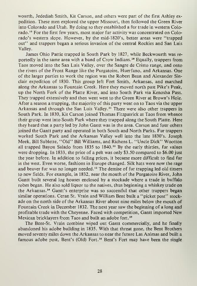
famous adobe post, Bent's (Old) Fort. 26 Bent's Fort may have been the single
28
most important factor in the development of Colorado's plains trade. Displaced
trappers moved onto the prairies to hunt buffalo. There were millions of these
animals along the Arkansas, and the demand for buffalo robes was rising both in
the eastern United States and in Europe. Buffalo hunters and skinners used vari-
ous posts and forts to buy goods, to trade with the natives, and to drop off
robes.27 Bent's Fort encouraged other settlements, too. Maurice Le Due and Wil-
liam LeBlanc, at the behest of the Bent brothers, built an adobe trading post near
Hardscrabble Creek called "Crow's Nest" or "Buzzard's Roost." New Mexicans
called the place El Cuervo. Le Due and his partners traded with Utes headed into
the Wet Mountain Valley and dispensed potent "Taos Lightening." The post
struggled along for years, but was hardly a major site.28 More important was the
establishment of a post along the Arkansas River, thirty miles east of Fountain
Creek in 1843. El Pueblo, as the settlement was named, provided trade goods, lo-
cally grown vegetables and goat's milk. Hence it was also known as "Milk
Fort." 29 The life of this "fort" ended on December 25, 1854, when Utes massacred
its inhabitants. 30 As competition for the buffalo trade heated up, forts were built
farther north along the South Platte River. Places like Lancaster Lupton's Fort
Lupton, Louis Vasquez's establishment, Fort Vasquez, and other locations served
the plains trade into the 1840's. However, the thrust of trade and commerce was
on the Arkansas. Bent's Fort was the major settlement between Santa Fe and St.
Louis, and it provided provisions, trade goods, liquor, a place to stay, and it was
certainly a welcome sight for weary travelers from throughout the eastern plains.
Bent's Fort was a success not only because of the buffalo robe trade. NewMexico's commercial ventures, beginning in 1822, blossomed into a serious trade
system by the 1840's. To serve New Mexican traders, the Santa Fe Trail became
the "road west." Leading from Missouri to Santa Fe, this route carried thousands
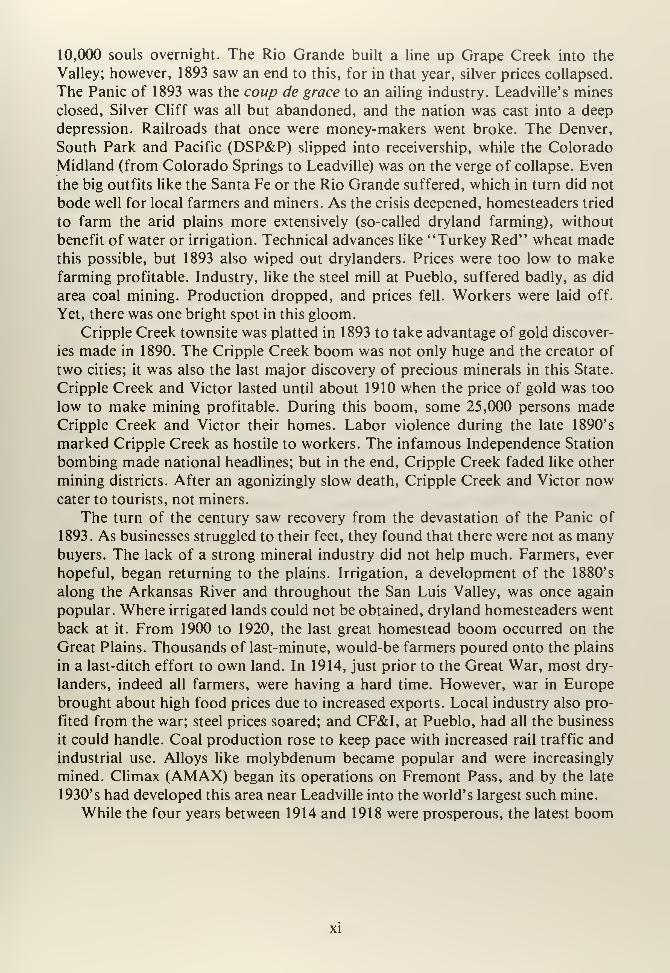
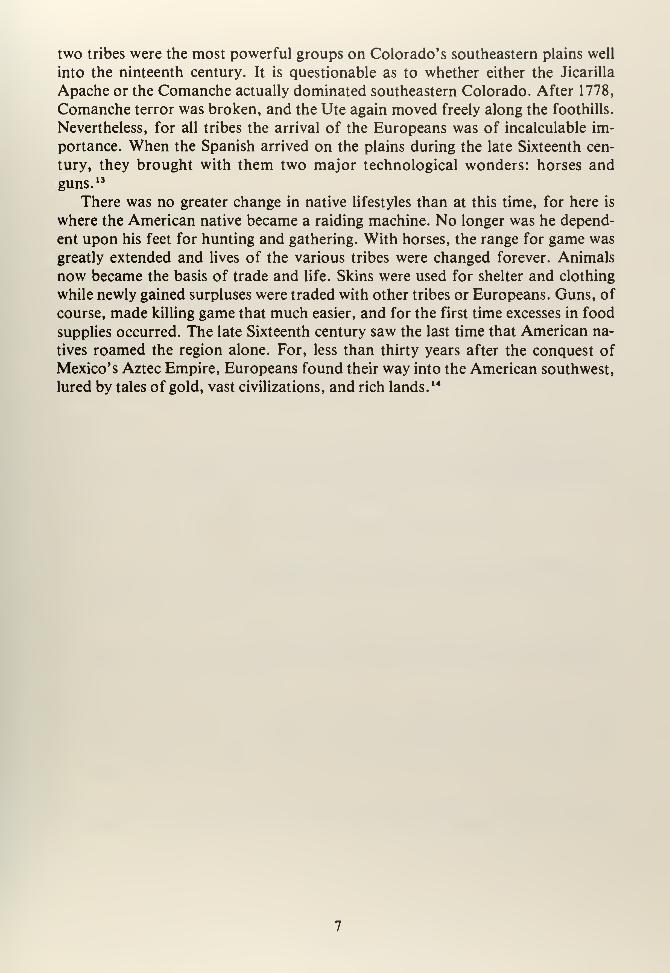
Bent's Old Fort, as reconstructed by the National Park Service, was a haven for travelers along the
Santa Fe Trail.
(Photo by F.J. Athearn)
29
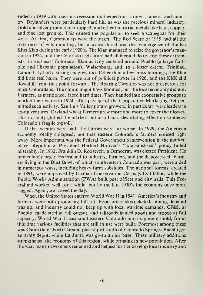
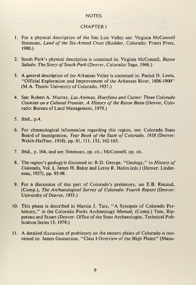
Boggsville, founded in 1866 was the home of Kit Carson and J.W. Prowers, both famous pioneers
in southeastern Colorado.
(Photo by F.J. Athearn)
of tons of goods, horses, and other items to be sold for Mexican silver at Santa Fe.
The Santa Fe trail ran along the Arkansas River which provided water and forage
for the lumbering oxen that dragged heavy wagonloads of goods. Near the mouthof the Purgatoire River, it then cut south, went over Raton Pass, and on to Santa
Fe. Modern Interstate-25 roughly parallels the "Mountain Branch" of the Santa
Fe Trail from Raton to Las Vegas, New Mexico. As time progressed and
technology allowed larger wagons with longer ranges, a cutoff was blazed from
near Fort Mann, Kansas, southwestward across the Cimarron River, and into the
northeastern plains of New Mexico. The "Cimarron Cutoff" was shorter but
more dangerous. There was no water across the barren prairies; Comanche and
Apache natives created an ever-present threat; and, while the route took less time,
losses were greater.30 Nevertheless, traders were willing to take risks for New Mex-
ico's commerce. By the mid- 1 840' s, there was so much trade that the Arkansas
River Valley could hardly be called "unsettled." Traders, trappers, and natives all
congregated along the river, and before much longer permanent European settle-
ment was going to occur. The end of the Santa Fe Trail came, coincidentally, at
the same time the buffalo trade faded. Relations between Mexico and the United
States soured over the Texas question, and by 1844 war seemed inevitable. The
30
problem dated to 1836, when American colonists in Texas declared their settle-
ments independent of Mexican rule and established the Republic of Texas. Mex-
ico's government, under the rule of Antonio Lopez de Santa Anna, refused to
recognize the new Republic and to allow trade with Texans. Texas, with greedy
eyes cast upon New Mexico, considered invading Santa Fe in order to capture the
Missouri trade. An expedition was attempted in 1843, but it was poorly managedand turned into rout when Mexican soldiers from Santa Fe broke it up. 31 TheSanta Fe Trail trade was curtailed in 1846 when war occurred. The United States,
having annexed Texas in 1844, went to war when Mexico allegedly "invaded" the
new state. New Mexico was captured in 1846 by Steven Watts Kearny's 500-man
military expedition. Charles Bent was named governor, and Kit Carson became
Lieutenant Governor. In 1847, a revolt occurred at Taos, and Bent was killed.
However, the rebellion was put down and New Mexico was firmly in American
hands. In 1848, Mexico surrendered and a peace was negotiated. The Treaty of
Guadalupe-Hidalgo provided that all lands west of Louisiana, including California,
would be annexed to the United States. In one stroke, the nation grew to its present
size. New Mexico became part of this change and the Santa Fe trade was no longer
profitable because silver specie from Mexico was cut off. The mines of Chihuahua
provided hard currency until 1848, and with this source gone, New Mexico was
thrust back into poverty. 32
Missouri merchants stopped sending goods to Santa Fe, and the Santa Fe Trail
was abandoned. Only a few immigrants wandered into the Arkansas River Valley,
most notably the so-called "Mormon Battalion" of 1847. 33 Perhaps a most telling
sign of the end was the destruction of Bent's Fort in 1852. William Bent tried to
sell the fort to the United States government. When negotiations dragged, Bent, in
a fit of anger, loaded the place with black powder and blew it to pieces. Bent then
moved down river and built a new fort near today's Lamar, Colorado. This be-
came known as Bent's New Fort. 34 The Santa Fe Trail continued to be used, of
course, but traffic was light. During the 1850's, immigrants seeking land used this
route, and some traders found their way into the region. A few new settlements
did spring up during this time. Charles Autobees established a plaza at the mouthof the Huerfano River in 1853, and Maurice Le Due maintained a store at Hard-
scrabble; El Pueblo functioned until 1854. 35
These places represented European settlement on the eastern plains. Yet, there
was also the stirring of development in the San Luis Valley. By the early 1840's,
Mexico's government provided land grants totalling millions of acres, and somesmall settlements arose along the Rio Grande. These plazas were the first agricul-
tural towns in the future state of Colorado, and became important a few years
later when gold was discovered in the Rockies. After the fur and buffalo trade
died, there was a period filled by another type of development. Instead of men ex-
ploiting the region's natural resources, they explored it to discover what else wasavailable.
31

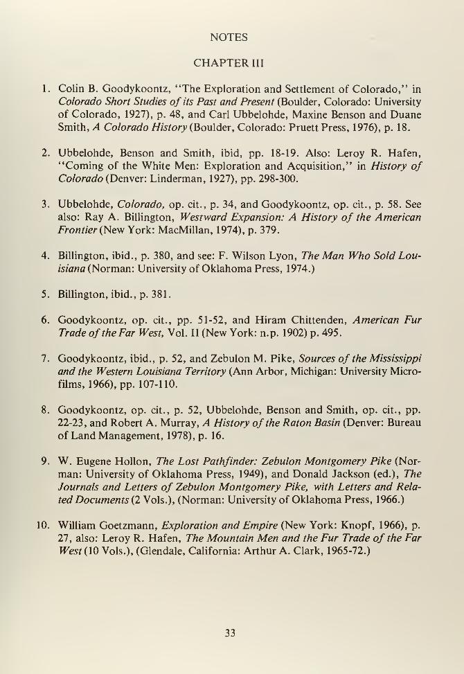
NOTES
CHAPTER III
1. Colin B. Goodykoontz, "The Exploration and Settlement of Colorado," in
Colorado Short Studies of its Past and Present (Boulder, Colorado: University
of Colorado, 1927), p. 48, and Carl Ubbelohde, Maxine Benson and DuaneSmith, A Colorado History (Boulder, Colorado: Pruett Press, 1976), p. 18.
2. Ubbelohde, Benson and Smith, ibid, pp. 18-19. Also: Leroy R. Hafen,
"Coming of the White Men: Exploration and Acquisition," in History ofColorado (Denver: Linderman, 1927), pp. 298-300.
3. Ubbelohde, Colorado, op. cit., p. 34, and Goodykoontz, op. cit., p. 58. See
also: Ray A. Billington, Westward Expansion: A History of the American
Frontier (New York: MacMillan, 1974), p. 379.
4. Billington, ibid., p. 380, and see: F. Wilson Lyon, The Man Who Sold Lou-
isiana (Norman: University of Oklahoma Press, 1974.)
5. Billington, ibid., p. 381.
6. Goodykoontz, op. cit., pp. 51-52, and Hiram Chittenden, American Fur
Trade of the Far West, Vol. II (New York: n.p. 1902) p. 495.
7. Goodykoontz, ibid., p. 52, and Zebulon M. Pike, Sources of the Mississippi
and the Western Louisiana Territory (Ann Arbor, Michigan: University Micro-
films, 1966), pp. 107-110.
8. Goodykoontz, op. cit., p. 52, Ubbelohde, Benson and Smith, op. cit., pp.
22-23, and Robert A. Murray, A History of the Raton Basin (Denver: Bureau
of Land Management, 1978), p. 16.
9. W. Eugene Hollon, The Lost Pathfinder: Zebulon Montgomery Pike (Nor-
man: University of Oklahoma Press, 1949), and Donald Jackson (ed.), The
Journals and Letters of Zebulon Montgomery Pike, with Letters and Rela-
ted Documents (2 Vols.), (Norman: University of Oklahoma Press, 1966.)
10. William Goetzmann, Exploration and Empire (New York: Knopf, 1966), p.
27, also: Leroy R. Hafen, The Mountain Men and the Fur Trade of the Far
West (10 Vols.), (Glendale, California: Arthur A. Clark, 1965-72.)
33
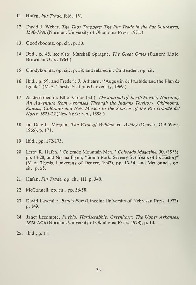
11. Hafen, Fur Trade, ibid., IV.
12. David J. Weber, The Taos Trappers: The Fur Trade in the Far Southwest,
1540-1846 (Norman: University of Oklahoma Press, 1971 .)
13. Goodykoontz, op. cit., p. 50.
14. Ibid., p. 48, see also: Marshall Sprague, The Great Gates (Boston: Little,
Brown and Co., 1964.)
15. Goodykoontz, op. cit., p. 58, and related in: Chittenden, op. cit.
16. Ibid., p. 59, and Frederic J. Athearn, "Augustin de Iturbide and the Plan de
Iguala" (M.A. Thesis, St. Louis University, 1969.)
17. As described in: Elliot Coues (ed.), The Journal of Jacob Fowler, Narrating
An Adventure from Arkansas Through the Indians Territory, Oklahoma,
Kansas, Colorado and New Mexico to the Sources of the Rio Grande del
Norte, 1821-22 (New York: n.p., 1898.)
18. In: Dale L. Morgan, The West of William H. Ashley (Denver, Old West,
1965), p. 171.
19. Ibid., pp. 172-175.
20. Leroy R. Hafen, "Colorado Mountain Men," Colorado Magazine, 30, (1953),
pp. 14-28, and Norma Flynn, "South Park: Seventy-five Years of Its History"
(M.A. Thesis, University of Denver, 1947), pp. 13-14, and McConnell, op.
cit., p. 55.
21
.
Hafen, Fur Trade, op. cit., Ill, p. 340.
22. McConnell, op. cit., pp. 56-58.
23. David Lavender, Bent's Fort (Lincoln: University of Nebraska Press, 1972),
p. 149.
24. Janet Lecompte, Pueblo, Hardscrabble, Greenhorn: The Upper Arkansas,
1832-1856 (Norman: University of Oklahoma Press, 1978), p. 10.
25. Ibid., p. 11.
34
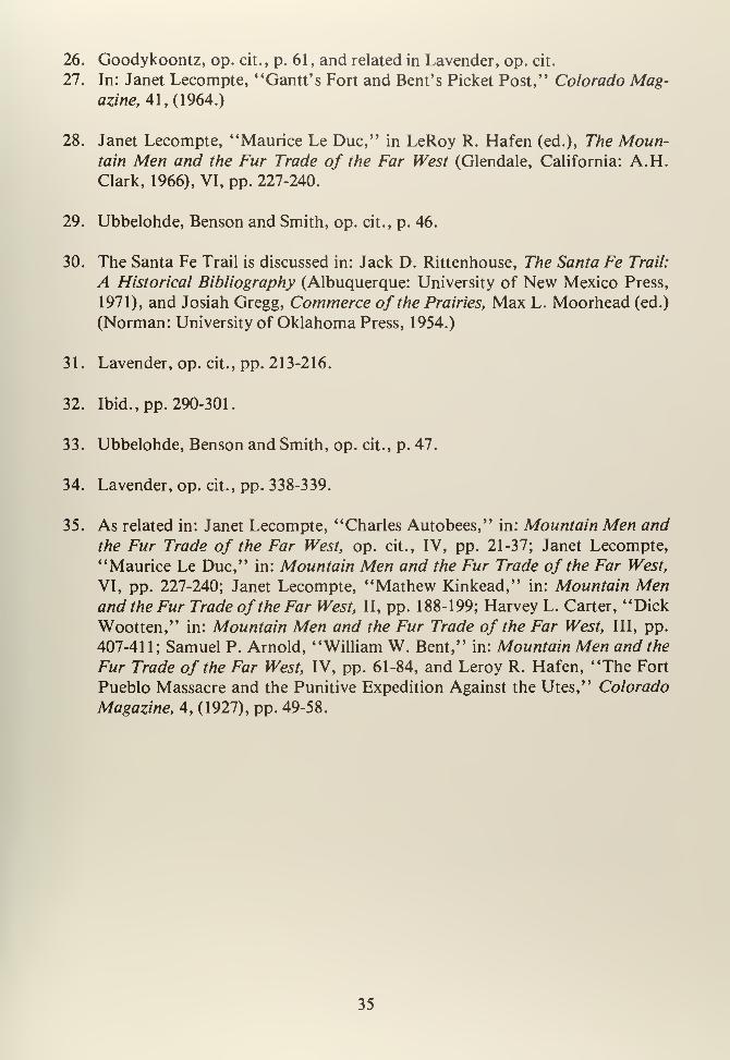
26. Goodykoontz, op. cit., p. 61, and related in Lavender, op. cit.
27. In: Janet Lecompte, "Gantt's Fort and Bent's Picket Post," Colorado Mag-azine, 41,(1964.)
28. Janet Lecompte, "Maurice Le Due," in LeRoy R. Hafen (ed.), The Moun-tain Men and the Fur Trade of the Far West (Glendale, California: A.H.Clark, 1966), VI, pp. 227-240.
29. Ubbelohde, Benson and Smith, op. cit., p. 46.
30. The Santa Fe Trail is discussed in: Jack D. Rittenhouse, The Santa Fe Trail:
A Historical Bibliography (Albuquerque: University of New Mexico Press,
1971), and Josiah Gregg, Commerce of the Prairies, Max L. Moorhead (ed.)
(Norman: University of Oklahoma Press, 1954.)
31. Lavender, op. cit., pp. 213-216.
32. Ibid., pp. 290-301.
33. Ubbelohde, Benson and Smith, op. cit., p. 47.
34. Lavender, op. cit., pp. 338-339.
35. As related in: Janet Lecompte, "Charles Autobees," in: Mountain Men and
the Fur Trade of the Far West, op. cit., IV, pp. 21-37; Janet Lecompte,
"Maurice Le Due," in: Mountain Men and the Fur Trade of the Far West,
VI, pp. 227-240; Janet Lecompte, "Mathew Kinkead," in: Mountain Menand the Fur Trade of the Far West, II, pp. 188-199; Harvey L. Carter, "Dick
Wootten," in: Mountain Men and the Fur Trade of the Far West, III, pp.
407-411; Samuel P. Arnold, "William W. Bent," in: Mountain Men and the
Fur Trade of the Far West, IV, pp. 61-84, and Leroy R. Hafen, "The Fort
Pueblo Massacre and the Punitive Expedition Against the Utes," Colorado
Magazine, 4, (1927), pp. 49-58.
35


CHAPTER FOUR
37

CHAPTER IV
THE NEW WEST IS EXPLORED
Zebulon Pike's journey into Colorado during 1806, was the prelude to numer-
ous other expeditions that were to map, record, describe, and condemn this region.
While the Pike expedition was supposedly for "science," it turned decidedly mil-
itary when the group was captured by the Spanish. 1 Perhaps this experience
soured the government on further efforts, because it was not until 1820 that the
next American explorers found their way into southeastern Colorado.
The year 1819 proved important to western exploration, because the United
States and Spain concluded a treaty that set, for the first time, definite boundaries
for Louisiana. The Adams-Onis (or Transcontinental) Treaty provided that Flor-
ida's boundary would be set at about where it is today (Florida was Spanish) and
that the southernmost boundary of Louisiana would be the Red River. This ap-
proximates the Texas-Oklahoma border of today. The northern boundaries were
not established, since Louisiana and Canada were contiguous, and the western
boundary continued to be the Continental Divide. 2 Congress intended, in 1819, to
explore the Upper Missouri in order to supplement existing information. The so-
called Yellowstone Expedition left St. Louis using a steamboat. However, the
party got no farther than Council Bluffs, and, while in winter quarters, the mencontracted scurvy. This incident ended the expedition, and Congress, irritated by
mismanagement, withdrew its support. 3 The U.S. Army, sponsor of the Yellow-
stone Expedition, tried to salvage the situation by commissioning Lieutenant
Stephen H. Long to lead a "quick" exploration to the Rockies to seek the source
of the Platte River. The military overtones of the expedition were written off, and
the Army sent Long to the west on a "scientific" mission. 4 Long assembled a
party of nineteen men, including topographers; a cartographer; a zoologist; a
physician, who also acted as botanist and geologist; a naturalist; and a painter.
The party was horse mounted and made rapid progress. By June 1820, the group
viewed the Rockies for the first time. Working along the South Platte River, they
spotted what was modestly named Long's Peak after the group's leader.5 As the
expedition approached and passed the sites of future Greeley and Denver, they
found the area in use by plains natives encamped along the rivers. There were
Arapaho camps along Cherry Creek, and Long noted that the smoke rising from
the valley obscured the mountains. This was the first recorded case of Denver's
famous air pollution. 6 Long's party followed Monument Creek over Monument(Palmer) Divide and to the site of Colorado Springs. Here Edwin James, the
party's physician, with six other expedition members, decided to climb what they
called Grand Peak. The little group broke up, and four remained at the base,
while James ascended the peak with a barometer to make altitude measurements.
He calculated the peak at 3,000 feet, but forgot to include the fact that he was well
39
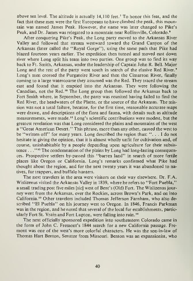
above sea level. The altitude is actually 14,110 feet.7 To honor this feat, and the
fact that these men were the first Europeans to have climbed the peak, this moun-tain was named James Peak. However, the name was later changed to Pike's
Peak, and Dr. James was relegated to a mountain near Rollinsville, Colorado. 8
After conquering Pike's Peak, the Long party moved to the Arkansas River
Valley and followed that stream westward toward the Grand Canyon of the
Arkansas (later called the "Royal Gorge"), using the same path that Pike had
blazed fourteen years earlier. The expedition then turned and moved east downriver where Long split his team into two parties. One group was to find its wayback to Ft. Smith, Arkansas, under the leadership of Captain John R. Bell. Major
Long and the rest of the party went south in search of the elusive Red River. 9
Long's men crossed the Purgatoire River and then the Cimarron River, finally
coming to a large watercourse they assumed was the Red. They traced the stream
east and found that it emptied into the Arkansas. They were following the
Canadian, not the Red. 10 The Long group then followed the Arkansas back to
Fort Smith where, in September, the party was reunited having failed to find the
Red River, the headwaters of the Platte, or the source of the Arkansas. The mis-
sion was not a total failure, because, for the first time, reasonable accurate mapswere drawn, and descriptions of the flora and fauna, with details such as altitude
measurements, were made. 11 Long's scientific contributions were modest, but the
greatest revelation was that Long considered the plains and mountains of the west
a "Great American Desert." This phrase, more than any other, caused the west to
be "written off" for many years. Long described the region thus: "... I do not
hesitate in giving the opinion, that it is almost wholly unfit for cultivation and, of
course, uninhabitable by a people depending upon agriculture for their subsis-
tence . .," 12 The condemnation of the plains by Long had long-lasting consequen-
ces. Prospective settlers by-passed this "barren land" in search of more fertile
places like Oregon or California. Long's remarks confirmed what Pike had
thought about the region, and for the next twenty years it was abandoned to na-
tives, fur trappers, and buffalo hunters.
The next travelers in the area were visitors on their way elsewhere. Dr. F.A.
Wislizenus visited the Arkansas Valley in 1839, where he refers to "Fort Puebla,"
a small trading post five miles [sic] west of Bent's (Old) Fort. The Wislizenus jour-
ney went from the Arkansas, over the Rockies, across Brown's Park, and on into
California. 13 Other travelers included Thomas Jefferson Farnham, who also de-
scribed "El Puebla" on his journey west to Oregon. In 1846, Francis Parkmanwas in the region, and he noted that several of the local fur establishments, partic-
ularly Fort St. Vrain and Fort Lupton, were falling into ruin.14
The next officially sponsored expedition into southeastern Colorado came in
the form of John C. Fremont's 1844 search for a new California passage. Fre-
mont was one of the west's more colorful characters. He was the son-in-law of
Thomas Hart Benton, Senator from Missouri. Benton was an expansionist, who
40
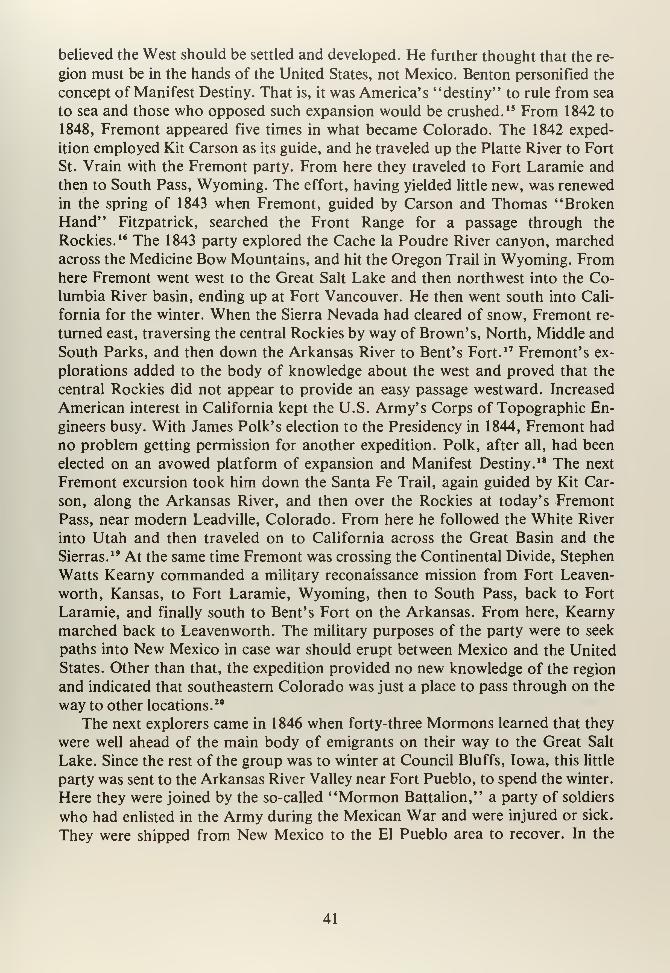
believed the West should be settled and developed. He further thought that the re-
gion must be in the hands of the United States, not Mexico. Benton personified the
concept of Manifest Destiny. That is, it was America's "destiny" to rule from sea
to sea and those who opposed such expansion would be crushed. 15 From 1842 to
1848, Fremont appeared five times in what became Colorado. The 1842 exped-
ition employed Kit Carson as its guide, and he traveled up the Platte River to Fort
St. Vrain with the Fremont party. From here they traveled to Fort Laramie and
then to South Pass, Wyoming. The effort, having yielded little new, was renewed
in the spring of 1843 when Fremont, guided by Carson and Thomas "BrokenHand" Fitzpatrick, searched the Front Range for a passage through the
Rockies. 16 The 1843 party explored the Cache la Poudre River canyon, marched
across the Medicine Bow Mountains, and hit the Oregon Trail in Wyoming. Fromhere Fremont went west to the Great Salt Lake and then northwest into the Co-
lumbia River basin, ending up at Fort Vancouver. He then went south into Cali-
fornia for the winter. When the Sierra Nevada had cleared of snow, Fremont re-
turned east, traversing the central Rockies by way of Brown's, North, Middle and
South Parks, and then down the Arkansas River to Bent's Fort.17 Fremont's ex-
plorations added to the body of knowledge about the west and proved that the
central Rockies did not appear to provide an easy passage westward. Increased
American interest in California kept the U.S. Army's Corps of Topographic En-
gineers busy. With James Polk's election to the Presidency in 1844, Fremont had
no problem getting permission for another expedition. Polk, after all, had been
elected on an avowed platform of expansion and Manifest Destiny. 18 The next
Fremont excursion took him down the Santa Fe Trail, again guided by Kit Car-
son, along the Arkansas River, and then over the Rockies at today's Fremont
Pass, near modern Leadville, Colorado. From here he followed the White River
into Utah and then traveled on to California across the Great Basin and the
Sierras.19 At the same time Fremont was crossing the Continental Divide, Stephen
Watts Kearny commanded a military reconaissance mission from Fort Leaven-
worth, Kansas, to Fort Laramie, Wyoming, then to South Pass, back to Fort
Laramie, and finally south to Bent's Fort on the Arkansas. From here, Kearny
marched back to Leavenworth. The military purposes of the party were to seek
paths into New Mexico in case war should erupt between Mexico and the United
States. Other than that, the expedition provided no new knowledge of the region
and indicated that southeastern Colorado was just a place to pass through on the
way to other locations.20
The next explorers came in 1846 when forty-three Mormons learned that they
were well ahead of the main body of emigrants on their way to the Great Salt
Lake. Since the rest of the group was to winter at Council Bluffs, Iowa, this little
party was sent to the Arkansas River Valley near Fort Pueblo, to spend the winter.
Here they were joined by the so-called "Mormon Battalion," a party of soldiers
who had enlisted in the Army during the Mexican War and were injured or sick.
They were shipped from New Mexico to the El Pueblo area to recover. In the
41
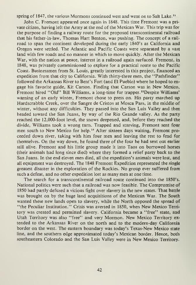
spring of 1847, the various Mormons continued west and went on to Salt Lake. 21
John C. Fremont appeared once again in 1848. This time Fremont was a pri-
vate citizen, having left the Army at the end of the Mexican War. This trip was for
the purpose of finding a railway route for the proposed transcontinental railroad
that his father-in-law, Thomas Hart Benton, was pushing. The concept of a rail-
road to span the continent developed during the early 1840's as California and
Oregon were settled. The Atlantic and Pacific Coasts were separated by a vast
land with few roads and no manner in which to move quickly. After the Mexican
War, with the nation at peace, interest in a railroad again surfaced. Fremont, in
1848, was privately commissioned to explore for a practical route to the Pacific
Coast. Businessmen from St. Louis, greatly interested in this project, financed an
expedition from that city to California. With thirty-three men, the "Pathfinder"
followed the Arkansas River to Bent's Fort (and El Pueblo) where he hoped to en-
gage his favorite guide, Kit Carson. Finding that Carson was in New Mexico,
Fremont hired "Old" Bill Williams, a long-time fur trapper. "Despite Williams'
warning of an early winter, Fremont chose to press on. His party marched upHardscrabble Creek, over the Sangre de Cristos at Mosca Pass, in the middle of
winter, without any difficulties. They passed into the San Luis Valley and then
headed toward the San Juans, by way of the Rio Grande valley. As the party
reached the 12,000-foot level, the snows deepened, and, before they reached the
divide, Williams took a wrong turn. Trapped and starving, Fremont sent four
men south to New Mexico for help.23 After sixteen days waiting, Fremont pro-
ceeded down river, taking with him four men and leaving the rest to fend for
themselves. On the way down, he found three of the four he had sent out earlier
still alive. Fremont and his little group made it into Taos on borrowed horses
(their animals had long since died) where they formed a relief party back to the
San Juans. In the end eleven men died, all the expedition's animals were lost, and
all equipment was destroyed. The 1848 Fremont Expedition represented the single
greatest disaster in the exploration of the Rockies. No group ever suffered from
such a defeat, and no other expedition lost as many men at one time.
The search for a transcontinental railroad route continued into the 1850's.
National politics were such that a railroad was now feasible. The Compromise of
1850 had partly defused a vicious fight over slavery in the new states. That battle
was brought on by the huge land acquisitions of the Mexican War. The South
wanted these new lands open to slavery, while the North opposed the spread of
"the Peculiar Institution." Crisis was averted in 1850, when New Mexico Terri-
tory was created and permitted slavery. California became a "free" state, and
Utah Territory was also "free" and very Mormon. New Mexico Territory ex-
tended to the Arkansas River on the north and to the modern-day California
border on the west. The eastern boundary was today's Texas-New Mexico state
line, and the southern edge approximated today's Mexican border. Hence, both
southeastern Colorado and the San Luis Valley were in New Mexico Territory.
42
Since the slavery matter was quiet, Congress decided, in 1853, to commission a
series of surveys for possible transcontinental railway routes. The primary ques-
tion was not only which route was the "easiest," but where it would be located.
Southern interests demanded New Orleans to Los Angeles, while northern busi-
nessmen wanted from St. Paul to Seattle. St. Louis merchants needed a route
from their city to San Francisco by way of the Central Rockies. 24
In 1853, surveys by the U.S. Army Corps of Topographical Engineers began.
The northern route was surveyed and approximates today's Northern Pacific. Anorth-central line was mapped across Wyoming and subsequently became the
Transcontinental Railroad (Union Pacific). A southernmost line was traced
from New Orleans and later became the Southern Pacific. North of the NewOrleans route another survey occurred, and it ran from Atchison, Kansas,
to Los Angeles by way of Albuquerque and the future Phoenix. This became the
Atchison, Topeka and Santa Fe in the 1880's.25 A central Rockies route was sur-
veyed by Captain John Williams Gunnison in 1853. This expedition was to follow
the thrity-ninth parallel from St. Louis to the West Coast. A team of thirty scien-
tific men, with an escort of thirty dragoons, along with eighteen wagons, an in-
strument wagon, and an ambulance, made their way along the Arkansas River to
Bent's Fort. From here the party crossed the Sangre de Cristos at La Veta Pass
and proceeded through the San Luis Valley, westward to Cochetopa Pass, which
turned out to be a far easier passage than the one attempted by Fremont in 1848. 26
Once into the Gunnison River Valley, the surveyors went west through the Black
Canyon of the Gunnison, up to the Grand (Colorado) River and emerged at the
future site of Grand Junction, Colorado. Gunnison's party then proceeded downthe Grand into Utah where, at Sevier Lake, on October 26, 1853, the men were
attacked by Paiute natives. Seven of the expedition were killed, including Captain
Gunnison. 27 Lieutenant E.J. Beckwith assumed command and led the group into
Salt Lake City. From here the expedition returned east the next year. While the
Gunnison expedition ended in disaster, it proved that a railway through the
Rockies was feasible, but also extremely expensive. Gunnison's work noted and
mapped, for the first time, the San Luis Valley, Cochetopa Pass, and the interior
of western Colorado. The survey was proved useful in the 1880's when the Denver
and Rio Grande Railroad built its first narrow gauge line from Denver to Salt
Lake City nearly along the route determined by Gunnison. 28
Not to be outdone, John C. Fremont, of the famous 1848 expedition, put to-
gether a trip to find a railway route to the West Coast that would outrival those of
the Topographic Corps of Engineers. This was Fremont's fifth, and last, excur-
sion to the West. Fremont traced Gunnison's steps almost exactly, adding abso-
lutely no new knowledge. However, he did prove that a route was feasible during
the winter because that was when he chose to survey. The Central Rockies, at
least, could be penetrated in snow season. 29
By 1854, the crisis over slavery arose once again. Sectional differences destroy-
43
ed the Compromise of 1850 when the territory of Nebraska was carved out of old
Louisiana. Again, the Union faced the decision of whether to permit slavery or
not. Introduced in January 1854, by Stephen A. Douglas, the Nebraska Territor-
ial Bill caused a storm. Southern interests, naturally, assumed that this new land
would be "slave," while northerners thought that it would not. To resolve this
crisis, the two territories of Kansas and Nebraska were created in order to provide
a "free" territory (Nebraska) and a "slave" territory (Kansas). Unfortunately,
Kansas was given the choice of free or slave, and the split among the population
caused an internal civil war. 30 With the nation's attention turned on Nebraska, the
thought of a Transcontinental Railroad evaporated. There was no possibility of
such a monumental enterprise being attempted at this time. By 1861, the nation
was plunged into Civil War, with brother fighting brother, family against family.
The west would have to await the outcome.
44
NOTES
CHAPTER IV
1. William H. Goetzmann, Army Exploration in the American West, 1803-1863
(New Haven: Yale University Press, 1959), pp. 36-39.
2. John A. Garraty, The American Nation (New York: Harper and Row, 1966),
p. 205.
3. Ubbelohde, Benson and Smith, op. cit., p. 27.
4. Goetzmann, op. cit., p. 43, and also: Edwin James, Account of an Expedition
from Pittsburgh to the Rocky Mountains, Performed in the Years 1819 and'20
. . .(Ed), R.G. Thwaites, in Early Western Travels, 1748-1846, Vol. 14,
(Cleveland: n.p. 1904-1907.)
5. Ubbelohde, Benson and Smith, ibid., p. 28.
6. James, op. cit., as related in Goetzmann, op. cit., p. 42.
7. Ibid., pp. 47-48.
8. Steven F. Mehls, The New Empire of the Rockies: A History of NortheastColorado (Denver: Bureau of Land Management, 1984).
9. Goetzmann, ibid., p. 43, and James, op. cit., p. 14.
10. James, ibid., pp. 15-16.
1 1
.
Goetzmann , ibid . , p . 43
.
12. James, ibid., pp. 147-148, as related in Goetzmann, p. 43.
13. Goodykoontz, op. cit., p. 62, and see also: F.A. Wislizenus, A Journey to
the Rocky Mountains in the Year 1839 (St. Louis: n.p., 1912), p. 141.
14. Goodykoontz, ibid., p. 63, see also: Leroy R. Hafen, "Early Fur Trade
Posts on the South Platte," Mississippi Valley Historical Review, 12, pp.
334-341.
15. Garraty, ibid., pp. 322-326.
45

16. Goetzmann, ibid., p. 78, Goodykoontz, p. 65, and Ubbelohde, Benson and
Smith, p. 45.
17. Ubbelohde, Benson and Smith, ibid., pp. 454-6, and Goetzmann, ibid., pp.
100-101.
18. Goetzmann, ibid., p. 103. See also: Donald Jackson and Mary Lee Spence,
The Expeditions of John Charles Fremont (Urbana: University of Illinois
Press, 1970.)
19. Ubbelohde, Benson and Smith, op. cit., p. 46.
20. Goetzmann, op. cit., pp. 1 12-116.
21
.
Ubbelohde, Benson and Smith, op. cit. p. 47.
22. Goodykoontz, op. cit., p. 65, Ubbelohde, Benson and Smith, p. 51, and
Goetzmann, op. cit., p. 297.
23. Ubbelohde, Benson and Smith, op. cit., p. 46, and LeRoy R. and Ann Hafen,
Fremont's Fourth Expedition (Glendale, California: A.H. Clark, 1960), pp.
17-18.
24. Ibid., pp. 45-46.
25. Goetzmann, op. cit., p. 276.
26. Ibid., p. 285, and Ubbelohde, Benson and Smith, op. cit., p. 53.
27. See: Nolie Mumey, "John Williams Gunnison: Centenary of His Survey and
Tragic Death," Colorado Magazine, 31, 1954, pp. 19-32.
28. Goodykoontz, op. cit., p. 66.
29. Ubbelohde, Benson and Smith, op. cit., p. 53.
30. Garraty, op. cit., pp. 382-385.
46

CHAPTER FIVE
47

CHAPTER V
EARLY AGRICULTURAL SETTLEMENT
The Mexican Revolution of 1821 destroyed old land tenure patterns in NewMexico because Spanish law became Mexican regulation. The Mexican govern-
ment, when it drew up a new constitution, changed some provisions for land ac-
quisition through settlement. Much of the government's concern revolved around
the Texas question. Texas delcared its independence in 1836 and promptly cast
greedy eyes on New Mexico, where the Santa Fe Trail trade was perceived as quite
wealthy. Mexico's fears about Texas were not totally unfounded. Yet, long before
Texans sought independence, Mexico City was deeply concerned about other
Americans. Fur traders made regular appearances at Taos while, of course, Amer-ican traders found their way into Santa Fe from Missouri. Mexico, concerned for
the safety of her northern flank, decided, in the early 1830's, to settle upper parts
of New Mexico. Records show that first land grants made in what is presently
Colorado were along the Conejos River. Some fifty families were conveyed land,
and for ten years they grazed a few sheep but never settled.1 That grant languished
until 1842 when Seledon Valdes and several other grantees petitioned for reval-
idation. Apparently, the original grant papers were lost. In October 1842, Juez
(Justice) Cornelio Vigil, at Taos, actually went to a site along the Conejos called
San Francisco de Padua where eighty-four families from Taos, El Rito, Rio
Arriba, Rio Colorado, Abiquiu and other northern New Mexican villages had
been given lands.2 This newer grant was made in the names of Julian Gallegos and
Antonio Martinez and was called Conejos. The regrant was huge, extending from
the Sangre de Cristo Mountains, on the east, southward to the Rio Grande, to San
Antonio Peak, and then north to the La Garita Mountains. The land subsequently
became Conejos County, and represents one of the largest nonsurveyed areas in
this state. During the 1840's, settlers tried to raise corn and beans on their shares,
but, because of Ute raiding and extreme isloation from New Mexico, results were
less than encouraging. 3 The Mexican War changed land status in the San Luis
Valley, for Mexican grants were no longer valid. Charles Bent, Governor of NewMexico in 1846, agreed to uphold existing claims. However, this did not last be-
cause land claims adjudication courts were established in the 1850's to straighten
out older Mexican land grants. Just before the war, grants were issued to Stephen
Luis Lee (Sangre de Cristo Grant), Carlos Beaubien (Beaubien-Miranda Grant),
and several other groups such as the Vigil-St. Vrain Grant and the Maxwell Grant,
the latter two being in Raton Basin. 4
The Sangre de Cristo Grant lay east of the Rio Grande and was one of the larg-
est such land claims in Colorado. There were no settlements until 1848, whenGeorge Gold (or Gould) tried to establish a town along the Costilla River. Being in
trespass, he was promptly evicted by New Mexicans, and the San Luis Valley was
49
again without settlement. However, 1849 saw a new village founded near present-
day Garcia, Colorado. This place was called the Plaza de los Manzanares. Thename was changed when Garcia got a post office a few years later.
5 This first step
toward settlement led to further efforts. Several events helped. First, a treaty was
signed with the Utes in 1849 and these natives now allowed New Mexicans to settle
unmolested. Next, merchants sensed an oncoming "land boom" and decided to
set up stores catering to settlers. Since the Utes were out of the way, a village of
crude jacales (huts) appeared along the Costilla, followed in 1851 by some log
cabins and a general store run by Ferdinand Meyer. 6 The little communities of San
Luis and San Pedro represented the first permanent agricultural settlements in
southeast Colorado and certainly in the San Luis Valley. These places were based
on a Spanish classic "plaza" concept, where homes were built around a central
square with spaces reserved for governmental buildings and churches. From the
plazas, homesteaders went to their fields during the day and returned at night.
The fields were divided in a long, narrow fashion and were semi-communal in
nature. There was also a common pasture area for animals to graze. This
settlement pattern was a duplicate of New Mexican homesteading in the 1600's.
The only difference was that there were hostile Utes instead of sedentary Pueblo
natives in the San Luis Valley. By 1851, a permanent European settlement was in
operation (San Luis), and farming was an ongoing enterprise. To provide water
for an arid environment acequias, or irrigation ditches, were dug. The first re-
corded water rights (in Colorado) date from April 10, 1852, and this becameknown as the San Luis People's Ditch.
7 For the first time, Colorado's dry soil was
irrigated, a harbinger of things to come. By 1852, the San Pedro Ditch was built,
with the Acequia Madre Ditch following. The Montez Ditch was finished in 1853,
the Vallejos and Manzanares Ditches in 1854; then the Acequiacita Ditch in 1855.
These efforts at farming were not only the earliest in southeast Colorado, but
were among the most successful anywhere. 8
The 1851 settlements spurred further development. For instance, by August
1854, a permanent settlement under the leadership of Jose Maria Jaquez was
founded along the Conejos River. This village was called El Cedro Redondo.
Meanwhile, Lafayette Head brought a group of some fifty families from Abiquiu,
New Mexico, to the Conejos where they built Plaza de Guadalupe. 9 The Conejos
Grant became a beehive of activity. By 1854, Servilleta was founded, Mogote ap-
peared in that same year, and ditches such as the Guadalupe Main Ditch and
Head's Mill Ditch were in operation by 1855. Perhaps the most influential settler
of the time was Lafayette Head.
A Missouri native, Head came to Santa Fe during the Mexican War. He oper-
ated a store at Abiquiu where he was also Indian Agent. He was a member of the
New Mexico Territorial Legislature by 1853, and he represented the claimants of
the 1842 Conejos Grant. Head, as Indian Agent, built the Conejos Ute Agencyand ran its varied facilities, such as the general store, stables, and school. The
50
Utes were a continual problem to New Mexican settlers. Finally, in 1852, the
United States government authorized the establishment of a fort just off the
Sangre de Cristo Pass trail, about fifty miles west of the Conejos settlements.10
Fort Massachusetts was the home of Edwin V. Sumner's cavalry. It contained
barracks, a blacksmith, a kitchen, officers quarters, and all the "amenities of civ-
ilization." However, the fort was badly placed, could never obtain sufficient sup-
plies, and it was isolated from most other settlements. From October 1853 to April
1854, the place was unoccupied due to winter. Lieutenant Colonel HoraceBrooks, the commander, saw his troops in action during late spring of 1854. Ute
raiders along the Rio Grande caused the U.S. Army to chase these natives, and the
troops actually caught a group of Utes near Raton Pass, inflicting serious dam-age.
11 The summer of that same year saw an outbreak of smallpox amongMouache Utes that decimated the tribe. The natives blamed contaminated goods
on the government, and in retribution massacred the settlers at Fort Pueblo on
Christmas Day, 1854. They then moved into the San Luis Valley, killed some set-
tlers at Costilla, and raided the area's livestock.12 February 1855, saw a punitive
expedition under Thomas Fauntleroy arrive from Fort Union, New Mexico; he led
his troops to Fort Massachusetts. This group chased some 150 Utes and Jicarilla
Apache north across the valley catching them north of Poncha Pass on March 23,
1855. After several other skirmishes, a decisive battle occurred in April where
forty natives were killed. The troops then retreated to Fort Massachusetts, glory-
ing in their victory. Meanwhile, Guadalupe Plaza was raided, but the Ute were
driven off.13 The rest of 1855 was relatively peaceful, and communities continued
to grow along the various watercourses. The next several years remained calm, the
Ute having been driven back deep into the San Juans. Agriculture continued to
develop, with new canals dug and little settlements built throughout the lower San
Luis Valley. The "older" places like San Luis and Guadalupe were so strong that
in 1856 a church was built. Equally, Conejos, which already had an adobe church,
was quite healthy. The first mass was offered during that year in the uncompleted
shell of the new Conejos church. 14
The Catholic religion, dominant in the San Luis Valley, derived from NewMexican Catholicism which, in turn, dated back to 1598 and the conquest of that
province. New Mexican settlers brought their religion with them and the San Luis
Valley saw numerous churches built during the 1850's. The parish became part of
the Colorado mission in 1860 and was administered by Joseph E. Machebeuf.
Later, in 1868, Colorado's Catholic churches were separated from New Mexico
and were operated with Utah's parishes. One feature of this religion that came to
the San Luis Valley early was los hermanos Penitentes, of just the Penitentes. 15
This group was primarily from northern New Mexico, and one of the first Peni-
tente organizations, dating from 1859, was founded at Chama, New Mexico. ThePenitentes were lay brothers who expiated their sins through self-flagellation, us-
ing methods such as being bound to wooden crosses. They met in buildings called
51
moradas that were generally secretly built and maintained. The Penitentes were
regarded by the Church as extremists who should be stopped, primarily because of
their violent practices. However, despite efforts of men like the famous Bishop
Lamy of New Mexico, the Penitentes survived and still practice their religion to-
day. Many moradas are found in Conejos, Costilla, Alamosa, and Saguache
Counties; they are presently in use.16
Agriculture was well established by the late 1850's. Stores in Costilla, San
Luis, and Conejos all provided "imported" goods to settlers, who, in turn, sold
grains, corn, and other staples to northern New Mexico's population. There was
virtually no northern trade in Colorado, for there were no towns outside the valley.
However, by 1858 the situation was to change. Gold was discovered in the DryCreek and Cherry Creek drainages near Denver in 1858. These small placers re-
sulted in a gold rush that brought an alleged 100,000 people to the area nowcalled Colorado. While there was no gold rush in the San Luis Valley, there was a
boom. Since there was absolutely no agriculture north of the valley, and with
thousands of gold seekers pouring into the region, San Luis Valley farmers were
in an excellent position to provide food and grains to the hungry miners. At first,
food was shipped across the plains from Missouri and Kansas into the Denver
area. However, this process was not only extremely expensive, but it also limited
the types of foods available. Flour, grain, beans, corn, and other staples that
would not easily rot could be shipped, but fresh meat, vegetables, and milk had to
be obtained locally. The San Luis Valley was not only closer to Denver, but it
could provide nearly anything the "59ers" needed. To accommodate this sudden
growth, flour mills were built at Costilla and other locations near settlements in the
valley. Albert D. Richardson, noted journalist, visited the area in 1859 and stated
that F.W. Posthoff, at Costilla, had a milling operation of the "Mexican type."
The coarse ground flour produced was not well suited to the new Denver market,
and soon other businessmen arrived.17 Ceran St. Vrain, late of the fur trade, and
H.E. Easterday, who operated a trading post at Taos, built a new mill at San Luis
in 1860. April of that year saw advertisements in the Rocky Mountain News for
"American Mill Flour." 18 Valley farmers hauled grains into San Luis and Costilla
for milling, and, as traffic increased so did San Luis' population. San Luis emerg-
ed as the dominant town in the valley, thanks to its agricultural efforts. The vil-
lage petitioned for a post office, and its name was changed from Culebra (Snake)
to San Luis. Easterday, doing well, imported a "Negro woman" to do housework.
This was the first recorded case of a black slave being in southeast Colorado. 19
Slavery was not new or unusual to the settlers of the valley, for Navajo and
Apache natives were often enslaved after capture. This tradition was NewMexican in origin and dated from the mid- 1 700' s when captured raiding natives
became booty for the Spanish. Abiquiu was one of the major centers for this slave
trade, and as settlers moved into the San Luis Valley they brought with them na-
tive servants and workers. Even during the 1850's the slave business went on.
52
Raids were conducted by Utes and Apaches into Navajo territory for the purpose
of obtaining young boys and girls who would become slaves. New Mexican set-
tlers, needing cash, would also raid for slaves. The poorer farmers would conduct
attacks, knowing that a good captive could bring up to $500. These slaves were
used as household domestics but not usually for hard labor. In 1865 Lafayette
Head, Ute Agent, was required to list native "servants" in the valley, and he cameup with some 88 in Conejos County alone. What was unusual was that many were
Ute. Costilla County listed 65 slaves, with other areas reporting "native servants"
at fewer numbers.
As the gold rush to the north progressed, agriculture benefited in the San Luis
Valley. Towns and villages continued to be established and plazas cropped up on a
regular basis. For instance, Fort Massachusetts was abandoned in 1858, and a newpost, Fort Garland, was established at the northern end of the Sangre de Cristo
grant, along Ute Creek, to protect the valley's settlers and to keep the passes over
the Sangre de Cristos open year round. A town grew up around Fort Garland; set-
tlers grew vegetables to sell at the fort. At the base of Sierra Blanca, the town of
Zapata was established in 1864, while new places were founded farther north and
east of Culebra Creek. Jesus Valdez and Luis Montoya settled on San Francisco
Creek near present-day Del Norte in 1858, while Domacio Espinoza, Crescencio
Torrez, J. Mateo Romero, and Susan Trujillo founded a town along La Garita
Creek. The original settlement was west of today's La Garita. The Espinosa fam-
ily settled along Carnero Creek, grazing sheep and cattle, during 1859." Spring of
that same year saw fourteen families from the Conejos area build a plaza near Del
Norte and call it La Loma de San Jose. From this village came a number of small-
er places like Valdes (Seven-Mile) Plaza and Luzero Plaza. Naturally, ditches were
dug from these plazas and agriculture flourished. The Silva Ditch was a major en-
terprise that was followed by forty other similar irrigation projects within a few
years. 22
While the San Luis Valley progressed nicely, events on the eastern plains caused
more and more settlement along the Arkansas River and its tributaries. One of the
earliest villages, El Pueblo or Fort Pueblo, was wiped out in 1854. Bent's Fort dis-
appeared as did the fur trade. What then caused trappers, traders, and settlers to
stay? Similar to the San Luis Valley, the Mexican government was worried about
both Texan and American intrusions into New Mexico. As in the Valley, that
government granted large tracts of land for settlement, based upon the premise
that occupation equaled ownership. In 1843, Ceran St. Vrain (of fur trade fame),
and Cornelio Vigil obtained a grant along the Huerfano River, east of future Wal-
senburg. The Vigil-St. Vrain Grant was not huge in the style of the San Luis
grants, but it was in a well-watered area. However, little development occurred,
and no permanent settlements were founded. 25 Of more interest was a giant grant
made to Carlos Beaubien and Guadalupe Miranda, also in 1843. This land extend-
ed from the Culebra Mountains on the west, eastward along the Purgatoire River
53
to near modern-day Trinidad. The grant became known as the Maxwell Grant
when Lucien Maxwell, Beubien's son-in-law took over control of the tract in later
years.24 The other land grant of note was a tract called the Nolan Grant that was
south and east of present-day Pueblo, Colorado. This grant was also supposed to
be settled and developed, but that never took place. As happened in the San Luis
Valley, the various Mexican grants on the eastern plains were turned over to the
American government in 1848 and claims to these grants were adjudicated in 1853
by Claims Courts. The Maxwell Grant was upheld in full while the Nolan and
Vigil-St. Vrain Grants were reduced. The Conejos Grant remained in court for
years, while the Sangre de Cristo Grant was confirmed. 25
The 1850's on the eastern plains was a time of retrenchment for most settlers
and residents. The fur and buffalo trade died, and California or Oregon boundtravelers went north along the Oregon Trail, leaving southeastern Colorado to the
natives. The Santa Fe Trail trade also ended with the annexation of New Mexico,
and there was simply little incentive for settlers to remain. Yet a few hardy souls
stayed on in the Raton Basin-Arkansas River area. Maurice Le Due and MathewKinkead's fur post on Hardscrabble Creek struggled along, trading with the Utes
and a few die-hard fur trappers. Of course, Fort Pueblo was in business until 1854
while Bent's (New) Fort served the lower Arkansas River Valley. Charles Auto-
bees established a plaza in 1853 at the mouth of the Huerfano River and proceed-
ed to farm and ranch. 26 During the 1850's, little plazas were founded along the
Purgatoire River, too. These places, generally without names, were agricultural
settlements that were subsistence in nature and did not provide much export trade.
They were usually unorganized, had no governmental functions, and probably
had no churches or other infrastructure. Yet these places became the core towns
that sprang up during the 1860's in this region.27
The 1850's were generally a "dead" period for Colorado, but the San Luis
Valley and, to a lesser extent, the Raton Basin saw development, progress,
permanent settlement and a solid agricultural foundation within a ten-year
period. Such settlement patterns were unusual for Colorado and represent a
unique chapter in this era. The late 1850's were times of dramatic and drastic
change, not only for the Raton Basin, but also for the San Luis Valley. Not only
did the gold rush to Pike's Peak affect southeast Colorado, but so did problems
with Ute natives in the Valley, pressures from miners in the San Juans, changes in
land tenure patterns, and the invasion of Anglo-American society to a land that
was predominantly Spanish in origin.
54
NOTES
CHAPTER V
1
.
Virginia McConnell Simmons, Land of the Six Armed Cross (Boulder: Pruett,
1980), p. 43. See also: State Archives of New Mexico, (Santa Fe, New Mex-ico): "Request for Renewal of Los Conejos Grant," William Blackmore
Papers, MS.
2. Ibid., p. 44, Files of the U.S. Surveyor General, New Mexico in: State Ar-
chives of New Mexico, (Santa Fe, New Mexico), 1821-1848, MSS. See also:
Myra Ellen Jenkins, Catalog of the Mexican Archives in New Mexico (Santa
Fe, New Mexico: State Archives of New Mexico, 1966.)
3. Simmons, op. cit., p. 44, and see: Ralph E. Twitchell, The Spanish Archives
ofNew Mexico (Cedar Rapids: Torch, 1914), 2 Vols.
4. See Harold H. Dunham, "New Mexico Land Grants with Special Reference
to the Title Papers of the Maxwell Grant," New Mexico Historical Review,
30, 1955, p. 4.
5. Simmons, op. cit., p. 44. See also: Olibama Lopez Tushar, People of the Val-
ley: A History of the Spanish Colonials of the San Luis Valley (Denver: n.p.,
1975.)
6. Simmons, ibid., p. 46, and see: Olibama Lopez, "The Spanish Heritage in
the San Luis Valley," (M.A. Thesis, University of Denver, 1942.)
7. Simmons, ibid., p. 49.
8. Ibid., pp. 49-50.
9. Alvin T. Steinel, History ofAgriculture in Colorado (Fort Collins: Colorado
Agricultural College, 1926), pp. 177-179.
10. Simmons, op. cit., pp. 48-49, and Morris F. Taylor, "Fort Massachusetts,
Colorado Magazine, 45, 1968, pp. 120-123.
11. Rafael Chacon, "Campaign against Utes and Apaches in Southern Colorado,
1855 from the Memoirs of Major Rafael Chacon," Colorado Magazine, 11,
1934, pp. 108-112, and Morris F. Taylor, "Action at Fort Massachusetts:
The Indian Campaign of 1855," Colorado Magazine, 42, 1965, pp. 292-310.
55
12. Taylor, ibid., p. 301.
13. Simmons, op. cit.,p. 52.
14. See: Claire McMenamy, "Our Lady of Guadalupe at Conejos, Colorado,"
Colorado Magazine, 17, 1940, pp. 180-181.
15. Simmons, op. cit., p. 53, and see: Martin F. Hasting, "Parochial Beginnings
in Colorado to 1889" (M.A. Thesis, St. Louis University, St. Louis, Missouri,
1941.)
16. See: Lorayne Ann Horka-Follick, Los Hermanos Penitentes (Los Angeles:
Westernlore, 1969.)
17. No Author. "San Luis Store Celebrates Centennial," Colorado Magazine,
34, 1957, p. 256, and Simmons, op. cit., pp. 58-59. See also: Robert G.
Athearn, The Coloradans (Albuquerque: University of New Mexico Press,
1976.)
18. As related in Steinel, op. cit., pp. 37-38.
19. Simmons, op. cit., pp. 59-60. See also: Lynn Robinson Bailey, Indian Slave
Trade in the Southwest: A Study of Slavetaking and Traffic of Indian Cap-
tives (Los Angeles: Westernlore, 1966) and D. Gene Combs, "Enslavement
of Indians in the San Luis Valley of Colorado" (M.A. Thesis, Adams State
College, Alamosa, Colorado, 1970.)
20. Simmons, op. cit., p. 60. See: The San Luis Historian, 5, No. 1, 1973, pp.22-29.
21. Ubbelohde, Benson and Smith, op. cit., p. 57.
22. Simmons, op. cit., pp. 60-61, and Frank A White, La Garita (La Jara, Colo-
rado: Cooper, 1971), pp. 21-23.
23. Robert A. Murray, pp. 32-33, and pp. 44-45. See also: Morris Taylor, "Cap-tain William Craig and the Vigil and St. Vrain Land Grant, 1855-1870,"
Colorado Magazine, 45, 1968, p. 319.
24. Murray, op. cit., p. 44; and see also: LeRoy R. Hafen, "Mexican LandGrants in Colorado," Colorado Magazine, 4, 1927, pp. 81-93; Richard W.Bradfute, The Las Animas Land Grant, 1843-1900," Colorado Magazine, 47,
56
1970, pp. 26-43, and Jim B. Pearson, The Maxwell Land Grant (Norman:
University of Oklahoma Press, 1961 .)
25. See: House Report 195 and Senate Report 228, 36th Congress, 1st Session,
1860, and "An Act to Confirm Certain Private Land Claims in the Territory
of New Mexico," U.S. Statutes at Large, Vol. 12 (1859-63) (Washington, DC:
Government Printing Office, 1863.)
26. Murray, op. cit., p. 46.
27. Ibid., p. 45.
57


CHAPTER SIX
59

CHAPTER VI
PIKE'S PEAK OR BUST
The year 1858 proved a watershed in Colorado's history, for at that time gold
was found in large enough quantities to spark what was called the Colorado
"Gold Rush." Discoveries of small amounts of placer gold in Cherry and DryCreeks, at the base of the Rockies, near the Platte River Valley, caused a depres-
sion-ridden nation to hope for another boom the size of California's 1849 GoldRush. Gold was not found by wandering fur trappers or natives, although they
certainly knew about the strange glittering metal, but rather by veteran placer
miners from Georgia. Three brothers named Russell went from the Arkansas
River (Santa Fe Trail) north to Dry Creek, where in July 1858 they found "gooddiggings." Based on the meager gold they found, promoters in Kansas and Mis-
souri "boomed" the Russells' find into the Pike's Peak Gold Rush. A nation-
wide depression, beginning in 1853, caused merchants at these western "ports" to
lose business. The Oregon Trail was virtually dead as was the Santa Fe Trail.
Upon hearing of "gold" in Pike's Peak country, they promptly began a propa-
ganda campaign aimed at luring Americans into the far west. 1Russells' success
was soon followed by others. John Easter, a Lawrence, Kansas butcher, went to
Pike's Peak country by way of the Arkansas River Valley, as had the Russell
party. This little group tried panning around Pike's Peak and found nothing.
They went into South Park with no luck, and just as the party was ready to turn
south, news of Cherry Creek came forth. The Easter expedition rushed for that
region and began placer operations. Like the Russell group, the Easter men (also
called the Lawrence party) found some gold, but it was hardly a bonanza. Never-
theless, some die-hards stayed for the winter in 1858 and staked out town sites.
Montana City died quickly, but St. Charles town lived a little longer. Across from
it arose the village of Auraria. In the end, the cities were combined and Denver
erected. However, gold at Cherry and Dry Creeks soon ran out, and miners began
working upstream toward the mountains, searching for a main source of gold. 2
Clear Creek was the nearest canyon, and soon placer miners were working up
and down that drainage. Gold was found, but not in paying quantities. Cries of
"humbug" and fraud were heard from the canyons of Pike's Peak. Thousands
who rushed to Colorado soon learned that there was little gold and that living con-
ditions were horrible, at best. Nevertheless, persistent gold seekers aspired to find
the "mother lode." George A. Jackson, in 1859, discovered large quantities of
ore along Clear Creek. Central City was founded a mile west of the discovery. Mean-
while, miners found "color" in Boulder Canyon during July 1859. The signifi-
cance of these finds cannot be underestimated, for they preserved a flagging gold
rush. Discouraged miners were leaving by May 1859, and Jackson's claims revived
the "boom." Naturally, merchants in Kansas and Missouri cashed in by issuing
61
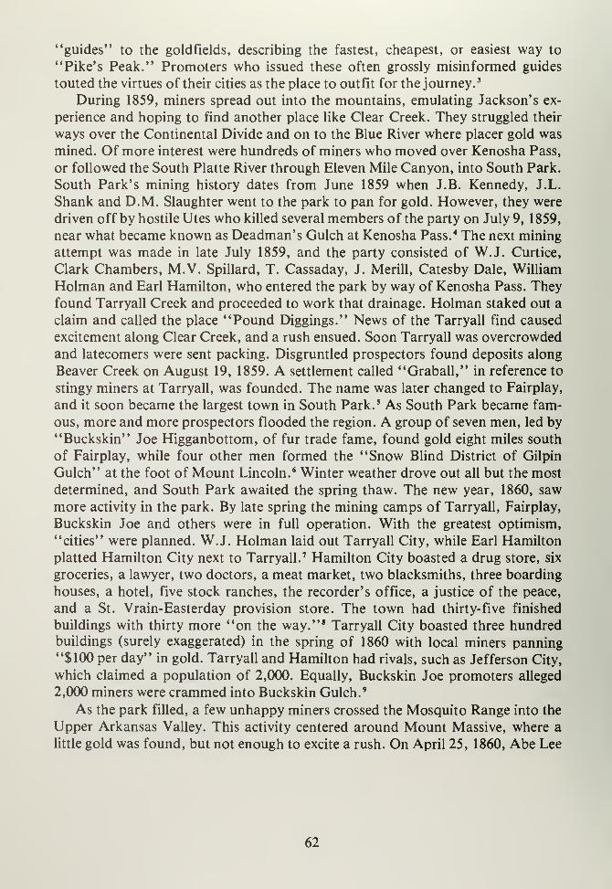
"guides" to the goldfields, describing the fastest, cheapest, or easiest way to
"Pike's Peak." Promoters who issued these often grossly misinformed guides
touted the virtues of their cities as the place to outfit for the journey. 3
During 1859, miners spread out into the mountains, emulating Jackson's ex-
perience and hoping to find another place like Clear Creek. They struggled their
ways over the Continental Divide and on to the Blue River where placer gold was
mined. Of more interest were hundreds of miners who moved over Kenosha Pass,
or followed the South Platte River through Eleven Mile Canyon, into South Park.
South Park's mining history dates from June 1859 when J.B. Kennedy, J.L.
Shank and D.M. Slaughter went to the park to pan for gold. However, they were
driven off by hostile Utes who killed several members of the party on July 9, 1859,
near what became known as Deadman's Gulch at Kenosha Pass. 4 The next mining
attempt was made in late July 1859, and the party consisted of W.J. Curtice,
Clark Chambers, M.V. Spillard, T. Cassaday, J. Merill, Catesby Dale, William
Holman and Earl Hamilton, who entered the park by way of Kenosha Pass. Theyfound Tarryall Creek and proceeded to work that drainage. Holman staked out a
claim and called the place "Pound Diggings." News of the Tarryall find caused
excitement along Clear Creek, and a rush ensued. Soon Tarryall was overcrowded
and latecomers were sent packing. Disgruntled prospectors found deposits along
Beaver Creek on August 19, 1859. A settlement called "Graball," in reference to
stingy miners at Tarryall, was founded. The name was later changed to Fairplay,
and it soon became the largest town in South Park. 5 As South Park became fam-
ous, more and more prospectors flooded the region. A group of seven men, led by
"Buckskin" Joe Higganbottom, of fur trade fame, found gold eight miles south
of Fairplay, while four other men formed the "Snow Blind District of Gilpin
Gulch" at the foot of Mount Lincoln. 6 Winter weather drove out all but the most
determined, and South Park awaited the spring thaw. The new year, 1860, saw
more activity in the park. By late spring the mining camps of Tarryall, Fairplay,
Buckskin Joe and others were in full operation. With the greatest optimism,
"cities" were planned. W.J. Holman laid out Tarryall City, while Earl Hamilton
platted Hamilton City next to Tarryall. 7 Hamilton City boasted a drug store, six
groceries, a lawyer, two doctors, a meat market, two blacksmiths, three boarding
houses, a hotel, five stock ranches, the recorder's office, a justice of the peace,
and a St. Vrain-Easterday provision store. The town had thirty- five finished
buildings with thirty more "on the way." 8 Tarryall City boasted three hundredbuildings (surely exaggerated) in the spring of 1860 with local miners panning"$100 per day" in gold. Tarryall and Hamilton had rivals, such as Jefferson City,
which claimed a population of 2,000. Equally, Buckskin Joe promoters alleged
2,000 miners were crammed into Buckskin Gulch. 9
As the park filled, a few unhappy miners crossed the Mosquito Range into the
Upper Arkansas Valley. This activity centered around Mount Massive, where a
little gold was found, but not enough to excite a rush. On April 25, 1860, Abe Lee
62
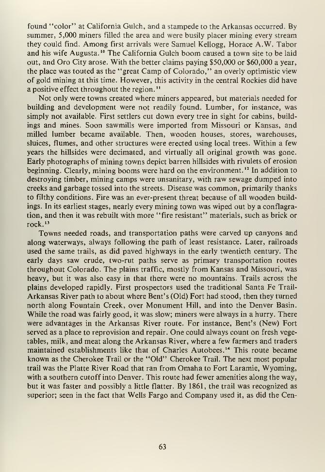
found "color" at California Gulch, and a stampede to the Arkansas occurred. Bysummer, 5,000 miners filled the area and were busily placer mining every stream
they could find. Among first arrivals were Samuel Kellogg, Horace A.W. Tabor
and his wife Augusta. 10 The California Gulch boom caused a town site to be laid
out, and Oro City arose. With the better claims paying $50,000 or $60,000 a year,
the place was touted as the "great Camp of Colorado," an overly optimistic view
of gold mining at this time. However, this activity in the central Rockies did have
a positive effect throughout the region. 11
Not only were towns created where miners appeared, but materials needed for
building and development were not readily found. Lumber, for instance, was
simply not available. First settlers cut down every tree in sight for cabins, build-
ings and mines. Soon sawmills were imported from Missouri or Kansas, and
milled lumber became available. Then, wooden houses, stores, warehouses,
sluices, flumes, and other structures were erected using local trees. Within a few
years the hillsides were decimated, and virtually all original growth was gone.
Early photographs of mining towns depict barren hillsides with rivulets of erosion
beginning. Clearly, mining booms were hard on the environment. 12 In addition to
destroying timber, mining camps were unsanitary, with raw sewage dumped into
creeks and garbage tossed into the streets. Disease was common, primarily thanks
to filthy conditions. Fire was an ever-present threat because of all wooden build-
ings. In its earliest stages, nearly every mining town was wiped out by a conflagra-
tion, and then it was rebuilt with more "fire resistant" materials, such as brick or
rock. 13
Towns needed roads, and transportation paths were carved up canyons and
along waterways, always following the path of least resistance. Later, railroads
used the same trails, as did paved highways in the early twentieth century. Theearly days saw crude, two-rut paths serve as primary transportation routes
throughout Colorado. The plains traffic, mostly from Kansas and Missouri, was
heavy, but it was also easy in that there were no mountains. Trails across the
plains developed rapidly. First prospectors used the traditional Santa Fe Trail-
Arkansas River path to about where Bent's (Old) Fort had stood, then they turned
north along Fountain Creek, over Monument Hill, and into the Denver Basin.
While the road was fairly good, it was slow; miners were always in a hurry. There
were advantages in the Arkansas River route. For instance, Bent's (New) Fort
served as a place to reprovision and repair. One could always count on fresh vege-
tables, milk, and meat along the Arkansas River, where a few farmers and traders
maintained establishments like that of Charles Autobees. 14 This route becameknown as the Cherokee Trail or the "Old" Cherokee Trail. The next most popular
trail was the Platte River Road that ran from Omaha to Fort Laramie, Wyoming,with a southern cutoff into Denver. This route had fewer amenities along the way,
but it was faster and possibly a little flatter. By 1861, the trail was recognized as
superior; seen in the fact that Wells Fargo and Company used it, as did the Cen-
63
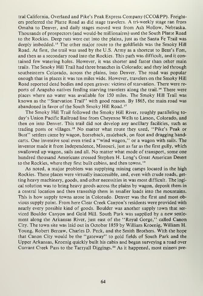
tral California, Overland and Pike's Peak Express Company (CCO&PP). Freight-
ers preferred the Platte Road as did stage travelers. A tri-weekly stage ran from
Omaha to Denver, and daily stages moved west from Ash Hollow, Nebraska.
Thousands of prospectors (and would-be millionaires) used the South Platte Roadto the Rockies. Deep ruts were cut into the plains, just as the Santa Fe Trail was
deeply imbedded. 15 The other major route to the goldfields was the Smoky Hill
Road. At first, the trail was used by the U.S. Army as a shortcut to Bent's Fort,
and then as a secondary road into the Rockies. This path was difficult, and it con-
tained few watering holes. However, it was shorter and faster than other main
trails. The Smoky Hill Trail had three branches in Colorado; and they led through
southeastern Colorado, across the plains, into Denver. The road was popular
enough that in places it was ten miles wide. However, travelers on the Smoky Hill
Road reported dead bodies and open graves: victims of starvation. There were re-
ports of Arapaho natives feeding starving travelers along the trail.16 There were
places where no water was available for 150 miles. The Smoky Hill Trail was
known as the "Starvation Trail" with good reason. By 1865, the main road was
abandoned in favor of the South Smoky Hill Road. 17
The Smoky Hill Trail followed the Smoky Hill River, roughly paralleling to-
day's Union Pacific Railroad line from Cheyenne Wells to Limon, Colorado, and
then on into Denver. This trail did not develop any ancillary facilities, such as
trading posts or villages.18 No matter what route they used, "Pike's Peak or
Bust" settlers came by wagon, horseback, muleback, on foot and dragging hand-
carts. One inventive soul even tried a "wind wagon," or a wagon with sails. The
inventor made it from Independence, Missouri, just as far as the first gully, which
swallowed up wagon, sails and all. No matter what mode of transport, some one
hundred thousand Americans crossed Stephen H. Long's Great American Desert
to the Rockies, where they first built cabins, and then towns. 19
As noted, a major problem was supplying mining camps located in the high
Rockies. These places were virtually inaccessible, and, even with crude roads, get-
ting heavy machinery, goods, and other necessities in was most difficult. The logi-
cal solution was to bring heavy goods across the plains by wagon, deposit them in
a central location and then transship them in smaller loads into the mountains.
This is how supply towns arose in Colorado. Denver was the first and most ob-
vious supply point. From here Clear Creek Canyon's residents were provided with
nearly every possible kind of goods. Boulder was another supply town that ser-
viced Boulder Canyon and Gold Hill. South Park was supplied by a new settle-
ment along the Arkansas River, just east of the "Royal Gorge," called CanonCity. The town site was laid out in October 1859 by William Kroenig, William H.
Young, Robert Bercaw, Charles D. Peck, and the Smith Brothers. With the hope
that Canon City would be the "gateway" to gold fields of South Park and the
Upper Arkansas, Kroenig quickly built his cabin and began surveying a road over
Currant Creek Pass to the Tarryall Diggings. 20 As it happened, most miners pre-
64
ferred the Fountain Creek-Ute Pass route into the park, and Canon City did not
become a major supplier for the mines. However, fresh vegetables and fuel were
always in demand. Jesse Frazer, along with Hosea Hoopengarner, C. Harrington
and John Leland, filed coal claims to supplement their gardening efforts. Eight
miles east of Canon City, Florence was born. At first a tiny agricultural settle-
ment, Florence became a major coal producer in the 1870's. In 1860, Gabriel
Bowen located a claim on Fourmile (Oil) Creek for an "oil spring." While these
resources were not immediately developed, they were used during the 1870's and
later.21 By fall 1860, Canon City's newspaper, the Times, reported that several
mills, including a steam-powered sawmill, were in business there, and that some800 people called the place home. 22
Farther down the Arkansas River, at its junction with Fountain Creek, settlers
used the site for crossing the river and grazing their animals. The area became part
of the Cherokee Trail, famous in initial gold rush days. At this location, a little
settlement called Fountain City arose, and it served travelers, farmers and others
in the immediate region. However, because the town site was prone to constant
flooding, it did not develop. Pueblo, on the other hand, was located on high
ground, overlooking the Arkansas River, and grew as a supply center. The two
villages were as one site.23
During the 1859 rush, people would stop over at this location, and finally a
few pioneers set up a town company to develop the area. Stephen S. Smith was
Pueblo's first settler, and he called the place Fountain City. In 1860, the towncompany changed its name to Pueblo, and on May 22, 1860, the residents of the
village met and formally founded Pueblo. The site was platted on July 1, 1860.
Thanks to its location along major north-south trade routes, the place flourished
by providing services to miners, farmers and merchants. 24 Pueblo attracted farm-
ers from as far as seventy- five miles to trade in town. Pueblo became a center for
trade and commerce, not only for the gold fields, but also for places like the San
Luis Valley, where farm goods went to Pueblo and then were resold to mining
communities. The Huerfano River valley also produced farm goods, such as
vegetables, fresh milk and other staples, and sold them at Pueblo. Pueblo resi-
dents soon built irrigation ditches from the Arkansas River, and by 1860 crops
abounded in the valley, providing even more farm goods for the boomingRockies. 25 As Pueblo grew, typical problems of urbanization occurred. By 1860,
People's Courts were established to mete out justice, and in 1862 Pueblo County,
which took in all of southeastern Colorado, was organized. Also, in 1862 a U.S.
mail route was established to Pueblo that, in turn, assured the town would
"funnel" communications up the river to the gold regions. 26 Pueblo's trade im-
portance became evident in 1862 when its first flour mill was erected. To be able
to produce refined goods was of considerable importance in early Colorado his-
tory, for local goods were much cheaper than those from St. Joseph or Omaha.The next year, 1863, saw Pueblo's first school opened and run by George Bilby. 27
65
Perhaps the most serious sign of permanence was Richens L. "Uncle Dick"
Wootton's construction of two houses in 1861 at Pueblo. Uncle Dick Wootton
was not ony famous for his exploits in the fur trade, but also as a developer in
southeastern Colorado. Wootton farmed along the Arkansas River during the
1850's, ran small trading posts in the Huerfano Valley, and in the 1860's obtained
a right-of-way through the Maxwell Grant from Trinidad to Raton, New Mexico.
He built a toll road over Raton Pass and proceeded to open trade among Pueblo,
Walsenburg, and Trinidad into New Mexico. The road became a major transpor-
tation corridor and was eventually purchased by the Atchison, Topeka and Santa
Fe for its railroad line to Los Angeles."
As the Arkansas River Valley developed, so did other drainages, such as the
Huerfano and Purgatoire Rivers. Demand for food was so great from the num-
erous mining camps that farms arose in these areas. J.M. Francisco established a
community at Francisco Plaza, near the Spanish Peaks, in 1862. This became LaVeta, Colorado, in later days.
29 Madrid Plaza, on the Purgatoire, was founded in
the 1860's by the Madrid family. J.M. Madrid, interviewed in the early 1900's, re-
called that some nineteen settlements were located along that river west of Trini-
dad. For instance, the Barela family founded a plaza on San Francisco Creek in
1866, while Torres Plaza and Vigil Plaza were both founded by New Mexican set-
tlers at about the same time. 30
In addition to a need for farm goods, the mining boom created demand for
fresh meat. John Wesley Prowers brought 600 head of cattle from Missouri
during 1861 and grazed them along the Arkansas River prior to shipping them
north to Denver to supply hungry mining camps. The results were so profitable
that Prowers added one hundred stock cows in 1862 and used the region from the
Purgatoire north to the Arkansas and east to the Kansas line for grazing. This
area became the core of a great cattle empire of the 1870's. While Prowers mayhave been astute enough to begin southeastern Colorado's cattle industry, he was
not the first to use the area. In 1859, John C. Dawson trailed a modest cattle herd
from Texas using the north side of the Arkansas River, along Fountain Creek and
on into Denver. These efforts paved the way for men like J.W. Prowers and J.W.
Iliff, eastern Colorado's two most famous cattle barons." By the mid-1860's one
hundred thousand head of cattle roamed the plains of southeastern Colorado,
generally concentrated along the lower Arkansas River. Charles Goodnight pion-
eered a new trail in 1864 when he drove cattle from Texas up the Pecos, over Trin-
cheras Pass, north past Pueblo, across Monument Hill, and to Denver. Today's
Interstate 25 closely parallels the Goodnight Trail from Pueblo north. 32
While the eastern plains developed, mining in the Rockies did not fare so well.
The blush of discovery was over by 1861, and mining slowly became a depressed
industry. The year 1861 saw a period of retraction in most South Park camps as
well as at Oro City. The major problem was lack of "loose" or placer gold in
streams. The rush of 1859-1860 cleaned out drainages, and by 1861 miners were
66
digging shafts in an attempt to extract quartz in which gold ore was locked. Whilemining techniques were standard for these times, Colorado quartz ores would not
yield their minerals. South Park miners at first used the old Spanish arrastra
method of milling by which a mule tied to a long pole would drive a large round
rock on a flat stone surface, thus crushing ore. However, the system was
inefficient and could be used for only high-grade ores.33 Colorado miners soon
imported metal ore stamps to pulverize stubborn local ores. By 1862, Laurette
town site could boast of two steam-driven and two water-powered stamp mills, in
addition to five older arrastras. Montgomery had six quartz mills, and three hun-
dred men worked the various mines in Mosquito Gulch. Even with this ore-crush-
ing equipment, and transportation, organized mining districts (like the
Independent Mining District), were doomed. 34 Extracting minerals from these
crushed ores was just too much for frontier technology. Only the richest ores were
worth refining because they had to be sent to either Boston or Swansea, Wales.
There were no local smelters, and 1860's technology was not adequate to deal with
the extremely complex ores of this region. The end result was a steady decline in pro-
duction followed by abandoned mining camps. Perhaps the most telling statistics
were in the census of 1860 that recorded 10,610 persons in Park County and the
1870 census that showed only 447 souls left in this county. 35 Samuel Bowles re-
ported in 1868 that only one of two hundred cabins at Montgomery was occupied,
while at Tarryall maybe three cabins were in use. Hamilton was described as a
place of fifty mud-patched cabins, two hotels, mostly vacated, and a population
of two dozen. 3* An earlier visitor, Bayard Taylor, reported in 1866 that Jefferson
City was abandoned and only two hundred miners still lived at Fairplay. 37 Dif-
ficult ores were not the only problem for South Park's miners. A flood on the
plains in 1864 cut off traffic from the east and, for a considerable time, slowed de-
livery of badly needed heavy machinery. The Civil War interrupted supplies to
mining camps as manufacturers switched production to meet the war effort while,
at the same time, native raids by both the Arapaho and Cheyenne disrupted trade
routes. Even the Santa Fe/Cherokee Trail was attacked by Cheyenne raiders.
These events conspired to make mining less and less profitable as the 1860's
marched forward. 38 The mines of Oro City, such a promising place in 1860, also
slowed production. The Printer Boy and Pioneer Mines were still the biggest pro-
ducers in Lake County, but they were not providing a fraction of the 1861 finds.
Both Park and Lake Counties yielded $7,762,000 in gold from 1859-1867, but
from 1868-1870 production was a pitiful $385,000. 39
South Park and the Upper Arkansas River basin were not the only areas ex-
plored for gold. Most every canyon along the Front Range was prospected, with
results that were less than encouraging. The Wet Mountain Valley was explored,
but no gold deposits were found. The Sangre de Cristo Mountains were looked at,
also with minimal results. The San Luis Valley hosted prospectors who worked
various creeks and streams emerging from both the Sangre de Cristos and the San
67
Juans. Kerber Creek, Saguache Creek, Poncha Creek, and San Luis Creek were
all tested, but deposits were meager. The Valley was also used by transient miners
on their ways to other places. In March 1861, T.C. Wetmore, of Canon City, went
on a prospecting trip into the San Juans. He returned in June and reported that
these mountains contained vast potential but that the native population had to be
removed in order that Europeans could explore further. Wetmore suggested that a
treaty was needed to permit miners into the San Juans. He apparently did not
realize that the treaty of 1849 covered this matter, and various prospectors were
indeed trespassing on native lands. 40 The Wetmore trip only served to point up an
ever-growing tension between native and European inhabitants in Colorado. Bythe mid- 1 860' s resentment flared to hostility, and the native problem loomed large
in territorial politics.
68
NOTES
CHAPTER VI
1. Ubbelohde, Benson and Smith, op. cit., pp. 60-61. Also: Robert G. Athearn,
The Coloradans (Albuquerque: University of New Mexico Press, 1976.)
2. Ibid., p. 61.
3. Athearn, ibid.
4. Virginia McConnell, op. cit., p. 63.
5. Frank Fossett, A Historical Descriptive, and Statistical Work on the RockyMountain Gold and Silver Mining Regions (Denver: Daily Tribune, 1876),
p. 45.
6. McConnell, ibid., pp. 64-65.
7. Don and Jean Griswold, Colorado's Century of Cities (Denver: Smith-Brooks,
1958), pp. 62-63.
8. Rocky Mountain News, June 13, 1860, p. 2.
9. McConnell, op. cit., p. 74.
10. Jean Griswold, "The History of Leadville, Colorado to 1900," (M.A. Thesis:
University of Southern California, 1933), p. 6.
1 1
.
Don and Jean Griswold, The Carbonate Camp Called Leadville (Denver:
University of Denver Press, 1951), pp. 1-2.
12. Duane A. Smith, Rocky Mountain Mining Camps, the Urban Frontier (Bloom-
ington: University of Indiana Press, 1967.) See also: Muriel Sibell Wolle,
Stampede to Timberline (Chicago: Swallow, 1974) and C. Eric Stors, Victor-
ian Bonanza (Albuquerque: University of New Mexico Press, 1973.)
13. Stors, ibid.
14. Janet LeCompte, "Charles Autobees" in: Mountain Men and the Fur Trade
(Glendale, California: A.H. Clark, 1966), Vol. 4, p. 37.
69
15. Ubbelohde, Benson and Smith, op. cit., pp. 63-64.
16. Margaret Long, The Smoky Hill Trail (Denver: Kistler, 1943), p. 19.
17. Ibid., p. 20.
18. Ibid., p. 39.
19. Ubbelohde, Benson and Smith, op. cit., p. 66.
20. Frank Hall, History of Colorado (Chicago: Blakely, 1895), Vol. IV, p. 223.
See also: H.H. Bancroft, "Early Days in Canon City," Colorado Magazine
(1930), p. 110.
21. As related in Rosemae Campbell, From Trappers to Tourists: Fremont County
Colorado, 1830-1950 (Palmer Lake, Colorado: Filter Press, 1972), and B.F.
Rockafellow, "History of Fremont County." In: History of the Arkansas
Valley (Chicago: Baskin, 1881.)
22. LeRoy R. Hafen, Colorado and Its People (New York: Lewis, 1948), Vol. I,
p. 197.
23. Milo Lee Whittaker, Pathbreakers and Pioneers of the Pueblo Region (Phil-
adelphia: Franklin, 1917), pp. 51-52.
24. Ibid., p. 40, 42, 52, 53, and 48.
25. Ibid., p. 64 and 56.
26. Ibid., p. 58, 62, 63 and 64.
27. Ibid., p. 132.
28. Lavender, Bent's Fort, op. cit., p. 374, and Murray, op. cit., p. 57.
29. Raymond M. Beckner, Old Forts of Southern Colorado (Pueblo, Colorado:
O'Brien, 1975), pp. 54-55, and CWA Interviews, A.K. Richeson, "Senator
J.M. Madrid, Trinidad, Colorado," Las Animas County, Colorado, CWANo. 359/6. In: Colorado Historical Society, Denver, Colorado, MSS.
30. William B. Taylor and Elliott West, "Patron Leadership at the Crossroads:
Southern Colorado in the Late 19th Century," Pacific Historical Quarterly,
42, (1973), pp. 335-357.
70
31. Murray, op. cit., pp. 41-42, and Ora B. Peake, The Colorado Range Cattle
Industry (Glendale, California: A.H. Clark, 1937); J. Everetts Haley, Charles
Goodnight (Boston: Houghton-Miffin, 1936); and Ernest S. Osgood, Day ofthe Cattleman (Minneapolis: University of Minnesota Press, 1929.)
32. As related in Haley, Charles Goodnight ibid.
33. As described in: James E. Fell, Ores to Metals: The Rocky Mountain Smelt-
ing Industry (Lincoln: University of Nebraska Press, 1979.)
34. McConnell, op. cit., p. 78, 106 and 109.
35. U.S. Census (Washington, DC: Government Printing Office, 1860 and 1870.)
36. Samuel A. Bowles, A Summer Vacation in the Parks and Mountains of Colo-
rado (Springfield, Massachusetts: Bowles, 1869), pp. 107 and 115-116.
37. McConnell, op. cit., pp. 109-1 12.
38. Described in: Ubbelohde, Benson and Smith, op. cit.
39. In: C.W. Hendrson, Mining In Colorado (Washington, DC: Government
Printing Office, 1926.)
40. Simmons, op. cit., p. 63.
71


CHAPTER SEVEN
73

CHAPTER VII
CONFRONTATIONS: REMOVAL AND TRANSITION
With thousands of would-be miners flooding into Pike's Peak, governing this
new land became a major problem. In short order, miners who settled the foot-
hills and canyons established vigilante groups to prevent claim jumping and land
grabbing that disrupted the work of recovering precious minerals. Miners did not
have time to waste with formal government, and quasi-legal organizations like
claim clubs arose. These "clubs" were formed to record claims, provide services
to legally stake claims, settle land disputes, and dispense justice for those whotried to grab others' claims. In this way, an embryo of civil government was
brought to mining camps and other settlements. The claim clubs eventually dis-
solved into elected officials and the creation of town and county governments. 1
Many times members of the local claim club became government officials and,
later, territorial officers. Anson Rudd, of Canon City, is a good example of the
transition from claim club to legal official.2 One major problem faced by what
was then called "Pike's Peak" was that this place represented the western-most
part of Kansas Territory. Administration lines extended hundreds of miles over
unsettled plains and, clearly, miners of the Rockies did what was necessary for
survival. National politics created further tensions. By 1860 the nation was on the
verge of civil war. The Kansas-Nebraska controversy made creation of new ter-
ritories difficult. Further, 25,000 persons were required to create a territory, and,
by 1860, with many "go-backers" leaving Pike's Peak, there was considerable
question as to whether there were enough souls to create an independent political
entity.3 Election of Abraham Lincoln to the presidency in 1860 changed things
greatly. Not only was he the first Republican Party candidate to win this high
post, but the victory drove Southern Democrats from the Union. Hard-line south-
erners could not tolerate Lincoln, and they left Congress, retreating to Mont-gomery, Alabama where the Confederate States of America was born.
On the eve of Lincoln's inauguration, President James Buchanan, a Demo-crat, signed a bill that created the State of Kansas, with its western border fixed at
the present location. On February 28, 1861, Buchanan also signed legislation that
created a territory from what was left of the old Kansas Territory. After consider-
able wrangling over what the place should be called, including suggestions like
Jefferson, Idahoe, Yampa, Arapahoe [sic], Tahosa, Lafayette, Columbus, Frank-
lin, Weapollao, Nemara, Lula, San Juan and Colorado; the latter won and Pike's
Peak became Colorado Territory. 4 When President Lincoln came to office, he ap-
pointed Colorado's first Territorial Governor, William Gilpin. Gilpin, an old
Colorado hand, arrived during a particularly troubled time. Civil War racked the
nation, the South seceded, and the country was torn asunder. William Gilpin
faced a series of problems ranging from the creation of new counties to suppress-
75
ing Confedrate activities in Colorado. Upon his arrival in May 186 If Gilpin set up
his cabinet, and by September of that year the first territorial legislature
convened. This body elected Hiram P. Bennett as delegate to Congress, and Colo-
rado Territory was in business. 5
Gilpin also had a strong interest in the San Luis Valley. From his earlier days
of promoting Colorado during the gold rush, Gilpin touted the Valley as a land
that held considerable agricultural promise. He proposed a transcontinental rail-
road that would cross the area while, at the same time, he wrote a guide book that
praised the Valley. When Colorado Territory became a reality, the San Luis was
taken from New Mexico and included in Colorado. The appointment of Gilpin
only could enhance the San Luis Valley's position in a new territory.6 To bring
government to the Valley, Conejos, Costilla and Guadalupe Counties were carved
from old Taos (New Mexico) County. Costilla County was formally organized in
1863 and San Luis became county seat, while Conejos County developed from the
earlier Guadalupe County, and Conejos became its seat. With county governments
in place, territorial representatives were elected. Jose Victor Garcia and Jesus
M. Barela went to Denver to serve the Valley, while John M. Francisco was elect-
ed to the Council (the same as today's State Senate.)8 On the east side of the Sangre
de Cristos, Fremont, Pueblo, Huerfano, El Paso and Park Counties repre-
sented local government. County seats were established at Fairplay, Canon City,
Fountain City (Pueblo), San Luis (actually west of the Sangres), and Trinidad. AsColorado settled into its territorial status, Governor Gilpin was faced with not
only the Civil War, but increasingly difficult natives on the Eastern Plains. Themost immediate matter was war between the states. There was a considerable
community of southern supporters at several mining communities, most notably
those of South Park. 9 Southern forces in New Mexico eyed Colorado's gold fields
as sources for the Confederacy's ailing economy. To meet this threat, Gilpin
found himself raising a militia. However, there were no public funds available,
and Gilpin, in desperation, issued $375,000 worth of drafts on the Federal Treas-
ury, hoping that Washington would honor them when the war ended. 10 Unfortun-
ately for Gilpin, the Treasury Department later refused to pay these drafts, and
the Governor found himself in serious trouble with the citizens of Colorado whodemanded payment for their services and goods. Before the money problem sur-
faced, Gilpin was busy "protecting" his territory from Confederate invasion.
Mace's Hole, near today's Beulah, was a hotbed of Confederate activity, while
miners at California and Georgia Gulches tried to raise Confederate regiments.
While there was no real threat of invasion from the south, U.S. Army posts at
Fort Garland and Fort Lyon (on the Arkansas) were put on alert.11 Under Gilpin's
leadership, the First Regiment of Colorado Infantry was assembled in 1861. Thegroup trained at Camp Weld near Denver, and then in 1862 they joined Unionforces under E.R.S. Canby in New Mexico. As it turned out, Gilpin's fears were
not totally misplaced as Confederate General Henry Sibley marched across
76
eastern New Mexico, intent on capturing Santa Fe. By the time Colorado's volun-
teers reached New Mexico, Santa Fe had fallen and the Confederates prepared to
take Fort Union. At Glorieta Pass, Union forces, under Canby, met Sibley and
routed the Confederates. This battle ended any Confederate threats to the west,
and Colorado's volunteers were praised for their contribution.12 Shortly there-
after, Gilpin was removed as governor by Abraham Lincoln, and John Evans re-
placed him. Evans arrived in Colorado during May 1862 and found that most
sympathy for the South was snuffed out. A raid into the San Luis Valley by Con-
federate raider James Reynolds was quickly disposed of, as were attempts of Con-
federate officers to smuggle gold from the territory.13
Governor Evans may have been rid of the South, but he faced continued prob-
lems with the Eastern Plains natives. The heart of the matter lay with the Laramie
Treaty Council of 1851, at which it was agreed that the Cheyenne and Arapahotribes could use the Eastern Plains from the South Platte to the Arkansas Rivers
as their land. The Gold Rush of 1859 changed that, because thousands of prospec-
tors trespassed while on their way to Pike's Peak and demands were soon loud
and long for removal of the "indolent savages." Land became a valuable com-
modity and native claims were in the middle of all the activity.14 The fall of 1860
saw Federal agents holding council along the Arkansas River to negotiate newpeace terms. Both the Cheyenne and the Arapaho agreed to surrender all their
lands except the area between Sand Creek and the Arkansas. This reservation
would be divided so that each tribal member received forty acres, while the Feder-
al Government promised an annual $30,000 subsidy for fifteen years, a grist mill,
a saw mill, and a school for the new land.15 Such an approach was in keeping with
European ideas that the native American should and could be "civilized" by turn-
ing him into a farmer. Details, like cultural differences and totally divergent con-
cepts of economics and society, did not bother these newcomers. The natives were
considered "useless," and unless they conformed they would be removed. Herein
lay the core of European/native conflicts throughout the western United States.
Every time settlement encroached on the natives, conflict occurred because
neither side was willing to change. The natives were usually more flexible than
were European settlers and generally they were bullied out of their lands and her-
itage by these newcomers. The Cheyenne and Arapaho may have been confined to
the Sand Creek Reservation on paper, but, in fact, they wandered across the plains
hunting and gathering as always. Further, continual expansion of European
towns, cities, and farms concerned the natives, for they saw lush grasses of the
prairies put to the plow and rivers dammed up. Increasingly, the Cheyenne and
Arapaho were agitated by younger braves who wanted all settlers out of Colorado. It
was one thing to share with itinerant fur trappers and a few traders, but whencities were buit, ranches and farms begun, the threat was too much to overlook.
Settlers in isolated regions of the plains became apprehensive about native
raids. The Sioux uprising in Minnesota during 1862 fueled the fires of panic in
77
Colorado. In response to his ongoing "Indian problem," Governor Evans re-
called the First Regiment of Colorado volunteers from New Mexico and scattered
it across the plains to calm the fears of various communities. Evans, despite his
pleas for Federal help, was caught between Colorado's apprehension and the
pressing needs of Civil War. Tension ran high, but there were no incidents until
the spring of 1864, when the natives became more bold, raiding cattle ranches,
stopping travel on the South Platte Trail, and then on June 1 1th attacked Nathan
Hungate's ranch, brutally killing him, his wife, and two daughters. 16 Denver's cit-
izens were thrown into panic and prepared to defend the city from the raiders.
Evans, however, tried to use reason and appealed to "the friendly Indians of the
Plains" to gather at Federal forts where they would be protected. Warring natives
would be "ruthlessly exterminated" if they did not surrender. Threats did no
good, for raids continued, mail service was severed, stage lines were cut, overland
freighting stopped, and Denver was isolated from its eastern suppliers. Evans, in
August 1864, raised a "hundred-day regiment" of volunteers who would sweep
the plains clear of hostiles.17 The fall of 1864 saw natives appearing at Fort Lyon
along the Arkansas. Edward W. Wynkoop, fort commander, escorted seven
chiefs to Denver to talk with Evans. Evans, who supposedly wanted peace, treated
his guests terribly. He and John Chivington were then involved in "statehood"
politics, and it seems that peace with the natives would harm this process. Evans
stated that resolution of the "native problem" was in the hands of military auth-
orities and he could do no more. Army officers suggested that the tribes move to
the Sand Creek Reservation where they would be safe for the winter. Chivington,
however, had plans of his own. As commander of the hundred-day volunteers, he
had yet to see action, and his soldiers' terms were about to expire. Obviously, if
Chivington was to use his men, it would have to be soon. Governor Evans left for
Washington, D.C. in November 1864, and Chivington decided to move. AsMethodist-Episcopal Bishop of Colorado, he saw it as his sacred duty to "exter-
minate" the heathen natives of the plains so as to free the land for settlement by
"Christian" Europeans. Further, Chivington felt the plains natives should be
taught a lesson that European technology was superior and defeat was inevitable.18
With such thoughts, Chivington' s force marched from Fort Lyon north to
Sand Creek, where a band of reservation natives had set up winter camp, just as
Wynkoop suggested. Chief Black Kettle was assured that if he flew the Americanflag, his people would be safe. Despite these promises, Chivington attacked the
little band on November 29, 1864, and proceeded to slaughter men, women, andchildren without discrimination. 19 The massacre was appalling. Chivington' s menspared none. Women were sadistically mutilated, men were tortured, children were
torn from their mothers arms and slowly killed before their parents eyes. Nobodyknows how many natives died. Chivington boasted of 500 dead, while saner heads
suggested 100 losses. There were no prisoners taken. 20 This horrible deed had im-
mediate consequences. The citizens of Colorado, who had called for native re-
78
moval, were revolted by Chivington's actions. A Congressional Joint Committee
on the Conduct of the (Civil) War investigated this massacre, and it condemnedChivington, while a military commission spent months coming to the same con-
clusion. So vicious was sentiment over Sand Creek that one outspoken critic of
Chivington, Captain Silas S. Soule, was assassinated; his murderer was never ap-
prehended. 21
Governor Evans foolishly defended Chivington's actions on the basis that
Colorado's natives had to be taught a lesson. However, no matter who was right,
native revenge occurred. The town of Old Julesburg was sacked in January 1865,
and then burned to the ground the next month. Terror returned to the plains and
Colorado's settlers demanded action. In 1867 a new treaty was negotiated by
which the Arapaho and Cheyenne were moved to Indian Territory (Oklahoma),
onto reservations that would keep them out of Colorado. The Medicine LodgeTreaty of that year "removed" these natives from the eastern plains and kept
them away from civilization." Nevertheless, enraged natives, led by Chief RomanNose, attacked fifty army scouts in September 1868 at Beecher Island on the Ari-
karee Fork of the Republican River in eastern Colorado. An siege ensued, and
nine days later U.S. Army reinforcements from Kansas relieved the men after
some losses. The next year Chief Tall Bull was pursued into northeastern
Colorado by Army troops and was attacked at Summit Springs where fifty natives
were killed. The Battle of Summit Springs was the final engagement on the Colo-
rado plains between European settlers and natives.23 The eastern plains of Colo-
rado were cleared of natives by 1870, primarily because superior military power
and the physical removal to Indian Territory eliminated the presence of these
peoples. Unlike the northern plains, there was no continual warfare between new-
comers and natives, nor was there inter-tribal squabbling. Colorado's natives
were simply overwhelmed by the 100,000 immigrants that poured across the plains
in 1859, and small bands like the Arapaho were inundated. 24
Across the Sangre de Cristos the situation was much the same. In the San
Luis Valley, Ute natives were a problem from the beginning. Fort Garland was
built to "protect" local settlers, and, as the gold rush continued, more and morepressure was brought to bear on this tribe. Miners went from the Upper Arkansas
into the San Luis and then up the Rio Grande deep into the San Juan Mountains
in search of gold. Charles Baker, for instance, traveled into the San Juans during
1860 where he found gold near Eureka Gulch. This site was known as "Baker's
Park" and a small settlement popped up here. The problem was that these miners
were clearly trespassing on Ute reservation lands. Nevertheless, May 1861 saw the
town site of Animas City laid out and several buildings were erected. Harsh win-
ters and the Civil War stopped mining in the San Juans until the late 1860's. Ex-
ploratory expeditions found paths into the mountains, usually by way of the San
Luis Valley. Mineral development continued at a pace that caused Coloradans
(and miners) to demand that an older treaty, signed in 1868 with the Utes, be re-
79
vised. The 1868 treaty said that a single reservation for all seven bands of the Ute
nation would be provided and that its boundary would run from about Pagosa
Springs north to Steamboat Springs and then westward into Utah Territory. Thus,
the western half of Colorado was ceded to these natives. The treaty was executed
at Conejos on March 1, 1868, and it established agencies at White River (near
modern-day Meeker) and Los Pinos, along Los Pinos Creek, west of Cochetopa
Pass. The old Conejos Agency was to be closed and its facilities were moved to
Los Pinos. By mid-1868 the various Ute bands occupied their new cession. Oneman emerged as their main spokesman. This was, of course, Chief Ouray whosensed the futility of opposing these newcomers and tried to maintain peace while
obtaining the best possible conditions for his people. In this effort Ouray was gen-
erally successful, for there were no serious incidents between miners and natives.
There were no "massacres" as on the eastern plains, and the Ute were left to hunt
and gather as they had always done. However, pressure increased year after year
in the San Juans so that by 1873 the Federal Government found itself having to
negotiate a new treaty. Felix Brunot, U.S. Commissioner of Indian Affairs;
Charles Adams, U.S. Indian Agent; and interpreter, Otto Mears, of Saguache, all
met with the Ute and created what was known as the Brunot Treaty. This pact
called for even more land cessions. The Ute were removed from the San Juans, a
new Los Pinos Agency was established near today's Montrose, and thousands of
miners rushed into the region by way of the San Luis Valley, using Otto Mears'
newly built toll roads. 25 The Ute and their relationship to the San Luis Valley end-
ed in 1873. Actually the 1868 Treaty removed natives from the Valley; however,
there were trade ties with Saguache and Conejos after that date. But by 1873 the
natives were confined to southwestern Colorado, and to the White River in north-
west Colorado. The White River Agency was where the associated Ute Tribes of
Colorado were finally removed. In 1879, under considerable aggravation from
Agent Nathan C. Meeker, the White River Utes rose in rebellion, killed Meekerand caused the U.S. Army to rush troops to the Agency. A military detachment
sent from Wyoming, under the command of Thomas T. Thornburgh, was am-bushed along Milk Creek. This was known as the Thornburgh Battle and was used
as the final excuse to remove the Ute from Colorado. After Army troops had sub-
dued White River's natives, they were removed to the Uintah Reservation, Utah,
during 1881 ." All of Colorado was now free of its native inhabitants and the land
rush was on. The eastern plains were swept clear by 1868 while the western slope
was opened in 1880. These removals provided the land that miners, farmers, ran-
chers and town builders needed to "settle and civilize" Colorado Territory.
80
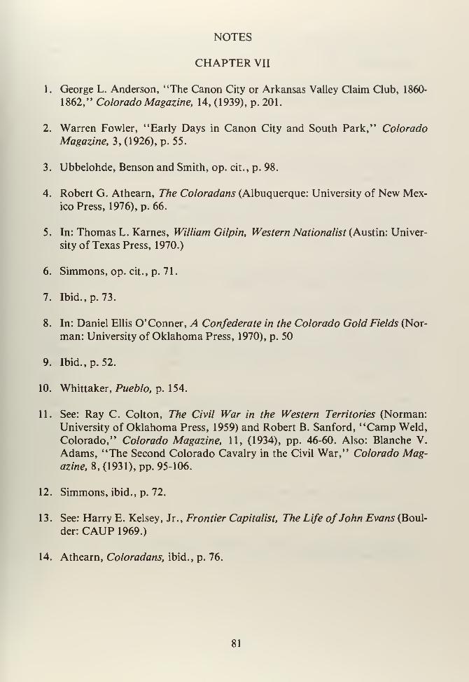
NOTES
CHAPTER VII
1. George L. Anderson, "The Canon City or Arkansas Valley Claim Club, 1860-
1862," Colorado Magazine, 14, (1939), p. 201.
2. Warren Fowler, "Early Days in Canon City and South Park," Colorado
Magazine, 3, (1926), p. 55.
3. Ubbelohde, Benson and Smith, op. cit., p. 98.
4. Robert G. Athearn, The Coloradans (Albuquerque: University of New Mex-
ico Press, 1976), p. 66.
5. In: Thomas L. Karnes, William Gilpin, Western Nationalist (Austin: Univer-
sity of Texas Press, 1970.)
6. Simmons, op. cit., p. 71.
7. Ibid., p. 73.
8. In: Daniel Ellis O' Conner, A Confederate in the Colorado Gold Fields (Nor-
man: University of Oklahoma Press, 1970), p. 50
9. Ibid., p. 52.
10. Whittaker, Pueblo, p. 154.
11. See: Ray C. Colton, The Civil War in the Western Territories (Norman:
University of Oklahoma Press, 1959) and Robert B. Sanford, "Camp Weld,
Colorado," Colorado Magazine, 11, (1934), pp. 46-60. Also: Blanche V.
Adams, "The Second Colorado Cavalry in the Civil War," Colorado Mag-azine, 8, (1931), pp. 95-106.
12. Simmons, ibid., p. 72.
13. See: Harry E. Kelsey, Jr., Frontier Capitalist, The Life ofJohn Evans (Boul-
der: CAUP 1969.)
14. Athearn, Coloradans, ibid., p. 76.
81
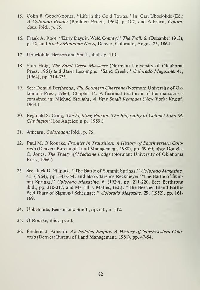
15. Colin B. Goodykoontz, ''Life in the Gold Towns." In: Carl Ubbelohde (Ed.)
A Colorado Reader (Boulder: Pruett, 1962), p. 107, and Athearn, Colora-
dans, ibid., p. 75.
16. Frank A. Root, "Early Days in Weld County," The Trail, 6, (December 1913),
p. 12, and Rocky Mountain News, Denver, Colorado, August 23, 1864.
17. Ubbelohde, Benson and Smith, ibid., p. 1 10.
18. Stan Hoig, The Sand Creek Massacre (Norman: University of OklahomaPress, 1961) and Janet Lecompte, "Sand Creek," Colorado Magazine, 41,
(1964), pp. 314-335.
19. See: Donald Berthrong, The Southern Cheyenne (Norman: University of Ok-
lahoma Press, 1966), Chapter 14. A fictional treatment of the massacre is
contained in: Michael Straight, A Very Small Remnant (New York: Knopf,
1963.)
20. Reginald S. Craig, The Fighting Parson: The Biography of Colonel John M.Chivington (Los Angeles: n.p., 1959.)
21
.
Athearn, Coloradans ibid., p. 75.
22. Paul M. O'Rourke, Frontier In Transition: A History of Southwestern Colo-
rado (Denver: Bureau of Land Management, 1980), pp. 59-60; also: Douglas
C. Jones, The Treaty ofMedicine Lodge (Norman: University of OklahomaPress, 1966.)
23. See: Jack D. Filipiak, "The Battle of Summit Springs," Colorado Magazine,
41, (1964), pp. 343-354, and also Clarence Reckmeyer "The Battle of Sum-mit Springs," Colorado Magazine, 6, (1929), pp. 211-220. See: Berthrong
ibid., pp. 310-317, and Merrill J. Mattes, (ed.), "The Beecher Island Battle-
field Diary of Sigmund Schesinger," Colorado Magazine, 29, (1952), pp. 161-
169.
24. Ubbelohde, Benson and Smith, op. cit., p. 112.
25. O'Rourke, ibid., p. 50.
26. Frederic J. Athearn, An Isolated Empire: A History of Northwestern Colo-
rado (Denver: Bureau of Land Management, 1981), pp. 47-54.
82

CHAPTER EIGHT
83

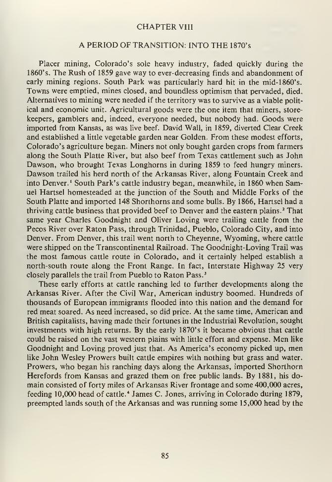
CHAPTER VIII
A PERIOD OF TRANSITION: INTO THE 1870's
Placer mining, Colorado's sole heavy industry, faded quickly during the
1860's. The Rush of 1859 gave way to ever-decreasing finds and abandonment of
early mining regions. South Park was particularly hard hit in the mid- 1 860' s.
Towns were emptied, mines closed, and boundless optimism that pervaded, died.
Alternatives to mining were needed if the territory was to survive as a viable polit-
ical and economic unit. Agricultural goods were the one item that miners, store-
keepers, gamblers and, indeed, everyone needed, but nobody had. Goods were
imported from Kansas, as was live beef. David Wall, in 1859, diverted Clear Creek
and established a little vegetable garden near Golden. From these modest efforts,
Colorado's agriculture began. Miners not only bought garden crops from farmers
along the South Platte River, but also beef from Texas cattlement such as JohnDawson, who brought Texas Longhorns in during 1859 to feed hungry miners.
Dawson trailed his herd north of the Arkansas River, along Fountain Creek and
into Denver. 1 South Park's cattle industry began, meanwhile, in 1860 when Sam-uel Hartsel homesteaded at the junction of the South and Middle Forks of the
South Platte and imported 148 Shorthorns and some bulls. By 1866, Hartsel had a
thriving cattle business that provided beef to Denver and the eastern plains.2 That
same year Charles Goodnight and Oliver Loving were trailing cattle from the
Pecos River over Raton Pass, through Trinidad, Pueblo, Colorado City, and into
Denver. From Denver, this trail went north to Cheyenne, Wyoming, where cattle
were shipped on the Transcontinental Railroad. The Goodnight-Loving Trail was
the most famous cattle route in Colorado, and it certainly helped establish a
north-south route along the Front Range. In fact, Interstate Highway 25 very
closely parallels the trail from Pueblo to Raton Pass. 3
These early efforts at cattle ranching led to further developments along the
Arkansas River. After the Civil War, American industry boomed. Hundreds of
thousands of European immigrants flooded into this nation and the demand for
red meat soared. As need increased, so did price. At the same time, American and
British capitalists, having made their fortunes in the Industrial Revolution, sought
investments with high returns. By the early 1870's it became obvious that cattle
could be raised on the vast western plains with little effort and expense. Men like
Goodnight and Loving proved just that. As America's economy picked up, menlike John Wesley Prowers built cattle empires with nothing but grass and water.
Prowers, who began his ranching days along the Arkansas, imported Shorthorn
Herefords from Kansas and grazed them on free public lands. By 1881, his do-
main consisted of forty miles of Arkansas River frontage and some 400,000 acres,
feeding 10,000 head of cattle.4 James C. Jones, arriving in Colorado during 1879,
preempted lands south of the Arkansas and was running some 15,000 head by the
85
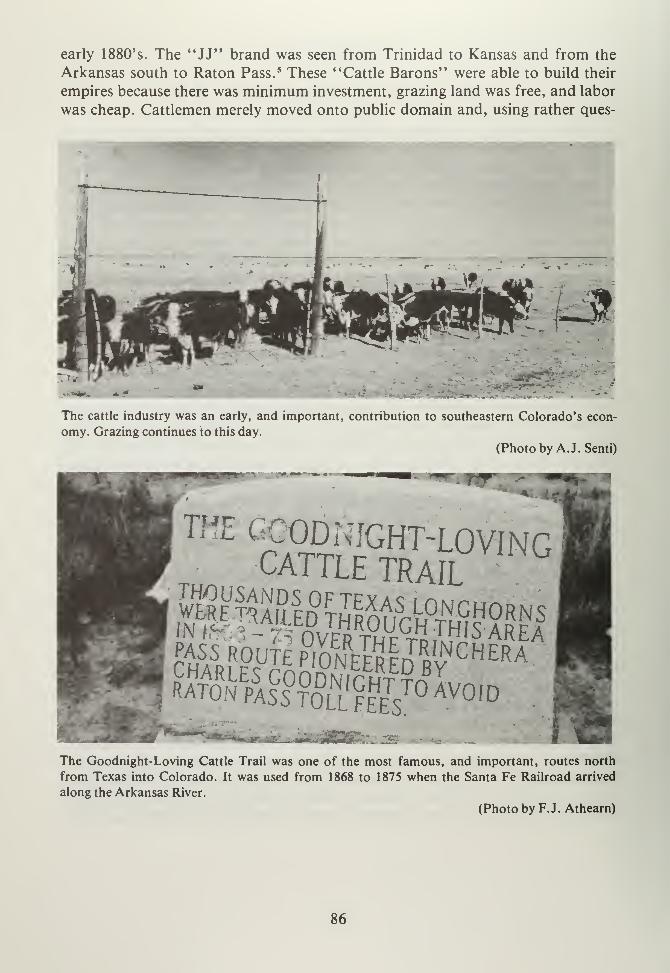
early 1880's. The "JJ" brand was seen from Trinidad to Kansas and from the
Arkansas south to Raton Pass. 5 These "Cattle Barons" were able to build their
empires because there was minimum investment, grazing land was free, and labor
was cheap. Cattlemen merely moved onto public domain and, using rather ques-
The cattle industry was an early, and important, contribution to southeastern Colorado's econ-
omy. Grazing continues to this day.
(Photo by A.J. Senti)
pass; route So"eerfrWCHERA
?SE
PASCS°T°i|l™ Ivo,D
2S23C:-
The Goodnight-Loving Cattle Trail was one of the most famous, and important, routes north
from Texas into Colorado. It was used from 1868 to 1875 when the Santa Fe Railroad arrived
along the Arkansas River.
(Photo by F.J. Athearn)
86
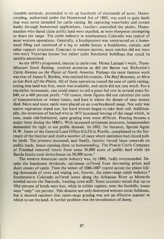
tionable methods, proceeded to tie up hundreds of thousands of acres. Home-steading, authorized under the Homestead Act of 1862, was used to gain lands
that were never intended for cattle raising. By capturing waterholes and stream
banks through homestead applications, ranchers controlled the plains. Home-steaders who dared claim public land were expelled, as were sheepmen attempting
to share the range. The cattle industry in southeastern Colorado was typical of
most western operations. Generally, a headquarters was constructed on a home-stead filing and consisted of a log or adobe house, a bunkhouse, corrals, and
other support structures. Contrary to western movies, most ranches did not have
two-story Victorian houses but rather quite functional buildings that could be
quickly amortized.
As the 1870's progressed, interest in cattle rose. Hiram Latham's work, Trans-
Missouri Stock Raising, received attention as did the Baron von Richtofen's
Cattle Raising on the Plains of North America. Perhaps the most famous workwas that of James S. Brisbin, who entitled his treatise, The BeefBonanza, orHowto Get Rich off the Plains. All of these narratives touted the ease of cattle raising,
noting that land was free, water was available, and cattle did not cost much. For a
ten-dollar investment, one could expect to sell a grass fed cow in several years for
$40, or a 400 percent profit.6 Of course, these figures did not calculate the costs
of transportation or winter losses, and here is where the dream of easy moneydied. More and more cattle were placed on an overburdened range. Not only was
native vegetation wiped out, but hard winters began to take their toll. Addition-
ally, the invention of barbed wire in 1873 increased fencing of the range which, in
turn, made old-fashioned, open grazing even more difficult. Fencing became a
major issue during the 1880's. With increased settlement pressures, homesteaders
demanded the right to use public domain. In 1882, for instance, Special Agent
H.W. Jones of the General Land Office (GLO) in Pueblo, complained to the Sec-
retary of the Interior and cited a number of cases where cattlemen had closed pub-
lic lands. The pressure increased, and finally, Interior forced fence removals on
public lands, hence opening them to homesteading. The Prairie Cattle Companyof Trinidad removed fences from some 36,000 acres of public land while the
Barela family took down fences on 38,000 acres.7
The western American cattle industry was, by 1886, badly overextended. De-
spite the handsome dividends, cattlemen suffered from decreasing prices and
short counts of cattle. Then the winter of 1886-1887 roared across the plains kill-
ing thousands of cows and wiping out, forever, the open-range cattle industry.'
Southeastern Colorado suffered losses along the Arkansas River as blizzards
howled across the flatlands, freezing cows stiff. Some accounts stated that up to
fifty percent of herds were lost, while in milder regions, near the foothills, losses
were "only" ten percent. This disaster not only destroyed western cattle fiefdoms,
but it showed ranchers that open-range grazing was not an effective manner in
which to use the land. A further problem was the introduction of sheep.
87
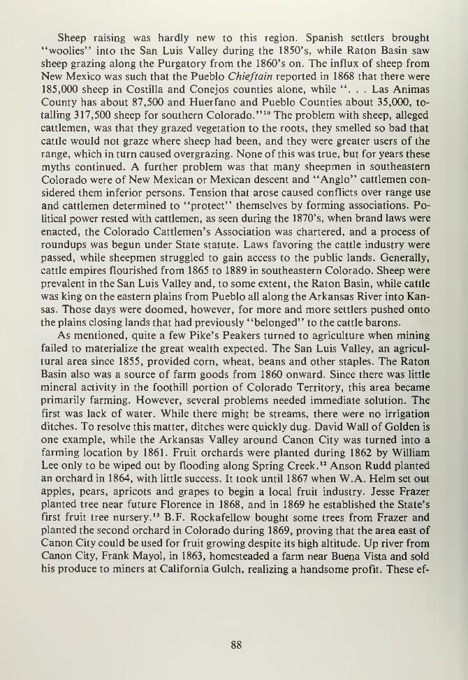
Sheep raising was hardly new to this region. Spanish settlers brought
"woolies" into the San Luis Valley during the 1850's, while Raton Basin saw
sheep grazing along the Purgatory from the 1860's on. The influx of sheep from
New Mexico was such that the Pueblo Chieftain reported in 1868 that there were
185,000 sheep in Costilla and Conejos counties alone, while "... Las AnimasCounty has about 87,500 and Huerfano and Pueblo Counties about 35,000, to-
talling 317,500 sheep for southern Colorado." 10 The problem with sheep, alleged
cattlemen, was that they grazed vegetation to the roots, they smelled so bad that
cattle would not graze where sheep had been, and they were greater users of the
range, which in turn caused overgrazing. None of this was true, but for years these
myths continued. A further problem was that many sheepmen in southeastern
Colorado were of New Mexican or Mexican descent and "Anglo" cattlemen con-
sidered them inferior persons. Tension that arose caused conflicts over range use
and cattlemen determined to "protect" themselves by forming associations. Po-
litical power rested with cattlemen, as seen during the 1870's, when brand laws were
enacted, the Colorado Cattlemen's Association was chartered, and a process of
roundups was begun under State statute. Laws favoring the cattle industry were
passed, while sheepmen struggled to gain access to the public lands. Generally,
cattle empires flourished from 1865 to 1889 in southeastern Colorado. Sheep were
prevalent in the San Luis Valley and, to some extent, the Raton Basin, while cattle
was king on the eastern plains from Pueblo all along the Arkansas River into Kan-
sas. Those days were doomed, however, for more and more settlers pushed onto
the plains closing lands that had previously "belonged" to the cattle barons.
As mentioned, quite a few Pike's Peakers turned to agriculture when mining
failed to materialize the great wealth expected. The San Luis Valley, an agricul-
tural area since 1855, provided corn, wheat, beans and other staples. The RatonBasin also was a source of farm goods from 1860 onward. Since there was little
mineral activity in the foothill portion of Colorado Territory, this area becameprimarily farming. However, several problems needed immediate solution. The
first was lack of water. While there might be streams, there were no irrigation
ditches. To resolve this matter, ditches were quickly dug. David Wall of Golden is
one example, while the Arkansas Valley around Canon City was turned into a
farming location by 1861. Fruit orchards were planted during 1862 by William
Lee only to be wiped out by flooding along Spring Creek. 12 Anson Rudd planted
an orchard in 1864, with little success. It took until 1867 when W.A. Helm set out
apples, pears, apricots and grapes to begin a local fruit industry. Jesse Frazer
planted tree near future Florence in 1868, and in 1869 he established the State's
first fruit tree nursery. 13 B.F. Rockafellow bought some trees from Frazer andplanted the second orchard in Colorado during 1869, proving that the area east of
Canon City could be used for fruit growing despite its high altitude. Up river fromCanon City, Frank Mayol, in 1863, homesteaded a farm near Buena Vista and sold
his produce to miners at California Gulch, realizing a handsome profit. These ef-
88
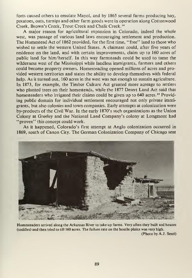
forts caused others to emulate Mayol, and by 1865 several farms producing hay,
potatoes, oats, turnips and other farm goods were in operation along Cottonwood
Creek, Brown's Creek, Trout Creek and Chalk Creek. 14
A major reason for agricultural expansion in Colorado, indeed the whole
west, was passage of various land laws encouraging settlement and production.
The Homestead Act of 1862 provided, for the first time, "free" land to those whowished to settle the western United States. A claimant could, after five years of
residence on the land, and with certain improvements, claim up to 160 acres of
public land for him/herself. In this way farmsteads could be used to tame the
wilderness west of the Mississippi while landless immigrants, farmers and others
could become property owners. Homesteading opened millions of acres and pro-
vided western territories and states the ability to develop themselves with federal
help. As it turned out, 160 acres in the west was not enough to sustain agriculture.
In 1873, for example, the Timber Culture Act granted more acreage to settlers
who planted trees on their homesteads, while the 1877 Desert Land Act said that
homesteaders who irrigated their claims could be given up to 640 acres.1 ' Provid-
ing public domain for individual settlement encouraged not only private immi-
grants, but also colonies and town companies. Early attempts at colonization were
by-products of the Civil War. In the early 1870's such organizations as the Union
Colony at Greeley and the National Land Company's colony at Longmont had
"proven" this concept could work.
As it happened, Colorado's first attempt at Anglo colonization occurred in
1869, south of Canon City. The German Colonization Company of Chicago sent
Homesteaders arrived along the Arkansas River to take up farms. Very often they built sod houses
(soddies) and then tried to till 160 acres. The failure rate on the hostile plains was very high.
(Photo by A.J. Senti)
89
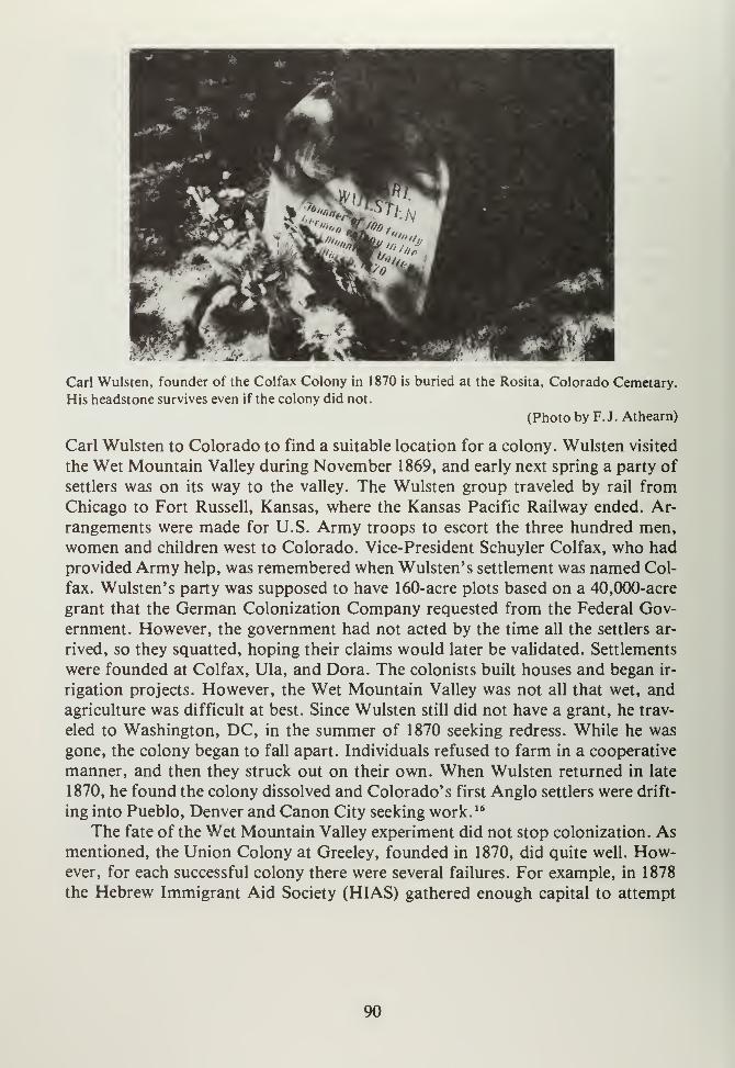
Carl Wulsten, founder of the Colfax Colony in 1870 is buried at the Rosita, Colorado Cemetary.
His headstone survives even if the colony did not.
(Photo by F.J. Athearn)
Carl Wulsten to Colorado to find a suitable location for a colony. Wulsten visited
the Wet Mountain Valley during November 1869, and early next spring a party of
settlers was on its way to the valley. The Wulsten group traveled by rail from
Chicago to Fort Russell, Kansas, where the Kansas Pacific Railway ended. Ar-
rangements were made for U.S. Army troops to escort the three hundred men,
women and children west to Colorado. Vice-President Schuyler Colfax, who had
provided Army help, was remembered when Wulsten' s settlement was named Col-
fax. Wulsten' s party was supposed to have 160-acre plots based on a 40,000-acre
grant that the German Colonization Company requested from the Federal Gov-
ernment. However, the government had not acted by the time all the settlers ar-
rived, so they squatted, hoping their claims would later be validated. Settlements
were founded at Colfax, Ula, and Dora. The colonists built houses and began ir-
rigation projects. However, the Wet Mountain Valley was not all that wet, and
agriculture was difficult at best. Since Wulsten still did not have a grant, he trav-
eled to Washington, DC, in the summer of 1870 seeking redress. While he was
gone, the colony began to fall apart. Individuals refused to farm in a cooperative
manner, and then they struck out on their own. When Wulsten returned in late
1870, he found the colony dissolved and Colorado's first Anglo settlers were drift-
ing into Pueblo, Denver and Canon City seeking work. 16
The fate of the Wet Mountain Valley experiment did not stop colonization. Asmentioned, the Union Colony at Greeley, founded in 1870, did quite well. How-ever, for each successful colony there were several failures. For example, in 1878
the Hebrew Immigrant Aid Society (HIAS) gathered enough capital to attempt
90
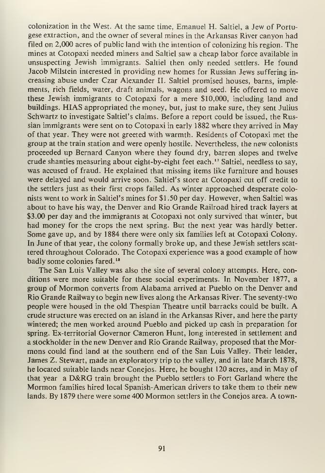
colonization in the West. At the same time, Emanuel H. Saltiel, a Jew of Portu-
gese extraction, and the owner of several mines in the Arkansas River canyon hadfiled on 2,000 acres of public land with the intention of colonizing his region. Themines at Cotopaxi needed miners and Saltiel saw a cheap labor force available in
unsuspecting Jewish immigrants. Saltiel then only needed settlers. He foundJacob Milstein interested in providing new homes for Russian Jews suffering in-
creasing abuse under Czar Alexander II. Saltiel promised houses, barns, imple-
ments, rich fields, water, draft animals, wagons and seed. He offered to movethese Jewish immigrants to Cotopaxi for a mere $10,000, including land andbuildings. HIAS appropriated the money, but, just to make sure, they sent Julius
Schwartz to investigate Saltiel's claims. Before a report could be issued, the Rus-
sian immigrants were sent on to Cotopaxi in early 1882 where they arrived in Mayof that year. They were not greeted with warmth. Residents of Cotopaxi met the
group at the train station and were openly hostile. Nevertheless, the new colonists
proceeded up Bernard Canyon where they found dry, barren slopes and twelve
crude shanties measuring about eight-by-eight feet each. 17Saltiel, needless to say,
was accused of fraud. He explained that missing items like furniture and houses
were delayed and would arrive soon. Saltiel's store at Cotopaxi cut off credit to
the settlers just as their first crops failed. As winter approached desperate colo-
nists went to work in Saltiel's mines for $1 .50 per day. However, when Saltiel was
about to have his way, the Denver and Rio Grande Railroad hired track layers at
$3.00 per day and the immigrants at Cotopaxi not only survived that winter, but
had money for the crops the next spring. But the next year was hardly better.
Some gave up, and by 1884 there were only six families left at Cotopaxi Colony.
In June of that year, the colony formally broke up, and these Jewish settlers scat-
tered throughout Colorado. The Cotopaxi experience was a good example of howbadly some colonies fared. 18
The San Luis Valley was also the site of several colony attempts. Here, con-
ditions were more suitable for these social experiments. In November 1877, a
group of Mormon converts from Alabama arrived at Pueblo on the Denver and
Rio Grande Railway to begin new lives along the Arkansas River. The seventy-two
people were housed in the old Thespian Theatre until barracks could be built. Acrude structure was erected on an island in the Arkansas River, and here the party
wintered; the men worked around Pueblo and picked up cash in preparation for
spring. Ex-territorial Governor Cameron Hunt, long interested in settlement and
a stockholder in the new Denver and Rio Grande Railway, proposed that the Mor-
mons could find land at the southern end of the San Luis Valley. Their leader,
James Z. Stewart, made an exploratory trip to the valley, and in late March 1878,
he located suitable lands near Conejos. Here, he bought 120 acres, and in May of
that year a D&RG train brought the Pueblo settlers to Fort Garland where the
Mormon families hired local Spanish-American drivers to take them to their newlands. By 1879 there were some 400 Mormon settlers in the Conejos area. A town-
91
site was staked out and named Manassa. Three and one-half miles north, Ephraimwas established. Some colonists, by 1881, moved to near La Jara, where Richfield
was founded. Sanford was later platted just north of Richfield. So successful were
the Mormon settlements, that the State of Colorado sold the Mormon Churchland for $1.25 per acre, and church officials bought seeds and tools for their colo-
nists. There were so many arrivals that land could not be cleared fast enough. TheDenver and Rio Grande Railway was building its line to Antonito at this time, andthe Mormons were able to obtain jobs paying from $3.50 to $4.00 per day. Thus,
these Mormon colonies survived and prospered. Their Spanish-American neigh-
bors, who had been in the valley since 1852, helped the newcomers and provided
support. Within ten years, the Mormons had 40,000 acres of land under cultiva-
tion, irrigated by ditches and canals. This was one case where colonization workedwell in Colorado."
Another example of colonization was the Holland American Land and Immi-
gration Company's Dutch colony in the San Luis Valley. This organization
bought 15,000 acres in the Valley, and in November 1892 some two hundred
people arrived at Alamosa directly from Holland, ready to settle their new land.
Poorly built quarters caused an outbreak of diptheria among the children, and
only thanks to the Denver and Rio Grande Railway's offer of two railroad cars as
isolation wards, was an epidemic stopped. While this was going on, the Empire
Land and Canal Company agreed to locate individual families on plots north of
Alamosa and rent or sell land to the immigrants. Meanwhile, word reached Hol-
land that the colony was in chaos, and the company stopped sending settlers to the
San Luis, diverting them to northeastern Colorado, along the South Platte River.
This ended efforts at Dutch settlements in the San Luis Valley and put a stop to
colonization in the Valley during the 1890's.20 Failure was due to lack of planning,
inadequate resources and poor agricultural potential.
Not all colonies or settlement schemes were for profit and economic develop-
ment. One unique example on the plains was the Salvation Army's Fort Amity
project. The Salvation Army, an English philanthropic organization, decided it
could help reduce poverty in large cities by moving poor citizens to settlements
where they could become farmers and learn to be self-sufficient. This social re-
habilitation was intended to turn the poverty-stricken into "productive citizens"
much like the American native was supposed to become a sedentary farmer. Vic-
torian morality had much to do with these views of "agricultural uplift," for pov-
erty was seen as a moral illness. Of course, it made no difference that most of
these potential farmers had never been outside of the city, had never farmed,
knew nothing about dry-land agriculture and were so poor that they could not
hope to survive the first two years. Yet, the Amity Land and Irrigation Companyof New York City purchased land along the Arkansas River twelve miles west of
the Kansas line. Using about 1,800 acres of bottomland, the Salvation Armyhoped to turn this place into a Utopia of abundance. The Army paid between $20
92
and $27.50 per acre, a rather high price considering the quality of the land. Never-
theless, these lands were to be resold to settlers by means of time payments. TheSalvation Army still lost between $60,000 and $70,000, even with resales. Despite
the problems, April 1898 saw thirty families arrive from Chicago and other places
in the mid-west. None of them had experience on the frontier, and there were no
farmers among them. The first year's crop was a total failure, and to survive, the
Salvation Army borrowed money to advance to its settlers. The next year, irriga-
tion ditches were dug, houses were built and fences were erected for livestock.
While there were a few colonists who left, the bulk of the new farmers remained,
and in April 1902 the first member paid off his entire debt of $900. By 1905,
Amity had a population of 350 and was a prospering community. The Salvation
Army also built an orphanage for $20,000, which was later used as a sanitarium
for lung diseases. The orphanage, called the Cherry Tree Home, was populated by
children who were transported from New York and New Jersey cities to Colorado
on the theory that they could be trained as "useful" workers in the sugar beet and
cantaloupe fields around Fort Amity. Amity prospered for a few years, but saline
seepage began to destroy fields. Crops failed, buildings settled, and despite frantic
drainage efforts, farms had to be abandoned year after year. The ophanage was
evacuated, and the children were moved to California. The building was eventu-
ally demolished. About ten years after the colony was founded, its lands were sold
to J.S. McMurty of Holly, Colorado, who later reclaimed the orchards with mod-ern drainage methods.
The Amity project, finally abandoned by the Salvation Army, was a combin-
ation of bad luck, unforeseen conditions such as seepage, and a poor choice in lo-
cation, all contributing to the loss of this colony. Such an experiment in religion
and social development was another example of good-intentioned persons gone
wrong by assuming the West was fit for agriculture in the eastern manner. 21
The period between 1860 and 1880 in southeastern Colorado was one of re-
trenchment from a failing mining industry. As gold booms faded, agriculture de-
veloped and took up the slack. Towns like Pueblo, Trinidad, Walsenburg, Lamar,
Alamosa, La Junta, and Las Animas were founded at this time and grew into agri-
cultural service centers. Ranching and farming sustained the economy of the re-
gion while optimists waited for the next mineral boom. One factor that slowed
growth and settlement during this era was a lack of adequate transportation
systems. Wagons and stage coach lines criss-crossed the area, but these methods
were slow and expensive to use. Freight cost money to move, and men like "Uncle
Dick" Wootton who ran a toll road over Raton Pass made a good profit. Equally,
the San Luis Valley was served westward from Saguache by Otto Mears' toll road
system into the San Juans. As agricultural efforts continued into the 1870's, other
events occurred that, in their own ways, may have been more important than the
region losing its dependence on mining.
93

NOTES
CHAPTER VIII
1. Ora B. Peake, The Colorado Range Cattle Industry (Glendale, California:
A.H. Clark, 1937.) See also: Ernest S. Osgood, Day of the Cattleman (Min-
neapolis: University of Minnesota Press, 1929.)
2. George G. Everett, Cattle Cavalcade in Central Colorado (Denver: Golden
Bell Press, 1966), pp. 159-160.
3. Peake, op. cit., p. 71. Also: Murray, op. cit., p. 40.
4. Ubbelohde, Benson and Smith, op. cit., p. 175.
5. Ibid., p. 176, and Richard Goff, Century in the Saddle (Denver: Cattle-
men's Centennial Commission, 1967), p. 110.
6. Hiram Latham, Trans-Missouri Stock Raising (Denver: Old West, 1972 re-
print); Walter, Baron von Richtofen, Cattle Raising on the Plains of North
America (New York: Appleton, 1885) and James S. Brisbin, The Beef Bon-
anza (Philadelphia: Lippincott, 1881.)
7. Lewis Atherton, The Cattle Kings (Lincoln: University of Nebraska Press,
1972), pp. 170-192, and Gene M. Gressley, Bankers and Cattlemen (Lincoln:
University of Nebraska Press, 197 1 .)
8. Osgood, op. cit., p. 22, and also: John M. Crowley, "Ranches in the Sky:
A Geography of Livestock Ranching in the Mountain Parks of Colorado"
(M.A. Thesis: University of Minnesota, 1964.)
9. As related in Osgood, op. cit., Goff, op. cit., and Atherton, op. cit.
10. Ubbelohde, Benson and Smith, op. cit., pp. 178-179, and Morris F. Taylor,
Trinidad, Colorado Territory (Trinidad: n.p., 1966.)
11. As related in: Edward Everett Dale, The Range Cattle Industry (Norman:
University of Oklahoma Press, 1930), and Rufus Phillips, "Early CowboyLife in the Arkansas Valley," Colorado Magazine, 7, (1930), pp. 165-179.
12. In: Fremont County, Colorado: Its Resources and Attractions (Canon City,
Colorado: Gazette-Express Print, 1882), p. 16, and Alvin Steinel, History
95
ofAgriculture in Colorado (Fort Collins: Colorado A&M University, 1926.)
Also: Rocky Mountain News, October 23, 1862.
13. William E. Pabor, Colorado as an Agricultural State: Its Farms, Fields andGarden Lands (New York: Orange Judd Co., 1883), p. 16.
14. Arthur Hutchinson, "Pioneer Days in the Upper Arkansas Valley," Colo-
rado Magazine, 9, (1932), p. 185, and E.R. Emerson, "History of Chaffee
County," In: History ofthe Arkansas Valley (Chicago: Baskin, 1881), p. 479.
15. Roy M. Robbins, Our Landed Heritage: The Public Domain, 1776-1970
(Lincoln: University of Nebraska Press, 1942), p. 206, pp. 218-219, and pp.
219-220. See also: Paul W. Gates, History ofPublic Land Law and Develop-
ment (Washington, DC: Public Land Law Review Commission, 1968.)
16. Athearn, Coloradans, op. cit., pp. 111-113, and Raymond Gardner Colwell,
"The Wet Mountain Valley . .." (Unpublished manuscript, Colorado His-
torical Society, Denver, Colorado, n.d.), pp. 10-16, and Gayle Turk, The
Wet Mountain Valley (Colorado Springs: Little London Press, 1976.)
17. As described in Athearn, ibid., pp. 181-182; Flora Jane Satt, "The Cotopaxi
Colony" (M.A. Thesis, University of Colorado, 1950), and Dorothy Rob-
erts, "The Jewish Colony at Cotopaxi," Colorado Magazine, 18, (1941),
p. 125.
18. Athearn, ibid., p. 183.
19. Athearn, ibid., pp. 120-127. See also: Andrew Jensen, "The Founding of
Mormon Settlements in the San Luis Valley," Colorado Magazine, 18, (1940),
p. 179, and Nicholas G. Morgan, "Mormon Colonization in the San Luis
Valley," Colorado Magazine, 17, (1950), pp. 271-272.
20. As described in Athearn, ibid., pp. 202-203. See also: Dorothy Roberts, "ADutch Colony in Colorado," Colorado Magazine, 17, (1940), pp. 229-230.
21. As related in Athearn, ibid., pp. 198-201. See also: H. Rider Haggard, The
Poor and the Land (New York, n.p., 1905), and Dorothy Roberts, "Fort
Amity, The Salvation Army Colony in Colorado," Colorado Magazine, 17,
(1940), p. 168.
22. Murray, op. cit., pp. 55-56.
96

CHAPTER NINE
97

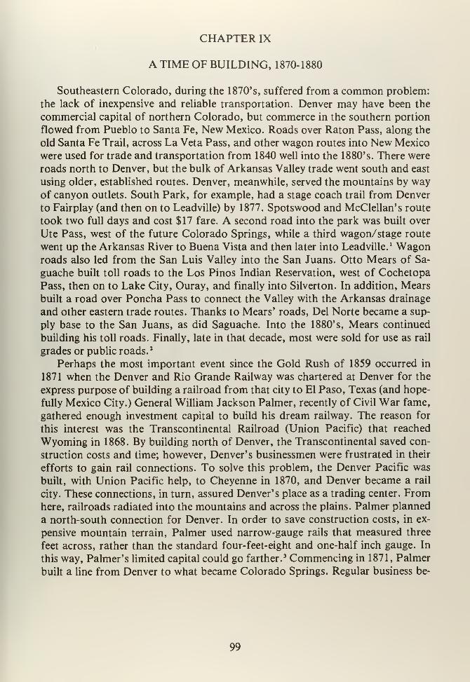
CHAPTER IX
A TIME OF BUILDING, 1870-1880
Southeastern Colorado, during the 1870's, suffered from a common problem:
the lack of inexpensive and reliable transportation. Denver may have been the
commercial capital of northern Colorado, but commerce in the southern portion
flowed from Pueblo to Santa Fe, New Mexico. Roads over Raton Pass, along the
old Santa Fe Trail, across La Veta Pass, and other wagon routes into New Mexico
were used for trade and transportation from 1840 well into the 1880's. There were
roads north to Denver, but the bulk of Arkansas Valley trade went south and east
using older, established routes. Denver, meanwhile, served the mountains by wayof canyon outlets. South Park, for example, had a stage coach trail from Denver
to Fairplay (and then on to Leadville) by 1877. Spotswood and McClellan's route
took two full days and cost $17 fare. A second road into the park was built over
Ute Pass, west of the future Colorado Springs, while a third wagon/stage route
went up the Arkansas River to Buena Vista and then later into Leadville. 1 Wagonroads also led from the San Luis Valley into the San Juans. Otto Mears of Sa-
guache built toll roads to the Los Pinos Indian Reservation, west of Cochetopa
Pass, then on to Lake City, Ouray, and finally into Silverton. In addition, Mears
built a road over Poncha Pass to connect the Valley with the Arkansas drainage
and other eastern trade routes. Thanks to Mears' roads, Del Norte became a sup-
ply base to the San Juans, as did Saguache. Into the 1880's, Mears continued
building his toll roads. Finally, late in that decade, most were sold for use as rail
grades or public roads. 2
Perhaps the most important event since the Gold Rush of 1859 occurred in
1871 when the Denver and Rio Grande Railway was chartered at Denver for the
express purpose of building a railroad from that city to El Paso, Texas (and hope-
fully Mexico City.) General William Jackson Palmer, recently of Civil War fame,
gathered enough investment capital to build his dream railway. The reason for
this interest was the Transcontinental Railroad (Union Pacific) that reached
Wyoming in 1868. By building north of Denver, the Transcontinental saved con-
struction costs and time; however, Denver's businessmen were frustrated in their
efforts to gain rail connections. To solve this problem, the Denver Pacific was
built, with Union Pacific help, to Cheyenne in 1870, and Denver became a rail
city. These connections, in turn, assured Denver's place as a trading center. Fromhere, railroads radiated into the mountains and across the plains. Palmer planned
a north-south connection for Denver. In order to save construction costs, in ex-
pensive mountain terrain, Palmer used narrow-gauge rails that measured three
feet across, rather than the standard four-feet-eight and one-half inch gauge. In
this way, Palmer's limited capital could go farther.3 Commencing in 1871, Palmer
built a line from Denver to what became Colorado Springs. Regular business be-
99
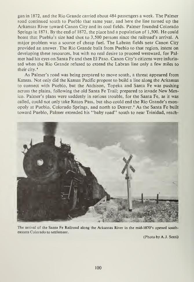
gan in 1872, and the Rio Grande carried about 484 passengers a week. The Palmer
road continued south to Pueblo that same year, and here the line turned up the
Arkansas River toward Canon City and its coal fields. Palmer founded Colorado
Springs in 1871. By the end of 1872, the place had a population of 1,500. He could
boast that Pueblo's size had shot to 3,500 persons since the railroad's arrival. Amajor problem was a source of cheap fuel. The Labran fields near Canon City
provided an answer. The Rio Grande built from Pueblo to that region, intent ondeveloping these resources, but with no real desire to proceed westward, for Pal-
mer had his eyes on Santa Fe and then El Paso. Canon City's citizens were infuria-
ted when the Rio Grande refused to extend the Labran line only a few miles to
their city.4
As Palmer's road was being prepared to move south, a threat appeared from
Kansas. Not only did the Kansas Pacific propose to build a line along the Arkansas
to connect with Pueblo, but the Atchison, Topeka and Santa Fe was pushing
across the plains, following the old Santa Fe Trail; prepared to invade New Mex-ico. Palmer's plans were suddenly in serious trouble, for the Santa Fe, as it was
called, could not only take Raton Pass, but also could end the Rio Grande's mon-opoly at Pueblo, Colorado Springs, and north to Denver. 5 As the Santa Fe built
toward Pueblo, Palmer extended his "baby road" south to near Trinidad, reach-
1I yL ^Ql mf
•
hf I -
Pryp
f
m - mm*~L ^ UsThe arrival of the Santa Fe Railroad along the Arkansas River in the mid- 1 870' s opened south-
eastern Colorado to settlement.
(Photo by A.J. Senti)
100
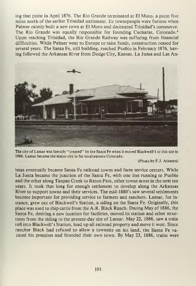
ing that point in April 1876. The Rio Grande terminated at El Moro, a point five
miles north of the earlier Trinidad settlement. Its townspeople were furious whenPalmer calmly built a new town at El Moro and decimated Trinidad's commerce.
The Rio Grande was equally responsible for founding Cucharas, Colorado. 6
Upon reaching Trinidad, the Rio Grande Railway was suffering from financial
difficulties. While Palmer went to Europe to raise funds, construction ceased for
several years. The Santa Fe, still building, reached Pueblo in February 1876, hav-
ing followed the Arkansas River from Dodge City, Kansas. La Junta and Las An-
The city of Lamar was literally "created" by the Santa Fe when it moved Blackwell's to this site in
1886. Lamar became the major city in far southeastern Colorado.
(Photo by F.J. Athearn)
imas eventually became Santa Fe railroad towns and farm service centers. While
La Junta became the junction of the Santa Fe, with one line running to Pueblo
and the other along Timpas Creek to Raton Pass, other towns arose in the next ten
years. It took that long for enough settlement to develop along the Arkansas
River to support towns and their services. The mid- 1 880' s saw several settlements
become important for providing service to farmers and ranchers. Lamar, for in-
stance, grew out of Blackwell's Station, a siding on the Santa Fe. Originally, this
place was used to ship cattle from the A.R. Black Ranch. During May of 1886, the
Santa Fe, desiring a new location for facilities, moved its station and other struc-
tures from the siding to the present-day site of Lamar. May 22, 1886, saw a train
roll into Blackwell's Station, load up all railroad property and move it west. Since
rancher Black had refused to allow a townsite on his land, the Santa Fe va-
cated his premises and founded their own town. By May 23, 1886, trains were
101
running from Garden City, Kansas, carrying land speculators, and some $45,000
worth of town lots were sold on that day alone. Lamar, named for Secretary of
the Interior L.Q.C. Lamar, became the largest town in far southeast Colorado
and still serves as a major rail town for the Santa Fe.
The Rio Grande reached an agreement with the Santa Fe to provide coopera-
tive service to Denver. In doing so, the Rio Grande assured its monopoly and kept
Denver to itself. However, the Santa Fe had eyes to the south and promptly began
construction to Trinidad, by way of La Junta, following Timpas Creek with the
objective of Raton Pass. As the Santa Fe rushed for Trinidad, the Rio Grande be-
gan a line from Cucharas, over La Veta Pass, intending to tap the San Luis Valley
and many suddenly mineral rich San Juan mining towns. Palmer made a fatal
error at this time, for he chose not to extend his road from Trinidad to RatonPass. In consequence, the Santa Fe captured the pass, buying out "Uncle Dick"
Wootton's toll road, and then it proceeded on into Santa Fe, New Mexico with
impunity. 7
The year 1878 changed all railroad builders thinking; Leadville boomed.Oro City, founded more than a decade earlier in California Gulch, was a gold
mining camp that never really went very far. Men like Horace A.W. Tabor, a mer-
chant, were ever hopeful and were willing to grubstake local miners. Tabor, in
1877, provided August Rische and George Hook enough goods for them to pros-
pect Fryer Hill. Here they found a rich silver lode, and the "boom" was on. By1879, Tabor was a millionaire, just as a number of Colorado luminaries, like David
Moffat, John Routt, Jerome Chaffee and John Evans made their fortunes
thanks to Leadville' s silver. Leadville was formally founded in 1877, and by 1879
it was the third largest city in Colorado, with all the amenities of a growing town.
Silver mines produced millions of dollars while smelters worked day and night re-
fining ore and casting ingots. Between just 1878 and 1880, an estimated
$36,850,000 in silver was pulled from the hills around Leadville. Eastern investors
poured in capital, and mines went even deeper searching for minerals. Individuals
rarely developed their finds now, for eastern corporations spent the needed mil-
lions in tunnels, shafts, mills and smelters. Laborers were hired for $3.00 per day,
and mining in Colorado became a modern industrial enterprise. This, in turn, led
to labor unrest. In 1880 Leadville's miners went out on strike demanding $4.00
per day for their work. The Miners, Mechanics and Laborers Protective Associa-
tion was founded to present management with workers' complaints.' Hostility ran
high, with businessmen and mine owners facing workers and miners. In typical
nineteenth century fashion, Governor Frederick Pitkin called in militiamen, andthe strike was broken. There were no further labor problems at Leadville until the
late 1890's.9
What is more significant about Leadville, and the silver boom, was that east-
ern capital, invested for the first time in Colorado, was returned to Denver, Colo-
rado Springs and Pueblo, causing new and dramatic growth. The mines of Lead-
102
ville precipitated silver booms in the San Juans, the Wet Mountain Valley and
other such locations. As noted, transportation was a major problem for the min-
ing industry. One reason silver took off during the early 1880's was construction
of railroads throughout this state, providing cheap and reliable means to move sil-
ver ore to smelters generally located in metropolitan areas. Denver and ColoradoSprings had large smelter operations that required quantities of coal and raw ore.
Pueblo, a developing steel producer, also needed coal in huge quantities.
Palmer's railroad, along with rivals, offered the solution to silver's problems.
It was soon realized that Leadville would produce fantastic rail revenues for the
line that got there first. Competition was keen for the rights to Leadville. Palmer,
having been cut off at Raton Pass, turned westward up the Arkansas River Can-
yon in 1878, rapidly building toward Leadville. There were other rivals, too. John
Evans and Walter Cheesman, of Denver, incorporated the Denver, South Park
and Pacific Railroad (DSP&P) in 1875. In 1876 construction up the Platte
River Canyon was underway. By October 1878, the line reached Bailey's Ranch,
then Grant and Webster. Kenosha Pass was crossed in May 1879, and during June
of that year the DSP&P reached Como. Como was not only a station, but also the
site of coal deposits that were soon exploited to fire the DSP&P's locomotives.
The Lechner and King Mines provided fuel, and the railroad built an extension
from Como to these places for development. Como, by 1879, was a tent city of
some 6,000 residents, including miners, railroad workers, and others cashing in on
the mini-boom. As the summer of 1879 progressed, the DSP&P graded over RedHill toward Leadville. The South Park line was prepared to cross Trout Creek Pass
and build up the Arkansas River into Leadville when its management ran into un-
expected troubles. The DSP&P hoped to have exclusive rights into the "CloudCity" by getting into the valley first. These dreams were dashed by events not of
the South Park's making. 10
As the Rio Grande turned west into the Grand Canyon of the Arkansas, Santa Fe
officials decided that Leadville' s markets were too rich to ignore. A race was on
between the two roads, and when they reached the Canyon of the Arkansas
(Royal Gorge), there was no room for two railroads. The rivals locked in battle,
beginning the "Royal Gorge War." The Santa Fe went to court while the Rio
Grande barricaded itself in the canyon. Judge Moses Hallett of Denver's U.S.
District Court did not help matters by ruling, in a preliminary injunction, that
both companies had rights to the canyon. Palmer, assuming he had lost the legal
battle, prepared for physical confrontation. Assistant Chief Engineer James R.
DeReemer, located twenty miles up river from Canon City, created a "deadline"
with ties and then built stone "forts" on the canyon walls all the way up to Texas
Creek so to defend Rio Grande workers from Santa Fe crews. These works are
still visible from U.S. Highway 50. There were no shots fired, and the Royal
Gorge War took place in courtrooms, not the Canyon of the Arkansas. 11 The Rio
Grande was in serious financial difficulty by late 1878, and Palmer was forced to
103
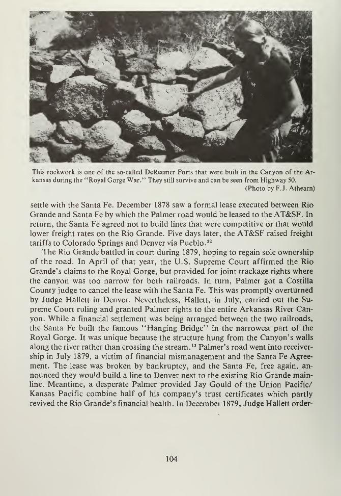
This rockwork is one of the so-called DeReemer Forts that were built in the Canyon of the Ar-
kansas during the "Royal Gorge War." They still survive and can be seen from Highway 50.
(Photo by F.J. Athearn)
settle with the Santa Fe. December 1878 saw a formal lease executed between Rio
Grande and Santa Fe by which the Palmer road would be leased to the AT&SF. In
return, the Santa Fe agreed not to build lines that were competitive or that would
lower freight rates on the Rio Grande. Five days later, the AT&SF raised freight
tariffs to Colorado Springs and Denver via Pueblo. 12
The Rio Grande battled in court during 1879, hoping to regain sole ownership
of the road. In April of that year, the U.S. Supreme Court affirmed the Rio
Grande's claims to the Royal Gorge, but provided for joint trackage rights where
the canyon was too narrow for both railroads. In turn, Palmer got a Costilla
County judge to cancel the lease with the Santa Fe. This was promptly overturned
by Judge Hallett in Denver. Nevertheless, Hallett, in July, carried out the Su-
preme Court ruling and granted Palmer rights to the entire Arkansas River Can-
yon. While a financial settlement was being arranged between the two railroads,
the Santa Fe built the famous "Hanging Bridge" in the narrowest part of the
Royal Gorge. It was unique because the structure hung from the Canyon's walls
along the river rather than crossing the stream. 13 Palmer's road went into receiver-
ship in July 1879, a victim of financial mismanagement and the Santa Fe Agree-
ment. The lease was broken by bankruptcy, and the Santa Fe, free again, an-
nounced they would build a line to Denver next to the existing Rio Grande main-
line. Meantime, a desperate Palmer provided Jay Gould of the Union Pacific/
Kansas Pacific combine half of his company's trust certificates which partly
revived the Rio Grande's financial health. In December 1879, Judge Hallett order-
104
ed that the completed line west of Canon City be transferred to the Rio Grandewith the Santa Fe getting $1.8 million for its efforts. The road to Leadville was
opened to Palmer by 1880, but his problems were far from over. 14
While Palmer and the Santa Fe fought it out in the Royal Gorge, the Denver,
South Park and Pacific was across Trout Creek Pass and running into BuenaVista. Early 1880 looked bad for Palmer's hopes; for the DSP&P was way ahead
in the race to Leadville; the Santa Fe had cut off Palmer at Raton Pass; the LaVeta Pass construction was slow and expensive, the San Luis Valley was still elus-
ive, and a new railroad was proposed from Colorado Springs to Leadville by wayof Ute Pass. Palmer, with enemies on all sides, took on the DSP&P first. He went
to court and got an agreement with the DSP&P to jointly operate D&RG-builttrackage between Buena Vista and Leadville. The DSP&P then proposed to build
up Chalk Creek to Gunnison, allowing the Rio Grande to use these rails. TheDSP&P was therefore deprived of its exclusive right to Leadville and the Rio
Grande was given some badly needed breathing room. 15
The DSP&P, for its part, continued on to Gunnison by building the Alpine
Tunnel, hoping to reach that town before Palmer's road could. The Rio Grande,
in turn, built over Marshall Pass and entered Gunnison ahead of the South Park.
As the DSP&P struggled to drill the Alpine Tunnel, Jay Gould's Union Pacific
bought it out. The South Park Line was then reincorporated as the Denver, Lead-
ville and Gunnison (DL&G) in 1882. Having been beaten to Gunnison, the
DSP&P turned its attention to Leadville. Palmer was still a long way from that
city, so the South Park Line built toward Breckenridge by way of Boreas Pass. OnAugust 2, 1882, the DSP&P was at Breckenridge, and by the end of that year the
line reached the Montezuma Mining District at Dillon and Keystone. 16 Since the
Union Pacific owned the DSP&P, capital was available for further construction.
The Rio Grande successfully choked off traffic between Buena Vista and Lead-
ville, so the DSP&P decided to go in the back way. From Breckenridge, the road
built up Ten Mile Canyon over Fremont Pass and into Leadville, arriving at the
"Cloud City" on February 5, 1884. The Rio Grande, having reached Leadville in
1883, was forced to lower its freight rates. The South Park's line was also faster,
because it was 126 miles shorter than the Rio Grande main line up the Arkansas
River Canyon. 17
As the Rio Grande and South Park battled over Leadville, a new competitor
entered the fray. Colorado Springs businessmen like Irving Howbert and J.F.
Humphrey got Jerome Wheeler, J.R. Buck, Charles Otis and J.J. Hagerman to
capitalize construction of a standard gauge road from that city to Leadville. While
the railroad was incorporated in 1884, construction did not actually begin until
1886. Next year saw the Colorado Midland Railroad marching over Ute Pass,
across South Park, through Trout Creek Pass and down to Buena Vista where the
first train rolled in on July 13, 1887. 1 ' From that station to Leadville was another
matter. Because the Rio Grande already occupied the most practical right-of-way,
105
the Midland was forced to build around, over and under the D&RG. For instance,
in the narrowest part of the Upper Arkansas River Canyon, the Midland drilled
four tunnels in just four-tenths of a mile, finally arriving at Leadville on August
31, 1887. Now that city had three railroads serving it, and they were all looking to
better things. The Colorado Midland eventually raced the Rio Grande over the
Continental Divide in an attempt to reach Aspen first. The Midland used Hager-
man Pass, west of Leadville, where the 2,000-foot Hagerman Tunnel was bored.
The Rio Grande proceeded over Tennessee Pass, down the Eagle River Valley to
Glenwood Springs, and then up the Roaring Fork into Aspen, reaching that boomtown on November 1, 1887, beating Midland by a year.
19
Railroad construction's importance to southeastern and south central
Colorado cannot be underestimated. This form of transportation not only pro-
vided fast and relatively inexpensive freight and passenger service, but it madesettlement in remote areas practical. Further, railroads made marginal mining
possible and provided a way to get low-quality ores to smelters. In addition, food
and durable goods were imported at lower costs and local standards of living rose.
The year 1876 was the culmination of Colorado's fight for statehood, for in
August of that year Colorado was admitted to the Union. The long battle for this
privilege was over. After several false starts, a Constitutional Convention prepar-
ed an acceptable State constitution and the U.S. Congress voted admission. Pres-
ident U.S. Grant signed the entrance papers, and Colorado became a state on
August 1, 1876. One of the provisions of the statehood Enabling Act was that the
new State of Colorado would relinquish, forever, all claims to public domainwithin her borders. This was done, and not twenty years later, Coloradans were to
regret it. Once statehood was obtained, the question as to Colorado's new capitol
arose. Suggestions ranged from Leadville to Silver Cliff (both with large popula-
tions), but Denver was chosen. In the 1890's a new capitol building was erected at
that city. State facility location became a major fight. Cities throughout Colorado
saw location of State facilities beneficial to their economies and were willing to
fight for the various plums.
Canon City engaged in battle with Boulder over the location of the State Pri-
son and/or State University. Canon City's boosters saw the location of a prison
there as having more "growth potential" and were pleased when the legislature
agreed to build the State Prison at Canon City. Boulder, laughed Canon City resi-
dents, had "lost." They only got the State University. Likewise Pueblo got the
State Mental Asylum, which did not add a great deal to the local economy primar-
ily due to the lack of purchasing power by its inmates. Nonetheless, these cities
were typical of what good lobby efforts could do for a town.
The decade of the 1870's also saw considerable growth and development along
the Arkansas River corridor. The San Luis Valley and Raton Basin regions were
populated, thanks not only to rail connections, but also due to governmental en-
couragement in the form of surveys. One of the last great survey efforts was that
106
of Ferdinand V. Hayden of the U.S. Geological Survey (GS). The Hayden ex-
peditions were designed to map and record areas of this and other states that, prior
to 1870, were not accurately described. Hayden, over a period of four years, ex-
plored the western slope, the southwestern corner of Colorado, North and Middle
Parks, and in 1873 his men fanned out over the Front Range to map and record
geologic and geographic features of this region. Hayden was not unfamiliar with
this part of Colorado, for in 1869 he had noted "oil springs" around Canon City
and also that there were major coal deposits here. He also described salt deposits
in South Park. This referred to Charles L. Hall's Colorado Salt Works Companywhich began operation in 1864 and continued into the 1870's.
20 Hayden's men dis-
persed across the southeastern Front Range in 1873; A.C. Peale mapped many of
the producing mines of South Park, while Henry Gannett described the topogra-
phy and climate of the park as ideal for cattle and sheep. In addition, the various
survey parties looked over the Wet Mountain Valley and Raton Basin. The annual
report of 1873 provided detailed maps of this region, including towns, roads,
drainages and elevations. Publication of Hayden's works attracted the attention
of land developers and mining investors who used this information to promote
settlement. Hayden's survey efforts helped increase a rising interest in the land for
development and improvement. 21
South Park and the Upper Arkansas Valley were not the only areas that boom-ed during the 1870's. Pueblo became a major supply center, and its beginnings as
an industrial city date from this time. Transportation, water, and coal supplies all
accounted for the city's predominant situation. Coal fields extending from
Florence to Trinidad were opened, and thousands of tons of this mineral were
produced in order to fuel locomotives, fire smelters and heat homes. Coal mining
became big business. From early small mines, operated by several individuals or a
family, corporate mining took over by 1880. With it came imported labor, com-
pany towns and labor strife.22
The San Luis Valley saw some new developments during the 1870's, too. Min-
ing was not exclusively the domain of the central Rockies. Of course, the San Juan
Mountains were "invaded" in the late 1860's by eager gold seekers. As miners
spread across the region, a few explored the streams and creeks of the valley hop-
ing to find enough "pay dirt" to stake claims. The first strike occurred near the
San Luis Valley at Summitville District in 1870. The nearest town was Del Norte,
which became the camp's supply center. The Summitville area was not overly pro-
ductive, but camps were established in never-ending hope of wealth. Jasper was
staked out along the Alamosa River in 1874. It became part of the Jasper-Corn-
wall District in 1879. Jasper had a stamp mill and post office, along with a branch
of L.L. Fassett's store of Monte Vista.23 This region also was home for the town
of Stunner, located above Jasper along the Alamosa River. Stunner was an out-
growth of Blaineville and dated from around 1882. Four miles from Stunner, the
settlement of Platoro was founded. This place produced during the early 1880's,
107
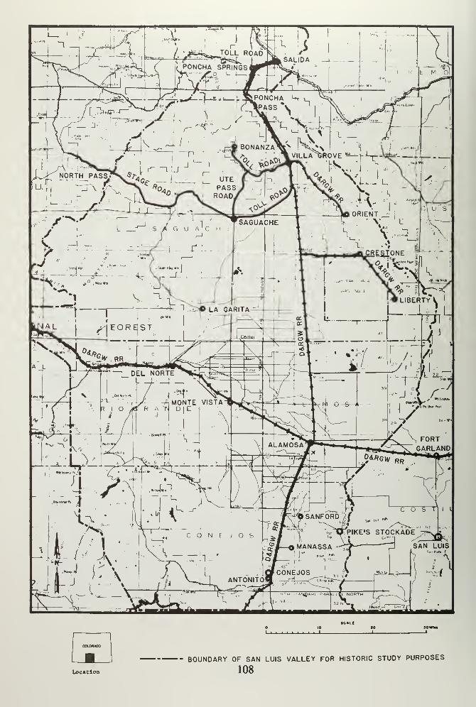
Location
BOUNDARY OF SAN LUIS VALLEY FOR HISTORIC STUDY PURPOSES
108

but was abandoned by 1913 as ores played out. These little mining towns west ofthe San Luis Valley were really part of the San Juan mining boom, but the Valley
itself had two major booms. 24
Kerber Creek was explored during the late 1870's by San Juan prospectors,
and in 1880 the Exchequer mine was located. Just below it, the Bonanza Mine also
struck rich ores, and the rush was on. The towns of Bonanza and Sedgwick sprangup along Kerber Creek in 1880, as did Exchequer, Bonito, and Spook City during1882. These places were truly boom towns, complete with hotels, saloons,
schools, churches and the famous brewery at Sedgwick. This "city" was so "civil-
ized" that it boasted a bowling alley, a billiard hall and two dance halls.25 Bonan-
za kept up with the times through two newspapers, while stage and wagon roads
connected the town with the Rio Grande Railway at Villa Grove. From the boomcame the Kerber Creek Mining District, founded in 1881. These little places lasted
into the 1890's, when silver prices fell. West of Kerber Creek, mining settlements,
such as Sky City, Bowenton, and Biedell arose and died within a ten-year period.
These places, unlike Kerber Creek, were not as rich or accessible as that mining
district; therefore, they were not major mining centers in the valley.26
Across the San Luis Valley, the Luis Maria Baca Number Four land grant be-
came a hotbed of activity during the late 1870's. A prime investor in this tract was
former Governor William Gilpin who, instead of putting money into the San
Juans, invested in the potential of the Sangre de Cristos. These investments in-
cluded the Baca Number Four which, by the early 1870's, was being taken over by
squatters intent on mining. By 1882 Crestone, San Isabel and Rio Alto (Rito
Alto?) had post offices. Cottonwood was first settled in 1876, and irrigation dit-
ches were dug. 27 The next year, 1877, Gilpin bought the grant from the D&RG'slessees; he renewed the old lease but retained all mineral rights. In doing so, Gilpin
made a wise decision, for during the spring of 1880 gold was found along Burnt
Creek, and a rush was on. Cottonwood was formally founded in that year, while a
place called Tetons grew up north of Crestone, but it soon died. William Gilpin
got lucky in 1886 when George Adams bought the Baca Grant for $350,000.
Adams promptly removed the numerous trespassers and the Baca mining boomabruptly ended. Adams and other new owners later began mining operations with
limited success.
Of the various "booms," discoveries by Nicholas Creede along Willow Creek
were the most significant. The Holy Moses Mine, developed in 1889, set off an in-
vasion that, by 1890, was the site of a growing mining town. Creede was founded
at this time and produced considerable wealth in a ten-year period. So good was
business that the Rio Grande extended a rail line from Del Norte up the narrow
valley, into Creede by 1891. Building materials were hauled in, and a small city
erupted. Saloons, hotels, assay offices, general stores and newspapers were soon
in business. Cy Warman's Creede Candle was printed here. Warman aptly de-
scribed Creede: "It's day all day in the daytime, and there is no night in Creede."
109
Investment monies poured in from men like David H. Moffat and Thomas Bowen.
Minerals other than gold and silver were also mined. Lead, copper, and zinc
helped sustain the camp over a period of years. Creede's mineral industry survives
to this day, and both precious and semiprecious minerals are still marketed.
Creede is also something of a tourist town; during the summers numerous sight-
seers come to the truly picturesque main street to gaze at the false fronted build-
ings, the old Rio Grande depot, and an amazingly narrow canyon at the mouth of
which Creede sits.28
While the San Luis Valley grew and prospered, settlement along the lower Ar-
kansas River also continued. Arrival of rail service along the Arkansas provided
not only transportation for homesteaders, but also a way to move crops east. TheSanta Fe built from Dodge City, Kansas to Granada, Colorado, where it stored
construction materials, preparing to advance on Pueblo. Jerry O'Loughlin ran a
general store at Granada and this town arose at track's end. By September 1875,
Las Animas was reached, and in February 1876 the Santa Fe rolled into La Junta
where it met the Kansas Pacific head-on. 29 The KP was cut off from its cattle
trade (the Goodnight-Loving Trail) by the new Santa Fe route. In retaliation, KPofficials built a branch line from Kit Carson, Colorado, to La Junta so as to divert
cattle traffic north into Kansas. However, thanks to tariff agreements between the
Santa Fe, the Rio Grande and the KP, this line proved worthless and was later
torn up. 30
Santa Fe management built on, into Pueblo, arriving in that city on March 7,
1876, precipitating a two-day celebration at which Pueblo's citizens engaged in
"eating, drinking, dancing, and general rejoicing." Not only was the Rio Grande's
monopoly broken, but Pueblo was now directly connected with the east. Fromthis point forward, Pueblo grew and soon became a primary trading center for
southeastern Colorado. 31 The Santa Fe also opened the lower Arkansas Valley to
homesteaders who took trains from Chicago and claimed lands along the river
where soils were fertile and water was available. Early, however, there were con-
flicts with cattlemen previously there. Nevertheless, agriculture gained a foothold,
and during the next twenty years, that industry flourished. In 1878 the Santa Fe
built its Transcontinental line from La Junta to Trinidad and then over RatonPass. As at Pueblo, the Rio Grande's monopoly was broken and Trinidad pros-
pered as a local trading center and railroad town. The coal fields around Trinidad
provided fuel for railroads. Little places like Model, Tyrone and Timpas poppedup along the new Santa Fe line from La Junta. 32
While the Gold Rush of 1859, and subsequent silver booms, may have been
the reason for settlement in southeastern Colorado, nothing was more important
to the area than arrival of inexpensive and fast transportation systems. With rail-
roads, not only was this region connected with the "outside world" but goods and
services could be imported and exported which, in turn, created an atmosphere of
permanent settlement and development. Railroads were the forerunners of mod-
110
ernity in the Victorian West; and when they arrived, prosperity could not be far
behind.
Ill

NOTES
CHAPTER IX
1. Ralph Moody, Stagecoach West (New York: Crowell, 1967), pp. 297-299,
and McConnell, op. cit., p. 77.
2. Michael D. Kaplan, "Otto Mears: Colorado's Transportation King" (Ph.D.
Dissertation, University of Colorado, 1975); LeRoy R. Hafen, "Otto Mears,
Pathfinder of the San Juan," Colorado Magazine, 9, (1932), pp. 71-74,
Michael D. Kaplan, "The Toll Road Building Career of Otto Mears," Colo-
rado Magazine, 52, (1975), pp. 153-170, Arthur Ridgway, "The Mission of
Colorado Toll Roads," Colorado Magazine, 9, (1932), pp. 161-169.
3. Robert G. Athearn, The Denver and Rio Grande Western Railroad (Lincoln:
University of Nebraska Press, 1977), p. 14, and Brit A. Storey, "William
Jackson Palmer: Promoter," Colorado Magazine, 63, (1966), pp. 44-56.
4. Athearn, ibid., pp. 25-26, and Keith L. Bryant, Jr., History of the Atchison,
Topeka and Santa Fe Railway (New York: MacMillan, 1975), p. 46.
5. Bryant, ibid., pp. 43-45.
6. Athearn, Rio Grande, op. cit., p. 43.
7. Bryant, ibid., p. 45, and Athearn, ibid., p. 55.
8. Don and Jean Griswold, The Carbonate Camp Called Leadville (Denver:
University of Denver Press, 1951); Caroline Bancroft, Tabor's Matchless
Mine and Lusty Leadville (Boulder: Johnson, 1967); George R. and Ruth
Gilfillan, Among the Tailings: A Guide to Leadville Mines (Leadville: Herald
Democrat, 1964); Duane A. Smith, Horace Tabor: His Life and Legend(Boulder: CAUP, 1973); James Fell, Ores to Metals, The Evolution ofSmelting Industry in Colorado, 1864-1921 (Lincoln: University of Nebraska
Press, 1981); Muriel S. Wolle, Cloud Cities of Colorado (Denver: Smith-
Brooks, 1934); Duane A Smith, Colorado Mining (Albuquerque: University
of New Mexico Press, 1979); C. Eric Stors, Victorian Bonanza (Albuquerque:
University of New Mexico Press, 1973); Jean Griswold, "The History of
Leadville, Colorado to 1900" (M.A. Thesis, University of Southern California,
1933); Helen M. Fleming, "Mining in Leadville, Colorado Since 1860"
(M.A. Thesis, Colorado State Teacher's College, 1924); Charles W. Hender-
113

son, Mining in Colorado, Washington, DC: GPO, 1926; and Paul T. Bechtol,
"The 1880 Labor Dispute in Leadville," Colorado Magazine, 67, (1968).
9. Bechtol, ibid., p. 132.
10. Meredith C. Poor, Denver, South Park and Pacific (Denver: Rocky Moun-tain Railroad Club, 1949), p. 150.
11. Athearn, Rio Grande, op. cit., p. 63, Bryant, op. cit., p. 50.
12. Athearn, ibid., pp. 65-66.
13. Ibid., p. 84, and Bryant, op. cit., p. 51.
14. Athearn, ibid., pp. 87-88, and Robert G. Athearn, "Captivity of the Den-
ver and Rio Grande Railroad," Colorado Magazine, 37, (1960), pp. 39-59.
15. Don and Jean Griswold, "The Denver, South Park and Pacific Builds the
High Line," Westerner's Brand Book (Denver: Westerners, Inc., 1969) and
Gordon Chappell, "John Evans: Building the South Park," in The South
Park Line: A Concise History (Golden, Colorado: Colorado Railroad Mus-
eum, 1974.)
16. Dow Helmers, Historic Alpine Tunnel (Chicago: Swallow Press, 1963), pp.
23-29, and Louise Atkinson (Ward), Chalk Creek, Colorado (Denver: J. VanMole, 1940.)
17. Poor, op. cit., p. 257.
18. Morris Cafky, Colorado Midland (Denver: Rocky Mountain Railroad Club,
1955.)
19. John T. Lipsey, The Lives of James J. Hagerman, Builder of the Colorado
Midland (Denver: Golden Bell Press, 1968); Percy Hagerman, "Colorado
Midland," in Westerner's Brand Book (Denver: Westerners, Inc., 1946), pp.
219-233; and Lucius Beebe and Charles Clegg, Narrow Gauge in the Rockies
(Berkeley: Howell-North, 1958.)
20. Richard A. Bartlett, Great Surveys of the American West (Norman: Univer-
sity of Oklahoma Press, 1962); Ferdinand V. Hayden, Annual Report of the
United States Geological and Geographical Survey of the Territories, Em-
114
bracing Colorado, Being a Report of Progress of the Exploration for the
Year 1873 (Washington, DC: GPO, 1874.)
21. Bartlett, op. cit., p. 462, and Murray, op. cit., p. 48.
22. Howard L. Scamehorn, "In the Shadow of Cripple Creek: Florence from
1885 to 1910," Colorado Magazine, 55, (1978), pp. 208-209.
23. Simmons, op. cit., p. 102.
24. Ibid., pp. 101-102, and S.E. Kortright, "Historical Sketch of the Bonanza
Mining District," Colorado Magazine, 22, (1945).
25. Kortright, ibid., p. 75.
26. Simmons, op. cit., p. 104.
27. Ibid., p. 105, and Mrs. A.H. Major, "Pioneer Days in Crestone and Creede,"
Colorado Magazine, 21, (1944).
28. Simmons, op. cit., p. 106, 108-109, and Athearn, Coloradans, op. cit., p. 168.
29. Bryant, op. cit., p. 37.
30. Ibid., p. 39, and Robert E. Riegel, The Story of the Western Railroads (Lin-
coln: University of Nebraska Press, 1926), pp. 114-115.
31. Bryant, op. cit., p. 39.
32. Ibid., p. 46.
115


CHAPTER TEN
117

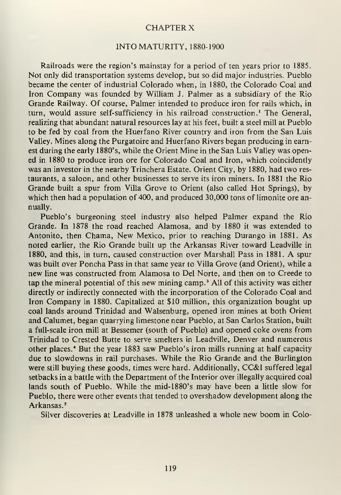
CHAPTER X
INTO MATURITY, 1880-1900
Railroads were the region's mainstay for a period of ten years prior to 1885.
Not only did transportation systems develop, but so did major industries. Pueblo
became the center of industrial Colorado when, in 1880, the Colorado Coal and
Iron Company was founded by William J. Palmer as a subsidiary of the Rio
Grande Railway. Of course, Palmer intended to produce iron for rails which, in
turn, would assure self-sufficiency in his railroad construction.1 The General,
realizing that abundant natural resources lay at his feet, built a steel mill at Pueblo
to be fed by coal from the Huerfano River country and iron from the San Luis
Valley. Mines along the Purgatoire and Huerfano Rivers began producing in earn-
est during the early 1880's, while the Orient Mine in the San Luis Valley was open-
ed in 1880 to produce iron ore for Colorado Coal and Iron, which coincidently
was an investor in the nearby Trinchera Estate. Orient City, by 1880, had two res-
taurants, a saloon, and other businesses to serve its iron miners. In 1881 the Rio
Grande built a spur from Villa Grove to Orient (also called Hot Springs), by
which then had a population of 400, and produced 30,000 tons of limonite ore an-
nually.
Pueblo's burgeoning steel industry also helped Palmer expand the Rio
Grande. In 1878 the road reached Alamosa, and by 1880 it was extended to
Antonito, then Chama, New Mexico, prior to reaching Durango in 1881. Asnoted earlier, the Rio Grande built up the Arkansas River toward Leadville in
1880, and this, in turn, caused construction over Marshall Pass in 1881. A spur
was built over Poncha Pass in that same year to Villa Grove (and Orient), while a
new line was constructed from Alamosa to Del Norte, and then on to Creede to
tap the mineral potential of this new mining camp. 3 All of this activity was either
directly or indirectly connected with the incorporation of the Colorado Coal and
Iron Company in 1880. Capitalized at $10 million, this organization bought up
coal lands around Trinidad and Walsenburg, opened iron mines at both Orient
and Calumet, began quarrying limestone near Pueblo, at San Carlos Station, built
a full-scale iron mill at Bessemer (south of Pueblo) and opened coke ovens from
Trinidad to Crested Butte to serve smelters in Leadville, Denver and numerous
other places.4 But the year 1883 saw Pueblo's iron mills running at half capacity
due to slowdowns in rail purchases. While the Rio Grande and the Burlington
were still buying these goods, times were hard. Additionally, CC&I suffered legal
setbacks in a battle with the Department of the Interior over illegally acquired coal
lands south of Pueblo. While the mid- 1 880' s may have been a little slow for
Pueblo, there were other events that tended to overshadow development along the
Arkansas. 5
Silver discoveries at Leadville in 1878 unleashed a whole new boom in Colo-
119
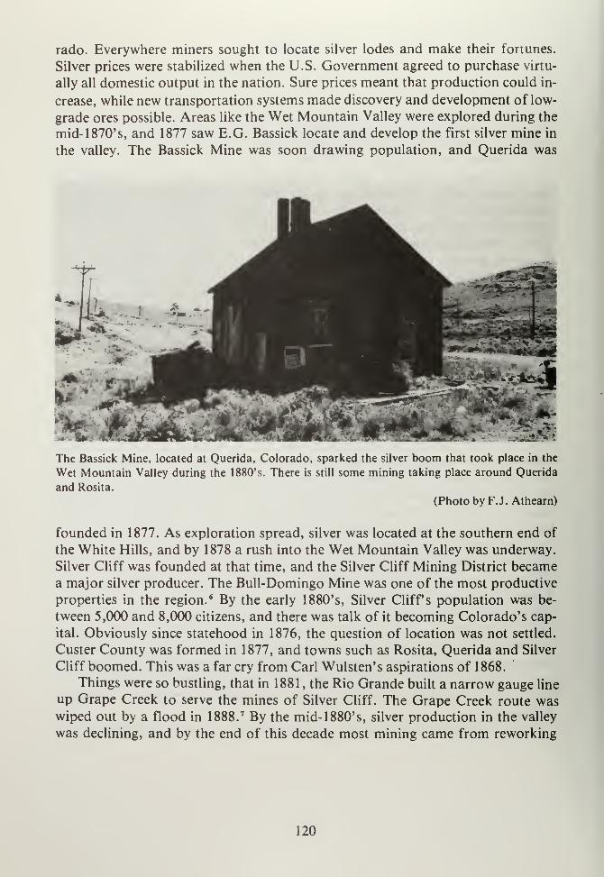
rado. Everywhere miners sought to locate silver lodes and make their fortunes.
Silver prices were stabilized when the U.S. Government agreed to purchase virtu-
ally all domestic output in the nation. Sure prices meant that production could in-
crease, while new transportation systems made discovery and development of low-
grade ores possible. Areas like the Wet Mountain Valley were explored during the
mid-1870's, and 1877 saw E.G. Bassick locate and develop the first silver mine in
the valley. The Bassick Mine was soon drawing population, and Querida was
*•-*
The Bassick Mine, located at Querida, Colorado, sparked the silver boom that took place in the
Wet Mountain Valley during the 1880's. There is still some mining taking place around Querida
and Rosita.
(Photo by F.J. Athearn)
founded in 1877. As exploration spread, silver was located at the southern end of
the White Hills, and by 1878 a rush into the Wet Mountain Valley was underway.
Silver Cliff was founded at that time, and the Silver Cliff Mining District becamea major silver producer. The Bull-Domingo Mine was one of the most productive
properties in the region. 6 By the early 1880's, Silver Cliff's population was be-
tween 5,000 and 8,000 citizens, and there was talk of it becoming Colorado's cap-
ital. Obviously since statehood in 1876, the question of location was not settled.
Custer County was formed in 1877, and towns such as Rosita, Querida and Silver
Cliff boomed. This was a far cry from Carl Wulsten's aspirations of 1868.
Things were so bustling, that in 1881 , the Rio Grande built a narrow gauge line
up Grape Creek to serve the mines of Silver Cliff. The Grape Creek route waswiped out by a flood in 1888. 7 By the mid- 1880's, silver production in the valley
was declining, and by the end of this decade most mining came from reworking
120
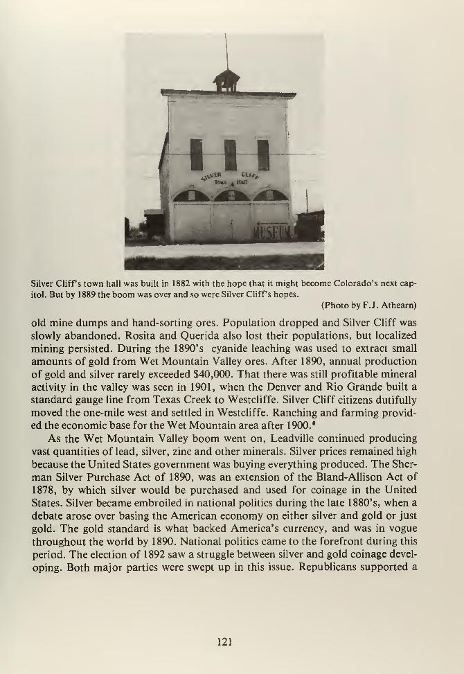
Silver Cliffs town hall was built in 1882 with the hope that it might become Colorado's next cap-
itol. But by 1889 the boom was over and so were Silver Cliffs hopes.
(Photo by F.J. Athearn)
old mine dumps and hand-sorting ores. Population dropped and Silver Cliff was
slowly abandoned. Rosita and Querida also lost their populations, but localized
mining persisted. During the 1890's cyanide leaching was used to extract small
amounts of gold from Wet Mountain Valley ores. After 1890, annual production
of gold and silver rarely exceeded $40,000. That there was still profitable mineral
activity in the valley was seen in 1901, when the Denver and Rio Grande built a
standard gauge line from Texas Creek to Westcliffe. Silver Cliff citizens dutifully
moved the one-mile west and settled in Westcliffe. Ranching and farming provid-
ed the economic base for the Wet Mountain area after 1900. 8
As the Wet Mountain Valley boom went on, Leadville continued producing
vast quantities of lead, silver, zinc and other minerals. Silver prices remained high
because the United States government was buying everything produced. The Sher-
man Silver Purchase Act of 1890, was an extension of the Bland-Allison Act of
1878, by which silver would be purchased and used for coinage in the United
States. Silver became embroiled in national politics during the late 1880's, when a
debate arose over basing the American economy on either silver and gold or just
gold. The gold standard is what backed America's currency, and was in vogue
throughout the world by 1890. National politics came to the forefront during this
period. The election of 1892 saw a struggle between silver and gold coinage devel-
oping. Both major parties were swept up in this issue. Republicans supported a
121
"solid" gold standard, while Democrats were split. Some factions favored gold,
while others wanted "soft money" in the form of both silver and gold backing.
To further confuse the issue, a third party appeared in 1892. 8 The People's Party,
or more commonly the Populist Party, arose during the late 1880's in protest to
big business, corrupt government and inequitable distribution of the national
wealth. The Populists were mostly farmers and small businessmen who wanted
basic reforms, like the secret ballot, recall, referendum, graduated income tax,
regulation of the railroads and other rights that we assume today. Among the
Populist Party's demands was a silver-gold standard at a ratio of 16 to 1. This, of
course, was popular in Colorado. 9
The battle reached its climax during the election of 1896. Populists "fused"
with the Democratic ticket and William Jennings Bryan was nominated as a silver
candidate. William McKinley was chosen as Republican standard bearer, and the
fight was on. Colorado, for one, was convinced that right-seeing voters would
cast aside McKinley and turn the country into a silver-based, reform-minded
nation. So deeply divided were the national parties, that in Colorado the Repub-
licans formed a Silver-Republican party that supported the national party's plat-
form except for the gold standard. The Colorado situation was further complica-
ted by a strong Populist Party. Davis P. Waite of Aspen had been elected Populist
governor in 1892. His attempts at reform were generally not successful, and he
became involved in several violent disputes that revolved around mining. Waite
also had the misfortune of being in office when the Panic of 1893 wiped out Colo-
rado's silver industry. 10 Waite was involved in a bitter strike at Cripple Creek dur-
ing 1894, when miners went out seeking better pay and shorter hours, not to men-
tion union recognition. The Western Federation of Miners (WFM) led this strike,
and, while Waite' s sympathy was with the miners, he sent in the state militia to re-
store order, benefitting local mineowners. 11
Ironically, Cripple Creek was the one mining district that survived the crash of
1893. First staked in 1890 by Bob Womack, these claims precipitated a gold rush
resulting in creation of the Cripple Creek Mining District on April 5, 1891. The
region west of Colorado Springs and on the backside of Pike's Peak turned out to
be one of the richest gold-bearing areas in Colorado. What was unique about
Cripple Creek was that the gold was locked in volcanic rock with certain areas of
vugs that were amazingly rich. In late 1891, a town site was laid out by Horace
Bennett and Julius Myers. They named the eighty-acre site Fremont. The next
year another 120 acres were platted and called Cripple Creek. By February 1893,
the two townsites had merged into modern-day Cripple Creek. In 1893, the towngot electricity, a sewer system and water works. By the end of that same year, tele-
phone service to Colorado Springs was in place. Cripple Creek was a legendary
boom town drawing thousands of miners into the region. 12 Other towns arose
around Pike's Peak. Victor was founded in 1893 and soon became a "rival" to
Cripple Creek's claim as the last great gold rush town. Smaller settlements served
122
specific mines. Anaconda, Gillette, Goldfield and Independence all represented
home to miners whose livelihood was nearby.
As fast as towns were built and as mines produced, construction of roads into
the district began. Early routes into the gold camp included a wagon road from
the Colorado Midland stations at Divide and Florissant while an El Paso Countyroad called the Bear Creek Road ran south of Pike's Peak into the area. In 1892,
several Florence businessmen created the Florence and Cripple Creek Free RoadCompany and opened a road up Eight Mile (Phantom) Canyon. Rivals quickly
built a toll road up Four Mile (Oil) Creek from Canon City to Cripple Creek. The"Shelf Road" was used by Dave Wood, one of southwestern Colorado's most
prominant early freighters, to haul goods into the newborn mining camps. 13 Wa-gon roads helped move goods into the booming region and to cart ores for smelt-
ing at Pueblo, Colorado Springs, Denver and even Leadville. But transportation
was not cheap. As in earlier days, railroads raced for Cripple Creek and the mil-
lions of dollars worth of ores to be transported.
Right behind the wagon roads, rail companies sought to connect the place with
steel. In late 1891, the Midland Terminal (MT) was incorporated to build a line
from the Colorado Midland at Divide. A series of problems, including finances
and being forced to rebuild the entire road from narrow gauge to standard gauge
kept the MT out of Cripple Creek until 1895. On the other hand, David H. Moffat
of Caribou, Colorado fame, determined to tap the riches of Pike's Peak, began
construction on the Florence and Cripple Creek (F&CC) in late 1893. Wishing to
win this race, Moffat threw 1750 men into the fray and proceeded up PhantomCanyon, reaching the district on July 1 , 1894. The F&CC reaped the windfall rev-
enues in the absence of competition. W.S. Stratton's Independence Mine, David
Moffat's own extensive holdings, and numerous other operations were all served
by the F&CC. The Midland Terminal did not reach Cripple Creek until December
1895, hence ending the F&CC's monopoly. 14
These two major connecting lines then built feeders throughout Teller County.
F&CC's subsidiary, the Golden Circle Railroad, built from Victor to Altman and
then down Squaw Creek into Cripple Creek, thus tapping Battle Mountain's
mines. Other short lines, like the Cripple Creek District Railway (CCD), were
built in 1898 from Cripple Creek to Midway by way of Poverty Gulch. With these
two roads fighting over ore haulage, competition was restored. Mills at Denver,
Colorado Springs, and Pueblo vied for the right to process Cripple Creek ores. In
order to capture this market, Denver investors organized the Denver and
Southwestern Railroad (D&SW) as a holding company. This corporation control-
led both the F&CC and the Midland Terminal, along with various short lines. As a
result, ore was diverted to Florence, where Denver interests had major invest-
ments in mills and smelters. Once again, a monopoly existed.15 Colorado Springs
businessmen immediately objected to this diversion of trade. Mine owners like
W.S. Stratton, Irving Howbert, Frank Woods, and others formed the Colorado
123
Springs and Cripple Creek District Railway (CS&CCD) in 1899 to combat the
D&SW. This new line ran from the Springs to Cripple Creek and then later to
Victor. The railway was electrified and carried both freight and passengers. This
line cost $4.5 million to build and was the most expensive railroad in Colorado to
date.16
While the Cripple Creek gold boom turned the area into a thriving metropolis
of 25,000, creating in turn, Teller County in 1899, all was not well in the gold
fields. Fire swept Cripple Creek during 1896, after which the city was rebuilt in
brick. Victor fell victim to fire in 1899, when the business district was wiped out.
Despite these setbacks Cripple Creek produced considerable gold during its first
ten years. From 1899 to 1902, mining output declined as it became harder to find
the precious mineral. In addition, labor unrest by the Western Federation of Min-
ers led to bloody strikes in 1903, climaxing in the Independence (Mine) station
bombing that killed 13 miners and set off violent retributions. The state militia
was sent in to restore order and the strike was broken in early 1904. Not only did
the District's miners pay a heavy price, so too did the mineowners, for production
never recovered. 17 Another major problem that Cripple Creek's mines faced was
continual water seepage. The El Paso Tunnel, built in 1903, was intended to drain
part of the mines. Others followed, like the Roosevelt Tunnel in 1908, and later
the Carlton Tunnel. These improvements, along with a new cyanide roasting pro-
cess kept Cripple Creek's mines going up to World War I. By 1917, total cumula-
tive production was $293,202,811; not bad for a place that twenty-five years
earlier was a cow pasture. 18 Cripple Creek might have been Colorado's mineral
savior during the Panic of 1893, but it was not all that went on in the southeast
corner of the state.
Agriculture developed to a point of major contribution during the 1880's and1890's. The Arkansas River, near Canon City, provided water for Colorado's
first orchards, dating to 1869. Irrigation, it was soon discovered, was needed to
provide upland benches with water. The riverbottom itself may have been fertile,
but there was precious little of it. Ditches were dug during the 1870's to water fruit
orchards, like "Dall" DeWeese's nursery at Canon City. DeWeese offered not
only fruit trees, but also 500,000 shade trees and 300,000 ornamental shrubs for
the many homeowners in Denver, Colorado Springs and Pueblo. Water projects
along the Upper Arkansas included the Missouri Park Ditch, the Hill and Sprague
Ditch, the Willowdale Ditch, and several others. At one time, Chaffee county's
pear and bean production was second only to Conejos and Otero counties. 19
Irrigation along the Arkansas River, below Pueblo, provided homesteaders with
an opportunity to raise crops like hay, onions, peas, wheat and corn. These agri-
cultural enterprises were the underpinnings of towns along the river from LaJunta to Lamar. They all became agricultural service centers. Not only was water
divertable, but local railroad transportation could haul goods east or west. TheSanta Fe provided monopolistic service until 1887, when the Missouri Pacific
124
Railroad reached Pueblo from St. Louis. 20 Now that city was connected to the
east by two mainline railroads and agriculture was able to gain a solid foothold,
thanks to these events. Thousands of homestead applications were filed during
this period on the southeastern plains. From 1861 to 1961, 22,140,000 acres of
public lands went into private hands in Colorado alone. Of this, considerable
acreage along the Arkansas was put to the plow from 1880 to 1920. As settlers
moved away from the river, they found that the land was not suitable for agricul-
ture as practiced in the mid-west.
Dryland farming became a way of life during the 1890's in southeastern Colo-
rado. Since there was not much natural moisture, farmers depended on soil reten-
tion and winter snowfall to keep the ground wet enough to grow wheat. The turn-
ing point for dryland farmers was the introduction of strains from the Ukraine
that could withstand both droughts and wind. These "Turkey Red" wheats were a
boon to great plains farmers, who soon planted every available acre in "dryland"
wheat. The advent of so-called "suitcase farmers" caused massive problems, like
When the Missouri Pacific arrived in the 1880's, the area north of the Arkansas River was opened
to homesteading. Towns like Eads, Arlington and Sugar City were founded. Today, the Missouri
Pacific hauls coal unit trains to St. Louis.
(Photo by F.J. Athearn)
soil erosion due to gross overplanting and considerable overproduction on the
plains. Once the virgin topsoil was disturbed, nature, in the form of wind and
drought, blew millions of tons of soil eastward. The Federal Government, in an
effort to populate the arid plains, ignored warnings about dryland damage and
encouraged farmers further by enlarging the amount of acreage available through
125
The rather large schoolhouse at Arlington, Colorado is testimony to the size of the last homestead-
ing boom. Now the town and its citizens are gone.
(Photo by F.J. Athearn)
homesteading. In 1909 the Enlarged Homestead Act provided for 320 acres while
the Stockraising Homestead Act of 1916 raised farm sizes to 640 acres. The hopewas that 640 acres would also encourage grazing on the plains.
21
Water, of course, was the key to farming success on Colorado's eastern plains.
The national government, in efforts to encourage irrigation, sponsored the
Carey Land Act of 1894, by which up to 1,000,000 acres of public domain could
be given to individual States for irrigation projects. This effort was a dismal fail-
ure, for the states were unable to manage the various "Land and Irrigation" com-
panies that cropped up, and in the end, almost no acres were irrigated.22
Irrigation
got a serious boost in 1902, with the passage of the Newlands Act. A Reclamation
Fund was established to help water users build dams and canals to irrigate farm
lands that hitherto were unusable. The Reclamation Service was formed to
oversee these projects. Southeast Colorado was not generally affected by the New-lands Act for most local canals and dams were already in place. However, during
the 1950's the U.S. Army Corps of Engineers became an important force along
the Arkansas River. 23
Irrigation for agriculture actually had its start in the San Luis Valley during
the 1850's. Logically, the Valley continued to be the leader in irrigation projects in
southeastern Colorado. The 1880's saw a proliferation of canals in the central
valley when such projects as the Travelers Canal, the Monte Vista Canal and the
Empire Canal were all built with eastern capital. They tapped the Rio Grande's
seemingly endless water. The 1880's were a period of canal building by corpor-
ations rather than by individuals or the government. Both British and American
126
companies put up the money to build ditches in the hope that they would not only
make a profit, but that the lands around these canals would become more and
more valuable. Of course, some major landholders in the area were the very same
companies that held mortgages on the ditches. That many such projects were not
small in nature was seen in the fact that during 1887 the La Junta and LamarCanals were both enlarged and reincorporated as the Fort Lyon Canal Company.This organization built canals off the Arkansas River to the point that the Fort
Lyon Canal was over 113 miles long, forty- five feet wide and six and one-half feet
deep. It is still the major water carrier for the river.24
Irrigation and dryland farming notwithstanding, agriculture continued to
dominate the San Luis Valley, the lower Arkansas Valley, and South Park. Hayand cattle were South Park's main products, while the San Luis Valley provided
beans, vegetables, corn and other staples. The 1890's saw a dramatic change in
crop production throughout the Arkansas drainage with the introduction of sugar
beets. Beets were a well-known European crop and became popular in Colorado
The sugar beet boom that took place at the turn of the century, lasted until the 1970's. But there
are many abandoned sugar processing plants along the Arkansas now. This plant at La Junta was
converted into a warehouse.
(Photo by F.J. Athearn)
during the 1890's as a cash crop. Sugar beets were first planted on the west slope,
in the Grand Valley, which is also where Colorado's first sugar beet plant was
erected in 1899. Then, "beet fever" spread like wildfire. Soon thousands of ir-
rigated acres were planted along the Arkansas and South Platte Rivers. Water was
the key to sugar beets, and where there was an abundance, sugar beet plants were
built. John Campion, of Leadville, and Charles Boettcher, of Denver, were
127
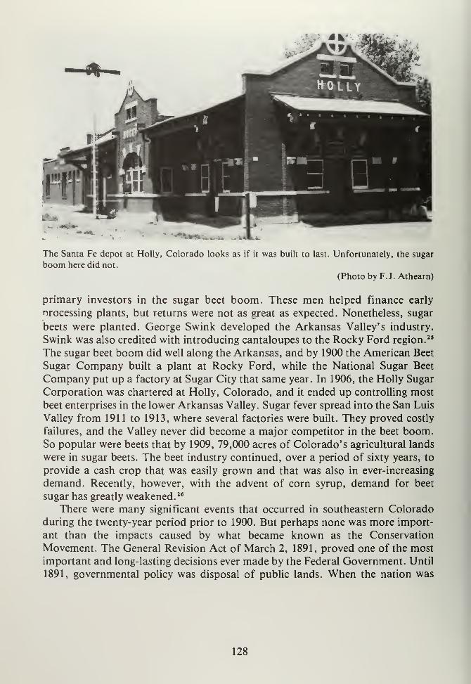
The Santa Fe depot at Holly, Colorado looks as if it was built to last. Unfortunately, the sugar
boom here did not.
(Photo by F.J. Athearn)
primary investors in the sugar beet boom. These men helped finance early
nrocessing plants, but returns were not as great as expected. Nonetheless, sugar
beets were planted. George Swink developed the Arkansas Valley's industry.
Swink was also credited with introducing cantaloupes to the Rocky Ford region."
The sugar beet boom did well along the Arkansas, and by 1900 the American Beet
Sugar Company built a plant at Rocky Ford, while the National Sugar Beet
Company put up a factory at Sugar City that same year. In 1906, the Holly Sugar
Corporation was chartered at Holly, Colorado, and it ended up controlling most
beet enterprises in the lower Arkansas Valley. Sugar fever spread into the San Luis
Valley from 1911 to 1913, where several factories were built. They proved costly
failures, and the Valley never did become a major competitor in the beet boom.So popular were beets that by 1909, 79,000 acres of Colorado's agricultural lands
were in sugar beets. The beet industry continued, over a period of sixty years, to
provide a cash crop that was easily grown and that was also in ever-increasing
demand. Recently, however, with the advent of corn syrup, demand for beet
sugar has greatly weakened. 26
There were many significant events that occurred in southeastern Colorado
during the twenty-year period prior to 1900. But perhaps none was more import-
ant than the impacts caused by what became known as the Conservation
Movement. The General Revision Act of March 2, 1891, proved one of the most
important and long-lasting decisions ever made by the Federal Government. Until
1891, governmental policy was disposal of public lands. When the nation was
128
founded, hundreds of millions of acres lay in a state of wilderness. To encouragesettlement and to help pay for government, vacant land was sold for $1.25 per
acre. War veterans were given free land. This system was under the supervision of
the General Land Office (GLO) from 1812 to 1946. Disposal of the public domainwas considered essential for development by farmers, miners, businessmen andothers who would buy cheap land, improve it and help expand the United States
into the West. The Homestead Act of 1862 provided for "free" lands. Now, set-
tlers could improve 160 acres over a five-year period and then the land would be
deeded to the claimant. This policy resulted in legislation such as the Desert LandAct, the Timber Culture Act, and various other incentives for settlers in the west
to take up land. In addition, millions more acres of public land were used for
grants to various railroad companies, that used them to pay for construction costs
by selling the land or using it as collateral. Perhaps the most famous grant wasthat of the Union Pacific (Transcontinental) Railroad across Nebraska andWyoming. 27
As the West developed, mining, lumbering, farming and ranching took their
tolls on public lands. Cattlemen overgrazed, miners stripped back the soil,
lumbermen denuded hillsides, and farmers plowed under virgin grass. During the
1890's, the Populist movement, so actively involved in the Silver Crusade andother reform efforts, also promoted awareness of natural resources and our en-
vironment. For years, concerned citizens expressed outrage over the devastation
of western lands. Primarily eastern in nature, these complaints were finally heard
in Washington. In March, 1891, the General Revision Act authorized the Presi-
dent "to reserve any part of the public lands" and to establish boundaries for
these withdrawals. President Benjamin Harrison, on October 16, 1891, took ad-
vantage of the act and withdrew about 1,200,000 acres in Colorado. The White
River Timber Reserve was the first such withdrawal in this state, and it caused an
incredible uproar in the West. Cattlemen, in particular, protested that they could
no longer graze freely. Miners cried that they would be shut out of the public
lands (which was and is not true) and timber interests decried the loss of forest
lands. Nevertheless, in 1892 the Pike's Peak Timber Land Reserve was created
from 184,320 acres in the Rampart Range country. In late 1892, Harrison also
withdrew the South Platte Timber Reserve consisting of 683,520 acres in Park,
Summit and Chaffee Counties. This was done to preserve and protect Denver's
South Platte watershed. 28
In two short years, conservationists had won stunning victories. After these
first withdrawals, a five-year period of nonuse lapsed before the Federal Govern-
ment undertook active administration. In 1897, the Department of the Interior
was designated forest manager, and rules were drafted to permit land use. Thetimber forest reserves were unlocked and locals could again use the land. Live-
stock grazing (excluding sheep) and water for irrigation was allowed. Homestead-
ing and timbering were not. Nevertheless, sawmills operated openly in places like
129
Florissant and Puma City without much Federal interference. Cattlemen adjust-
ed to the new regulations, and generally the furor over forest withdrawals calmeddown. 29 What destroyed the uneasy peace was the implementation of grazing
permits in 1900 by Interior's General Land Office. Now to use the reserves, cattle-
men had to have permits. What was worse, sheep were permitted to use forest
grazing lands, too. These new rules drove cattlemen into the anti-conservation
ranks almost to a man. Despite outcries from users and politicians like Henry M.Teller and Thomas Patterson, President Theodore Roosevelt, in 1902, created the
San Isabel Forest Reserve, consisting of 77,980 acres in Fremont, Custer, Huer-
fano and Saguache Counties. Roosevelt, a hard-core conservationist, ignored pro-
tests by western ranchers and land users, proceeding to create the San Juan Forest
Reserve in June 1902. This withdrawal consisted of 1,437,406 acres west of the
Continental Divide, including the eastern side of the San Luis Valley and the Rio
Grande watershed. Amid more howls of anguish, Roosevelt withdrew 1,129,947
acres in the Leadville Forest Reserve during May 1905. This massive forest ex-
tended from the Continental Divide to Central City, and from Idaho Springs back
to Leadville. In addition, the Pike Forest Reserve was created from the older
South Platte, Plum Creek and Pike's Peak Timber Reserves in 1905. In June of
that year, the Wet Mountain Reserve of 239,251 acres was created, and one day
later, on June 13, 1905, the Cochetopah Forest Reserve was withdrawn. TheCochetopah consisted of 1,333,300 acres and extended from Salida on the east to
Creede on the west. 30 The year 1905 was the last of the massive Colorado with-
drawals. Interior lost administration of these lands, and they were transferred to
the Department of Agriculture in 1905. The Forest Service was created, and cattle-
men, forced to pay grazing fees since 1900, took out their hostilities on the new
Forest Rangers, who literally defied death enforcing the rules. Despite the pro-
tests, fears that the timber and cattle businesses would be wiped out, and resent-
ment toward the Federal Government, the forest reserves stuck. From the various
timber reserves evolved today's present National Forest system, and most of the
acreage withdrawn at the turn of the century is still in Federal hands.
The significance of forest withdrawals lies not only in the fact that the Federal
Government became a permanent landlord in the western states, but also that mil-
lions of acres were removed from homestead entry. A Public Lands Convention
held at Denver in 1907 deplored the closing of the frontier, but the reserves pre-
vailed. Now, if a settler wanted to homestead, it would have to be on the arid east-
ern plains. This is precisely where the last great settlements occurred a few years
later. The timber reserves changed, for all time, settlement patterns and develop-
ment in southeast Colorado. From this time on, the region's growth and develop-
ment were locked firmly by the location of forest reserves. By changing govern-
mental policy from total disposal to conservation and retention, Colorado's (and
the entire West's) destiny was turned and fixed in a new direction.
130
NOTES
CHAPTER X
1. H. Lee Scamehorn, Pioneer Steelmaker in the West (Boulder: Pruett, 1976),
p. 4.
2. Ibid., p. 50, and Athearn, Rio Grande, p. 123.
3. Athearn, ibid., p. 106. See also: Robert A. LeMassena, Rio Grande... to the
Pacific (Denver: Sundance, 1978.)
4. Scamehorn, op. cit., p. 45,46, 48.
5. Ibid., p. 52.
6. Samuel F. Emmons, "The Mines of Custer County, Colorado," in WhitmanCross (ed.), Geology of the Silver Cliff and Rosita Hills, Colorado District
(Washington, DC: GPO, 1896), pp. 412-413. Also: Gayle Turk, The Wet
Mountain Valley (Colorado Springs, Colorado: Little London Press, 1976.)
7. William Rathbun and Ed Bathke, "Bassick and His Wonderful Mine," Den-
ver Westerners Brandbook (Denver: Westerners, Inc., 1964), pp. 319-349.
8. Percy S. Fritz, Colorado the Centennial State (New York: Prentice-Hall,
1941), pp. 349-351. and Ubbelohde, Benson and Smith, op. cit., p. 220.
9. Fritz, ibid., p. 352.
10. Ibid., pp. 353-354, and Ubbelohde, Benson and Smith, op. cit., p. 221.
11. George Suggs, Colorado's War of Militant Unionism (Detroit: Wayne State
University Press, 1972), p. 17 and pp. 45-64, also Emma Langdon, The Crip-
ple Creek Strike of 1903-1904 (Victor: Victor Daily Record, 1904.)
12. Muriel S. Wolle, Stampede to Timberline (Denver: Sage, 1949), pp. 452-453;
Frank Waters, Midas of the Rockies (Denver: Denver University Press, 1949);
Edgar C. McMechan, "The Founding of Cripple Creek," Colorado Mag-
azine, 12, (1935), pp. 28-29; Geology and Mining Industries of the Cripple
Creek District, Colorado (Washington, DC: GPO, 1895); Catherine Rinker,
"History of Cripple Creek, Colorado, 1891-1917," (M.A. Thesis, University
of Colorado, 1934), and Leland Feitz, Cripple Creek: A Quick History of
131
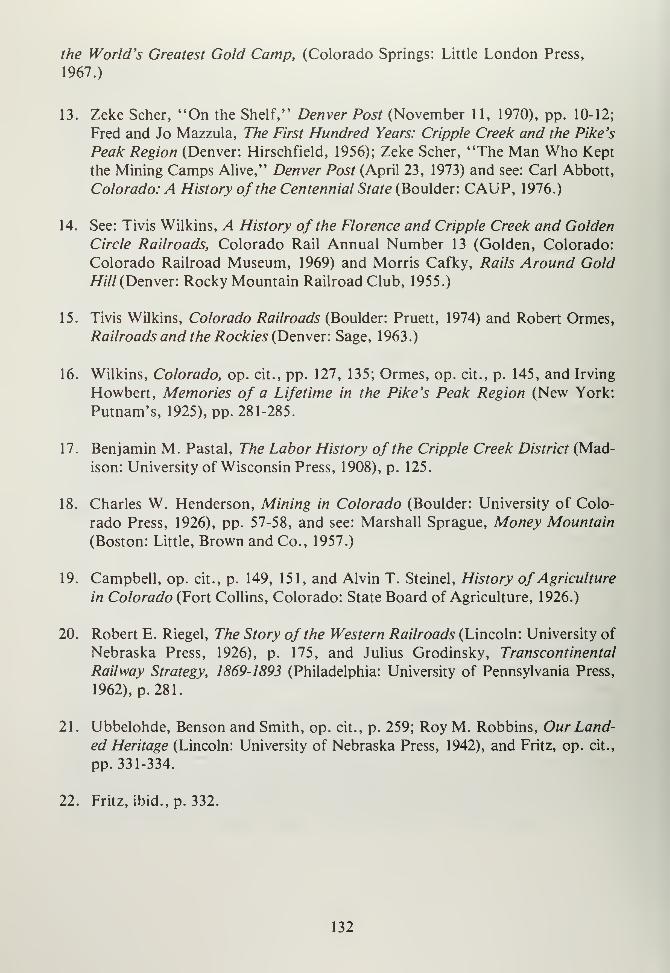
the World's Greatest Gold Camp, (Colorado Springs: Little London Press,
1967.)
13. Zeke Scher, "On the Shelf," Denver Post (November 11, 1970), pp. 10-12;
Fred and Jo Mazzula, The First Hundred Years: Cripple Creek and the Pike's
Peak Region (Denver: Hirschfield, 1956); Zeke Scher, "The Man Who Kept
the Mining Camps Alive," Denver Post (April 23, 1973) and see: Carl Abbott,
Colorado: A History of the Centennial State (Boulder: CAUP, 1976.)
14. See: Tivis Wilkins, A History of the Florence and Cripple Creek and Golden
Circle Railroads, Colorado Rail Annual Number 13 (Golden, Colorado:
Colorado Railroad Museum, 1969) and Morris Cafky, Rails Around GoldHill (Denver: Rocky Mountain Railroad Club, 1955.)
15. Tivis Wilkins, Colorado Railroads (Boulder: Pruett, 1974) and Robert Ormes,
Railroads and the Rockies (Denver: Sage, 1963.)
16. Wilkins, Colorado, op. cit., pp. 127, 135; Ormes, op. cit., p. 145, and Irving
Howbert, Memories of a Lifetime in the Pike's Peak Region (New York:
Putnam's, 1925), pp. 281-285.
17. Benjamin M. Pastal, The Labor History of the Cripple Creek District (Mad-
ison: University of Wisconsin Press, 1908), p. 125.
18. Charles W. Henderson, Mining in Colorado (Boulder: University of Colo-
rado Press, 1926), pp. 57-58, and see: Marshall Sprague, Money Mountain
(Boston: Little, Brown and Co., 1957.)
19. Campbell, op. cit., p. 149, 151, and Alvin T. Steinel, History of Agriculture
in Colorado (Fort Collins, Colorado: State Board of Agriculture, 1926.)
20. Robert E. Riegel, The Story of the Western Railroads (Lincoln: University of
Nebraska Press, 1926), p. 175, and Julius Grodinsky, Transcontinental
Railway Strategy, 1869-1893 (Philadelphia: University of Pennsylvania Press,
1962), p. 281.
21. Ubbelohde, Benson and Smith, op. cit., p. 259; Roy M. Robbins, Our Land-
ed Heritage (Lincoln: University of Nebraska Press, 1942), and Fritz, op. cit.,
pp. 331-334.
22. Fritz, ibid., p. 332.
132
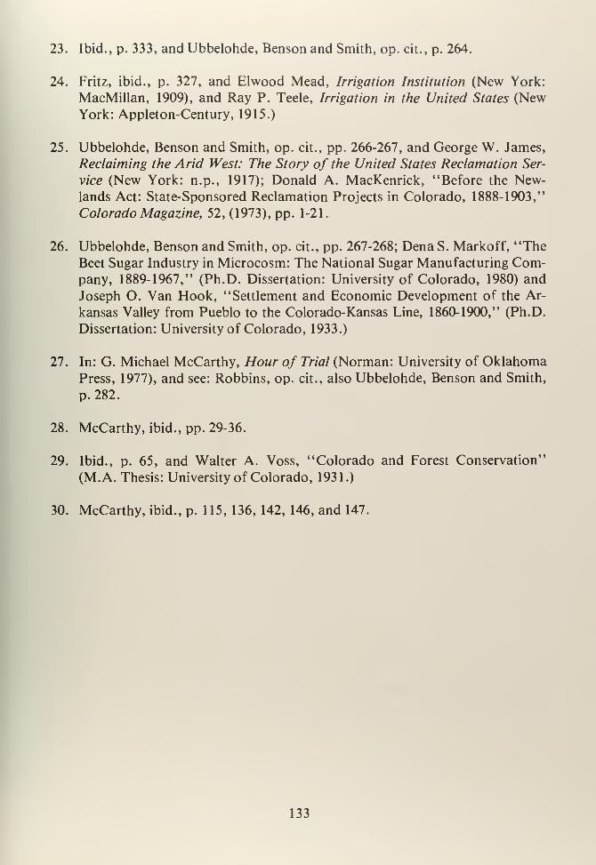
23. Ibid., p. 333, and Ubbelohde, Benson and Smith, op. cit., p. 264.
24. Fritz, ibid., p. 327, and Elwood Mead, Irrigation Institution (New York:
MacMillan, 1909), and Ray P. Teele, Irrigation in the United States (NewYork: Appleton-Century, 1915.)
25. Ubbelohde, Benson and Smith, op. cit., pp. 266-267, and George W. James,
Reclaiming the Arid West: The Story of the United States Reclamation Ser-
vice (New York: n.p., 1917); Donald A. MacKenrick, "Before the New-lands Act: State-Sponsored Reclamation Projects in Colorado, 1888-1903,"
Colorado Magazine, 52, (1973), pp. 1-21.
26. Ubbelohde, Benson and Smith, op. cit., pp. 267-268; Dena S. Markoff, "TheBeet Sugar Industry in Microcosm: The National Sugar Manufacturing Com-pany, 1889-1967," (Ph.D. Dissertation: University of Colorado, 1980) and
Joseph O. Van Hook, "Settlement and Economic Development of the Ar-
kansas Valley from Pueblo to the Colorado-Kansas Line, 1860-1900," (Ph.D.
Dissertation: University of Colorado, 1933.)
27. In: G. Michael McCarthy, Hour of Trial (Norman: University of OklahomaPress, 1977), and see: Robbins, op. cit., also Ubbelohde, Benson and Smith,
p. 282.
28. McCarthy, ibid., pp. 29-36.
29. Ibid., p. 65, and Walter A. Voss, "Colorado and Forest Conservation"
(M.A. Thesis: University of Colorado, 1931.)
30. McCarthy, ibid., p. 1 15, 136, 142, 146, and 147.
133


CHAPTER ELEVEN
135

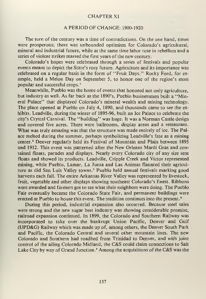
CHAPTER XI
A PERIOD OF CHANGE: 1900-1920
The turn of the century was a time of contradictions. On the one hand, times
were prosperous; there was unbounded optimism for Colorado's agricultural,
mineral and industrial future, while at the same time labor rose in rebellion and a
series of violent strikes marred the first years of the new century.
Colorado's hopes were celebrated through a series of festivals and popular
events meant to depict the State's rosy future. Agriculture and its importance was
celebrated on a regular basis in the form of "Fruit Days." Rocky Ford, for ex-
ample, held a Melon Day on September 5, to honor one of the region's most
popular and successful crops. 1
Meanwhile, Pueblo was the home of events that honored not only agriculture,
but industry as well. As far back as the 1890's, Pueblo businessmen built a "Min-eral Palace" that displayed Colorado's mineral wealth and mining technology.
The place opened at Pueblo on July 4, 1890, and thousands came to see the ex-
hibits. Leadville, during the winter of 1895-96, built an Ice Palace to celebrate the
city's Crystal Carnival. The "building" was huge. It was a Norman Castle design
and covered five acres. There were ballrooms, display areas and a restaurant.
What was truly amazing was that the structure was made entirely of ice. The Pal-
ace melted during the summer, perhaps symbolizing Leadville' s fate as a mining
center.2 Denver regularly held its Festival of Mountain and Plain between 1895
and 1912. This event was patterned after the New Orleans Mardi Gras and con-
tained floats, parades and displays. Nearly every Colorado city of any size sent
floats and showed its products. Leadville, Cripple Creek and Victor represented
mining, while Pueblo, Lamar, La Junta and Las Animas flaunted their agricul-
ture as did San Luis Valley towns. 3 Pueblo held annual festivals marking good
harvests each fall. The entire Arkansas River Valley was represented by livestock,
fruit, vegetable and other displays showing southeast Colorado's finest. Ribbons
were awarded and farmers got to see what their neighbors were doing. The Pueblo
Fair eventually became the Colorado State Fair, and permanent buildings were
erected at Pueblo to house this event. The tradition continues into the present.4
During this period, industrial expansion also occurred. Because steel sales
were strong and the new sugar beet industry was showing considerable promise,
railroad expansion continued. In 1899, the Colorado and Southern Railway was
incorporated to take over the bankrupt Union Pacific, Denver and Gulf
(UPD&G) Railway which was made up of, among others, the Denver South Park
and Pacific, the Colorado Central and several other mountain lines. The newColorado and Southern had roadbed from Trinidad to Denver, and with joint
control of the ailing Colorado Midland, the C&S could claim connections to Salt
Lake City by way of Grand Junction. 5 Among the acquisitions of the C&S was the
137
Fort Worth and Denver City that ran from Trinidad to Fort Worth, Texas. The
Fort Worth and Denver was connected, in 1907, with the Trinity and Brazos Val-
ley Railroad into Houston. In that year, southeast Colorado had a new transpor-
tation system that connected Pueblo, Trinidad and points north to the Texas Gulf
Coast. 6 This provided new markets for Pueblo's steel, a fact not unnoticed by the
C&S. Also, Arkansas Valley sugar beets, vegetables and other produce could be
shipped south. Equally, passenger service was available from Denver to Houston
by way of Pueblo and Trinidad. The C&S had extensive trackage in Wyoming and
Montana that connected not only Denver, but Pueblo and southeastern Colorado
on a north-south axis. The Chicago, Burlington and Quincy (CB&Q) bought con-
trolling interest in the C&S in 1908 and has retained the line ever since.7 The C&S
bought the Colorado Springs and Cripple Creek Railway in order to tap rich min-
eral markets in Cripple Creek and Victor. The CS&CC hauled ores to large
smelters at Pueblo. By 1910, railroad building in the region ended, but Pueblo was
now connected by four major railroads and southeast Colorado was the scene of
cutthroat competition among these various lines.8
Smelting, along with steel, was one of Pueblo's primary sources of industry.
As early as 1880, Meyer Guggenheim became interested in smelting near Pueblo.
The Colorado Smelting Company opened a plant in 1882 at Pueblo. In 1884,
plans were announced to build another smelter here. The New England and Colo-
rado Mining and Smelting Company opened its facilities in 1885, but it closed a
year later for lack of work. Nevertheless, local smelting was consolidated by
Guggenheim in the late 1880's. This Philadelphia family controlled most smelting
in the region. In 1888, Guggehheim built a new plant at Pueblo after the local
Chamber of Commerce persuaded him to locate in that city.9 By the early 1890's,
copper ores from Arizona and New Mexico were being processed at Pueblo, as
were Leadville, Cripple Creek and Victor silver and gold ores. Pueblo's mills
worked during the 1890's turning out finished materials. The high point of Pueblo
smelting came in 1901, when the industry processed $24.5 million in ores. Fromhere on, milling declined. 10 The situation had changed dramatically in 1899, whenthe American Smelting and Refining Company was created in New Jersey. Amer-ican proceeded to buy up virtually all smelters in the nation, including the Colo-
rado Smelting Company and the Pueblo Smelting Company plants at Pueblo.
One of the combine's backers was Standard Oil of New Jersey.11 The Guggen-
heim's Philadelphia Smelting and Refining Company of Pueblo was not swallow-
ed by the American trust. The family held out against intense pressure to sell. Fin-
ally in 1901, the Guggenheim corporation sold their mills to American Refining
and smelting was monopolized. 12 While the creation of this huge combine was sig-
nificant for mineowners, it was outright ominous for the common working man.
Labor lost its ability to bargain with owners who were physically close to their
plants. Smelting workers found themselves facing a huge, nameless bureaucracy
interested in profits, not people.
138
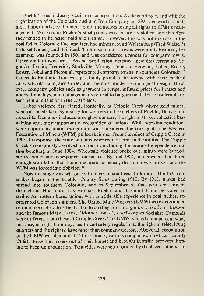
Pueblo's steel industry was in the same position. As demand rose, and with the
organization of the Colorado Fuel and Iron Company in 1892, steelworkers and,
more importantly, coal miners found themselves losing all rights to CF&I's man-agement. Workers in Pueblo's steel plants were relatively skilled and therefore
they tended to be better paid and treated. However, this was not the case in the
coal fields. Colorado Fuel and Iron had mines around Walsenburg (Fred Walsen's
little settlement) and Trinidad. To house miners, towns were built. Primero, for
example, was founded in 1901 and was considered a model for company towns.
Other similar towns arose. As coal production increased, new sites sprang up. Se-
gundo, Tercio, Frederick, Starkville, Morley, Tobasco, Berwind, Toller, Rouse,
Lester, Jobal and Pictou all represented company towns in southeast Colorado. 13
Colorado Fuel and Iron was justifiably proud of its towns, with their medical
care, schools, company stores, and the most modern sociological design. How-ever, company policies such as payment in script, inflated prices for houses and
goods, long days, and management's refusal to bargain made for considerable re-
sentment and tension in the coal fields.
Labor violence first flared, ironically, at Cripple Creek where gold miners
went out on strike in sympathy for workers in the smelters of Pueblo, Denver and
Leadville. Demands included an eight-hour day, the right to strike, collective bar-
gaining and, most importantly, recognition of unions. While working conditions
were important, union recognition was considered the true goal. The Western
Federation of Miners (WFM) pulled their men from the mines of Cripple Creek in
1903. In response, the State, at mineowner request, sent in the militia. The Cripple
Creek strike quickly devolved into terror, including the famous Independence Sta-
tion bombing in June 1904. Wholesale violence broke out; mines were burned,
stores looted and newspapers ransacked. By mid- 1904, mineowners had hired
enough scab labor that the mines were reopened, the union was broken and the
WFM was forced into oblivion. 14
Now the stage was set for coal miners in southeast Colorado. The first coal
strikes began in the Boulder County fields during 1910. By 1913, unrest had
spread into southern Colorado, and in September of that year coal miners
throughout Huerfano, Las Animas, Pueblo and Fremont Counties voted to
strike. An eastern-based union, with considerable experience in coal strikes, re-
presented Colorado's miners. The United Mine Workers (UMW) were determined
to unionize Colorado's fields. To do so they sent in organizers like John Lawson
and the famous Mary Harris, "Mother Jones", a well-known Socialist. Demandswere different from those at Cripple Creek. The UMW wanted a ten percent wage
increase, an eight-hour day, health and safety regulations, the right to select living
quarters and the right to have other than company doctors. Above all, recognition
of the UMW was demanded. 15 In response, various companies, most particularly
CF&I, threw the strikers out of their homes and brought in strike breakers, hop-
ing to keep up production. Tent cities were soon formed by displaced miners, in-
139
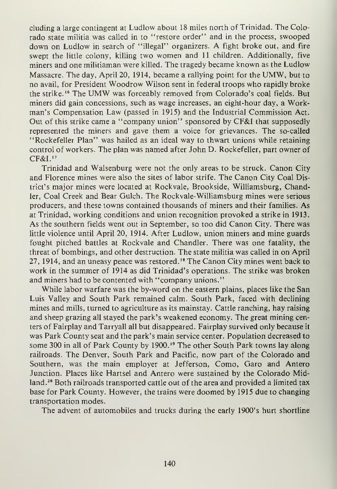
eluding a large contingent at Ludlow about 18 miles north of Trinidad. The Colo-
rado state militia was called in to "restore order" and in the process, swooped
down on Ludlow in search of "illegal" organizers. A fight broke out, and fire
swept the little colony, killing two women and 11 children. Additionally, five
miners and one militiaman were killed. The tragedy became known as the Ludlow
Massacre. The day, April 20, 1914, became a rallying point for the UMW, but to
no avail, for President Woodrow Wilson sent in federal troops who rapidly broke
the strike.16 The UMW was forceably removed from Colorado's coal fields. But
miners did gain concessions, such as wage increases, an eight-hour day, a Work-man's Compensation Law (passed in 1915) and the Industrial Commission Act.
Out of this strike came a "company union" sponsored by CF&I that supposedly
represented the miners and gave them a voice for grievances. The so-called
"Rockefeller Plan" was hailed as an ideal way to thwart unions while retaining
control of workers. The plan was named after John D. Rockefeller, part owner of
CF&I. 17
Trinidad and Walsenburg were not the only areas to be struck. Canon City
and Florence mines were also the sites of labor strife. The Canon City Coal Dis-
trict's major mines were located at Rockvale, Brookside, Williamsburg, Chand-
ler, Coal Creek and Bear Gulch. The Rockvale-Williamsburg mines were serious
producers, and these towns contained thousands of miners and their families. Asat Trinidad, working conditions and union recognition provoked a strike in 1913.
As the southern fields went out in September, so too did Canon City. There was
little violence until April 20, 1914. After Ludlow, union miners and mine guards
fought pitched battles at Rockvale and Chandler. There was one fatality, the
threat of bombings, and other destruction. The state militia was called in on April
27, 1914, and an uneasy peace was restored.18 The Canon City mines went back to
work in the summer of 1914 as did Trinidad's operations. The strike was broken
and miners had to be contented with "company unions."
While labor warfare was the by-word on the eastern plains, places like the San
Luis Valley and South Park remained calm. South Park, faced with declining
mines and mills, turned to agriculture as its mainstay. Cattle ranching, hay raising
and sheep grazing all stayed the park's weakened economy. The great mining cen-
ters of Fairplay and Tarryall all but disappeared. Fairplay survived only because it
was Park County seat and the park's main service center. Population decreased to
some 300 in all of Park County by 1900. 19 The other South Park towns lay along
railroads. The Denver, South Park and Pacific, now part of the Colorado and
Southern, was the main employer at Jefferson, Como, Garo and Antero
Junction. Places like Hartsel and Antero were sustained by the Colorado Mid-
land. 20 Both railroads transported cattle out of the area and provided a limited tax
base for Park County. However, the trains were doomed by 1915 due to changing
transportation modes.
The advent of automobiles and trucks during the early 1900's hurt shortline
140
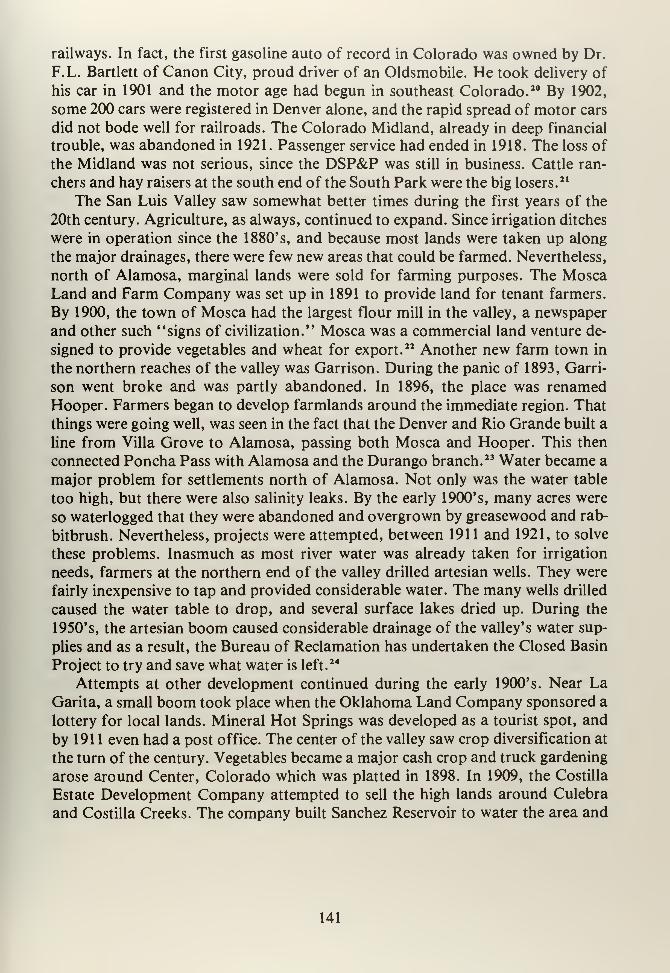
railways. In fact, the first gasoline auto of record in Colorado was owned by Dr.
F.L. Bartlett of Canon City, proud driver of an Oldsmobile. He took delivery of
his car in 1901 and the motor age had begun in southeast Colorado. 20 By 1902,
some 200 cars were registered in Denver alone, and the rapid spread of motor cars
did not bode well for railroads. The Colorado Midland, already in deep financial
trouble, was abandoned in 1921. Passenger service had ended in 1918. The loss of
the Midland was not serious, since the DSP&P was still in business. Cattle ran-
chers and hay raisers at the south end of the South Park were the big losers.21
The San Luis Valley saw somewhat better times during the first years of the
20th century. Agriculture, as always, continued to expand. Since irrigation ditches
were in operation since the 1880's, and because most lands were taken up along
the major drainages, there were few new areas that could be farmed. Nevertheless,
north of Alamosa, marginal lands were sold for farming purposes. The MoscaLand and Farm Company was set up in 1891 to provide land for tenant farmers.
By 1900, the town of Mosca had the largest flour mill in the valley, a newspaper
and other such "signs of civilization." Mosca was a commercial land venture de-
signed to provide vegetables and wheat for export.22 Another new farm town in
the northern reaches of the valley was Garrison. During the panic of 1893, Garri-
son went broke and was partly abandoned. In 1896, the place was renamed
Hooper. Farmers began to develop farmlands around the immediate region. That
things were going well, was seen in the fact that the Denver and Rio Grande built a
line from Villa Grove to Alamosa, passing both Mosca and Hooper. This then
connected Poncha Pass with Alamosa and the Durango branch. 23 Water became a
major problem for settlements north of Alamosa. Not only was the water table
too high, but there were also salinity leaks. By the early 1900's, many acres were
so waterlogged that they were abandoned and overgrown by greasewood and rab-
bitbrush. Nevertheless, projects were attempted, between 1911 and 1921, to solve
these problems. Inasmuch as most river water was already taken for irrigation
needs, farmers at the northern end of the valley drilled artesian wells. They were
fairly inexpensive to tap and provided considerable water. The many wells drilled
caused the water table to drop, and several surface lakes dried up. During the
1950's, the artesian boom caused considerable drainage of the valley's water sup-
plies and as a result, the Bureau of Reclamation has undertaken the Closed Basin
Project to try and save what water is left.24
Attempts at other development continued during the early 1900's. Near LaGarita, a small boom took place when the Oklahoma Land Company sponsored a
lottery for local lands. Mineral Hot Springs was developed as a tourist spot, and
by 191 1 even had a post office. The center of the valley saw crop diversification at
the turn of the century. Vegetables became a major cash crop and truck gardening
arose around Center, Colorado which was platted in 1898. In 1909, the Costilla
Estate Development Company attempted to sell the high lands around Culebra
and Costilla Creeks. The company built Sanchez Reservoir to water the area and
141
laid out the townsites of San Acacio, Mesita and Jarosa. Some Japanese truck
farmers later settled at San Acacio. 25 Costilla Estate was not the first land com-
pany in this area. The Seventh-Day Adventist Church founded a colony at Jarosa,
where they operated a cooperative farm and in 1910 they established an agricul-
tural academy. In 191 1 , a post office was opened at Jarosa and when the San Luis
Southern Railroad arrived, the little settlement prospered, for shops and other
railway facilities were built here." The San Luis Southern Railroad was one of the
last independent roads built in Colorado. It ran from Blanca to Jarosa, and served
to connect with the Denver and Rio Grande at Blanca. The San Luis Southern
hauled vegetables, potatoes and other local crops to theD&RG where they were
transshipped to Denver and other points. The railroad, started in 1910, still oper-
ates and serves the same purpose, connecting the center of the valley with the Rio
Grande. 27In 1913, another short line was constructed from Sugar Junction (2Vi
miles east of Monte Vista) to Center. Operations on the San Luis Central Railroad
began September 1, 1913. This line carried sugar beets, vegetables and potatoes to
Center, where it also connected with the Rio Grande. The San Luis Central wasthe last railroad built in the valley and still serves this region on a seasonal basis."
As mentioned, the automobile's introduction in the early 1900's revolution-
ized transportation throughout the nation. Not only was mobility greatly increas-
ed, but new service industries developed because of automobiles. For instance, the
Gates Rubber Company, in Denver, became the largest western manufacturer of
tires, belts and other parts for cars.29 Additionally, gas stations, roadside cafes
and places to stay sprang up along improved roads. Under increasing pressure, the
state and counties were forced to improve wagon and stage roads for cars. In this
way, today's state and county highway system began. The rapid increase in auto-
mobile ownership culminated in something called the Goods Roads Movement.
The Colorado Good Roads Association was founded in 1905, and in 1908 became
the Rocky Mountain Highway Association. Its lobby efforts helped create the
State Highway Department. 30 The state was forced to admit that cars were here to
stay and began road building. In 1905, Skyline Drive at Canon City was built,
while 1911 saw the opening of a road to the Royal Gorge. Using convict labor, a
state road was built in 1899, from Pueblo to Leadville. It later became U.S. High-
way 50.3I Road building was given a boost when, in 1916, Congress passed legis-
lation by which the Federal government would double every dollar the state in-
vested in highways. Federal aid led to national highway construction, including
paved roads along the old Santa Fe Trail, up the canyon of the Arkansas, and
north from Pueblo to Denver using the older, heavily used wagon routes. TheSouthern Transcontinental Highway or the "Rainbow Route," (U.S. 50) follow-
ed the Arkansas from Holly to Pueblo and then climbed over Monarch Pass. 32
As railroads were abandoned, old roadbeds were turned into automobile high-
ways. In 1918, the Florence and Cripple Creek Railroad was torn up and the Vic-
tor Auto Club converted the Phantom Canyon into a dirt auto road. When the
142
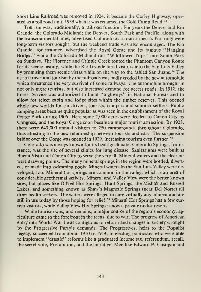
Short Line Railroad was removed in 1924, it became the Corley Highway; oper-
ated as a toll road until 1939 when it was renamed the Gold Camp Road. 33
Tourism was, traditionally, a railroad function. For years the Denver and Rio
Grande; the Colorado Midland; the Denver, South Park and Pacific, along with
the transcontinental lines, advertised Colorado as a tourist mecca. Not only were
long-term visitors sought, but the weekend trade was also encouraged. The Rio
Grande, for instance, advertised the Royal Gorge and its famous "HangingBridge," while the Colorado Midland ran "Wildflower Trips" into South Park
on Sundays. The Florence and Cripple Creek touted the Phantom Canyon Route
for its scenic beauty, while the Rio Grande lured visitors into the San Luis Valley
by promising them scenic vistas while on the way to the fabled San Juans. 34 Theuse of travel and tourism by the railroads was badly eroded by the new automobile
which threatened the very survival of some railways. The automobile brought in
not only more tourists, but also increased demand for access roads. In 1912, the
Forest Service was authorized to build "highways" in National Forests and to
allow for select cabin and lodge sites within the timber reserves. This opened
whole new worlds for car drivers, tourists, campers and summer settlers. Public
camping areas became quite popular as was seen in the establishment of the Royal
Gorge Park during 1906. Here some 2,000 acres were deeded to Canon City by
Congress, and the Royal Gorge soon became a major tourist attraction. By 1923,
there were 643,000 annual visitors to 250 campgrounds throughout Colorado,
thus attesting to the new relationship between tourists and cars. The suspension
bridge over the Gorge was opened in 1929, increasing tourism even further. 35
Colorado was always known for its healthy climate. Colorado Springs, for in-
stance, was the site of several clinics for lung disease. Sanitariums were built at
Buena Vista and Canon City to serve the very ill. Mineral waters and the clear air
were drawing points. The many mineral springs in the region were bottled, divert-
ed, or made into swimming pools. Mineral waters in the San Luis Valley were de-
veloped, too. Mineral hot springs are common in the valley, which is an area of
considerable geothermal activity. Mineral and Valley View were the better knownsites, but places like O'Neil Hot Springs, Hunt Springs, the Mishak and Russell
Lakes, and something known as Shaw's Magnetic Springs (near Del Norte) all
drew health seekers. The waters were alleged to cure virtually any ailment and are
still in use today by those hoping for relief.36 Mineral Hot Springs has a few cur-
rent visitors, while Valley View Hot Springs is now a private nudist resort.
While tourism was, and remains, a major source of the region's economy, ag-
riculture came to the forefront in the teens, due to war. The progress of American
entry into World War I was contiguous to reform and changes in society wrought
by the Progressive Party's demands. The Progressives, heirs to the Populist
legacy, succeeded from about 1910 to 1914, in electing politicians who were able
to implement "drastic" reforms like a graduated income tax, referendum, recall,
the secret vote, Prohibition, and the initiative. Men like Edward P. Costigan and
143
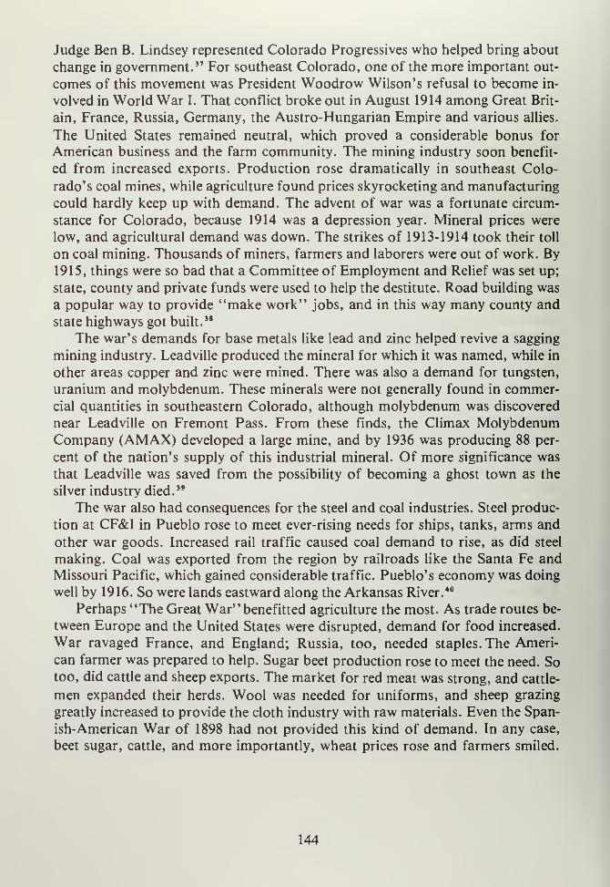
Judge Ben B. Lindsey represented Colorado Progressives who helped bring about
change in government. 37 For southeast Colorado, one of the more important out-
comes of this movement was President Woodrow Wilson's refusal to become in-
volved in World War I. That conflict broke out in August 1914 among Great Brit-
ain, France, Russia, Germany, the Austro-Hungarian Empire and various allies.
The United States remained neutral, which proved a considerable bonus for
American business and the farm community. The mining industry soon benefit-
ed from increased exports. Production rose dramatically in southeast Colo-
rado's coal mines, while agriculture found prices skyrocketing and manufacturing
could hardly keep up with demand. The advent of war was a fortunate circum-
stance for Colorado, because 1914 was a depression year. Mineral prices were
low, and agricultural demand was down. The strikes of 1913-1914 took their toll
on coal mining. Thousands of miners, farmers and laborers were out of work. By1915, things were so bad that a Committee of Employment and Relief was set up;
state, county and private funds were used to help the destitute. Road building was
a popular way to provide "make work" jobs, and in this way many county and
state highways got built.38
The war's demands for base metals like lead and zinc helped revive a sagging
mining industry. Leadville produced the mineral for which it was named, while in
other areas copper and zinc were mined. There was also a demand for tungsten,
uranium and molybdenum. These minerals were not generally found in commer-
cial quantities in southeastern Colorado, although molybdenum was discovered
near Leadville on Fremont Pass. From these finds, the Climax MolybdenumCompany (AMAX) developed a large mine, and by 1936 was producing 88 per-
cent of the nation's supply of this industrial mineral. Of more significance was
that Leadville was saved from the possibility of becoming a ghost town as the
silver industry died. 39
The war also had consequences for the steel and coal industries. Steel produc-
tion at CF&I in Pueblo rose to meet ever-rising needs for ships, tanks, arms and
other war goods. Increased rail traffic caused coal demand to rise, as did steel
making. Coal was exported from the region by railroads like the Santa Fe andMissouri Pacific, which gained considerable traffic. Pueblo's economy was doing
well by 1916. So were lands eastward along the Arkansas River. 40
Perhaps "The Great War" benefitted agriculture the most. As trade routes be-
tween Europe and the United States were disrupted, demand for food increased.
War ravaged France, and England; Russia, too, needed staples. The Ameri-
can farmer was prepared to help. Sugar beet production rose to meet the need. Sotoo, did cattle and sheep exports. The market for red meat was strong, and cattle-
men expanded their herds. Wool was needed for uniforms, and sheep grazing
greatly increased to provide the cloth industry with raw materials. Even the Span-
ish-American War of 1898 had not provided this kind of demand. In any case,
beet sugar, cattle, and more importantly, wheat prices rose and farmers smiled.
144
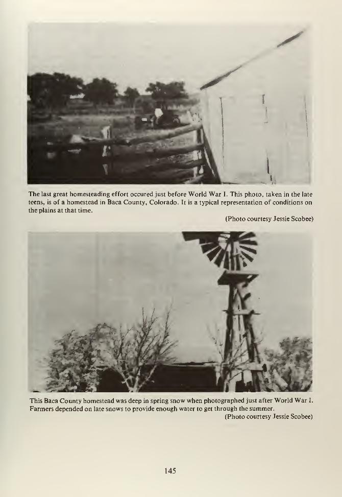
I
The last great homesteading effort occured just before World War I. This photo, taken in the late
teens, is of a homestead in Baca County, Colorado. It is a typical representation of conditions on
the plains at that time.
(Photo courtesy Jessie Scobee)
This Baca County homestead was deep in spring snow when photographed just after World War I.
Farmers depended on late snows to provide enough water to get through the summer.
(Photo courtesy Jessie Scobee)
145
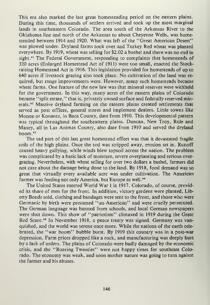
This era also marked the last great homesteading period on the eastern plains.
During this time, thousands of settlers arrived and took up the most marginal
lands in southeastern Colorado. The area south of the Arkansas River to the
Oklahoma line and north of the Arkansas to about Cheyenne Wells, was home-
steaded between 1914 and 1920. What was left of the "Great American Desert"
was plowed under. Dryland farms took over and Turkey Red wheat was planted
everywhere. By 1919, wheat was selling for $2.02 a bushel and there was no end in
sight.41 The Federal Government, responding to complaints that homesteads of
320 acres (Enlarged Homestead Act of 1911) were too small, enacted the Stock-
raising Homestead Act in 1916. This legislation provided for homesteads of up to
640 acres if livestock grazing also took place. No cultivation of the land was re-
quired, but range improvements were. However, many such homesteads becamewheat farms. One feature of the new law was that mineral reserves were withheld
for the government. In this way, many acres of the eastern plains of Colorado
became "split estate," that is, privately owned surface and federally reserved min-
erals.42 Massive dryland farming on the eastern plains created settlements that
served as post offices, general stores and implement dealers. Little towns like
Monon or Konantz, in Baca County, date from 1910. This developmental pattern
was typical throughout the southeastern plains. Duncan, New Troy, Rule and
Maxey, all in Las Animas County, also date from 1910 and served the dryland
boom. 43
The sad part of this last great homestead effort was that it devastated fragile
soils of the high plains. Once the sod was stripped away, erosion set in. Runoff
caused heavy gullying, while winds blew topsoil across the nation. The problem
was complicated by a basic lack of moisture, severe overplanting and serious over-
grazing. Nevertheless, with wheat selling for over two dollars a bushel, farmers did
not care about the damage being done to the land. By 1918, food demand was so
great that virtually every available acre was under cultivation. The American
farmer was feeding not only America, but Europe as well.44
The United States entered World War I in 1917. Colorado, of course, provid-
ed its share of men for the front. In addition, victory gardens were planted, Lib-
erty Bonds sold, clothing and bandages were sent to the front, and those who were
Germanic by birth were presumed "un-American" and were cruelly persecuted.
The German language was banned from schools, and local German newspapers
were shut down. This show of "patriotism" climaxed in 1919 during the Great
Red Scare. 45 In November 1918, a peace treaty was signed. Germany was van-
quished, and the world was serene once more. While the nations of the earth cele-
brated, the "war boom" bubble burst. By 1919 this country was in a post-war
depression. Farm prices dropped like a rock, and manufacturing was deeply hurt
by a lack of orders. The plains of Colorado were badly damaged by the economic
crisis, and the "Roaring Twenties" were not happy times for southeast Colo-
rado. The economy was weak, and soon mother nature was going to turn against
the farmer and his abuses.
146
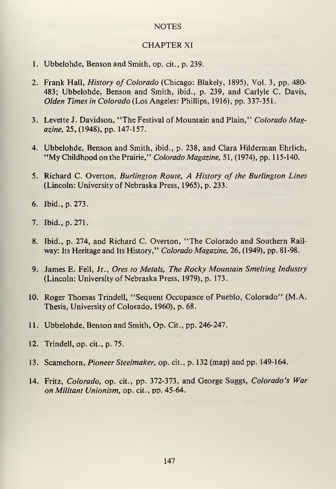
NOTES
CHAPTER XI
1
.
Ubbelohde, Benson and Smith, op. cit. , p. 239.
2. Frank Hall, History of Colorado (Chicago: Blakely, 1895), Vol. 3, pp. 480-
483; Ubbelohde, Benson and Smith, ibid., p. 239, and Carlyle C. Davis,
Olden Times in Colorado (Los Angeles: Phillips, 1916), pp. 337-351.
3. Levette J. Davidson, "The Festival of Mountain and Plain," Colorado Mag-azine, 25, (1948), pp. 147-157.
4. Ubbelohde, Benson and Smith, ibid., p. 238, and Clara Hilderman Ehrlich,
"My Childhood on the Prairie," Colorado Magazine, 51, (1974), pp. 115-140.
5. Richard C. Overton, Burlington Route, A History of the Burlington Lines
(Lincoln: University of Nebraska Press, 1965), p. 233.
6. Ibid., p. 273.
7. Ibid., p. 271.
8. Ibid., p. 274, and Richard C. Overton, "The Colorado and Southern Rail-
way: Its Heritage and Its History," Colorado Magazine, 26, (1949), pp. 81-98.
9. James E. Fell, Jr., Ores to Metals, The Rocky Mountain Smelting Industry
(Lincoln: University of Nebraska Press, 1979), p. 173.
10. Roger Thomas Trindell, "Sequent Occupance of Pueblo, Colorado" (M.A.
Thesis, University of Colorado, 1960), p. 68.
1 1
.
Ubbelohde, Benson and Smith, Op. Cit., pp. 246-247.
12. Trindell, op. cit., p. 75.
13. Scamehorn, Pioneer Steelmaker, op. cit., p. 132 (map) and pp. 149-164.
14. Fritz, Colorado, op. cit., pp. 372-373, and George Suggs, Colorado's War
on Militant Unionism, op. cit., pp. 45-64.
147
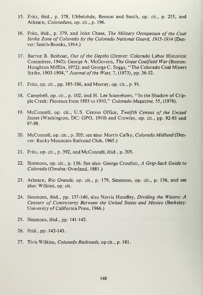
15. Fritz, ibid., p. 378, Ubbelohde, Benson and Smith, op. cit., p. 255, and
Athearn, Coloradans, op. cit., p. 196.
16. Fritz, ibid., p. 379, and John Chase, The Military Occupation of the CoalStrike Zone of Colorado by the Colorado National Guard, 1913-1914 (Den-
ver: Smith-Brooks, 1914.)
17. Barron B. Beshoar, Out of the Depths (Denver: Colorado Labor Historical
Committee, 1942); George A. McGovern, The Great Coalfield War (Boston:
Houghton Mifflin, 1972); and George C. Suggs, "The Colorado Coal Miners
Strike, 1903-1904," Journal of the West, 7, (1973), pp. 36-52.
17. Fritz, op. cit., pp. 385-386, and Murray, op. cit., p. 91.
18. Campbell, op. cit., p. 102, and H. Lee Scamehorn, "In the Shadow of Crip-
ple Creek: Florence from 1885 to 1910," Colorado Magazine, 55, (1978).
19. McConnell, op. cit., U.S. Census Office, Twelfth Census of the United
States (Washington, DC: GPO, 1910) and Crowley, op. cit., pp. 92-93 and97-98.
20. McConnell, op. cit., p. 205; see also: Morris Cafky, Colorado Midland (Den-
ver: Rocky Mountain Railroad Club, 1965.)
21. Fritz, op. cit., p. 392, and McConnell, ibid., p. 205.
22. Simmons, op. cit., p. 136. See also: George Croufutt, A Grip-Sack Guide to
Colorado (Omaha: Overland, 1881.)
23. Athearn, Rio Grande, op. cit., p. 179, Simmons, op. cit., p. 136, and see
also: Wilkins, op. cit.
24. Simmons, ibid., pp. 137-140, also Norris Hundley, Dividing the Waters: ACentury of Controversy Between the United States and Mexico (Berkeley:
University of California Press, 1966.)
25. Simmons, ibid., pp. 141-142.
26. Ibid., pp. 142-143.
27. Tivis Wilkins, Colorado Railroads, op cit., p. 181
.
148
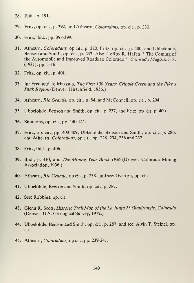
28. Ibid., p. 191.
29. Fritz, op. cit., p. 392, and Athearn, Coloradans, op. cit., p. 230.
30. Fritz, ibid., pp. 398-399.
31. Athearn, Coloradans, op cit., p. 220; Fritz, op. cit., p. 400; and Ubbelohde,Benson and Smith, op. cit., p. 237. Also: LeRoy R. Hafen, "The Coming of
the Automobile and Improved Roads to Colorado," Colorado Magazine, 8,
(1931), pp. 1-16.
32. Fritz, op. cit., p. 401.
33. In: Fred and Jo Mazzula, The First 100 Years: Cripple Creek and the Pike's
Peak Region (Denver: Hirschfield, 1956.)
34. Athearn, Rio Grande, op. cit., p. 84, and McConnell, op. cit., p. 204.
35. Ubbelohde, Benson and Smith, op. cit., p. 237, and Fritz, op. cit. p. 400.
36. Simmons, op. cit., pp. 140-141.
37. Fritz, op. cit., pp. 403-409; Ubbelohde, Benson and Smith, op. cit., p. 286,
and Athearn, Coloradans, op cit., pp. 228, 234, 236 and 237.
38. Fritz, ibid., p. 406.
39. Ibid., p. 410, and The Mining Year Book 1936 (Denver: Colorado Mining
Association, 1936.)
40. Athearn, Rio Grande, op cit., p. 238, and see: Overton, op. cit.
41
.
Ubbelohde, Benson and Smith, op. cit., p. 287.
42. See: Robbins, op. cit.
43
.
Glenn R. Scott, Historic TrailMap of the La Junta 2 ° Quadrangle, Colorado
(Denver: U.S. Geological Survey, 1972.)
44. Ubbelohde, Benson and Smith, op. cit., p. 287, and see: Alvin T. Steinel, op.
cit.
45. Athearn, Coloradans, op cit., pp. 239-241
.
149


CHAPTER TWELVE
151


CHAPTER XII
HARD TIMES, 1920-1940
As the "Roaring Twenties" dawned, times were not good for many of Colo-
rado's citizens. The post-war boom ended in a major recession during late 1919.
The year 1920 was a continuation of economic insecurity for farmers, miners andmanufacturers. The farm industry was particularly hard hit, due to falling prices
for wheat, cotton, sugar beets, cattle and hogs. Suddenly, the supplier to the
world was no longer needed, and as priced plummeted, marginal farmers were
wiped out. The situation was particularly difficult on the eastern plains, where
marginal farming was common. Dryland farming was normal practice on the
prairies from 1910 to 1930. Moisture was limited, erosion was heavy, and life was
hard. Nevertheless, farmers cultivated wheat on these lands. High prices were in-
centives, and luckily, the war years were relatively moist. These conditions lulled
homesteaders into a sense of security. As World War I peaked, so did prices.1
Equally, hard times were evident in the mining industry. Demand for
tungsten, molybdenum, lead, zinc and other base metals was reduced when the
war ended. Gold and silver prices slipped, and what little precious mineral activity
there was, ground to a halt. For instance, China began mining tungsten on a large
scale and, despite high U.S. tariffs, American prices suffered from these imports.
Also, the uranium industry, located mainly on the western slope, suffered from
newly opened mines in the Belgian Congo. 2If hardrock mining was depressed
during this time, so was coal. As demand for this fossil fuel dropped, life in the
coal towns got harder. As prices fell, miners found that benefits were cut, wages
were frozen, and management was less than willing to bargain. Other factors in
the decline of coal included increased use of petroleum products. Oil was
discovered at Oil Creek (Four Mile) in 1862, where the second well in the nation
was drilled. The Florence field developed during the 1870's, but demand was lim-
ited to lamp oil and lubrication products. The heavy sales of automobiles dramat-
ically increased the need for gasoline and other oil-related products. Fields were
brought in at Moffat, Rio Blanco and Boulder Counties; and, of course, the Flor-
ence unit was heavily pumped. Railroad traffic declined and this, in turn, caused
coal use to drop. Many smelters that once used huge quantities of the black min-
eral shut down after the war, and their demands ceased. Homeowners and busi-
nesses using coal found that alternative sources of fuel were both more economical
and cleaner to burn. Natural gas was used by the mid- 1 920' s to heat homes and
stores. Gas was not new, but its widespread introduction and use came at this
time. The final blow to coal came in 1928, when a major natural gas pipeline was
built from Texas to the Denver area. This was made possible by the invention of
seamless electric welding. Within a few years, most homes and businesses along
the Front Range had natural gas heat, and coal demand fell even further. 3
153
At the same time new natural gas was being imported, more labor troubles
broke out. Coal miners in Boulder County went out on strike during the winter of
1927-1928, demanding restoration of wages cut in 1925 and better working con-
ditions. The Industrial Workers of the World (IWW) moved in to organize Colo-
rado's coal miners. The IWW was alleged to be a communist union that sought to
not only unionize labor, but also to overthrow the government. Violence ensued,
particularly near Lafayette, Colorado, where six men died. As this strike went on,
Josephine Roche became owner of the Rocky Mountain Fuel Company. She was a
modern women who was associated with the Progressives prior to World War I.
Josephine put her liberal ideas to work in the coal industry. 4First, she recognized
the United Mine Workers (UMW) as the legitimate bargaining agent for RockyMountain Fuel. Horrified stockholders threatened to sell; Roche bought them out
and became sole owner of the company. Naturally, other mineowners, paticularly
CF&I in southern Colorado viewed the goings on at Rocky Mountain with fear
and horror. Nevertheless, in 1928 the first contract, between management andlabor, for Colorado's coal industry was signed. Roche's company recognized the
union, increased wages and provided for better working conditions. In turn, the
union, faced with declining coal prices and demand, loaned the company moneyto make interest payments and began a "Buy from Josephine" campaign to in-
crease production. Rocky Mountain Fuel soon outstripped its competition in pro-
ductivity, which in turn caused other firms to reconsider their positions regarding
unions. In 1933, Colorado Fuel and Iron was forced to recognize the UMW, and
from that point forward CF&I was unionized. 5 Perhaps the breakthrough came
too late, for by the early 1930's company coal towns were being abandoned at an
astounding rate. More significant were the nonprofitable railroad lines in the
Trinidad-Walsenburg area. Lines near Walsenburg, Trinidad, Rouse, Tropic,
Maitland, Cuchara Junction and Blende were torn up between 1934 and 1939. Therailroad from Texas Creek to Westcliffe was removed in 1938 and during the
1940's even more mines closed and their railroad spurs were ripped up. 6
As bad as things may have been in the mines, farmers were in even worseshape. Wheat, in 1918, selling for $2.02 a bushel was, by 1921, priced at 76 cents.
Dryland farmers found that their costs exceeded profits. Tenant farming rose. In
1920, 23 percent of Colorado's farmers were tenants, but by 1930 34.5 percentwere renters. This trend continued well into the 1930's. Due to adverse weather,more and more tenants were driven off their land. 7 One new farm relief conceptcame from North Dakota. The Non-Partisan League was formed to help promotecooperative marketing, state-run warehouses and other ideas that would assist
farmers in avoiding "middlemen" and pass subsequent savings on to the consum-er. From these efforts came the Colorado League, which attempted to get the state
legislature to pass laws benefiting farmers, most particularly some kind of act
making cooperative marketing legal. The Cooperative Marketing Act of 1923 pro-
vided that farmers could form their own coop stores, warehouses and other facil-
154
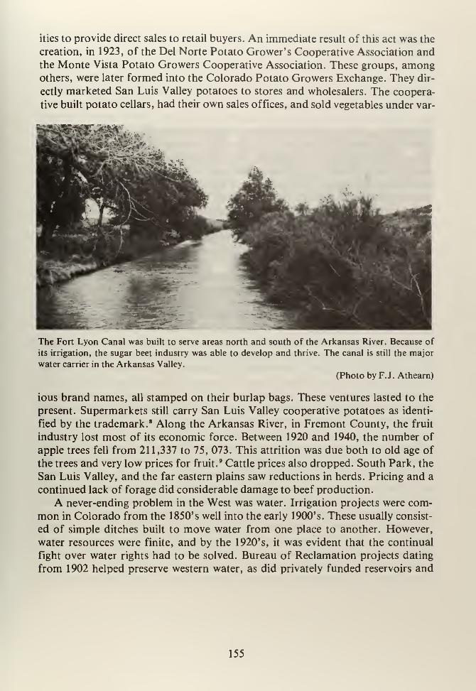
ities to provide direct sales to retail buyers. An immediate result of this act was the
creation, in 1923, of the Del Norte Potato Grower's Cooperative Association andthe Monte Vista Potato Growers Cooperative Association. These groups, amongothers, were later formed into the Colorado Potato Growers Exchange. They dir-
ectly marketed San Luis Valley potatoes to stores and wholesalers. The coopera-
tive built potato cellars, had their own sales offices, and sold vegetables under var-
The Fort Lyon Canal was built to serve areas north and south of the Arkansas River. Because of
its irrigation, the sugar beet industry was able to develop and thrive. The canal is still the major
water carrier in the Arkansas Valley.
(Photo by F.J. Athearn)
ious brand names, all stamped on their burlap bags. These ventures lasted to the
present. Supermarkets still carry San Luis Valley cooperative potatoes as identi-
fied by the trademark. 8 Along the Arkansas River, in Fremont County, the fruit
industry lost most of its economic force. Between 1920 and 1940, the number of
apple trees fell from 21 1,337 to 75, 073. This attrition was due both to old age of
the trees and very low prices for fruit.9 Cattle prices also dropped. South Park, the
San Luis Valley, and the far eastern plains saw reductions in herds. Pricing and a
continued lack of forage did considerable damage to beef production.
A never-ending problem in the West was water. Irrigation projects were com-
mon in Colorado from the 1850's well into the early 1900's. These usually consist-
ed of simple ditches built to move water from one place to another. However,
water resources were finite, and by the 1920's, it was evident that the continual
fight over water rights had to be solved. Bureau of Reclamation projects dating
from 1902 helped preserve western water, as did privately funded reservoirs and
155
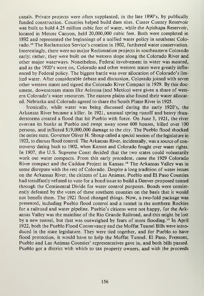
canals. Private projects were often supplanted, in the late 1890's, by publically
funded construction. Counties helped build dam sites. Custer County Reservoir
was built to hold 4.25 million cubic feet of water, while the Apishapa Reservoir,
located in Metote Canyon, held 20,000,000 cubic feet. Both were completed in
1892 and represented the beginnings of a unified water policy in southeast Colo-
rado. 10 The Reclamation Service's creation in 1902, furthered water conservation.
Interestingly, there were no major Reclamation projects in southeastern Colorado
early; rather, they were built on the western slope along the Colorado River and
other major waterways. Nonetheless, Federal involvement in water was assured,
and as the 1920's wore on, Colorado and other western states were greatly influ-
enced by Federal policy. The biggest battle was over allocation of Colorado's lim-
ited water. After considerable debate and discussion, Colorado joined with seven
other western states and signed the Colorado River Compact in 1929. By this doc-
ument, downstream states like Arizona (and Mexico) were given a share of west-
ern Colorado's water resources. The eastern plains also found their water allocat-
ed. Nebraska and Colorado agreed to share the South Platte River in 1925.
Ironically, while water was being discussed during the early 1920's, the
Arkansas River became a killer. In 1921, unusual spring runoff and heavy thun-
derstorms created a flood that hit Pueblo with force. On June 3, 1921, the river
overran its banks at Pueblo and swept away some 600 houses, killed over 100
persons, and inflicted $19,000,000 damage to the city. The Pueblo flood shocked
the entire state. Governor Oliver H. Shoup called a special session of the legislature in
1922, to discuss flood control. The Arkansas River, incidentally, was a source of con-
troversy dating back to 1902, when Kansas and Colorado fought over water rights.
In 1907, the U.S. Supreme Court decided that the two states could voluntarily
work out water compacts. From this early precedent, came the 1929 Colorado
River compact and the Caddoa Project in Kansas. 12 The Arkansas Valley was in
some disrepute with the rest of Colorado. Despite a long tradition of water issues
on the Arkansas River, the citizens of Las Animas, Pueblo and El Paso Counties
had steadfastly refused to vote for a bond issue to build a Denver-proposed tunnel
through the Continental Divide for water control purposes. Bonds were consist-
ently defeated by the votes of these southern counties on the basis that it would
not benefit them. The 1921 flood changed things. Now, a two-fold package was
presented, including Pueblo flood control and a tunnel in the northern Rockies
for a railroad and water pipeline. Pueblo's citizens were not happy, for the Ark-
ansas Valley was the mainline of the Rio Grande Railroad, and this might be lost
by a new tunnel, but that was outweighed by fears of more flooding. 13 In April
1922, both the Pueblo Flood Conservancy and the Moffat Tunnel Bills were intro-
duced in the state legislature. They were tied together, and for Pueblo to have
flood protection, it would have to help the Moffat Tunnel. El Paso, Fremont,
Pueblo and Las Animas Counties' representatives gave in, and both bills passed.
Pueblo got a district with which to tax property owners, and with the proceeds
156
build levees, dikes and other flood control devices. Denver and the northern
Rockies got the Moffat Tunnel. Pueblo was probably the loser in this battle, but,
on the other hand, there have been no recurrences of the 1921 disaster.14
The 1920's in Colorado was also a period of hatred, prejudice and racism. Ashard times deepened, more middle and lower class workers became unemployed.
Money was tight, jobs were few, agriculture was failing, and scapegoats were
needed. The Ku Klux Klan (KKK) became a powerful force in Colorado politics at
this time. The KKK came out of Georgia during the 1912-1918 era, and it gained
considerable strength during the "Red Scare" of 1919. Colorado was a good
breeding ground for the KKK because of a fairly large ethnic population and sev-
eral industrial cities. Pueblo was a major contributor of KKK members whospouted patriotism, "Americanism," racism and bigotry. Their targets were
minorities like Blacks (there were few in Colorado at this time), Spanish-Amer-
icans, Italians, southern Europeans, Jews, Catholics and Orientals. Trinidad,
Walsenburg, Aguilar and other coal towns were prime candidates for Klan activi-
ties. Southeastern Colorado may have seen a few cross burnings, some threats
against minorities, and other incidents, but there were no deaths or injuries due to
KKK activities. Italian newspapers in Trinidad, such as La Voratore Italiano and
the Corriere de Trinidad successfully defended their communities against the
KKK. Because there was a large Spanish-American population in the San Luis
Valley, the KKK did not do well. Canon City saw a fair amount of KKK activity,
but there were not very many minorities living there. Local Catholics and Jews
took the brunt of KKK hatred. 15 So powerful was the KKK in Denver and the
Front Range, that in 1924 these areas elected Clarence J. Morley governor. This
Klan-backed executive was a Klan sympathizer, as were most members of the
House of Representatives in Colorado's legislature. All kinds of bills were intro-
duced, from banning wine for use in Catholic church services to the abolition of
parochial schools. Colorado's Senate was the only body that kept these efforts
from becoming law. The sole accomplishment of the Morley administration was
abolition of the office of Horseshoe Inspector. Morley was removed from office
in the 1926 election, and the Klan's political influence quickly diminished. 16
The imposition of Prohibition in 1919 created new problems. Not only did
those less than honest about "being dry" demand liquor, but there were manypeople willing to supply the need. A large bootlegging industry grew up in the met-
ropolitan areas of Colorado. Denver and Pueblo were the two biggest sources of
illegal booze. As in Chicago, gangland-style crime became a serious matter. There
were hijackings, kidnappings and murders over who was going to control the
liquor trade. The Trinidad-Walsenburg area was also the location of numerous
stills. Law enforcement officials, who tried raiding the hills west of Trinidad,
found themselves consistently "shut off" by the locals. Such illegal moonshine
trade continued for many years and was reportedly still popular into the 1950's.17
Gangland crime was persistent during the late 1920's into the 1930's. War
157
broke out when Pueblo rumrunners tried to invade Denver. February 1931, sawexchanges between these forces, with death threats if the Pueblo invasion did notstop. Undeterred, Pete Carlino continued to "muscle in," and in the best Chicago-style, he was machine-gunned while standing in front of a local Pueblo garage.The assassins, who were in a moving car, missed their target and Carlino was un-touched. 12 But he was a marked man. One of his "boys" was kidnapped, his
home was bombed, his brother was killed and numerous threats were madeagainst him. Local authorities tried to "get" Carlino, by claiming that he hadburned his own house for the insurance. As this was studied, so was the possibility
of his deportation to Italy. In September 1931, Carlino's body was found along aroadside near Pueblo, ending that city's gangland attempt to take over Denver.Joe Roma, of Denver, emerged as Colorado's new leader. He survived until 1933,when he was "rubbed out" by rivals while sitting at home playing his mandolin. 19
As it happened, the Prohibition experiment ended during 1933, a total failure.
Denver, for example, repealed local anti-liquor ordinances in July of that year.
Pueblo and other southeast Colorado communities followed suit. By December
1933, national prohibition was repealed.
Southeastern Colorado was also the scene of one of the most sensational
crimes of the decade. On May 23, 1928, five men walked into the First National
Bank at Lamar and took $250,000. They killed bank President Amos N. Parrish
and his son John. Two tellers were abducted and held as hostages. Ralph Fleagle
was identified as the gang leader and the chase was on. Sheriff's Deputies found
one teller left wandering along a road about four miles from Lamar, but the other
hostage was found dead near Liberal, Kansas, on June 13, 1928. During the rob-
bery, one of the bandits, Howard L. Royston, was wounded and sought medical
attention. Dr. W. W. Wineinger of Dighton, Kansas was forced to provide help
and then he was shot in an execution-style slaying. His body was found on May28 near Garden City, Kansas. This trail of bodies, abandoned cars and finger-
prints finally led police officers to Kankakee, Illinois where, in August 1929,
Ralph Fleagle was captured. Fleagle confessed and implicated his brother, along
with two others.20 Fleagle and his men were tried at Lamar in October 1929, and
they were all found guilty of murder. After several appeals, Ralph Fleagle was
hanged at Canon City on July 12, 1930, followed by George J. Abshier and
Howard Royston later in July. Jake Fleagle was killed in September 1930 during a
gunfight, while resisting arrest at Branson, Missouri. The robbery and murders at
Lamar made a deep impression on the region and remain, to this day, one of the
most dramatic events in the history of Prowers County. 21
The thirties was a period of severe depression in Colorado and the nation.
Farm prices, declining from 1920 on, went ever lower. Farmers, in turn, planted
more and more wheat, beans, beets, corn and other staples. This drove prices
down further, for there were huge surpluses. Desperation saw more planting and
grazing, causing serious damage to fragile soils. Then, in 1929, the American
158
economy totally collapsed. The fall of the stockmarket in October of that year
precipitated the worst economic dislocation in U.S. history. Not only were mil-
lions jobless as factories shut down, but industry found itself facing bankruptcy.
Farmers, suffering from overproduction, saw prices go from $2.02 a bushel for
wheat in 1918, to 76 cents in 1921, to 37 cents in 1932. Cost of production usually
exceeded sale prices. Crops were left to rot in the ground rather than lose. Po-
tatoes, a mainstay in the San Luis Valley, were selling for 24 cents, while hogs
went for $3.10 each. Fruit growers sold their apples for 42 cents a bushel. It
cost more to ship them to Denver than they could be sold for." Coal production
dropped by one-half in 1932, and miners were laid off en masse. All business suf-
fered, but mining and agriculture took the worst beating in southeast Colorado.
Then, to make matters worse, nature turned against humanity. Drought gripped
the region; what little soil moisture there was dried up. Strong winds blew topsoil
across the plains. In a matter of two years, much of eastern Colorado was a des-
ert. Soil blew against buildings, burying them in drifts. Cattle were covered in
shifting sands, fences disappeared under dunes, and the plains were reduced to
Stephen Long's famous "Great American Desert." April 14, 1935 saw the biggest
dust storm ever. "Black Sunday" found a storm raging across southeastern Colo-
rado into Kansas with dust billowing several miles high. Thousands of travelers
were stranded, as in a blizzard. Several deaths due to suffocation were recorded.
The sky was black for twenty-four hours; the sun was blotted out. "Black Sun-
day" was such a serious disaster that the Red Cross set up hospitals and relief sta-
tions to help victims of this dust storm. Property damage done by blowing dust
was extensive. Not only were farms wiped out, but towns and cities suffered fromdust fallout.
23 The term "Dust Bowl" was coined by Robert Geiger, an Associa-
ted Press reporter from Denver, who after viewing the destruction of the plains,
wrote about it. The Soil Conservation Service declared that southeast Colorado,
northeastern New Mexico, western Kansas, the Oklahoma panhandle and western
Texas were subject to severe wind erosion, and this became the "Dust Bowl."
Baca County was the hardest hit area in southeastern Colorado.
As Depression settled deeper into the national economy, President Herbert
Hoover, a Republican, declared that prosperity was "just around the corner." All
the nation had to do was let the "recession" run its course and the capitalist sys-
tem would revive itself. Yet the economy got worse, the Dust Bowl became moredevastating, and private relief funds ran out. Destitute men and women roamedthe streets literally begging for food. Unemployment reached nearly 20 percent of
the work force, and despite cries for help, the Federal Government maintained
that private business would solve the problem." The elections of 1932 changed the
situation. In that year Franklin D. Roosevelt, a Democrat, was elected President.
Roosevelt had definite ideas about how the Depression should be handled. First,
by "priming the pump" Federal dollars would be used to stimulate a devastated
economy. Deficit spending by the Federal Government provided massive amounts
159
of money to help industry, farmers and businessmen alike. To provide a conduit
for this aid, Roosevelt created a myriad of agencies to oversee Federal help pro-
grams. Of primary interest to residents of southeastern Colorado, were the Agri-
cultural Adjustment Administration (AAA), the Work Projects Administration
(WPA), the Reconstruction Finance Corporation (RFC) [actually Hoover's idea],
the National Industrial Recovery Act (NRA) and the Public Works Administra-
tion (PWA). Two programs in what Roosevelt called "The New Deal" that mostbenefited southeast Colorado were the AAA, which paid farmers to reduce crop
production, and the Civilian Conservation Corps (CCC) that gave invaluable la-
bor to the Forest Service by constructing trails, roads, park sites and other im-
provements within national forests. The CCC employed thousands of youths to
build roads and other improvements, while paying them $30 a month, a generous
sum in the midst of the Depression. 26
The Roosevelt administration also stabilized gold prices at $35.00 per ounce
and required governmental purchase of all gold produced. This caused a resur-
gence of precious mineral operations in Lake, Park and Teller Counties. Lake
County's lead and zinc production slipped steadily from 1920 to 1930, and mining
around Leadville was all but dead during the early 1930's. With gold prices stable
by 1934, extraction increased considerably. Teller County also revived, and by
1935, production of Cripple Creek District's mines equalled $4.5 million. TheGolden Cycle Mill at Colorado Springs processed over 500,000 tons of ore in that
same year. South Park saw a major revival of gold mining during the 1930's. Pro-
duction went from a paltry $39,719 in 1927, to $3,001,074 in 1934. The Mosquito
Creek District provided most of this while Fairplay saw considerable dredging ac-
tivity. The South Park Dredging Company built and then ran a 5 10-foot dredge
boat along the South Platte River between 1922 and 1952, producing considerable
amounts of placer gold while tearing up the river bottom. Revived mining helped
with capital improvements. In 1939, Cripple Creek's numerous mines were drain-
ed by completion of the six-mile Carlton Tunnel. Excess water, for irrigation,
went to the eastern plains by way of the Arkansas River. Leadville' s mines were to
be drained by the Leadville Drainage Tunnel, begun in 1943. However, due to en-
gineering problems, it was not finished until 1951. This water was also dumpedinto the Arkansas River and used for downstream irrigation. The Works Progress
Administration (WPA) offered employment and also built public buildings like
post offices, schools and city halls. For instance, the town halls of Alamosa and
Center were WPA built, while the bandshell and bridge at Pueblo's old Mineral
Palace Park were WPA projects. Water-related construction was also part of the
WPA/CWA concept. The Big Thompson Project in northern Colorado began at
this time. The Twin Lakes Tunnel, bringing water from near Leadville to the
Arkansas Valley, was financed with a 1930's RFC loan of $1.25 million.27
The Depression created the Taylor Grazing Act of 1934. This legislation pro-
vided management of the Public Domain for the first time. Grazing districts were
160
set up to control the numbers of domestic animals allowed on public lands. In this
way, it was hoped that damage to the land would be reduced. Additionally, home-steading was severely limited. For all practical purposes, classic disposal of the
public domain ended in 1934. Considering the condition of the plains at the time,
this legislation went a long way to help stop degradation of remaining Federal
lands. The U.S. Department of the Interior's Grazing Service, established in 1934,
oversaw use of the public domain and administered these various grazing districts.
The old General Land Office (GLO) continued to manage disposal of the public
lands, but this was greatly limited by President Roosevelt's Executive Order of
1934, withdrawing all Federal lands west of the 100th Meridian from homestead-
ing. Farrington Carpenter, of Hayden, Colorado was named the Grazing
Service's first Director, and under him a new agency took shape. In 1946, the
GLO and Grazing Service were merged to form the Bureau of Land Management(BLM) which remains the primary Federal land management agency in the United
States. The newly created BLM was heavily involved in range management andland disposal, but as time went along, the agency emerged as a multiple-use, land-
based bureau with the intent of balanced resource management. 28
The New Deal saw new national legislation that benefited the general public.
Social Security was created to help people in retirement while the Old Age Pension
Amendment, passed in Colorado during 1927, was beefed up in the 1930's by in-
creasing state tax revenues. In this way, pensioners were assured a minimum in-
come by the state. By the end of 1938, 34,654 Coloradans were listed on the pen-
sion rolls.29 The Depression Era was also a time of labor unrest. Under consider-
able pressure from the Roosevelt administration, industry was forced to recognize
unionism throughout the country. The National Recovery Administration (NRA)provided a vehicle for ending the practices of blacklisting, lock outs, and other
management abuses. The government directed that industries refusing to help
unions would not be given Federal assistance. Under this threat, Colorado Fuel
and Iron recognized the United Mine Workers (UMW) in 1933 and a collective
bargaining contract was written. Other industries followed suit, and while union
activity in Colorado has never been strong, southeast Colorado saw the second,
yet most powerful, local union victory. Despite the worst Depression in history,
there were some paradoxial events. Schools actually benefited from hard times,
for as the nonworking population grew, so did its demand for education. Junior
colleges were established to provide localized educational experiences from the
mid-1930's on. In 1925, a college had been established at Trinidad, while Alamosa
got Adams State College during that same year. Adams State was a teacher-train-
ing facility, the third in the state. Pueblo Junior College opened its doors in 1933
and served the Arkansas River Valley all the way west to Leadville. Lamar Junior
College was established in 1936 and assured higher education for the lower
Arkansas region. 30
Another area that did not suffer as deeply during the Depression years was
161
transportation. A newly emerging air industry expanded during the late 1920's
and into the 1930's. Mail service was a key revenue producer; a few daring souls
rode as passengers. As happened with the Transcontinental Railroad, the first
coast-to-coast air service went by way of Cheyenne, Wyoming because the moun-tains were much lower in that state. From Cheyenne, air service was established to
Denver, Colorado Springs and Pueblo. From Pueblo, airlines could go south to El
Paso or east to St. Louis. Despite the promise of becoming Colorado's main air-
port, Pueblo's aviation dreams never materialized. Denver, instead, grew as the
hub of western air travel. When pressurized planes came into general service, the
mountains were no longer a barrier. Both Cheyenne and Pueblo lost their respec-
tive positions to Denver. 31
Rail service also underwent major changes during the 1930's and on into the
1940's. The Burlington Railroad introduced, in 1934, a revolutionary new train
called the "Zephyr." These units were diesel powered (a serious omen for the coal
industry) and consisted of "streamlined" lightweight cars that provided new lux-
ury and comfort. The Burlington streamliner brought a whole new dimension to
rail travel, and other railroads soon followed, hoping to attract travelers in vast
numbers. Southeastern Colorado, by the late 1930's saw the Santa Fe running an
incredibly luxurious train, the Super Chief, from Chicago to Los Angeles by way
of Lamar, La Junta and Trinidad. The Missouri Pacific, in 1948, began the
streamlined Colorado Eagle from St. Louis to Pueblo and then north to Denver
on Rio Grande trackage. The Burlington introduced the Texas Zephyr in 1930,
providing service from Denver to Houston by way of Pueblo and Trinidad. TheDenver and Rio Grande, in bankruptcy during the 1930's, was hard pressed to
even maintain service. Utterly ancient equipment ran from Denver to Salt Lake
City through Pueblo and Leadville. Traffic was light and passengers few. Yet, by
the late 1940's the Rio Grande was on a solid financial footing again, and upgrad-
ed equipment was forthcoming. The Pueblo-Arkansas River line became second-
ary with the absorption of the old "Moffat Road" in 1947, for the Moffat Tun-
nel/Dotsero cut-off route was used for most passenger service.32 Nevertheless, the
Rio Grande, in the early 1950's, provided passenger service to Pueblo and the
upper Arkansas towns with streamlined equipment. The Royal Gorge followed
the Rio Grande's historic mainline route to Leadville and then on to Salt Lake
City. The train used diesel power, and had a diner and sleeper, and even boasted a
a Vista-Dome from which to view the Royal Gorge. This service was discontinued
in 1967. 33
The Depression period saw dramatic changes in the economic and political
lifestyle of southeastern Colorado. Federal involvement in the area increased, as
did dependence upon Federal aid. The economy perked up slightly during the
mid-1930's, but was declining by the end of the decade. Again, as in 1914, Amer-ican farmers and industry were fortunate when war broke out in Europe. Ger-
many invaded Poland early in September 1939, precipitating a world crisis. Great
162
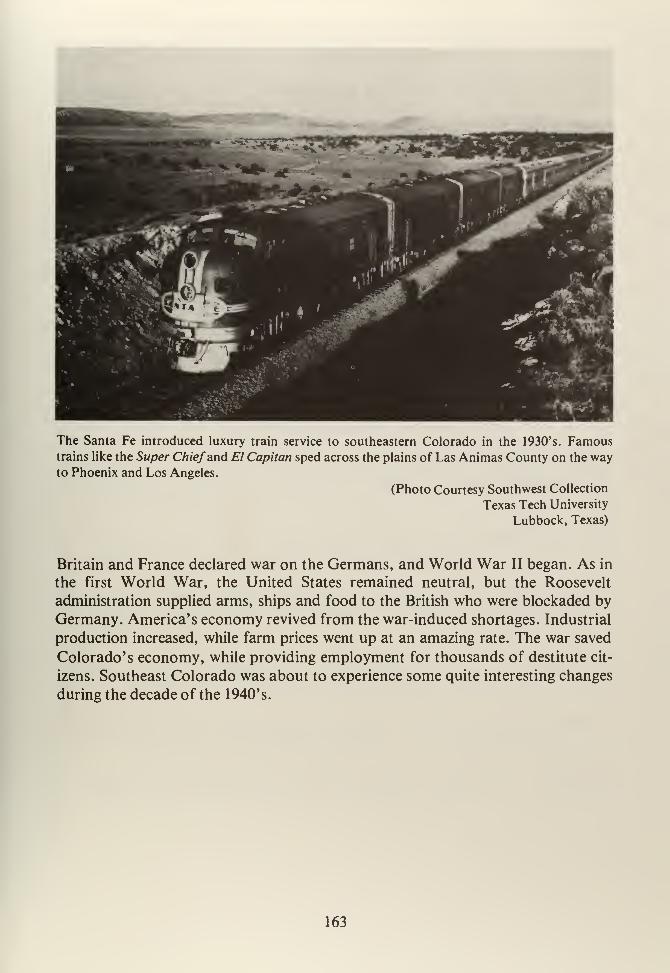
The Santa Fe introduced luxury train service to southeastern Colorado in the 1930's. Famoustrains like the Super Chiefand El Capitan sped across the plains of Las Animas County on the wayto Phoenix and Los Angeles.
(Photo Courtesy Southwest Collection
Texas Tech University
Lubbock, Texas)
Britain and France declared war on the Germans, and World War II began. As in
the first World War, the United States remained neutral, but the Roosevelt
administration supplied arms, ships and food to the British who were blockaded by
Germany. America's economy revived from the war-induced shortages. Industrial
production increased, while farm prices went up at an amazing rate. The war saved
Colorado's economy, while providing employment for thousands of destitute cit-
izens. Southeast Colorado was about to experience some quite interesting changes
during the decade of the 1940's.
163

NOTES
CHAPTER XII
1. Fritz, op. cit., pp. 450-451; Ubbelohde, Benson and Smith, op. cit., pp. 305-
306; Athearn, Coloradans, op. cit., pp. 272-273, and Donald Worster, DustBowl (New York: Oxford, 1979), pp. 10-11.
2. Fritz, ibid., pp. 410-412.
3. Athearn, Coloradans, ibid., pp. 257-258, and Ubbelohde, Benson and Smith
ibid., p. 302.
4. Ubbelohde, Benson and Smith, ibid., p. 303, and Athearn, ibid., p. 274, also
Fritz, ibid., pp. 386-388.
5. Ubbelohde, Benson and Smith, ibid., p. 302.
6. Athearn, Rio Grande, op. cit., p. 344 (map).
7. Fritz, ibid., p. 451, and Ubbelohde, Benson and Smith, p. 305.
8. Ubbelohde, Benson and Smith, ibid., p. 295, and Irwin Thomle, "Rise of
the Vegetable Industry in the San Luis Valley," Colorado Magazine, 26,
(1949, pp. 112-125.
9. Colorado State Board of Immigration, Year Book of the State of Colorado,
1931 (Denver: State of Colorado, 1931), pp. 164-165.
10. Donald A. MacKendrick, "Before the Newlands Act: State Sponsored Re-
clamation Projects in Colorado, 1888-1903," Colorado Magazine, Vol. 52,
(1975), pp. 1-21.
11. Fritz, p. 471, and Ralph Carr, "Delph Carpenter and River Compacts Be-
tween Western States," Colorado Magazine, Vol. 21, (1964), pp. 5-14.
12. Fritz, ibid., pp. 470-472, and Guy E. Macy, "The Pueblo Flood of 1921,"
Colorado Magazine, 17, (1940), pp. 201-211.
13. Athearn, Rio Grande, ibid., p. 270, and Edgar C. McMechen, The Moffat
Tunnel of Colorado 2 Vols., (Denver: Wahlgren, 1927.)
165
14. Athearn, ibid., p. 270, and Fritz, pp. 469-469.
15. Ubbelohde, Benson and Smith, op. cit., 292-293, Athearn, Coloradans, op.
cit., p. 245. See also: Robert A. Goldberg, Hooded Empire: The Ku KluxKlan in Colorado (Urbana, Illinois: University of Illinois Press, 1981.)
16. Athearn, Coloradans, ibid., p. 246, and James H. Davis, "Colorado Under
the Klan," Colorado Magazine, 42, (1965), pp. 93-108.
17. Athearn, Coloradans, op. cit., p. 249, and Gerald Lynn Marriner, "Klan
Politics in Colorado," Journal of the West, 15, (1976), pp. 76-101.
18. Athearn, Coloradans, ibid., pp. 249-250, and James E. Hansen II, "Moon-shine and Murder: Prohibition in Denver," Colorado Magazine, 50, (1973),
pp. 7-12.
19. Athearn, ibid., p. 250, and Robert N. Annand, "A Study of the Prohibition
Situation in Denver" (M.A. Thesis: University of Denver, 1932.)
20. Robert Christy, "The Dauntless Posse, The Fleagle Bank Robbery," (Manu-
script, Lamar, Colorado, 1969), and as reported in: The Lamar Daily News,
May 23, 1928, the Bristol (Colorado) Herald, May 24, 1928.
21
.
Lamar (Colorado) Daily News, June 9, 1930, and Denver Post, July 1 1 , 1930.
22. Ubbelohde, Benson and Smith, op. cit., p. 305, and Clark C. Spence, The
Rainmakers: American "Pluviculture" to World War II (Lincoln: Univer-
sity of Nebraska Press, 1980.)
23. Worster, op. cit., pp. 18-20.
24. Ibid., pp. 28-30.
25. As related in: Ubbelohde, Benson and Smith, op. cit. pp. 307-308.
26. Fritz, op. cit., pp. 451-457, and James P. Wickens, "Colorado in the Great
Depression: A Study of New Deal Politics at the State Level" (PhD. Dis-
sertation, University of Denver, 1964). Also: James P. Wickens, "The NewDeal in Colorado," Pacific Historical Review, 38, (1969), pp. 275-291.
166
27. Ubbelohde, Benson and Smith, op. cit., p. 312, and Donald B. Cole, "Trans-
Mountain Water Diversion in Colorado," Colorado Magazine, 25, (1948),
pp. 49-65.
28. Paul J. Culhane, Public Land Politics (Baltimore: Johns Hopkins, 1981),
pp. 81-91, and Joe A. Stout, Jr., "Cattlemen, Conservationists, and the Tay-
lor Grazing Act," New Mexico Historical Review, 45, (1970), pp. 311-332.
Also: Leslie Hewes, The Suitcase Farming Frontier: A Study in the Histor-
ical Geography of the Central Great Plains (Lincoln: University of Nebraska
Press, 1973.)
29. Fritz, op. cit., p. 459.
30. Athearn, Coloradans, op. cit., p. 283, also: George W. Frasier and William
Hartman, "History of Higher Education in Colorado," in: LeRoy Hafen,
Colorado and Its People (New York: Lewis, 1948), 2, Chapter 17.
31. Emerson N. Barker, "Colorado Mail Takes Wings," Colorado Magazine, 20,
(1943), pp. 95-99; H. Lee Scamehorn, "Colorado's First Airline," Univer-
sity of Colorado Studies, Series in History, Number 3, (1964), H. Lee Scame-
horn, "The Air Transport Industry in Colorado," in: Carl Ubbelohde, (ed.),
A Colorado Reader (Boulder: Pruett, 1964), and Athearn, Coloradans, op.
cit., pp. 265-266.
32. Overton, Burlington Route, op. cit., pp. 379-406, and Robert A. LeMassena,
Rio Grande. . . Pacific, op. cit.
33. Athearn, Rio Grande, op. cit., p. 353.
167


CHAPTER THIRTEEN
169

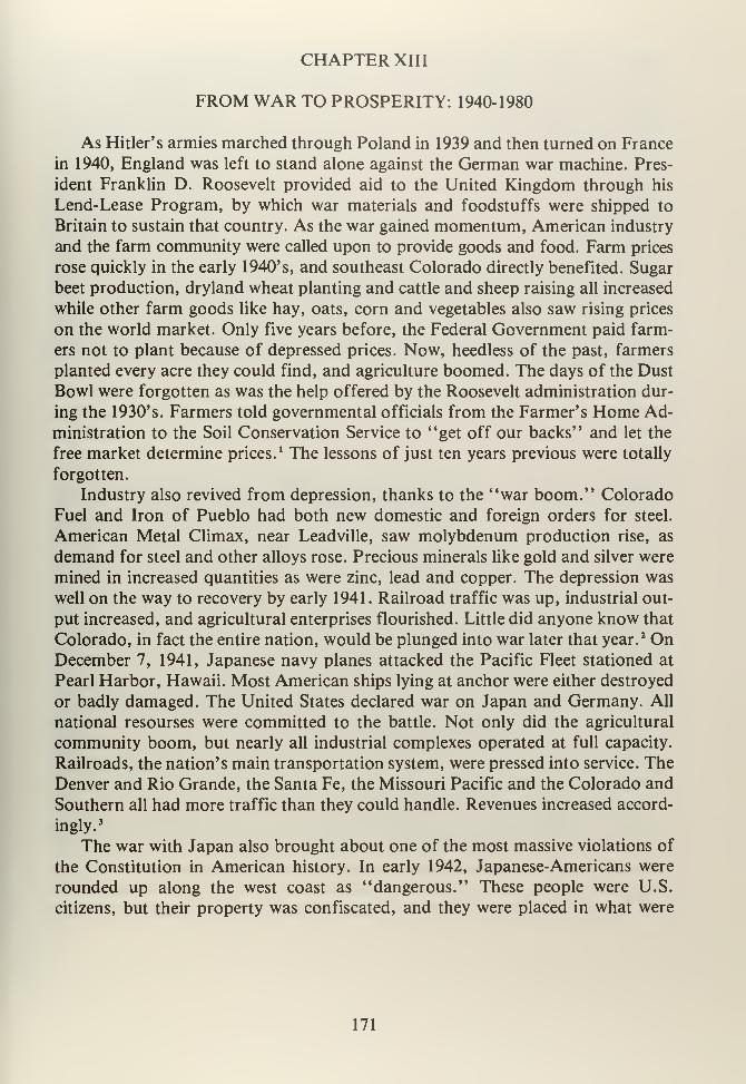
CHAPTER XIII
FROM WAR TO PROSPERITY: 1940-1980
As Hitler's armies marched through Poland in 1939 and then turned on France
in 1940, England was left to stand alone against the German war machine. Pres-
ident Franklin D. Roosevelt provided aid to the United Kingdom through his
Lend-Lease Program, by which war materials and foodstuffs were shipped to
Britain to sustain that country. As the war gained momentum, American industry
and the farm community were called upon to provide goods and food. Farm prices
rose quickly in the early 1940's, and southeast Colorado directly benefited. Sugar
beet production, dryland wheat planting and cattle and sheep raising all increased
while other farm goods like hay, oats, corn and vegetables also saw rising prices
on the world market. Only five years before, the Federal Government paid farm-
ers not to plant because of depressed prices. Now, heedless of the past, farmers
planted every acre they could find, and agriculture boomed. The days of the Dust
Bowl were forgotten as was the help offered by the Roosevelt administration dur-
ing the 1930's. Farmers told governmental officials from the Farmer's Home Ad-
ministration to the Soil Conservation Service to "get off our backs" and let the
free market determine prices.1 The lessons of just ten years previous were totally
forgotten.
Industry also revived from depression, thanks to the "war boom." Colorado
Fuel and Iron of Pueblo had both new domestic and foreign orders for steel.
American Metal Climax, near Leadville, saw molybdenum production rise, as
demand for steel and other alloys rose. Precious minerals like gold and silver were
mined in increased quantities as were zinc, lead and copper. The depression was
well on the way to recovery by early 1941. Railroad traffic was up, industrial out-
put increased, and agricultural enterprises flourished. Little did anyone know that
Colorado, in fact the entire nation, would be plunged into war later that year.2 On
December 7, 1941, Japanese navy planes attacked the Pacific Fleet stationed at
Pearl Harbor, Hawaii. Most American ships lying at anchor were either destroyed
or badly damaged. The United States declared war on Japan and Germany. All
national resourses were committed to the battle. Not only did the agricultural
community boom, but nearly all industrial complexes operated at full capacity.
Railroads, the nation's main transportation system, were pressed into service. The
Denver and Rio Grande, the Santa Fe, the Missouri Pacific and the Colorado and
Southern all had more traffic than they could handle. Revenues increased accord-
ingly.3
The war with Japan also brought about one of the most massive violations of
the Constitution in American history. In early 1942, Japanese-Americans were
rounded up along the west coast as "dangerous." These people were U.S.
citizens, but their property was confiscated, and they were placed in what were
171
called "Detention Centers." There was a difference between Hitler's concentra-
tion camps and the American version. The Japanese were not systematically exter-
minated. Colorado was the scene of some of this mass deportation. In August
1942, about 8,000 Japanese were moved to a campsite near Granada, Colorado
along the Arkansas River. At this place 11,000 acres were set aside for construc-
tion of barracks, social halls, and agricultural fields. The camp was called
"Amache" (after J.W. Prowers' Indian wife) or, more formally, the Granada Re-
location Camp. Camp Amache became a small city with its own internal govern-
ment, newspaper and schools. However, residents' movements were severely re-
stricted. Amache was not a pleasant place; water had to be hauled in due to un-
drinkable local sources, meals were served in three or four shifts, and very few of
the huts had running water. The "internees" were offered work in sugar beet
fields surrounding Granada and by 1945, Amache had 9,000 acres of irrigated
beet land under production, managed by the American Crystal Sugar Company.The nearest large town, Lamar, at first wanted the camp because it pumped $5
million into the local economy, but there was a strong anti-Japanese prejudice.
Store windows carried signs "No Japs Wanted." Eventually, Lamar's merchants
realized that it was good business to cater to Japanese-American buyers and stores
soon welcomed the prisoners. There was also some ami-Japanese sentiment at
Swink and La Junta, where it was suggested that these people would drive downthe price of local labor. 4 Despite local fears, the camp was built to stay. By 1943,
camp conditions were improving and included the establishment of a chapter of
the Future Farmers of America, an American Legion Post, the YMCA and
YWCA, and an extension division from the University of Colorado. CampAmache' s existence ended in October 1945, when its citizens were repatriated to
California and other west coast states. Granada was not the only place Japanese-
Americans went as they were displaced.
Eastdale, in the San Luis Valley, also saw a number of California Japanese-
American farmers move into the area during 1942 where they took up vegetable
farming. Eastdale, originally a religious settlement, was later populated by Japan-
ese-Americans when encouraged to do so by the colonization company that ran
this colony. In this way, the truck gardens were well established when the war
came. Relatives and friends of Eastdale' s Japanese population moved there whenremoved from the west coast as "security risks." Considerable numbers of Jap-
anese-Americans also settled near Blanca and Fort Garland in the 1940's where
vegetable farming made them famous. 5
The other major result of World War II was the infusion of "foreign" popula-
tion to Colorado. Not only did manufacturers like CF&I need labor, but small
firms got big government contracts that, in turn, caused worker shortages. This
demand for laborers caused migration from both the south and midwest. Workerswere paid good wages at both industrial and military facilities. This helped attract
new people to the State. Colorado's minority population, particularly Mexican-
172

What remains of Camp Amache are foundations and bitter memories. This Japanese "relocation"
camp was located just north of Granada, Colorado and was in use until 1945.
(Photo by F.J. Athearn)
* «.*
-'X -*s•'V,..
N^*Z£T*....
•'** »,«7^^^^^
'V *& % W»~ -
"*•*. -
' ft£.«•
V. cm * «* *
Beyond the foundations, some of the original barracks have been remodeled and are used for
housing migrant laborers, mainly Mexican nationals.
(Photo by F.J. Athearn)
173
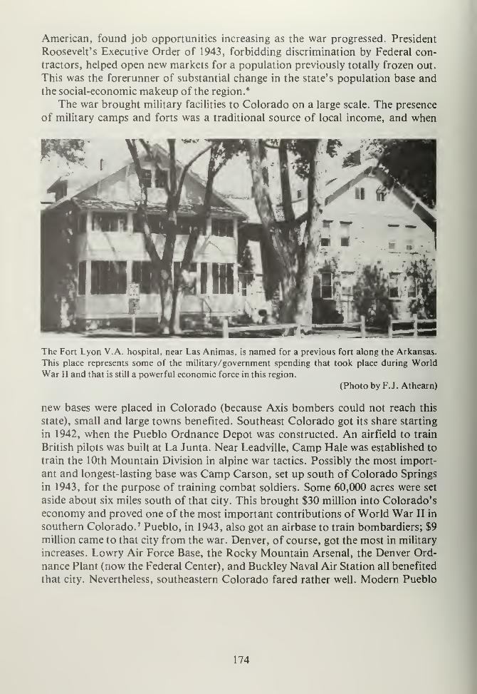
American, found job opportunities increasing as the war progressed. President
Roosevelt's Executive Order of 1943, forbidding discrimination by Federal con-
tractors, helped open new markets for a population previously totally frozen out.
This was the forerunner of substantial change in the state's population base andthe social-economic makeup of the region. 6
The war brought military facilities to Colorado on a large scale. The presence
of military camps and forts was a traditional source of local income, and when
The Fort Lyon V.A. hospital, near Las Animas, is named for a previous fort along the Arkansas.
This place represents some of the military/government spending that took place during World
War II and that is still a powerful economic force in this region.
(Photo by F.J. Athearn)
new bases were placed in Colorado (because Axis bombers could not reach this
state), small and large towns benefited. Southeast Colorado got its share starting
in 1942, when the Pueblo Ordnance Depot was constructed. An airfield to train
British pilots was built at La Junta. Near Leadville, Camp Hale was established to
train the 10th Mountain Division in alpine war tactics. Possibly the most import-
ant and longest-lasting base was Camp Carson, set up south of Colorado Springs
in 1943, for the purpose of training combat soldiers. Some 60,000 acres were set
aside about six miles south of that city. This brought $30 million into Colorado's
economy and proved one of the most important contributions of World War II in
southern Colorado. 7 Pueblo, in 1943, also got an airbase to train bombardiers; $9
million came to that city from the war. Denver, of course, got the most in military
increases. Lowry Air Force Base, the Rocky Mountain Arsenal, the Denver Ord-
nance Plant (now the Federal Center), and Buckley Naval Air Station all benefited
that city. Nevertheless, southeastern Colorado fared rather well. Modern Pueblo
174
and Colorado Springs got their starts at this time, thanks to war-generated in-
come. 8
Later, shortages not only brought immigrants into the state, but also cost
unions considerable power. While the 1930's saw major gains in unionism, the
1943 Colorado Labor Peace Act virtually wiped out every labor gain "made since
the days of Ludlow." Mass picketing, all-union shops, secondary boycotts, and
the use of union funds for political purposes were all outlawed. These restrictions
to labor affected the miners of southeastern Colorado as well as factory laborers
in places like Pueblo. These laws were gradually rescinded, but not without having
done considerable damage to the labor movement in not only Colorado, but par-
ticularly in the Pueblo-Trinidad region. 9
As World War II came to an end, Colorado's future was changed forever by
events of the past five years. By the time of Japan's surrender, farm prices were
already falling and industrial output was down. Recession was on the horizon, as
noted by the Colorado Stock Growers and Feeders Association which admitted:
"We've got more cattle than we can handle." Coal production reached an all-time
high in 1943, and then declined to almost nothing during the early 1950's. Oil and
gas production soared during the war, and older fields like Florence were exten-
sively pumped. Again, as war ended, oil prices fell and production slowed. 10
By the end of the forties, recession set in and southeast Colorado began to
look rather like the late thirties. There was one significant difference: the ever-in-
creasing presence of the Federal Government. World War IPs military bases re-
mained, although on a lesser scale. Farm programs like the Soil Conservation Ser-
vice and Farmer's Home Administration were strong on the eastern plains. Whereoffices were opened, the local economy benefited. The Comanche National Grass-
lands, created from Bankhead-Jones Land Utilization Repurchase Act lands, during
the 1930's, were administered from Springfield, Colorado. The U.S. Forest Service
opened an office here to handle the 420,000 acres for which it was responsible in
1954. Springfield got some badly needed economic help.11 The 1950's were gener-
ally a period of low farm prices, falling demand for minerals and a desperate at-
tempt to "sell Colorado" to easterners. Southeastern Colorado, primarily
dependent upon agriculture, suffered intensely. Sugar beet prices dropped, as did
beef and wheat demand. Farmers planted more and more hoping to make up for
losses. Equally, the Trinidad-Walsenburg region saw mine closings on a regular
basis. The coal market was limited to CF&I's Pueblo plant and, as a result, only a
few company-owned mines west of Trinidad, at Weston and Primero, remained
operational. Colorado Fuel and Iron, however, did expand through purchases of
subsidiary companies on both the east and west coasts. Such diversification pro-
vided little relief for local unemployment problems.
Mining at Climax continued, and AMAX expanded its operations. World-
wide demand for replacement steel caused molybdenum prices to rise. Traditional
mineral operations, like the limestone quarry at Howard, gypsum mining at Coal-
175
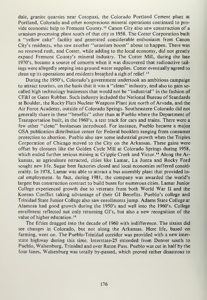
dale, granite quarries near Cotopaxi, the Colorado Portland Cement plant at
Portland, Colorado and other nonprecious mineral operations continued to pro-
vide economic help to Fremont County. 12 Canon City also saw construction of a
uranium processing plant south of that city in 1958. The Cotter Corporation built
a "yellow cake" facility and generated considerable enthusiasm from CanonCity's residents, who saw another "uranium boom" about to happen. There was
no renewed rush, and Cotter, while adding to the local economy, did not greatly
expand Fremont County's mineral industry. The Cotter Mill, during the late
1970's, became a source of concern when it was discovered that radioactive tail-
ings were allegedly seeping into ground water supplies. Cotter eventually agreed to
clean up its operations and residents breathed a sigh of relief.13
During the 1950's, Colorado's government undertook an ambitious campaign
to attract tourists, on the basis that it was a "clean" industry, and also to gain so-
called high technology businesses that would not be "industrial" in the fashion of
CF&I or Gates Rubber. Such industry included the National Bureau of Standards
at Boulder, the Rocky Flats Nuclear Weapons Plant just north of Arvada, and the
Air Force Academy, outside of Colorado Springs. Southeastern Colorado did not
generally share in these "benefits" other than at Pueblo where the Department of
Transportation built, in the 1960's, a test track for cars and trains. There were a
few other "clean" businesses introduced. For instance, Pueblo became a major
GSA publication distribution center for Federal booklets ranging from consumer
protection to abortion. Pueblo also saw some industrial growth when the Triplex
Corporation of Chicago moved to the City on the Arkansas. These gains were
offset by closures like the Golden Cycle Mill at Colorado Springs during 1958,
which ended further serious mining at Cripple Creek and Victor. 14 Along the Ar-
kansas, as agriculture retracted, cities like Lamar, La Junta and Rocky Ford
sought new life. Sugar beet factories closed and local economies suffered consid-
erably. In 1978, Lamar was able to attract a bus assembly plant that provided lo-
cal employment. In fact, during 1981, the company was awarded the world's
largest bus construction contract to build buses for numerous cities. Lamar Junior
College experienced growth due to veterans from both World War II and the
Korean Conflict taking advantage of their GI Benefits. Pueblo's college and
Trinidad State Junior College also saw enrollments jump. Adams State College at
Alamosa had good growth during the 1950's and well into the 1960's. College
enrollment reflected not only returning GI's, but also a new recognition of the
value of higher education. 15
The fifties dragged into the decade of 1960 with indifference. The sixties did
see changes in Colorado, but not along the Arkansas. Here life, based on
farming, went on. The Pueblo-Trinidad corridor was provided with a new inter-
state highway during this time. Interstate-25 extended from Denver south to
Pueblo, Walsenburg, Trinidad and over Raton Pass. Pueblo was cut in half by the
four lanes, Walsenburg was totally by-passed, which proved rather disastrous to
176
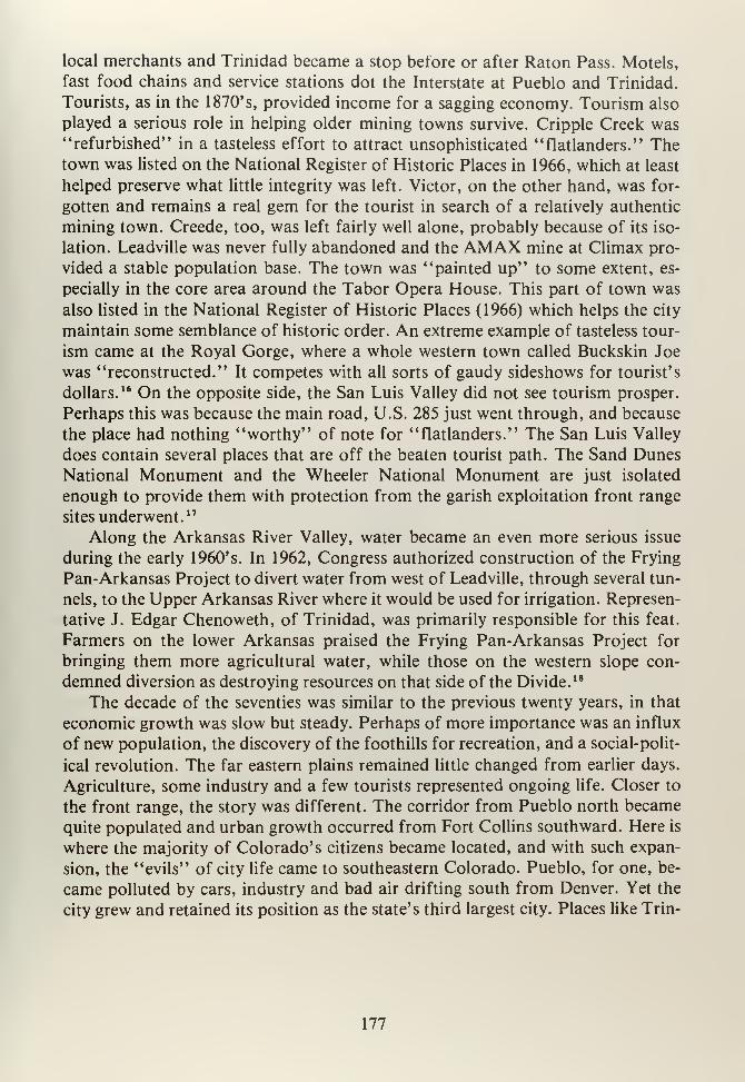
local merchants and Trinidad became a stop before or after Raton Pass. Motels,
fast food chains and service stations dot the Interstate at Pueblo and Trinidad.
Tourists, as in the 1870's, provided income for a sagging economy. Tourism also
played a serious role in helping older mining towns survive. Cripple Creek was''refurbished" in a tasteless effort to attract unsophisticated "flatlanders." Thetown was listed on the National Register of Historic Places in 1966, which at least
helped preserve what little integrity was left. Victor, on the other hand, was for-
gotten and remains a real gem for the tourist in search of a relatively authentic
mining town. Creede, too, was left fairly well alone, probably because of its iso-
lation. Leadville was never fully abandoned and the AMAX mine at Climax pro-
vided a stable population base. The town was "painted up" to some extent, es-
pecially in the core area around the Tabor Opera House. This part of town was
also listed in the National Register of Historic Places (1966) which helps the city
maintain some semblance of historic order. An extreme example of tasteless tour-
ism came at the Royal Gorge, where a whole western town called Buckskin Joe
was "reconstructed." It competes with all sorts of gaudy sideshows for tourist's
dollars.16 On the opposite side, the San Luis Valley did not see tourism prosper.
Perhaps this was because the main road, U.S. 285 just went through, and because
the place had nothing "worthy" of note for "flatlanders." The San Luis Valley
does contain several places that are off the beaten tourist path. The Sand Dunes
National Monument and the Wheeler National Monument are just isolated
enough to provide them with protection from the garish exploitation front range
sites underwent. 17
Along the Arkansas River Valley, water became an even more serious issue
during the early 1960's. In 1962, Congress authorized construction of the Frying
Pan-Arkansas Project to divert water from west of Leadville, through several tun-
nels, to the Upper Arkansas River where it would be used for irrigation. Represen-
tative J. Edgar Chenoweth, of Trinidad, was primarily responsible for this feat.
Farmers on the lower Arkansas praised the Frying Pan-Arkansas Project for
bringing them more agricultural water, while those on the western slope con-
demned diversion as destroying resources on that side of the Divide. 18
The decade of the seventies was similar to the previous twenty years, in that
economic growth was slow but steady. Perhaps of more importance was an influx
of new population, the discovery of the foothills for recreation, and a social-polit-
ical revolution. The far eastern plains remained little changed from earlier days.
Agriculture, some industry and a few tourists represented ongoing life. Closer to
the front range, the story was different. The corridor from Pueblo north became
quite populated and urban growth occurred from Fort Collins southward. Here is
where the majority of Colorado's citizens became located, and with such expan-
sion, the "evils" of city life came to southeastern Colorado. Pueblo, for one, be-
came polluted by cars, industry and bad air drifting south from Denver. Yet the
city grew and retained its position as the state's third largest city. Places like Trin-
177

The Victorian courthouse at Las Animas represents a past that has seen growth from a hostile land
to a fully modern society. The building, erected in the 1880's,has stood the test of time.
(Photo by F.J. Athearn)
The most unbiquitous structure on the plains of southeast Colorado is the ever-present grain ele-
vator.
(Photo by F.J. Athearn)
178
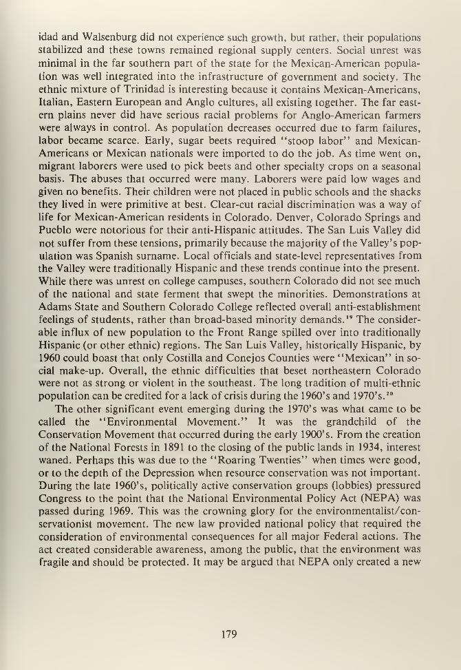
idad and Walsenburg did not experience such growth, but rather, their populations
stabilized and these towns remained regional supply centers. Social unrest was
minimal in the far southern part of the state for the Mexican-American popula-
tion was well integrated into the infrastructure of government and society. Theethnic mixture of Trinidad is interesting because it contains Mexican-Americans,
Italian, Eastern European and Anglo cultures, all existing together. The far east-
ern plains never did have serious racial problems for Anglo-American farmers
were always in control. As population decreases occurred due to farm failures,
labor became scarce. Early, sugar beets required "stoop labor" and Mexican-
Americans or Mexican nationals were imported to do the job. As time went on,
migrant laborers were used to pick beets and other specialty crops on a seasonal
basis. The abuses that occurred were many. Laborers were paid low wages andgiven no benefits. Their children were not placed in public schools and the shacks
they lived in were primitive at best. Clear-cut racial discrimination was a way of
life for Mexican-American residents in Colorado. Denver, Colorado Springs and
Pueblo were notorious for their anti-Hispanic attitudes. The San Luis Valley did
not suffer from these tensions, primarily because the majority of the Valley's pop-
ulation was Spanish surname. Local officials and state-level representatives from
the Valley were traditionally Hispanic and these trends continue into the present.
While there was unrest on college campuses, southern Colorado did not see muchof the national and state ferment that swept the minorities. Demonstrations at
Adams State and Southern Colorado College reflected overall anti-establishment
feelings of students, rather than broad-based minority demands. 19 The consider-
able influx of new population to the Front Range spilled over into traditionally
Hispanic (or other ethnic) regions. The San Luis Valley, historically Hispanic, by
1960 could boast that only Costilla and Conejos Counties were "Mexican" in so-
cial make-up. Overall, the ethnic difficulties that beset northeastern Colorado
were not as strong or violent in the southeast. The long tradition of multi-ethnic
population can be credited for a lack of crisis during the 1960's and 1970's.20
The other significant event emerging during the 1970's was what came to be
called the "Environmental Movement." It was the grandchild of the
Conservation Movement that occurred during the early 1900's. From the creation
of the National Forests in 1891 to the closing of the public lands in 1934, interest
waned. Perhaps this was due to the "Roaring Twenties" when times were good,
or to the depth of the Depression when resource conservation was not important.
During the late 1960's, politically active conservation groups (lobbies) pressured
Congress to the point that the National Environmental Policy Act (NEPA) was
passed during 1969. This was the crowning glory for the environmentalist/con-
servationist movement. The new law provided national policy that required the
consideration of environmental consequences for all major Federal actions. The
act created considerable awareness, among the public, that the environment was
fragile and should be protected. It may be argued that NEPA only created a new
179
bureaucracy and slowed progress, but on the other hand, valuable ecological and
other resources have been preserved due directly to NEPA. 21 In 1964, the Wilder-
ness Act was passed. This legislation, a forerunner of NEPA, set the stage for cre-
ation of Wilderness Areas and affected primarily the Forest Service, which was
told to inventory and then name sites that were "potential" Wilderness Areas. In
the process, seven areas in southeastern Colorado were designated wilderness.
They were La Garita, Collegiate Peaks, Mt. Massive, Holy Cross, Lost Creek,
South San Juan and the Great Sand Dunes. All but one are administered by the
U.S. Forest Service; the Sand Dunes is a National Monument. The Colorado "en-
vironmentalists" enjoyed their greatest triumph in 1973 when, thanks to intense
pressure, Colorado withdrew its bid for the Winter Olympics. The environmental
controversy that embroiled the Olympics may have been the peak of environmen-
tal power in this state for, from that point on, more moderate views were touted
both among hard-core environmentalists and private industry. Most recently, the
U.S. Army's plans to expand Fort Carson into the Pinon Canyon area, east of
Trinidad, has generated considerable environmental discussion."
Present-day activities in this region are traditional. Agriculture remains the
primary economic force in southeastern Colorado. Wheat, hay, some sugar beets,
fruit, beans, barley and other staples are the primary crops. The far eastern plains,
the San Luis Valley, South Park and the Wet Mountain Valley are all agricultural
in nature. Energy development is beginning to revive. Coal, of course, was once a
primary economic force in this region. But today only CF&I still mines this min-
eral at Weston for its Pueblo Plant. However, with the 1973 oil shortage, there
was talk of the vast coal deposits in the Raton Basin. The Federal Government,
which controls considerable blocks of coal lands, is considering the possibility of
leasing these reserves, but due to the current oil glut nothing has happened. TheSan Luis Valley has seen some oil and gas drilling activity. More interesting is the
Valley's geothermal potential. Exploratory works have occurred in this area with
the hope of tapping steam for energy. Near Walsenburg, carbon dioxide (CO 2) is
being removed from Sheep Mountain and sent by pipeline to Texas, where it is
used for recovery in older wells. Atlantic-Richfield operates a large CO 2field in
this area and is continuing exploration. With this interest in minerals and energy-
related products, southeast Colorado may find itself once again a dominant pro-
ducer of fuels. The old days of coal mining could again drive this economy. But
there are many who will not forget the day the mines closed and will always watch
with suspicion "big plans" for mining.
Southeastern Colorado is a place of many contrasts. From snow-capped peaks
on the west to high plains on the east, this area has seen slow changes. First users
were Native Americans who exploited the rich natural resources. Following them,
several nations claimed the region. Spanish, French, Confederate and Americanflags flew over the land at one time or another. All peoples used the land in their
own ways, depending upon need and level of cultural development. However, the
180
progression of southeast Colorado's history was classically "western" in nature.
From fur trappers to miners to cattlemen to settlers to town builders, the Arkansas
River Valley grew in a traditional and steady manner. The Upper Arkansas was
built on mineral extraction and remains tied to mining for its life. South Park has
changed very little since mining died. Cattle raising, hay growing and a few seedy
subdivisions sustain the park. The San Luis Valley was different. Culturally, it
was New Mexican and has remained so to the present. Anglo-American influences
came from some miners and a few settlers. Other than these intrusions, the Valley
remains wonderfully unique.
Perhaps southeastern Colorado is different because it is one place that change
has occurred slowly. It has been said that the more things change the more they
stay the same, which is certainly true for this part of our state.
181

NOTES
CHAPTER XIII
1. Worster, op. cit. See also: Paul Bonnifield, The Dust Bowl, Men, Dirt, De-pression (Albuquerque: University of New Mexico Press, 1979.)
2. John H. Thompson, "The Molybdenum Industry at Climax, Colorado"(M.A. Thesis, University of Colorado, 1943), pp. 6-25, and Athearn, Colo-
radans, op. cit., pp. 301-302.
3. Athearn, Rio Grande, op. cit., pp. 318-320, and Overton, op. cit., p.
4. Athearn, Coloradans, op. cit., pp. 298-299, and Ubbelohde, Benson andSmith, Colorado, op. cit., p. 330.
5. Simmons, op. cit., and Shirley Fujikawa, "Eastdale, Colorado: A Picture
Window Settlement" (Boulder, Colorado: University of Colorado, n.d.,
Seminar Paper.)
6. Athearn, Coloradans, op. cit., p. 301, 303 and 305.
7. Ubbelohde, Benson and Smith, op. cit., pp. 330, 332 and No Author, Fort
Carson: A Tradition of Victory (Ft. Carson, Colorado: Public Affairs and
Information Office, 1972.)
8. Athearn, Coloradans, op. cit., p. 297, and Trindell, "Occupance," op. cit.
9. Ubbelohde, Benson and Smith, op. cit., p. 327, and Athearn, Coloradans,
op. cit., p. 303.
10. Colorado State Planning Commission, Yearbook of the State of Colorado,
1941-1942, (Denver: Smith-Brooks, 1942) and Colorado State Planning Com-mission, Yearbook of the State of Colorado, 1945-1947, (Denver: n.p., 1947.)
11. Culhane, Public Lands, op. cit., p. 48, and Interview, with Robert E. Wag-ner, Bureau of Land Management, Denver, Colorado, May 19, 1982.
12. Colorado Bureau of Mines, Reportfor the Year 1960 (Denver: State Printers,
1961), p. 24.
183
13. "Cotter Corporation Plant Producing Uranium Oxide Yellow Cake," CanonCity Record, September 11, 1958, p. 5, and W.T. Little "New Metal Treat-
ment Mill Already Studying Expansion," Rocky Mountain News, December
9, 1964, p. 34.
14. Athearn, Coloradans, op. cit., pp. 319-320.
15. Ubbelohde, Benson and Smith, op. cit., p. 340.
16. U.S. Department of the Interior, National Park Service, National Register
of Historic Places, Vol. 44, No. 26 (Washington, DC: GPO, 1979), pp. 7437-
7440, and Athearn, Coloradans, op. cit., p. 324.
17. See: Simmons, op. cit.
18. See: Robert G. Dunbar, "Water Conflicts and Controls" in: A Colorado
Reader, Carl Ubbelohde, (Ed.) (Boulder: Pruett, 1962), pp. 219-230; Trin-
dell, "Occupance," op. cit., pp. 148-149; and Athearn, Coloradans, op. cit.,
p. 294.
19. Athearn, Coloradans, ibid., p. 342; Matt S. Meier and Feliciano Rivera, TheChicanos: A History ofMexican Americans (New York: n.p., 1972) and Jose
de Onis, The Hispanic Contribution to the State of Colorado (Boulder: West-
view Press, 1976.)
20. Simmons, op. cit., and Athearn, Coloradans, op. cit., p. 339.
21. Culhane, op. cit., pp. 54-55.
22. Athearn, ibid., pp. 357-360 and p. 398.
184

BIBLIOGRAPHY
185

PRIMARY SOURCES
Manuscripts
No Author. "Rocky Ford as the School Children See It," n.L, n.p., 1925 (xerox
copy).
Autobees, Jose Marino Collection, Colorado Historical Society, Denver, Colorado.
Austin, J.R., "A History of Early Baca County," n.l., n.p., c. 1936.
Aviation in Colorado Collection, Colorado Historical Society, Denver, Colorado.
Bent, George. Papers, Denver Public Library, Western History Collection, Den-
ver, Colorado.
Bent's Fort Collection, Colorado Historical Society, Denver, Colorado.
Bent and St. Vrain Collection, University of Colorado, Western History Collec-
tion, Boulder, Colorado.
Bent-Hyde Collection, University of Colorado, Western History Collection,
Boulder, Colorado.
Blackmore, William. Microfilm, Colorado Historical Society, Denver, Colorado.
Carson, Christopher Collection, Colorado Historical Society, Denver, Colorado.
Chivington, John M. Collection, Denver Public Library, Western History Col-
lection, Denver, Colorado.
Christy, Robert. "The Dauntless Posse, The Fleagle Bank Robbery." Lamar,
Colorado, 1969, Manuscript in: Prowers County Historical Society.
Civil Workers Administration. Interviews, Las Animas County, Colorado, 1933-
1934, Vol. 1, in: Colorado Historical Society, Denver, Colorado.
. Interview, Huerfano County, Colorado, 1933-1934, in:
Colorado Historical Society, Denver, Colorado.
"Claims Club," copy, CWA Collection, Vol. 343, Colorado Historical Society,
Denver, Colorado.
187
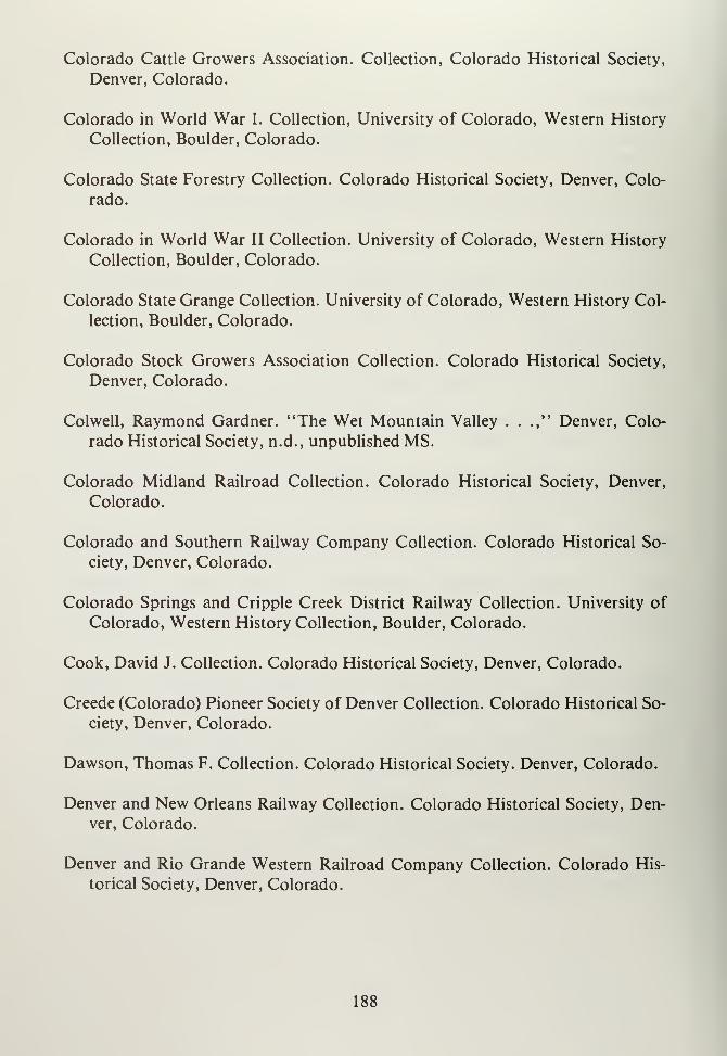
Colorado Cattle Growers Association. Collection, Colorado Historical Society,
Denver, Colorado.
Colorado in World War I. Collection, University of Colorado, Western History
Collection, Boulder, Colorado.
Colorado State Forestry Collection. Colorado Historical Society, Denver, Colo-
rado.
Colorado in World War II Collection. University of Colorado, Western History
Collection, Boulder, Colorado.
Colorado State Grange Collection. University of Colorado, Western History Col-
lection, Boulder, Colorado.
Colorado Stock Growers Association Collection. Colorado Historical Society,
Denver, Colorado.
Colwell, Raymond Gardner. "The Wet Mountain Valley . . .," Denver, Colo-
rado Historical Society, n.d., unpublished MS.
Colorado Midland Railroad Collection. Colorado Historical Society, Denver,
Colorado.
Colorado and Southern Railway Company Collection. Colorado Historical So-
ciety, Denver, Colorado.
Colorado Springs and Cripple Creek District Railway Collection. University of
Colorado, Western History Collection, Boulder, Colorado.
Cook, David J. Collection. Colorado Historical Society, Denver, Colorado.
Creede (Colorado) Pioneer Society of Denver Collection. Colorado Historical So-
ciety, Denver, Colorado.
Dawson, Thomas F. Collection. Colorado Historical Society. Denver, Colorado.
Denver and New Orleans Railway Collection. Colorado Historical Society, Den-
ver, Colorado.
Denver and Rio Grande Western Railroad Company Collection. Colorado His-
torical Society, Denver, Colorado.
188
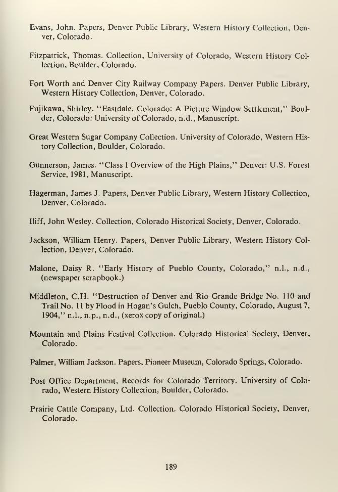
Evans, John. Papers, Denver Public Library, Western History Collection, Den-
ver, Colorado.
Fitzpatrick, Thomas. Collection, University of Colorado, Western History Col-
lection, Boulder, Colorado.
Fort Worth and Denver City Railway Company Papers. Denver Public Library,
Western History Collection, Denver, Colorado.
Fujikawa, Shirley. "Eastdale, Colorado: A Picture Window Settlement," Boul-
der, Colorado: University of Colorado, n.d., Manuscript.
Great Western Sugar Company Collection. University of Colorado, Western His-
tory Collection, Boulder, Colorado.
Gunnerson, James. "Class I Overview of the High Plains," Denver: U.S. Forest
Service, 1981, Manuscript.
Hagerman, James J. Papers, Denver Public Library, Western History Collection,
Denver, Colorado.
Iliff, John Wesley. Collection, Colorado Historical Society, Denver, Colorado.
Jackson, William Henry. Papers, Denver Public Library, Western History Col-
lection, Denver, Colorado.
Malone, Daisy R. "Early History of Pueblo County, Colorado," n.l., n.d.,
(newspaper scrapbook.)
Middleton, C.H. "Destruction of Denver and Rio Grande Bridge No. 110 and
Trail No. 1 1 by Flood in Hogan's Gulch, Pueblo County, Colorado, August 7,
1904," n.l., n.p., n.d., (xerox copy of original.)
Mountain and Plains Festival Collection. Colorado Historical Society, Denver,
Colorado.
Palmer, William Jackson. Papers, Pioneer Museum, Colorado Springs, Colorado.
Post Office Department, Records for Colorado Territory. University of Colo-
rado, Western History Collection, Boulder, Colorado.
Prairie Cattle Company, Ltd. Collection. Colorado Historical Society, Denver,
Colorado.
189
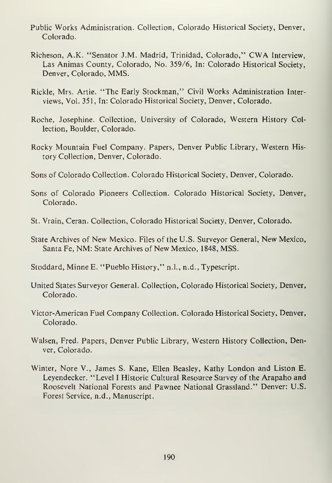
Public Works Administration. Collection, Colorado Historical Society, Denver,
Colorado.
Richeson, A.K. "Senator J.M. Madrid, Trinidad, Colorado," CWA Interview,
Las Animas County, Colorado, No. 359/6, In: Colorado Historical Society,
Denver, Colorado, MMS.
Rickle, Mrs. Artie. "The Early Stockman," Civil Works Administration Inter-
views, Vol. 351, In: Colorado Historical Society, Denver, Colorado.
Roche, Josephine. Collection, University of Colorado, Western History Col-
lection, Boulder, Colorado.
Rocky Mountain Fuel Company. Papers, Denver Public Library, Western His-
tory Collection, Denver, Colorado.
Sons of Colorado Collection. Colorado Historical Society, Denver, Colorado.
Sons of Colorado Pioneers Collection. Colorado Historical Society, Denver,
Colorado.
St. Vrain, Ceran. Collection, Colorado Historical Society, Denver, Colorado.
State Archives of New Mexico. Files of the U.S. Surveyor General, New Mexico,
Santa Fe, NM: State Archives of New Mexico, 1848, MSS.
Stoddard, MinneE. "Pueblo History," n.l., n.d., Typescript.
United States Surveyor General. Collection, Colorado Historical Society, Denver,
Colorado.
Victor-American Fuel Company Collection. Colorado Historical Society, Denver,
Colorado.
Walsen, Fred. Papers, Denver Public Library, Western History Collection, Den-
ver, Colorado.
Winter, Nore V., James S. Kane, Ellen Beasley, Kathy London and Liston E.
Leyendecker. "Level I Historic Cultural Resource Survey of the Arapaho and
Roosevelt National Forests and Pawnee National Grassland." Denver: U.S.
Forest Service, n.d., Manuscript.
190
Wulsten, Carl. Papers, Denver Public Library, Western History Collection, Den-
ver, Colorado.
Interviews
Interview with Robert Wagner, Bureau of Land Management, Denver, Colorado,
1982.
Published Documents
Adamson, Raymond K. Productivity and Employment in Selected Industries:
Beet Sugar. WPA, National Research Project. Philadelphia: WPA, 1938.
Ahlborn, Richard E. The Penitente Moradas ofAbiquiu. Washington, DC: GPO,1968.
Arguimbau, Ellen. (Comp.) A Guide to Manuscript Collections. Boulder: West-
ern Historical Collections, University of Colorado, 1977.
Beetle, Alan A. Agricultural Problems in Arid and Semiarid Environments: ASymposium Held at the University of Wyoming. Laramie, Wyoming: Univer-
sity of Wyoming, 1959.
Board of Trade of Southern Colorado. The Geography, Description and Re-
sources of Central and Southern Colorado. Pueblo, Colorado: Colorado
Chieftan Book and Job Office, 1869.
Butters, R.M. . . . Permian or "Permo-carboniferous" of the Eastern Foothills ofthe Rocky Mountains in Colorado. Denver: Smith-Brooks, 1913.
Camp and Plant. Denver and Pueblo: Colorado Fuel and Iron, 1901-1904. V. 1-4,
v. 5. Sociological Department, CF&I.
Canon City, Colorado. Chamber of Commerce. Canon City, Colorado: n.p.,
n.d.
Colorado Bureau of Immigration and Statistics. The Natural Resources and in-
dustrial Development and Condition of Colorado. Denver: The Bureau, 1889.
Colorado Bureau of Mines. Report for the Year 1960. Denver: State Printers,
1961.
191
Colorado State Planning Commission. Year Book for the State of Colorado,
1941-1942. Denver: Smith-Brooks, 1942.
. Year Book of the State of Colorado, 1945-1947. Denver:
n.p., 1947.
Colorado State Board of Immigration. Year Book of the State of Colorado, 1918.
Denver: Welch-Haffner, 1918.
Colorado Geological Survey. Underground Water Possibilitiesfor Stock and Do-
mestic Purposes in the La Junta Area, Colorado. Boulder: Daily Camera,
1924. Bulletin 27, Parti.
Coffin, Reuben C. . . . Preliminary Report on the Underground Waters of a Part
ofSoutheastern Colorado. Denver: State Printers (Eames), 1921.
Dames and Moore. Draft Environmental Statement, Land Acquisition at Fort
Carson, Colorado. Denver: Dames and Moore, 1974.
Darton, Nelson H. Geology and Underground Waters of the Arkansas Valley in
Eastern Colorado. Washington, DC: GPO, 1906.
Emmons, Samuel F. "The Mines of Custer County Colorado," in WhitmanCross, Geology of the Silver Cliff and Rosita Hills, Colorado District. Wash-ington, DC: GPO, 1896.
Emmons, William H., . . . Geology and Ore Deposits of the Creede District,
Colorado. Washington, DC: GPO, 1923.
Follansbee, Robert. The Arkansas River Flood of June 3-5, 1921. Washington,
DC: GPO, 1922.
Gilbert, G.K. Pueblo Folio. Washington, DC: GPO, 1897.
George, R.D., et. al. Analyses of Colorado Coals. Washington, DC: GPO, 1937.
Gilbert, Grove K. . . . The Underground Water of the Arkansas Valley in Eastern
Colorado. Washington, DC: GPO, 1896.
Hayden, Ferdinand V. Annual Report of the United States Geological Survey andGeographical Survey of the Territories, Embracing Colorado, Being a Report
of Progress of the Exploration for the Year 1873. Washington, DC: GPO,1874.
192
Henderson, C.W. Mining in Colorado. Washington, DC: GPO, 1926.
Las Animas Regional Planning Commission. "Aguilar Master Plan, 1980." Den-
ver: Colorado Division of Planning, 1972.
Lovering, T.S. and E.N. Goddard. Geology and Ore Deposits of the Front Range,
Colorado. Washington, DC: GPO, 1951.
Mautner, Bertram H. Child Labor in Agricultural and Farm Life in the Arkansas
Valley of Colorado . . . New York: National Child Labor Committee, 1929.
McCrary, Irvin J. Pueblo Improvement Plan: A Report to the Commissioners ofthe City ofPueblo. Pueblo, Colorado: Franklin, 1916.
New Mexico State Records Center. Calendar of the Spanish Archives of NewMexico. Santa Fe, New Mexico: SANM, 1972.
Calendar of the Microfilm Edition of the Territorial Ar-
chives ofNew Mexico. Santa Fe, New Mexico: SANM, 1974.
No Author. Agricultural Yearbookfor Colorado. Washington, DC: GPO, 1941.
No Author. Catalog of the Western Research Collection, Pueblo Regional Library
District. Pueblo, Colorado: n.p., 1976.
No Author. Colonel Kearney's Expedition of 1845. Report of Secretary of War,
29th Congress, First Session.
No Author. Colorado Mining Directory . . . Denver: The Colorado Mining Dir-
ectory Co., 1883.
No Author. Colorado Handbook, Agricultural and Range Agricultural andRange Conservation Programs. Washington, DC: GPO, 1939.
No Author. Geology and Mining Industries of the Cripple Creek District. Colo-
rado. Washington, DC: GPO, 1895.
No Author. Fort Carson: A Tradition of Victory. Fort Carson, Colorado: Public
Affairs and Information Office, 1972.
No Author. National Forests of Colorado. Washington, DC: GPO, 1928.
193
No Author. Report ofAuthorizationsfor Surveyfor Transmountain Diversion ofWaters. Washington, DC: GPO, 1938.
No Author. Report of the Board of Immigration of Colorado Territory for the
Two Years Ending December 21 , 1873. Denver: Board of Immigration, 1874.
No Author. Report of Compacts Between Nebraska, Colorado and Kansas with
Respect to the Republican River. Washington, DC: GPO, 1940.
No Author. The Mining Book, 1936. Denver: Colorado Mining Association, 1936.
No Author. The Cost of Producing Sugar Beets in Colorado. Washington, DC:GPO, 1926.
Patton, Horace B. . . . Geology and Ore Deposits of the Bonanza District,
Saguache County, Colorado. Denver: Eames Brothers, 1916. (State Geologi-
cal Survey Bulletin Number 9.)
. . . Geology and Ore Deposits of the Platoro-Summit-
ville Mining District, Colorado. Denver: Eames Brothers, 1917, 1918. (Colo-
rado Geological Survey, Bulletin Number 13.)
Scott, Glenn R. Historic Trail Map of the La Junta 2° Quadrangle, Colorado.
Denver: U.S. Geological Survey, 1972.
Sims, P.K. and D.M. Sheridan. Geology of Uranium Deposits In Front Frange,
Colorado. Washington, DC: GPO, 1964.
Skunderna, A.W., et. al. Agronomic Evaluation of Tests on Mechanical Block-
ing and Cross Cultivation ofSugar Beets. Washington, DC: GPO, 1937.
Snipes, R.J. Floods ofJune, 1965 in Arkansas River Basin, Colorado, Kansas andNew Mexico. Washington, DC: GPO, 1974.
State of Colorado. Colorado Commission of Spanish-surnamed Citizens, n.l.,
n.p., 1967.
Sweet, A.T. and Wayne Inman. So/7 Survey of the Arkansas Valley Area, Colo-
rado. Washington, DC: GPO, 1926.
Tate, Marcia J. Colorado State Parks Archaeology Manual. Denver: Office of the
State Archaeologist, 1978.
194
Taylor, Theodore W. The States and Their Indians. Washington, DC: GPO, 1972.
Tyler, S. Lyman. A History ofIndian Policy. Washington, DC: GPO, 1973.
U.S. Bureau of Reclamation. Final Environmental Statement, Frying Pan-
Arkansas Project. Denver: GPO, 1975.
U.S. Commission on Industrial Relations. The Colorado Coal Miners' Strike.
Washington, DC: GPO, 1916.
U.S. Census Bureau. U.S. Census. Washington, DC: GPO, 1860 and 1870.
Twelfth Census of the United States. Washington, DC:GPO, 1910.
U.S. Congress. 36th Congress, House Report 1951, Senate Report 228, 1st Ses-
sion. Washington, DC: n.p., 1860.
58th Congress. Second Session. Senate Documents. La-
bor Troubles in Colorado. Washington, DC: GPO, 1904.
U.S. Statues at Large. "An Act to Confirm Certain Pri-
vate Land Claims in the Territory of New Mexico." Washington, DC: GPO,1863.
U.S. Department of the Interior, National Park Service. National Register ofHis-
toric Places. Washington, DC: GPO, 1979.
U.S. Geological Survey. Geology of Silver Cliff and the Rosita Hills, Colorado.
Denver: GPO, n.d.
U.S. National Park Service. Founders and Frontiersmen: Historic Places Com-memorating Early Nationhood and the Westward Movement, 1783-1828.
Washington, DC: GPO, 1967.
U.S. War Department. The Arkansas River and Tributaries. Washington, DC:GPO, 1936.
Wheeler, W.W. and Associates. Water Legislation Investigations for the Arkansas
River Basin in Colorado. Denver: n.p., 1968.
195
SECONDARY SOURCES
Books
No Author. Buckskin Joe Mining District Colorado. Laws, Statutes, etc., Early
Mining Laws ofBuckskin Joe, 1859. Boulder, Colorado: Johnson, 1961.
No Author. Creede Camp: The Greatest Mineral Discovery Since the Days ofLeadville. n.l., n.p., 1896.
No Author. The Cripple Creek Short Line Trip is the Most Wonderful Sightseeing
Trip in America. Denver: Williamson-Haffner, 1915.
No Author. The City of Pueblo: The Greatest Railway and Manufacturing Cen-
ter of Colorado . . . Pueblo, Colorado: Pueblo Printing, 1888.
No Author. Directory of the City of Pueblo. Pueblo, Colorado: Ives & Rood,1886-1889 and 1900-Present.
No Author. Florence: Its Resources, Its Attractions, Its Possibilties. Pueblo, Colo-
rado: Florence Chamber of Commerce, 1904.
No Author. Fremont County, Colorado: Its Resources and Attractions. CanonCity, Colorado: Gazette-Express Print, 1882.
No Author. Folks and Fortunes: Saga of the San Luis Valley in Colorado. MonteVista, Colorado: Monte Vista Journal, 1949.
No Author. Historical and Descriptive of Fremont and Custer Counties. CanonCity, Colorado: Binckley & Hartwell, 1879.
No Author. History of the Arkansas Valley, Colorado . . . Chicago, Illinois: Bas-
kin, 1881.
No Author. History and Description of the Cripple Creek Mining District . . .
Cripple Creek, Colorado: Hazeltine&Co., 1894.
No Author. History of Custer County, Colorado Stockgrowers. Westcliffe, Colo-
rado: Wet Mountain Tribune, 1966.
No Author. Semi-Centennial of the Organization of the First Presbyterian Church,
196
Rocky Ford, Colorado, 1888-1938 and Early History of Rocky Ford. RockyFord, Colorado: n.p., 1938.
No Author. Souvenir, Cripple Creek to Florence. Denver, Colorado: Williamson-Haffner, 1908.
No Author. Souvenir ofPueblo. Portland, Oregon: L.H. Nelson Co., n.d.
No Author. Spanish and Mexican Land Grants. New York: Arno Press, 1974.
No Author. Story of the Cripple Creek Short Line . . . n.l., n.p., n.d.
No Author. Welcome to Rocky Ford: Melon Capital of the World, n.l., n.d., 1964.
No Author. Wesley Methodist Church, Diamond Jubilee. Pueblo, Colorado:n.p., 1965.
Abert, James W. Western America in 1846-1847 . . . San Francisco: Jowell, 1966.
Abbott, Carl. Colorado: A History of the Centennial State. Boulder, Colo-
rado: CAUP, 1976.
Adams, Graham. Age of Industrial Violence, 1910-1915, the Activities and Find-
ings of the United States Commission on Industrial Relations. New York, NewYork: Columbia University Press, 1966.
Adams, Robert H. The New West: Landscapes Along the Colorado Front Range.
Boulder: CAUP, 1971.
The Architecture and Art of Early Hispanic Colorado.
Boulder, Colorado: CAUP, 1974.
.. White Churches of the Plains: Examplesfrom Colorado.
Boulder, Colorado: CAUP, 1974.
Agnew, S.C. Garrisons of the Regular U.S. Army: New Mexico, 1846-1899. Santa
Fe, New Mexico: Press of the Territorian, 1971.
Allen, James B. The Company Town in the American West. Norman, Oklahoma:
University of Oklahoma Press, 1966.
197
Allen, Mary Moore. Origin ofNames ofArmy and Air Corps Posts, Camps, andStations in World War II in Colorado. Goldboro, North Carolina: n.p., n.d.
Alter, Cecil J. Jim Bidger. Norman, Oklahoma: University of Oklahoma Press,
1962.
Anderson, George L. . . . General William Jackson Palmer: A Decade of Colo-
rado Railroad Building, 1870-1880. Colorado Springs, Colorado: n.p., 1936.
Appleton, Roger. The Cripple Creek and Victor Narrow Gauge Railroad. Crip-
ple Creek, Colorado: Feitz, 1970.
Armitage, Merle. Operations Santa Fe: Atchison, Topeka and Santa Fe Railway
System. New York: Duell, Sloan and Pearce, 1948.
Arps, Louisa A. Chalk Creek, Colorado. Denver, Colorado: J. Van Mole, 1940.
Arrington, Leonard J. The Changing Economic Structure of the Mountain West,
1850-1950. Logan, Utah: Utah State University Press, 1963.
Athearn, Frederic J. An Isolated Empire: A History of Northwestern Colorado.
Denver, Colorado: Bureau of Land Management, 1981, 3rd Ed.
Athearn, Robert G. Union Pacific Country. Chicago, Illinois: Rand McNally,
1971.
The Coloradans. Albuquerque, New Mexico: University
of New Mexico Press, 1976.
The Denver and Rio Grande Western Railroad. Lincoln,
Nebraska: University of Nebraska Press, 1977.
Atherton, Lewis E. The Cattle Kings. Bloomington, Indiana: Indiana University
Press, 1961.
Bailey, Jesse D. Diego de Vargas and the Reconquest ofNew Mexico. Albuquer-que, New Mexico: University of New Mexico Press, 1942.
Bailey, Lynn Robinson. Indian Slave Trade in the Southwest: A Study of Slave-
taking and Traffic of Indian Captives. Los Angeles, California: Westernlore,
1966.
198
Baker, James H., and LeRoy R. Hafen, (eds.). History of Colorado. Denver,
Colorado: Linderman, 1927.
Bancroft, Caroline. Tabor's Matchless Mine and Lusty Leadville. Boulder, Colo-
rado: Johnson, 1967.
Bancroft, Hubert H. History ofNevada, Colorado and Wyoming. San Francisco,
California: The History Company, 1880.
Bannon, John Francis. The Spanish Borderlands Frontier, 1513-1821. New York:
Holt, Rinehart and Winston, 1970.
Bartlett, Richard A. Great Surveys of the American West. Norman, Oklahoma:University of Oklahoma Press, 1962.
Baskin, O.L. History of the Arkansas Valley. Chicago, Illinois: O.L. Baskin &Co., 1881.
Bauer, William H. Colorado Postal History: The Post Offices. Crete, Nebraska:
J—B Publishing Company, 1971.
Bean, Geraldine. Charles Boettcher: A Study in Pioneer Western Enterprise.
Boulder, Colorado: Westview Press, 1976.
Bean, Luther E. Land of the Blue Sky People: A Story of the San Luis Valley.
Monte Vista, Colorado: Monte Vista Journal, 1962.
Beckner, Raymond M. Old Forts of Southern Colorado. Pueblo, Colorado:
O'Brien, 1975.
Beck, Warren A. New Mexico: A History of Four Centuries. Norman, Oklahoma:
University of Oklahoma Press, 1963.
Beebe, Lucius and Charles Clegg. Narrow Gauge in the Rockies. Berkeley, Cali-
fornia: Howell-North, 1958.
Beebe, Lucius M. Rio Grande: Mainline of the Rockies. Berkeley, California:
Howell-North, 1962.
Beecher Island Battle Memorial Association. The Beecher Island Annual. Wray,
Colorado: The Beecher Island Battle Memorial Association, 1904. Vol. 1.
199
Bennett, Edwin L. Boom Town Boy: In Old Creede, Colorado. Chicago, Illinois:
Sage, 1968.
Bent, George. Life of George Bent Written from His Letters. Norman, Oklahoma:
University of Oklahoma Press, 1968.
Berry, Don. A Majority of Scoundrels: An Informal History of the Rocky Moun-tain Fur Company. New York: Harper, 1961.
Beshoar, Barron B. Out of the Depths. Denver, Colorado: Colorado Labor His-
torical Committee, 1942.
. Hippocrates in a Red Vest. Palo Alto, California: Amer-ican West Publishing Company, 1973.
Berthong, Donald. The Southern Cheyenne, Norman Oklahoma: University of
Oklahoma Press, 1965.
Bethel Methodist Church. Golden Anniversary. Pueblo, Colorado: n.p., 1952.
Beulah Methodist Church. Beulah Land. Beulah, Colorado: Beulah Methodist
Church South, 1951.
Blackmore, William. Colorado: Its Resources, Parks and Prospects as a NewFieldfor Emigration: With an Account of the Trenchara and Costilla Estates
in the San Luis Park. London: Low, Son and Martson, 1869.
Blair, Edward. Palace ofIce: A History of the Leadville Ice Palace of 1896. Lead-
ville, Colorado: Timberline Books, 1972.
Everybody Came to Leadville. Leadville, Colorado:
Timberline Books, 1971.
Tabor Family Album. Leadville, Colorado: Timberline
Books, 1974.
Bluemel, Elinor. One Hundred Years of Colorado Women. Denver, Colorado:
n.p., 1973.
Billington, Ray A. Westward Expansion: A History of the American Frontier.
New York: MacMillan, 1974.
200
Bolton, Herbert E. Spanish Borderlands. Norman, Oklahoma: University of Ok-lahoma Press, 1964.
Bonnifield, Paul. The Dust Bowl: Men, Dirt, Depression. Albuquerque, NewMexico: University of New Mexico Press, 1979.
Bowlby, Bethene A. Pathway to Progress: A History of the Arkansas Valley,
Colorado. Pueblo, Colorado: Frying Pan-Arkansas Project Office, 1964.
Bowles, Samuel A. A Summer Vacation in the Parks and Mountains of Colorado.Springfield, Massachusetts: Bowles, 1869.
Boyd, LeRoy. Fort Lyon, Colorado: One Hundred Years of Service. Colorado
Springs, Colorado: H&H Printing, 1967.
Bradley, Glenn D. The Story of the Santa Fe. Boston, Massachusetts: Badger,
1920.
Brandon, William. The Men and the Mountain: Fremont's Fourth Expedition.
New York: Morrow, 1955
Brayer, Garnet M. American Cattle Trails, 1540-1900. Bayside, New York: Amer-ican Pioneer Trails Association, 1952.
Brayer, Herbert O. William Blackmore, A Case Study in the Economic Develop-
ment of the West. Denver, Colorado: Bradford-Robinson, 1949.
Breck, Allen D. The Centennial History of the Jews in Colorado: 1859-1959. Den-
ver, Colorado: Hirschfeld, 1961.
William Gray Evans, 1855-1924: Portrait of a Western
Executive. Denver, Colorado: University of Denver, 1964.
Brewerton, George D. Overland with Kit Carson: A Narrative of the Old Spanish
Trail in '48. New York: Coward-McCann, 1930.
Brigham, Lillian R. Historical Guide to Colorado: A Pilgrimage over the Old
Trails to Outstanding Sites and Landmarks. Denver, Colorado: Daughters of
the American Revolution, 193 1
.
Brinckerhoff, Sidney B. Lancers for the King: A Study of the Frontier Military
201
System of Northern New Spain. Phoenix, Arizona: Arizona Historical Foun-
dation, 1965.
Brisbin, James S. The BeefBonanza: Or How to Get Rich on the Plains, Being ADescription of Cattle-Growing, Sheep-Farming, Horse-Raising, and Dairying
in the West. Norman, Oklahoma: University of Oklahoma Press, 1959 (Re-
print).
Brubacker, Roy G. The Manassa Mauler: A Souvenir of Manassa, Colorado,
Birthplace of "Jack" Dempsey. Manassa, Colorado: Manassa Town Council,
1966.
Bryant, Keith L. Jr. History of the Atchison, Topeka and Santa Fe Railway. NewYork: MacMillan, 1975.
Bunker, Hazel. Seeing Cripple Creek: A Self Conducted Tour of the World's
Greatest Gold Camp. Cripple Creek, Colorado: Feitz, 1970.
Cafky, Morris. Colorado Midland. Denver, Colorado: Rocky Mountain Railroad
Club, 1965.
Chicago, Burlington and Quincy Railroad Co. Eastern Colorado: A Brief De-
scription of the New Lands Now Being Opened Up . . . Omaha, Nebraska:
n.p., 1887.
A Handbook of Colorado . . ..Chicago, Illinois: Poole,
1897.
Chicago, Rock Island and Pacific Railway Co. Colorado Cities and Places. Chi-
cago, Illinois: n.p., 1890.
Chittenden, Hiram. American Fur Trade of the Far West. New York: n.p., 1902.
2 Vols.
Chronic, John. Prairie, Peak and Plateau: A Guide to the Geology of Colorado.
Denver, Colorado: Colorado Geological Survey, 1972.
Clark, Ira G. Then Came the Railroads: The Centuryfrom Steam to Diesel in the
Southwest. Norman, Oklahoma: University of Oklahoma Press, 1958.
Clarke, R. Neilson. The Humbolt-Poachontas Vein, Rosita, Colorado. Rosita,
Colorado: n.p., 1878.
202
Clason, George S. Free Homestead Lands in Colorado Described. Denver, Colo-
rado: The Clason Map Company, 1915.
Cleland, Robert G. This Reckless Breed ofMen. New York: Knopf, 1950.
Coffin, Morse H. The Battle of Sand Creek. Waco, Texas: W.M. Morrison, 1965.
Collier, William R. Dave Cook of the Rockies . . .. New York: Wilson, 1936.
Colorado and Southern Railway Co. Colorado's Mineral Wealth. Denver, Colo-
rado: Smith-Brooks, 1904(7).
Colorado Midland Railway Company. From Plains to Peaks: A Handbook forTourists in the Rocky Mountains. Chicago, Illinois: Poole, 1888.
Colorado Mine Operator's Association. Criminal Record of the Western Feder-
ation of Miners from Coeur d'Alene to Cripple Creek, 1894-1904. Colorado
Springs, Colorado: n.p., 1904.
Colorado Historical Society. Bent's Fort on the Arkansas. Denver, Colorado:
Colorado Historical Society, 1954.
Colton, Ray C. The Civil War in the Western Territories. Norman, Oklahoma:University of Oklahoma Press, 1959.
Rails Around Gold Hill. Denver, Colorado: RockyMountain Railroad Club, 1955.
Calef, Wesley. Private Grazing and Public Land. Chicago, Illinois: University of
Chicago Press, 1960.
Calhoun, W.C. History of Cripple Creek: America's Most Famous Gold Camp.Denver, Colorado: Calhoun, 1896.
Campa, Arthur L. The Treasure of the Sangre de Cristos: Tales and Traditions ofthe Spanish Southwest. Norman, Oklahoma: University of Oklahoma Press,
1963.
Campbell, Rosemae W. From Trappers to Tourists: Fremont County, Colorado,
1830-1950. Palmer Lake, Colorado: Filter Press, 1972.
203
Campbell, Walter S. The Old Santa Fe Trail. Boston, Massachusetts: Houghton,Mifflin, 1939.
Wagons Southwest: Story of Old Trail to Santa Fe . . .
New York: American Pioneer Trails Association, 1964.
Carey, R.G. A Collection of Documents Concerning the Battle of Sand Creek,
November 29, 1864. Denver, Colorado: n.p., 1958.
Carr, Ralph L. William Gilpin, Pioneer. Pueblo, Colorado: Rocky MountainBank Note, 1940.
Carroll, John M. Buffalo Soldiers West. Fort Collins, Colorado: Old ArmyPress, 1971.
Carter, Harvey L. Dear Old Kit: The Historical Christopher Carson. Norman,Oklahoma: University of Oklahoma Press, 1968.
. Zebulon Montgomery Pike, Pathfinder and Patriot.
Colorado Springs, Colorado: Dentan, 1965.
Carstensen, Vernon (ed.) The Public Lands, Studies in the History of the Public
Domain. Madison, Wisconsin: University of Wisconsin Press, 1963.
Chappell, Gordon S. Farewell to Cumbres. Golden, Colorado: Colorado Rail-
road Museum, 1967.
To Santa Fe by Narrow Gauge: The D&RG's "Chili
Line. "Golden, Colorado: Colorado Railroad Museum, 1973.
Chase, John. The Military Occupation of the Coal Strike Zone of Colorado Na-
tional Guard, 1913-1914. Denver, Colorado: Smith-Brooks, 1914.
Coquoz, Rene L. Early Days of Colorado: New Tales of Early Leadville. n.l.,
n.p., 1954.
The History of Medicine in Leadville and Lake County,
Colorado. Leadville, Colorado: n.p., 1967.
The Invisible Men on Skis: The Story of the Construction
ofCamp Hale and the Occupation by the 10th Mountain Division, 1942-1945.
Boulder, Colorado: Johnson, 1971.
204
King Pleasure Reigned in 1896: The Story of the Fabu-
lous Leadville Ice Palace. Boulder, Colorado: Johnson, 1969.
The Leadville Story: A Brief Story 1860-1960. Boulder,
Colorado: Johnson, 1971.
Coues, Elliot (ed.) The Journal of Jacob Fowler, Narrating an Adventure fromArkansas Through Indian Territory, Oklahoma, Kansas, Colorado and NewMexico to the Sources of the Rio Grande del Norte, 1821-1822. New York:
n.p., 1898.
. The Expeditions of Zebulon Montgomery Pike. NewYork: Francis P. Harper, 1925.
Craig, Reginald S. The Fighting Parson: The Biography of Colonel John M.Chivington. Los Angeles, California: n.p., 1959.
Cripple Creek Times. Story of the World's Greatest Gold Camp, the LaborTroubles 1903-1904. Cripple Creek, 'Colorado: n.p., 1904.
Crofutt, George. A Grip-Sack Guide to Colorado. Omaha, Nebraska: Overland,
1881.
Culhane, Paul J. Public Land Politics. Baltimore, Maryland: Johns Hopkins
Press, 1981.
Dale, Edward Everett. The Range Cattle Industry. Norman, Oklahoma: Univer-
sity of Oklahoma Press, 1930.
Cow Country. Norman, Oklahoma: University of Okla-
homa Press, 1942.
Dana, John C. Colorado: About Its Climate. n.L: Denver, Union Pacific, Den-ver and Gulf Railway and Denver, Leadville and Gunnison Railway Com-panies, 1898.
Daney, Isabel S. Pueblo's First Cross: Episcopal Church History. Denver, Colo-
rado: Big Mountain Press, 1966.
Daughters of the American Revolution. Pueblo County History. n.L: Daughters
of the American Revolution, Pueblo Chapter, 1939.
205
Davis, Carlyle C. Olden Times in Colorado. Los Angeles, California: Phillips,
1916.
Davis, Clyde B. The Arkansas. New York: Farrar and Rinehart, 1940.
Delaney, Howard L. All Our Yesterdays: The Story of St. Mary's Parish, Walsen-
burg, Colorado. Walsenburg, Colorado: (?), Consolidated, 1944.
Dempsey, Jack. Dempsey, By the Man Himself. New York: Simon and Schuster,
1960.
Round by Round, An Autobiography. New York:
McGraw-Hill, 1940.
Denison, Charles. Rocky Mountain Health Resorts. Boston, Massachusetts:
Houghton, Osgood and Co., 1880.
de Onis, Jose. The Hispanic Contributions to the State of Colorado. Boulder,
Colorado: Westview Press, 1976.
Dick, Everett. The Sod-House Frontier. Lincoln, Nebraska: University of
Nebraska Press, 1954.
. The Lure of the Land: A Social History of the Public
Landsfrom the Articles of Confederation to the New Deal. Lincoln, Nebraska:
University of Nebraska Press, 1970.
Donnelly, Thomas C. (ed.) Rocky Mountain Politics. Albuquerque, New Mex-ico: University of New Mexico Press, 1940.
Drago, Harry S. Great American Cattle Trails: The Story of the Old Cow Paths
of the East and the Longhorn Highways of the Plains. New York: Dodd,Mead, 1965.
The Great Range Wars: Violence on the Grasslands. NewYork: Dodds, Mead & Co., 1970.
Duffs, Robert L. The Santa Fe Trail. New York: Longmans Green, 1930.
Dunham Harold H. Government Handout: A Study in the Administration of the
Public Lands. 1875-1891. New York: DaCapo, 1970. (Reprint.)
206
Dunn, Ruth. The Burning ofJulesburg. n.L, n.p., 1973.
. Attack on Black Kettles Village. n.L, n.p., 1973.
Eberhart, Perry. Treasure Tales of the Rockies. Denver, Colorado: Sage, 1961.
Guide to the Colorado Ghost Towns and Mining Camps.Denver, Colorado: Sage Books, 1969.
Echevarria, Evelio and Jose Otero, (ed.) Hispanic Colorado: Four Centuries His-
tory and Heritage. Ft. Collins, Colorado: Centennial Publications, 1976.
Ellis, Amanda Mae. Bonanza Towns: Leadville and Cripple Creek. Colorado
Springs, Colorado: Dentan, 1954.
Eichler, George R. Colorado Place Names. Boulder, Colorado: Johnson Pub-
lishing Company, 1977.
Emmitt, Robert. The Last War Trail. Norman, Oklahoma: University of Okla-
home Press, 1954.
Emmons, David M. Garden in the Grasslands: Boomer Literature of the Central
Great Plains. Lincoln, Nebraska: University of Nebraska Press, 1971.
Espinosa, Aurelio N. The Spanish Language in New Mexico and Southern Colo-
rado .... Santa Fe, New Mexico: New Mexican Printing Co., 1911.
Espinosa, J. Manuel. First Expedition of Vargas into New Mexico. Albuquerque,
New Mexico: University of New Mexico Press, 1940.
Evans, Dannette. Spotlight on Pueblo, Past and Present. Denver, Colorado:
Golden Press, 1952.
Everett, George G. Cattle Cavalcade in Central Colorado. Denver, Colorado:
Golden Bell Press, 1966.
Farnham, Thomas J. Travels in the Great Western Prairies. New York: Greely &McElrath, 1843.
Feitz, Leland. Myers Avenue: A Quick History of Cripple Creek's Red-light Dis-
trict. Colorado Springs, Colorado: Dentan-Berkeland, 1967.
207
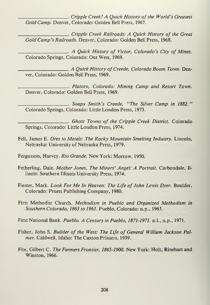
Cripple Creek! A Quick History of the World's Greatest
Gold Camp. Denver, Colorado: Golden Bell Press, 1967.
Cripple Creek Railroads: A Quick History of the Great
Gold Camp's Railroads. Denver, Colorado: Golden Bell Press, 1968.
. A Quick History of Victor, Colorado's City of Mines.
Colorado Springs, Colorado: Out West, 1969.
A Quick History of Creede, Colorado Boom Town. Den-
ver, Colorado: Golden Bell Press, 1969.
Platoro, Colorado: Mining Camp and Resort Town.
Denver, Colorado: Golden Bell Press, 1969.
Soapy Smith's Creede, "The Silver Camp in 1882."
Colorado Springs, Colorado: Little London Press, 1973.
Ghost Towns of the Cripple Creek District. Colorado
Springs, Colorado: Little London Press, 1974.
Fell, James E. Ores to Metals: The Rocky Mountain Smelting Industry. Lincoln,
Nebraska: University of Nebraska Press, 1979.
Fergusson, Harvey. Rio Grande. New York: Morrow, 1950.
Fetherling, Dale. Mother Jones, The Miners' Angel: A Portrait. Carbondale, Il-
linois: Southern Illinois University Press, 1974.
Fiester, Mark. Look For Me In Heaven: The Life of John Lewis Dyer. Boulder,
Colorado: Pruett Publishing Company, 1980.
First Methodist Church. Methodism in Pueblo and Organized Methodism in
Southern Colorado, 1863 to 1963. Pueblo, Colorado: n.p., 1963.
First National Bank. Pueblo. A Century in Pueblo, 1871-1971. n.l., n.p., 1971.
Fisher, John S. Builder of the West: The Life of General William Jackson Pal-
mer. Caldwell, Idaho: The Caxton Printers, 1939.
Fite, Gilbert C. The Farmers Frontier, 1865-1900. New York: Holt, Rinehart and
Winston, 1966.
208

Flynn, Norma L. Early Mining Camps of South Park. Denver, Colorado: n.p.,
1952.
.. History of the Famous Mosquito Pass. Denver, Colo-
rado: n.p., 1959.
Foreman, Grant. Pioneer Days in the Early Southwest. Cleveland, Ohio: Arthur
H. Clark Company, 1926.
Forrest, James T. Old Fort Garland. Denver, Colorado: State Historical Society
of Colorado, 1954.
Fossett, Frank. Colorado: A Historical, Discriptive and Statistical Work on the
Rocky Mountain Gold and Silver Mining Regions. Denver, Colorado: Daily
Tribune, 1876.
Colorado: Its Gold and Silver Mines, Farms and Stock
Ranges, Health and Pleasure Resorts. New York: C.G. Crawford Printers,
1879.
Fowler, Jacob. The Journal ofJacob Fowler . . . New York: Harper, 1898.
Frink, Maurice, W. Turrentine Jackson and Agnes Wright Spring. When Grass
Was King: Contributions to the Western Range Cattle Industry Study.
Boulder, Colorado: University of Colorado Press, 1956.
Fritz, PercyS. Colorado,The Centennial State. New York: Prentice-Hall, 1941.
Garrard, Lewis H. Wah-toy-yah and the Taos Trail. Oklahoma City, Oklahoma:
Barlow, 1927.
Garraty, John A. The American Nation. New York: Harper and Row, 1969.
Gates, Paul W. History of Public Law and Development. Washington DC: Pub-
lic Land Law Review Commission, 1968.
Landlords and Tenants on the Prairie Frontier. Ithaca,
New York: Cornell University Press, 1973.
209
Gleyre, L.A. and C.N. Alleger, (comp.) History of the Civilian Conservation
Corps in Colorado. Denver, Colorado: Western Newspaper Union Press, 1936.
Gilfillan, George R. and Ruth. Among the Tailings: A Guide to Leadville Mines.
Leadville, Colorado: Herald Democrat, 1964.
Gjevre, John A. Chili Line: The Narrow Rail Trail to Santa Fe. Espanola, NewMexico: Rio Grande Sun Press, 1969.
Goetzmann, William. Exploration and Empire. New York: Knopf, 1966.
Army Exploration in the American West, 1803-1863.
New Haven, Connecticut: Yale University Press, 1959.
Golze, Alfred R. Reclamation in the United States. Caldwell, Idaho: The Caxton
Printers, Ltd., 1961.
Goodykoontz, Colin B. Colorado: Short Studies of Its Past and Present. Boulder,
Colorado: University of Colorado, 1927.
Goff, Richard. Century in the Saddle. Denver, Colorado: Cattlemen's Centen-
nial Commission, 1967.
Goldberg, Robert A. Hooded Empire: The Klan in Colorado. Urbana, Illinois:
University of Illinois Press, 1982.
Greenbaum, Fred. Fighting Progressive: A Biography of Edward P. Costigan.
Washington, DC: Public Affairs Press, 1971.
Greever, William S. Arid Domain: The Santa Fe Railway and Its Western LandGrant. Stanford, California: Stanford University Press, 1954.
The Bonanza West: The Story of the Western Mining
Rushes, 1848-1900. Norman, Oklahoma: University of Oklahoma Press, 1963.
Gregg, Josiah. Commerce of the Prairies. Norman, Oklahoma: University of Ok-lahoma Press, 1954.
Gressley, Gene M. Bankers and Cattlemen. Lincoln, Nebraska: University of
Nebraska Press, 1971.
210
Grinnell, George B. Bent's Old Fort and Its Builders, n.l., Kansas State Histori-
cal Society, n.d.
The Cheyenne Indians: Their History and Ways of Life.
2 Vols., New Haven, Connecticut: Yale University Press, 1924.
Griswold, Don and Jean. The Carbonate Camp Called Leadville. Denver, Colo-
rado: University of Denver Press, 1951
.
Colorado's Century of Cities. Denver, Colorado: Smith-
Brooks, 1958.
Grodinsky, Julius. Transcontinental Railway Strategy, 1869-1893. Philadelphia,
Pennsylvania: University of Pennsylvania Press, 1962.
Hackett, Charles W. Revolt of the Pueblo Indians ofNew Mexico and Otermin's
Attempted Reconquest, 1680-1692. Albuquerque, New Mexico: University of
New Mexico Press, 1942. 2 Vols.
Hafen, LeRoy R. Colorado: A Story of the State and Its People. Denver, Colo-
rado: Old West Publishing, 1945.
Broken Hand: The Life of Thomas Fitzpatrick: Moun-tain Man, Guide and Indian Agent. Denver, Colorado: Old West, 1973.
The Mountain Men and the Fur Trade of the Far West.
Glendale, California: A.H. Clark, 1966. 10 Vols.
Fremont's Fourth Expedition: A Documentary Account
of the Disaster of 1848-1849. . ..Glendale, California: A.H. Clark, 1960.
Relations With Indians of the Plains, 1857-1861. Glen-
dale, California: The Arthur H. Clark Company, 1959.
The Indians of Colorado. Denver, Colorado: State His-
torical Society of Colorado, 1952.
Haggard, H. Rider. The Poor and the Land. New York: n.p., 1905.
Haley, J. Everetts. Charles Goodnight. Boston, Massachusetts: Houghton-Miff-
lin, 1936.
211
Hall, Frank. History of the State of Colorado . . . Chicago, Illinois: Blakely,
1889-1895. 4 Vols.
Hall, Mabel W. The Story of Phantom Canyon. Canon City, Colorado: Master
Printers, 1963.
Hamilton, Fern J. Legends of the Valley. Alamosa, Colorado: Alamosa Daily
Courier, 1947.
Hammond, George P. Coronado's Seven Cities. Albuquerque, New Mexico:
United States Coronado Exposition Commission, 1940.
and Agapito Rey, (eds.) Don Juan de Onate, Colonizer
of New Mexico, 1595-1628. Albuquerque, New Mexico: University of NewMexico Press, 1953, 2 Vols.
Harris, F.S. The Sugar-Beet in America. New York: The MacMillan Company,1919.
Hart, Steven H. and Archer B. Hulbert, (eds.). Zebulon Pike's Arkansas Journal.
Denver, Colorado: Denver Public Library, 1932.
Hayden, Ferdinand V. The Great West. Bloomington, Illinois: C.R. Brodix, 1880.
Hayes, Samuel P. Conservation and the Gospel of Efficiency. Cambridge, Mas-
sachusetts: Harvard University Press, 1959.
Helmers, Dow. Historic Alpine Tunnel. Chicago, Illinois: Swallow, 1963.
Henderson, Junius. Colorado: Short Studies Past and Present. New York: AmesPress, 1969. (Reprint).
Henry, Mabel S. Historical Summary of Pueblo County, Colorado Chapter
American Red Cross, April, 1917 to June 1, 1919. n.p.,n.p.,n.d.
Hewes. Leslie. The Suitcase Farming Frontier: A Study of the Historical Geo-
graphy of the Central Great Plains. Lincoln, Nebraska: University of Nebraska
Press, 1973.
Hicks, John D., The Populist Revolt: A History of the Farmer's Alliance and the
People's Party. Lincoln, Nebraska: University of Nebraska Press, 1961.
212
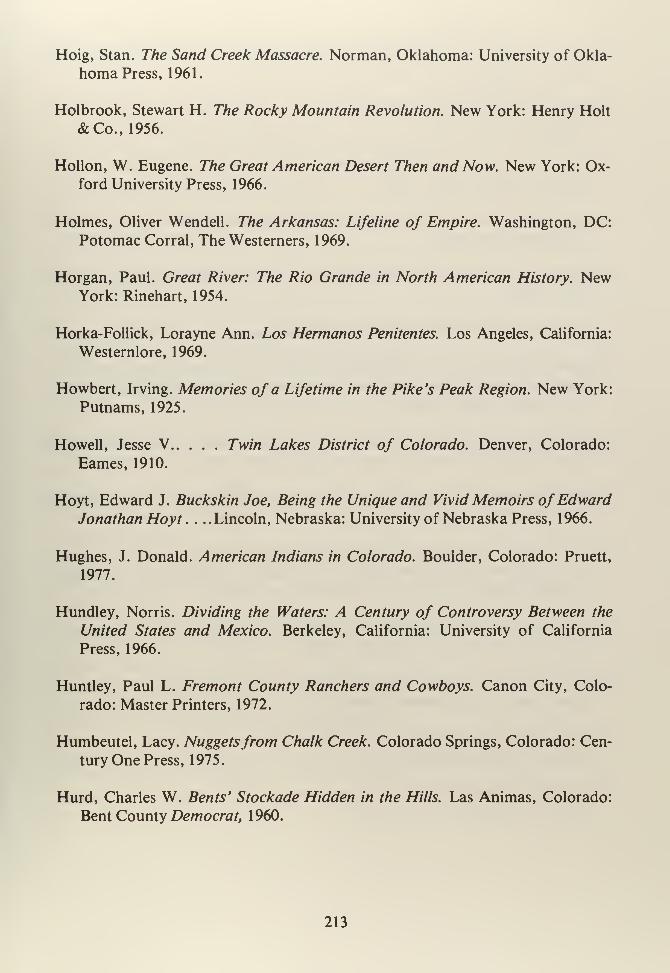
Hoig, Stan. The Sand Creek Massacre. Norman, Oklahoma: University of Okla-
homa Press, 1961.
Holbrook, Stewart H. The Rocky Mountain Revolution. New York: Henry Holt
&Co., 1956.
Hollon, W. Eugene. The Great American Desert Then and Now. New York: Ox-ford University Press, 1966.
Holmes, Oliver Wendell. The Arkansas: Lifeline of Empire. Washington, DC:Potomac Corral, The Westerners, 1969.
Horgan, Paul. Great River: The Rio Grande in North American History. NewYork: Rinehart, 1954.
Horka-Follick, Lorayne Ann. Los Hermanos Penitentes. Los Angeles, California:
Westernlore, 1969.
Howbert, Irving. Memories of a Lifetime in the Pike's Peak Region. New York:
Putnams, 1925.
Howell, Jesse V Twin Lakes District of Colorado. Denver, Colorado:
Eames, 1910.
Hoyt, Edward J. Buckskin Joe, Being the Unique and Vivid Memoirs ofEdwardJonathan Hoyt . . ..Lincoln, Nebraska: University of Nebraska Press, 1966.
Hughes, J. Donald. American Indians in Colorado. Boulder, Colorado: Pruett,
1977.
Hundley, Norris. Dividing the Waters: A Century of Controversy Between the
United States and Mexico. Berkeley, California: University of California
Press, 1966.
Huntley, Paul L. Fremont County Ranchers and Cowboys. Canon City, Colo-
rado: Master Printers, 1972.
Humbeutel, Lacy. Nuggetsfrom Chalk Creek. Colorado Springs, Colorado: Cen-
tury One Press, 1975.
Hurd, Charles W. Bents' Stockade Hidden in the Hills. Las Animas, Colorado:
Bent County Democrat, 1960.
213
Boggsville, Cradle of the Colorado Cattle Industry. Las
Animas, Colorado: Bent County Democrat, 1957.
Hyde, George E. Indians of the High Plains. Norman, Oklahoma: University of
Oklahoma Press, 1959.
The Life of George Bent. Norman, Oklahoma: Univer-
sity of Oklahoma Press, 1968.
The Pawnee Indians. Norman, Oklahoma: University of
Oklahoma Press, 1974.
Ingersoll, Ernest. The Crest of the Continent. Chicago, Illinois: R.R. Donnelley &Sons, 1888.
Inman, Henry. The Old Santa Fe Trail. Topeka, Kansas: Crane, 1916.
Jackson, Donald (ed.) The Journals and Letters of Zebulon Montgomery Pike,
with Letters and Related Documents. Norman, Oklahoma: University of Ok-
lahoma Press, 1966. 2 Vols.
Jackson, Donald and Mary Lee Spence. The Expeditions of John Charles Fre-
mont. Urbana, Illinois: University of Illinois Press, 1970.
Jackson, W. Turrentine. Wagon Roads West. Berkeley, California: University of
California Press, 1952.
Jackson, Edwin. Account of an Expedition from Pittsburgh to the Rocky Moun-tains, Performed in the Years 1819 and '20 . . ..Edited by Ruben G. Thwaites,
in: Early Western Travels, 1748-1846. Cleveland, Ohio: n.p., 1904.
James, George W. Reclaiming the Arid West: The Story of the United States Re-
clamation Service. New York: n.p., 1917.
James, Harold L. Cumbres and Toltec Scenic Railroad. Socorro, New Mexico:
New Mexico State Bureau of Mines, 1972.
Jocknick, Sidney. Early Days on the Western Slope of Colorado . . . Denver,
Colorado: Carson-Harper, 1913.
Jones, Billy M. Health-Seekers in the Southwest, 1817-1900. Norman, Oklahoma:University of Oklahoma Press, 1967.
214
Jones, Mary (Harris). Autobiography of Mother Jones. New York: Arno, 1969
(Reprint).
Jones, Oakah L. Pueblo Warriors and Spanish Conquest. Norman, Oklahoma:University of Oklahoma Press, 1966.
Joy, Carol M. (comp). Colorado Local History: A Directory. Denver, Colorado:
Colorado Library Association, 1975.
Karnes, Thomas L. William Gilpin, Western Nationalist. Austin, Texas: Univer-
sity of Texas Press, 1970.
Kelsey, Harry E. Frontier Capitalist, The Life ofJohn Evans. Boulder, Colorado:
CAUP, 1969.
Kenner, Charles L. A History ofNew Mexico-Plains Indian Relations. Norman,Oklahoma: University of Oklahoma Press, 1969.
Kessler, F.C. The Royal Gorge of the Arkansas River in Colorado: Its History
and Geology. Canon City, Colorado: Canon City Daily Record, 1941.
King, Joseph E. A Mine to Make a Mine. College Station, Texas: Texas A&MUniversity Press, 1977.
Kubler, George. The Religious Architecture ofNew Mexico in the Colonial Per-
iod and Since the American Occupation. Colorado Springs, Colorado: Taylor
Museum, 1940.
Lakes, Arthur. Geology of Cripple Creek, Colorado: A General Description ofthe Famous Gold Mining Region and Its Ore Deposits. Denver, Colorado:
Chain, 1935.
Lamar, Howard R. The Far Southwest, 1846-1912. New Haven, Connecticut:
Yale University Press, 1966.
Lamb, Frank R. The Pioneer Story of Joseph Milton and Other Pioneer Stories.
Canon City, Colorado: Master Printers, 1969.
Langdon, Emma F. The Cripple Creek Strike of 1903-1904. Victor, Colorado:
Victor Daily Record, 1904.
215
The Cripple Creek Strike . . . Denver, Colorado: Great
Western, 1908.
Latham, Hiram. Trans-Missouri Stock Raising. Denver, Colorado: Old West,
1962.
Lavender, David S. Bent's Fort. Garden City, New York: Doubleday, 1954.
LaZar, Arthur. Of Earth and Timbers Made: New Mexico Architecture. Albu-
querque, New Mexico: University of New Mexico Pres, 1974.
League of Women Voters of Pueblo. This is Pueblo County, Colorado. Pueblo,
Colorado: Pueblo Congress-Times Press, 1955.
Leckie, William H. The Buffalo Soldiers. Norman, Oklahoma: University of Ok-lahoma Press, 1967.
Lecompte, Janet. Pueblo, Hardscrabble, Greenhorn: The Upper Arkansas. 1832-
1856. Norman, Oklahoma: University of Oklahoma Press, 1978.
Lee, Mabel Barbee. Back in Cripple Creek. Garden City, New York: Doubleday,
1968.
Cripple Creek Days. Garden City, New York: Double-
day, 1958.
LeMassena, Robert A. Rio Grande . . . To the Pacific. Denver, Colorado: Sun-
dance, 1978.
Lingenfelter, Richard E. The Hardrock Miners: A History of the Mining LaborMovement in the American West, 1863-1893. Berkeley, California: Univ-
ersity of California Press, 1974.
Lipsey, John J. The Salt Works in Colorado's South Park. Colorado Springs,
Colorado: J.J. Lipsey, 1959.
The War of the Gauges. Colorado Springs, Colorado:
J.J. Lipsey, 1961
The Lives of James J. Hagerman Builder of the Colo-
rado Midland. Denver, Colorado: Golden Bell Press, 1969.
216
Long, Margaret. The Smoky Hill Trail. Denver, Colorado: Kistler, 1943.
The Santa Fe Trail; Following the Old Historic Pioneer
Trails on the Modern Highways. Denver, Colorado: n.p., 1954.
Lopez, Lino M. Colorado Latin American Personalities. Denver, Colorado:
A.M. Printing, 1959.
Lyon, F. Wilson. The Man Who Sold Louisiana. Norman, Oklahoma: Univer-
sity of Oklahoma Press, 1974.
Mangan, Terry W. Colorado on Glass. Denver, Colorado: Sundance Publica-
tions, 1975.
Marshall, James L. Santa Fe, the Railroad that Built an Empire. New York: Ran-
dom House, 1945.
Marcosson, Isaac F. Metal Magic; the Story of the American Smelting and Re-
fining Company. New York: Farrar, Straus, 1949.
Martin, Bernice. "People of the Book" A History of the First Presbyterian
Church. Monte Vista, Colorado: n.p., 1956.
Martin, John A. The Pueblo Flood in Word and Pictures. Pueblo, Colorado:
Graphic Arts Press, 1921
.
Matson, Simon E. (ed.) The Battle of Beecher Island. Wray, Colorado: TheBeecher Island Battle Memorial Association, 1960.
Matthews, Albert. The Purgatory River of Colorado. Cambridge, Massachusetts:
J. Wilson & Son, 1902.
Mazzula, Fred and Jo. The First Hundred Years: Cripple Creek and the Pike's
Peak Region. Denver, Colorado: Hirschfield, 1956.
McAdow, Beryl. From Crested Peaks: The Story ofAdams State College of Colo-
rado. Denver, Colorado: Big Mountain Press, 1961 Vol. 1.
. Our Voices Raise: The Story ofAdams State College ofColorado, 1950-1966. Alamosa, Colorado: Adams State College, 1966 Vol. 2.
217
McCarthy, G. Michael. Hour of Trail. Norman, Oklahoma: University of Okla-
homa Press, 1977.
McConnell, Virginia. UtePass. Denver, Colorado: Sage, 1963.
. Bayou Salado: The Story of South Park. Denver, Colo-
rado: Sage, 1966.
McCoy, Dell. The Rio Grande Pictorial, 1871-1971. Denver, Colorado: Sundance,
1971.
McCoy, Joseph G. Historic Sketches of the Cattle Trade of the West and South-
west. Glendale, California: Arthur H. Clark Company, 1940.
McGovern, George A. The Great Coal Field War. Boston, Massachusetts:
Houghton-Mifflin, 1972.
McMechen, Edgar C. The Moffat Tunnel of Colorado. Denver, Colorado: Wahl-
gren, 1927. 2 Vols.
. Walter Scott Cheesman, A Pioneer Builder of Colorado.
Denver, Colorado: n.d., (Xerox Copy).
Mead, Elwood. Irrigation Institutions. New York: MacMillan, 1909.
Meier, Matt S. and Feliciano Rivera. The Chicanos: A History ofMexican-Amer-
icans. New York: n.p., 1972.
Mehls, Steven F. The New Empire of the Rockies, A History of Northeast Colo-
rado. Denver, Colorado: Bureau of Land Management, 1984.
Menig, Donald. Southwest: Three Peoples in Geographical Change, 1600-1970.
New York: Oxford University Press, 1971.
Miller, Gladyce M. Treasure of the Valley of Secrets. Segundo, Colorado: National
Prospector's Gazette, 1971.
Missouri Pacific Railway and Iron Mountain Route. Eastern Colorado; Its Op-
portunities and Resources. A New Region Opened to Agriculture by the De-
velopment ofDry Farming and Irrigation. St. Louis, Missouri: n.p., 1910.
Moody, Ralph. Stagecoach West. New York: Crowell, 1967.
218
Moore, Jackson W. Bent's Old Fort; An Archaeological Study. Denver, Colo-
rado: Colorado Historical Society, 1973.
Moorehead, Warren K. . . . Archaeology of the Arkansas River Valley. New Hav-
en, Connecticut: Yale University Press, 1931.
Moorehead, Max L. The Apache Frontier: Jacabo Ugarte and Spanish-Indian Re-
lations in the Northern New Spain, 1769-1971. Norman, Oklahoma: Univer-
sity of Oklahoma Press, 1960.
Morgan, Dale L. Jedediah Smith and the Opening of the West. Lincoln, Nebras-
ka: University of Nebraska Press, 1955.
The West of William H. Ashley. Denver, Colorado: Old
West, 1965.
Morrison, Andrew. The City of Pueblo and the State of Colorado. St. Louis,
Missouri: Engelhardt & Company, 1890.
Mumey, Nolie. Creede, A History of a Colorado Silver Mining Town. Denver,
Colorado: Artcraft Press, 1949.
. John Williams Gunnison, The Last of the Western Ex-
plorers. . ..Denver, Colorado: Artcraft Press, 1955.
Murray, Robert A. Las Animas, Huerfano and Custer: Three Colorado Counties
on a Cultural Frontier; a History of the Raton Basin. Denver, Colorado:
Bureau of Land Management, 1979.
Nankevell, John M. History of the Military Organization of the State of Colo-
rado, 1860-1935. Denver, Colorado: Kistler Stationary Company, 1935.
Nash, Roderick. Wilderness and the American Mind. New Haven, Connecticut:
Yale University Press, 1973.
Nevins, Allan P. Fremont, Pathmaker of the West. New York: Longman's,
Green, 1955.
Newell, Frederick H. Irrigation in the United States. New York: Crowell, 1972.
Newton, Harry J. Yellow Gold of Cripple Creek . . ..Denver, Colorado: Nelson,
1967.
219
O'Conner, Daniel Ellis. A Confederate in the Colorado Gold Fields. Norman,Oklahoma: University of Oklahoma Press, 1970.
O'Connor, Harvey. The Guggenheims: The Making of An American Dynasty.
New York: Covici, Friede, 1937.
O'Rourke, Paul M. Frontier in Transition: A History of Southwestern Colorado.
Denver, Colorado: Bureau of Land Management, 1980.
Ormes, Robert M. Railroads and the Rockies; A Record of Lines in and NearColorado. Denver, Colorado: Sage, 1963.
Osgood, Ernest S. Day of the Cattleman. Minneapolis, Minnesota: University of
Minnesota Press, 1929.
Otero County Nursery and Orchard Company. Homes in the Great Arkansas Val-
ley, Colorado, the Land of Sunshine, Health, Wealth and Happiness, n.l.,
n.p., 1896.
Overton, Richard C. Burlington West: A Colonization History of the Burlington
Railroad. Cambridge, Massachusetts: Harvard University Press, 1941.
Gulf to Rockies the Heritage of the Fort Worth and Den-ver, Colorado & Southern Railways, 1861-1898. Austin, Texas: University of
Texas Press, 1953.
Burlington Route, A History of the Burlington Lines.
Lincoln, Nebraska: University of Nebraska Press, 1965.
Owen, Robert P. Huerfano Valley as I Knew It. Canon City, Colorado: Master
Printers, 1975.
Pabor, William E. Colorado AsAn Agricultural State: Its Farms, Fields and Gar-
den Lands. New York: Orange Judd Company, 1882.
Pangborn, Joseph G. The New Rocky Mountain Tourist, Arkansas Valley andSan Juan Guide . . ..Chicago, Illinois: Knight & Leonard, 1878.
Parker, Willis H. Pueblo's Flood in Pictures. Pueblo, Colorado: O'Brien, 1921.
Pastal, Benjamin M. The Labor History of Cripple Creek District. Madison, Wis-
consin: University of Wisconsin Press, 1908.
220
Paul, Rodman W. Mining Frontiers of the Far West, 1848-1880. New York: Holt,
Rinehart & Winston, 1963.
Peake, Ora B. The Colorado Range Cattle Industry. Glendale, California: A.H.
Clark, 1937.
Pearson, Jim B. The Maxwell Land Grant. Norman, Oklahoma: University of
Oklahoma Press, 1961.
Peffer, E. Louise. The Closing of the Public Domain. Stanford, Connecticut:
Stanford University Press, 1951.
Pelzer, Louis. The Cattleman's Frontier; A Record of the Trans-Mississippi Cat-
tle Industry from Oxen Trains to Pooling Companies, 1850-1890. New York:
Russell and Russell, 1969 (Reprint).
Pierce, Neal R. The Mountain States of America; People, Politics and Power in
the Eight Rocky Mountain States. New York: Norton, 1972.
Pettit, Jan. A Quick History of Ute Pass. Colorado Springs, Colorado: Little
London Press, 1979.
Pike, Zebulon M. Sources of the Mississippi and the Western Louisiana Territory.
Ann Arbor, Michigan: University Microfilms, 1966.
. Zebulon Pike's Arkansas Journal . . ..Denver, Colorado:
Denver Public Library, 1932.
Preuss, Charles. Exploring with Fremont; The Private Diaries of Charles Preuss . . .
Norman, Oklahoma: University of Oklahoma Press, 1958.
Pomeroy, Earl S. In Search of the Golden West: The Tourist in Western America.
New York: Knopf, 1957.
Poor, M.C. Denver, South Park and Pacific. Denver, Colorado: Rocky Moun-tain Railroad Club, 1976.
Quaife, Milton M. Kit Carson's Autobiography. Lincoln, Nebraska: University
of Nebraska Press, 1936.
Renaud, E.B. (comp). The Archaeological Survey of Colorado: Fourth Report.
Denver, Colorado: University of Denver, 1935.
221
Richardson, Elmo. The Politics of Conservation. Berkeley, California: Univer-
sity of California Press, 1962.
Richardson, Rupert N. The Greater Southwest. Glendale, California: A.H.Clark, 1934.
Riegel, Robert E. The Story of the Western Railroads. Lincoln, Nebraska: Univer-
sity of Nebraska Press, 1926.
Risley, James H. How it Grew: A History of the Pueblo Public Schools. Denver,
Colorado: University of Denver Press, 1953.
Rister, Carl C. The Southwestern Frontier, 1865-1881. New York: Russell andRussell, 1969.
Rittenhouse, Jack D. The Santa Fe Trail: A Historical Bibliography. Albuquer-
que, New Mexico: University of New Mexico Press, 1971.
The Man Who Owned Too Much. Houston, Texas:
Stagecoach Press, 1958.
Robbins, Roy M. Our Landed Heritage: The Public Domain, 1776-1970. Lincoln,
Nebraska: University of Nebraska Press, 1976.
Rockafellow, B.F. History of the Arkansas Valley. Chicago, Illinois: Baskin, 1881.
Rolle, Andrew F. The Immigrant Upraised; Italian Adventures and Colonists in
an Expanding America. Norman, Oklahoma: University of Oklahoma Press,
1968.
Ruxton, George F. Wildlife in the Rocky Mountains. New York: Outing Publish-
ing Company, 1916.
Sage, Rufus B. Rufus B. Sage His Letters and Papers, 1836-1847 . . ..Glendale,
California: A.H. Clark, 1956.
Saunderson, Mont H. Western Land and Water Use. Norman, Oklahoma: Uni-
versity of Oklahoma Press, 1950.
Scamehorn, H. Lee. Pioneer Steelmaker in the West. Boulder, Colorado: Pruett,
1976.
222
Seligson, Harry. Labor-Management Relations in Colorado. Denver, Colorado:
Sage, 1961.,
Sinn, Charles H. Mining Camps, A Study in American Frontier Government.
New York: Harper & Row, 1965.
Simmons, Virginia McConnell. Land of the Six Armed Cross. Boulder, Colorado:
Pruett, 1980.
Smith, Duane A. Rocky Mountain Mining Camps, the Urban Frontier. Bloom-
ington, Indiana: University of Indiana Press, 1967.
Horace Tabor: His Life and Legend. Boulder, Colorado:
CAUP, 1973.
Colorado Mining. Albuquerque, New Mexico: Univer-
sity of New Mexico Press, 1979.
Smith, Marian P. The Leadville Ice Palace. Leadville, Colorado: n.p., 1953.
Snell, Joseph W. The Birth of the Atchison, Topeka and Santa Fe Railroad. To-
peka, Kansas: Kansas State Historical Society, 1968.
Sparks, Colonel Ray G. Reckoning at Summit Springs. Kansas City, Missouri:
Lowell Press, 1969.
Spell, Leslie D. Forgotten Men of Cripple Creek. Denver, Colorado: Big Moun-tain Press, 1959.
Spence, Clark C. British Investments and the American Mining Frontier, 1860-
1901. Ithaca, New York: Cornell University Press, 1958.
Mining Engineers and the American West; The Lace
Boot Brigade, 1849-1933. New Haven, Connecticut: Yale University Press,
1970.
The Rainmakers; American "Pluviculture" to WorldWar II. Lincoln, Nebraska: University of Nebraska Press, 1980.
Spencer, Frank C. The Story of the San Luis Valley. Alamosa, Colorado: Ala-
mosa Journal, 1925.
223
Sprague, Marshall. The Great Gates; The Story of the Rocky Mountain Passes.
Boston, Massachusetts: Little Brown, 1964.
Money Mountain. Boston, Massachusetts: Little Brown,
1957.
Colorado: A Bicentennial History. New York: W.W.Norton & Co., 1976.
Stein, Leon. Massacre at Ludlow, Four Reports. New York: Arno, 1971
Steinel, Alvin T. History of Agriculture in Colorado. Fort Collins, Colorado:
Colorado Agricultural College, 1926.
Stors, C. Eric. Victorian Bonanza. Albuquerque, New Mexico: University of NewMexico Press, 1973.
Stone, Wilbur F. History of Colorado. Denver, Colorado: S.J. Clarke & Com-pany, 1918. 4 Vols.
Straight, Michael. A Very Small Remnant. New York: Knopf, 1963.
Suggs, George G. Colorado's War on Militant Unionism: James Peabody and the
Western Federation of Miners. Detroit, Michigan: Wayne State University
Press, 1972.
Sunseri, Alvin R. The Ludlow Massacre; A Study in the Mis-Employment of the
National Guard, n.l., n.p., n.d.
Swadesh, Frances L. Los Primeros Pobladores; Hispanic Americans of the Ute
Frontier. South Bend, Indiana: Notre Dame University Press, 1974.
Tate, Bill. The Penitentes of the Sangre de Cristos; American Tragedy. Truchas,
New Mexico: Tate Gallery, 1968.
Taylor, Donna. Memories from the Foot of the Gorge. Canon City, Colorado:
Canon City High School, 1969.
Taylor, Fred G. A Saga of Sugar; Being a Story of the Romance and Develop-
ment of Beet Sugar in the Rocky Mountain West. Salt Lake City, Utah: Utah-
Idaho Sugar Company, 1944.
224
Taylor, Morris F. The First Mail West; Stagecoach Lines on the Santa Fe Trail.
Albuquerque, New Mexico: University of New Mexico Press, 1971
.
. Pioneers of the Picketwire. Trinidad, Colorado: n.p.,
1964.
A Sketch of Early Days on the Purgatory. Trinidad,
Colorado: Risley Printing, 1959.
Trinidad, Colorado Territory. Trinidad, Colorado: trini-
dad Junior College, 1966.
Taylor, Ralph C. A Guide to Historic Pueblo, n.l., n.p., c. 1972.
Taylor, Robert G. Cripple Creek Mining District. Palmer Lake, Colorado: Filter
Press, 1973.
Teele, Ray P. Irrigation in the United States. New York: Appleton-Century, 1915.
Thomas, Alfred B. After Coronado; Spanish Exploration Northeast ofNew Mex-ico, 1869-1927. Norman, Oklahoma: University of Oklahoma Press, 1935.
Plains Indians and New Mexico. Norman, Oklahoma:University of Oklahoma Press, 1940.
Forgotten Frontiers; A Study of the Spanish Indian Pol-
icy of Don Juan Bautista de Anza. Norman, Oklahoma: University of Okla-
homa Press, 1932.
Thome, Wayne (ed.) Land and Water Use. Washington, DC: American Associa-
tion for the Advancement of Science, 1963.
Thwaites, Reuben Gold. Early Western Travels, 1748-1846. New York: D. Ap-pleton & Company, 1904. 32 Vols.
Tonge, Thomas. Colorado Mineral Resources. Denver, Colorado: Colorado Pro-motion Commission, 1904.
Handbook of Colorado Resources. Denver, Colorado:Smith-Brooks, 1907.
225
All About Colorado: For Homeseekers, Tourists, In-
vestors, Health-Seekers. Denver, Colorado: Tonge, 1913.
Trenholm, Virginia C. The Arapahoes, Our People. Norman, Oklahoma: Univer-
sity of Oklahoma Press, 1970.
Trimble, Stephen A. Great Sand Dunes; The Shape of the Wind. Globe, Arizona:
Southwest Parks and Monuments Associations, n.d.
Trinidad Catholic High School. Public School Number One, and Then Some.Trinidad, Colorado: Trinidad Catholic High School, 1970.
Tully, Marjorie F. An Annotated Bibliography of Spanish Folklore in New Mex-ico and Southern Colorado. Albuquerque, New Mexico: University of NewMexico Press, 1950.
Turk, Gayle. The Wet Mountain Valley. Colorado Springs, Colorado: Little Lon-
don Press, 1976.
Tushar, Olibama Lopez. People of the Valley: A History of the Spanish Colon-
ials of the San Luis Valley. Denver, Colorado: n.p., 1975.
Twitchell, Ralph E. The Leading Facts ofNew Mexican History. Cedar Rapids,
Iowa: Torch Press, 1911.2 Vols.
The Spanish Archives of New Mexico. Cedar Rapids,
Iowa: Torch Press, 1914. 2 Vols.
The History of the Military Occupation of the Territory
ofNew Mexico. Denver, Colorado: Smith-Brooks, 1909.
Ubbelohde, Carl(ed.)y4 Colorado Reader. Boulder, Colorado: Pruett, 1962
Maxine Benson, Duane Smith. A Colorado History.
Boulder, Colorado: Pruett, 1982.
Vallejo, M. Edmund. Recollections of the Colorado Coal Strike of 1913-1914.
n.l., n.p., 1974. (Xerox copy).
Vandiver, Clarence A. The Fur-Trade and Early Western Exploration. Cleveland,
Ohio: Arthur M. Clark Company, 1929.
226
Vestal, Stanley. The Mountain Men. Boston, Massachusetts: Houghton-Mifflin,
1937.
The Old Santa Fe Trail. Boston, Massachusetts:
Houghton-Mifflin Company. 1939.
Jim Bridger, Mountain Man. Lincoln, Nebraska:
University of Nebraska Press, 1946.
.. Joe Meek, the Merry Mountain Man. Lincoln, Nebraska:
University of Nebraska Press, 1952.
Von Richthofen, Baron Walter. Cattle-Raising on the Plains of North America.
Norman, Oklahoma: University of Oklahoma Press, 1964. (Reprint.)
Walker, Henry P. The Wagon Masters: High Plains Freighting from the Earliest
Days of the Santa Fe Trail to 1880. Norman, Oklahoma: University of Okla-
homa Press, 1966.
Warren, Henry C.J. Cripple Creek and Colorado Springs. Colorado Springs,
Colorado: Warren & Stridce, 1895.
Waters, Frank. Midas of the Rockies; The Story of Stratton and Cripple Creek.
Chicago, Illinois: Sage, 1972.
Waters, Lawrence L. Steel Trail to Santa Fe. Lawrence, Kansas: University of
Kansas Press, 1950.
Weaver, John E. and Frederick W. Albertson. Grasslands of the Great Plains.
Lincoln, Nebraska: University of Nebraska Press, 1956.
Weber, David J. The Taos Trappers: The Fur Trade in the Far Southwest. Nor-
man, Oklahoma: University of Oklahoma Press, 1971.
The Extrajeros; Selected Documents from the Mexican
Side of the Santa Fe Trail. Santa Fe, New Mexico: Stagecoach Press, 1967.
Weigle, Marta. The Penitentes of the Southwest. Santa Fe, New Mexico: Ancient
City Press, 1970.
Werstein, Irving. Massacre at Sand Creek. New York: Scribner, 1963.
227
Westermeir, Clifford P. Colorado's First Portrait, Scenes by Early Artists. Albu-
querque, New Mexico: University of New Mexico Press, 1970.
Whitaker, Arthur P. The Spanish-American Frontier, 1783-1795. Lincoln,
Nebraska: University of Nebraska Press, 1969. (Reprint of 1927.)
Whittaker, Milo Lee. Pathbreakers and Pioneers of the Pueblo Region. Philadel-
phia, Pennsylvania: Franklin, 1917.
White, Frank A. La Garita. La Jara, Colorado: Cooper, 1971.
Wilkins, Tivis. A History of the Florence and Cripple Creek and Golden Circle
Railroads. Golden, Colorado: Colorado Railroad Museum, 1969.
Colorado Railroads. Boulder, Colorado: Pruett, 1974.
Willard, James F. Experiments in Colorado Colonization, 1869-1872. Boulder,
Colorado: University of Colorado Press, 1926.
Winship, George P. The Journey of Coronado, 1540-1542. New York: Green-
wood, 1969.
Wislizenus, Adolphus. A Journey to the Rocky Mountains in the Year 1839.
Glorieta, New Mexico: Rio Grande Press, 1969. (Reprint).
Wolle, Muriel S. Cloud Cities of Colorado. Denver, Colorado: Smith-Brooks,
1934.
Stampede to Timberline. Chicago, Illinois: Swallow,
1974.
Wood, Richard H. Stephen Harriman Long, 1784-1864. Glendale, California:
A.H. Clark, 1966.
Wootton, Richens L. "Uncle Dick" Wootton, the Pioneer Frontiersman of the
Rocky Mountain Region. Chicago, Illinois: Dibble, 1890.
Worcester, Philip G. . . . Molybdenum Deposits of Colorado with General Notes
on the Molybdenum Industry. Denver, Colorado: Eames, 1919.
Worster, Donald. Dust Bowl. New York: Oxford University Press, 1979.
228
Worthington, William. In the Sunny San Luis Valley. Providence, Rhode Island:
Worthington, 1930.
Wright, James Edward. The Politics of Populism, Dissent in Colorado. NewHaven, Connecticut: Yale University Press, 1974.
Wulsten, Carl. El Mojada or the Wet Mountain Valley, n.l., n.p., 1879.
The Silver Region of the Sierra Mojada and Rosita, Fre-
mont County, Colorado. Denver, Colorado: Tribune, 1876.
Young, Otis E. Western Mining. Norman, Oklahoma: University of OklahomaPress, 1970.
Zinke, George W. Minnequa Plant of Colorado Fuel and Iron Corporation andTwo Locals of United Steelworkers of America; A Case Study. Washington,
DC: National Planning Association, 1951.
Articles
No Author. "Adobe Past and Present," El Palacio, No. 4, Vol. 77, 1972.
The San Luis Historian. No. 1, Vol. 5, 1937.
"The Banker's Convention," The Trail, No. 3, Vol. 4,
August 1911: 24.
"The Arapahoe Indians," The Trail. No. 4, Vol. 7,
September 1914: 20-23.
"Centennial of Long's Expedition," The Trail, No. 5,
Vol. 13, October 1920: 5-15.
"Colorado's Farm Industry," The Trail, No. 4, Vol. 14,
September 1921:40.
"Crossing the Great American Desert in the '60' s," The
Trail, No. 5, Vol. 1, October 1908: 6-11
'Cy Warman--An Appreciation," The Trail, No. 11,
Vol. 6, April 1914: 12-14.
229
August 1920: 25-26.
.. "Deer Ranged the Plains," The Trail, No. 3, Vol. 13,
"The Growth of the Sugar Industry in Colorado," TheTrail, No. 7, Vol. 7, December 1914: 11-17.
'The Hungate Massacre," The Trail, No. 9, Vol. 1,
February 1909: 6-10.
"The Mail at Buckskin Joe," The Trail, No. 5, Vol. 4,
October 1911: 18-19.
"Naming the Peaks," The Trail, No. 5, Vol. 14, October
1921: 14-15.
'Our Wonderful Sugar Beet," The Trail, No. 8, Vol.
13, January 1921: 25.
Adams, Andy. "The Cattle on a Thousand Hills," Colorado Magazine, No. 5,
Vol. 15, 1938.
Adams, Blanche V. "The Second Colorado Cavalry in the Civil War," Colorado
Magazine, No. 3, Vol. 8, 1931.
Alexander, Philip K. "George W. Kassler: Colorado Pioneer," Colorado Maga-zine, No. 2, Vol. 39, 1962.
"George W. Kassler: Colorado Pioneer," Colorado
Magazine, Vol. 39, 1962.
Anderson, George L. "The El Paso Claim Club, 1859-1862," Colorado Maga-zine, No. 2, Vol. 13, 1936.
"The Canon City or Arkansas Valley Claim Club, 1860-
1862," Colorado Magazine, No. 6, Vol. 14, 1939.
Anthony, Webster D. "Journal of a Trip from Denver to Oro City in 1860," Colo-
rado Magazine, No. 6, Vol. 11, 1934.
Arnold, Frazer. "Samuel Hartsel, Pioneer Cattleman," Colorado Magazine, No.
3, Vol. 19, 1942.
230
Athearn, Robert G. "Colorado and the Indian War of 1868," Colorado Maga-zine, No. 1, Vol. 33, 1956.
"The Denver and Rio Grande Railway: Colorado's'Baby Road,' " Colorado Magazine, No. 1, Vol. 35, 1958.
.. "The Denver and Rio Grande and the Panic of 1873,"
Colorado Magazine, No. 2, Vol. 35, 1958.
zine, No. 1, Vol. 36, 1959.
.. "Origins of the Royal Gorge 'War,' " Colorado Maga-
"The Captivity of the Denver and Rio Grande Railroad,"
Colorado Magazine, No. 2, Vol. 7, 1960.
Aultman, Jennie R. "I Remember Doctor Beshoar, Pioneer," Colorado Maga-zine, No. 2, Vol. 30, 1953.
Baca, Luis. "The Guadalupita Colony of Trinidad," Colorado Magazine, No. 1,
Vol. 21, 1944.
Baker, Galen R. "Excavating Fort Massachusetts/2," Colorado Magazine, No.
2, Vol. 45, 1968.
Balch, C.T. "The First Graves in La Junta, Colorado," Colorado Magazine, No.
6, Vol. 8, 1931.
Bancroft, F.J. "Luring the Health-Seeker," in: A Colorado Reader. Carl
Ubbelohde(ed.), Boulder, Colorado: Pruett, 1962.
Bancroft, George J. "Diversion of Water from the Western Slope," Colorado
Magazine, No. 5, Vol. 21, 1944.
Bancroft, H.H. "Early Days in Canon City," Colorado Magazine, Vol. 7, 1930.
Barbour, Charolette. "Quartermastering for the 2nd Regt. Colorado Volunteers,"
Colorado Magazine, No. 4, Vol. 38, 1961.
Baker, Emerson N. "Colorado Mail Takes Wings," Colorado Magazine, No. 3,
Vol.20, 1943.
231
Barker, Joel. "Colorado Mail Service, 1859-1885," Colorado Magazine, No. 3,
Vol.49, 1972.
Bauer, John E. "The Health Seeker in the Westward Movement, 1830-1900,"
The Mississippi Valley Historical Review, 46, June 1959.
Bayard, Charles J. "The Colorado Progressive Republican Split of 1912," Colo-
rado Magazine, No. 1, Vol. 45, 1968.
. "Theodore Roosevelt and Colorado Politics: The Roose-
velt-Stewart Alliance," Colorado Magazine, No. 4, Vol. 42, 1965.
Baxter, George A.H. "Experiences and Observations in Prowers County," Colo-
rado Magazine, No. 4, Vol. 11, 1934.
Bean, Luther. "San Luis Valley," Colorado Magazine, No. 4, Vol. 28, 1951.
Bechtol, Paul T. Jr. "The 1880 Labor Dispute in Leadville," Colorado Magazine,
No. 4, Vol.47, 1970.
Behymer, F.L. "Glimpses of Kiowa County," Colorado Magazine, No. 4, Vol.
31,1954.
Beitleman, John J. "An Attack on the Stage Stations in 1864," The Trail, No. 1,
Vol. 2, 1909: 1-6.
Benn, Mary Lou. "Mary Hallock Foote: Early Leadville Writer," Colorado Mag-azine, No. 2, Vol. 33, 1956.
Benson, Horace G. "Denver to Del Norte in 1874," Sons of Colorado, No. 7,
Vol. 1, December 1907: 13-16.
Benson, Maxine. "Colorado Cattle Country; A Look at Ranching in the OpenRange Days," Colorado Magazine, No. 1, Vol. 43, 1966.
Bjork, Charles. "Experiences in the Building of Chessman Dam," Colorado
Magazine, No. 2, Vol. 26, 1949.
Bisbee, William H. "General Sedgwick and Recollection of Fort Sedgwick,"
Colorado Magazine, No. 3, Vol. 10, 1933.
232
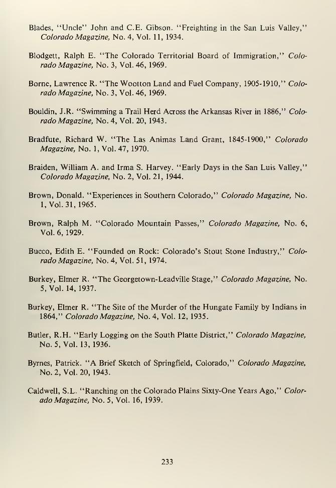
Blades, "Uncle" John and C.E. Gibson. "Freighting in the San Luis Valley,"
Colorado Magazine, No. 4, Vol. 11, 1934.
Blodgett, Ralph E. "The Colorado Territorial Board of Immigration," Colo-
rado Magazine, No. 3, Vol. 46, 1969.
Borne, Lawrence R. "The Wootton Land and Fuel Company, 1905-1910," Colo-
rado Magazine, No. 3, Vol. 46, 1969.
Bouldin, J.R. "Swimming a Trail Herd Across the Arkansas River in 1886," Colo-
rado Magazine, No. 4, Vol. 20, 1943.
Bradfute, Richard W. "The Las Animas Land Grant, 1845-1900," Colorado
Magazine, No. 1, Vol. 47, 1970.
Braiden, William A. and Irma S. Harvey. "Early Days in the San Luis Valley,"
Colorado Magazine, No. 2, Vol. 21, 1944.
Brown, Donald. "Experiences in Southern Colorado," Colorado Magazine, No.
1, Vol. 31,1965.
Brown, Ralph M. "Colorado Mountain Passes," Colorado Magazine, No. 6,
Vol. 6, 1929.
Bucco, Edith E. "Founded on Rock: Colorado's Stout Stone Industry," Colo-
rado Magazine, No. 4, Vol. 51, 1974.
Burkey, Elmer R. "The Georgetown-Leadville Stage," Colorado Magazine, No.
5, Vol. 14, 1937.
Burkey, Elmer R. "The Site of the Murder of the Hungate Family by Indians in
1864," Colorado Magazine, No. 4, Vol. 12, 1935.
Butler, R.H. "Early Logging on the South Platte District," Colorado Magazine,
No. 5, Vol. 13,1936.
Byrnes, Patrick. "A Brief Sketch of Springfield, Colorado," Colorado Magazine,
No. 2, Vol. 20, 1943.
Caldwell, S.L. "Ranching on the Colorado Plains Sixty-One Years Ago," Color-
ado Magazine, No. 5, Vol. 16, 1939.
233
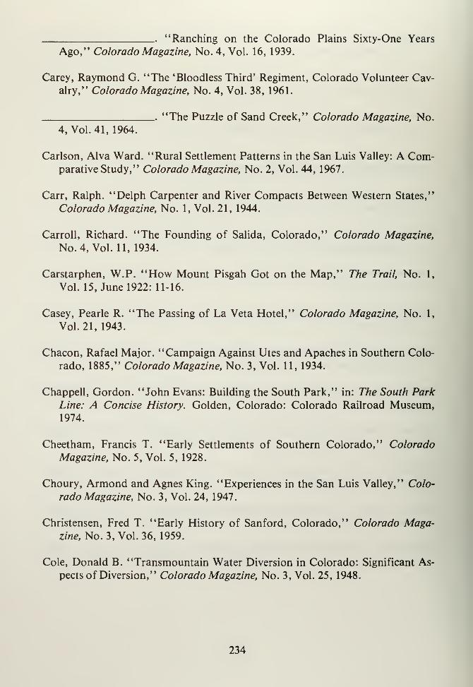
"Ranching on the Colorado Plains Sixty-One Years
Ago," Colorado Magazine, No. 4, Vol. 16, 1939.
Carey, Raymond G. "The 'Bloodless Third' Regiment, Colorado Volunteer Cav-
alry," Colorado Magazine, No. 4, Vol. 38, 1961.
.. "The Puzzle of Sand Creek," Colorado Magazine, No.
4, Vol.41, 1964.
Carlson, Alva Ward. "Rural Settlement Patterns in the San Luis Valley: A Com-parative Study," Colorado Magazine, No. 2, Vol. 44, 1967.
Carr, Ralph. "Delph Carpenter and River Compacts Between Western States,"
Colorado Magazine, No. 1, Vol. 21, 1944.
Carroll, Richard. "The Founding of Salida, Colorado," Colorado Magazine,
No. 4, Vol. 11, 1934.
Carstarphen, W.P. "How Mount Pisgah Got on the Map," The Trail, No. 1,
Vol. 15, June 1922: 11-16.
Casey, Pearle R. "The Passing of La Veta Hotel," Colorado Magazine, No. 1,
Vol.21, 1943.
Chacon, Rafael Major. "Campaign Against Utes and Apaches in Southern Colo-
rado, 1885," Colorado Magazine, No. 3, Vol. 11, 1934.
Chappell, Gordon. "John Evans: Building the South Park," in: The South ParkLine: A Concise History. Golden, Colorado: Colorado Railroad Museum,1974.
Cheetham, Francis T. "Early Settlements of Southern Colorado," Colorado
Magazine, No. 5, Vol. 5, 1928.
Choury, Armond and Agnes King. "Experiences in the San Luis Valley," Colo-
rado Magazine, No. 3, Vol. 24, 1947.
Christensen, Fred T. "Early History of Sanford, Colorado," Colorado Maga-zine, No. 3, Vol. 36, 1959.
Cole, Donald B. "Transmountain Water Diversion in Colorado: Significant As-
pects of Diversion," Colorado Magazine, No. 3, Vol. 25, 1948.
234
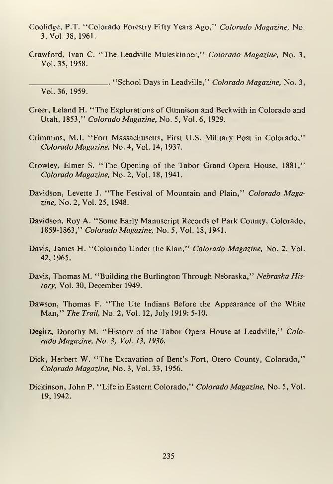
Coolidge, P.T. "Colorado Forestry Fifty Years Ago," Colorado Magazine, No.
3, Vol. 38, 1961.
Crawford, Ivan C. "The Leadville Muleskinner," Colorado Magazine, No. 3,
Vol. 35, 1958.
"School Days in Leadville," Colorado Magazine, No. 3,
Vol. 36, 1959.
Creer, Leland H. "The Explorations of Gunnison and Beckwith in Colorado and
Utah, 1853," Colorado Magazine, No. 5, Vol. 6, 1929.
Crimmins, M.I. "Fort Massachusetts, First U.S. Military Post in Colorado,"
Colorado Magazine, No. 4, Vol. 14, 1937.
Crowley, Elmer S. "The Opening of the Tabor Grand Opera House, 1881,"
Colorado Magazine, No. 2, Vol. 18, 1941.
Davidson, Levette J. "The Festival of Mountain and Plain," Colorado Maga-zine, No. 2, Vol. 25, 1948.
Davidson, Roy A. "Some Early Manuscript Records of Park County, Colorado,
1859-1863," Colorado Magazine, No. 5, Vol. 18, 1941.
Davis, James H. "Colorado Under the Klan," Colorado Magazine, No. 2, Vol.
42, 1965.
Davis, Thomas M. "Building the Burlington Through Nebraska," Nebraska His-
tory, Vol. 30, December 1949.
Dawson, Thomas F. "The Ute Indians Before the Appearance of the White
Man," The Trail, No. 2, Vol. 12, July 1919: 5-10.
Degitz, Dorothy M. "History of the Tabor Opera House at Leadville," Colo-
rado Magazine, No. 3, Vol. 13, 1936.
Dick, Herbert W. "The Excavation of Bent's Fort, Otero County, Colorado,"
Colorado Magazine, No. 3, Vol. 33, 1956.
Dickinson, John P. "Life in Eastern Colorado," Colorado Magazine, No. 5, Vol.
19, 1942.
235
'On a Government Survey in the Early Seventies," TheTrail, No. 7, Vol. 10, December 1917: 14-22.
Donahue, J.L. "Dry Farming," Sons of Colorado, No. 4, Vol. 1, September
1906: 11-16.
Downing, Finis E. "With the Ute Peace Delegation of 1863; Across the Plains at
Conejos," Colorado Magazine, No. 5, Vol. 22, 1945.
Dunbar, Robert. "Agricultural Adjustments in Eastern Colorado in the 1890's,"
Agricultural History, Vol. 18, January 1944: 41-52.
"Water Conflicts and Controls in Colorado," Agricul-
tural History, 22, July 1948: 180-186.
"Water Conflicts and Controls," in: Carl Ubbelohde, AColorado Reader, Boulder, Colorado: Pruett, 1962.
Dunham, Harold H. "Coloradans and the Maxwell Grant," Colorado Magazine,
No. 2, Vol. 32, 1955.
Ellis, Richard N. (ed). "Bent, Carson and the Indians," Colorado Magazine, No.
1, Vol. 46, 1969.
Emerson, E.R. "History of Chaffee County," in: History of the Arkansas Val-
ley. Chicago, Illinois: Baskin, 1881.
Ehrlich, Clara Hilderman. "My Childhood on the Prairie," Colorado Magazine,
Vol.51, 1974.
Espinosa, J. Manuel. "The Neapolitan Jesuits on the Colorado Frontier, 1868-
1919," Colorado Magazine, No. 2, Vol. 15, 1938.
"Journal of the Vargas Expedition into Colorado,
1694," Colorado Magazine, No. 3, Vol. 16, 1939.
Field, Matthew C. "Sketches of Big Timber, Bent's Fort and Milk Fort in 1839,"
Colorado Magazine, No. 3, Vol. 14, 1937.
Filipiak, Jack D. "The Battle of Summit Springs," Colorado Magazine, Vol. 41,
1964.
236
Flanagan, Sue. "Charles Goodnight in Colorado," Colorado Magazine, No. 1,
Vol. 43, 1966.
Folmer, Henri. "DeBourgmont's Expedition to the Padoucas in 1724; The First
French Approach to Colorado," Colorado Magazine, No. 4, Vol. 14, 1937.
. "The Mallet Expedition of 1737 through Nebraska, Kan-
sas and Colorado," Colorado Magazine, No. 5, Vol. 16, 1939.
Foster, Mark S. "Colorado's Defeat of the 1976 Winter Olympics," Colorado
Magazine, No. 2, Vol. 53, 1976.
Frasier, George W. and William Hartman. "History of Higher Education in
Colorado," in: LeRoy Hafen, Colorado and Its People, New York: Lewis,
1948.
Fuller, Leon W. "Governor Waite and His Silver Panacea," Colorado Magazine,
No. l,Vol. 10, 1933.
Fuller Wayne E. "The Grange in Colorado," Colorado Magazine, No. 4, Vol. 36,
1959.
Flynn, A.J. "Furs and Forts of the Rocky Mountain West," Colorado Magazine,
No. 6, Vol. 8, 1931.
Flynn, Arthur. "Furs and Forts of the Rocky Mountain West," Colorado Maga-zine, No. 2, Vol. 9, 1932.
Fowler, Warren. "Early Days in Canon City and South Park," Colorado Maga-zine, Vol. 3, 1926.
Fritz, Percy S. "The Tungsten Boom," in: A Colorado Reader, Carl Ubbelohde
(ed.) Boulder, Colorado: Pruett, 1962.
Ganoe, John T. "The Origins of a National Reclamation Policy," The Mississippi
Valley Historical Review, Vol. 18, June 1931: 34-52.
Gardiner, James T. "The Hayden Survey in Colorado, 1873-1874," Colorado
Magazine, No. 4, Vol. 6, 1929.
Gease, Deryl V. "William N. Byers and the Case for Federal Aid to Irrigation in
the Arid West," Colorado Magazine, No. 4, Vol. 45, 1968.
237
Giffen, Nina B. "The Beginnings of Ordway, Colorado," Colorado Magazine,
No. 1, Vol. 11, 1934.
Gomer, P.O. "Freighting on the Plains in the '60' s," The Trail, No. 2, Vol. 3,
July 1910: 5-8.
Gressley, Gene M. (ed.) "Report on Fort Garland Made by Christopher (Kit) Car-
son . . . ," Colorado Magazine, No. 3, Vol. 32, 1955.
Griffin, Walter R. and Jay L. Rasmussen. "A Comprehensive Guide to the Lo-
cation of Published and Unpublished Newspaper Indexes in Colorado Re-
positories," Colorado Magazine, No. 4, Vol. 49, 1972.
Griswold, Don and Jean. "The Denver, South Park and Pacific Builds the High
Line," Westerner's Brand Book. Denver, Colorado: Westerner's Inc., 1969.
Guice, John D.W. "Colorado's Territorial Courts," Colorado Magazine, No. 3,
Vol. 34, 1968.
Hafen, LeRoy R. "Early Fur Trade Posts on the South Platte," Mississippi Val-
lay Historical Review, Vol. 12, 19—
.
. "Early Mail Service to Colorado, 1858-60," Colorado Maga-
zine, No. 1, Vol. 2, 1925.
"The Fort Pueblo Massacre and the Punitive Expedition
Against the Utes," Colorado Magazine, Vol. 4, 1927.
'Thomas Fitzpatrick and the First Indian Agency in
Colorado," Colorado Magazine, No. 2, Vol. 6, 1929.
Raton Pass, an Historic Highway," Colorado Maga-zine, No. 6, Vol. 7, 1930.
"The Coming of the Automobile and Improved Roads to
Colorado," Colorado Magazine, No. 1, Vol. 8, 1931.
"The Counties of Colorado: A History of Their Creation
and the Origin of Their Names," Colorado Magazine, No. 2, Vol. 8, 1931.
"Zebulon Montgomery Pike," Colorado Magazine, No.
4, Vol. 8, 1931
238
"Otto Mears, Pathfinder of the San Juan," Colorado
Magazine, Vol. 9, 1932.
.. "Colorado Cities-Their Founding and Origin of the
Names," Colorado Magazine, No. 5, Vol. 9, 1932.
"Ghost Towns-Tarryall and Hamilton," Colorado
Magazine, No. 4, Vol. 19, 1933.
"Thunder on the Rio Grande: The Great Adventure of
Sibley's Confederates for the Conquest of New Mexico and Colorado," Colo-
rado Magazine, No. 4, Vol. 24, 1947.
"Colorado Mountain Men," Colorado Magazine, Vol.
30, 1953.
'When Was Bent's Fort Built?", Colorado Magazine,
No. 2, Vol. 31, 1954.
"Thomas Fitzpatrick-Indian Agent, "in: A Colorado
Reader, Carl Ubbelohde (ed.) Boulder, Colorado: Pruett, 1962.
.. "Mexican Land Grants in Colorado," Colorado Maga-zine, Vol. 47, 1970.
Hagerman, Percy, /'Colorado Midland," in: Westerner's Brand Book, Denver,
Colorado: Denver Westerner's Inc., 1946.
Haight, Mary Bohm, "Christmases at the Tabor Grand," The Trail, No. 7, Vol.
6, December 1912: 16-20.
Halaas, David F. "Frontier Journalism in Colorado," Colorado Magazine, No.
3, Vol. 44, 1967.
Hall, Mrs. M.B. "Experiences in Leadville and Independence, 1881-1932," Colo-
rado Magazine, No. 2, Vol. 10, 1933.
Hanchett, William. "About Towns: Del Norte, Elbert," Colorado Magazine,
No. 2, Vol. 34, 1957.
Hannington, C.N. "Smelting in Colorado," Colorado Magazine, No. 2, Vol. 23,
1946.
239
Hansen, James E. II. "Moonshine and Murder; Prohibition in Denver," Colo-
rado Magazine, No. 1, Vol. 50, 1973.
Hansen, William and Velma West Skyes. "Pioneer Life in the San Luis Valley,"
Colorado Magazine, No. 4, Vol. 17, 1940.
Harvey, Mr. and Mrs. James R. "Turquoise Among the Indians and a Colorado
Turquoise Mine," Colorado Magazine, No. 5, Vol. 15, 1938.
Harvey, Mrs. James R. "The Leadville Ice Palace of 1896," Colorado Magazine,
No 3, Vol. 17, 1940.
Harvey, James R. "El Cerrito de los Kiowas," Colorado Magazine, No. 6, Vol.
19, 1942.
. "Negroes in Colorado," Colorado Magazine, No. 3,
Vol. 26, 1949.
Hastings, James K. "Boyhood in the Trinidad Region," Colorado Magazine, No.
2, Vol. 30, 1953.
Hayes, Augustus A. "The Cattle Ranches of Colorado," Harper's Monthly, No-vember, 1879.
Hedges, William H. "Buying and Jumping a Claim in Tarryall Gulch in 1860,"
Colorado Magazine, No. 4, Vol. 29, 1951.
Holsinger, M. Paul, "Amache," Colorado Magazine, No. 2, Vol. 41, 1964.
Hornbein, Marjorie, "Josephine Roche: Social Worker and Coal Operator,"
Colorado Magazine, No. 3, Vol. 53, 1976.
Hudnall, Mary Prowers, "Early History of Bent County," Colorado Magazine,
No. 6, Vol. 22, 1945.
Hough, Merill. "Leadville and the Western Federation of Miners," Colorado
Magazine, No. 1, Vol. 49, 1972.
Hutchins, James S. "The Fight at Beecher Island," in: Great Indian Fights.
Washington, DC, Potomac Corral Westerners, 1960.
240
Hutchinson, Arthur. "Pioneer Days in the Upper Arkansas Valley," Colorado
Magazine, No. 5, Vol. 9, 1932.
Hyatt, Frank A. "Making an Arrest in the San Luis Valley," Colorado Magazine,
No. 3, Vol. 12,1935.
Jackson, W.H. "A Visit to the Los Pinos Indian Agency in 1874," Colorado
Magazine, No. 6, Vol. 15, 1938.
Jackson, William S. "Railroad Conflicts in Colorado in the 'Eighties,' " Colora-
do Magazine, January 23, 1946: 7-25.
Jeancon, Jean A. "The Pike Stockade and Its Purchase by the State of Colorado,"
Colorado Magazine, No. 1, Vol. 4, 1927.
Jefferson, Mrs. Daisy Baxter. "Pioneering Conditions in the Arkansas Valley,"
Colorado Magazine, No. 3, Vol. 24, 1947.
Jenson, Andrew. "The Founding of Mormon Settlements in the San Luis Valley,"
Colorado Magazine, No. 5, Vol. 17, 1940.
Johnston, M.D. "Eastern Colorado Fifty-Seven Years Ago," Colorado Magazine,
No. 3, Vol. 21, 1944.
Kaplan, Michael D. "The Toll Road Building Career of Otto Mears," Colorado
Magazine, Vol.,52, 1975.
Keena, Leo J. "Cripple Creek in 1900," Colorado Magazine, No. 4, Vol. 30, 1953.
Kelsey, Harry. "Background to Sand Creek," Colorado Magazine, No. 4, Vol.
45, 1968.
Kortright, S.E. "Historical Sketch of the Bonanza Mining District," Colorado
Magazine, No. 2, Vol. 22, 1945.
Lawrence, John. "John Lawrence, Father of Saguache," Colorado Magazine,
No. 1, Vol. 38, 1961.
"John Lawrence, Father of Saguache, III," Colorado
Magazine, No. 3, Vol. 38, 1961
241
Leach, Richard E. "John W. Iliff," The Trail, No. 10, Vol. 4, March 1912: 14-
17.
Leach, Samuel. "Mosquito Mining District 1862," The Trail, No. 9, Vol. 18,
February 1926: 17-19.
"Mosquito Mining District 1862," The Trail, No. 10,
34, 1957.
Vol. 18, March 1926: 10-13.
Lecompte, Janet S. "The Hardscrabble Settlement, 1844-1848," Colorado Maga-zine, No. 2, Vol. 31, 1954.
"Charles Autobees," Colorado Magazine, No. 4, Vol.
. "Charles Autobees," Colorado Magazine, No. 1, Vol.
. "Charles Autobees, Colorado Magazine, No. 3, Vol. 35,
"Charles Autobees," Colorado Magazine, No. 3, Vol.
. "Gant's Fort and Bent's Picket Post," Colorado Maga-
35, 1958.
1958.
36, 1959.
zine, Vol. 41, 1964.
"Sand Creek," Colorado Magazine, No. 4, Vol. 41,
1964.
'Bent, St. Vrain and Company Among the Comancheand Kiowa," Colorado Magazine, No. 4, Vol. 49, 1972.
'John Lawrence of Saguache," Colorado Magazine,
Nos. 2&3, Vol. 55, 1978.
Logan, Paul S. "Building the Narrow Gauge from Denver to Pueblo," Colorado
Magazine, No. 6, Vol. 8, 1931.
Long, Margaret, "The Smoky Hill Trail," Colorado Magazine, No. 6, Vol. 9,
1932.
242
"The Smoky Hill Trails in Colorado," Colorado Maga-zine, No. 2, Vol. 11,1934.
"The Santa Fe Trail on the Cimarron in Colorado,"
Colorado Magazine, No. 3, Vol. 14, 1937.
Lonsdale, David L. "The Fight for an Eight-Hour Day," Colorado Magazine,
No. 4, Vol.43, 1966.
Lopez, Olibama. "Pioneer Life in the San Luis Valley," Colorado Magazine, No.
5, Vol. 19,1942.
MacKendrick, Donald A. "Before the Newlands Act: State-Sponsored Reclam-
ation Projects in Colorado, 1888-1903," Colorado Magazine, Vol. 52, 1975.
Macy, Guy E. "Organization and Early Development of Pueblo County," Colo-
rado Magazine, No. 2, Vol. 16, 1939.
"The Pueblo Flood of 1921," Colorado Magazine, No.
6, Vol. 17, 1940.
Majors, Mrs. A. H. "Pioneer Days in Crestone and Creede," Colorado Magazine,
No. 6, Vol. 21,1944.
. "Life in North Creede in the Early Days," Colorado
Magazine, No. 6, Vol. 22, 1945.
Markoff, Dena S. "The Sugar Industry in the Arkansas Valley: National Beet
Sugar Company," Colorado Magazine, No. 1, Vol. 55, 1978.
"A Bittersweet Saga: The Arkansas Valley Beet Sugar
Industry, 1900-1979," Colorado Magazine, Nos. 3 &4, Vol. 56, 1979.
Marriner, Gerald Lynn. "Klan Politics in Colorado," Journal of the West, Vol.
15, 1976.
Mattes, Merill J. "The Beecher Island Battlefield Diary of Sigmund Schlesinger,"
Colorado Magazine, No. 3, Vol. 29, 1952.
Mazulla, Collection of Fred and Jo. "A Klan Album," Colorado Magazine, No.
20, Vol. 42, 1965.
243
Merrill, George B. "Early History of Lamar, Colorado," Colorado Magazine,
No. 4, Vol.6, 1919.
McCord, Paul P. "The Passing of the Railroad in the Pike National Forest,"
Colorado Magazine, No. 1, Vol. 14, 1937.
McCourt, Purnee A. "The Conejos Land Grant of Southern Colorado," Colo-
rado Magazine, No. 1, Vol. 52, 1975.
McHendrie, A.W. "Origin of the Name of the Purgatoire River," Colorado
Magazine, No. 1, Vol. 5, 1928.
"The Hatcher Ditch (1846-1928): The Oldest ColoradoIrrigation Ditch Now in Use," Colorado Magazine, No. 3, Vol. 5, 1928.
_. "Trinidad and Its Environs," Colorado Magazine, No.
5, Vol. 6, 1929.
"Boyhood Recollections of Springfield, Colorado,"
Colorado Magazine, No. 3, Vol. 21, 1944.
McMechen, Edgar C. "The Founding of Cripple Creek," Colorado Magazine,
No. 1, Vol. 12, 1935.
"Acquisition of Old Fort Garland . . . ," Colorado
Magazine, No. 1, Vol. 23, 1946.
"Historical Projects at Fort Garland and Pike's Stock-
ade," Colorado Magazine, No. 5, Vol. 23, 1946.
McMenamy, Claire. "Our Lady of Guadalupe at Conejos, Colorado," Colorado
Magazine, No. 5, Vol. 17, 1940.
Miller, David J. "German-Russians in Colorado," Colorado Magazine, No. 4,
Vol.21, 1944.
Mock, S.D. "Colorado and the Surveys for a Pacific Railroad," Colorado Maga-zine, No. 2, Vol. 15, 1940.
Moon, Sarah J. "Recollections of Fort Garland and Southern Colorado," Colo-
rado Magazine, No. 2, Vol. 24, 1947.
244
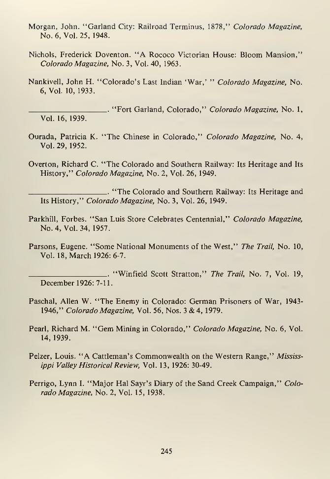
Morgan, John. "Garland City: Railroad Terminus, 1878," Colorado Magazine,
No. 6, Vol. 25, 1948.
Nichols, Frederick Doventon. "A Rococo Victorian House: Bloom Mansion,"
Colorado Magazine, No. 3, Vol. 40, 1963.
Nankivell, John H. "Colorado's Last Indian 'War,' " Colorado Magazine, No.
6, Vol. 10, 1933.
"Fort Garland, Colorado," Colorado Magazine, No. 1,
Vol. 16, 1939.
Ourada, Patricia K. "The Chinese in Colorado," Colorado Magazine, No. 4,
Vol. 29, 1952.
Overton, Richard C. "The Colorado and Southern Railway: Its Heritage and Its
History," Colorado Magazine, No. 2, Vol. 26, 1949.
"The Colorado and Southern Railway: Its Heritage and
Its History," Colorado Magazine, No. 3, Vol. 26, 1949.
Parkhill, Forbes. "San Luis Store Celebrates Centennial," Colorado Magazine,
No. 4, Vol. 34, 1957.
Parsons, Eugene. "Some National Monuments of the West," The Trail, No. 10,
Vol. 18, March 1926: 6-7.
"Winfield Scott Stratton," The Trail, No. 7, Vol. 19,
December 1926:7-11
Paschal, Allen W. "The Enemy in Colorado: German Prisoners of War, 1943-
1946," Colorado Magazine, Vol. 56, Nos. 3&4, 1979.
Pearl, Richard M. "Gem Mining in Colorado," Colorado Magazine, No. 6, Vol.
14, 1939.
Pelzer, Louis. "A Cattleman's Commonwealth on the Western Range," Mississ-
ippi Valley Historical Review, Vol. 13, 1926: 30-49.
Perrigo, Lynn I. "Major Hal Sayr's Diary of the Sand Creek Campaign," Colo-
rado Magazine, No. 2, Vol. 15, 1938.
245
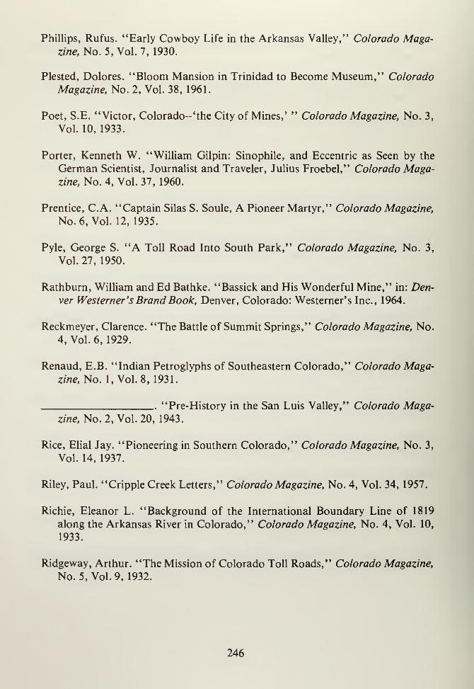
Phillips, Rufus. "Early Cowboy Life in the Arkansas Valley," Colorado Maga-zine, No. 5, Vol. 7, 1930.
Plested, Dolores. "Bloom Mansion in Trinidad to Become Museum," Colorado
Magazine, No. 2, Vol. 38, 1961.
Poet, S.E. "Victor, Colorado-- 'the City of Mines,' " Colorado Magazine, No. 3,
Vol. 10, 1933.
Porter, Kenneth W. "William Gilpin: Sinophile, and Eccentric as Seen by the
German Scientist, Journalist and Traveler, Julius Froebel," Colorado Maga-zine, No. 4, Vol. 37, 1960.
Prentice, C.A. "Captain Silas S. Soule, A Pioneer Martyr," Colorado Magazine,
No. 6, Vol. 12,1935.
Pyle, George S. "A Toll Road Into South Park," Colorado Magazine, No. 3,
Vol. 27, 1950.
Rathburn, William and Ed Bathke. "Bassick and His Wonderful Mine," in: Den-
ver Westerner's Brand Book, Denver, Colorado: Westerner's Inc., 1964.
Reckmeyer, Clarence. "The Battle of Summit Springs," Colorado Magazine, No.
4, Vol. 6, 1929.
Renaud, E.B. "Indian Petroglyphs of Southeastern Colorado," Colorado Maga-zine,No. l,Vol. 8, 1931.
"Pre-History in the San Luis Valley," Colorado Maga-zine, No. 2, Vol. 20, 1943.
Rice, Elial Jay. "Pioneering in Southern Colorado," Colorado Magazine, No. 3,
Vol. 14, 1937.
Riley, Paul. "Cripple Creek Letters," Colorado Magazine, No. 4, Vol. 34, 1957.
Richie, Eleanor L. "Background of the International Boundary Line of 1819
along the Arkansas River in Colorado," Colorado Magazine, No. 4, Vol. 10,
1933.
Ridgeway, Arthur. "The Mission of Colorado Toll Roads," Colorado Magazine,
No. 5, Vol. 9, 1932.
246
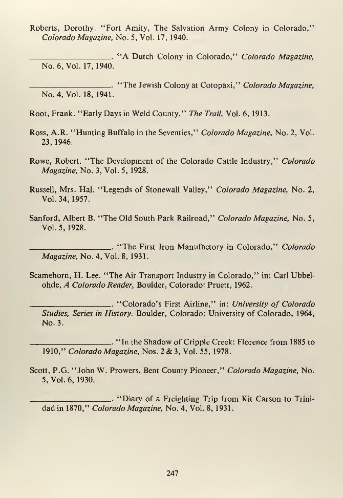
Roberts, Dorothy. "Fort Amity, The Salvation Army Colony in Colorado,"
Colorado Magazine, No. 5, Vol. 17, 1940.
"A Dutch Colony in Colorado," Colorado Magazine,
No. 6, Vol. 17, 1940.
"The Jewish Colony at Cotopaxi," Colorado Magazine,
No. 4, Vol. 18, 1941.
Root, Frank. "Early Days in Weld County," The Trail, Vol. 6, 1913.
Ross, A.R. "Hunting Buffalo in the Seventies," Colorado Magazine, No. 2, Vol.
23, 1946.
Rowe, Robert. "The Development of the Colorado Cattle Industry," Colorado
Magazine, No. 3, Vol. 5, 1928.
Russell, Mrs. Hal. "Legends of Stonewall Valley," Colorado Magazine, No. 2,
Vol. 34, 1957.
Sanford, Albert B. "The Old South Park Railroad," Colorado Magazine, No. 5,
Vol. 5, 1928.
"The First Iron Manufactory in Colorado," Colorado
Magazine, No. 4, Vol. 8, 1931.
Scamehorn, H. Lee. "The Air Transport Industry in Colorado," in: Carl Ubbel-
ohde, A Colorado Reader, Boulder, Colorado: Pruett, 1962.
"Colorado's First Airline," in: University of Colorado
Studies, Series in History. Boulder, Colorado: University of Colorado, 1964,
No. 3.
"In the Shadow of Cripple Creek: Florence from 1885 to
1910," Colorado Magazine, Nos. 2&3, Vol. 55, 1978.
Scott, P.G. "John W. Prowers, Bent County Pioneer," Colorado Magazine, No.
5, Vol. 6, 1930.
"Diary of a Freighting Trip from Kit Carson to Trini-
dad in 1870," Colorado Magazine, No. 4, Vol. 8, 1931.
247
Sears, R.W. "The Pioneer Store at Greenhorn on the Santa Fe Trail," Colorado
Magazine, No. 6, Vol. 25, 1948.
Sears, General W.H. "Cowboy Life at Bent's New Fort and on the Arkansas,"
Colorado Magazine, No. 3, Vol. 31, 1954.
Shields, Lillian B. "Relations with the Cheyennes and Arapahoes in Colorado to
1861," Colorado Magazine, No. 4, Vol. 4, 1927.
Shoemaker, Len. "National Forests," Colorado Magazine, No. 5, Vol. 21, 1944.
Smith, Emilia Gallegos. "Reminiscences of Early San Luis," Colorado Magazine,
No. 1, Vol. 24, 1947.
Smith, E. Willard. "With Fur Traders in Colorado, 1839-1840," Colorado Mag-azine, "Ho. 1, Vol. 27, 1950.
Smith, Lynn. "Early Days of Florence, Colorado," Colorado Magazine, No. 1,
Vol. 18, 1941.
Spence, Clark C. "The British and Colorado Mining Bureau," Colorado Maga-
zine, No. 2, Vol. 33, 1956.
Spencer, Frank C. "The Hayden Survey in Colorado in 1873-1874 . . . ," Colo-
rado Magazine, No. 4, Vol. 6, 1929.
"Early Days in Alamosa," Colorado Magazine, No. 2,
Vol. 8, 1931.
Spring, Agnes Wright. "Rainmakers of the 'Nineties,' " Colorado Magazine, No.
4, Vol. 32, 1955.
"John W. Iliff-Cattleman," in: A Colorado Reader,
Carl Ubbelohde, (ed.) Boulder, Colorado: Pruett, 1962.
Sporleder, Louis B. "La Plaza de los Leones, (Forerunner of Walsenburg, Colo-
rado)," Colorado Magazine, No. 1, Vol. 10, 1933.
Stantons, F.J. "History of the First Regiment of Colorado Volunteers 1861,"
The Trail, No. 12, Vol. 1, May 1909: 5-15.
248
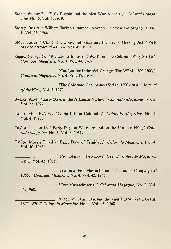
Stone, Wilbur F. "Early Pueblo and the Men Who Made It," Colorado Maga-zine, No. 6, Vol. 6, 1929.
Storey, Brit A. "William Jackson Palmer, Promoter," Colorado Magazine, No.
1, Vol. 43, 1966.
Stout, Joe A. "Cattlemen, Conservationists and the Taylor Grazing Act," NewMexico Historical Review, Vol.45, 1970.
Suggs, George G. "Prelude to Industrial Warfare: The Colorado City Strike,"
Colorado Magazine, No. 3, Vol. 44, 1967.
"Catalyst for Industrial Change: The WFM, 1893-1903,"
Colorado Magazine, No. 4, Vol. 45, 1968.
The Colorado Coal Miners Strike, 1903-1904," Journal
of the West, Vol. 7, 1973.
Swarts, A.M. "Early Days in the Arkansas Valley," Colorado Magazine, No. 5,
Vol. 27, 1927.
Tabor, Mrs. H.A.W. "Cabin Life in Colorado," Colorado Magazine, No. 1,
Vol.4, 1927.
Taylor Jackson Jr. "Early Days at Wetmore and on the Hardscrabble," Colo-
rado Magazine, No. 3, Vol. 8, 1931.
Taylor, Morris F. (ed.) "Early Days of Trinidad," Colorado Magazine, No. 4,
Vol.40, 1963.
'Promoters on the Maxwell Grant," Colorado Magazine,
No. 2, Vol.42, 1965.
"Action at Fort Massachusetts: The Indian Campaign of
1855," Colorado Magazine, No. 4, Vol. 42, 1965.
"Fort Massachusetts," Colorado Magazine, No. 2, Vol.
45, 1968.
'Capt. William Craig and the Vigil and St. Vrain Grant,
1855-1870," Colorado Magazine, No. 4, Vol. 45, 1968.
249
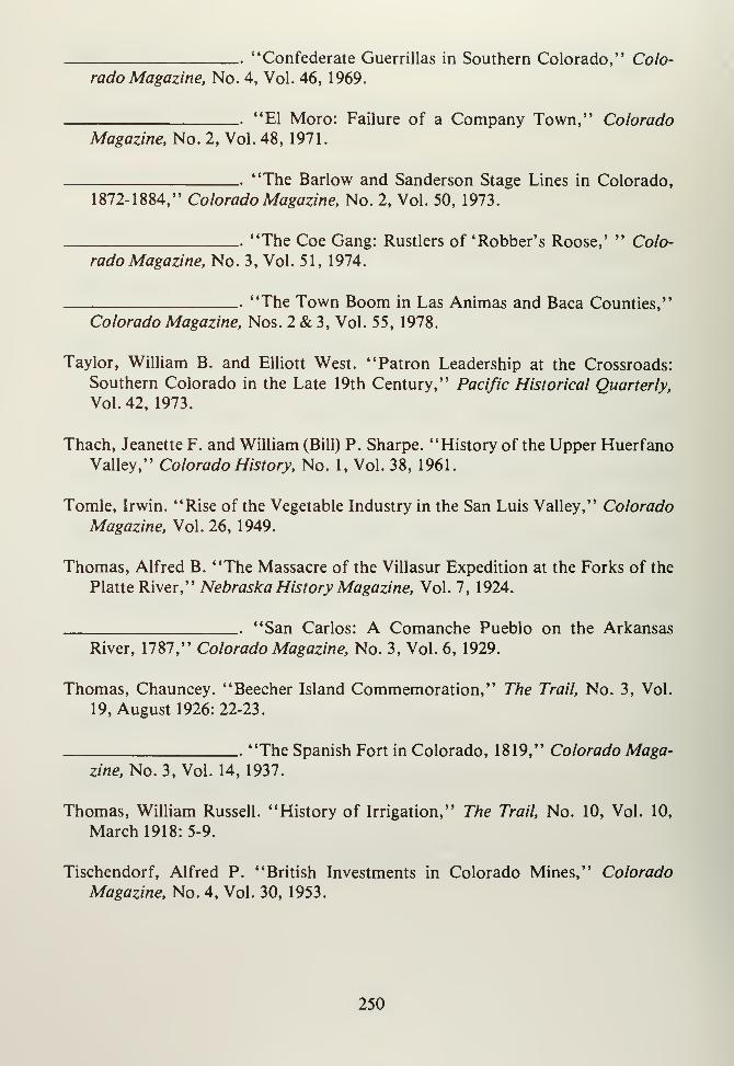
'Confederate Guerrillas in Southern Colorado," Colo-
rado Magazine, No. 4, Vol. 46, 1969.
El Moro: Failure of a Company Town," ColoradoMagazine, No. 2, Vol. 48, 1971
'The Barlow and Sanderson Stage Lines in Colorado,1872-1884," Colorado Magazine, No. 2, Vol. 50, 1973.
"The Coe Gang: Rustlers of 'Robber's Roose,' " Colo-
rado Magazine, No. 3, Vol. 51, 1974.
"The Town Boom in Las Animas and Baca Counties,"
Colorado Magazine, Nos. 2 & 3, Vol. 55, 1978.
Taylor, William B. and Elliott West. "Patron Leadership at the Crossroads:
Southern Colorado in the Late 19th Century," Pacific Historical Quarterly,
Vol.42, 1973.
Thach, Jeanette F. and William (Bill) P. Sharpe. "History of the Upper HuerfanoValley," Colorado History, No. 1, Vol. 38, 1961.
Tomle, Irwin. "Rise of the Vegetable Industry in the San Luis Valley," Colorado
Magazine, Vol. 26, 1949.
Thomas, Alfred B. "The Massacre of the Villasur Expedition at the Forks of the
Platte River," Nebraska History Magazine, Vol. 7, 1924.
"San Carlos: A Comanche Pueblo on the Arkansas
River, 1787," Colorado Magazine, No. 3, Vol. 6, 1929.
Thomas, Chauncey. "Beecher Island Commemoration," The Trail, No. 3, Vol.
19, August 1926: 22-23.
"The Spanish Fort in Colorado, 1819," Colorado Maga-zine, No. 3, Vol. 14, 1937.
Thomas, William Russell. "History of Irrigation," The Trail, No. 10, Vol. 10,
March 1918: 5-9.
Tischendorf, Alfred P. "British Investments in Colorado Mines," Colorado
Magazine, No. 4, Vol. 30, 1953.
250
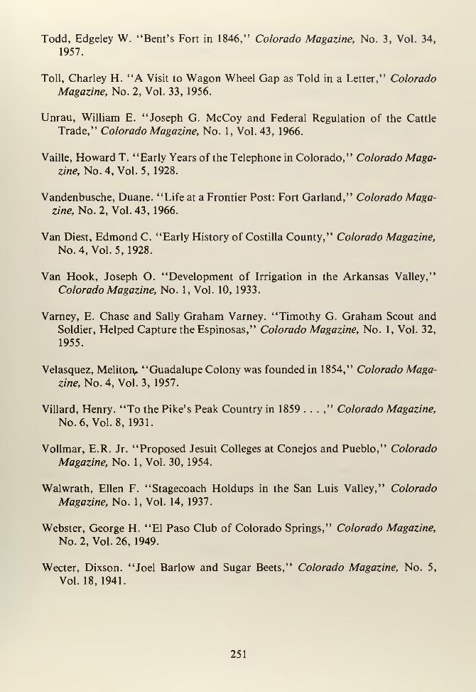
Todd, Edgeley W. "Bent's Fort in 1846," Colorado Magazine, No. 3, Vol. 34,
1957.
Toll, Charley H. "A Visit to Wagon Wheel Gap as Told in a Letter," Colorado
Magazine, No. 2, Vol. 33, 1956.
Unrau, William E. "Joseph G. McCoy and Federal Regulation of the Cattle
Trade," Colorado Magazine, No. 1, Vol. 43, 1966.
Vaille, Howard T. "Early Years of the Telephone in Colorado," Colorado Maga-zine, No. 4, Vol. 5, 1928.
Vandenbusche, Duane. "Life at a Frontier Post: Fort Garland," Colorado Maga-
zine, No. 2, Vol. 43, 1966.
Van Diest, Edmond C. "Early History of Costilla County," Colorado Magazine,
No. 4, Vol. 5, 1928.
Van Hook, Joseph O. "Development of Irrigation in the Arkansas Valley,"
Colorado Magazine, No. 1, Vol. 10, 1933.
Varney, E. Chase and Sally Graham Varney. "Timothy G. Graham Scout and
Soldier, Helped Capture the Espinosas," Colorado Magazine, No. 1, Vol. 32,
1955.
Velasquez, Melitoiv "Guadalupe Colony was founded in 1854," Colorado Maga-
zine, No. 4, Vol. 3, 1957.
Villard, Henry. "To the Pike's Peak Country in 1859 . . . ," Colorado Magazine,
No. 6, Vol. 8, 1931.
Vollmar, E.R. Jr. "Proposed Jesuit Colleges at Conejos and Pueblo," Colorado
Magazine, No. 1, Vol. 30, 1954.
Walwrath, Ellen F. "Stagecoach Holdups in the San Luis Valley," Colorado
Magazine, No. 1, Vol. 14, 1937.
Webster, George H. "El Paso Club of Colorado Springs," Colorado Magazine,
No. 2, Vol. 26, 1949.
Wecter, Dixson. "Joel Barlow and Sugar Beets," Colorado Magazine, No. 5,
Vol. 18, 1941.
251
Weitbrec, Robert F. "Sketch of the Early History of the Denver and Rio GrandeRailroad," The Trail, No. 4, Vol. 17, September 1924: 3-8.
Westermeier, Clifford P. "The Legal Status of the Colorado Cattlemen, 1867-
1887," Colorado Magazine, No. 3, Vol. 26, 1948.
"The Legal Status of the Colorado Cattleman, 1867-
1887," Colorado Magazine, No. 4, Vol. 26, 1948.
Westermeier, Therese S. "Colorado Festivals Part II: Faith and Folklore," Colo-
rado Magazine, No. 3, Vol. 29, 1952.
White, William R. "Illegal Fencing on the Colorado Range," Colorado Maga-
zine, No. 2, Vol. 52, 1975.
Wickens, James P. "The New Deal in Colorado," Pacific Historical Review, Vol.
38, 1969.
Williams, Eugene. "A Winter Storm on the Open Range," Colorado Magazine,
No. 6, Vol. 10, 1933.
Wroten, William H. Jr. "Colorado and the Advent of the Civil War," Colorado
Magazine, No. 3, Vol. 36, 1959.
Zilch, John H. "Memorial to 'Father' John L. Dyer," Colorado Magazine, No.
3, Vol. 40, 1963.
Zweig, Sheldon S. "The Civil Administration of Governor William Gilpin,"
Colorado Magazine, No. 3, Vol. 31, 1954.
Pamphlets
No Author. Souvenir Edition Devoted to the Interests of Trinidad, Las AnimasCounty, 1900-1901. Trinidad (?): Advertiser-Sentinal, c. 1901.
Three Score and Ten. Lamar, Colorado: LamarChamber of Commerce, 1956.
Crampon, L.J. Manufacturing in Pueblo. Boulder, Colorado: Bureau of Business
Research, University of Colorado, 1949.
252
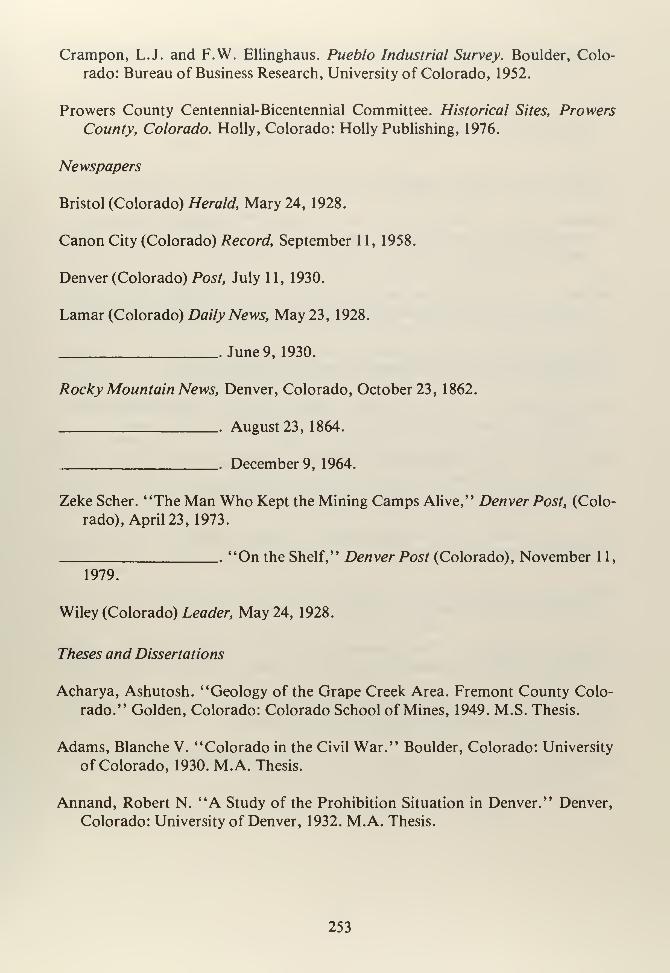
Crampon, L.J. and F.W. Ellinghaus. Pueblo Industrial Survey. Boulder, Colo-
rado: Bureau of Business Research, University of Colorado, 1952.
Prowers County Centennial-Bicentennial Committee. Historical Sites, Prowers
County, Colorado. Holly, Colorado: Holly Publishing, 1976.
Newspapers
Bristol (Colorado) Herald, Mary 24, 1928.
Canon City (Colorado) Record, September 1 1 , 1958.
Denver (Colorado) Post, July 11, 1930.
Lamar (Colorado) Daily News, May 23, 1928.
June 9, 1930.
Rocky Mountain News, Denver, Colorado, October 23, 1862.
August 23, 1864.
December 9, 1964.
Zeke Scher. "The Man Who Kept the Mining Camps Alive," Denver Post, (Colo-
rado), April 23, 1973.
"On the Shelf," Denver Post (Colorado), November 11,
1979.
Wiley (Colorado) Leader, May 24, 1928.
Theses and Dissertations
Acharya, Ashutosh. "Geology of the Grape Creek Area. Fremont County Colo-
rado." Golden, Colorado: Colorado School of Mines, 1949. M.S. Thesis.
Adams, Blanche V. "Colorado in the Civil War." Boulder, Colorado: University
of Colorado, 1930. M.A. Thesis.
Annand, Robert N. "A Study of the Prohibition Situation in Denver." Denver,
Colorado: University of Denver, 1932. M.A. Thesis.
253
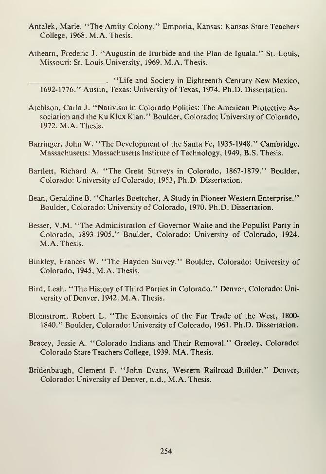
Antalek, Marie. "The Amity Colony." Emporia, Kansas: Kansas State Teachers
College, 1968. M.A. Thesis.
Athearn, Frederic J. "Augustin de Iturbide and the Plan de Iguala." St. Louis,
Missouri: St. Louis University, 1969. M.A. Thesis.
"Life and Society in Eighteenth Century New Mexico,
1692-1776." Austin, Texas: University of Texas, 1974. Ph.D. Dissertation.
Atchison, Carla J. "Nativism in Colorado Politics: The American Protective As-
sociation and the Ku Klux Klan." Boulder, Colorado; University of Colorado,
1972. M.A. Thesis.
Barringer, John W. "The Development of the Santa Fe, 1935-1948." Cambridge,
Massachusetts: Massachusetts Institute of Technology, 1949, B.S. Thesis.
Bartlett, Richard A. "The Great Surveys in Colorado, 1867-1879." Boulder,
Colorado: University of Colorado, 1953, Ph.D. Dissertation.
Bean, Geraldine B. "Charles Boettcher, A Study in Pioneer Western Enterprise."
Boulder, Colorado: University of Colorado, 1970. Ph.D. Dissertation.
Besser, V.M. "The Administration of Governor Waite and the Populist Party in
Colorado, 1893-1905." Boulder, Colorado: University of Colorado, 1924.
M.A. Thesis.
Binkley, Frances W. "The Hayden Survey." Boulder, Colorado: University of
Colorado, 1945, M.A. Thesis.
Bird, Leah. "The History of Third Parties in Colorado." Denver, Colorado: Uni-
versity of Denver, 1942. M.A. Thesis.
Blomstrom, Robert L. "The Economics of the Fur Trade of the West, 1800-
1840." Boulder, Colorado: University of Colorado, 1961. Ph.D. Dissertation.
Bracey, Jessie A. "Colorado Indians and Their Removal." Greeley, Colorado:
Colorado State Teachers College, 1939. MA. Thesis.
Bridenbaugh, Clement F. "John Evans, Western Railroad Builder." Denver,
Colorado: University of Denver, n.d., M.A. Thesis.
254
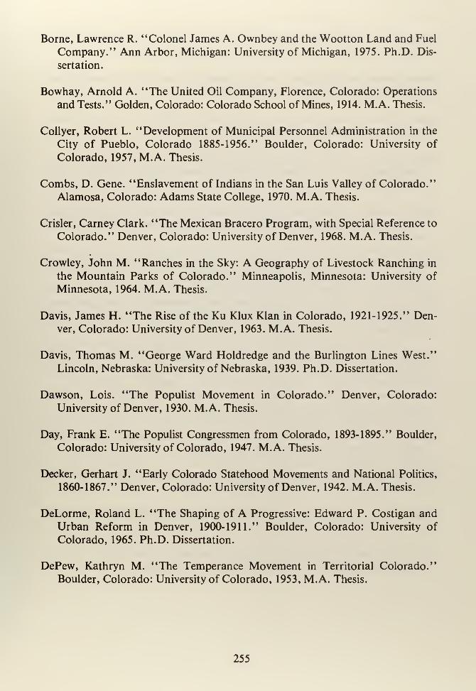
Borne, Lawrence R. "Colonel James A. Ownbey and the Wootton Land and Fuel
Company." Ann Arbor, Michigan: University of Michigan, 1975. Ph.D. Dis-
sertation.
Bowhay, Arnold A. "The United Oil Company, Florence, Colorado: Operations
and Tests." Golden, Colorado: Colorado School of Mines, 1914. M.A. Thesis.
Collyer, Robert L. "Development of Municipal Personnel Administration in the
City of Pueblo, Colorado 1885-1956." Boulder, Colorado: University of
Colorado, 1957, M.A. Thesis.
Combs, D. Gene. "Enslavement of Indians in the San Luis Valley of Colorado."
Alamosa, Colorado: Adams State College, 1970. M.A. Thesis.
Crisler, Carney Clark. "The Mexican Bracero Program, with Special Reference to
Colorado." Denver, Colorado: University of Denver, 1968. M.A. Thesis.
Crowley, John M. "Ranches in the Sky: A Geography of Livestock Ranching in
the Mountain Parks of Colorado." Minneapolis, Minnesota: University of
Minnesota, 1964. M.A. Thesis.
Davis, James H. "The Rise of the Ku Klux Klan in Colorado, 1921-1925." Den-
ver, Colorado: University of Denver, 1963. M.A. Thesis.
Davis, Thomas M. "George Ward Holdredge and the Burlington Lines West."
Lincoln, Nebraska: University of Nebraska, 1939. Ph.D. Dissertation.
Dawson, Lois. "The Populist Movement in Colorado." Denver, Colorado:
University of Denver, 1930. M.A. Thesis.
Day, Frank E. "The Populist Congressmen from Colorado, 1893-1895." Boulder,
Colorado: University of Colorado, 1947. M.A. Thesis.
Decker, Gerhart J. "Early Colorado Statehood Movements and National Politics,
1860-1867." Denver, Colorado: University of Denver, 1942. M.A. Thesis.
DeLorme, Roland L. "The Shaping of A Progressive: Edward P. Costigan and
Urban Reform in Denver, 1900-1911." Boulder, Colorado: University of
Colorado, 1965. Ph.D. Dissertation.
DePew, Kathryn M. "The Temperance Movement in Territorial Colorado."
Boulder, Colorado: University of Colorado, 1953, M.A. Thesis.
255
Downing, Bonnie P. "The Mining Interest in the Colorado Statehood Movement."Boulder, Colorado: University of Colorado, 1970, M.A. Thesis.
Fleming, Helen M. "Mining in Leadville, Colorado Since 1860." Greeley, Colo-
rado: Colorado State Teacher's College, 1924.
Flynn, Norma. "South Park: Seventy-five Years of Its History." Denver, Colo-
rado: University of Denver, 1947. M.A. Thesis.
Fogel, Karen S. "Mineworkers and Their Families in the Southern Colorado
Coalfields, 1913-1914." Cambridge, Massachusetts: Radcliff College, 1975.
B.A. Thesis.
Fox, Leonard P. "Origins and Early Development of Populism in Colorado."
College Station, Pennsylvania: University of Pennsylvania, 1916. Ph.D. Dis-
sertation.
Fuller, Leon W. "The Populist Regime in Colorado." Madison, Wisconsin:
University of Wisconsin, 1933. Ph.D. Dissertation.
Gaynor, Lois M. "History of the Colorado Fuel and Iron Co., and Constituent
Companies, 1872-1933." Boulder, Colorado: University of Colorado 1935.
M.A. Thesis.
Griswold, Jean. "The History of Leadville, Colorado to 1900." Los Angeles,
California: University of Southern California, 1933. M.A. Thesis.
Hasting, Martin F. "Parochial Beginnings in Colorado to 1889." St. Louis, Mis-
souri: St. Louis University, 1941. M.A. Thesis.
Henderson, David A. "The Beef Cattle Industry of Colorado." Boulder, Colo-
rado: University of Colorado, 1951. M.A. Thesis.
Jensen, Billie B. "The Women's Suffrage Movement in Colorado." Boulder,
Colorado: University of Colorado, 1959. M.A. Thesis.
Johnson, Ella C. "The Territory of Jefferson." Denver, Colorado: University of
Denver, 1926. M.S. Thesis.
Kaplan, Michael D. "Otto Mears: Colorado's Transportation King." Boulder,
Colorado: University of Colorado, 1975. Ph.D. Dissertation.
256
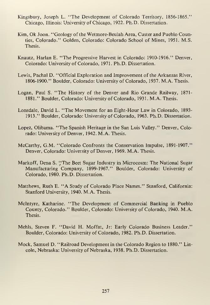
Kingsbury, Joseph L. "The Development of Colorado Territory, 1856-1865."
Chicago, Illinois: University of Chicago, 1922. Ph.D. Dissertation.
Kim, Ok Joon. "Geology of the Wetmore-Beulah Area, Custer and Pueblo Coun-
ties, Colorado." Golden, Colorado: Colorado School of Mines, 1951. M.S.
Thesis.
Knautz, Harlan E. "The Progressive Harvest in Colorado: 1910-1916." Denver,
Colorado: University of Colorado, 1971. Ph.D. Dissertation.
Lewis, Pachal D. "Official Exploration and Improvement of the Arkansas River,
1806-1900." Boulder, Colorado: University of Colorado, 1937. M.A. Thesis.
Logan, Paul S. "The History of the Denver and Rio Grande Railway, 1871-
1881." Boulder, Colorado: University of Colorado, 1931. M.A. Thesis.
Lonsdale, David L. "The Movement for an Eight-Hour Law in Colorado, 1893-
1913." Boulder, Colorado: University of Colorado, 1963. Ph.D. Dissertation.
Lopez, Olibama. "The Spanish Heritage in the San Luis Valley." Denver, Colo-
rado: University of Denver, 1942. M.A. Thesis.
McCarthy, G.M. "Colorado Confronts the Conservation Impulse, 1891-1907."
Denver, Colorado: University of Denver, 1969. M.A. Thesis.
Markoff, Dena S. "The Beet Sugar Industry in Microcosm: The National Sugar
Manufacturing Company, 1899-1967." Boulder, Colorado: University of
Colorado, 1980. Ph.D. Dissertation.
Matthews, Ruth E. "A Study of Colorado Place Names." Stanford, California:
Stanford University, 1940. M.A. Thesis.
Mclntyre, Katharine. "The Development of Commercial Banking in Pueblo
County, Colorado." Boulder, Colorado: University of Colorado, 1940. M.A.Thesis.
Mehls, Steven F. "David H. Moffat, Jr: Early Colorado Business Leader."
Boulder, Colorado: University of Colorado, 1982. Ph.D. Dissertation.
Mock, Samuel D. "Railroad Development in the Colorado Region to 1880." Lin-
coln, Nebraska: University of Nebraska, 1938. Ph.D. Dissertation.
257
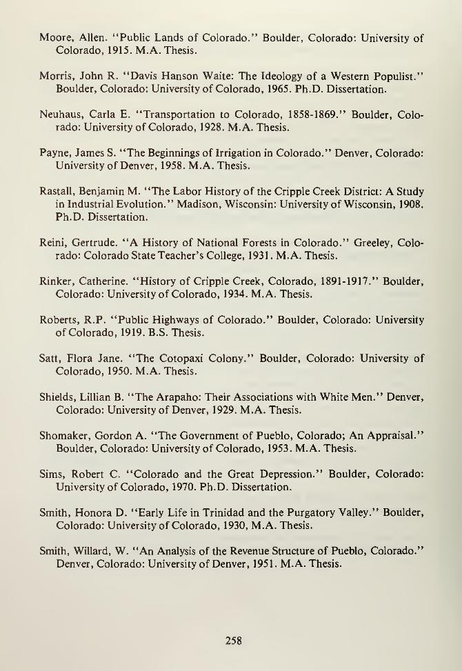
Moore, Allen. "Public Lands of Colorado." Boulder, Colorado: University of
Colorado, 1915. M.A. Thesis.
Morris, John R. "Davis Hanson Waite: The Ideology of a Western Populist."
Boulder, Colorado: University of Colorado, 1965. Ph.D. Dissertation.
Neuhaus, Carla E. "Transportation to Colorado, 1858-1869." Boulder, Colo-
rado: University of Colorado, 1928. M.A. Thesis.
Payne, James S. "The Beginnings of Irrigation in Colorado." Denver, Colorado:
University of Denver, 1958. M.A. Thesis.
Rastall, Benjamin M. "The Labor History of the Cripple Creek District: A Study
in Industrial Evolution." Madison, Wisconsin: University of Wisconsin, 1908.
Ph.D. Dissertation.
Reini, Gertrude. "A History of National Forests in Colorado." Greeley, Colo-
rado: Colorado State Teacher's College, 1931. M.A. Thesis.
Rinker, Catherine. "History of Cripple Creek, Colorado, 1891-1917." Boulder,
Colorado: University of Colorado, 1934. M.A. Thesis.
Roberts, R.P. "Public Highways of Colorado." Boulder, Colorado: University
of Colorado, 1919. B.S. Thesis.
Satt, Flora Jane. "The Cotopaxi Colony." Boulder, Colorado: University of
Colorado, 1950. M.A. Thesis.
Shields, Lillian B. "The Arapaho: Their Associations with White Men." Denver,
Colorado: University of Denver, 1929. M.A. Thesis.
Shomaker, Gordon A. "The Government of Pueblo, Colorado; An Appraisal."
Boulder, Colorado: University of Colorado, 1953. M.A. Thesis.
Sims, Robert C. "Colorado and the Great Depression." Boulder, Colorado:
University of Colorado, 1970. Ph.D. Dissertation.
Smith, Honora D. "Early Life in Trinidad and the Purgatory Valley." Boulder,
Colorado: University of Colorado, 1930, M.A. Thesis.
Smith, Willard, W. "An Analysis of the Revenue Structure of Pueblo, Colorado."
Denver, Colorado: University of Denver, 1951. M.A. Thesis.
258
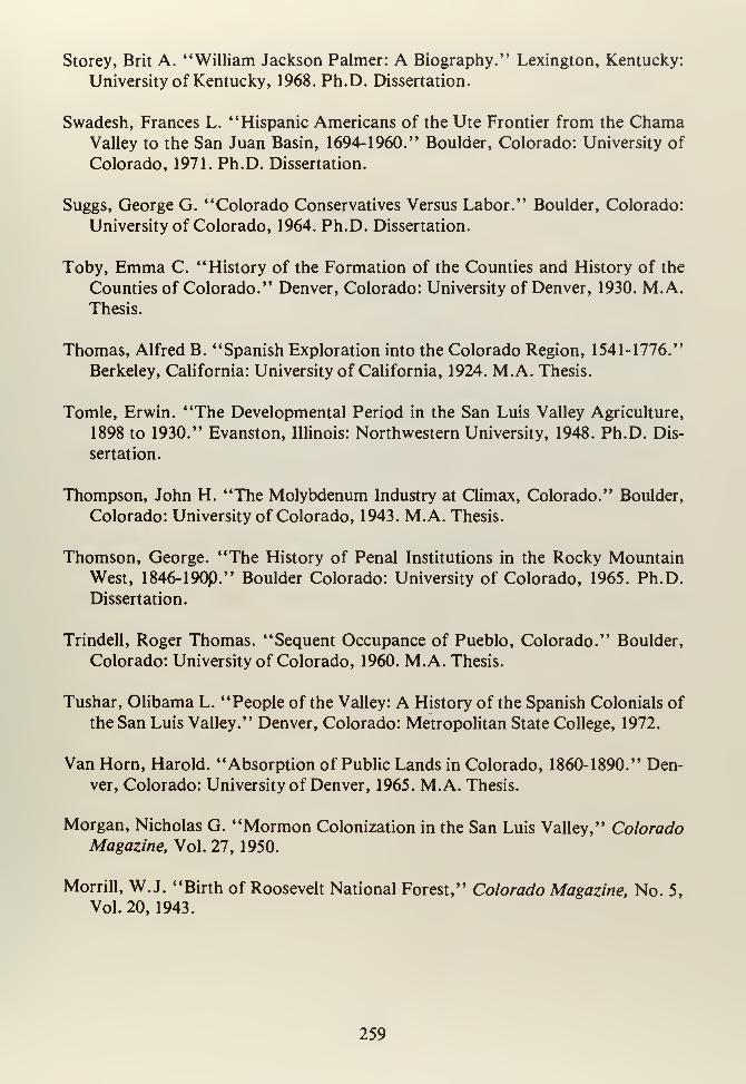
Storey, Brit A. "William Jackson Palmer: A Biography." Lexington, Kentucky:
University of Kentucky, 1968. Ph.D. Dissertation.
Swadesh, Frances L. "Hispanic Americans of the Ute Frontier from the ChamaValley to the San Juan Basin, 1694-1960." Boulder, Colorado: University of
Colorado, 1971. Ph.D. Dissertation.
Suggs, George G. "Colorado Conservatives Versus Labor." Boulder, Colorado:
University of Colorado, 1964. Ph.D. Dissertation.
Toby, Emma C. "History of the Formation of the Counties and History of the
Counties of Colorado." Denver, Colorado: University of Denver, 1930. M.A.Thesis.
Thomas, Alfred B. "Spanish Exploration into the Colorado Region, 1541-1776."
Berkeley, California: University of California, 1924. M.A. Thesis.
Tomle, Erwin. "The Developmental Period in the San Luis Valley Agriculture,
1898 to 1930." Evanston, Illinois: Northwestern University, 1948. Ph.D. Dis-
sertation.
Thompson, John H. "The Molybdenum Industry at Climax, Colorado." Boulder,
Colorado: University of Colorado, 1943. M.A. Thesis.
Thomson, George. "The History of Penal Institutions in the Rocky MountainWest, 1846-190P." Boulder Colorado: University of Colorado, 1965. Ph.D.
Dissertation.
Trindell, Roger Thomas. "Sequent Occupance of Pueblo, Colorado." Boulder,
Colorado: University of Colorado, 1960. M.A. Thesis.
Tushar, Olibama L. "People of the Valley: A History of the Spanish Colonials of
the San Luis Valley." Denver, Colorado: Metropolitan State College, 1972.
Van Horn, Harold. "Absorption of Public Lands in Colorado, 1860-1890." Den-
ver, Colorado: University of Denver, 1965. M.A. Thesis.
Morgan, Nicholas G. "Mormon Colonization in the San Luis Valley," ColoradoMagazine, Vol. 27, 1950.
Morrill, W.J. "Birth of Roosevelt National Forest," Colorado Magazine, No. 5,
Vol.20, 1943.
259
Murphy, J.E. "Western City Ends Flood Menace," Scientific American Vol. 134,
1926:318-319.
Mumey, Nolie. "John Williams Gunnison: Centenary of His Survey and Tragic
Death (1853-1953)," Colorado Magazine, No. 1, Vol. 31, 1954.
Van Hook, Joseph O. "Settlement and Economic Development of the Arkansas
Valley from Pueblo to the Colorado-Kansas Line, 1860-1900." Boulder, Colo-
rado: University of Colorado, 1933. Ph.D. Dissertation.
Voss, Walter A. "Colorado and Forest Conservation." Boulder, Colorado: Uni-
versity of Colorado, 1931. M.A. Thesis.
Welch, Gerald D. "John F. Shafroth, Progressive Governor of Colorado 1910-
1912." Denver, Colorado: University of Denver, 1962. M.A. Thesis.
White, Forest L. "The Panic of 1893 in Colorado." Boulder, Colorado: Univer-
sity of Colorado, 1932. M.A. Thesis.
Wickens, James F. "Colorado in the Great Depression: A Study of New Deal Pol-
itics at the State Level." Denver, Colorado: University of Denver, 1964. PhD.
Dissertation.
Wilson, Owen, M. "A History of the Denver and Rio Grande Project, 1870-1901."
Berkeley, California: University of California, 1942. Ph. D. Dissertation.
Woodward, Dorothy. "The Penitentes of New Mexico." New Haven, Connecticut:
Yale University, 1935. Ph.D. Dissertation.
260
ABOUT THE AUTHOR
Frederic J. Athearn has been a resident of Colorado most of his life. He received a
B.A. in History and Spanish from the University of Colorado, Boulder in 1968, a
M.A. (R) in History from St. Louis University in 1969 and a Ph.D. in Western
History from the University of Texas at Austin in 1974. The author has taught
U.S. History, Western History and Colorado History at both the University of
Texas and the University of Colorado. He is the author of An Isolated Empire: AHistory of Northwestern Colorado (1976), has published articles in numerous
professional history journals and has delivered papers to professional groups. The
author is presently historian for the Bureau of Land Management's Colorado
State Office in Denver, Colorado, a position he has occupied since 1975.
261

Bureau of Land ManagementLibrary
Bldg. 50. Denver Federal CenterDenver. CO 80225
Q<u
ouMt/1
D
u z *10
*-aJ3
<5 z k^+-> K T»
z>
3 <OC/3
W J 77 R<4H
o ^ v<1
X o ()
uo c^ <=5 u\
•H33
(!)
< w
• • i i
Related Documents