Geo-database And Topology Prof. Dr. Sajid Rashid Ahmad [email protected] Atiqa Ijaz Khan _ Demonstrator [email protected]

Lab 12 geodatabase and topology
Jul 15, 2015
Welcome message from author
This document is posted to help you gain knowledge. Please leave a comment to let me know what you think about it! Share it to your friends and learn new things together.
Transcript
Geo-database And Topology
Prof. Dr. Sajid Rashid Ahmad
Atiqa Ijaz Khan _ Demonstrator

Step by Step Procedure
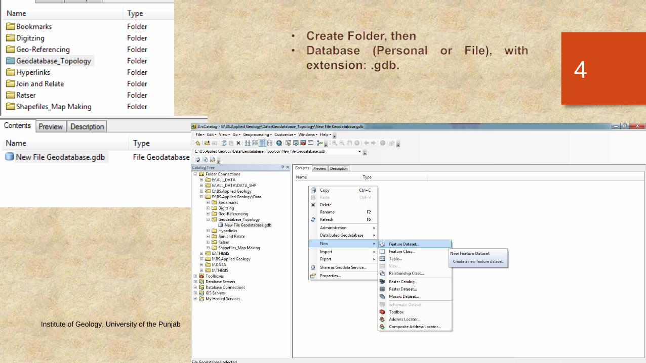
• Open Arc Catalogue.
• Create New Folder.
• Go inside the folder, create File/Personal Geo-database.
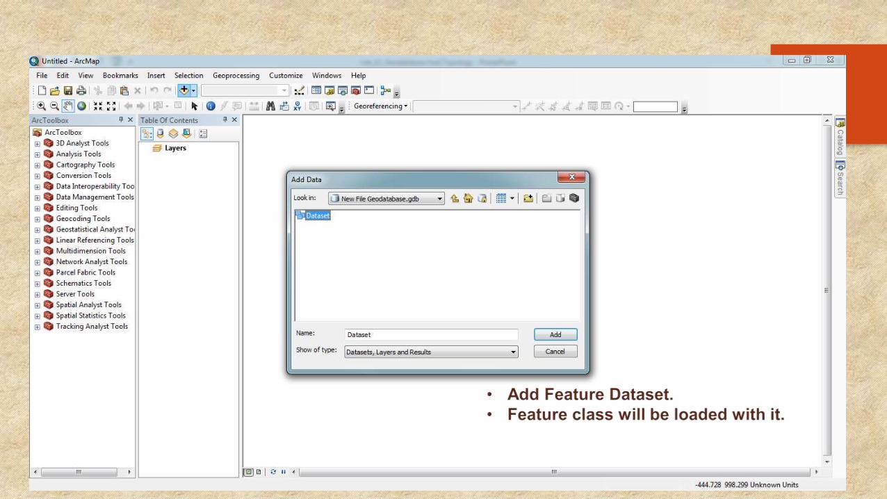
• Go inside it, create Feature Dataset.
• Go inside it, create Feature class. Or one can Import Feature class.
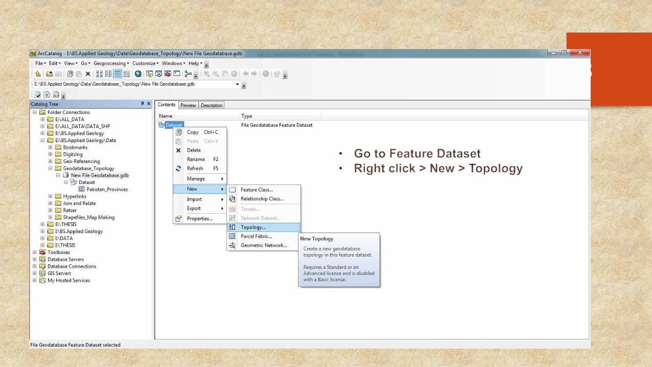
• Go to Feature Dataset, Right click to open Add Topology.
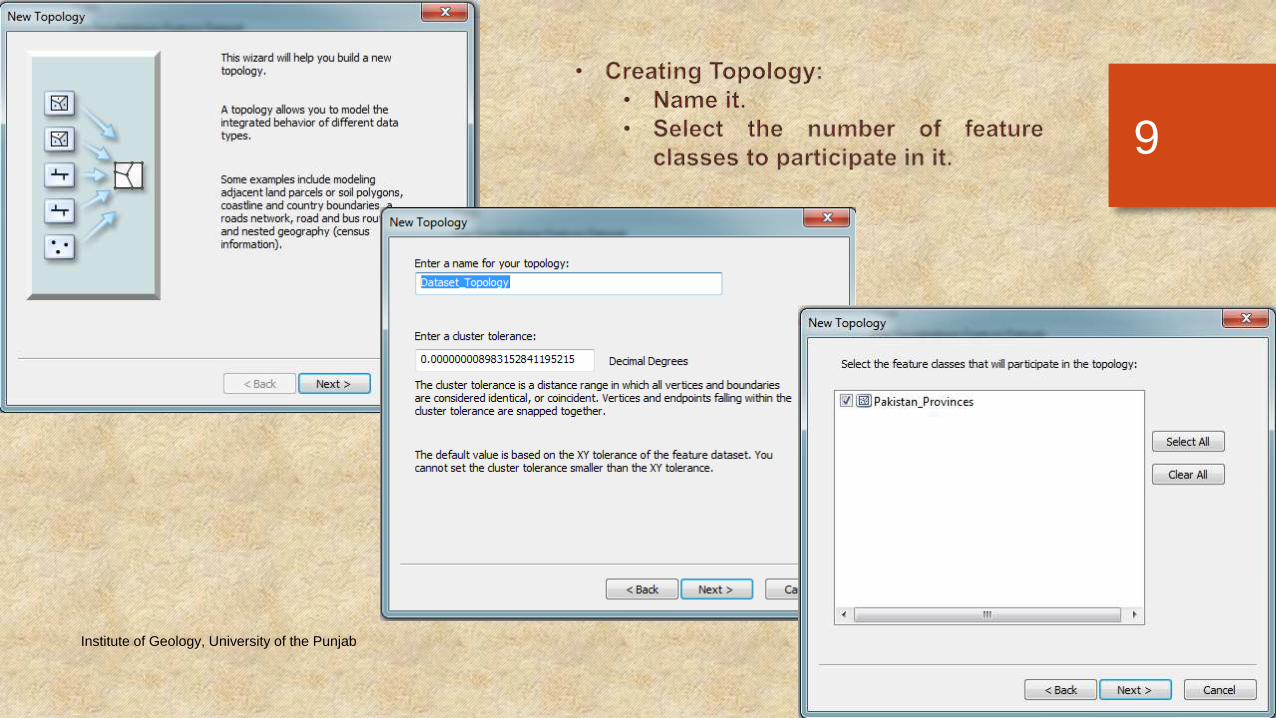
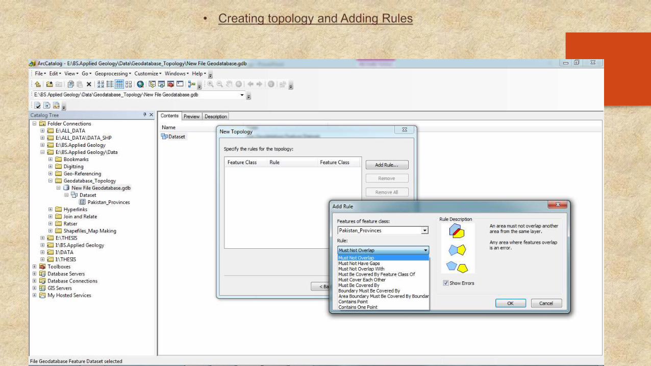
• Name it, Set rules, See descriptions, Finish, Validate.
• Close Arc Catalogue, & open Arc Map.
• Add the Feature Dataset.
Monday, March 30, 2015Institute of Geology, University of the Punjab
2
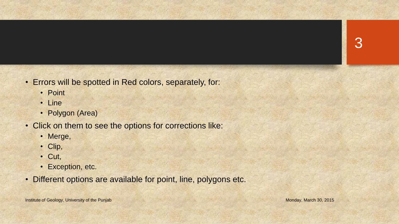
• Errors will be spotted in Red colors, separately, for:
• Point
• Line
• Polygon (Area)
• Click on them to see the options for corrections like:
• Merge,
• Clip,
• Cut,
• Exception, etc.
• Different options are available for point, line, polygons etc.
Monday, March 30, 2015Institute of Geology, University of the Punjab
3
Monday, March 30, 2015Institute of Geology, University of the Punjab
4

Monday, March 30, 2015Institute of Geology, University of the Punjab
5

Monday, March 30, 2015Institute of Geology, University of the Punjab
6

Monday, March 30, 2015Institute of Geology, University of the Punjab
7
Monday, March 30, 2015Institute of Geology, University of the Punjab
8
Monday, March 30, 2015Institute of Geology, University of the Punjab
9

Monday, March 30, 2015Institute of Geology, University of the Punjab
10
Monday, March 30, 2015Institute of Geology, University of the Punjab
11

Monday, March 30, 2015Institute of Geology, University of the Punjab
12

Monday, March 30, 2015Institute of Geology, University of the Punjab
13
Monday, March 30, 2015Institute of Geology, University of the Punjab
14

Monday, March 30, 2015Institute of Geology, University of the Punjab
15

Monday, March 30, 2015Institute of Geology, University of the Punjab
16

Monday, March 30, 2015Institute of Geology, University of the Punjab
17
Related Documents