KITSAP COUNTY PARKS PORT GAMBLE FOREST HERITAGE PARK RESOURCE STEWARDSHIP & RECREATIONAL ACCESS PLAN EXECUTIVE SUMMARY We are the stewards of the Forest and the Shore! Our goal is to protect and enhance these forested uplands, shorelands and delands, where nave plants and wildlife can flourish for generaons. Our goal is to provide for public enjoyment and recreaon opportunies, in a manner that respects those inherent resources and values.

Welcome message from author
This document is posted to help you gain knowledge. Please leave a comment to let me know what you think about it! Share it to your friends and learn new things together.
Transcript

KITSAP COUNTY PARKS PORT GAMBLE FOREST HERITAGE PARKRESOURCE STEWARDSHIP & RECREATIONAL ACCESS PLANEXECUTIVE SUMMARY
We are the stewards of the Forest and the Shore!
Our goal is to protect and enhance these forested
uplands, shorelands and tidelands, where native
plants and wildlife can flourish for generations.
Our goal is to provide for public enjoyment and
recreation opportunities, in a manner that respects
those inherent resources and values.

STEWARDSHIP GUIDING PRINCIPLESProtect, Restore and Enhance Natural Resources: 1. Protect, restore and enhance Natural Resources;sensitivenaturalareas, plant species and wildlife habitat 2.Worktowardaforestrestorationregimefor foresthealthandhabitatdiversity;create aforestwithvariedtreeageandspecies, andsuitablefordiversewildlifehabitat 3.Protecttheaquiferrechargefunction 4. Protect and enhance shoreline habitat; includingshellfishandforagefish 5.ProtectthewaterqualityofPortGambleBay throughmanagementofshorelineanduplands 6.UnderstandtheimportanceofthePacific flyway(avian“highway”)andthis landscape’skeyrole 7. Plan for stewardship and public use as part ofthelarge-scalesurroundinglandscape
Respect Historical and Future Cultural Integrity: 1.Preserveculturalandhistoricalaspects ofthelandsandshore,inclusiveofallTribes; recognizeandprotectpopulationsof medicinalplantsandotherculturally significantflora 2.PreserveandenhancetheState ScenicHighway104viewshedalong theHeritageForestalignment
Promote Responsible Recreation and Public Use of the Park: 1.MeetrecreationalneedsoftheRegion 2.Developacohesivetrailsystem;createtrail loops,trailsclose-in,andextensivetraveltrails 3.Developsafepublicaccesspointsand trailheadparking 4.Planforconnectingcorridorsforrecreation trails[SoundtoOlympics)andwildlifetravel 5.Recognizeandplanningfor“watertrails” aspartofKitsapPeninsulaWatertrailsystem 6.ExplorelandadjacenttotheShorelineBlock whichisintendedforamountainbikeride center,andworktointegratethisactivity areawithpark’snaturalresourcesprotection 7.Engageallusers/activitiestogetthem excitedaboutnature-educationand conservationthroughrecreation
RESOURCE MANAGEMENT LANDSCAPE CLASSIFICATIONSThisplanincludesaLandscapeClassificationsMapthatrecognizesoutstandingandsensitiveresourceareas,andoutlinesareaswhererecreationalactivitiesareconsideredcompatible.
NA = Natural AreaAcceptable Land use: Let natural processes prevail.Observeandmonitorhealth.Ecosystemrestorationactivitiesonly.AllowableActivities:Authorizedaccessbypermit.Managementactivitiestopromotehealthandlongevity;ex.invasivespeciescontrol. Nodevelopedrecreationalaccessoruse.
C = Conservation AreaAcceptableLanduse:Prescriptivehabitatrestoration.Monitorecosystemhealth, invasivespeciesmanagementandcontrol.AllowableActivities:Prohibitedorganizedlargegroupactivities.NOpets,livestock,bicycles.Educationalandinterpretiveactivitieswhich haveminimalresourceintrusionandimpact.Limitedrecreationalharvestactivitiesand thosewhichsustainandcomplement resourcehealthanddiversity;ex.shellfish,berries,brushpicking.
PR = Passive RecreationAcceptableLanduse:Managelandscape forrecreationalsafetyandlimitedimpact use.Determineacarrying-capacityfortrailaccess and use. AllowableActivities:Somerecreationalharvestoftraditionalvegetation,lowimpacttrails,manage“hazardtrees”inconcentratedareas,someconditionalcommercialharvestforstandmaintenance.NOlargerecreationalevents.Viewpoints.Publicamenities;ex.restrooms,interpretiveandeducationalactivities.Conditionaluse:Leasheddogwalkingmaybepermitted,dependingonresourceprotectionrequirements.
AR = Active RecreationAcceptableLanduse:Anareaofhighlevelofrecreationalactivitiesandfacilities.Modificationoflandscapeisallowablewiththeprotectionofsensitiveandcriticalresourceareas.AllowableActivities:Nature-basedrecreationactivitiesandfacilities.Eventsareallowablewithpermitandscheduling.Largeeventimpactsneedtobemitigated.Provideforvisitorcomfortamenities.Highcapacitydesignedtrails,parking.Dogwalking,on-leash--Ok.Dogwalkingwithequestrianuseisallowablewithvoicecontrol.
SP = Specialized RecreationAcceptable Land Use: Dependent on recreationalexperienceandactivitydemands.AllowableActivities:Dependentonrecreationalneeds.ex.;bikerecreationareas,amphitheaters,modelairplaneflyfields,non-motorizedorganizedeventssuchasruns,walks,bike rallies,watertrailactivities.
Conditional Uses:Allowancesaremadeforresourceuseforrecreationandpublicaccessthatarenotidentifiedinthelandclassificationsandmaybedeterminedanacceptable“conditionaluse”,onacase-by-casebasis,throughaKitsapCountyParksplanningprocess.ThesewillbenotedinaParkManagementPlan.
Forest Restoration Activities: As a result of historicsilviculturalpracticesonthispropertydirectedtocommercialtimberharvest;thecurrentforeststructureandcompositionhaslimiteddiversity,ageclassandunderstorycomplexity.Restorationactivitieswillenhanceforesthealthandhabitatsandmayinclude;restorativethinning,inter-plantingofnativetreespecies,andintroductionofothernativeplants.
Po
rt
Ga
mb
l eB
ay
SCENICDR
NES
TATE H
WY
104 NE
BALTIC
LN
NE
STAT
EH
WY
3N
E
WO
OD
CR
EE
KP
LN
E
G1000
G1200
G10
20
G1210
G1430
G1310
G1330
G1340
G1420
G13 11
G14
10
G13 20
G10
10
G1400
G1100
G1300
Forb
idde
nFo
rest
E.T.
Bea ver tra
il
Ran ger TheHi
gh
Life
Hope
Ewok
St
umps
BeaverTrail
Downhell The Hood
100
200
100
200
300
300
100
200
300
400
400
400
400
Wildlife Assessment Study Area
Kitsap County Parks
Kitsap County Parks – Pending Purchase
Olympic Property Group Lands
DRAFT Planning Designations (Version 3)Natural Area
Conservation
Passive Recreation
Active Recreation
Undetermined Recreation
Specialized Recreation
RoadsState Highway
Local Road
GPS'd Trails
Proposed Sound to Olympics Trail
Proposed Shoreline Trail
Topo Map100' Contours
20' Contours
USE OF THIS MAP IMPLIES THE USER’SAGREEMENT WITH THE FOLLOWING STATEMENT:
Kitsap County disclaims any warrantee ofmerchantability or warrantee of fitness of this map forany particular purpose, either expressed or implied. Norepresentation or warranty is made concerning theaccuracy, currency, completeness or quality of datadepicted on this map. Any user of this map assumesall responsibility for the use thereof, and further agreesto hold Kitsap County harmless from and against anydamage, loss, or liability arising from any use of thismap.Imagery Date: Spring, 2012Map Date: 6/1/2015
Port Gamble Forest Heritage Park
NW I ONHSA GT
SIK T APYUCO NT
0 250 500 750 1,000
Feet
July 13, 2015

PROTECTION OF NATURAL, CULTURAL & HISTORIC RESOURCES
Ongoing Resource Stewardship Issue: Tocontinuestewardshipoftheseparklandsandapplicationofthemanagementobjectivestherewillneedtobeaconcertedeffortbylocalcitizens,interestgroups(recreationalandconservation),andtheTribes,tostayinvolvedandrecommendmoreprescriptivemanagementactionsandfundingpossibilities.
Management Objectives:CreateaPortGambleForestHeritageParkStewardshipGrouptofurthertheresourcemanagementandrecreationalneedsinthisarea.CreateacadreofinformedStewardsindevelopingaseriesofStewardshipCertificationCoursestoinstructvolunteersinthevariousaspectsofresourceassessment,monitoring,management,andrecreationplanninganddevelopment.Parkstaffandvolunteerstewardswillcontinuetomonitorandreportresourceissues;vandalism,unauthorizedparkuse,garbagedumping,anddevelopclean-upevents.
Native Vegetation vs. Invasives Issue: Selectiveforestrybeganin1878.Inthe1920’stimberproductionbeganinearnest.Themajorityoftheacreagewasclear-cutthenreplantedwithamonocultureofDouglasfirtreesplantedcloselytogethertomaximumfuturetimber-harvests.Thereby,thepropagationofmanynativetreesspeciesandunderstoryvegetationhasbeenrestricted.
Management Objectives: Identifyandcontrolinvasivevegetationwith thepurposetoenhancenativeplantcommunitiesandcreatemorenaturalwildlifehabitats.Inmanyoftheearliertreeplantationsthetreesarestressed,astheydonothavesufficientspacefornormalgrowthanddevelopment.Forestrytractsaretobemappedandselectivelythinnedtoopenuptheexistingdensetreecanopy,allowinglighttoreachtheforestfloor.Inopeninguptheforestfloor,spaceforunder-plantingswithnativeevergreenanddeciduousspeciessuchascedar,hemlockcascara,alder,bigleafmapleandlargeshrubsincludingosoberry,elderberry,rhododendron,alder,big-leafmaple,canoccur;approximatingtheoriginalforestconditionspriortothe1920’sclear-cutting.
Fish, Wildlife & Habitat Issue: Adense,darkDouglasfirmonocultureforestdoesnotsupportahealthyeco-systemasitdoesnotsupportadiversityofwildlife.Somestreamcrossingsutilizeunder-sizedculvertsthatdonotallowforsalmontomigrateupstream.
Management Objectives: ReplacetheDouglasfirmonoculturebyselectivethinningandre-plantingwithcompatiblenativespeciessuchascedarandhemlock.Replace,orremoveunder-sizedculverts.De-constructunwarrantedandhabitatdegradingtrailsandobsoleteformerloggingroads as appropriate.Designateareaswherethereisnopublicaccesstoprotectwildlifehabitatandsanctuary.Provideinterpretivedisplaysregardingwildlifepopulationsandviewingopportunities.
Streams, Wetlands, and Waterbodies Issue: PortGambleForestHeritageParkhaswetlandsandnumerousstreamsthatemptyintoGambleBay.Impactstothebaybeginupstreamandareoftenimpactedbytheproximitytotrailsandpublicuse.Parkvisitorssuchashikers,mountainbikers,wildlifeviewers,dogwalkers,andhorsebackriderscontributetowaterqualitydegradation.
Management Objectives:Considerallwetlands,streamsandspringsasintegraltotheentirewatershedecosystem,aquiferrecharge,andinsupportoffish-bearingstreamsandwaterdependentcritters.Mapallfish-bearingstreams.Monitorwaterqualityinwetlandsandstreams.Determinetrailusagealongwithproximitytostreamsandwetlands,andcategorizewhichstreamsaretypedasfishbearing.Applyprescriptivemeasuressuchasculvertortrailremoval.
Shorelands, Tidelands & Shellfish Issue: ThePortGambleHeritageForestParkincludes1.5milesofshorelandsandtidelands.Ninetypesofshellfishareharvestedalongsimilarshorelinesinthisarea--WashingtonStateDepartmentofFishandWildlife(WDFW)Region8.Theshellfishpopulationhasbeenlargelyun-tappedforrecreationalharvestwhileinprivatelandownership.CurrentlytherearenoStateharvestsurveys,regulationsorseasonstogovernrecreationorcommerciallyapprovedharvest.
Management Objectives: Protecttheshorelandsandtidelandsfromuplandimpacts,garbage,andpollutants,andpromotethelong-termhealthofthePortGambleBay.RecommendthatKitsapCountyenterintoashellfishmanagementagreementanddevelopshellfishresourcemanagementplanswiththeWDFWandaffectedTribes.
RESOURCE & PUBLIC USE ISSUES | MANAGEMENT APPROACH
Encouragethepropagationandprotectionofnativeshellfishstockandhabitatforforagefish.Provideaccesstotheshorelineinapprovedanddevelopedtrailsandparkingareas.Provideforon-sitepubliceducationandinterpretationoftheshellfishresources,licenses,harvestseasonsandregulationsandresponsibleresource stewardship.
Forest Restoration and ManagementIssue: PortGambleForestHeritageParkhasapproximately800acresofdenselystockedconiferplantationsrangingbetween23and50yearsold.Thisconditionistheproductofpastmanagementpracticesanddoesn’tadequatelyprovideforthelongtermforesthealthandhabitatpotentialforthisnewpark.
Management Objectives: EstablishaForestStewardshipCommitteethatwillhelpdirectforestenhancementplansandoperationsbasedoncountyapprovedguidelines.Userestorationthinningintheseoverstockedstandstoimproveforesthealthandrestorewildlife habitat.
Commercial Vegetation HarvestingIssue: Theharvestingoftimber,brushandotherspecialforestproductshaslongbeenapartofthetraditionalandculturalhistoryonthelandsthatincludethePortGambleForestHeritagePark.
Management Objectives: WithintheboundaryoftheHeritagePark,thepracticeofconventionaltimberharvestinghasended.ForestthinningforfuturehabitatenhancementandspeciesdiversificationwillbedirectedbyaForestStewardshipCommittee.
Harvestingofbrushandotherspecialforestproductsthataresustainablemaybeallowedincertainareas,andcanprovideasourceofrevenuetosupportfurtherstewardshipactivities.Permitswillberequired.
Wildfire ProtectionIssue: Wildfireisarealityandtominimizethatriskduringperiodsofhighfiredanger,PopeResourceshasannuallyclosedthePortGambleUplandsthatsurroundthePortGambleForestHeritagePark.
Management Objectives: Bearesponsibleneighbor:developandimplementawildfirepreventionplanforthePortGambleForestHeritageParkthatprotectsboththeparkandsurroundingprivatepropertyowners.CountyParkswillworkwithlocalandregionalwildfiremanagementagenciestodevelopaplanforfirepreventionandfiresuppressionresponse.
Historical / Cultural ResourcesIssue: PortGambleForestandthesurroundingprivatetimberlandshavearichandvariedhistoryofcommercialuse.Nativeinhabitantsusedthepropertiesforthousandsofyearsforsubsistencegatheringofnaturalresourcesfromthe shoreline and uplands.
Management Objectives: Highlightareasofpasthistoricalactivities throughinterpretivemediaandsignage. Include reference to Tribal subsistence use, railroadsandpierconstruction,loggingand milloperationsandtimberlandmanagement.Heightenawarenessofthepastland-use andimpacts,andcomparewithcurrent resourcemanagement.
WorkwiththePortGambleMuseum topresentinformationtothepublic.Developsignageandinterpretivetrails where appropriate.
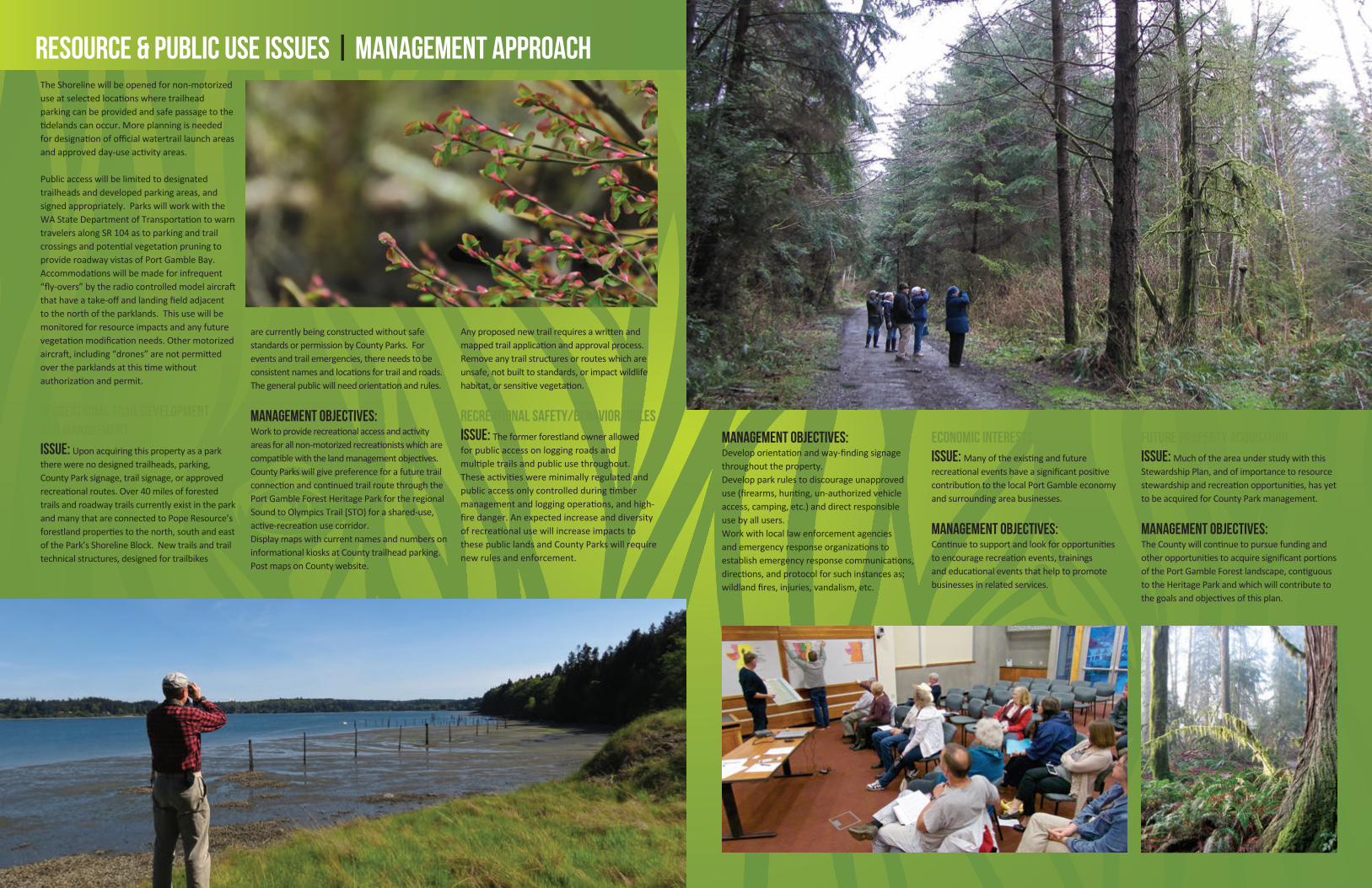
PUBLIC ACCESS & RECREATION OPPORTUNITIES Public Access & Events Issue: Thepreviouslandowners,PopeResourcesCompanyallowedpublicaccessof the interior lands for hikers, equestrians and bikesviaexistingloggingroads.Publicaccesstothe1.5-milesofshorelinehasbeenprohibited.Overtheyearsthemountainbikecommunityhasorganizednumerouseventswithpermissionfromthepreviouslandownersthatattractedhundredsofparticipantsatatime.
Management Objectives: Parkstaffandvolunteerstewardswillmonitorimpactsoflargegroupactivitiesontheprotectionofinherentresourcesandrecreationalexperiencesforallparkusers.KitsapCountywillconsiderthenatureoflargesocialgatheringsandtheirneeds,aswellasrespectforrecreationistsdesiringareasofnature-solitude.Eventimpactsontheresourcewillberemediedormitigated.SpecialEventsmayrequireaCountyParksDepartmentPermit,perCountyPolicy.UserfeesmaybechargedperCountyParkPolicyandKitsapCountyParkFees&ChargesScheduleasapprovedbytheKitsapCountyBoardofCommissioners.
RESOURCE & PUBLIC USE ISSUES | MANAGEMENT APPROACHTheShorelinewillbeopenedfornon-motorizeduseatselectedlocationswheretrailheadparkingcanbeprovidedandsafepassagetothetidelandscanoccur.Moreplanningisneededfordesignationofofficialwatertraillaunchareasandapprovedday-useactivityareas.
Publicaccesswillbelimitedtodesignatedtrailheadsanddevelopedparkingareas,andsignedappropriately.ParkswillworkwiththeWAStateDepartmentofTransportationtowarntravelersalongSR104astoparkingandtrailcrossingsandpotentialvegetationpruningtoprovideroadwayvistasofPortGambleBay.Accommodationswillbemadeforinfrequent“fly-overs”bytheradiocontrolledmodelaircraftthathaveatake-offandlandingfieldadjacentto the north of the parklands. This use will be monitoredforresourceimpactsandanyfuturevegetationmodificationneeds.Othermotorizedaircraft,including“drones”arenotpermittedovertheparklandsatthistimewithoutauthorizationandpermit.
Recreational Trail Development and ManagementIssue: Uponacquiringthispropertyasaparktherewerenodesignedtrailheads,parking,CountyParksignage,trailsignage,orapprovedrecreationalroutes.Over40milesofforestedtrailsandroadwaytrailscurrentlyexistintheparkandmanythatareconnectedtoPopeResource’sforestlandpropertiestothenorth,southandeastofthePark’sShorelineBlock.Newtrailsandtrailtechnicalstructures,designedfortrailbikes
arecurrentlybeingconstructedwithoutsafestandardsorpermissionbyCountyParks.Foreventsandtrailemergencies,thereneedstobeconsistentnamesandlocationsfortrailandroads.Thegeneralpublicwillneedorientationandrules.
Management Objectives:Worktoproviderecreationalaccessandactivityareasforallnon-motorizedrecreationistswhicharecompatiblewiththelandmanagementobjectives.CountyParkswillgivepreferenceforafuturetrailconnectionandcontinuedtrailroutethroughthePortGambleForestHeritageParkfortheregionalSoundtoOlympicsTrail[STO)forashared-use,active-recreationusecorridor.DisplaymapswithcurrentnamesandnumbersoninformationalkiosksatCountytrailheadparking.PostmapsonCountywebsite.
Anyproposednewtrailrequiresawrittenandmappedtrailapplicationandapprovalprocess.Removeanytrailstructuresorrouteswhichareunsafe,notbuilttostandards,orimpactwildlifehabitat,orsensitivevegetation.
Recreational Safety/Behavior/Rules
Issue: Theformerforestlandownerallowedforpublicaccessonloggingroadsandmultipletrailsandpublicusethroughout.Theseactivitieswereminimallyregulatedandpublicaccessonlycontrolledduringtimbermanagementandloggingoperations,andhigh-firedanger.AnexpectedincreaseanddiversityofrecreationalusewillincreaseimpactstothesepubliclandsandCountyParkswillrequirenewrulesandenforcement.
Management Objectives: Developorientationandway-findingsignagethroughouttheproperty.Developparkrulestodiscourageunapproveduse(firearms,hunting,un-authorizedvehicleaccess,camping,etc.)anddirectresponsible usebyallusers.Workwithlocallawenforcementagenciesandemergencyresponseorganizationstoestablishemergencyresponsecommunications,directions,andprotocolforsuchinstancesas;wildlandfires,injuries,vandalism,etc.
Economic InterestsIssue: ManyoftheexistingandfuturerecreationaleventshaveasignificantpositivecontributiontothelocalPortGambleeconomyandsurroundingareabusinesses.
Management Objectives: Continuetosupportandlookforopportunitiestoencouragerecreationevents,trainingsandeducationaleventsthathelptopromotebusinessesinrelatedservices.
Future Property AcquisitionIssue: MuchoftheareaunderstudywiththisStewardshipPlan,andofimportancetoresourcestewardshipandrecreationopportunities,hasyettobeacquiredforCountyParkmanagement.
Management Objectives:TheCountywillcontinuetopursuefundingandotheropportunitiestoacquiresignificantportionsofthePortGambleForestlandscape,contiguoustotheHeritageParkandwhichwillcontributetothegoalsandobjectivesofthisplan.

TRIBES: PortGambleTribe,LauraPrice|SuquamishTribe,JayZischke
PRIVATE PROPERTY OWNERS:OlympicPropertyGroup,JulieMcAfee|Neighbor,MarkSchorn
CONSERVATION COMMUNITY:KitsapAudubon,JudyWillott|GreatPeninsulaConservancy,DebbieEngel,KateKuhlman
RECREATION INTERESTS:KitsapCountyParksandRecreationBoard,AlvinAndrus,Chair|OlympicOutdoorCenter,John
Kuntz|NorthKitsapTrailAssociation,LindaBerryMaraist,|EvanStoll|RadioControlledAirplanes,RonBruhn|Evergreen
MountainBikeAlliance,BrianKilpatrick|BackcountryHorseman,Elaine&JimDavis
PARK STAFF & TECHNICAL ADVISORS: StevenStarlund,ParksandOpenSpacePlanner|ArnoBergstrom,ParksForester|
DoriLeckner,ParksSuperintendent|RicCatron,ParksProjectsCoordinator|LucretiaWinkler,MappingConsultant|David
Nash,KitsapCountyGISAnalyst|T.J.Nedrow,WADOT|StephenPadua,KitsapCountyRegionalTrailPlanner|PhilStruck,
MikeHall,ParametrixConsultants
KITSAP COUNTY: ParksDirector,JimDunwiddie
BOARD OF COMMISSIONERS: RobertGelder,CharlotteGarrido,EdwardE.Wolfe
PlanadoptedbyResolution:July13,2015
REPORT PHOTO CREDITS: Don Willott | Steven Starlund | M. Weiss | Mike Hall
STEWARDSHIP PLAN STEERING COMMITTEE
“Our County Parks staff shares the community’s
appreciation of the concerted efforts of the Forest and
Bay Coalition and aligned organizations in their pursuit
of lands acquisitions to create the Port Gamble Forest
Heritage Park. This public area offers a foundation for
sustainable forest conservation, wildlife habitat, and a
wide range of recreation opportunities. The continued
stewardship efforts and support by those groups and
individuals will enhance our park and open space goals,
into the future. Thanks to all.”
– JIM DUNWIDDIE, KITSAP COUNTY PARKS DIRECTOR
“I appreciate the community’s work in creating this
stewardship plan. It was a pleasure watching the
cooperative support from the various stakeholders and
interest groups. This process can be expanded and/or
replicated for other park properties that may come to
fruition as part of the overall conservation effort.”
– ROBERT GELDER, COMMISSIONER, KITSAP COUNTY DISTRICT 1
Related Documents